The problem with research using old newspaper archives is that there is so much else of interest to read and it is so very easy to get distracted. I was looking for a totally different subject, when I found an article that referenced a long closed east London Station, in the East London Observer on the 27th August 1887:
“A MILE END EXCURSION. It was one of the jolliest and most pleasant excursions in which we have ever taken part that started off from Globe-road station, in the very early hours of Tuesday morning. There was nothing stiff and starched about either the excursion or the excursionists – it and they were as delightfully and pleasantly informal as the origin of the Association in whose aid it was held – the Mile End Old Town Victoria Park Hospital Association.”
I love these insights into London life, written at the time they happened. There is more to discover about their association in a moment, but I wanted to find out more about Globe Road station.
The full name of the station was Globe Road and Devonshire Street Station. It was located on the main line between Liverpool Street and Stratford stations and was originally part of the Great Eastern Railway’s efforts at generating traffic from the dense housing being built across east London, and growing demand for easier travel.
I have highlighted the station in the following page from the 1902 Railway Clearing House maps:
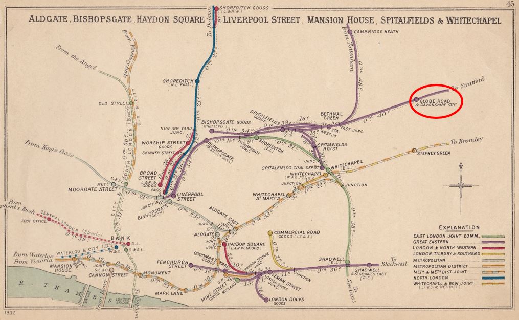
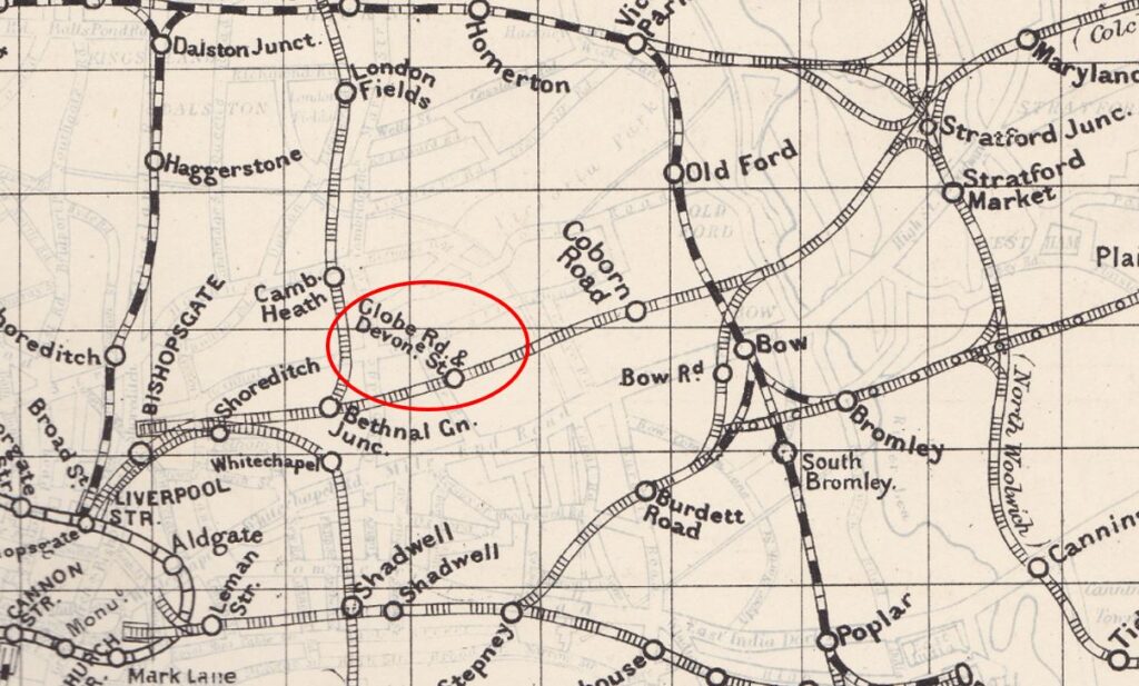
Another map showing Globe Road and Devonshire Street station on the route from Liverpool Street to Stratford. There are several other lost stations and stations that have changed name on the map.
So returning to the article that mentioned Globe Road station, where were the excursionists going on the 27th August 1887. The rest of the article:
“It was then the annual excursion which had drawn so many Mile-enders together on the Globe-road Station on Tuesday morning. In point of numbers, the gathering could scarcely be said to equal those of previous years – a result due rather to the vacillation and delay experienced at the hands of a railway company with whom the Association had first attempted to arrange, than to any lack of energy and perseverance on the part of the officers of the Association.
But no regretful consideration such as that was allowed to weigh with the excursionists; they were out for a day’s excursion to Harwich and Dovercourt, and like the thoroughly honest and hard working, genial Mile-enders as they were, they were determined to enjoy themselves to the uttermost. And everything on Tuesday seemed to favour that determination.
The day was one of the best and brightest with which the Metropolis has ever been favoured, and the round, red faced sun peered from behind the misty heat, and gave promise of even more charming weather in store. The special train too, hired for the conveyance of the excursionists, seemed to heartily enter into the spirit of the thing, and flew shrieking, past houses, villages, woods, fields and rivers, until, with a snort of satisfaction, it drew up at quiet, sleepy Dovercourt, with its breezy common, its golden sands, and its magnificent stretch of sea.”
They spent the day enjoying everything that Dovercourt had to offer before returning to Globe Road Station on their special train, a journey of a couple of hours through the Essex countryside.
Globe Road and Devonshire Street Station was a relatively short lived station, opening in 1884 and closing for passenger use in 1916.
In the 5th of July, 1884 edition of the East London Observer, a report on the opening of the station provides a detailed description of the new station:
“The station is entered from either Globe-road or Devonshire-street. It is a double station, having a spacious booking office at Devonshire-street and Globe-road respectively. The platforms are approached from the booking offices on street level, by staircases 9 feet in width, constructed of ‘Hedges patent wood treads’.
The platforms are 600 feet in length, by an average width of 25 feet, and are covered from end to end by a light ornamental glass, iron and zinc roof. The platforms are paved with ‘Victoria Stone’ throughout. This material is well-known, but these platforms will serve as an excellent specimen of the pavement. On each platform are well arranged ladies and gentlemen’s waiting-rooms for each class of passenger. A drinking fountain for the use of the passengers is placed on each platform. Offices for staff are provided, the platforms are well lighted throughout, and every improvement and modern requirement for a London suburban station, has been carefully studied and provided.
The works have been carried out by Messrs. Perry & Co. contractors, Bow, Messrs. Lead & Co. of Stratford carrying out the gas lighting arrangements. All the works have been designed and executed by the company’s engineer-in-chief and staff. There is a very frequent service of trains to Liverpool-street and Stratford, about 80 trains calling at the station on week-days. The journey to Liverpool-street is done in seven or eight minutes, and the return fares are 6d first class, 5d second class, and 4d third class.”
This was a significant suburban station for east London and if we assume services were running between 04:00 and midnight, then 80 trains a day is 2 trains an hour to Liverpool Street and the same to Stratford.
In the same newspaper, the results for the first half of 1884 of the North Metropolitan Tramway Company were reported. The area covered by the company included the trams not far from Globe Street and Devonshire Road station. The company had carried 17,428,145 passengers during the half year, however there was an outstanding issue of fares for short journeys and the report in the paper ended with a reference to the new station “We would remind the directors that the subject of penny fares for short distances is a matter worthy of consideration, especially in view of the opening of the new station by the Great Eastern Railway Company at Devonshire-street, Mile End”.
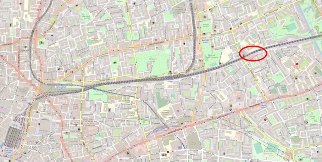
The following map shows where the station was located, with Liverpool Street at lower left. Continue the line off to the right and the next stop is Stratford (Map © OpenStreetMap contributors).
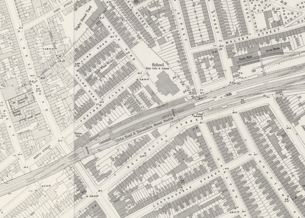
The 1895 Ordnance Survey map shows the station on either side of two tracks on the northern part of the rail route. Presumably the two tracks on the southern side were for fast trains not stopping at Globe Road (‘Reproduced with the permission of the National Library of Scotland.
Having a local station was, as now, a benefit for those who lived and worked locally. During the years that the station was open there were numerous newspaper adverts for properties for sale or rent that mentioned their proximity to Globe Road and Devonshire Street station.
The Britain from Above archive includes a couple of photos of Globe Road station. In the following photo, the platform buildings can be seen running either side of the tracks running through the station:
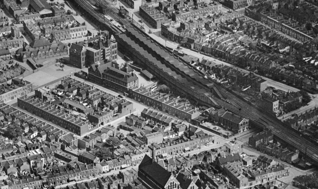
(Source: https://www.britainfromabove.org.uk/en/image/EPW036260 )
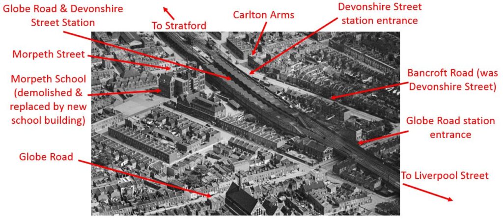
The full name of the station was Globe Road and Devonshire Street Station. Whilst we can still find Globe Road, Devonshire Street has changed name and is now Bancroft Road.
I have annotated the above photo to show the local roads, a couple of key buildings, entrances to the station, and the direction to Stratford and Liverpool Street stations:
Another view of Globe Road and Devonshire Street Station, where the tracks for stopping at the station are seen on the left, and the fast tracks for trains not stopping at the station can be seen on the right:
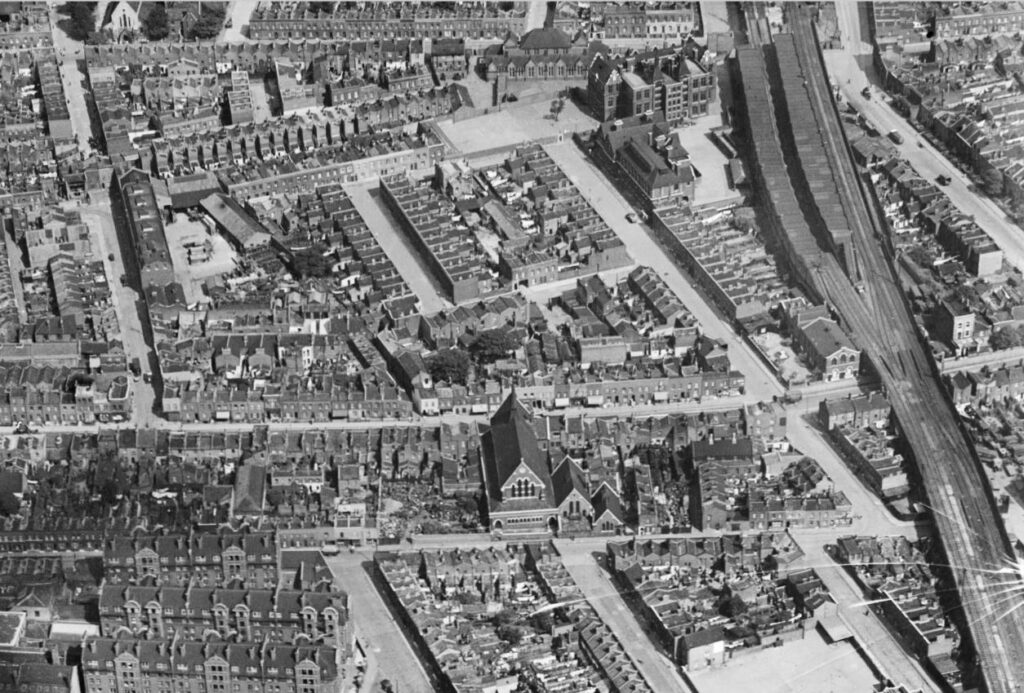
(Source: https://www.britainfromabove.org.uk/en/image/EPW036258 )
The end for Globe Road and Devonshire Street Station came in 1916. The Great Eastern Railway had been proposing to close a number of what were classed as suburban east London stations. Presumably the long distance routes into Liverpool Street were more profitable, and stopping trains at stations in east London were taking up capacity that could be used for faster, long distance trains.
There were also a number of underground routes serving east London along with a network of trams, however many of the stations that were proposed to close were still being well used and there was much concern that closure would transfer additional passengers to already busy tram and underground services.
On the 15th of April 1916, the East London Observer announced a “Mass Meeting of Inhabitants of Mile End, Bow and Bromley and Bethnal Green”, The meeting was held in the People’s Palace on Mile End Road, and chaired by Warwick Brookes M.P. and supported by the Right Hon. Lord Burnham, along with the “Leading Public Men of the districts affected”.
In May 1916, meetings were held with the London County Council to protest the proposed closures. the “Housing of the Working Classes Committee” reported that their attention had been drawn to the closures (there were complaints that the LCC were somewhat late at looking at the impact of the closures), and they were concerned about the impact on travel times, the lack of alternative rail routes, and the problems that would be caused by additional load on the trams.
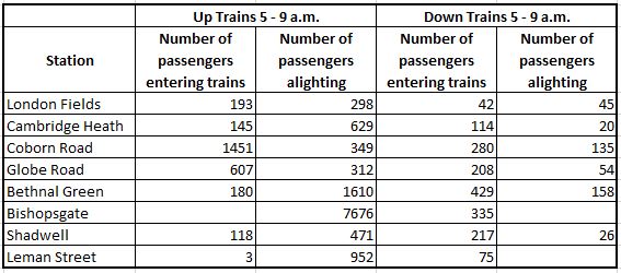
The East London Observer provided a table showing the number of users of the stations that the Great Eastern Railway were proposing to close between 5 and 9 a.m. on a typical weekday morning.
As can be seen, Globe Road was well used in the morning, with 607 passengers boarding trains during the four hour period to travel towards Liverpool Street.
Despite the meetings and protests, the Great Eastern Railway, after a short delay, confirmed their intention to close Globe Road and Devonshire Street Station, with closure on the 22nd of May, 1916. I will cover the story and fate of the other stations in future posts.
Much of the station buildings and infrastructure remained in place until 1938 when they were finally demolished leaving very little evidence that the station had existed.
Although there would be nothing much to see, I still wanted to visit the site of the station, and take some photos.
The following map shows the area today. Devonshire Street has been renamed Bancroft Road. The other street names rename the same. I have marked the locations of the entrances to the station in Globe Road and Devonshire Street:
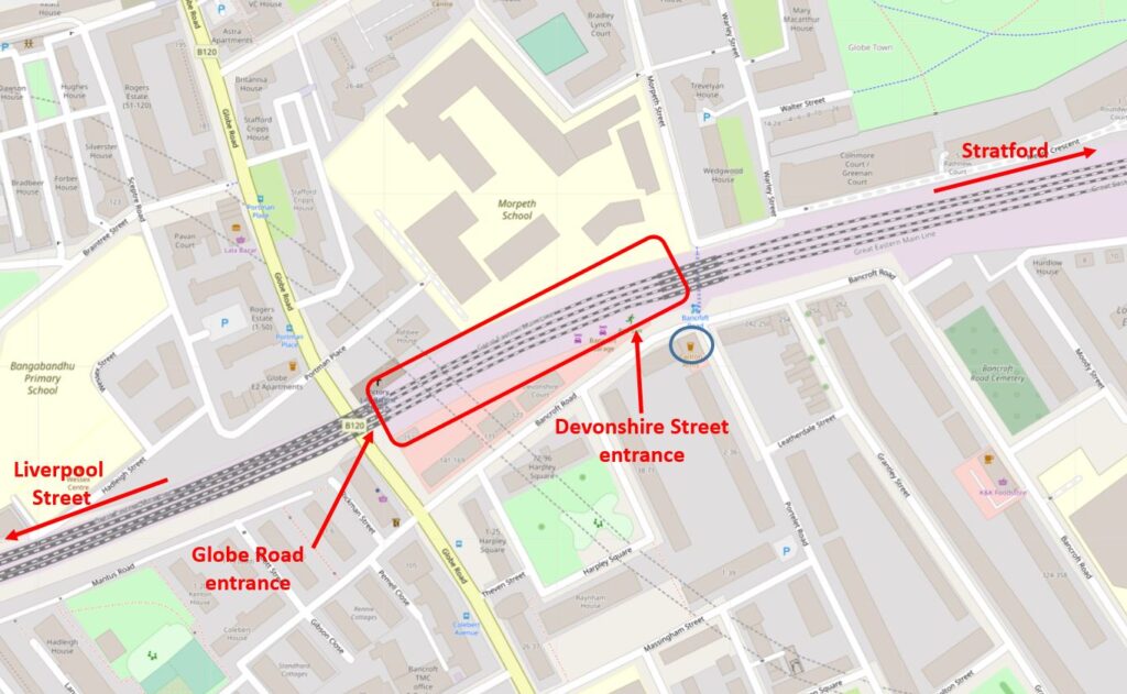
The blue circle is around the Carlton pub which has a sad recent history.
I walked down Morpeth Street (to the upper right of the station, the location of which is marked by the red rectangle), to get to the bridge that runs under the rail tracks and provides access to Devonshire Street / Bancroft Road.
To the right of the bridge is the old Morpeth Street entrance to the station.
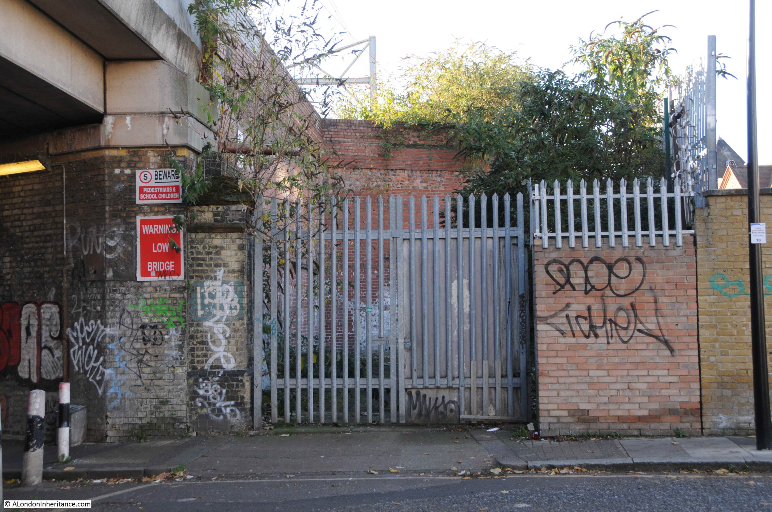
There were originally two brick pillars on either side of the entrance, only the left hand pillar, up against the viaduct, survives today.
There was a gate between the two pillars, and a cast iron curved sign above the entrance running between the two pillars. The station name was on the sign, and a round gas lamp was mounted at the top of the curved sign above the entrance.
Turning to the left, and this is the view under the viaduct, which provides a walkway between Morpeth Street and Bancroft Road.
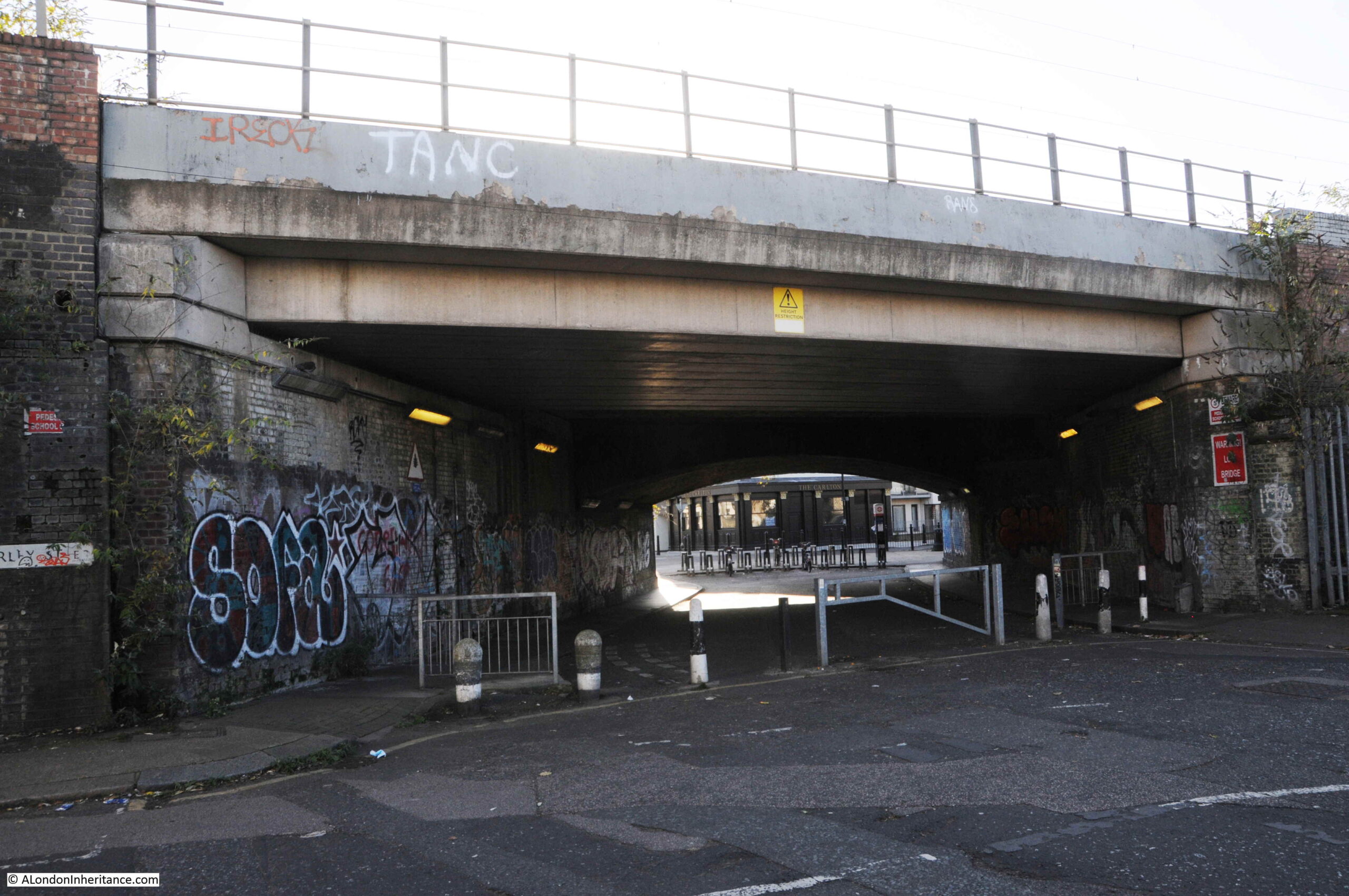
The viaduct carrying the tracks towards Liverpool Street has been extended and modified a number of times over the years since the lines were originally constructed in the mid 19th century.
Some of these changes can be seen by the different construction and materials in use to carry the tracks over the tunnel:
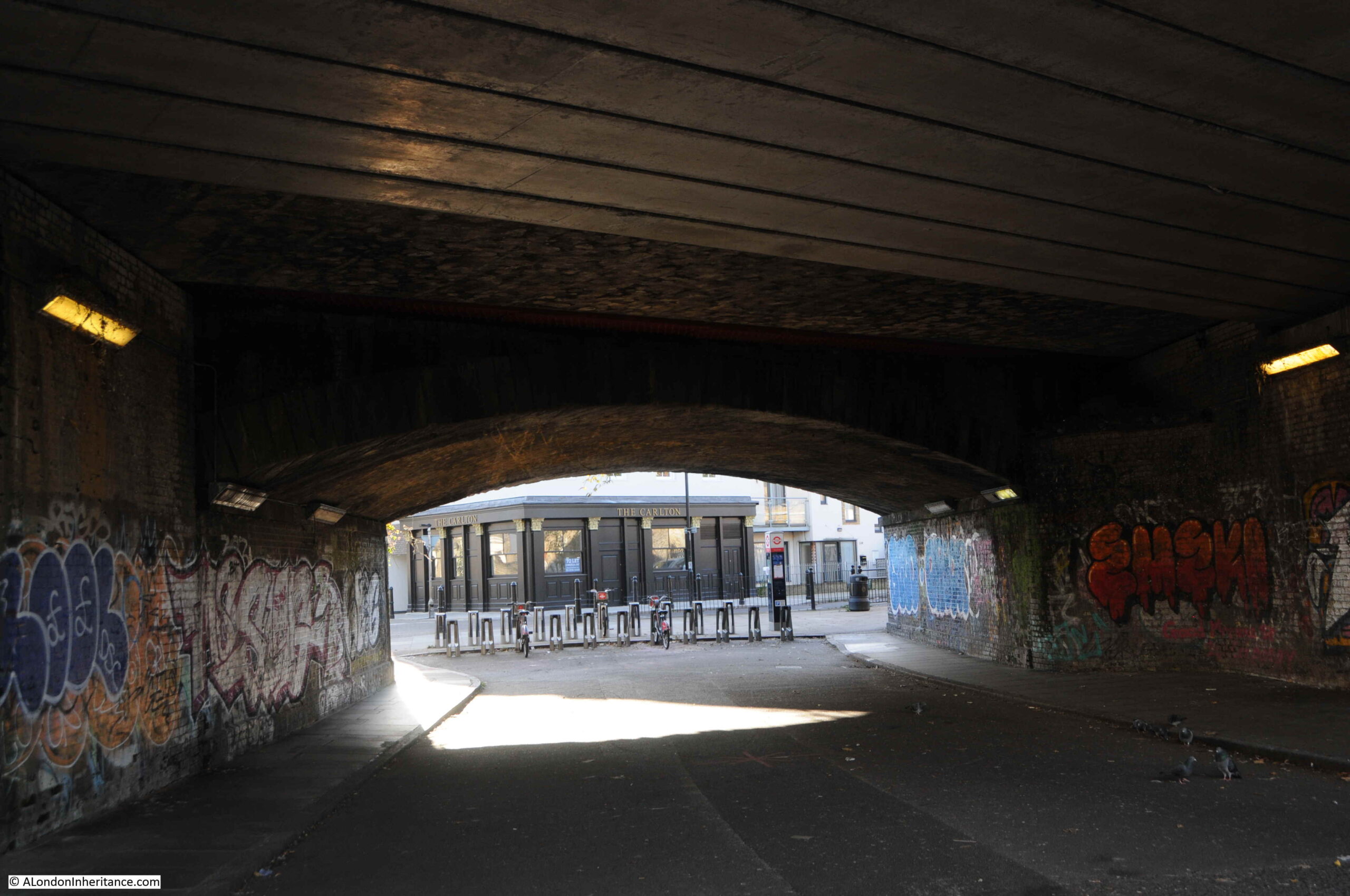
The opposite side, now on what was Devonshire Street, now Bancroft Road:
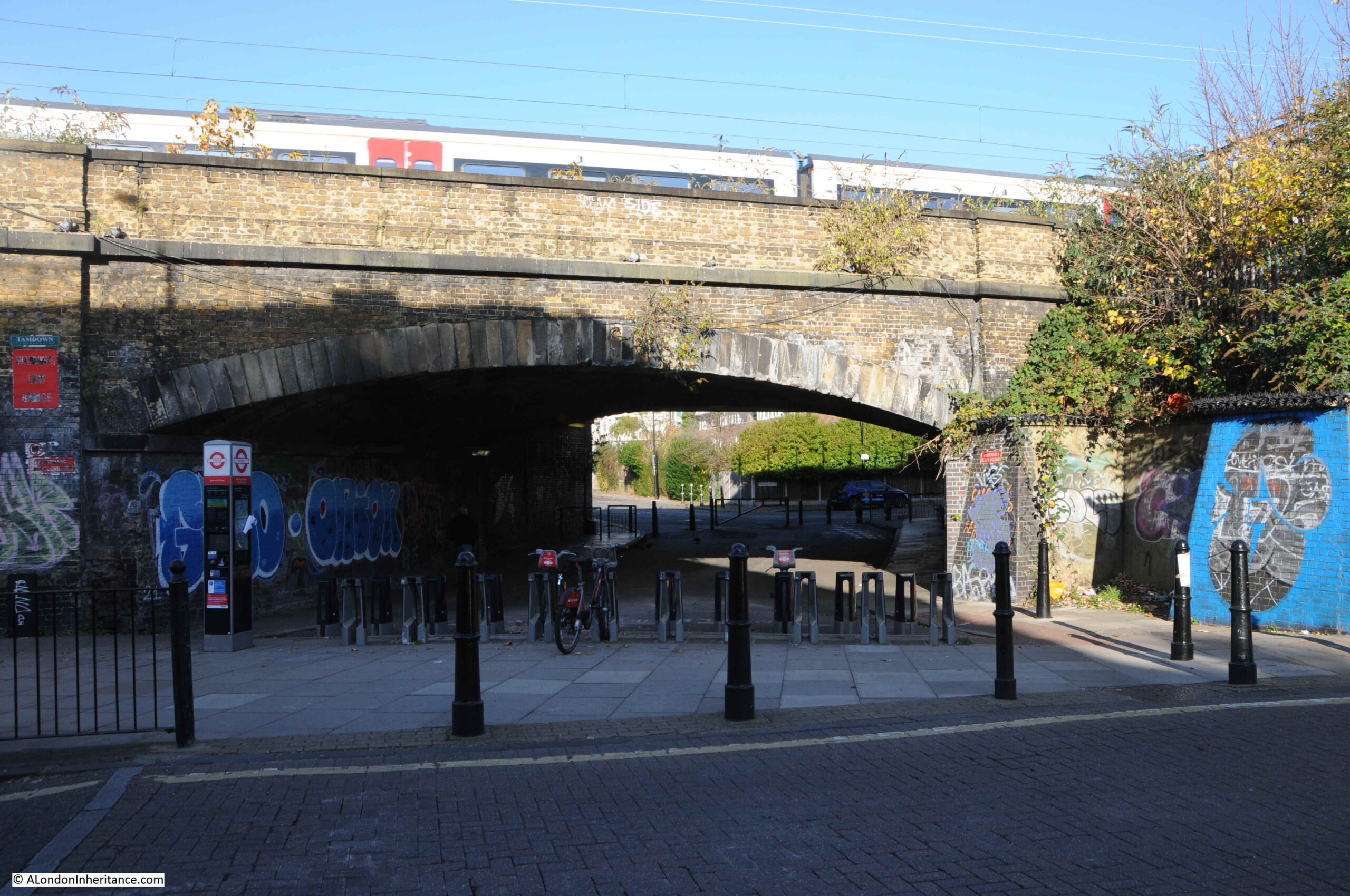
Looking towards the location of the Devonshire Street entrance to the station, now occupied by businesses using the arches and space between Bancroft Road and the viaduct:
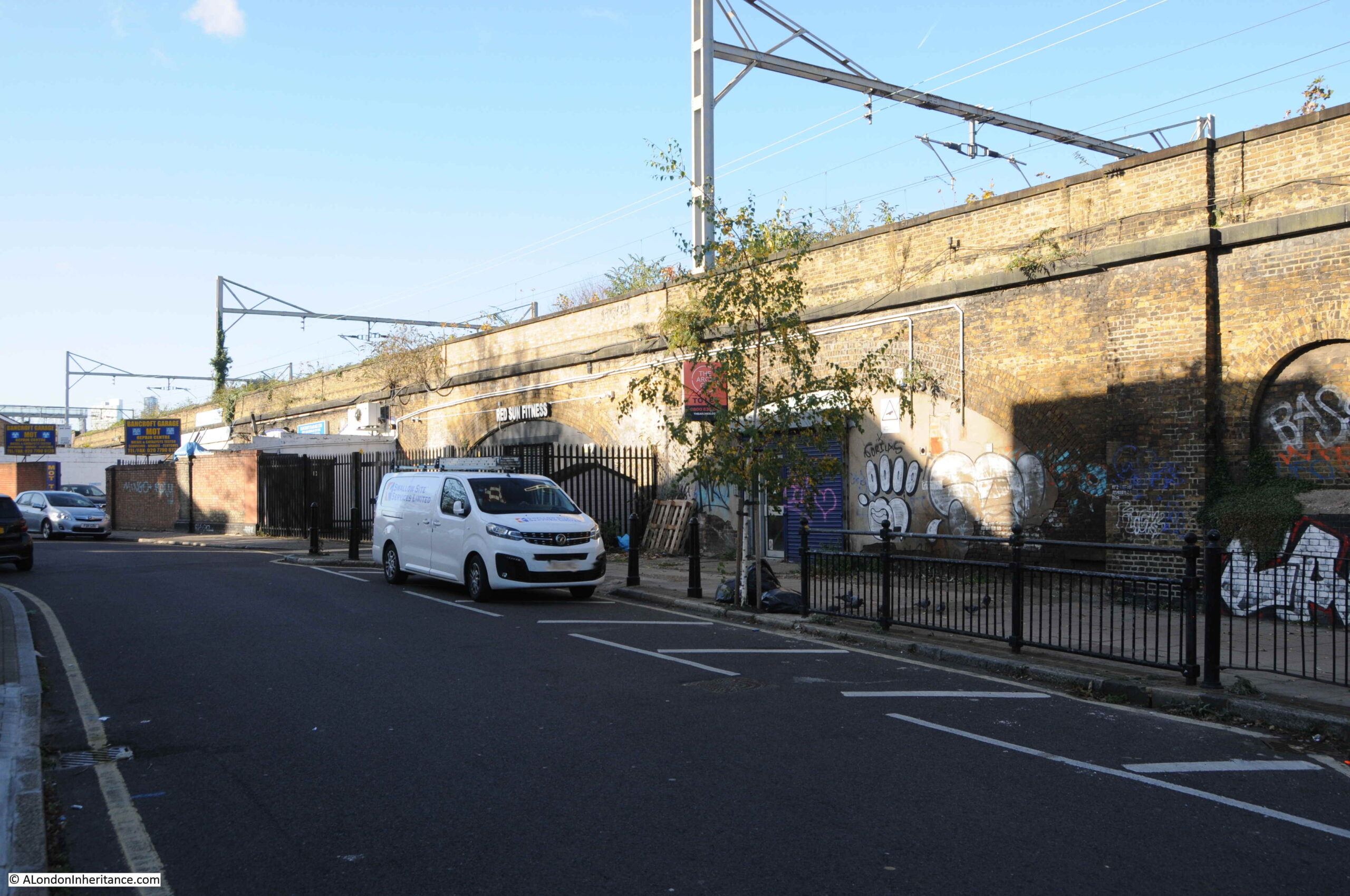
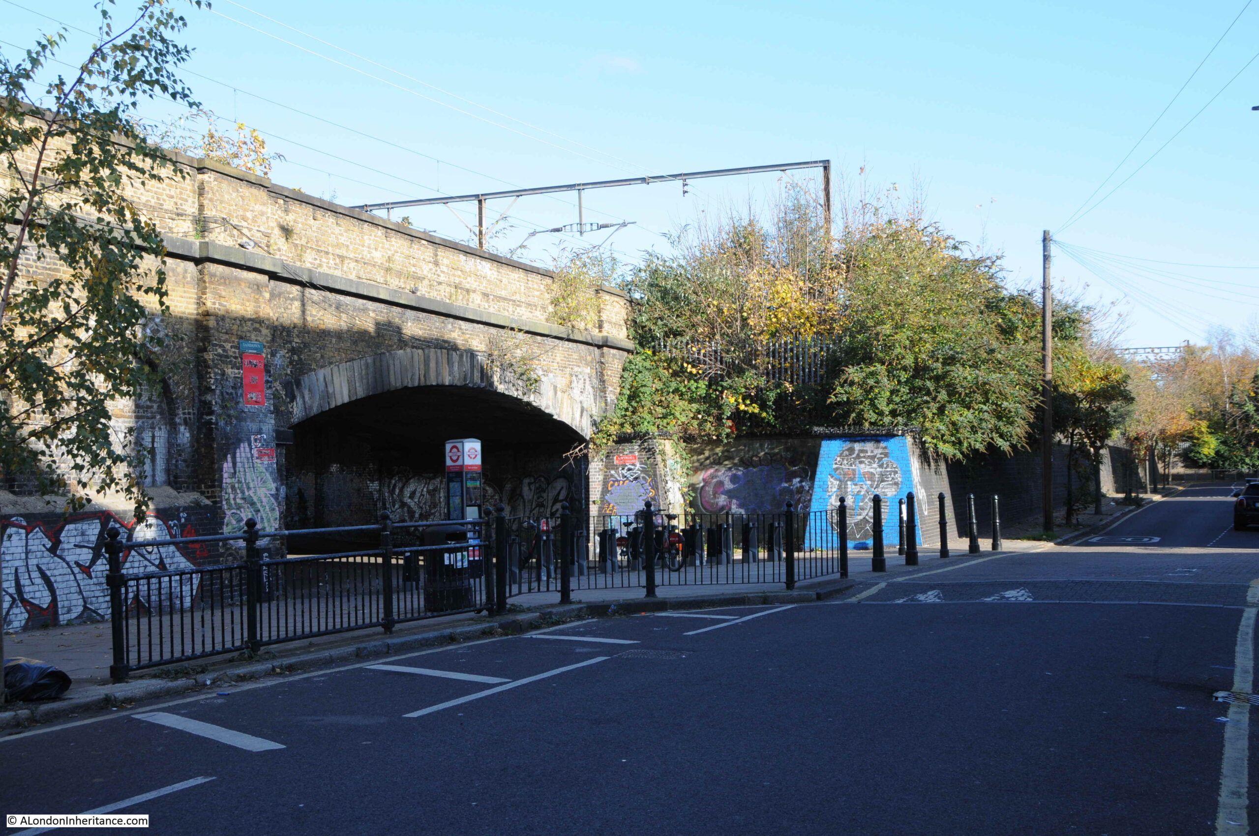
The section of viaduct along Bancroft Road is Grade II listed. It was built between 1839 and 1840 by John Braithwaite, the engineer for the Eastern Counties Railway. The bridge that I have just walked under is included in the listing and is described as “The skew bridge is a very shallow elliptical opening, with radiating voussoirs of sandstone set above an impost band of sandstone.” (I had to look up the meaning of voussoir, and apparently it means a wedge shaped or tapered stone used to construct an arch).
Between the bridge and the area that was occupied by the station are two, small, blind arches:

The arch that was occupied by the station is now the site of Red Sun Fitness:
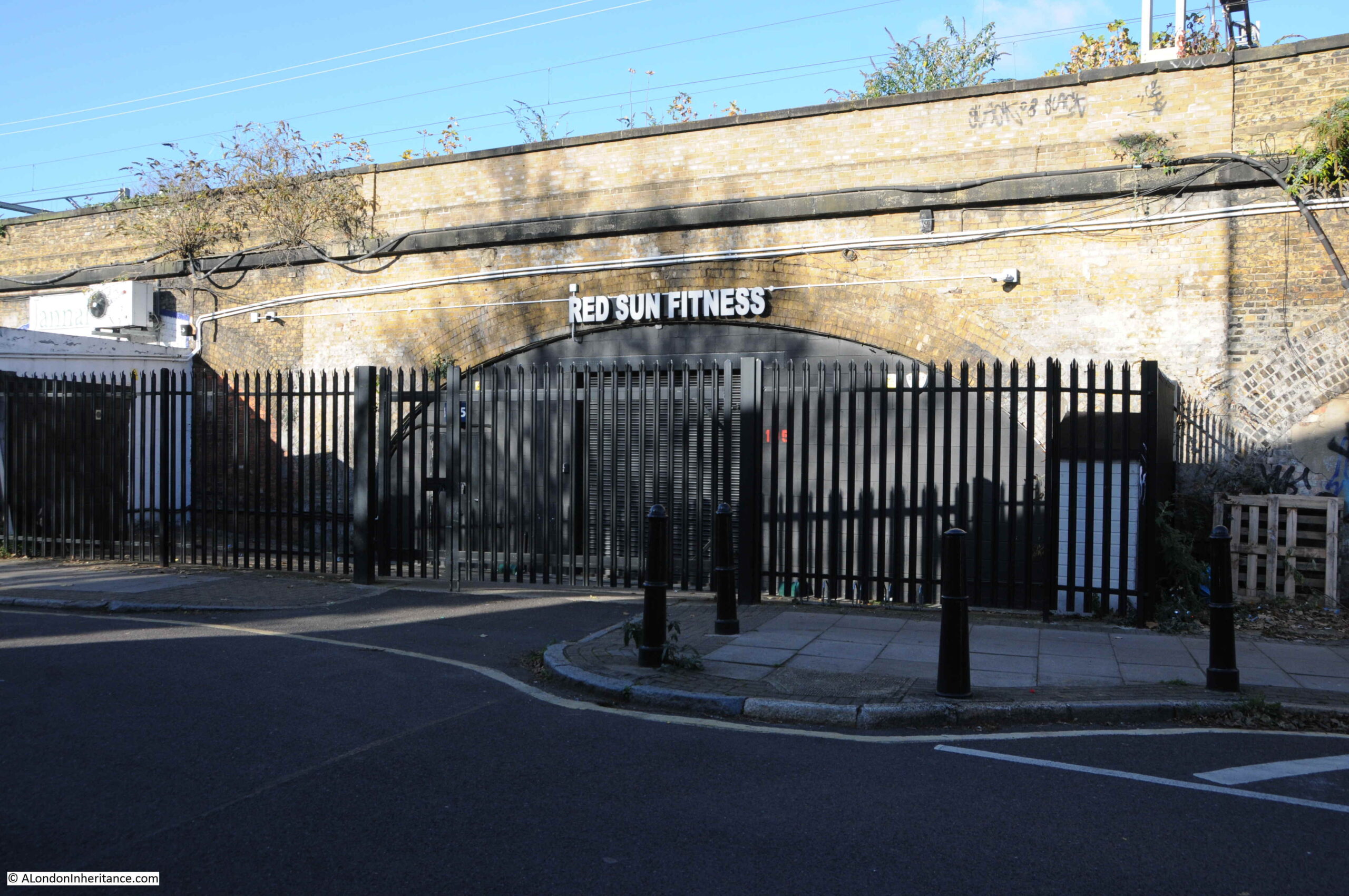
When in use, the name Great Eastern was above the arch, running along the brick parapet at the very top of the viaduct.
The following photo is looking back to the bridge that provides access from Morpeth Street. The Historic England listing describes the viaduct along Bancroft Road as “the viaduct is among the earliest, and longest, examples of a first-generation railway structure to survive in London.“
On the corner of Bancroft Road and Portelet Road, and opposite the tunnel under the rail tracks, is a building which appears to be a pub called the Carlton, although the pub is not what it seems.
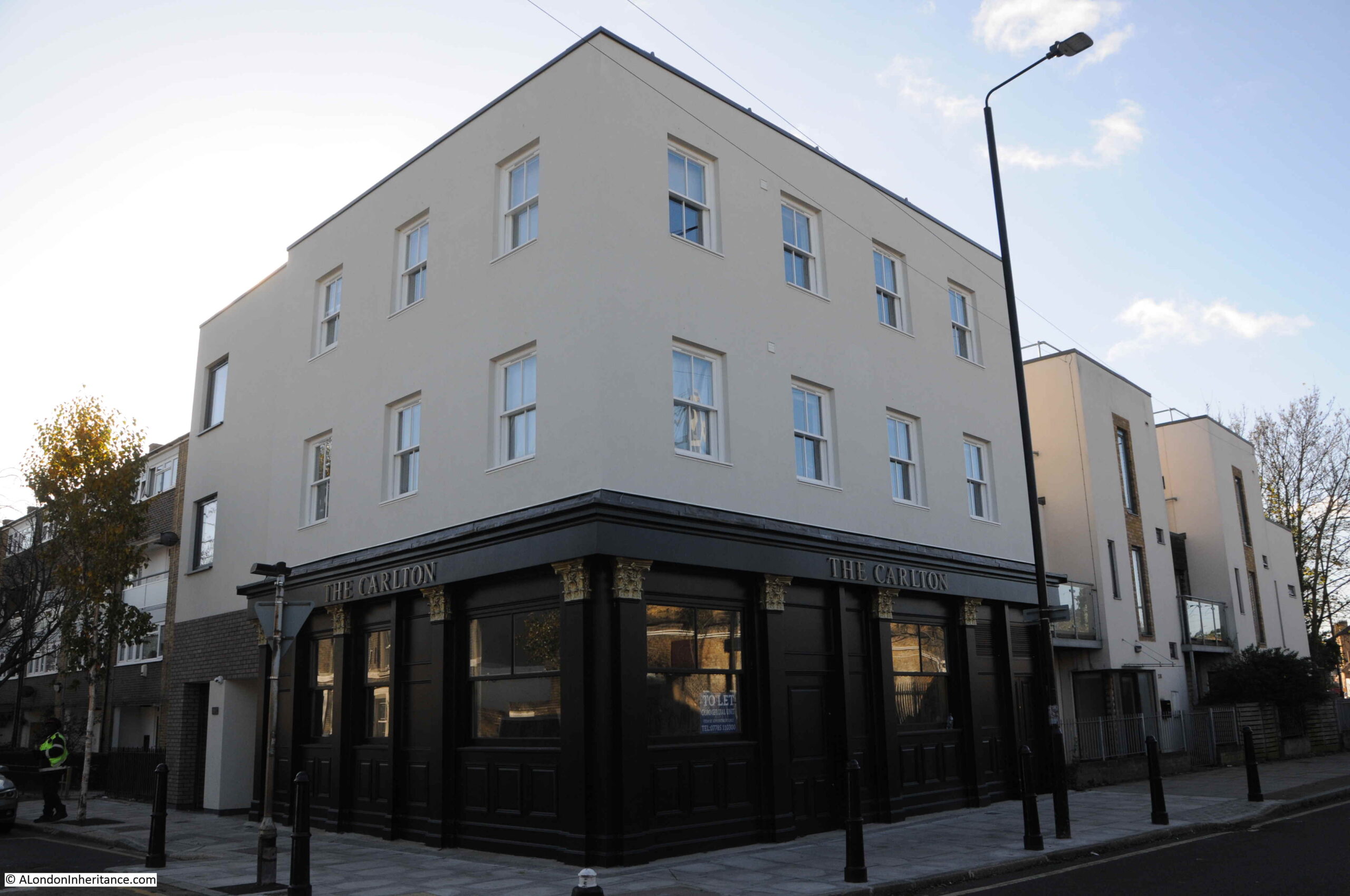
There was a pub, originally called the Carlton Arms on the site since at least the early 1850s. A typical east London pub with a large corner advertising sign, advertising around the top of the building and wood paneling around the ground floor.
The pub closed in early 2018 and a couple of months later, Tower Hamlets Council had approved a planning request to convert the site to five flats, which would involve demolishing the first floor, adding additional floors and a new basement. Planning approval required that the historic ground floor of the pub should be retained.
Contrary to planning approval, the whole pub was then demolished. The developers argued that demolition was the only option due to the condition of the structure. It was then rebuilt with a modern wooden trim to the outer ground floor, but was substantially a new building.
The ground floor and basement are currently available to rent as an empty commercial space, and are ready to be transformed to a “traditional pub/restaurant”. If you have £2,500 per month to spare, plus the cash to convert to a pub, it is currently listed on Rightmove.
There is a very small part of the station left in Bancroft Road. As Bancroft Road and the railway viaduct head east, the land where the station entrance was located forms a small triangular site. On the edge of this site, along Bancroft Road, what was Devonshire Street, was a wall surrounding the entrance to the station, with two brick pillars on either side of the opening in the wall to access the station.
One of these brick pillars survives and is now part of a modern brick wall.
In the following photo, the original brick pillar can be seen in the centre of the wall.
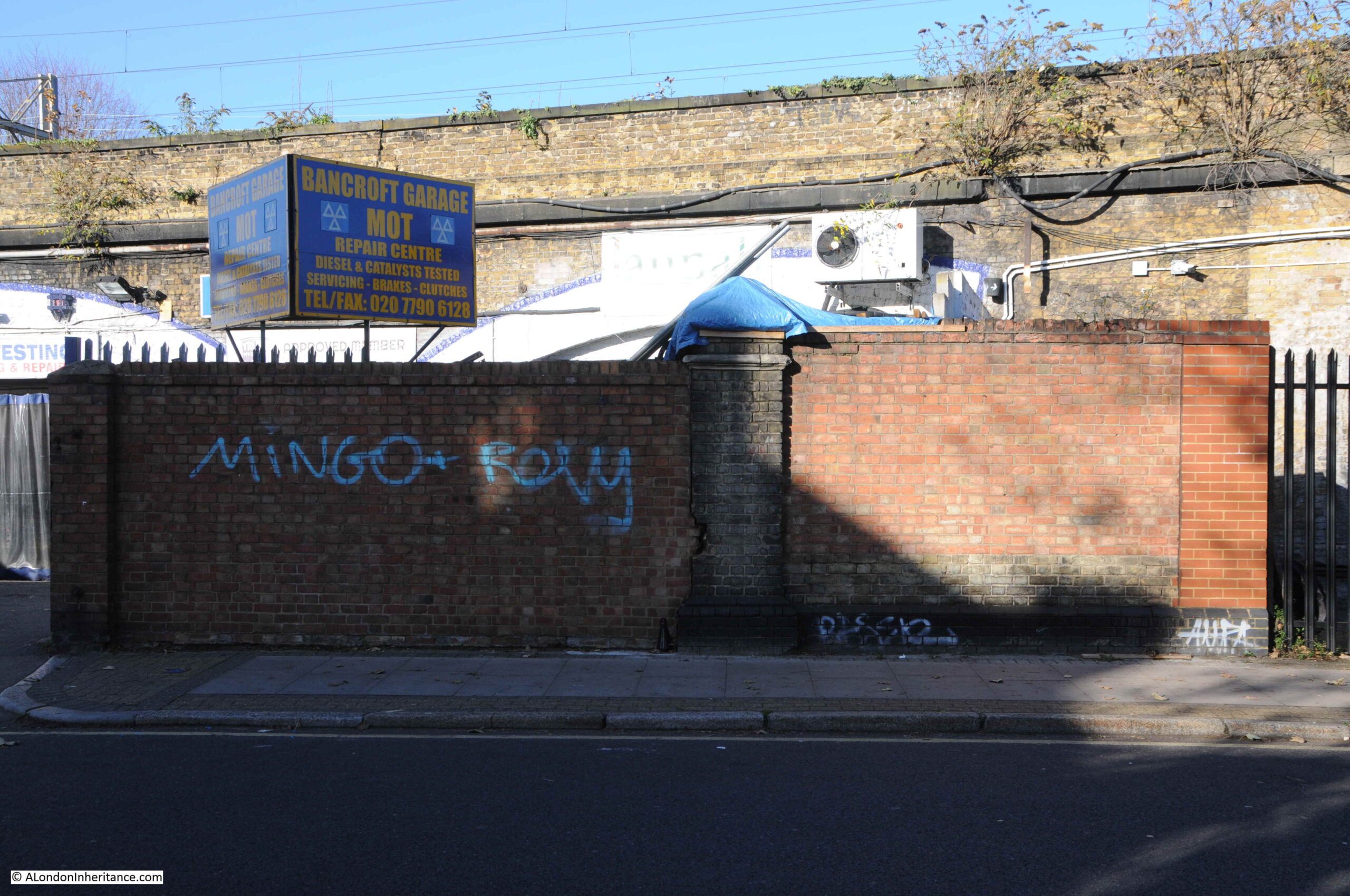
View looking back along Bancroft Road, with the brick pillar on the left:
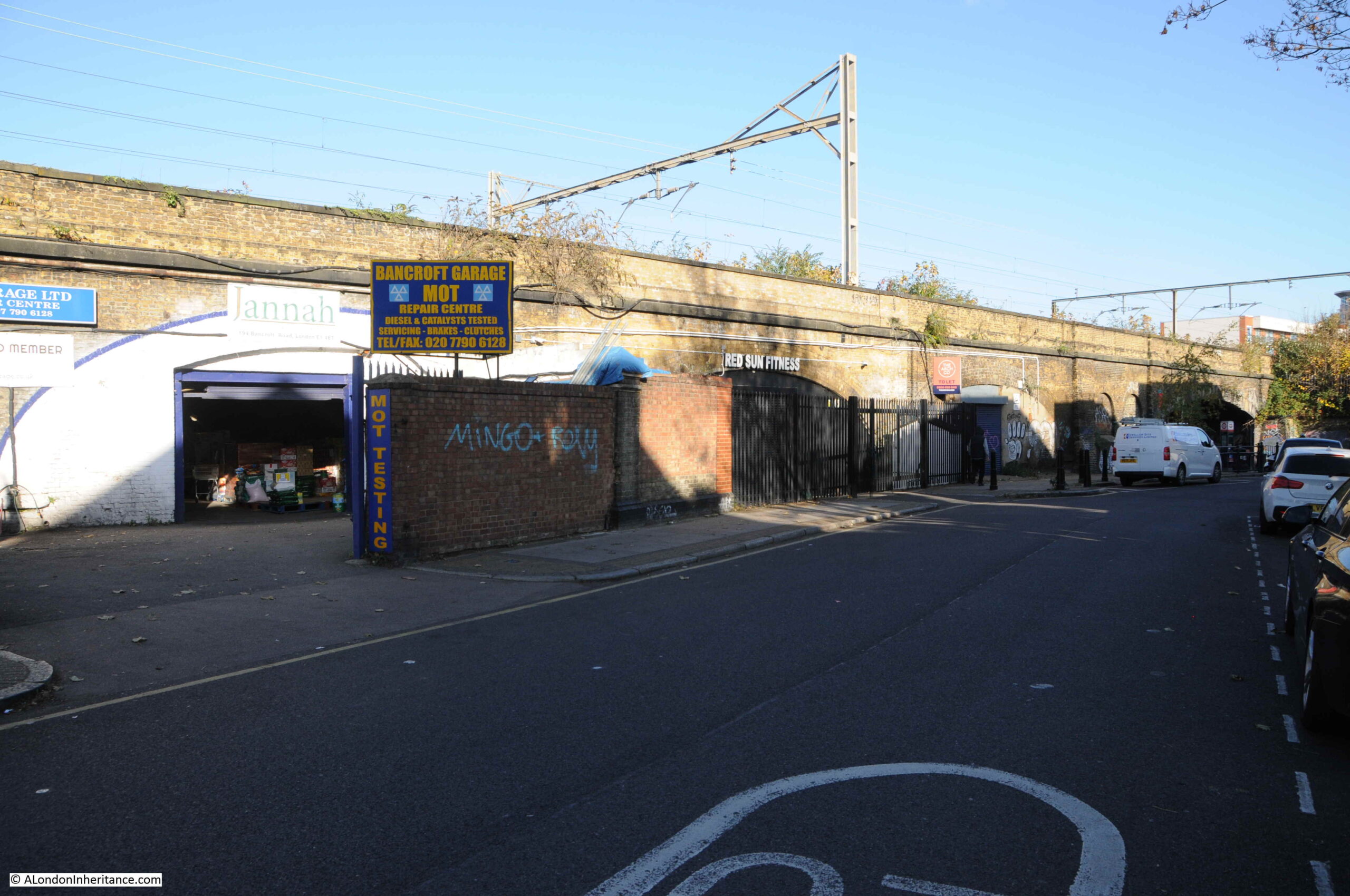
I next wanted to find the Globe Road entrance to the old station, so I walked to the junction of Bancroft Road and Globe Road, and turned right to see the bridge carrying the railway across the road.
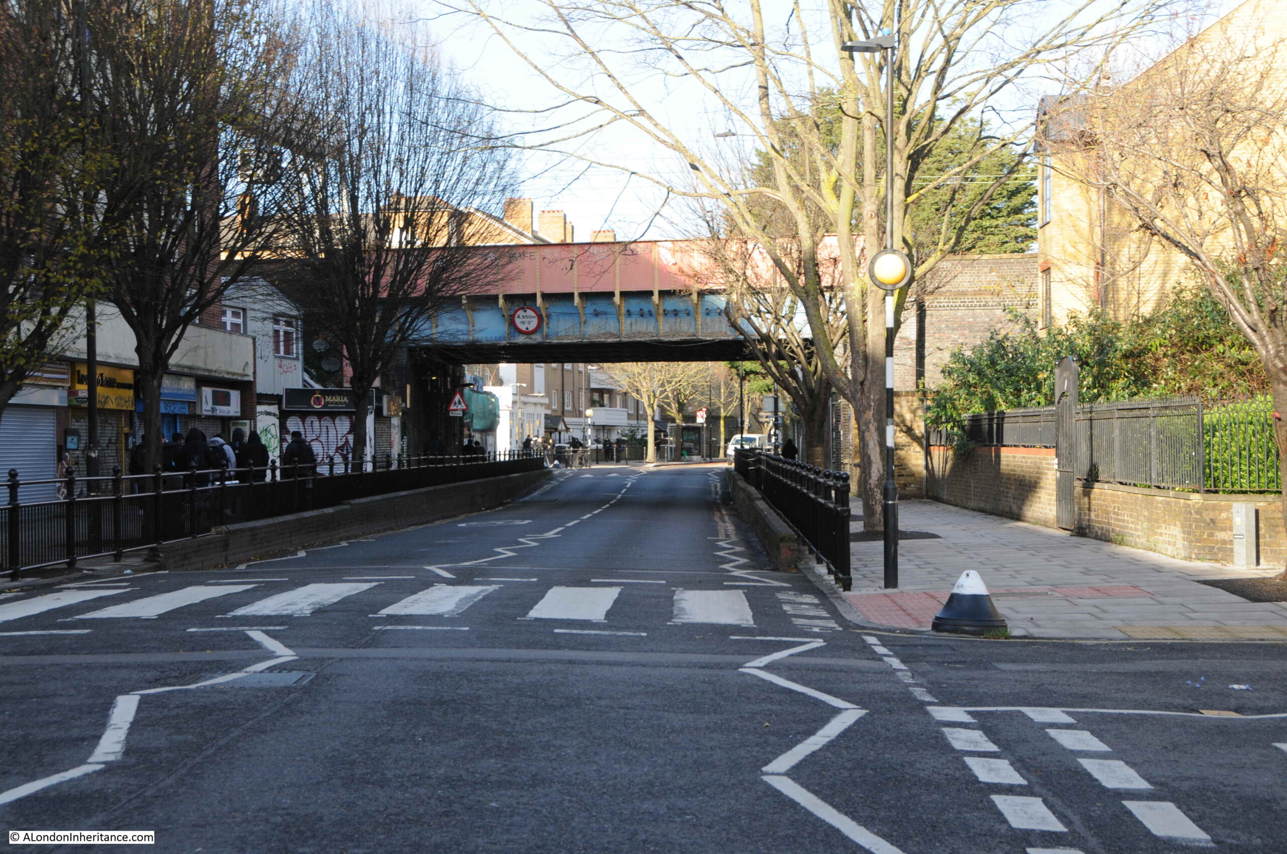
Walking towards the bridge, and up against the viaduct, on the east of Globe Road is the old station entrance. Very similar to the Morpeth Street entrance, with brick pillars either side of the entrance, however at this entrance more pillars survive:
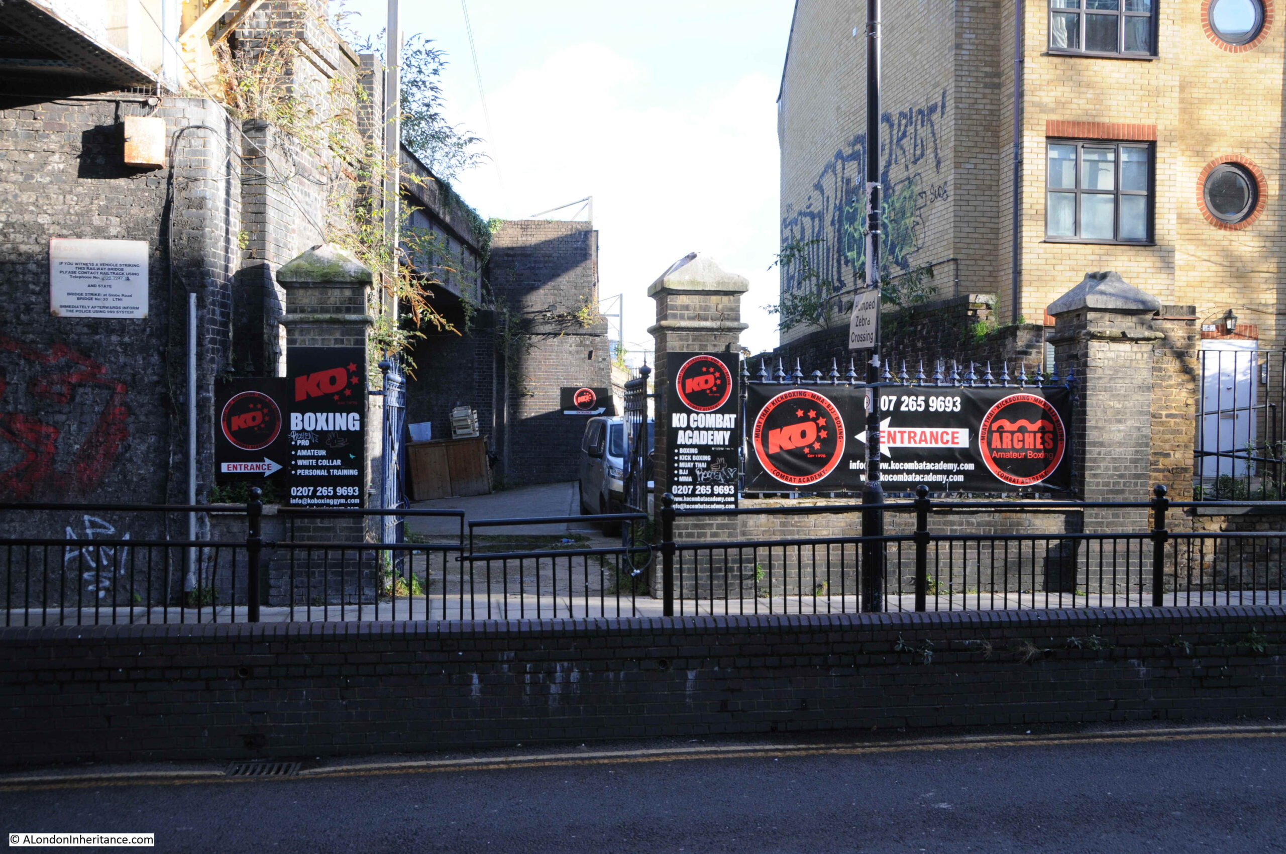
As with Morpeth Street, there was a curved, cast iron station name sign above the entrance from pillar to pillar, with a gas lamp in the middle.
Walking under the bridge, and this is the view looking south along Globe Road. The station entrance is just under the bridge on the left:
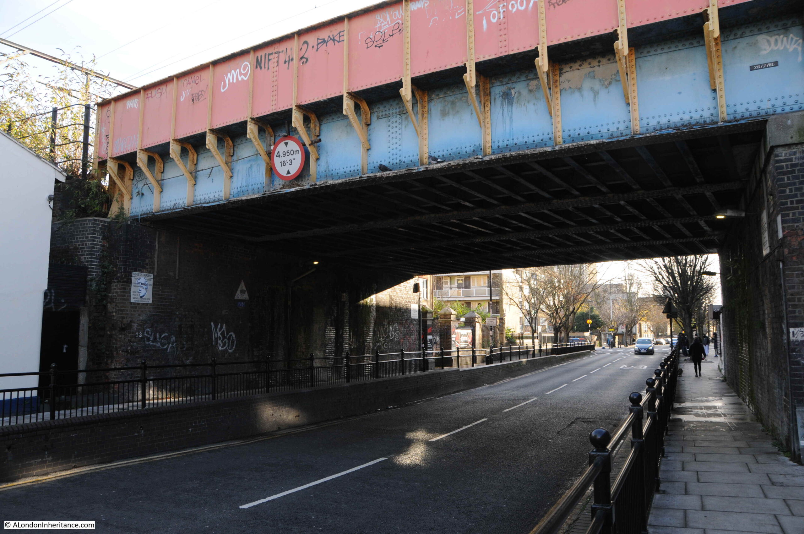
Only some of the brick piers at the station entrances appear to have survived, but good that there is something left from this east London station, from a time when there was a number of suburban stations as trains from the east approached Liverpool Street.
The station was only open for 32 years, and provided a fast method of transport for those who worked in the City, as well as providing a route into Essex for those such as the excursionists of the Mile End Old Town Victoria Park Hospital Association on the 27th August 1887, who were leaving the noise, congestion and smoke of east London for a very different day on the Essex coast at Dovercourt.
And if any TV production company is looking for a Victorian soap opera based in east London, then my outline for Mile Enders is ready and waiting.

A fantastic account of your research into the area. Always look forward to my Sunday morning coffee and reading your latest entry.
Hello ,I am new to this blog and am not on twitter – I am trying to find out more about Ashburton House, Globe Road, Mile End – during the early 1920’s my [late] grandfather was 7 years old – It is a sad story about my grandfather who I have just found went into the Norwood Childrens home , this address was on the archives that I have. If anyone could fill me in on Ashburton House I would really like to know more.
With thanks
I echo Mark’s comment above. I love the flowery language used in those old newspaper reports. How much more pleasant than the current lazy way of chopping of word endings and garbled grammar. Innit!
Good research into the background of the closure. I had always assumed it was war-time economies, although if memory serves me well, Shadwell was the result of WW2 bomb damage,
Fascinating. It is the relatively small things, the humble things, a flavour of past times, that matter so much and slip away so easily. I look forward to the other stations!
Excellent article. I know this area fairly well and used to occasionally drink in The Carlton in the 1980s. Diagonally opposite the pub, just before the bridge, there is a recess. This used to be a men’s public urinal big enough for 2-3 men. No idea when it was ‘decommissioned’ or no longer convenient!
There’s a lot more on about Globe Road and Devonshire Street station on the Disused Stations website:
http://www.disused-stations.org.uk/g/globe_road/index.shtml
What a brilliant piece of research. This is an area I know very well but knew nothing about the station. Thank you. When next in Stepney Green/Mile End, the Jewish cemeteries in this area would make a fantastic topic for your historical skills of investigation
I can only echo what has already been said -very interesting reading.