
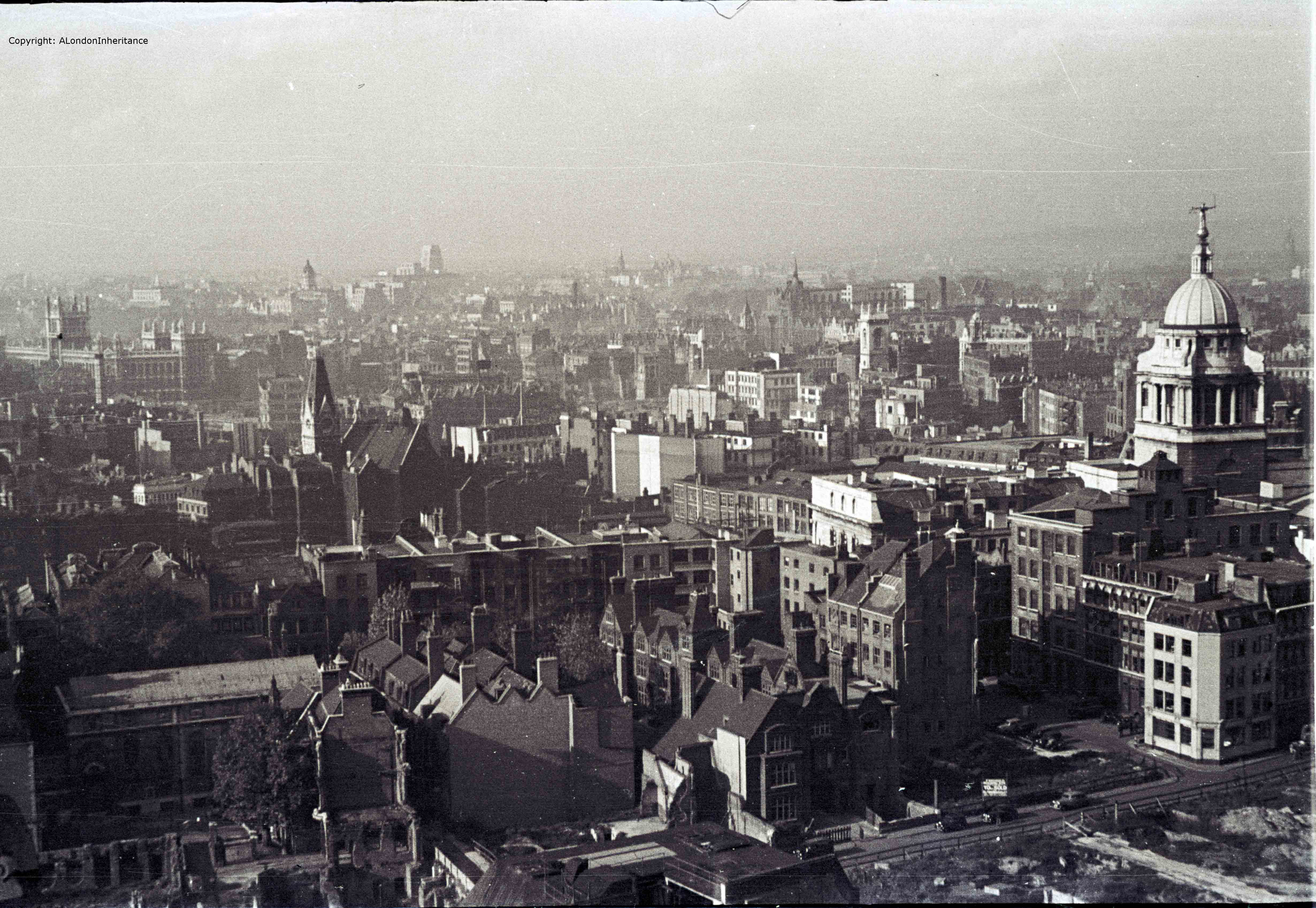
For this week’s post, we continue on our walk around the Stone Gallery of St. Paul’s Cathedral, 376 steps and 53 meters from the cathedral floor. We have covered the south and east views and this week it is the turn of the north and south and the first photo is looking roughly due north:
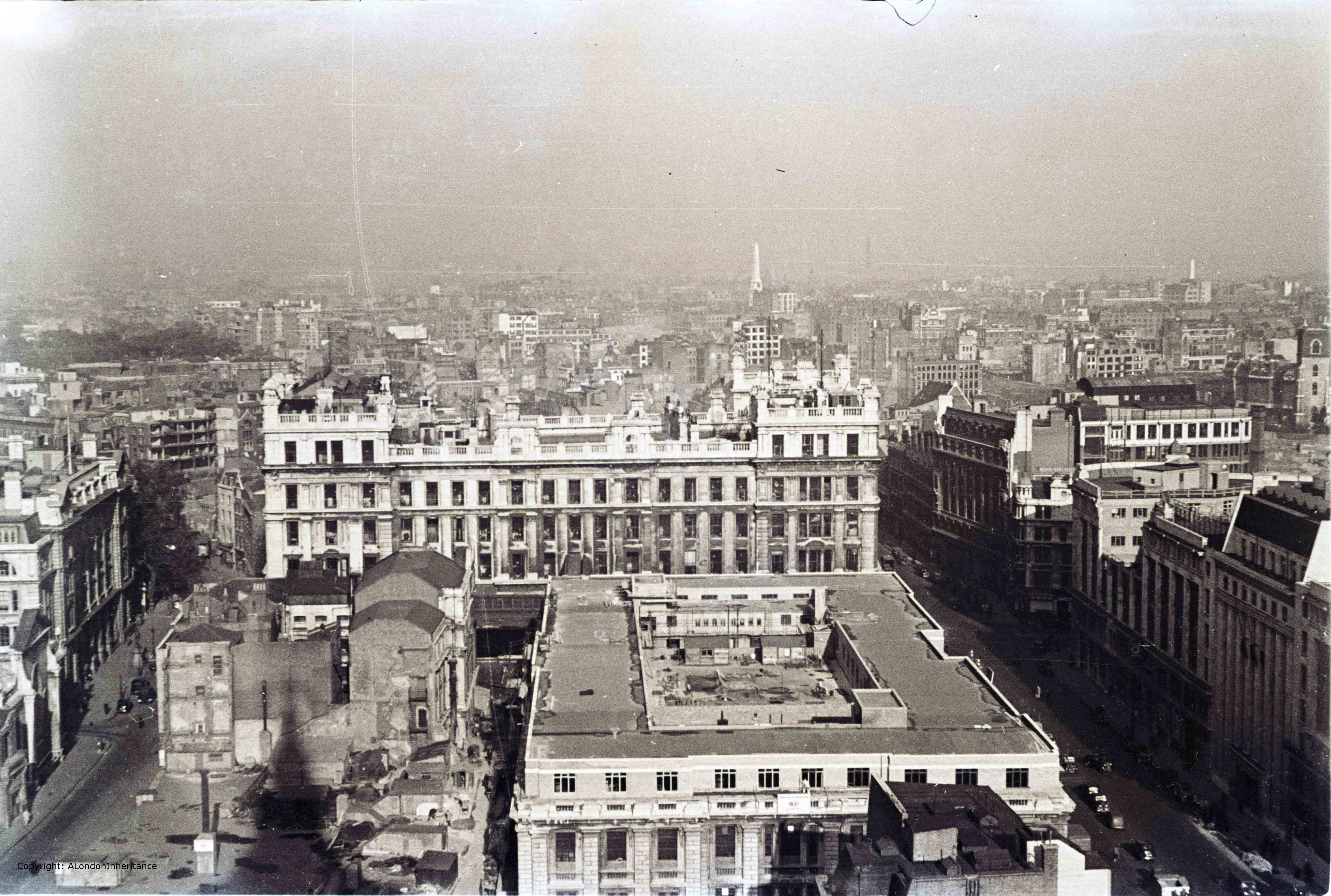
The street on the left is King Edward Street and the street on the right is St. Martin’s Le-Grand. The large buildings that occupy the space between these were General Post Office buildings with the larger building in the centre of the photo being the headquarters of the General Post Office.
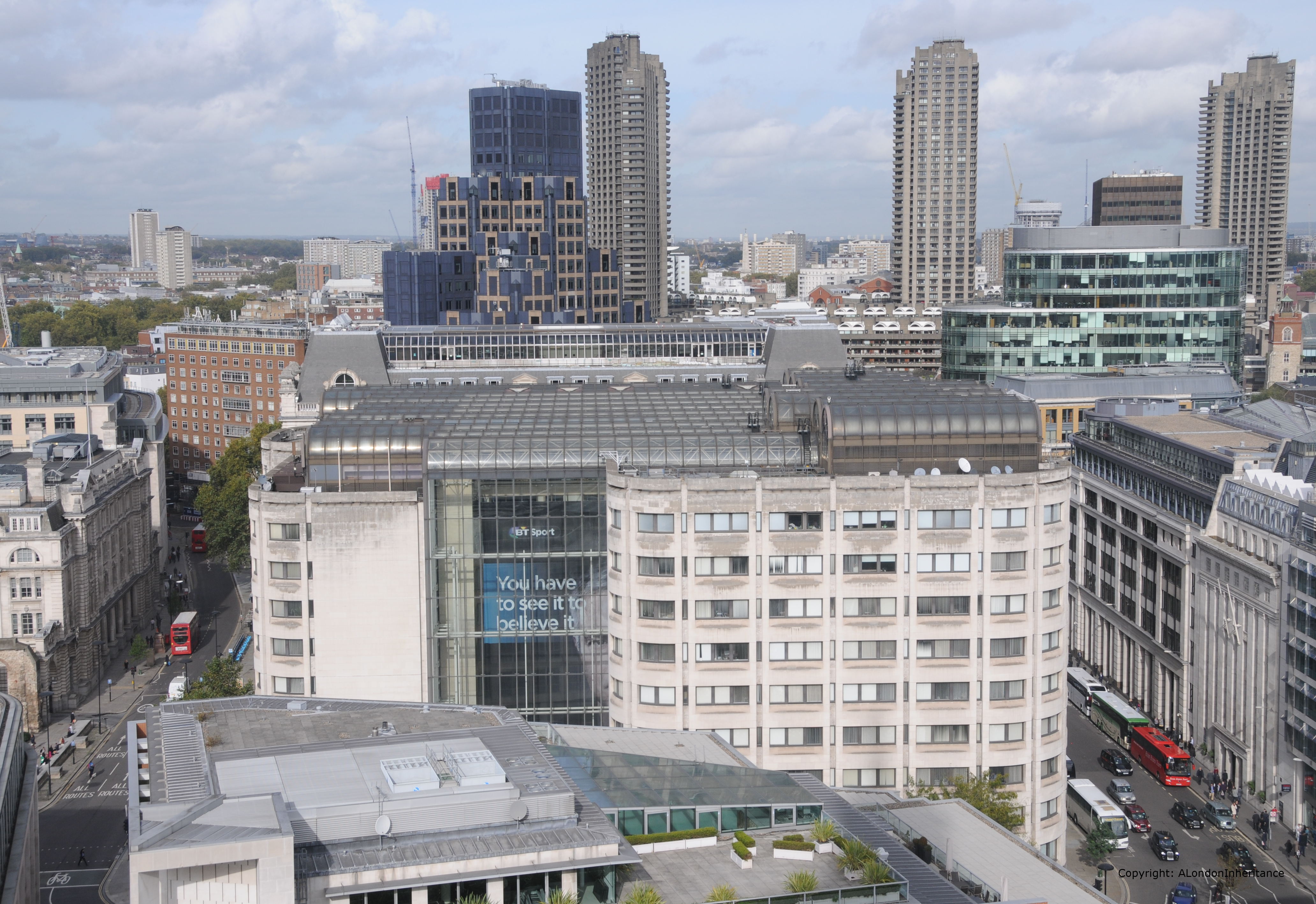
Whilst the roads are still in the same position, the view again is very different. In the following photo, apart from the streets my only reference points are the building on the extreme left of the photo and the church tower of St. Giles, Cripplegate on the right. These appear to be the only buildings that remains from the immediate post war period.
Now walk a few feet to the left and look out over to Christchurch Greyfriars.
Newgate Street is running left to right with King Edward Street heading north from Newgate Street.

And the same view today. The body of the church has been left to this day as it was after being destroyed in 1940. Flower beds now occupy the space where the pews once stood. Apart from the church, the building just behind the body of the church also remains.
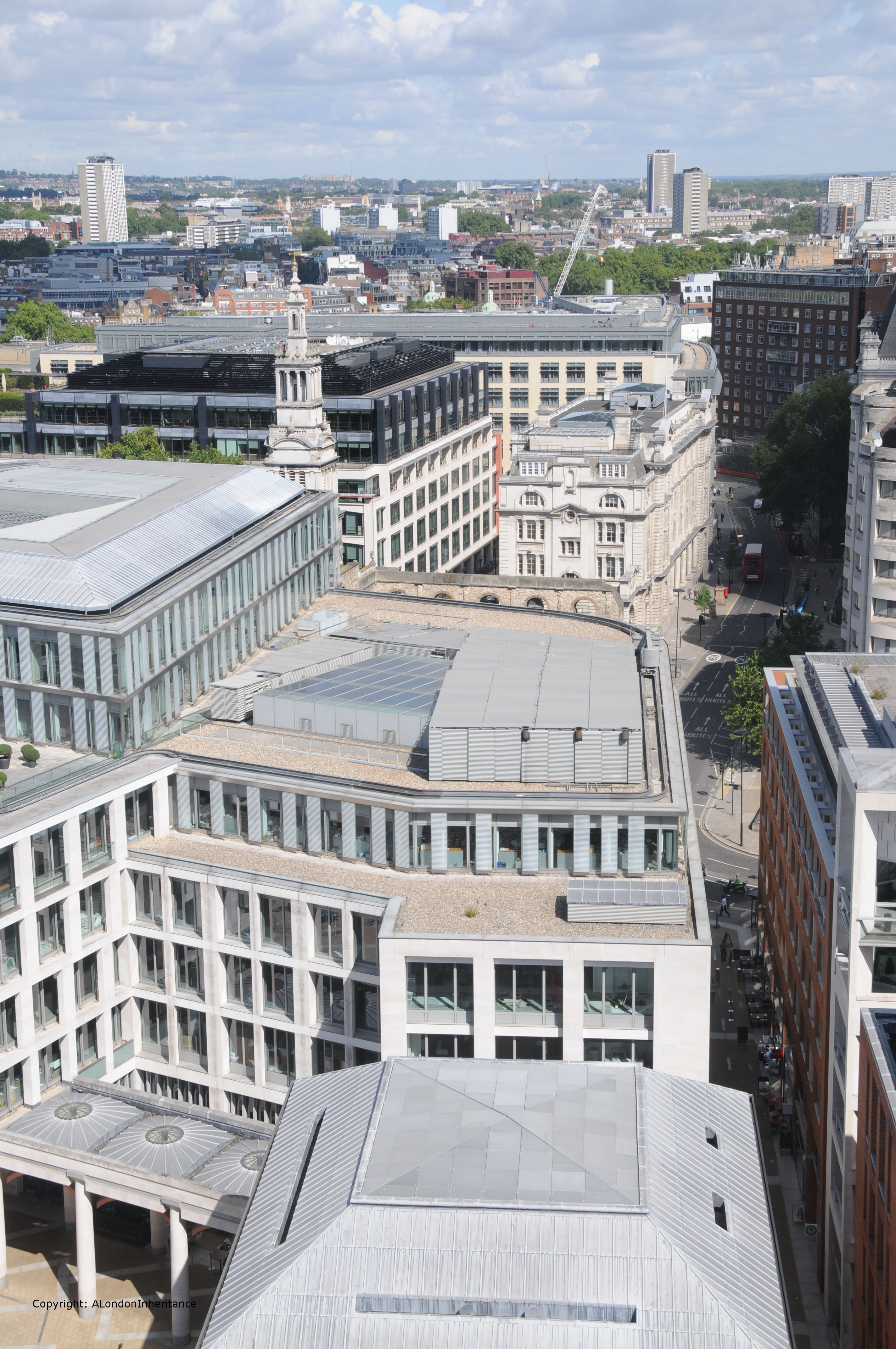
The above photos and the ones below are looking down on the area of Paternoster Square and Paternoster Row.
Paternoster Row was mentioned in the thirteenth century when Stow states that it was built around 1282 and that rents from the houses were used for the maintenance of London bridge. Before the war, this area was well-known for book publishing, distribution and warehousing, a fact that contributed to the intensity of the fires that raged in this area. This trade started well before the 20th century. It was in Paternoster Row in 1720 that William Taylor published Robinson Crusoe after Defoe had tried all over London to sell the manuscript. In 1724 Taylor’s publishing business was purchased by Thomas Longman who had founded the publishing firm of Longman, Green and Company also in Paternoster Row. Longman is still an imprint today, owned by the Pearson publishing company.
The following paragraphs are from the book “The Lost Treasures of London” by William Kent and give some idea of the dreadful loss to the long-established businesses that use to thrive in the City.
“On the night of the 29th December 1940 the bombs rained down here and Paternoster Row was more completely destroyed than any other City thoroughfare of importance. All that remained were a few buildings at the east end. The devastation in respect of books has been indicated by Evan Pughe, the Deputy Chairman of Simpkin Marshall and Co. Ltd:
On the night of the 29th December 1940, Simpkin Marshall, Ltd, the greatest distributor of English books in the world, carrying the largest comprehensive stock, lost approximately four million books when their premises in Ave Maria Lane, Stationers’ Hall Court, Stationers’ Hall, Amen Corner, Paternoster Row and Ludgate Hill, were entirely destroyed by the incendiary bombs of the enemy.
This disastrous fire eliminated everything. All the old records of the business going back a hundred and thirty years were destroyed; and most important of all, the great cataloguing system, the only one of its kind in the world, dating back for a hundred and fifty years. These catalogues were handwritten records of books, cross-referenced, so that books on all subjects could easily be traced. These records could immediately give books that had been published on any subject during the hundred and fifty years covered by them, the publisher, date of publication, the price, the size of the books, etc. They were invaluable and their loss will be felt by the reading public for many years to come.”
As a result of the blitz, Simpkin Marshall went out of business. It is hard to imagine the loss that must have been felt when Londoners returned to their place of work after an air raid and realised not just the loss of the buildings, but also what was held within and long established businesses.
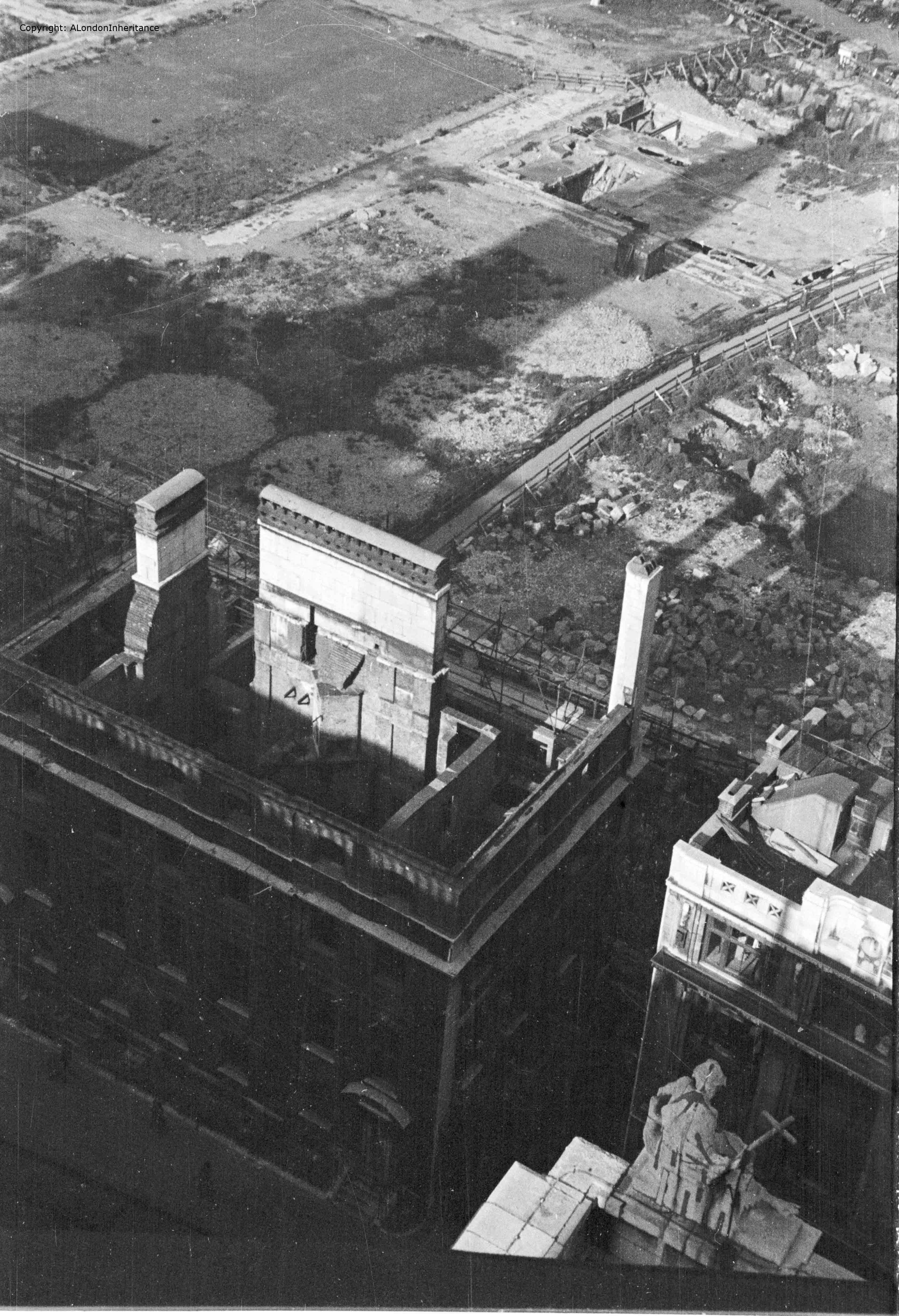
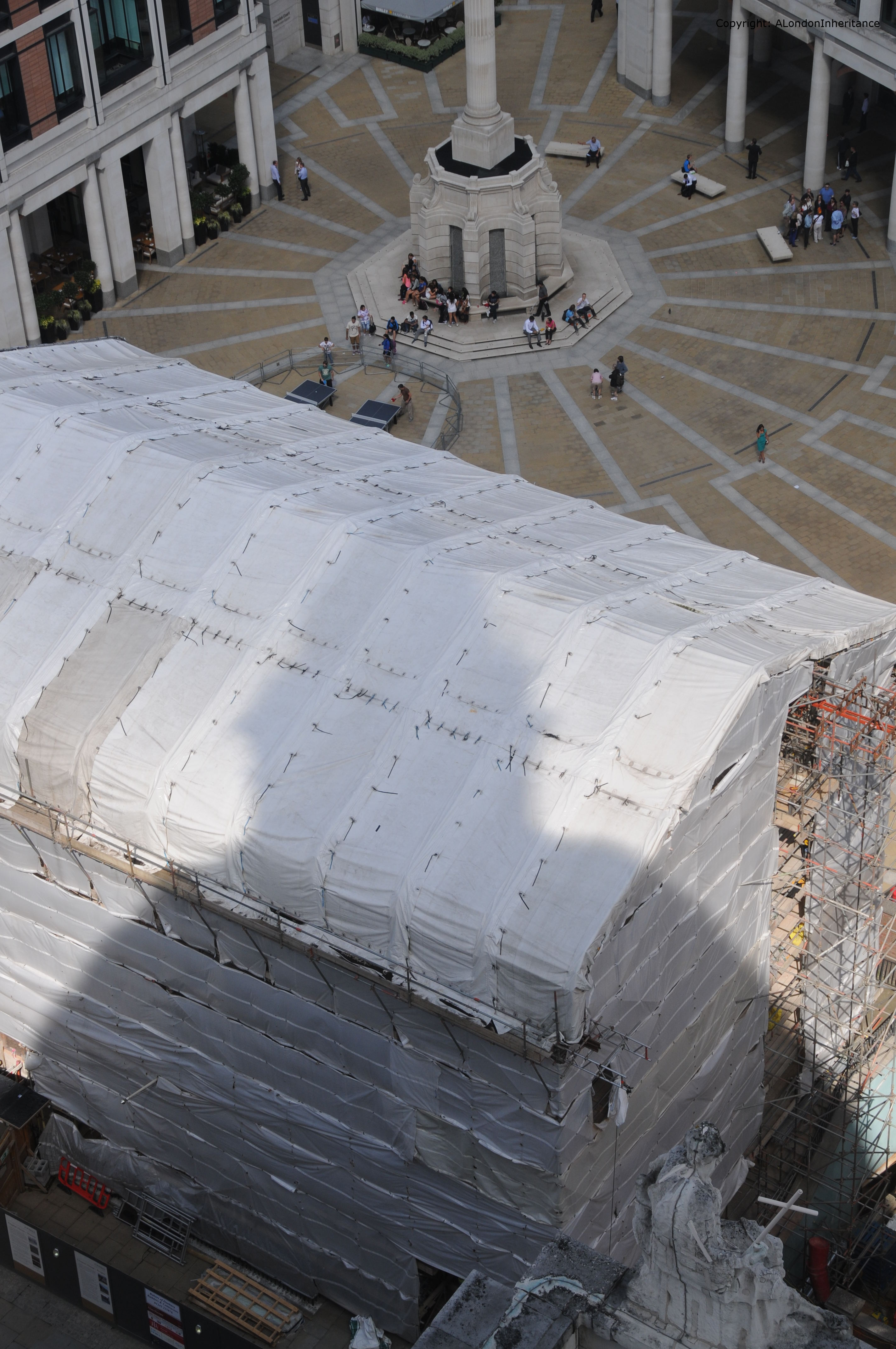
Turning a bit more to the left and peering down we can get a glimpse of the Chapter House and the road that was St. Paul’s Church Yard that closely circled the cathedral.
The five circular shapes just behind the Chapter House are the impressions left by water storage tanks. Access to water was always a problem during the blitz. Damage to water distribution pipes, blocked roads and low tides in the Thames all contributed to the lack of the plentiful supplies of water needed to fight the sheer number of fires that would take hold after a raid. After the Paternoster area was destroyed on the 29th December 1940, the area was quickly cleared and these water tanks were built and kept full ready for the next raid.
Further back can be seen the rectangular shape and surrounding streets of Paternoster Square.
I was able to frame the following 2014 photo reasonably well using the statue at the bottom right, to take a photo in exactly the same position as my father 67 years ago. The current incarnation of the Chapter House is currently undergoing re-building / restoration work hence the protective covering.
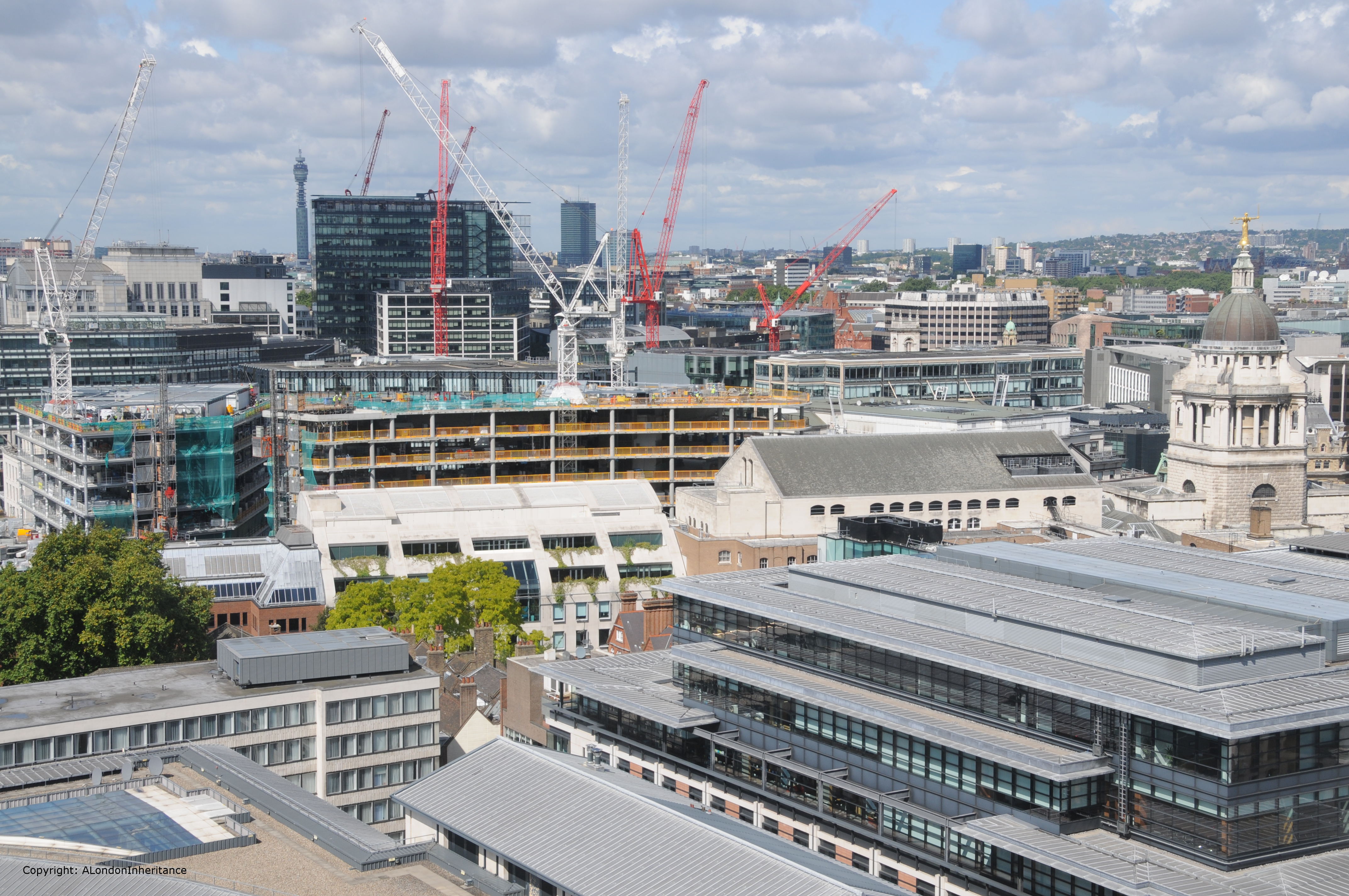
Now look up again and walk further to the left and out across to the west. In 1947 the Old Bailey with the “Lady of Justice” holding the sword and scales of justice stand well above the surrounding buildings, with the Senate House of the University of London the next tallest building in the distance.
In 2014, the Old Bailey still stands clear but the rest of the view towards the west is very different. The view of the Senate House is now obscured, and the next tallest building on the horizon is the BT Tower.
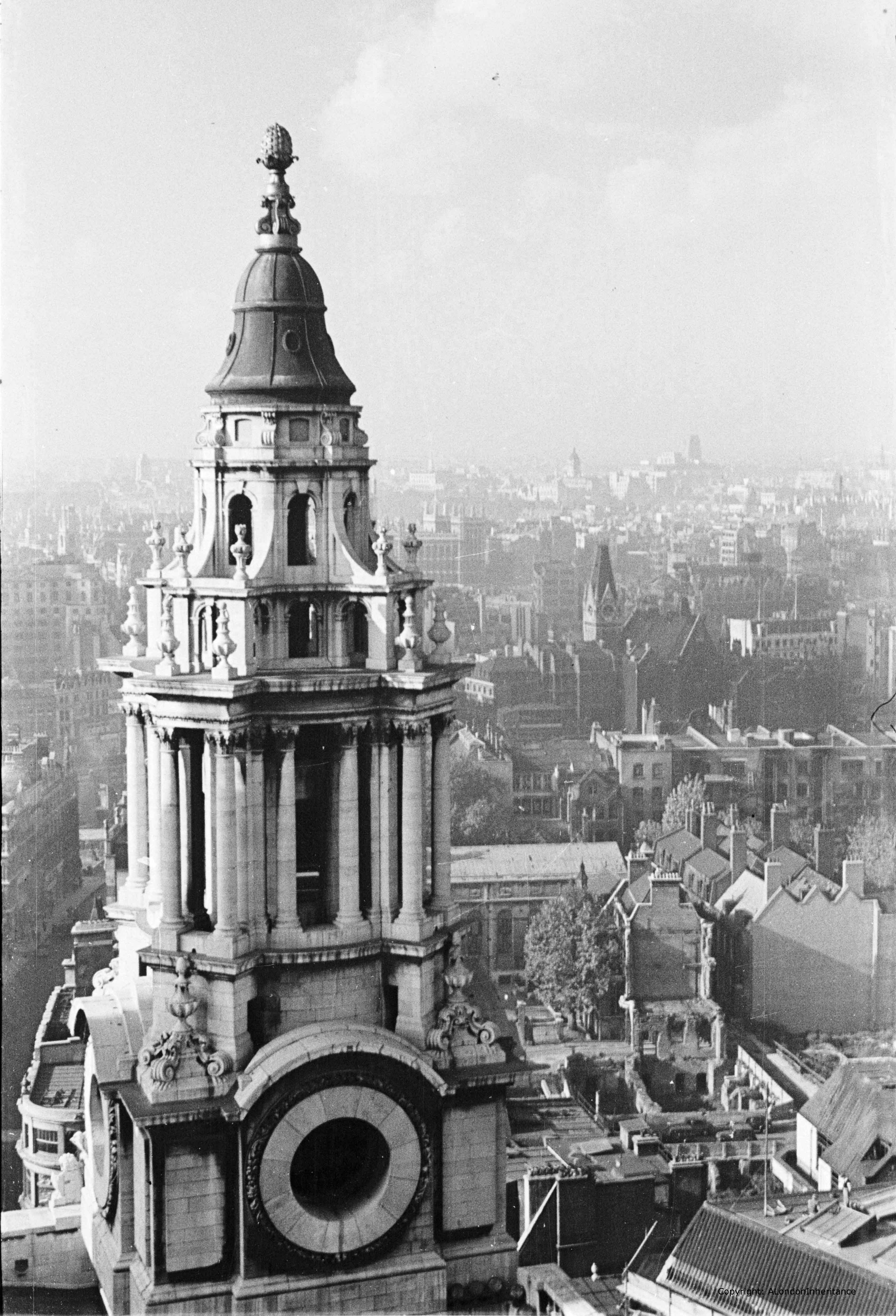
Turning to look further to the left, we can see one of the western towers at the front of St. Paul’s.
And the same view today in 2014:

Looking at these towers at the front of St. Paul’s, at the Dome, across the different levels of roof across the cathedral, the many small walkways, along with the many stairways leading up to the heights of the cathedral really bring home the complexity of protecting the cathedral during the air raids of the blitz.
The Very Reverend W.R. Matthews, Dean of St. Paul’s wrote an account of St. Paul’s Cathedral in Wartime published in 1946. The following extract covering the 29th December 1940 brings to life the challenges that the Fire Watchers faced whilst protecting the cathedral. We join the account after the external water supplies have dried up:
“The Watch was now forced back on their reserves and had to rely entirely on stirrup pumps and sandbags. How we blessed the prescience of our commander, who had insisted on having our supplies of reserve water augmented in case of an emergency like that which we now confronted. Tanks, baths and pails full of water with their compliment of crowbars, shovels and other fire-fighting equipment were now liberally installed in all the vulnerable parts of the building and were so arranged that men approaching the scene of the fire from any direction would be certain of finding the necessary appliances to hand. But for these precautions there might well have been a different story to tell of the fate of St. Paul’s that night.
The action in the cathedral became for a while a number of separate battles in which small squads fought incipient fires at different places on and beneath the roofs. Some of the bombs were easily dealt with, as for example that one which fell on to the floor of the Library aisle and was extinguished by Mr Allen and myself. I have a special affection for the scar left by that bomb on the floor – it represents, I feel, my one little positive contribution to the defeat of Hitler ! But some of these battles were arduous and protracted. Bombs which lodged in the roof timber were very dangerous and hard to tackle. More than one of these took three-quarters of an hour before they were put out and had to be attacked by two squads, one from below and the other from above. The lower squad had the additional discomfort of being drenched by the pumps of their more elevated colleagues”.
The account also makes clear the need for a “head for heights” when working in the roof spaces and above the cathedral floor. It is the bravery of the Fire Watchers that we have to thank for the survival of the cathedral.
Now for the final view from the Stone Gallery in 1947 and we are looking out over the southerly of the western towers across the River Thames to Westminster. We can see Waterloo Bridge along with the Shot Tower on the south bank of the Thames.
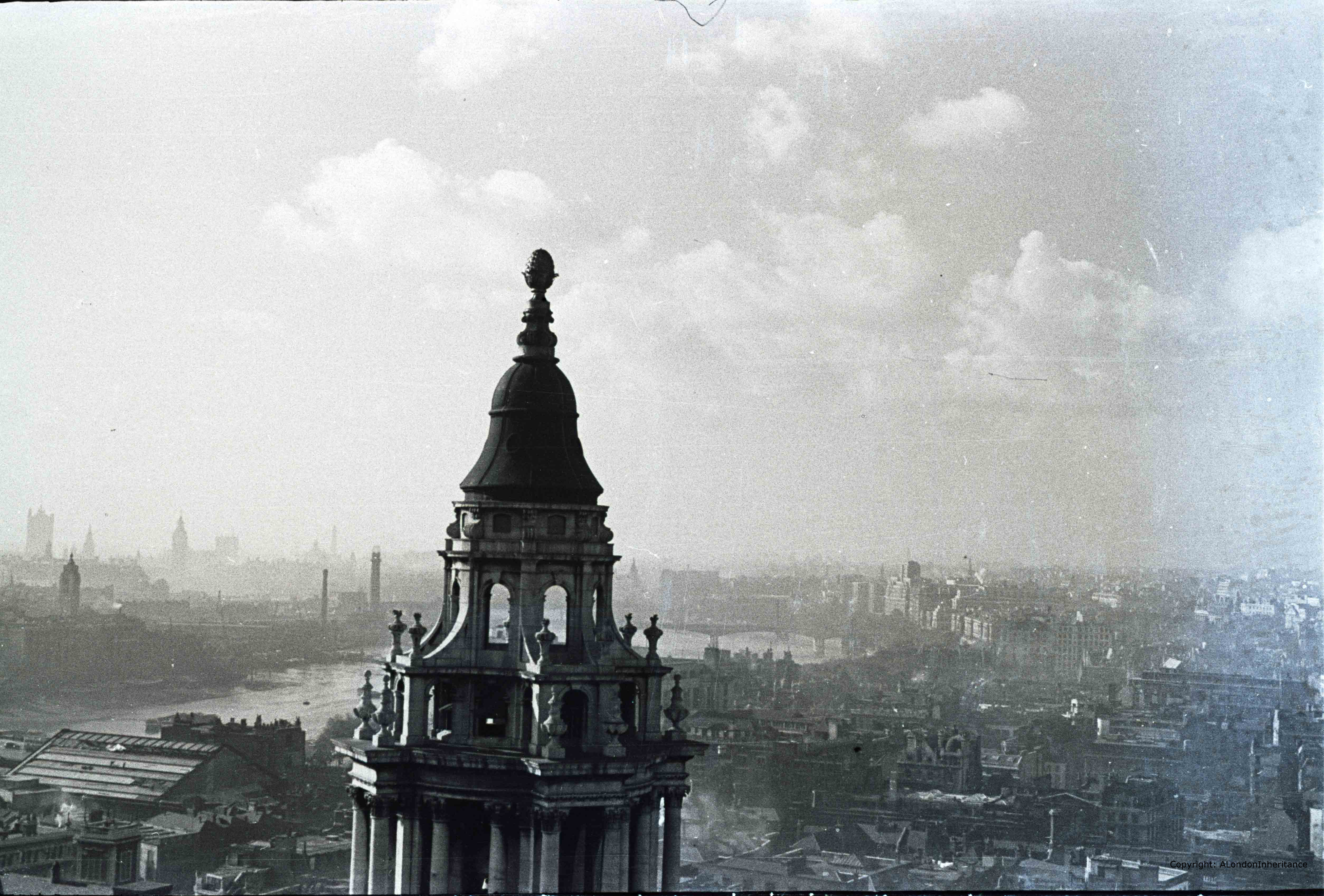
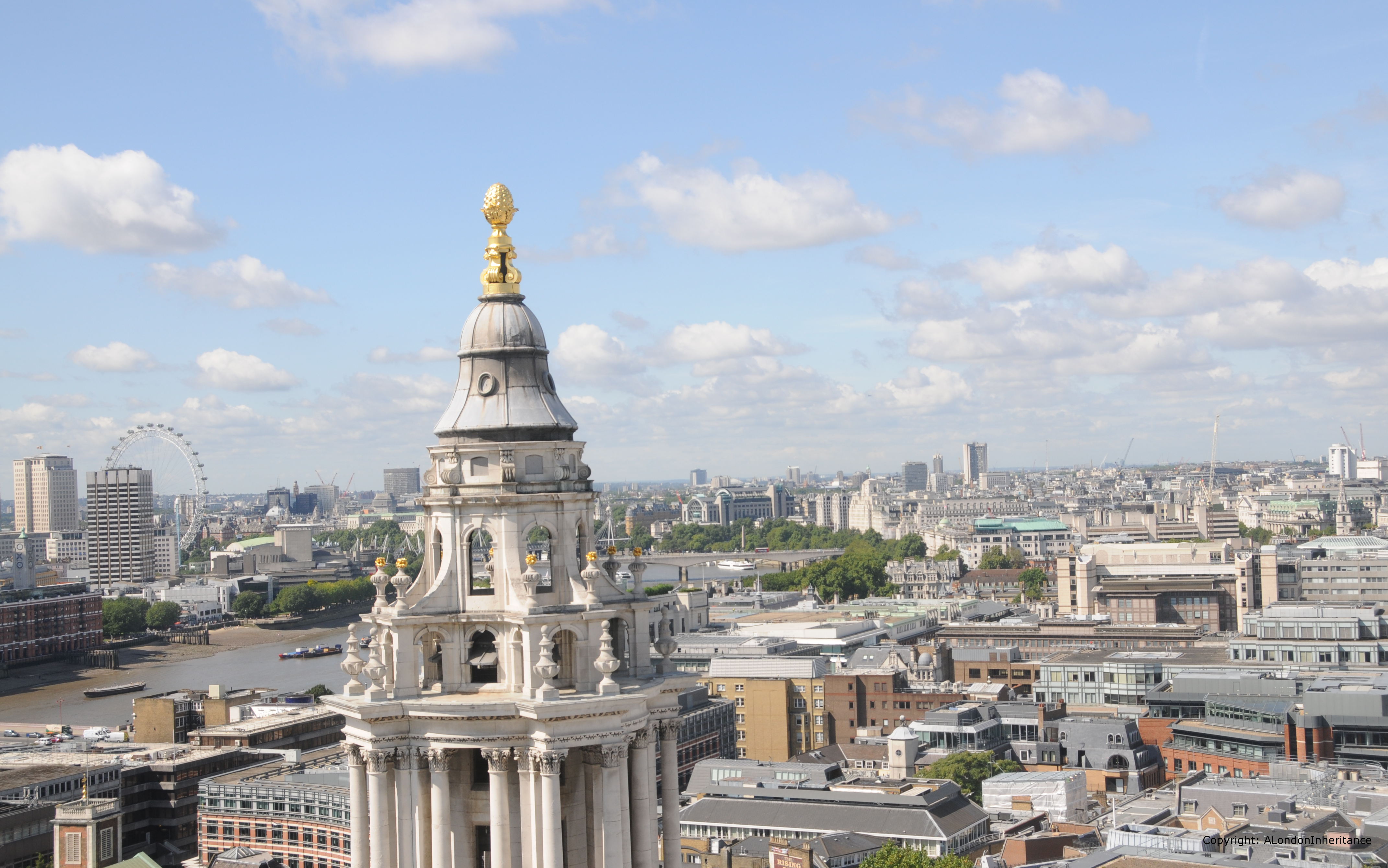
And in 2014, the view of the river and Waterloo Bridge remain but there has been considerable change on both banks of the river. In the 1947 photo, the south bank would soon be cleared for the Festival of Britain, after which the site was part occupied by the Shell Centre building then continuous development leading up to the London Eye.
In the foreground in the extreme lower left of the photos is St. Benets, Paul’s Wharf.
The following map from Bartholomew’s 1940 Reference Atlas of Greater London covers the area to the north of St. Paul’s and shows the streets between St. Paul’s Church Yard and Newgate Street. This was the area shown in the photos covering Paternoster Row and Square and shows the many small streets that were occupied by numerous businesses including that of Simpkin Marshall Ltd. These were soon to be lost with the rebuilding of the area over the coming decades.

Compare this 1940 map with the Google map of today:
View Larger Map
That completes our walk around the Stone Gallery. The air raid of the 29th December 1940 destroyed a significant part of the surroundings of St. Paul’s and the area has since changed dramatically.
The air raids destroyed not only buildings but also business that had been operating for many years, not to mention the thousands of lives that were lost. That St. Paul’s remains is thanks to the bravery of those who protected the building as the area was covered by a deluge of bombs.
For Londoners, it must have seemed that their City was changing forever almost on a nightly basis.
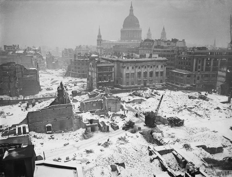
The following photo is from the Imperial War Museum collection © IWM (D 6412) and was taken in January 1942 and perhaps typifies the atmosphere that must have pervaded many parts of the city.
The Stone Gallery (and the higher Golden gallery) provide a perfect location to view the wide sweep of London, from Shooters Hill, to Alexandra Palace, the City, Westminster, North and South Bank. The last stone of the cathedral’s structure was laid in 1708 and since that time it has looked down on a City that has changed beyond all recognition and hopefully will continue to do so for many centuries to come.
The sources I used to research this post are:
- The Lost Treasures of London by William Kent published 1947
- St. Paul’s Cathedral In Wartime by the Very Reverend W.R. Matthews, Dean of St. Paul’s published 1946
- The Blitz by Constantine Fitz Gibbon published 1957
- The City That Wouldn’t Die by Richard Collier published 1959
- London by George H. Cunningham published 1927
- Bartholomew’s Reference Atlas of Greater London published 1940
- The Streets of London by Gertrude Burford Rawlings published 1926
- And for a detailed minute by minute account I recommend reading The City Ablaze – The Second Great Fire of London 29th December 1940 by David Johnson published 1980
One of the things that I noticed when I looked up from the detail of the post war photos of London was the sky. I was born in the 1950’s and that was still the colour & texture of a sky over a city still suffering not only from the effects of WW2, but also from the smoke and industrial fumes of the city. I can just about remember the last ‘smog’, when, if you opened your front door it came in with real prescence. I miss the London I knew as a child, and wish I had known the pre-war London, but I do love the clearer skies, the cleaner buildings – which with restoration, cleaning & gilding have made London today a very beautiful city – but then I am biased!
Hi Donna, I agree, it would have been great to have known pre-war London. Whilst it is still a very beautiful city some of the recent development has been somewhat bland. The Paternoster Row and Square areas sound fascinating and were a centre of the publishing industry. Very different today.
Pingback: London News Roundup | Londonist
This blog goes from strength to strength….fascinating stuff! It’s interesting to me that the new Paternoster Square is private space, with its own security guards, hence the Occupy protest had to be very close to St Pauls on what is still public land. So many changes, not all of them obvious….thanks David.
Thanks Vivienne. I had problems with security guards when I was trying to take photos of All Hallows by the Tower. Trying to get back far enough for a photo I was told by some security guards I was on private land and could not take pictures, despite the fact I was aiming at the church, not their building. As you say, one of the not so obvious changes.
I think you are, unusually, in error about the top two photos. (“These appear to be the only buildings that remains from the immediate post war period.”) There are two survivors besides St. Giles Cripplegate and the unidentified building on the left.
Take a look at your own photo, to the lower right, where there’s a bright red bus. The two buildings adjacent to it are visible in the older photo. One is badly damaged, but its street-level doorway and roofline are clearly the same. The building adjacent to that, closer to the bottom of the photos, is the same in both photos.
Lisa, you are right. Not sure how I missed those buildings but they are the same as in the original photo. Thanks for pointing that out.
I work for BT so that pictured as commented on by Lisa is of interest. I started my career in Oct 1977 in a building called Falcon House in St Martins-le-grand, opposite Postman’s Park and next to a pub called the Lord Raglen (where I had my ‘real’ training).
I can tell you that most of the buildings survived the war and it wasn’t until the 80’s I think that Falcon and Alder House next door were demolished and rebuilt. The building opposite where I worked also survived. It’s directly behind the BT HQ in the picture centre and at the end of the 70’s the outer shell was retained and a new building (for Nomura Bank) was built from the inside out. if you look closely at the top left-hand corner you can recognise the stonework for the little towers.
The building by the bus stop also survived. The one referenced has to it’s right a former GPO building called Armour House. It’s on the corner of Gresham Street and I think when I visited the area last it had been redeveloped. A quick ‘drive’ around BT Centre using Google Street View is a great way to get ground level views of this location and others.
Great site BTW – enjoyed reading it as working there for some years and being aware of the history made my lunch time walks that bit more interesting. In particular I’d watch the excavations on the site of the former CTO (Central Telegraph Office now BT Centre and not GPO HQ as stated) where numerous Roman walls, baths and artefacts were found. What could be removed went to the London museum nearby. Then the site was covered in concrete.
Stan, thanks for your comments and the correction on the Central Telegraph Office. Your comments on the buildings that survived to the 1980s holds true for much of the City. It was that decade when the level of development that continues to this day really started. Prior to that it had been mainly building on the old bomb sites. Also understand your comments on the ‘real training’. I started with BT in 1976. It was a very different time !
I’ve just seen this via twitter. To give a bit more detail on Stan’s helpful comment from 2015 (from my perspective as an archivist at BT):
The building in the foreground in the north-facing photograph was indeed occupied by the Central Telegraph Office. It was designed by James Williams of HM Office of Works and Public Buildings and completed in 1874, with additional storeys being added in 1884 and 1929. Formally, the building was called General Post Office (West) – to distinguish it from the original General Post Office designed by Robert Smirke which stood opposite it on the eastern side of St Martin’s-le-Grand from 1829 to 1912. Originally it was built to house a number of functions:
“The ground floor is to be appropriated to the Postmaster General, the Receiver and Accountant General, with their respective staffs, and in the centre of the building, on the same floor, there will be a large public office in which the business relating to money-orders, saving-banks, registration of letters, sale of stamps, and the receipt of telegrams will be conducted. The first floor will be occupied by the secretary and assistants; the second by the savings banks department, and the top floor by the telegraph staff. The basement is to be used as store rooms and offices. The new building in its integrity will be thus assigned to the whole of the administrative departments of the establishment, and the old one will be exclusively used for the receipt, sortation and despatch of letters.” (“The Times” of 17 December 1870)
However, soon the work of the CTO expanded to occupy the whole building.
The CTO also expanded into buildings on the western side of Roman Bath street (a now vanished street which ran from Newgate Street to Angel Street – you can see it to the left of the CTO in the photo; it’s now somewhere under BT Centre reception).
In the air raid of 29 December 1940 GPO (West) was set alight by burning debris from adjacent buildings and the interior was totally destroyed. The shell of the building was refurbished during the war up to the first and second floors, and the unsafe upper floors dismantled – making for a very odd-looking truncated building. Later in the war a brick third floor was added, and you can see that above the balustrade in the photo. During 1959 work was gradually transferred from the building to other locations; in October 1962 it was closed and in 1967 it was declared unsafe and demolished.
As Stan says, between 1975 and 1979 the Museum of London did extensive archaeological work on the site of GPO (West) and the buildings between Roman Bath Street and King Edward Street. In fact it crops up in an episode of Michael Wood’s ‘In Search of the Dark Ages’. Then in 1979 planning permission was given for a new Headquarters building for Post Office telecommunications. The new building, designed by the Property Services Agency, was opened in June 1984 just in time for the privatisation of British Telecom. Although a very different building, the materials (granite at ground level, Portland Stone above) echo those used in GPO (West).
The building behind GPO (West) was GPO (North), built in 1891, initially to house more administrative and engineering offices. As Stan says, it’s now home to Nomura.
The building behind Christchurch Greyfriars was another Post Office building, King Edward Building, built to replace Smirke’s building as the principal Post Office for London. It’s now Bank of America Merrill Lynch I believe.
With all these Post Office buildings, it’s hardly surprising that in 1900 when the Central London Railway opened a station at the end of St Martin’s-le-Grand, they named it Post Office. It was only in 1937 that it gained its present name of St Paul’s station on the Central Line.
There are lots more photographs of the CTO (inside and out) at http://www.digitalarchives.bt.com/Calmview/
Hi David – do you think that the last photo in this post, from the IWM, could have been taken from the tower of St Albans on Wood Street? The elevation and alignment of St Vedast and St Pauls suggest to me that it was….
Just had a look at that photo and you could well be right. The alignment of St Vedast and St Pauls does look about right.
I was horrorified to read about the destruction of all those books and the impact on the publishing and writing communities of losing Paternoster Row. Your London posts are fascinating and looks like I’ll be parked here for the evening.
Best wishes,
Rowena
Just found this having finished editing this year’s book for the London Topographical Society which will illustrate Lawrence Wright’s watercolour views from the Stone Gallery (purchased in 1956 by the Museum of London). He depicts London in shades of blue and grey, as if dreamily waiting to be rebuilt after the immediate post-Blitz debris had been cleared away. Fascinating to see the photographs taken by your father, and the comparisons of recent views – mostly pretty characterless.
Thank you for your posts, always worth a read.
Great website! Thanks.
To throw in my hap’ny’s worth.
The only building opposite the now demolished CTO in the first photograph that survives today was built to house a warehouse for Courtauld’s, no. 16 S-M-L-G known as St. Martin’s house.
It’s difficult to get an idea of the detail of this design of building from the photo, and I haven’t found any specific images through web searches, though Armour House was apparently like Empire house to the south of St. Martin’s House shown in this newspaper cutting I found on eBay
(https://www.ebay.ie/itm/1926-New-City-Buildings-On-Old-Post-Office-Site-St-Martins-Le-Grand-/233197066470).
I don’t think any of the new building to the north (originally Armour House with Union House beyond to the north) incorporated anything from the earlier structure. Saying that, the b/w image looks like it had an arcade or a row of piers/pilasters on the front.
Also, If I am reading the direction of the last picture right – London in snow – the buildings to the right of Goldsmith’s Hall must be the back of Armour/Union House facing Foster lane.
St. Martin’s house was praised by Pevsner whereas its neighbours, all designed by Gunton & Gunton, were dismissed as ‘below average for the date’. What I like about St. Martin’s house is its combination of Greek and Egyptian details and the use of Doric columns in the doorway. Robert Smirke, who designed the original GPO on this site, was one of the pioneers of the Greek revival in the UK, and the Doric portico of his Covent Garden Theatre (later the Royal Opera House) caused a sensation in 1909 (though enraged John Soane). I wonder if the architect, L. Sylvester Sullivan, deliberately nodded at this tradition.
Ironically, Smirke’s GPO was demolished – not without protest – just as the neo-classical style was beginning to be appreciated again, and thrived in various ways in the 1920s and 1930s.
There’s a photo of Armour House (with bomb damage) in the Postal Museum catalogue:
https://catalogue.postalmuseum.org/collections/getrecord/GB813_P_118_9_11654
My late father was one of the firemen that fought the fire at Christchurch Greyfriars…..He told me years later that there were only two firefighters at the scene. He died in 2004 and I scttered his ashes at the site. I often go and sit there and talk to him.
My friend worked in Armour House in the late 1970s. The Post Office Telecoms Circuit Laboratory occupied the ground floor and had store rooms in the basement and sub basement. Apparently it was discovered by the staff exploring the sub basement that the building bridged a Plague Pit.