
Following on from last Sunday’s post from the Hague, whilst there we took a train to Amsterdam to track down the location of more photos from 1952. Rather than drive, the train provided an excellent direct service between the two cities and it was a perfect opportunity to use a type of train not available on the UK train network.
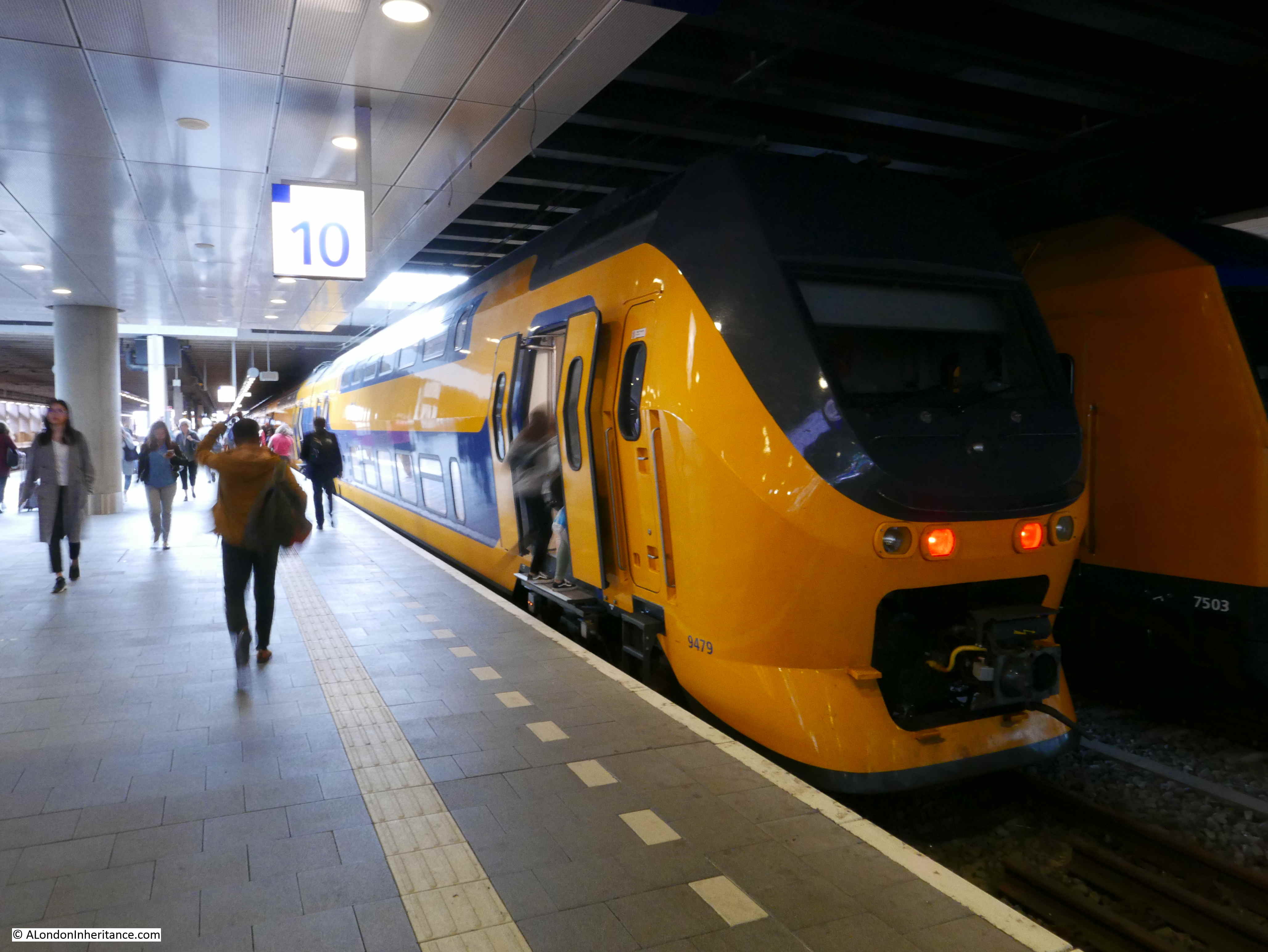
The Dutch rail system uses a combination of single deck “Sprinter” trains which are generally stopping trains and double decker trains in use as Inter City services which are faster alternatives without so many stops. The ticketing system is the same for both, and a return ticket between the Hague and Amsterdam could be used on the slower Sprinter and faster Intercity trains.
The double decker trains are not new, they were in use across the network when we lived in the Netherlands in the early 1990s and it was always a novel experience to climb stairs on a train, after using trains on the UK network.
The InterCity train in the Hague Central Station:
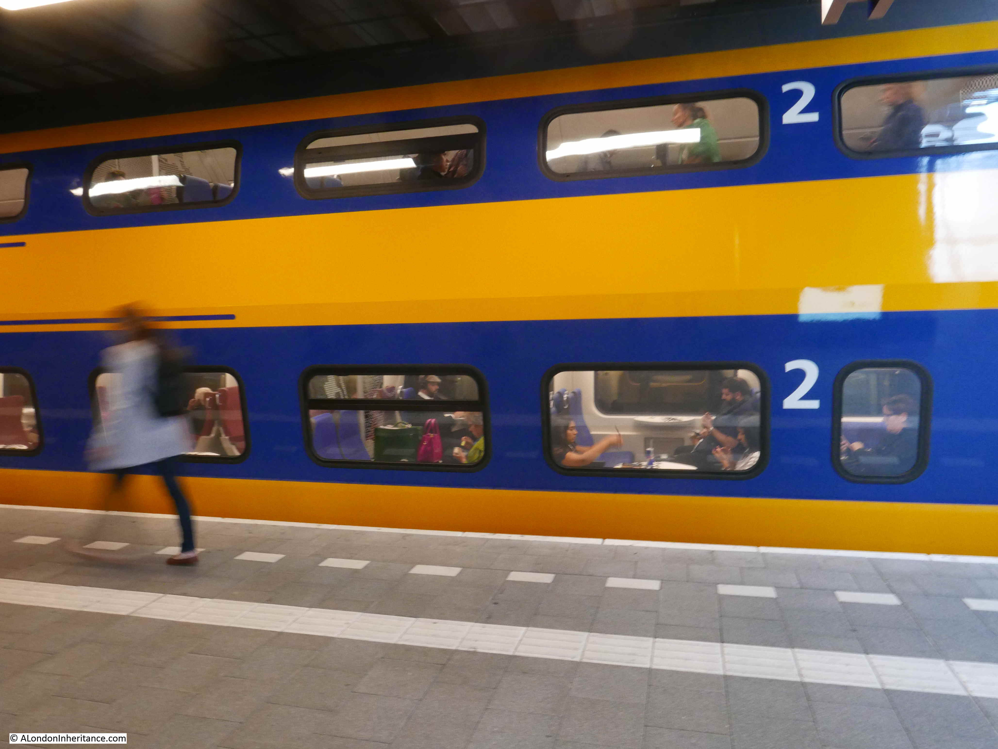
Two decks of train capacity:
Through the doors and an intriguing option – do I go up or down?
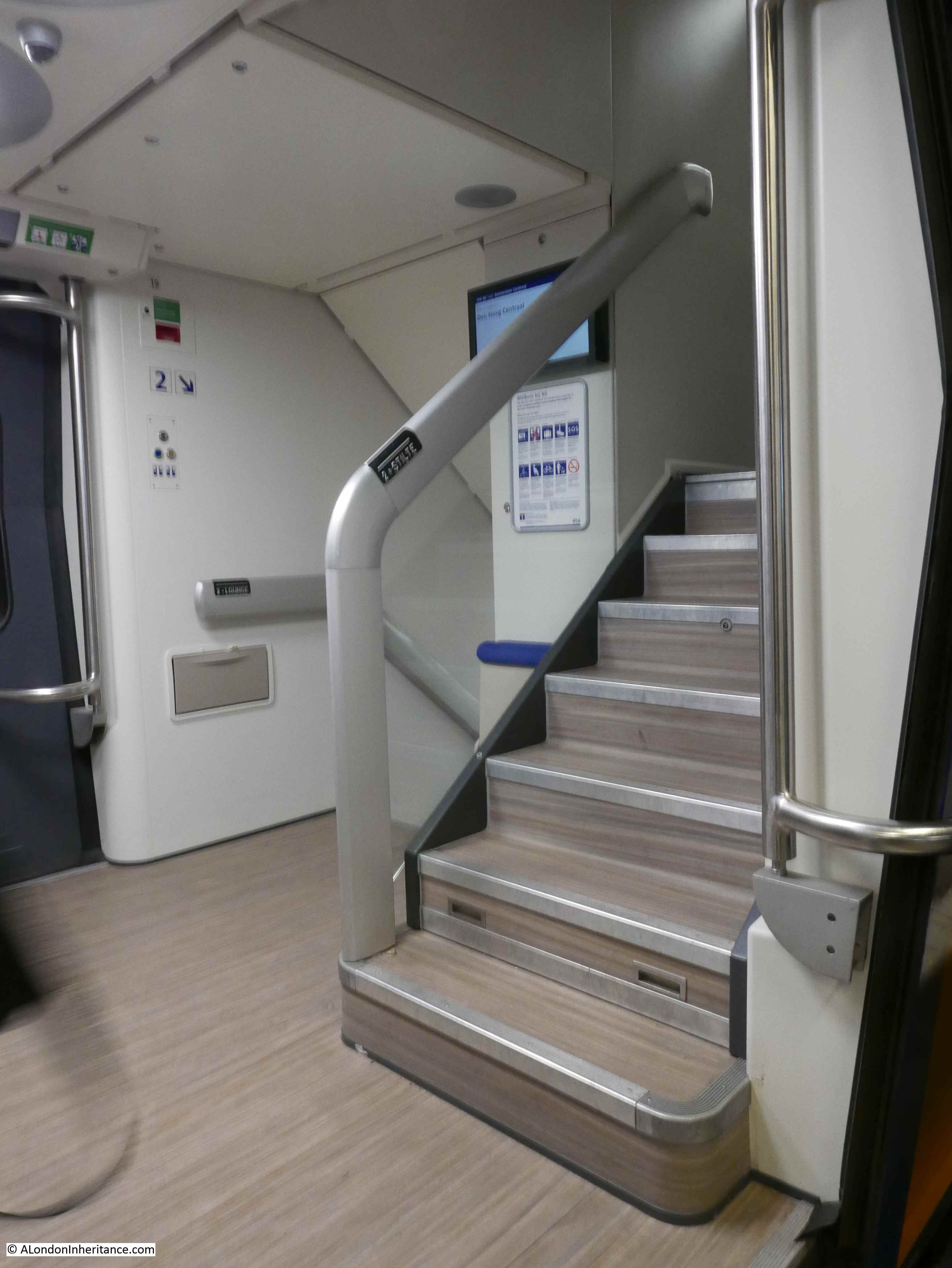
Up was the obvious choice. The upper deck resembles an aircraft interior but with larger windows and no overhead luggage bins.
Stopping in Leiden Station and looking down on the platform from the upper deck:

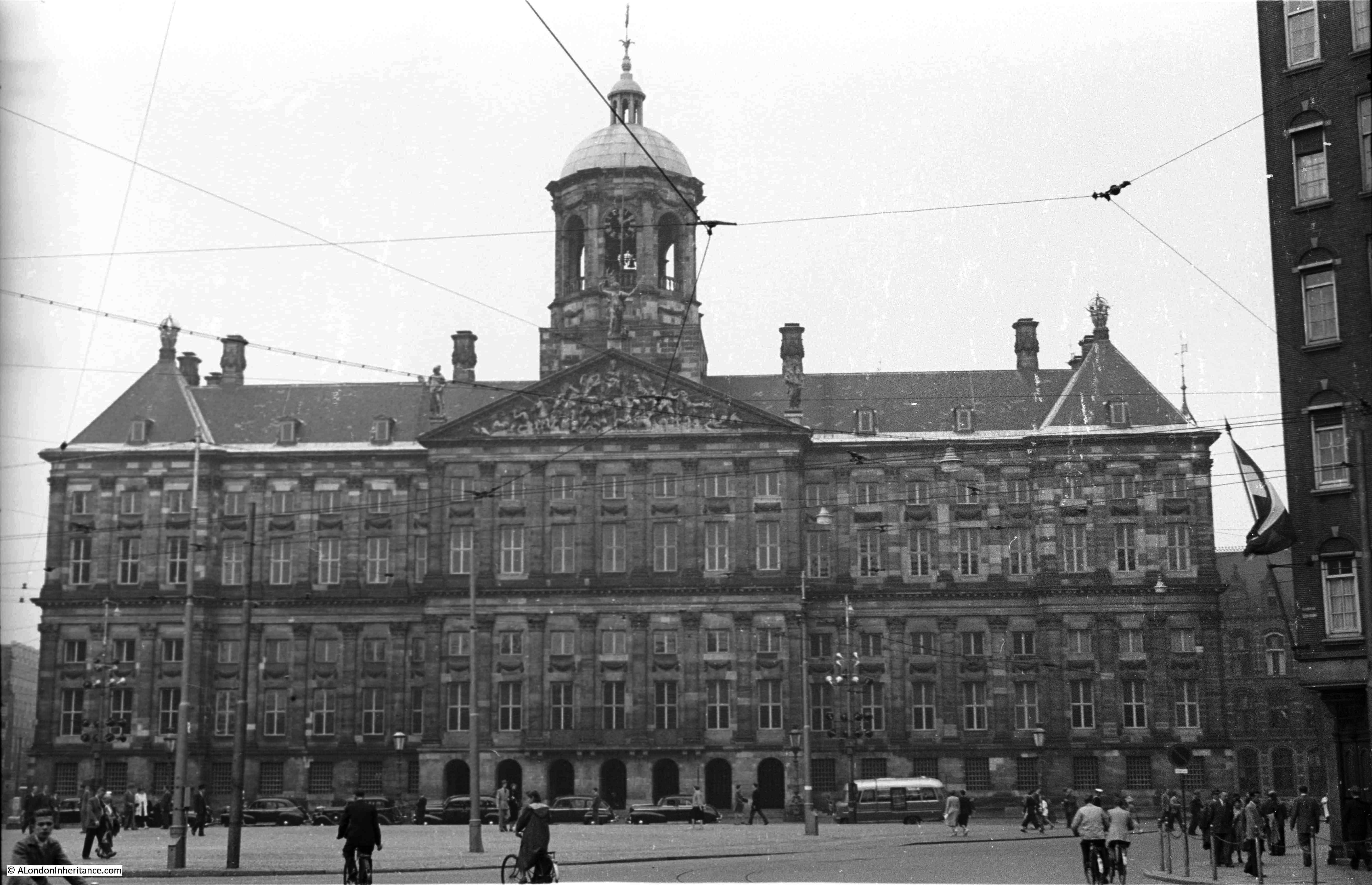
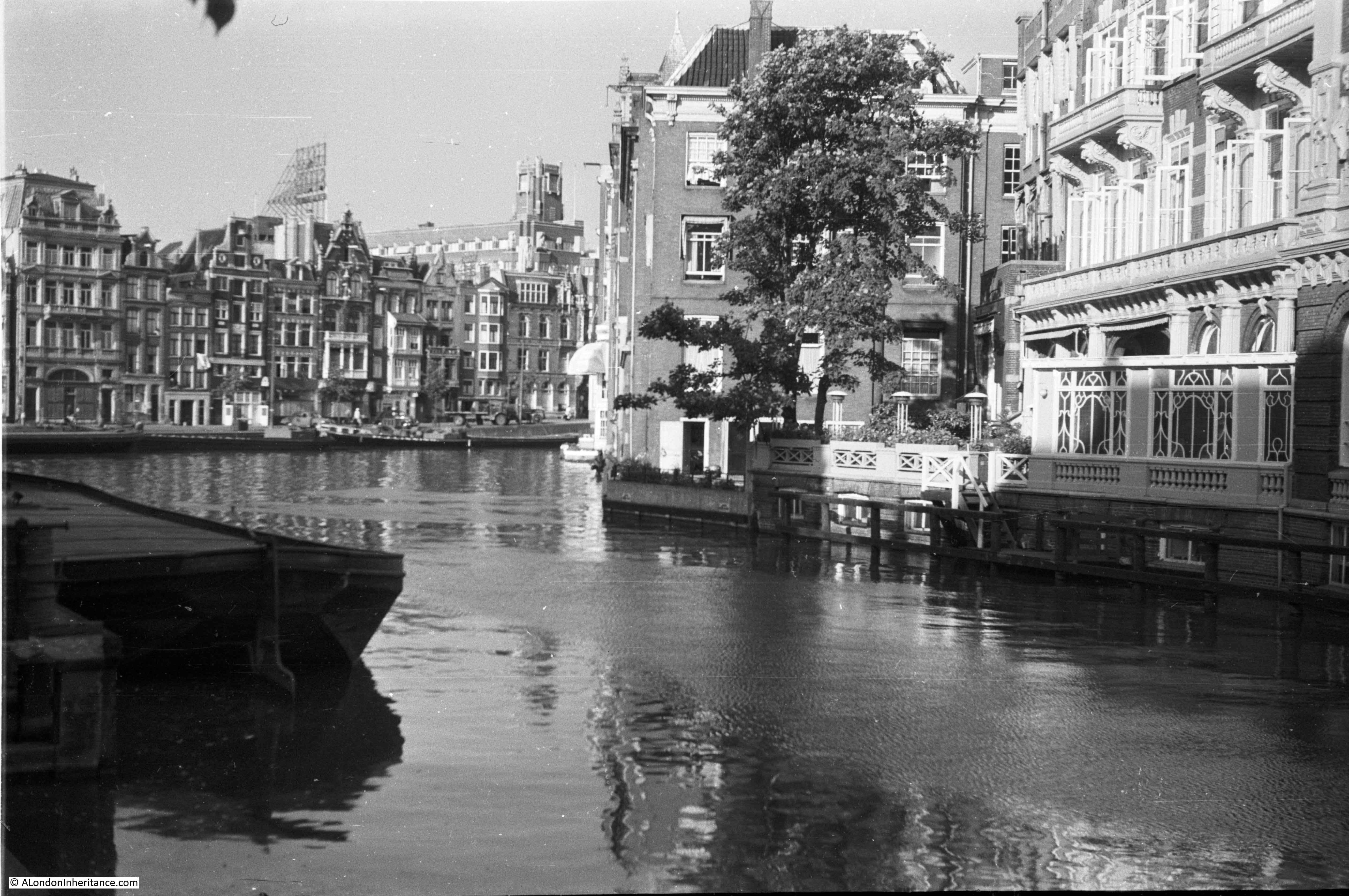
After arriving at Amsterdam Central Station, I headed to the first location which was easy to recognise. This is the Royal Palace in the centre of Amsterdam, photographed in 1952:
And this is the same view in 2018: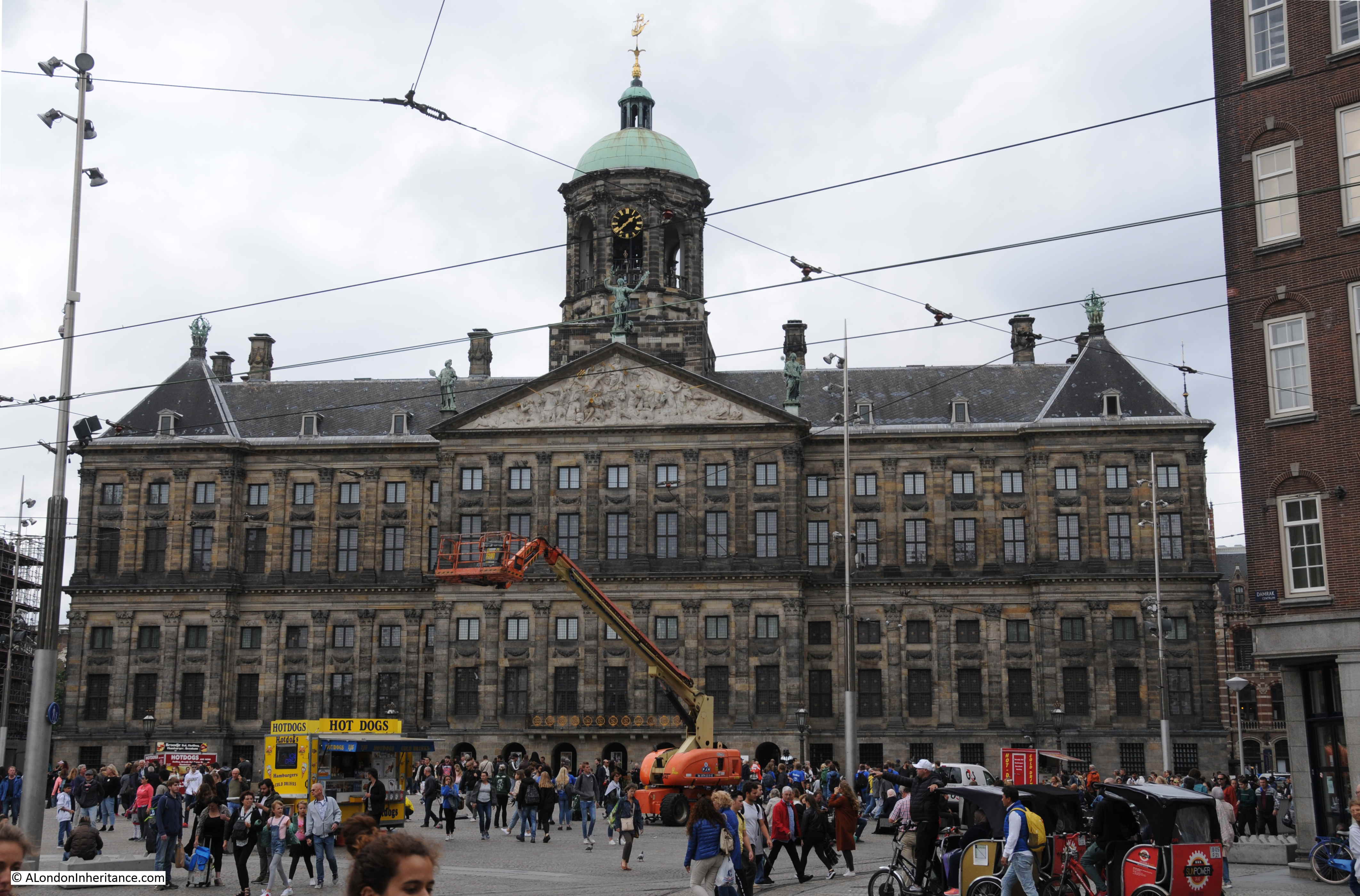
As could be expected, the view has hardly changed, even the overhead power cables for the trams are still in place. As with the Hague, Amsterdam has an extensive tram system which provides excellent connectivity across the city.
The Royal Palace dates from the 17th century, however the building we see today mainly dates from 1808 when King Louis Bonaparte transformed the palace during the French occupation of the Netherlands.
Very similar to Buckingham Palace in London, the Amsterdam Royal Palace is used to host foreign Heads of State and state receptions. It also plays a key part in the life of the Dutch monarchy as royal marriages and investiture ceremonies are also held in the palace.
The large space in front of the Royal Palace is Dam Square.
Dam Square has been the centre for many demonstrations and rallies over the years. The square hosts the annual National Memorial Day in May, which commemorates all members of the armed forces and civilians who have died in war.
Dam Square was also the site of one of the final actions of the last war in the Netherlands when on the 7th May 1945, two days after the German surrender, German soldiers on a balcony fired into Dutch crowds in the square. The crowds had been awaiting the arrival of Canadian forces. There were many deaths and casualties and no real reason for the shooting to have taken place.
Dam Square today is a busy centre for tourists visiting the city. As well as a natural place to congregate opposite the Royal Palace, the square is also the location for one of the Netherlands largest department stores and a Madam Tussaud’s Wax Museum.
The following map extract showing the historic centre of Amsterdam shows the sites of my father’s photos that I have been able to identify. The Royal Palace shown above is at site number 1.
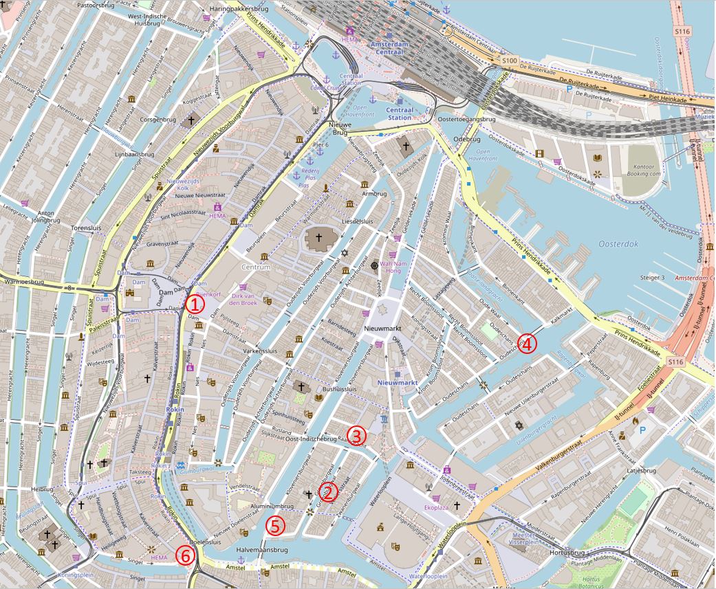
(Map “© OpenStreetMap contributors”)
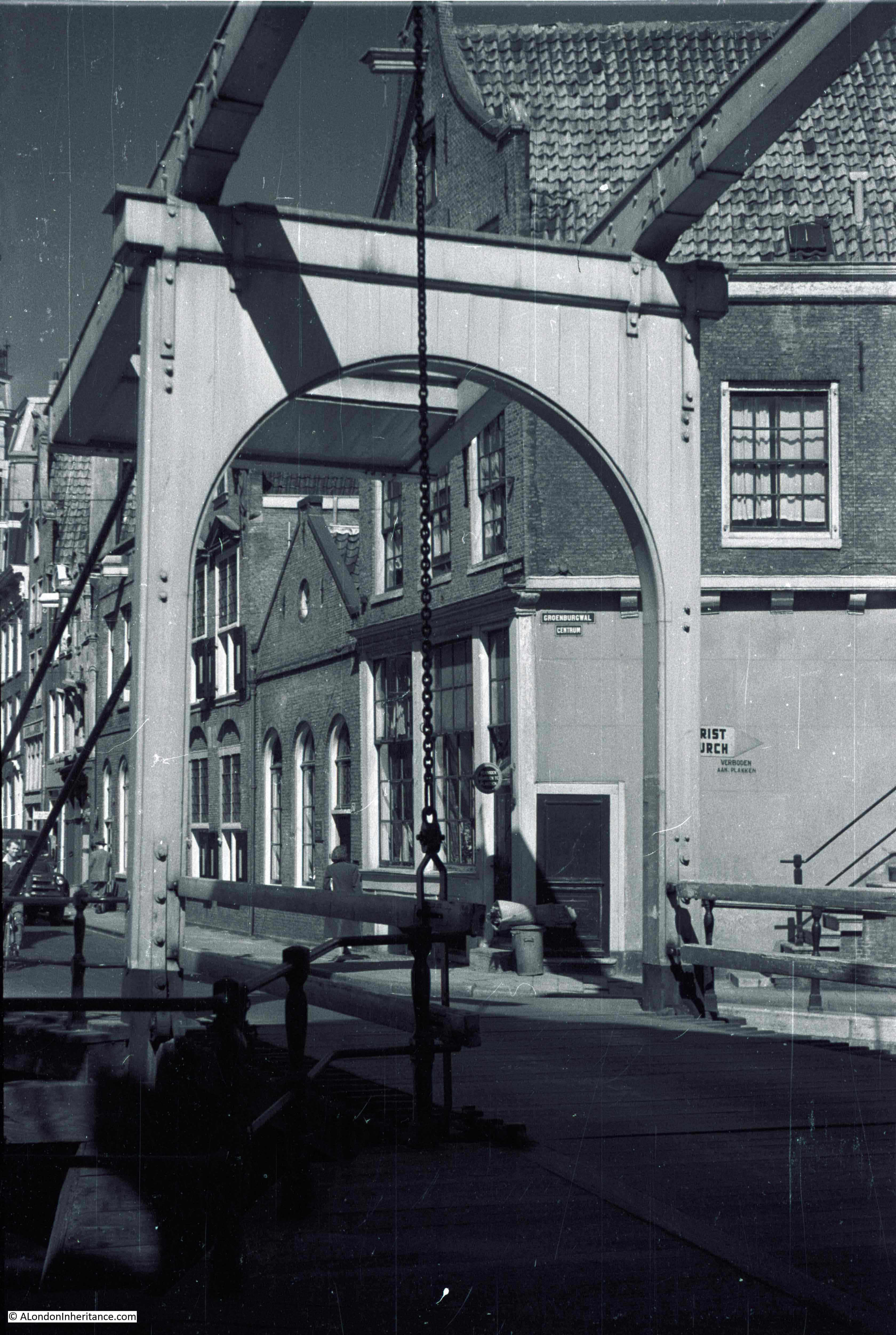
My next location was a walk through the side streets from Dam Square to site number 2. I had found this location in advance. Fortunately in my father’s photo there is a street name visible so I was able to work out where the photo had been taken before arriving in Amsterdam.
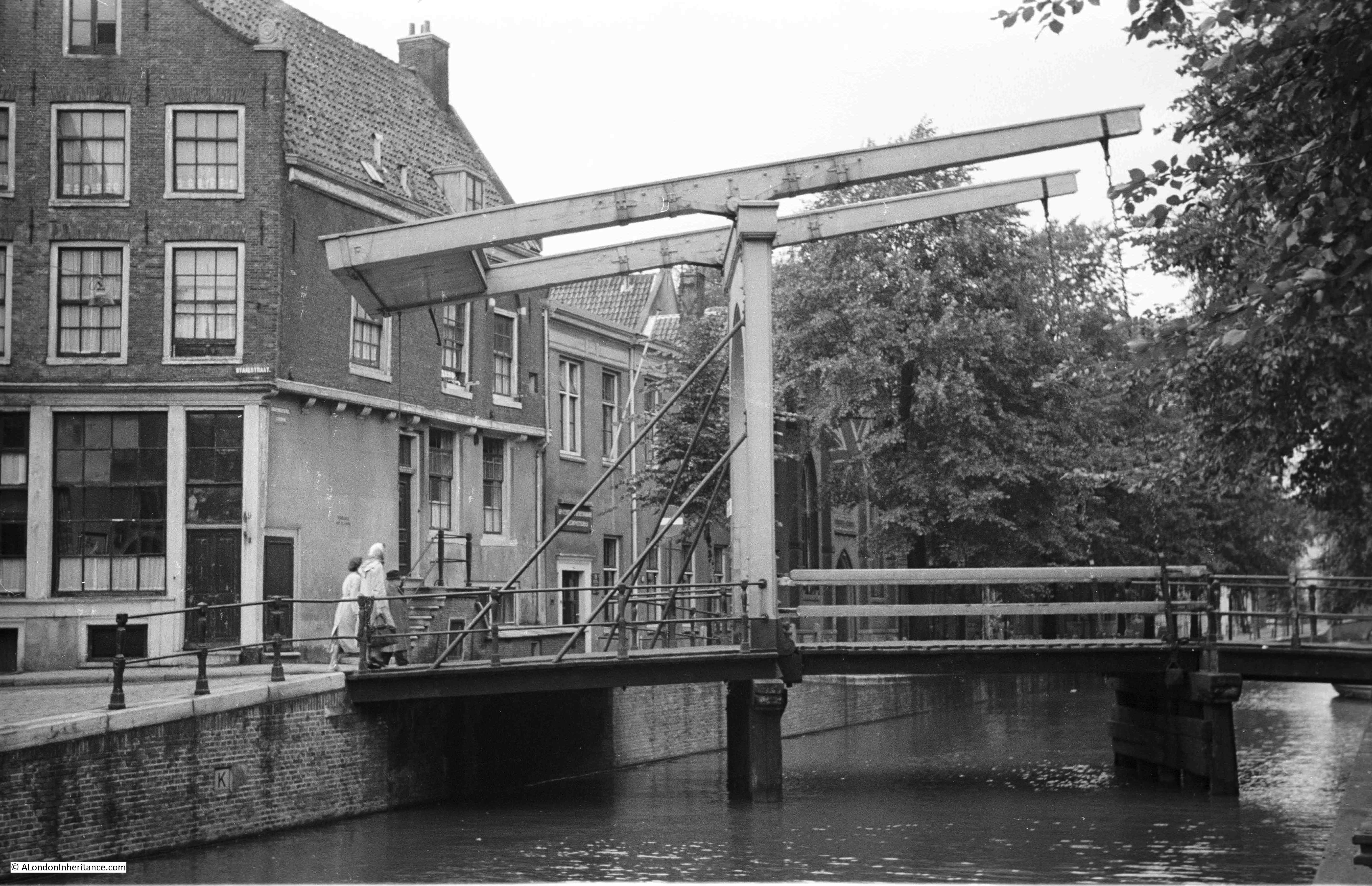
This is the Staalmeestersbrug which spans the Groenburgwal canal.
Sixty six years later and the view of the bridge is much the same:
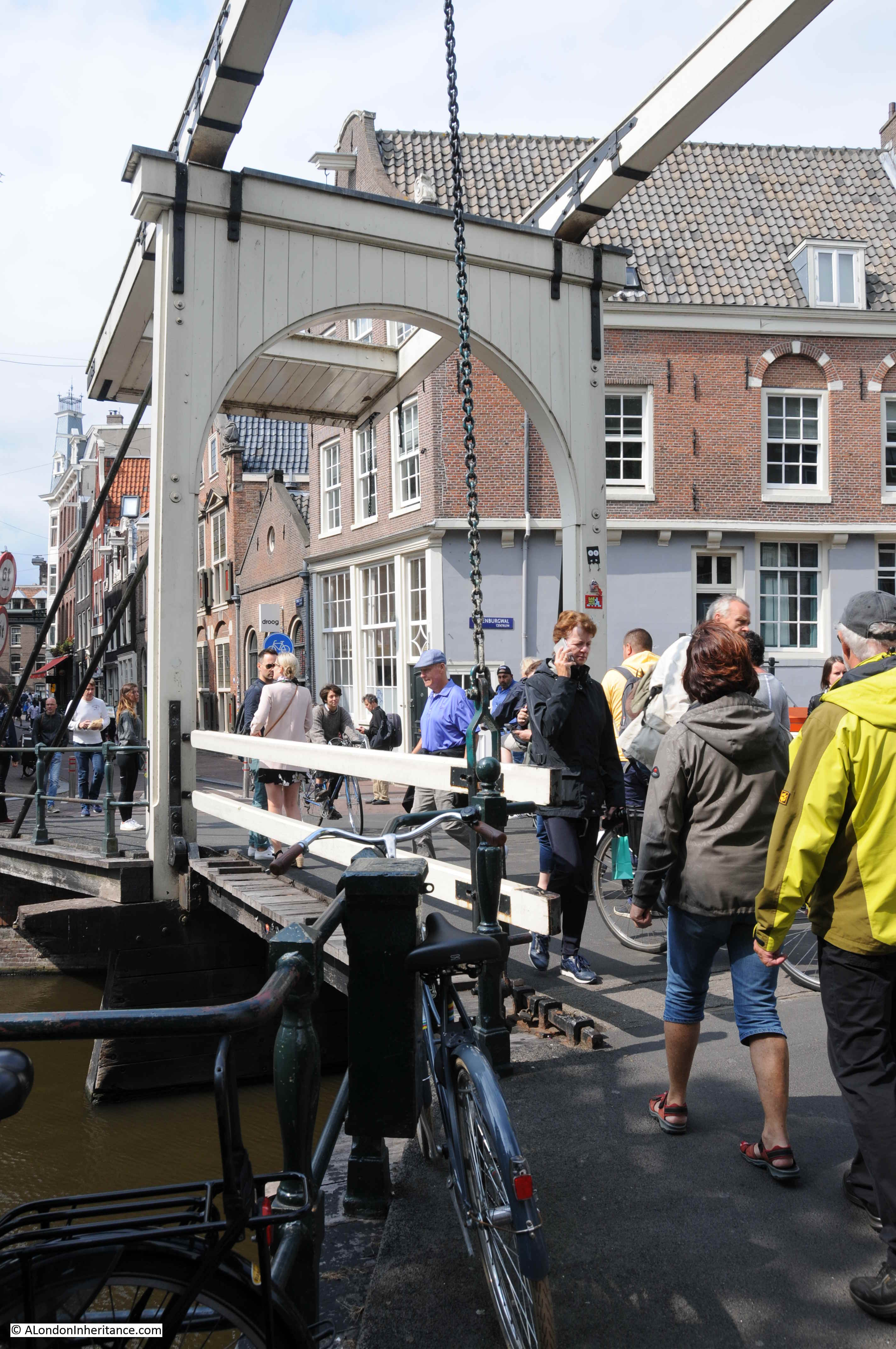
There has been a bridge here for many centuries, the first written record dates from 1599. The bridge in my father’s photo dates from 1928 when a replacement bridge was installed, replicating the previous bridge at the site.
The bridge in my 2018 photo is not fully the same as my father’s photo. In 1964 repair was again needed and the bridge section and counterbalance were replaced – but by comparing the two photos, the appearance of the new parts are the same as in the previous photo.
The photo does highlight one of the main differences between the Amsterdam of 1952 and that of 2018, and the same change can be seen in London, and that is the level of tourism and growth in the city’s population.
Main streets in the historical centre of Amsterdam are very busy, and you can tell from the languages spoken, and the photos being taken that a high percentage of those walking the streets are tourists.
Another view of the same bridge in 1952:
And in 2018:
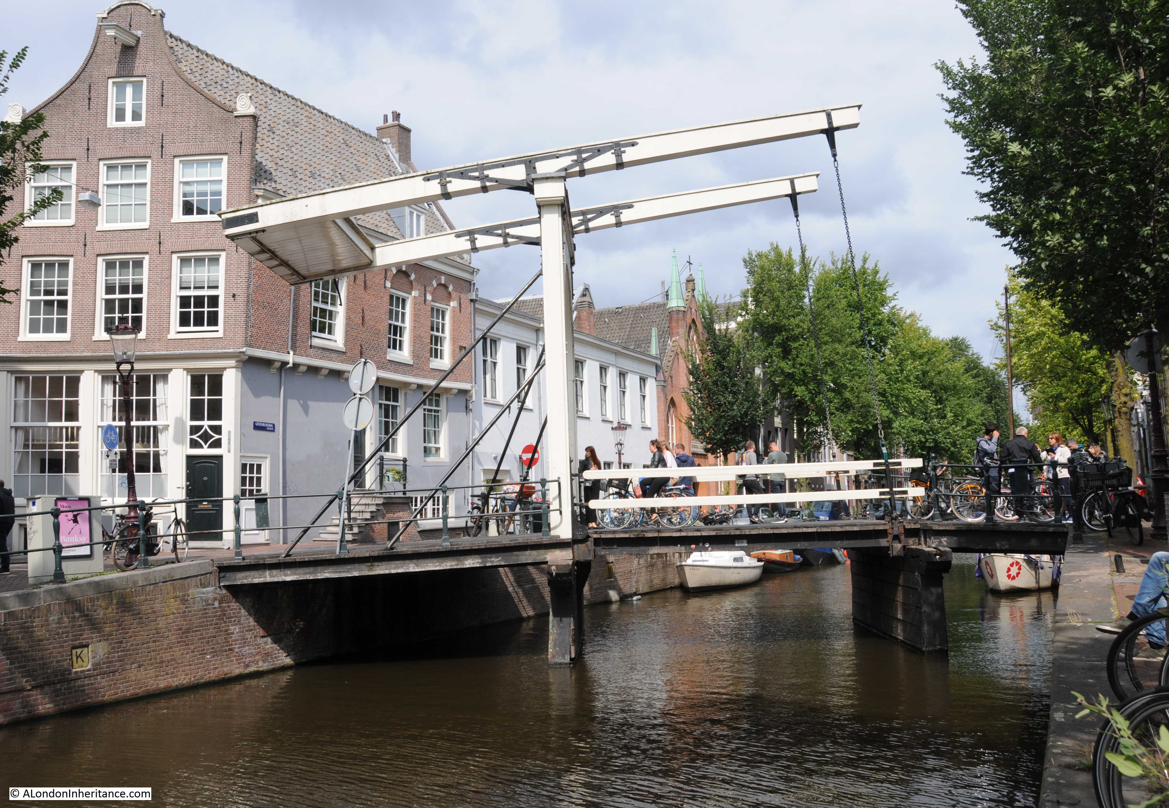
Whilst generating economic benefit and employment, Amsterdam is struggling with the level of tourism. In 2017 there were 6.7 million hotel stays by foreign visitors, a figure which does not include day visitors. There are ten tourists for every resident of Amsterdam and local politicians and activists are calling Amsterdam the Venice of the north – not just because of the omnipresence of water, but also due to the impact of high volumes of tourists.
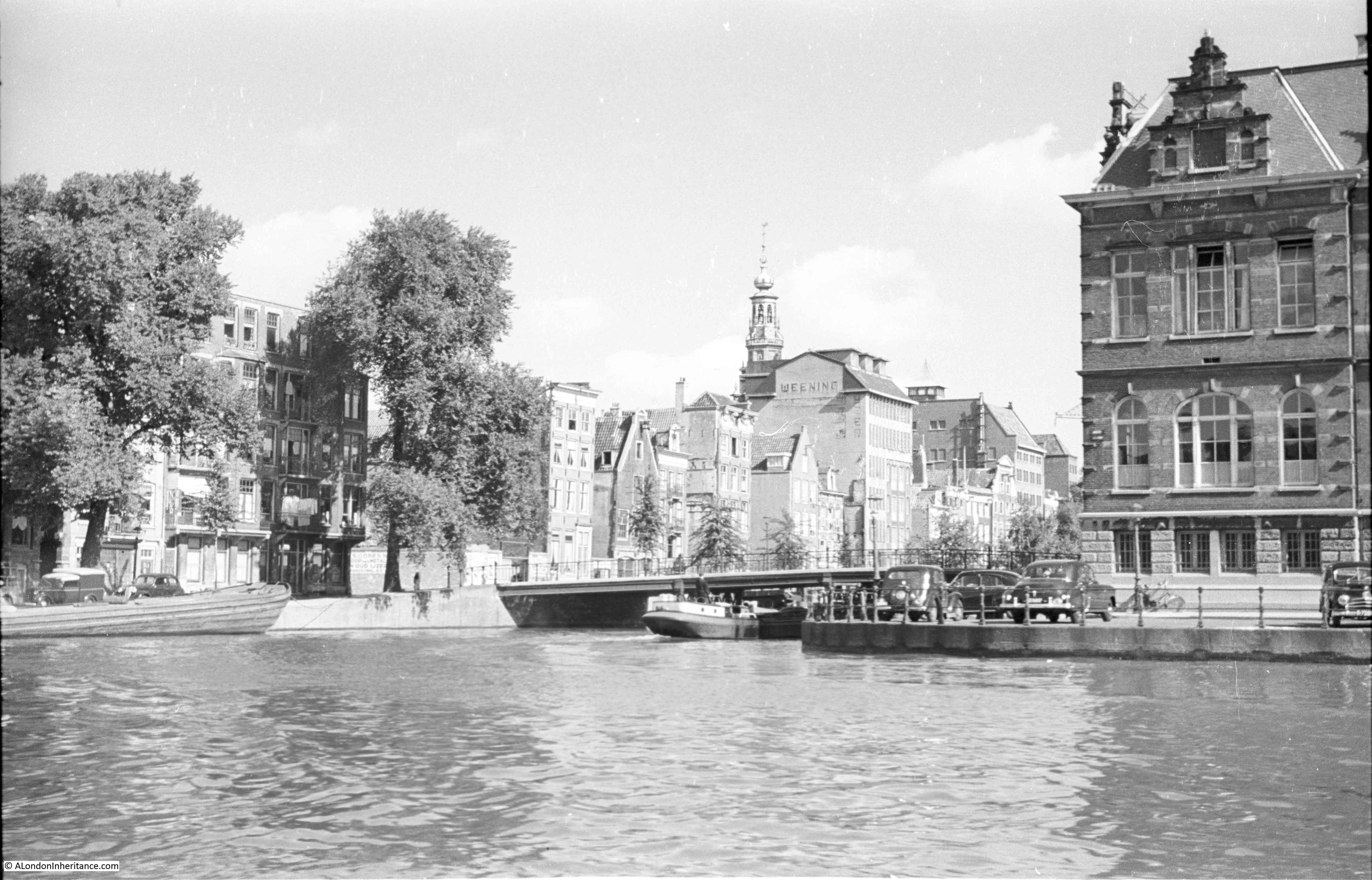
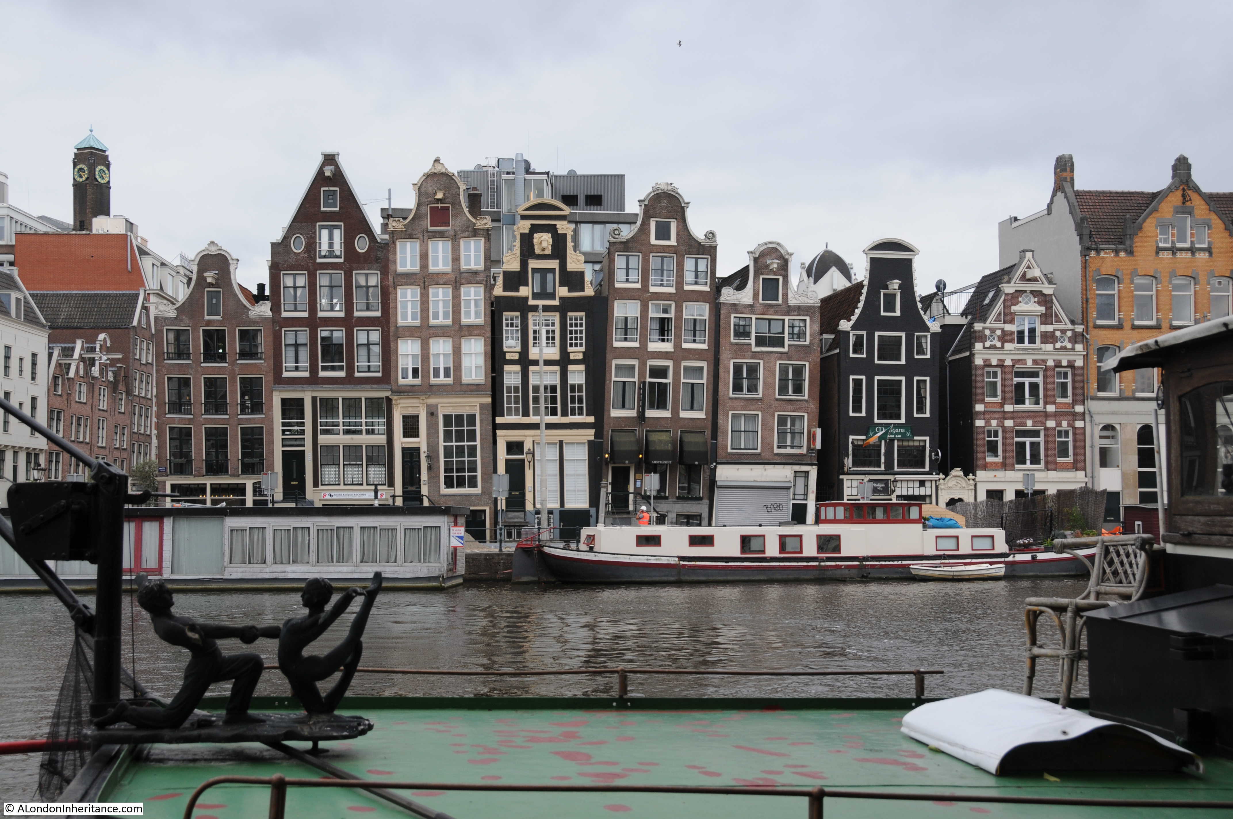
Standing on the Staalmeestersbrug and looking along the Groenburgwal is this view of the tower of the Zuiderkerk, located at site 3 in the map above:
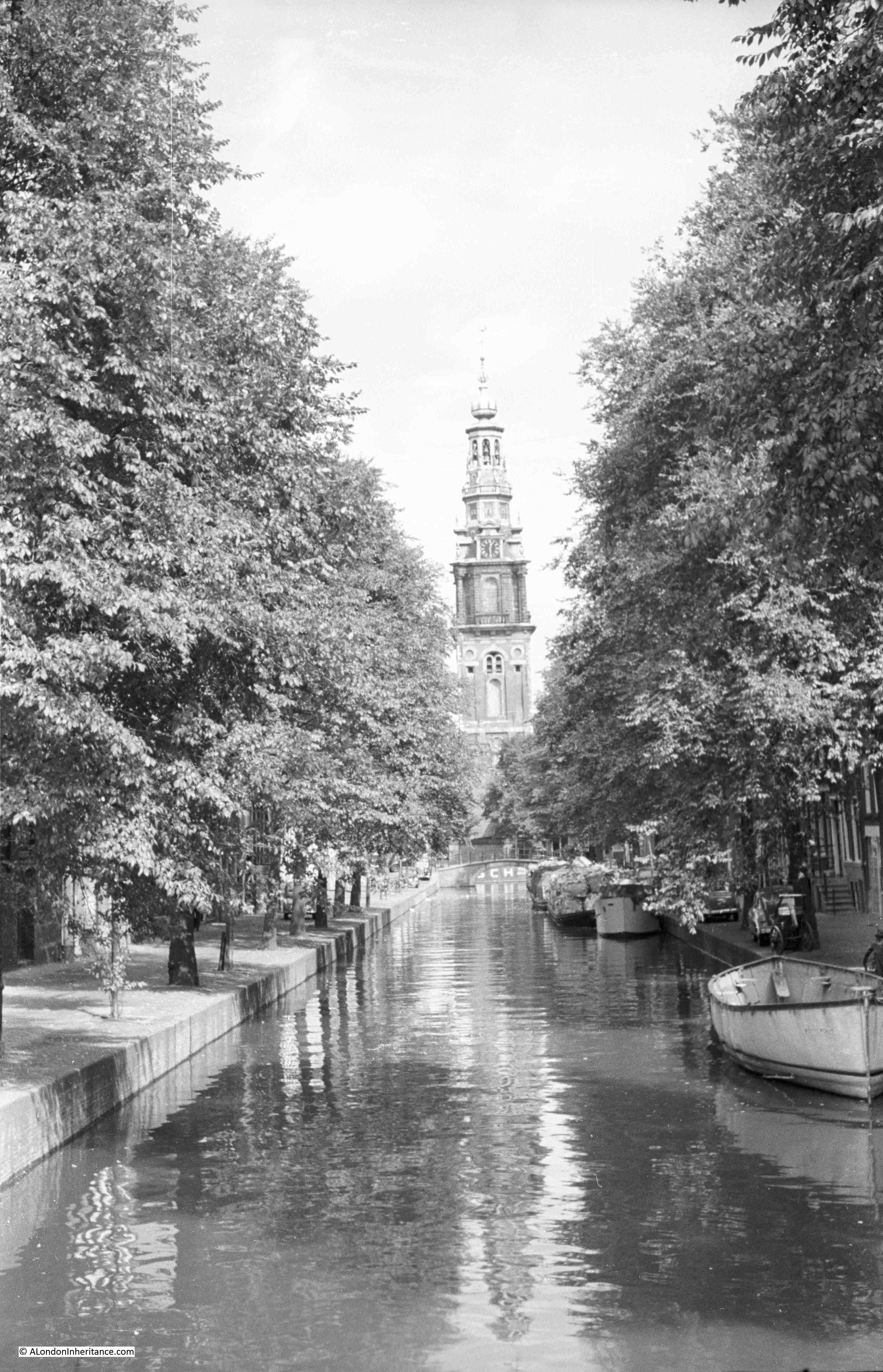
1952 above and 2018 below:
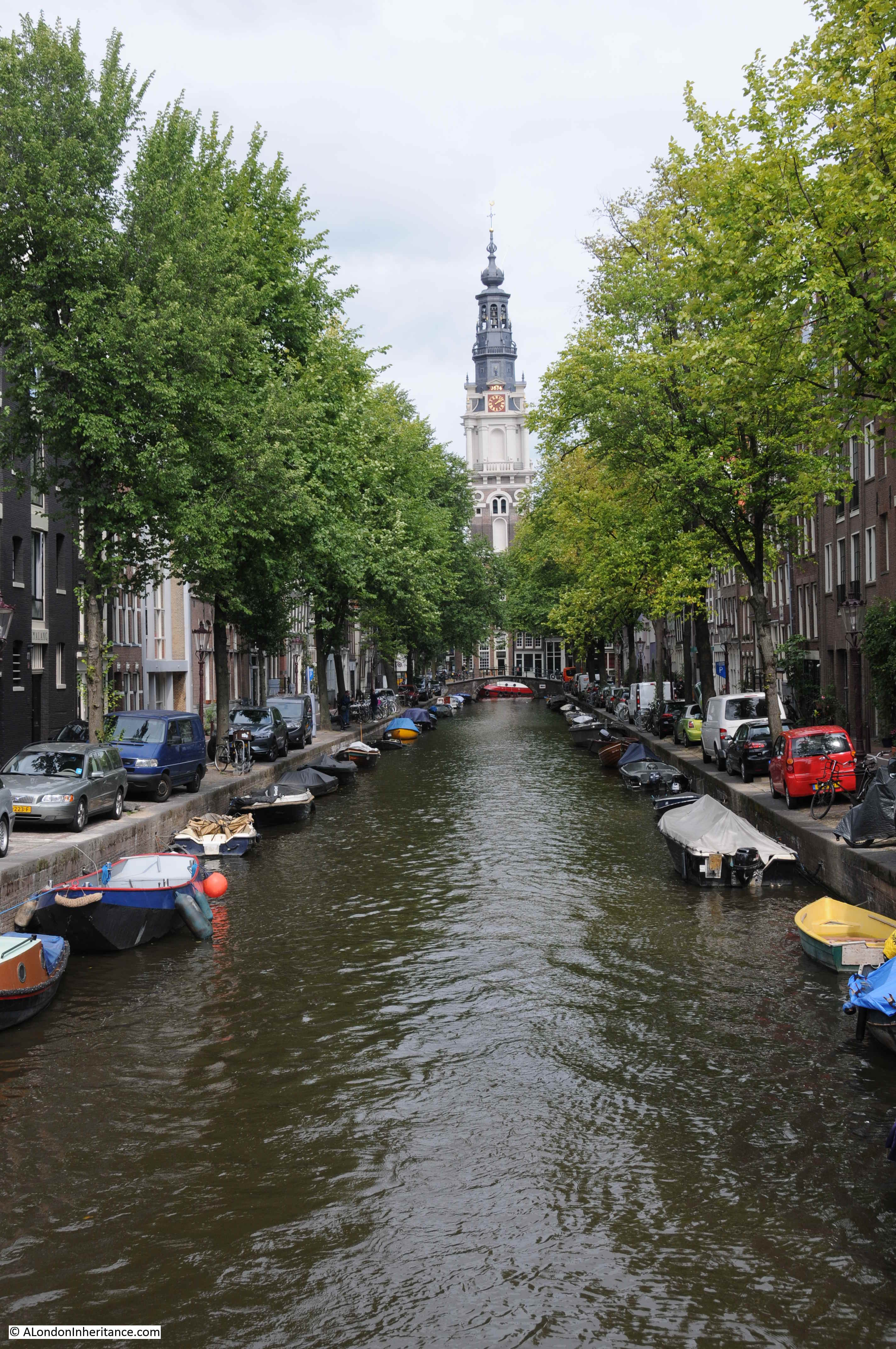
The Zuiderkerk dates from the first decade of the 17th century when the body of the church was built., the tower was completed in 1624. There was a rebuild of the church in 1657, and the church has remained much the same since.
Comparison of the two photos shows one of the differences between 1952 and 2018 that can also be seen across London. In 1952 there were few cars parked along the roads, however today there is car parking along the majority of canals – which does require some careful maneuvering to avoid ending up in the water.
As mentioned in my previous two posts on the Hague and Wassenaar, the western part of the Netherlands suffered terribly during the final months of the war and the winter between 1944 / 45 was known as the hunger winter due to the lack of supplies of food. During this time the Zuiderkerk church was used as a mortuary.
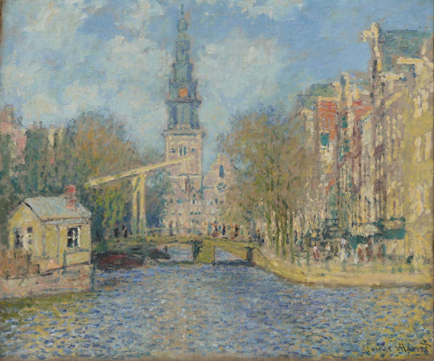
Claude Monet painted the view in 1874. The view shows the Staalmeestersbrug with the church tower behind:
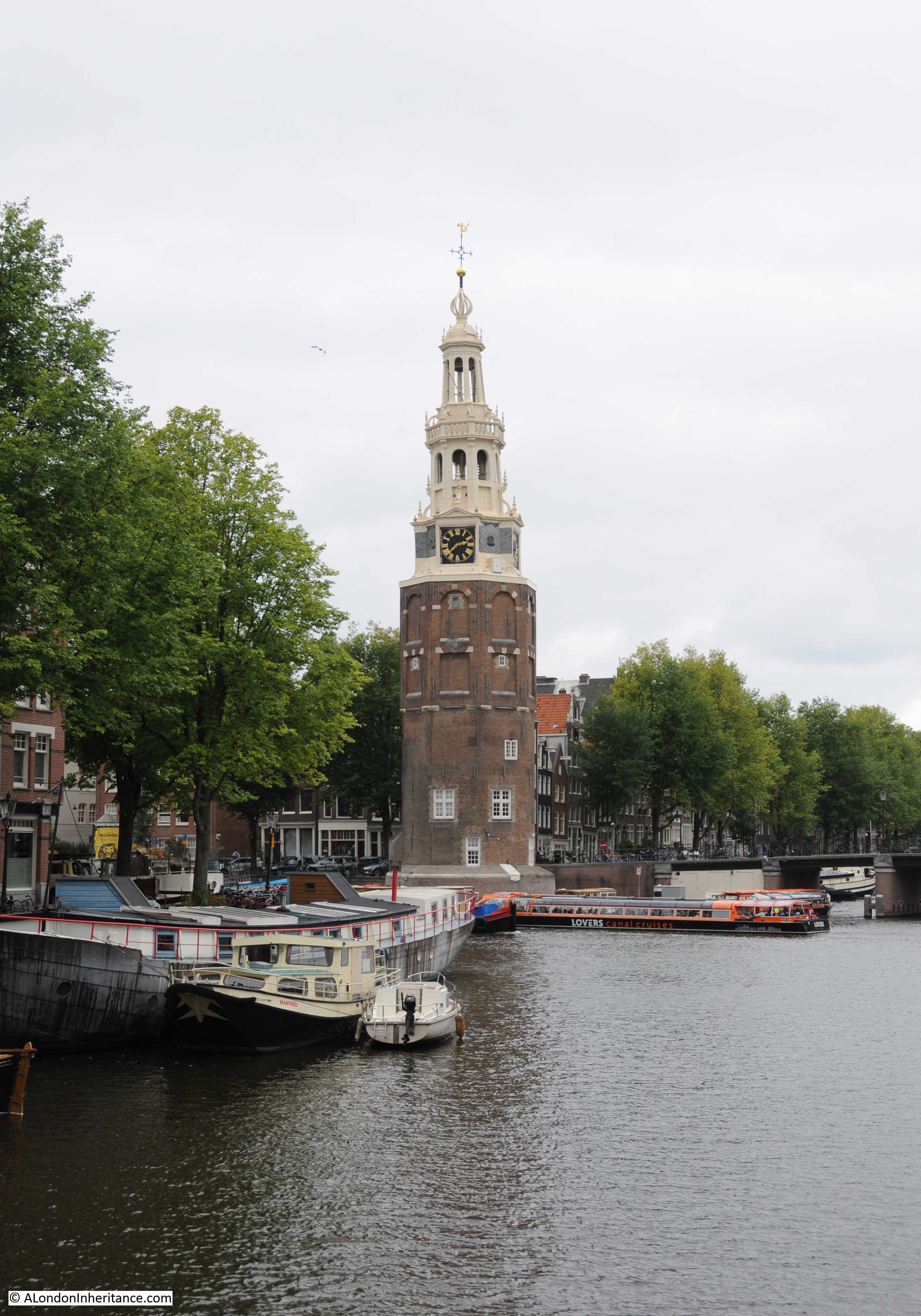
The next stop was for a view of the Montelbaanstoren at site number 4. The tower was part of the city walls. The lower part of the tower, below the clock, dates from 1516 with the upper part added in 1606.

The tower stands close to the main harbour area of Amsterdam, and at the junction of two major canals. There was a boat passing in front of the tower in my father’s photo above. Whilst I was looking at the view there was a constant stream of river traffic – the canals are still very much in use.
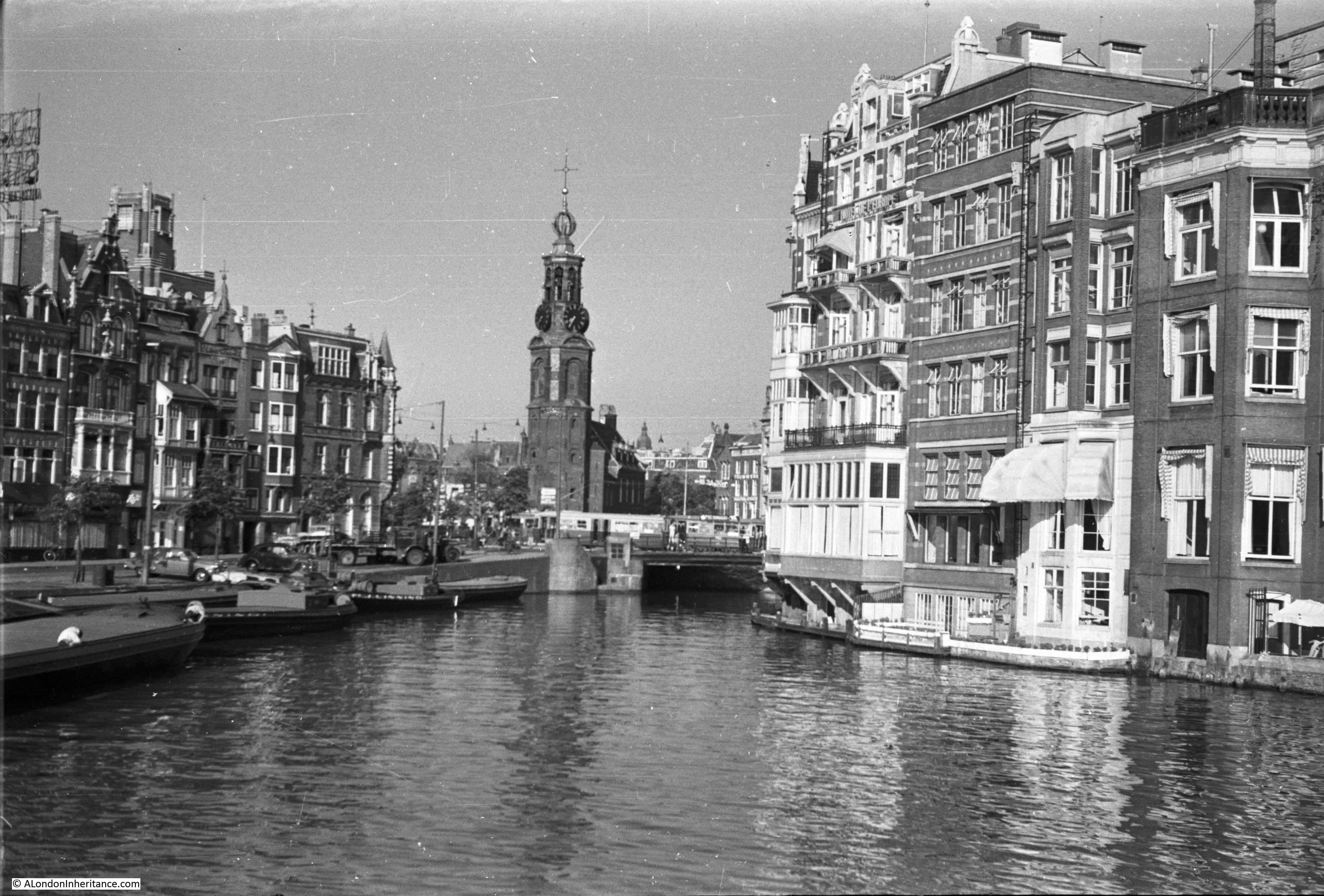
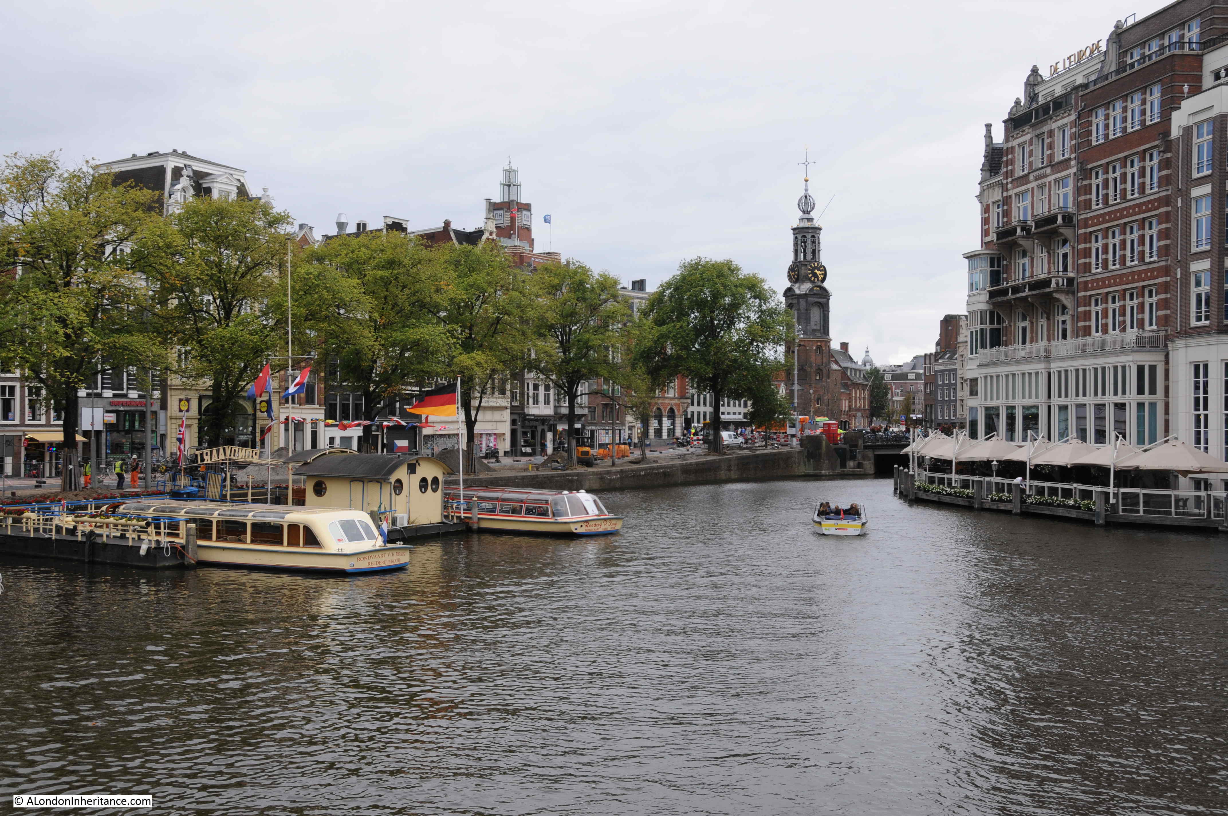
My next stop was another of the towers from the original city walls. This time the Munttoren, originally part of the one of the main gates into Amsterdam. The tower had been rebuilt in the early 17th century.
This was reached by walking to where the Kloveniersburgwal canal meets the Amstel (site number 5 on the map).
1952 above and 2018 below: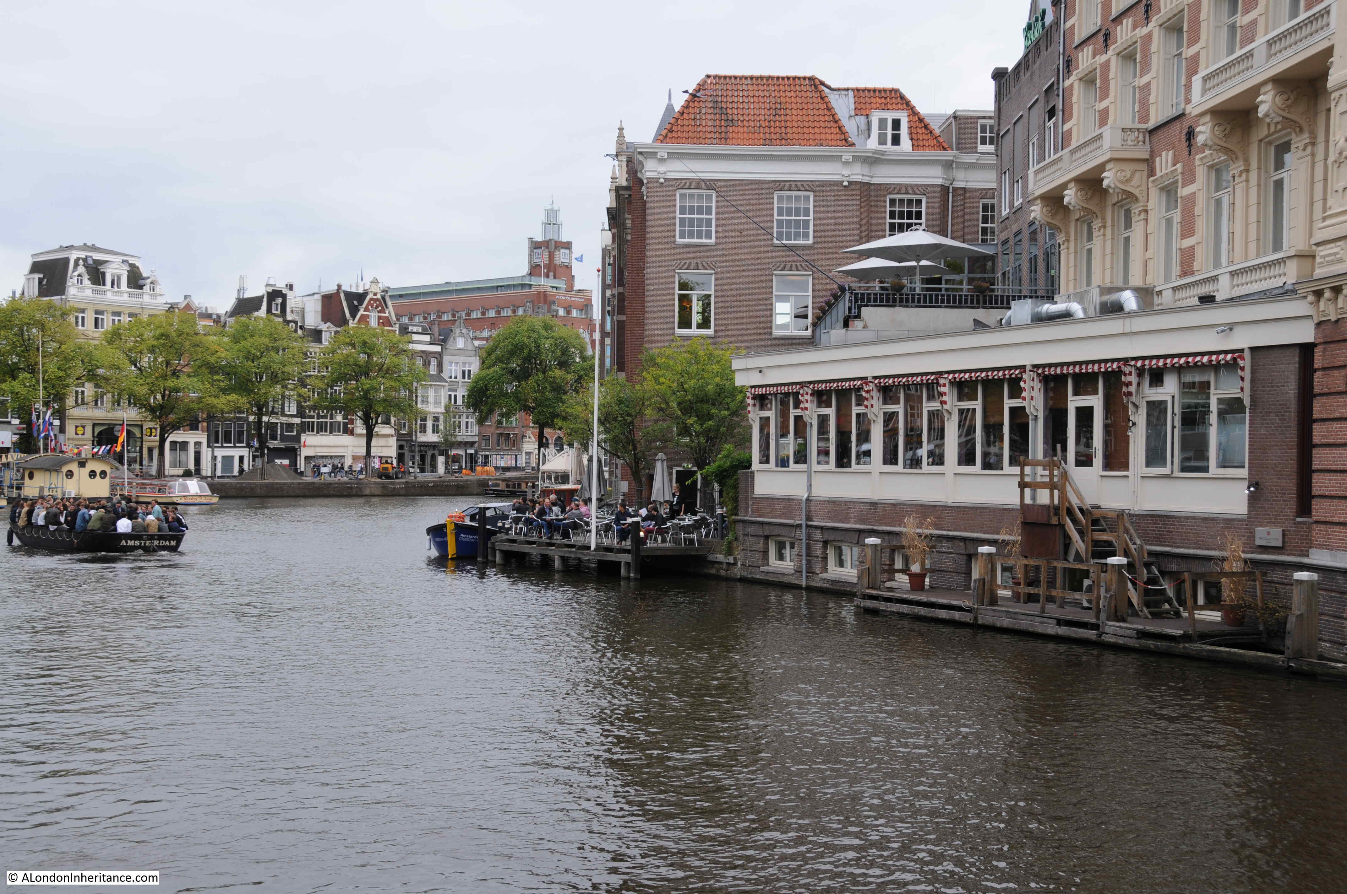
To where the Munttoren becomes visible alongside a bridge over the canal and a busy road junction:
The same view today:
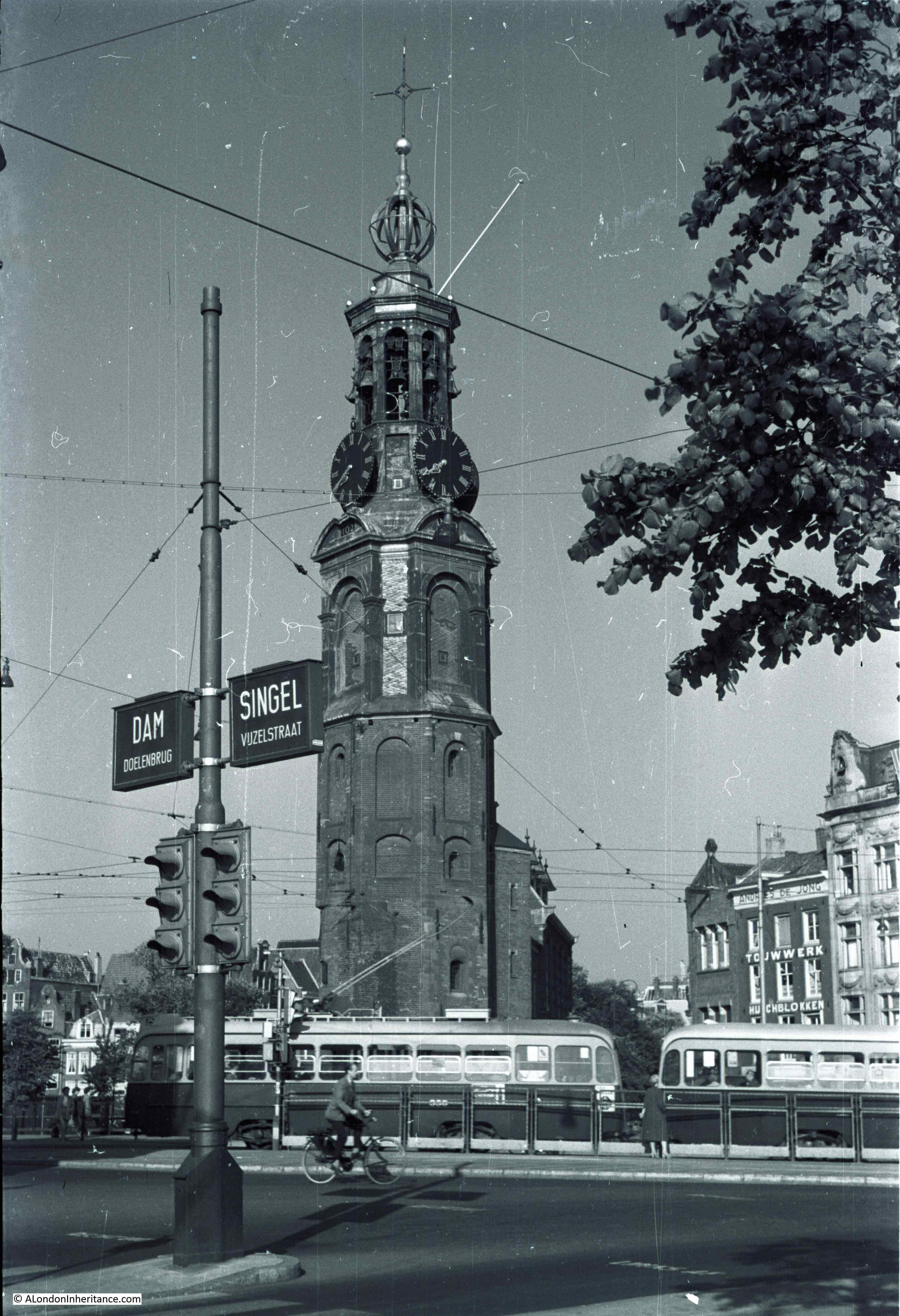
The name “Munttoren” means Mint Tower and refers to a short period in the 17th century when the guard house alongside the tower was used to mint coins.
The Munttoren in 1952 – located at site number 6 in the map:
The same view today. The tower is still alongside a busy tram route and the wires still stretch above the road, although the impressive street name sign has disappeared.

As well as the above photos, there were also a number of photos where I could not identify the location, including the following two view of canals and buildings:

During the 17th century, Amsterdam was the wealthiest city in Europe. The city was home to the Dutch East India and West India Companies that traded across the world and the Netherlands growing list of colonial conquests. Amsterdam, was also the worlds largest financial centre during this period. Wars with England and France during the 18th century would reduce the influence of Amsterdam, along with competition from other global trading companies such as the British East India Company, one of the reasons for London’s growing influence.
The buildings that line the canals reflect this wealth and were a mix of merchant houses, town houses, workshops and warehouses.
The mix of architectural styles is fascinating. The buildings are typically narrow, but tall to maximise the amount of available space within the building on a small plot of land.

The buildings alongside the canals are much the same today, although generally in better states of repair. I came across this wonderful jumble of buildings which look to be falling apart from each other:
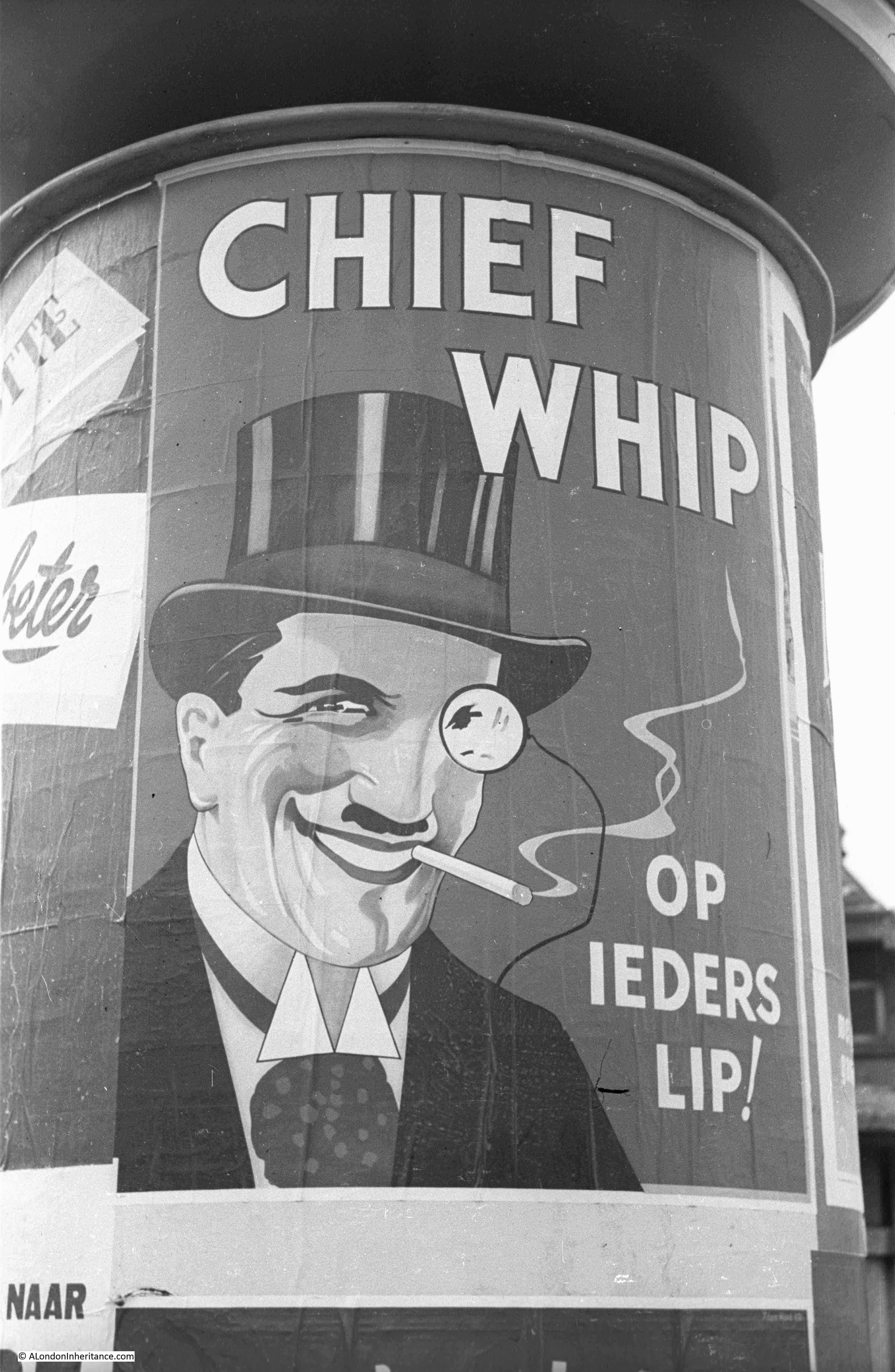
One of my father’s photos was of this canal side scene:
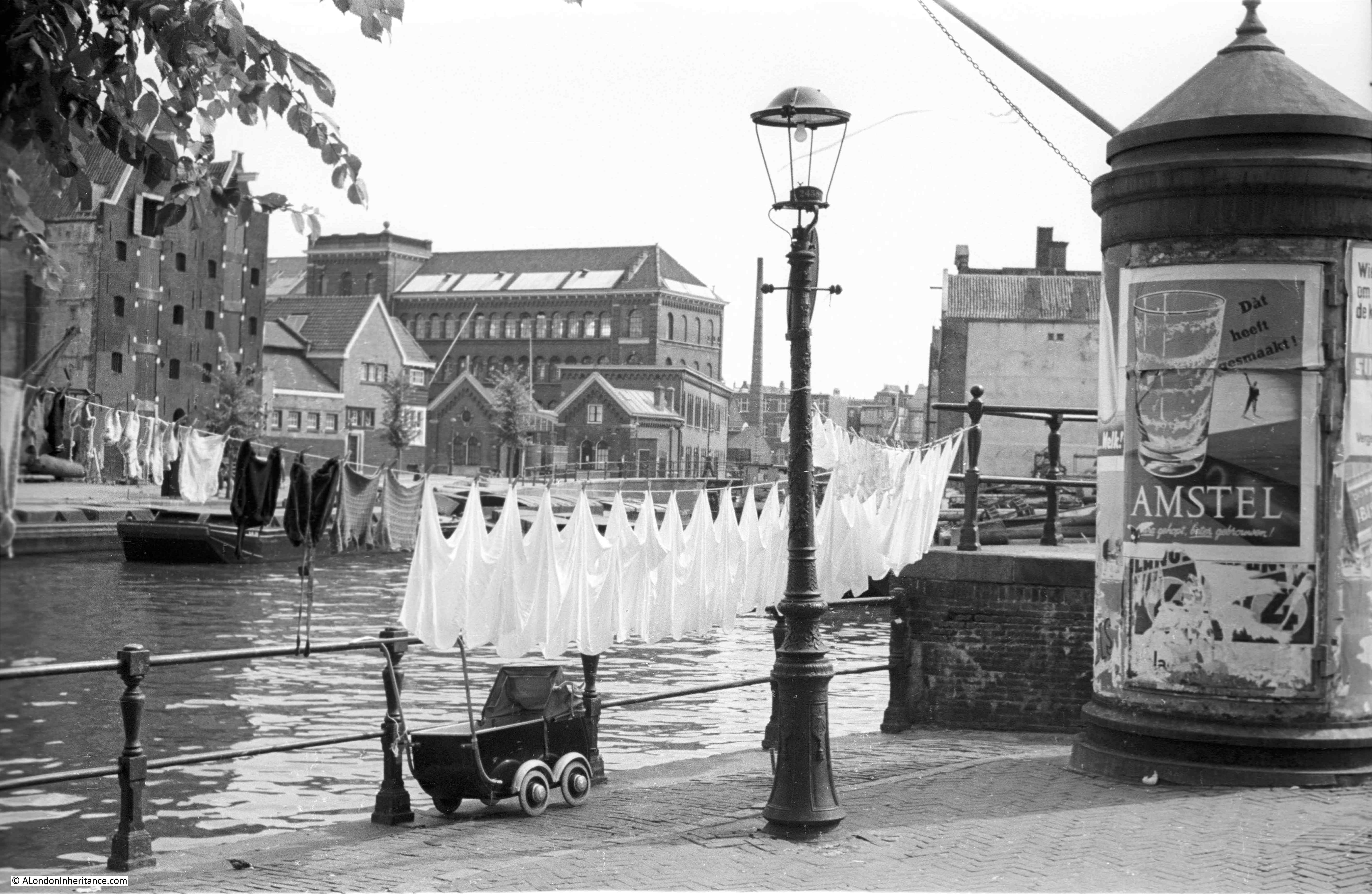
The circular panels for advertising are still a feature in Amsterdam today. The Dutch Amstel beer in the poster above and below, the Chief Whip cigarette brand – “On everyone’s lip”.
Water is inextricably linked with the history of Amsterdam. As with London’s relationship with the River Thames, it is the reason why Amsterdam is where it is, and access to water and the open sea was why Amsterdam grew to be such a major trading city, at times rivaling London.
The origin of the name is from the Dam built across the River Amstel, believed to have been where Dam Square is now located.
Walking around Amsterdam today, there is a more defined separation between the inland canals which seem mainly to be used by tourist boats, and the docks which are located on the large waterway which runs from the North Sea via the North Sea Canal to the large waters of the Markermeer and Ijsselmeer.
In 1952, boats to transport goods within Amsterdam, and throughout Europe via the canal and river network, could be found across the city.
However scenes like this can still be found alongside most canals, however with cars now lining the boundary between road and canal.
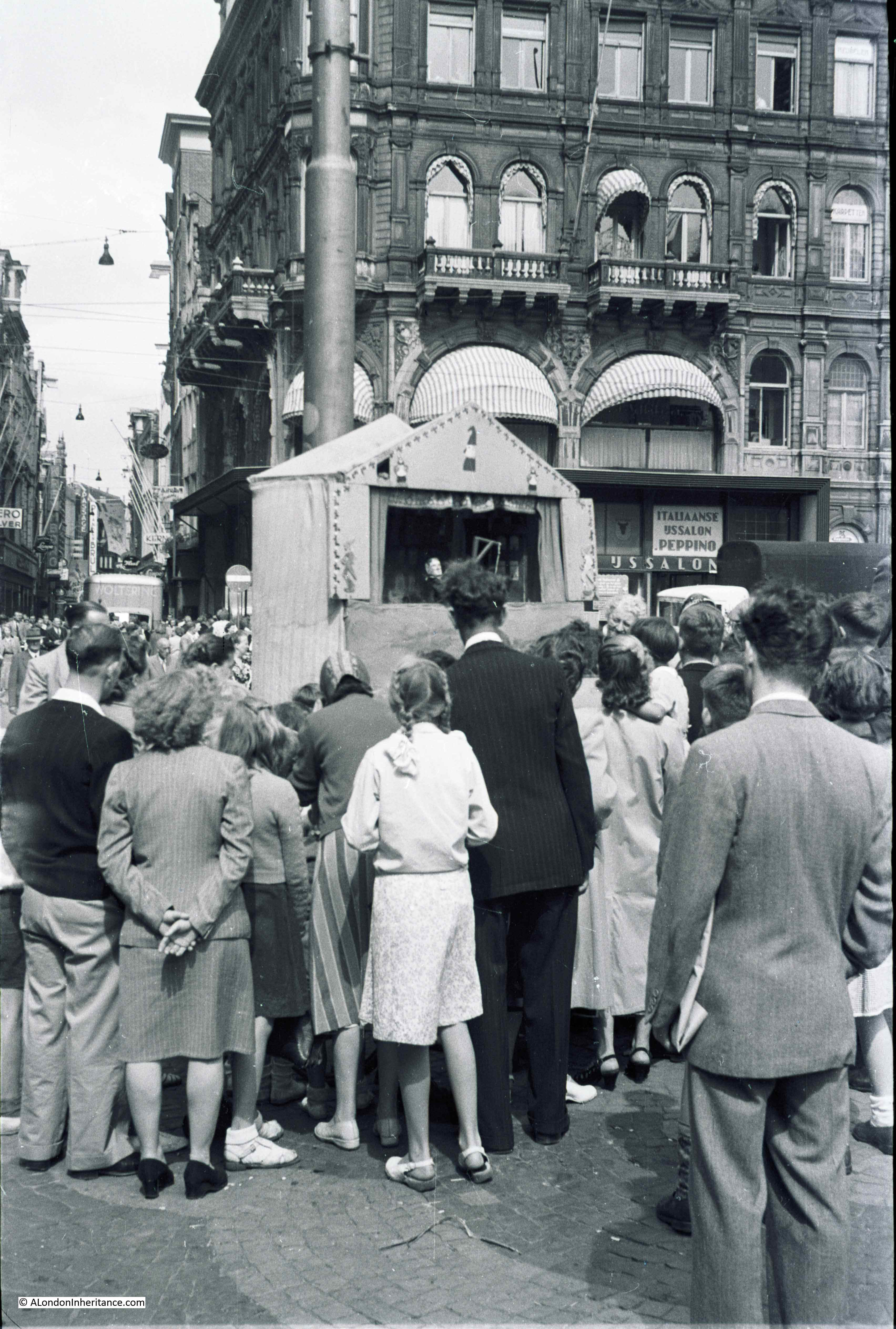
I tried to find the location of this Punch and Judy show by looking for the large corner building in the background, but with no luck,
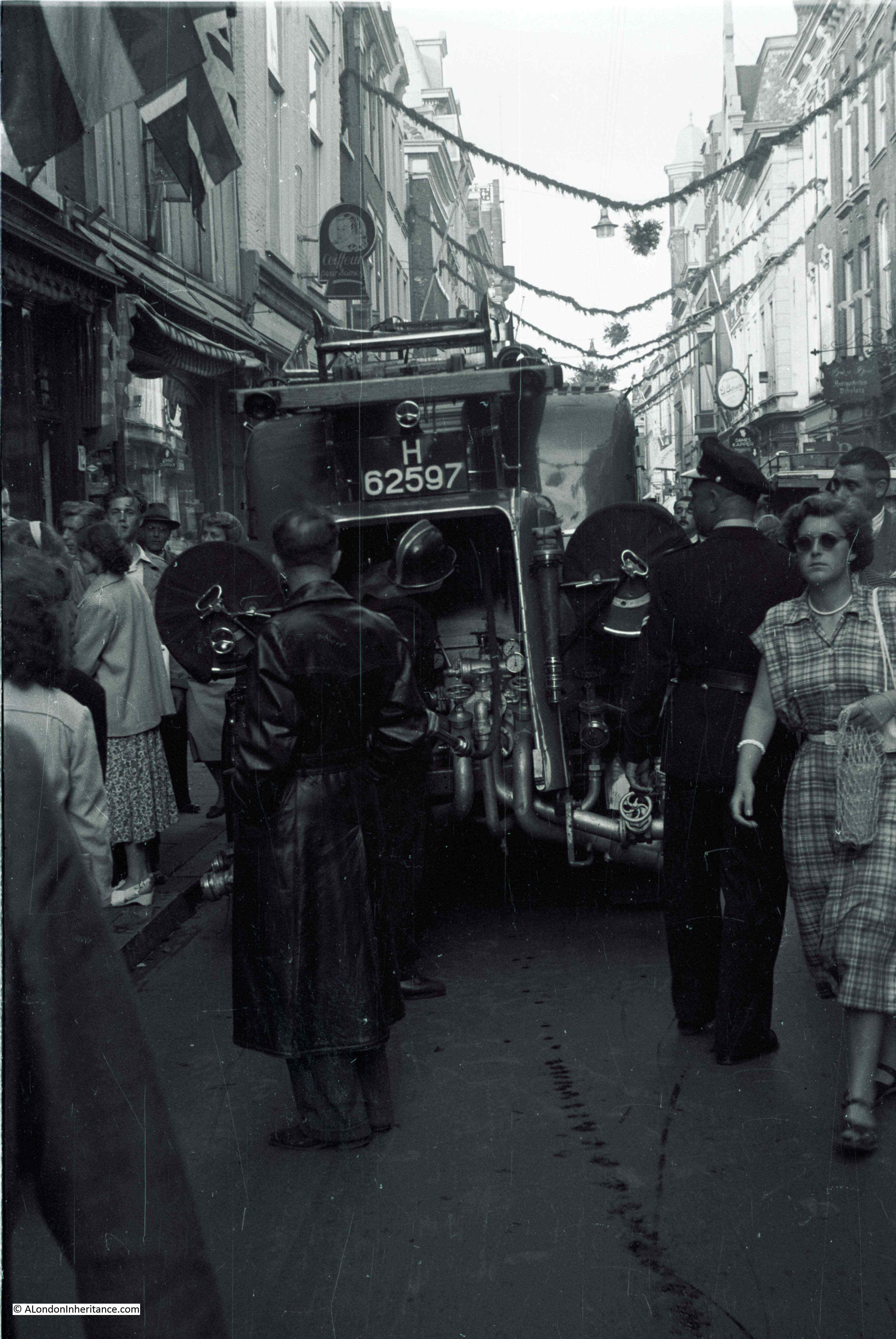
I assume that with the pipework on the rear of this vehicle, this is a fire engine threading its way through the narrow, crowded streets.
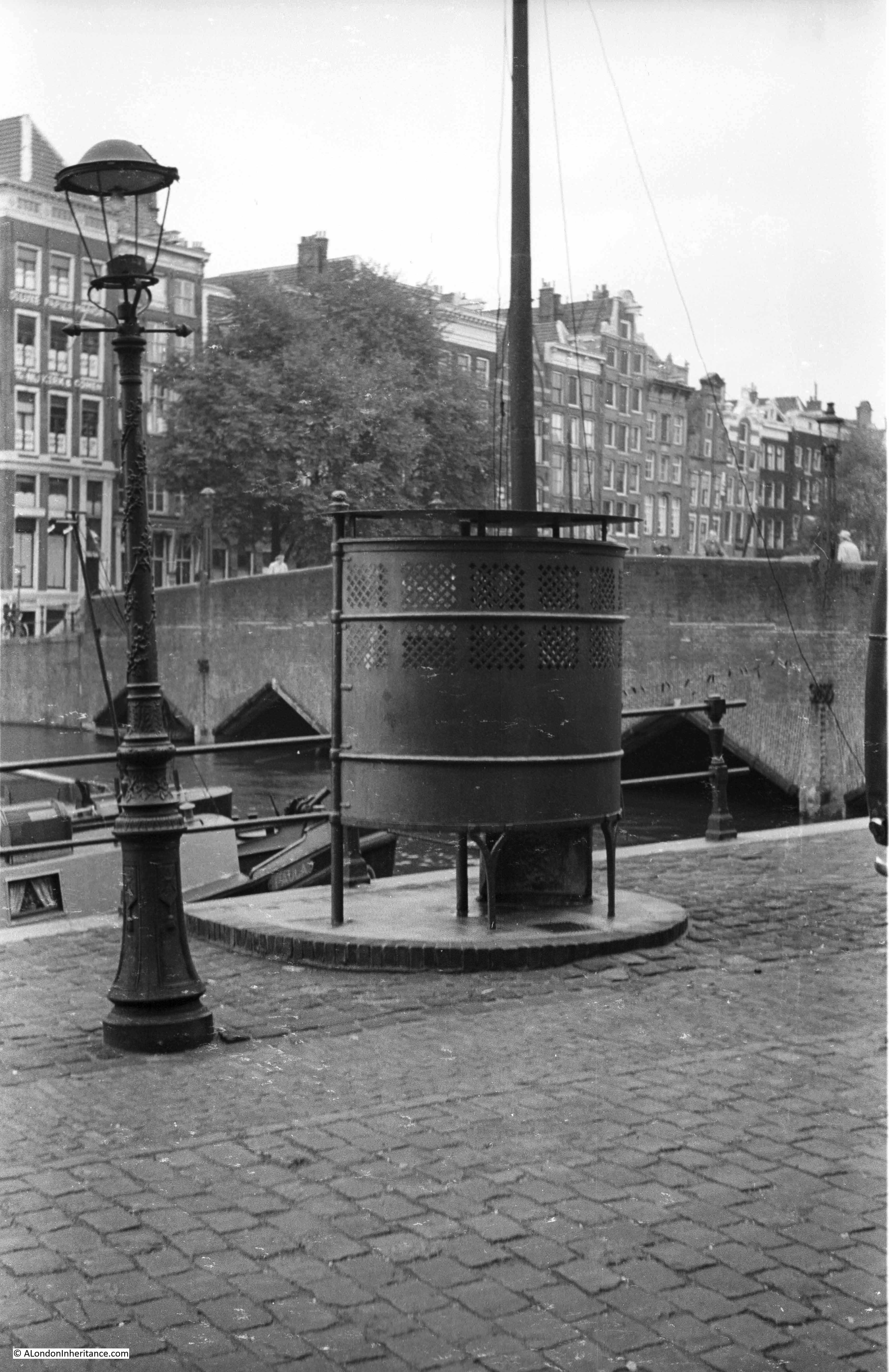
Street urinal:
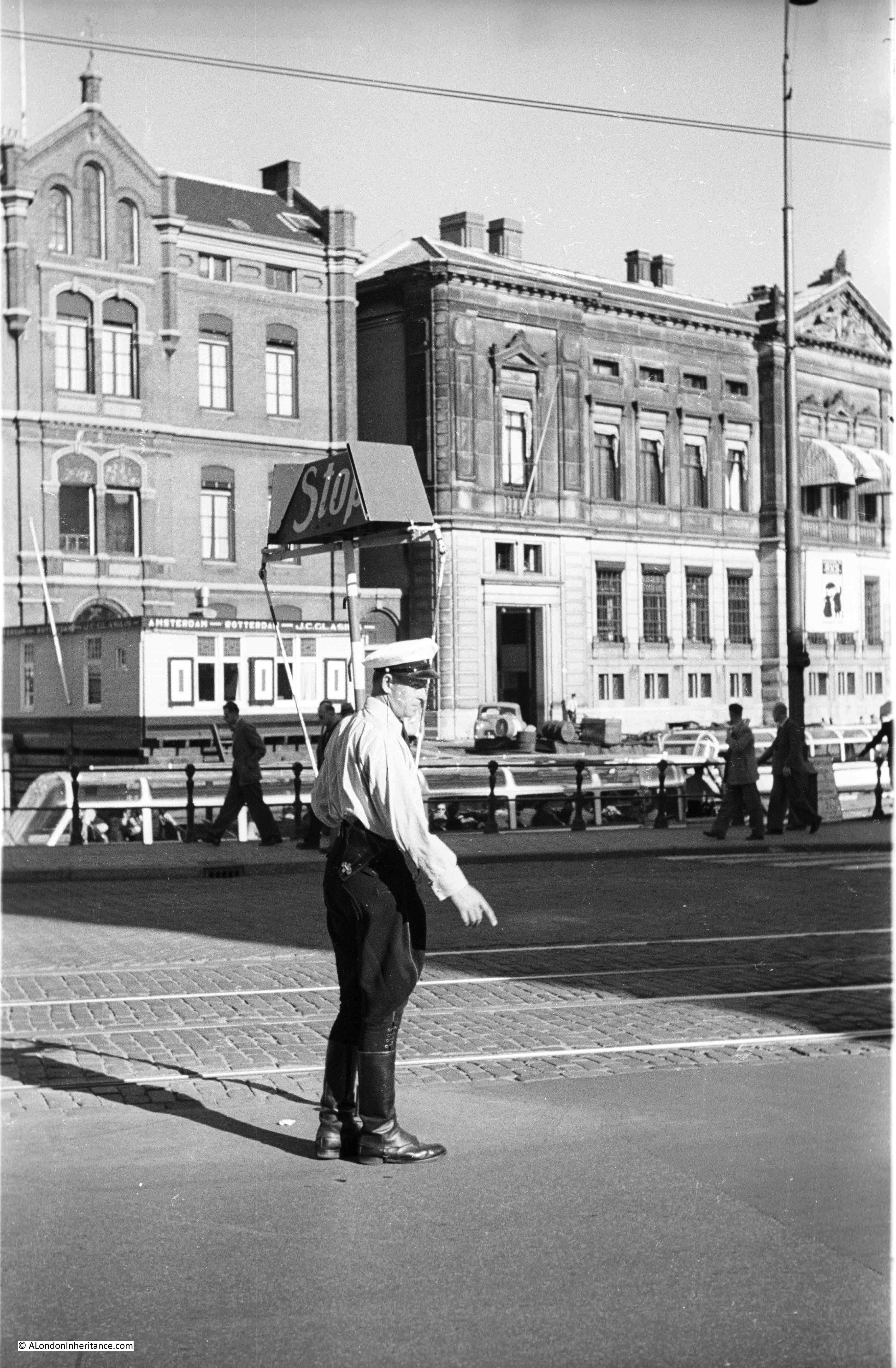
Traffic control:
I am really not sure where the following photo was taken. It is on one of the Amsterdam negative strips, and appears to show an entrance to something below ground, I would normally think this was to an underground railway. Amsterdam does have an underground railway, however it did not open until the 1970s, long after this photo was taken.
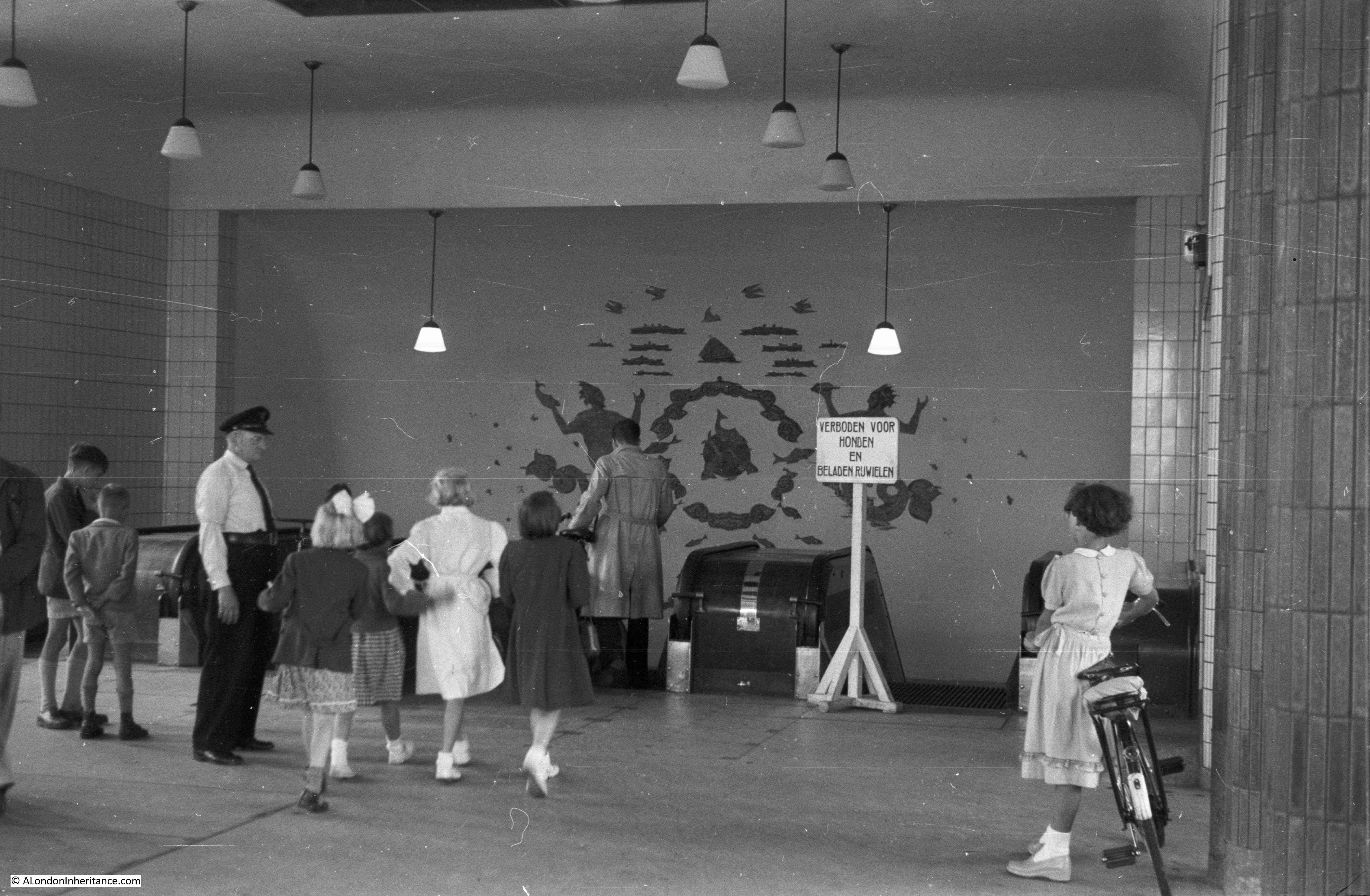
The mural on the rear wall has a number of different types of ships at the top, with symbols of fish below and possibly Neptune on either side. The sign reads “forbidden for dogs and loaded bicycles”. There is a small chance that the above photo was from Rotterdam if some of the negative strips have been muddled over time, but the rest of the photos on the same strip are from Amsterdam.
As with London, Amsterdam is best seen on foot. The historical centre of the city, with some imagination and by ignoring the parked cars, retains the feel of the 17th century city.
With a few exceptions, the majority of later development seems well planned. The majority of new building is outside the centre with considerable new building towards Schiphol airport.
The tourist hot spots are crowded, there is the red light district and the cafes where soft drugs are legal and readily available, however turn away from the main streets, and as with London, there is so much more to explore – and water is never far away.
Ref the last picture: did your father ever go to Antwerp? There’s a foot tunnel under the river there.
I look forward to every posting of your blog.
I found an additional way to enjoy Amsterdam’s architecture is from the top deck of one of the city tour buses. We visitors do not appreciate the breadth of architectural styles, especially Art Deco, when at street level – as we’re dodging other tourists or bikes. It’s especially useful for spotting good buildings along the Damrak, which IMO is now hideous at street level, spoiled by drug paraphernalia shops once the chain clothing stores run out.
Thanks, as always. A terrific Sunday morning read.
Good evening. That first mystery photo was taken either from a boat or from across the water from 7 Amstel. Where that attractive building with the cars parked in front once stood is now a large and ugly beer emporium but the bridge and the church tower is still clear to see. I thought it looked familiar as I had been there some years ago.
I tried to send a reply but it seems to have disappeared. The two views that you could not identify were – first one shows the view looking to 7 Amstel where there is now a large beer emporium instead of the building with the cars in front and the second is a view of Staalkade where it turns into Groenburgwal. I think both were taken when on board a boat. That was fun!
And the Punch and Judy is on Dam Square, looking up Nieuwendijk. Practically unchanged. Thanks to google street maps and my general nosiness.
I thought those would be solved quickly!
This a nice way to look at the city. The last photo with the traffic sign (traffic control) is at the Rokin looking across to Oude Turfmarkt. The building on the right hand is now the Archaeological Museum.
The photo with the stone brick bridge and the urinal is taken on the Oude Waal looking out to Binnenkant. It is brug 283 and was built in 1914 by the same architects who designed the nearby Scheepvaarthuis. See: https://nl.wikipedia.org/wiki/Brug_283
The first unknown location is indeed at Amstel-Waterlooplein where on the right is now the city hall and what I would call a cafe. The bridge ends at the left in the Staalstraat. If you walk a little further you will come to the Staalmeestersbrug.
The last picture with the escalator is probably in Rotterdam: the entry for cyclists and pedestrians to the Maas (river) tunnel. A lovely old wooden escalator and beautiful 1930s decorations.
I always enjoy reading about your walks and this one is very interesting. If I could point out one minor error, though – the picture headed: “Stopping in Leiden Station and looking down on the platform from the upper deck” is actually Haarlem station. It has very distinctive platform structures and is difficult to confuse with other stations on the NS network (you can also just see a platform sign with that name). I could also mention that the tram overhead in front of the palace is unlikely to be the same as in your father’s picture as this often gets renewed.