A recent birthday present was some tickets to go up Lift 109, the lift that goes up one of the chimneys of Battersea Power Station to get a view from the top.
This blog is not usually about this type of place to visit, but I love a high view of London, and I have not been to Battersea Power Station since it opened following many years of reconstruction.
The blog is about how London changes and adapts, so that does give me an excuse to show the fantastic view from the top of the chimney, and to look at how the old power station has been transformed.
To start the sequence of change, here are a couple of photos taken by my father in the early 1950s showing the majority of the power station complete, with just the final south east chimney to be built (from this post back in 2015):

A 2014 image of the power station, from the same viewpoint as the above photo, with the gas holder still on the right, which would soon be demolished:

When the early 1950s photos was taken, the power station only had three chimneys. Power stations are frequently built using a modular approach so that the site can start generating electricity as soon as possible and capacity added when there is sufficient demand and an economic justification. This approach was used in the 1930’s and continues to this day.
Battersea “A”, the first phase of the power station consisted of the right hand side of the building as seen from the north bank. Construction of this part of the building started in 1929 and the station was operational soon after. The Sir Giles Gilbert Scott brick exterior work was finished in 1933.
Work on Battersea “B”, the left side of the building commenced in 1944 with the fourth chimney completed in 1955 when the power station reached the configuration that was to last until closure.

The same view in 2015:

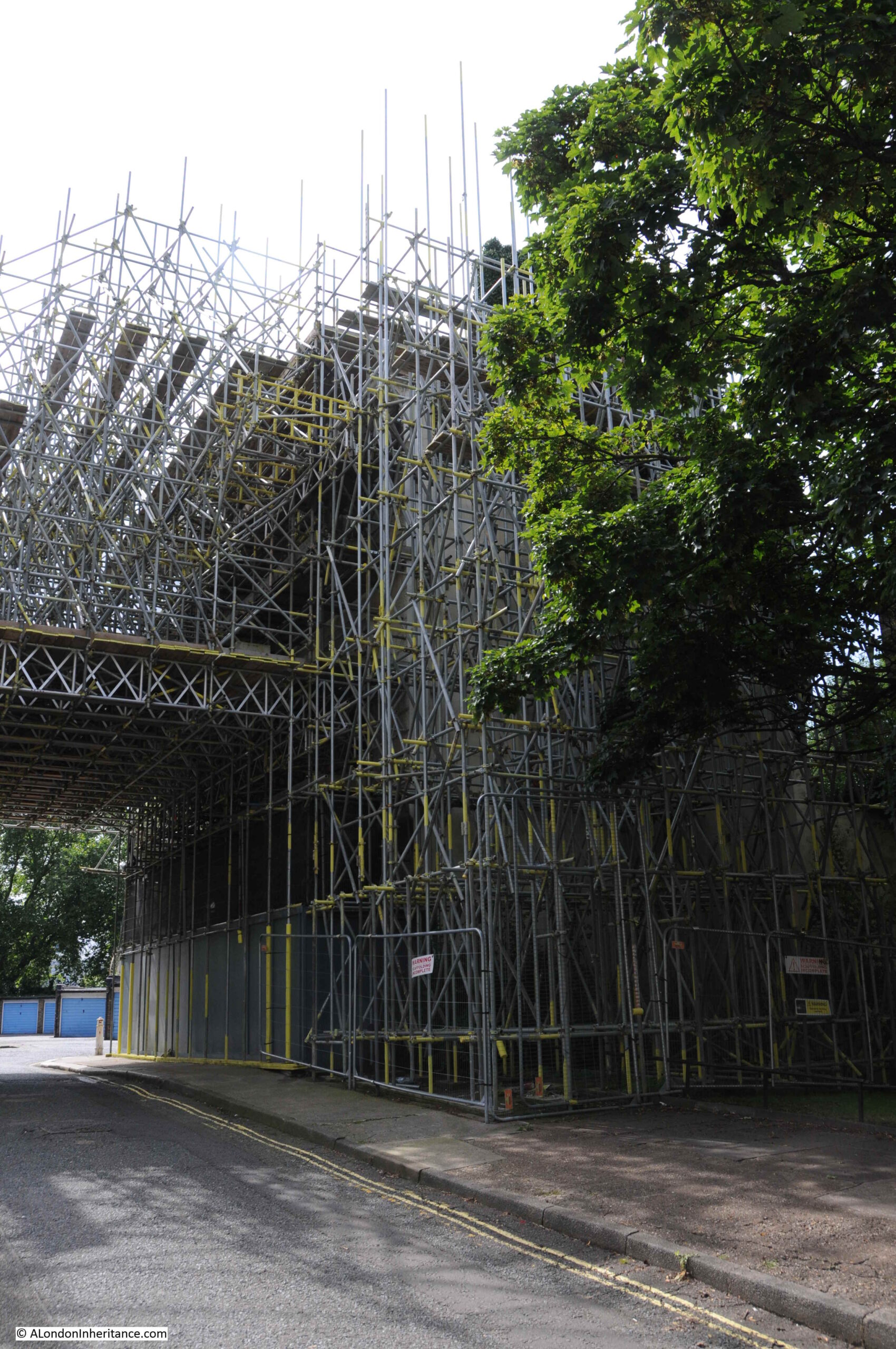
In the above photo, the south west chimney has been demolished. The chimneys were considered unsafe and not easy to strengthen and repair, therefore all four chimneys would be demolished and rebuilt, using new materials, but to an identical design so the visual appearance of Battersea Power Station would be the same.
In 2016, the new south west chimney had been built, and the other three had been demolished:

In the above and below photos you can see the new apartment buildings under construction between the power station and the railway line to Victoria Station:

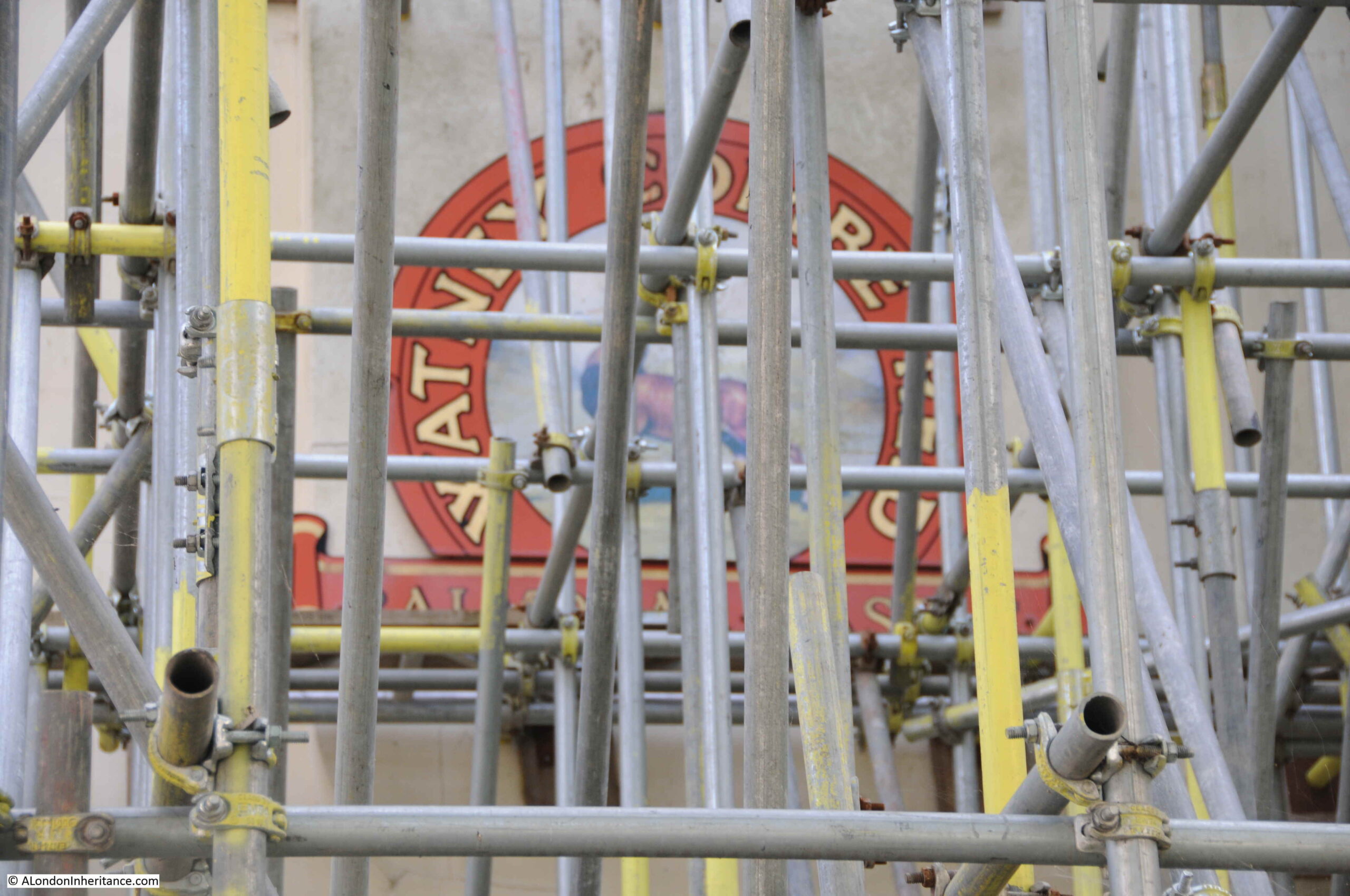
In the above and below photos, you can see through into the interior of the power station, which at the time was a hollow shell:

I have loads more photos showing Battersea Power Station as was, but cannot quickly find them. I have tens of thousands of photos, all stored in folders dated with when I copied or scanned the photos to the computer – not at all efficient for finding a specific place.
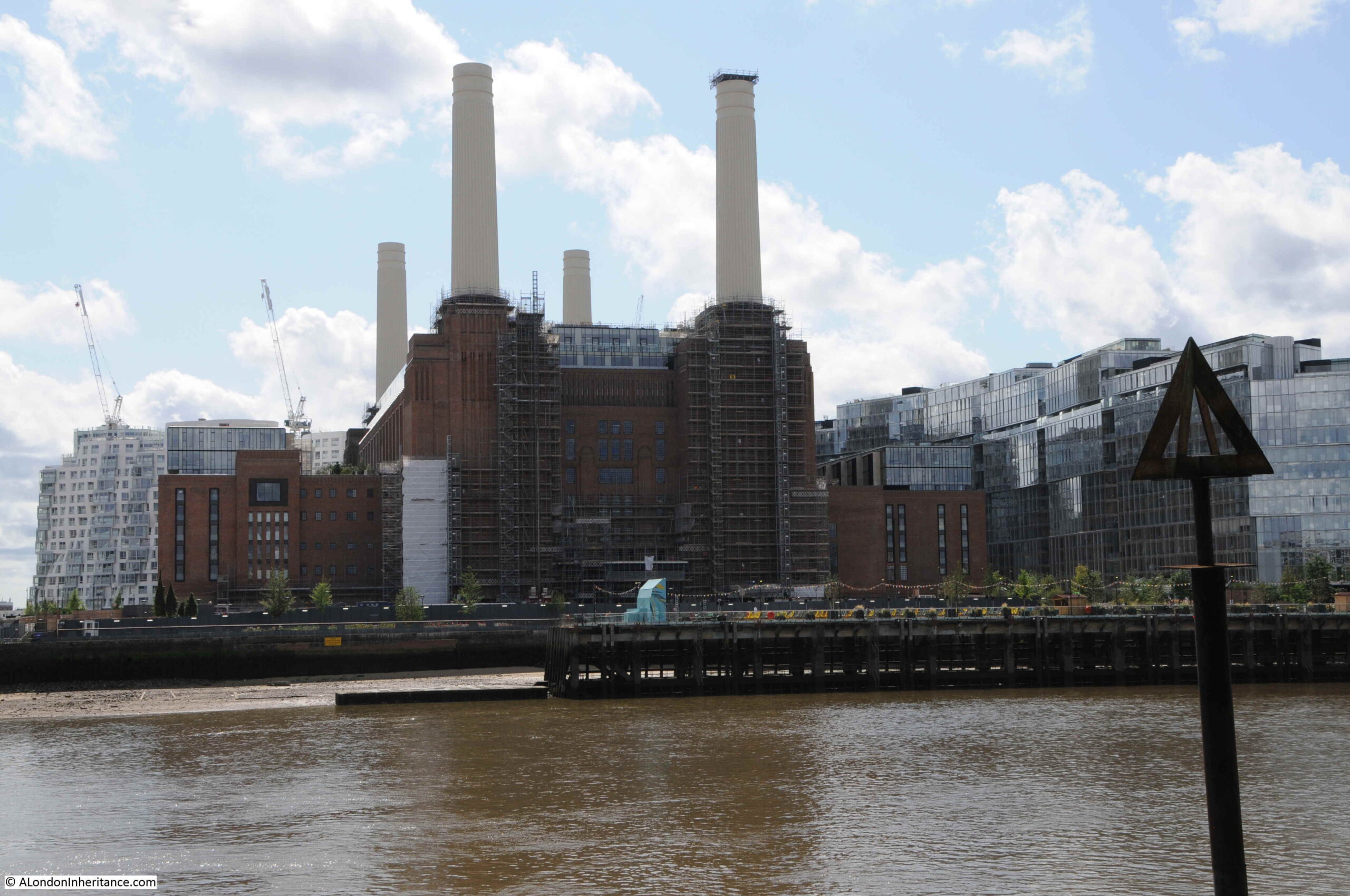
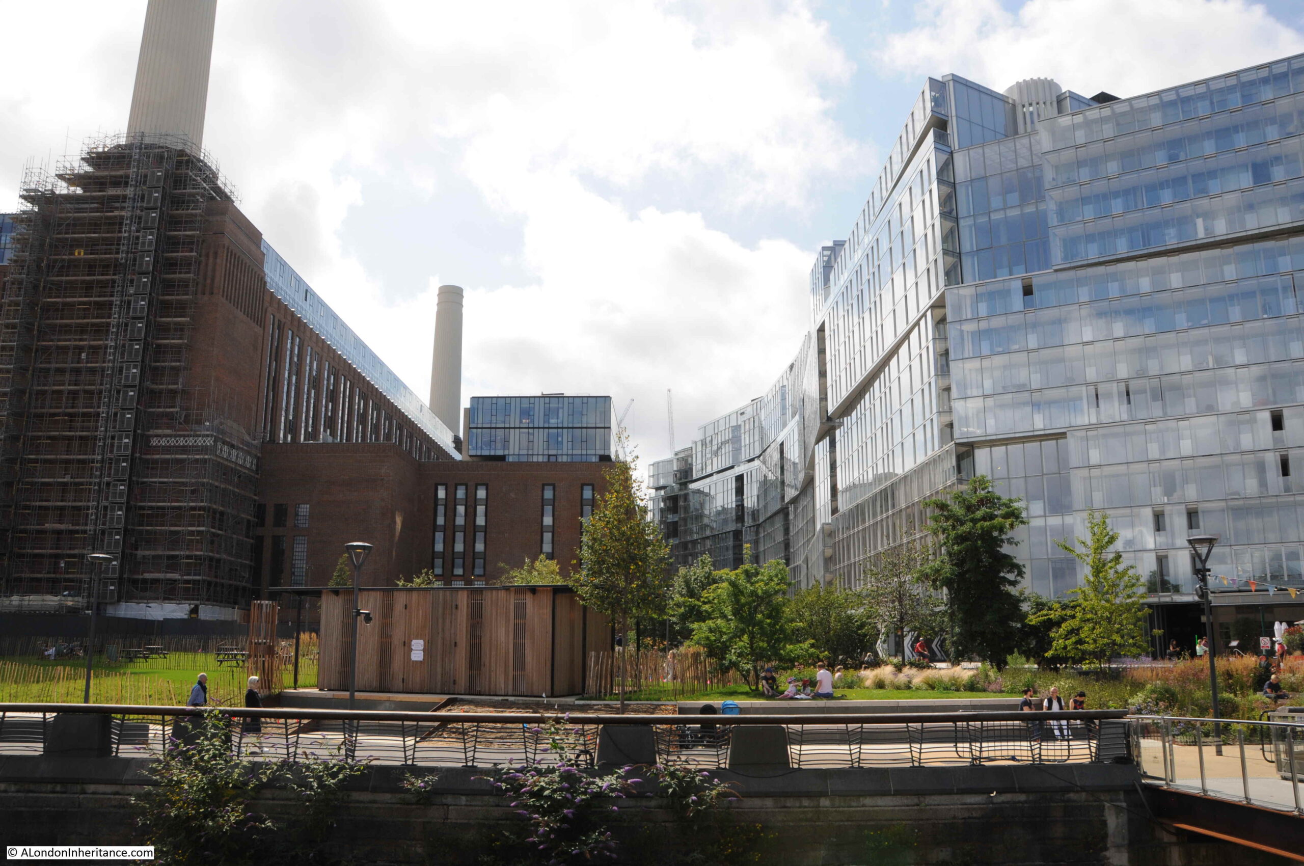
Fast forward though to March 2025, and this is Battersea Power Station today (taken from alongside the river at Battersea, the fourth chimney is there, just not from this perspective:

Time to head to the top of the chimney, and the viewing platform can just be seen at the very top of the chimney on the right of the front of the power station in the photo above.
The lift is branded as Lift 109 as it takes you 109 metres up. Passing through the ticketing area, there are several displays about the history of the power station along with a few relics from the control room where you can pretend to switch electricity to parts of London once served by the station.
Then up a lift and 39 steps to the base of the chimney, where you get in the glass circular lift that takes you to the top and just above the chimney:
At the top:

I had been waiting to book the visit for some guaranteed sunny weather, and when the sun was in the south and highest in the sky, and on reaching the top, the view really did not disappoint. Looking east along the Thames, with the edge of the chimney at the bottom of the photo:

I find high view points fascinating for a number of reasons:
- They provide a view of the layout of the wider city that you cannot get a street level. The way the Thames curves on its route through the city and the way the Thames has created low ground occupied by the city, surrounded by high ground to the north and south.
- The distance and relationship between landmarks looks very different when viewed from a height rather than at street level.
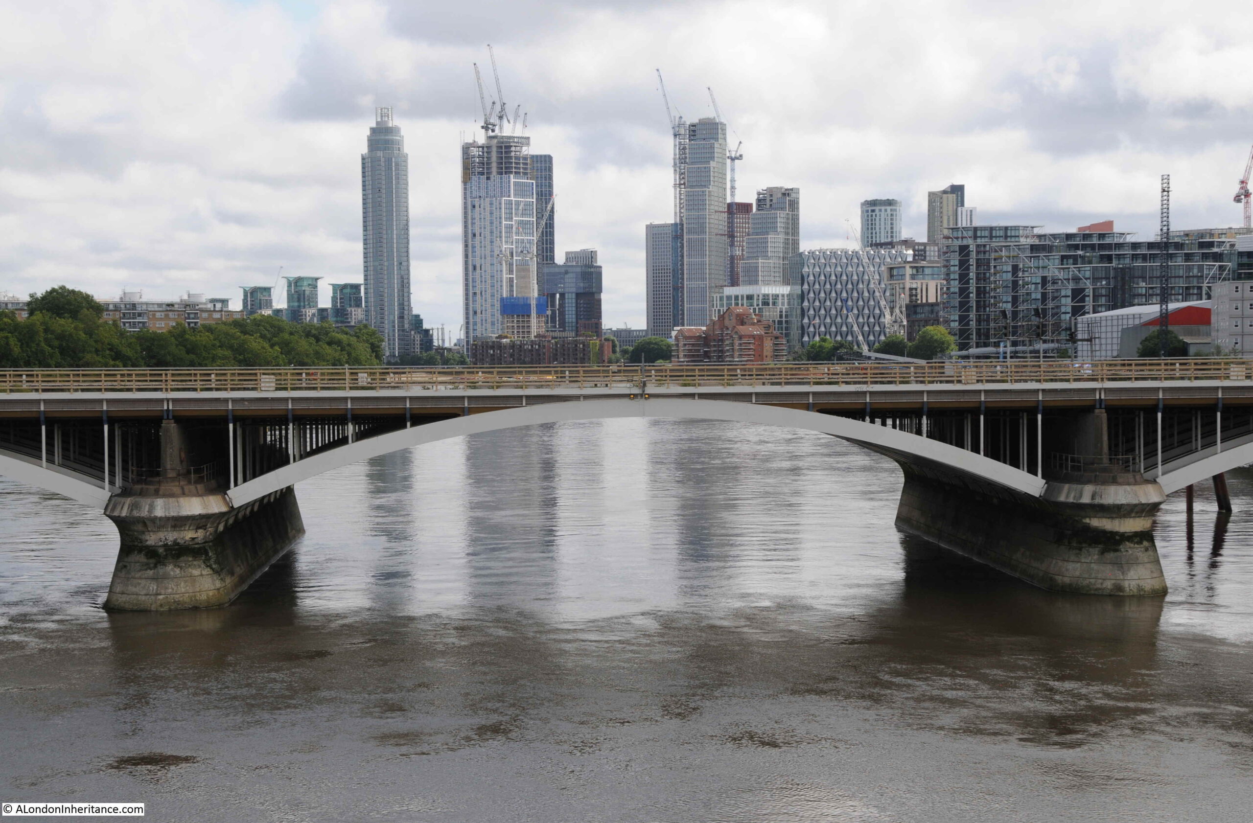
- How the height of the city is changing. From ground level it is often hard to appreciate the number, clustering and relative height of the buildings that are springing up all the time – for example in the above photo the new apartment towers in Vauxhall can be seen along the Thames on the right.
- Despite the height, small details can be seen, including their relationship with the surrounding landscape – there are some examples of this in the photos below
In the following photo, the eastern end of the Churchill Gardens estate is in the lower left corner, and up a bit on the left is the red brick Dolphin Square estate. The tower on the right of the photo is the St George Wharf Tower, the first apartment tower built in Vauxhall. This tower blocks the view of the towers on the Isle of Dogs around Canary Wharf, a few can just be seen to the left of the tower. On the left is the Walkie Talkie building, then the Shard and in the semi-foreground directly below the Shard is Millbank Tower:

A bit to the right, and more of the Vauxhall towers appear:

Then with more of the Vauxhall towers, we get the south west chimney. The American Embassy is in the left-middle of the photo, the building with the ornate decoration across the whole of the façade:

View to the west – a very different low-rise view. Chelsea Bridge crosses the Thames and Battersea Park is the open space on the left:

Royal Hospital Chelsea:

In the river in the above photo, just to the right of the barge with the crane, is one of the Thames Tideway (super-sewer) work spaces, built into the river. Work is now complete, and the work space has been transformed into an open space accessible from the path along the embankment.
The workspace covers the deep shaft that is below the surface down to the sewer, and it was one of the drive locations for tunnelling, and is now one of the combined sewer outflow interceptor points, where sewer flows will be diverted into the new tunnel.
The view from above shows an interesting relationship between this new space and the Royal Hospital, as it appears to be at the end of the wide drive up to the centre of the Royal Hospital, and terminates this drive, in the river (although the busy embankment roads are between).
This new space is now open, and according to the project’s website “Parts of the new space here will be ‘floodable’ at high tides, giving Londoners the first opportunity of its kind to dip their toe in a cleaner River Thames.” I think I will wait a while before dipping my toes in the river.
View to the south, with the southern two chimneys of the power station:

In the above photo, there is a glass roof in the middle of the core part of the power station. This is above an atrium which is part of the 500,000 sq. ft. of Apple’s London offices. Along with Apple, there is other office space, including flexible rent space. Surrounding the top are apartments.
There is currently a two bedroom apartment in the power station for rent at £7,000 per month.
To the south east of the power station, there is still open space, which will presumably be home to new apartment buildings in the coming years:

Views to the south were challenging for the camera, as the sun was very bright. I was looking for the 719 feet Crystal Palace transmitter tower, and by chance it appeared in the left of one photo. If you watch free to air TV or listen to VHF FM or DAB radio in London, your signal is almost certainly coming from this tower:

Looking back to the east in the following photo, the Barbican towers can be seen in the background on the left, in front of which is the Shell Centre tower on the Southbank, and just below the Shell tower is County Hall. In the middle is the Southbank Tower at 55 Upper Ground, and to the right of this is One Blackfriars, with its distinctive bulge half way up the tower:

Moving slightly to the right, and the old NatWest tower in the City appears to the right of the following photo. Slightly to the left of this tower, and between two smaller towers is the brick tower of Tate Modern, the old Bankside Power Station by Sir Giles Gilbert Scott, who was also the Consultant on the exterior design of Battersea Power Station – London’s two great brick cathedrals of power:

The London Eye and Palace of Westminster, with the Victoria Tower on the right and Elizabeth Tower on the left. Further to the left, part of Westminster Abbey can be seen, with the octagonal Chapter House:

New buildings at Victoria in the foreground, with the BT Tower in the background. To the left of the BT Tower is the 1970 Euston Tower, at the time London’s tallest office block, and from 1973 it was the home of Capital Radio:

Camden Council have just approved the plans for a £600 million redevelopment of Euston Tower, so this building will look very different in coming years.
The engine shed over Victoria Station, with one of the angular buildings which seem to be a design feature of recent Victoria developments:

The rail bridge over the river, tracks leading up to Victoria Station, and train depot / parking area:

Look to the right of the train depot area, and the benefit of a high view can be seen, with the view of the two parallel housing blocks of the Peabody Avenue estate – the 1870s estate with a length of 300 metres. The two long, parallel rows of this development are really clear from this perspective.
The Natural History Museum is in the centre, slightly to the right, of the following photo:

And moving slightly to the right, along the centre is the Victoria and Albert Museum, and just behind, covered in scaffolding, is the Queen’s Tower of Imperial College:

In the above photo, the Wembley Arch can be seen in the distance, the photo below shows a close up of Wembley, with the dome of the Royal Albert Hall to the lower right:

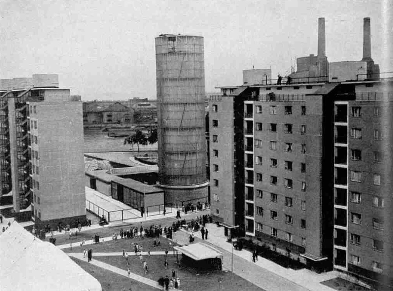
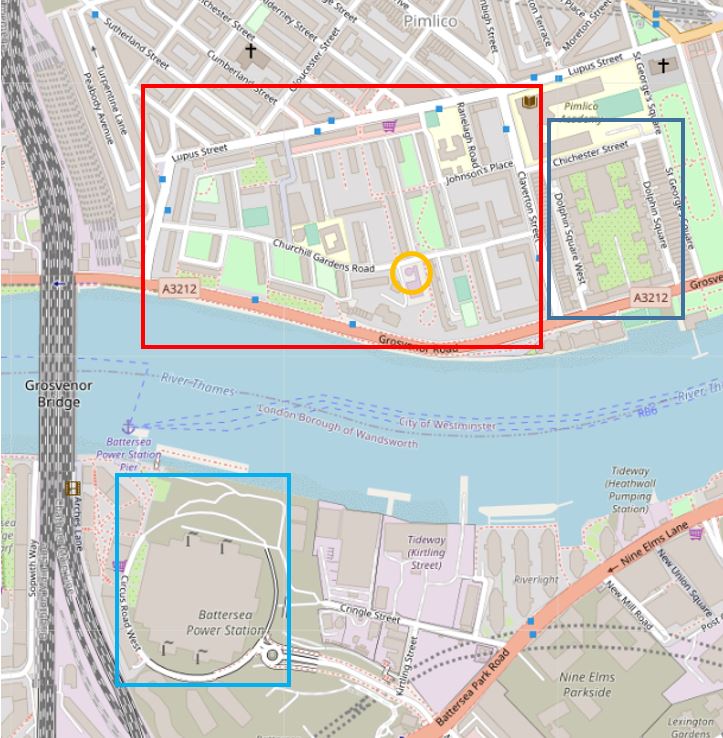
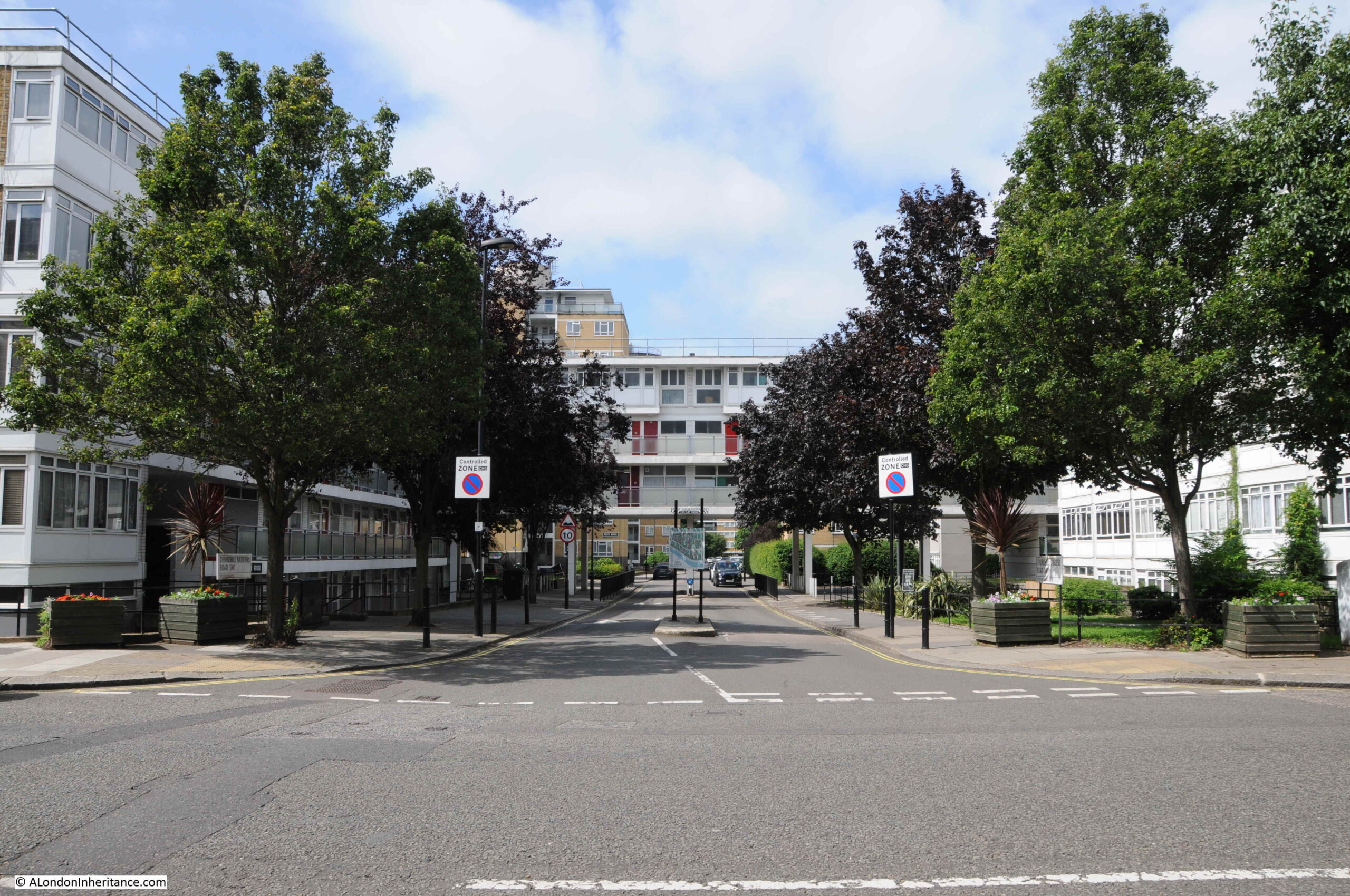
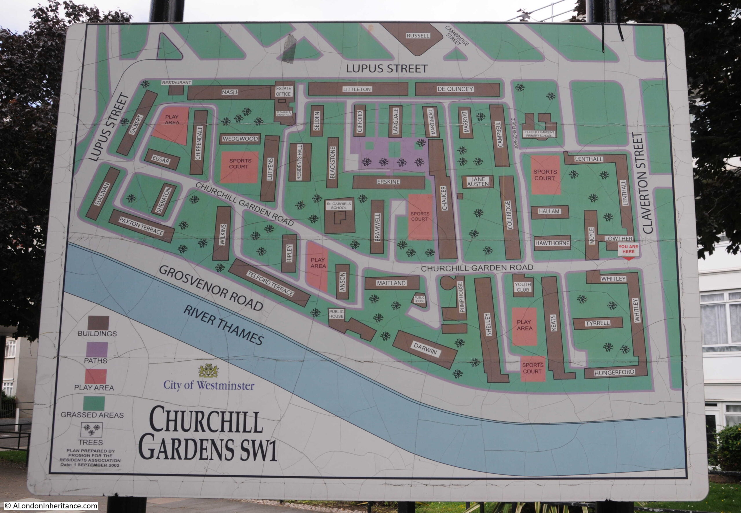
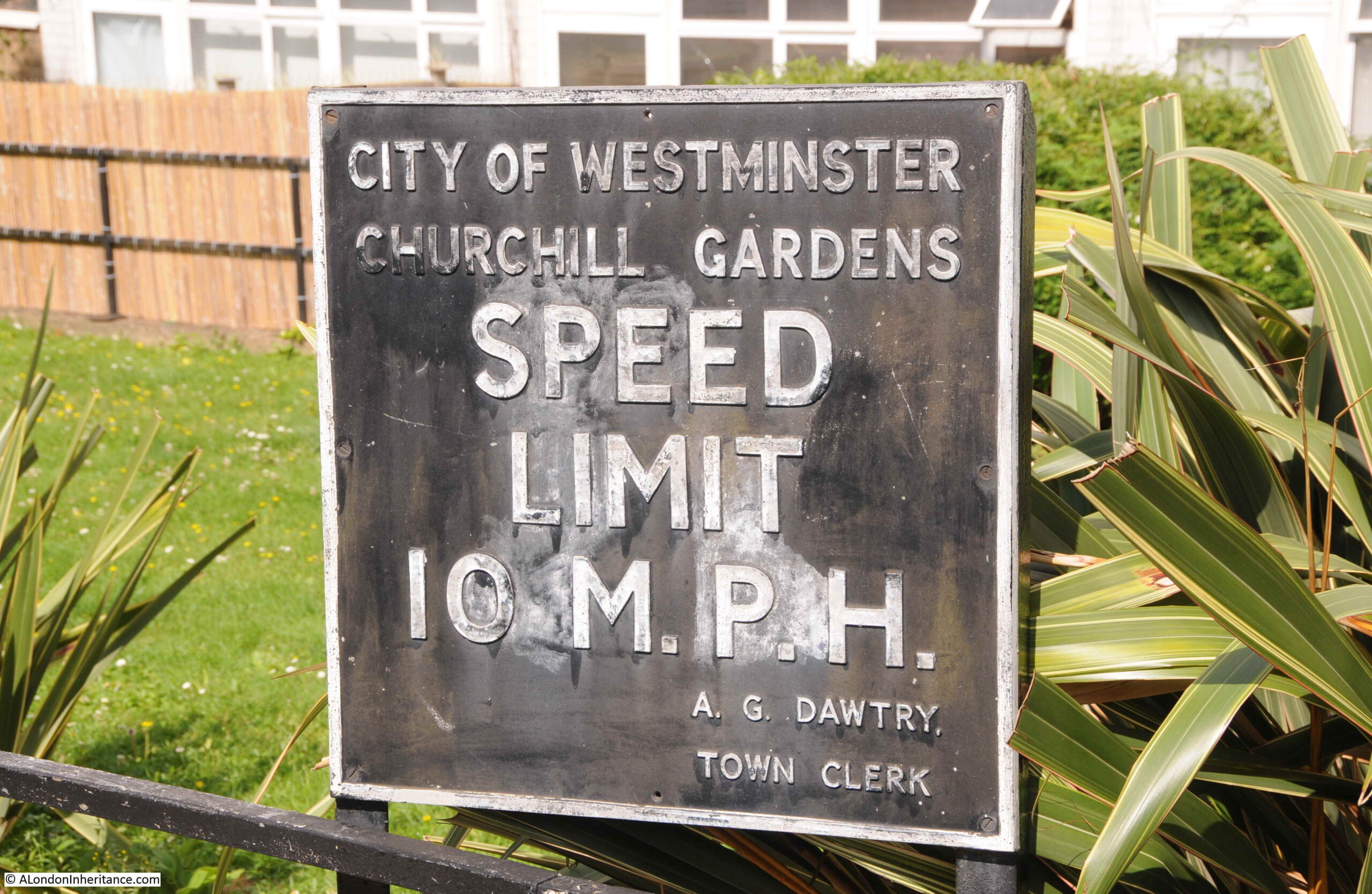
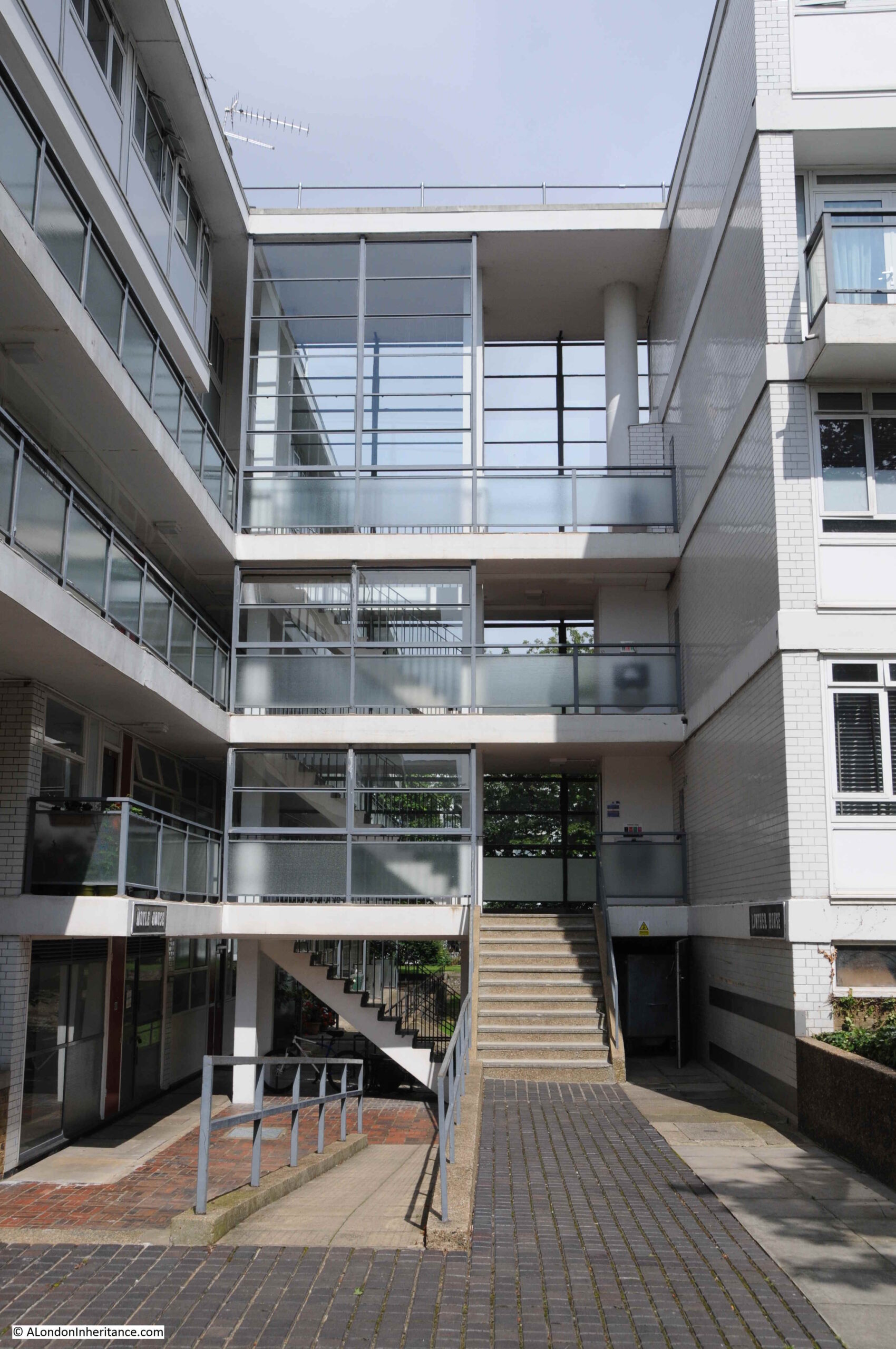
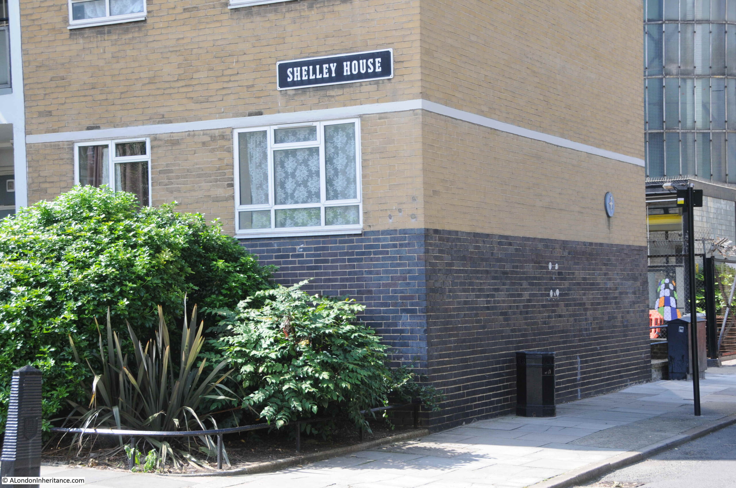
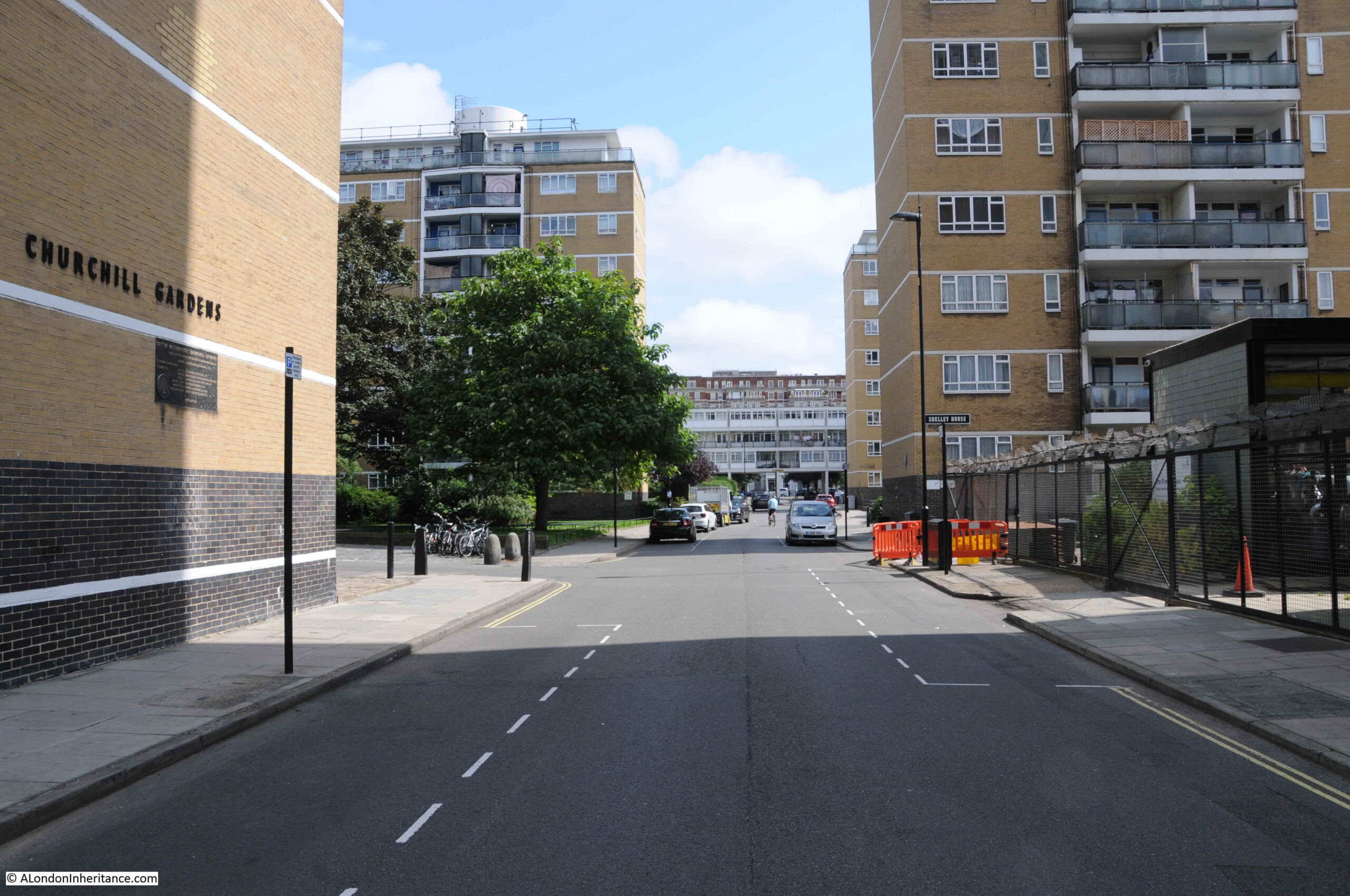
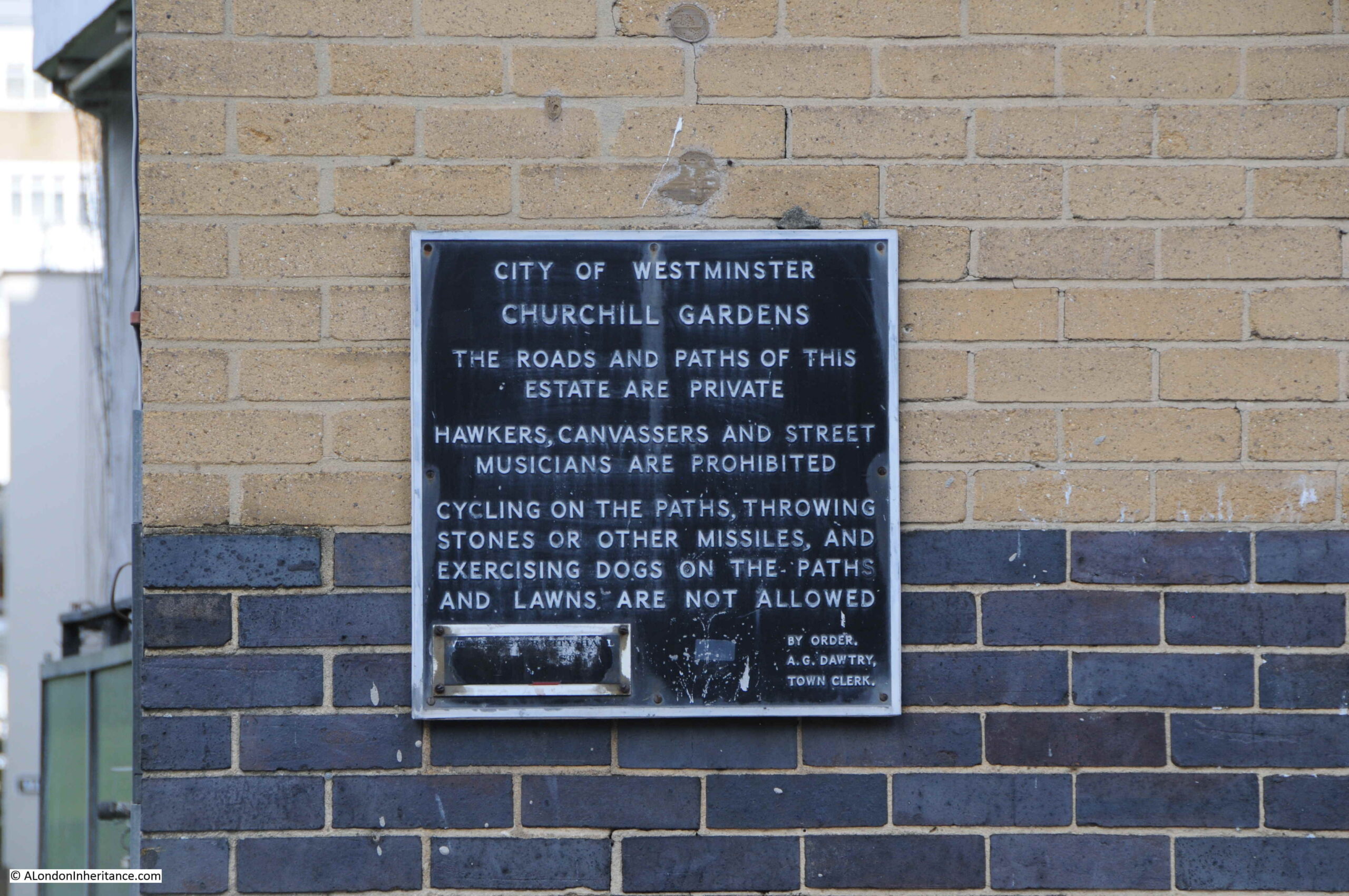
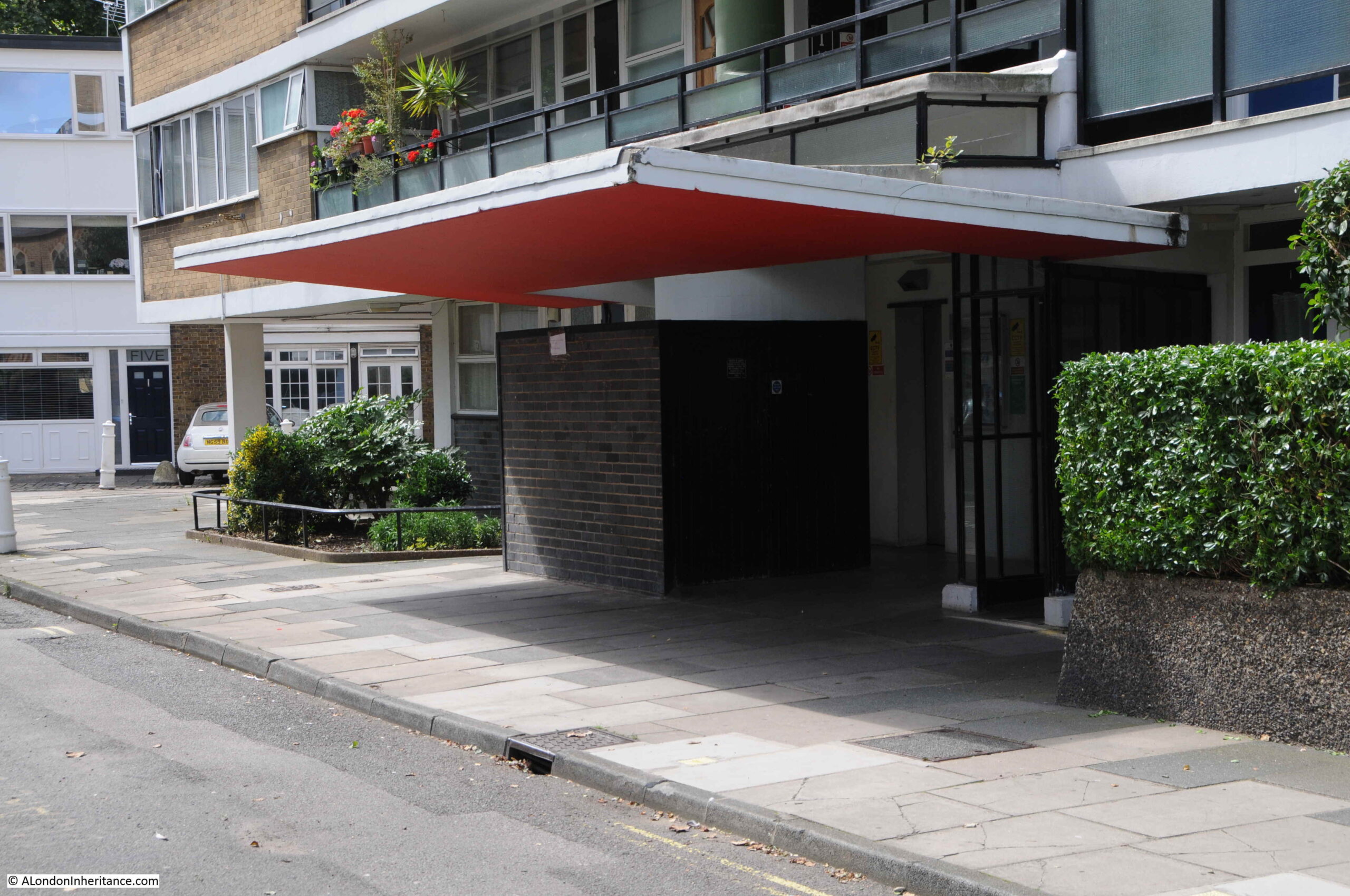
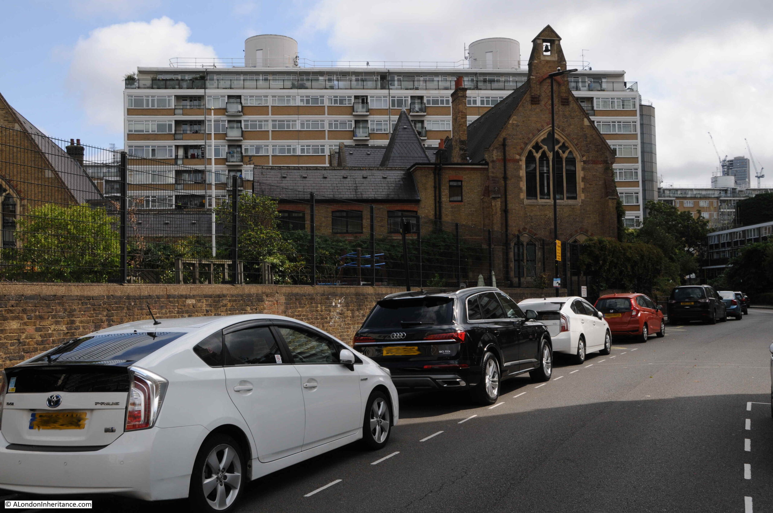
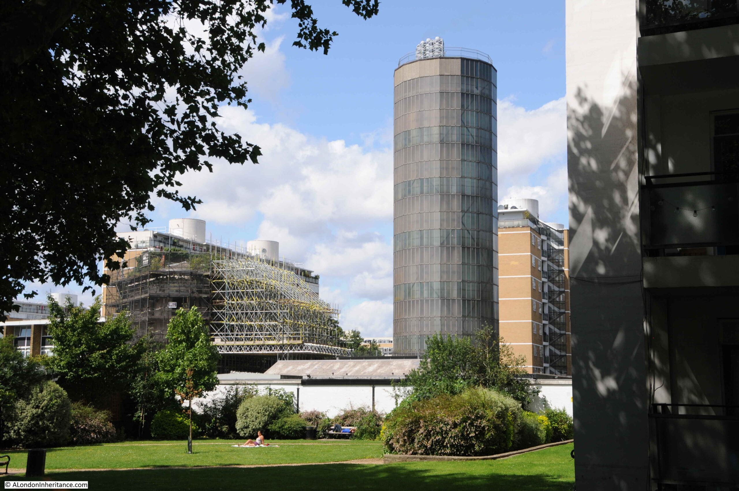
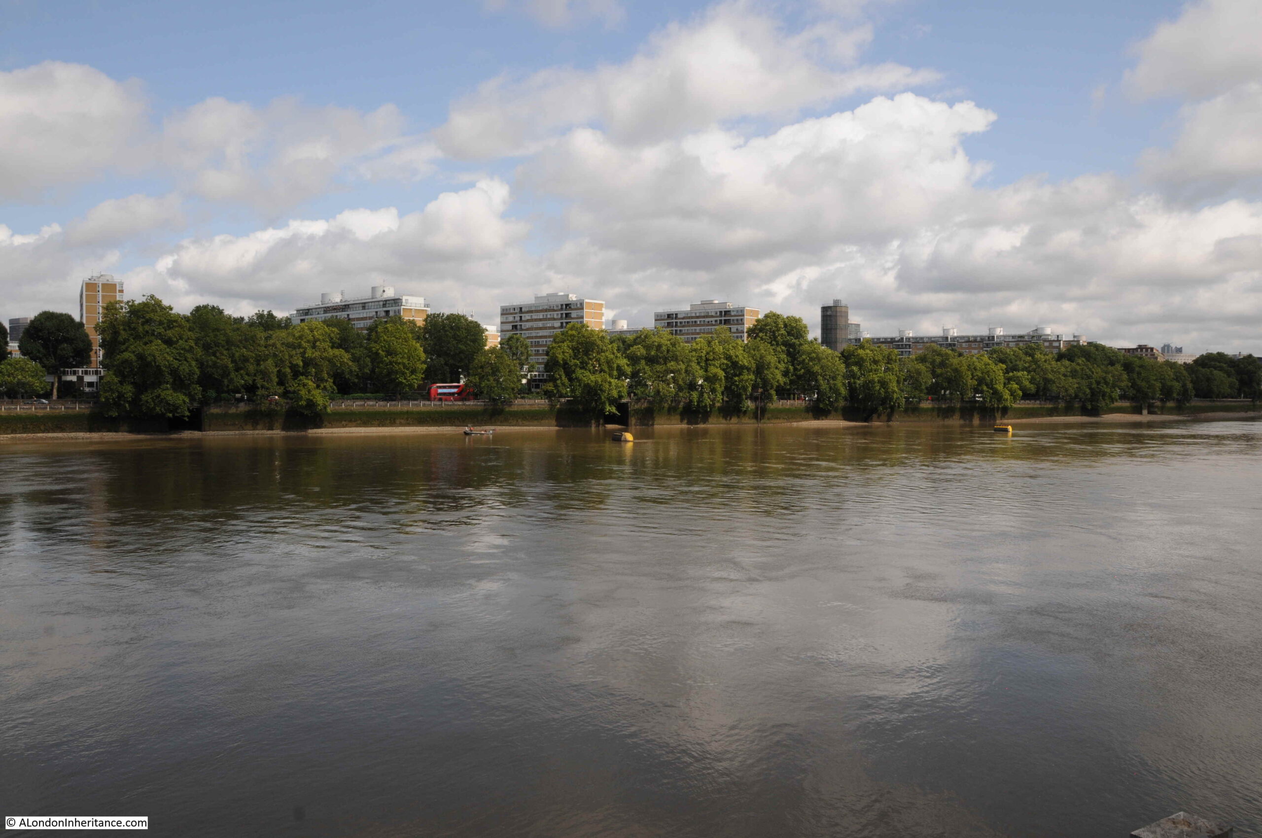
Across the Thames is an estate that had a key relationship with Battersea Power Station. In the lower part of the following photo are the light brown buildings of the Churchill Gardens Estate:

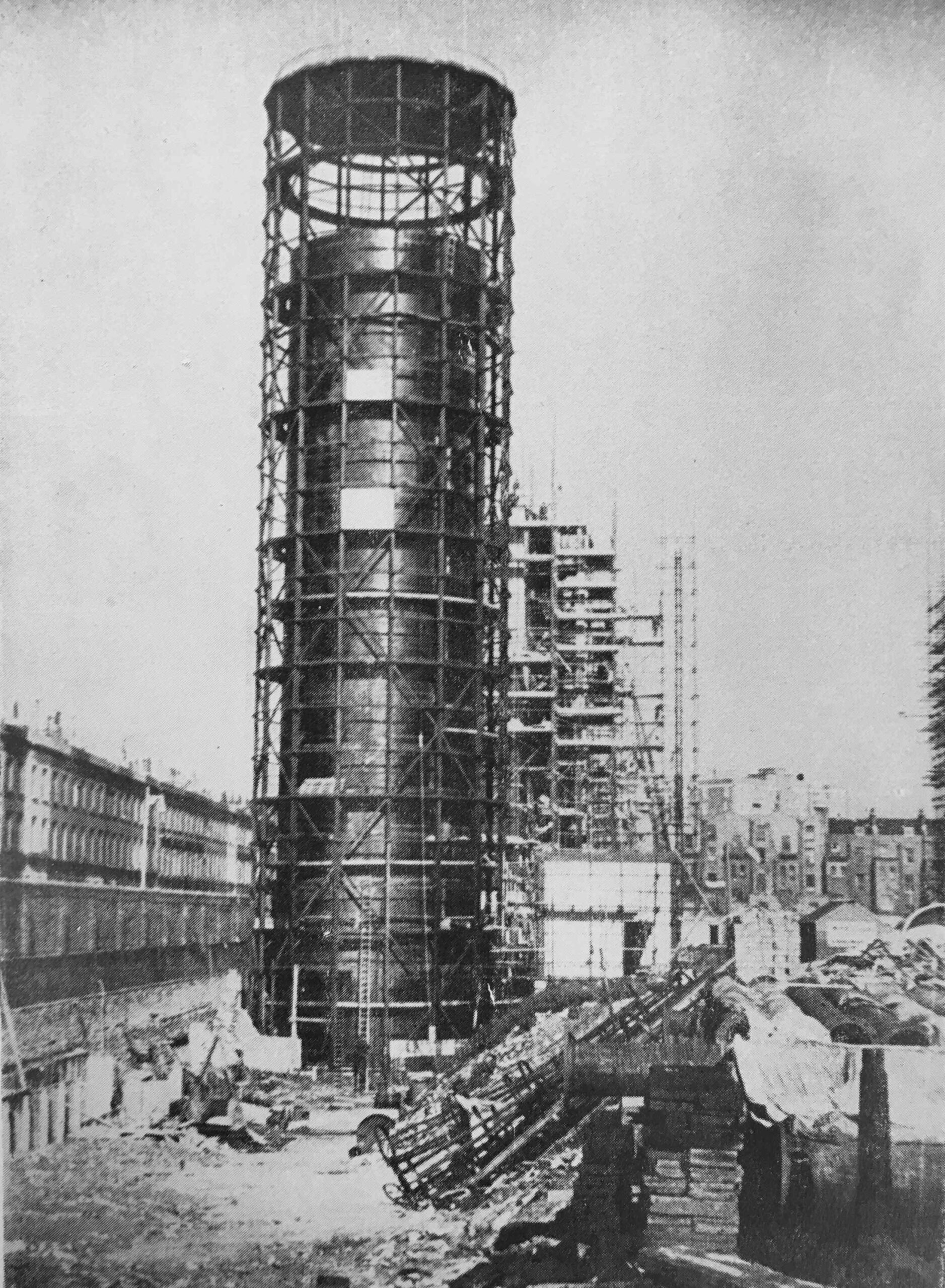
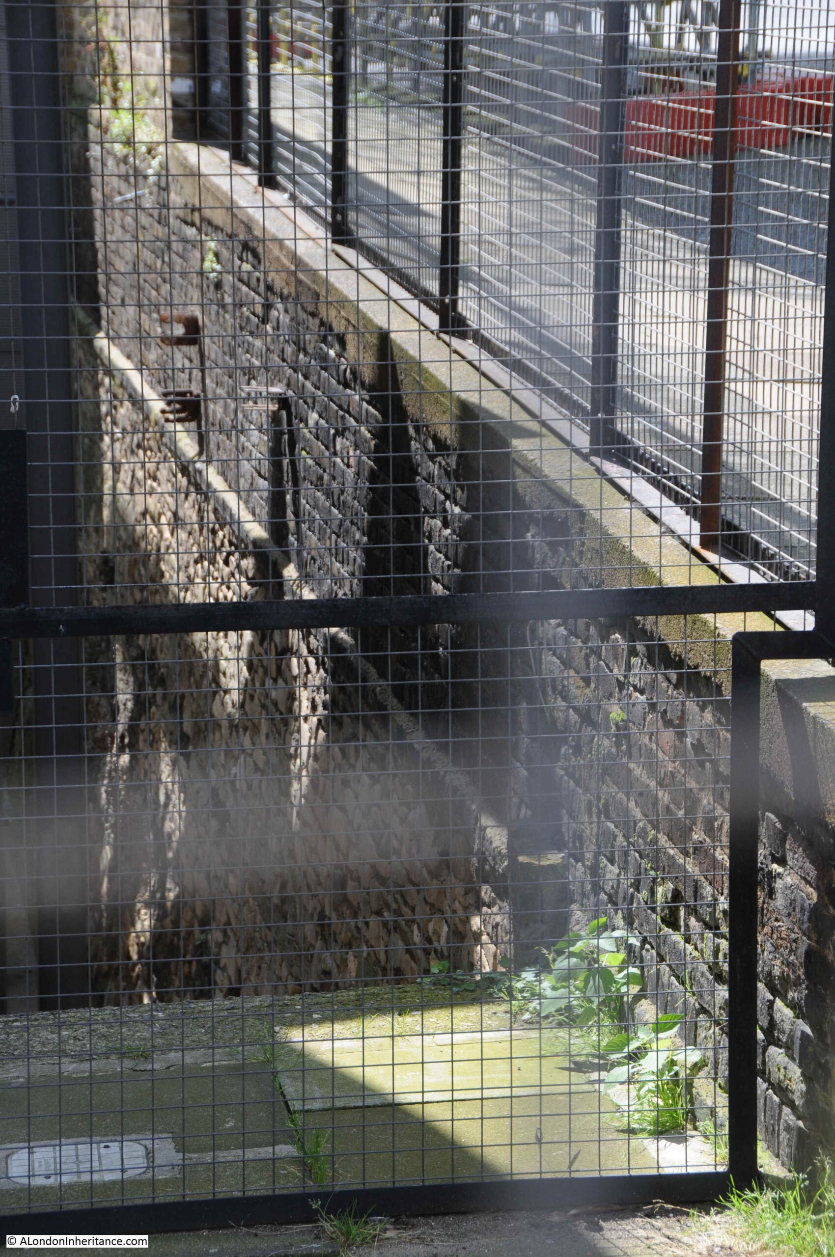
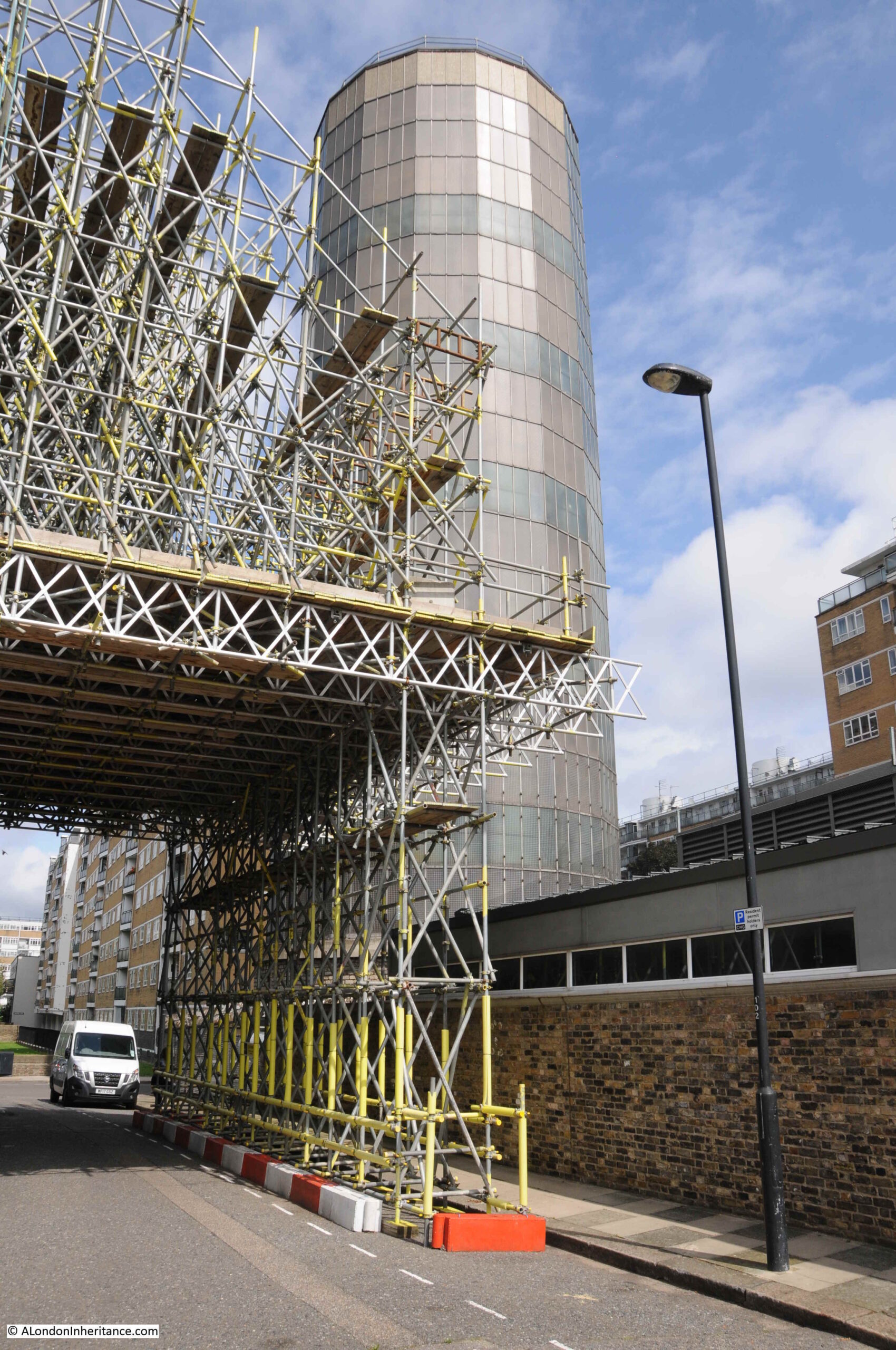
In the centre of the estate is a fascinating industrial relic of the link between Battersea Power Station, and the Churchill Gardens Estate:

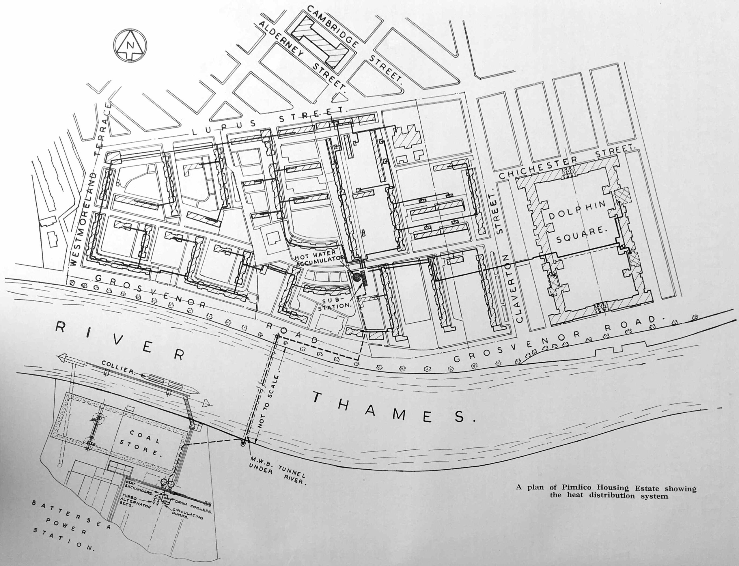
The tower is the most visible part of a highly complex system, that took hot water from Battersea Power Station, pumped it under the Thames through specially constructed pipes, stored water in the tower, then distributed it across both the Churchill Gardens and Dolphin Square estates for heating and hot water.
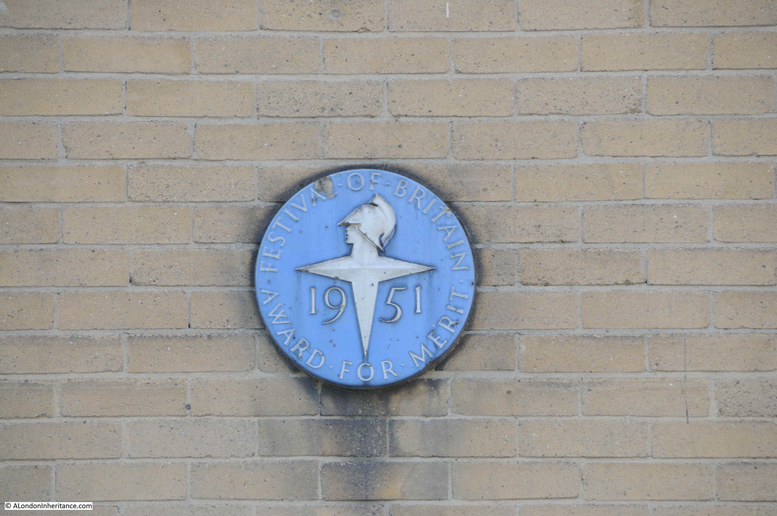
The system is described in considerable detail in a book published in 1951 for the Festival of Britain by the Association of Consulting Engineers. A large book that celebrates the work of civil engineering and construction across a wide range of projects.
The introductory paragraph to the section on the Churchill Gardens project provides an excellent description:
“In the ancient City of Westminster, almost within the shadow of the Houses of Parliament, so severely damaged by German bombers in 1942, great blocks of new flats are rising to meet the needs of London’s teeming millions, thousands of whom are still living in bomb-shattered houses built a century ago.
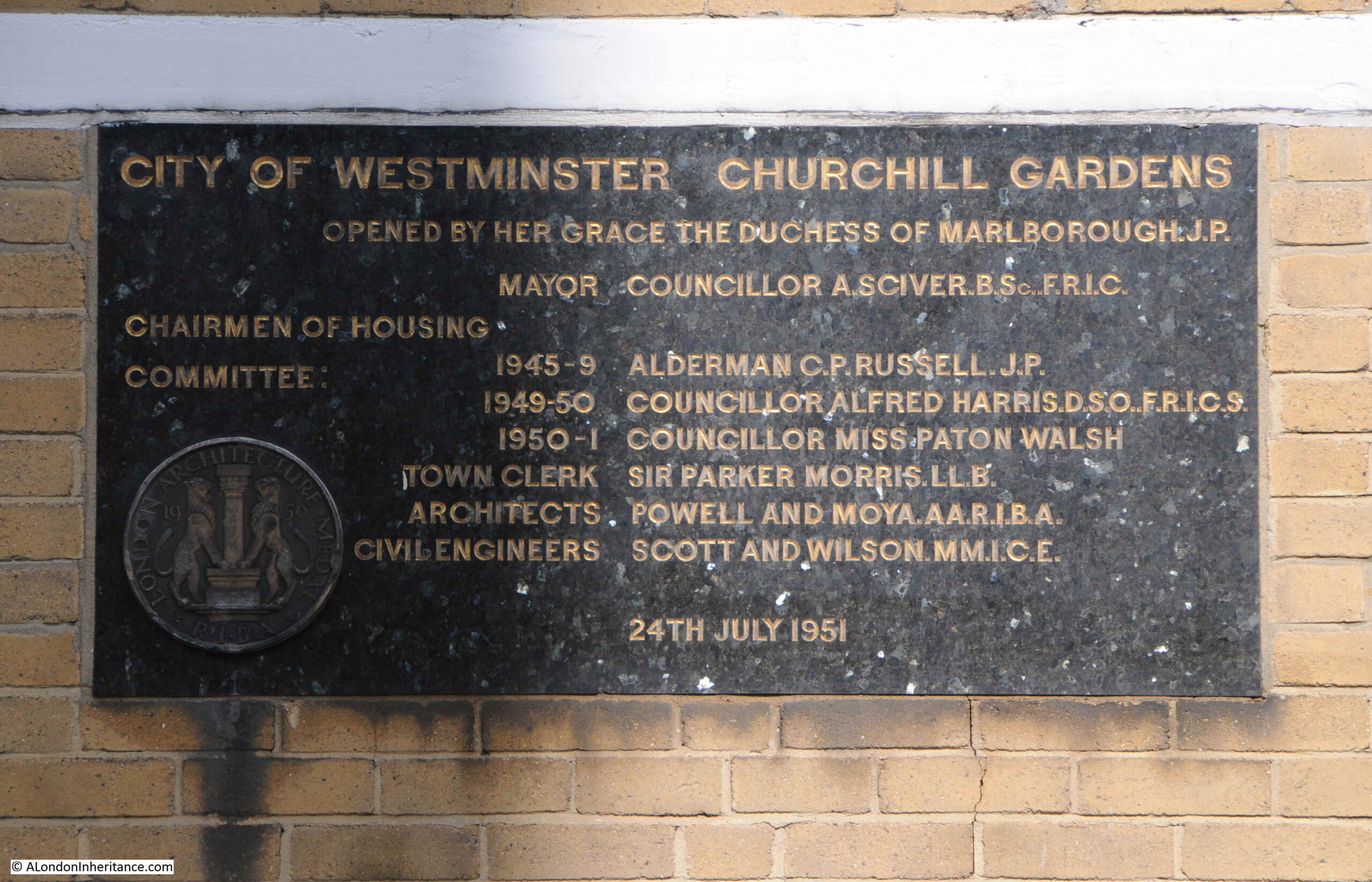
It is perhaps indicative of Britain’s will to survive and to surmount her economic troubles, that this great new housing estate, together with, it is expected an existing group of flats – probably the largest in Europe – is to have complete space heating and water heating by means of a district heating plan, thus banishing the dust and drudgery of the open coal fire, and the nuisance caused by the delivery and removal of fuel and ash for each block of flats. This plant is unique in two respects: it’s the first public heat supply in London, and it is also London’s first district heating plant wherein the heat is the by product of electricity generation. By this means the thermal efficiency of electric generating stations may be raised from its present figure of 25 per cent, to a figure approaching 75 per cent, for stations generating both electricity and heat.”
The section in the book is titled “District Heating Scheme, Pimlico Housing Estate and Dolphin Square”, as at the time the book was put together, the estate had not yet been given the name of Churchill Gardens.
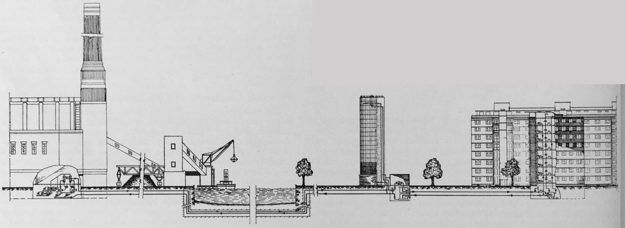
The water sent from Battersea Power Station was up to a maximum of 200 degrees Fahrenheit (93 degrees Celsius) and was stored in the tower, or to use its correct name, the “Hot Water Accumulator” before being distributed across the estate.
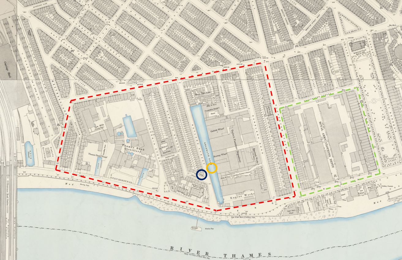
The following diagram shows the concept from power station on the left to estate on the right via the Thames, which from the diagram, looks a very trivial barrier to cross with pipes:

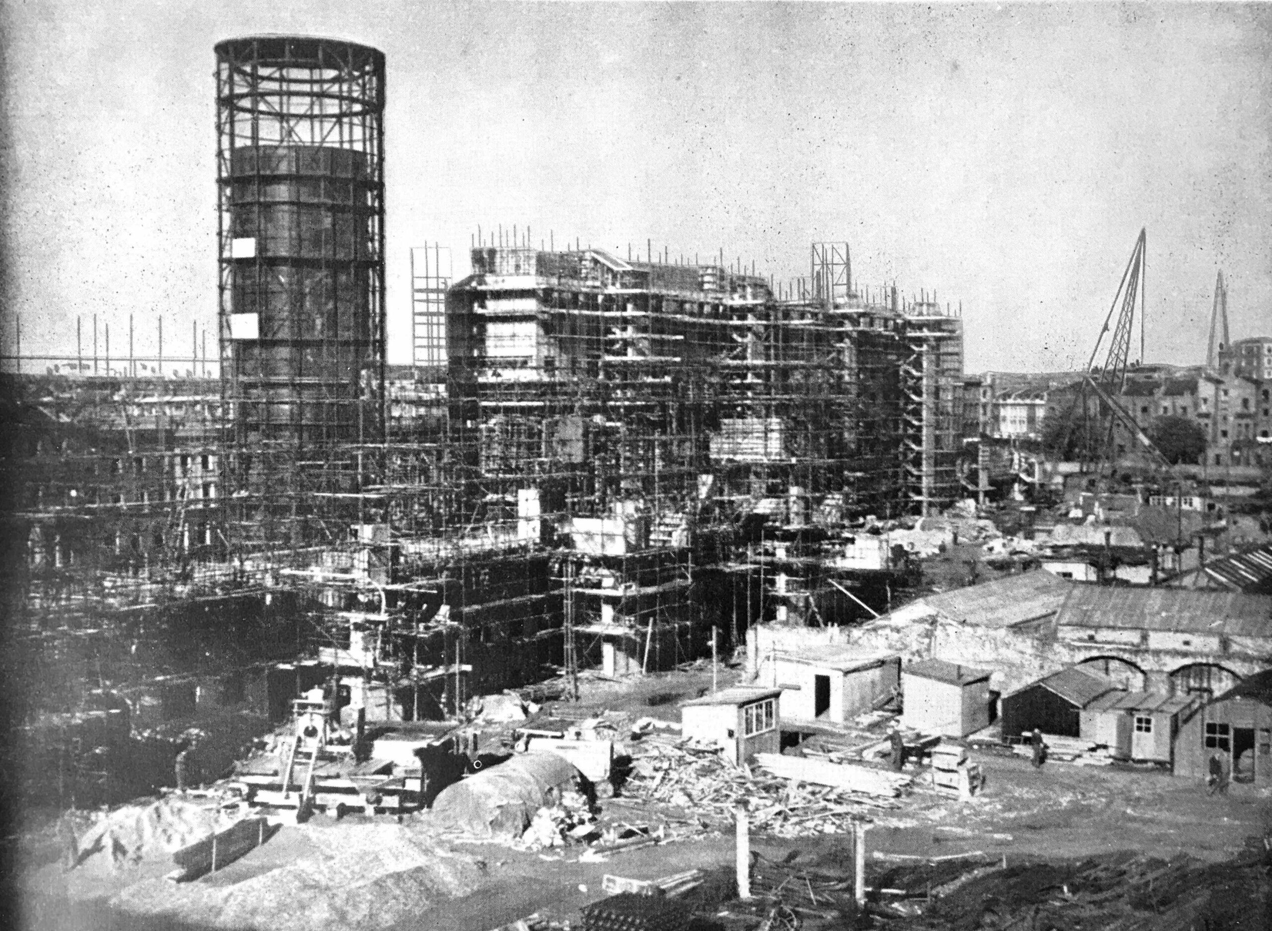
The accumulator tower and estate under construction (from a post dedicated to the system and the estate, which can be found here):

I did not measure the amount of time, but you get around 10 to 12 minutes at the top of the chimney – plenty of time to take a good look at the view, but at the end it was time to take a look inside the power station building:

The public areas are within the old turbine halls of the two halves of the station, with the central boiler house (again in two parts as the station was built in two halves at two different times) now office space with apartments at the top.
The space is basically a Westfield or Airport shopping centre, with the only industrial relics of the buildings’ purpose being found in the roof space:

As the power station was built in two different halves, there were also two separate Control Rooms – A and B.
Control Room B sort of remains, but is now a bar:

To get an impression of what the Control Room looked like, you need to walk to the back of the bar, and providing the tables lining the viewing space at the end are free, you can see some of the original equipment:


The “B” side of the station was built after the war, a time when money and materials were in short supply, so the decoration of Control Room B was very basic.
The pre-war Control Room A was much more ornate, but is now (inevitably) a private event space. You can see some photos of the space here.
I guess there is a certain industrial feel to the design, but this is really brand driven retail space:

And you need to look up to see any relics from the buildings past:

The view from the waiting area for Lift 109, which is in the pre-war “A” side of the power station, so the stone work along the walls is more ornate:

Looking down into the entrance of the building from the river side of the power station:

The large, green equipment in the centre of the floor is a 66 kilo volt circuit breaker dating from around 1955, which was part of the station switchgear – one of the very few items of equipment from the operational station left on display:

The purpose of the circuit breaker was to automatically cut of electricity if a fault in the circuit was detected, to prevent further damage to the electricity distribution network.
There were a number of these circuit breakers at Battersea, each built within a brick compartment with steel doors, so that if a circuit breaker caught fire, the fire would be prevented from spreading.
As we have seen at Heathrow in the last few days, electrical distribution equipment can at times catastrophically catch fire.
Outside the power station, there is a long walking / viewing , seating area on the top of the pier that coal barges once moored up against:

It was here that the distinctive cranes that once transferred coal between river and power station were located. These were removed when development work started, with the intention that they would be restored and replaced, however I believe they are currently in bits in an outside storage area – not in Battersea:

Reflection of the power station in an adjacent apartment block, with a randomly placed bit of equipment from the old power station:

My photos earlier in the post showed all the chimneys being replaced, and in the garden at the front of the power station is a small part of one of the original chimneys – a segment from the 1933 north west chimney:

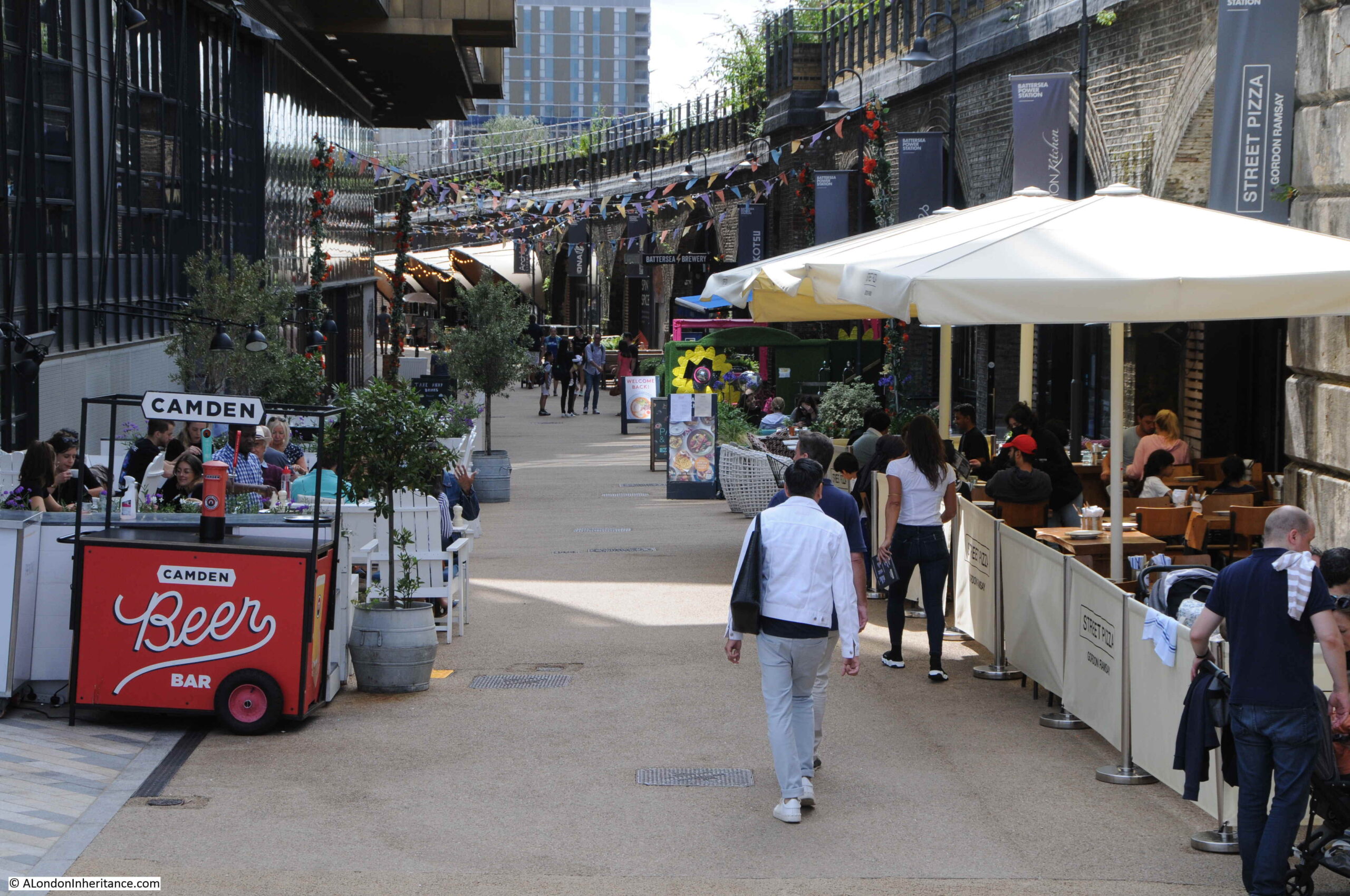
Along the western side of the building, with on the right apartment blocks with shops and restaurants along ground level:

Towards the rear of the power station is Prospect Place, designed by the California based architectural practice of Gehry Partners, founded by Frank Gehry:

South east brick work and chimney:

It was interesting to see the transformation of Battersea Power Station. My preference would have been for alternative uses than just retail in the public space, however in reality there was no other option than funding the considerable reconstruction of the building – which had been out of use for decades – than by building apartments, offices and retail.
There had been many schemes before the current development, none of which had resulted in any work in restoring the building, and no public or private money was being made available to create a transformation such as has resulted at Bankside Tate Modern.
Whilst the chimneys are new, they are to the original design, and the good thing is that the shell of the building is fundamentally as it was – a temple to 20th century electricity generation – I just wish that there was more about this in the building, in addition to the small display at the start of Lift 109, and a couple of bits of switchgear. Control Room A should have public access rather than being a private event space, and the cranes should be restored and installed alongside the river as a starter.
Giving more prominence to the heritage of the building would help increase footfall across the site, which is probably part of the thinking behind Lift 109, as visitors to this will probably also use the restaurants and shops.
Lift 109 though is brilliant, the view from the top provides a very different perspective of London. Unless you can get to the top of one of the new apartment buildings around Vauxhall, there are no other high places to view the city from this part of London, and on a sunny day, London looks glorious – as does the brickwork of this temple to power: