Tag Archives: City Churches

St Clement Eastcheap

When the 19th century London Bridge was built to replace the original medieval bridge, the new bridge was built slight further west along the river allowing the old bridge to continue in use until the new bridge was completed.

The construction of the 19th century bridge had quite a dramatic impact on the streets on the north bank of the river. I have already covered some examples in my post on the Ticket Porter in Arthur Street which you can find here, and there were more street changes further north.

Today’s post on the church of St Clement Eastcheap provides us with another example.

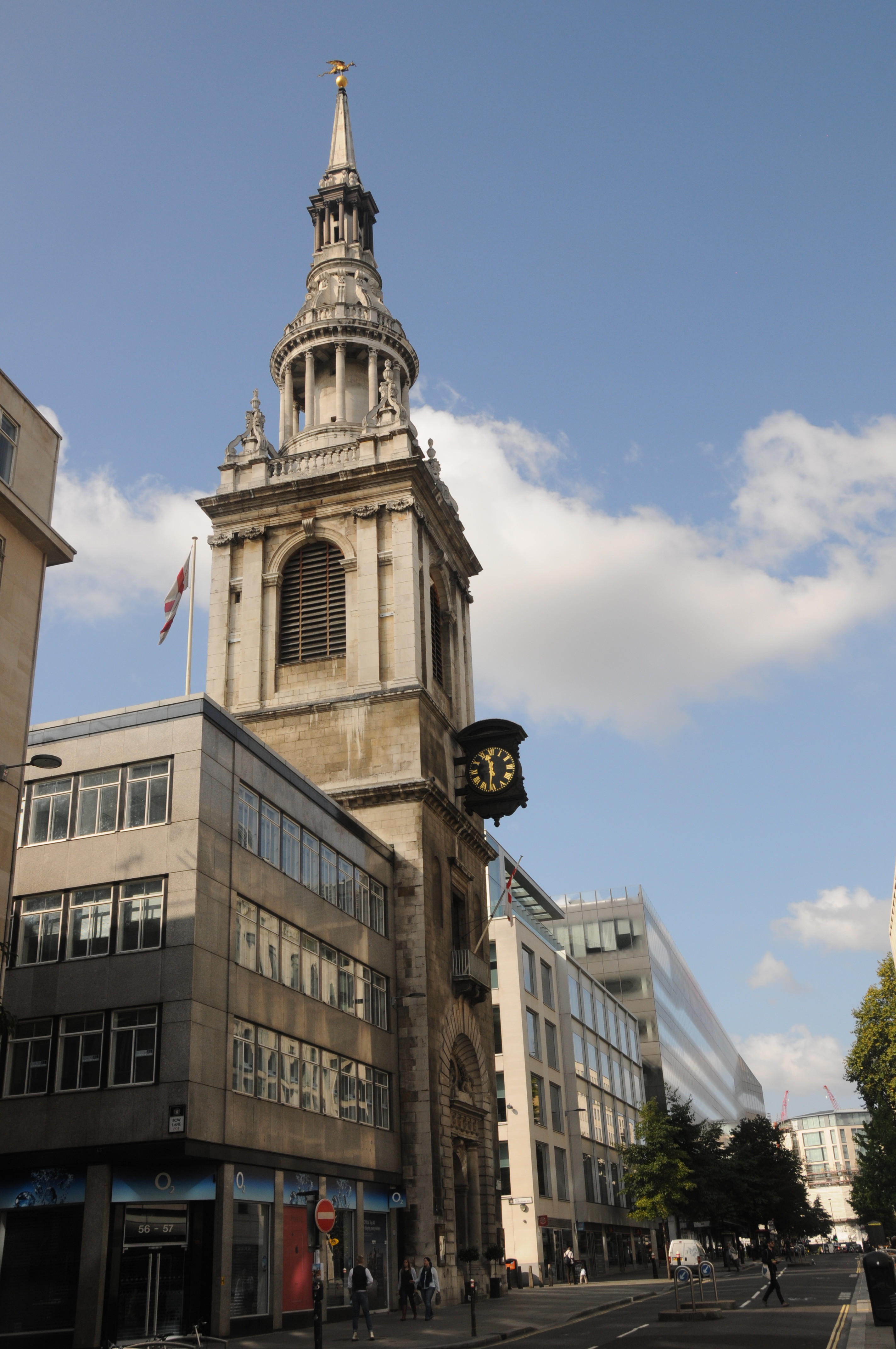
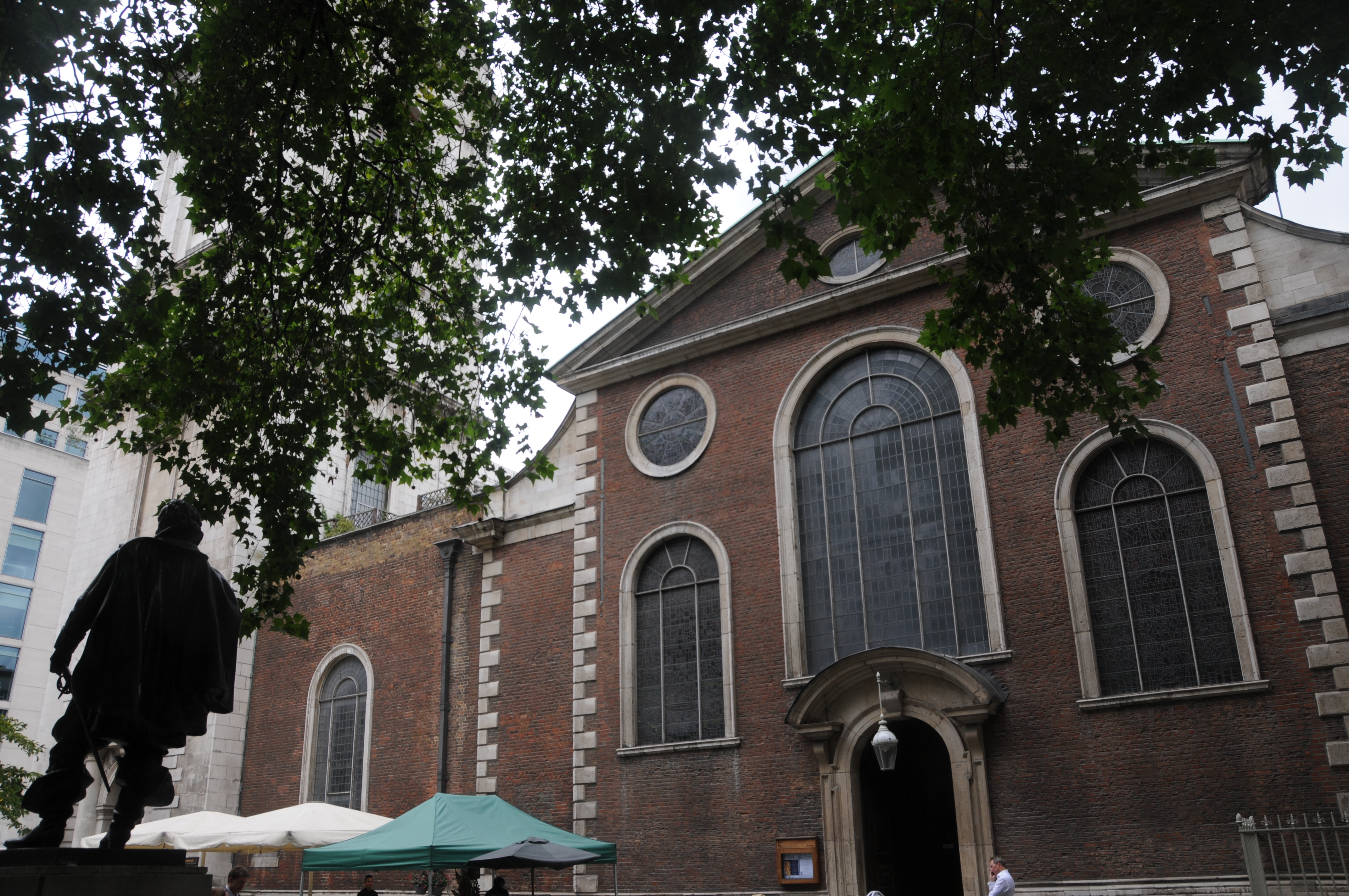
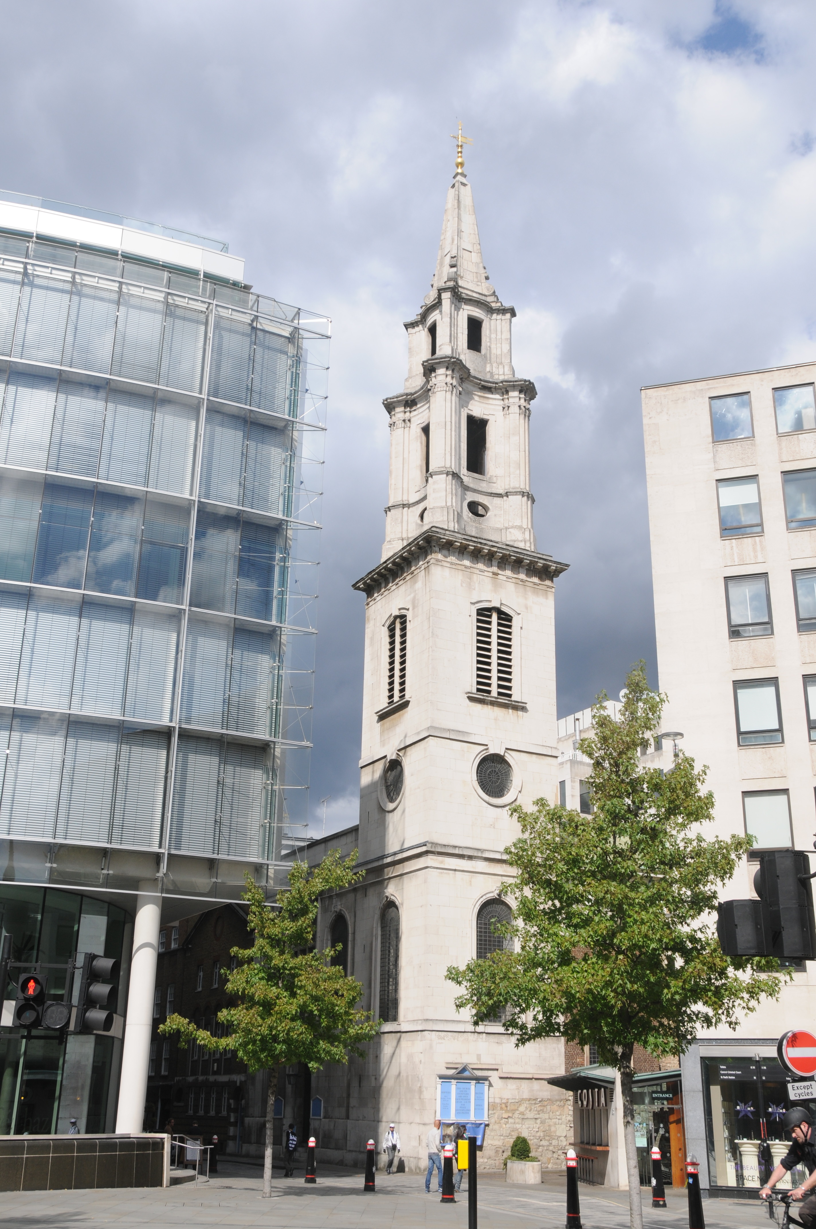
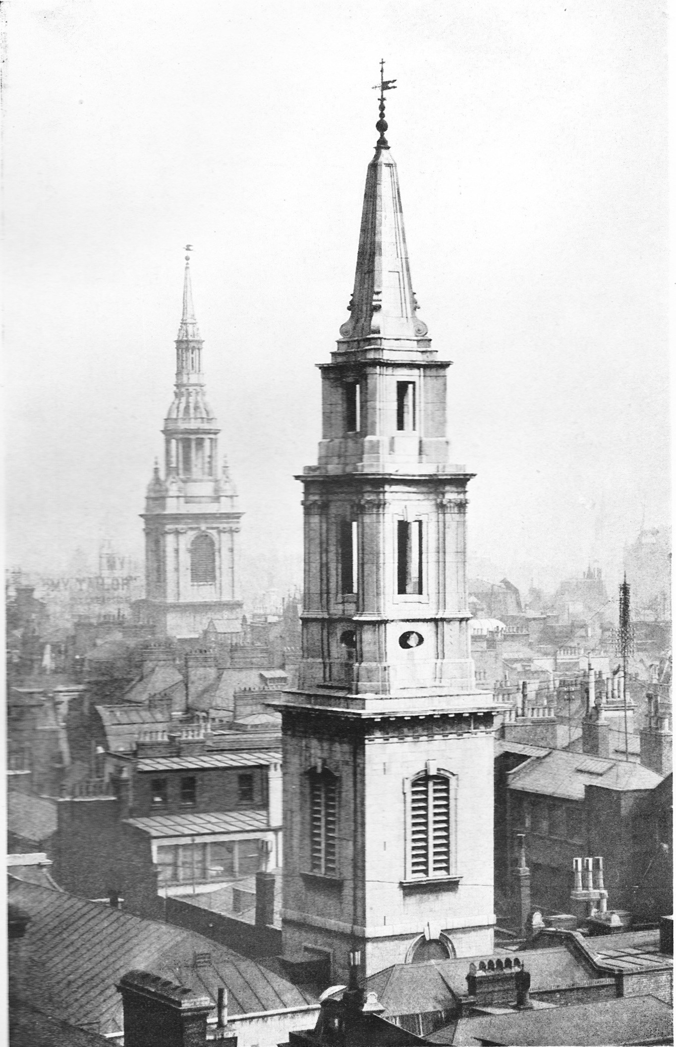
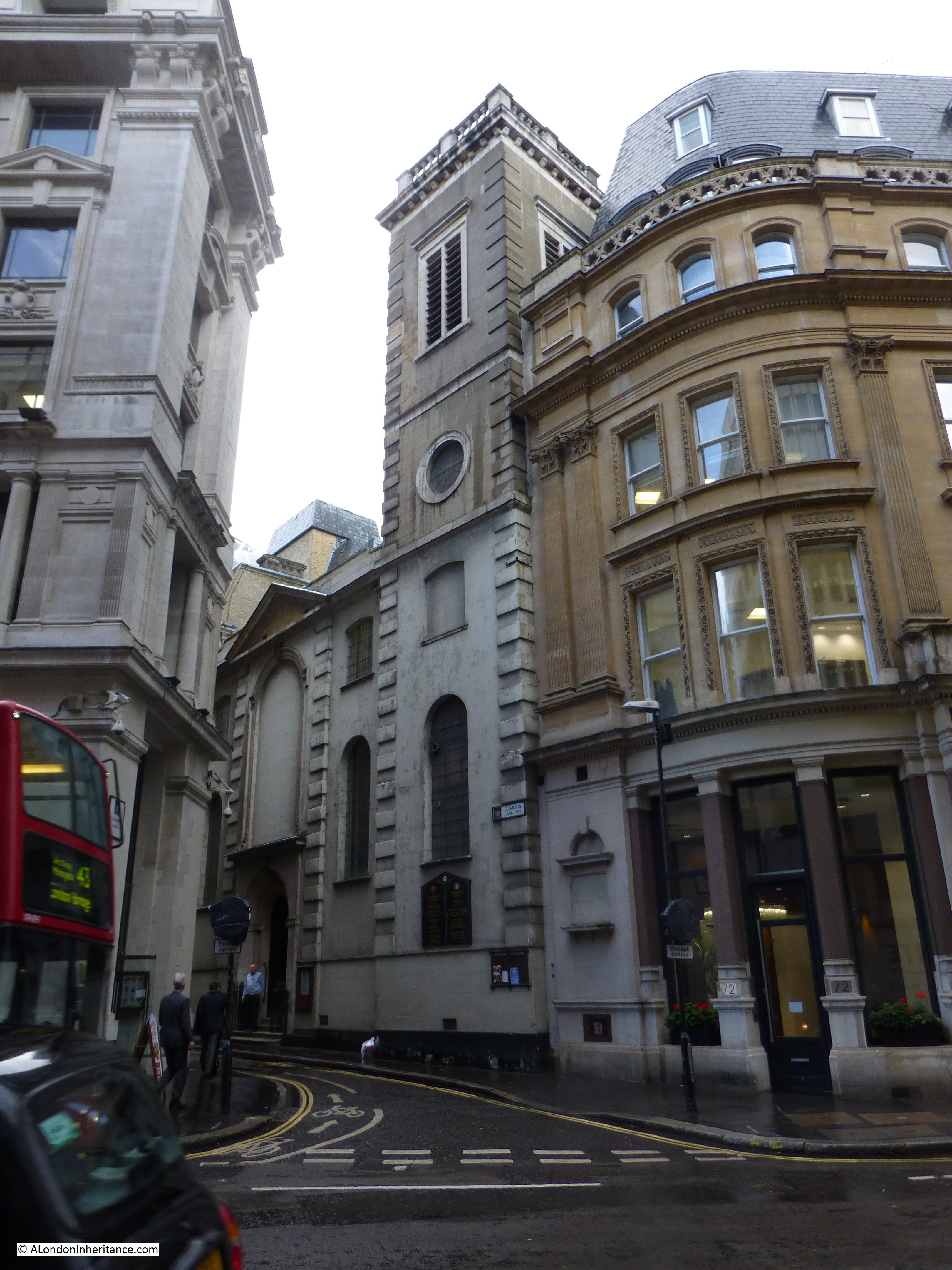
St Clement Eastcheap is a modest church in Clements Lane almost at the corner with Cannon Street. The church does not have a spire and the church tower is at the same level as the surrounding buildings so unlike many other City churches, you will not find a spire to help locate the church.

The church does though have a fascinating piece of early 18th century graffiti in one of the most unusual locations, more on this later.

So, to start, here is St Clement Eastcheap in Clements Lane taken from Cannon Street.

St Clement Eastcheap 1

St Clement Eastcheap, located in Candlewick Ward, dates from at least the 12th Century, probably earlier and was originally adjacent to the street Great Eastcheap.

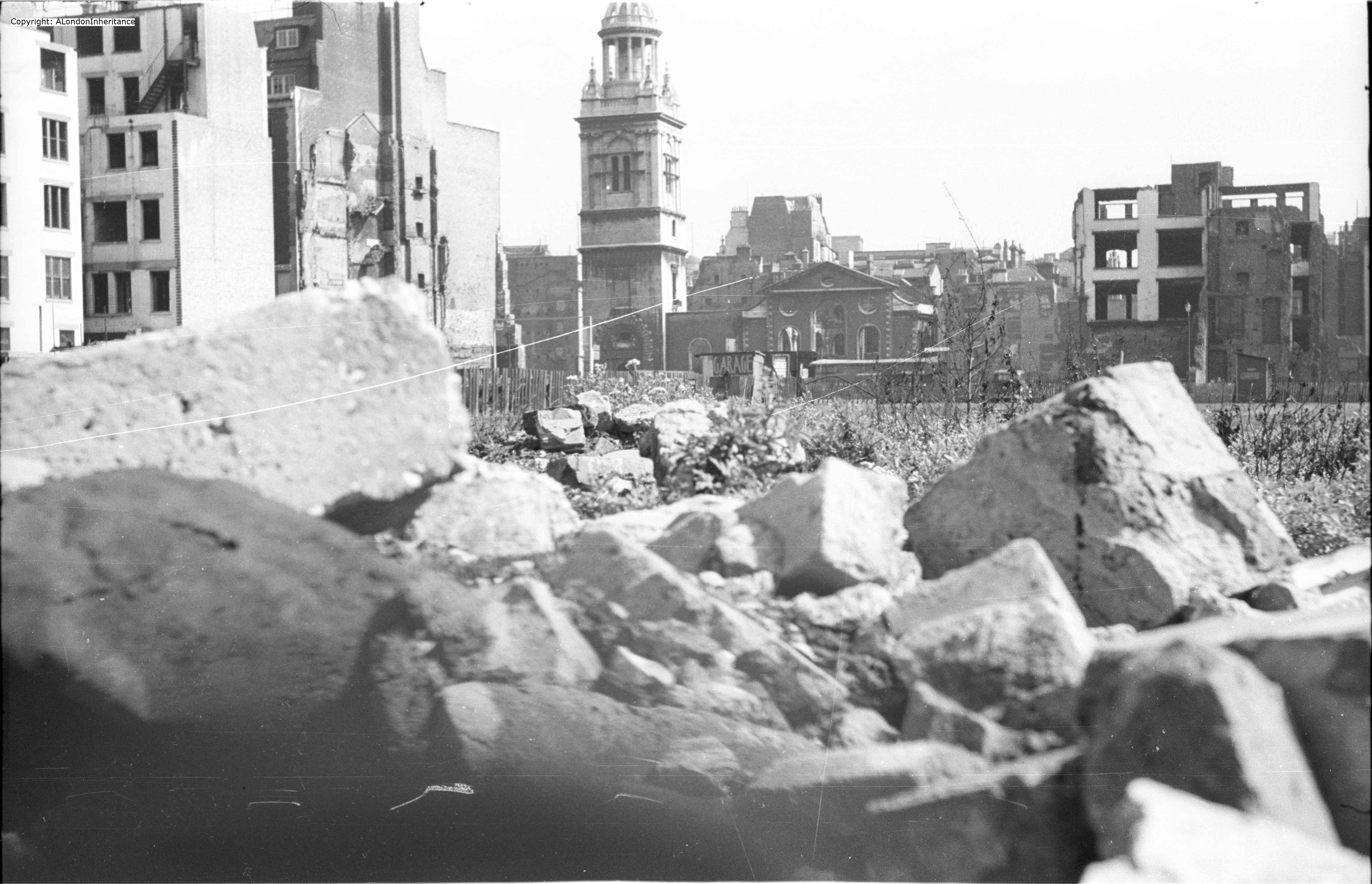
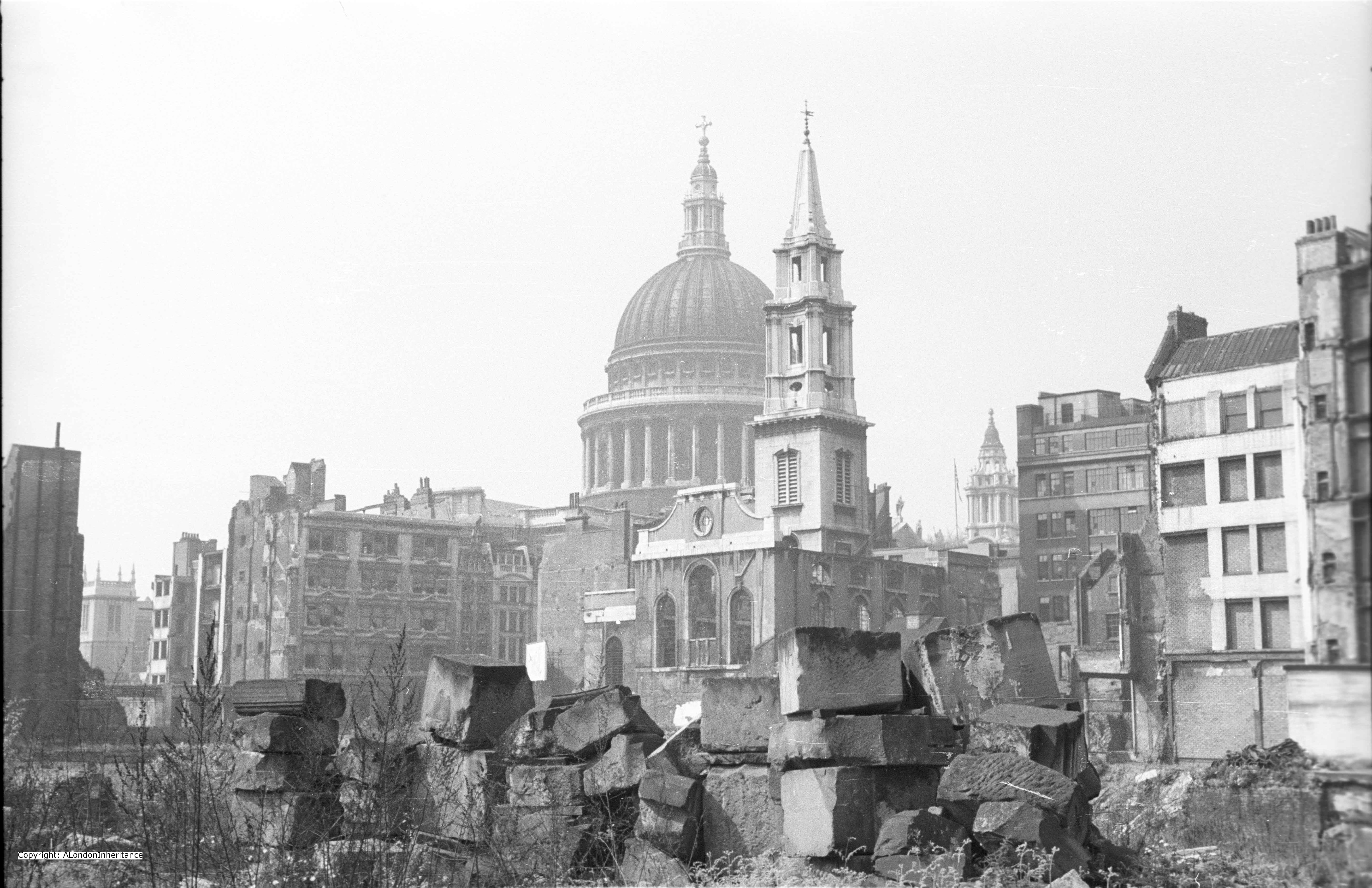
The church was destroyed in the Great Fire of London and rebuilt by Wren between 1683 and 1687. The church suffered very little damage during the 2nd World War which is surprising given the central City location, so the church we see today is much the same as the original Wren construction.

The following map is from the 1940 Bartholomew London Street Atlas. The street plan is also much the same today. St Clement Eastcheap can be seen to the lower right, just above Monument Station.

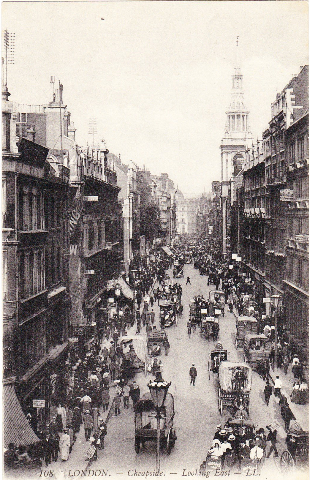
Clements Lane today, runs between Lombard Street and King William Street which runs on to London Bridge.

St Clement Eastcheap 12

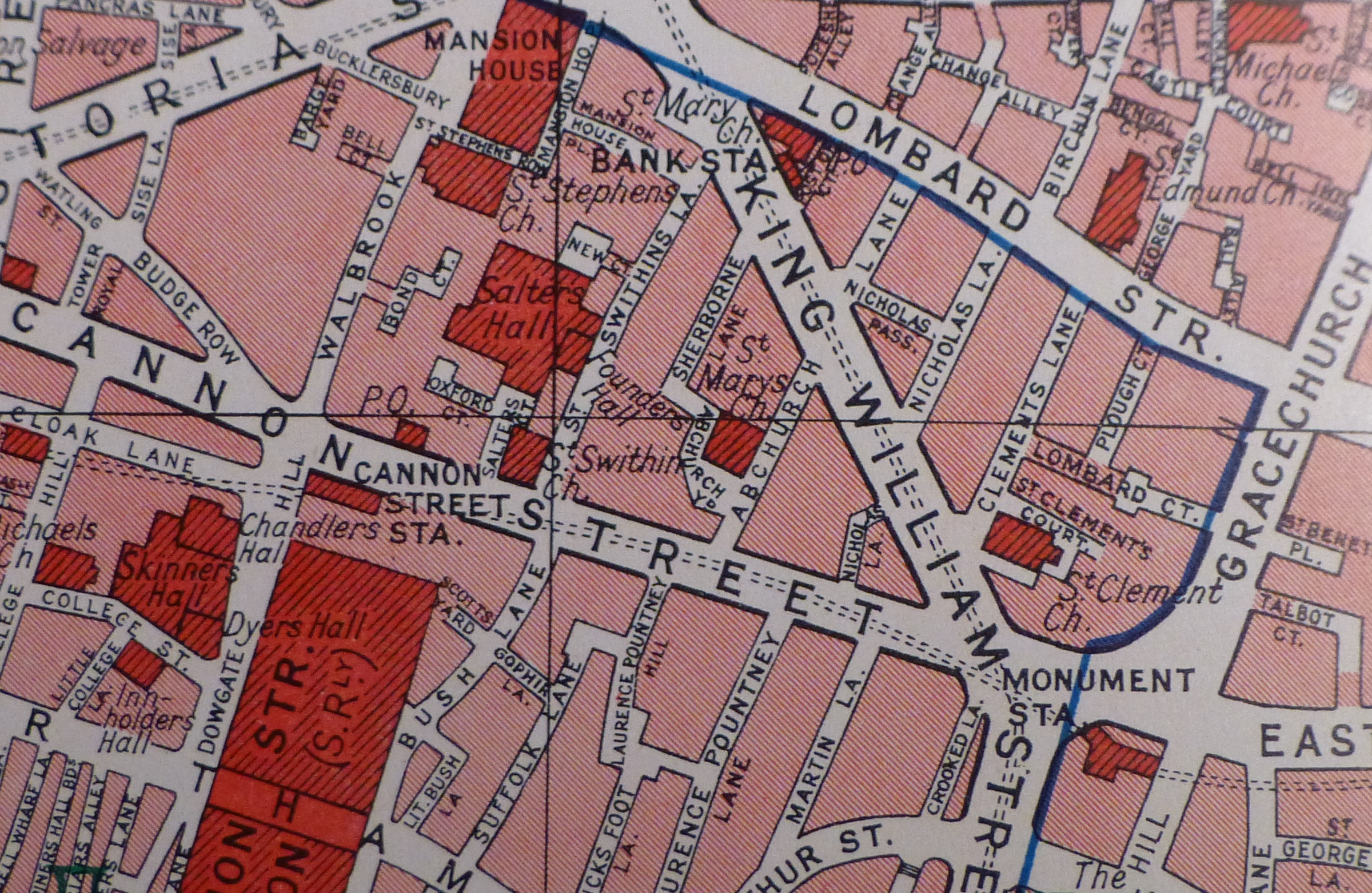
Much of this street plan was created to provide an efficient route onto the new London Bridge with King William Street providing direct access from the major road junction at the Bank.

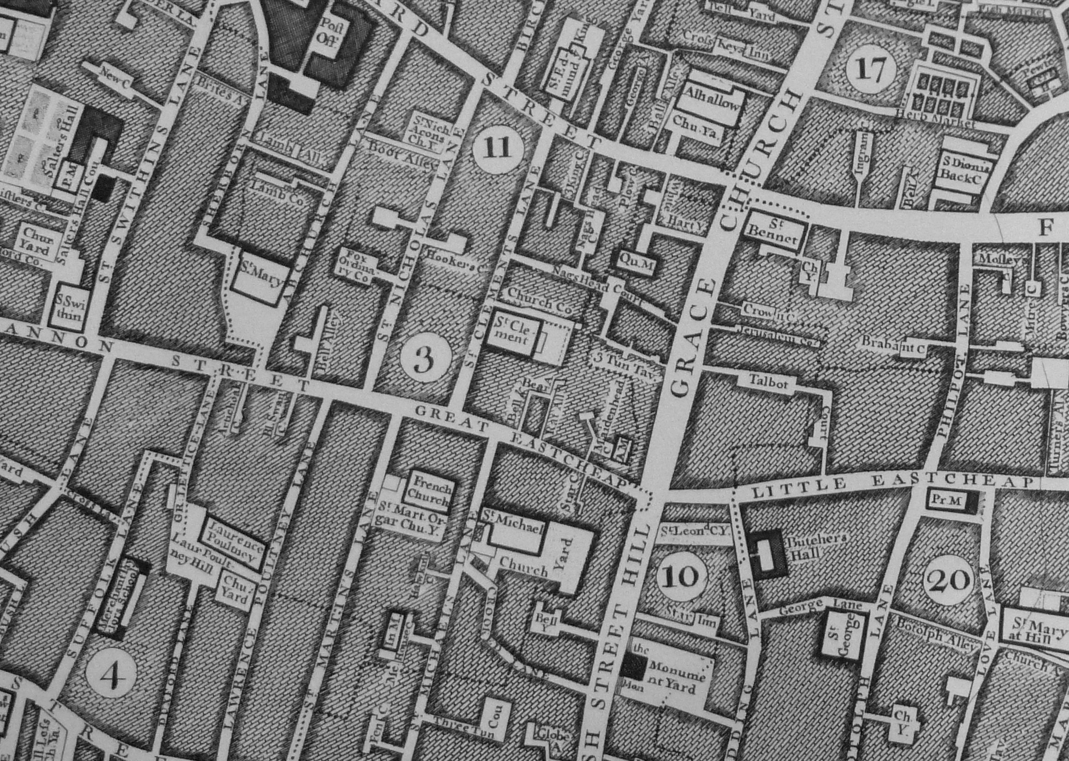
The extract below from  John Rocque’s map of 1746 shows the street plan when the original London Bridge was still in place.

Here, Gracechurch Street runs to Fish Street Hill then on to London Bridge. Compare this with the above map where Gracechurch Street now curves past Monument Station to King William Street and the approach to London Bridge, highlighting the slight westward move of the bridge.

Just above and to the right of the number 3 in the map below can be seen St Clement. Here, St Clements Lane runs down to Great Eastcheap. Note also how Eastcheap is split into Great and Little Eastcheap, with Little Eastcheap remaining to this day, but now called simply Eastcheap.

Stowe states in his 1603 Survey of London that:

“The street of Great Eastcheape is so called of the Market kept, in the east part of the City, as West Cheape is a market so called of being in the West.

This Eastcheape is now a flesh Market of Butchers there dwelling, on both sides of the street, it had sometime also Cookes mixed amongst the Butchers, and such other as solde victuals readie dressed of all sorts.”

Great Eastcheap was lost when King William Street was built, with Great Eastcheap being included in the end of Cannon Street, King William Street and the Gracechurch Street, Eastcheap section by Monument Station.

St Clement Eastcheap 10

When I visited the church, there was an interesting reminder of the geology of the City. When I entered the church, there was a clear blue sky, however on leaving there was a very heavy rain shower and water was streaming down the narrow Clements Lane, carrying various bits of rubbish in the flow. Whilst today, the water disappeared down the nearest drain, this was a graphical reminder of how much of this side of the City slopes down towards the Thames and how in the past the water and rubbish running down these streets would have been carried straight down towards the river.

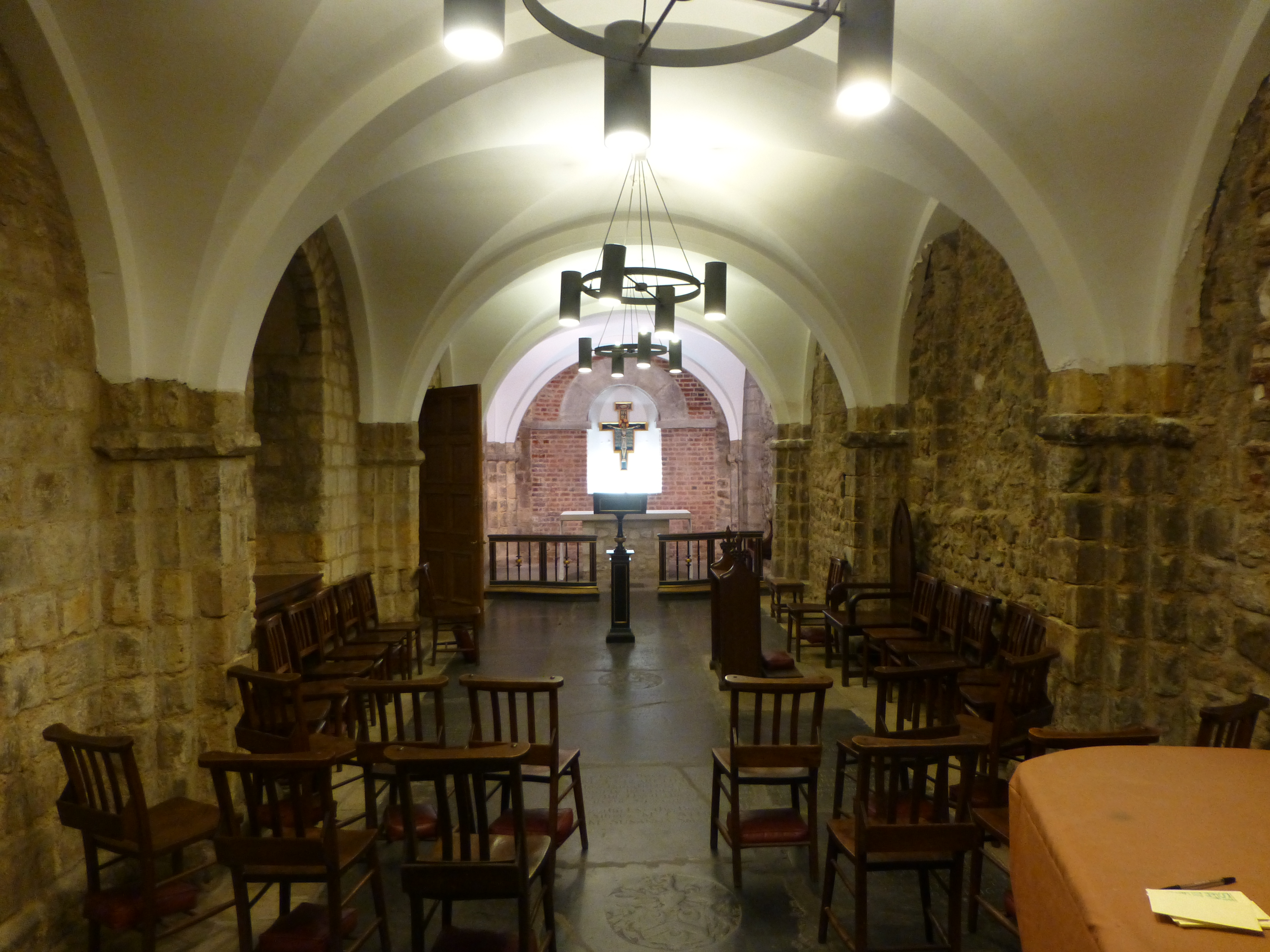
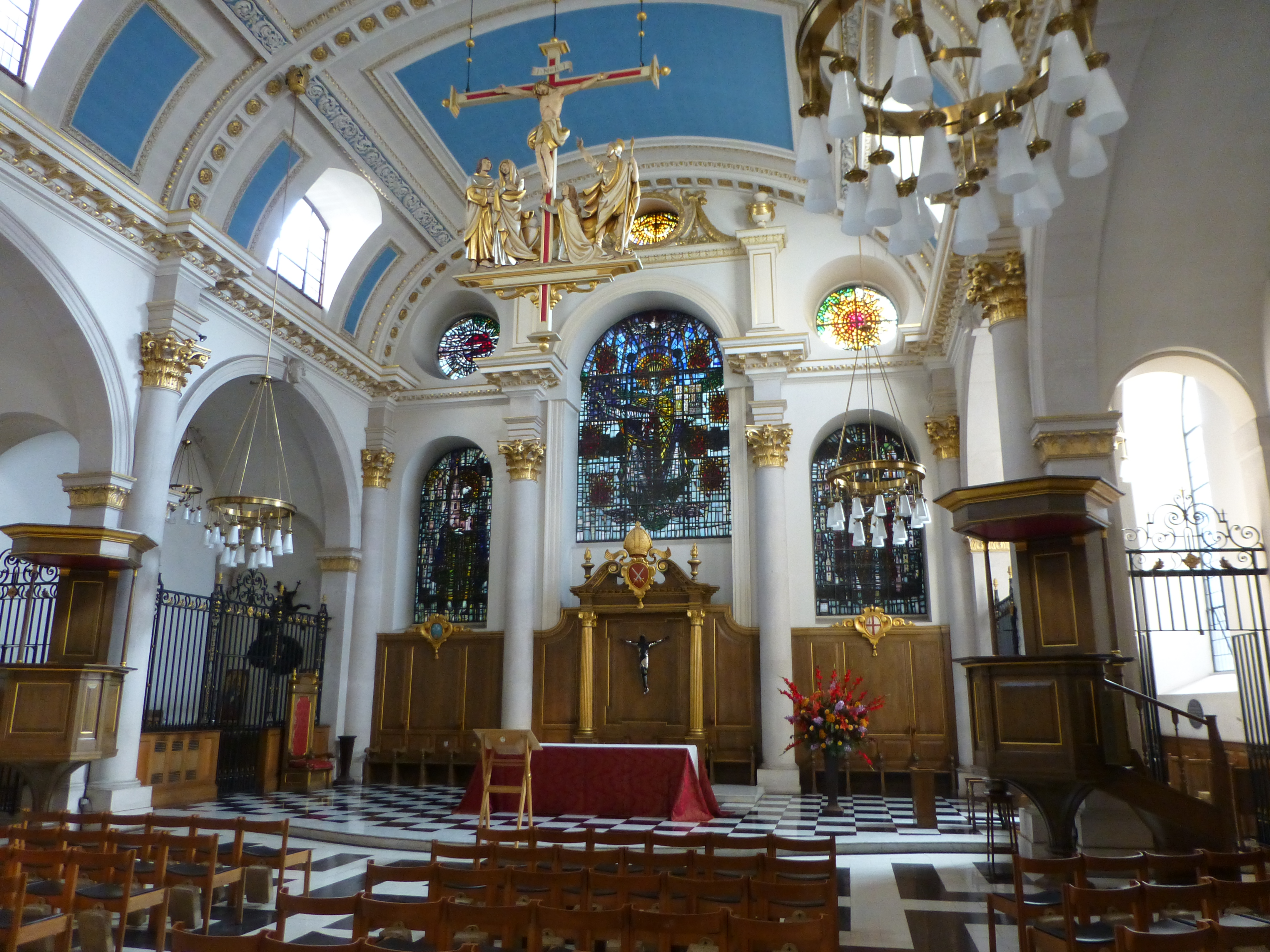
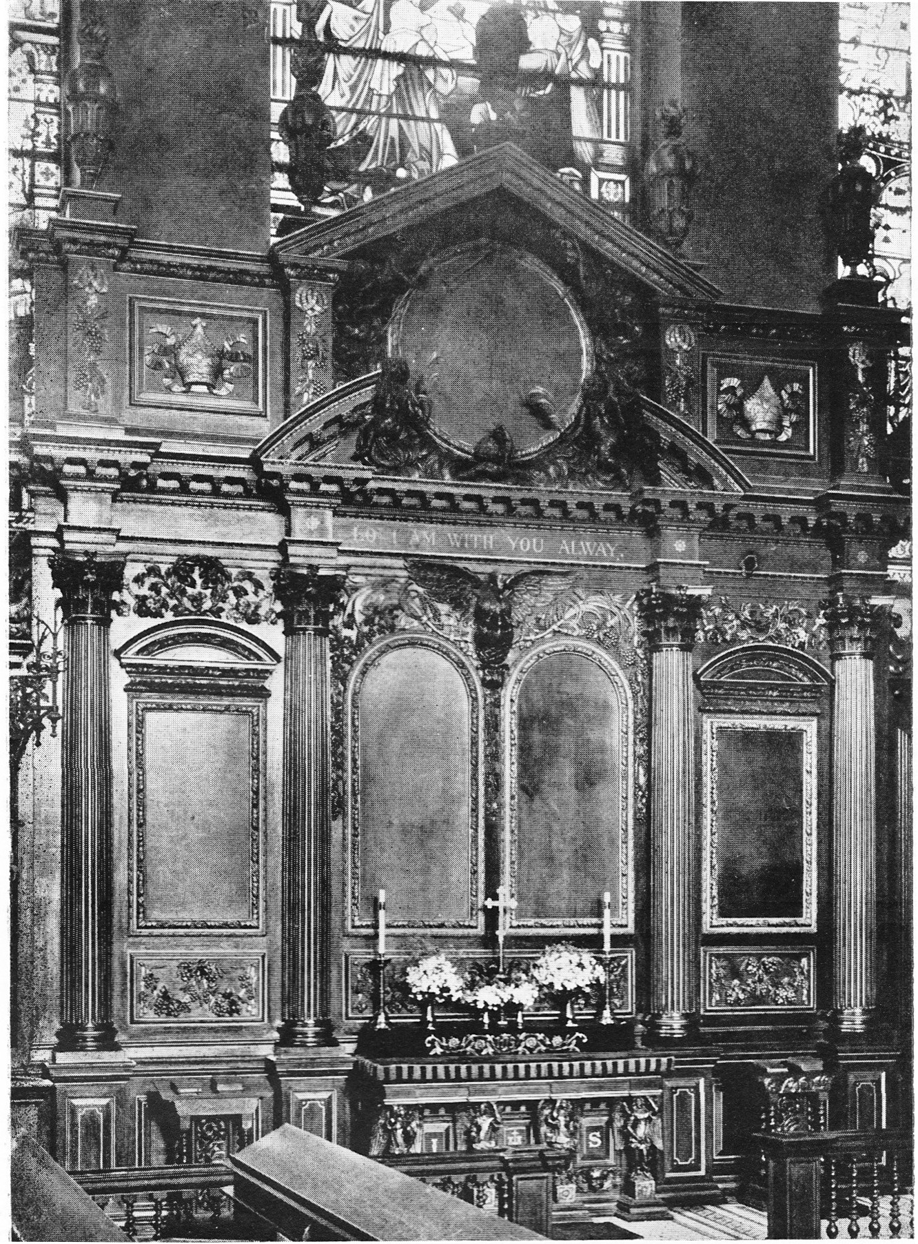
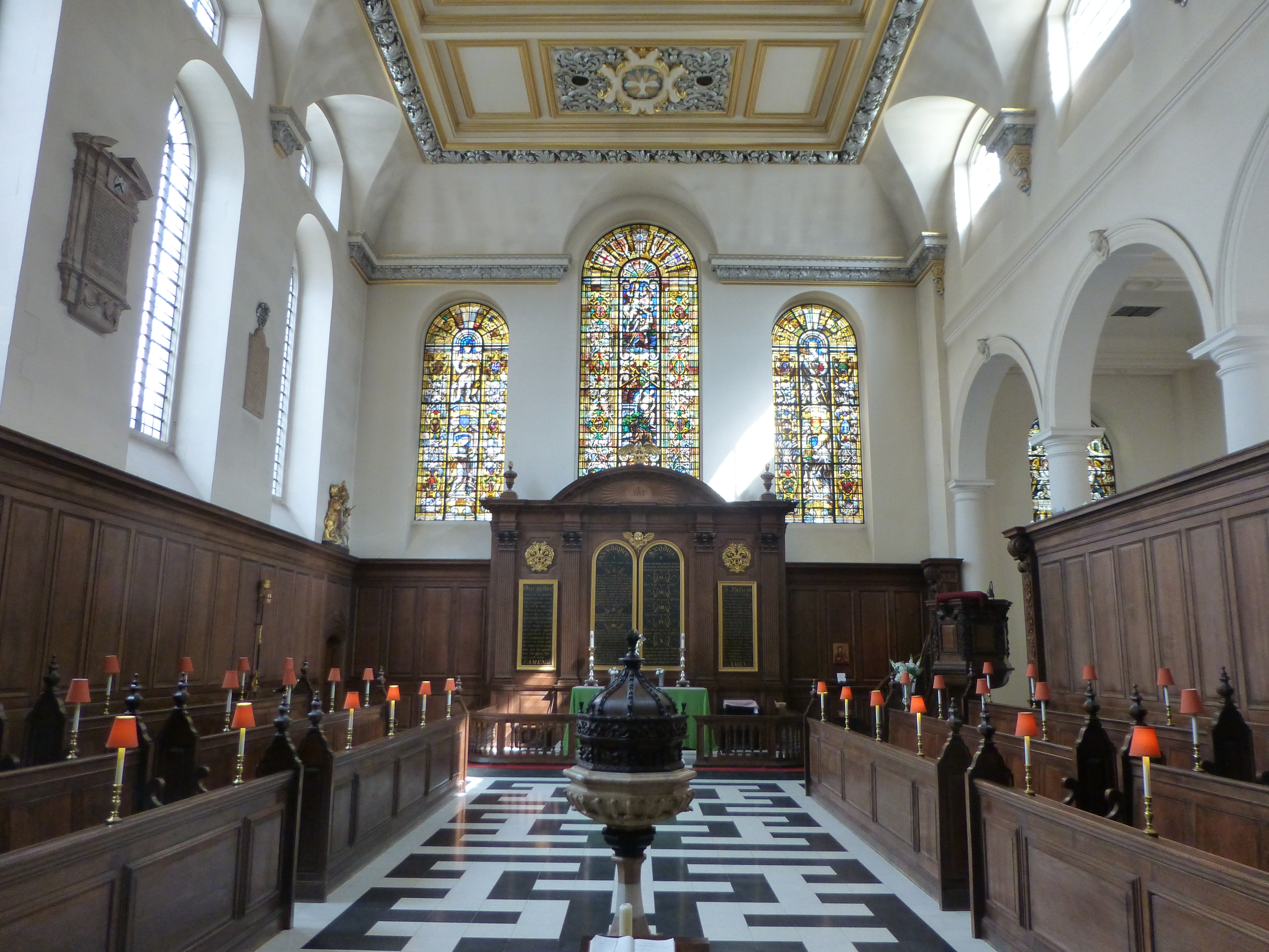
On entering the church from the street we look straight at the gilded reredos behind the altar.

St Clement Eastcheap 6

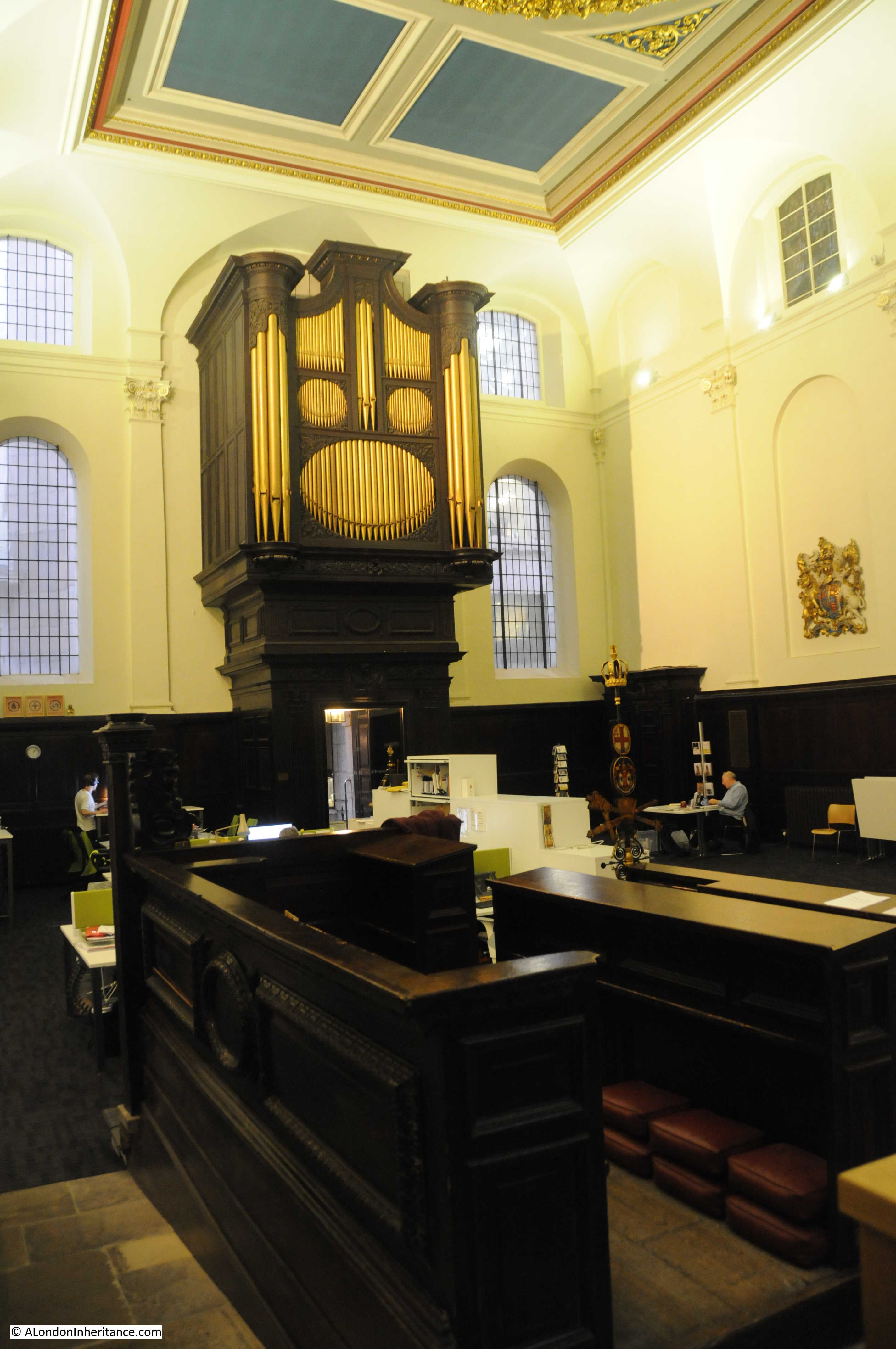
There was some redesign of the interior of the church during the Victorian period and much of the ceiling was renewed in 1925.

The interior of the church has always been relatively simple, Stowe summed up the church as “This is a small church, void of any monuments”, and today the church performs a function which would have surprised Stowe. The pews have been removed and half of the floor space is now office space for charities. A good use and which helps the continued occupation of the church.

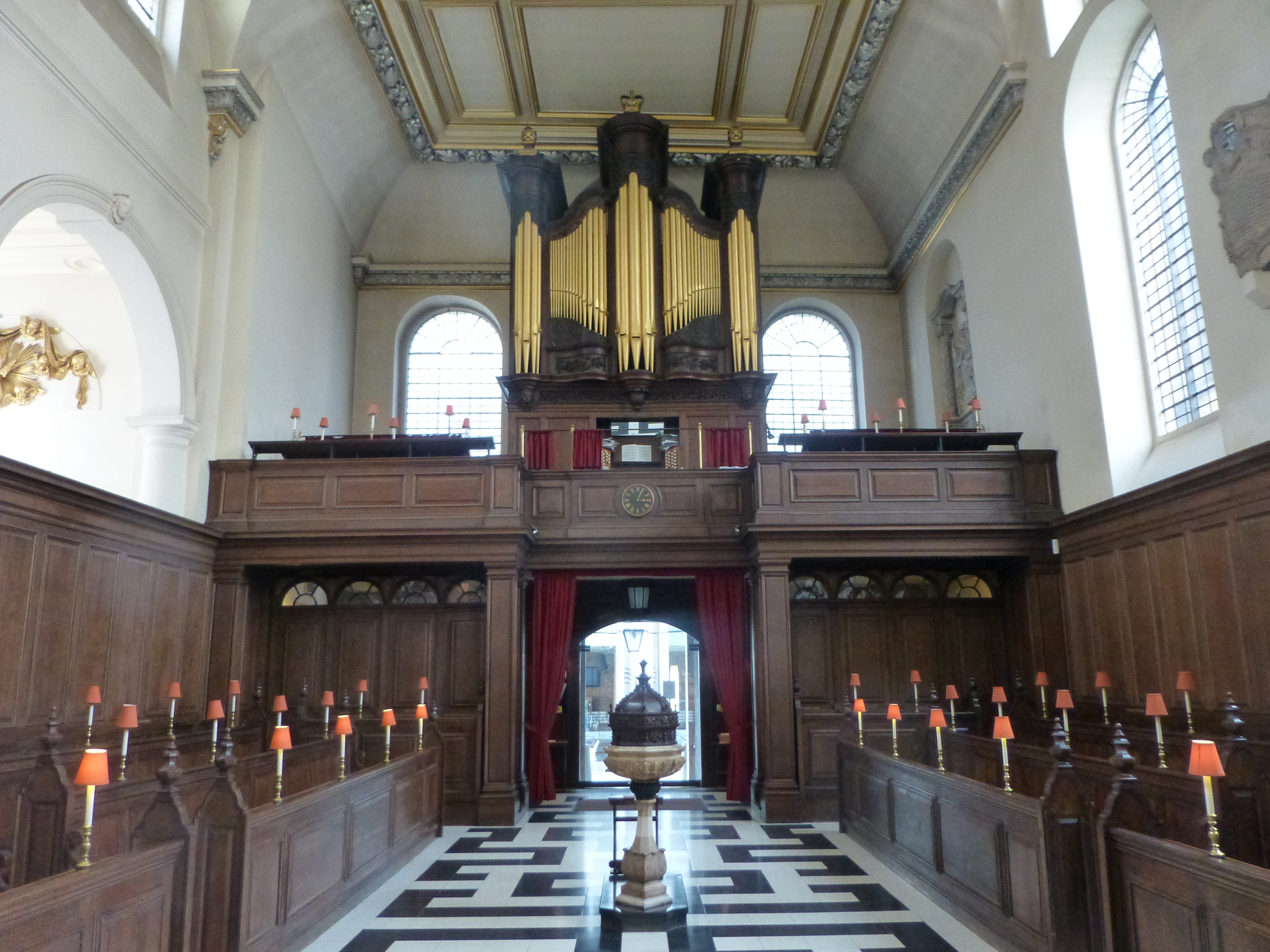
Looking back towards the entrance with the charity office space to the left. The original oak casing surrounding the organ appears to have a look of surprise, perhaps because of the current use of the church.

St Clement Eastcheap 5

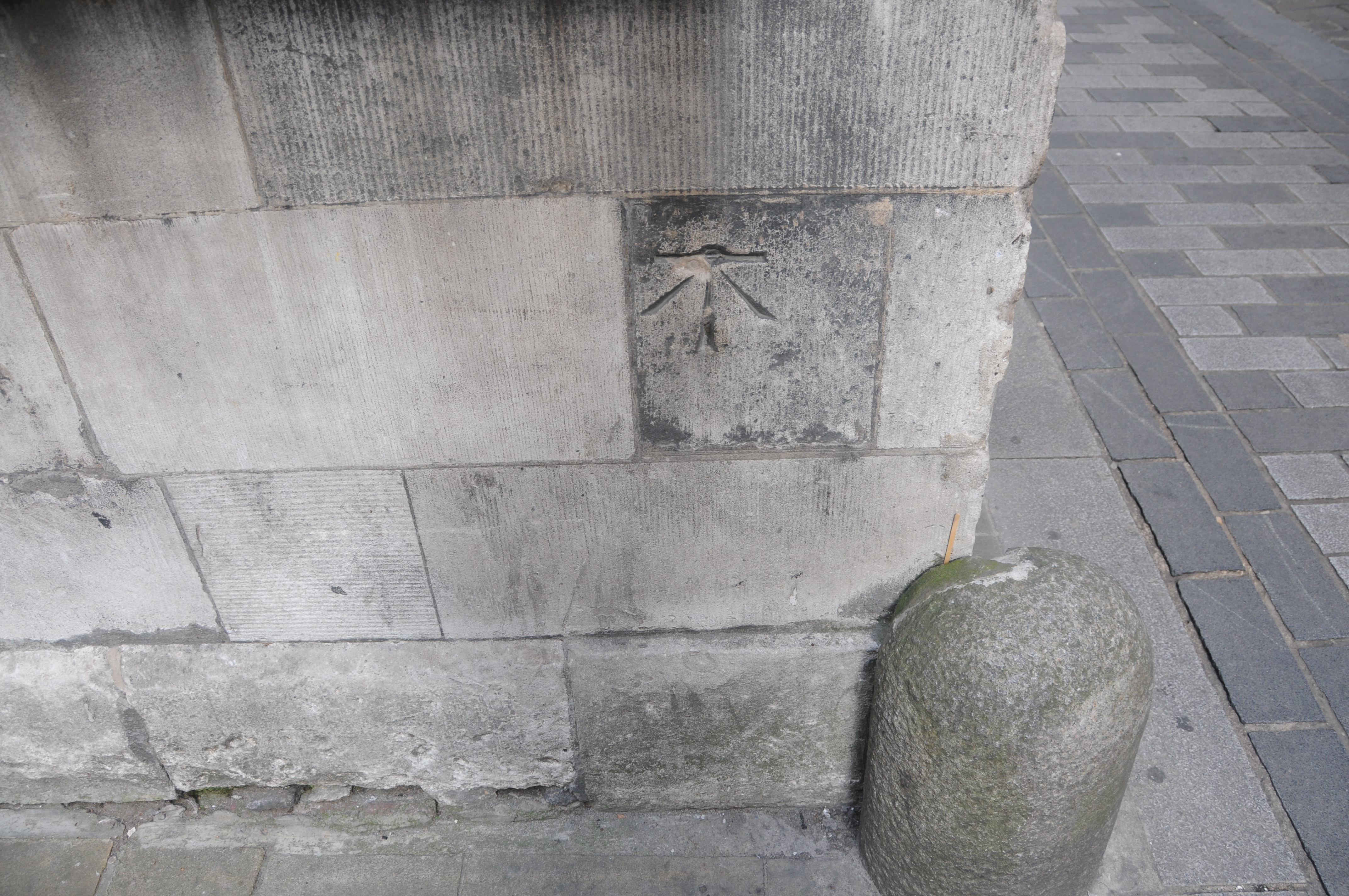
One of the most unique features of the church can be found in the toilets. Modern toilets have been built up against the original wooden wall panelling as can be seen in the photo below. It cannot be seen in the photo due to the lighting and dark panelling, but on the panelling, just to the left of the small wooden table is some very early 18th century graffiti.

St Clement Eastcheap 8

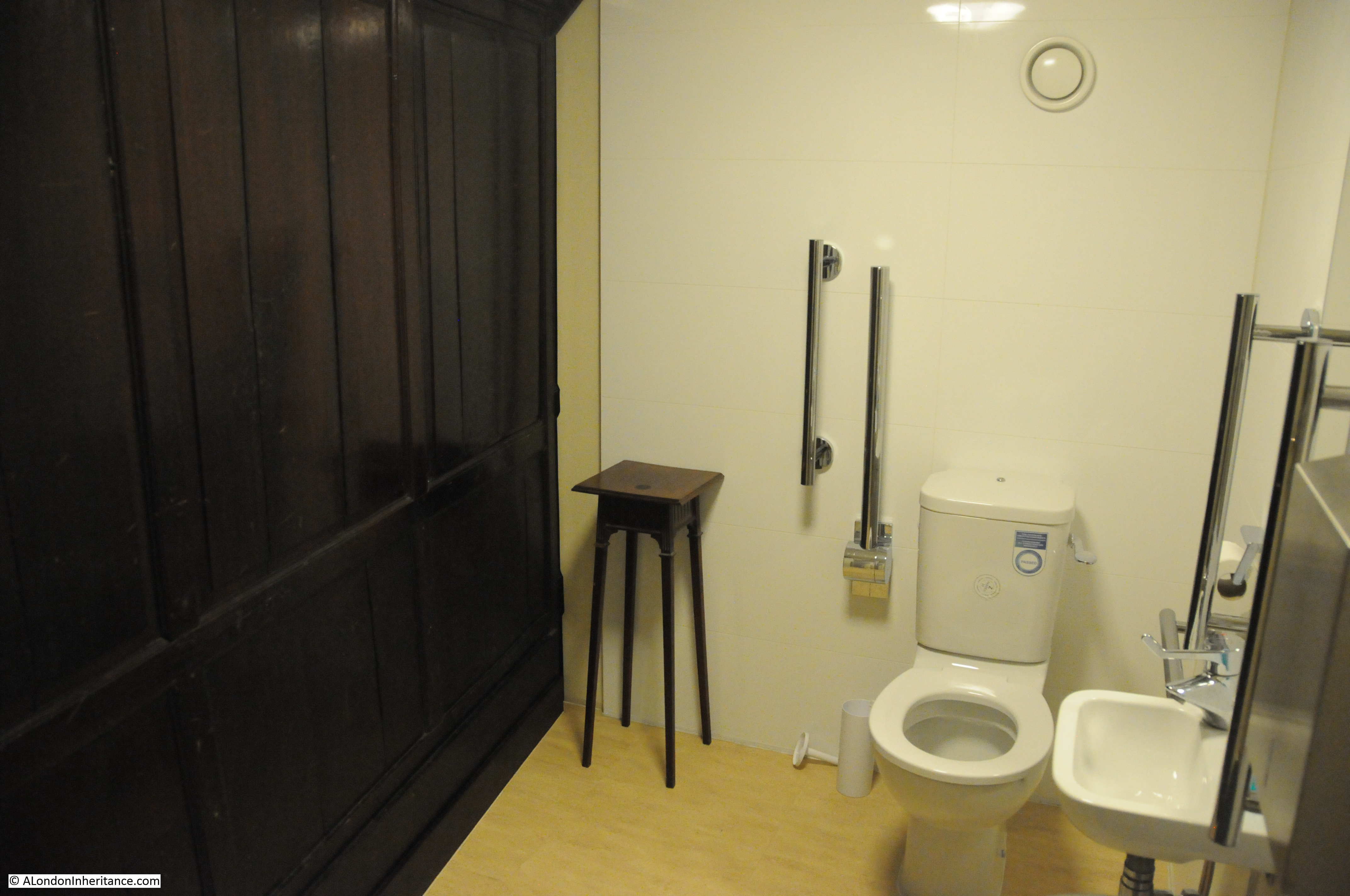
A close up of the graffiti, dating from the year 1703, carved 15 years after the church was completed. A remarkable survival and very surprising to find this in such a location.

St Clement Eastcheap 9

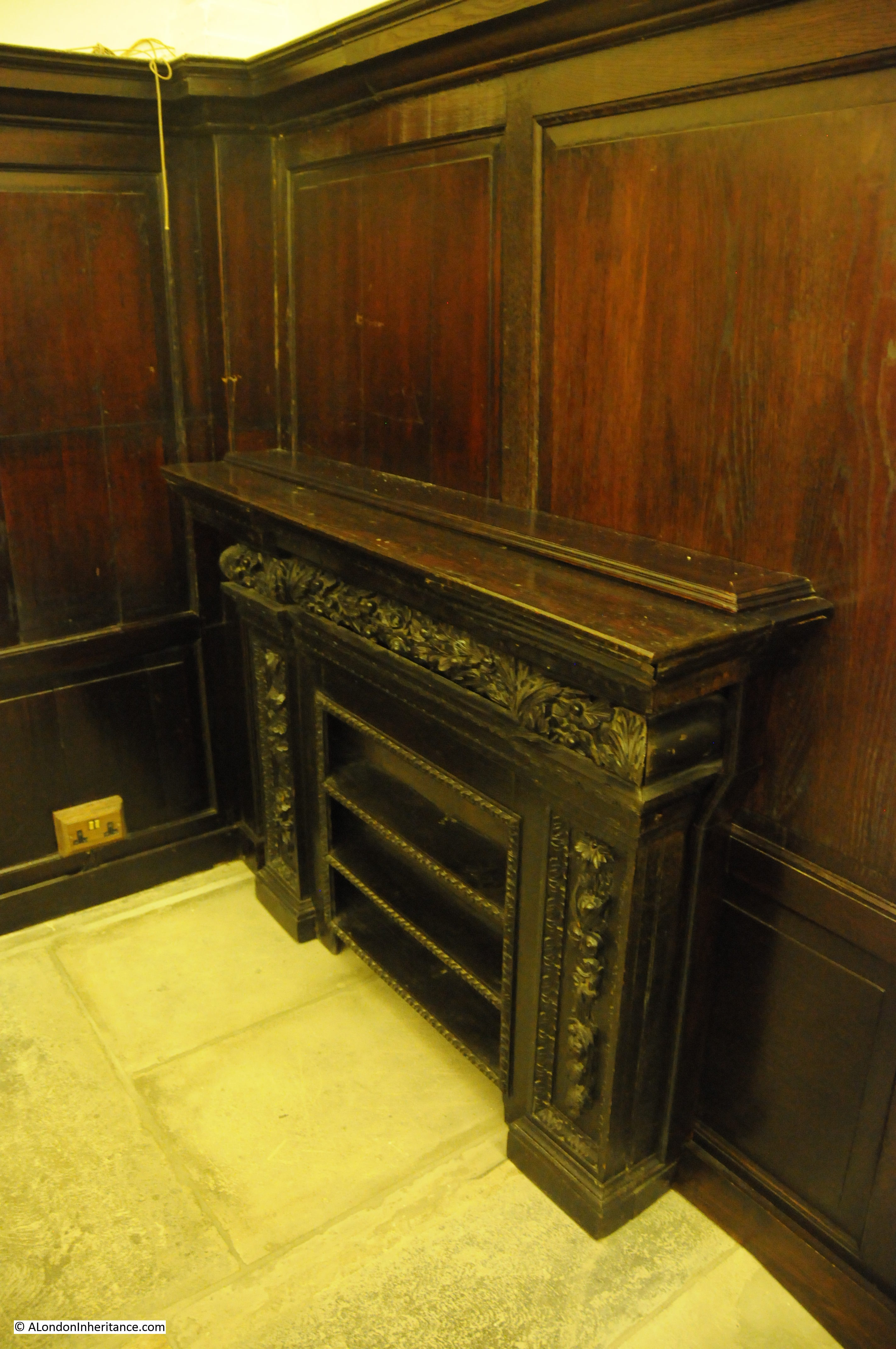
The church also retains some original Bread Shelves, used to store bread ready for charitable distribution.

St Clement Eastcheap 7

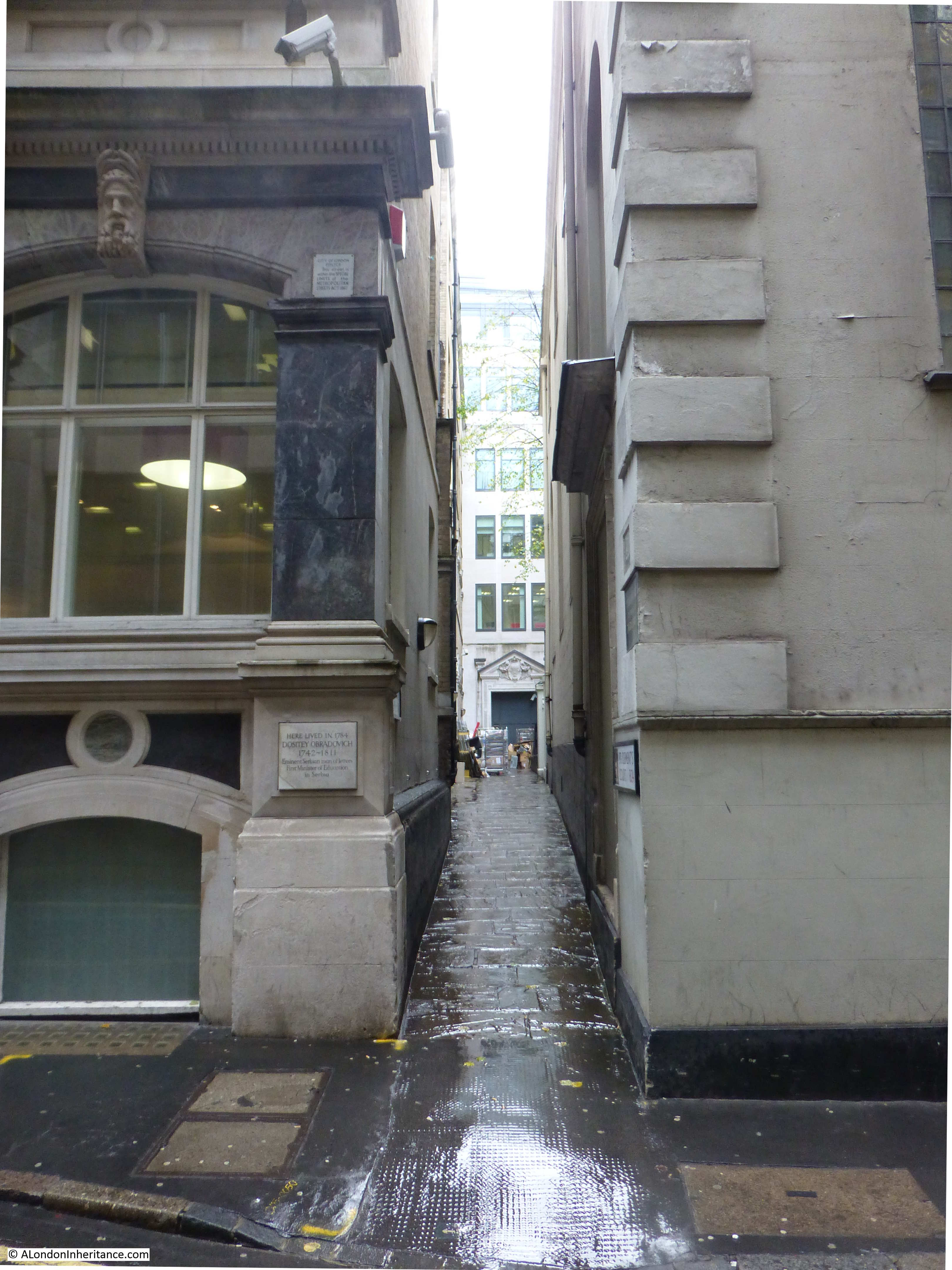
To the side of the church is St Clement’s Court, a narrow lane leading to the small churchyard at the rear of the church.

The plaque on the building on the left reads:

Here lived in 1784

Dositey Obradovich

1742 – 1811

Eminent Serbian man of letters

First Minister of Education

in Serbia

The lane also provides access to some of the office buildings that back onto the rear of the church.

St Clement Eastcheap 13

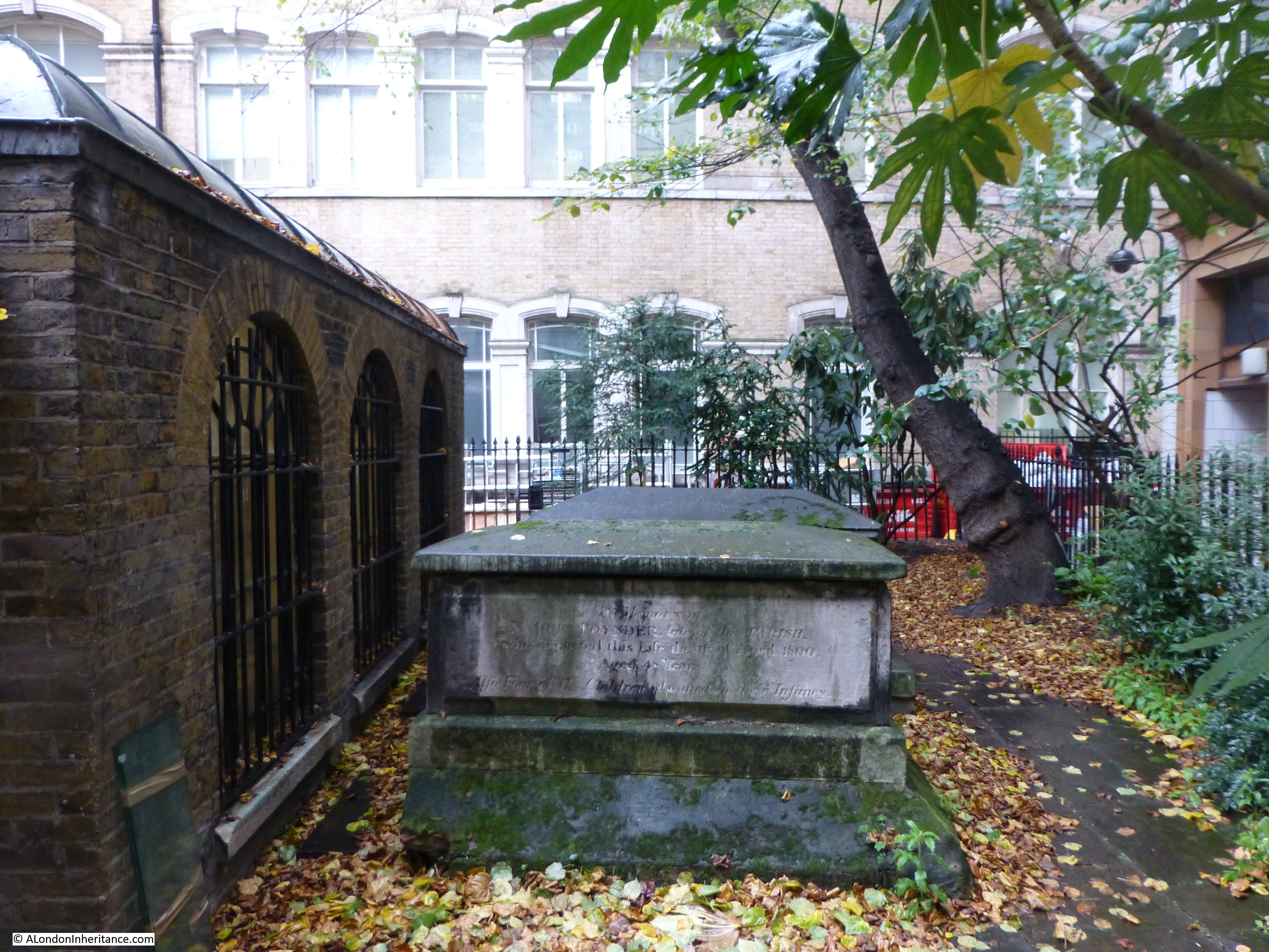
The remaining churchyard is very small with only a couple of in-situ graves. In 1910, Sir Walter Besant wrote of the churchyard:

“In Church Court we come to the ancient graveyard of St Clement, a minute space with one great shapeless tomb in the centre of the asphalt and a few small erect tombstones on the little border running inside the railings”

Not much has changed in the 105 years since that was written.

St Clement Eastcheap 4

And a couple of gravestones which have been relocated up against the wall of adjoining buildings.

St Clement Eastcheap 3

The church of St Clement, Eastcheap is easy to miss when walking in the area, but well worth a visit, including an essential trip to the toilet to see graffiti from 1703.

alondoninheritance.com

A Walk In And Around St Mary-le-Bow

St Mary-le-Bow in Cheapside is one of the more well-known of the City churches being home to Bow Bells. The church also has one of the finest Wren steeples which, unlike the church adjacent to the steeple, survived wartime bombing.

My father took the following photo just after the war from Friday Street looking across the ruins of the city towards St Mary-le-Bow

St Mary-le-Bow

Friday Street is now lost under the One New Change development. Friday Street was on the south side of Cheapside, roughly halfway between Gutter Lane and Wood Street on the northern side, and ran down to Watling Street. The tower and steeple appear relatively unscathed from the outside unlike the church to the lower right which, although external walls remain, has been gutted and is now an empty shell. Within the tower fire did cause much damage and as a result the bells crashed to the ground.

As with many of these photos taken just after the war, it is impossible to take a comparison photo today. The space in between is now full of office blocks with no chance to get any view of the church.

St Mary-le-Bow is now best viewed from Cheapside and the small square adjacent to the church from where the beauty of the spire can be admired.

A Church has stood on the site of St Mary-le-Bow for many centuries. The church to the right rather than the tower is the original site of the church. Apparently when the church was rebuilt after the great fire Wren brought the tower forward onto Cheapside and connected the tower to the church with the vestibule which can be seen in the above photo as the brick wall between tower and church.

As evidence of the age of the church, below is an 11th century crypt constructed when the church was rebuilt by Lanfranc of Canterbury as his London headquarters.

The crypt, although with some changes resulting from reconstruction of the church above following the great fire and wartime bombing is in fine condition and can still be visited with two entrances, either through the vestibule or through a small set of steps at a corner of the church in the square outside.

Part of the crypt of St Mary-le-Bow which also extends to the left of the photo.

St Mary-le-Bow

Following the great fire, Wren planned the reconstruction of the church. The original tower was not badly damaged and much money was spent on attempted restoration, however re-building was eventually found to be inevitable. This is when the decision was taken to emphasise the importance of the church by rebuilding with a magnificent tower and bringing the tower forward to Cheapside. The former church stood about forty feet southwards of Cheapside and in order to bring the new tower forward to the line of the street the site of a house not yet rebuilt after the fire was purchased.

The accounts for the rebuilding of the tower show the expense that was put into the construction:

To Thomas Cartwright and John Thompson, Masons, for building ye whole Stone wall inside and outside of ye New Tower of Bow from ye pavement to ye top of ye first great cornice with ye winding Staires ye Great Neech Portalls Pillasters windows and carvings according to contract by the great bearing date March  3 1676 – £1600

ffor building from ye top of ye first great Cornice to ye top of ye round Cornice according to Contract signed Septr. 22, 1676 – £2550

from ye Top of ye Cornice over ye Ionick Pillars to the top of ye Cornice under ye Pedestall, ffeb. 27, 1679 – £467, 1, 6

from ye Top of ye Cornice under ye first pedestal to ye under side of ye Spire, June 27, 1679 – £295, 16, 6

about finishing ye Piramids Pinicles and other works of ye Tower, June 8, 1680 – £551, 16, 0

The accounts continue to list in detail the various items and costs for the construction of the Tower which finally amounted to £7,388 8s 7d which must have been a considerable sum in 1680, with a further £8,033, 0s, 5d spent on the church resulting in a combined total of £15,421, 9s, 0d which is by far the most spent on the reconstruction of any of the City churches. For comparison, St. Lawrence Jewry was the next most expensive at £11,870 which really highlights the importance of St Mary-le-Bow.

The tower and steeple are best viewed from Cheapside.

St Mary-le-Bow

And from the small square adjacent to the church, we can admire the detail of the steeple. The steeple is 224ft in height and is second only in height to St. Brides.

St Mary-le-Bow

My father also took another photo from roughly the same spot as the first showing the full height of the spire:

St Mary-le-Bow

Rebuilding after the war was carried out between 1956 and 1964. The light inside the church along with the white walls, blue panels, gold decoration and stained glass is magnificent:

St Mary-le-BowUnlike the tower and steeple, the main church building is very difficult to view from a distance. The main church is surrounded by buildings and the best viewing point is from the small square outside the church. The following photo shows the church with the tower to the left. It was possible to get a bit further back, however the tree then obscured much of the church. Even so, you can see from my father’s original photo that although the core of the church was gutted, the walls remain to this day.

St Mary-le-Bow

The statue to the left of the photo is Captain John Smith, a former parishioner of the church. It was Captain John Smith who was leader of the Virginia Colony and was the first English explorer to map the Chesapeake Bay area and New England during the British settlement along the east cost of the United States.

As always, I find it fascinating to walk around a building to see what can be discovered on the external walls. Hiding at the top of the walls are these headers to rain water down pipes continuing a long tradition of dating and decorating these architectural features. A visible reminder of the rebuilding of the church after the war.

St Mary-le-Bow

There is also a plaque removed from the church of All Hallows, Bread Street commemorating that John Milton was baptised in All Hallows.

All Hallows, Bread Street was a victim of the gradual consolidation of parishes over the centuries. It was not just the Great Fire of London and the Blitz that destroyed the City Churches, there was an ongoing process of consolidation. As well as All Hallows, St. Pancras, Soper Lane was also united with St. Mary-le-Bow.

St Mary-le-Bow

On the corner of the tower you will also find the following carving:

St Mary-le-Bow

This is nothing to do with the function of the church, they are found carved on buildings, bridges and walls across the United Kingdom.

They are Ordnance Survey Bench Marks carved into structures that are likely to be long-lasting and stable to provide a height reference. The horizontal line is the height reference above the Ordnance Survey datum.  This was used in the re-levelling of Greater London between 1931 and 1934 and established a height of 56.269ft above mean sea level at Newlyn in Cornwall (the Ordnance Survey datum for measuring heights above sea level). So if you now walk along Cheapside, past St. Mary-le-Bow, at least you know the height above sea level !

St Mary-le-Bow has always been a prominent landmark in Cheapside, a very busy route between Bank and St. Paul’s.  The following view taken from an early postcard shows how the steeple stood well above the surrounding buildings and then as now a clock on the front of the tower kept the busy people of Cheapside well-informed of the time of day.

St Mary-le-Bow

A fascinating church and I have not even covered the story of the Bow Bells, the nursery rhyme , Dick Whittington etc. as these are all well documented elsewhere.

The sources I used to research this post are:

  • The Old Churches Of London by Gerald Cobb published 1942
  • London by George H. Cunningham published 1927
  • Old & New London by Edward Walford published 1878

alondoninheritance.com

St Vedas and Foster Lane

This week’s photo finds us in Gresham Street in 1947 looking towards St. Paul’s Cathedral. With the exception of St. Paul’s and the church spires, all the other buildings have been demolished over the years following the war and only the street names and churches provide a tangible link back to the long pre-war period.

St Vedas

The church in the foreground is St Vedas on Foster Lane, a Wren church built following the Great Fire of London.

As with many City churches, the core of the church has been destroyed with only the shell remaining, however the tower still stands and fortunately is structurally sound. It was the raid on the 29th December 1940 that caused the majority of the damage in the area around St. Paul’s. As well as high explosive bombs, over 100,000 incendiary bombs created so many fires that the area was devastated. Only the work of many volunteer fire-fighters managed to save St. Paul’s.

My grandfather had experience of incendiary bombs during one of the many raids that hit the area they were living in just to the west of Euston Station. An incendiary penetrated the flat above and armed with buckets of water and a stirrup pump he managed to put it out before a fire took full hold. If you could get to an incendiary bomb quickly you would have a chance. The problem was the sheer number of them that would fall in a raid with limited numbers of fire-fighters to get to them quickly, or they would lodge in inaccessible places and could not be put out. This, along with the risk of high explosive bombs falling at the same time.

The photo was taken from Gresham Street, looking across Gutter Lane to St Vedas. I spent an hour somewhat optimistically walking around this area trying to get any view of St Vedas from Gresham Street and surroundings for a comparison photo, however with the degree of new building in the area it is impossible. Coming from the Gresham Street area, you do not realise there is a church until you are almost alongside.

The only place I could get a clear photo of St Vedas is from the Cheapside / New Change crossing just across from St. Paul’s where St Vedas still stands proudly in amongst the building of the last 65 years.

St Vedas

A church was established on the site in the twelfth century dedicated to St Vedas who was a French saint, Bishop of Arras and Cambray in the reign of Clovis (who lived from 466 to 511) and apparently performed many miracles on the blind and lame. Following the invasions of the region by tribes in the late Roman period, Vedas helped to restore the Christian Church.

The dedication to St Vedas may have been by the Flemish community in London in the 12th and 13th centuries. It is an unusual dedication for a church in the United Kingdom as there is only one other church that is currently dedicated to St. Vedas which is in Tathwell in Lincolnshire.

Foster Lane was also known in the 13th Century as St Vedas Lane, which was gradually corrupted over time to Foster Lane (the church has also been referred to as St. Foster).

Foster is evolved from Vedast in such steps as Vastes, Fastes, Fastres, Faster, Faister and Fauster. For 100 years or more prior to the Great Fire, the church was known as St. Foster’s and is now also known as St. Vedas alias Foster.

In the 19th century, the interior of St Vedas was described as:

“a melancholy instance of ornamentation. The church is divided by a range of Tuscan columns, and the ceiling is enriched with dusty wreaths of stucco flowers and fruit. The altarpiece consists of four Corinthian columns, carved in oak and garnished with cherubim and palm branches. In the centre above the entablature is a group of well executed winged figures and beneath is a sculptured pelican.”

From 1838 there is a reference that the church did not have stained glass, the windows being covered by transparent blinds painted with various Scriptural subjects.

The following photo from “The Old Churches of London” shows the altarpiece  in St. Vedas before destruction in the war, exactly fitting the 19th century description.

St Vedas

Work on reconstruction of St. Vedas commenced in 1953 and it is now a very bright and simple interior. There is still an altarpiece but without the degree of melancholy ornamentation as in the 19th century description. The following photo is as you enter the church and look down to the altar.

St Vedas And looking back towards the entrance to the church:

St Vedas

The following picture from “The Old Churches of London” provides an interesting view of the surroundings of St Vedas looking towards St. Mary-le-Bow in Cheapside.

St Vedas

This was still at a time when the spires of the City churches stood well above the surrounding buildings.

The spire of St Vedas is unusual when compared to many other Wren churches in that there are no vases to decorate the spire. The contrasting surfaces and cornices, concave and convex, emphasise the angles and on the light and shade across the spire.

It is always interesting to look at the outside of City buildings and on St Vedas I found two boundary markers just to the side of the main door. Interesting is the use of “alias Foster” as part of the name.St Vedas

St Vedas is a lovely church to visit and despite being so close to St. Paul’s and the thousands of people who visit this landmark everyday, and being in the heart of the city, it is a quiet and peaceful church. In the all too brief fifteen minutes I spent visiting the church I was not disturbed by a single person.

The sources I used to research this post are:

  • The Old Churches Of London by Gerald Cobb published 1942
  • London by George H. Cunningham published 1927
  • Old & New London by Edward Walford published 1878

alondoninheritance.com