Tag Archives: City Churches

Christopher Wren, London Transport and St Mary Aldermary

Christopher Wren, London Transport and St. Mary Aldermary – there is an obvious link between two of those subjects, but London Transport looks out of place, hopefully it will become clear.

One of the pleasures of buying second hand books is not just the book, but what can be found in the book. A few years ago, I purchased the book “Wren and His Place In European Architecture” by Eduard Sekler.

There is no publication date listed in the book for the edition I found in the bookshop in Chichester, however at the end of the preface to the book, the date August 1954 is given, so the book possibly dates from the mid 1950s.

The purpose of the book was to “promote a better understanding of Wren’s work as an architect by relating it t contemporary architectural activity on the Continent and Wren’s own intellectual and spiritual background” – a task that it does rather well.

The bonus with the book, was what was tucked in between the pages, a small booklet published by London Transport in 1957:

Christopher Wren

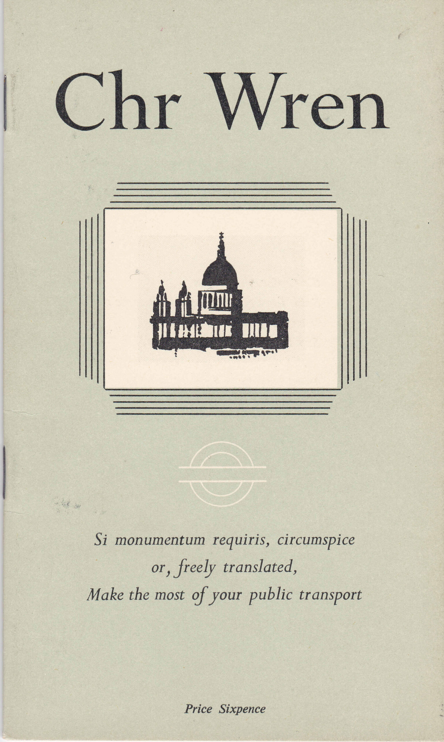
The booklet was one of a number published by London Transport which had the underlying aim of encouraging people to get out and explore the city. and to “Make the most of your public transport”.

The Latin “Si monmentum requiris, circumspice” is taken from Wren’s tomb in St. Paul’s Cathedral, and which translates as “If you seek his monument, look around you”.

The use of the phrase on the tomb is meant to refer to the cathedral which Wren designed, but in this case, London Transport have admitted that this is freely translated to making the most of your public transport, presumably to explore London to find the many buildings designed by Christopher Wren which are also his monuments.

The London Transport booklet is a 19 page guide to the architecture of Christopher Wren, in and near London:

Christopher Wren

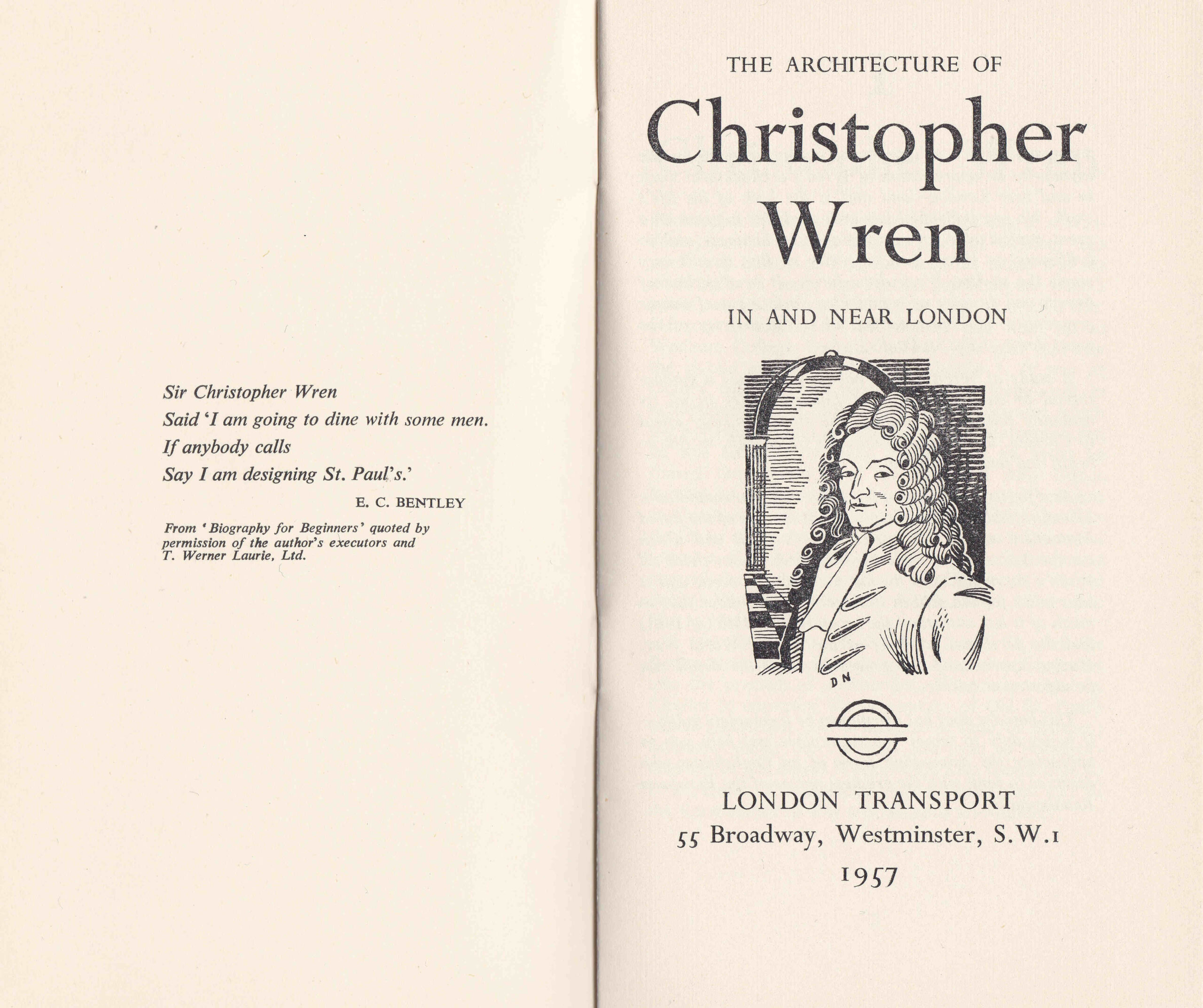
The booklet is organised into 7 chapters, which cover:

  • Chapter 1 – An overview of Christopher Wren
  • Chapter 2 – Architect, an overview of Wren’s work
  • Chapter 3 – St. Paul’s Cathedral
  • Chapter 4 – City Churches
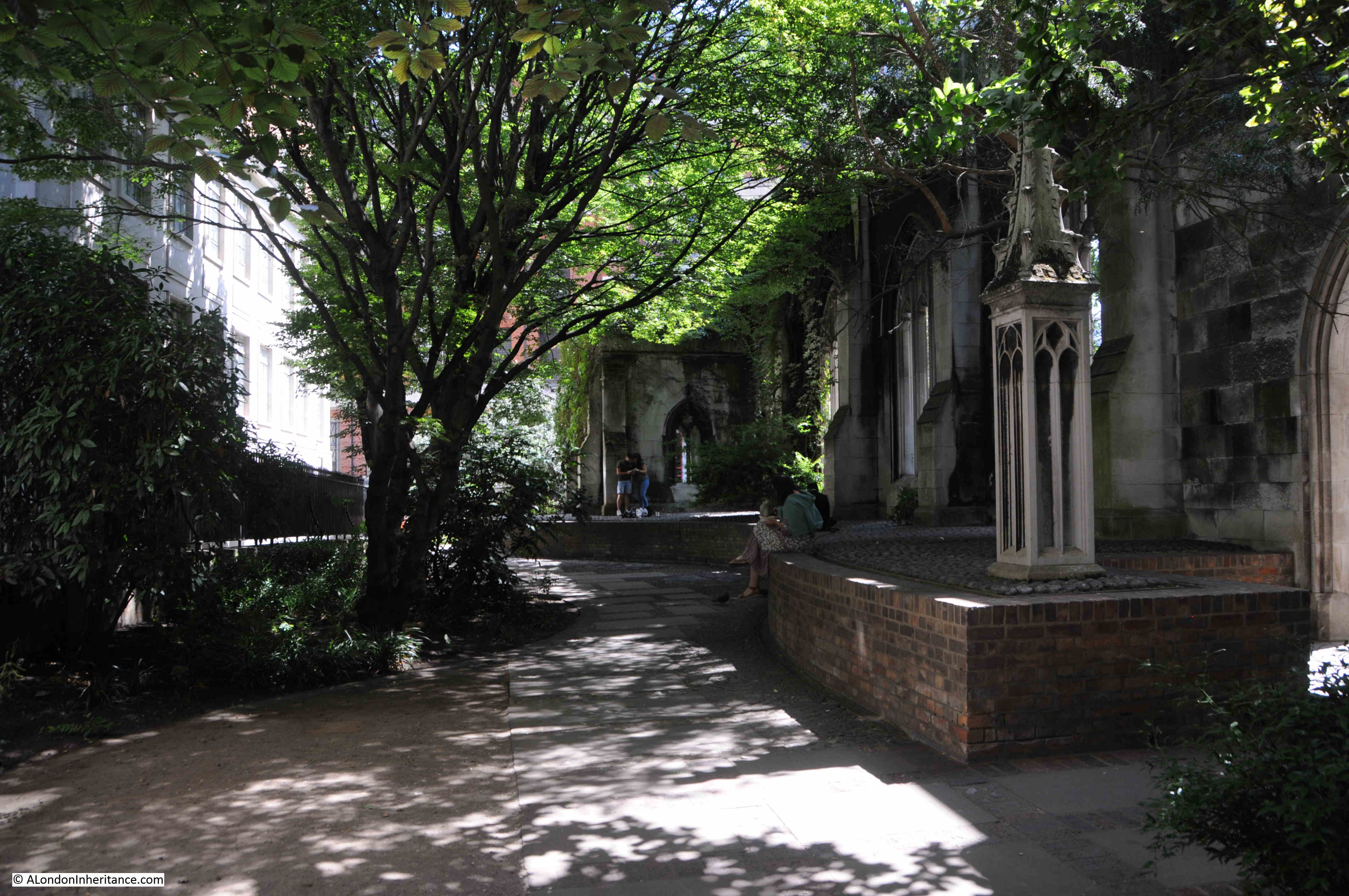
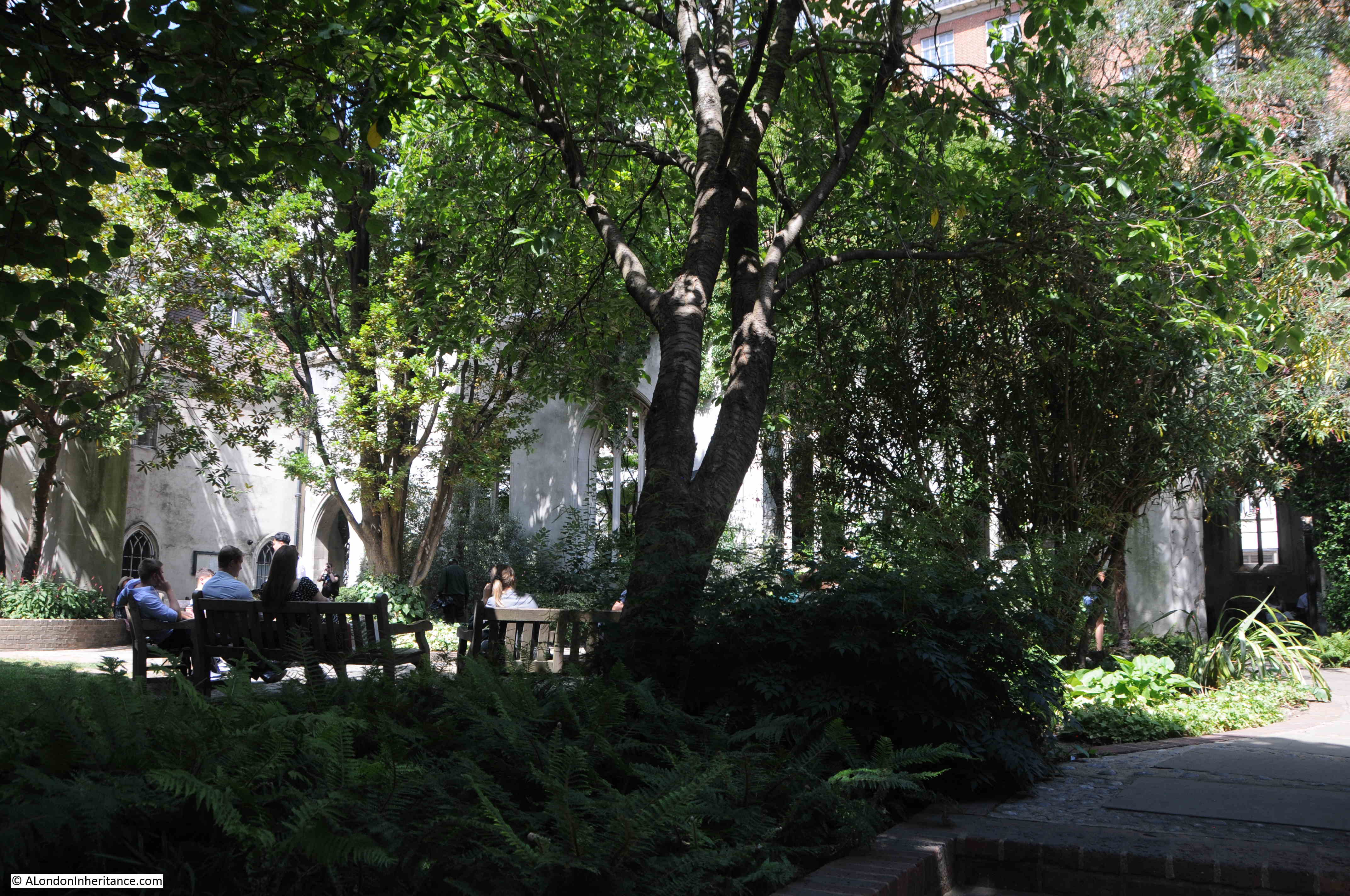
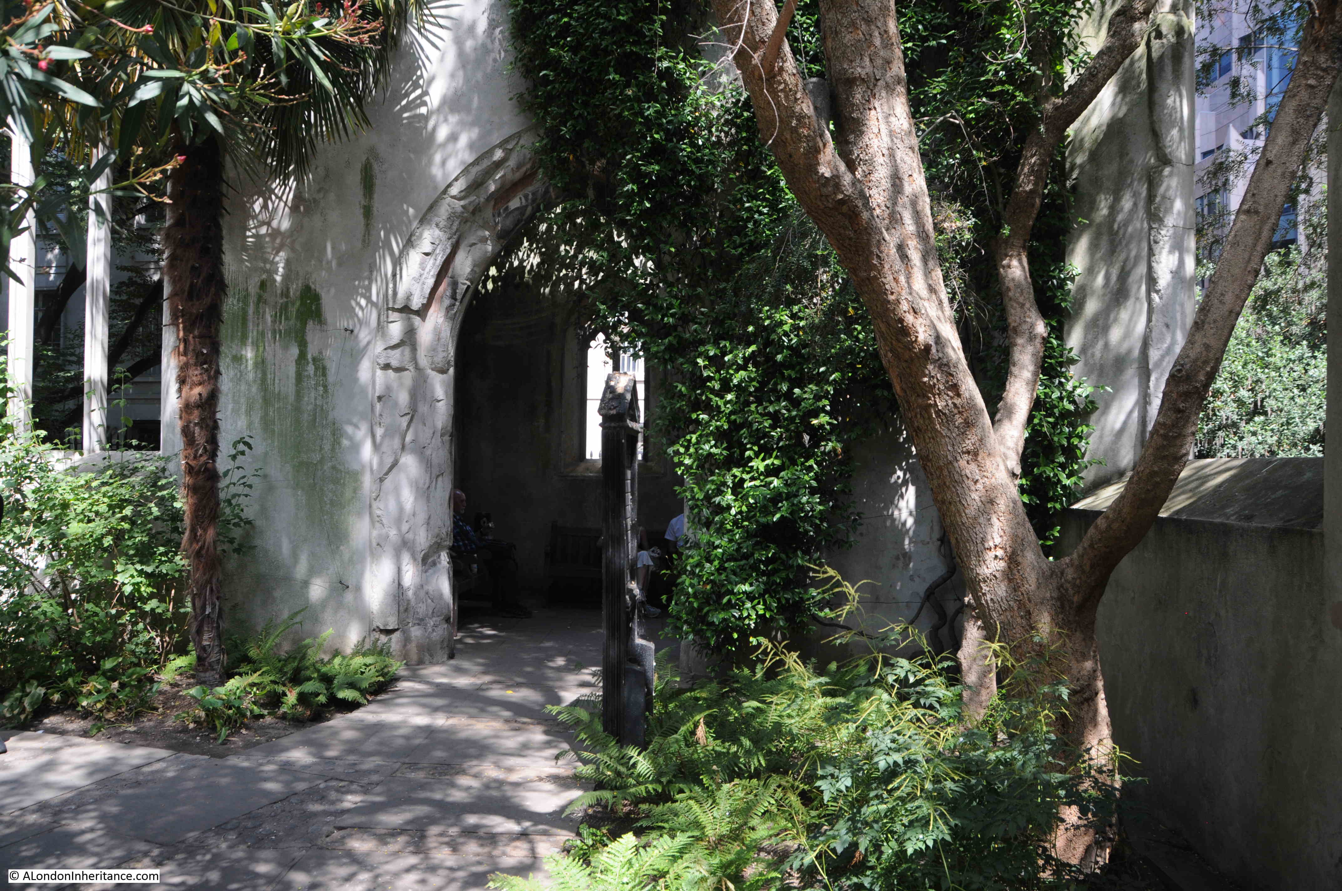
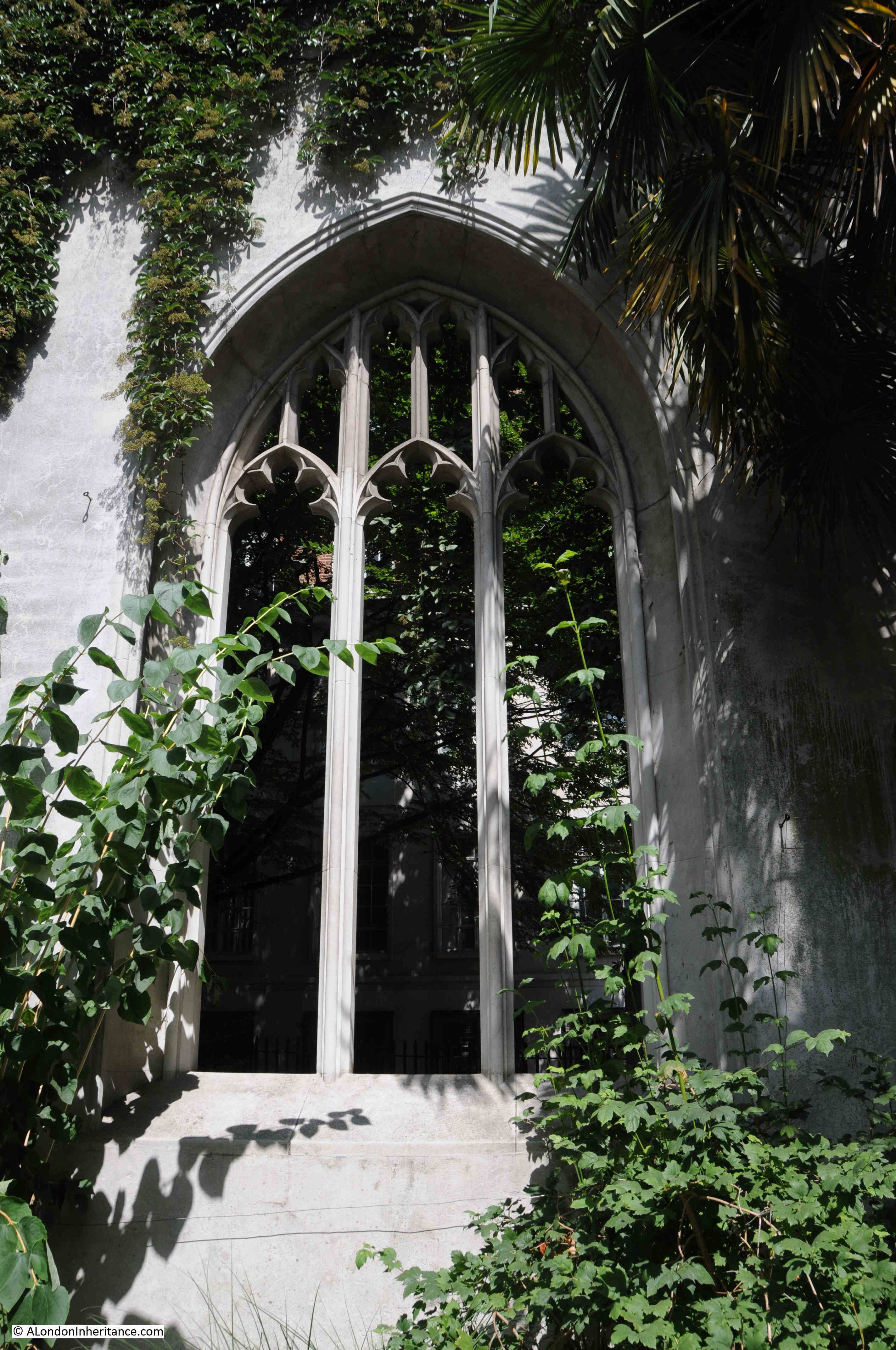
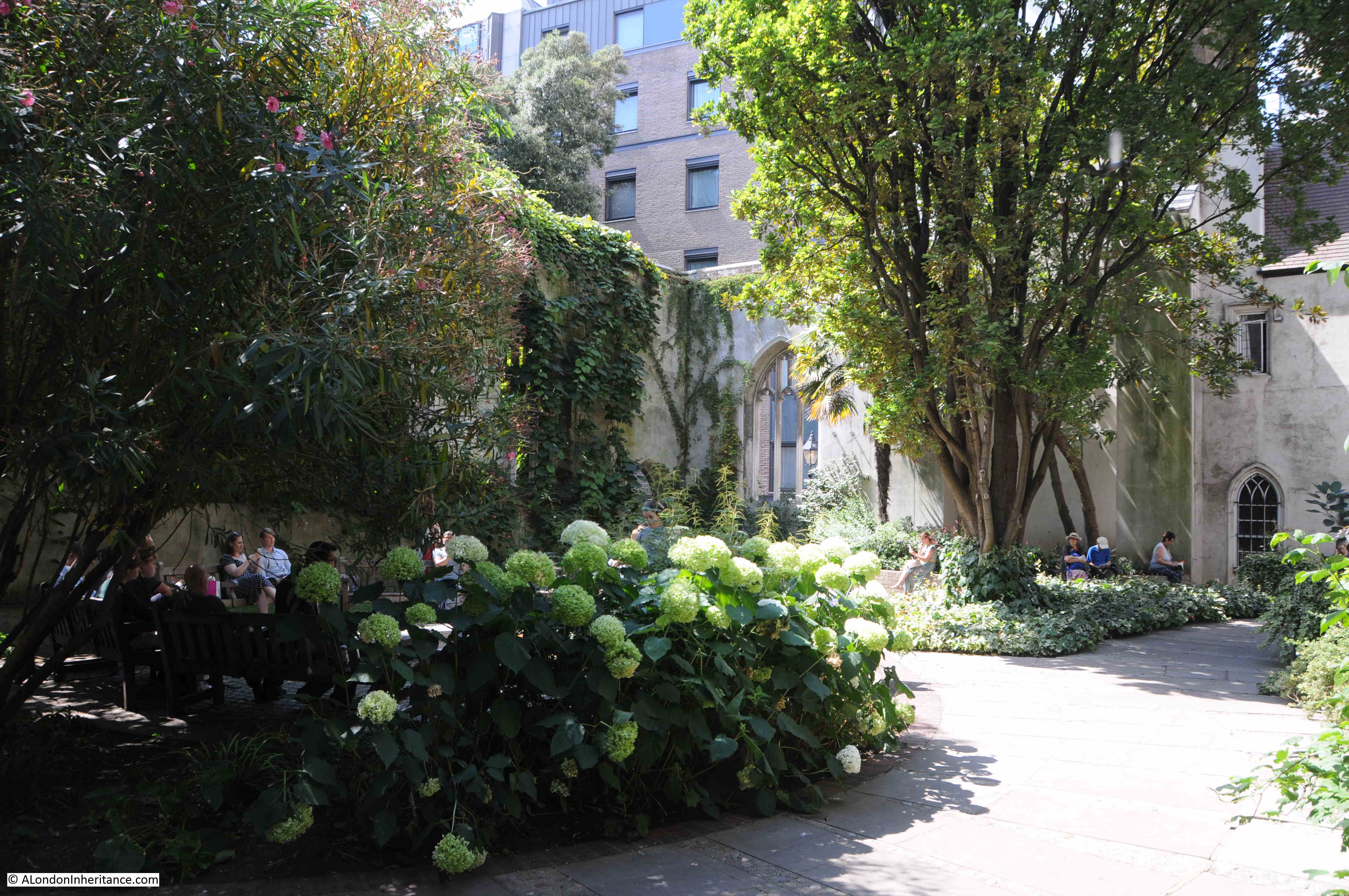
  • Chapter 5 – Remnants, Wren’s churches that still survive although their fabric had been devastated by bomb damage
  • Chapter 6 – Secular Buildings, Including Chelsea Hospital, Morden College and the Royal Naval Hospital etc.
  • Chapter 7 – How to get there, underground stations, bus routes and trains to use to get to the places mentioned in the booklet

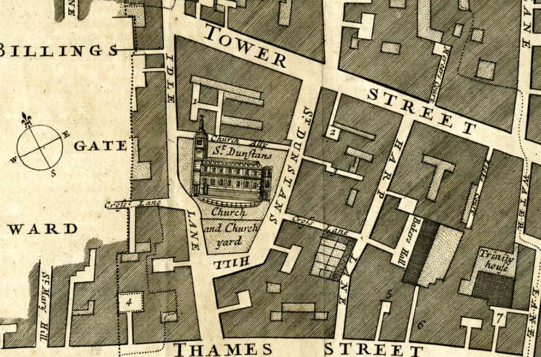
At the back of the booklet, there is a map showing Wren’s City Churches, along with Underground Stations, so the visitor could work out which station to use to visit some of Wren’s City churches:

Christopher Wren

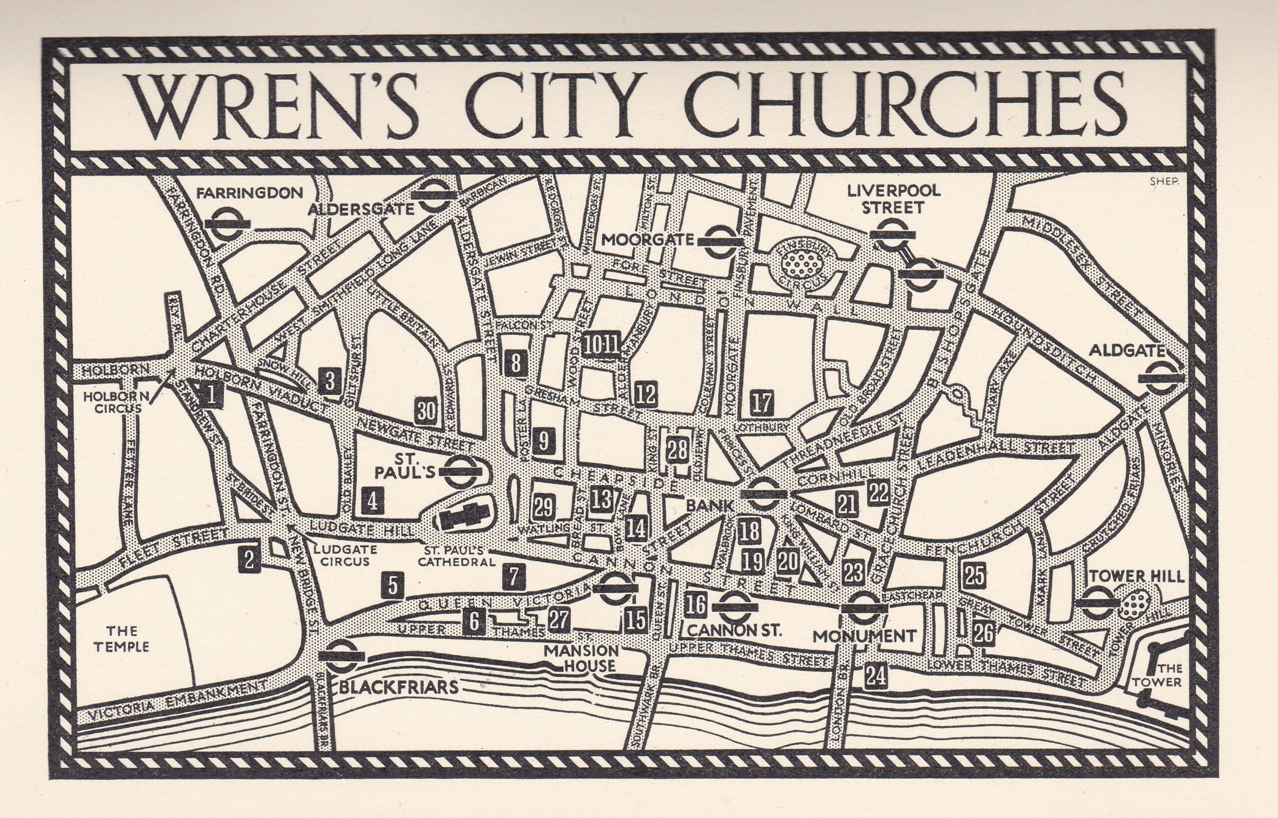
It is a wonderful little booklet, and an example of when London Transport probably had more of a budget for publications and maps aimed at encouraging people to make more use of the city’s transport network.

This year would have been an ideal time for an updated booklet, as this year it is 300 years since Christopher Wren’s death in 1723.

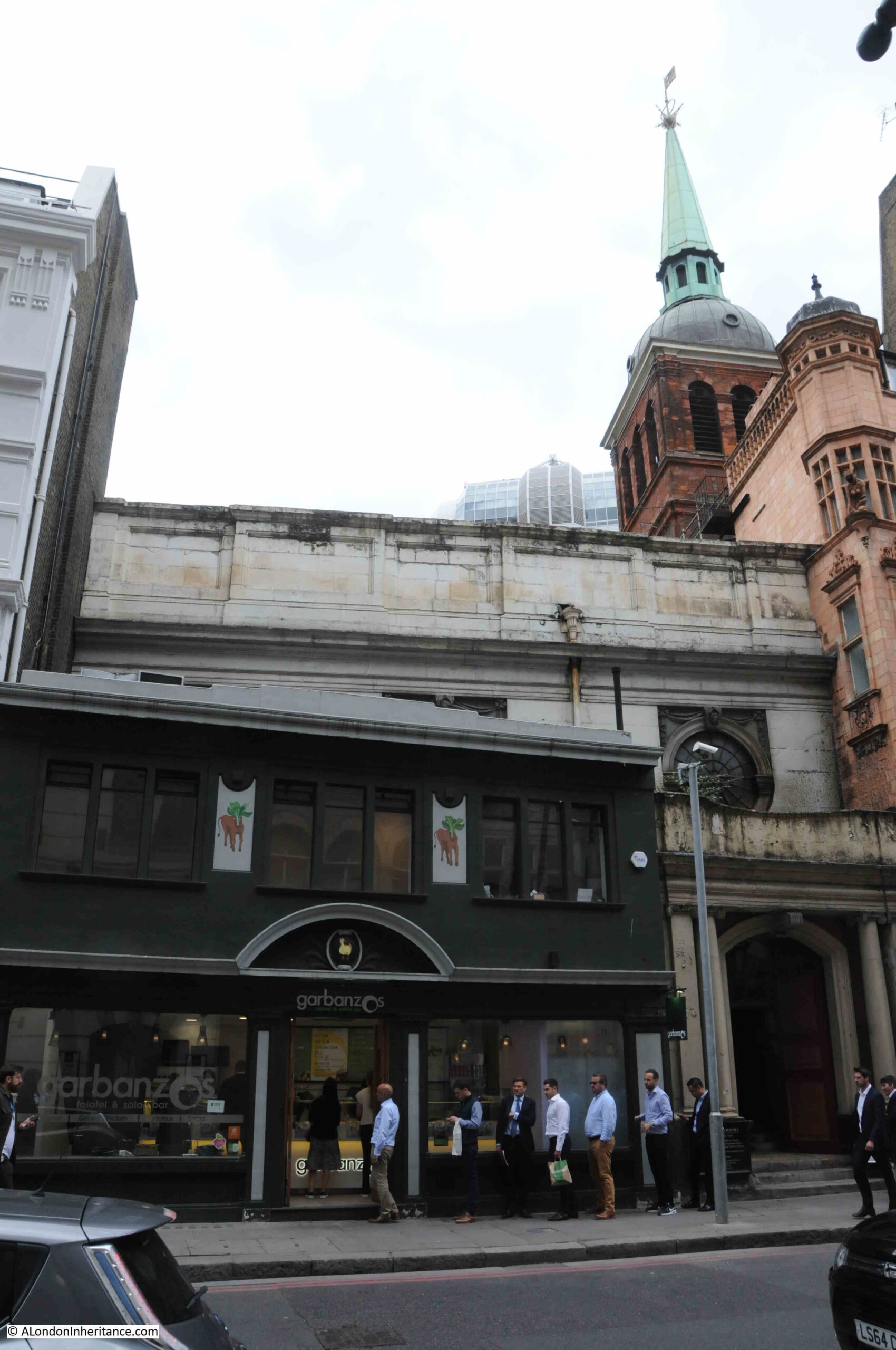
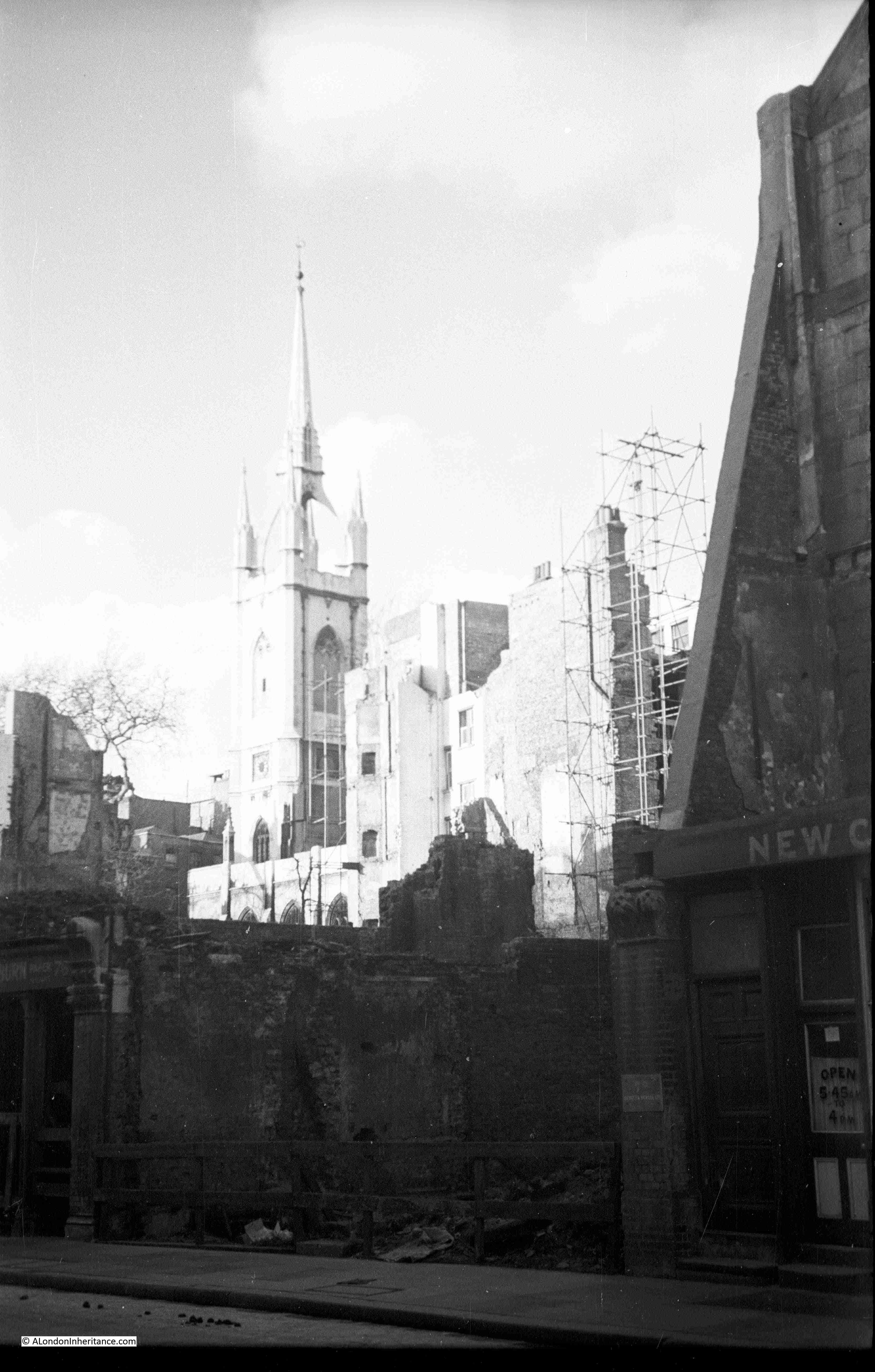
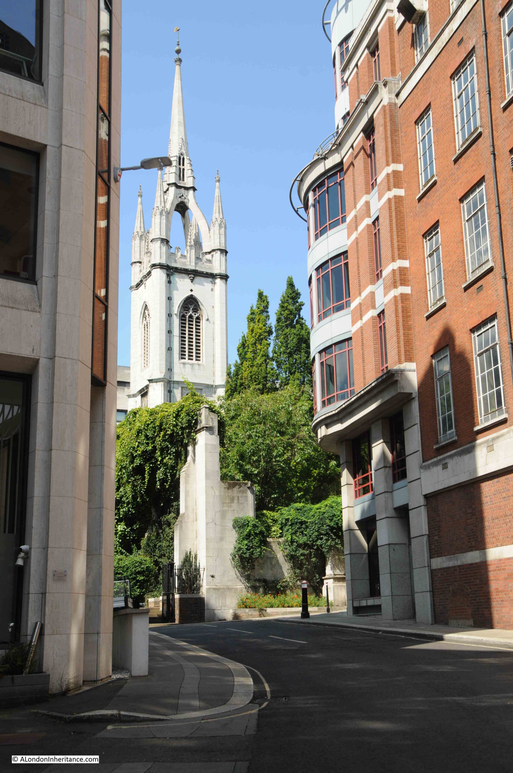
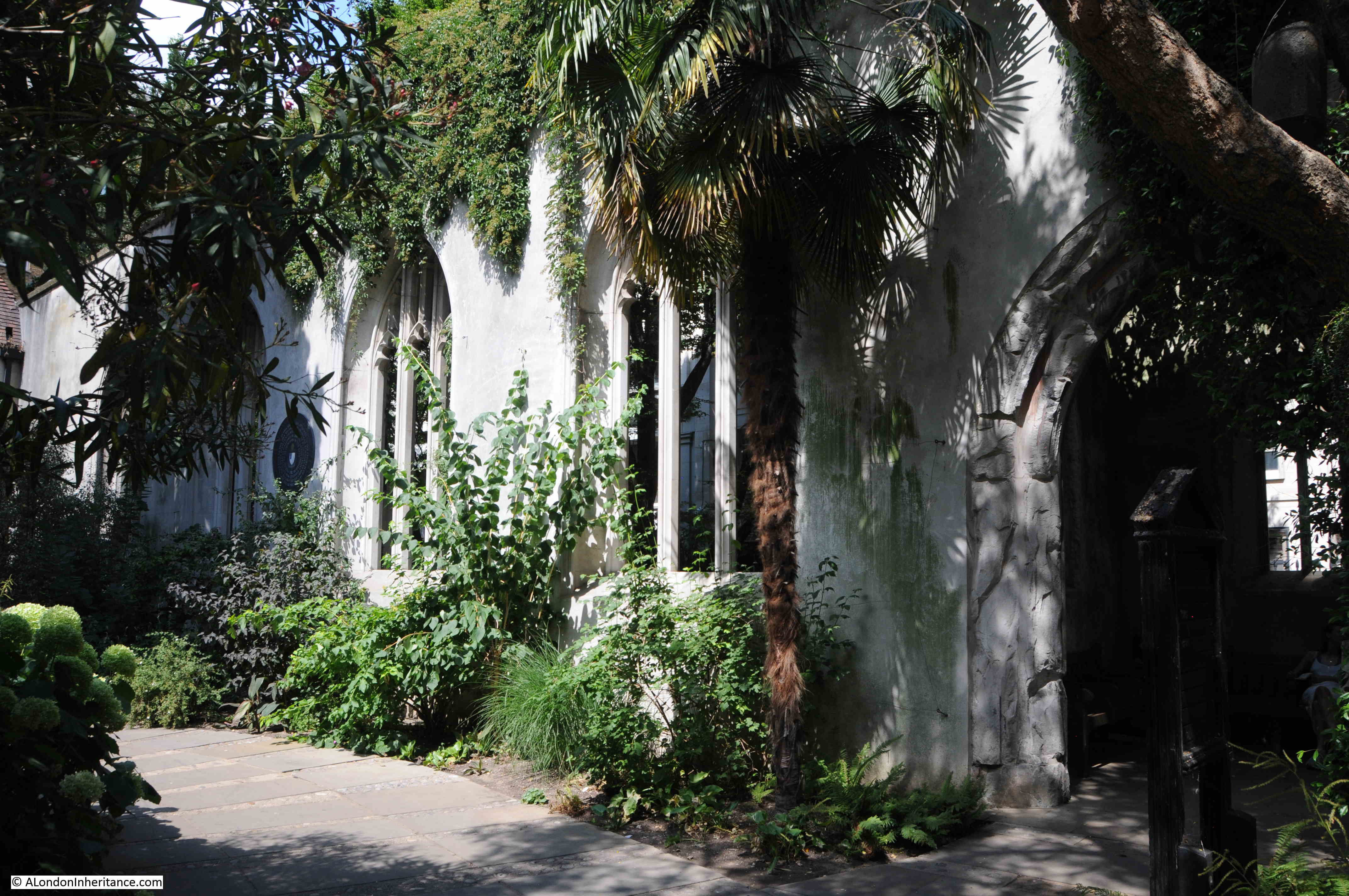
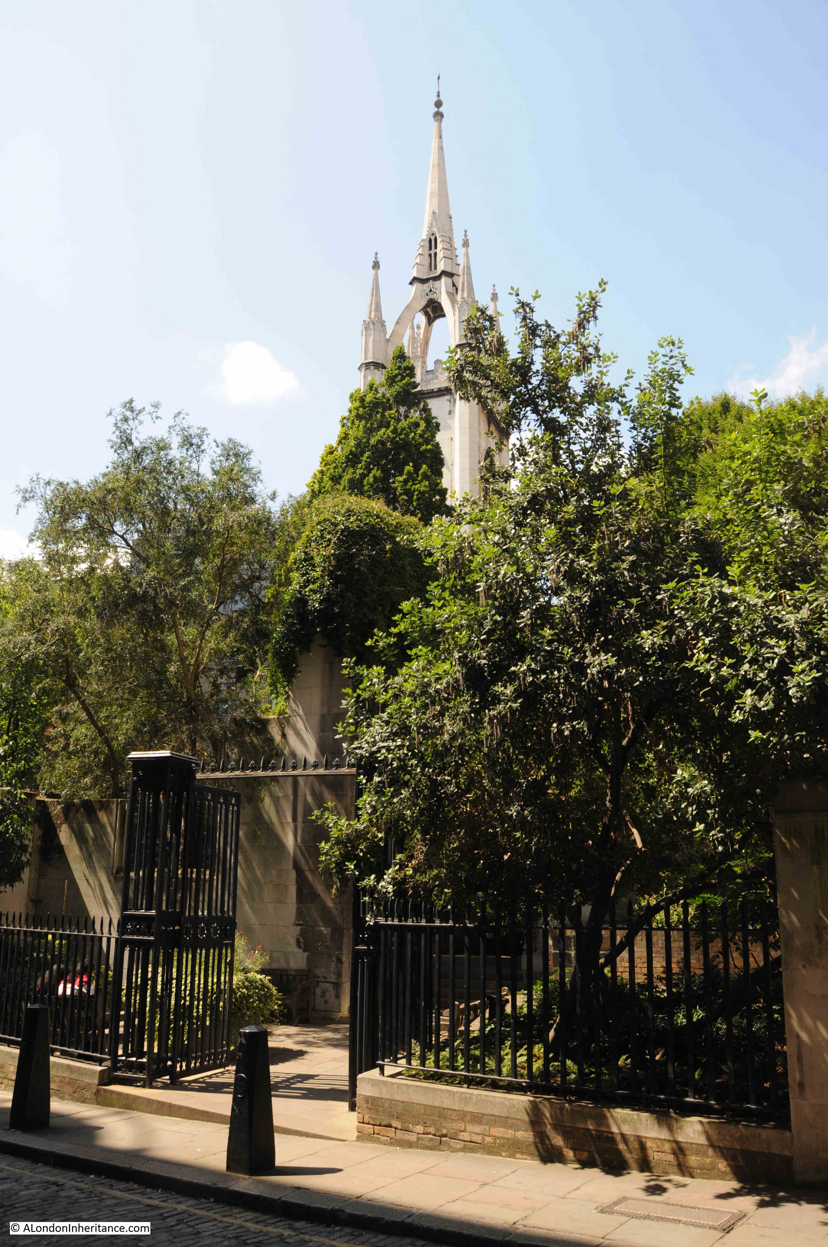
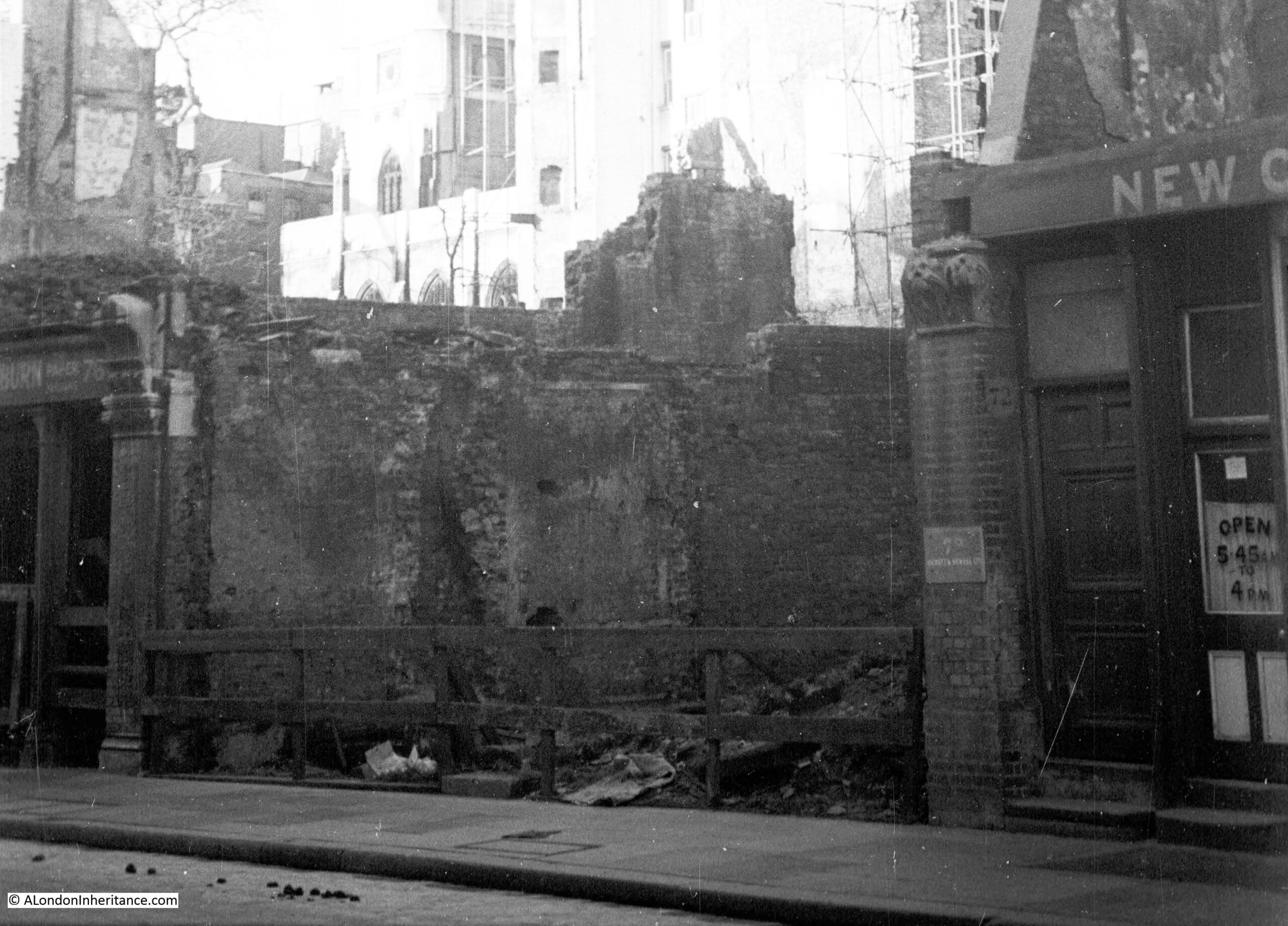
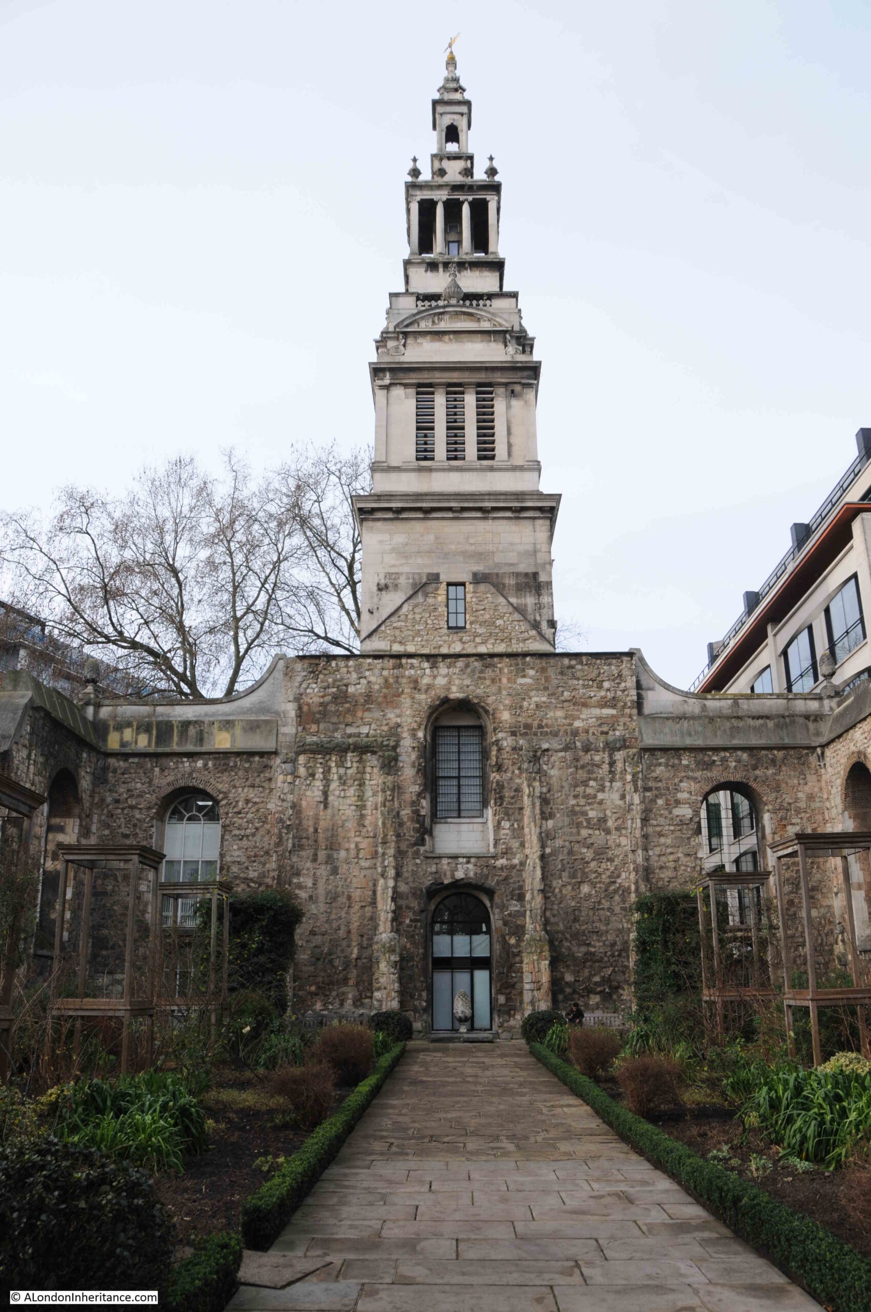
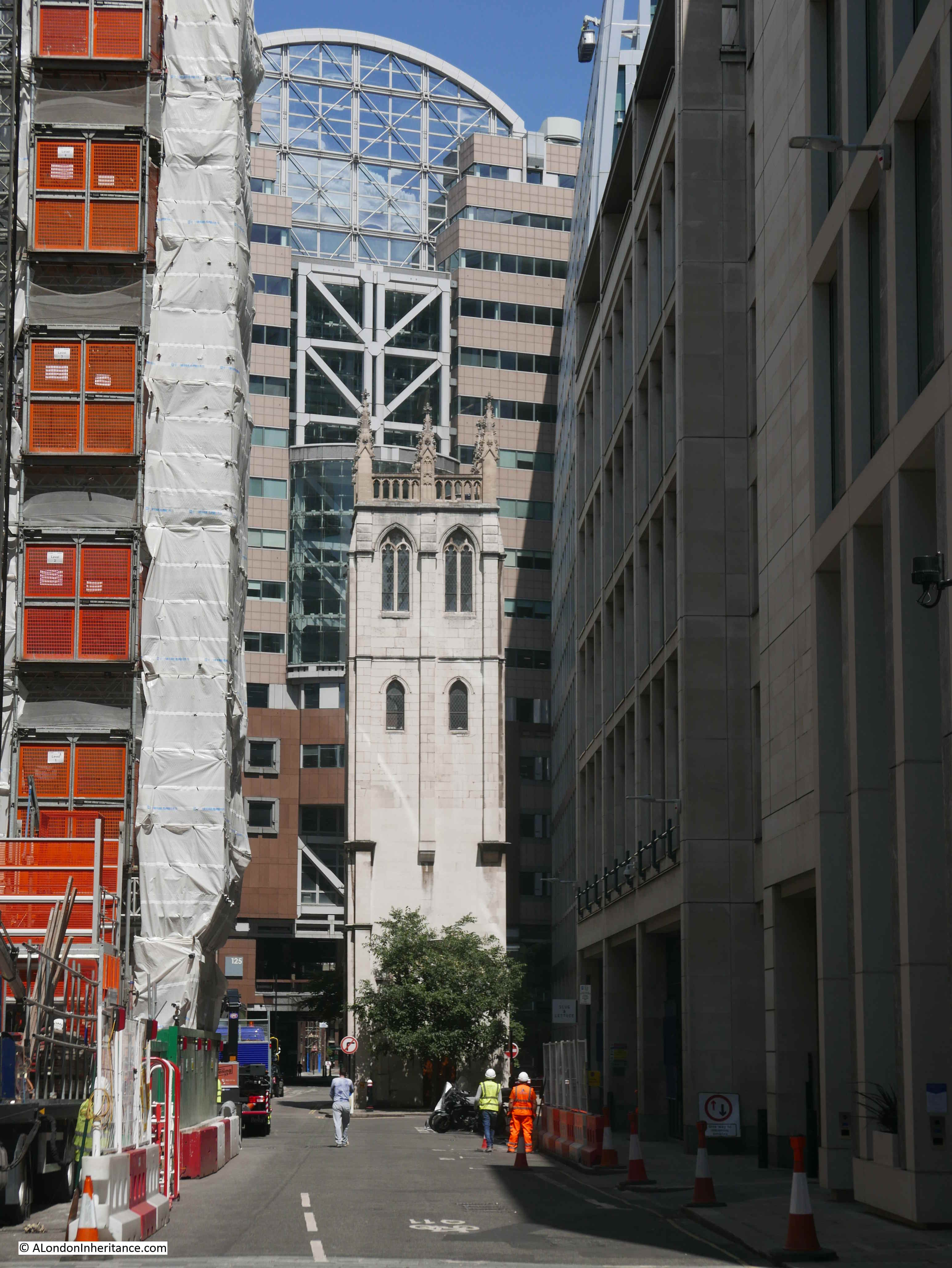
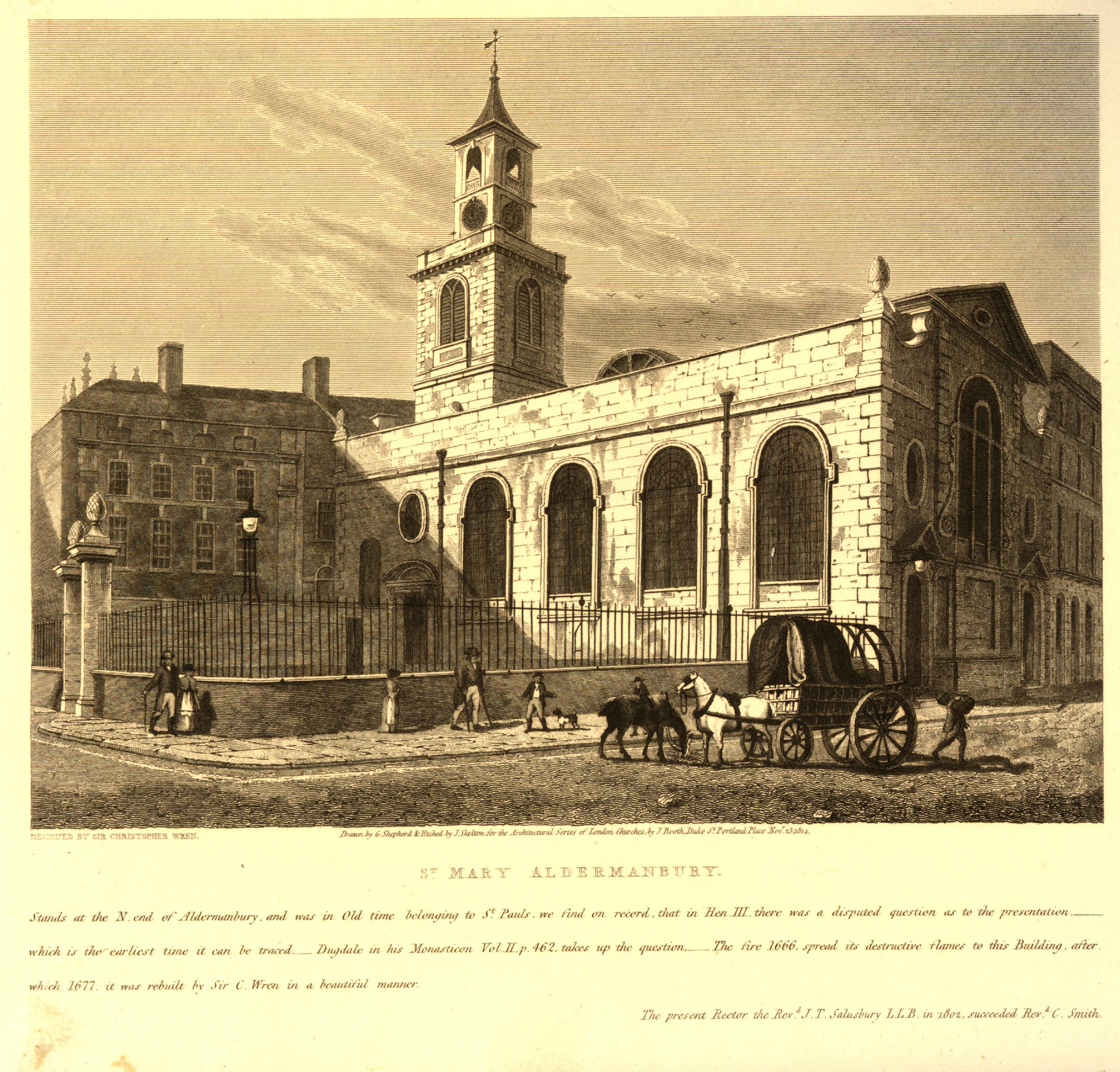
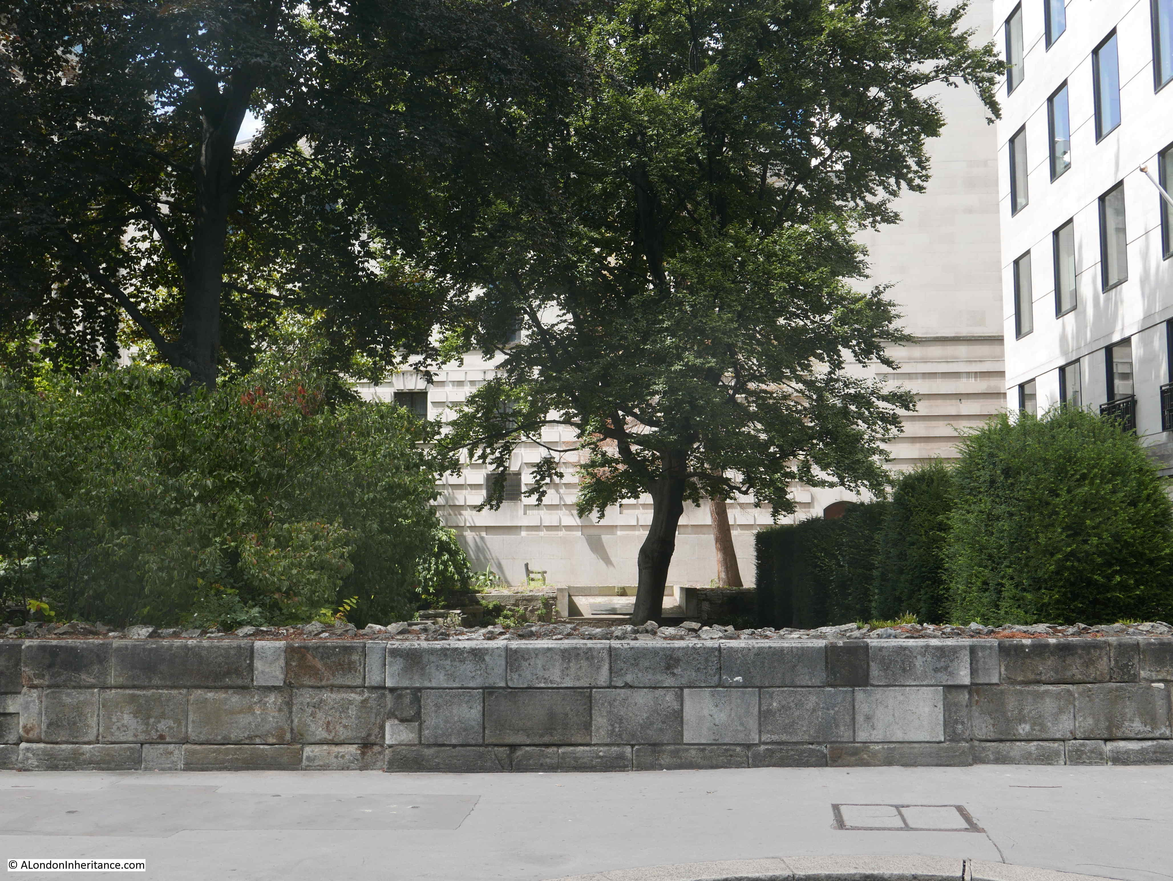
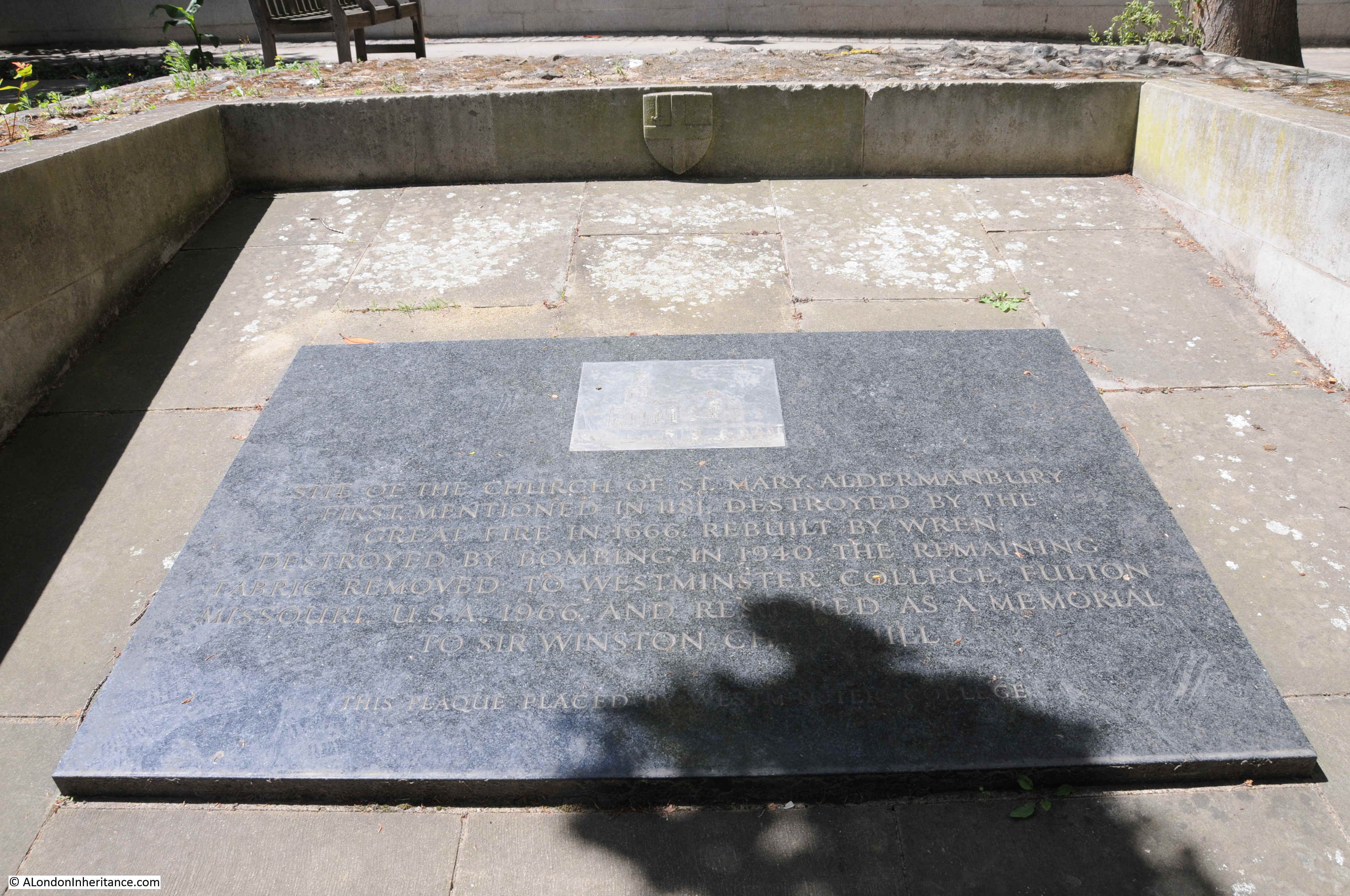
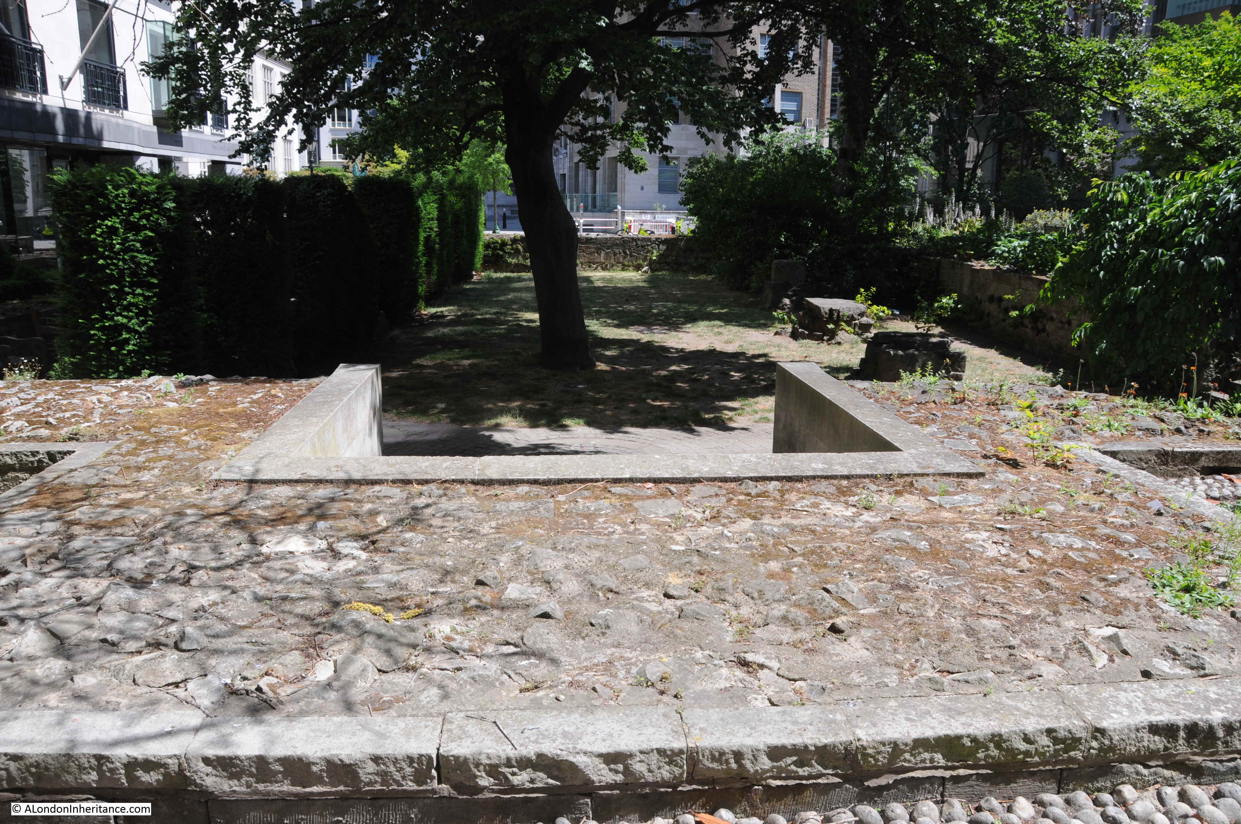
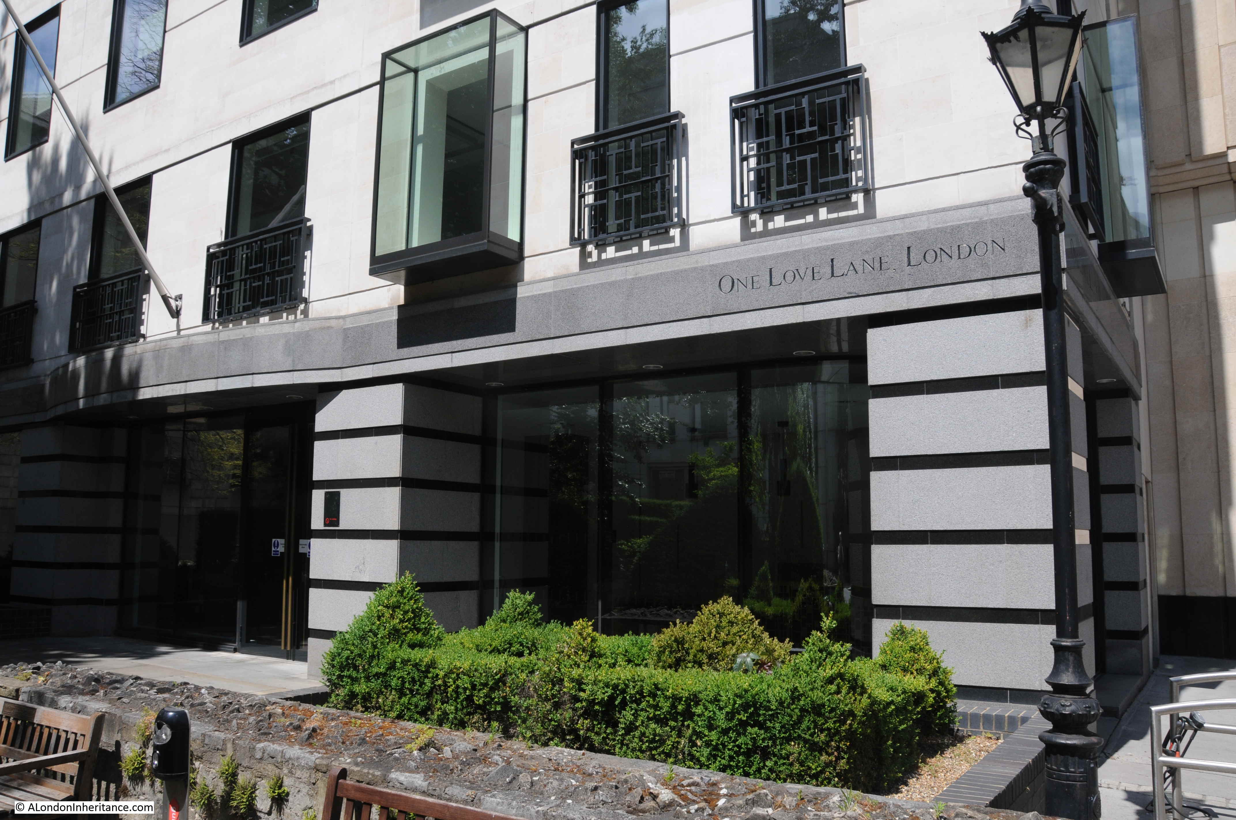
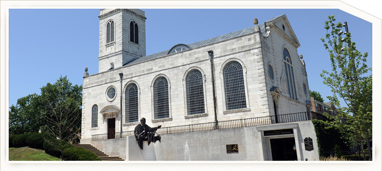
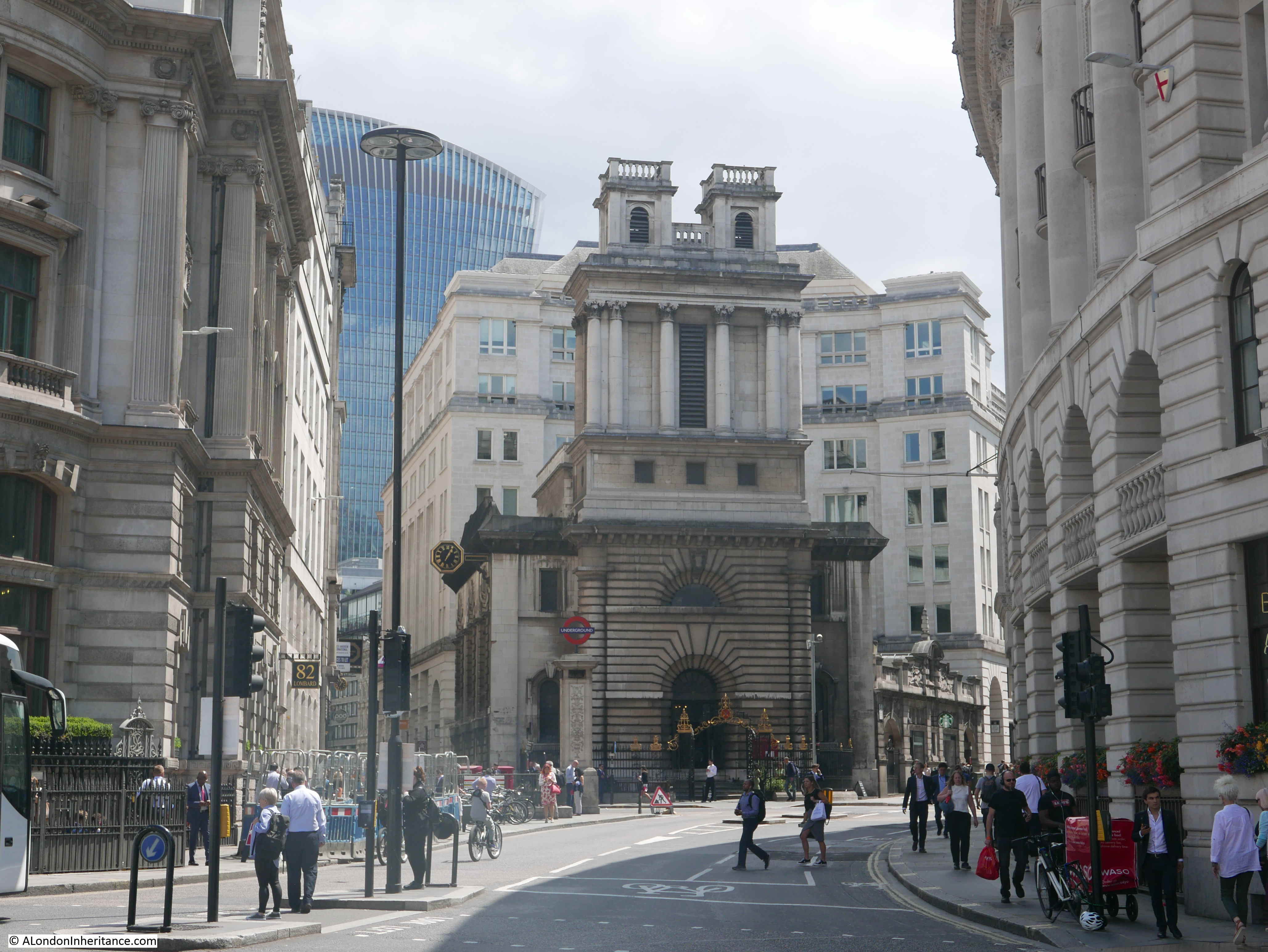
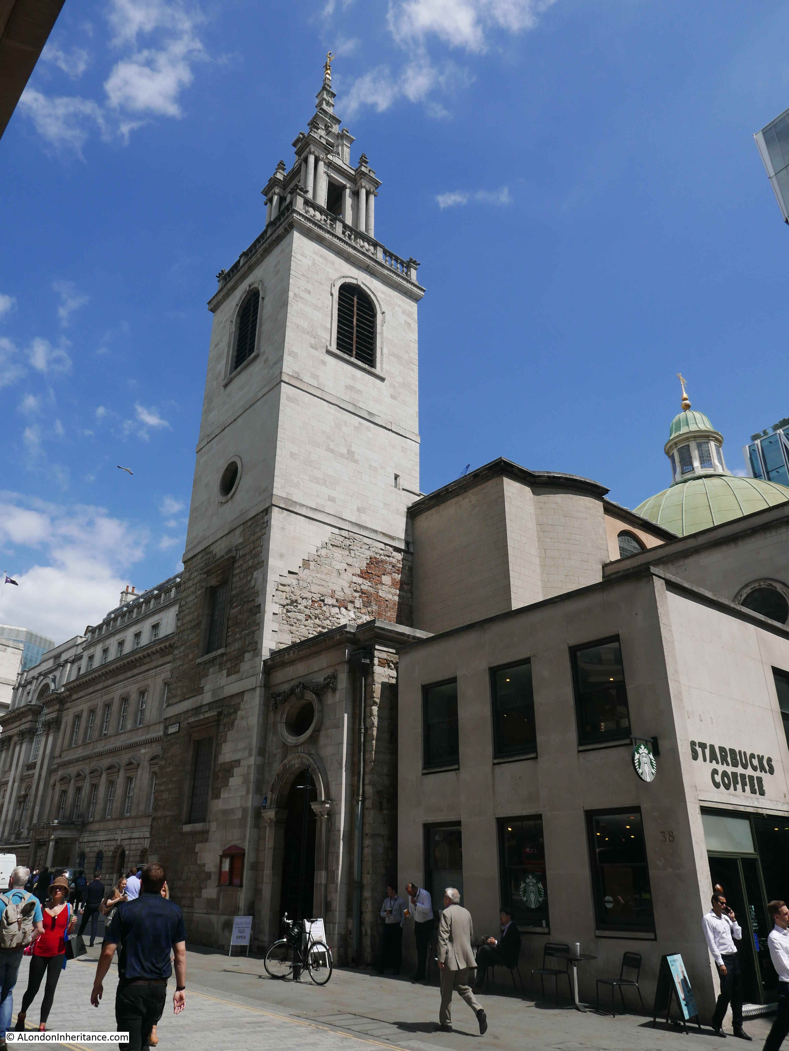
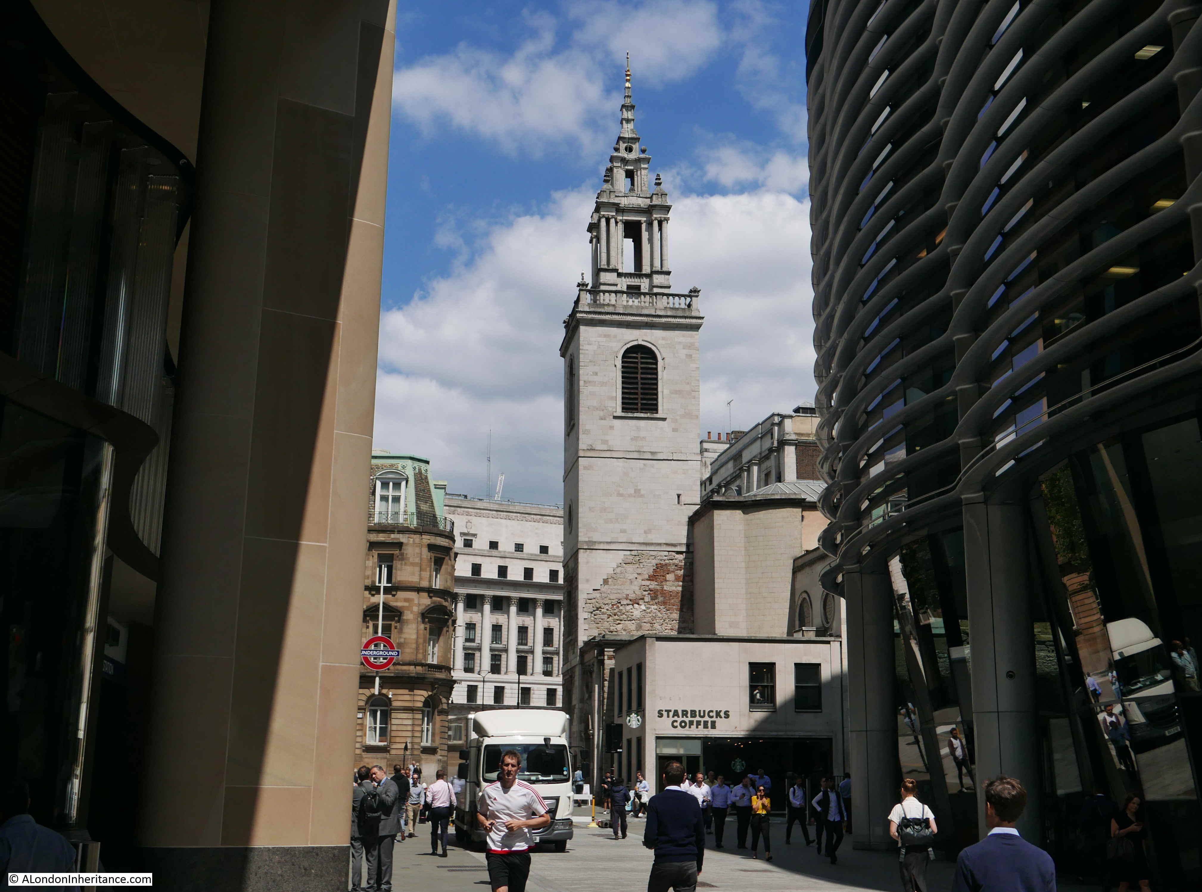
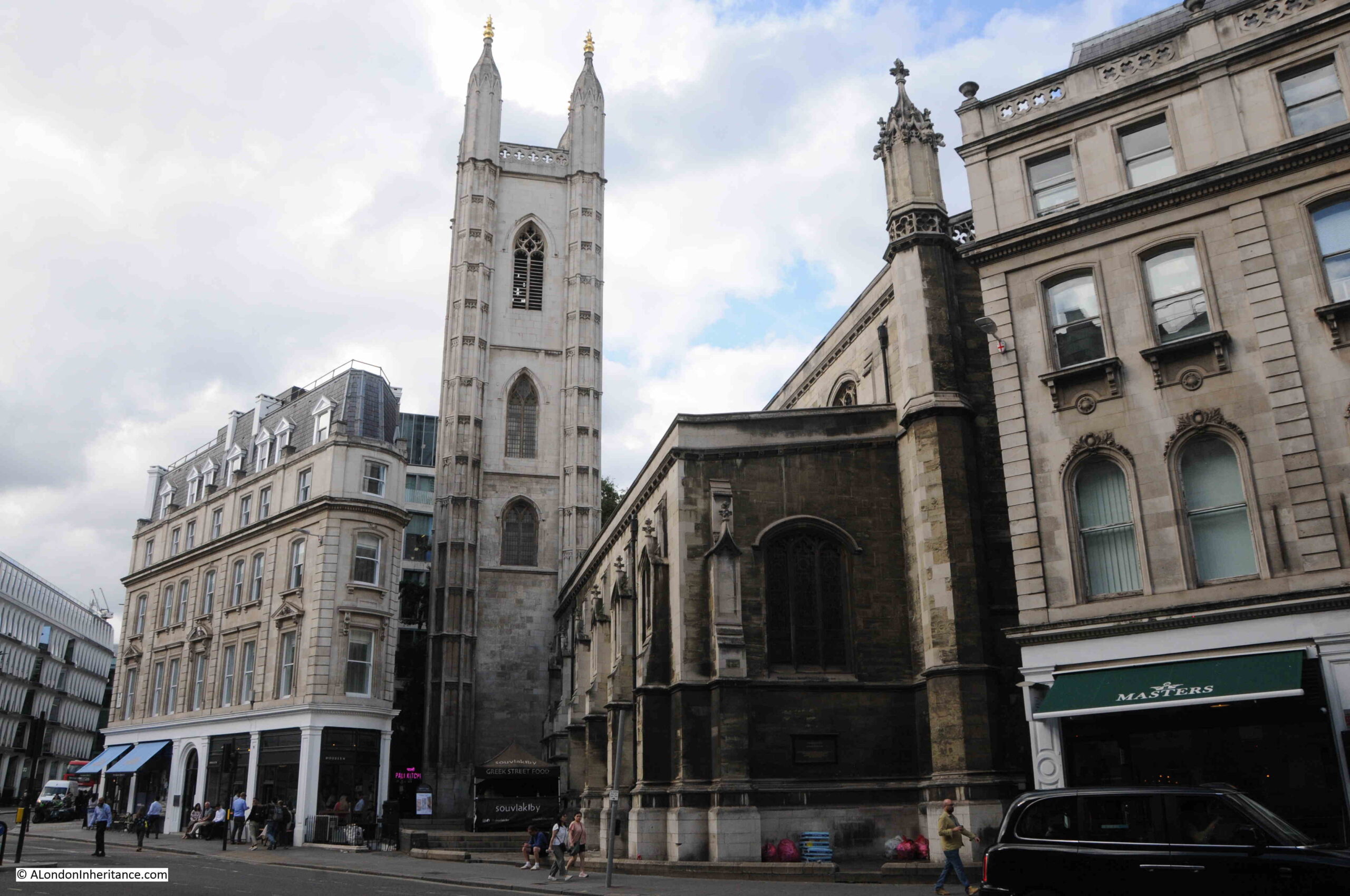
At the start of the year, I had been intending to follow the advice of the booklet and visit all of Wren’s City churches for a series of blog posts, however time and poor planning has forced that idea to be abandoned, so to link the London Transport booklet with one of Wren’s churches, I had a look around a church I have not written about before – St. Mary Aldermary.

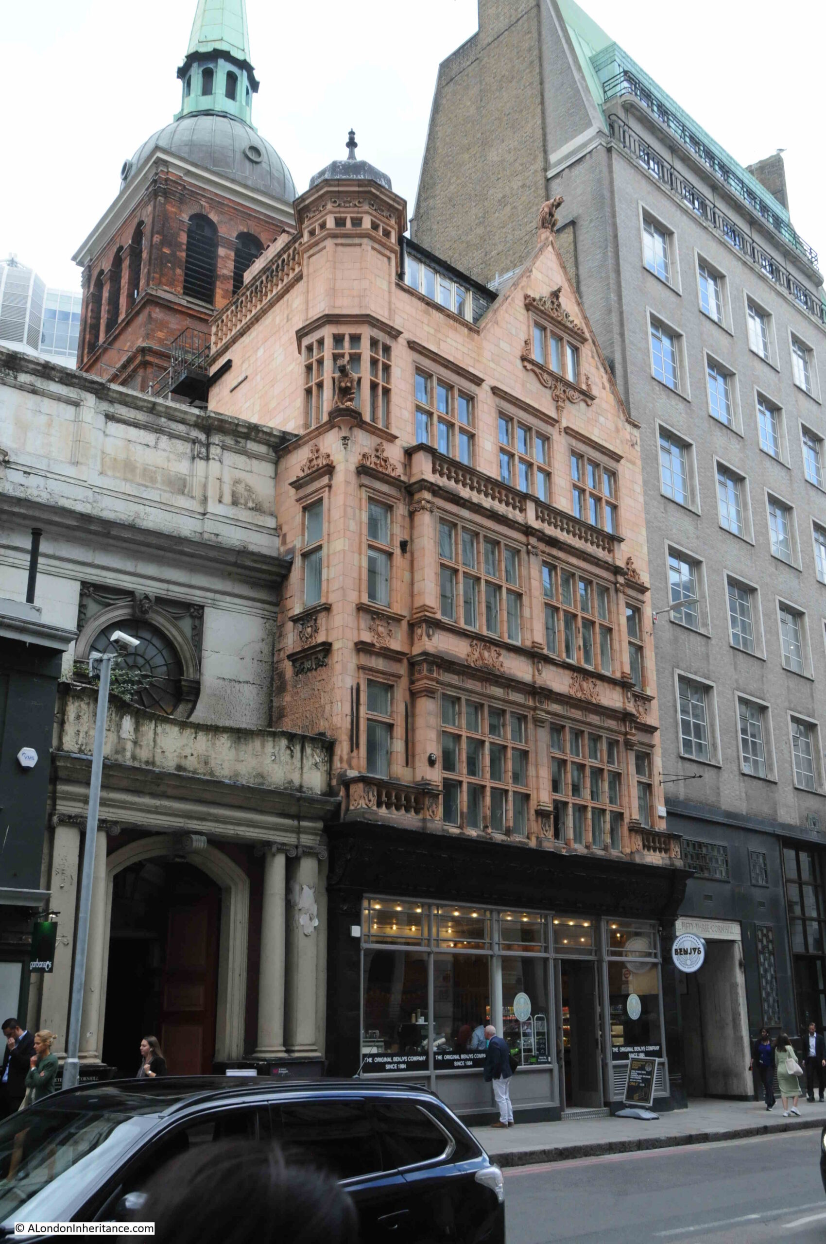
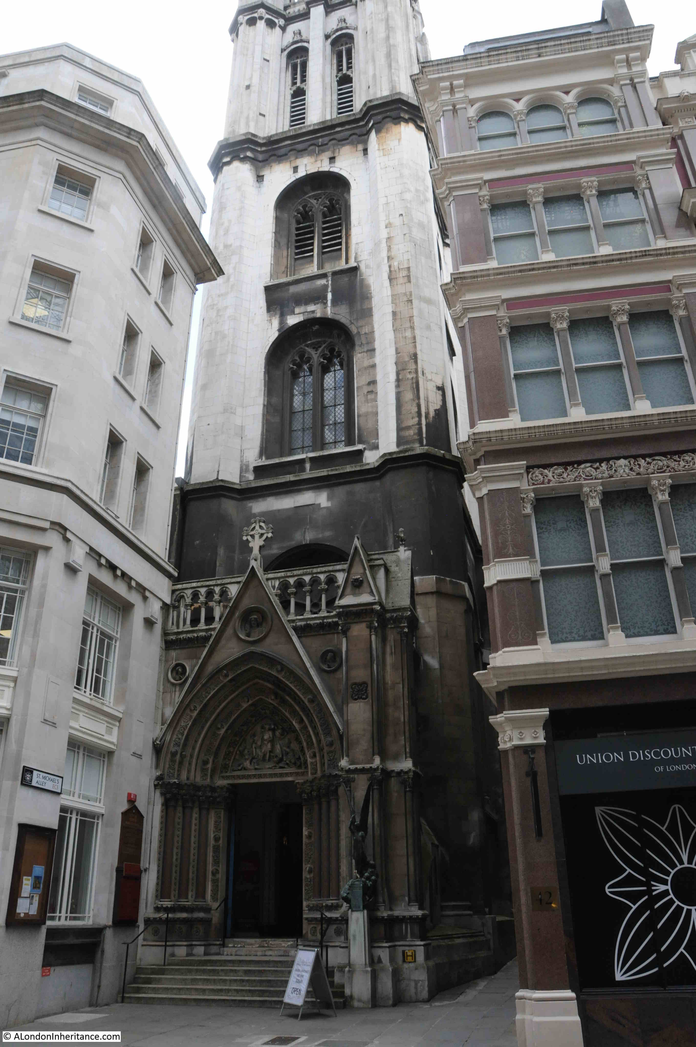
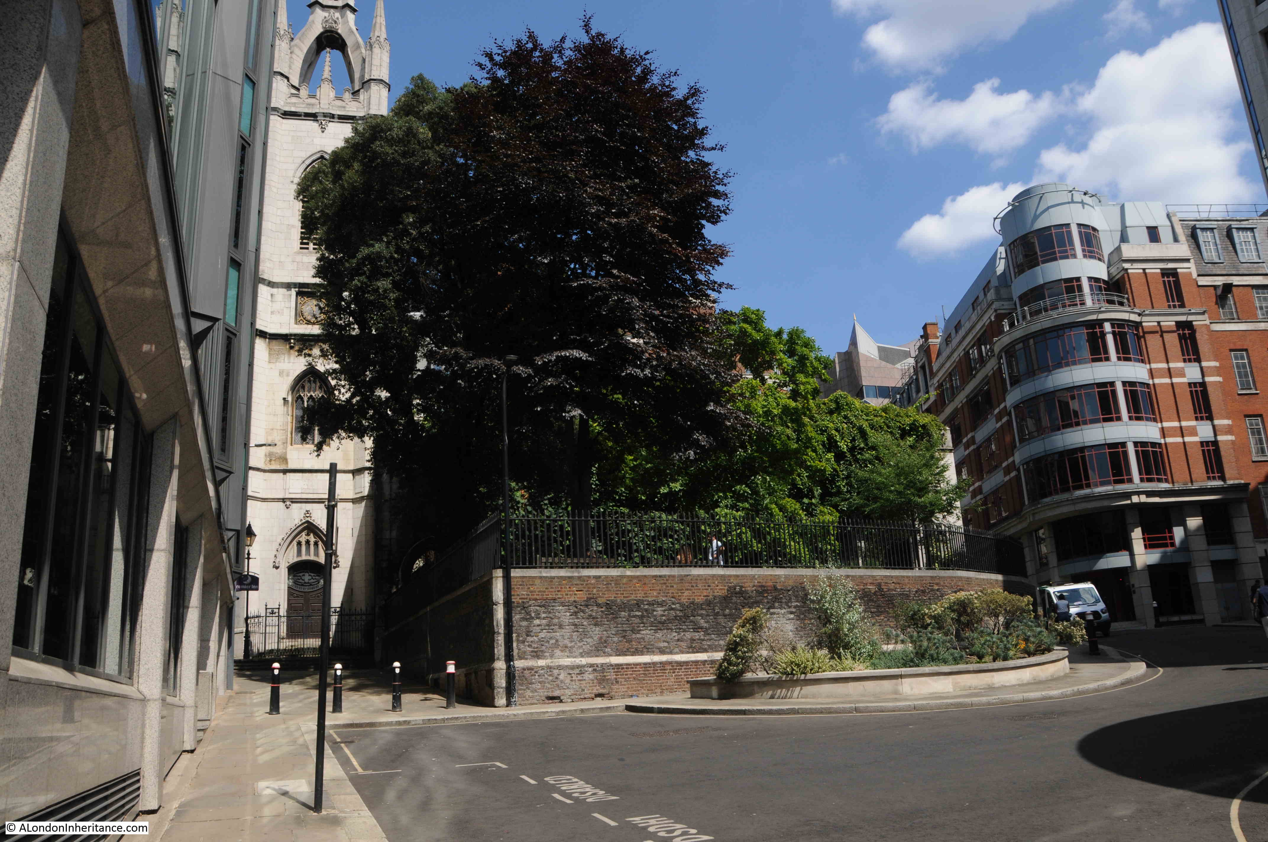
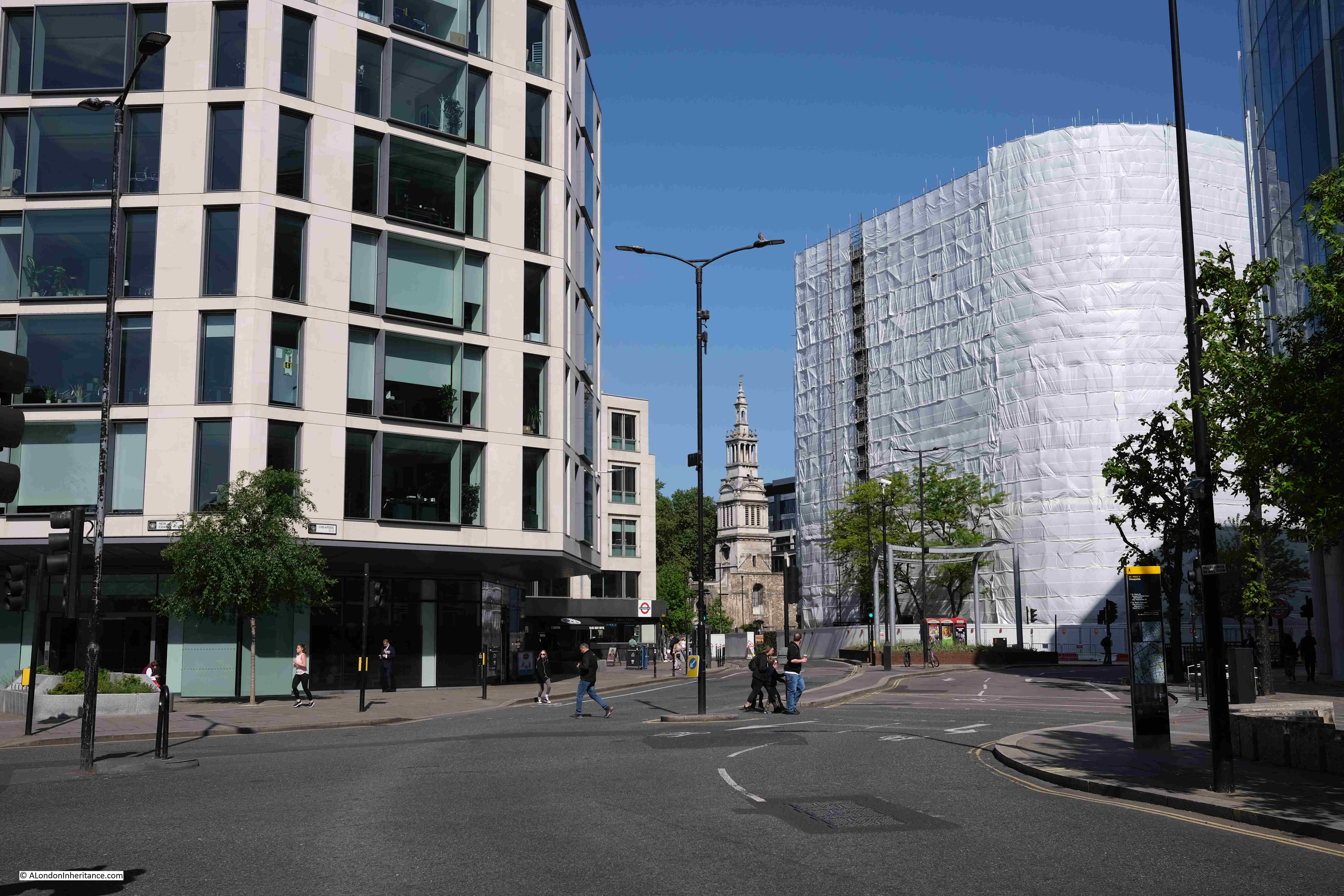
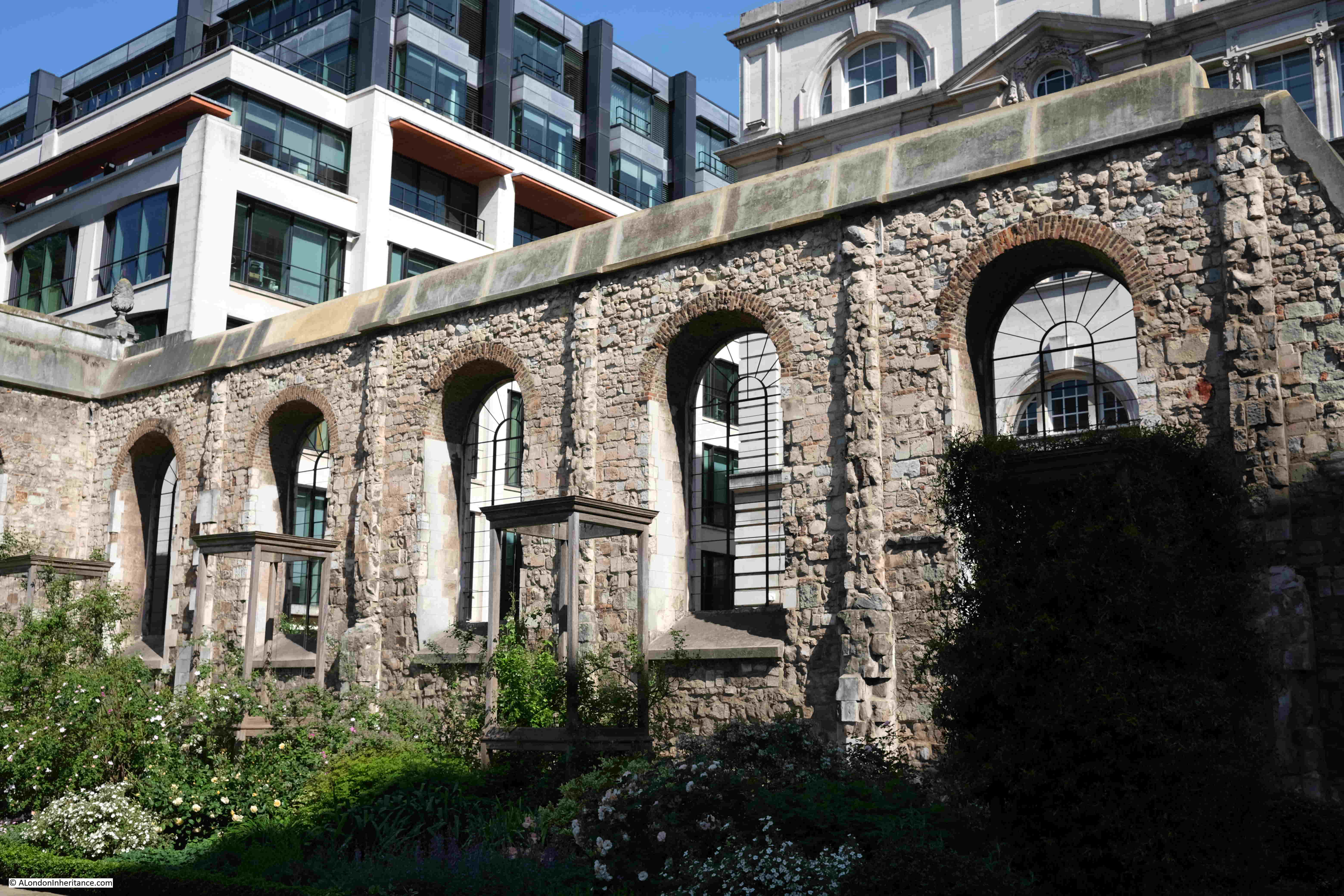
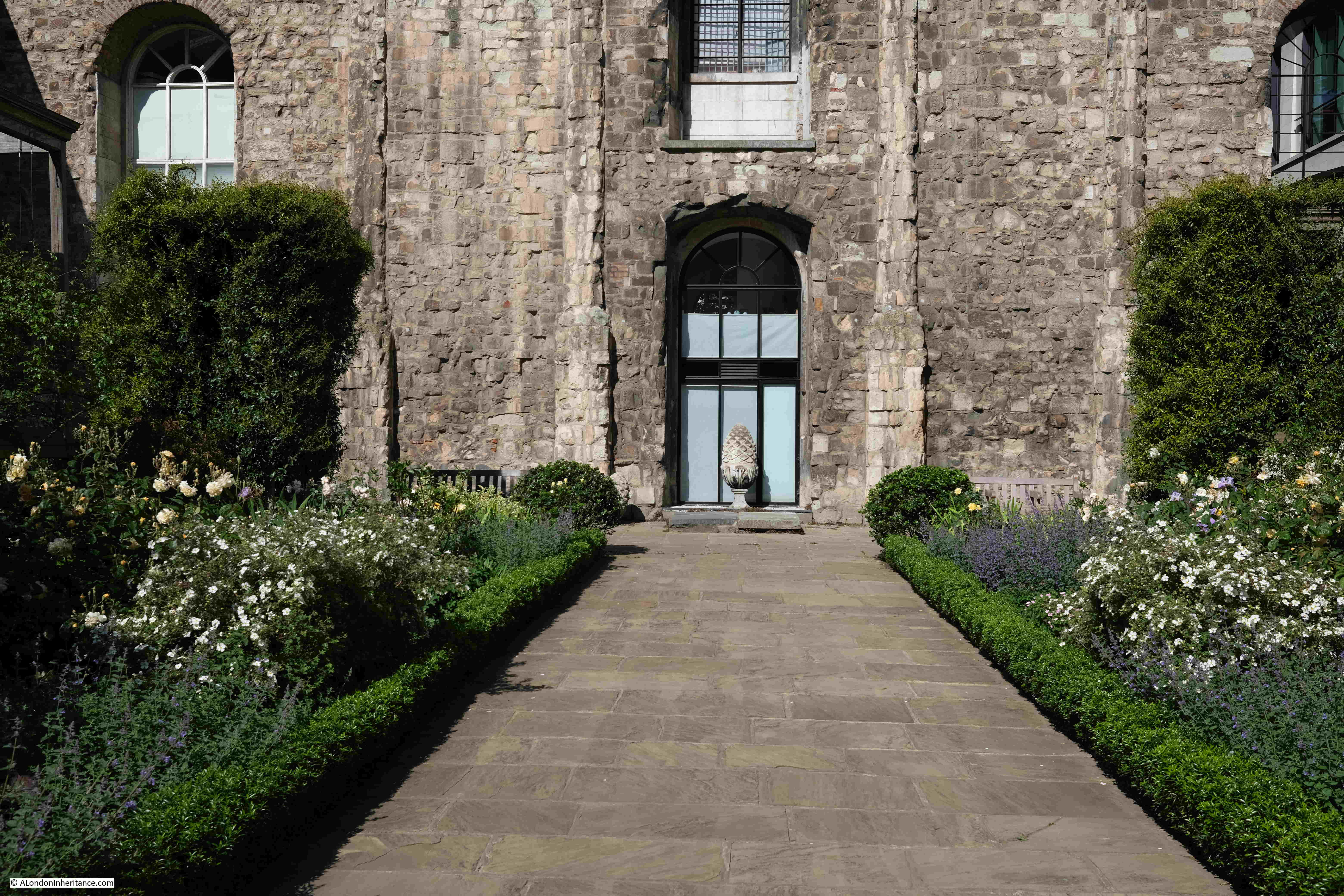
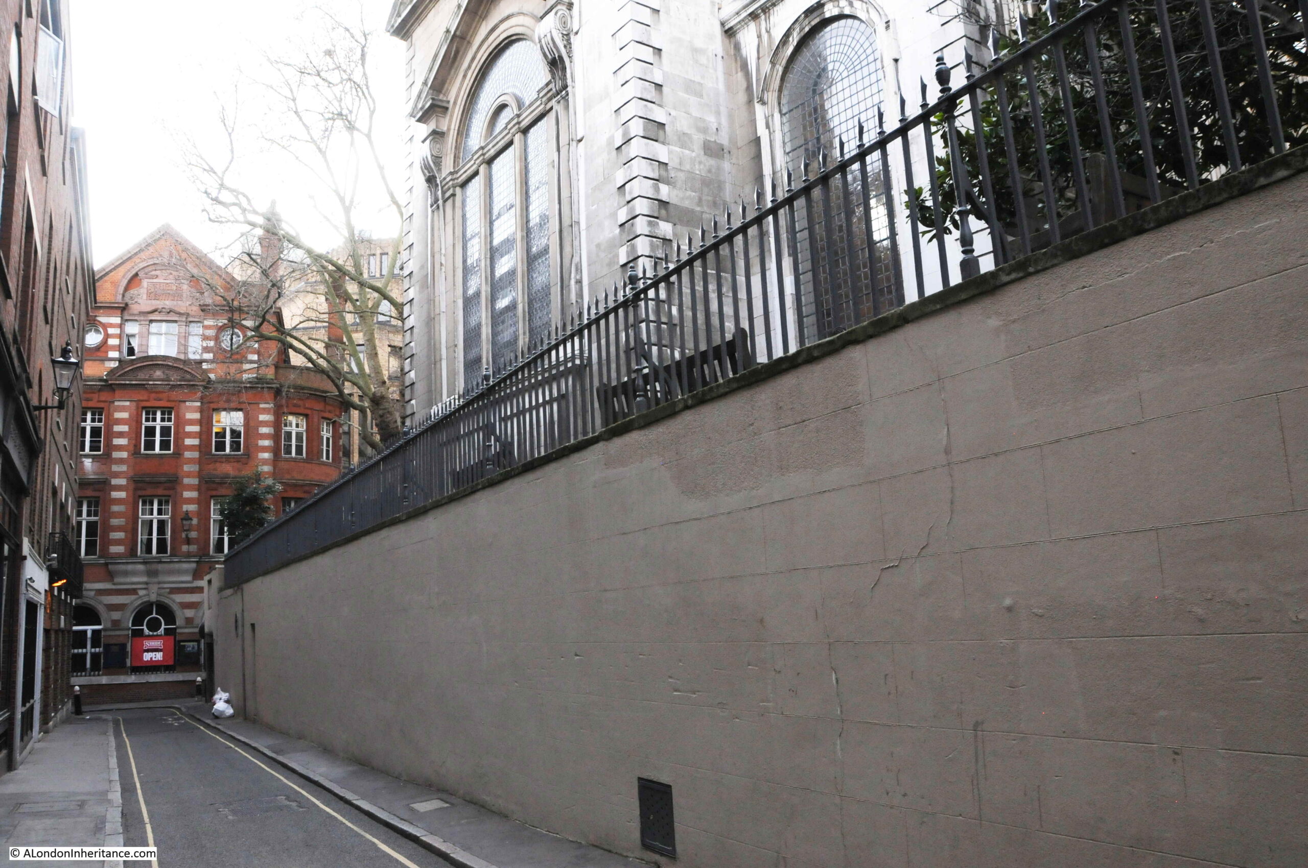
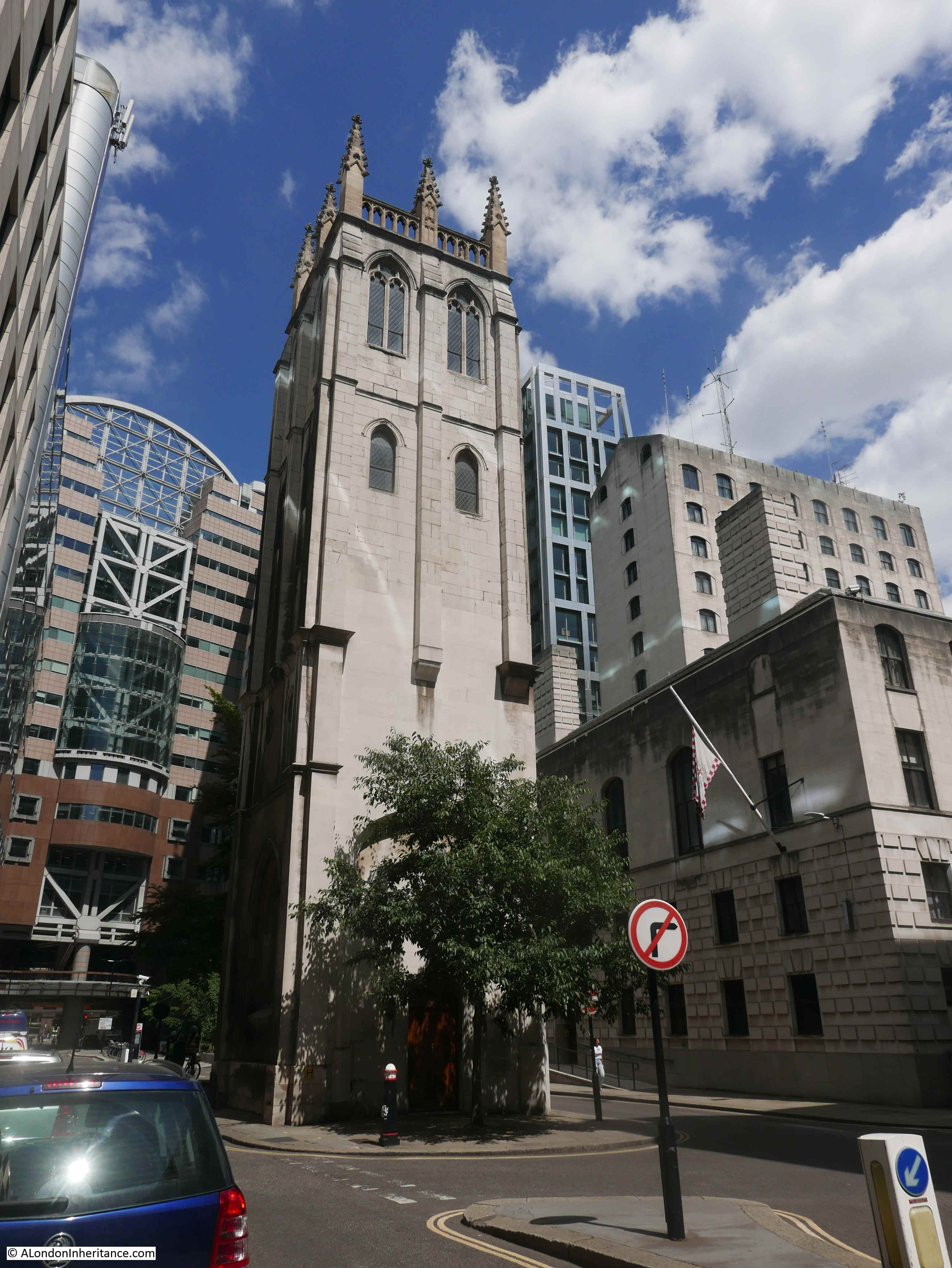
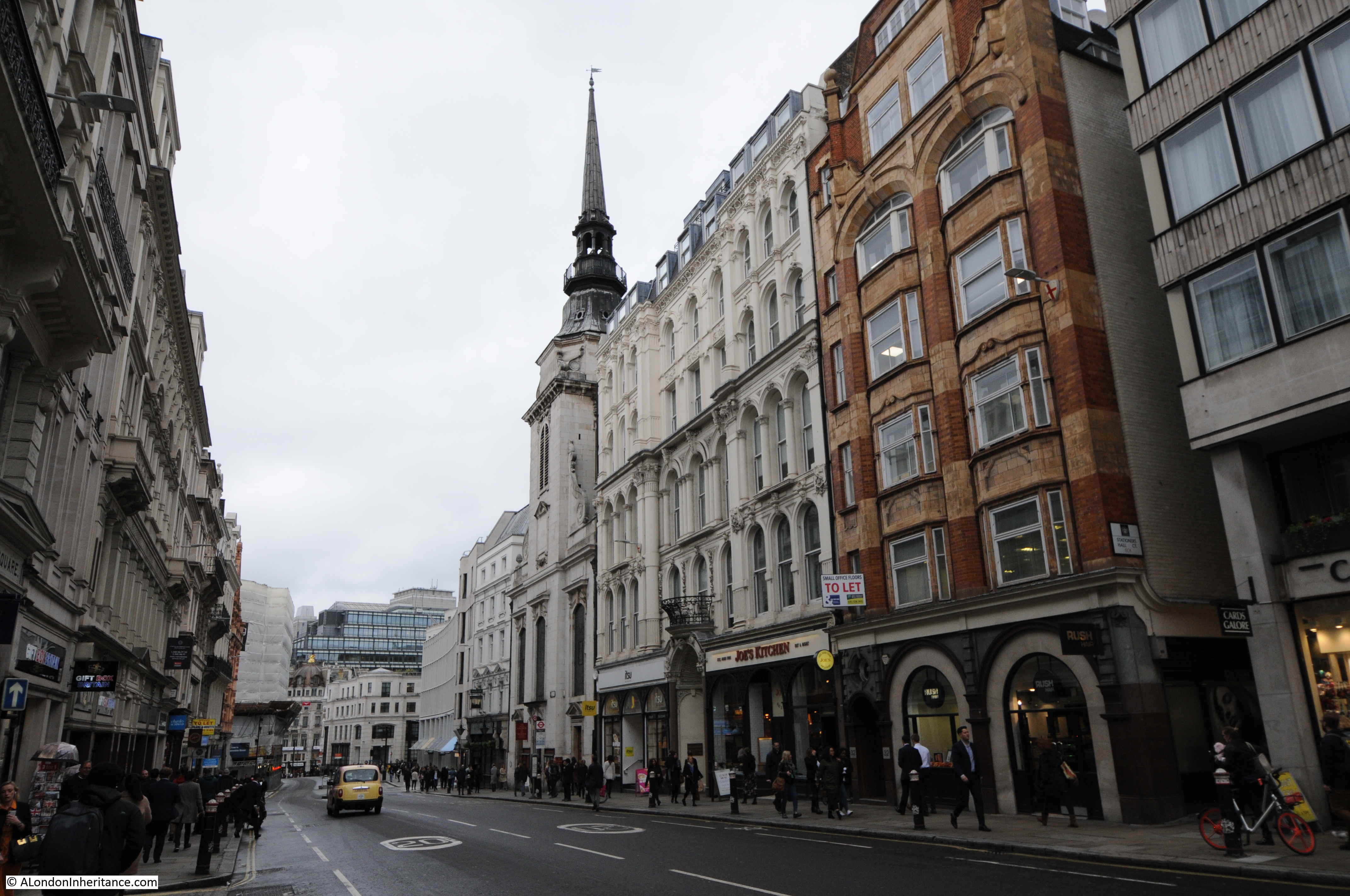
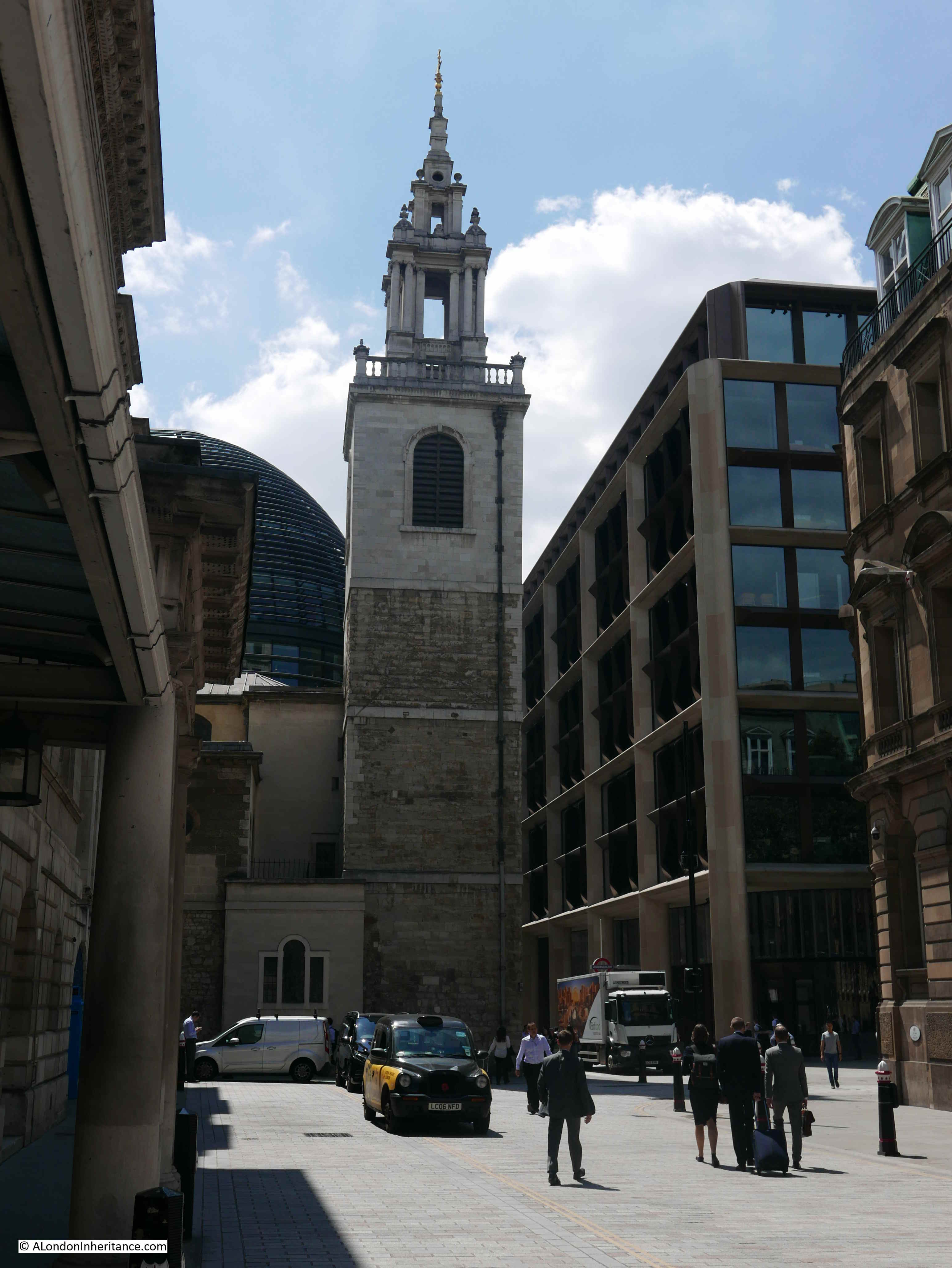
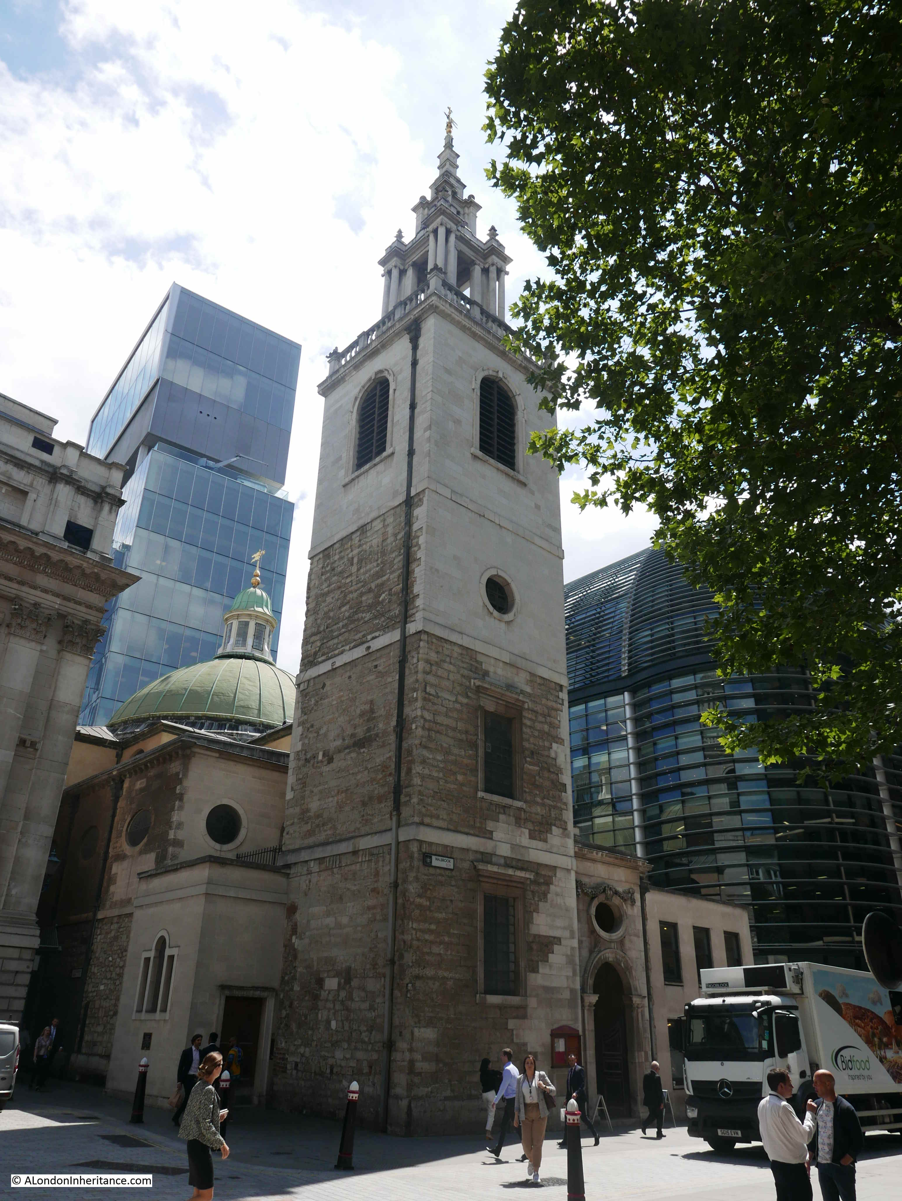
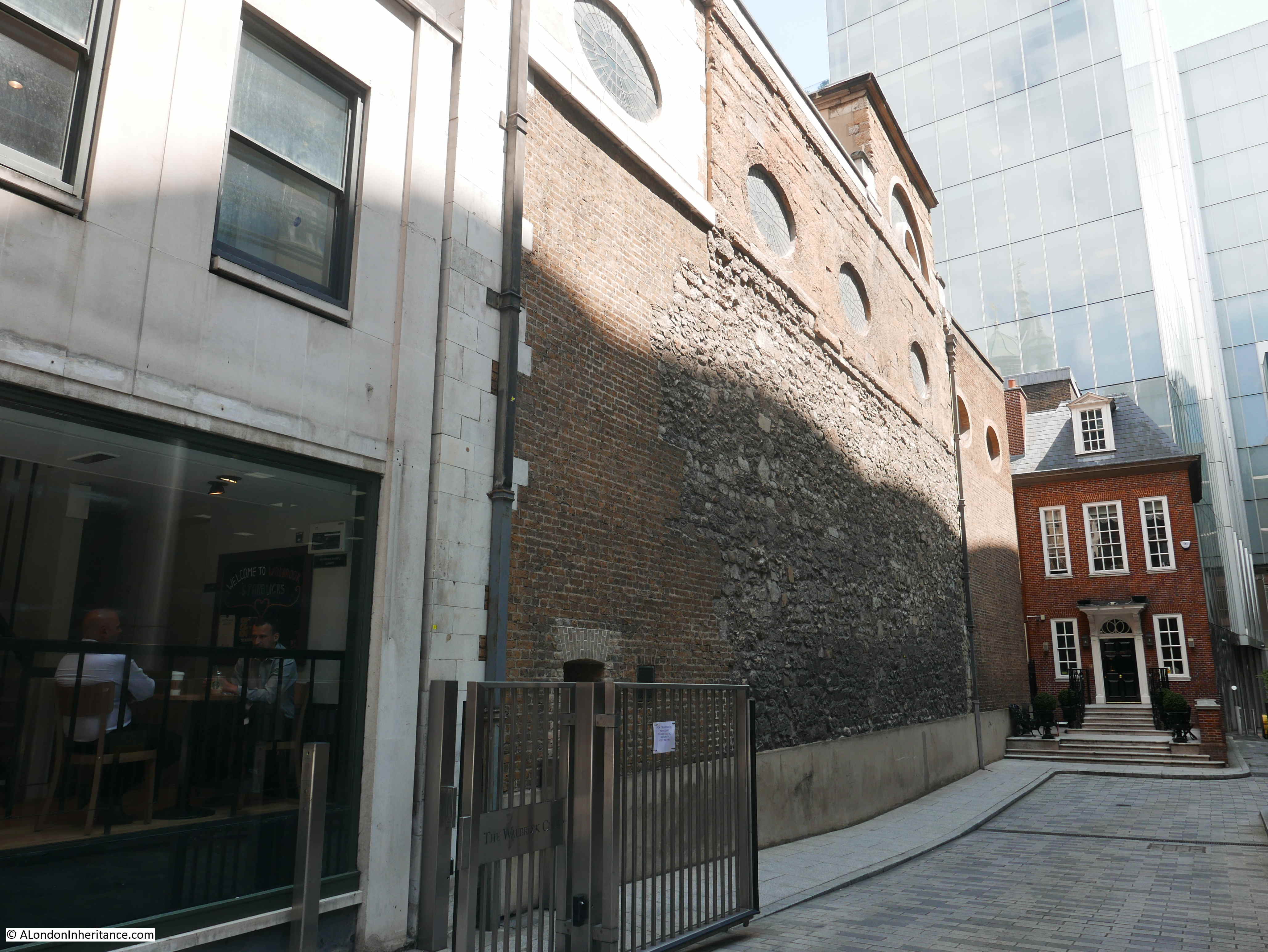
The church is located within a triangle of land, with Queen Victoria Street, Bow Lane and Watling Street forming the three sides of the triangle. The church is at a strange angle to Queen Victoria Street and is also hemmed in by surrounding buildings:

St. Mary Aldermary

A plaque on the church hints at why the church is positioned as it is, as it follows its mediaeval outline:

Christopher Wren

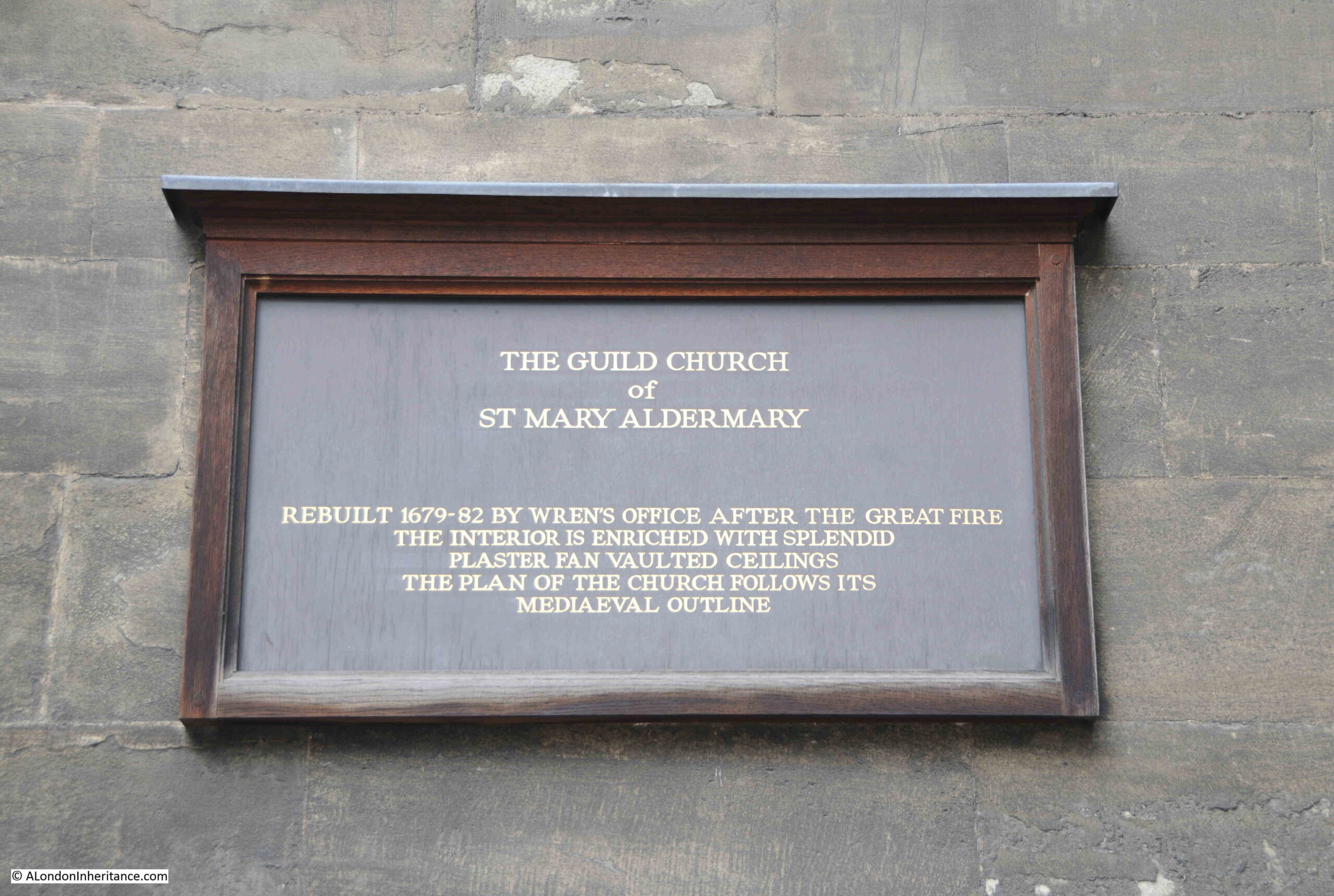
The plaque also states that the church was rebuilt between 1679 and 1682 by “Wren’s Office”. This is an interesting phrase as it does hint at the question of how much Wren was involved in the buildings attributed to him.

The amount of post Great Fire rebuilding, along with all his other building projects, interests and responsibilities must have meant that for many of his buildings, whilst he was probably responsible for the overall design, he had others working on the detail and overseeing the construction of the buildings.

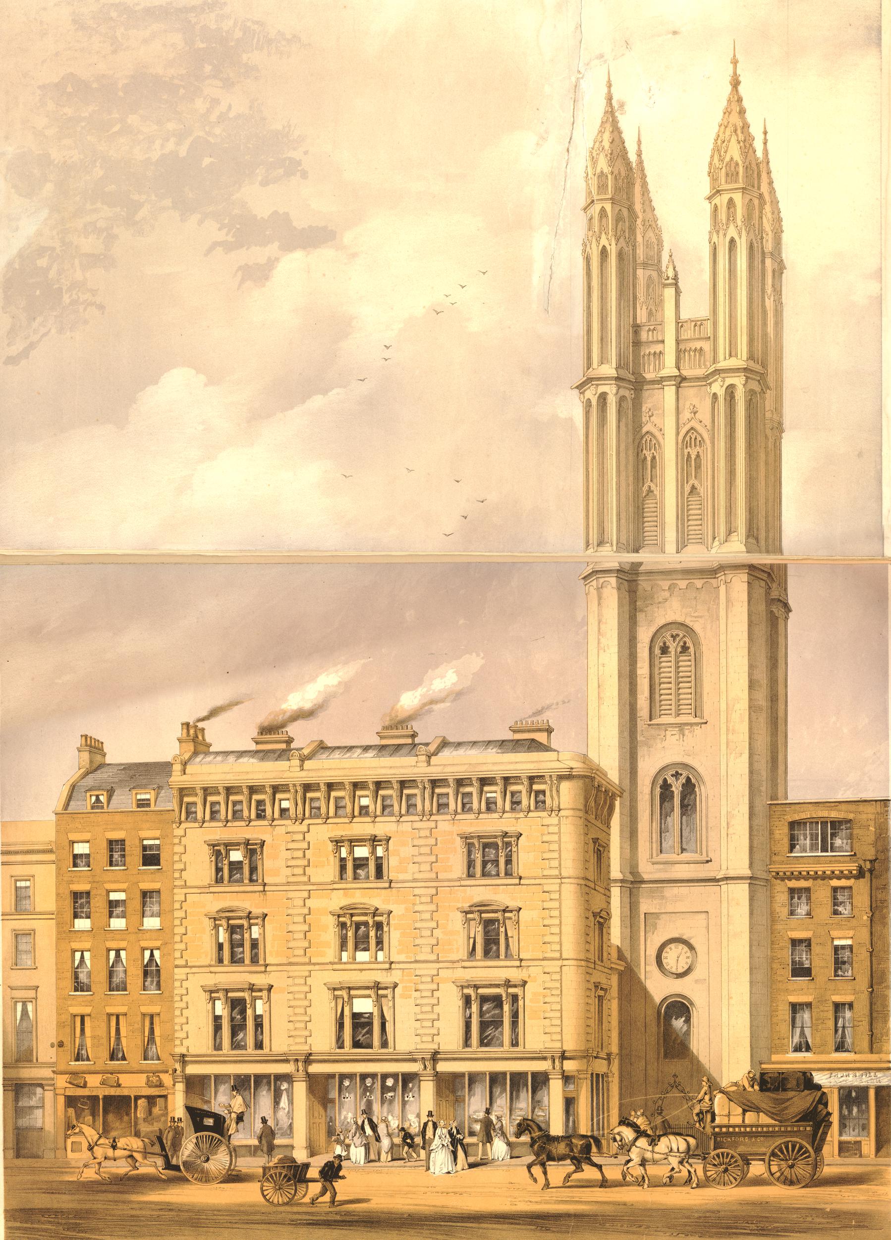
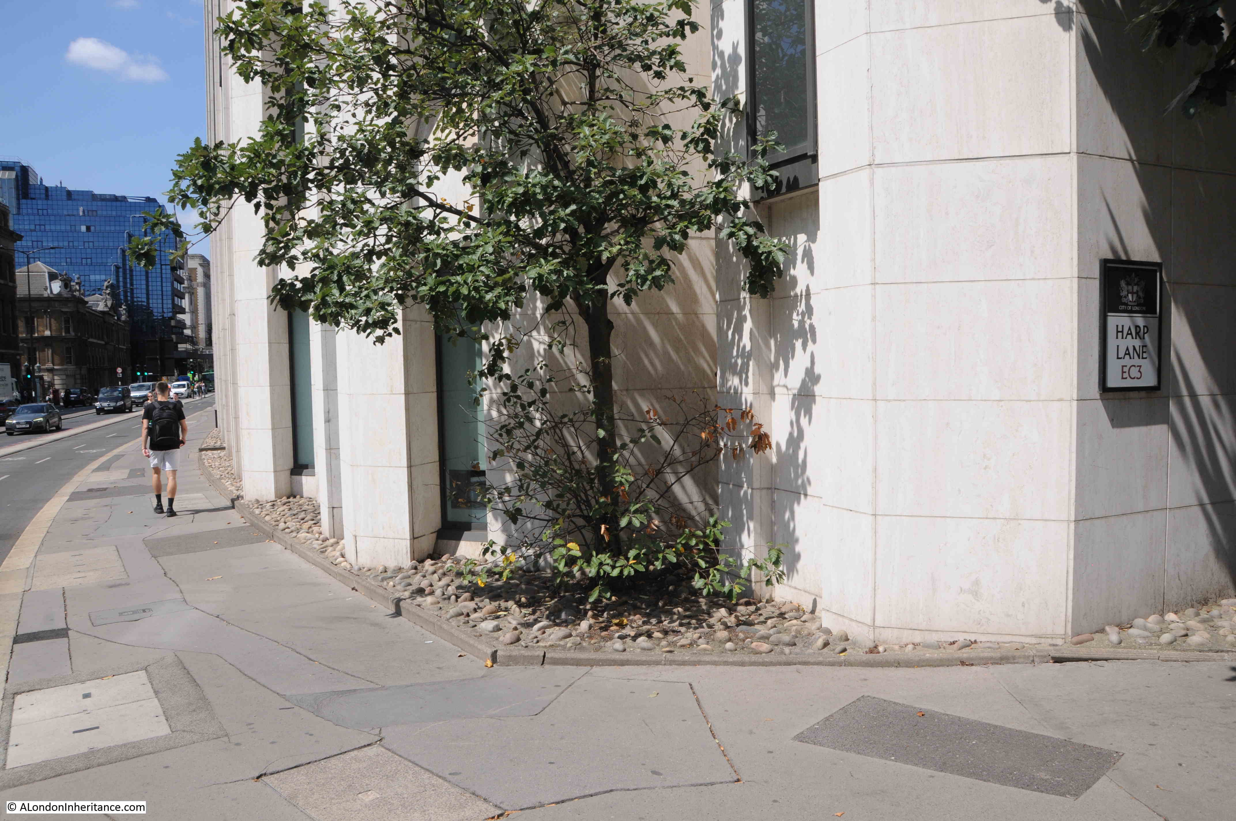
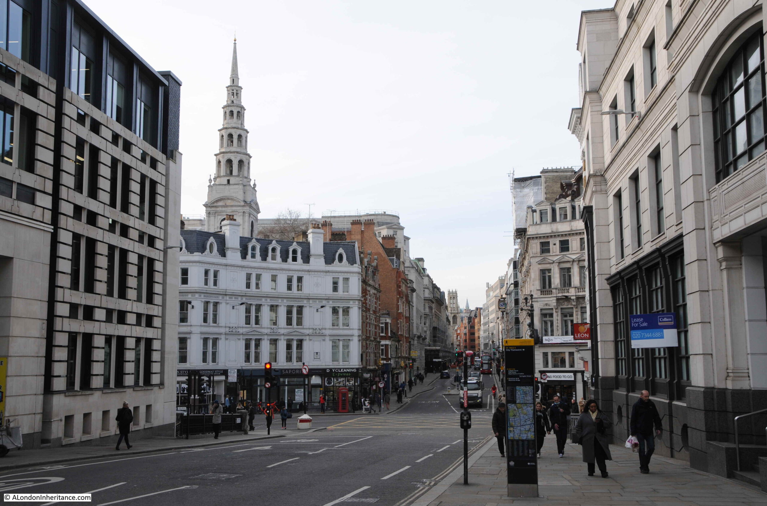
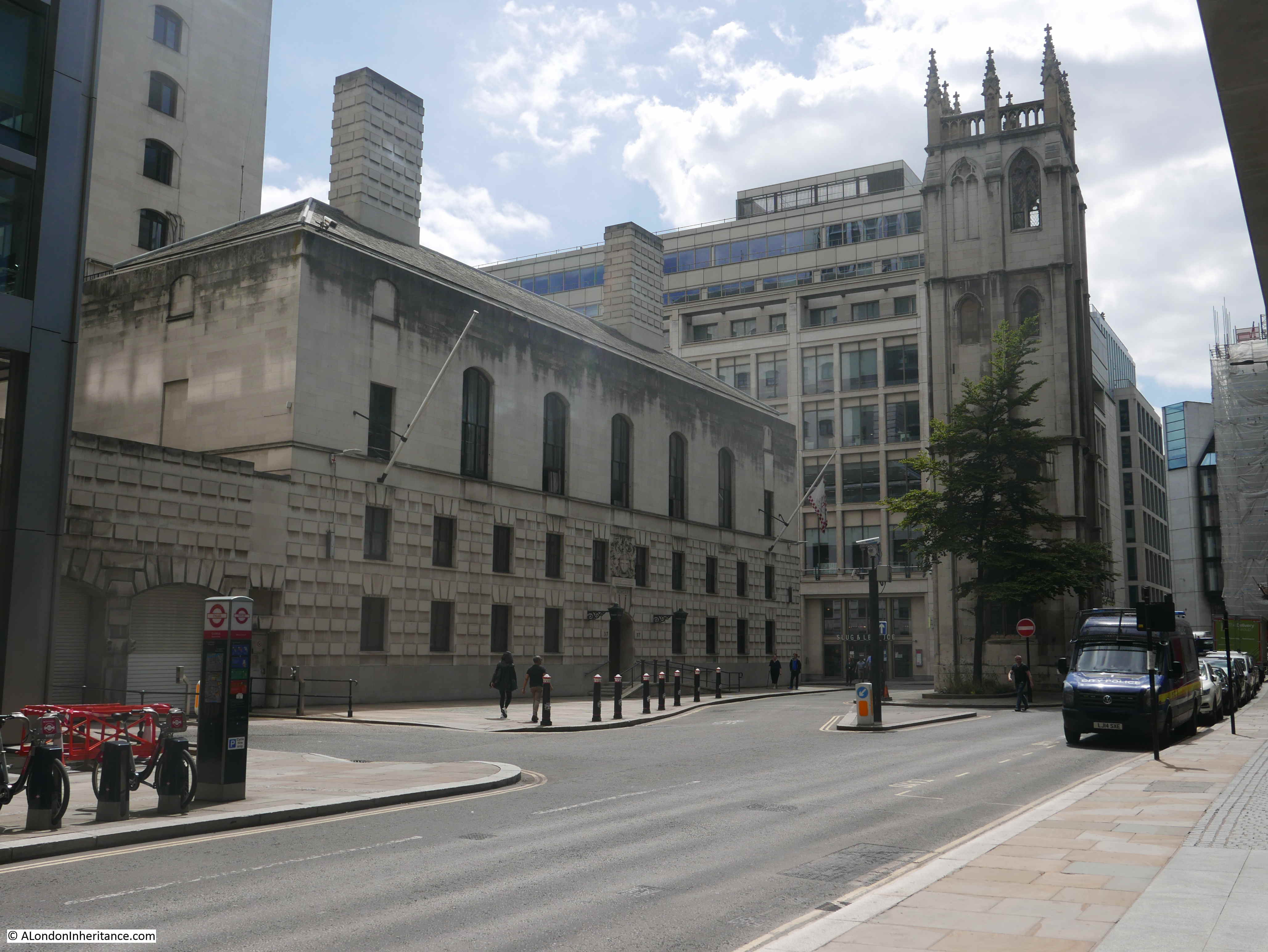
The following photo is looking along Queen Victoria Street as it heads down towards Blackfriars. Part of the church can be seen on the right and a narrow building making use of a small plot of land between street and church can be seen in the middle.

St. Mary Aldermary

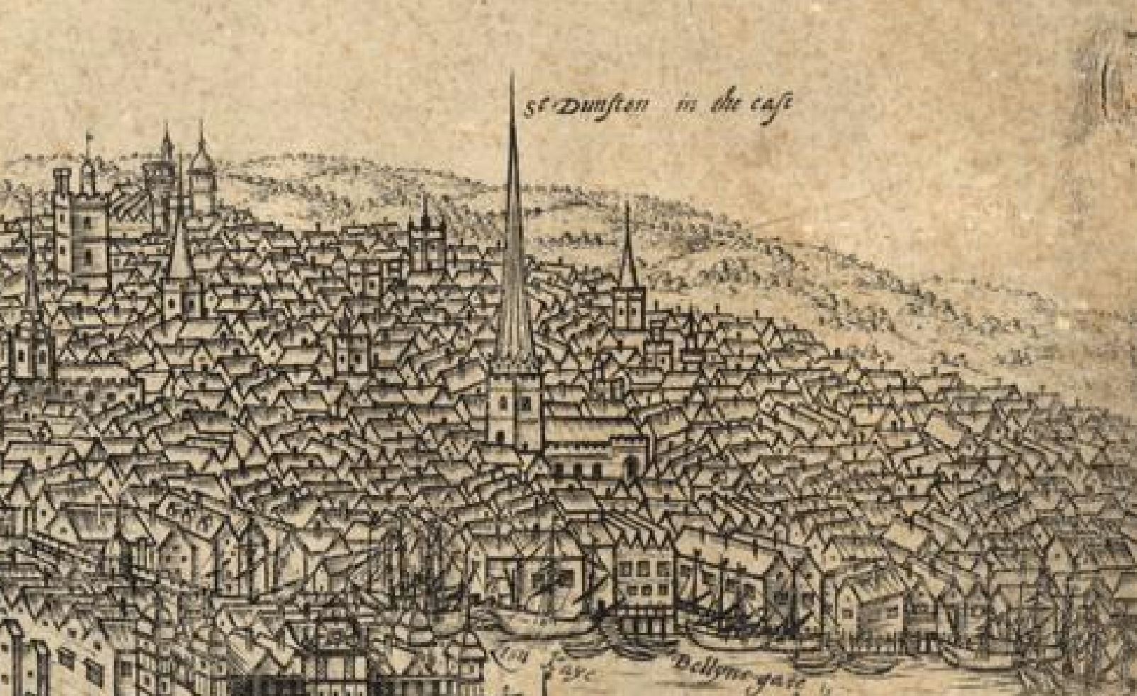
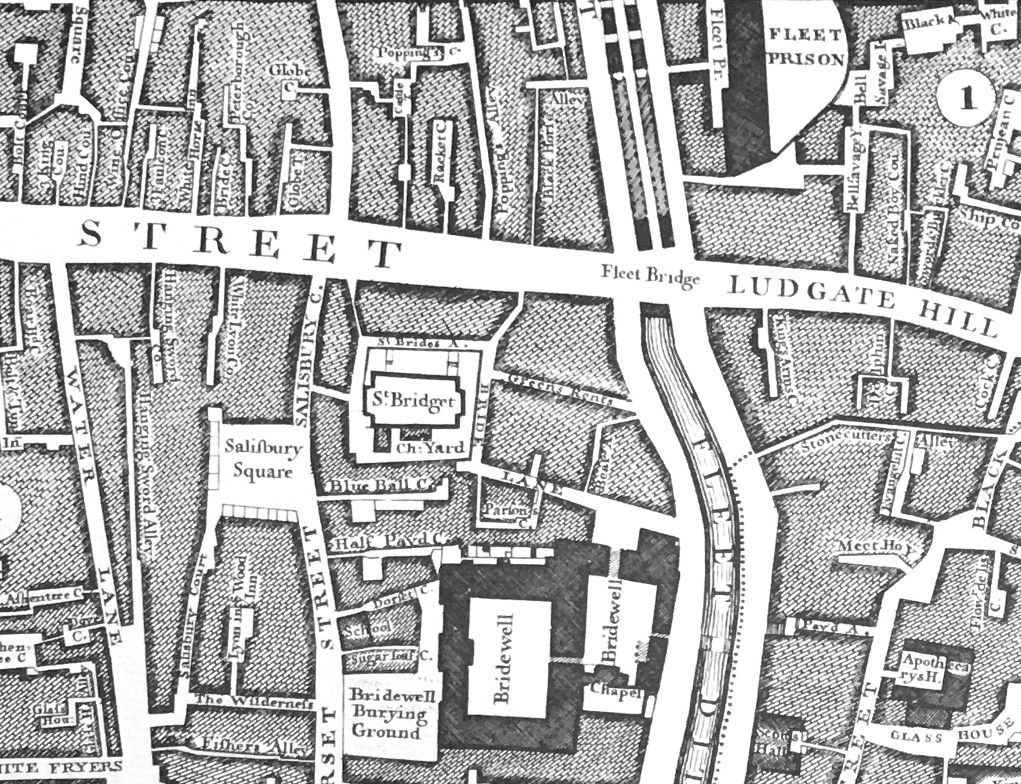
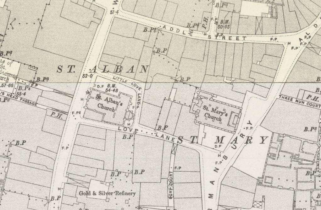
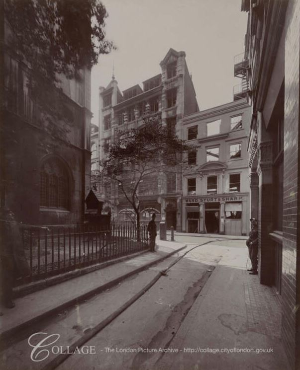
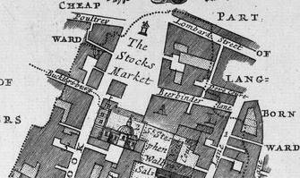
The following map is an extract from a map of Bread Street Ward and Cordwainer Ward, dated 1754 and for an edition of Stow’s Survey of London. The map shows St. Mary Aldermary in the centre, with Bow Lane at the front of the church and Watling Street to the right.

St. Mary Aldermary

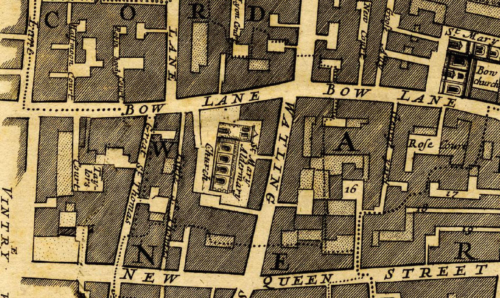
The map shows the church within a typical City streetscape, surrounded by buildings, streets and narrow lanes.

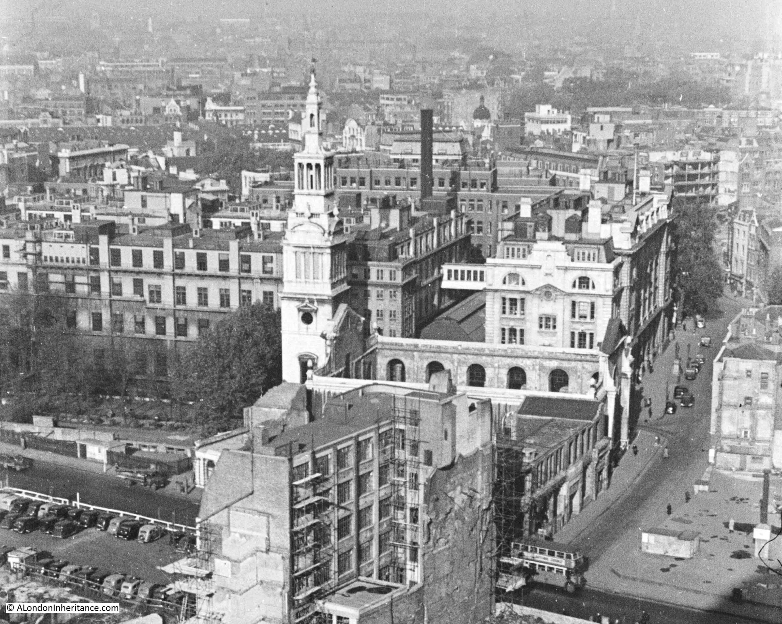
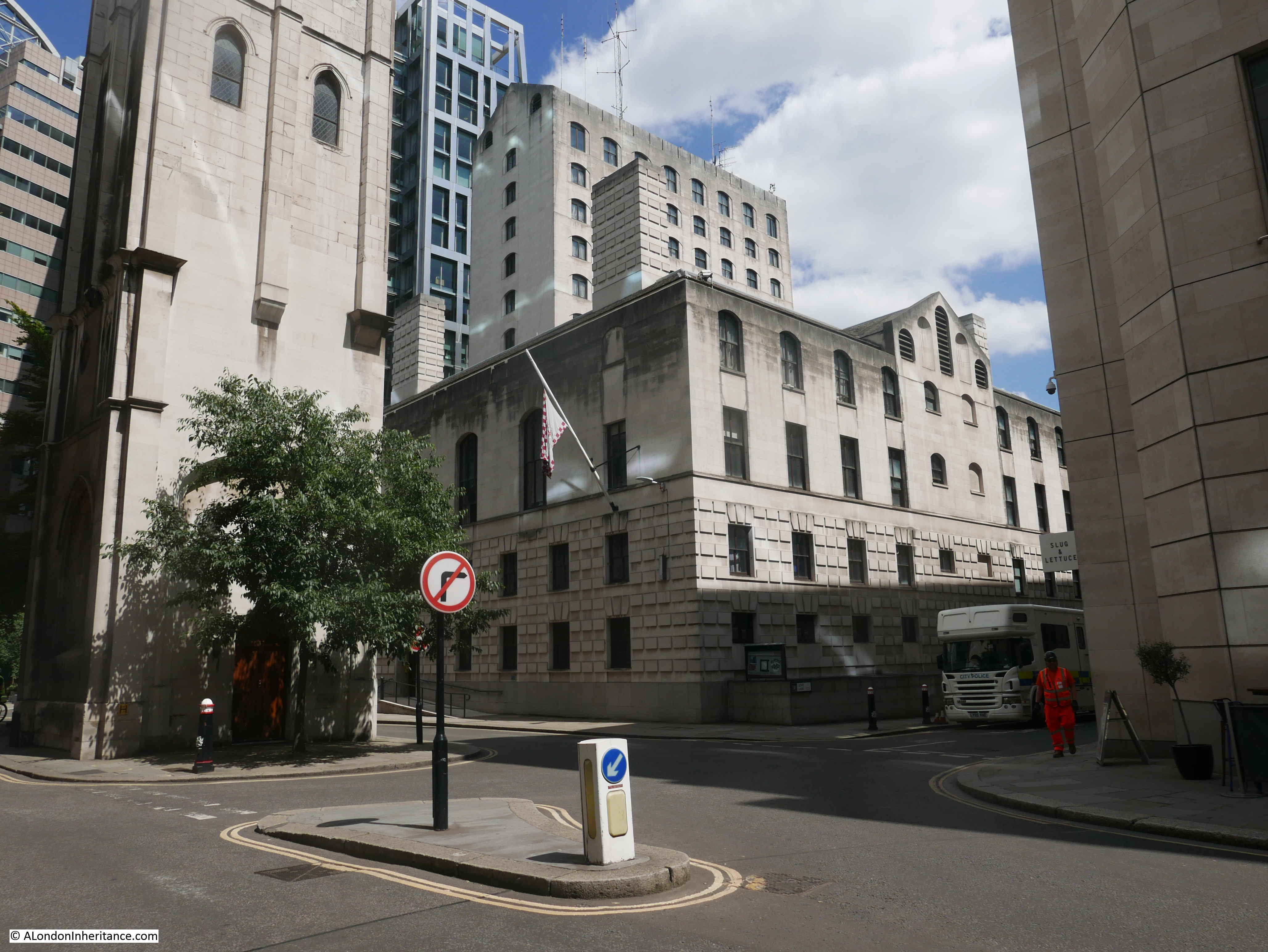
The reason for the strange triangular plot of land on which the church sits today is down to the 19th century construction of Queen Victoria Street, when this wide street was carved through a dense network of streets, as part of Victorian “improvements” to the City, with the aim of providing a fast route from the large junction at the Bank, down to the newly constructed Embankment.

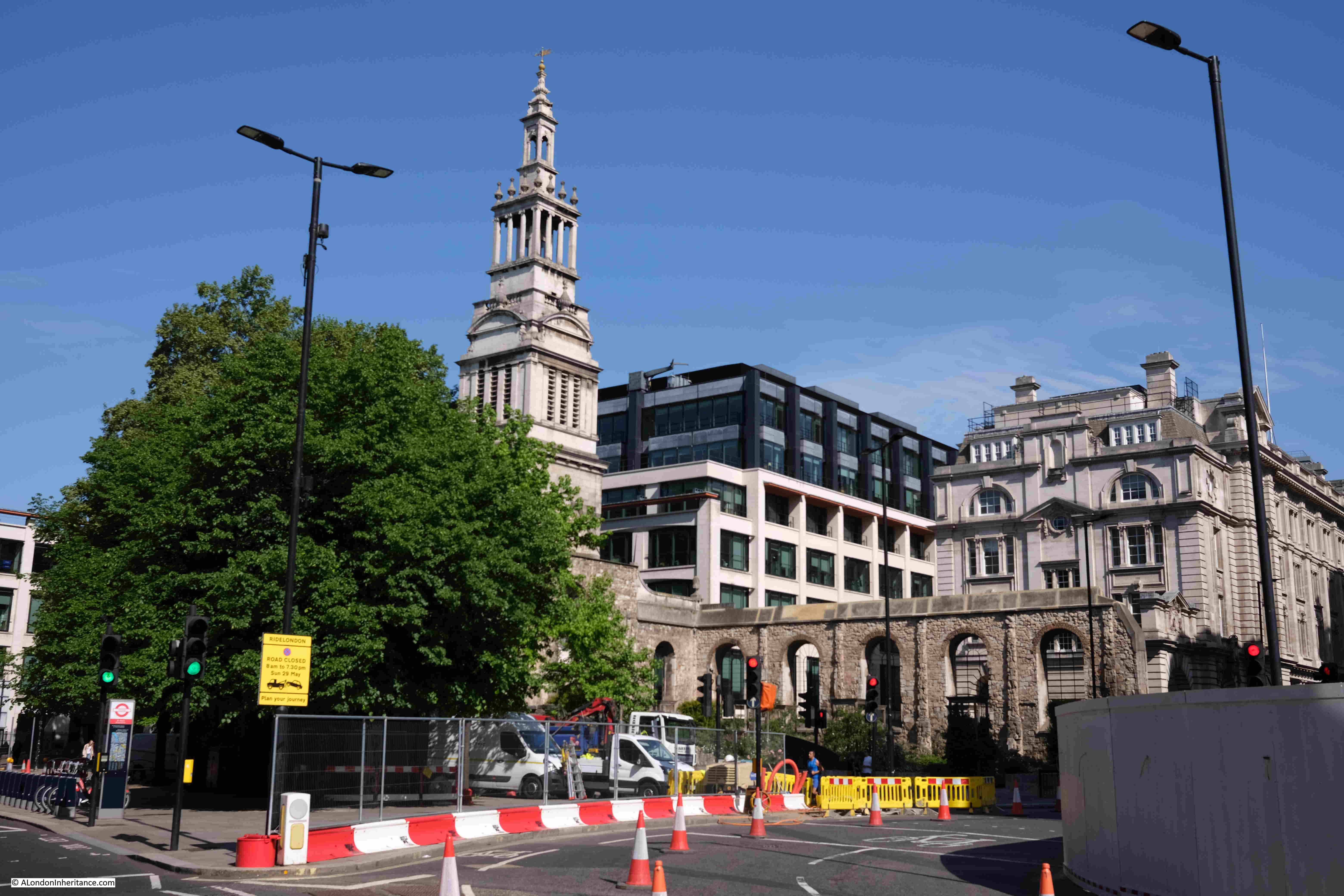
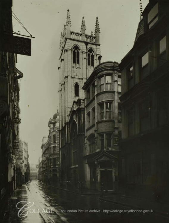
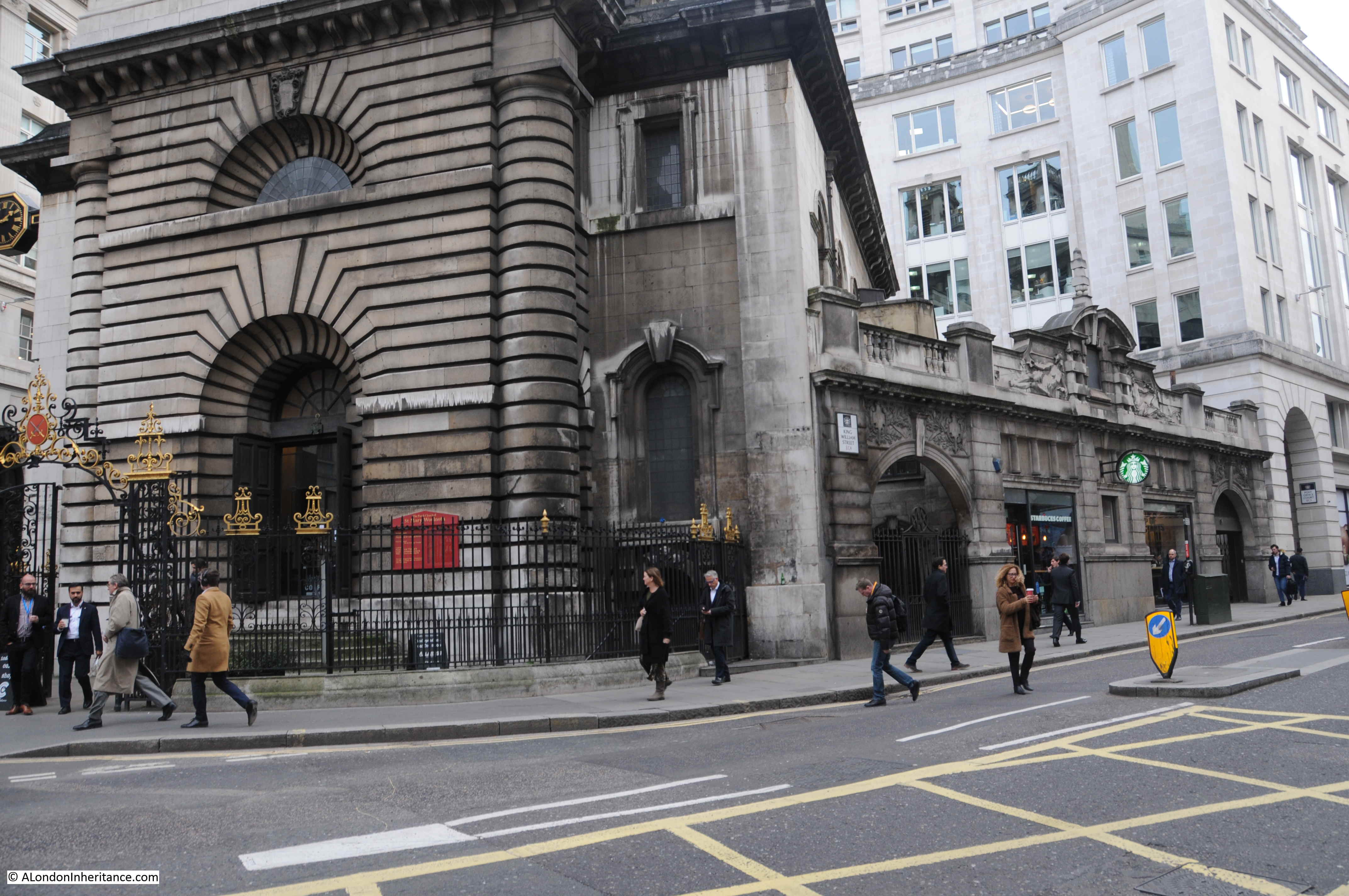
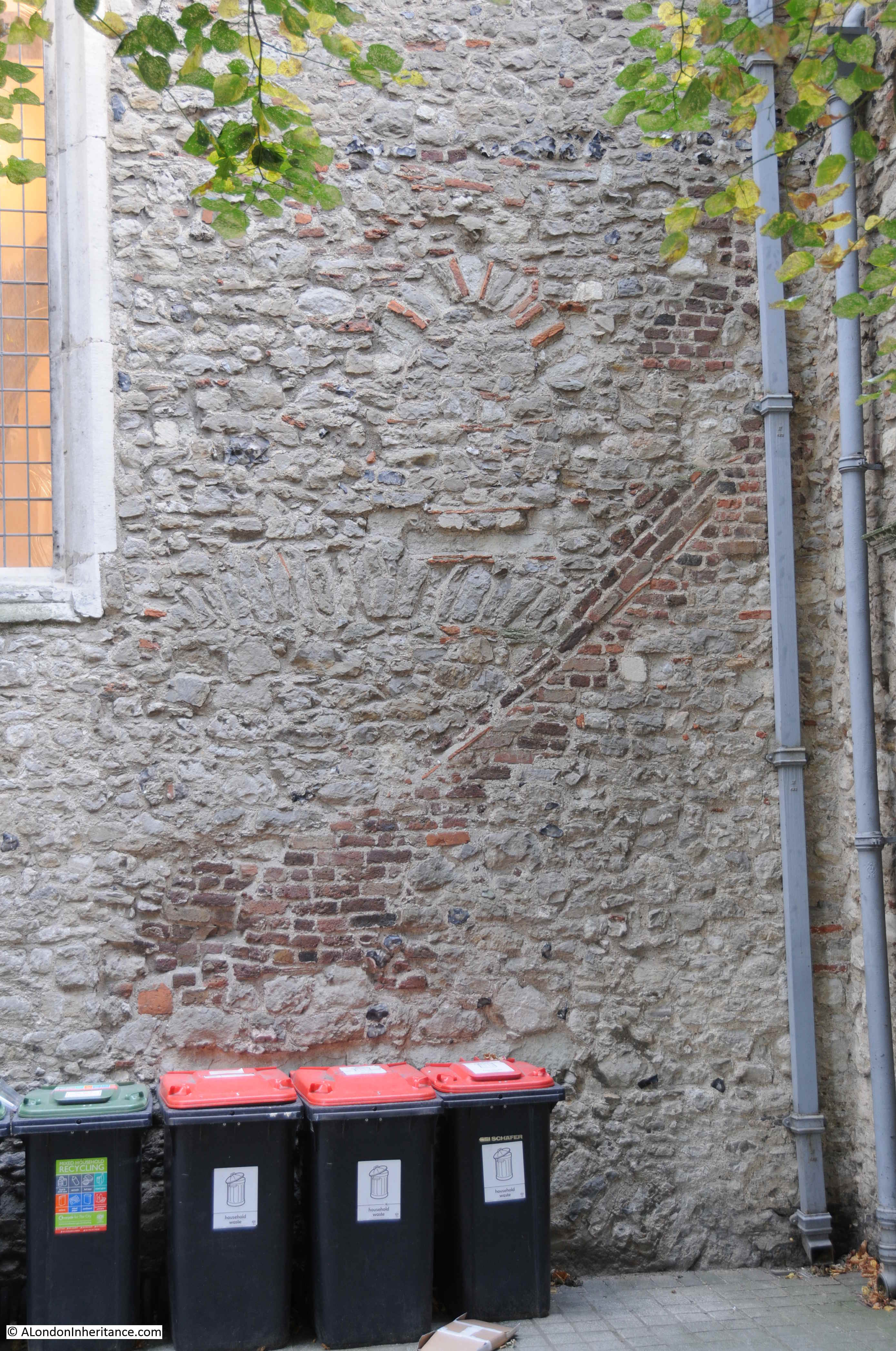
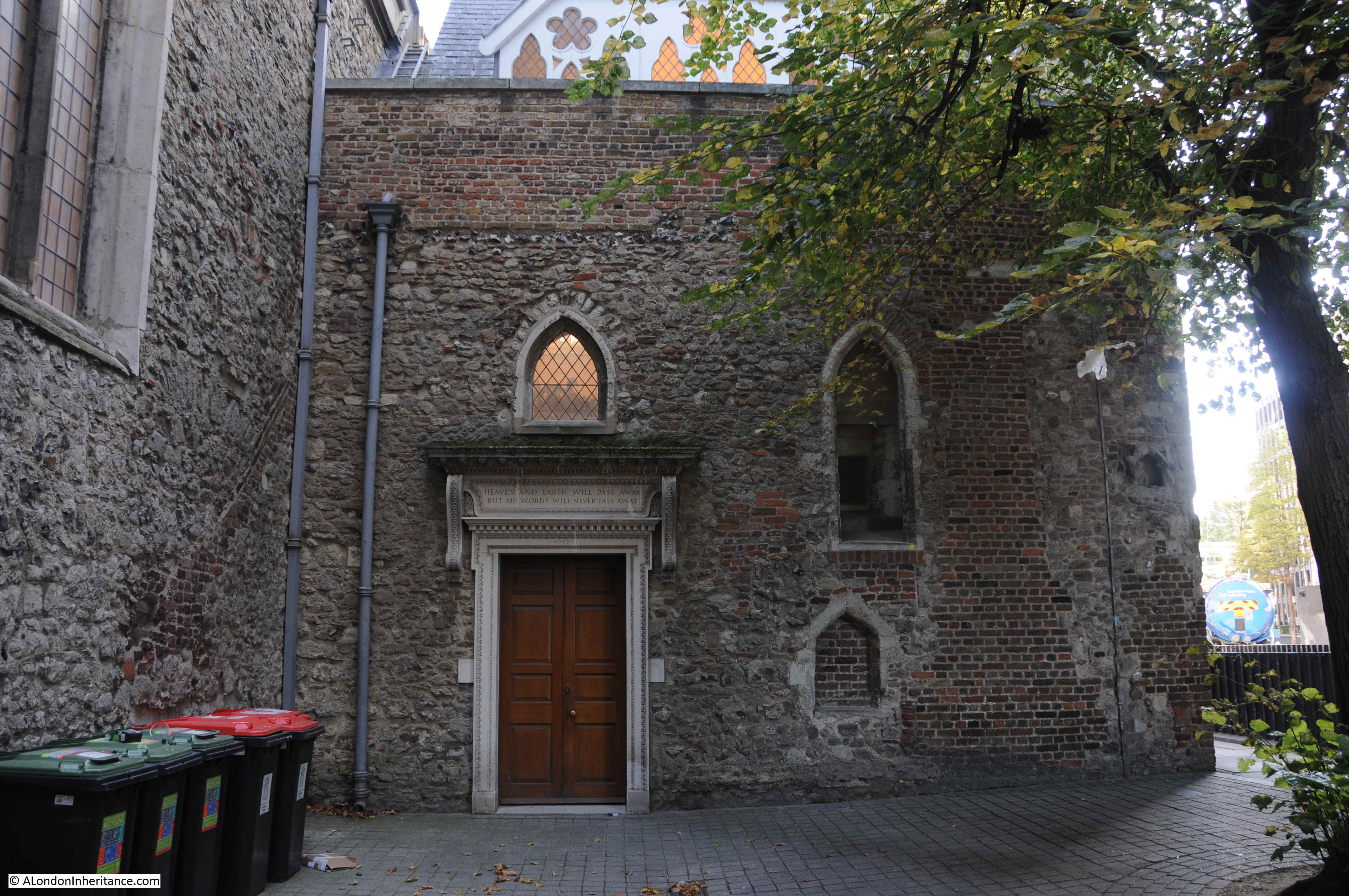
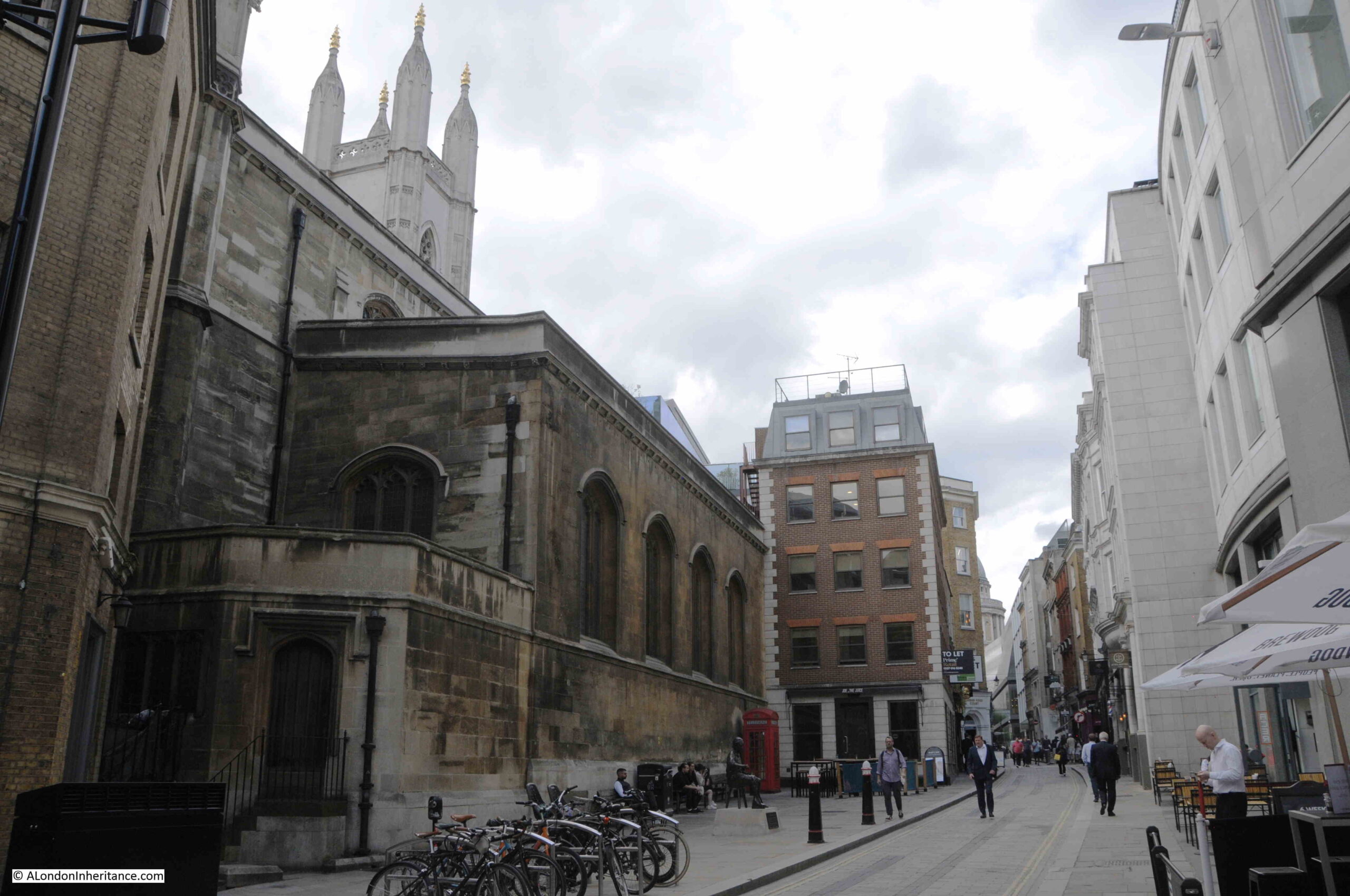
In Watling Street, the side of the church is more visible:

St. Mary Aldermary

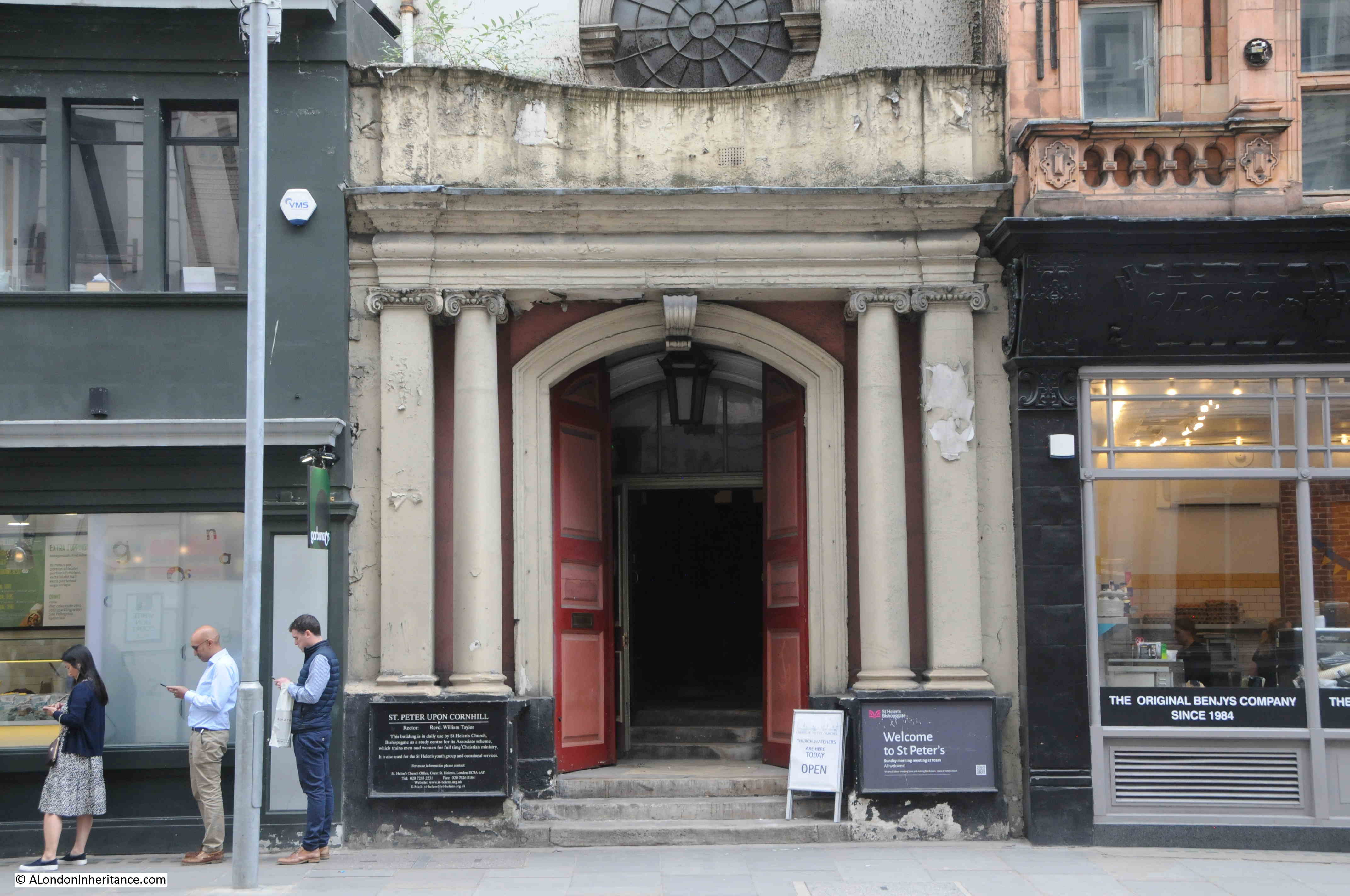
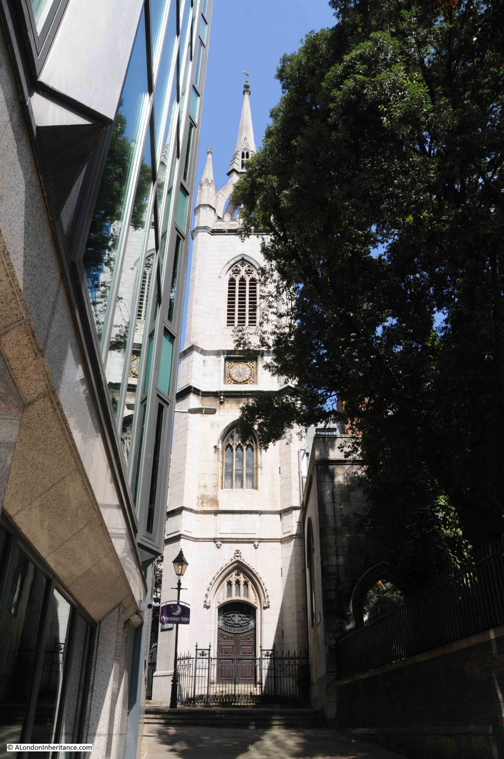
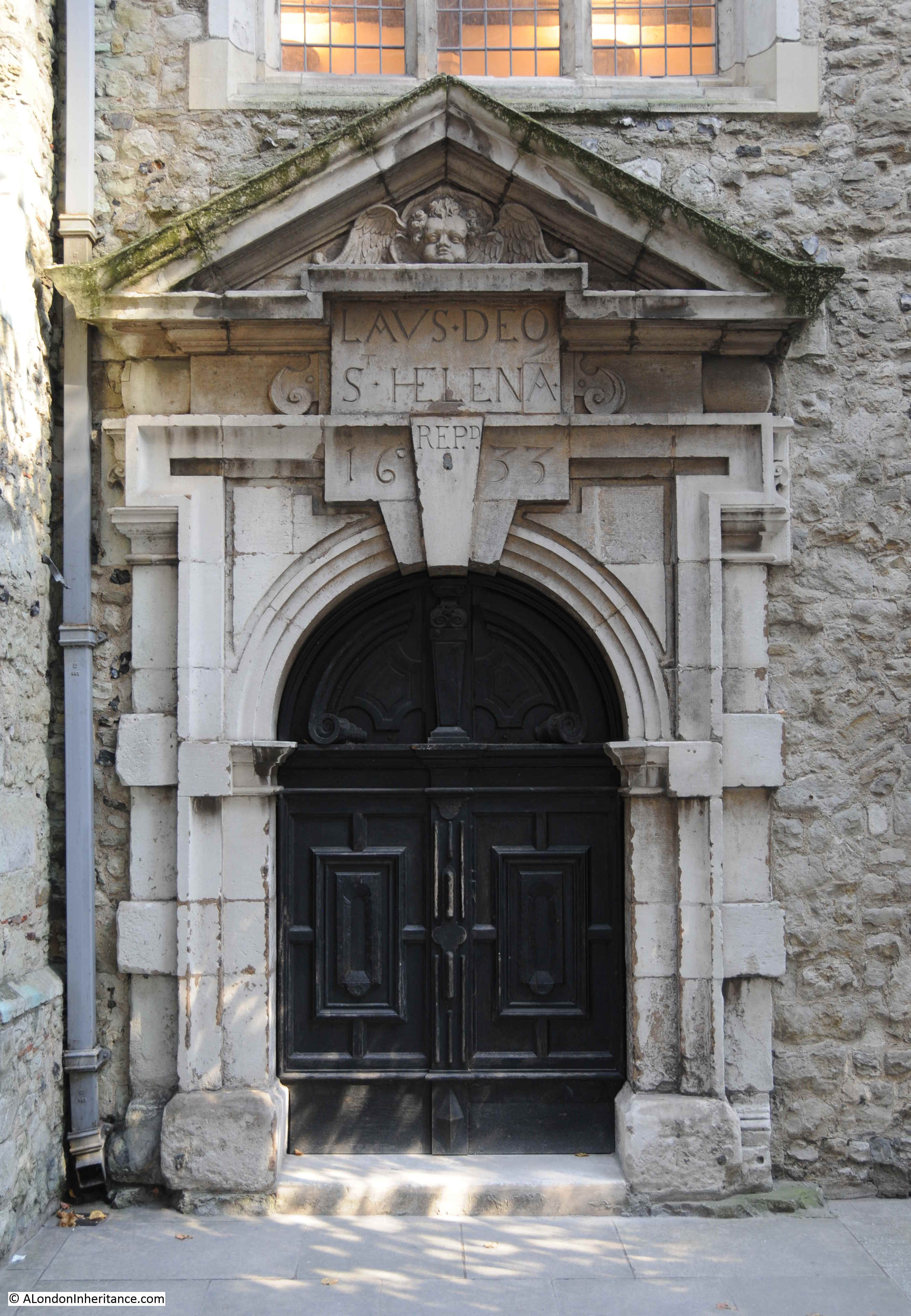
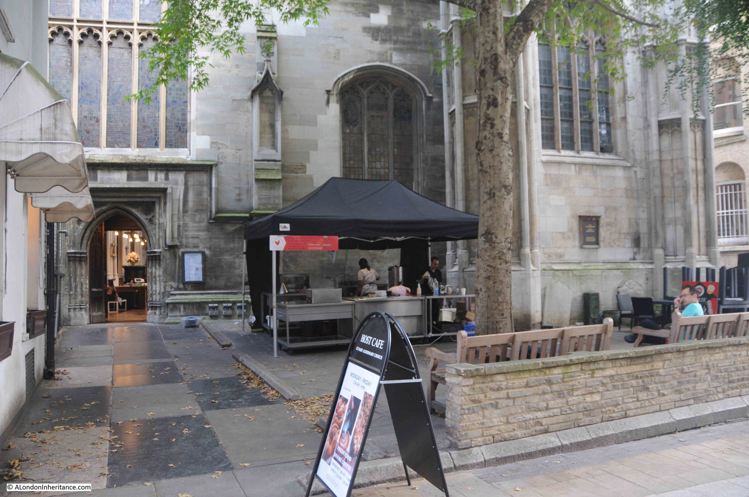
Entrance to St. Mary Aldermary in Bow Lane:

St. Mary Aldermary

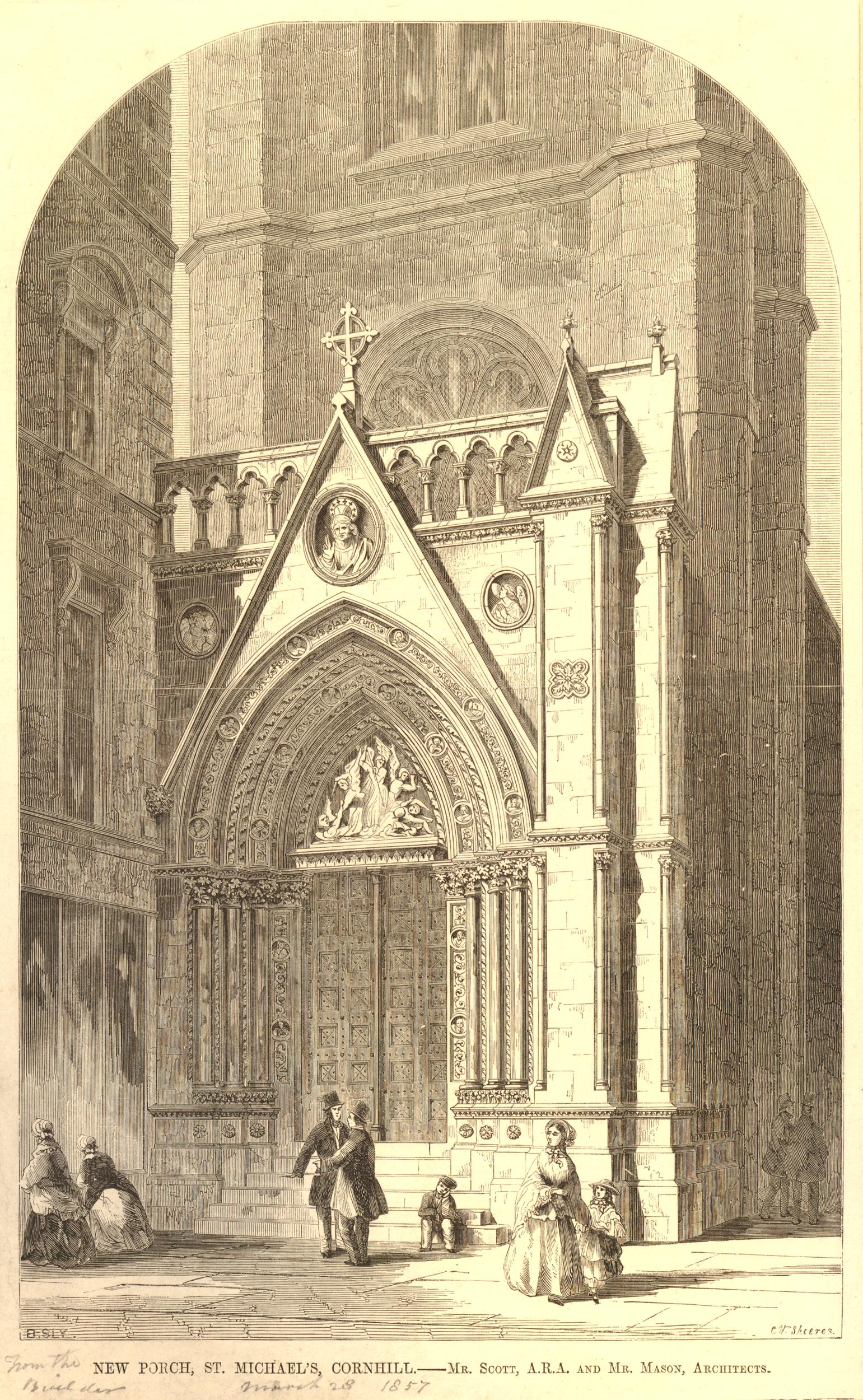
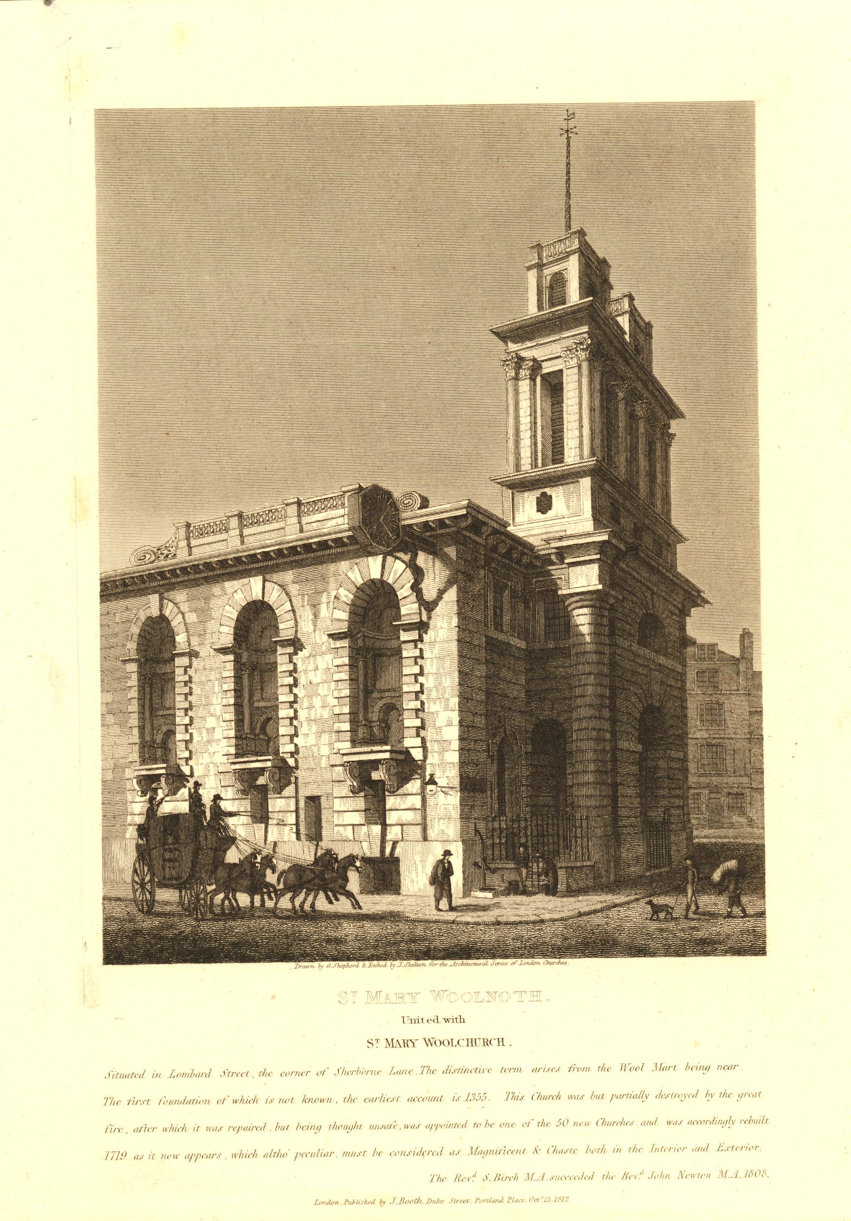
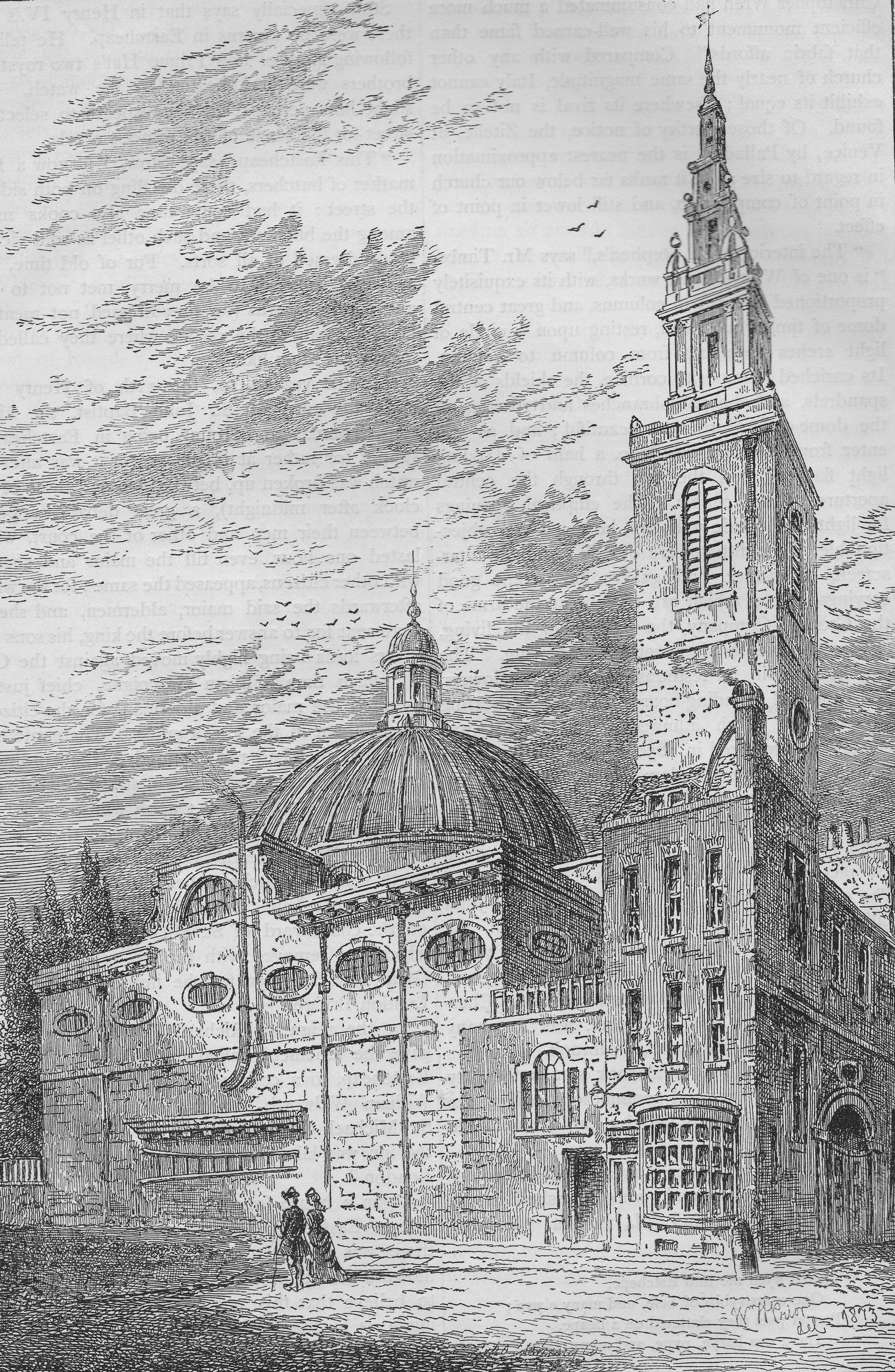
Due to the narrowness of the street, it is impossible to get a photograph of the church showing the front façade and tower. The following print from 1812 provides a view of the church which is impossible to get today:

Christopher Wren

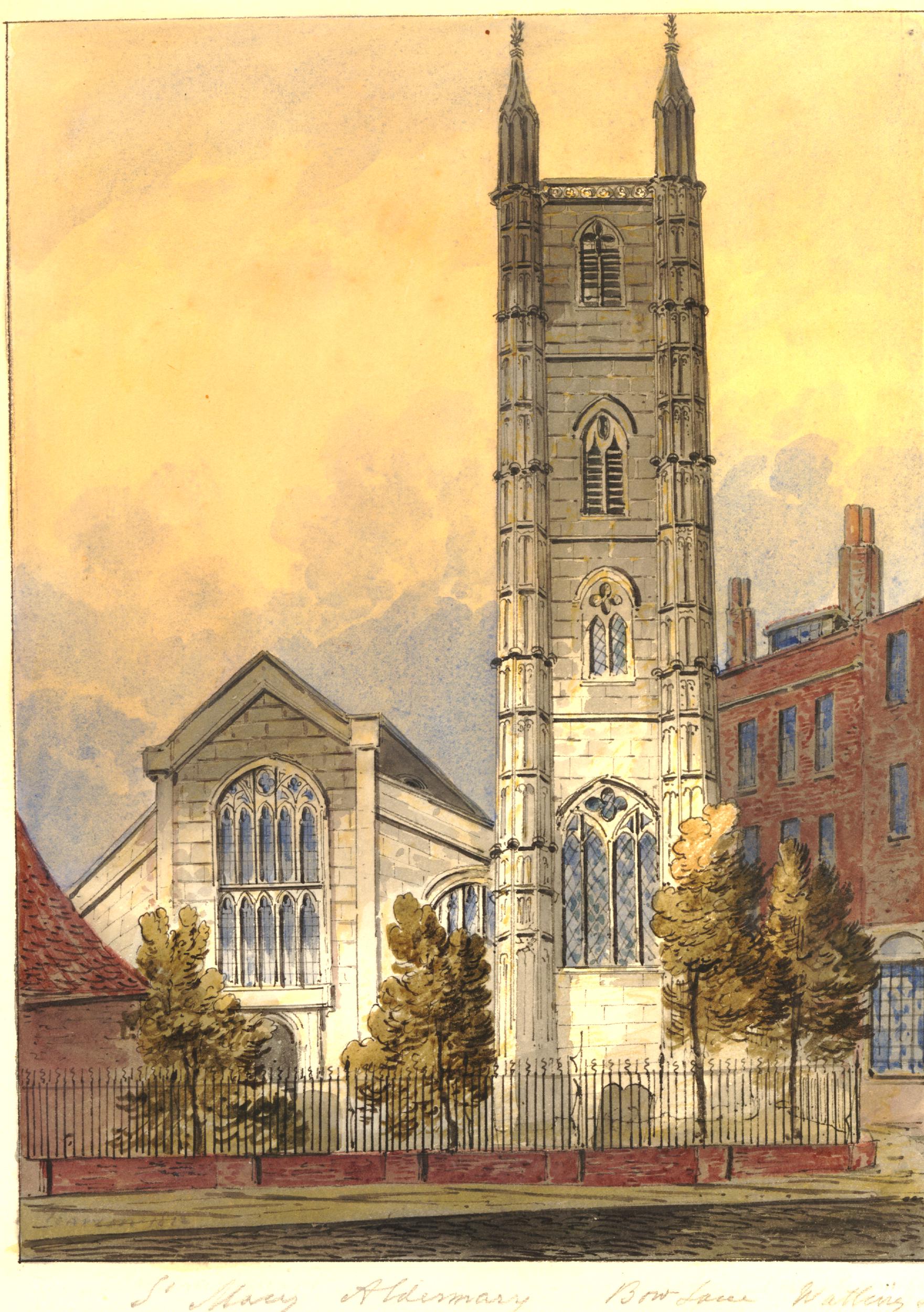
The trees and railings have gone, as has the building on the left, however the rest of the church looks the same, the lower part of the church can be compared with my photo above.

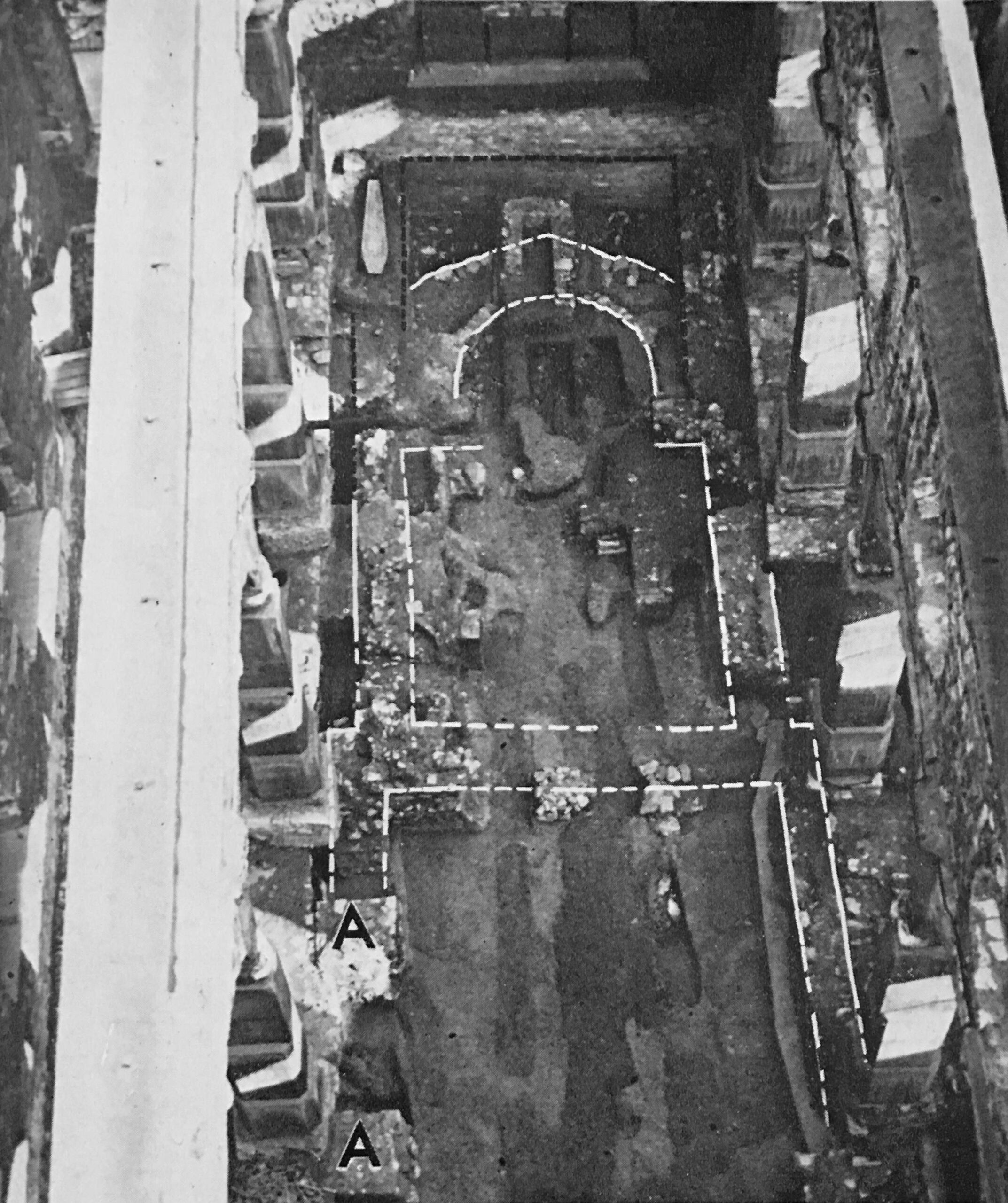
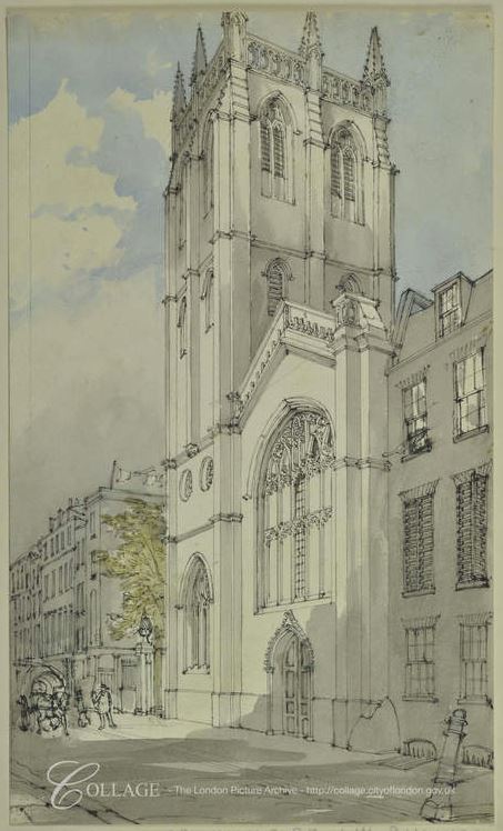
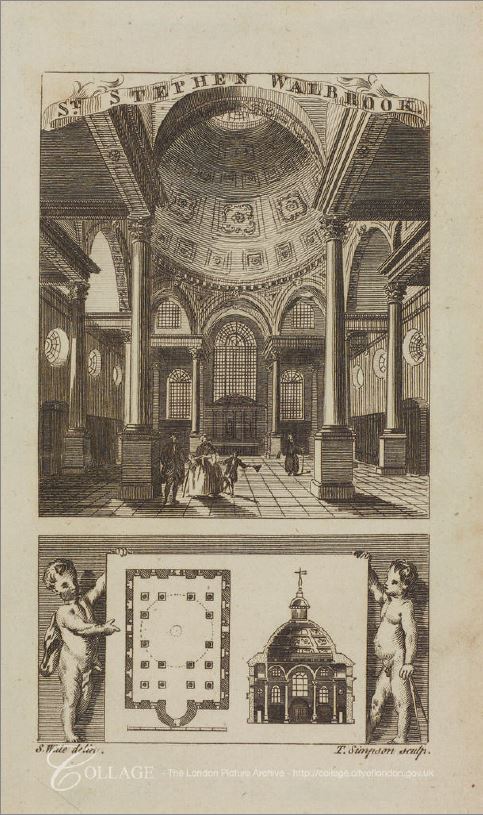
In the above print, the body of the church is to the left and the tower on the right. The book on Wren in which I found the London Transport booklet, includes a floor plan of all of Wren’s City of London churches, and it is surprising just how much variety there is across his City churches.

The floor plan for St. Mary Aldermary from the book is shown below:

Christopher Wren

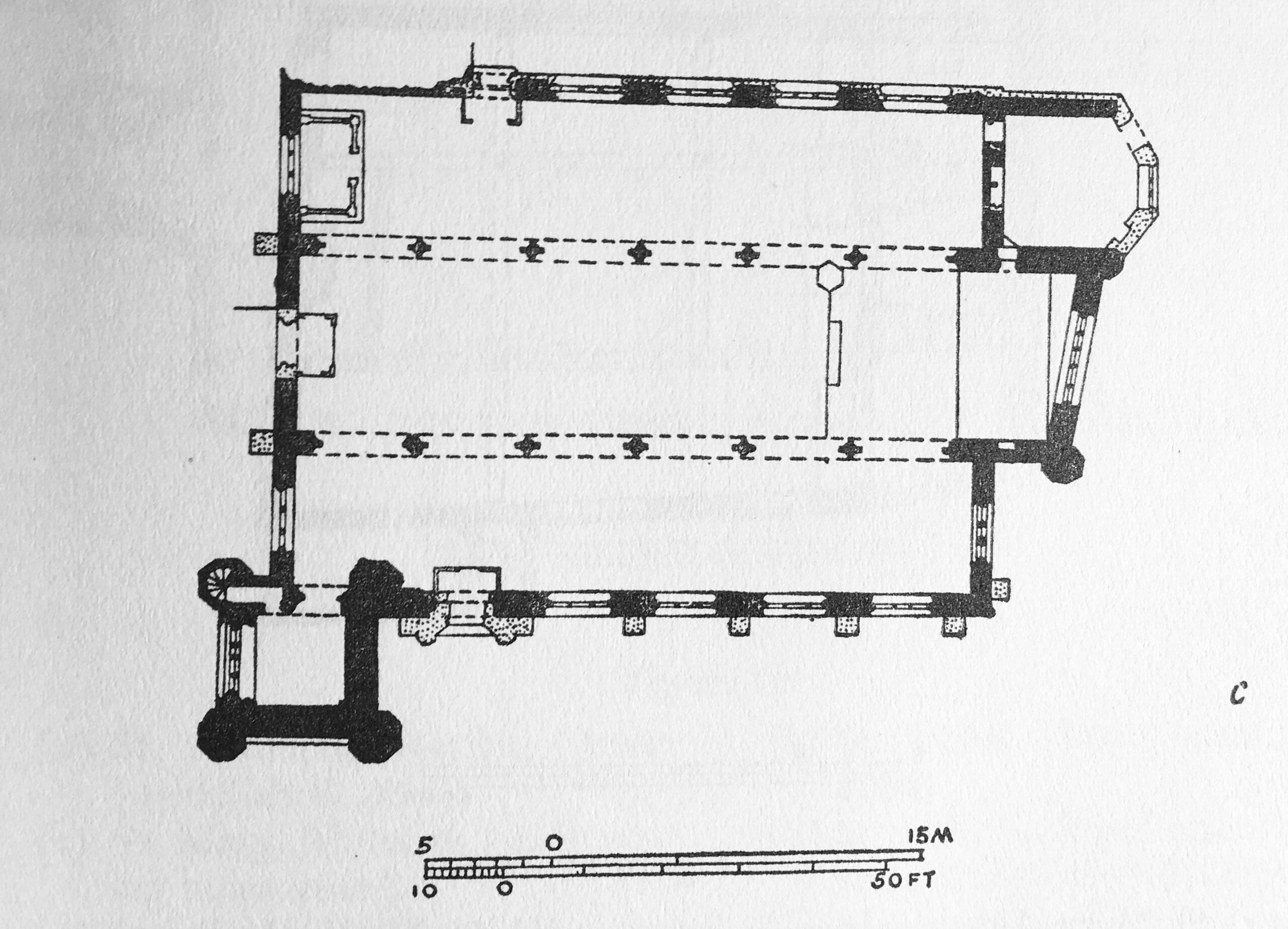
The floor plan clearly shows the location of the square tower at bottom left of the plan.

The church has a Gothic feel to the design, and according the Eduard Sekler, in the book on Wren, he had an “obligation to deviate from a better style”, because the patron who was funding the rebuild of the church insisted that it was rebuilt as an exact copy of the church that was destroyed in the Great Fire.

The book “If Stones Could Speak” by F. St. Aubyn-Brisbane (1929) states that the patron was a certain Henry Rogers, who had bequeathed £5,000 towards the expense of rebuilding, and it was his widow who insisted that the church was rebuilt as an exact imitation of the former church. It does not state why this was so important.

There appears to be no image of what the church looked like prior to the Great Fire, but it would seem that we are looking today on a church that is a replica of the one that stood on the site prior to 1666.

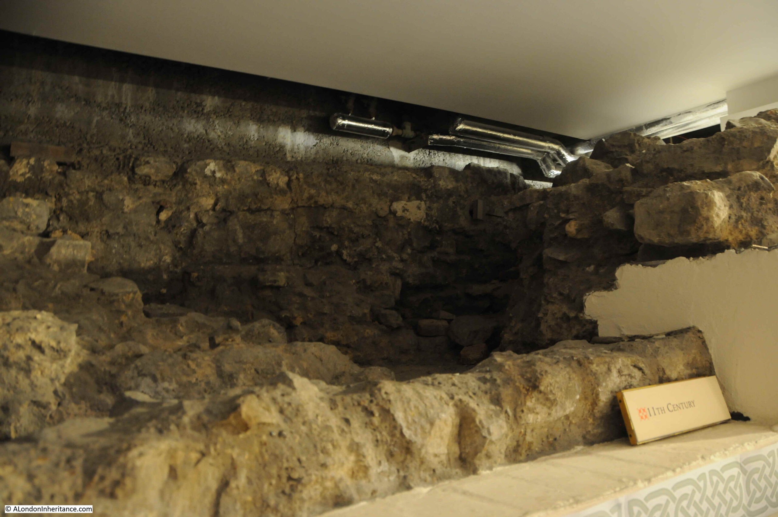
The church has a long history, with a church possibly being on the site from the 11th or early 12th centuries.

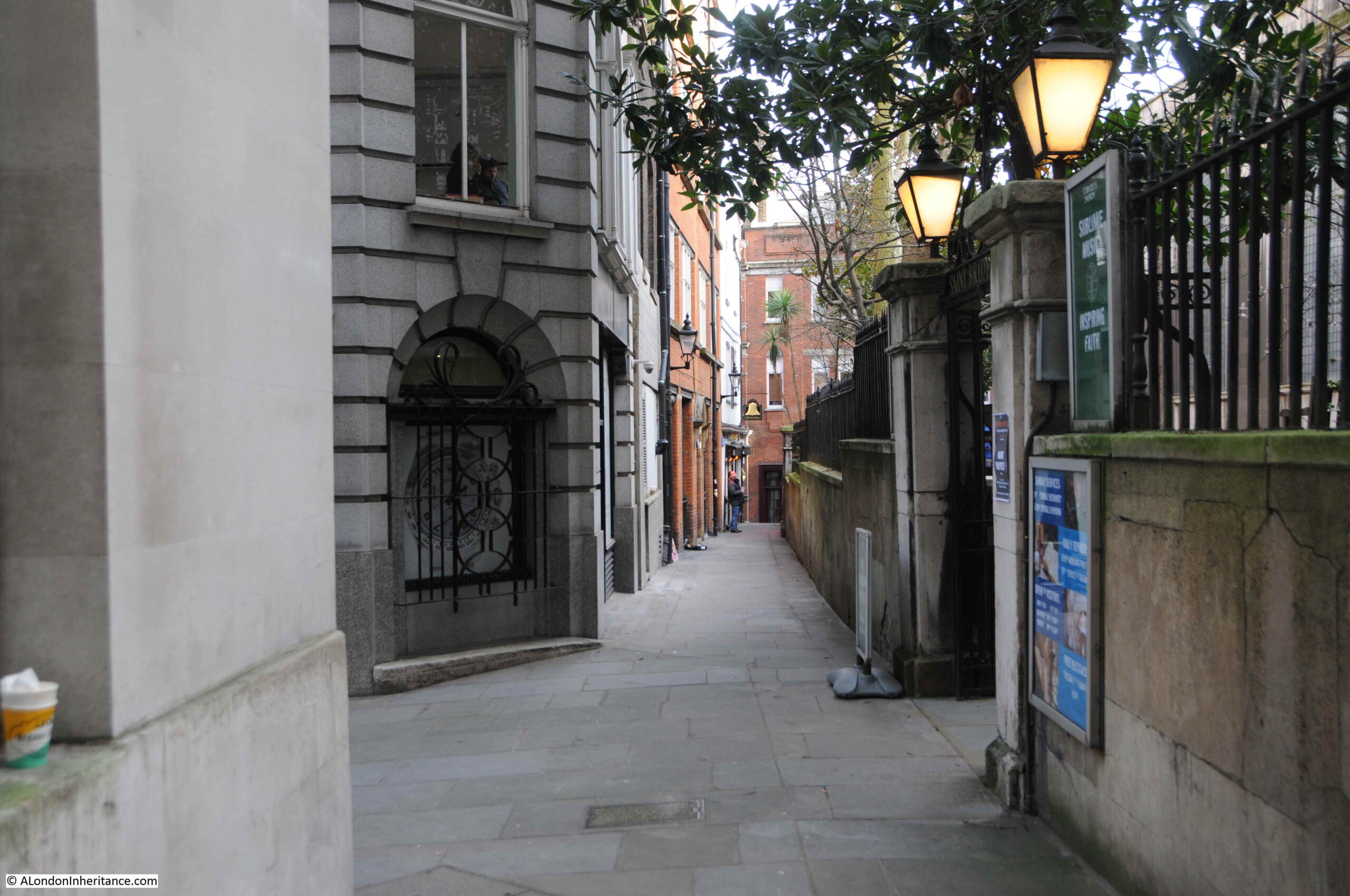
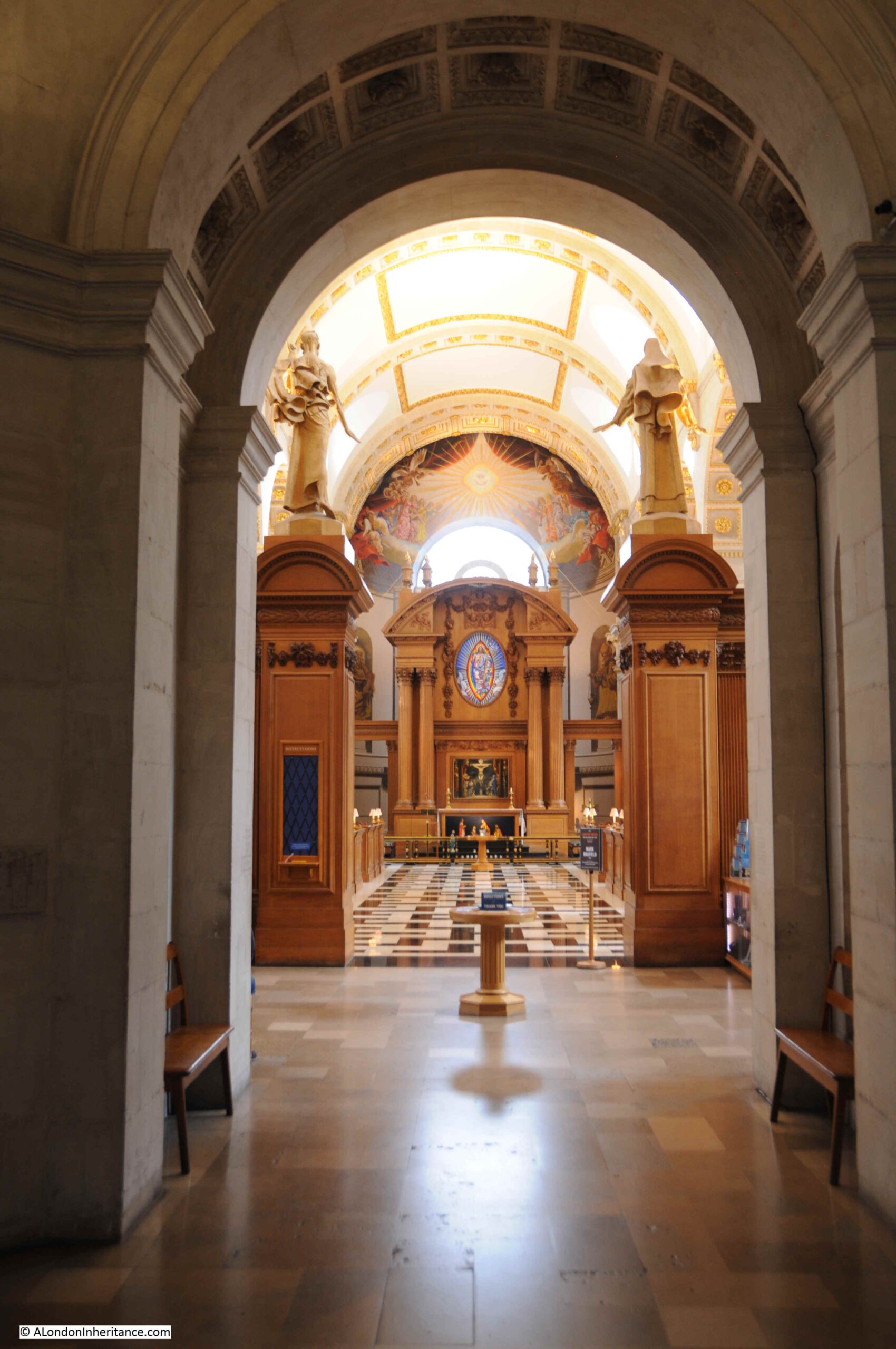
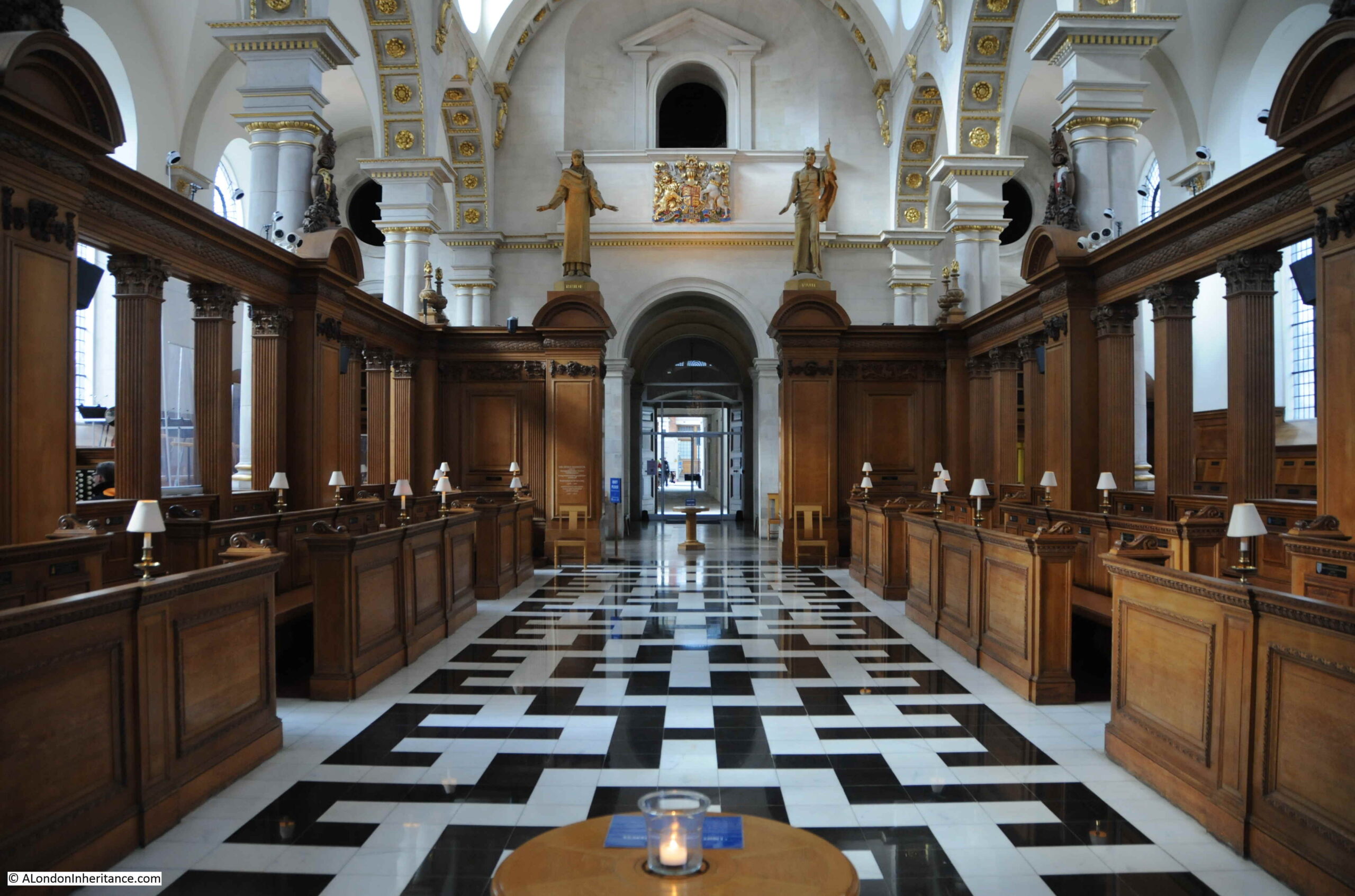
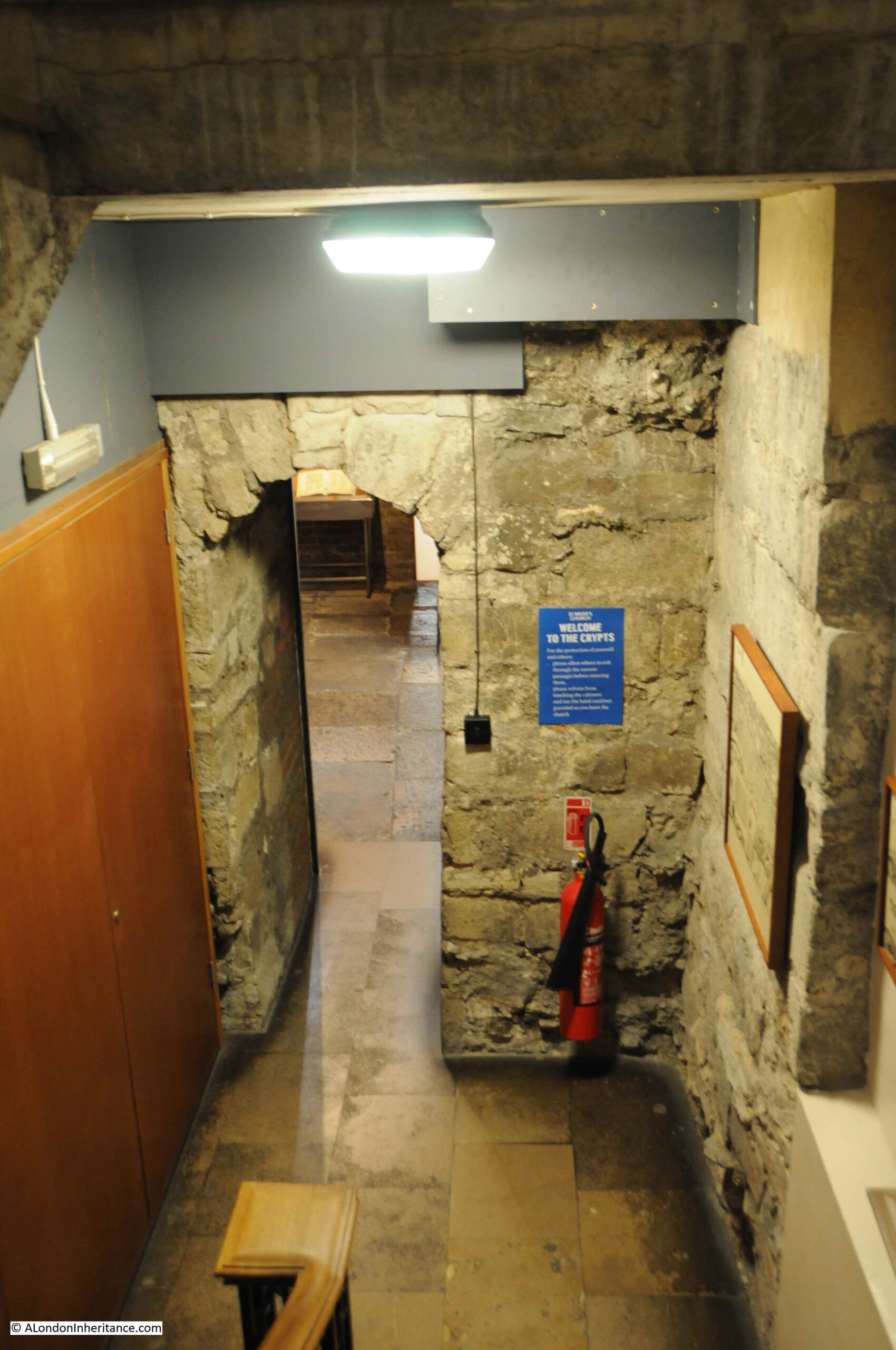
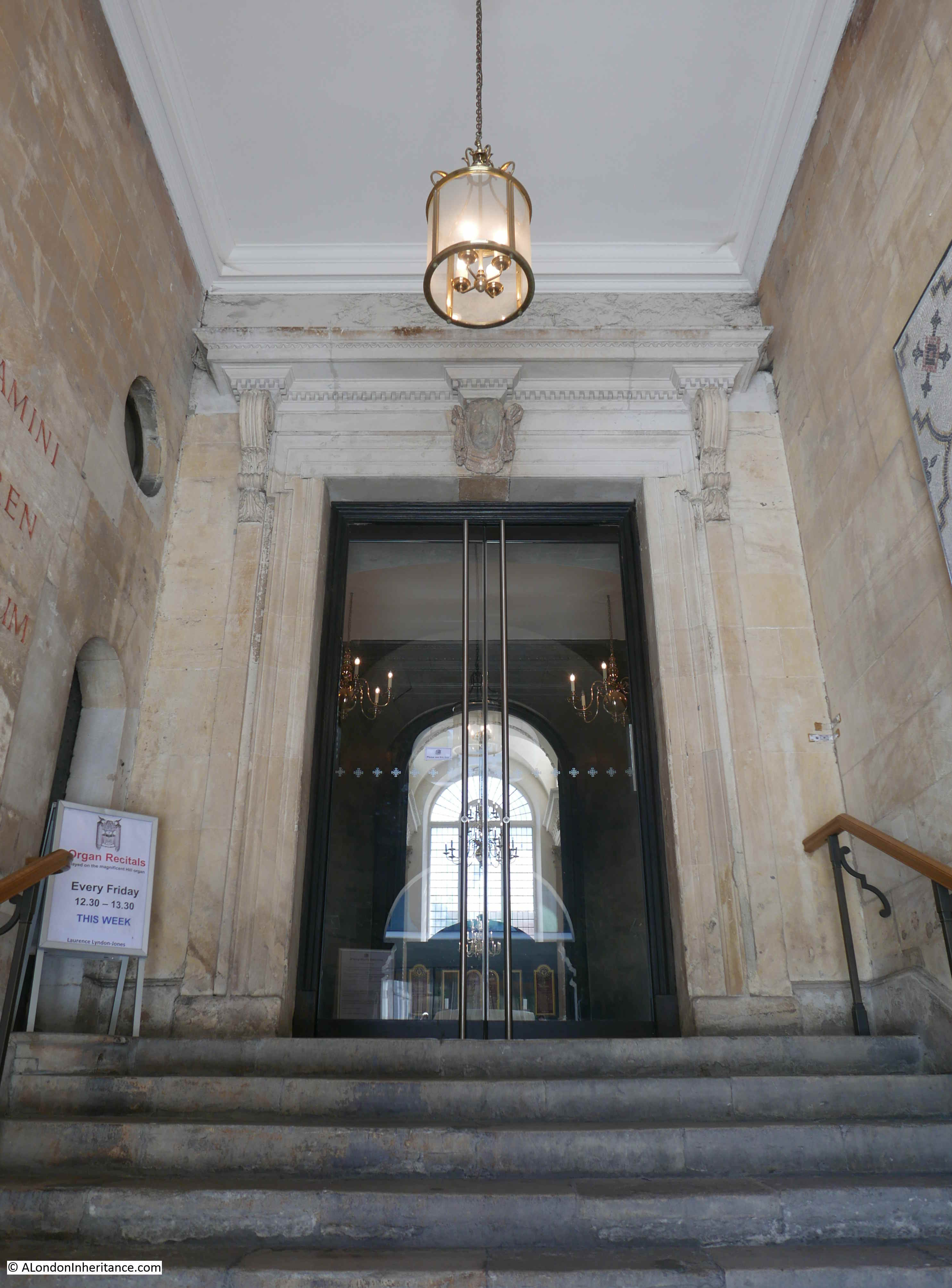
Looking through the entrance into the church from Bow Lane:

St. Mary Aldermary

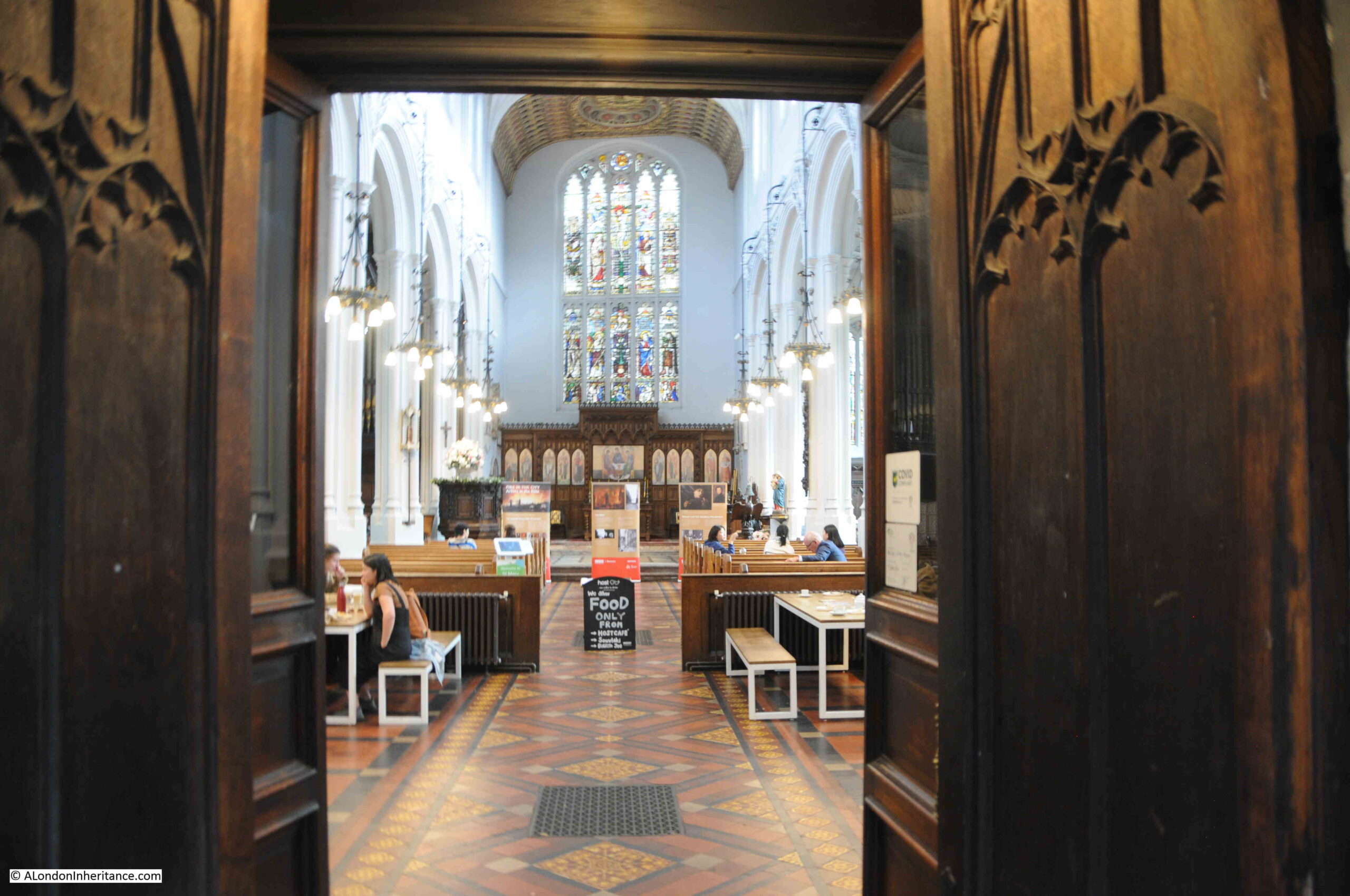
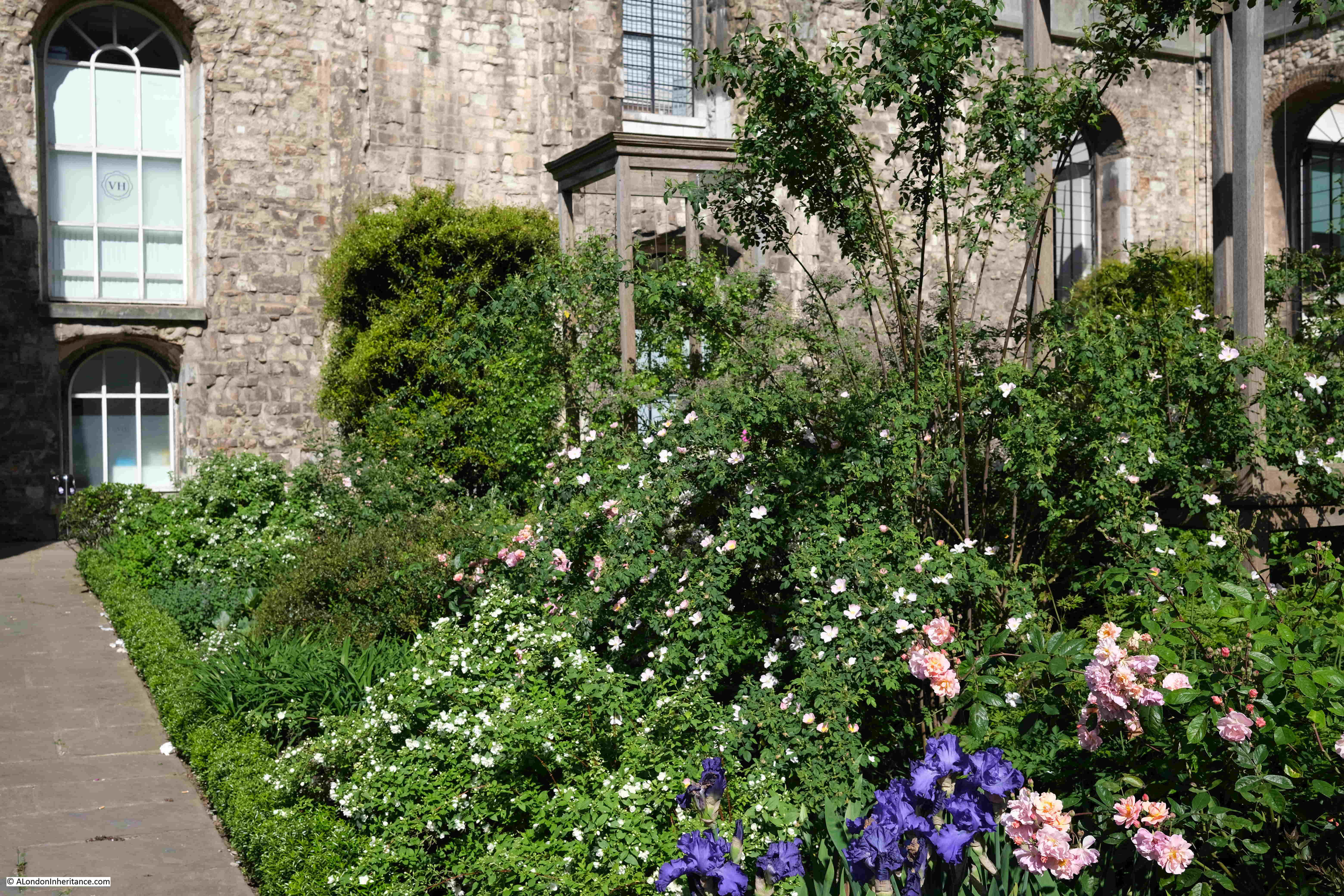
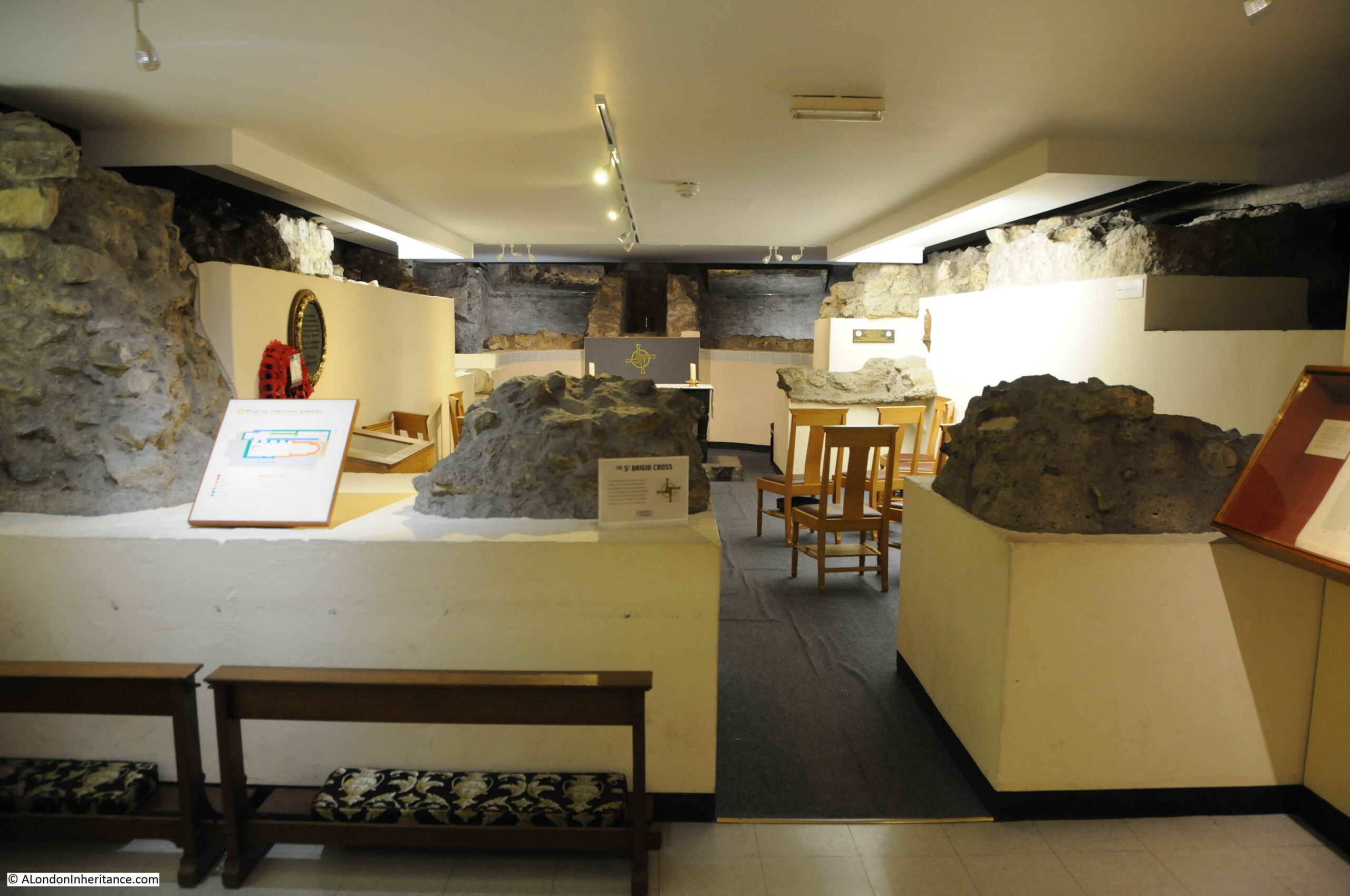
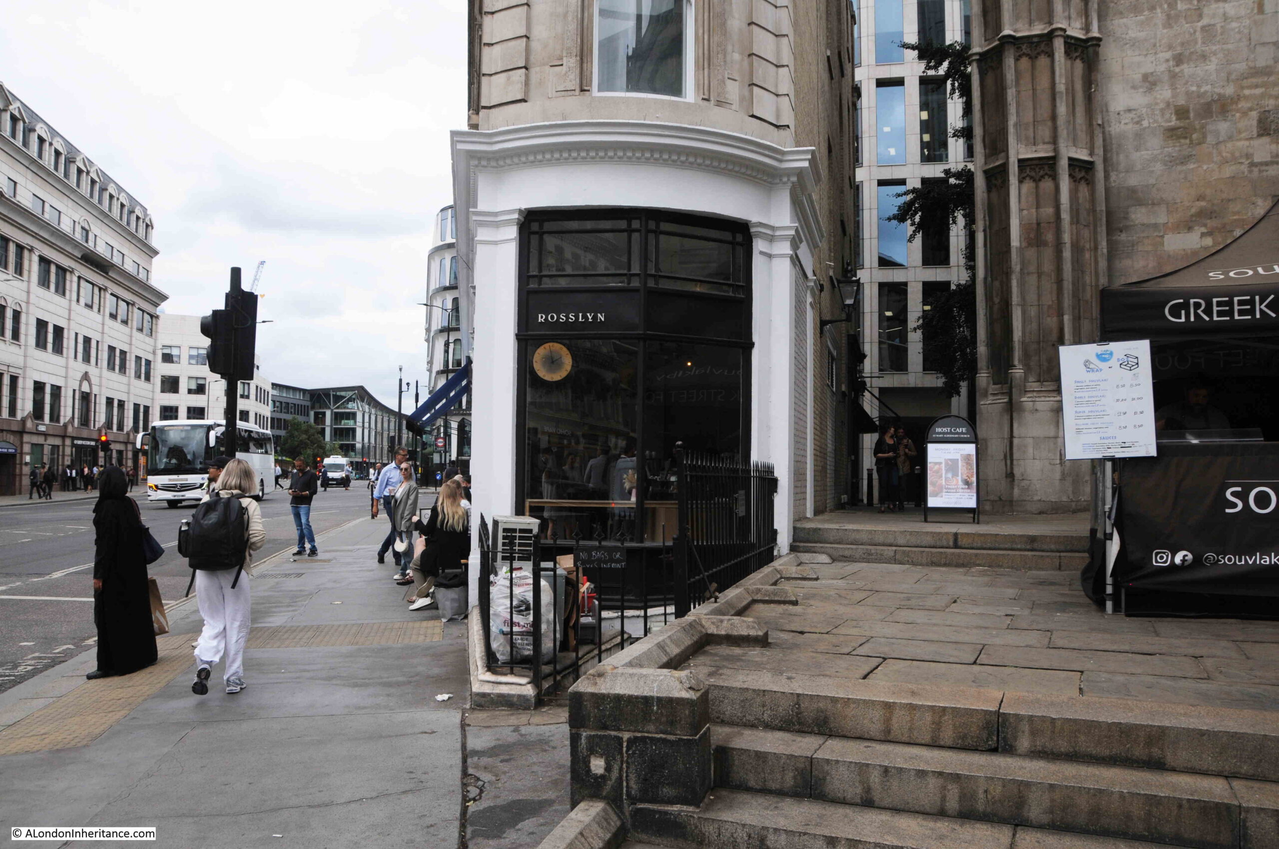
The area of the church just inside the entrance is used as a café when services are not being conducted. It is a really good place for a drink and to sit down after some miles of walking.

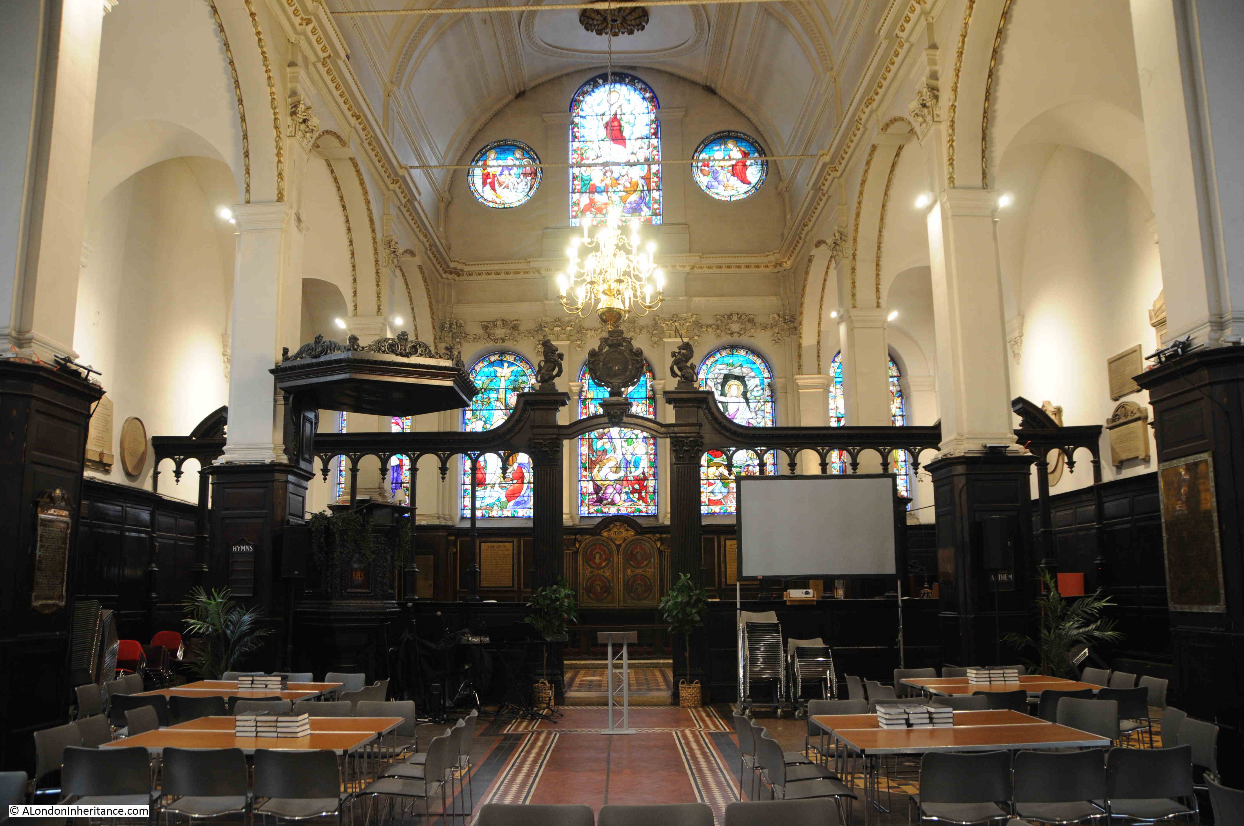
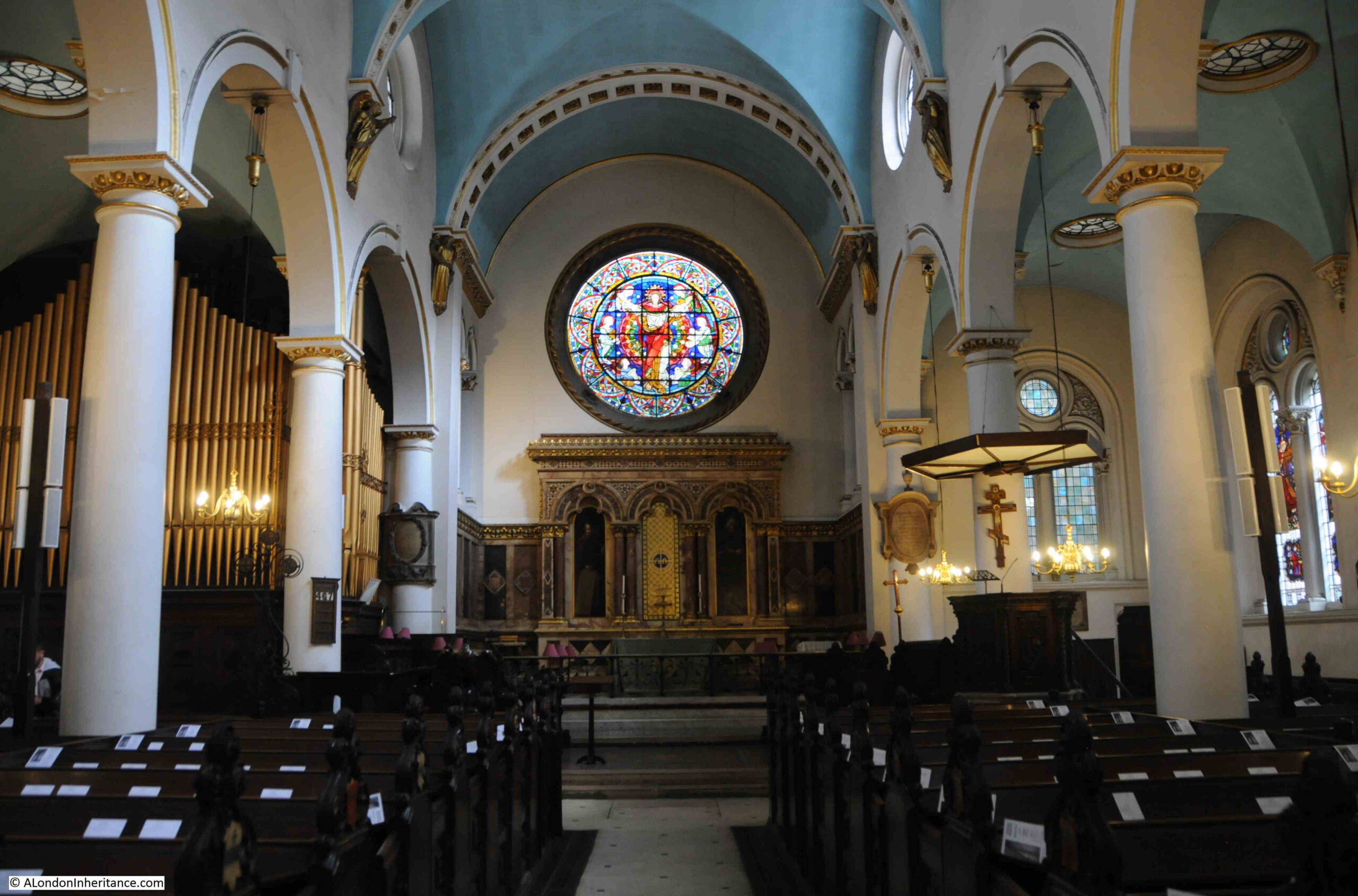
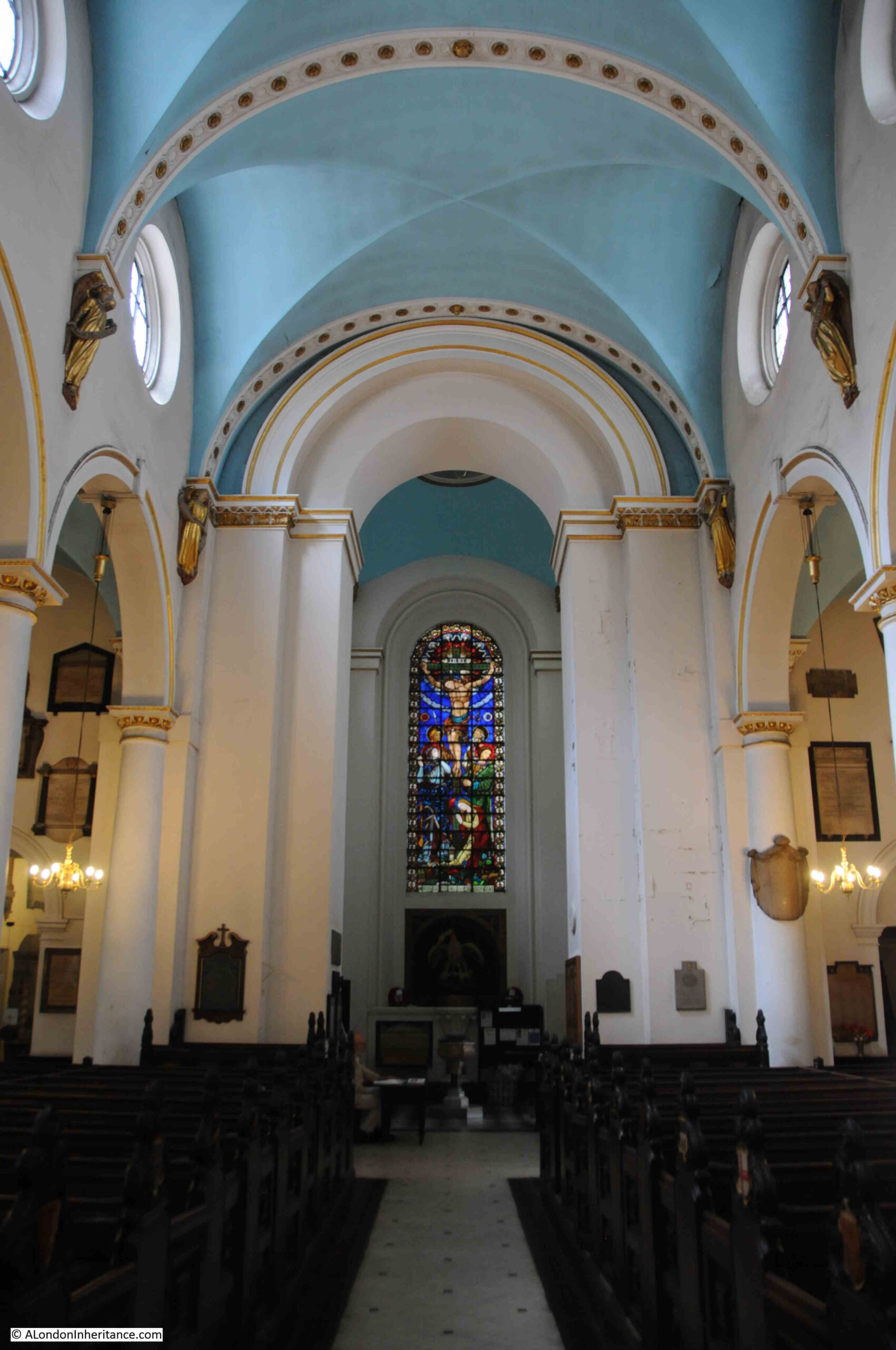
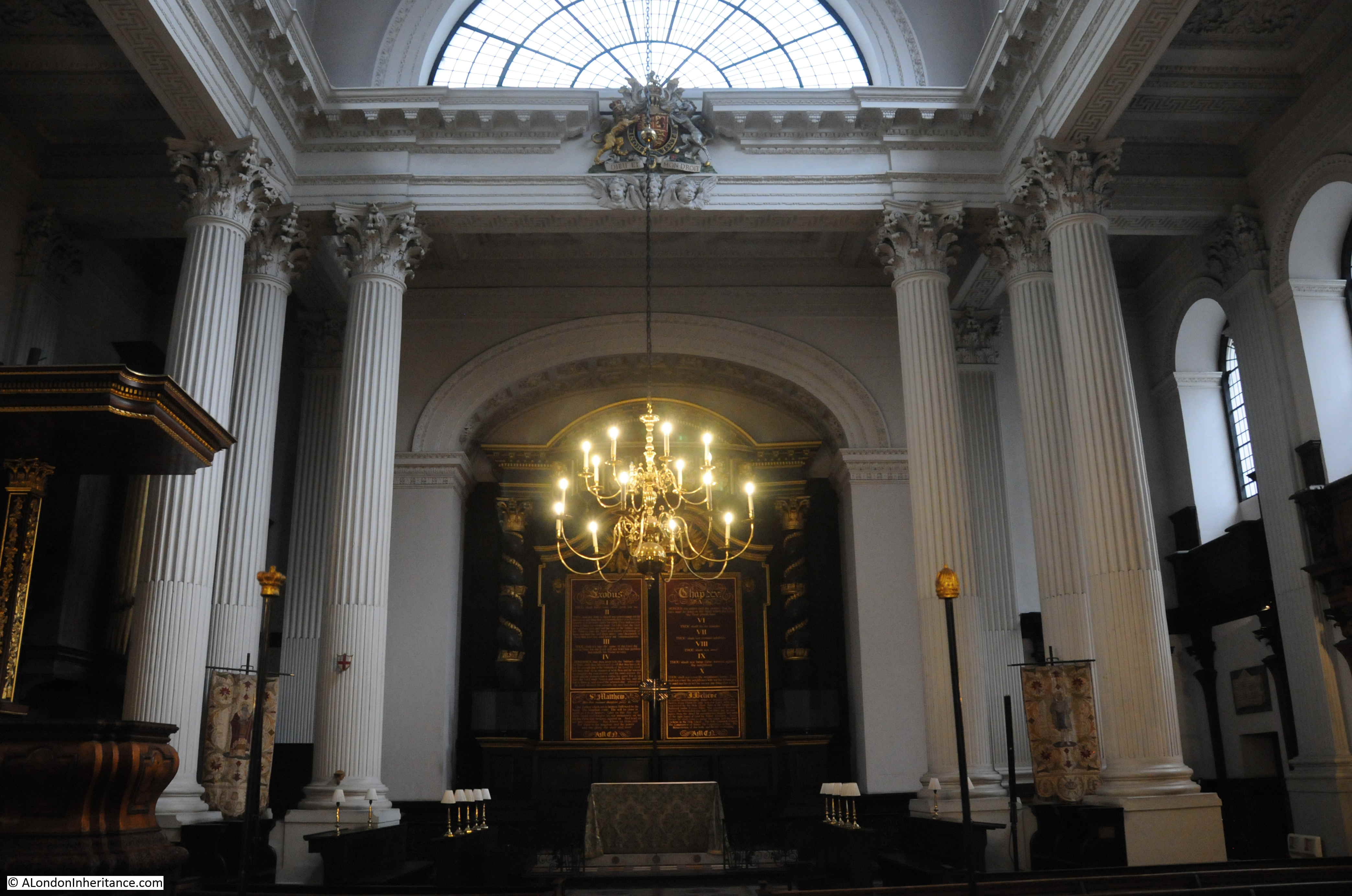
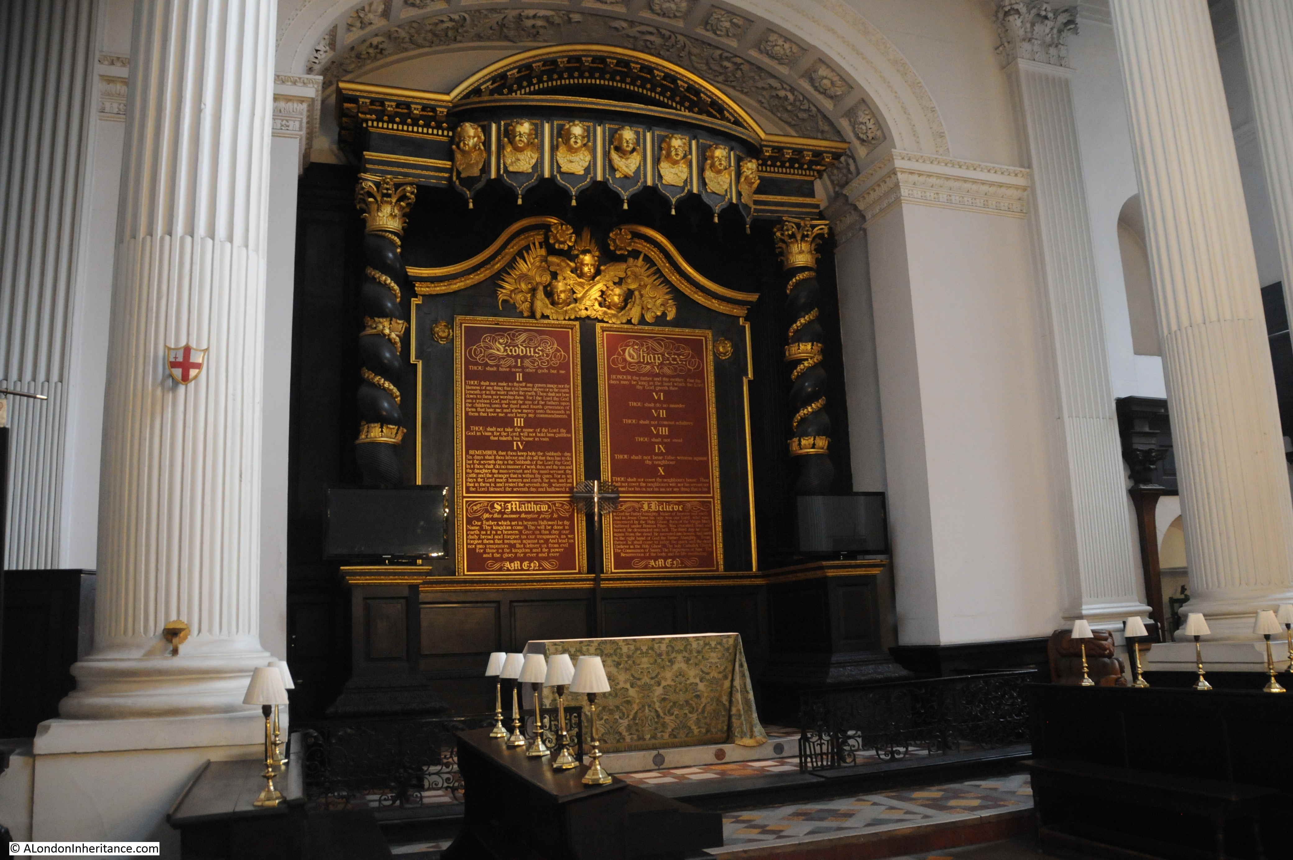
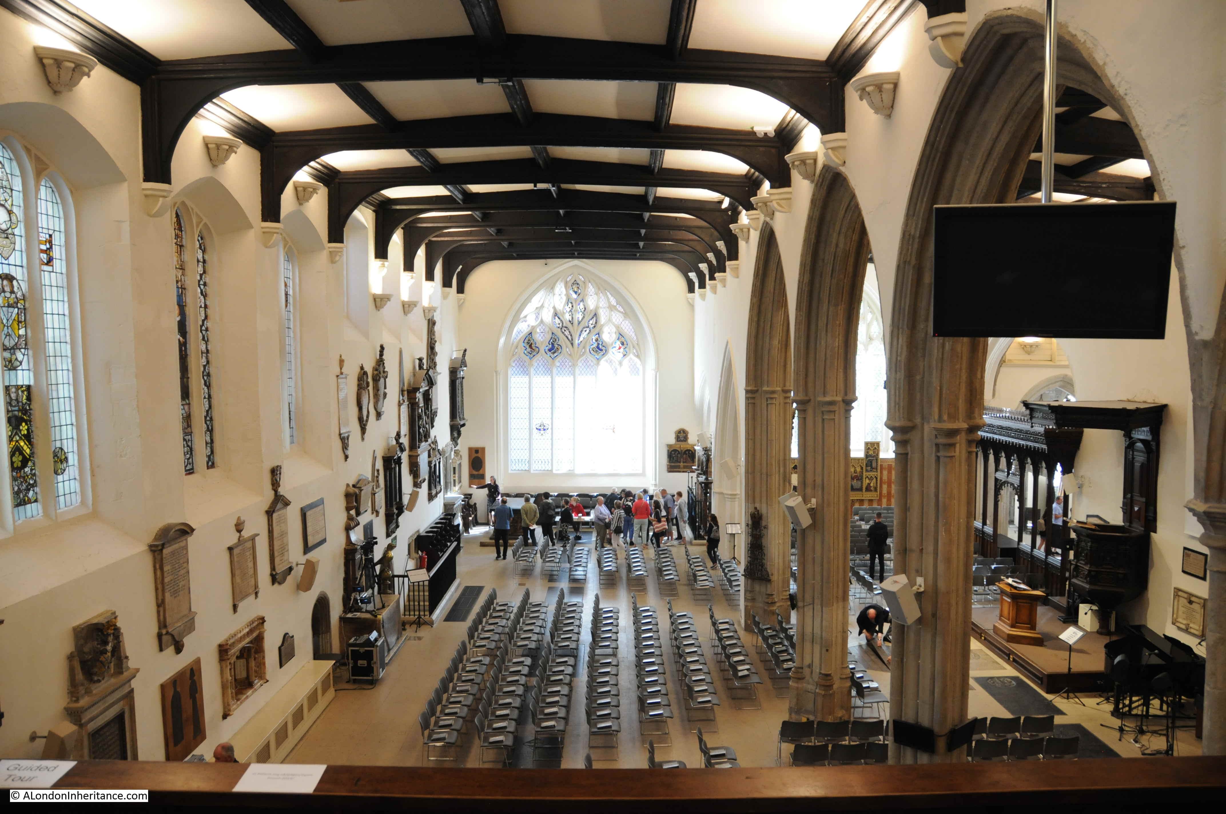
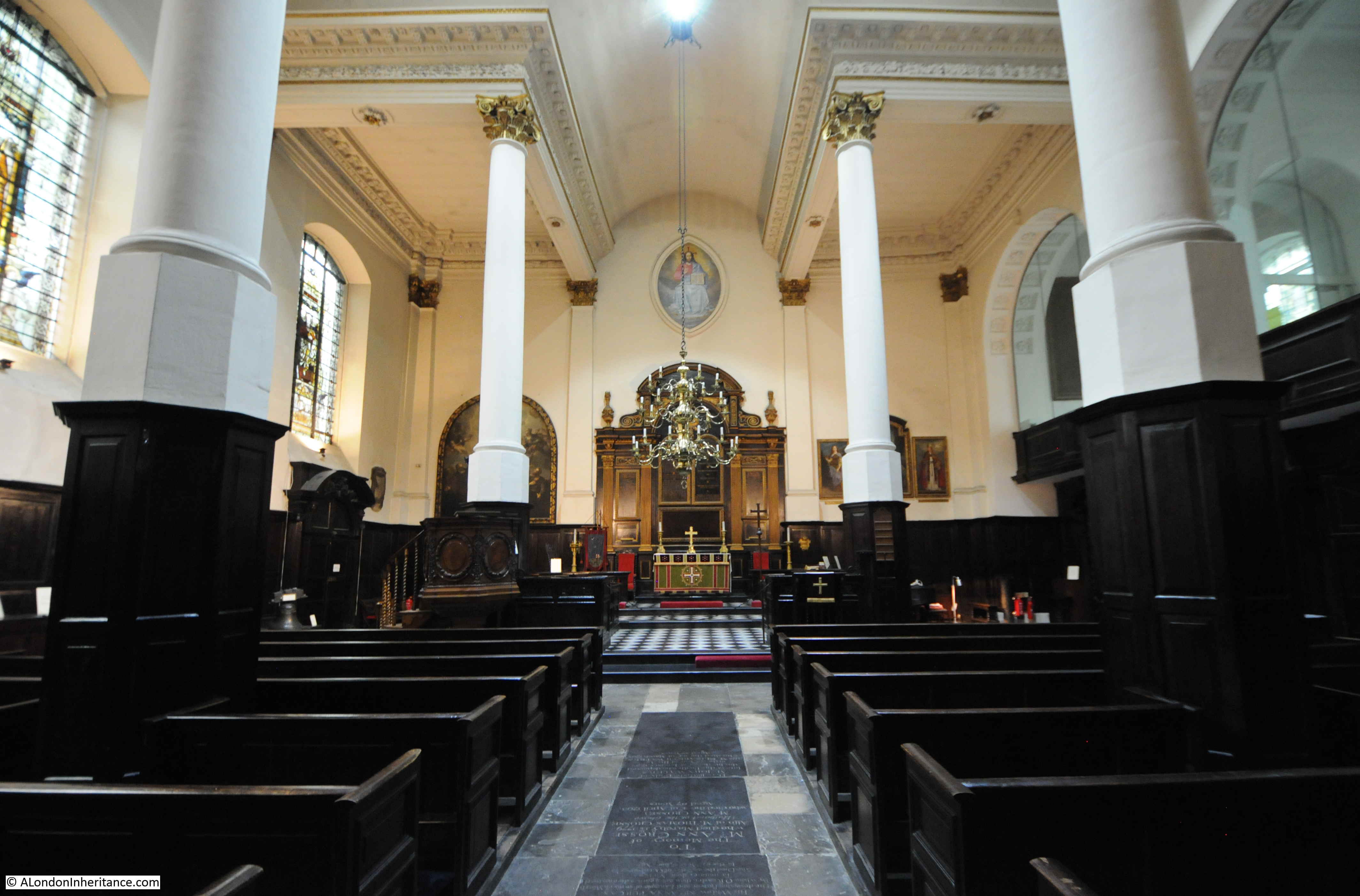
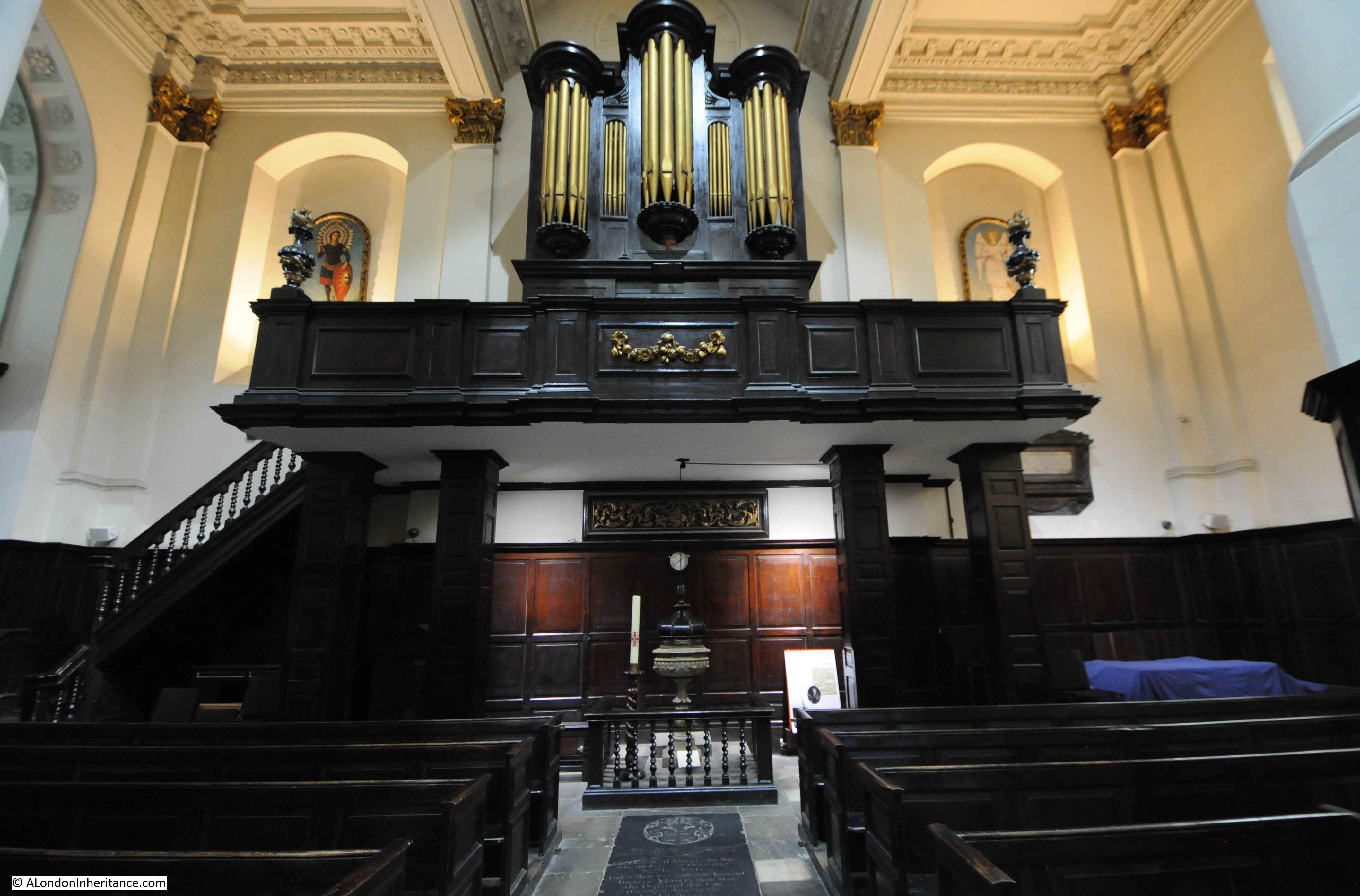
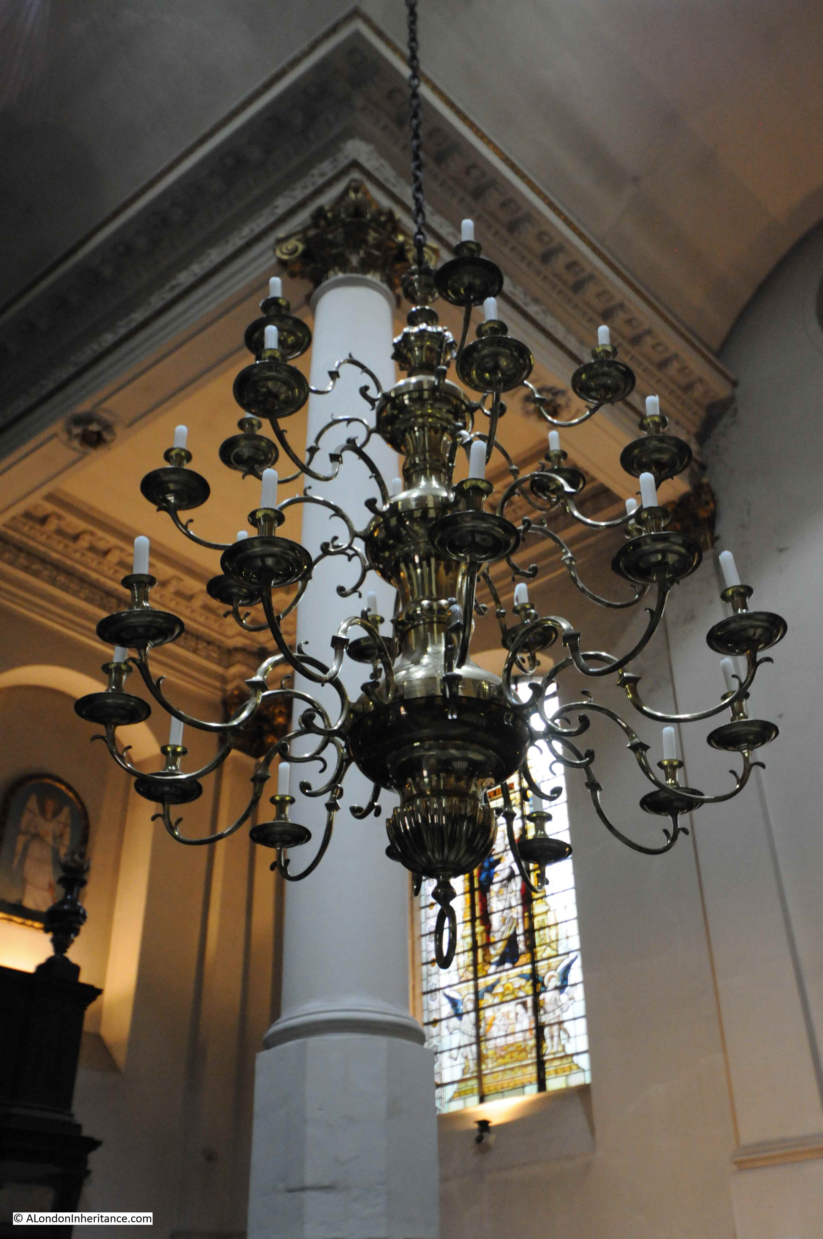
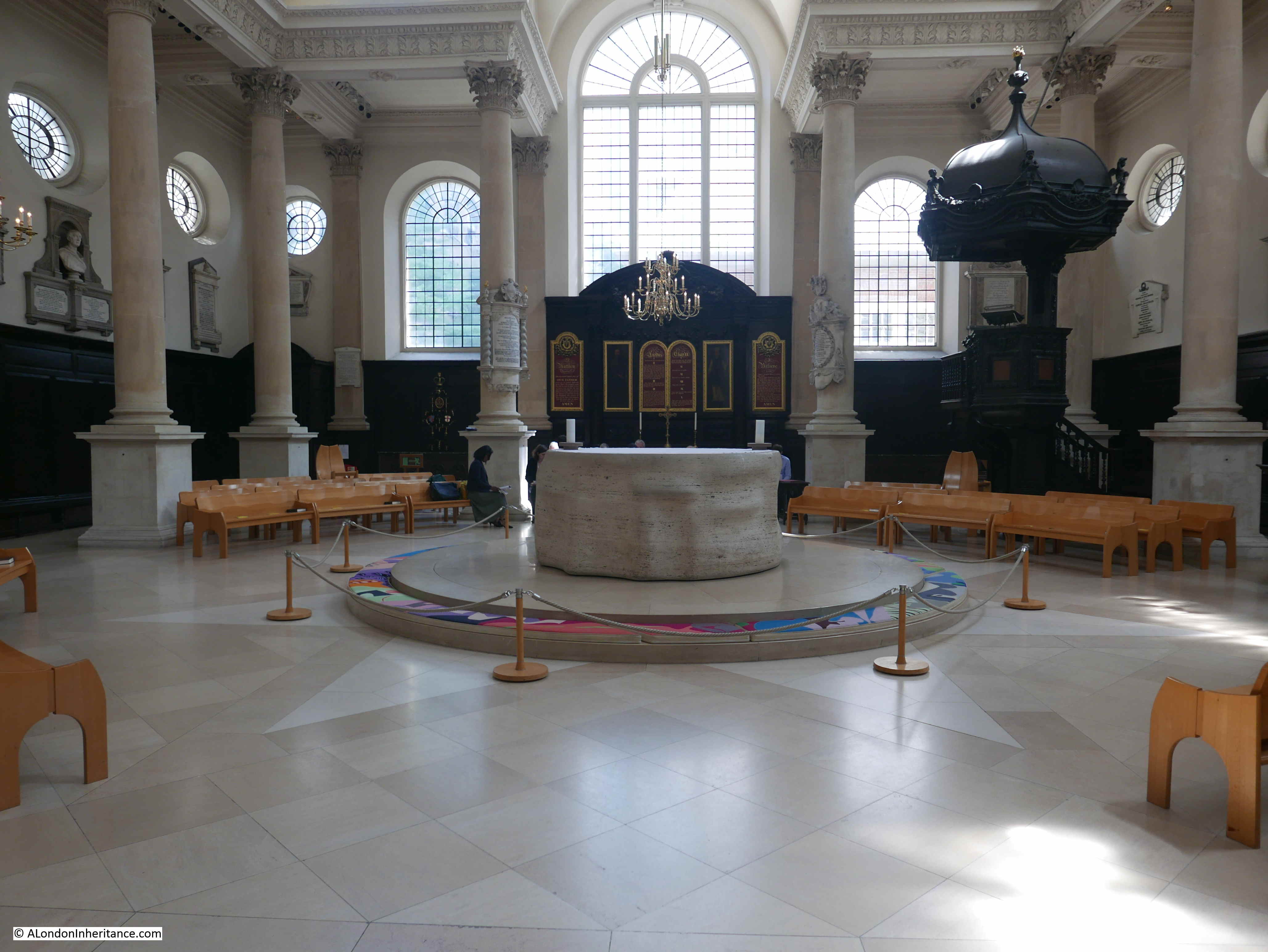
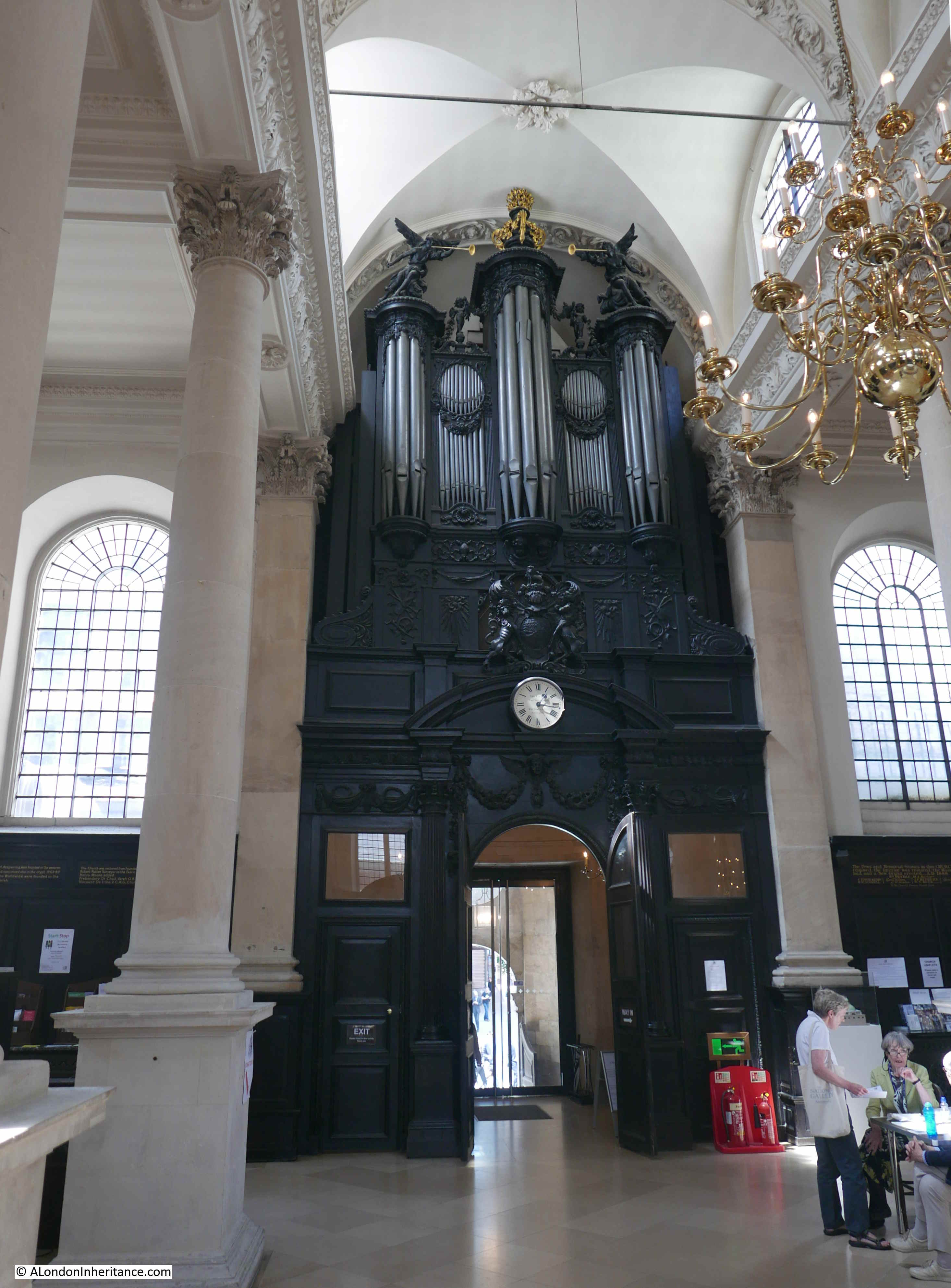
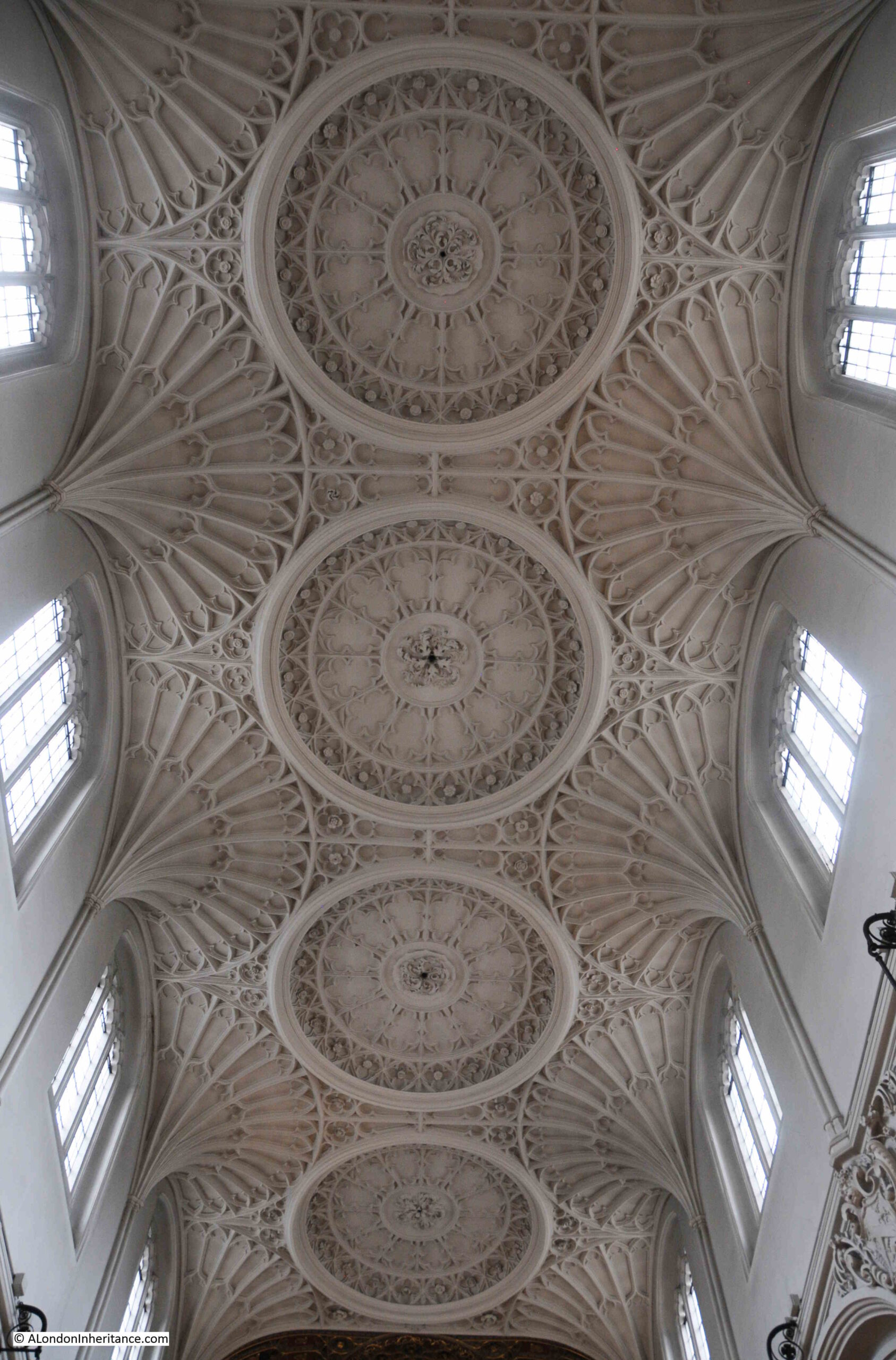
As shown in the image of the floor plan, the church has three aisles. The central aisle is the highest and has a magnificent plaster fan-vaulted ceiling:

St. Mary Aldermary

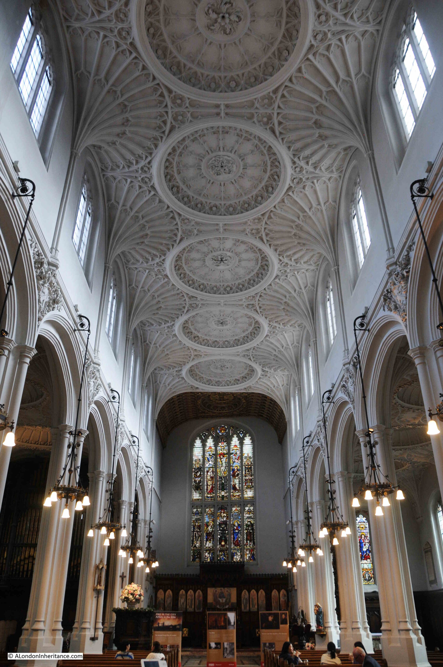
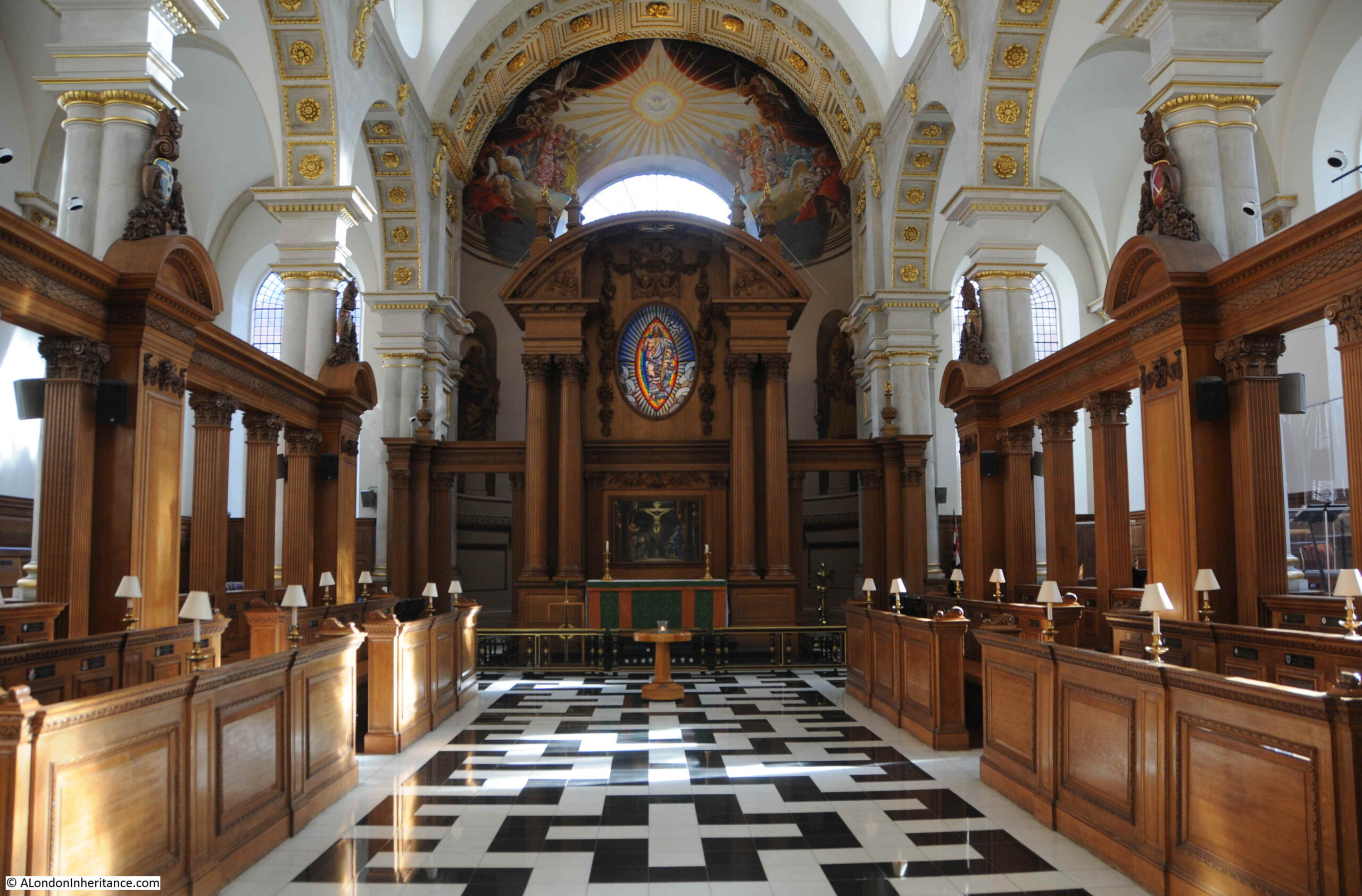
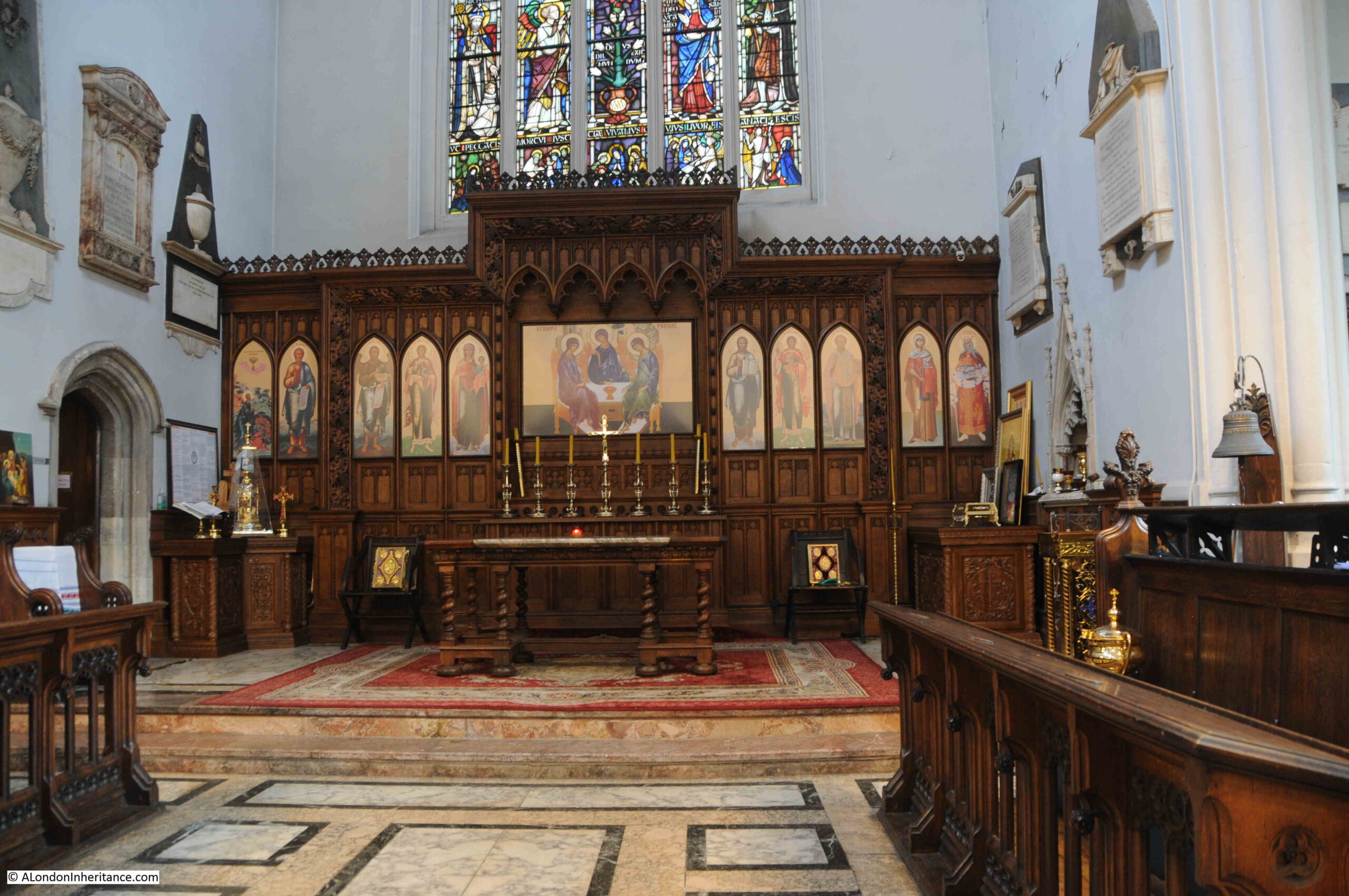
View towards the altar at the eastern end of the central aisle:

St. Mary Aldermary

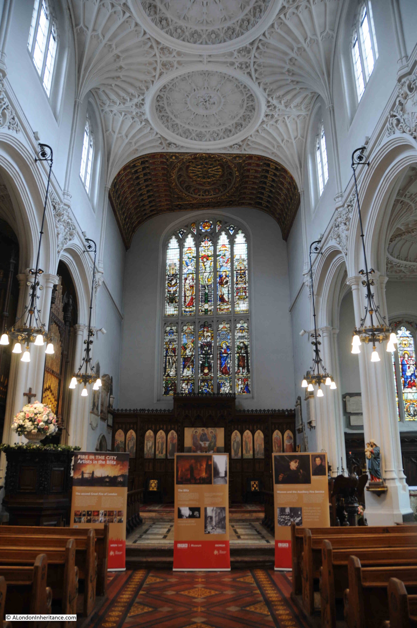
In the above photo, you can see that the rear wall is at a slight angle from the rest of the church, a feature which is confirmed by the floor plan shown earlier.

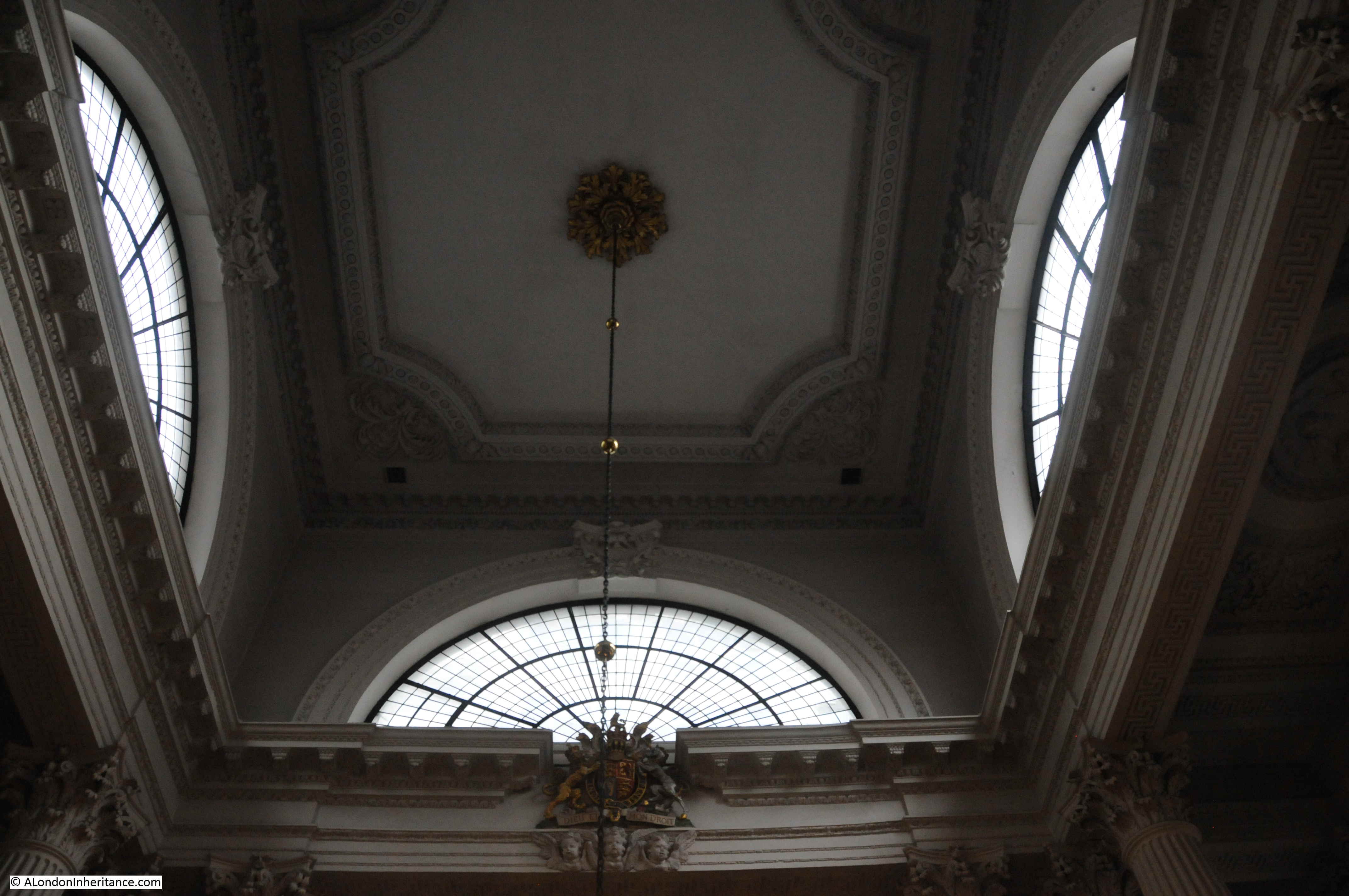
A look at the ceiling:
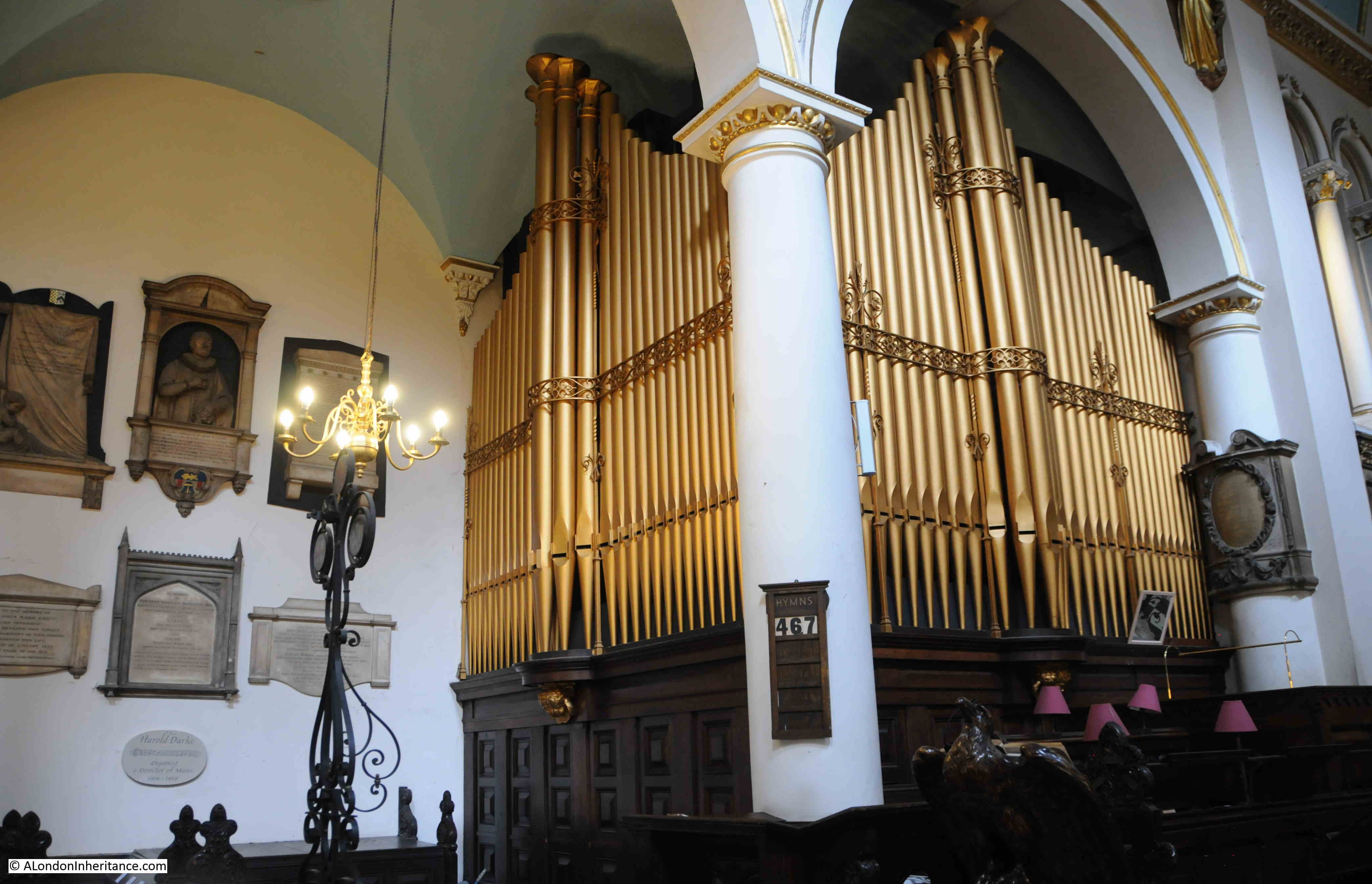
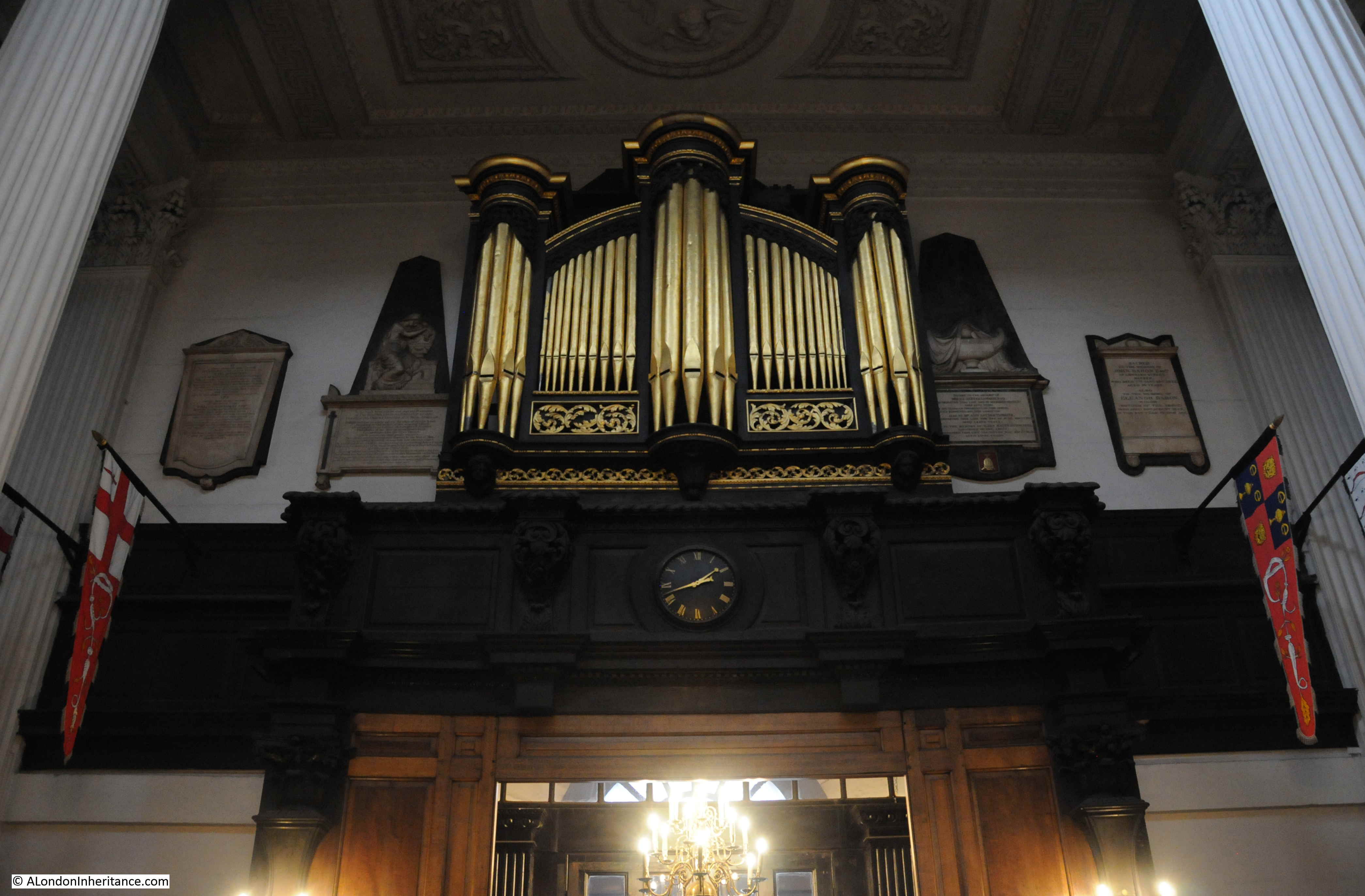
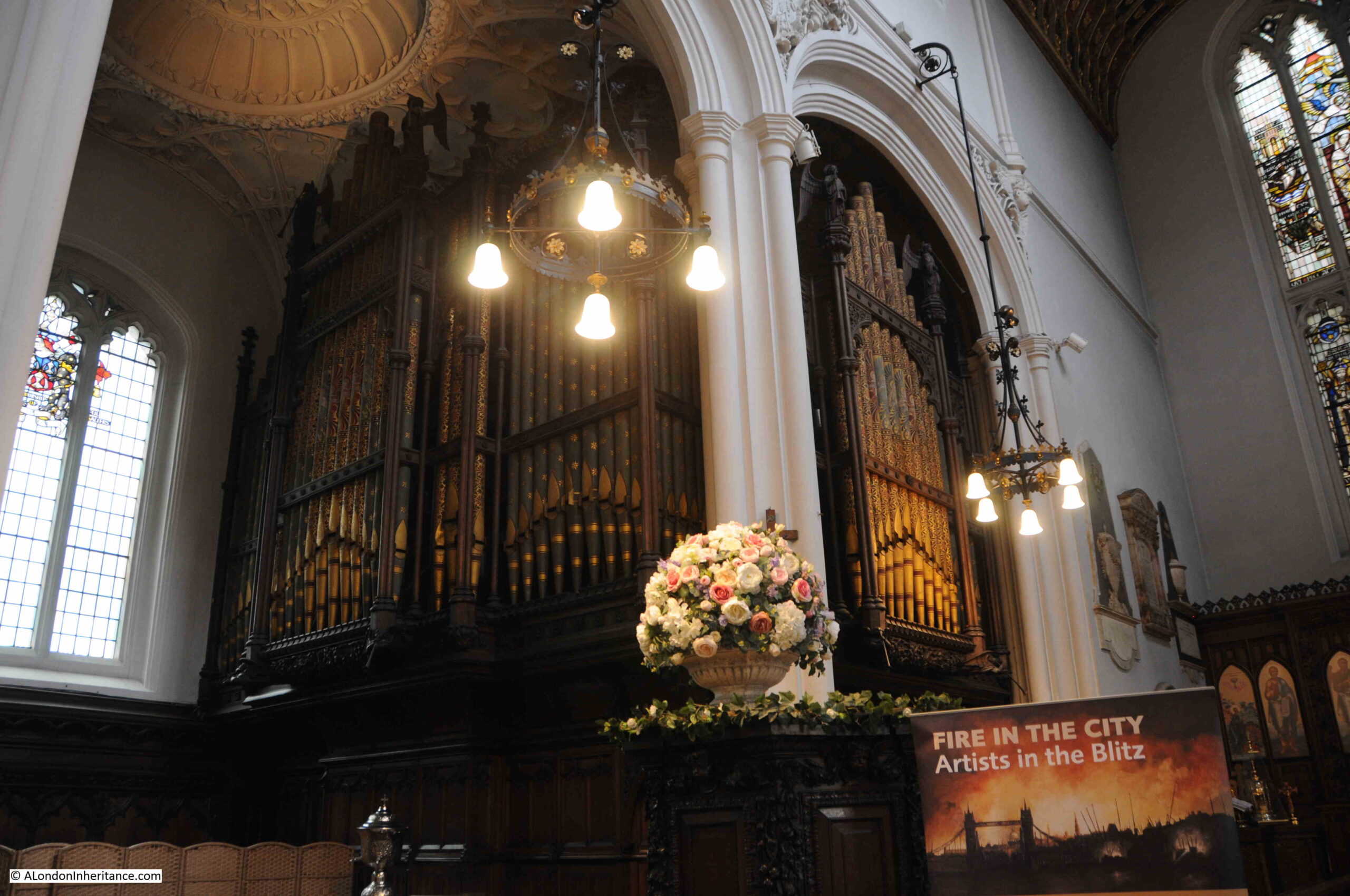
St. Mary Aldermary

The organ:

St. Mary Aldermary

The following photo shows the altar and reredos (the wooden screen at the rear of the altar). As can be seen, the wooden screen is at an angle to the rear wall, to allow the screen and altar to face directly down the centre of the church despite the angled rear wall:

St. Mary Aldermary

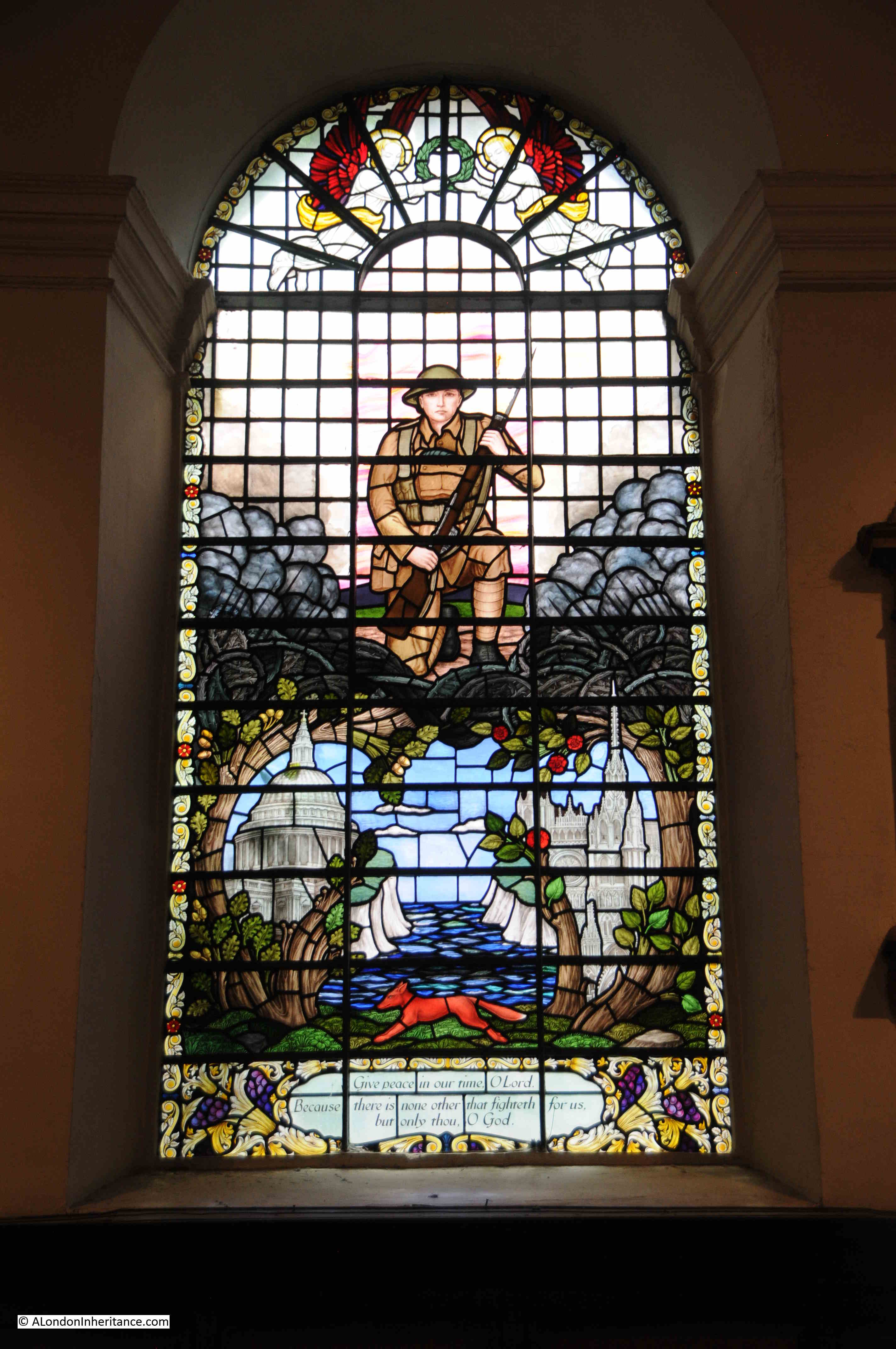
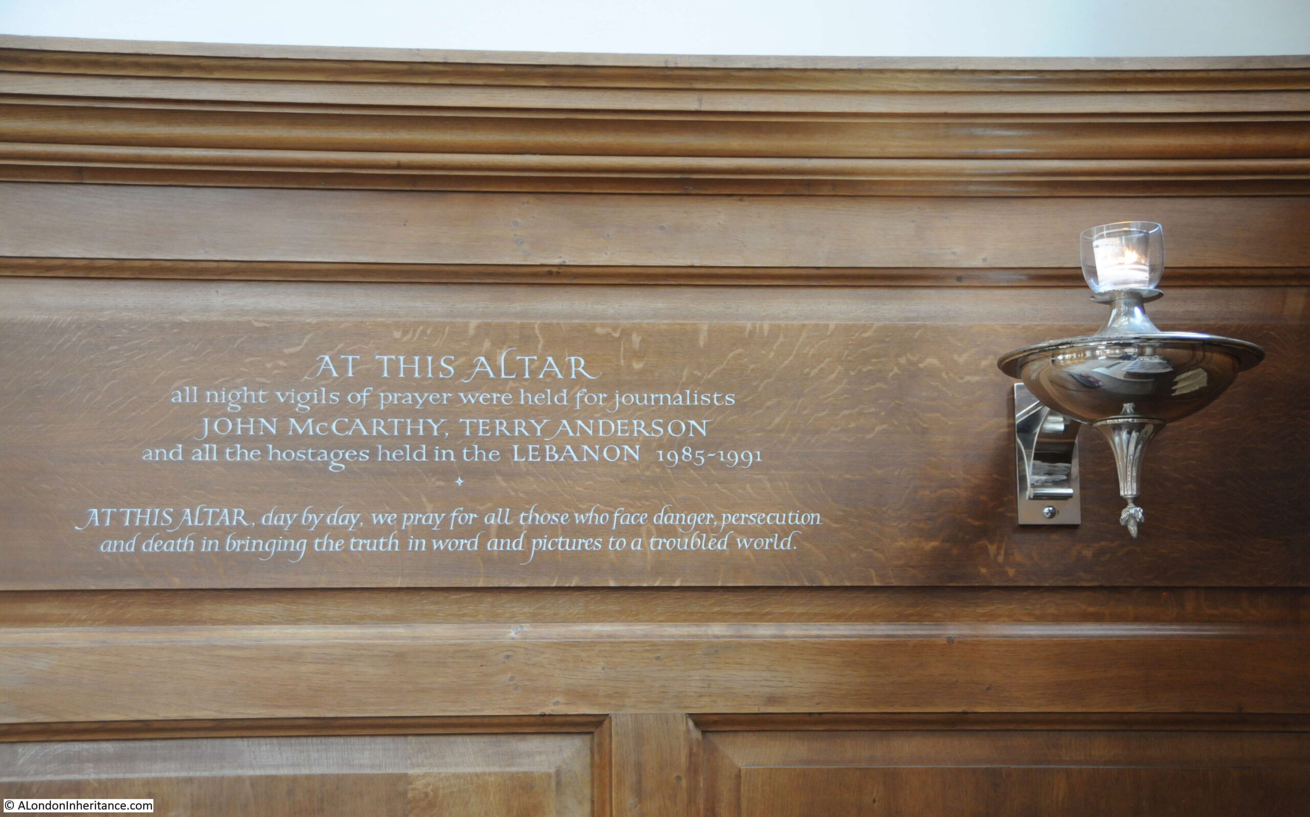
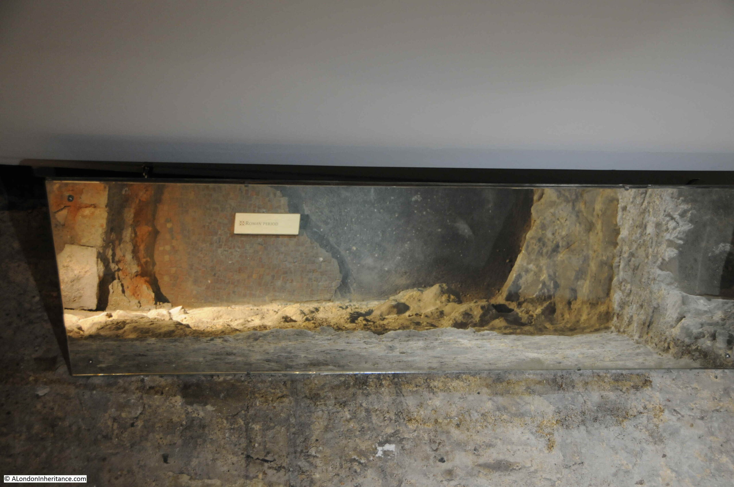
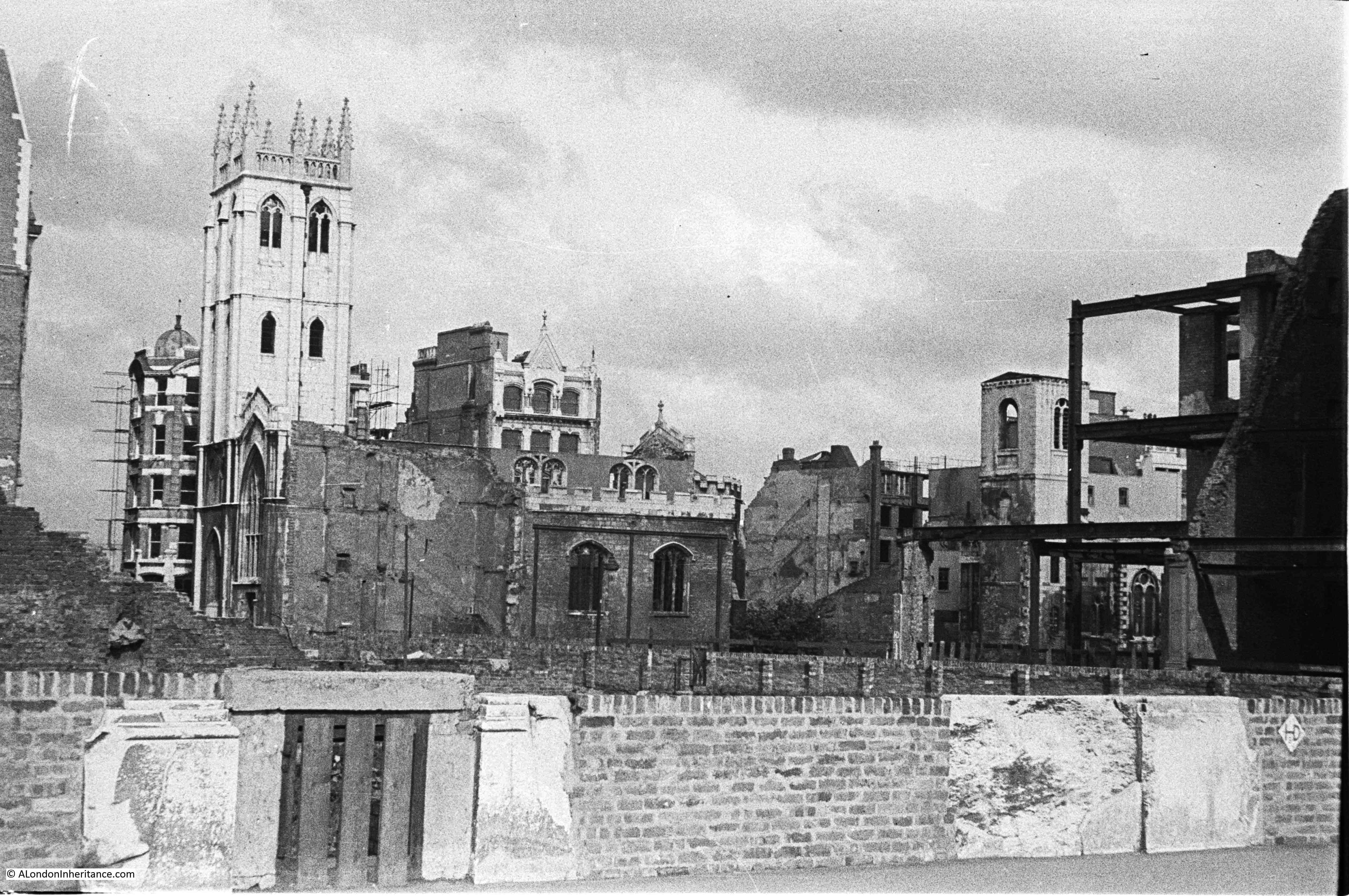
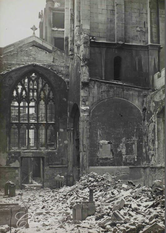
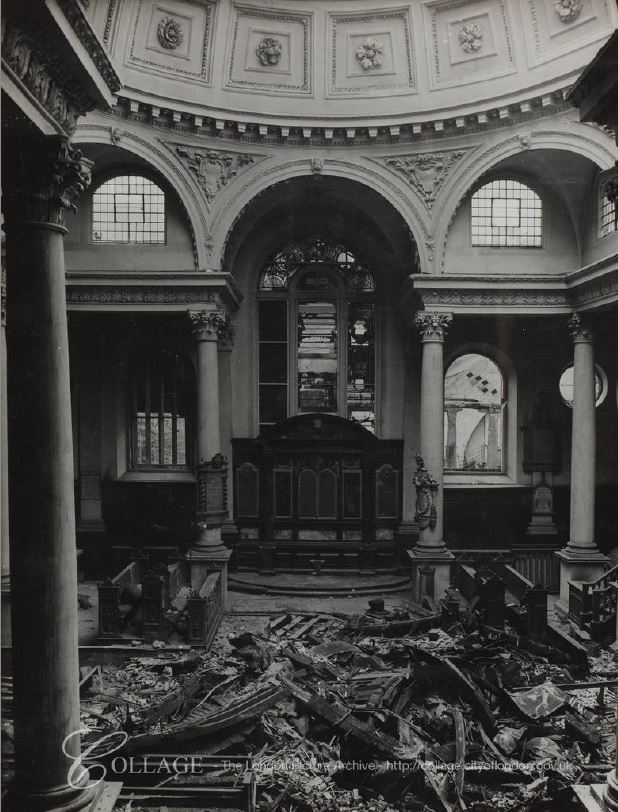
St. Mary Aldermary did not suffer too much damage during the last war, although much of the Victorian stained glass windows were lost.

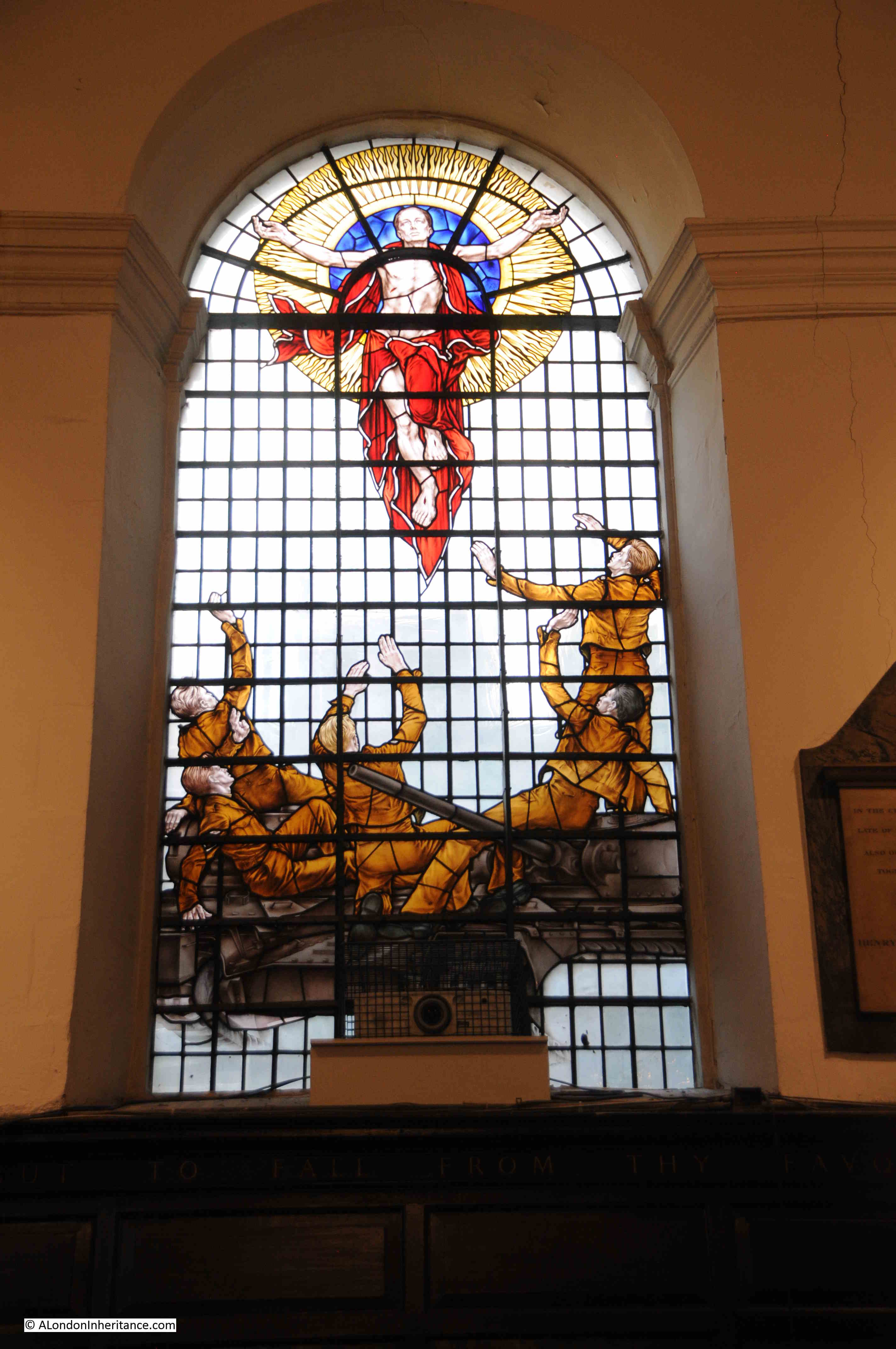
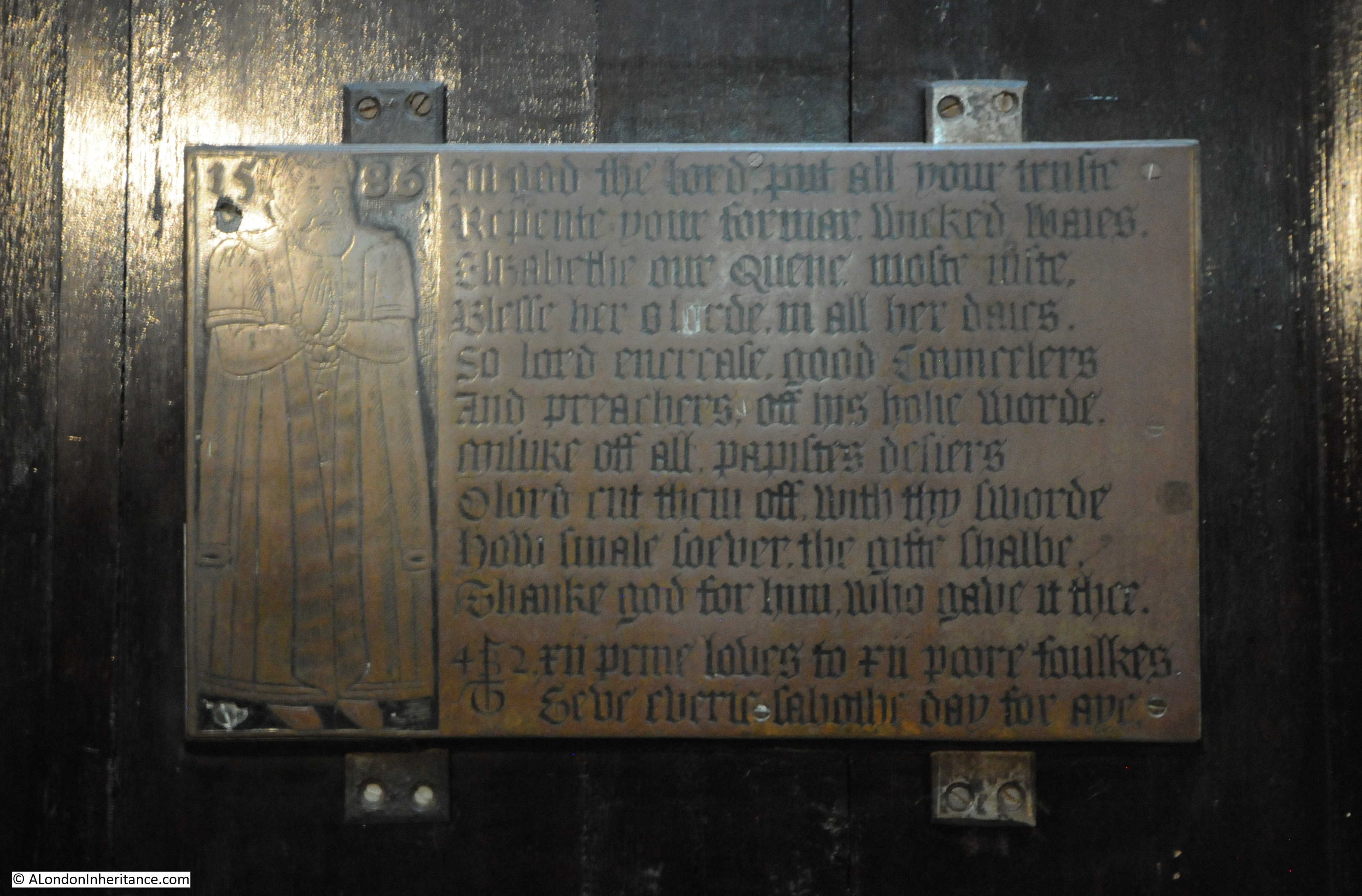
There is an interesting set of stained glass at the end of the southern aisle of the church:

St. Mary Aldermary

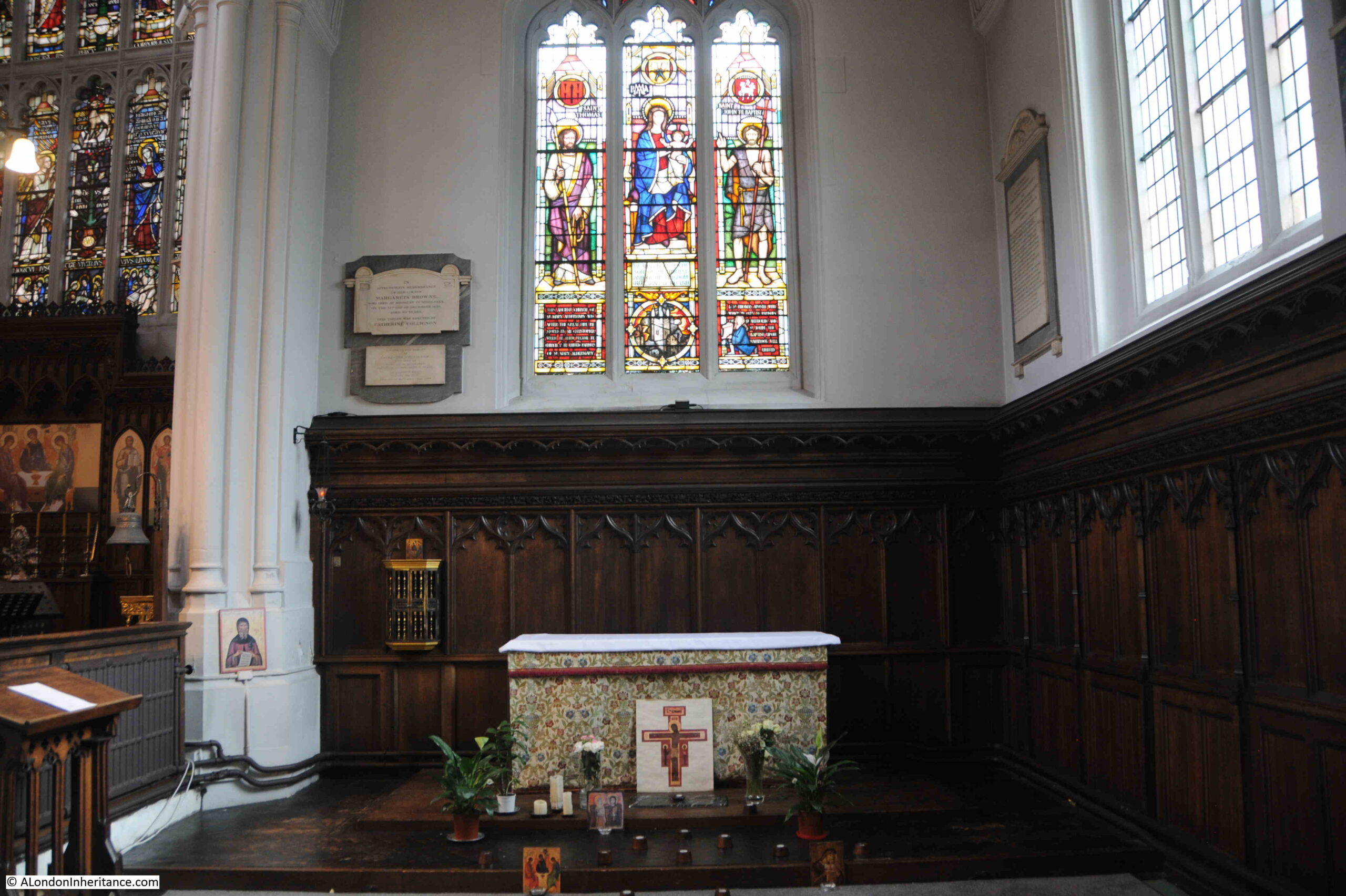
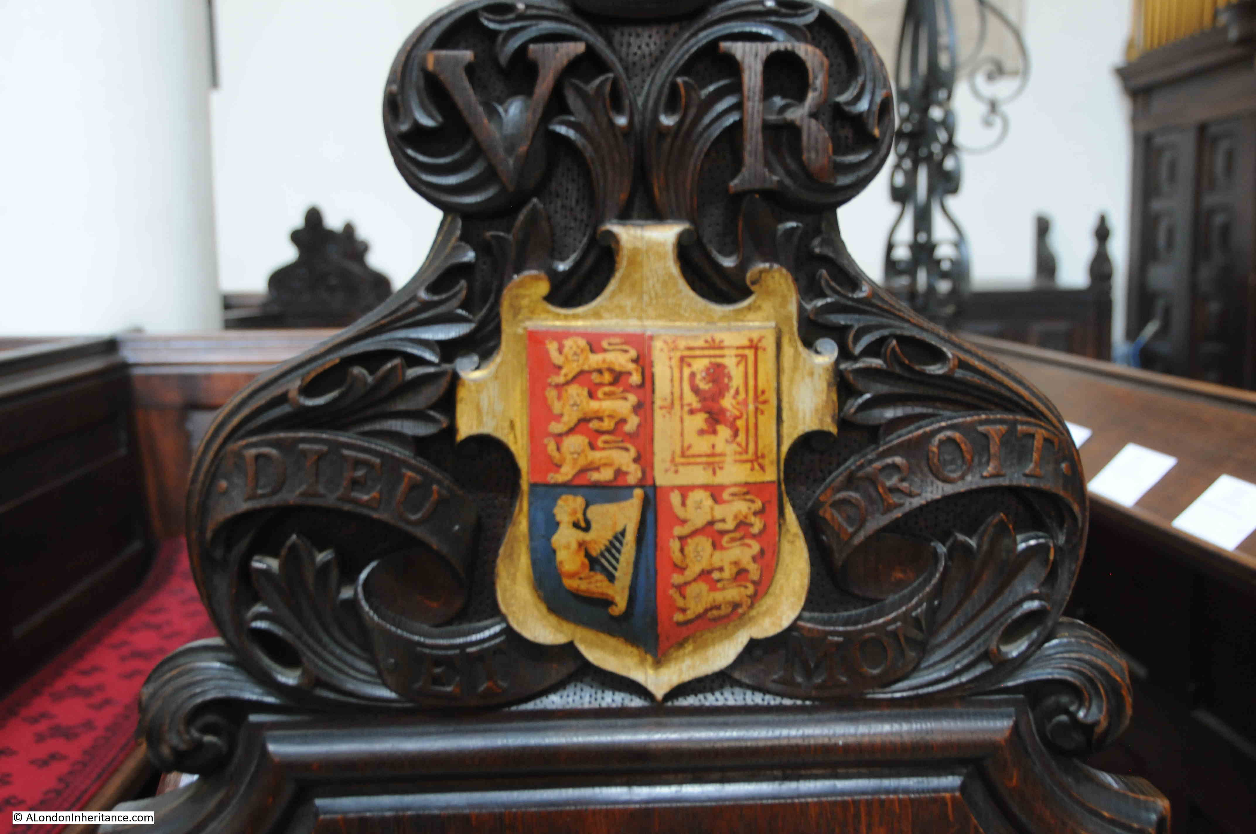
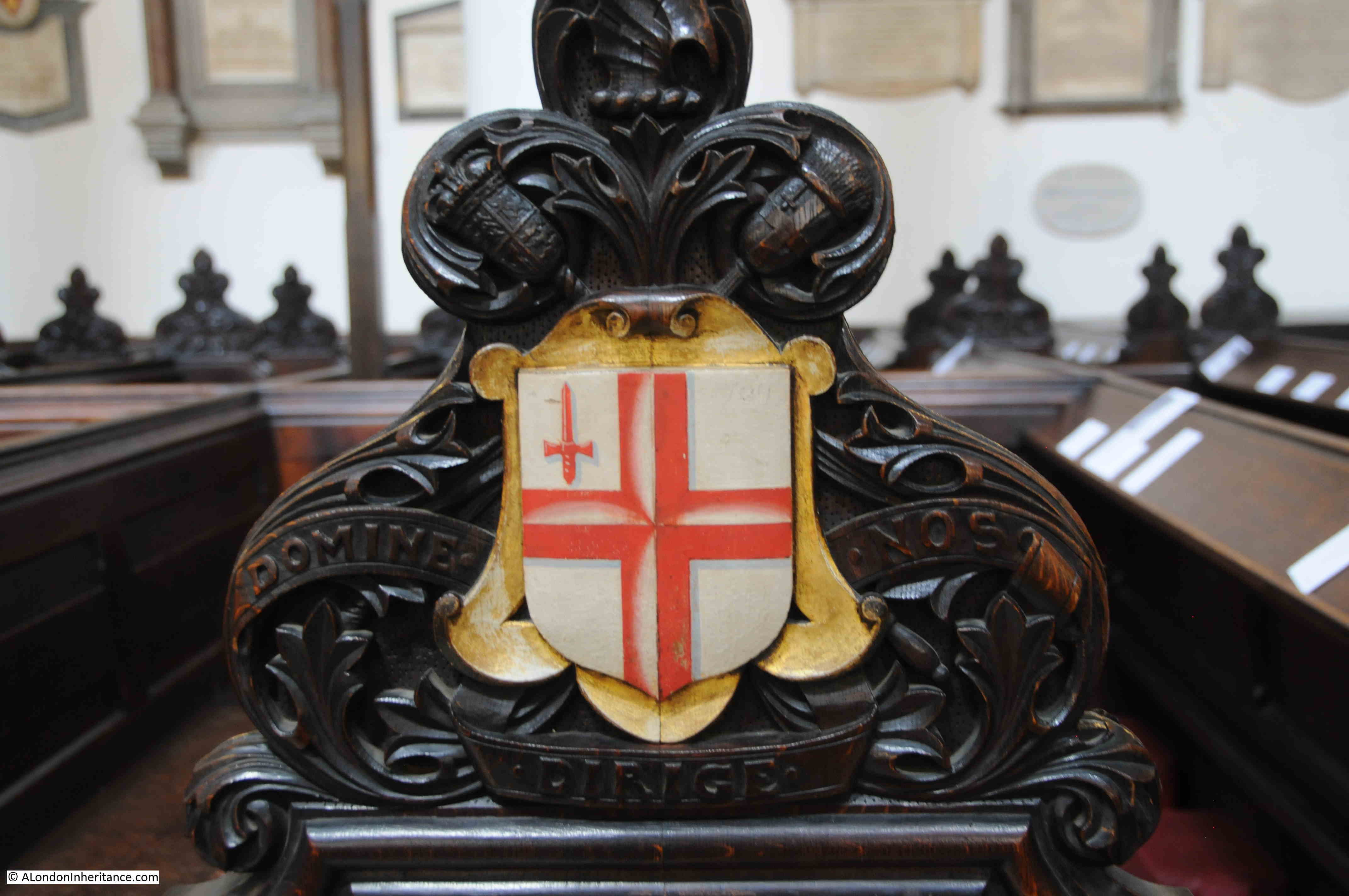
At the bottom of the windows are three panels:

Christopher Wren

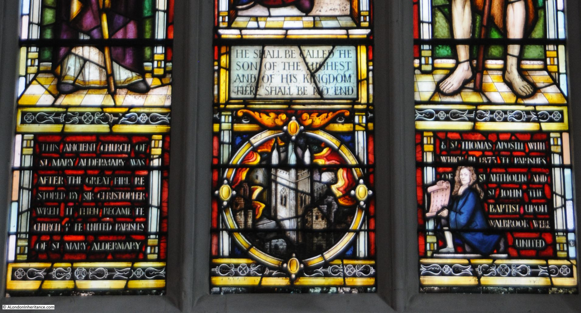
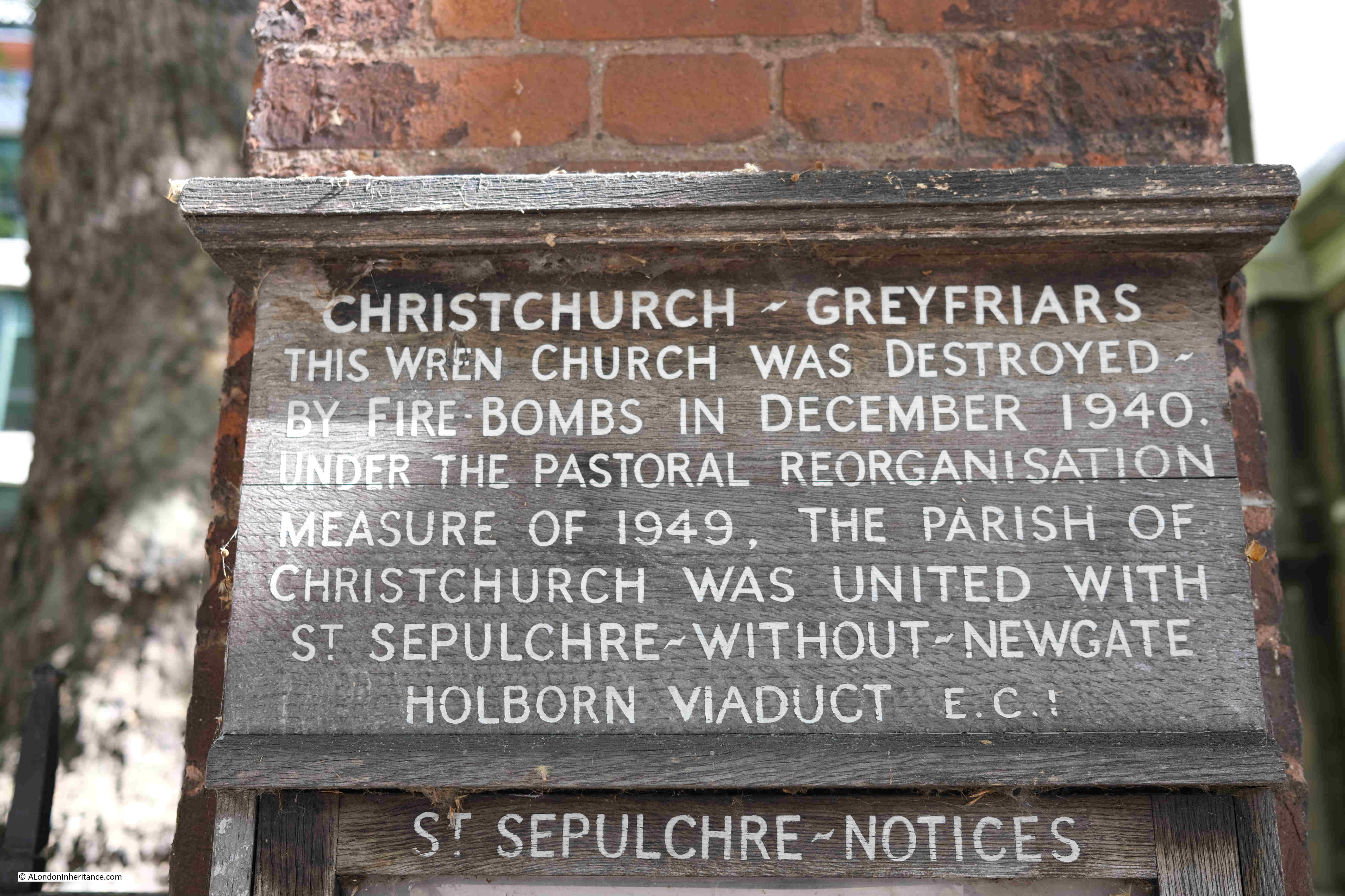
At the centre is an image of the church surrounded by the flames of the Great Fire. The windows to left and right record the rebuilding of the church by Christopher Wren and the amalgamation of parishes.

St. Thomas the Apostle was not rebuilt after the Great Fire and the parish was united with St. Mary.

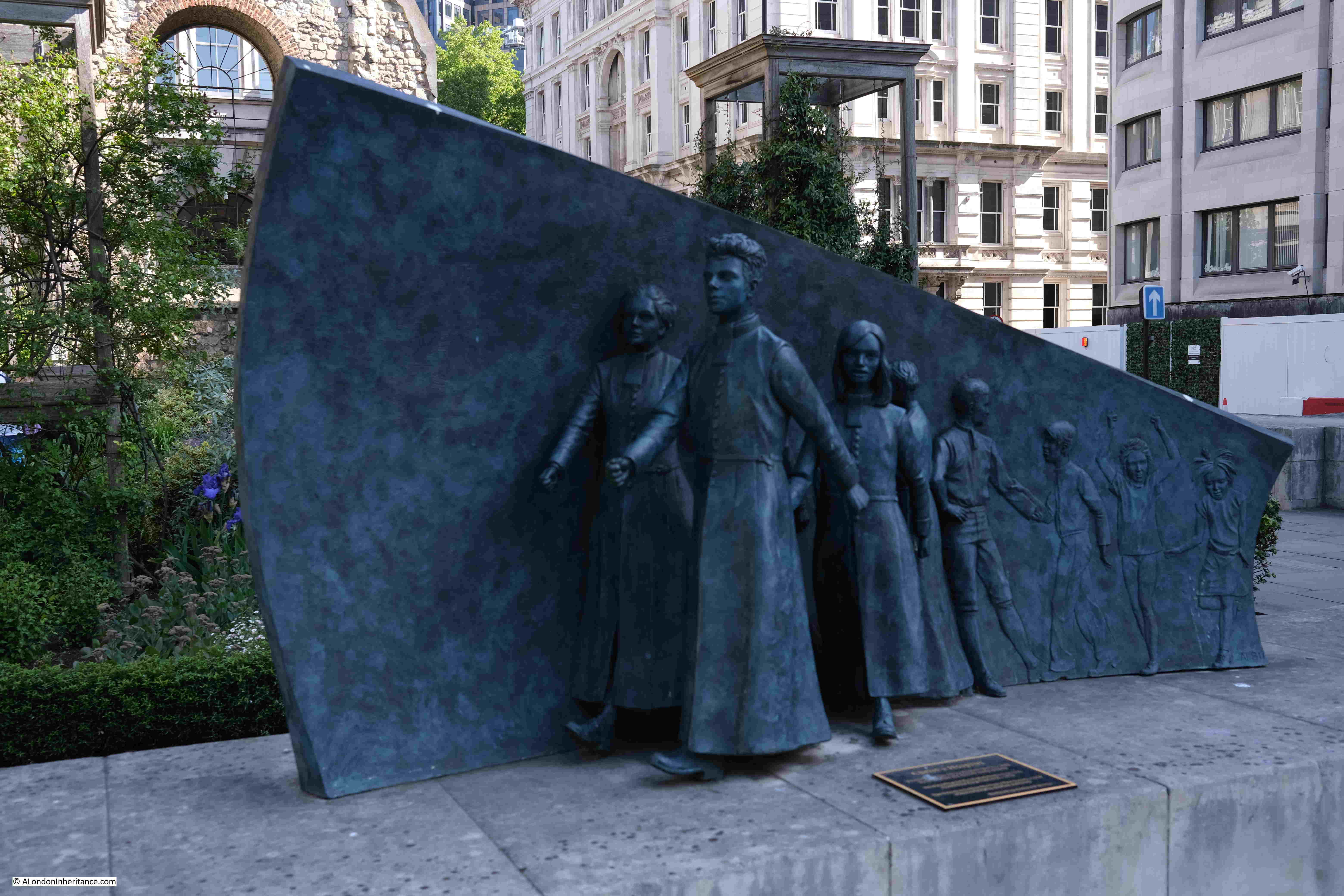
St. John the Baptist was destroyed in the fire and the parish was united with St. Antholin’s Watling Street which was demolished in 1874 and these two parishes united with St. Mary Aldermary, so the church today is the sum of four parishes, which highlights just how many churches there were in the City prior to the Great Fire.

The Aldermary part of the name and dedication of the church is believed to come from “Older Mary” which has been assumed to indicate that it was the oldest church in the City to be dedicated to Mary, however this does seem unlikely, given that the church seems to date from around the late 11th / early 12th centuries, however given how long ago this was, and the lack of supporting documents, it is impossible to be sure.

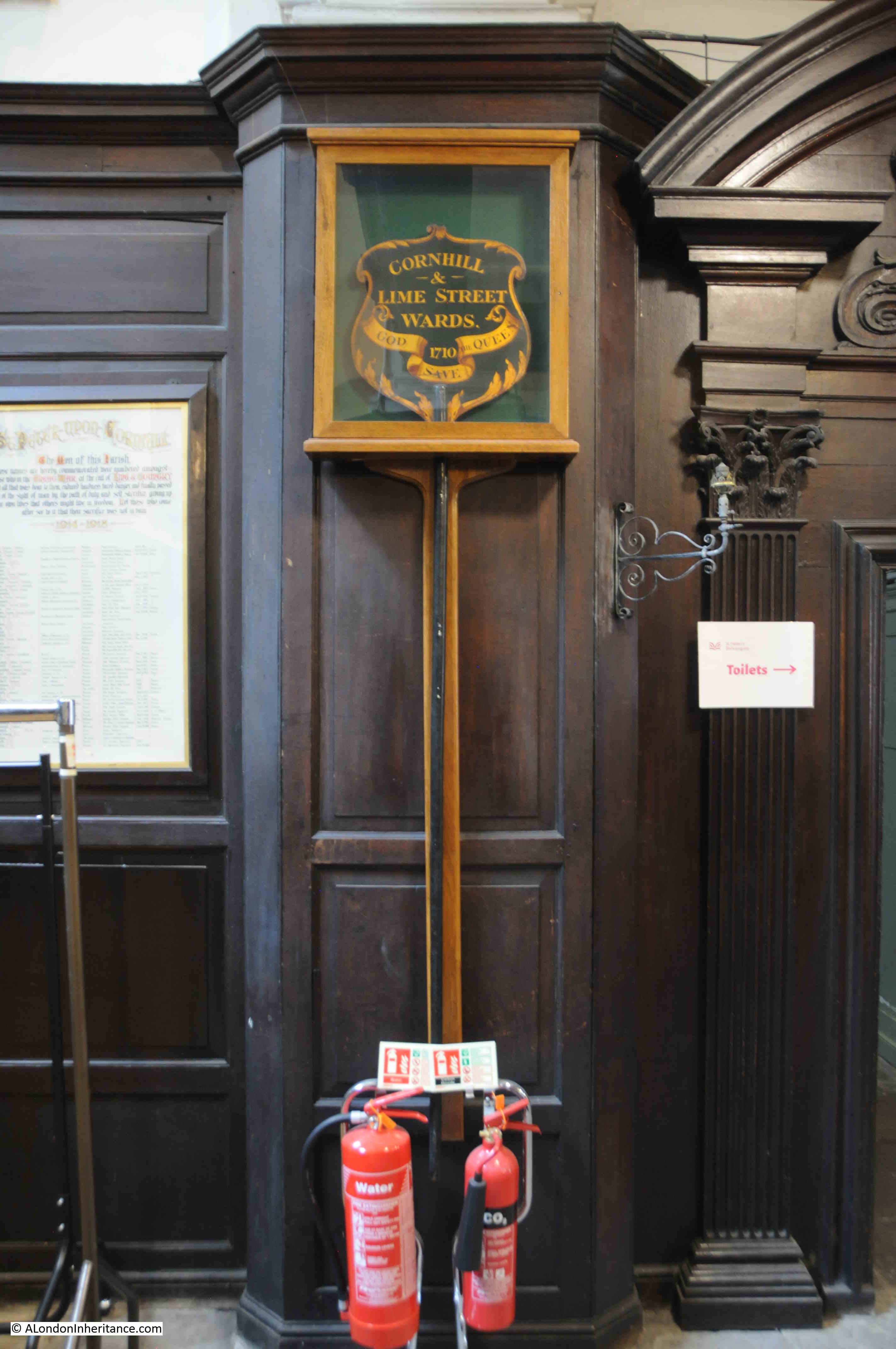
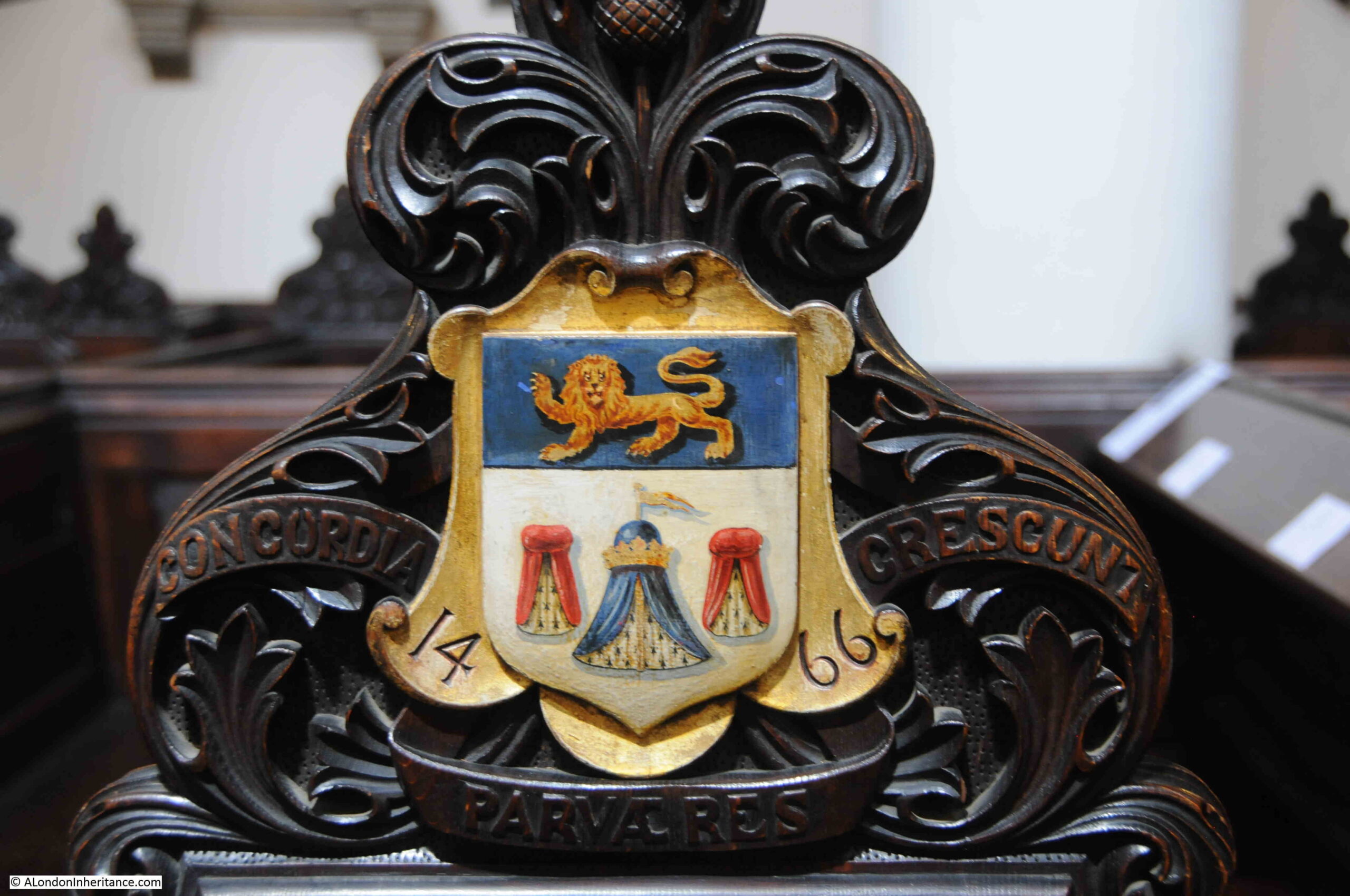
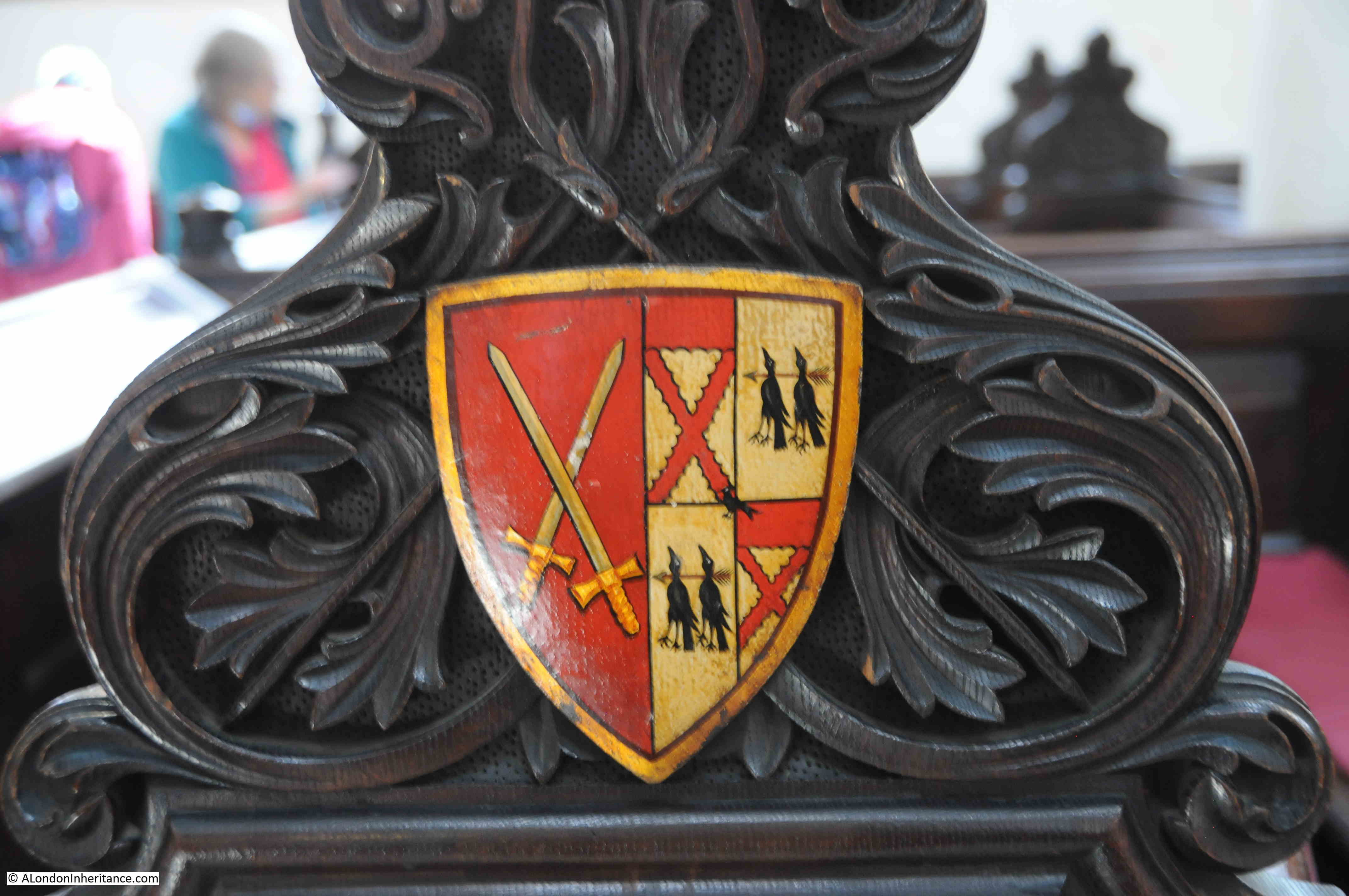
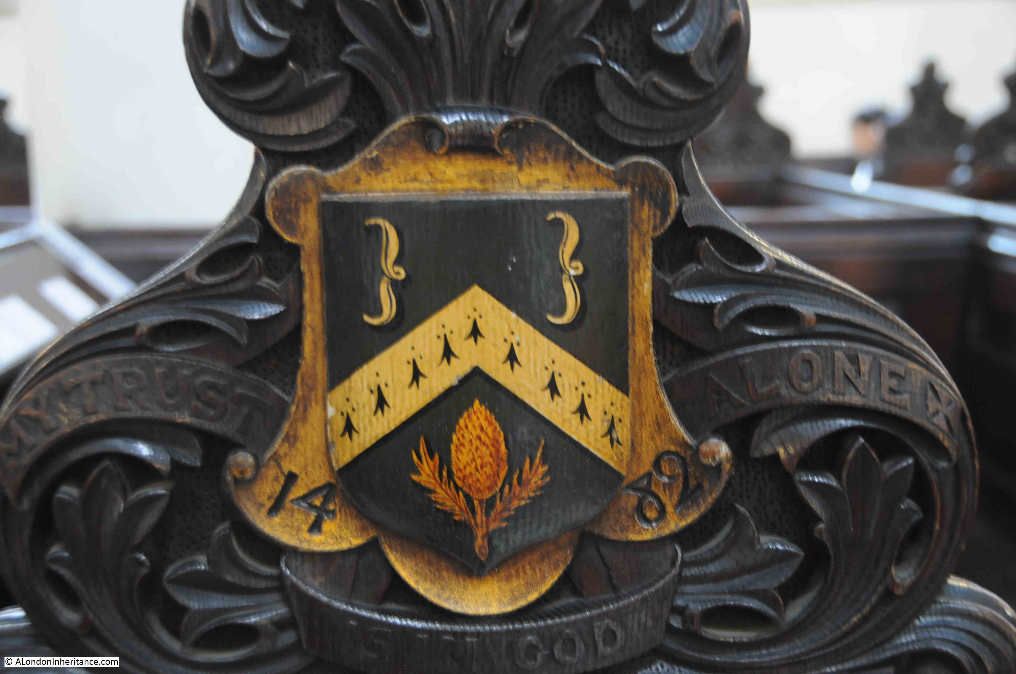
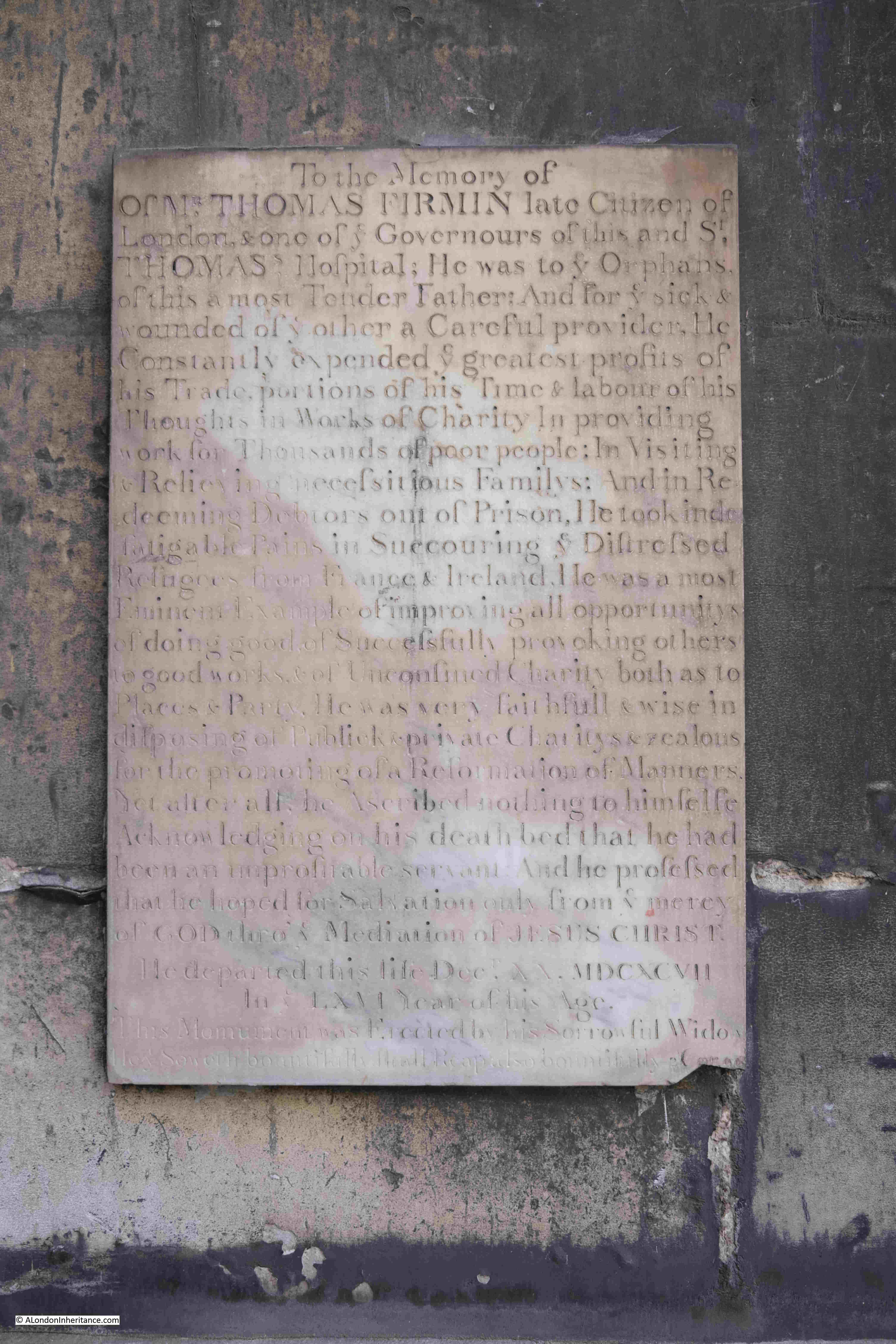
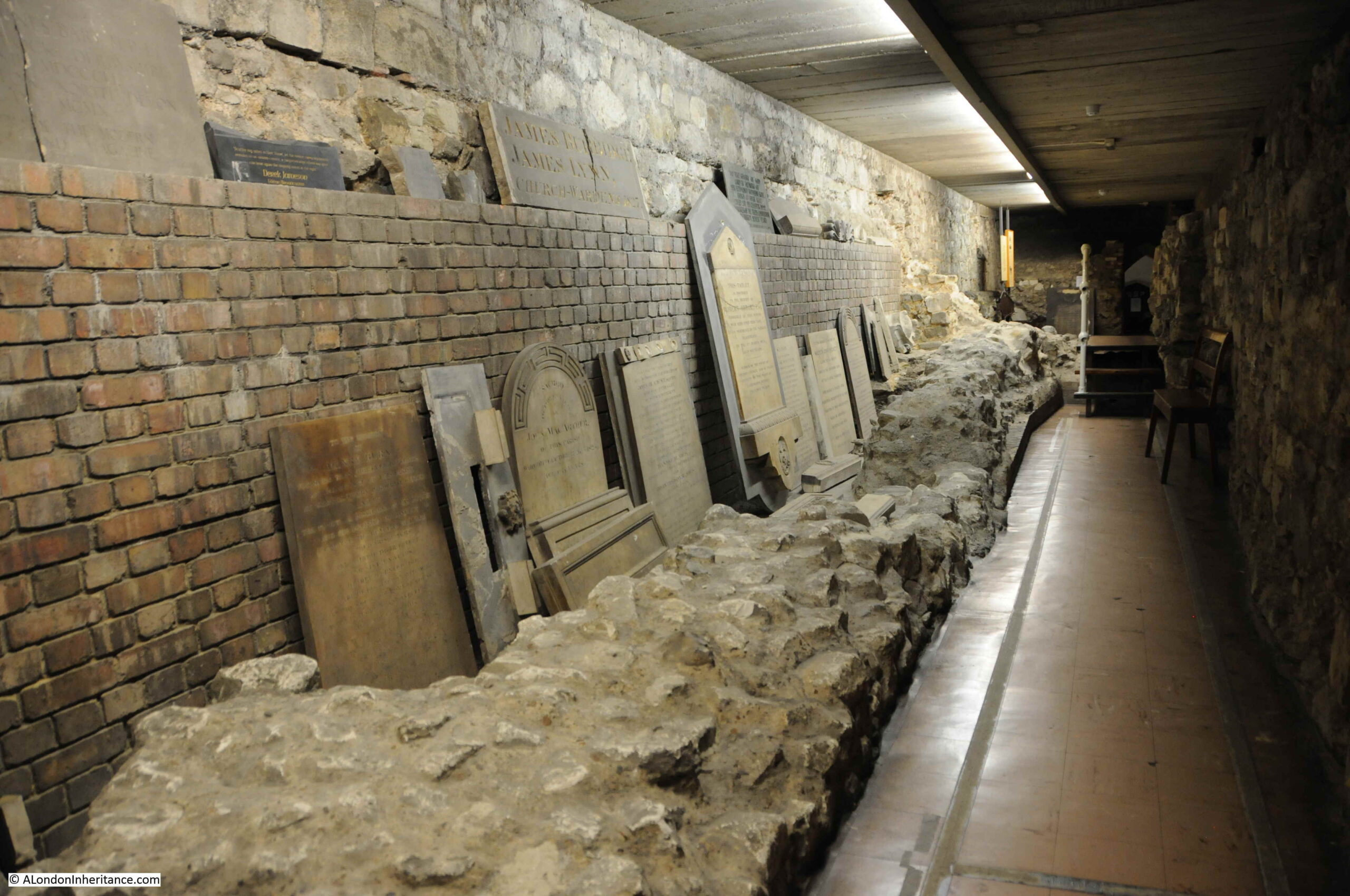
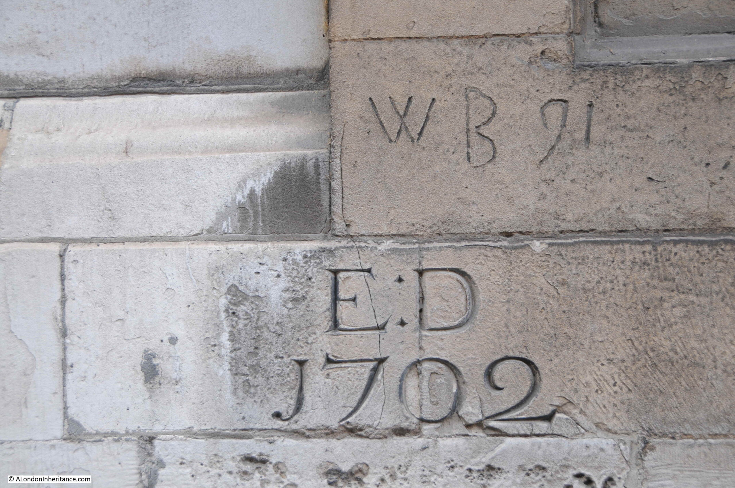
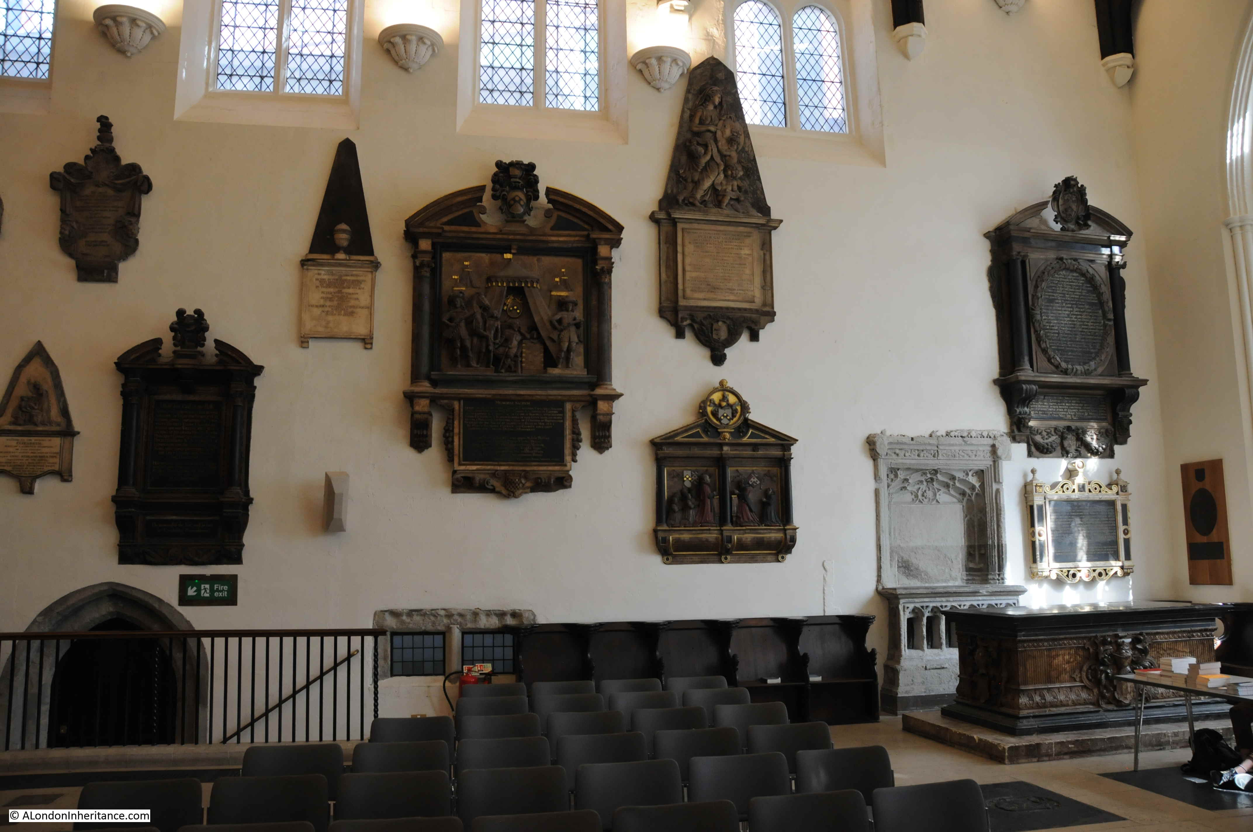
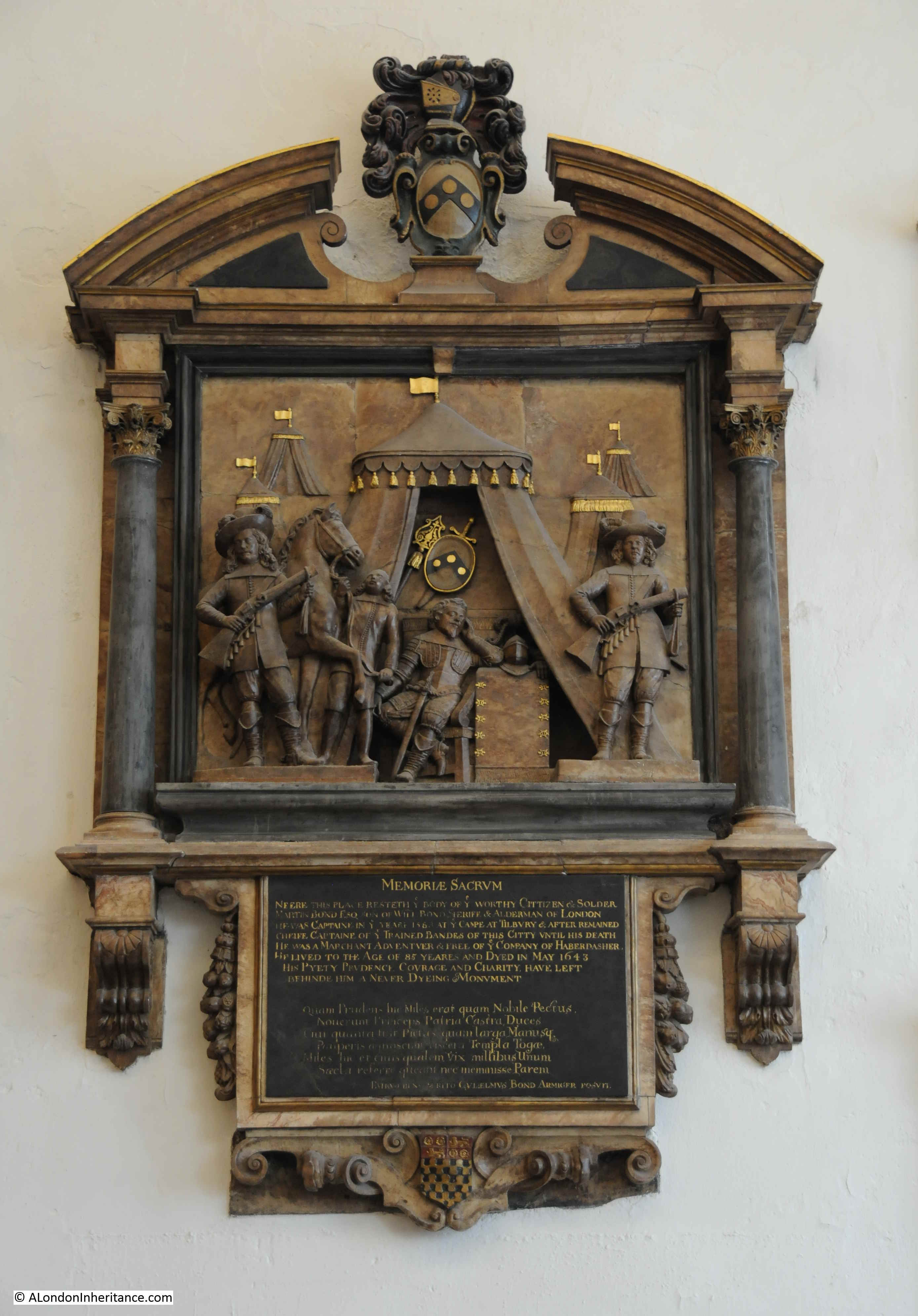
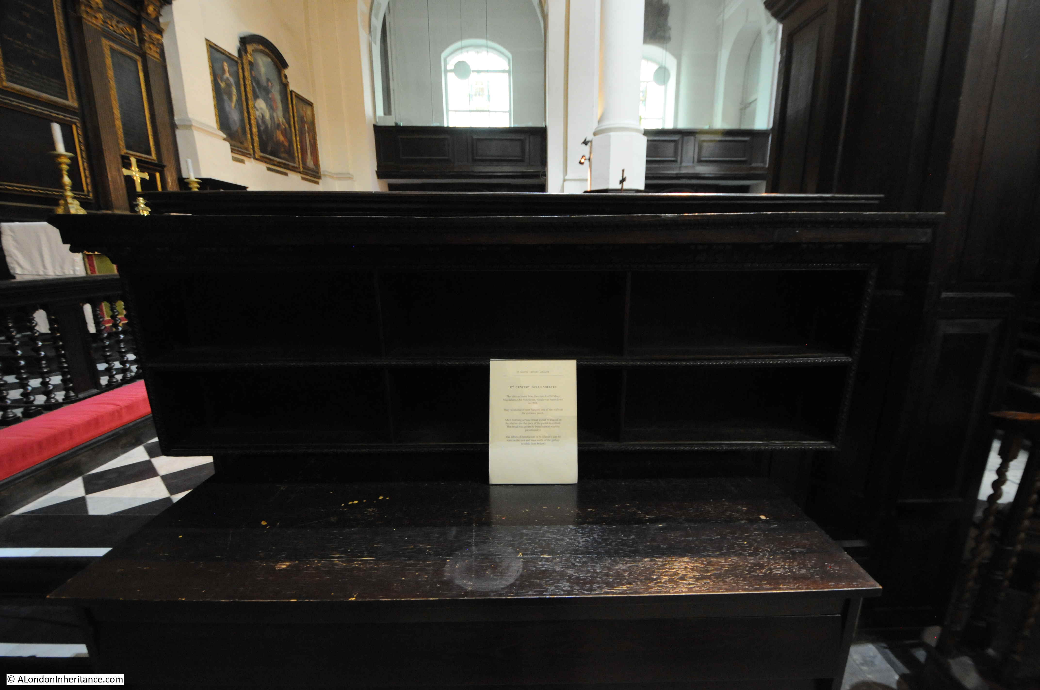
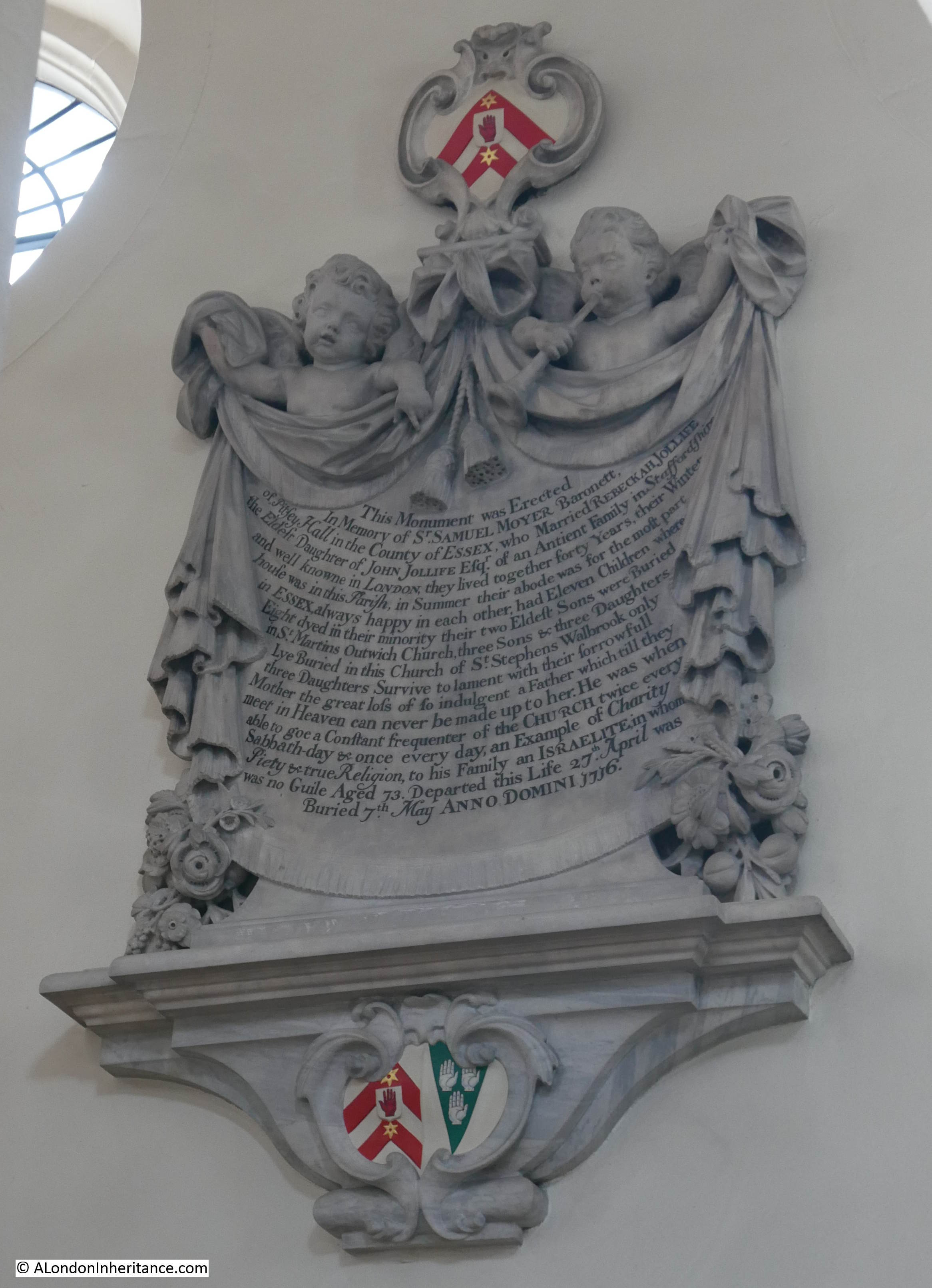
There are a number of monuments remaining in the church, and one of the more ornate of these is to a Mr. John Seale who was apparently “Late of London Merchant”. I assume there should have been a comma between London and Merchant:

John Seale

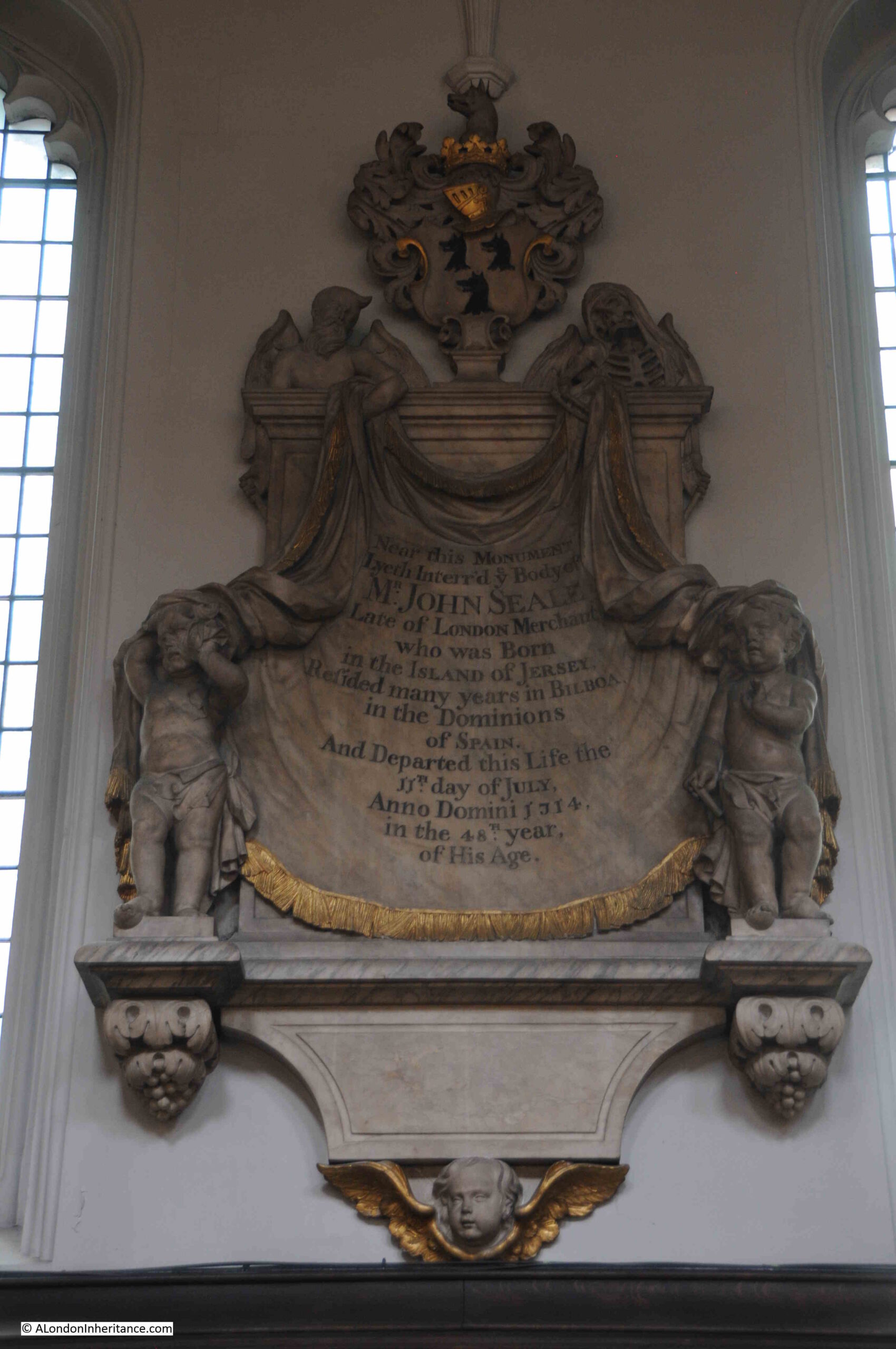
City church monuments often tell stories of how those recorded travelled the world. This was off course only those who could afford to have monuments were those who were able to travel.

John Seale is recorded as being “Born in the Island of Jersey. resided many years in Bilboa in the Dominions of Spain”. He died aged 48 on the 11th of July, 1714, by when he had presumably moved to London.

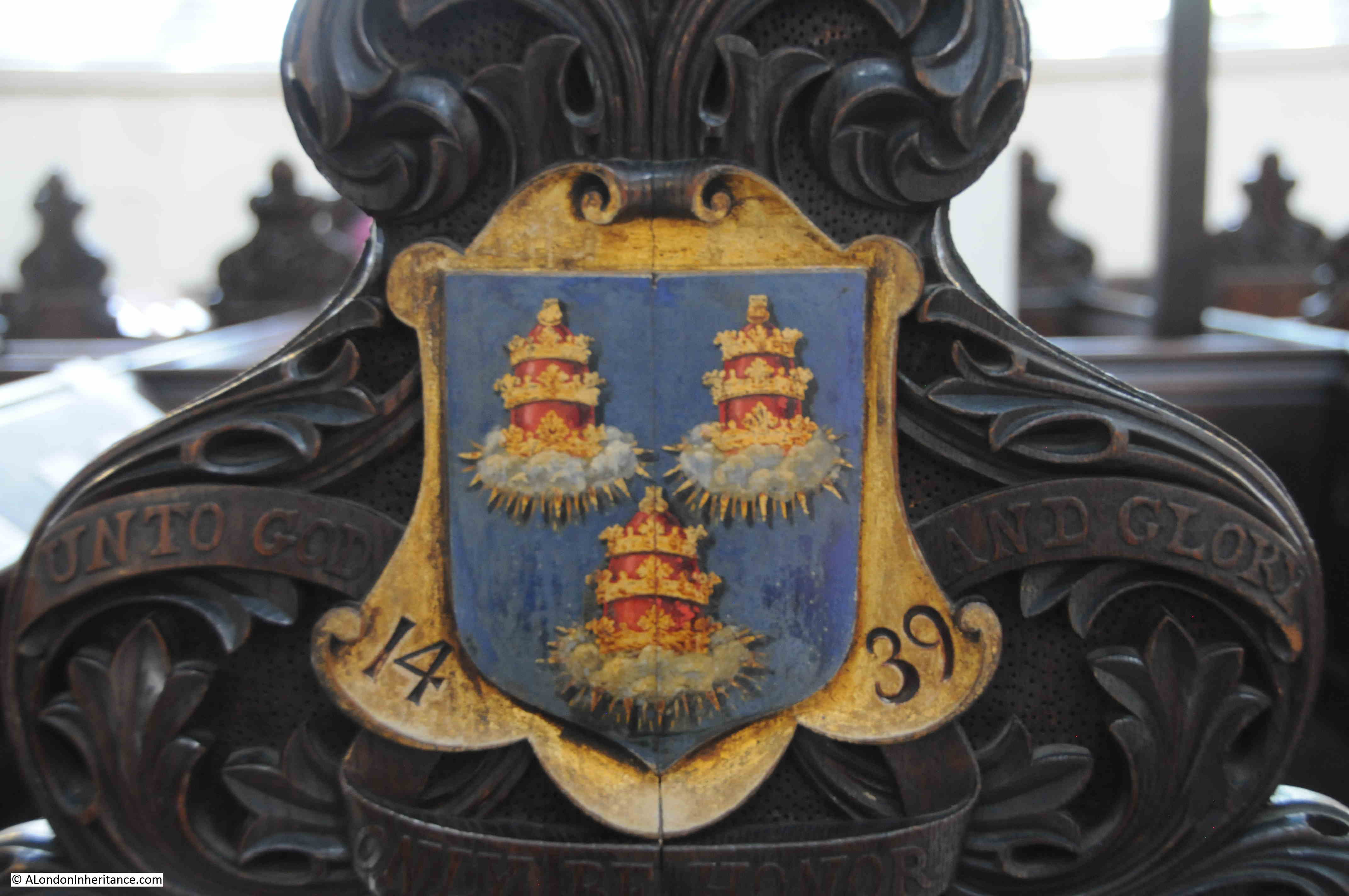
The Seale’s appear to have been a long standing Jersey family, and the use of the first name of John stretched back several generations. The first John Seale was born in 1564 and as an adult was a Constable at St, Brelade, Jersey in the Channel Islands.

His son. also a john was also a Constable in Jersey. His son was also a John, and it was this John whose son was the John Seale buried in St. Mary Aldermary.

The buried John Seale also had a son called John who is recorded as being a London Merchant and Banker and who took on an apprentice from Westminster School in 1736.

The next John Seale would become a Baronet, and the Whig Member of Parliament in 1838, and although he had several children, including boys, none of them were called John.

The loss of the first name of John was only for one generation, and the name John Seale returned in 1843, and four generations later, John Robert Charters Seale is the current Seale Baronet.

A bit of monument trivia, but it is interesting that the dusty monuments in City of London churches still have traceable, living descendants.

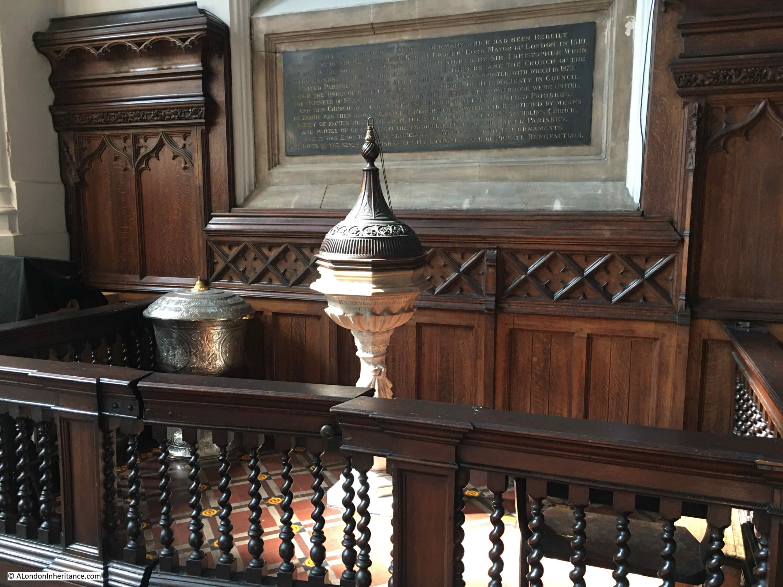
The font, which according to the description of the church in “If Stones Could Speak”, dates to 1682, the same time as Wren’s reconstruction of the church. It was apparently a gift from one Dutton Seaman, when wealthy members of the parish would have been expected to contribute to the rebuilding and furnishing of their parish churches.

St. Mary Aldermary

St. Mary Aldermary is a lovely church, and a small bit of Gothic among Christopher Wren’s City churches. Back to the book “Wren and His Place In European Architecture” by Eduard Sekler, and as well as the London Transport booklet, there was also a photo of a bust of Wren. On the back were notes that it was by Edward Pierce, 1673 and that it was in the Ashmolean Museum in Oxford:

Christopher Wren

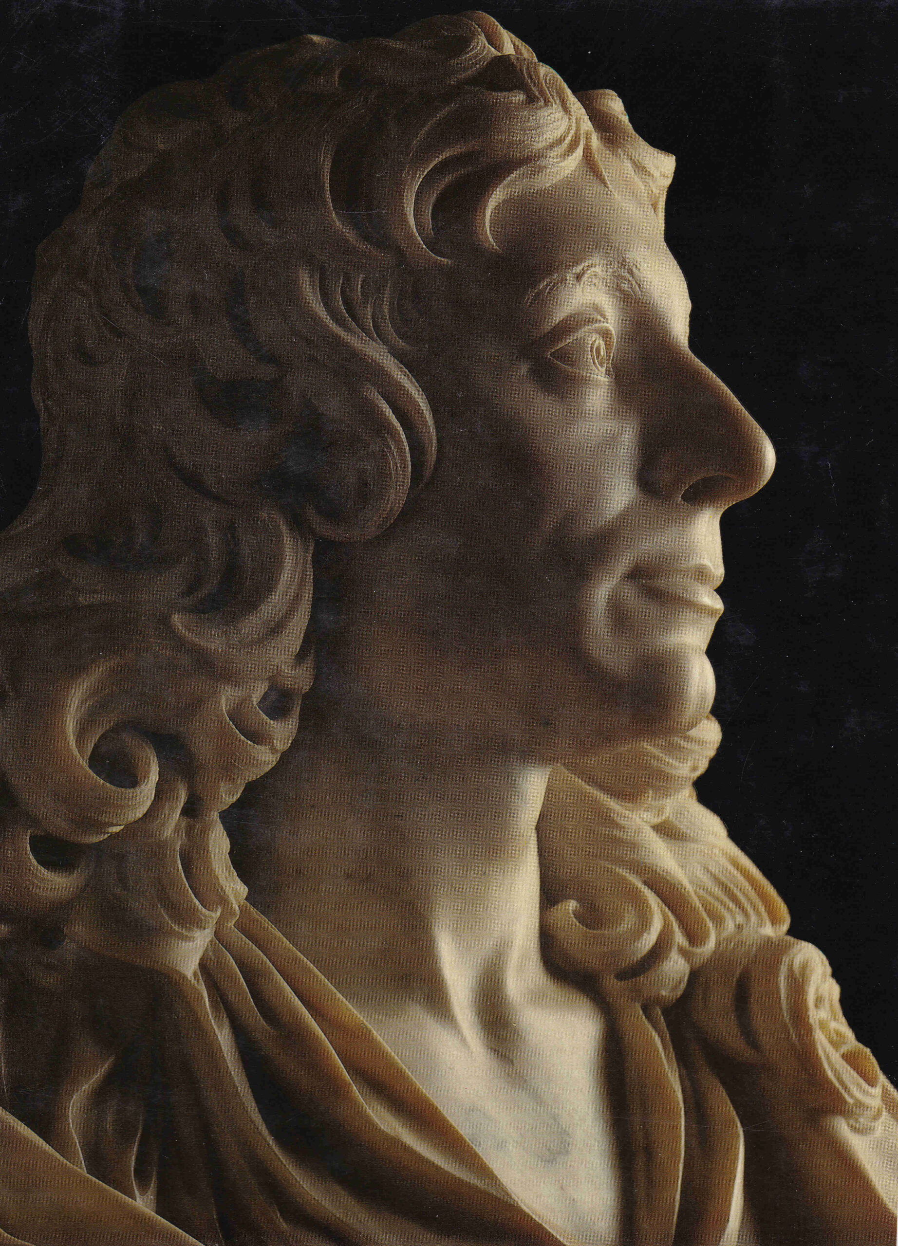
Christopher Wren had been knighted the year before the date of the bust, so perhaps this was to mark his becoming Sir Christopher Wren. The full bust can be seen in the Ashmolean’s imagae archive, at this link.

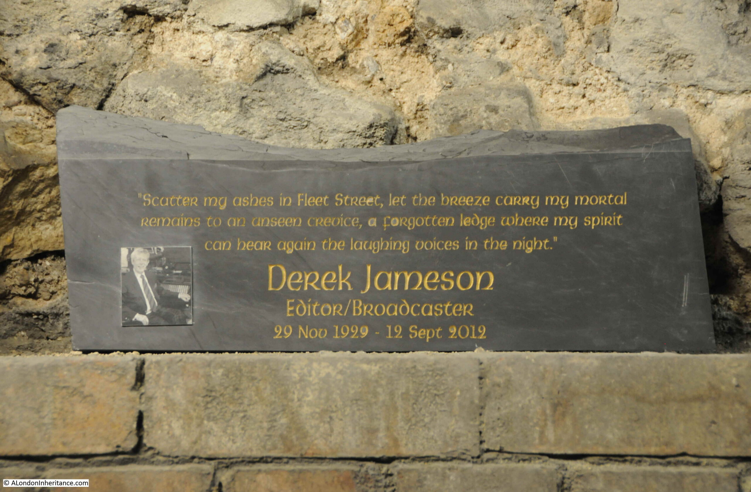
I have mentioned this in a previous post, but leaving bookmarks in books is something I have been doing for years, usually it is the latest London Underground map, museum or exhibition tickets etc. Hopefully something that a future owner of the book may find of interest.

I am very grateful to whoever left the 1957 London Transport guide to Wren in the city in the book.

alondoninheritance.com

Two Cornhill Churches – St Peter and St Michael

A church that was not rebuilt after the 1666 Great Fire along with the churchyard lost in the late 19th century was the subject of last week’s post. For today, I want to take a look at two churches that have survived, both very old churches, and at the eastern end of Cornhill in the City.

In the following extract from John Rocque’s 1746 map of London I have circled St Peter-upon-Cornhill (red) and St Michael Cornhill (orange):

Map of Cornhill

Both churches are partly hidden behind other buildings that face onto Cornhill, and have the appearance of churches from an earlier period of London’s history, when the built space was very crowded, and every available plot of land was utilised for building.

This is the view of St Peter, from Cornhill, with a lunchtime queue at the food shop that is on the small wedge of land between the body of the church and the street:

St Peter Cornhill

Only the main entrance to St Peter is on Cornhill, and when the doors are open, the entrance appears to offer a rather mysterious portal between the food shops to an older London:

St Peter Cornhill

St Peter-upon-Cornhill is in an interesting location, as it is at roughly the highest point in the City of London. Whether this has anything to do with the church’s location is doubtful, however it has been a religious site for very many centuries with Stow claiming the second century as the date for the founding of a church on the site.

The website of the church is even more specific as it states ” 179AD when Lucius, the first Christian King of Britain”, and that St Peter was the first church in the City of London. It was built on the site of the Roman Basilica.

Stow refers to a tablet in the church which had an inscription about the original founding of the church, and this reference also appears in other accounts of the church, however it seems this tablet dated to the 14th century, so a considerable gap of many centuries with the alleged second century date of the original founding of the church.

The earliest written records for the church date to 1127, however a church was probably on the site for many centuries before the 12th century, but whether back to the 2nd century is impossible to confirm.

The church has had a number of rebuilds and additions over the years. In the 15th century there was a school attached to the church.

In common with many other City churches, it was very badly damaged during the 1666 Great Fire. It was rebuilt by Wren between 1677 and 1684, and this is the church we see today as it survived the blitz without any damage – although there have been a number of restorations since the 17th century.

It was the post fire rebuild that shortened the church. Ten feet of the eastern section of the pre-fire church was demolished to make way for a widened Gracechurch Street.

I found one reference to the church of a type that I have not seen before. It goes back to the 25th of January 1783 and is a newspaper report about a fire in Fenchurch Street, and states that:

“There was a great scarcity of water for some time, but the reservoir belonging to St Peter’s Cornhill, being opened, a good supply was obtained, which was the means of its being got under.”

I have not seen a reference to a City church having a water reservoir. Whether this was an open body of water, or a large tank or conduit, it is impossible to tell. It could perhaps have been a service that the church provided to the parish.

Walking through the dark portal of the church from Cornhill reveals a surprisingly light church interior:

St Peter Cornhill

The last major restoration of the church was in 1872, and although everything above ground is Wren and later, below ground there are much earlier remains as during an excavation in 1990 it was found that Wren had used the medieval pier foundations of an earlier version of the church which probably dated to around the mid 15th century.

The most recent additions to the church are some stained glass. These were created by the stained glass artist, Hugh Ray Easton, and date from 1960.

The military significance of the windows is that the church was Regimental Church of the Royal Tank Regiment, between 1954 and 2007.

stained glass artist, Hugh Ray Easton

They are a strange mix of war and religious imagery, with in the following window, a group of soldiers are standing on a tank and are witnessing either the Ascension or the Resurrection:

stained glass artist, Hugh Ray Easton

As can frequently be found in City churches, there are a number of historical relics, including the following dating from 1710 which was probably carried in a procession by representatives of Cornhill and Lime Street Wards:

St Peter Cornhill

What also adds to the view of an earlier London is the building to the right of the entrance to the church. This is numbers 54 – 55 Cornhill:

54 - 55 Cornhill

The building has a food outlet on the ground floor, but look at the terracotta upper floors, and there are details that you would not expect to find on a commercial building in the City:

54 - 55 Cornhill

Some very grotesque creatures peer down at those walking along Cornhill.

This strange building was designed by Ernest Augustus Runtz, and dates from 1893. Apparently (although I can find no contemporary confirmation), Runtz’s original plans for the building strayed onto land owned by St Peter. The vicar objected, Runtz had to rework his plans, and added the figures as an insult to the vicar.

 Ernest Augustus Runtz

The Vicar may have had the last laugh though as Runtz was declared bankrupt in 1912 following financial problems and the failure of his business.

He has though left a most unusual building on Cornhill.

The second church, St Michael Cornhill, is a very brief walk from St Peter, and demonstrates how densely populated the City once was with churches, and again shows how buildings once surrounded City churches, as with St Michael, only the tower is visible from Cornhill, with the main entrance to the church being through an ornate entrance in the base of the tower:

St Michael Cornhill

St Michael is again an old church, however there are no firm records of just how old. The usual references where “tradition points to a church in Saxon times”, however the first written reference, according to “London Churches Before The Great Fire” by Wilberforce Jenkinson (1917) is from 1133 when the church was in the possession of the Abbott of Evesham, and the “living granted by him to Sparling the Priest”.

The tower of the church seems to feature in the majority of references to, and illustrations of St Michael.

There are no illustrations of the original church, however a copy of an illustration of the fourteenth century tower, which was destroyed in 1421, has survived and shows the “Symilitude of the old Steeple 1421”:

St Michael Cornhill

The church was badly damaged during the 1666 Great Fire, but was rebuilt between 1670 and 1671 by Wren, who included the surviving tower into the reconstruction. The tower was weakened by the fire and survived for a further fifty years and was then taken down “as wanting in stability”.

Pevesner states that the new tower was probably designed by “William Dickenson who was in charge of winding down Wren’s City Church Office”, although other references state that it was to Wren’s original design.

The following print illustrates the appearance of the tower in 1850, again with only the tower being visible from Cornhill. The body of the church is behind the buildings on the left  (© The Trustees of the British Museum):

St Michael Cornhill

The tower in the above print is the same tower that we see today, however it was missing one vital feature, the ornate entrance to the church at the base of the tower.

This ornate, Gothic entrance would be built between 1857 and 1860 when the church was the first in the City to be remodeled to high Victorian taste by Sir George Gilbert Scott.

The following print has a penciled note dating it to 1857. It may actually be a couple of years later, however it does show the new porch soon after it had been added to the church, and although today the stone is blackened with dirt (another feature of older City churches), it does look much the same today  (© The Trustees of the British Museum):

St Michael Cornhill

The interior of the church is mainly from the 17th century, post Great Fire rebuild with mid 19th century and later restorations:

St Michael Cornhill

Pevsner states that the organ has been “much rebuilt”, so it is probably not that old, although there may be some surviving parts from the original Renatus Harris 17th century organ. It still looks very impressive with gleaming, gold, organ pipes occupying a corner of the church:

St Michael Cornhill

Looking back towards the base of the tower:

St Michael Cornhill

The majority of City churches have plenty of old monuments, pulpits, sword rests etc. and St Michael Cornhill is no exception. In St Peter I wanted to highlight the stained glass windows as a different feature, and in St Michael there are coats of arms on the sides of the pews. The majority appear to be City Livery Companies, however there are some I cannot identify. The following photos show a sample.

The Merchant Taylors:

Merchant Taylors coat of arms

The Drapers:

Drapers coat of arms

This one is rather strange. I cannot find a similar set of arms being used by a Company. The crossed swords may indicate the Cutlers who usually have three sets of crossed swords on their arms, however I cannot confirm that they use the images on the right of the shield:

Coat of arms

The Clothworkers:

Clothworkers coat of arms

Another I cannot identify, or find anything similiar:

Coat of Arms

I thought I had a reasonably good understanding of the arms used by City companies, and have also been through the book “The Armorial Bearings of the Guilds of London”, but the following is a mystery as well:

Coat of Arms

The Royal Coat of Arms of the United Kingdom – apparently this were placed on the pew at the front of the church in anticipation of a visit by Queen Victoria. Unfortunately she failed to visited the church.

Royal coat of Arms

The arms of the City of London:

City of London

When researching many of my posts, I am struck by the number of times there is a reference to a serious fire at or near the subject of the post. It is incredible just how many fires there were in 18th and 19th century London. Even after the building regulations put in place after the 1666 Great Fire, serious fires still continued.

When searching for stories about St Michael, I found the following print which shows a serious fire in Cornhill on the 25th March, 1748, with the tower of St Michael in the background  (© The Trustees of the British Museum):

Cornhill fire

The print is fascinating for the detail it portrays. There is presumably a property owner on the right, apparently rescuing something from the burning building.

There is a very early fire fighting pump on the left, sending a jet of water at the building.

The print references the engine as “invented by my late Uncle, Richard Newsham”, an inventor who held two patents for fire engines, taken out in 1721 and 1725. Newsham appears to have dominated the mid 18th century market for fire fighting equipment.

The following photo shows the earliest known fire engine by Newsham purchased in 1728, and photographed at St Giles Church in Great Wishford, Wiltshire. The photo is almost identical to the one in the 1748 print:

fire engine by Newsham

Source: Trish Steel, CC BY-SA 2.0 https://creativecommons.org/licenses/by-sa/2.0, via Wikimedia Commons

A quick visit to two Cornhill churches. They are an interesting pair of churches to visit as they demonstrate what City churches must have looked like in previous centuries. Surrounded by buildings on the main street, a small churchyard behind, but only an entrance to the street.

That they are also a very short distance apart is a reminder of how densely populated the City was with churches, before the loss of churches caused by the Great Fire, 19th century church closures, and bombed churches not being rebuilt after the last war.

You can read another of my posts about Cornhill, the Cornhill Water Pump, here.

alondoninheritance.com

St Dunstan in the East

The photo for today’s post is one of my father’s, taken in 1948 in Lower Thames Street, looking up towards the tower of the church of St Dunstan in the East:

St Dunstan in the East

Today, the same view is totally obscured by the office buildings that now line the northern side of Lower Thames Street. The following photo is the closest I could get to reproducing the view, and was taken a short distance down Cross Lane:

St Dunstan in the East

Cross Lane turns into Harp Lane and continues down to Lower Thames Street, and it was around here from where my father took the original photo. Lower Thames Street can be seen on the left and the office blocks that obscure the view on the right:

View along Lower Thames Street

The very distinctive tower of St Dunstan in the East dates from the Christopher Wren rebuild of the church after the Great Fire. The walls of the church had been rebuilt using Portland stone before the fire so did survive, however the church needed a new tower.

The church has long possessed a distinctive tower and spire. In the following extract from the Civitas Londini map of around 1600, the spire of St Dunstan in the East is one of the few labelled, and can be seen rising much higher than surrounding churches  (© The Trustees of the British Museum):

Civitas Londoni map

The book “London Churches Before the Great Fire” (Wilberforce Jenkinson, 1917) provides some background:

“The church was built not later than the thirteenth century; possibly earlier. The first rector, so far as any records go, was John de Pretelwelle, who vacated in 1310, The church is one of those termed ‘Peculiar’. It was destroyed in the Great Fire, and rebuilt by Wren, with a spire somewhat notable but not so lofty as that of the old church, which in Visscher’s map appears to be the loftiest in the City, St Paul’s only excepted.”

The term ‘Peculiar’ was given to churches that were exempt from the jurisdiction of the Bishop of London and were under the Archbishop of Canterbury. There were thirteen City of London churches in this category: All Hallows, Bread Street; All Hallows’ Lombard Street; St Dionys, Backchurch; St Dunstan in the East; St John Evangelist; St Leonard Eastcheap; St Mary, Aldermanbury; St Mary-le-Bow; St Mary Bothaw; St Mary, Crooked Lane; St Michael Royal; St Pancras, Soper Lane; St Vedast.

Saint Dunstan was a Saxon Archbishop of Canterbury, so it may be this dedication that brings the church under the Archbishop of Canterbury rather than the Bishop of London.

Wilberforce Jenkinson’s book tells the story of a 17th century rector of the church, and the penalty at the time for blasphemy:

“Dr Childerley, rector of this church, exhibited his prowess as an athlete in rather an eccentric manner. it seems that one Hackett, an imposter who claimed to be a sort of Messias, and who boasted that he was invulnerable and that anyone might kill him if he could, was arrested and imprisoned in Bridewell.

Dr Childerley repaired unto him and proffered to gripe hands with him and try the wrists, which Hackett unwillingly submitted to do. The Doctor fairly twisted his wrists almost to the breaking thereof, but not to the bowing of him to any confession or remorse.

Hackett was subsequently hanged at the cross in Cheapside, blaspheming to the last breath.”

The view looking up towards the church from St Dunstan’s Hill:

St Dunstan in the East

In my father’s photo, a clock can just be seen half way up the tower. The following closer view of the tower shows the clock today:

St Dunstan in the East

A closer view of the clock, which has the year of 1953 in numbers at the four corners of the clock:

St Dunstan in the East

1953 is the year when restoration of the tower was finished. The tower does not look in too bad a condition in my father’s 1948 photo, however it did need some significant work to make it safe.

Newspaper reports from June 1950 covered the start of restoration work:

A start has been made on the restoration of another of the City’s bomb-shattered churches, that of St Dunstan in the East. As one of Wren’s masterpieces, this church is fortunate because it has been scheduled as a national monument (it was Grade I listed in 1950) and all the difficulties of obtaining a building licence have been swept away. For some time scaffolding has surrounded the steeple, the dismantling of which is expected to take about six months.

Each stone is being numbered in order that it can readily be fitted into its old place when rebuilding begins. Meanwhile the bells which fell when the church was bombed in 1941, have been brought out from the vestry where they had been stored, and in about a year’s time will ring out again. There has been a church on this site for a thousand years.”

As usual with any City church, this was not the first restoration. I have already mentioned the Wren rebuild after the Great Fire, however in 1817 the body of the church needed a rebuild, as the walls which had survived the Great Fire, had been pushed out of the vertical by 7 inches due to the pressure of the roof.

The Public Ledger and Daily Advertiser on the 27th November 1817 reported on the start of the restoration;

“His Grace the Archbishop of Canterbury laid the first stone yesterday, with a bottle containing the coins of the realm, and a brass plate, with an inscription commemorative of the event, for the restoration of the Parish Church of St Dunstan East, assisted by the Rev. Rob Hesketh, Rector; John Howe and William Ruston, Wardens, and the Gentlemen of the Church and Rebuilding Committees. Mr. Laing is the architect, who produced a south view of the intended building, which is to be of Portland stone, entirely Gothic, and made to correspond as nearly as possible with the universally admired structure of the Steeple, built by Sir Christopher Wren.”

The main entrance to the church is in Idol Lane, where in the following photo the base of the tower and entrance can be seen on the right:

Idol Lane

Idol Lane has an interesting history. The earliest mention dates from 1666 when it was called Idle Lane. A reference to the street in 1708 refers to the street being called Idol Lane as in old records there were “makers of idols or images living there”, however there is no evidence to support this.

The following extract from a 1754 map of Tower Street Ward shows St Dunstan’s, with Idle Lane to the west. The map also provides an impression of the scale and view of the church before the 19th century rebuild  (© The Trustees of the British Museum).

Tower Street Ward

From Idol Lane we can walk into the ruins of the church.

Whilst the tower was restored in the early 1950s, the walls were left as they were following the damage caused by bombing, so we can walk around the shell of the old church.

The shell of the church and immediate surroundings were turned into gardens in 1971, and they now form one of the many remarkable sights in the City. The following photo is a view alongside the north wall of the church, with one of the old pinnacles that once stood on top of the church:

St Dunstan in the East

The south side of the church has a small fountain in the centre of the gardens which in the summer are a haven for City workers:

St Dunstan in the East

Doorway into the east entrance to the church:

St Dunstan in the East

View along the southern wall of St Dunstan in the East:

St Dunstan in the East

The 1817 rebuild by Mr. Laing, resulted in a design that at the time was quoted as being “entirely Gothic“. I doubt that Mr. Laing could have realised quite how gothic the church would appear, 200 years later:

St Dunstan in the East

The interior of the church:

St Dunstan in the East

From St Dunstan’s Hill, we can see the eastern entrance to the church, and the top of the tower. Wren’s design is wonderful. Pinnacles are placed at each corner of the tower, and behind the pinnacles, a flying buttress supports the central lantern and spire:

St Dunstan in the East

St Dunstan in the East is a short distance from the old Billingsgate Market, and workers at the market use to donate fish, geese etc. to the harvest festival at the church.

Looking back to my father’s photo, and to the right of the photo, facing onto Lower Thames Street is what I suspect was a café. The board in the window states that it is open from 5.45 am to 4 pm. I suspect the early start was to provide breakfast to the workers at the market. The photo is just one of many where I wish my father had enough film, turned to the right and took another photo.

Cafe in Lower Thames Stteer

The left of the photo shows the level of bomb damage along Lower Thames Street.

The preservation of St Dunstan in the East is rather wonderful. The tower and spire show one of Wren’s best designs across the post fire City churches, and the gardens surrounding the walls of the church are a brilliant place to sit on a summer’s day.

The church is also good to walk past on a quiet, winter’s moonlit night, when Laing’s Gothic design really comes alive.

alondoninheritance.com

Christchurch Greyfriars

Before heading to Christchurch Greyfriars, if you are interested in a walk exploring the history of Bankside, I have had one ticket returned from someone who cannot now attend the walk on Sunday 5th of June, and a couple of tickets are available for the walks later in July. The walk can be booked here.

I took the following photo in 1973, taken from Cheapside, looking towards the church of Christchurch Greyfriars using my very first camera, a simple Kodak Instamatic:

Christchurch Greyfriars

Not a very good photo, the Kodak Instamatic was a very simple camera. All the film was contained within a large cartridge, which included the exposed film. Pre-set focus and the only setting for exposure and speed were a single switch which could be moved either to sunny or cloudy. A very child friendly camera.

Roughly the same view, around 50 years later, in 2022:

Christchurch Greyfriars

Christchurch Greyfriars is an interesting, and distinctive church. A very different history to many other City churches.

It is distinctive, as whilst the tower of the church is intact, the body of the church is now a garden, with only one main side wall standing, and a short stub of the other sidewall. The rear wall is completely missing.

Christchurch Greyfriars

The church was destroyed during the night of the 29th December 1940, when much of the area surrounding, and to the north and south of St Paul’s Cathedral, was engulfed by the fires started by incendiary bombs. This was the raid that destroyed the area that would later be rebuilt as the Golden Lane and Barbican estates.

Christchurch Greyfriars was in one of my father’s photos taken from St Paul’s Cathedral just after the war, and can be seen in the following extract from one of the photos (the full series can be seen in this post, and this post):

Christchurch Greyfriars

As can be seen in the above photo, the church still retained its four walls. The church was destroyed by fire which burnt the contents of the church along with the roof, but left the walls standing.

In my 2022 photo you can count 5 windows in the remaining side wall. In the above photo, there are 6 windows (part of the 6th window on the right can just be seen to the left of the end wall of the church). There is also a two storey building which runs south from the end wall of the church.

The reason for these differences, and for the loss of the rear and southern side wall were changes in 1973 to allow the widening of King Edward Street, and the construction of a spur from Newgate Street into King Edward Street.

Christchurch Greyfriars was Grade I listed in 1950, however this protection appears to have been insufficient to prevent the demolition of much of the surviving walls.

In the following map, Newgate Street runs from left to right, and the spur of King Edward Street can be seen cutting across where the two storey building was located. This, along with widening of King Edward Street, and the footpath along the street, resulted in the demolition of the end wall and shortening by one window of the north wall  (© OpenStreetMap contributors).

Christchurch Greyfriars

The church was included in the series of postcards “London under Fire”, issued during the war:

London Under Fire

The church was also included in a couple of works by the artist Roland Vivian Pitchforth for the War Artists Advisory Committee. Both show the burnt out church with the surviving tower and walls:

War Artists Advisory Committee
Post Office Buildings : the Telephone Exchange (Art.IWM ART LD 938) image: a view looking down on a cleared bomb site in between other burnt-out buildings in the City. Copyright: © IWM. Original Source: http://www.iwm.org.uk/collections/item/object/21822

And both show the two storey building to the south of the church where the slip road from Newgate Street to King Edward Street now runs:

War Artists Advisory Committee
Post Office Buildings (Art.IWM ART LD 939) image: a bomb site in the foreground with steel girders sticking up out of the rubble. In the background buildings remain standing, however men can be seen at work securing the building on the right. Copyright: © IWM. Original Source: http://www.iwm.org.uk/collections/item/object/21823

Note that in the Imperial War Museum commentary for the above two prints, the focus in on the Post Office Buildings, one of which was the large building to the right of the church.

The Post Office, or British Telecom has had a long association with King Edward / Newgate Street, but has now moved away. In my 2022 photo there is a large building covered in white sheeting. This was the 1980s head office of British Telecom. It is now being converted into a mixed use development, and is unusual in the City in that the new building will retain the structural framework of the original rather than the usual full scale demolition and complete rebuild.

What has no doubt helped this approach is the height limitation around St Paul’s Cathedral so the usual high glass and steel tower was not an option.

A sign close to the tower of the church confirms when and how Christchurch Greyfriars was destroyed (perhaps there should be a second plaque explaining how and why some of the walls disappeared).

Christchurch Greyfriars

The plaque also informs why there was no requirement to rebuild the church, as the old parish of the church was united with that of St Sepulchre-without-Newgate. The number of people living in the City had reached a point where there was an insufficient number of parishioners and regular church attendees to justify many of the old City churches.

A wooden font cover was rescued from the burning church on the 29th December 1940, and it can now be seen in the church of St Sepulchre.

To the west of the church is a small open space – the Christchurch Greyfriars churchyard:

Christchurch Greyfriars

This is not the traditional churchyard. William Morgan’s 1682 map of London provides a clue:

Christchurch Greyfriars

The church can be seen to the right of centre (although it is facing the wrong way), and to the left of the picture of the church, there is a rectangle labelled “Old Church”.

The original church was the church of a monastery established around 1228 on land to the north of the church by the Franciscan’s, or Greyfriars.

The first church on the site was built in the 13th century, demolished in 1306, and a new church built in 1325. This church was much larger than the church we see today, and as well as the space occupied by the current church ruins, also occupied the green space to the west of the church, hence the comment “Old Church” in the map extract.

The church attached to the monastery was of some size. According to “London Churches Before The Great Fire” (Wilberforce Jenkinson, 1917), the church was described as being “300 feet in length, in breadth 89 feet, and in height 64 feet”.

The book also states that “no other parish church contained the remains of so many of the great, there being there buried four queens, four duchesses, four countesses, one duke, two earls, eight barons, thirty-five knights, etc”.

The queens I can identify are:

  • Queen Margaret, the second wife of King Edward I
  • Queen Isabella, the wife of Edward II
  • Queen Eleanor of Provence (just her heart so not sure if this really counts)

Cannot find who the fourth queen was, some sources reference Queen Joan of Scotland, however most sources state that she was buried in Perth.

Whether it was two and a bit queens, three or four, the church appears to have been a large and important church, as was the Franciscan monastery, with only St Paul’s Cathedral being greater in size.

The monastery was taken by the Crown during the Dissolution when Henry VIII took the properties of religious establishments across the country in the mid 16th century, and after a short period when the building was used for storage, the church became a local, although rather impressive, parish church.

“London Churches Before The Great Fire” records that Sir Martin Bowes, mayor of the City, sold all the ornate alabaster and marble monuments from the church for £50 in 1545.

Ornate memorials did continue after the church became a parish church, and the same book also records a memorial to Venetia, the wife of Sir Kenelm Digby who was buried in the church:

“Her husband tried to preserve her beauty by cosmetics and after her death had her bust of copper-gilt set up in the church. The bust was injured in the fire and was afterwards seen in a broker’s stall. She was painted by Vandyke.”

Bit of a lesson there on fame and beauty, that no matter how good looking, or famous, eventually we may all end up on the equivalent of a broker’s stall.

van Dyke’s portrait of Venetia, Lady Digby:

Venetia, Lady Digby
Venetia, Lady Digby
by Sir Anthony van Dyck
oil on canvas, circa 1633-1634
NPG 5727
© National Portrait Gallery, London. Creative Commons Reproduction

View down the alley between the remaining side wall to the north, and what were the old Post Office buildings:

Christchurch Greyfriars

The church was one of those lost during the Great Fire of London in 1666.

It was rebuilt by Wren between 1687 and 1704 on the foundations of the chancel of the original church. There was no need for a parish church to be the same size as the pre-fire church, and it was also expensive to rebuild with even the smaller church being one of Wren’s most expensive at a cost of over eleven thousand pounds.

It is remarkable just how many churches there were in the City of London. Today it seems as if you only need to walk a short distance to find another church but there were many more in previous centuries.

When Christchurch Greyfriars was rebuilt after the Great Fire, the church absorbed two smaller parishes, the parish of the wonderfully named St Nicholas in the Shambles, and that of St Ewin or Ewine. The churches for these two smaller, adjacent parishes were not rebuilt.

The base of the tower has a number of monuments which were rescued from the war damaged church:

Christchurch Greyfriars

After the church and the monastic buildings of the Franciscans were taken by the Crown, the buildings continued to have a close relationship.

There was always a need to provide help for London’s poor. There were many children throughout the city who did not have a father, or were part of a family that was struggling to feed them. In 1552 King Edward VI responded to this need by working with the mayor of the City to form a charitable organisation to provide for some of these children.

The result being that the old buildings of the Franciscans were taken over, donations were received, a Board of Governors set-up and in November 1552, Christ’s Hospital opened with an initial 380 pupils.

There is a sculpture on the southern side of the church of some of the children of Christ’s Hospital in their traditional school uniform:

Christ's Hospital

Christchurch Greyfriars became the church for Christ’s Hospital.

The buildings of Christ’s Hospital were damaged during the Great Fire, rebuilt after, with a frontage designed by Wren.

The following print from 1724 shows the church to the right, along with the impressive buildings of Christ’s Hospital  (© The Trustees of the British Museum):

Christ's Hospital

The text below the print provides some background on the school in the early 18th century:

“This Hospital, formerly a House of Grey Friars was first founded by that pious Prince Edward the 6th and has since received many donations from other persons by which Charities poor Children to the number of about 820 boys and 80 girls are not only provided with Lodging, Diet, Clothing and Learning, but when discharged of the House are bound out Apprentices and some of the Boys who have made large advances in Learning are sent to University. The House is divided into handsome Wards, where the Children lodge and a particular Ward where the sick are removed. For their instruction, here are a Grammar School, a Mathematick School a Writing School, a School where Girls learn to Read, Sew and Mark, and of late years, Boys have been taught to Draw. This Hospital is under the care and patronage of the City and by prudent care taken therefor it has produced many famous for Wealth, Learning and Servicableness to the public.”

Christ’s Hospital school left the site in 1902 and moved to Horsham in West Sussex where the school continues to this day.

View from next to the tower into the old body of the church:

Christchurch Greyfriars

View looking south towards St Paul’s where only one window and surrounding part of the southern wall remains:

Christchurch Greyfriars

What was the interior of the church was laid out as a rose garden in 1989, with a major update to the gardens in 2011. The configuration of this garden is intended to reflect the Wren church with the position of pews marked by the box edges and wooden towers where the old stone columns were located:

Christchurch Greyfriars

The northern wall of the church from what was the interior of the church:

Christchurch Greyfriars

If you return to my father’s photo of the church, you can see at the top corners of the church walls, there were stone pineapples. The ones rescued from the demolished walls can be found on the ground in the garden, next to the tower:

Christchurch Greyfriars

View along the centre of the church, pews would have been on either side with the small box hedges marking the edge of the pews:

Christchurch Greyfriars

A view of the tower of the church and part of the garden earlier in the year:

Christchurch Greyfriars

Christchurch Greyfriars is a survivor. Originally dating from the 13th century, it has survived being part of a Franciscan monastery, a charitable hospital / school, the Great Fire, the London Blitz and post war road construction and extension.

During many of these events, the church has shrunk in size, leaving the view we see today.

There was a campaign a number of years ago to rebuild the missing walls of the church, and for the church to become a memorial “to honour all Londoners who have been the victims of bombings in wartime and peacetime during the modern era”, however nothing seems to have come of this.

On a sunny spring or summer’s day, the gardens are a wonderful place to sit and contemplate the history of the church, surrounded by plants, flowers and bees.

alondoninheritance.com

St Bride’s, Fleet Street

The church of St Bride’s is set back from Fleet Street, and the body of the church is not that visible, however walk a short distance and the steeple of the church rises above the surrounding buildings:

St Bride's

Remarkably there has not been any taller buildings in the surrounding streets which could obscure the view of the steeple, and the roof line of Fleet Street is much the same as it was in the 1940s when the following view for the postcard series “London under Fire” was taken:

St Bride's

A visit to St Bride’s today, reveals two distinct sides to the church. There is the historic church, which includes evidence of the Roman city almost 2,000 years ago, and there is the church today which is the spiritual centre for a profession that we see on our TV screens every day.

The design of the current church dates from Wren’s post Great Fire rebuild of the church. The previous church having been completely destroyed by the fire that devastated so many City churches,

Although the rebuilt church reopened in 1675, the steeple was not completed until 1703. The steeple was Wren’s tallest steeple and today is actually 8 feet shorter than when originally completed due to a lightning strike and subsequent rebuilding work.

The steeple is also traditionally thought to be the inspiration of the tiered wedding cake, and up close, the steeple provides no reason to doubt this story:

St Bride's

The following drawing, dated 1680, shows the steeple of the church, and confirms that the steeple today is identical to Wren’s original design. The drawing on the right shows some very tempting stairs running up the middle of the steeple (© The Trustees of the British Museum):

St Bride's

St Bride’s today is completely surrounded by buildings so apart from the steeple it is really difficult to appreciate the overall design of the church. The following print shows the church open to the west (© The Trustees of the British Museum):

St Bride's

The above print is dated 1753, however Rocque’s map of London seven years earlier shows the area in front of the church occupied by buildings, so I do not know if some artistic licence was used in the above print, or whether the block had been demolished, and the artist had used the opportunity to portray this unique view of St Bride’s.

In the following extract from Rocque’s 1746 map, St Bride’s (marked as St Bridget) is shown just to the left of centre, and as now, was surrounded by buildings.

St Bride's

St Brigit (St Bride) was an abbess of a number of convents in Ireland, the most important of which was at Kildare. Brigit is believed to have lived between 451 and 525, and there are very few, if any, written records from that time, with what is known of her coming from later writings and anecdotes.

The majority of churches dedicated to St Brigit / Bride, or place names, are in Ireland or Wales and the west of England (such as St Brides Bay in Wales). The church in London is a rare example of the name in the east of the country.

Looking at the extract from Rocque’s map, and to the north of the church is “St Bride’s A”. This is St Bride’s Avenue, a narrow passageway that still runs between the church and the buildings on the southern side of Fleet Street:

St Bride's

In the above photo, a gate between the two lights leads into the churchyard, and a side entrance into the church, however I much prefer the entrance underneath the tower, as this entrance provides a view from under the tower into the brightly lit nave of St Bride’s:

St Bride's

St Bride’s was devastated during the last war, when bombing and fire, mainly during December 1940, reduced the church to a shell of side walls, tower and steeple.

The interior we see today is to Wren’s core design, but is the result of the post war rebuild, with everything, including floor, all wooden structures, roof etc. being from the 1950s and later refurbishments:

St Bride's

The view from close to the altar, looking back along the church to the entrance under the tower:

St Bride's

I have touched on the history of the church, but there is far more to discover which I will come to later in the post, however whilst in the church, there is the opportunity to explore one aspect of St Bride’s that is very relevant to life today.

Altar

St Bride’s has a long association with the print trade and journalism, dating back to around 1500 when the printing press of Wynkyn de Worde was established near the church. This association grew with the rise of Fleet Street as a centre of journalism and the newspaper industry.

Whilst newspapers have left Fleet Street, St Bride’s maintains this connection.

If you watch TV news today, or listen to a radio report, chances are these will be from a journalist and their support staff in Ukraine. Kitted out in protective gear. Those who report from war zones run a very real risk of injury or death, and those who have been lost in previous wars are commemorated in St Bride’s, including this memorial to those who lost their lives whilst covering the 2003 Iraq war:

Iraq War

St Bride’s has also created a Journalists’ Altar, to commemorate those within the profession who have died, are held hostage or have an unknown fate.

Journalists Altar

Unfortunately, there are too many to display at any one time, so the photos are rotated.

The three photos just above the candle are for Roman Protasevich, the Belarusian journalist who was arrested at Minsk airport in 2021. In the centre is John Cantile, who was taken hostage in Syria in 2012 by Islamic State and is still missing, and on the right is American freelance journalist Austin Tice who was also kidnapped in 2012, in Syria.

On either side of the Nave of the church, there is wooden seating, and these seats also have plaques commemorating those in the profession who have died. I have selected two to show the range of those named in St Bride’s.

The first is Patricia (Paddy) Mary Watson:

Patricia Watson

Patricia Watson was a journalist on the staff of the Daily Sketch, who died at the age of 23 in an aircraft accident over Italy on the 22nd of October 1958.

I found the details of the accident recorded in newspaper reports from the time, as follows:

A British European Airways Viscount and an Italian Air Force jet fighter collided near Nettuno, central Italy, and the airliner plunged to earth with the feared loss of 30 lives, cables Reuter.

Airport authorities in Rome said it was believed none of the 25 passengers and five crew survived. The fighter pilot was reported to have parachuted into the sea and was then picked up by a rescue launch.

BEA’s manager in Rome, Mr. David Craig, said he had been informed by the Italian authorities that all on board the Viscount were dead. The airliner was flying from London to Malta via Naples.

The Viscount and the fighter, an F36 Sabre jet, collided between Nettuno and Anzio. The wreckage of the Viscount was ten miles south-east of Anzio, a short distance inland from the sea, Mr. Craig said.

A police official at Nettuno said that after the collision, there was a terrific explosion. The British airliner blew up. Everyone on board must have been killed instantly. the wreckage came streaming down in a shower. The biggest piece was not more than a yard long.

The pilot of the fighter managed to parachute out of his plane immediately and the plane went on flying for a short distance before plunging downwards. The pilot of the fighter, Capt. Giovanni Savorelli, was taken to Nettuno hospital suffering from shock, Hospital authorities said he was otherwise uninjured.

An Italian civilian is believed to have been killed on the ground by falling wreckage. Within two hours of the crash Italian police announced that 15 bodies had been found. Police said the airliner was flying at 23,000 ft. at the time of the collision.

Among the dead were Miss Patricia Watson (23), a member of the Daily Sketch staff. Mr. Brian Fogaty (25) freelance photographer, and Mr. Lee Benson, free-lance reporter. They were on a Daily Sketch assignment.

Another member of the party was Miss Jane Buckingham (22) a London model.

The first paragraph of the above report mentions Reuter as the source of the news, which brings us to the second plaque, to Julius Reuter:

Julius Reuter

Paul Julius Reuter was a German immigrant to London. In Germany he had been running an early form of financial news service which relied on the telegraph and even carrier pigeons, to distribute financial information such as the prices of stocks.

In 1851, he set-up an office in the City of London, and using a new telegraph cable between London and Paris, started transmitting stock market quotations and news between the two city’s.

Reuter established the company known as Reuters, and as submarine cables and radio services allowed global communication, Reuters built a global network of journalists providing news and financial information, so as the plaque states, he was “First to spread world news worldwide”.

Reuters struggled somewhat in the early years of the 21st century, and in 2008, Reuters merged with the Canadian media organisation Thompson, to form Thomson Reuters.

Reuters had a presence close to St Bride’s, with offices at 85 Fleet Street, in the building designed by Sir Edwin Lutyens, and completed in 1938 for the Press Association.

St Bride’s relationship with the professions of print and journalism are very much alive today, however I hope that no more names need to be added to those who have died whilst working as journalists.

I have touched on the history of the Wren church we see today, and there is a much older side to the church, which we can see with a visit to the superb displays in the Crypt:

St Bride's crypt

To discover the history of the Crypt, I turned to my go to book for post-war archeological excavations across the City – “The Excavation of Roman and Mediaeval London” by W.F. Grimes.

St Bride’s had a Mediaeval crypt, which had been retained when Wren rebuilt the church in the 17th century, however access to the crypt had been lost, and apart from a drawing preserved by the Reverend John Pridden who was a curate at St Bride’s from 1783 to 1803, there was no information on the layout of the crypt.

In the section on St Bride’s, Grimes explains that the church authorities invited the Roman and Mediaeval London Excavation Council to look for the vault before work started to rebuild the church.

The invitation was accepted, along with a request to extend the excavation beyond just the discovery of the crypt. The post-war state of the church can be understood with the following photo from Grimes book, showing the interior of the church from above:

St Bride's war damage

The white outline in the photo is that of the early Anglo-Norman church.

Walking down to the Crypt today, and there are two sections. On the left is a narrow walkway, where we can walk alongside the remains of some of the early walls and foundations of the church:

St Bride's crypt

This section of the crypt has a number of memorials from the pre-war church, alongside more memorials to those in the media:

Derek Jameson

On the right is the main section of the crypt, where the key features found during the post war excavation can be seen along with display cases telling the history of the church, and displaying some of the finds from the excavations.

St Bride's crypt

Grimes explains that the history of the site begins in the Roman period, when a stone building with a plain floor of red and some yellow tesserae was found at the eastern end of the church, some 10 feet below the floor level of Wren’s church.

The floor sections discovered are behind walls and foundations of medieval versions of the church, and can be seen today via mirrors which reflect the view of the Roman floor from behind the stone walls:

Roman Floor

The Roman floor was found to have been built on natural gravels, which extended westwards within the church, gradually increasing in height.

The level of the Roman floor is very similar to that of the streets that surround St Bride’s church today, which as shown in the earlier view of St Bride’s Avenue, are lower than the church, and descend to the east.

Another part of the Roman floor on display:

Roman floor

As well as the Roman tiled floor, an unexpected feature found towards the western end of the church was a Roman ditch. This was of a reasonable size, and extended beyond the site of the excavations so the full extent of the ditch and what it could have enclosed were not found at the time.

There was very little evidence of an early Christian church on the site of St Bride’s, although a number of burials were found which were probably early Christian. Evidence of either a cemetery on the site, or buried alongside an early church.

The following photo shows a late Roman / early Christian burial found near the western end of the church:

Late Roman / early Christian burial

Later mediaeval burials which had been cut through during later building works as the church developed:

Late mediaeval burials

Grimes records how the church before the Great Fire changed over the centuries, and was a more complex structure than the simple rectangular church built by Wren on the site.

Excavations were able to provide dates to the structures found within the crypt, and these are labelled as we walk around the crypt today. Some of the earliest walls from the 12th century:

12th century Walls

And the 11th century:

11th Century Walls

Grimes records that the earliest tower may not have been in the same location as the current tower. An early tower was probable given that St Bride’s is one of the churches recorded as sounding the curfew in the fourteenth century, however it may have been separate to the main church to avoid putting too much strain on what was a comparatively slight structure of the early medieval church.

Grimes summarises that the “the presence of an early church here with a Celtic dedication owes something to the use of the area as a burial ground since Roman times has much in it that is attractive”.

Having seen the crypt, the Roman floor, and read Grimes’ comments about the natural gravel on which the floor was probably built, a second look outside the church is instructive. The following view is looking along St Brides Avenue, which as can be seen, is lower than the church:

St Bride's Avenue

In the following photo, I am looking back up St Bride’s Avenue from the east. This view shows the gradual increase in height towards the western end of the church.

St Bride's Avenue

The Old Bell on the right, is an old pub, claiming to have been built by Sir Christopher Wren in the 1670s for workmen and masons working on the church of St Bride’s.

The following view is looking along Bride Lane at the eastern end of the church, showing how high the church is, compared to the ground level at the east.

St Bride's Avenue

As Grimes gives the level of the Roman floor as about 10 feet below Wren’s church floor, the level of the Roman floor and the natural gravel is probably at the same level as Bride Lane.

This is rather unusual, as there is usually a depth of “made ground” (the artificial deposits of human occupation that raise the level of the ground) in London between the natural surface, Roman remains, and the surface level of today.

It could be that as St Bride’s was built on the western banks of the River Fleet (see the earlier Rocque map extract for the location of the Fleet), that the descending gravels found by Grimes from west to east were part of the bank towards the river, and this gave less opportunity for man made deposits to build up.

Walking around the outside of the church, and there are a number of carvings on the church, including the following by or to E.D. and dated 1702 – the time when the tower of the church was being completed.

St Bride's

I did find a number of interesting references to St Bride’s when researching newspaper archives. One of the earliest dates from the 9th of August, 1716, where deaths in the City of London were reported.

One of these deaths was a person “Killed by several bullets, shot from a Blunderbuss at St Brides” – which raises all manner of questions, sadly not answered in the newspaper.

The death was part of the Bills of Mortality, records of deaths in London, along with their cause (and an example of how I am easily distracted when researching topics). The following table is the Bill of Mortality for London for the week from the 24th to the 31st of July, 1716:

Bill of Mortality

Causes of death were much more descriptive of their actual perceived cause in the 18th century.

The names of some need a bit of deciphering, for example “Chrisoms”.

A Chrisom was a piece of cloth laid over a child’s head when they were being baptised or christened, and would have probably been used at St Bride’s. The term was also used to describe the death of a child if they had died within a month of their baptism.

Bills of Mortality show a story over time, recording the causes and number of deaths of Londoners – a topic for a future post.

St Bride’s is a fascinating church, one of a few that have a Roman floor in their crypt. All Hallows by the Tower is another church where evidence of Roman buildings can be seen in the crypt (see this post).

A history that is almost 2,000 years old, and with a role that is relevant today, providing a spiritual home to the publishing industries and those following the profession of journalism, where journalists continue to report from war zones across the world.

If you are in the vicinity of Fleet Street, St Bride’s is very much worth a visit.

I had hoped to cover Bridewell, which was just to the south of the church (as can be seen in the Rocque map), but ran out of time – also a topic for a future post.

alondoninheritance.com

Two Bombed Churches – St Alban and St Mary

I will complete my tour of the City pubs in the next week, but for today’s post, I am staying in the City, and visiting the location of one of my father’s 1947 posts, which shows a view of two bombed churches.

Two bombed churches

The church tower on the left is that of St Alban, Wood Street, and the smaller tower on the right is St Mary Aldermanbury. The remains of the body of the churches can be seen at the base of the towers. The photo was taken from Gresham Street. I took a photo from the same position today, but it was totally pointless, as new buildings completely obscure the view.

Two bombed churches

The 1947 photo shows that whilst the towers of the churches remained, the rest of the church, and the surrounding area, had been badly damaged by wartime bombing. The two churches are between Gresham Street and today’s route of London Wall. Wood Street runs between the two. The following map shows the location of the two churches today. The red circle shows the tower of St Alban, and the orange oval shows the site of St Mary (Map © OpenStreetMap contributors).

Two bombed churches

The 1894 Ordnance Survey map shows a very different place. The two churches, surrounded by streets, lanes, and dense building of low rise, individual buildings. The area today is occupied by large glass and steel office blocks.

Two bombed churches

Credit: ‘Reproduced with the permission of the National Library of Scotland’ 

The tower of St Alban looks out on very different surroundings today. The rest of the church was demolished in 1955 with only the tower remaining on an island, with Wood Street passing either side.

Where once the tower looked out over its surroundings, today, the surrounding office blocks close in and look down on the tower.

Two bombed churches

Fourteen years before the raids that would cause so much destruction, in 1926 Wood Street looked very different:

Two bombed churches

Image credit: London Metropolitan Archives, City of London: catalogue ref: v8482613

St Alban, Wood Street was an unusual church in that the tower was on the corner of the church. In the above photo you can see the body of the church on the right.

The church takes its name from St Alban, the first British Saint. The cathedral city of St Alban’s in Hertfordshire also takes it name from the same saint.

The London Encyclopedia states that the church was “built on the alleged site of the palace chapel of King Offa, the 8th century ruler of Mercia. In penance for his part in the murder of Alban, the first English martyr. Offa founded St Albans Abbey; and in 793 gave the patronage of Wood Street to the abbey”.  There is an immediate problem with this statement as Alban was recorded being executed in the early 4th century, whilst Offa was from the 8th century, so Offa could have had no part in murdering Alban.

The connection with the abbey at St Albans is probably correct. For example, in London Churches Before The Great Fire by Wilberforce Jenkins (1917), he states “The church was, at all events, built in Norman times, for we are told that the Abbey of S. Alban owned several churches in the Eleventh Century dedicated to S. Alban; and this was one of them”.

Jenkins aligns the church with a different Saxon King “Wood Street is said to have been formerly King Adel Street, justifying a tradition connecting the church with the Saxon King Adelstane. Anthony Munday, writing in 1633, gives his personal impression of the building as it then stood:

Another character of the antiquity of it is to be seen in the manner of the turning of the arches in the windowes and heads of the Pillars. A third note appears on the Romane bricks here and there inlayed among the stones of the building. King Adelstane the Saxon, as tradition says, had his house at the east end of this church”.

A Dictionary of London (Henry Harben, 1918)  adds a further twist to the street, with a first mention of the name Wodestrata dating to 1156-7. The book also includes a suggestion that the name came from the fact that wood was sold here – which is a possibility given the names of streets such as Milk Street and Honey Street to the south.

So there may have been some connection between the site and a Saxon King, the name comes from St Alban, and the abbey in the city of the same name owned the land, and the street is probably named after the sale of wood in the surroundings of the street – but as always, there is no firm written evidence from the time so impossible to be sure.

The original Norman church was rebuilt in 1633 and 1634 as the original Norman church was in a dreadful state of decay such that many of the parishioners would refuse to go into the church.

The church was then destroyed in the Great Fire, and the church destroyed in 1940 was built by Wren between 1682 and 1685 with the tower being added 12 years later.

St Alban, Wood Street in 1837:

Two bombed churches

Image credit: London Metropolitan Archives, City of London: catalogue ref: SC_PZ_CT_01_3672

Today, the tower sits on an island, with Wood Street passing either side. To the east of the tower is the City of London Police Station in Wood Street. In the following photo, the body of the church would be coming out from the church where the tree is located today, with the front of the church extending to the traffic island.

Two bombed churches

The church then extended back to cover a small part of the police station and the adjacent street.

I often wonder what someone who knew the area in the time of the 1926 photo would think if they could visit the area today.

Two bombed churches

The following photo is from the north, looking south down Wood Street. If you return to the 1894 OS map, you will see Liitle Love Lane, ran from Wood Street, this side of the church and circles around the church to Love Lane. Little Love Lane would have run roughly from the southern end of the traffic island, to the left, through the Police Station and round to Love Lane.

Two bombed churches

The following photo dates from 1915, and was taken from within Little Love Lane, with St Alban on the left, looking up to Wood Street.

Two bombed churches

Image credit: London Metropolitan Archives, City of London: catalogue ref: M0060679CL

In the above photo, the building opposite the end of Little Love Lane, showing just as a facade was the result of a First World War bombing raid on London by the Zeppelin L.13 over the 8th and 9th of September 1915. The use of incendiaries by the Zeppelin caused some serious fires in Wood Street and significant damage. A foretaste of what would come to the area in 25 years time.

The interior of the church showing the damage caused by the raids of 1940. we can see the entrance to Wood Street on the left with the large window above. The tower is on the right. As the tower now sites on an island, the eastern branch of Wood Street now runs in front of the tower in the photo below.

Two bombed churches

Image credit: London Metropolitan Archives, City of London: catalogue ref: M0017321CL

The second church in my father’s 1947 photo is that of St Mary Aldermanbury, of which there is even less remaining (in London) than there is of St Alban.

In the following photo I am standing at the junction of Love Lane (to the left) and Aldermanbury (to the right), looking over the site of St Mary Aldermanbury. The Wood Street police station is to the left, and the tower of St Alban can just be seen above the left hand corner of the police station.

Two bombed churches

Had I been standing in the same position, just over two hundred years ago in 1814, this would have been the view:

Two bombed churches

The buildings at the left end of the church are where the police station stands today.

St Mary Aldermanbury is another medieval church, with references to it belonging to St Paul’s and / or The Elsing Priory. It grew during the medieval period, for example the Mayor of the City in 1429 and 1437, Sir William Englefield, added a steeple to the church and renewed the church bells.

The church was one of the many destroyed during the Great Fire. Rebuilt by Wren, it was this church that is shown in the above print, and that was destroyed in 1940.

The main entrance to the church, shown on the right in the above print, faced onto Aldermanbury. A first reference to the name “Aldresmanesberi” dates from 1130.

Stow suggested that the Guildhall was originally a little further west, and was on the eastern edge of Aldermanbury, and that the street took its name from being adjacent to, or having within its precincts, the ‘bury’ or ‘court’ of the alderman of the City.

The fires of 1940 destroyed the core of the church, leaving only the tower and stone outer walls of the church remaining, and it was removed in the 1960s, however the outline of the church and churchyard remains today.

The following photo is looking from Aldermanbury at what was the front of the church:

Two bombed churches

Inside the footprint of the church, looking up towards the location of the tower, with stones and bushes marking the locations of the outer walls.

Two bombed churches

What was the base of the tower, with a plaque which provides some information as to the fate of the church, which I will come on to soon.

Two bombed churches

Looking back along the church from the location of the tower.

Two bombed churches

The name Love Lane survives in the street to the south of the church, and in the surrounding buildings:

Two bombed churches

There are many stories associated with St Mary Aldermanbury. Foundlings in the parish were christened Aldermanbury, but the name Berry was used as a more day to day abbreviation. One of the murderers of the young princes in the Tower is alleged to have died at the church, after taking sanctuary.

Judge Jeffries, the Hanging Judge was buried here in 1689, and the following print portrayed another event in the crypt of the church in 1778:

Two bombed churches

Image credit: London Metropolitan Archives, City of London: catalogue ref: q8018643

The text with the print states that George Roach, Robert Elliot and James Gould are stealing the leaden coffin of W.T. Aston in the vault of Aldermanbury Church.

The three were carpenters working on the church. At the time, coffins placed in the crypt had to be within a lead outer coffin. Overnight, the carpenters removed the inner coffin, cut up the lead outer coffin, removed it from the church, and sold the lead. They would have got away with the crime, but were reported by an apprentice who worked for their employer.

Roach and Elliot were sentenced to three years of hard labour. Gould seems not to have been charged, possibly because he gave evidence against the other two.

Sunday services were used as a means of making proclamations to the parish as a Sunday service would be the time when the majority of people in a parish were at one place, for example, in January 1754 “Sunday Morning, after Divine Service, a Proclamation for the Appearance of Elizabeth Canning, together with a Warrant direct to the Sheriffs of London for apprehending her, was read at the Door of the Parish-Church of St Mary in Aldermanbury”.

So why does nothing remain of St Mary Aldermanbury today, apart from the footprint of the church on the ground? The answer is that it was sent to America.

The Daily Herald on the 29th January 1963 provides some background:

“The cost of removing the Wren church of St Mary Aldermanbury to America was revealed yesterday. A staggering £1,670,000. 

The church, which now stands in the shadow of the Guildhall, is being shipped stone by stone to Westminster College, in Fulton, Missouri, where it will be reassembled.

it was bombed into a shell in the war and is a gift from London to the Americans.

Professor of Architecture at Nebraska University and Dr Robert Davidson, of Fulton, are in London to look into the arrangements for the church’s removal.

‘Virtually a military operation’ was how they described the task to me. But they seem to think it worthwhile. Just as well that their universities are a lot better off than ours.

The church is being re-erected at Fulton as a tribute to Sir Winston Churchill. At Fulton in 1946, Churchill made an historic speech about the need for western unity. In it he used a phrase that was to ring around the world – the Iron Curtain”.

In America, a large model of what the relocated and repaired church would look like, was made, and the importance of the project was such that President Truman made an inspection of the model.

Two bombed churches

The church is now part of the National Churchill Museum. The museum’s website has some video of the church in its new location.

Two bombed churches

I wonder what Wren, and the many thousands of parishioners who used the church over the centuries, would have thought of the new location?

Love Lane still runs to the south of the churchyard of St Mary Aldermanbury:

Two bombed churches

The churchyard includes a bust of Shakespeare. The playwright does not have a direct connection with the church, however two parishioners who were also buried in the church played a key part in ensuring Shakespeare’s plays would be available for future generations.

Two bombed churches

John Heminge and Henry Condell, were “Fellow actors and personal friends of Shakespeare. They lived many years in this Parish and are buried here. To their disinterested affection the world owes all that is called Shakespeare. They alone collected the dramatic writings regardless of pecuniary cost”.

Heminge and Condell published the Shakespeare Folio of 1623 which collected together his plays, many of which have no other printed copies.

The folio is represented by the open book below the bust. On the right page is printed the following words from Heminge and Condell “We have but collected them, and done an office to the dead, without ambition either of selfe profit or fame, onely to keepe the memory of so worthy a Friend and Fellow alive as was our Shakespeare”.

As usual, there is so much history to be found in a small area of the City. A plaque on the edge of the churchyard records the location of the Aldermanbury Conduit which provided free water from 1471 to the 18th century (the first date is strangely specific).

Two bombed churches

A rather nice drinking fountain, the gift of a Deputy of the Ward to the Parish of St Mary Aldermanbury sits at on the corner of the churchyard:

Two bombed churches

City churches fascinate me as they are a fixed point in an ever changing City. Performing the same function since medieval times, possibly earlier, and the surroundings of these two churches has changed so dramatically over the last 70 years.

Two bombed churches, they are now only ghostly outlines of the original churches. With St Alban only the tower remains, and with St Mary, only the foot print of the church and churchyard, but at least they remain.

Strange though that the stones of the tower of St Mary in my father’s 1947 photo are now standing in a location, many thousands of miles away.

It is also strange how stories spread about a location. Whilst I was taking photographs of the tower of St Alban, there was a couple looking quite intently at the tower. The man asked me if this is where people were hanged. I answered that I am sure it was not such a location – to which he replied very firmly that he was sure that it was. I have not heard or read any stories about executions taking place around St Alban.

In researching these posts, I always try to read and compare multiple sources, but as time stretches back, legends, hearsay and stories become accepted as fact, so it is always best to question and check – which is part of the enjoyment of discovering London.

alondoninheritance.com

St Mary Woolnoth – The Church with the Underground in the Crypt

St Mary Woolnoth is an unusual church. A short distance from the Bank, the church can be found at the junction of Lombard Street and King William Street. St Mary Woolnoth has one of the more unusual towers of the City churches, a Hawksmoor church, built after post Great Fire repairs to the medieval church failed, a church that survived the blitz, but 50 years earlier had almost been lost to the City and South London Railway.

The view of St Mary Woolnoth from the Bank junction.

St Mary Woolnoth

The church occupies a small space, surrounded by City offices and from this perspective, the unusual tower is clearly viewed.

The current church was built between 1716 and 1727 by Nicholas Hawksmoor. The previous church had partly survived the Great Fire of 1666, but needed considerable repair. This work was carried out from 1670, but there were obviously problems repairing a medieval church which led to the decision for Hawksmoor’s replacement church in the early decades of the 18th century. The new church was part of the plan for 50 new churches, funded by a tax on coal.

The tower is interesting. From the front it is substantial and broad, but look from the side and the tower is narrow. Four columns give the impression of two separate towers, this view being reinforced by the two small turrets rising at the top. The turrets are small versions of the square towers that would normally be expected on a City church.

This print from 1838 shows St Mary Woolnoth when the tower of the church was still higher than the surrounding buildings. Note the clock on the left wall of the church, over hanging the street. The clock is still a feature of the church today.

St Mary Woolnoth

As well as the tower, another feature of the church is one that almost led to its destruction. If you look along the King William Street side of the church, there is an ornate wall projecting out from the corner of the church, today being the location for a Starbucks. In the far arch of the wall can be found the entrance to a lift.

St Mary Woolnoth

The City and South London Railway had opened in 1890. The railway had originally been planned to run from King William Street to the Elephant and Castle, however extensions were being quickly implemented and the line would eventually become the eastern branch of the Northern Line.

The City and South London Railway required space around the Bank in what was already a very congested area. The late 19th century was a time when a number of City churches were demolished as the population of the City had declined and there was no longer a sufficient congregation for what was still a number of churches that suited the Medieval City rather than the Victorian City.

Although proposals for the demolition of the church were put forward, a compromise was agreed, as detailed in the following report from the Standard on Friday November 23rd 1900:

“In 1893 the Railway Company obtained an Act for making a railway, and under that Act they scheduled the site of the church. Owing to the lack of means there was no opposition to the Act on the part of the churchwardens, and the only portion of the Act which affected the church was the clause relating to the removal of human remains which might be disturbed.

Nothing was done till 1896, when the Company obtained an Act to extend the period for the construction of the line. Opposition was then raised by the present Claimants and the Bill was opposed in both Houses, though in the protection of public monuments. the result was that in the Act a clause was inserted that the Company could not purchase any part of the church, but only portions of the land adjacent and under the church, and the clause provided that the arbitrator, in considering the compensation, should take into account the additional cost to the Company of this change to their plans.

in February 1897, the Company under their powers served notice on the Churchwardens, and shortly afterwards took possession of the church and carried on their works. These works had been in progress nearly three years, and all the Company had done was strictly within their rights. On the lands they had made approaches to the station, which was formed of the crypt of the church, and was 4ft above ground level. So far as the engineering went, it was a wonderful piece of work”.

It was indeed a wonderful piece of work. The church lost its crypt, which became part of the station infrastructure for the City and South London Railway, and the church above ground was strengthened with steel reinforcement.

Most importantly, it was a compromise which ensured this unique Hawksmoor church would survive.

The side of the church facing King William Street is now masked by what was the former Underground Station, designed by Sidney R.J. Smith and built between 1897 and 1898 as part of the works described in the Standard article above.

The Pevsner “London: The CIty Churches” does not think much of the facade,  describing it as “a Hawksmoorish rusticated centrepiece, let down by mediocre flanking figures in low relief”.

St Mary Woolnoth

The arch on the right provides access to a lift for step free access to the Northern Line platforms – the old City and South London Railway.

The churchwardens probably regarded the loss of the crypt as an extremely good result as only a few years earlier the church had to be closed because of the state of the crypt. This also sheds light on what an appalling state most City churches must have been in during the 19th century until their crypts were cleared. The following article explains:

“One of the oldest churches in the City of London has actually had to be closed in consequence of the effluvia arising from the dead bodies in the vault. This is St Mary Woolnoth. The congregation who worshiped there were not only annoyed, but made ill, and the clergyman, after the three services, generally went home with a sore throat. At times there would be no smell in the church, at others an intolerable odour came up in whiffs and gusts. It is computed that the remains of between seven and eight thousand bodies are massed together within a few feet of the floor”.

So the City and South London Railway fixed the problems with the crypt and the churchwardens received back a strengthened church, although now without a crypt.

The article mentions that the church is one of the oldest in the City. There appears to have been a church on the site in the 12th century. The church was rebuilt in 1438, and it was this church that was badly damaged in the Great Fire.

There are a number of explanations as to the name “Woolnoth”. Pevsner states that the name “probably commemorates an 11th century founder named Wulfnoth”. Wilberforce Jenkinson in London Churches Before The Great Fire (1917) links the name with the wool trade.

This print from 1812 also associates the name of the church with the wool trade stating that “the distinctive term arises from the Wool Mart being near”.

St Mary Woolnoth

The side view of the church in the above print shows how narrow the tower is from the side, compared with the width of the front view.

Another view of the church from around 1830 with a good view of the clock.

St Mary Woolnoth

The interior of St Mary Woolnoth is relatively compact, Three large columns on each corner support a square opening, above which there is a space with an arch shaped window on each side, with a chandelier hanging from the centre of the ceiling.

St Mary Woolnoth

Surrounding the altar is some impressive woodwork, with two ornately carved columns supporting a canopy decorated with gilded cherubs.

St Mary Woolnoth

View up to the roof. It was overcast on the day of my visit, and the windows do not let much natural light through to the church interior below.

St Mary Woolnoth

The organ gallery and organ case above the entrance to the church. According to the Pevsner guide, the organ case dates from 1681, so perhaps it was part of the post Great Fire restoration of the medieval church, and was saved for use in Hawksmoor’s church.

St Mary Woolnoth

In a corner of the church is a clock mechanism:

St Mary Woolnoth

The mechanism is within a perspex cover, and just below is printed an extract from The Waste Land by TS Eliot:

St Mary Woolnoth

Thomas Stearns Eliot was an American who moved to England in 1914 when he was 25 and became a UK citizen. In The Waste Land, Eliot is concerned about the state of Europe in the 1920s and the impact the modern world is having on the cultural, spiritual and moral state.

He worked in the City for a bank, so must have known the area well, and the description is of City workers flowing over London Bridge, up and down King William Street as they make their way to work, with the clock at St Mary Woolnoth reminding them of the time they needed to be in their offices.

Although written in the 1920s, it is a scene that could still be seen up until March of this year, and I suspect Eliot would be just as concerned today as he was then about the moral state of the world.

St Mary Woolnoth has a memorial to perhaps the most celebrated rector of the church, John Newton:

St Mary Woolnoth

John Newton was born in Wapping in 1725, the son of a Master Mariner, so his life at sea was as good as guaranteed. His early career at sea was in the slave trade, working on slave ships, including three voyages as captain. In 1748 he converted to Christianity and from the same year worked as the Surveyor of Tides in Liverpool. During his time in Liverpool he studied theology and although considered a radical, finally found a position as curate at the church of Saints Peter and Paul in Olney, Buckinghamshire.

Whilst he was at Olney, he worked with the poet William Cowper on a collection of hymns which included Amazing Grace.

His time at St Mary Woolnoth started in 1780 when he became rector of the church. During his time at the church, he supported William Wilberforce, he published a pamphlet titled “Thoughts upon the African Slave Trade” in which he wrote about his time as a slave trader, wrote about his regret of his role and was outspoken in his condemnation of the slave trade.

He supported the Committee for the Abolition of the Slave Trade which had been formed in 1787, and the committee purchased copies of Newton’s pamphlet to be sent to every member of the House of Commons and the House of Lords

John Newton provided evidence to the parliamentary committee set up to examine the slave trade, and used his experience as a slave trader to speak about the appalling conditions of the trade.

The law to abolish the slave trade, the Abolition Act passed into law and soon after, in December 1807, John Newton died. He was buried in the crypt of St Mary Woolnoth, alongside his wife.

When the crypt was cleared for the construction of the Underground station, the bodies of John and his wife Mary were moved to the church in Olney where he had been churchwarden.

Newton’s pamphlet “Thoughts upon the African Slave Trade” provides a very clear account of the unbelievable cruelties of the trade and makes for a very harrowing and upsetting read.

The Cowper and Newton Museum in Olney can be found here, and they also have a copy of the pamphlet in PDF form which can be downloaded from the following link:

https://www.cowperandnewtonmuseum.org.uk/wp-content/uploads/2012/01/thoughtsuponafri00newt.pdf

The Reverend John Newton:

St Mary Woolnoth

St Mary Woolnoth is an important church. A church has been on the site since the 11th century. Architecturally, it is a fine example of Hawksmoor’s work. The church survived the arrival of the Underground railway and suffered minimal damage during the blitz.

Many millions of City workers must have looked up at St Mary Woolnoth’s clock on their way to and from work, and from John Newton we can learn first hand about the appalling cruelties of the slave trade.

alondoninheritance.com

St Helen’s Bishopsgate, Nuns and Robert Hooke

St Helen’s Bishopsgate, Nuns and Robert Hooke – sorry, but the post is not going to be as exciting as the title may suggest, however it does tell the story of one of the City’s ancient churches, a nunnery and some of those buried at the church.

The City churches are fascinating, not just each individual church, but the part they play in the City’s landscape, being one of the few fixed points in a thousand years of history.

Standing in front of a church such as St Helen’s Bishopsgate, it is easy to imagine the church as the time machine in the 1960 film of H.G. Wells book, The Time Machine, where the time machine is a fixed point and as the machine moves through time, the surroundings change at a rapid pace.

Or perhaps I was getting carried away by my imagination as I stood outside St Helen’s Bishopsgate last September during Open House weekend.

St Helen's Bishopsgate

A church has been on the site for many hundreds of years. P.H. Ditchfield writing in London Survivals (1914) states “Several legends that are baseless cluster around the church. They tell us that the Emperor Constantine built the earliest edifice on the site of a heathen temple in the fourth century, and dedicated it to his mother, St. Helena. Some writers assert that there was a church here in 1010, but there is no direct evidence of such a building.”

The first firm, written records of the church date to around 1140, when two Canons of St Paul’s Cathedral were granted the church for the duration of their lives, provided that they paid 12d a year to the chapter of St Paul’s.

The church has a very distinctive appearance compared to the majority of other City churches. Looking at the main entrance on the west facing side of the church, a small wooden bell turret sits at the middle of two separate entrances, both with large windows above the doors.

The following print from 1736 shows the church looking much the same as it does today.

St Helen's Bishopsgate

Image credit: London Metropolitan Archives, City of London: catalogue ref: q6010382

The wooden bell turret was originally added to the church around 1568, with the existing turret dating from around 1700.

The text at the bottom of the print records that St Helen was the mother of Constantine the Great. The father of Constantine was the 3rd century Roman Emperor Constantius. Helen had converted to Christianity, and when Constantine became Emperor, Helen went on pilgrimages, and also on a search for early Christian relics. She was alleged to have found the three crosses buried where Jesus was crucified, to have ordered the destruction of the Roman temple built on the site and the construction of the Church of the Holy Sepulchre.

Medieval literature included references to St Helen, trying to tie her origins into British History, including Geoffrey of Monmouth who wrote that St Helen was the daughter of a Welsh leader Coel, or Cole who legend also attributed to be a ruler of Colchester in Essex. Where there is reasonably firm evidence, it gives Helen’s origins as Greek.

St Helen’s, Bishopsgate survived the Great Fire and bombing of the City during the Second World War. The church was badly damaged during the 1990s by two IRA bombs, in 1992 in St Mary Axe, and a bomb in Bishopsgate in 1993. Both bombs caused considerable damage to the church. The architect Quinlan Terry managed the rebuild which included reconfiguration of the interior space. Aspects of the church that could not be rebuilt included a medieval stained glass window.

As the main walls of the church have not been substantially rebuilt for many hundreds of years, walking around the walls shows how they retain the echoes of so many previous features, stages of construction and a range of different building materials, frequently thrown together to build part of a wall.

The following photo shows part of the south facing wall:

St Helen's Bishopsgate

A 17th century, pedimented door dated 1633 with reference to St Helena (one of the variations of the name Helen):

St Helen's Bishopsgate

London: The City Churches by Simon Bradley and Nikolaus Pevsner describes the walls as of “random rubble” and this is easy to see, including where there is a range of different features which have been part of the walls over time and perhaps show where external buildings were built into the church wall. Part of the south facing wall:

St Helen's Bishopsgate

The south transept extends out from the south eastern corner of the church:

St Helen's Bishopsgate

Again a mix of old features and building materials along the corner of the south transept contrast with the modern office blocks that now surround St Helen’s Bishopsgate.

St Helen's Bishopsgate

Within the paved area surrounding the southern edge of the church is one of the works from the Sculpture in the City initiative. This is Crocodylius Philodendrus by Nancy Rubins:

St Helen's Bishopsgate

The view from St Mary Axe, showing a shaft of sunlight picking out part of the church, with Tower 42 in the rear and to the left, the tower of 1 Undershaft, and the entrance to the underground car park which now occupies much of the space to the south of the church.

St Helen's Bishopsgate

I mentioned nuns in the title to the post, and it is down to a nunnery that was on part of the site for 300 years, that the church is of the form we see today. Returning to the photo of the west facing side of the church. There are two sections to the church. The section on the right of the central buttress is slightly smaller than the section on the left.

St Helen's Bishopsgate

The section on the right is that of the original parish church, and on the left is the nave of the former nuns church that was added to the parish church when the nunnery was established.

This was in 1210 when the Dean and Chapter of St Paul’s gave permission to a William, son of William the Goldsmith, to build a nunnery to the north of the church, with a church for the nuns to use being added to the side of the original parish church, but being 4 foot wider than the original church.

The nunnery occupied the space to the north of the church. Returning to the book London Survivals, there is an interesting description of the church and nunnery: “The parish church, therefore, was in existence before the foundation of the nunnery, and to the parochial nave the founder of the nunnery added a second nave on the north side for the services of the nuns. This double use of the church is still evinced in its construction. It has two parallel naves divided by an arcade of six arches; and lest the eyes of the nuns should wander from their devotions, a wooden screen separated the conventual from the parochial church, the floor of which was much higher than that of the nun’s choir.

The cloister and other conventual buildings were situated on the north side of the church. in the midst of the present crowded streets and houses of modern London, it is pleasant to recall the memory of the fair garden wherein the sisters wandered. A survey taken in the time of the arch-destroyer of monasteries, Henry VIII, tells of a little garden at the east end of the cloister, and further on a fair garden of half an acre, and on the north of the cloister a kitchen garden which had a dovecot, and besides all this a fair wood-yard with another garden, a stable and other appurtenances.”

During the Dissolution, the Nunnery was taken over by Henry VIII, and Thomas Cromwell then obtained the buildings and land from the Crown, which he then sold on to the Leathersellers’ Company.

The Leathersellers’ used the refectory of the old nunnery as their Hall, and they continued to use the buildings until they were demolished in 1799 to make way for a new Hall, with offices also being built around what would become St Helen’s Place.

This print from 1819 shows the ruins of the old nunnery. It is a rather strange print as the area looks very rural rather than in the heart of the City. Although there is probably some considerable artistic interpretation of the view, it probably does give a good idea of the remains of part of the nunnery, with the church being seen on the left of the print.

St Helen's Bishopsgate

Image credit: London Metropolitan Archives, City of London: catalogue ref: q688426x

The following print from 1801 probably shows a more realistic view of the ruins of the nunnery and the church:

St Helen's Bishopsgate

© The Trustees of the British Museum

The following print dated 1800, shows the remains of the crypt of the nunnery:

St Helen's Bishopsgate

© The Trustees of the British Museum

The text underneath the print reads “REMAINS of a crypt part of the ancient priory of BLACK-NUNS adjoining St Helen’s Church in Bishopsgate Street. It was situated under the Leather sellers Hall; and together with the Hall, and with some less considerable remains of the priory, was discovered and demolished in the year 1799.”

In the roughly three hundred years of the nunnery, it seems to have had the usual challenges of financial management, maintaining the behaviour of the nuns and ensuring they were separated from the general population of London, property disputes and issues regarding rights of way that ran through the grounds of the nunnery.

Wealthy London residents contributed to the upkeep of the nunnery, and in 1285 there was an event which built on the legends of St Helen. Edward I visited the church on the 4th May 1285 to deliver to the church a piece of the True Cross that had been found in Wales. Building on the legend that Helen had found the original crosses in Jerusalem, and the Welsh ancestor of Coel who Geoffrey of Monmouth alleged was Helen’s father.

Time to visit the interior of the church, which was repaired and reconfigured to provide a much more open and flexible space following the bombings of the early 1990s. The damage was such that the roof was lifted off the walls by the force of the explosions.

A gallery runs part the length of the western wall, and from the gallery we can get a good view along the church, showing the section of the nuns church on the left and the original parish church on the right.

St Helen's Bishopsgate

The large central arches date from around 1480. Before the 1990s restoration, the floors of the various sections of the church were at different levels,some lower than at present, reflecting their different original use and periods of build. They were rebuilt to the same level in the 1990s. which does make the space easier to use, but the Pevsner Guide to the City of London Churches appears to be rather dismissive of this change, saying that “Terry remade the floor at one indiscriminately high level throughout”.

St Helen’s Bishopsgate has a large number of memorials and monuments. London Survivals records that the number of these have given the church the name “Westminster Abbey of the City”.

St Helen's Bishopsgate

Many of these are fascinating, not just through the story of the subject of the memorial, but the way the story has been portrayed. This is the memorial to Martin Bond – a worthy citizen and soldier.

St Helen's Bishopsgate

The text states that he was “son of Will Bond, Sheriff and Alderman of London. He was Captain in the year 1588 at the camp at Tilbury and after remained chief captain of trained bands of the City until his death. He was a Merchant Adventurer and free of the Company of Haberdasher. He lived to the age of 85 years and died in May 1643. His piety, prudence, courage and charity have left behind him a never dying monument.”

I love it when I can tie posts together, and the reference in the memorial to Martin Bond being at the camp at Tilbury in the year 1558, is a reference to Tilbury Fort which I wrote about here.

1588 was the year when additional reinforcements were made to the fort at Tilbury due to the threat from the Spanish Armada. In March of the previous year, Queen Elizabeth I requested the City to provide a force of 10,000 men, fully armed and equipped. Billingsgate Ward contributed 326 men, one of which would have been Martin Bond.

His memorial may well therefore show him in his role as Captain, in his tent at Tilbury Fort.

As well as memorials, there are bits of stonework that further demonstrate how churches of this age are made up of many different bits of stone from different sources.

St Helen's Bishopsgate

The plaque at the top reads “The insertions in the wall beneath are a weathered fragment of marble of Moorish or Venetian workmanship (XII or XIII century) discovered in the interior of the Bernard monument adjacent on its removal (in 1874) to its present position. A Purbeck marble panel, part of the ancient Clitherow Monument (formerly of the church of St Martin Outwich) used to repair the Pemberton Monument on its reconstruction in 1796 and removed on the restoration of that monument in 1874”.

Monuments tell stories of the life of those recorded on the stones and marble. The monument shown in the photo below is to Dame Abigail Lawrence, who died at the age of 59 on the 6th June 1682.

St Helen's Bishopsgate

She is recorded as being the “tender mother of ten children, the nine first being all daughters she suckled at her own breasts, they all lived to be of age, her last a son died an infant”. Described as an “Exemplary matron of this Cittie”.

The walls on which these monuments are now mounted are all firm and dry, but it is interesting to read of earlier improvements, the state of the walls and the problems faced by employing workmen in such a historic building.

There was an article in the London City Press dated the 22nd July 1865, reporting on the repairs and renovations that were about to take place at St Helen’s Bishopsgate. In the article, the walls were described as being built with nitrate of lime, and as a consequence being almost always wet.

The article also mentions that the church is home to a large number of brass memorials and that during the last restoration in 1845 several of these brasses were lost – the implication being that they were stolen at the request of antiquaries. The article also references the loss of large quantities of lead, stolen from the coffins by workmen, working on repairs at Stepney Church.

The article recommends that the church authorities put in place measures to protect the artifacts in the church, as “the power of whisky over the working man is very great, and it is feared that the mere value of the brass may have caused some of them to have been taken away”.

The church has a late 18th century Poor Box which is mounted on a 17th century figure of a bearded man, holding a hat ready to receive alms.

St Helen's Bishopsgate

There are numerous memorials and monuments across the church, too many for a single post, and there is one further subject in the post’s title that I want to cover, one Robert Hooke.

St Helen's Bishopsgate

Robert Hooke was far more than a scientist. He was also an engineer, surveyor, inventor and architect. Your first contact with Hooke may have been during school science lessons and Hooke’s law which stated that the force needed to extend or compress a spring is proportional to the distance extended or compressed.

After the Great Fire in 1666 he was appointed the Surveyor for the City of London and worked on many of the rebuilds of the city churches, frequently with Christopher Wren. This work included the Monument to the Great Fire.

He has been somewhat overshadowed by Wren, and other scientists of the time such as Newton. He also had a number of disagreements and controversies with other scientists during his lifetime, Possibly because of these, there are no drawings or paintings of Robert Hooke which survive to this day. Apparently Newton removed Hooke’s name from the Royal Society records and destroyed his portrait after one rather passionate argument.

Hooke’s bones were removed from the graveyard at St Helen’s during the 19th century, probably during one of the many Victorian clearances of the City graveyards. They were moved to an unknown destination in north London.

There was a memorial window to Robert Hooke in St Helen’s Bishopsgate which was one of those destroyed during the IRA bombings of the early 1990s. The following is a 1930s photo of the window:

St Helen's Bishopsgate

St Helen’s Bishopsgate, although surrounded by modern office blocks, has roots that stretch back across the centuries of the City’s history. Leaving the church, I was still thinking of the Time Machine, and everything the church has seen built and then demolished, and all the people who have passed through and by the church, and what the church will see in the future.

alondoninheritance.com

St Martin Ludgate and a Hidden Name

City churches are interesting, not just the history of the church, but also for the artifacts that London’s churches seem to accumulate. St Martin Ludgate, or to give the full name St Martin Within Ludgate is a church I have not visited for a while, so on a rather grey day I went for another look inside the church.

St Martin Ludgate is on the northern side of Ludgate Hill. I suspect that the church suffers from the fact that St Paul’s Cathedral is at the top of Ludgate Hill and the cathedral tends to attract the gaze, rather than the historic church along the side of the street.

The view looking down Ludgate Hill with the church and spire of St Martin Ludgate on the right:

St Martin Ludgate

St Martin is an old City church, with written evidence dating the church to the 12th century, however Geoffrey of Monmouth writing in the 12th century claims that the church was founded by the Welsh King Cadwallader in the 7th century. Given that this was 500 years before Geoffrey of Monmouth, I doubt very much whether this was based on any truth or factual record.

The claim was embellished in the text with the following print from 1814 which shows the tower and steeple of St Martin Ludgate standing clear from the surrounding houses. The author adds that Cadwallo was buried here. The text included evidence that the site was ancient as “several antiquities were discovered to prove it being a Roman burial-place”.

St Martin Ludgate

The location was certainly interesting, being adjacent to Lud Gate and the Roman Wall. Travelers from the west would have approached the City along what is now the Strand. Crossing over the River Fleet, then a short distance up the hill to the Lud Gate, with the location of St Martins just inside the wall on the left.

The current church dates from between 1677 and 1686 when it was rebuilt by Wren following the destruction of the previous church in the Great Fire of London, although there is a possibility that rather than Wren, it was Robert Hooke who was responsible for the church.

The original church was slightly clear of the Roman Wall, however the new church was moved slightly to the west and included the Roman Wall in the foundations of the church. Ludgate Hill was also widened at this time, so the new church was also set slightly further back

The spire of the church was designed to be a counterpoint to the dome of St Paul’s Cathedral.

Through the entrance to the church and there is a wide corridor running the width of the building before entering the church proper. This was an attempt to sound proof the church from the noise on Ludgate Hill which must have been one of the busier and noisier streets in the City.

Entering the church and we can see a typical Wren designed City church of the 17th century.

St Martin Ludgate

The organ loft above the font:

St Martin Ludgate

The font dates from 1673 and was a gift to the rebuilt church from one Thomas Morley.

Behind and to the right of the font is an information panel that confirms that this wall of the church was the original western limit of the Roman City, and below the floor and wall are the foundations of the original Roman Wall, along with remains of the later Medieval Wall.

The full name of the church St Martin within Ludgate indicates that the church was within the City walls.

There is an interesting plaque in the church, which holds a hidden message in the text. A brass plaque, now in St Martin’s was originally in St Mary Magdalene’s on Old Fish Street. A serious fire severely damaged much of St Mary in 1886, and as a number of City churches were closing and being demolished under the Union of Benefices Act (an Act to reduce the number of City churches as the population of the City had decreased), the decision was taken not to rebuild St Mary and a number of artifacts were moved to St Martin Ludgate.

The plaque is shown in the following photo and dates from 1586.

St Martin Ludgate

The plaque records a charity set up by Elizabethan fish monger Thomas Berry, or Beri. He is seen on the left of the plaque, and to the right are ten lines of text, followed by two lines which describe the charity:

“XII Penie loaves, to XI poor foulkes. Gave every Sabbath Day for aye”

The plaque is dated 1586, and the charity was set up in his will of 1601 which left his property in Edward Street, Southwark to St Mary Magdalen, with the instruction that the rent should be used to fund the loaves. The recipients of the charity were not in London, but were in Walton-on-the-Hill (now a suburb of Liverpool), a village that Berry seems to have had some connection with. The charity included an additional sum of 50s a year to fund a dinner for all the married people and householders of the town of Bootle.

The interesting lines of text are above those which describe the charity. Thomas seems to have spelled his last name either Berry or Beri and these ten lines of anti-papist verse include his concealed name.

The ten lines are shown below (thankfully “If Stones Could Speak” by F. St Aubyn-Brisbane (1929) have the transcribed text as it was hard to read from the plaque):

St Martin Ludgate

If you take the first letter from each sentence and read from the last sentence, you get the name Tomas Beri.

St Martin Ludgate

The parish church in Walton-on-the-Hill had a similar brass plaque, however it was badly damaged when the church was destroyed in the Liverpool Blitz in May 1941. The Walton church was rebuilt after the war, and a replica plaque can now be seen.

Unlike the Walton church, St Martin Ludgate suffered the least damage of any City church during the last war, with only a single incendiary bomb damaging the roof.

A closer view of the font. The wall behind the font marks the limit of the original Roman City, and remains of the Roman Wall are below the wall of the church.

St Martin Ludgate

City churches tend to accumulate objects, not just from other City churches, but from across the world. For some reason, St Martin Ludgate has a large chandelier from the 18th century which was originally in St Vincent’s Cathedral in the West Indies.

St Martin Ludgate

The chandelier is unusual as the majority of objects in the church appear to have come from St Mary Magdalen, including these bread shelves:

St Martin Ludgate

On display within the church is one of the bells from the post Great Fire rebuild. The bell dates from 1683 and was a “Gift of William Warne, Scrivener to the Parish of St Martin’s Ludgate”:

St Martin Ludgate

In a side room of the church is an interesting 17th century carved pelican:

St Martin Ludgate

The symbol of the pelican feeding its young is a very early Christian representation of Jesus. It comes from a pre-Christian legend that in times of famine, a mother pelican would pierce her breast, allowing her young to feed on her blood, thereby avoiding starvation.

Apart from the slender spire, there is nothing remarkable about the building of St Martin Ludgate, and the church is over shadowed by the much larger cathedral a bit further up Ludgate Hill.

The key though with City churches is that despite the ever-changing City, they are stable reference points, providing the same function for over 900 years.

St Martin Ludgate has the added bonus that the west wall of the church marks the western boundary of the original Roman city, and the Roman wall.

And whilst pondering the Roman city, we can also wonder why Thomas Beri decided to conceal his name in the plaque, or what game he was playing with the future back in 1586.

alondoninheritance.com

St Stephen Walbrook

I was in the City earlier this month and had a couple of free hours in the afternoon, so I headed to the church of St Stephen Walbrook, a church I have not been inside for a number of years.

The church is located just south of the Bank junction of Poultry, Princess Street, Threadneedle Street, Cornhill and King William Street. Located just behind the Mansion House, the church includes the name of one of the City’s lost rivers, and faces onto a street with the same name, Walbrook.

Walking down from the Bank junction, this is the view of the tower of St Stephen Walbrook:

St Stephen Walbrook

St Stephen Walbrook has a long history, however the church is not on its original site.

The River Walbrook originally ran slightly to the west of the street, and it was on the western side of the River Walbrook that the first church was established. Foundations of the original church were found during excavation of the site that today is occupied by the offices of Bloomberg, also the original location of the Roman Temple to Mithras.

According to Walter Thornbury writing in Old and New London, “Eudo, Steward of the Household to King Henry I (1100- 1135) gave the church of St Stephen, which stood on the west side of Walbrook, to the Monastery of St John at Colchester.”

The church probably dates from around the 11th century, but is probably older.

There is very little written evidence of this first church, however in the History of the Ward of Walbrook of the City of London (1904), J.G. White states:

“It possessed a Steeple with Bells and Belfry, as, from an inventory made, it appears that at the time of building the new Church, three bells, with their wheels, &c., were removed from the old building, and fixed in the new Steeple; also that it contained a belfry is evident from the fact that there is in the Coroner’s Roll for 1278 an entry, that on the 1st May in that year information was given that on the previous Sunday, about mid-day, William Clarke ascended the belfry to look for a pigeon’s nest, and in climbing from beam to beam he missed his hold and fell, dying as soon as he came to the ground. There was also a Chancel, there being in the year 1300 an Inquisition taken to enquire who was liable to repair the watercourse of the Walbrook over against the Chancel Wall of the Church.”

Around 1428, this original location of the church, and its associated graveyard was considered too small to support the parish, so a new location was required.

A plot of land was given by Robert Chicheley, a member of The Worshipful Company of Grocers, on the opposite side of Walbrook street, roughly 20 metres to the east of the original location, and the new church was built between 1429 and 1439.

This church would last just under 240 years as the church of St Stephen Walbrook would be one of those destroyed in the Great Fire of 1666.

Rebuilding commenced in December 1672, with Wren as the architect. St Stephen Walbrook was probably his local church as at the time he was living in Walbrook.

It was a difficult location for the new church as houses were built up against the church, including the area around where the tower would be built.

The area north of the church, now the site of the Mansion House was originally occupied by a market in fish and flesh know as the Stocks Market. Part of the original design for completion of St Stephen Walbrook was a colonnaded replacement for the pre-fire Stocks Market, which would have extended north from the church, This did not get built.

The church was ready to use in 1679, although the tower appears to have been completed later.

The following print from Old and New London shows the church soon after completion. The print also highlights the houses that clustered immediately around the tower.

St Stephen Walbrook

The above drawing from Old and New London is dated 1700, however I suspect this is wrong. The drawing shows the spire on top of the tower, however the spire was not added until 1713-1715.

Remove the houses in front of the church, and as the following photo demonstrates, the appearance of the church is much the same today. It was not possible to replicate the above drawing as the Mansion House presses in to the left of the church, occupying the space that was the Stocks Market.

St Stephen Walbrook

The following extract from a 1720 Ward map shows the church of St Stephen Walbrook, with the Stocks Market occupying the land to the north.

St Stephen Walbrook

Time for a look inside the church. A set of steps rise up from street level to the interior of the church.

St Stephen Walbrook

The interior of St Stephen Walbrook from the entrance:

St Stephen Walbrook

The interior has an unusual layout for a City church. The wooden reredos is at the far end of the church where the altar would traditionally have been located, however following restoration work carried out between 1978 and 1987, the traditional altar was replaced by a central circular altar carved from Travertine by Henry Moore.

St Stephen Walbrook

The new altar and additional restoration work throughout the church was commissioned and supported by the fund-raising efforts of Lord Peter Palumbo who was Churchwarden from 1953 to 2003.

Restoration work at the time was essential as the church was suffering from subsidence, possibly due to the long-term impact of the River Walbrook.

The location of the altar does prevent an ideal photograph of one of the main features of Wren’s designs – the large dome located above the central square of the church.

St Stephen Walbrook

Multiple references refer to the dome as being Wren’s practice for the dome of St Paul’s Cathedral, however whilst the overall shape is similar, a dome with lantern on top, the size and construction method is very different.

Whilst the dome of St Paul’s has the inner false dome, with the layer of supports between inner and outer dome to transfer the load of the large stone lantern through to the body of the cathedral, the dome of St Stephen is a much more straightforward construction, however that does not detract anything from the beauty of a magnificent dome, designed in the 17th century on a City parish church.

The following drawing from 1770 shows a view of the interior of the church, with below a cut away diagram of the dome’s construction and a floor plan of the church.

St Stephen Walbrook

The interior of the church also shows another of Wren’s innovations. Rather than the weight of the dome being carried on a large pier at each corner, there are three slender columns at each corner. These have the effect of opening out the corners, rather than these spaces being occupied by a large load bearing pillar.

Note in the floor plan above that the tower is missing. The tower was added after the church had opened, and perhaps Wren’s idea was to have a rectangular church with no tower, where the dome rising above the church would have been the dominating feature.

When the exterior of the church is viewed today, the dome of the church is somewhat hidden to the rear with the tower dominating – perhaps not Wren’s original intention.

Whilst many writers praised St Stephen Walbrook as one of Wren’s best City churches, there were other views, for example in Curiosities of London (1867), John Timbs writes:

“This church, unquestionably elegant, has been overpraised. The rich dome is considered by John Carter to be Wren’s attempt to ‘set up a dome, a comparative imitation (though on a diminutive scale) of the Pantheon at Rome, and which, no doubt, was a kind of probationary trial previous to his gigantic operation of fixing one on his octangular superstructure in the centre of the new St Paul’s’. Mr J. Gwilt says of St Stephen’s ‘Compared with any other church of nearly the same magnitude, Italy cannot exhibit its equal, elsewhere its rival is not to be found. Of those worthy notice, the Zitelle at Venice (by Palladio), is the present approximation in regard to size, but it ranks far below our church in point of composition, and still lower in point of effect.’

Again, had its materials and volume been as durable and as extensive as those of St Paul’s Cathedral, Sir Christopher Wren had consummated (in St Stephen’s) a much more efficient monument to his well-earned fame than this fabric affords.”

The church suffered significant damage during the war. the following photo shows the interior of the church with parts of the dome collapsed onto the floor of the church.

St Stephen Walbrook

Image credit: London Metropolitan Archives, City of London: catalogue ref: M0019488CL

A view of the damage to the dome can be seen in the following drawing by Dennis Flanders in June 1941.

St Stephen Walbrook

Copyright: © IWM. Original Source: http://www.iwm.org.uk/collections/item/object/9354

Dennis Flanders was a freelance artists who recorded bomb damage to London. He sold some of his work to the War Artists Advisory Committee, including the drawing of St Stephen’s.

Another drawing purchased by the War Artists Advisory Committee was the following by Ian Strang, dated 1945.

St Stephen Walbrook

Copyright: © IWM. Original Source: http://www.iwm.org.uk/collections/item/object/25791

Note the temporary wooden cover in the place of the dome.

In the foreground are the foundations of the bombed buildings that occupied the space now occupied by the Bloomberg building. Excavation in the space during 1954 would reveal the Roman Temple of Mithras.

There is a wonderful model of the church to be seen inside the church:

St Stephen Walbrook

The model allows the overall design of the church to be appreciated, not easy when viewed from outside.

Looking at the model, the tower and buildings along the front of the church do look separate to the main body of the church (the smaller building to the right of the row on the front is a Starbucks).

Remove the tower and the buildings along the front and the church would be of rectangular design with a magnificent dome dominating the view of the church – perhaps Wren’s original intention.

The spire on top of the church is very similar to two other City churches, St Michael Paternoster Royal and St James Garlickhithe, which is shown in the following photo taken by my father in 1953.

St Stephen Walbrook

The spire was added to St Stephen Walbrook between 1713 and 1715, and the spires to the other two churches were added in the same period. They are possibly to a design by Hawksmoor.

Looking back towards the entrance to the church with a rather magnificent organ case above the door. This dates from 1765.

St Stephen Walbrook

There are a number of monuments on the walls of the church, including the following to Samuel Moyer dated 1716:

St Stephen Walbrook

Many of these tablets provide an insight into the dreadful child mortality rates of earlier centuries, even for those who were affluent.

The tablet states that Samuel Moyer was a Baronet. He must have had money as the tablet states the family spent the summer at their home at Pitsey Hall in Essex and the winters in the parish of St Stephen Walbrook.

A Baronet, who could afford homes in Essex and London still suffered numerous child deaths, Of their eleven children, eight died in their minority, with only three daughters surviving to “lament with their sorrowful mother, the great loss of so indulgent a father”.

It was not just the high rates of child mortality, but also what this level of child-birth did to women. The risks to women during childbirth were very high, and for Rebeckah Jollife, Moyer’s wife, surviving eleven must have been traumatic.

Also, with eleven births, for a significant period of her life, Rebeckah must have been in a state of almost continuous pregnancy.

St Stephen Walbrook also has a rather nice sword rest dating from 1710. This apparently came from the church of St Ethelburga.

St Stephen Walbrook

Back outside the church and this is the view of St Stephen Walbrook from the south.

St Stephen Walbrook

Today, a Starbuck’s occupies the corner space between tower and body of the church.

The dome of the church and lantern is just visible from the street.

The side view of the church shows the rough building materials used in the construction of the church – probably because other buildings were up against the side of the church so there was no need for expensive stone dressing to the side walls.
St Stephen Walbrook

Close up view of the dome and lantern:

St Stephen Walbrook

A longer view looking along Walbrook from the south. The Bloomberg building is on the left:

St Stephen Walbrook

This is such a fascinating area. In the above photo, the River Walbrook once ran roughly from where I am standing to take the photo, up and parallel to the existing street. The original church was on the left, prior to moving across the street and the river. The Roman Temple of Mithras is under the Bloomberg building on my left.

St Stephen Walbrook still dominates the northern part of the street, however if you walk along the street, look behind the tower and admire Wren’s dome.

alondoninheritance.com