Tag Archives: Trafalgar Square

St Martin in the Fields and Historical maps of Southwark and City Ward Maps

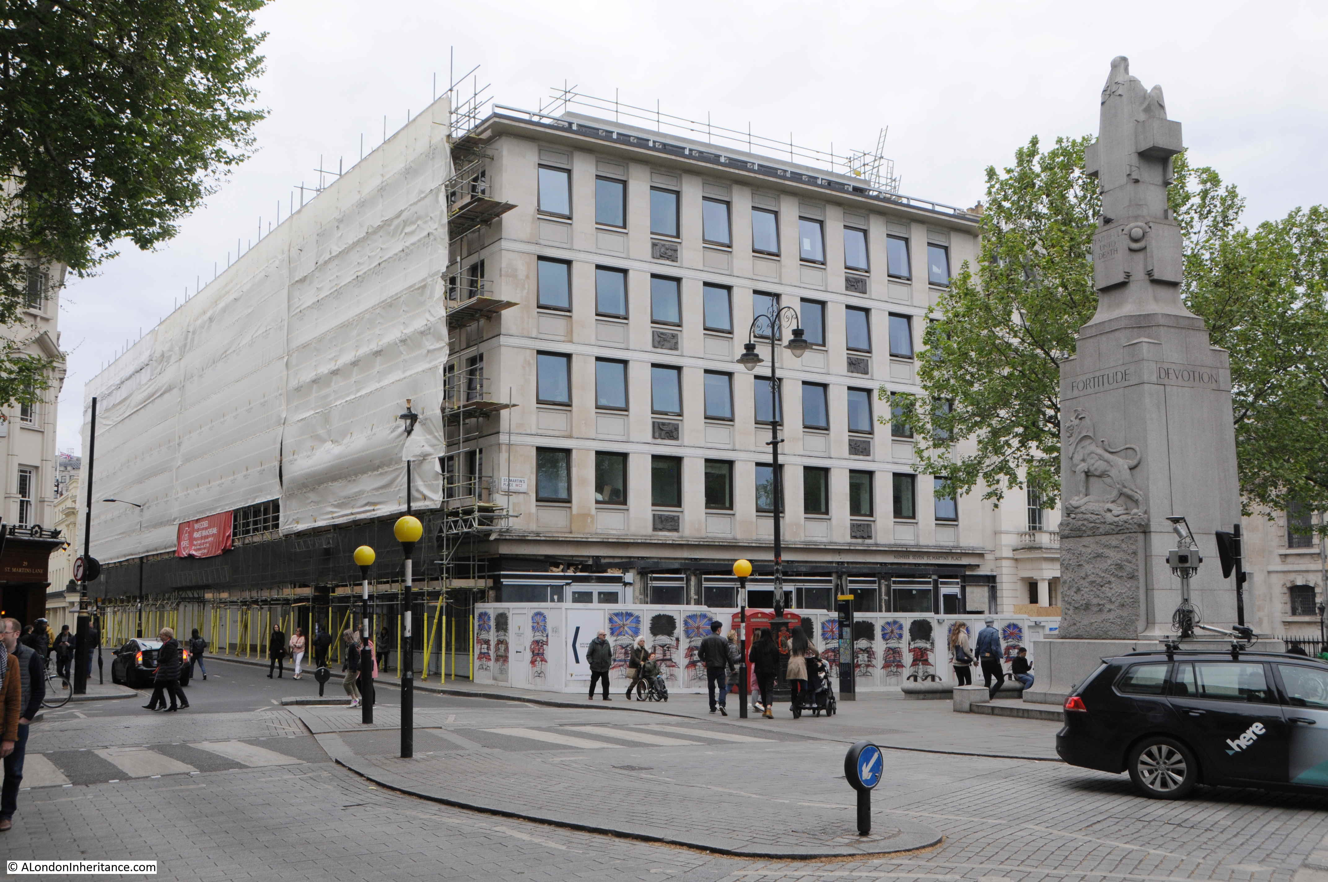
In this week’s post, I am exploring the church of St Martin in the Fields, and also at the end of the post I have my first Sunday of the month feature on Resources, where I look at some of the resources available to help explore the history of London. In this months Resources, I am looking at a source of Historical maps of Southwark (and the rest of London) and a series of maps showing the boundaries of Wards of the City of London..

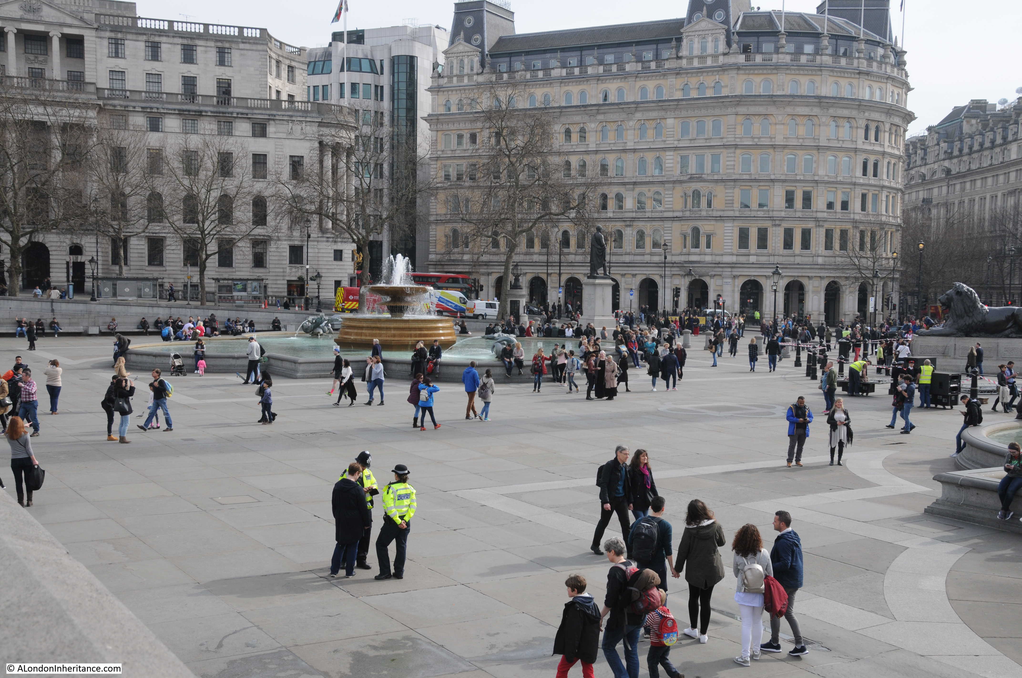
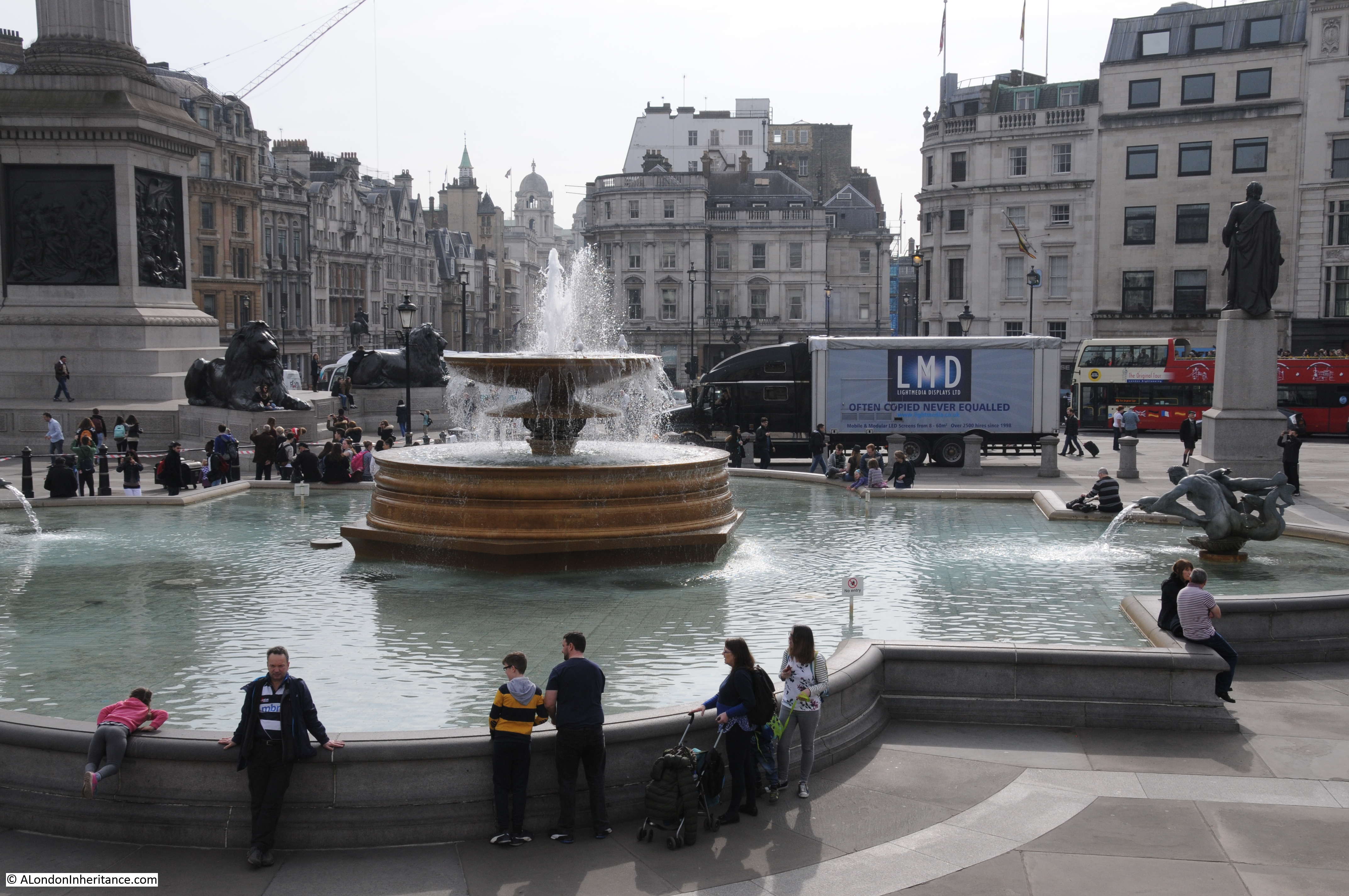
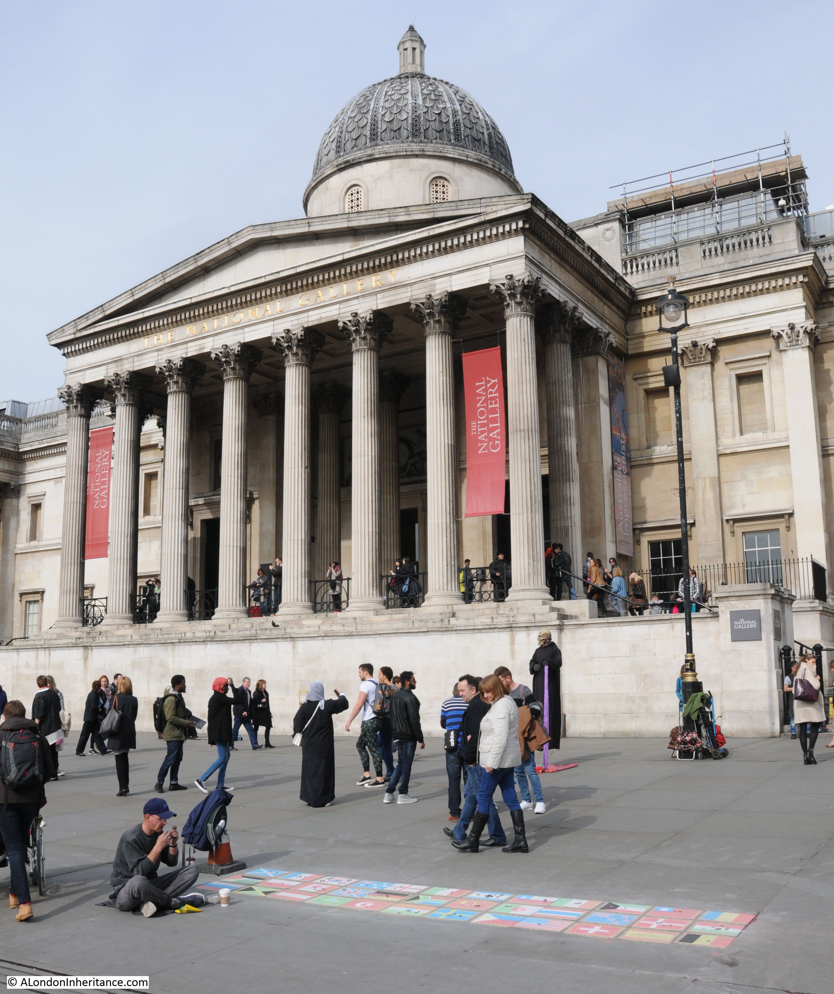
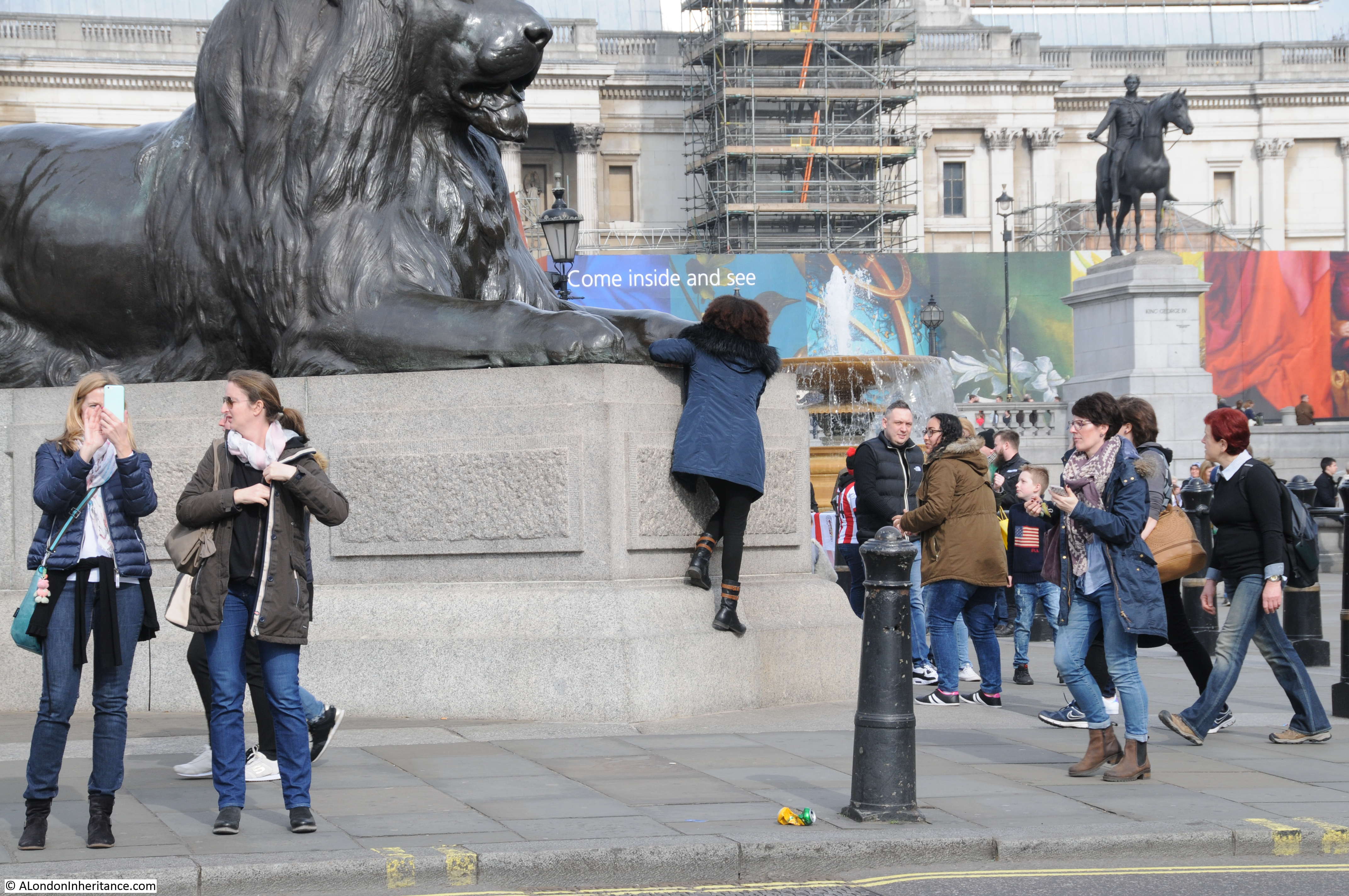
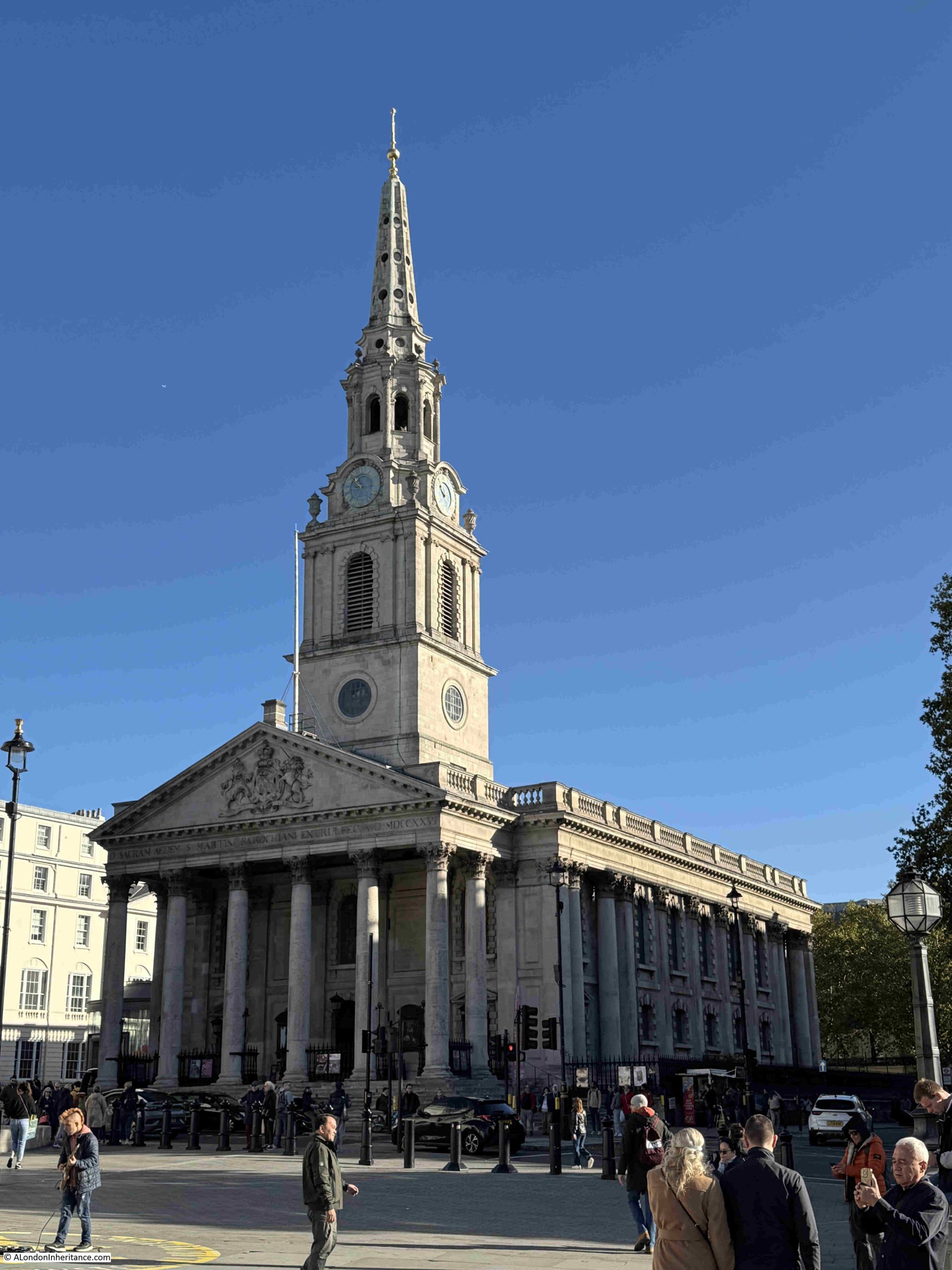
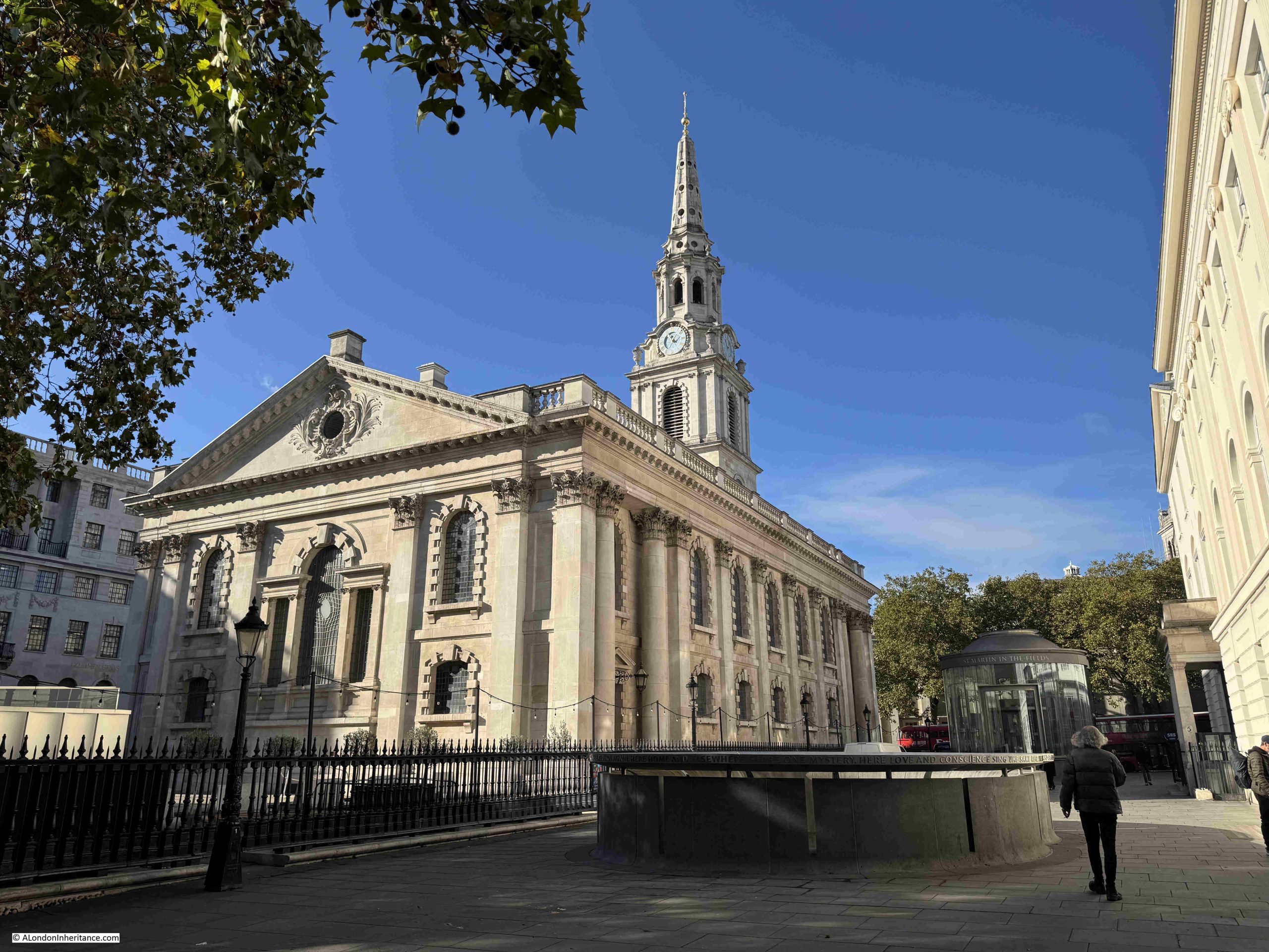
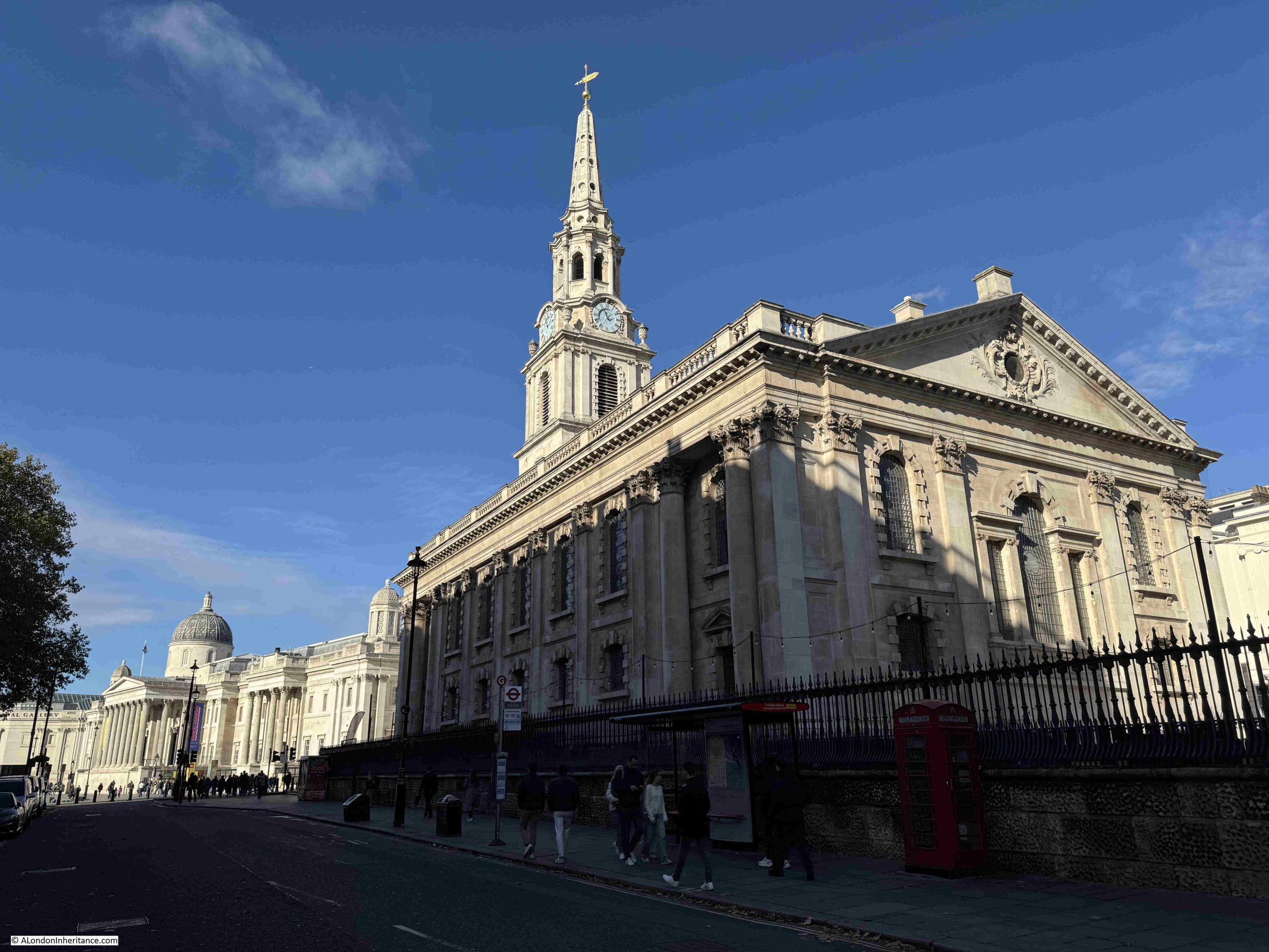
But first, St Martin in the Fields, a very prominent church on Charing Cross Road and at the north eastern edge of Trafalgar Square, with the prominent tower and steeple looking out over the square and the National Gallery:

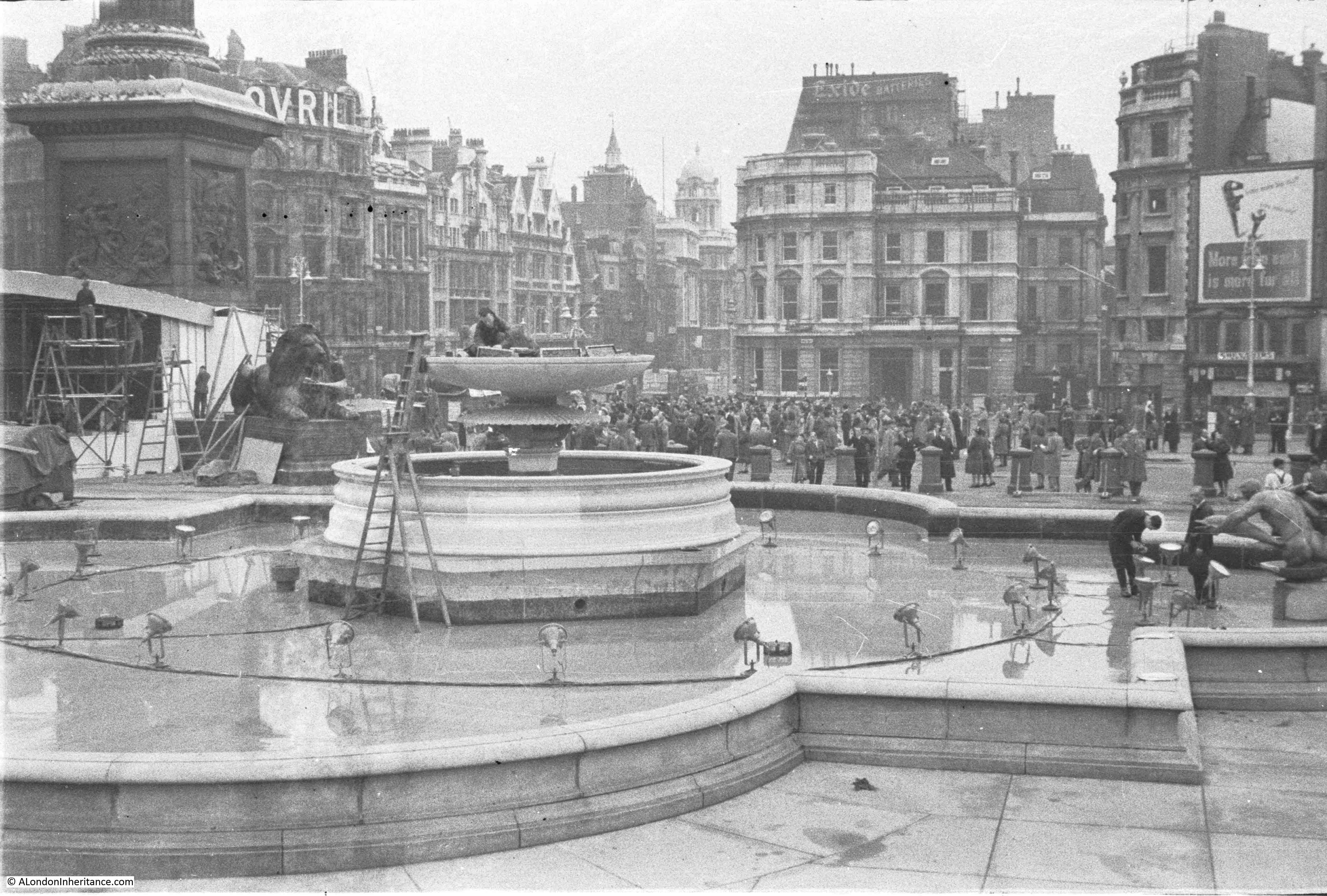
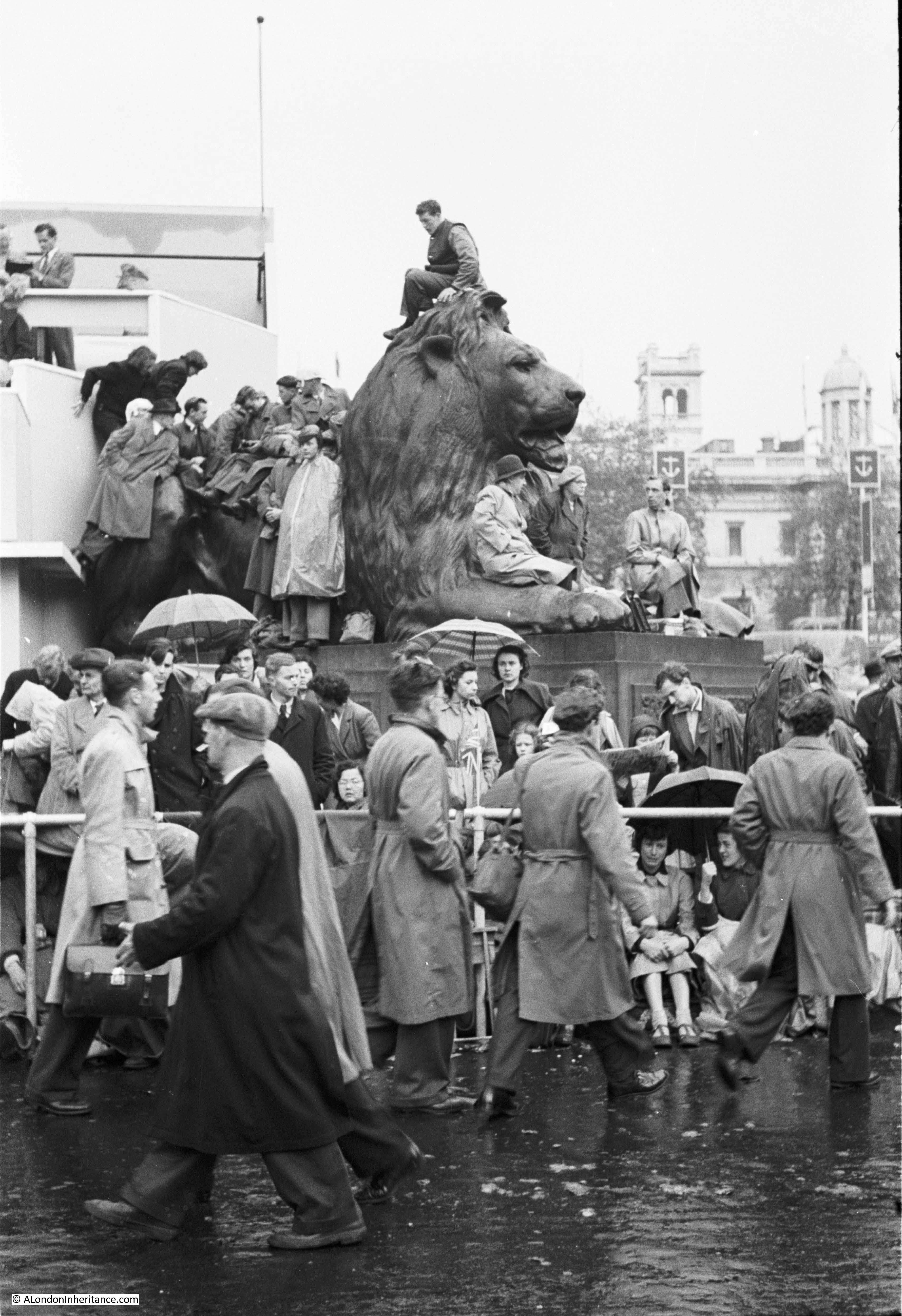
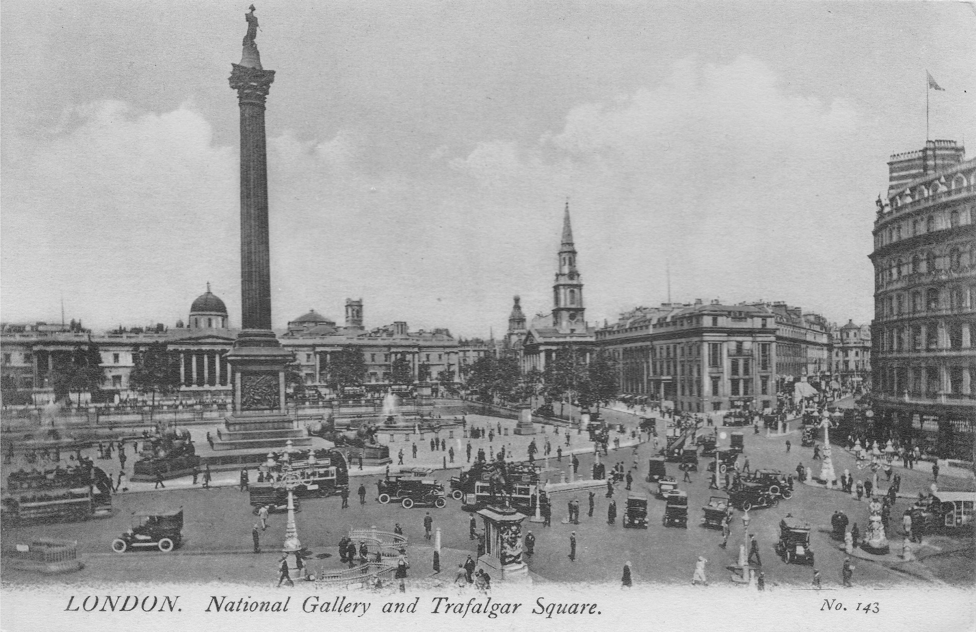
A similar, but very moody view of the church through a Trafalgar Square fountain in the 1920s:

The St Martin in the Fields that we see today was designed by James Gibbs and completed in 1726:

The current church was built on the site of a much earlier mediaeval church, with the first mention of the church dating back to 1222, when it would have been mainly surrounded by fields, although just to the south was the important road running from the City to Westminster and the small village of Charing.

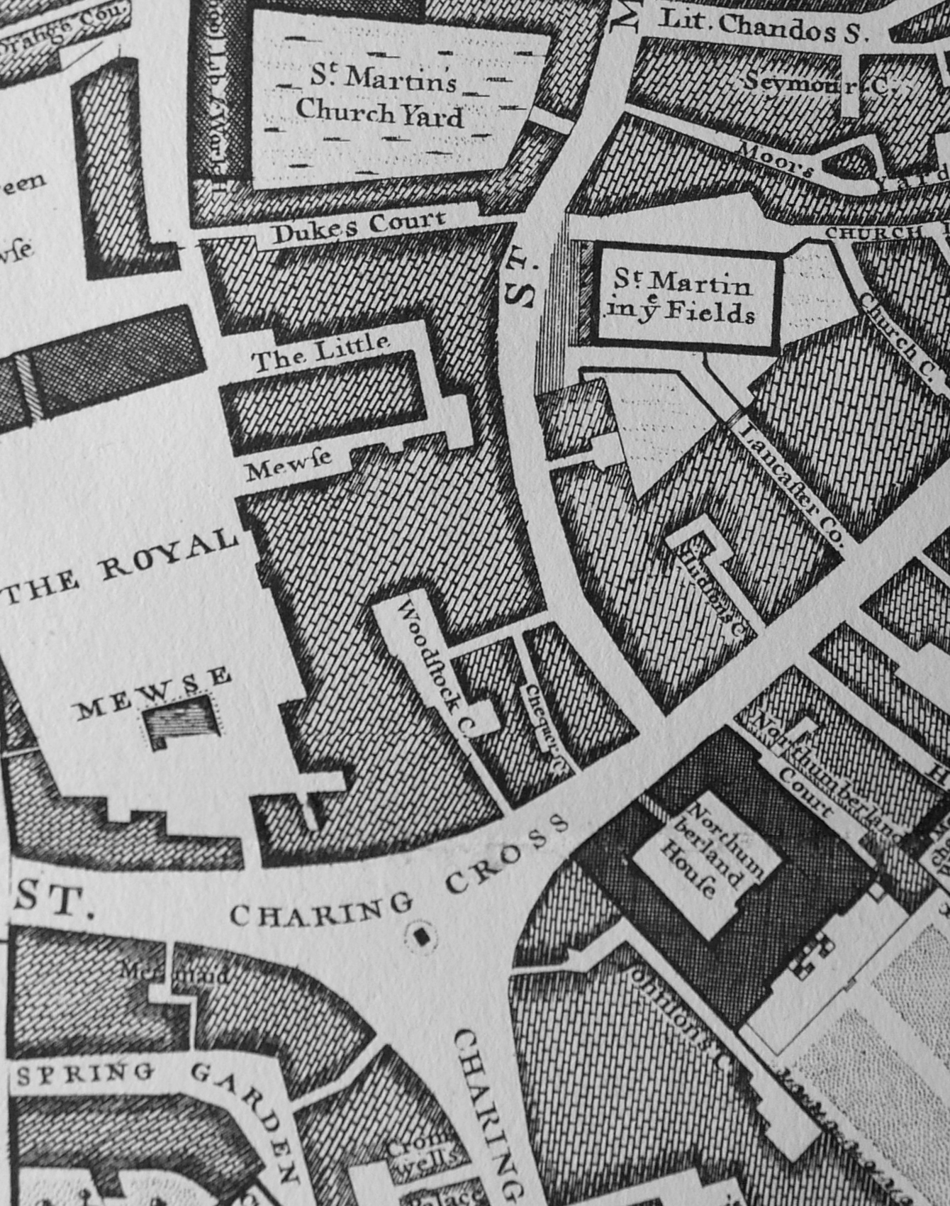
We can see the original church in Morgan’s 1682 map of London, by which time most of the surrounding area had been transformed from fields to streets:

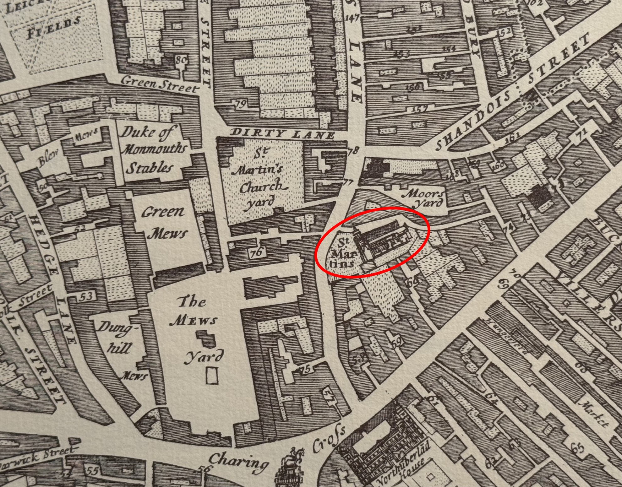
The Mews Yard and St Martin’s Church Yard are where Trafalgar Square and the National Gallery are today.

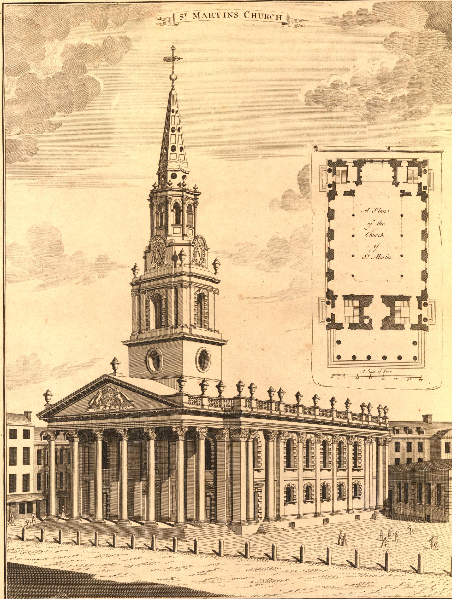
A plan of the mediaeval church was produced shortly before it was demolished. The plan shows a relatively small, simple church with a length of 84 feet, width of 62 feet, height of 25 feet and a 90 foot high steeple which contained 6 bells  (© The Trustees of the British Museum. Shared under a Creative Commons Attribution-NonCommercial-ShareAlike 4.0 International (CC BY-NC-SA 4.0) licence.):

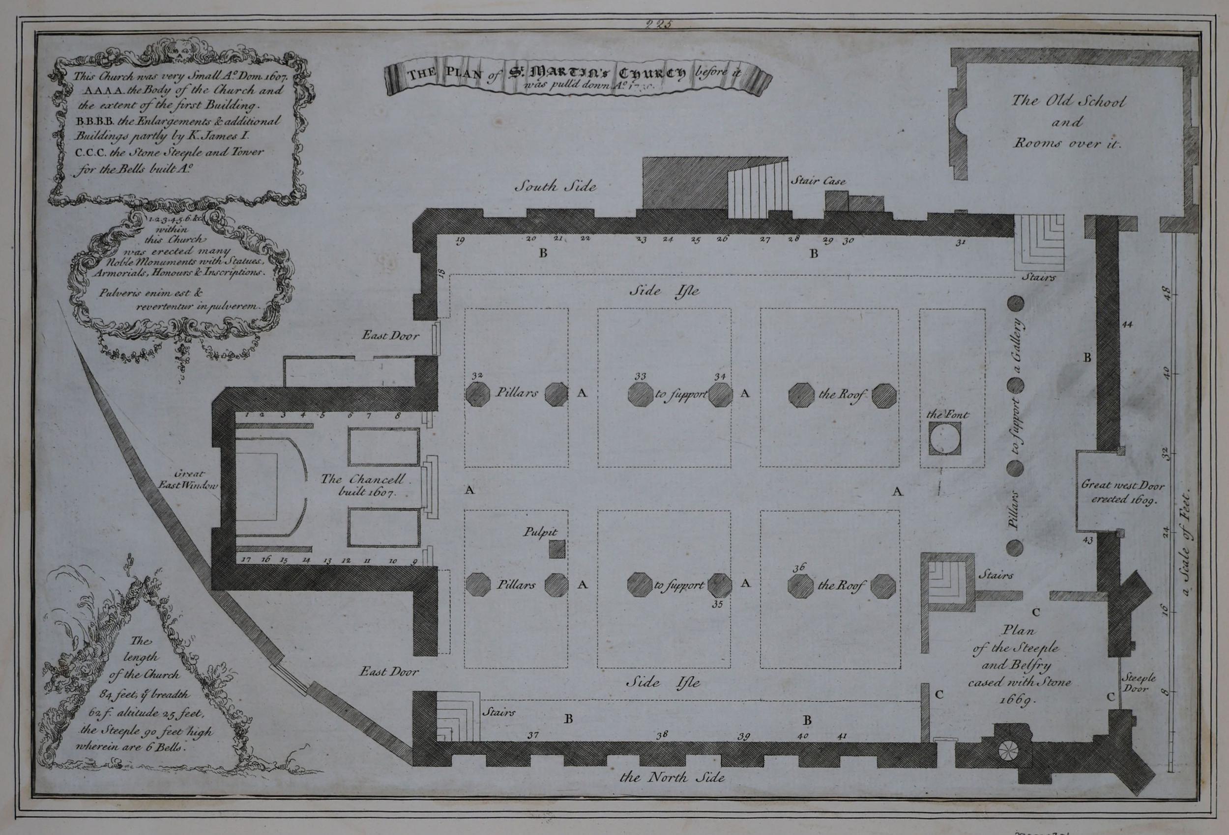
The church had been extended in the 17th century with the Chancel to the left added in 1607, and the steeple and belfry being cased in stone in 1669, so it was a smaller building prior to the 17th century.

At upper right is marked a school room with rooms above.

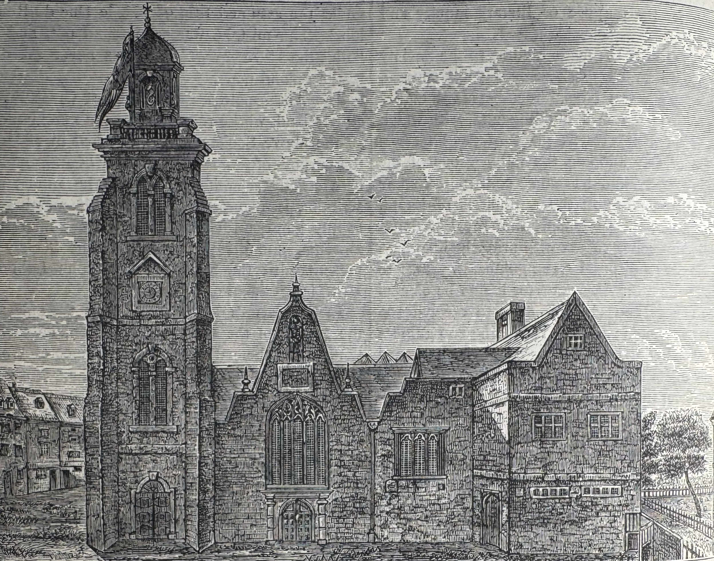
Old and New London by Edward Walford includes a drawing of the west view of the church, as it appeared before demolition. The view matches the above plan, with the tower on the left corner, and the school room and rooms above on the right, extending from the side and front of the church:

As with so many medieval churches across London, by the early 18th century St Martin in the Fields was in a very poor condition. A survey of the church identified that the decayed walls made mainly of rubble, had been spread out by the weight of the roof, and the fabric of the church was unable to continue providing sufficient support.

A new church was needed, and as the church was now serving a large, built up area, rather than a small village with surrounding fields, an impressive and larger church was required.

A new church was included in the 1715 list of “Fifty New Churches”, however there was very little progress, and the majority of the fifty churches would not be built due to cost.

The Church Vestry petitioned Parliament and in 1717 an Act was passed to rebuild St Martin, with the costs being covered by the inhabitants of the parish.

Designs for a new church were requested from architects of the day, and George Sampson, Sir James Thornhill, John James, Nicholas Dubois and James Gibbs submitted plans in 1720.

James Gibbs design was chosen, the old church was demolished between April 1722 and January 1723, and construction of the new church commenced.

James Gibbs plans went through a number of iterations. His first plan for the new St Martin’s was for a round church with a large dome – almost a mini version of St Paul’s. There were issues with the overall size of the plot, the need to house memorials from the old church, provision of a temporary site of prayer during construction, the encroachment of nearby houses etc.

Gibbs came up with a final design which addressed these issues, as well as the costs of a large, domed church, and produced a more traditional rectangular design in early 1721.

Minor design changes continued during the construction process, although a major change was made in 1722 to “increase the breadth of the portico”, a change that would result in the impressive front and entrance to the church that we see today, and which brough the front and the steps up to the church, up to the edge of St Martin’s Lane.

In the spring of 1724, the core of the church, consisting of brick and Portland stone, had been completed and construction moved on to the fitting out of the new church with carpenters, plasters, plumbers etc. submitting proposals for how this would be completed. This work included cast iron railings to surround the churchyard.

The total cost for the new church was £22,497.

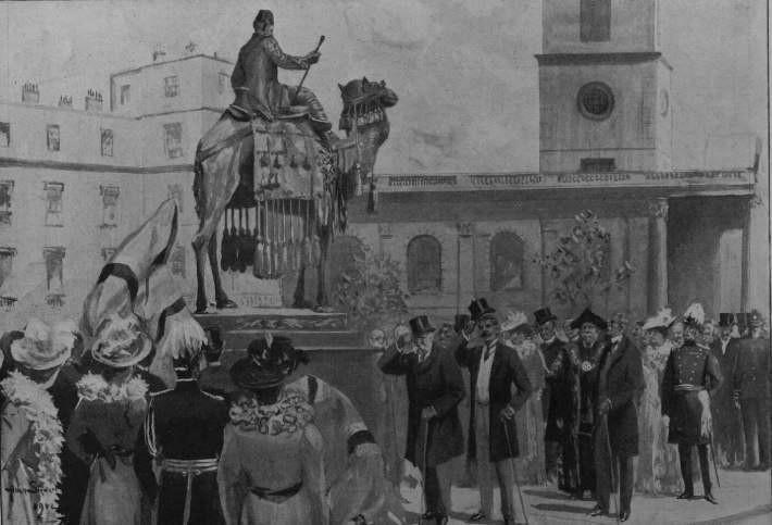
A rather strange event was held to celebrate the completion of the new St Martin in the Fields. Tomas Cadman, who was known as the Italian Flyer, descended head first along a rope stretched from the top of the steeple to the Royal Mews opposite.

The new St Martin in the Fields not long after completion, as shown in a print dating from 1754  (© The Trustees of the British Museum. Shared under a Creative Commons Attribution-NonCommercial-ShareAlike 4.0 International (CC BY-NC-SA 4.0) licence.):

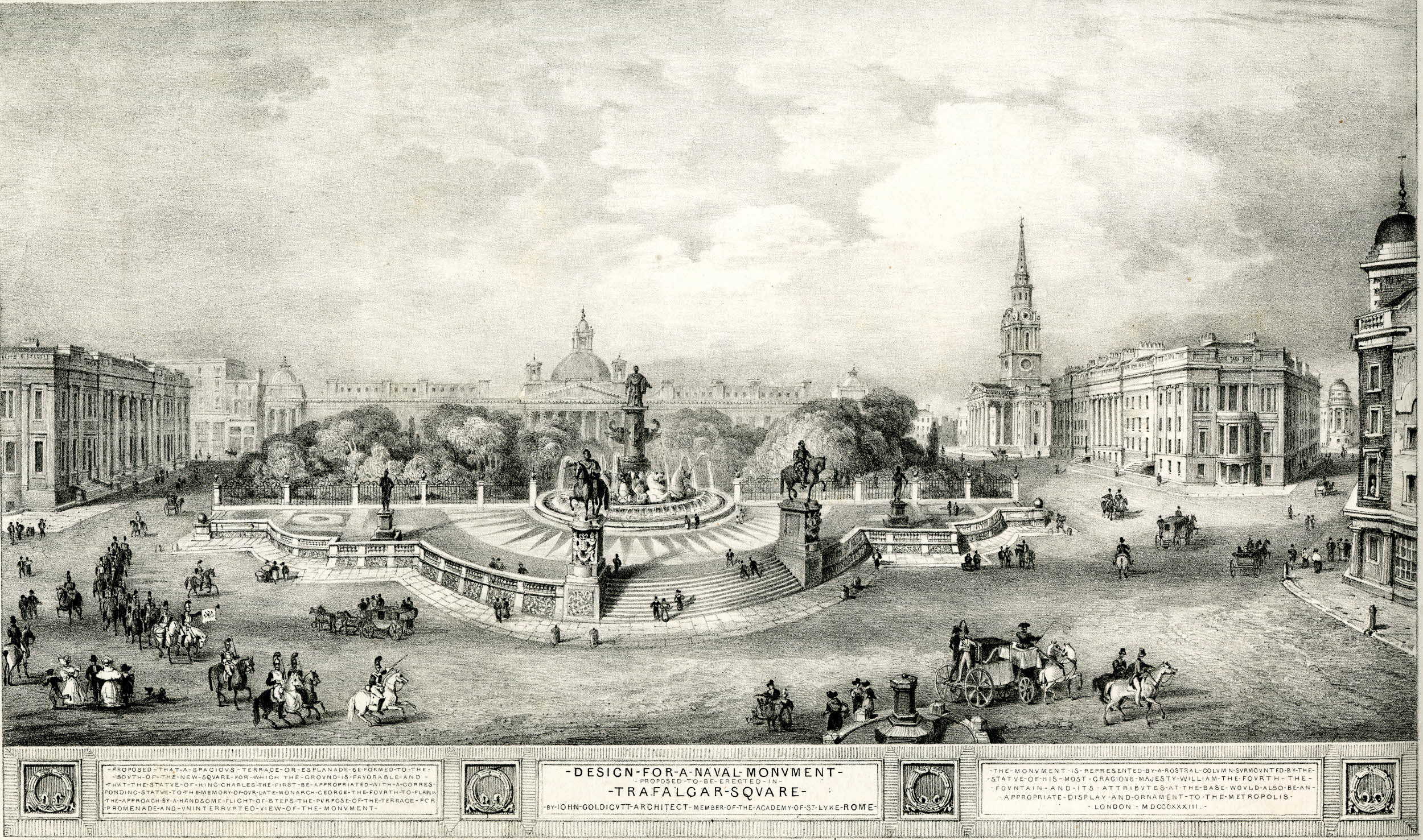
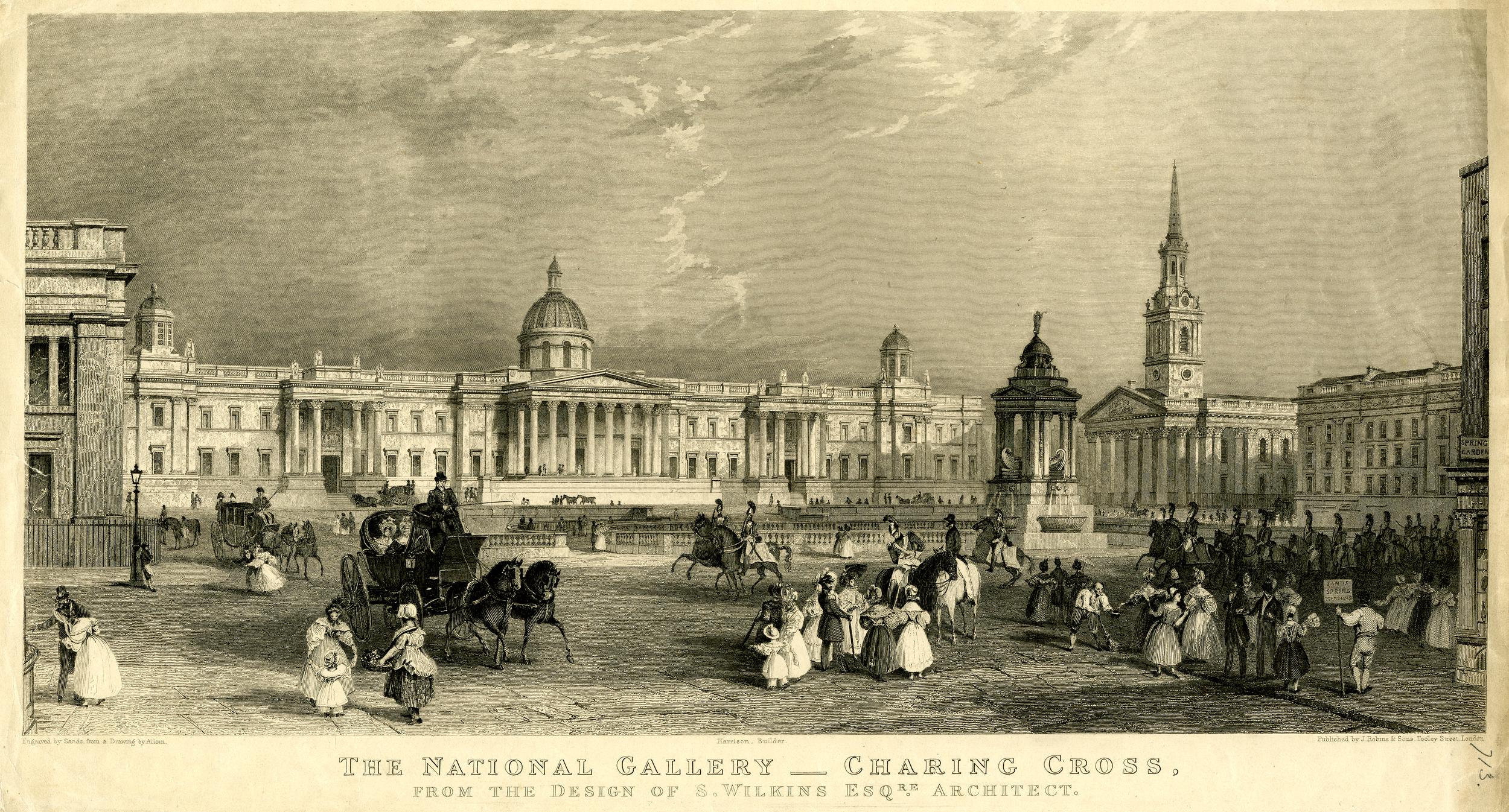
The new church when built looked across to the Royal Mews, however after the construction of Trafalgar Square, the church took on a whole new status as a key landmark at the north east corner of Trafalgar Square, as seen in this 1836 print  (© The Trustees of the British Museum. Shared under a Creative Commons Attribution-NonCommercial-ShareAlike 4.0 International (CC BY-NC-SA 4.0) licence.):

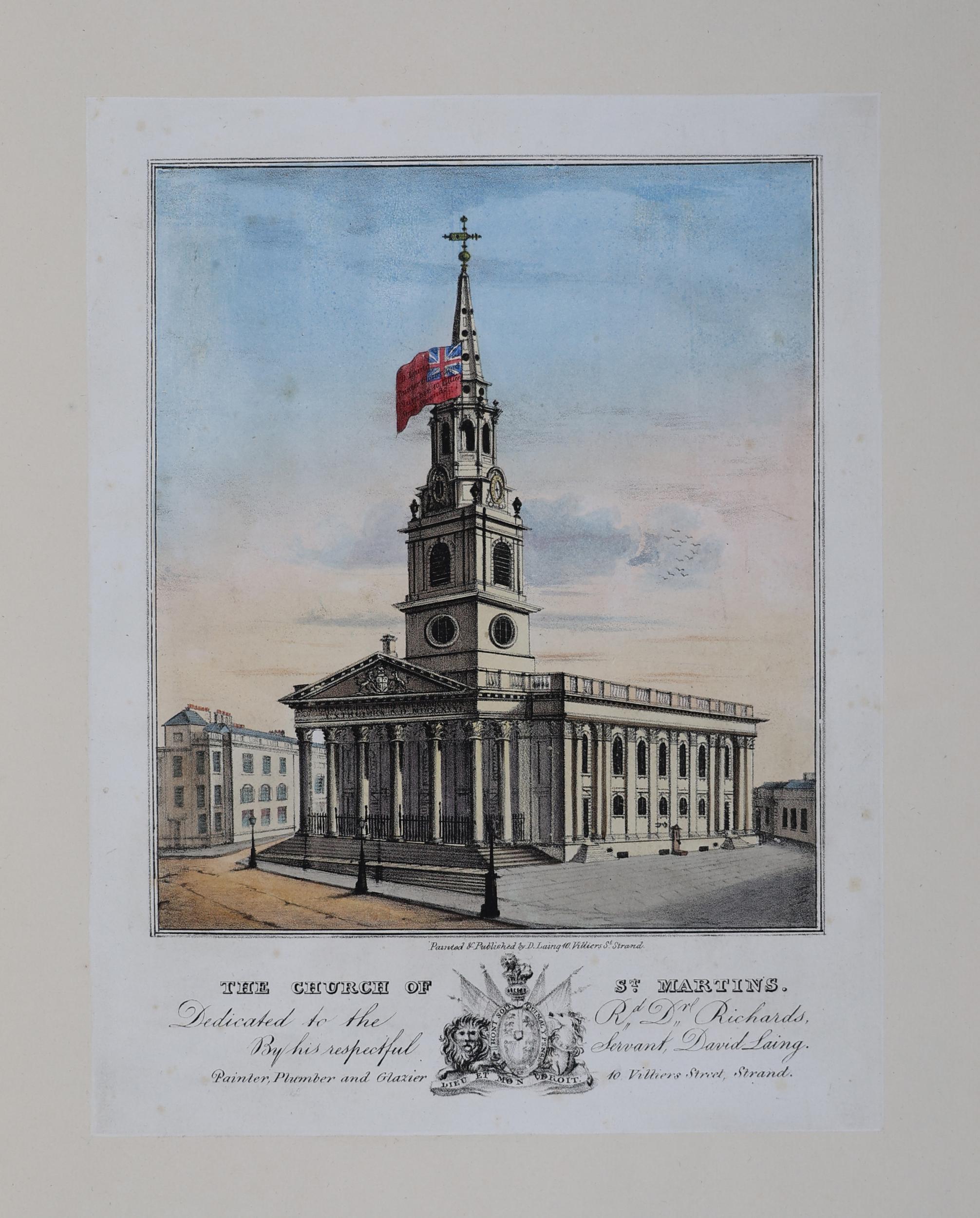
One print of the church shows a large flag being displayed alongside the steeple. Flag flying from churches seems to have been a common event in the 18th and 19th centuries, and a news paper report from the 4th of June 1726 reads that “The Right Hon. The Lords of the Admiralty have made a present to the Parish of St Martin in the Fields of the Royal Standard, who have a right, it being his Majesty’s Parish, to put out the Ensign (upon all days that flags are put out) upon their Church” – although the flag in the print is not the Royal Standard  (© The Trustees of the British Museum. Shared under a Creative Commons Attribution-NonCommercial-ShareAlike 4.0 International (CC BY-NC-SA 4.0) licence.):

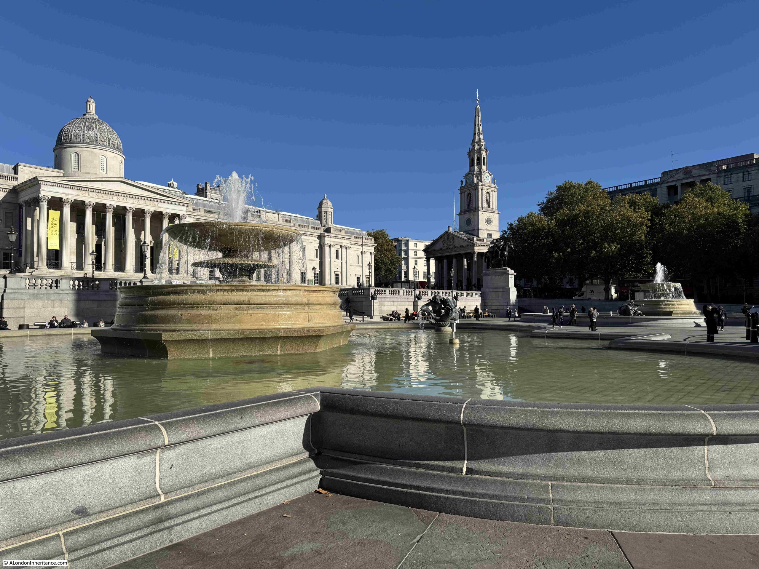
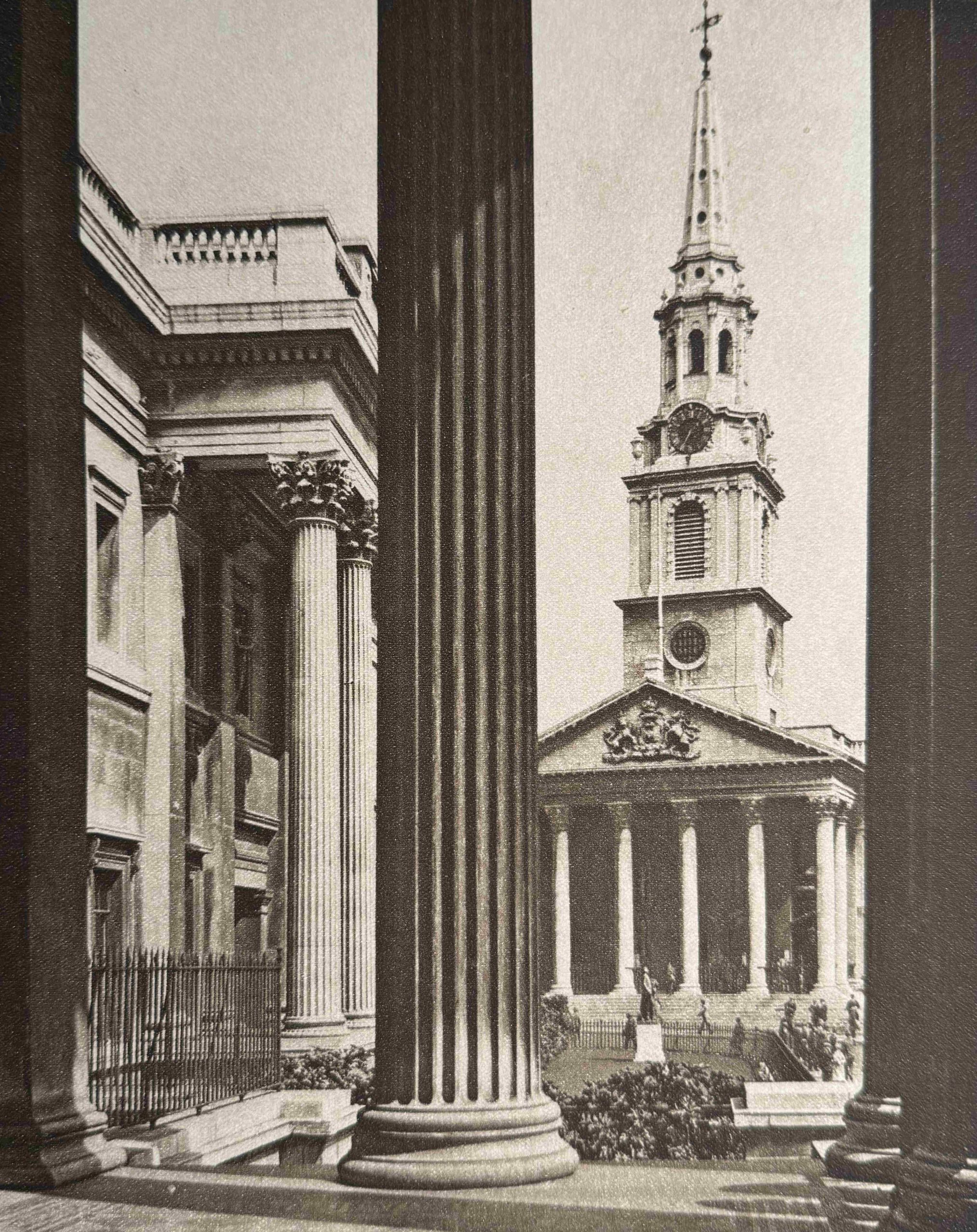
A 1920s view looking across to St Martin in the Fields from the National Gallery:

It is difficult to photograph the interior of the church as there are very many services, musical events and rehearsals, and when these take place there are signs up saying absolutely no photography.

On my fifth recent visit, I did find a time when there were nothing was happening, so managed to get the following photo of the interior of the church:

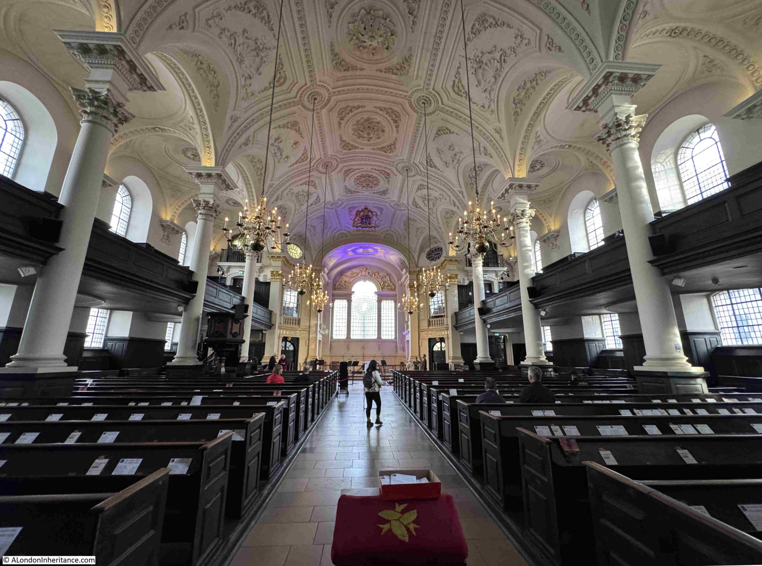
The large number of side windows on two levels provide a significant amount of natural light into the church, and the white of the roof, walls and pillars contrasts nicely with the dark wood of the pews and the balcony seating along the side walls.

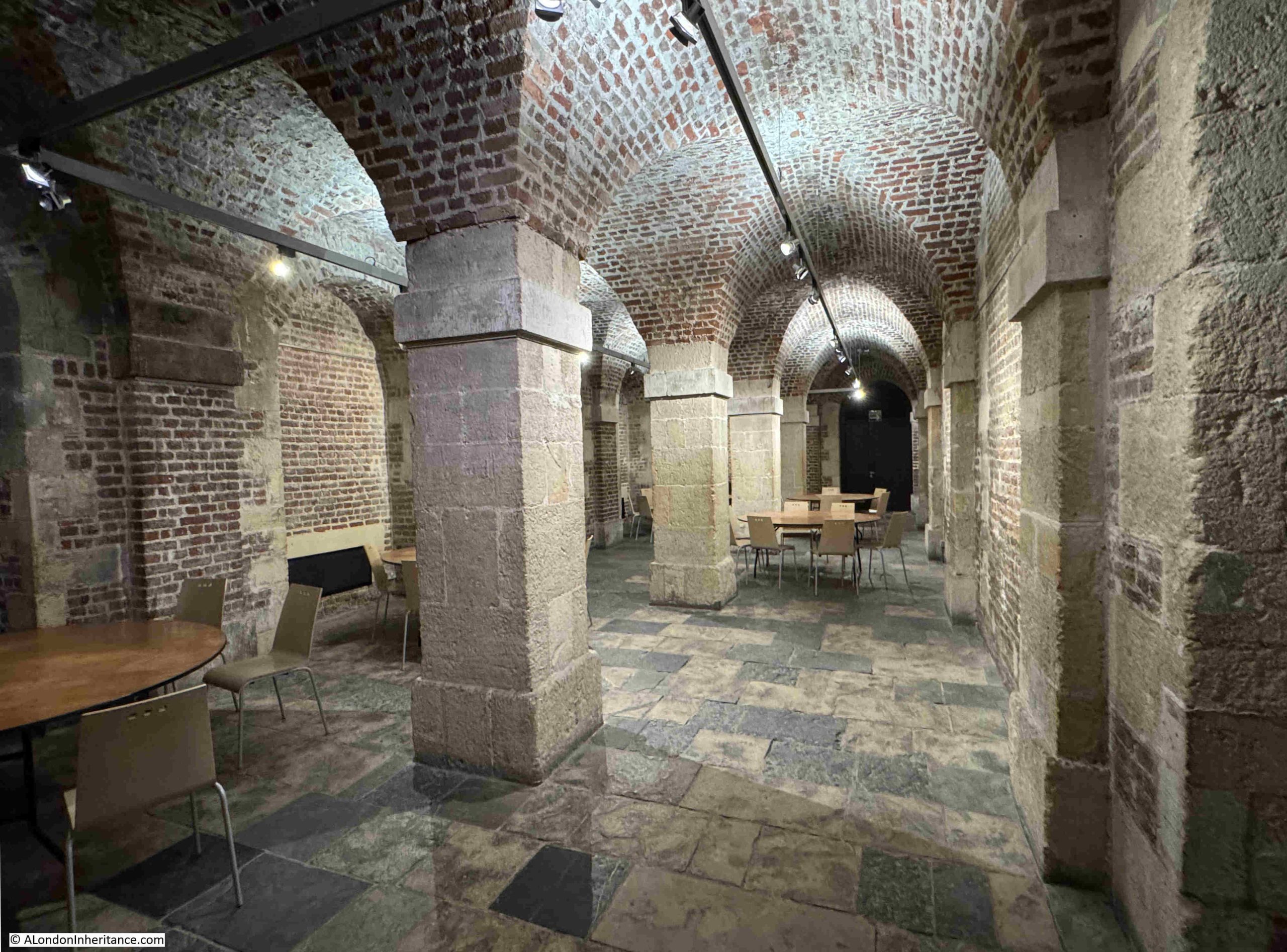
In the above photograph, there are none of the traditional monuments and plaques that we would normally expect to see on the side walls of the church. For these we have to go below ground to visit the magnificent crypt:

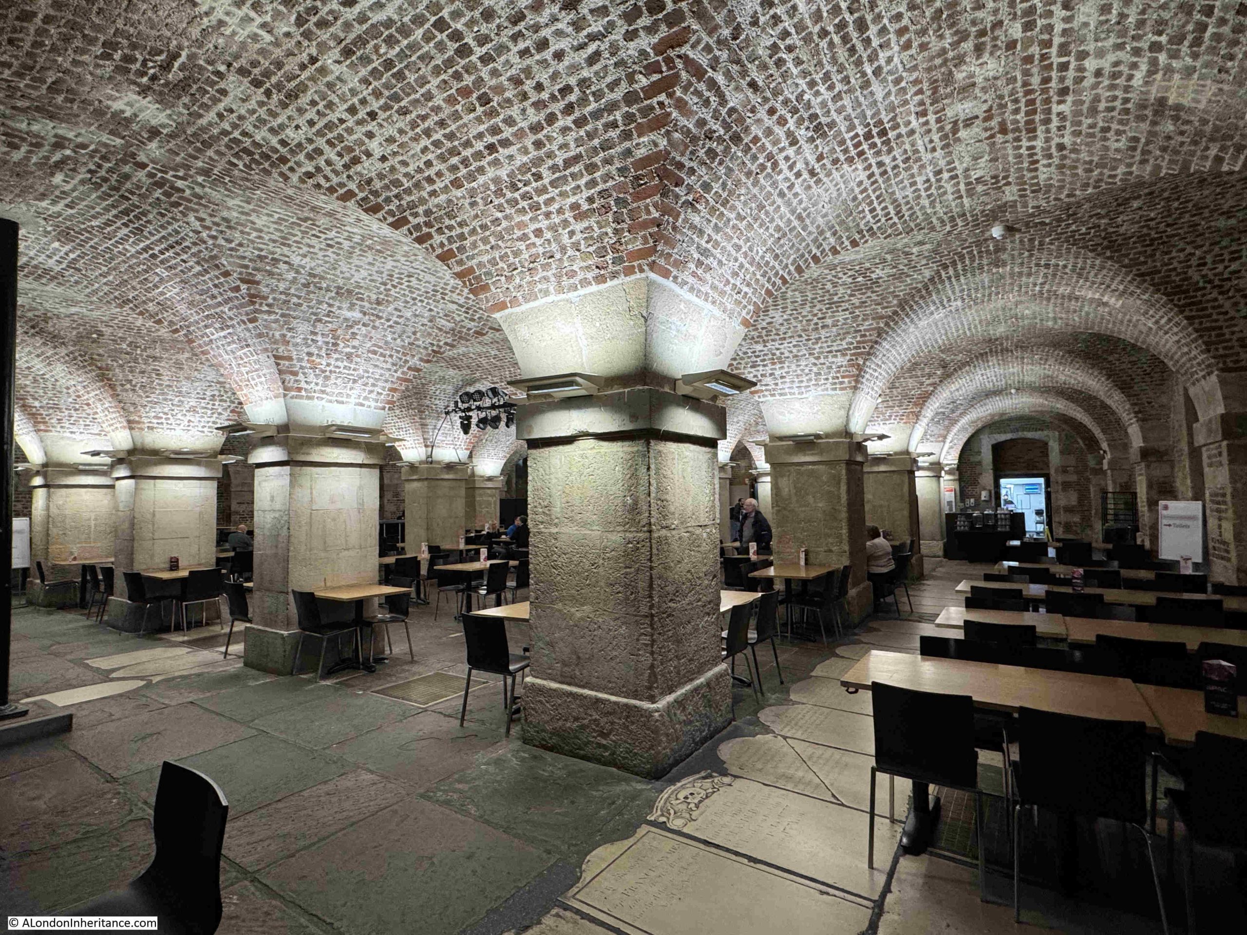
Originally the crypt was a place of burials, but was cleared to make a large space, which is now used for a café and event space. I will come onto the burials and crypts later in the post.

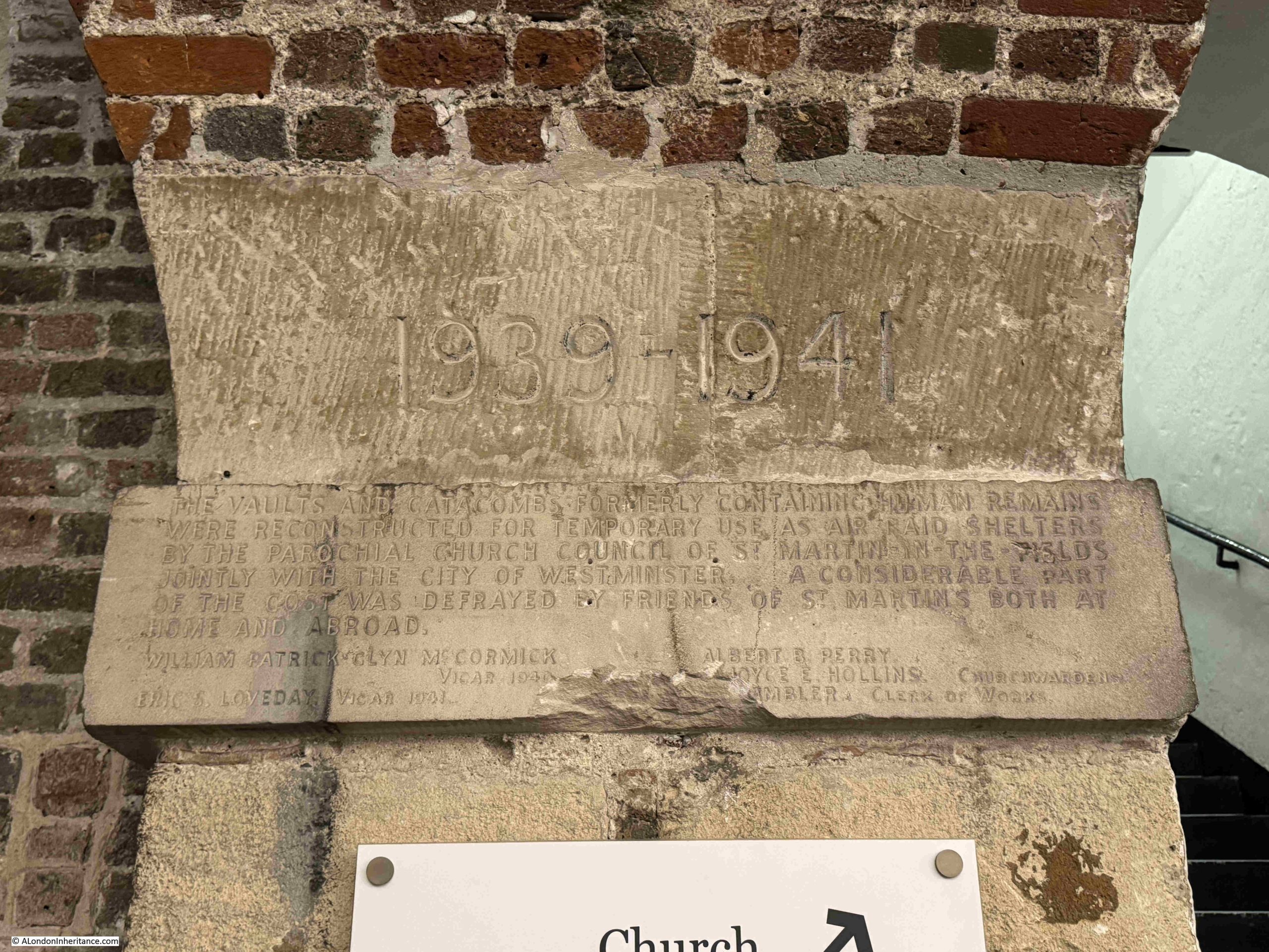
A carved sign on one of the pillars reads “The vaults and catacombs formerly containing human remains were reconstructed for temporary use as air raid shelters by the parochial church council of St Martin in the Fields jointly with the City of Westminster. A considerable part of the cost was defrayed by friends of St Martin’s both at home and abroad”:

The crypt was also used to provide refreshments to service personnel during the war. As the following from the 10th of May 1940 highlights “A team of Boys Brigade men are undertaking in turn night duty at the Services Canteen in the crypt of St Martin in the Fields Church in Trafalgar Square. Some of those who have been helping out in this way since the outbreak of war have now joined the forces themselves and there are vacancies for more Boys Brigade officers who could give an occasional night to attend to the needs of the soldiers, sailors and airmen who throng St Martins. The hours of duty are from 10 p.m. to 6 a.m. and one’s turn comes about once a month”.

The church did suffer some bomb damage in November 1940.

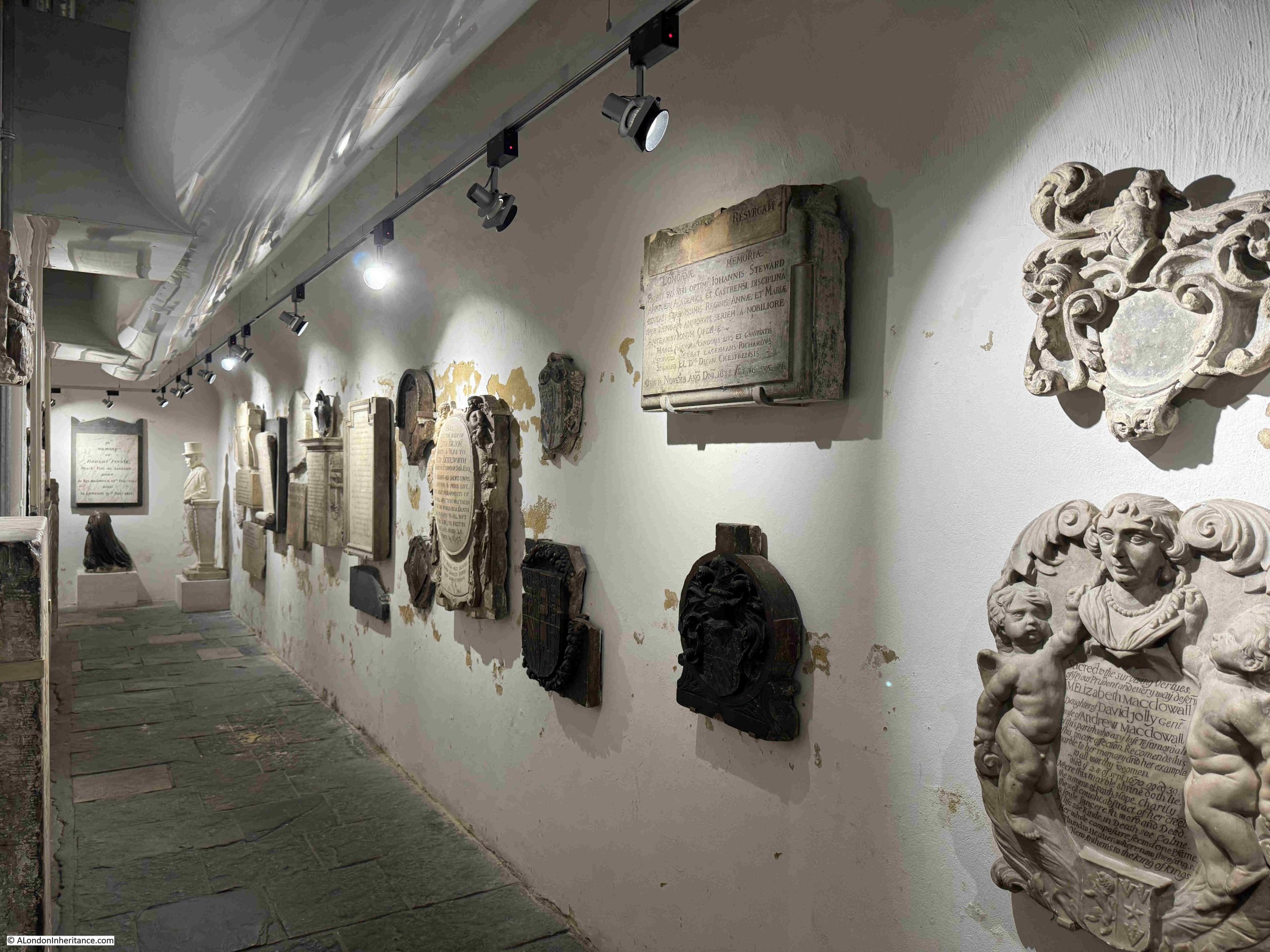
Towards the front of the church is a small space:

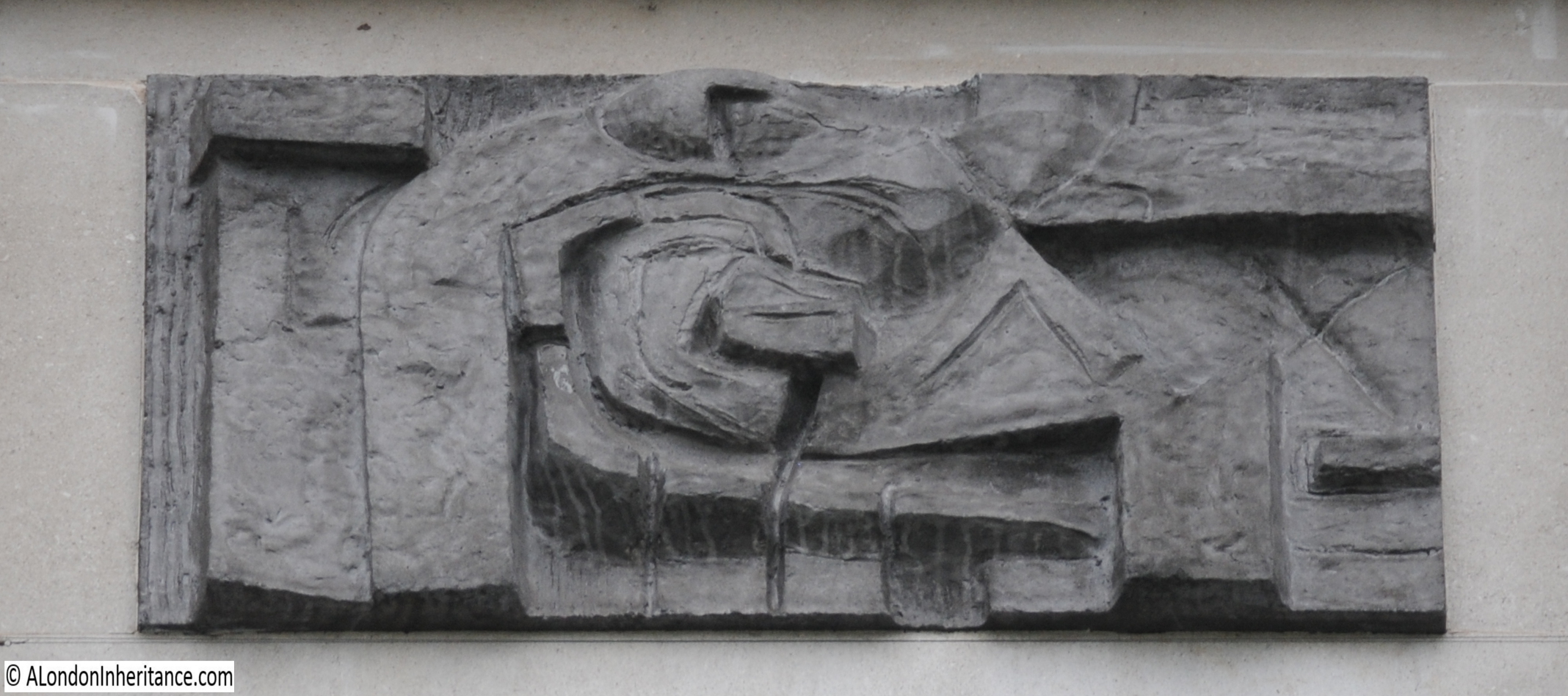
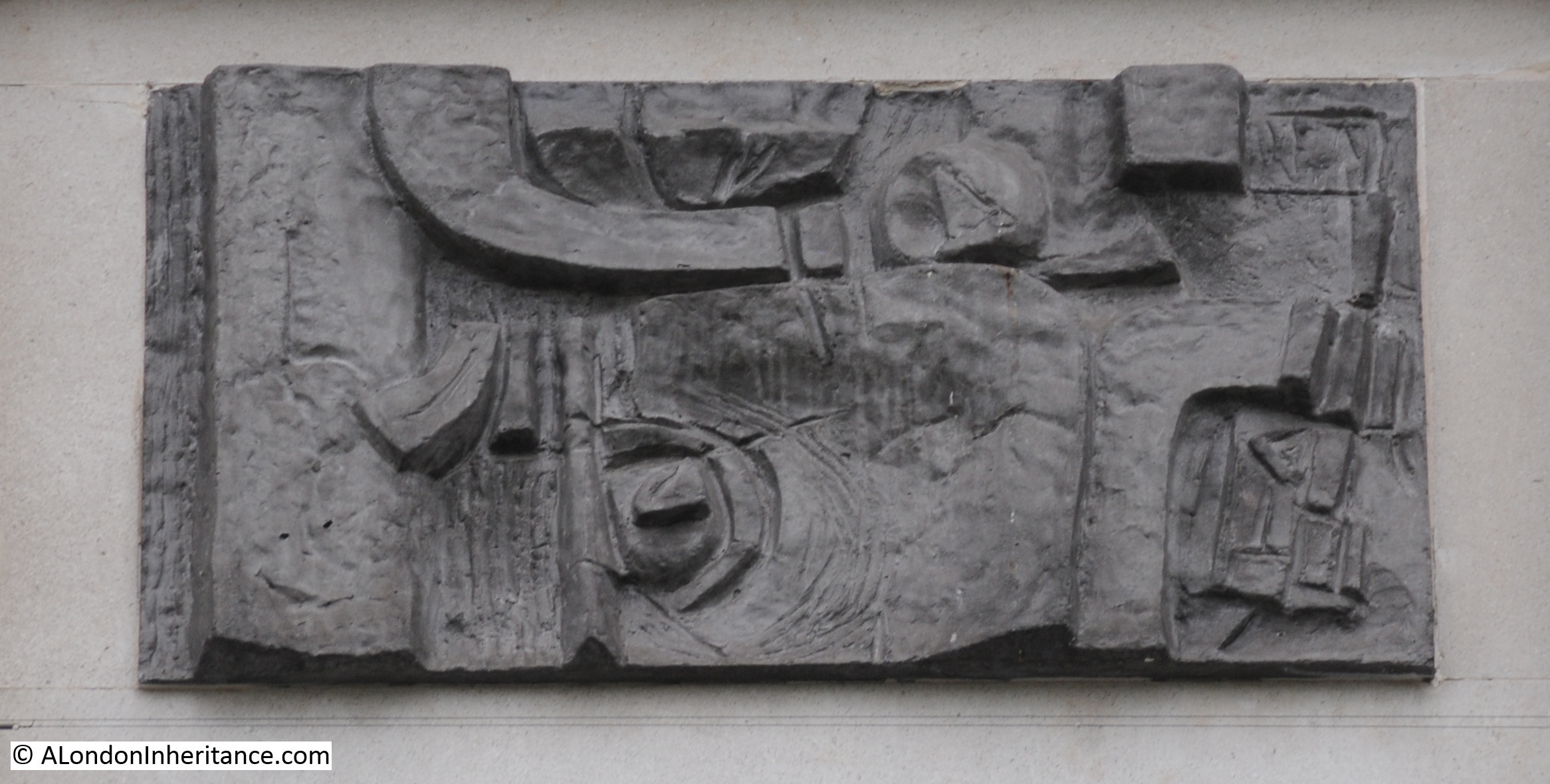
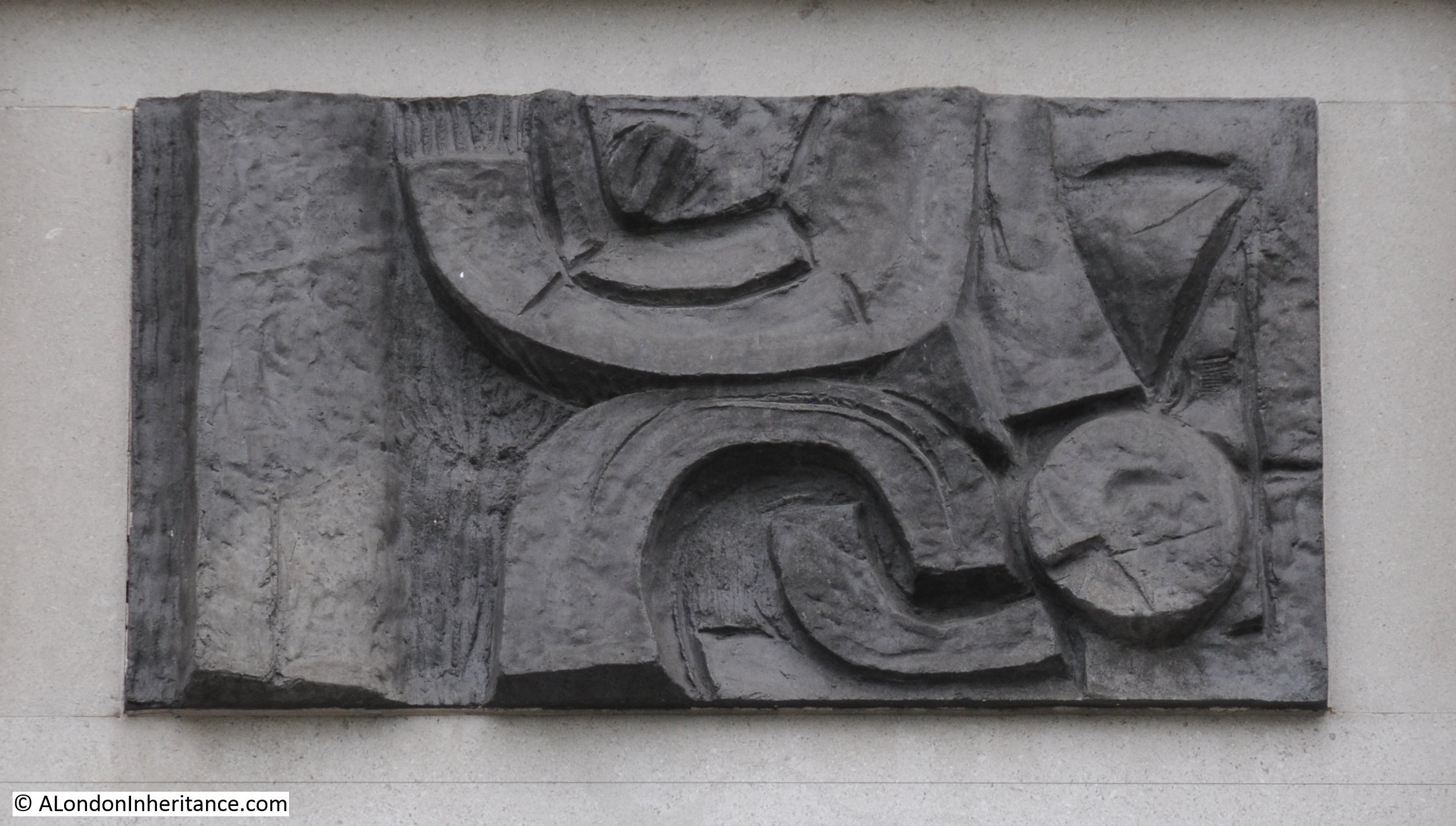
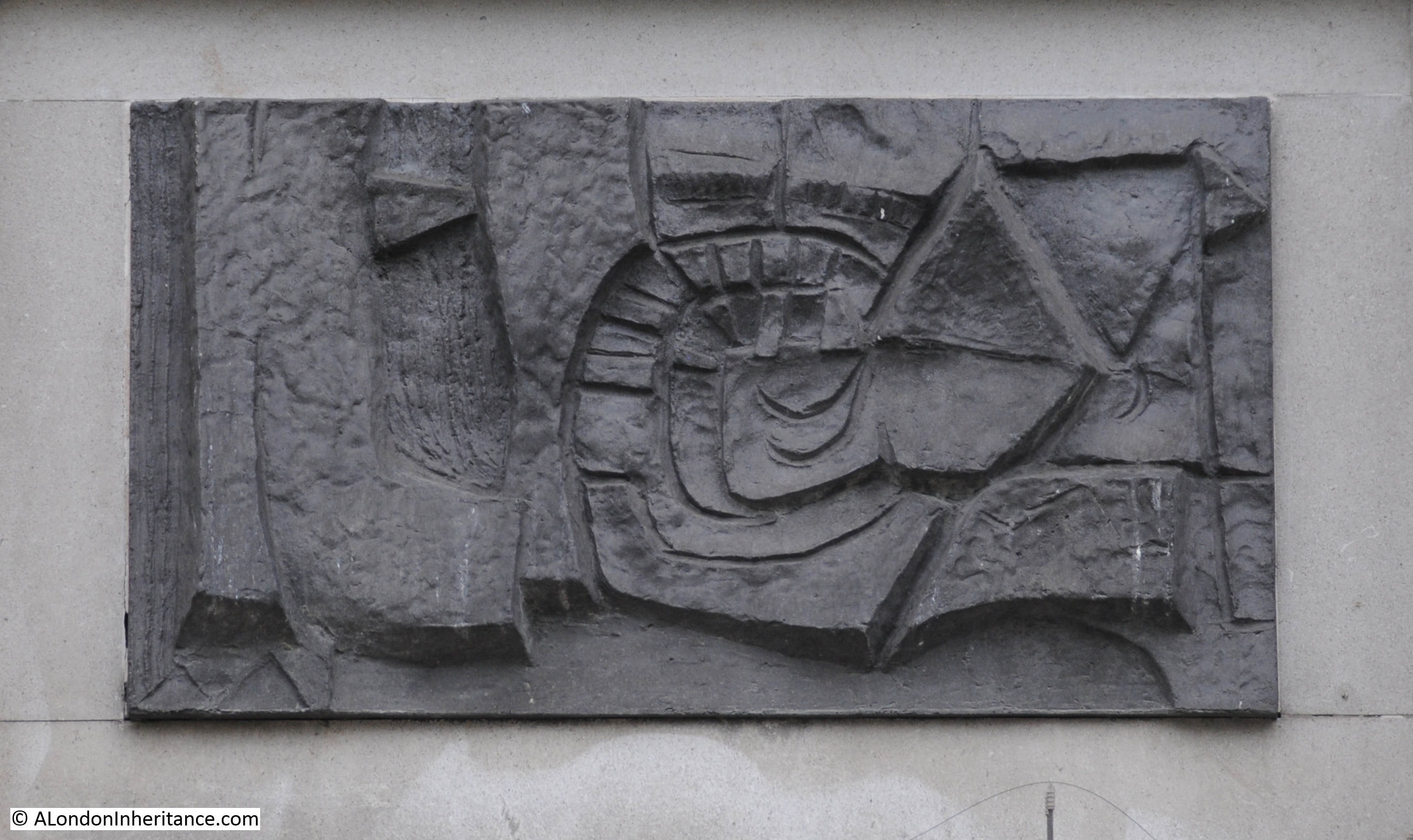
And to the side of this space, there is a corridor which contains many of the memorials and monuments that were once found across the church, many of which must come from the original church as they predate the current St Martin’s:

The memorial to Benjamin Colinge who died on the 2nd of December 1700, and who worked in the Royal Household from the Restoration until 1697:

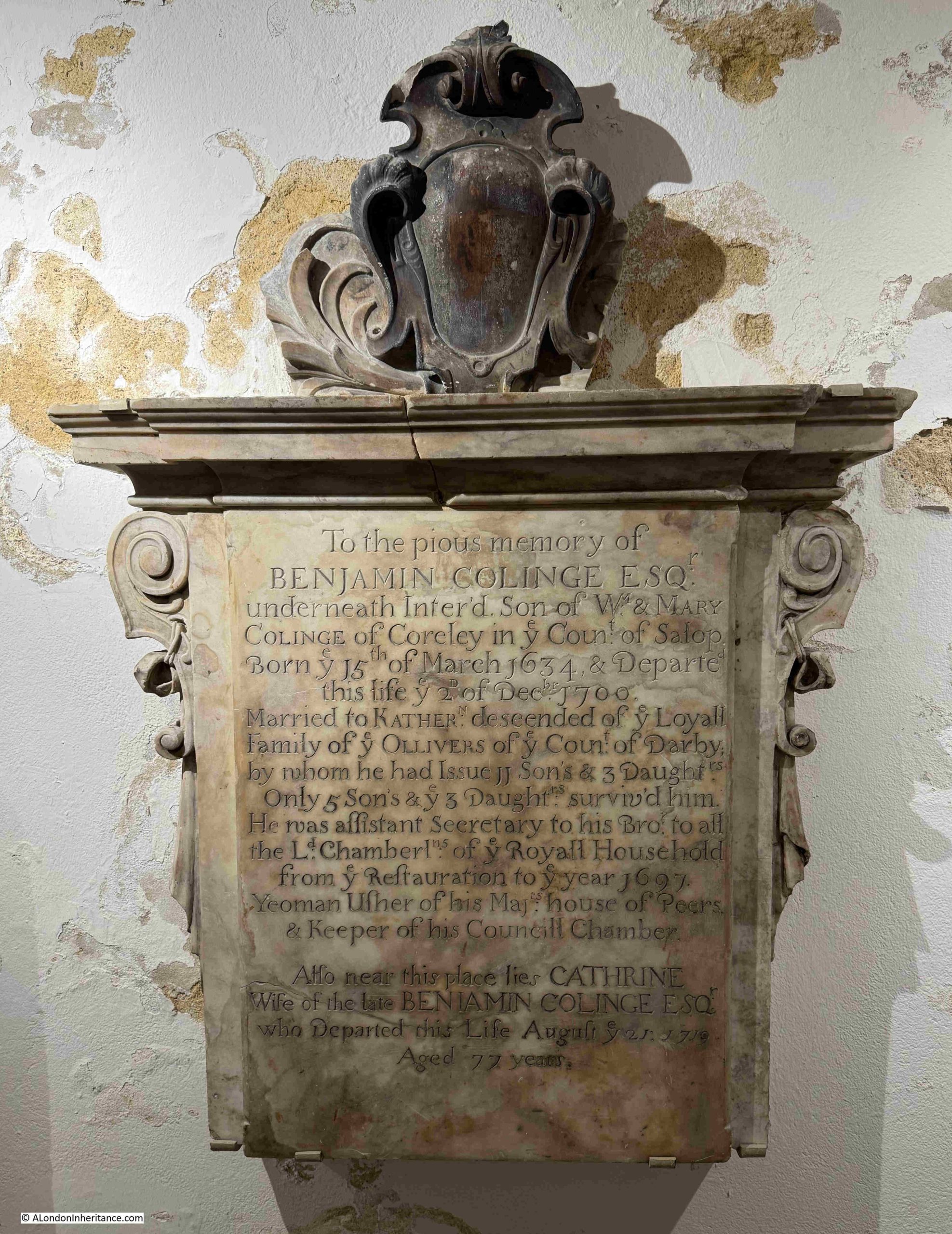
With his wife Katherine (also spelt Catherine on the same memorial). They had 11 sons and 3 daughters, of which only 5 sons and 3 daughters survived their father. Katherine lived to the age of 77 – quite an achievement in the late 17th / early 18th century after having a total of 14 children.

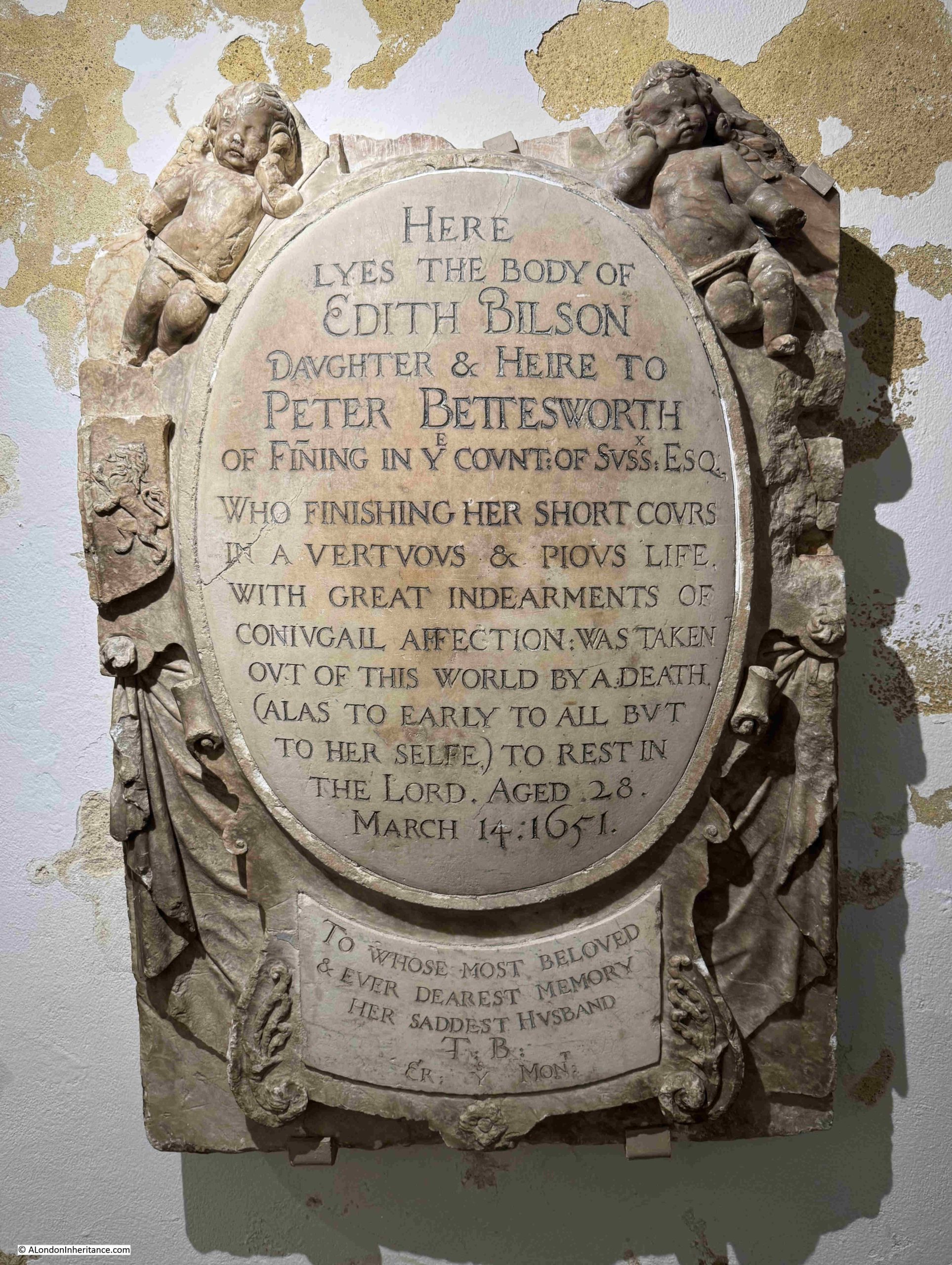
To the Pious Memory of Edith Bilson who died on the 14th of March 1651, aged 28:

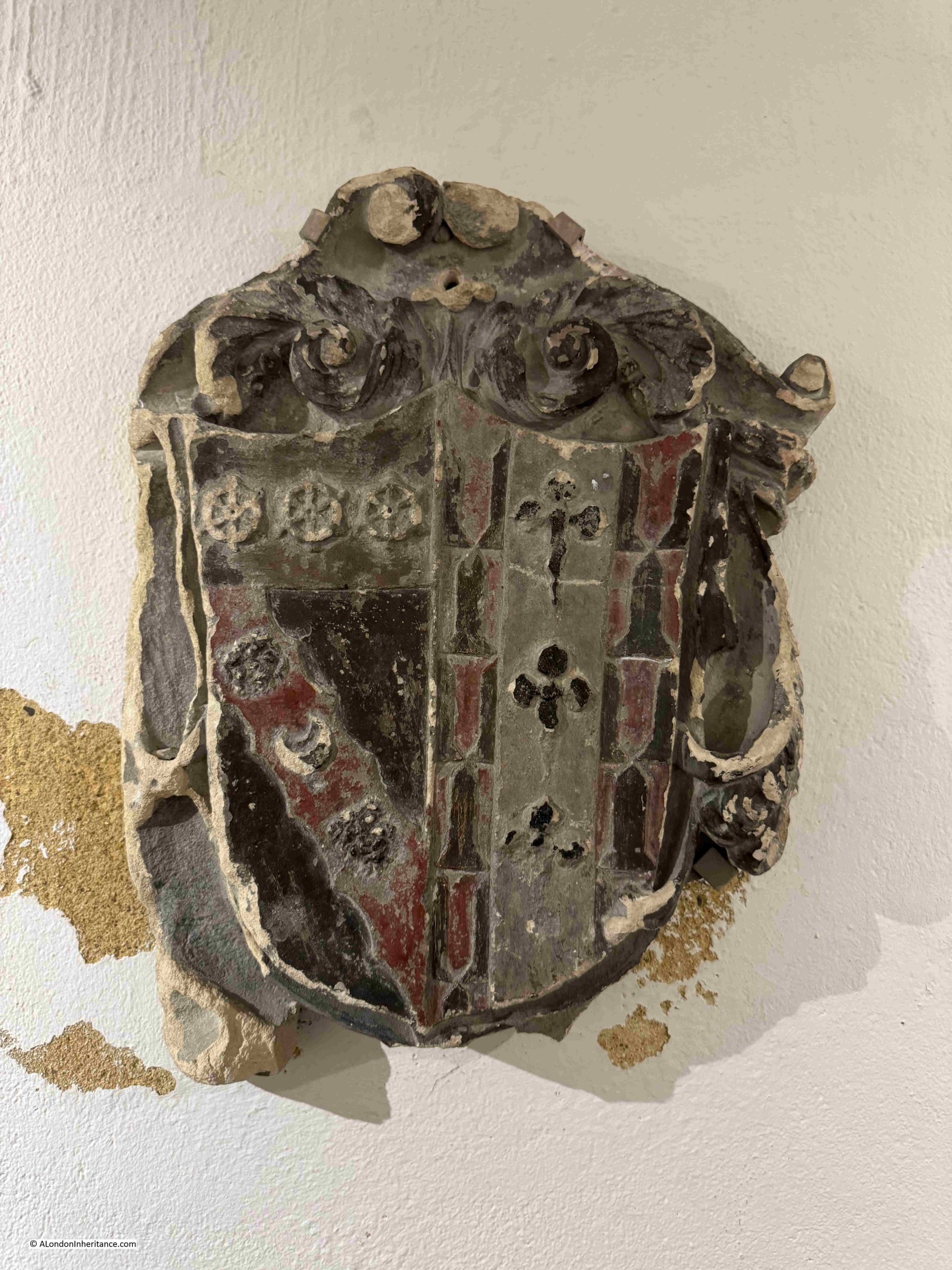
There are also a few Coats of Arms, presumably of those who had been buried in the church and possibly the only parts remaining of their monument / tomb:

At the corner of the corridor of memorials is that of Henry Croft – “The Original Pearly King”:

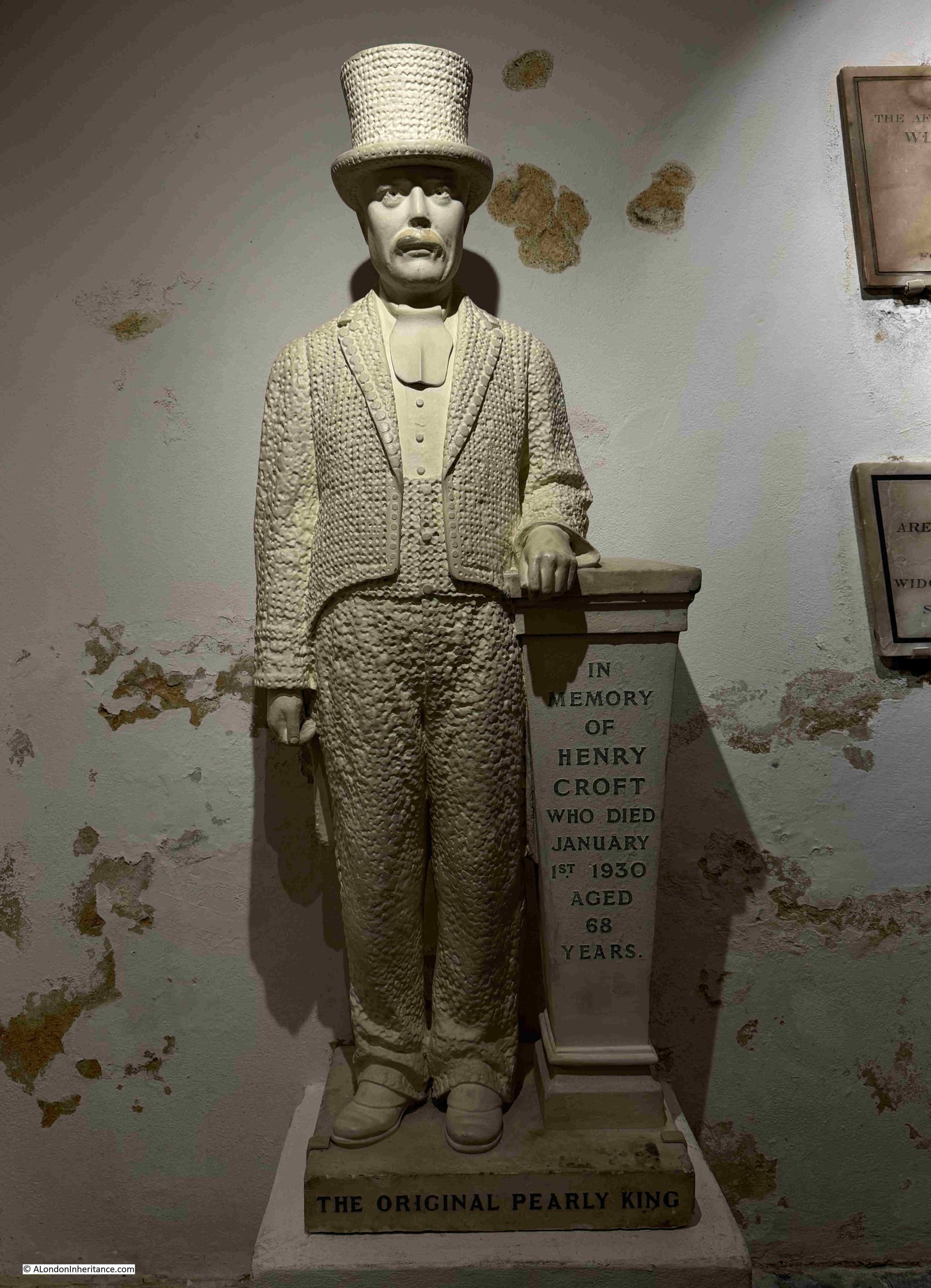
Henry died on the 1st of January 1930 and there were numerous accounts of his life and funeral in the papers, with the following from the St Pancras Gazette on the 10th of January 1930:

“At the age of 67, the death took place, as the bells were ringing in the New Year, of Mr. Henry Croft, the original ‘Pearly King’. Mr Croft, who was well known in every quarter of London, had been an employee of the St. Pancras Vestry and Borough Council for over 40 years and only recently retired on pension.

Most remarkable scenes were witnessed on Tuesday, when the funeral took place to St. Pancras Cemetery. Hours before it was due to leave great crowds began to assemble round 16 Charles-street, Euston-road, and those crowds grew until all the adjoining neighbourhood was one solid mass of humanity.

There were over one hundred ‘Pearly Kings and Queens’ to say nothing of ‘Pearly Children’ who assembled in their full regalia to pay their respects to their old comrade, a man who had collected many thousands of pounds for the various hospitals of London.

Almost every Saturday and Sunday he devoted to his task, and hospitals have certainly lost a very great friend by his death. It took a number of mounted and foot police to control the crowds and it was a most impressive sight when the procession left Charles-street to wend its way to the cemetery, led by a band of pipers playing a haunting lament, and many banners were displayed by members of the various societies and organisations with which the deceased was connected. The coffin was borne by four comrades – all Pearly Kings – and on it rested the deceased tall hat of pearl buttons, and also all the medals with which he had been presented for his charitable work, displayed on a black velvet cushion.

The coffin was drawn in an open car with four horses, and the three coaches following contained his widow and family – he had two sons and three daughters. Behind the mourning coaches came a stream of vehicles of all kinds carrying other Pearly Kings and Queens and a whole retinue of the deceased friends. The procession was nearly half a mile in length and was one of the largest that London has seen for many years.”

The statue of Henry Croft was originally installed where he was buried in St Pancras Cemetery, however after several instances of vandalism, it was restored and moved to the crypt in 2002. The choice of St Martin in the Fields was because of the long association of Pearly Kings and Queens with the church, and it is where they continue to hold their Annual Harvest Festival.

On display in the crypt is a reminder of the barbaric forms of punishment that offenders could suffer in London – the St Martin in the Fields Whipping Post:

There were a number of whipping posts across London, and these were often associated with a pillory. Whipping was also carried out with the offender tied to a cart, and whipped as they were being moved between two places, often relevant to their crimes.

Whipping was a public punishment, aimed not only at punishing and humiliating the offender, but also visibly showing the public the type of punishment they would suffer if they were to commit similar crimes.

The punishment was also a risky time for the authorities, if the general public was not happy that the offender was being given a fair punishment, or if there were other general issues with authority. For example, the whipping of James Dinord, a journeyman weaver in Bethnal Green in 1829 was attended by the officers of Worship Street, Lambeth Street, the Thames police and all the parochial and special constables of the district, including the parochial officers of the twenty one districts of Tower Hamlets, due to the risk of trouble.

The large crowd was described as being silent whilst the punishment was carried out, with not a single murmur being heard, nor the slightest symptom of riot or insubordination.

The impact of a whipping or being confined in the pillory could also effectively be a death sentence. On the 28th of September 1810, the London Statesman reported that “The sheriffs and Jack Ketch were actively employed yesterday between the pillory and the whipping post in the Old Bailey; their respective functions were not finished till it was nearly dark. Viguers, the miscreant placed in the pillory in Cornhill, is at present blind, in consequence of the pelting he received. He was so much bruised and lacerated, that he is not expected to survive”.

I cannot find where the St Martin in the Fields Whipping Post was originally located. I wonder if it was a short distance further south at Charing Cross which would have been a public place, at the junction of key roads, for such a public punishment to be carried out.

The Whipping Post dates from 1752, as indicated by the year carved at the top of the post, and at this time St Martin was relatively enclosed within streets and buildings, long before Trafalgar Square was built, and whilst St Martins Lane was a busy street, it would not have been such a public location as the main street just to he south:

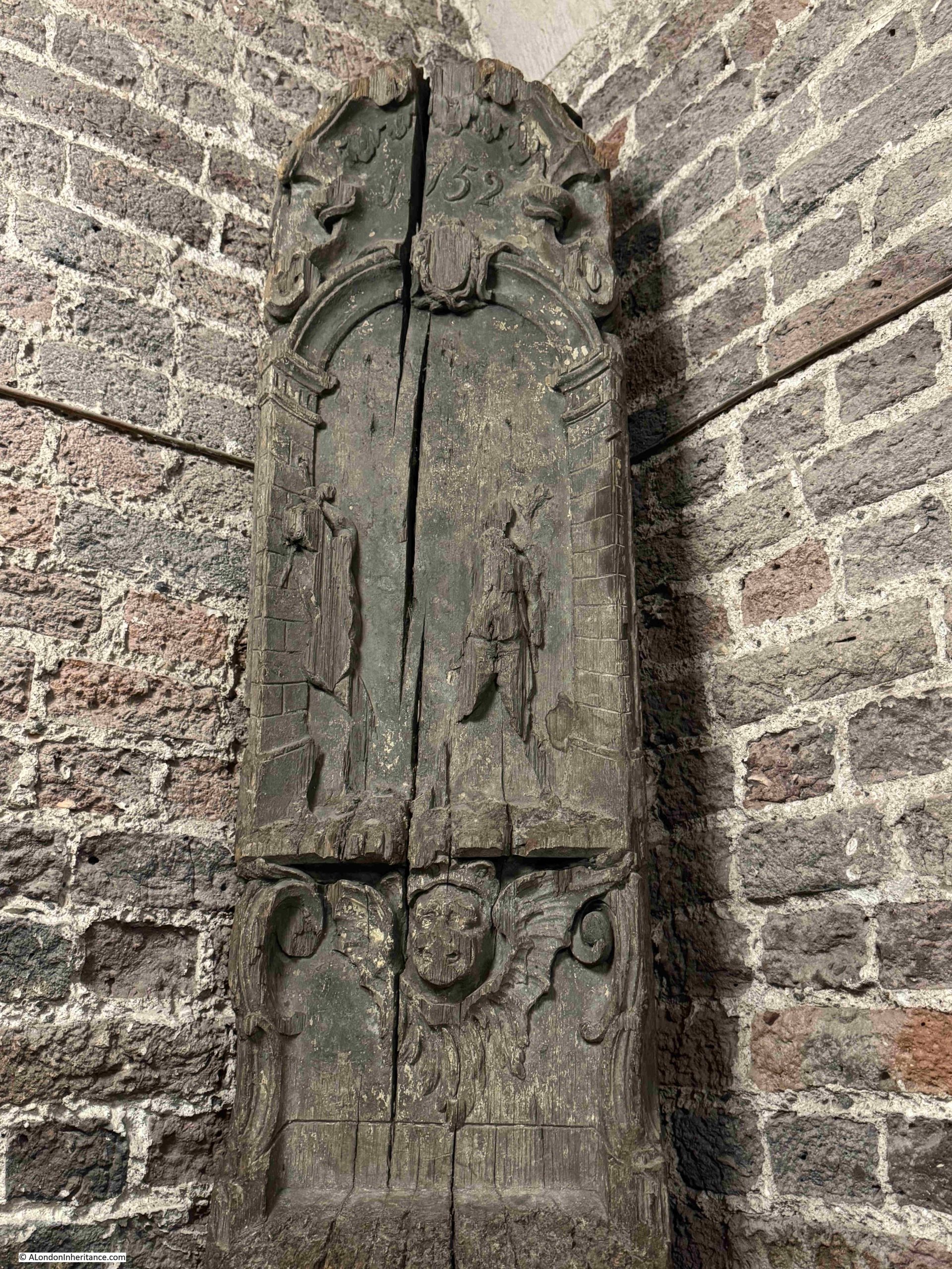
It is interesting that it was thought necessary that the post used for such a punishment should also be ornately carved, it was probably to give some authority to the whipping post and the punishments carried out.

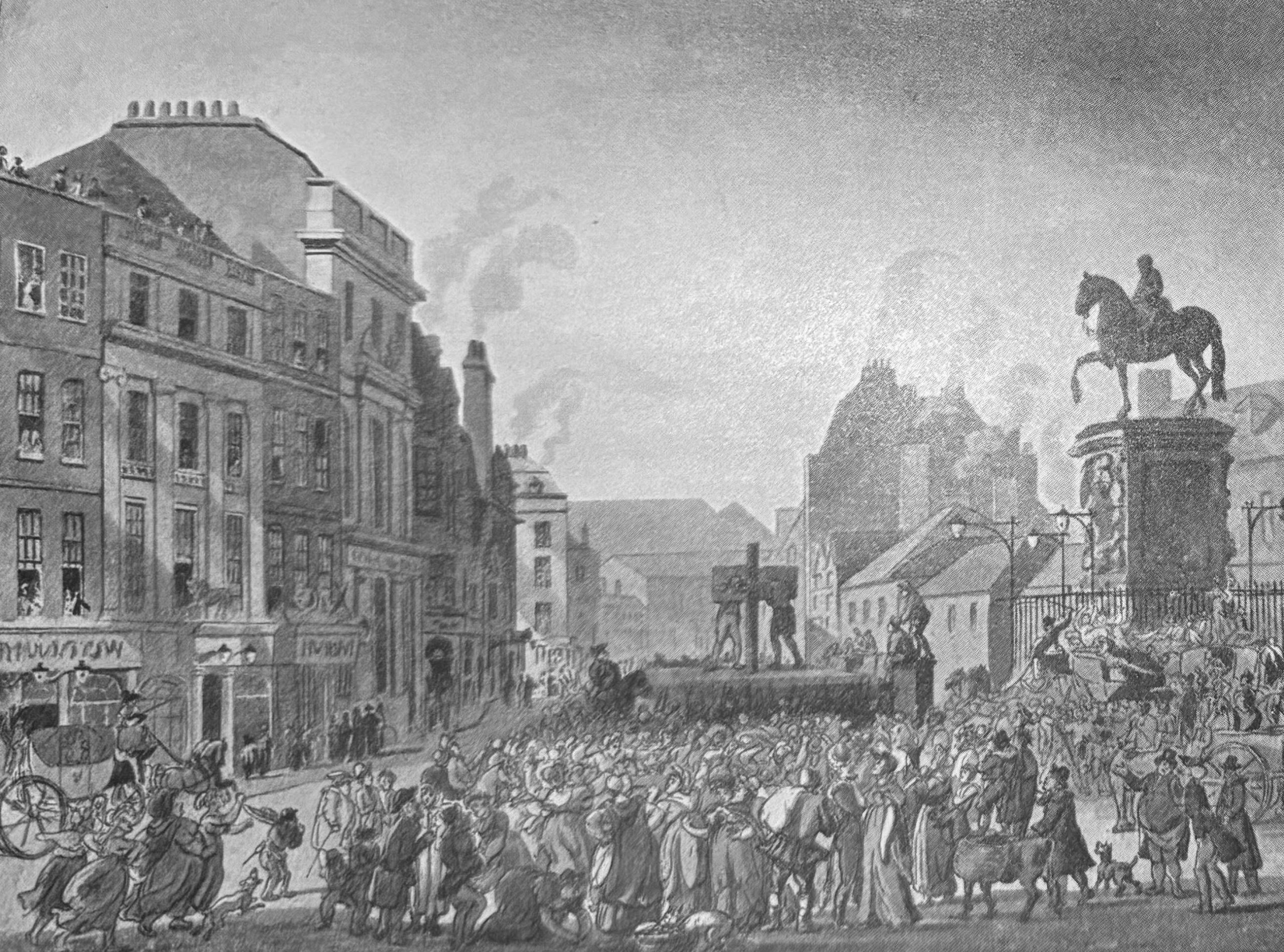
There was a pillory at Charing Cross, as illustrated in this print from 1809, by Rowlandson and Pugin from Ackermann’s Microcosm of London:

There is a large space space to the left side of the church and to the rear. This space was once part of the burying ground, which originally extended further than the space we see today:

There were up to 70,000 burials in the crypt and across the burying ground and between 1827 and 1830 the burying ground was emptied and the crypt space extended under a programme of work by John Nash to create buildings to the north of the church. This also allowed Duncannon Street which now runs along the southern edge of the church to be built.

Al the crypt space was finally emptied between 1915 and 1937.

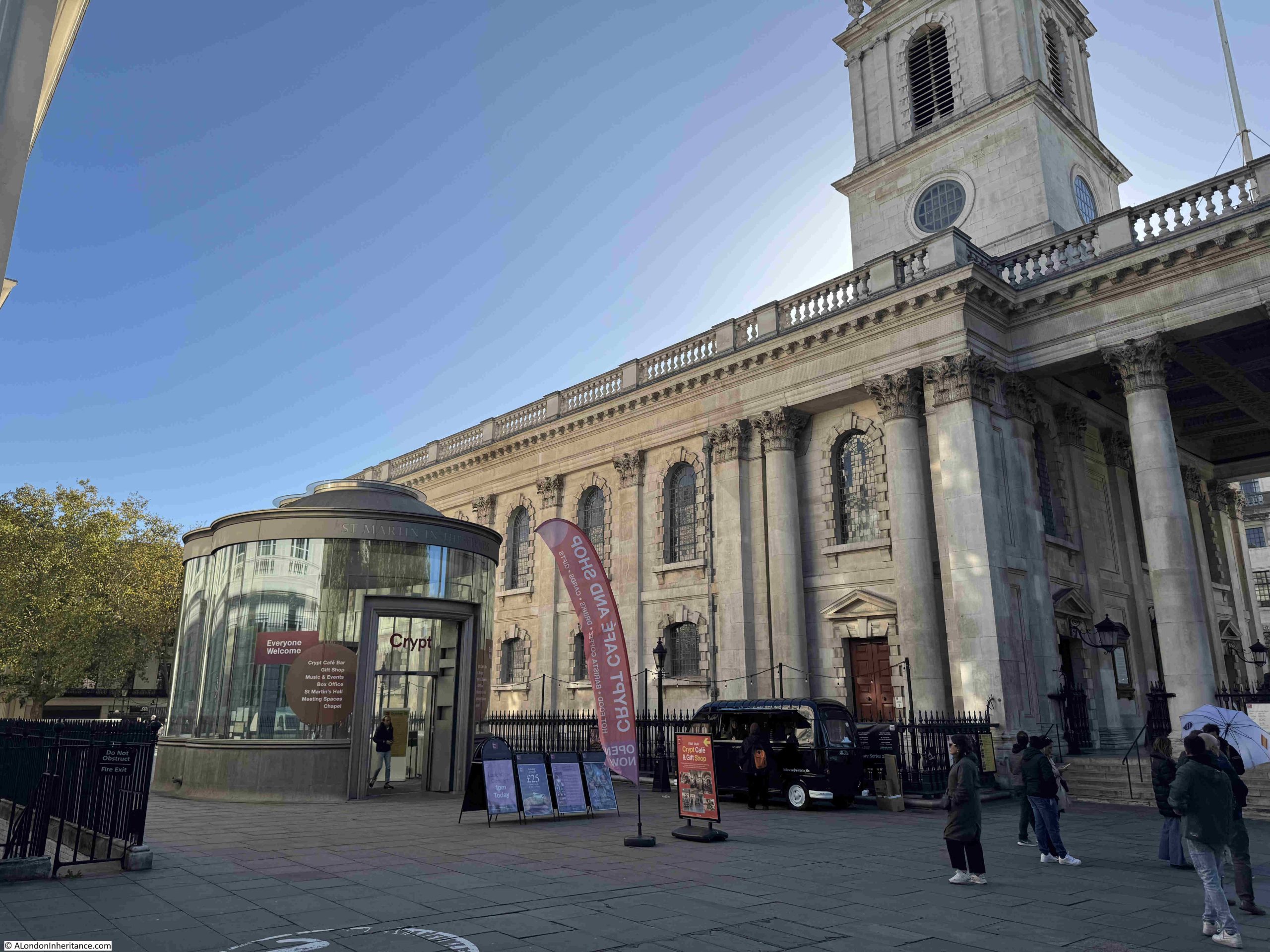
The area to the north and south of the church has been significantly renewed, with a couple of floors of space developed below ground, consisting of the church hall, music rehearsal room, a chapel, open space, and a shop.

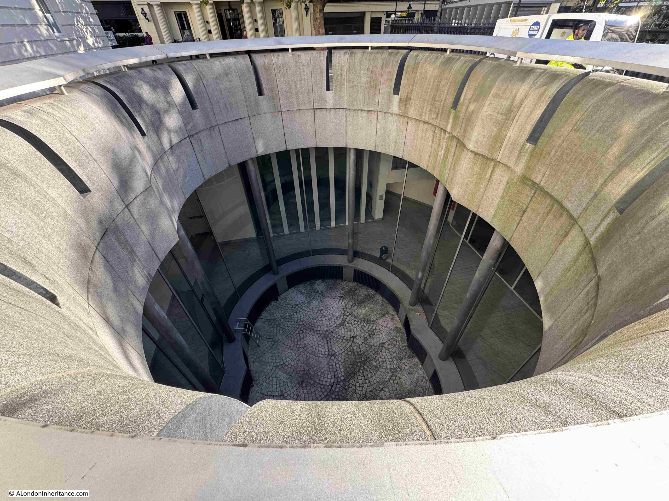
There is a new entrance to the crypt and below ground space, as shown in the photo above and just behind the entrance there is a light well that lets natural light into the two floors below:

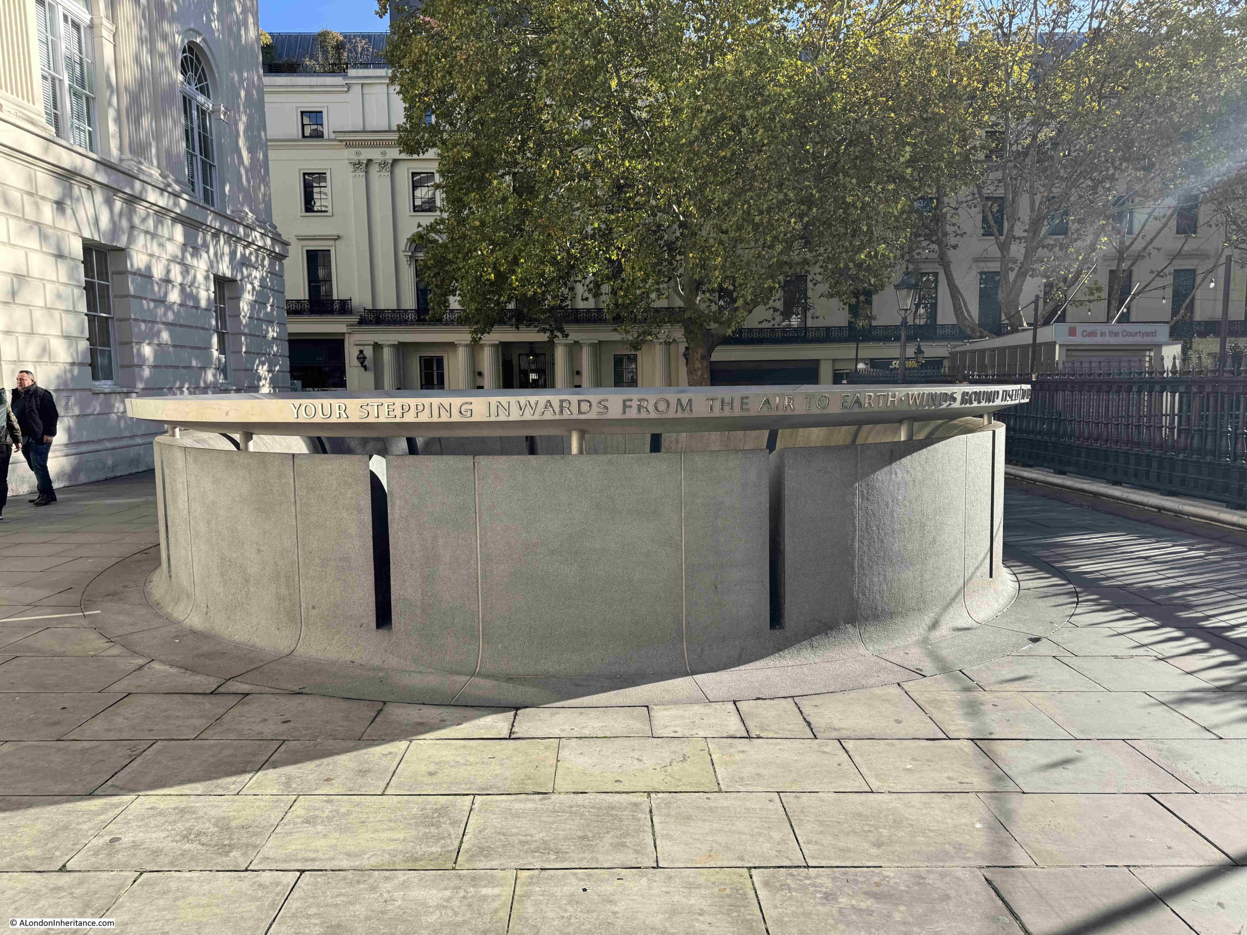
Looking down through the light well:

The church seen from the north east showing space to the side and behind the church which was once part of the burying ground, and then the below ground extension to the crypt:

And from Duncannon Street, the street created when the burying ground to this side of the church was emptied of human remains:

Today, as well as church services, St Martin’s is a centre for music with regular concerts, and the original home of the Academy of St Martin in the Fields, formed in 1958 by Sir Neville Marriner, and who had their first performance in the church in November 1959.

There is an interesting video by Eric Parry Architects on the project to redevelop the below ground space:

St Martin in the Fields is a very impressive church. It is ideally placed at the north east corner of Trafalgar Square, a space that would not be developed for over 100 years after James Gibbs designed the church, and modified the front to enlarge the portico during the construction process, a change which just adds to the view of the church as you look across Trafalgar Square.

I suspect he would be rather pleased with the views now available of his church.

Resources – Historical maps of Southwark and City Ward Maps

In this months section on resources that may be of help with researching the history or London, I am looking at some more maps.

Maps are brilliant resources for understanding the history of an area, and by using maps of different dates, how an area has developed over the years.

Southwark Council have put a range of historical maps online. The title of the respective webpage is Historical maps of Southwark, although the maps available cover much more than just the Borough of Southwark, with many of the maps showing the whole of London.

The Historical maps of Southwark webpage can be found by clicking here, where you will find the following listing:

The list shows the range of maps available, and to give an example, the following is an extract from the 1572 map Londinvm Feracissimi Angliae Regni Metropolis, and in the extract I have put a circle around the main subject of the post – St Martin in the Fields:

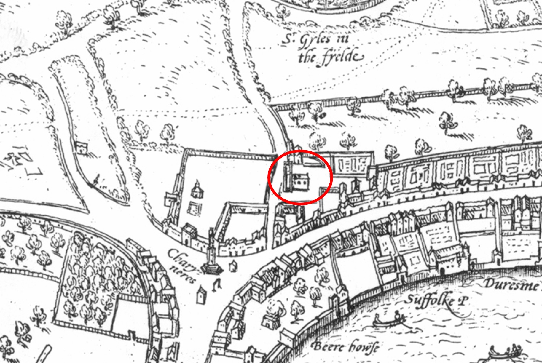
The map shows how the church justified the use of “in the Fields” within the name, as at the time, it was on the edge of the built city. An early St Martin’s Lane can be seen running north in front of the church.

To the south is the Strand, which runs to Charing Cross, then continues to the south to Westminster. The importance of the Strand can be seen by the large houses running along the street, with rear gardens leading down to the Thames, where each house would typically have its own Watergate.

To the north of the church there are fields, up to another “in the Fields” church, St Giles in the Fields.

At the major road junction at Charing Cross, we can see the last of the Eleanor Crosses, which marked the route taken by the body of Eleanor of Castile, the wife of Edward I, from the location of her death in Lincolnshire, to her burial at Westminster Abbey.

It was taken down on the orders of Parliament in 1647, and the stones were allegedly used in various building works in Whitehall.

Another London local authority with some interesting maps is the City of London Corporation. If you have ever wondered about the current boundaries of all the City Wards, then the Corporation have a webpage to help.

The Ward Maps webpage can be found by clicking here, where you will find subfolders for each of the City Wards, as shown in the following image:

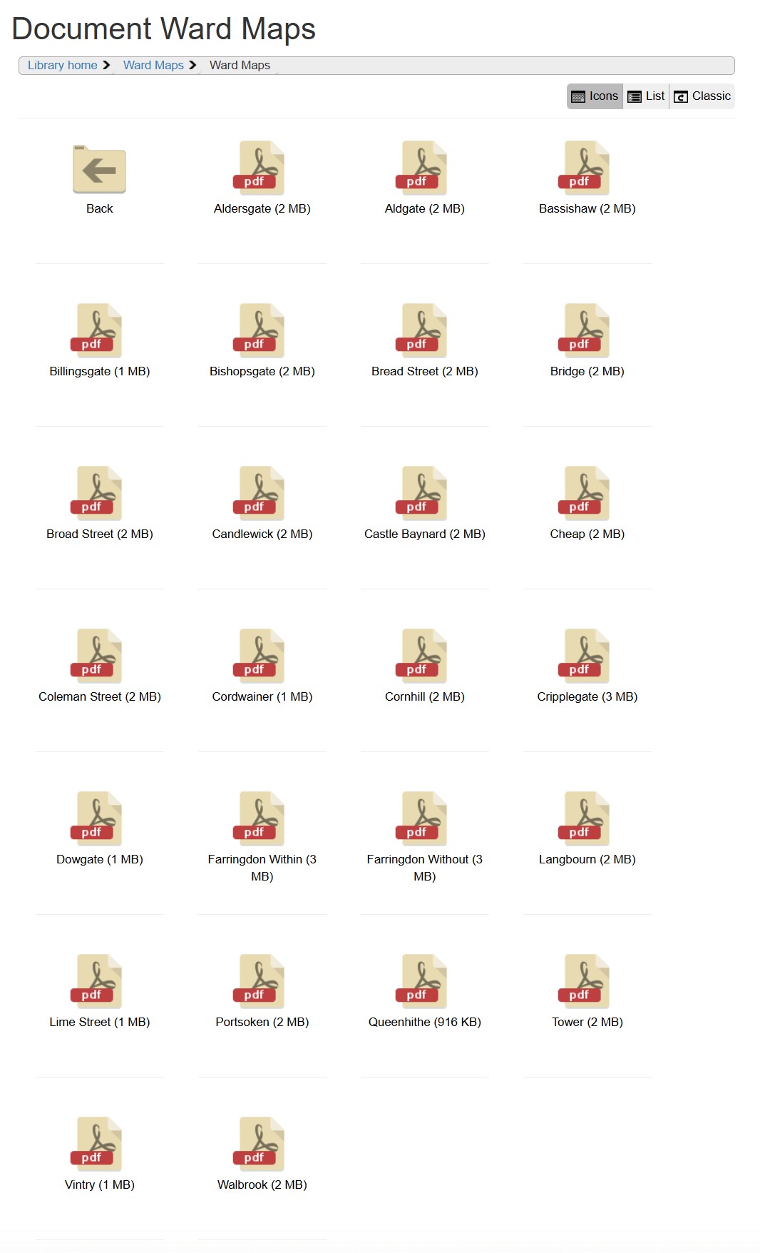
Clicking on any of the Wards when you are on their webpage, will bring up a PDF map showing the boundaries of the relevant Ward superimposed on a modern day street map.

Each Ward Map also shows the boundaries of the City of London, along with the adjacent Wards.

Both the Southwark and the City of London Corporation webpages provide very different views of London, but both help provide an understanding of the historical development of the city, and how historical boundaries still apply in a very modern City.

Seven St Martin’s Place and London Hotel Growth

London changes at such a rate that it seems every time you walk down a street, there is new building work underway. I was recently walking down Charing Cross Road towards Trafalgar Square and saw scaffolding and sheeting around this building – Seven St Martin’s Place.

Seven St Martin's Place

Seven St Martin’s Place is between the church of St Martin in the Fields and William IV Street and faces the Edith Cavell Memorial.

There is nothing very special about the building. It is a late 1950s office block with retail space along the ground floor. The company I worked for in the early 1980s had a couple of floors in the building.

What the building does have is a rather good location. Opposite the National Gallery, less than a minute’s walk from Trafalgar Square, at the southern end of Charing Cross Road and close to the Strand – a prime west London location.

The location of the building is shown by the red rectangle in the following map extract  (© OpenStreetMap contributors) .

Seven St Martin's Place

The reason for the building work at Seven St Martin’s Place is that the building is being converted to a hotel.

The City of Westminster planning decision approves a change of use for the first to fourth floors from offices to hotel accommodation along with extensions at the fifth floor roof level to create a new rooftop restaurant and bar with external terrace,

The existing ground floor retail units will be reconfigured and new retail space created, both at ground and basement levels.

The hotel will consist of 136 bedrooms and be operated by the Butterfly Hotel Group, a Hong Kong based hotel company.

The redevelopment of Seven St Martin’s Place mirrors so much other development across London, where almost any property that becomes available, or can be purchased, is converted to either apartments or hotels. Not in itself a bad thing, providing that residential apartments are affordable, which is rare, or that the diversity of use found across London streets is not restricted.

The planning decision states that whilst “Policy S20 of the City Plan July 2016” resists the loss of offices to residential use, there is no policy that resists the loss of office space to hotel use. Apparently because it is also another use that generates employment, so providing the proposal meets regulations such as noise control, light, appearance, access etc. there is no reason to turn down the application, although an additional Policy S23 does state that existing hotels must be protected and that there are no adverse effects on residential amenity.

I suspect that with the demand for hotel rooms in London, very few applications are turned down.

Building name above the original entrance to the building:

Seven St Martin's Place

The conversion of Seven St Martin’s Place did get me wondering about how many hotels there are in London and the level of growth as there does seem to be new hotels opening all the time, and at what point is saturation reached?

There are a number of reports available, and a report by London & Partners (the Mayor of London’s official promotional agency) titled “London Hotel Development Monitor – The Investment Hotspot” provides an overview.

The function of the agency is to promote London and the report is very much focused on promoting the city as a tourist destination and the opportunities for hotel development that tourism brings.

The report states that:

  • In July 2018 there were 140,000 hotel rooms in London
  • An additional 11,600 rooms were expected to be built by 2020
  • Room occupancy is significantly high. In 2018, 79.6% of rooms were occupied, slightly behind Dublin (82%), but higher than Dubai (76.4%), Paris (77.1%), Berlin (74.7%) and Rome (70.1%)

An earlier report stated that the City of Westminster had the most hotels, with 433, with Kensington and Chelsea being second at 189. The City of London had 68 hotels.

The report highlights the impact of the 2012 Olympics on the number of hotel rooms opened across London:

  • 2012: 8,133 new hotel rooms
  • 2013: 1,833 new hotel rooms
  • 2014: 5.442 new hotel rooms
  • 2015: 3,117 new hotel rooms

The money involved is significant with the report claiming hotel investment in 2015 was £3.9 billion.

This level of growth and investment is expected to continue. A working paper “Projections of demand and supply for visitor accommodation in London to 2050” (Greater London Authority – April 2017) provides a projection of visitor numbers to London over the coming decades, with International visitor growth expected to be:

  • 2015 – 18.581 million
  • 2020 – 19.992 million
  • 2025 – 21.215 million
  • 2030 – 22.439 million
  • 2036 – 23.907 million
  • 2041 – 25.130 million
  • 2050 – 27.332 million

Domestic visitors to London, staying overnight will also be growing significantly in the same period;

  • 2015 – 12.938 million
  • 2020 – 13.964 million
  • 2025 – 15.451 million
  • 2030 – 16.938 million
  • 2036 – 18.598 million
  • 2041 – 19.928 million
  • 2050 – 22.413 million

Projections are notoriously difficult to get right, but I suspect it is safe to assume that the number of hotels required in London will continue to grow significantly, and there will be many more redevelopments of existing buildings over the coming decades.

The closed Post Office on the ground floor of Seven St Martin’s Place – will this type of business ever return to the retail space of redeveloped buildings, with probably increased rents? The planning decision does confirm that space will be available for the Post Office should the company choose to return.

Seven St Martin's Place

The growth in hotels across London has been considerable, but to understand the impact on local communities, pricing pressure on the cost of housing, apartments and flats, costs for renting, we must also look at the growth of Airbnb in London, which has been dramatic over the last few years.

The Inside Airbnb site has some fascinating detail on the number and type of accommodation listed, cost, occupancy etc. The overview for London at the time of writing this post shows that for London there are:

  • A total of 77, 096 listings, of which;
  • 42,758 are entire homes or apartments
  • 33,594 are private rooms
  • 744 are shared rooms

The supporting data is downloadable. I was creating a graphic showing the number of Airbnb’s for each London borough, but ran out of time (I will add when complete), but for now, along with the new hotel being built, there are 9,411 Airbnb listings in Westminster.

The relative ease and low cost of global travel is driving the rise in tourism, and therefore the demand for accommodation in cities across the world. Other cities such as Venice and Barcelona are taking steps to control tourism, and the growth in Airbnb. These cities also have to manage the rise in tourists arriving by cruise ship – an issue which currently has minimal impact on London, apart from the occasional cruise ship moored by HMS Belfast or at Greenwich. Whilst these methods of travel do not require accommodation in the city, they do drive a high number of visitors who spend little in the host city.

Amsterdam is another city trying to manage ever increasing visitor numbers with a number of steps being taken including the Netherlands Tourist Board no longer actively promoting the country as a tourist destination.

The demand for land and buildings for hotel development is one of the many drivers behind the price of property across London.

In 2010, Seven St Martin’s Place was sold for £41 million and four years later in 2014 it was sold again, with the prospect of change of use to a hotel, for £65 million – a profit of £24 million in four years.

The facade of the building is relatively bland, however there is some interesting decoration on the side of the building facing the Edith Cavell monument. There are two vertical sets of, I am not sure what – artwork, carvings – one panel between each window, creating vertical columns of panels spaced between windows. See the photo at the top of the post for the location of these panels.

Close-up photos of these panels reveal some intriguing designs:

Seven St Martin's Place

Seven St Martin's Place

Seven St Martin's Place

Seven St Martin's Place

Seven St Martin's Place

Seven St Martin's Place

Seven St Martin's Place

Seven St Martin's Place

I have no idea as to the origin of these panels, or what they are intended to represent.

The building is not listed, and strangely the planning decision document which details the conditions of planning approval does not make any mention of these panels.

The drawings in the planning document appear to include these panels, so hopefully they will remain.

I have really tried to make out what these panels mean, but cannot find any reference, or looking at them, see any recognisable form or pattern.

I did wonder if put together they would make a map. I have written about the building at 111 Strand, where a map of the area has been carved into the Portland Stone across the 1st to 5th floor of the building.

To see if they made a map, or if there was any other meaning when the panels are combined, I put them together in the same order as they appear on the building:

Seven St Martin's Place

It does look as if the panels are meant to be combined. There are features that run from one panel to the adjacent. There looks to be a boarder around combined panels. On the far right of the panels, there are vertical wavy lines running down all four panels – could this be the River Thames?

Despite looking at these panels for ages, rotating the photos, trying different combinations, I cannot see any meaning – perhaps there is none. If anyone knows what they mean and who created them, I would be really interested to know.

Although the focus of this week’s post was on the building, and what another hotel conversion means for London, I wanted to have a quick look at the history of the site.

The area demands a full post, so this is a brief look. The 1895 Ordnance Survey Map shows the area as it was around 125 years ago:

Seven St Martin's Place

Credit: ‘Reproduced with the permission of the National Library of Scotland’ 

The street plan is much the same as today, but the block of land that is now occupied by Seven St Martin’s Place was St Martin’s Mews. The Vicarage remains to this day

What is interesting is that the location now occupied by the monument to Edith Cavell, also had a statue in 1895, however it must have been different as the Edith Cavell monument was unveiled in 1920.

On July 18th 1902 a rather impressive statue to General Gordon, mounted on a camel was unveiled in the same position:

Seven St Martin's Place

But this was seven years after the Ordnance Survey map – I could not find any reference to an earlier statue, but my research time was limited.

The London Metropolitan Archives Collage collection, as usual provided some views of the site prior to the construction of the building we see today.

This is the view of the building that occupied the site, note the entrance to the Mews. The photo is dated 1930 and I suspect are the same buildings that are shown on the 1895 Ordnance Survey map.

Seven St Martin's Place

Image credit: London Metropolitan Archives, City of London: catalogue ref: SC_PHL_01_523_A7058

In the above photo, the darker section on the right of the block is the vicarage. This part of the block remains to this day and it is the lighter section on the left that was demolished to be replaced by Seven St Martin’s Place.

The following photo is a 1958 view of the building. As the 1895 map indicates, it was a collection of different buildings with a central mews.

Seven St Martin's Place

Image credit: London Metropolitan Archives, City of London: catalogue ref: SC_PHL_01_523_58_2190

As the above photo is dated 1958, it was either demolished soon after, or the references to the current building on the site being a late 1950s office block are wrong, and it is perhaps early 1960s.

The view of the building from William IV Street today, shrouded in sheeting as part of the building work.

Seven St Martin's Place

Changes to London are gradual, and normally it is only the historically or culturally significant buildings that get publicity when their use is changed, or they are threatened, but there are also so many changes involving rather ordinary buildings from the last half of the 20th century.

Hotels and expensive residential buildings appear to be the main drivers of development, however there still appears to be an expectation for plenty of office space. The 2017 London Office Policy Review for the Greater London Authority projects that office employment across the greater London area will rise from 1.982 million in 2016 to 2.861 million in 2050, so office space will continue to be required in larger volumes to accommodate this workforce.

So with the 2050 projections for both office space and tourism numbers – London is set for a considerable amount of development over the coming decades, and we will continue to see change whilst walking the streets of London, although I am not sure how much trust I would put in future projections.

alondoninheritance.com

Trafalgar Square, New Year’s Eve, 1981

In my last post of the year, I revisit an earlier New Year’s Eve celebration in London, but can I firstly wish you all a very Happy New Year for 2018 and thank you for reading my posts and your feedback over the past year – it is so very much appreciated.

New Year’s Eve in London has become a very organised event. Large areas of central London are closed, tickets must be purchased, and sell out very quickly, security will, understandably, be very tight. This is all very different to my first experiences of New Year’s Eve in London. In the late 1970s and 1980s we would occasionally spend the evening out and about, wandering the streets, pubs, clubs of the West End and celebrating midnight with thousands of people in Trafalgar Square.

One year I took my camera with me and recently I found some of the negatives. Many had camera shake a I was trying to take hand held photos at night and using a film camera. I still have to find some of the other negatives of photos taken whilst walking the streets, however here is a set of photos taken in the crowd in Trafalgar Square on New Year’s Eve, 1981.

New Year's Eve

Trafalgar Square was then the centre of New Year’s Eve celebrations until the focus moved to the Embankment with the firework displays along the Thames.

My memory of these nights in London are probably influenced by the passage of time and alcohol on the night (the reason why I only risked taking my camera along on one New Year’s Eve), however I remember the very large crowds that assembled in Trafalgar Square ready for midnight and so many people walking the streets before and after midnight, usually with bottle or cans in hand.

New Year's Eve

This was only 36 years ago, but it feels like a different world. If you compare these photos with those of the crowds in London tonight there is one very big difference – in 1981 there was not a single mobile phone in sight. Tonight the glow of mobile phone screens taking photos of the fireworks, selfies etc. will be seen across the crowds.

There was also minimal security, I do not remember seeing many police around and those that were visible would not be armed.

I do not remember any road closures (although the roads around Trafalgar Square probably were closed), however there was hardly any traffic. I do remember the freedom to wander the streets into the early hours and the alcohol induced friendliness of everyone on the streets – probably one of the few times Londoners will talk to so many strangers.

There was also a need to be careful – as when any such large crowd assembles there were rowdy elements, those who had been drinking too much and for too long, and crime such as pickpocketing – but at the age I was then it was all a big adventure.

New Year's Eve

Some detail from the above photo – if it could be climbed then it would be climbed:

New Year's Eve

The only organised facilities that I remember were some first aid facilities around the base of Nelson’s Column:

New Year's Eve

I have no idea how many people there were in Trafalgar Square, however you had to get there well before midnight to get in the centre of the square. Crowds would stretch along all the roads leading into Trafalgar Square. In the following photo the sea of heads can be seen stretching off into the Strand.

New Year's Eve

I am not sure what time we got home that night, but after midnight, celebrations continued for many hours in the streets across the West End.

New Year's Eve

New Year’s Eve in Trafalgar Square could not compete with the massive firework display along the river tonight, however I suspect that the New Year’s Eve fireworks are aimed just as much for TV viewers around the world as they are for those standing along the Embankment, as London competes with other global cities.

With the now ubiquitous mobile phone, they will also probably be one of the most photographed large events in London.

alondoninheritance.com

Trafalgar Square – Coronations, British Housewives And Christmas Trees

Trafalgar Square, one of the most well known locations in London. Visited by thousands of tourists every day, a rallying point for demonstrations, where the 2012 Olympic medals were revealed, and where commemorations and vigils are held, the most recent being after the dreadful terrorist attack at Westminster.

The location of Trafalgar Square is important. It is a key junction, with the Strand leading to St. Paul’s Cathedral and the City, Whitehall leading to the Palace of Westminster and Westminster Abbey and The Mall leading to Buckingham Palace. It is this junction of streets that has resulted in Trafalgar Square being on the route for so many of the processional events the city has witnessed over the last couple of centuries.

Trafalgar Square is also home to Nelson’s Column – the column and the name of the square commemorating the Battle of Trafalgar. On the northern edge is the National Gallery, the church of St. Martin in the Fields is on the north eastern edge and as reminders of the days of Empire the square is fringed by South Africa House, Uganda House and Canada House.

My father took a couple of photos looking across Trafalgar Square 70 years ago in 1947. They show either the preparation for, or dismantling after an event. I do not have a record of the date within 1947 and there are no photos of the event. In 1947 my father was on National Service so I suspect these photos were taken during one of the brief periods back in London on leave.

View across Trafalgar Square looking towards Charing Cross in 1947:

Trafalgar Square

And the same view in 2017:

Trafalgar Square

The following photo is looking towards Whitehall. There is a man working on what appears to be lights in the top of the fountain and more around the base of the fountain. You can see part of a stage on the left, in front of the base of Nelson’s Column.

Trafalgar Square

The same view today – very little has changed in the past 70 years.

Trafalgar Square

Without a date I have not been able to identify the event that required these preparations, and there were no clues in the photos. There were a number of events in and around Trafalgar Square in 1947:

  • The wedding of Princess Elizabeth and Philip Mountbatten took place on the 20th November 1947 and passed the square. Both the square and the surrounding roads were full to capacity with spectators. Police had to form a “crush barrier” with their horses to control the enormous crowds in the square.
  • There were a number of demonstrations in the square during 1947. One of which was the “We Work and Want” protest organised by the British Housewives’ League in June 1947. The Aberdeen Press and Journal reported that “More than 100 motor coaches from Scotland and the North of England are expected to carry women to London for Friday’s rally of housewives at the Royal Albert Hall. Seven thousand angry women will attend the meeting, organised by the British Housewives’ League, at which speakers will denounce the Government’s powers of regimentation and food rationing. On Saturday, 30,000 housewives wearing red, white and blue rosettes will march through the West-End of London after a protest meeting in Trafalgar Square.”
  • 1947 was also the year of the first gift of a Christmas Tree from Norway. A newspaper report from the time reported that “Trafalgar Square is changed as never before. A 48ft Christmas Tree has sprung up on the west side of Nelson’s column. It arrived last week in the Thames, brought from Norway in the S.S. Borgholm. The tree is a Christmas gift to England’s capital from Oslo, Norway’s capital, and tomorrow the Norwegian Ambassador, Mr. Prebensen, will hand it over to our Minister of Works, Mr. Key. This charming gift, to be lit and decorated with artificial snow, is the outcome of a happy thought of Mr. Pieter Prag, manager of the Norway Travel Association. In Oslo every Christmas a giant fir is set up in University Square, where the children flock to see it. Now, in London’s best-known square, British Children will have a similar treat”

I cannot confirm that my father’s photos were connected with any of the above events. I also found newspaper reports of work in the square in 1947 to repair the electrical cabling and lighting, and to remove the hoardings erected around the base of the column during the war, so it could be this work that my father photographed.

As an aside, whilst reading through newspaper articles and letters on Trafalgar Square, I came across the following letter written to the Kent & Sussex Courier regarding the British Housewives’ League which may be one of the earliest “disgusted of Tunbridge Wells” letters:

Sir – I recently attended a British Housewives’ League meeting at Christ Church Hall, Tunbridge Wells. the speaker was Dorothy Crisp, chairman of the League.

I was thoroughly disgusted that a woman would use her talent as a speaker to create strife, ill-feeling and unrest, in this Britain of ours. Her whole attitude took me back to the days when Mosley and his gang held meetings.

She stated that she had already booked Scotland Yard for protection at her mass Rally to be held at Trafalgar Square on June 7. Why the secrecy over the name of the other Party who are joining at Trafalgar Square? Are they Fascists, Communists or Conservatives?

I should like to know the real organisation who are paying to cause this unrest and to fool housewives and use them as camouflage to hide sinister intentions that are obviously in mind.”

As far as I can tell, the British Housewives’ League was a right wing organisation that campaigned for women to stay at home and look after the family, christian values and opposition to state intervention and control. Post war austerity and the Welfare State were claimed not to be in the interests of a free and happy home life. There is a fascinating BBC radio programe on the British Housewives’ League. “The League of Extraordinary Housewives” can still be found on iPlayer Radio here. It is well worth a listen

Another of my father’s photos of Trafalgar Square in 1947:

Trafalgar Square

In these 1947 photos there were a number of illuminated advertising signs on the buildings along the southern side of the square, almost like the start of a mini Piccadilly Circus. Luckily this is one area of London where advertising did not subsequently take over.

The area now occupied by Trafalgar Square was originally part of the Royal Mews, where horses were stabled and carriages stored along with a reasonably dense area of buildings. The following extract from John Rocque’s map from 1746 shows the area now occupied by Trafalgar Square. The church of St. Martin in the Fields in the upper right is a good reference point to see that all the land to the left and above Charing Cross is now occupied by the National Gallery and Trafalgar Square.

Trafalgar Square

In the lower right of the map is Northumberland House. The following photo shows Northumberland House prior to its demolition in 1874. It was the last remaining of the “Strand Palaces” and had been built in 1605. The lion on top of Northumberland House is now at Syon House.

Trafalgar Square

The preperations for the construction of Trafalgar Square were in the Charing Cross Act of 1826. This enabled the land to be used for an open square and the National Gallery.

Work on the National Gallery commenced in 1832 with the Gallery being completed in 1838 to a design by William Wilkins. Trafalgar Square was constructed over a couple of decades. The core design was by Charles Barry, although his design did not include the fountains and he opposed Nelson’s Column being part of the square, arguing that it would dwarf the National Gallery.  The fountains were completed in 1845 and the layout of the square in 1850.

Work on Nelson’s Column began in 1839 with the statue of Nelson being raised into position in November 1843. The bronze lions were added in 1867.

There were a number of alternative proposals for the design of the naval monument, as Nelson’s Column was originally called during the planning stages, including the following by John Goldicutt from 1833 (©Trustees of the British Museum).

Trafalgar Square

Trafalgar Square today, continues as a central hub towards the west of London and is always busy. The terrace area in front of the National Gallery is from where my father took his photos looking across the square. Today, it is mainly selfies in front of the National Gallery and with the square in the background, and also the home to that essential visitor attraction – the floating Yoda, of which there are far too many both here and across London.

Trafalgar Square

Although the more traditional form of street artist still survives:

Trafalgar Square

One of the major attractions for children at Trafalgar Square was feeding the once significant number of pigeons. Vendors would sell seed in the square and I remember doing this as a child in the 1960s. Feeding the pigeons was made illegal in 2003 which has resulted in a much improved environment – although probably rather boring for small children. Today there are still signs stating that pigeon feeding is banned.

Trafalgar Square

On the south east corner of the square is the very small building that was used as a police lookout during major events in the square.

Trafalgar Square

Trafalgar Square’s location puts it on the route for any procession between the City, St. Paul’s Cathedral, Buckingham Palace, the Place of Westminster and Westminster Abbey. Crowds have long used Trafalgar Square as a location to watch these events and in recent decades it provides a good location for the media to assemble.

My father also took a number of photos on the morning of the Coronation of Queen Elizabeth II on the 2nd June 1953. The full post with these photos can be found here, and I have included two from Trafalgar Square below. The first photo is looking north from the southern edge of the square and shows crowds around one of the lions.

Trafalgar Square

The same view today:

Trafalgar Square

I wonder how many people have sat in front of the lion over the years. Whilst I was there, numerous children were being lifted to sit for photos between the paws of the lion.

Another of my father’s photos from 1953:

Trafalgar Square

And again in 2017:

Trafalgar Square

And it is not just in this century that Trafalgar Square has featured in such events. This drawing from 1838 shows the procession of Queen Victoria to her coronation passing the square, with the National Gallery in the background and the church on St. Martin in the Fields on the right (©Trustees of the British Museum).

Trafalgar Square

The notable feature absent from the above drawing is Nelson’s Column. Work on the column would begin the following year.

As well as being a bystander to events, the square has also been the subject of major ceremonies, for example on the Centenary of the Battle of Trafalgar on the 21st October 1905. The square was crowded and Nelson’s Column decorated for the special event as shown in the postcard below:

Trafalgar Square

It was not just the centenary event that attracted crowds. The Pall Mall Gazette reports on the 11th October 1905 “Steeplejacks in Trafalgar Square – Preparations for the decoration of the Nelson Monument in Trafalgar Square in connection with the forthcoming anniversary have already been commenced. This morning the operations of three steeplejacks, who were engaged in girding the column with stout ropes from ladders strapped to the structure, were watched with great interest by a large crowd.”

Ladders strapped to the side must have been a rather risky exercise given the lack of health and safety at the start of the 20th century.

Another view of the square in the early 20th century. The traffic and complexity of the road layout remains to this day and is a result of the square being at the point where so many major streets meet.

Trafalgar Square

Although I have not checked, I suspect Trafalgar Square has featured in the majority of Coronations. The following postcard shows the procession during the coronation of King George V passing Trafalgar Square on the 22nd June 1911.

Trafalgar Square

I have been working out of the country for much of the past week, and as with most of my posts, I feel I have only just scratched the surface of the history of this area. There is so much more on the area prior to the construction of Trafalgar Square, the work on building the square and column, the fountains and their water supply, the many other events that have taken place in and around Trafalgar Square (for example whilst researching 1947 I also found the story of an alleged terrorist bomb blast at the Colonial Welfare Club in St. Martin’s Place off Trafalgar Square which injured six airmen). You can though read about one of the tunnels under Trafalgar Square here.

But at least if you are ever in a London trivia quiz and you need to know who was responsible for the first Trafalgar Square Christmas Tree, it was Mr. Pieter Prag, Manager of the Norway Travel Association.

alondoninheritance.com