Tag Archives: Water Pump

Queen Square – A Water Pump, Zeppelin And Medical Imaging

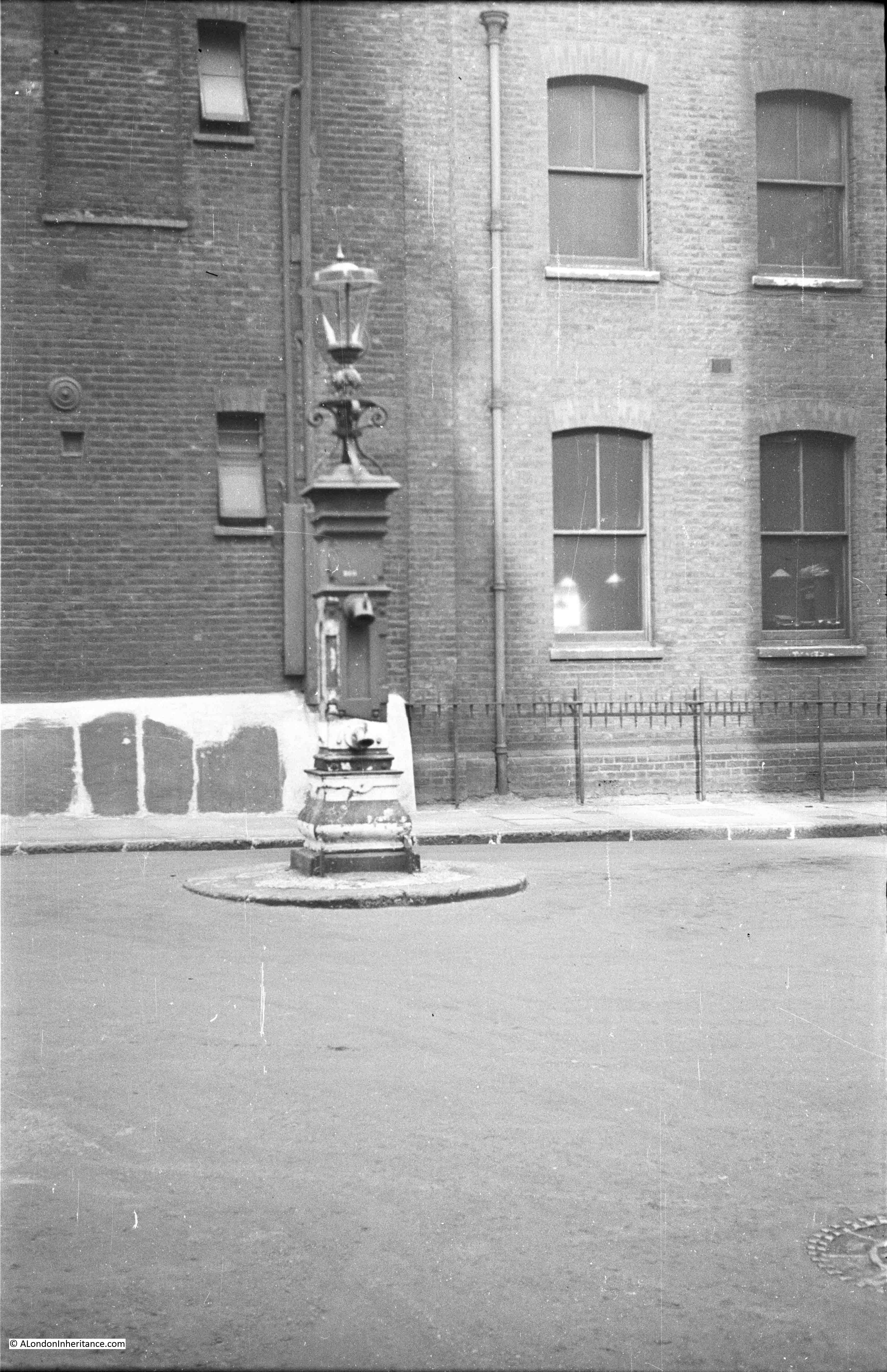
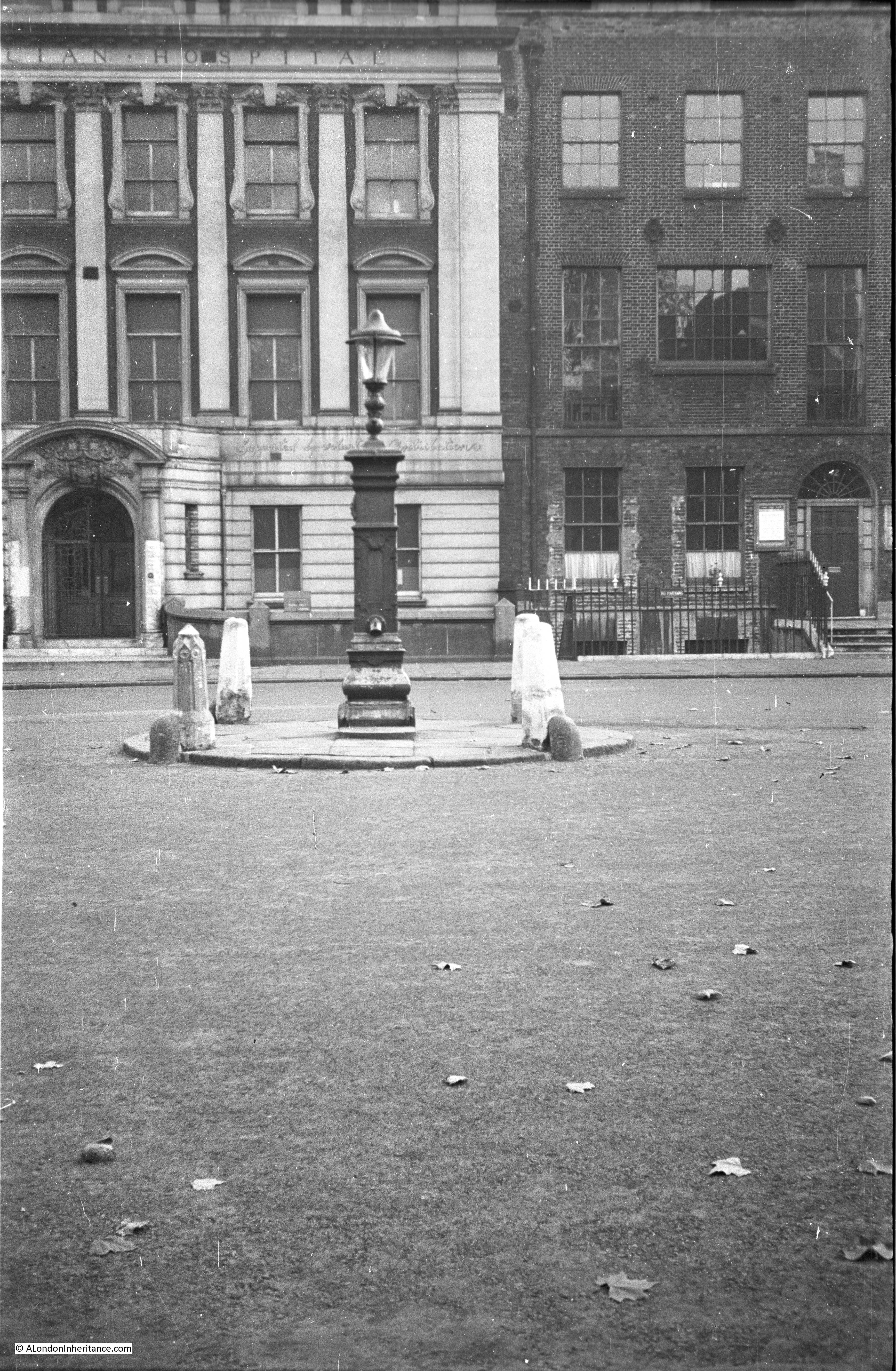
For this week’s post, I am in Queen Square, Bloomsbury tracking down the location of the water pump that my father photographed in 1947;

Queen Square

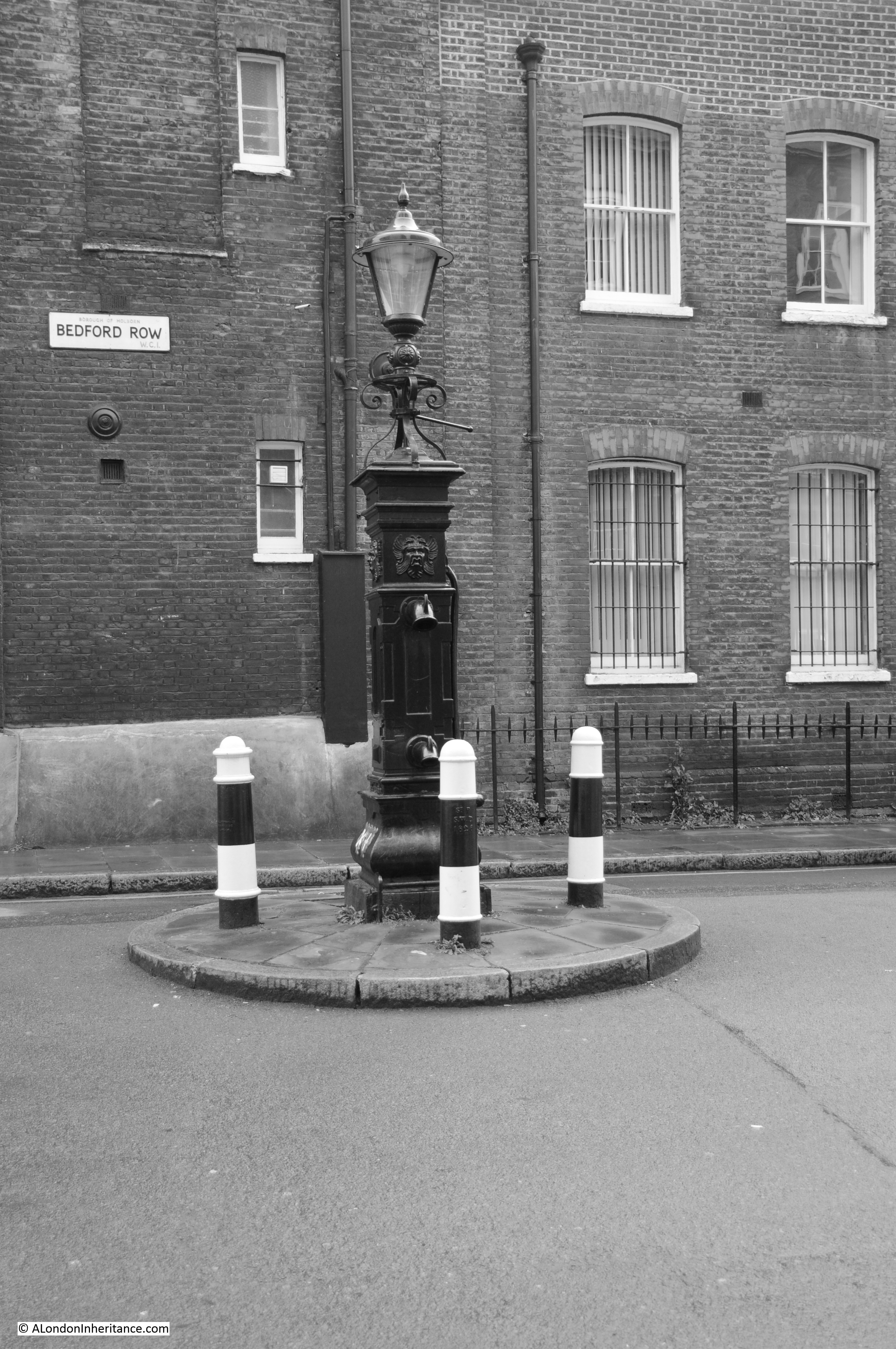
The view from the same position 70 years later:

Queen Square

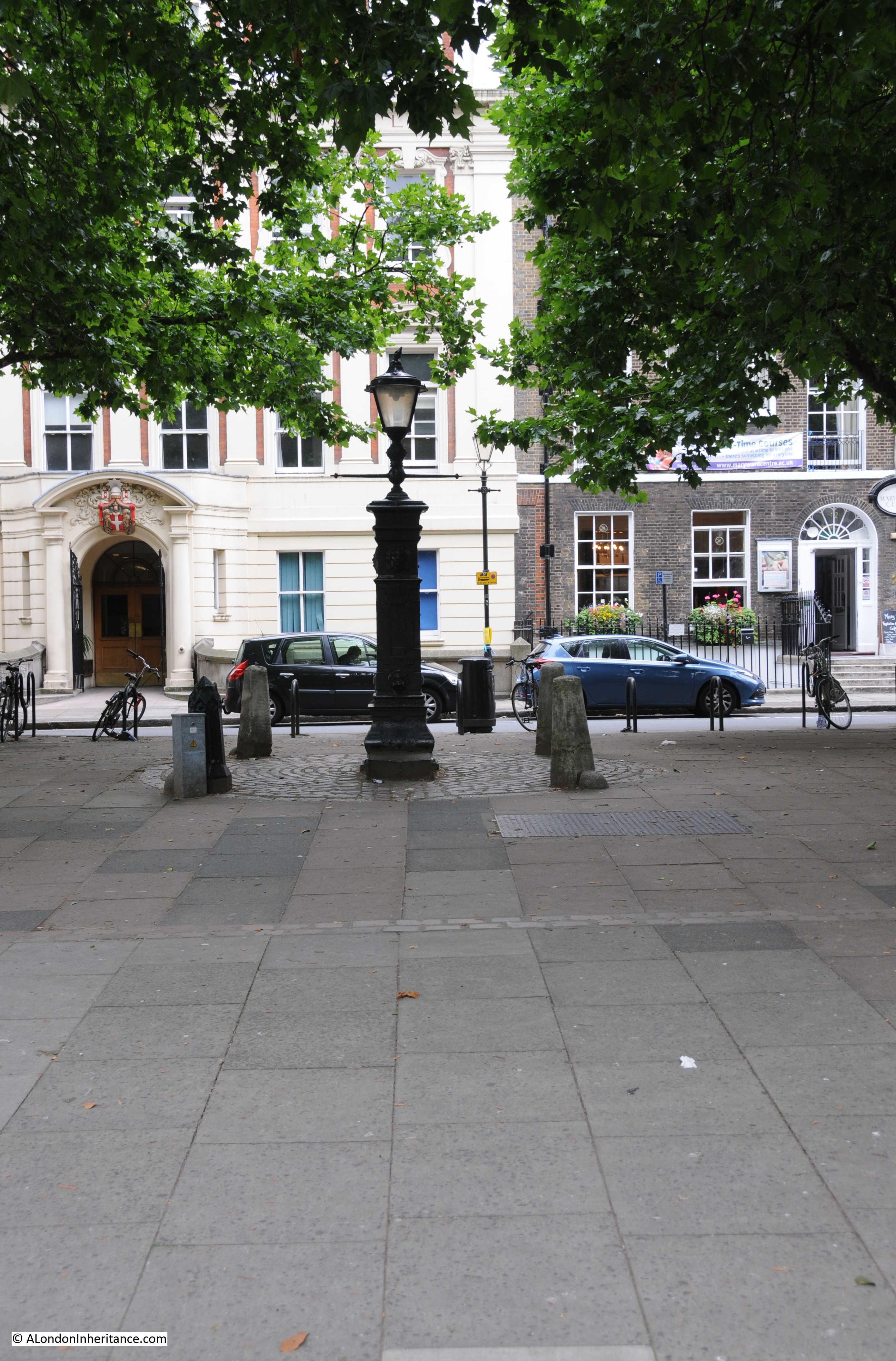
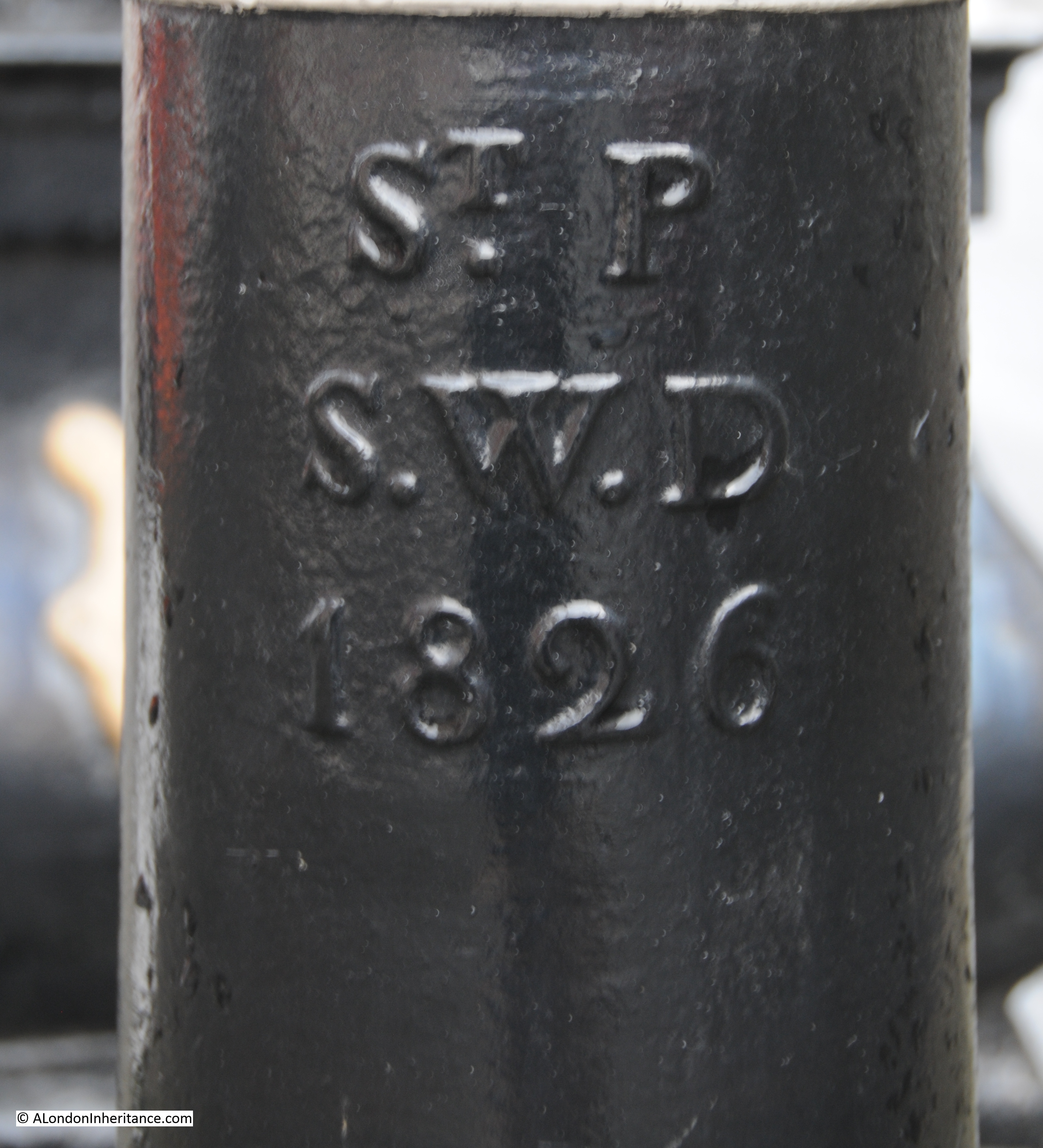
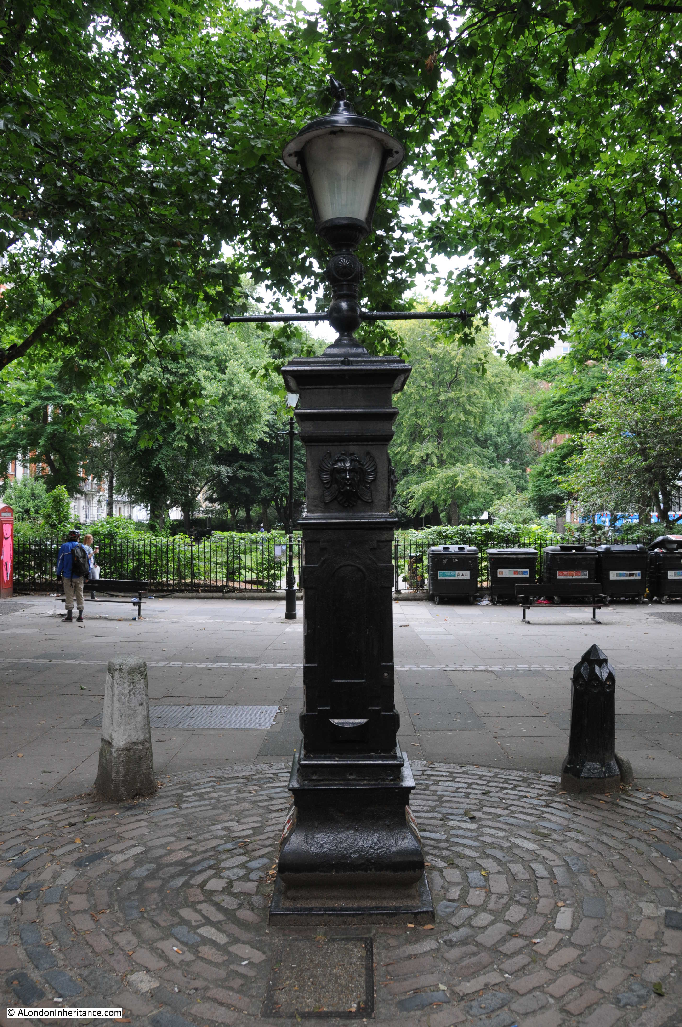
The cast iron fountain dates from 1840 (although the lamp at the top is of a later date). On the base of the water pump on both sides are the coats of arms of St. Andrew and St. George. The strange white and black symbol half way up is a temporary survey marker.

Queen Square

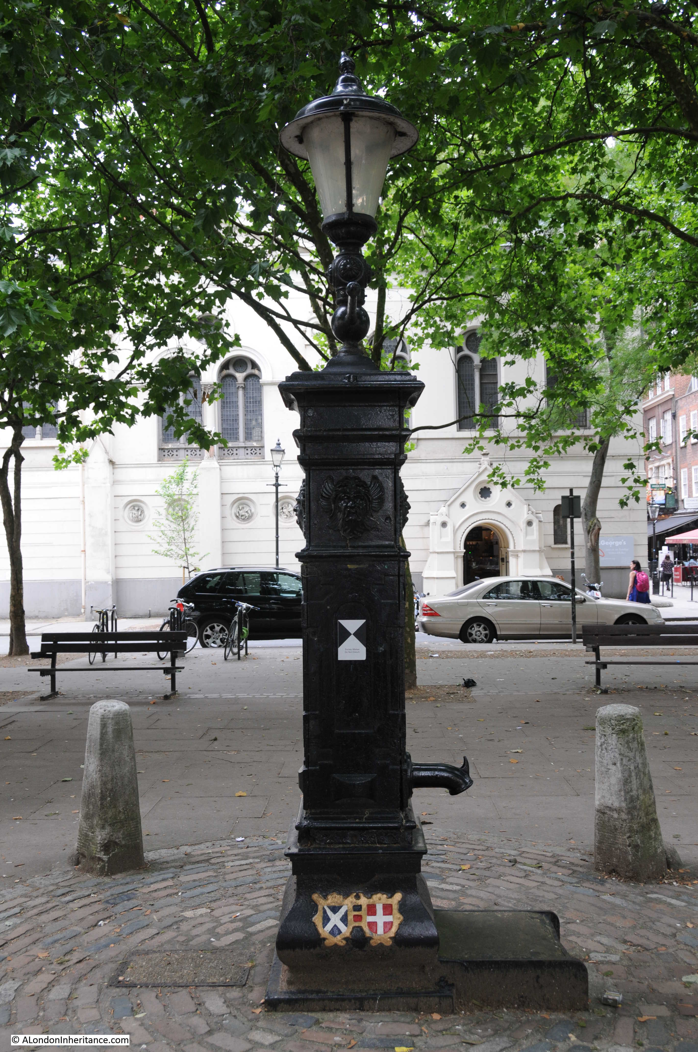
The above view is looking west towards the church of St. George’s Holborn and in the photo below looking east towards where Great Ormond Street meets Queen Square:

Queen Square

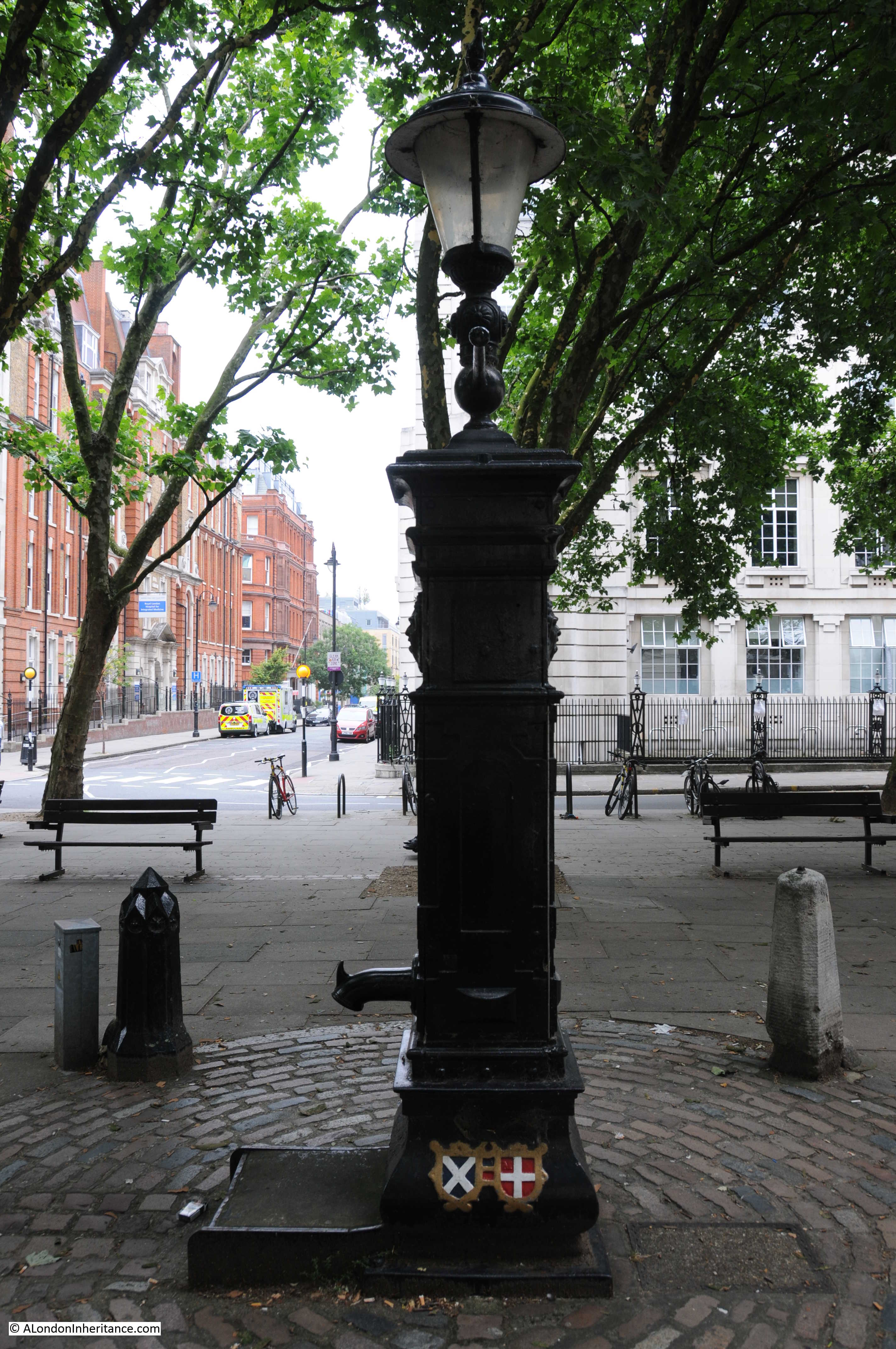
The fountain is surrounded by four bollards, three of Portland Stone and one of cast iron – no idea why there is this single iron bollard. The same set of bollards appear in the 1947 photo. I wonder if the single cast iron bollard is original being of the same material as the fountain and the stone bollards are latter replacements following damage to the other three cast iron bollards?

The water pump sits within a large paved area at the southern end of Queen Square with the gardens running north and occupying the majority of the centre of the square.

Queen Square

Construction of Queen Square started in around 1706. The square was built on the gardens of Sir Nathaniel Curzon’s house, which was typical of the expansion of London in this area with new houses and squares taking over the from the large houses that were once surrounded by countryside. The square was completed by 1725 but buildings only occupied three sides, the northern side was left empty so that the inhabitants of the square could enjoy the views over open countryside to the hills of Hampstead.

The following extract from John Rocque’s map of 1746 shows Queen Square in the centre, just below the line formed by the page fold. All the land to the north of the square is still open country. The map indicates that at the northern end of the square there were some ornamental gardens and trees to provide a boundary between the square and the lane running from left to right named Powis Wells in the map, this would later become Guildford Street.

Queen Square

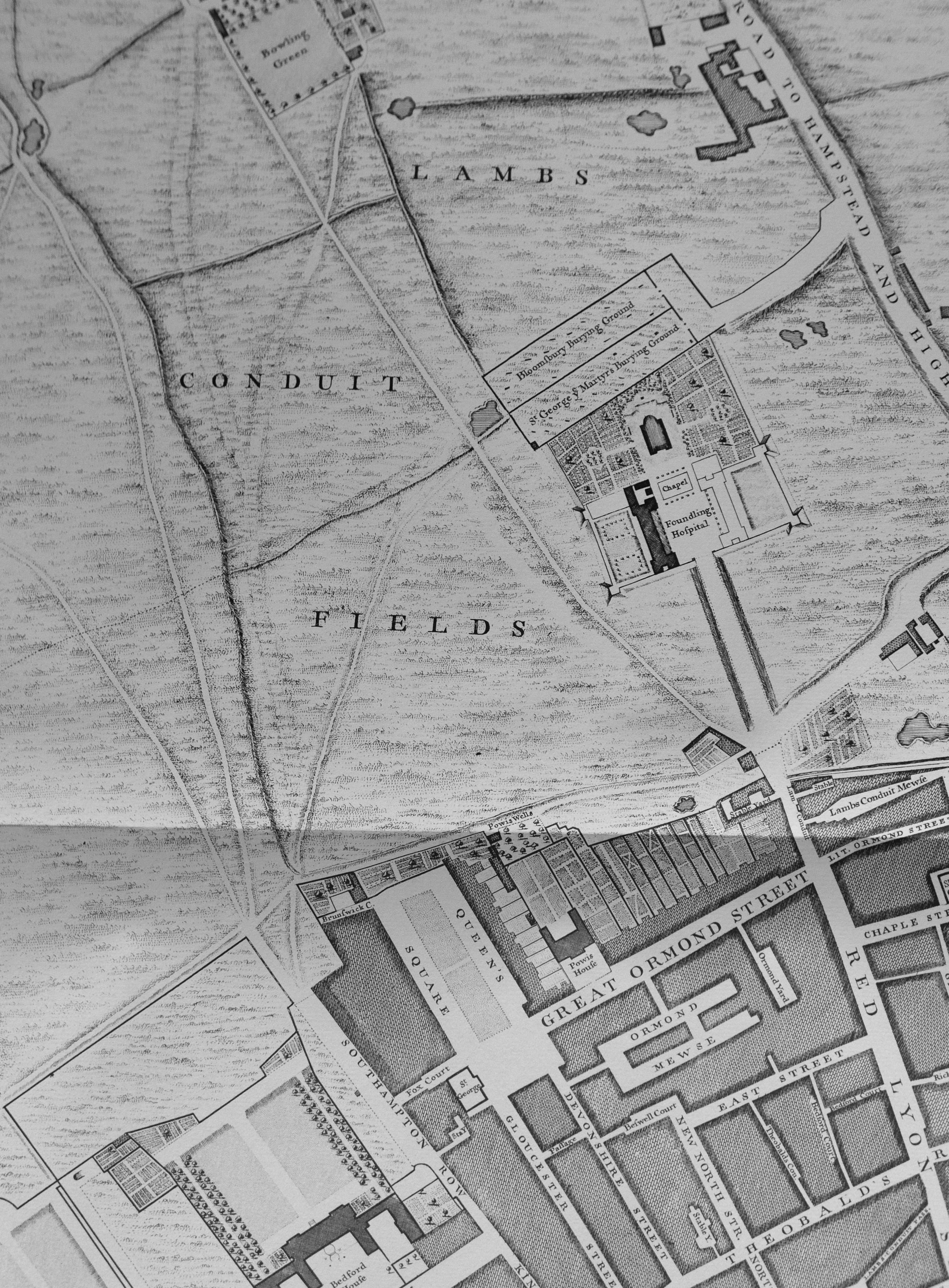
The map also shows that in 1746, gardens occupied the centre of the square north from the junction with Great Ormond Street with the large paved area occupying the southern end of the square as it does today.

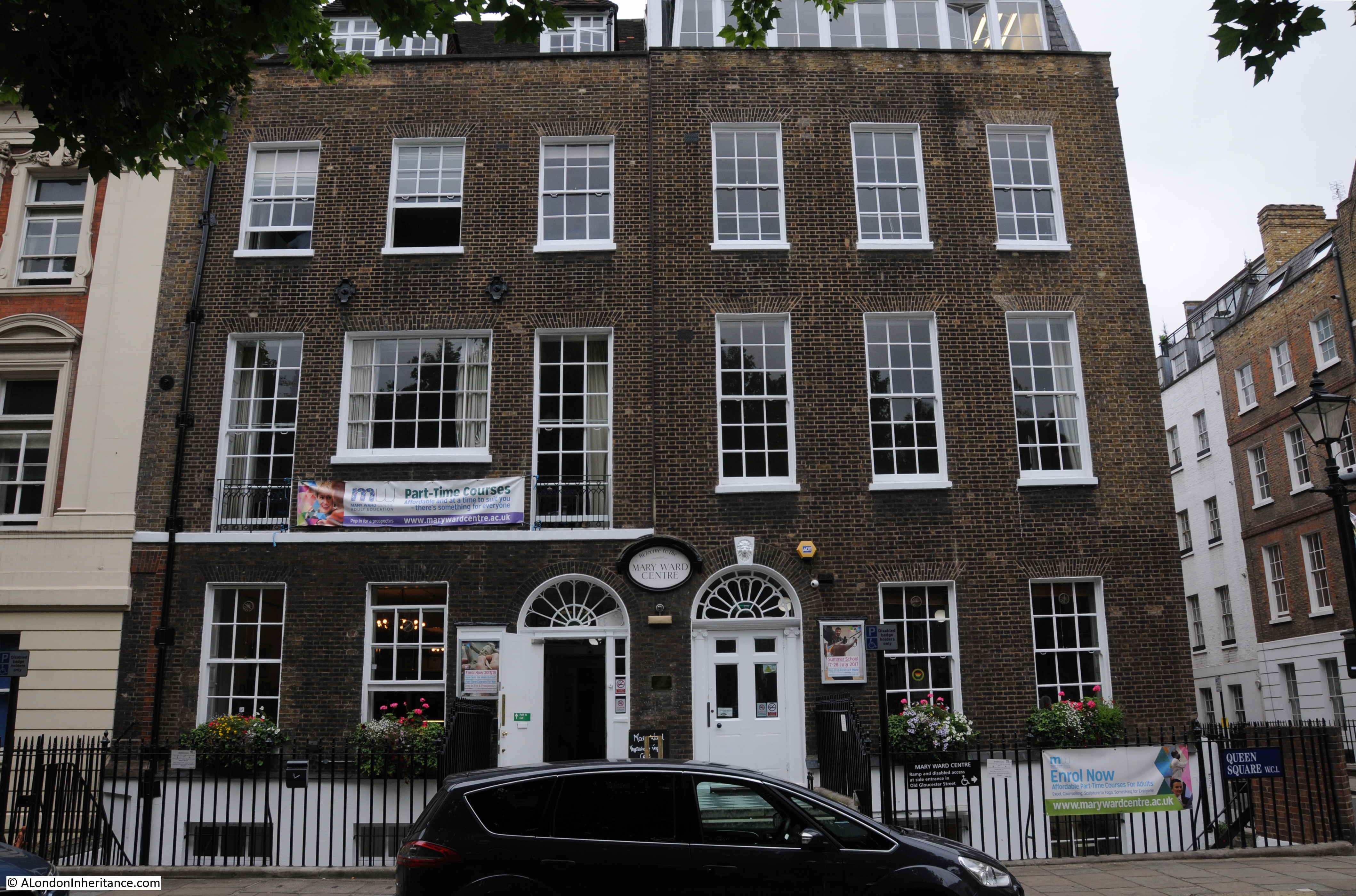
Behind the water pump in my father’s photo are two buildings of very different style. The same buildings remain to this day as shown by my photo, although they are now somewhat obscured by the trees that have grown around the water pump.

The building on the left has a rather large and ornate coat of arms above the door and along the width of the building, below the top floor windows, is written “The Italian Hospital”.

Queen Square

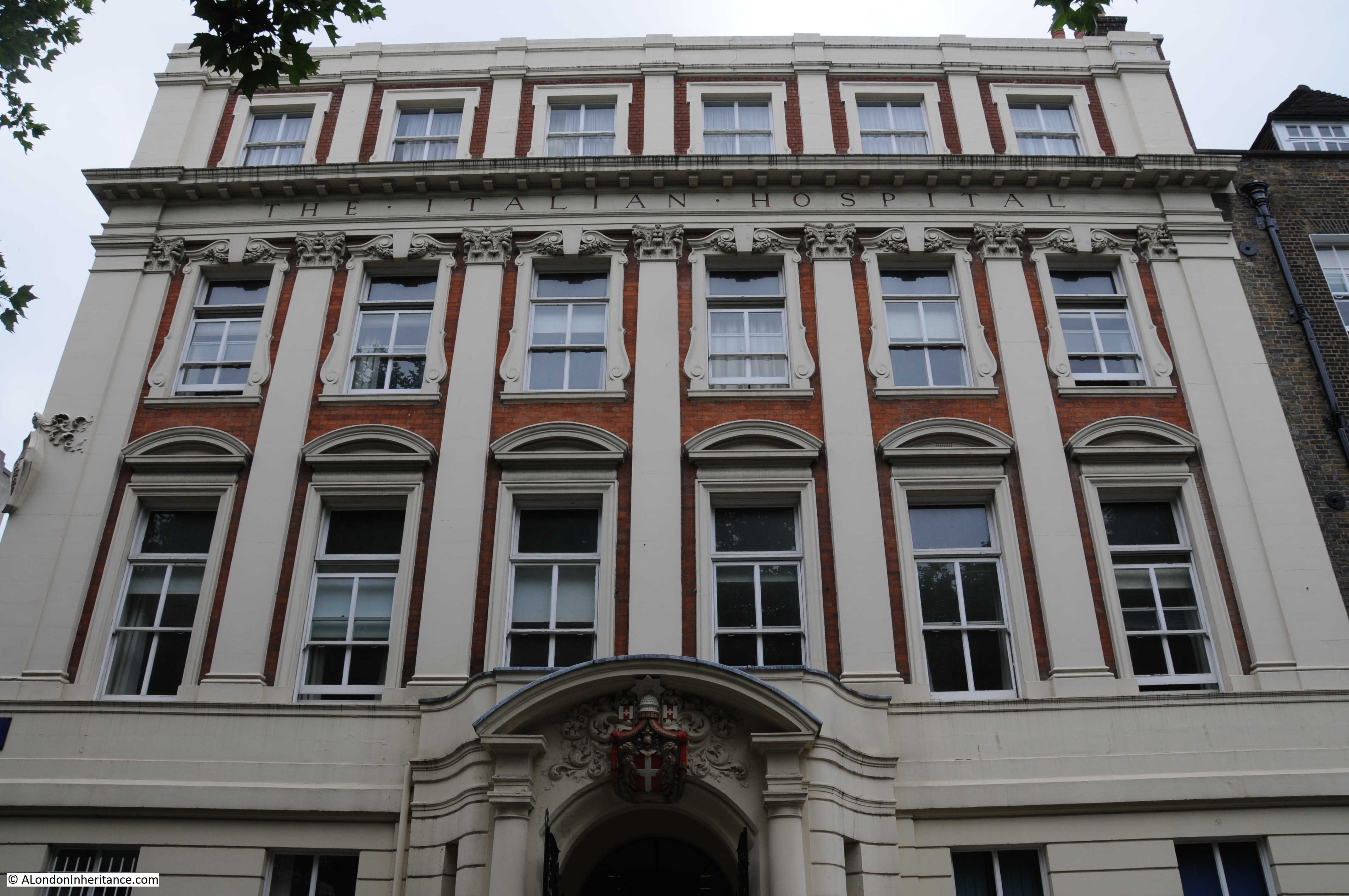
The Italian Hospital dates from 1884 when it was founded by the local Italian businessman Giovanni Batista Ortelli to provide medical care for sick Italians living in London who could not afford to pay for health care. It originally started operation in Giovanni’s home in Queen Square but moved into the purpose built building shown above following construction in 1898 to 1899.

It closed in 1990, but is now part of Great Ormond Street Hospital.

The buildings on the right are two Georgian houses that are now occupied by the Mary Ward Centre. Although there have been considerable changes to these two buildings, they are some of the few remaining original buildings with the first lease being granted on the 19th June 1703 by Sir Nathaniel Curzon.

Queen Square

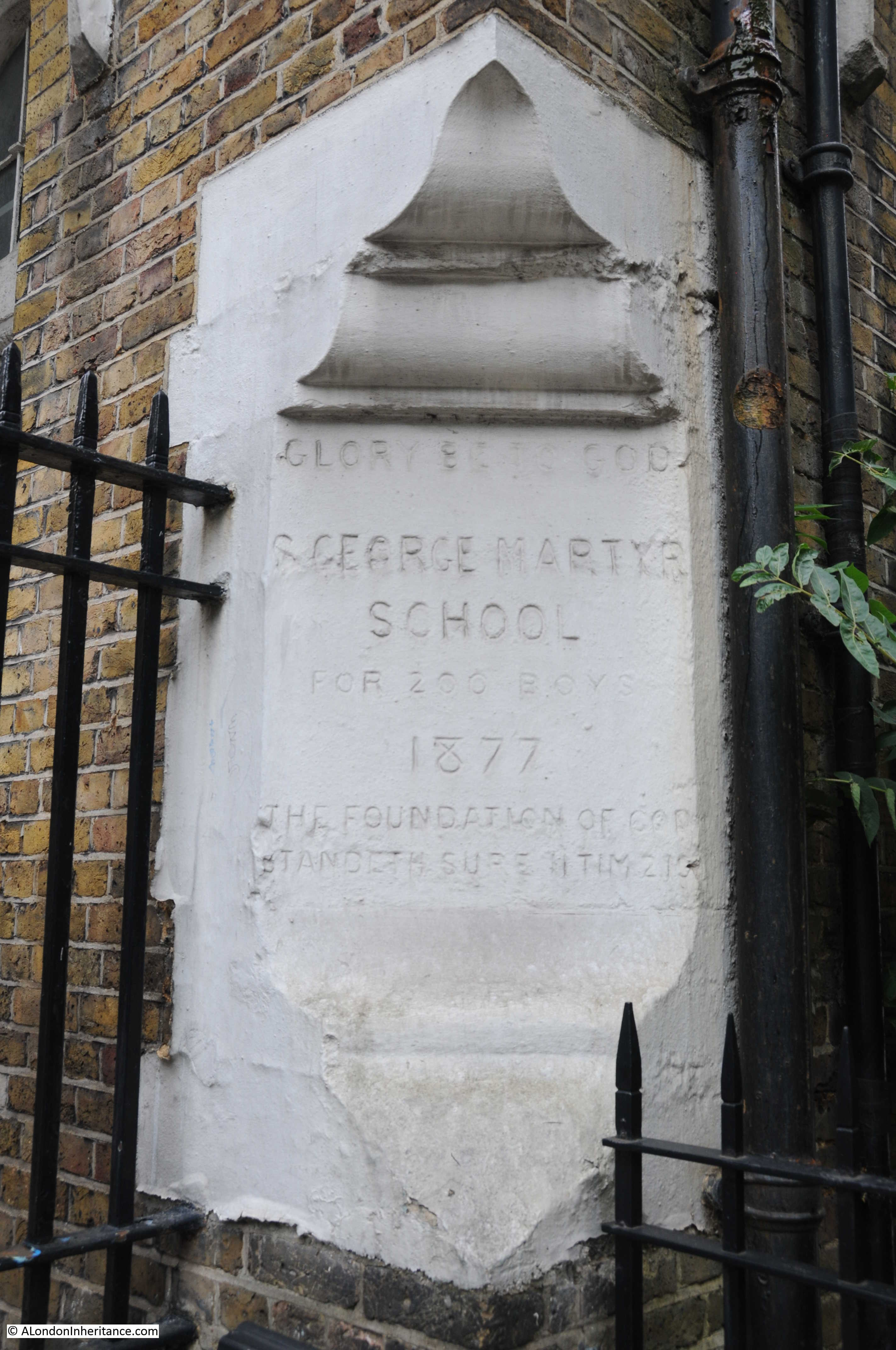
At the junction of Queen Square and Old Gloucester Street is the St. George the Martyr Parochial School. Built in 1877 as a church school aligned with the adjacent church. The school has long closed and the building appears locked and empty. Just to the rear of the building on the top floor can be seen the metal frame of the meshed cover over an outside playground – the only way to provide outside play areas at inner city schools.

Queen Square

Queen Square

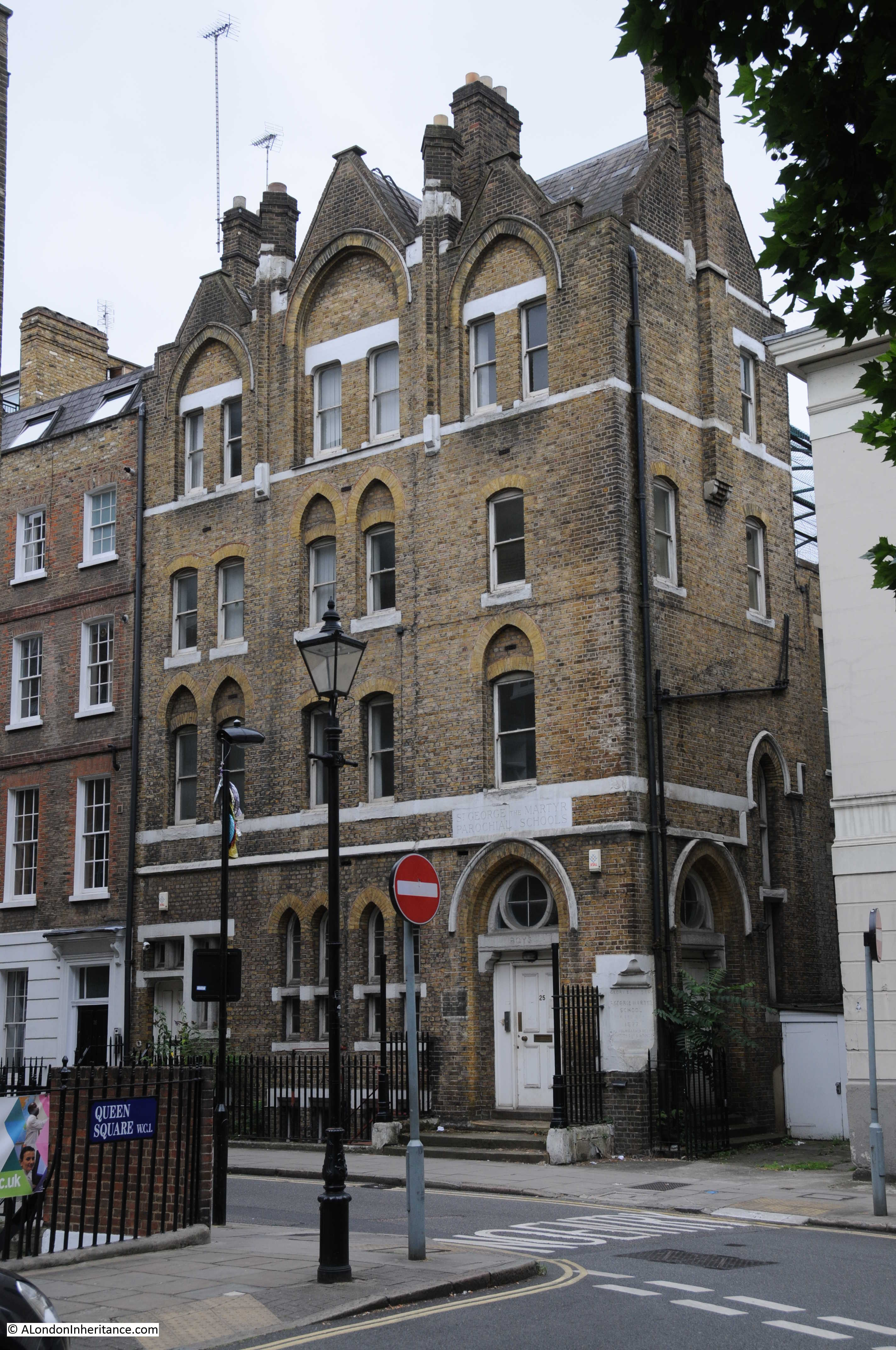
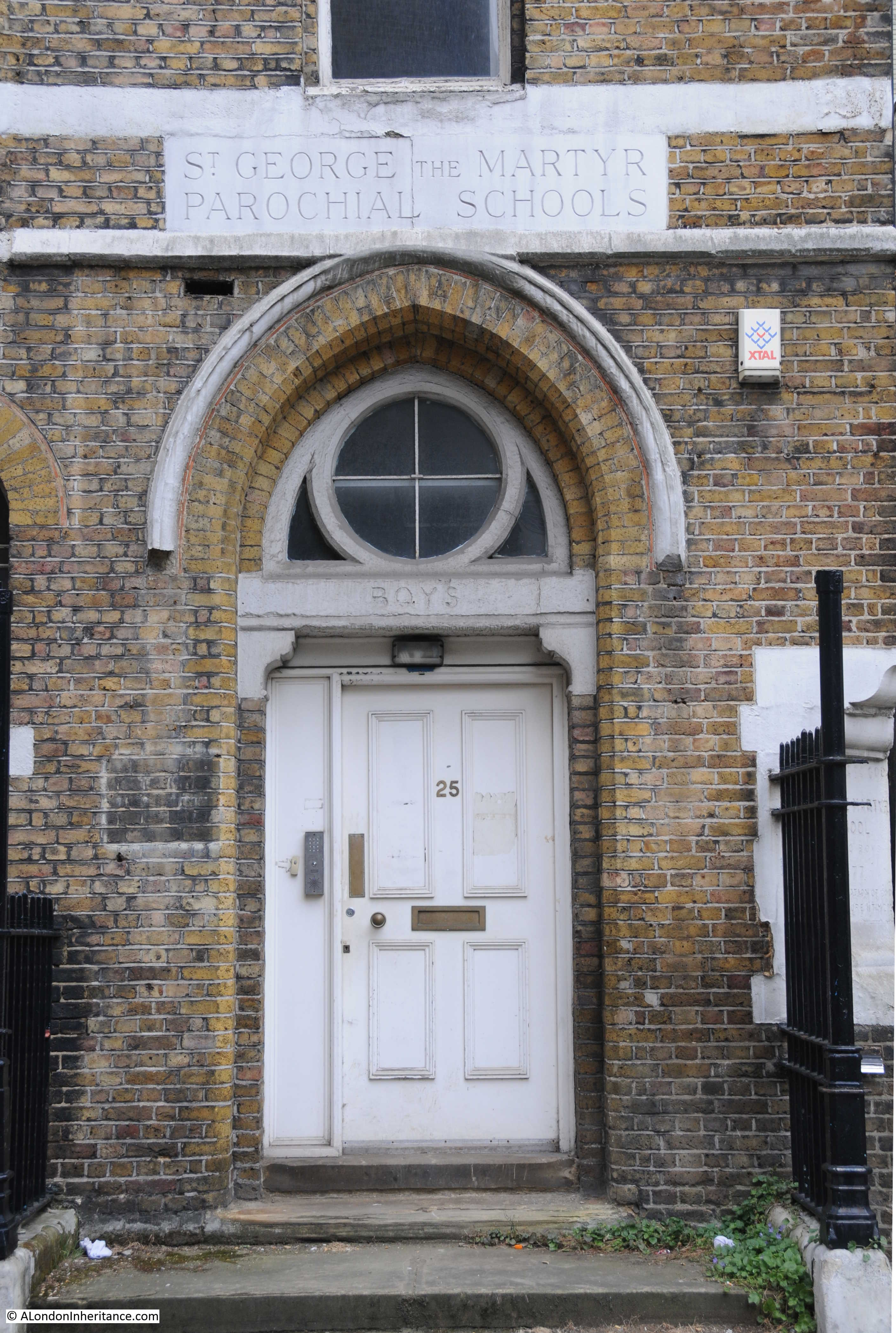
The plaque on the corner of the building records the year of opening and also that the school was for 200 boys.

Queen Square

Next to the school and in the south west corner of Queen Square is the church of St. George, one of the first buildings on the square The church dates from 1706, its construction having been funded by some of the wealthy inhabitants of the new square.

Queen Square

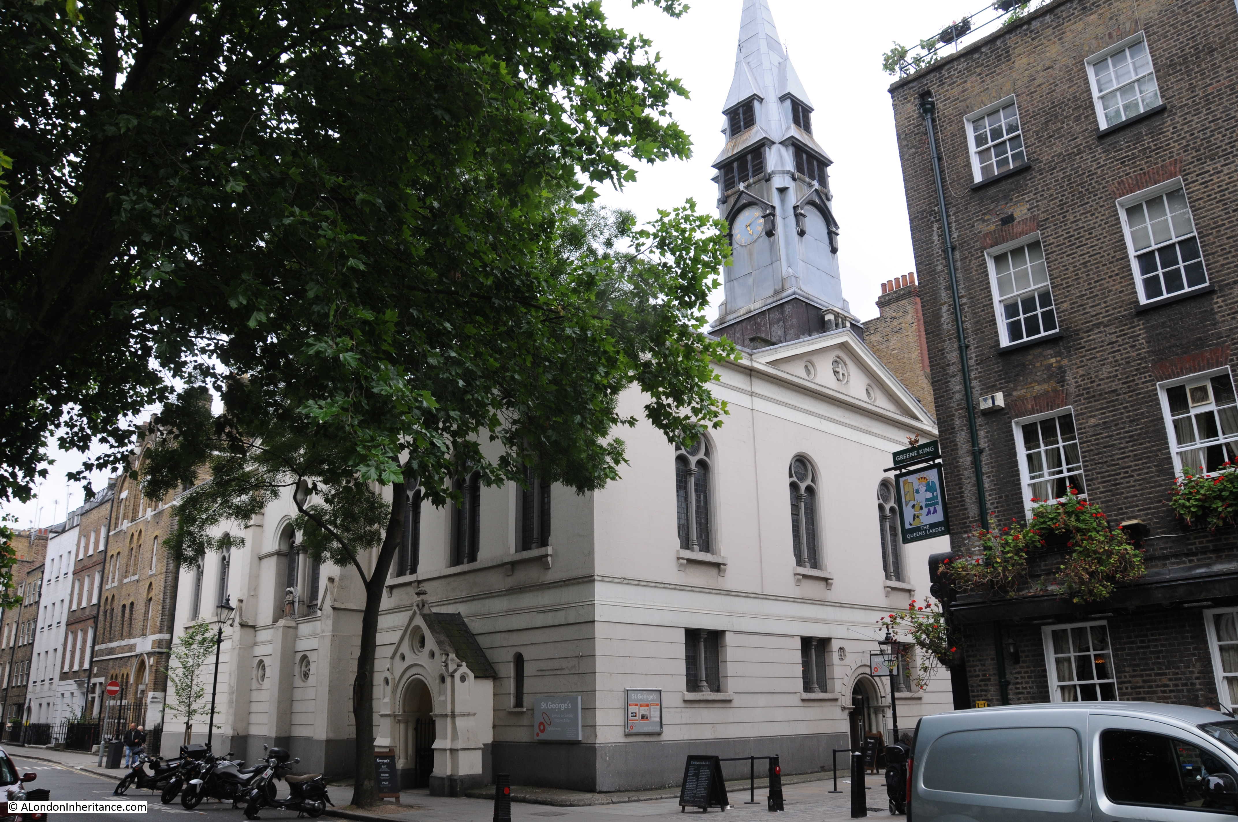
There was no space available for a graveyard adjacent to the church, this was instead provided in the land just to the north of the Foundling Hospital and is marked on the Rocque map shown above.

The antiquarian Dr. William Stukeley was rector of St. George from 1747 until his death in 1765. It was Stukeley who popularised the association of Stonehenge and Druids and in Old and New London, Edward Walford records Stukeley as also being known as the “arch druid”. For some reason, he had requested to be buried in East Ham rather than the burial ground of the church of which he was rector.

Opposite the church and to the right of the above photo is another of the original buildings. This is the pub “The Queens Larder”. The building now occupied by the pub was first let by Sir Nathaniel Curzon to Matthew Allam, a stationer.

George III stayed in Queen Square whilst under the care of a Dr. Willis whilst he was suffering from the mental illness that would impact so much of the later years of his reign. Queen Charlotte would apparently store the food that the King preferred in the cellar underneath the building which gave the pub its name during the King’s reign.

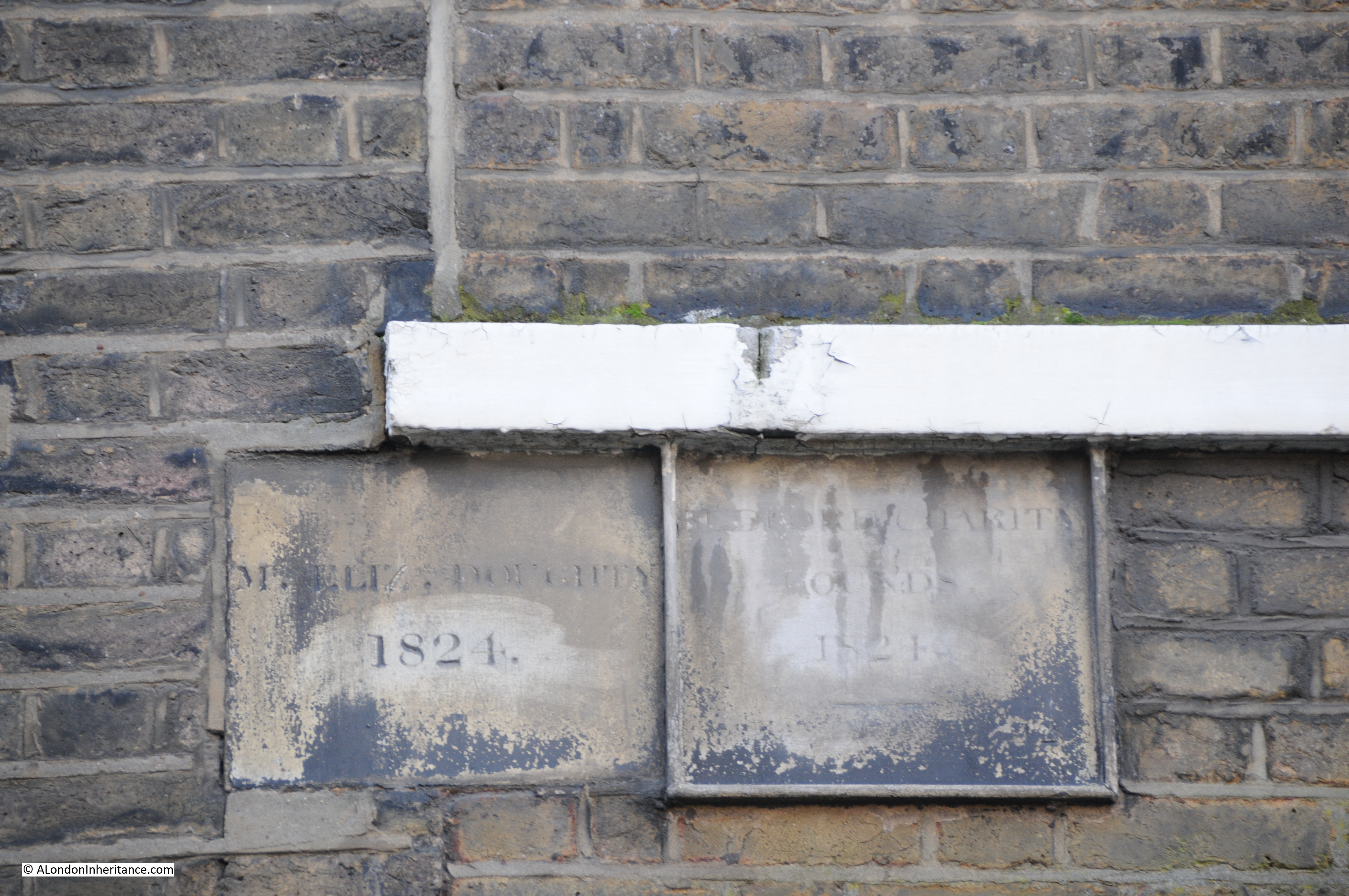
Although Queen Square is built with houses on three sides which were occupied by the business and professional classes who could afford homes on the edge of the city with the benefits of the countryside and clean air, during the 19th century the square and many of the surrounding streets were rapidly occupied with charities and medical institutions which resulted in rebuilding of much of the square.

Old and New London provides some background to the institutions that occupied the square in the years leading up to publication:

“Queen Square, as well as Great Ormond Street which we shall shortly pass, seems to be a favourite centre of charitable institutions. At the corner of Brunswick Row is the Hospital for Hip Diseases in Childhood, which was founded in 1867. At No. 22 was for many years located the oldest of Ladies’ Charitable Schools. This institution, for although called a school, it is in reality one of our oldest institutions, was established in 1702 for educating, clothing and maintaining the daughters of respectable parents in reduced and necessitous circumstances. The Ladies’ Charity School was removed in 1883 to new quarters in Notting Hill; and the site of the building here is being utilised in an extension of the National Hospital for the Paralysed and Epileptic, which adjoined it. This hospital was instituted in the year 1859.

At No. 29 is the College for Men and Women, with which is incorporated the Working Women’s College, both offshoots of the Working Men’s College established in 1874 with the object of supplying to men and women occupied during the day a higher education than had hitherto been within their reach.

No. 31 formed the head-quarters of some Roman Catholic charitable institutions, among which are the Aged Poor Society.

A large double house on the south side of the square is the College of Preceptors, founded in 1846, its object is to afford to commercial and other public and private schools those tests of results which were afforded to other schools by the university local examinations. “

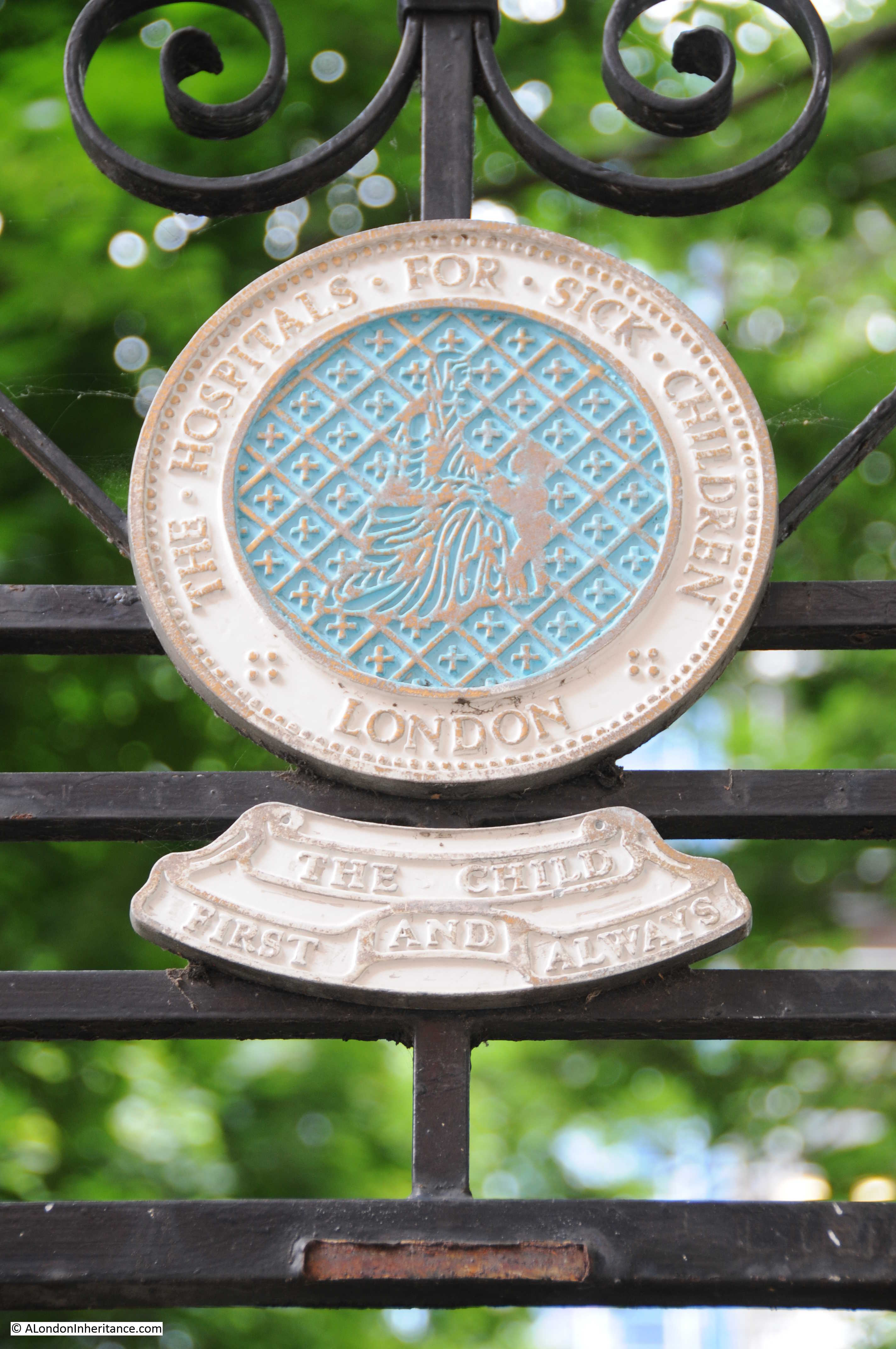
This is just a sample of the institutions that were operating in the area in the later half of the 19th century. These also included the London Hospital for Sick Children which opened on the 2nd of January 1852. The hospital is today better known as Great Ormond Street Hospital.

Plaque above one of the entrances into the central gardens:

Queen Square

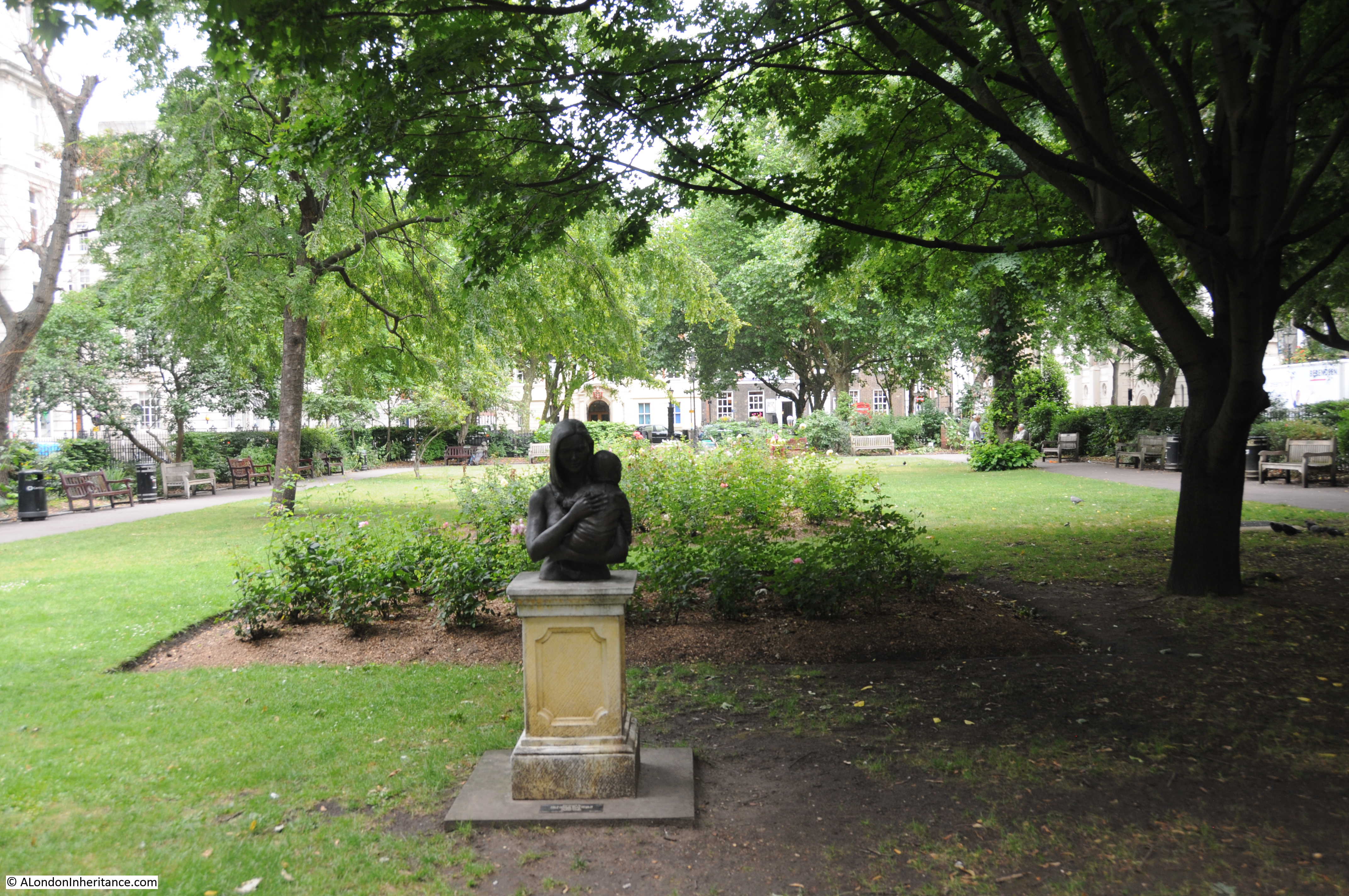
Inside the gardens, the following view is looking south towards the location of the water pump. The sculpture is titled “Mother and Child” and is by Patricia Finch. It was installed in the gardens in 2001 in memory of Andrew Temple Meller who was a Director of the Friends of Great Ormond Street Hospital from 1995 to 2000.

Queen Square

Nearby there is a plaque set into the ground that is rather easy to miss. It records the night of the 8th September 1915 when a bomb dropped by a Zeppelin fell on the location of the plaque. The Zeppelin was the L13 commanded by Heinrich Mathy.  The Zeppelin’s route over the city resulted in bombs being dropped in Golders Green, close to Euston Station, Bloomsbury, Clerkenwell, Smithfield and the railway lines into Liverpool Street,

Queen Square

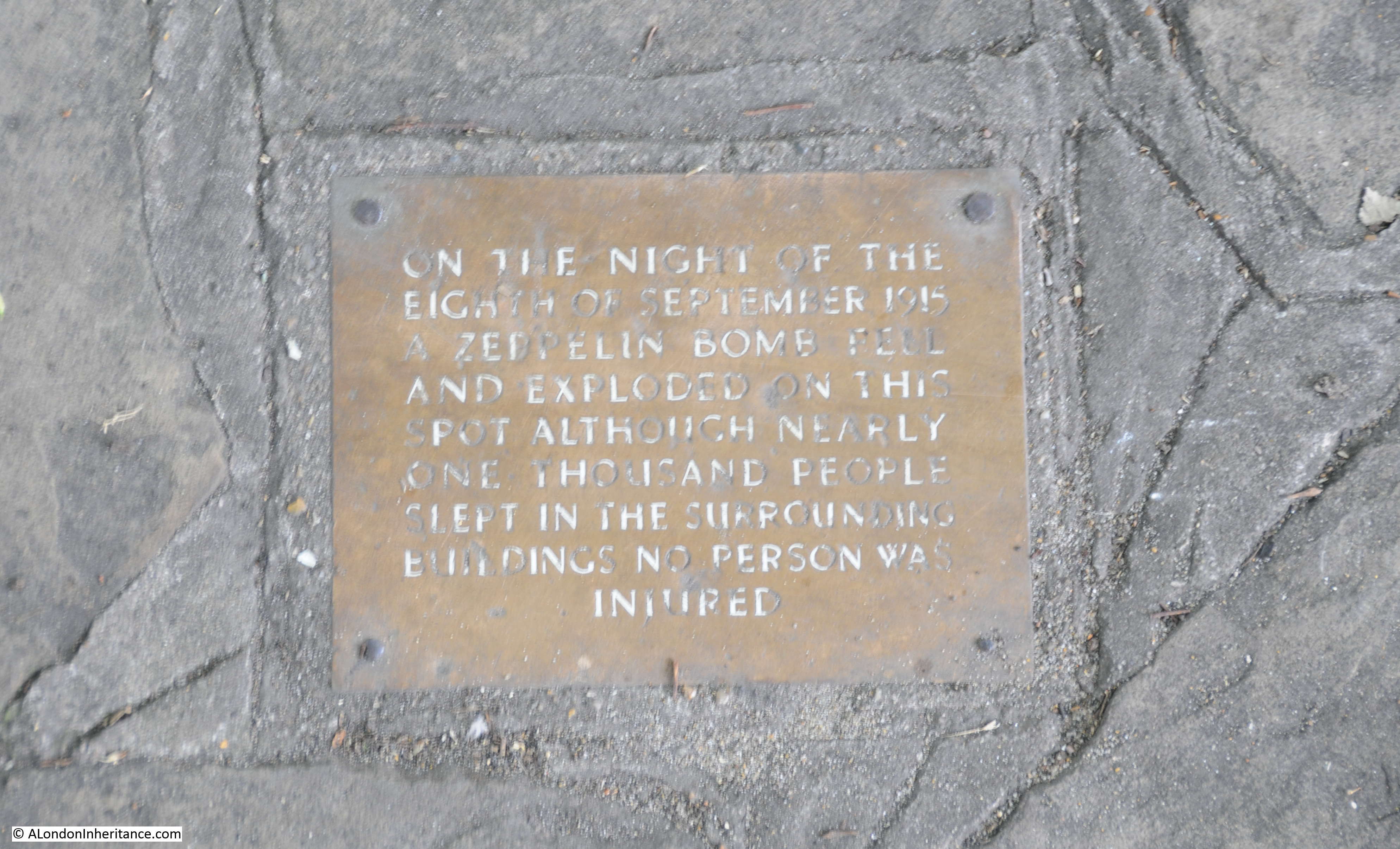
As the plaque states, there were many people asleep close to the bomb in Queen Square, but luckily there were no casualties. This was not the case at other locations as there was a death in Lambs Conduit Passage, along with deaths in Clerkenwell (four children) and in Smithfield.

The following photo (© IWM (Q 58456)) shows the L13 Zeppelin.

Queen Square

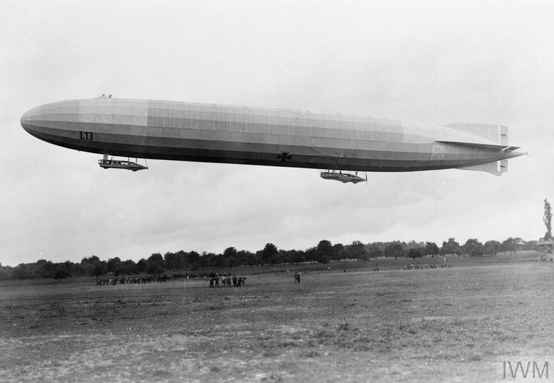
The L13 was decommissioned in 1917 however Heinrich Mathy died on the 2nd October 1916 when he was commander of L31 which was shot down near Potters Bar. Mathy along with his entire crew died after jumping from the burning Zeppelin.Queen Square

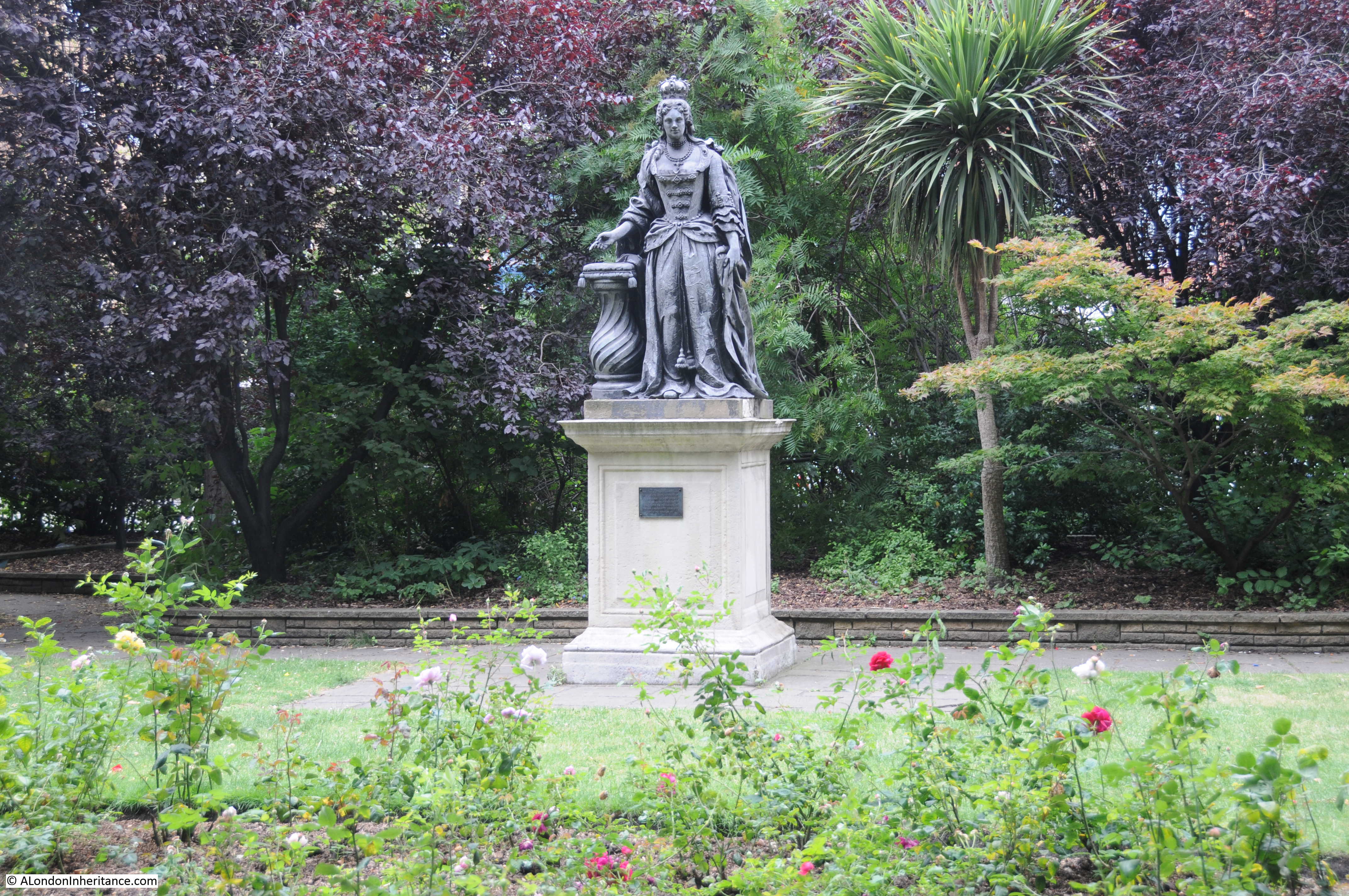
Queen Square is named after Queen Anne, the monarch at the time of the construction of the square and there is a statue at the northern end of the square which was originally thought to be have been Queen Anne however as the plaque on the pedestal (shown below) states it is now thought to be of Queen Charlotte, who was also responsible for the naming of the Queens Larder pub.

Queen Square

At the north eastern end of the square there is a recent statue of Lord Wolfson, the chairman of Great Universal Stores (remember them ?) and also founder with his father of the Wolfson Foundation in 1955 which was endowed with £6 million of Great Universal Stores shares.

Queen Square

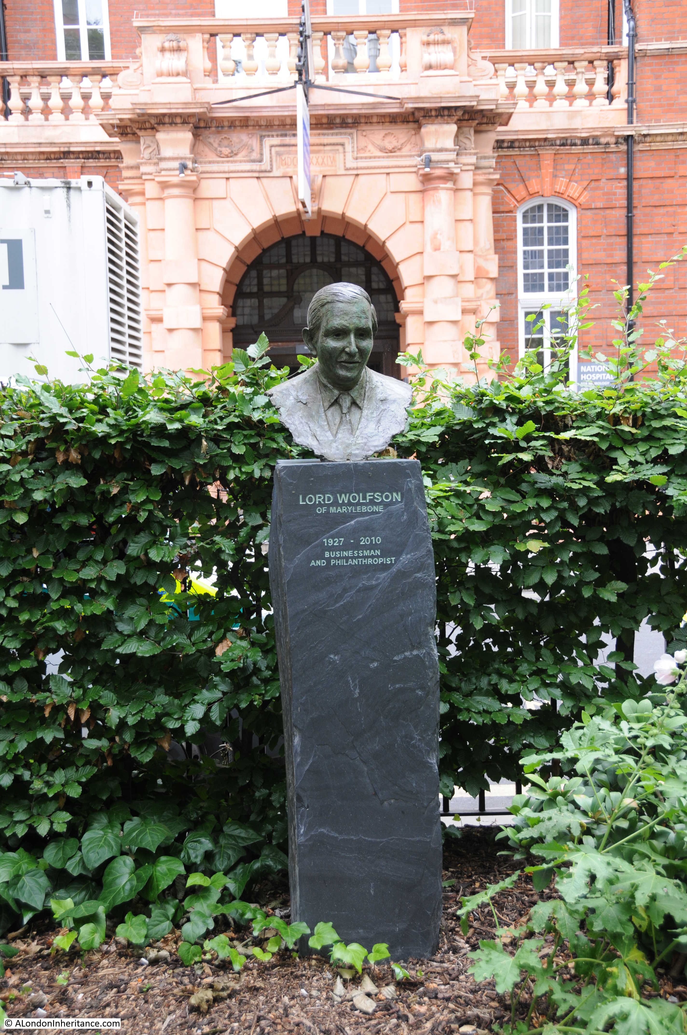
The Wolfson Foundation is a charity that provides grants to individuals and organisations in the fields of science, health, education and the arts and humanities. I assume that the medical institutions that now surround Queen Square have benefited from the Wolfson Foundation, hence the statue.

The square dates back to the start of the 18th century, however standing at the north eastern corner it was strange to hear a 21st century sound with the rhythmic thumping of an MRI scanner working in a large container parked in the street. There are other reminders of the functions of the buildings surrounding the square. Whilst I was there, patients in wheelchairs were being pushed around the square. As well as being a historic square this is also a centre of medical research and treatment.

Queen Square

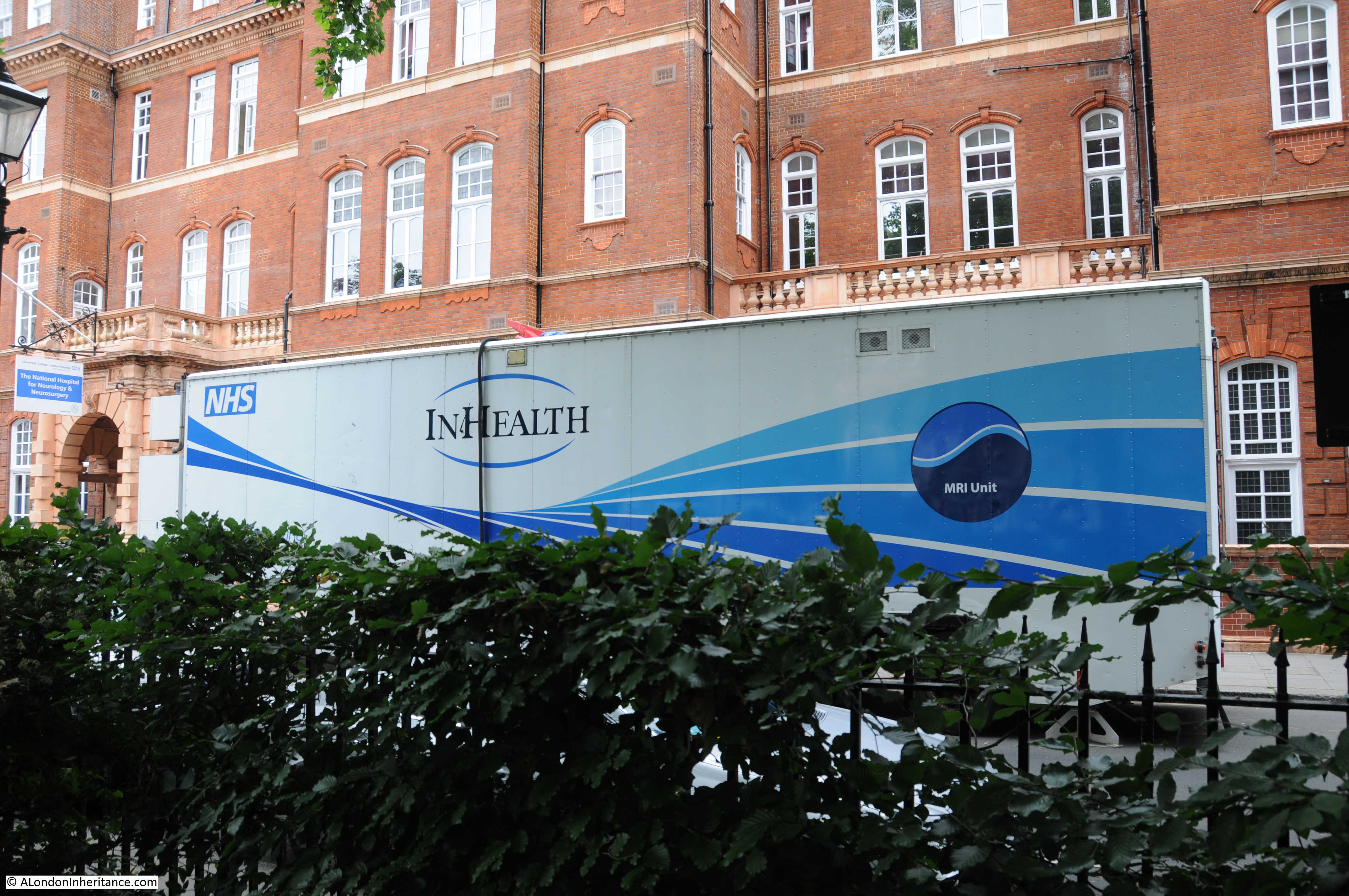
Along the eastern side of the square are buildings of the National Hospital for Neurology and Neurosurgery.

Queen Square

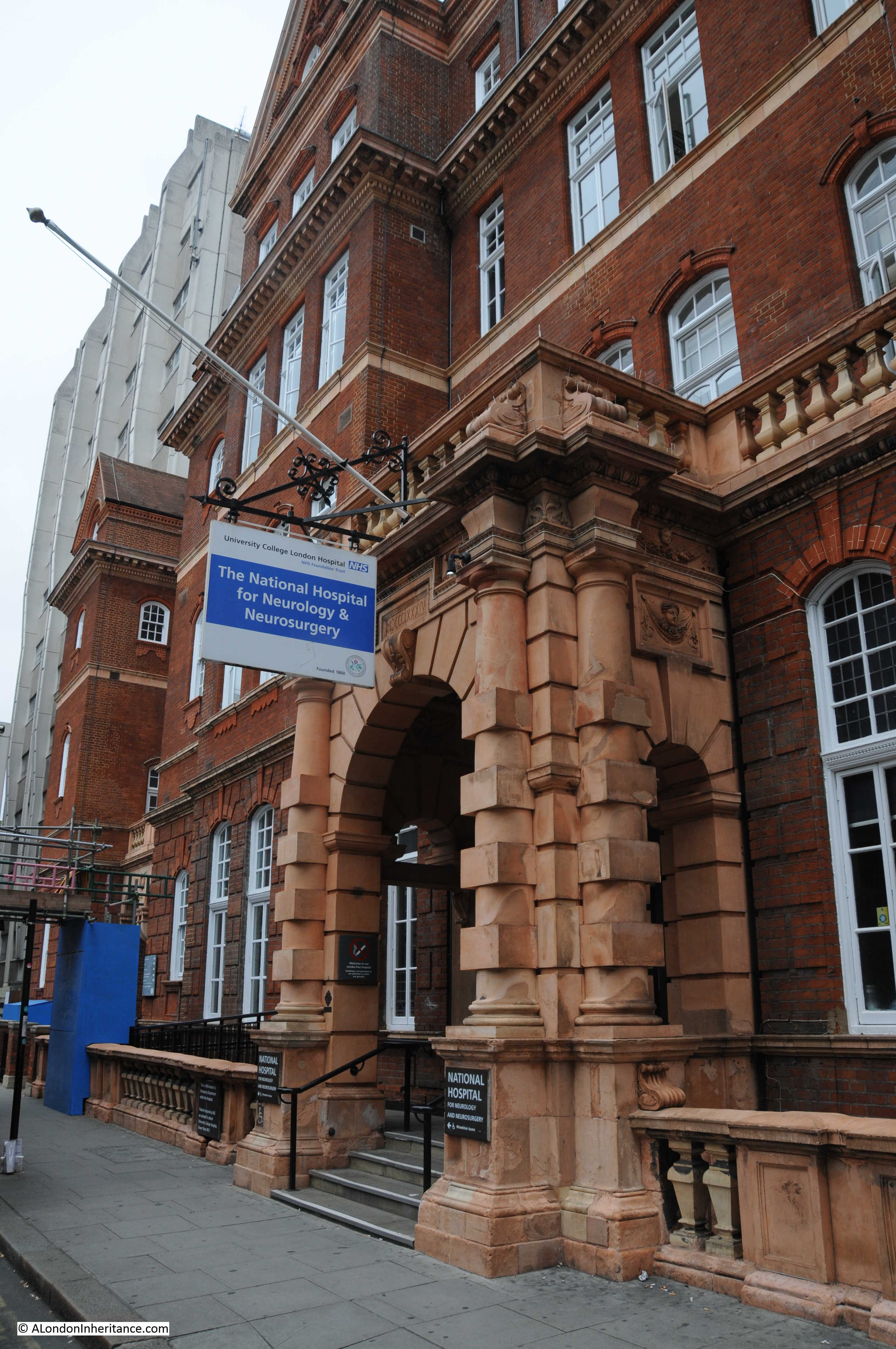
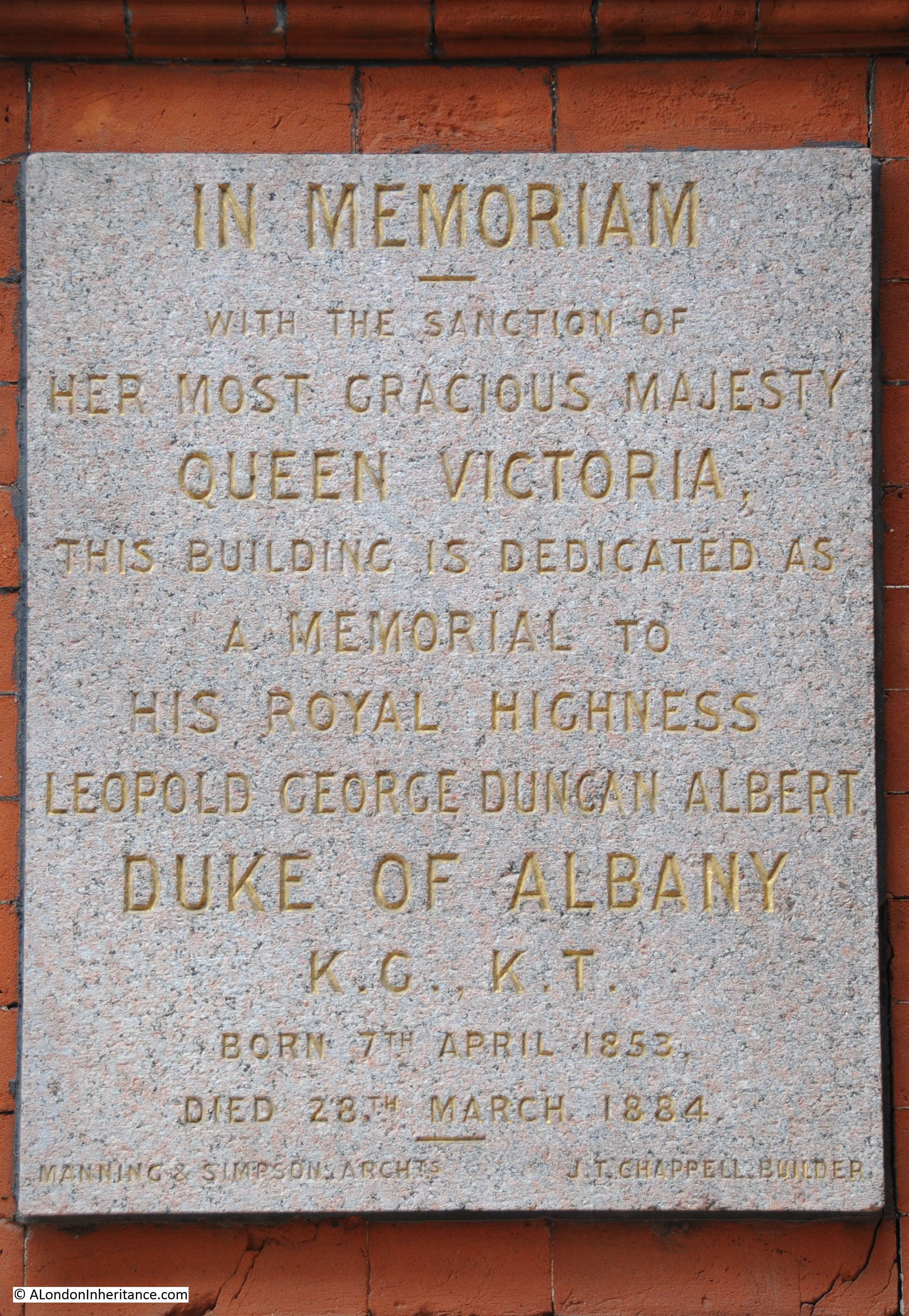
The plaque below is on the building shown above.

Queen Square

Next to the above building, there is a later building, also part of the same hospital, that was opened in 1937. The majority of the building was covered in scaffolding and sheeting, however one of the doors to the street was clear and there is an excellent relief above the door.

Queen Square

This is by A.J.J. Ayres who was born in Paddington in 1902 and worked from a studio in Hampstead. There is a second door from the building which also has another relief by Ayres, however this door was covered when I walked past.

This was the second photo I had taken of this door and relief. When taking the first I surprised a doctor coming out the building who was faced by someone taking a photo at as distance of a couple of feet. he had not noticed the relief before – it is strange how you do not notice things when you pass them so many times.

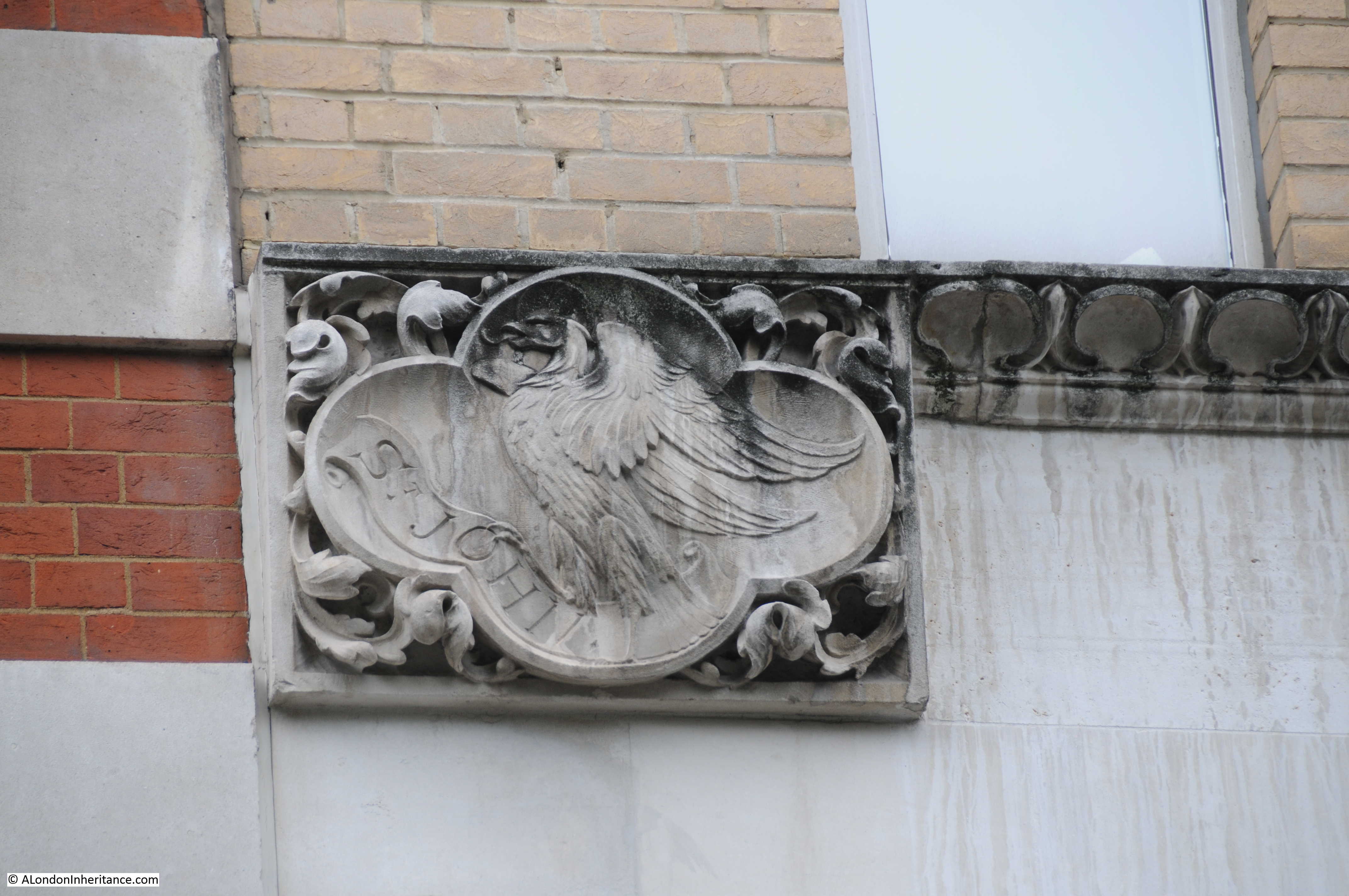
On the west side of Queen Square is this building – St. John’s House.

Queen Square

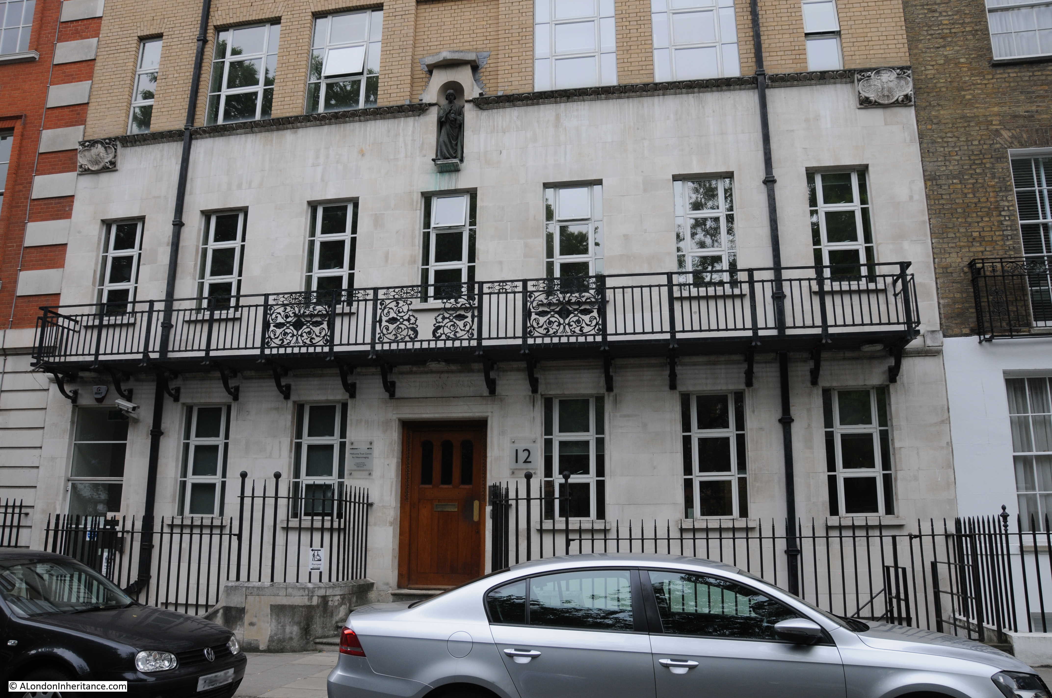
Build in 1906 for an organisation of the same name which was founded in 1848 as a ‘Training Institution for Nurses for Hospitals, Families and the Poor’. St. John’s House recruited and trained nurses for many of the major London Hospitals, however in the early 20th century recruitment into a religious training organisation was falling as hospitals were starting to recruit and train their own nurses and the St. John’s House organisation closed in 1919. The building was then used as a centre for nurses who had been trained at St Thomas’ Hospital.

St. John’s House is now occupied by the Wellcome Trust Centre for Neuroimaging.

There are some rather nice decorative features on the building. At the top of the first floor on the right is the following plaque which records that St. John’s House was founded in 1848 and rebuilt in 1906.

Queen Square

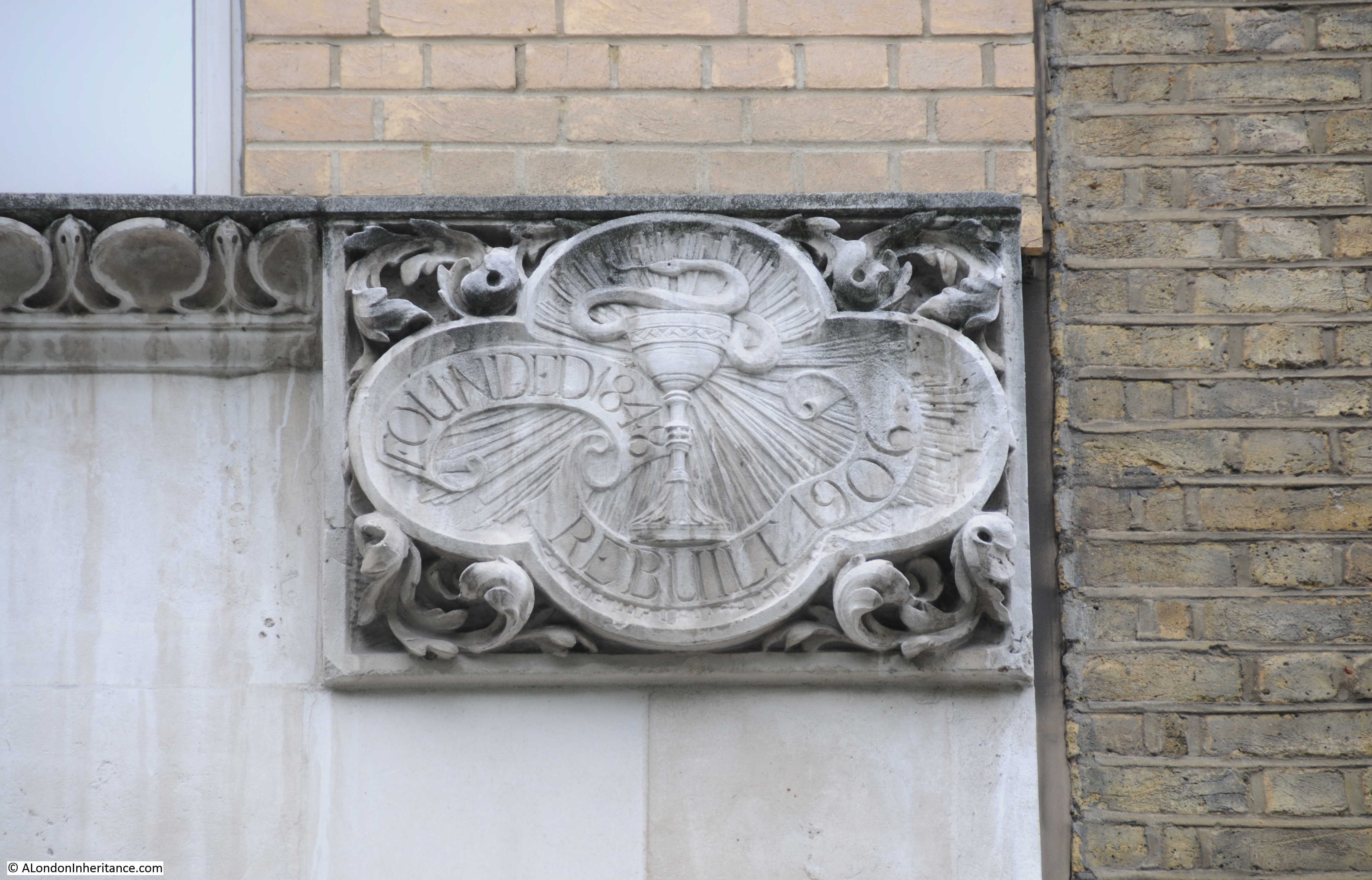
Just below the above plaque is this small stone which records the date of 1906, however the name of the builders appears to be now unreadable.

Queen Square

The plaque on the left of the building:

Queen Square

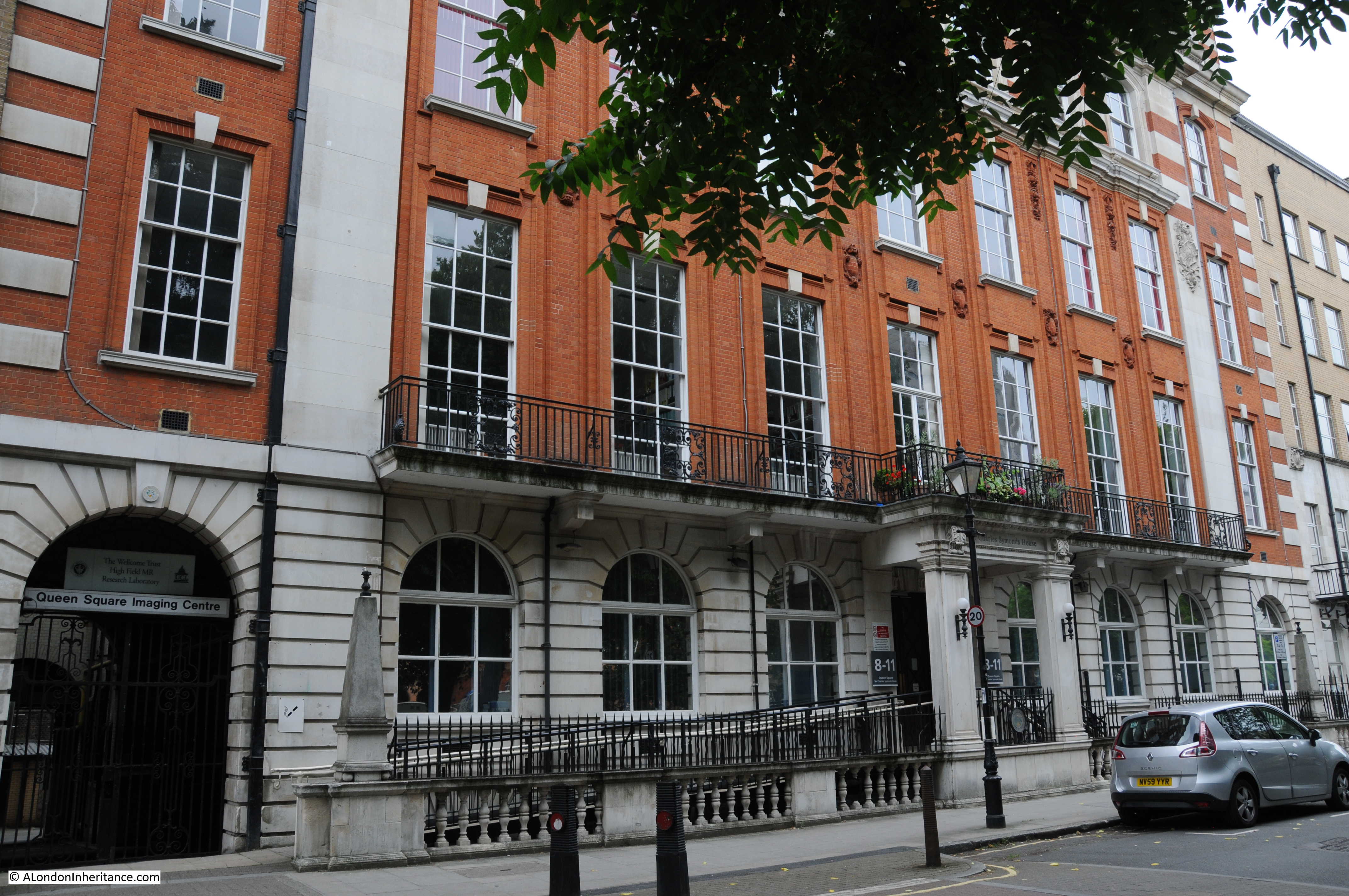
The building below is the Queens Square Imaging Centre. Owned by the University College London Hospitals Charity it is strange to think that behind this rather ornate facade are some of the latest medical imaging systems.

Queen Square

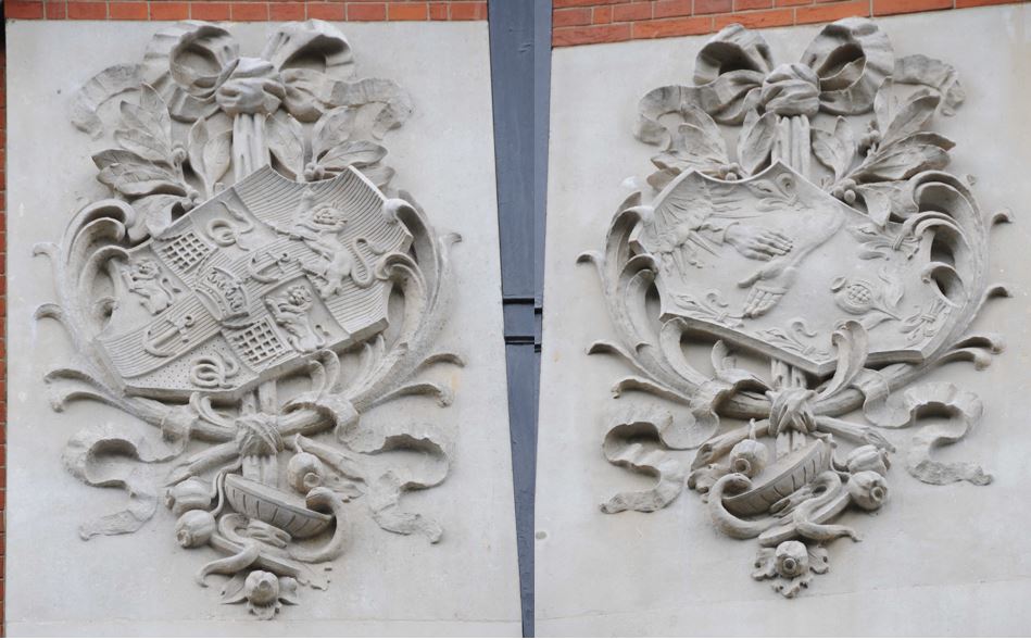
Reliefs from the top of the second floor of the above building:

Queen Square

The final buildings in my tour of Queen Square are these in this view of the northern side of the square. It is here that during the first decades of the 18th century when the square was built that the square was open to provide views across open countryside up to the hills of Hampstead.

Queen Square

The building on the left was the head offices of the Royal Institute of Public Health and now houses private consulting rooms.

The building on the right is the 1930s apartment block Queen Court. There is a blue plaque on the building for Forest Frederick Edward Yeo-Thomas who lived in Queen Court for a short period. Yeo-Thomas was a Special Operations Executive agent who went on a number of missions to occupied France during 1942 and 1944, ending with his betrayal and capture in Paris. He suffered severe torture by the Gestapo and was sent to Buchenwald Concentration Camp. Following further transfers and a number of escape attempts he managed to escape and made it back to Allied lines in April 1945. After the war he participated in the Nuremberg War Crime Trials, then settled in Paris where he died in 1964.

A couple of years ago in 2015 a potential developer paid £150,000 for the ground beneath Queen Court, presumably with the expectation of building large basement apartments. It seems crazy that the ground beneath existing buildings can now be sold for such ridiculous figures, presumably with no regard for the occupiers of the building above ground.

Limited work has started, however the residents obtained an injunction forcing the developers to halt the work. It will be interesting to see where this goes.

That was a brief run around Queen Square. It is one of the locations in London I like to walk through when I am feeling cynical about London and the over priced apartment buildings that are being built at every opportunity, bland architecture, the loss of local character and disconnection with the past

Queen Square does what London does best. Loads of history, a wide mix of different architectural styles dating back to the first building in the area as London expanded, a concentration of expertise, institutions and professions, all still very relevant today – and a good pub.

Long may it continue.

alondoninheritance.com

A Water Pump, Bedford Row And Tracing Harpur’s Bedford Charity Estate

There are some locations in London that have changed remarkably little over the last seventy plus years. There are also locations where decisions made 500 years ago are still in evidence. Not the usual candidates such as the Tower of London or St. Paul’s but amongst the ordinary streets of London.

One of my father’s photo’s from 1947 was the water pump in Bedford Row.

From Chancery Lane underground station, walk along Holborn to the west until you come to Brownlow Street. Head up this street and at the end you will be in part of Bedford Row, facing the water pump shown in the following 1947 photo:

Bedford Row 18

And in 2015 the scene is remarkably much the same. The pump has been painted, a sign with the street name has been put on the building behind and there are now bollards around the pump.

The buildings behind are almost unchanged, even the metal fencing along the building to the right is the same.

Bedford Row 17

The pump is also a perfect example of not always believing what you see in London. Take a look at the bollards and they are marked St. Pancras Street Works Department, 1826, so it would be a reasonable assumption that they have been in place since 1826, however the 1947 photo clearly shows a much smaller surround to the base of the pump and no bollards.

I assume that with the size of cars and lorries that are now in use on London roads, it was decided prudent to enlarge the base and provide some protection to the pump using bollards from some other location in St. Pancras.

Bedford Row 16 small

I always find it fascinating to look at the buildings around any location I am photographing. On the building just to the left of the pump is the remains of the original street signage for Bedford Row:

Bedford row 1

And just further along I found the following plaques:

Bedford Row 19

Not so easy to read. The one on the left reads “Ms. Eliz Doughty 1824” and the one on the right “Bedford Charity Bounds 1824”

These are boundary markers and were essential to identify ownership of blocks of land prior to the availability of accurate street mapping. In the days before clearly defined ownership boundaries, when parcels of land were let and sublet, when it could be decades between the times when ownership of land needed to be checked and when owners could easily extend their boundaries in the hope of expanding their ownership before anyone realised, boundary markers played a key role in defining ownership.

Much of the land across London was originally held by the Crown or Church in large blocks, and over the centuries this has gradually been sold off to leave much smaller parcels of land, however some large estates still remain.

The Bedford Charity seemed an ideal candidate for some further research, to find the original boundaries of the estate, how the estate came into being, and if anything remained.

The origin of the Bedford Charity is a gift of land made by Sir William Harpur in 1566 to the corporation of Bedford.

Sir William Harpur was very much a self-made man of the times. The Harper family (the spelling of the name appears to have changed to Harpur around 1764) had lived in the area around Bedford for many years prior to the 16th century.

A school had been operating in Bedford since before 1166 and as with most schools of this period it was part of the church and Bedford school maintained this connection through to the dissolution during Henry VIII’s reign.

William Harpur attended the original Bedford School before leaving for London. His early days in London do not appear well documented, however from the book “The Harpur Trust” by Joyce Godber;

“It my be that he was apprenticed to a tailor, but there is no certainty about this; nor is there evidence of his connection with any other trade.”

The assumption of his original apprenticeship seems likely to be correct due to his later career, as William Harpur was admitted to the Merchant Taylors company in 1533.

Harpur’s progression through the Mechant Taylors resulted in him becoming Master in 1553, the same year he became an alderman for the ward of Bridge Without.  When a vacancy appeared for an alderman within the much older and prestigious ward of Dowgate, Harpur was elected to this ward in 1556. He also served a year as treasurer of St. Bartholomew’s Hospital and was a sheriff between 1556 and 1557.

His rise continued and in 1561 he reached the peak of his career becoming Lord Mayor of London.

Through his contacts, Harpur would have been very aware of the work of others within the City of London in support of schools throughout the country.

Whilst Harpur was Lord Mayor the Merchant Taylors school was founded by Richard Hilles, the master at the time and a contemporary of Harpur. He would have known of the founding of St. Paul’s school by Dean Colet in 1509 and the work being done by schools such as Winchester where the earliest printed school text books were compiled in 1559.

He had already been assisting the school in Bedford. Newnham Priory, originally attached to the school had been closed and the property confiscated. Again from “The Harpur Trust” by Joyce Godber;

“These were unsettled times in religious matters. In 1533 when he was approaching the age of 40, Harpur would have heard that, like monasteries elsewhere, Newnham Priory had been closed, the canons pensioned off, and the property confiscated. When he visited Bedford again he would find the priory site desolate, with much of the stone carried away and what was left was being converted to a house. At Bedford it would seem he found the school still existing, probably under an aged master, but it was clearly at risk, like similar schools elsewhere; for the building was up for sale with a number of other ex-monastic properties.

And now Harpur seems to have got in touch with John Williams, perhaps once his schoolfellow. Williams in 1545 obtained a large grant of former monastic property, and with it the school-house in School Lane.

In 1548 Edmund Green came from New College, Oxford to teach at Bedford. Probably Harpur arranged this and paid his stipend. But at this stage he did not commit himself further.”

Given his position in the City, he was probably a wealthy man.

Joyce Godber’s book also provides an insight into Harpur’s life as the Lord Mayor of London;

“On the 12th January, when Harpur and the alderman went to St. Paul’s and all the crafts in London in their livery, and then came into Cheapside a lord of misrule from Whitechapel with a great company”

and in September 1562 after an inspection of the conduit heads of London’s water supply:

“after dinner they hunted the fox, and there was a goodly cry for a mile, and after the hounds killed the fox at the end of St. Giles, and there was a great cry at the death, and so rode through London my Lord Mayor Harpur with all his company home to his place in Lombard Street.”

It would not be until 1564 that Harpur commenced the work that would provide a lasting endowment for Bedford.

On the 30th September 1564 for £180, 13 shillings he purchased 12 acres and 3 roods of meadow outside the City at Holborn, old monastic land that had formerly belonged to Charterhouse.

On the 22nd April 1566 he and his wife, Dame Alice, conveyed the land to Bedford Corporation.

The following map (kindly provided by the Harpur Trust) shows the approximate boundaries of the original deed of gift by Sir William Harpur in 1566:

The Harpur Trust estates map Sep 2013 FINALWhilst this map shows the majority of the original estate, it was not until 1654 when it took this final shape. There were some small blocks of land in Harpur’s deed separate from the main block and in a Chancery decree of the 16th February 1654 an exchange of smaller, detached parcels of land took place leaving the estate in its final form.

The following map from the Joyce Godber’s Harpur Trust book shows the original blocks of land identified by the red crosses to the left of the main block of land, which were part of the exchange to consolidate the estate into a single block.

book map 1

Just prior to the transfer of the land to Bedford Corporation, in 1565 the land was let on a 40 year lease to Richard Bacon. On transfer, this brought in a sum of £12 per annum.

Having found the first boundary markers for the Bedford Charity, I wondered if any further remained and if it was possible to trace the outlines of a 1566 transfer of land, on the streets of 2015 London.

I started at the Holborn end of Bedford Row, with the water pump to my right. Bedford Row is a superb wide street of broadly similar architectural styles (despite the rather aggressively pollarded trees). Bomb damage during the war has been repaired rather than rebuilt.

From this point of view, the boundary runs down the centre of the street and the original Harpur land is to the left.

Bedford Row 7

I made two visits to the area, one on a cloudy, wet day, the other with clear blue sky and a February sun which really highlighted the brickwork:

Bedford Row 3

Due to the proximity of Grays Inn, many of the buildings now house activities associated with the legal profession.

Bedford Row 5

Although some buildings retain reminders of earlier occupation:

Bedford Row 4

So how many indications of the original Harpur land could I find? I have annotated the Harpur Trust map with the locations of the boundary markers that I was able to find.

Marker 1 is the first, at the end of Bedford Row, adjacent to the water pump shown in the earlier photo:

Harpur map with locations

At the end of Bedford Row, at marker 2 in the map where I found the following from 1803 to show where the boundary came from the centre of the street onto the edge of the building.

This one is dated 1803. The different dates are down to the building work that was being carried out on the land, and when the commissioners of the charity would periodically come down from Bedford and “perambulate” the boundaries of the land.

Bedford Row 6

Now cross over Theobalds Road and walk down Emerald Street. At the very end at marker 3 in the map is this boundary marker.

Bedford Row 8

Now head down the small alley from Emerald Street, leading up to Lamb’s Conduit Street and half way along on the right are two of the Bedford boundary markers, one from 1776 and the other from 1838. These are shown in marker 4 in the map.

Bedford Row 9

From Lamb’s Conduit Street we can look back down the alley (part of Emerald Street). Boundary marker 3 can be seen half way up the wall of the building at the far end of the alley. Marker 4 is half way along on the left.

Bedford Row 12

Lamb’s Conduit Street derives its name from William Lamb who erected a water conduit n the site in 1577 by restoring an earlier dam in one of the tributaries of the River Fleet.

The next set of boundary markers are on a building in Lamb’s Conduit Street, directly across from the alley. These were from 1803 and 1838. Marker 5 on the map.

It is here that there is a marked boundary with another estate. Just below the Bedford markers on the building on the right is a boundary marker for the Rugby Estate, dated 1824. The Rugby estate was an 8 acre parcel of land that was part of a bequest to Rugby School in 1567. As with the Harpur estate, the Rugby estate was mainly meadow / pastureland at the time of the bequest, however rapid development over the coming years would add considerably to the estates income.

Bedford Row 10

Photo taken from the end of the alley looking towards the building with the Bedford boundary markers and the Rugby marker on the building on the right. Not easily seen, but are just behind the tree branches.

Bedford Row 11

The next pair of markers are strange. I cannot explain their location. Following the map, to get from Lamb’s Conduit Street to Orde Hall Street where I expected the next set of markers to be found, I found the pair shown in the following photo at marker 6 in the map. This area should be clearly within the Bedford / Harpur estate, however the marker on the right is Bedford 1883 and on the left is Rugby 1884. I can only assume that this was a later sale of land between the two estates in the later part of the 19th century, although strangely the Harpur map shows these buildings as being still owned by the Harpur Trust in 1985 and 2013.

Bedford Row 14

Despite walking the rest of the route of the boundary I was not able to find any more boundary markers, although there are still a number of reminders of the Harpur legacy.

A small alley off Dombey Street leads to Harpur Mews:

Bedford Row 13

And this is Harpur Street:

Bedford Row 15

The far house is original and the house nearest the camera is a post war development.

An example of how boundaries between estates were often challenged can again be found in the book “The Harpur Trust” by Joyce Godber;

“There were soon to be more complications over the London lease. The Great Fire of 1666 set in motion a tide of building in London. One of the most active developers was Nicholas Bourbon, who had qualified as a physician, but who had speculative interests  which included setting up in 1681 an office for fire insurance. A contemporary says that the trade of medicine failing, he fell into that of building, and the fire of London gave him means of doing and knowing much of that kind….All his aim was profit. By 1683 he had contributed to the development in the Strand, Soho and elsewhere. Another contemporary notes in his diary in 1684 on 11 June “Dr. Barebone, the great builder, having some time since bought the Red Lyon fields nears Gray’s Inn to build on….the gentlemen of Gray’s Inn, thinking it an injury to them, went with a considerable body of 100 persons, upon which the workmen assaulted the gentlemen and flung bricks at them. Red Lyon Field, now Red Lyon Square, adjoined the revised Harpur land on the southwest; between it and Gray’s Inn were trees and open space, now Bedford Row. the case came before the Privy Council, where it was said that Barbon marched about the fields at the head of his workmen, shouting and halloing.”

William Harpur died on the 27th February 1574 at the age of 77. He was buried in St. Paul’s church, Bedford.

The Bedford Charity is still going, renamed the Harpur Trust, and still using income from the properties owned within the original Harpur estate to support education in the town of Bedford.

Remarkable that 450 years later, Harpur’s original bequest continues to benefit education and can still be traced on the streets of London, and that going in search of a water pump can lead you off in a totally different direction of London’s history.

The sources I used to research this post are:

  • The Harpur Trust 1552 – 1973 by Joyce Godber published in 1973
  • My thanks to the Surveyor of the Harpur Trust for the provision of the map

alondoninheritance.com