Tag Archives: Harpur Trust

Building The Tybalds Close Estate

After the devastation of the last war, there was an urgent need to rebuild and housing was a key priority in post war redevelopment. The construction techniques and architectural style were often very different from pre-war housing and new estates sprung up to replace the old street plan. One such location is the Tybalds Close Estate, just north of Theobalds Road.

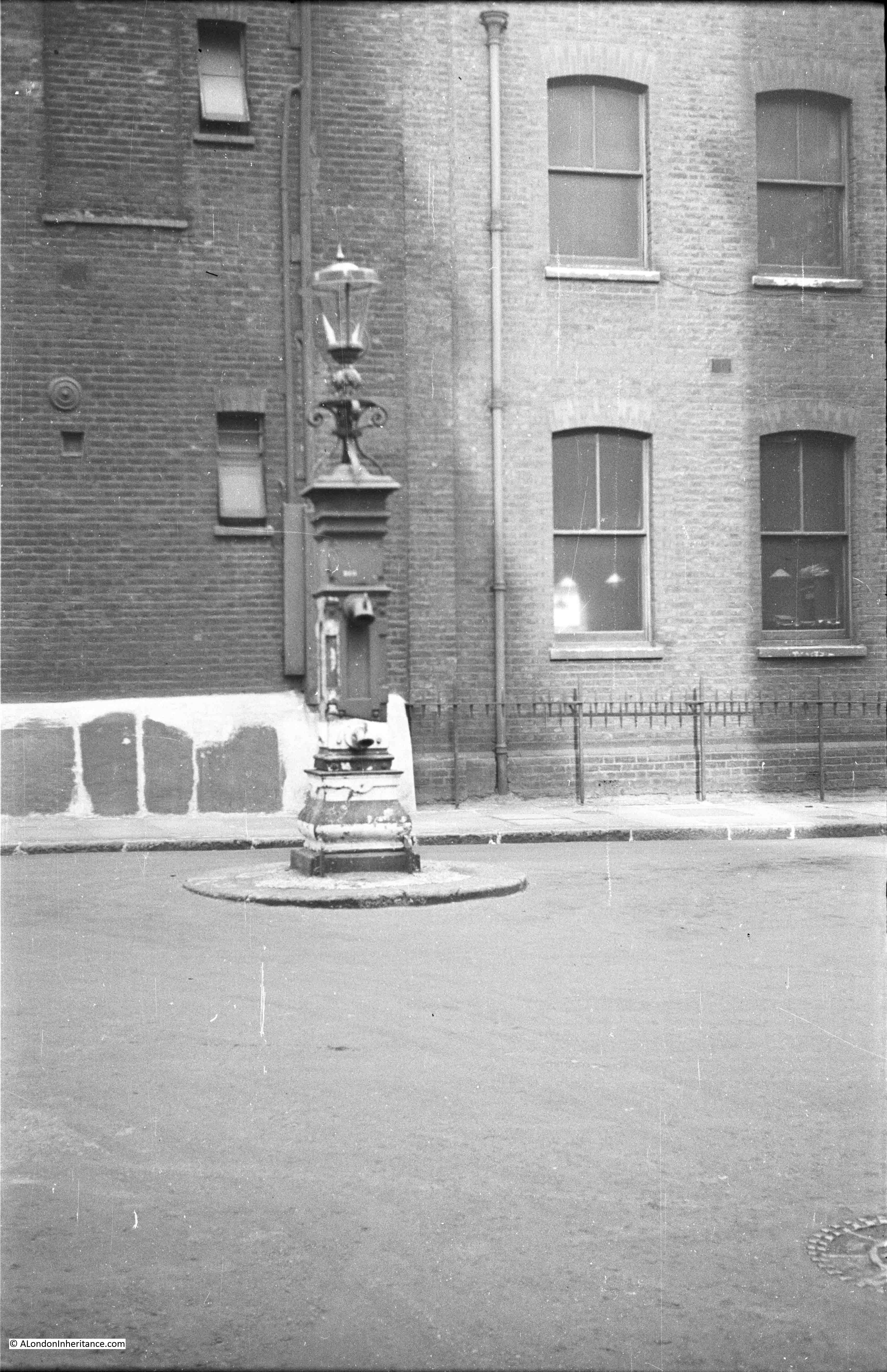
My father took a couple of photos of the first blocks of the estate being built in 1949:

Tybalds Close Estate

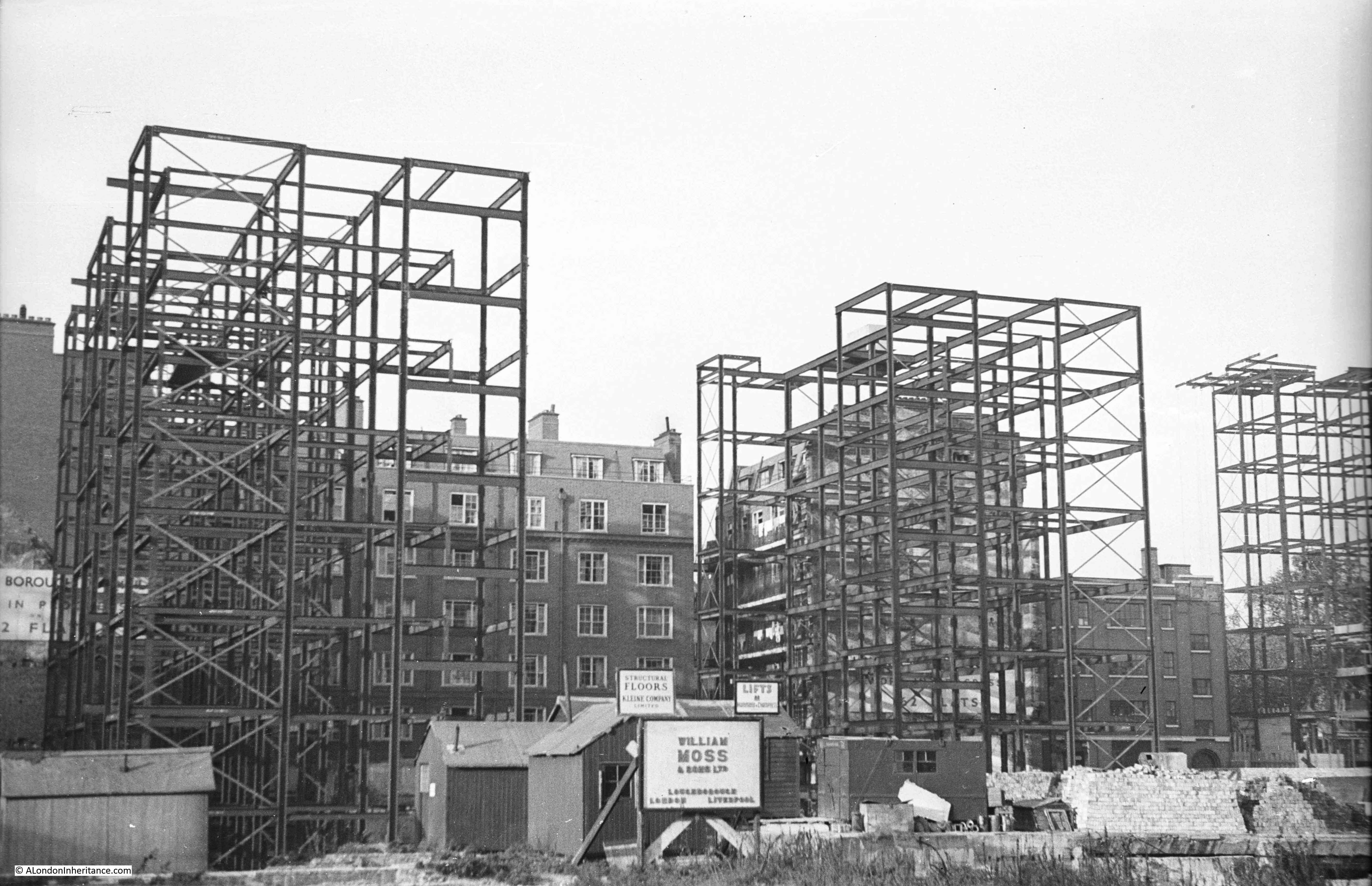
The following photo was taken looking to the right of the above photo and shows the tallest of the first blocks to be built, along with a house in the lower right corner which enabled the location to be identified and also surprised me by showing that you cannot believe that buildings are the age they appear – more on that later in the post.

Tybalds Close Estate

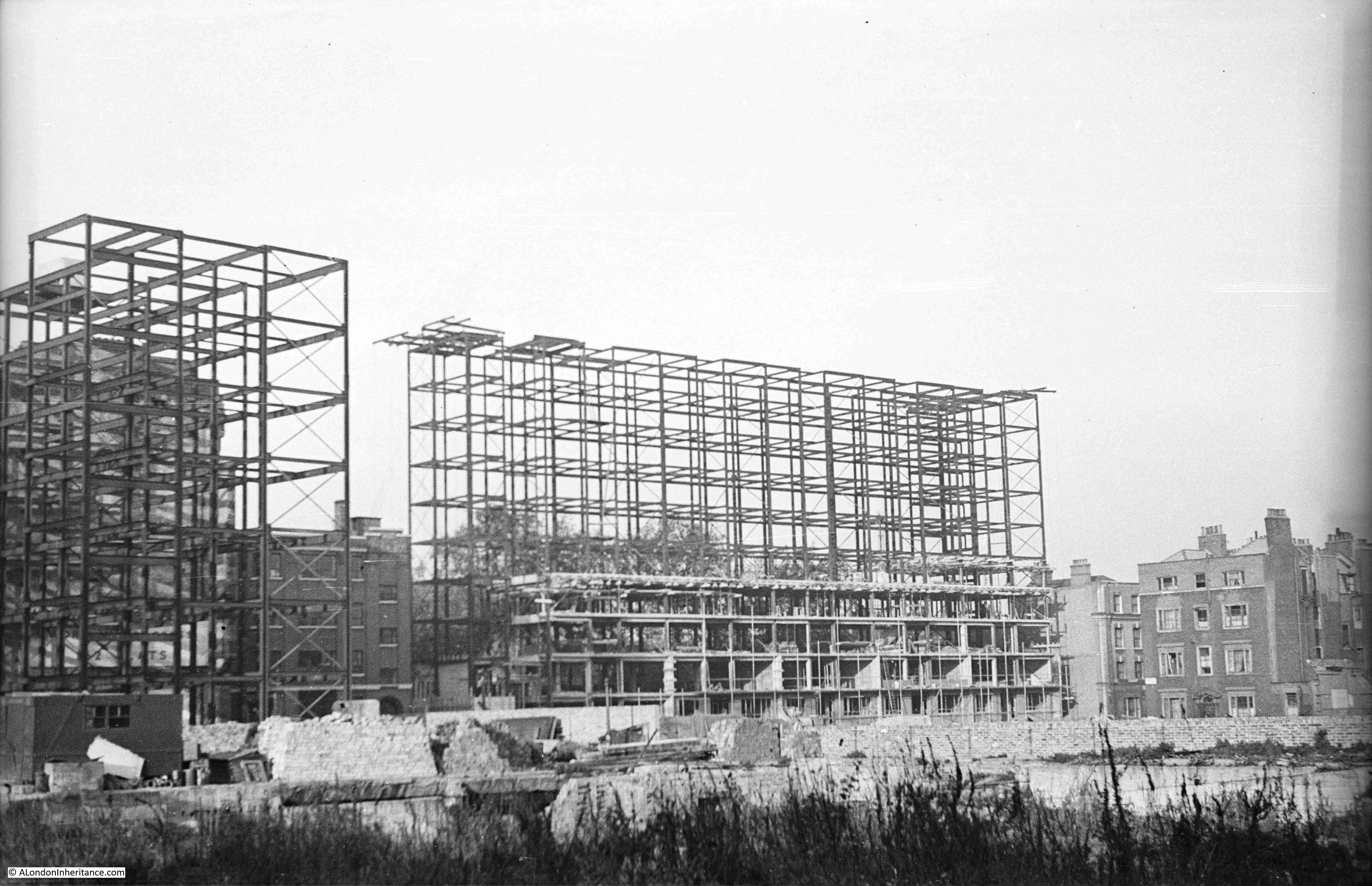
Approval to develop the Tybalds Close Estate was given in 1946 and the estate gradually grew from the late 1940s (when my father’s photos were taken) through to the 1960s when the final tower block was complete.

The first blocks were of a steel frame construction and consisted of one block of 10 storeys (the one on the right in the above photo) and four 7 storey blocks (two of which can be seen on the left of the above photos with the remaining two being built later).

The architects were Robert Hening and Anthony Chitty. They had started their architectural work in the years before the war when their work included a number of regional airports. One of these airports was at Ipswich where despite being Grade II listed, Hening and Chitty’s airport terminal buildings were demolished in 2005.

After war service, Hening and Chitty reformed their partnership and worked on a number of housing developments, commercial, industrial and schools. As well as the Tybalds Close Estate, Hening and Chitty were also responsible for the housing blocks alongside Cromer Street in St. Pancras. The style of both sets of housing blocks is very similar, although the Cromer Street blocks have been through a complete re-cladding.

The buildings were constructed by William Moss and Sons, a company original founded in 1820 and with a long history as an independent construction company until being taken over by the Kier Group in 1984.

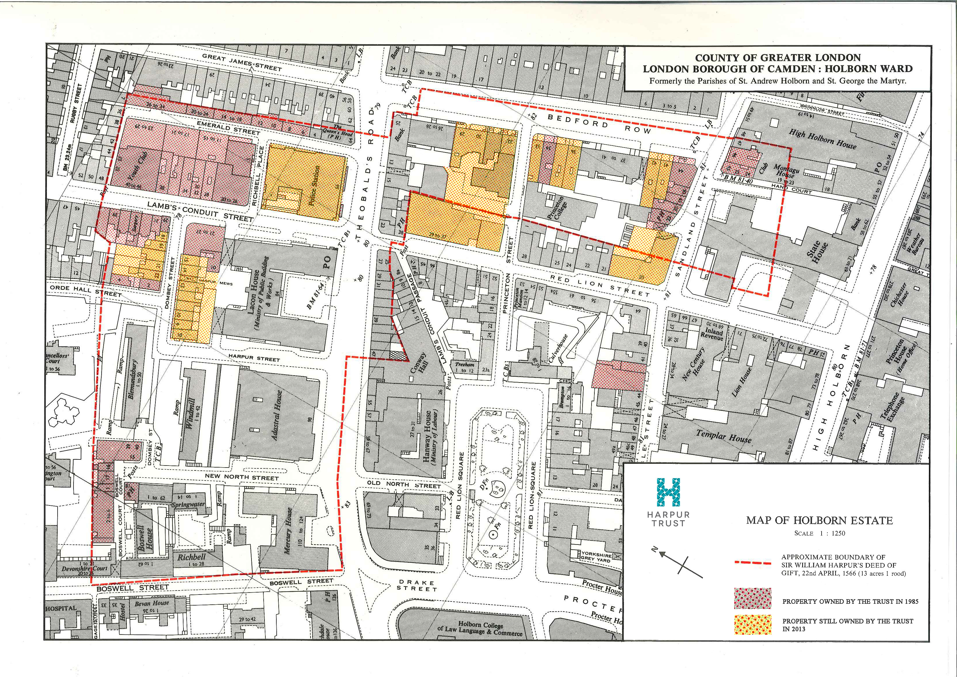
The following map shows the location of the Tybalds Close Estate. The overall estate being roughly within the blue oval, with the original parts of the estate as shewn in my father’s photo being within the red oval.  (Map  “© OpenStreetMap contributors”).

Tybalds Close Estate

As can be seen, the area between the housing blocks and where my father was standing was open ground. Originally dense housing, but badly bombed with the area cleared ready for reconstruction.

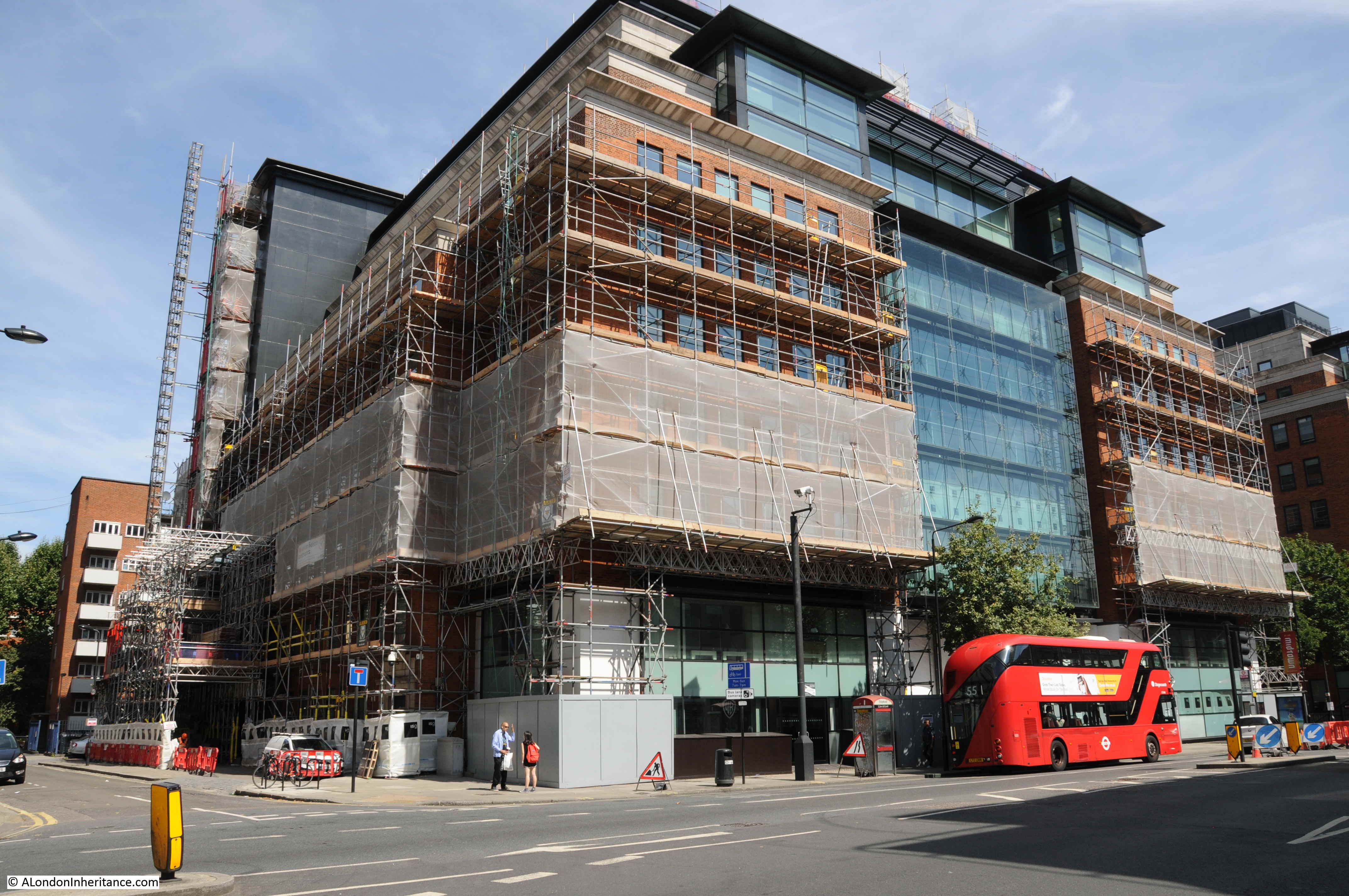
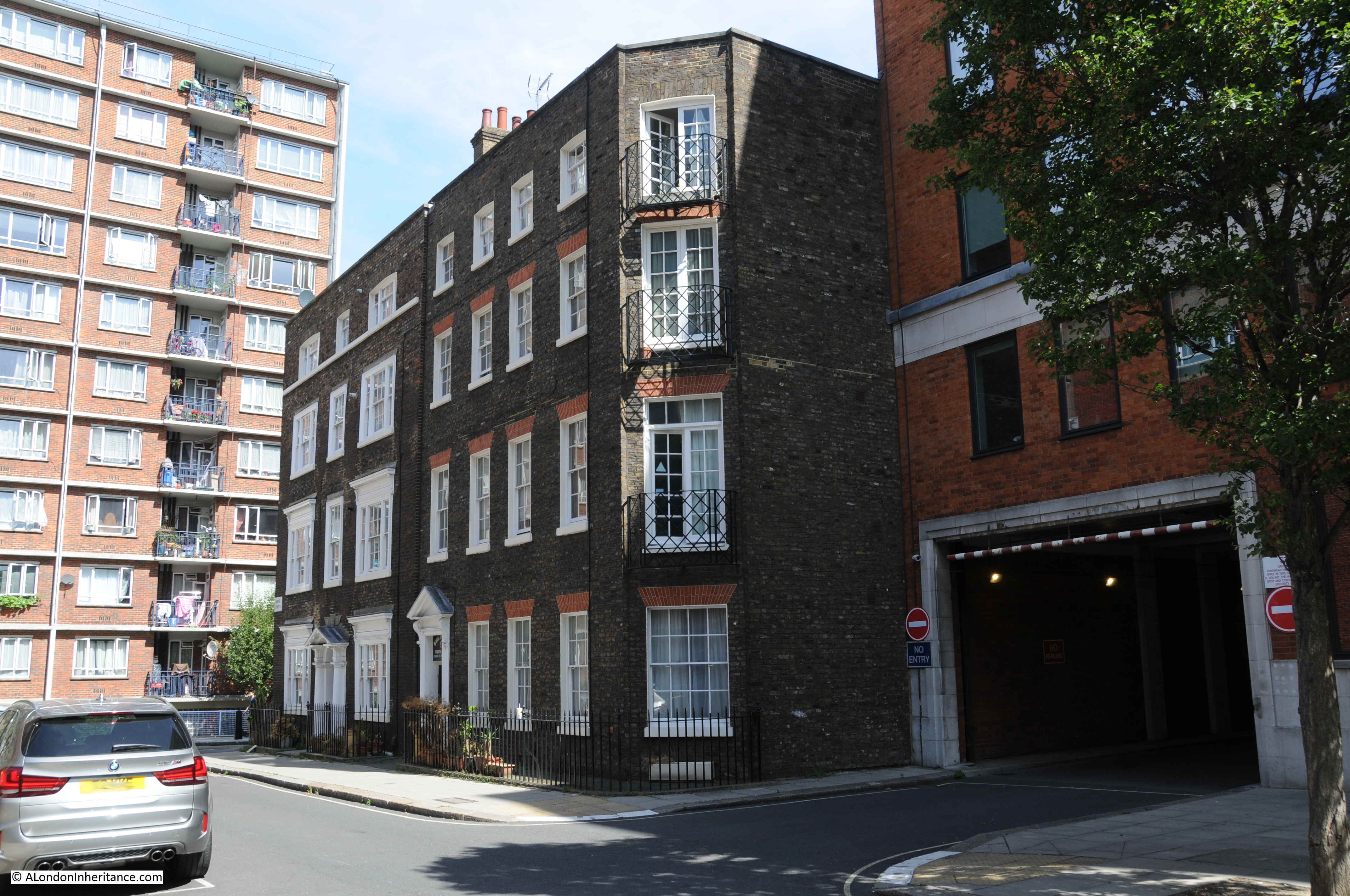
It is impossible to get a similar view today as the area has been completely built over with large office blocks. The following photo is looking across in the general direction of the original photos. My father was standing somewhere under this large office block to take the originals.

Tybalds Close Estate

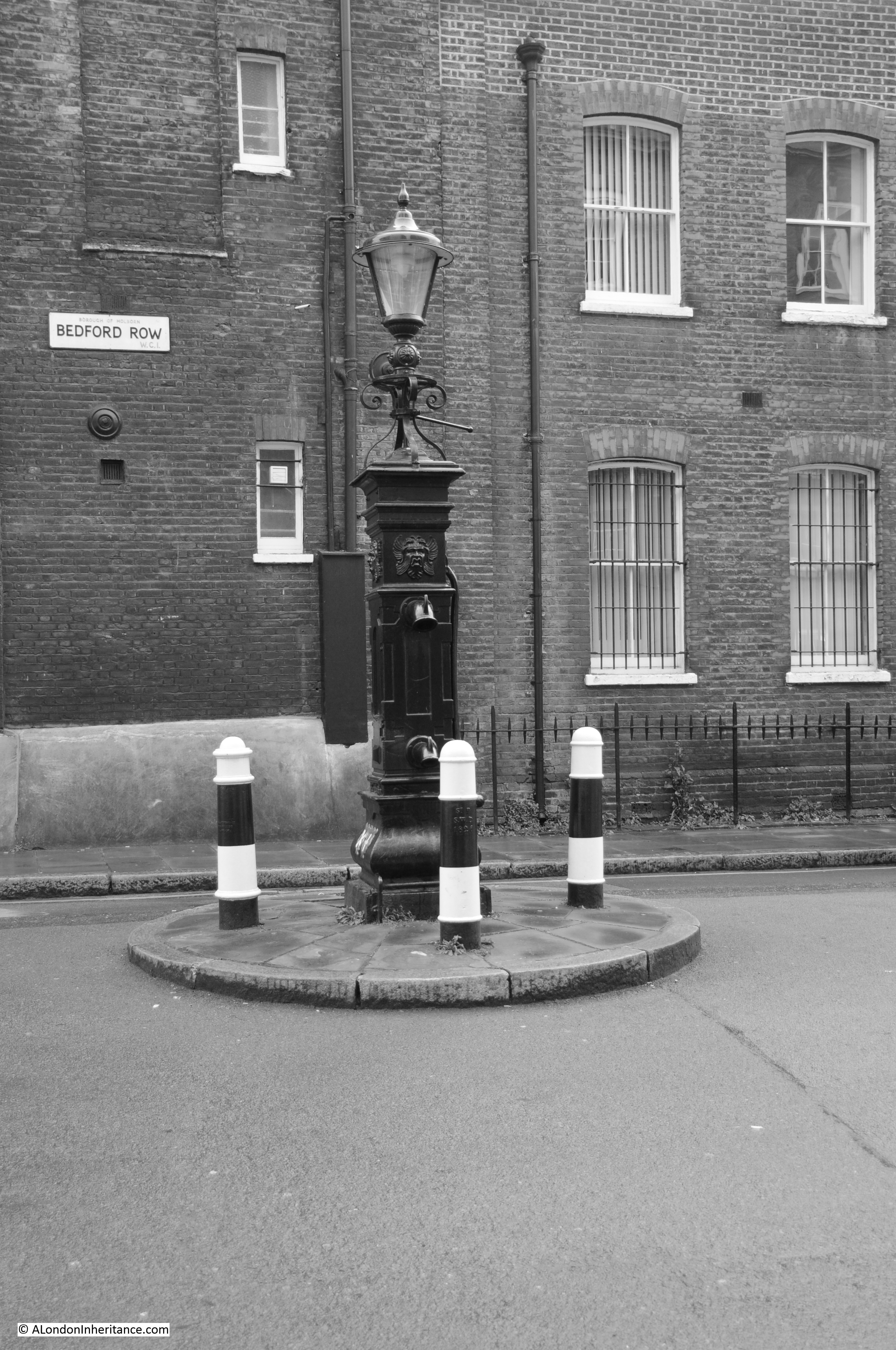
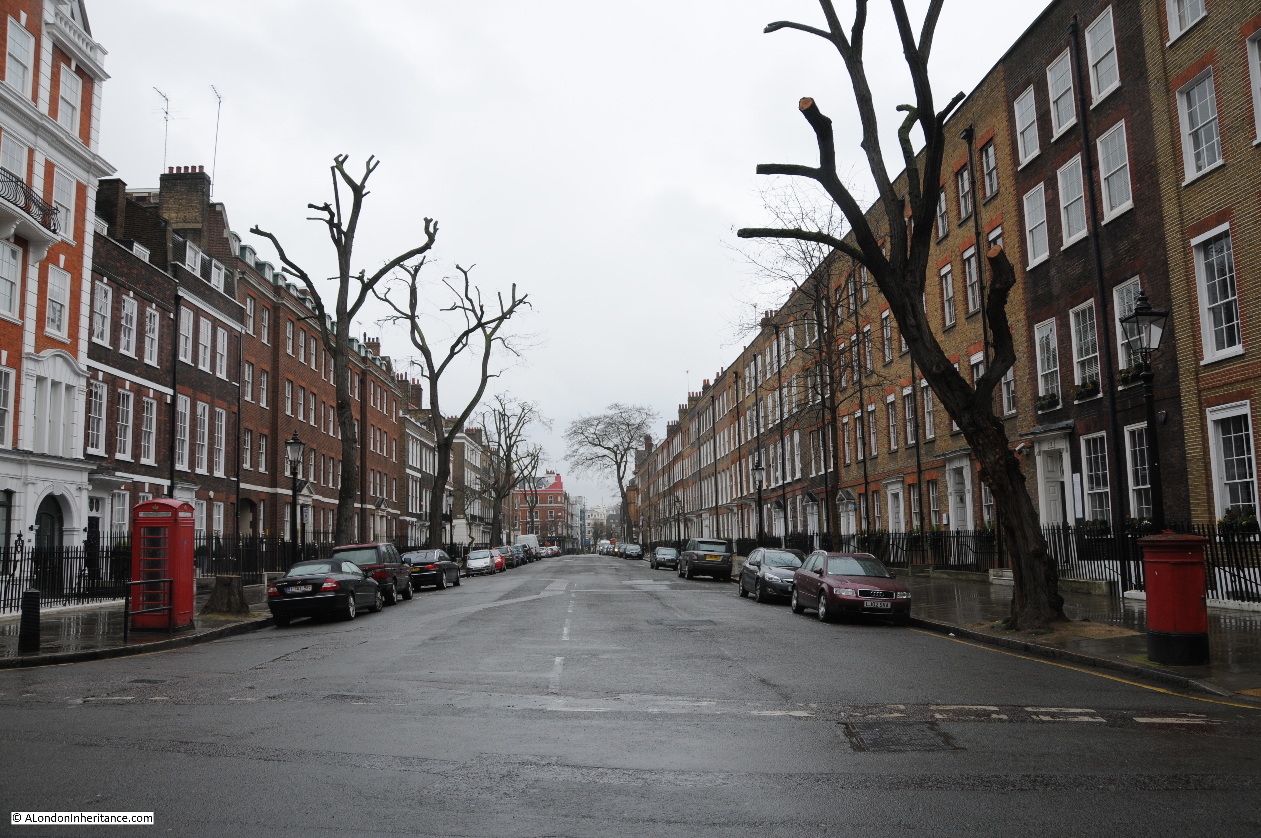
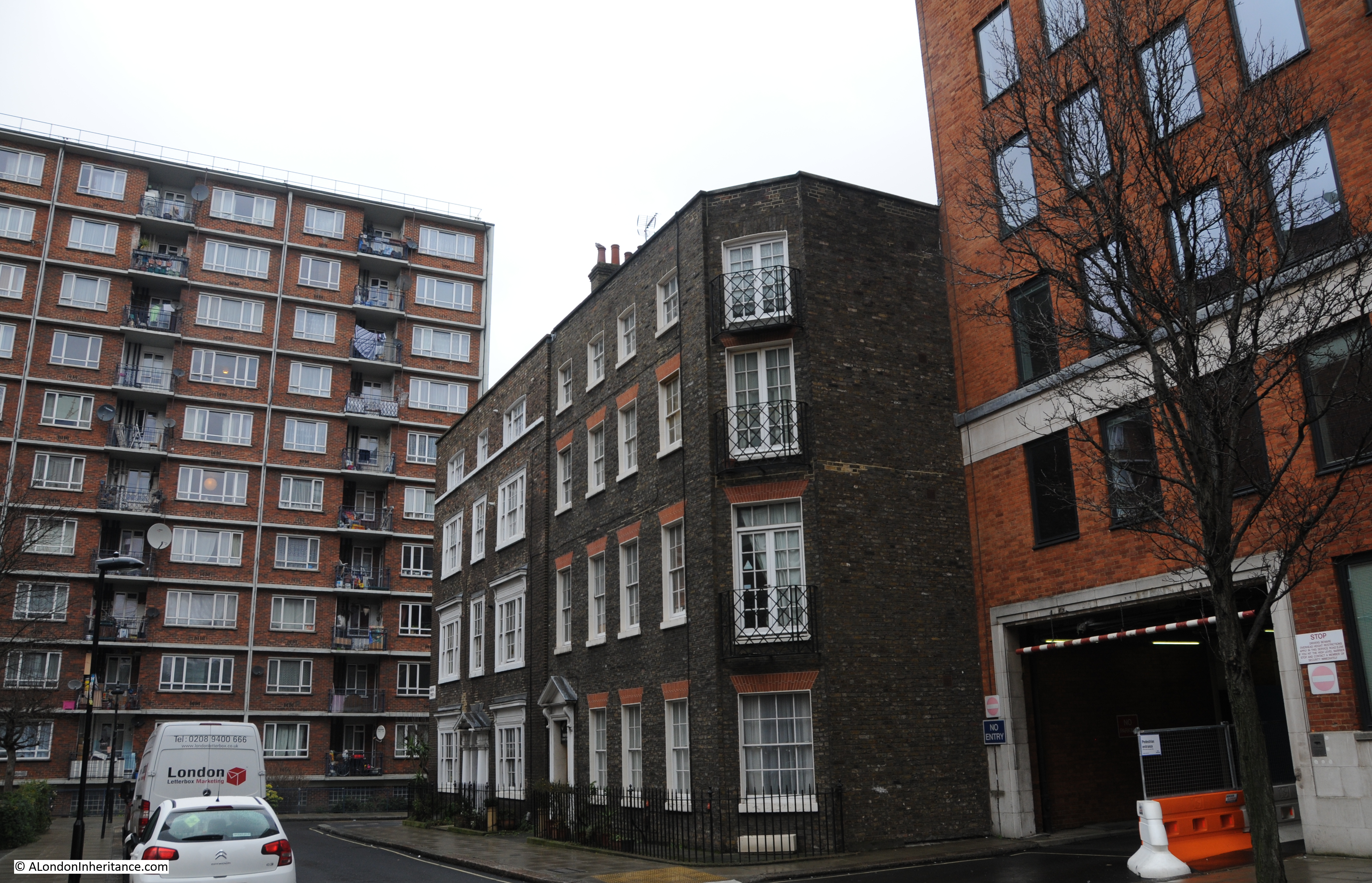
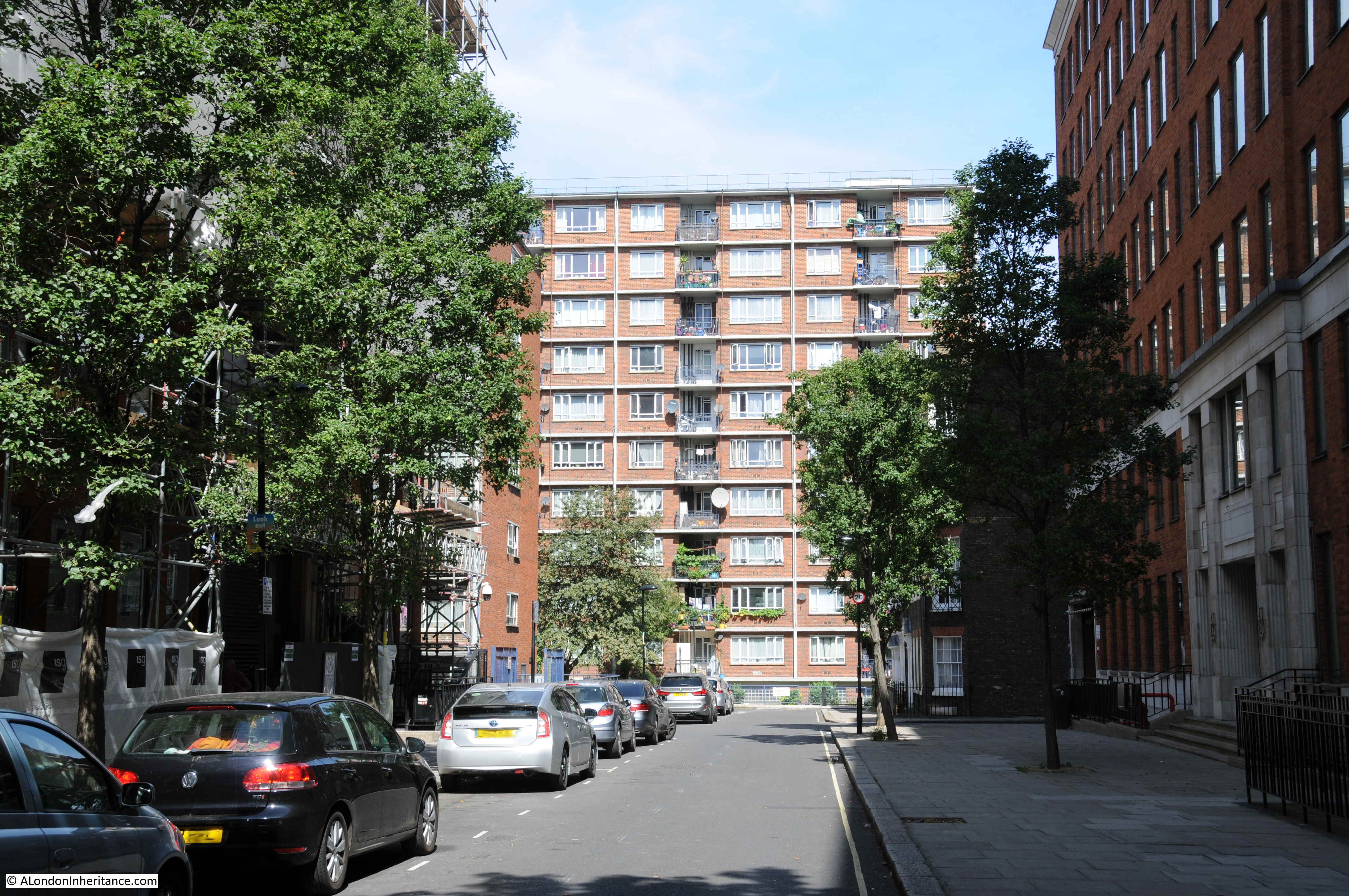
The taller of the blocks on the right of the second photo is Blemundsbury House. This is the view of Blemundsbury House today, looking down Harpur Street.

Tybalds Close Estate

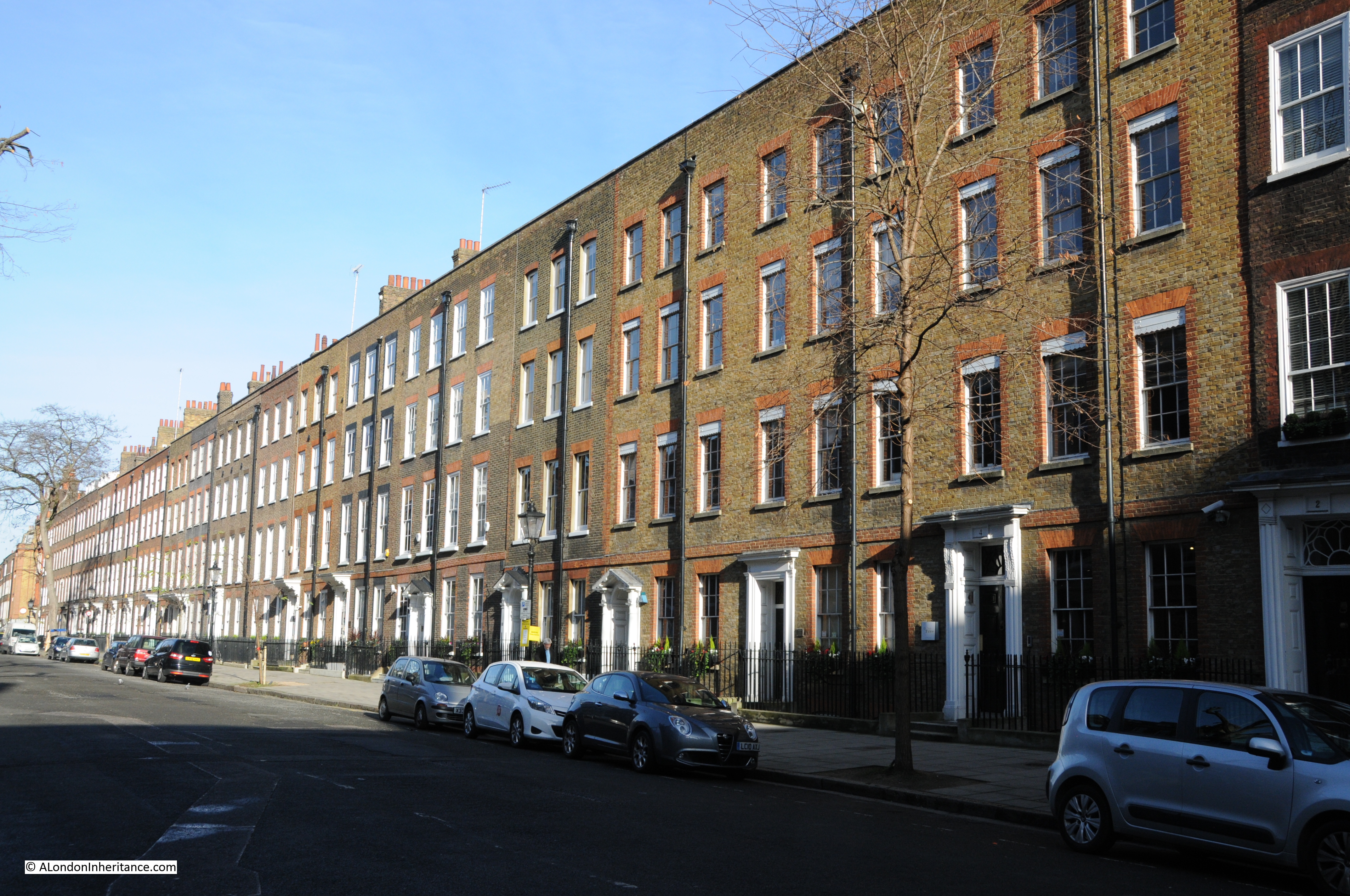
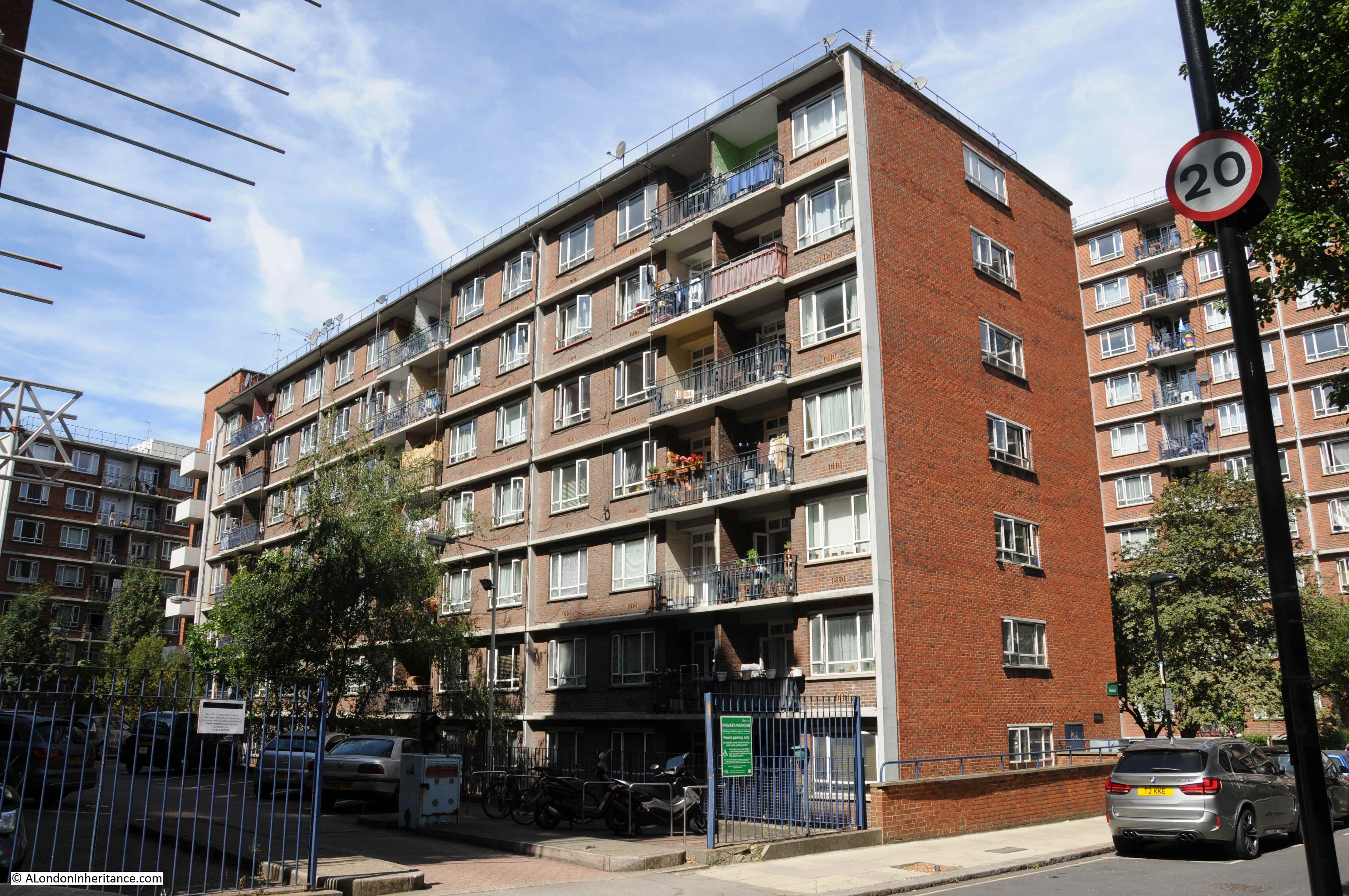
This is Windmill House. Not yet started when my father took the original photos, but of the same style and one of Hening and Chitty’s designs. To the left of Windmill House can be seen one of the buildings that was also a steel frame in my father’s photos, at right angles to Blemundsbury House.

Tybalds Close Estate

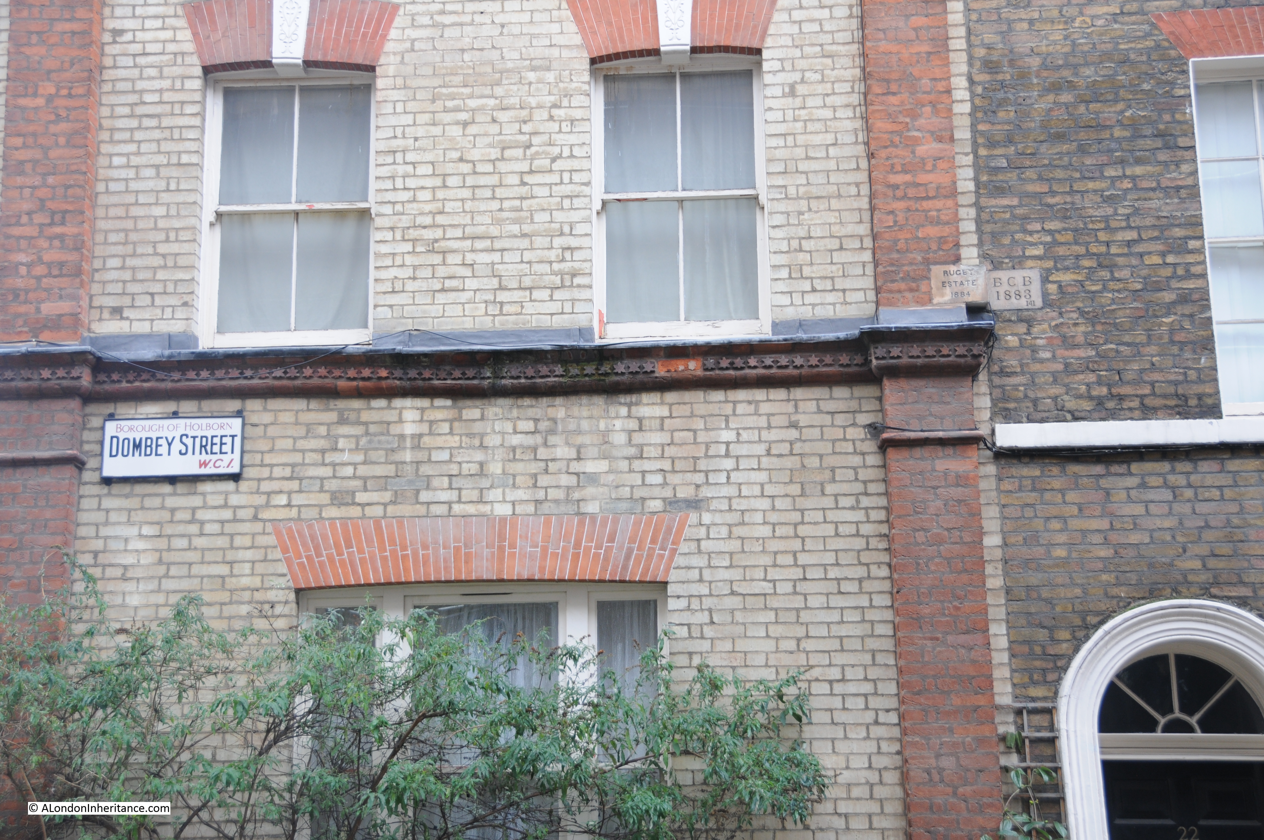
I mentioned earlier in the post that the location of the photo could be identified by the old house in the lower right corner and that I also found something that demonstrates you cannot always believe what you see.

The following is an extract from the second of my father’s photos. It is an enlargement of the house at the lower right corner of the photo.

Tybalds Close Estate

The house is on the corner of Harpur and Dombey Streets. The following is a photo of the same house today.

Tybalds Close Estate

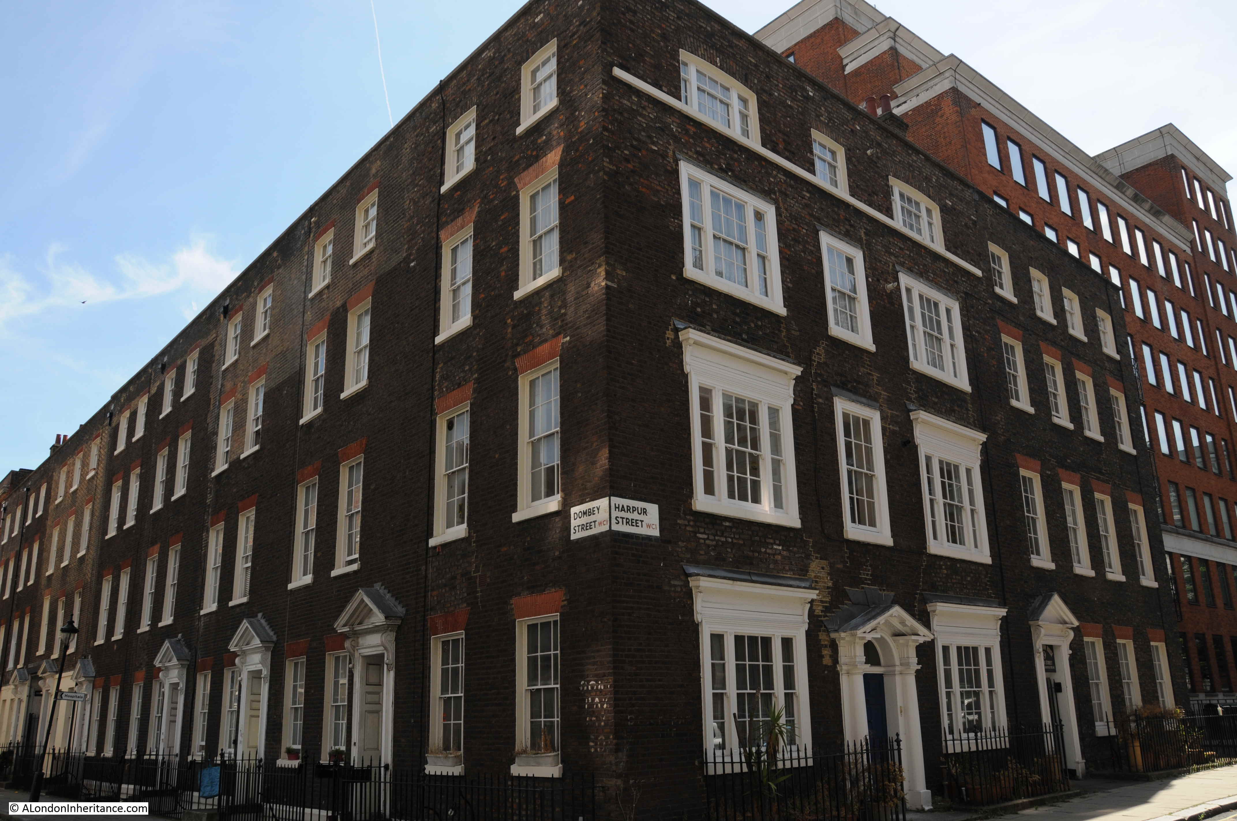
The house in the original photo looks the worst for wartime damage, however the layour of the windows is the same, the same entrance door, the same seperator at the top of the 3rd floor and the street name sign is in the same place on the corner of the house.

What is really stange is that in the original photo there is no building to the right of the corner house, although today there is a substantial house which looks original in all aspects.

Tybalds Close Estate

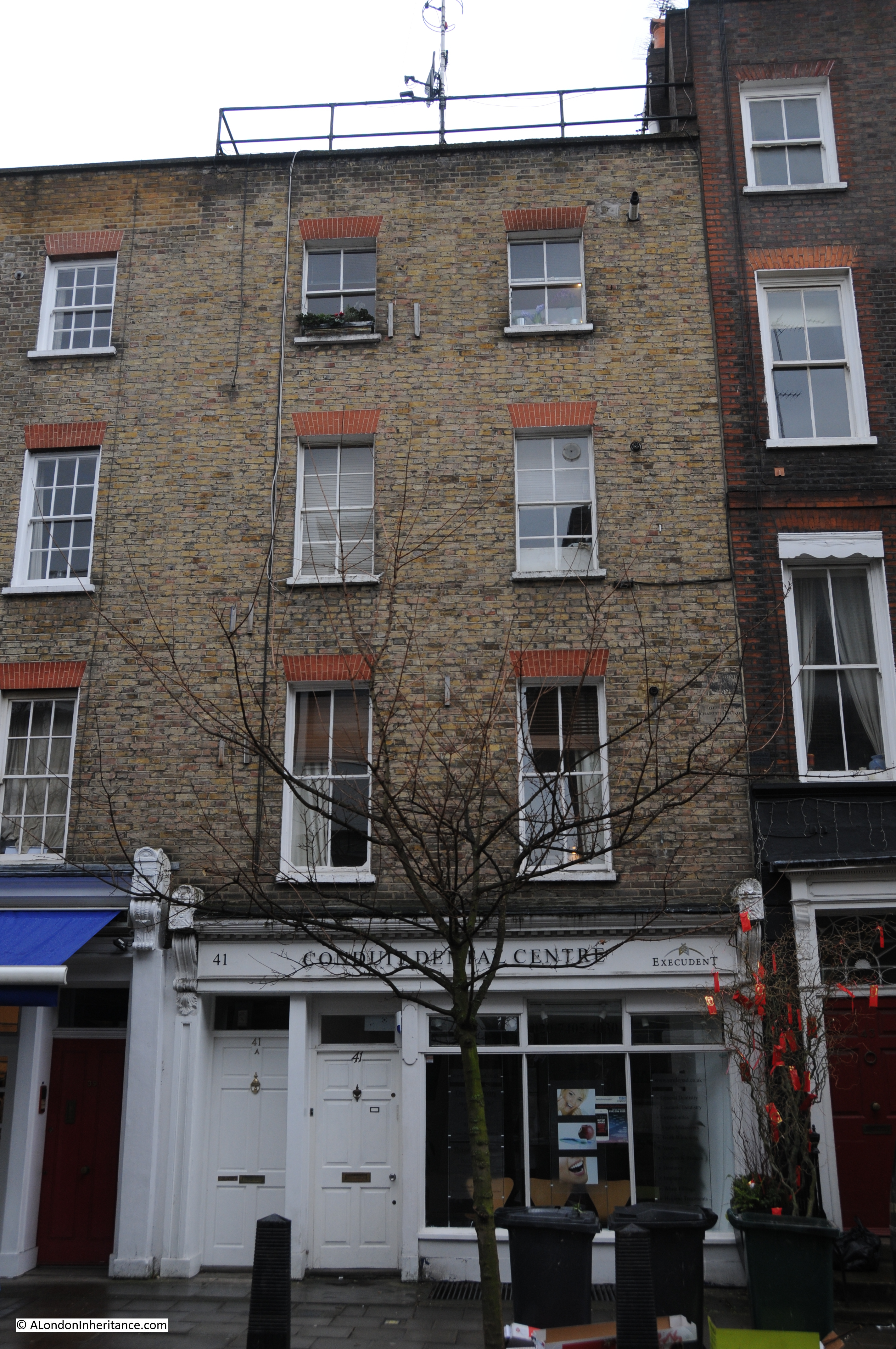
This is another view of the two houses. The further being the one in the original photo and the house closest to the camera must be a post war reconstruction of the original house on the site.

The attention to detail is remarkable. The brickwork is the same, the style of the house is the same as the houses in Dombey Street. If I did not have my father’s photo for evidence I would have thought that this was an original Georgian house.

The entrance door to the reconstructed house is shown in the photo below. Note how identical the brick work and the size of the coarse between the bricks is to the wall on the left. There must have been piles of bricks in the area from the bomb damage and I can only assume that bricks and probably door and windows were reused from demolished houses to construct this new house.

Tybalds Close Estate

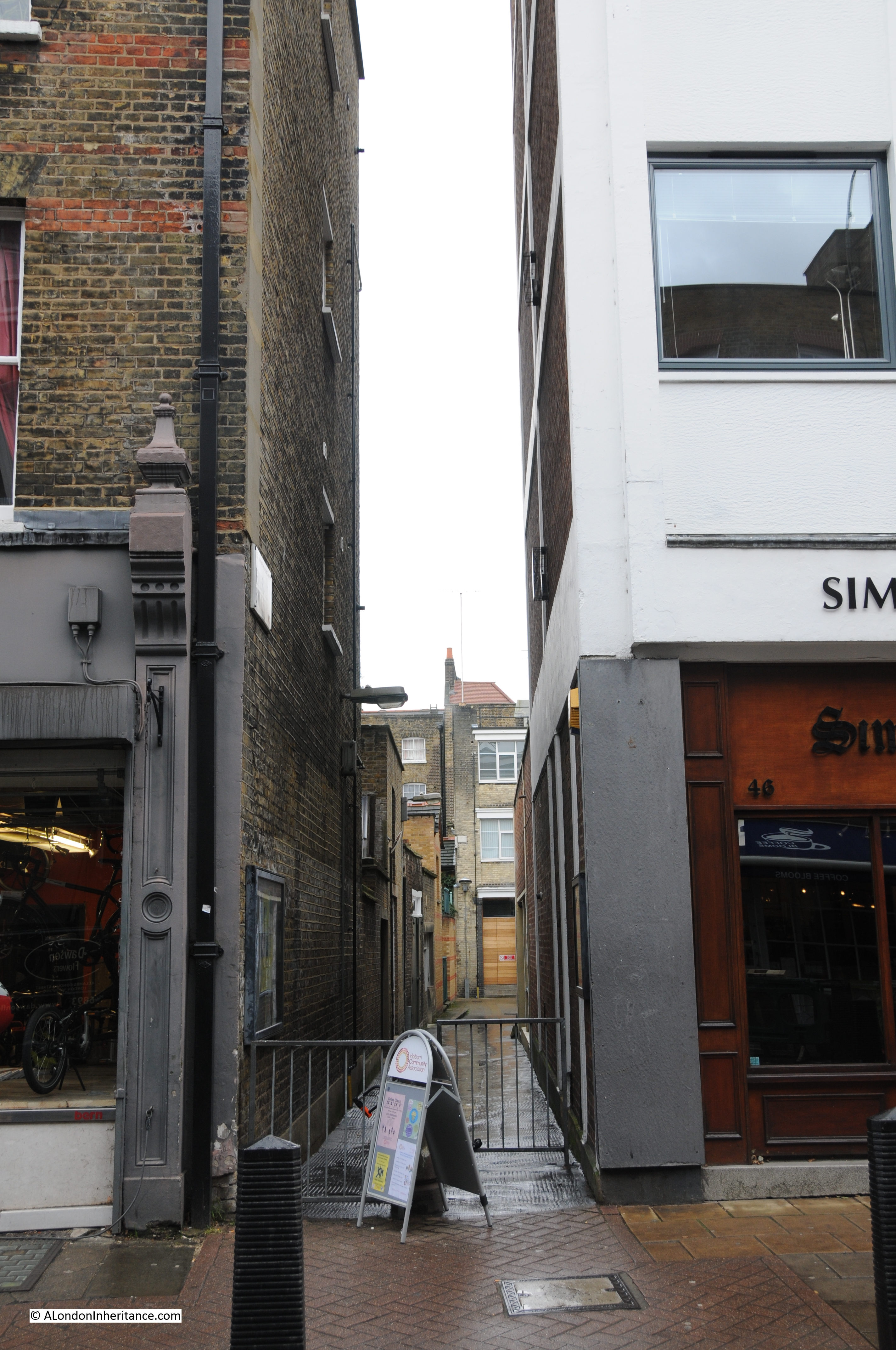
In the enlargement of the original photo there is a doorway visible to the right of the main house and this was probably the entrance to the original house, but not to Harpur Mews as the sign above the entrance advertises today.

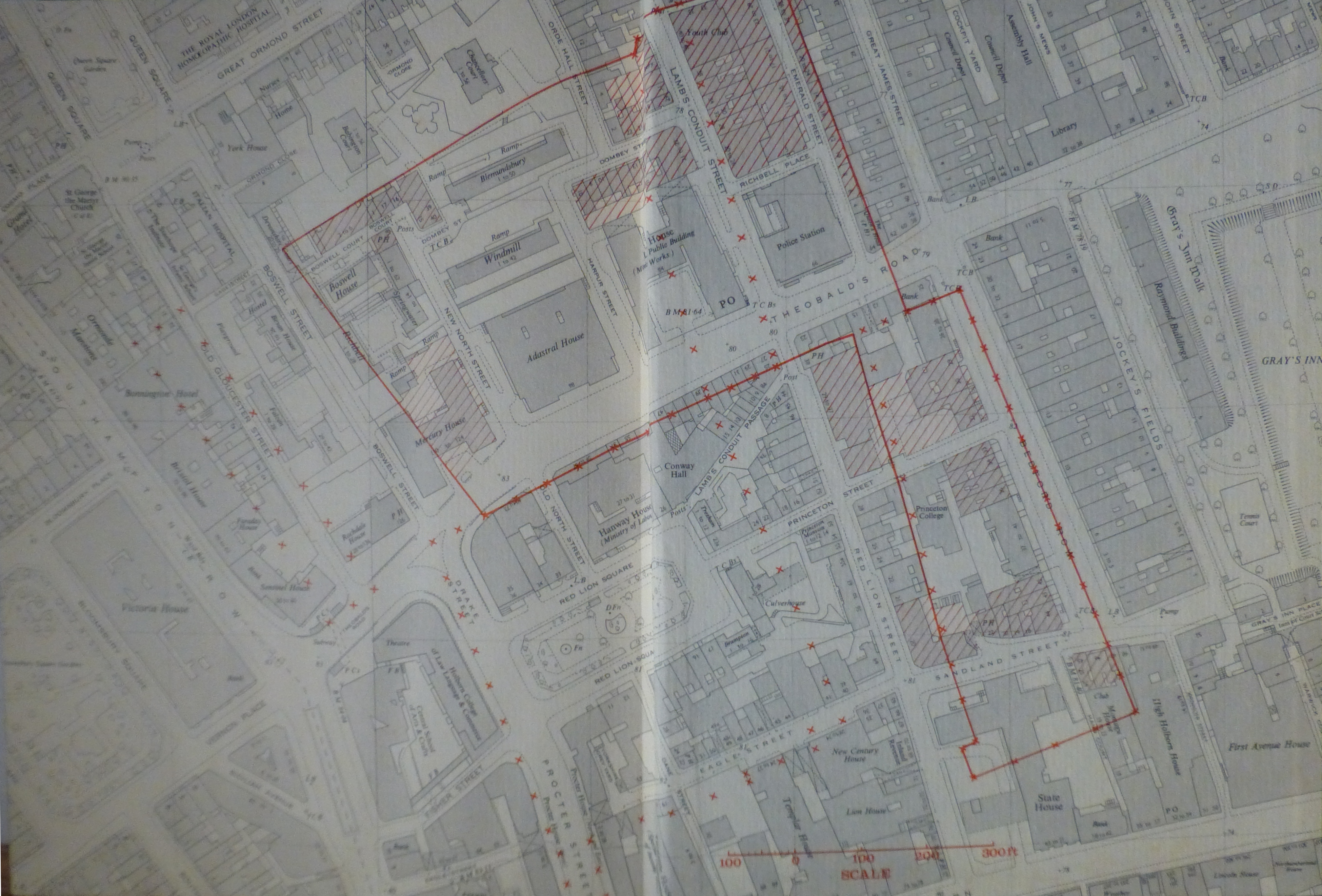
The following map is an extract from the 1895 Ordnance Survey map.

Tybalds Close Estate

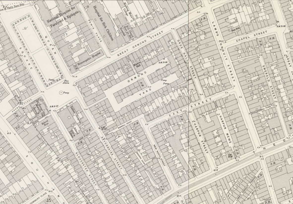
Harpur Street can be seen to the lower right. Harpur Mews is in the middle of the block and there is no entrance to the mews from Harpur Street. the entrance was from East Street (now Dombey Street) as shown by the building with the X which denotes a building above a through entrance.

The map also shows the dense housing across the area, much of which is now covered by the Tybalds Close Estate. Blemundsbury House occupies the space occupied by the houses to the north of East Street, starting from just to the right of the junction with Harpur Street and running to the left.

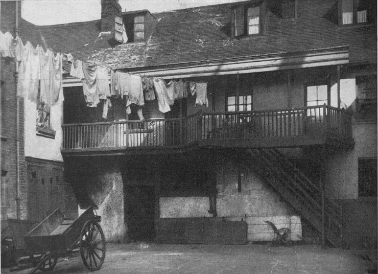
I could not find too much information on the area, however I did find a photo of Ormond Yard, the largest space in the centre of the map and now occupied by the Tybalds Close Estate. The following photo was published in The Sphere on the 2nd December 1933 and is one of a series of photos taken by a Mr. William Clark in 1918. Mr. Clark was apparently a Birmingham businessman who was fascinated by London in the time of Dickens and set out to photograph what he could find that was typical of Dickens time and also mentioned in Dickens novels.

The following photo is titled “Ormond Yard, Bloomsbury – Galleried cottages of Dickensian days whose quiet charm is in strange contrast to 20th century London”.

Tybalds Close Estate

The first mentions that I could find of Ormond Yard date back to 1770, and through one hundred plus years there are the usual reports of the casual crime, accidents and violence that could be found across the dense housing of London.

The pub in the centre of the yard was The Crown. A report in the Sporting Life on the 2nd of June 1885 offers a glimpse of life in the yard:

“The Crown, Ormond Yard, Bloomsbury – A high class show took place at this establishment on the 31st, the exhibits consisting of bulldogs, bull terriers, mastiffs, pugs, dachshunds, and almost every variety of choice toy pets. The house, as usual, was well attended by fanciers and dealers. the chair was occupied by Mr. Alfred George faced by Mr Currie, supported by the following;- Messrs Strugnell (champion pugs), Clarke (bull dogs), Anderson (white half-bred dogs), Painter (champion spaniels), Matthews and Taylor (toy black and tan terriers) and Nicholls (mastiffs); also a gentlemen with some remarkably fine dachshunds, and many others together with many strangers. The handsome silver collar for the best bull terrier was taken by Mr. A. George’s Prince, a very handsome dog.

The land on which the Tybalds Close Estate is built was part of the early 18th century expansion of London. Rocque’s map from 1746 shows the area below:

Tybalds Close Estate

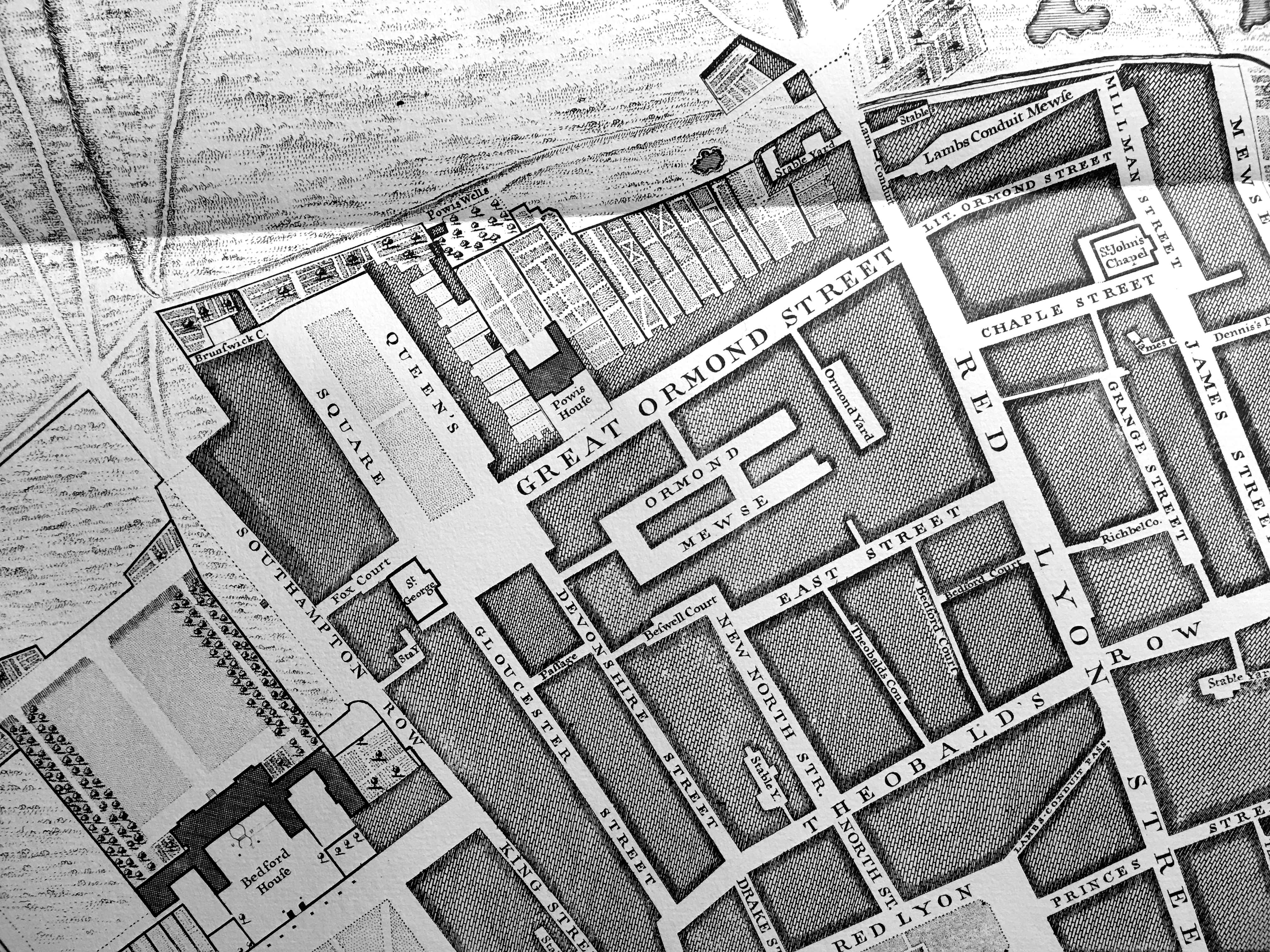
The fields to the north and west show that the area at the time was on the edge of built London. At the time, and as probably built, Ormond Yard was a separate smaller yard and the main area was Ormond Mewse – the two areas would later combine as shown in the 1895 map.

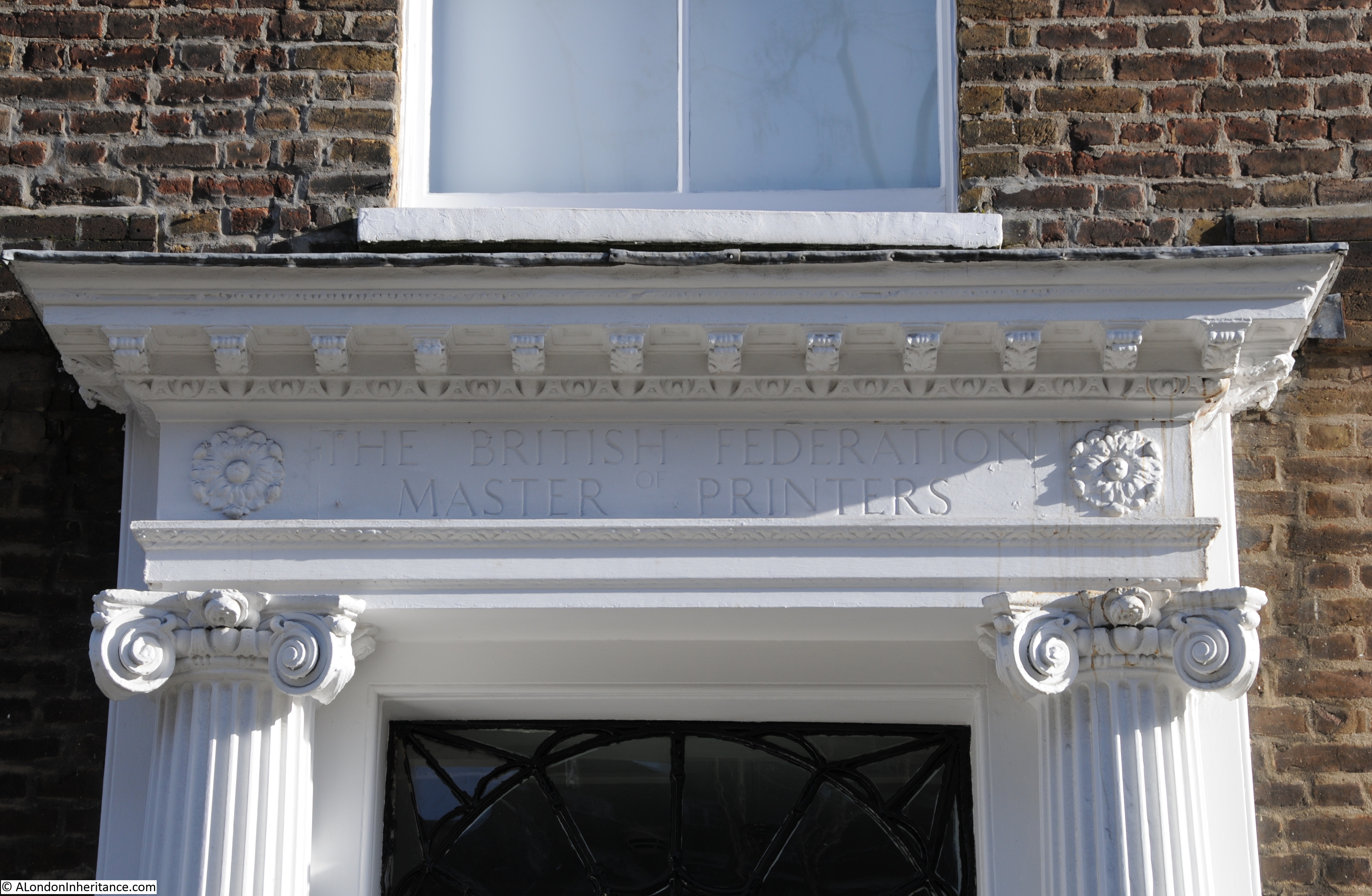
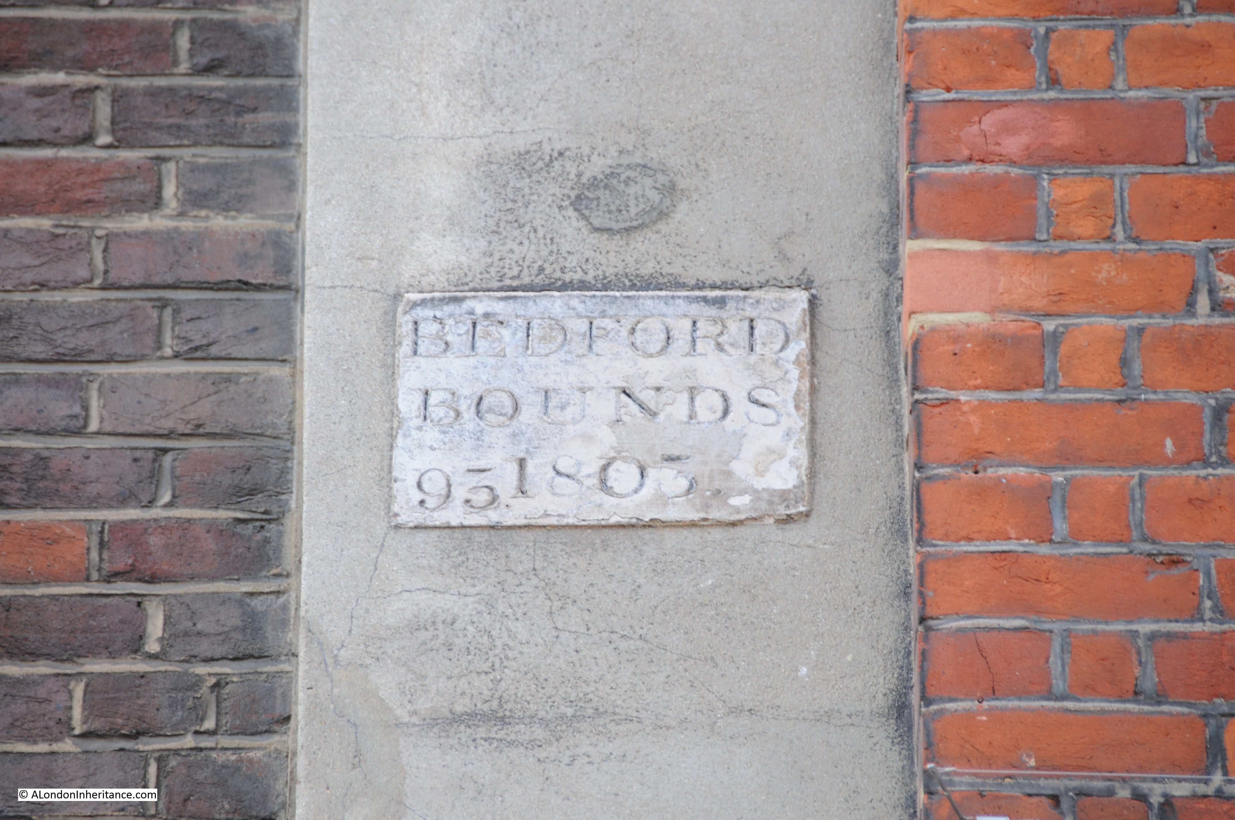
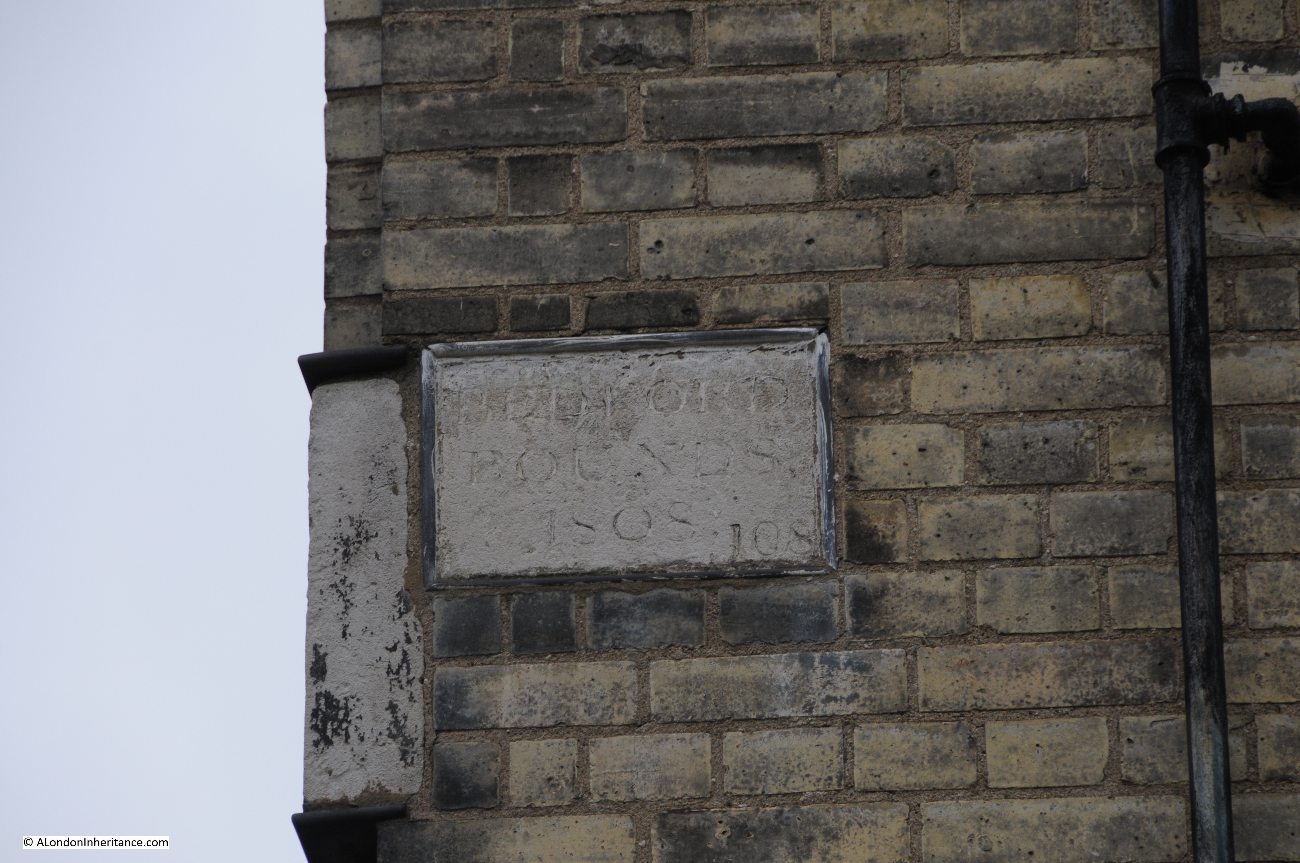
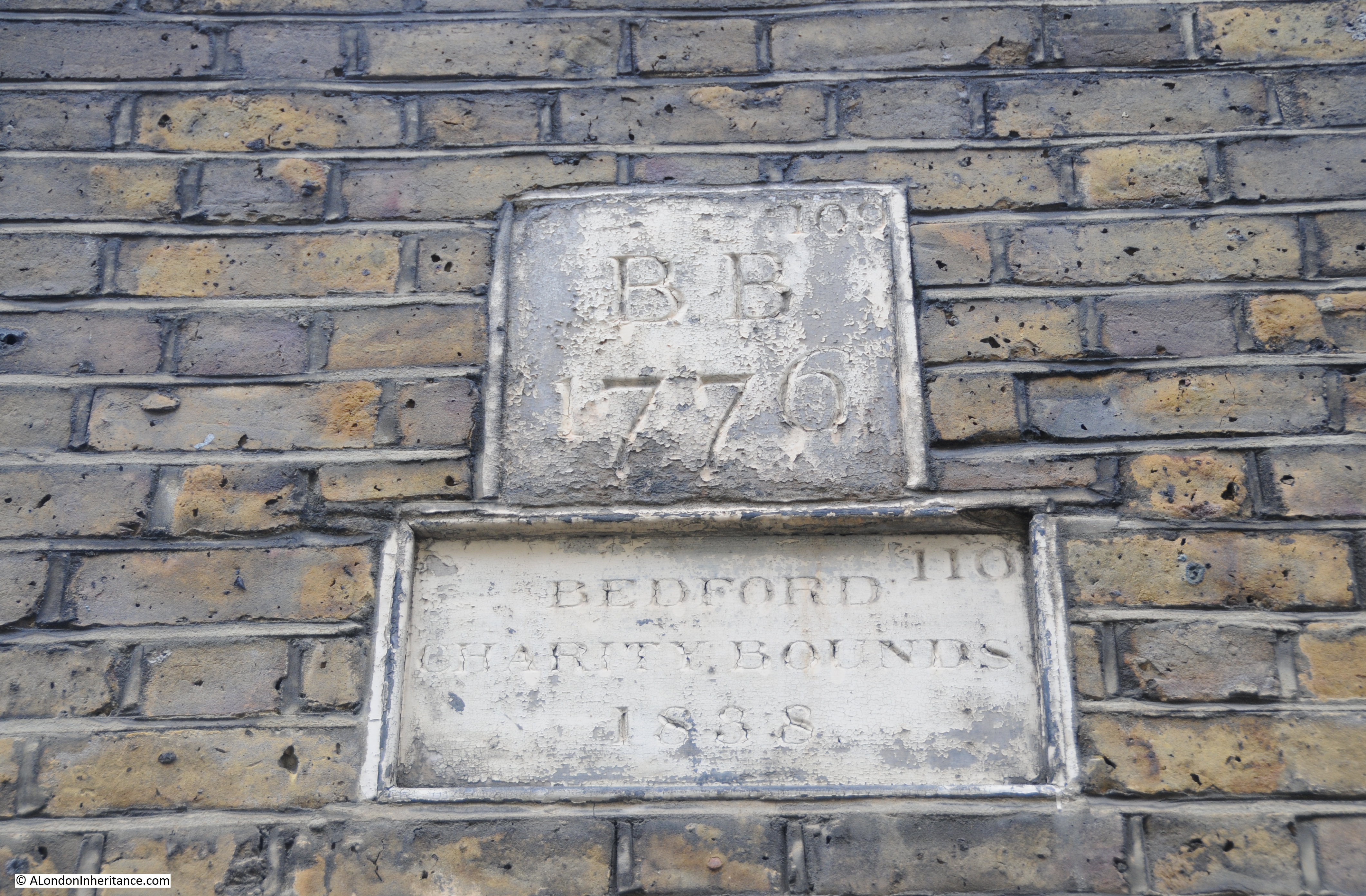
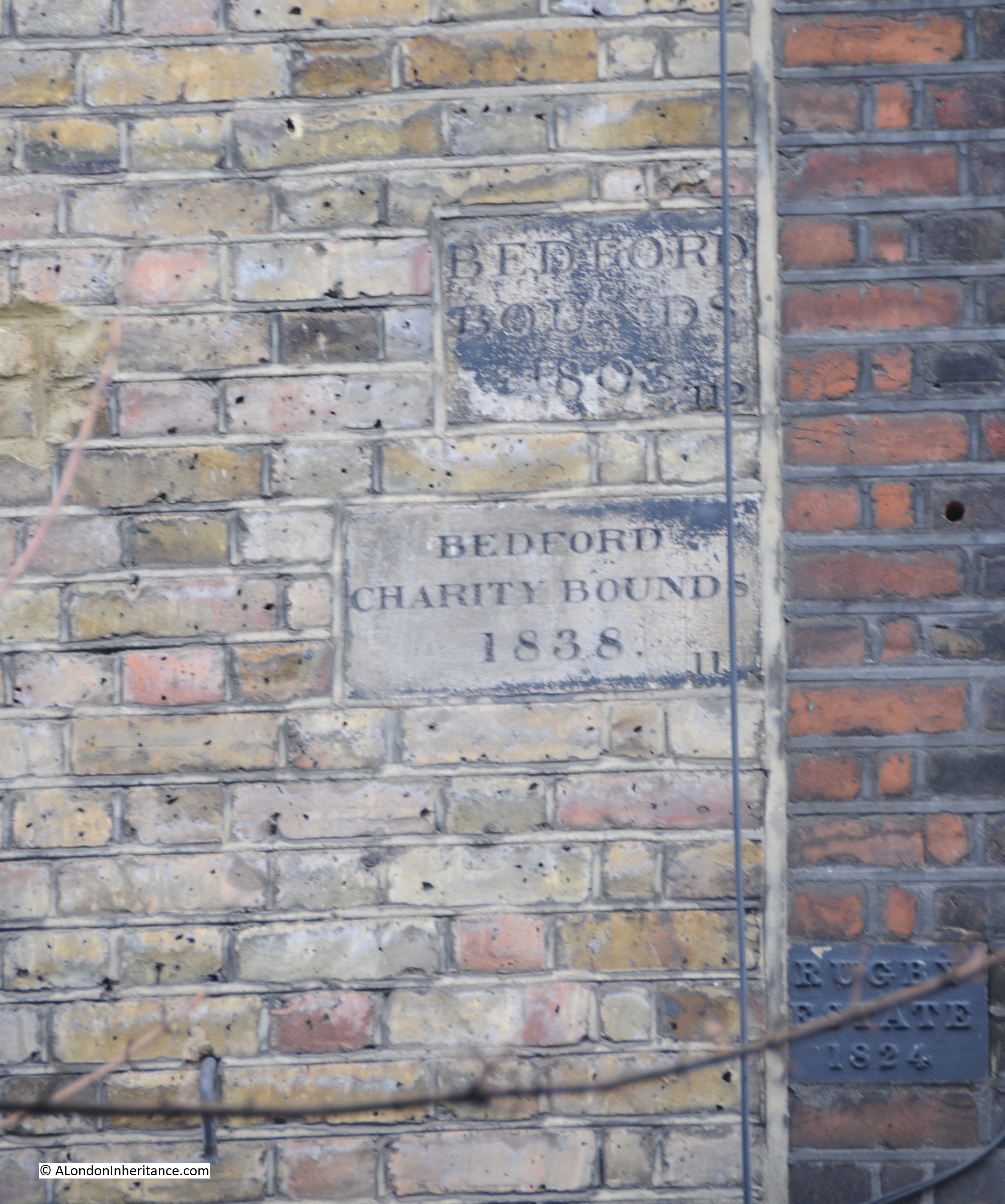
The area in which the Tybalds Close Estate is built was originally part of the land donated by Sir William Harpur in 1566 by Sir William Harpur. See my post on Tracing Harpur’s Bedford Charity Estate.

One final point, the larger of the two blocks being built in my father’s photo is Blemundsbury House. The name provides an old connection to the area of Bloomsbury.

Blemundsbury was the original name of Bloomsbury. In turn, Blemundsbury took its name from a 13th century drainage ditch in the area known as Blemund’s Dyke.

The Tybalds Close Estate is at the heart of a fascinating area.

alondoninheritance.com

A Water Pump, Bedford Row And Tracing Harpur’s Bedford Charity Estate

There are some locations in London that have changed remarkably little over the last seventy plus years. There are also locations where decisions made 500 years ago are still in evidence. Not the usual candidates such as the Tower of London or St. Paul’s but amongst the ordinary streets of London.

One of my father’s photo’s from 1947 was the water pump in Bedford Row.

From Chancery Lane underground station, walk along Holborn to the west until you come to Brownlow Street. Head up this street and at the end you will be in part of Bedford Row, facing the water pump shown in the following 1947 photo:

Bedford Row 18

And in 2015 the scene is remarkably much the same. The pump has been painted, a sign with the street name has been put on the building behind and there are now bollards around the pump.

The buildings behind are almost unchanged, even the metal fencing along the building to the right is the same.

Bedford Row 17

The pump is also a perfect example of not always believing what you see in London. Take a look at the bollards and they are marked St. Pancras Street Works Department, 1826, so it would be a reasonable assumption that they have been in place since 1826, however the 1947 photo clearly shows a much smaller surround to the base of the pump and no bollards.

I assume that with the size of cars and lorries that are now in use on London roads, it was decided prudent to enlarge the base and provide some protection to the pump using bollards from some other location in St. Pancras.

Bedford Row 16 small

I always find it fascinating to look at the buildings around any location I am photographing. On the building just to the left of the pump is the remains of the original street signage for Bedford Row:

Bedford row 1

And just further along I found the following plaques:

Bedford Row 19

Not so easy to read. The one on the left reads “Ms. Eliz Doughty 1824” and the one on the right “Bedford Charity Bounds 1824”

These are boundary markers and were essential to identify ownership of blocks of land prior to the availability of accurate street mapping. In the days before clearly defined ownership boundaries, when parcels of land were let and sublet, when it could be decades between the times when ownership of land needed to be checked and when owners could easily extend their boundaries in the hope of expanding their ownership before anyone realised, boundary markers played a key role in defining ownership.

Much of the land across London was originally held by the Crown or Church in large blocks, and over the centuries this has gradually been sold off to leave much smaller parcels of land, however some large estates still remain.

The Bedford Charity seemed an ideal candidate for some further research, to find the original boundaries of the estate, how the estate came into being, and if anything remained.

The origin of the Bedford Charity is a gift of land made by Sir William Harpur in 1566 to the corporation of Bedford.

Sir William Harpur was very much a self-made man of the times. The Harper family (the spelling of the name appears to have changed to Harpur around 1764) had lived in the area around Bedford for many years prior to the 16th century.

A school had been operating in Bedford since before 1166 and as with most schools of this period it was part of the church and Bedford school maintained this connection through to the dissolution during Henry VIII’s reign.

William Harpur attended the original Bedford School before leaving for London. His early days in London do not appear well documented, however from the book “The Harpur Trust” by Joyce Godber;

“It my be that he was apprenticed to a tailor, but there is no certainty about this; nor is there evidence of his connection with any other trade.”

The assumption of his original apprenticeship seems likely to be correct due to his later career, as William Harpur was admitted to the Merchant Taylors company in 1533.

Harpur’s progression through the Mechant Taylors resulted in him becoming Master in 1553, the same year he became an alderman for the ward of Bridge Without.  When a vacancy appeared for an alderman within the much older and prestigious ward of Dowgate, Harpur was elected to this ward in 1556. He also served a year as treasurer of St. Bartholomew’s Hospital and was a sheriff between 1556 and 1557.

His rise continued and in 1561 he reached the peak of his career becoming Lord Mayor of London.

Through his contacts, Harpur would have been very aware of the work of others within the City of London in support of schools throughout the country.

Whilst Harpur was Lord Mayor the Merchant Taylors school was founded by Richard Hilles, the master at the time and a contemporary of Harpur. He would have known of the founding of St. Paul’s school by Dean Colet in 1509 and the work being done by schools such as Winchester where the earliest printed school text books were compiled in 1559.

He had already been assisting the school in Bedford. Newnham Priory, originally attached to the school had been closed and the property confiscated. Again from “The Harpur Trust” by Joyce Godber;

“These were unsettled times in religious matters. In 1533 when he was approaching the age of 40, Harpur would have heard that, like monasteries elsewhere, Newnham Priory had been closed, the canons pensioned off, and the property confiscated. When he visited Bedford again he would find the priory site desolate, with much of the stone carried away and what was left was being converted to a house. At Bedford it would seem he found the school still existing, probably under an aged master, but it was clearly at risk, like similar schools elsewhere; for the building was up for sale with a number of other ex-monastic properties.

And now Harpur seems to have got in touch with John Williams, perhaps once his schoolfellow. Williams in 1545 obtained a large grant of former monastic property, and with it the school-house in School Lane.

In 1548 Edmund Green came from New College, Oxford to teach at Bedford. Probably Harpur arranged this and paid his stipend. But at this stage he did not commit himself further.”

Given his position in the City, he was probably a wealthy man.

Joyce Godber’s book also provides an insight into Harpur’s life as the Lord Mayor of London;

“On the 12th January, when Harpur and the alderman went to St. Paul’s and all the crafts in London in their livery, and then came into Cheapside a lord of misrule from Whitechapel with a great company”

and in September 1562 after an inspection of the conduit heads of London’s water supply:

“after dinner they hunted the fox, and there was a goodly cry for a mile, and after the hounds killed the fox at the end of St. Giles, and there was a great cry at the death, and so rode through London my Lord Mayor Harpur with all his company home to his place in Lombard Street.”

It would not be until 1564 that Harpur commenced the work that would provide a lasting endowment for Bedford.

On the 30th September 1564 for £180, 13 shillings he purchased 12 acres and 3 roods of meadow outside the City at Holborn, old monastic land that had formerly belonged to Charterhouse.

On the 22nd April 1566 he and his wife, Dame Alice, conveyed the land to Bedford Corporation.

The following map (kindly provided by the Harpur Trust) shows the approximate boundaries of the original deed of gift by Sir William Harpur in 1566:

The Harpur Trust estates map Sep 2013 FINALWhilst this map shows the majority of the original estate, it was not until 1654 when it took this final shape. There were some small blocks of land in Harpur’s deed separate from the main block and in a Chancery decree of the 16th February 1654 an exchange of smaller, detached parcels of land took place leaving the estate in its final form.

The following map from the Joyce Godber’s Harpur Trust book shows the original blocks of land identified by the red crosses to the left of the main block of land, which were part of the exchange to consolidate the estate into a single block.

book map 1

Just prior to the transfer of the land to Bedford Corporation, in 1565 the land was let on a 40 year lease to Richard Bacon. On transfer, this brought in a sum of £12 per annum.

Having found the first boundary markers for the Bedford Charity, I wondered if any further remained and if it was possible to trace the outlines of a 1566 transfer of land, on the streets of 2015 London.

I started at the Holborn end of Bedford Row, with the water pump to my right. Bedford Row is a superb wide street of broadly similar architectural styles (despite the rather aggressively pollarded trees). Bomb damage during the war has been repaired rather than rebuilt.

From this point of view, the boundary runs down the centre of the street and the original Harpur land is to the left.

Bedford Row 7

I made two visits to the area, one on a cloudy, wet day, the other with clear blue sky and a February sun which really highlighted the brickwork:

Bedford Row 3

Due to the proximity of Grays Inn, many of the buildings now house activities associated with the legal profession.

Bedford Row 5

Although some buildings retain reminders of earlier occupation:

Bedford Row 4

So how many indications of the original Harpur land could I find? I have annotated the Harpur Trust map with the locations of the boundary markers that I was able to find.

Marker 1 is the first, at the end of Bedford Row, adjacent to the water pump shown in the earlier photo:

Harpur map with locations

At the end of Bedford Row, at marker 2 in the map where I found the following from 1803 to show where the boundary came from the centre of the street onto the edge of the building.

This one is dated 1803. The different dates are down to the building work that was being carried out on the land, and when the commissioners of the charity would periodically come down from Bedford and “perambulate” the boundaries of the land.

Bedford Row 6

Now cross over Theobalds Road and walk down Emerald Street. At the very end at marker 3 in the map is this boundary marker.

Bedford Row 8

Now head down the small alley from Emerald Street, leading up to Lamb’s Conduit Street and half way along on the right are two of the Bedford boundary markers, one from 1776 and the other from 1838. These are shown in marker 4 in the map.

Bedford Row 9

From Lamb’s Conduit Street we can look back down the alley (part of Emerald Street). Boundary marker 3 can be seen half way up the wall of the building at the far end of the alley. Marker 4 is half way along on the left.

Bedford Row 12

Lamb’s Conduit Street derives its name from William Lamb who erected a water conduit n the site in 1577 by restoring an earlier dam in one of the tributaries of the River Fleet.

The next set of boundary markers are on a building in Lamb’s Conduit Street, directly across from the alley. These were from 1803 and 1838. Marker 5 on the map.

It is here that there is a marked boundary with another estate. Just below the Bedford markers on the building on the right is a boundary marker for the Rugby Estate, dated 1824. The Rugby estate was an 8 acre parcel of land that was part of a bequest to Rugby School in 1567. As with the Harpur estate, the Rugby estate was mainly meadow / pastureland at the time of the bequest, however rapid development over the coming years would add considerably to the estates income.

Bedford Row 10

Photo taken from the end of the alley looking towards the building with the Bedford boundary markers and the Rugby marker on the building on the right. Not easily seen, but are just behind the tree branches.

Bedford Row 11

The next pair of markers are strange. I cannot explain their location. Following the map, to get from Lamb’s Conduit Street to Orde Hall Street where I expected the next set of markers to be found, I found the pair shown in the following photo at marker 6 in the map. This area should be clearly within the Bedford / Harpur estate, however the marker on the right is Bedford 1883 and on the left is Rugby 1884. I can only assume that this was a later sale of land between the two estates in the later part of the 19th century, although strangely the Harpur map shows these buildings as being still owned by the Harpur Trust in 1985 and 2013.

Bedford Row 14

Despite walking the rest of the route of the boundary I was not able to find any more boundary markers, although there are still a number of reminders of the Harpur legacy.

A small alley off Dombey Street leads to Harpur Mews:

Bedford Row 13

And this is Harpur Street:

Bedford Row 15

The far house is original and the house nearest the camera is a post war development.

An example of how boundaries between estates were often challenged can again be found in the book “The Harpur Trust” by Joyce Godber;

“There were soon to be more complications over the London lease. The Great Fire of 1666 set in motion a tide of building in London. One of the most active developers was Nicholas Bourbon, who had qualified as a physician, but who had speculative interests  which included setting up in 1681 an office for fire insurance. A contemporary says that the trade of medicine failing, he fell into that of building, and the fire of London gave him means of doing and knowing much of that kind….All his aim was profit. By 1683 he had contributed to the development in the Strand, Soho and elsewhere. Another contemporary notes in his diary in 1684 on 11 June “Dr. Barebone, the great builder, having some time since bought the Red Lyon fields nears Gray’s Inn to build on….the gentlemen of Gray’s Inn, thinking it an injury to them, went with a considerable body of 100 persons, upon which the workmen assaulted the gentlemen and flung bricks at them. Red Lyon Field, now Red Lyon Square, adjoined the revised Harpur land on the southwest; between it and Gray’s Inn were trees and open space, now Bedford Row. the case came before the Privy Council, where it was said that Barbon marched about the fields at the head of his workmen, shouting and halloing.”

William Harpur died on the 27th February 1574 at the age of 77. He was buried in St. Paul’s church, Bedford.

The Bedford Charity is still going, renamed the Harpur Trust, and still using income from the properties owned within the original Harpur estate to support education in the town of Bedford.

Remarkable that 450 years later, Harpur’s original bequest continues to benefit education and can still be traced on the streets of London, and that going in search of a water pump can lead you off in a totally different direction of London’s history.

The sources I used to research this post are:

  • The Harpur Trust 1552 – 1973 by Joyce Godber published in 1973
  • My thanks to the Surveyor of the Harpur Trust for the provision of the map

alondoninheritance.com