
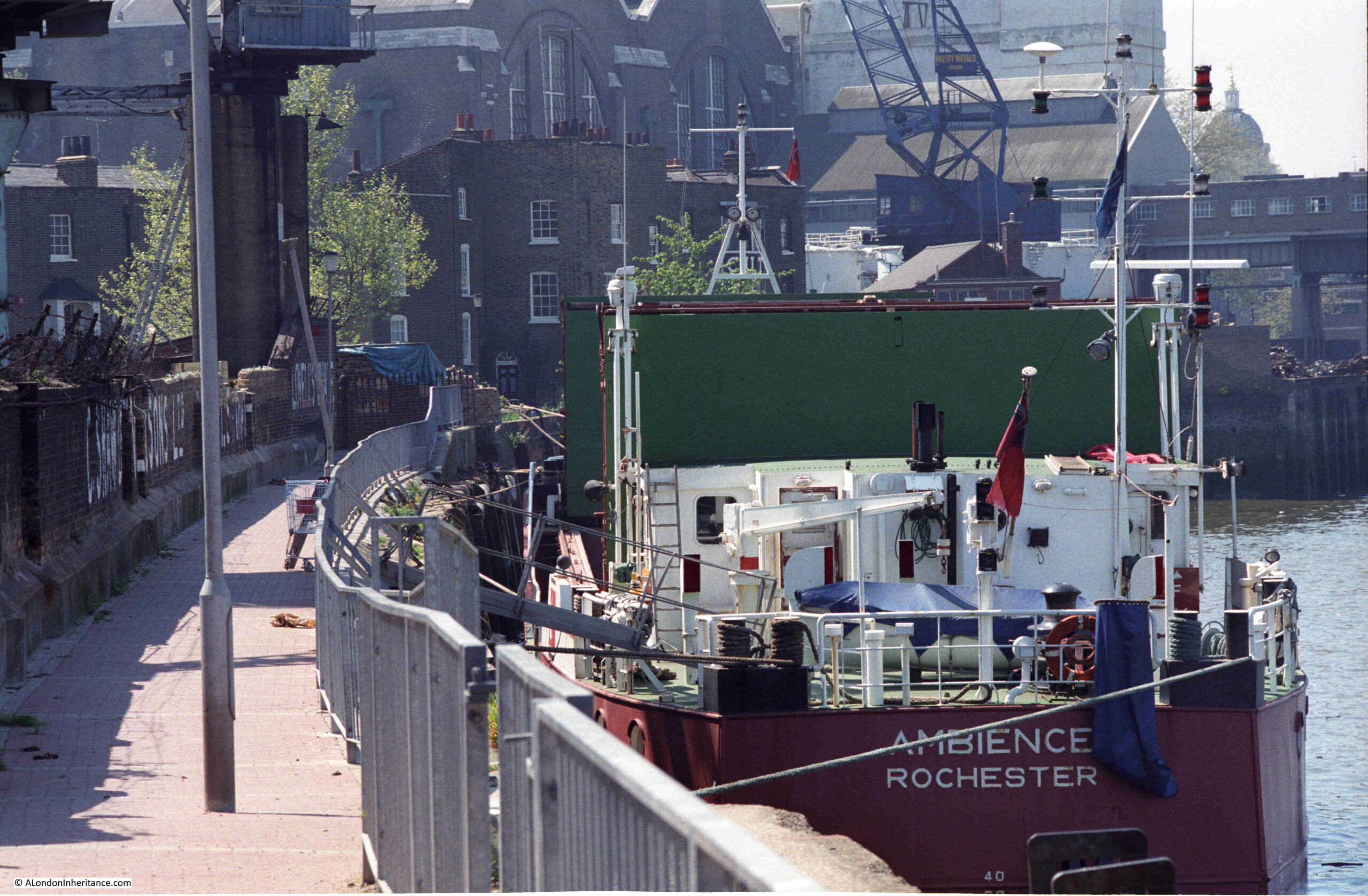
I recently scanned some negatives from 1986, and came across three photos taken in Greenwich, where the walk along the river heads past the power station and the Cutty Sark pub, and joins the Greenwich Peninsula. This is the first of the three:
Very roughly the same view today – despite lots of walking around I could not get exactly the same view, as the area has been remodeled considerably since the mid-1980s.
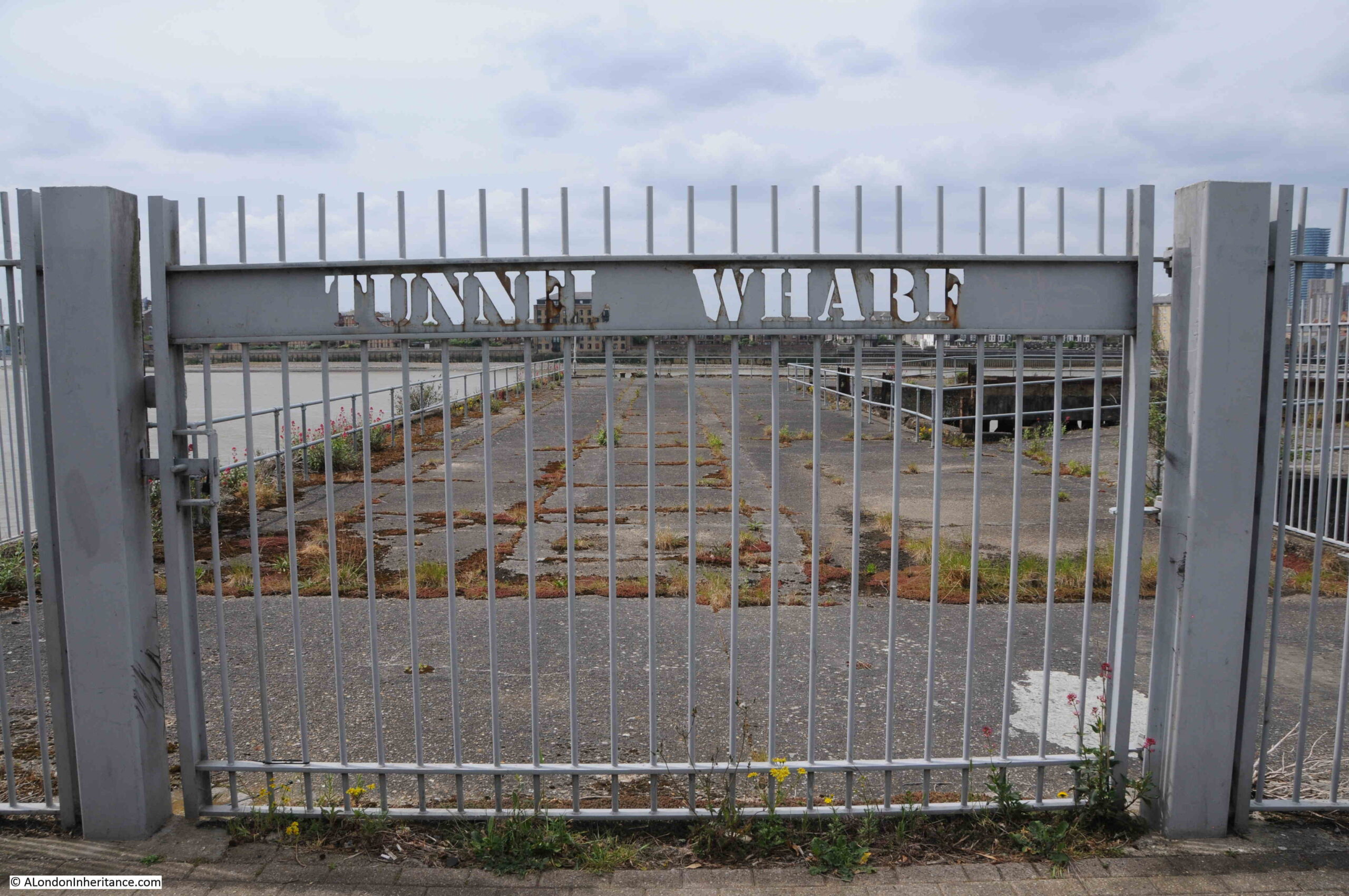
Along the wall in the 1986 photo there were painted white letters for C. Shaw & Sons Ltd and Lovell’s Wharf:
The books by Mary Mills are my go to source for anything about the Greenwich Peninsula, and Mary has recently published “The Greenwich Riverside. Upper Watergate to Angerstein”:
For a detailed history of the peninsula and the considerable industrial heritage of the area, the book is invaluable.
The book states that the company Shaw Lovell leased the site in the 1920s. A company with a Bristol heritage, their business was as a “Shipping and Forwarding Agent”.
The company handled non-ferrous metals, including in the 1920s, scrap from the Great War battlefields.
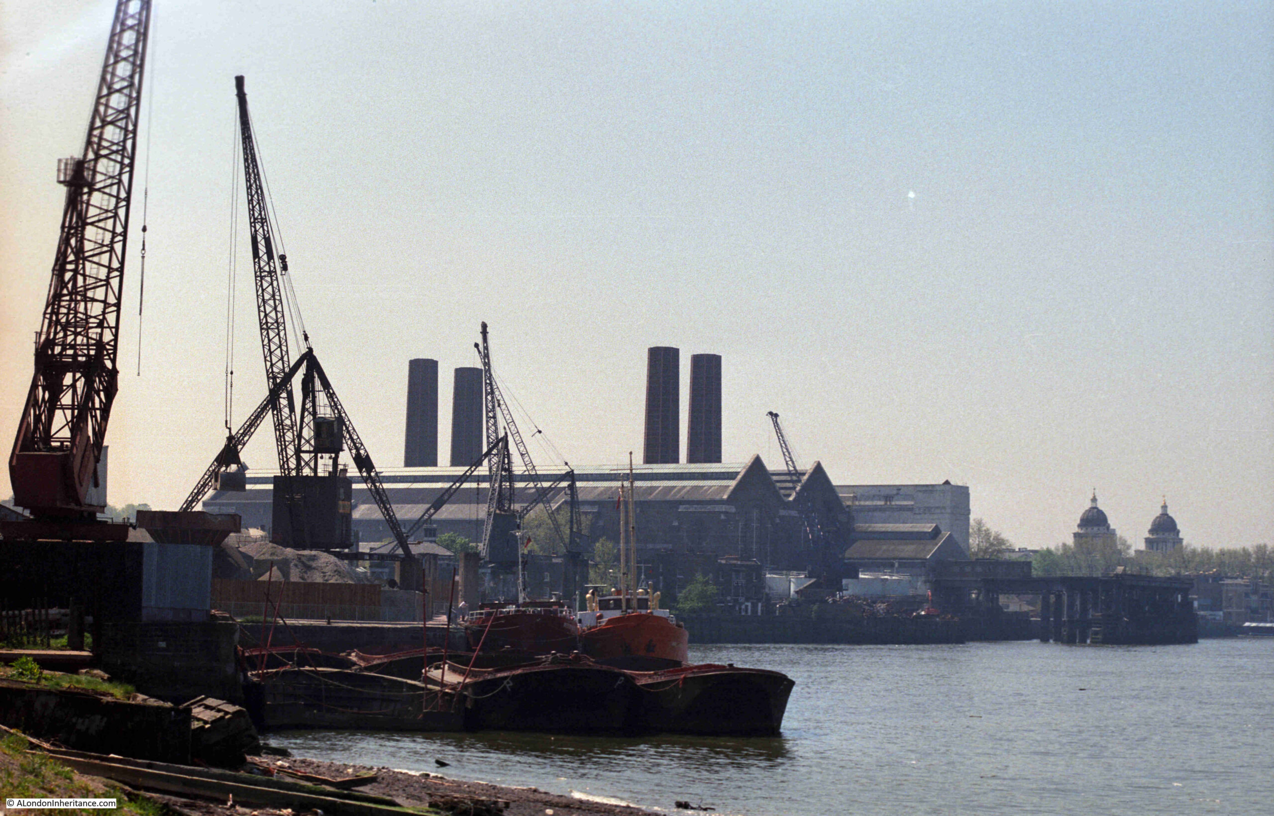
A view of the methods that the company used to transport material between shipping on the river and the land is shown in the following photo from a bit further along the Greenwich Peninsula:
The same view today:
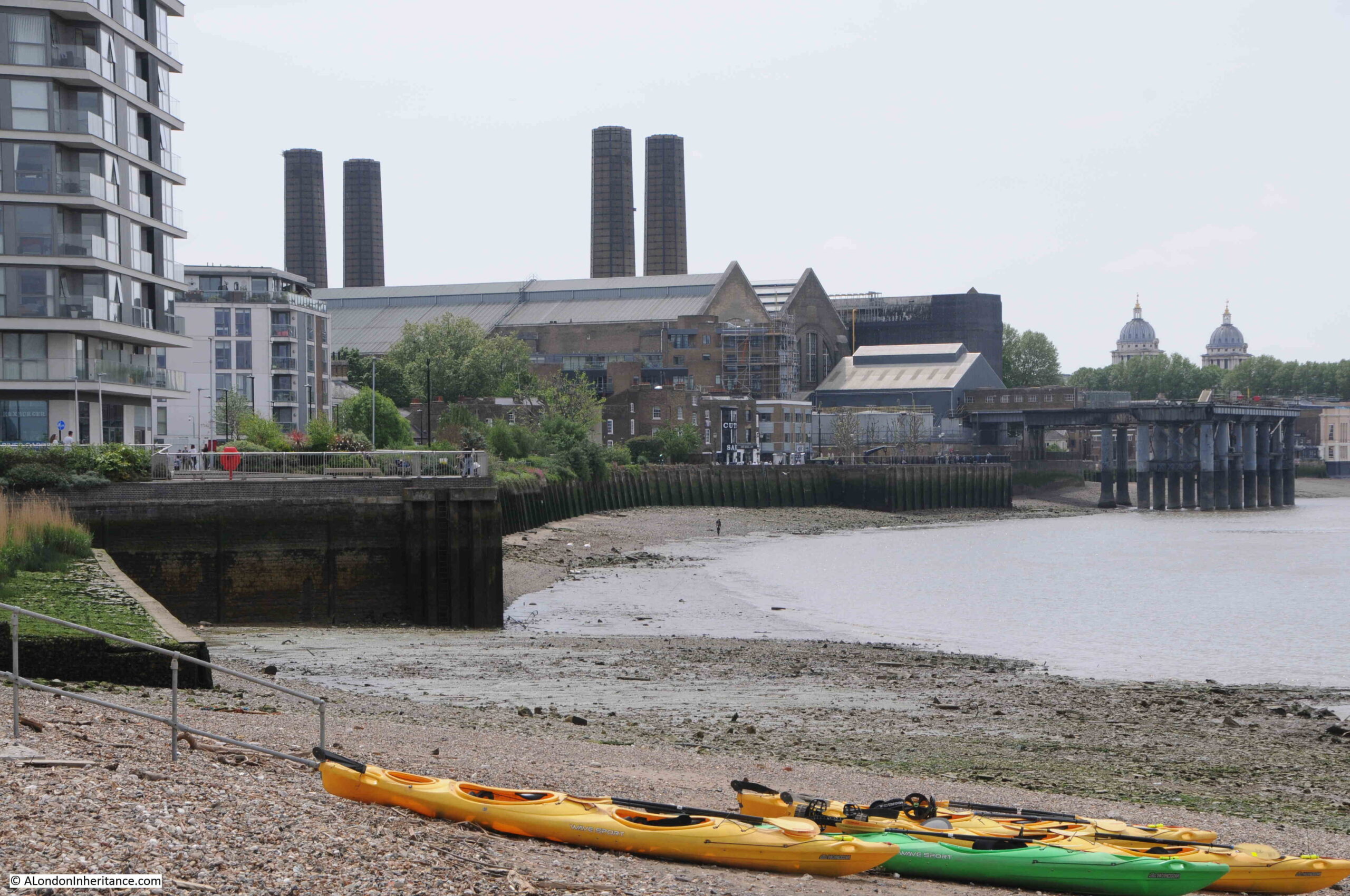
I found the exact position for the above photo. The chimneys of the power station, and domes to the right help, but in the foreground there is the low concrete wall on the left, and behind the barges in the 1986 photo is where the shore wall extends out into the river. If I had timed my visit better, I could have got the tide in the same position.
The main differences between the two photos is the lack of shipping moored alongside the wharf, and the cranes being used to transport materials.
The cranes were significant local landmarks. They may have dated from around 1950 and were originally in use in Dublin. The cranes moved to Greenwich in the 1970s, and remained on site until 2000, when the owner of the land had them removed.
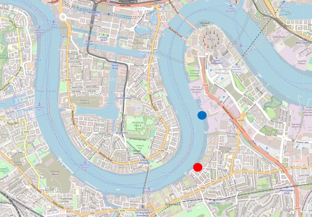
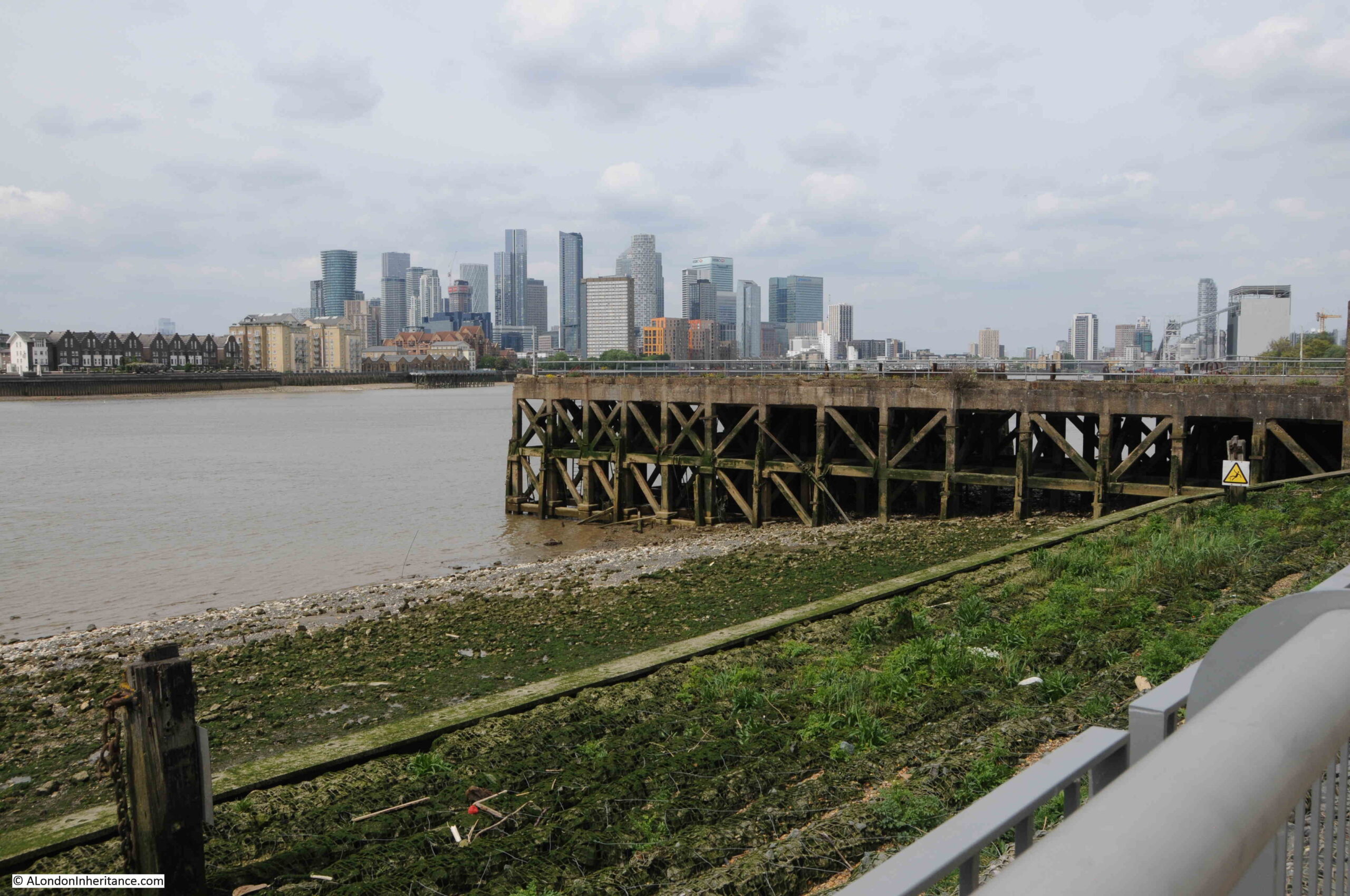
To put the locations of this week’s post in context, the following map shows where I will be covering. Starting at the red circle, with the above photos just north of this circle, and finishing at the end of the post at the blue circle (© OpenStreetMap contributors).
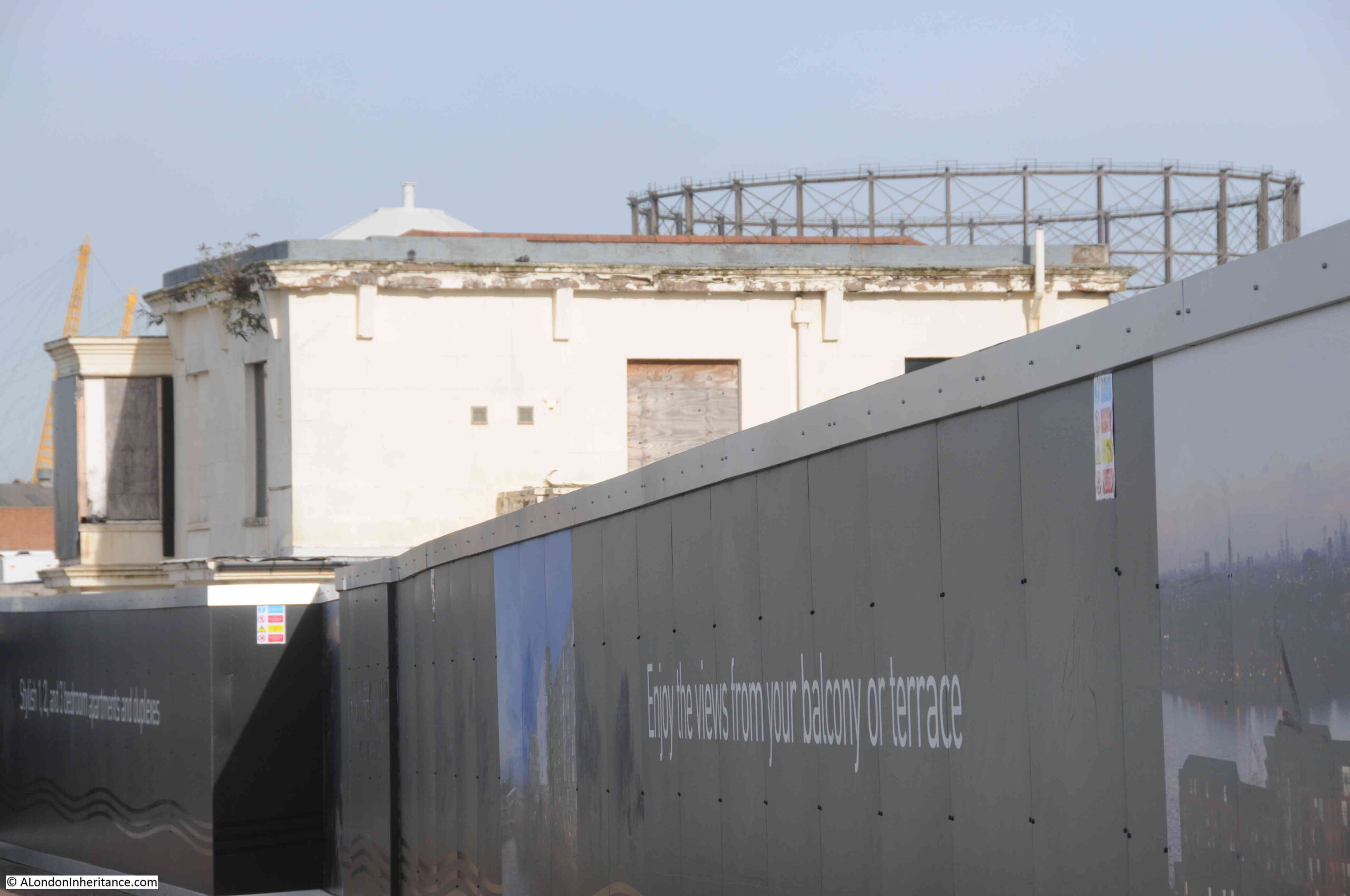
As can be seen by comparing the above then and now photos, the area has changed considerably. What was an area of considerable industry has been derelict for some years, and over recent years the northward expansion of apartment buildings has started along the western side of the peninsula, and will no doubt meet the southward run of buildings close to the O2 dome.
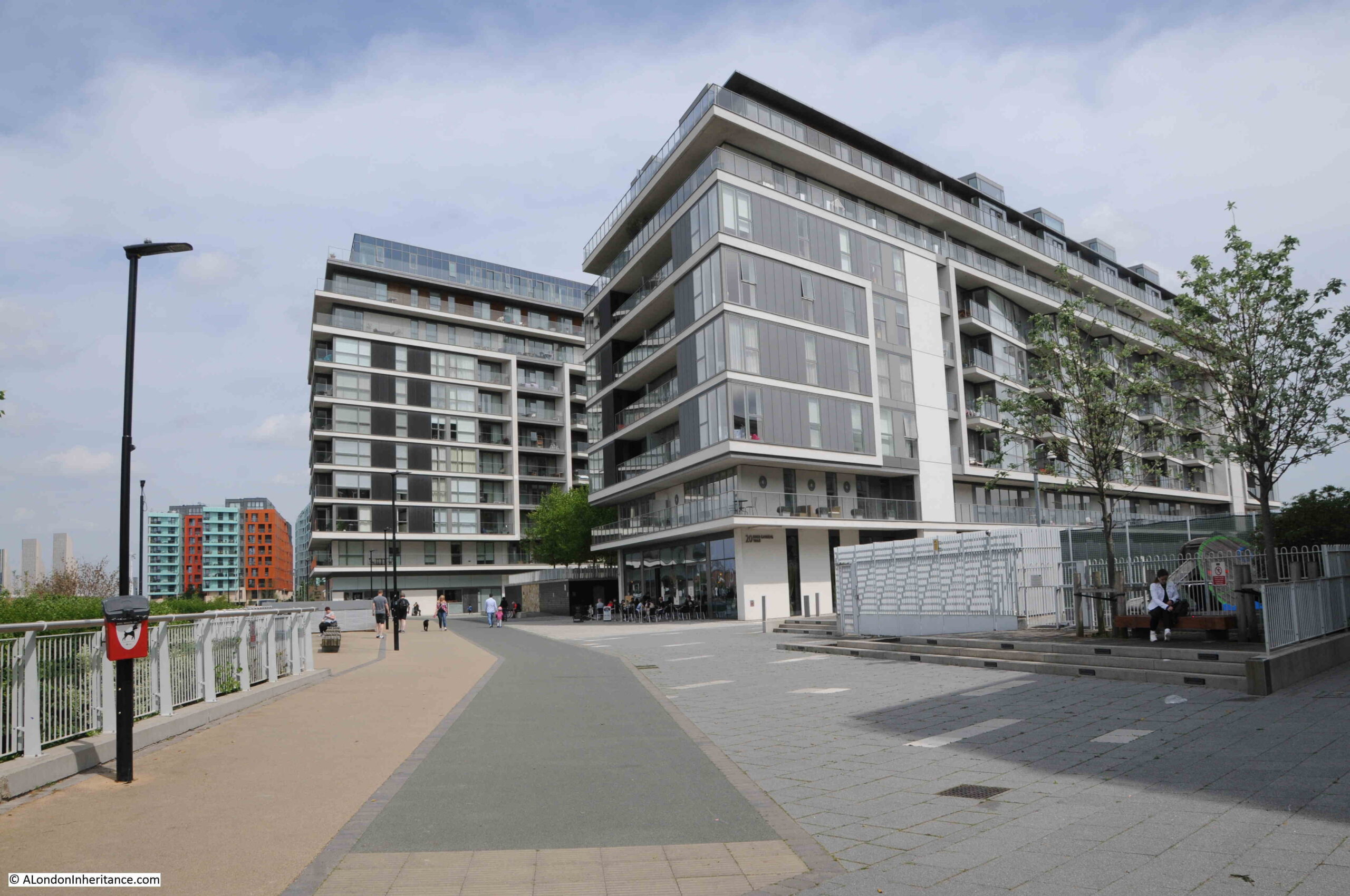
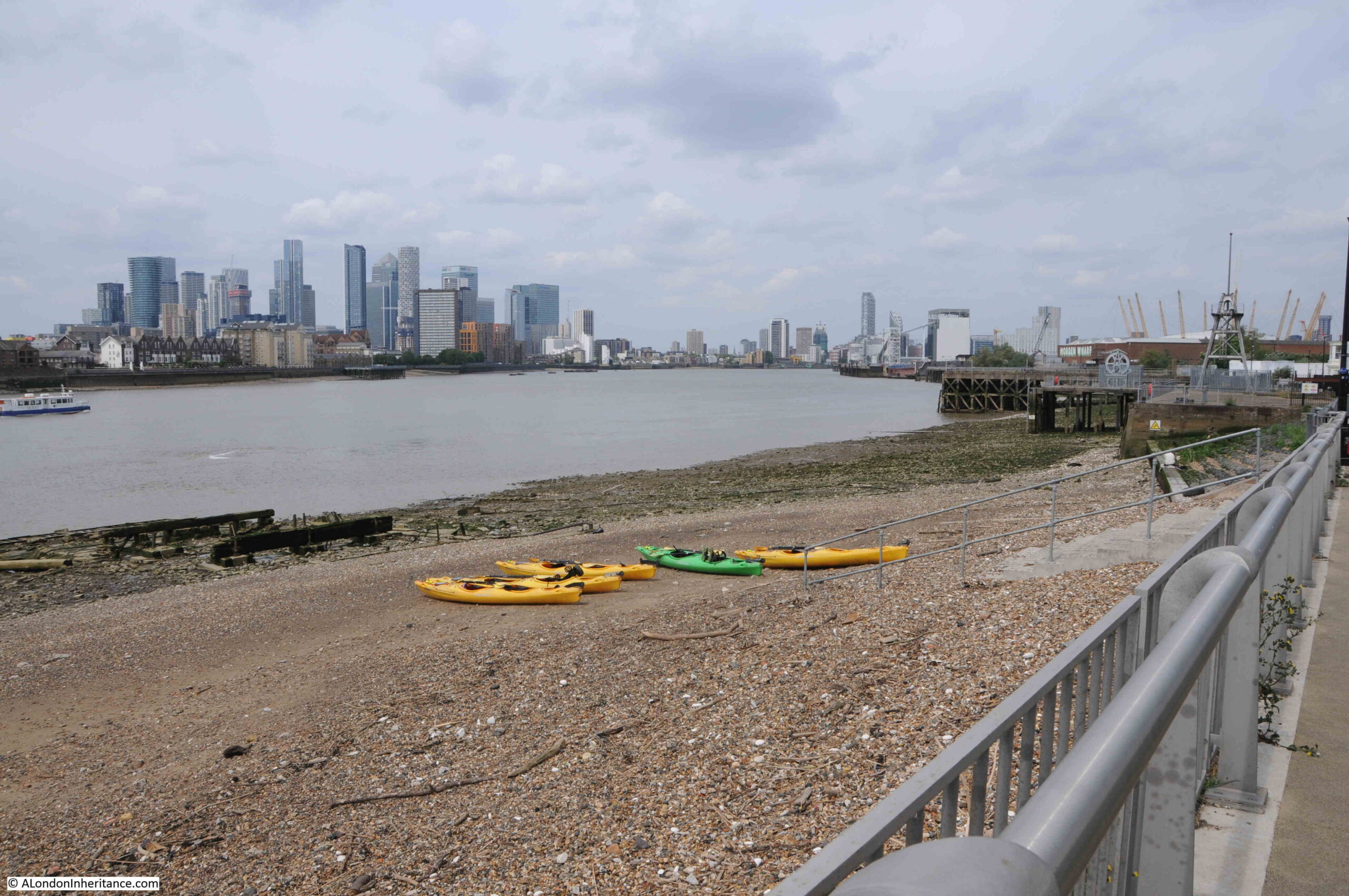
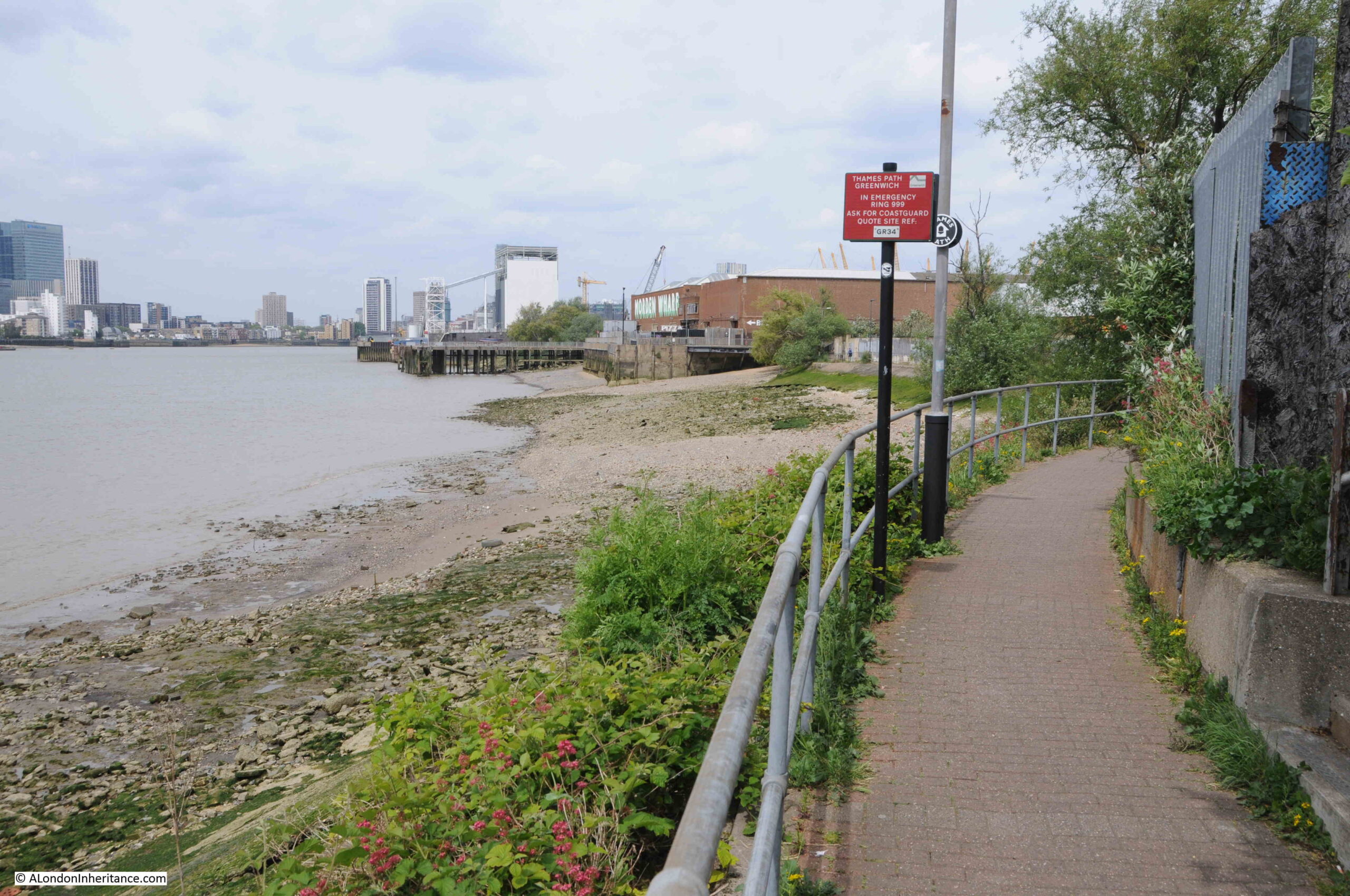
Looking along the foreshore towards the dome at the northern tip, with new apartment buildings replacing the industries that once occupied the area:

View across the river to the towers of the Isle of Dogs:
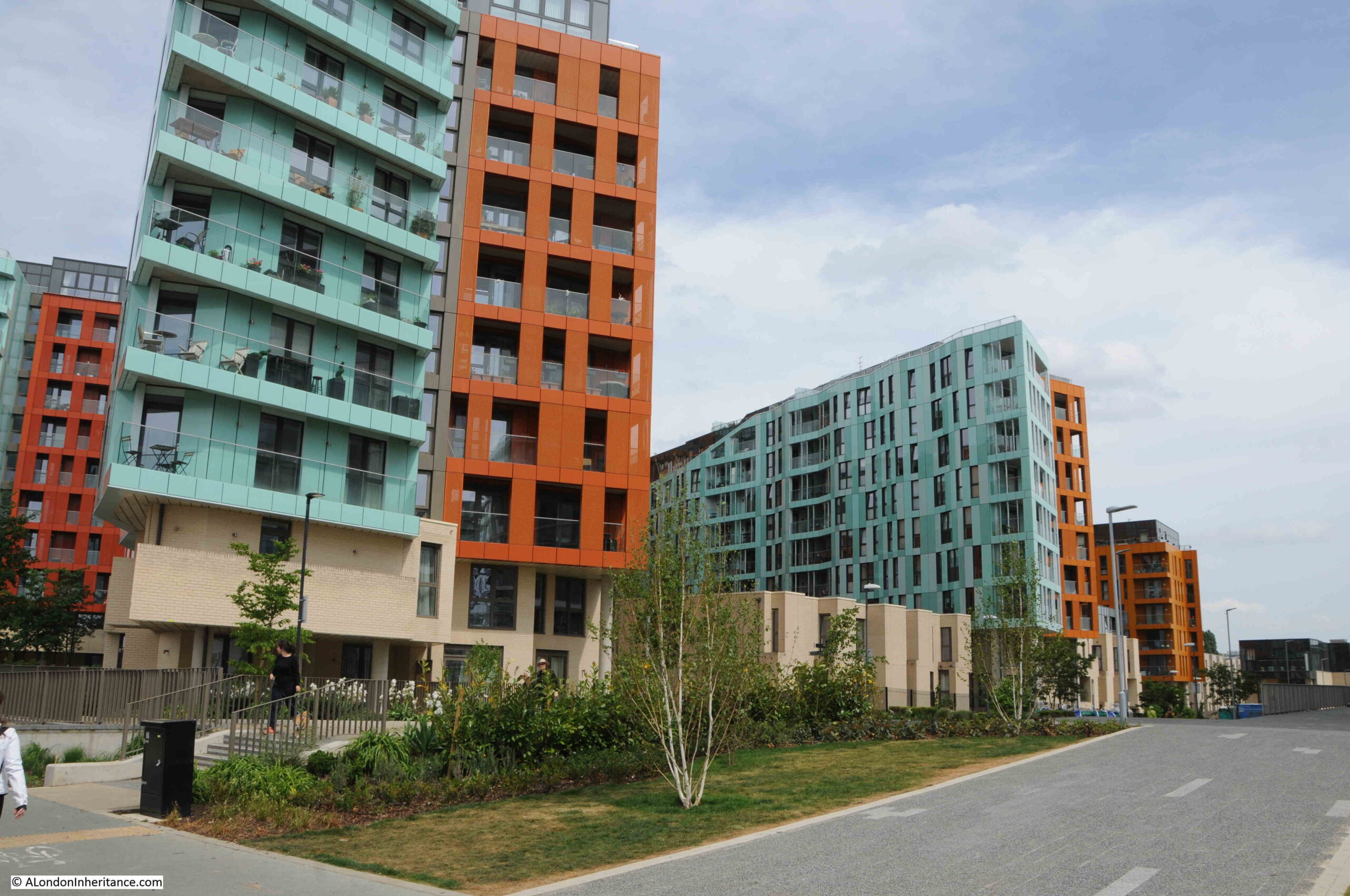
Two colour apartment blocks:
Of the many industries along this stretch of the river, one was a company that was key in the provision of a technology that enabled communications across the world. This was the manufacture of submarine communication cables which took place at Enderby Wharf and it is here that we can see the remains of some of this activity.
Here was manufactured the first cable to cross the Atlantic and up until the mid 1970s much of the world’s subsea communication cables had been manufactured here. The web site covering the history of the Atlantic Cable and Undersea Communications has a detailed history of Enderby Wharf.
The tower structure that can still be seen is part of the mechanism, along with the smaller wheel on the left, used for transferring cable from the factory on the right to cable ships moored in the Thames on the left. Cable would be run across the walkway to the top of the tower then to the round hold-back mechanism on the left then onto the ship:
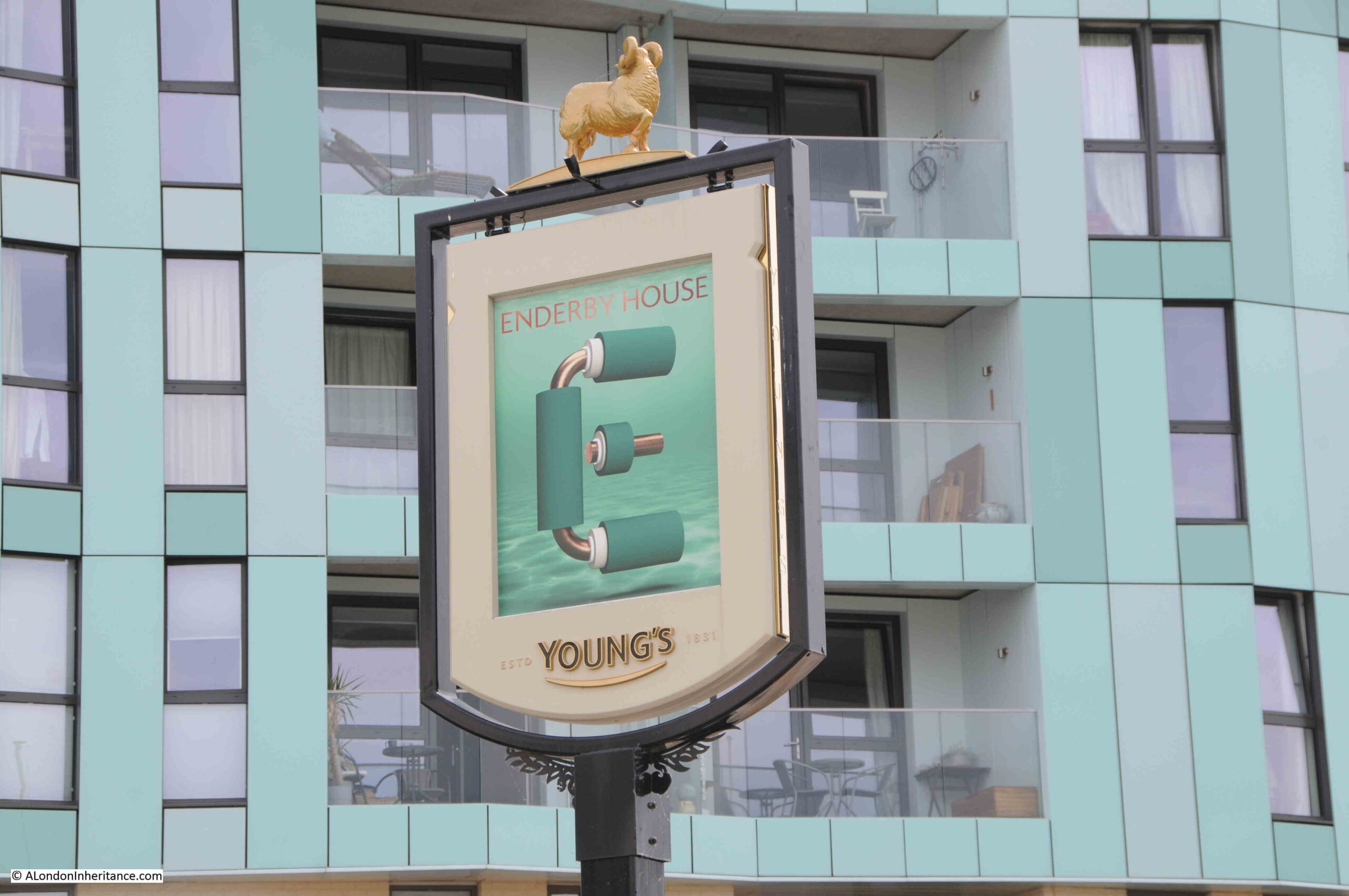
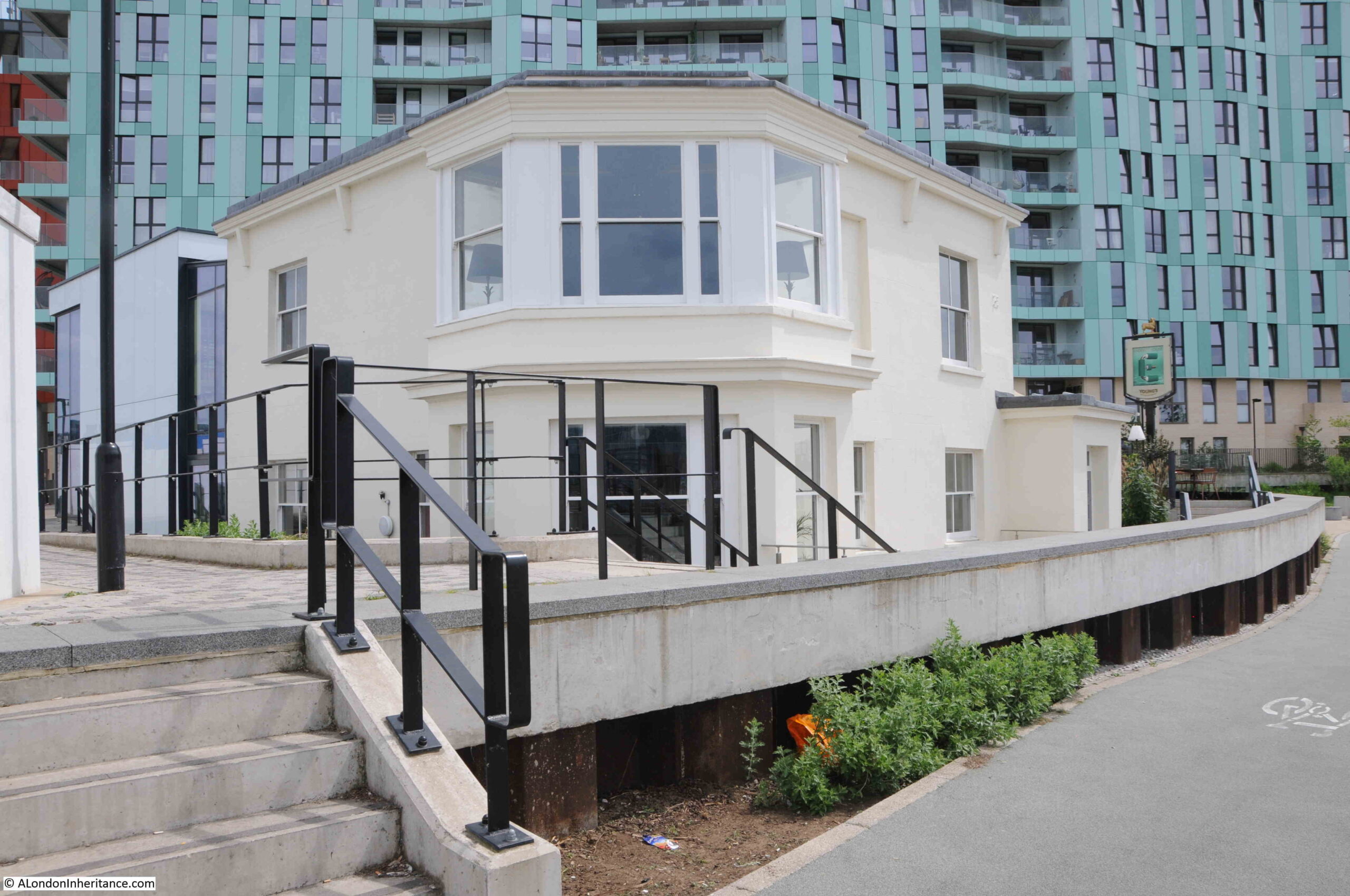
It was here that I was really surprised to see a new pub – Enderby House:
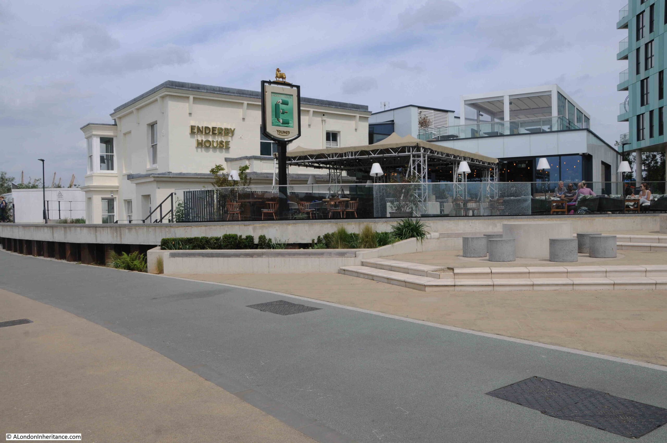
Enderby House is a historically important building. Grade II listed, the Historic England listing provides more details about the building:
“Enderby House belonged to the firm of Samuel Enderby, the largest whalers and sealers in Britain, and pioneers of Antarctic exploration. Hermann Melville describes their flagship and crew in “Moby Dick”. The decline of British whaling led to the Enderbys ceasing to have an interest in Enderby’s Wharf in 1854. It was then taken on by Glass, Elliott and Company, a contractor for the first transatlantic telegraph cable (lost while being laid in 1857) then the second in 1858 which operated for a few weeks. The business was reconstituted in 1864 as the Telegraph Construction and Maintenance Company, who manufactured cable at Enderby’s Wharf to an improved design for another attempt in 1865, and a fourth in 1866, both times with the Great Eastern as the cable-laying ship, and by the end of 1866 had achieved the first successfully working transatlantic telecommunications cable connection. “
The last time I walked along this stretch of the peninsular in 2015, from Cutty Sark pub to O2 dome, Enderby House was looking in a very poor condition:
I walked around the outside of the pub, but could not see any references to the history of the site, or to the impact on communication technologies that the products manufactured here would bring, however the pub sign did appear to illustrate what I assume to be a representation of a telecommunications cable:
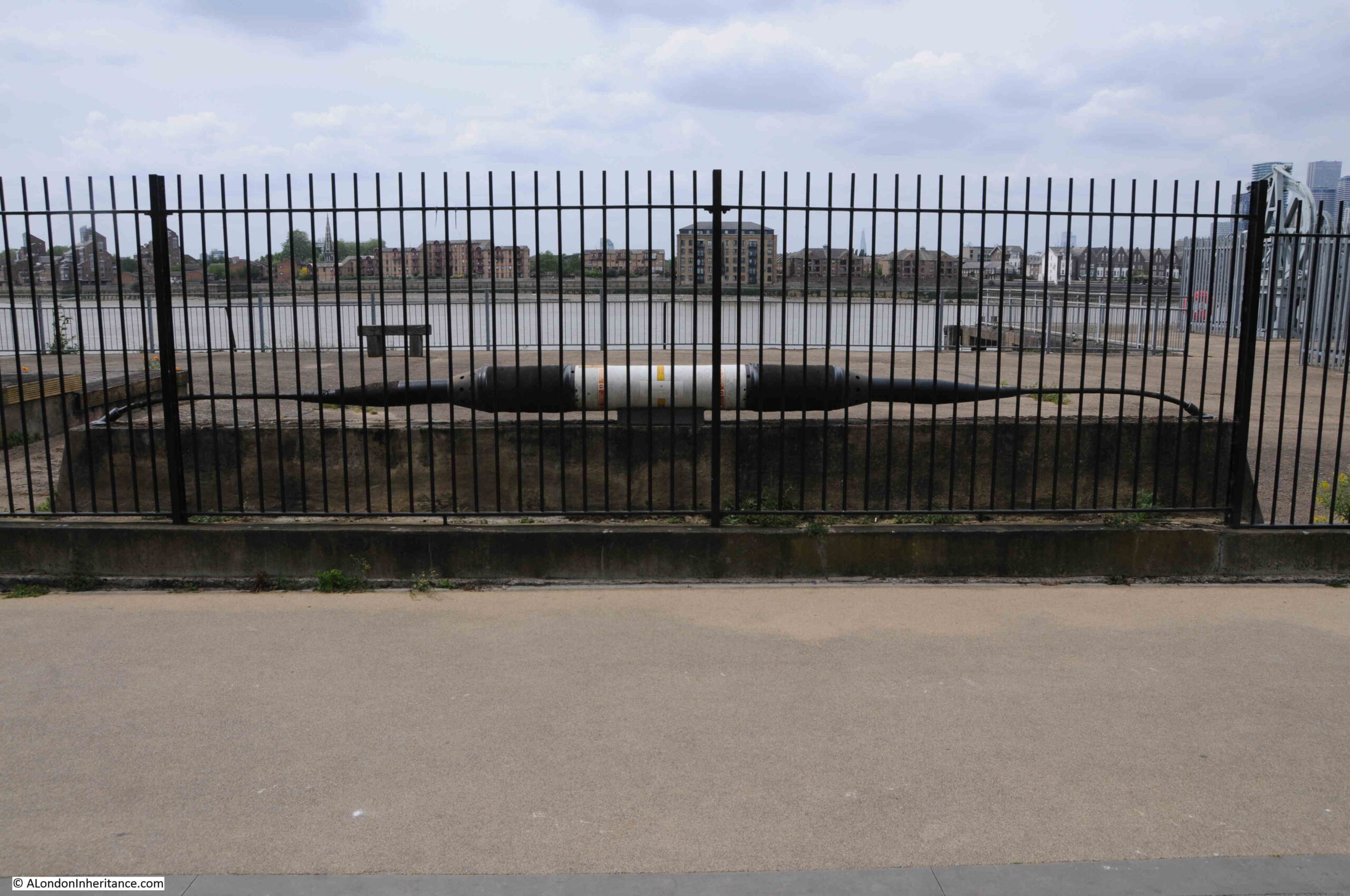
Opposite, within the fenced off wharf, was an example of a length of cable and the housing for the repeater equipment that would amplify the signal as it travelled for thousands of miles under the sea:
I get really conflicted when I see a building such as Enderby House. I am pleased that it is still there, and that it is a new pub (too many of these are closing), however it appears to be heavily altered, and does not appear to offer any information as to the importance of the site, apart from retaining the name and the pub sign.
Perhaps there is information inside and I am being unfair. I did not have time for a visit, having a meet arranged at the Cutty Sark pub on the walk back.
View of the northern side of Enderby House – if I was responsible for decorating the building I would have an artwork representing a trans-Atlantic cable running along the side of the building to break up the rather bland cream paintwork.
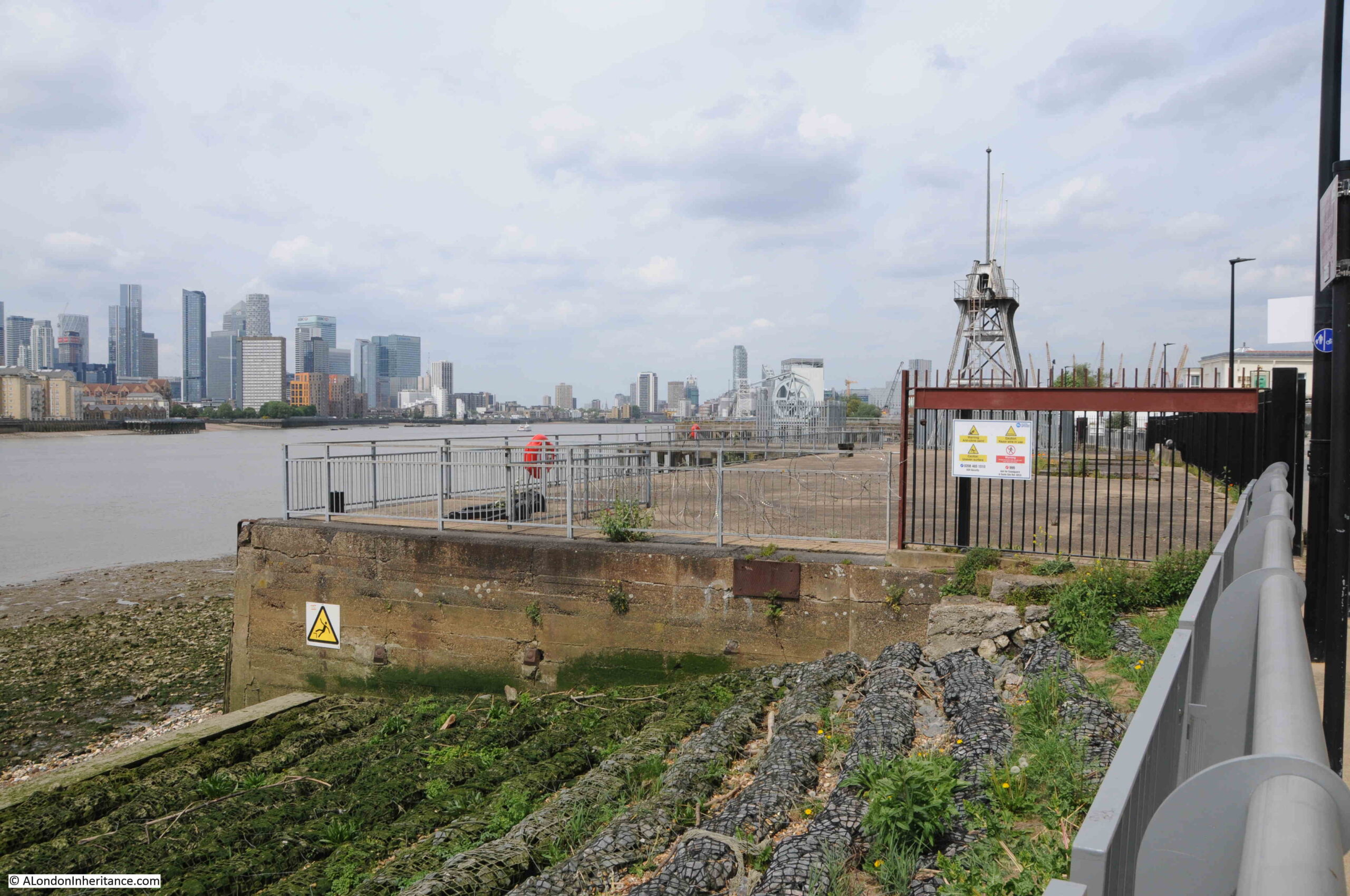
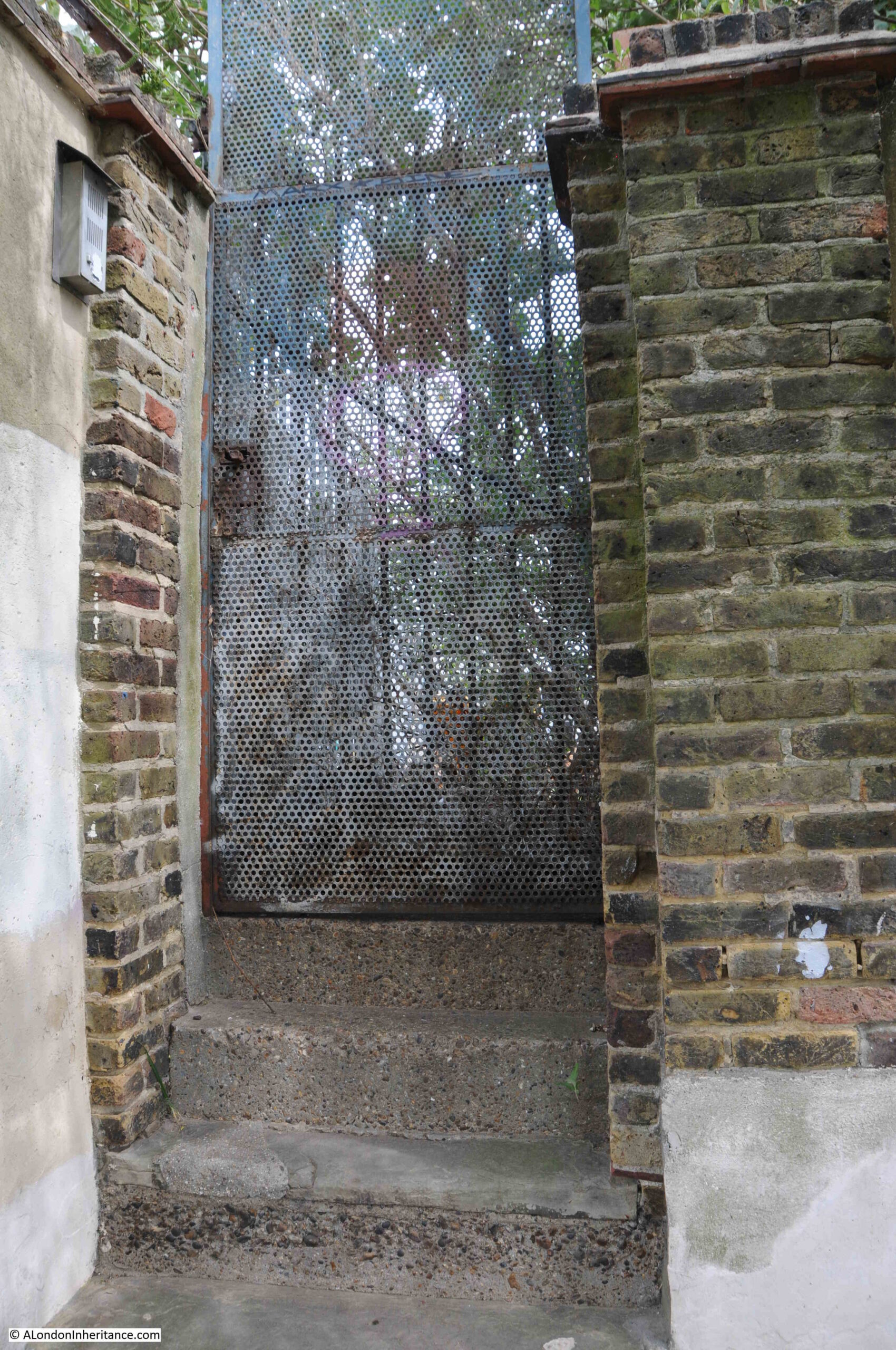
Fenced off access to the wharfs near Enderby House:
There is a flat wall of stone to be found among the apartment buildings and facing on to the walkway along the river:

Rather than repeat what the information panel to the right of the wall states, I will summarise Mary Mills comments from her book.
There was a road that ran underneath the new apartment buildings between Lovell’s and Granite Wharf (which was to the north of Lovell’s).
Much of the boundary wall of Granite Wharf along this roadway was made up of an extraordinary range of what appeared to be random stone, and was thought to have been quarried in Dorset, shipped to Greenwich where it was stored until it was sold for use in a construction project. Some of this stone had been used to construct the wall.
This stone wall was important as it was a visual demonstration of the stone trade from along the English Channel.
When the wall, along with the rest of the site was being demolished, Mary Mills was instrumental in getting the importance of the stone recognised, however the wall created by the developer using the stone is very far from how it was originally used, and what had been rough stone had been tided up considerably and placed in what is now a smooth wall of stone. Again, good that it has been retained, but it could have been so much better.
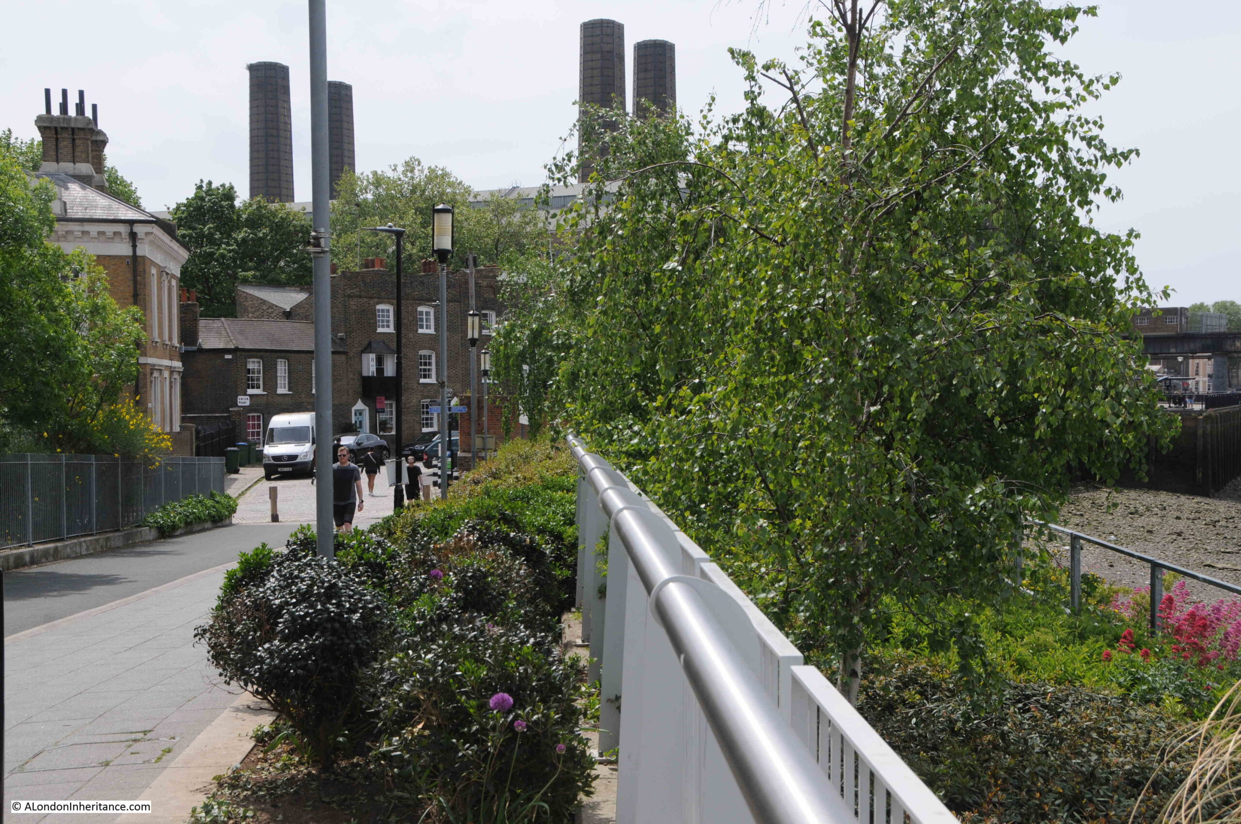
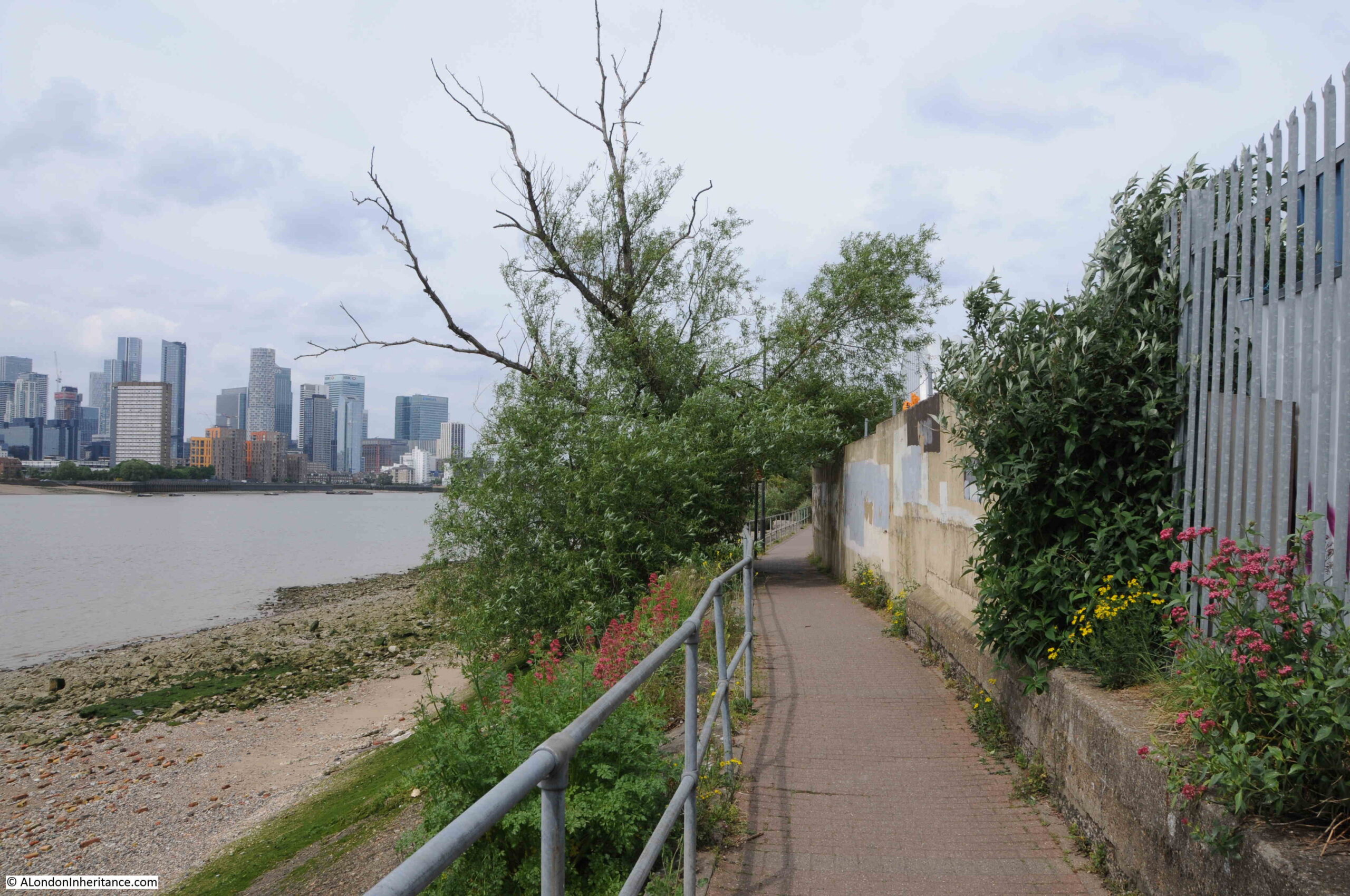
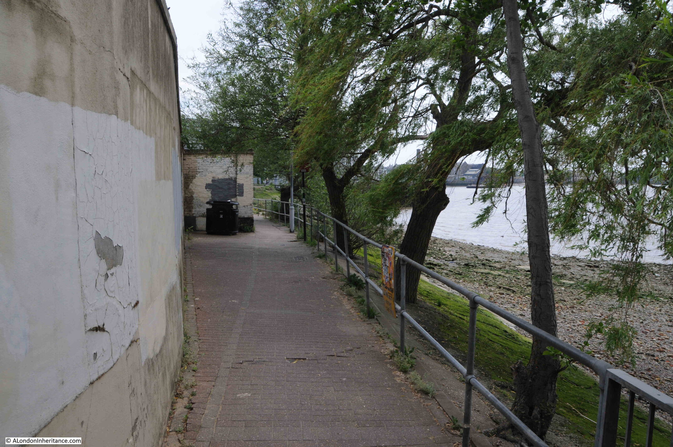
Soon after walking past Enderby House, development has stopped and the river path changes from a new, wide path in front of apartment buildings, to a narrow path alongside the derelict sites that are probably scheduled for development:
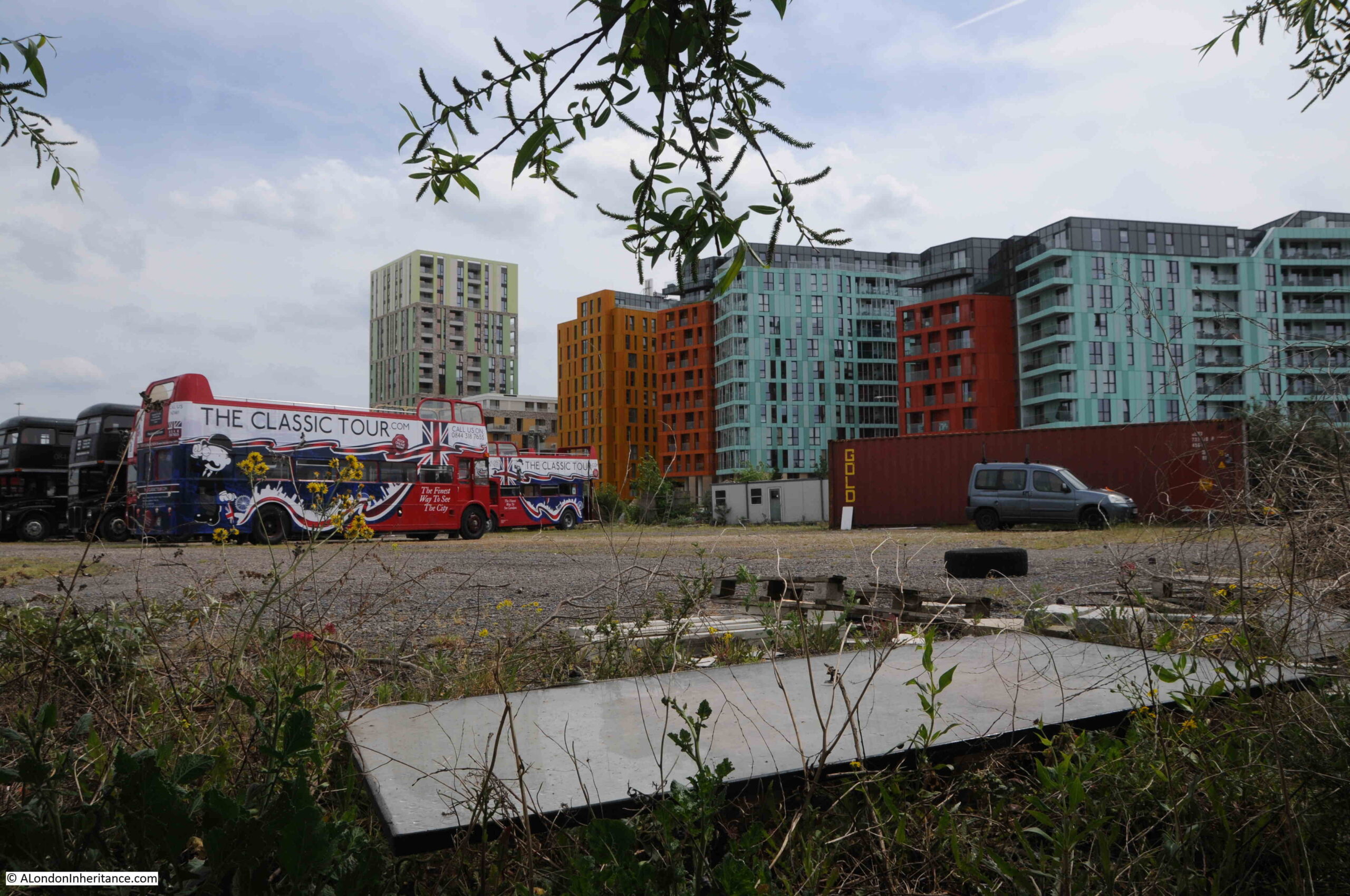
Where tour buses go to park:
I really love this part of the walk along the peninsula. A narrow path along the river’s edge, quiet, and a chance to think about what was here:
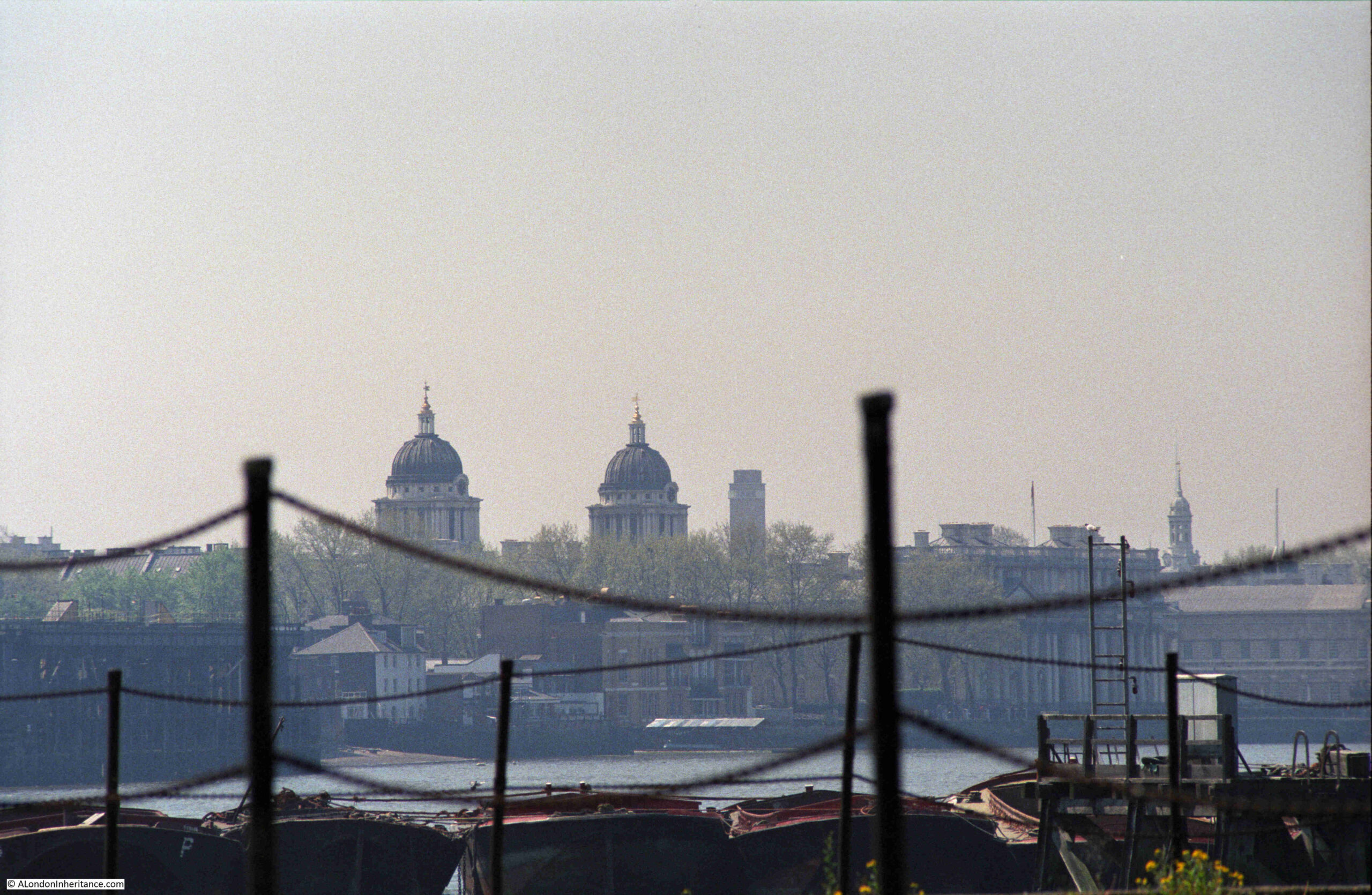
I still had my third 1986 photo to track down, and I suspect it was taken from the following pier:
This was the view looking back towards central Greenwich in 1986:
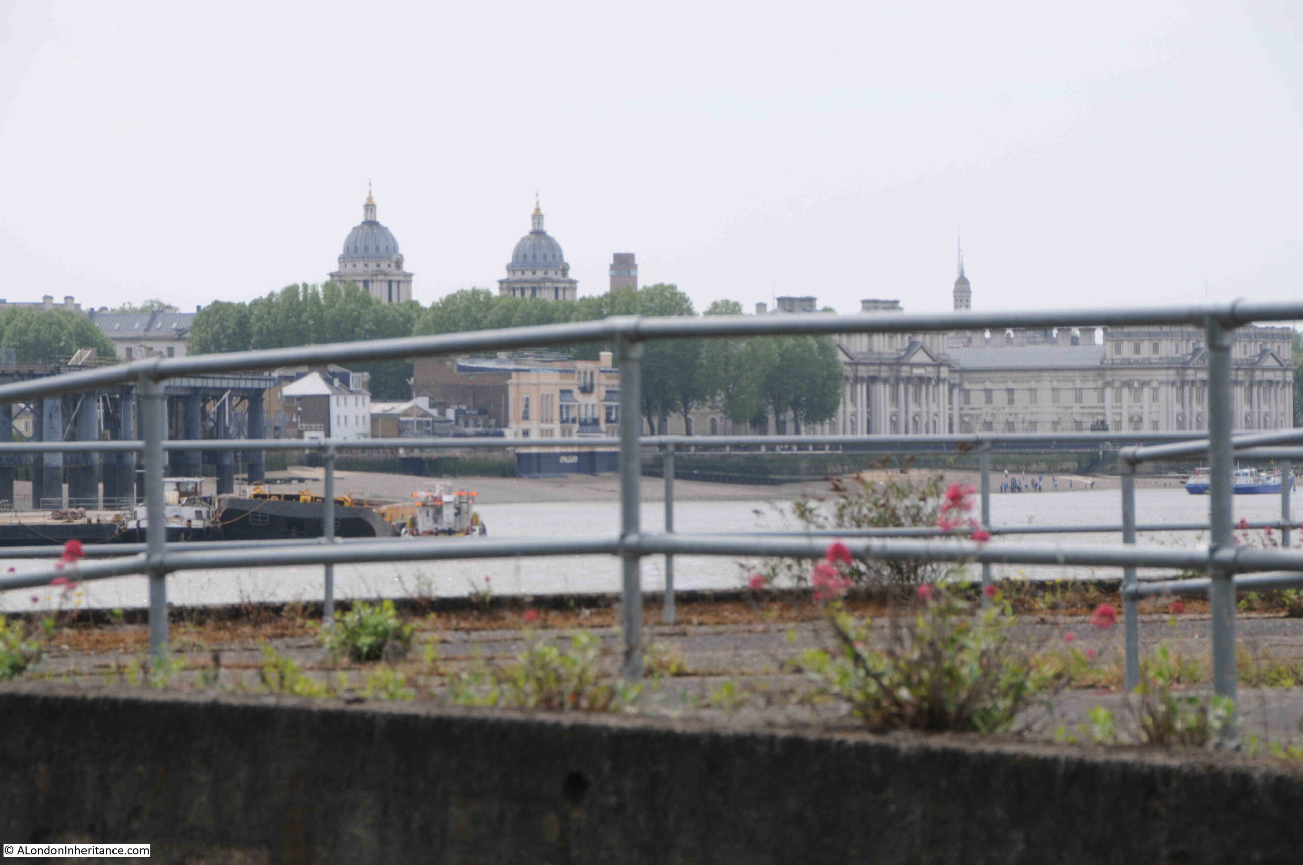
The following photo was the closest I could get to recreating the above. The landmarks of Greenwich all line up reasonably well. The barges moored alongside the pier in 1986 have all disappeared.
To the side of the footpath, there are the remains of structures that once provided access to the long gone industrial premises that lined the river:
A long closed gateway:
Looking back along the footpath – this stretch of the river is so very different to that which has already been developed, and I assume that at some point in the future, this footpath will become the same wide pedestrianised area next to new apartment buildings, as found at the start of the post:
A welcome sign:
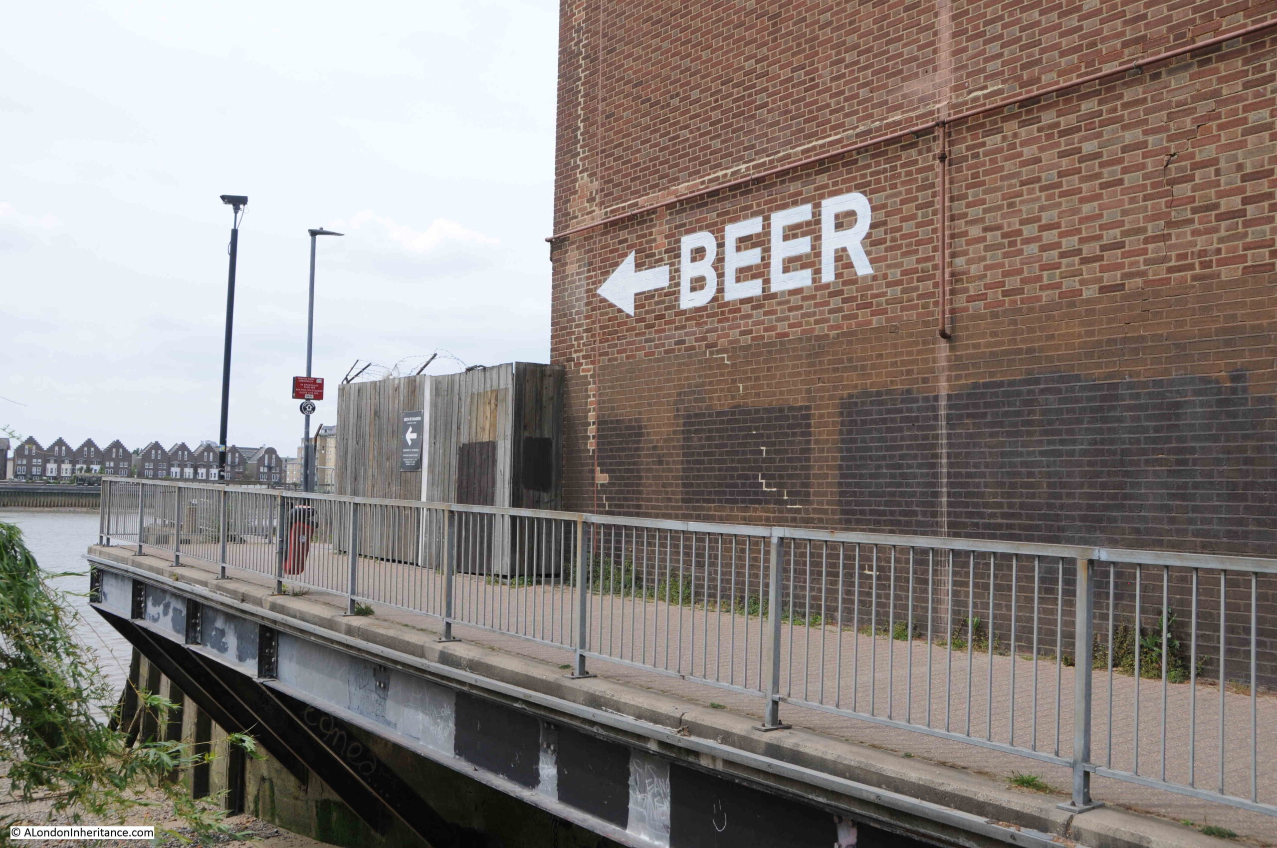
The sign points to what looks like a temporary bar / pizza area built in front of Morden Wharf:
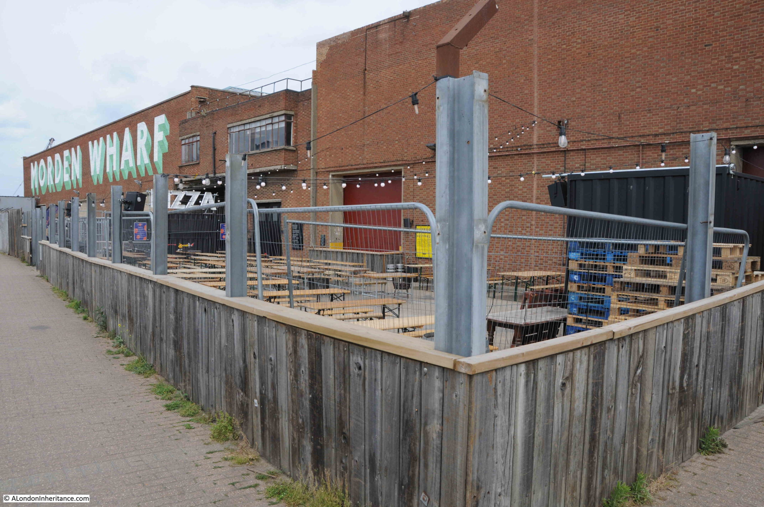
Morden Wharf was named after Morden College, the freeholder of much of the land in the vicinity of the wharf.
The last time I walked along the peninsular, Morden Wharf was fenced off from the footpath with high, wooden panels, these have now been removed with only their vertical metal supports remaining.
Having reached Morden Wharf, I turned back towards Greenwich.
The area that I have walked which has not yet been developed, is planned to undergo a significant transformation. The footpath winding its way between the river and the derelict industrial sites will disappear and large new towers will be built.
The developed is called Morden Wharf, and the website describing the development can be found here.
Scroll to the bottom of the page, on the Morden Wharf website, and the area I have walked can be seen to the right of the old brick Morden Wharf building, and the bar and pizza area will apparently become “The reinstated Sea Witch pub”, a very different recreation of a pub that was once close to the river, and that was badly damaged by a V1 flying bomb on the 12th of July 1944.
The 1986 photos captured some of the last years of some of the industry along this side of the Greenwich Peninsula. It would then remain derelict for some years, and is now undergoing a significant transformation. It is a good time to walk the western side of the peninsula before this happens.
My 2015 walk along the peninsular to the O2 dome can be found here and shows how the area is changing, and the final part of the walk.
I have walked along the Thames from Deptford to Greenwich in the past, and also from Woolwich to Greenwich going the other way, but my most usual method of visiting Greenwich has been to take the DLR to Island Gardens, walk through the foot tunnel and then head to the maritime museum and surrounding park and ultimately on to Greenwich railway station.
I went to a talk about the development of Enderby House some years back, and the developers were going to create a small museum or exhibition when it re-opened as a pub. Needless to say that never happened. There an art installation ‘Lay lines’ at the front of the pub, which represent configurations of some of the cables manufactured there – see this website:
https://enderbywharf.wordpress.com/sculpture-lay-lines
The Greenwich Industrial History Society talk on Tuesday 20th September will be about submarine cables. Bill Burns and Stewart Ash will be talking about ” The Pender family and their roles in the development of the submarine cable industry” – and you will no doubt hear more about all the negotiations to get Enderby House to acknowledge that important industry, resulting in the Lay Lines art and the pub sign!
Gosh thanks – quick note though. Enderby Wharf – we had (have) a small group which worked to try and get the developer to recognise the historic importance of the wharf and had very considerable support – and the same with the pub. Could write a blow by bow account of it and how they just eventually ignored us.. The only thing which they did – because it was in the planning consent – was the installation of an art work – Ley Lines -which you missed. Again have a lot of detail.
Gosh thanks – quick note though. Enderby Wharf – we had (have) a small group which worked to try and get the developer to recognise the historic importance of the wharf and had very considerable support – and the same with the pub. Could write a blow by blow account of it and how they just eventually ignored us.. The only thing which they did – because it was in the planning consent – was the installation of an art work – Ley Lines -which you missed. – and which others have noted above.
Mary, missed Ley Lines, cannot be that obvious as you walk along the river?
Thanks for the excellent book. A fascinating read about the area.
They look a bit like concrete seats as you walk past, so are easily overlooked
Thank you for your wonderful descriptions of the Thames path at Greenwich. I have lived in the area since 1986 and also like that stretch between Enderby House and Tunnel Avenue best.
As a historical link, at least Alcatel remains with their website saying
“Greenwich, UK: Amplifiers, repeaters, branching units, ROADM and other submerged equipment are produced at this site where the world’s first transatlantic cable was manufactured in 1858”
Here’s a photo I took at Lovell’s Wharf in 2006: http://www.ipernity.com/doc/mjm/22118861
As a GPO apprentice in 1966, I was attached to a customer maintenance group at Greenwich telephone exchange. The huge assortment of industry that spread the length of the river front is now all gone. Those that come to mind Submarine Cables, AEI British Steel and United Glass, to name but a few.
However the most striking industry on the peninsula had to have been SEGAS works it covered acres of land and the atmosphere was quite pungent. Indeed when the site was cleared in the early 1990’s to make way for the erection of the Dome,the decontamination of the site took many years at a colossal cost.
Thanks for an interesting article that took me back to my youth and a reflection of the days still vivid in my mind.
You can see a section of submarine cable plus a few photos in the Museum of London Docklands at West India Dock. There is also a great section on the Blitz. Both my Grandfather were dock crane operators in the early war years.
The website of Young & Co describes “…the historic building of Enderby House”, but does not say why it is considered to be historic :-
https://www.enderbyhousepub.co.uk/
A missed opportunity in my opinion !
Paul – Enderby Group members and others have been on to Youngs over the years, and now to the local management, offering them information – and as you probably know the Atlantic Cable web site (https://atlantic-cable.com/) gives endless detail about the house with many pictures. At one point two of us actually went to a meeting including Young’s design team – who went ‘yes yes’ and never got back to us. We could probably offer talks and walks and so on if people were interested. The Greater London Industrial Archaeology Society has a walk around the area on its telecoms heritage on 3rd September (you need to book http://www.glias.org.uk/gliasdiary.html). Its led by Alan Burkitt Gray who is the Greenwich Industrial History Society Secretary but in his real life is a telecoms information professional. And as Elizabeth has said above GIHS has speakers on the subject on 20th September (book via our FB page) – with Bill Burns who runs the Atlantic Cable site from New York and Stewart Ash who has written many many books and articles mostly for specialist telecoms history sites and publications.
Mary’s comment doesn’t surprise me. I and others offered Youngs images from the vast Royal Arsenal Woolwich Historical Society’s collection for their new pub in the Arsenal, the ‘Dial Arch’. After an enthusiastic reception we heard no more.
More topical for this subject, I’ve known this stretch of The Thames since the 1970s and I’m aghast at what’s happened and what will happen. An area of great history, atmosphere, and individuality is going to appear as if it could be anywhere from Los Angeles to Singapore. We should be thankful for such bodies as the Greenwich Industrial History Society for continuing their research and saving at least something of a rather glorious past.
Very interesting read certainly not aware that morden college owned land in Greenwich
Thank you very much for another interesting report. Sunday was the day that Father and I , a lad of about 8 years of age would go on a bike ride. We would leave Bermondsey, through Deptford and reach Greenwich. We would ride past the Old Royal Naval College on our route to Blackwell Point. Not far(as best I can remember) from Blackwell Point the footpath became covered over by a building. It was quite dark, and I often wonder what that factory was. Perhaps someone in the group might know?
Depends – up until about 2000 there was a sort of awning covering over Granite Wharf to stop stones from overhead conveyors dropping onto people’s heads but that was near the start. Further on I think I can remember a sort of covered passage way at Morden Wharf – part of the Tunnel Glucose site which was later changed. Not sure. It would be early 1970s.
On October 9th 2025, Historic England listed the cable gantry and hauling engine at Enderby’s Wharf as a “Scheduled Monument”, putting it in the same category as Stonehenge (for example).
https://historicengland.org.uk/listing/the-list/list-entry/1490823
My opinion that its all like dogs dinner I drew up sketches for west properties that seemed to be interested in what my ideas we’re about the changes that were going to happen . It was in my mind to keep the connection to history of the area and building architecture should be in keeping. That is the sketches I came up with were basically that new building should be erected with round and curved shapes and protruding individual bay windows that would been in keeping with hundreds of cable storage tanks where cable was kept after manufacturing the submarine the cable and a small museum with part of a stranding machine that made cable and other items I was confident this was to come about but unfortunately not we’ve got glass erections like everywhere else and this does look like In keeping the history of the start of a new commutations that will used the world over and in space the digital systems
I was employed in those communication factories at that site with both the TELCON and STC and as Greenwich person all my life . Personally I’m quite sad to see what’s it’s like now