
Before heading to the Swanscombe Peninsula, if you would like to explore the Southbank or the Barbican, there are still a few tickets left for my final walks for the year. I have also added a limited number of tickets as many walks have already sold out. Click here for details.
If you have been reading the blog for a while, you will probably be aware of my interest in the River Thames. Not just the part through the city, but the whole of the river, out to the estuary. The Thames is the reason why London is located where it is, and has been the route for the trade that made the city so successful.
Just over a week ago, on probably the last, hot and sunny day of a late summer, I went to the Swanscombe Peninsula. A place that is currently threatened with some significant development.
The Swanscombe Peninsula is a large area of land, pushing out into the river, well to the east of the city. According to the Kent Past website, the name comes from the Old English “camp” meaning a “field, an enclosed piece of land”, along with the Danish name of Swaine, so Swanscombe could have originated as describing “Swaine’s enclosure’’.
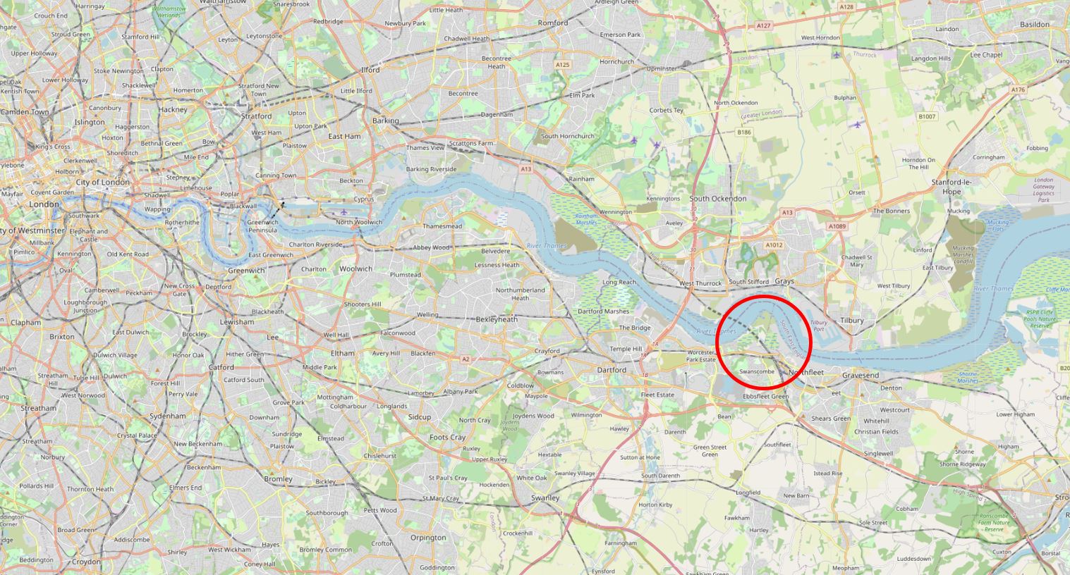
The area of the peninsula is 205 Hectares, or 506 Acres. In the following map, I have circled Swanscombe Peninsula in red (Map © OpenStreetMap contributors)..
The western part of the peninsula has long been seen as a development opportunity, and in the Strategic Planning Guidance for the River Thames (1997), the area was identified as a “riverside opportunity for an urban village”. Current plans are for a very different use as a considerable part of the Swanscombe Peninsula is currently planned to be developed as the London Resort, described on the project’s website as a “world-class, sustainable, next generation entertainment resort known as the ‘London Resort’, on the banks of the River Thames”.
The London Resort will also be the “first European development of its kind to be built from scratch since the opening of Disneyland Paris in 1992”.
Development of the London Resort will bring considerable investment into the area and many, much needed jobs.
The London Resort has been planned for many years, in 2008 it was designated as a Nationally Significant Infrastructure Project, however there have been a number of delays, and major supporters of the project have withdrawn and also rejoined over the years.
Plans for development now seem to be making progress, and the London Resort’s website claims a start date of 2022, with the first part of the resort opening in 2024, and the site being complete by 2029.
If I have understood the planning documents correctly, the core of the London Resort is shown outlined in red in the following map:
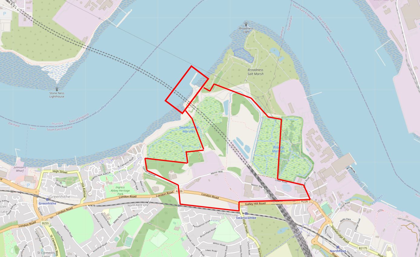
The red rectangle covers pier developments as numbers of people travelling to the resort are expected to come via the river, and land on the opposite side of the river in Tilbury is being being included in this scheme.
Whilst the map shows the core of the resort, there will be considerable additional surrounding development, bath in support of the resort, and as the large number of visitors and supporting businesses draw in additional development.
The Swanscombe Peninsula is not a pristine, natural environment. It has long been surrounded by the type of dirty industrial complexes that were to be found to the east of London. Paper Milling, Cement Production and Lead Refining were some of the industries that could be found here, and their impact extended over the peninsula, for example rail tracks extending to river piers.
The site has also been used for waste disposal, gas works, a sewage works, and in recent decades provides the infrastructure for a high-voltage electricity crossing of the river, and where the HS1 railway linking St Pancras with the Channel Tunnel dives under the Thames.
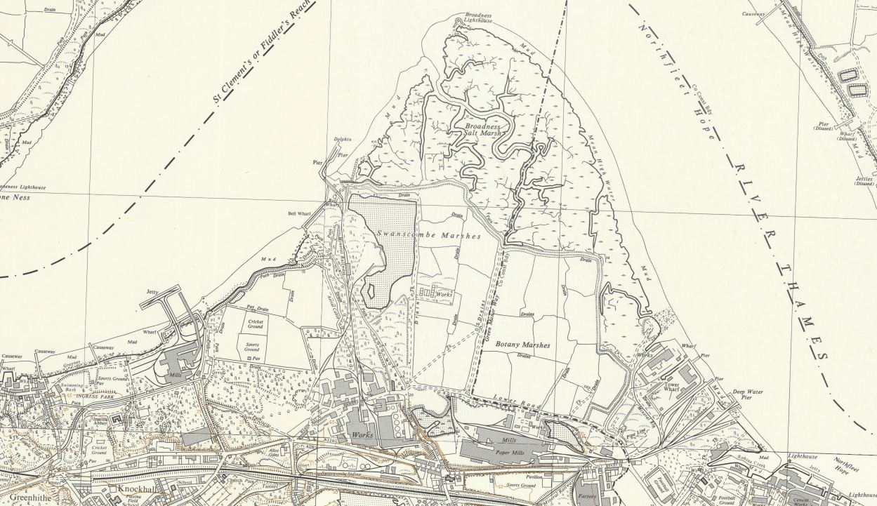
The following extract from a mid 1950s Ordnance Survey map shows the peninsula, with industry covering the southern boundary. Note also the split between the Broadness Salt Marsh and Swanscombe Marshes where a drain was constructed to recover the southern parts of the peninsula (‘Reproduced with the permission of the National Library of Scotland’.
To visit the site, I took the train from Waterloo East to Greenhithe. I planned to follow the recommended route on the Save Swanscombe Marshes website, which can be found here.
Starting at Greenhithe Station, an almost circular walk would take me to Swanscombe Station to catch the train back to Waterloo East. I ended up walking almost six miles, by taking some detours and also on the eastern side of the peninsula, I carried on along a footpath rather than turn onto the road, the footpath almost took me back around the peninsula.
There is so much to be found in the area. I got distracted in Greenhithe, found where the Cutty Sark was moored, saw some wonderful electrical infrastructure, and was just stunned by the beauty of the place, and whilst much could be described as a brownfield site, it shows how nature can recover and reestablish.
I have split today’s post about the Swanscombe Peninsula into two separate posts. One at the usual time this morning, and a second post later this evening. I will also include a number of links for further information at the end of the second post.
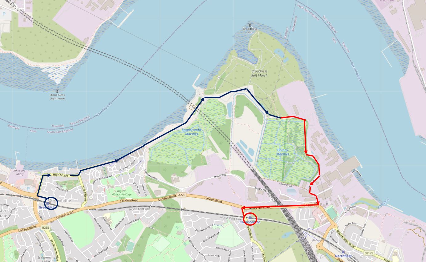
So, for the first post, I am starting at Greenhithe Station (blue circle to left) and covering the route marked by the blue line.
To reach the western end of the peninsula, I walked through Greenhithe to get close to the river. Greenhithe is a historic, small town, where the streets alongside the river reflect the towns early relationship with the river.
The name has similarities to Queenhithe in the City, with “hithe” meaning a wharf or landing place. It seems that Green just refers to the town as being a green landing place.
There were wharves, ships were built and maintained, goods and people transferred between ships and land.
In Greenhithe High Street is the Sir John Franklin pub, named after the commander of the expedition that sailed from Greenhithe on the 19th of May 1845, in the Erebus and Terror, to try and find a north west passage across the top of Canada, between the Atlantic and Pacific. Greenhithe was the last place that the crew would set foot in England. After a final sighting on the 26th July 1845, the two ships and their crew, including Sir John Franklin, were not seen again.
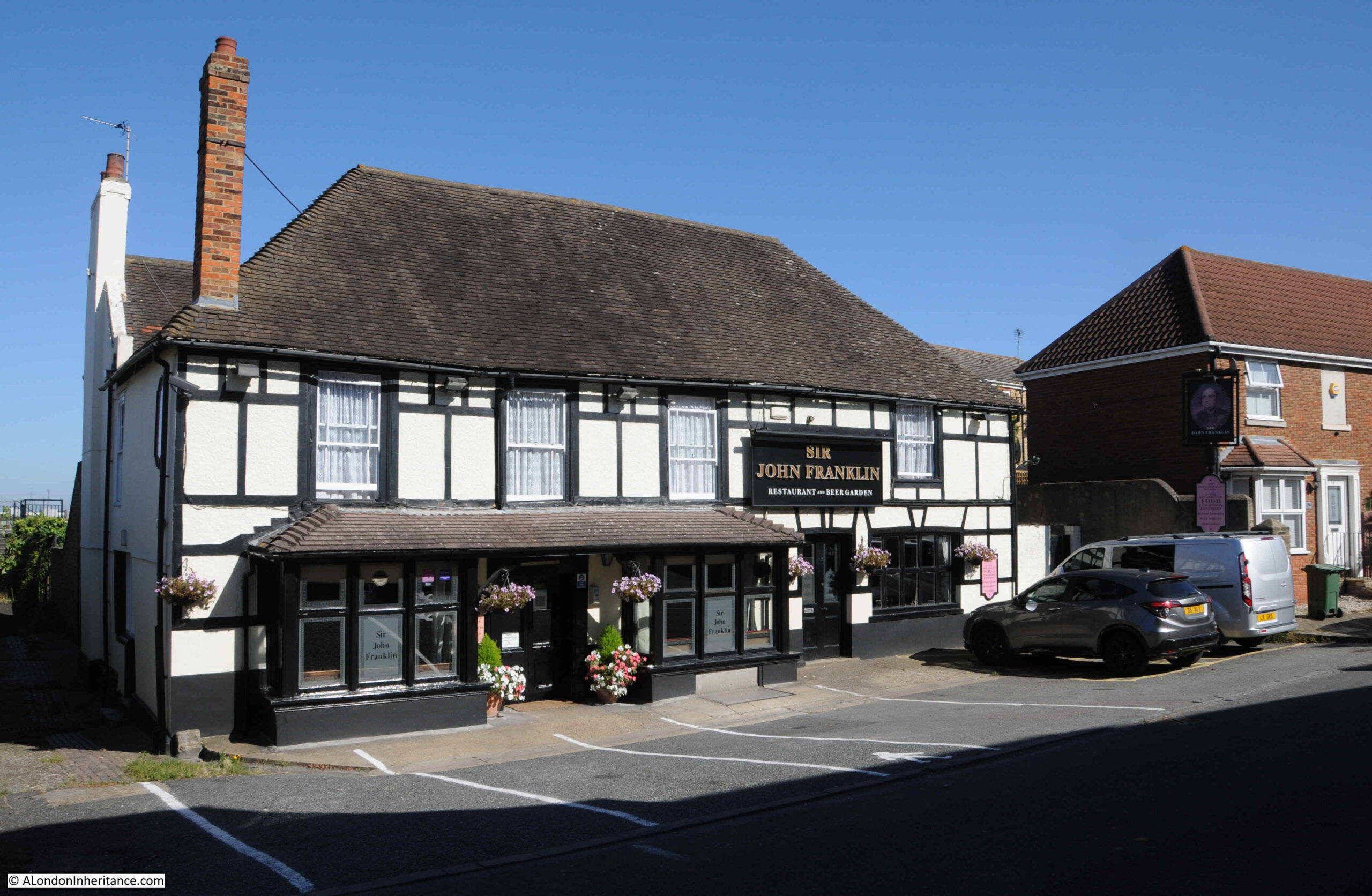
A newspaper report on the 20th May 1845 describes their departure along the Thames;
“The Erebus, Captain Sir John Franklin, and the Terror, Captain Crozier, left Woolwich on Monday, towed by the African and Myrtle steamers, for Greenhithe. The Terror having previously tried her screw-propeller, on this occasion resolved on trying it again, and made such excellent progress, that she cast off her towing steamer and proceeded down the river without any additional assistance whatever. The crews of the Erebus and Terror were paid in advance today and tomorrow (Saturday) sail for their destination, accompanied by the Monkey and Rattler steam-vessels, ordered to tow them to the Orkney islands. The Baretto Junior transport with live stores and various descriptions of preserved meats and other articles, most liberally supplied for the use of the officers and men of the discovery vessels, will be sent at the same time, and accompany them to the borders of the ice. The compasses of the vessels have been adjusted by Captain Johnson, and the most perfect arrangements made for the peculiar service in which the vessels of the Artic expedition are to be engaged.”
I have written more about the expedition, and the search for the crew in a post on the The Bellot Memorial at Greenwich.
At the back of the Sir John Franklin pub is one of the old wharfs, now a rectangular inlet, with new housing on one side and an old, decaying boat below.

As well as the name of the pub, Greenhithe High Street retains other links with the previous life of the town (assuming the sign is genuine, and not a modern creation).
There are some wonderful old houses in the High Street, and it is a lovely place to walk on a sunny, September day, however in the 18th century, this would not be a very safe place to be when the press gangs were roaming as this report from a number of newspapers on the 24th May 1740 indicates: “On Tuesday there was a smart Pres on the River below Bridge, that from the little Town of Greenhithe they have taken no less than 17 Men for the King’s Service”.
Before the High Street takes a sharp right to turn in-land, there is another pub, this is the Pier Hotel:
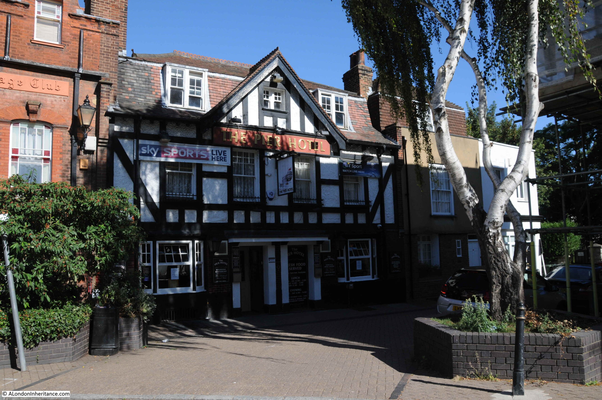
In the first half of the 19th century there was an attempt to turn Greenhithe into a tourist destination, perhaps trying to attract the boats passing on the river that were starting to take Londoners out of the city for a day trip to Southend or Margate.
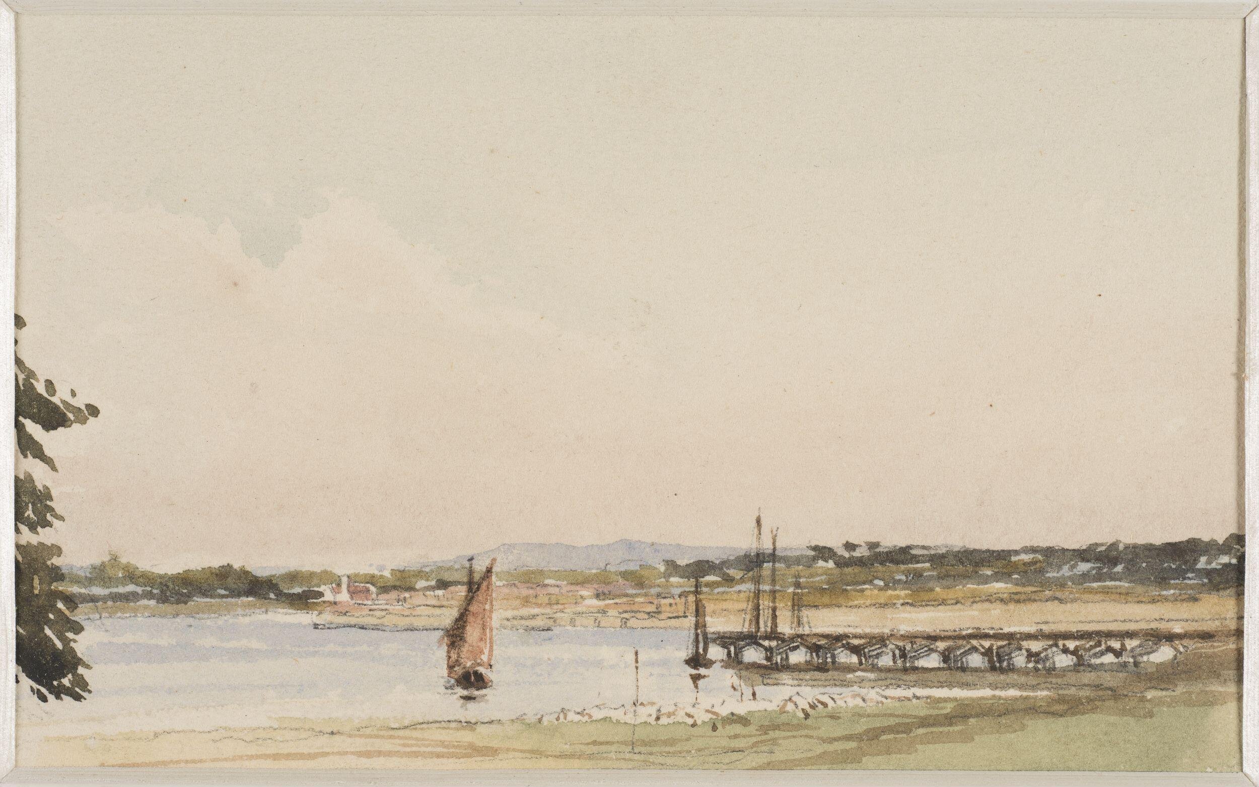
This included the construction of a short pier, shown in the following drawing by Henry Cole, dated 1836:
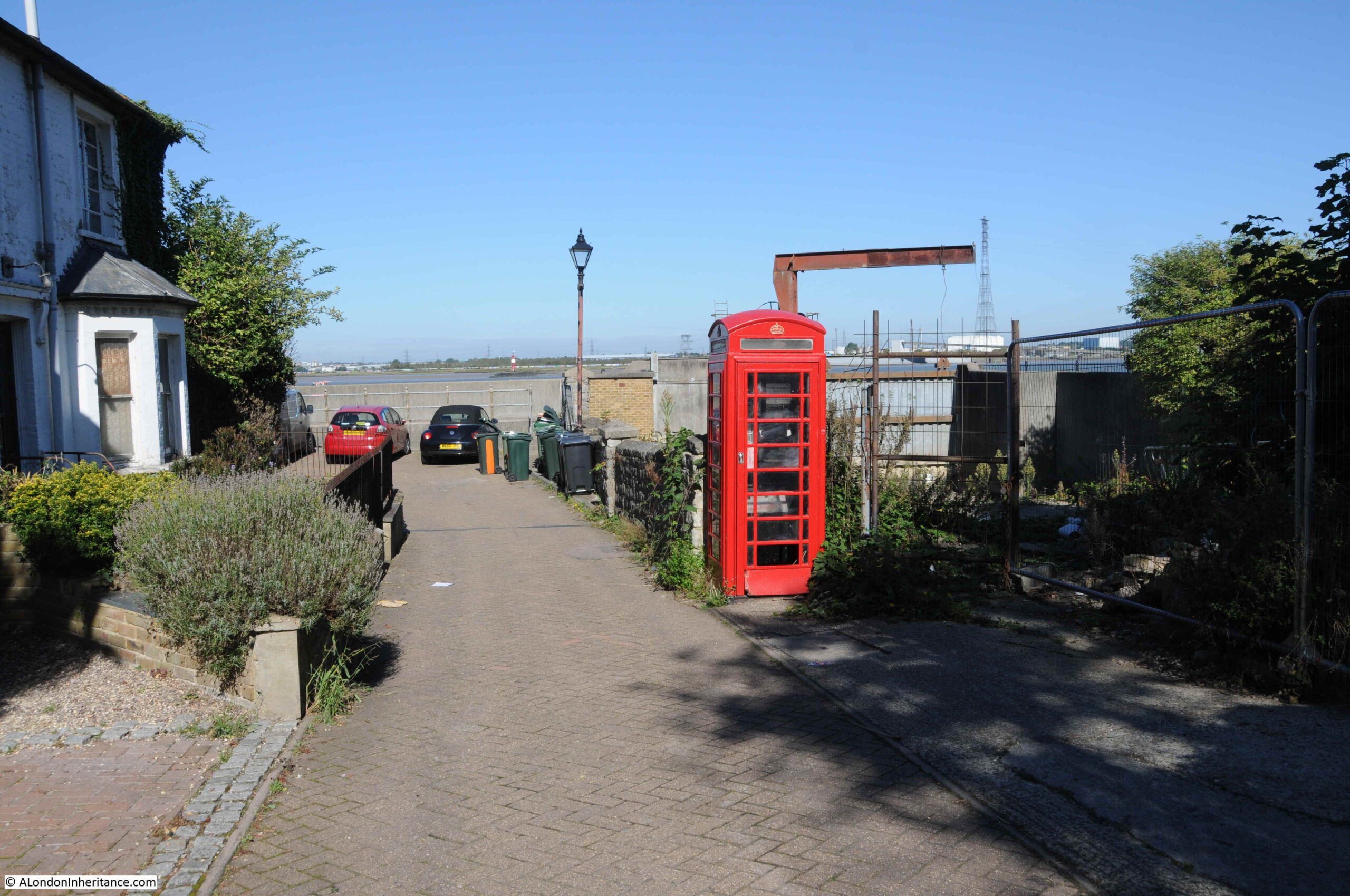
To get back to the river, and continue on to the peninsula, I walked past the Pier Hotel, and took a quick look down to the river, where there is a rather hidden red telephone box, before taking a cut through to the river walk.
From where there is a superb view of the Queen Elizabeth II Bridge, part of the M25 Dartford crossing:

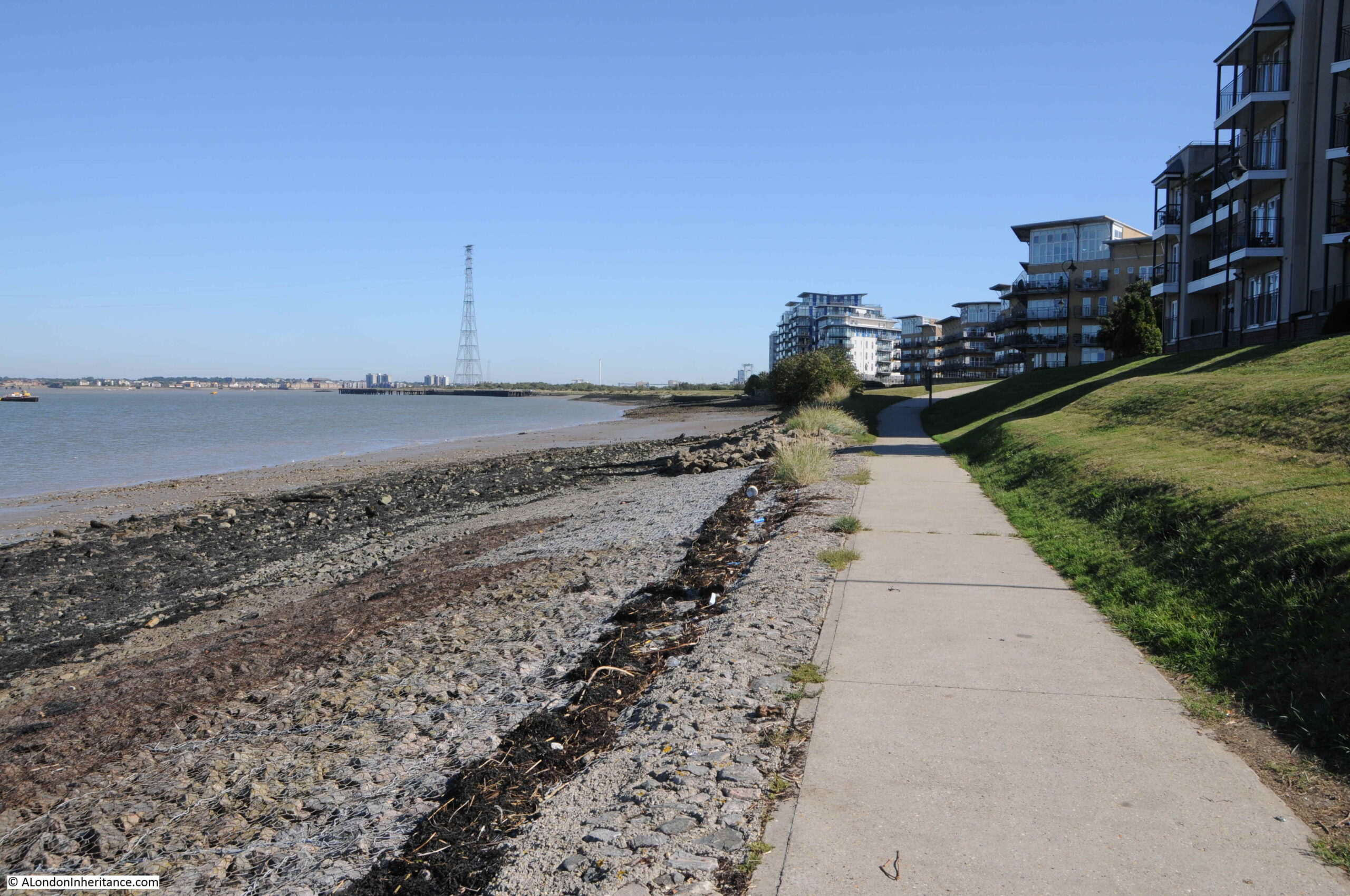
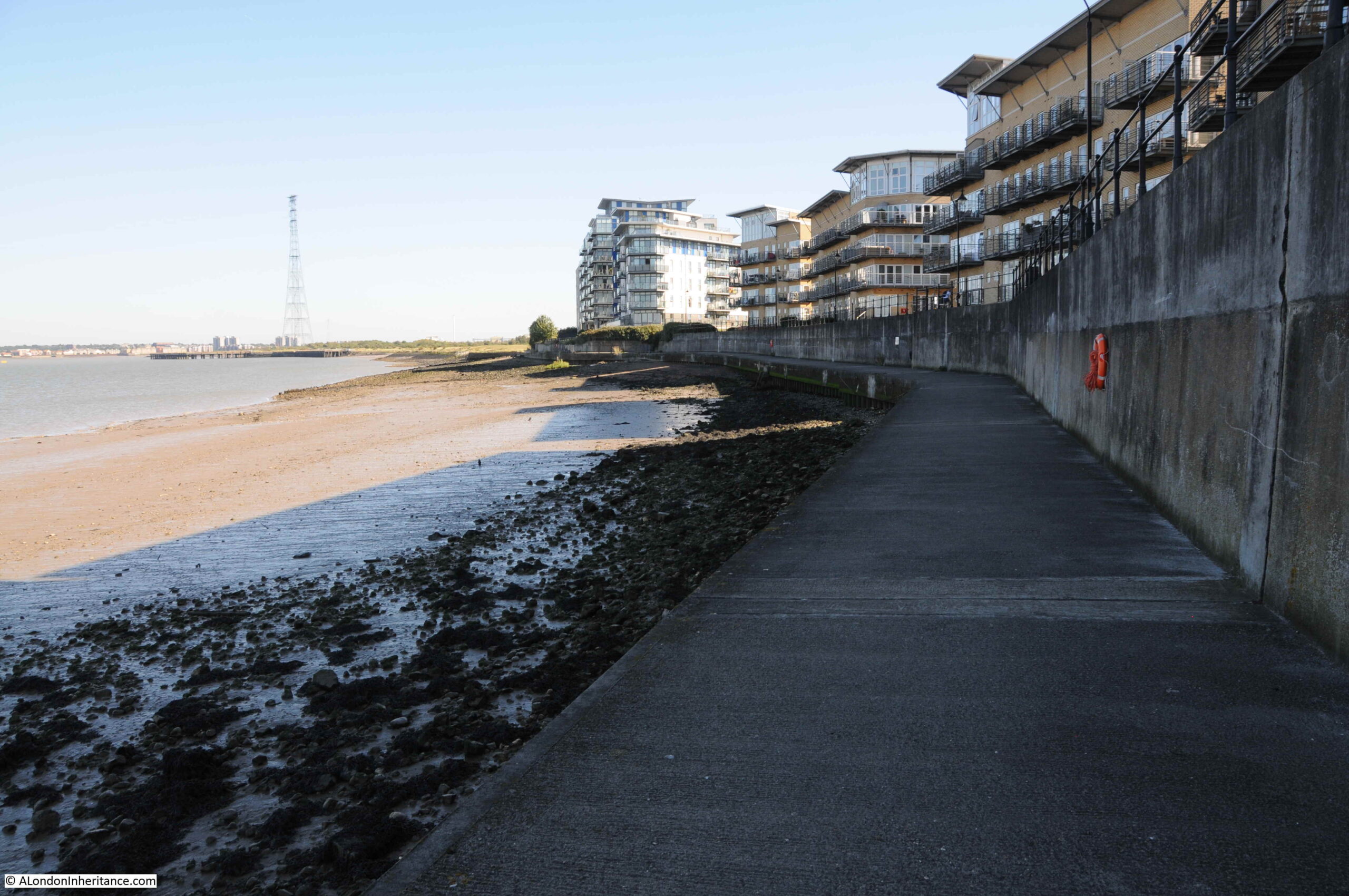
And looking in the opposite direction, I could see my destination, the peninsula curving out into the river, with the electricity pylon a clear landmark of where I was heading.
This stretch of the river has a walkway with superb views across the river. In the following photo I am looking back towards Greenhithe. This stretch of the river has had a considerable amount of building over the last few decades, with a large housing estate on the left, facing onto the river:
View in the opposite direction, towards my destination:
Part of the land on which the housing in the above two photos was built, originally formed part of the Ingress Estate, an ancient manor that once belonged to the Priory of Dartford.
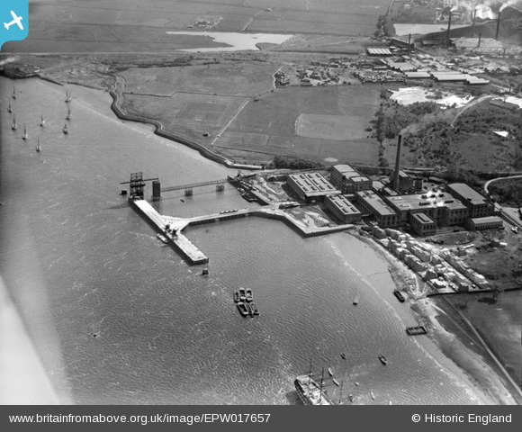
in 1833, an Elizabethan style house was built on the site and named Ingress Abbey, allegedly using stones from London Bridge which had been demolished in 1831. The house was surrounded by land, including land sloping down to the river. When researching the site, I found the following photo from the Britain from Above archive:
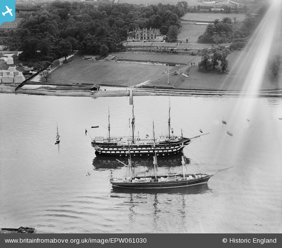
The photo is dated 1939. Ingress Abbey can be seen looking down to the river, where two ships are moored. The larger ship is HMS Worcester which at the time operated as the Thames Nautical Training College. The smaller ship is the Cutty Sark which at the time was also part of the training college, operating as an auxiliary cadet training ship. The Cutty Sark would continue in this role, before being moved to Greenwich.
Walking further towards Swanscombe Peninsula, and the walkway changes, now with a high concrete wall protecting the housing from the river.
Not sure what these rails in the base of the walkway are, possibly left over from the site’s industrial activity:

As well as the land of Ingress Abbey, the housing in the second above photo was built on a large industrial site, the Empire Paper Mills. I have highlighted the paper mills within the red oval in the following extract from the 1966 Ordnance Survey map:
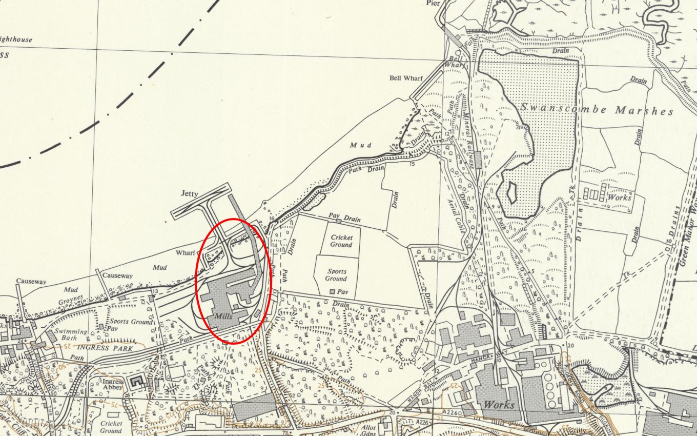
The paper mills included a large jetty projecting into the Thames. This was used to receive raw materials from cargo ships, that were then transported to the mill for processing. Completed products were then sent via the rail network, and a rail line can just be seen leaving the lower left of the mills, heading to the mainline at Greenhithe.
The following photo from Britain from Above shows the scale of the paper mills in 1927. The Swanscombe Peninsula can be seen in the background:
The paper mills continued into the early 1990s, but were struggling to operate and make money. They finally closed in 1992, and in the decades that followed the site was cleared and is now occupied by housing.
The following photo, also from 1927, is looking west, with the paper mills, the grounds of Ingress Abbey and at the top right of the photo, the town of Greenhithe:
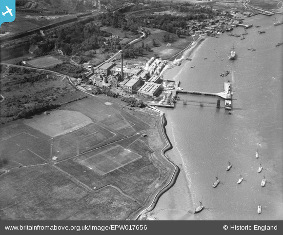
In the above photo, part of Swanscombe Peninsula can be seen in the lower left half of the photo. Part of the space is occupied by Cricket and Sports grounds, showing how there has long been a degree of human influence on the peninsula.
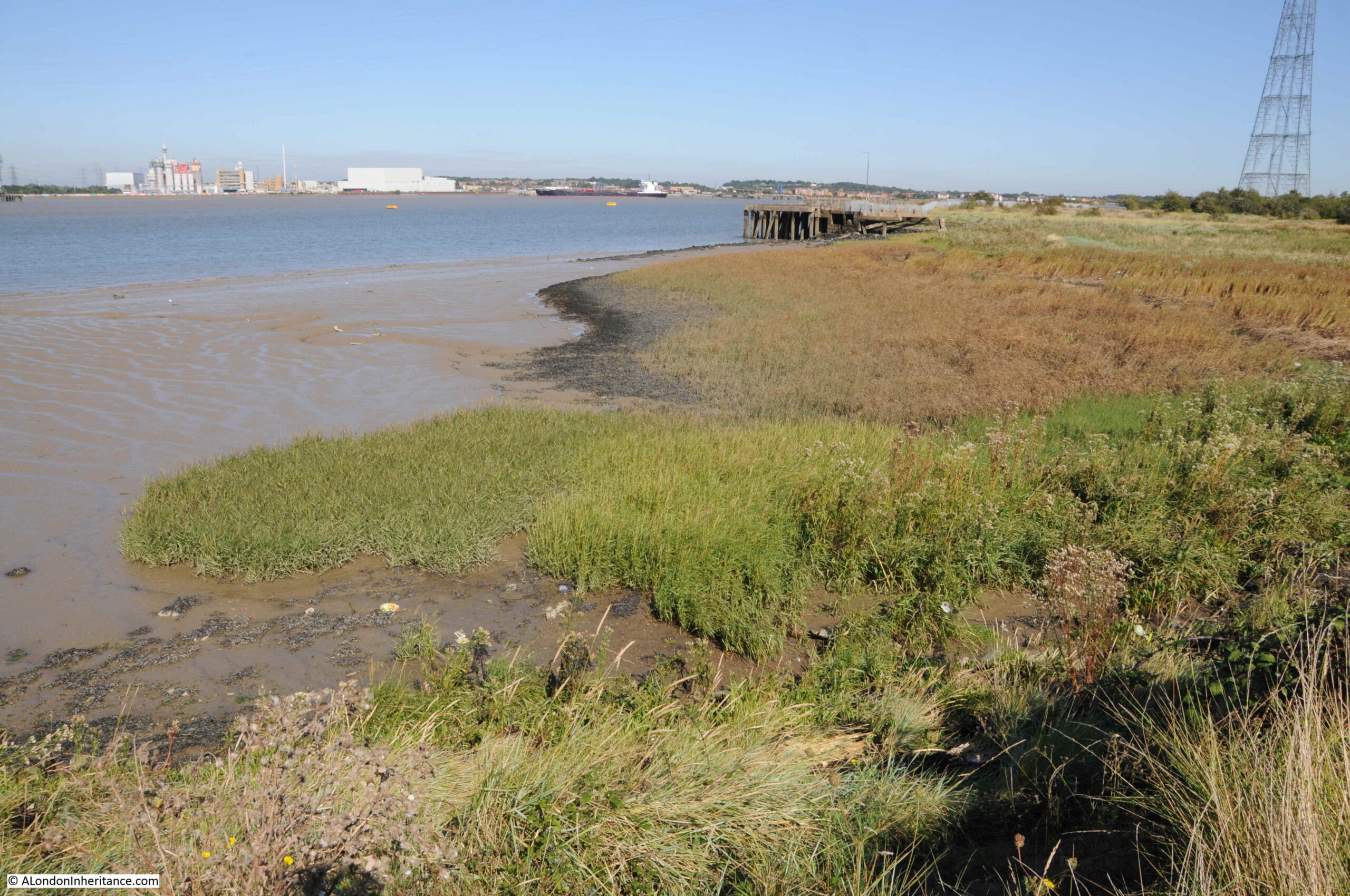
Also in the above photo, there is a triangular inlet from the river where the paper mills meets the peninsula. This inlet is still there today, and is where the river walkway ends with steps up to Swanscombe Peninsula.

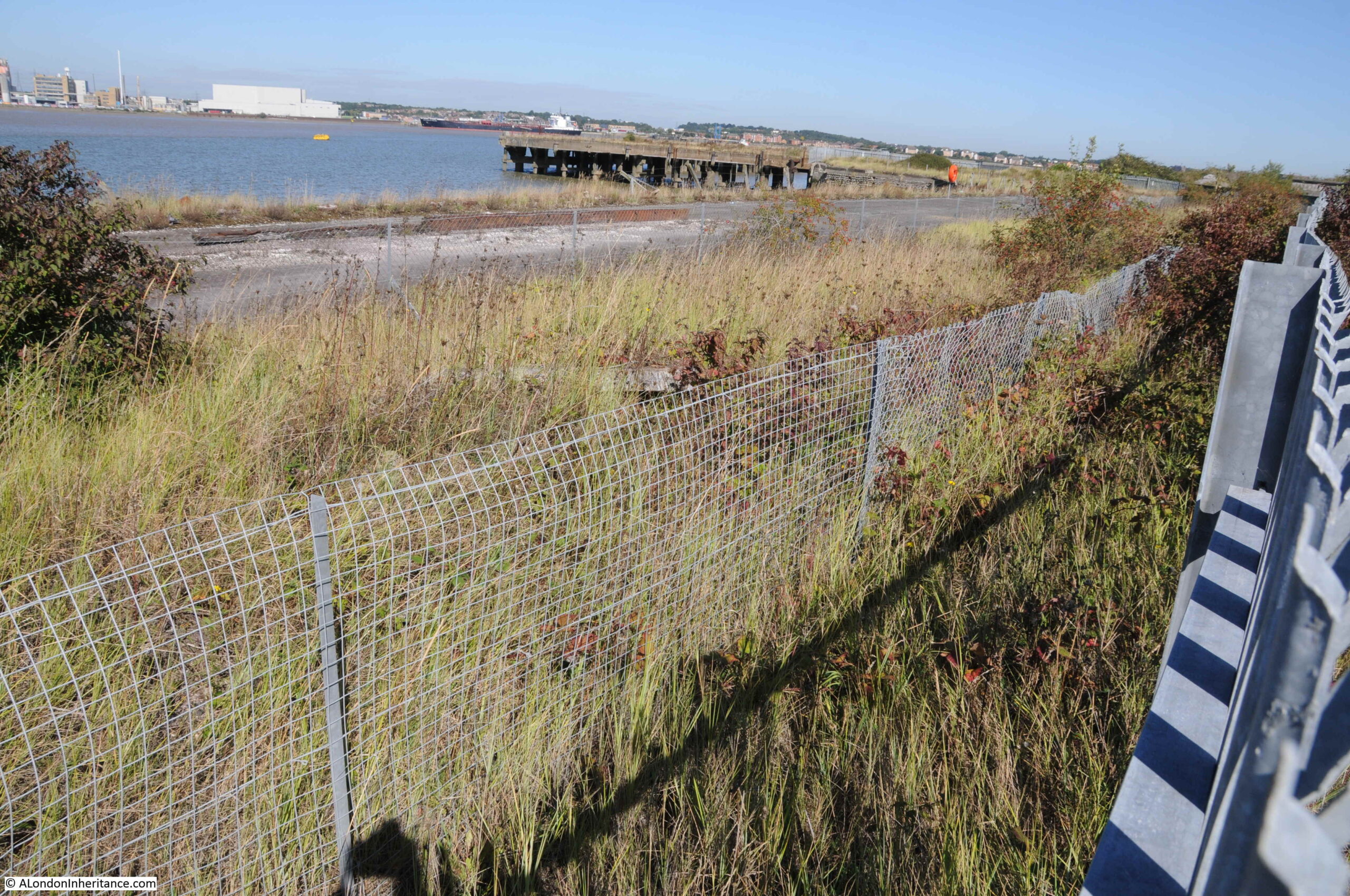
Walking up the steps, and I was finally on Swanscombe Peninsula:
A raised bank protects this part of the western side of the peninsula from the river. One of the old piers from the area’s industrial past juts out into the river:

Along this stretch there are two raised banks, with a low lying ditch between:
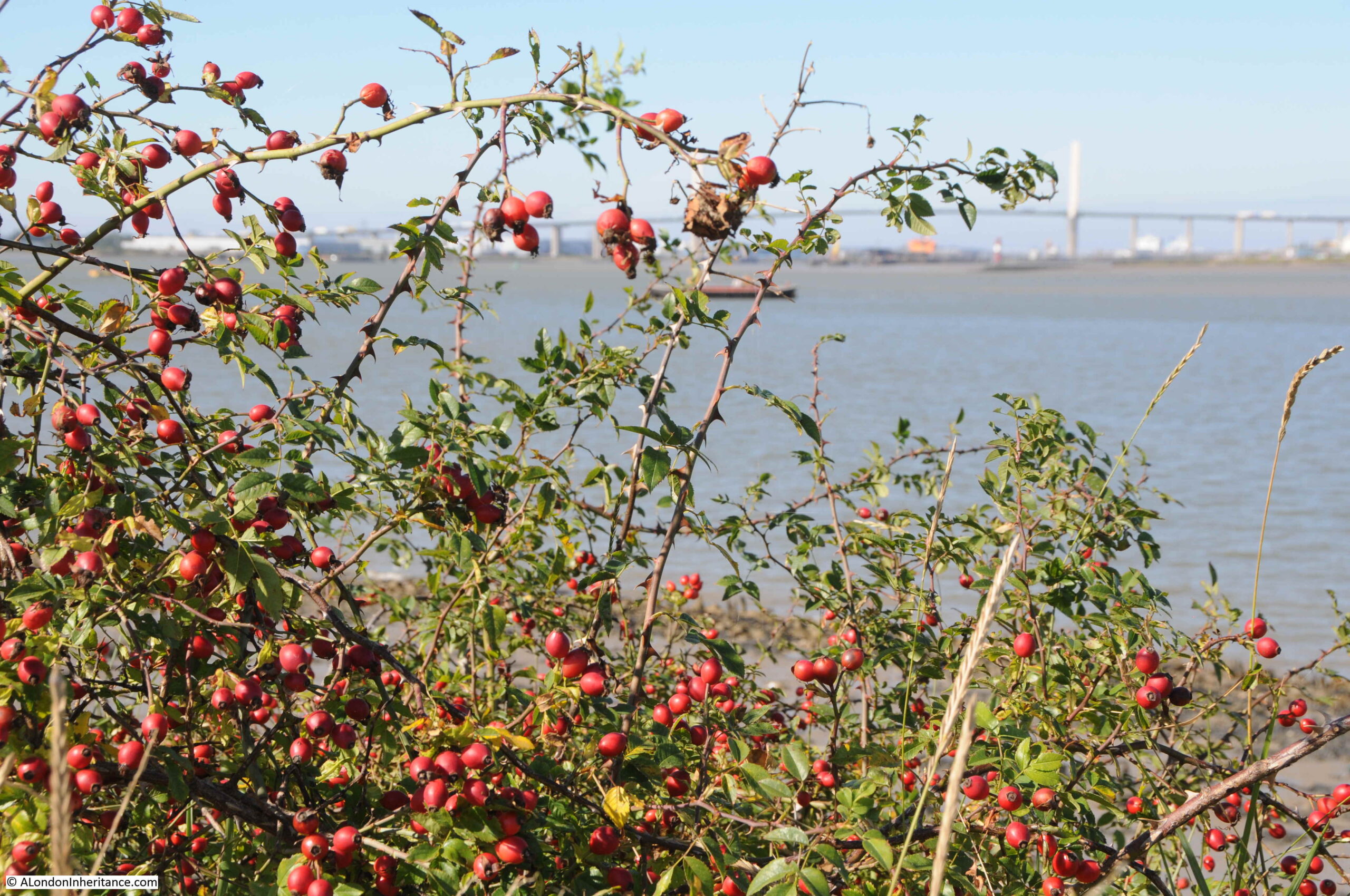
Windswept bushes line the river:
A good view of the Queen Elizabeth II bridge. It is only from viewpoints such as this that you can appreciate the length of the central section and the two slender towers that provide support.
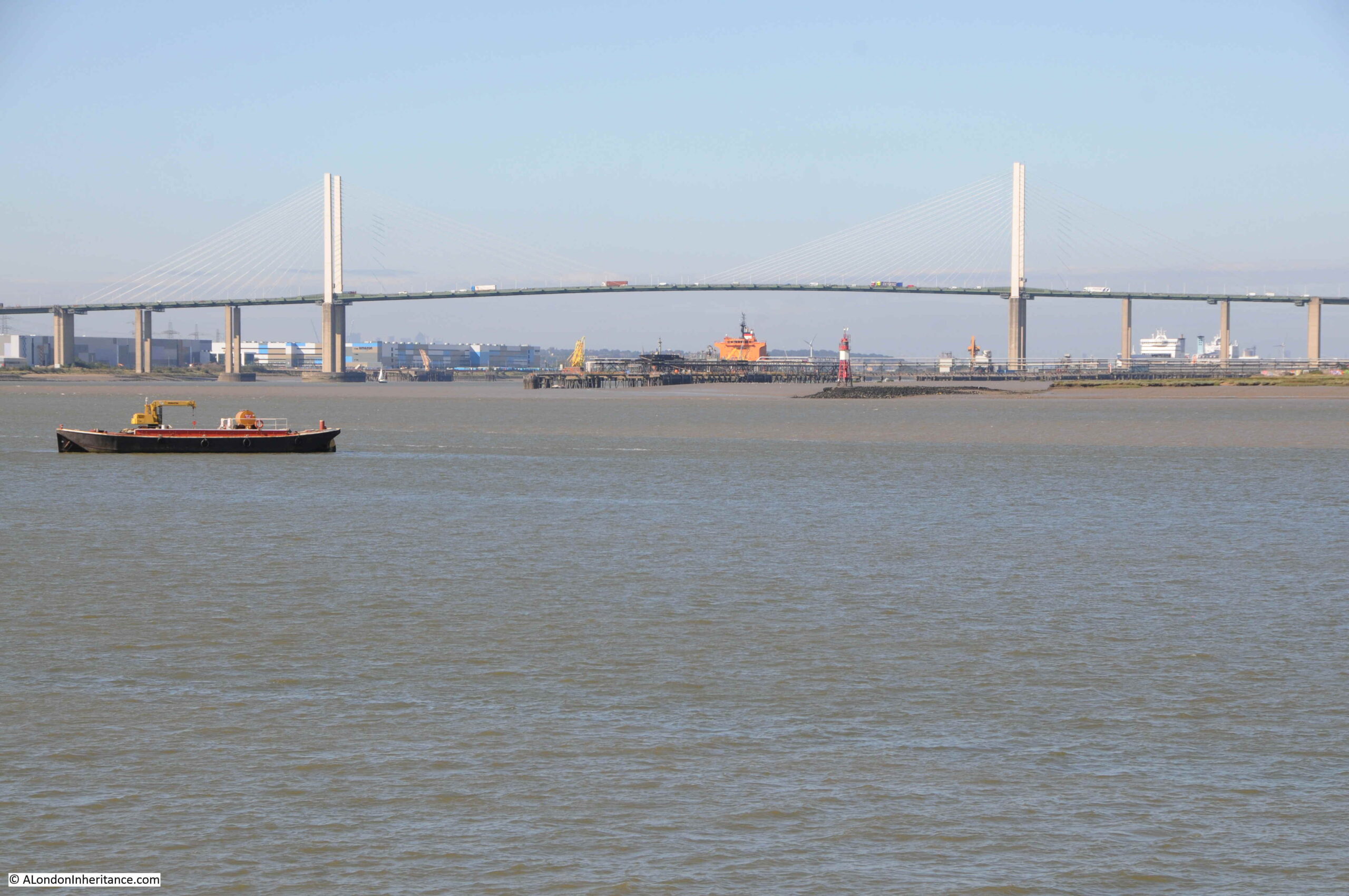
Below the bridge, to the lower right can be seen the red and white of the Stoneness Lighthouse, a working lighthouse on a piece of land jutting out into the river. This model of the lighthouse will soon be replaced. The Port of London Authority have issued a Notice to Mariners that from the 29th September, work will begin to replace the lighthouse, and that it will be out of operation until the 9th of October.
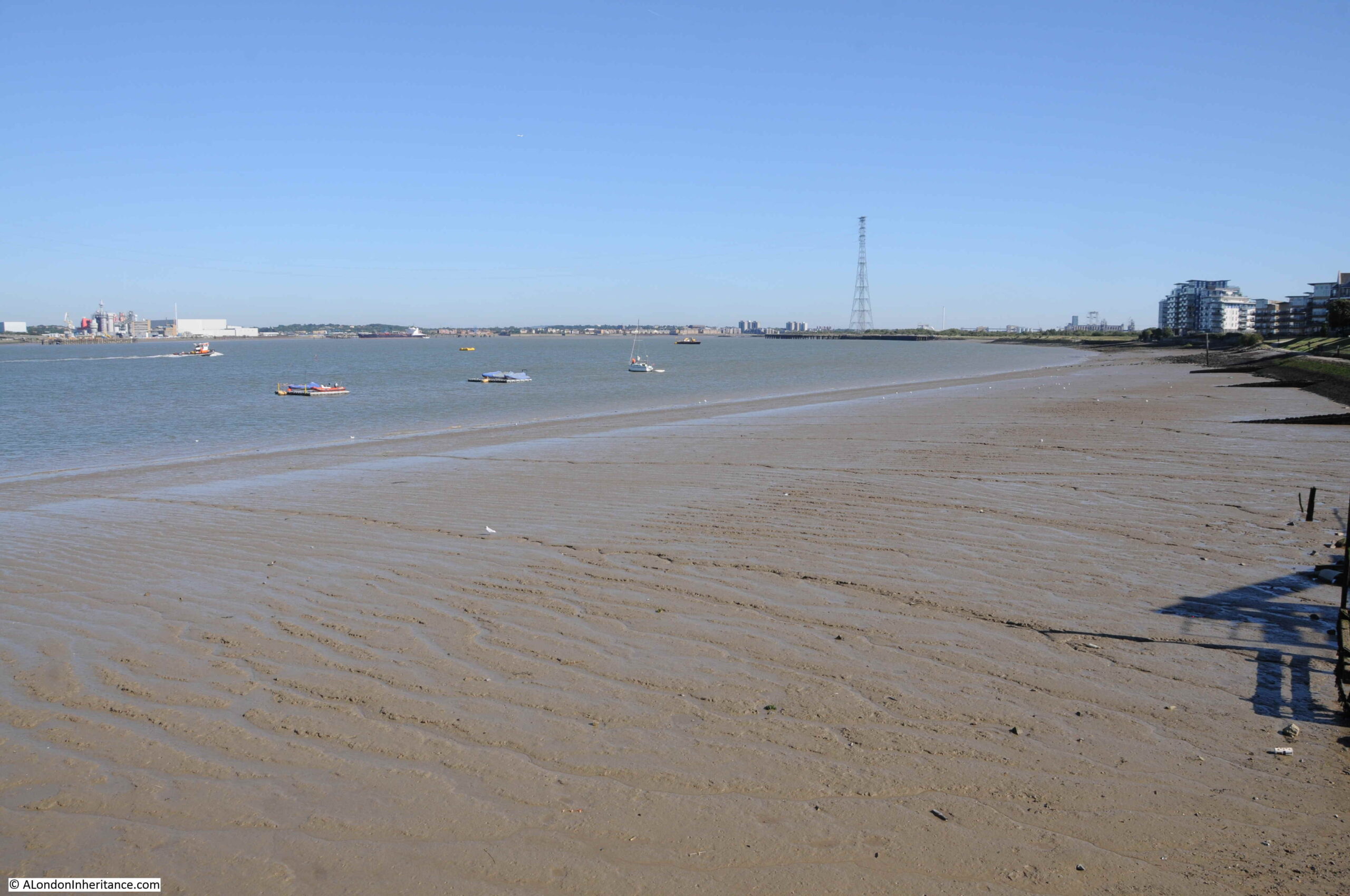
Inter-tidal mud and grasses:
The above photo highlights how important an area with low lying marsh is along the river, and will be in the future with expected rises in the level of the Thames on the eastern side of the Thames Barrier where water levels will rise, as the barrier protects the city.
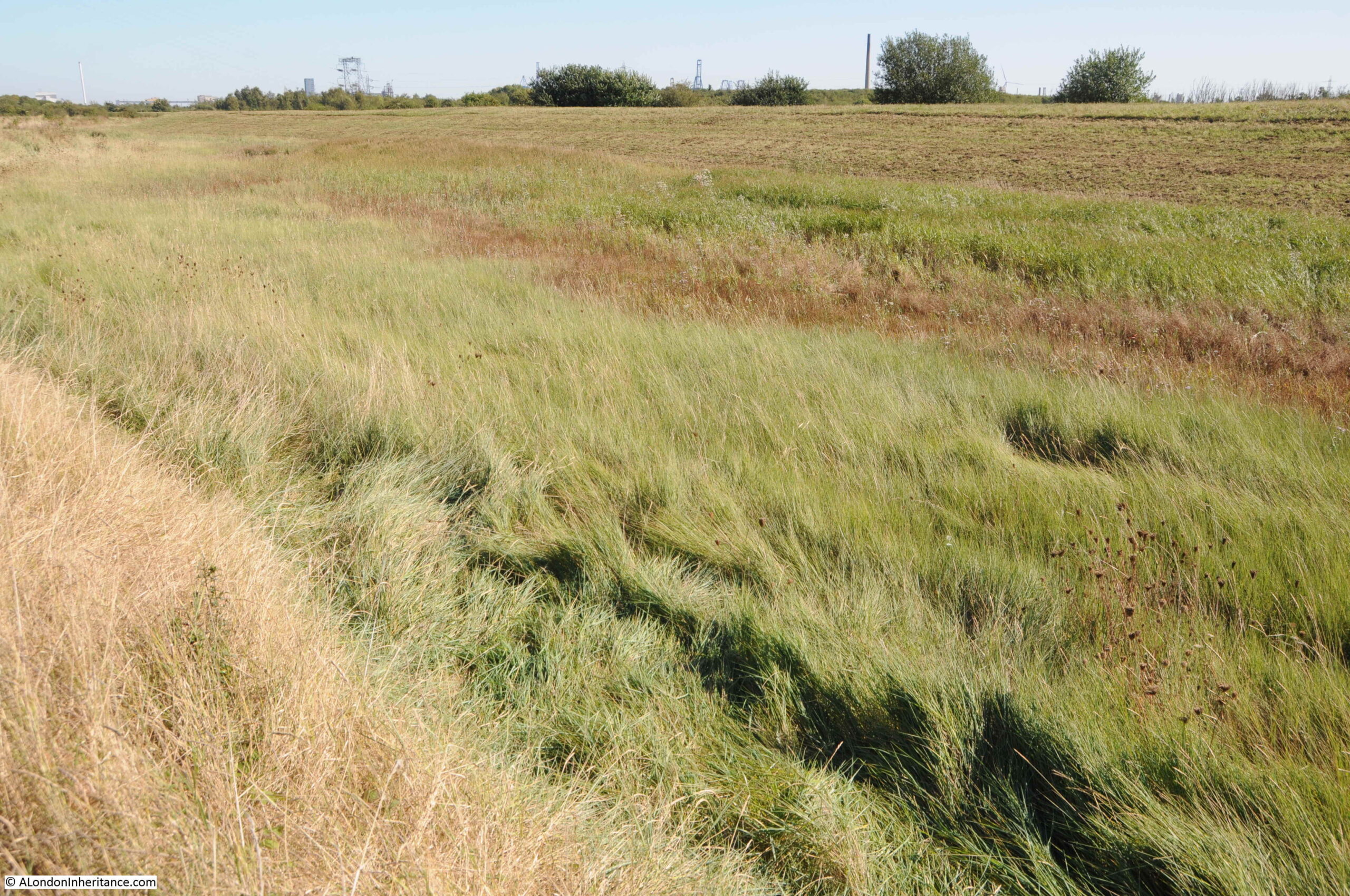
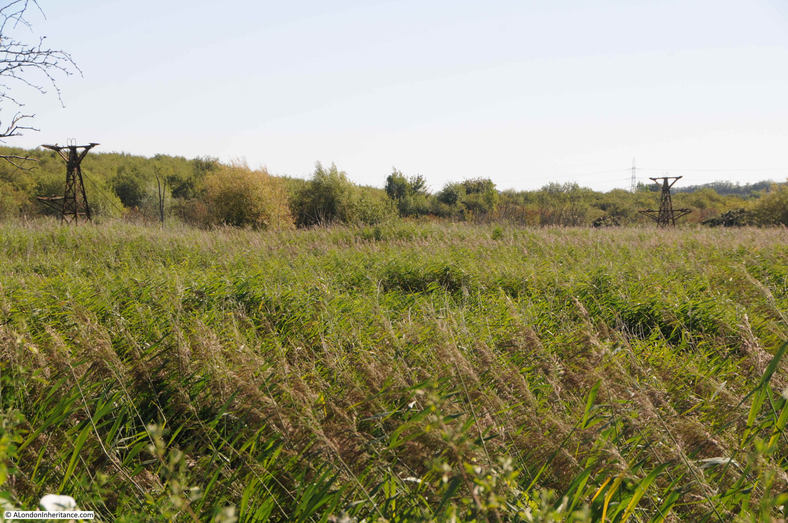
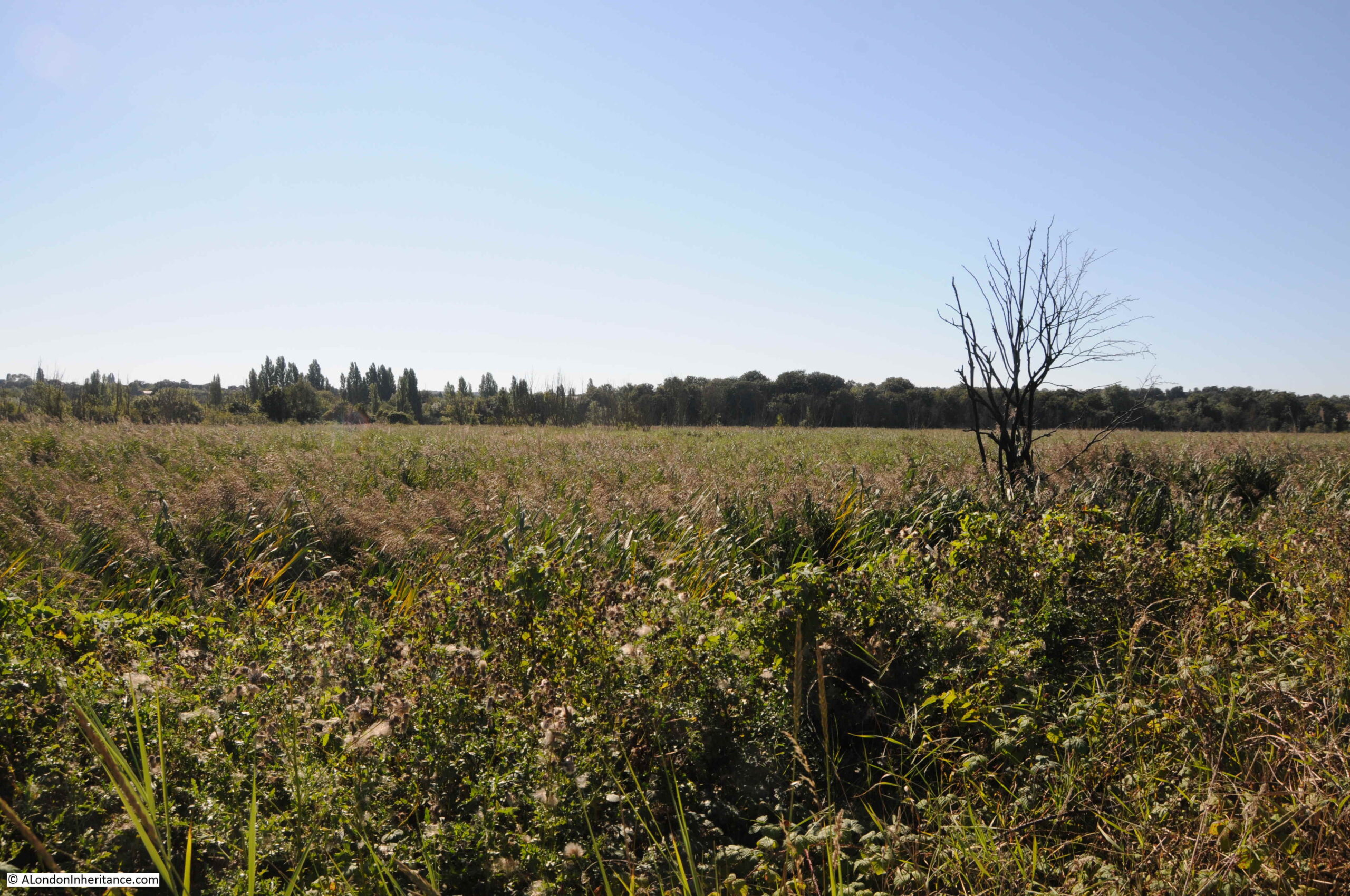
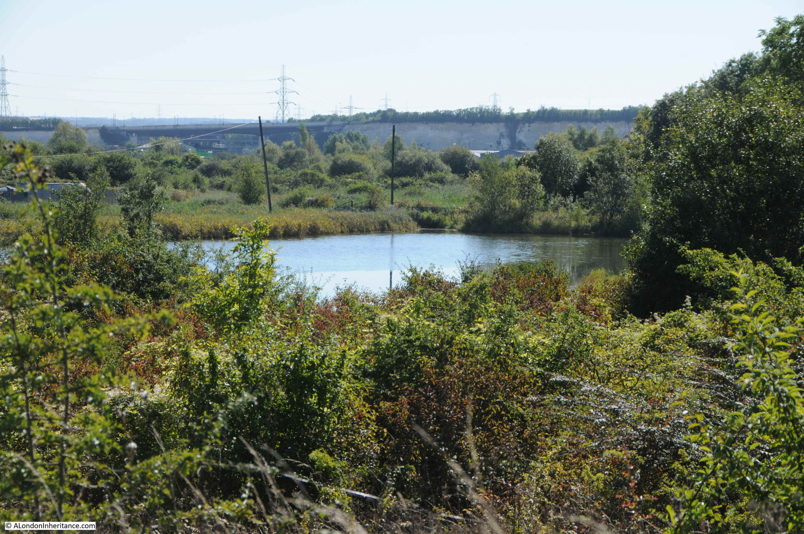
Looking inland, and this part of the peninsula is covered with dense, tall grasses and reeds:
There are two, rusting towers visible in the above photo. To the south of the peninsula was a large cement works, and the towers were part of an aerial cableway that stretched from a wharf and pier on the river to the cement works and was used to transport materials between ships in the Thames and the factory. The cable operated alongside a railway between wharf and factory.
I have highlighted the route of the cableway which is marked on the following extract from the 1966 Ordnance Survey map:

Closer view of one of the towers, showing one of the cables that once ran along the route carrying materials to and from the cement factory:
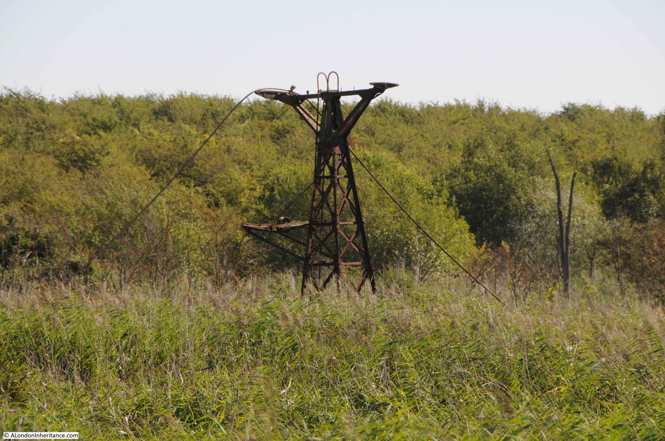
As well as the factory to the south of the peninsula, and the transport system across the peninsula, the production of cement was also responsible for the legal dumping of cement kiln dust, which has raised the height of the land in some western parts of the peninsula.
Looking to the right of the above view, and there is a dense area of grass growth up to a distant tree and bush line:
Along the inland base of the second bank is a road which runs up to the location of the old wharf and pier:
An open barrier still stands as the land around is reclaimed by nature:
Track leading to the location of the old wharf and pier:

Which unfortunately appears to have a double row of fencing restricting access:
Getting closer to the electricity pylon:
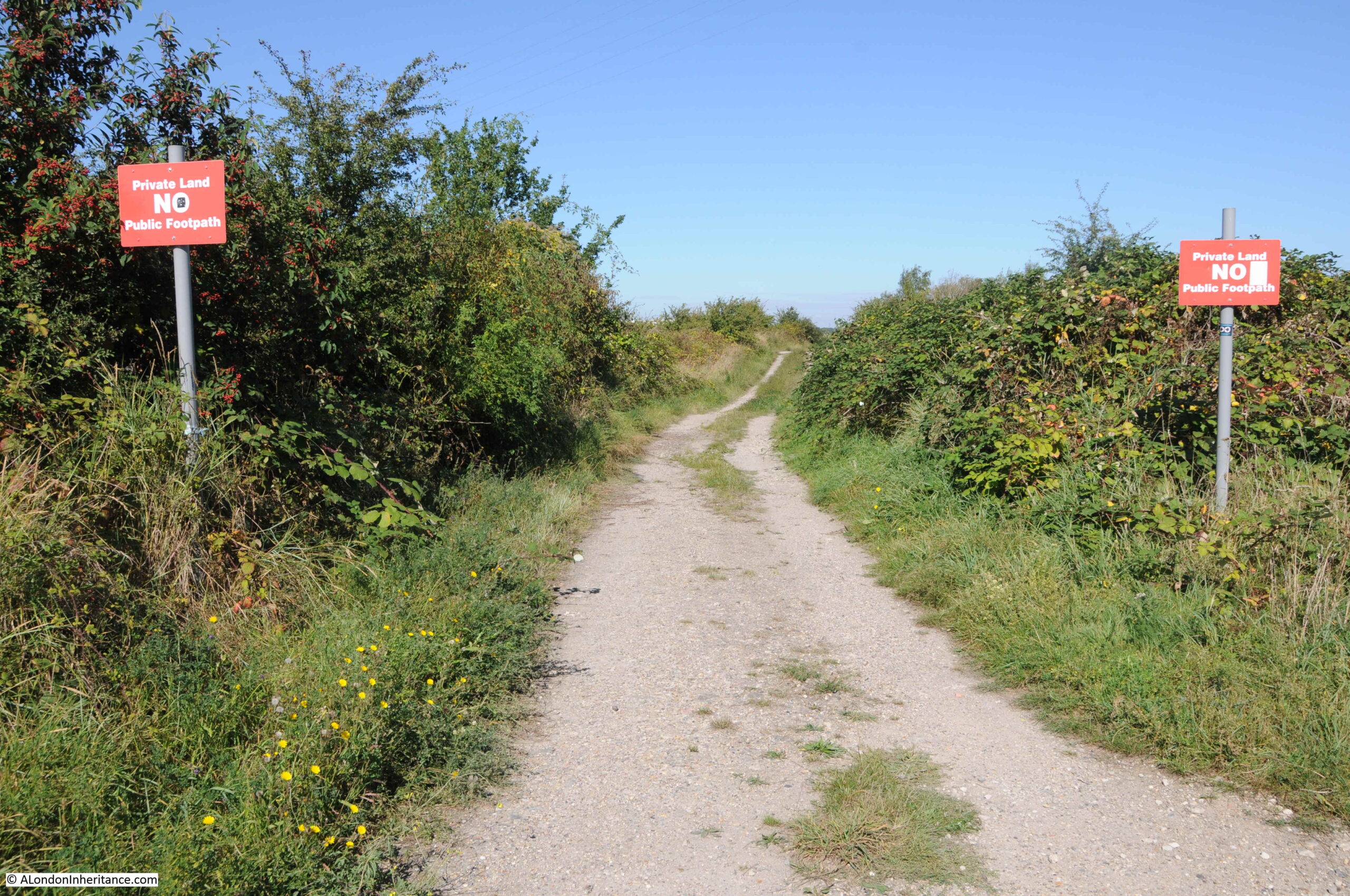
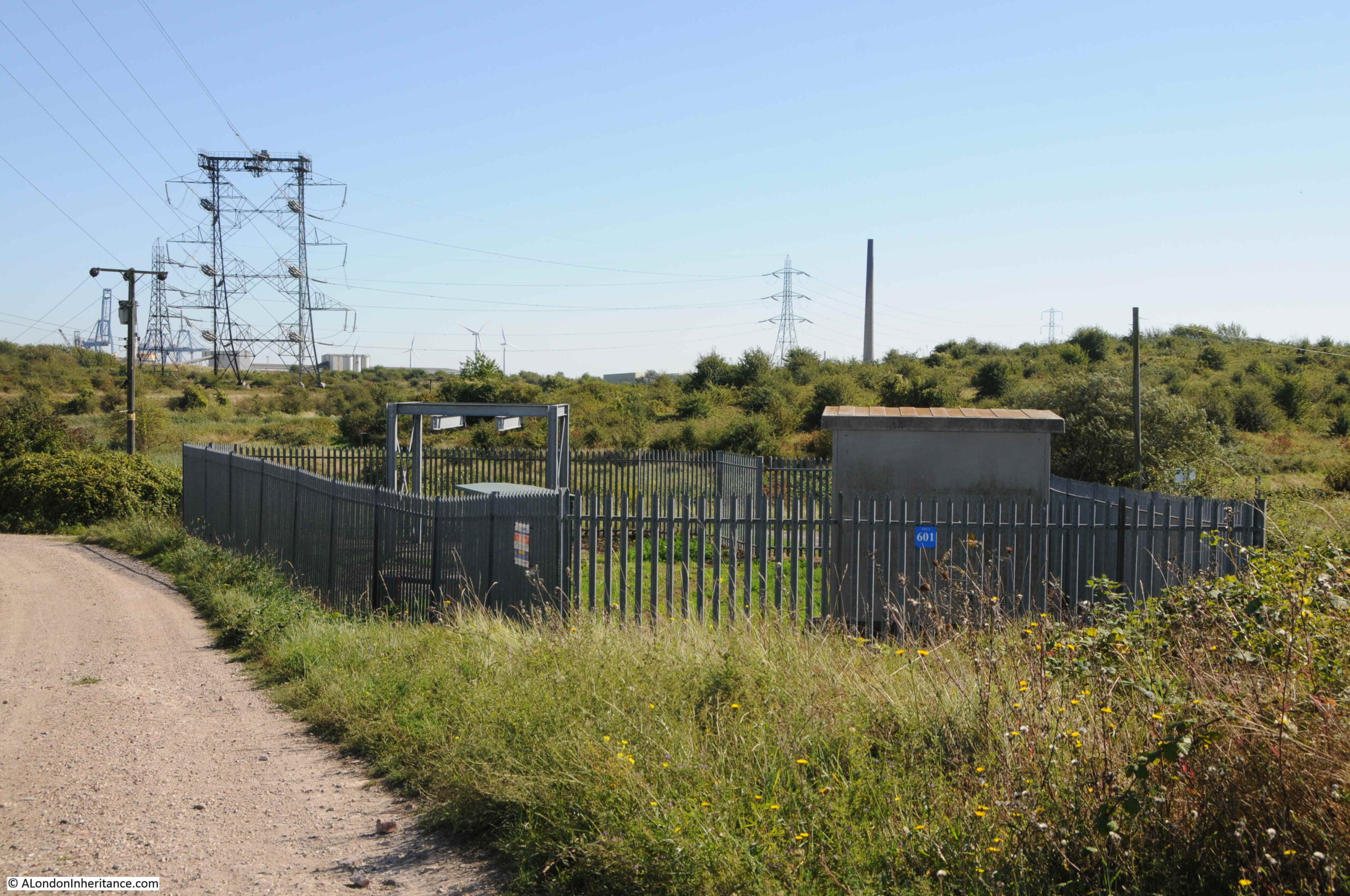
There are a number of tracks which make it clear that parts of the peninsula are private land and that these tracks are not public footpaths:
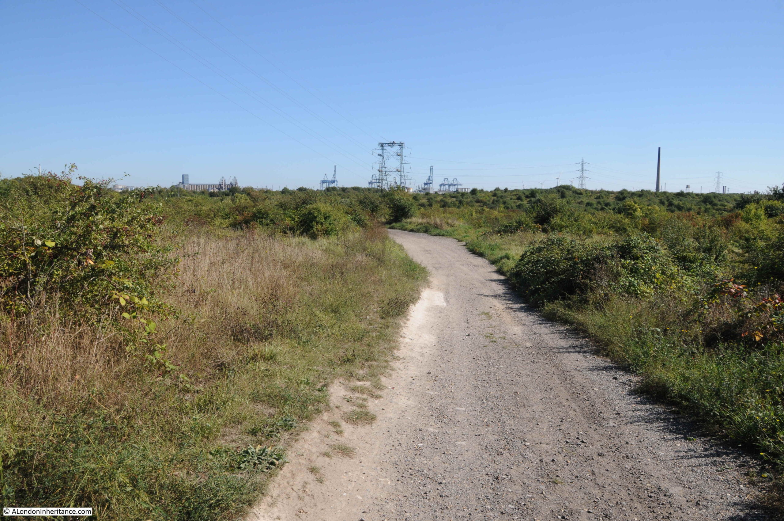
Exploring tracks on a warm September day:
In the following photo, I am looking inland. There are a number of large areas of water, and in the distance on the left is the bridge that carries the A226, London Road, and on the right, the white chalk cliffs can be seen, highlighting that the site has been subject to extensive chalk quarrying:
Strange to come across some Network Rail infrastructure in a small, fenced compound. The reason for this will be come clear in the second post on Swanscombe Peninsula.
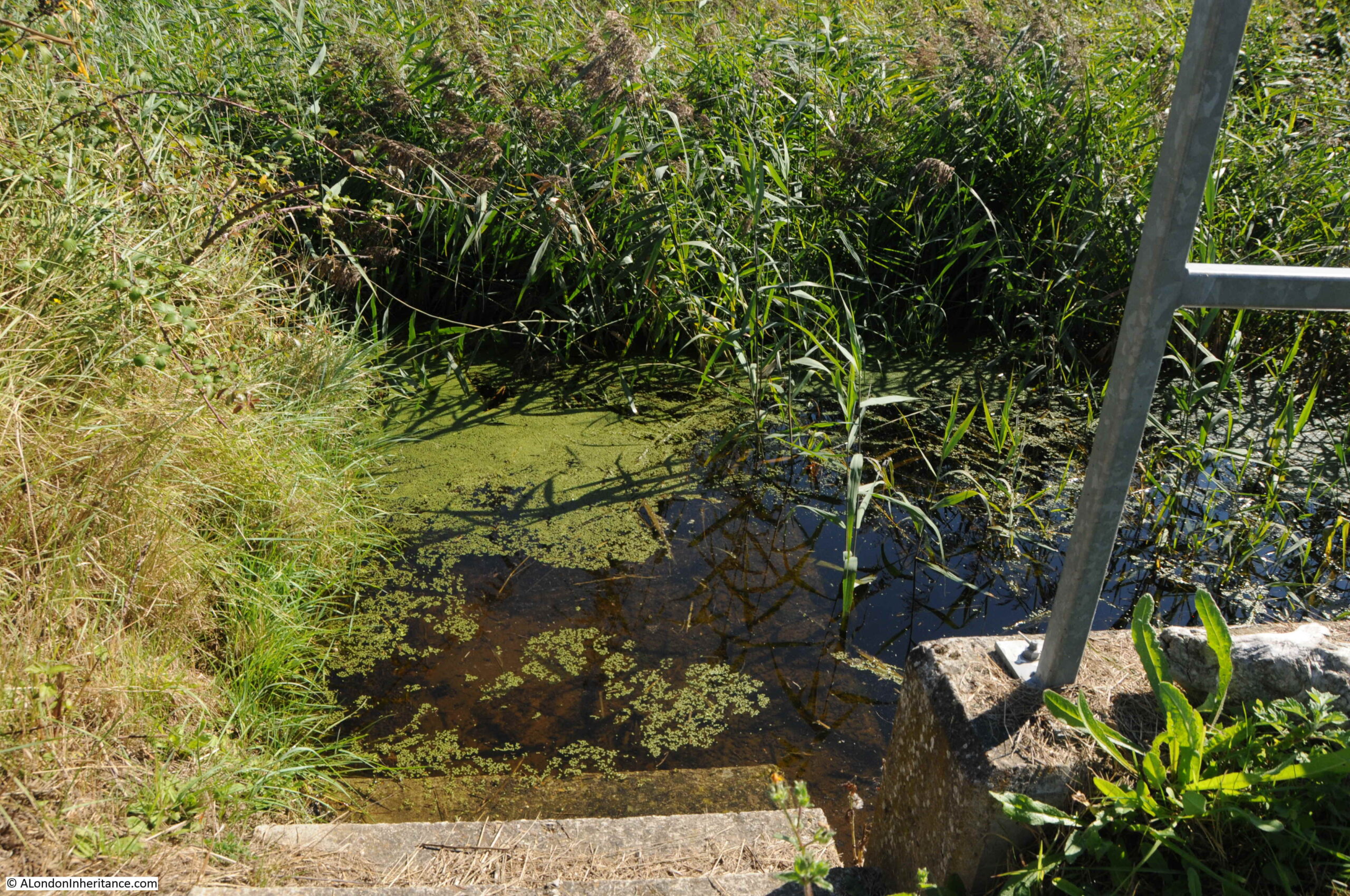
Although much of this part of the peninsula is covered with dense grasses, reeds and low bushes and trees, these can be deceiving as the area is also very wet, with water appearing in clear pools which emerge from the grass:
As well as walking, the peninsula is a place to just stop and enjoy what is a very special place. There is plenty of insect life both within and away from the water. My insect identification skills are almost non-existent, however I hope I am right in claiming the following photo is of a dragonfly, one of many that were around me in the above photo.

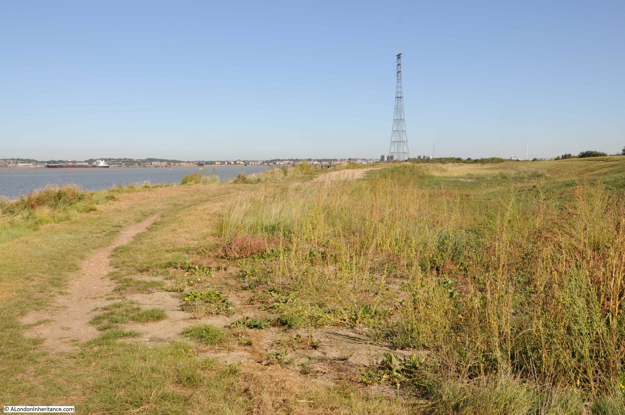
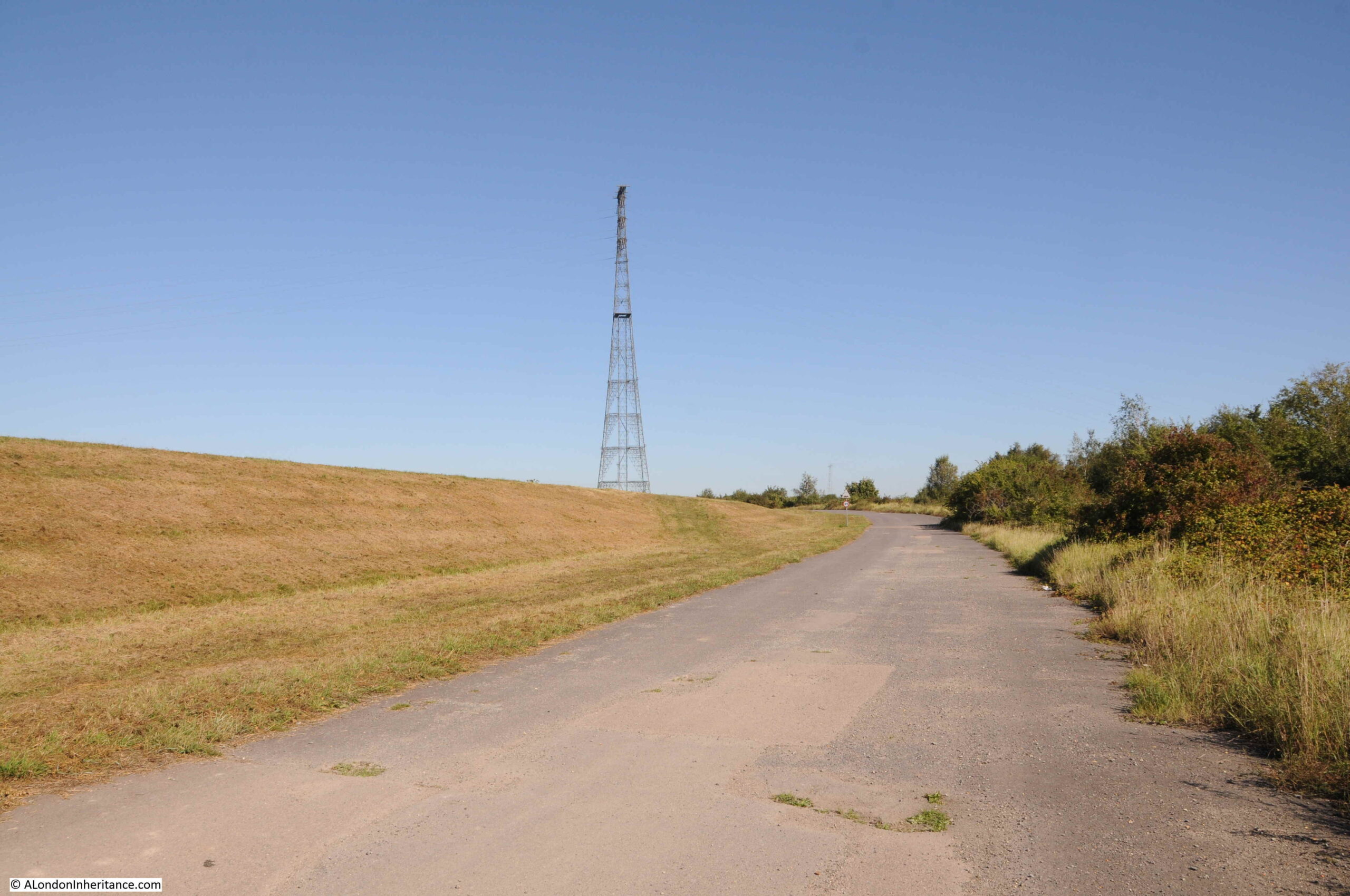
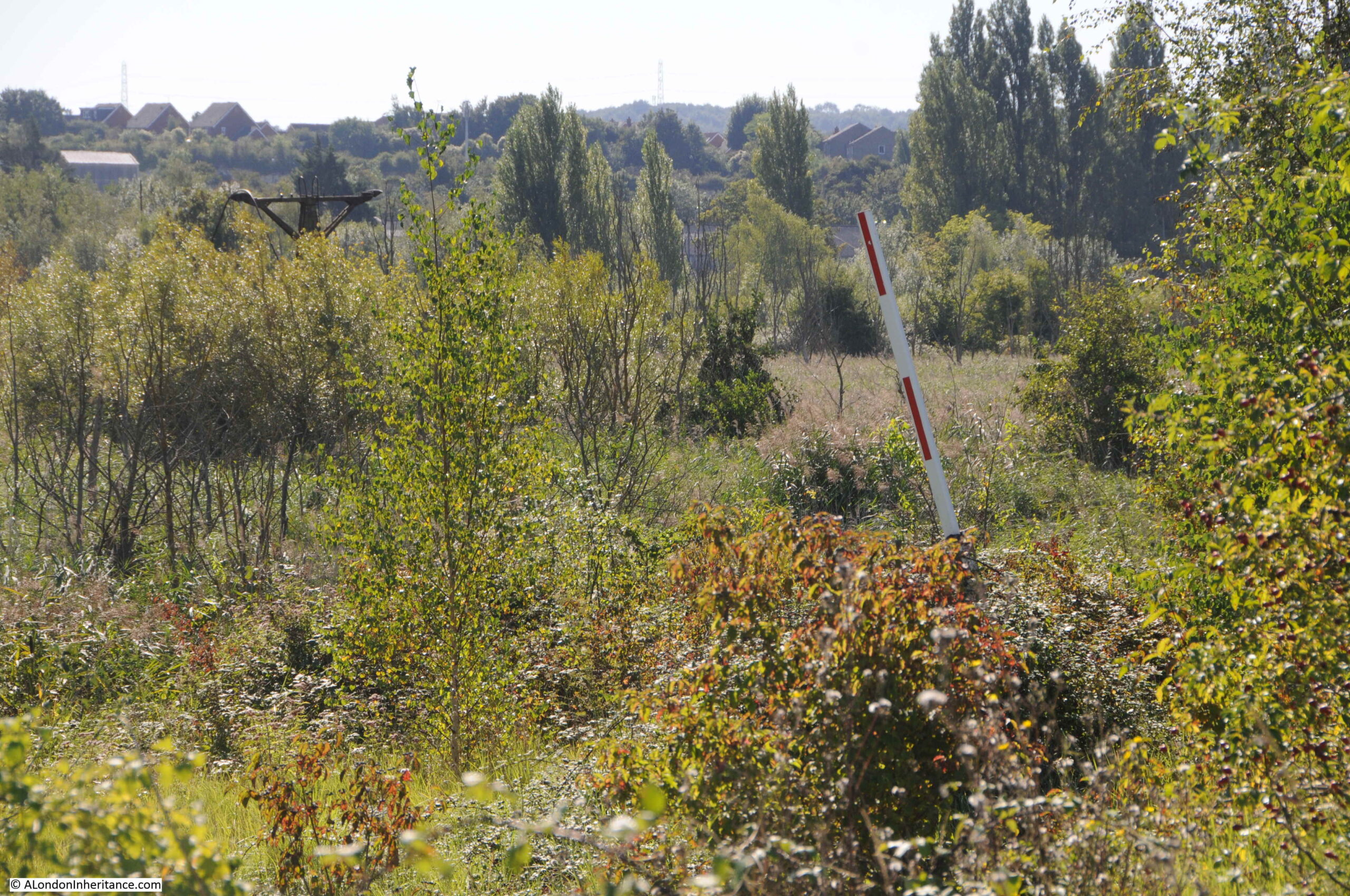
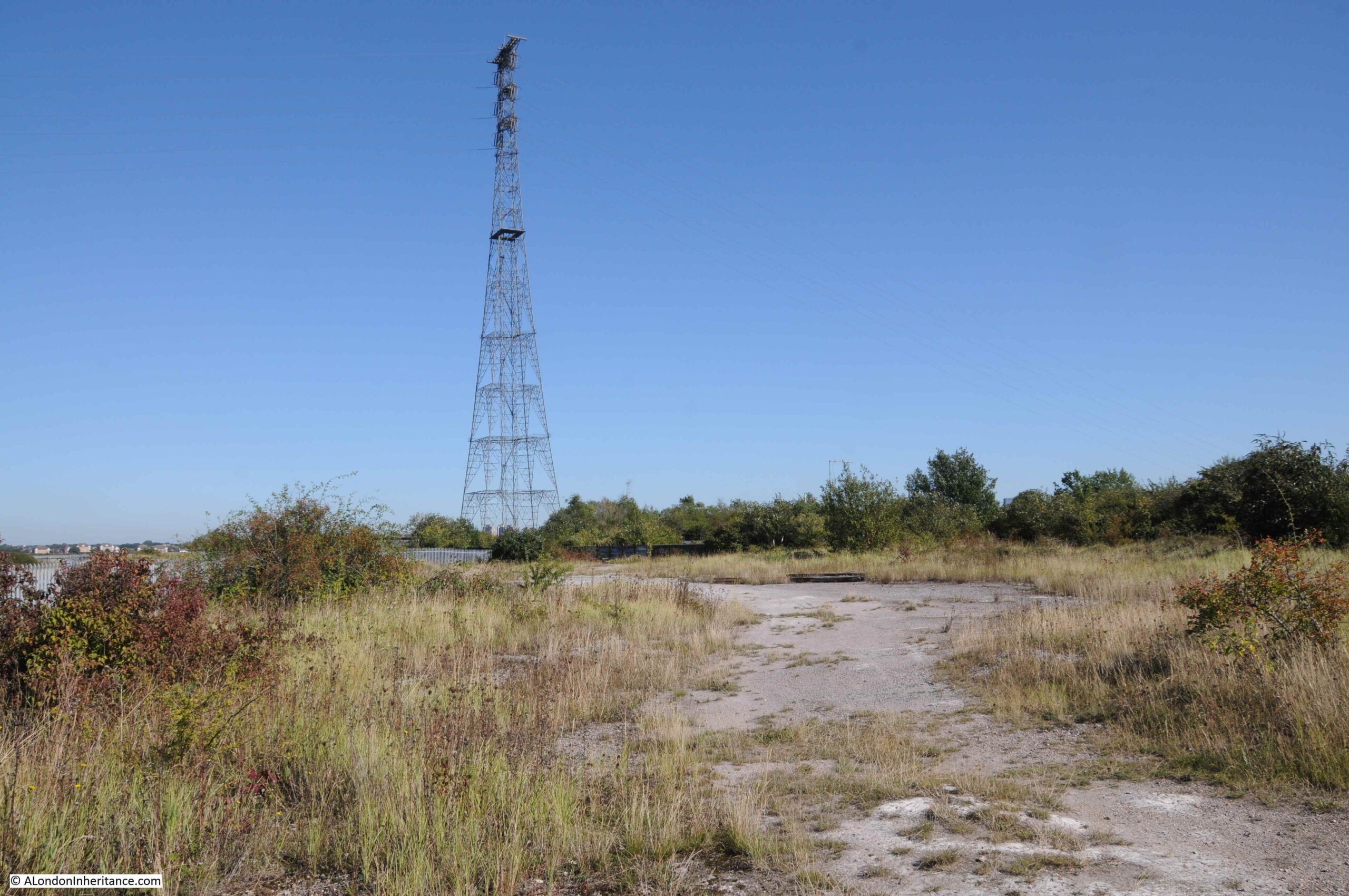
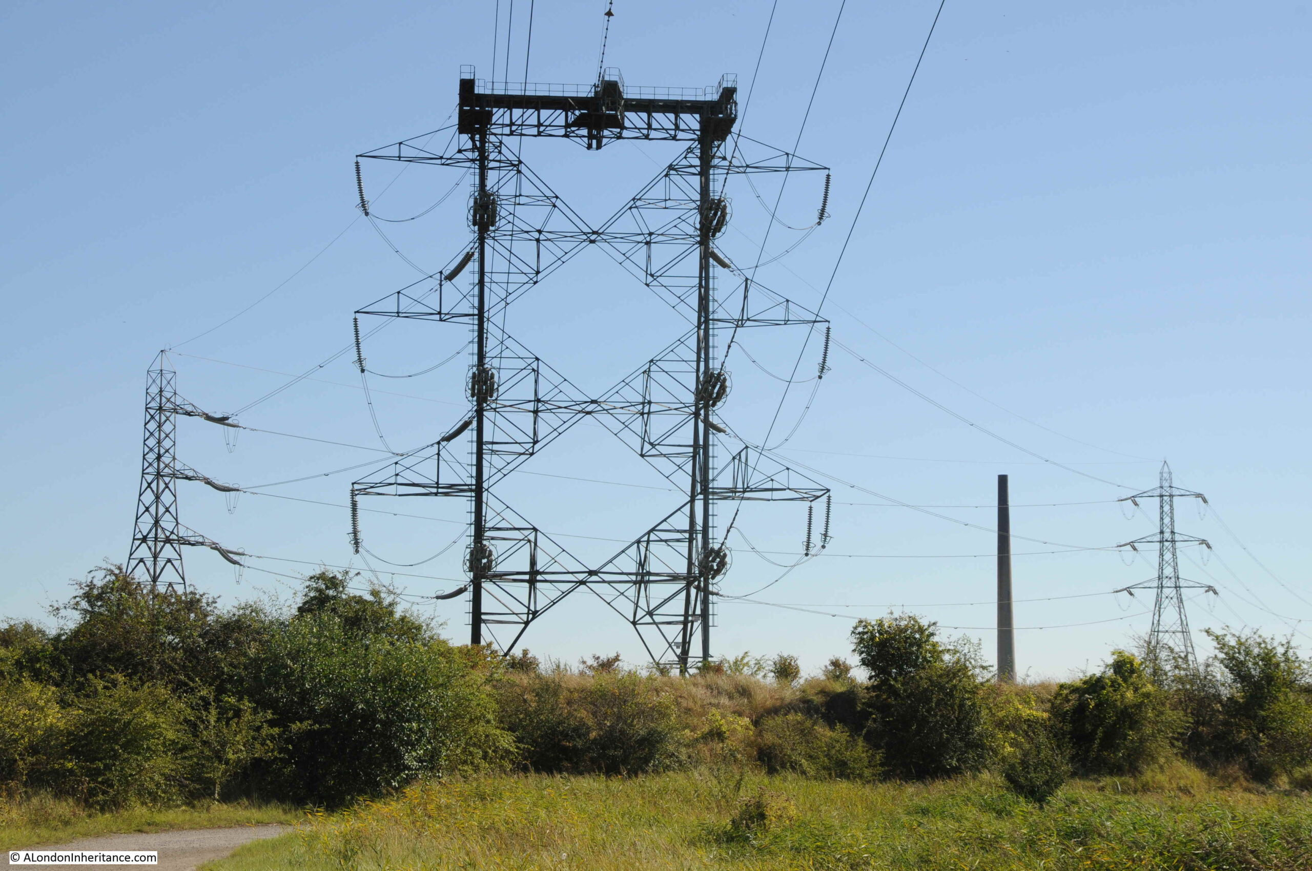
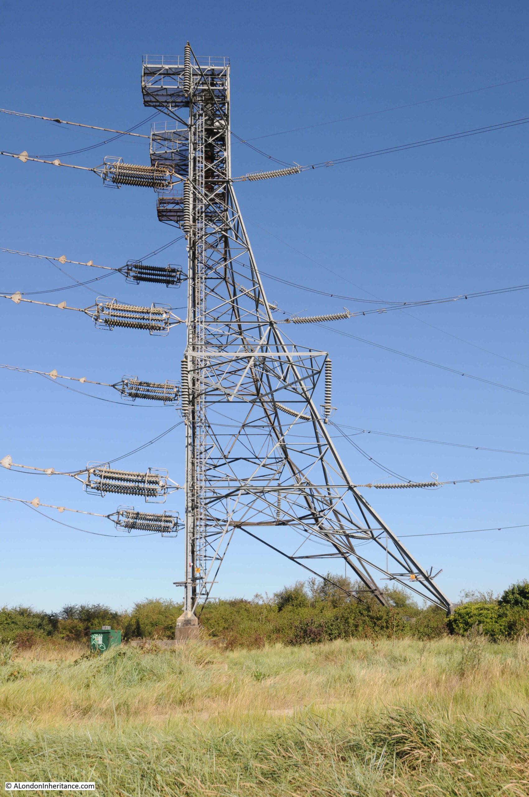
The main landmark on the peninsula is the electricity pylon:
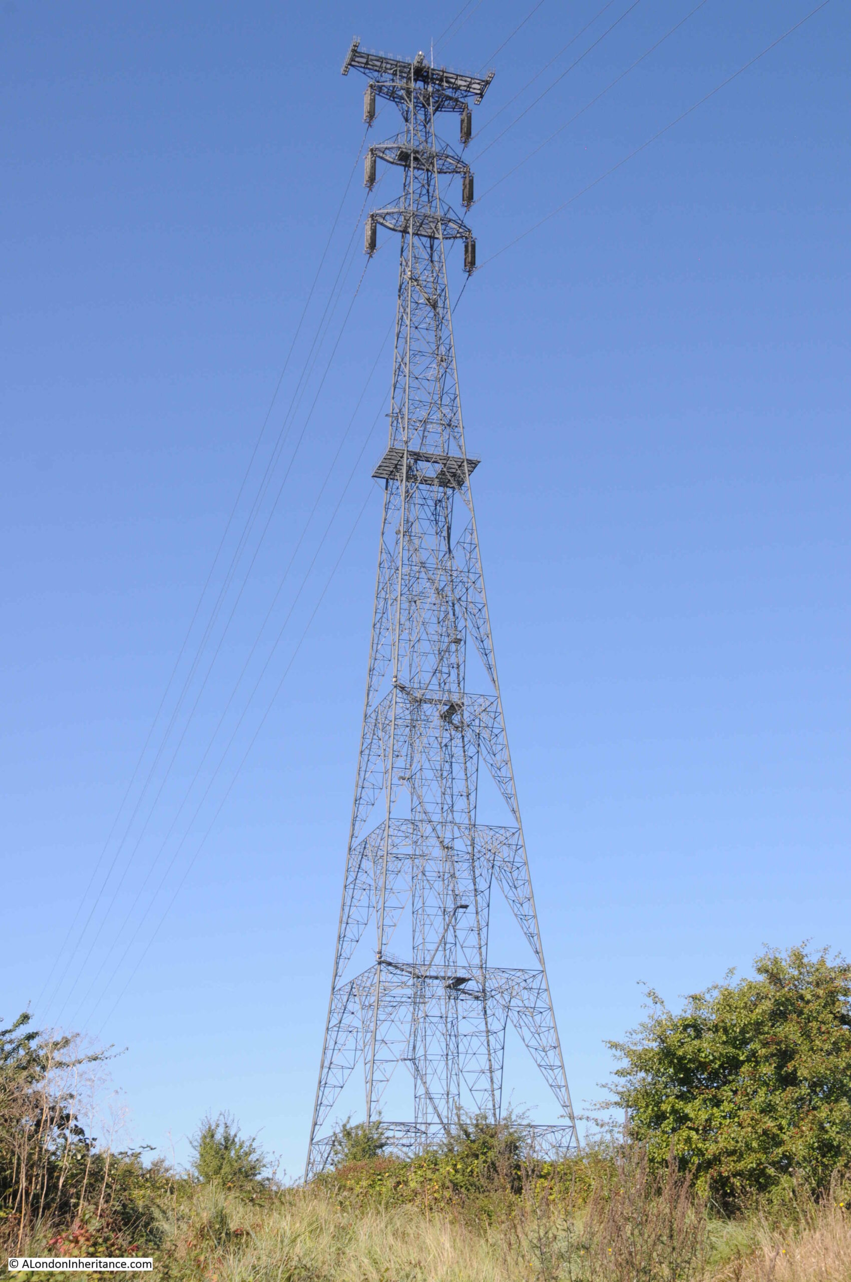
The pylon is one of a pair that support cables spanning the Thames. The other pylon is on the north bank of the river, and they carry several 400,000 Volt (400kV) electricity circuits, transporting power across the country.
They were built in 1965, and are 623 feet (190 metres) in height, apparently the tallest in the country. The height was needed to ensure sufficient clearance for the cables above the River Thames so the river is clear for shipping. Not just the height of the ship, but also to provide enough distance between cable and ship, so the high voltages carried by the cables would not arc between cable and ship.
The cables running over the Thames, connect to the grid network north of the Thames that transports electricity into London. From Swanscombe, the cables run towards east Kent where there were former coal fired power stations, which have been replaced by gas, as well as undersea interconnector cables to the Netherlands and Belgium which land on the Isle of Grain and near Richborough in Kent.
The height of the tower, along with the two platforms on the tower has resulted in the tower being popular with base jumpers – people who jump with a parachute from a high structure. In March 2006, one base jumper died at Swanscombe when it appears his parachute failed to open.
That is a sport I could not imagine ever attempting, however I really do like these structures.
Following photo shows the platform at the very top of the 623 feet tower, along with some of the insulators that carry the cables. These are of some length as they need to separate the 400kV running through the cables from the metal of the tower.
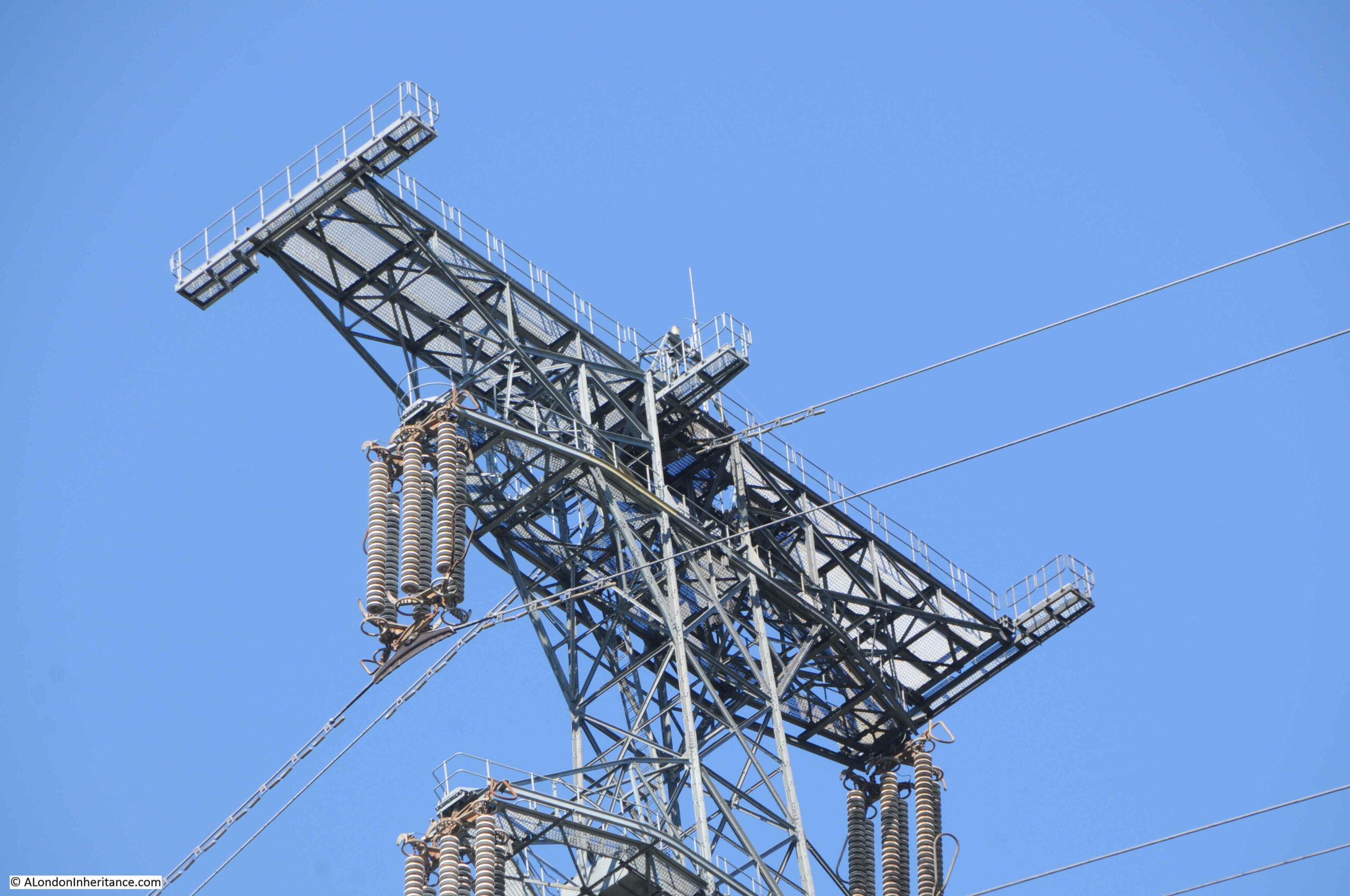
The cables from the top of the tower then run down to a smaller tower that separates and routes them off to more traditional electrical pylons.
A sideways view of the above tower shows a work of industrial art:
I have now reached the end of the blue line in my map of the route through the Swanscombe Peninsula. The post covering part two of my walk through this very special place, the industry on the eastern edge, HS1, the wildlife of the peninsula, the status of a Site of Special Scientific Interest along with links to further sources of information will be sent out this evening.
The Swanscombe Peninsula is indeed very special. Please take a look at this link from Buglife. The decline of insects is every bit as important as climate change, but has far less publicity. Without enough insects to fertilise and feed wildlife, we will have a very different world. https://www.buglife.org.uk/campaigns/save-swanscombe-marshes/
The dragonfly is a Ruddy Darter [Sympetrum sanguineum] https://flic.kr/p/2mgv4qH
Good post and interesting insight into the area good pics too.
The dragonfly is most probably a Ruddy Darter [Sympetrum sanguineum] https://flic.kr/p/2mgv4qH
The male Common Darter [Sympetrum striolatum] https://flic.kr/p/2mf7ALk is very similar, the main identification difference is the white lines on the legs of the Common.
Looking forward to part 2!
Thank you for this travelogue venturing further afield, part of which looks like a fairly isolated area, so I am pleased to be able to view it with sunny skies and an excellent ‘tour commentary’ from behind the comfort of my phone screen! The linked piece about the Bellot memorial was of particular interest, as I have been reading a lot about the Terror and Erebus since watching the very excellent North Water TV series. Another excellent start to my Sunday morning – thank you again, and I look forward to Part 2!
Another Fascinating blog. Interested to see the electricity Pylons are the tallest in the UK.
Second to these are the ones that my late husband worked on in 1969 across the River Severn at Aust, these ones being slightly shorter at 148.75m but being the longest stretch in the UK.
Thank you for another fascinating post – I’ve never heard of the Swanscombe Peninsula or indeed the London Resort, which is strange considering how imminent it appears to be. The pictures of the pylons are great and it would be worth a visit just to see those. Thank you.
Rob Smith of Footprints of London has been doing walks all along the Thames right up to the Estuary and coastal towns for quite a few years now. I have walked the Swanscombe Peninsula twice over several years and also petitioned against the development which destroy an extraordinary natural habitat.
Not wishing to take these blogs for granted, it is clear that much detailed work, effort and research have gone into each production…….I have been following these fascinating experiences for some considerable time and continue to be engrossed in the content produced on each occasion. I have always been interested in industrial archeology, so this being the fabric of your sojourns, gives me enormous pleasure to the extent that, having shared your experience, I feel, as you must have felt, both enthralled and uplifted.
I really felt as though I had been right there with you. Thank you ‘again’!
As always, a fascinating post. I know the area fairly well but didn’t know about the two electricity pylons or Ingress Abbey or even better, the Sir John Franklin pub. Thanks again for offering us your insights.
A great post. This area is not far from me, but having some mobility issues means I haven’t been able to visit it myself. But your exploration and account have enabled me to find out what is there, thank you! I look forward to your next report later.
Mary Kelly’s crime novel “Due to a Death”, republished in the British Library Crime Classics series this year, is set in a fictional town based on Greenhithe and the Swanscombe peninsula. Written in 1962 it references almost all of the sites and areas you have visited. It is also an excellent story.
The current development proposal is hideous and pointless
Most absorbing and atmospheric. I like these watery landscapes that have the melancholy of past industrial lives; something a bit Dickensian lingers. Must be very moody on an overcast day. Those reed beds must surely be home to many wintering birds. Tragic to turn it all into a privatized, banal palace of fun which could end up a white elephant.
I particularly enjoyed reading this as I’ve known the Swanscombe peninsula well over the past 20 years and led a guided walk across it only a month ago. My interest comes from study of the area’s industries.
The rails that cross the footpath at the Eastern end of the Ingress Park development once led-on to the Imperial Paper Mills deep-water pier. One of the locomotives that worked there has been preserved.
My I suggest an alternative to our author’s route?
Once one is approaching the Pylon, just past the former cement work’s jetties, it is feasible and permissible to continue by the riverside towards Broadness Creek, sometimes now known as Broadness Harbour. The route is not a Public Footpath but is well trodden. This land does not belong to London Resort Holdings Ltd and one will not be troubled by their security guards. The ‘harbour’ is home to a community living on a large number of small vessels, not all of which appear to be fully ship-shape.
Having walked around the creek it’s possible at lower tides to drop-down onto the foreshore just past the Broadness light beacon. This is the best part of my preferred walk around the periphery of the peninsula as the foreshore has been less engineered for flood defence than anywhere else in these stretches of the Thames. The problem comes when one approaches the industrial buildings and leaving the foreshore becomes necessary. A very stiff upwards climb is required but the last half mile will have been truly worthwhile, it’s the nearest thing to a natural riparian landscape on the lower Thames. Make sure to consult the tide tables first. From hereon one can take the ‘official’ paths as our author has.
The reason why the peninsula has evolved into such a wonderful environment was the ownership of so much of it by Associated Portland Cement Manufacturers and their predecessors for well-over a Century. They used it as a dumping ground yet nature has achieved a complete re-colonisation.
Swanscombe cement works was the longest-lived of all such UK factories. Founded in 1845, APCM etc. kept it going until 1990. The reason was that its Chalk quarry produced an exceptionally white cement that was originally a key component in the remarkable paint product that is ‘Snowcem’. (I am not in any way associated with APCM or their successors.)
The potential redevelopment, and thus destruction, of this unique landscape weighed heavily on my 20 walkers. They had seen it at first-hand and found it as glorious as I do yet, I’d fully explained the very difficult employment situation in the nearby towns of Northfleet and Gravesend. More jobs really are needed there. As we left the peninsula I called for a vote on whether the theme-park should go ahead or not. No-one dared to declare in either direction. It’s a conundrum.
As for me, I recently had an opportunity to apply to London Restort Holdings as a contractor. I need the work but I just couldn’t bring myself to do it.
And I’ve just heard that it’s been pulled! Yeah.
It’s only a temporary withdrawal of the planning application caused by changes at the theme park’s proposed ferry terminal at Tilbury. Also, London Resort Holdings have been buying more land on the peninsula.
Oh dear. Where have they been buying?
I don’t know but it’s confirmed by the BBC. See this link…
https://www.bbc.co.uk/news/uk-england-kent-60911483
Many thanks for this. Great to have a few gaps in my knowledge filled. You begin your post with what appear to be pretty neutral observations about the planned development, but then later comment that it is is a very special place. I think it will be a tragedy if/when the amusement park is built and it looks increasingly like it will be. Those private land signs are recent, they appeared only on my last visit a couple of years ago.
I’m a photographer/artist who makes one-off books (would love to find a publisher haha). I made a book about the peninsula called ‘Creek’ which hopes to celebrate its unusual beauty. You can find details and images here: http://www.eleventhvolume.com/bound/creek.html.
I look forward to part two in which I have no doubt you’ll be detailing that strange set of moorings you’re on the cusp of.
I ride along the sea wall on the opposite bank and pass under the north pylon and on to the bridge. West Thurrock power station was where my late father and brother both worked – my father when it opened with my brother there when it closed.
I have often wondered what the other side of the river was like and will ride there one day from the Gravesend ferry.
A very interesting account. I worked at Greenhithe from 1973 to 1987, when the Empire Paper Mill was in full swing, as was Swanscombe cement works, albeit at a much reduced output compared with its heyday. The waterfront at Greenhithe was dominated by Everards, coastal shipping and barge owners, with their repair yards. The pubs there (such as the Lamb, now closed I believe) were definitely not used to stangers at lunch time, and especially not to women…
It must have been so interesting, a different world. Thanks for giving us a glimpse of it.
Interesting article about an area I knew well for three years from 9/1980 to 7/1983 being at Merchant Navy College (1974-1989), the shore establishment that replaced the HMS Worcester in her final days before being towed off to Belgium for scrap. Lots can be found online about the Worcester, less about the college but here’s a photo at this link and others may be found elsewhere online. http://www.hms-worcester.me.uk/big/15/40.jpg There’s an interesting film from Meridian TV about Ingress Abbey (and incidentally about the demolition of the college), featuring Marcus Binney from Save Britain’s Heritage.