
Baldwin’s Gardens is a street that runs between Leather Lane and Gray’s Inn Road. If you take a walk along the street, you may be disappointed that the street does not live up to its name. Rather than finding any gardens, the walker will find flats, a church, school and other buildings lining Baldwin’s Gardens.
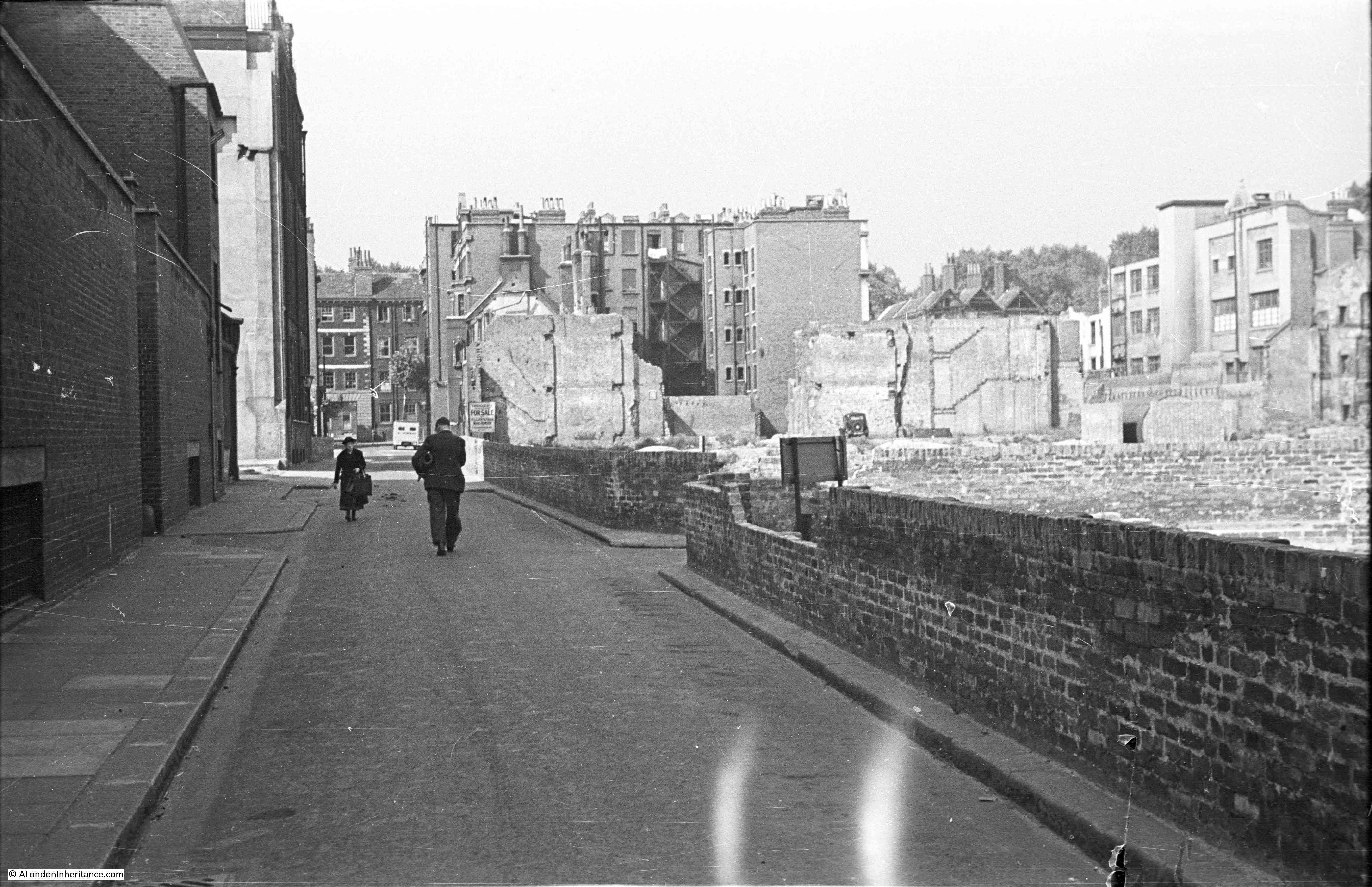
My father took the following photo of Baldwin’s Gardens in 1949. The view is looking down towards Gray’s Inn Road. In the early years of the war, the area suffered from the impact of several high explosive bombs and the effects of these can be seen to the right of the street.
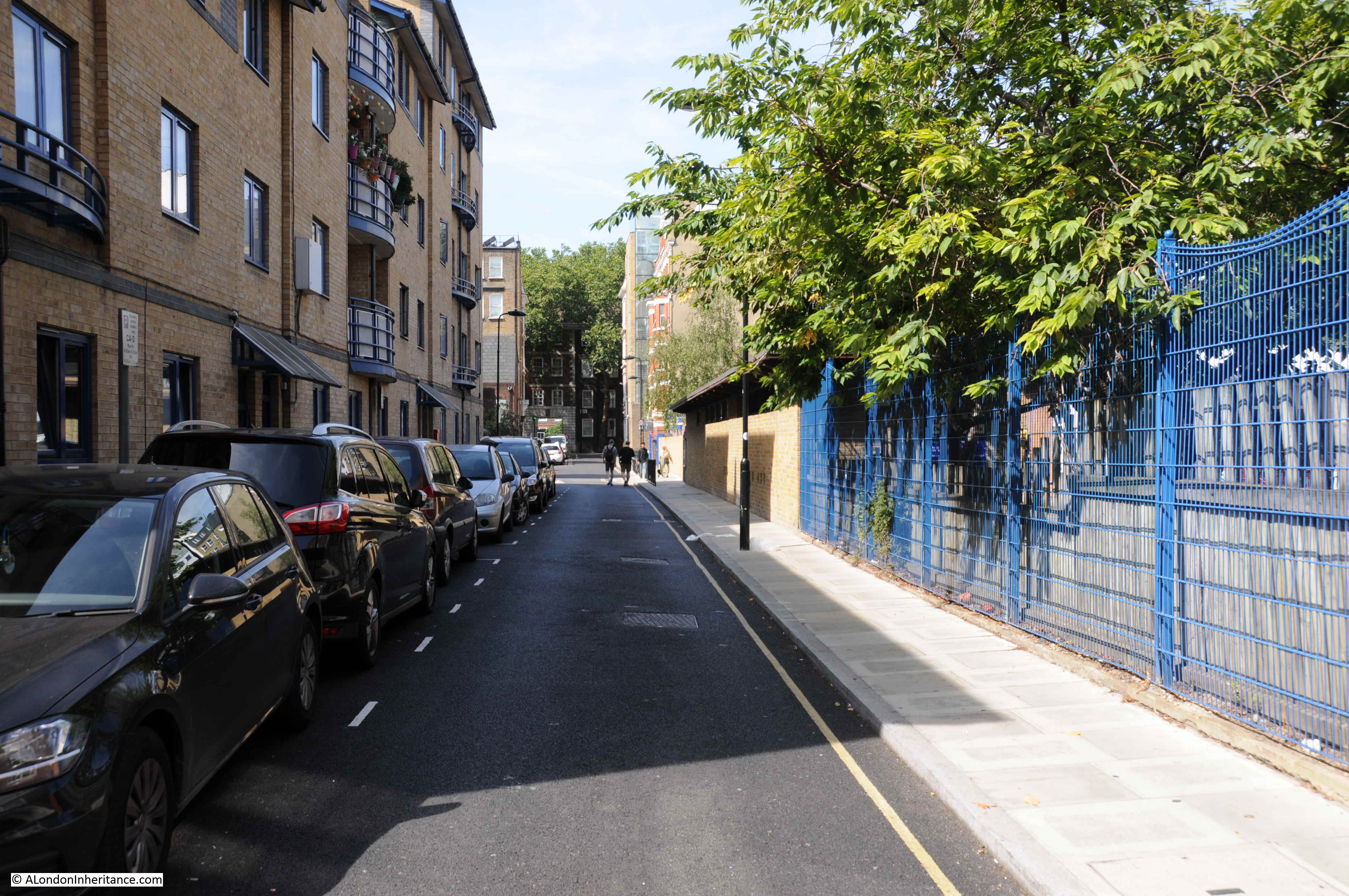
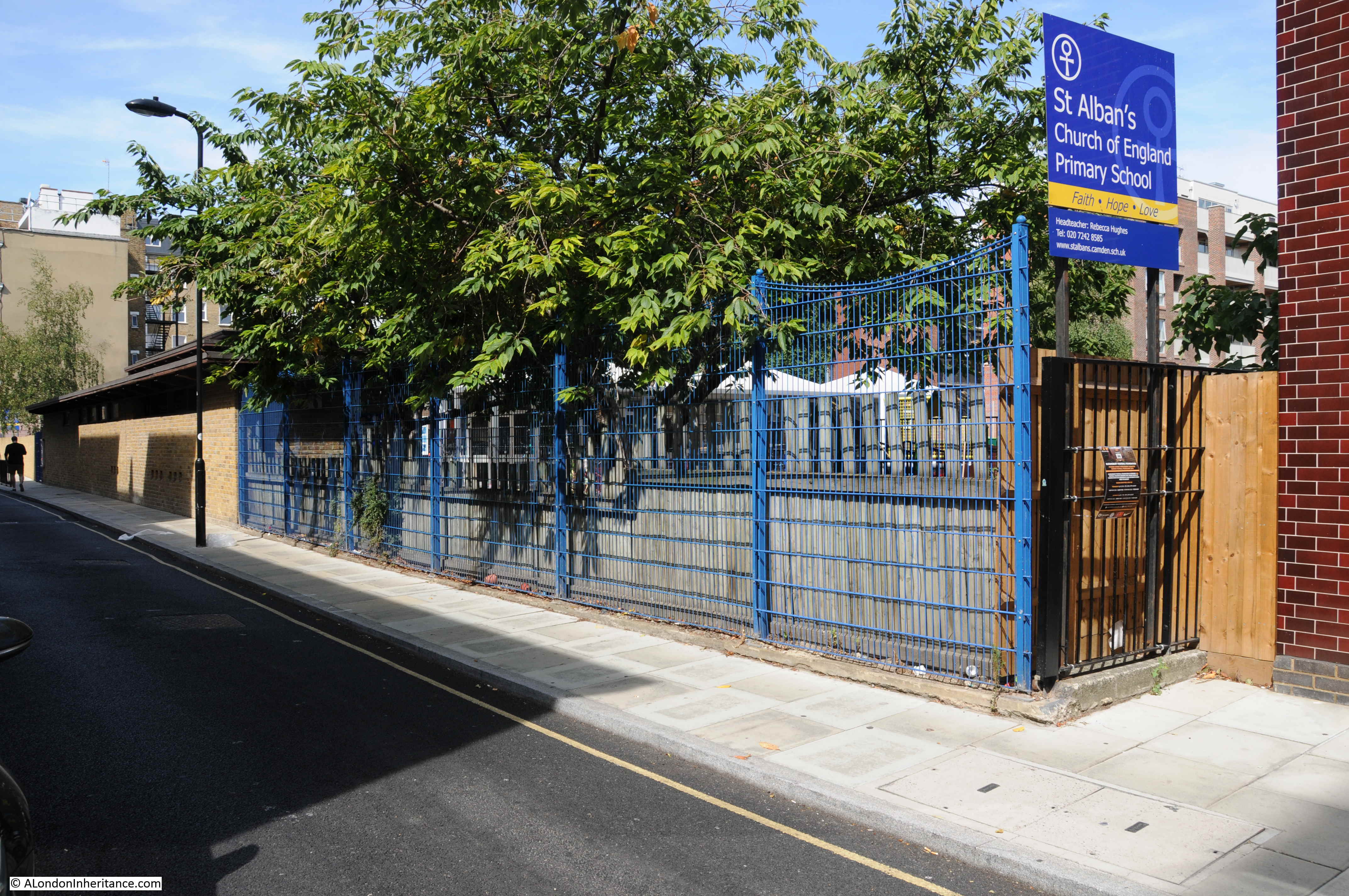
The same view today:
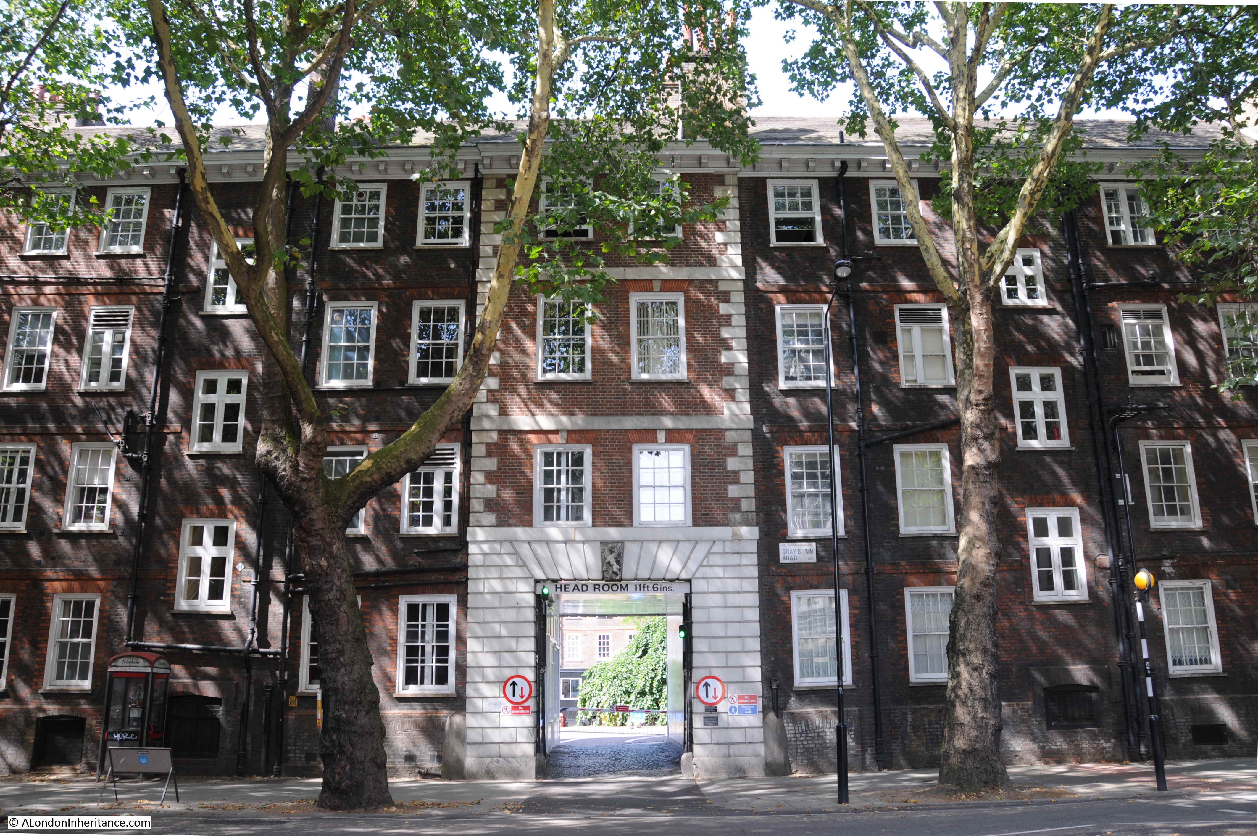
The only identifiable feature in the above two photos is the building in Gray’s Inn Road visible at the far end of Baldwin’s Gardens (although it is slightly obscured by trees in the 2018 photo). This building is part of Gray’s Inn, and one of the entrances to Gray’s Inn Square.
I took the photo below at the end of Baldwin’s Gardens to show the building today with the central block and entrance to the gardens behind being the feature visible in my father’s photo.
Detail from the 1949 photo shows the Gray’s Inn building:
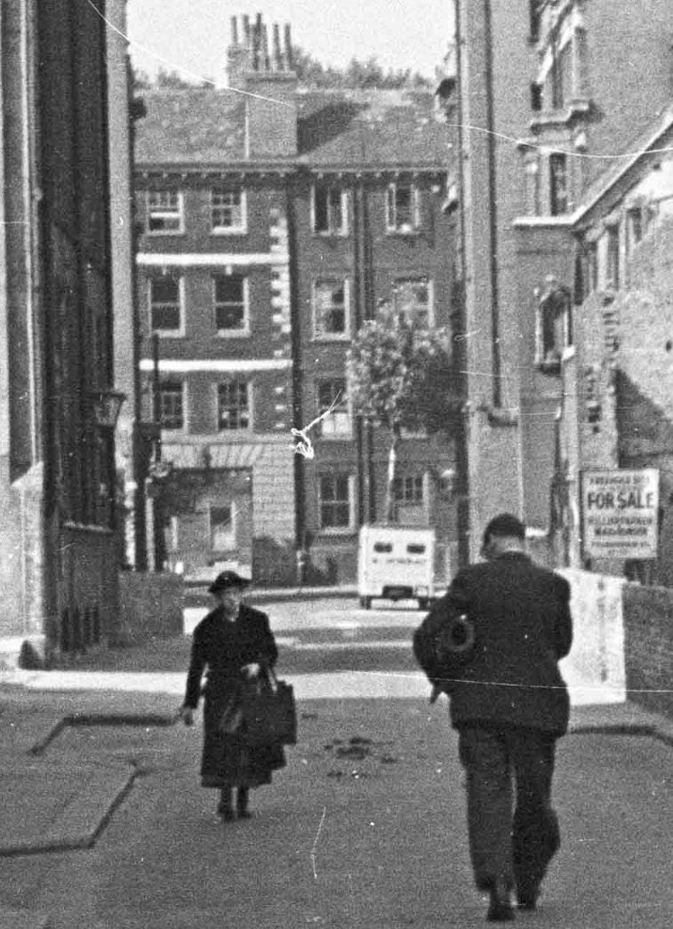
My father took a second photo looking slightly to the right of the first photo to show more of the bomb damaged area.
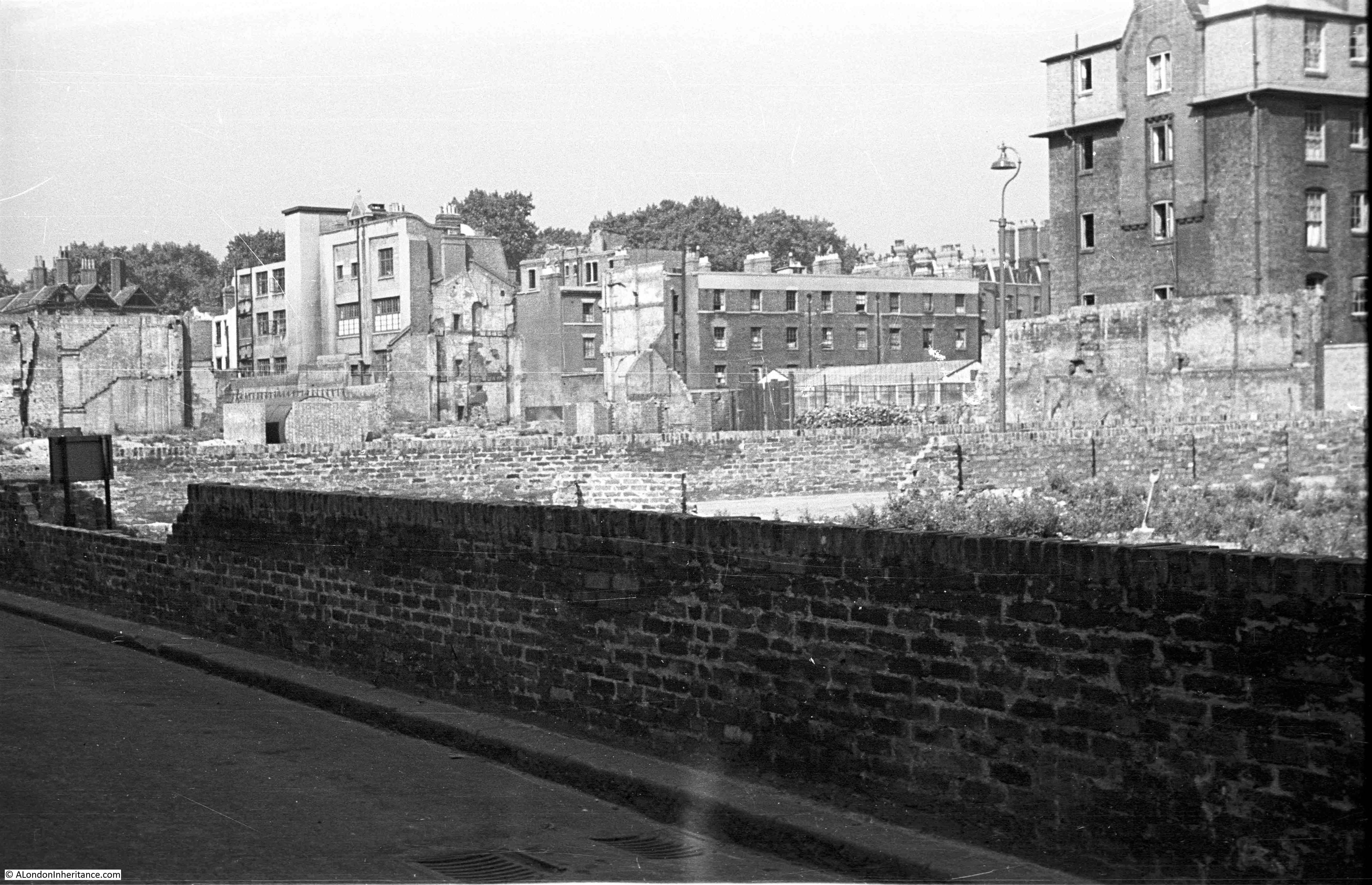
Difficult to be precise regarding the exact location due to the level of change, however looking over to the right of Baldwin’s Gardens today, and the 1949 bomb site is now occupied by a Primary School.
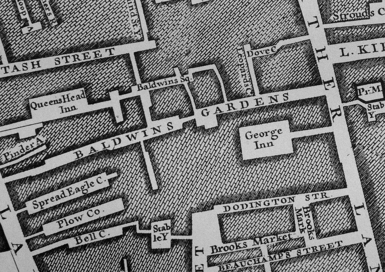
A clue as to what occupied the bomb site can be found in the extract from the 1895 Ordnance Survey map shown below from the National Library of Scotland. Baldwin’s Gardens run across the centre of the map. The upper left part of Baldwin’s Gardens is the bombed area in my father’s photo.
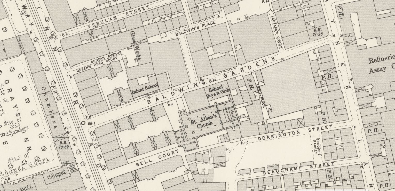
Just above the letter B in Baldwin’s Garden, there is an Infant School. This is in the same location as the Primary School today. Below the word Baldwin’s is St. Alban’s Church and to the upper right of the church is a school for boys and girls.
The church of St. Alban is still alongside Baldwin’s Gardens as shown in the photo below. A large brick church, completed in the early 1860s.
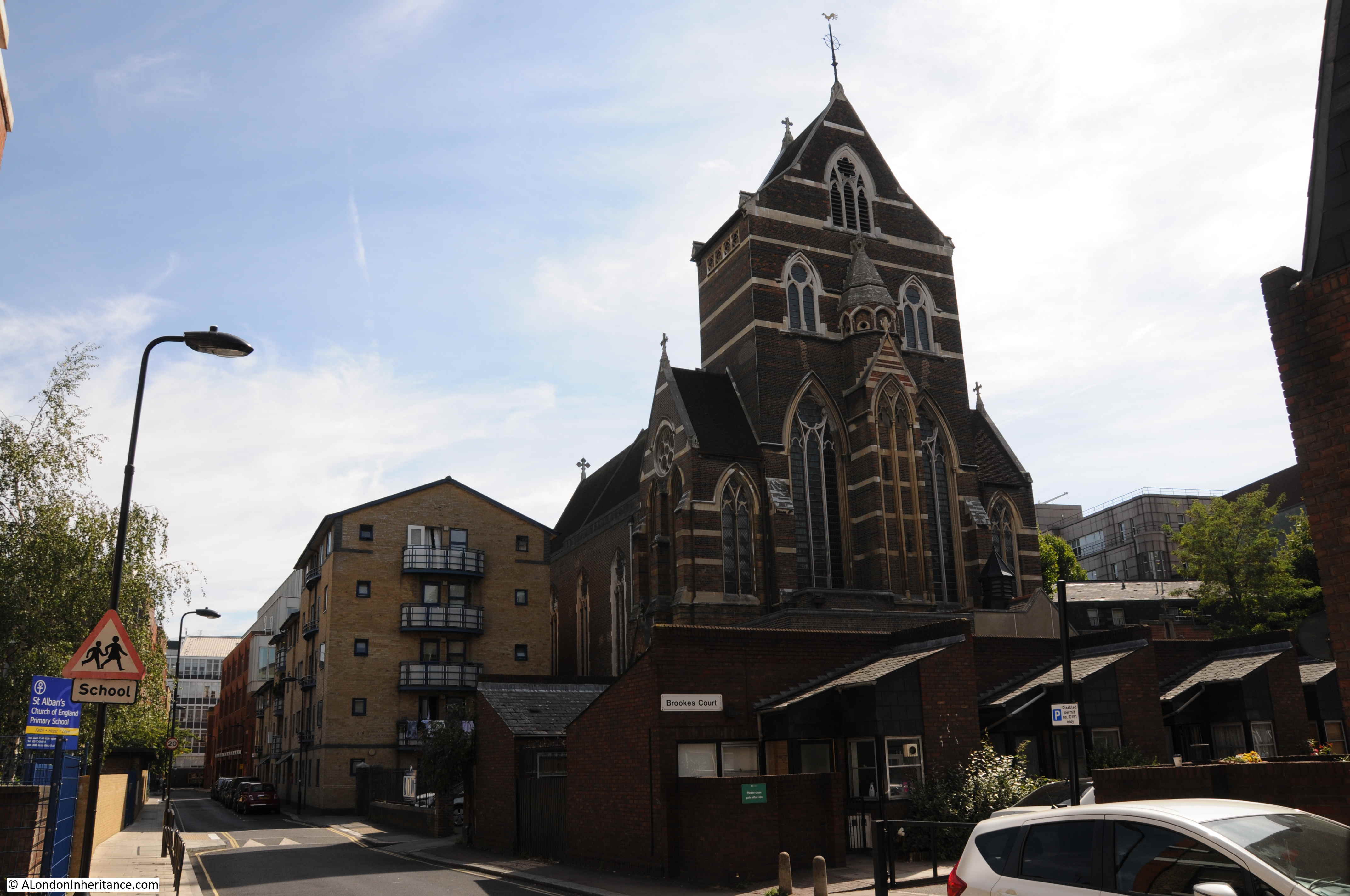
The Holborn Journal reported on the 28th June 1862 that the church was almost complete, apart from some internal decoration. The Holborn Journal appears to have appreciated the church as the article concludes with “Mr. Myers was the builder, and he appears to have done his work well.”
The second school on the map, marked for boys and girls has been lost although a plaque from the school can be found in the small yard between the church and Baldwin’s Gardens:

Remarkably, I found a photo of this plaque when it was on the original school. The following photo is from the London Metropolitan Archive Collage site. It is titled “St Alban’s School, Baldwin Gardens: St Alban’s Hall.” The photo is dated 1956, confirming that the northern side of Baldwin’s Gardens appears to have suffered the worst bomb damage.
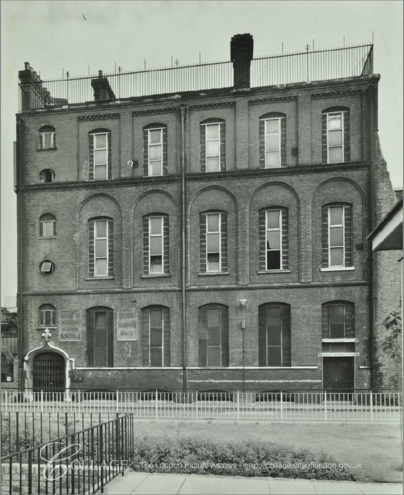
Image credit: London Metropolitan Archives, City of London: catalogue ref: SC_PHL_01_144_56_3265
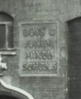
If you look to the lower left of the building there are two plaques on the wall. The one on the right is the St. Alban’s Hall, whilst the one on the left is the one that can been today as shown in my photo. The following is an enlargement of the plaque from the above photo to show it is the same:
This is what I find so fascinating about walking London’s street – being able to find the traces of long lost buildings and activities and being able to trace them to their original place.
Baldwin’s Gardens schools seemed to have played a part in early teacher training. A newspaper article from 1875 comparing school education in the United States with that in the United Kingdom, and the approach to teacher training, writes: “But as early as 1811, the National Society in our own country had begun, in a rudimentary fashion, to train teachers at Baldwin’s-gardens school in London, and in 1817 the British and Foreign School Society followed with an organisation of their own for the same purpose.”
So perhaps this rather plain London side street was once a pioneer in the work of teacher training.
According to A Dictionary of London, published in 1918, the name comes from a Richard Baldwin who was a gardener to Queen Elizabeth the 1st and erected the street in 1589.
In “The London Encyclopedia” by Ben Weinreb and Christopher Hibbert, they confirm that the street was built in 1589, and add that it was on the site of Brook House, the mansion of Lord Brooke. Apparently it held the privilege of sanctuary and criminals fled to Baldwin’s Gardens to live without fear of the law. This privilege ended in 1697. The London Encyclopedia also states that “the area continued as a notorious slum, much frequented by criminals, and part of the locality known as the Thieves’ Kitchen, a training ground for young criminals.”
London by George H. Cunningham (1927) confirms the reputation of the area and adds that it was one of the most dangerous and disreputable of slums. This notoriety was removed in the building of St. Alban’s Church, and that “alterations and improvements have completely changed the appearance of Baldwins Gardens”
Baldwin’s Gardens featured in the 1746 map by John Rocque:
A further insight into the area can be found in my post on the nearby Hole in the Wall Passage.
In the second of the 1949 photos, a large building can be seen on the right of the photo. This is part of the Bourne Estate, a housing development by the London County Council in the first decade of the 20th century. Part of the estate can be seen from Baldwin’s Gardens:
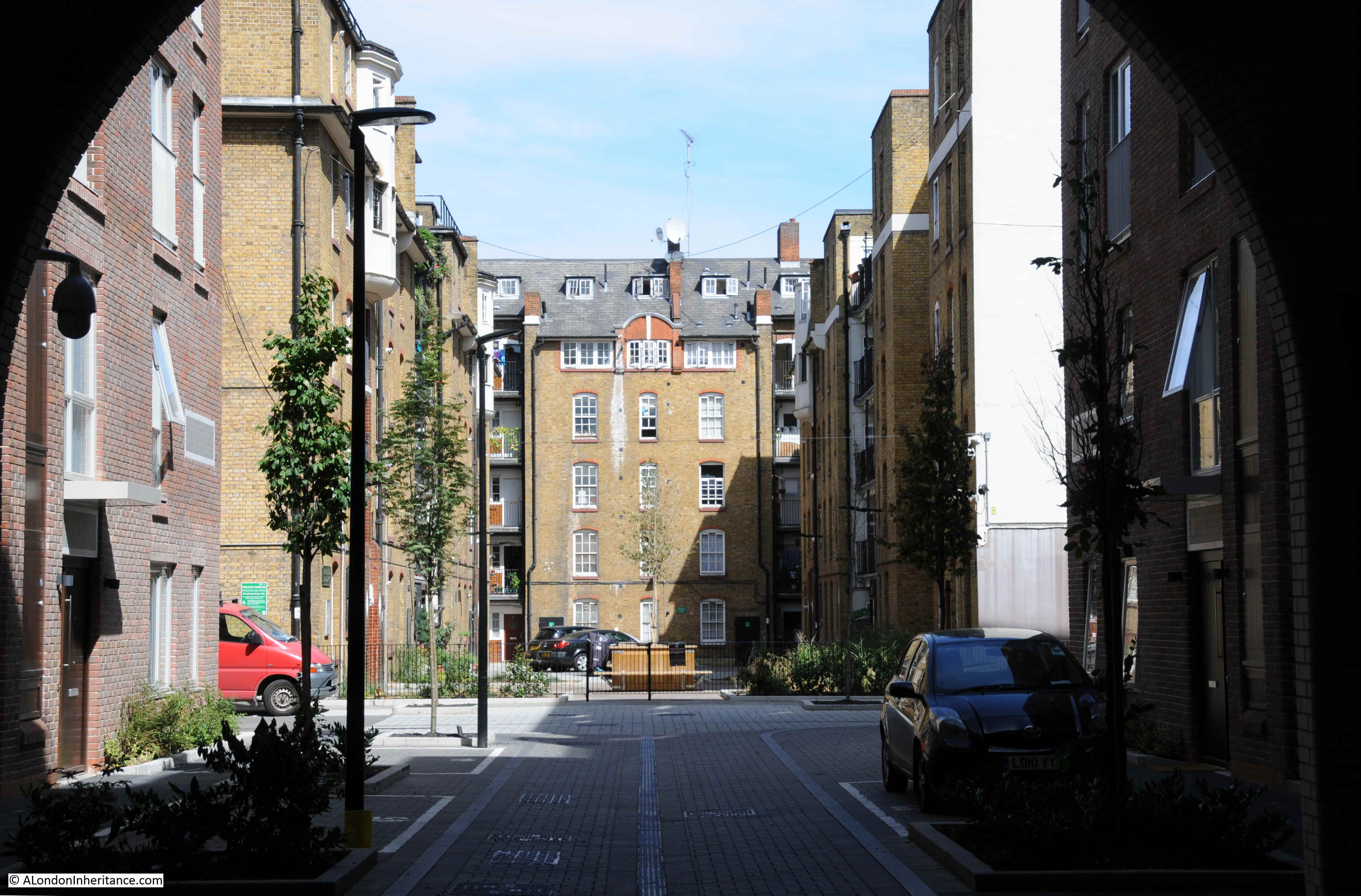
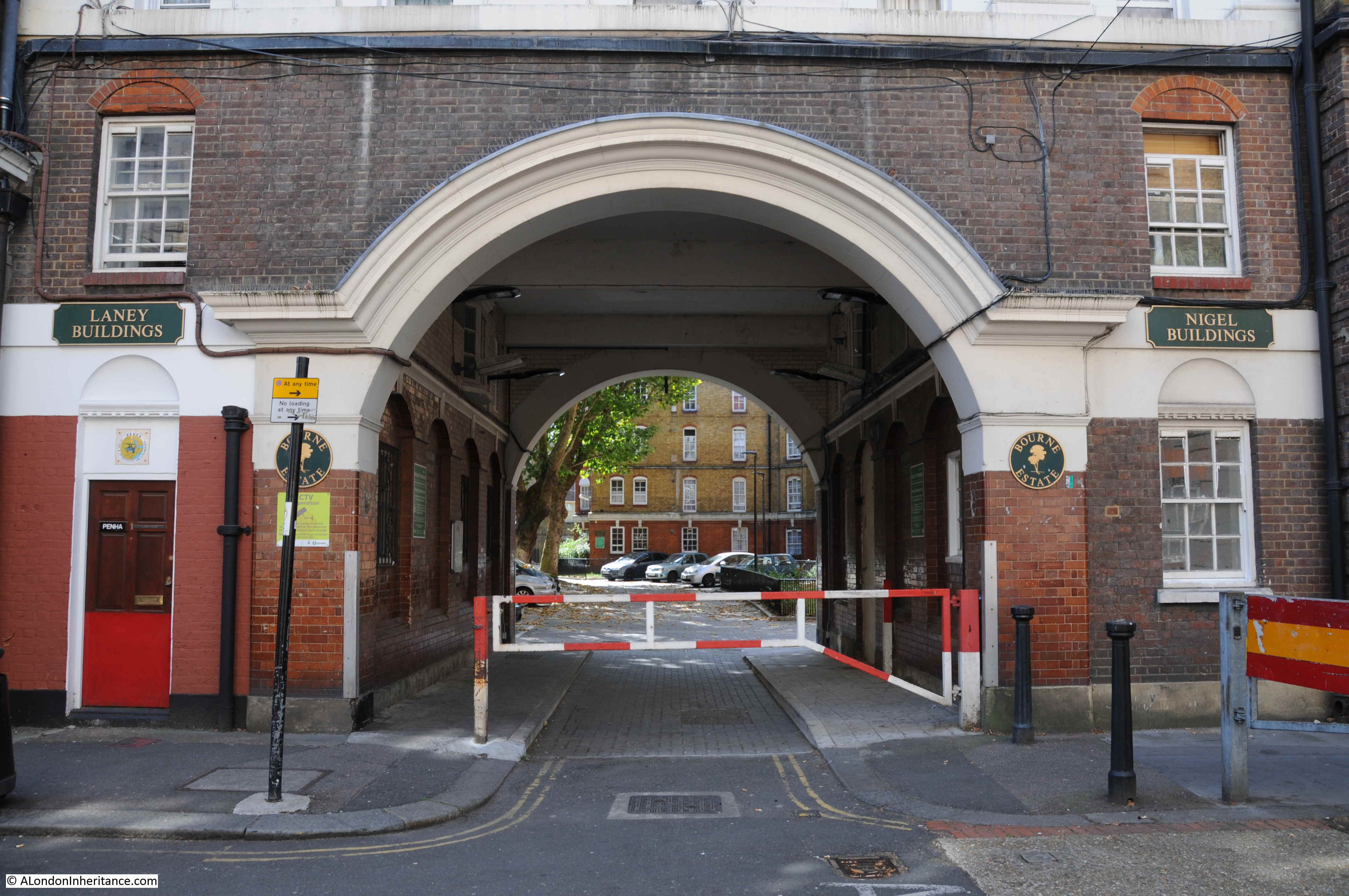
To take a look at the estate, I walked out of Baldwin’s Gardens, a short distance north along Leather Lane to Pontpool Lane where one of the main entrances to the estate can be found:
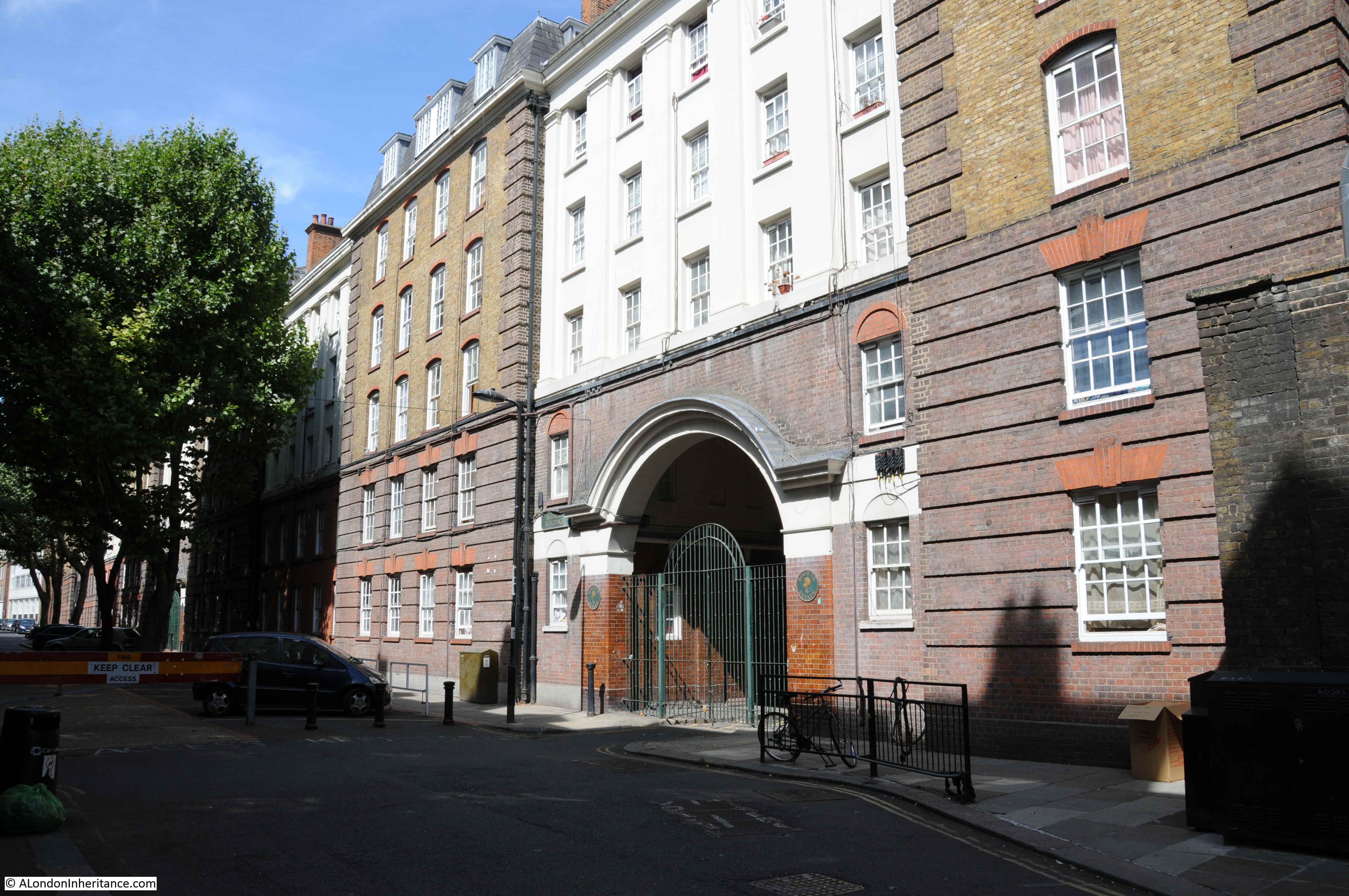
There was some damage to the estate during the war, however the majority appears to have survived. A rather impressive entrance archway leading through into the estate:
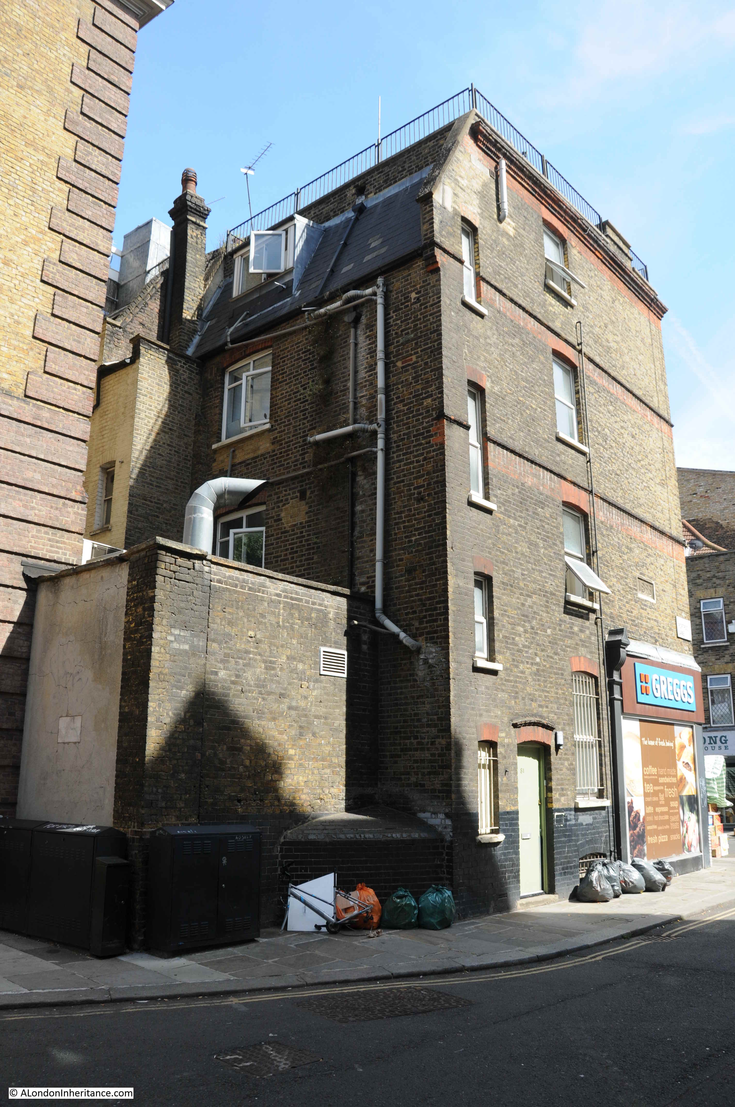
Ever on the lookout for plaques on buildings, the building on the corner of Pontpool Lane and Leather Lane has a plaque with the date 1895, presumably the date the building was constructed (seen above the Greggs sign).
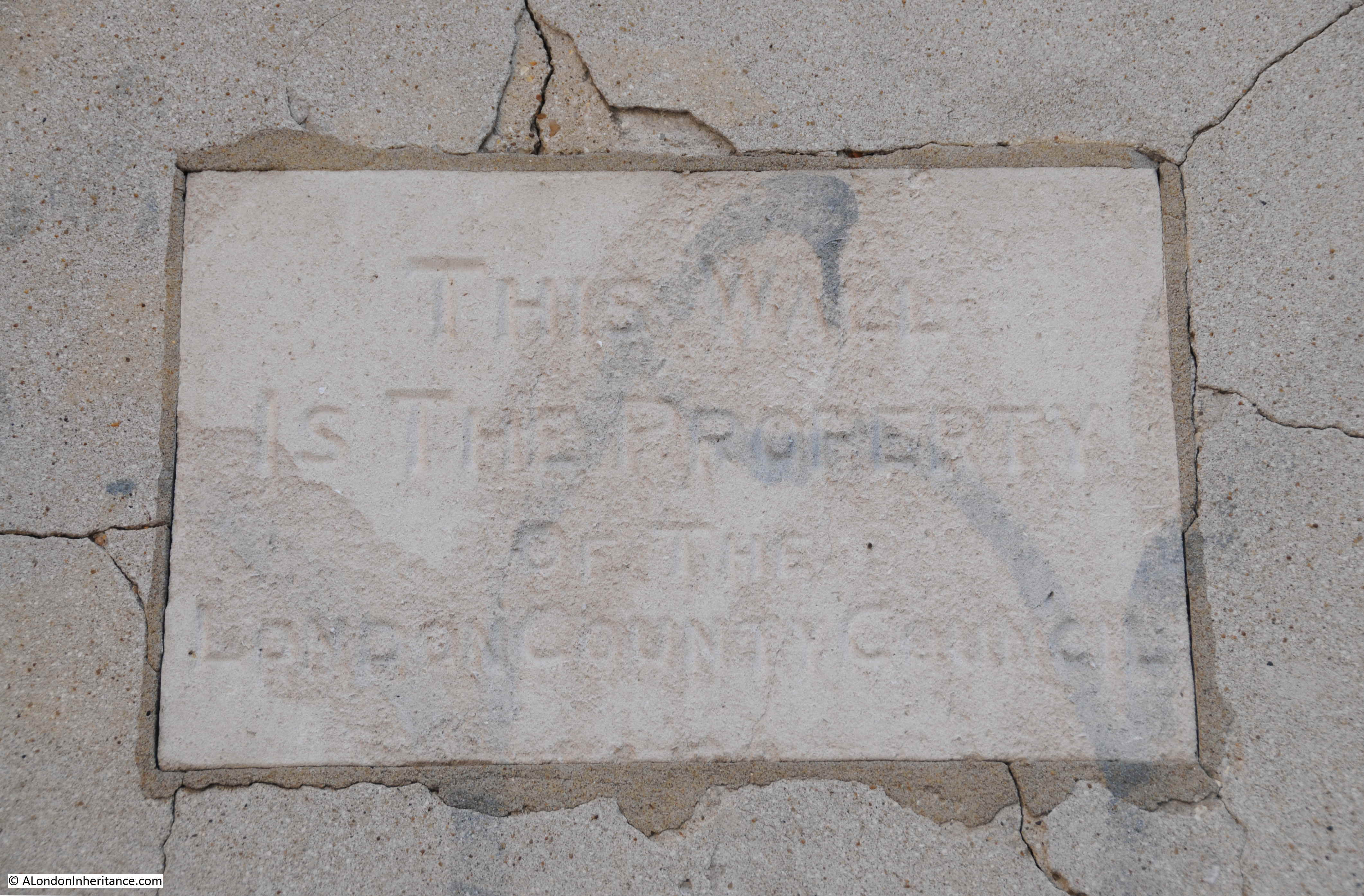
There is a second plaque to the lower left:
The plaque states that the wall is the property of the London County Council.
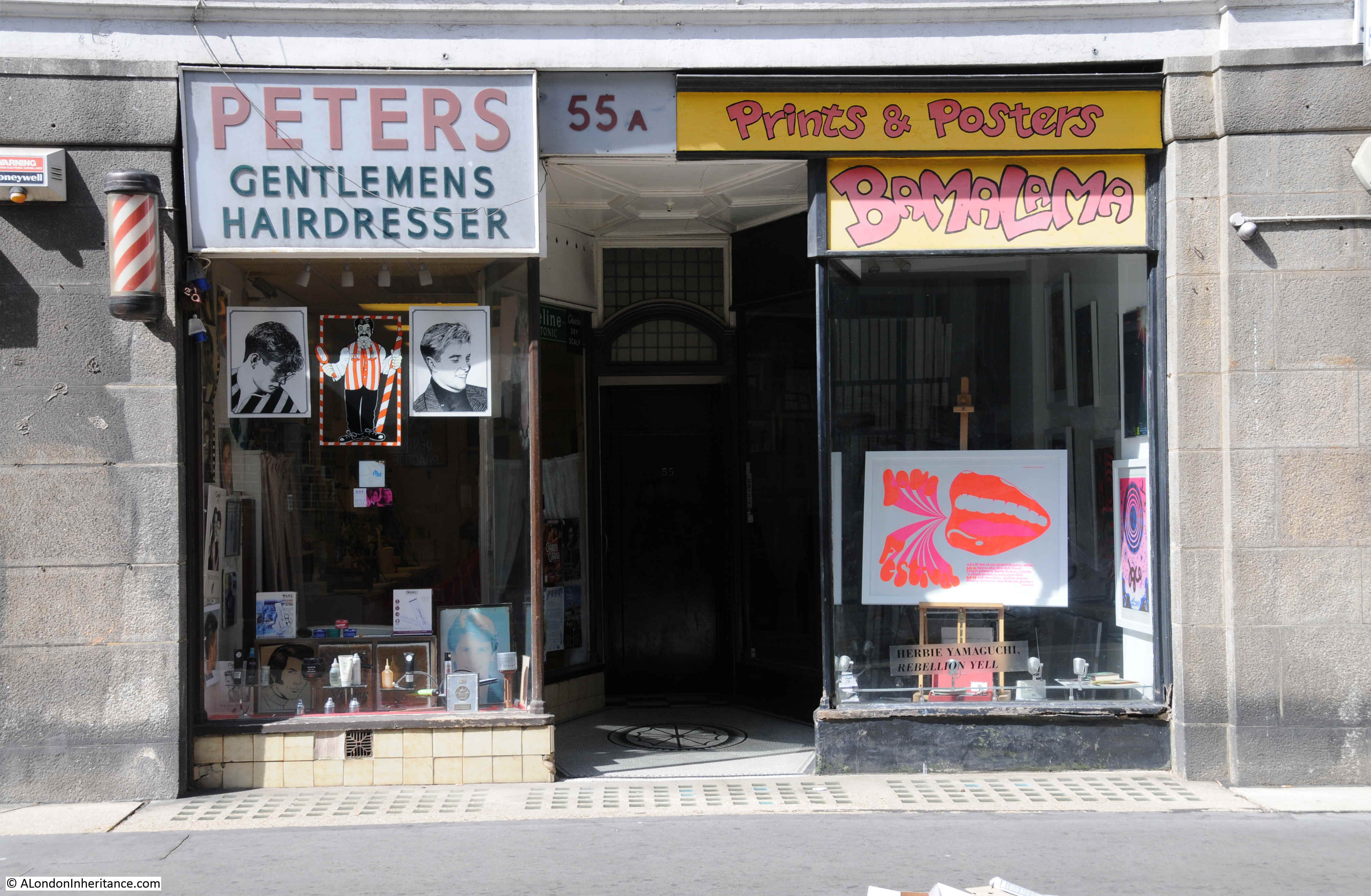
Leather Lane has a fascinating history which I hope to write about in the future, however to finish today’s post I did find a rather traditional hairdresser in Leather Lane. I always take a photo of these when I find them in London’s streets to continue the series of photos of London hairdressers started in the 1980s.
Baldwin’s Gardens is an ordinary London side street, but one that was built by the gardener to Queen Elizabeth the 1st. It was the haunt of thieves and a dangerous place until the building of the church, and the street has been host to a junior school since the 19th century – rebuilt since the wartime destruction of the previous school. There is history to be found in every street.
Hi
I want to thank you for your emails…….. they are fascinating.
I am.just wondering if you are aware of the Layers of London project bring undertaken by the London Metropolitan Archives? I am sure they would be delighted to know of your Incredible photos.
Regards and thank you
Jenny Tidman
if you would like to contact me, I can give you some more info on the photos above .
and I was amazed to see the photos of Ampton Sreet , this is where i live now .
I have just discovered that one of my great-great grandfathers, George Kearley, took over the ‘publicanship’ of the “White Horse” (built c.1790), situated at Baldwin’s Gardens, Holborn, having taken over from William Rushton in September, 1857. George’s tenure there only lasted about a year. I rather suspect the “White Horse” is long gone and vanished without a trace. Oddly enough, George the publican’s grand-daughter, my grandmother, married a Mr. Baldwin.
This post is fascinating and I will make the effort to find Baldwin’s Gardens,it’s not a million miles away! I love the way you feature on everyday London and reveal how it was in living memory. A great site.
Once again an article on a street I use on my walks between Euston and the City. Are you following me?
The church (St Albans) caught my attention a while back – as much for its imposing presence as anything else and like many Victorian gothic churches was built by William Butterfield – who also built the whole of Keble College in Oxford – also in red and yellow brick.
In just checking Wikipedia for the church before replying I’d noticed this before – another claim to fame:
“In 1938 the church hosted England’s first complete performance of Olivier Messiaen’s La Nativité du Seigneur, organised by Felix Aprahamian and played by the composer himself. The church was burned out during the London Blitz in 1941, though the chapel survived. The main church was restored by Adrian Gilbert Scott between 1959 and 1961, including a new organ by John Compton. ” One I’ll have to add to my challenge of listening to the organs of the city churches…
The 1949 photo of the length of Baldwin’s Gardens shows the standard low brick wall — 12 courses plus a top row laid depthwise — constructed to contain WWII bomb sites. There must have been so many of these 1940s brick walls in London. I wonder if there are any remaining.*
Where a razed bombsite is below street level it seems possible that this indicates true ground level, the pavements and streets having been raised up when a district such as this was first blanket-developed, providing coal vaults under the pavements for the adjacent residences. Can we assume that these vaults extend beyond the pavements under the streets, or were the roadways built up on solid material?
There is a charming example of graphic design in the former school’s plaque — the conjoined OO in “MIXED SCHOOLS”. And appropriately the tall weed growing in front of it looks like rosebay willowherb which gained the nicknames bombweed and fireweed due to its prevalence on demolished WWII sites.
*Phoenix Place / Mount Pleasant appears to have one, if redevelopment hasn’t happened since Streetview’s most recent images.
i used to play in some of the cole sheds as a boy , they only extend under the pavement and not out into the road .
Wonderful photos, and of great interest to me as I had ancestors living in Portpool Lane and Brooks Market.
Keep up the great work.
Darren
I also had an ancestor living in Portpool lane
She was a laundress living with Elizabeth Stephen’s a shoe binder in 1841C
Thank You again for another wonderful and interesting post. I will add Baldwin`s Gardens to my own ever increasing list of London streets to walk and reminisce .
Kind Regards,
So Peters is still in Leather Lane. I remember them well from when I first moved to London and lived near Holborn Circus in the late ’60s. They have certainly long outlived Gamages, which was a well-known department store on Holborn Circus. I worked in the City so continued to visit Peters until the early ’90s when my job moved to Canary Wharf.
This is a lovely site. I love London’s colourful history. I was born in the suburbs. (Boring Enfield). But i’ve lived in Central London for 20yrs. London’s past didn’t come alive for me until i moved to Covent Garden. I love reading about the ‘ladies of the night’. (I’ve got a copy of Harris’s List, that listed where the prostitutes lived & even describes their ‘specialities!) I love the beautiful Georgian/Victorian architecture. I live in a Peabody flat. I find their estates very attractive. I was googling Portpool Lane last week. It’s a lovely little street, that i always seem to find by accident. I like Leather Lane too. You somehow feel how old it is. It would be interesting if you did some research on Whitecross Street, off Clerkenwell. The Market’s been there since the 17thc. I’ve been going to Moorfields eye hospital for 20yrs & only went down there a few years ago. Has a lovely community feel.
Thank you for yet another great article.
Just realised I posted this on the Hole in the Wall post replies but it applies to this as well. You can see on the 1895 survey just where the passage was and it lines up exactly with Roque’s map too, but both unnamed.
Time to add to the mix! I think I have found the location of what used to be the Hole in the Wall, later Bodega and demolished. If you look at the photo your father took, in the background is a block of the Bourne Estate. On street view you can identify the block by the windows and it lines up today with a view through the blue fence of the school, through the playground. Easy to do this if you do it in satellite view overhead. The pub was both renamed and renumbered and later demolished – maybe because of war damage?
https://pubology.co.uk/pubs/9189.html might help.
I’ve enjoyed this, on a damp afternoon.
I can’t tell you how much I love your well-researched surprises on Sunday mornings. Thanks so much, from the west coast of Canada.
A side note on the Bourne Estate:
The LCC bought this large parcel from Reid’s Brewery for £200,000 in 1900, with Reid’s undertaking clearance of the site. The brewery’s address had been Liquorpond Street, a name now sadly lost. Construction of the central 5 blocks of flats began in 1903 & was completed in 1905, at which point they housed 2,642 people. By 1908, when the Union Buildings were constructed on the south side of Portpool Lane, the Estate accommodated 3,902 persons. Along with the Millbank Estate (on the site of the former prison), the Bourne Estate rehoused the majority of people displaced by slum clearance around Clare Market *and* by the construction of Kingsway & the Aldwych.
I had relatives living in Liquorpond Street in 1790s. So the area is of interest to me.
Fascinating how its changed, council redevelopments, bomb damage etc.
Layers of history with some still visible if you know where to look
Hi Geraldine,
Do you have any information on the flats on Baldwin Gardens next to or behind the church that mainly housed the Italian community. They were tenement style and almost derelict while inhabited.
Another interesting article on London history. Enjoyed by many of us.
Thankyou for your hard work and detailed research.
Thank you for another fascinating walk. I have walked down this very street, using it as a cut-through when late back to work on my lunchbreak, and would have never have thought it had its roots in the 15th century. Eye-opening detail as ever – thank you.
Thanks for posting this. Another fascinating look at this wonderful city. I post info about blue (and other colour plaques) on Twitter (@walkingthepast) together with other aspects of London as and when I see them.
My research is not as detailed as yours !
I remember Leather Lane in the late 1950s, when it had a Sunday (I think) market selling all sorts of goods.
My main memory was an ex-boxer selling liniment; he clearly had a severe health problem – constantly shaking and barely able to string two words together.
Thankyou for all these memories – forwarded to me by my oldest son.
Another absolutely brilliant article which I read with much interest.
Hi interesting article
There were 2 car parks on bomb sites in Baldwins Gardens where the newish flats are now. They were run by my uncle and his brothers for many years. In school holidays I sometimes cleaned cars there.
Came across this site unexpectedly, and found it so interesting, my great grandmother lived in Bourne buildings between the wars and she was a cook in the police station on the corner of Grays Inn Road, her second husband was a sergeant in the same police station. My grandmother was a post woman in the First World War her round was Ely Place, Hatton Garden and part of Leather Lane. I myself worked in Fairfax House,Fulwood Place High Holborn from the middle 50’s for Zurich Insurance Co. I Travelled from north London on the trolley bus. I spent many happy lunchtimes in Leather Lane market. And played netball for Zurich in Lincoln’s Inn fields. Such happy memories of a special place to our family.B
I was fascinated by how multi level Leather Lane is. In the Remark! headquarters, in the basement, is a stone boundary marker, so that must have been where the ground level was.
I used to hang around Leather Lane a lot in my lunch hour and found the Google Maps car there once in Baldwins Gardens. I also liked the magic shop at the top.
Hi, my Great grandmother lived at the Bourne estate from around 1905 until her death in 1944, in 1939 she was living in Buckridge Buildings but by 1944 she was living in Radcliff Buildings, was there bomb damage to Buckridge Buildings requiring a move? I would love to know, thank you
I’ve only just seen this blog, but just in case anyone’s still interested . . .
I used to live on the Bourne Estate.
Re the first picture of Baldwins Gardens in 1949 –
The alley on the right was Leopards Court.
Re the second picture of Baldwins Gardens in 1949 –
Buckridge Buildings (original name) is the block at the right; the block beyond it was Thanksgiving Buildings, replaced by the present Gooch House in the mid fifties; Leopards Court visible. We used to play on the bomb sites in the late forties, and called the one adjoining Buckridge Buildings ‘the big hole’. Buckridge had no war damage, I think, beyond vibration damage. Bomb sites (holes) were extensive between Leather Lane and Saffron Hill.
My grandfather was caretaker of the old school building and my father attended there; my youngest brother went to the new school building, which was built over ‘the big hole’ about 1950. My father said there had been a row of buildings that side of the Gardens pre-war, small manufactories and the like, such as the one where his sister worked, which made lamp-shades.
Very interesting site! I lived in Bourne Estate from early 1950s until 1962 the large bomb site between Leather Lane and Hatton Garden was our playing fields loved it during the school holidays and when I started work in 1964 in Chancery Lane me and my friend used to have our lunch in Leather Lane every day such brilliant times and many many good memories
My dad completed his apprenticeship as an engraver at WG Briggs, Chichester Rents, Chancery Lane in the early 50s. Do you recall that alley before it was redeveloped? He used to love spending his lunchtime around Leather Lane.
Another fantastic post from a blog I never tire of.
I have worked in this area of London since 1986 so it is interesting to find out more about it. I note Baldwin Gardens is referenced in Adam Hothchild’s book “Bury the Chains: The British Struggle to Abolish Slavery”. He notes Olaudah Equiano as living on Baldwin Gardens. An African writer whose experiences as a slave prompted him to become involved in the British abolition movement in 1786.
Great blog. Thank you for the articles.
My mother was in the flats at the top of port pool lane, part of the Bourne estate, with her sister rose and brother Jonny when they received a direct hit from the bombs. the damage you can see from the pics above of Baldwins gardens, thankfully my mum and her sister survived the blast . but sadly nothing was ever found of Jonny, who was on leave from fighting in Dunkirk .
i loved the picture of the old school hall, I used to play in there as a boy, so sad it was pulled down .
i was brought up on the bourne estate and have lived in the area all my life .
pleased to say my mum is still going strong at 97 Margret stabielli maiden name Gibson
Absolutely loved looking at these photos. I lived in Duncan Building, Baldwin Gardens. We had a top one bedroom flat. We shared a toilet with the other occupants of the top floor. Had gas mantles no electric. A wireless which worked by accumulators. My playground was the bomb site next door and Leather Lane. St Albans Builders was opposite us and also a library. Went to Princeton Street School. Colected old newspapers from the flats and took them to Star Fish and Chip shop for a bag of chips and sometimes a Wally. I remember Gamages and the Prudential where a few of the mums worked. We were very poor but also very happy.
I am thrilled to find this site as I am in the process of deciphering a 1911 census sheet of ‘I think’ one of my ancestors whose address was 40 & 41 Evelien Bldgs Baldwins Gardens. I was hoping to find an expert on this page owing to the enumerators scribblings. However now to exploring more of this street
I lived on St Albans 1956 -1970 ish . My dad was caretaker at the school there. I played on the Bomb site and got told off for it ! My dad held pigeon fancier meetings every Saturday in the school and men came for
Miles to bid and buy their pigeons . Mum would open the school canteen for tea and cheese rolls. I would be sent to Frakes on leather lane with a shopping list . My friends lived on Bourne estate . Gillian Turner top floor . My brother was a barrow boy every Sunday morning at the market. Mum & dad drunk in the Leather bottle pub !
I was a pupil 1965-68. I think your dad’s name was Lee. I had a reached call Miss Hawkins, but I always thought it was Miss Sawkins!.
Hi Paul: I was a pupil during those years (Paul Mander) and I remember Miss Hawkins well. A wonderful teacher, but quite scary if you misbehaved! Is your last name McCullock? (Forgive any mispelling). And I remember Mr. Brinkley, the caretaker, plus many others. I am amazed to see from this website that Peter’s the barber still exists–my mother used to take me there for my haircuts. What memories I have of that area, though I didn’t live there–I commuted from Bethnal Green each day. What an interesting website this is.
Hi I also thought her name was Miss Sawkins haha . My dad was Fred Brinkley but my brother was Lee
I remember Lee–he was my classmate.
Really ? He lives in Australia now has done for 30 years more , I shall tell him I heard from you . Where are you now ? Barbara
I now live in the US—came here in 82. It still have vivid memories of the school and that neighborhood. I remember some really good teachers there, and several classmates. Please give my regards to Lee, though he might not remember me—I was pretty quiet. Were you a class ahead of me?
Hi Paul this is from Lee’s daughter:
Dads struggling with this app but could you ask Paul if he remembers: Johnny Nickleson, Candy Kennedy, and Gina Macnamara. That would be great, he will be interested!
Thanks hope you are well 🙂
I used to go to St Albans primary school from 1961-67. I also went to cubs, 13th Holborn, in the old school building.
Lived in Leather Lane and after school we would help put the barrows in the car park after the market closed , on the site of the flats in Baldwin’s Gardens.
My dad who used to live n Laney House Bourne Estate, said the tenament blocks at the Grays Inn road end of Baldwin’s Hardens, housed a lot of Maltese families in the war
I remember you John , you kissed me once lol stay in touch x