Tag Archives: Hampstead

Admiral’s House, Plaques and Cholera in Hampstead

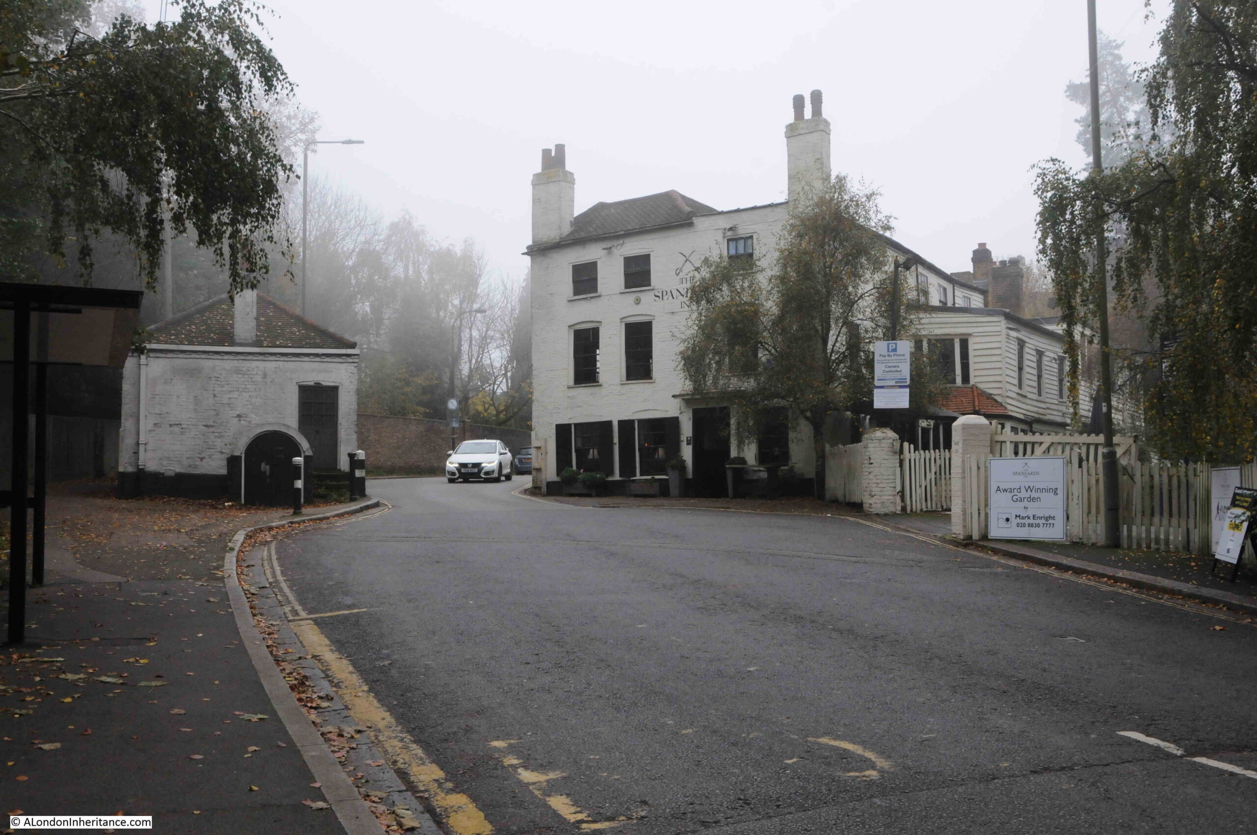
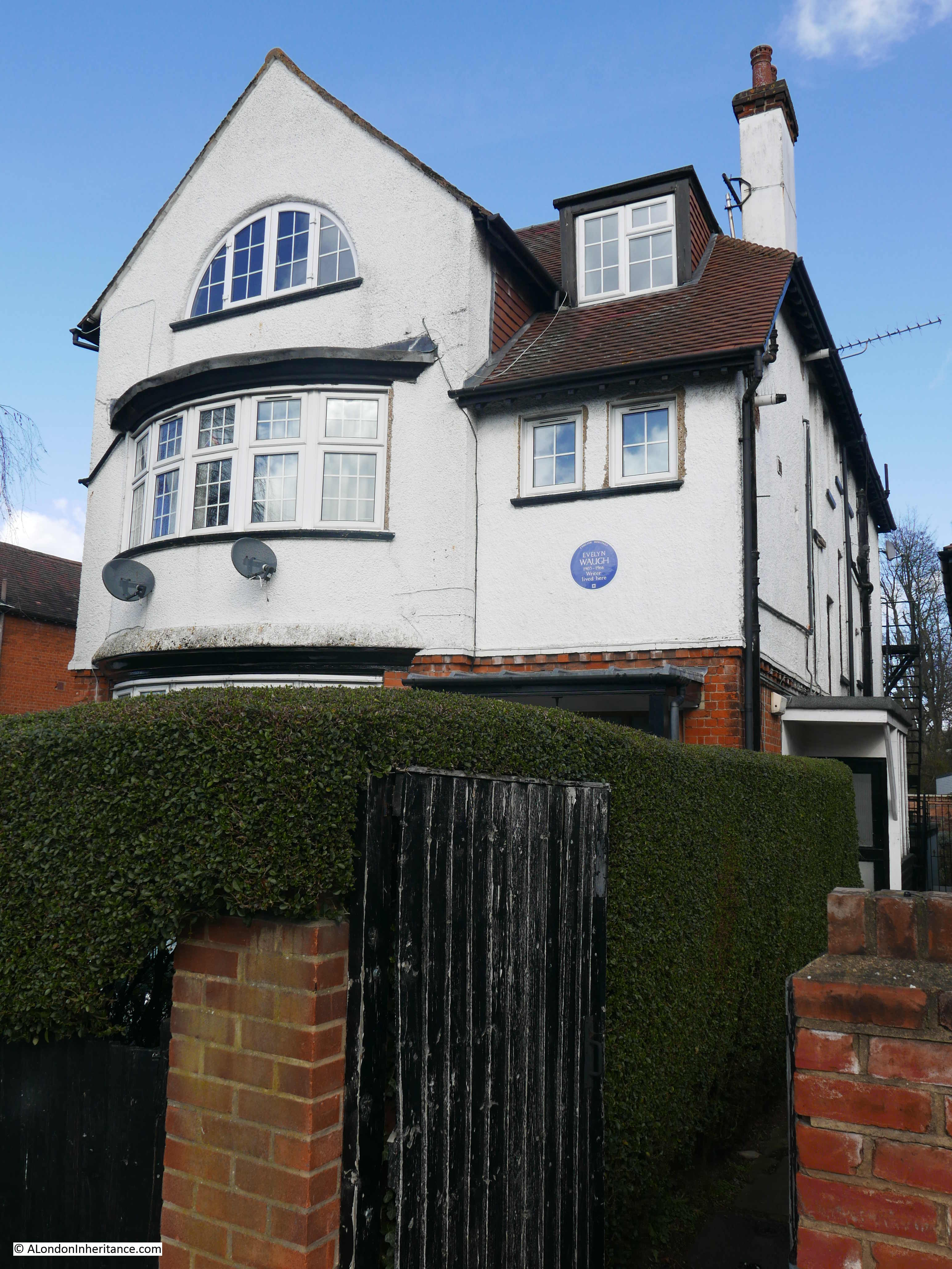
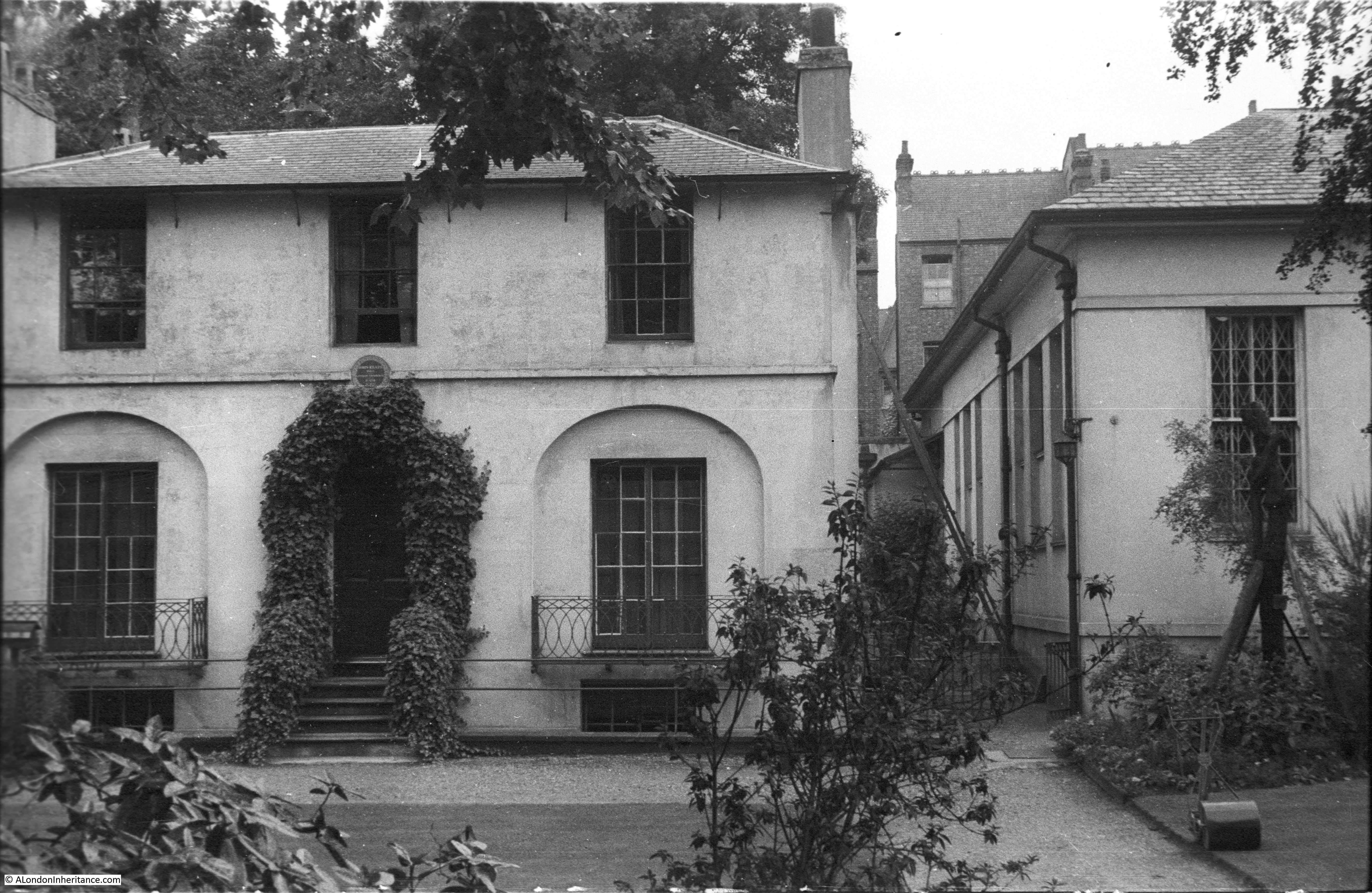
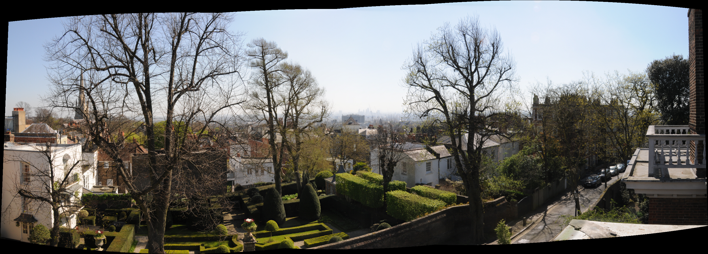
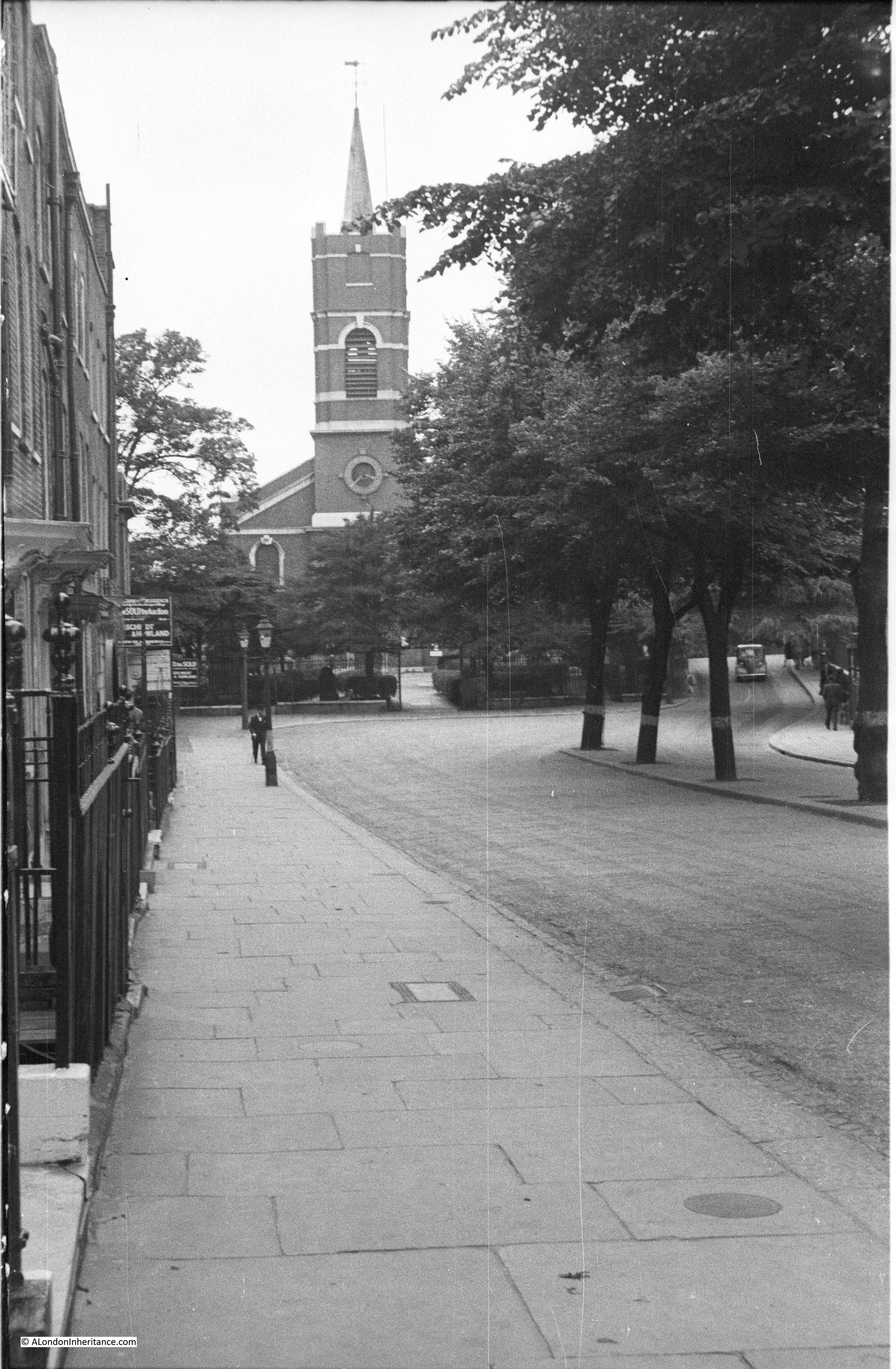
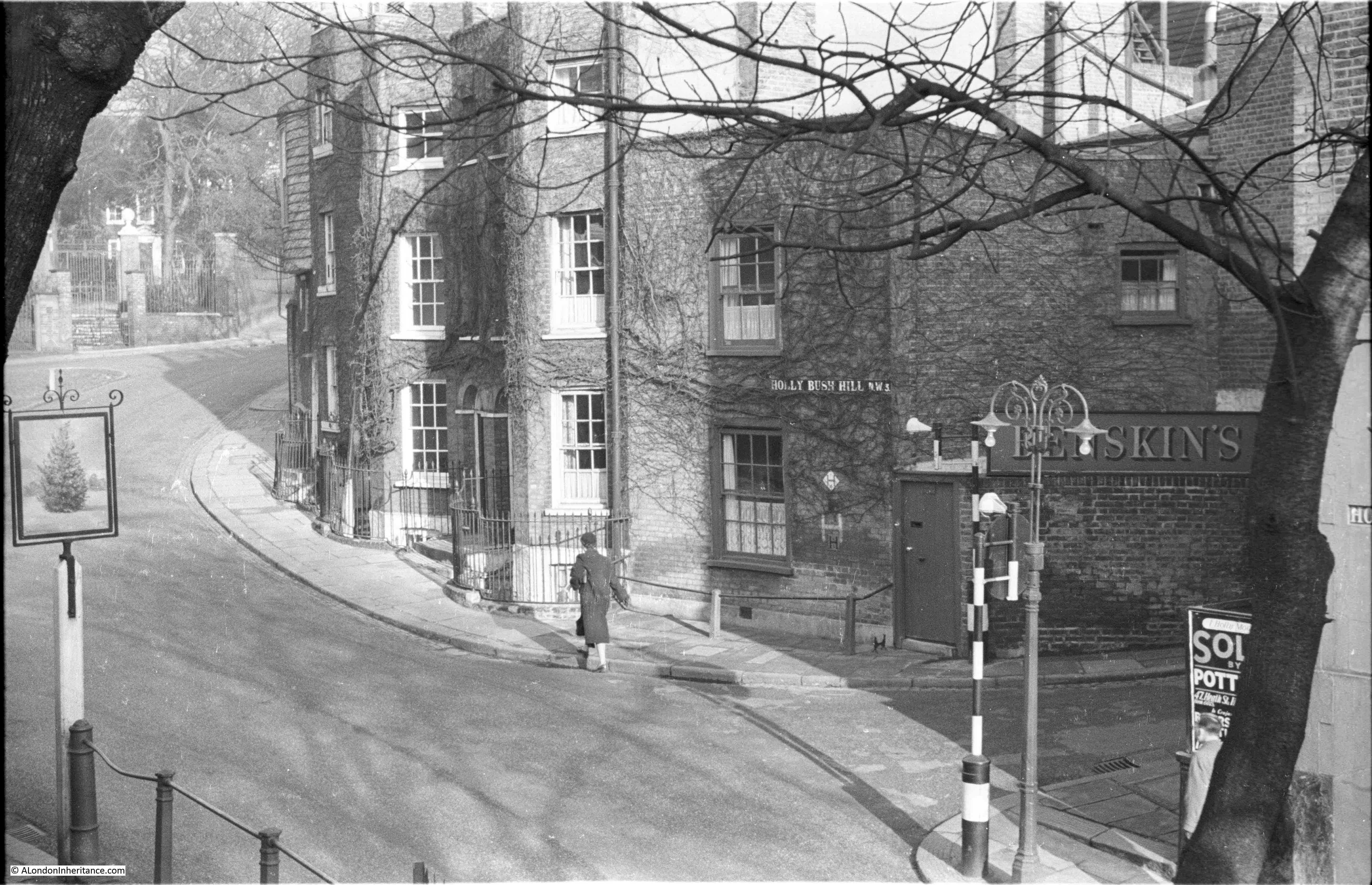
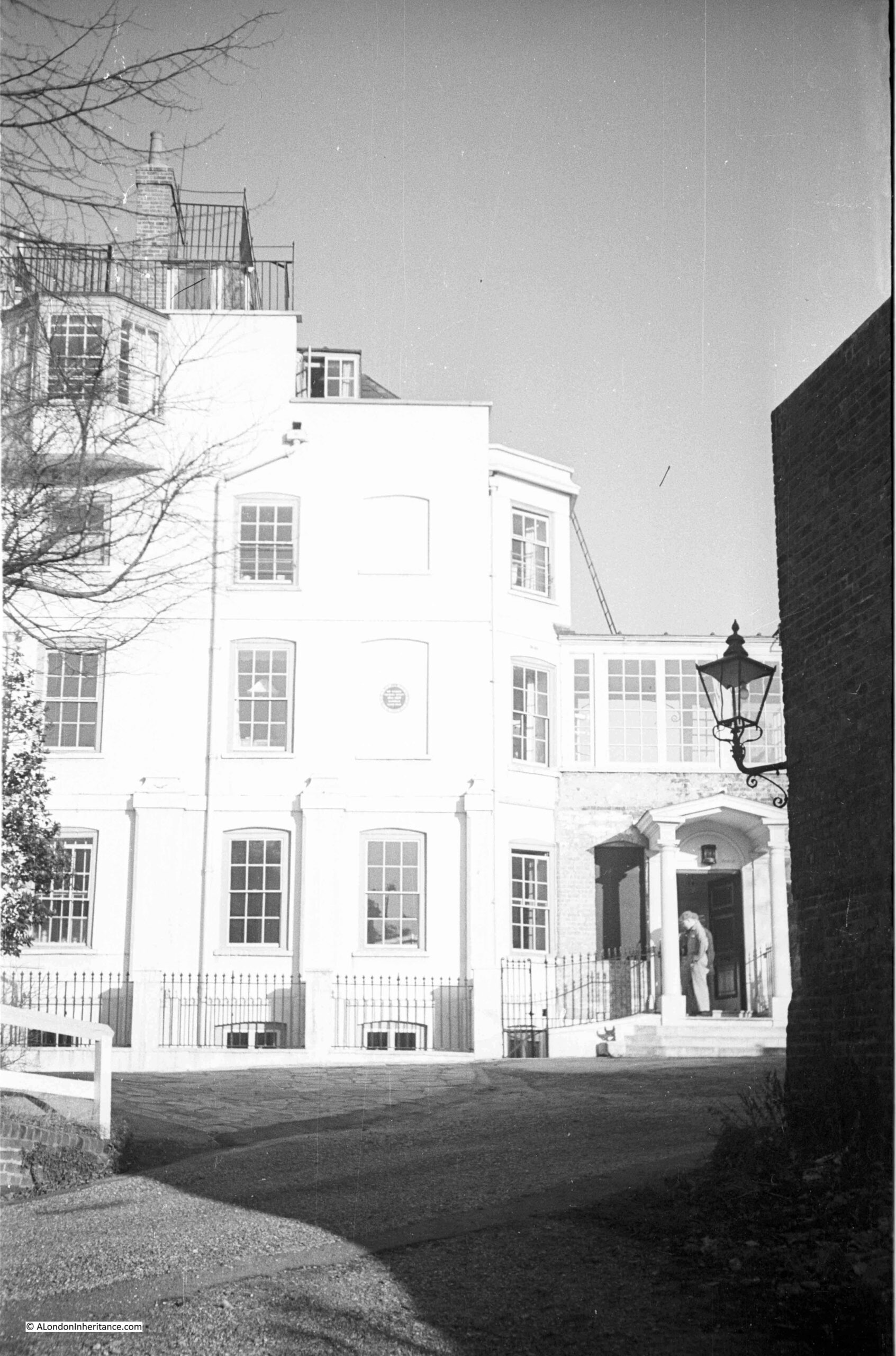
In last Sunday’s post, I complained about the lack of sunlight when I was taking photos of Peckham. The day that post was published was a glorious February day, bright sunlight and clear blue sky, so I took the opportunity for a walk around Hampstead, starting with Admiral’s House, the location of one of my father’s photos from 1951.

Admiral's House

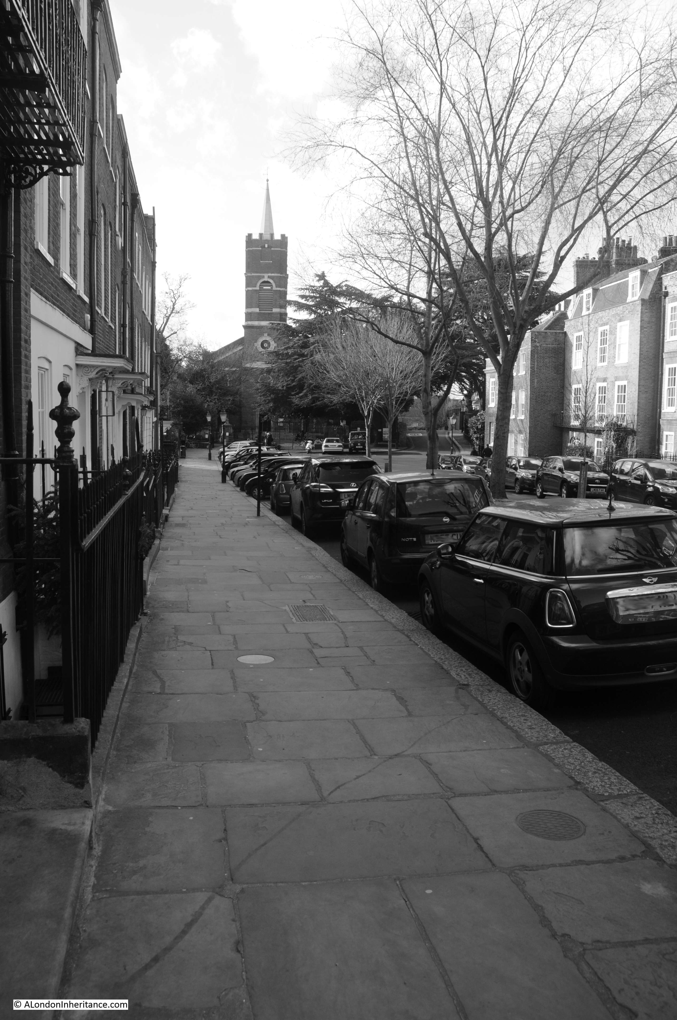
The same view in February 2023:

Admiral's House

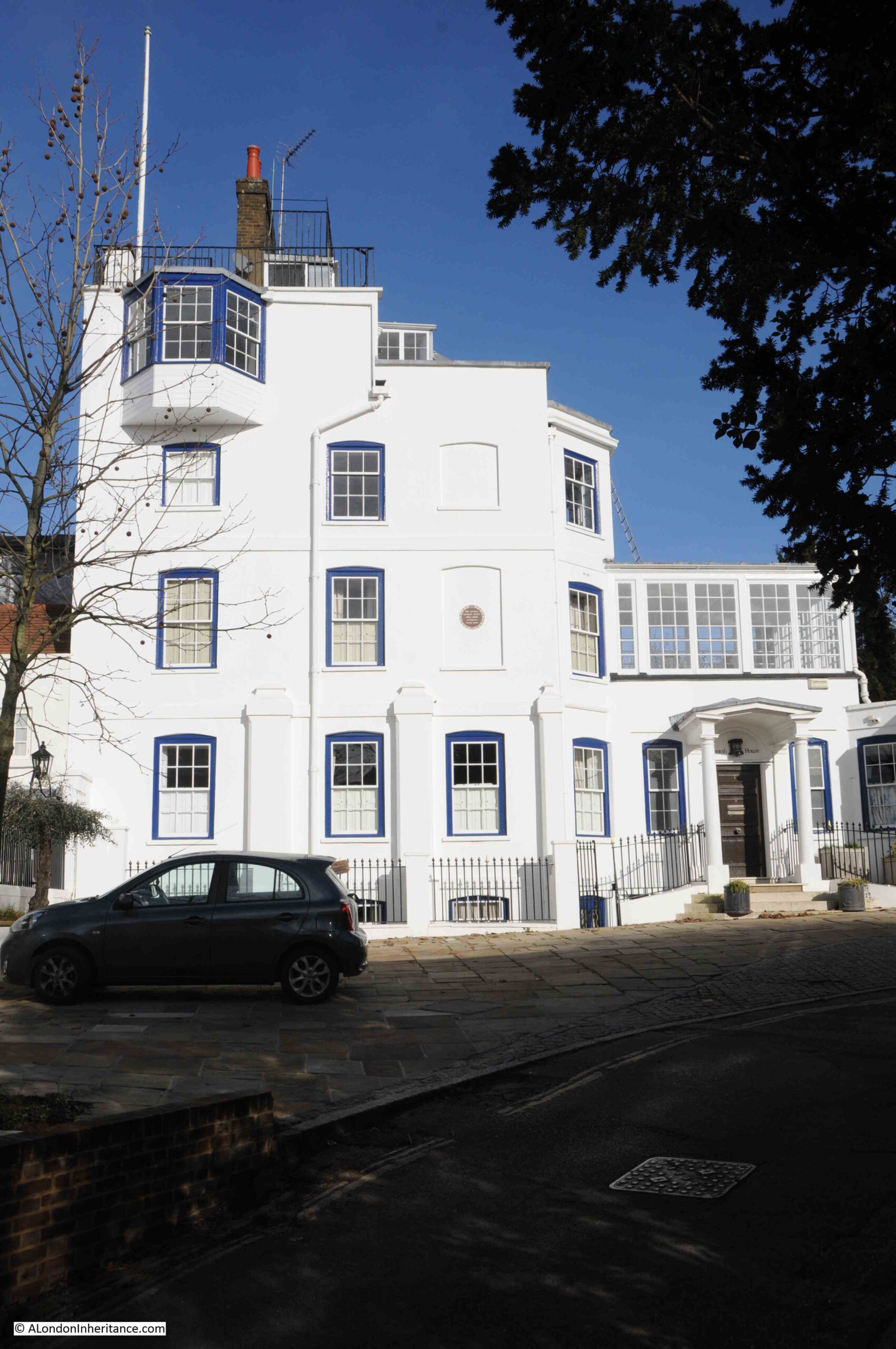
The view of Admiral’s House is much the same, however if you look to the right of my father’s photo, there is a brick wall and a rather nice lamp. These are not visible in my photo.

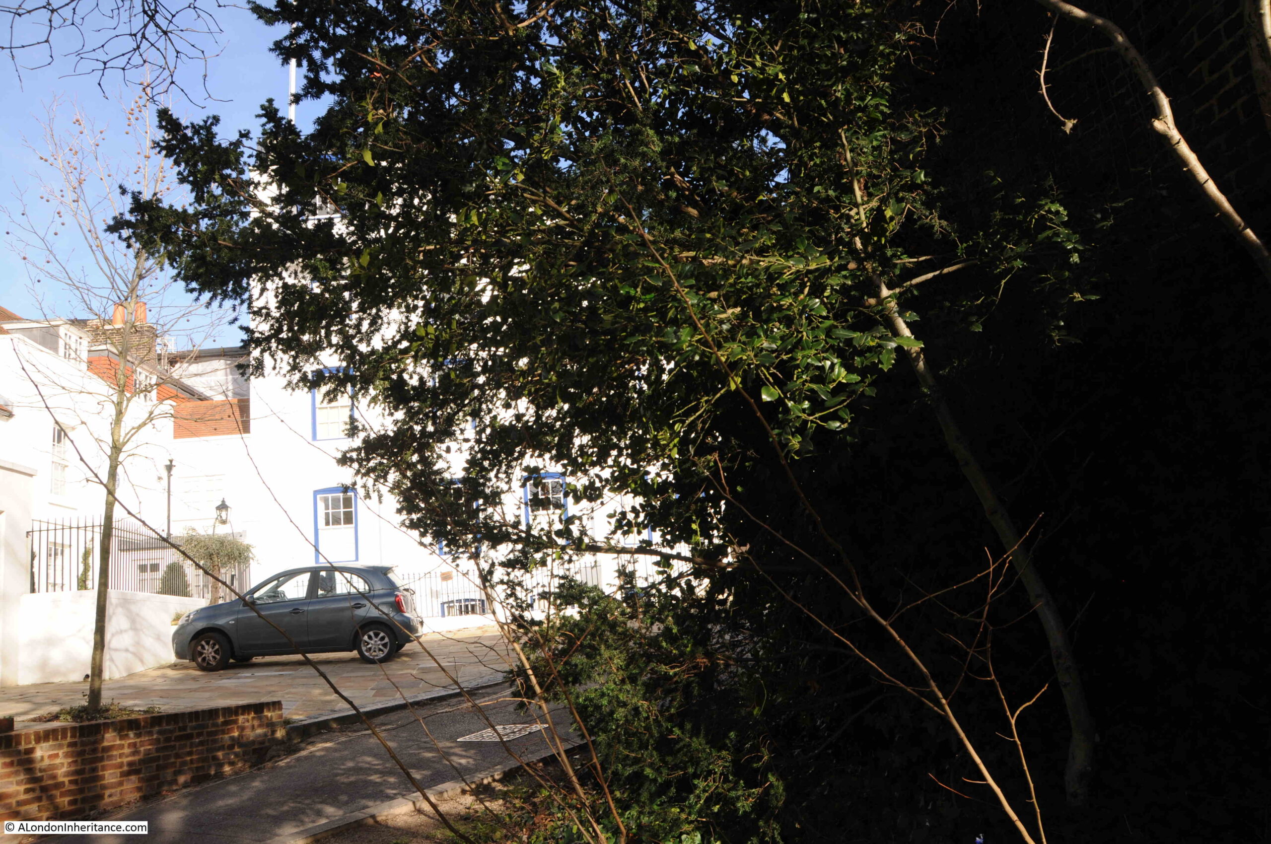
The reason being that both photos were taken a few feet along a walkway that follows the brick wall on the right. In the 72 years between the two photos, a large amount of small trees and bushes have grown up alongside the wall, so I could not get into the exact same position as my father when he took the 1951 photo:

Admiral's House

The lamp on the end of the wall is still there, it looks the same design, so I assume it is the same lamp, however there are some shiny washers and bolts now holding the mount to the wall, so these have been replaced:

Admiral's House

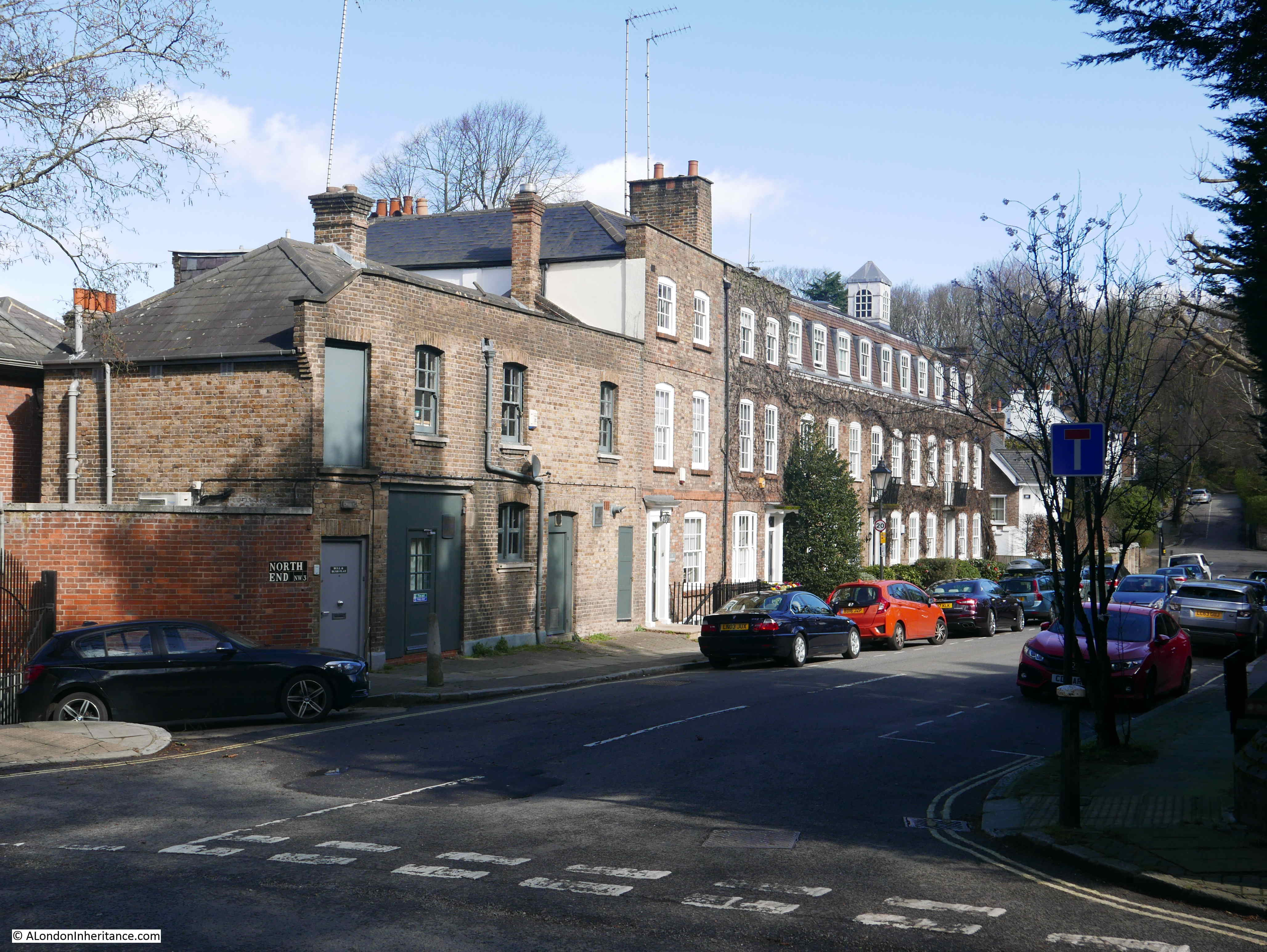
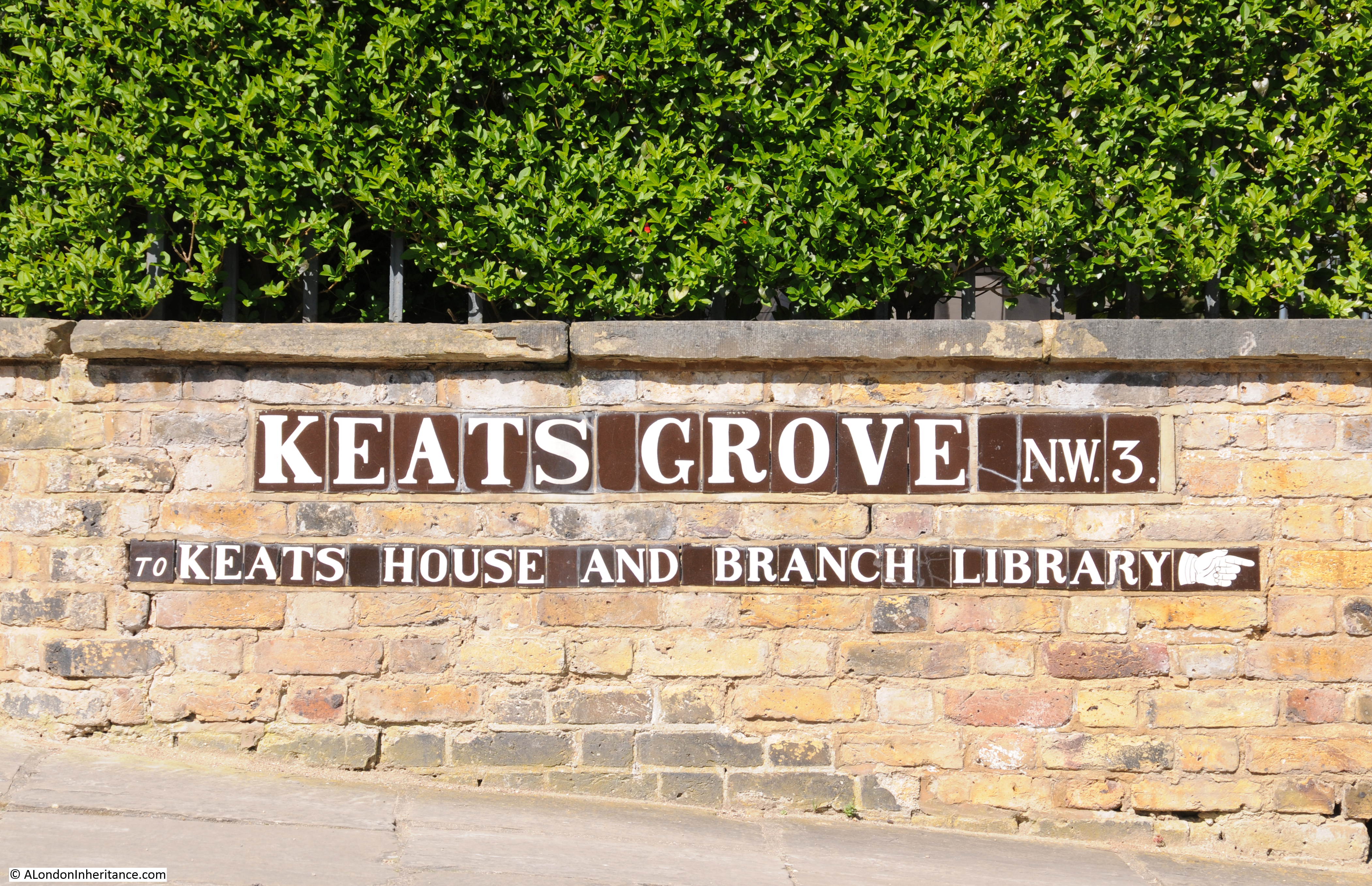
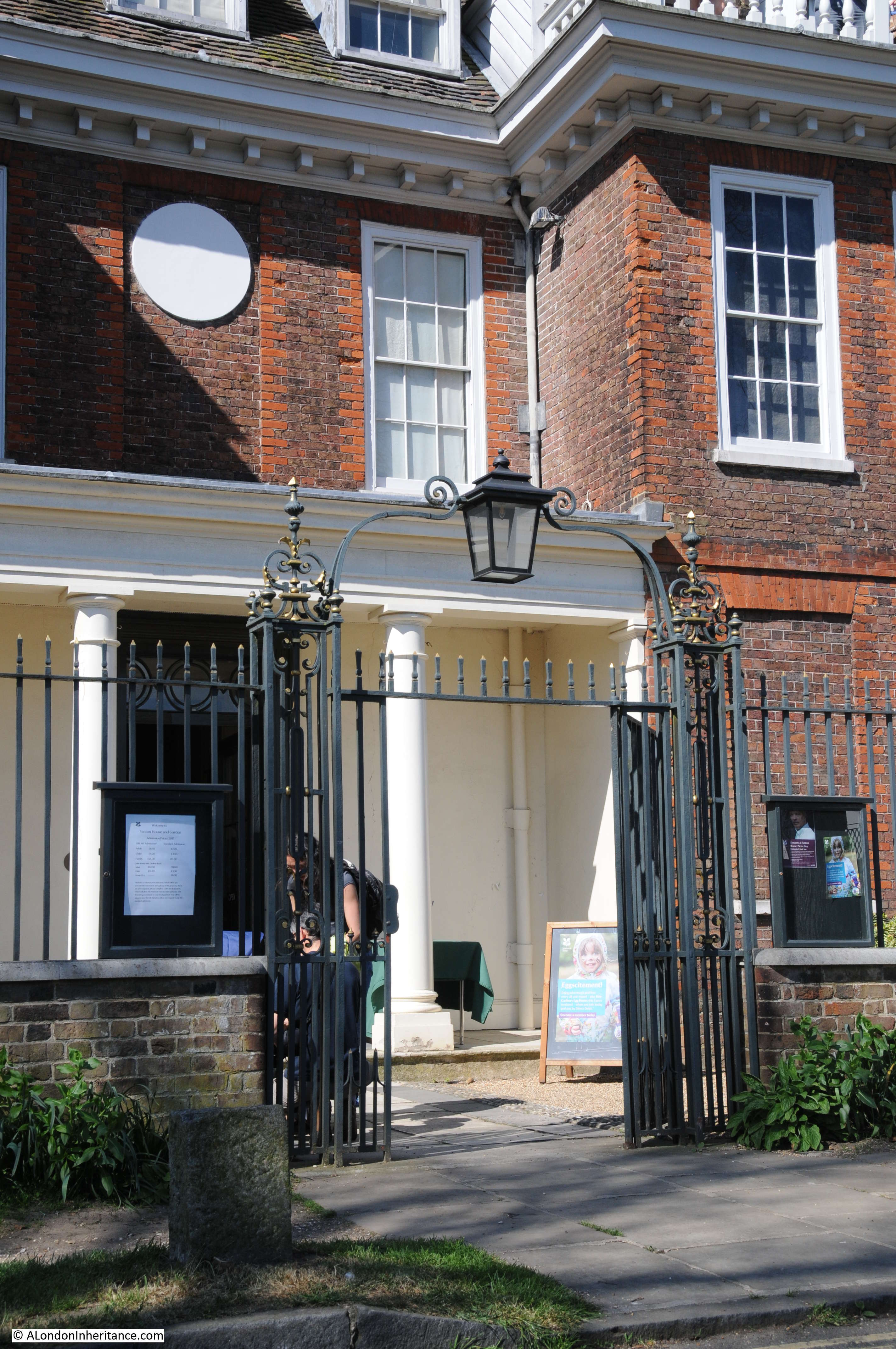
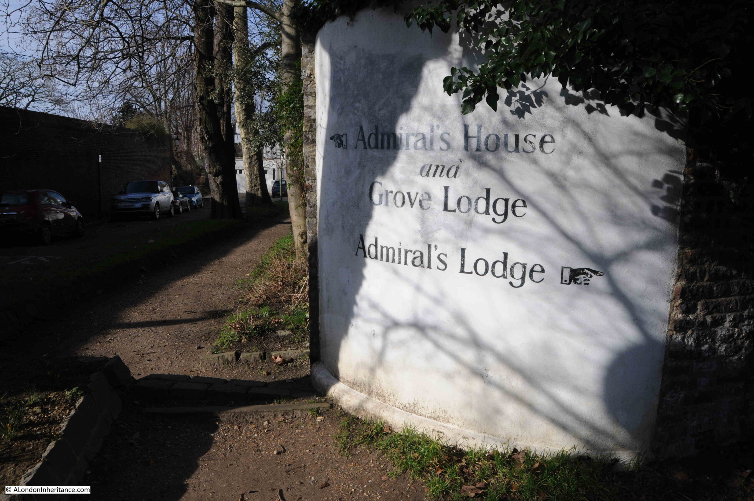
Admiral’s House is a short walk from Hampstead Underground Station. North along Hampstead Grove, then turn left into Admiral’s Walk, where there is a large sign on the corner, helpfully pointing to Admiral’s House:

Admiral's House

The house appears to date from the early 18th century, when it was built for a Mr. Charles Keys. At that time, the building was known as the Golden Spike, after the Masonic Lodge that met in the building between 1730 and 1745.

Admiral’s House can be seen in Rocque’s 1746 map, shown circled in red in the following extract, where, for reference, I have also circled Fenton House in blue, with the distinctive squared shape of its garden between Fenton and Admiral’s Houses.

Admiral's House

From 1775 to 1810 the house was occupied by Fountain North, apparently a former naval captain. North changed the name of the house to ‘The Grove’.

Fountain North is a rather unusual name, and I did find some basic information about him. He died on the 21st of Spetember, 1810 in Hastings. The brief line recording his death in newspapers at the time states that he was of Rougham Hall in Norfolk. There is no mention of Hampstead. I could only connect this record with the Fountain North who lived in Hampstead, when I found the report of the death of his wife, Arabella North, who died in Weymouth in 1832, and the record states that she was “the widow of Fountain North, of Rougham Norfolk, and Hampstead, Middlesex”.

It was Fountain North who constructed the quarter deck on the roof of the house, and it was from here that he apparently fired a cannon to celebrate naval victories, however I cannot find any references to this from the time, so difficult to say whether or not it is true.

This is where there has been confusion with an Admiral Barton, a genuine Admiral who lived between 1715 and 1795, who has been alleged to have built Admiral’s House, but in reality had nothing to do with the house in Hampstead.

Even publications such at the Tatler recorded Admiral Barton as being responsible for the house, for example, in an article on the 14th July, 1940 on Pamela Lady Glenconner, who was then living in the house with her family, the Tatler reported that “Admiral’s House was built in the eighteenth century by Admiral Barton who, after an adventurous career which included shipwreck on the Barbary Coast, being sold into slavery, rescue and court martial, ended his days firing guns to celebrate victories in the Napoleonic wars”.

Barton did have an adventurous career, but he did not live in Admiral’s House.

Admiral’s House is Grade II listed, and I have used the Historic England history of the house in the listing record as hopefully the most accurate record for the history of the house.

Admiral Barton certainly did not build the house, and whether cannons were ever fired from the roof must be questionable.

Pamela Lyndon Travers (born Helen Lyndon Goff in Queensland, Australia on the 9th of August, 1899) was the author of Mary Poppins which features Admiral Boom, who fired a cannon from his roof. Travers was working on Mary Poppins during the 1920s (it was published in 1934).

Admiral’s House is referenced as Travers inspiration for Admiral Boom’s house. There is no record that she ever lived in Hampstead, or whether she saw the house when she was writing Mary Poppins, however as shown with the Tatler article in 1940, the story of the Admiral and cannon was in circulation in the early decades of the 20th century.

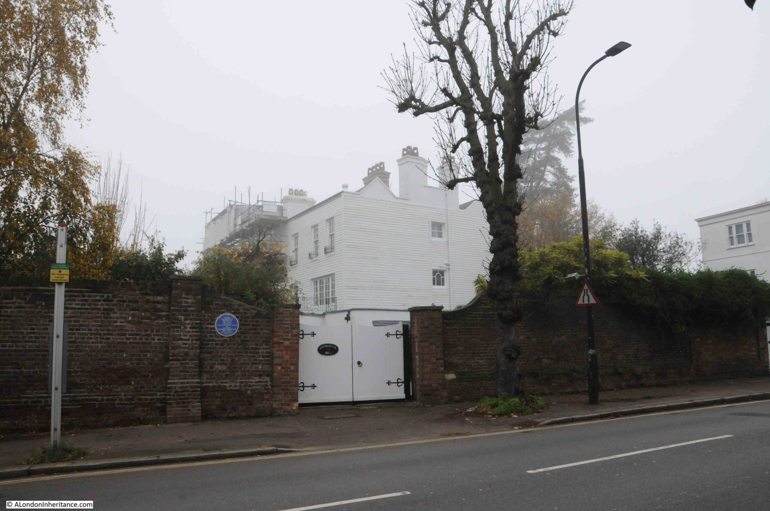
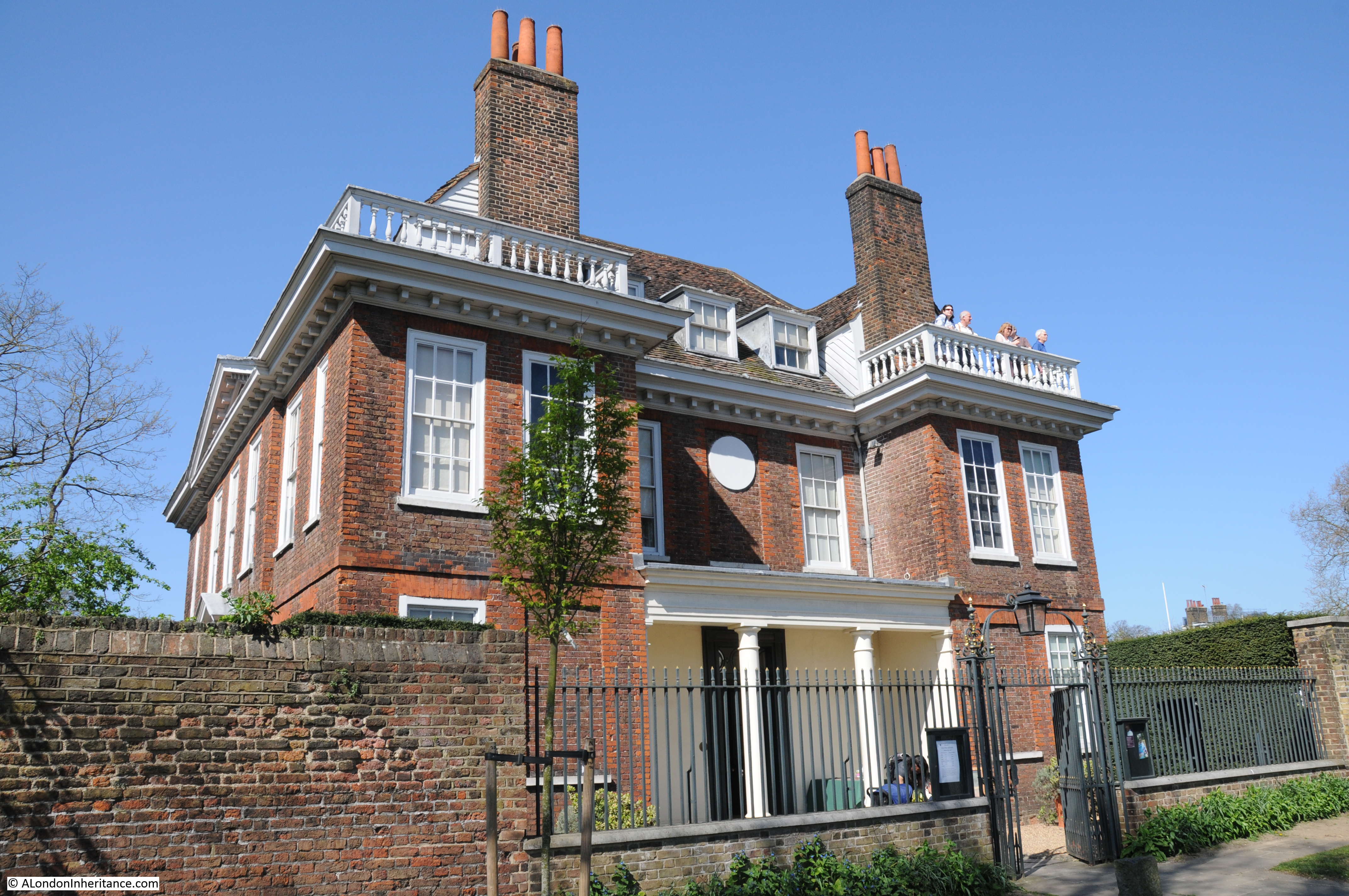
Admiral’s House as seen whilst walking along Admiral’s Walk:

Admiral's House

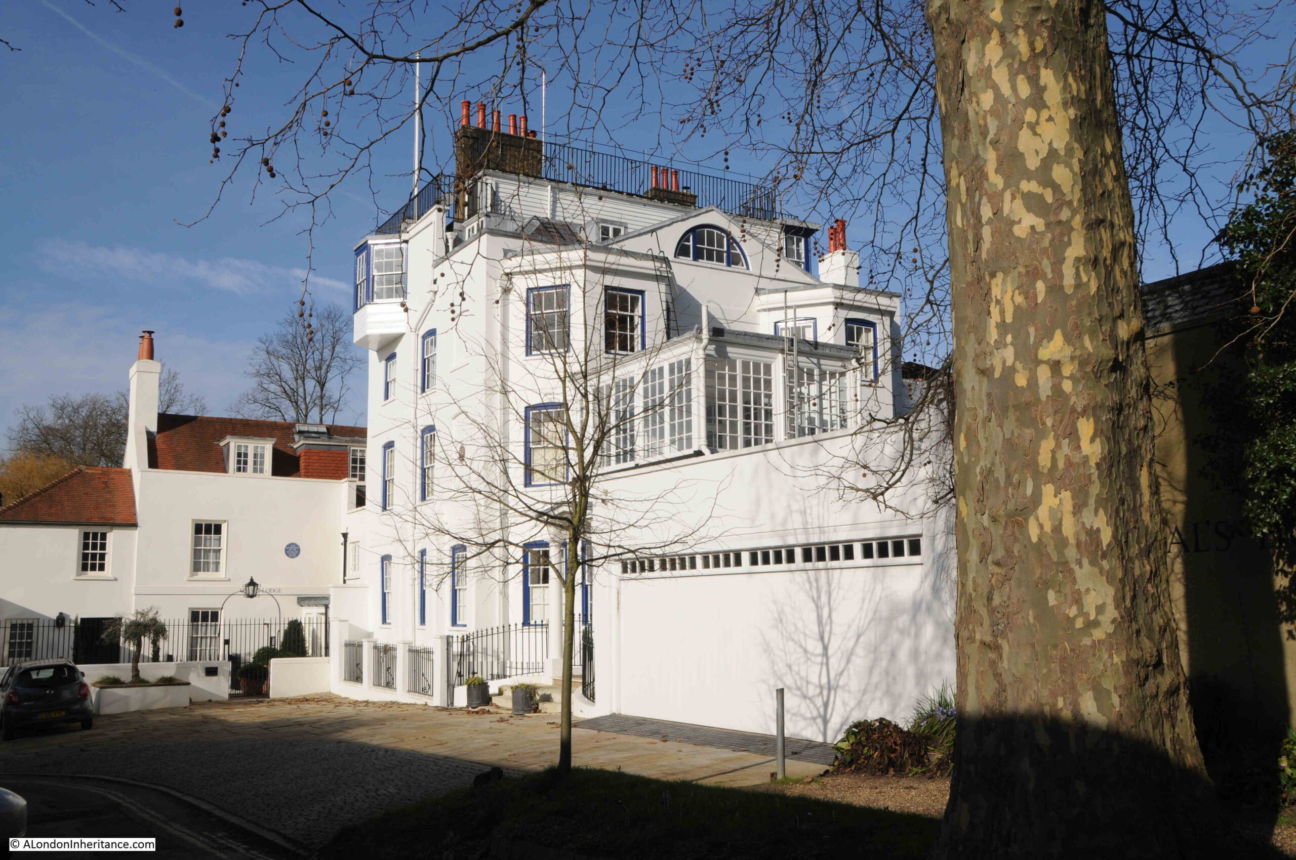
Admiral’s House has been modified many times over the years. The entrance from Admiral’s Walk, along with the conservatory on the first floor which can be seen in the above photo, were both 19th century additions.

The large garage which can be seen to the right of the house is a recent replacement of an earlier structure, and the house has also had a kitchen extension and underground swimming pool added.

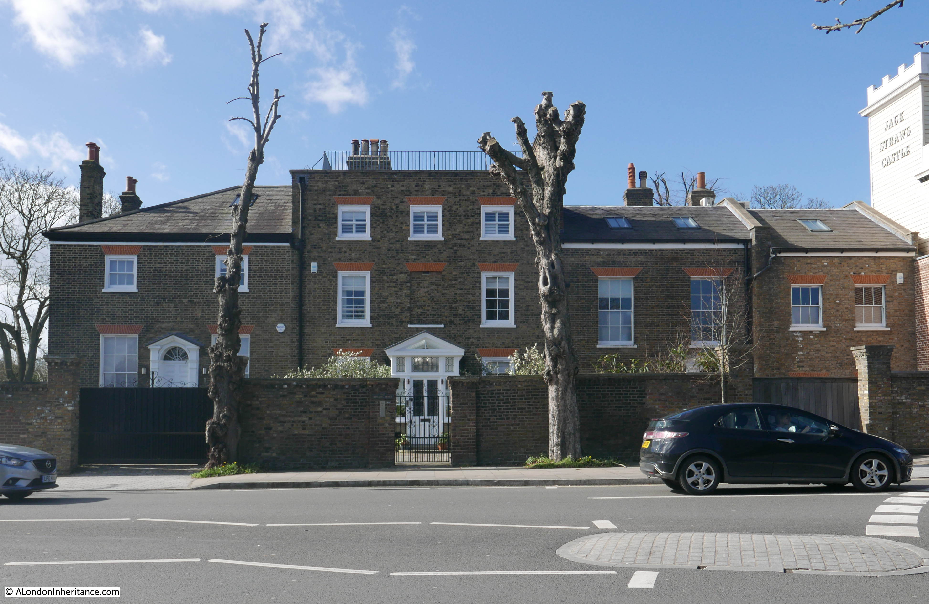
To the side of Admiral’s House is another building, Grove Lodge. It is not clear what the original relationship was between the two buildings, and whether there was any dependency, however they do appear to have been in separate ownership for most of their existence.

Recent building work on Grove Lodge made the national newspapers, when construction of a basement at Grove Lodge, allegedly caused damage to Admiral’s House, as reported in the Daily Mail.

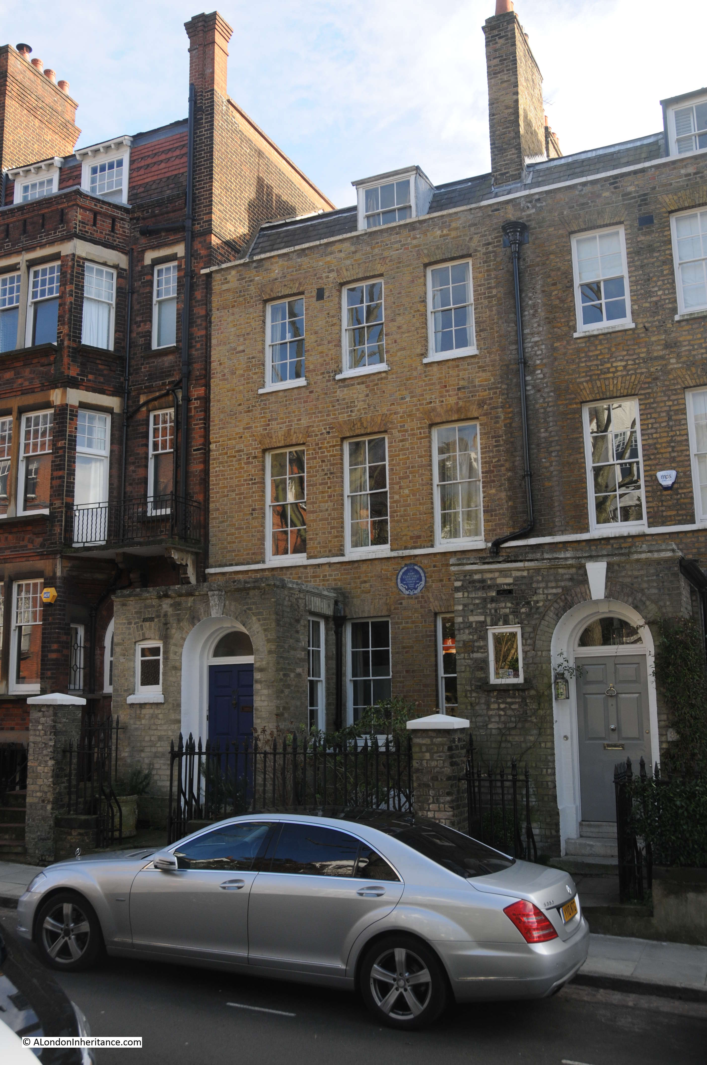
If you look at the following photo, there is a brown plaque on Admiral’s House, and a blue plaque on Grove Lodge:

Admiral's House

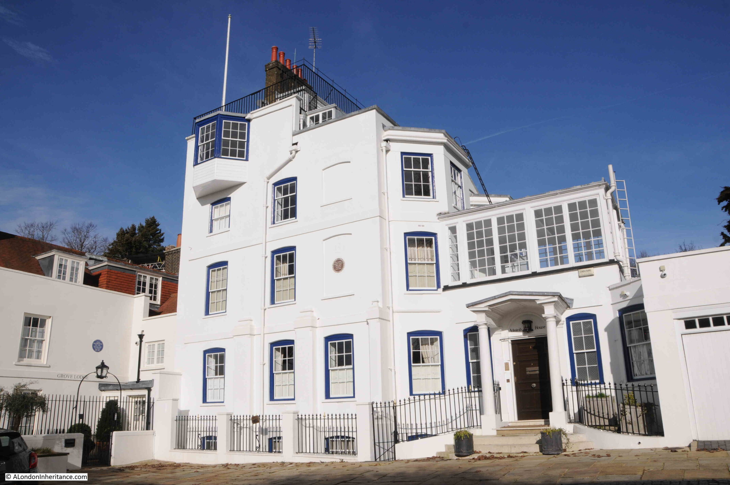
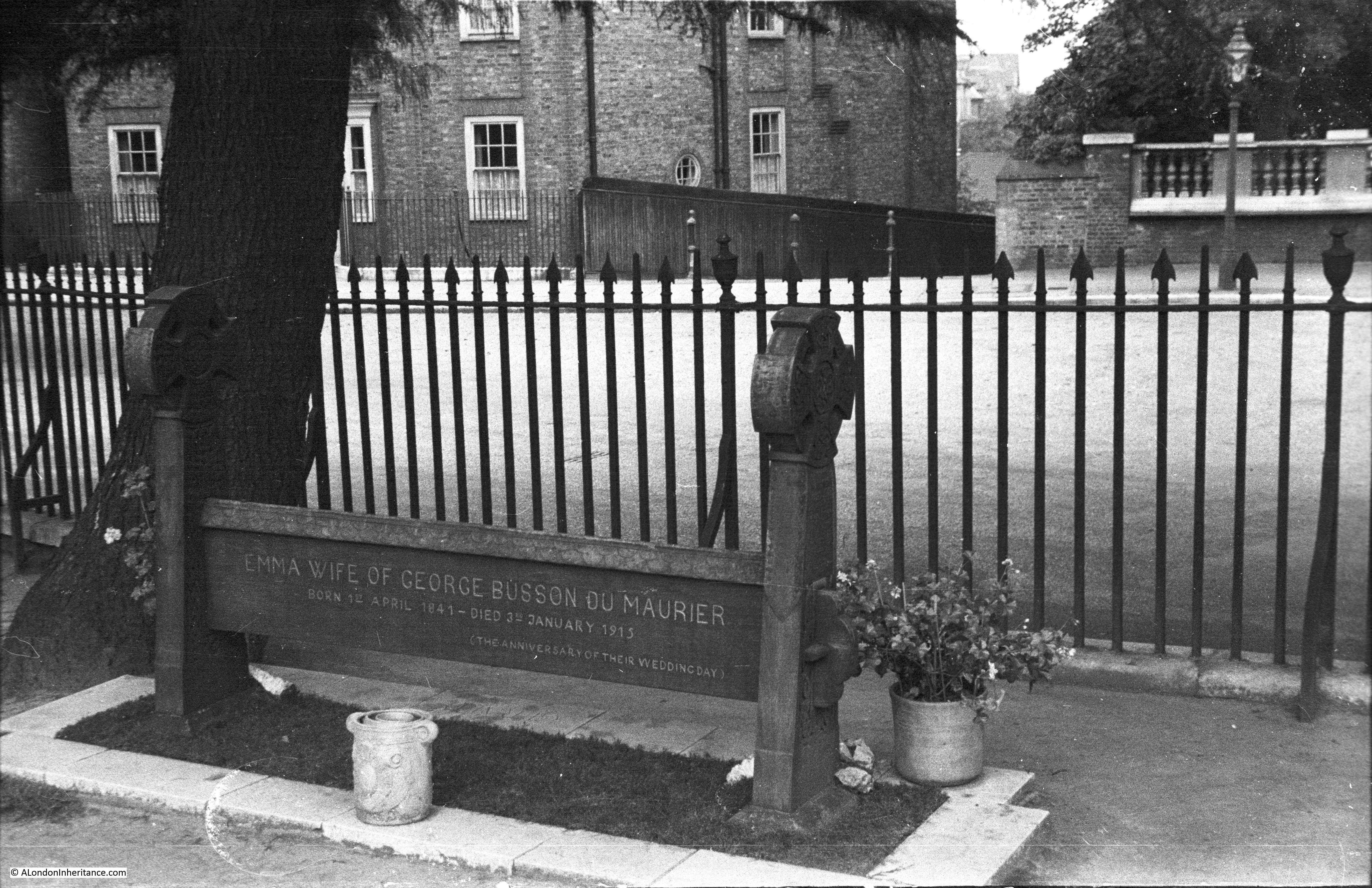
The brown plaque on Admiral’s House was also in my father’s 1951 photo, and is a London County Council plaque, recording that the architect, Sir George Gilbert Scott lived in the house.

He was the architect for the Midland Grand Hotel at St. Pancras Station, the Albert memorial, and the Foreign and Commonwealth Office, as well as large number of other public buildings, restorations of churches and cathedrals, and domestic houses.

Prior to Hampstead, he was living in St. John’s Wood, however the continued expansion of London resulted in a move in 1856 to Admiral’s House. He would not stay there for too long, as his wife Caroline found the place rather cold and the location isolated which restricted their social life (Hampstead Underground Station would open years later in 1907).

The blue plaque on Grove Lodge, to the left, is to record that the novelist and playwright John Galsworthy lived in the house between 1918 and 1933. Galsworthy’s best known work was the Forsyte Saga, and he was awarded the Nobel prize for literature in 1932.

The house in Hampstead was his London home, and it was here that Galsworthy died in 1933.

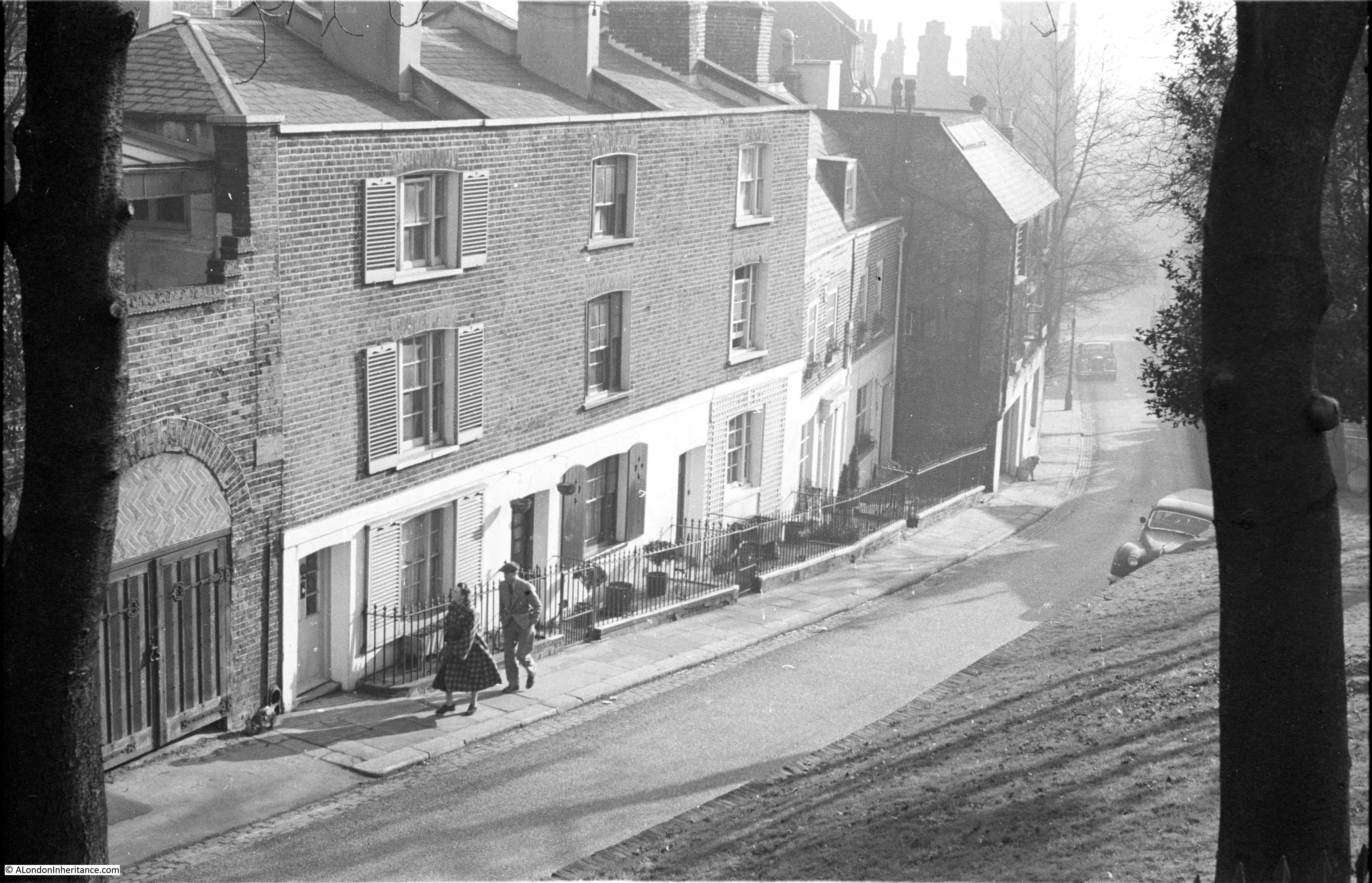
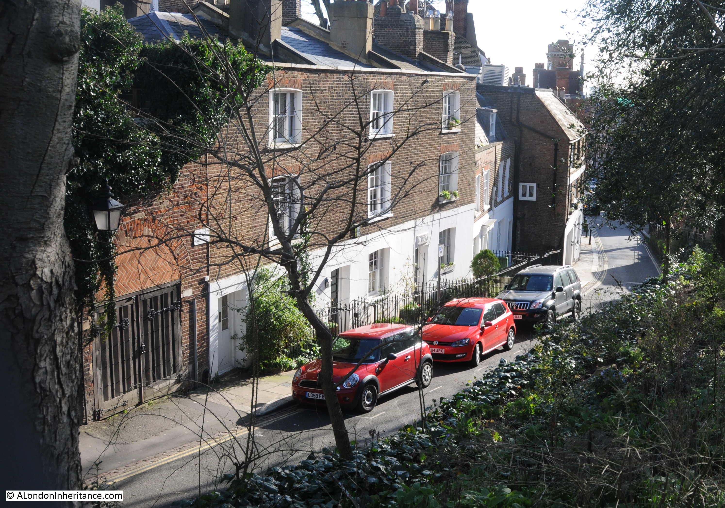
After a look at Admiral’s House, and ticking off another of my father’s photos, the weather was so good that we went for a wander around Hampstead.

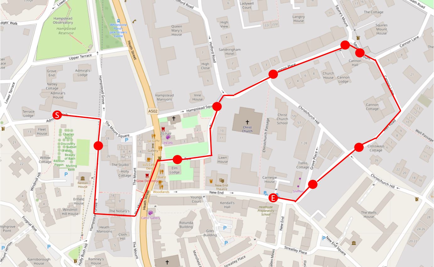
The following map shows the route covered in the rest of the post with red circles indicating a place I will write about. Admiral’s House is at the start of the route on the left of the map (Map © OpenStreetMap contributors):

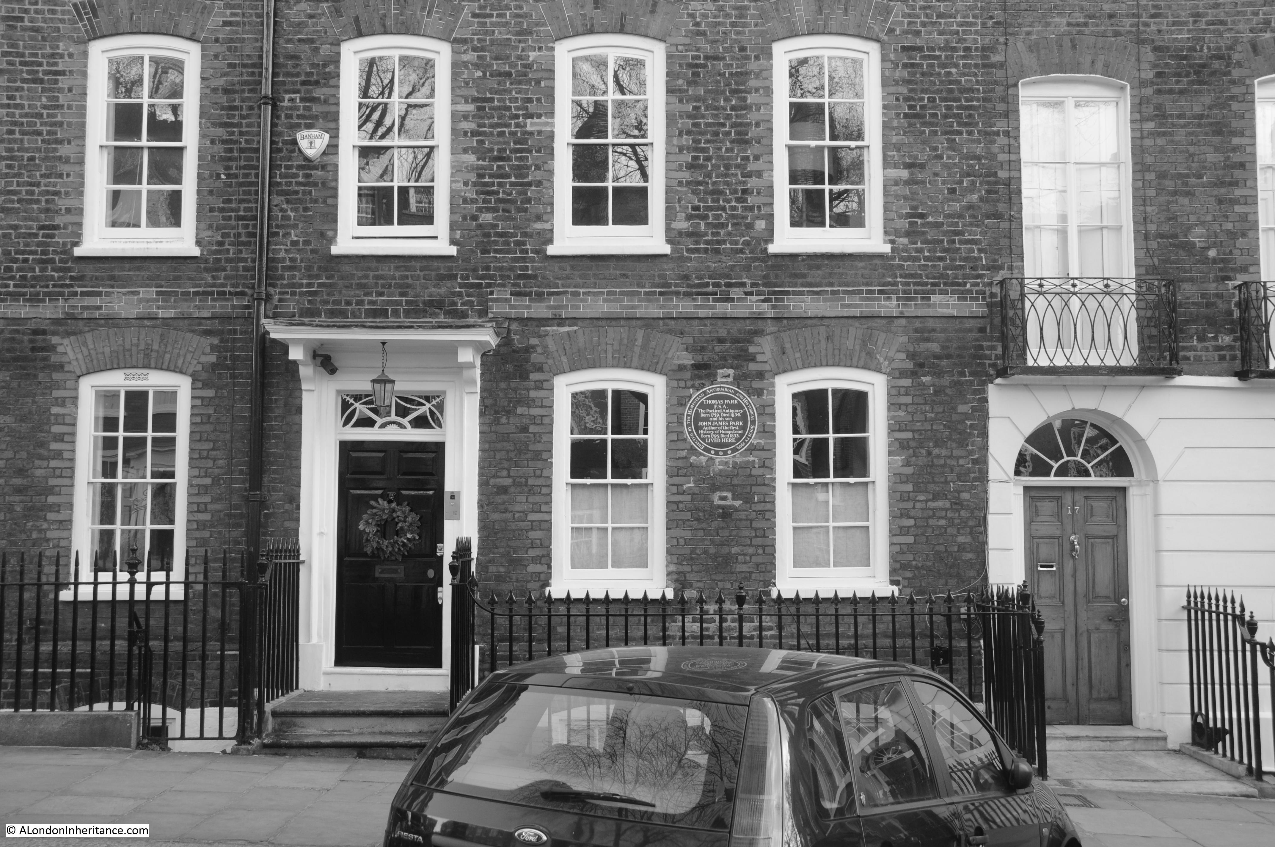
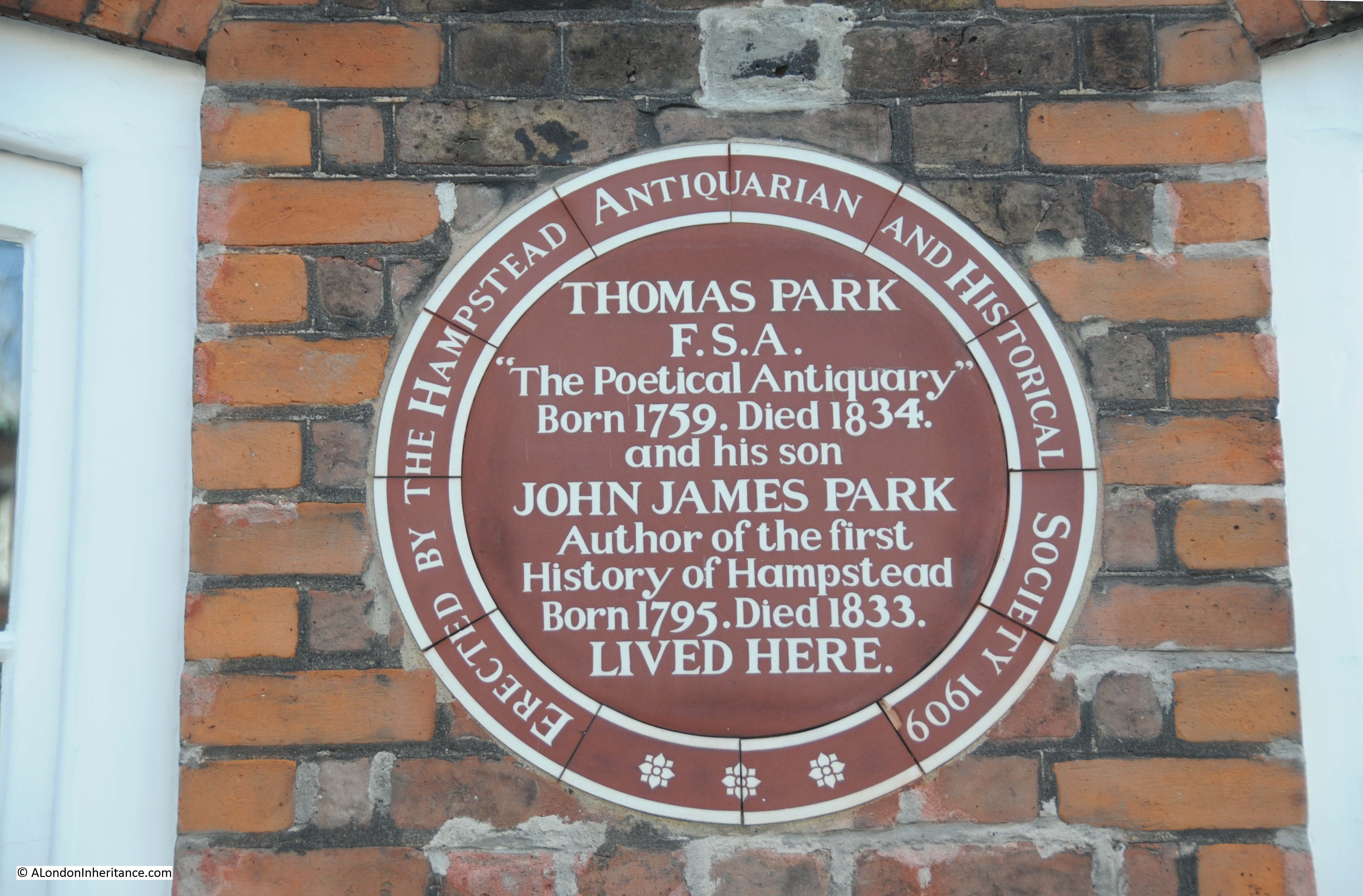
And from here, a short walk brings us to the following house in Hampstead Grove:

George du Maurier

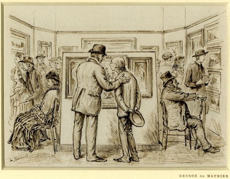
Which has a plaque recording that cartoonist and author George du Maurier lived in the house:

George du Maurier

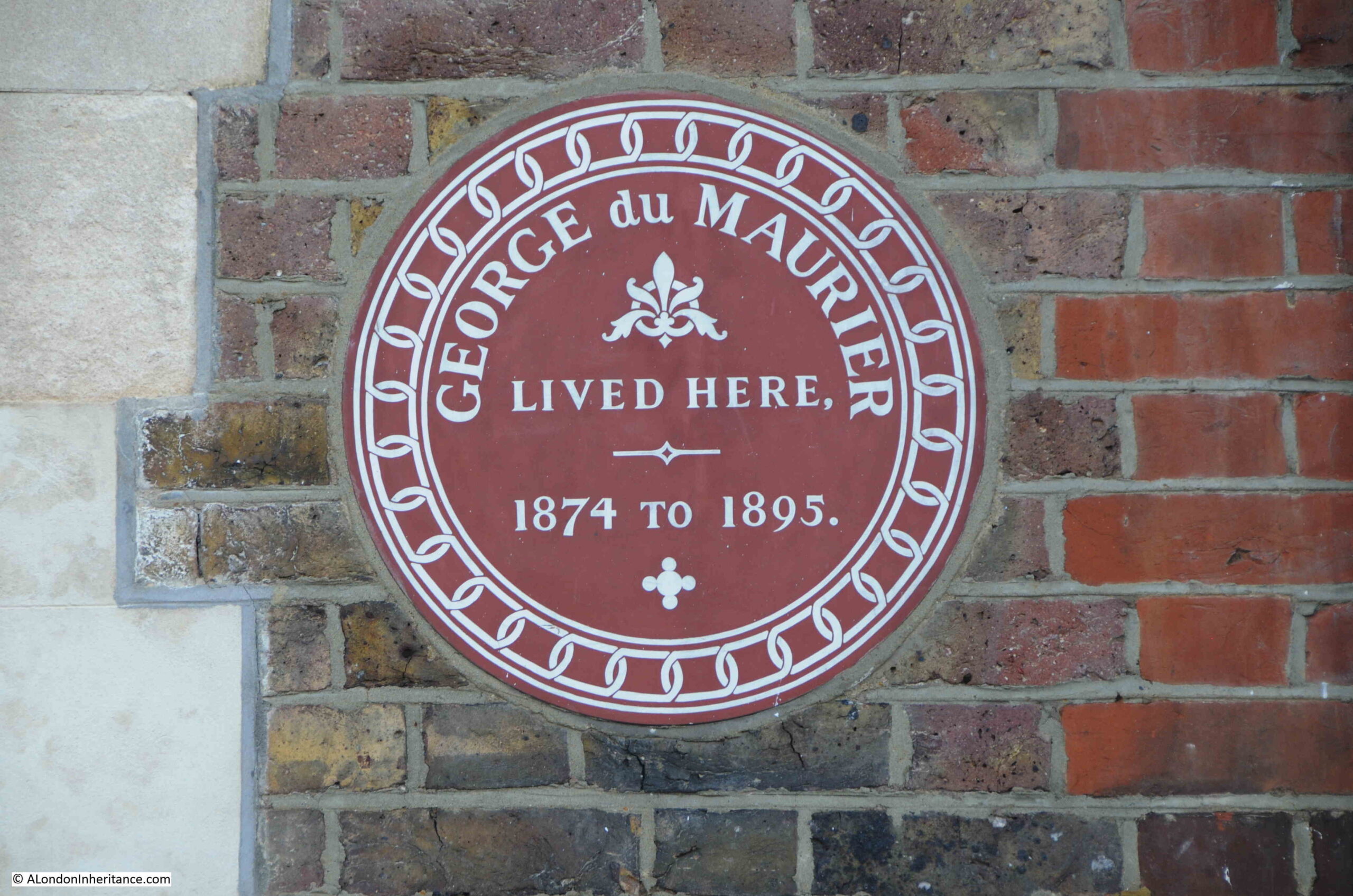
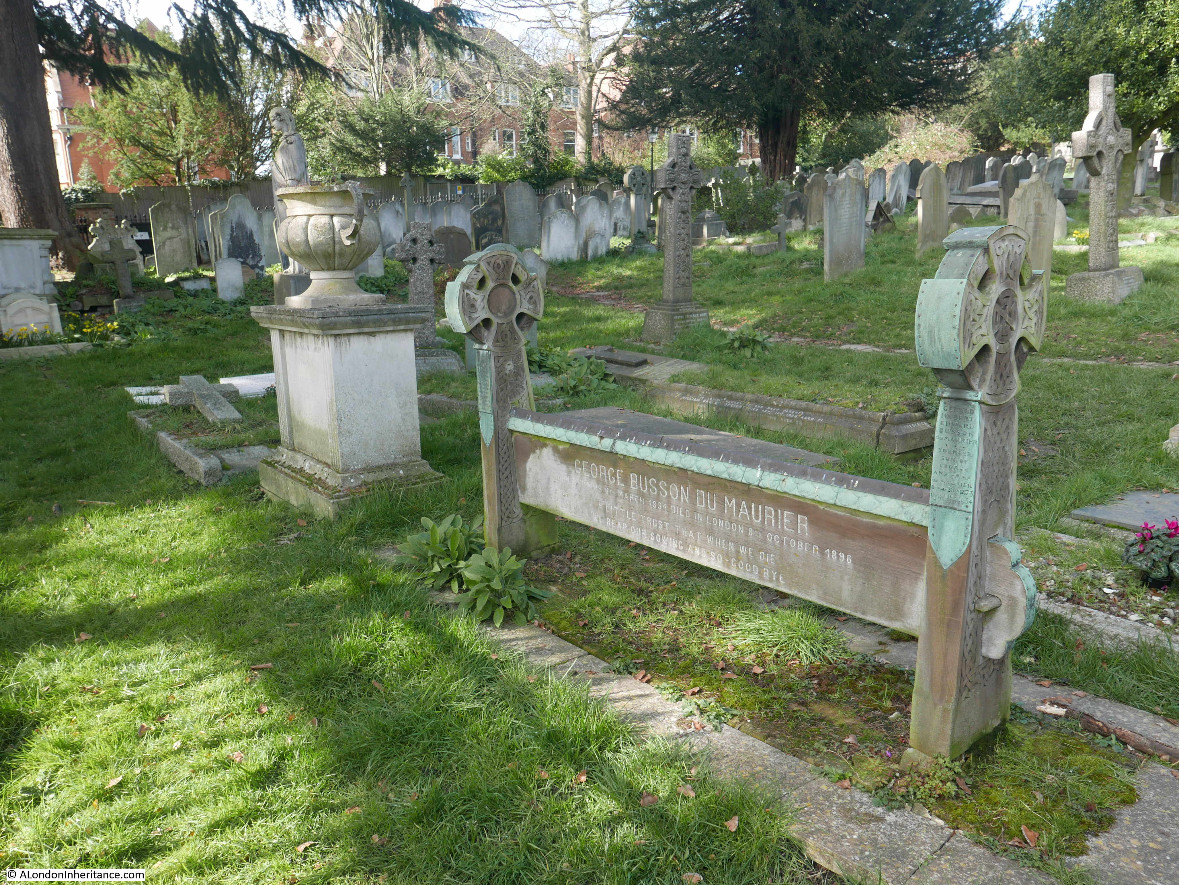
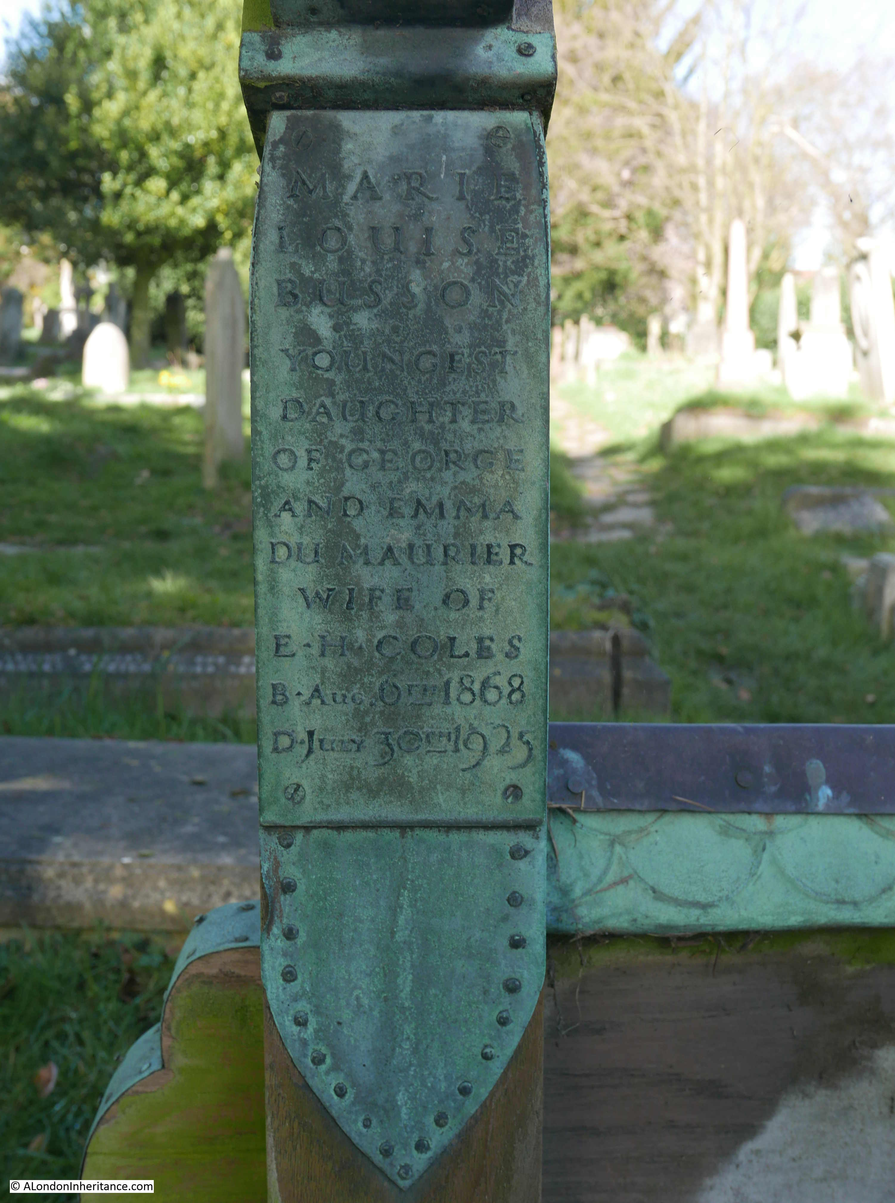
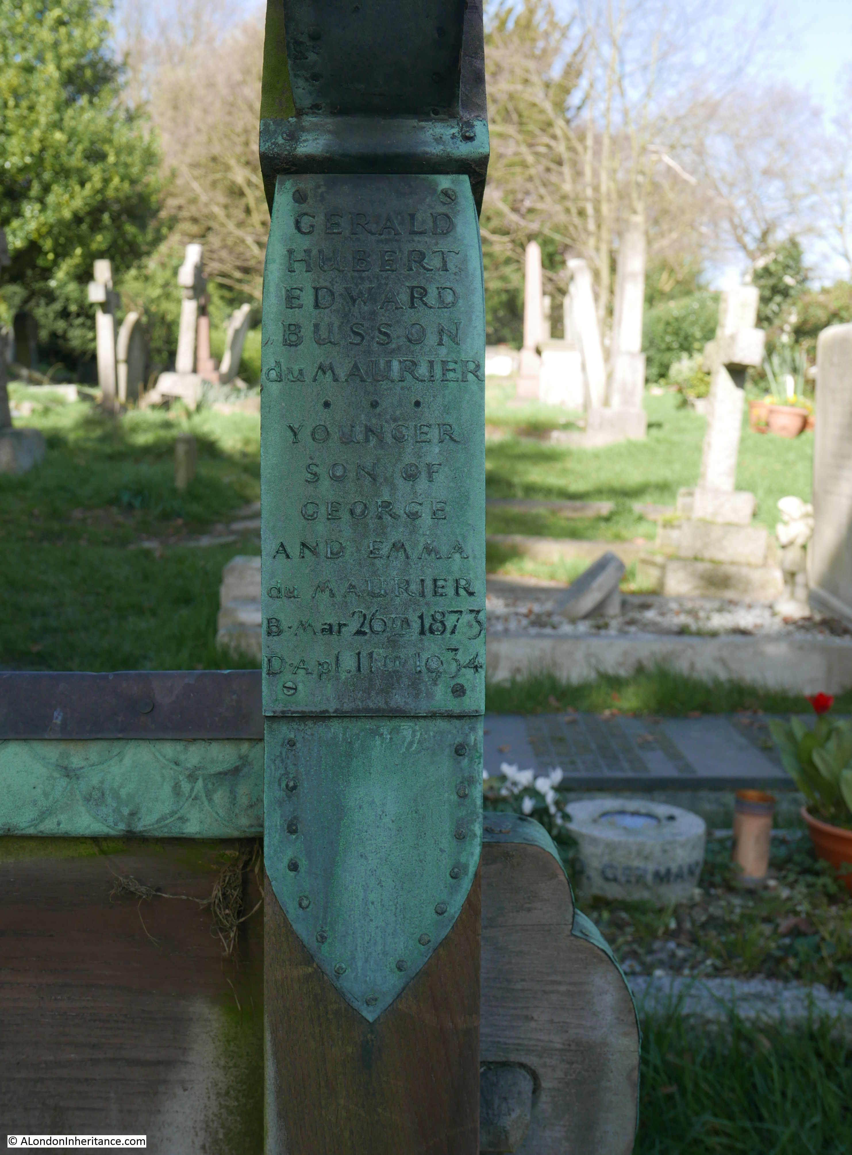
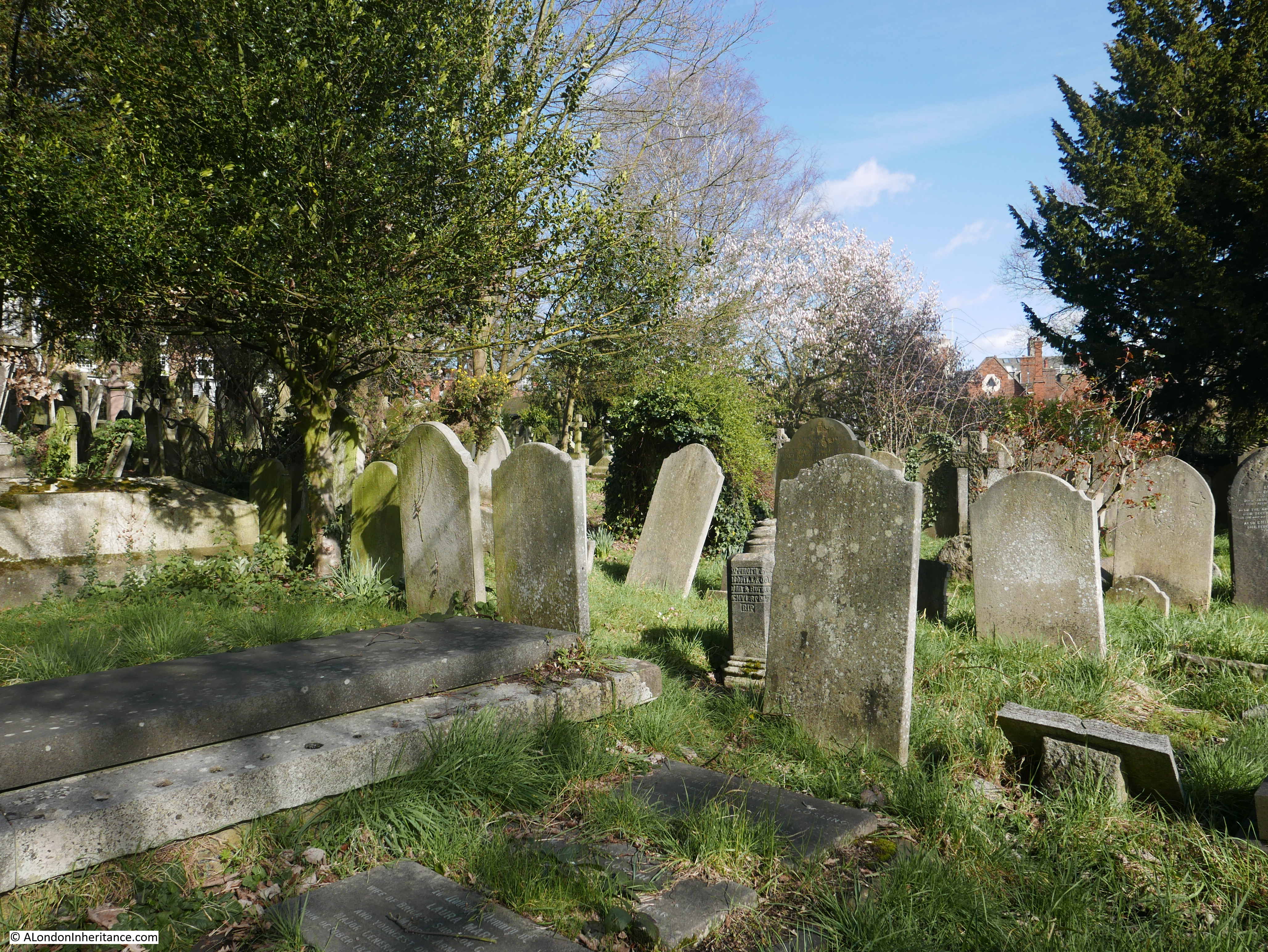
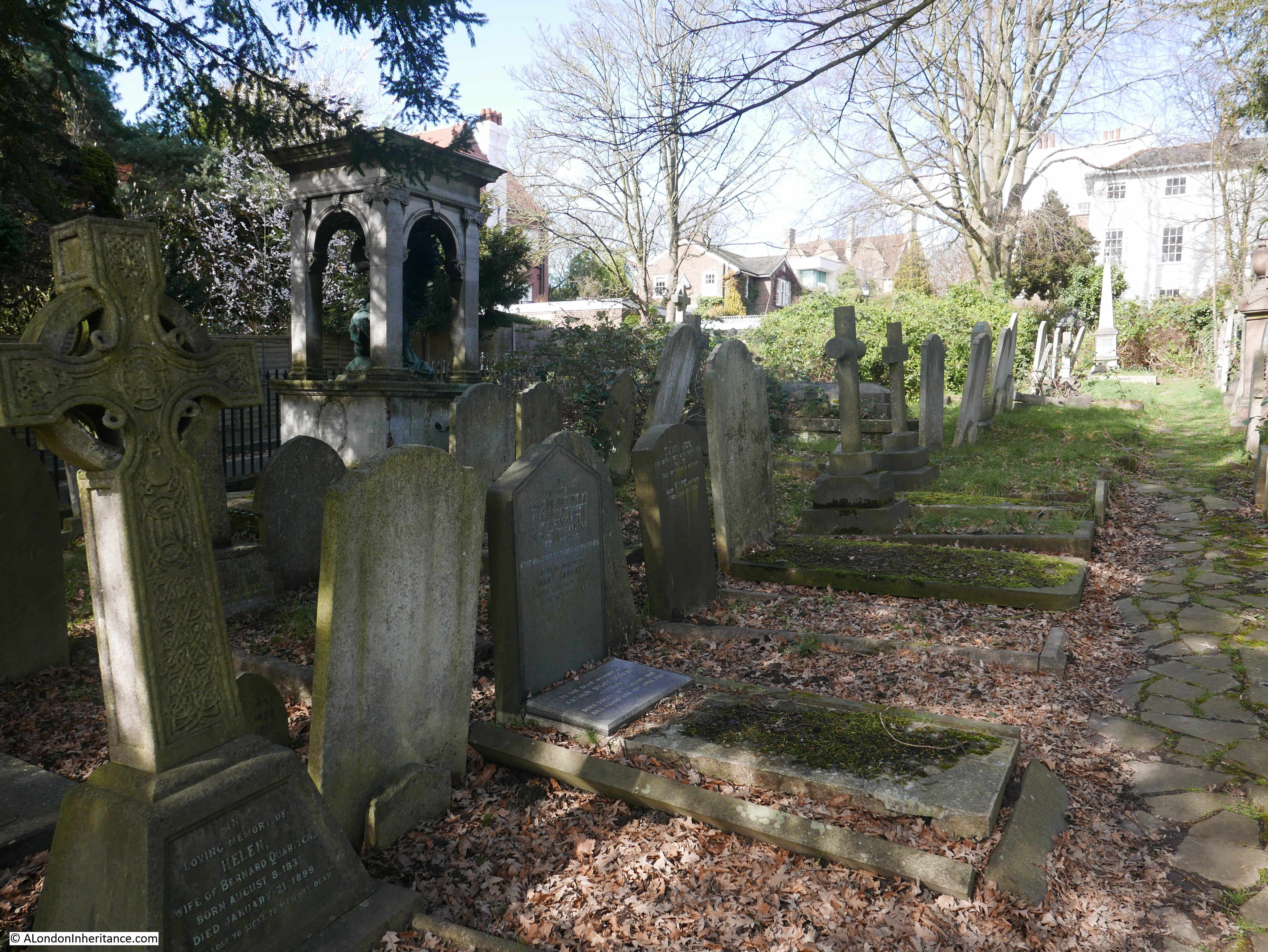
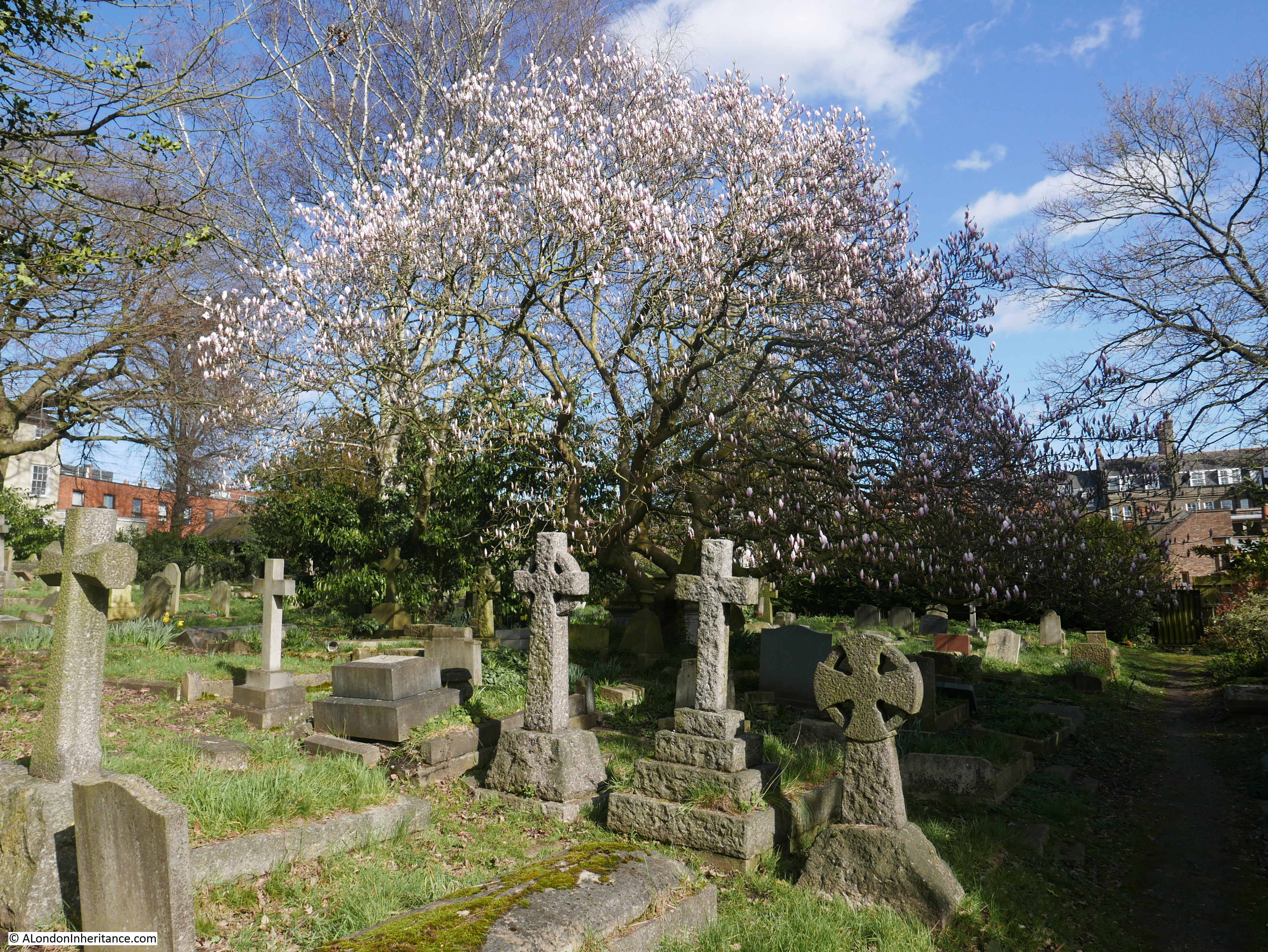
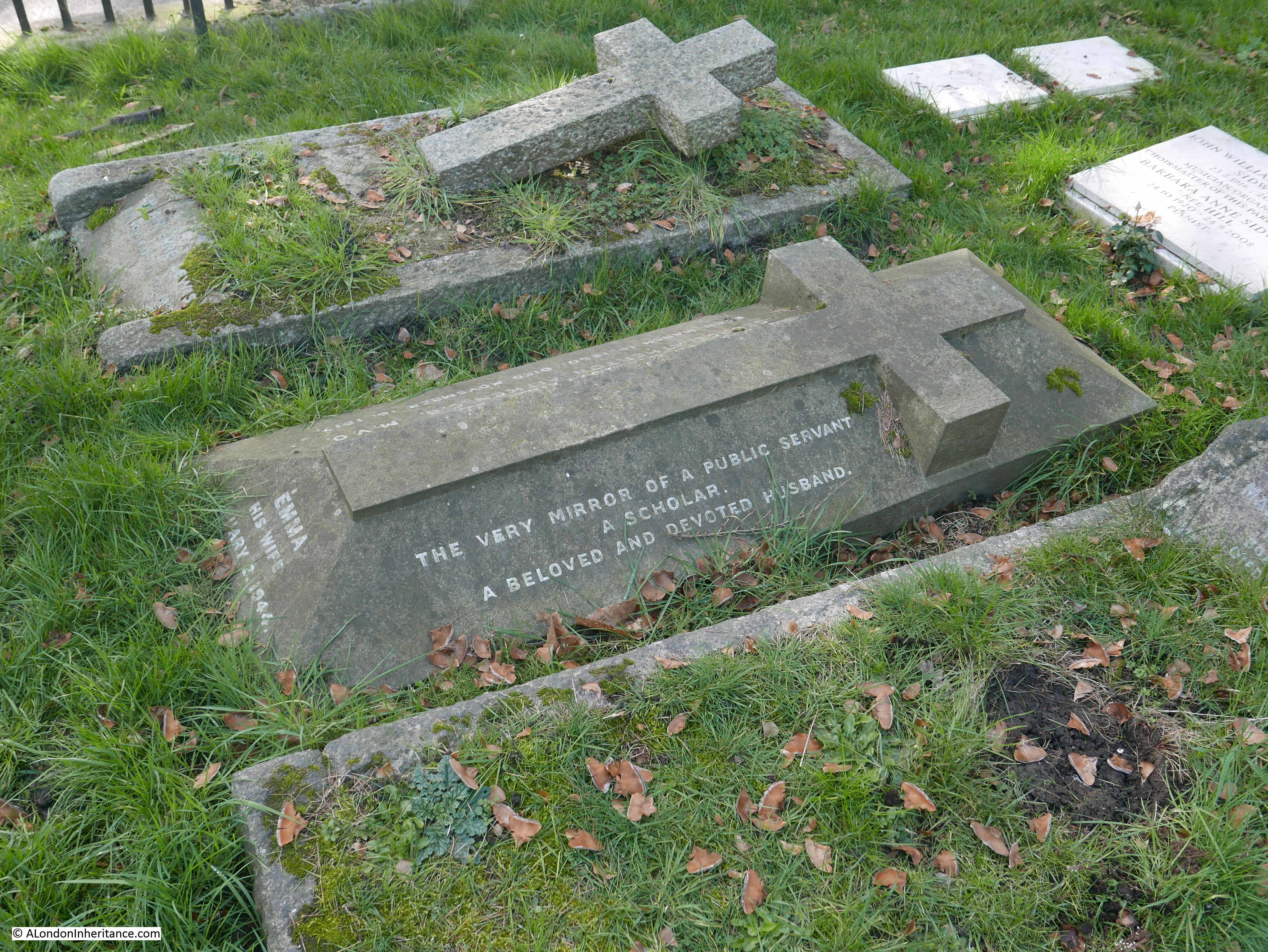
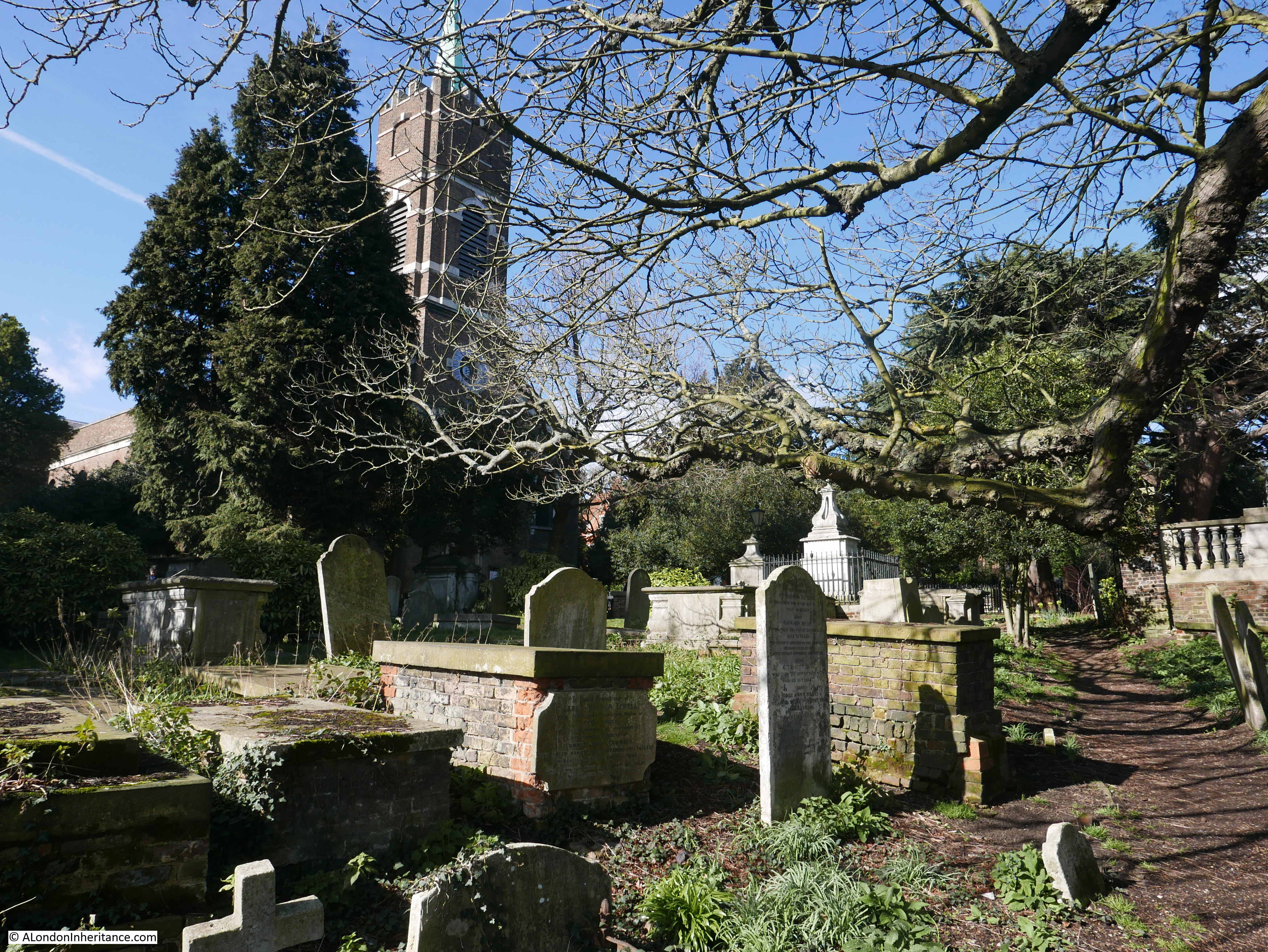
The du Maurier name has many associations with Hampstead, and I wrote about finding his grave at St John, Hampstead. in this post.

We then headed east, crossed over Heath Street and walked along Elm Row, where there is this house:

Henry Cole

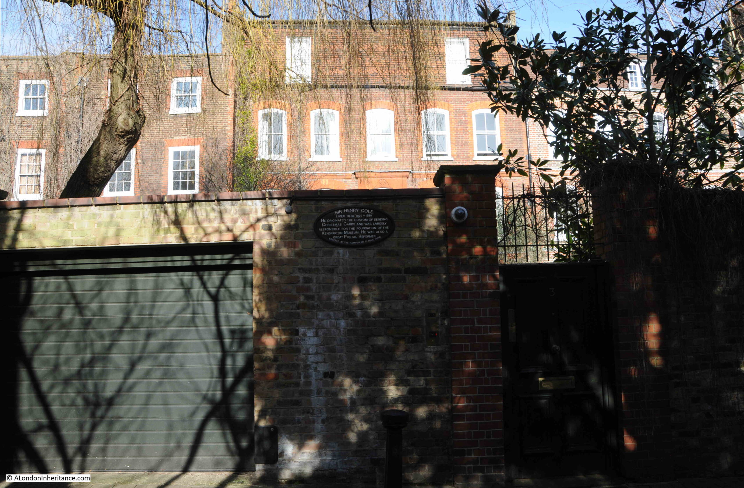
With a plaque recording that Sir Henry Cole, who “originated the custom of sending Christmas Cards” lived in the house:

Henry Cole

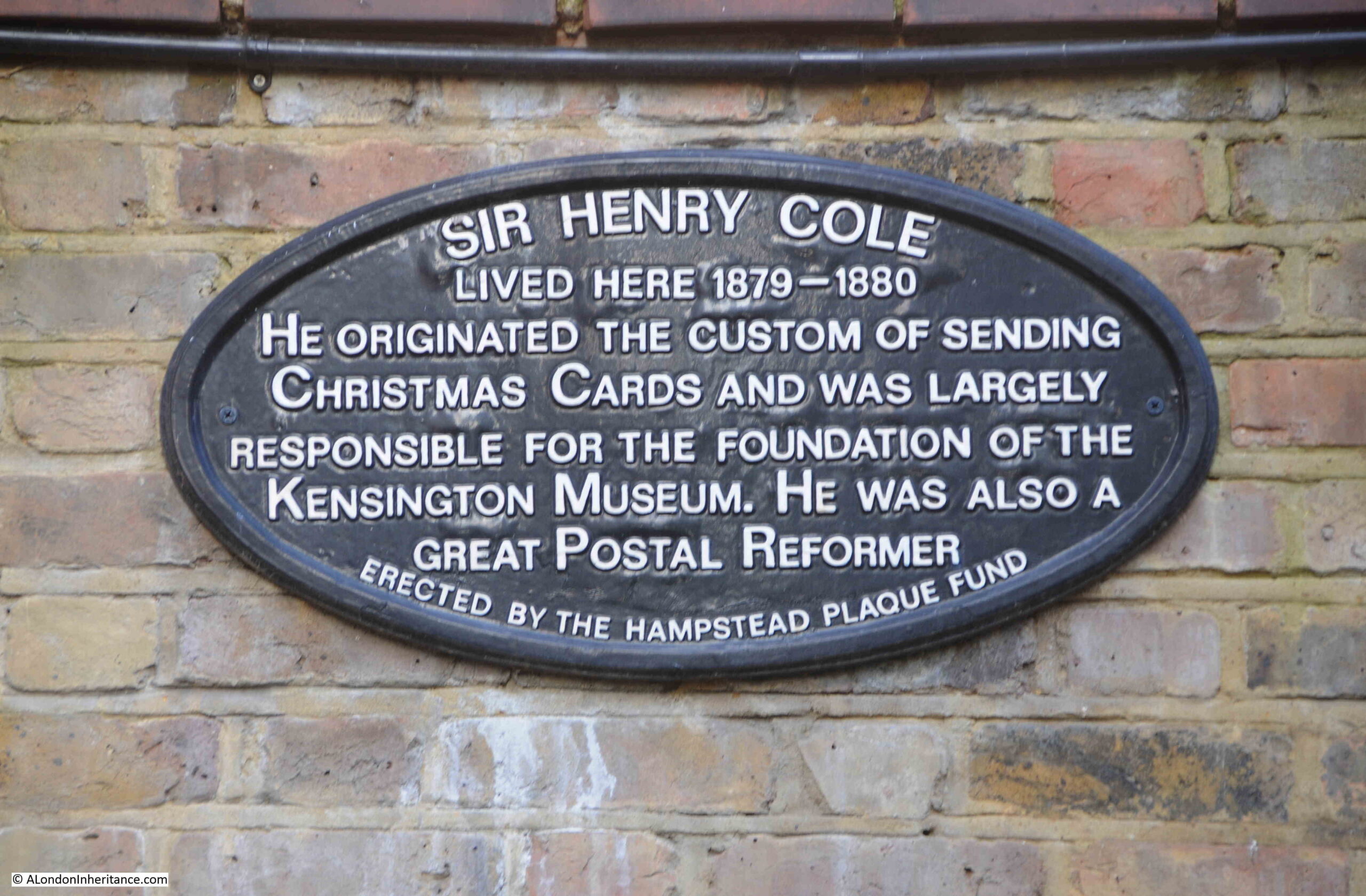
Sir Henry Cole seems to have been a far more complex and busy man than the plaque suggests. He appears to have been a workaholic, and also did not suffer fools gladly (or those that disagreed with him). His obituary, published after his death in 1882, records that “It is now fifty-five years since he commenced his career of working himself and making everybody else within the sphere of his influence work also”, and that he entered public service under the Record Commission when he “allowed little time to pass before making his presence felt”.

He found the Records Commission was in a terrible state and set about reorganising the way records were kept, in such a way that brought him into conflict with a number of powerful people.

The Record Commissioners dismissed him following a feud within the organisation, however when he was proved to be right, and had gathered his own support, the Record Commissioners had to take him back, and promote him to the office of Assistance Keeper of Records.

The reference to Christmas Cards probably relates to the following entry in his obituary “He took an important part in the development of the penny-postage plan of Sir Rowland Hill, occupied the responsible post of Secretary to the Mercantile Committee on Postage, and gained one of the £100 prizes offered by the Treasury for ‘suggestions'”.

He also had concerns about standards of architecture, fashion and the design of everyday objects, stating that “In 1840 England had not yet recovered from the fearful degradation of taste under Farmer George” (the nickname given to George III), and he preached for the alliance of art and manufacture.

This is only a small snapshot of his life and his obituary ran to a full column and a quarter of news print. I suspect it was a clever marketing idea to introduce the custom of sending Christmas Cards when he was involved with the penny-postage plan.

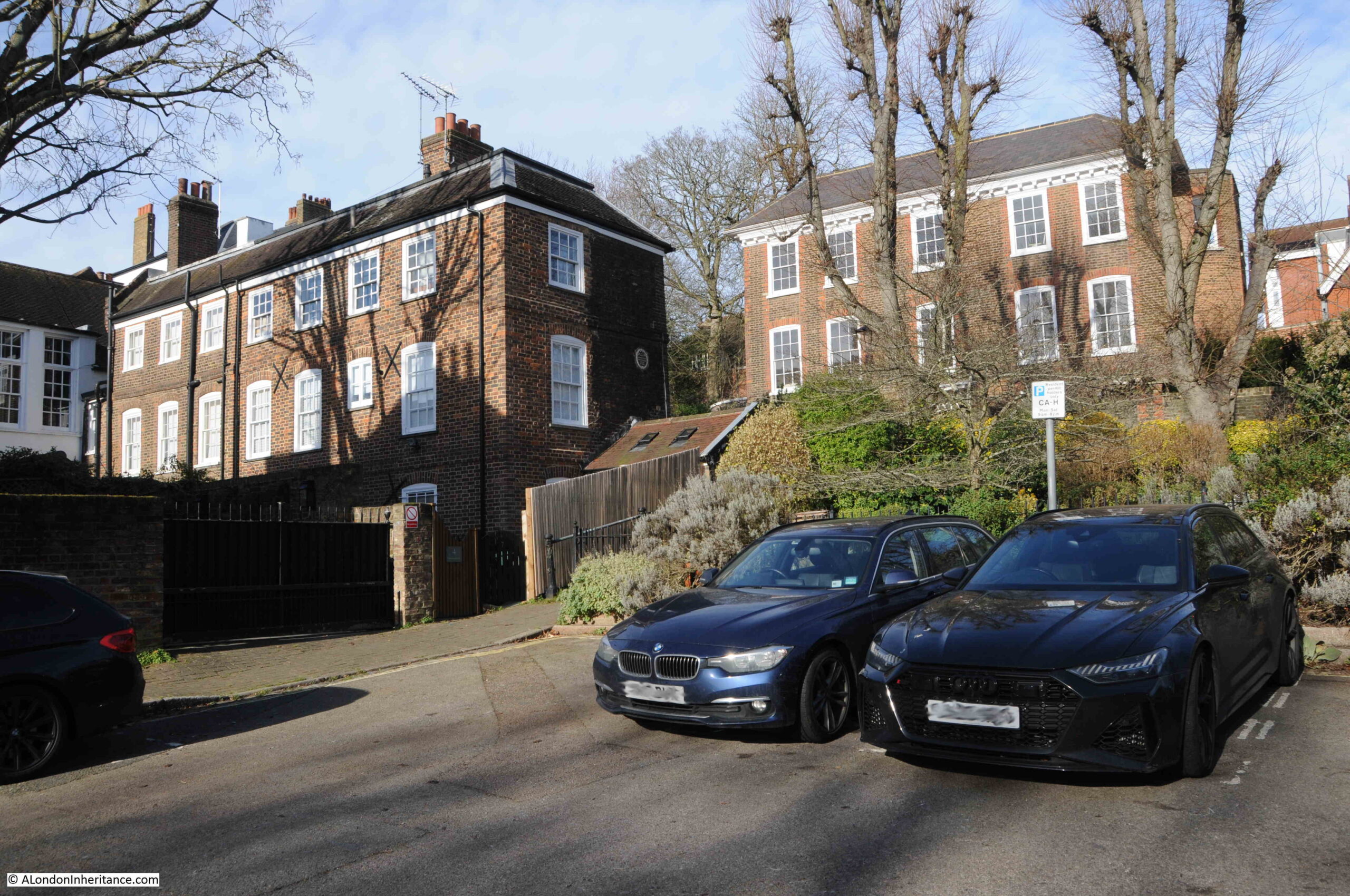
Following Elm Row, then turning into Hampstead Square and there are two large, brick buildings. The one on the left has a brown plaque on the side:

Newman Hall

The brown plaque reads “In memoriam – Newman Hall, D.D. Homes for the aged given by his widow”.

Newman Hall was described as “one of the oldest residents in Hampstead” when he died in 1902 aged 85. He was a Reverend and Preacher, author and artist. The titles of his book included “Songs of Heaven and Earth” and “Come to Jesus”.

The plaque refers to numbers 7, 8 and 9 Hampstead Square, which were bequeathed by the Will of Newman Hall’s wife, Harriet Mary Margaret Hall as almshouses for pensioners in 1922.

The charity, the Newman Hall Home for Pensioners exists to this day, continuing to maintain the properties in their use as almshouses.

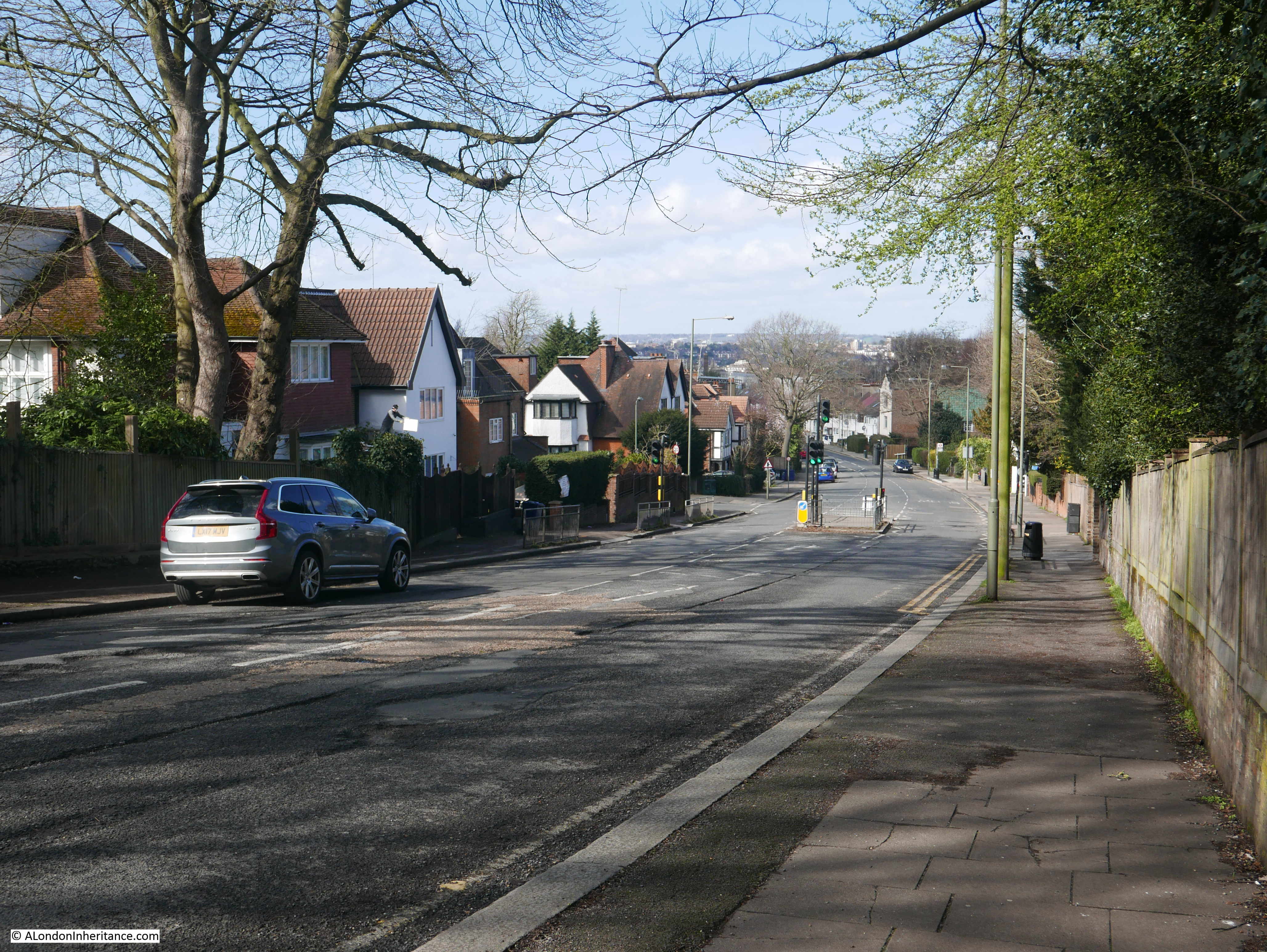
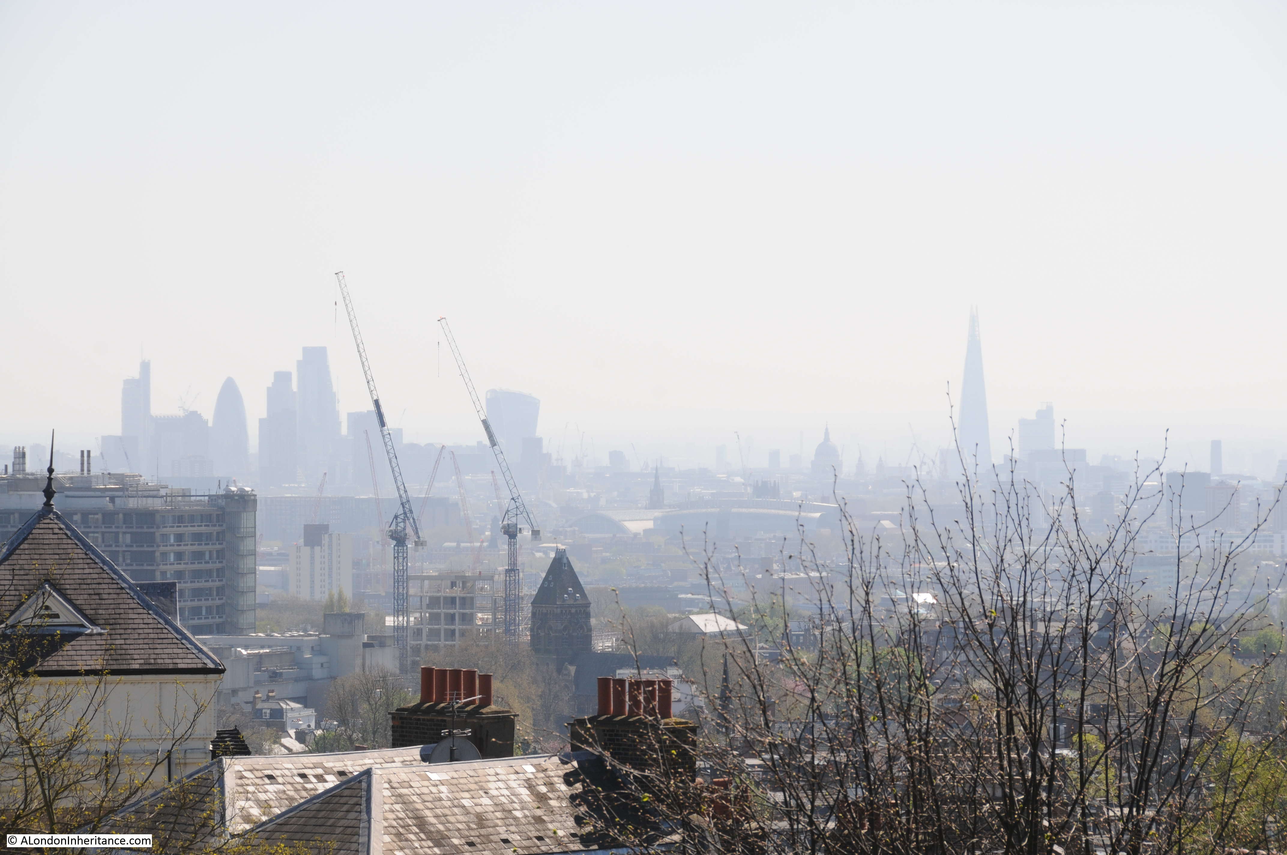
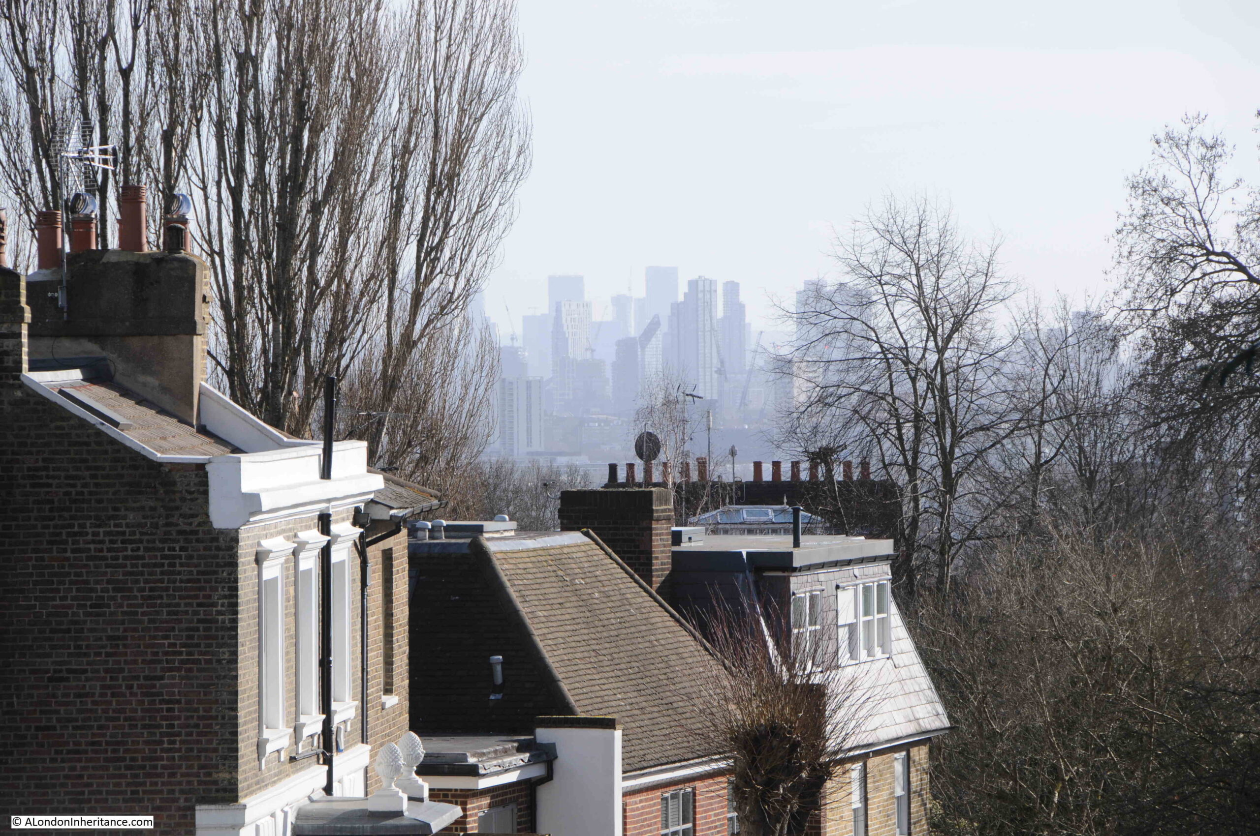
Now continuing along Cannon Place, and the view along Christchurch Hill shows the height of Hampstead, compared to the city to the south, which was one of its attractions when development started during the early 18th century.

View from Hampstead

Opposite the junction with Christchurch Hill is another blue plaque. This one to Sir Flinders Petrie, 1853 to 1942, Egyptologist:

Flinders Petrie

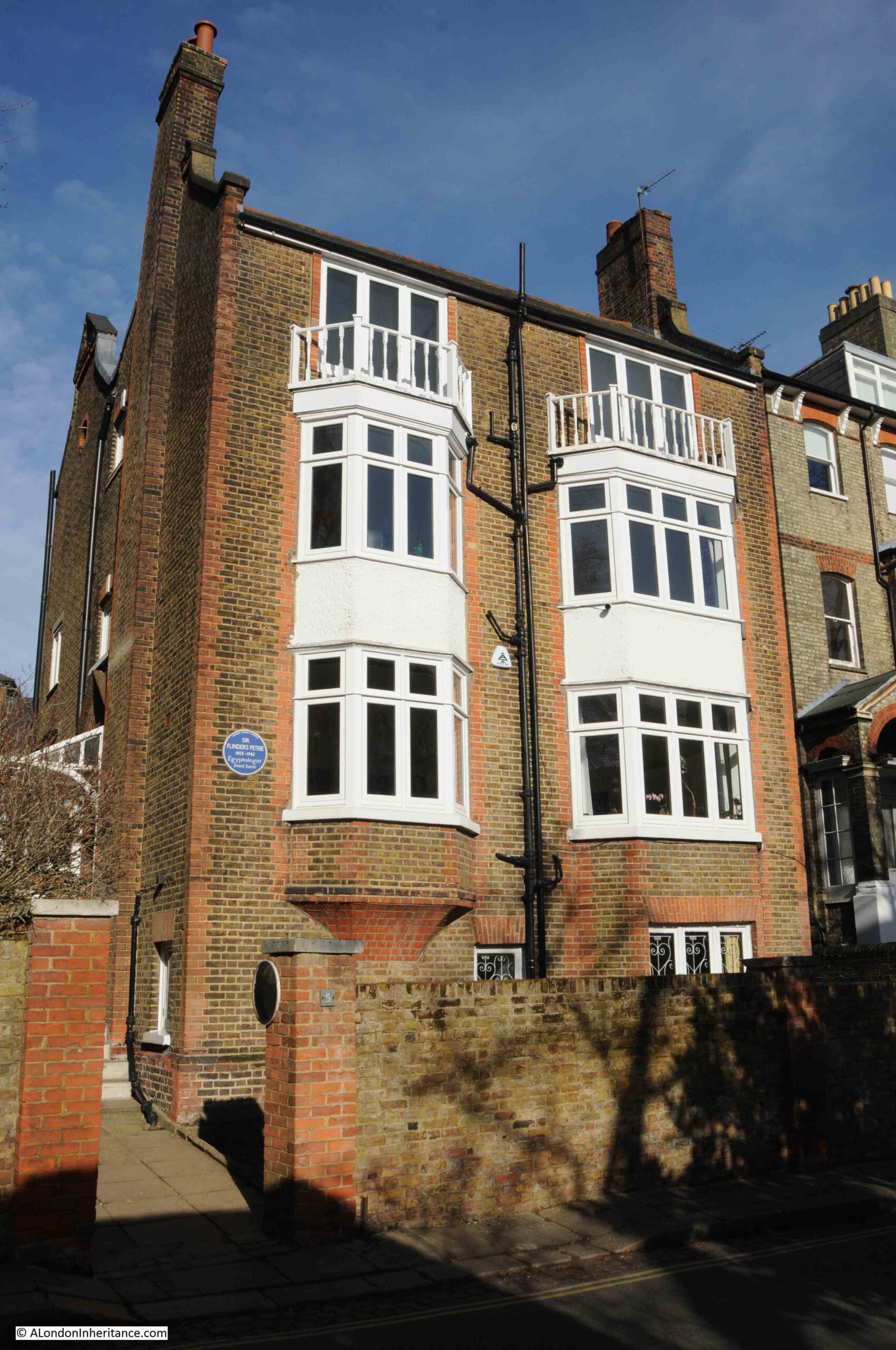
Flinders Petrie was a prolific archaeologist of Egyptian history. He began archaeological training began in 1872, when he surveyed Stonehenge, and his first visit to Egypt in 1880 resulted in his first dig in the country in 1884 and which started a lifetime of work exploring Egyptian history.

He gathered a very large collection of Egyptian antiquities, and ensured that during excavations, everything was recorded, no matter how small.

University College London now has the Petrie Museum. This was formed around the department and museum created in 1892 through the bequest of Amelia Edwards. a collection of Egyptian antiquities.

Amelia Edwards, who for a while lived in Wharton Street on the Lloyd Baker Estate (see this post) was a 19th century novelist and author of travel books which she would also illustrate. After a visit to Egypt she became fascinated by the ancient history of the country and the threats to the archaeology and monuments that could be found across the country.

She wrote about her travels in Egypt and in 1882 also helped set-up the Egypt Exploration Fund to explore, research and preserve Egypt’s history. The fund is still going today as the Egypt Exploration Society, continuing to be based in London at Doughty Mews.

Flinders Petrie was the first Edwards Professor of Egyptian Archaeology and Philology at University College London. The Flinders collection of Egyptian antiquities is also now in the museum that bears his name.

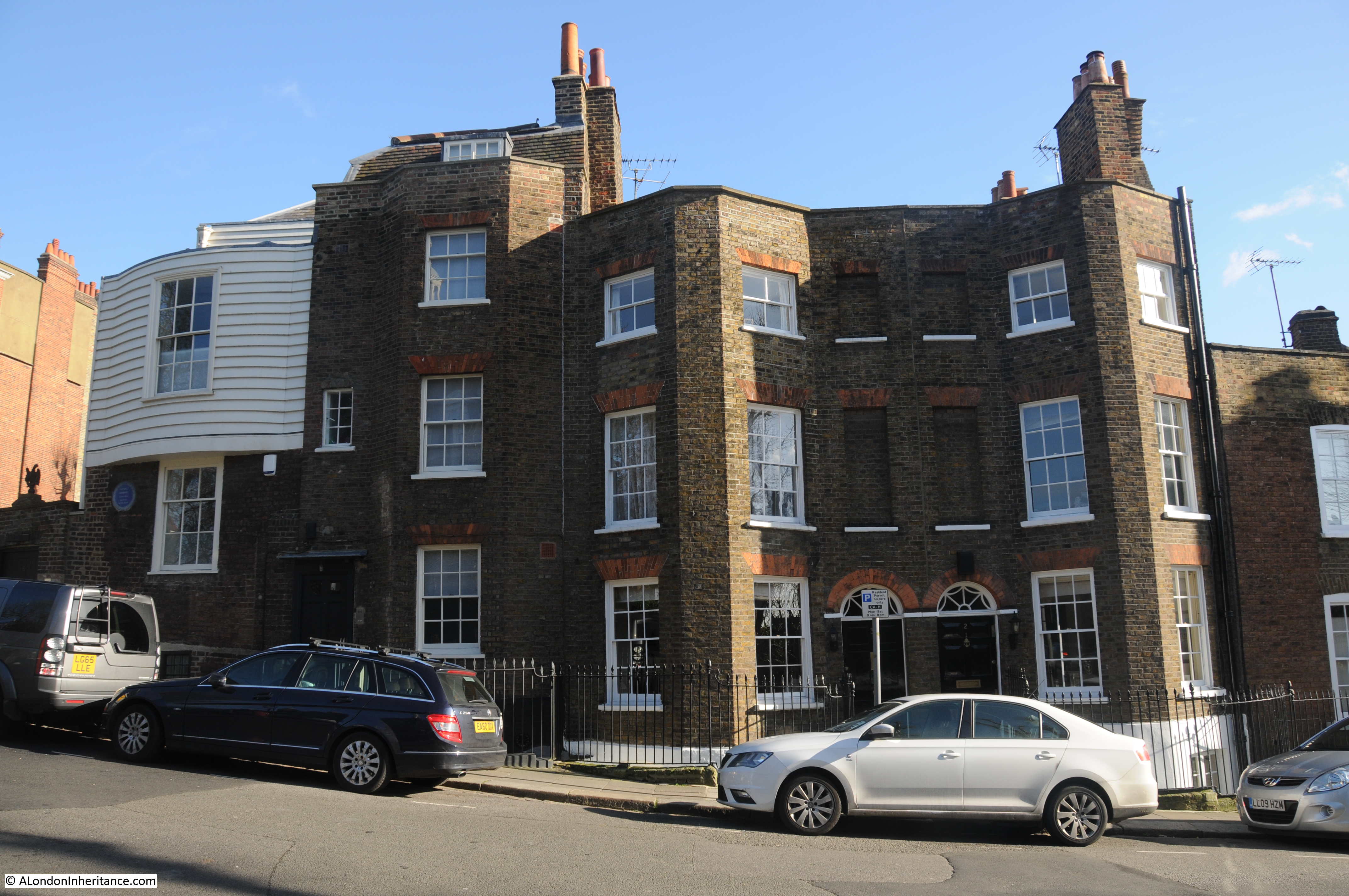
At the end of Cannon Place, at the junction with Squire’s Mount is Cannon Hall:

Cannon Hall

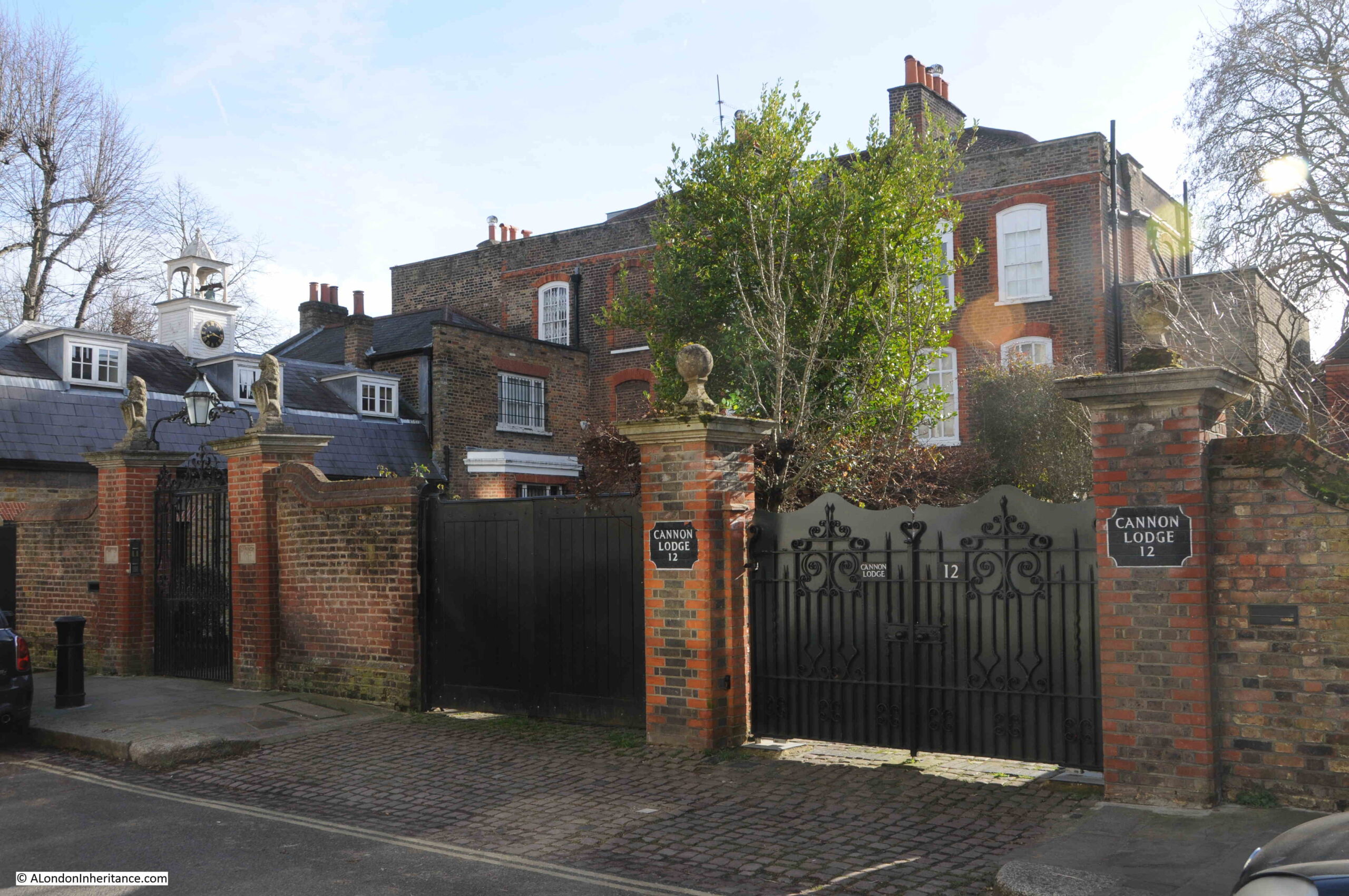
Cannon Hall dates from around 1729 and is a Grade II* listed building.

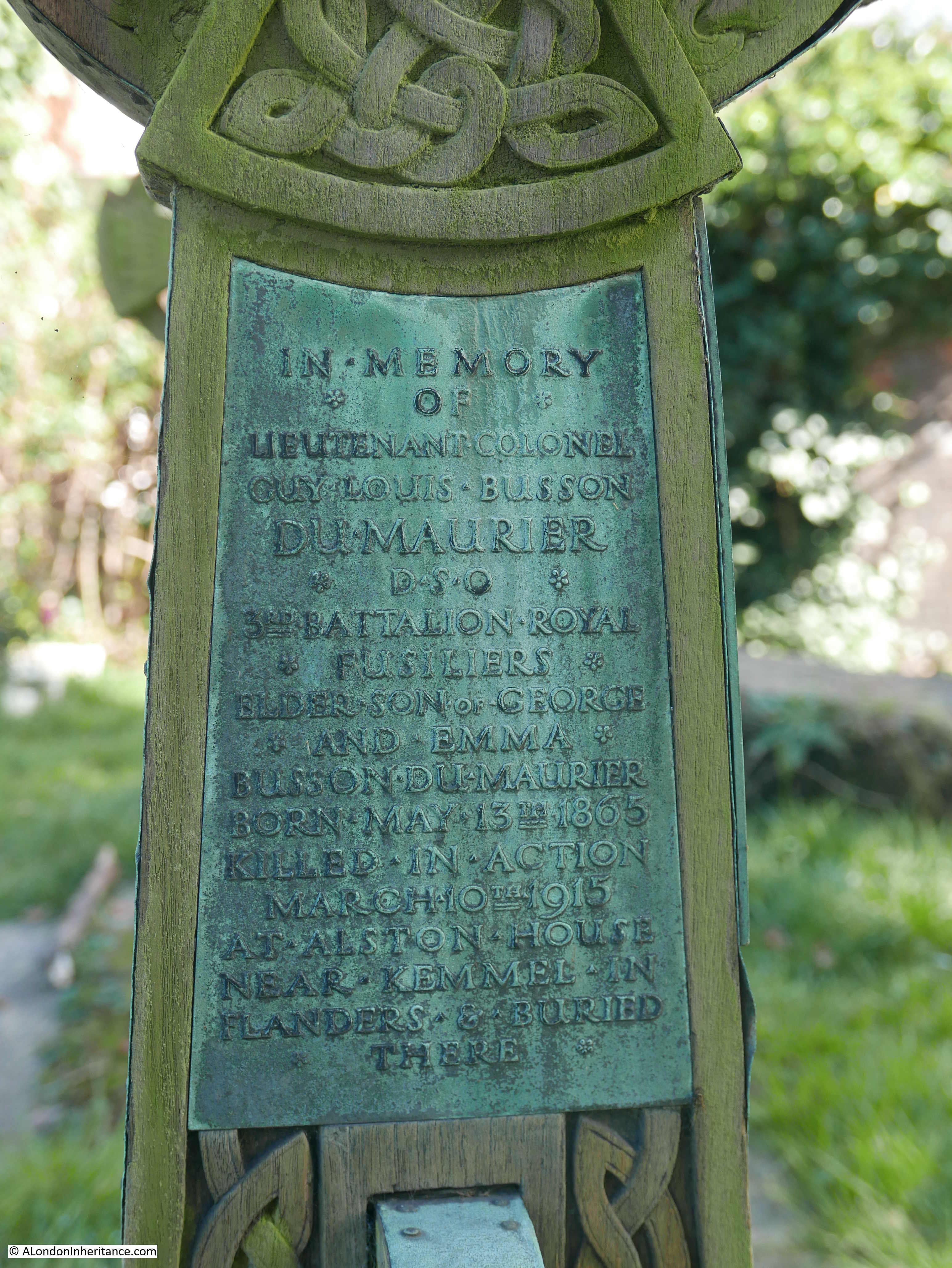
The house is another Hampstead connection with the du Maurier family, as Gerald du Maurier purchased the house in 1916 and lived there until his death in 1934.

Gerald was the son of George du Maurier who we met earlier in Hampstead Grove.

Gerald was an actor-manager and his most famous parts were probably when he played significant roles in premieres of two J.M. Barrie plays, including the dual role of George Darling and Captain Hook on the 27th of December, 1904 at the Duke of York’s Theatre.

He lived in Canon Hall with his wife Muriel Beaumont and their three daughters, Daphne du Maurier (future author and who we will meet again in Hampstead, Angela (who would also become an author), and the future artist, Jeanne du Maurier.

Canon Hall had a number of other notable, previous residents, including in 1780, Sir Noah Thomas who was physician to King George III, and from 1838, Sir James Cosmo Melville of the East India Company, who when he purchased the house was chief secretary of the company.

It seems that from around the time of Meville’s ownership, the cannons that gave the name to the place were installed along the street.

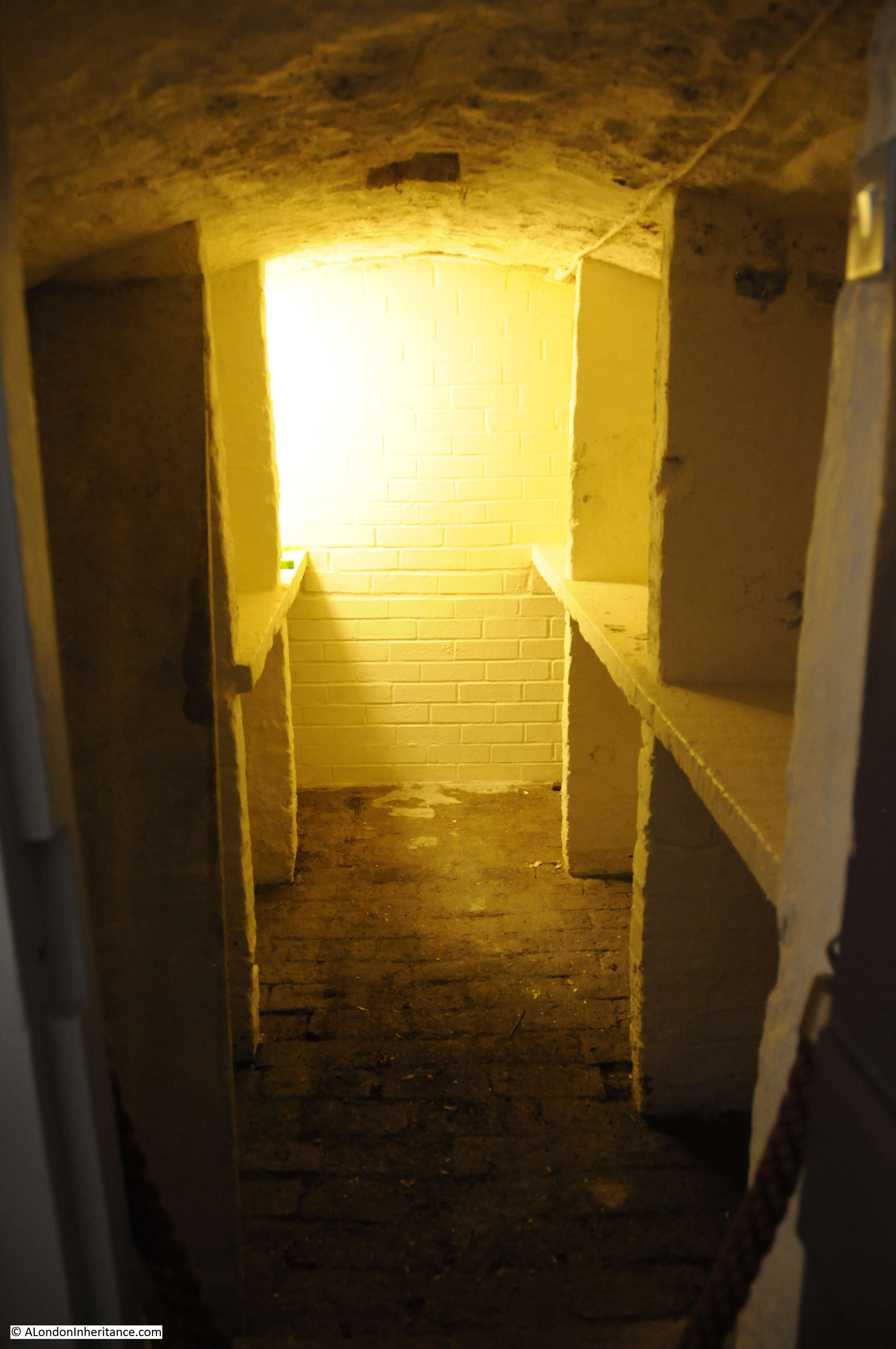
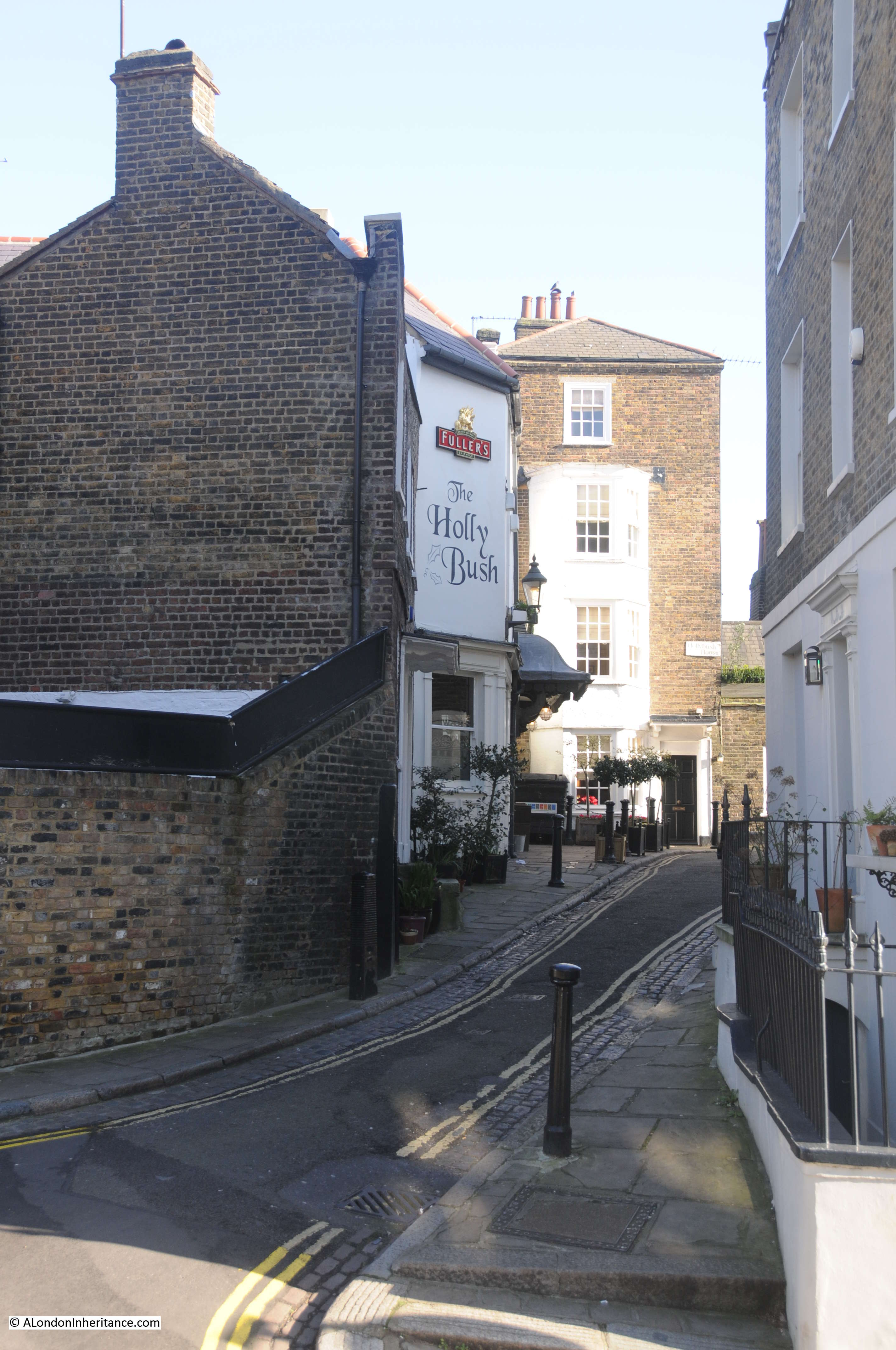
Walk past Cannon Hall, and turn down Squire’s Mount (named after Joshua Squire who purchased some land here in 1714), follow the wall alongside Cannon Hall, to find a strange door and pair of windows:

Hampstead parish lock-up

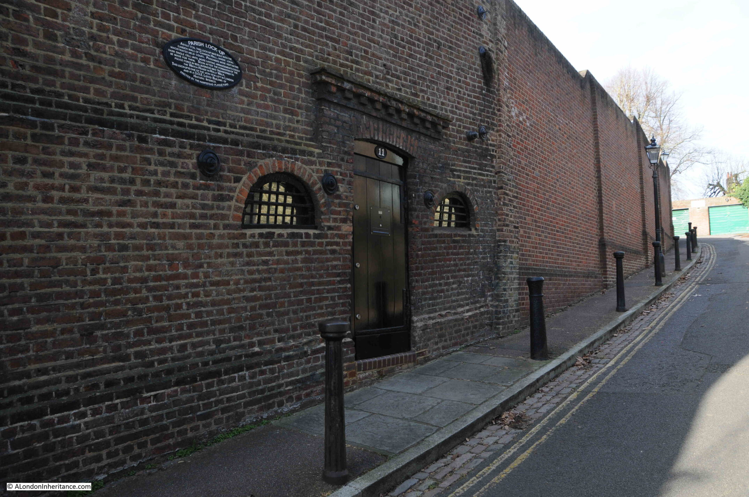
The plaque on the wall states that this was the parish lock-up, built into the garden wall of Cannon Hall around 1730. The hall was the site of a magistrates court, and prisoners would be kept in the single room cell, until more suitable arrangements could be found.

The Hampstead News on the 2nd of June 1949 stated that from old title deeds, the names of former magistrates appear to have lived in Cannon Hall. The article also stated that the lock-up later housed the manual fire engine belonging to the parish, however I doubt it would have fit through the door, unless alterations have been made to the entrance.

The lock-up lasted 100 years, as its use ended in 1832, when the temporary holding of prisoners was moved to the Watch House in Holly Walk.

Hampstead parish lock-up

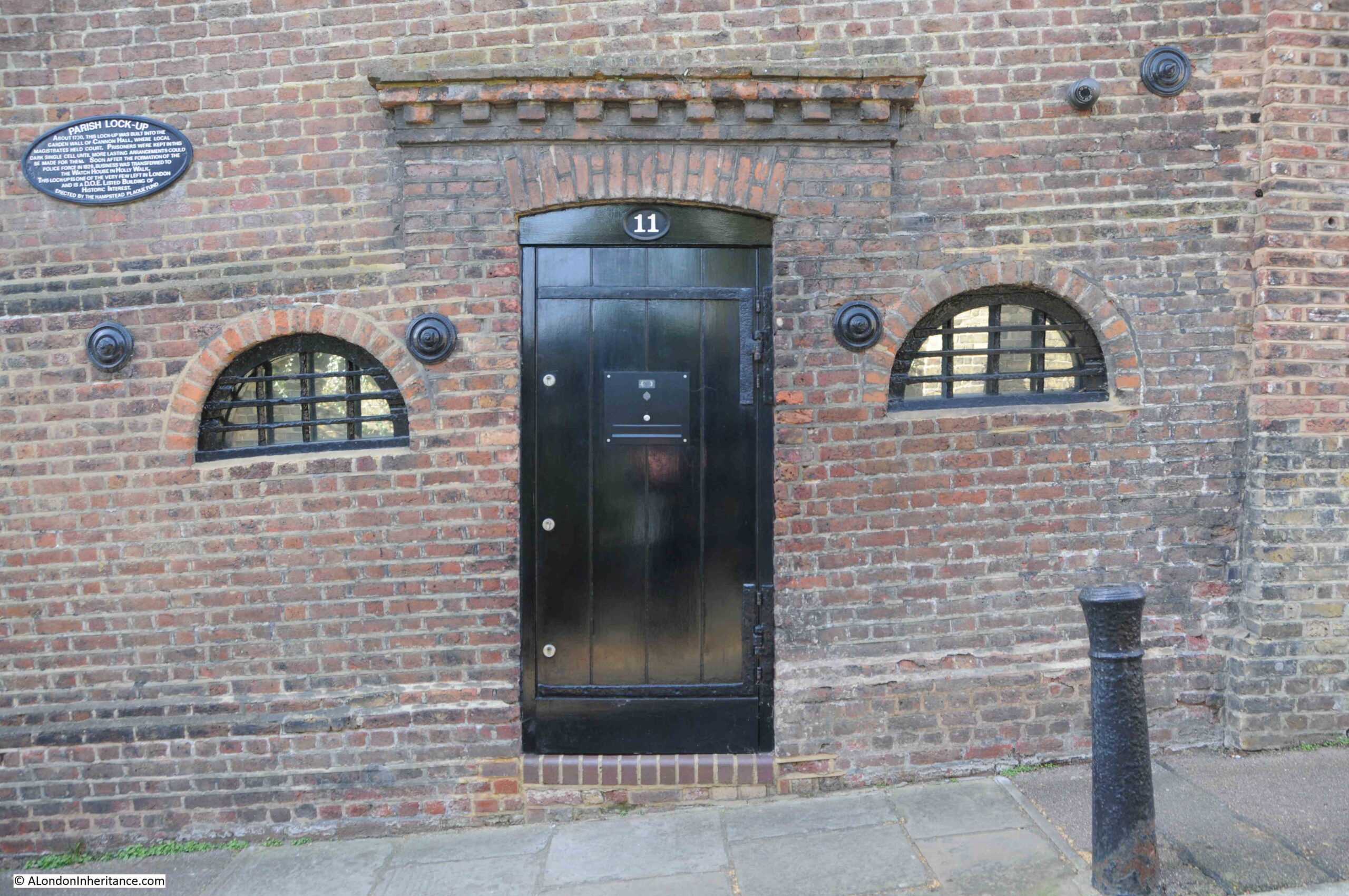
The lock-up is Grade II listed, and the listing states that inside there is a vaulted brick single cell. The London Borough of Camden’s Conservation Statement for Hampstead records that on the other side of the wall, modern houses have been built in part of the garden of Cannon Hall, and the old lock-up is now the entrance to one of these houses.

Back in 2015 there was a planning application for a three storey house to be built replacing the single storey building behind the wall. I assume this did not go ahead as no evidence of such a house can be seen above the wall.

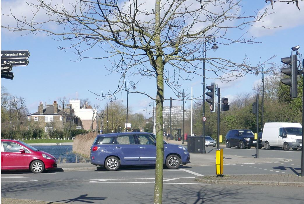
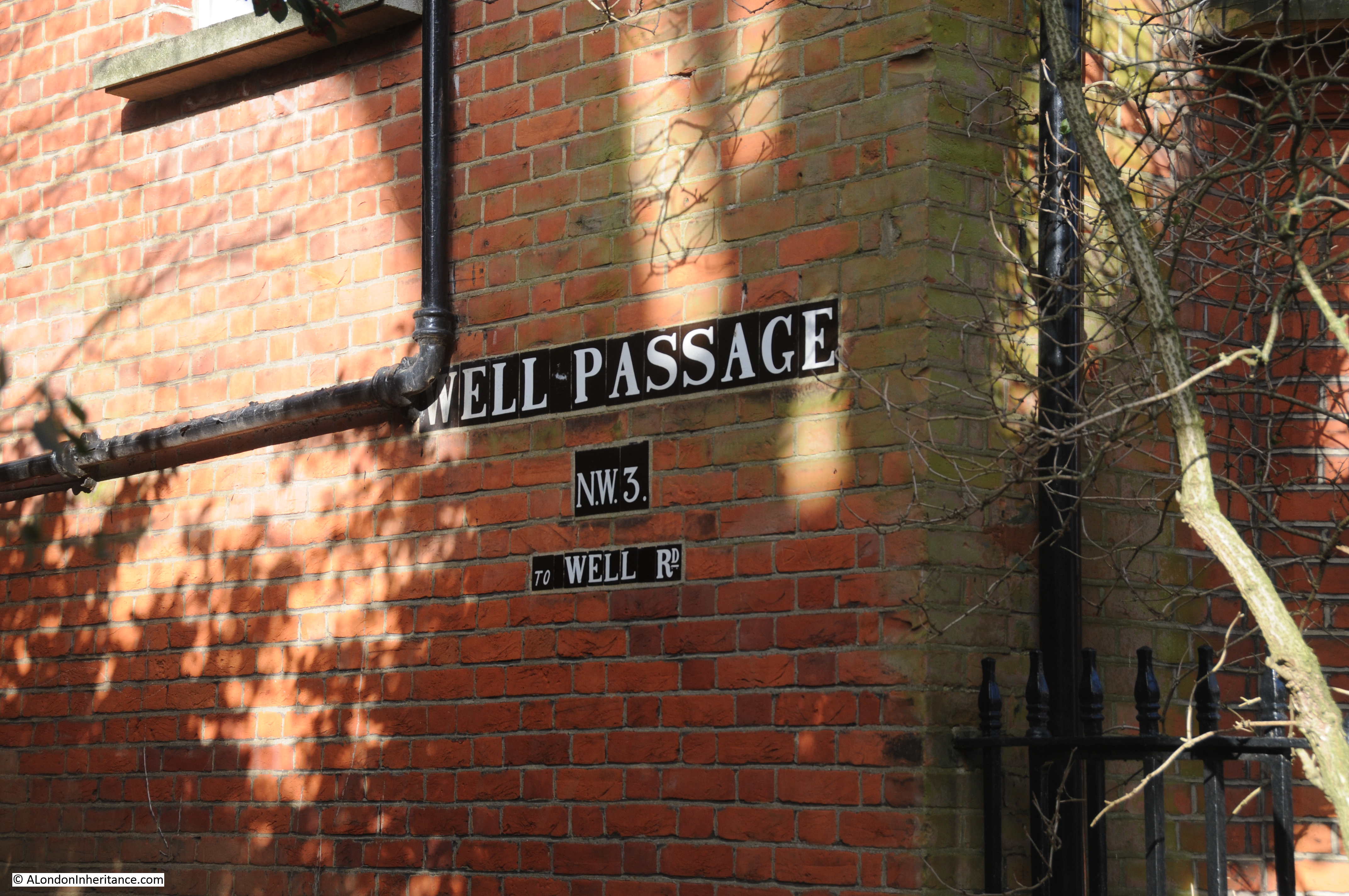
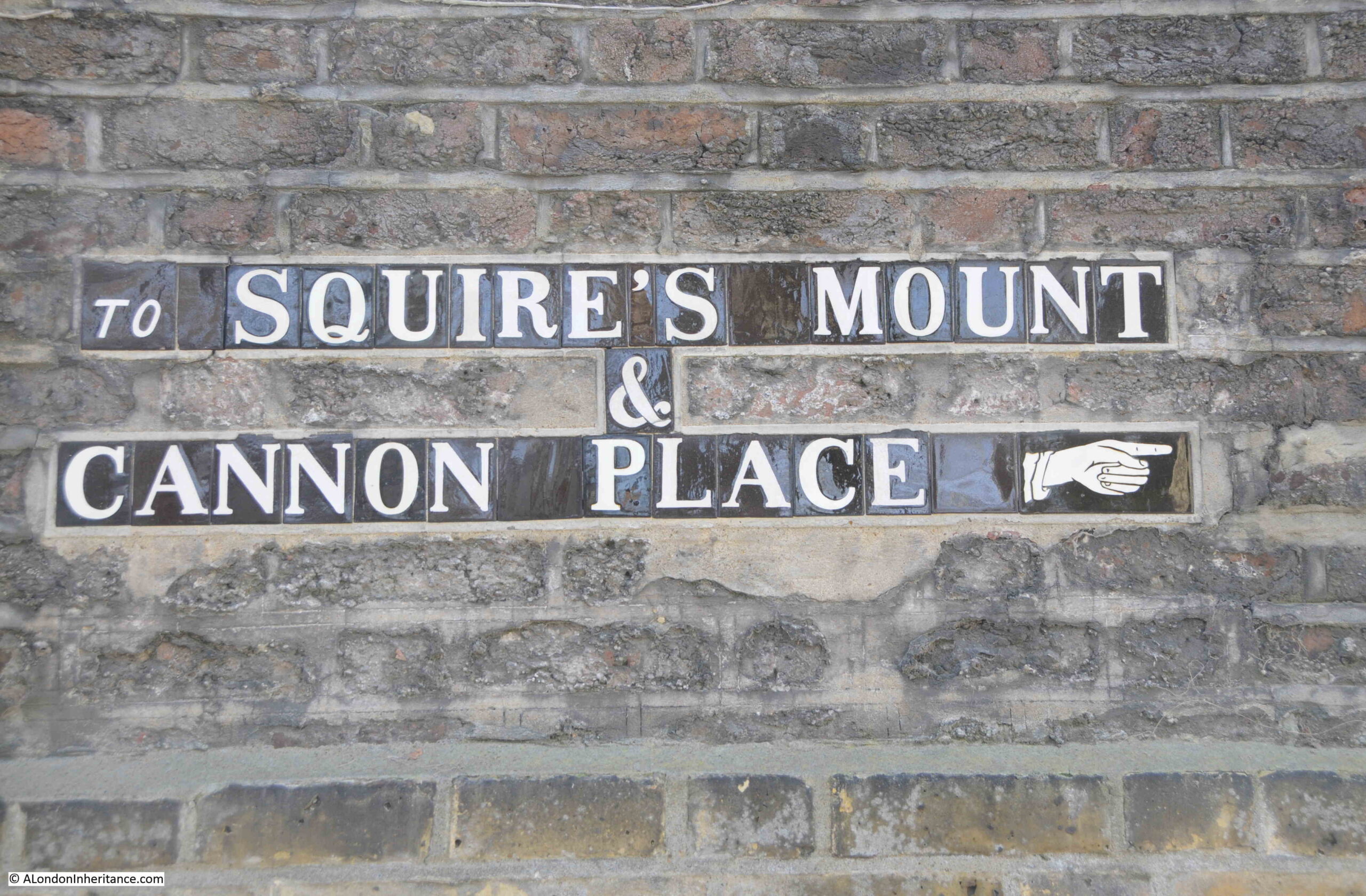
Squire’s Mount turns into Cannon Lane, at the end of which is another of the wonderful street name signs that can be found across Hampstead. Nothing like a pointing finger to indicate the direction.

Squire's Mount

At the end of Cannon Lane, we turned west into Well Lane, and soon found another mention of the du Maurier’s presence in Hampstead:

Daphne du Maurier

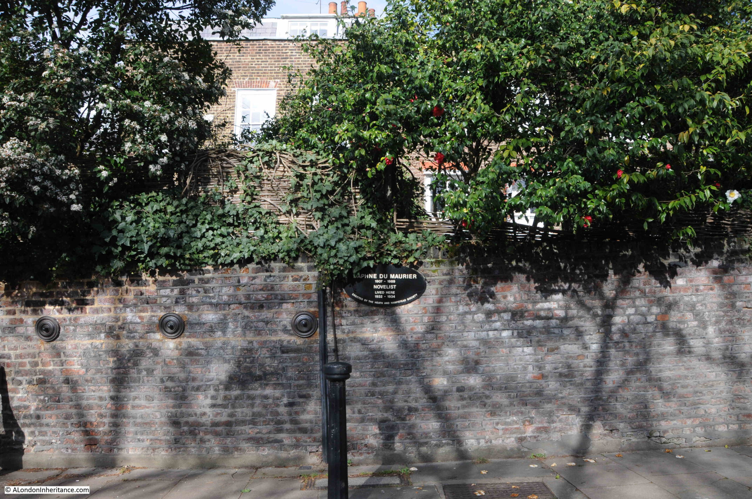
The plaque states that the novelist Daphne du Maurier lived in the house behind the wall, between 1932 and 1934. Probably best known for the books Jamaica Inn, Rebecca and Frenchman’s Creek, her last book, Rule Britannia, published in 1972, was a interesting and prophetic account of the country leaving the European Union.

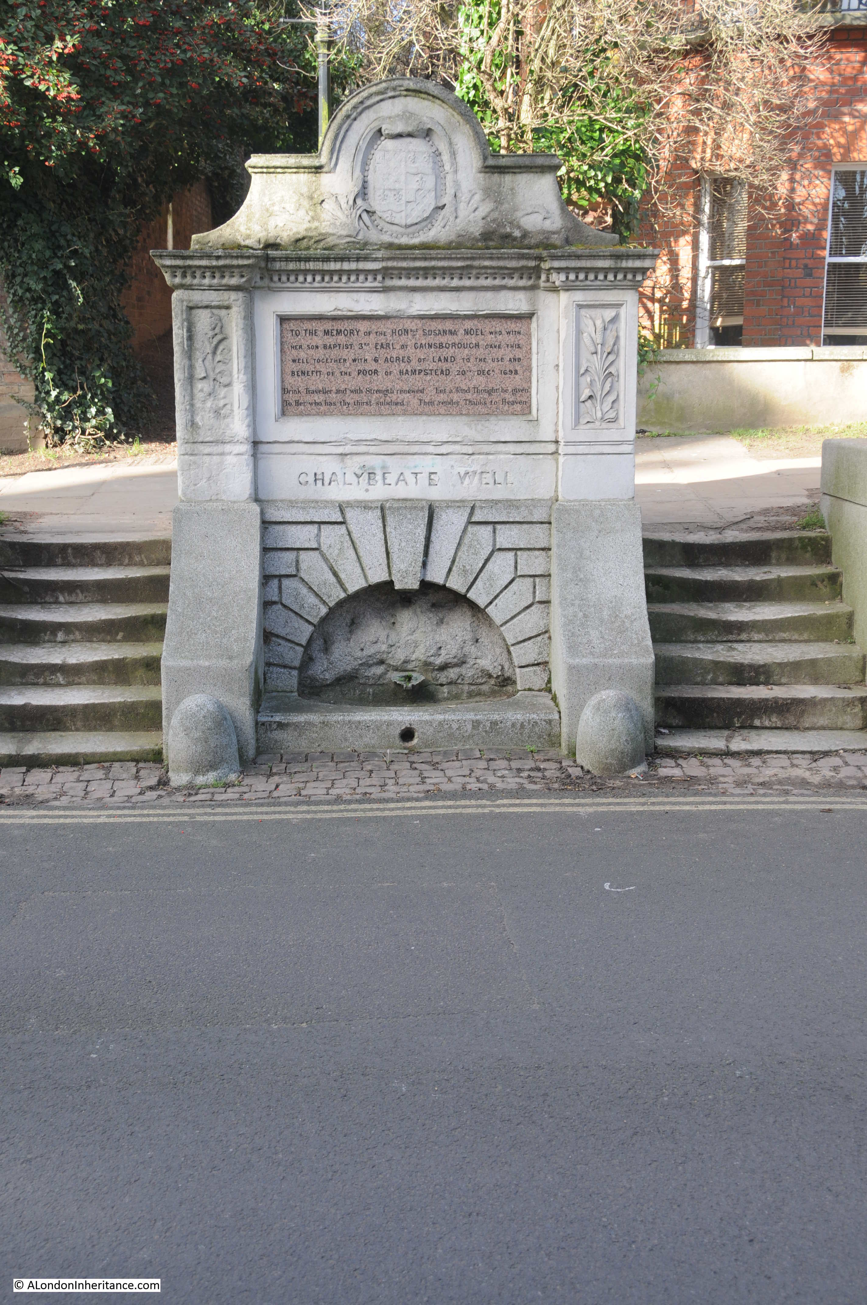
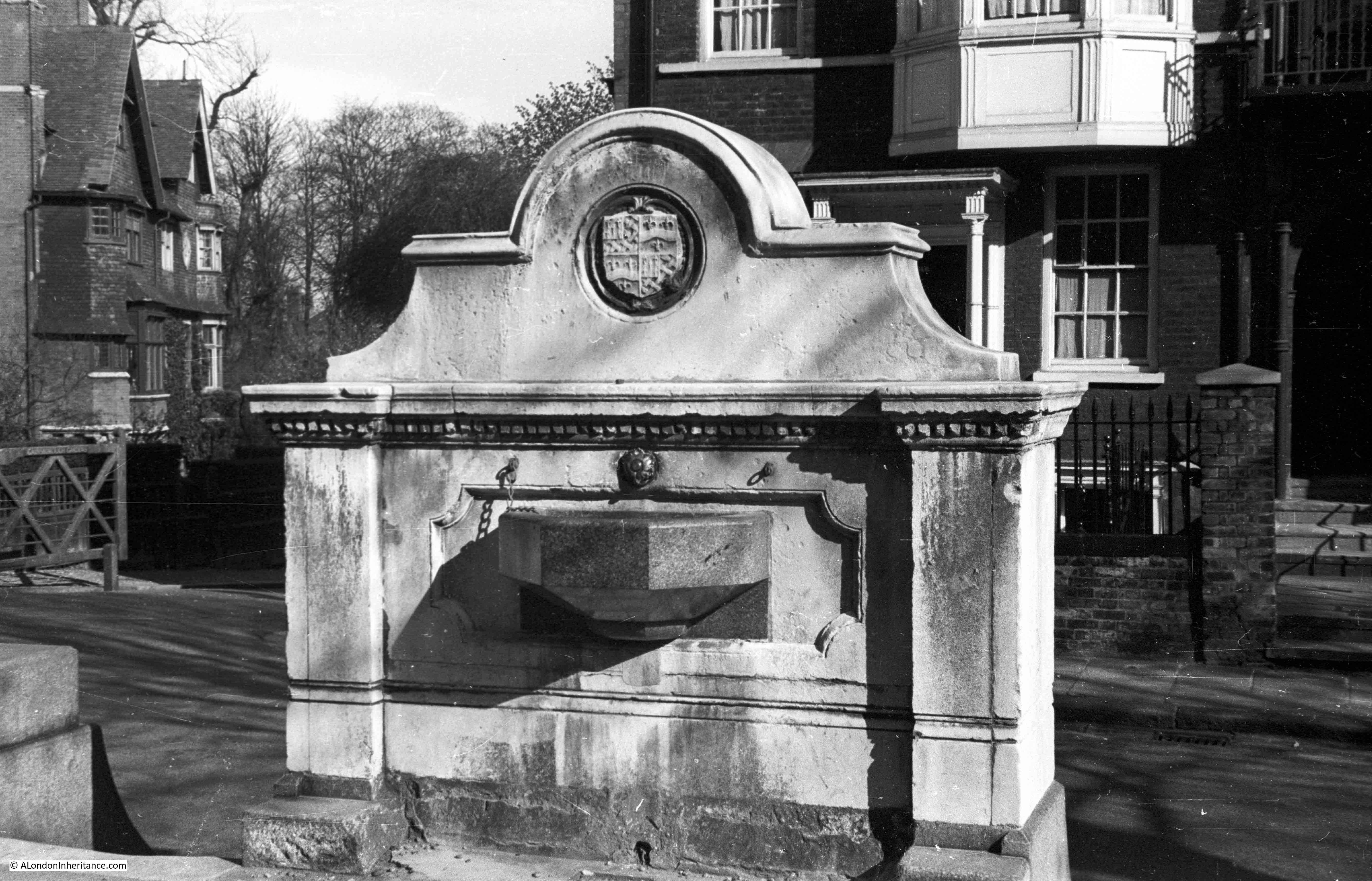
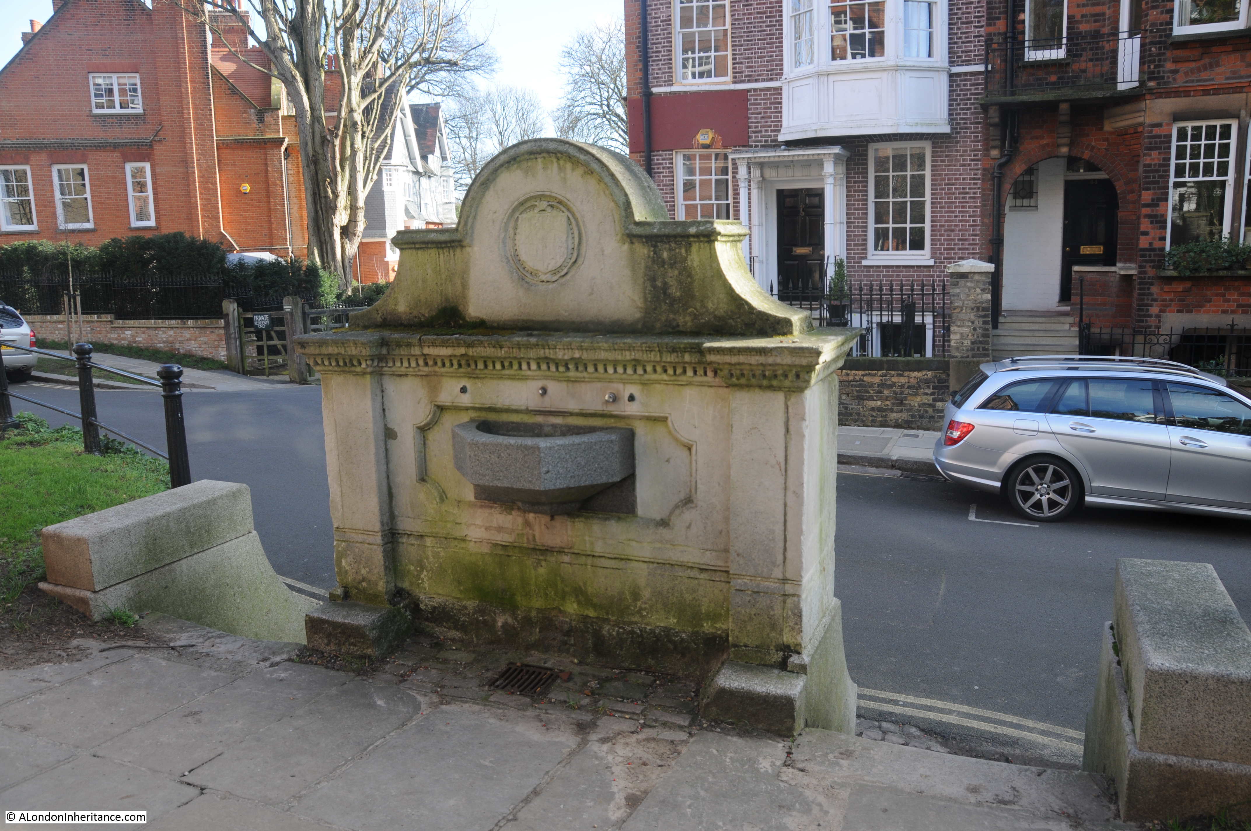
Finally, towards the end of Well Road is another plaque on the walk alongside the house and buildings in the following photo:

Mark Gertler

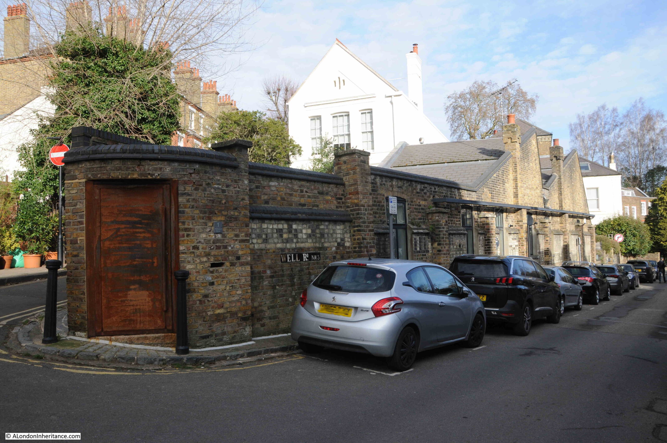
This plaque records that the artist Mark Gertler lived in the building. He was born in Spitalfields and there is a house in Elder Street that also records his time in the area. He was a painter of figure subjects, portraits and still-life, and one of many artists that have made Hampstead their home.

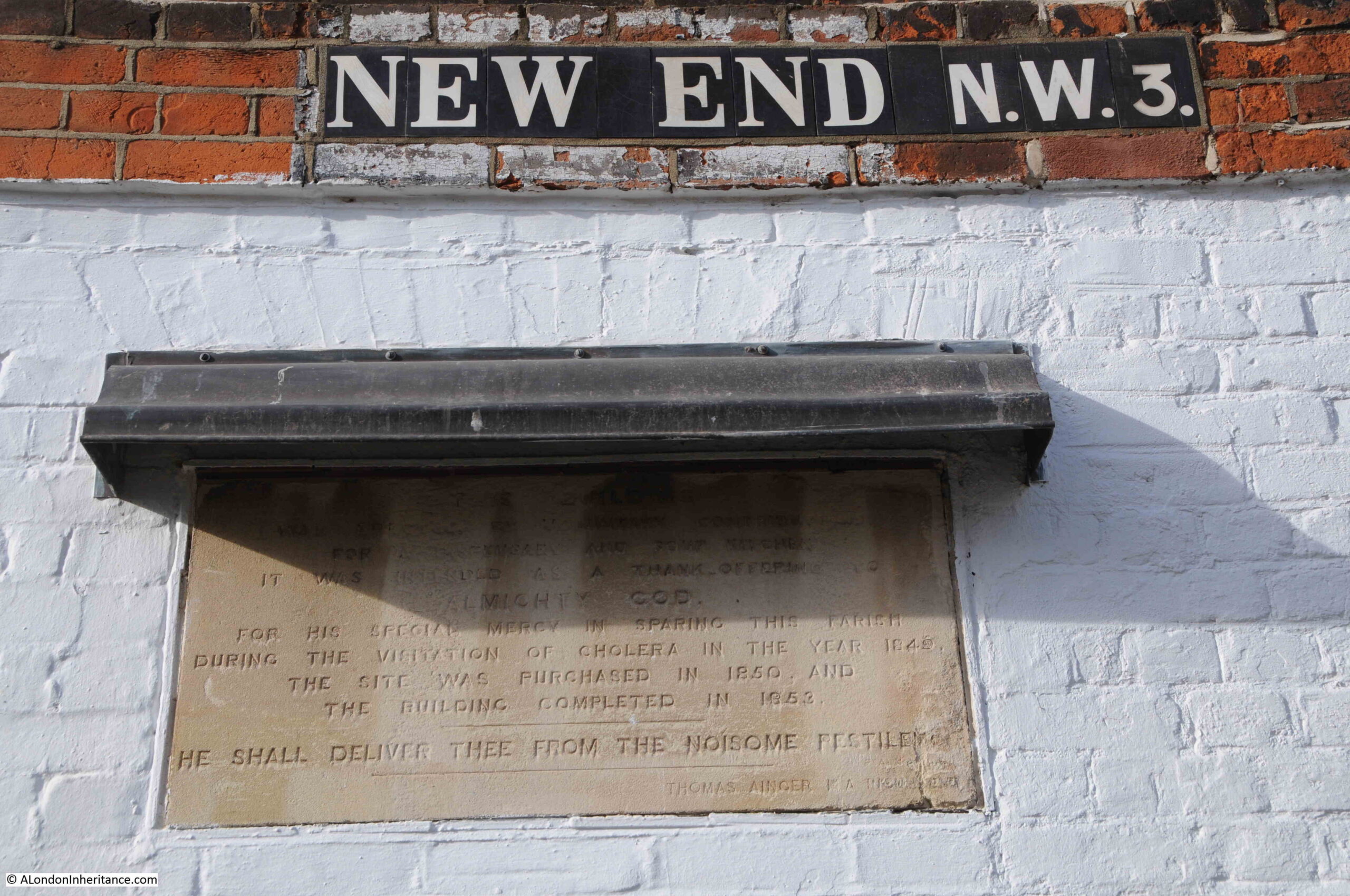
At the end of Well Road, at the junction with New End is a tall, brick building, with a stone plaque on the narrow end of the building:

Cholera in Hampstead

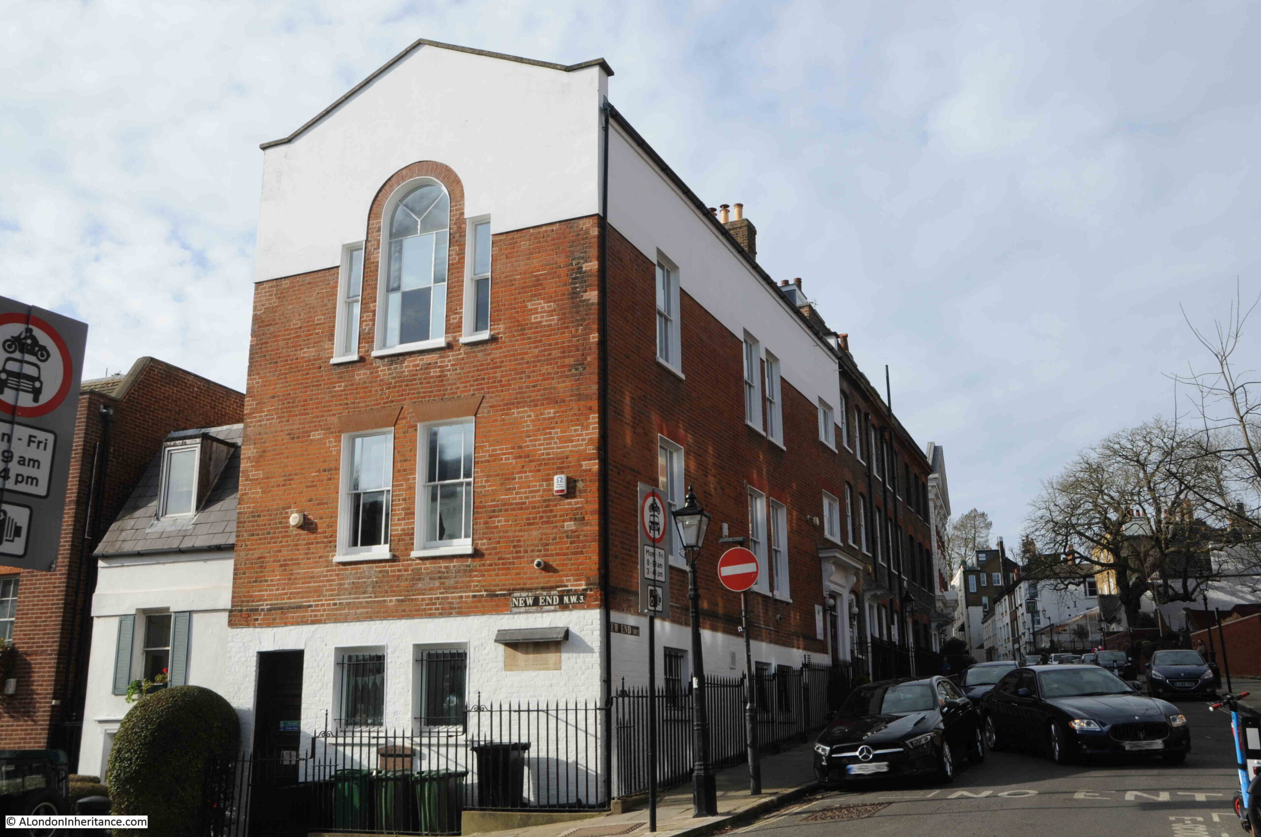
The lettering along the top of the plaque is somewhat worn, but appears to read: “These buildings were erected by voluntary contributions for a dispensary and soup kitchen. It was intended as a thank offering to almighty God for his special mercy in sparing this parish during the visitation of cholera in the year 1849. The site was purchased in 1850 and the building completed in 1852. He shall deliver thee from the noisome pestilence. Thomas Ainger M.A.”

Cholera in Hampstead

The building, that was constructed as a dispensary and soup kitchen is now a fee paying, independent school.

The visitation of cholera in the year 1849 was one of the many cholera outbreaks in the mid 19th century (see my post on John Snow and the Soho Cholera Outbreak of 1854). John Snow’s suspicion about the source of a cholera outbreak was further confirmed when a local resident of Golden Square moved to Hampstead, but still sent for a bottle of the “sparkling Broad Street water” every day. She was the only person in Hampstead to be diagnosed with cholera.

The cholera outbreak of 1849 was serious across the whole of London, although south London suffered more than north London. The Lady’s Newspaper on the 29th of September 1849 carried an account of the outbreak during the first part of the year and reported that 35 out of 10,000 inhabitants of north London died, compared to 104 out of 10,000 inhabitants of south London.

The following table from the Weekly Dispatch provides a list of deaths from Cholera and Diarrhea reported on the 31st of August 1849:

Cholera in Hampstead

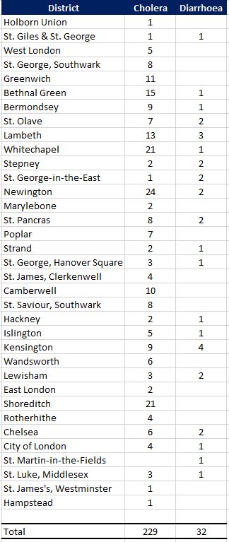
The table shows that for the reporting on that one day, Hampstead had one of the lowest levels of death across London.

That was a short walk, starting at Admiral’s House, which still looks much as it did when compared with my father’s 1951 photo.

The rest of the walk demonstrated just how much there is to explore in Hampstead. Other posts I have written about the area include:

alondoninheritance.com

The Spaniards Inn, Hampstead

Thanks for all the feedback to last week’s series of posts on Eleanor of Castile – very much appreciated. A very different post today, as I am visiting the site of one of my father’s photos, and this is of the Spaniards Inn in Hampstead, photographed in 1948:

The Spaniards Inn

I had to be in Hampstead last week, so used the opportunity to cross this one off my list of my father’s photos to visit, however it was a misty, autumn day. I waited for much longer than the weather forecast predicted it would take for the mist to disappear, and finally had to take a misty comparison photo before I had to leave, so this is the same view today, a misty Spaniards Inn in 2022:

The Spaniards Inn

Different weather, different perspective due to very different cameras, and colour vs. black and white, however, look past that and the two views are almost identical across 74 years.

Even the small triangular pavement between the two car park entrances is still the same. The cars approaching along the road from behind the pub are though very different.

The Spaniards is a very old pub, believed to date back to the 16th century.

As with any pub of such age, there are plenty of stories about the pub, many of which have been repeated in newspapers and books for at least the last 150 years, so may well have a grain of truth.

Regarding the name, I have read two different accounts, firstly that there may have been two Spanish owners of the pub, who killed each other in a duel, secondly, that the pub was named after the Spanish Ambassador to James II.

There are stories that the highwayman Dick Turpin used the pub, and kept his horse in one of the buildings.

What does seem to be true is that the pub played a role in the Gordon Riots. This was in June 1780 when there were violent anti-Catholic riots in London. At the time, Kenwood House, not far from the Spaniards, was the home of the Earl of Mansfield, the Lord Chief Justice. He was rumoured to have pro-Catholic sympathies, so the rioters set out from central London with the intention of burning down Mansfield’s Kenwood House.

The rioters stopped in the large gardens of the Spaniards Inn, and the landlord, along with the Earl of Mansfield’s steward gave the rioters large amount of drink, which gave them time to summon soldiers, and by the time they arrived, the rioters were in no fit state to resist.

The Spaniards Inn also features in Dickens’ book, Pickwick papers where Mrs. Bardell and her friends take the Hampstead Stage to the Spaniards Tea Gardens. The Inn is also mentioned in Bram Stoker’s Dracula, where the vampire hunter Van Helsing, after having supper in Jack Straws Castle, then: “By good chance we got a cab near the “Spaniards,” and drove to town.”

Many of the literary and artistic inhabitants of, and visitors to Hampstead are believed to have visited the Spaniards Inn, including Keats, Shelley, Byron, Hogarth and Constable.

I walked to the Spaniards Inn from Hampstead, firstly walking up to Spaniards Road, where there is one of type of street signs that can be found across Hampstead, which also has a pointing hand symbol indicating the direction to Highgate.

Spaniards Road

The road between Hampstead and Highgate runs along the north and north-western borders of the heath, and the Spaniards Inn can be found at roughly the half way point along the heath’s border. Spaniards Road runs up to the inn, and soon after the road changes name to Hampstead Lane – one of the indicators that the inn has long formed a boundary between Hampstead and Highgate.

The location of the Spaniards Inn is circled in the following map (© OpenStreetMap contributors):

The Spaniards Inn

My father’s photo shows the corner of the Spaniards Inn directly on the road, with a car just coming from behind the pub. To discover why the inn is at such a historic location, we need to zoom out to a wider view of the road that runs to the side of the inn:

The Spaniards Inn

As the road passes the Spaniards Inn, it narrows and bends around the corner of the inn. On the opposite side of the road is a small square building.

This point in the road was the location of a toll gate, and travelers had to pay a toll when passing along the road in the direction of Highgate, as the land to the west of the tollgate was owned by the Bishops of London.

The square building on the opposite side of the road was the 18th century toll gate house.

The Spaniards Inn and the toll gate feature in John Rocque’s 1746 map of London.

In the following extract, I have circled the location of the inn and the gate:

Location of the toll gate

I love the detail that can be found in Rocque’s maps. In the map below, I have zoomed in on the location of the inn and the toll gate. Where the toll gate is located, there is a dotted line across the street (see red arrow), which I assume is a representation of the gate that would have barred the street to allow collection of tolls.

Location of the toll gate

The name Spaniards Gate can be seen above, implying that the gate took the name from the inn. one interesting feature is the way the road is represented on either side of the toll gate. To the right of the toll gate is the Bishop of London’s land. The road looks wider and more defined. To the left of the gate, the road is narrow and seems more like a track.

The toll was collected when you travelled into the Bishops of London land, moving left to right in the above map, and when you passed through the gate, you also started to travel on better roads. Even today, the road widens soon after passing the toll gate heading to the east.

The following print from around 1840 shows a very similar scene to today, although the road and traffic along the road are very different  (© The Trustees of the British Museum).

The Spaniards Inn

As the road between Hampstead and Highgate passes the Spaniards Inn, traffic has to slow as there is not really enough space for two cars to pass through the gap.

The road is a busy road with an almost continuous stream of traffic. It took a while to get some reasonably traffic free photos.

it is remarkable that the toll gate house, and the narrow width of the road has remained as traffic has increased. There have been a number of attempts to remove the toll gate house, and widen the road, for example, one hundred years ago, the Hampstead and St John’s Wood Advertiser on the 14th of December 1922 reported that:

“The proposal to widen the road where it forms a sort of bottle-neck by the Spaniards Inn at the Highgate end of Hampstead Heath, if carried out, would probably mean a destruction of the famous old tavern, and the little brick building that stands opposite to it, on the Kenwood side of the road. In spite of the great volume of traffic on the Spaniards-road itself, on high days and holidays, it is not really a main thoroughfare to anywhere.”

The 1922 proposal to widen the road did not make any progress, and almost 40 years later, in 1961 there was another attempt, as reported in the Hampstead News, Golders Green Gazette and Journal on the 27th of January 1961:

“Tollhouse: Council Must Act – The L.C.C.’s proposed demolition of the Tollhouse at the Spaniards Inn, Hampstead Heath, for road improvements was brought to a head at a meeting of the Hampstead Borough Council at the town hall last night.

Cllr. Richard Butterfield asked the council to approve a motion opposing the demolition because of the historical association and usefulness in helping the traffic problem. He asked that copies of the resolution be sent to the L.C.C., other local authorities involved, local Members of Parliament, and to the Minister of Transport.”

The future of the toll gate even reached the House of Lords when a question was put to the Government on the 2nd of February 1966. Lord Colwyn obviously wanted the toll gate demolished and asked the following question:

“To ask Her Majesty’s Government whether they will arrange for the removal of the obstruction at the Spaniard’s Inn, Hampstead Lane.”

Lord Lindgren, the Parliamentary Secretary in the Ministry of Power replied – “My Lords, I presume that the noble Lord is referring to the old toll gate opposite the Spaniard’s Inn. Her Majesty’s Government have no powers to arrange for its removal. This is a problem essentially for the Greater London Council and the London Boroughs of Barnet and Camden, as the local authorities concerned, and I understand that they will be discussing it soon.”

Lord Colwyn wanted some action, as he replied – “My Lords, I thank the noble Lord very much for his Answer. May I ask whether he would get in touch with the Camden Council and the Barnet Council with a view to moving this obstruction backwards, putting it on Hampstead Heath, or putting up traffic lights? At the moment it causes a terrific traffic block.”

Lord Colwyn was Mr. Frederick Smith. He died not long after asking the above question, and the only reason I can find for appearing to want the demolition of the toll gate was that reports of his death included that he lived in St John’s Wood to the south of Hampstead, so perhaps he travelled along Spaniards Road and felt having the narrow bend in the road was an inconvenience.

The toll gate survived both the plans of the L.C.C. and the attentions of Lord Colwyn, however it would have to wait until 1974 when it would finally be listed as a Grade II building, under the ownership and care of Camden Council.

The following photo shows the toll gate house as seen from the Hampstead side. The oval plaque on the side of the building was put up by the Heath and Hampstead Society to record the function of the building.

Toll gate house

In the above photo, a black and white bollard can be seen at the corner of the building. This was installed in 2008 to provide some protection from the traffic that passes so close to the building.

It is Grade II listed, and the Historic England listing states that the building is inspected regularly and is in good condition.

Just behind the Spaniards Inn is one of the many large buildings that can be found across Hampstead. It is a challenge to walk any distance in Hampstead and not find a blue plaque, and my walk to the Spaniards was no exception.

The building has a blue plaque at the entrance, recording that Dame Henrietta Barnett and Cannon Samuel Barnett lived in the house and that Henrietta was founder of the Hampstead Garden Suburb.

Dame Henrietta Barnett house

The Barnett’s were a married couple that had a significant impact on Hampstead, and on London. On her death in 1936, the Hampstead News dedicated a full page to her life, and the following is an introduction:

“Born 85 years ago, she dedicated herself at an early age to a life of social service. When she was 21 she married Canon S.A. Barnett, who had just been become Vicar of St. Jude’s Whitechapel. This was a very poor district affording ample scope for her unusual abilities and unbounded energy, and she at one threw herself into parish work. In 1875 she was appointed manager of the Forest Gate District School, holding this position until 1897, and from 1876 to 1898 she was honorary secretary of the Metropolitan Association for Befriending Young Students. During this period she found time to engage in promoting homes for workhouse and feeble-minded girls.

It was Mrs. Barnett who started the Children’s Country Holiday Fund, and in 1884 she founded the London Pupil Teachers Association, of which she was President from 1891 to 1907. She also put in much hard work as a member of the committee which formed the Whitechapel Art Gallery.

In 1883 a number of undergraduates from Oxford and Cambridge came, at the suggestion of Mrs. Barnett to live in Whitechapel during the vacations. From this Toynbee Hall developed, and Mrs. Barnett helped her husband enthusiastically in this new field. She later introduced the settlement system in America with great success.

It is, however, as the founder of the Hampstead Garden Suburb that she will be best remembered, at any rate in North West London. Her aim was to establish a healthy community in beautiful surroundings, coupled with architecture and town planning on artistic lines, in a way which did not limit these advantages to the wealthier classes. She formed the Hampstead Garden Suburb Trust, and building was commenced in 1907. All who live in north-west London know what the ‘suburb’ is today.”

The Hampstead Garden Suburb Trust is still in existence, and looks after the more than 5,000 properties and 880 acres of the estate.

Three buildings with some fascinating history. The Barnett’s house, the Spaniards Inn and the toll gate house, all at this historic crossing point between Hampstead and Highgate, and the original western boundary of the Bishops of London land. A boundary that can still be seen on the street today.

Hopefully, both the Spaniards Inn and the toll gate house will still mark the boundary for very many years to come.

alondoninheritance.com

Down at the Old Bull and Bush

For last week’s post I was looking at the building that was once the pub Jack Straw’s Castle. This week, I have walked from Jack Straw’s Castle, along North End Way towards Golders Green to find another famous Hampstead pub. This is the Old Bull and Bush as photographed by my father in 1949:

Old Bull and Bush

The same view 70 years later in 2019:

Old Bull and Bush

If you have not been to the Old Bull and Bush, you probably recognise the name from the music hall song “Down at the Old Bull and Bush” made famous by Florrie Forde in the early years of the 20th century. The song has the following chorus (there are some minor variations, dependent on the source):

Come, come, come and make eyes at me
Down at the Old Bull and Bush,
Come, come, drink some port wine with me,
Down at the Old Bull and Bush,
Hear the little German Band,
Just let me hold your hand dear,
Do, do come and have a drink or two
Down at the Old Bull and Bush, Bush, Bush
Come, come, come and make eyes at me

The song appears to date from 1903 / 1904. There is a recording apparently dated from 1903 by a Miss Edith Manley. The song may also been a re-work of a song with much the same words titled “Down at the Anheuser Bush” – a song commissioned by the Anheuser-Busch brewing company which also seems to have appeared in 1904.

The Anheuser Bush origin my be correct as the Old Bull and Bush version has a German band reference and the Anheuser Busch company grew out of the 1860 take over of the Bavarian Brewery in St. Louis by Eberhard Anheuser.

The song appeared in a number of pantomimes at Christmas 1904, but it was Florrie Forde’s recording of the song and live performances that appear to have given the song popular appeal at the time, and the longevity needed to keep the song in the cultural background 115 years later.

The song may well also be the reason why the Old Bull and Bush did not go the same way as Jack Straw’s Castle.

Florrie Forde  was born on the 16th of August 1875 in Melbourne, Australia, She was the sixth of eight children of Lott Flannagan, an Irish-born stonemason and Phoebe Simmons. Although her last name was Flannagan, she adopted the surname of a later step father to become Florrie Forde.

She had success in Australia, but moved to England in 1897 where she started to appear in London music halls. This was the start of a very successful career which would last until her death in 1940.

Old Bull and Bush

The Old Bull and Bush at it appeared in the first decade of the 20th century:

Old Bull and Bush

The style of the building is much the same as my father’s photo and the pub you will see today, however it has also clearly had some major redevelopment.

Hampstead pubs were major attractions during summer weekends and public holidays, when Londoners would have a rare opportunity to stop work and head to the open space and clean air of the heath. As well as the open space, fun fairs could be found on the heath as well as the Vale of Health and the pubs would always be a popular destination as shown in the following photo where crowds are heading into the Terrace and Gardens which could be found at the rear of the pub.

Old Bull and Bush

An example of the impact that the bank holiday trade could have for the country, and the pubs of Hampstead can be found in the following newspaper report from The Standard on Tuesday 17th April 1906 reporting on the previous day’s Bank Holiday:

“A RECORD BANK HOLIDAY – CROWDS EVERYWHERE – DAY OF SUNSHINE – SIGNS OF PROSPERITY. Absolutely empty was the Londoner’s verdict about London yesterday, as he strolled about the sunny streets of the metropolis. The fact remains that it was a wonderful Easter Monday, and that many holiday records were broken. The weather had a good deal to do with it. It was bright enough for June, and nearly warm enough for July. But the weather was not all. This is a time of good trade, and everybody is doing reasonably well. They are in the mood to enjoy a holiday, and they can afford to do it in ease and comfort.

The railway companies are unanimous in paying tribute to our satisfactory prosperity, as shown by the money we spend on pleasure. The passenger traffic on the Great Western was the highest ever recorded for Easter. Forty-four excursion trains left Paddington during the holidays. Liverpool Street station was a scene of unprecedented activity for the time of year, and 100,000 passengers left it during the week. More people went to Germany by way of the Hook of Holland, than ever before.

Fifty crowded excursion trains poured into Blackpool yesterday morning. 

Coming to smaller matters, the landlords of The Spaniards, Jack Straw’s Castle, and the Bull and Bush at Hampstead Heath, say it was the best Easter Monday they have known for years; and the refreshment and amusement caterers of Epping Forest admit that they have done better than ever before. At a rough estimate, some quarter of a million excursionists have thronged the glades of the forests during the four days of the holiday.”

I am always struck when reading these old newspapers, that whilst some things have changed, so much remains the same. This coming Easter weekend, crowds will not be taking excursion trains, indeed long public holidays are often when stations close for engineering work as Euston is during the coming Easter weekend. However if the weather is good, it is almost guaranteed that TV reporters will be at one of the seaside resorts with scenes of crowded beaches and interviews with ice cream sellers praising the increase in business.  Hampstead Heath will also be busy, as will the Old Bull and Bush and The Spaniards.

To the side of the Old Bull and Bush was the entrance to the Terrace and Gardens as shown in a postcard dated 1906:

Old Bull and Bush

The Terrace and Gardens appear to have been a key part of the success of the Old Bull and Bush. The following view shows part of the gardens. Change the clothing of those sitting at the tables and this could be a pub garden today.

Old Bull and Bush

The above two photos shows lights strung along the gardens. This must have been a popular destination for a summer evening’s drink.

The Bull and Bush as it appeared in the 1880s:

Old Bull and Bush

Some history of the Old Bull and Bush can be found in the Hampstead and Highgate Express dated the 15th September 1888. Note that in the following article the pub is called the “Bull and Bush” so the Old was added at some point between 1888 and the end of the century – an early attempt at marketing the history of the pub to visitors to the heath.

“No tavern situated in the suburbs of London is better known than the Bull and Bush. Contiguous to some of the loveliest bits of Hampstead scenery, and possessing pleasant garden grounds, the Bull and Bush is all that can be desired of an old fashioned, comfortable, roadside hostelry. These characteristics, added to the attractions of its rural surroundings, have made the Bull and Bush a favourite resort for Londoners.

The Bull and Bush was originally a farm house and the country seat of Hogarth (by whom the yew bower in the garden was planted); and which, after its transformation into a roadside place of refreshment, attained some reputation as a resort of the London wits and quality. Tradition informs us that the place was visited by Addison and several of his friends. North-end must have charmed them by the picturesque beauty of its situation.

This feature of the spot still retains, notwithstanding the innovations of brick and mortar, and the construction of roads through regions once sacred to grass and wild flowers. The approach to the Bull and Bush from the town of Hampstead, with its glimpses of gorse and brushwood near Heathbrow, and the foliage in the gardens of Wildwood, remains one of the most beautiful places in suburban London.

The Bull and Bush, like other old Hampstead taverns, has many interesting bits of gossip connected with its history.

‘What a delightful little snuggery is this said Bull and Bush!’ So Gainsborough the painter is reported to have said on one occasion, while surrounded by a party of friends, who, like himself, were enjoying good cheer at the tavern.”

The peak in popularity of the Old Bull and Bush appears to have been around the time that Fred Vinall was licensee as the majority of photos of the pub have Fred’s name in large letters along the top of the building.

Old Bull and Bush

I wonder if that is Fred, standing outside the pub in the white apron in the above photo? He took over the pub in 1905.

Comparing the photo above, with the 2019 photo below shows that while the style of the pub has remained the same, the building has undergone some significant redevelopment, including the separation of the pub from the road by the wall and pavement.

Old Bull and Bush

The road to the right of the pub has a lovely terrace of houses. I suspect the buildings on the left were originally stables.

Old Bull and Bush

The attraction of the Old Bull and Bush has always been its location, and the 1888 newspaper article mentioned that the area “remains one of the most beautiful places in suburban London”. Whilst the road heading down into Golders Green is now surrounded by housing, the road continuing up towards Jack Straw’s Castle and then into Hampstead retains the appearance it must have had in the heyday of the Old Bull and Bush.

This is the view looking up in the direction of Jack Straw’s Castle from where I was standing to take the photo of the Old Bull and Bush.

Old Bull and Bush

It is a lovely walk on a sunny day up from the pub to Jack Straw’s Castle and Whitestone Pond.

A short terrace of houses hidden in the woods.

Old Bull and Bush

Which contrasts with the very different view walking down the hill from the Old Bull and Bush towards Golders Green station:

Old Bull and Bush

The street leading down to Golders Green station has a wide range of different architectural styles, probably a result of the speculative building on smaller plots of land that developed the area between Golders Green and Hampstead.

I spotted a couple of Blue Plaques in the street. One for Anna Pavlova, the Russian prima ballerina, who spent much of her life living in the Ivy House on North End Road. The following plaque is for the writer Evelyn Waugh who also lived along North End Road.

Old Bull and Bush

The short walk between Golders Green and Hampstead station is a lovely walk. If you start from Golders Green and walk up the hill, the Old Bull and Bush is a perfect stop before the final climb to the highest point in metropolitan London.

If you take the underground, do not follow the instructions in the “Getting Here” section on the pub’s website, which strangely states that the pub is “Located a quarter of a mile from Bull and Bush Underground station” – this was a planned station that was part built but never opened. Intended to serve building on the heath to the north of the Old Bull and Bush, which fortunately was never built. Next time I am in the pub I will have to ask them for directions to Bull and Bush Underground station (there is a surface building for the original entrance shaft, but it is clearly not a station – a subject for another post, even better if TfL could let me see the old station shafts and tunnels!).

It was relatively quiet during my visit, but if we have the same weather as reported in The Standard from 1906 for the Easter Bank Holiday weekend in a couple of weeks, the Old Bull and Bush, as well as the other pubs around Hampstead Heath will be looking forward to the additional trade that good weather has always generated.

alondoninheritance.com

Jack Straw’s Castle, Hampstead

For today’s post, I am at the highest point in the metropolitan London area, standing opposite Jack Straw’s Castle.

Jack Straw’s Castle was one of the most well known pubs around Hampstead Heath. A coaching inn as well as a place for those walking across the heath to visit, along with weekend and Bank Holiday crowds.

My father photographed the building just after the last war and the photo below is his view of Jack Straw’s Castle in 1949.

Jack Straw's Castle

This was my view in March 2019:

Jack Straw's Castle

You may well be wondering how I know that my father’s photo is of Jack Straw’s Castle, given the changes between 1949 and 2019, however if you look at the very top of the tallest building, the faded words Jack Straw’s Castle can just be seen. Also, the building on the far left of both photos, along with the brick wall with two pillars, are the same in both photos.

My father’s photo shows the pub as it was following bomb damage in 1941 and subsequent demolition of some of the walls to make the building safe. The Daily Herald on the 29th March 1941 carried a report titled “Jack Straw’s Castle Bombed – the old Hampstead hostelry, was among places recently damaged during air-raids. Its neighbour, Heath House, the home of Lord Moyne, leader of the House of Lords, was also damaged.”

The building was demolished and rebuilt in 1964 to a rather striking design by Raymond Erith, however it is no longer a pub, having been converted into apartments and a gym. The building is Grade II listed which has helped to preserve key features of Erith’s design, despite developers trying to push the boundaries of how much they could change.

Jack Straw, after who the pub was named, is a rather enigmatic figure. General consensus appears to be that he was one of the leaders of the Peasants Revolt in 1381, however dependent on which book or Internet source is used, he could either have led the rebels from Essex, or been part of the Kent rebellion. Jack Straw may have been another name for Wat Tyler and some sources even question his existence. Any connection with Hampstead Heath and the site of Jack Straw’s Castle seem equally tenuous – he may have assembled his rebels here, made a speech to the rebels before they marched on London, or escaped here afterwards.

Jack Straw is mentioned by Geoffrey Chaucer in the The Nun’s Priest’s Tale of The Canterbury Tales:

Out of the hyve cam the swarm of bees.
So hydous was the noyse — a, benedicitee! 
Certes, he Jakke Straw and his meynee
Ne made nevere shoutes half so shrille
Whan that they wolden any Flemyng kille

Given The Canterbury Tales were written not long after the Peasants Revolt, this reference by Geoffrey Chaucer does probably confirm his existence. The reference to “Flemyng kille” is to the targeting of the houses of Flemish immigrants in London by the rebels.

I cannot though find any firm evidence of Jack Straw’s association with Hampstead or the site of the pub.

My father’s photo was of a rather sad looking building, however before the bombing of 1941, Jack Straw;s Castle was a rather lovely coaching inn. The following photo is from a postcard from around or just before the First World War showing Jack Straw’s Castle, and demonstrating that part of the series of buildings was the Castle Hotel.

Jack Straw's Castle

It all looks rather idyllic. A cart is parked outside, a well dressed couple are entering the Castle Hotel, and there are small trees and plants growing in frount of the buildings. The road to Golders Green disappears off past the buildings.

The rear of the postcard reveals that London was not so idyllic when it was posted. The card is dated 10th September 1915 and the author has written “The Zeppo did a lot of damage here”, probably referring to the raid on the 8th September 1915 when a Zeppelin attacked London, dropping the largest bomb to land on the city during the first war, with the raid killing 22 people in total.

Jack Straw's Castle

A later photo than the above postcard as the pub has now lost the bay windows on the ground floor and has the windows that would remain in my father’s photo.

Jack Straw's Castle

The two carts in the above photo possibly delivering Nevill’s Bread to Jack Straw’s Castle and Hotel, along with a delivery from the Civil Service Cooperative Society.

In the following photo, the cart is delivering High Class Table Waters.

Jack Straw's Castle

The above photo shows how there are frequently traces of previous buildings in the buildings we see today. Jack Straw’s Castle was a Coaching Inn, and the large doors on the left have “Livery & Bait Stables”, but compare the position of these large doors with my 2019 photo above and you will also see a large set of doors in roughly the same position, although the 1964 version of Jack Straw’s Castle had no need to provide a stables.

A view of Jack Straw’s Castle, the origin of the name and some of the visitors to the inn is provided by Edward Walford in Old and New London (published in 1878);

“To Hampstead Heath, as every reader of his ‘Life’ is aware, Charles Dickens was extremely partial, and he constantly turned his suburban walks in this direction. He writes to Mr. John Forster: ‘You don’t feel disposed, do you, to muffle yourself up and start off with me for a good brisk walk over Hampstead Heath? I know of a good house where we can have a red-hot chop for dinner and a glass of good wine.’ ‘This note’ adds Forster, ‘led to our first experience of Jack Straw’s Castle, memorable for many happy meetings in coming years.’

Passing into Jack Straw’s Castle, we find the usual number of visitors who have come up in Hansoms to enjoy the view, to dine off its modern fare, and to lounge about its gardens. The inn, or hotel, is not by any means an ancient one, and it would be difficult to find out any connection between the present hostelry and the rebellion which may, or may not, have given it a name. The following is all that we could glean from an old magazine which lay upon the table at which we sat and dined when we last visited it, and it is to be feared that the statement is not to be taken wholly ‘ for gospel’ – Jack Straw, who was second in command to Wat Tyler was probably entrusted with the insurgent division which immortalised itself by burning the Priory of St. John of Jerusalem, thence striking off to Highbury, where they destroyed the house of Sir Robert Hales, and afterwards encamping on Hampstead heights. Jack Straw, whose castle consisted of a mere hovel, or a hole in the hill-side, was to have been king of one of the English counties – probably of Middlesex; and his name alone of all the rioters associated itself with a local habitation, as his celebrated confession showed the rude but still not unorganised intentions of the insurgents to seize the king, and, having him amongst them, to raise the entire country.

This noted hostelry has long been a famous place for public and private dinner-parties and suppers, and its gardens and grounds for alfresco entertainments.”

Gardens at the back of pubs and inns have probably been a popular attraction for as long as these establishments have existed, and today a pub with a garden is a perfect place to spend a summer’s evening or weekend afternoon. The garden at the back of Jack Straw’s Castle looks perfect in this drawing from 1830 by George Scharf (©Trustees of the British Museum).

Jack Straw's Castle

The drawing is interesting as it appears to contain notes for a later coloured version. Scribbled text alongside the building record that the chimney is light yellow, the boards are stone colour and the brick wall is yellow.

Jack Straw’s Castle was obviously a local landmark in what was a very rural area. The following print from 1797 showing an old cottage surrounded by trees and bracken and is labelled “Near Jack Straw’s Castle, Hampstead Heath” as the inn was probably the only local reference point (©Trustees of the British Museum).

Jack Straw's Castle

My father’s photo was of the building just after the war showing a shadow of the former inn. The following photo from 1941 shows Jack Straw’s Castle in 1941 in the days following the bombing.

Jack Straw's Castle

The windows have been blown out, but difficult to see what other damage has been caused to the structure of the building. From this photo I would have expected that Jack Straw’s Castle could have been repaired, however shortage of materials and people during the war probably prevented any repair work, and over the years any structural damage and the building being left in this state resulted in the building being unsafe, and walls demolished to result in the building that my father photographed.

Although Jack Straw’s Castle is very different, the buildings to the left look as if they are much the same as their original construction.

Jack Straw's Castle

There appear to be four individual houses in the above photo. The name adjacent to the entrance is “Old Court House”. The Victoria County History volume for Hampstead refers to these buildings as having been built by Thomas Pool who purchased Jack Straw’s Castle in 1744 and built two houses in 1788. The Victoria County History states that in 1820 they were converted into a single house, with name changes over the years of Heath View, Earlsmead, and finally Old Court House.

Underneath the name plate is an intercom system with four buttons so I assume they are four individual homes, but how and when they converted from the original two houses to the current buildings, I am unsure.

Jack Straw’s Castle sits on a very busy road junction, where roads from Hampstead, Highgate and Golders Green converge. Whilst I was trying to take photos there was a continuous stream of traffic.

In the following photo, the road on the left leads to Golders Green, the road on the right leads to Highgate (passing a building which is still a pub – the Spaniards), and I am standing by the road that leads up from Hampstead.

Jack Straw's Castle

After visiting Jack Straw’s Castle, I walked down into Hampstead. This took me alongside Whitestone Pond.

Jack Straw's Castle

The pond was originally named Horse Pond as it was a drinking point for horses on the passing road, I will find the origin of the new name in a moment.

This area is the highest point in London, with according to the Ordnance Survey map, the pond being at 133m above sea level and Jack Straw’s Castle being at 135m.

It was originally fed by rain water and dew, however I believe it now also has an artificial supply as the height of the pond means there was no natural underground or stream sources of water.

This view dates from 1936 and shows Whitestone Pond, with the side of the Old Court House and Jack Straw’s Castle in the distance.

Jack Straw's Castle

I took the following photo of the same view, but I have no idea why I stupidly did not move to get the tree in a different position as it is obscuring the war memorial which can be seen in the distance in the 1936 view.

Jack Straw's Castle

Just to the left of where I was standing for the above photo, is the source of the name Whitestone Pond. Jack Straw's Castle

This is a milestone and states “IV miles from St Giles, 4 1/2 miles 29 yards from Holborn Bars”. There is a similar milestone near the Flask pub in Highgate (see my post here) which gives a distance of 5 miles from St Giles Pound. These two milestones show that there were two main routes, either side of Hampstead Heath, leading down to St. Giles and then via Holborn, into the City.

There is one final unexpected find before heading off down into the centre of Hampstead, close to the milestone is a covered reservoir with an unusual looking dome on top.

Jack Straw's Castle

This is the astronomical observatory of the Hampstead Scientific Society – a rather unique place to observe the night sky, high above the rest of London. One of the very few locations across London that provides public viewing. Unfortunately, the observatory is currently closed whilst restoration work is carried out.

It is a shame that Jack Straw’s Castle is no long a pub. It is an impressive building in an equally impressive location – although I must admit that i prefer the pre-war building. I have read so many different interpretations of the origin of the name Jack Straw and possible associations with Hampstead so i suspect we will never know the truth behind Jack Straw, but it is good that there is still a very visible reminder of the Peasants Revolt at the highest spot in Hampstead, 638 years after the event.

alondoninheritance.com

St John at Hampstead and George du Maurier

Last Saturday was a windy, sunny spring day in London, so what better than to spend an hour exploring the cemetery of St John at Hampstead.

The reason for this specific cemetery was to find a rather unusual grave that my father had photographed in 1949. This is the grave of George du Maurier.

St John at Hampstead

The same view 70 years later in 2019:

St John at Hampstead

The grave today does not appear as well looked after as in 1949. There was some space surrounding the grave in 1949, however today there are many more graves alongside. The tree on the left has been cut down and today only the stump survives. One of the significant differences which I find in many of my father’s photos is the number of cars in the street. In 1949 streets were generally free of parked cars, in 2019 there are very few streets without parked cars, or lots of passing traffic.

George du Maurier, or to give him his full name, George Louis Palmella Busson du Maurier, was born in Paris on the 6th March 1834 and died on the 8th October 1896.

His grandparents on his father’s side were French and according to an 1886 newspaper account, emigrated to England during the “Reign of Terror” during the French Revolution. Later accounts state that his grandfather was a glassblower and left France to avoid fraud charges, adding the du Maurier name to give the impression of a French aristocratic background.

His father returned to Paris and it was there that George was born. He spent much of his childhood in France until the family returned to London and George started as a student at the Birkbeck Laboratory of Chemistry.

The Hampstead and Highgate Express on the 24th July 1886, in their series on well known residents features George du Maurier and explains that whilst his father wanted him to become a chemist, including going to the expense of setting up his own private laboratory, George was more interested in the arts and “humorous draughtsmanship“.

After the death of his father, he gave up chemistry and went to Paris to study art. He later returned to London, after spending an additional three years in Germany and Belgium and started in his career as a draughtsman, producing drawings for publications. Punch was the publication that became most associated with his work, and he produced drawings for Punch for twenty five years.

George du Maurier photographed in 1889 (© National Portrait Gallery, London)

St John at Hampstead

The article in the Hampstead and Highgate Express described his work: “Over a period of nearly twenty five years he has contributed to ‘Punch’ an almost endless series of drawings illustrative of the manners and customs of English society. Some of its phenomena, the shams, affectations, meannesses and frivolities peculiar to its salons and garden parties, and some other scenes of fashionable life, are treated by the artist with the most biting satire. But a great deal belonging to English life and society, especially its venial weaknesses, is treated by the artist from the humorists’ standpoint, namely that of light satire and good humour. In an appreciation of beauty and grace as seen in his numerous presentments of women and children, and in his general design of his pictures, Mr du Maurier excels all preceding English pictorial humourists. In the ‘Punch’ contributions he has not only shown power as a graceful and refined artist, but in his drawings for that amusing periodical there are touches of wit, humour, satire, subtle observation, and poetic suggestiveness which are indisputably the work of a man of genius.”

A couple of examples of George du Maurier’s work for Punch are shown below (both ©Trustees of the British Museum).

The following drawing is an illustration for Punch, dated the 18 October 1880. It is described as “What our Artist has to put up with, a man talking and touching the shoulder of another, both standing before a group of three pictures, other figures examining other pictures on the surrounding walls”.

St John at Hampstead

The following drawing is dated the 12th January 1878 and is a study of two female figures sitting in a carriage on the Metropolitan Railway.

St John at Hampstead

He also produced numerous sketches for his own amusement, including many self portraits. This one on paper, stamped with his home address in Hampstead shows George du Maurier exclaiming ‘Hooray!’ at the arrival of the post with his dog dancing nearby.

St John at Hampstead

George du Maurier married Emma Wightwick, who he had met whilst in Germany. They had five children. One of his children was the actor Sir Gerald du Maurier, who was the father of the authors Daphne du Maurier and Angela du Maurier.

In his later years, George du Maurier turned to writing and produced three novels between 1889 and 1897- Peter IbbetsonTrilby, and The Martian.  Trilby was a significant best seller with the Victorian story of a fallen woman with a good heart.

George du Maurier was 62 when he died of heart failure. He had lived at two locations in Hampstead during his life, but had moved around a number of times and at the time of his death was living at Oxford Square, near Hyde Park.

His funeral at St John at Hampstead was a significant event, attended by many dignitaries of the day, authors and the staff of Punch magazine.

The memorial at his grave is unusual, and I cannot find any references as to why the design was chosen.

I am also unsure why my father chose to photograph du Maurier’s grave given the number of famous names buried at St John at Hampstead. My father was also a draughtsman, professionally for the St. Pancras Borough Council Electricity and Public Lighting Department, then the London Electricity Board, but also was interested in drawing many other subjects and it may have been this interest in an earlier draughtsman that prompted the choice of grave to visit and photograph.

George du Maurier’s grave is in the “Additional Burial Ground” just across the road from the church of St John at Hampstead and the original graveyard. The extension opened in 1812. This is the view of the additional burial ground from Church Row. The church is on the left, just behind the car. George du Maurier’s grave is up against the railings, just behind the poster.

St John at Hampstead

Another view of George du Maurier’s grave. Underneath the name and dates of birth and death is written “A little trust that when we die, we reap our sowing and so – good bye“.

St John at Hampstead

The monument above the grave is to Geoirge du Maurier, however there are panels inset to the front and sides that record the children of George and Emma du Maurier.

Here, their eldest son, Lieutenant Colonel Guy Louis Busson du Maurier is recorded as being killed in action on March 10th 1915 at Alston House, near Kemmel in Flanders.

St John at Hampstead

Marie Louise Busson du Maurier, their youngest daughter.

St John at Hampstead

Gerald Hubert Edward Busson du Maurier, their youngest son.

St John at Hampstead

There are numerous fascinating graves in the cemetery of St John at Hampstead. Walking around is a history lesson of the past couple of centuries.

The following grave and monument was not there when my father took the photo at the top of this post. It is immediately to the left (when looking from the road) of George du Maurier’s grave and is the grave of Hugh Gaitskell, the  leader of the Labour Party from 1955 to 1963, along with his wife, Dora.

St John at Hampstead

Adjacent to the grave of Hugh Gaitskell are plaques to the Hampstead resident, comedian and satirist Peter Cook and his wife Lin.

St John at Hampstead

Strangely Wikipedia states that Peter Cook’s ashes were buried in an unmarked grave so either the plaques are in the wrong place, or Wikipedia is wrong. – I suspect the later.

There was one specific grave that I was interested to find, and after some searching I found the grave of Sir Walter Besant.

St John at Hampstead

Sir Walter Besant was born in Portsmouth in 1836 and died in Hampstead in 1901. His life almost matching the reign of Queen Victoria.

He was a prolific author of both novels and factual books. Two of his more famous novels, “Children of Gibeon” and “All Sorts and Conditions of Men” dealt with the living and social conditions of east London and the relationship between east and west London. The later book helped with the establishment of the People’s Palace in east London by John Beaumont. The book included the planning and build of a Palace of Delight to provide education, concerts, picture galleries, reading rooms etc. free to the people of east London. The name used in the book was part taken by the People’s Palace, and the book brought funding and support to the People’s Palace.

For many of his books, he worked with the author James Rice and the two men went walking across London to gather background for their books. James Rice died in 1882 and in the preface to “All Sorts and Conditions of Men”, Besant wrote: “The many wanderings, therefore, which I undertook last summer in Stepney, Whitechapel, Poplar, St. George’s-in-the-East, Limehouse, Bow, Stratford, Shadwell and all that great and marvelous unknown country we call East London, were undertaken, for the first time for ten years, alone. They would have been undertaken in great sadness had one foreseen the end. In one of these wanderings I had the happiness to discover Rotherhithe, which I afterwards explored with carefulness; in another, I lit upon a certain Haven of Rest for aged sea captains, among whom I found Captain Sorensen; in others I found many wonderful things, and conversed with many wonderful people”.

I suspect that during the 19th century there were quite a few authors wandering the streets of east London.

In a review of one of Besant’s book, the London Evening Standard wrote in 1901 a paragraph that is just as true today:

“It is commonly said that half the world is ignorant of how the other half lives. That is more than true of London, for its vastness limits the social outlook of its inhabitants to the narrow groove of their daily work. How little do most people know of the occupations, or even names, of their immediate neighbours. Sir Walter Besant however is well acquainted with the region he is describing and his details are always equally graphic and correct.”

Sir Walter Besant spent six years abroad when he was a Senior Professor of Mathematics at the Royal College in Mauritius. He was Secretary of the Palestine Exploration Fund. Besant was also instrumental in the founding of the Society of Authors and became the first Chair of the society. During his time with the society he was active in furthering the cause of copyright for an author’s work.

Sir Walter Besant, looking very Victorian in 1896 (photo © National Portrait Gallery, London)

St John at Hampstead

The reason why I wanted to find Besant’s grave was that I have many of his historical and topographical books on London. They are comprehensive studies of a specific period in time and of a region of the city. Full of early photos, drawings and maps. This is my copy of Besant’s London books published by A&C Black.

St John at Hampstead

The London Evening Standard on the 11th June 1901 carried a comprehensive obituary of Besant.

It records that “When the People’s Palace was opened by Queen Victoria, the obligation which London and the nation owed to Mr. Besant was publicly recognised, and in 1895 the honour of Knighthood was bestowed upon him, amid universal approval.”

He was married to Mary Foster-Barham, and the obituary illustrates how male and female children were treated differently. The obituary records that when he died, his two sons, Philip and Geoffrey were both at the Front (South Africa). The former being a Captain in the 4th Battalion Royal Warwickshire Regiment, the latter a trooper in the Imperial Yeomanry. Of his daughters, the only mention is that one unnamed daughter was with Walter Besant at the time of his death.

It was fascinating to find the grave of an author that has provided me with a Victorian view of the history of London.

It was a pleasure to walk round and explore the “Additional Burial Ground” of St John at Hampstead on a sunny spring day.

St John at Hampstead

The cemetery is at the exactly right place between being wild and too manicured. Last autumn’s leaves still cover the ground, moss covers many of the graves and narrow paths provide walkways across the cemetery. The houses of Hampstead close in on the cemetery boundaries.

St John at Hampstead

This stunning Magnolia tree will look magnificent in a couple of weeks (providing the flowers have not been blown away with the recent gales).

St John at Hampstead

There are so many graves that tell an interesting and often tragic story of 19th and early 20th century life. This is the grave of Arthur Llewelyn Davies who died in 1907 and his wife Sylvia Jocelyn who both died at the same age of 44 (although in different years).

St John at Hampstead

Perhaps the only good thing about their relatively young deaths is that they would not have to suffer the deaths of their eldest son George who was killed in action at the age of 22 on the 15th March 1915, and the death of their fourth son Michael who drowned whilst bathing at Oxford where he was an undergraduate at the age of 20.

Inscriptions also record how individuals (or their families) wanted to be remembered. This is the grave of George Atherton Aitken – The Very Mirror Of A Pubic Servant.

St John at Hampstead

After visiting the additional cemetery, I walked across the road to visit the church of St John at Hampstead and the original cemetery.

St John at Hampstead

References to a chapel on the site date back to the 14th century. The core of the current church was consecrated in 1747 with the spire being added in the 1780s. The church was expanded during the middle of the 19th century to support the growing population of Hampstead. During the rest of the 19th century there would be improvements (such as gas lighting), decoration and minor changes. The church was given a lighter colour decoration in 1958 to replace the dark Victorian interior.

The interior of St John at Hampstead today:

St John at Hampstead

The original cemetery around the church has a number of fascinating graves of those who have made their mark over the centuries.

Close to the church is the grave of John Harrison.

St John at Hampstead

The inscription provides a summary of Harrison’s work;

“In memory of Mr John Harrison , late of Red Lion Square, London. Inventor of the Time-Keeper for ascertaining the Longitude at Sea.

He was born at Foulby, in the County of York, and was the Son of a Builder at that Place, who brought him up to the same profession.

Before he attained the Age of 21, he without any Instruction employed himself in cleaning and repairing Clocks and Watches and made a few of the former chiefly of Wood. At the age of 25 he employed he Whole Time in Chronological Improvements. He was the Inventor of the Gridiron Pendulum and the Method of preventing the Effect of Heat and Cold upon Time keepers by Two Bars of different Metals fixed together. He introduced the Secondary Spring to keep them going while winding up and was the Inventor of most (or all) of the Improvements in Clocks and Watches during his Time.

In the year 1735 his first Time keeper was sent to Lisbon, and in 1764 his then much Improved fourth Time keeper, having been sent to Barbados the Commissioners of Longitude certified that it had determined the Longitude within one Third of Half a Degree of a Great Circle having erred not more than 40 Seconds in Time.

After near Sixty years close Application to the above Pursuits, he departed this Life on the 24th Day of March 1776, Aged 83.

Mrs Elizabeth Harrison Wife of the above Mr John Harrison departed this life March 5th 1777, Aged 72.”

Despite the success of the trial with the fourth time keeper (model H4), Harrison had problems with the Board of Longitude which had been set up to oversee the trials and a financial award for the accurate measurement of Longitude under the Longitude Act. The Commissioners on the Board of Longitude did not feel that sufficient trials had been carried out, and they initially offered part of the award (£10,000) with a further £10,000 if Harrison’s time keeper could be replicated by other manufacturers. This would have required the design details of Harrison’s time keeper to be published freely for other manufacturers to use.

Harrison did eventually get a substantial financial award from Parliament, with the support of the King.

The grave of an artistic Hampstead resident can be found up against the boundary wall of the cemetery. This is the grave of the artist John Constable.

St John at Hampstead

Constable was a frequent visitor to Hampstead and lived for many years in the area, including in a house in Well Walk between the years 1827 until 1834. It was from the drawing room of the house in Well Walk that he painted a number of views across to the centre of the City.

An example being the following view with St. Paul’s Cathedral in the centre distance. An inscription on the rear of the painting reads: “Hampstead. Drawing Room 12 o’clock noon Sept.1830” (Image ©Trustees of the British Museum)

St John at Hampstead

The hilly nature of Hampstead is visible in the graveyard, as the land descends from the high point of 135m at Whitestone Pond down towards the River Thames.

St John at Hampstead

The graveyard is also managed in such a way that whilst it is not too wild, it is not manicured and a plaque at the entrance provides information on the range of wildlife that can be found.

St John at Hampstead

Towards the south east corner of the graveyard, just across Frognal Way, there is a rather large construction site.

St John at Hampstead

I believe this was 22 Frognal Way, which was occupied by a modernist house built to the design of Kentish Town architect Philip Pank. The house was commissioned by Harold Cooper and built in 1978. Cooper was the founder of the Lee Cooper jeans brand. After his death in 2008, the house became derelict and although there were attempts to get the house listed and restored, planning permission appears to have been given for demolition and construction of a new house.

The new building will be low profile consisting of a single story as viewed from street level, however as can be seen by the size of the excavation in the above photo, the new building will have considerable basement space.

Some of these building sites where basements are constructed for residential homes appear more like a Crossrail construction site. I suspect I know what the neighbours think about having such a large excavation on their doorstep.

The church of St John at Hampstead, the original and additional graveyards, are a fascinating place to explore, and if you have a couple of hours spare on a sunny day, there is no better place to learn about the residents of this area of north London.

alondoninheritance.com

Keats House, Hampstead

Keats House in Hampstead was the home of the poet John Keats for part of his short life. Saved from demolition when there were plans to replace the house with a row of flats in 1920, the house became a museum in 1925, a role which continues to this day. Keats House is now the responsibility of the City of London Corporation.

My father photographed Keats House in 1951:

Keats House

Sixty six years later I made a return visit to photograph Keats House on a warm and sunny April day:

Keats House

The house has hardly changed apart from the foliage around the door and some restoration work, the latest of which was a Heritage Lottery Funded redevelopment in 2009 and Arts Council supported work in 2015.

I love finding small details in these photos. In the lower right corner of the 1951 photo is a push lawnmower. I remember these from childhood as about the only way of cutting the lawn in a normal garden.

Keats House is a short walk from Hampstead underground station. Walk down Hampstead High Street and continue where the high street becomes Rosslyn Hill until a turning on the left  with the name of Downshire Hill, past the Keats Group Practice (the association with Keats is very popular here) till the junction with Keats Grove where there is a handy pointer to the museum.

Keats House

A short distance along Keats Grove we find Keats House standing in the middle of a large garden, looking wonderful on a spring afternoon.

Keats House

The house was built between 1815 and 1816 and at the time was called Wentworth Place. Although it has the appearance of a single house, at the time of Keats occupation it was divided into two homes.

The large building on the right was completed in 1931 over the original stables and kitchen garden. It was built as a branch library of Hampstead Library and also to house a collection of Keats books and letters donated by Sir Charles Dilke.

View of Keats House from the rear. The flat-roofed building on the left in the photo above and right in the photo below was built about 20 years after Keats left Hampstead. When he was in residence this would have been part of the garden.

Keats House

The plaque above the main entrance door at the front of the building, also to be seen in the 1951 photo. It was installed in 1895.

Keats House

John Keats had a tragically short life and his work did not achieve the level of recognition it has today until long after his death.

He was born on the 31st October 1795 at the Swan and Hoop Livery Stables in Moorfields. He was the eldest of four children, with two younger brothers (George and Tom) and a sister Frances Mary, or Fanny.

His father died in 1804 which resulted in a period of change as the children were moved around, first to Enfield then after the death of his grandfather, to Edmonton.

His mother died in 1810 of tuberculosis, a disease that would come to haunt Keats.

In 1810 Keats whilst still in Edmonton, was apprenticed to the surgeon Thomas Hammond and in 1816 he passed his exams at the Apothecaries’ Hall which enabled him to practice in the medical professions, however whilst working as an apprentice he had also been writing poetry. The same year he was introduced to the writer and poet Leigh Hunt who the following year introduced him to Shelley.

With the encouragement of the writers and poets in his circle of friends, he made the decision to concentrate on poetry and give up the medical profession. He moved to Hampstead in 1817, and the following year he moved into Wentworth Place – or Keats House as it is now.

In 1818 his brother Tom died of tuberculosis.

Whilst staying in Wentworth Place he met Fanny Brawne, who with her mother would also move into the other half of Wentworth Place in 1819. Keats and Fanny Brawne fell in love and became engaged but were unable to marry due to Keats lack of money.

During his time in Hampstead, Keats was also travelling extensively, including Chichester, Bedhampton, the Isle of Wight, Winchester and also taking temporary lodgings in Westminster.

In January 1820 his brother George returned from America for a short visit to sort out issues with their inheritance. John Keats traveled with him to Liverpool to see him off on his return to America. On Keats return to Hampstead from London, he fell very ill having traveled on the outside of the coach as this was the cheaper option.

His friend Charles Brown found him stumbling and feverish.

Keats was spitting blood and recognised the signs of tuberculosis which had killed both his mother and brother. In July 1820 his Doctor recommended that Keats travel to Italy in the hope that the warmer weather would help his condition.

Keats found it hard to leave Fanny, he wrote to her “I feel it almost impossible to go to Italy, the fact is I cannot leave you”. Just before leaving, Keats and Fanny exchanged gifts, a diary, a ring, books and a lock of hair.

He left Gravesend on the 18th September 1820, but the journey to Italy was beset with problems. Bad weather required a stop at Portsmouth, there was a further stop in Dorset and the ship did not reach Naples until the 21st October where it was then held in quarantine for 10 days, not ideal in autumn weather on board a ship for a person suffering from tuberculosis.

Keats finally reached Rome on the 15th November. A time of year when the hoped for warm weather had finished. Keats had a relapse on the 10th December and died on the 23rd February 1821 at the age of 25. He was buried in the Protestant Cemetery in Rome.

John Keats by William Hilton, oil on canvas, © National Portrait Gallery, London:

Keats House

Keats published three books of poems – “Poems” in 1817, “Endymon” in 1818 and “Lamia, Isabella, The Eve of St. Agnes and other Poems” in 1820. During his lifetime his work did not achieve any recognition and he was branded by critics as a “cockney poet”, probably due to his origins in Moorfields. It was after his death and throughout the rest of the 19th century that his work gained a wider readership and his reputation grew to the point that he is now considered as one of the greatest of the romantic poets in the English language.

He lived a very short time in Wentworth Place, Hampstead, but it was here that he met Fanny Brawne and where they lived together in separate parts of what at the time was a divided house.

Following Keats death, the house went through many changes in ownership. The division was removed making it into a single house, the flat-roofed extension was built on the left of the house and the large library building built to the right.

The visitor entry to the house is at the rear of the building and there are three floors to explore, basement, ground and first floors. Whilst none of the furniture or decoration is from the time that Keats occupied the house, it does set the scene and there are many Keats related artifacts throughout the house.

Starting on the ground floor is Charles Brown’s Parlour. It was Charles Brown who occupied part of the house and rented out a parlour and bedroom to Keats from December 1818 to September 1820.

Keats House

The largest room on the ground floor is the Chester Room, named after the actress Eliza Jane Chester who built the room 20 years after Keats death so in his time this was part of the garden.

Keats House

John Keats’s Parlour – it was during his time at Wentworth Place that Keats wrote much of the poetry that would be considered his greatest work. The surroundings, Fanny Brawne and Hampstead Heath all providing inspiration.

Keats House

There are a number of quotes from Keats work around the house including the following written on the 28th August 1819 in a letter to his sister Fanny – 200 years later and it would still be hard to beat this combination..

Keats House

In the basement one room shows a film about Keats whilst the other two rooms are configured as the kitchen and servants quarters they would have been at the time, although part of this area would also have been a coal store.

Keats House

Charles Brown who rented rooms to Keats had an affair with Abigail O’Donaghue, one of the servants in the house. This caused a stir and they may have later married. Abigail had a child in 1820. Brown later moved to Italy with the child and they later emigrated to New Zealand, apparently without Abigail and there is no record of what became of her.

Keats House

Coal store:

Keats House

One of the paintings on show in the house – Keats listening to a Nightingale on Hampstead Heath by Joseph Severn:

Keats House

Painted by Joseph Severn in 1849, he was a friend of Keats and had traveled with him to Rome and had been with him in his final days. Severn would complete a number of paintings of Keats, including some which referenced his work, including the above alluding to Keats poem “Ode to a Nightingale”.

Fanny Brawne’s room.

Keats House

Fanny lived in this half of the house with her widowed mother and younger sister and brother. She was 18 when she first met Keats.

Charles Brown’s bedroom:

Keats House

John Keats’s bedroom:

Keats House

It was in this bedroom where Keats was in bed after returning from London in February 1820 when he started coughing up blood. Through his medical training he knew that this was arterial blood – a clear indicator of consumption, or tuberculosis, which he had also seen in his mother and brother.

On the landing is an example of Regency plumbing that may have been here in Keats time. A small lead sink which held rainwater collected from the roof.

Keats House

Keats House is a wonderful museum. He spent a very short time at the house but it was where some of his best work was completed and where he met the woman who had such an impact on him. His death, along with that of his mother and brother all from tuberculosis is a reminder of how harsh life was in the 19th century.

I was surprised to learn that the house had to be rescued from demolition in the 1920s. It is not just recently that it seems that anywhere in London is at risk of being converted into luxury apartments.

I visited Keats House after Fenton House. There is a Waterstones bookshop on Hampstead High Street, a secondhand bookshop in Flask Walk, some excellent pubs and restaurants and the weather was fantastic so I was able to follow Keats recommendation to:

“Give me Books, fruit, french wine and fine weather”

alondoninheritance.com

Fenton House, Hampstead

On the hottest day of the year so far, when temperatures on an April day reached 25 degrees in central London, I headed out to Hampstead to visit Fenton House, a wonderful 17th century house with a glorious garden and views over London.

The reason for this visit was to see if the photo of the entrance to the house has changed much since my father took the following photo in 1951.

Fenton House

Sixty six years later and the same view today.

Fenton House

The scene is almost identical apart from some cosmetic changes, including the lamp and metalwork arch over the entrance gate.

Fenton House is now owned by the National Trust, hence the signs around the entrance and the house and gardens are open including the balcony that offers a superb view over central London.

Fenton House is a short walk north from Hampstead underground station, along Holly Hill, Holly Bush Hill then into Hampstead Grove. There are two entrances into Fenton House, the first from Holly Bush Hill that leads through an ornate gateway and garden to the front of the house, and the second entrance which is the view in the above two photos in Hampstead Grove.

The photo below shows the full view of the house from Hampstead Grove.

Fenton House

Fenton House was built around 1686 by William Eades. At the time, the land around Hampstead was being developed with individual large houses being built for the aspiring professional classes who wanted a house close to London but away from the congestion and pollution of central London.

The following extract from John Rocque’s map from 1746 shows the village of Hampstead and the enclosed gardens of large houses can be seen spreading to the north, west and east of Hampstead. One of these is Fenton House although I have tried to identify which one, also comparing with later maps, but I cannot work out which one is Fenton.

Fenton House

In Old and New London, Edward Walford described the house: “Hard by the house of Joanna Baillie is an old mansion named Fenton House, but generally known as ‘The Clock House’ from a clock which adorned its front, now superseded by a sundial; the house is chiefly remarkable for its heavy high-pitched roof, not unlike that of many a château in Normandy. It now belongs to a member of Lord Mansfield’s family.”

The position of the old clock and later the sundial is still marked by the circular plaque above the entrance, as still visible in the photos above. A 1780 view of the house from Old and New London is shown below:

Fenton House

From the late 17th century, the house went through a series of owners. Mary Martin brought the house around 1756 and it was during her time at the house that the clock was added. The house was purchased by Philip Fenton in 1793 and remained with the Fenton family until 1834. The Fenton family gave the house its current name – I am not sure why the Fenton family name has survived when the house has been through multiple owners since 1686. I assume the Clock House name was not relevant after the removal of the clock, the Fenton’s named the house after their family name, and future owners did not want to change the name, or were not in residence through multiple generations.

Philip Fenton was a Yorkshire man who became a Baltic Merchant exporting to England. Prior to his purchase of the Clock House as it was, he was based in Riga (now the capital of Latvia but then part of Russia) along with his nephew James who married in Riga and had seven children. After Philip purchased Fenton House, he was later joined by James and his family, and James inherited the house after Philip’s death. It was James who added the colonnaded porch above the entrance from Hampstead Grove shown in the photos at the start of this post, the only substantial change to the house since the 17th century.

James Fenton was involved in the protests against further development of Hampstead Heath. In 1829 the Lord of the Manor, Sir Thomas Maryon Wilson tried to get an act of parliament passed against the restrictions preventing building on the heath. This was a battle that ran for many years, continuing after James’ death as the Heath only passed into public ownership in 1871 when the heir of Sir Thomas sold his manorial rights.

After James Fenton, the house continued through a succession of owners, all apparent;ly making little if any changes to the fabric and appearance of the building. The last owner of the building was Katherine, Lady Binning who purchased the house in 1936. Lady Binning was a widow, her husband the heir to the Earl of Haddington had died in 1917. The family had a number of houses in the Scottish Borders and in London at 49 Berkeley Square and she appears to have spent very little time at Fenton House and after purchasing allowed Robert Broussons to stay in the house (he had leased the house from the previous owner) and in 1937 she let the house to a Dr. Abercrombie.

Lady Binning had an extensive collection of porcelain, furniture and needlework and before the second world war had entertained the idea of leaving the house to the National Trust as a museum to display the collections. This was formalised after the war and on Lady Binning’s death in 1952, Fenton House passed to the National Trust. It was opened to the public in 1953.

My father’s photo of the entrance is from 1951, so the last full year of Lady Binning’s ownership.

The house today continues to display Lady Binning’s collection and the National Trust have added the George Benton Fletcher collection of early keyboard instruments and the Peter Barkworth art collection.

Time for a walk around Fenton House. The Dining Room with a Shudi and Broadwood harpsichord dating from 1770:

Fenton House

Part of the porcelain collection:

Fenton House

A Johannes Ruckers harpsichord from 1612:

Fenton House

The Drawing Room:

Fenton House

Two large display cabinets in the Drawing Room display more of Lady Binning’s porcelain collection:

Fenton House

Lady Binning – the last owner of Fenton House, and thanks to her donation of the house to the National Trust, the house and gardens are now fully open to visit and explore.

Fenton House

Landing between rooms:

Fenton House

On the east side of the house, above the entrance from Hampstead Grove there are two balustraded flat roofs and one of these is open to provide spectacular views across Hampstead to the City of London. Fenton House is built on one of the highest points in Hampstead, roughly 124 meters above sea level, with the land rising by an additional 10 meters further north on the heath. To the south the land falls away to provide the following view which greets you as you step out.

Fenton House

Close up of the view across to the City. St. Paul’s Cathedral to the right of centre along with the Shard. To the left are the towers of the City with the unmistakable shapes of the Walkie Talkie and the Gherkin. The total height of St. Paul’s Cathedral is about 111 meters and the ground height is 11 meters giving a total of 122 meters so standing on this balcony we are a few meters higher than the very top of the cathedral.

Fenton House

Roughly half way between the dome of St. Paul’s and the Walkie Talkie and slightly lower down can be seen the clock tower at St. Pancras Station. The chimney of the old Bankside Power Station is on the far right.

In the brickwork behind the balcony a number of initials and dates have been carved, including the following from 1693, a couple of years after the completion of Fenton House:

Fenton House

Then in the 18th century:

Fenton House

And finally in the 19th century:

Fenton House

The carvings show how long this has been a place to look out over Hampstead and London. I also find it strange to be pleased to find these old dates and initials carved into the fabric of old buildings, when if someone did this today it would be considered an act of vandalism.

Fascinating though to think of the changes since those 1693 initials as London has gradually expanded to take in the village of Hampstead, the long years of St. Paul’s Cathedral dominating the city skyline followed by the recent rush of tower blocks.

I wonder what the same view will look like in 100 and 200 years time?

A panorama from the balcony (click on the photo for a larger version):Fenton House

As well as the house and the view, Fenton House also has some superb gardens. The view from the balcony:

Fenton House

Walking back down from the balcony, an indicator board manufactured in Clapham Junction:

Fenton House

The gardens are divided into two main sections – a formal part of grass and hedges and an adjacent kitchen garden. Spring is a perfect time for walking through a garden, but the weather on this April day made this extra special as the garden was full of life and the bright sunshine made the natural colours of spring all the more vivid.

The Kitchen Garden:

Fenton House

Path through the Kitchen Garden:

Fenton House

Pathways, hedges and a brick wall:

Fenton House

The formal garden – view from the far end looking back towards Fenton House:

Fenton House

The lawn on a sunny April day:Fenton House

I left Fenton House by the Hollybush Hill entrance. I suspect that this is the entrance by which the majority of visitors would have entered the house. Facing onto the street leading up from the main Hampstead roads, an impressive entrance gateway with a long path leading up to the house.

Fenton House

A visit to Fenton House is highly recommended. The house and gardens provide a good example of the developments that took place across this part of the heath from the mid 17th century.

Standing on the balcony with three centuries of initials on the brickwork behind and the view of London in front, makes you think of all those who have also lived in or visited Fenton House and also looked over the changing city – and how the city will continue changing.

alondoninheritance.com

Church Row – Hampstead

I have featured Hampstead in a number of posts and for this week I am back in Hampstead looking at a street which, architecturally, has hardly changed in the past 67 years. The street is Church Row which turns off from Heath Street as you walk up towards Hampstead Underground Station.

Church Row leads up to the parish church of St. John-at-Hampstead with a central, narrow avenue of trees that separates two rows of terrace houses in the section of road closest to the church. These houses were mainly built during the 1720s.

The following photo was taken by my father in 1949, standing outside the church and looking back up towards Heath Street.

Church Row 1

And the same view in 2016 (although I should really have waited a couple of months for the trees to be in full leaf).

Church Row 4

I thought that using black and white for the 2016 photo would emphasis how little Church Row has changed over the past 67 years, with one exception – the car and on-street parking.

A common challenge with taking photos of the locations today that my father photographed many years ago is trying to capture the same scene without traffic obscuring the view. With locations such as Church Row it is impossible to photograph without the on-street parking.

Car ownership and use across London has grown considerably over the last 70 years. Central London has always been busy, however the ongoing growth in traffic and need for parking has spread out from the centre to cover all parts of the city.

It is interesting to compare car ownership statistics to understand the growth of car use across London. The County of London Plan published in 1943 stated “In England, the ratio of cars to population is about one to twenty-two; in America it is one to six or seven. It is perhaps doubtful whether this country will equal America in this respect, but it is generally agreed that there is every likelihood of a rapid approach to the American figure and that the increase in the number of vehicles will far outstrip the 500 cars per day increase which was taking place in the days preceding the present war.”

This statement from the 1943 plan just shows the difficulties in trying to predict the future. The plan suspects it is doubtful that this country will get to a car ownership level or one car per six or seven of population, however for London in 2012, from the Transport for London report “Roads Task Force – Technical Note 12. How many cars are there in London and who owns them?” there are currently:

  • 2.6 million cars registered in London and 54% of households have at least one car
  • this gives a ratio of approximately 0.3 cars per adult
  • car ownership varies widely across London with the lowest percentage (13%) in the City of London and the highest (75%) in Richmond upon Thames
  • for Hampstead, the Borough of Camden has an ownership percentage of 38%, however I suspect this varies widely across the Borough

The above 2.6 million excludes the cars that travel into London during the day. I have been unable to find any reliable figures for the total number of cars across the whole of London.

This volume of cars all need to be parked somewhere so we see the streets of London changing as Church Row has done between 1949 and 2016.

The following photo from 1949 is looking back down Church Row towards the church. The above photo was taken from just outside the entrance to the churchyard.

Church Row 3

And the same scene in 2016:

Church Row 7

These two photos are interesting as they show the challenges with taking exactly the same photo and how using different cameras and lenses impact the perspective of the photo.  The 1949 photos were taken by my father using his Leica IIIc and a 50mm lens. I am using a Nikon D300 digital camera with an 18 to 200mm zoom lens – two very different camera systems and this is very noticeable in the perspective differences.

My 2016 photo looks further away from the church than my father’s however I walked up and down the street a number of times to find the same combination of manholes. In the 1949 photo there are two round nearer the camera and a rectangular manhole furthest away. I found the same combination, and although the paving slabs look to have been changed, there are the same number of rows of paving slabs between the various manholes so I am confident I found the same location although the perspective looks slightly different (and perhaps by counting paving slabs and manholes I am starting to take this project a bit too seriously !!)

My father sold the original camera to purchase a Leica IIIg which I still have along with the original 50mm lens which was transferable between different Leica camera bodies. On my to-do list is to learn how to use this entirely manual camera and start taking photos using the Leica and the original lens that may father used.

As you walk down Church Row, towards the church, on the left is a house with a plaque. The house in 1949:

Church Row 2

And the same house in 2016 (although I forgot when taking the photo that the original was portrait rather than landscape).

Church Row 5

Only very minor cosmetic changes, for example the change in rainwater down-pipe, apart from the burglar alarm and the car parked in front.

The plaque was installed in 1909 by the Hampstead Antiquarian and Historical Society. Formed in 1897, the “objects of the society are the study, and as far as possible, the recording of antiquarian and historical matters, especially in regard to the Borough of Hampstead, and also, should necessity arise, the protection of any historic landmark from needless violation.”

I cannot find exactly when the Society closed, however the Camden local history archive has the minutes, cashbooks, annual reports and papers of the society up to 1940 and I can find no record post 1940.

Thomas Park was an engraver, poet and antiquary who lived in Church Row for 30 years until his death. His son, John James Park published “The Topography and Natural History of Hampstead in the County of Middlesex with Appendix of original Records” in 1818. It was the first book dedicated to the history of Hampstead.

According to “London” by George Cunningham, H.G. Wells lived in number 17, the house to the right of that of Thomas Park, in 1912. His stay was obviously too short to justify a plaque.

The Hampstead Antiquarian and Historical Society plaque to Thomas Park and John James Park:

Church Row 6

As with the buildings along Church Row, there are some other aspects of London that change very little. Whilst reading the section on Road Transport in the 1943 County of London Plan I found the following paragraph:

“In 1927 the late Mr Frank Pick stated that the London General Omnibus Company lost, through delay and congestion on the roads, one million pounds a year in actual out-of-pocket expenses. This figure does not take into account the cost of time lost to passengers. Other estimates include those of a large catering firm, which estimated the cost of calls in congested periods at 6s 8d compared with 3s 4d outside those periods, and of Mr. Shrapnel Smith, who estimated the cost of delays in central London, within a three mile radius of Charing Cross, at over eleven million pounds a year. Uncomfortable and slow traffic, resulting from congestion and lack of system, is inefficient and bad for business.”

Multiply the financial values several times and those exact words could be written today. Some thing never change !

alondoninheritance.com

Holly Bush Hill – Hampstead

After visiting the Chalybeate Well in Hampstead which I featured in my post of two weeks ago, I stayed in Hampstead and walked to the other side of Heath Street to visit Holly Bush Hill.

Sixty seven years ago in 1949, my father took the following photo looking up Holly Bush Hill from the walkway that leads up to Mount Vernon.

Holly Bush Hill 2

And in 2016, Holly Bush Hill looks much the same.

Holly Bush Hill 1

Turning to the right in 1949, the view looking down from Holly Bush Hill.

Holly Bush Hill 4

And the same view in 2016.

Holly Bush Hill 3

As with many of the side streets in Hampstead, there has been very little change over many decades. Both photos highlight the major change since 1949 which is how much cars have taken over the streets. In 1949 there were very few cars to be seen and street parking was minimal, however in 2016 cars are everywhere and the side streets are lined with parked cars.

I cannot find the origin of the name Holly Bush Hill. Many of the streets in this area use the name Holly, for example Holly Bush Vale and Holly Mount so there must be an original local meaning, perhaps the growth of holly bushes at the top of the hill. Other possible sources of the name refer to the local pub, The Holly Bush. This pub name has several possible meanings including the use of the Holly Bush by the Romans during their Saturnalia celebrations and also the custom of hanging a green branch or bush over the door of a building that sold wines and beers for advertisement.

Whatever the original source of the name, the holy on the pub sign has reduced over the years from a full holly bush in 1949 down to a sprig of holly in 2016.

old and new pub signs

Holly Bush Hill was not the original name of the street. George W. Potter in Hampstead Wells – A Short History Of Their Rise And Decline published in 1907 states that the original name was Cloth Hill “no doubt because it was anciently used as a drying or bleaching ground”.

George Potter records that before becoming a very fashionable area, Hampstead was the location for a large number of laundry businesses set-up to serve London. Hampstead was a perfect location due to the availability of a large number of springs with a good supply of clean water. No doubt the windy heights of Hampstead also helped with drying.

In the first 1949 photo there is a pub sign on the left and on the wall on the right the brewery name Benskins.

This refers to the pub “The Holly Bush” which, as can be seen by the 2016 pub sign, is still in existence and down the side street Holly Mount. The Holly Bush is a lovely old pub, built-in 1643 and a grade II listed building, one of the London locations that Dr. Johnson and Boswell drank in. Today it is a perfect stop after a walk around Hampstead.

Holly Bush Hill 8

In the top photo, look just along the street to the buildings on the right, these are also much the same.

Holly Bush Hill 7

On the far left of the buildings there is blue plaque recording that the artist, George Romney lived here. George Cunningham in “London” (1927) records the history of this building:

“Formerly the house and studio of George Romney. In 1796 George Romney, the artist, bought an old house and stable here, and in 1797-8, when his health had begun to decline, he built a new house and studio on the site and on land he had purchased at the back of it. Romney lived here until 1799, when he went back to Kendall to the wife he had deserted some thirty-five years before. This was his last London residence, and his stay here was a period of constantly increasing illness. The property was sold in 1801 and in 1807 it was purchased for use as assembly rooms and until 1860 it was a social centre for the neighbourhood. The Hampstead Literary and Scientific Society was formed here about 1833, and among its lecturers Dr. Lardner, Dr. Ure, Professor Lindsey, John Constable and others of equal prominence. The Conversazione Society was established in 1846 and held its meetings here. Since 1886 the Constitutional Club has been here.”

George Romney was a society portraitist, completing portraits of many prominent people of the time. A very skillful draughtsman, initially he did not have the confidence for major works of art, however in 1782 he met Emma Hart, the future Lady Emma Hamilton who became Lord Nelson’s mistress.

At the time of Romney’s meeting with Emma Hart, she was the mistress of Charles Greville who took her to Romney to have her portrait painted. Romney was fascinated by her, and she became his “artist’s muse”, sitting for him many times and featuring in a large number of Romney’s works.

Self portrait of George Romney, oil on canvas, 1784.

by George Romney, oil on canvas, 1784

©Trustees of the British Museum

One of George Romney’s drawings of Lady Hamilton.

Lady Hamilton

©Trustees of the British Museum

On the assumption that you may have stopped for a drink in The Holly Bush, when you come out, turn left along Holly Mount, then down Holly Bush Steps to Heath Street. Cross over, walk a short distance up Heath Street then stop , turn round and look back. This was the view in 1949.

Holly Bush Hill 6

And in 2016 (my apologies for the quality of the photo, it was a very sunny day and despite waiting for the sun to drop behind the buildings it still presented some contrast problems).

Holly Bush Hill 5

The entrance to Holly Bush Steps is just behind the furthest car in the 1949 photo.

Heath Street is an incredibly busy road and despite waiting for almost half an hour there was not a break in the traffic, however if you ignore the cars and focus on the buildings, the scene is almost exactly the same. I am sure that the trees in front of the white building on the right are the same.

The side streets of Hampstead have changed very little over the years. Take away the cars and I suspect George Romney would not find too many differences if he was to return to his house and studio.

alondoninheritance.com

The Chalybeate Well – Hampstead

The high ground of Hampstead Heath, to the north of central London has a fascinating geology which helped to drive Hampstead’s original development and is also the source of rivers such as the Fleet and the Westbourne.

The highest point on the heath reaches some 133 meters above sea level. If you stand on the heath, under your feet will be a thick layer of sand and gravel, known to Geologists as the Lower Bagshot Sands, which at the highest point is 24 meters thick. The thickness of this layer fluctuates across the heath, for example when the shafts were sunk for the Hampstead Underground Station, the layer was found to be only 5 meters thick, and the layer disappears as height descends running down from Hampstead.

Underneath the layer of sand and gravel is a layer of sandy clay which extends for 15 meters at the thickest point. Underneath this layer is the thick and impermeable London Clay which extends over much of London.

The following map from “Hampstead Heath – It’s Geology And Natural History” by the Hampstead Scientific Society published in 1913 shows the area covered by the Bagshot Sands.

Chalybeate Well 13

Hampstead and the heath can therefore be considered as a sandy peak sitting on top of a layer of thick clay.

It is this geology which gives rise to the large number of springs which can be found across the heath. Rainwater can easily pass through the layers of sand before reaching the layer of London Clay which presents a barrier. Water then runs horizontally along the boundary between the sand and clay to come back out from the ground in the form of a spring at the point lower down the heath where the sand layer stops.

When emerging from the ground, the water carries with it the properties of the sand through which it has passed, and it is these springs and the properties of the water that have been so important in Hampstead’s development.

So what relevance does this brief geological introduction to Hampstead have to this week’s post? Among my father’s photos is this photo of a well taken in 1949:

Chalybeate Well 1

The same well in 2016:

Chalybeate Well 3

This is the Chalybeate Well in Well Walk, Hampstead. In the context of water, the name chalybeate means that the water contains iron.

The springs of Hampstead have a long history of providing supplies of water for the rest of London. Conduits were built to channel water from the springs along the heath to the centre of the city. During the search for sources of water, the chalybeate springs must have also been found, and whilst not suitable for drinking water, the high iron content gave rise to the believe that the water had medicinal properties.

On the 20th December 1698 the infant Earl of Gainsborough and his guardian and mother, the Countess of Gainsborough gave six acres of land in the region of the Chalybeate Well, to be used to benefit the poor of Hampstead. The deed that transferred the land refers to “the Wells lately made there for medicinal waters”. The transfer was to a charity managed by 14 trustees.

This gift of land is recorded on the plaque on the Chalybeate Well:

Chalybeate Well 5

The land in this area of Hampstead was poor quality and rather boggy due to the number of springs. Despite the gift of the land, there was little from the land that would benefit the poor of Hampstead, apart from the springs and it is these that the trustees started to develop.

An advertisement posted by the trustees in the “Postman” on the 18th April 1700 reads:

“The Chalybeate Waters at Hampstead being of the same nature and equal in virtue with Tunbridge Wells and highly approved of by most of the eminent physicians of the College, as likewise by many of the gentry who formerly used to drink Tunbridge Waters, are by direction of the Trustees of the Wells aforesaid, for the conveniency of those who yearly drink them in London carefully bottled up in flasks and sent to Mr. Phelps Apothecary at the Eagle and Child in Fleet Street every morning at the rate of 3d per flask and if any person desires to have them brought to their own houses, they will be conveyed to them upon their leaving a note to Mr Phelps’ aforesaid at 1d more, and to prevent any person being imposed upon the true waters and nowhere else to be procured unless they are sent for to the Wells at Hampstead, and the said Mr Phelps to prevent Counterfeits hath ordered his servants to deliver to each person who comes for any of the waters aforesaid, a sealed ticket viz: a wolf rampant with 7 Crosslets. Note! the messengers that come for the waters must take care to return the flasks daily.”

So the Chalybeate Wells of Hampstead were in competition with those of Tunbridge Wells. It also provides a fascinating insight into the need to guarantee that the waters provided in flasks were original – the use of a sealed ticket with a wolf rampant sounds very dramatic.

The waters were bottled on the site of the present pub “The Flask” on Flask Walk which leads directly into Well Walk.

The source of the water that was sold in London was not from the existing Chalybeate Well in Well Walk, the source was a spring and pond (filled in about 1880) about 100 yards further up the hill.

As well as the sale of the water in London, the trustees also looked at other opportunities for how they could gain further benefit from the 6 acres of land.

On the 2nd June 1701, a John Duffield was granted possession of the land for a period of 21 years for an annual rent of £50. John Duffield must have realized the opportunities that the land and the associated springs provided with their close location to the rest of London. He immediately started building work, constructing buildings that would enhance the local springs with a Great Room or Long Room, Assembly Rooms and a Pump Room. To these rooms were soon added a tavern, chapel and shops along with formal gardens and a bowling green.

The following map from George Potter’s “Hampstead Wells” published in 1907 provides an overview of the area around 1761. The original source for the Chalybeate waters is at point C. The walkway between Well Road and Well Walk terminates on Well Walk directly behind the current Chalybeate Well so the locations of the Great Room, Pump Room etc. can be positioned along the current Well Walk.

Chalybeate Well 12

The type of entertainments provided in these rooms can be identified from another advert in the “Postman” on the 9th September 1701:

“In the Great Room at Hampstead Wells on Monday next being the 15th, exactly at 11 o’clock of the forenoon will be performed a Consort of vocal and instrumental Musick by the best Masters, and at the request of several gentlemen, Jeremy Bowen will perform several songs and particular performance on the violin by several masters. Tickets to be had at the Wells and at St. Stephen’s Coffee House in King Street, Bloomsbury at 1s per ticket. There will be dancing in the afternoon as usual.”

A later advertisement mentions that the room will hold 500 people which gives an indication of the size, and also at 1s per ticket the amount of money that the new buildings at the Hampstead Wells were generating.

John Rocque’s map published in 1746 shows the village of Hampstead still as a village surrounded on all sides by fields and the heath. The new developments around Well Walk are to the upper right of the village.

Chalybeate Well 11

The rear of the Chalybeate Well in 1949. On the left of the basin is a chain which presumably had a cup attached to allow the waters to be drunk from the basin.

Chalybeate Well 2

The rear of the well in 2016. The chain and cup have disappeared. Just above the right hand-side of the basin is a modern push button which appears to offer a pump-action to bring water to the basin – I tried it several times but there was no water.

Chalybeate Well 4

The chalybeate waters, the Long Room, Pump Room etc. enjoyed a number of years of great popularity with those who could afford to travel and pay for the entertainments, with Londoners flocking to Hampstead. However after a number of years their popularity declined, there were a number of scandals and trouble at the tavern. It was also found that the poor of Hampstead who should have benefited from the original grant of land had not received anything as John Duffield had not been paying his annual £50 rent, and by the 1720s when the situation could not last for much longer, eleven of the original fourteen trustees had died so the trust had also become rather ineffective.

After this initial development of the grant of the 6 acres of land, and the chalybeate waters, the area continued under the management of what became the Wells Charity. Continued efforts were made to promote the waters and the entertainments that were provided in the buildings along Well Walk and during the 19th century the houses that currently line Well Walk gradually replaced the 18th century buildings, constructed to promote the spring waters.

The original public basin that held the spring waters was on the opposite side of the road from the current Chalybeate Well which was built around 1882. Water has never run freely from the well. Digging of sewers in the road and other building works appears to have disrupted the underground flow of water. Even if water was flowing into the well, it would not be wise to drink.

A Dr. Atfield analysed the water from the well in 1884 and found that it contained:

analysis

There was a note at the bottom of the above table which read:

“Note – This appears to be chalybeate water mixed with ordinary surface water. If this could be excluded a purely chalybeate water would probably be obtained.”

Not that there was much to drink. In 1907, George Potter of the Wells and Campden Charity recorded that:

“The traveler requiring a draft of it would have to spend at least an hour to obtain a moderate one from this source, and when he had obtained it he probably would not relish it very much.”

So, despite the new well being constructed, there was very little water and what was available was not very drinkable.

George Potter tried to find other sources of water which could be run to the well. A number of shafts were sunk in the gardens of houses along Well Walk and spring water was found, however on analysis it was found that:

“With reference to the analyst’s report on the two samples of water, Nos 2 and 3, a copy of which I forwarded to you on the 10th, it appears to me that I cannot allow it to pass without representing to those in whom is vested the Chalybeate Spring that persons drinking this water run a serious risk of injury to their health.”  (Letter from Dr. Herbert Lttlejohn, Medical Officer of Health to George Potter on the 17th November 1902.)

George Potter described his disappointment with these results: “The handsome new fountain in Well Walk, a fountain without water, is now only a monument – a monument to commemorate the memory of the departed glories of the once famous Hampstead Spa. But even now I am not without hope that a supply of this water, practically pure, may yet be found and let to this fountain – a fountain only in name at present.”

The Well Charity continues to this day in the form of the Hampstead Wells and Campden Trust. Although having been through amalgamation with other charities and changes in status, the charity is rooted in the original donation of 6 acres of land by the Earl and Countess of Gainsborough

The well provided a common source of street names in the area. Chalybeate Well is on Well Walk. Just behind the well is Well Passage which leads up to Well Road.

Chalybeate Well 6

Well Walk has been the location for a number of drawings and paintings of Hampstead over the years. The following print being an example, and reads: “A Prospect of Hampstead from the Corner of Mrs Holford’s Garden, opposite the Well Walk” and shows Hampstead in 1745 (print by William Henry Toms)

816585001

©Trustees of the British Museum

The following print by a Captain Thomas Hasting is from 1828 and titled Near the Well Walk Hampstead”

1169785001

©Trustees of the British Museum

Hampstead has also long been the residence of artists. A blue plaque along Well Walk identifies one of the two houses in which the artist John Constable lived in Hampstead. He frequently visited Hampstead in the summer then moved there permanently until his death in Hampstead in 1837. He took the lease on the house in Well Walk from the summer of 1827 until 1834.

Chalybeate Well 7

Constable delighted in the view of London from his house in Well Walk and worked on a number of paintings of the view. The following is a watercolor painted in the drawing-room at 6 Well Walk looking across to the City and St. Paul’s Cathedral. An inscription on the rear of the painting reads: “Hampstead. drawing Room 12.oclock noon Sept.1830”

9206001

©Trustees of the British Museum

Walking back into Hampstead, at the junction with Christchurch Hill is the Wells Tavern. This was built on the site of the original tavern, the “Old Green Man” which was pulled down in the late 1840s.

Chalybeate Well 8

At the Hampstead end of Well Walk, the road splits into Flask Walk and Gayton Road. Follow Flask Walk towards Hampstead to find The Flask. Both the walk and the pub are named after the flasks that were filled here with spring water ready for dispatch to London.

Chalybeate Well 10

The Chalybeate Well is a reminder of how the geology of a location has played a part in the development of London. The springs helped the early development of laundry services in Hampstead, the waters were channeled to the City through conduits and they have shaped the development and natural history of the heath.

I hope to cover this in more detail in future posts (and it provides a good excuse to walk more in Hampstead and visit Hampstead pubs).

The sources I used to research this post are:

  • Springs, Streams and Spas of London by Alfred Stanley Foord published in 1910
  • Hampstead Heath. Its Geology and Natural History by the Members of the Hampstead Scientific Society published in 1913
  • Hampstead Wells – A Short History of their Rise and Decline by George W. Potter published in 1907
  • For the poor of Hampstead for ever – 300 years of the Hampstead Wells Trust by Christopher Wade published in 1998

alondoninheritance.com