It is not often that you can trace the naming of streets and the ownership of land to events that happened between 600 and 800 years ago, however there is one place between the Strand and the Thames, and the boundary marker for the Duchy of Lancaster shown in the following photo provides a clue:
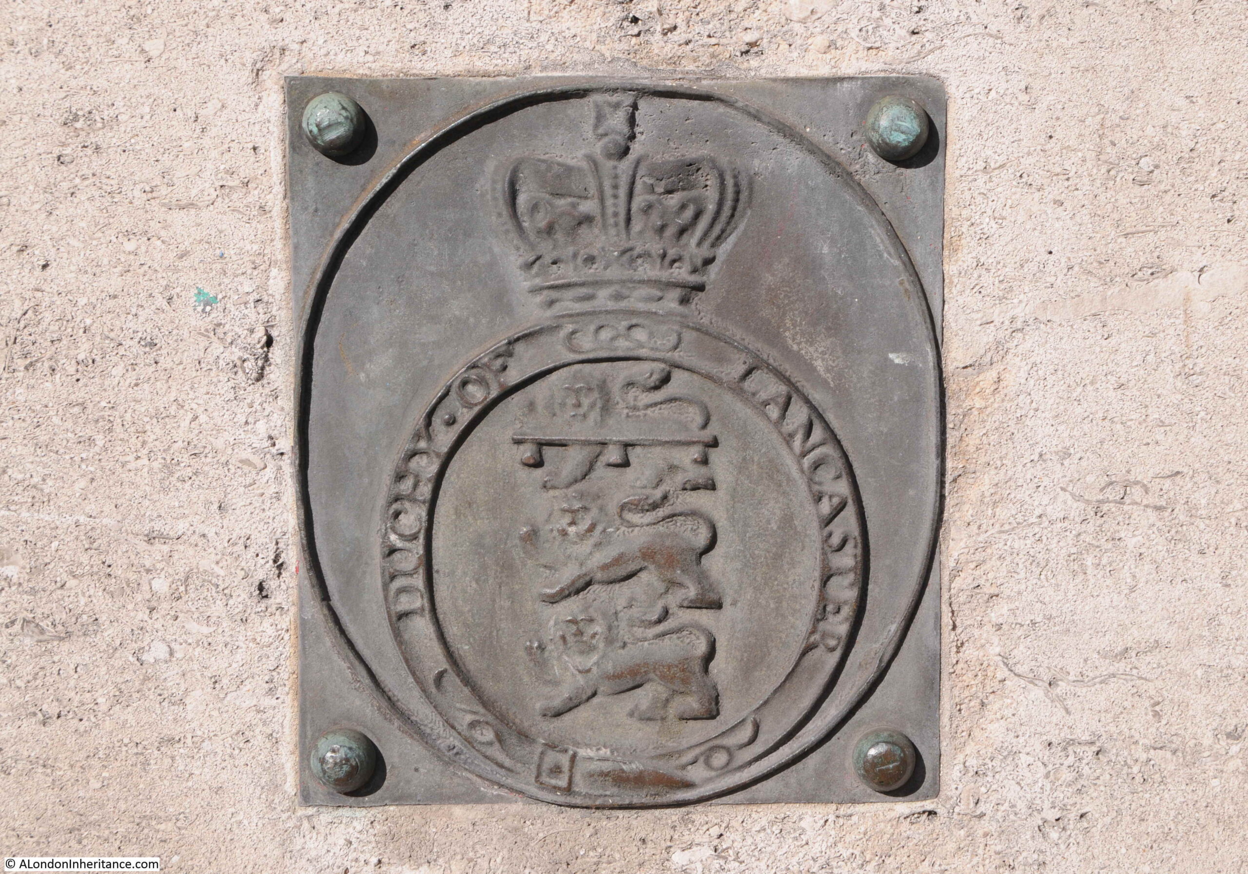
The boundary marker is close to the ground, by the steps from the Embankment up to Waterloo Bridge, on the Somerset House side of the bridge. The marker is circled in the following photo:
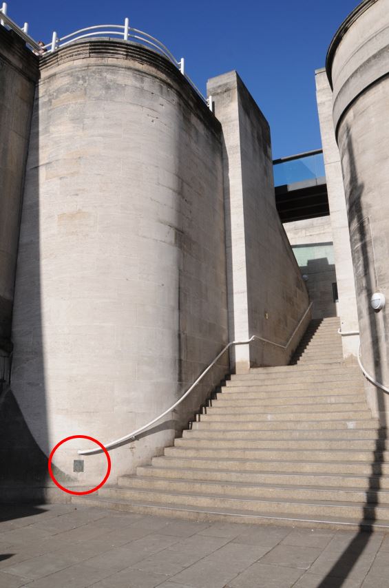
It must have been the position of the sun, and the strength of light on the stairs, however I have never realised how impressive the stairs leading up to Waterloo Bridge are, despite walking past, and up them, very many times:
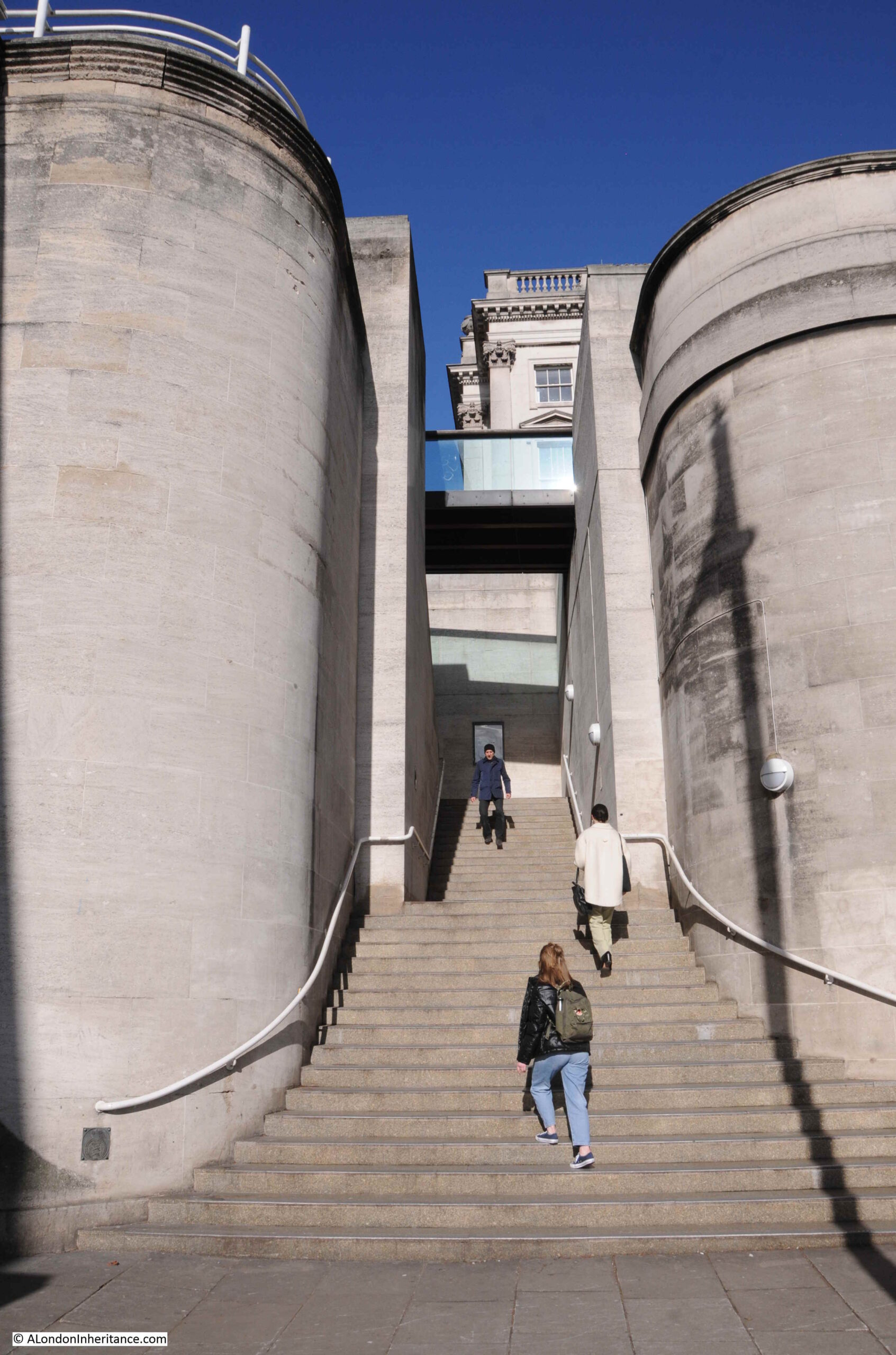
The marker is to mark the historic boundary of the Manor of Savoy. I got in contact with the Duchy of Lancaster who told me that this is one of a number of boundary markers, including one on the Lyceum Theatre. A future project to locate them all.
So what does a boundary marker of the Manor of Savoy have to do with the Duchy of Lancaster.
The answer goes back to the Middle Ages, and the time of King Henry III and his wife, Eleanor of Provence in the 13th century.
This was a time when the bank of the river between the City and Westminster was being lined with palaces and grounds belonging to the nobility of the country. One of these was Simon de Montfort, the 6th Earl of Leicester, who formed an estate to the west of Somerset House.
de Montfort has a fascinating history and both supported, and fought against the king, and for a time he ran an early form of Parliament. de Montfort died during the Battle of Evesham on the 4th of August, 1265, when he led a small army of rebellious barons against Edward, the son of King Henry III.
Following the death of Simon de Montfort, the king granted his estate to Peter, the Earl of Savoy, from where the estate would get the name “Manor of Savoy” a name which can still be found in a number of streets and buildings in the area.
Edward was the eldest son of Henry III. He would later become Edward I. Henry III had another son called Edmund, and in 1266 Edmund was granted the title of Earl of Lancaster.
Meanwhile, Peter, the Earl of Savoy had died and the Savoy estate seems to have been in the possession of a small religious establishment. Eleanor of Provence, the wife of King Henry III and mother of Edmund purchased the Savoy estate and bestowed it to her son Edmund in 1284, thereby bringing together the names Savoy and Lancaster.
The history of the estate between 1245 and 1399 is rather complex, so rather than write lots of confusing text, I have tried to show this almost as a flow chart:
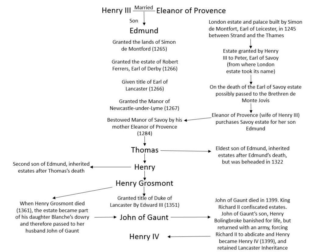
Basically, the Manor of Savoy is formed, and then granted, along with lots of other titles, to Edmund, the second son of Henry III and Eleanor of Provence.
When Edmund died, the estate passed to his son Thomas, who was beheaded in 1322 after leading a rebellion, then the estate passed to Edmund’s second son, Henry, the 3rd Earl of Lancaster. On his death, the estate passed to his eldest son, Henry Grosmont, who was granted the title Duke of Lancaster by Edward III.
Henry Grosmont had two daughters, and as daughters could not inherit a title, it became part of the dowry of his daughter Blanche, who married John of Gaunt, the third son of King Edward III.
Blanche and John of Gaunt had a son, Henry who should have inherited the estate, however during the short reign of Richard II, the king confiscated his estates and banished Henry.
Henry returned with an army, beat Richard II and became King Henry IV, thereby bringing the Manor of Savoy and the Duchy of Lancaster into royal ownership in 1399.
Henry IV defined that the estates belonging to the Duchy of Lancaster should be held by the Monarch as a private estate, separate to all other estates, and should descend through the Monarchy.
The Crown Lands Act 1702 defined that the Monarch could only receive an income from the estate and not benefit from any capital, and that is how the Duchy of Lancaster, including what remains of the Manor of Savoy remains to this day.
The area occupied by the Savoy in 1755 is shown in the following map extract. Somerset House can be seen to the right of the area occupied by the Savoy.
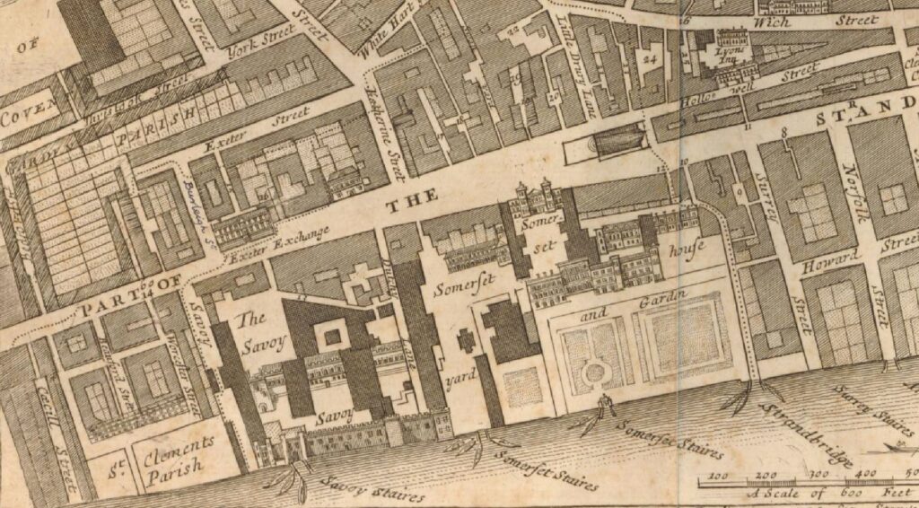
At the lower left corner of the Savoy, you can see the “Savoy Stairs”. These disappeared under the construction of the Embankment which pushed the river wall further out into the Thames, but as I have written about in a number of previous posts, these stairs provide snapshots of life in London and the wider country.
The 1730s and 1740s were decades when the country was often at war, with, for example, the War of the Austrian Succession between 1740 and 1748 which was basically a war between the ruling dynasties of Europe, and who would inherit the Hapsburg crown.
In 1743, the Battle of Dettingen took place where Britain, Austria and Hanover fought the French. This was the last battle where a British monarch (George II) led an army into Battle.
There are many newspaper reports naming the Savoy Stairs, and for this post I will use just two which tell of the risks to Londoners of being press ganged into the Navy, and of those where the stairs were the point where they left London, during this turbulent period of history.
Those working on the river was always at risk of being taken, but they would fight back. Report from the Stamford Mercury on the 21st June 1739 “Yesterday a Press-Gang of Eight, in a Man of War’s Boat, having impressed a Waterman off of Barge-House-Stairs, a Gally was manned from the Temple, by the Temple Watermen, who taking Truncheons, Stones and Brickbats with them, rowed after the Press Boat, boarded them and at last beat the Gang, brought off the Waterman, and the Press-Boat at the Savoy-Stairs, where she sunk by the Holes made in her in the Battle.”
And from the Ipswich Journal on the 30th July 1743: “Yesterday morning a great number of Recruits were put on board a close Lighter at the Savoy-Stairs, in order to be shipped at Gravesend to Portmahon and Gibraltar.“
That was a slight detour, but I find the river stairs tell us so much of what life was like in London when the river was a central part of the lives of so many people, whether a place of work, or point of departure or return.
Back to the Duchy of Lancaster.
The boundary marker photographed at the top of the post shows the historical boundary of the Manor of Savoy, that became part of the Duchy of Lancaster.
I have marked the properties that are still owned by the Duchy of Lancaster. along with the location of the boundary marker in the following map (© OpenStreetMap contributors):
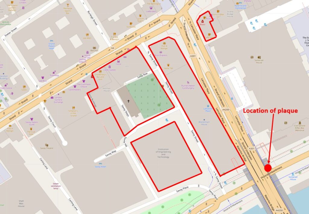
The roads around these buildings still recall the name of the old Manor of Savoy with Savoy Street, Savoy Place, Savoy Hill and Savoy Way.
The long building that runs to the west of the approach to Waterloo Bridge is the 1932 constructed Brettenham House. The southern end of the building can be seen in the following photo:
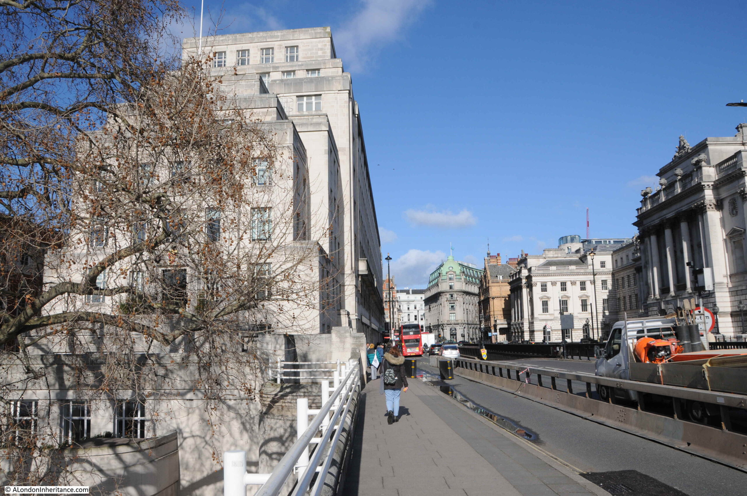
From Waterloo Bridge, the two river facing properties of the Duchy of Lancaster are Brettenham House and the part brick building named Savoy Place to the left is now part occupied by the Institution of Engineering and Technology, and is also available as an events space.
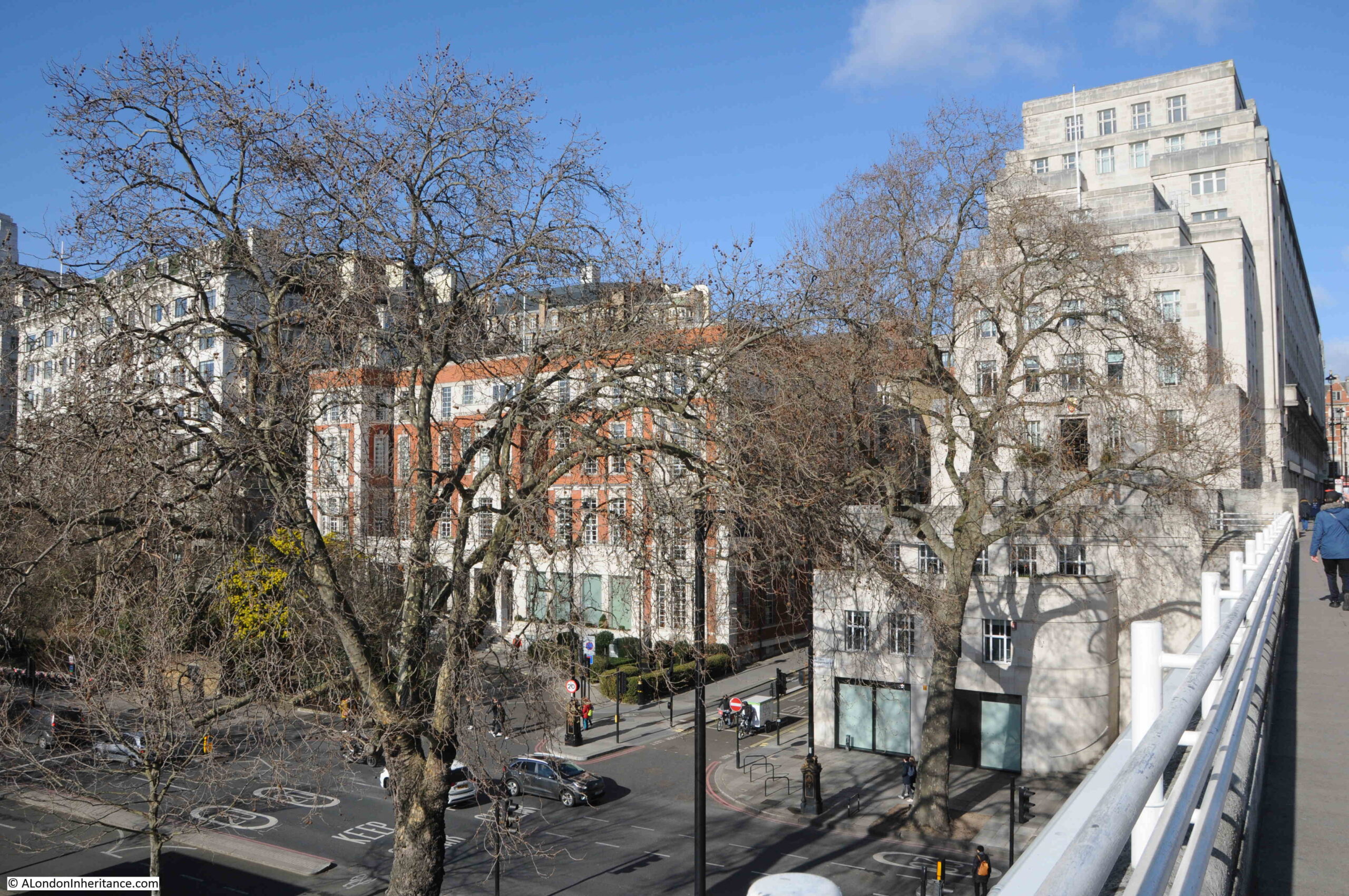
Savoy Place is the name of the building and the street that runs in front of the building, and continues left between the gardens and buildings.
The building at the southern end of Brettenham House, facing the river is 1 Lancaster Place, and are the offices of the Duchy of Lancaster, with the coat of arms of the Duchy above the door. These date back to Edmund, the first Earl of Lancaster:
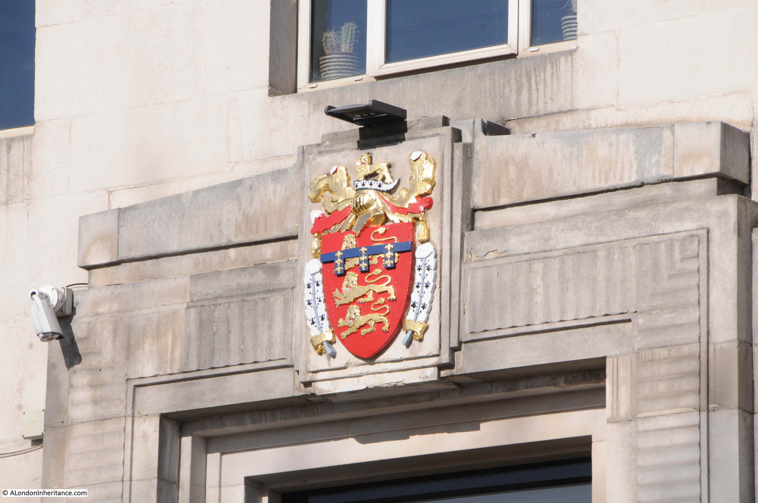
The entrance to 1 Lancaster Place:
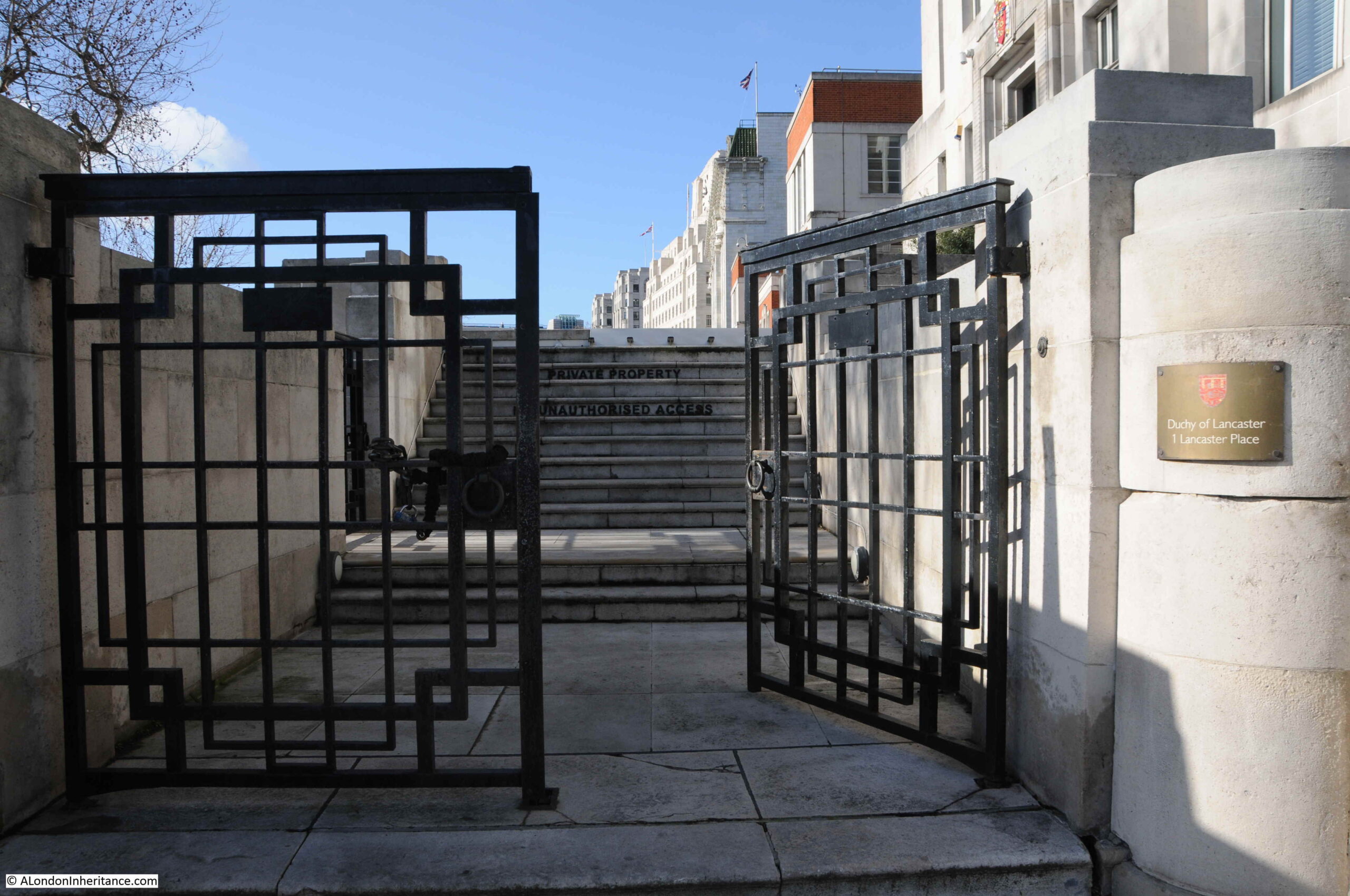
Walking from Waterloo Bridge, down to Savoy Place and this is the view up Savoy Street with Brettenham House on the right. The photo shows the slope of the street down from the Strand in the distance, to the Thames.
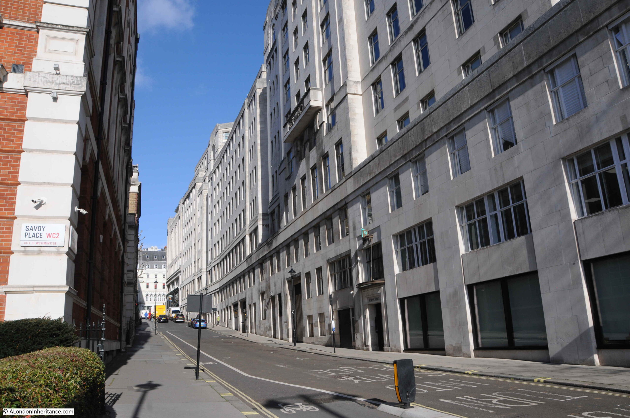
Part of the Savoy Place building seen from Waterloo Bridge in the street of the same name, can be seen to the left of the above photo.
In front of Savoy Place is a statue of Michael Faraday:
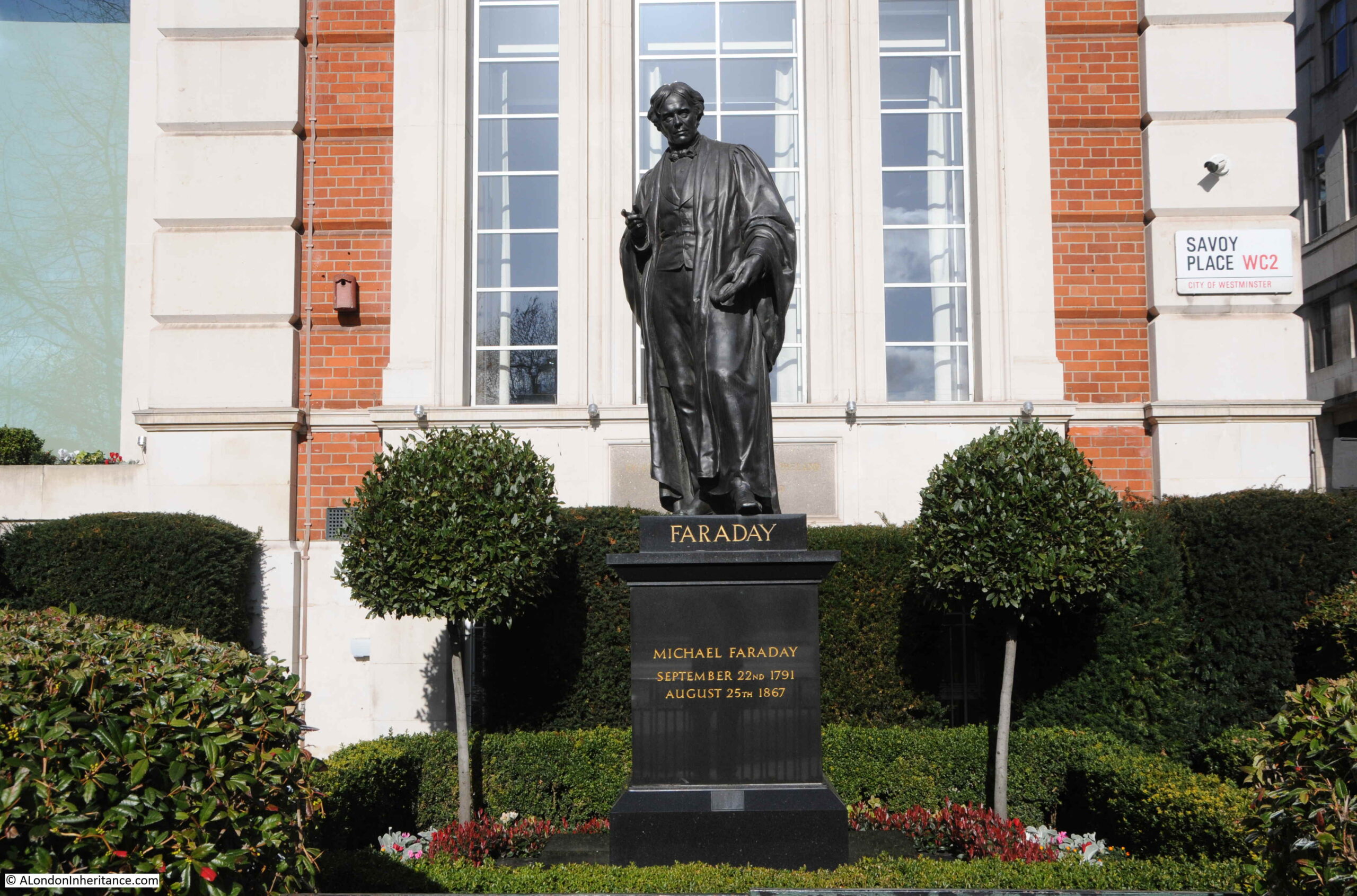
Michael Faraday was a 19th century scientist who investigated electromagnetism and electromagnetic induction, basically how a magnet could induce an electrical current to flow in a wire, which has led to how we generate electricity today.
The society occupying Savoy Place tells the history of how electricity has impacted every element of everyday life. The Society of Telegraph Engineers was formed in 1871. As the use of electricity started to grow, the society changed name to Society of Telegraph Engineers and Electricians in 1880, and in 1889, the society became the Institution of Electrical Engineers.
These societies had been meeting in the buildings of other London institutions, but in 1909 the Institution of Electrical Engineers took possession of the lease of Savoy Place which had been built in the 1830s for the Royal College of Physicians and the Royal College of Surgeons of England.
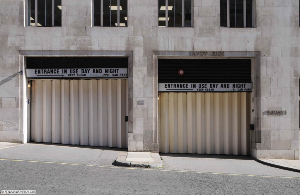
Walking up Savoy Street and I found these garage doors in the side of Brettenham House. The photo shows the slope of the road down to the river, and I rather like the lettering used above the doors.
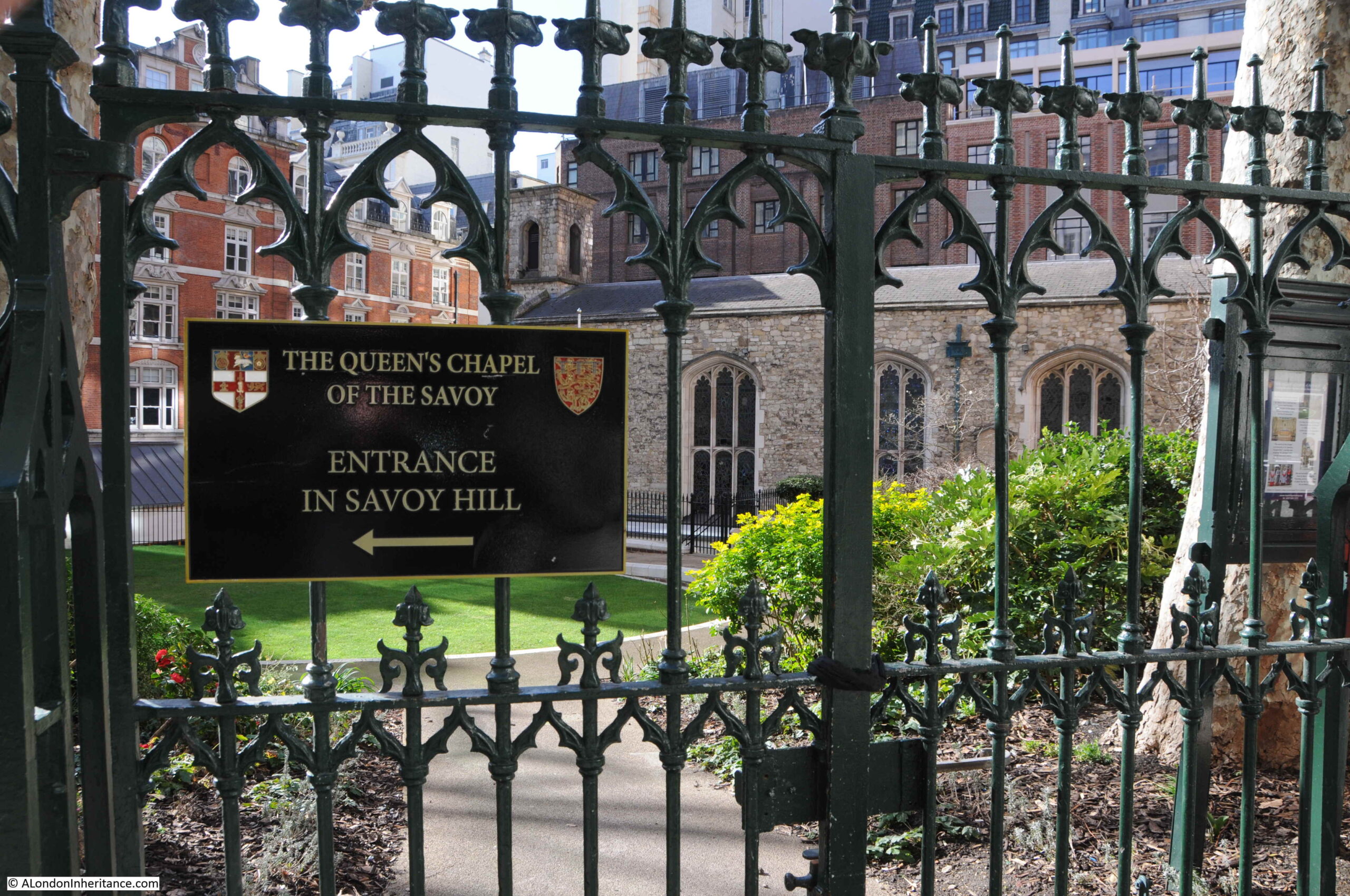
Half way up Savoy Street, and hidden among all the 20th and 21st century buildings is a survivor from the hospital built on the land of the Savoy estate by Henry VII in the early years of the 16th century. This is the Savoy Chapel:
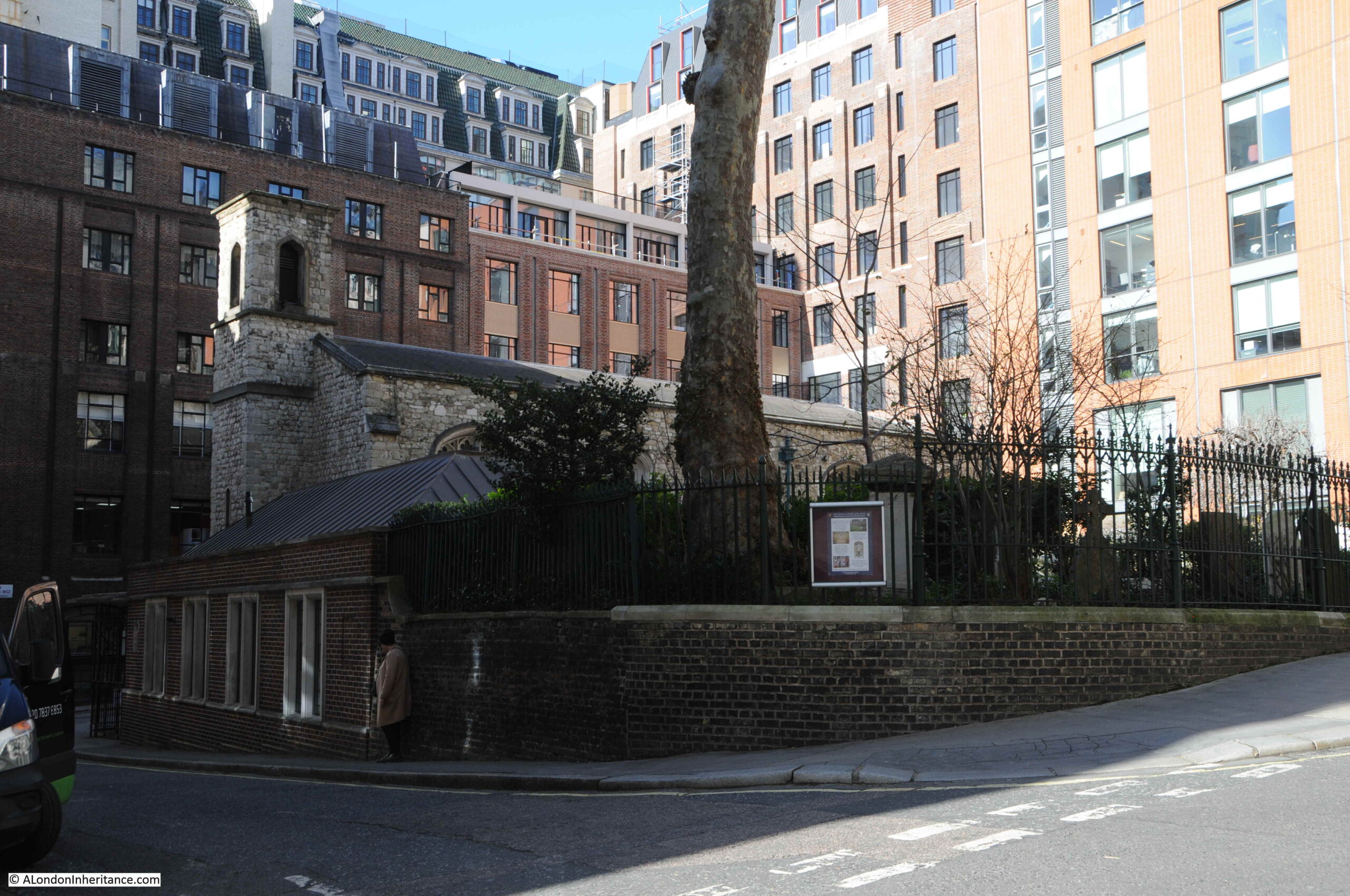
The chapel is a private chapel of the Sovereign in Right of the Duchy of Lancaster. Despite appearances of being older, much of the chapel dates from 1865 after the building was gutted by fire. Only part of the outer wall dates from the original construction in 1502.
The Savoy Chapel is maintained by the Duchy of Lancaster. The chapel as it appeared in 1830 (© The Trustees of the British Museum):
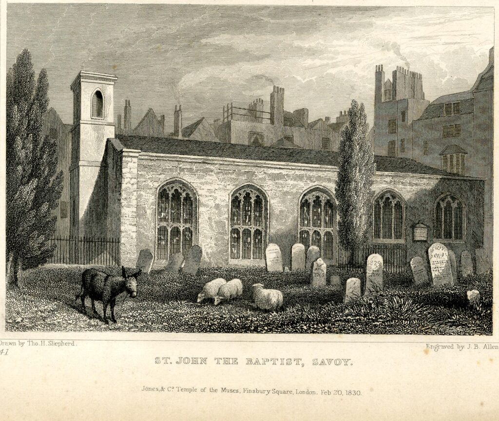
Despite the later rebuild the chapel today looks much the same as the above print, although there are no sheep to be seen tending the perfect looking grass.
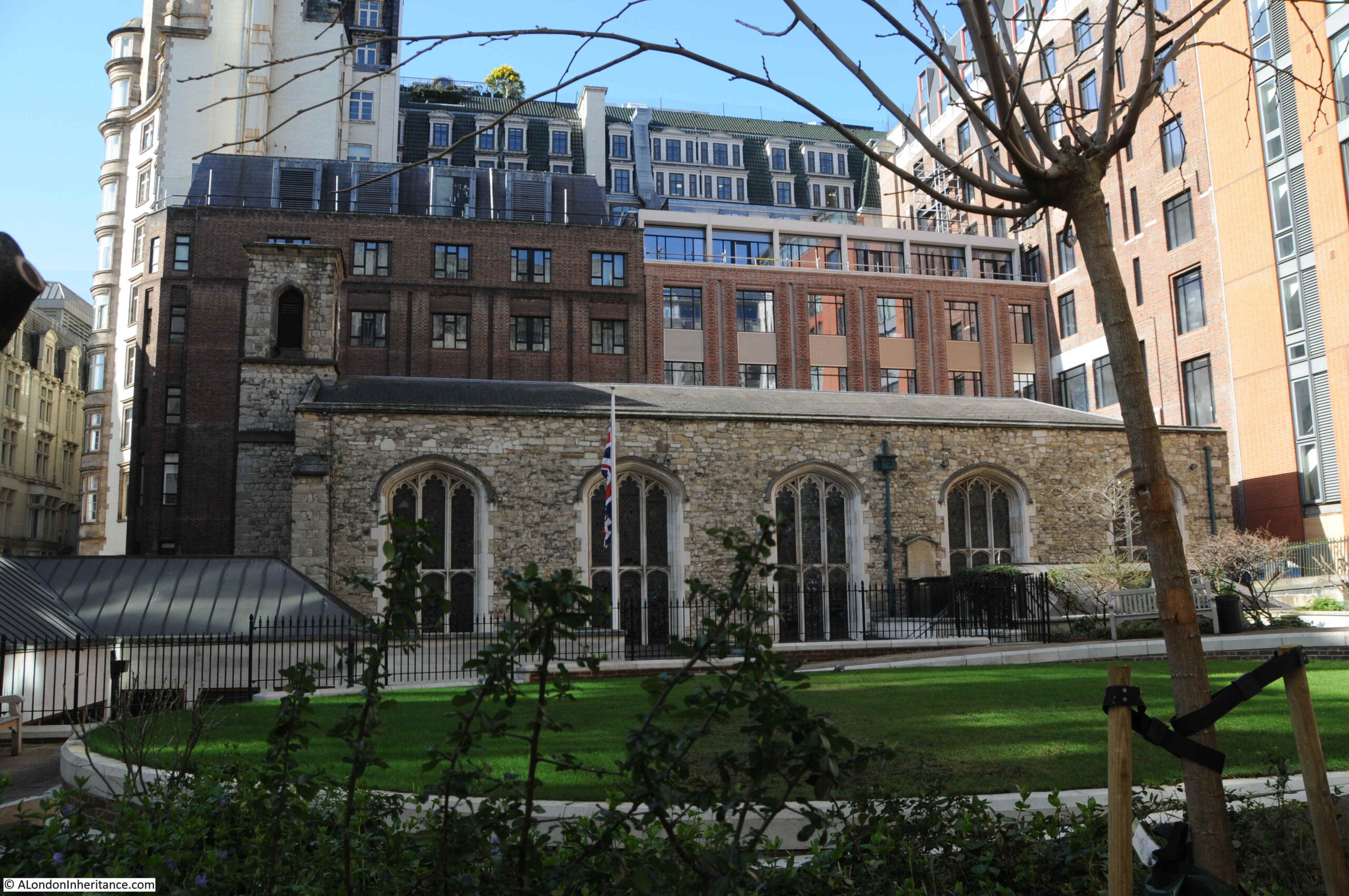
A future post will cover the chapel and the history of the Savoy and the hospital in more detail, as I wanted to look at the Duchy of Lancaster in this post.
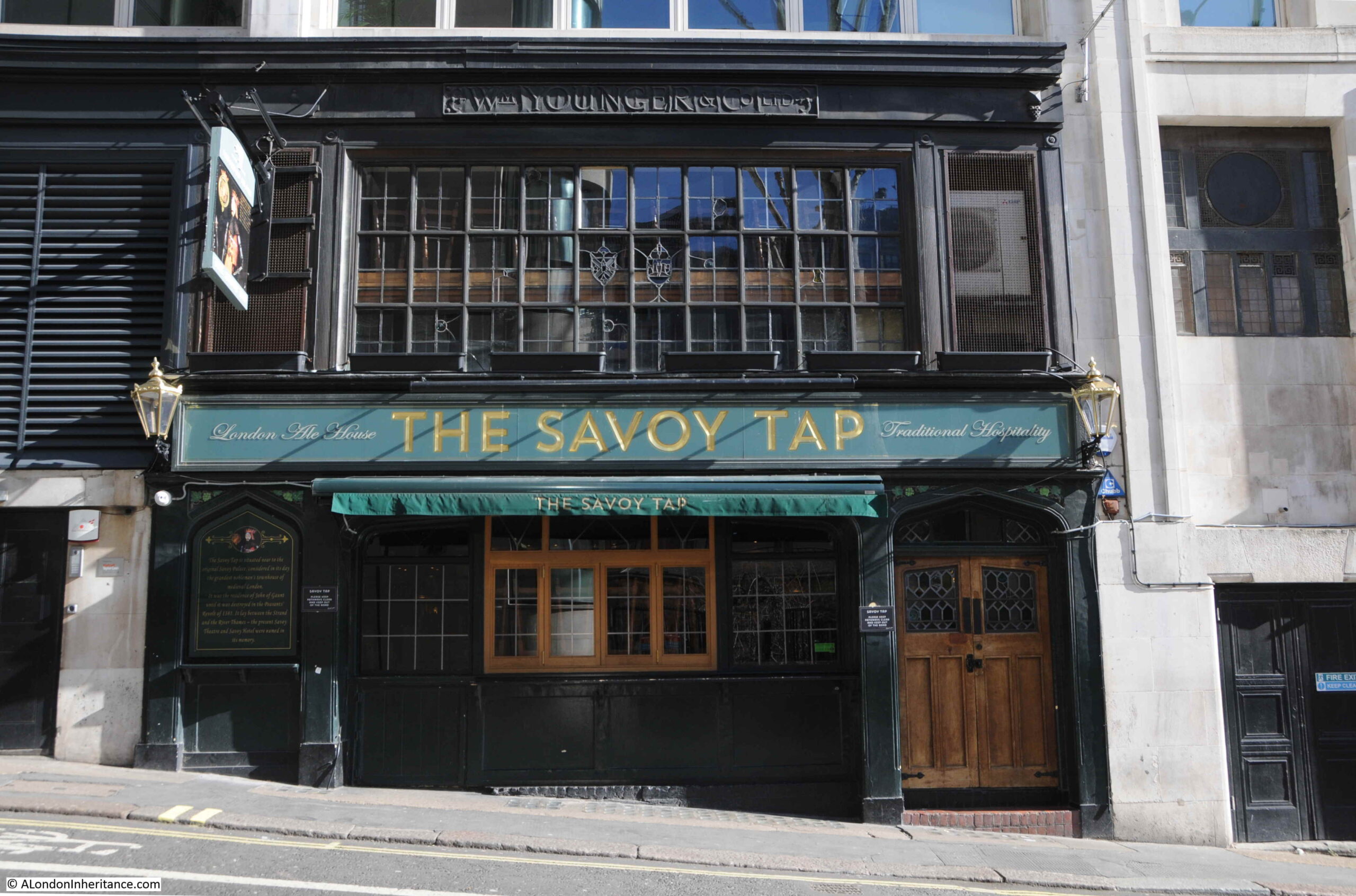
The Savoy Tap pub, which although today is built into the surrounding 19th century buildings, a pub has been on the site since the mid 19th century. Again, the street shows the slope between Strand and Thames:
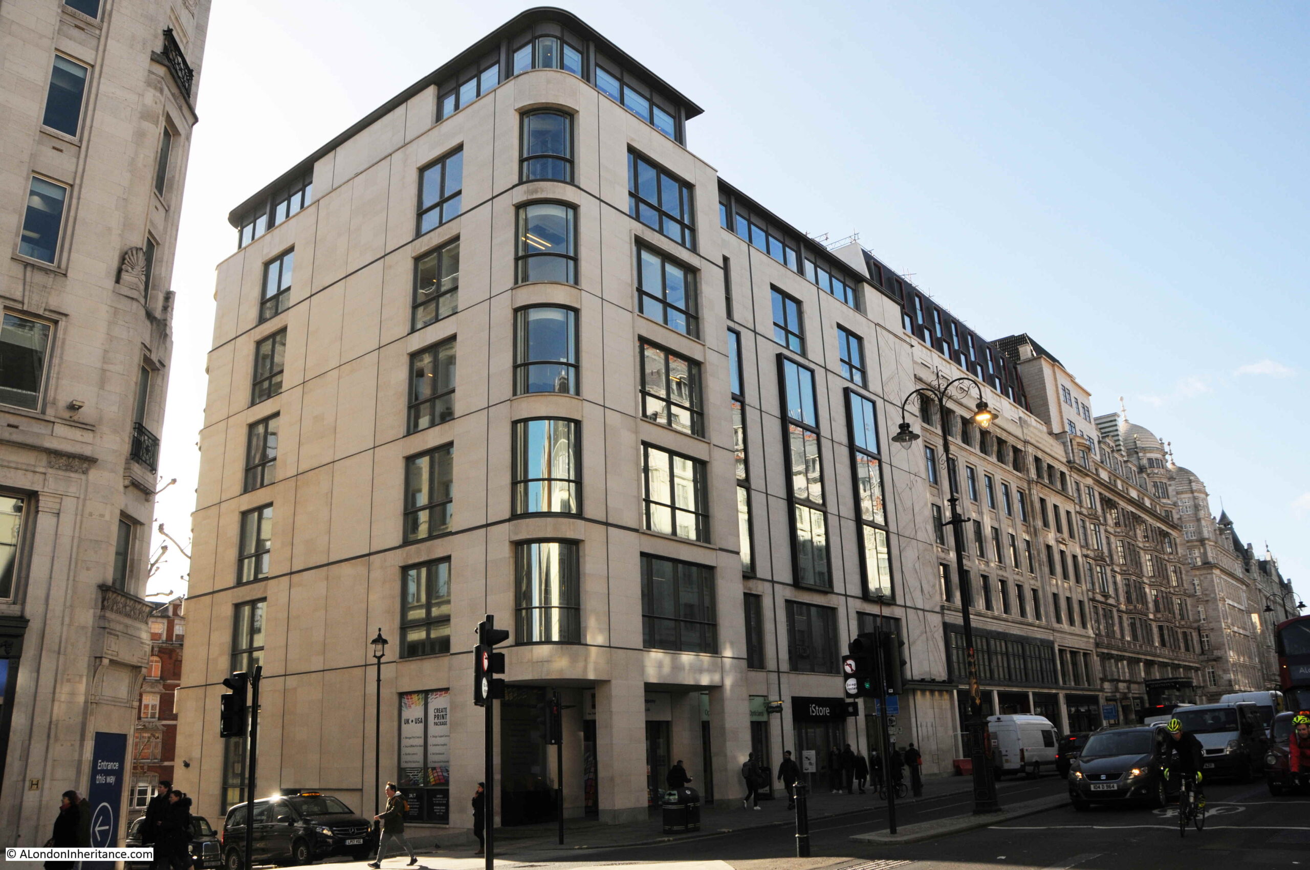
My map of the buildings owned by the Duchy of Lancaster, shows a couple of buildings along the Strand, west of Savoy Street. These are the first two buildings in the following photo:
The main block on the corner is 111 Strand, and has a map carved on the front of the building which I wrote about in this post.
On the eastern corner of the junction between the Strand and the approach to Waterloo Bridge is Duchy House, the Duchy of Lancaster’s single building on this side of the approach to Waterloo Bridge:
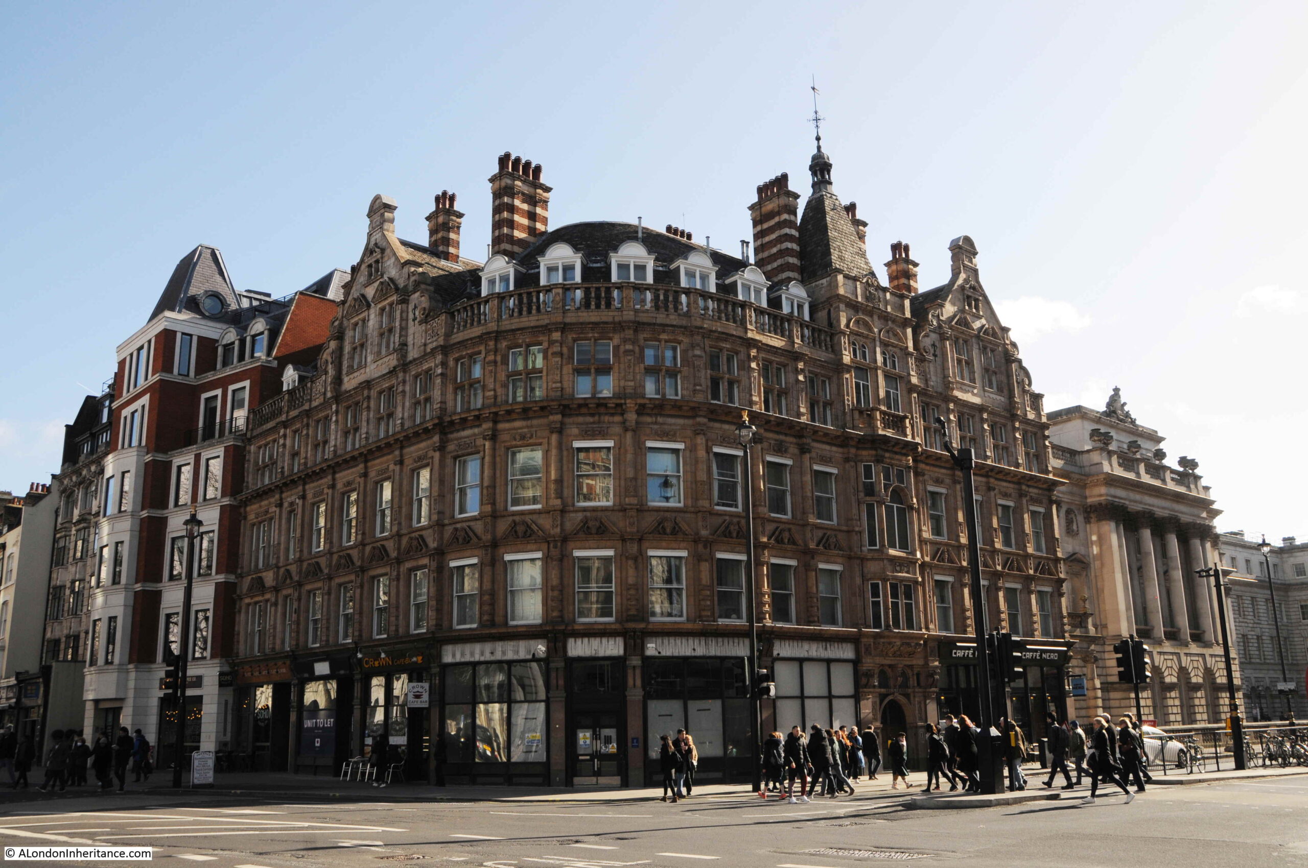
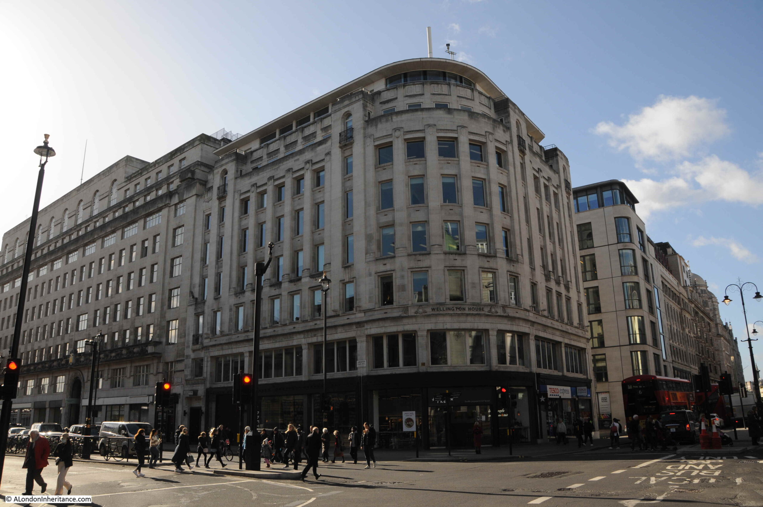
On the western side of the junction is the corner building owned by the Duchy of Lancaster with Brettenham House to the left:
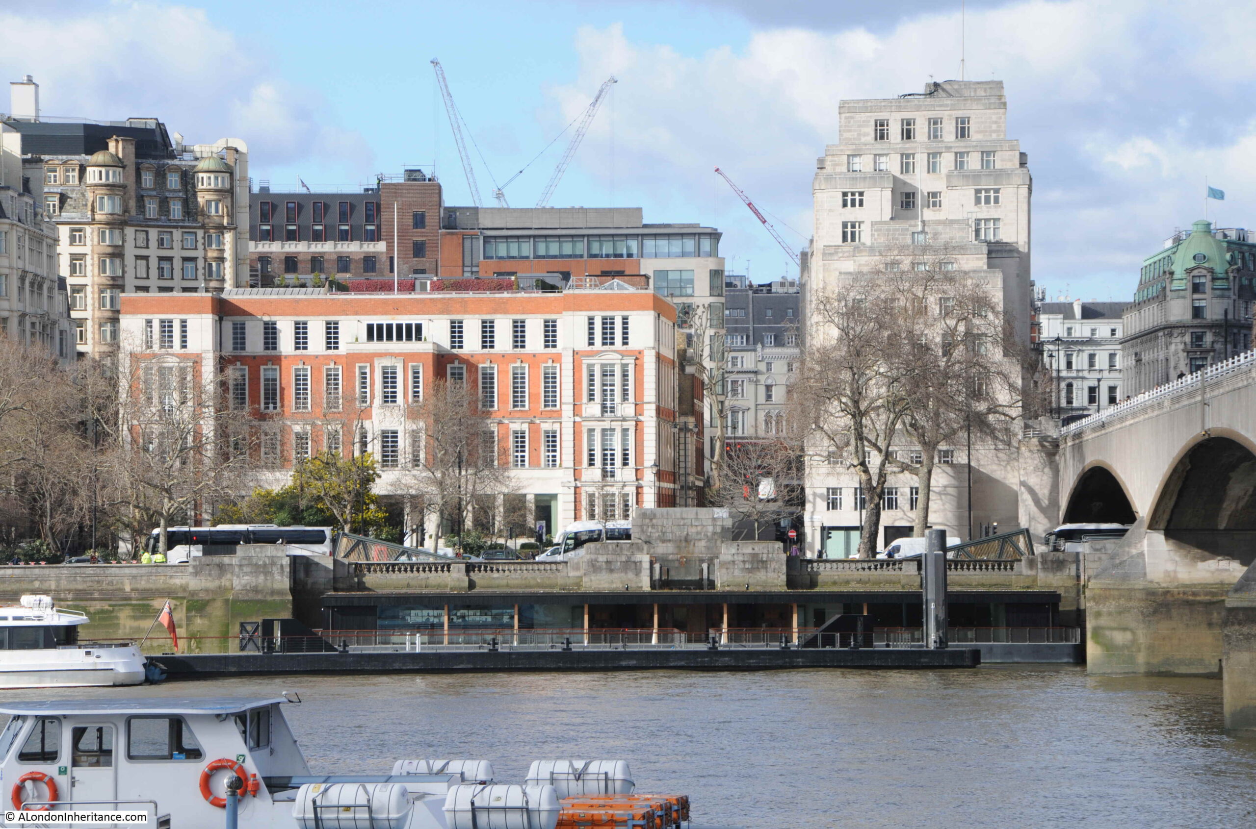
From across the river, we can see the end of Brettenham House, and Savoy Place.
The following print from 1736 shows the Savoy from the south bank of the river. the Savoy Stairs are on the left and the tower of the Savoy chapel can be seen to the rear of the left of the print (© The Trustees of the British Museum):
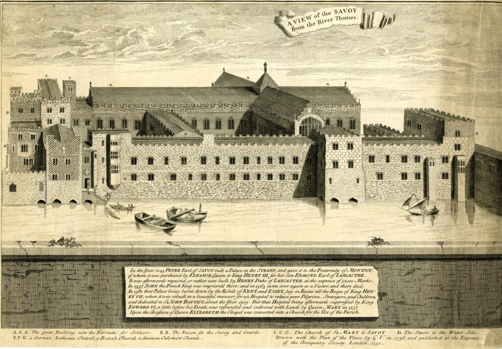
If the perspective and scale of the buildings in the above print is correct, then Savoy Stairs would have been just to the left of centre of the Savoy Place building today.
The right hand part of the buildings in the above print would today be under the approach to Waterloo Bridge, hence the location of the boundary marker on the eastern side of the bridge.
As well as the remaining parts of the land associated with the Manor of Savoy, the Duchy of Lancaster also owns a considerable portfolio of other holdings associated with the original holdings at the time of Henry IV.
This includes land in Lancashire, Staffordshire, Cheshire and Yorkshire, various mineral rights and parts of the foreshore in Lancashire.
The estates of the Duchy of Lancaster have been owned by the Monarch since Henry IV took over the Lancaster inheritance in 1399, and continue to be owned by the current Monarch, as Duke of Lancaster.
The name goes further back to 1266 when Edmund , the second son of Henry III granted him the title of Earl of Lancaster, the Savoy name originates from Peter, Earl of Savoy who was also granted the estate by Henry III, and the estate goes back to 1245 when Simon de Montfort formed the estate and built a palace on the banks of the Thames.
All from a small boundary marker on the side of the steps up to Waterloo Bridge. Now I need to find the rest of the markers.

Brilliant! What a treat with my first cup of tea of the day.
I love this part of London. I’m going to look for the Savoy stairs next time I go. By the way is the spelling ‘Montfort’ or ‘Montford’ as you have put both…
Jane, thank you for picking that up. No matter how many times I read through, I frequently miss typos. It should be ‘Montfort’. Post updated – thanks again.
Absolutely fascinating.
Fascinating… and food for thought. I live in a Savoy House which was built on the site of another “Savoy”.
About 30 odd years ago I did a scheme to redevelop the site at 111 Strand but our client did not buy the site. It was later developed by another firm using Squire as architects.
that’s really interesting. I’m going to read it again as there is a lot to take in.
it makes walking around London much more nicer looking out for historic boundaries and being aware of the history of places.
Very interesting thanks. I worked in the corner building next to Brettenham House in the early 70s.
Fascinating piece. And the Duchy has a political connection, as the Chancellor of the Duchy of Lancaster is a senior cabinet minister. He/she is appointed by the monarch under the advice of the Prime Minister and is nowadays given to someone as a ‘minister without portfolio’. The actual Duchy responsibilities are minimal so ultimately it’s a sinecure post allowing the PM of the day to appoint who he/she wishes to the cabinet.
https://en.wikipedia.org/wiki/Chancellor_of_the_Duchy_of_Lancaster
I believe the very first BBC radio studios were in Savoy Hill before Broadcasting House was built, but I have never been able to find exactly where.
I believe that the studios were in the Savoy Place building, occupied by the Institution of Engineering and Technology and its predecessors since 1909. The Institution offered the accommodation to the British Broadcasting Company in 1923.
Another Brilliant piece- gave me a recap on history of England. John of Gaunt always fascinated me. It has made me go back and reread books I loved. Will also reread this as there was so much history to absorb.
Growing up in London I was surrounded by history everytime I walked down the street.
Thank you from Canada for reminding me just how special London is.
My Vanderpump ancestors were Thames watermen in the 1700s (or before) so particularly interested in them defending each other against the press gangs! Also Captain Aubrey in Patrick O’Brian’s Aubrey-Maturin novels has to stay at the Grapes Inn when he is threatened with arrest for debt. So many thanks!
For more on Parish Boundary markers see the late Mike Horne’s website and inventory of the surviving markers which can be found at http://www.metadyne.co.uk/Parishboundaries.html
The Boundary Marker you have identified is PBM055 in the inventory as is reported as being “Badge or roundel now about 50ft west of actual parish/precinct boundary line”.
Another truly enlightening post. Congratulations.
The little alley by the side of the Savoy chapel is where Bob Dylan filmed the video for “Subterranean Homesick Blues”… the chapel is the building on the right. Bob and his friends had been up all night making the cards that he holds and discards as the song progresses.
Thank for this. When I worked for Inland Revenue in the 1990s with the main offices being Somerset House, we also had many satellite offices including in Bush House, Strand Bridge House, Victory House on Kingsway and others – there were HR staff in Duchy House (referred to as Duchy Rooms) and I remember looking down from there at the bombed bus (not the 7/7 one, this was ten years earlier – that morning we had been due to receive a Canadian delegation for negotiations, which had to be cancelled).