I have written about the area between the Strand and the Embankment in a number of previous posts. It is a fascinating place of alleys, steep streets to the river, and a place where we can still find features that are reminders of long lost landscapes.
One such feature can be found at the southern end of Essex Street, where the street appears to come to an end, with a large gap in the building at the end of the street framing the view towards the Embankment:

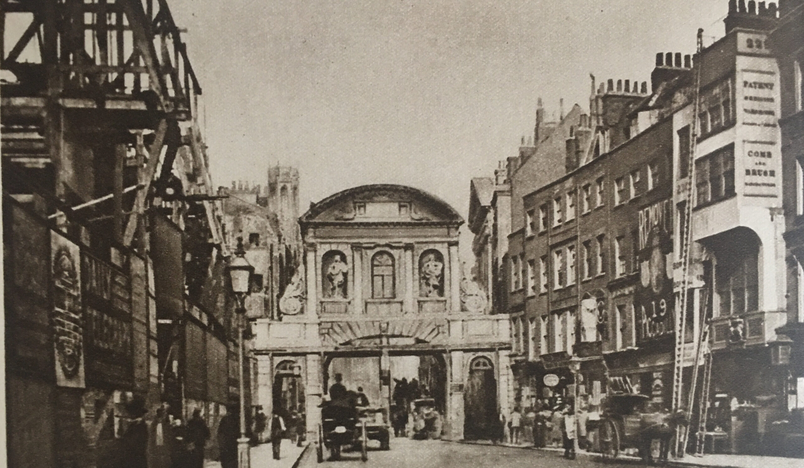
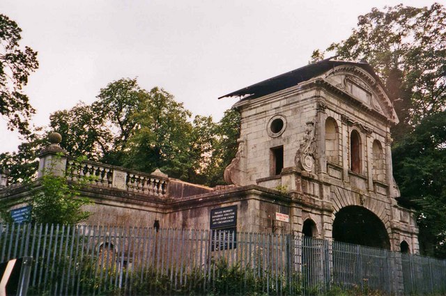
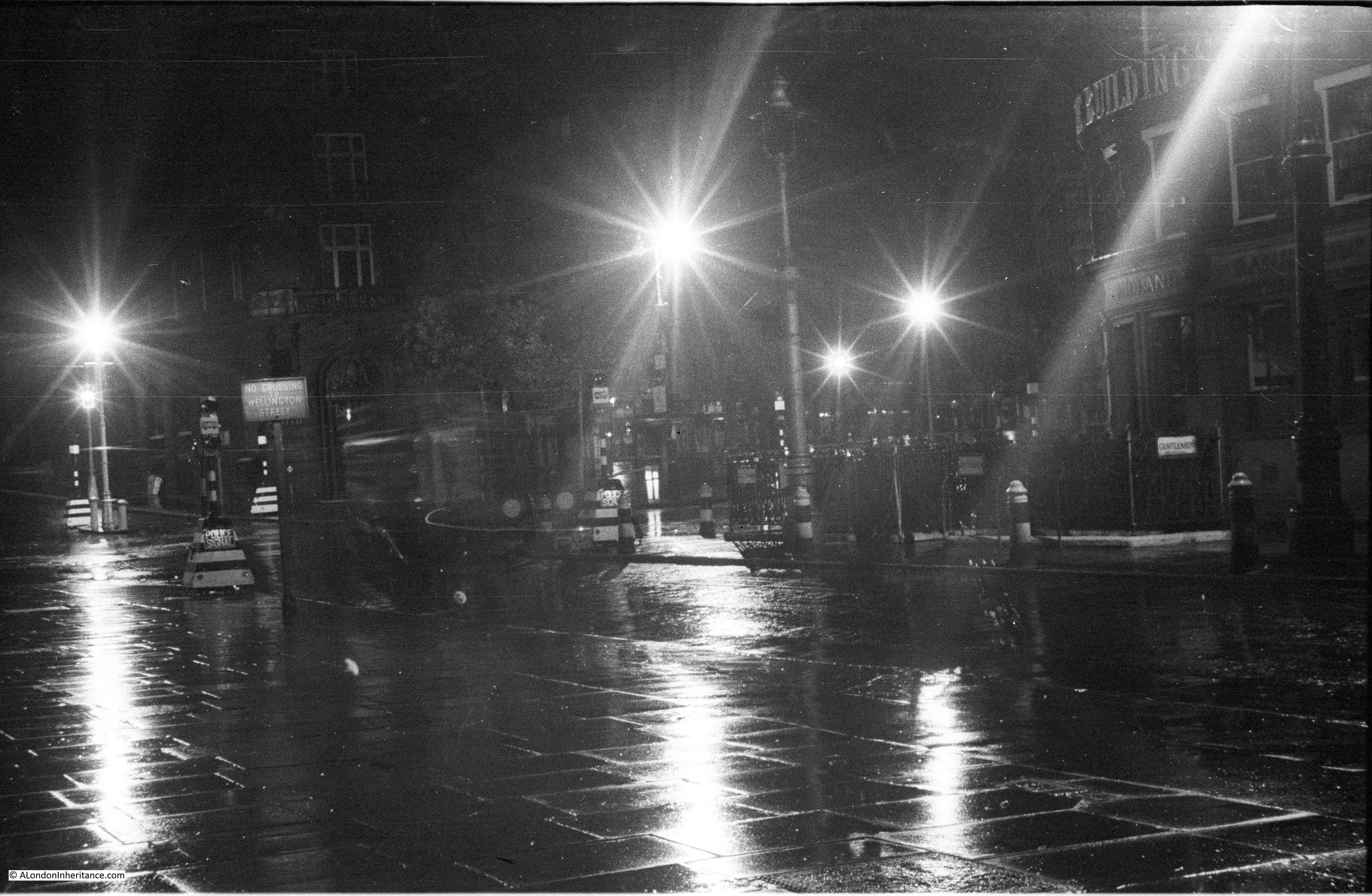
The archway through the building at the end of Essex Street leads to a set of stairs down to what would have been the level of the Thames. The archway in the 1920s from the book Wonderful London:

I love the details in these photos. There appears to be a child at lower left of the arch, who looks like they are holding a small dog or cat.
At first glance, the arch and surrounding building looks the same as the photo from 100 years ago, however looking closer and there are differences. The brickwork in the semi-circular area below the two round windows and above the entrance appears far more recessed in the 1920s than it does today, and along the wall between first and second floors there appears to be a white decorative band protruding from the brickwork which is not there today, so I suspect there has been some rebuilding / restoration of the building and arch.
A look at the London County Council Bomb Damage Map shows that there has indeed been some considerable post-war rebuilding, as the building surrounding the arch at the end of Essex Street is coloured deep purple, indicating serious damage.
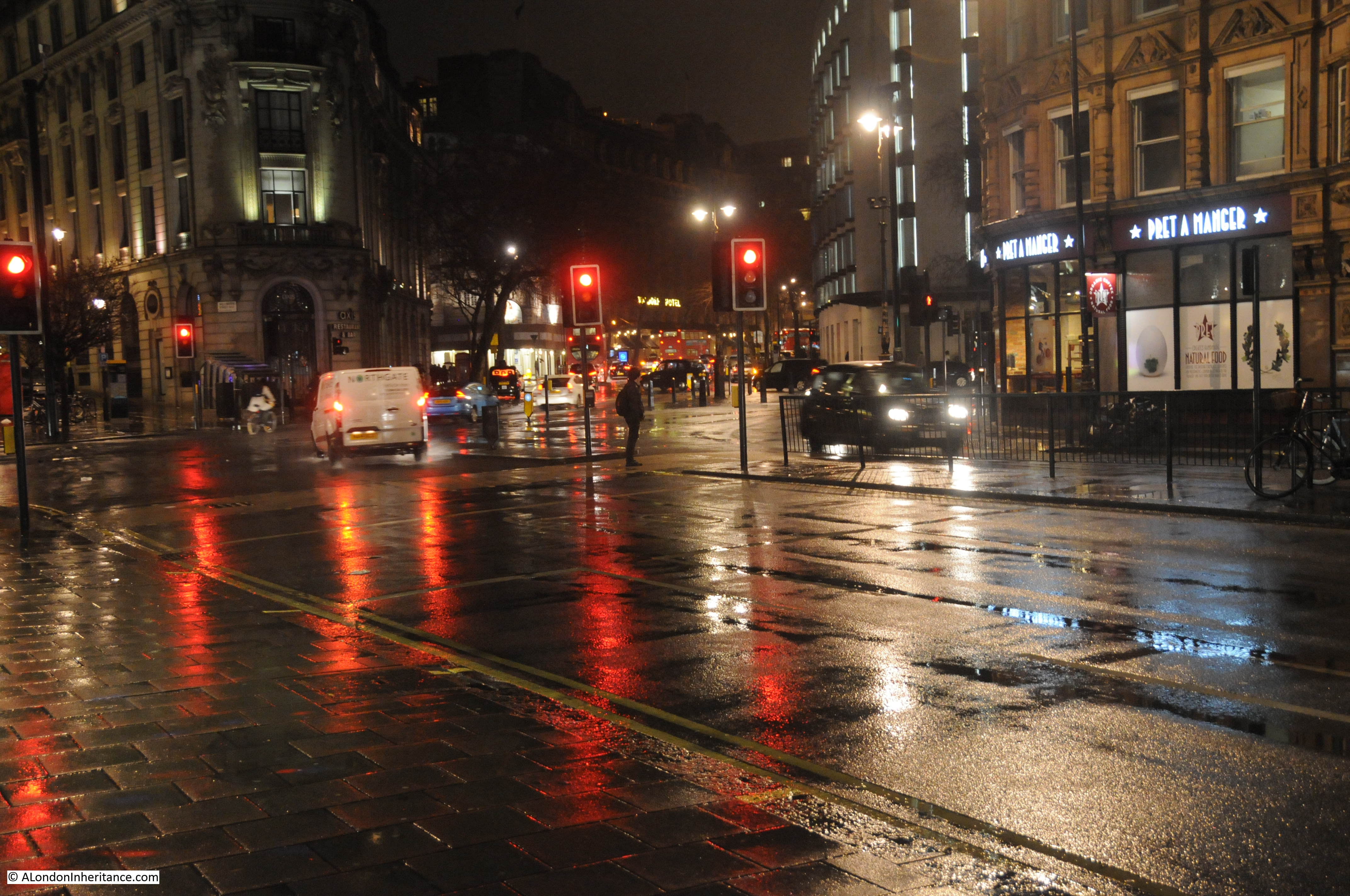
A look through the arch in 2025:

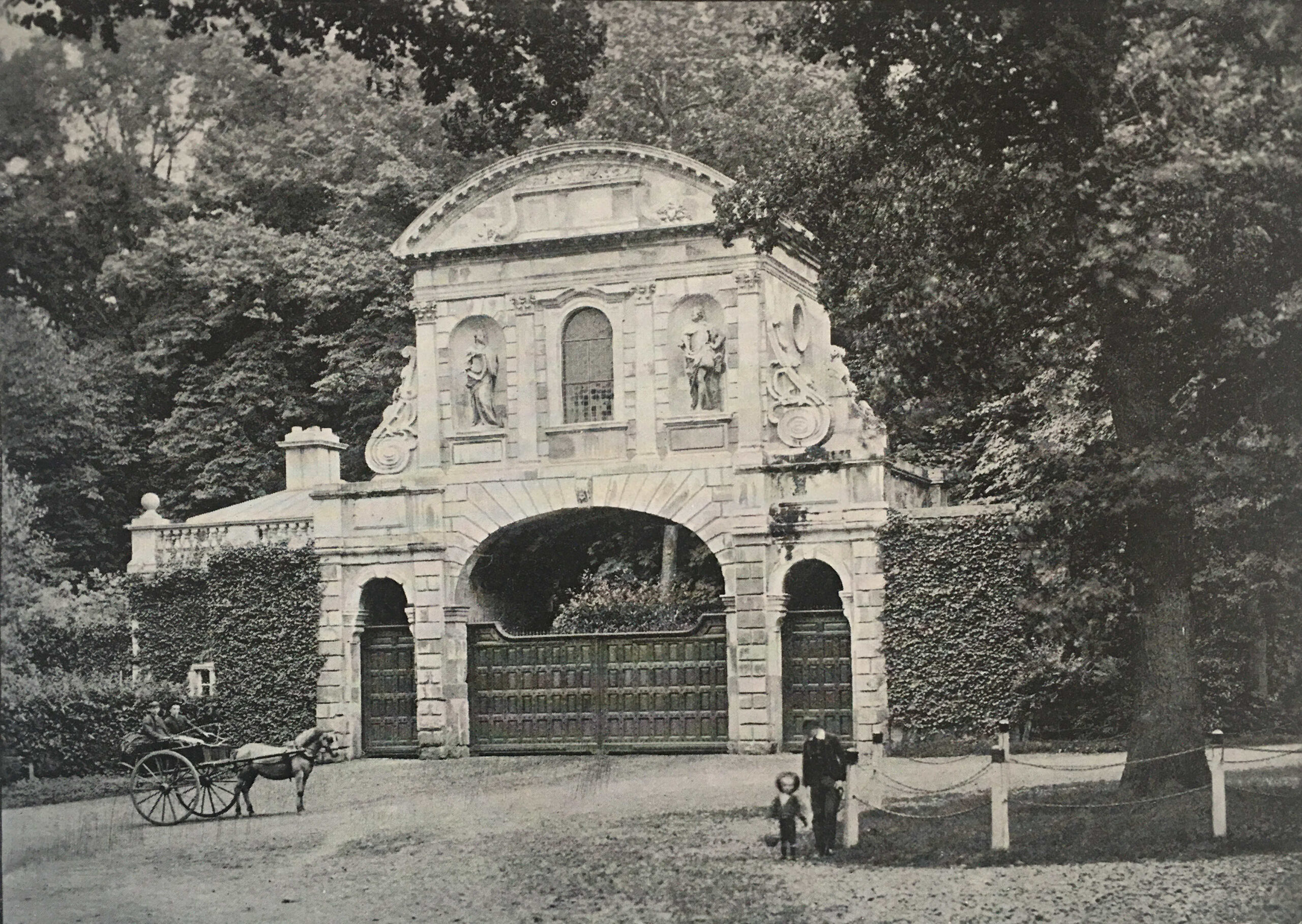
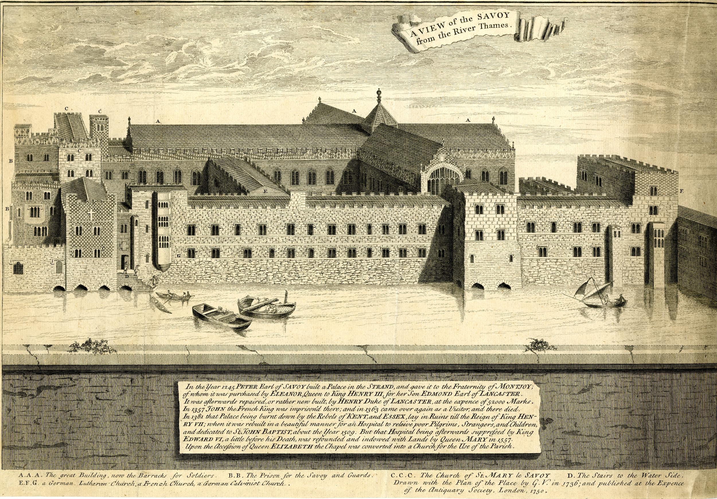
The following photo from the the book “The Romance of London” by Alan Ivimy (1940), where the scene is described as “Water Gate, at Essex Street, Strand. This opening at the bottom of the street, which gives a view of green trees, is the old Water Gate, built into the surrounding houses, of Essex House, and the only survival of that great mansion”:

Essex House was one of the large houses that once lined the Strand, each with gardens leading down to the banks of the Thames. These houses would typically have their own access to the river as the river was frequently the fastest and safest method of travelling through London.
The caption in Alan Ivimey’s book is rather ambiguous as it states that the opening is the old water gate. It does not specifically state that the surrounding structure is the original water gate.
The houses lining the Strand often did have a feature where their private access to the river was located, as the view of these from the river would have acted as a location marker as well as a symbol of status, where a large, decorated structure acting as their gate to the river would have impressed visitors and those travelling along the Thames.
Another example is the Water Gate to York House, which was the subject of this post.
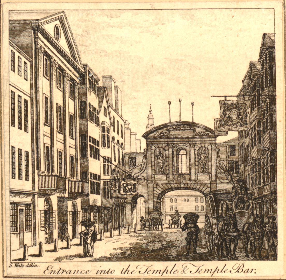
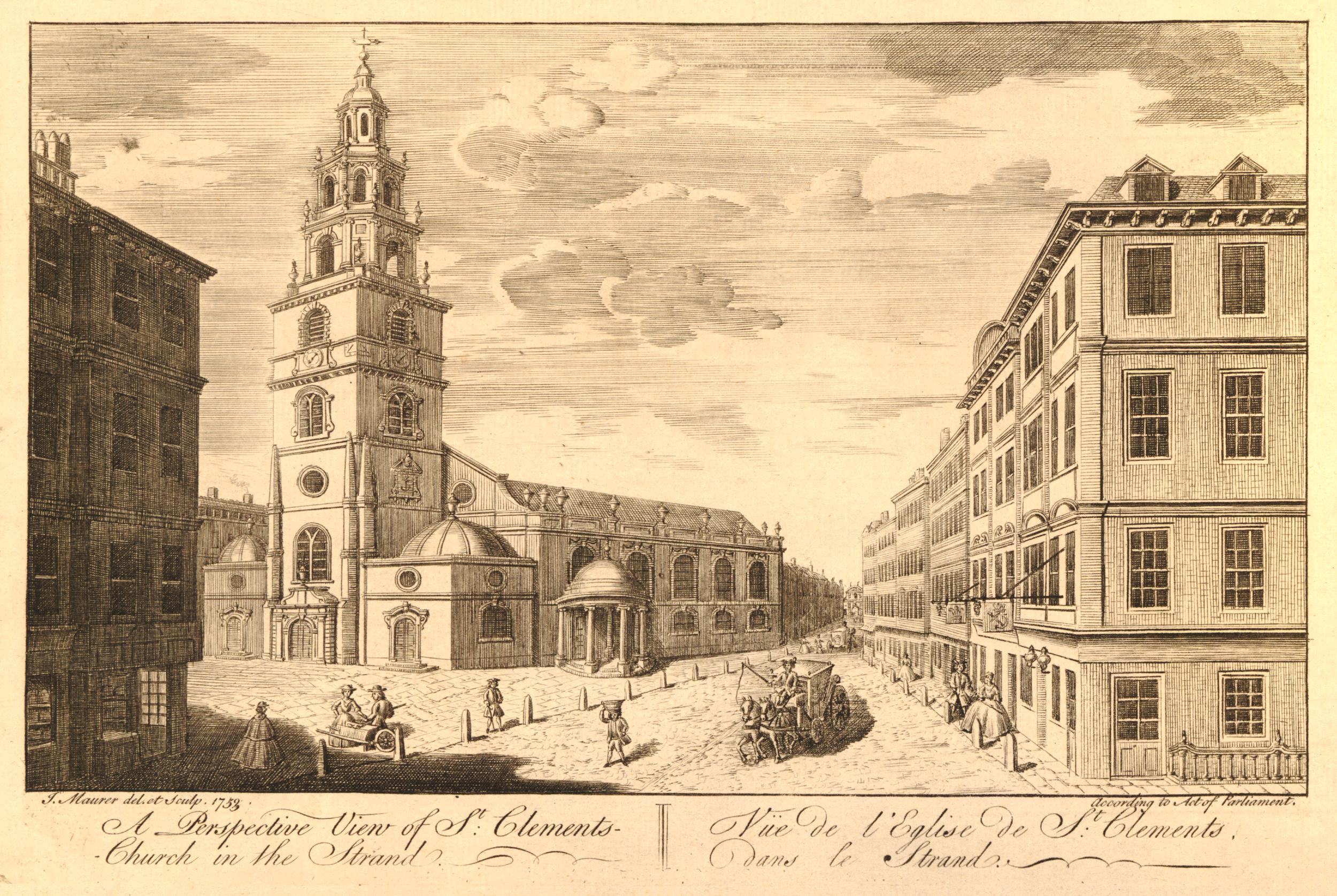
The arch was described as a Water Gate in the many illustrations of the feature that have appeared over the last couple of hundred years, including this print from 1848, where the Water Gate is described as the “stately portal with large columns to either side”:

Image: © The Trustees of the British Museum. Shared under a Creative Commons Attribution-NonCommercial-ShareAlike 4.0 International (CC BY-NC-SA 4.0) licence.
So is the arch a survivor from the time of Essex House? Any thoughts that this may be a historic survival are quickly dashed when looking through the Historic England listing.
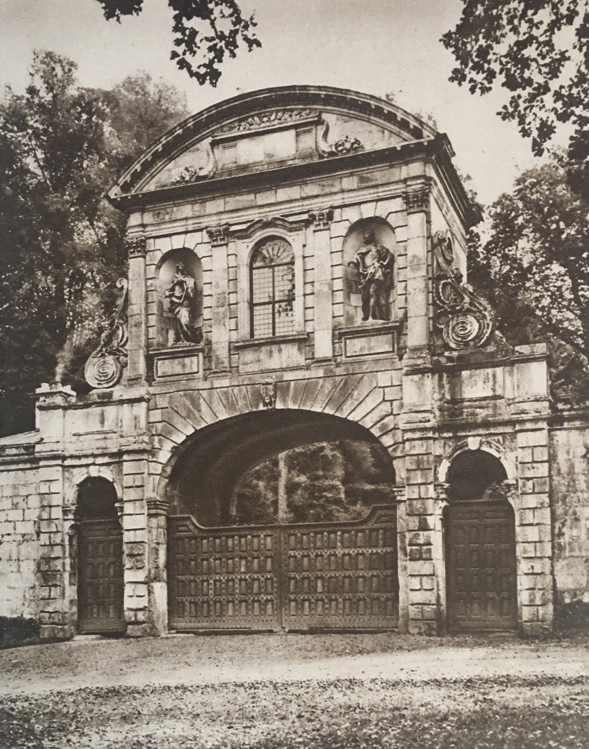
The arch is Grade II listed, however the listing text states that it is a “Triumphal” gateway built in 1676 by Nicholas Barbon to terminate his Essex Street development, and to screen his development of a commercial wharf below. The listing also confirms that there was bomb damage, and the surrounding buildings date from 1953.
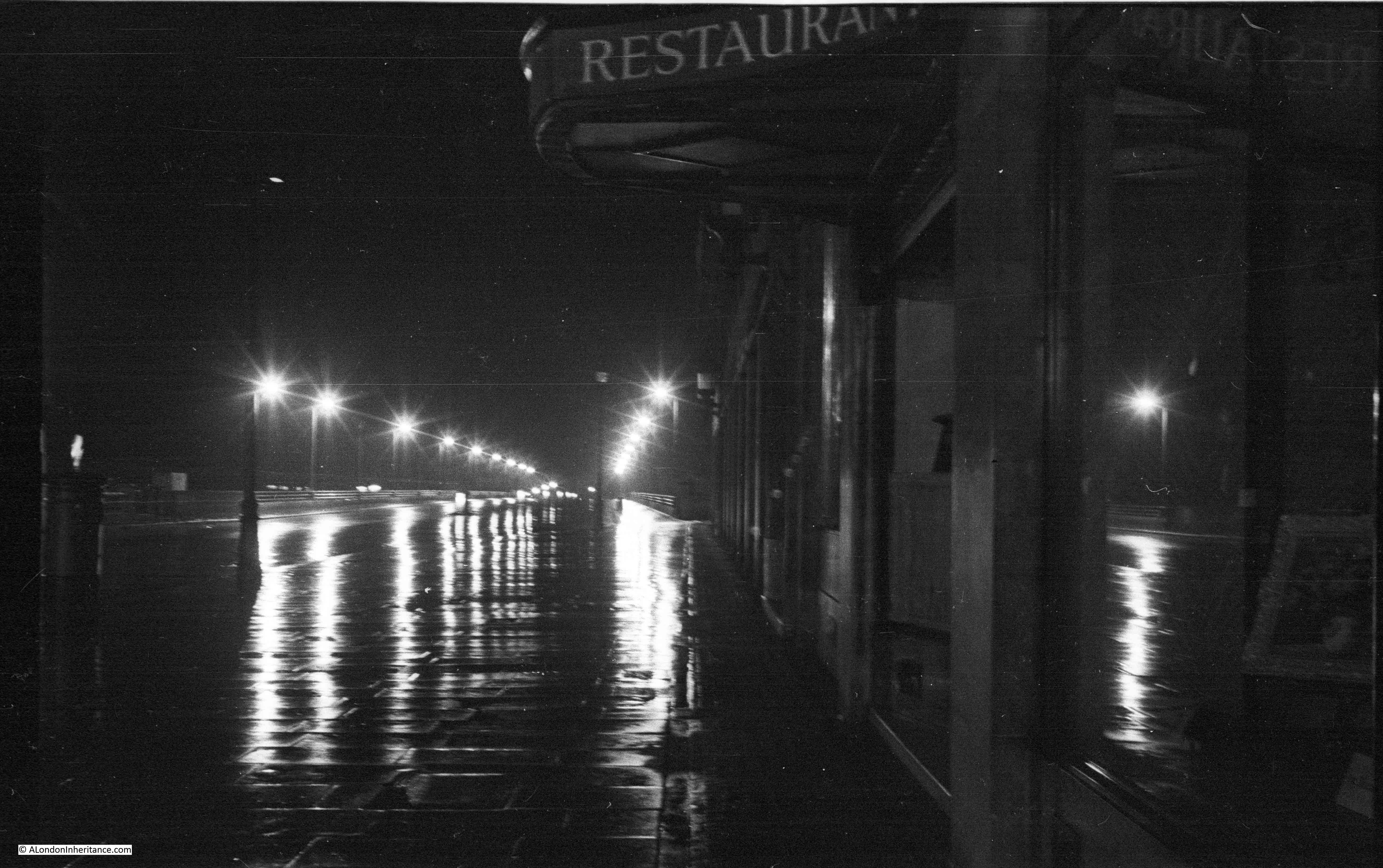
Looking through the arch, we can see the steps leading down to Milford Lane:

Through the arch and down the stairs, we can look back at the rear of the 1953 building, the stairs and the arch. The view shows how the height difference between the streets leading down from the Strand, and what was the foreshore of the Thames have been managed, where the ground floor from this angle is the basement from Essex Street:

Although the building was bombed in the 1940s, and rebuilt in the 1950s, this view still looked very similar to the 1920s:

So, although the arch has frequently been called the Essex Street, or Essex House Water Gate, it appears that the feature dates from Nicholas Barbon’s development of what had been the Essex House gardens, into Essex Street. It was bombed in the last war, restored and rebuilt, and the building surrounding the arch dates from the 1950s.
I mentioned at the start of the post how features such as the arch can act as reminders of a long lost landscape, and to see how this works, we need to follow a series of maps.
Starting with the area today, and I have marked the location of the arch / water gate with the red arrow in the map below (map © OpenStreetMap contributors):

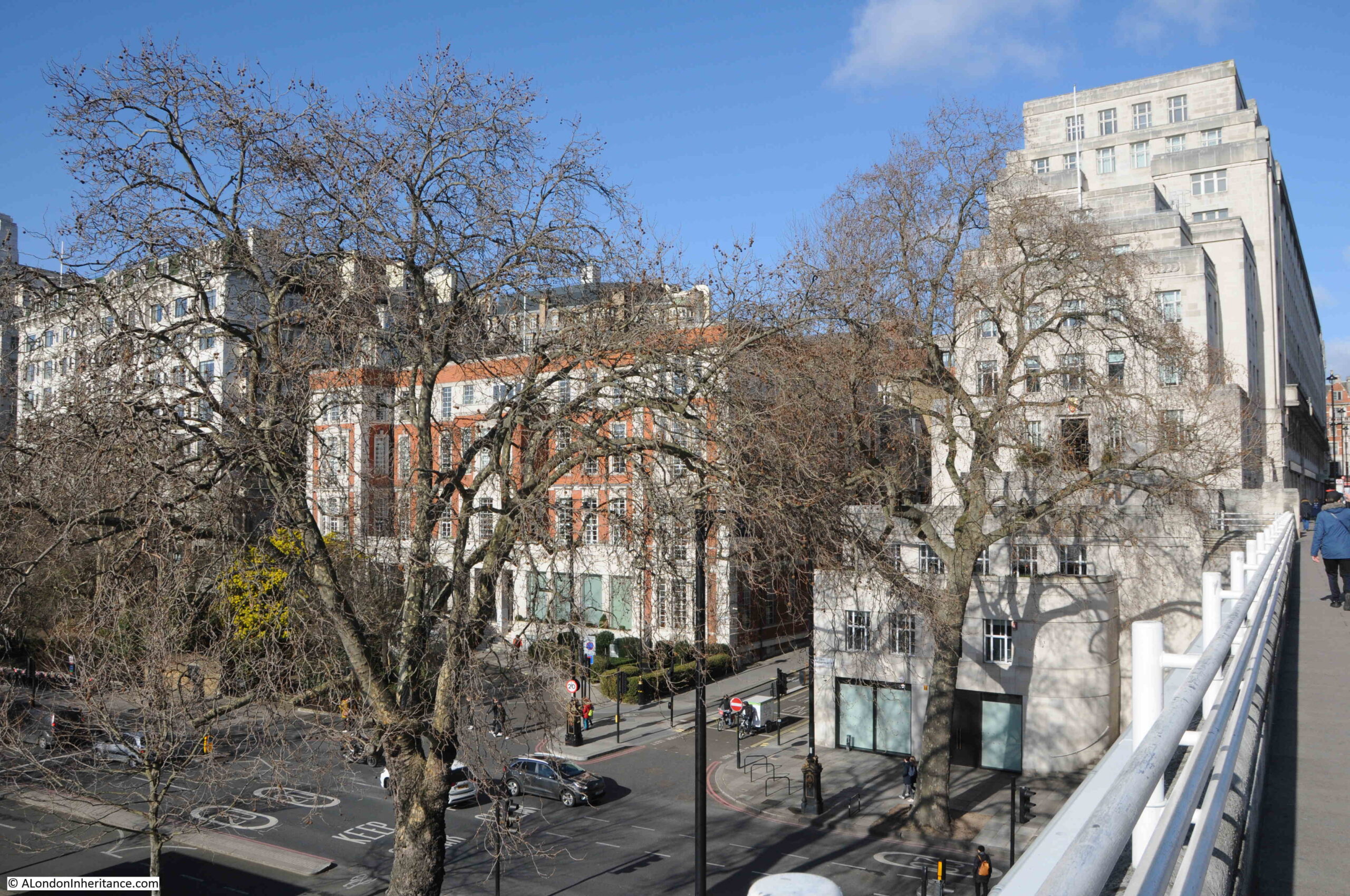
In the above map, we can see Essex Street running slightly north west from the water gate (red arrow), up to the Strand. In the area between the arch / water gate, we can see part of the Victoria Embankment gardens to lower left, and on the right are Temple Gardens.
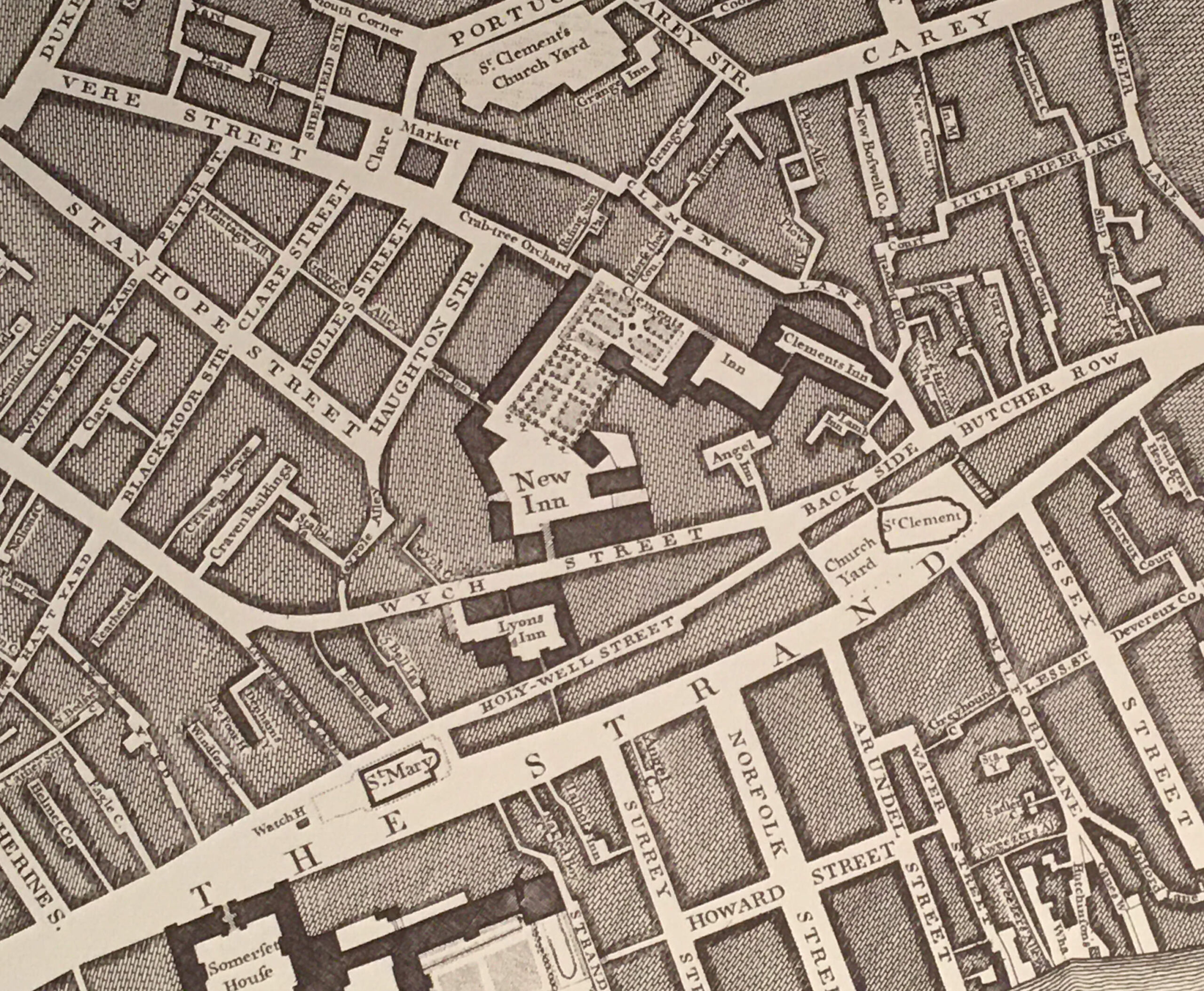
Going back to William Morgan’s 1682 map of London, and we can see the area soon after Nicholas Barbon’s development, with the red arrow marking the water gate:

There are 343 years between Morgan’s map, and the area today, and the street layout is almost identical, with Essex Street running to the north west, up to the Strand. The same two streets running east and west about two thirds up the street, and Milford Lane (blue arrow) running from the west to the south of the stairs in almost exactly the same alignment as today.
Morgan’s map shows a gap between the buildings at the end of Essex Street, where the arch is today. The map appears to show an open gap, with no arch, or floors above the arch. Whether this was an error in the map, whether the arch had not yet been built, or whether Barbon initially only put pillars on the building to the side of the gap as decoration, without an arch, would require much more research, but the key point is that the gap leading from Essex Street was there in 1682.
The 1682 map shows the stairs to the river, Essex Stairs (yellow arrow). These were not the stairs that lead down through the arch, but stairs at the end of what must have been a flat space between the water gate and the river, probably Barbon’s wharf development that the building and arch at the end of Essex Street was intended to screen.
To see how rapidly this area had changed, we can go back just five years from the above map, and the 1677 Ogilby and Morgan’s map of London.
In the extract below, we can see that Essex House, along with ornate gardens between the house and the Thames were still to be found. The red arrow marks the location of the water gate / arch we see today:

Image: © The Trustees of the British Museum. Shared under a Creative Commons Attribution-NonCommercial-ShareAlike 4.0 International (CC BY-NC-SA 4.0) licence.
Essex House can be seen close to the Strand, opposite the church of St. Clements.
Essex House was originally Exeter House as it was the London residence of the Bishop of Exeter who had been granted the site in the reign of Edward III.
The house and grounds were taken during the Reformation, after which it was purchased by Thomas Howard, the fourth Duke of Norfolk, who was arrested in the house and in 1572 he was beheaded for his part in the conspiracy of Mary Queen of Scots. The house was then owned by the Earl of Leicester, and became Leicester House. After his death, the property passed to his son-in-law, the Earl of Essex during the reign of Elizabeth I, and the house became Essex House.
Originally facing directly onto the Strand, by the time of the above map, we can see that houses and shops had been built between the house and the Strand, reflecting the slow decline in the importance of the large houses built along the Strand.
The house was pulled down around 1682, the same year as the map of William Morgan, however it is always difficult to be sure of exact publication dates, when the streets were surveyed for the map etc.
This may also answer why the gap of the water gate is shown without an arch as the William Morgan map may have used the plans for the area, rather than as finally built.
The 1677 map shows some interesting comparisons and features:
- comparing the shoreline between the Thames and the land in the 1677 and 1682 maps, and after Bourbon’s development, an area of the foreshore appears to have been recovered – Barbon’s wharf development as mentioned in the Historic England listing
- this would then put the current arch / water gate at the location of the original stairs at the end of the gardens, to the river
- the slight north west angle of the gardens is roughly the same as the alignment of Essex Street today, so as we walk along Essex Street, we are walking along what must have been the central pathway through the gardens of Essex House
- although not named in the map, Milford Lane is running to the east of Essex House, in the same alignment as the lane today (although in 1677 it did not have the bend round the base of the stairs. Milford Lane once formed the boundary between Essex House and Arundel House to the west
An extract from the 1677 map is shown below, covering the boundary with the Thames:

There are two boats moored at the end of the stairs down to the river at the end of the gardens of Essex House, where the water gate stairs are today.
There are two other sets of stairs shown on the map. On the left, there is a cluster of boats around Milford Stairs – named after the lane on the east of Essex House, and a lane we can still find today.
On the right there is a large cluster of boats around Temple Stairs.
Three stairs in a short distance shows just how many stairs there once were between the land and the river. Many still survive, but stairs such as Milford, Essex and Temple have disappeared beneath the land reclamation for the Embankment.
Temple Stairs appear to have been of a rather ornate stone design. The following print shows the Great Frost of the winter of 1683 / 4:

Image: © The Trustees of the British Museum. Shared under a Creative Commons Attribution-NonCommercial-ShareAlike 4.0 International (CC BY-NC-SA 4.0) licence.
Temple Stairs are on the left edge of the print, and they appear to be a stone, bridge like structure, probably over the most muddy part of the foreshore, with a set of steps then leading down to the river, where a passenger would take a boat to be rowed across or along the river.
The print has a pencil note “Taken from the Temple Stairs”, but other British Museum notes to the print state that the print is from near the Temple Stairs.
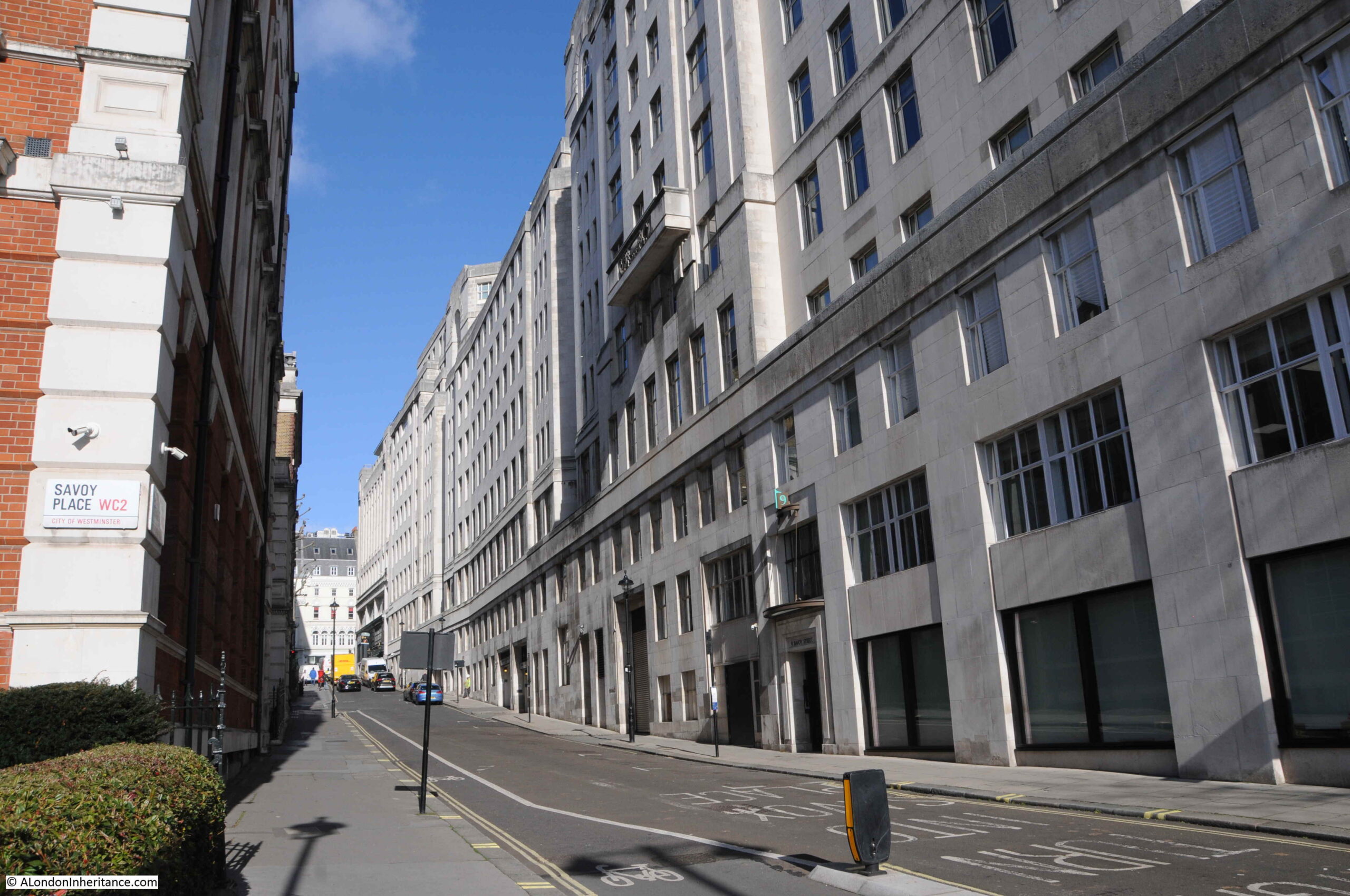
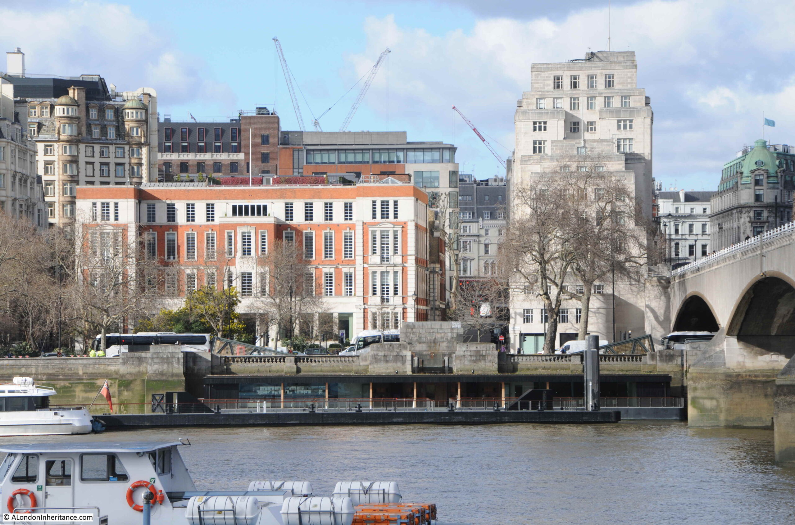
The following photo was taken from the southern end of Milford Lane, where it joins Temple Place:

The above photo is looking across what was Nicholas Barbon’s wharf development, which the houses at the end of Essex Street were meant to screen, and before Barbon’s work, this would have been the Thames foreshore, with the stairs leading down from the gardens of Essex House to the river, where the gap of the water gate can be seen.
In the following photo, the entrance to Milford Lane is on the right, behind the red phone box. The building on the left is Two Temple Place:

Two Temple Place gives the impression of being of some considerable age, however it is built on what was the Thames foreshore, and dates from the early 1890s, when William Waldorf Astor commissioned the gothic revivalist architect John Loughborough Pearson to create the building.
One of the stand out features is the gilded weather vane, made by J. Starkie Gardner, a representation of Christopher Columbus’ ship, the Santa Maria:

The water gate is today an interesting architectural feature at the end of Essex Street. Perhaps more importantly, it is reminder of a long lost landscape, which dates from Essex House and the gardens which led down to stairs to the Thames. After the demolition of Essex House, Essex Street was built on the same alignment as the gardens, and the stairs then led down to Barbon’s commercial wharf on what had been the Thames foreshore.
Today, the 19th century Embankment has further separated Essex Street and the stairs from the river, and Two Thames Place is a symbol of late 19th century building on the recently reclaimed land of the Embankment.
The stairs are also a reminder of a time when there were very many stairs along this part of the river, important places in the daily lives of many Londoners.
Very much, a lost landscape.