Tag Archives: Waterloo Bridge

The IMAX Roundabout at the end of Waterloo Bridge

Roundabouts in cities are a problem. Whilst they are built to simplify traffic flow, they take up a large amount of space, and leave a central area for which it is difficult to find a purpose due to its isolated location.

One such roundabout is at the southern end of Waterloo Bridge, where York Road, Waterloo Road, Stamford Street and the approach to Waterloo Bridge all meet. I photographed the roundabout from the Shell Centre viewing gallery in 1980:

Roundabout at the end of Waterloo Bridge

Beneath the roundabout were a large number of pedestrianised access routes to the surrounding streets and the central space provided access between these, so you could walk between any of the surrounding streets without having to cross a road.

It was always a rather bleak space. Concrete planters were scattered around the central space, and for a time in the 1980s the GLC organised what we would now call a pop-up market at lunchtimes, hoping to attract workers from the surrounding offices, although with traffic on the surrounding roundabout, it was not that pleasant and most people headed to the Jubilee Gardens or the walkway alongside the Thames.

A rather innovative use for the central space was found in the late 1990s when the British Film Institute opened an IMAX Theatre in the centre of the roundabout:

IMAX Theatre at end of Waterloo Bridge

The IMAX is of circular design to fit the central space, and is surrounded by a glass wall which makes the building ideal for advertising and for displaying films that are being shown in the theatre. It is a very obvous landmark when approaching from any of the surrounding streets, and with the low sun of a December day, produces strange light reflections on the streets of the roundabout.

So, a very clever use of a difficult city space. One that has to overcome a number of obstacles, for example vibration and soundproofing from both the traffic on the roundabout, and the Waterloo and City line which runs just 4 metres below the theatre, which gives me an excuse to show a map of the route of the Waterloo and City line, with the location of the roundabout and IMAX marked by a red circle (Credit: The Engineer, July 26, 1895, Public domain, via Wikimedia Commons):

Old map of the Waterloo and City line

The IMAX Theatre was opened in 1999 and designed by Bryan Avery Architects. I have walked past the IMAX countless times, but what got me thinking about the use of space and the problems of inner city planning and maintenance was when I was walking alongside the roundabout in late December.

Access to the IMAX is via the steps down from the surrounding streets that also provide access between the streets without having to cross at surface level.

The steps down in the following photo are on the side of the roundabout between York Road and Waterloo Road. It was the start of the Christmas school holidays and I noticed a mother and child going down the stairs, then coming up, looking around, walking to another set of stairs, then back to the one in the photo. They were going to the IMAX, but there is no obvious signage and the stairs down do not look the most inviting.

Tunnel to IMAX Theatre from Waterloo

I walked down the stairs, and met the smell that is familiar to such spaces:

Tunnel under roundabout

Tunnel under the roundabout leading to the central space and the IMAX:

Tunnel under roundabout

Once in the central space of the roundabout, we can see the curving wall of the IMAX and the extensive planting that creates a rather unique space:

Area around the IMAX Theatre

More than 2000 plants were originally planted, comprising of honeysuckle, jasmine, wisteria, clematis, ivy, Boston ivy and Japanese vine. An automated watering system was installed, which looks to have worked well as the plants now look very established and have grown up from the side walls, across supporting cables and up to the sides of the IMAX:

Area around the IMAX Theatre

There is a very tenuous link between the current centre of the roundabout, and an earlier use of the space, when it was occupied by Cuper’s Gardens, one of the many gardens and places of entertainment that were found on the south bank of the river in the 17th, 18th and early 19th centuries.

The following map is interesting as it shows the area in 1825, eight years after Waterloo Bridge was opened. It is titled “A Plan of Cuper’s Gardens with part of the Parish of Lambeth in the year 1746 showing also the site of the Waterloo Bridge Road and the new roads adjacent”.

The map helps define the exact location of Cuper’s Gardens as the church of St. John is also shown. The large roundabout (circled) now covers part of Cuper’s Gardens at the junction with Stamford Street:

Old map of Cuper's Gardens and Waterloo Bridge

The “gardens” around the IMAX are very different today, and the whole area is rather a surreal space. The outer wall has been painted light brown, possibly to resemble the earth through which the space descends. Large, twisted trunks (which look like roots) of the presumably now over 20 years growth extend up along the walls, and the outer wall is occasionally cut through with the access tunnels to the streets above:

Tunnel leading up to Waterloo Bridge

The entrance to the IMAX Theatre:

IMAX Theatre

Looking up between the planting and the curved glass wall of the IMAX dominates the view:

IMAX Theatre

When the IMAX was opened, as well as the central space surrounding the theatre, the walkways and tunnels leading up to the streets were cleaned, restored and painted, with many of the walls being painted blue, and some lighting being set into the walls.

IMAX Theatre

You can see the effect that this was intended to create. The central space with substantial overhead plant growth, the surrounding earth coloured walls, covered in the trunks of the plants, with the walls being cut through by the blue painted walkways to the surrounding streets.

It all creates an intriguing and surreal space, appropriate for walks to the IMAX.

Service access tunnel and pedestrian walkway leading to Belvedere Road:

Tunnels under Waterloo Bridge

View up through the plants with the new tower blocks that have taken much of the old Shell Centre site:

View from IMAX Theatre

Walking up to the surrounding streets, and it is clear what was intended, and the problems that result in the walkways not being that much of an inviting route to the IMAX. The following photo shows the walkway up to the western side of Waterloo Bridge:

Access tunnel from IMAX to Waterloo Bridge

Many of the walls are covered in graffiti, including the main walkway, and the tunnels that connect the east and west walkways:

Under Waterloo Bridge

Many of these walkways and tunnels make really good subjects for photography. The blue walls, the grafitte, and the hidden destination of these tunnels adds to their mystery, however if you did not know the area, were taking children to the IMAX, and it was at night, they are not inviting, and there were very few people using them as I wandered around taking photos.

Under Waterloo bridge

Global conspiracy theories meet South Bank direction signs:

Under Waterloo Bridge

Looking back down the walkway from the western side of Waterloo Bridge:

Underground tunnel leading up to Waterloo bridge with IMAX in background

Whilst the view of the IMAX in the above photo provides an indication of the destination of the walkway and the tunnel, it does not encourage you to walk down, there should be signs above the tunnel and better lighting in the entrance to the tunnel.

One of the walkways that crosses between the west and east sides of Waterloo Bridges crosses the service tunnel:

Under Waterloo Bridge

Walkway up to the eastern side of Waterloo Bridge:

Underground tunnel leading up to Waterloo Bridge

This is the view from the eastern side of Waterloo Bridge, with the IMAX in the centre of the roundabout, and the blue painted entrance to the walkway and tunnels that lead to the IMAX:

IMAX Theatre from Waterloo Bridge

The direction post to the left of the pavement does have a direction to the IMAX with an arrow pointing straight up, the implication being to head down the tunnel rather than walk on the pavement to the right. As with the other entrances, the tunnel does not offer an inviting prospect. No signage above the point where the walkway enters the tunnel and poor lighting at the entrance to the tunnel so it looks very dark and forbidding.

The Waterloo IMAX Theatre is a brilliant use of a difficult space, as well as being a building that has some technically clever ways of avoiding sound and vibrations. For example, the first floor is mounted on oil-damped spring bearings, and the walls inside the glass outer wall are 750mm thick. During construction, pile foundations were installed around the tunnels of the Waterloo and City line. A thick concrete slab was then built on top of the pilings to support the weight of the building above.

The IMAX apparently has the largest screen of any cinema in the UK and has the equipment to support normal film format as well as IMAX Digital and 3D.

A shame that whilst the intention with the tunnels and walkways is clear, and they could have provided a creative and innovative space, what appears to have been limited maintenance and care over the years has resulted in a rather poor experience when walking to the theatre at the centre.

TfL did have plans back in 2017 to transform the area and remove the roundabout, creating a surface level pedestrianised space up to the IMAX, however these plans appear to have been paused due to “the pandemic and current funding restraints”.

Given TfL’s current funding constraints, I suspect the roundabout will be there for some years to come.

More 1980 photos from the viewing gallery of Shell Centre are in this post.

alondoninheritance.com

The Duchy of Lancaster

It is not often that you can trace the naming of streets and the ownership of land to events that happened between 600 and 800 years ago, however there is one place between the Strand and the Thames, and the boundary marker for the Duchy of Lancaster shown in the following photo provides a clue:

Duchy of Lancaster

The boundary marker is close to the ground, by the steps from the Embankment up to Waterloo Bridge, on the Somerset House side of the bridge. The marker is circled in the following photo:

Duchy of Lancaster

It must have been the position of the sun, and the strength of light on the stairs, however I have never realised how impressive the stairs leading up to Waterloo Bridge are, despite walking past, and up them, very many times:

Duchy of Lancaster

The marker is to mark the historic boundary of the Manor of Savoy. I got in contact with the Duchy of Lancaster who told me that this is one of a number of boundary markers, including one on the Lyceum Theatre. A future project to locate them all.

So what does a boundary marker of the Manor of Savoy have to do with the Duchy of Lancaster.

The answer goes back to the Middle Ages, and the time of King Henry III and his wife, Eleanor of Provence in the 13th century.

This was a time when the bank of the river between the City and Westminster was being lined with palaces and grounds belonging to the nobility of the country. One of these was Simon de Montfort, the 6th Earl of Leicester, who formed an estate to the west of Somerset House.

de Montfort has a fascinating history and both supported, and fought against the king, and for a time he ran an early form of Parliament. de Montfort died during the Battle of Evesham on the 4th of August, 1265, when he led a small army of rebellious barons against Edward, the son of King Henry III.

Following the death of Simon de Montfort, the king granted his estate to Peter, the Earl of Savoy, from where the estate would get the name “Manor of Savoy” a name which can still be found in a number of streets and buildings in the area.

Edward was the eldest son of Henry III. He would later become Edward I. Henry III had another son called Edmund, and in 1266 Edmund was granted the title of Earl of Lancaster.

Meanwhile, Peter, the Earl of Savoy had died and the Savoy estate seems to have been in the possession of a small religious establishment. Eleanor of Provence, the wife of King Henry III and mother of Edmund purchased the Savoy estate and bestowed it to her son Edmund in 1284, thereby bringing together the names Savoy and Lancaster.

The history of the estate between 1245 and 1399 is rather complex, so rather than write lots of confusing text, I have tried to show this almost as a flow chart:

Duchy of Lancaster

Basically, the Manor of Savoy is formed, and then granted, along with lots of other titles, to Edmund, the second son of Henry III and Eleanor of Provence.

When Edmund died, the estate passed to his son Thomas, who was beheaded in 1322 after leading a rebellion, then the estate passed to Edmund’s second son, Henry, the 3rd Earl of Lancaster. On his death, the estate passed to his eldest son, Henry Grosmont, who was granted the title Duke of Lancaster by Edward III.

Henry Grosmont had two daughters, and as daughters could not inherit a title, it became part of the dowry of his daughter Blanche, who married John of Gaunt, the third son of King Edward III.

Blanche and John of Gaunt had a son, Henry who should have inherited the estate, however during the short reign of Richard II, the king confiscated his estates and banished Henry.

Henry returned with an army, beat Richard II and became King Henry IV, thereby bringing the Manor of Savoy and the Duchy of Lancaster into royal ownership in 1399.

Henry IV defined that the estates belonging to the Duchy of Lancaster should be held by the Monarch as a private estate, separate to all other estates, and should descend through the Monarchy.

The Crown Lands Act 1702 defined that the Monarch could only receive an income from the estate and not benefit from any capital, and that is how the Duchy of Lancaster, including what remains of the Manor of Savoy remains to this day.

The area occupied by the Savoy in 1755 is shown in the following map extract. Somerset House can be seen to the right of the area occupied by the Savoy.

Manor of Savoy

At the lower left corner of the Savoy, you can see the “Savoy Stairs”. These disappeared under the construction of the Embankment which pushed the river wall further out into the Thames, but as I have written about in a number of previous posts, these stairs provide snapshots of life in London and the wider country.

The 1730s and 1740s were decades when the country was often at war, with, for example, the War of the Austrian Succession between 1740 and 1748 which was basically a war between the ruling dynasties of Europe, and who would inherit the Hapsburg crown.

In 1743, the Battle of Dettingen took place where Britain, Austria and Hanover fought the French. This was the last battle where a British monarch (George II) led an army into Battle.

There are many newspaper reports naming the Savoy Stairs, and for this post I will use just two which tell of the risks to Londoners of being press ganged into the Navy, and of those where the stairs were the point where they left London, during this turbulent period of history.

Those working on the river was always at risk of being taken, but they would fight back. Report from the Stamford Mercury on the 21st June 1739 “Yesterday a Press-Gang of Eight, in a Man of War’s Boat, having impressed a Waterman off of Barge-House-Stairs, a Gally was manned from the Temple, by the Temple Watermen, who taking Truncheons, Stones and Brickbats with them, rowed after the Press Boat, boarded them and at last beat the Gang, brought off the Waterman, and the Press-Boat at the Savoy-Stairs, where she sunk by the Holes made in her in the Battle.”

And from the Ipswich Journal on the 30th July 1743: “Yesterday morning a great number of Recruits were put on board a close Lighter at the Savoy-Stairs, in order to be shipped at Gravesend to Portmahon and Gibraltar.

That was a slight detour, but I find the river stairs tell us so much of what life was like in London when the river was a central part of the lives of so many people, whether a place of work, or point of departure or return.

Back to the Duchy of Lancaster.

The boundary marker photographed at the top of the post shows the historical boundary of the Manor of Savoy, that became part of the Duchy of Lancaster.

I have marked the properties that are still owned by the Duchy of Lancaster. along with the location of the boundary marker in the following map  (© OpenStreetMap contributors):

Duchy of Lancaster

The roads around these buildings still recall the name of the old Manor of Savoy with Savoy Street, Savoy Place, Savoy Hill and Savoy Way.

The long building that runs to the west of the approach to Waterloo Bridge is the 1932 constructed Brettenham House. The southern end of the building can be seen in the following photo:

Duchy of Lancaster

From Waterloo Bridge, the two river facing properties of the Duchy of Lancaster are Brettenham House and the part brick building named Savoy Place to the left is now part occupied by the Institution of Engineering and Technology, and is also available as an events space.

Duchy of Lancaster

Savoy Place is the name of the building and the street that runs in front of the building, and continues left between the gardens and buildings.

The building at the southern end of Brettenham House, facing the river is 1 Lancaster Place, and are the offices of the Duchy of Lancaster, with the coat of arms of the Duchy above the door. These date back to Edmund, the first Earl of Lancaster:

Duchy of Lancaster

The entrance to 1 Lancaster Place:

Duchy of Lancaster

Walking from Waterloo Bridge, down to Savoy Place and this is the view up Savoy Street with Brettenham House on the right. The photo shows the slope of the street down from the Strand in the distance, to the Thames.

Duchy of Lancaster

Part of the Savoy Place building seen from Waterloo Bridge in the street of the same name, can be seen to the left of the above photo.

In front of Savoy Place is a statue of Michael Faraday:

Savoy Place

Michael Faraday was a 19th century scientist who investigated electromagnetism and electromagnetic induction, basically how a magnet could induce an electrical current to flow in a wire, which has led to how we generate electricity today.

The society occupying Savoy Place tells the history of how electricity has impacted every element of everyday life. The Society of Telegraph Engineers was formed in 1871. As the use of electricity started to grow, the society changed name to Society of Telegraph Engineers and Electricians in 1880, and in 1889, the society became the Institution of Electrical Engineers.

These societies had been meeting in the buildings of other London institutions, but in 1909 the Institution of Electrical Engineers took possession of the lease of Savoy Place which had been built in the 1830s for the Royal College of Physicians and the Royal College of Surgeons of England.

Walking up Savoy Street and I found these garage doors in the side of Brettenham House. The photo shows the slope of the road down to the river, and I rather like the lettering used above the doors.

Duchy of Lancaster

Half way up Savoy Street, and hidden among all the 20th and 21st century buildings is a survivor from the hospital built on the land of the Savoy estate by Henry VII in the early years of the 16th century. This is the Savoy Chapel:

Savoy Chapel

The chapel is a private chapel of the Sovereign in Right of the Duchy of Lancaster. Despite appearances of being older, much of the chapel dates from 1865 after the building was gutted by fire. Only part of the outer wall dates from the original construction in 1502.

The Savoy Chapel is maintained by the Duchy of Lancaster. The chapel as it appeared in 1830 (© The Trustees of the British Museum):

Savoy Chapel

Despite the later rebuild the chapel today looks much the same as the above print, although there are no sheep to be seen tending the perfect looking grass.

Savoy Chapel

A future post will cover the chapel and the history of the Savoy and the hospital in more detail, as I wanted to look at the Duchy of Lancaster in this post.

Savoy Chapel

The Savoy Tap pub, which although today is built into the surrounding 19th century buildings, a pub has been on the site since the mid 19th century. Again, the street shows the slope between Strand and Thames:

Savoy Tap pub

My map of the buildings owned by the Duchy of Lancaster, shows a couple of buildings along the Strand, west of Savoy Street. These are the first two buildings in the following photo:

Duchy of Lancaster

The main block on the corner is 111 Strand, and has a map carved on the front of the building which I wrote about in this post.

On the eastern corner of the junction between the Strand and the approach to Waterloo Bridge is Duchy House, the Duchy of Lancaster’s single building on this side of the approach to Waterloo Bridge:

Duchy of Lancaster

On the western side of the junction is the corner building owned by the Duchy of Lancaster with Brettenham House to the left:

Duchy of Lancaster

From across the river, we can see the end of Brettenham House, and Savoy Place.

Savoy Manor

The following print from 1736 shows the Savoy from the south bank of the river. the Savoy Stairs are on the left and the tower of the Savoy chapel can be seen to the rear of the left of the print (© The Trustees of the British Museum):

Savoy Palace

If the perspective and scale of the buildings in the above print is correct, then Savoy Stairs would have been just to the left of centre of the Savoy Place building today.

The right hand part of the buildings in the above print would today be under the approach to Waterloo Bridge, hence the location of the boundary marker on the eastern side of the bridge.

As well as the remaining parts of the land associated with the Manor of Savoy, the Duchy of Lancaster also owns a considerable portfolio of other holdings associated with the original holdings at the time of Henry IV.

This includes land in Lancashire, Staffordshire, Cheshire and Yorkshire, various mineral rights and parts of the foreshore in Lancashire.

The estates of the Duchy of Lancaster have been owned by the Monarch since Henry IV took over the Lancaster inheritance in 1399, and continue to be owned by the current Monarch, as Duke of Lancaster.

The name goes further back to 1266 when Edmund , the second son of Henry III granted him the title of Earl of Lancaster, the Savoy name originates from Peter, Earl of Savoy who was also granted the estate by Henry III, and the estate goes back to 1245 when Simon de Montfort formed the estate and built a palace on the banks of the Thames.

All from a small boundary marker on the side of the steps up to Waterloo Bridge. Now I need to find the rest of the markers.

alondoninheritance.com

A Walk Along Belvedere Road – 1947 and 2016

Having explored the history of the South Bank in yesterday’s post, today it is time to take a walk along Belvedere Road to see the remains of buildings dating back to the start of the 19th century, the clearance ready for construction of the Festival of Britain and the foundations of the Royal Festival Hall. We will start from where Waterloo Bridge crosses Belvedere Road, drop down to Belvedere Road and then walk along Belvedere Road to County Hall.

My father visited this area a number of times between 1947 and 1951, first to photo the buildings as they were, then the area as it was cleared and finally as the construction of the Royal Festival Hall was underway. This post brings together photos distributed among a number of different posts over the last couple of years along with some new photos I have recently scanned.

The map below is the same extract from the 1895 Ordnance Survey Map covering the area between Hungerford and Waterloo Bridges as in yesterday’s post. I have marked in numbered red dots the locations from where the photos in today’s post were taken.

Belevedere Walk Map 1

The first three photos are at point one. I am not sure whether they were taken from Waterloo Bridge, or from one of the buildings alongside the bridge, however this first photo is looking along Belvedere Road towards the bridge under the rail tracks leading up to Hungerford Bridge.

Demolition is already underway. The remains of the entrance to the Lion Brewery can be seen on the right, in front of the railway, and clearance of the houses on the left is well underway.

History of the Southbank 3

This is roughly the same view today. I should have been a bit further to the right, however the buildings of the Hayward Gallery obscure the view. Belvedere Road curves to the left towards where the road passes under the rail tracks – the bridge is obscured by the trees.

Belvedere Road Walk 1

This next photo is from the same spot, but is looking towards the right, towards the Thames. The large building is the Lion Brewery. Note that on the opposite side of the river, construction of the new Ministry Defense Building is well underway. The buildings in the foreground are along Grellier’s Stone Wharf on the 1895 map.

History of the Southbank 2

Again, I should have been a bit further towards the right, however the following view from 2016 shows that the entire site of the above photo is now occupied by the Royal Festival Hall, the Hayward Gallery, Queen Elizabeth Hall and the Purcell Room.

Belvedere Road Walk 2

And the following photo is the last from the bridge and is looking to the left, towards Waterloo Station. Two streets can be seen, on the left is Howley Place and the street in the middle is Tenison Street. The terrace buildings that lined these streets have been demolished, however those along the boundary of the site remain. On the right are the houses along Sutton Street and the houses in front of Waterloo Station are along York Road. To the right of centre, there is a solitary figure standing on the rubble left by demolition.

History of the Southbank 1

And the same view today. The entire site is now occupied by what was the Downstream Building of the Shell Centre office complex, but is now the Whitehouse Apartments. When I checked on their website, two apartments were for sale, one from just over £1 Million and the second for £2,750,000. A chat box from a representative in Hong Kong popped up whilst looking at the page asking if I needed help which tells you all you need to know about central London”s property market.

Belvedere Road Walk 3

Now walk towards the large roundabout at the southern end of Waterloo Bridge and take an immediate right hand turn down the slip road that takes you down to Belvedere Road. This road does not appear to have a name, but runs along the route what was Howley Place. At the end of the slip road, on reaching Belvedere Road, turn round to look back up the slip road (position 2 on the map).

This was the original view:

History of the Southbank 27

The buildings on the left are the rear of buildings facing onto the approach road to Waterloo Bridge which has since been widened. The large roundabout with the glass IMAX cinema in the centre, which can be seen at the end of the current slip road had not been built at the time of these photos, so the houses seen at the end of Howley Place are roughly where the edge of the IMAX is currently located.

Belvedere Road Walk 4

We can now start walking along Belvedere Road, but only a short distance to point 3 on the map where we can look back at the original bridge which takes the approach road to Waterloo Bridge over Belvedere Road. The entrance to Howley Place is on the right with part of the street name sign visible.

History of the Southbank 18

The same scene today. The approach road to Waterloo bridge has been replaced and is wider than in the original photo.

Belvedere Road Walk 5

Now walk a short distance along to point 4. This is the entrance to Tenison Street, looking towards Waterloo Station.

History of the Southbank 23

And this is roughly from the same position today. Waterloo Station is behind the buildings of the Whitehouse Apartments.

Belvedere Road Walk 6

Now walk along to point 5 which is roughly half way along the rear of the Royal Festival Hall, and look towards the building. This was the scene at the start of construction of the Royal Festival Hall with the buildings on the north bank of the river clearly visible. There were some fascinating challenges with the construction of the building which I will cover in detail in my next post.

History of the Southbank 30

The same scene today, although not much to see with the trees in the foreground and then the rear of the Royal Festival Hall.

Belvedere Road Walk 7

Now walk along to point 6 which is at the end of the original alignment of Sutton Walk which has now been cut short by Concert Hall Approach. The following photo shows where the original Sutton Walk met Belvedere Road. Looking over the wall surrounding the Whitehouse Apartments it is possible to see the remaining length of Sutton walk where it passes under the railway tracks. Sutton Walk originally continued straight on, to end at the point where this photo was taken.

Belvedere Road Walk 15

From this point we can walk slightly further along then turn back and look across where Sutton Walk joined Belevdere Road. This is the entrance to the buildings of the Lion Brewery on the south side of Belvedere Road with one of the three lions that were used above brewery entrances and the main brewery building. These buildings were used for stables and also as a warehouse. Look in front of the entrance arch and there are bollards on either side.

History of the Southbank 22

And they are still here in this later photo following demolition of all the buildings. The buildings running along the left are those along the approach to Waterloo Bridge and Howley Place, with the buildings along York Road on the right. All the buildings in the background are still there, with the Royal Hospital for Children and Women being the second building from the left.

History of the Southbank 24

This is the same scene today.

Belvedere Road Walk 8

The following photo was taken from Sutton Walk, looking down towards the entrance to the Lion Brewery from Belvedere Road. There was a lion on top of this arch but this had already been removed.

History of the Southbank 20

Not easy to replicate this photo as this section of Sutton Walk does not exist, but the following photo is looking towards the area where the entrance to the brewery was located.

Belvedere Road Walk 9

The next photo was also taken from the original Sutton Walk and is looking towards the right with the Shot Tower in the background.

The house in front of the Shot Tower is number 55 Belvedere Road, one of the substantial houses that went up along Belvedere Road in the first decades of the 19th century.

In 1821 a tin plate worker named John Fowler extended his lease on the land and built No. 55 for his own use. The Survey of London describes the building:

“No. 55 was a house of substantial character. Though detached, it was of terrace type without openings in the flank walls. It was in yellow stock brick and its front elevation was three windows wide to each of the ground, first and second floors. The windows had gauged flat arches and all had glazing bars to their double hung sashes. The ground storey was raised above a semi-basement and the entrance, which was reached by a short flight of steps, had an architrave surround with consoles each side designed to support a flat hood. The hood had been removed some time prior to demolition. There was a moulded band at first floor level and a bold parapet cornice above the second floor. Behind the parapet dormer windows were set in a slated mansard roof”.

History of the Southbank 21

John Fowler annoyed his neighbours when in 1839 he converted a factory between the rear of his house and the river into a lead works. Concern about the works was such that Golding, the owner of the Lion Brewery complained to his landlord, however a report from a Professor of Chemistry into the conditions of the lead works stated that their construction and use was such as to prevent waste, injury to the workmen and annoyance to the neighbourhood.

Along with the Lion Brewery, No. 55 was used by the London Waste Paper Company in the 1930s and would be demolished in 1949.

Again, not easy to replicate the original view as this part of Sutton Walk does not now exist, however the following photo is as close as I could get. Not much to see due to the trees, but the Royal Festival Hall is in the background.

Belvedere Road Walk 10

The following photo was taken just before construction of the Royal Festival Hall commenced. It was taken from where Belvedere Road passes under the rail tracks leading up to Hungerford Bridge and is looking back down Belvedere Road towards Waterloo Bridge which can just be seen behind the Cubitts sign at the centre left. Sutton Walk is just behind the lamppost running to the right. The Shot Tower is on the left. Note the “stink pipe” behind the lamppost (not sure if that is the correct name, but that is what we always called them).

History of the Southbank 29

This is the view some weeks later, taken from the opposite side of the road. The “stink pipe” in the centre of the photo is the same as in the above photo. The Cubitts site office is on the former location of the Lion Brewery Stable and Warehouse. On the left is one of the three legs of the derrick supporting the crane that was used to build the Royal Festival Hall.

History of the Southbank 5

Cubitts were the main building contractors for the Royal Festival Hall, and the use of an onsite site office seems to have been unique for the time as it helped with the rapid construction of the building with drawings been passed from the office to the builders as the drawings were being completed – such was the pace with which the Royal Festival Hall was built.

This is the same view today as the above photo taken at point 8 on the map.

Belvedere Road Walk 11

Now it is time to walk through to the other half of the area which is split in two by the rail tracks running up to Hungerford Bridge. This brick-built viaduct is the only remaining construction from the pre-war period and provides a perfect reference point to locate the key places on the 19th century Ordnance Survey maps. The viaduct has retained the original position of Belvedere Road and by retaining the short length of Sutton Walk that runs from York Road to the new Concert Hall Approach, allows the alignment to be confirmed to Belvedere Road and therefore the position of the entrances to the Lion Brewery.

This is where Belvedere Road passes underneath the rail tracks. The white plaque on the blue bridge reads “W. Richards & Son – 1900 – Leicester”.

1900 is not old by London standards, but it is the oldest construction in this part of London.

Belvedere Road Walk 14

The following map shows the area we are now in, having passed under the rail tracks at the top and continuing along Belvedere Road.

Belevedere Walk Map 2

A short distance along Belvedere Road, we can look towards the river and this is the approximate position of College Street leading down to Kings Arms Stairs. There is an entrance to the car park here – would be interesting to believe that this is a remaining part of College Street.

Belvedere Road Walk 16

The next photo shows the India Stores Depot as it was prior to demolition. The photo was taken from point 9 in the above map, a short distance in Belvedere Crescent, the kerb of which can be seen in the lower left corner. The road running left to right in front of the gates is Belvedere Road. The India Stores Depot suffered badly from bombing during the war with the majority being left as a shell of a building.

History of the Southbank 16

I could not get to the same position as the original Belvedere Crescent is under the Shell Centre complex. The following photo was taken from in front of Shell Centre looking across Belvedere Road to where the India Stores Depot were located, on the current Jubilee Gardens.

Belvedere Road Walk 12

The Jubilee Gardens have been through a number of changes. I took the following photo in the mid 1980s of a much quieter Jubilee Gardens than today. The central area was later used as a construction site for the Jubilee Line extension with a large access shaft in the middle of the grassed area. The grass would be packed during summer lunchtimes with office workers from the Great London Council and Shell Centre.

Belvedere Road Walk 18

The buildings in the following photo were along Belvedere Road, roughly at point A, which today is the location of the Shell Centre tower building.

History of the Southbank 17

Another view with the buildings in the above photo now on the right of the photo below. The cafe in the photos above and below was called “The County Cafe” – I assume a reference to County Hall, just a bit further along Belvedere Road. It is small buildings such as these where the signs of the business still remain that bring home that this was once a busy area full of industry, cafes, shops and residents. The bridge carrying the rail tracks over Belvedere Road can be seen at the far end of the road and the entrance to the India Stores Deport is on the left.

History of the Southbank 15

This is same scene today with the main tower building of the Shell Centre complex on the immediate right, occupying the space where the County Cafe once stood. The blue bridge at the end of Belvedere Road is in the same position as the photo above.

Belvedere Road Walk 13

Many of the streets in this area were named after Archbishops of Canterbury. Sutton Walk was named after Charles Manners-Sutton (Archbishop between 1805 and 1828).

Tenison Street was named after Thomas Tenison (Archbishop from 1694 to 1715) and Chicheley Street. was named after Henry Chichele (Archbishop from 1414 to 1443).

The naming of streets after Archbishops extended beyond the area between York Road and Belvedere Road. The street in front of Waterloo Station, Mepham Street was named after Simon Mepeham, Archbishop of Canterbury from 1329 to 1333).

From outside Shell Centre, we can turn towards County Hall and walk to the junction of Belvedere Road and Chicheley Street. Instead of turning up Chicheley Street we can still walk up towards Westminster Bridge through the County Hall complex. Today this is marked on maps as Belvedere Road, but on the 1895 Ordnance Survey maps, Belvedere Road ended at the Chicheley Street junction and this stretch of road up to Westminster Bridge was still called Narrow Wall, the last remaining use of this original name and reference to the earthen bank that separated the Thames from the rest of Lambeth marshes.

The following photo shows the Belvedere Road / Narrow Wall passing through the County Hall buildings, I will continue on from the end of this road in my next post.

Belvedere Road Walk 17

We have now walked the length of Belvedere Road and traced the pre-1951 streets and buildings where much of the original street plan still remained.

Although Belvedere Road has been straightened and widened over the years, we have walked the route of the original earthen wall.

In my next post we will walk along the north bank of the river before returning alongside Hungerford Bridge to look at the building of the Royal Festival Hall.

alondoninheritance.com

A Brief History Of The South Bank

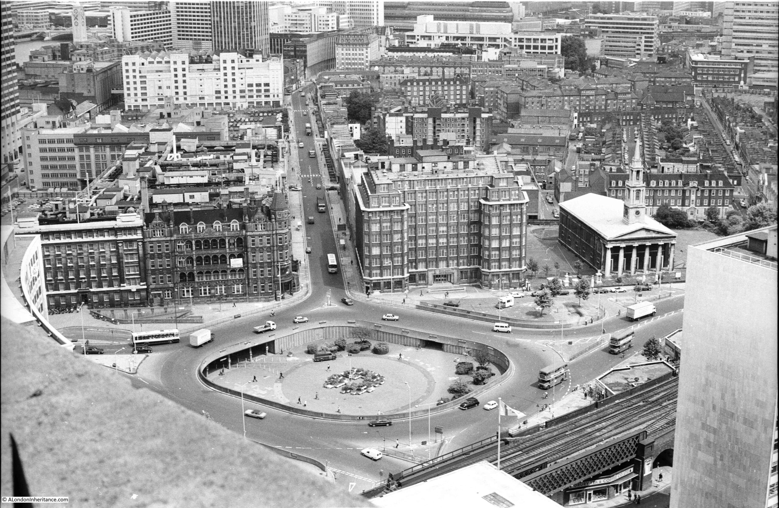
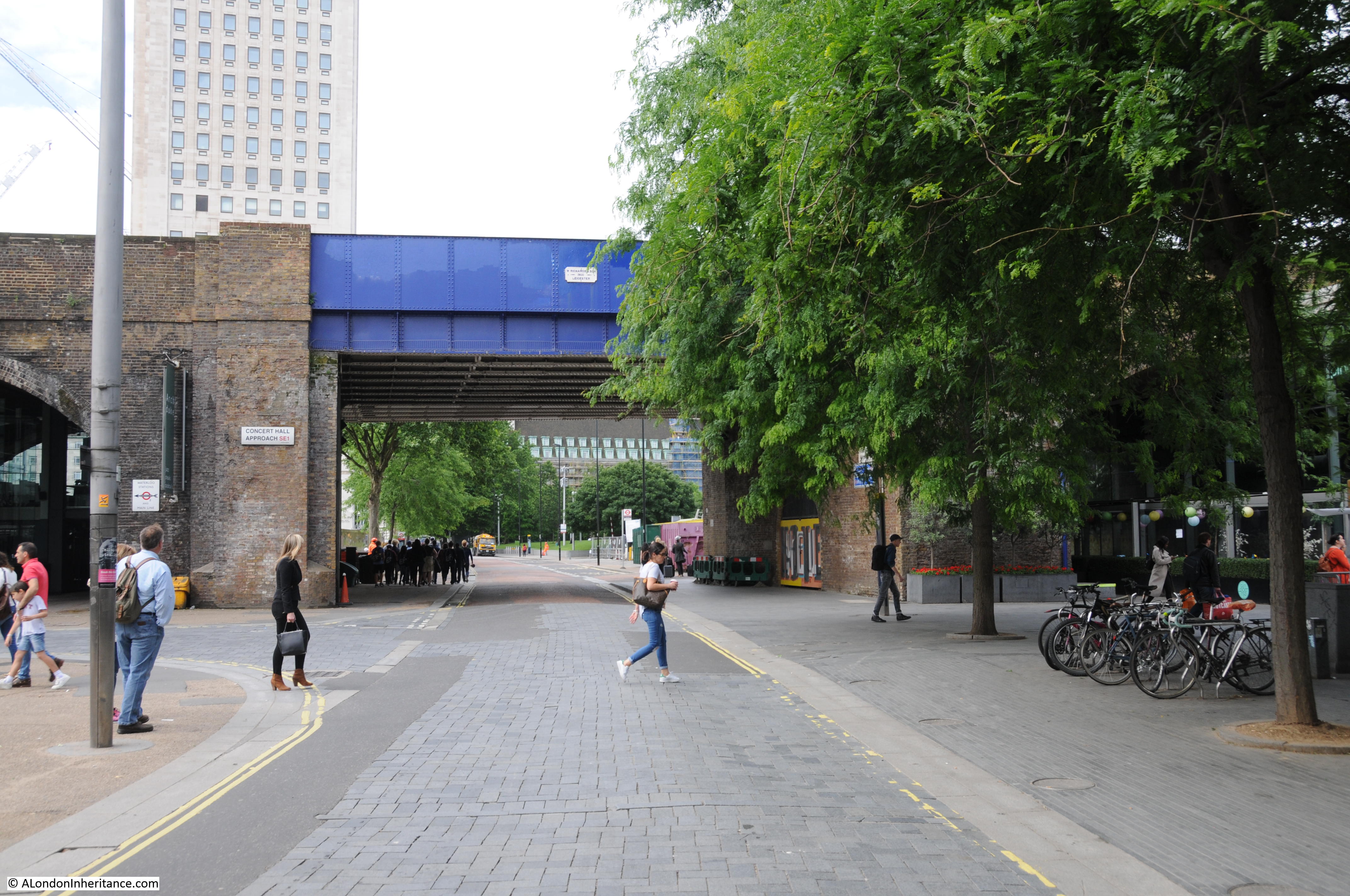
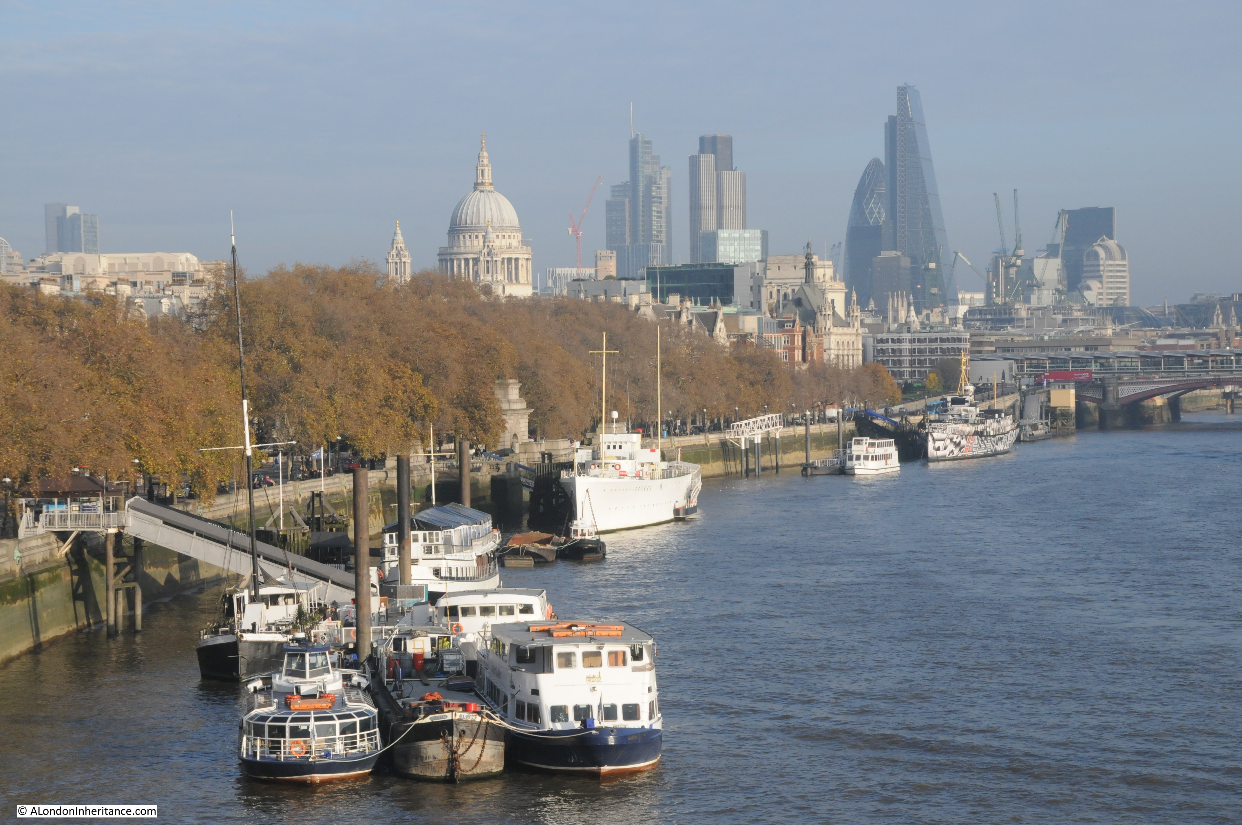
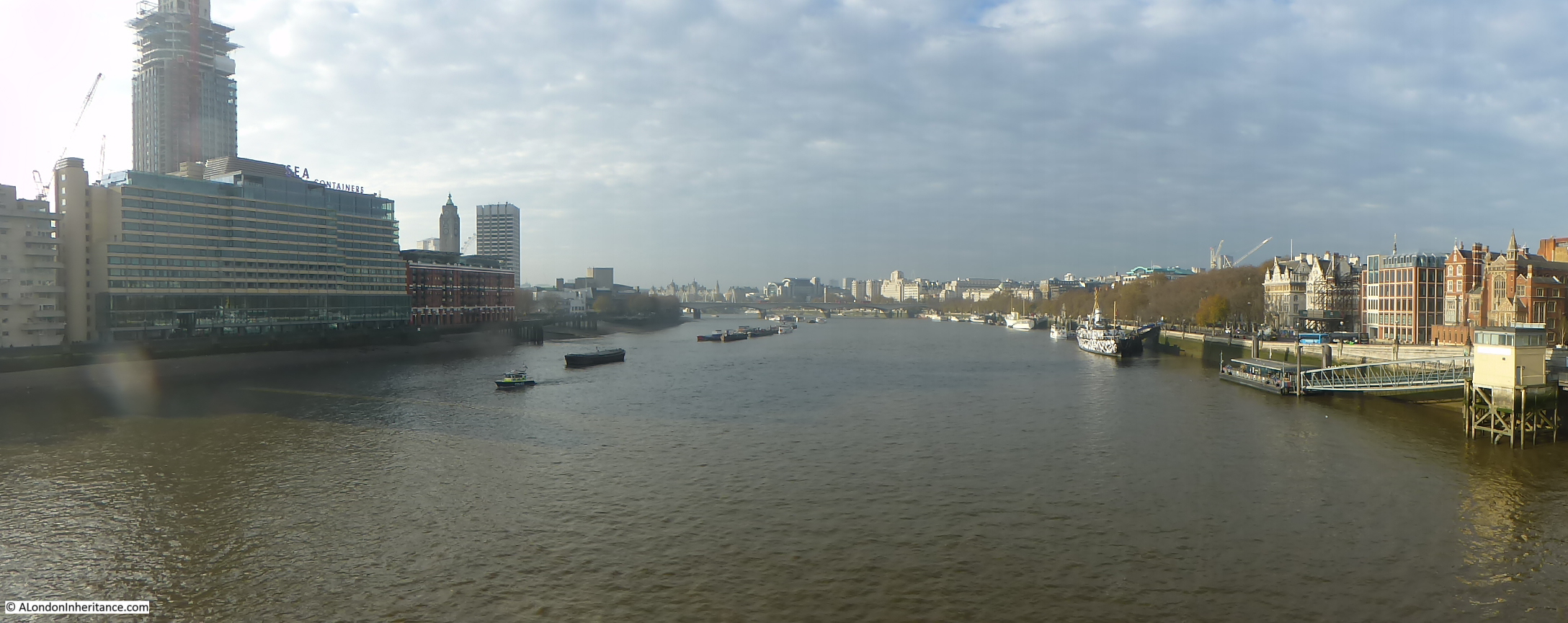
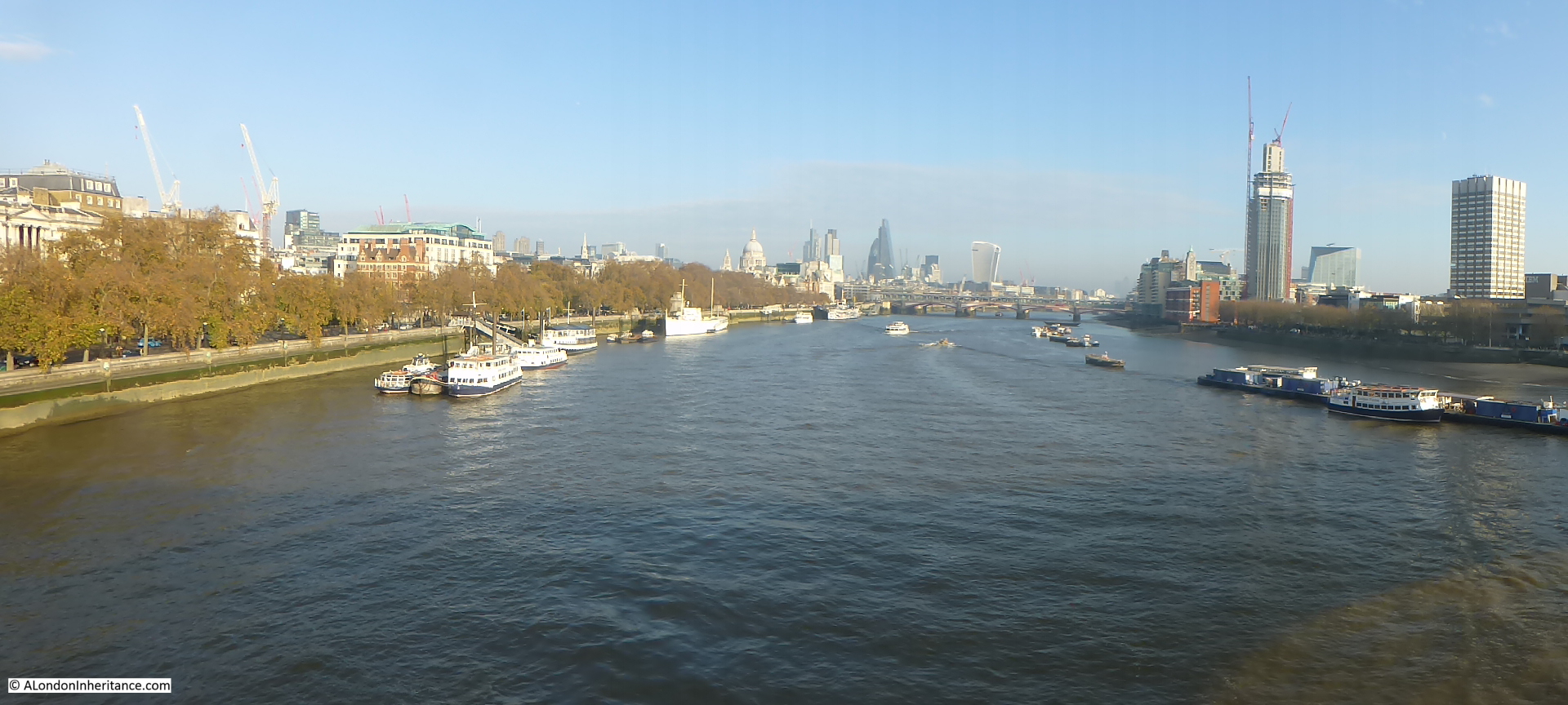
I have long been interested in the history of the South Bank, which for the purposes of this post I will define as the area between County Hall and Waterloo Bridge. I worked there for 10 years from 1979 and it was the location where I first realised that my father had a collection of photos as he brought out some of the photos he had printed to show me what the area where I was now working had looked like some 30 years earlier.

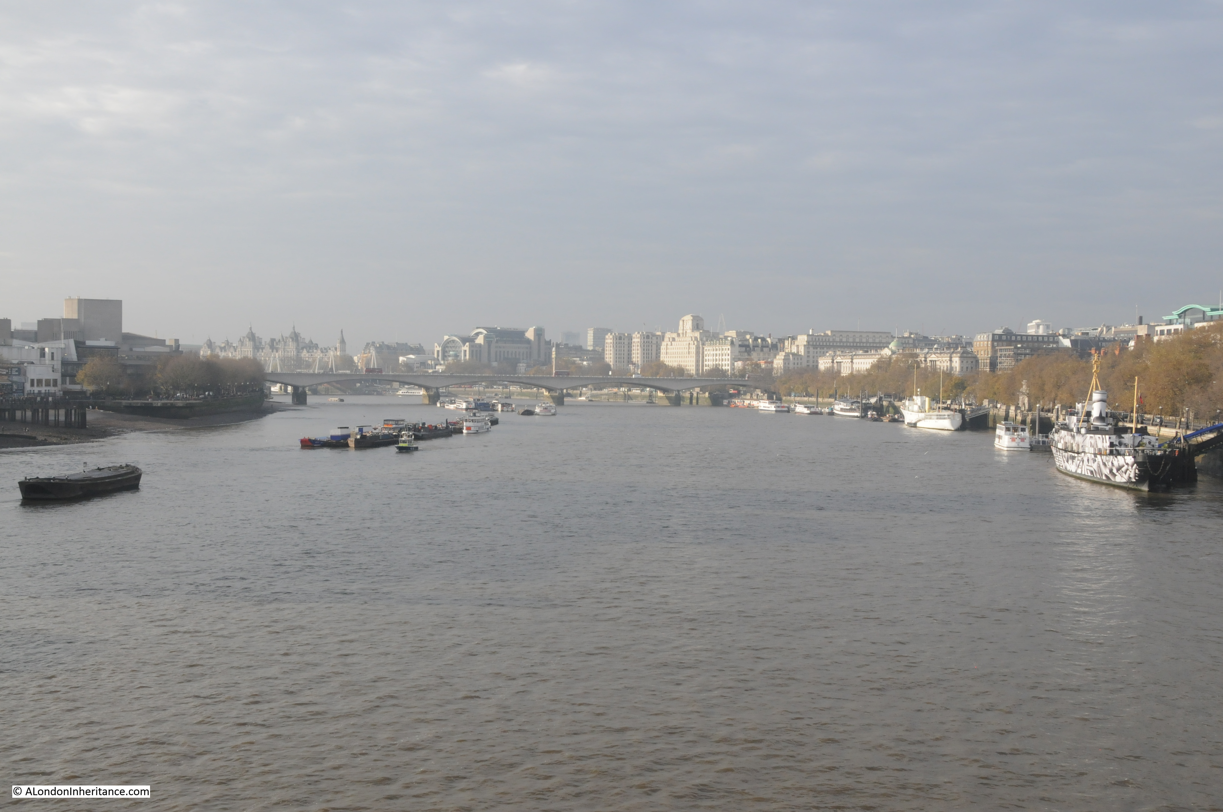
The South Bank has been through two major transformations since the war. The first with the construction of the Festival of Britain exhibition which required the demolition of the whole area between County Hall and Waterloo Bridge (with the exception of Hungerford Railway Bridge which provides a useful reference point).

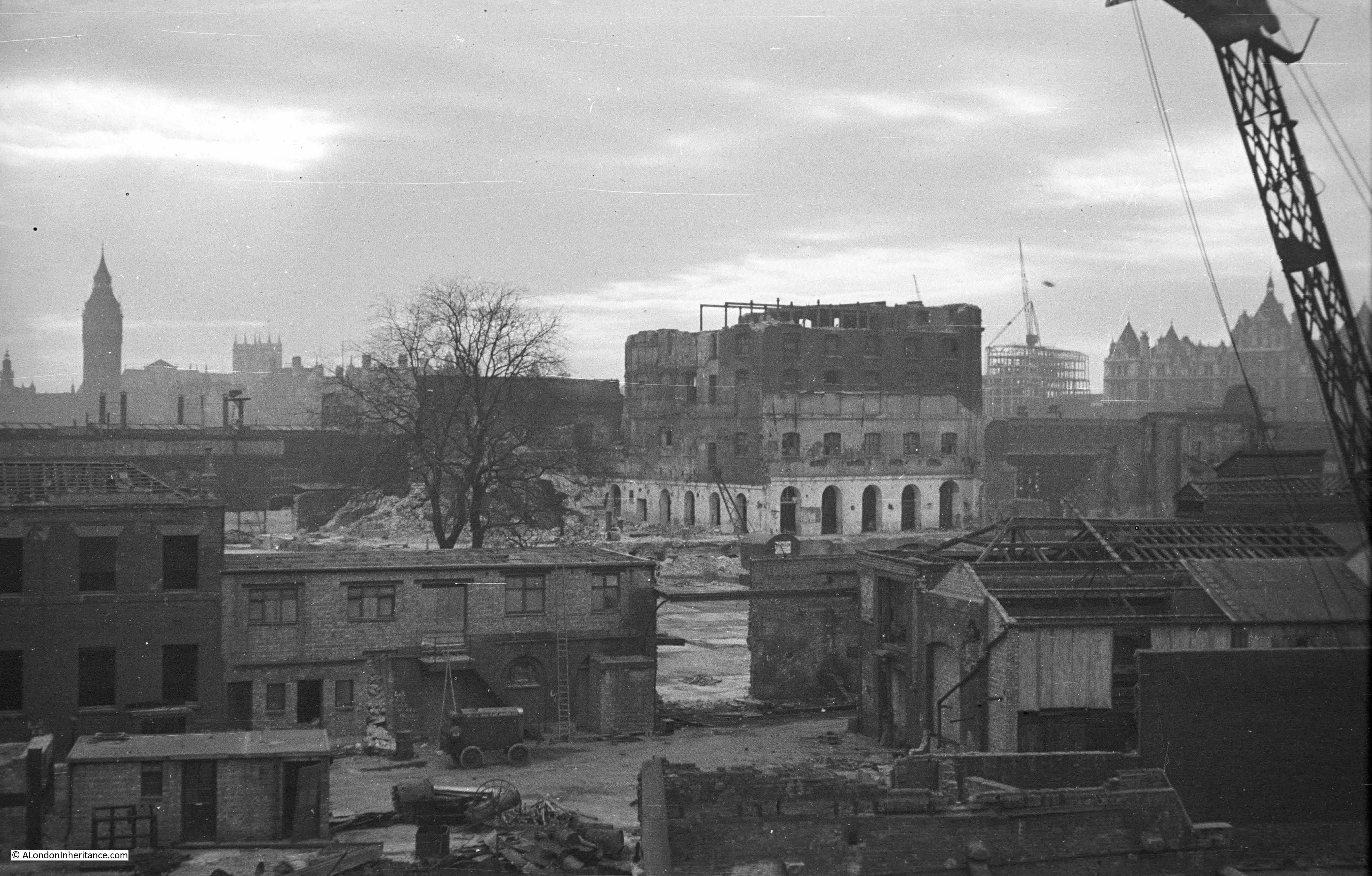
Following closure, the Festival of Britain site was in turn swiftly demolished with only the Royal Festival Hall remaining, with the rest of the site being gradually built up to the position we see today.

The South Bank was an inspired location for the main Festival of Britain site, a decision which has resulted in the South Bank continuing to be an arts and entertainment centre to this day.

The Festival of Britain was in many ways, a break point between the immediate post war period and the decades to follow. The Festival attempted to define the place of Great Britain within a new world order and looked at how British industry, science, design and architecture could shape that future for the better.

Starting today, and for the next few weeks, I will be exploring the history of the South Bank and the Festival of Britain in detail, starting with three posts covering the South Bank prior to the Festival of Britain.

Then next week, exploring the Festival of Britain at the South Bank, the week after moving to the Festival of Britain Pleasure Gardens at Battersea, then moving onto the Festival’s Architectural Exhibition at Poplar and finally, rounding off with the wider impact of the Festival of Britain.

These are locations and a time in recent history that I find fascinating – I hope you will also enjoy the journey.

A Brief History of the South Bank

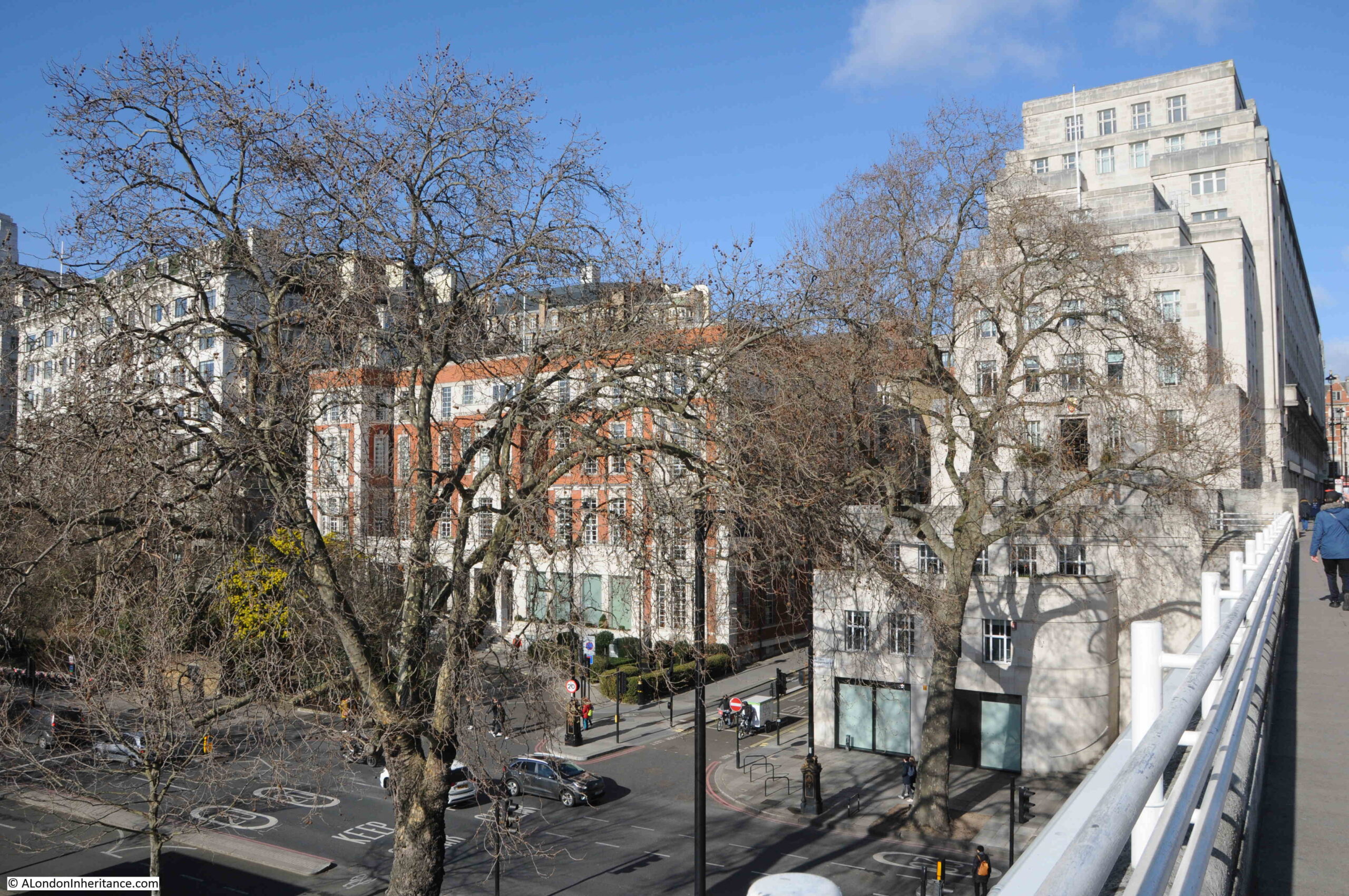
I have published a number of photos my father took of the South Bank over the last couple of years and in the next couple of posts I will take a walk along Belvedere Road and then look at the construction of the Royal Festival Hall using these photos, including a number that I have not published before, but first, some history of the South Bank.

Originally, the river frontage along this stretch of the Thames was mainly marsh land and at times of high tide, water would sweep inland. At some point, an earthen bank was constructed to prevent the Thames coming too far inland and by the Tudor period, a road had been constructed on the alignment of this original earthen bank, although according to Thomas Pennant, in 1560 there was not a single house standing between Lambeth Palace and Southwark. This road was shown on maps as Narrow Wall and today, Belvedere Road is roughly along the line of the old Narrow Wall and therefore also the original wall that formed the barrier to the Thames.

Land between Narrow Wall and the river was gradually drained and a number of small industries grew up along this stretch of the river, with the land behind the Narrow Wall staying as marsh and pasture with drainage ditches taking water into the river.

In the fifteenth and sixteenth centuries, the land between the current location of Waterloo and Westminster Bridges, from Narrow Wall to the river was called Church Osiers (Osier being a name for a type of Willow) after the osier bed which occupied this marshy land at the side of the river that would frequently flood. At some point prior to 1690 the land was named Pedlar’s Acre. 1690 is the first time that the name appears in a lease document. The legend behind the name Pedlar’s Acre is that a Pedlar from Swaffham in Suffolk had traveled to London with his dog in the hope of finding his fortune. Different versions of the legend either has the Pedlar’s dog digging up a pot of money either on the South Bank, or after returning home to Swaffham. The Pedlar then gave the strip of land along the river to the parish of Lambeth on condition that his portrait, along with his dog be preserved in painted glass in the parish church.

What ever the truth of this story, there was a picture of the pedlar and his dog in one of the windows of Lambeth Church until 1884.

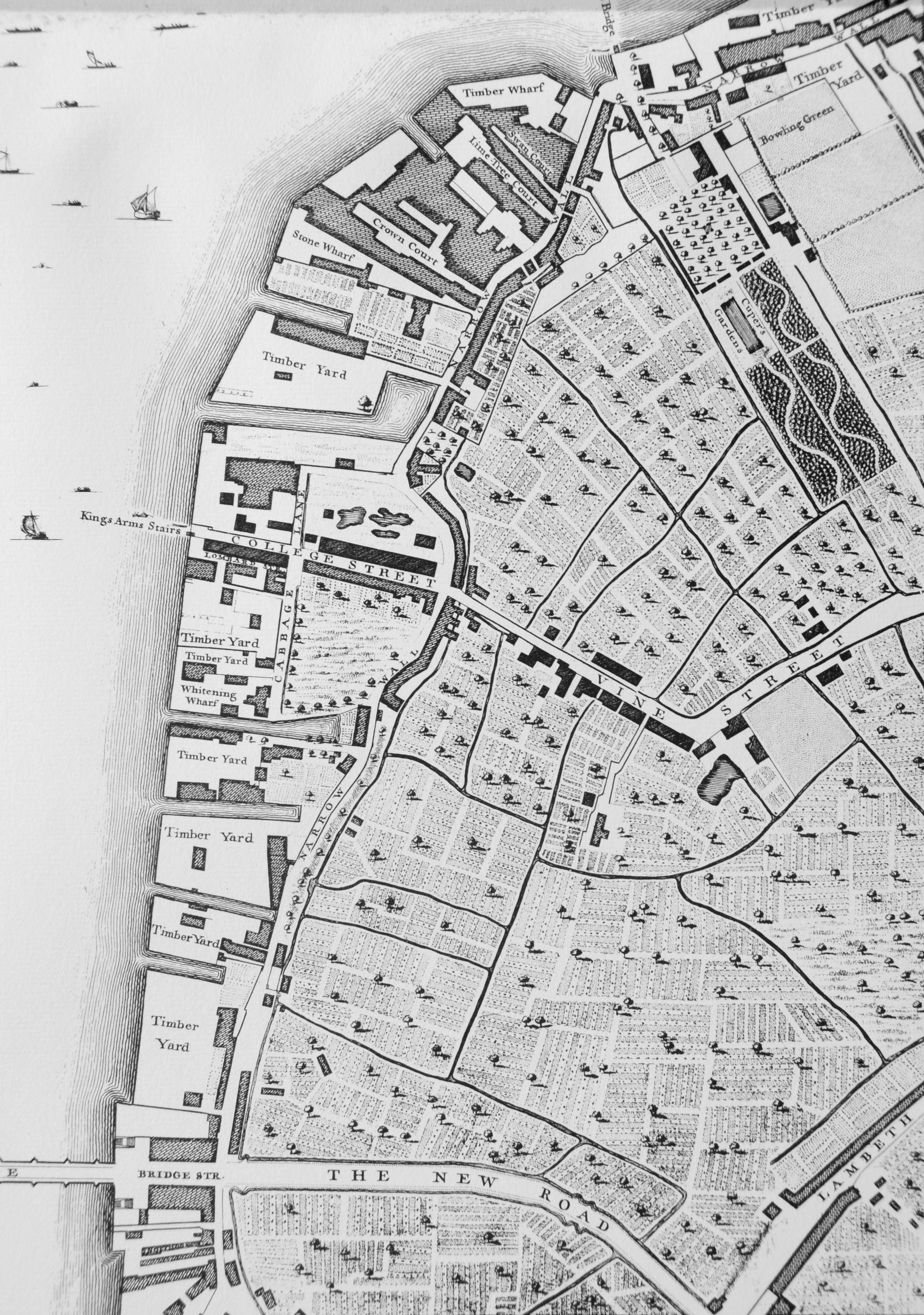
From the 17th century onwards, the land between Narrow Wall and the river was gradually developed. John Rocque’s map shows the area in the middle of the 18th century.

Westminster Bridge is at the bottom of the map and the future location of Waterloo Bridge is at the top of the map, to the left of the bowling green.

History of the Southbank Map 1

Narrow Wall, the original earthen wall, can be seen running parallel to the river, dividing the development along the river from the pasture land that covered much of Lambeth. Starting at the top right of the map, Cuper’s Garden runs in land from the river following almost exactly the route today of the approach road up to Waterloo Bridge.

Cuper’s Garden, one of the many pleasure gardens that ran along the south bank of the river was well known for displays of fireworks and it was also described as “not however the resort of respectable company, but of the abandoned of either sex”. The name came from one Boydell Cuper who had been the gardener to Lord Arundel at his property on the north bank of the river and who rented the land and created the gardens including using some of the old statues from Arundel House.

The land from Cuper’s Gardens along the river went under a number of changes of ownership and names including Bishop’s Acre, Four Acres and Float Mead.

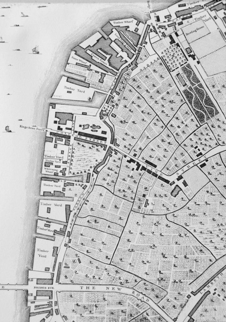
Follow the river south through the wharfs and timber yards that now occupy the space between the river and the Narrow Wall, until College Street.

College Street is on the edge of the current location of the Jubilee Gardens with the open space bounded by College Street, Cabbage Lane and Narrow Wall, called College Gardens part of which is also now the Jubilee Gardens. At the end of College Gardens is Kings Arms Stairs, one of the many stairs down to the river. The curve inland of Narrow Wall at this point was later straightened out, with the inland curve being retained and originally named Ragged Row and then Belvedere Crescent.

The name College Street and College Gardens may refer to the ownership of this parcel of land by Jesus College.

The land after the next Timber Yard and onwards to Westminster Bridge was the future location of County Hall.

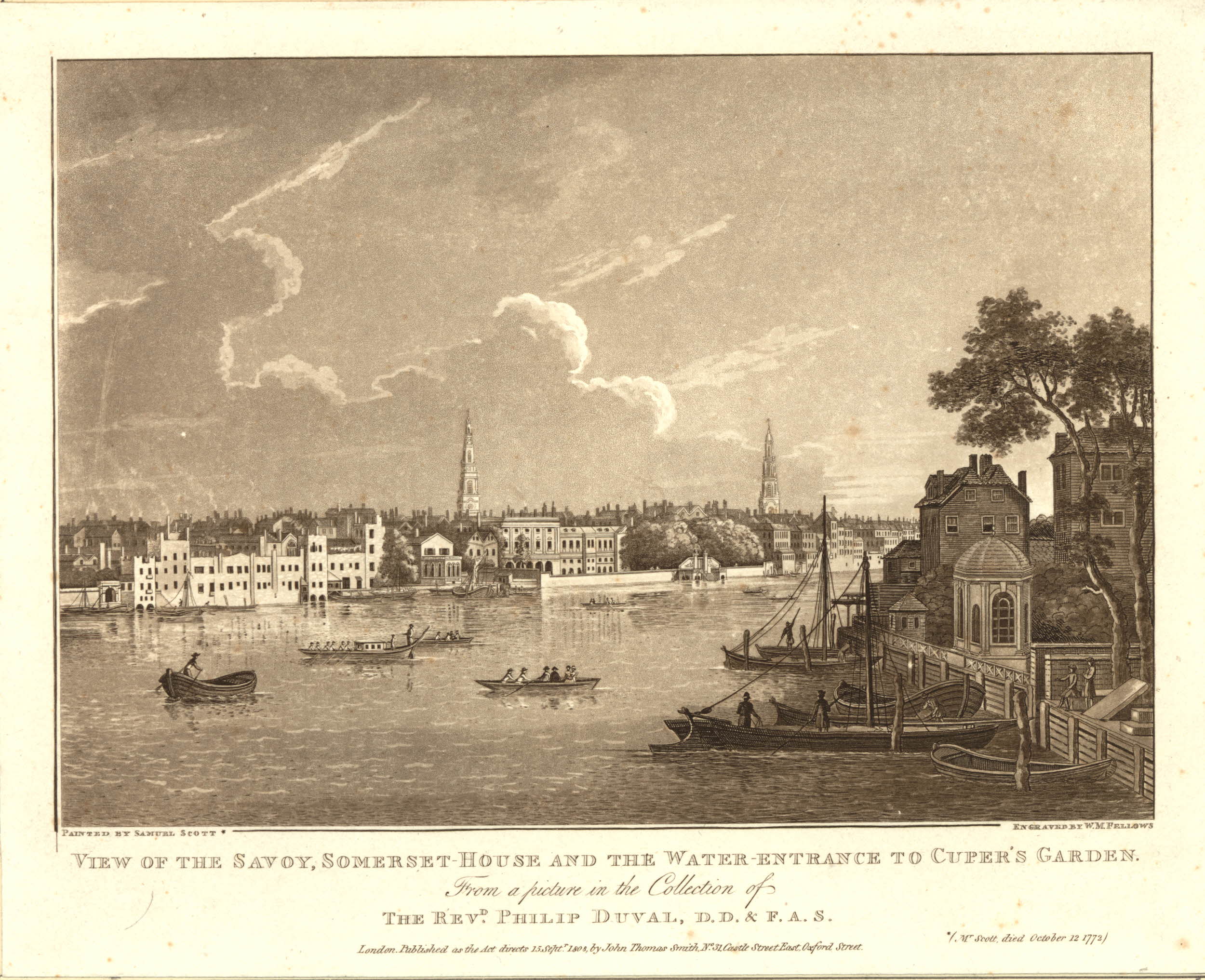
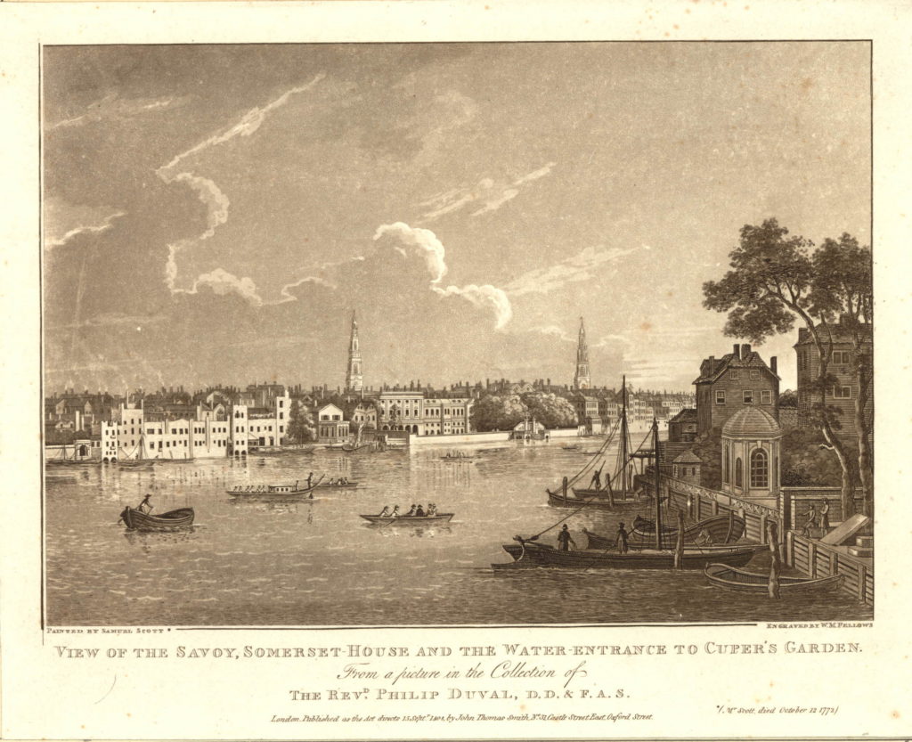
There are a number of prints of Cuper’s Gardens which give the impression of a very pleasant place. The following is from the mid 18th century and is looking across the curve of the river to the north bank, but shows the water entrance to Cuper’s Garden on the right side of the print.

591508001

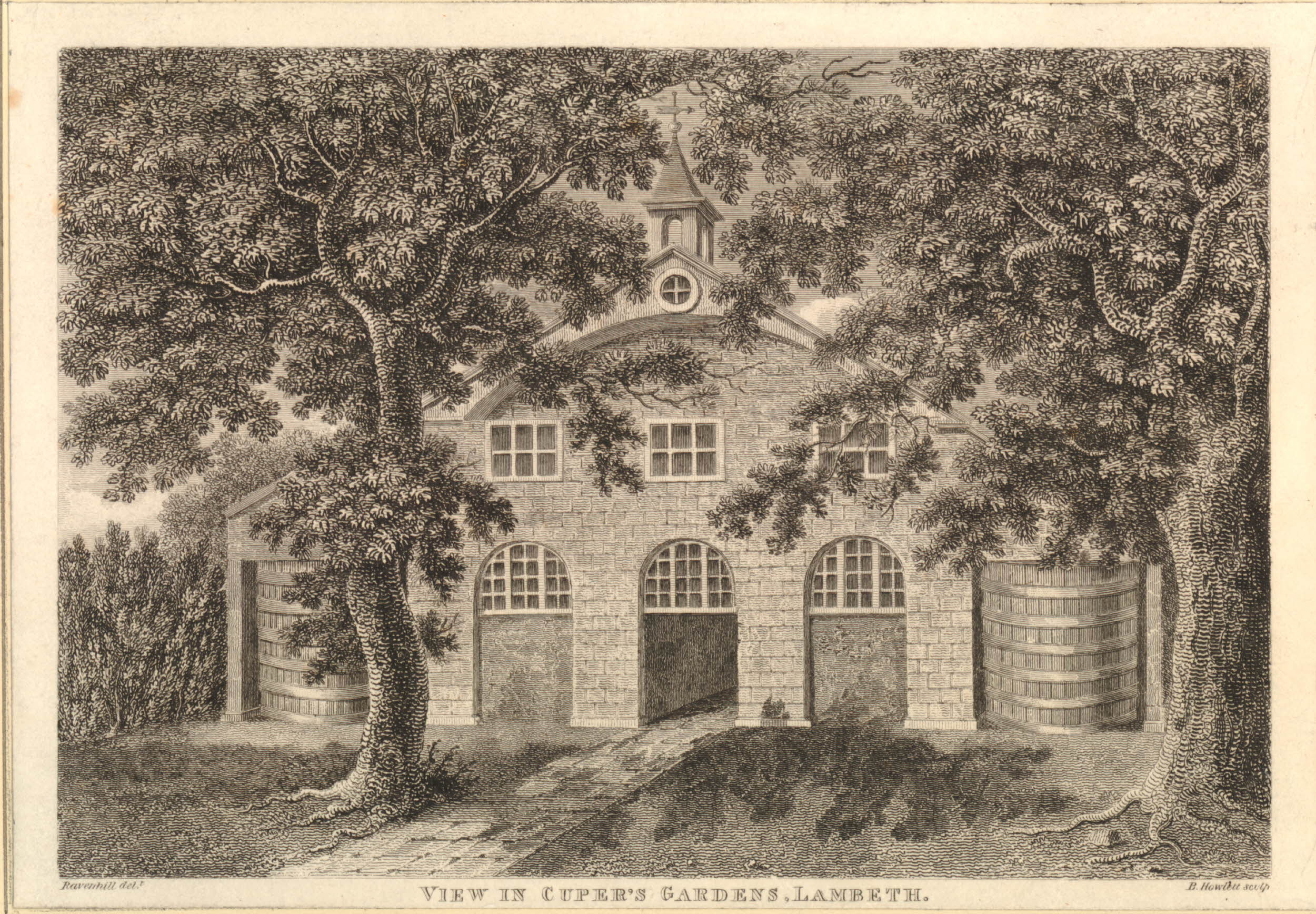
The following print is from 1798 and shows when part of the gardens were occupied by Beaufoy’s Distillery with a large amount of barrels outside. The print gives a good impression of the number of trees across the gardens as it was always described as a wooded area.

806092001

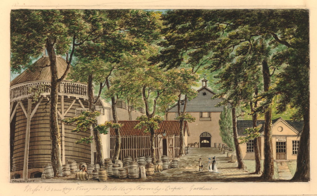
Another view of the Distillery in Cuper’s Gardens.

806217001

The next map is part of the “New and Correct Plan of London, Westminster and Southwark” from 1770. This shows the area to be roughly the same with Cuper’s Gardens at the top right of the map and Narrow Wall running down towards Westminster Bridge. This map is interesting as it shows the difficulty with relying on one specific map for accuracy. In the Rocque map, College Street is shown running into Vine Street. In the following map, College Street is now College Walk and Vine Street has changed into Wine Street. These are the only references I have found to these names so I assume that they are errors in 18th century map making.

History of the Southbank Map 6

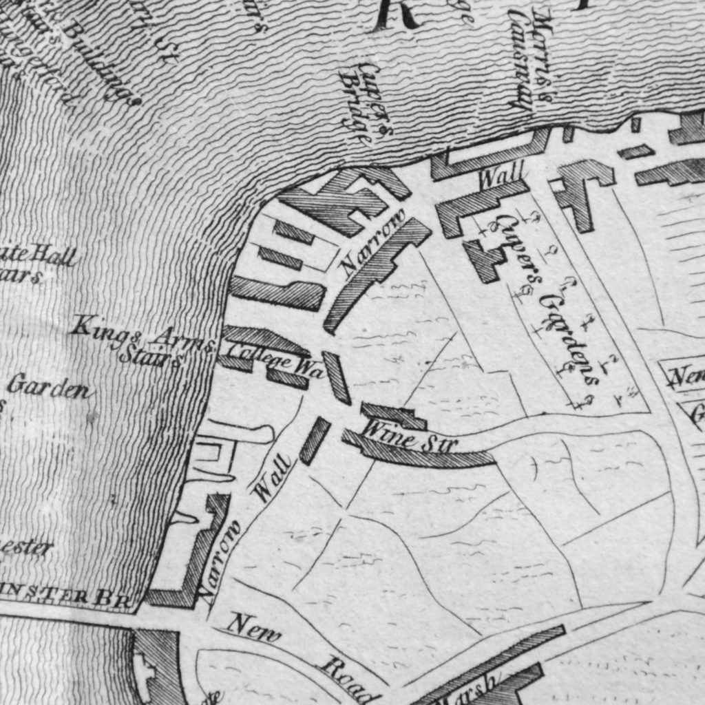
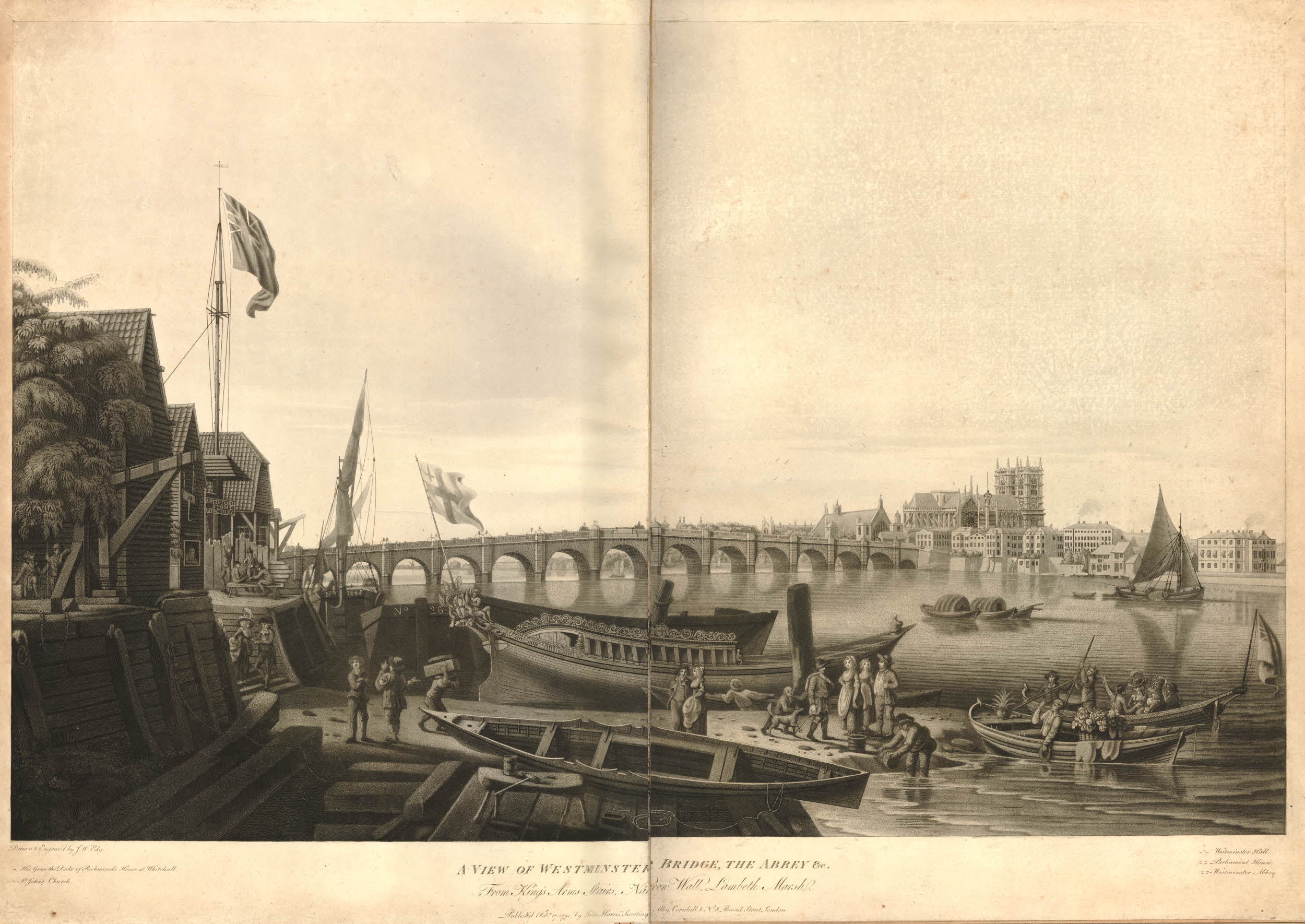
The above map shows the location of Kings Arms Stairs. The following print from 1791 is titled “A View of Westminster Bridge, the Abbey &c. from Kings Arms Stairs, Narrow Wall, Lambeth Marsh”. The stairs can be seen on the left, the tide is low and there is much activity on the waters edge. Westminster Bridge can be seen across the river with Westminster Abbey and Westminster Hall just to the left of the Abbey.

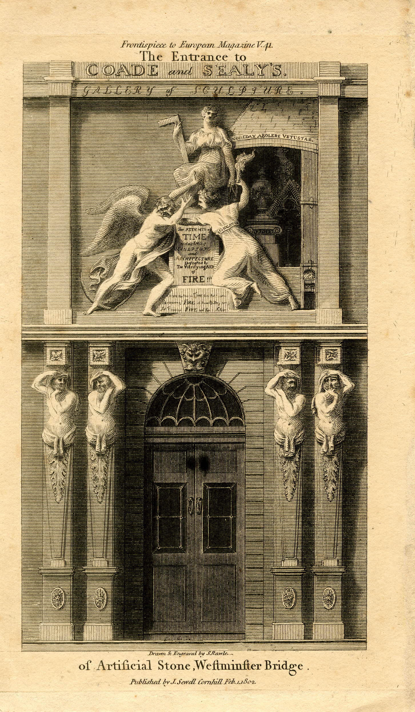
The rest of the scene cannot be a usual scene on this part of the south bank. In the centre of the print is a very ornate boat facing into the river with the flag of the City of London on the stern of the boat. The two small boats in the river to the right have people in ornate dress and large baskets of flowers. It would be interesting to know what was happening. On the left, the building just past the stairs has a sign reading “Artificial Stone Manufactory”, referring to Coade’s Stone Factory which i will cover later in the post.

582791001

Between the above map of 1770 and the next map, the Ordnance Survey map of 1895, the whole area underwent considerable development.

This edition of Ordnance Survey map splits coverage of the area between two maps, so the following map shows the area between Waterloo Bridge and Hungerford Railway Bridge.

History of the Southbank Map 3

The approach road to Waterloo Bridge still has the name of Cuper’s Garden, retaining a link from when this now heavily built area was mainly pasture land. The Waterloo Bridge approach was developed between 1813 and 1816.

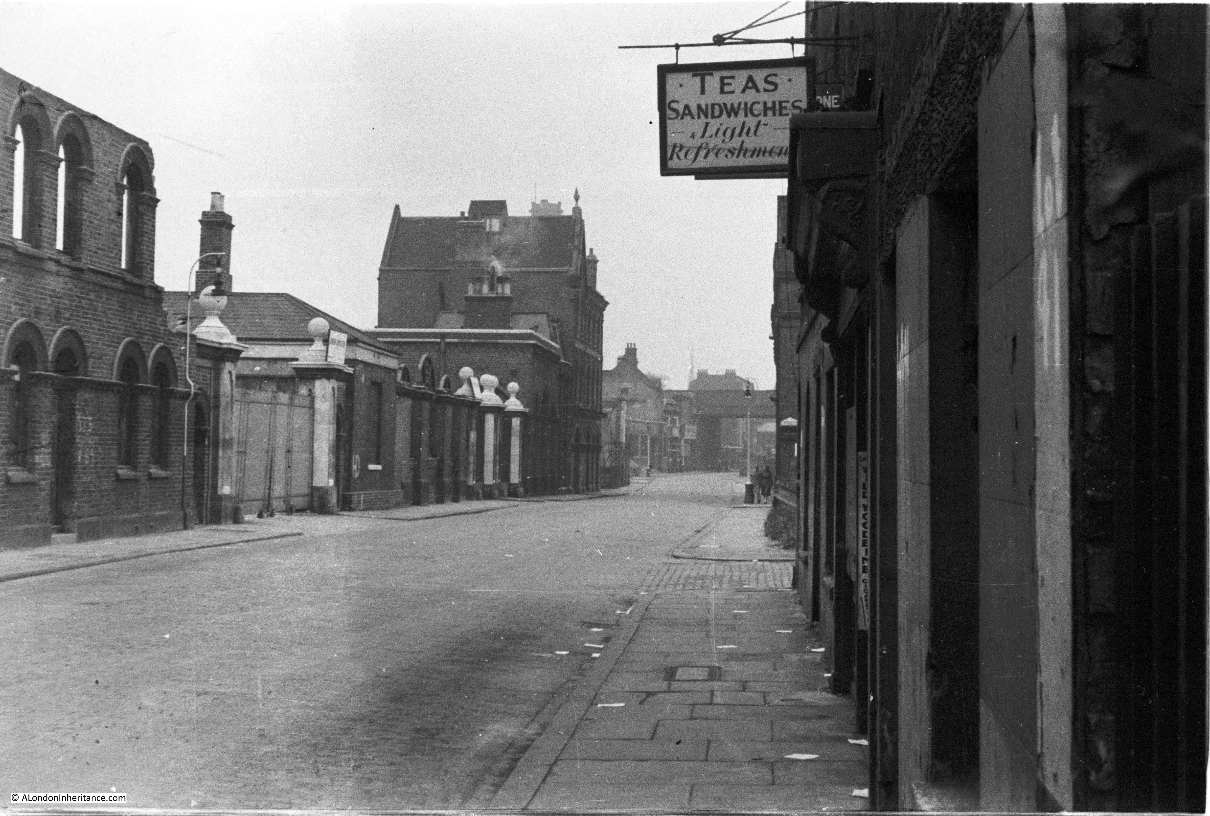
The area inland from Belvedere Road has been developed with rows of terrace houses.

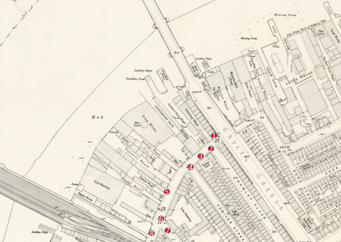
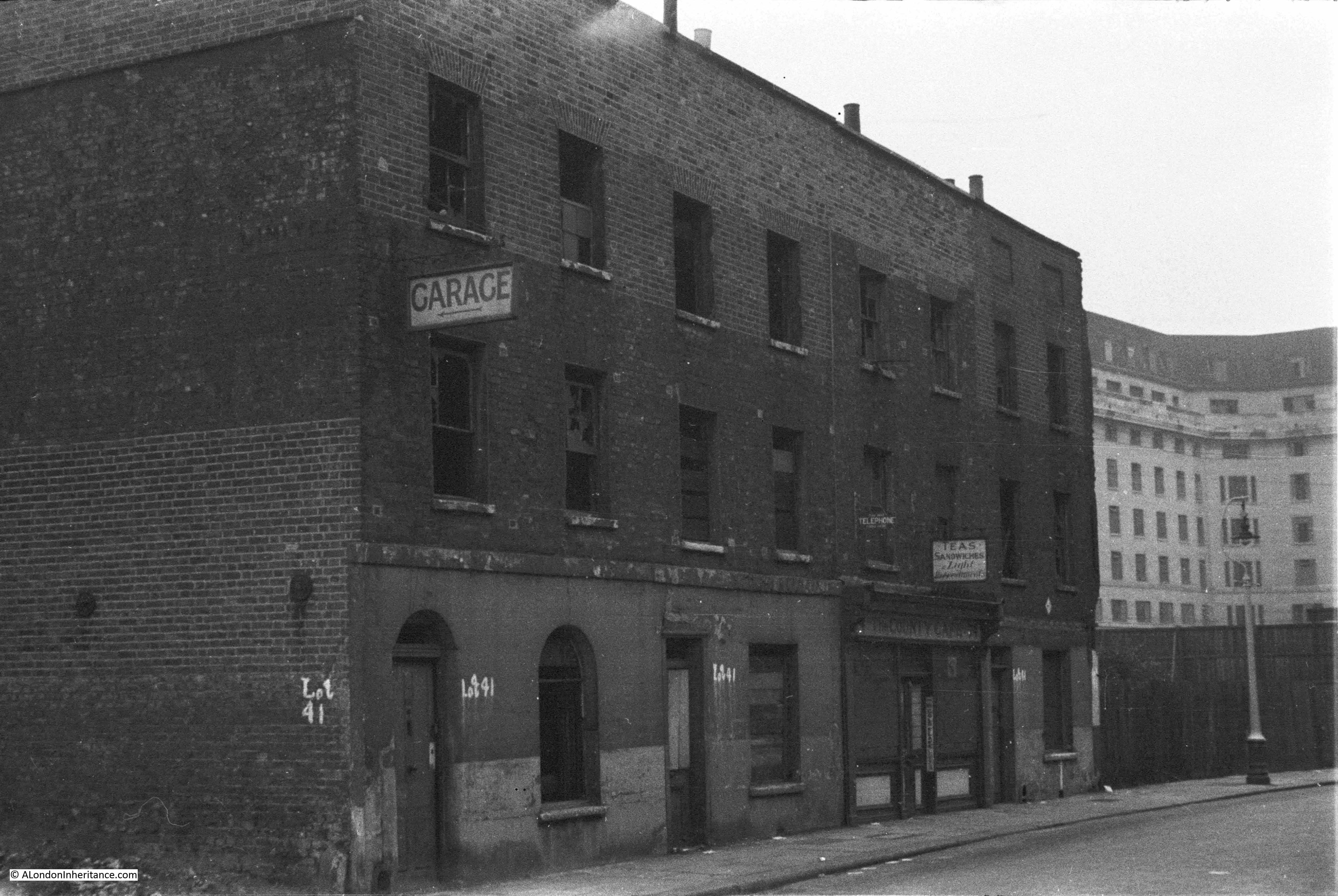
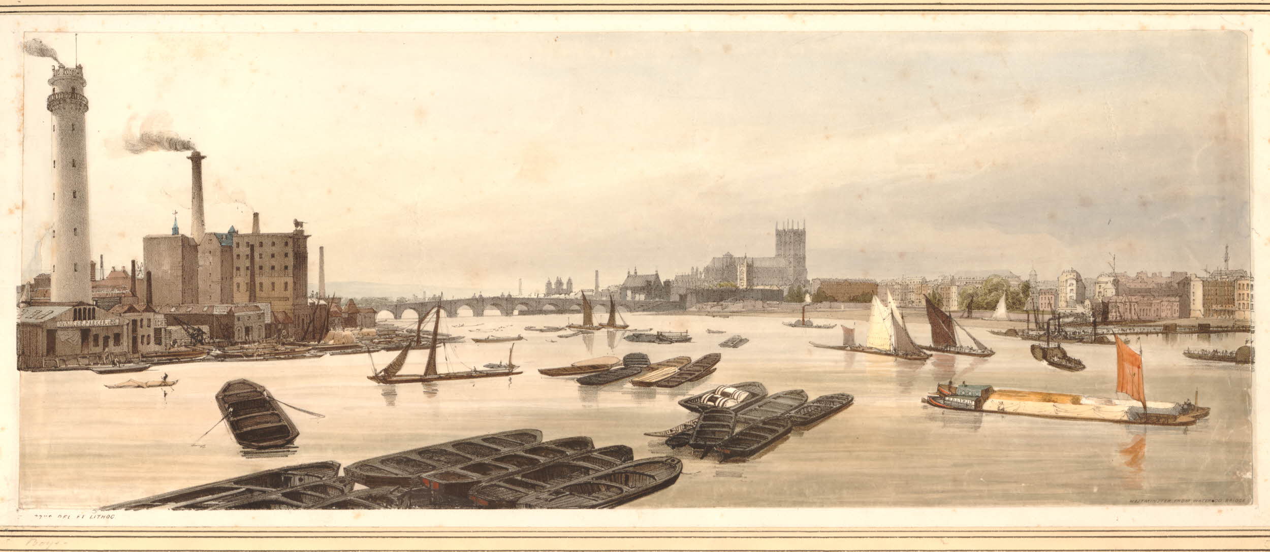
The area between the old Narrow Wall, now named Belvedere Road, and the River Thames is still industrial with two major landmarks, the Iron Works and Shot Tower close to Waterloo Bridge and the Lion Brewery adjacent to Hungerford Bridge. Narrow Wall was widened and straightened between 1824 and 1829 to become Belvedere Road. The source of the name is from Belvidere, a house and grounds on the land south of the Iron Works in the above map. As with many of the other pleasure grounds along the river, Belvidere was opened to the public from 1718 and sold wine and food, including fish taken from the river.

The start of the Hungerford Railway Bridge is shown in the lower left of the above map. Construction of the bridge and the associated railway almost cut the area in two with Belvedere Road now being the main route through the area. If you look back at the Rocque map, Hungerford Bridge was built over the Timber Yard and land just north of College Street.

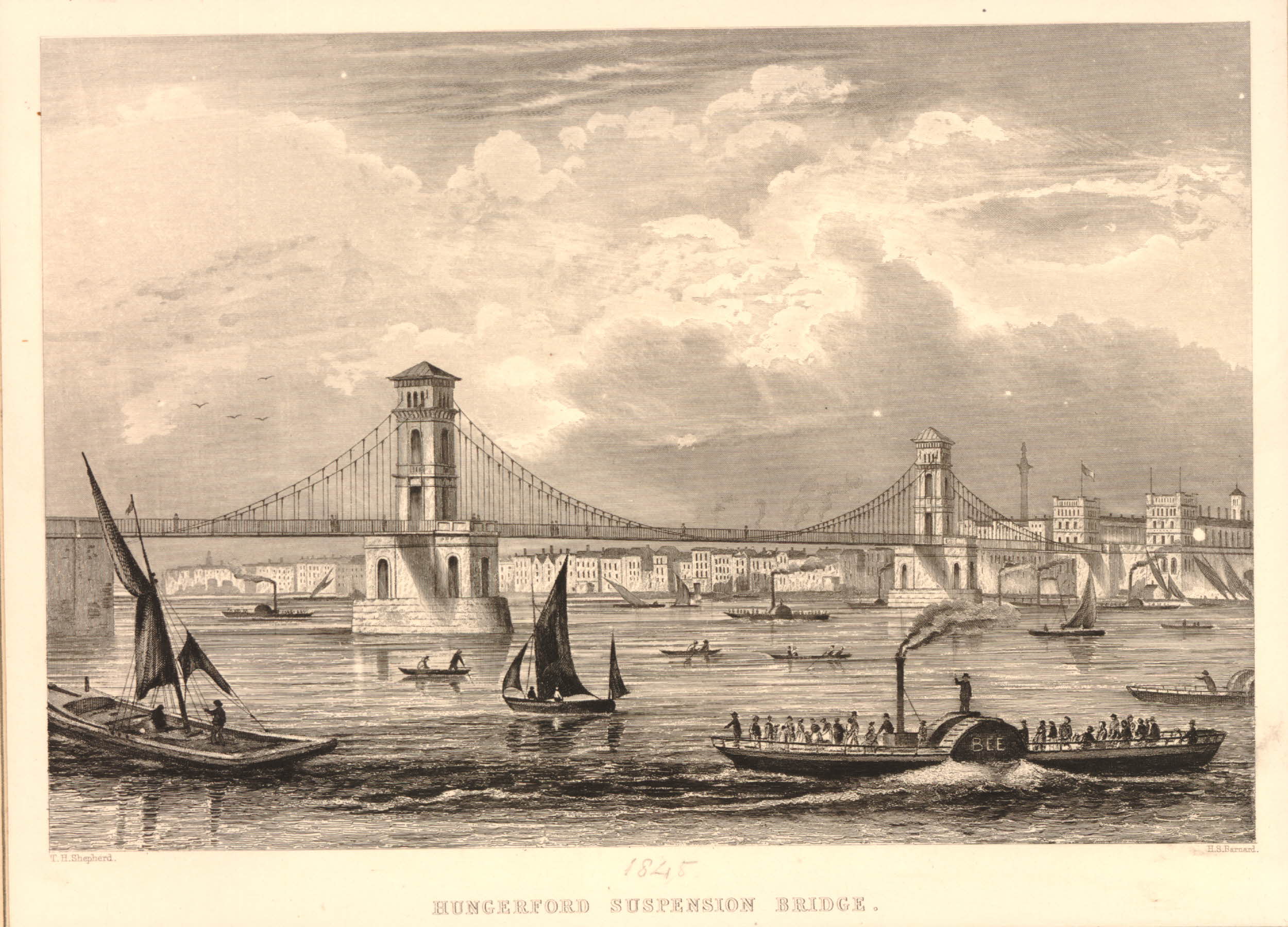
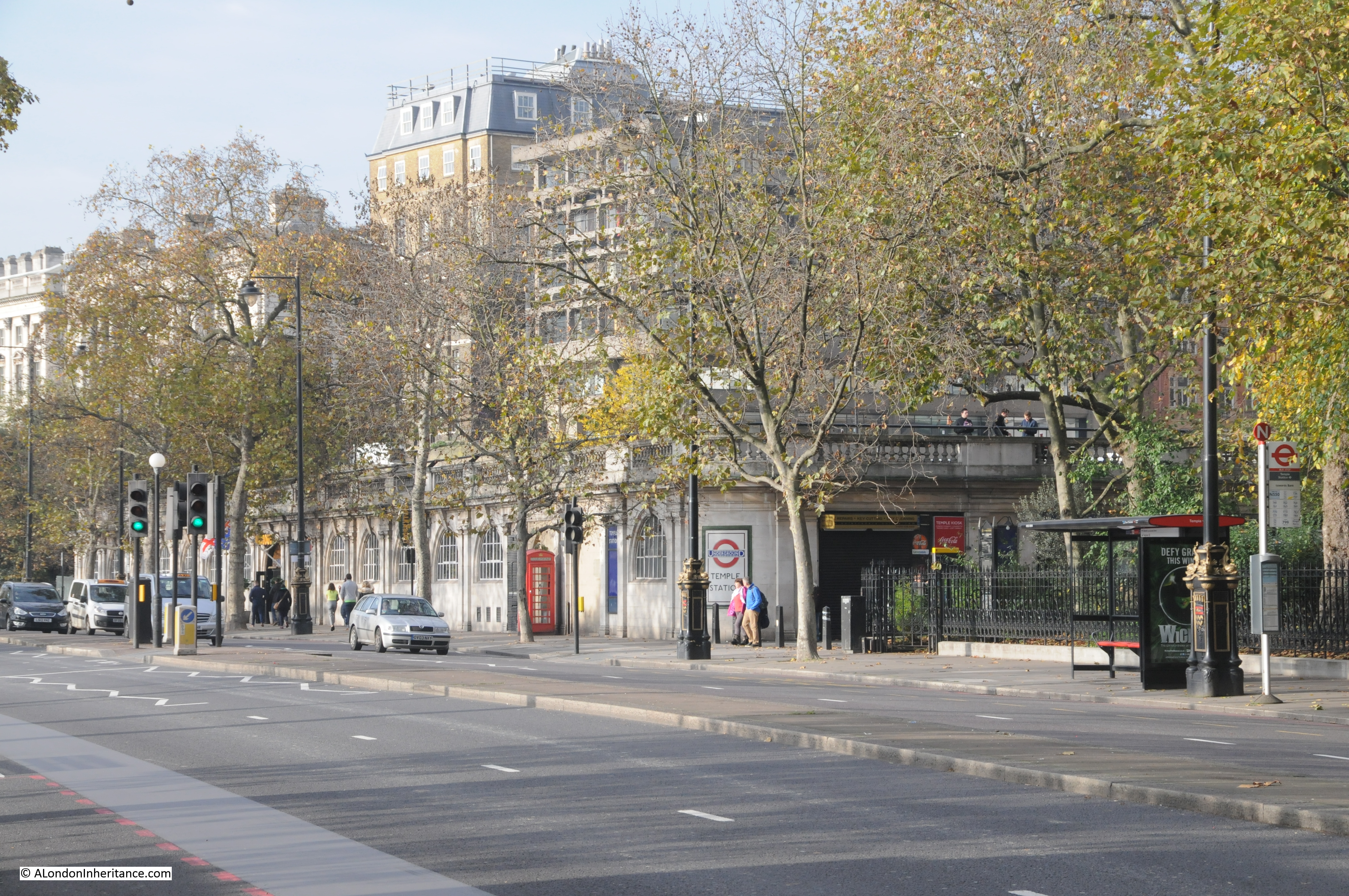
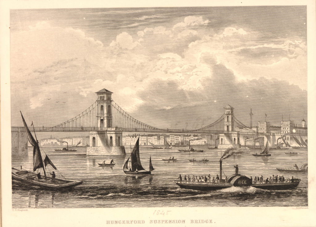
Designed by Brunel, construction of the original Hungerford Bridge was completed by 1845 when the bridge was opened. It was not originally a railway bridge, the aim of the bridge was to bring more custom to the Hungerford Market on the north side of the river. The original bridge did not last long and in 1859 the construction of a new railway bridge was authorised by the Charing Cross Railway Act. The old bridge was demolished and the new railway bridge was opened in 1864. The chains and ironwork from the old Hungerford Bridge were sold to be used in the construction of the new Clifton Suspension Bridge, also to a design by Brunel.

The original Hungerford Suspension Bridge:

582941001

The other major change was the construction of Waterloo Bridge, with the approach road across the former Cuper’s Gardens. Construction of the original Waterloo Bridge commenced in 1811 with the bridge being opened by the Prince Regent on the second anniversary of the Battle of Waterloo in 1817, after which the bridge was named following an act of parliament in 1816 to approve the proposed name.

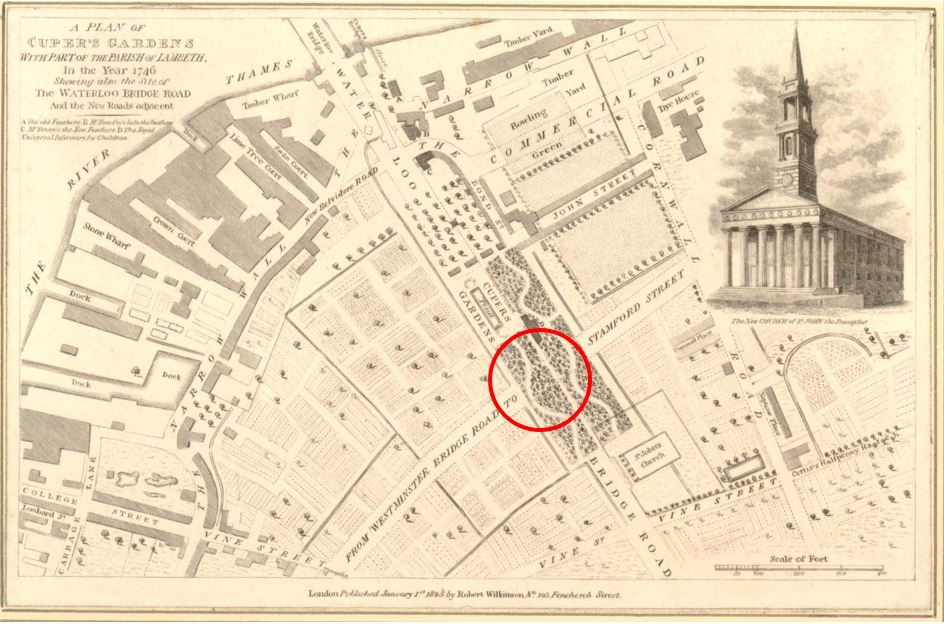
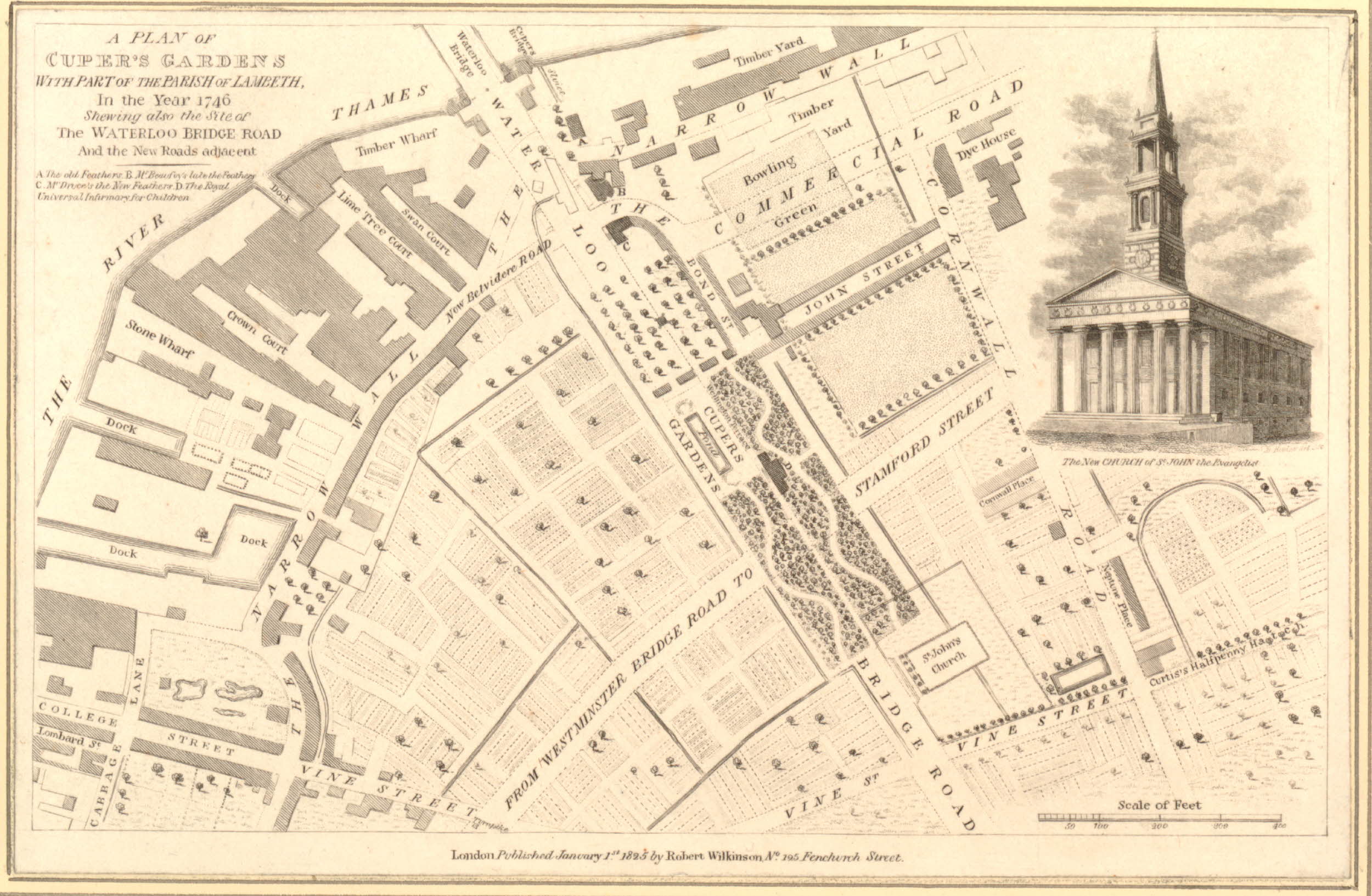
The following map is interesting as it appears to bring together some of the later development around Waterloo Bridge with the area in 1746. Published in 1825, eight years after the bridge was opened, it is titled “A Plan of Cuper’s Gardens with part of the Parish of Lambeth in the year 1746 showing also the site of the Waterloo Bridge Road and the new roads adjacent”.

The map helps define the exact location of Cuper’s Gardens as the church of St. John is also shown. The large roundabout at the end of Waterloo Bridge Road is now covering the end of Cuper’s Gardens at the junction with Stamford Street.

The map also shows how the name Belvedere Road came into use. The first straightening of the Narrow Wall is shown close to the approach to Waterloo Bridge and the name for this short section is New Belvidere Road. It is the first reference to the new street name, and also retains the original spelling from the house and gardens. As the name was taken on by the rest of the Narrow Wall, the name changed to the present spelling.

806218001You will need to click on the map to expand a larger version to see the next reference point to the area today. In the gardens in the wooded area just at the bottom right corner of the pond is a building marked D. Checking the key at top left, D is given as the “Royal Universal Infirmary for Children”. This is on an alignment of Waterloo Bridge down to St. John’s Church and although it has now closed as a hospital, a later version of this building, the Royal Waterloo Hospital for Children and Women is still there, on the junction with Stamford Street. This allows us to place the location of Cuper’s Garden precisely and as you walk up towards Waterloo Bridge from St. John’s Church, you are walking through the middle of Cuper’s Gardens.

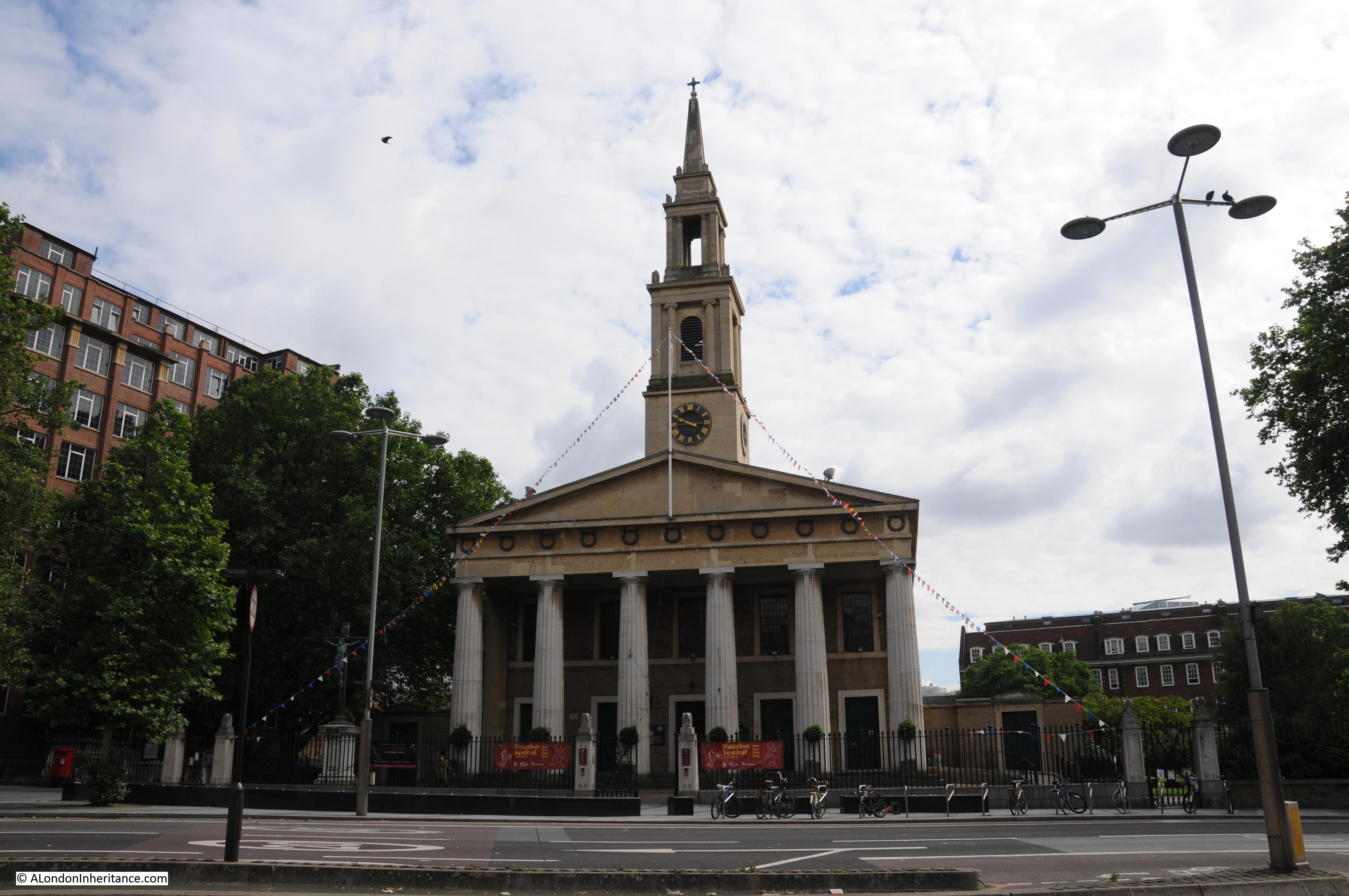
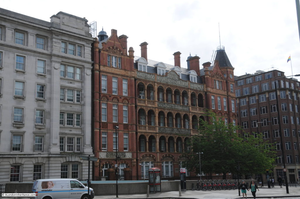
The following photo shows the Royal Waterloo Hospital for Children and Women on the corner of the approach to Waterloo Bridge and Stamford Street.

History of the Southbank 31

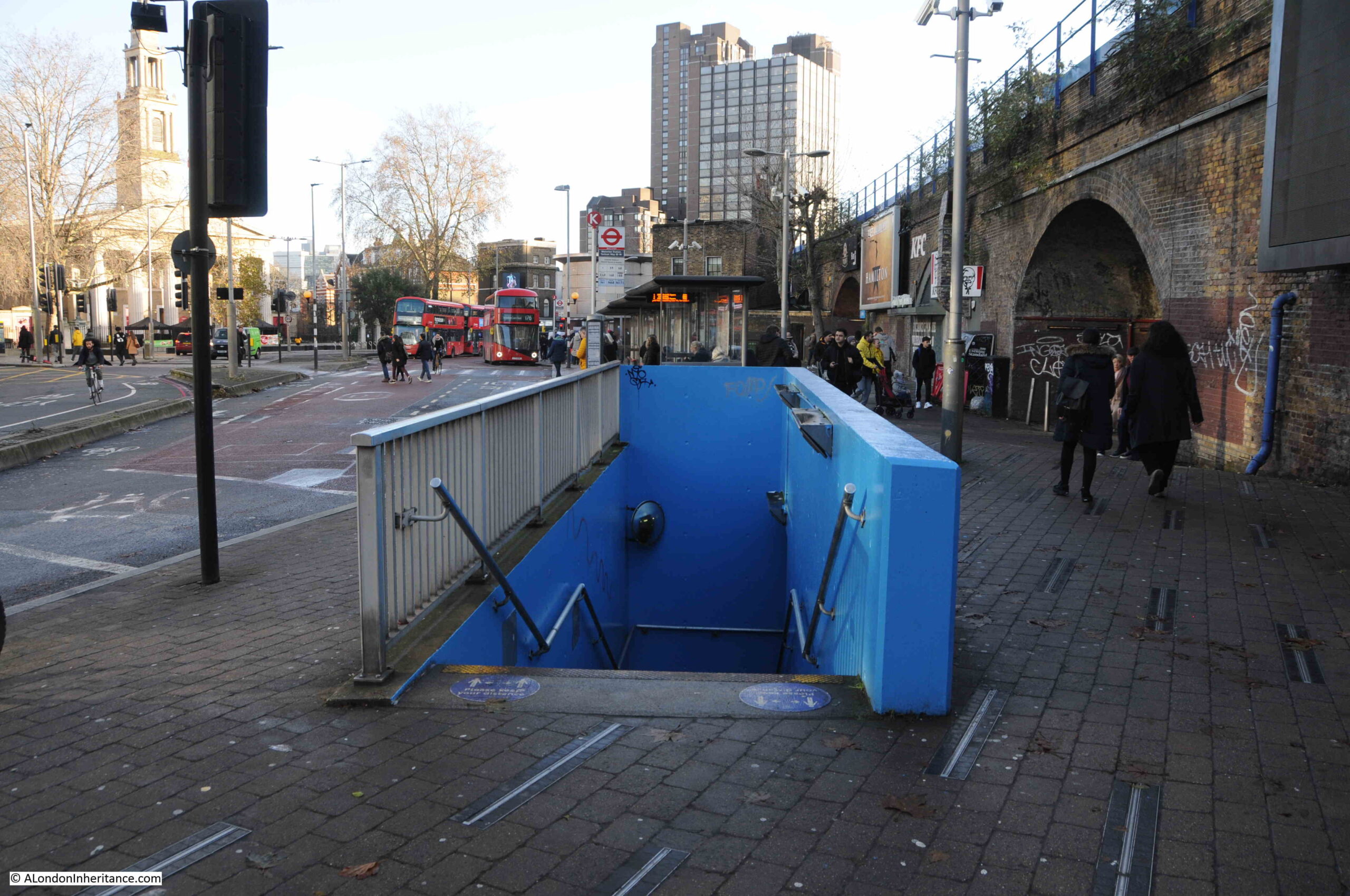
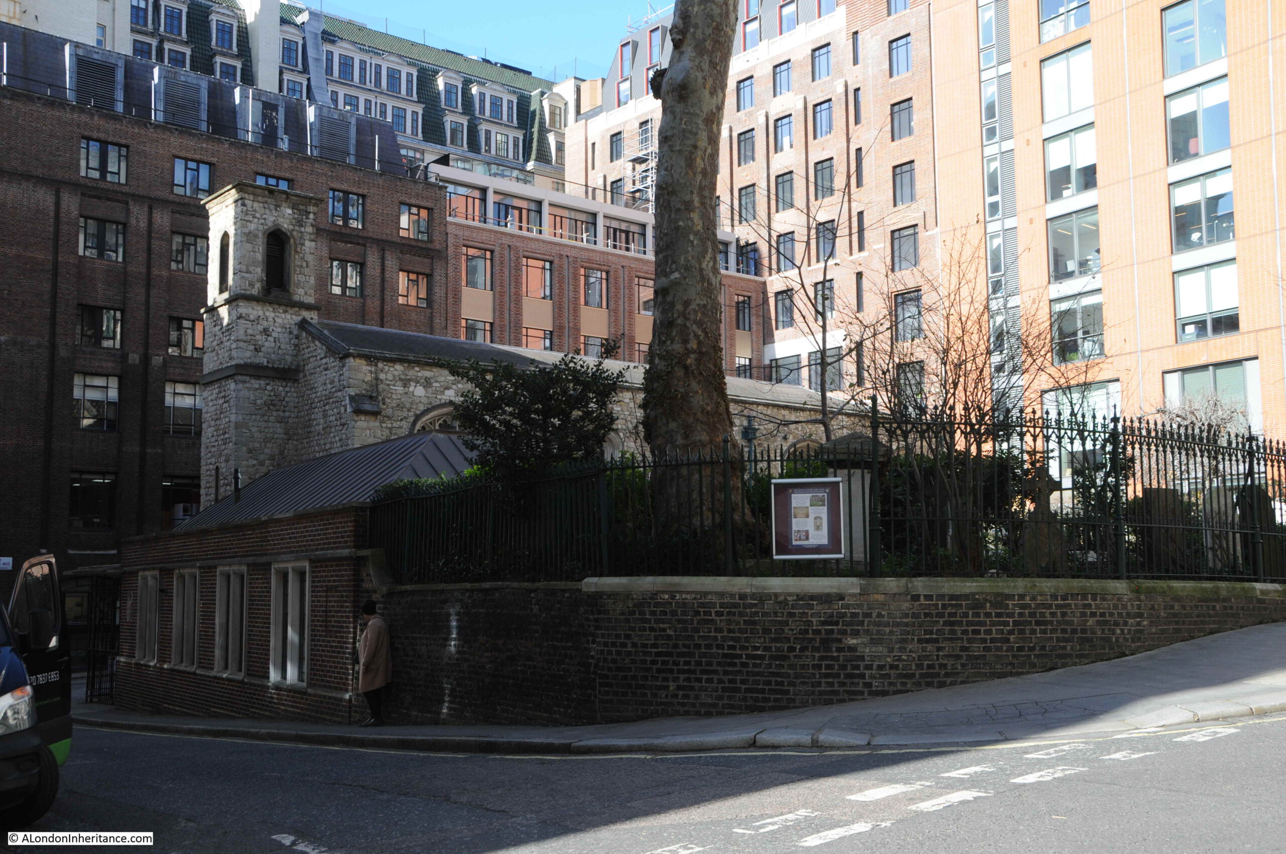
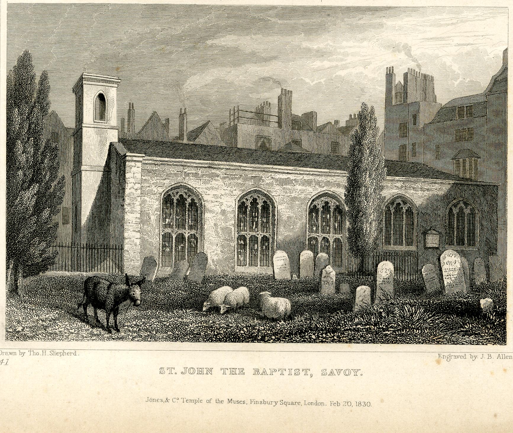
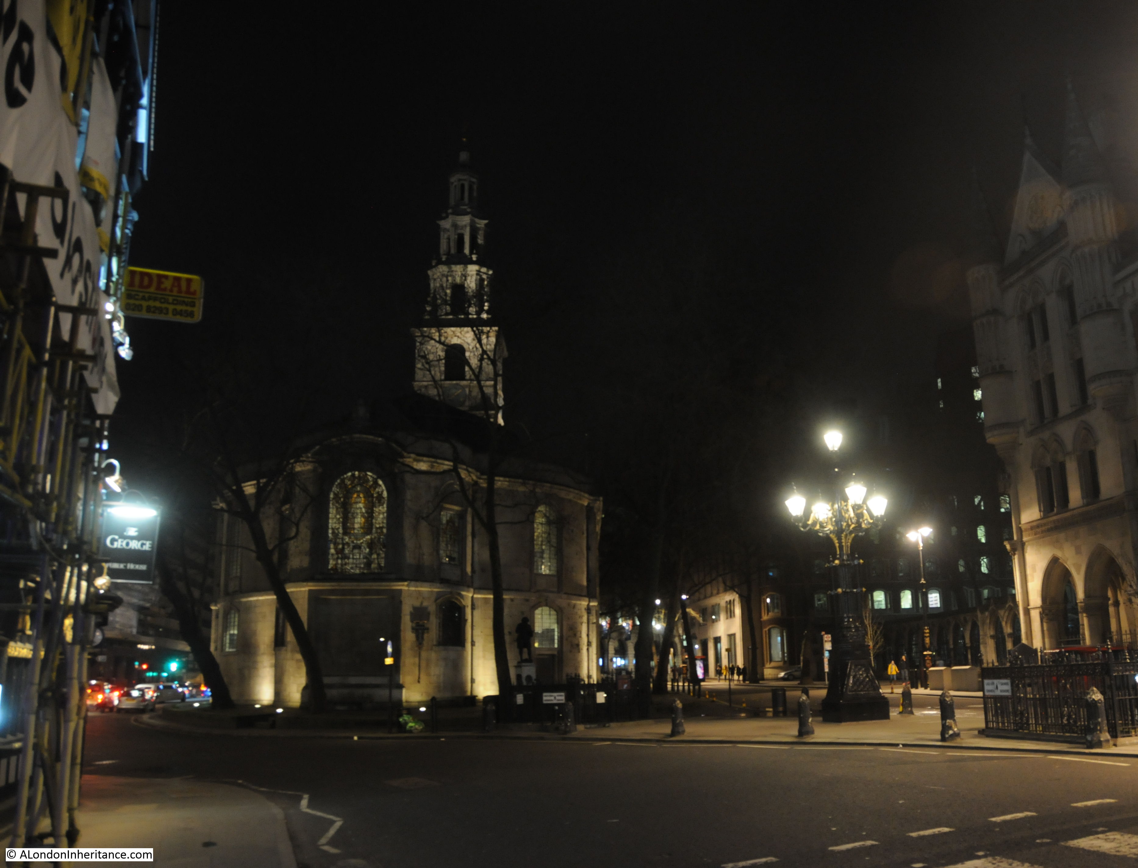
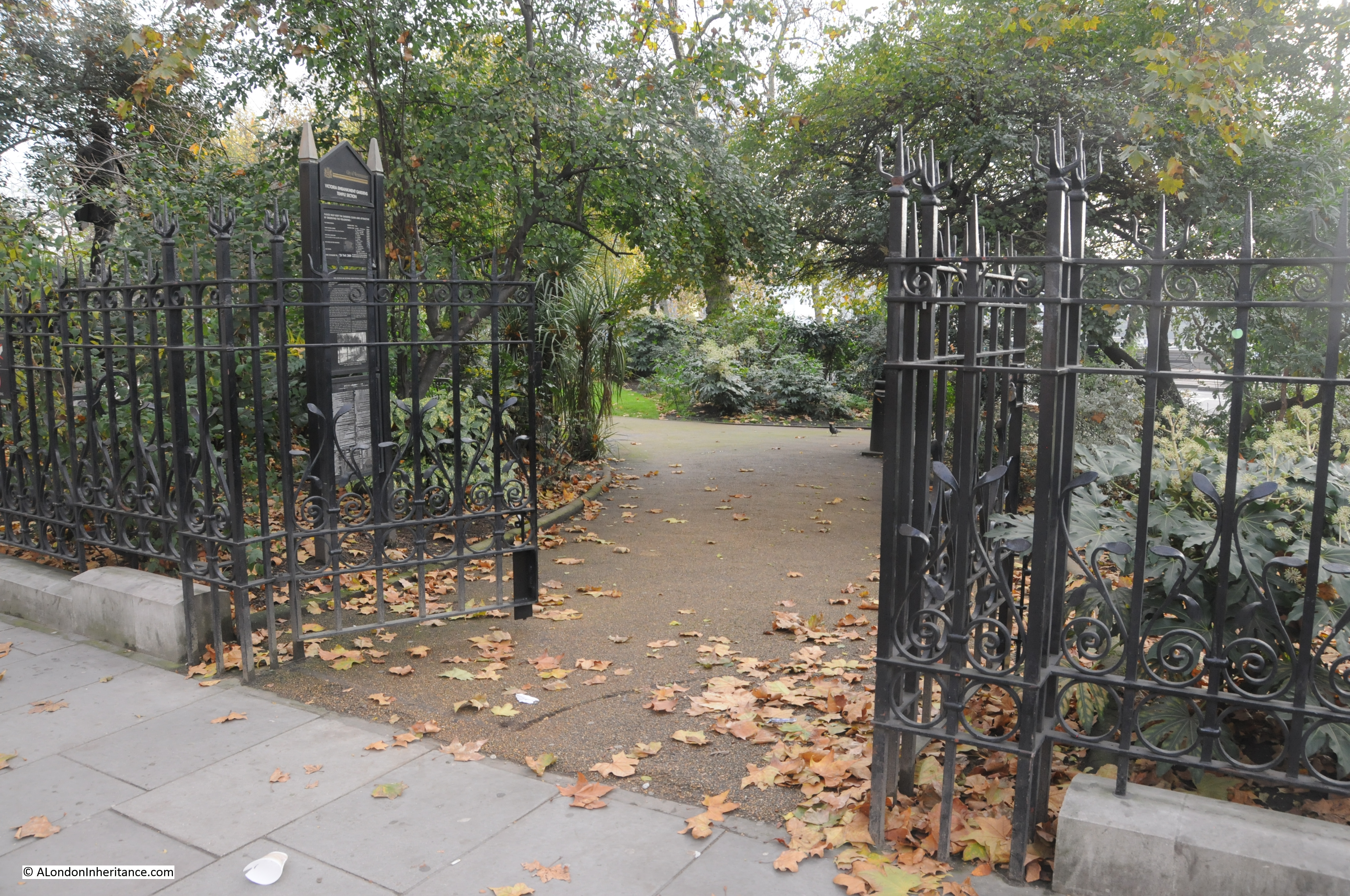
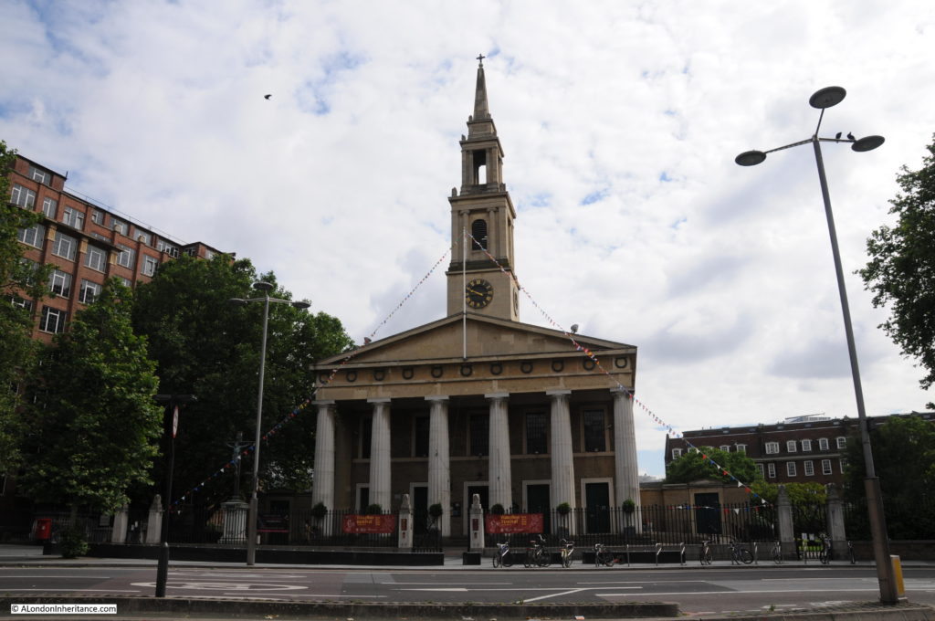
The church of St. John, although badly damaged by bombing during the last war, it was rebuilt to the original plan and is still exactly the same as the drawing on the 1825 map. During the Festival of Britain, the church was designated as the Festival Church with a programme of events during the period of the festival. The church is at the end of the original location of Cuper’s Gardens, the entrance to the gardens was on the left.

History of the Southbank 32

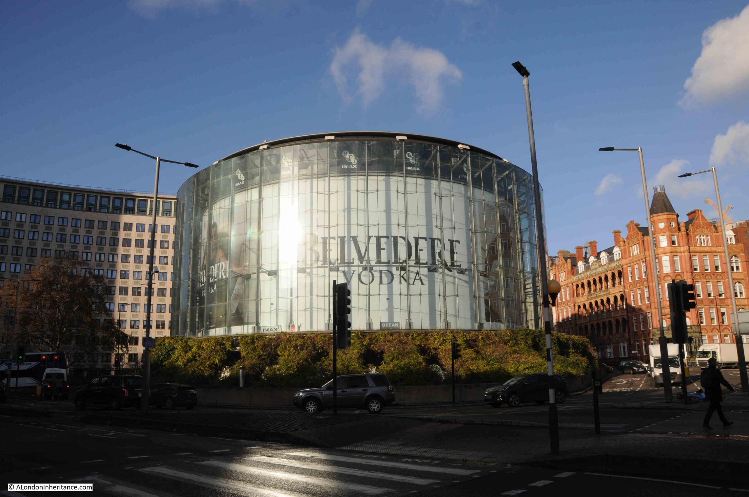
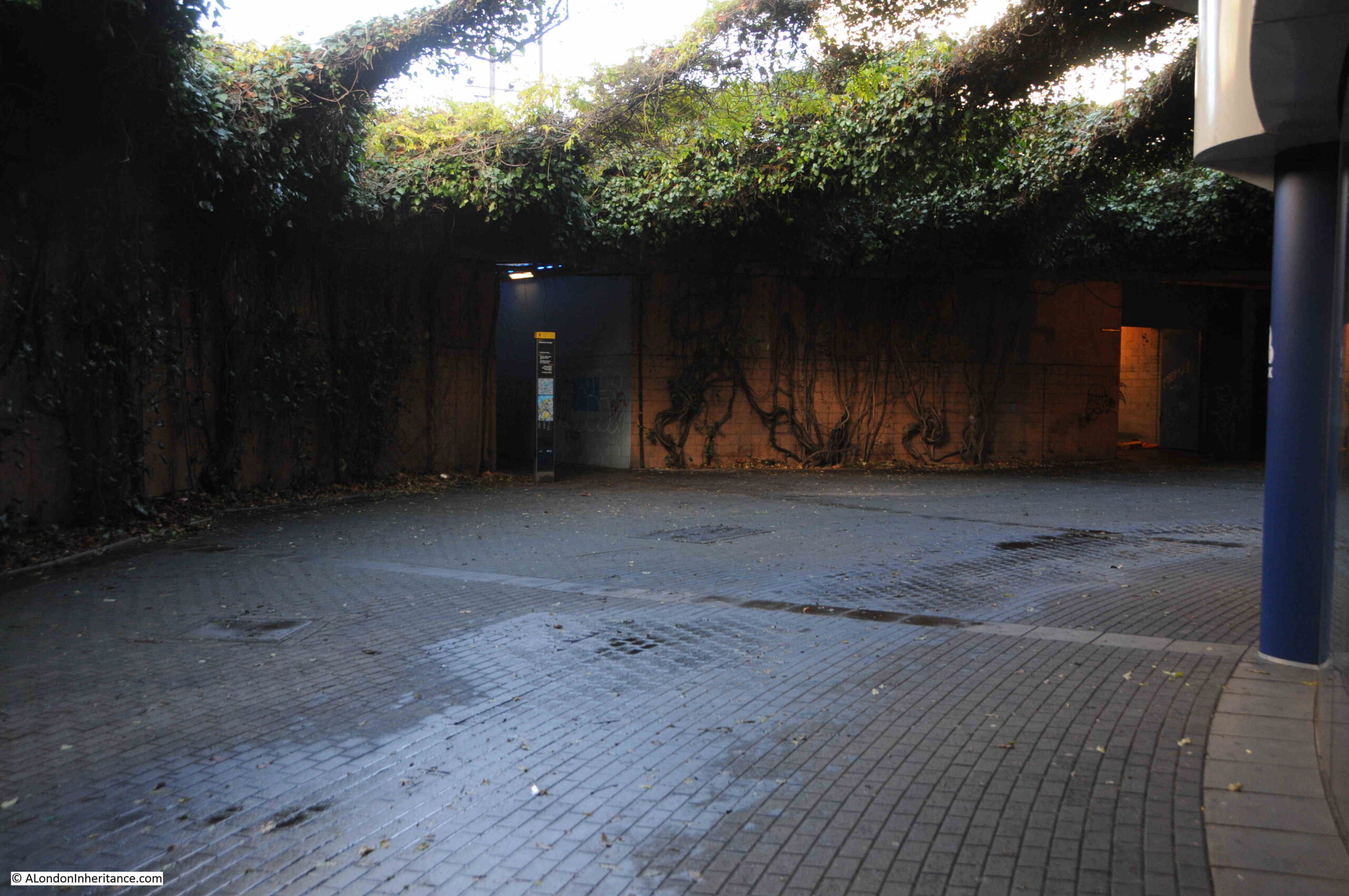
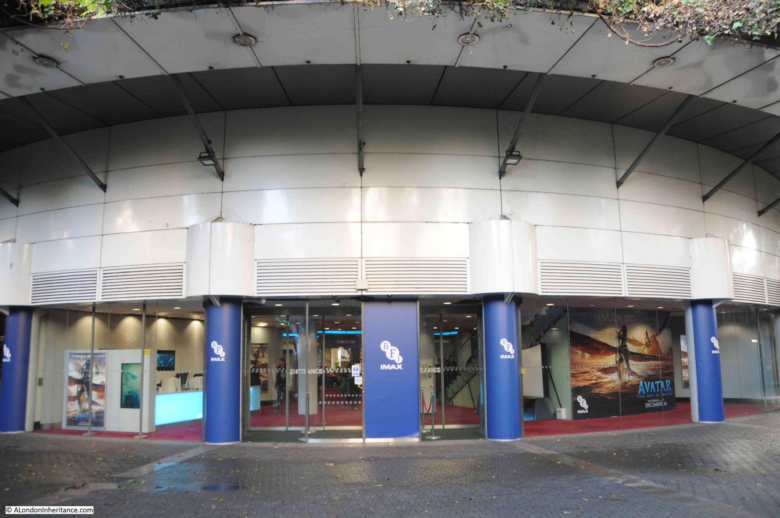
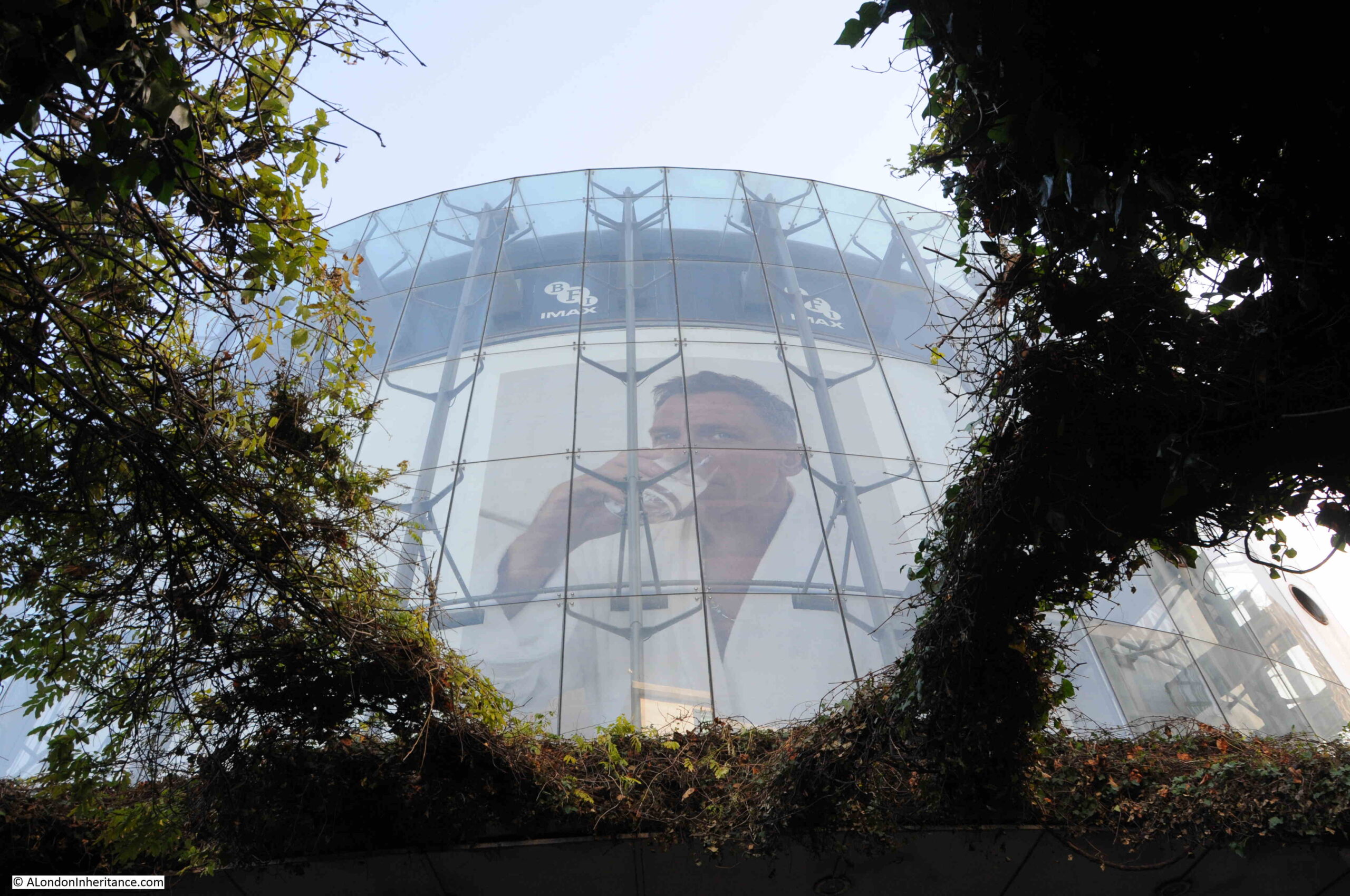
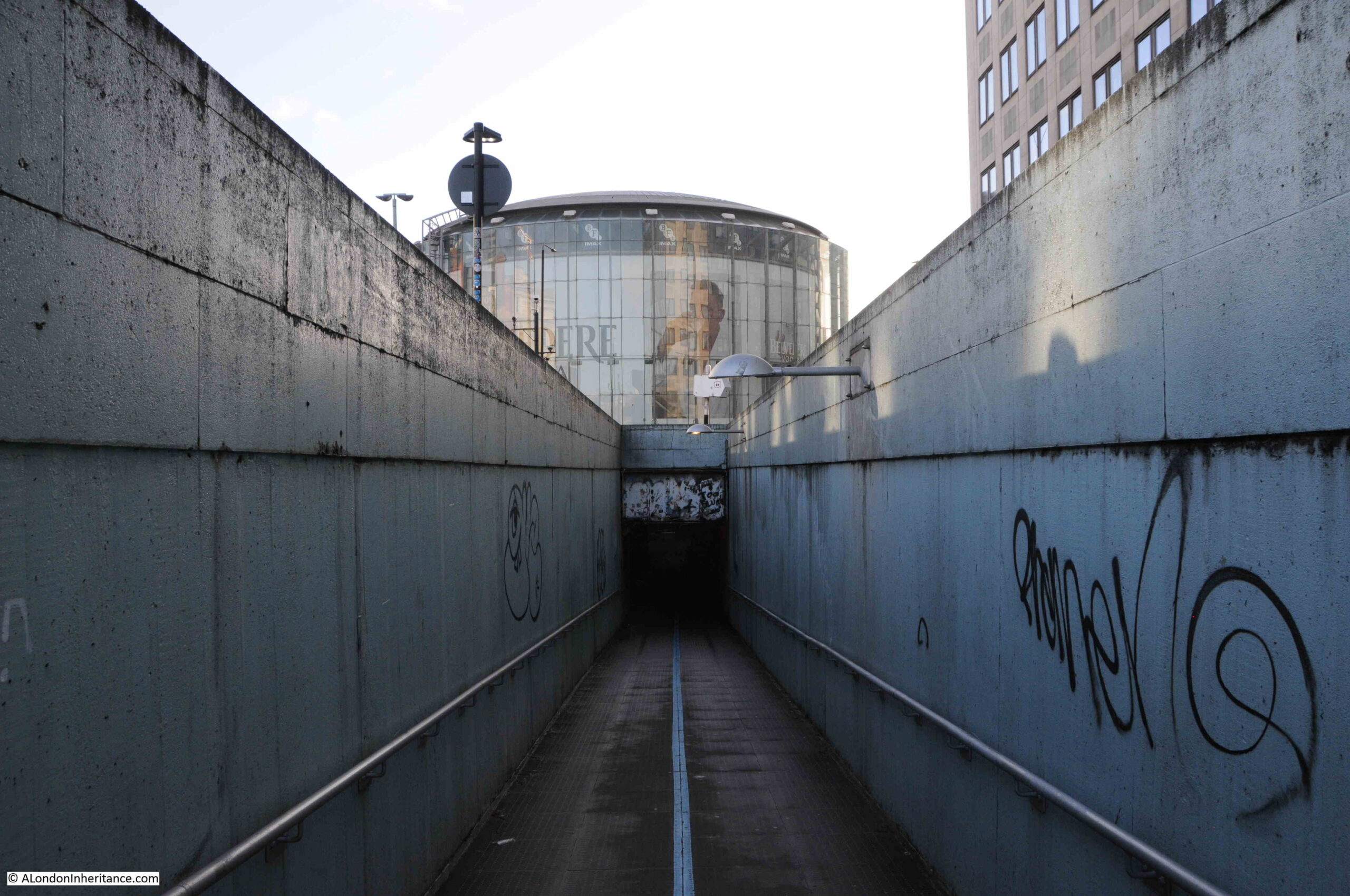
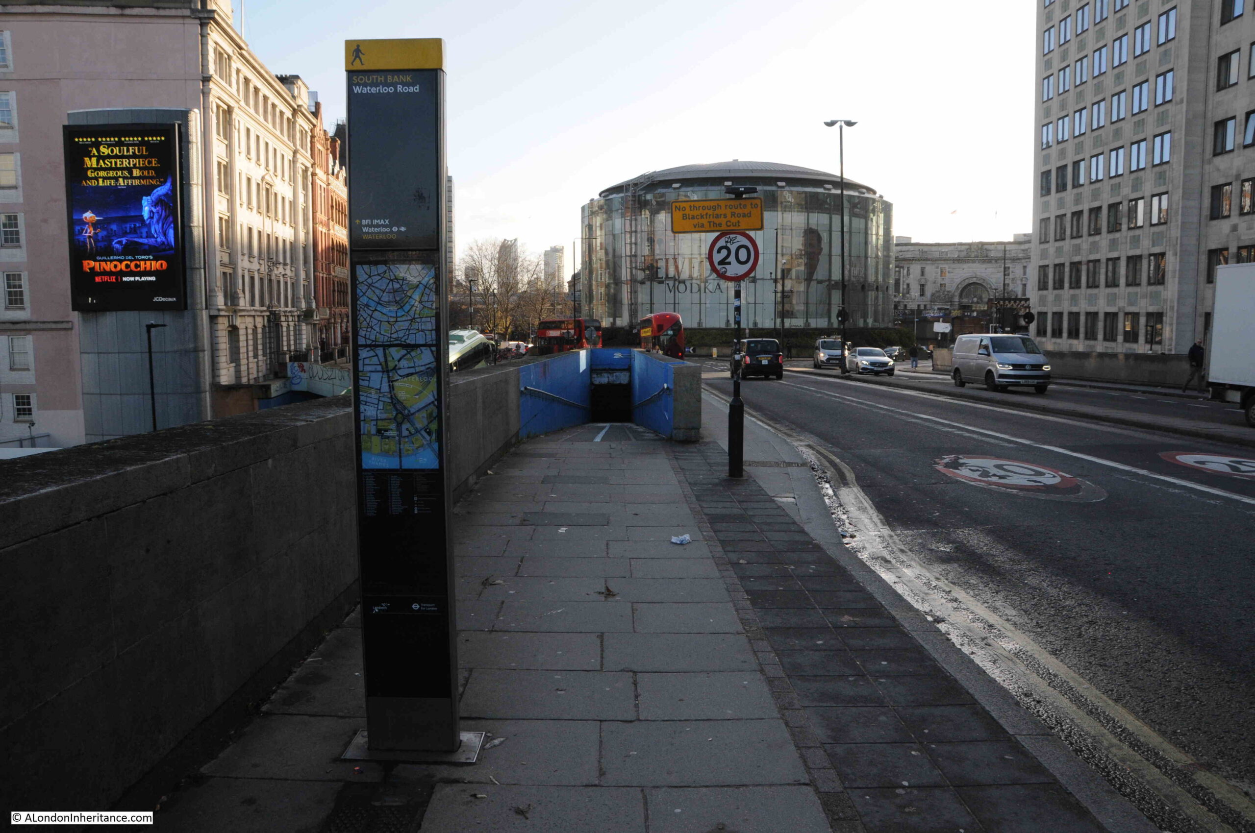
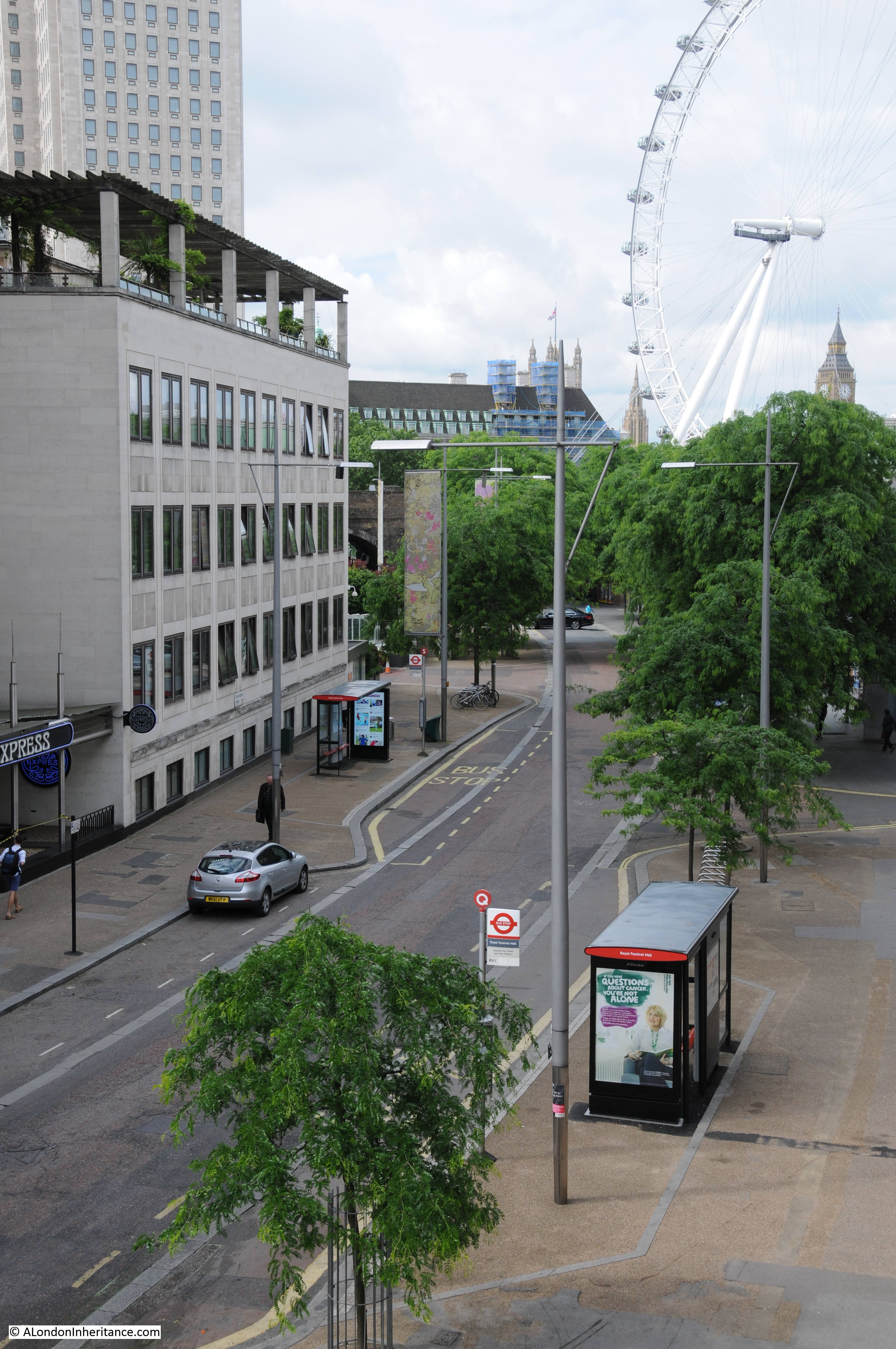
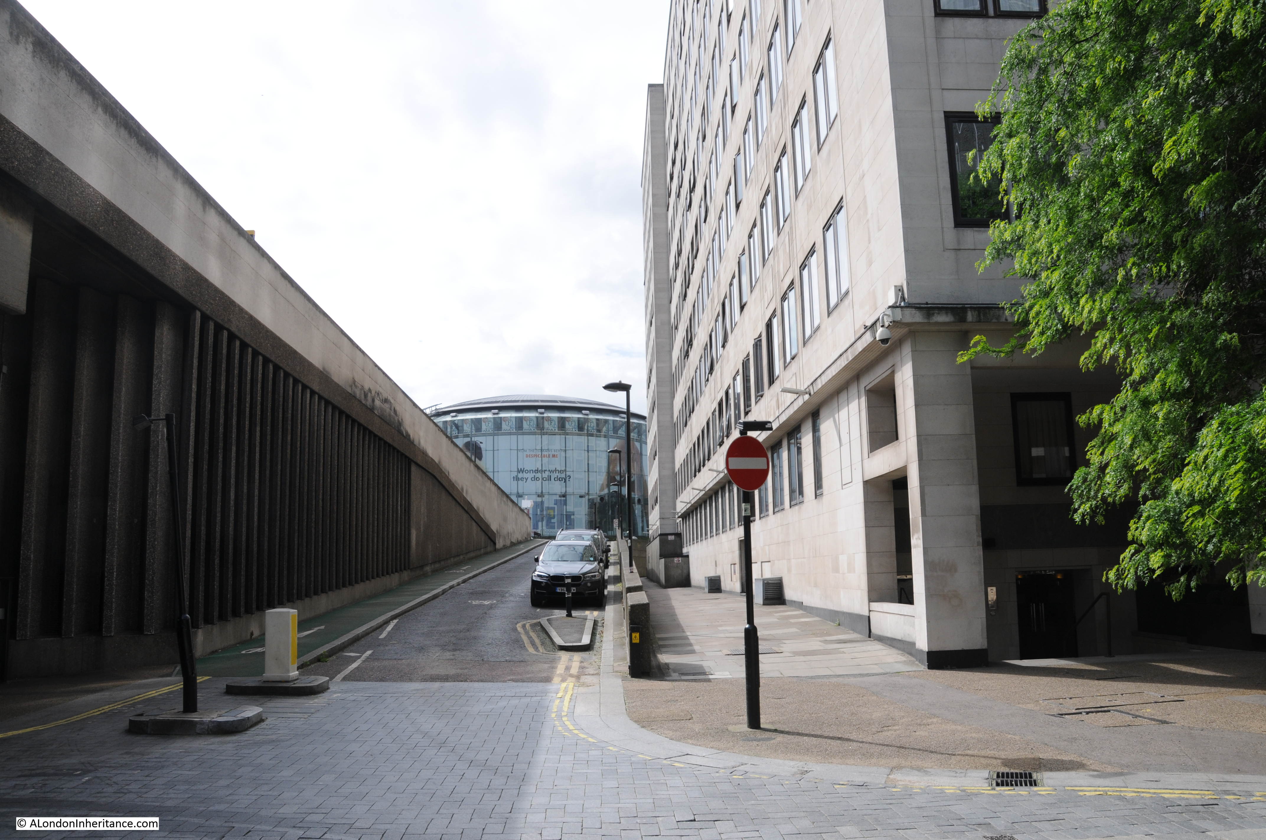
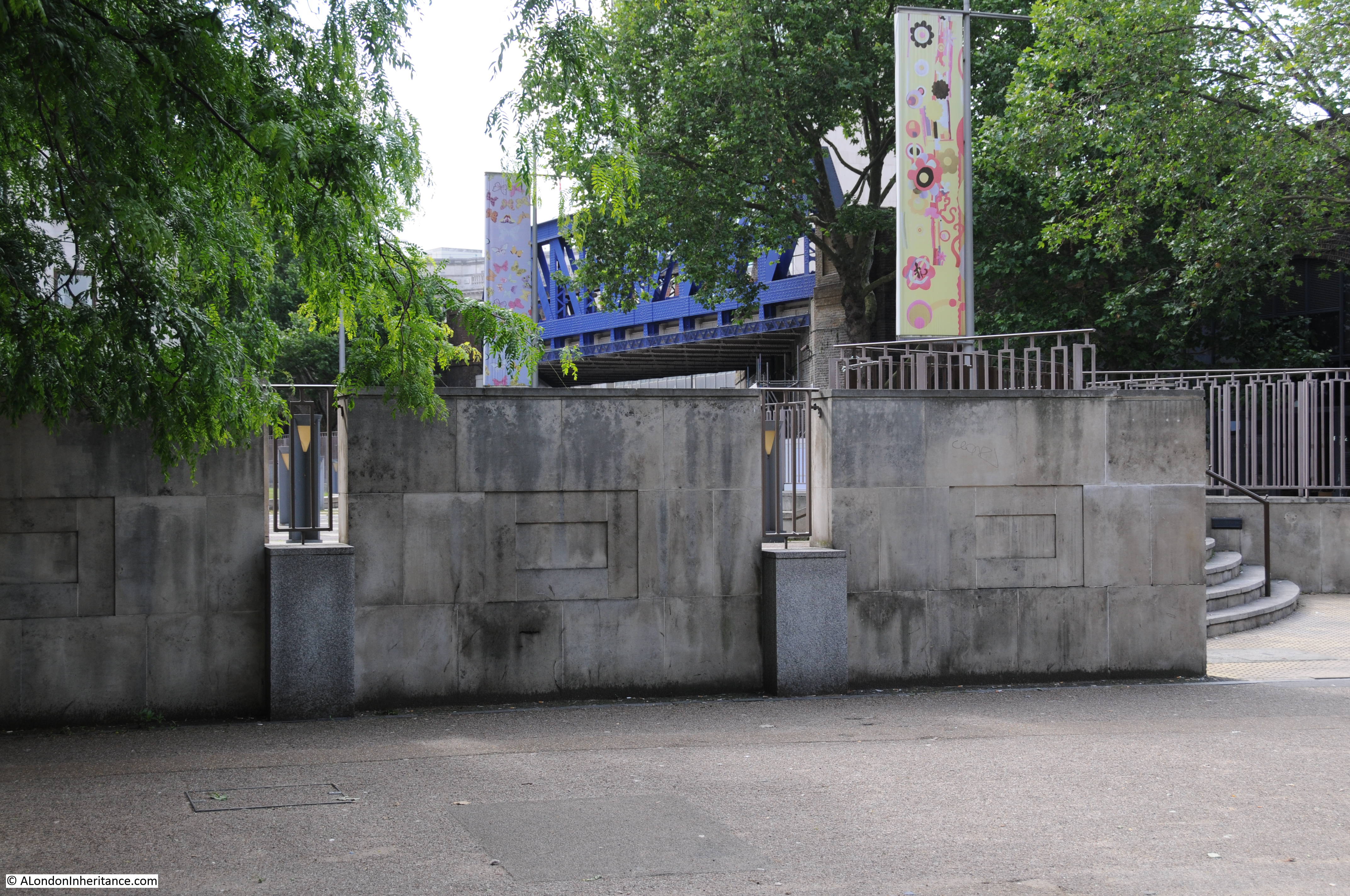
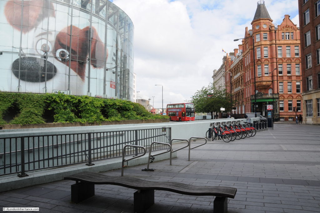
Looking up towards Waterloo Bridge from where the end of Cuper’s Gardens would have been. The hospital and Stamford Street are on the right. The IMAX cinema is on the left in the centre of the roundabout. A very different place to the 18th century gardens.

History of the Southbank 33

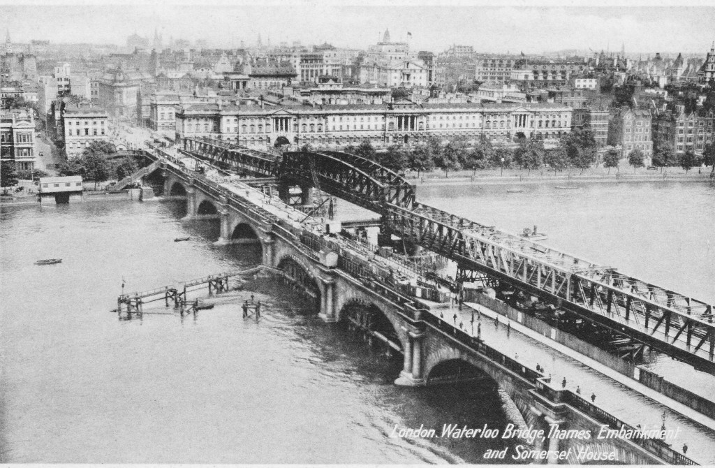
In 1923, Waterloo Bridge suffered from settlement to the central arch along with subsidence to the carriageway and parapet, leading to the bridge being closed to traffic in 1924. A temporary bridge was constructed alongside Waterloo Bridge and options were reviewed as to whether the original bridge should be repaired, rebuilt or a completely new design of bridge built.

The decision was for a new design of bridge and the Waterloo Bridge that we see today was fully opened in December 1945. The following postcard with a photograph taken from the top of the Shot Tower shows the original Waterloo Bridge with the damage to the central pier, along with the temporary bridge built alongside.

Postcard 5

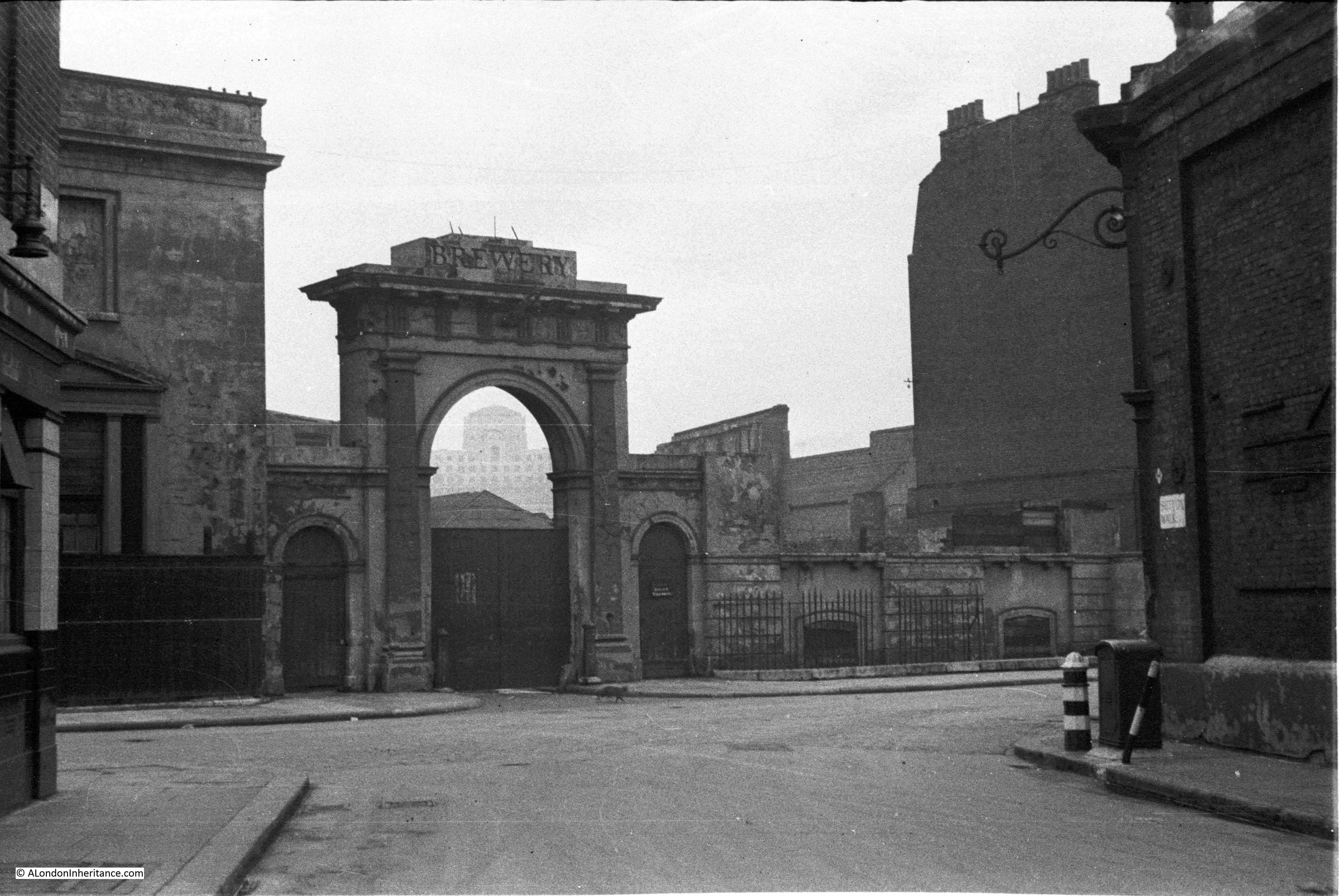
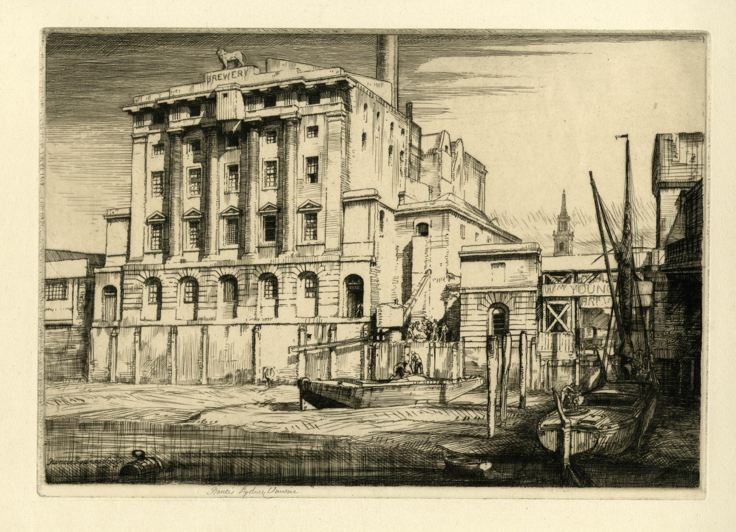
Also in the above map, adjacent to Hungerford Bridge is the Lion Brewery. This area was originally the location of Belvidere House and Grounds, and in 1785, Water Works were built on the southern end of the gardens, drawing water from the river to supply the local residents. Not surprisingly, there were issues with the purity of the water being taken from the river and as part of the general improvements to London’s water supply, the water works were moved to outer London locations such as Surbiton. After the closure of the water works, the lease on the land was assigned to James Golding and the Lion Brewery was completed in 1837. On the opposite side of Belvedere Road to the brewery, Golding purchased a lease on an additional parcel of land and built stables and warehouses to support the brewery.

The Lion Brewery was taken over by the brewers Hoare and Company of Wapping in 1924 and in 1931 the building was badly damaged by fire. It was then temporarily used for paper storage before being demolished in 1949 to make way for the Royal Festival Hall.

During the demolition of the brewery buildings, a total of five wells were found which had been used to provide water for the brewery as water could not be taken from the Thames.

There are a number of prints which show the industry along the South Bank between Hungerford and Waterloo Bridges. The following shows the Lion Brewery. Note the tower of the church of St. John’s in the background.

334997001

Another print shows both the Lion Brewery and the Shot Tower with the original Waterloo Bridge on the left.

582939001

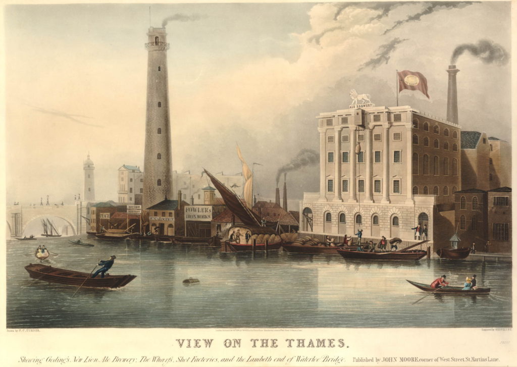
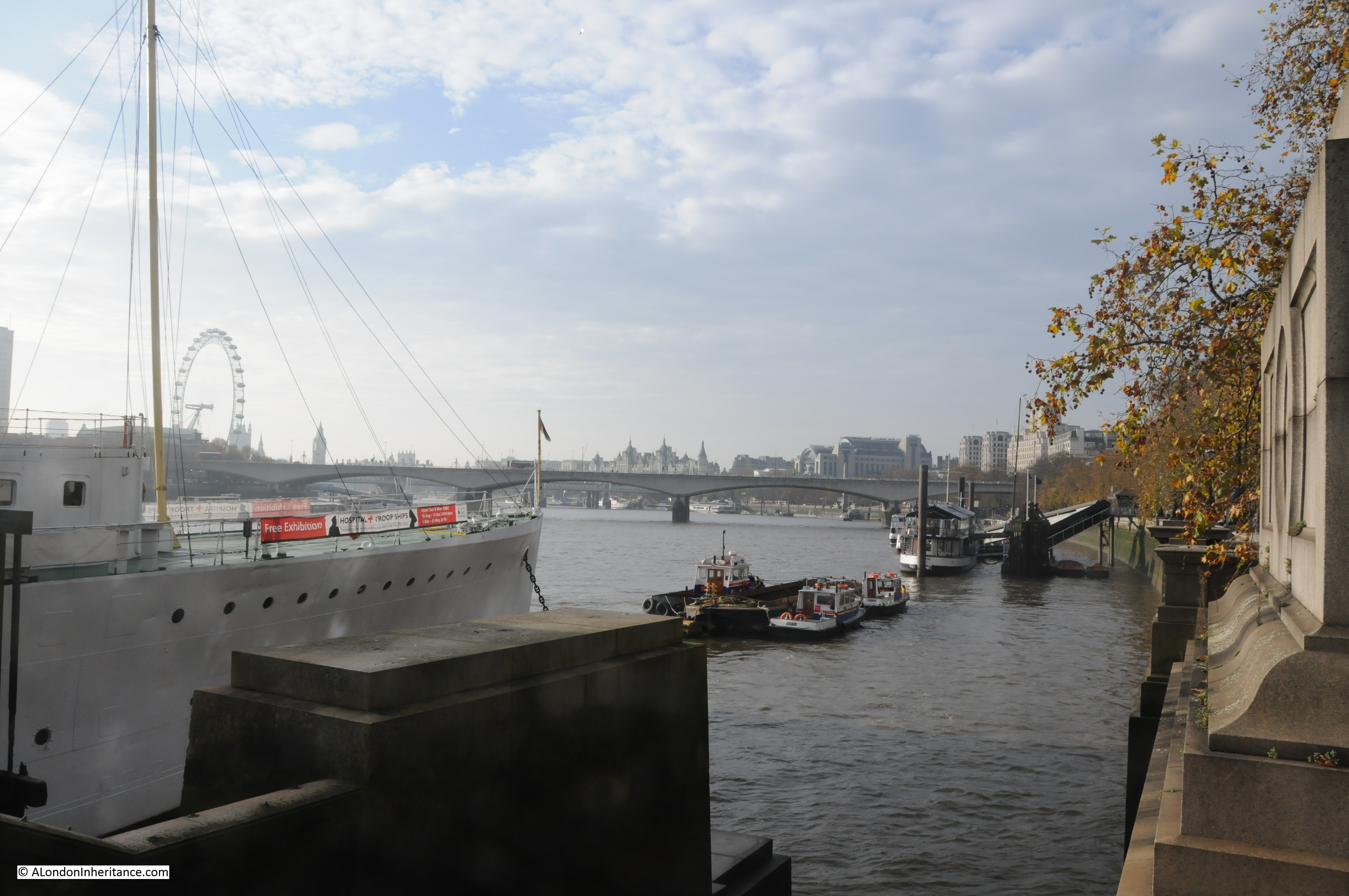
And a view from Waterloo Bridge along the river to Westminster Bridge before the construction of Hungerford Bridge. The Shot Tower and the Lion Brewery are on the left.

582808001

The Shot Tower was built in 1826. The gallery at the top of the tower is 163 feet high, and was used to drop molten lead for large shot. A gallery half way up the tower was used to make small lead shot.

The Shot Tower and the associated lead works were owned from 1839 by Walkers, Parker and Company who ran the business until 1949.

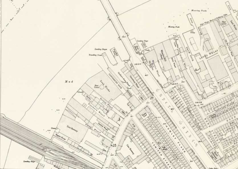
The area between Hungerford and Westminster Bridges is shown in the following map (the map cuts off before Westminster Bridge but if included it would be just at the bottom of the map to the left).

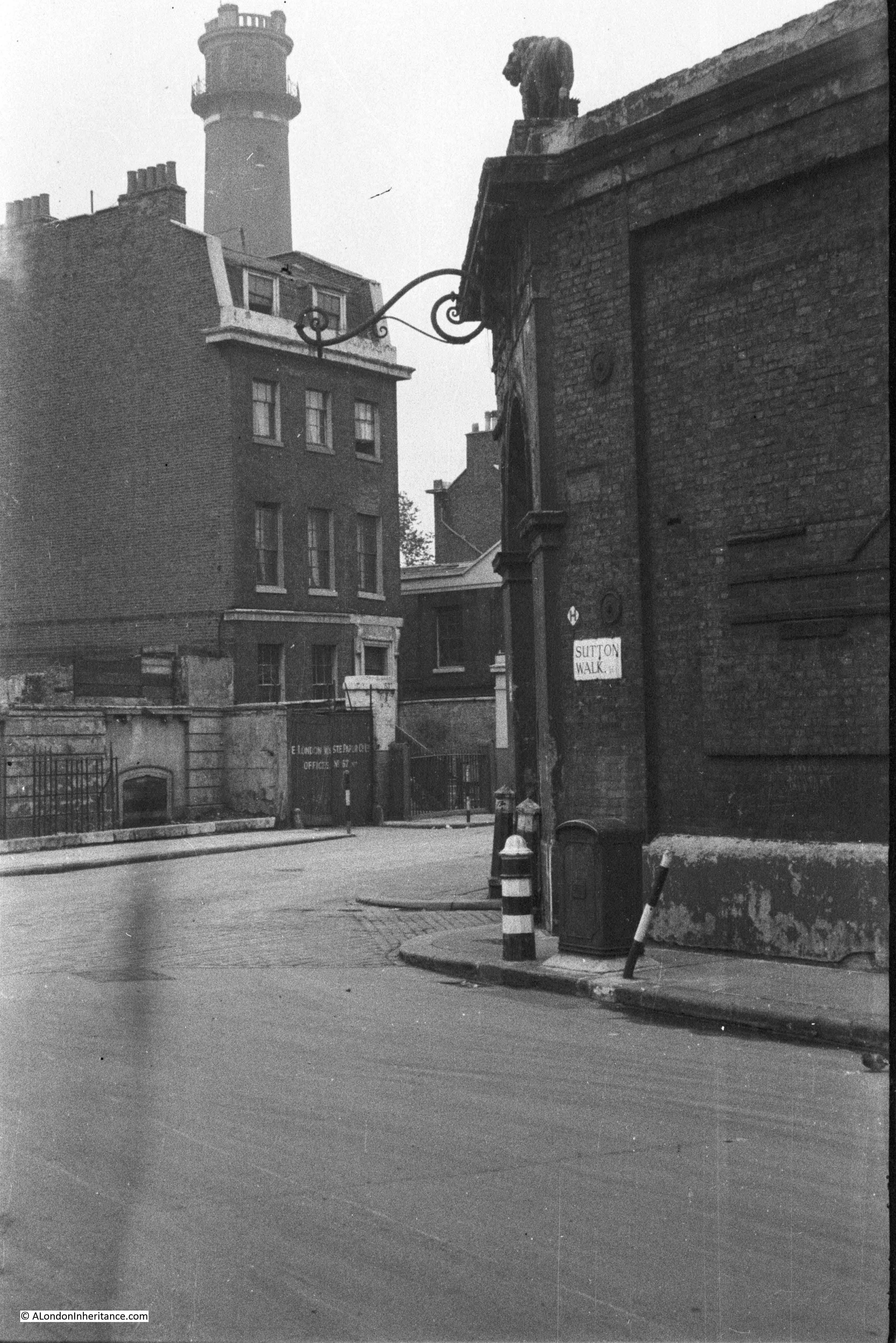
The map shows the straightened Belvedere Road, with the original curve in the road still in existence but is now named Belvedere Crescent. Follow Belevedere Road towards the bottom of the map and at the junction with Chicheley Street, it reverts back to Narrow Wall.

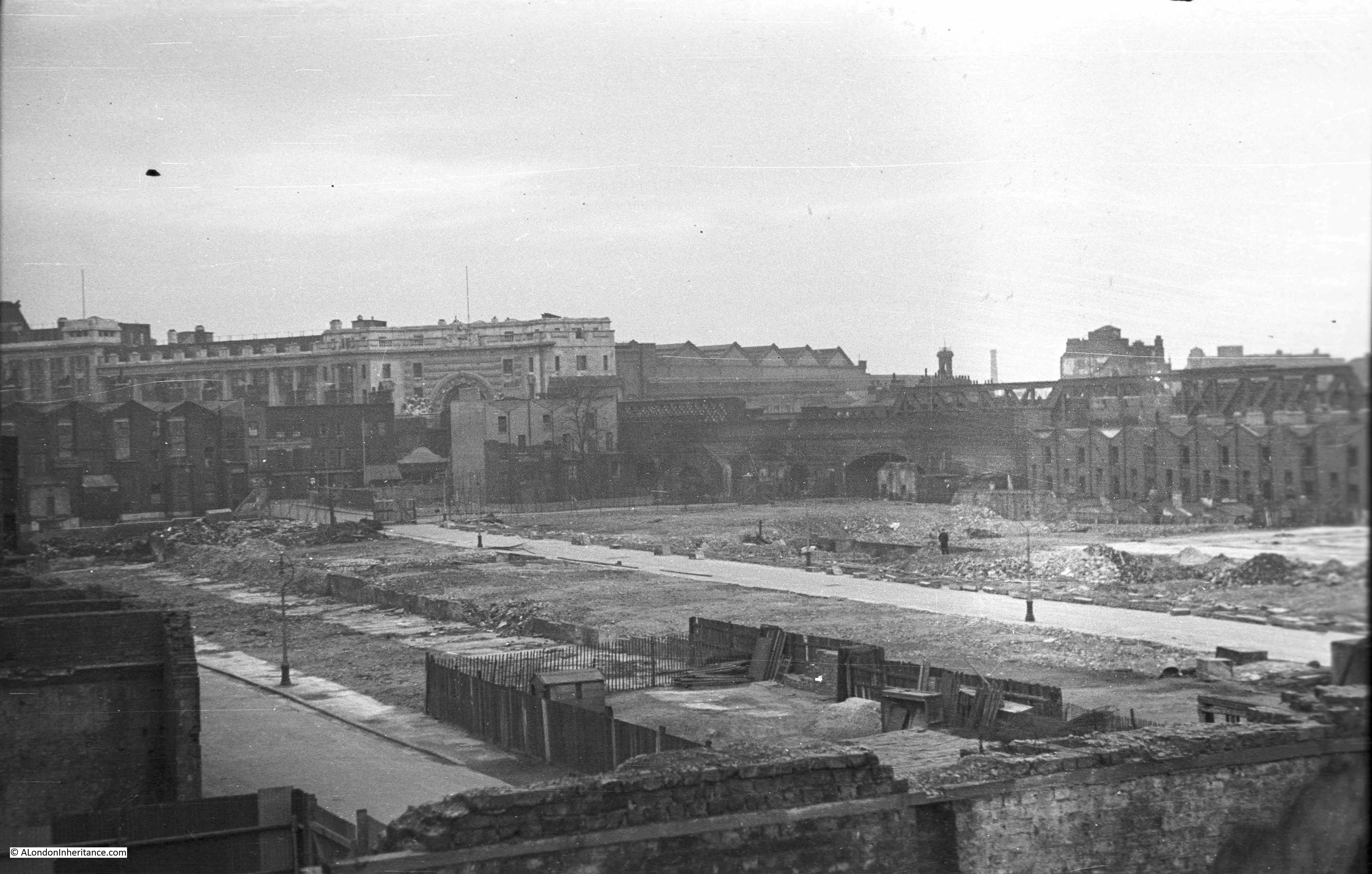
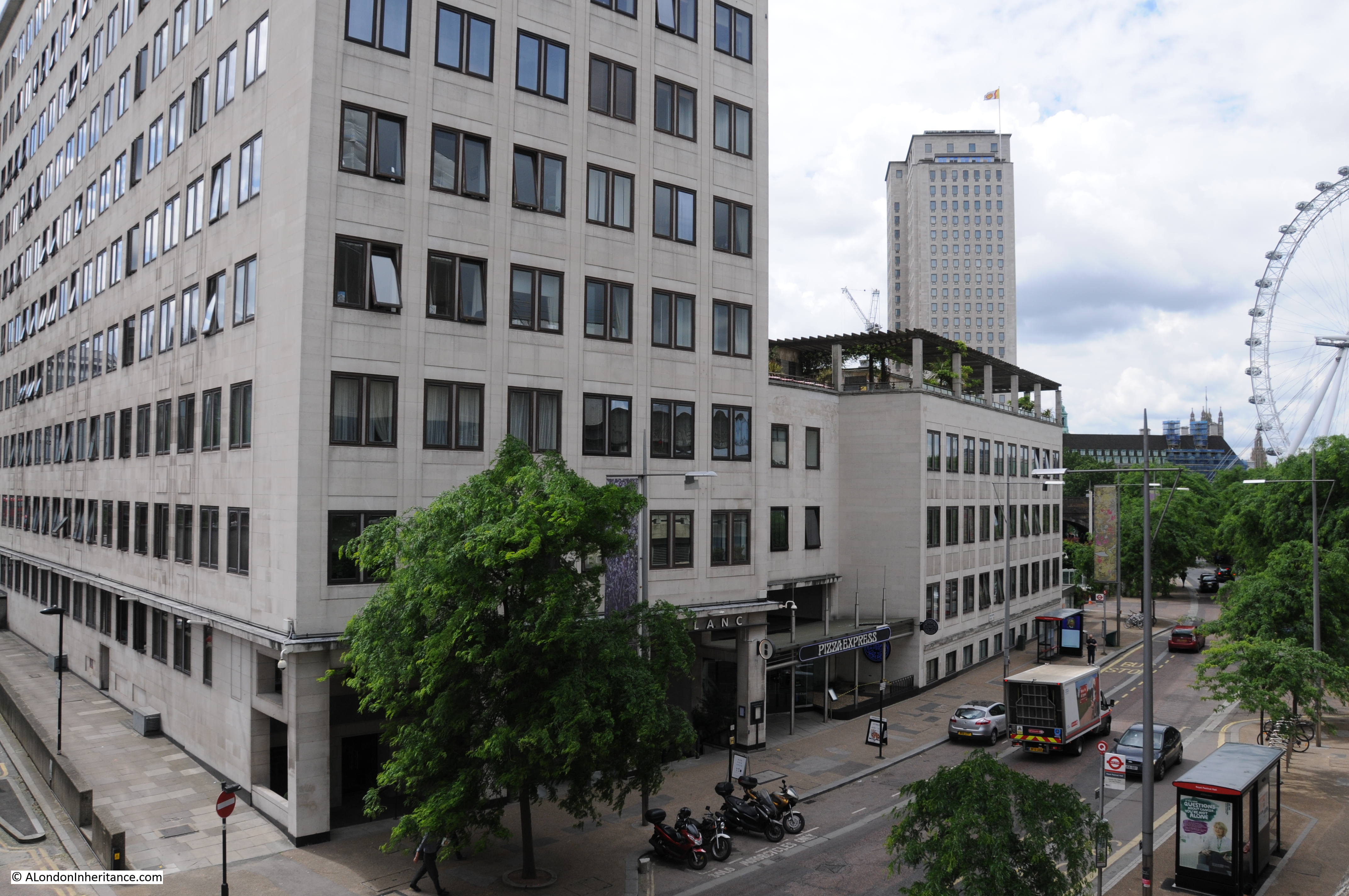
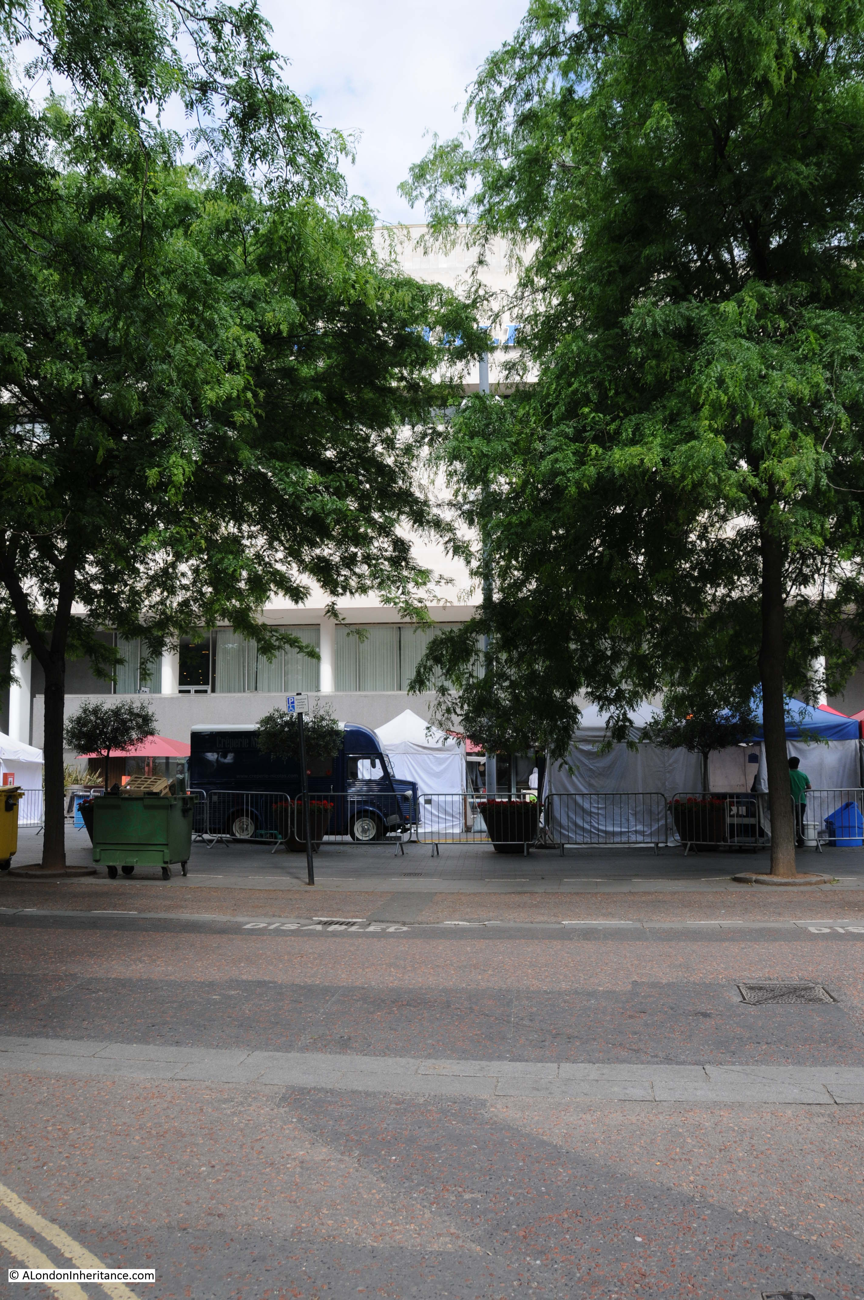
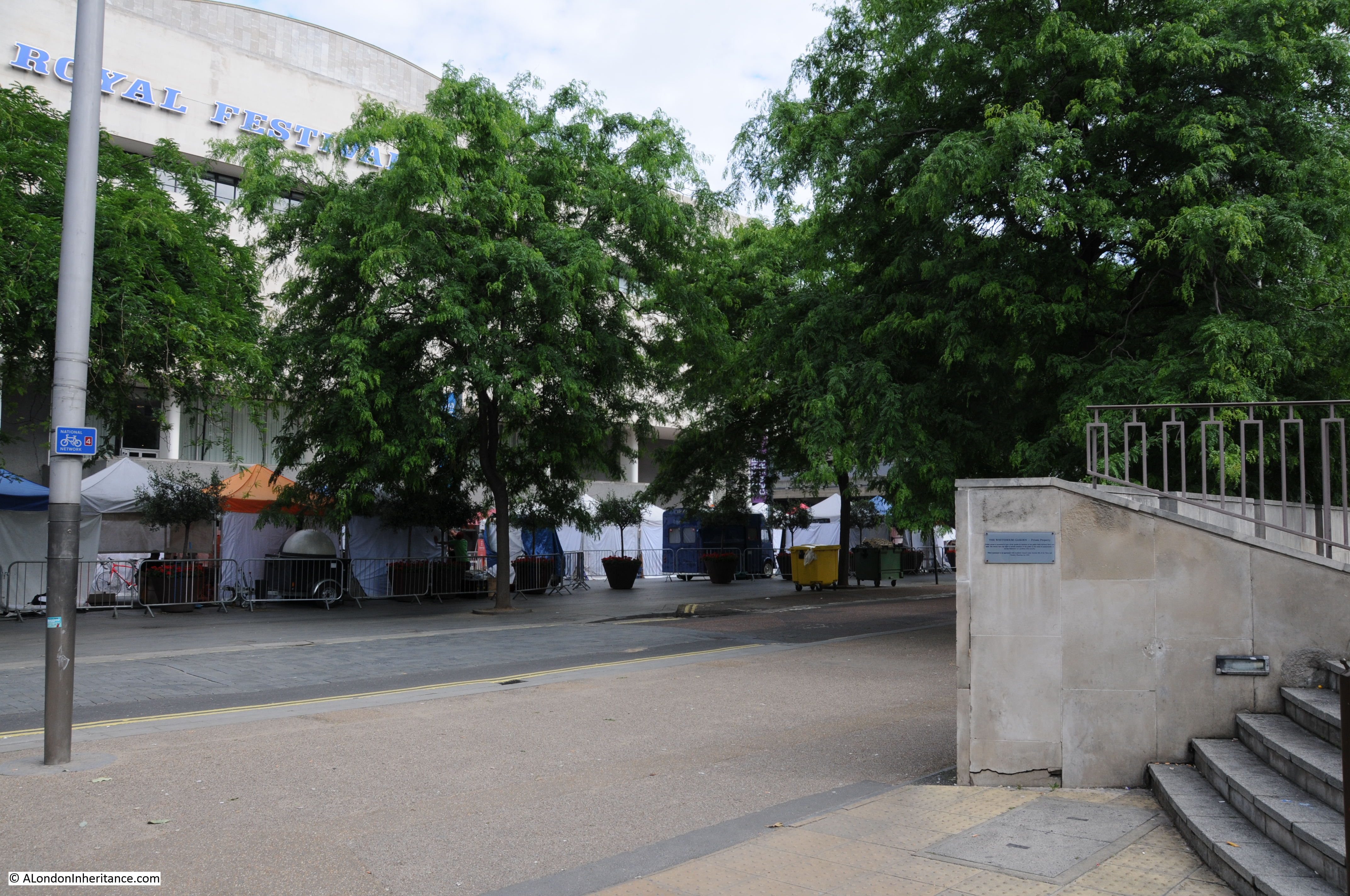
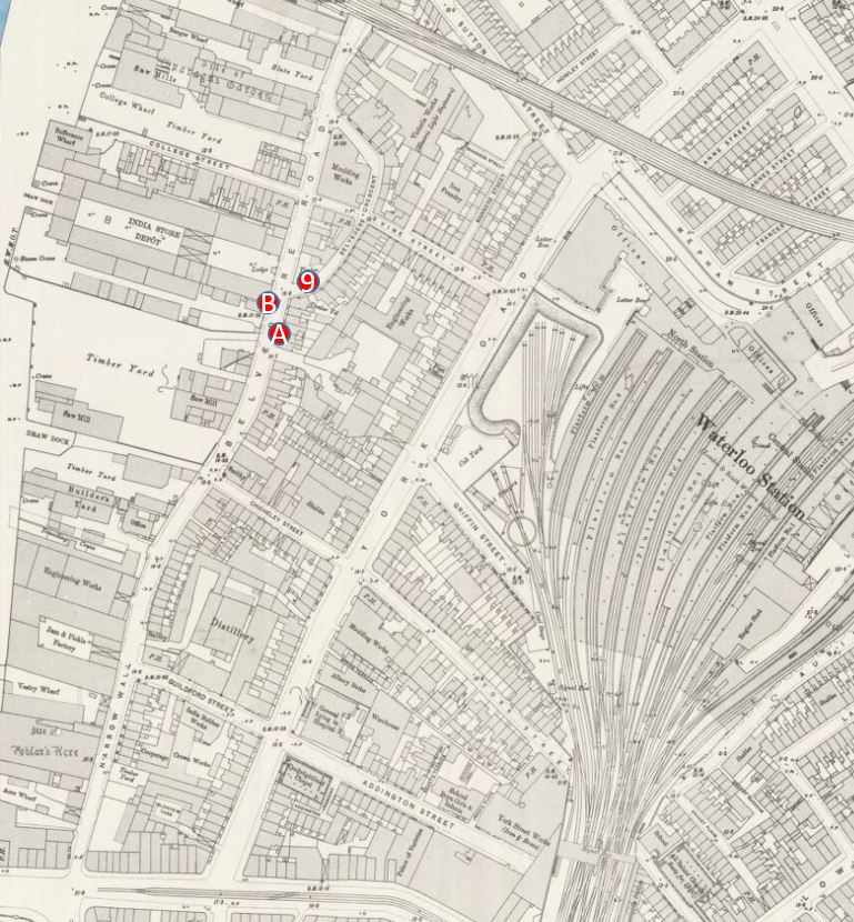
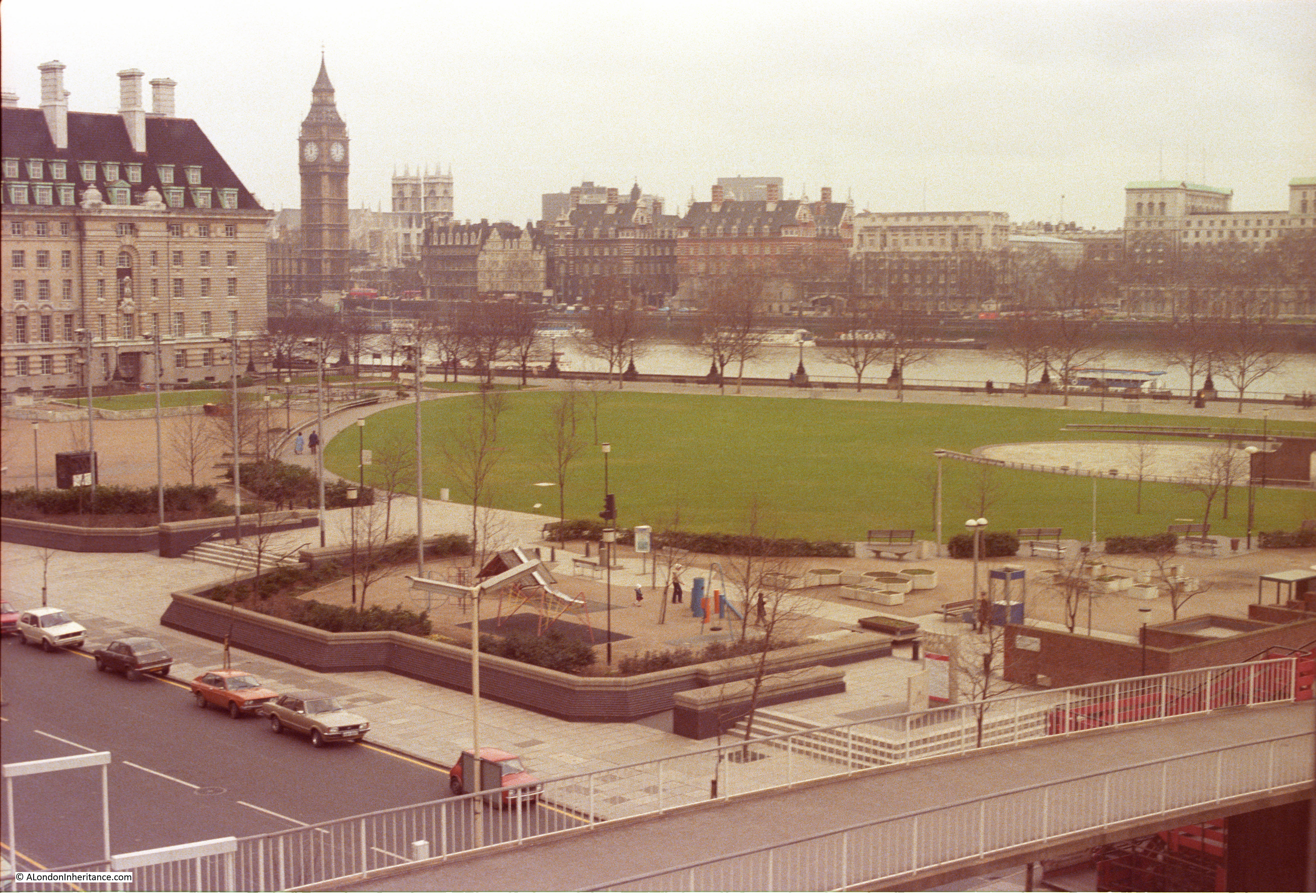
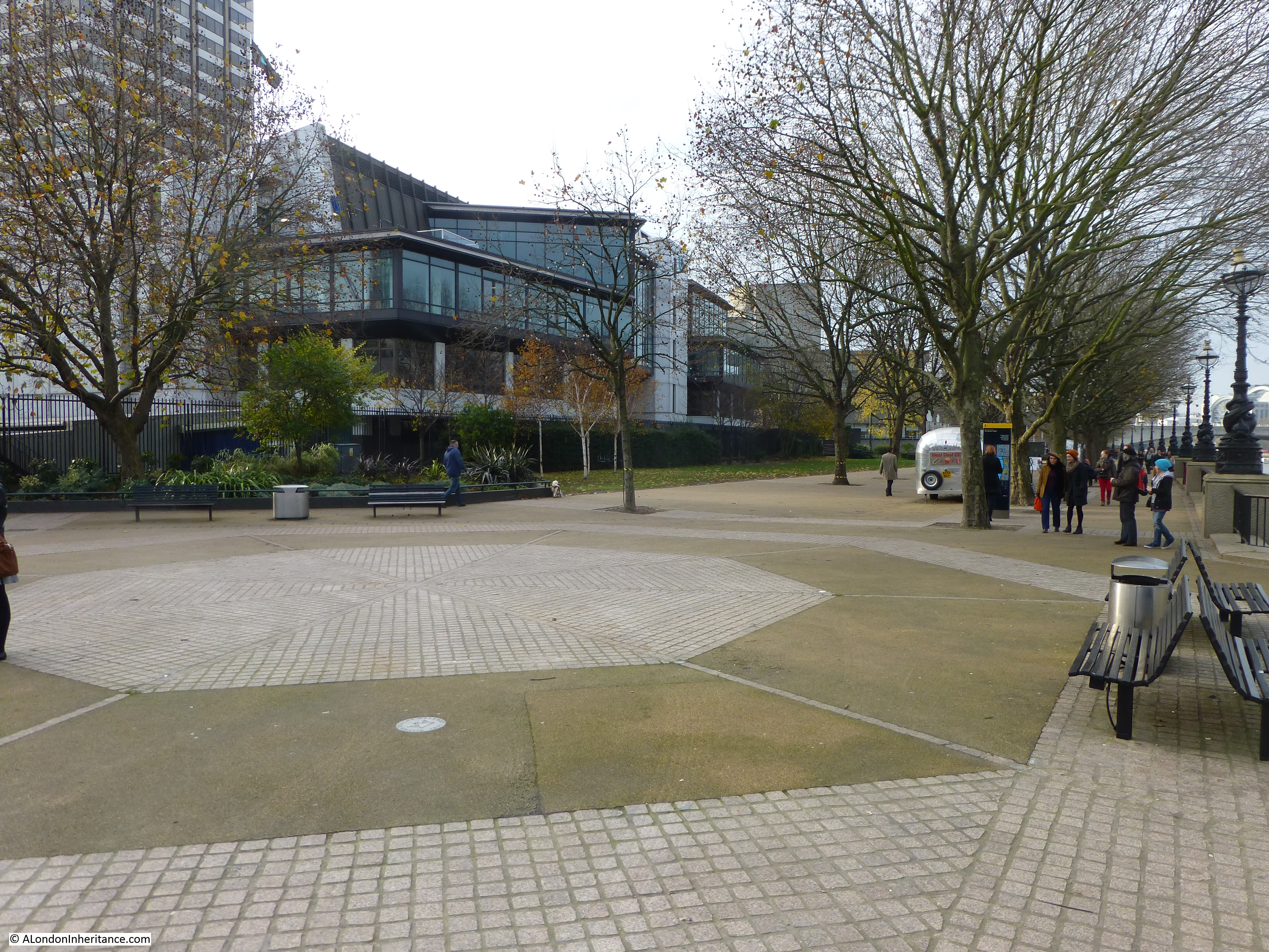
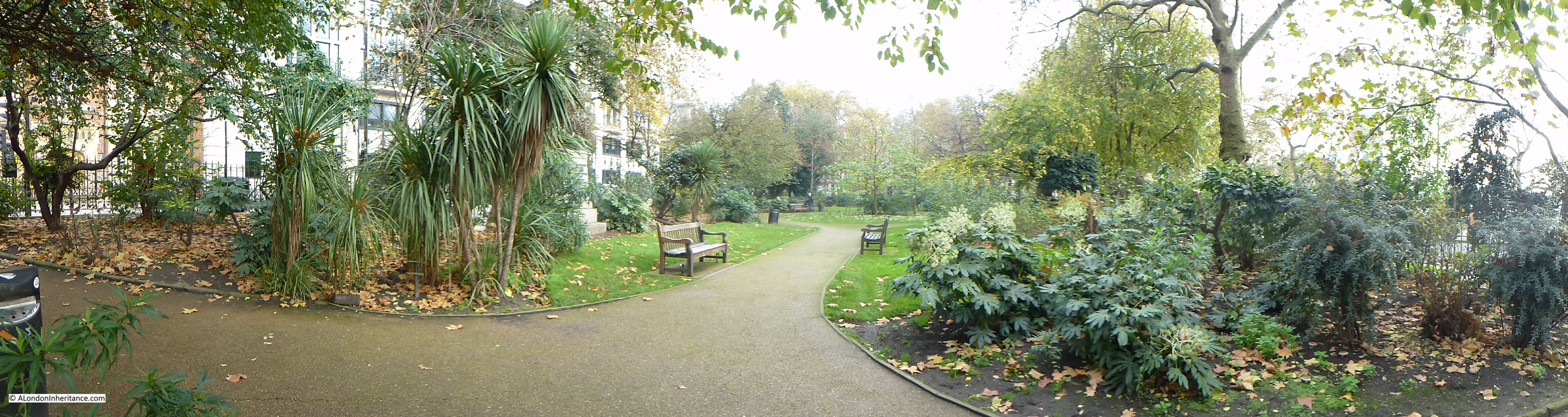
Below the Chicheley Street junction, the whole area between York Road and the river would later be occupied by County Hall. Following the Festival of Britain, the area bounded by York Road, Belevedere Road, the rail tracks and Chicheley Street would be occupied by the Shell Centre building. On the opposite site of Belvedere Road, up to the river, during the Festival of Britain, the Dome of Discovery would be built on the area occupied by the India Store Depot and today the Jubilee Gardens are on this spot.

History of the Southbank Map 4

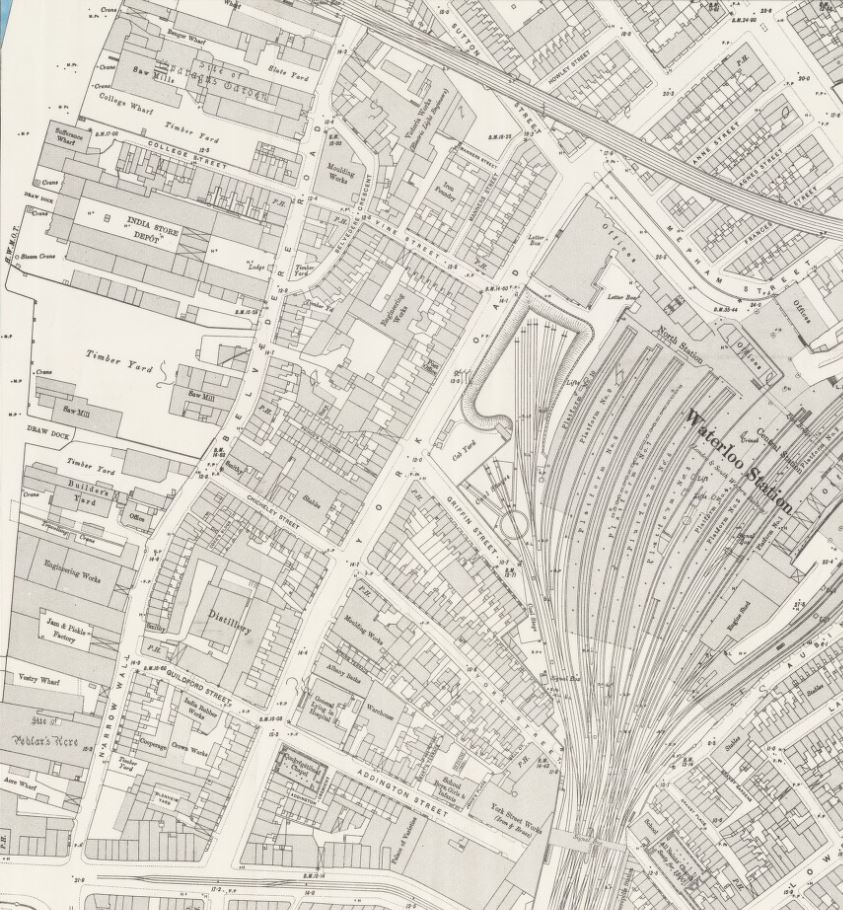
At the top left of the map is a set of buildings, over which is written “site of Sparagus Garden”. This was also an early pleasure gardens, but unlike Culper’s Gardens, is not very well documented. This was also the site of Coade’s Artifical Stone Works.

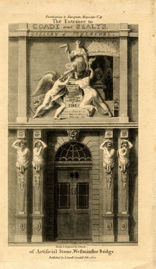
The initial stone works on the site were opened in around 1770 by Daniel Pincot who published that he had opened a factory “by King’s Arms Stairs, Narrow Wall, Lambeth”. At some point soon after 1770, the factory appears to have been taken over by Eleanor Coade who would go on to run the factory for 25 years until her death in 1796 when her daughter, also called Eleanor, took over the factory. The younger Eleanor also ran the business well and opened a gallery for the factory’s products at the corner of Narrow Wall and Bridge Street – the street leading up to Westminster Bridge – along with a number of houses which took the name Coade’s Row.

The entrance to the Coade Stone showroom on Westminster Bridge Street:

853044001

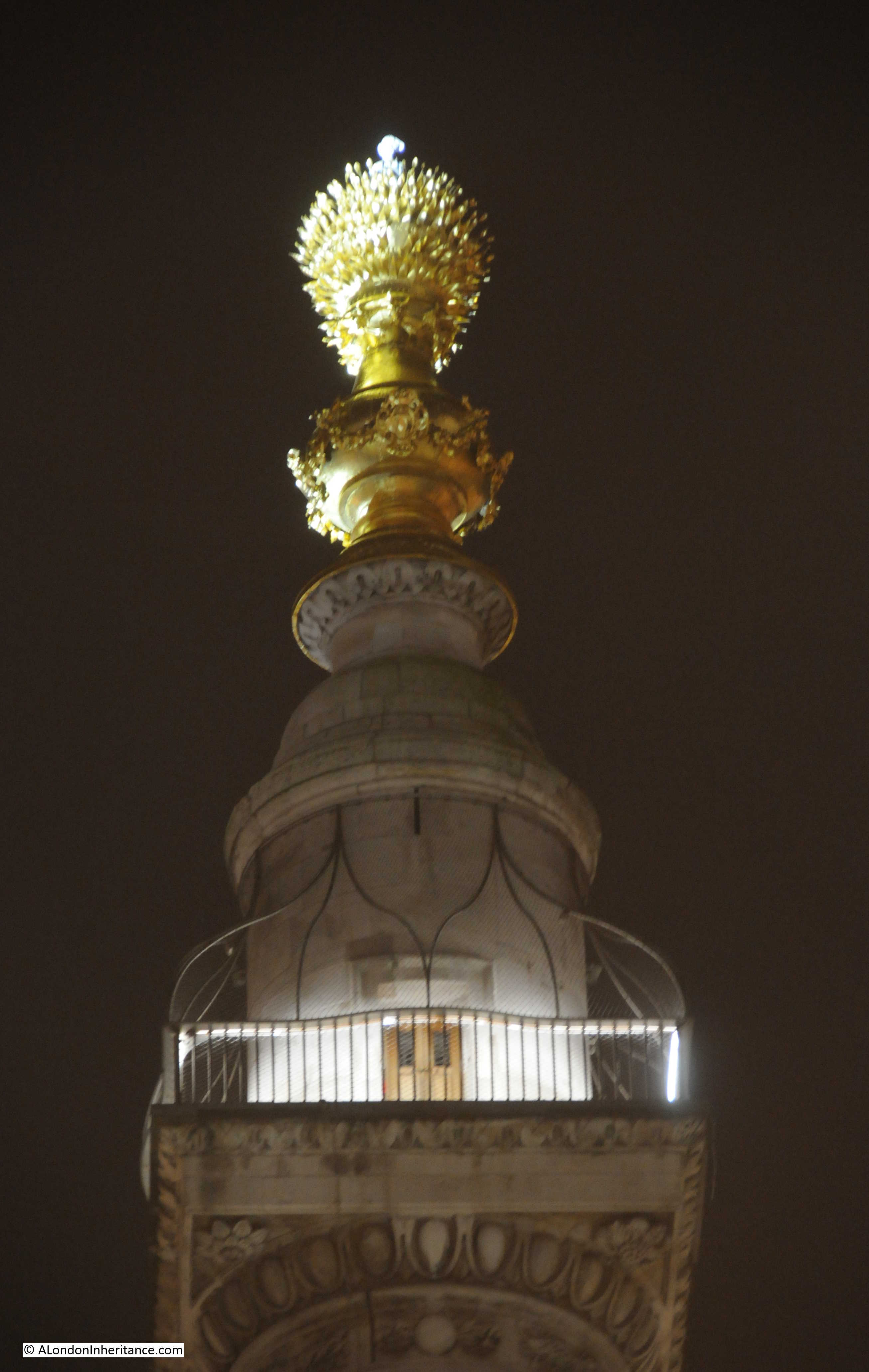
Products from the Coade factory were used across London and wider afield, but the most long lasting and well known is the lion that was on top of the Lion Brewery. Removed and stored at the time that the brewery building was demolished, it was installed on a plinth at the southern end of Westminster Bridge in 1966.

The younger Eleanor Coade was unmarried and had no children by the time of her death in 1821, however she had already taken on a cousin, William Croggon to take control of the business, who was succeeded by his son Thomas in 1836, however his ownership of the business did not last long and the Coade Stone Factory appears to have closed a year later in 1837 and the production of this unique, man-made stone was consigned to history.

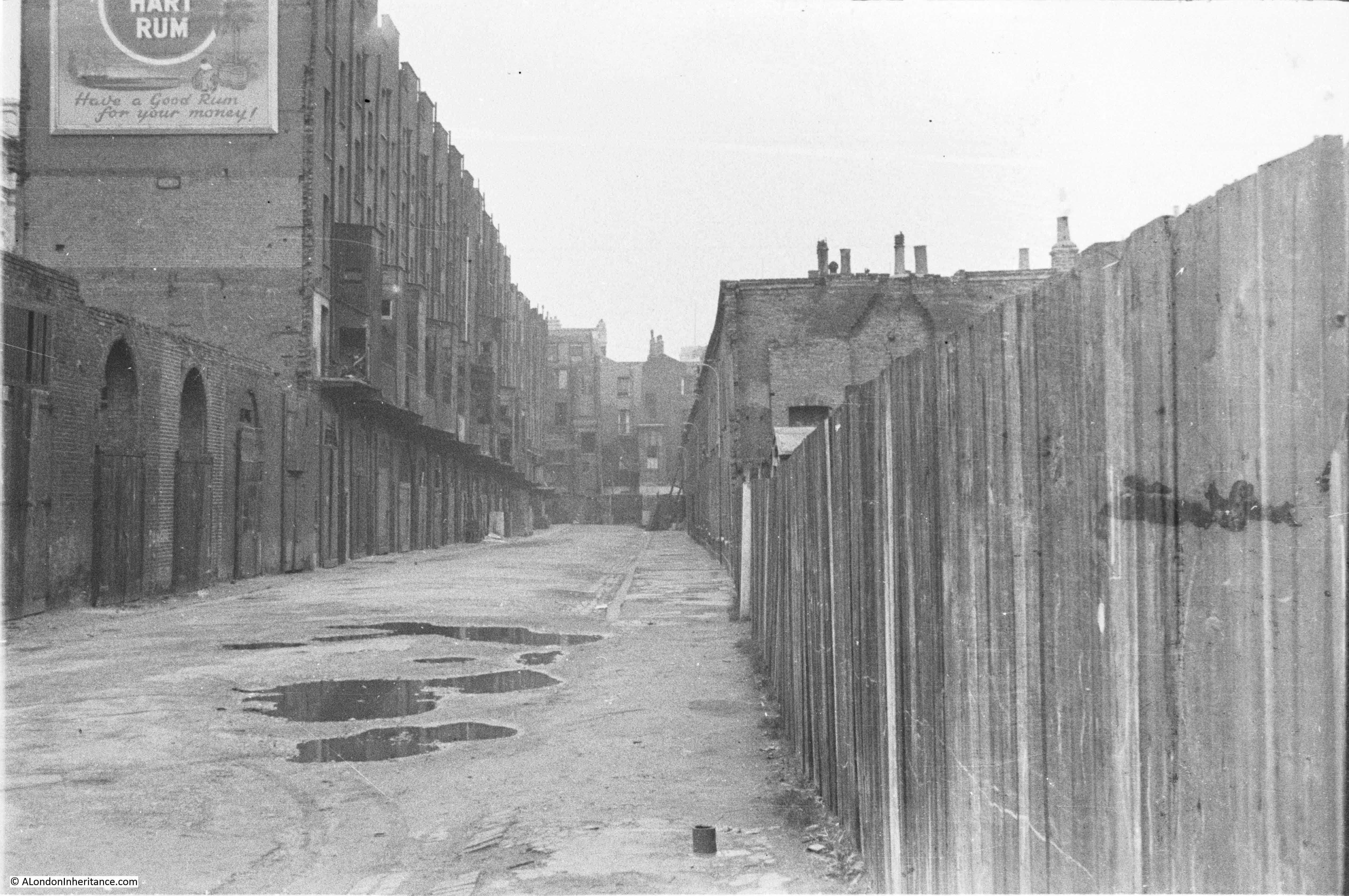
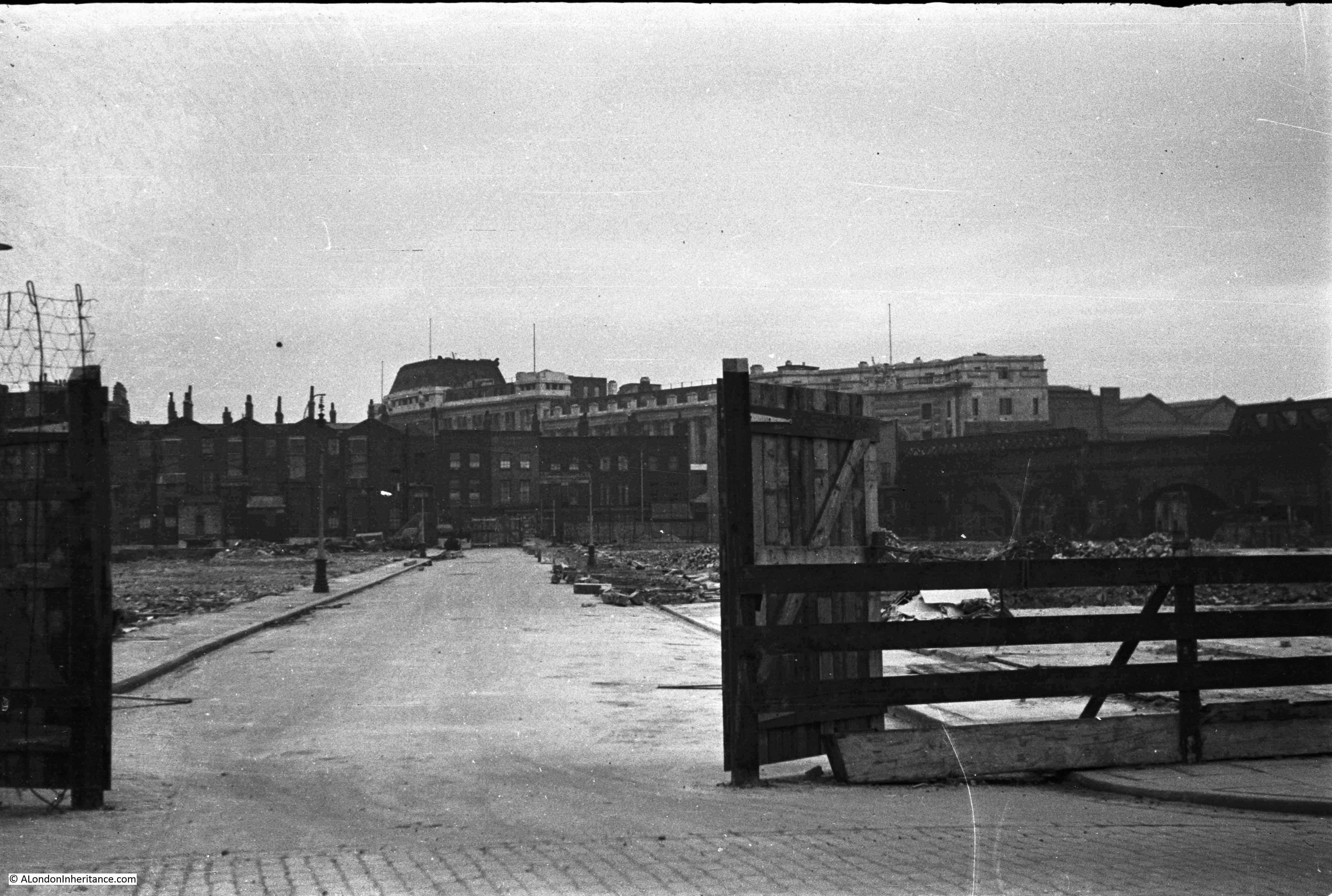
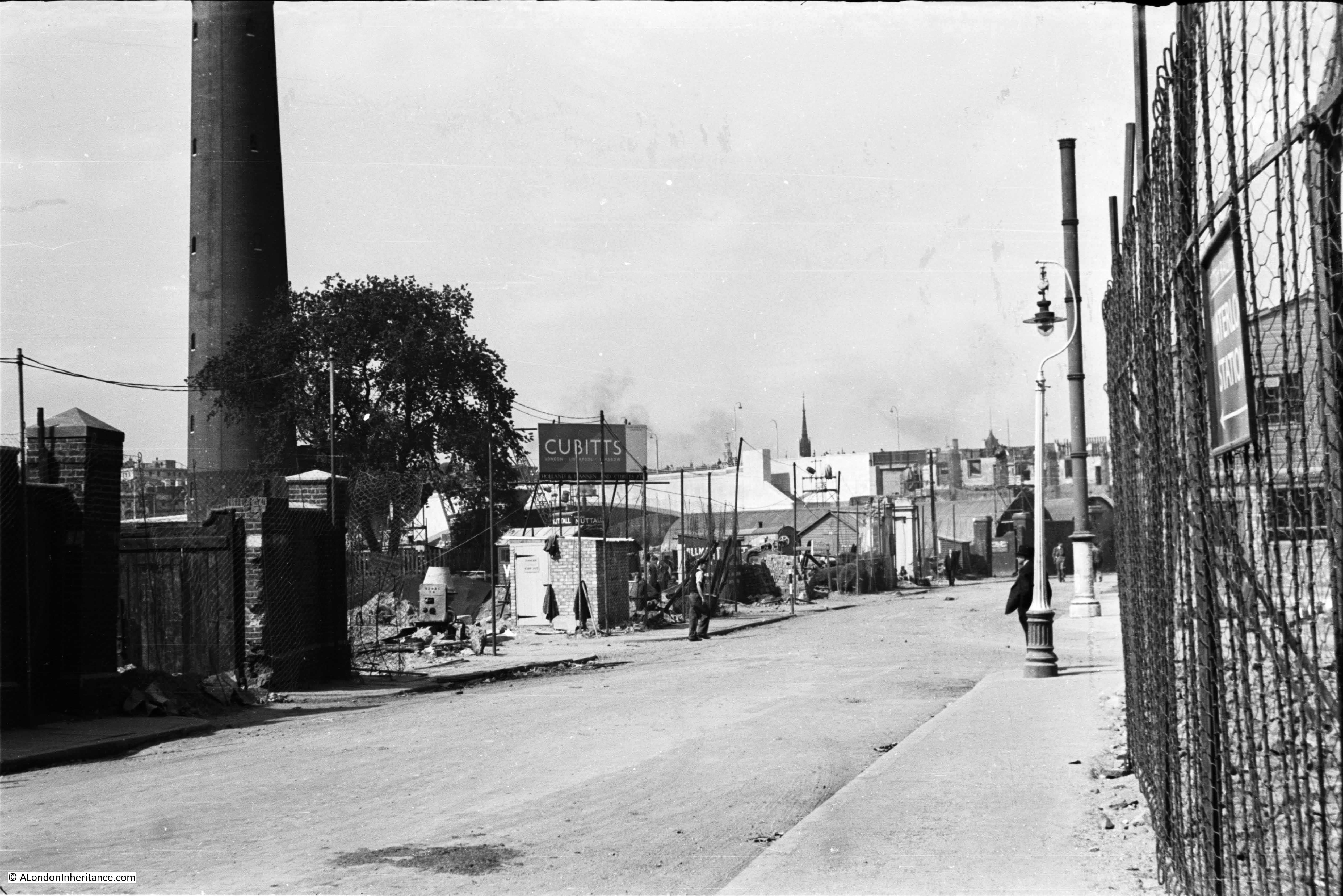
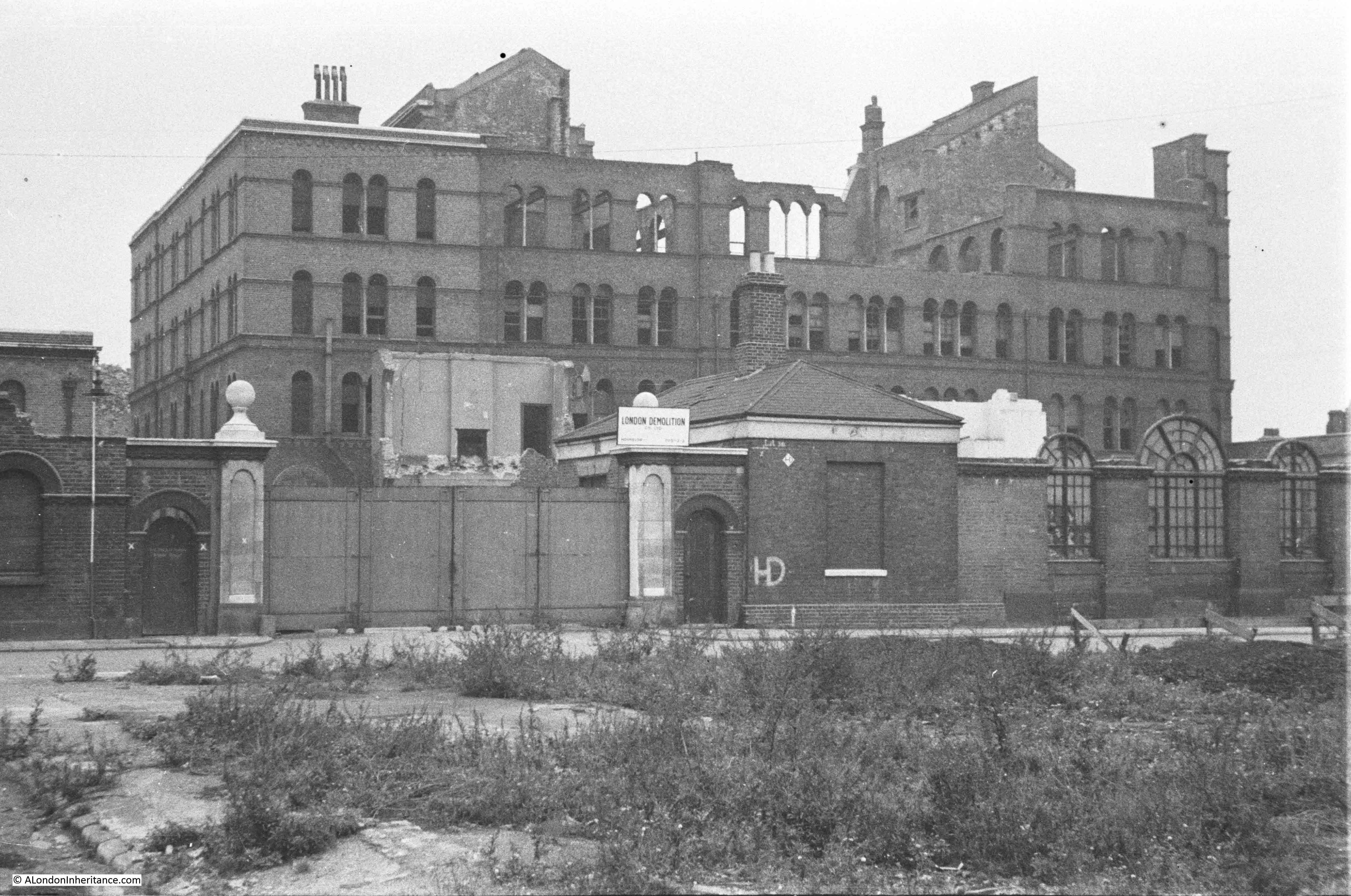
Just to the south of College Street, is labelled the India Stores Depot. This was built in 1862 on land leased by the Secretary of State for India. These stores were gradually extended until the start of the 2nd World War, during which they suffered considerable damage and were demolished to make way for the Festival of Britain.

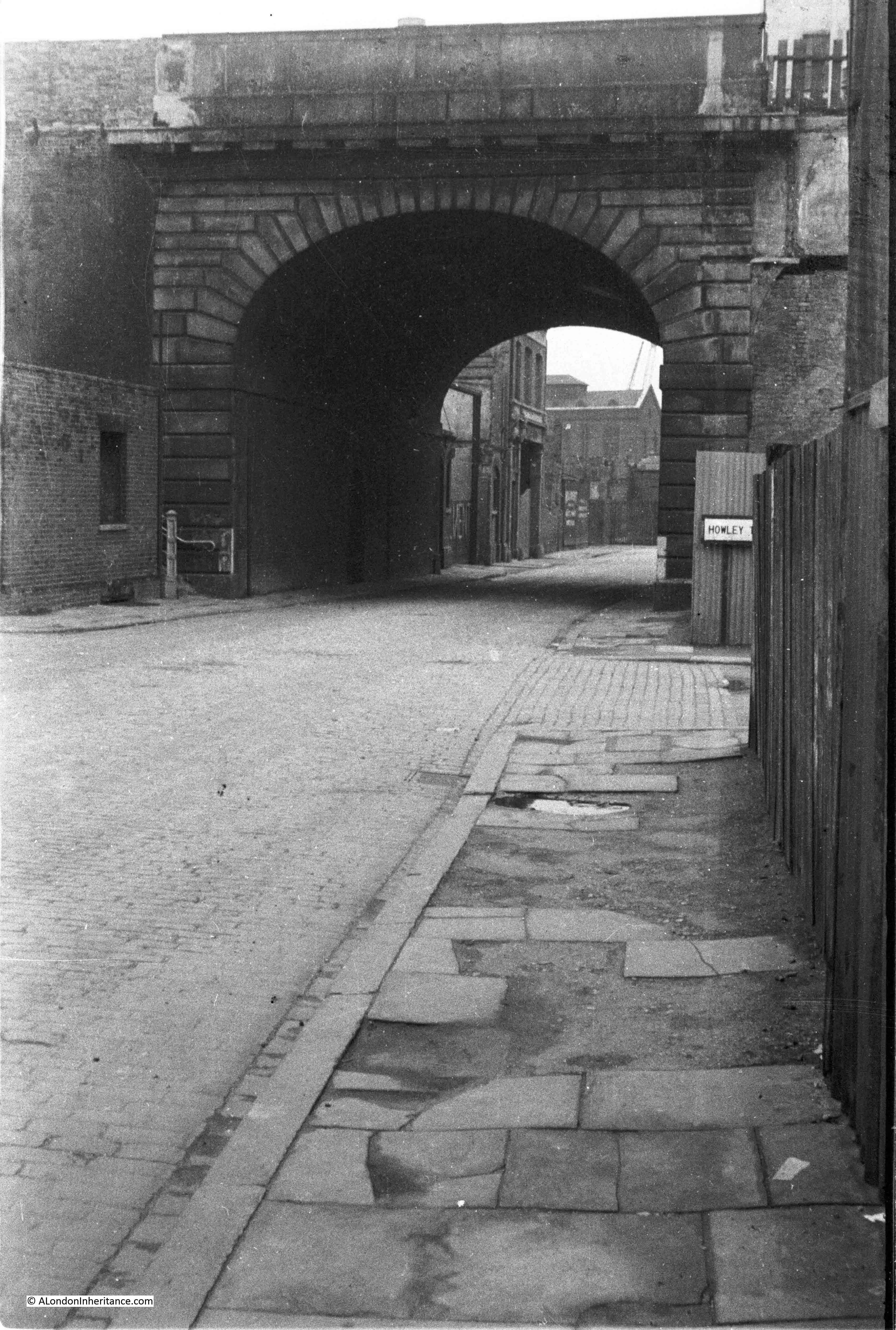
As a final bit of confusion regarding continuity of street names, the following map extract is from the Bartholomew Greater London Street Atlas from 1940. It shows Belvedere Road running between Westminster and Waterloo Bridges, with Howley Place shown at Howley Terrace, Tension Street and Sutton Walk with the same names as previous maps, but further along, where College Street and Vine Street were shown in the 1895 Ordnance Surcey map, the street is now called Jenkins Street. This map is the only place I have seen this name for the street, so it was either an error, or there was a name change between 1895 and 1940.

History of the Southbank Map 7

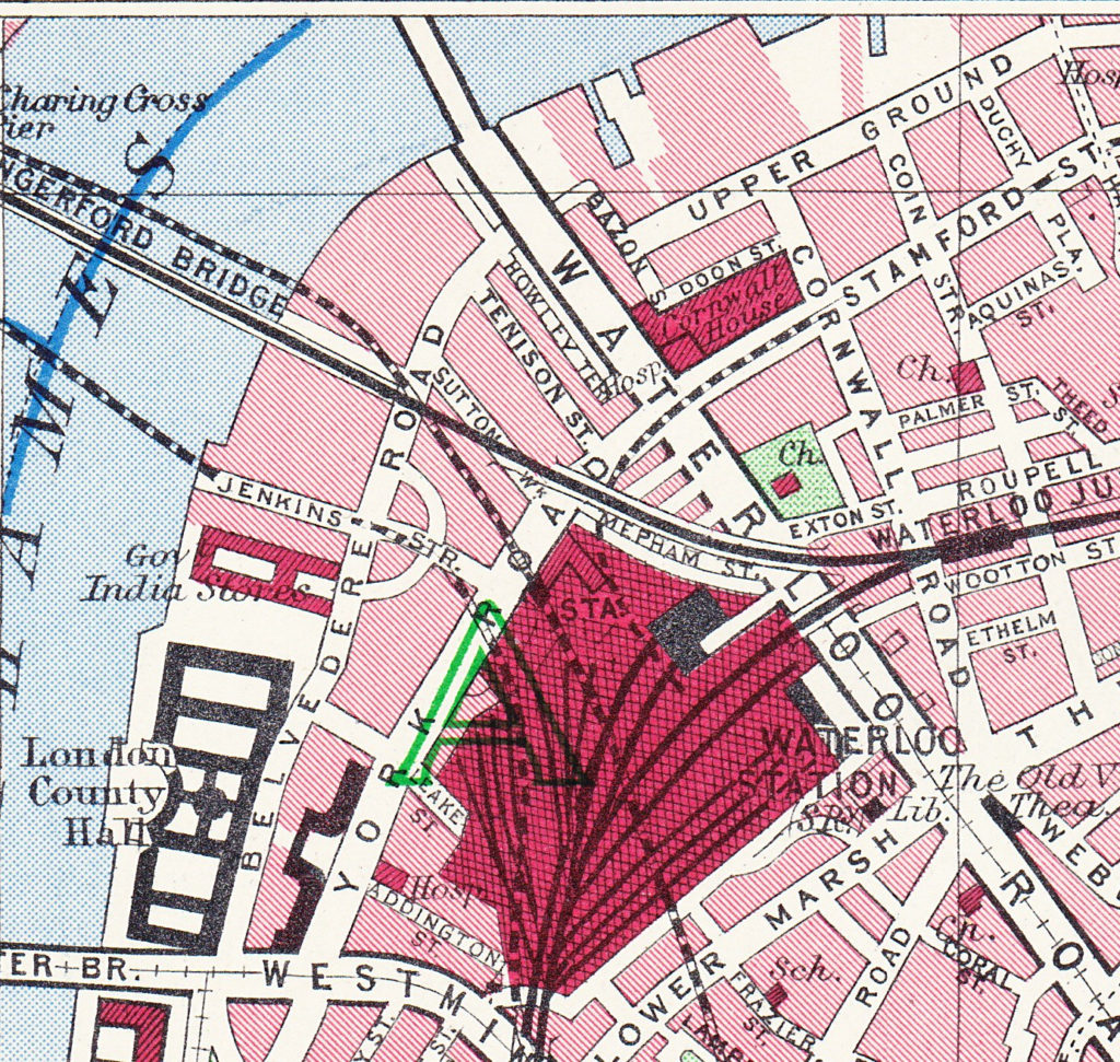
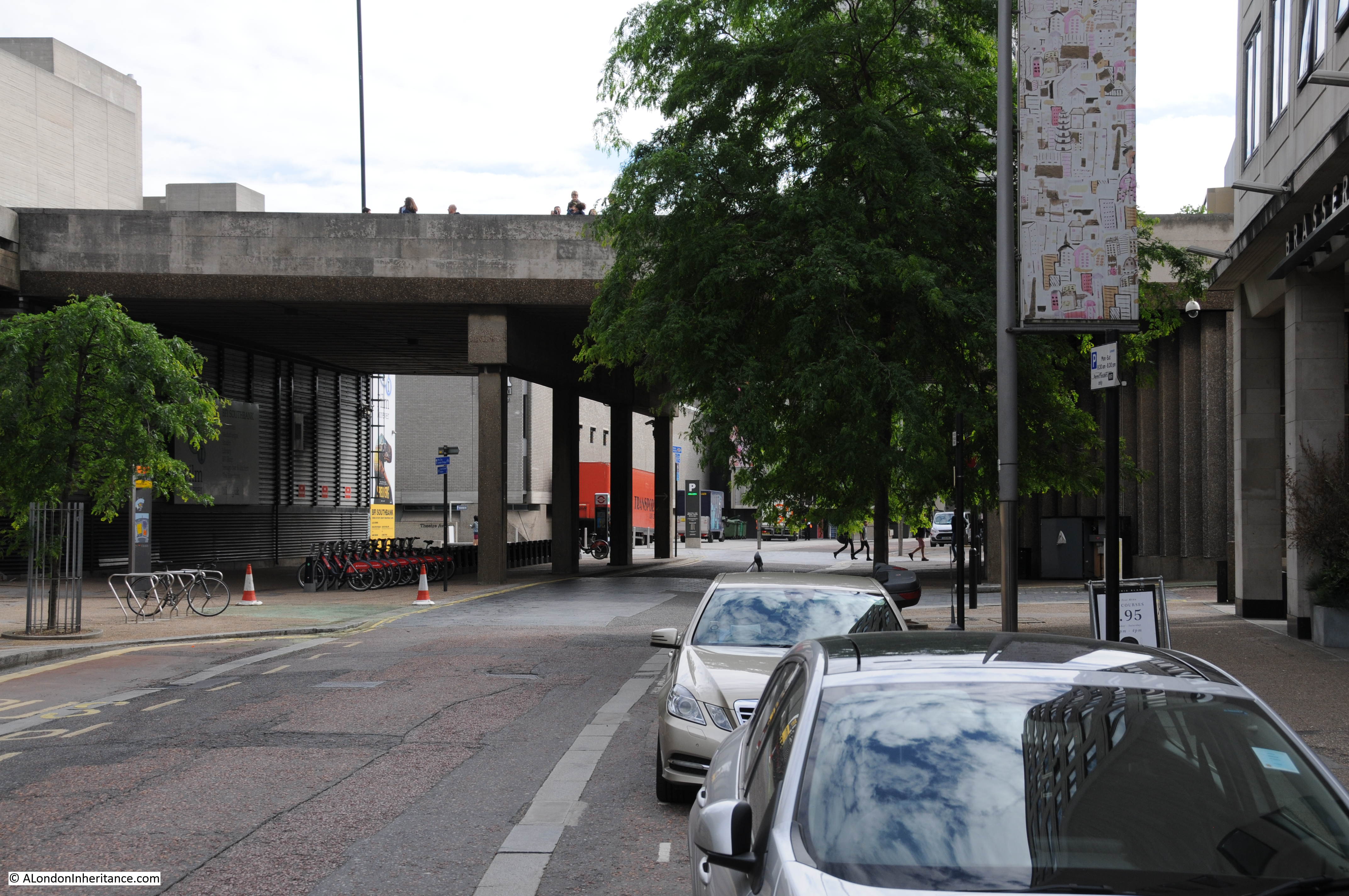
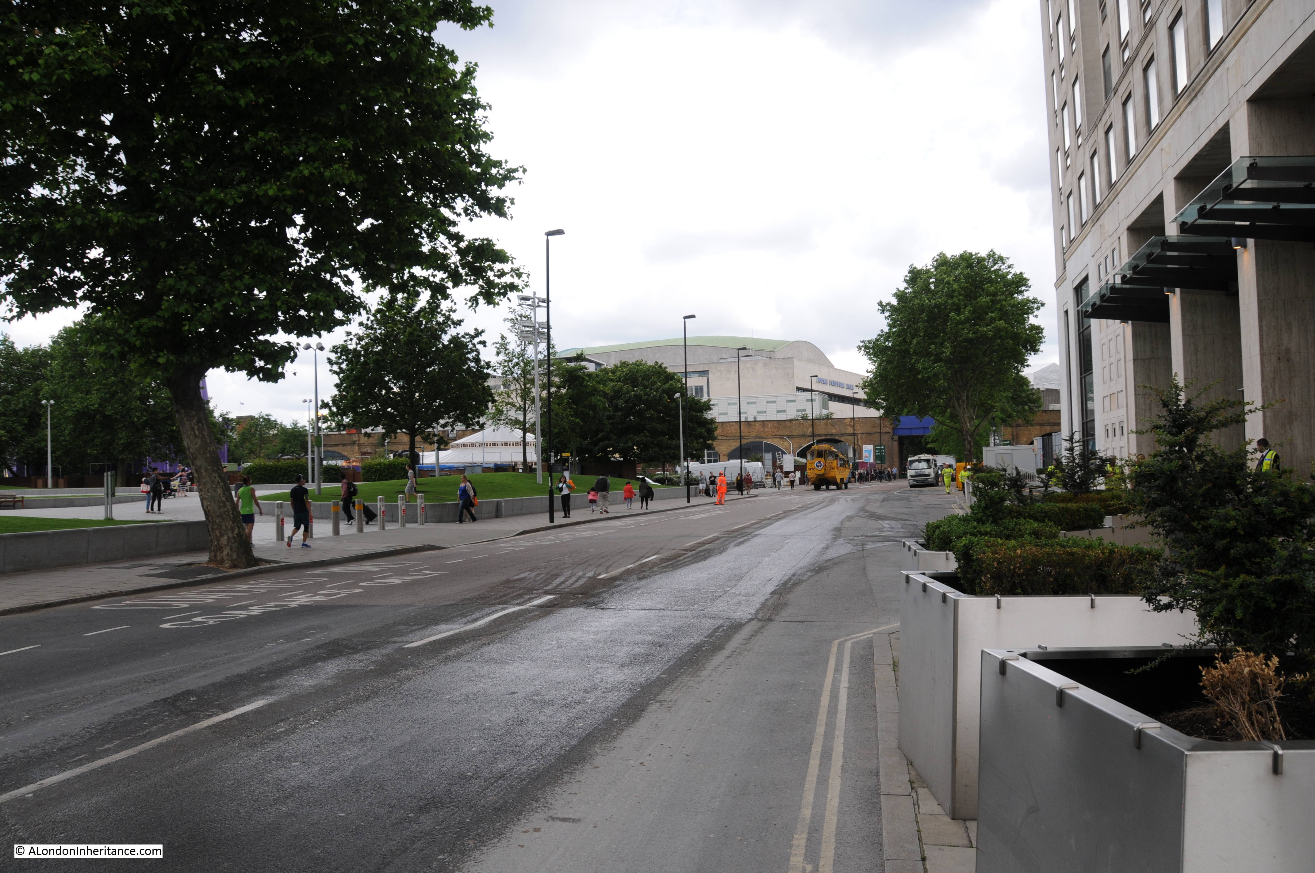
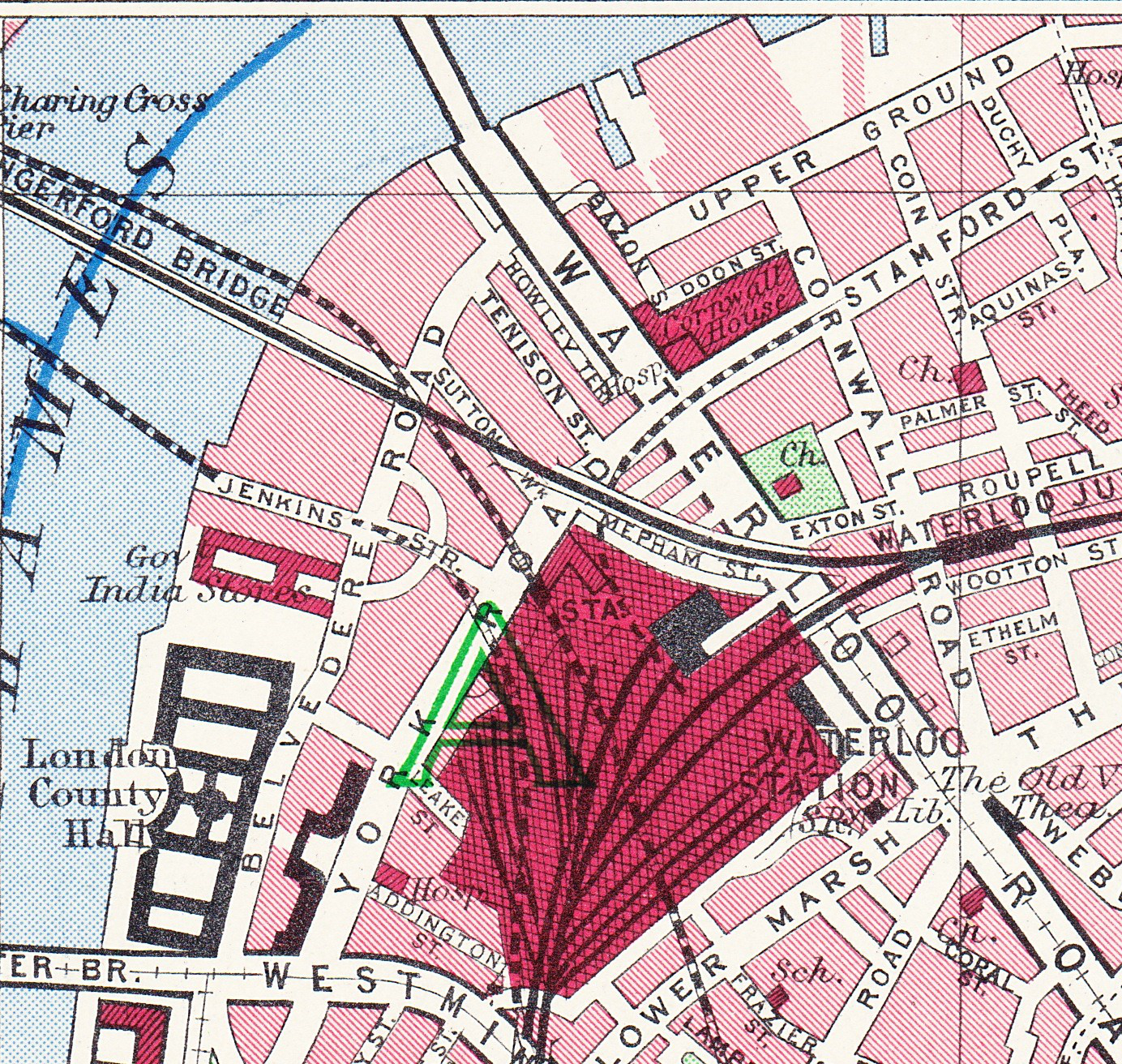
And finally we come to today and the following map shows the layout of the area as it is now – although this will also change soon as the buildings surrounding the Shell Centre tower have been demolished to make way for a new development of multiple apartment towers.

History of the Southbank Map 5

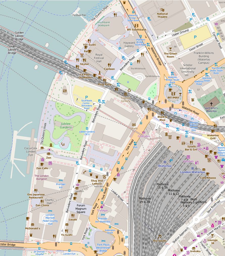
The map shows roughly the same area, between Waterloo Bridge at the top of the map and Westminster Bridge at the bottom.

The only streets that remain from previous years are Belvedere Road and Chicheley Street. Belvedere Road has been widened and straightened over the years, but follows roughly the same route as the Narrow Wall and the original earthern embankment.

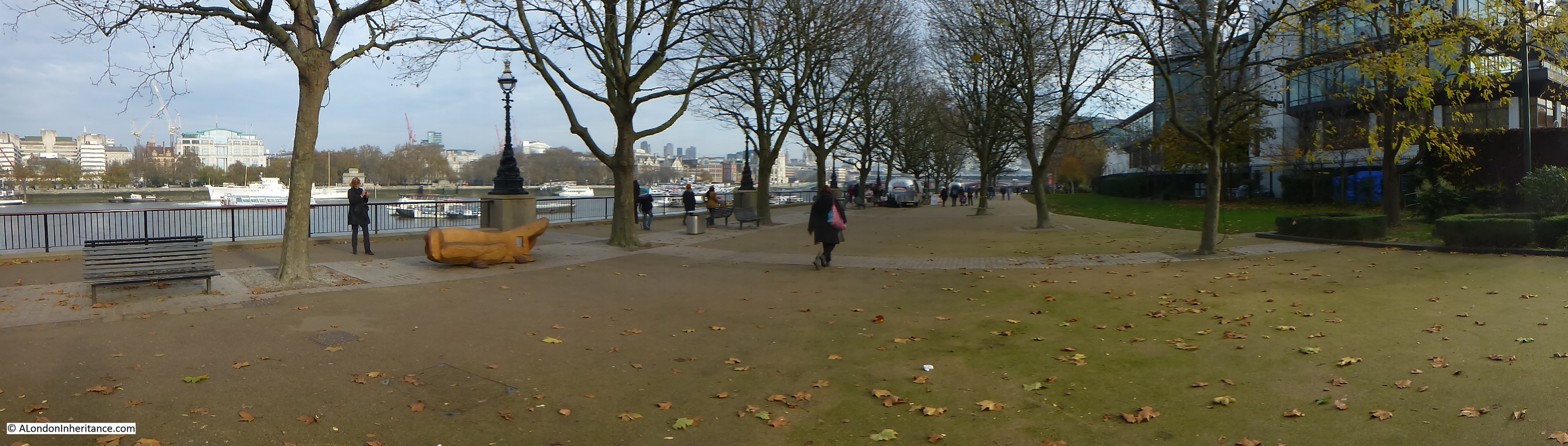
There is more land between Belvedere Road and the river as during the construction of County Hall and the Festival of Britain, the embankment was pushed further into the river.

The approach road to Waterloo Bridge now covers the area occupied by Cuper’s Gardens. The Royal Festival Hall occupies the site of Timber Yards and then the Lion Brewery.

The Coade Stone Factory was on the site now occupied by the car park above the Jubilee Gardens.

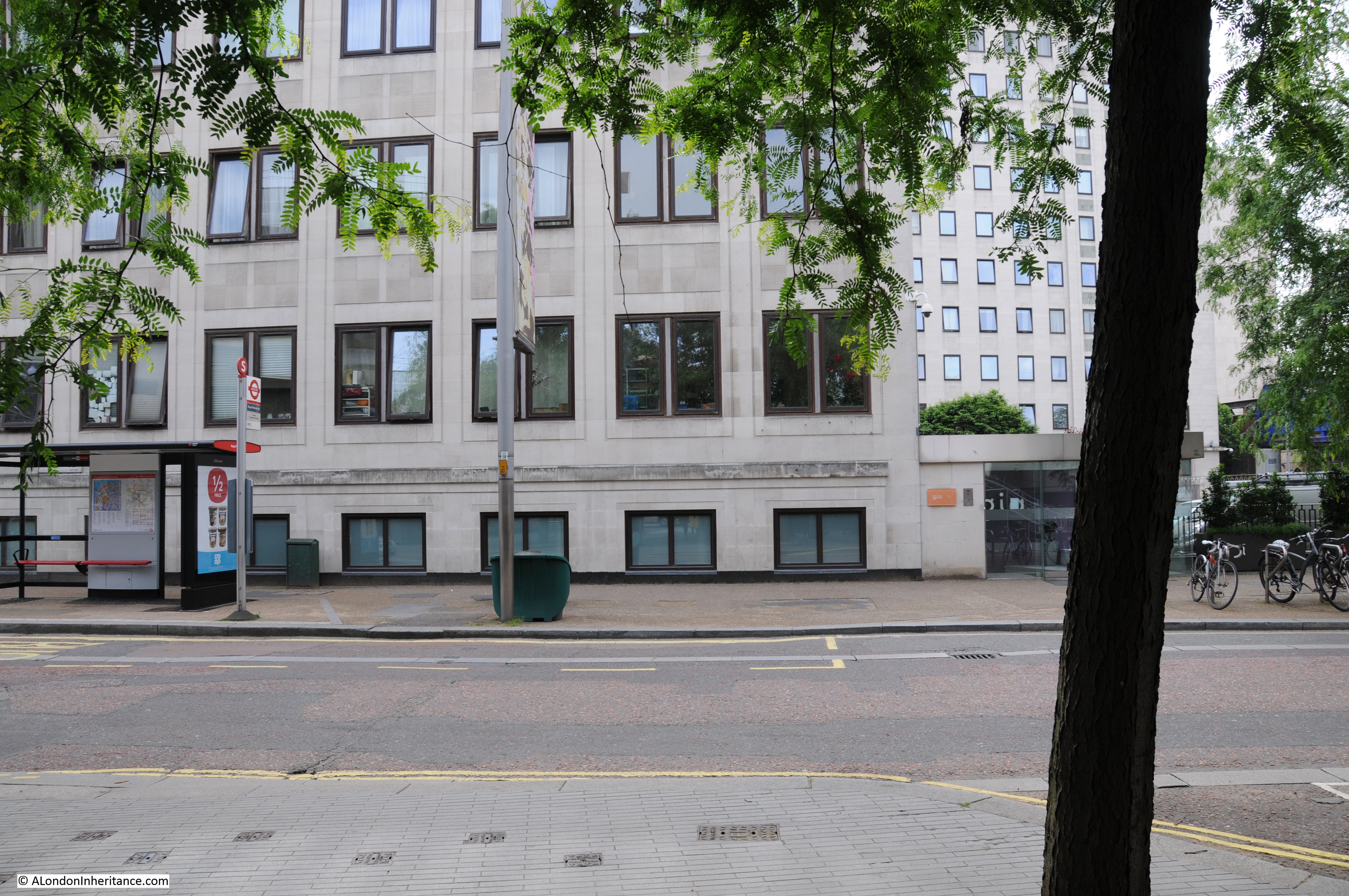
The rows of terrace houses between Belevedere Road and York Road have gone with the space being occupied by the Shell Centre Upsteam and Downstream buildings – off which all but the tower building have either been converted into apartments or have been demolished to make way for more apartment blocks.

In my next post we will have a walk along Belvedere Road looking at the buildings and views from between 1947 and 1950 as the site is prepared for the Festival of Britain and comparing with the same scenes today.

All the prints in the above post are ©Trustees of the British Museum

The extracts from the 1895 Ordnance Survey Map are reproduced by permission of the National Library of Scotland.

alondoninheritance.com

London At Night – The Strand To The Monument

London at night is a very different city. The West End continues to be just as busy as during the day with thousands of people at the theaters, pubs, bars, clubs and restaurants that make this area the entertainment center of London, however head just beyond the West End and London takes on a very different aspect.

My father took a number of photos in 1951 of the streets at the northern end of Waterloo Bridge, St. Paul’s Cathedral and the Monument. I do not know why he took photos of these locations, he was probably experimenting with nighttime photography which would have been a challenge for an amateur at the time given the camera and film available.

To take these, he must have taken a walk from Waterloo Bridge down to the Monument, so I thought I would take a late evening walk along the same route and take some photos of the same locations and more, along the route. I took many more than the five taken in 1951, the cost of film, home developing and printing all limited the number of photos that an amateur would have taken, and really brings home the differences with digital photography today.

I wanted to walk the route after the weather had been raining to get the same effect as in my father’s photos, so planned an evening when there should have been a rain shower, however as is typical with trying to forecast the weather, it failed to rain so my full walk of the route was in the dry. The evening before I published this article, it did rain so I headed out again, just to photo the first three locations to get the same effect, the rest of the photos are from my original walk.

The first location is from the approach road to Waterloo Bridge, looking to where the Strand crosses, the curve of Aldwych to the right, with Wellington Street running up on the left.

London after dark 28

Standing in the same position on a rain and wind-swept evening in February. The building on the right is the same as in my father’s photo, as is the building across the street. The public toilets that were in the middle of the road have disappeared.

London after dark 35

To also check that this is the right location, by enlarging the sign on the post in the original photo, we can see it reads “No crossing to Wellington Street”.

London after dark 31

Wellington Street is directly opposite the road that leads to Waterloo Bridge and today is blocked off for road traffic from the Strand. It is the location of the Lyceum Theater. The traffic signals appear temporary and are Police Signals, so this may have been some experimentation with traffic and pedestrian control at the end of Waterloo Bridge.

The next photo is from roughly the same position and is looking in the opposite direction down Waterloo Bridge:

London after dark 27

The same view today:

London after dark 34

The following photo should have been easy to locate given the bus stop clearly labelled as the Strand stop. I do not often use the bus in central London, preferring to walk, and was not sure where the Strand stop was located. Walking the length of the Strand, I could not find a stop with this name. What finally helped to locate the position of the photo is the wall on the right side of the photo.

London after dark 26

This is the wall at the side of the church of St. Mary-le-Strand and is the same in my 2016 photo below. The pillars in the original photo either side of the bus stop sign are still there, they are just hidden in the 2016 photo behind bushes running along the length of the church wall. The bus stop has been moved slightly along the street and the stop is now named “Aldwych”. Where the original bus stop and pillar box were located is now the entrance to the King’s College London, Strand Building.

London after dark 33

Having found these locations, it was time to walk down to the Monument. The Waterloo Bridge junction with the Strand seems to be a nighttime boundary. From the end of the bridge turn left and the streets are busy with people, turn right and it is a much quieter street with only a few late night walkers to be seen.

The church of St. Mary-le-Strand. The stone columns at the entrance to the church seen in my father’s photo can just be seen.

London after dark 32

Just a short distance along, turn right off the Strand, through the archway and into the courtyard of Somerset House. The buildings that surround the courtyard are brilliantly lit at night.

London after dark 25

Back on the Strand, bikes and buses:

London after dark 24

As with many other places across London, there are new buildings being constructed to the south of the Strand adjacent to the church of St. Clement Danes. I happened to notice this model of the area and the church lit up in one of the ground floor windows of the new building facing the Strand.

London after dark 23

The Royal Courts of Justice:

London after dark 22

Looking back at St. Clements Danes:

London after dark 21

I much prefer to walk London at night, but other options are available:

London after dark 20

The side roads from the Strand down to the Thames show how steeply the land slopes down to the river. The Oxo Tower on the south bank can be seen along many of these side roads.

London after dark 19

Now into Fleet Street and St. Paul’s Cathedral in the distance:

London after dark 18

Fast food shops that are busy during the day are closed and silent at night:

London after dark 17

A very quiet junction of Fleet Street, Farringdon Street, New Bridge Street and Ludgate Hill.

London after dark 15

An empty City Thameslink station on Ludgate Hill.

London after dark 13

Late night drinkers on Ludgate Hill:

London after dark 12

St. Paul’s Cathedral from the south-east:

London after dark 11

The following is one of my father’s photos from 1951. In the immediate post war period the very top of the Cathedral was lit up by search lights that only a few years earlier had been used to search the sky for enemy aircraft trying to bomb a city that was hiding in the blackout. The post war lighting had the effect of highlighting the Golden Gallery, the Lantern and Cross. Today, the whole of the cathedral is illuminated.

London after dark 30

The above photo was taken from a point on the land now occupied by One New Change. At the time, this was still empty land having been cleared of all the bomb damaged buildings. I could not get far enough back to take a photo from the same position so the following photo is the nearest I could get. The base of the Cathedral is also obscured by the post war buildings that house the Cathedral School.

London after dark 10

This photo from my post on the “Post war view from the Stone Gallery” shows the land then used as a car park that my father was standing in to take the nighttime view of the Cathedral:

IMG02593-upload

Time to head on down Cannon Street in the direction of the Monument. Empty offices, still lit up, waiting for their occupants:

London after dark 9

The Cathedral follows you as you walk down Cannon Street:

London after dark 8

Another very quiet station, this time Cannon Street:

London after dark 6

The next photo is of Abchurch Lane, leading up to the church of St. Mary Abchurch in the heart of the City. Very busy during the day, however I stood here for about 10 minutes and did not see a single person along the length of the lane. It is in these alleys and lanes across the city that it is possible to imagine a much earlier London. Many more people would have lived in the City, but long after dark what reason would there be for people with legitimate business to be walking the streets?

London after dark 5

Back to the 21st century and the junction of Cannon Street with King William Street. Walking across the City at night, I find that there are very few people walking, but the main streets through the City are always busy with traffic.

London after dark 4

Walking down King William Street and a quick look over at Upper Thames Street. Roadworks for the Cycle Superhighway have closed one of the carriageways leading to queues of traffic long into the night. Upper and Lower Thames Streets form the southern route taking traffic east – west through the City. The roads were widened post war rather than build the Embankment extension which was one of the options put forward in the plan for post war reconstruction of the City (see last weeks post).

London after dark 3

The next photo is my father’s photo of the Monument in 1951. I can place where the photo was taken from by looking at the position of the viewing gallery, the photo was looking up at the Monument and the glow in the background is from the searchlights on St. Paul’s. It was taken from Lower Thames Street prior to the widening of the road and the new buildings which have now obscured the view.

London after dark 29

As I could not get a photo of the Monument from the same position due to the height of the buildings between the Monument and Lower Thames Street, this is the Monument from Monument Street with typical London building work on the right. Advertising for the new office building shows the view from the roof with office workers on the roof apparently able to look straight across to the tourists on the viewing gallery of the Monument.

London after dark 2

A close-up of the viewing gallery and very top of the Monument:

London after dark 1

It would have been much darker in 1951 when my father took the same route to photograph the Strand junction, St. Paul’s Cathedral and the Monument which is probably why he did not take any photos between these locations, however walking London at night is still a very different experience to the day. The Strand and Ludgate Hill are relatively quiet compared to the day, but turn off the main streets through the City, away from the traffic and you can walk the lanes and alleys, often without seeing another person.

It is here that you can let your imagination run over the last two thousand years of London’s history and imagine who has walked and what has happened in this nighttime City.

alondoninheritance.com

The Garden Bridge – A Personal View

The majority of my posts have been covering the changes in London over the last 70 years, showing where London has changed, and the few locations where there has been very little change.

Change in London is a constant, some good, some not so good and often we do not recognise and appreciate what we have in London until it is lost. For this week’s post I want to offer my personal view of a proposed very significant change to London and to the River Thames that now looks likely to get the go ahead and to be built.

The Garden Bridge is a proposal to construct a pedestrian bridge over the River Thames between the Southbank and Temple Underground Station. As the name suggests, this will be far more than a simple pedestrian bridge, the deck of the bridge will be planted with trees, shrubs etc. to give the impression of a walk through a garden as you cross the River Thames.

The proposal has already been granted planning permission by Lambeth Council and last Tuesday evening was granted permission by Westminster Council.

The bridge will span the Thames, across the sweep of river known as Kings Reach between Waterloo and Blackfriars Bridges, from the Southbank to land on the roof of Temple Underground Station on the north bank.

I am not going to argue against the concept, the design or the economics of the Garden Bridge, there are already a number of articles covering these topics. In this post I will question the location, and show what will be lost as a result of the Garden Bridge.

The bridge will cross the river between Waterloo and Blackfriars Bridges. It needs to be high enough to provide sufficient clearance for river traffic at high tide, and the overall apparent height of the bridge will be increased by the planting of trees.

The website of the Garden Bridge Trust can be found here where there are photos and videos of the bridge.

The sweep of the Thames between these two bridges is one of the longest between Westminster and Tower bridges and provides superb views of the river from both north and south embankments and from Waterloo and Blackfriars Bridges.

Rather than crossed by themed bridges, the River Thames and its relationship to the city and the built environment should be the object of interest. The River Thames is central to the history of London. It is the reason why London was established in this location. It was the artery which carried shipping to and from the rest of the world to the docks of London that were central to the development of London as a major global trading city. The Thames has also divided north and south London, providing two parts of the larger city with very different characters. The Thames also provides a key open space in a very congested city.

The proposed landing point on the north bank of the Thames will be at Temple Underground Station. This is a relatively quiet area and the level of visitor numbers to the bridge (anticipated by the Garden Bridge Trust at 7.1 million per annum – paragraph 8.6.2 of the Environmental Statement Main Report Volume 1) will significantly impact and change this area.

Last Saturday I took a walk round the area where the Garden Bridge is to be constructed to understand the impact and see how the area will change.

I started on Waterloo Bridge, looking east down the Thames and across to the City. The current view is shown in the following photo, where we look down Kings Reach towards Blackfriars Bridge with St. Paul’s and the City in the background. The spire of St. Brides can seen above the trees on the left. The Garden Bridge will run across the centre of the river from in front of the white ship on the left to the south bank on the right.

garden bridge 12
The long view of the sweep of the Thames will be lost with the bridge now running across the river and dividing Kings Reach in two, obscuring the view down to Blackfriars Bridge and having an impact on the view across to St. Paul’s and the City.

Walking along Waterloo Bridge to the north bank, we pass this view of the north bank of the river. This will change considerably as the bridge will be landing in front of the white ship and cutting across to Temple Station which is behind the trees on the left.

garden bridge 10

Compared to the south bank of the Thames, the north bank in this area (apart from the traffic) is still very quiet. The bridge will land on top of the building housing the Temple Underground Station, with steps running down to street level. In the following photo, the bridge will come across the gap between the station entrance and the railings to the right, with access ramps and two lifts onto the roof of the station and down to ground level.

garden bridge 19

The rooftop area on top of the station and the adjacent bar is shown in the following photo. This will become the landing point for the northern side of the bridge.

garden bridge 6

The following view is from the top of Temple Underground Station. The ship is the Head Quarters Ship (HQS) Wellington. Built in 1934 and having seen service across the world, was berthed on the Embankment in 1948 as a floating livery hall of the Honourable Company of Master Mariners. The ship is now owned by a charitable trust, the Wellington Trust. The Garden Bridge will come across the Thames, in front of HQS Wellington and onto the Temple roof to the left.

garden bridge 7

A view of the station entrance and building as it currently stands. Again, the bridge would be coming across the Embankment and landing on the roof of this building, with the associated steps and lifts to support the expected volume of visitors to the bridge.

garden bridge 9

Adjacent to Temple Underground Station are one of the Embankment Gardens. This garden currently provides a quiet area to walk and get away from the traffic on the Embankment.

Remember that the Garden Bridge Trust anticipate 7.1 million annual visitors to the bridge.

During peak periods there will probably need to be some method of crowd control / waiting for access to the bridge. The impact on this garden and the area surrounding Temple Underground Station will be very significant, potentially making this area as busy as the Southbank is today.

One of the arguments for the Garden Bridge appears to be that the Temple area is underused and the bridge will bring visitors, but I do not see why there is a need to make everywhere in London busy? One of the pleasures of living, working or visiting London is finding areas that are not crowded, not too commercialised and still having some unique character. The Garden Bridge will significantly change this area of the north bank and bring significant numbers of people to the area around Temple Underground Station and the adjacent gardens, with the almost certain additional commercialisation that the availability of large numbers of people often attracts.

The Embankment Gardens adjacent to Temple Underground Station:

garden bridge 2

Looking back from the gardens to Temple Underground Station:

garden bridge 3

These gardens have some interesting statues. The statue in the gardens to Lady Isabelle Henry Somerset “in memory of work done for the temperance cause”, from the “Children of the Loyal Temperance Legion”. According to the plaque, she was also the founder of the first “industrial farm for inebriate women” whatever that could have been !

garden bridge 1
And the statue to William Edward Forster “To his wisdom and courage England owes the establishment throughout the land of a national system of elementary education”. His Education Act of 1870 set the framework for a system of primary school education:

garden bridge 4

The entrance to the gardens from Temple Place:

garden bridge 5
Hard to believe that the Garden Bridge Trust anticipate 7.1 Million visitors per annum will be crossing the bridge and passing through the northerly landing point at Temple:

garden bridge 17

Walking along the Embankment towards Blackfriars Bridge we can look back at Temple Underground Station. The Garden Bridge will cross the Embankment and land on the roof of the Underground Station. (If Westminster Council want to improve the area, it would be good to replace or remove the “Welcome to Westminster” sign in the central reservation, not the most inspiring of signs or integrated with the surroundings).

garden bridge 8

A short distance along the Embankment we can walk onto the pier where HQS Wellington is berthed and look back towards Waterloo Bridge. The Garden Bridge will cross the river just in front of the Wellington;

garden bridge 18

Continuing along the Embankment, we walk up to Blackfriars Bridge and walk to the centre to look back up river to Waterloo Bridge. The first ship on the right is HMS President, painted in a “dazzle” colour scheme. Further along the north bank we can see HQS Wellington marking where the bridge will cross the Thames to the area with trees on the Southbank to the left. I doubt that very much of Waterloo Bridge will be visible and the planting on top of the bridge may well obscure the buildings running along the north bank.

garden bridge 16
As well as the Garden Bridge, additional future development work is planned to take place for the Thames Tideway Tunnel on the Blackfriars Bridge foreshore where there will be reclamation of land in the foreshore and construction of a new permanent area with ” several ventilation columns, a kiosk and public realm furniture will be permanent above ground features”. See the Blackfriars site on the Thames Tideway Tunnel website here for an illustration.

Continue across Blackfriars Bridge and walk along the Southbank towards Waterloo Bridge. Just past the Oxo Tower building, we pass Bernie Spain Gardens and arrive at the southerly landing point of the bridge, photographed early on a Saturday morning.

In this area will be access to and from the bridge, along with a new building to house maintenance, storage and welfare facilities for the bridge staff and a combination of approximately 410 square meters of retail and/or restaurants and/or visitor centre / community / educational use.

garden bridge 15

Walking a bit further along we come to where the bridge will cross the river. Looking directly across, the bridge will pass over the smaller boat in the middle of the photo, with Temple Underground Station being just behind the trees.

garden bridge 14

To me, the Garden Bridge, however good the concept and design, will be in entirely the wrong location.

1. A significant stretch of the Thames will be changed for good. Kings Reach will be broken up into two smaller segments and the bridge will detract from the focus that should be on the river and the relationship between the river and the City.

2. Views from Waterloo Bridge and the Southbank will be changed for good, with significant loss of the view over to the City. The view from Waterloo Bridge will now be of a much shorter stretch of the Thames.

3. The view from Blackfriars Bridge will likewise change. The view of Waterloo Bridge and the arc of buildings along the north bank will be obscured.

4. A relatively quiet area of the north bank will be subjected to significantly raised numbers of visitors. The area will need to accommodate 7.1 million visitors per annum with the associated infrastructure and commercialisation that this number will attract. The current environment of the Temple will be changed for good.

5. The Southbank is already a very successful cultural and visitor location. It can be incredibly busy at weekends and during the peak summer periods. Can it cope with the additional visitor numbers that the Garden Bridge will bring?

6. Why in this location? What needs to be connected between these points on the south and north banks and what is the purpose of building the bridge in this location?

The last bridge to be built in central London, the Millennium Bridge was for a very specific purpose, to connect Bankside and Tate Modern with the area around St. Paul’s. It is a well designed bridge built for the purpose of moving people, it does not pretend to be something else.

Having received approval from both Lambeth and Westminster Councils, the final decision is now with the Mayor of London.

For further information, the site of the Garden Bridge Trust is here.

Newspaper articles covering the recent decisions are from the Guardian, the Independent and the Daily Telegraph.

Final views of the key locations. From the south bank looking along the line of the bridge towards the north bank:
garden bridge 20
The area on the south bank where the bridge will land along with the staff and maintenance buildings, retail etc:

garden bridge 21
The view from Blackfriars Bridge: garden bridge 23

The view from Waterloo Bridge:
garden bridge 22
The Embankment Gardens at Temple: garden bridge 24


alondoninheritance.com