
London is so built up that it is hard to imagine that anything from the original rural environment remains. Major streets tend to follow much earlier alignments, and there is one street north of Oxford Street that still follows the same route from the time when the street ran through fields. This is Marylebone Lane.
In the following map extract, Oxford Street is the orange street running from the bottom left corner, across the map to the right. Just to the right of the middle of the stretch of Oxford Street shown below, there is a pair of streets, forming a triangle and branching northwards. This pair of streets then combine and continue northwards. The angled and curving shape of the street stands out from the grid pattern of the surrounding area.
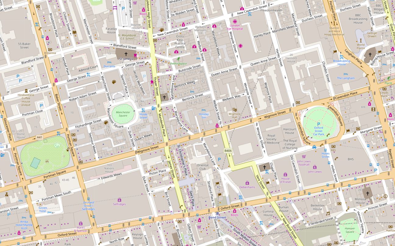
Map © OpenStreetMap contributors.
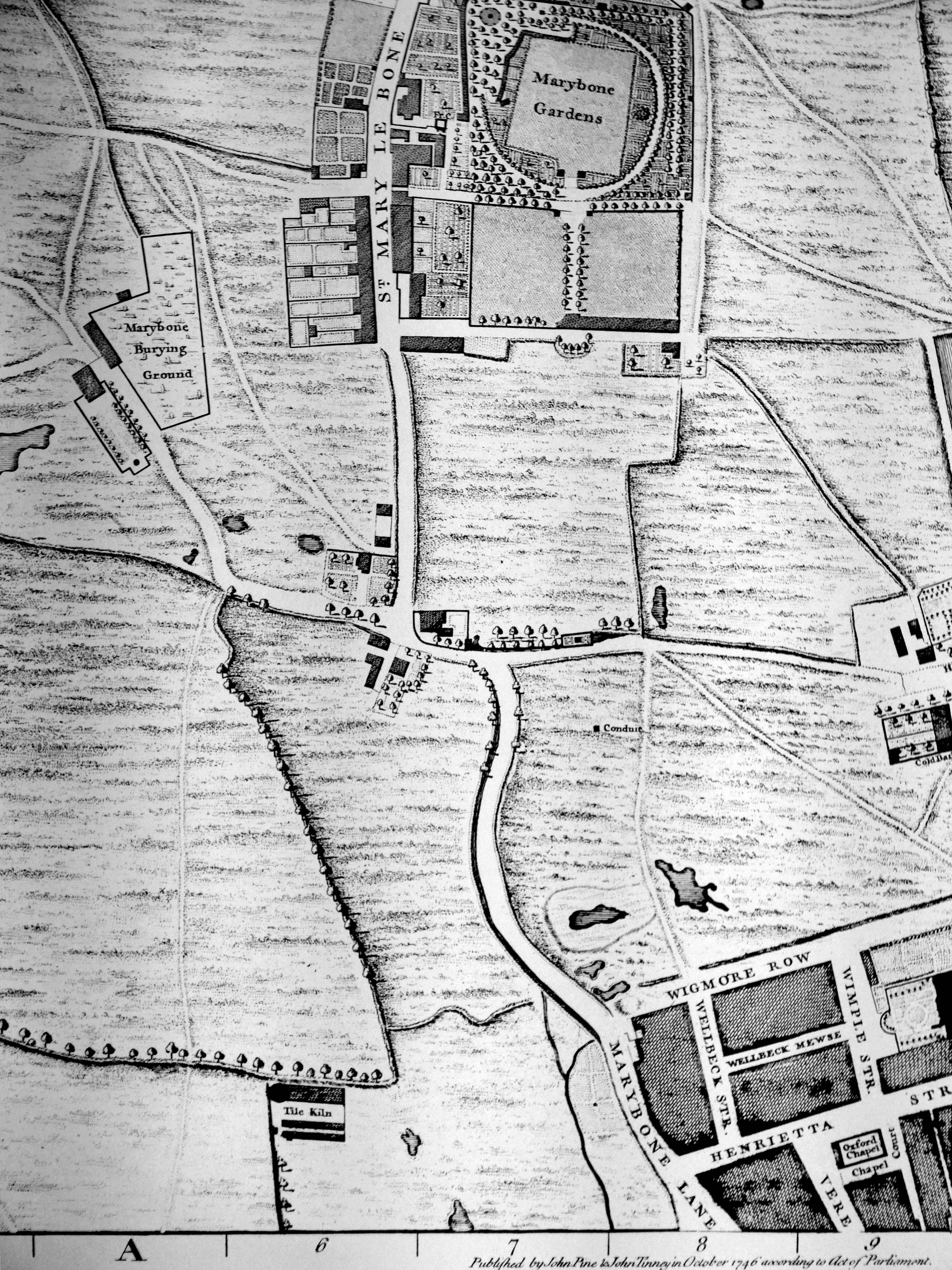
Back in 1746, when John Rocque was mapping London, this area was on the edge of the built city. In the map extract below, the top of the triangular section can just been seen at the bottom of the map. Marylebone Lane then runs northwards with the same outline as can be seen today. The first evidence of the grid layout of streets that will soon cover the whole area can be seen in the lower right corner. Fields cover much of the rest of the map with the formal Marybone Gardens at the top of the map.
On an autumn afternoon, I went for a walk along Marylebone Lane, trying to imagine the fields, ponds and streams that once lined the lane, as well as discovering how Marylebone Lane acted as a boundary between the estates and developments that were springing up on either side of this old lane in the 18th century.
I also wanted to take some photos of Welbeck Street Car Park before what now looks like a certain demolition and replacement with a hotel building that will look similar to so many other hotels across London.
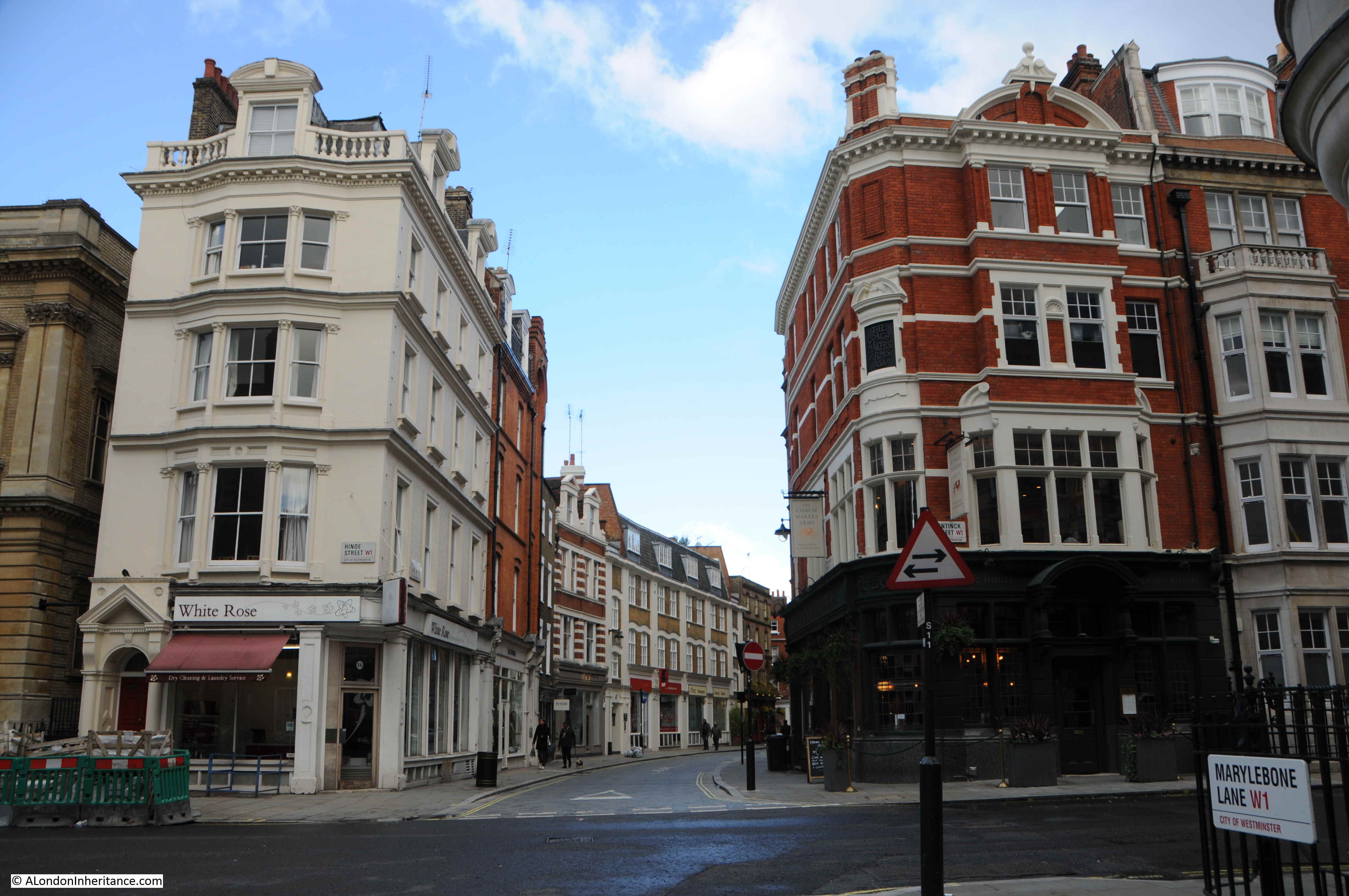
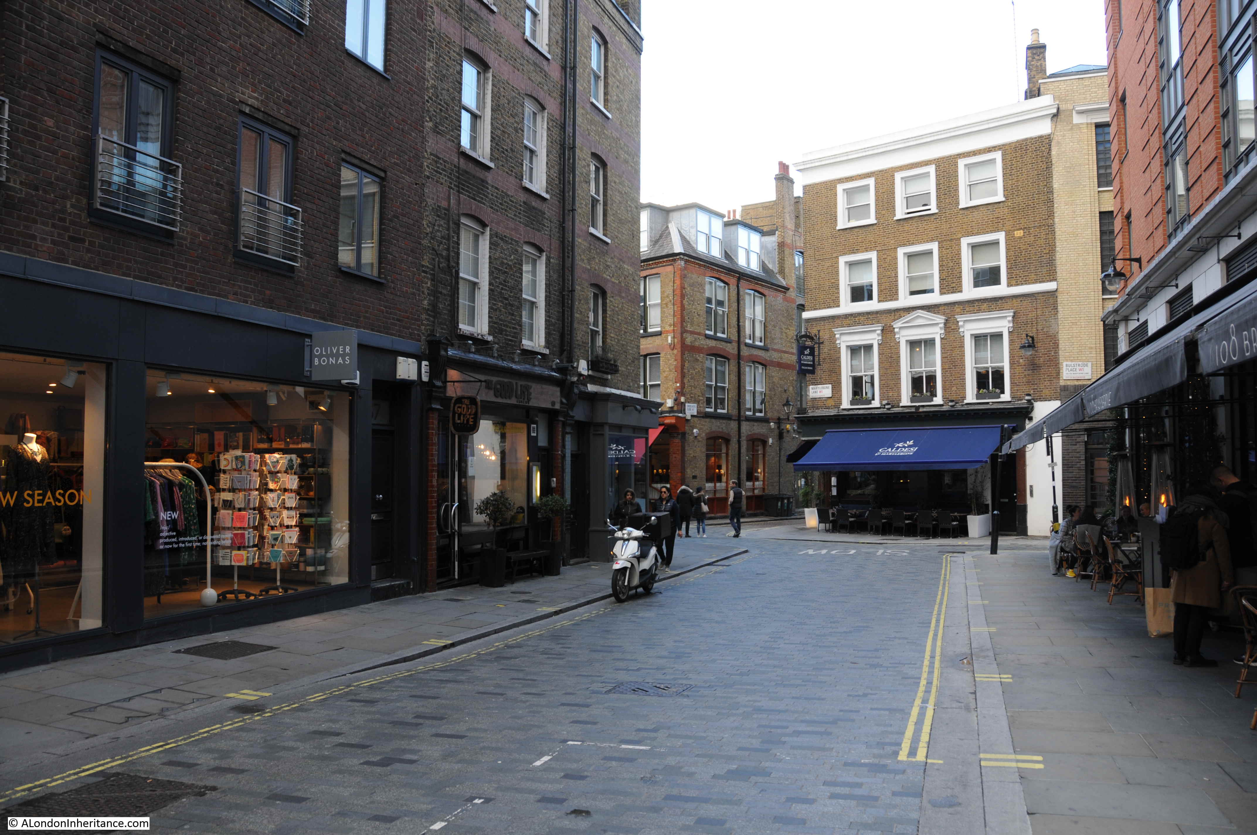
I turned off a very busy Oxford Street into the relative quiet of Marylebone Lane, passing the bulk of the Debenhams store, to the junction with Henrietta Place where I turned round to see the two branches of Marylebone Lane, with the triangular plat of land in the middle.
This plot of land and the split of Marylebone Lane can be seen in detail in the following extract from Rocque’s map.
Today, the road at the bottom is Oxford Street. In 1746, according to Rocque, the junction with Marylebone Lane appears to mark the junction where the name Oxford Street ends, and the name Tyburn Road takes over and continues up to Tyburn, roughly where Marble Arch is today. This change of names as streets cross Marylebone Lane will be a recurring theme.
Before the expansion of London built over these fields, Marylebone Lane ran from Tyburn Road, through the village of Marylebone to what were the northern parts of the parish, and ended within the current location of Regent’s Park.
In 1746 Marylebone Lane still ran the full length of this route, however building in the later half of the 18th century, including construction of Marylebone High Street, truncated Marylebone Lane to the southern portion of the route, so the section we can walk today is only part of the original full route.
The triangular plot of land, with the frontage onto Tyburn Road / Oxford Street has long been a significant location. Originally home to the parish church of Tyburn, then the first church of St. Marylebone, then being the location for a number of administrative functions for the parish, including a court and watch house. The book “London” by George H. Cunningham (1927) simply refers to this plot of land “Supposed to be the site of the ancient church of Tyburn, from a mass of skeletons that were dug up here in 1724”.
The watch house was photographed in 1920 and shows the same triangular layout with the two branches of Marylebone Lane leading down to Oxford Street.
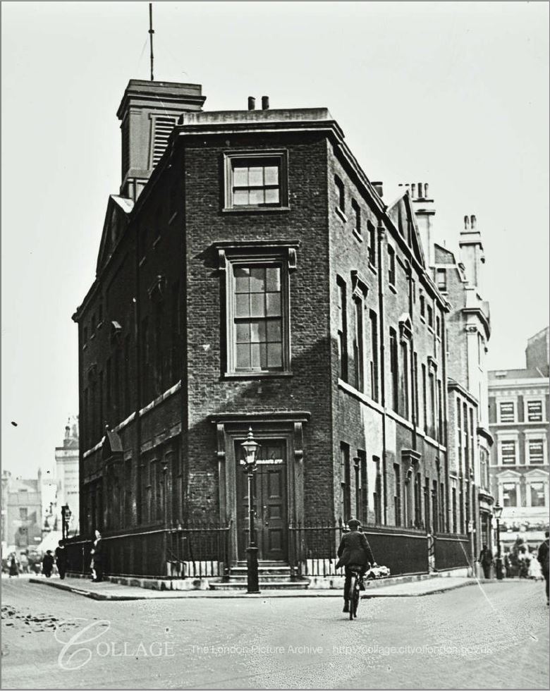
Image credit: London Metropolitan Archives, City of London: catalogue ref: SC_PHL_01_316_79_7322
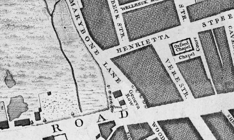
The first junction we come to is that with Henrietta Place, or Henrietta Street as it was in 1746. The map at the top shows that a short distance along Henreitta Place, there is a junction with Wellbeck Street, today the street name only has a single L.
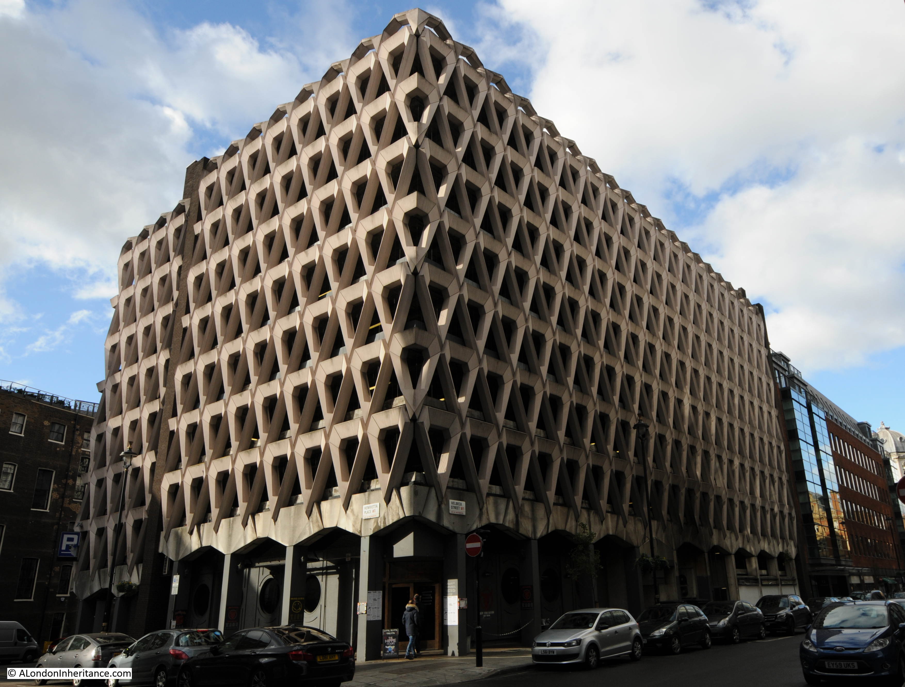
It is between Marylebone Lane and Welbeck Street that we can find the Welbeck Street Car Park.
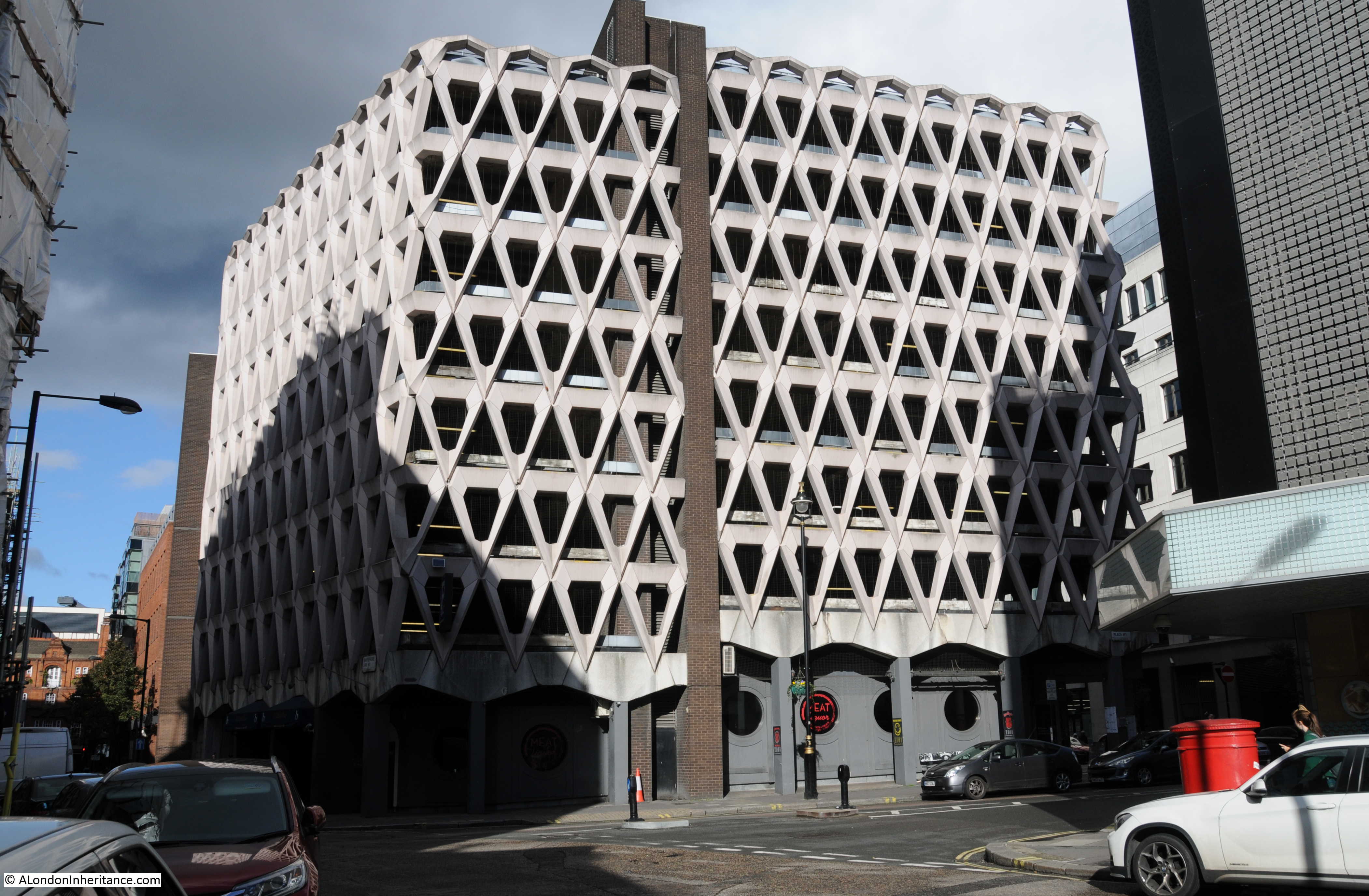
Proposals for post war planning of the city all generally accepted that there would be rapid growth in the numbers of cars that the city would have to accommodate. This led to some schemes that did get built, such as the Upper and Lower Thames Street through route, as well as many schemes that fortunately did not get built. I will write about some of these schemes in a future post. Actively accommodating the car continued through the closing decades of the 20th century and one result was the rather wonderful Welbeck Street Car Park.
The car park, designed by Michael Blampied and Partners for the adjacent Debenhams store was built between 1968 and 1970. It was a condition of approval for the Debenhams store that the car park was built as Westminister Council’s planning regulations required developments such as the store to have appropriate parking facilities.
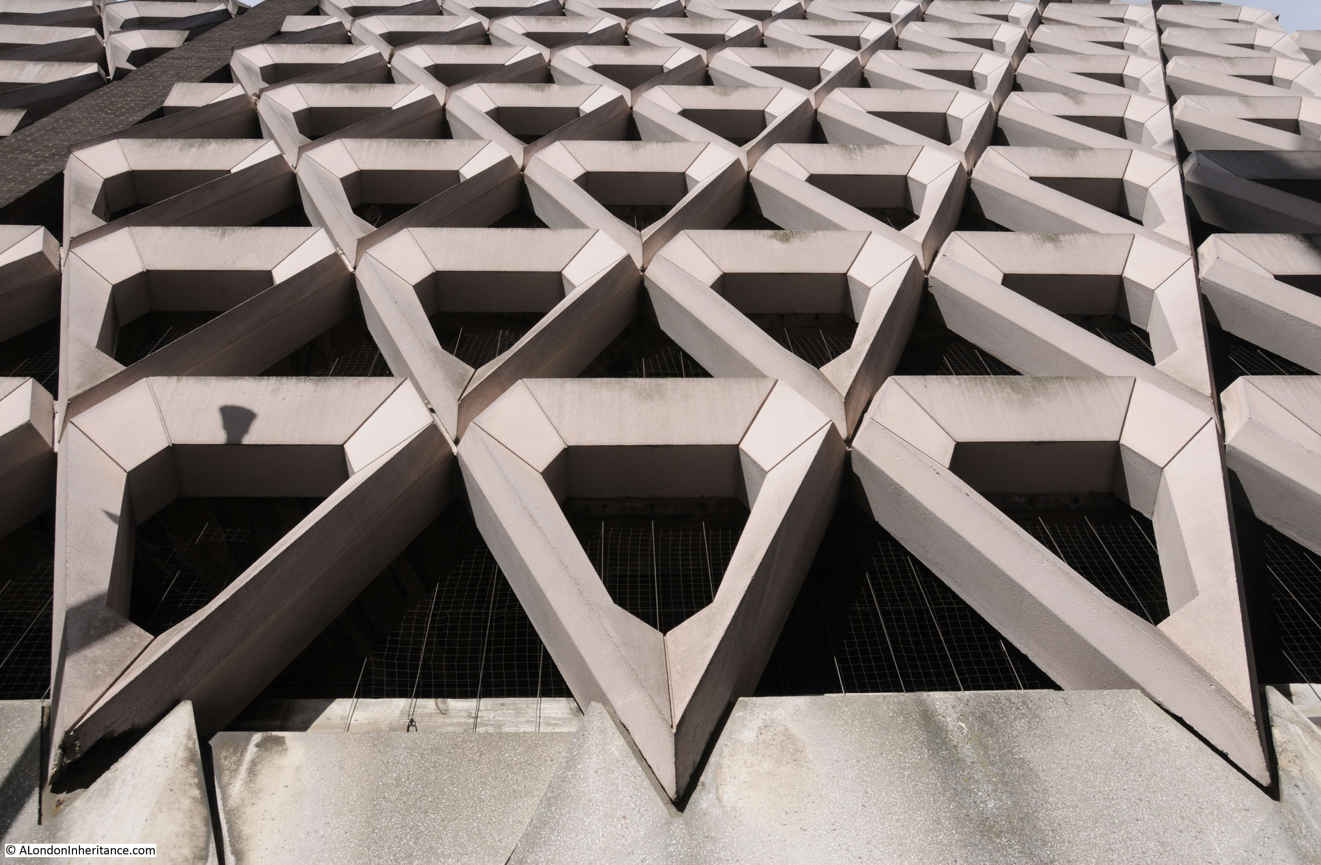
Internally, it is a functional, multi-storey car park, but externally it has a remarkable design with prefabricated concrete diamonds covering all floors above the ground floor.
The car park is under threat of demolition after having been purchased by a developer with the intention of building a hotel on the site. Attempts have been made to get the building listed, or alternate uses which retain the exterior fabric of the building, but these appear to have been rejected and demolition awaits.
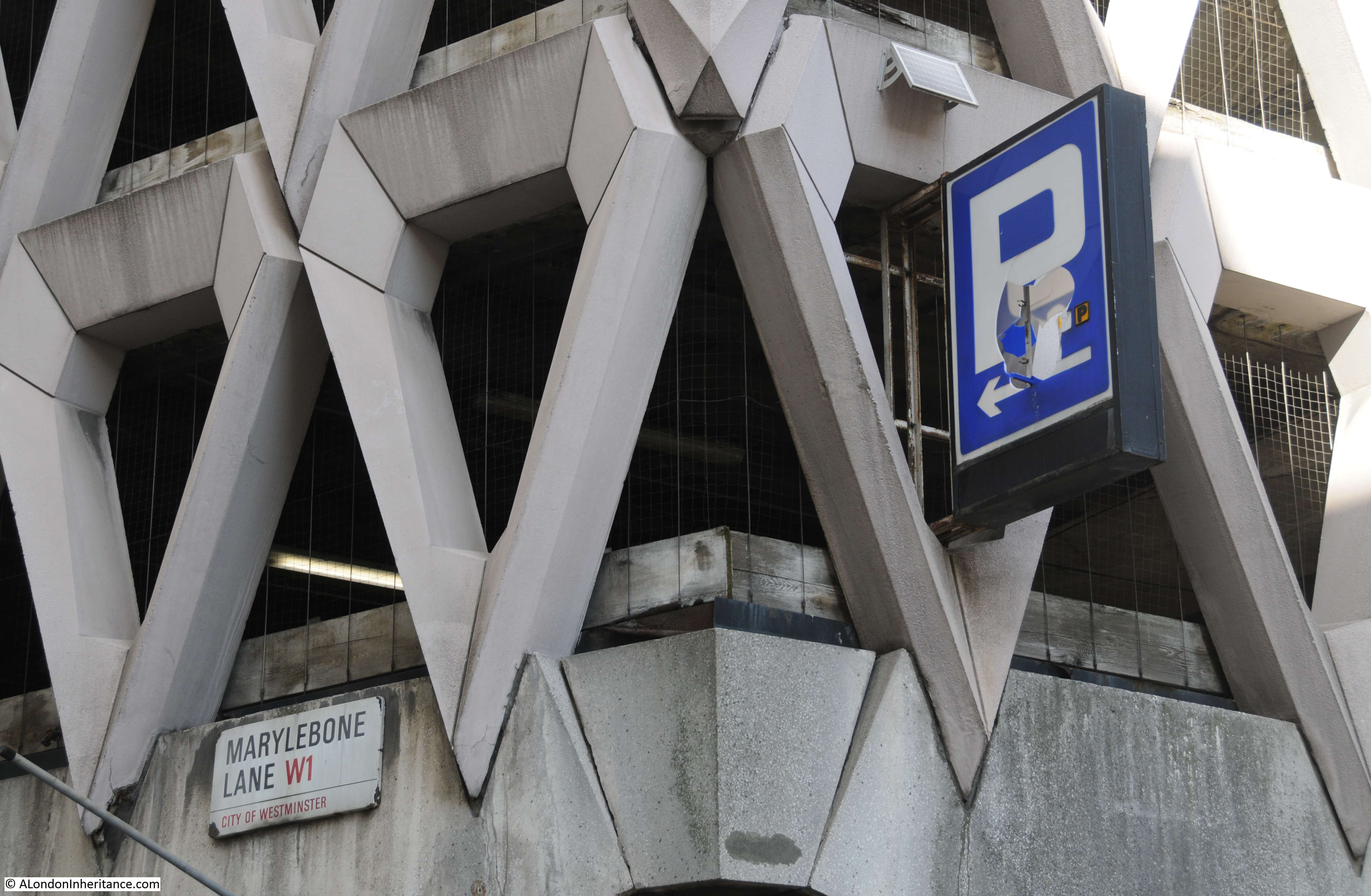
The building is stunning from a distance, but get up close and the repetition of the triangular concrete shapes creates some fascinating patterns. I wonder if it is just coincidence that the triangular shape mirrors the shape for the land opposite the car park, where Marylebone Lane reaches Oxford Street?
The car park from the junction of Henrietta Place and Welbeck Street.
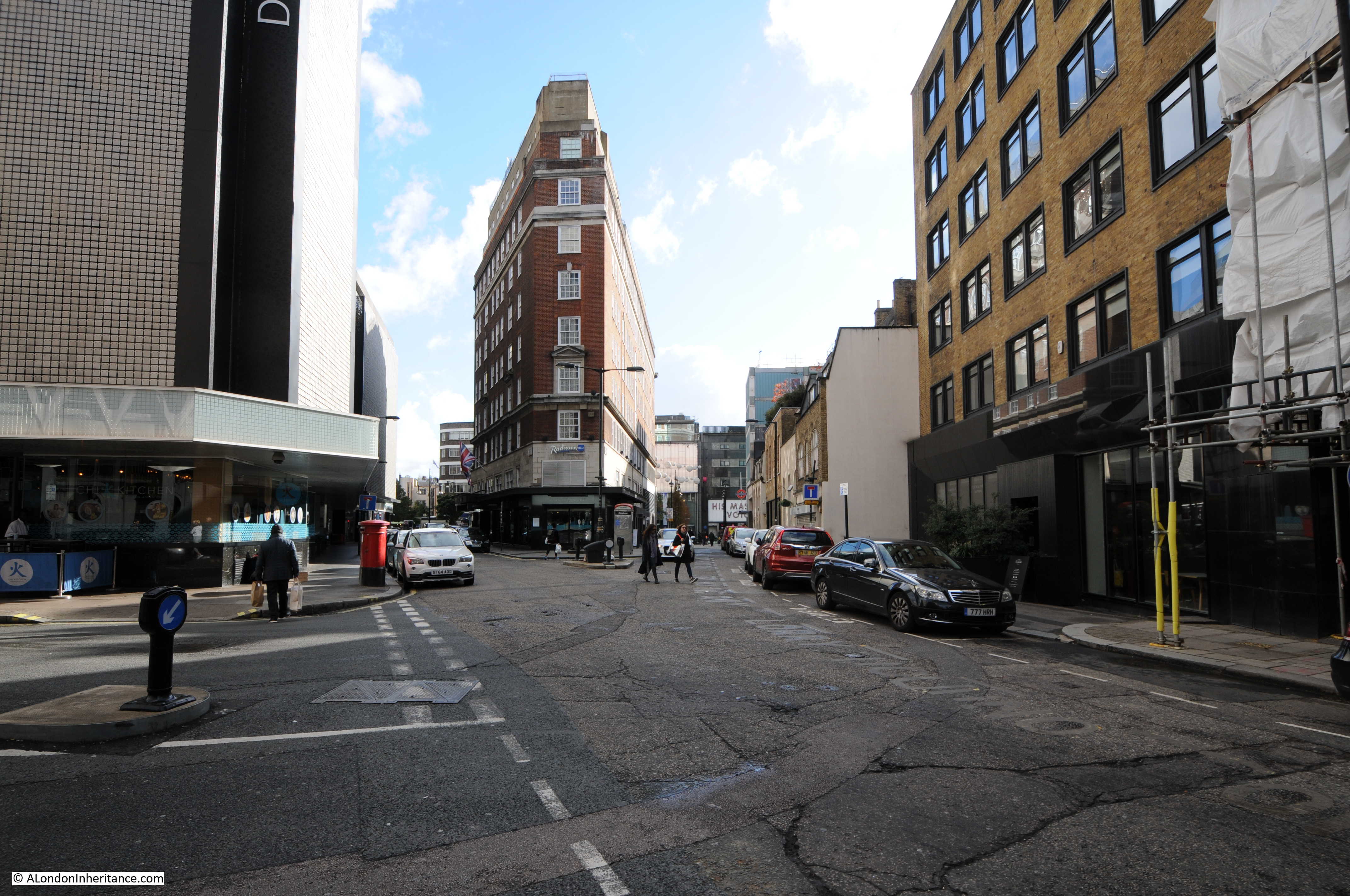
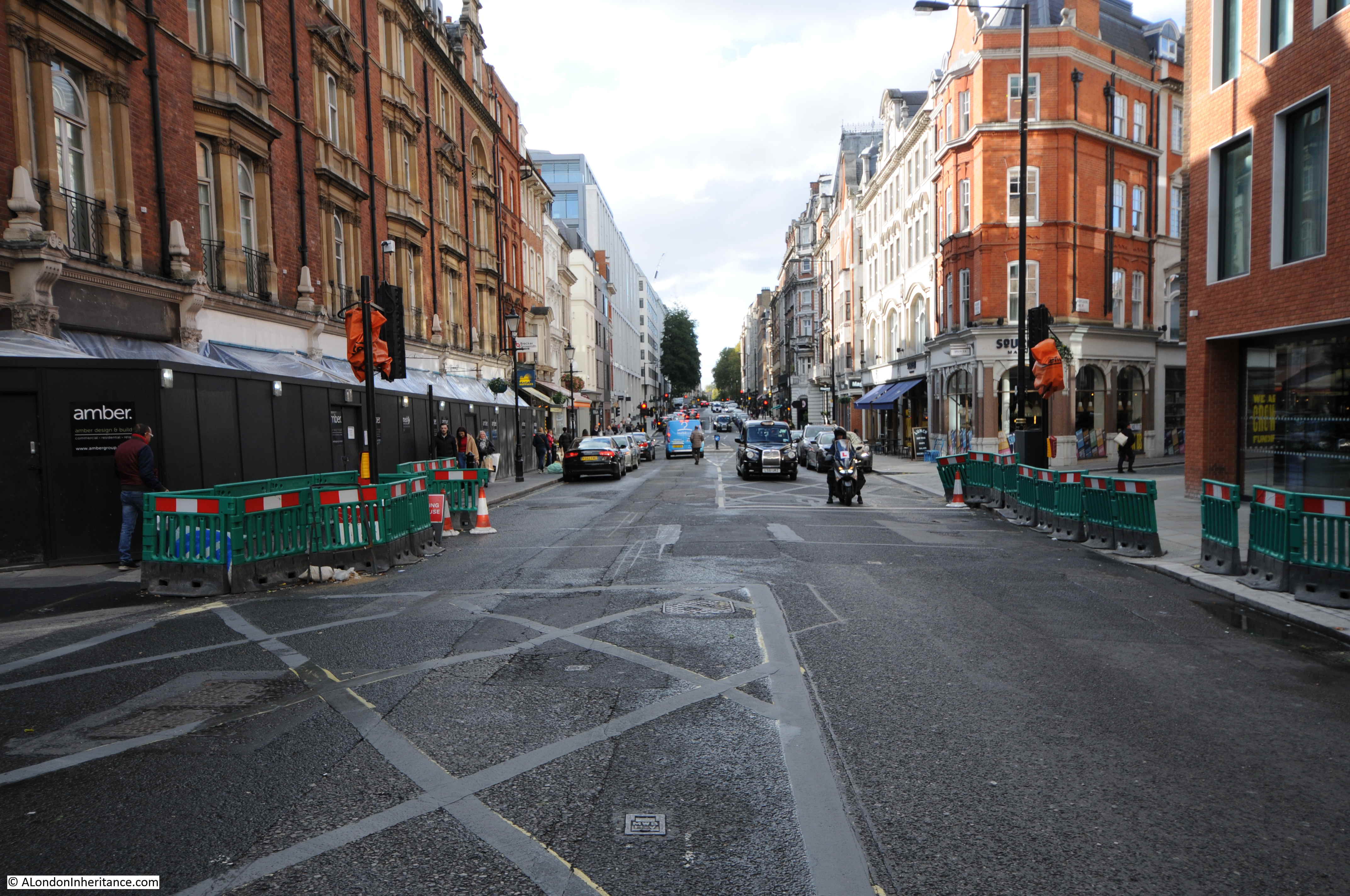
Leaving the Welbeck Street car park, and continuing along Marylebone Lane, we come to the junction with Wigmore Street.
In 1746 this street was named Wigmore Row and came to an abrupt halt at the junction with Marylebone Lane as the land to the west was still field, and had yet to be developed.
The following photo is in Marylebone Lane, looking across Wigmore Street. On the left can be seen the curving, continuation of Marylebone Lane. The slightly offset continuation of the street is the same as shown in the 1746 map.
In 1746, the area directly opposite was field and just behind where the buildings now stand there appear to have been a couple of large ponds.
This is looking along Wigmore Street towards the west and shows the straight street approach of the grid layout in the area which helps Marylebone Lane stand out as being different, and older than the rest of the area.
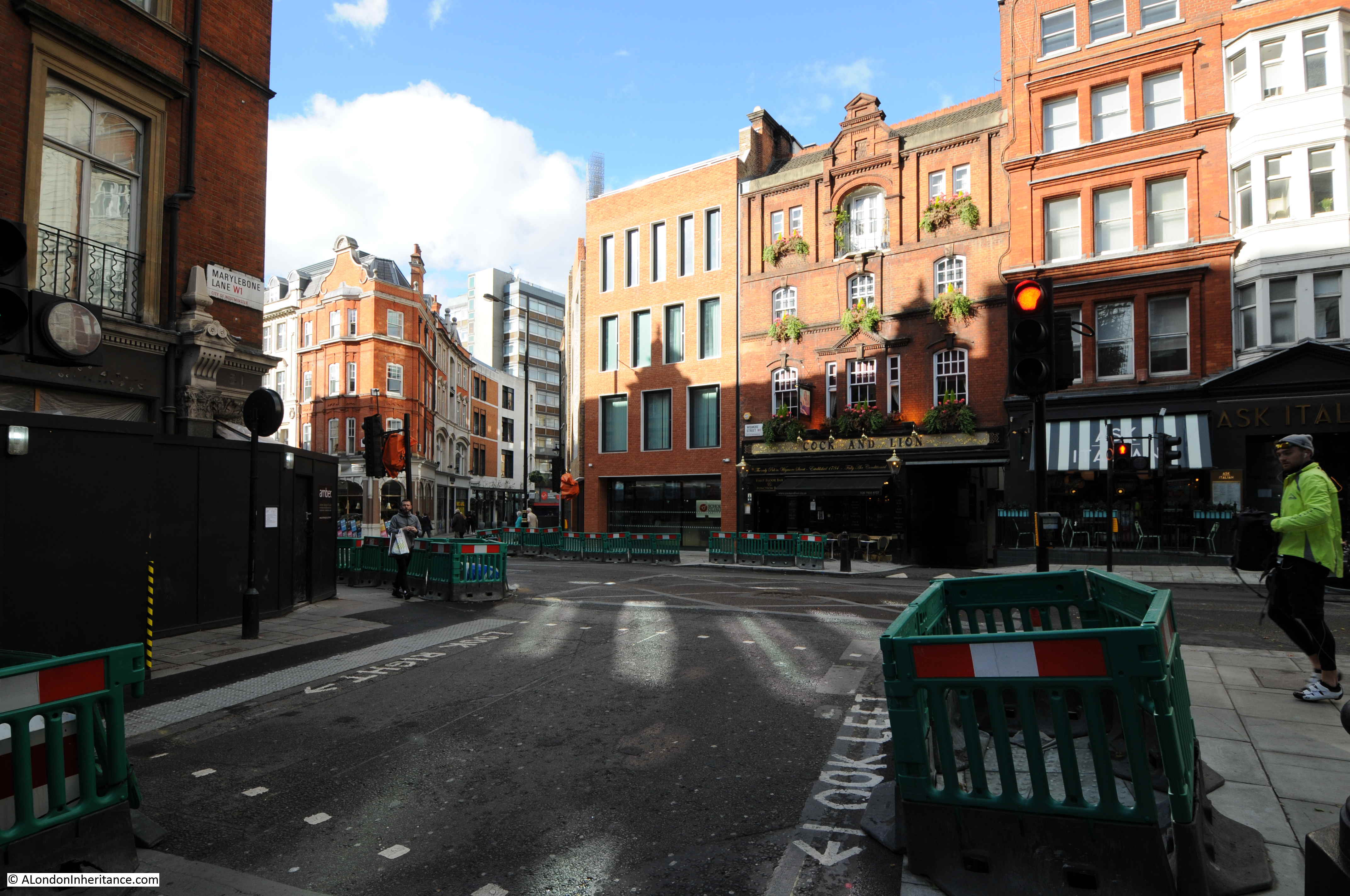
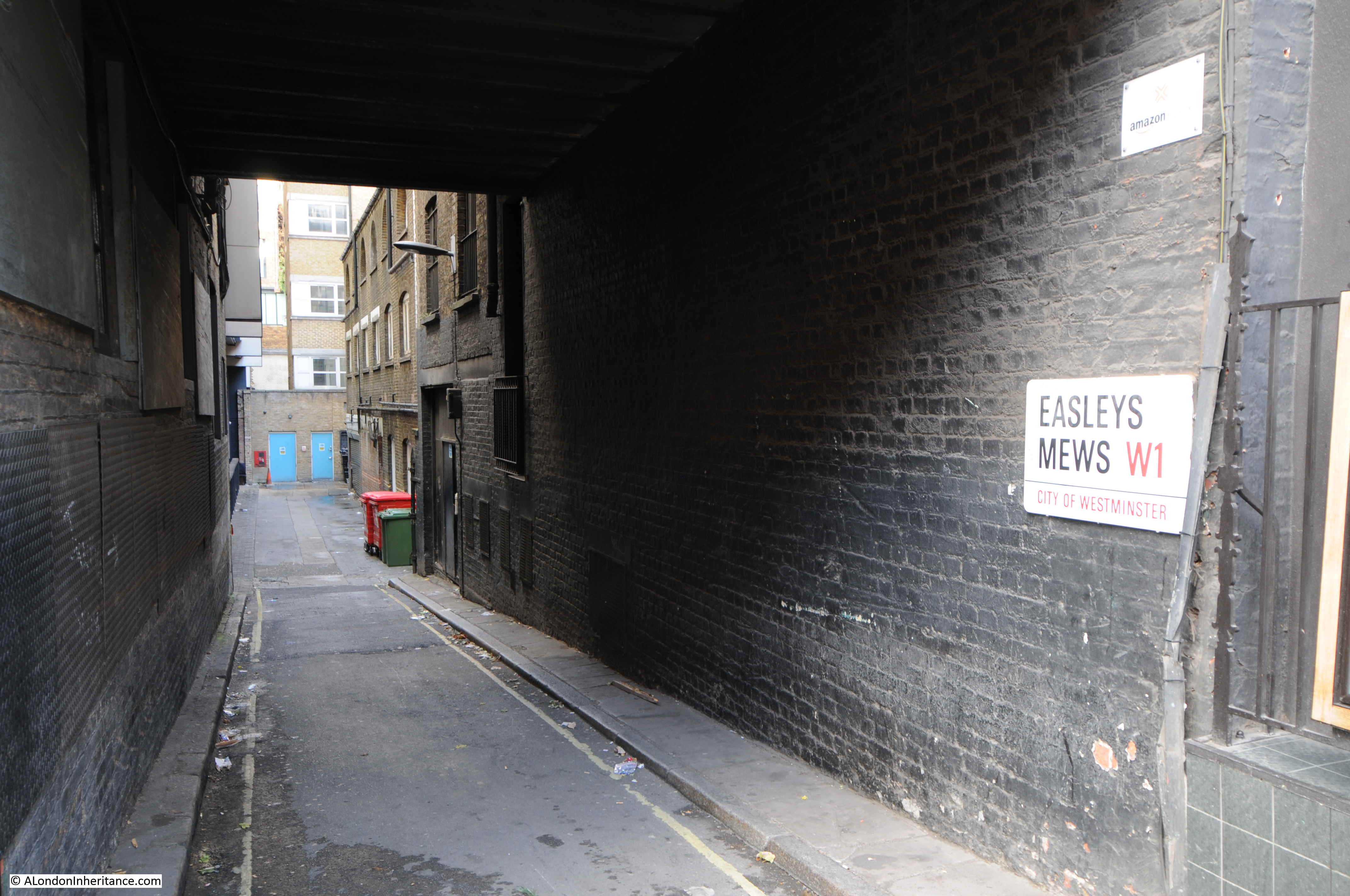
Although the 18th century onward developments follow a grid pattern, there are still many, small side street, alleys and mews. These provide access to the central core of the buildings within the square of the grid. The pub directly opposite Marylebone Lane is the Cock and Lion and the entrance to Easleys Mews takes up part of the ground floor space of the pub.
In the 18th century, the area was very different. The following print from 1759 is titled “View of Marylebone from Wigmore Row”
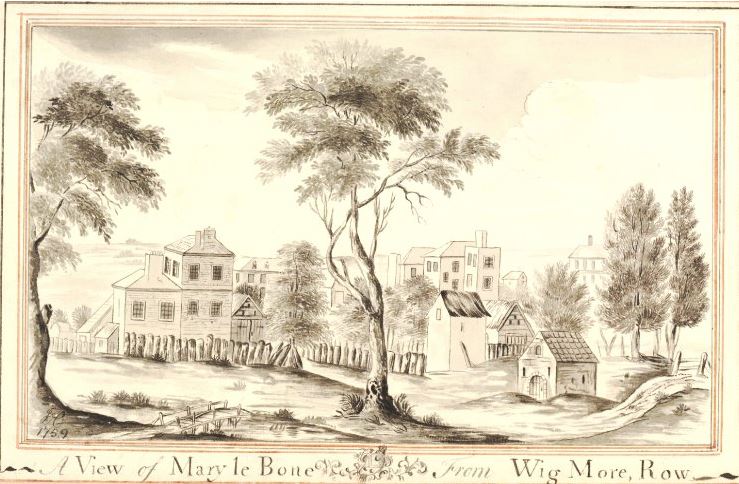
One of the City Conduits that stood near Marylebone Lane is shown in the print. In the large field north of Wigmore Row in the 1746 map there is a small black dot labelled conduit.
Crossing over Wigmore Street, we continue along Marylebone Lane and the curved nature of the street is apparent.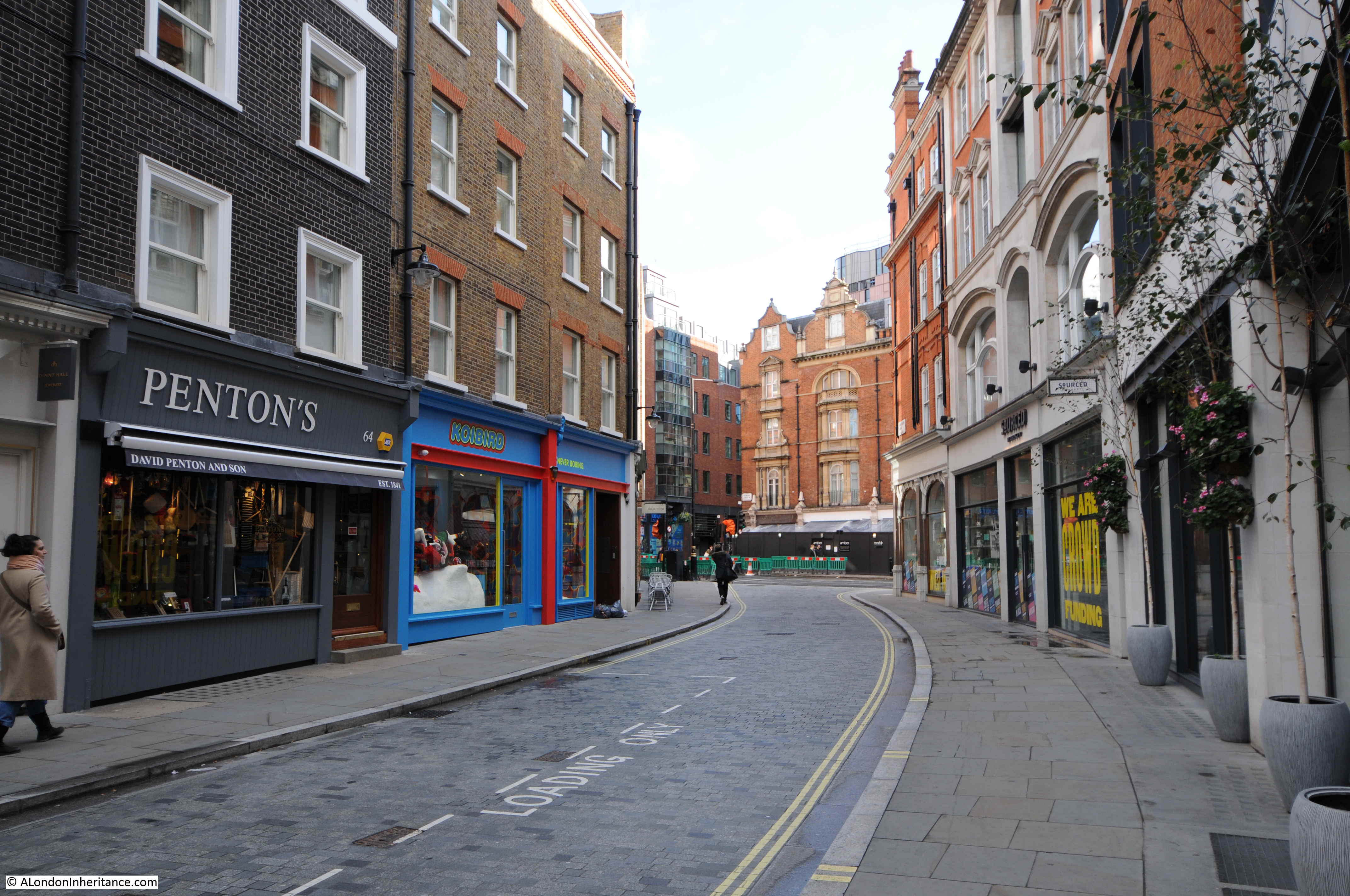
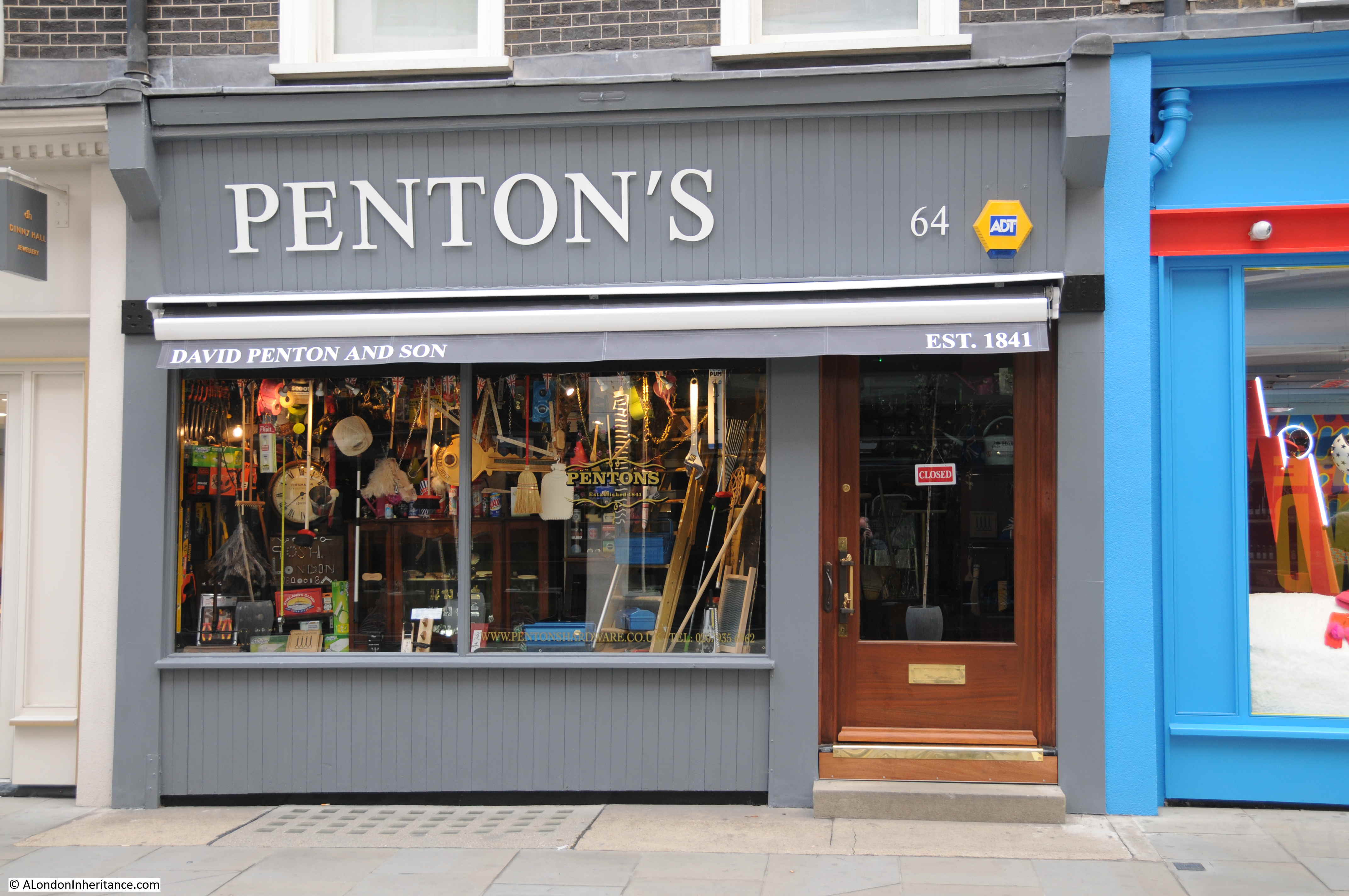
Marylebone Lane retains a number of one off shops, including the hardware store Penton’s which claims to be the oldest store on Marylebone Lane having been established in 1841.
At number 35 is Paul Rothe & Son. If you look to the left of the shop there are several pages of information which tell the fascinating story of the shop.
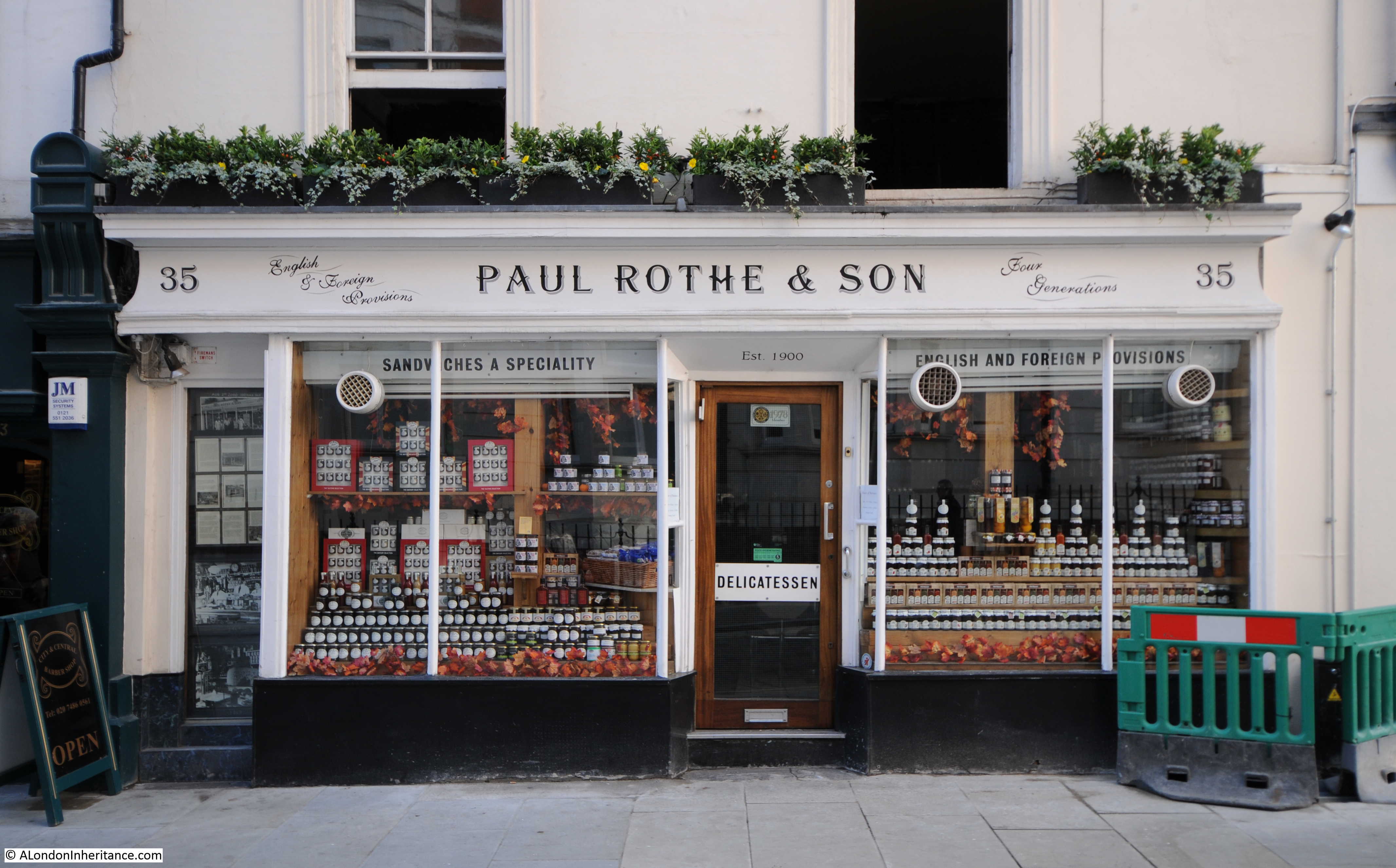
Paul Rothe was a German who worked his way to London in 1899 and opened a delicatessen on Marylebone Lane in 1900. The store has been in the same family ever since.
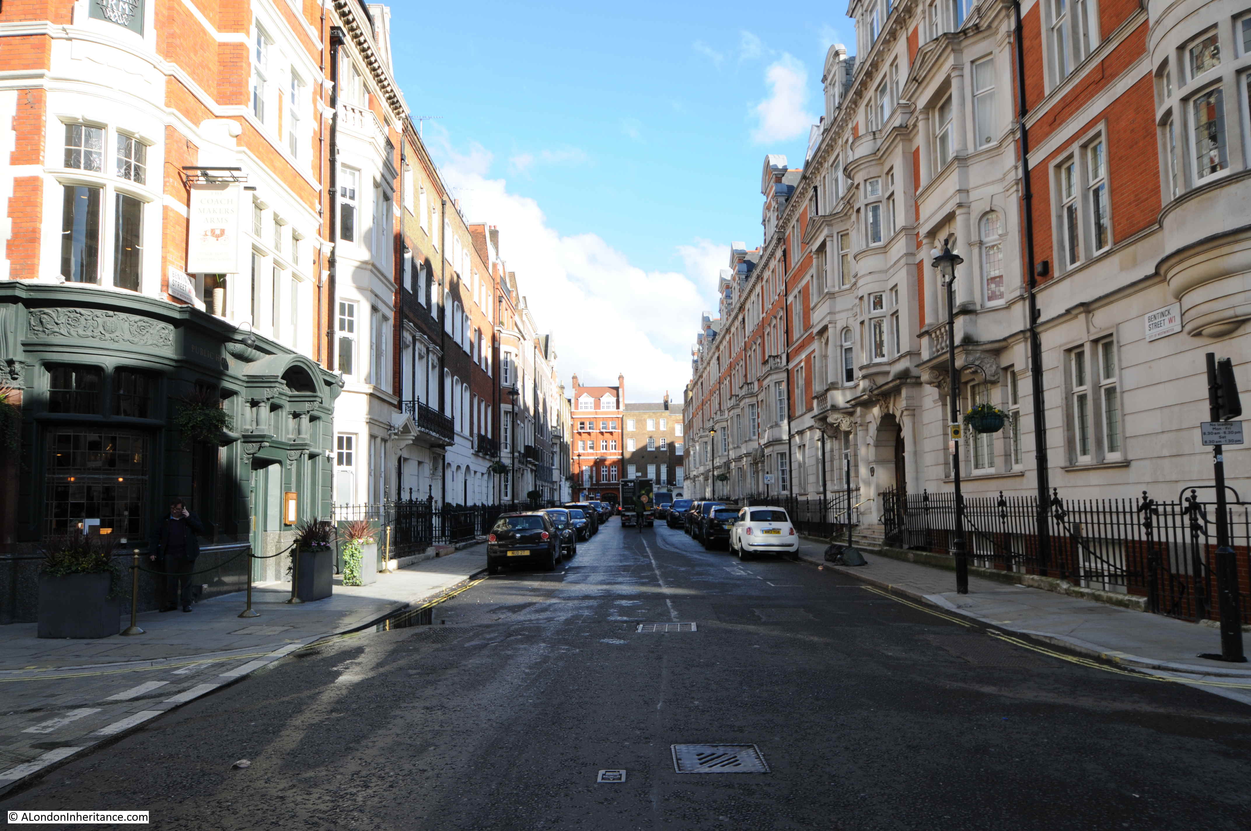
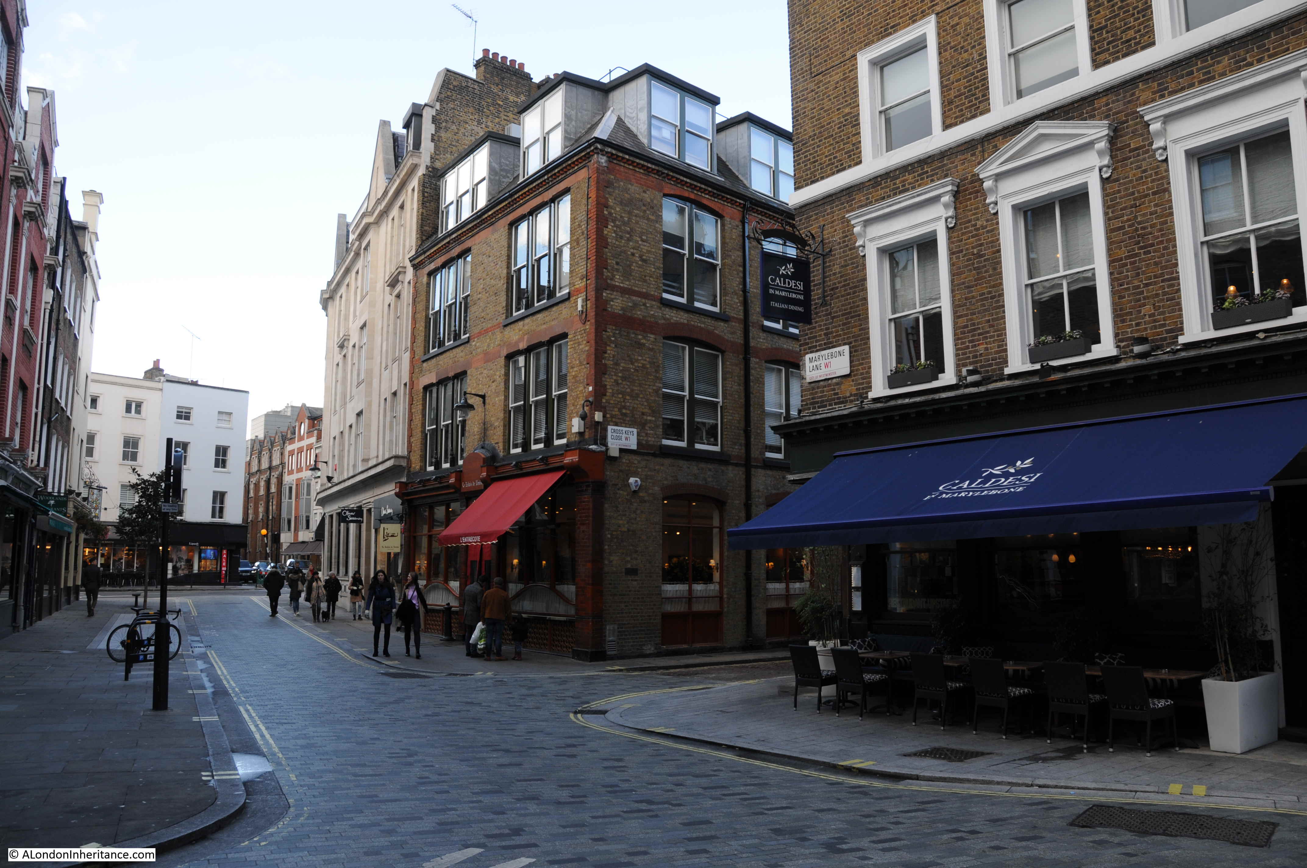
We now come to the junction with Bentinck Street, another of the wide streets that cut east – west across the old lane. The slightly curving Marylebone Lane can be seen directly across the street.
On the corner of Bentinck Street and Marylebone Lane is the Coach Makers Arms.
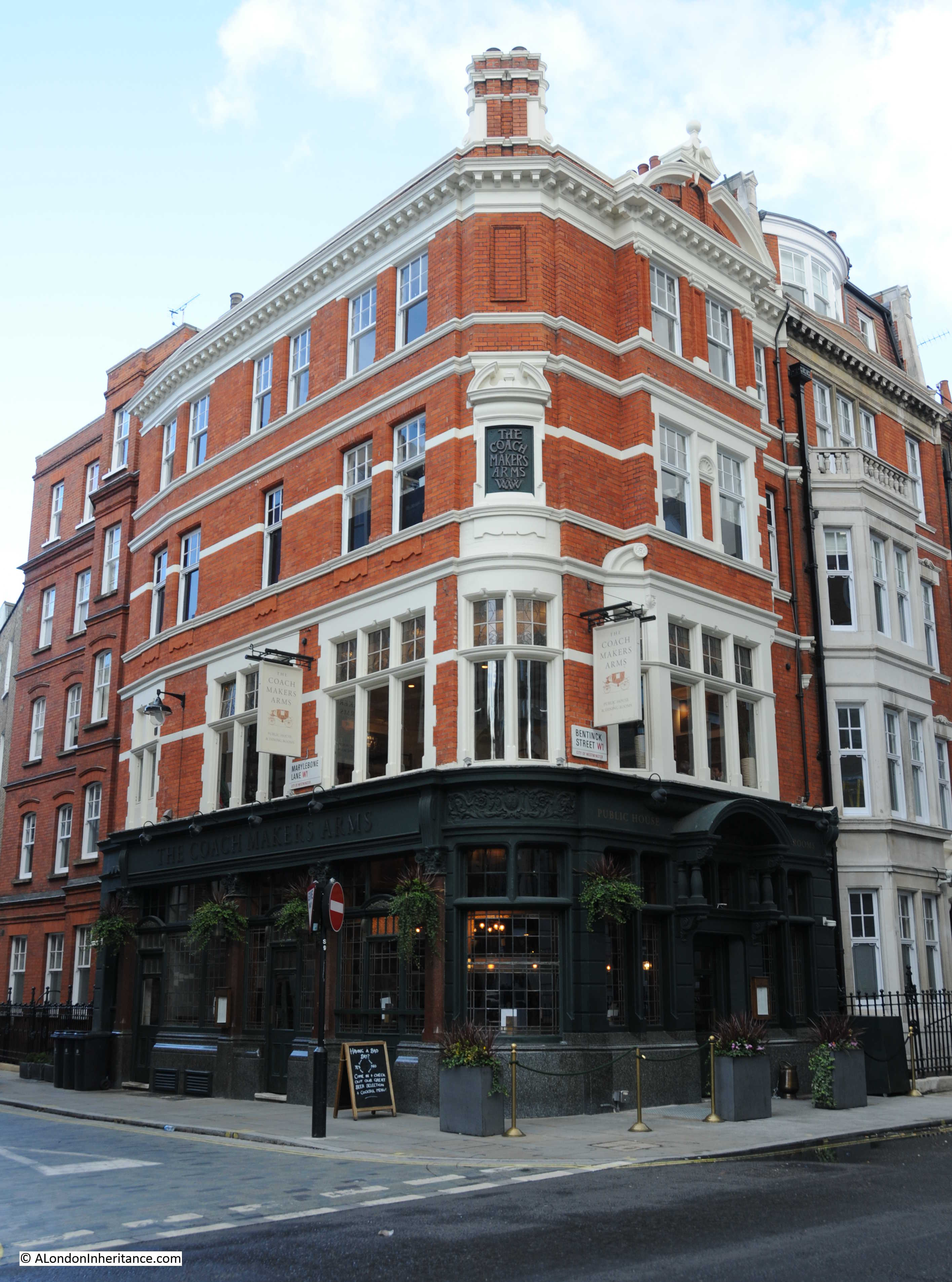
The current building dates from the early 1900s, however there has been a pub on the site since the 18th century. The pub has been through a couple of name changes (the O’Conor Don and the Conduit of Tybourne) but has returned to the original name for the pub.
Looking east along Bentinck Street, again showing the straight streets that make up the grid layout of this area of Marylebone.
Bentick Street ends at the junction with Marylebone Lane and continues on as Hinde Street. These name changes in otherwise straight streets shows how Marylebone Lane acted as a boundary as estates developed in the area with separate estates to the east and west of the lane.
As we cross over Bentinck Street / Hinde Street, the Hinde Street Methodist Church can be seen to the left.
The first Methodist Chapel was built on the site in 1810 and the current building dates from 1887.
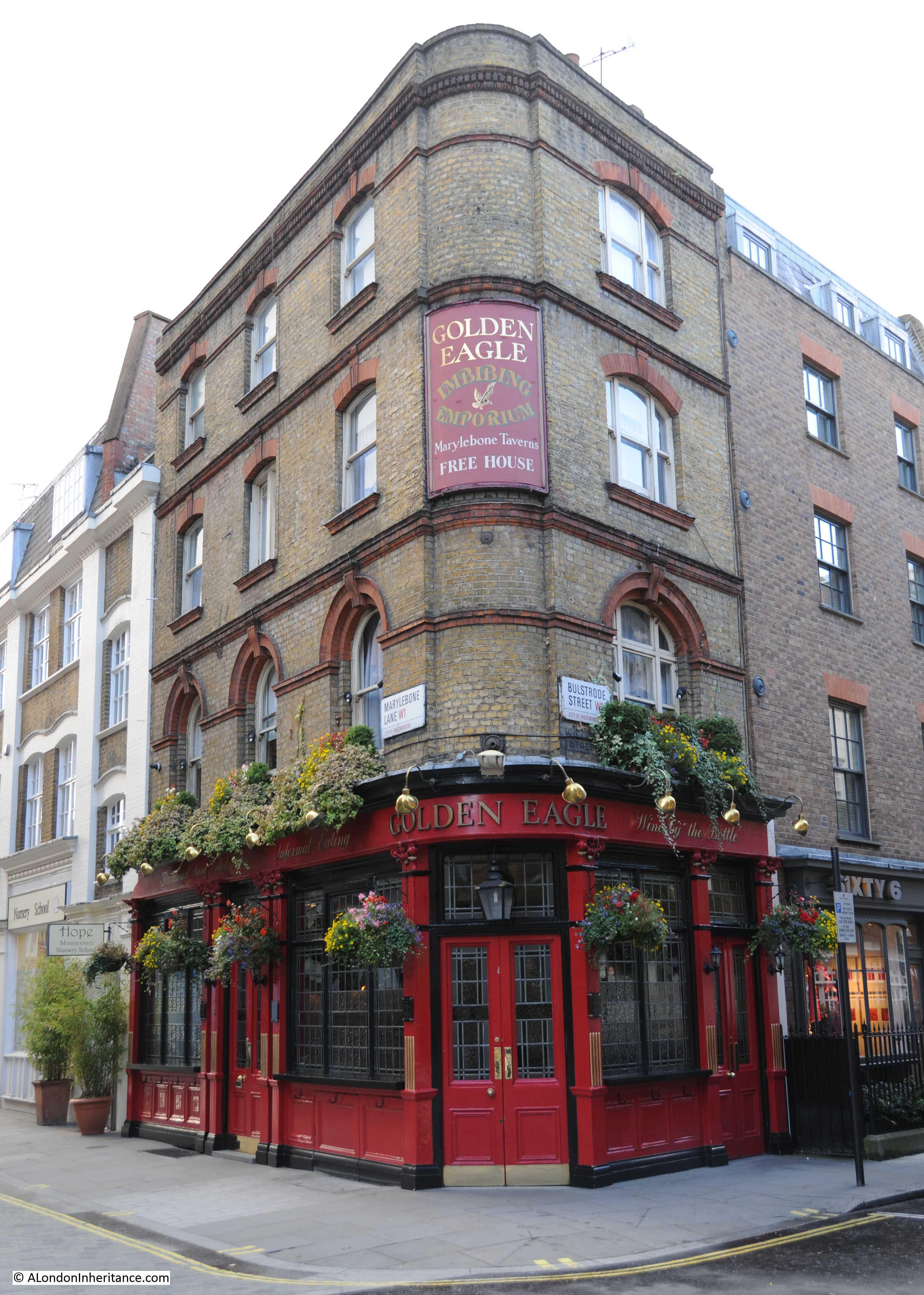
Continuing along Marylebone Lane, the next junction is with Bulstrode Street and on the corner is another 19th century pub, the Golden Eagle, described on the corner sign as an “Imbibing Emporium”.
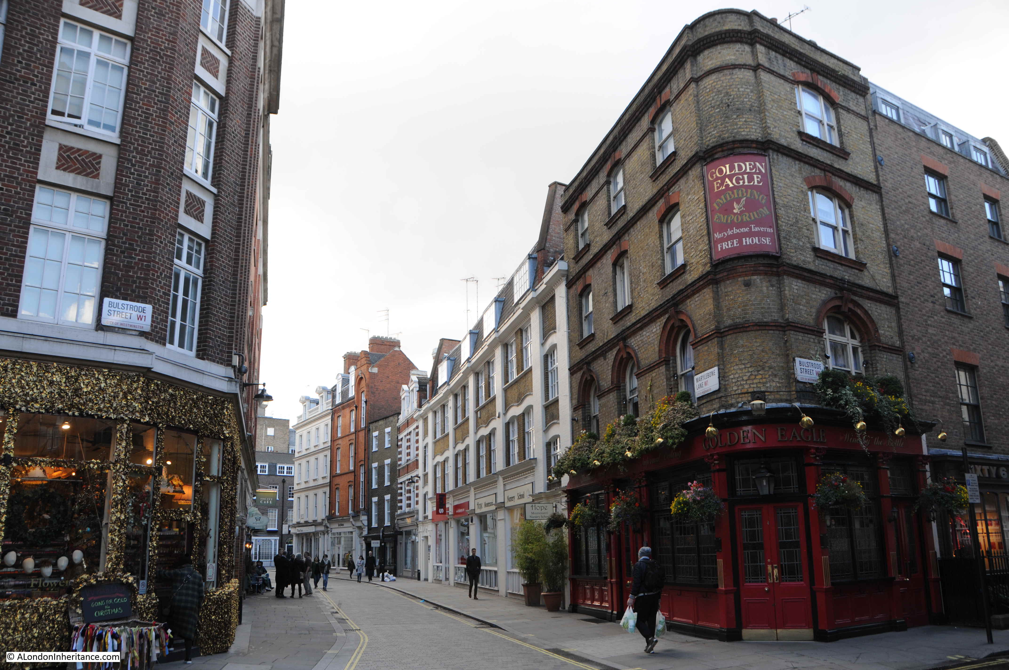
Unlike the Coach Makers Arms, the Golden Eagle retains the feel of a local London pub. Lacking the expensive refurbishment and decor, the pub is the perfect stop for a “local” drink and has a wonderful atmosphere.
The pub provides more evidence of how Marylebone Lane acted as a boundary as the area developed. Just below the Bulstrode Street sign, there is a painted sign on the brickwork stating that the name was “Late William Street”.
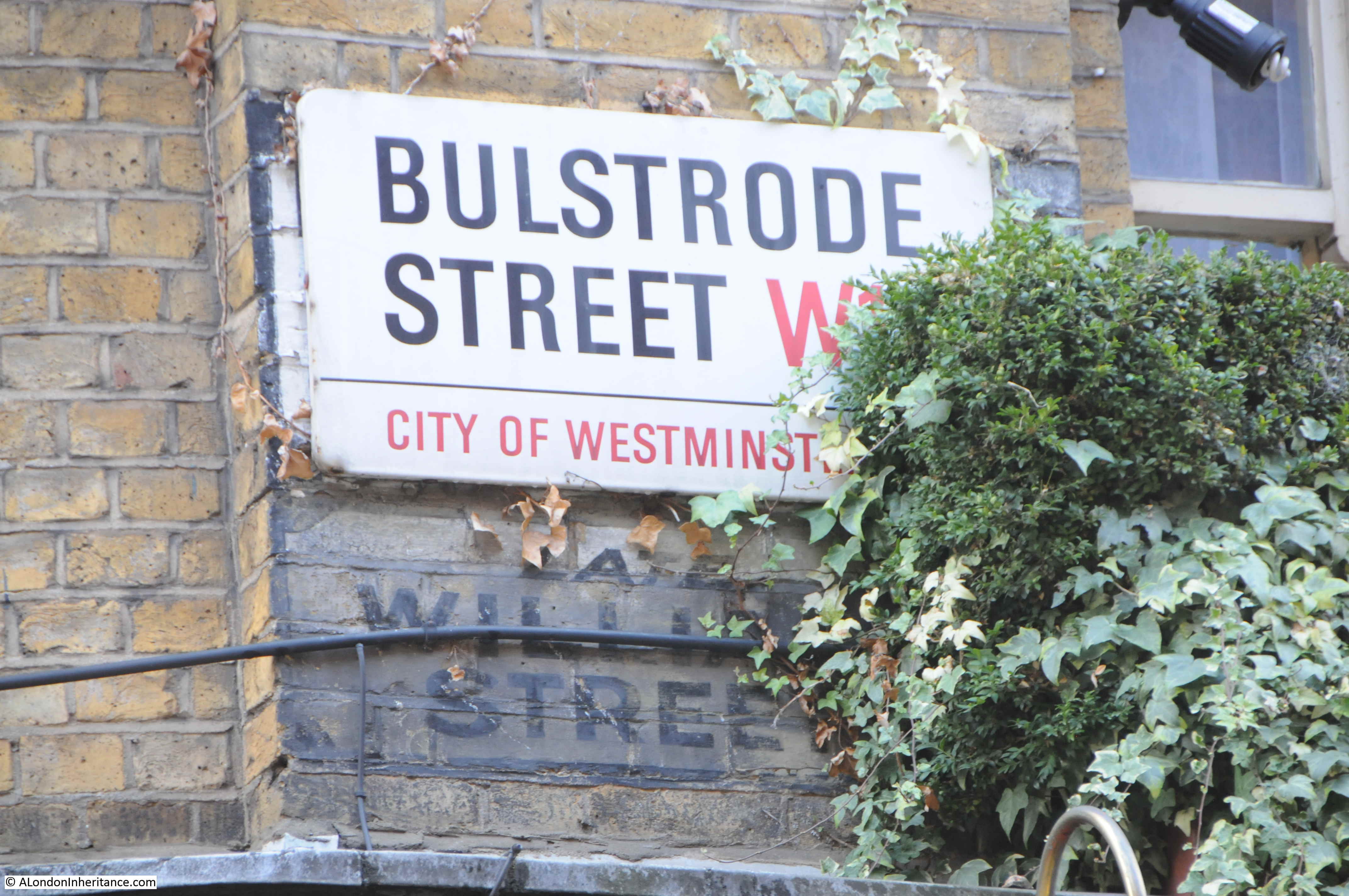
Although today, Bulstrode Street is the name of the full length of the street that cuts across Marylebone Lane, originally, Bulstrode Street was the name of the street up to the Marylebone Lane junction. From then on, the street continued as William Street.
It is fascinating to see how this ancient lane provided a boundary as the estates developed from the mid 18th century onward and these boundaries can still be seen, reflected in the street names we see today.
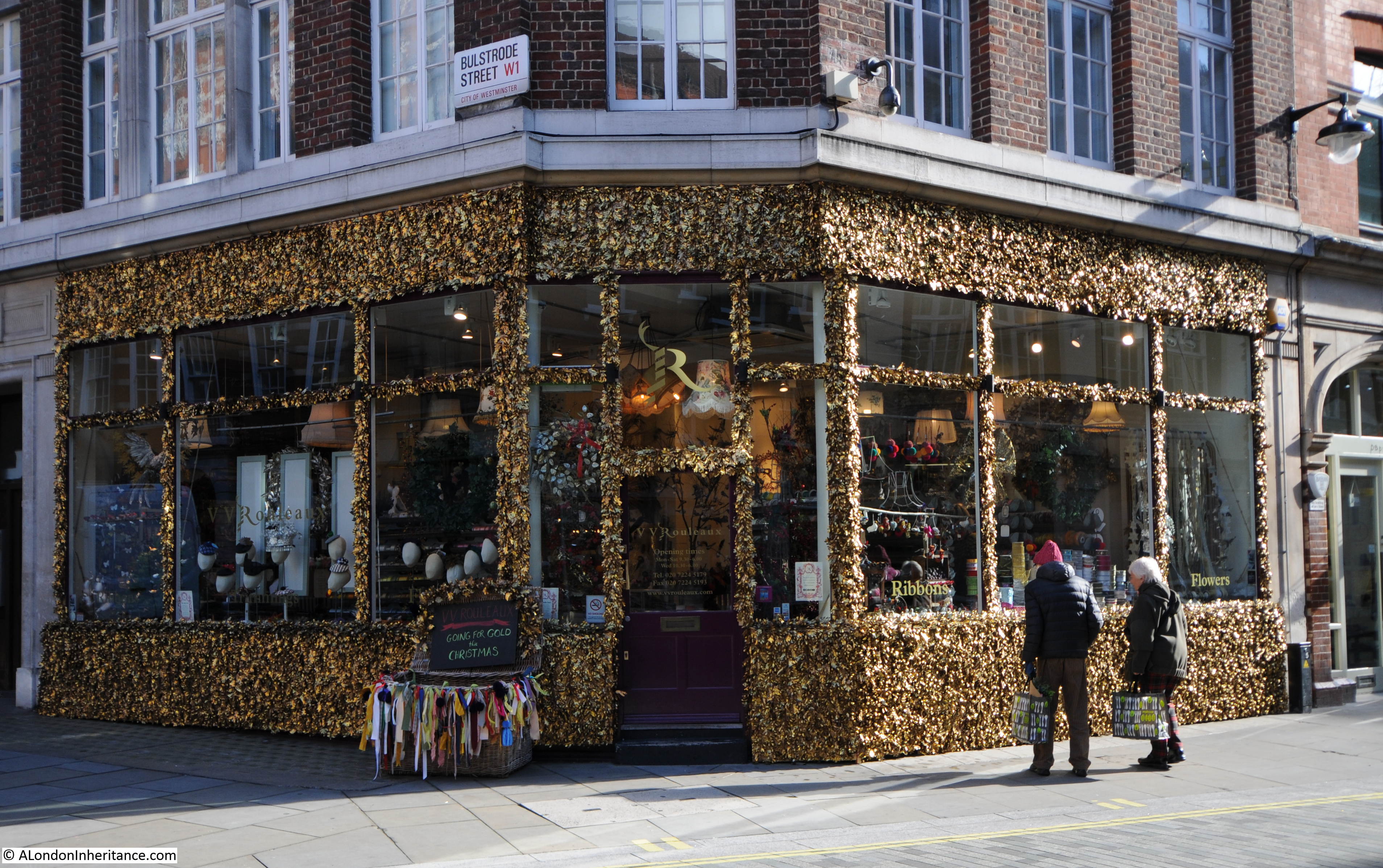
Opposite the Golden Eagle is the haberdashery shop of V V Rouleaux. brilliantly decorated to reflect the colour of the goods for sale inside the shop.
Crossing over Bulstrode Street takes us into the final section of what remains of Marylebone Lane. There is a new building on the north eastern corner of the junction which has an interesting stained glass art work that records another feature of the area.
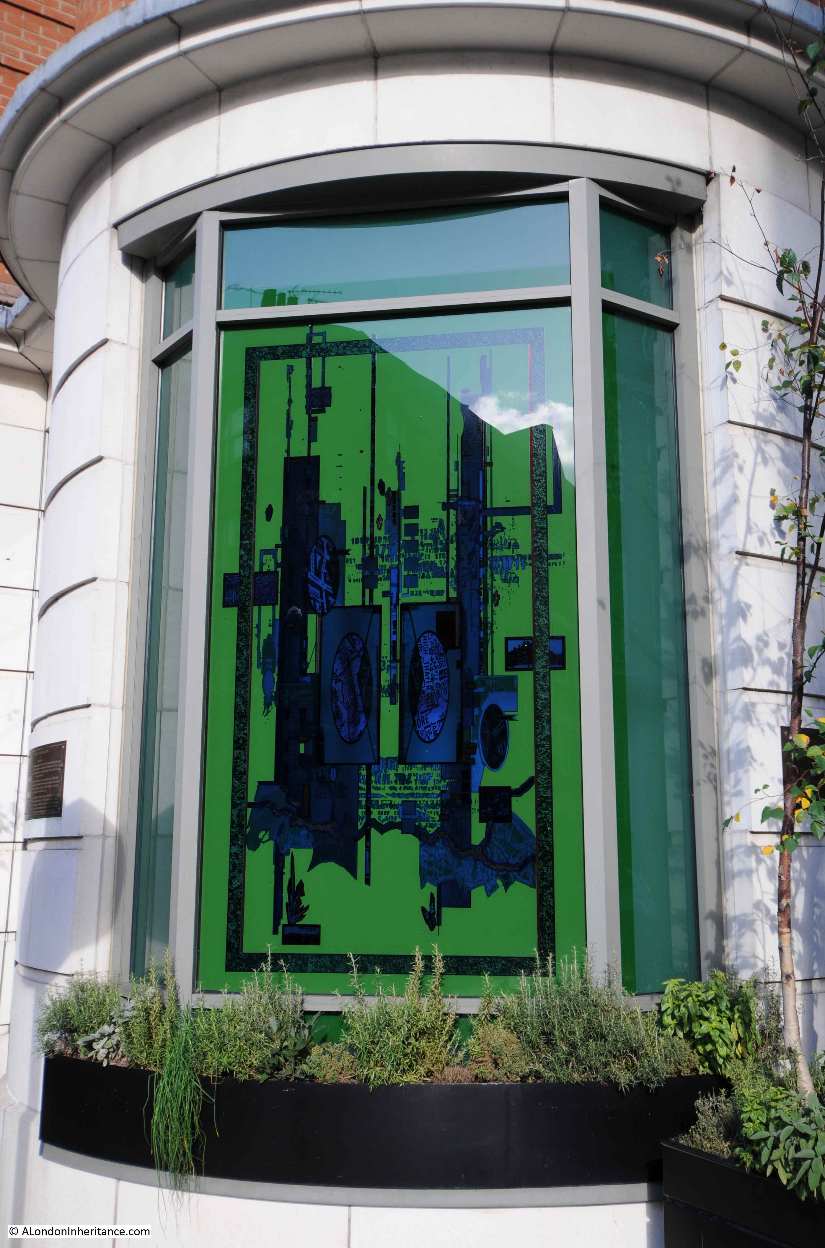
A plaque alongside the window provides these details:
“Light in the Darkness 2000 by Julian Stocks. This stained glass window celebrates the River Tyburn that flows beneath Marylebone Lane….it takes the form of a lantern which, when illuminated will act as a beacon. During the 18th century the River Tyburn was an open stream that ran from the hills of Hampstead Hearth down to the River Thames. Marylebone Lane follows the banks of the river, the course of which has since been culverted, but still maintains a presence most noticeable in it’s serpentine form.”
The Tyburn is possibly one of the reasons for the route of Marylebone Lane, if the lane did follow the bank of the river. Nicholas Barton in his book “The Lost Rivers of London” (1960), provides the following background:
“Marylebone Lane was originally on the left bank of the stream, and its winding line indicates the course of this part of the steam”. The book includes a photo from 1957 showing a muddy stream at the bottom of some sewer excavations in Marylebone Lane. Whilst it would be hard to prove that this was the Tyburn, it does show that there is running water beneath the ground.
Continuing on from the junction with Bulstrode Street, we now reach the point in Rocque’s 1746 map where Marylebone Lane makes a sharp left turn at the junction with another street that runs in from the east. The same turn to the left can be seen today.
A road still joins from the east, although today this street (Bulstrode Place) is a short street terminated by buildings with no exit.
This is the view looking west at the turning point with the last short run of Marylebone Lane before it meets with Thayer Street, the street marked on the Rocque map as St. Mary Le Bone which ended here rather than continuing on down to Hinde Street, as Thayer Street does today.
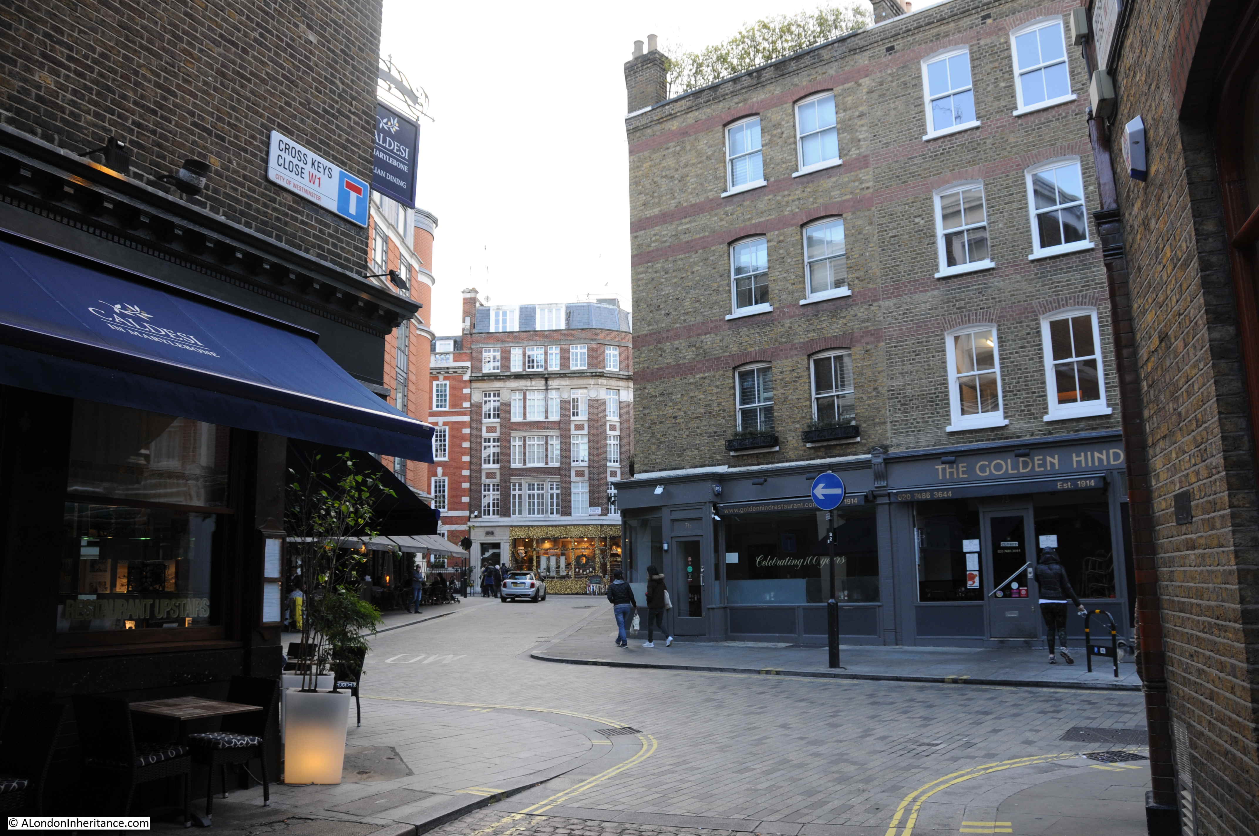
At this corner, Cross Keys Close, one of the many little mews and dead end streets that lead from Marylebone Lane, can be found. Cross Keys Close was developed in the 1760s. These little side streets provide access to the centre of the blocks built within the grid pattern of streets.
The view from within Cross Keys Close, looking down Marylebone Lane.
And at the end of Marylebone Lane is Thayer Street. This is the view looking back into Marylebone Lane. On the right is the pub, Angel in the Fields.
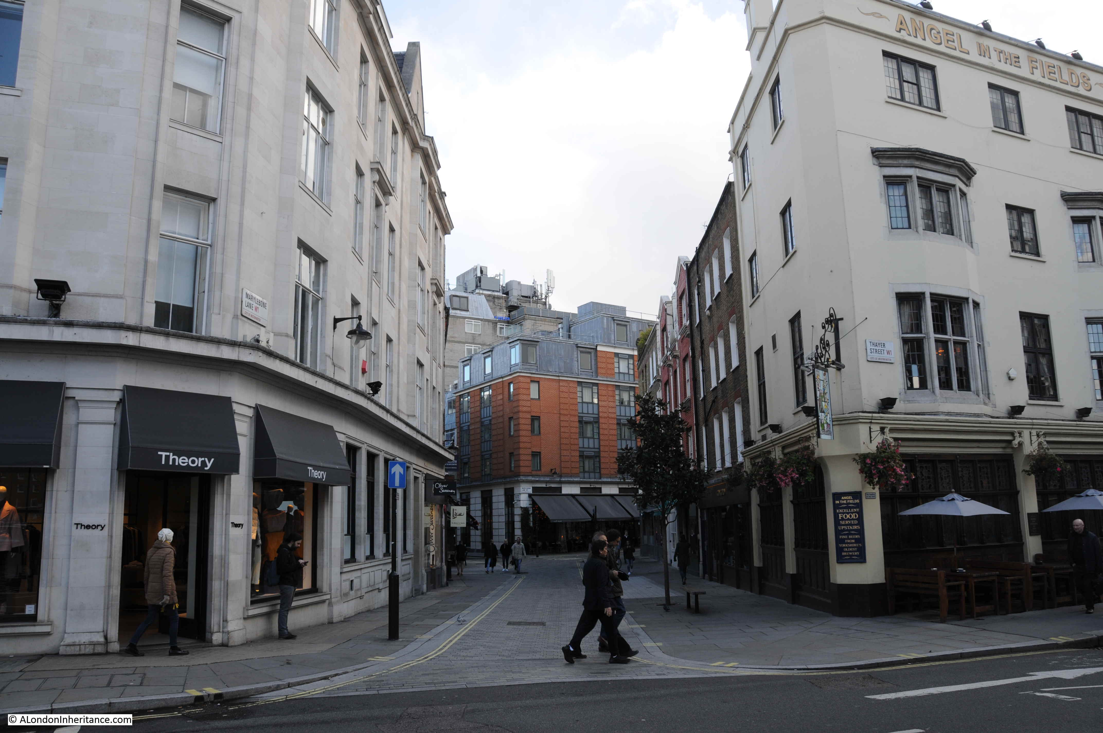
This pub can be found on the 1746 map. Where Marylebone Lane turns left and meets the road marked as St. Mary Le Bone, at the junction there are a number of buildings. The lower right building within a small patch of land with trees edging the boundary, is the Angel pub. The pub was first recorded in 1720, and was rebuilt in 1770 as the area was being developed.
The “in the Fields” addition is from the refurbishment of the pub in 2001.
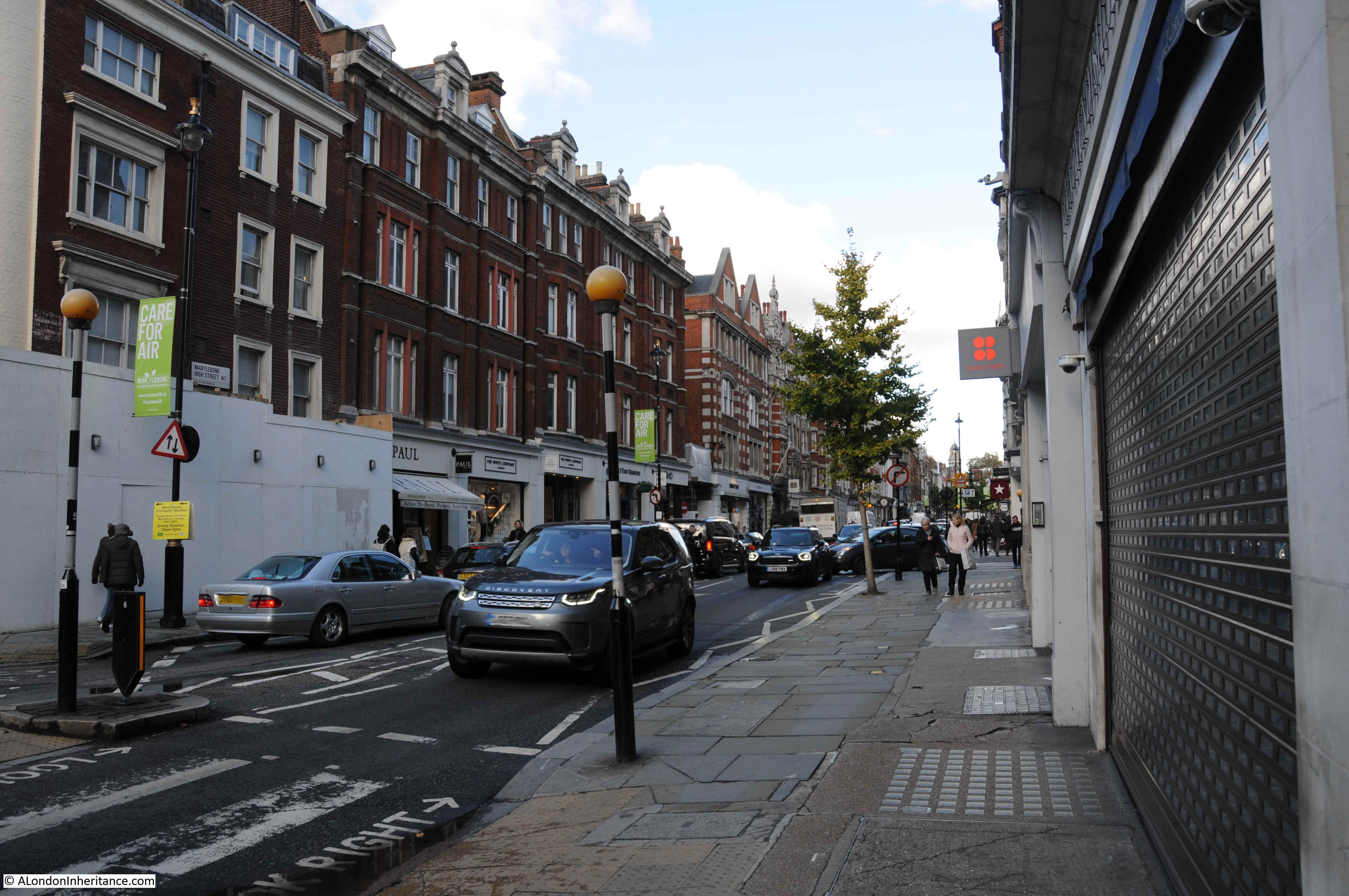
This is the view north from the junction with Thayer Street where it becomes Marylebone High Street. Another example of the straight streets that contrast with the narrow, winding nature of Marylebone Lane.
John Rocque’s map provides a glimpse of this part of London, when fields, streams and ponds still cover the land. The future for the area can be seen in the lower right of Rocque’s map as the grid of streets and buildings continues London’s northward expansion.
Walking Marylebone Lane is to walk a street that existed long before the buildings that now dominate the view. The street also acted as a boundary between the estates and developments on either side. evidence of which can still be seen in the way that the names change of the long, wide streets as they cross this narrow lane.
Having walked the lane, rather than return to the crowds of Oxford Street, the best option was to continue an almost 300 year tradition, and stop for a drink in the Angel.
A lovely post.
My favourite word is “palimpsest”, and this truly can be applied to Marylebone Lane. A trace of the former street pattern faintly showing through the modern.
I read this avidly, and see Marylebone Lane as a relaxing walk, imagining the Tyburn flowing somewhere beneath the ground. The Eagle also sounds promising. Wonderful.
The Lost Ricers of London, by Nicholas Barton? Sounds fascinating
Either way, a great read for a Sunday morning. Thank you.
Thanks for spotting that – no matter how many times I read through before publishing, some errors always seem to get missed
Im keeping this for a good walk one day thank you
Thank you again for another fascinating post that reveals much about an area I discovered when I used to commute between Euston and Marble Arch on foot… I used to make this detour sometimes just for variety. But your post adds quite a lot to what I had missed. Many thanks
Mike
I am interested in this area of London due to my ancestry and found your walk fascinating. The old established shops look so interesting to visit especially the hardware store and the haberdashery which no longer seem to exist where I now live in somerset. There is something about these old streets of London that can not be found elsewhere. Thank you for such an interesting walk. I do wish I could visit the area but alas am not well enough to do so, so thank you for walking it for me and providing such detail .
Fascinating. I’m wondering who the estate owners were. Probably I could figure it out from the names of the streets, but I’m not much good at researching.
At this juncture, Marylebone Lane marks the boundary between the Portman Estate to the east & the Portland Estate to the west (the latter became the Howard de Walden Estate in 1879 when the 5th Duke of Portland died without issue & the land passed to his sister, Lucy Joan Bentinck, wife of the 6th Baron Howard de Walden).
Thank you so much for this account, a lot of fascinating information and photographs to match. Too much to absorb at first reading, I will return to it!
There is undoubtedly water under Marylebone Lane. In the 80s used to work in a publishing business on the West side of the Lane just South of the Golden Eagle. The lift broke down several times a year and the engineers used to say it was caused by water seeping through from old Tyburn Brook.
Londoners of a certain age may have a permanent trigger to the word “Welbeck”. In 1961 a fleet of red-painted Renault Dauphines could be seen on London’s streets competing with the black-cab taxi service, with HQ on Welbeck Street. Was the hire rate one shilling per mile? Can’t remember that bit.
It all got rather heated and ended in gnashing of teeth. The Welbeck Cabs service lost the minicabs war despite plenty of free publicity from TV news and evening newspaper reports. Those letterbox-red Renaults did at least provide an opportunity for us junior car spotters for one year.
I’ve read elsewhere that north of Oxford Street the river wasn’t called the Tyburn because it was beyond the northern border of the Manor of Eia through which it flowed before reaching the Thames; Tyburn being a contraction of “The Eia Bourne”. Well, even if not true it’s a pleasant idea.
Thanks for this enjoyable and soothing trip along Memory/Marylebone Lane.
Splendid timing. Thank you. I returned home last night from a last-minute business trip that took me back to London this past week for the first time in a year. I stay in Marylebone; the High Street and curving Lane comprise my favorite part of town. I never tire of walking along them. I make it a point when I exit Bond Street tube station to go north on the Lane to see the marvelous Wellbeck Car Park. Day or night it’s a lovely sight. I’m so glad you included it here, and sad that it is apparently slated for removal.
I was able to spend two days on either side of meetings walking through town. I’d planned walks long ago revisiting Wapping/Limehouse and then Rotherhithe/Bermondsey Wall, and was able to take both on this trip, as well as one through Surrey Docks, which I’d not visited before. Your two preceding posts on the Angel Pub and the Bermondsey Wall area, as well as those form the archives on Wapping High Street, enhanced my experience substantially. In fact, I rearranged my walk through Wapping to commence from St. Katherine’s Dock, as yours did, rather than Limehouse, and was glad of it. I was fortunate to visit Wapping and Rotherhithe at low tide and made a point to walk down to the foreshore from the various stairs in Wapping and also those adjacent to the Angel. The algae- and mud-covered steps are treacherous indeed!
I failed to notice Rouleaux’s haberdashery adorned as it apparently is this time of year. I’ve noticed it on previous visits but recall that it usually has a plain frontage. Does anyone know if this decoration is recent or something different for the holidays? Am sorry I missed that but thanks for including a photo. I believe I passed by it while walking down Bulstrode from Regent Street on Thursday evening, quite hungry and cold, and intent on some steamed fish at the Golden Hind, which is a favorite, after a long day of walking.
Thanks again.
I can only repeat what others have wrote “FASCINATING” a great read and so informative it is like being there and walking with you.
Thank you
David
Hi,
As ever.. and I’ve been a long term recipient of the excellent A London Inheritnce, I look forward to each edition with great interest, no least that it confirms my interest in London’s Social, Architectual,Geographical and even Geological History. Marylebone lane being amongst my own favourite locations. There are therefore one or two additions I’d like to made to the content covered in the most recent article, my first is to identify at least two points on Marylebone lane, where you can actually hear the River Tyburn or it’s tributory conduit running beneath the street level at either end of the Lane, ofcourse best that this is to be auditioned on the very quietest of days. Secondly, you may have noticed a number of culinary sites at the top of the lane nearest to Marylebone High Street, two very high quality restaurants and the home of one of the worlds finest Cordon Bleu Cookery Schools, but most of all I would like to draw your readers attention to one of the most excellent and unique shops in all London, a noted omission in your survey of Marylebone Lane, it is The Queen of Buttons at Number 76 , but that exhibits all over london at Fairs and Markets. You sincerely don’t have to be a Tailor or Dressmaker, to be truly inspired by this wonderful and diverse enterprise. If Charles Dickens himself we’re alive I’m certain he would have waxed exceedingly lyrically over this delightful store, that is ‘big in the world of buttons’, even exceeding his Old Curiosity Shop and if you haven’t already been there it is a must to be visited, I provide the website link below. Finally also as an owner of the excellent ‘The Lost Rivers of London’ by Nicholas Barton, I furthermore recommend this enjoyable read very highly, the book includes ofcourse a rare photograph of the Blitz damaged River Westbourne’s main Conduit severely damaged above Sloane Square Tube Station, that prior to replacement did such great damage to The District Line in the latter years of World War Two.
http://www.thebuttonqueen.co.uk
Best Regards,
Jeremy
Marylebone Lane is a bit of memory lane for me. I used to live in Marylebone Street in the late 70’s and my regular route home from the Tube was up St Christopher’s Place, across Wigmore Street and up the Lane. I loved it and used to pass the Eagle in the evening and hear the pub piano being played for a singalong. I had completely forgotten the lovely deli until I saw the photo today. Back then, beneath the car park there was a rather good Italian restaurant and a fine Italian disco called Cinecitta. Many evenings spent there on the multicoloured dance floor, drinking cappuccinos as we grooved. If I am in the area, I always stop and take a look.
That’s wonderful. An Italian restaurant and disco underneath the car park?! I wish I’d known that this past week as I walked past it several times. Thanks for sharing this and your memory of the Eagle.
The disco underneath the car park was called Cinecitta, it was a great place to amuse yourself in the late eighties. Great music, ambience and habitues. Billy boy you should have known it in its glory days.
I remember Cincecitta, we used to go there after work. I think it was buffet service, and you could sit in train carriages inside.
You’re right Fiona. There was a buffet (mainly italian dishes) and coffee was superb. Yeap train carriages for sitting
Glad that you enjoyed this classy place as well.
Happy black weekend!
Max
Oh yes!
I was one of the DJs! Fabulous place and great fun.
Back in 1988 while I was studying English in London, I used to frequent Cinecitta Disco too. There was a great ambience: Sabrina was in a good mood with the boys, Rick Astley was never gonna give you up, neither do I in my mid-twenties. Such good memories indeed, who knows, maybe we share its dance floor at Saturday night.
I hit this page by chance since I wonder if I could find the place again and finally made it, 74 Welbeck Street corner of Marylebone behind Debenhams.
Cinecitta used to be a self-serve Italian restaurant with various ‘sets’ to sit in to eat. My Father used to take me there in the 70s for lunch and we sat in a booth on the train. Hard as you get older and London changes beyond recognition
Hello, I apologize for the intrusion. I am Italian and live in Venice. Towards the end of the 1970s, I worked in that disco, which I have beautiful memories of. I was 20 years old and had left home. I returned to London about ten years ago, but I couldn’t find the place. Perhaps it has been demolished? Thank you if you have an answer, and if you can point me to where I can find some photos from that time. I apologize for my English; I’m using a translator. Unfortunately, I never learned the language well.
Unfortunately, the car park was demolished in late 2019 to make way for a new hotel. You may look on Google street view at the intersection of Welbeck Street & Henrietta Place just north of Oxford Street immediately behind Debenhams. Click on “See more dates” in the upper left-hand corner box and you’ll see various former snapshots appear along the bottom. Click on the “>” arrow at far left of these snapshots and you can scroll all the way back to 2008. Oct. 2019 is the final view of the garage before it was wrapped for demolition.
Various online resources contain photos. Here’s merely one of them:
https://architectuul.com/architecture/welbeck-street-car-park
In case my English isn’t clear to you, these are the GPS coordinates you can use on Google Maps:
51.5153247, -0.1487966
Thank you for the kind response. I am saddened to learn that the stable no longer exists, but fortunately, memories remain and cannot be torn down and replaced. I hope to return to London once again, as it has remained my favorite city after Venice 🙂
Lorenzo Cecchinato
I just love these posts. One of my most favourite things in the world to do is to explore London with a fine tooth comb and these posts, with their detailed back stories and excellently researched histories, are just fantastic. Thank you so much. Such a worthy project. I shall look forward to walking Marylebone Lane myself as soon as possible.
I was interested to read your favourable comments with regard to the Welbeck Street Car Park. During the late 1960’s I was working as a draughtsman for the structural engineers appointed for this building and was fortunate to be given the task of producing the engineering drawings. The shape of the external precast units and their fixing details generated considerable interest within the office at the time.
It is a shame that the building, being a multi-storey car park and hidden in a back-street, has gone pretty much unnoticed until the threat of demolition.
The old Marylebone Lane Police Station stood on the eastern side of the Lane and just to the north of the back of the Welbeck Street car park. That car park was also used (officially) by the officers based at the Station as there was no other available parking on street or otherwise. Martlebone Lane Police Station was demolished in the mid to late 1970s and a new “nick” was built, called simply Marylebone Police Station; I think it stood on George Street quite close to Seymour Place.
Thank you for jogging my memories of my early working days in central London, days when police officers still patrolled on foot and knew shopkeepers and locals by name, when panda cars had just been introduced and police radios were still a novelty.
I was interested to learn that the street name of Bentinck came from Lucy Bentinck, wife of Howard de Walden. A Count William Bentinck came over from Holland with William of Orange, and the names Welbeck and Bulstrode come from parts of his estates. I believe one of his descendents is Tim Bentinck, who plays David in the Archers!
Surely the name Wellbeck is another indication of water? Would there have a tributary of the Tyburn?
I loved Cinecitta restaurant and used to go there for lunch when I was working on South Molton Street in the 70s, but I couldn’t remember exactly where it was located. Thank you. It was self-service and you could sit in different film ‘sets’ to eat. They did wonderful profiteroles.
It’s only today that I’ve come across this site – and memories came flooding back. I was born and brought up in St Christopher’s Buildings, and went to St Marylebone Primary School. I walked Marylebone Lane to go to School; went into Roth’s on Sundays ( it was the only way to but anything on Sundays then); my father drank in the Golden Eagle – only beer then because it had only an ale licence.
What a wonderful blog.
Hear! Hear! Jan Jeffries. My Sunday can’t begin till I’ve feasted on this week’s journey back in time.
You’re right Fiona. There was a buffet (mainly italian dishes) and expresso coffee was superb. Yeap train carriages for sitting; so glad that you enjoyed this classy place as well.
Happy black weekend!
Max