
On a Sunday morning in June 1949, my father photographed a solitary man walking along the middle of Thomas More Street. This is a street in the middle of the London Docks, as can be seen by the surrounding warehouses.
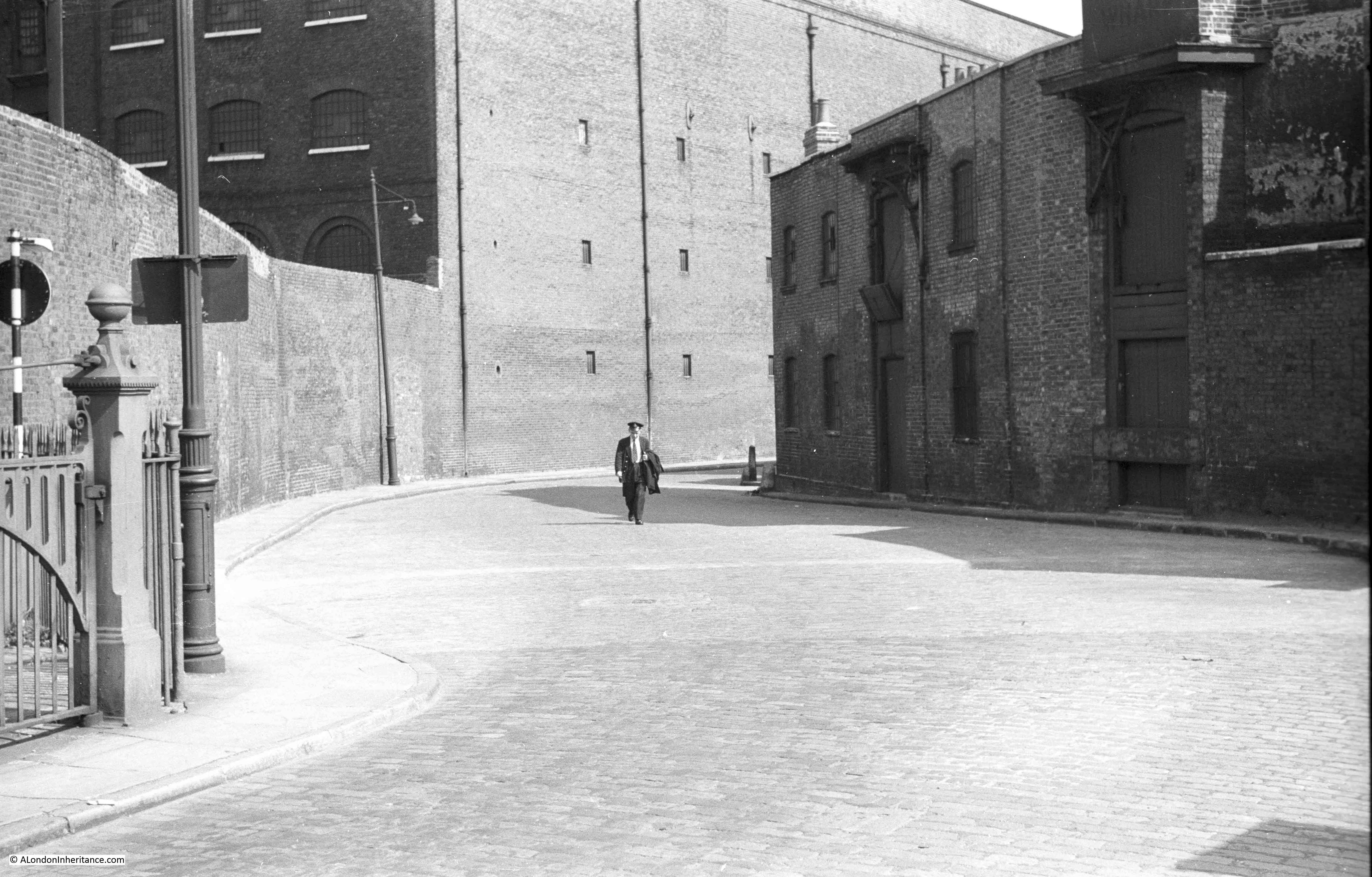
Fortunately, this photo is one of those that my father labelled, as without that guidance I would not have been able to find the location as there are no features to identify the exact street.
The man is in uniform. I have looked at the original high definition scan of the negative, but cannot see any details that would indicate his job. He is walking towards the river, he may be about to start work, or possibly walking home after ending a night shift.
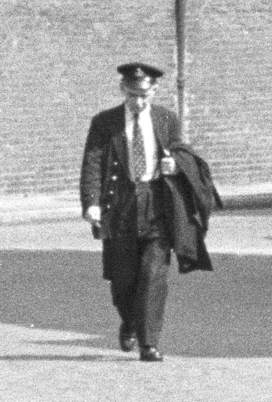
The badge on the hat would almost certainly indicate his role, but it is to indistinct on a 70 year old film negative.
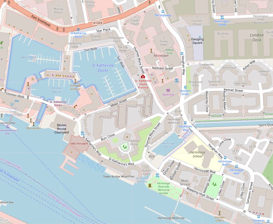
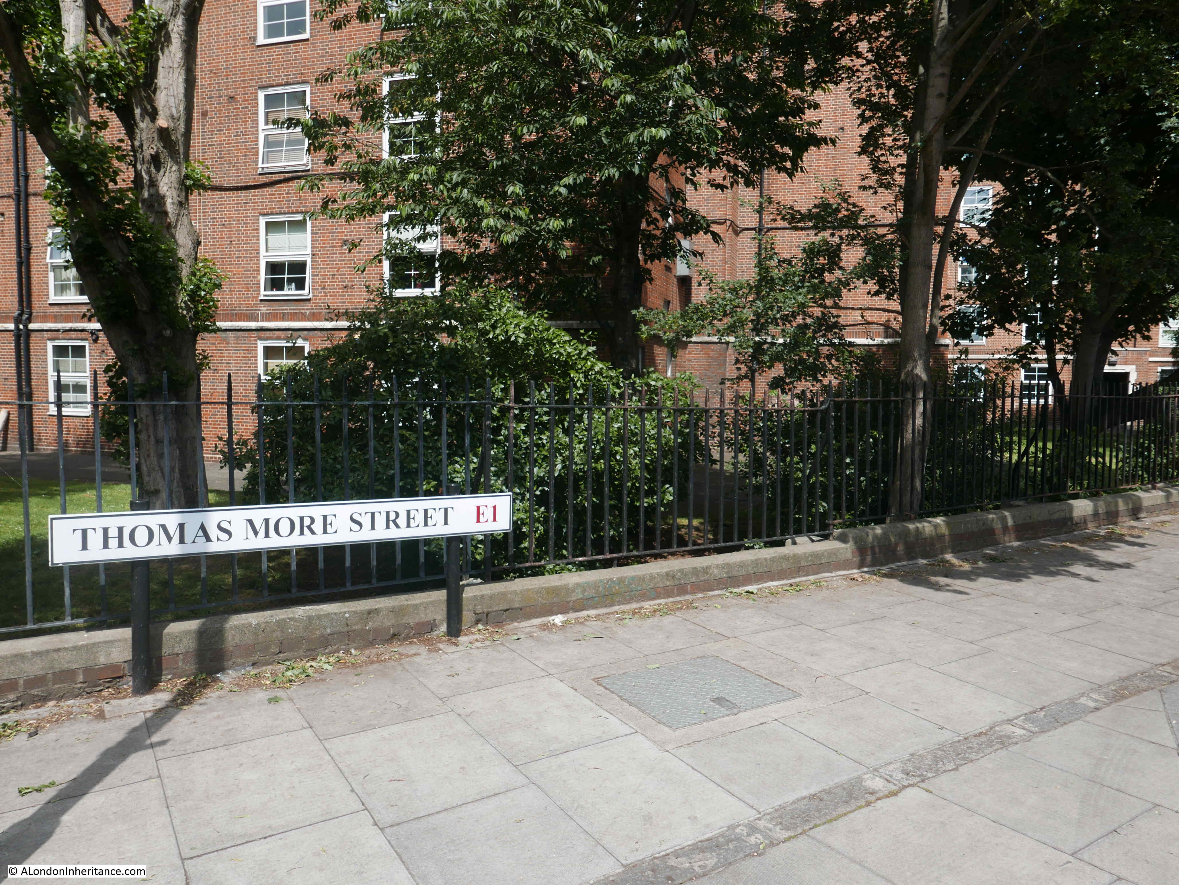
Thomas More Street is to the immediate east of St Katherine Docks. The street runs from East Smithfield down to the junction with St Katherine’s Way and Wapping High Street.
The following map shows Thomas More Street running vertically down the map, just to the right of centre (© OpenStreetMap contributors) :
The name Thomas More Street is a relatively recent change, made at some point between 1895 and 1940 (it had the current name in the 1940 Bartholomew London Atlas). The street is named after Sir Thomas More, who was executed nearby on Tower Hill on the 6 July 1535. The original name was Nightingale Lane, a rather rural sounding name for a street in this location.
I cannot find any reference as to why the street name changed.
The following extract from the 1895 Ordnance Survey Map shows the street with the name Nightingale Lane:
Credit: ‘Reproduced with the permission of the National Library of Scotland’
The name might imply a reference to the bird of the same name being heard in the distant past in this part of east London, however there is possibly a very old source of the name. Henry Harben’s Dictionary of London states that the earliest mention is by Stow in 1598 as Nightingale Lane. The street formed the eastern boundary of Portsoken Ward. Harben also quotes a publication by the London and Middlesex Archaeological Society on the Anglo Saxon settlement around London, where there is a suggestion that the name may be a corrupted survival of Knightengild.
This source of the name is also mentioned in “The Streets of London” by Gertrude Burford Rawlings which states: “Nightingale Lane E.1. A corruption of Cnihtena Guild or Knightenguild. This was an ancient London Guild established, as some think, in the time of King Edgar. In the reign of Henry I it was merged in the Priory of Holy Trinity, then newly founded at Aldgate. Its ‘soke’ is represented today by Portsoken ward.”
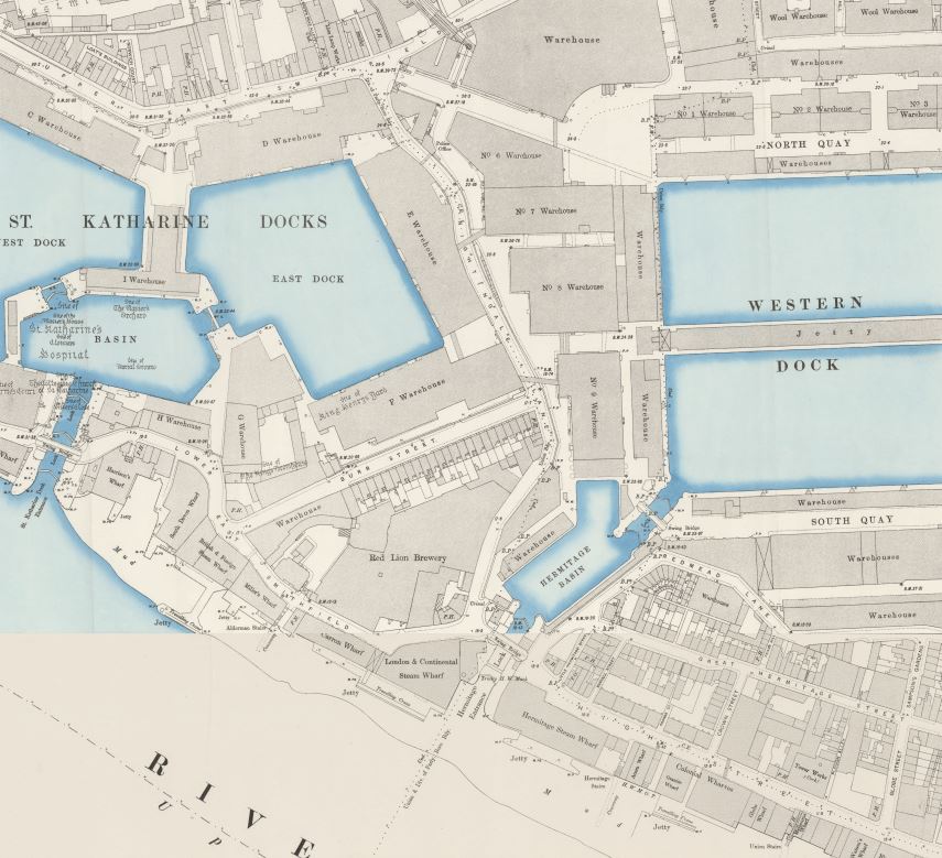
The 1895 map shows how the street ran between two large docks, St Katherine Docks to the west and London Docks to the east. The map also shows the street lined by warehouses serving the two docks, which is confirmed by my father’s photo as being much the same in 1949.
In John Rocque’s map from 1746, the street (just to the right of centre of the map below) is called Nightingal Lane. The ‘E’ on the end is missing. Assuming this is not just an error in the map, it does add credibility to the origin of the name referenced by Harben and Rawlings.
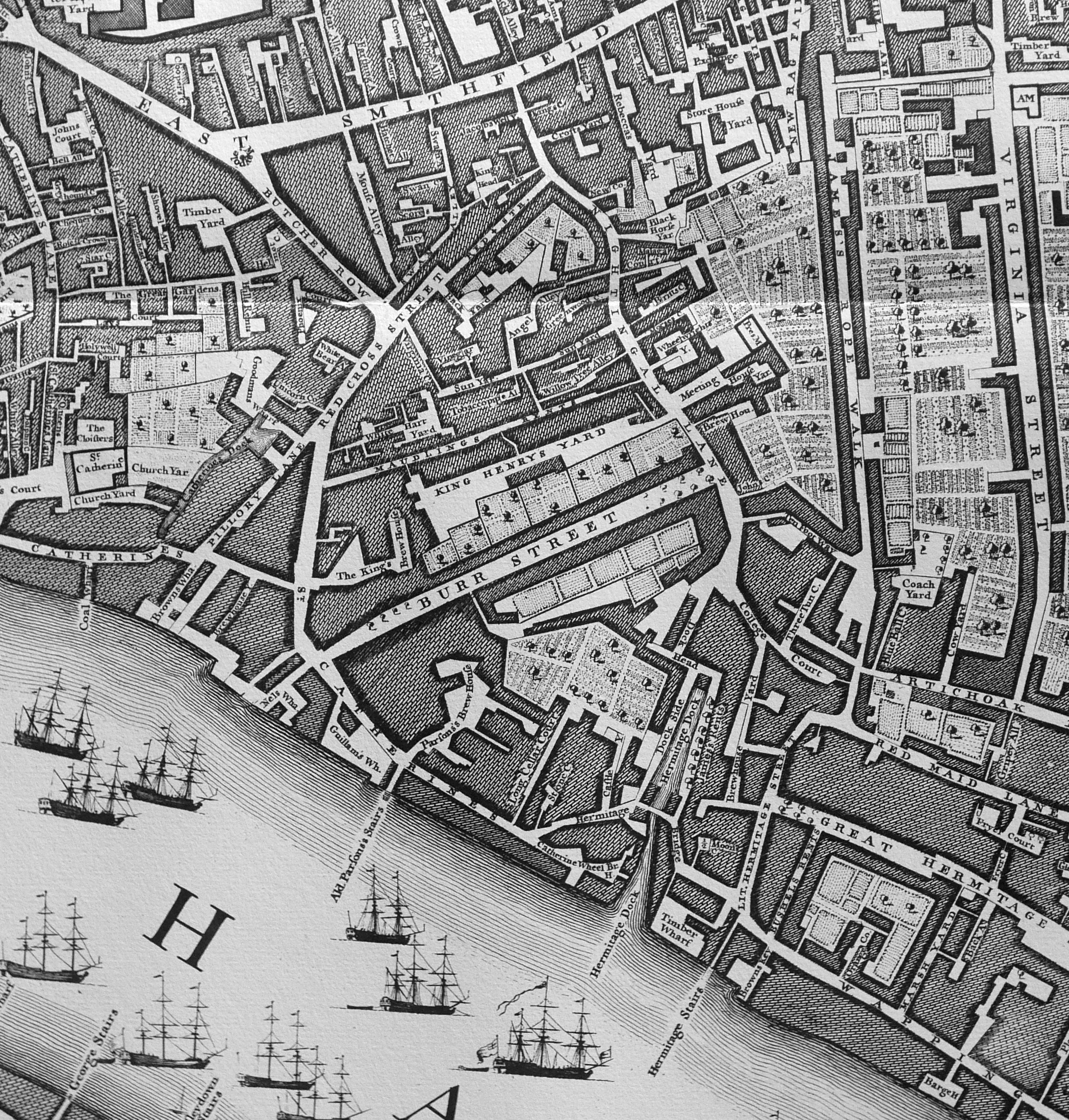
Rocque’s map shows how much this area would change with nearly everything in 1746 obliterated by the St Katherine and London Docks and their associated infrastructure, but Nightingal(e) Lane survives today at Thomas More Street.
I tried to find the location of my father’s photo, but whilst many of the old dock walls remain, the warehouses have long since disappeared, and I suspect entrances through the walls have changed to accommodate the recent building.
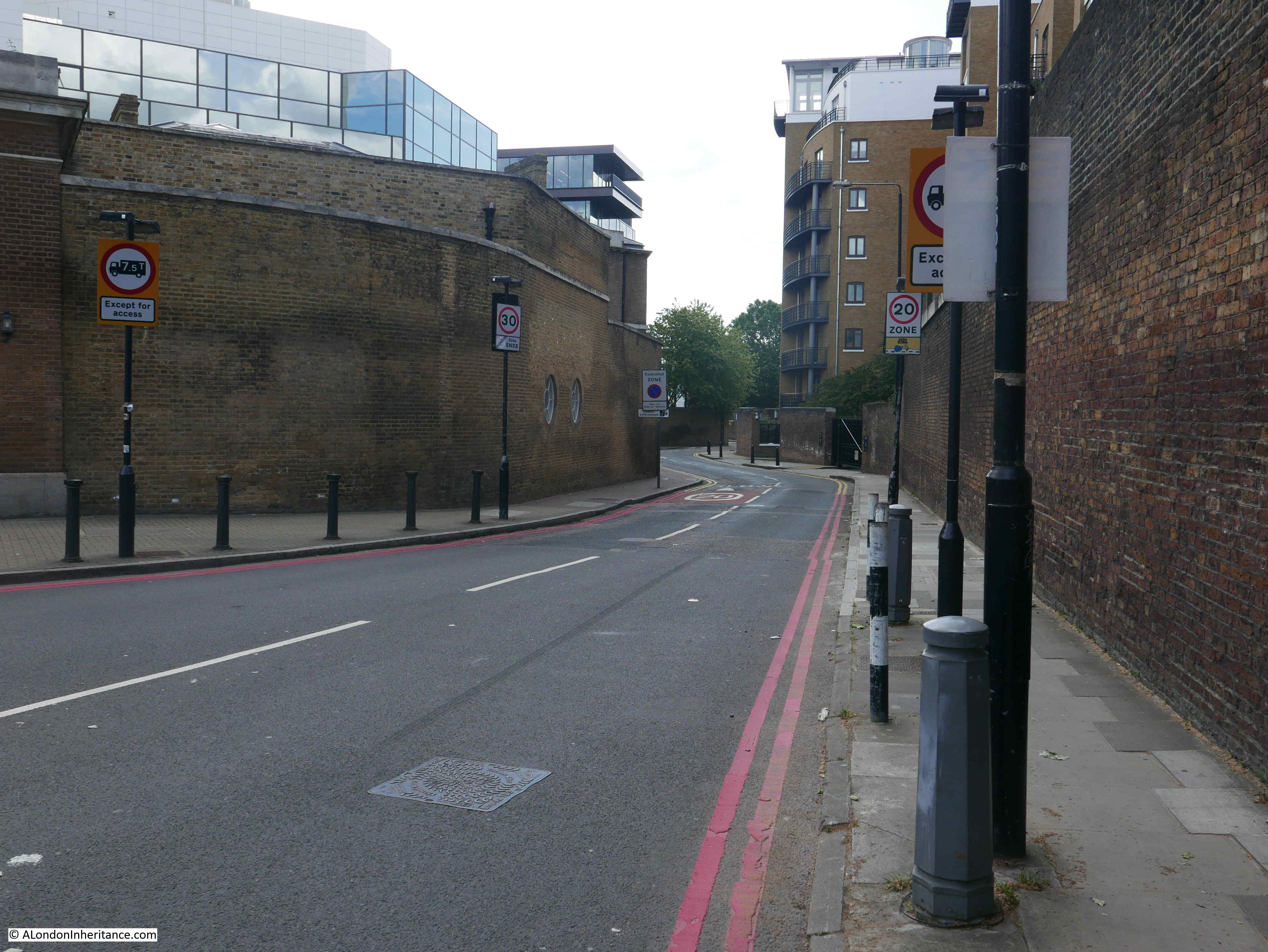
Starting at the junction of Thomas More Street with East Smithfield, this is the original entrance to the Western Dock of the London Docks. The 1895 OS map shows this well.

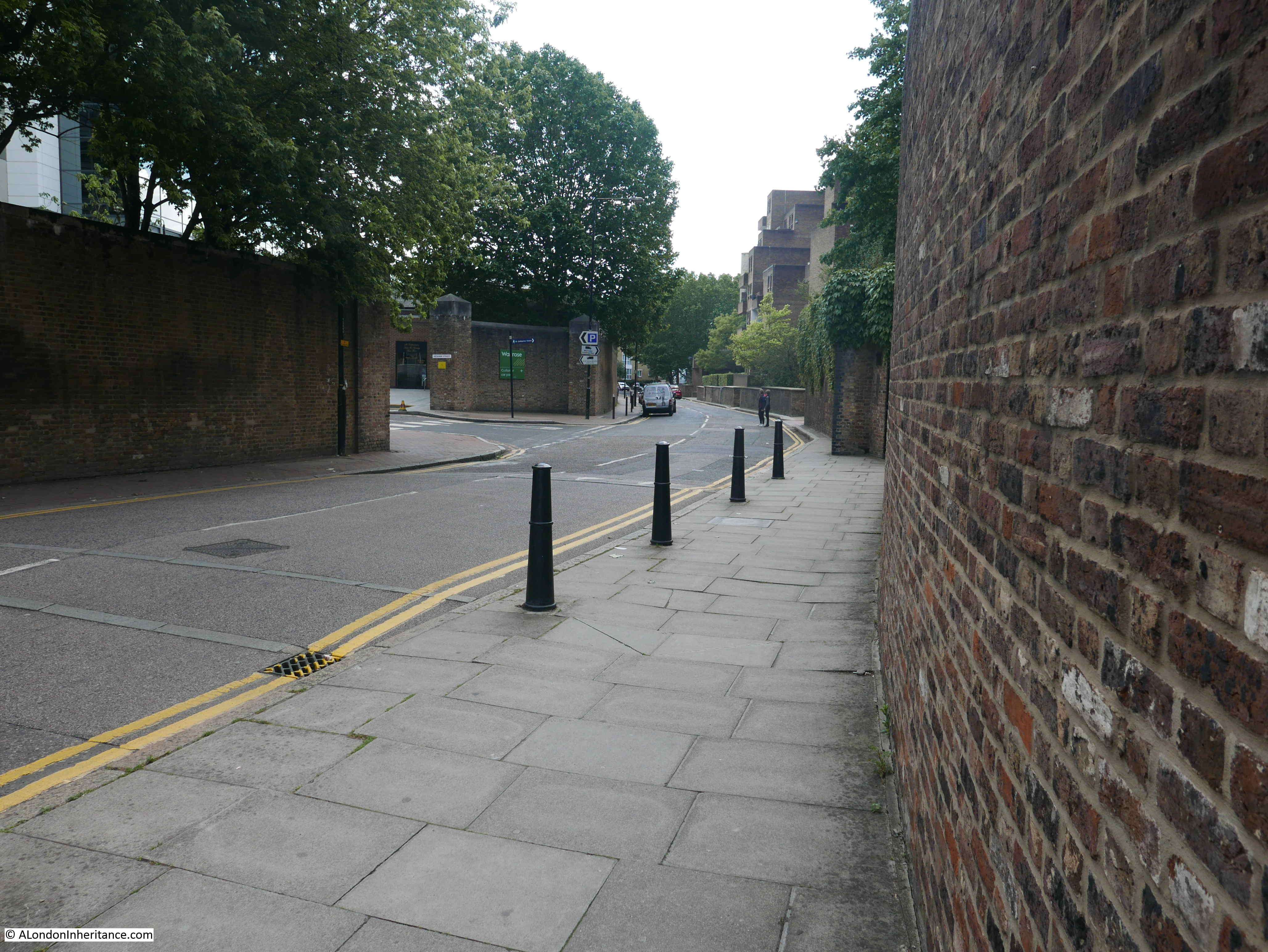
The view looking south along Thomas More Street from the junction. The high brick walls remain and give a good impression of how tall and solid these walls were. Theft from the docks and their warehouses was always a major problem and the dock owners built these walls to surround their docks to try to manage access through a limited number of controlled entrances.
A couple of lengths of Thomas More Street did have the S shaped curve shown in my father’s photo, but I could not match up the walls at any of the locations.
There has been considerable building over the area once occupied by the warehouses that lined Thomas More Street, alongside the London Docks.
The different brick colours in the walls around the entrance show some probable rebuilding, so it is not always clear whether the entrances we see today are original, or later changes to the wall.
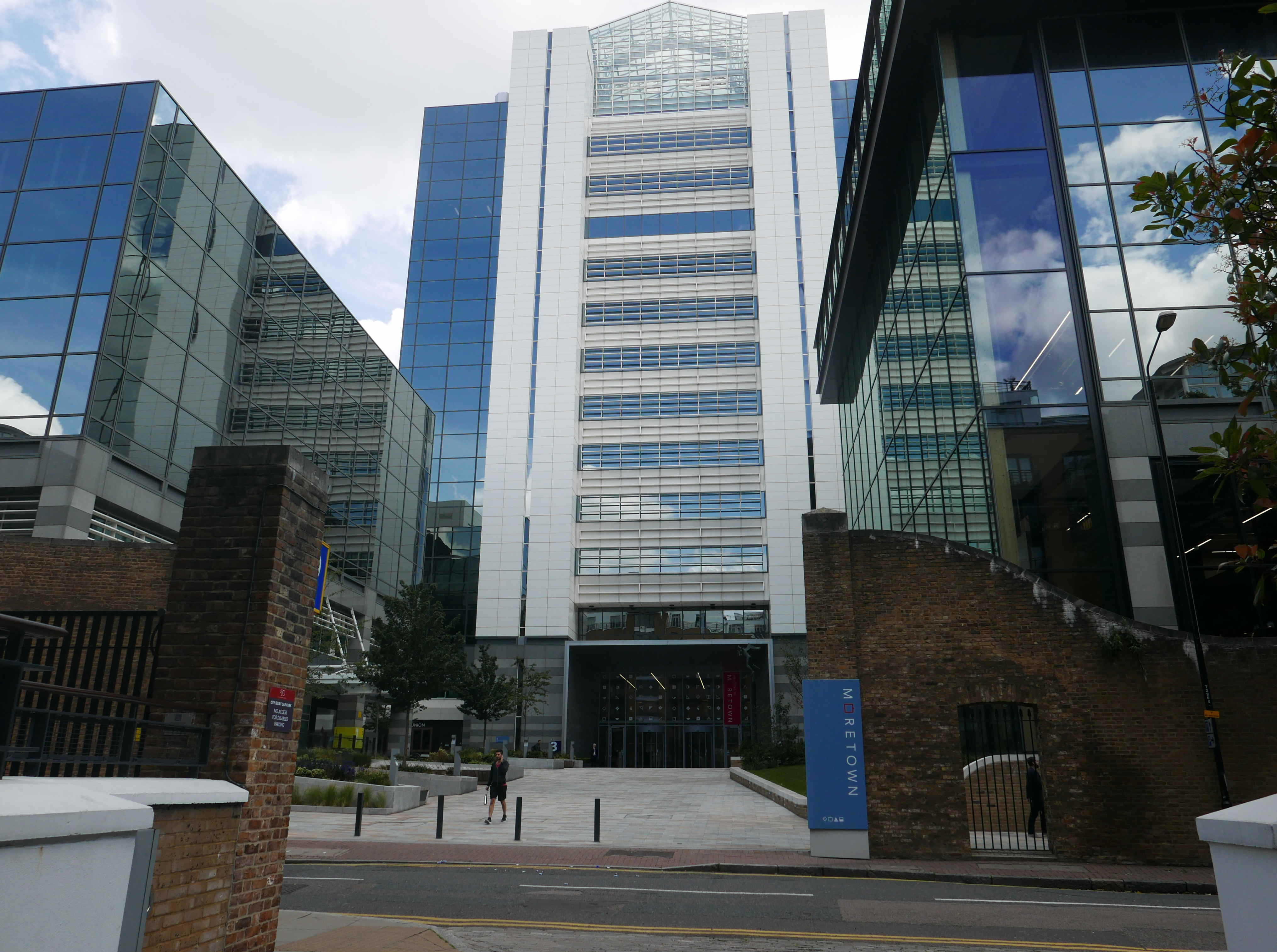
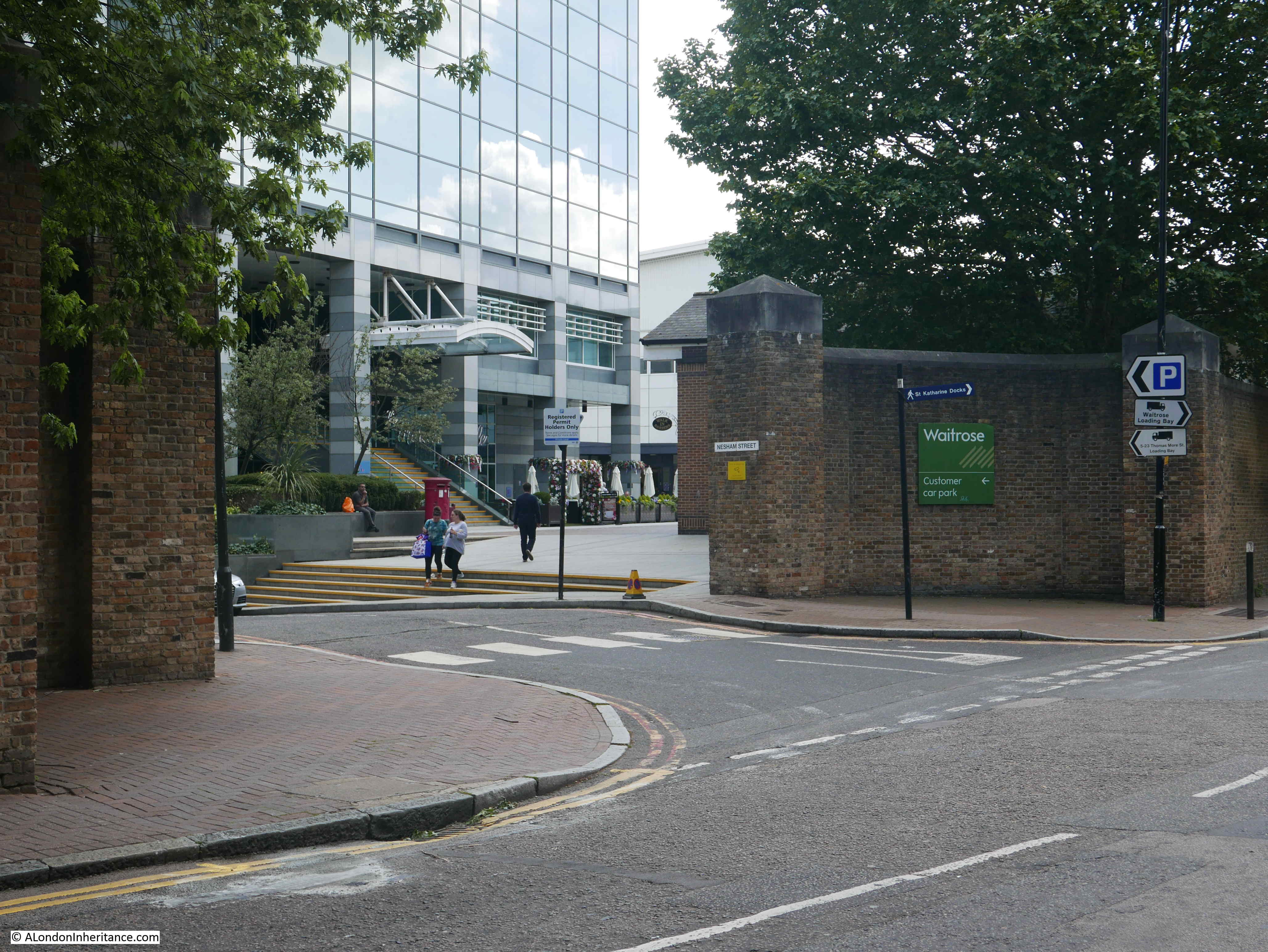
The development alongside Thomas More Street is named Moretown – an example of a trend seen across many parts of London where new names are given to an area to try to build a new identity – or in developer speak ‘place making’.
The wall continues alongside Thomas More Street:
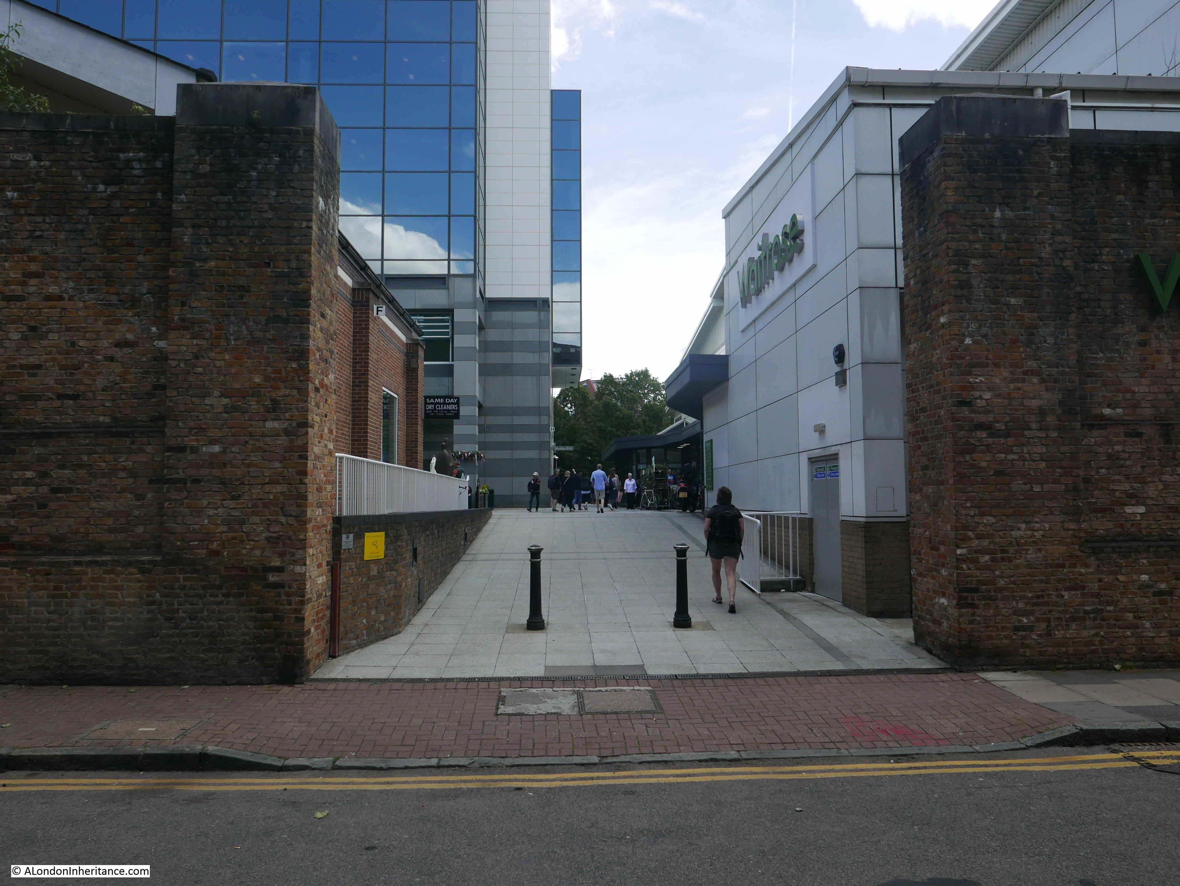
Another entrance:
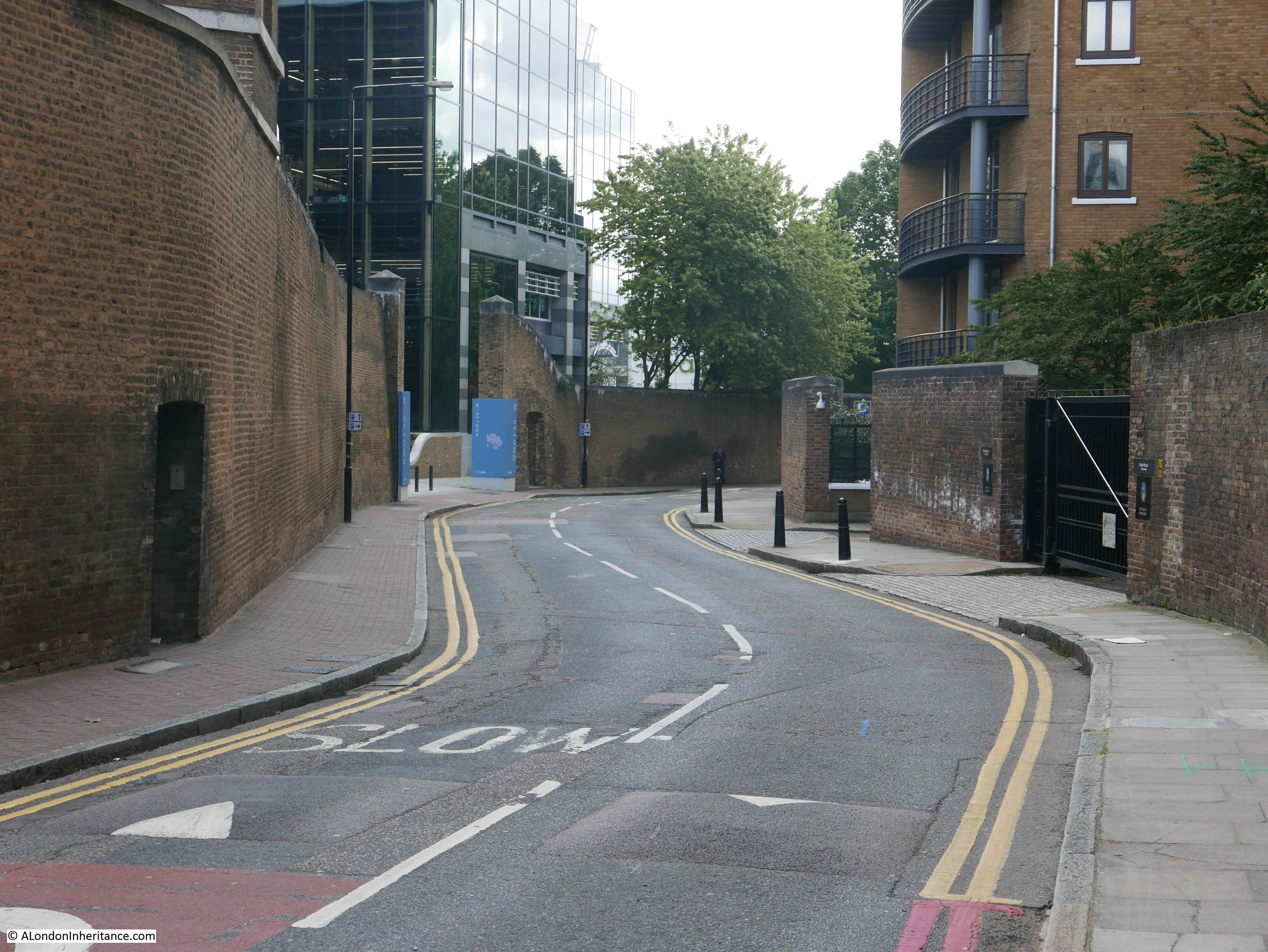
Looking back up Thomas More Street, the curve is going in the wrong direction to my father’s photo.
The buildings between Thomas More Street and the site of the London Docks are of steel and glass, whilst those between the street and St Katherine Docks are of brick. A couple of gaps in the building on the western edge of the street show the docks behind.

A Waitrose now serves the residents of the area, showing how much the area has changed.
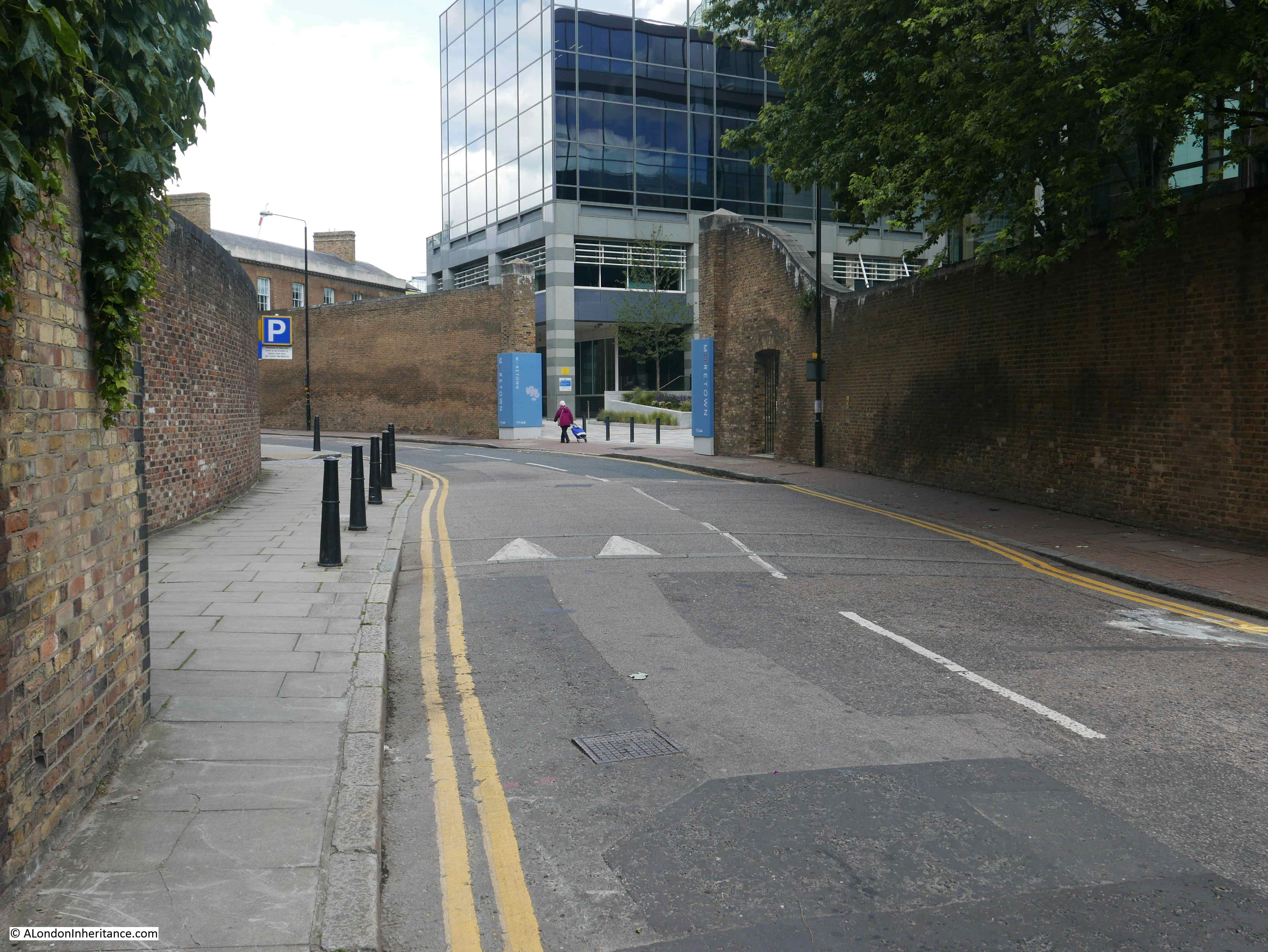
Looking back along Thomas More Street showing the height of the walls.

At the junction of Thomas More Street and Stockholm Way. Thomas More Street continues to the right, as do the walls, which once had the warehouses of the London Docks behind them.

When walking these streets, the continuation of Thomas More Street look strange, as the northern section ends at Stockholm Way, which looks as if it should continue on, however Thomas More Street than continues at a 90 degree bend to the northern section.
This makes sense when looking at the 1895 OS map as Stockholm Way did not exist when the area it now runs through was covered by the London Docks.
The following photo is looking back along Thomas More Street, at the southern end of the street at the junction with St Katherine Way. On the right is an entrance to Hermitage Basin shown on the 1895 OS map.

The final street sign:
If you look at the 1895 OS map, to the west of the southern end of Thomas More Street was the Red Lion Brewery.
This was owned by the brewers Hoare & Co. but had a very long history as a brewery, possibly dating back to the 15th century. Sir John Parson’s (who gave his name to Alderman’s stairs, see last week’s post) had a brew house here in 1746 as shown in the extract from John Rocque’s map.
The brewery was closed in 1934. The end of the business was widely reported as the end of an industry that had been in operation on the site for over 500 years.
The West London Observer reported on the 15th June 1934:
“The ‘King’s Brew House’ is about to be closed after being used continuously for brewing throughout the last 500 years. The brew house is part of the buildings which form part of the Red Lion brewery, the oldest, and probably the third largest brewery in London. The whole of these buildings will be closed on June 23rd.
The ‘King’s brew house’ is so called because it supplied the beer for the English and French courts in the 17th and 18th centuries, it is believed to be the only brew house in Britain to have had a monopoly on the beer supply to the old French courts. The privilege was obtained in a romantic way by Humphrey Parsons, an 18th century brewer, who was twice Lord Mayor of London, and the manufacturer of the liquor christened by Oliver Goldsmith ‘black champagne’.
Parsons was hunting near Paris with Louis XV, and being well-mounted outstripped the rest of the party and was first in at the death. This was contrary to Court etiquette, and when the King asked the name of the hard riding stranger, he was indignantly told that he was ‘un chavalier de malte’.
The King summoned Parsons and asked the price of his horse. He replied that the horse was beyond any price other than his Majesty’s acceptance.
The horse was delivered to the King and from that time, the ‘Chevalier’ Parsons had the exclusive right to supply the French court with beer.”
There is no sign of the brewery today, after being in operation for 500 years and supplying the English and French Courts with beer.
The St Katherine’s Estate was built on the location of the brewery, and the estate now occupies the land between Thomas More Street and St Katherine’s Way, across the road from Alderman Stairs.
The entrance to the St Katherine’s Estate from St Katherine’s Way:
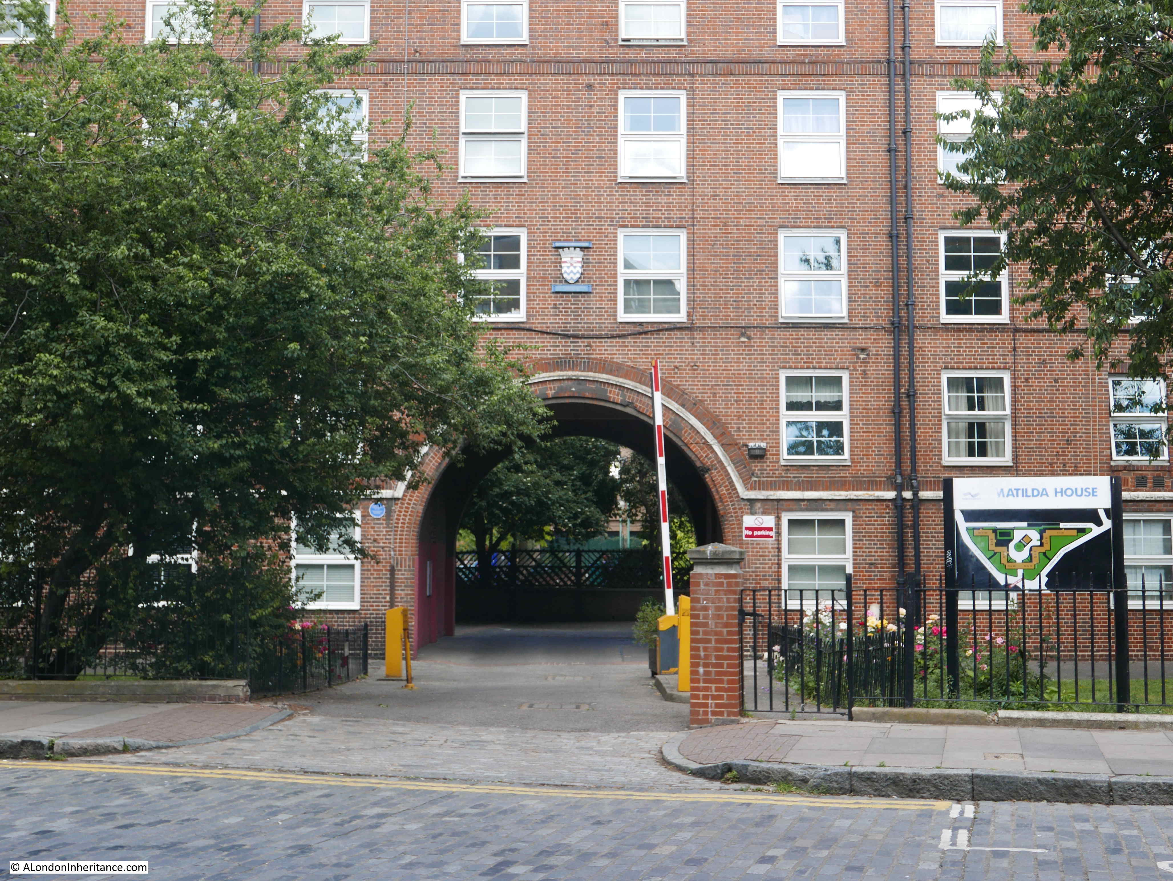
The estate was one of the many built by the London County Council, and above the main entrance arch is a rather lovely reminder:
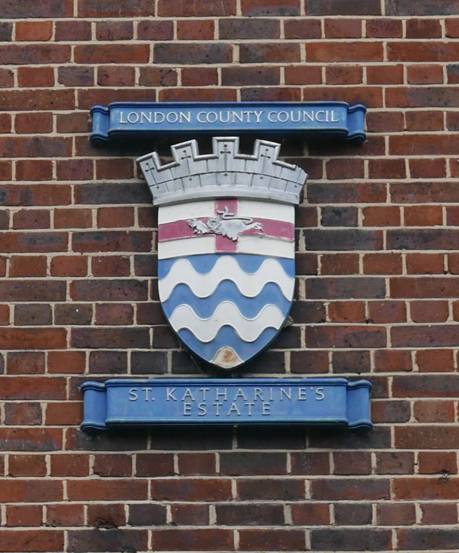
The old walls that defended the warehouses and docks are Grade II listed, so hopefully are protected to provide a reminder of the industry and business that operated in the area for so many years.
It was frustrating that I could not find the location in Thomas More Street of my father’s photo, however I do love the original photo, it is so evocative of another London which has disappeared for forever.
Wonderful photo that instigated fascinating research – another part of the London jigsaw puzzle is placed, many thanks.
Very lovely and informative piece of research. And the photos – I am so delighted with the old vintages.
My son lives around the Motown Building and on a number of occasions walking from there to the Tower Hill Station, I would walk through the dockland where the boats are anchored.
I will be up again this August, having been here just a few months back this year. Your article plus the one on Wapping have got me going. I intend to take a walk using your article as a guide.
Did you cover the East India Docks? I would love it because in school we studied geography on the Tilbury Docks, East India Docks and so forth. Is like a travel back in time for me.
Thanks once again.
Another lovely post! But “disappeared for good?” Surely forever?
Good point – I will blame final late night editing. Have changed.
The picture is of St Katharine’s Way, not Thomas More Street
The uniform, possibly:
A Trinity House pilot, this is most likely, the cap badge has a pronounced crest or device at the top
An officer of the Waterguard, HM Customs & Excise
A dockmaster of the Port of London Authority
Fascinating to see the maps of the old Western Dock compared to the new residential streets of today. I often stop off at that Waitrose on my walk home from Tower Hill to Limehouse, and I’m always looking at the remnants of the old waterways along my walk trying to picture what the place once would have been like with ships passing through what’s now solid ground.
If it is in the morning, and the sun is on the right, then it is looking north.
I think, if you take a look at the wall opposite the Waitrose development, courtesy of google street maps, you will see there are grilles and little round holes in the brick work, just as there are in the wall of the large warehouse, but at a different height. Possibly what we can see today is what is just around the corner in the photo and out of sight. Or, we are looking at the warehouse wall further south where today there is a residential development and the walls are much lower.I think it is morning, sun shining from east, and he is headed off to work. But, as you point out, the walls have been lowered and altered all along the street as they have been adapted for new usage. I’d love to know what those gates lead to because I think that would help a lot…great photos, by the way. Thanks for an interesting hour and a half.
What a great photo. However, is isn’t of Thomas More Street, which is why you can’t find the location.
The actual location is St Katharine’s Way, looking east. It’s taken from the old swing bridge that used to span the entrance to St Katharine’s Dock. If you zoom in on this image from Britain for Above you’ll see what I mean https://britainfromabove.org.uk/image/EAW022338.
There’s been a look of reconfiguring of that part of the docks (e.g. the current red bridge isn’t the original and is in a different location to the old one) so it’s pretty much impossible to replicate the view.
Andy – thank for this, had a quick look at the Britain from Above photo and I can see what you mean. Thanks again, it is good to pin down exactly where these photos were taken. I will update the post.
What an imposing setting this shot gives.
On the left hand wall immediately beyond the leaning lampost is a bricked up doorway. It’s still there, and Streetview has it approx 5 metres north of the entrance to Star Place’s City Quay entrance.
Almost exactly the same location was used briefly in the film “Odd Man Out” with James Mason, 1947. Because that scene was composed further forward we can see in it a single storey building on the opposite side with a shop-type hoarding saying “Wine S….” An unexpected place for such a shop, if that is what it was.
From 1973, Collage photo number 120426 has a reverse view of the scene. In this photo the bricked-up doorway is immediately beyond a concrete lampost in the distance.
Thanks very much for this opportunity to do some Sunday map searching. London and its inheritance never lets us down.
Fascinating! I’m always interested in this area as I have ancestors who were living in King Henry’s Yard as shown on the John Roque map. The street pattern remains although the buildings are long gone.
Thanks for sharing your father’s Piranesian study from ’49. There are four 1930s photos of Nightingale Lane in Rasmussen (only two of which made it into the 60s Penguin abridged edition) which strongly echo the atmosphere of your father’s evocative photo.
The confusion regarding the exact location is perhaps because your father may have misled you. I shared the photo in the Docklands History Group Facebook page to ask of anyone knew the exact location. The answer back is that it’s actually St. Katharine’s Way, or Lower East Smithfield as it’s shown in your 1895 OS map, not Thomas More Street. The photographer is standing on the eastern end of the swing bridge that passes over the lock from the river into St. Katharine’s Dock, looking east. You’ll find that on the left-hand side of your 1895 map. The wall on the left in the photo is the southern wall of the St. Katharine Docks.
Peter, thanks for this, an earlier comment included a link to a Britain from Above photo that shows the same location as you have identified. Good to pin down the correct location of these photos. I will update the post – thanks again.
You’re welcome. Keep up the good work, I thoroughly enjoy reading your posts.
A fascinating, well-researched and hugely informative post, as usual, and I too love the original, evocative photo. Thanks as ever for all your painstaking work.
Great post. I would put my money on the man being a PLA lock-keeper or dockmaster. If he is walking South toward the lock at Hermitage Basin those must be summer morning shadows. Making his way to “turn to” for the morning shift?
I wonder whether the street in the photo isn’t Thomas More Street. The post-war large scale OS map on the National Library of Scotland site (https://maps.nls.uk/geo/explore/#zoom=18&lat=51.5064&lon=-0.0708&layers=173&b=6) is dated ‘Surveyed/Revised: 1948, Published:1949’. Since your father’s photo was taken in June 1949 it should correspond exactly with the map. But none of the mapped buildings in Thomas More Street match the large warehouse on the left hand side of the street in the photo. Looking around the nearby streets on the map, I think your father could have taken the photo in St Katharine’s Way. Your father would have been standing at the eastern end of the swing bridge over the entrance to the St Katharine Docks and was pointing his camera roughly north-east. The building on the right hand side of the photo would be Harrison’s Wharf.
Malcolm, thanks for the detective work. A couple of other comments have also mentioned the same location in St Katherine’s Way. It is good to pin down the correct location of these photos, I will update the post. Thanks again.
Oh ! what memories ! I was 18 years old about 1960 and working for a wine shipping and forwarding agents on Tower Hill. One of my tasks was to take the custom documents down to the London Docks normally in the morning. On occasion I had to go down in the afternoon. At about 4 o’clock was tea time for the dockers and all the sherry butts would be lined up on the gauging ground. Invariably one of the small one man dock trucks would hare round the area and of course one or two of the sherry butts would bounce off, each holding 108 gallons of sherry. Somehow everyone knew it was going to happen and raced out with their tea mugs to have a taster.
The gentleman walking down Thomas More Street between the warehouses looks like a customs officer with his peaked cap. But what was he doing there on a Sunday morning ? It was well known that the officers loved a tipple or two down in 1/5 vaults where the port and sherry was warehoused. They were very long tunnels stretching for several hundred yards and some of the officers were so tight they could not find their way out at the end of the day. After a quick search the doors were locked and they had to stay there until the following day.
There was a docker in 4/5 Pennington Street who could open a case of champagne with a halfcrown coin. In those days champagne was packed by the dozen in wooden cases, each bottle held in a straw cover. The case lids were nailed down and banded with wire or steel. This docker could work out a couple of nails with his coin, slide a slat out enough to obtain a bottle and then put the lid back again. No one would be any the wiser until the case reached its final destination. No weighing or checking in those days.
So sad that now the London Docks have completely disappeared. I was informed that the vaults were Grade I listed but no longer there.
My family lived / grew up in Wapping and my father, born in 1919, always referred to Thomas More St as Nightingale Lane. Also called Wapping Lane Old Gravel Lane I think. It got confusing! Lovely post as always, thanks.
The link below:
https://petegrafton.com/2013/09/19/london-town-54/
shows an almost exact photo, but taken further east, showing the end of the gantried frontage, followed by an access road, then a pub.
One of Nightingale Lane:
https://inexpensiveprogress.com/post/158171196360/london-dockland
A google for Thomas More Street brings up a photo of what appears to be the bend after East Smithfield looking towards Wapping, (link too long to post!). Looks very bleak
The pub in the first photo (correctly labelled as St Katharine’s Way) was called the Bull’s Head. There’s a better picture of it in this post http://spitalfieldslife.com/2016/10/23/the-alphabet-of-lost-pubs/
Well, that was fun! After reading all the comments above, I think I agree that it is indeed St Katherine’s Way, and the huge warehouse is that labelled Warehouse H on the map from the late 19th century. But all the remodeling and moving of roads (reversing the shape in this case) has completely skewed this view which no longer exists. The pub helped and you can see it on the map quite clearly. And I expect the system of little round holes and grilles was common in all warehouses at the time, so most of these would have looked the same.
Fascinating.
Final comment (or I will lose my mind…) I think I have pinpointed this exactly. Look at the wall on the left of the picture and you can see a metal boss sticking out (round). Go to google street maps and by the side of the St Katharine’s Marina office and the lock itself there is a flight of steps and a narrow pathway. Look up on the wall on the left, just by a lamp and…there it is.. the same metal boss. All the new building, plus the removal of Harrison’s Wharf has almost obscured this. The position of the bridges has changed slightly today but you can make a pretty good guess now where your dad was standing.
Honestly, you’d never guess I have an actual life.
You are quite a detective – what a shame you could not find the site where the original photo was taken but it did inspire a great walk.
Always find your writings thought-provoking, prompting a personal visit to the area, more often than not !
The photograph bears more than a passing resemblance to Fieldgate Street (looking South from the A11) and the side of the Whitechapel Bell Foundry. (Same curve of the road etc).
…my first thought was he worked in some capacity as a “customs offical”
As always, fascinating and your father’s photo is exquisite. With regards to street name changes you may find this website, if you haven’t already come across it, of interest. Even if it isn’t Thomas Moor Street it seems possibile that the change to the street name may have been made between 1936 and 1939. Why? Afraid I can’t answer that.
https://maps.thehunthouse.com/Streets/New_to_Old_London_Street_Name_Changes.htm
Between 1929 and 1939, the London County Council had a scheme to abolish duplicated street names within their area. Nightingale Lane into Thomas More Street falls into that scheme being renamed 1st July 1939.
Good to know. Thanks Dave.
So much industry lost forever
Another interesting post, thank you
Thanks for the post and the interesting comments. Does anyone else find this a strangely haunting and slightly surreal photo? I’ve been looking at it for days, it’s quite transfixed me!
This morning’s post on Spitalfields Life!
http://spitalfieldslife.com/2019/07/30/ebbe-sadolins-london-x/
Vicky Stewart beat me to it. It is interesting that it was referred to as Nightingale Lane I presume by Ebbe Sadolin.
Interesting article, thanks. I live on Thomas More Street and I’ve always loved the feeling of history hereabouts. I’ll have to check out St Katherine’s Way to see if I can spot the location of the photo. There have to be more photos of this area around. I have some somewhere. I’ll have to look them out.
My family lived in Matilda House in the late 60s. Their flat was the flat either side of the LCC badge in the penultimate photo.
My nan continued to live in Matilda House until the mid 70s. We would frequently visit. Walking down the winding Thomas More St with it’s very high walls seemed very imposing and long to a young child.