Tag Archives: Cornhill

The Standard, Cornhill

Before today’s post, I have just added a couple of new dates for my walks. Dates and links for booking are as follows:

A few week’s ago, my post was about London Maps, and I included one of the strip maps by John Ogilby, who had the impressive title of His Majesties Cosmographer.

John Ogilby was a fascinating character. Born in 1600 in Scotland, he had many professions including a dancer, teacher, translator, publisher and map maker.

With William Morgan, John Ogilby created a very detailed map of London which was published 10 years after the Great Fire of London in 1666 (although it was probably surveyed before the fire). You can find the map on the Layers of London website, here.

Ogilby is probably best known for his atlas of all the major routes in the country, which he published in 1675 under the name of Britannia.

Routes were shown in a strip map format, where several strips were used to follow a route from source to destination. Along the route, towns and villages were listed, as were geographic features, roads leading off the main route, with their destinations listed, landmarks along the route, distances etc.

The map featured in the previous post was from London to Portsmouth, a route which started at the Standard in Cornhill.

The Standard in Cornhill was the starting point for many of the maps with routes that commenced in London, and after writing the previous post, I wanted to discover a bit more about the Standard, but before I head to Cornhill, here is another of Ogilby’s routes. This one a bit longer than the previous map to Portsmouth.

Each of the routes had a header on each page, with the first map having the title of the overall route, total distances, major towns and cities along the route, with individual distances between them.

So if you were planning to journey from the City of London, to Lands End in Cornwall, this was Ogilby’s route, which started with the summary header of the route of 303 miles and 3 furlongs, and started at the Standard in Cornhill:
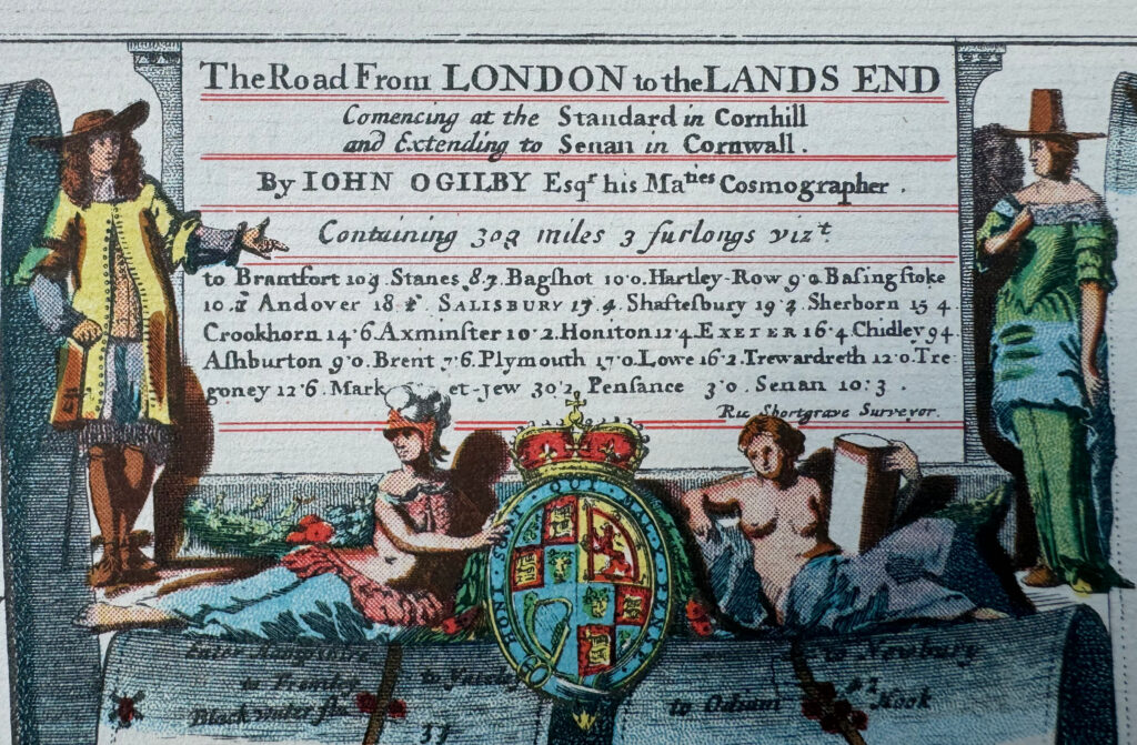
John Ogilby

The first page of the journey to Cornwall, runs from London to just before Winchester, and just after leaving what was then the limits of London, we cross Knightsbridge, when it was still a bridge:

John Ogilby

We then cross Hampshire, Wiltshire, Dorsetshire and Somersetshire. In the 17th century, counties still had “shire” at the end of the names such as Dorsetshire and Somersetshire, which would later be shortened, but as with current names such as Wilshire, the “shire” recalls the old origins of these counties and county boundaries:

John Ogilby

We then continue travelling through Devonshire, passing through Exeter:

John Ogilby

Then head into Cornwall, before finally reaching Lands End, which faces onto “The Western Sea”:

John Ogilby

So where was The Standard, the start of the Lands End route, and of many other maps, and what was it? Helpfully there is a City of London plaque to mark the site:

Standard Cornhill

The Standard sounds as if it should have been the name of one of the many large coaching inns across London, and which would make sense as a place where journeys across the country commenced, however it was an ancient well / water pump / conduit, and it was located at a key crossroads in the City of London, where Cornhill, Leadenhall Street, Bishopsgate and Gracechurch Street all meet.

The following photo shows the junction of these four roads:

Standard Cornhill

You can just see the blue plaque, on the first floor of the corner of the white building across the junction. To the right of the white building is Cornhill and to the left is Gracechurch Street. The white building also shows how every bit of available land has been built on in the City, as the building is right up against the church of St. Peter, Cornhill, which has an entrance on Cornhill, and the rear of the church can be seen on Gracechurch Street to the left of the white building.

If we look at the four roads leading from this junction, we can see why this was an important location for travelling out of the City.

Gracechurch Street heads south down to London Bridge, which for centuries was the only bridge across the Thames, and therefore the main route to the south.

Leadenhall Street headed to the east, Bishopsgate headed to the north and Cornhill headed to the west, so from this junction, one could travel to the major routes that ran across the country, and was why maps such as Obilby’s used the Standard as their City of London starting point.

London Past and Present (Henry Wheatley, 1891) provides some background detail about the Standard:

“A water-standard with four spouts made (1582) by Peter Morris, a German, and supplied with water conveyed from the Thames by pipes of lead. it stood at the east end of Cornhill, at its junction with Gracechurch Street, Bishopsgate Street and Leadenhall Street, and with the waste water from its four spouts cleansed the channels of the four streets.

The water ceased to run between 1598 and 1603; but the Standard itself remained for a long time after. It was long in use as a point of measurement for distances from the City, and several of our suburban milestones were, but a very few years ago, and some perhaps are still, inscribed with so many miles ‘from the Standard in Cornhill’. There was a Standard in Cornhill as early as Henry V.”

A print, dated 1814 of the “Antient North East View of Cornhill” shows the pump at the crossroads. The print is dated over 100 years after the pump was removed, so whether it was an interpretation of what it may have looked like, or whether it was based on an earlier print is impossible to know:
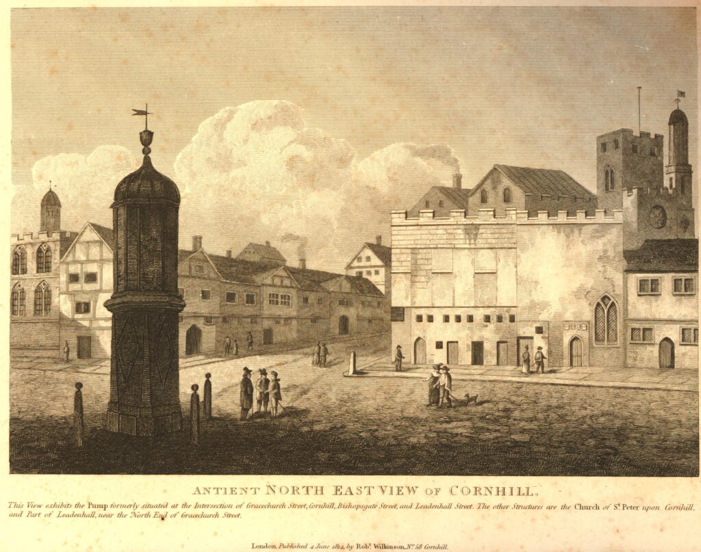
Standard Cornhill

© The Trustees of the British Museum Creative Commons Attribution-NonCommercial-ShareAlike 4.0 International (CC BY-NC-SA 4.0)

London Past and Present, and many other sources date the Standard to around 1582, however the site seems to have been used as a source of water for many centuries before.

In 1921, as new pipes to carry telephone cables were being laid across the junction, a well which was believed to have been below the Standard was discovered.

Four feet below the 1921 road surface an arched brick top to a brick well of 45 inches in diameter was found. Below this, at 18 feet below street level, a much older well was found, of 30 inches in diameter.

It was believed that this much older well had been filled in, along with part of the upper well, when the water pipes of Morris were installed through an opening in the side of the well.

Excavating the well below the old location of the Standard in 1921.

Standard Cornhill

It was believed at the time that the lower parts of the well dated from early Medieval times, or possibly earlier, but as far I can find, no direct dating evidence was found.

I also cannot find any evidence that the brick and stone structure of the well was removed, so presumably the lower parts of this ancient well are still there, far below the road surface of the junction today.

The plaque mentions that the Standard was removed around 1674, and London Past and Present states that it remained long after water ceased to flow in 1603, and from most of the references I have found, it seems to be that the Standard had become an obstruction at a major road junction. It had long ceased to have any functional purpose and so was simply demolished.

Despite the loss of the Standard at some point in the later part of the 17th century, it continued to be used as a point for measuring distances to and from for many years to come. Not just formal measurements in maps, but also for almost any purpose that required a City of London reference point that would be widely known.

For example, I found the following advert in the Morning Herald on the 4th of January 1838:

“WANTED, a detached FAMILY RESIDENCE, within six miles of the Standard, Cornhill; consisting of drawing and dining rooms, three or four best bedrooms, servants’ rooms, and convenient domestic offices; double detached coach house and stabling lawn, pleasure and kitchen gardens; and if a few acres of meadow land it would be preferred – Apply by letter (post paid) to A.H., 9 Coleman-street, City”

The Standard, Cornhill was often mentioned on milestones when giving a distance to London. There was an 18th century example in Purley for many years. I am not sure if it has survived.

A 1921 article in the Sussex Express mentions the preservation of a milestone in Lewis:

“The milestone let in the upper front of 144/5 High Street, which the Council are to preserve when the building is demobilised, bears the interesting inscription, which probably many Lewes residents have not read; ‘Fifty miles from the Standard in Cornhill, 49 miles to Westminster Bridge, 8 miles to Brightelmstone.”

I have not heard of a building being “demobilised”. I assume it meant being demolished, and the Council did indeed preserve the milestone as it can still be seen in Lewes today, and fortunately I found a photo of the milestone on the brilliant Geograph website:

Standard Cornhill

Credit: Old Milestone by the A277, High Street, Lewes cc-by-sa/2.0 – © A Rosevear – geograph.org.uk/p/6038102

The Standard, Cornhill is just one of a number of locations that have been used as a point from where distances to and from London have been measured.

The most common location seems to be the statue of Charles I to the south of Trafalgar Square, where the Eleanor Cross once stood, so possibly the location of the final cross as part of a 13th century journey to London, still marks where distances are measured to and from:

Standard Cornhill

Plaque by the statue recording that the site of the cross was / is from where distances are measured:

Standard Cornhill

It is fascinating to stand at the eastern end of Cornhill, look across the road junction, and imagine the Standard water pump / conduit that once stood there, and that an ancient well probably still exists deep below the surface.

What I also find fascinating are the stories told by books, not just from their intended contents.

I have a copy of a 1939 facsimile of Ogilby’s Britannia, published by the Duckhams Oil Company on the 7th of December 1939, the 40th anniversary of the company’s founding.

Duckhams had a sales office at Duckhams House, 16 Cannon Street in the City, and the books of the facsimile of Britannia were in the office when war broke out. The company thought that the celebration of their 40th anniversary was a little out of place as war had just been declared.

The books appear to have been stored in Cannon Street for a period, with “two narrow escapes from bombing”, they were then distributed, with a little note in the inside cover:

Duckhams Oil

The PTO reveals a postscript appealing for funds for the Royal Air Force Benevolent Fund.

Alexander Duckham, who founded the company, and also signed the note in the book lived for some years at Vanbrugh Castle near Greenwich Park. He must have been a long standing supporter of the Royal Air Force Benevolent Fund as in 1920, just a year after the fund had been established, he donated Vanbrugh Castle to the fund, to be used as a school for children of members of the RAF who had been killed in service.

Just some of the obscure connections you can make across London.

From an ancient well and water conduit at an important cross roads in the City, to a map maker who used the water conduit as the starting point for his routes out of London, and to an early 20th century industrialist who loved Ogilby’s maps and published a facsimile from their office in Cannon Street during the last war.

Copies of the facsimile of Ogilby’s Britannia can be found on the Abebooks website, and if you are interested in John Ogilby, the Nine Lives of John Ogilby by Alan Ereira is a really good account, and can be found here.

alondoninheritance.com

Two Cornhill Churches – St Peter and St Michael

A church that was not rebuilt after the 1666 Great Fire along with the churchyard lost in the late 19th century was the subject of last week’s post. For today, I want to take a look at two churches that have survived, both very old churches, and at the eastern end of Cornhill in the City.

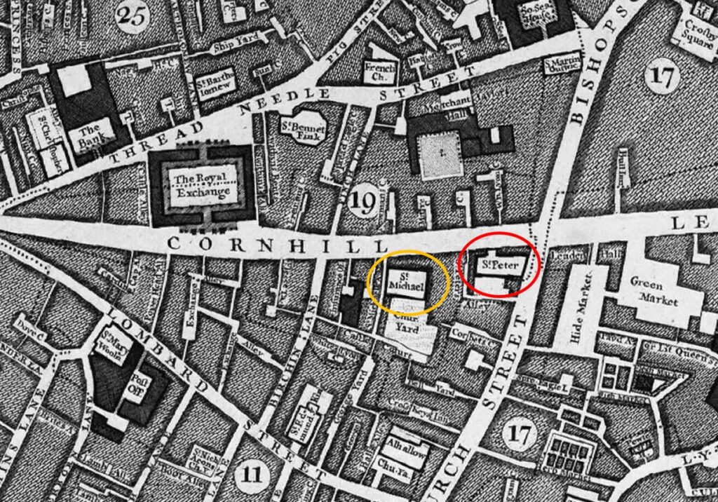
In the following extract from John Rocque’s 1746 map of London I have circled St Peter-upon-Cornhill (red) and St Michael Cornhill (orange):

Map of Cornhill

Both churches are partly hidden behind other buildings that face onto Cornhill, and have the appearance of churches from an earlier period of London’s history, when the built space was very crowded, and every available plot of land was utilised for building.

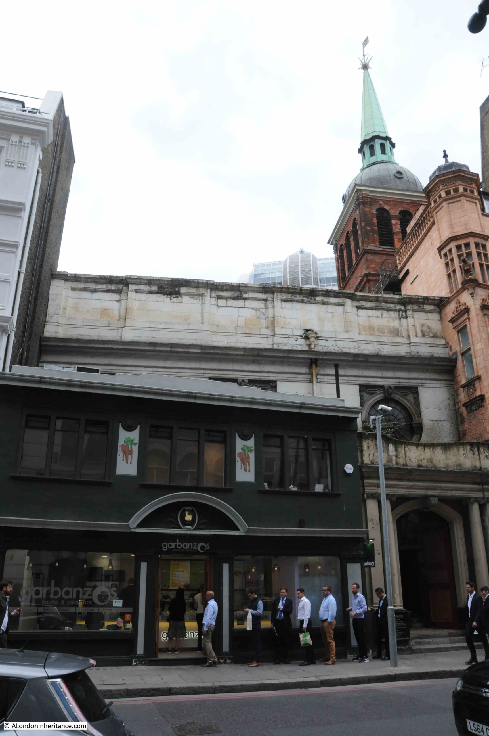
This is the view of St Peter, from Cornhill, with a lunchtime queue at the food shop that is on the small wedge of land between the body of the church and the street:

St Peter Cornhill

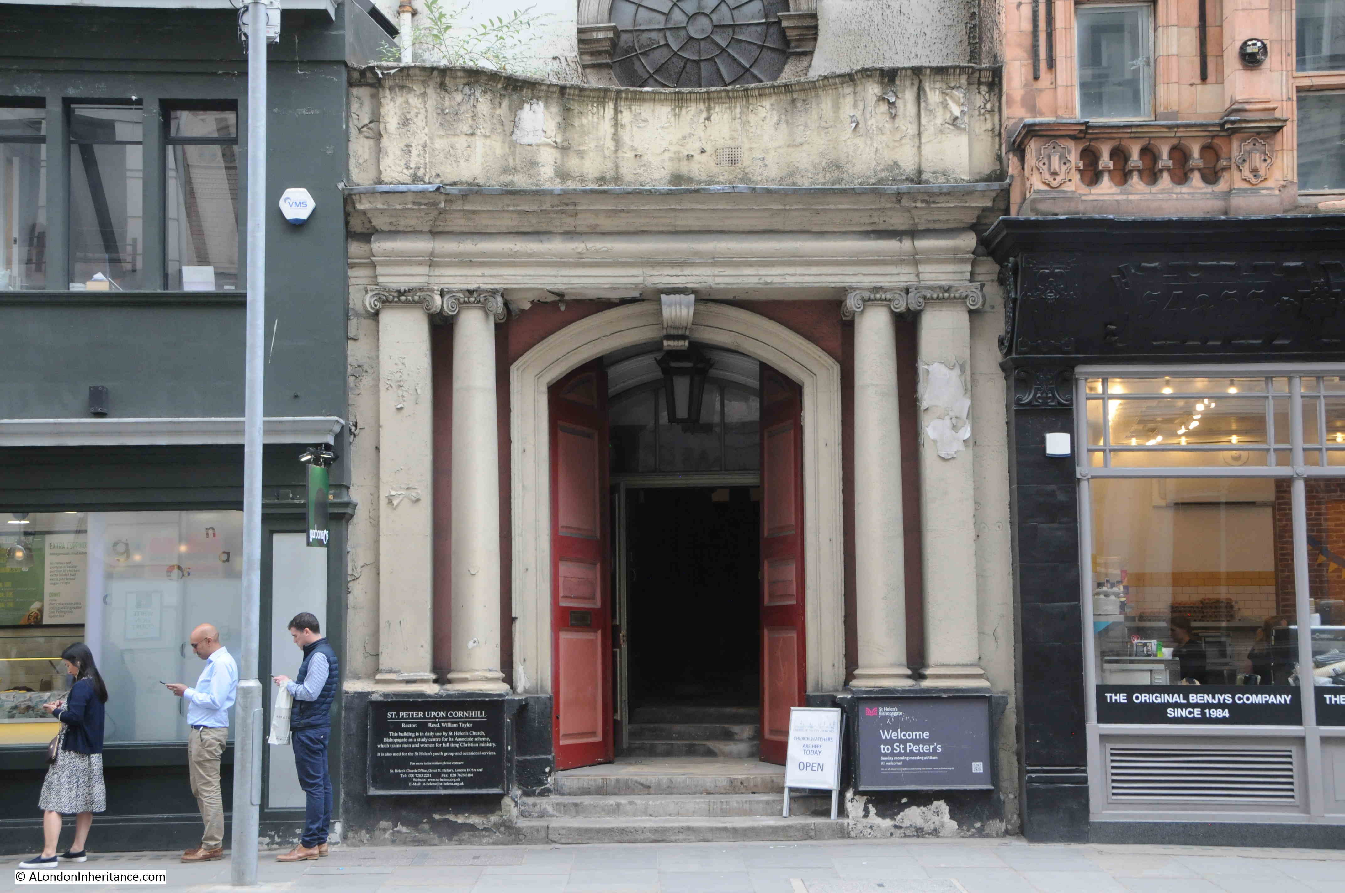
Only the main entrance to St Peter is on Cornhill, and when the doors are open, the entrance appears to offer a rather mysterious portal between the food shops to an older London:

St Peter Cornhill

St Peter-upon-Cornhill is in an interesting location, as it is at roughly the highest point in the City of London. Whether this has anything to do with the church’s location is doubtful, however it has been a religious site for very many centuries with Stow claiming the second century as the date for the founding of a church on the site.

The website of the church is even more specific as it states ” 179AD when Lucius, the first Christian King of Britain”, and that St Peter was the first church in the City of London. It was built on the site of the Roman Basilica.

Stow refers to a tablet in the church which had an inscription about the original founding of the church, and this reference also appears in other accounts of the church, however it seems this tablet dated to the 14th century, so a considerable gap of many centuries with the alleged second century date of the original founding of the church.

The earliest written records for the church date to 1127, however a church was probably on the site for many centuries before the 12th century, but whether back to the 2nd century is impossible to confirm.

The church has had a number of rebuilds and additions over the years. In the 15th century there was a school attached to the church.

In common with many other City churches, it was very badly damaged during the 1666 Great Fire. It was rebuilt by Wren between 1677 and 1684, and this is the church we see today as it survived the blitz without any damage – although there have been a number of restorations since the 17th century.

It was the post fire rebuild that shortened the church. Ten feet of the eastern section of the pre-fire church was demolished to make way for a widened Gracechurch Street.

I found one reference to the church of a type that I have not seen before. It goes back to the 25th of January 1783 and is a newspaper report about a fire in Fenchurch Street, and states that:

“There was a great scarcity of water for some time, but the reservoir belonging to St Peter’s Cornhill, being opened, a good supply was obtained, which was the means of its being got under.”

I have not seen a reference to a City church having a water reservoir. Whether this was an open body of water, or a large tank or conduit, it is impossible to tell. It could perhaps have been a service that the church provided to the parish.

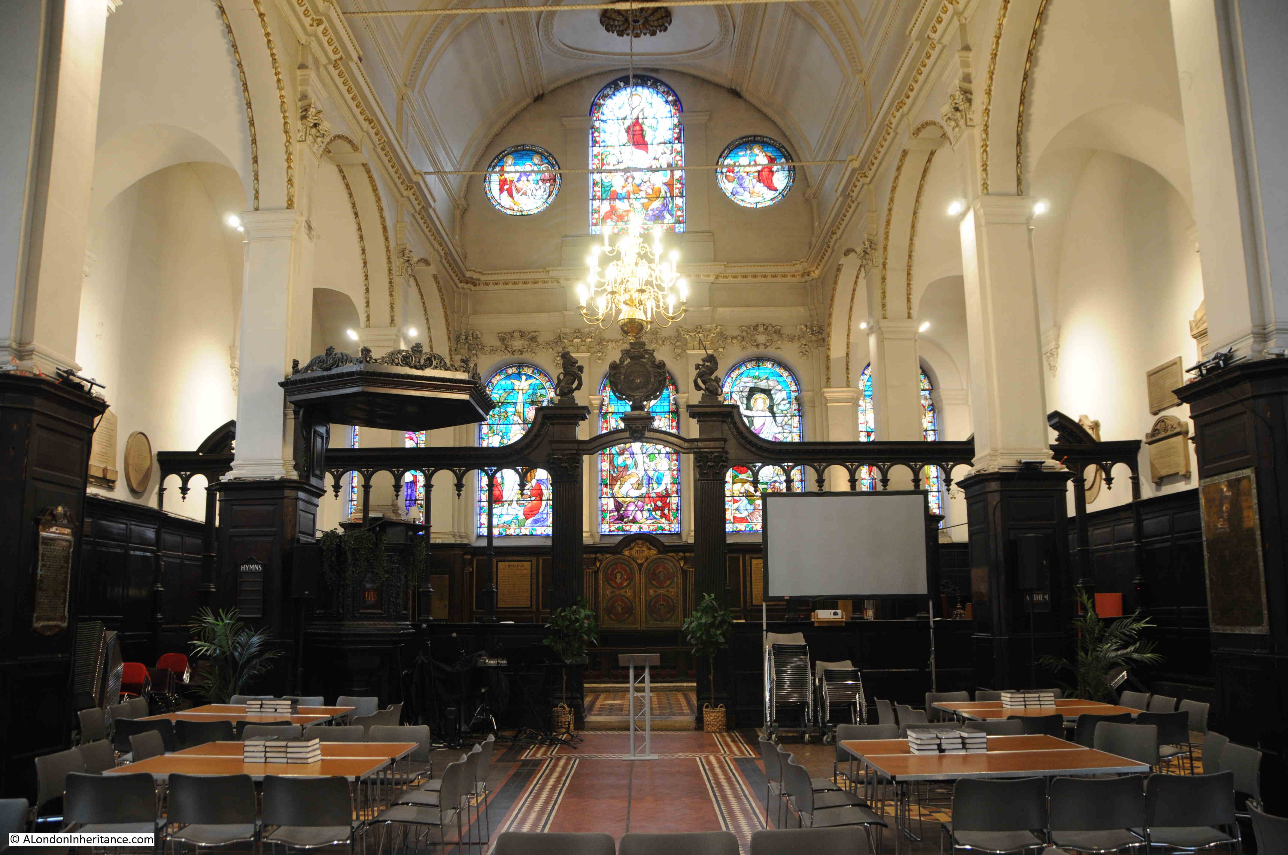
Walking through the dark portal of the church from Cornhill reveals a surprisingly light church interior:

St Peter Cornhill

The last major restoration of the church was in 1872, and although everything above ground is Wren and later, below ground there are much earlier remains as during an excavation in 1990 it was found that Wren had used the medieval pier foundations of an earlier version of the church which probably dated to around the mid 15th century.

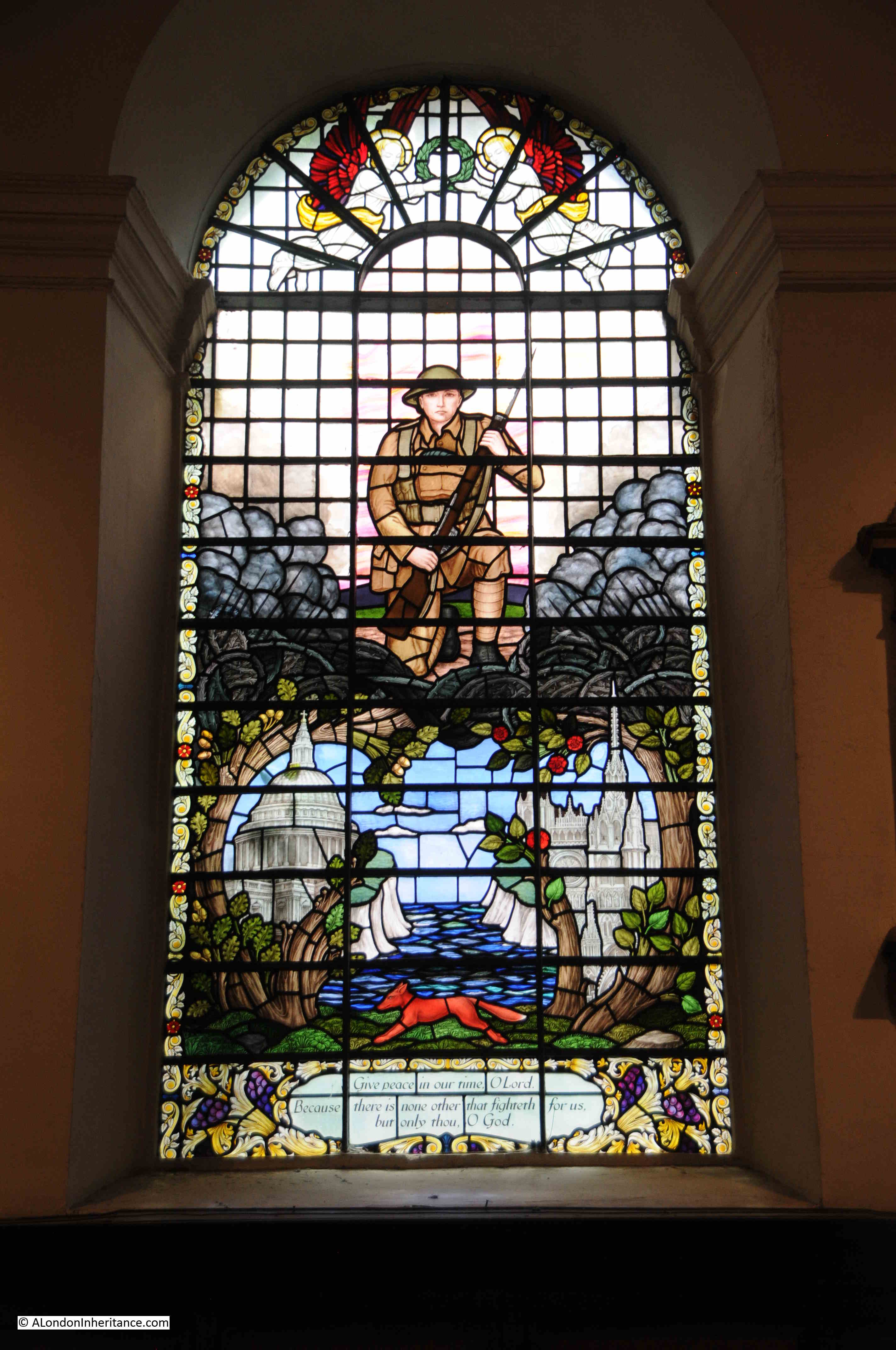
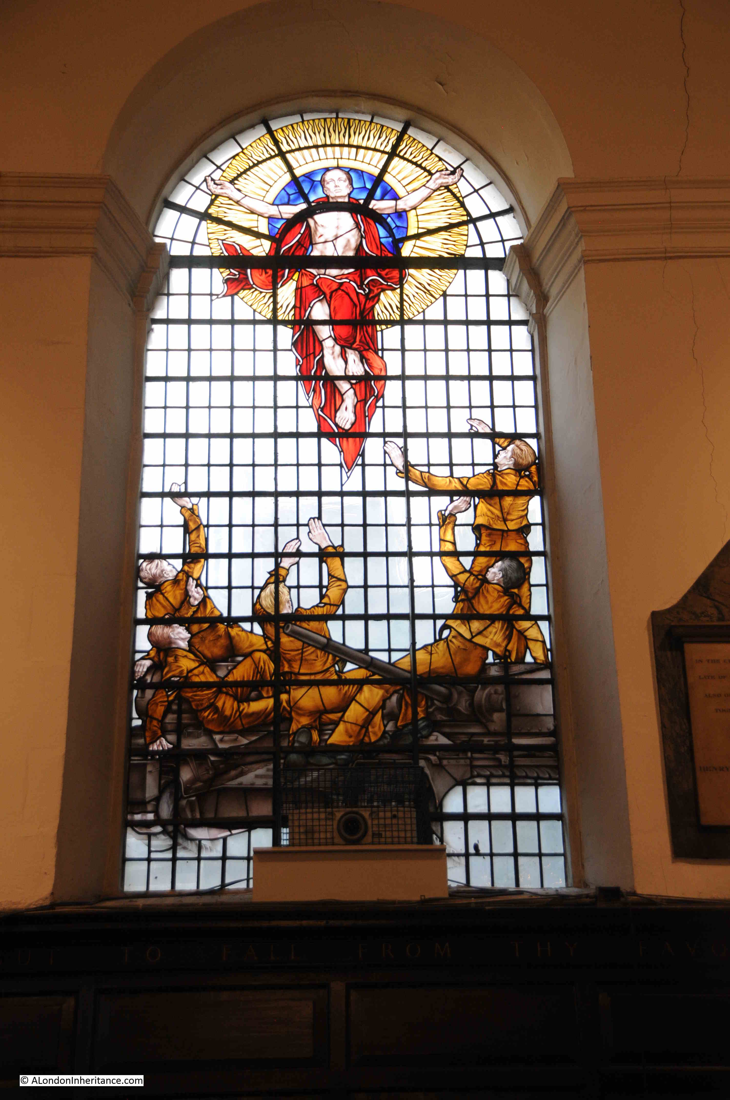
The most recent additions to the church are some stained glass. These were created by the stained glass artist, Hugh Ray Easton, and date from 1960.

The military significance of the windows is that the church was Regimental Church of the Royal Tank Regiment, between 1954 and 2007.

stained glass artist, Hugh Ray Easton

They are a strange mix of war and religious imagery, with in the following window, a group of soldiers are standing on a tank and are witnessing either the Ascension or the Resurrection:

stained glass artist, Hugh Ray Easton

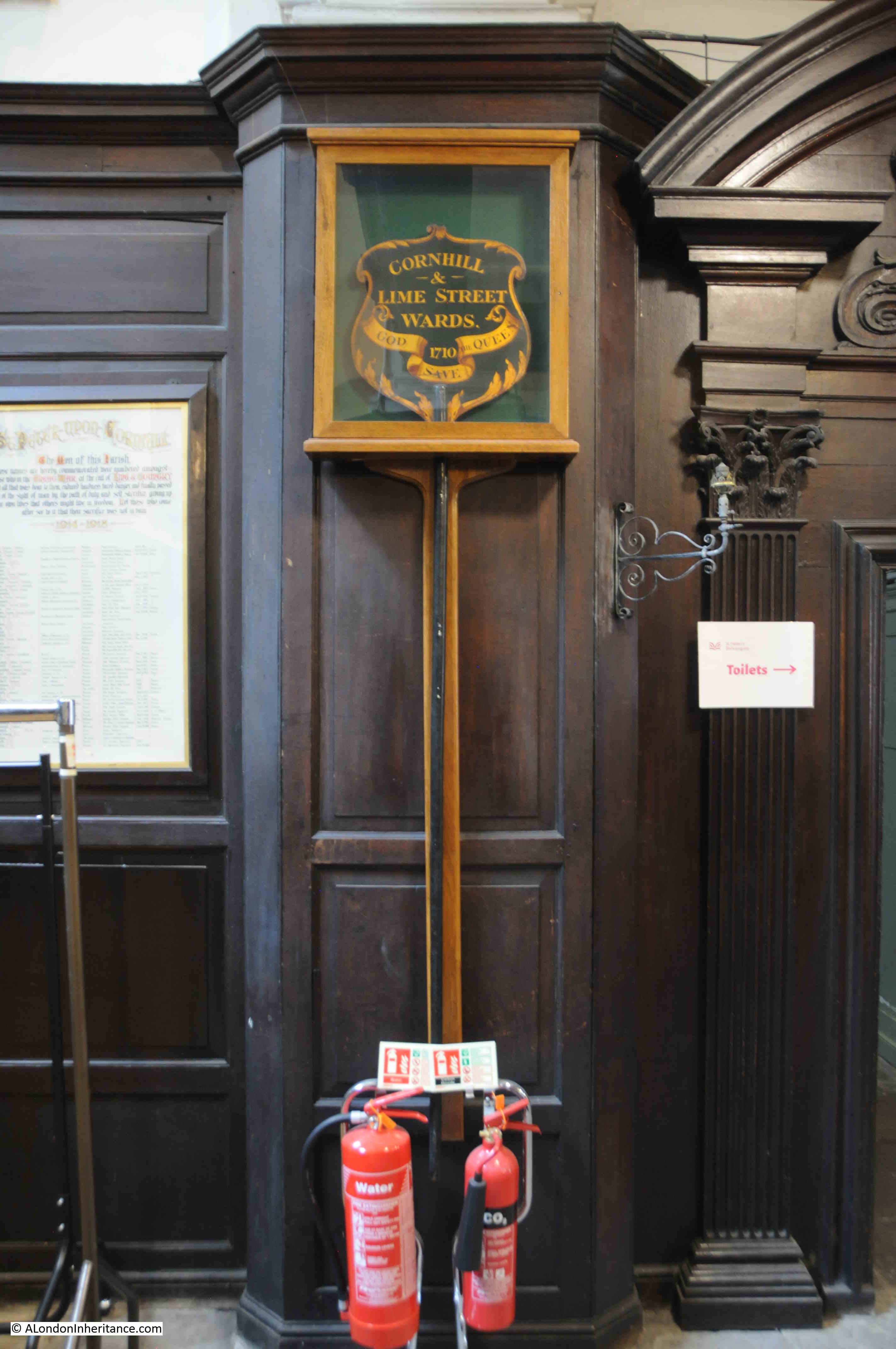
As can frequently be found in City churches, there are a number of historical relics, including the following dating from 1710 which was probably carried in a procession by representatives of Cornhill and Lime Street Wards:

St Peter Cornhill

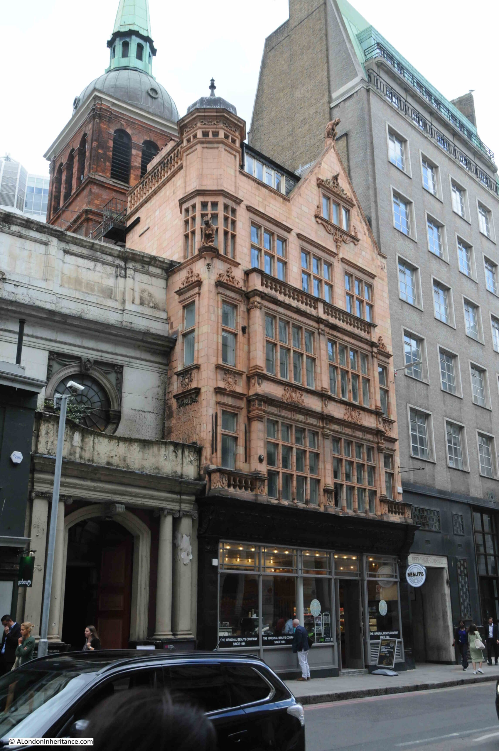
What also adds to the view of an earlier London is the building to the right of the entrance to the church. This is numbers 54 – 55 Cornhill:

54 - 55 Cornhill

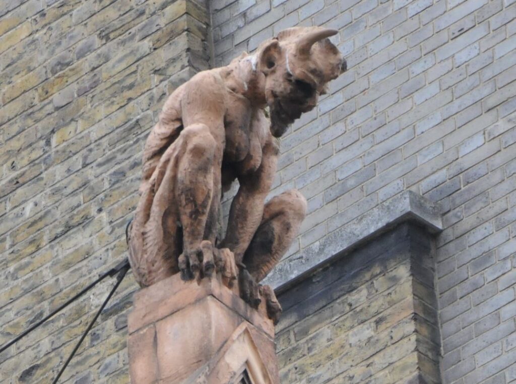
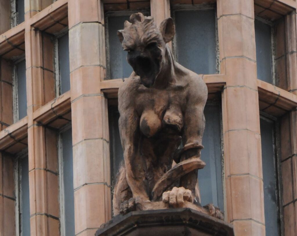
The building has a food outlet on the ground floor, but look at the terracotta upper floors, and there are details that you would not expect to find on a commercial building in the City:

54 - 55 Cornhill

Some very grotesque creatures peer down at those walking along Cornhill.

This strange building was designed by Ernest Augustus Runtz, and dates from 1893. Apparently (although I can find no contemporary confirmation), Runtz’s original plans for the building strayed onto land owned by St Peter. The vicar objected, Runtz had to rework his plans, and added the figures as an insult to the vicar.

 Ernest Augustus Runtz

The Vicar may have had the last laugh though as Runtz was declared bankrupt in 1912 following financial problems and the failure of his business.

He has though left a most unusual building on Cornhill.

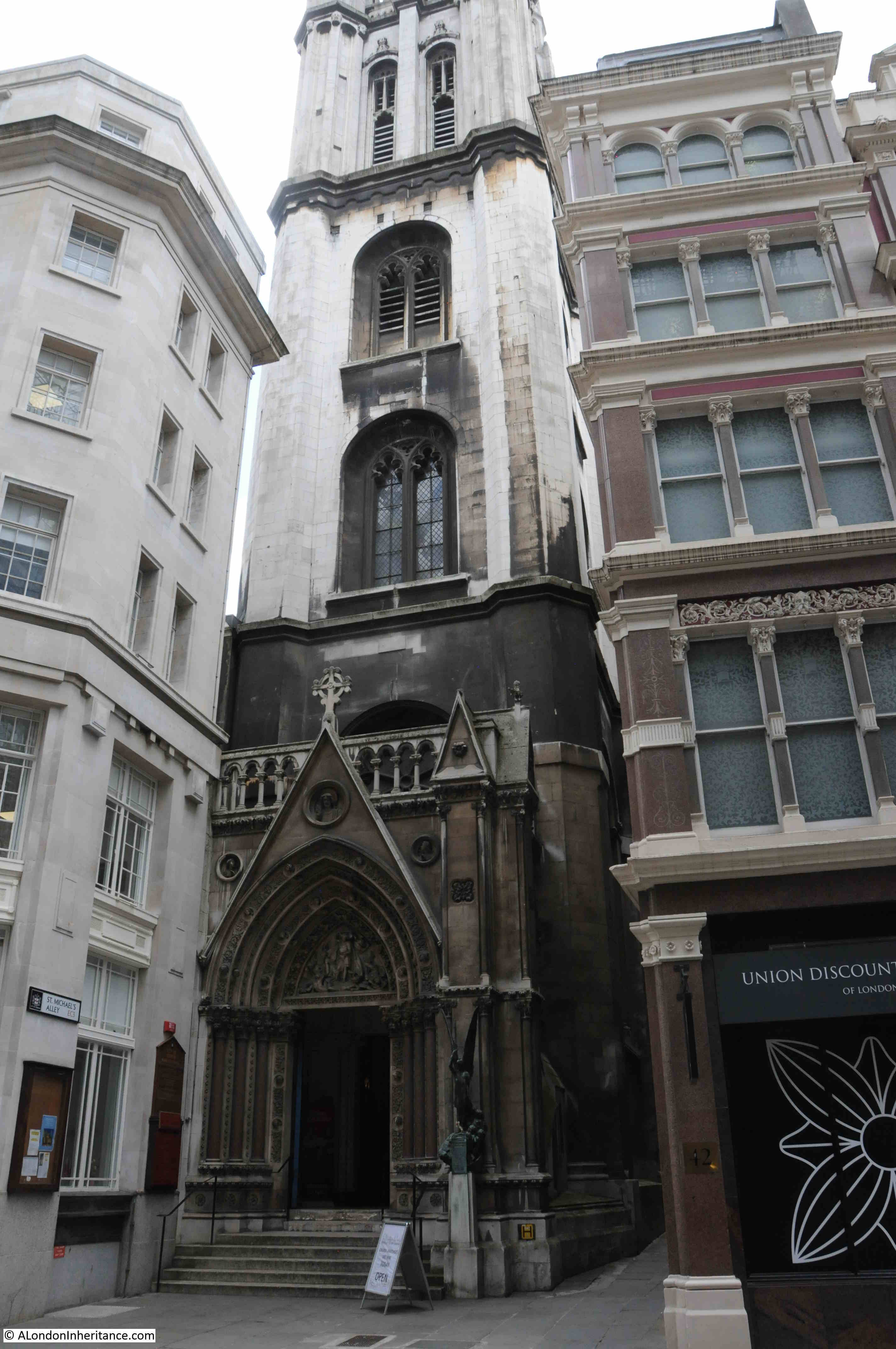
The second church, St Michael Cornhill, is a very brief walk from St Peter, and demonstrates how densely populated the City once was with churches, and again shows how buildings once surrounded City churches, as with St Michael, only the tower is visible from Cornhill, with the main entrance to the church being through an ornate entrance in the base of the tower:

St Michael Cornhill

St Michael is again an old church, however there are no firm records of just how old. The usual references where “tradition points to a church in Saxon times”, however the first written reference, according to “London Churches Before The Great Fire” by Wilberforce Jenkinson (1917) is from 1133 when the church was in the possession of the Abbott of Evesham, and the “living granted by him to Sparling the Priest”.

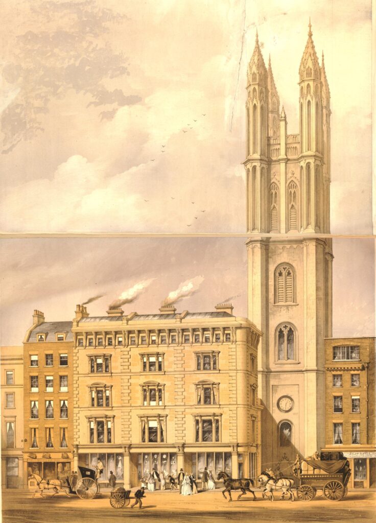
The tower of the church seems to feature in the majority of references to, and illustrations of St Michael.

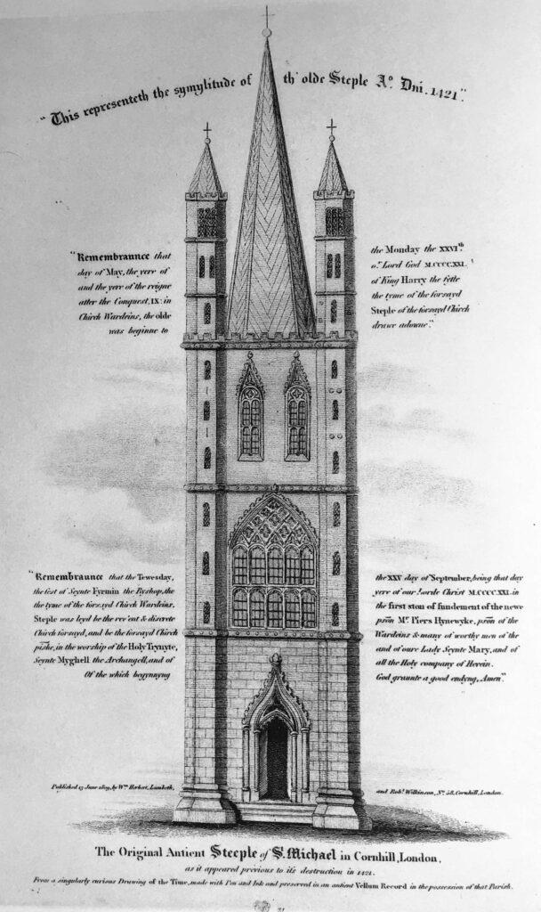
There are no illustrations of the original church, however a copy of an illustration of the fourteenth century tower, which was destroyed in 1421, has survived and shows the “Symilitude of the old Steeple 1421”:

St Michael Cornhill

The church was badly damaged during the 1666 Great Fire, but was rebuilt between 1670 and 1671 by Wren, who included the surviving tower into the reconstruction. The tower was weakened by the fire and survived for a further fifty years and was then taken down “as wanting in stability”.

Pevesner states that the new tower was probably designed by “William Dickenson who was in charge of winding down Wren’s City Church Office”, although other references state that it was to Wren’s original design.

The following print illustrates the appearance of the tower in 1850, again with only the tower being visible from Cornhill. The body of the church is behind the buildings on the left  (© The Trustees of the British Museum):

St Michael Cornhill

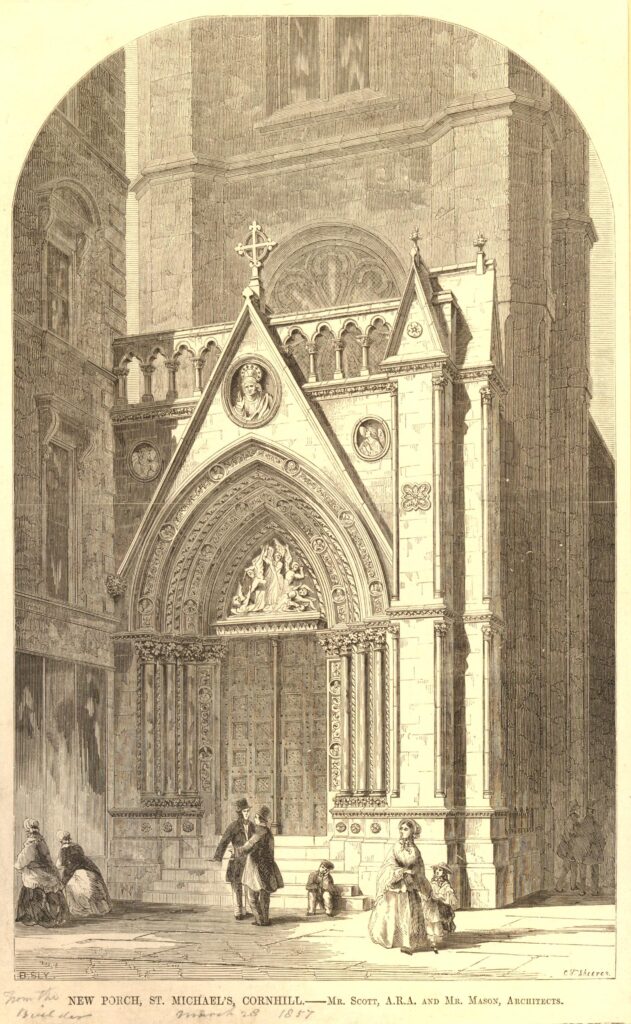
The tower in the above print is the same tower that we see today, however it was missing one vital feature, the ornate entrance to the church at the base of the tower.

This ornate, Gothic entrance would be built between 1857 and 1860 when the church was the first in the City to be remodeled to high Victorian taste by Sir George Gilbert Scott.

The following print has a penciled note dating it to 1857. It may actually be a couple of years later, however it does show the new porch soon after it had been added to the church, and although today the stone is blackened with dirt (another feature of older City churches), it does look much the same today  (© The Trustees of the British Museum):

St Michael Cornhill

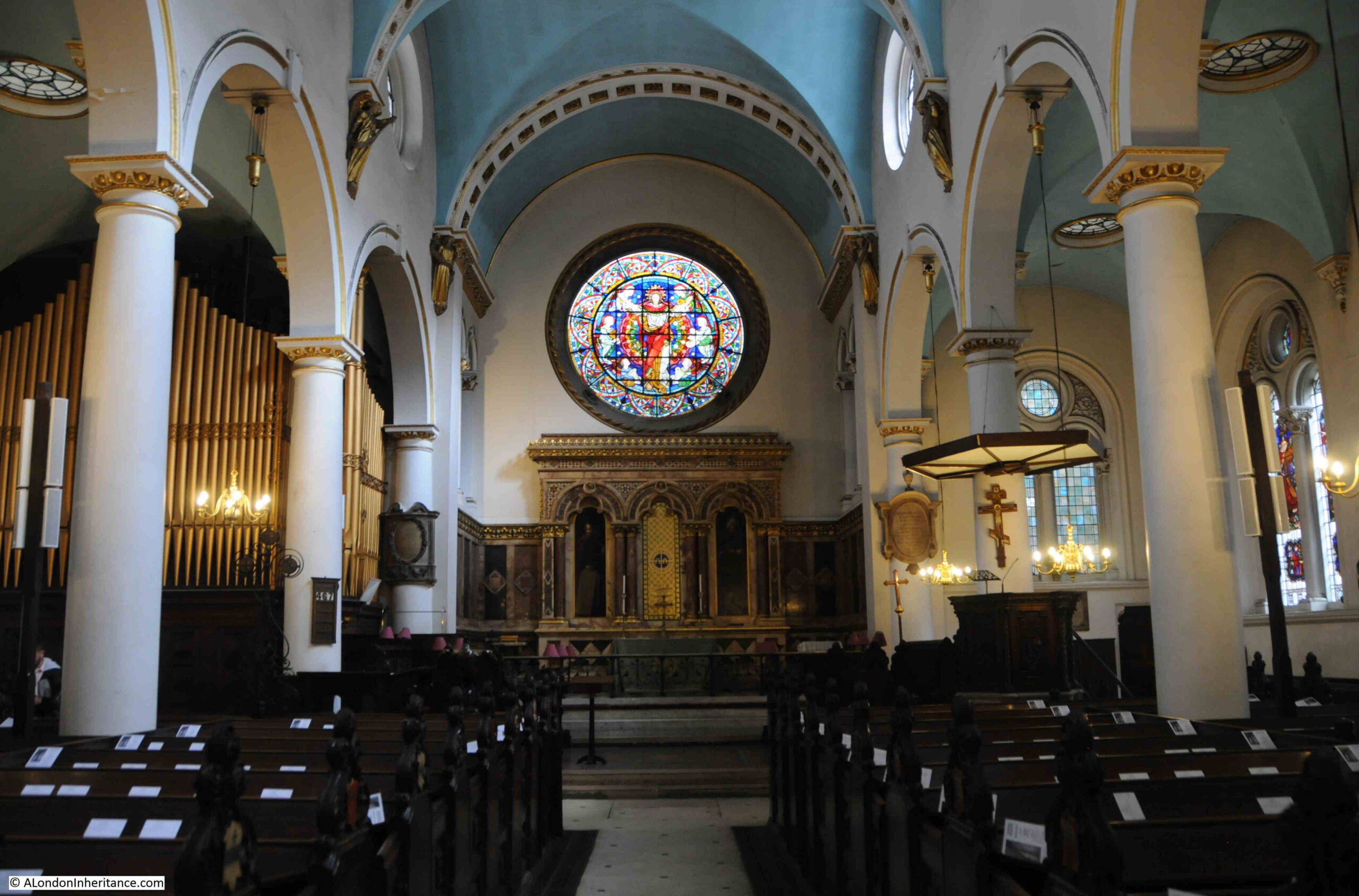
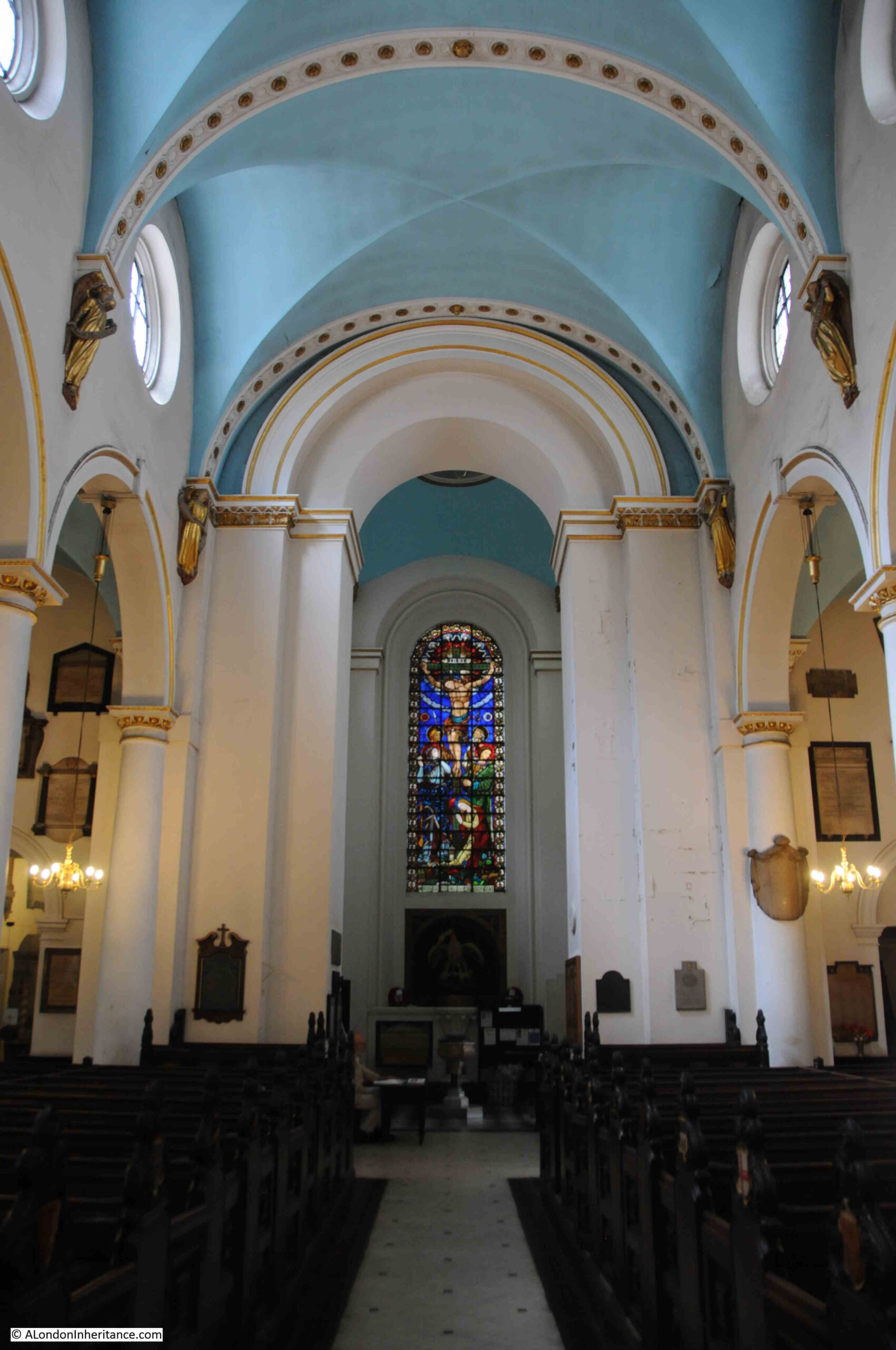
The interior of the church is mainly from the 17th century, post Great Fire rebuild with mid 19th century and later restorations:

St Michael Cornhill

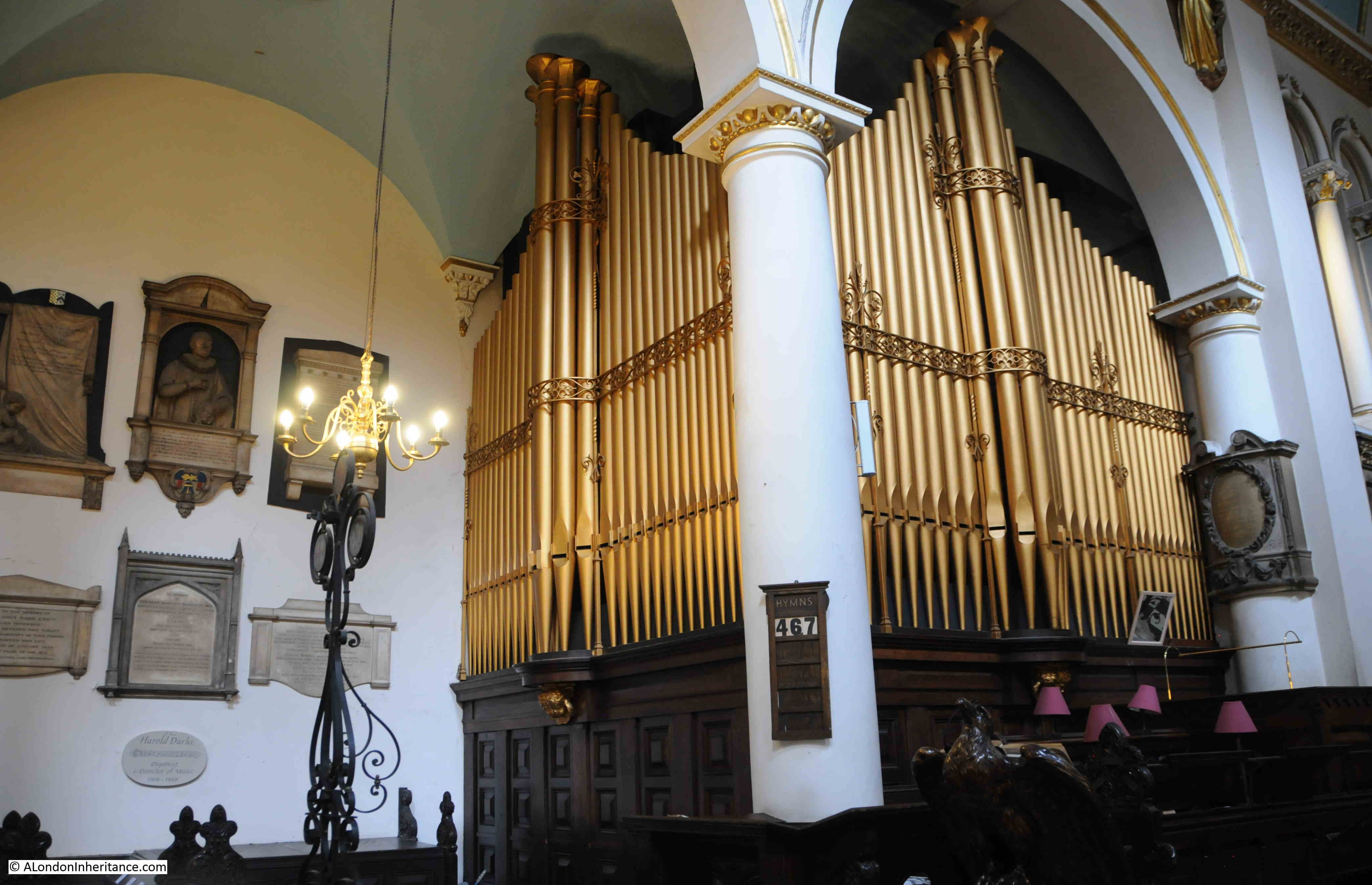
Pevsner states that the organ has been “much rebuilt”, so it is probably not that old, although there may be some surviving parts from the original Renatus Harris 17th century organ. It still looks very impressive with gleaming, gold, organ pipes occupying a corner of the church:

St Michael Cornhill

Looking back towards the base of the tower:

St Michael Cornhill

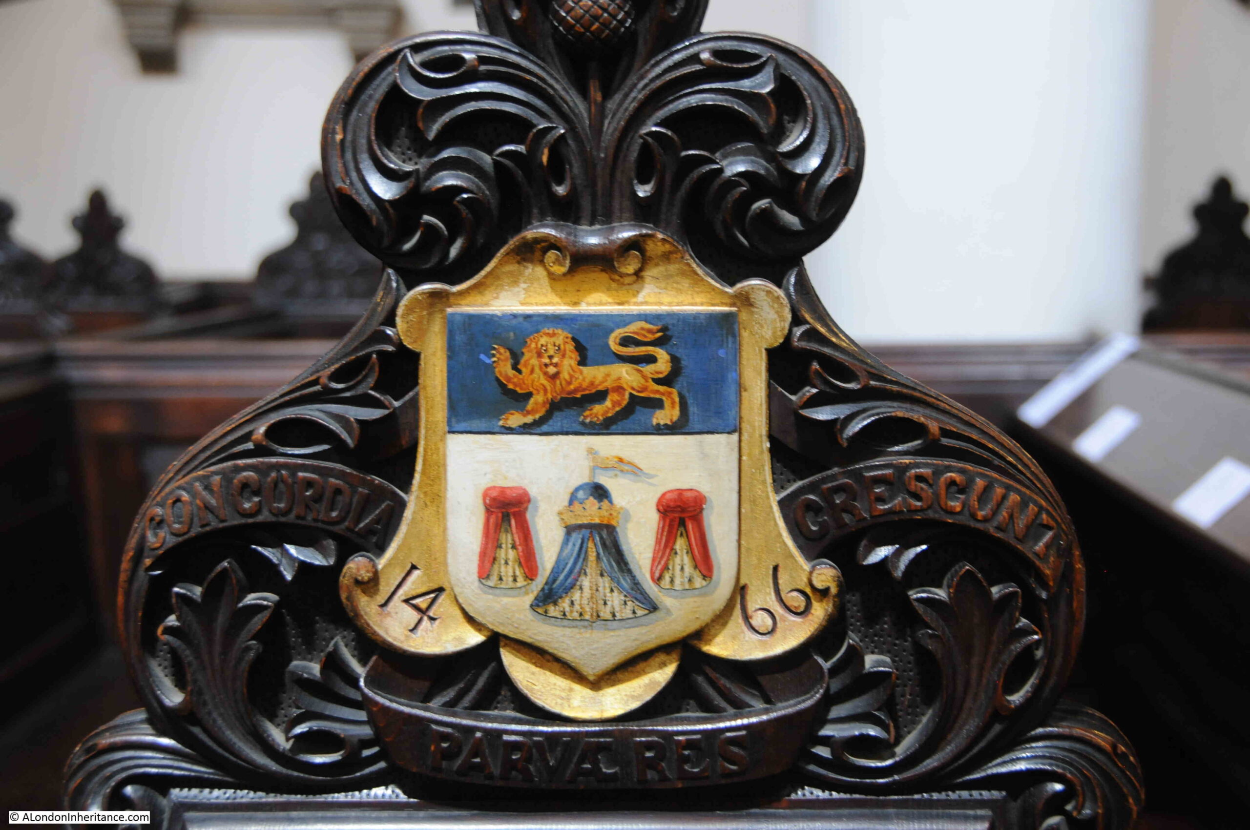
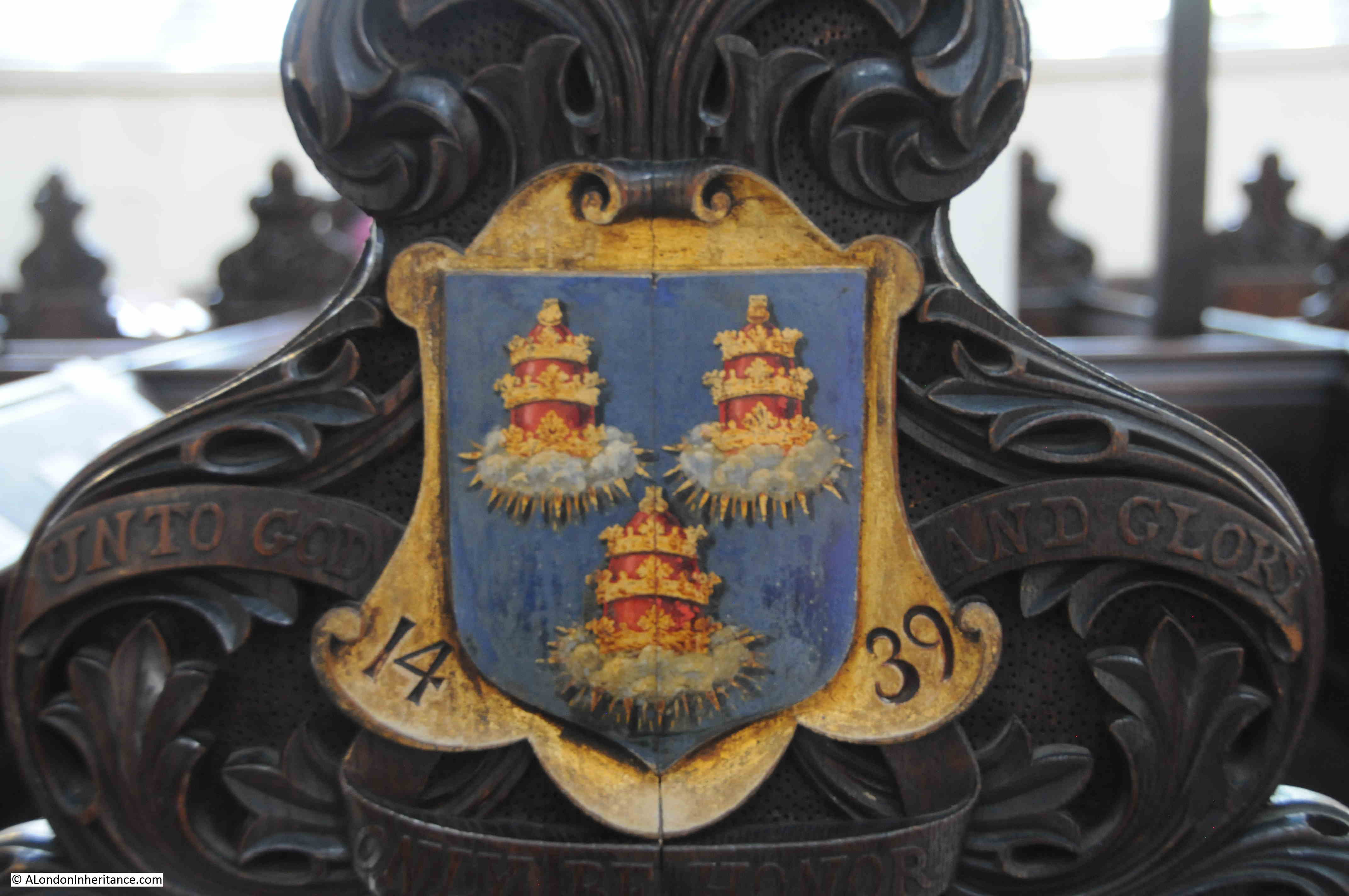
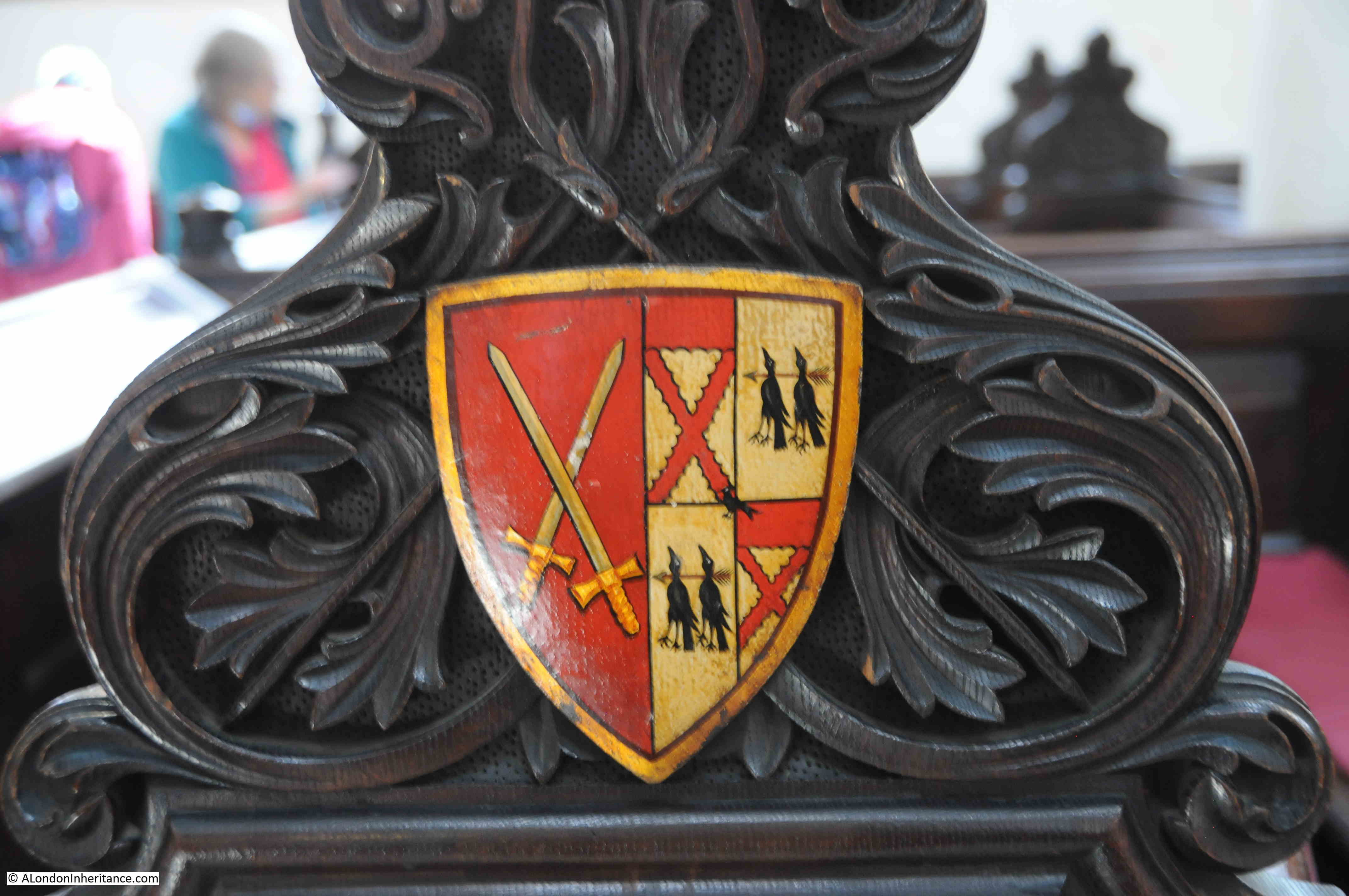
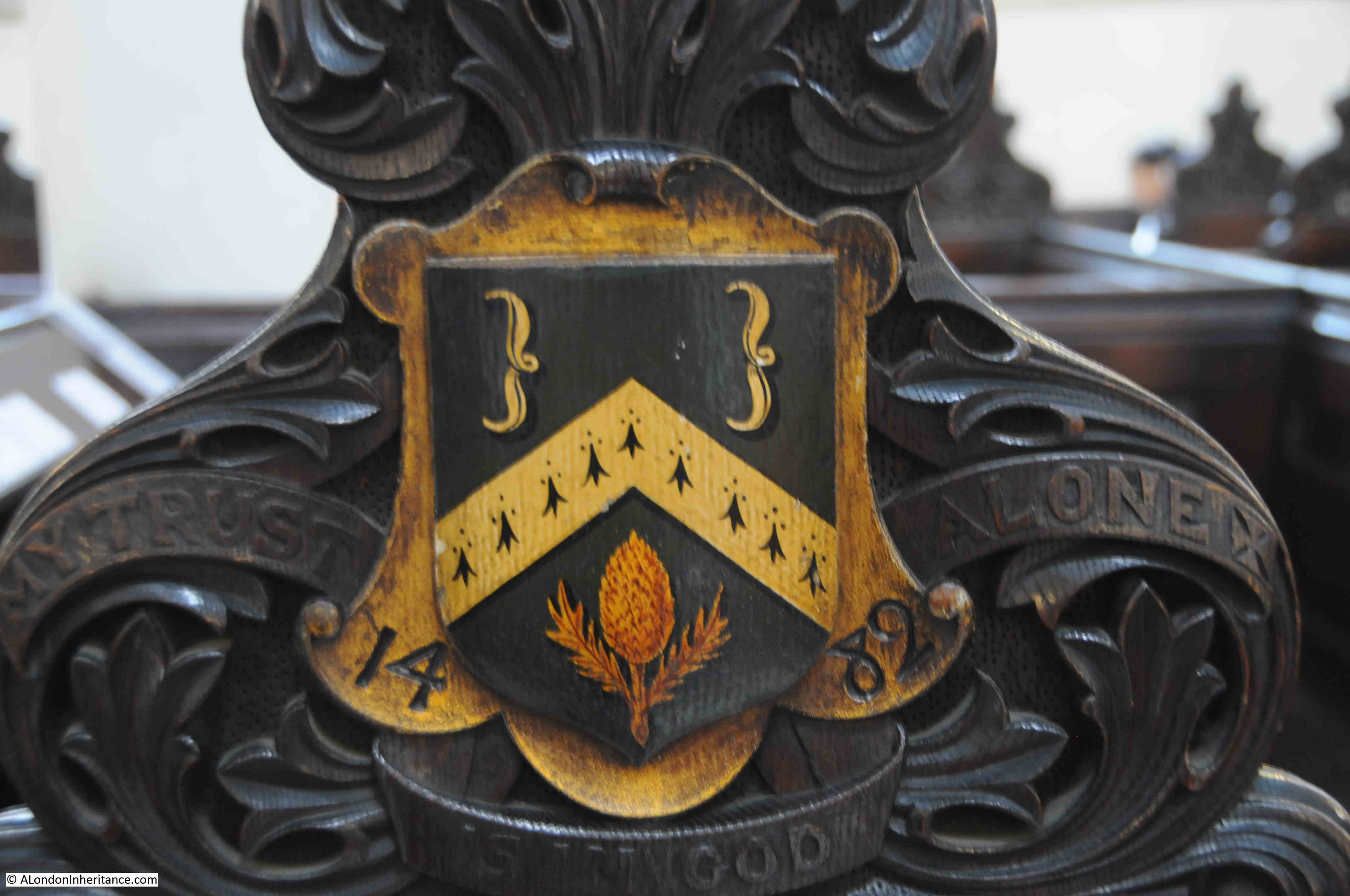
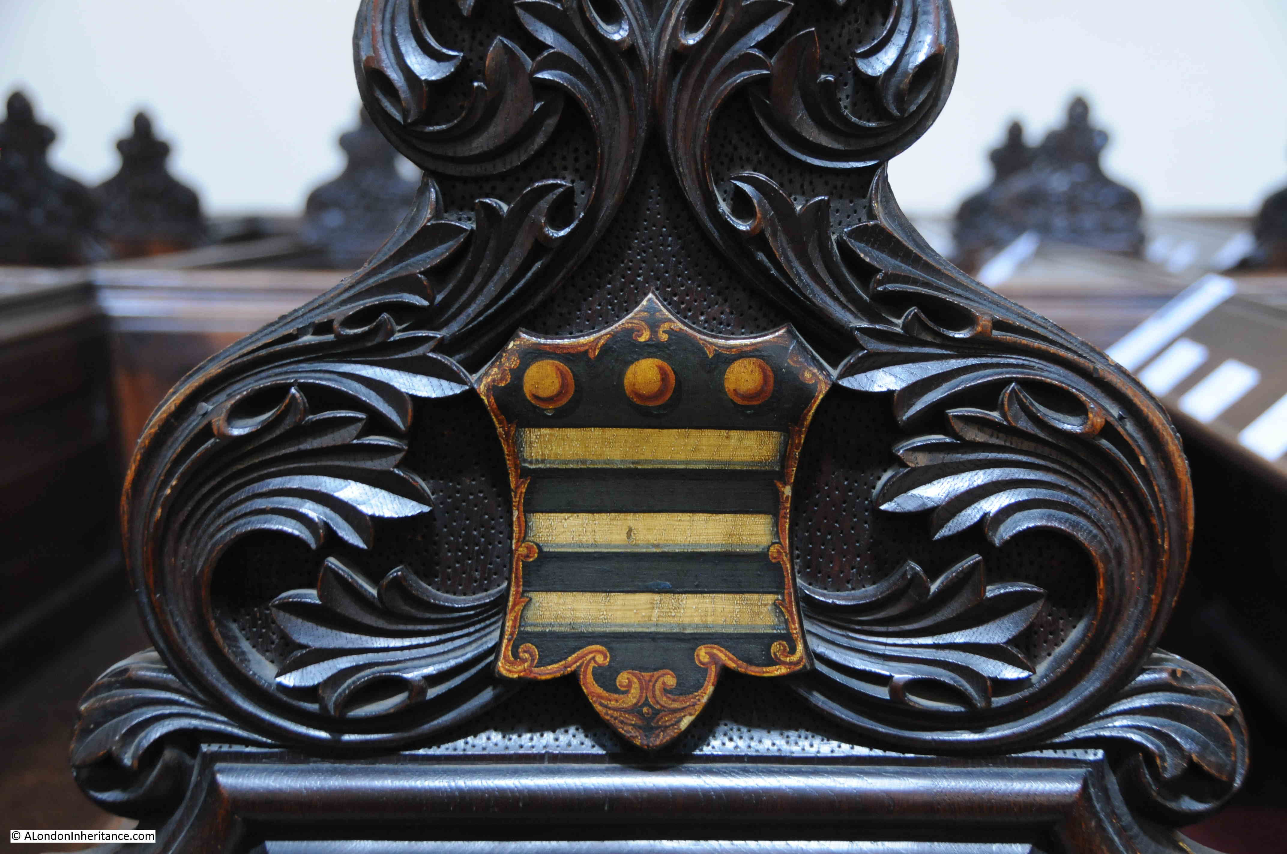
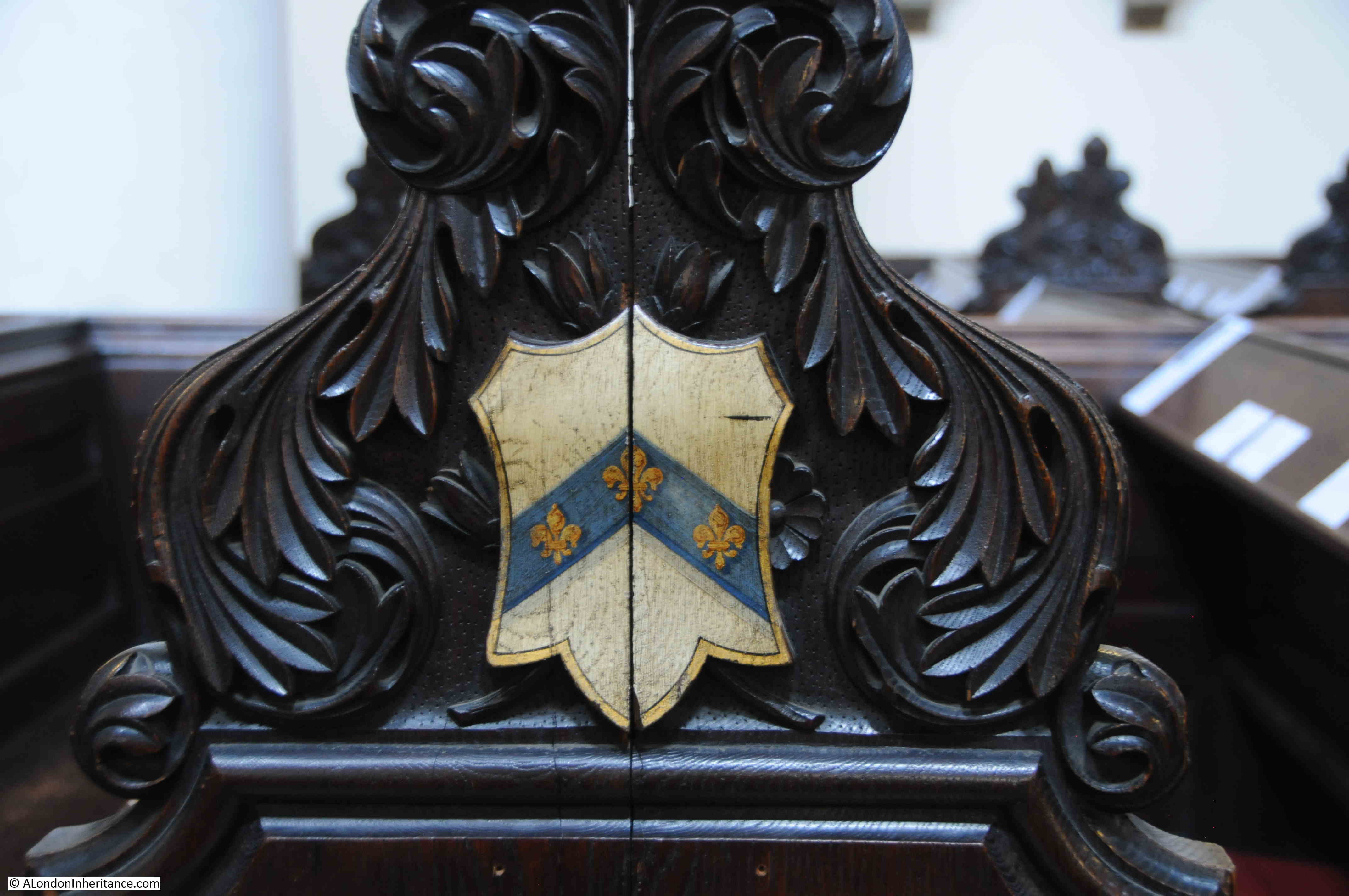
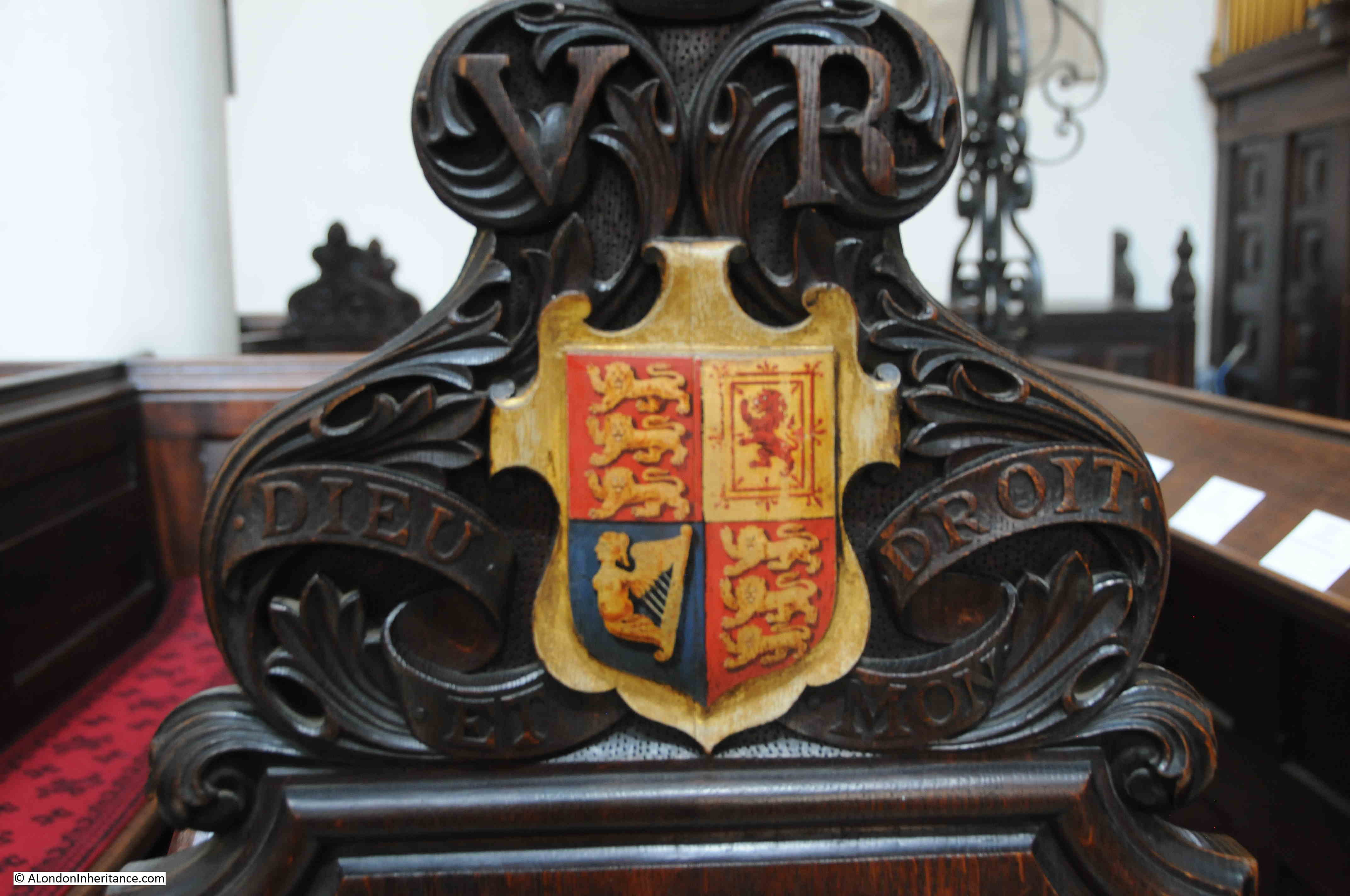
The majority of City churches have plenty of old monuments, pulpits, sword rests etc. and St Michael Cornhill is no exception. In St Peter I wanted to highlight the stained glass windows as a different feature, and in St Michael there are coats of arms on the sides of the pews. The majority appear to be City Livery Companies, however there are some I cannot identify. The following photos show a sample.

The Merchant Taylors:

Merchant Taylors coat of arms

The Drapers:

Drapers coat of arms

This one is rather strange. I cannot find a similar set of arms being used by a Company. The crossed swords may indicate the Cutlers who usually have three sets of crossed swords on their arms, however I cannot confirm that they use the images on the right of the shield:

Coat of arms

The Clothworkers:

Clothworkers coat of arms

Another I cannot identify, or find anything similiar:

Coat of Arms

I thought I had a reasonably good understanding of the arms used by City companies, and have also been through the book “The Armorial Bearings of the Guilds of London”, but the following is a mystery as well:

Coat of Arms

The Royal Coat of Arms of the United Kingdom – apparently this were placed on the pew at the front of the church in anticipation of a visit by Queen Victoria. Unfortunately she failed to visited the church.

Royal coat of Arms

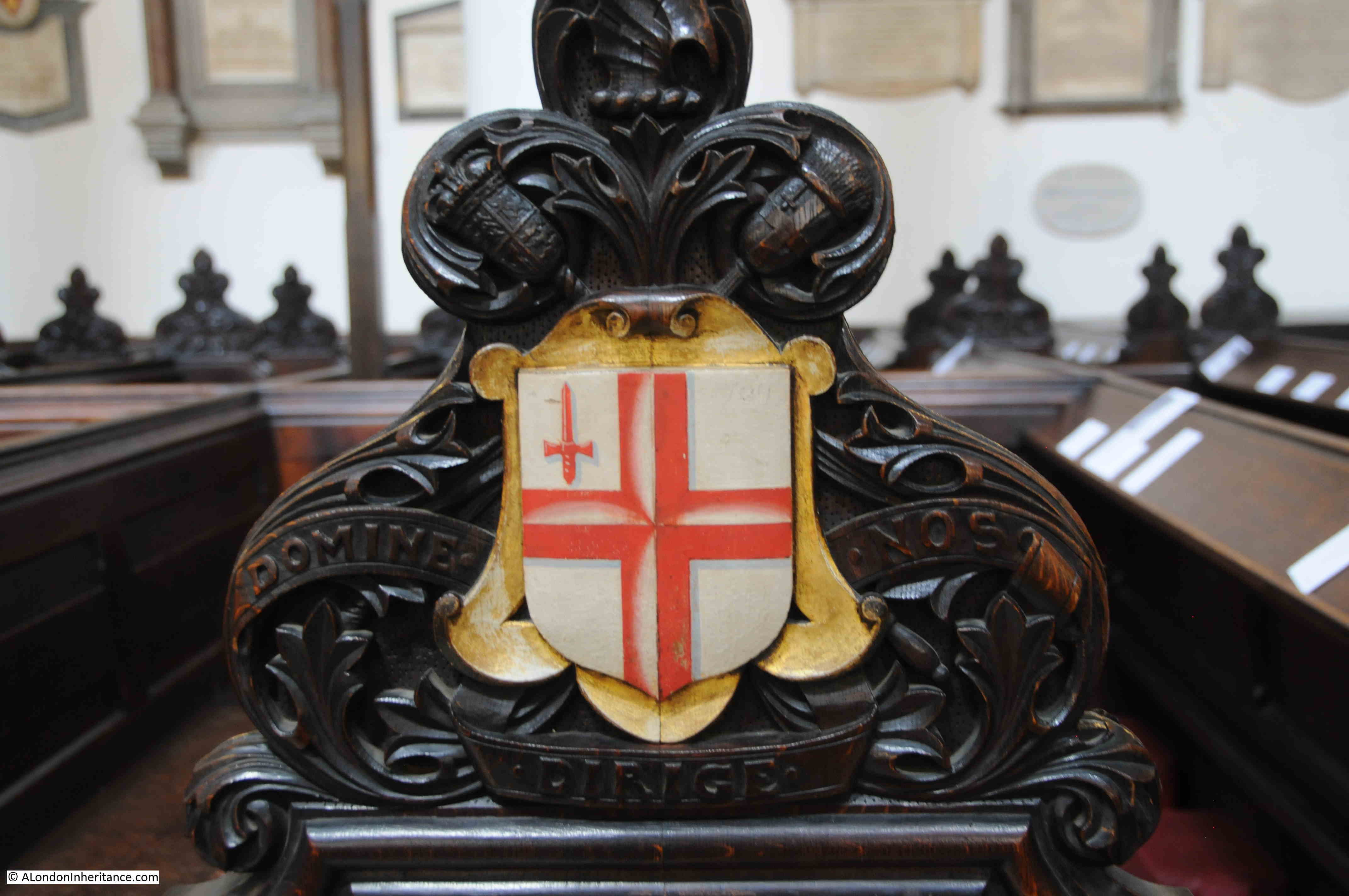
The arms of the City of London:

City of London

When researching many of my posts, I am struck by the number of times there is a reference to a serious fire at or near the subject of the post. It is incredible just how many fires there were in 18th and 19th century London. Even after the building regulations put in place after the 1666 Great Fire, serious fires still continued.

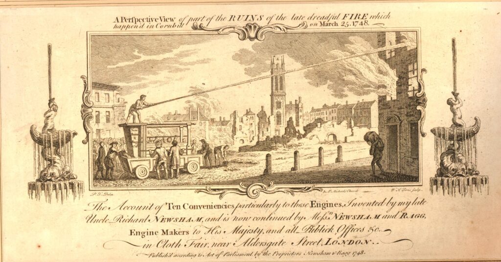
When searching for stories about St Michael, I found the following print which shows a serious fire in Cornhill on the 25th March, 1748, with the tower of St Michael in the background  (© The Trustees of the British Museum):

Cornhill fire

The print is fascinating for the detail it portrays. There is presumably a property owner on the right, apparently rescuing something from the burning building.

There is a very early fire fighting pump on the left, sending a jet of water at the building.

The print references the engine as “invented by my late Uncle, Richard Newsham”, an inventor who held two patents for fire engines, taken out in 1721 and 1725. Newsham appears to have dominated the mid 18th century market for fire fighting equipment.

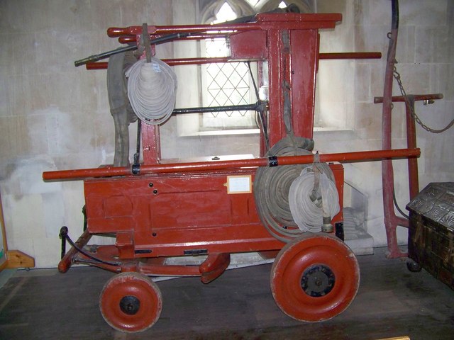
The following photo shows the earliest known fire engine by Newsham purchased in 1728, and photographed at St Giles Church in Great Wishford, Wiltshire. The photo is almost identical to the one in the 1748 print:

fire engine by Newsham

Source: Trish Steel, CC BY-SA 2.0 https://creativecommons.org/licenses/by-sa/2.0, via Wikimedia Commons

A quick visit to two Cornhill churches. They are an interesting pair of churches to visit as they demonstrate what City churches must have looked like in previous centuries. Surrounded by buildings on the main street, a small churchyard behind, but only an entrance to the street.

That they are also a very short distance apart is a reminder of how densely populated the City was with churches, before the loss of churches caused by the Great Fire, 19th century church closures, and bombed churches not being rebuilt after the last war.

You can read another of my posts about Cornhill, the Cornhill Water Pump, here.
alondoninheritance.com

The Cornhill Water Pump

The City of London appears to be changing by the day with construction sites on every corner, however there are still some locations that have changed remarkably little over the past 70 plus years. This week’s post is about one such location, centred on the Cornhill Water Pump.

Cornhill is one of the streets that meet at the major road junction adjacent to the Bank of England. Originally the location of the north wall of the first Roman settlement, and later at about the centre of the city as Roman London developed from the original settlement.

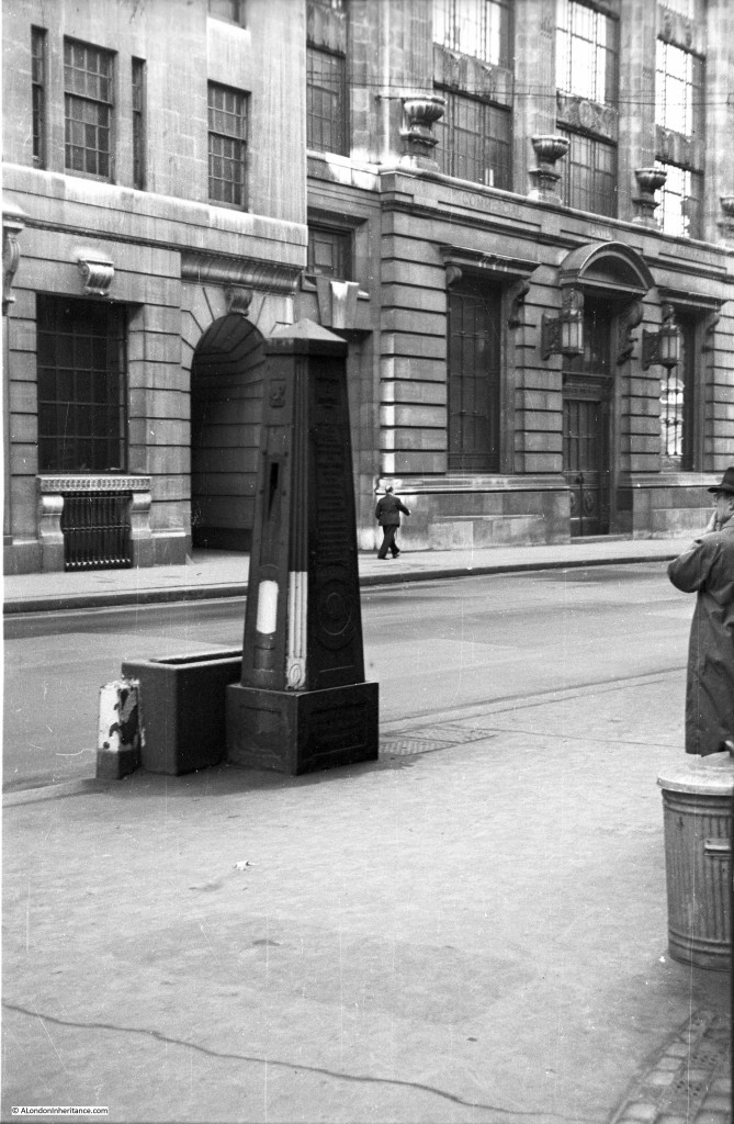
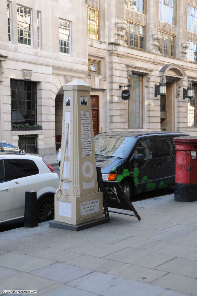
My father took the following photo of the Cornhill Water Pump in 1948:

Cornhill Water Pump 1

This is the view of the pump from the same location, 67 years later in 2015:

Cornhill Water Pump 2

I will come on to the history of the pump, but what did surprise me as I was taking the photo is how little has changed. Not just the stonework of the buildings opposite (which have been cleaned in the intervening years), but also the windows, the large lamps either side of the door on the right and the stone decoration on both buildings. The man standing on the right of the 1948 photo could stand in the same position today and (apart from the traffic and the post box) see little change.

The building on the right of the photo was occupied by the Commercial Union Assurance Company, and to the right of this (just out of the photo) is the building originally built for Lloyds Bank.

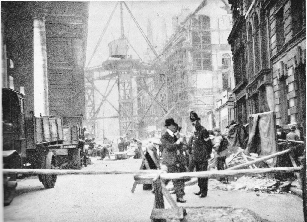
During construction of the Lloyds Bank building in 1927, the roadway in Cornhill collapsed, with the result that part of the original Commercial Union building also collapsed. The damage was so bad that the Commercial Union building had to be rebuilt. It was completed in 1929 and it is that building we see today.

The collapse of the roadway was put down to the loose condition of the soil due to the Walbrook stream having once flowed across this part of the City down to the Thames.

The following photo from August 1927 shows the collapse of the roadway. It was taken from the main Bank junction looking down Cornhill. The Royal Exchange building is on the left. Note the tripod crane structure occupying the whole of the road at the approximate position of the water pump.

Cornhill Water Pump 7

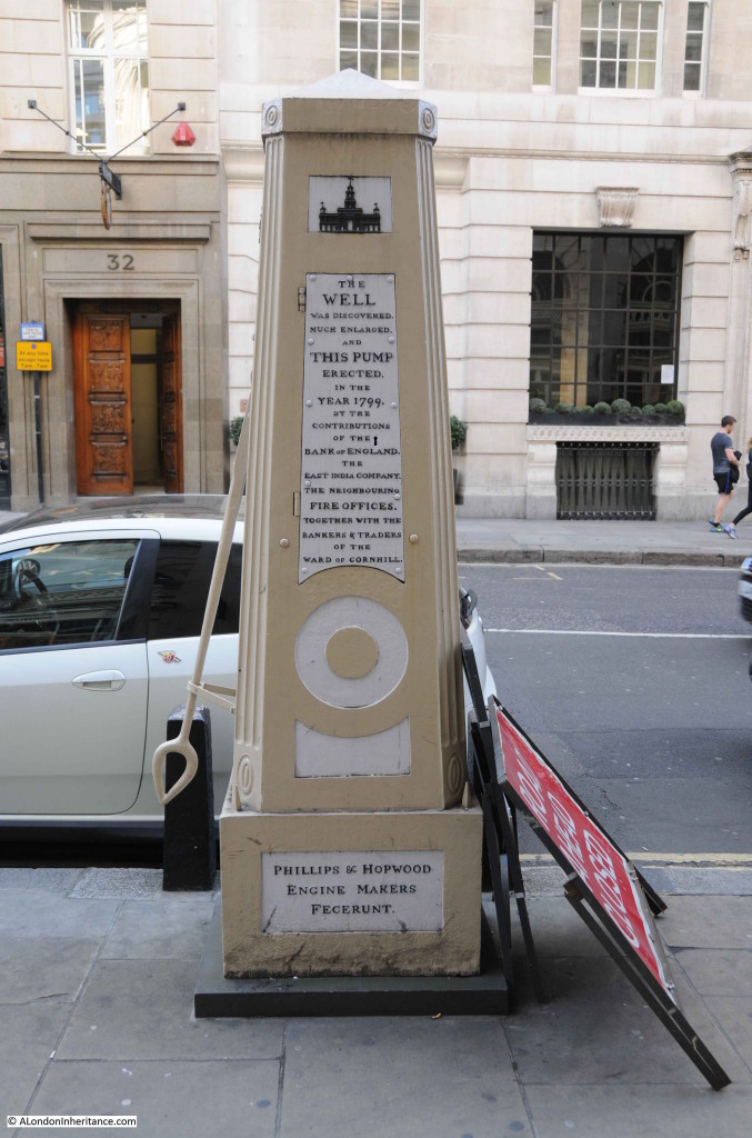
The pump has been restored a couple of times since 1948, the last restoration was a few years ago, when the stone water trough between the pump and the road was also removed. The pump provides some historical background:

The well was discovered much enlarged and this pump erected in the year 1799 by the contributions of the Bank of England, the East India Company, the neighbouring Fire Offices together with the bankers and traders of the Ward of Cornhill

The view of the pump from the pavement. A real shame that it is also used as a prop for traffic signs.

Cornhill Water Pump 3

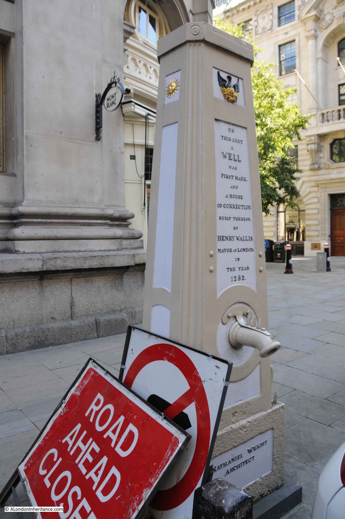
The road facing side of the pump provides an indication of the antiquity of the site:

On this spot a well was first made and a house of correction built thereon by Henry Wallis, Mayor of London in the year 1282 

Cornhill Water Pump 4

Sir Walter Besant writing in “London – The City”  in 1910 refers to the origin of the pump, using the original spelling of the mayor, Henry Wallis: “A conduit built by Henry le Waleys in 1282, and there was a standard for Thames water brought their by the contrivance of one Peter Morris, a Dutchman.”

Besant also refers to several conduits and a spring in the area of Cornhill, but it is not clear whether he is referring to the location of the pump. There were many pumps and wells sunk all over the City, typically shallow and reaching a depth of 30 feet. They would have about 14 foot of water in the winter reducing to 3 foot in the summer.

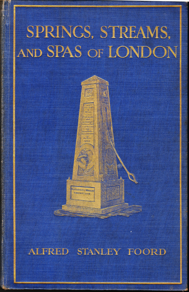
At some point, the well was covered, as the rediscovery in 1799 was caused by “a sinking of the pavement in front of the Royal Exchange, March 16, 1799” according to Springs, Streams and Spas of London by Alfred Foord. This book was published in 1910 and contains a detailed account of the many water sources across London. It also features the Cornhill pump on the front cover:

Cornhill Water Pump 6

Writing in 1910 Foord also states that “The well and pump have been disused for some years past; the water which fills the trough, so much enjoyed by the many horses of passing vehicles, being derived from the New River Company’s mains. The iron case of the pump remains, but deprived of handle and spout. The whole structure would be much better for a coat of paint, which would not only improve its appearance, but would also tend to arrest decay.” 

I am sure that 105 years later, Foord would be very pleased with the condition of the pump today.

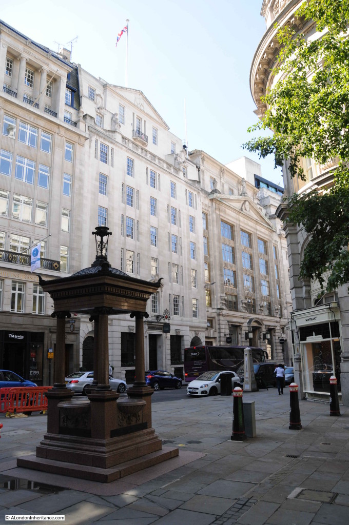
Continuing the theme of public water supplies, a short distance away from the water pump is a large and ornate drinking fountain:

Cornhill Water Pump 5

This was erected in 1911 and unveiled by the then Lord Mayor of London, Sir T. Vezey Strong on the 3rd May 1911. It replaced an earlier drinking fountain from 1859.

The current fountain was built to commemorate the jubilee of the Metropolitan Drinking Fountain and Cattle Trough Association.

The association, originally called just the Metropolitan Drinking Fountain Association, (the Cattle Trough reference was added in 1867 to highlight the need to provide water for the many animals still on the streets of London), were responsible for the provision of a large number of drinking fountains across London. Another survival can be found at the north end of Blackfriars Bridge (see my post which can be found here)

The fountain today, like the pump, is just decorative without a supply of water and therefore unable to fulfil the intended function, however they are both a reminder of the many water fountains, wells, pumps and conduits that helped provide water to the inhabitants of London over the centuries.

The sources I used to research this post are:

  • London by George Cunningham published in 1927
  • Springs, Streams And Spas Of London by Alfred Stanley Foord published in 1910
  • The Face Of London by Harold Clunn published in 1932

alondoninheritance.com