Laystall Street is a turning off Clerkenwell Road, slightly to the west of Leather Lane. A short distance along Laystall Street there is an unusual plaque on the first floor of one of the terrace houses.
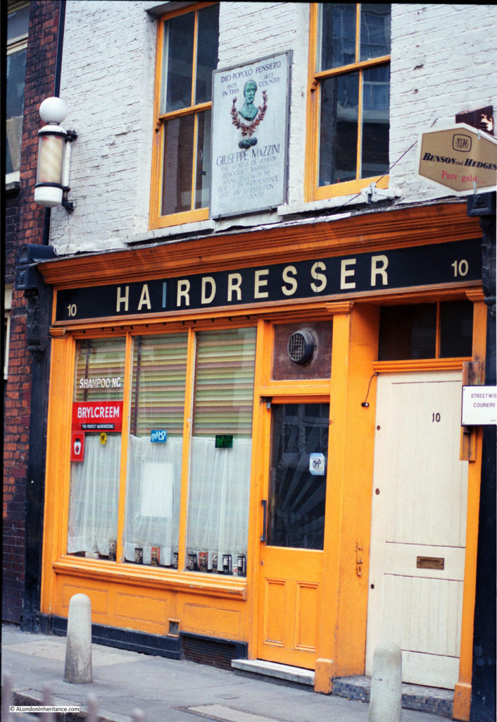
In 1986, the ground floor was occupied by a hairdresser:
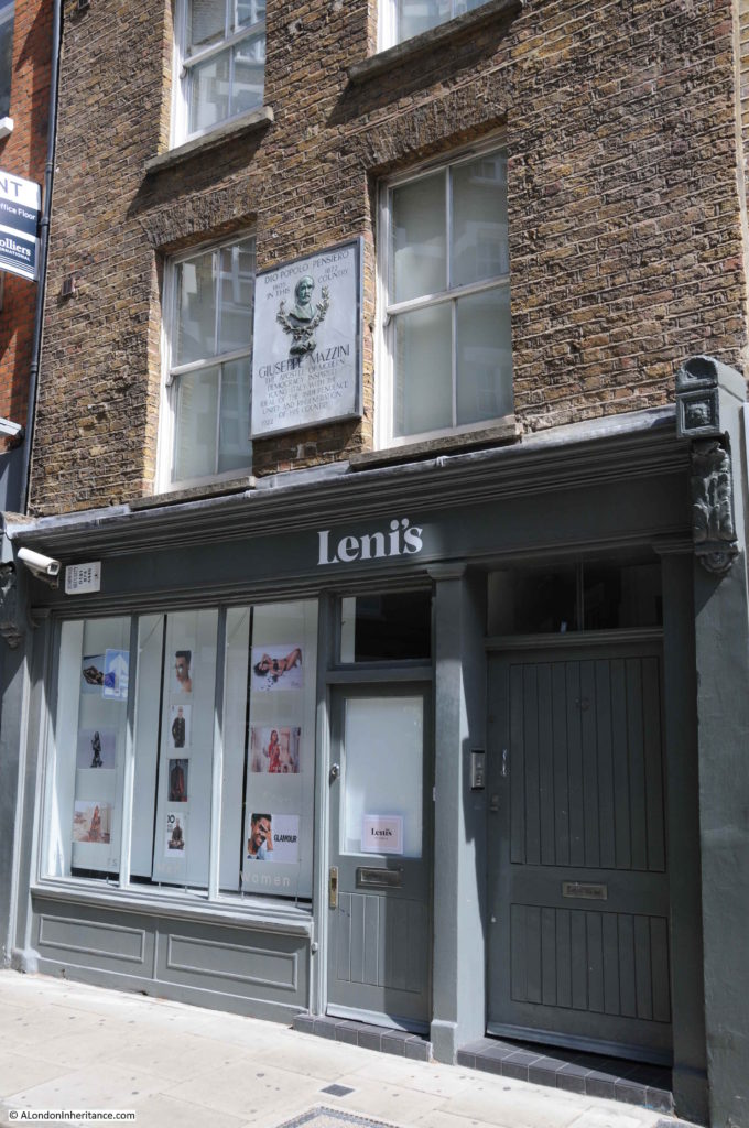
In 2018, the ground floor is now a model agency, but the same plaque can be seen on the first floor:
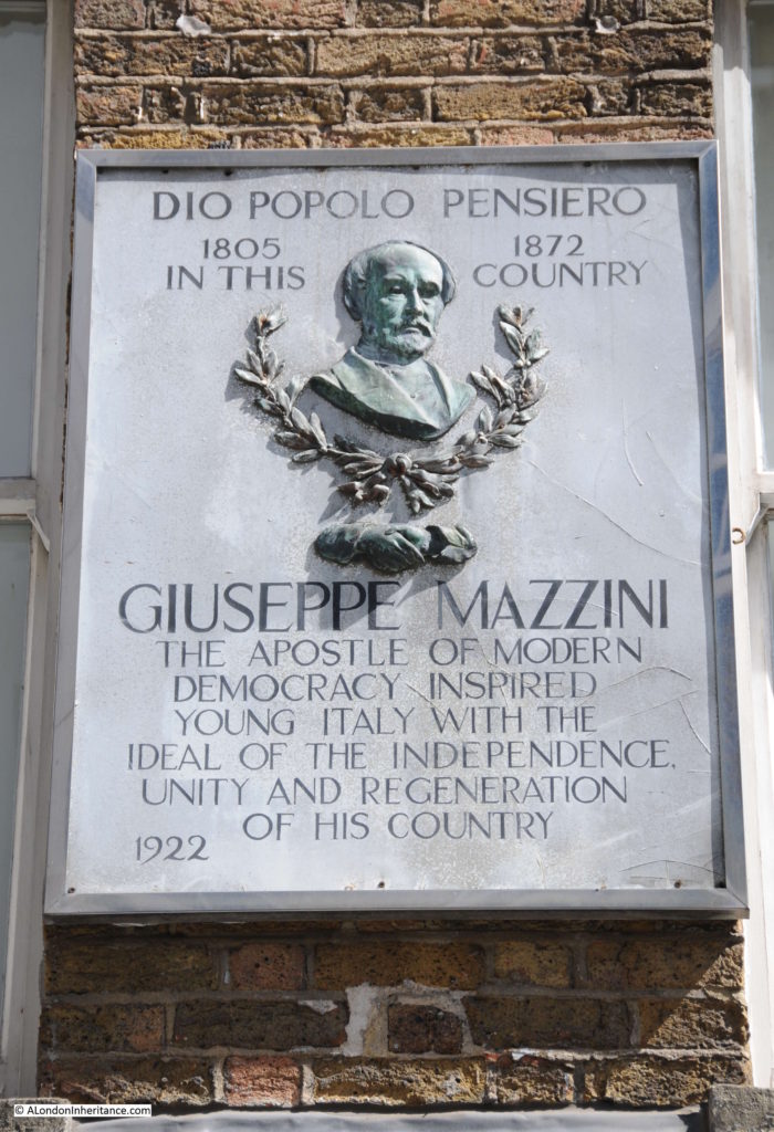
The large and rather ornate plaque is to Giuseppe Mazzini:
Giuseppe Mazzini was born in Genoa, Italy in 1805 at a time when Italy consisted of several independent republics and city states, rather than as a unified country.
He qualified as a lawyer, but his main interest was republicanism and the unification of Italy into a single nation state.
He was involved with, and organised a number riots and attempted insurrections to try and bring about unification. He also formed a secret political organisation called Young Italy (as mentioned in the plaque) dedicated to the unification of the country.
His activities resulted in periods of imprisonment, exile from Italy and, in his absense, a sentance of death.
In the 1840s, 1850s and 1860s, periods in exile included London from where he continued to work in the cause of unification. The plaque in Laystall Street might be interpreted as indicating that he lived in the house whilst in London, however there is a Blue Plaque on the house at 155 North Gower Street which was his London residence, and he also spent some time close by in Hatton Garden.
The Laystall Street plaque is a record of “La Società per il Progresso degli Operai Italiani in Londra” (the Society for the Progress of Italian Workers in London).
Laystall Street and surrounding streets were once a centre for Italian immigrants and the area had a large Italian population. The Society for the Progress of Italian Workers in London was founded in May 1864 under the joint presidency of Mazzini and Guiseppe Garibaldi (who also shared the same views on republicanism and the unification of Italy)
The aim of the society was to engage the Italian population of London in the unification cause. The club originally met in Mazzini’s house in Hatton Garden, before moving to Farringdon Road, before occupying 10 Laystall Street where the club would stay until 1930 when the society moved to Red Lion Street.
The plaque in Laystall Street is dated 1922, when the society had already been based in the building for many years. I cannot find any information as to why it is only to Mazzini, one of the founders of the society and does not mention Garibaldi.
The Red Lion Street premises were seized during the 2nd World War, but returned to the society after the war, who then changed their name to the Mazzini-Garibaldi Club.
Given the siezure of the premises of the society and the internment of many Italians as enemy aliens during the last war, it would be interesting to know if the Laystall Street plaque survived on the building during the war, or whether it was removed and reinstalled after the end of the war.
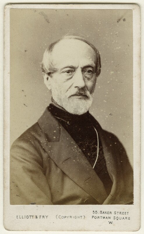
Giuseppe Mazzini photographed during one of his visits to London:
Giuseppe Mazzini was involved in a notorious act of letter opening by the British Government. In 1843 Mazzini’s cause attracted the support of two officers in the Austrian Navy, who landed in the Kingdom of Naples to support some riots that Mazzini was organising. The two were immediately captured and executed. The Illustrated London News on the 12th May 1849 in an article about Mazzini reported that:
“He is well known to the English public, through the notoriety acquired by Sir James Graham in opening his letters in the English Post-office, and communicating their contents to the Austrian Government, which led to the death of the noble-hearted brothers, Bandiera,”
In describing them as “noble hearted”, the Illustrated London News appears to have had some sympathy for their cause.
The view along Laystall Street from Clerkenwell Road:
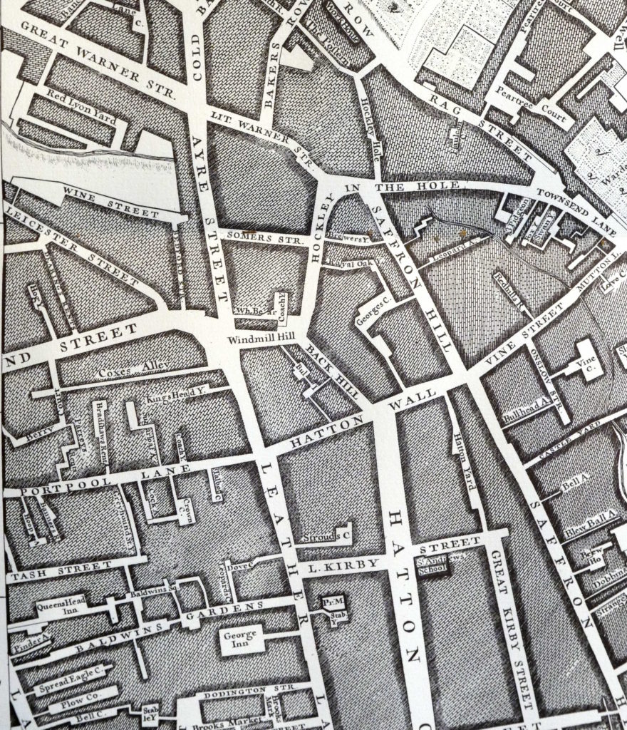
The source of the name Laystall Street is interesting. The word Laystall can refer to a place where rubbish or dung is deposited. It can also refer to a place where cattle are kept. This would imply an old source of the name, so I checked John Roque’s 1746 map of London.
The area around Laystall Street has changed singnificantly since 1746. Clerkenwell Road was not there, and the majority of streets have since changed their names.
Laystall Street is just to the west of Leather Lane, it has a slight turn into Clerkenwell Road, and then runs back at an angle of about 45 degrees to Clerkenwell Road.
In 1746, in the right place, with the right alignment was a street named Leicester Street (see the map extract below). Leather Lane is running from the middle of the map to the lower edge. Leicester Street is to the left of the map, running to the left edge from the junction of Leather Lane, Ayre Street and Windmill Hill).
The words Laystall and Leicester sound similar, so perhaps Laystall was just a corruption of the street name in 1746, however the Encyclopedia of London attributes the name to the traditional meaning of a rubbish dump which was probably towards the Mount Pleasant end of the street as this was originally a lane that ran down to the River Fleet and the area was known as a rubbish dumping ground. Perhaps Roque has just recorded the incorrect name?
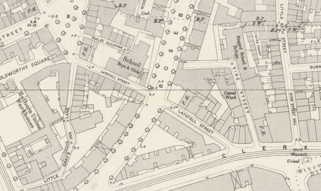
Laystall Street was cut in half in the early 1890s when Rosebery Avenue was built, and the area north of Laystall Street underwent considerable development with the demolition of the old Coldbath Fields prison and the construction of the Mount Pleasant Post Office.
The extract below from the 1895 Ordnance Survey map shows Rosebery Avenue newly completed, cutting through Laystall Street:
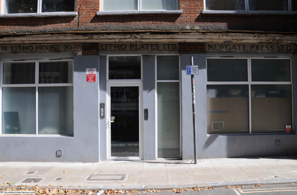
I walked further down Laystall Street. On one of the buildings there is the rather nice sign of the Newgate Press preserved:
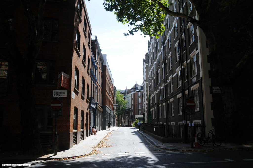
The view looking up Laystall Street from the junction with Rosebery Avenue:
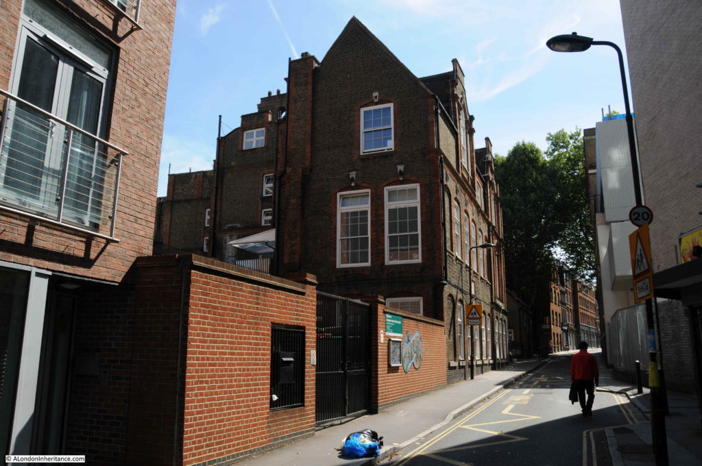
In the 1895 Ordnance Survey Map, there is a large school occupying the northern side of Laystall Street after it crosses Rosebery Avenue. The school buildings are still to be found:
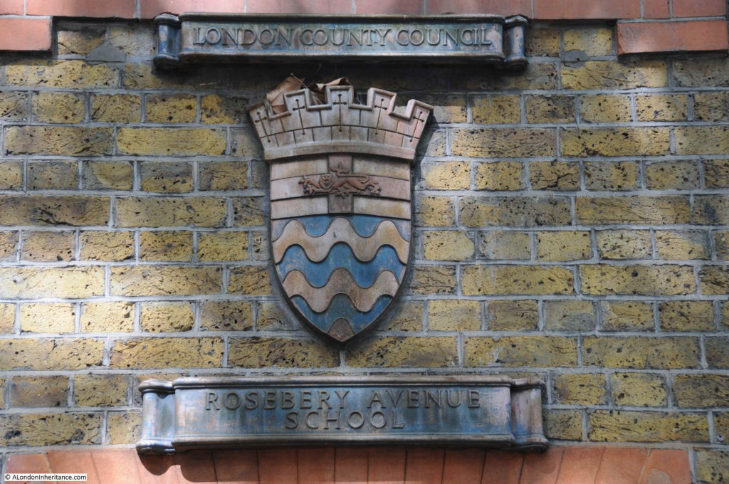
The school retains a very nice London County Council coat of arms with the name of the school below:
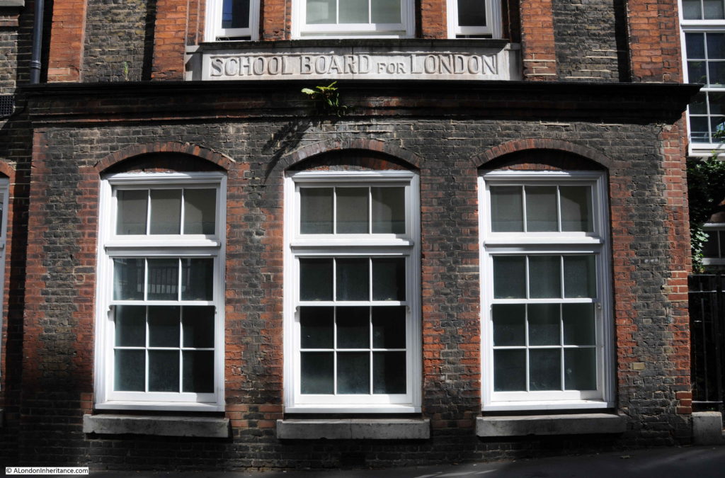
The school also includes the following sign for the School Board for London:
The above two photos show two of the key organisations responsible for the expansion of a structured education system across London.
The School Board for London was created by the 1870 Elementary Education Act to provide elementary school places for all poor children. It became the largest provider of school places across London.
The School Board for London was in operation between 1870 and 1903, when the London County Council took over responsibility for education across London.
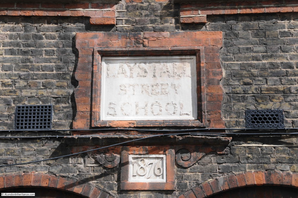
Another sign on the school building gives 1876 as the date of the school, six years after the Elementary Education Act, but also names the school as the Laystall Street School:
The Illustrated London News on the 5th August 1876 provides a glimpse into the challenges of providing schools in central London:
“A board-school was opened, on Monday night, in Laystall-street, Gray’s Inn Road, by Sir Charles Reed. in the ‘block’ where the school is situated Sir Charles stated that places were required for 2075 children. The difficulty of getting a site in the metropolis was very great, and it was sometimes costly; but, cost what it might, the board must have a school placed in the particular locality in which it was required. He thought if his colleagues were to be blamed for anything it should be because of their tardiness in providing school accommodation in that district, which would have the additional provision given to it without injury to the other schools there. He saw a letter in a newspaper the other day in which the writer, speaking of the school board, said ‘Their present school in Laystall-street, which will open unblessed by us on Monday next, is within sixty yards of a church school.’ He (Sir Charles) believed the parents of that district would bless that school, and that would be quite enough. Sir Edward Currie also spoke, and stated that the site of the new school was the smallest and the most costly that the board had purchased in London. The school was intended to accommodate 502 children, at a cost of about £10 per head.”
The original name was Laystall School, as Rosebery Avenue did not exist. It was built 14 years after the school was constructed.
The two signs also probably tell us how and when the name changed. The school was built in 1876 as the Laystall Street School by the School Board for London. In 1903 the London County Council takes over the school and it is probably then that the name also changes after the construction of Rosebery Avenue – a much larger street than Laystall Street (sorry, but I love these little connected details you can find across London’s streets).
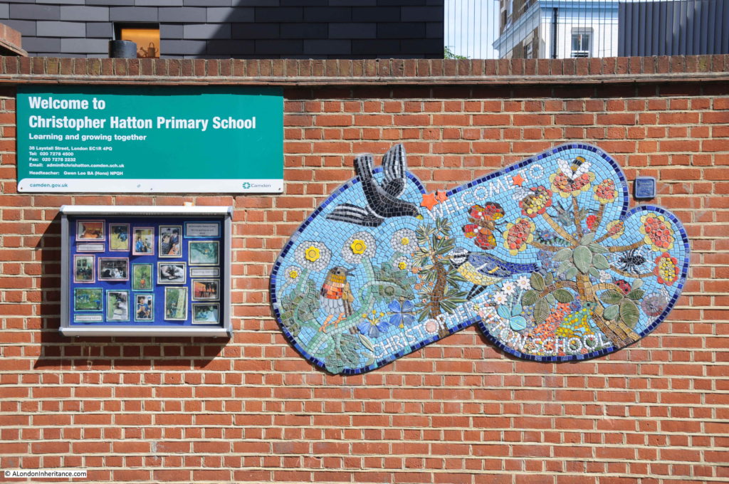
The school today is the Christopher Hatton Primary School, named after the Elizabethan politician who also gave his name to Hatton Garden.
I always feel I never do justice to the history of the areas I cover in my posts, however it is fascinating what you can find in London’s streets and in Laystall Street there is an Italian nationalist, possible long lost rubbish dump that gave the name to the street, and a glimpse into the development of schools at the end of the 19th century – not bad for a short walk.

