Tag Archives: Kent

The Medieval Church at Reculver

I hope you have had a good Christmas in whatever form that may have taken in these strange times. As well as Christmas, last week also saw the shortest day of the year, and slowly the days will start to lengthen. The weather has also been very grey and cloudy and the period between Christmas and New Year is often a good time to get out for a walk.

The Thames Estuary is an ideal place for a walk. Close to the Thames and the sea, usually a good breeze to blow away any late December lethargy, and plenty of historic places to explore.

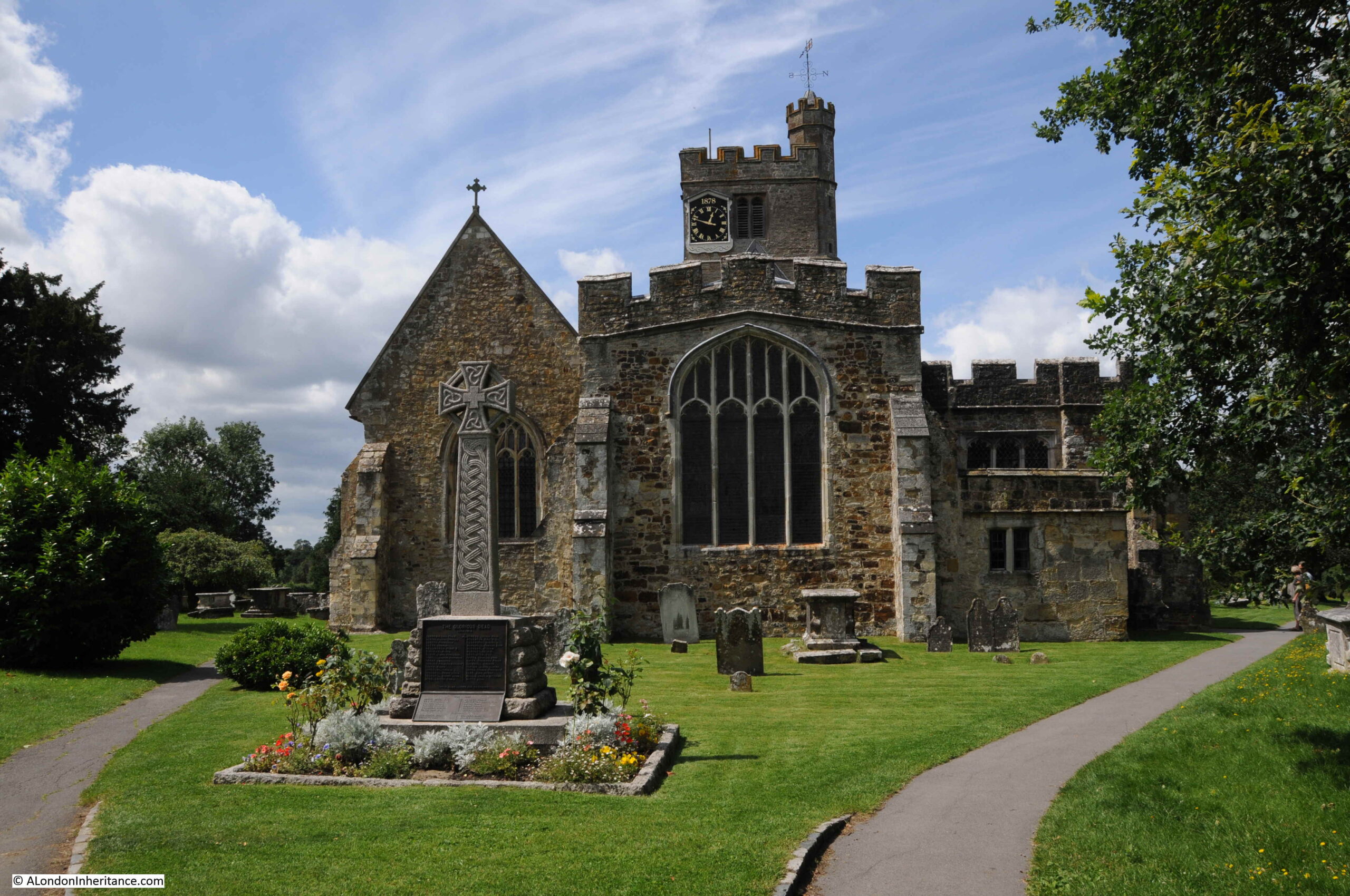
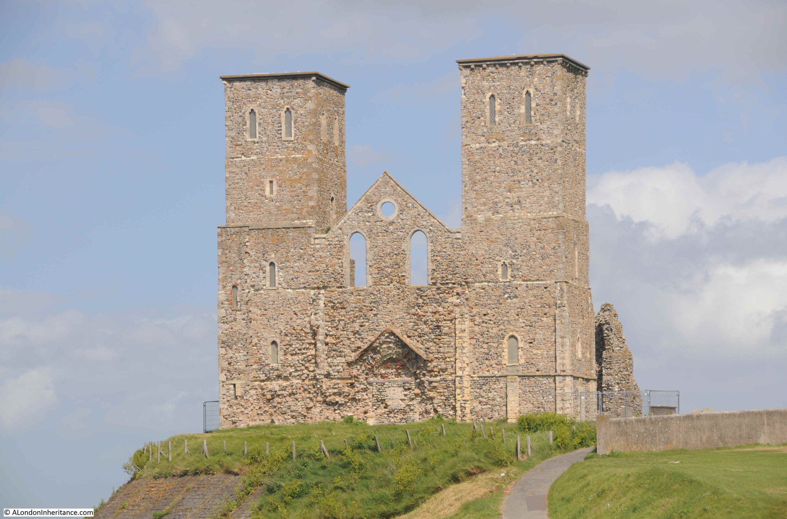
One of these is the ancient church of Reculver on the north Kent coast. The remains of a church built in an old Roman camp, with two distinctive towers that for long were navigation markers for those sailing on the estuary.

Reculver

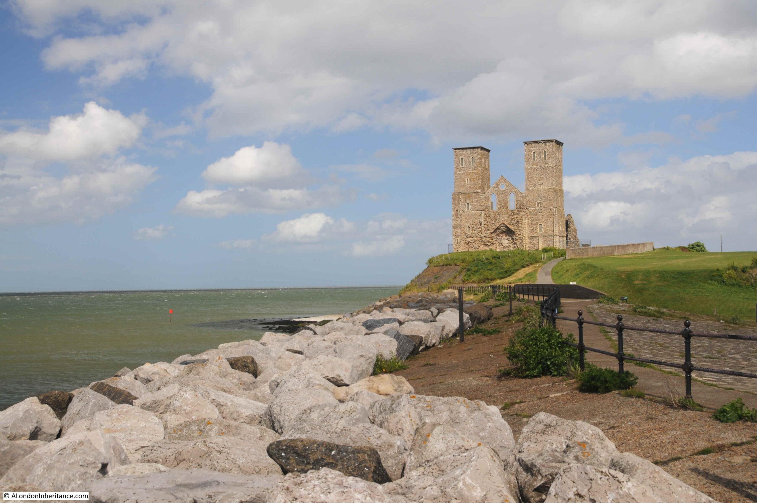
Reculver is a few miles to the east of Herne Bay, and as the above photo shows is on a prominent location on a cliff top next to the sea. The location is ringed in the following map ( © OpenStreetMap contributors):

Map of Reculver

This has long been an important location, with the first major construction on the site being an early Roman fort. A Saxon church was built at some point around the year 669, with the church forming the core of a small monastic settlement.

The towers were added when a series of alterations were made to the church at the end of the twelfth century. This work included a new, large west facing doorway.

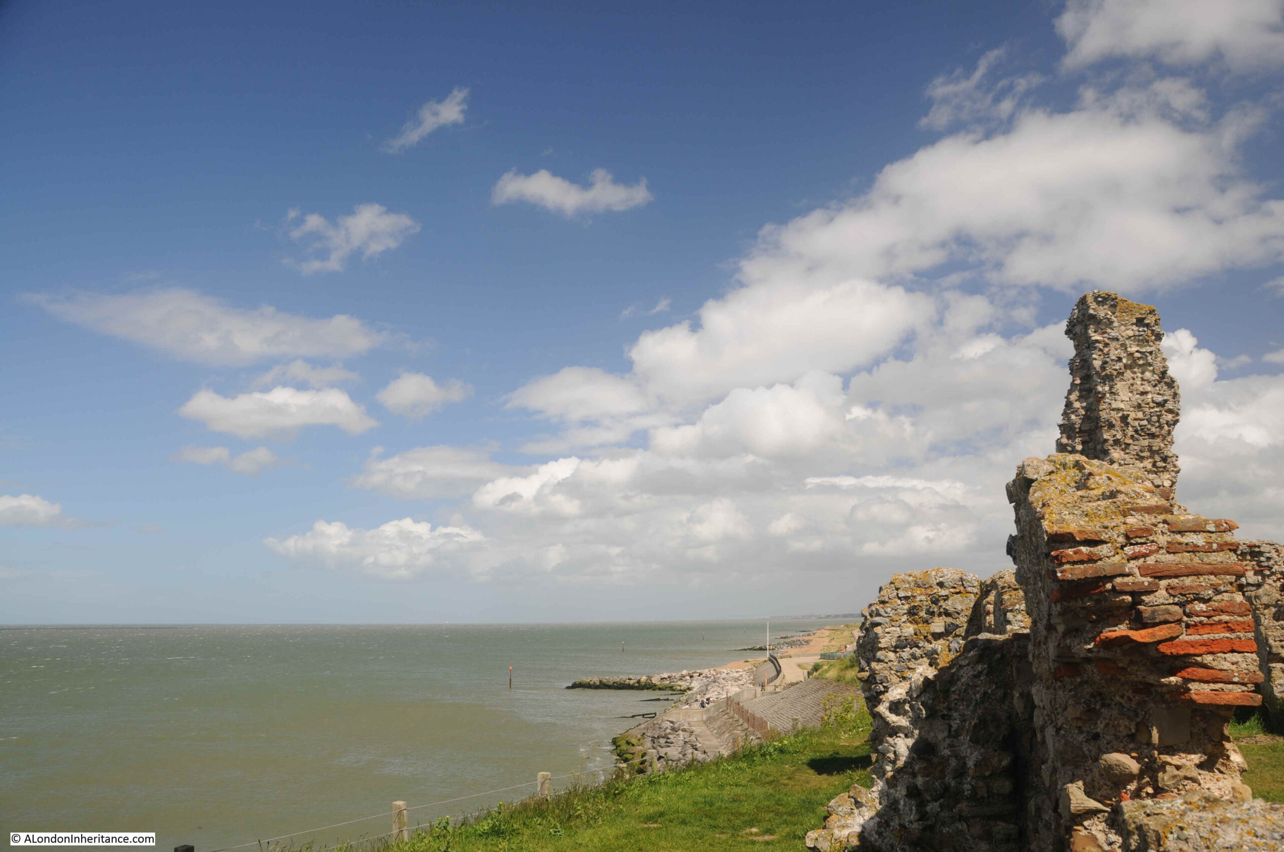
The church was built in the centre of the original Roman fort, and the church was originally almost a mile from the sea, however erosion has taken the sea up to the edge of the church, and the land occupied by almost half of the Roman fort has been lost.

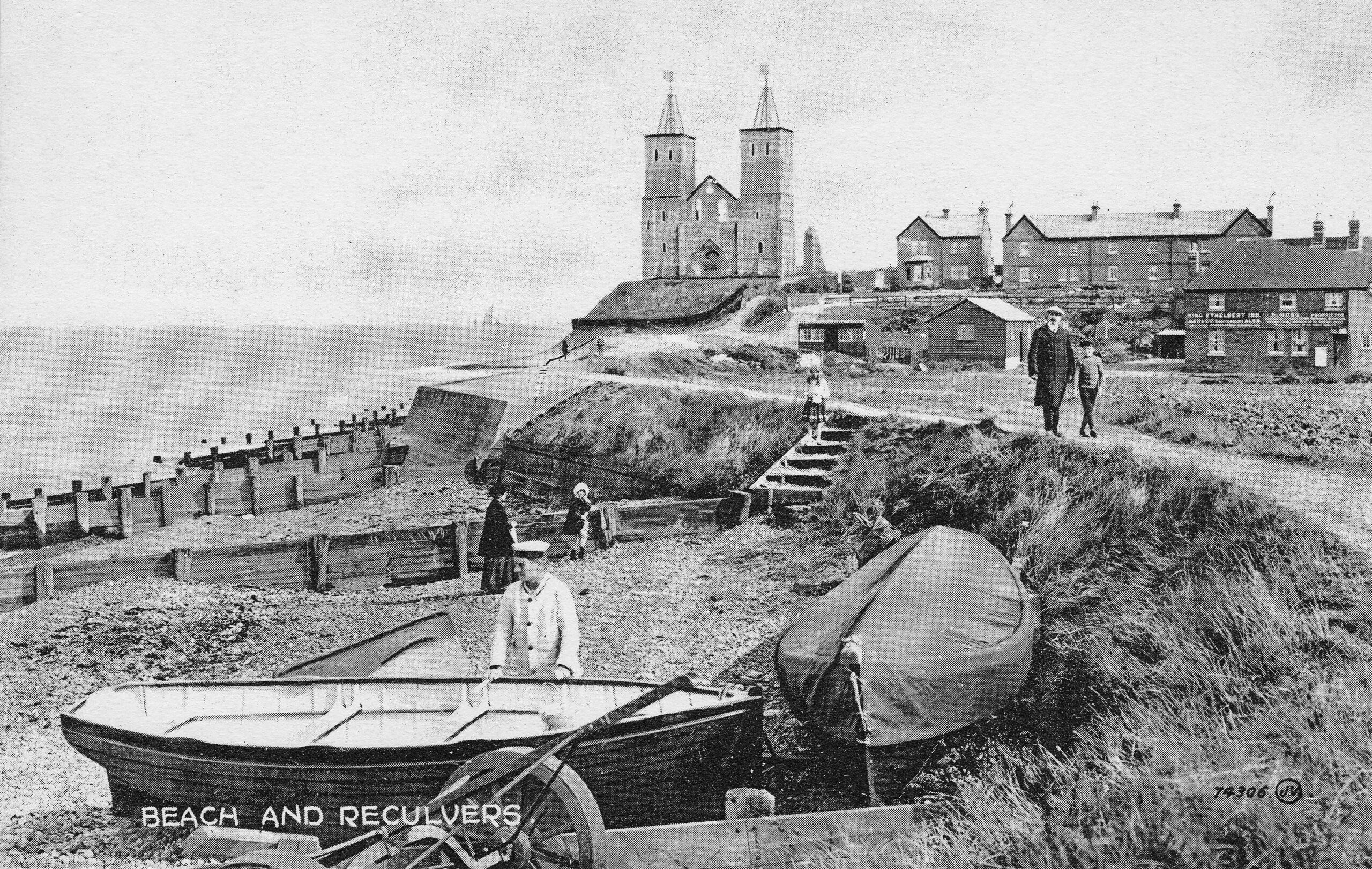
The beach (now occupied by large rocks to prevent further erosion) and the church has long been a tourist destination, and the following early postcard shows what would have greeted visitors in the early 20th century:

Reculver postcard

The Monastic establishment came to an end in the year 949 when the building took on the role of a parish church. The rebuild of the late twelfth century utilised the remains of the old monastery to construct the new church.

Over the centuries, land was gradually being eroded, and by 1780, the northern corner of the church was only 50 yards from the sea. In 1802 much of the core of the church collapsed and by 1805, the two towers were at risk.

The prominence of the two towers, on the cliff, overlooking the sea and the Thames estuary was critical to navigation. The minutes of Trinity House from 1662 record the need to make repairs to the steeples of a building that was long regarded as an “ancient sea mark”.

With the two towers at risk in 1805, Trinity House took action and purchased the remains of the old church in 1810 and built groins along the beach in front of the cliff, to break up the action of the waves. They also faced the cliff with stone to prevent further erosion, and following this work, the two towers have been able to continue to help those navigating at sea.

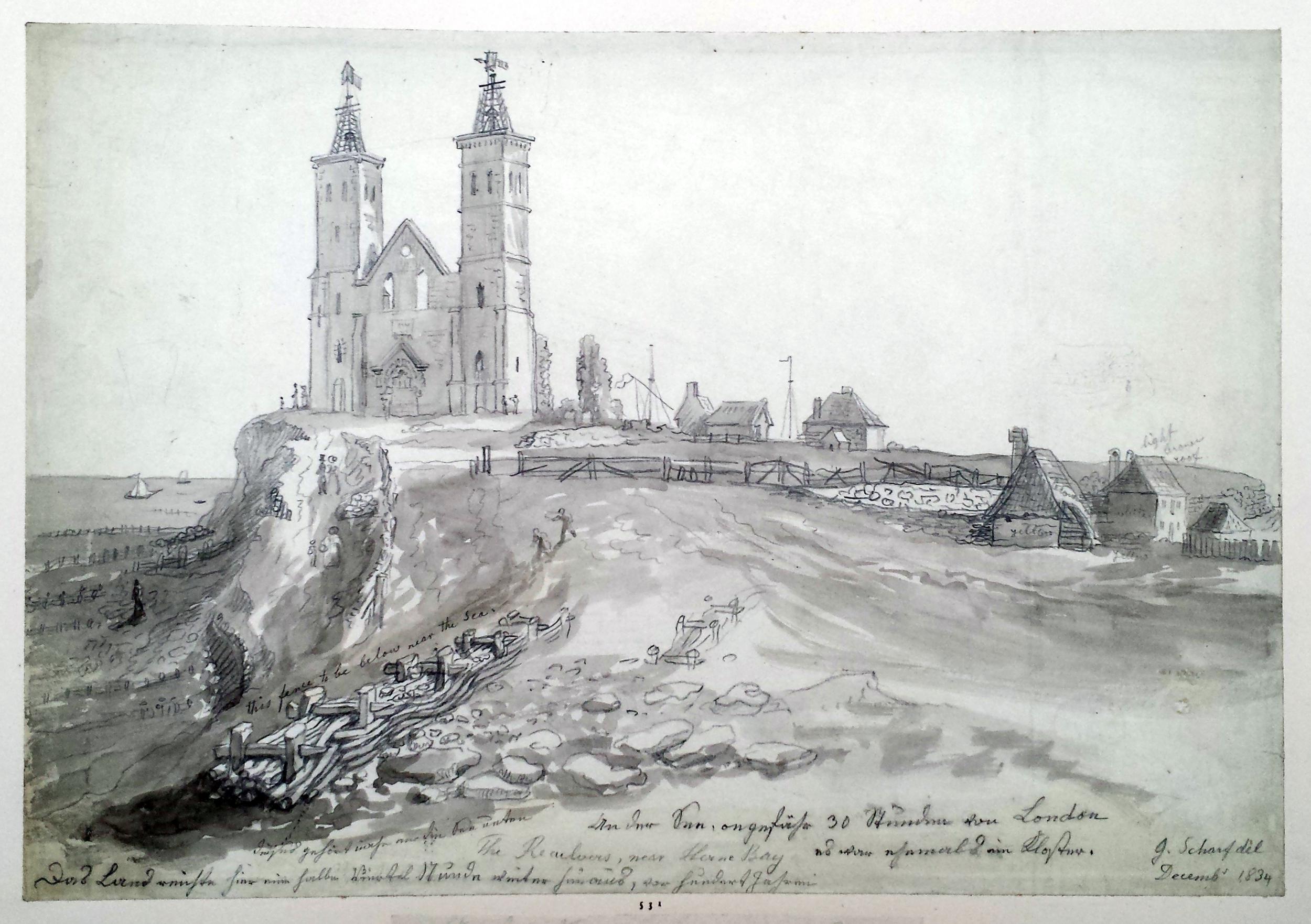
Trinity House also rebuilt the wooden steeples at the top of the towers, which had been blown down (it can get very windy along this exposed coast).

Navigation markers, such as the towers at Reculver, were becoming less relevant in the early 20th century for navigation on the Thames estuary, so Trinity House handed over the site to the Government’s Office of Works in 1925, and it is now the responsibility of English Heritage.

The following print from 1834 shows the new wooden steeples installed by Trinity House at the top of the towers. Note also to the right of the church two structures with flags which were probably used for signaling to ships at sea  (© The Trustees of the British Museum).

Reculver

Getting closer to the church and the original west facing entrance can be seen, now blocked up.

Reculver church towers

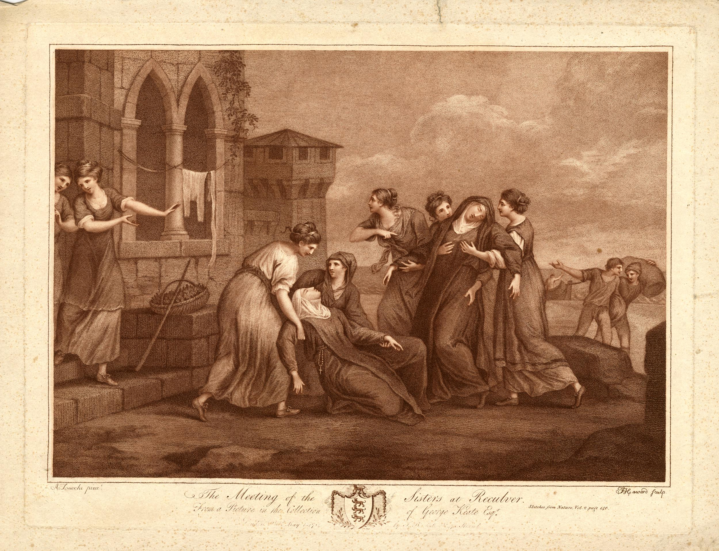
A legend associated with the twin towers of the church is that they were either caused to be built, or where repaired around the year 1500 by  Frances St. Clair, Abbess of a Convent of Benedictine Nuns at Davington.

There are a number of variations to the legend, with the majority recording that Frances, along with her sister (also a nun) were travelling on a ship that was shipwrecked near Reculver. They were brought ashore at the church. Some variations record that her sister Isabelle died in the ship wreck, other that they were both saved.

Either way, due to the shipwreck, Francis had the towers built / repaired as a result of being saved, or in memory of her sister.

A drawing from 1784 shows Frances and Isabella being reunited in front of the church at Reculver, with some serious artistic license and creativity being used to show the buildings of the church in the background  (© The Trustees of the British Museum).

Reculver

The site of the church has probably been in use for well over 2,000 years. Archaeological excavations have shown that the Roman fort probably started as a small initial camp for the invading Roman forces in the year 43. Excavations have also revealed that Reculver was the site of an earlier Iron Age farmstead.

The site was occupied throughout the Roman period, and the main walled fort was built early in the third century. It became one of the line of forts known as the Saxon Shore Forts which were established along the eastern and southern coast of England, and the northern coast of France, in the late third century, to protect against raiding parties as the Roman empire started to face many of the threats that would result in Rome abandoning England in the early 5th century.

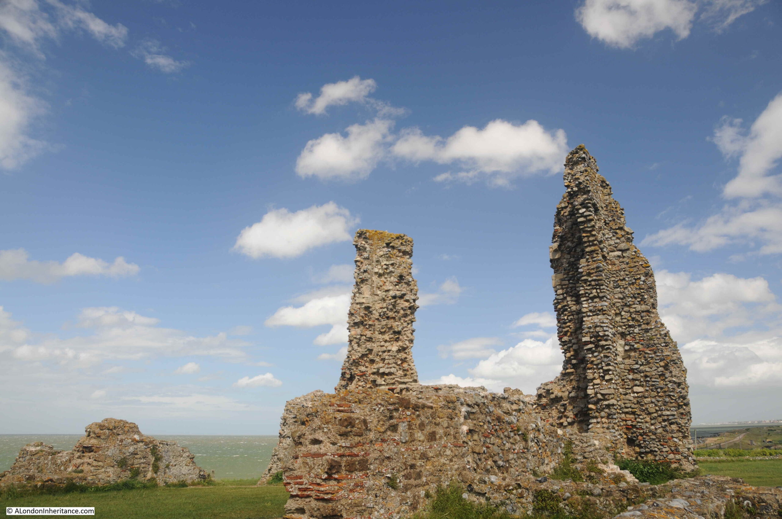
The remains of a number of the walls of the fort can still be seen around the site, and Roman tiles and stone were used in the construction of the church. The distinctive red / orange Roman tiles can be seen embedded in many of the remaining walls of the church:

Reculver

My last visit to Reculver was on a brilliant sunny day, and the ruins of the church stood out against a blue sky.

Reculver

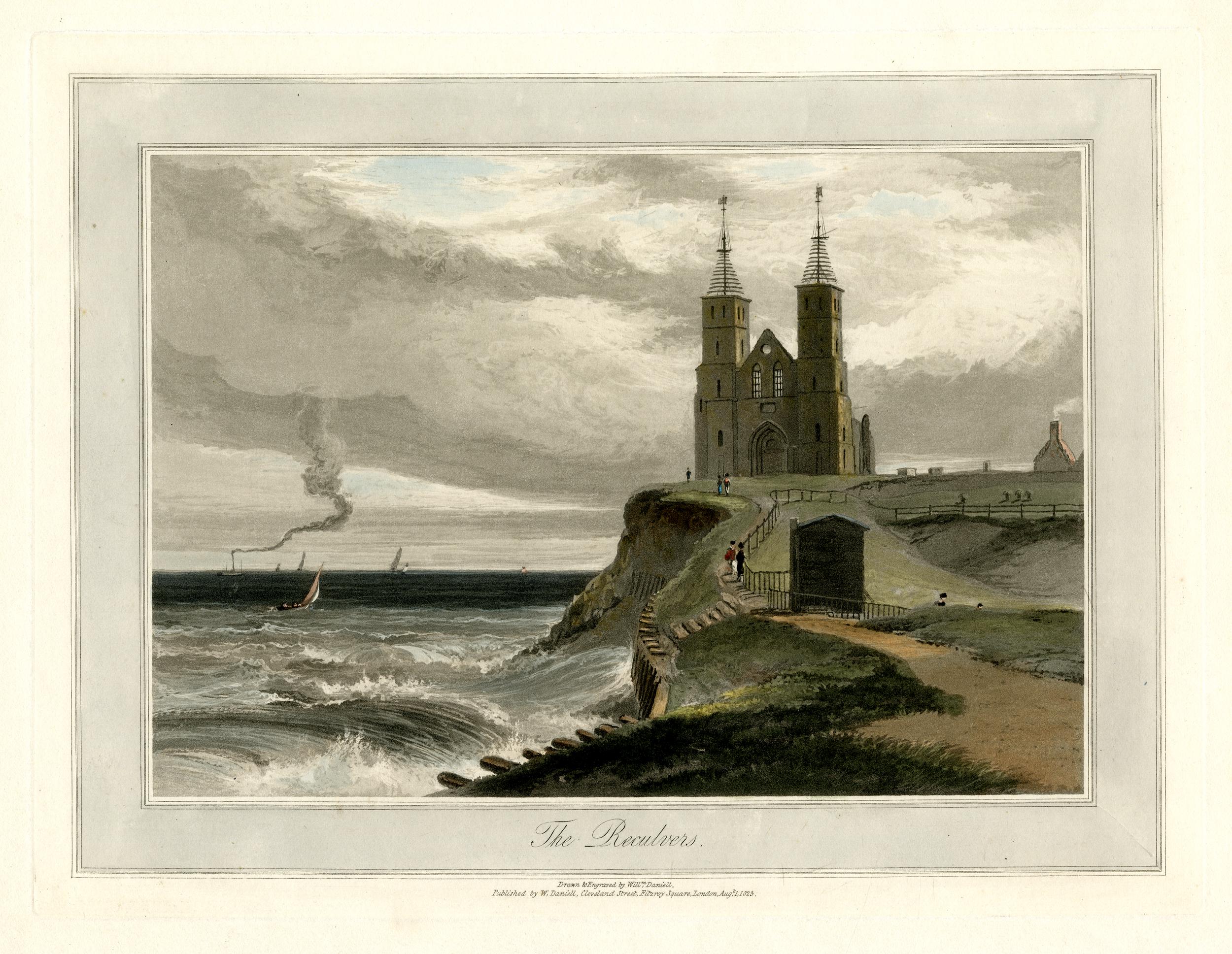
However it is a wonderful place to walk at any time of year, and has frequently been illustrated as part of a windy / stormy scene with the waves crashing up to the cliff showing how easily this part of the north Kent coast is eroded, and that the church would have been victim to the waves if not for the work of Trinity House. The following print is from 1829  (© The Trustees of the British Museum):

Reculver

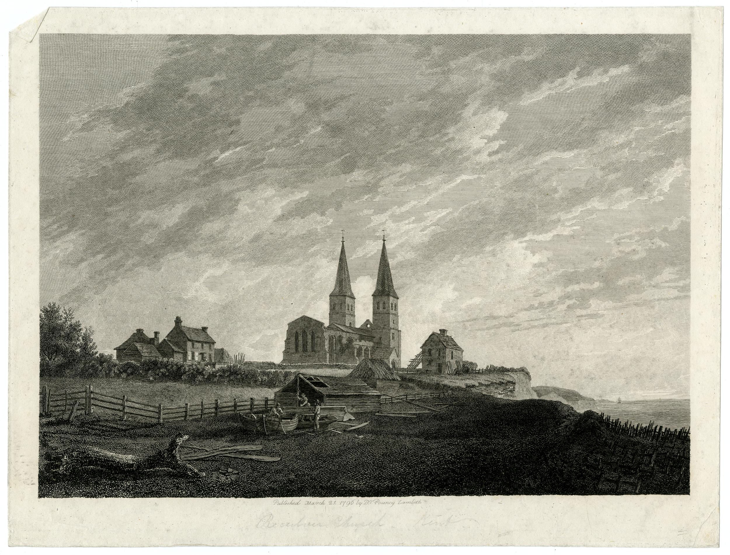
Another scene from 1796 showing the nave of the church before this collapsed in 1802. The scene also shows a house between church and cliff, however as well as the collapse of the church, a few years later this house would also be lost and the cliff would be up against the church  (© The Trustees of the British Museum).

Reculver

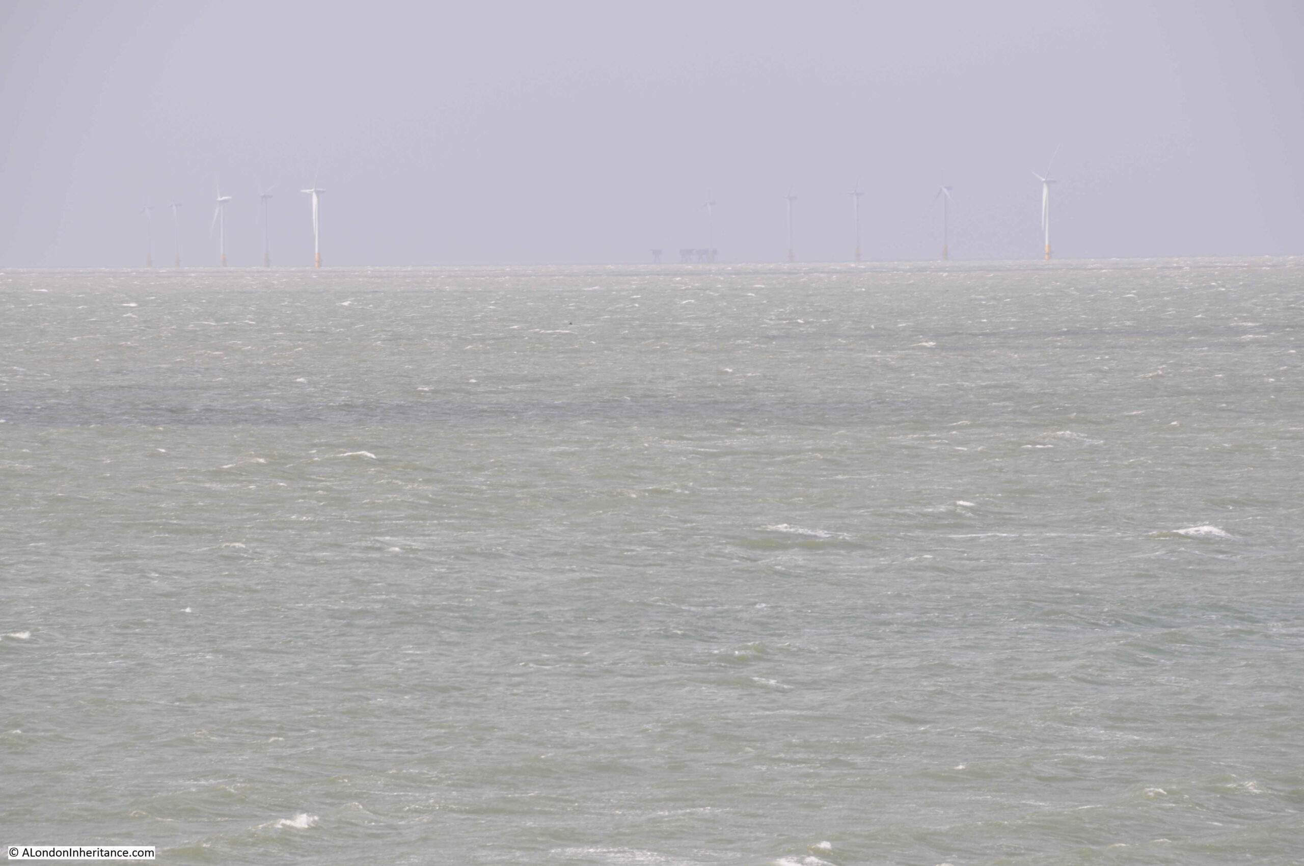
Whilst today there are very few sailing ships off Reculver using the towers as navigation markers, the view from Reculver includes the Kentish Flats wind farm, roughly six miles offshore, and in the middle of the following photo, just visible on the horizon, is the Red Sands fort:

Red Sands Fort

Reculver is a fascinating place to visit at anytime of year. It is also a good place to see the impact of coastal erosion, with getting on for a mile of land having been lost in recorded history. Without the work of Trinity House, it is doubtful whether the two towers, the remains of the body of the church, and some of the walls of the Roman fort would remain for us to see today.

That’s my last post for 2021. Thanks for reading over the last year, and can I wish you all a very happy and healthy 2022.

alondoninheritance.com

The Strange Story of the Biddenden Maids

I ran out of time this week to complete the research and writing of the London post I had planned, so as it is summer, how about a trip to Kent, to visit the village of Biddenden, and discover the strange story of the Biddenden Maids.

This is not a random choice. As long term readers of the blog will know, as well as London, my father took lots of photos whilst cycling around the country and staying in youth hostels. This was with friends from London, and from his period of National Service.

I am also trying to visit the location of as many of these photos as possible, and take an updated photo to mirror the original.

One trip in 1948 included a route through the county of Kent. I have already written about the visit to Canterbury, however they also passed through the small village of Biddenden, and this was the view of the village green on a summer’s day in 1948:

Biddenden Maids

This was the same view in July 2021:

Biddenden Maids

Although there is 73 years between the two photos, the area around the central village green of Biddenden still looks much the same. For a change, I even managed to take the “now” photo with similar weather to the original, although this was more through luck than clever planning.

The main difference is the number of cars parked, and the more organised road markings and boundaries.

The central green area has also lost the original iron railings, and the village name sign has also been moved back further into the green.

Biddenden is one of the many very picturesque villages in the Weald of Kent, the area of once forested land that stretched across the south of the county.

I have marked the location of Biddenden in the following map . The town of Ashford is the grey built area to the right of the map, with Maidstone to top left of the map (Map © OpenStreetMap contributors).

Biddenden Maids

The Ordnance Survey map from around the time of my father’s visit shows a small village surrounded by fields  (‘Reproduced with the permission of the National Library of Scotland’).

Biddenden Maids

The village green in the above photos is located at the road junction to the right of the street with buildings lining both sides. There has been some development, mainly to the north of the village, and west of the church, however Biddenden is still very much a village surrounded by fields.

Many villages in this area of Kent have rather ornate name signs, which frequently include a historic fact about the village, however few illustrate a story as strange as that of Biddenden.

Biddenden Maids

Looking closer at the name sign, it shows two women standing beside each other (1948 above and 2021 below):

Biddenden Maids

They are the so called Biddenden Maids, or the conjoined twins Eliza and Mary Culkhurst.

A newspaper article from the 15th May 1885 provides some background to the Biddenden Maids:

Among the various charities in the parish of Biddenden, in Kent, is one which has acquired some celebrity. On the afternoon of Easter Sunday a quantity of small flat cakes, made only of flour and water and impressed with the figures of two women, united at the sides after the fashion of conjoined twins, are distributed in the church porch to all comers. Bread and cheese, to a considerable amount, are given at the same time to the poorer parishioners. This, says tradition, was the legacy of the twin sisters, called the Biddenden Maids, who lived for many years united in their bodies after the manner represented in the cakes, and then died within a few hours of each other. There is also given to the recipients of the cakes a printed paper bearing upon it a representation of the impression on the cakes, and purporting to contain ‘a short and concise account of the lives of Elisa and Mary Culkhurst, who were born joined by the hips and shoulders, in the year of our Lord 1100, and in the county of Kent, commonly called the ‘Biddenden Maids’ .

It then proceeds- ‘The reader will observe by the plate of them that they lived together in the above state thirty-four years, at the expiration of which time one of them was taken ill and in a short time died. The surviving one was advised to be separated from the body of her deceased sister by dissection, but she absolutely refused the separation by saying these words ‘As we came together we will also go together’ and in the space of about six hours after her sister’s decease she was taken ill and died also.

By their will they bequeathed to the churchwarden of the parish of Biddenden, and his successors, churchwardens, for ever, certain pieces or parcels of land in the parish of Biddenden, containing twenty acres, more or less, which now let at 40 guineas per annum.

There is usually made in commemoration of these wonderful phenomena of nature about 1000 rolls, with their impressions printed on them, and given away to all strangers on Easter Sunday after Divine service in the afternoon; also about 500 quartern loves and cheese in proportion, to all the poor inhabitants of the said parish”.

At a distance of 900 years, it is hard to know the truth of this story.

Edward Hasted, writing in the “The History and Topographical Survey of the County of Kent” referenced the story as follows:

“There is a vulgar tradition in these parts, that the figures on the cakes represent the donors of this gift, being two women, twins, who were joined together in their bodies, and lived together so till they were between twenty and thirty years of age. But this seems without foundation. The truth seems to be, that it was the gift of two maidens, of the name of Preston; and that the print of the women on the cakes has taken place only within these fifty years, and was made to represent two poor widows, as the general objects of a charitable benefaction.”

Hasted did not seem convinced about the original story of the Biddenden Maids, however he does not give any further details or sources for his suggestion as to the truth of the story.

The money for the cakes and loaves came from the rents received from twenty acres of land known as Bread and Cheese land. If you look back at the Ordnance Survey map of Biddenden earlier in the post, two large fields to the upper left of the village were still called Bread and Cheese Land.

The first newspaper reference I can find to the Biddenden Maids is an article in the London Evening Standard in 1829. There are then numerous articles, mainly reporting on the Easter Sunday charity distribution, and the large number of visitors to the village who came to see and participate in the distribution of the cakes.

Popularising the Biddenden Maids would have helped the economy of the village.

According to Biddenden’s web site, the charity distribution still takes place:

“Once a year Bread and Cheese are given to local widows and pensioners at the Old Workhouse. Biddenden Biscuits, baked from flour and water, are distributed among the spectators as souvenirs. They bear an effigy of two female figures whose bodies are joined together at the hips and shoulders.”

A close up of the village sign in 1948:

Biddenden Maids

In 1948, the wording between the two women was “IN KENT” – a continuation of the village name above to show the county of the village, however by 2021, the names of the two women, Mary and Eliza had replaced the county name.

Biddenden Maids

The origin of the sign dates back one hundred years. In 1920, the King discussed the revival of village signs during a speech at the Royal Academy.

The Daily Mail then organised a village signs competition and exhibition with a fund of £2,200 being available in prizes. Of the ten awards made, the design for the sign at Biddenden received a special prize of £50.

There are a number of subtle differences between the signs of 1948 and 2021. This is probably down to the complete refurbishment of the sign in 1993.

This may have included the changes, such as, moving the sign back further into the green. replacing the county of Kent, with the names of the twins, and replacing the pole as the original square pole is now round, with some gold spiral decoration.

The photos of the village in 1948 and 2019 tell a story of how villages change, and stay the same. If you go back to the 1948 photo at the top of the post, there is a sign on the very first building on the left. The sign is for a bank, and looking at the high resolution scan from the scanner it seems to be a Lloyds Bank. Remarkable at a time when bank branches are disappearing by the day that in 1948 a small village of the size of Biddenden would have their own bank branch.

The building that was once the bank is shown in the photo below:

Biddenden

Not visible in the 1948 photo, but there is a terrace of rather special houses continuing on from the bank. These were Flemish Weavers cottages, dating from the 17th century:

Biddenden

Directly opposite the above terrace, there is a pub and café:

Biddenden

As we had travelled by car, the pub was out of bounds (Biddenden did have a railway station, however this branch of the Kent and East Sussex Railway closed in 1954), so we went into the Bakehouse Café, which was excellent, and which had the following inscription on one of the windows overlooking the street:

Biddenden

The main street through Biddenden village:

Biddenden

Behind me, in the above photo is the entrance to Biddenden’s church which stands at the western end of the village:

Biddenden Church

Parts of the church date from the 13th century, however there has been much later rebuilding. Unfortunately it was locked on the day of our visit so no opportunity to take a look inside.

Biddenden Church

At a distance of 900 years, it is almost impossible to be sure of the origins of the story of the Biddenden Maids, however the story is still central to the village, and it has been the driving force behind a charity distribution which has taken place for hundreds of years, and in a world where places get more and more standardised and similar, it is good for a place to retain its own unique identity.

For next Sunday, I will be back in London.

Southbank Walks

A couple of tickets have become free on two of my Southbank walks. If you are interested in exploring the history of the Southbank and the Festival of Britain, there is:

All other walks have sold out.

alondoninheritance.com