Tag Archives: Thames Estuary

The Broomway and a London Airport

I am fascinated by both London, and the impact that London has had on the wider country. Even some of the most remote parts of the surrounding counties have felt the threat of London’s continual growth, and the infrastructure needed to service the rapacious city. To find such a place, and to walk what has been called the country’s most dangerous footpath, took me to Wakering Stairs in Essex last Sunday morning at 7am, ready to walk the Broomway.
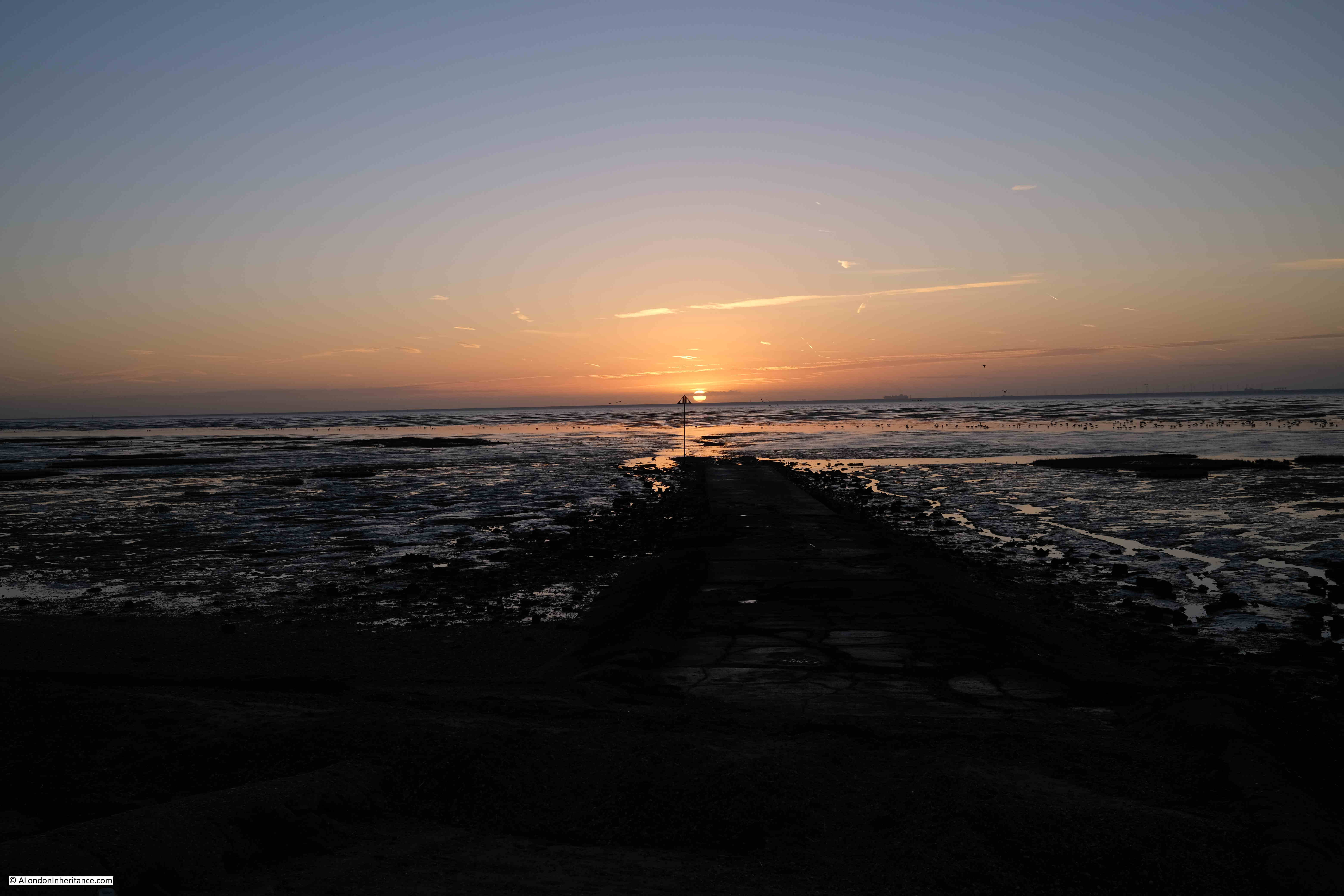
Wakering Stairs

The Broomway is an ancient footpath, several hundred years old, that links mainland Essex at Great Wakering with Foulness Island.

Foulness is now mainly Ministry of Defence property, although it does have a small community living on the island. The MoD have built a bridge connecting with the mainland, however before the bridge was constructed, the only way for residents to get to and from the island was via a boat across one of the creeks and channels that surrounded the island, or via the Broomway.

The shore facing the wider Thames Estuary / extreme southern part of the North Sea is extremely flat and extends a considerable distance from land. This has resulted in a large area of flat sands that are either covered by water, or as exposed sand, mud and low lying water, depending on the tide.

The part of the shore close to land is comprised of a black organic mud, that is very sticky, can drag down someone who walks into this area, and is very difficult to get out of.

Further out, there are reasonably stable sands, however these still have their dangers. It is these sands that offer a route to travel between the mainland and Foulness when the tide allowed, and was marked by poles of Broom and was used for centuries as a route to and from Foulness.

I have long wanted to walk the Broomway. I am reasonably good at planning routes which involve the tide, walking over tidal mudflats etc. however the Broomway is not a route I would take without an expert guide.

Tom Bennett is qualified in a number of outdoor activities, and offers guided walks along the Broomway. These sell out quickly, but a number of months ago I was able to book a walk in October, not my preferred month due to the risks of autumn weather, but in the end, it turned out to be a perfect day’s walking.

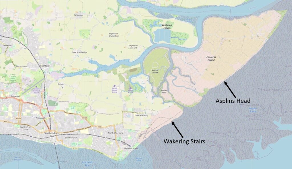
The route taken was between Wakering Stairs and Asplins Head, and the following map shows the location of these points, along with the location of Foulness, to the north-east of Southend (© OpenStreetMap contributors).
Foulness

This is not the full route of the Broomway which originally went all the way along the easterly coast of Foulness, and there were a number of access points between the Broomway and the land.

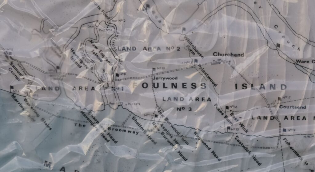
I photographed the map on an information panel at Wakering Stairs, where there are plenty of warnings about the dangers of the area. The map shows the Broomway running parallel, but a distance offshore, to Foulness, and also shows the full length of the path, and the points where it is relatively safe to travel through the dangerous areas of mud near land and reach Foulness.
Map of Foulness and the Broomway

The time needed to walk the whole footpath, and return along the same route is such that it is difficult to avoid the incoming tide, so the walk last Sunday covered half the route.

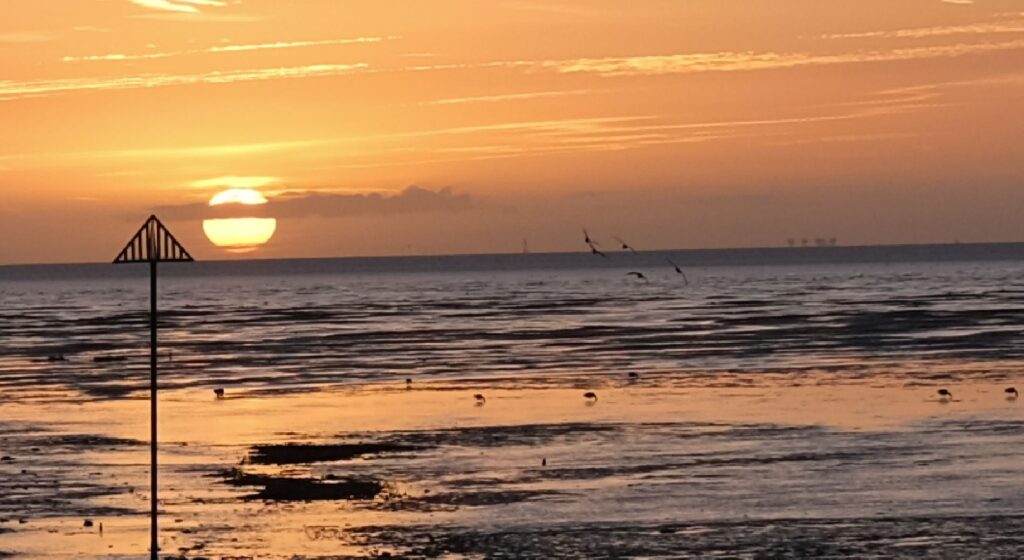
Standing at Wakering Stairs at seven in the morning, looking out over the mudflats is rather magical. The sun rising above the distant sea, the sounds of flocks of birds on, and flying above the mud flats:
Broomway

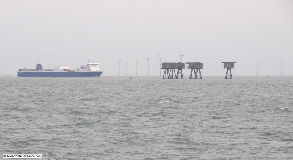
In the above photo, on the right, where the sea meets the sky, the Redsands Maunsell Fort can be seen.

So what is the London connection?

Maplin Sands is the name of the large area of sands offshore Foulness, and in the early 1970s, it was Maplin Sands and Foulness that almost became London’s third airport.

In the 1960s, London had two main airports, Heathrow and Gatwick. Air travel was growing rapidly, and this growth was expected to continue well into the future, so the search began for the site of a new airport.

In 1968 the Roskill Commission, also known as the Commission on the Third London Airport was formed, with the aim of investigating options, and making a recommendation for the location of the new airport. The commission was named after High Court Judge Eustace Roskill.

The locations were narrowed down to four, Cubington in Buckinghamshire, Foulness in Essex, Nuthampstead in Hertfordshire and Thurleigh in Bedfordshire.

The commission published their report in 1971, with a recommendation that Cubington in Buckinghamshire should be the site of the third London airport. The commission turned down the Foulness option mainly due to issues with accessibility, as Foulness was on an isolated part of the Essex coast, with no current, or easy to implement transport options. The commission feared that if transport options could be put in place, they would still be too far from central London, and airlines would continue to prefer Heathrow and Gatwick.

The Government turned down this recommendation, and went for Foulness which had been put forward in a separate report by Professor Colin Buchanan, a dissenting member of the Roskill Commission.

The reasons for this decision were the avoidance of significant impact to countryside and people, there was pressure from well funded groups opposing Cubington. Essex County Council were in favour of Foulness, and it was seen as a way to regenerate the area around Southend.

In the 1972-73 Parliamentary Session, the Maplin Development Bill was introduced and the Maplin Development Authority was set-up, which would have the responsibility for the development of the land, which, as well as the airport, would include a deep water port and new town, along with the transport links needed to connect the new airport to London, and the rest of the country.

The airport was supported by the then Conservative Prime Minister, Edward Heath, however it would not last long, with only minimal works to test whether the Maplin Sands could be reclaimed for the construction of the airport.

In March 1974 the Labour Party took over in Government, and commenced a review into the airport. In july 1974 the review was published and Peter Shore, the Labour MP for Stepney and Poplar announced that the Foulness / Maplin Airport project would be abandoned.

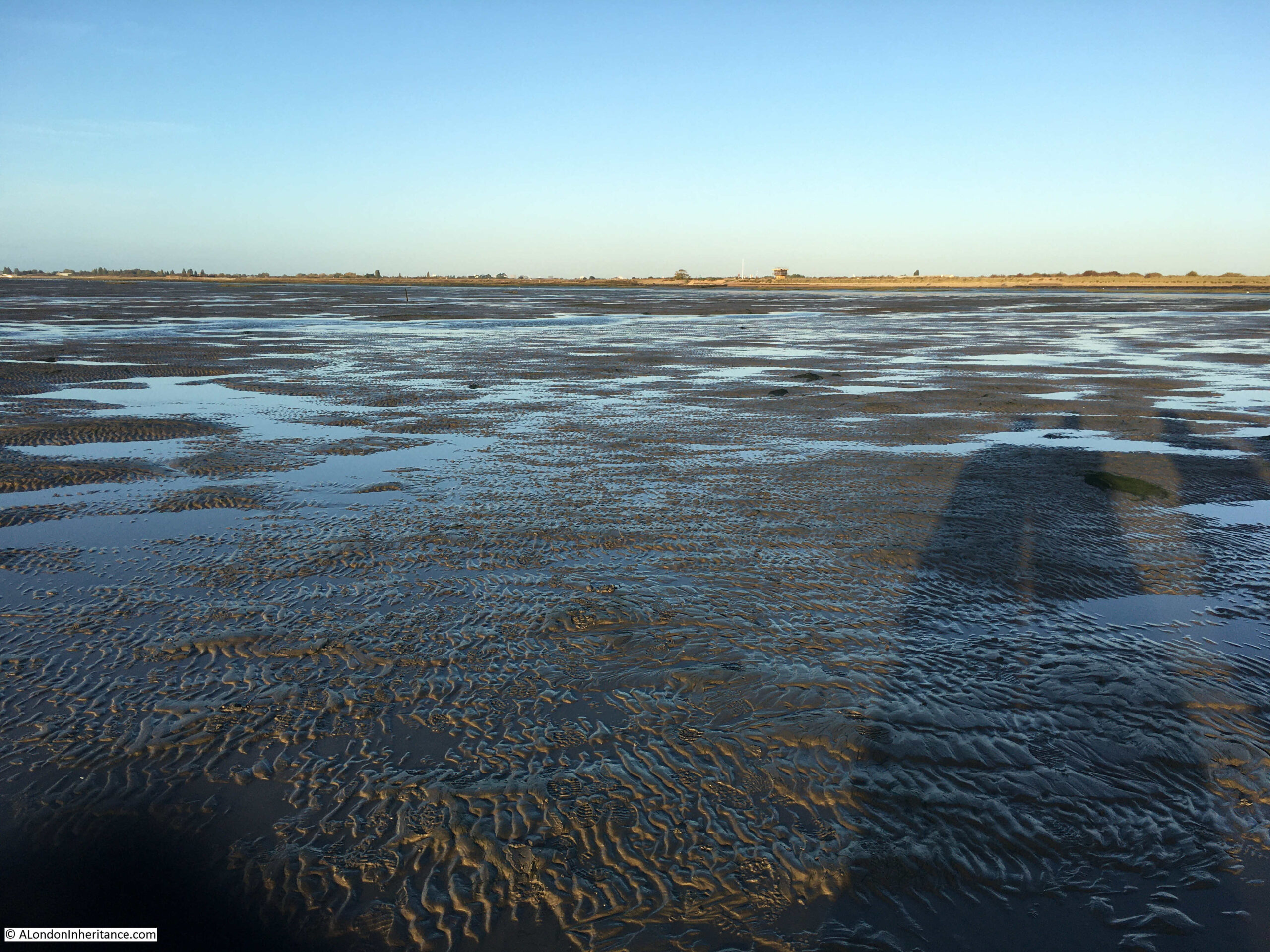
Back to the Broomway, and the walk over what could have become the third London airport, started at 7:30 am. The walk left Wakering Stairs and headed out, away from the coastline, and the dangerous mud. The following view is out on the Broomway, looking back towards Wakering Stairs:
Broomway

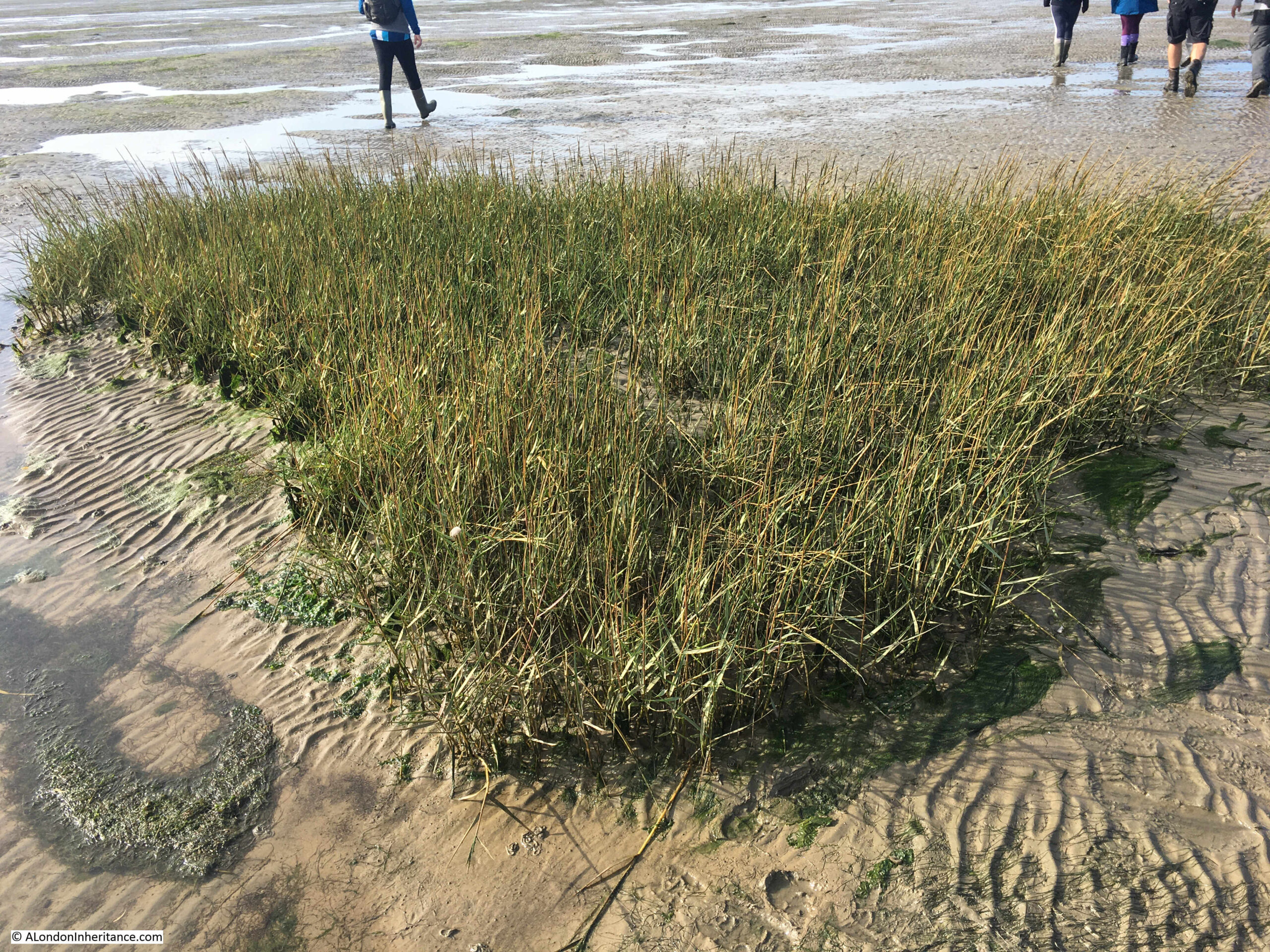
The above photo shows large expanse of sands and water with hardly any landmarks. The first we reached was a small patch of grass growing in isolation:
Broomway

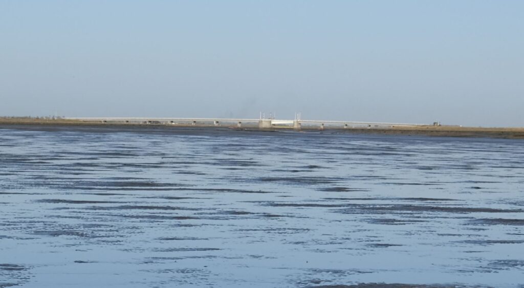
To the south, Foulness is separated from the mainland by the Havengore Creek. Today, there is a bridge over the creek which is part of the upgraded roads along Foulness used by the limited number of occupants, and primarily by the Ministry of Defence (MoD).

In the following photo the Havengore Bridge can be seen in the distance as we walk over the sands where the creek flows into the sea.
Broomway

The island’s connection with the MoD starts in the mid 19th century when the War Office used sands to the south as an artillery range. The War Office tried to expand to the north and attempted to purchase Foulness Island from the Lord of the Manor, however he refused, although the War Office started to buy up any land or farms that became available.

When Alan Finch, the Lord of the Manor died in 1914, his half-brother inherited the estate and agreed to sell to the War Office, who then owned over two thirds of the island.

Since 1915, Foulness has effectively been a closed island. Mainly used by the MoD for weapons testing, but with a small community remaining and some farming.

The Essex Weekly News on the 18th of December 1914, described the island as:

“AN OLD WORLD PLACE – If Foulness island becomes simply a military area we shall see there after two thousand years an instance of how history repeats itself. The Romans selected Mersey Island further along the Essex shore as a military camp, and fortified it against invasions by Norsemen. Now another foe, equally barbarous again threatens us from the North Sea.

Foulness is very flat and scantily wooded, and but few farm houses and cottages are in view, although there is a population of about 480. The island was constituted a parish in 1550. The Parish Church erected in 1850 on the site of a series of wooden buildings, is dedicated to St Mary.

The nearest point on the mainland to Foulness is Great Wakering from whence as a spot known as “The Stairs” it is reached at low tide by a headway over the sands. Stubby tufts of broom stuck in the sand about thirty yards apart mark the way for the traveler. There have been some narrow escapes by those who have ventured along this wave-washed road; and indeed few experiences are more alarming than to find one-self along the ‘Broom-way’ as the road is called, a couple of miles from land in the dusk of a winter’s day with the tide beginning to race across the Maplins.”

Once out on the Broomway, it is easy to appreciate the risks whilst walking along this “wave-washed road”. You are separated from land by a dangerous area of mud. There are no visual reference points. The land is so flat that when the tide comes in, it does so rapidly. Not an incoming visible wave of water, rather a deceptive rise in the water level all around that cuts you off from the land.

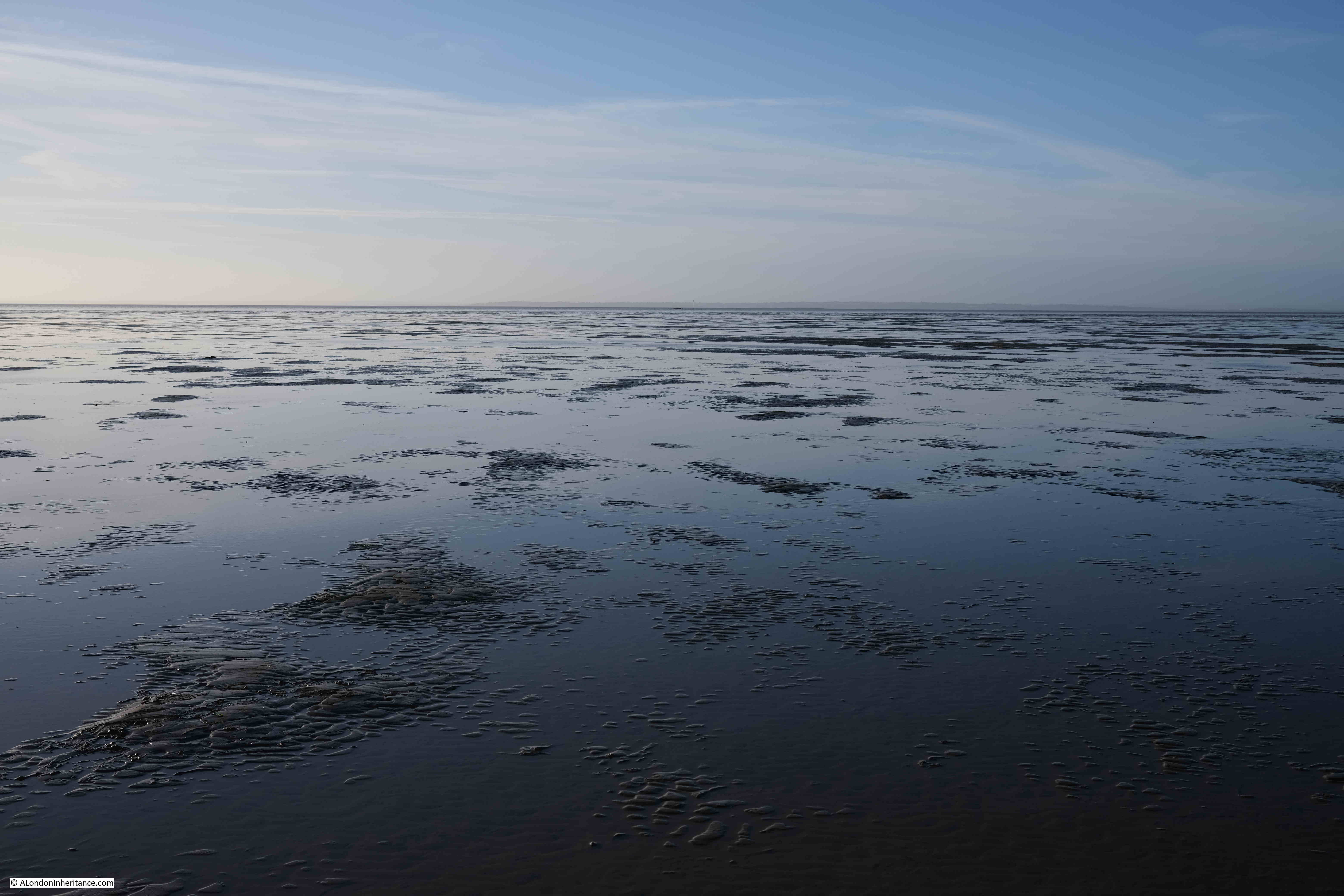
The following view is looking out to sea from the Broomway. The sea is not visible, just an endless scene of sand and water until the horizon meets the sky:
Broomway

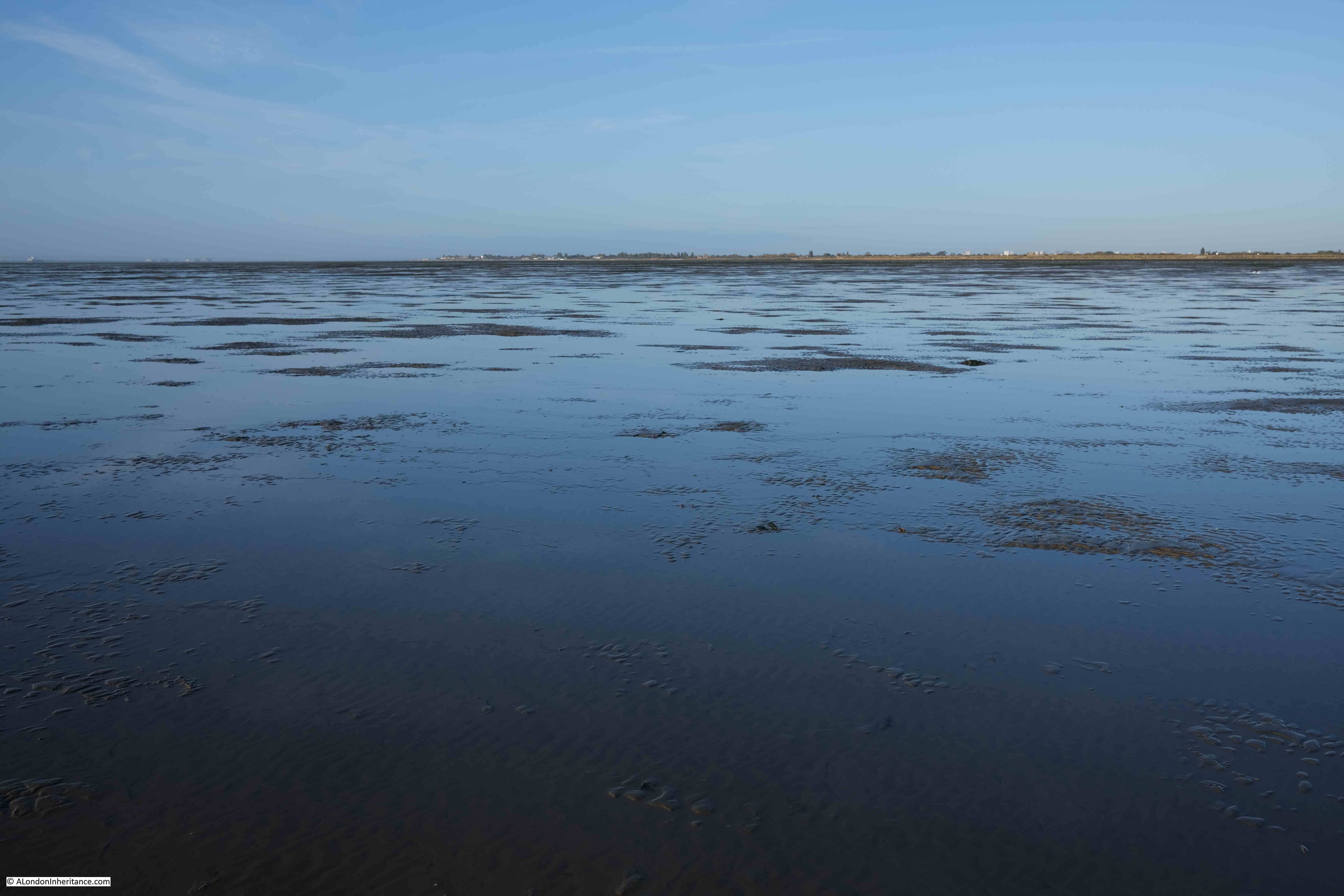
And in the following photo, looking back to land from the Broomway, which is now a narrow strip on the horizon, with the “Black Grounds” of dangerous mud separating you from the safety of the land.
Broomway

The military use of Foulness caused additional risk to those navigating the Broomway. The area was used for training and the test firing of guns and ammunition. This use continues to this day, and there are large warning signs at Wakering Stairs advising that “Do not approach any object or debris as it may explode and cause serious injury or kill”.

Newspaper reports illustrate the risk when the Broomway was in use by Foulness residents, as the following from the Southend Standard and Essex Weekly Advertiser on the 1st of December 1910 reports:

“FACING DEATH AT FOULNESS – EXCITING INCIDENT ON THE BROOMWAY: For a long time there have been many loud complaints from the people whose vocation causes them to use the road known as the Broomway from Wakering Stairs to Foulness Island, as to the serious danger which is caused by the gun practice from the Garrison at Shoeburyness.

On Tuesday last two people were driving across the Broomway when they had the narrowest of escapes from death, or serious disablement, by the bursting of a shell. They were in two traps, a few yards behind each other, and their attention was drawn to the gun firing which was going on from the Garrison. Naturally enough they felt no fear of danger, as the Broomway is on the edge of space allowed for practice is a mile or more away.

Several shots passed a safe distance away, but suddenly one great shell ploughed into the mud not more than thirty yards away and burst with a loud explosion. Vast quantities of mud and water were thrown out in all directions, and some of it, in great lumps, struck the two gentlemen who were driving, So great was the force of the explosion that a hole many feet long and deep, big enough to hold a wagon and team, was dug out. The horses were scared, and it was only with considerable difficulty that they could be prevented from bolting.”

The Broomway is only accessible from Wakering Stairs at the weekend as during the week, Foulness is still used for live firing.

Continuing the walk along the Broomway, and the most significant landmark on the sands comes into view. This is the Havengore Maypole:
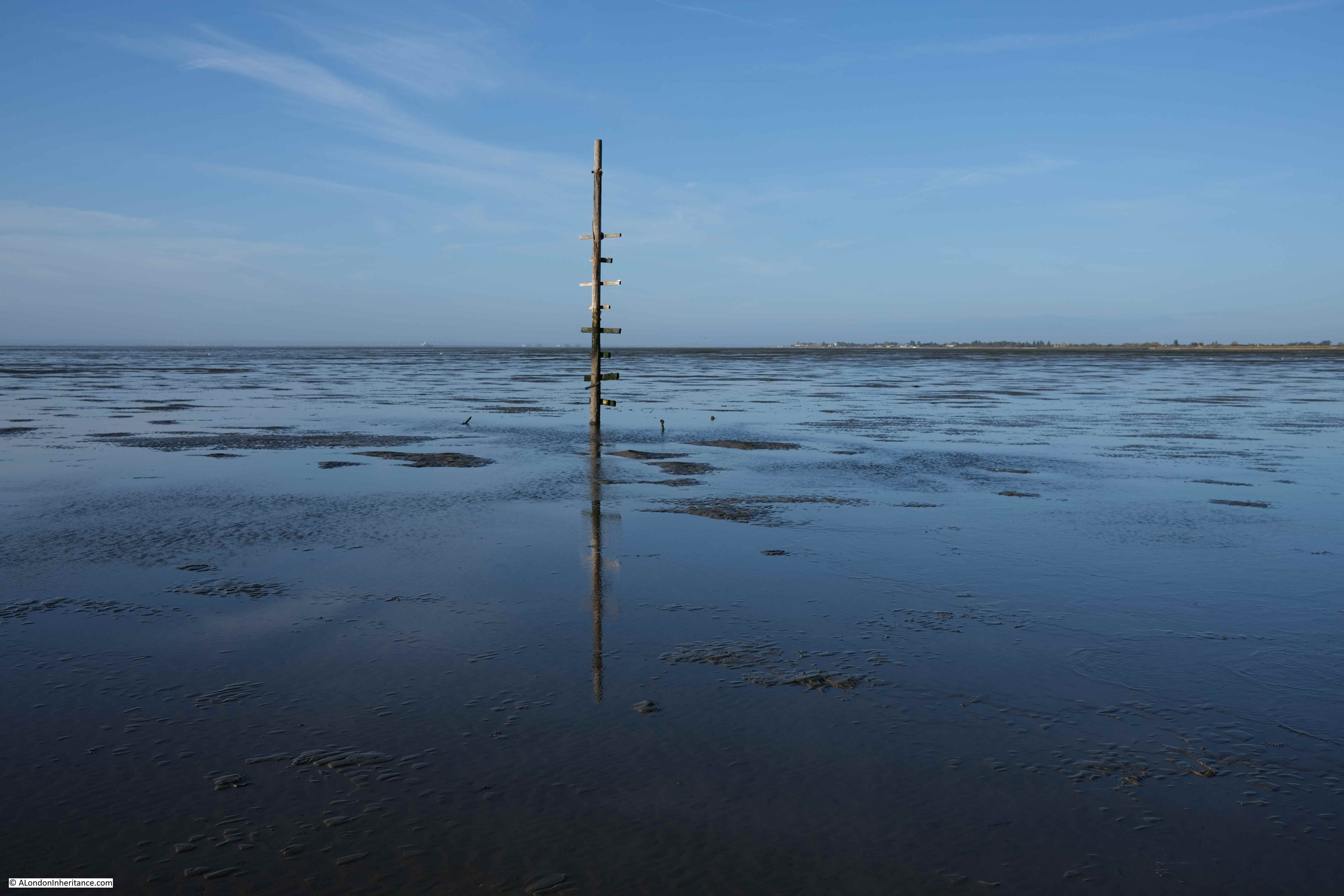
Havengore Maypole

It is known as the Havengore Maypole as it marks a channel into Havengore Creek much further to the coast, and was once held in place by cables extending from the top of the pole to moorings in the sands, one of which can be seen to the left of the pole on the following photo:
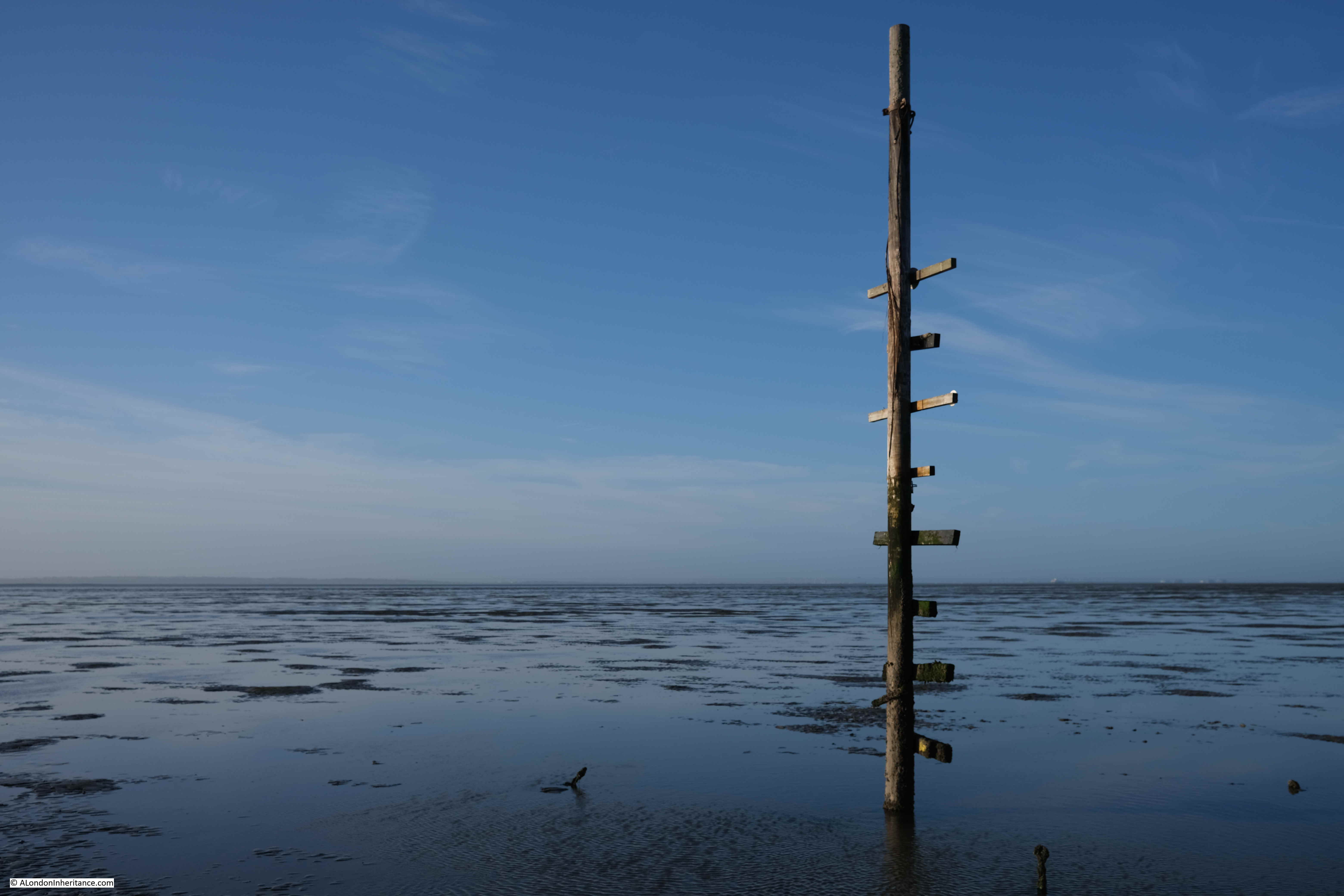
Havengore Maypole

The Havengore Maypole is a significant marker in the wide expanse of featureless sand and water, however it was surprising how difficult it was to see from any distance. This is a problem with navigating the Broomway in that everything seems to blend into a featureless landscape, including the distant sea and land.

The weather on the day of my walk was really good. Clear skies, light wind and good visibility, however the Broomway is also at risk from sea fogs and mists which can roll in rapidly leaving a walker lost in a grey fog with no idea of the direction of travel.

There are stories of people being lost in fogs and walking out to sea rather than towards land.

The name Broomway comes from the use of sticks of Broom placed in the sands at regular intervals. By following these sticks, the traveler had confidence that they were on a safe route. They only then had the tide, fogs and the risk of an exploding shell to worry about.

There are very few of these markers left today, just the occasional base of a pole sticking out of the sands:
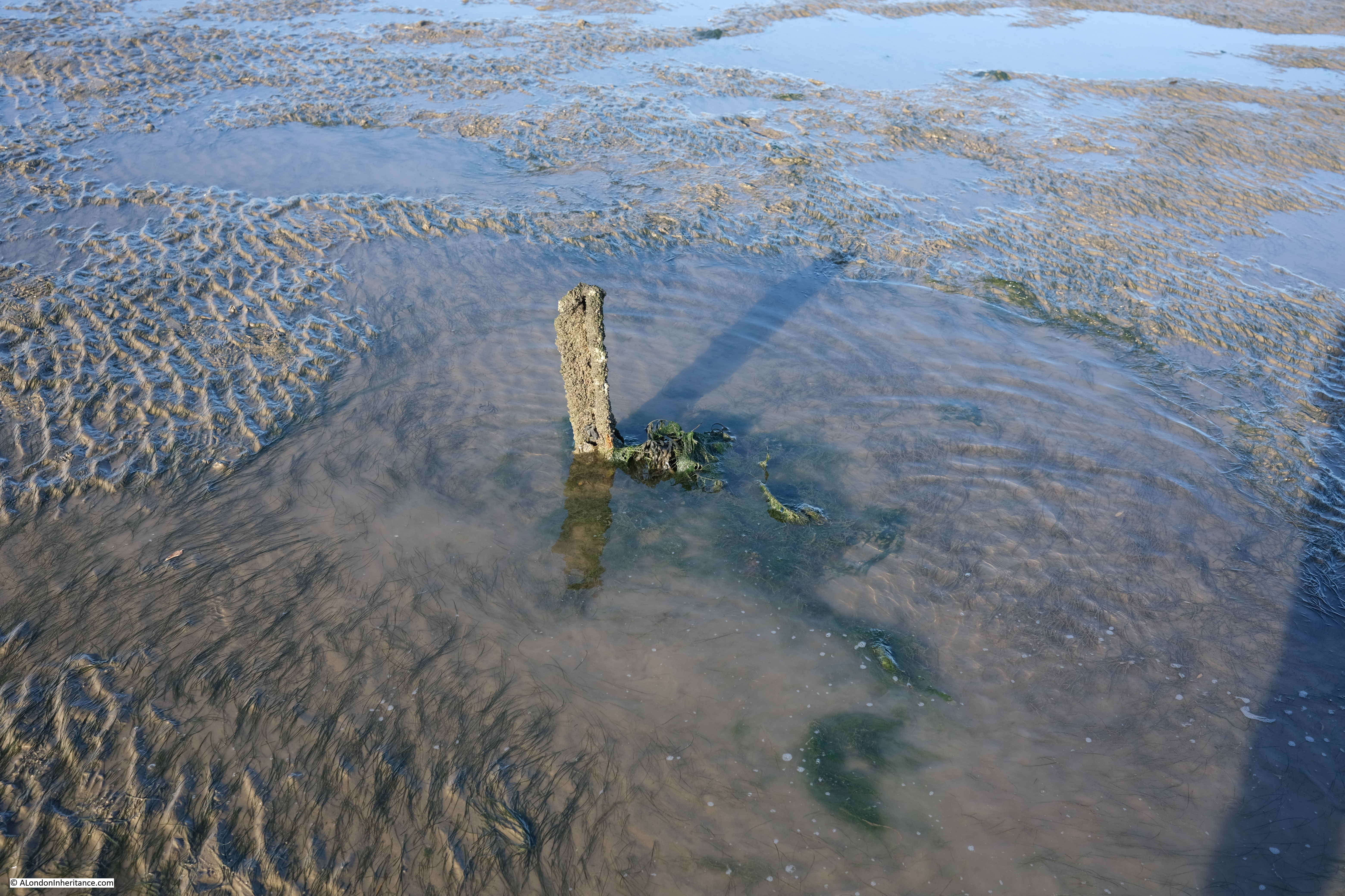
Broomway

For centuries the Broomway was the main route between Foulness and the mainland. There is written evidence of its existence back to the 16th century, and it is probably much older.

It was used by all manner of means of transport. Coaches, pony and traps, bikes, walkers. Newspaper reports of travel along the Broomway mention that the Postman had one of the most dangerous jobs as he had to travel the Broomway on an almost daily basis.

Even at low tide the sands are covered by pools of water and there are a number of larger channels of water to cross:
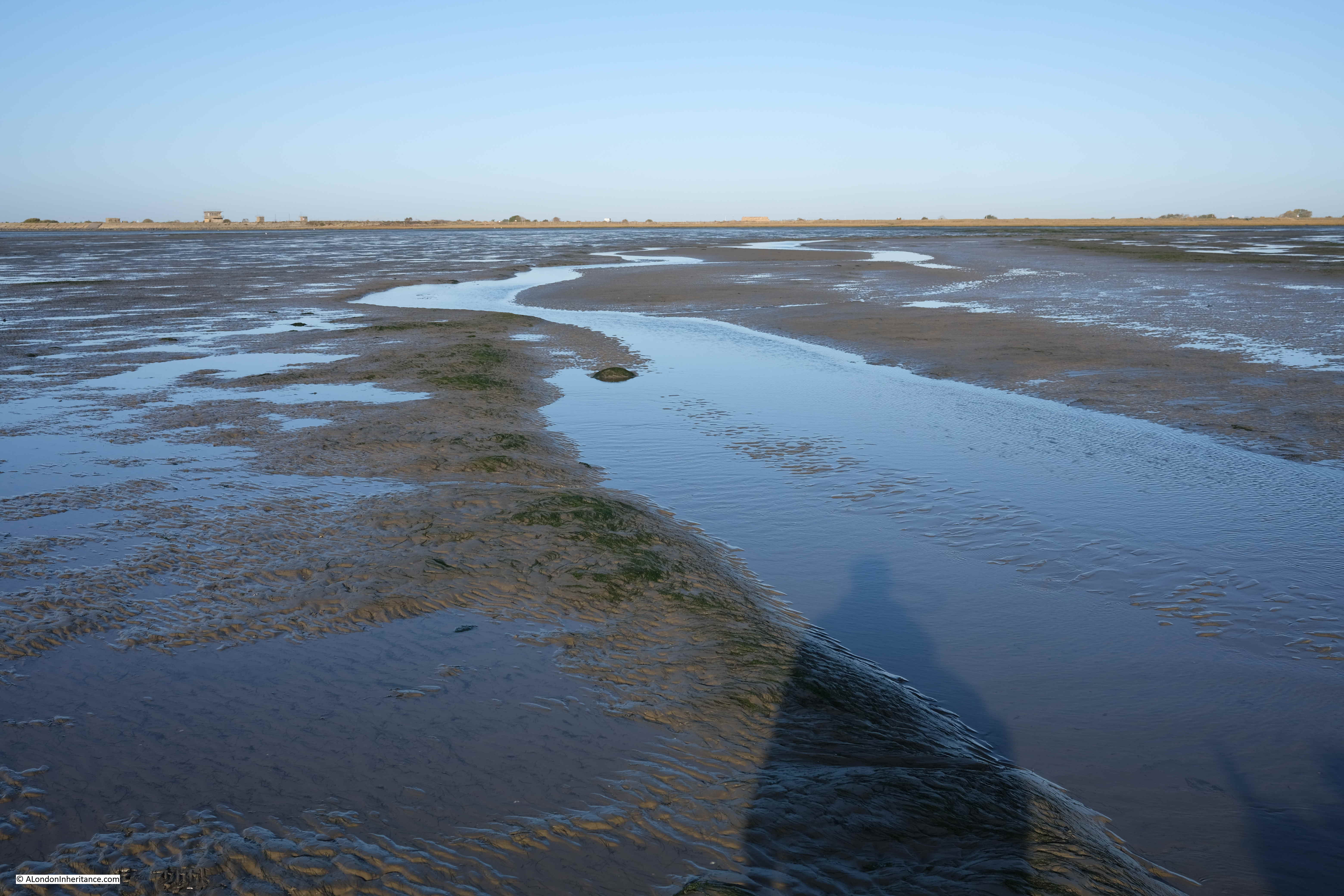
Broomway

Maplin Sands – Nothing but sand, water and sky, and somewhere in the distance is the sea with the returning tide:
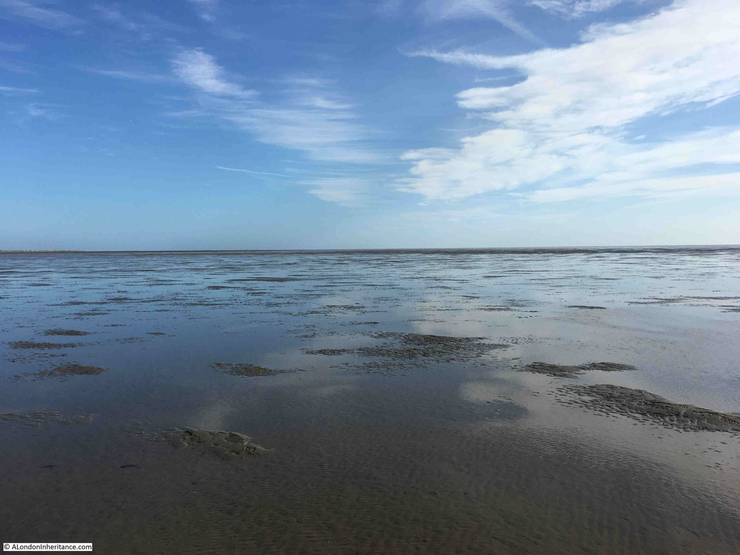
Maplin Sands

After 5km of walking across the sands, we reached Asplins Head, the point where there is a causeway across the dangerous muds providing a safe route onto Foulness. The following photo shows the end of the causeway furthest from the land. It is a jumble of rocks and broken concrete.

If you look to the left half of the photo, where the sands meet the sky, you can make out a low wall. Apparently this enclosed an area that was used to test how fuel burnt with fuel being pumped into the space bounded by the wall and set on fire.
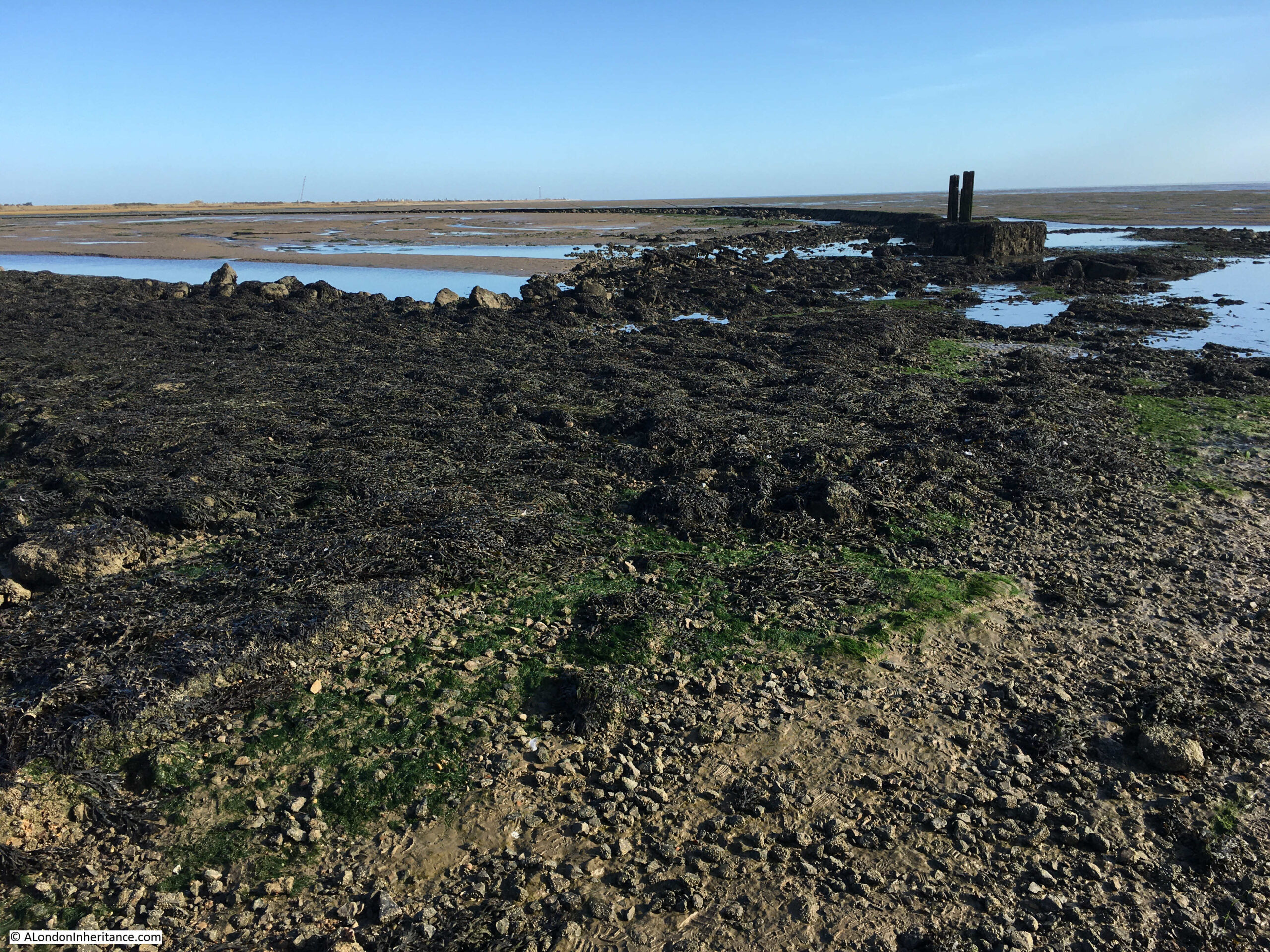
Asplins Head

The view towards Foulness showing the length of the causeway:

The view from Foulness along the Asplins Head causeway. The low wall of the circular enclosure for fuel testing can be seen on the sands to the left:
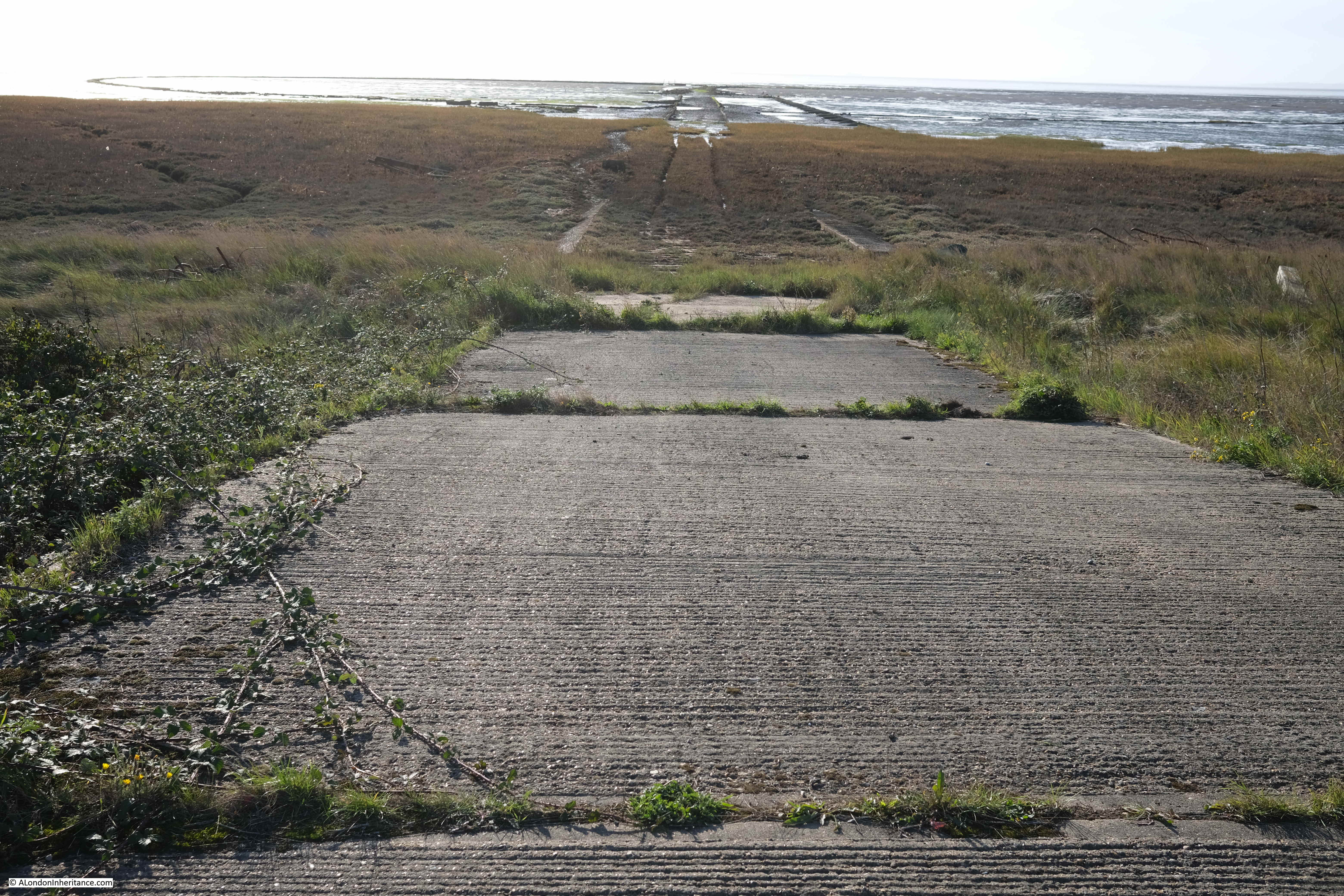
Asplins Head

Whilst the Broomway continues further than Asplins Head, continuing on the route at a reasonable walking pace, and being able to return to Wakering Stairs is a risk with the returning tide, so Asplins Head is as far as the walk took us along the Broomway.

After a short break, it was then a final 5km walk back along the Broomway to Wakering Stairs.

The Broomway is a fascinating walk. Despite the proximity of the MoD, and the use of the sands for weapons testing, Maplin Sands still feels very natural. Large flocks of wadding birds are further out on the sands, and the casts of lugworms are frequently seen on the sands.

The area had a lucky escape in the 1970s when plans to build the third London Airport on Foulness and Maplin Sands were cancelled.

The remote areas of the Thames Estuary have been the focus for a number of airport proposals over the decades. See my post on the Crow Stone, London Stone and an Estuary Airport for an example of the most recent proposals for an airport on the Isle of Grain and the Hoo Peninsula in north Kent.

Researching the history of the airport proposals, and at the time there was much support for an airport at Foulness, both within the local area, and from around London.

Two examples show very different reasons for supporting the proposals.

Toby Jessel, the MP for Twickenham was a vocal supporter of the Foulness airport. He had long been raising issues with the increasing number of flights at Heathrow, the disruption that noise caused to residents, and even the risk of an aircraft crash in heavily populated areas of London as the number of flights increased. He also saw Foulness as the option that would result in less damage to the countryside compared to the inland options.

There was also an article in the Stage and Television Today on the 19th of October 1972, which I found amusing as it relates to the opening of a club / disco in Southend that I frequented in the late 1970s – Talk of the South (better known as TOTS), and that its opening was down to the possibility of Foulness Airport:

“Southend, and more generally speaking the South of England, have been left out on a limb as it were as far as good cabaret facilities are concerned and it is fair to say that it was not without consideration of the new Foulness Airport, Britain’s new number one air terminal, that the idea of a delux cabaret club was formed.”

TOTS closed a couple of years ago, but it lasted for much longer than the airport proposals.

The Broomway is not a walk to take without the experience and skill needed to plan and navigate a path a long distance from shore, covering dangerous sands, and at risk of a rapidly incoming tide and changing weather conditions.

I booked my walk via Tom Bennett Outdoors, and his walks can be booked here.

alondoninheritance.com

The Medieval Church at Reculver

I hope you have had a good Christmas in whatever form that may have taken in these strange times. As well as Christmas, last week also saw the shortest day of the year, and slowly the days will start to lengthen. The weather has also been very grey and cloudy and the period between Christmas and New Year is often a good time to get out for a walk.

The Thames Estuary is an ideal place for a walk. Close to the Thames and the sea, usually a good breeze to blow away any late December lethargy, and plenty of historic places to explore.
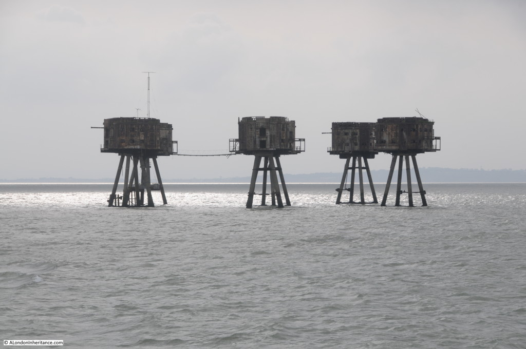
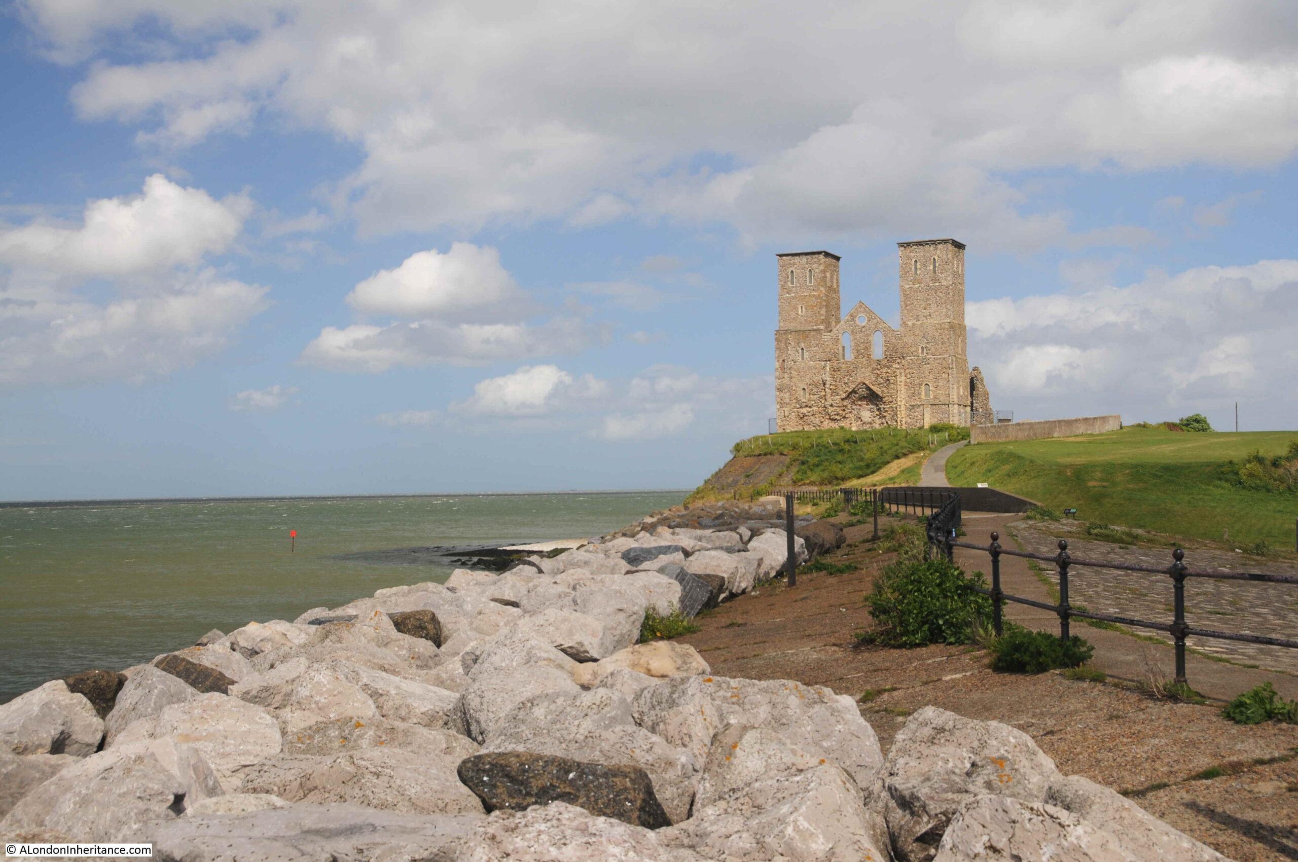
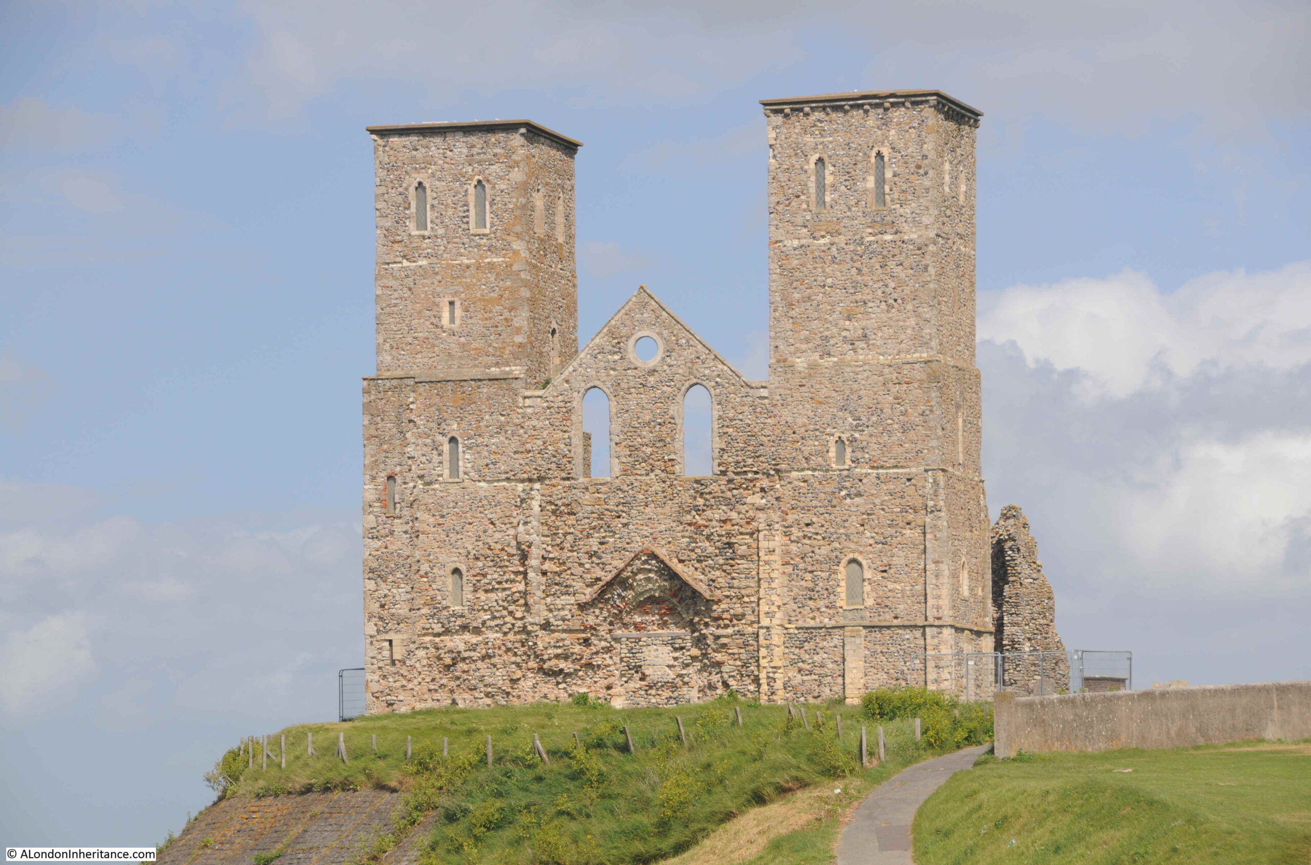
One of these is the ancient church of Reculver on the north Kent coast. The remains of a church built in an old Roman camp, with two distinctive towers that for long were navigation markers for those sailing on the estuary.

Reculver

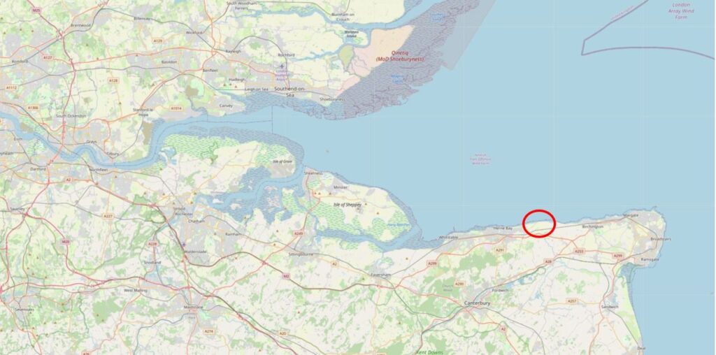
Reculver is a few miles to the east of Herne Bay, and as the above photo shows is on a prominent location on a cliff top next to the sea. The location is ringed in the following map ( © OpenStreetMap contributors):

Map of Reculver

This has long been an important location, with the first major construction on the site being an early Roman fort. A Saxon church was built at some point around the year 669, with the church forming the core of a small monastic settlement.

The towers were added when a series of alterations were made to the church at the end of the twelfth century. This work included a new, large west facing doorway.

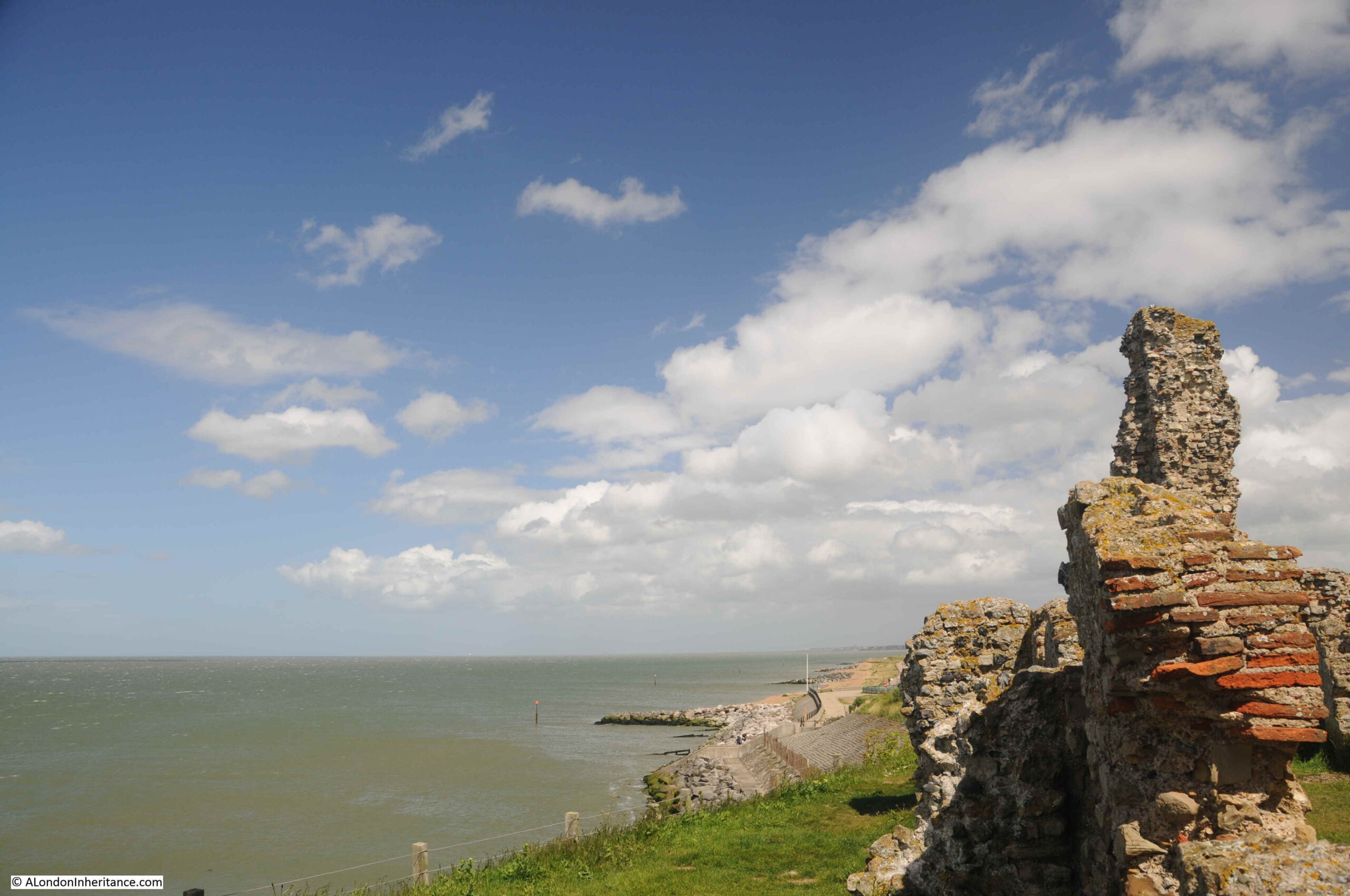
The church was built in the centre of the original Roman fort, and the church was originally almost a mile from the sea, however erosion has taken the sea up to the edge of the church, and the land occupied by almost half of the Roman fort has been lost.

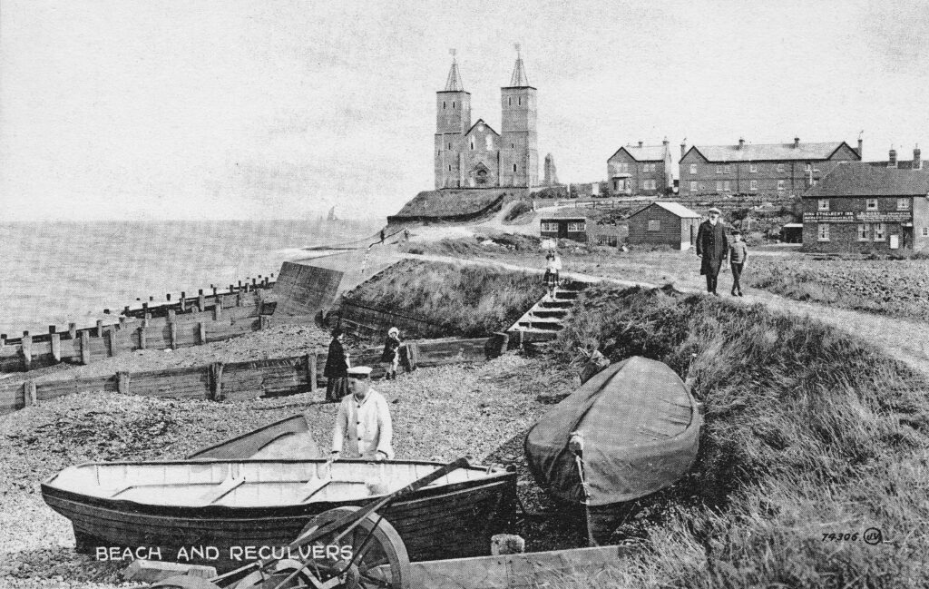
The beach (now occupied by large rocks to prevent further erosion) and the church has long been a tourist destination, and the following early postcard shows what would have greeted visitors in the early 20th century:

Reculver postcard

The Monastic establishment came to an end in the year 949 when the building took on the role of a parish church. The rebuild of the late twelfth century utilised the remains of the old monastery to construct the new church.

Over the centuries, land was gradually being eroded, and by 1780, the northern corner of the church was only 50 yards from the sea. In 1802 much of the core of the church collapsed and by 1805, the two towers were at risk.

The prominence of the two towers, on the cliff, overlooking the sea and the Thames estuary was critical to navigation. The minutes of Trinity House from 1662 record the need to make repairs to the steeples of a building that was long regarded as an “ancient sea mark”.

With the two towers at risk in 1805, Trinity House took action and purchased the remains of the old church in 1810 and built groins along the beach in front of the cliff, to break up the action of the waves. They also faced the cliff with stone to prevent further erosion, and following this work, the two towers have been able to continue to help those navigating at sea.

Trinity House also rebuilt the wooden steeples at the top of the towers, which had been blown down (it can get very windy along this exposed coast).

Navigation markers, such as the towers at Reculver, were becoming less relevant in the early 20th century for navigation on the Thames estuary, so Trinity House handed over the site to the Government’s Office of Works in 1925, and it is now the responsibility of English Heritage.
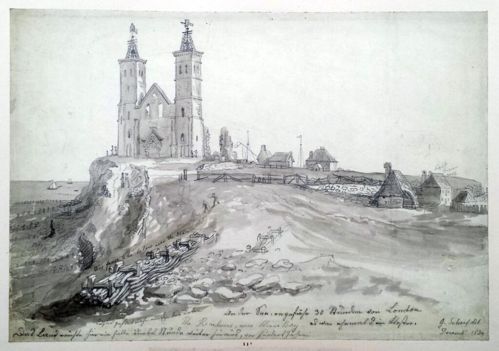
The following print from 1834 shows the new wooden steeples installed by Trinity House at the top of the towers. Note also to the right of the church two structures with flags which were probably used for signaling to ships at sea  (© The Trustees of the British Museum).
Reculver

Getting closer to the church and the original west facing entrance can be seen, now blocked up.

Reculver church towers

A legend associated with the twin towers of the church is that they were either caused to be built, or where repaired around the year 1500 by  Frances St. Clair, Abbess of a Convent of Benedictine Nuns at Davington.

There are a number of variations to the legend, with the majority recording that Frances, along with her sister (also a nun) were travelling on a ship that was shipwrecked near Reculver. They were brought ashore at the church. Some variations record that her sister Isabelle died in the ship wreck, other that they were both saved.

Either way, due to the shipwreck, Francis had the towers built / repaired as a result of being saved, or in memory of her sister.

A drawing from 1784 shows Frances and Isabella being reunited in front of the church at Reculver, with some serious artistic license and creativity being used to show the buildings of the church in the background  (© The Trustees of the British Museum).

Reculver

The site of the church has probably been in use for well over 2,000 years. Archaeological excavations have shown that the Roman fort probably started as a small initial camp for the invading Roman forces in the year 43. Excavations have also revealed that Reculver was the site of an earlier Iron Age farmstead.

The site was occupied throughout the Roman period, and the main walled fort was built early in the third century. It became one of the line of forts known as the Saxon Shore Forts which were established along the eastern and southern coast of England, and the northern coast of France, in the late third century, to protect against raiding parties as the Roman empire started to face many of the threats that would result in Rome abandoning England in the early 5th century.

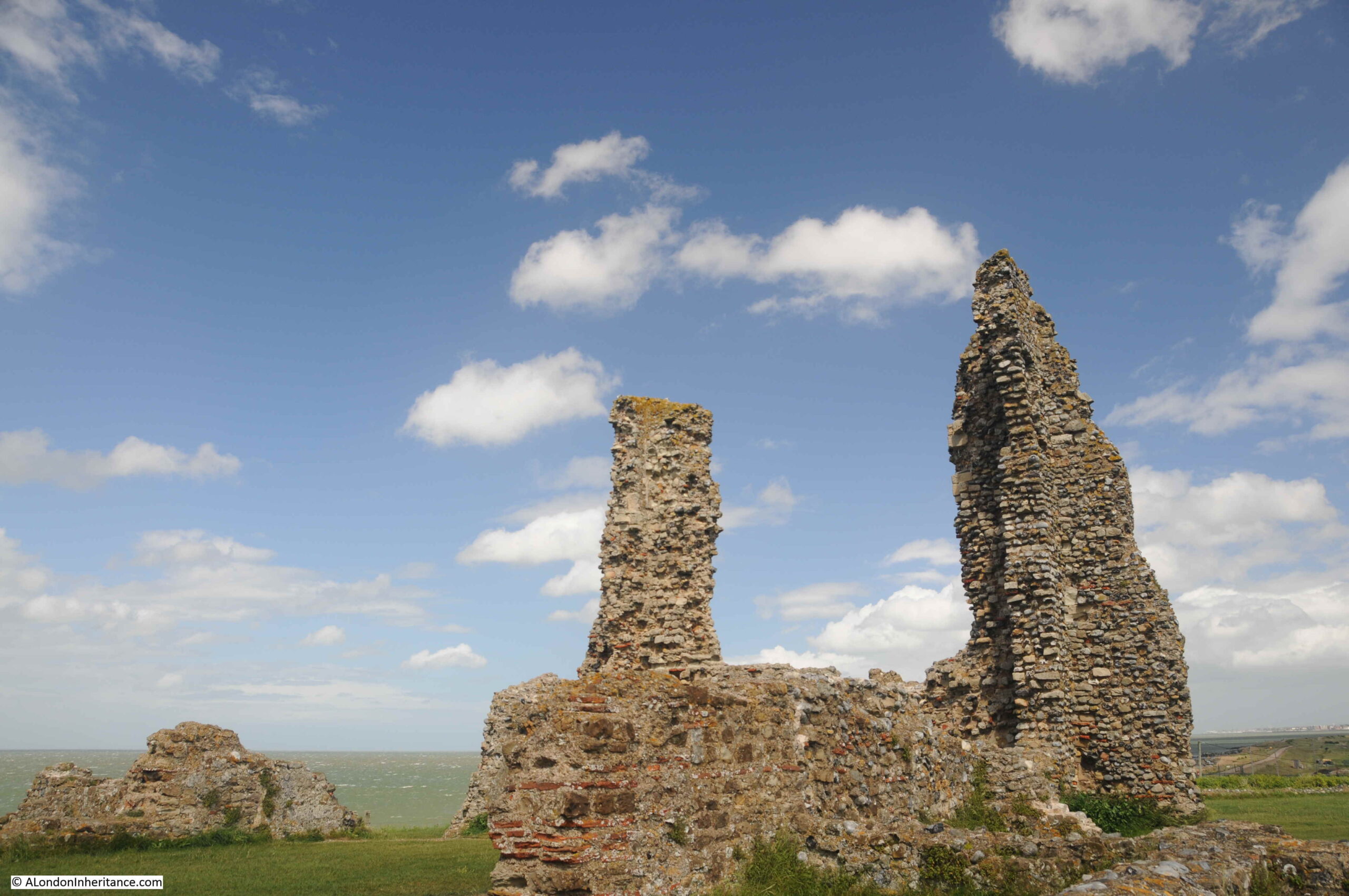
The remains of a number of the walls of the fort can still be seen around the site, and Roman tiles and stone were used in the construction of the church. The distinctive red / orange Roman tiles can be seen embedded in many of the remaining walls of the church:

Reculver

My last visit to Reculver was on a brilliant sunny day, and the ruins of the church stood out against a blue sky.

Reculver

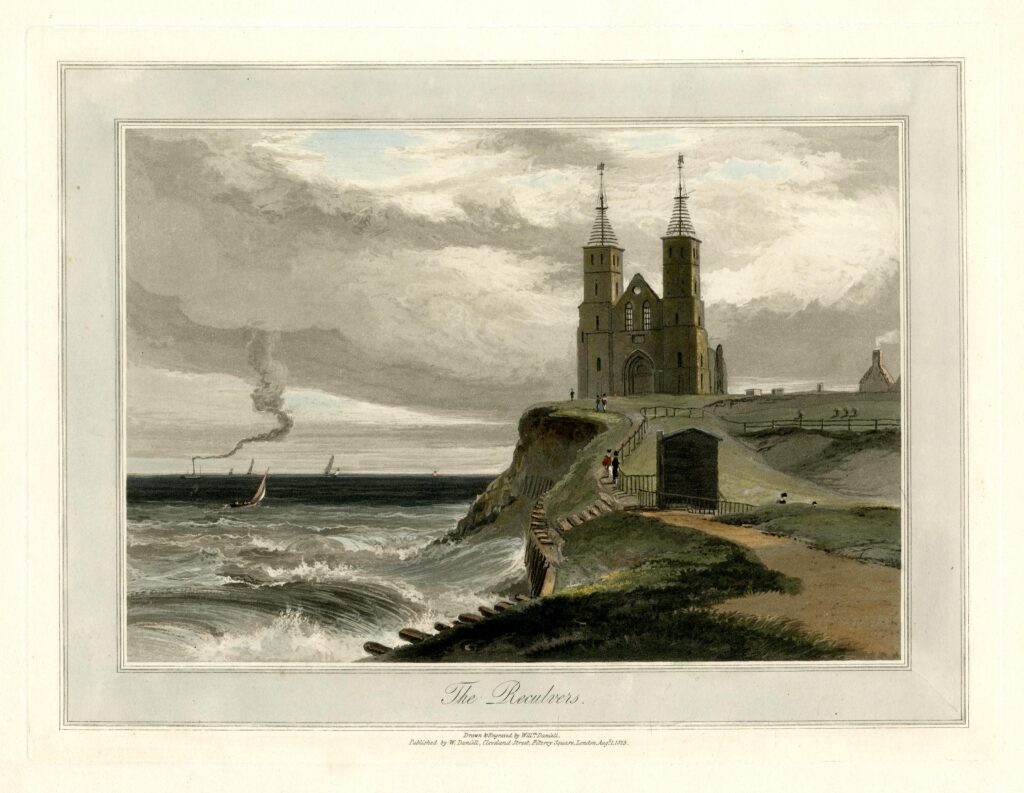
However it is a wonderful place to walk at any time of year, and has frequently been illustrated as part of a windy / stormy scene with the waves crashing up to the cliff showing how easily this part of the north Kent coast is eroded, and that the church would have been victim to the waves if not for the work of Trinity House. The following print is from 1829  (© The Trustees of the British Museum):

Reculver

Another scene from 1796 showing the nave of the church before this collapsed in 1802. The scene also shows a house between church and cliff, however as well as the collapse of the church, a few years later this house would also be lost and the cliff would be up against the church  (© The Trustees of the British Museum).

Reculver

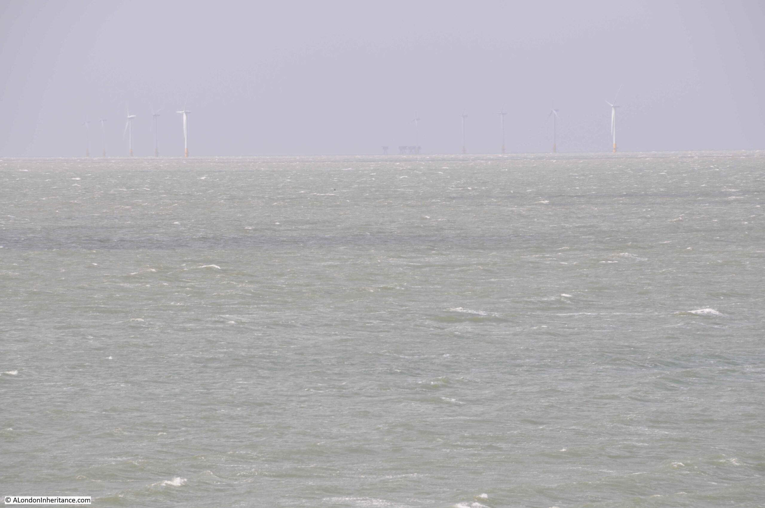
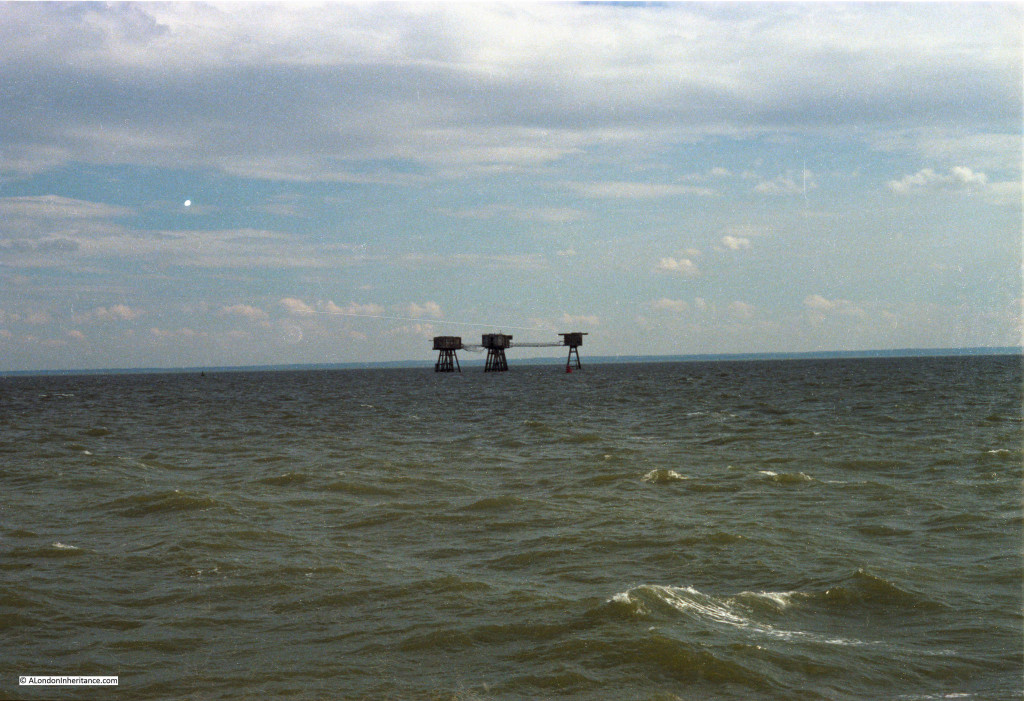
Whilst today there are very few sailing ships off Reculver using the towers as navigation markers, the view from Reculver includes the Kentish Flats wind farm, roughly six miles offshore, and in the middle of the following photo, just visible on the horizon, is the Red Sands fort:

Red Sands Fort

Reculver is a fascinating place to visit at anytime of year. It is also a good place to see the impact of coastal erosion, with getting on for a mile of land having been lost in recorded history. Without the work of Trinity House, it is doubtful whether the two towers, the remains of the body of the church, and some of the walls of the Roman fort would remain for us to see today.

That’s my last post for 2021. Thanks for reading over the last year, and can I wish you all a very happy and healthy 2022.

alondoninheritance.com

Defending The Thames – Hadleigh Castle

Long term readers of the blog will probably recognise my fascination with the River Thames and how the river has shaped London, and London’s influence on the river.

The river was the main driver in London’s economic growth, providing the route by which ships could reach the City from the sea. This led to the expansion of central London docks, followed by the move of docks from the City out to the Estuary.

The river has also been a weak point, allowing enemies to attack key locations along the Rivers Thames and Medway, and potentially strike at the City.

The River Thames has been lined with various forms of defence over the centuries. I have already written about Tilbury Fort and Coal House Fort, and at Hadleigh in Essex there are the remains of a medieval castle, refurbished and extended to defend the Thames Estuary against the French during the 100 years war, and to provide a royal residence away from London.

A couple of week’s ago I was in Southend (Gary Numan at the Cliffs Pavilion – reliving the late 1970s / early 1980s), so I used the opportunity to visit Hadleigh Castle, just to the west of Southend, on a hill and overlooking the estuary of the River Thames.

The origins of Hadleigh Castle date back to 1215, when King John gave Hubert de Burgh land around the village of Hadleigh. de Burgh constructed the first castle on the site to demonstrate his position in the country and ownership of the Manor of Hadleigh.

As was often the case, relationships became strained as power shifted and de Burgh was forced to return his lands to Henry III in 1239.

Not much happened at the castle until the early 1300s when Edward II started to use the castle as a residence and constructed a number of internal buildings to help make the castle more suitable to providing royal accommodation.

Hadleigh Castle’s potential value as a fortification overlooking the Rover Thames was seen by Edward III during the Hundred Years War – the period straddling the 14th and 15th centuries when the Kings of England fought for the French crown, and the ownership of lands in France.

The Thames was a route whereby the French, and their allies, could attack the towns along the river, potentially all the way to London. This was a very real risk as demonstrated by the attack on Gravesend in the 1380s, and concerns that the French were assembling a large fleet for invasion.

Edward III built on the work of Edward II, strengthening and extending Hadleigh Castle.

Edward III may also have been interested in the castle as a retreat from London, providing views over the river and estuary. The area around the castle also provided extensive hunting grounds for Edward III and his guests.

The river provided easy access to the castle and there are records of the Royal Barge being moored at Hadleigh.

Royal interest in Hadleigh Castle was short-lived as after the death of Edward III the castle was no longer used as a royal residence, instead being leased to a series of tenants, until being sold off in 1551 to Lord Riche, who took no interest in occupying the castle, and started demolition to sell off the castle as building materials.

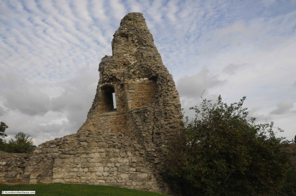
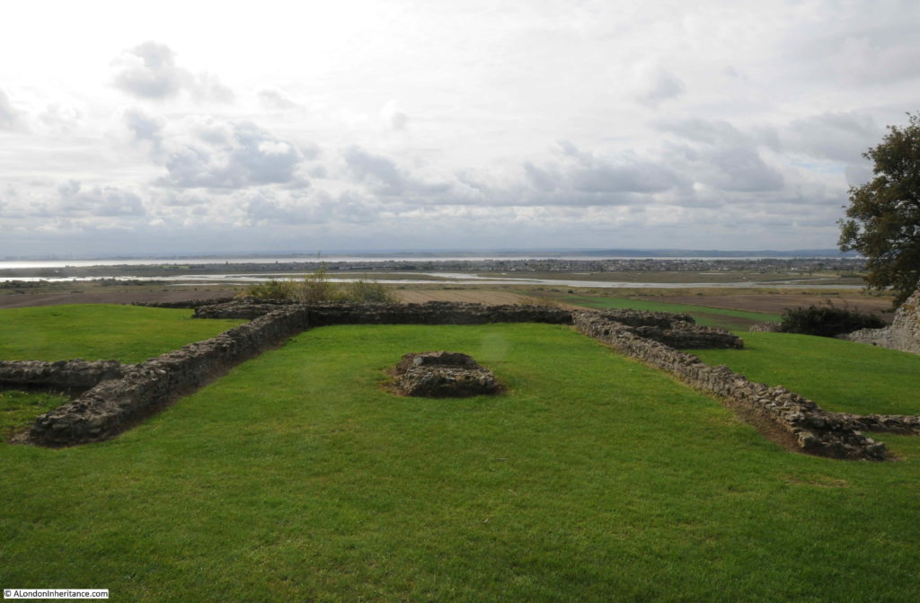
The version of Hadleigh Castle we see today is therefore a ruin and a shadow of its former self. Just a few towers, walls and foundations that have survived demolition and the castle’s geologically unstable location.

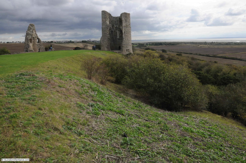
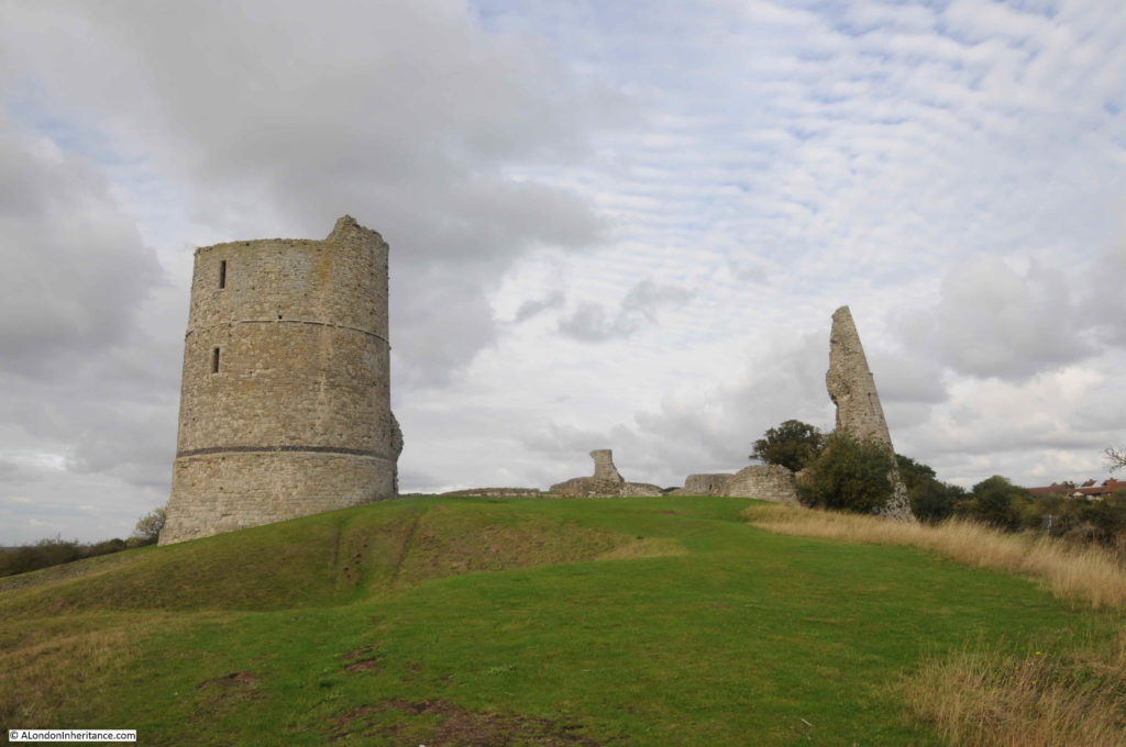
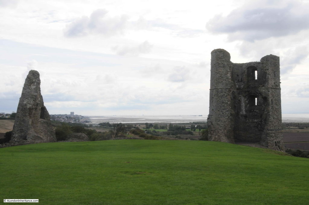
This is the view looking east, with the estuary on the right and the one remaining tower in the centre of the photo.

Hadleigh Castle

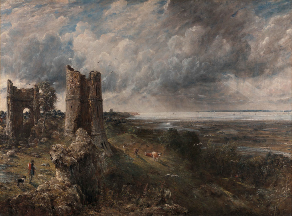
Almost the same view was the subject of a painting by John Constable in 1829, titled “The Mouth of the Thames–Morning after a Stormy Night”:

Hadleigh Castle

Image credit: Yale Center for British Art, Paul Mellon Collection

I really do like this painting. It perfectly captures the relationship between the sky and the estuary. Blue sky is starting to appear after the stormy night, and the sun is shining on the ruins of the castle.

In many ways Constable’s view is much the same today, although there was no Southend pier jutting out into the estuary in 1829, and today, cows are not grazing on the slopes adjacent to the castle.

Constable exhibited the painting at the Royal Academy in 1829, where it was described as “Full of nature and spirit, and graceful easy beauty; though freckled and pock-marked after its artist’s usual fashion”.

The painting now appears to be part of the Yale Centre for British Art collection in New Haven, Connecticut in the United States. I am not sure how it was acquired by the Yale Centre. In 1936 newspaper reports were congratulating the National Gallery on the acquisition of the painting and saving the painting for the nation.

The same newspaper reports were also expressing concerns about the planned development of the area around Hadleigh Castle. Factory sites were planned for the land around the castle. The villages of Leigh-on-Sea and West Benfleet were expected to expand towards the castle, and a road was planned to be built to run parallel to the railway.

The site of the castle is still relatively isolated. There are houses about half a mile further in land, and the Salvation Army run Hadleigh Farm is on the approach to the castle. I suspect the war put a hold on the proposed factories.

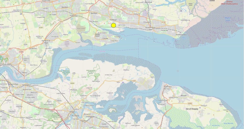
The following map extract shows the strategic location of Hadleigh Castle, marked by the yellow circle (Map © OpenStreetMap contributors).

Hadleigh Castle

The map shows that the castle’s position provided an ideal view over the estuary, and any attacking force would be clearly seen. The map does not clearly show the height of the castle, which stands 42m above sea level. Not that high, but high enough in this part of southern Essex to provide a commanding view over the river.

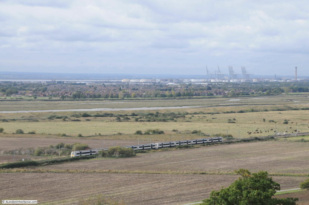
The geology of the site is interesting as the castle stands on the edge of high ground, which quickly falls to a level stretch of land between the castle and the river. The following photo is the view looking towards the south-west, with a c2c train running on the route from London Fenchurch Street to Southend and Shoeburyness.

Hadleigh Castle

In the distance are the cranes of the London Gateway port, and in front of them are the oil storage tanks to the west of Canvey Island and in Coryton. Canvey Island is between the oil tanks and the stream of water.

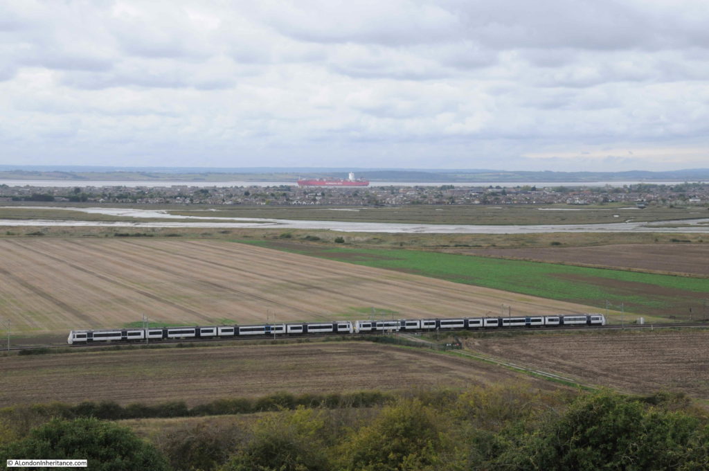
The view below is looking south. The river is at sea level, and the land gradually rises to 6 metres at the rail line.

Hadleigh Castle

During the medieval period when the castle was constructed and in use, the area between the mound on which the castle was built, and the river would have been marshland, and probably subject to flooding at times of very high tide.

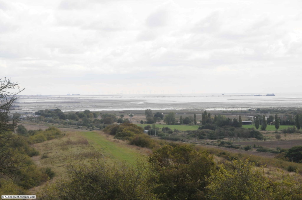
The view looking to the east, Southend Pier is visible in the distance.

Hadleigh Castle

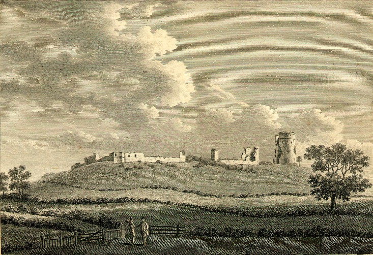
The following print from 1772 shows Hadleigh Castle from where the railway line runs today. Although the majority of the castle had been demolished for building materials, some of the southern walls still remained, although the majority of these have since disappeared.

Hadleigh Castle

Although from a strategic perspective, Hadleigh Castle was built in an ideal position, with a commanding view over the approaches to the estuary and River Thames, geologically it was built in a very precarious position.

The castle sits on an unstable spur of London Clay. Over the centuries there have been numerous slippages and damage to the castle building, beginning soon after completion of the castle. The last major landslip was during the winter of 1969 / 1970.

Today, about a third of the southern side of the original castle has been lost due to slippage.

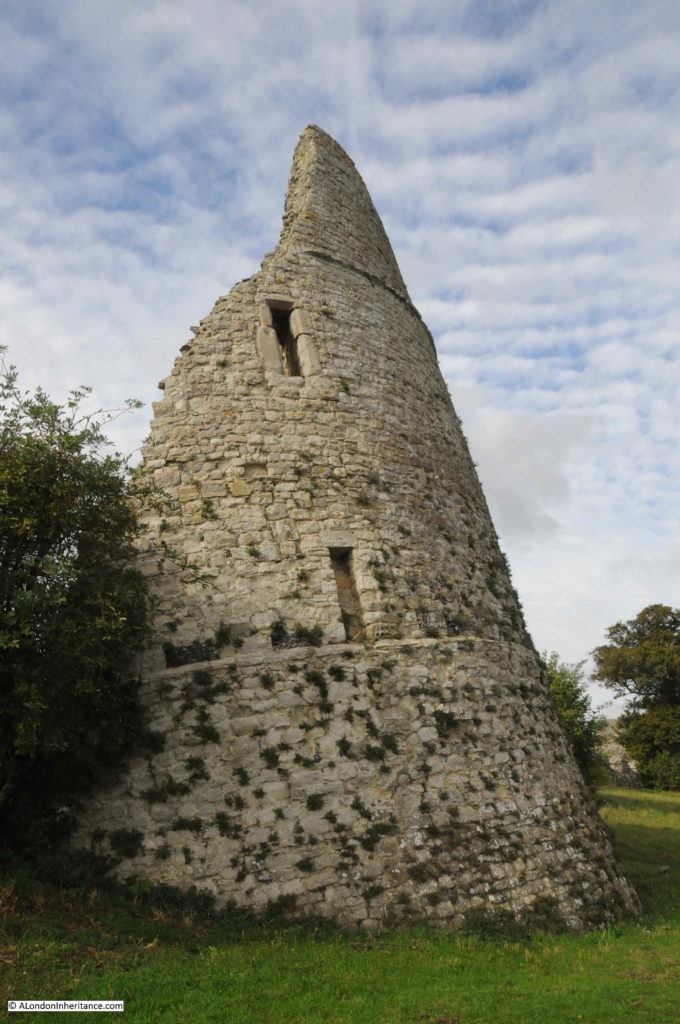
In Constable’s painting, two towers can be seen. Today, only one tower survives. The second tower to the north has slipped and collapsed and the remains can be seen to the right in the photo below:

Hadleigh Castle

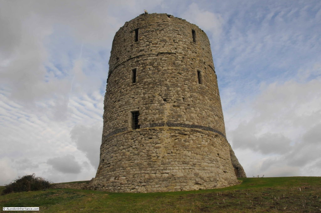
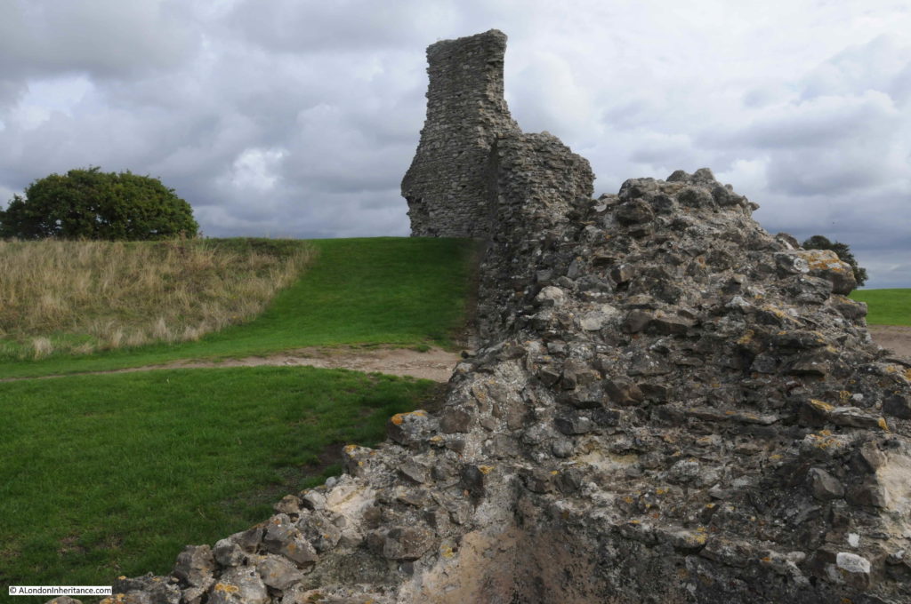
The main tower still looks impressive, and gives a good idea of what the whole castle must have looked like in the 14th century:

Hadleigh Castle

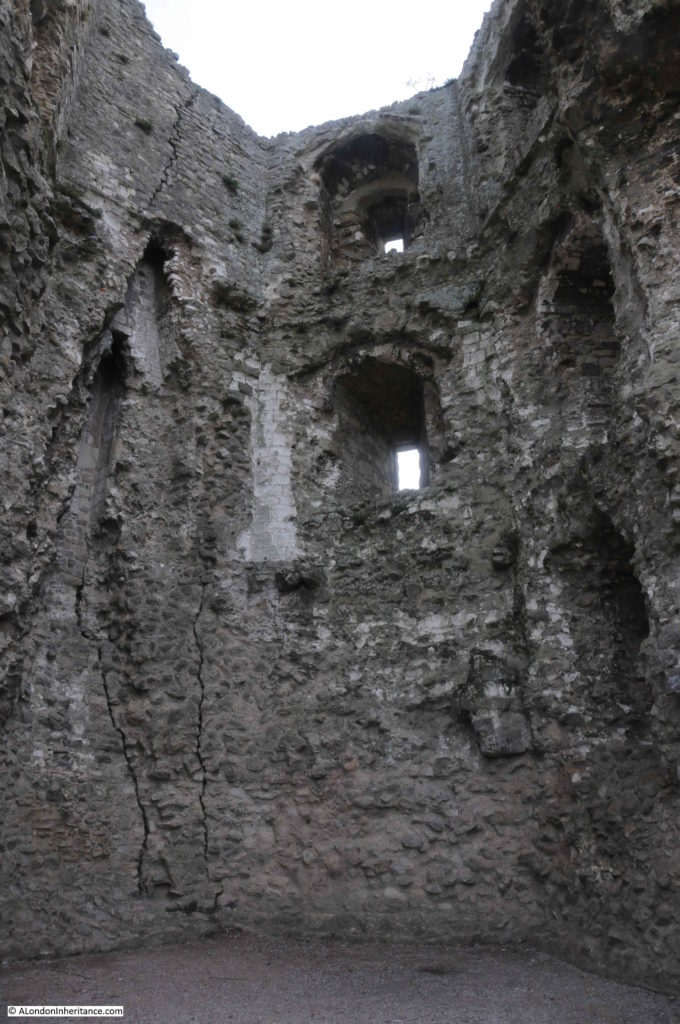
Although the tower sits at the edge of the descent down to lower ground towards the river, and cracks inside the tower tell of the possible future for this one substantial remaining part of Hadleigh Castle.

Hadleigh Castle

The exterior of the collapsed tower:

Hadleigh Castle

The interior of the collapsed tower:

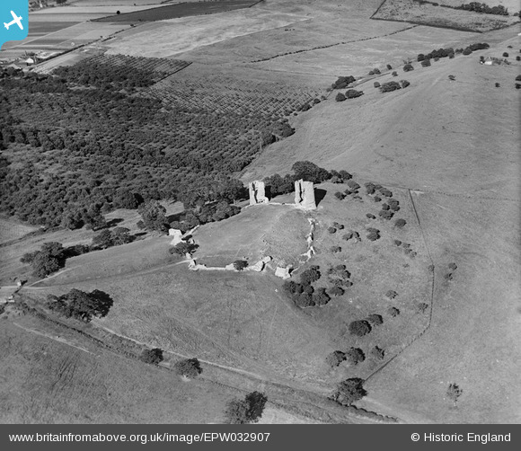
Hadleigh CastleThe following photo from Britain from Above shows Hadleigh Castle in 1930.

Hadleigh Castle

The tower on the left of the above photo is the one that has since collapsed.

The photo does provide a good view of the overall size of the castle, and the rather precarious position, situated on top of a high mound of London Clay.

The river is to the right of the photo and the two towers are facing to the east – to the Continent and to the Estuary, so the two large towers would have been the first evidence of the king’s power that anyone arriving from the Continent would have seen.

19th century interest in Gothic landscapes and architecture, and recreating late medieval architecture may have been the source of considerable growth in visitor numbers to Hadleigh Castle. Constable’s painting probably contributed, as did the relatively easy access from London on the Fenchurch Street line.

Visitor numbers were of such a size that in the later part of the 19th century, a large refreshment room was opened in the grounds of the castle, with seating for 400 people.

No such facilities at the castle today, just neatly clipped grass as the castle is now under the care of English Heritage.

Hadleigh Castle

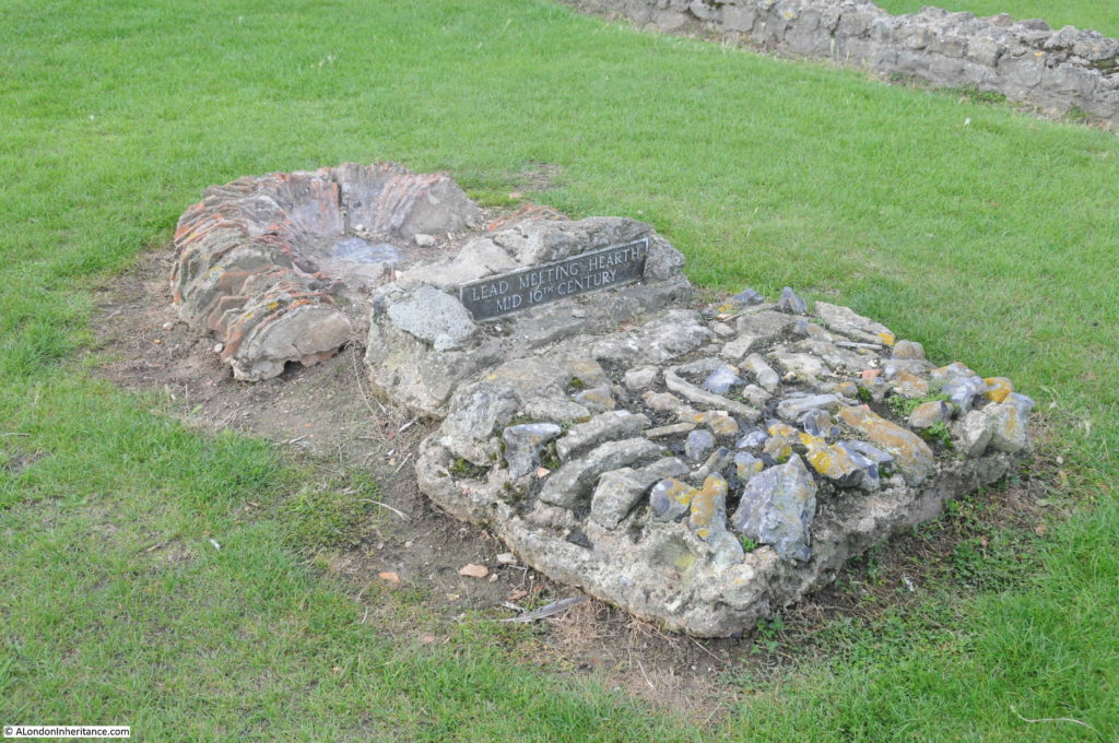
When the Crown sold the castle to Lord Riche in 1551, he seems to have commenced the demolition of the castle for building materials in an organised manner. In the grounds of the castle are the remains of a lead melting hearth from the mid 16th century. The hearth was used to melt down the lead window frames from the castle, thereby making it easier to transport the lead away from the site.

Hadleigh Castle

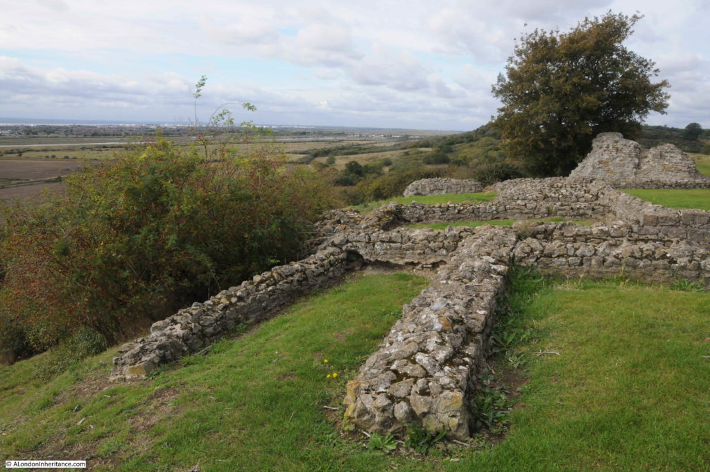
The hearth is located in the middle of the castle’s hall, with only the foundations remaining today.

Hadleigh Castle

Part of the remaining curtain wall:

Hadleigh Castle

The southern edge of the castle, looking towards the west:

Hadleigh Castle

The above photo marks the boundary to the left, with the land that has fallen away in previous landslides.

To the left, there was the King’s Chamber, continuation of the curtain wall surrounding the castle, and the south tower. All lost as the London Clay fell away.

The one main archaeological excavation of the castle was carried out in 1863 by a Mr H.M. King, working for the Essex Archaeological Society. The work was extensive, however the finds from the excavation have since been lost.

Edward III also constructed a castle on the opposite side of the Thames at Queensborough on the Isle of Sheppy, although nothing now survives of this castle.

So, Hadleigh Castle is the one remaining example of a medieval castle on the Thames Estuary. The last land slip was in 2002, so for how long the castle will remain in its current condition is open to question as the London Clay gradually slips away.

Although the castle is fading away, it is still more substantial than the ghost that a Mr Wilfred Davies of Canvey Island was looking for in the 1960s and early 1970s, when armed with tea and sandwiches, he would keep a nightly vigil at the castle, looking for a female ghost that was reported to slap people’s faces. I bet though, on a dark night at the castle’s isolated position, looking over the Thames Estuary, it would be easy to imagine the ghosts of those who made it their home in the 13th to 15th centuries.

alondoninheritance.com

From The City To The Sea – The Thames Estuary

Before returning to London, a quick chance to explore the Thames Estuary and discover some of the legacy from the last war that has survived the last 70 years.

As the Waverley left Southend, the sky and sea seemed to merge even more into a uniform grey with only the occasional boat adding any colour.

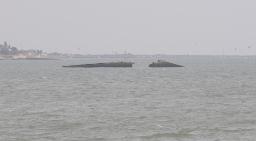
Soon after leaving Southend Pier there is the wreck of a part of the Mulberry Harbours that were used directly after the D-Day landings in France to provide temporary harbours until one of the French ports could be taken.

This particular part is a Phoenix Caisson. These were very large concrete hollow boxes that were used to provide the support to the harbour. They were manufactured at three locations in the UK including Tilbury on the Thames, however this Caisson was being brought from Immingham on the Humber to Southsea (Portsmouth on the south coast) ready for transport across the channel.

Whilst being transported from Immingham it sprang a leak and was towed into the Thames and beached in its current position.

Southend to Sea 1

There is a much more potentially destructive relic of the last war about 5 miles from Southend. This is the wreck of the SS Richard Montgomery.

The SS Montgomery left the US in August 1944 loaded with over 6,000 tonnes of munitions and explosives. Arriving off Southend the ship was instructed to moor off Sheerness. On the 20th August, the Montgomery started to drag her anchor and drifted to a sand bank where she became stuck as the tide went down and the due to the uneven distribution of weight and insufficient water to provide support, she broke her back and was stranded on the sandbank with her full compliment of explosive cargo.

There was an attempt to remove some of the cargo, however before this was complete the ship finally broke in two and the salvage attempt was abandoned leaving a very considerable volume of munitions and explosives (high explosive bombs, fragmentation bombs, phosphorus bombs, pyrotechnic signals, flares and fuses) on the ship, which remain there to this day.

The ship has an exclusion zone marked by buoys and is regularly surveyed to check the stability of the structure.

I am not sure if anyone really knows what would happen if there was an explosion, many years ago I heard stories that it would break many of the windows in Southend.

It is an eerie sight passing the wreck and seeing the masts of the SS Richard Montgomery still standing above the water.

Southend to Sea 2

Further out from Southend are the Maunsell Forts.

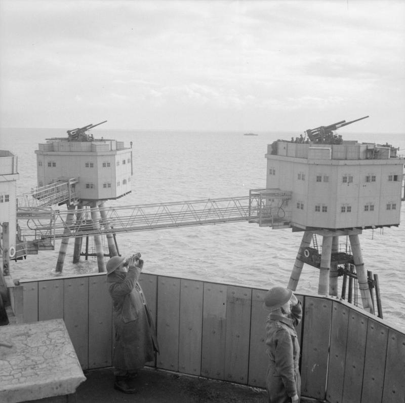
These were operated by the Navy and Army during the last war to provide anti-aircraft gun emplacements in the estuary. The River Thames provided an ideal navigation route to central London for enemy bombers. Even at night and with a blackout, the glint of the moon on the water of the Thames would lead directly to London.

These forts were the idea of Guy Anson Maunsell, a highly innovative civil engineer who had worked on a range of civil engineering projects in the UK and abroad, including in 1931, the widening of Putney Bridge.

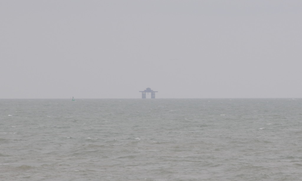
The initial requirement was for a set of Naval Forts further out to sea than the Army forts. They were operated by the Navy with the objective of preventing German mine laying in the approaches to the Thames. Four of these were constructed, of which two (Rough Sands and Knock John) survive. From the Thames Estuary the Knock John fort can be seen as a rather enigmatic shape in the distance.

Southend to Sea 11The Army forts followed the Naval forts. The aim of these forts was to attack approaching bomber forces with an anti-aircraft gun mounted on each of the individual forts.

The first set of forts were deployed in the Mersey to protect Liverpool, with the next set of forts deployed across the Thames Estuary to protect London.

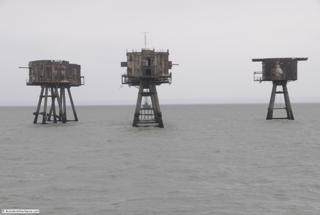
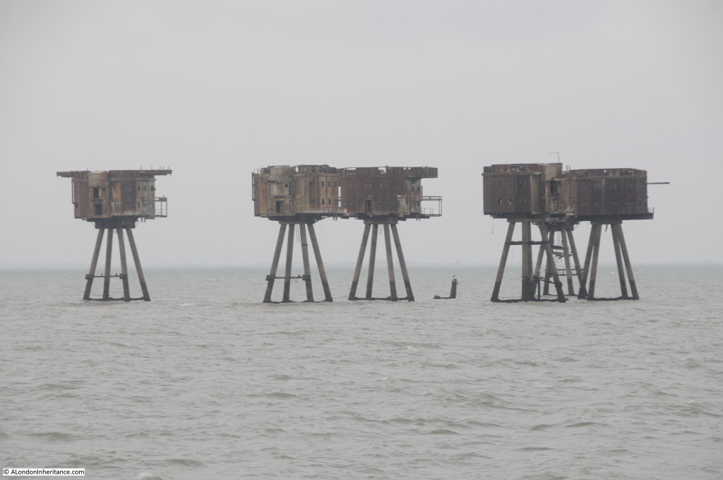
Three forts were installed, Shivering Sands, Red Sands and Nore, with Shivering Sands and Red Sands remaining to this day.

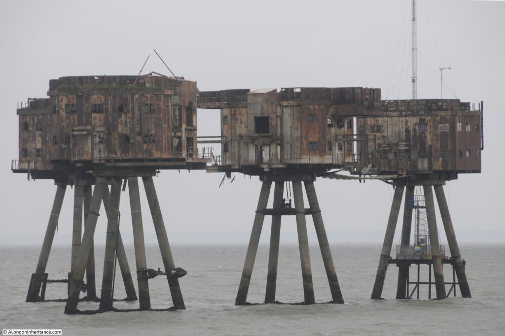
Setting out from Southend, the first fort is Red Sands.

Southend to Sea 3

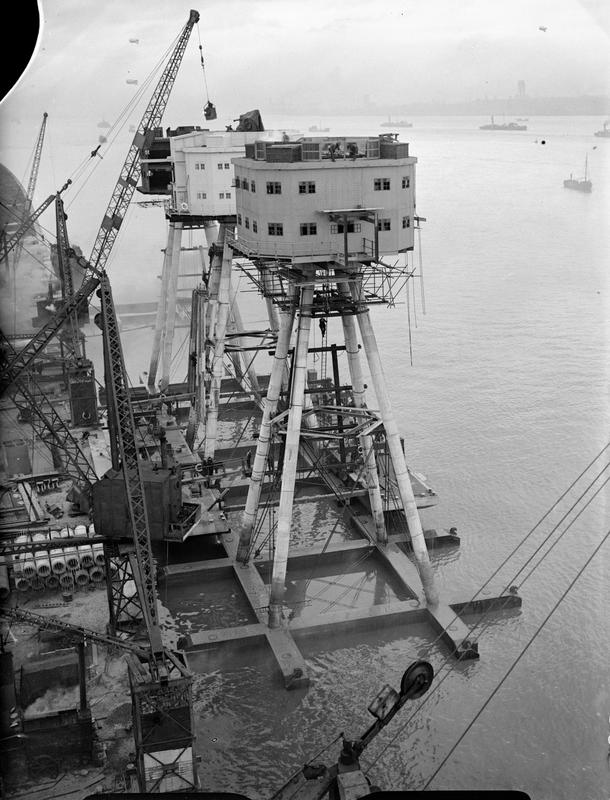
The forts were built on the Thames in a disused and derelict cement factory that Maunsell had found at Red Lion Wharf at Northfleet, close to Gravesend. The forts were constructed, towed out and installed on site between May and December 1943.

Southend to Sea 4

A central observation tower was surrounded by towers, each with an anti-aircraft gun installed. Walkways were run between the individual towers to provide access across the complex.

Southend to Sea 5

Although land was visible from the forts, this must have felt like an isolated and remote location for those based on the forts, coupled with long periods where there would not have been any enemy activity.  It cannot have been very comfortable on a cold and stormy winters night.

The crew of the forts would spend 4 weeks on-board, then a 10 day break ashore.

Although the forts were operational after the main period of the blitz on London they were successful during the later V1 campaign when at least 30 of the V1s were shot down on their way to London.

Southend to Sea 6

I passed the forts during my 1978 journey down the Thames, with the following photo from this time. Most of the walkways were then still in place. The weather was also better, just to show that there is some colour in the estuary.

Southend to Sea 13

The Thames Estuary provides an example of how power generation has changed over the last century. Initially, power stations were local to population centres. London had a number of smaller power stations, (my grandfather worked in one in Camden). These were replaced by larger stations such as Battersea and Bankside. Power stations then started moving away from centres of population to places such as Littlebrook and Tilbury that we passed along the river. These have now closed and generation moved out to sea with a number of offshore wind farms located in the wider Thames Estuary.

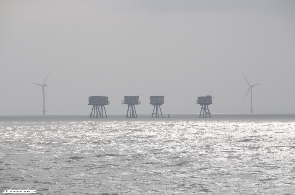
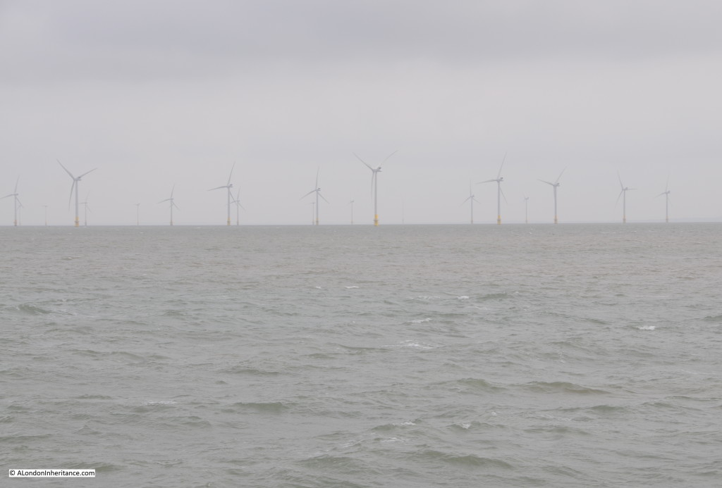
Emerging out of the gloom are the 30 wind turbines of the Kentish Flats Offshore Wind Farm.

Southend to Sea 7

Further out in the Estuary is the Shivering Sands fort. This was the last fort is be completed and as Maunsell wrote at the time:

“the final floating out operation sailed on the afternoon on December 13th, whereafter it transpired that the last of the Towers was grounded on the Shivering Sand in bright moonlight and bitter cold shortly after midnight on December 14th.”

Shivering Sands lost one of its towers in 1963 when it was hit by a ship. The stump of the tower still pokes from the water:

Southend to Sea 8

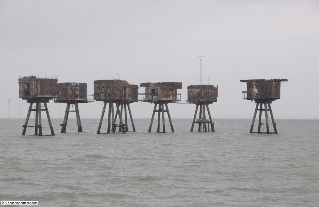
Passing Shivering Sands fort with Red Sands in the distance. Viewed from a distance they could almost be the Martians from H.G. Wells book War of the Worlds, striding across the Thames Estuary ready to wreak havoc on Southend.

Southend to Sea 9

Seventy years of construction in the Thames Estuary from wartime defences to peaceful electricity generation.

Southend to Sea 10

After the war, Guy Maunsell and a couple of partners set-up their own business and were much in demand to work on major construction projects across the world.

In London, G. Maunsell & Partners were responsible for the Hammersmith Flyover. When this was completed in 1961 it was the first such pre-cast segmented concrete structure in the UK. Further work followed on the Westway from Paddington to White City.

Guy Maunsell died in 1961. His company continued independently, working on projects such as the Docklands Light Railway and the Jubilee Line, until the year 2000 when the company was bought by the US firm AECOM.

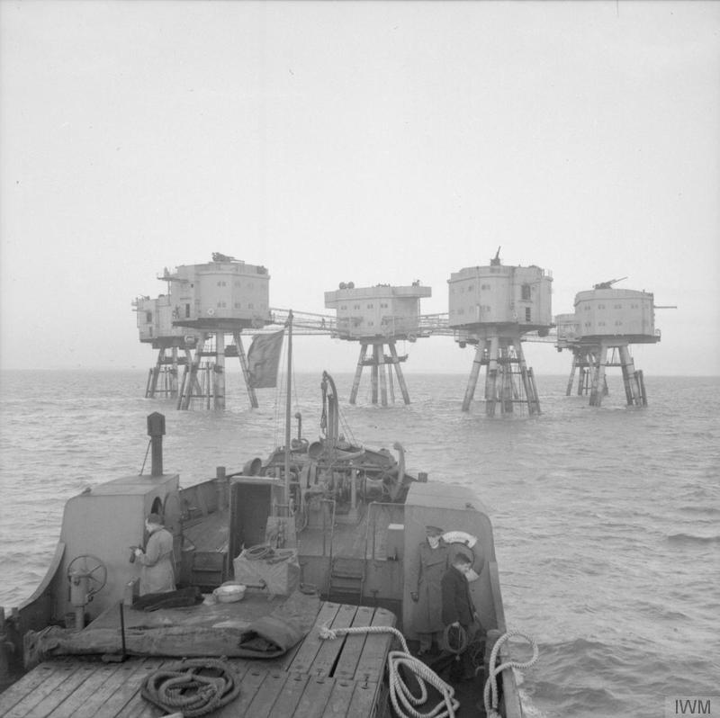
The Imperial War Museum has a number of photos of the forts in use (reproduced under the IWM’s Share and Reuse, non commercial licence):

Supply vessel approaching one of the Thames forts © IWM (H 34537):

IWM - 1View from the top of one of the towers showing the anti-aircraft gun mounted on each tower © IWM (H 34542):

IWM - 2The only photo of the construction of the towers I could find was of the Mersey forts, however the Thames Estuary forts from Northfleet on the Thames would have been constructed in the same manner, ready to be floated out to sea © IWM (A 13259):

IWM - 3 A final view of the Red Sands fort, wind farm and a ship approaching the Thames heading for its berth further upstream.

Southend to Sea 14

The water that has flowed through London and down the Thames has now merged with the sea. Even at this distance, connections with London can still be found through the Maunsell Forts, built specifically to defend the city from attack during the last war.

The Thames is a fascinating river with a long history, intimately connected with London.

Now it is time to turn round and head back to London. For my final post on the Thames it will be a dramatic after dark return to the centre of the city.

alondoninheritance.com