I hope you have had a good Christmas in whatever form that may have taken in these strange times. As well as Christmas, last week also saw the shortest day of the year, and slowly the days will start to lengthen. The weather has also been very grey and cloudy and the period between Christmas and New Year is often a good time to get out for a walk.
The Thames Estuary is an ideal place for a walk. Close to the Thames and the sea, usually a good breeze to blow away any late December lethargy, and plenty of historic places to explore.
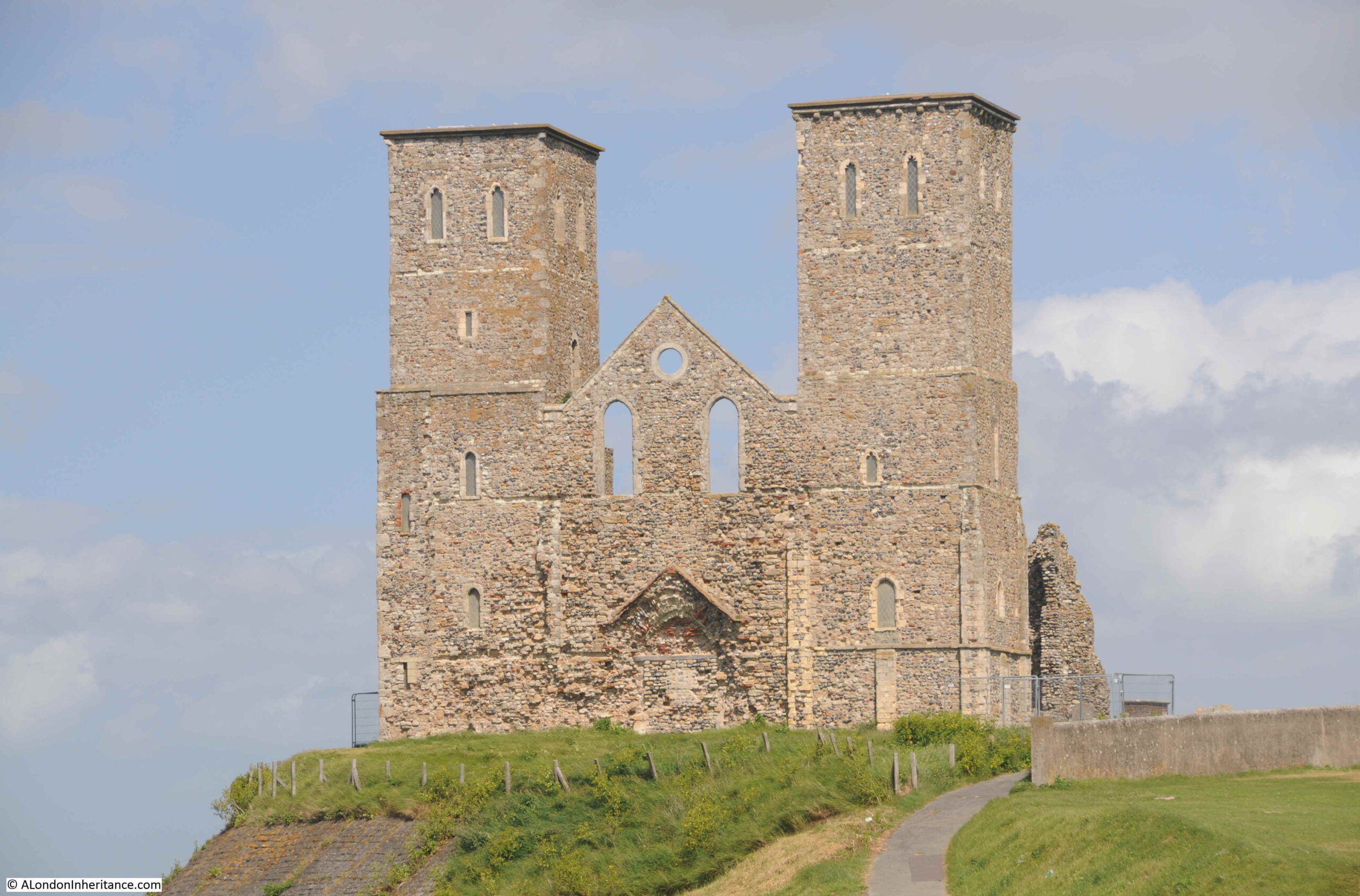
One of these is the ancient church of Reculver on the north Kent coast. The remains of a church built in an old Roman camp, with two distinctive towers that for long were navigation markers for those sailing on the estuary.
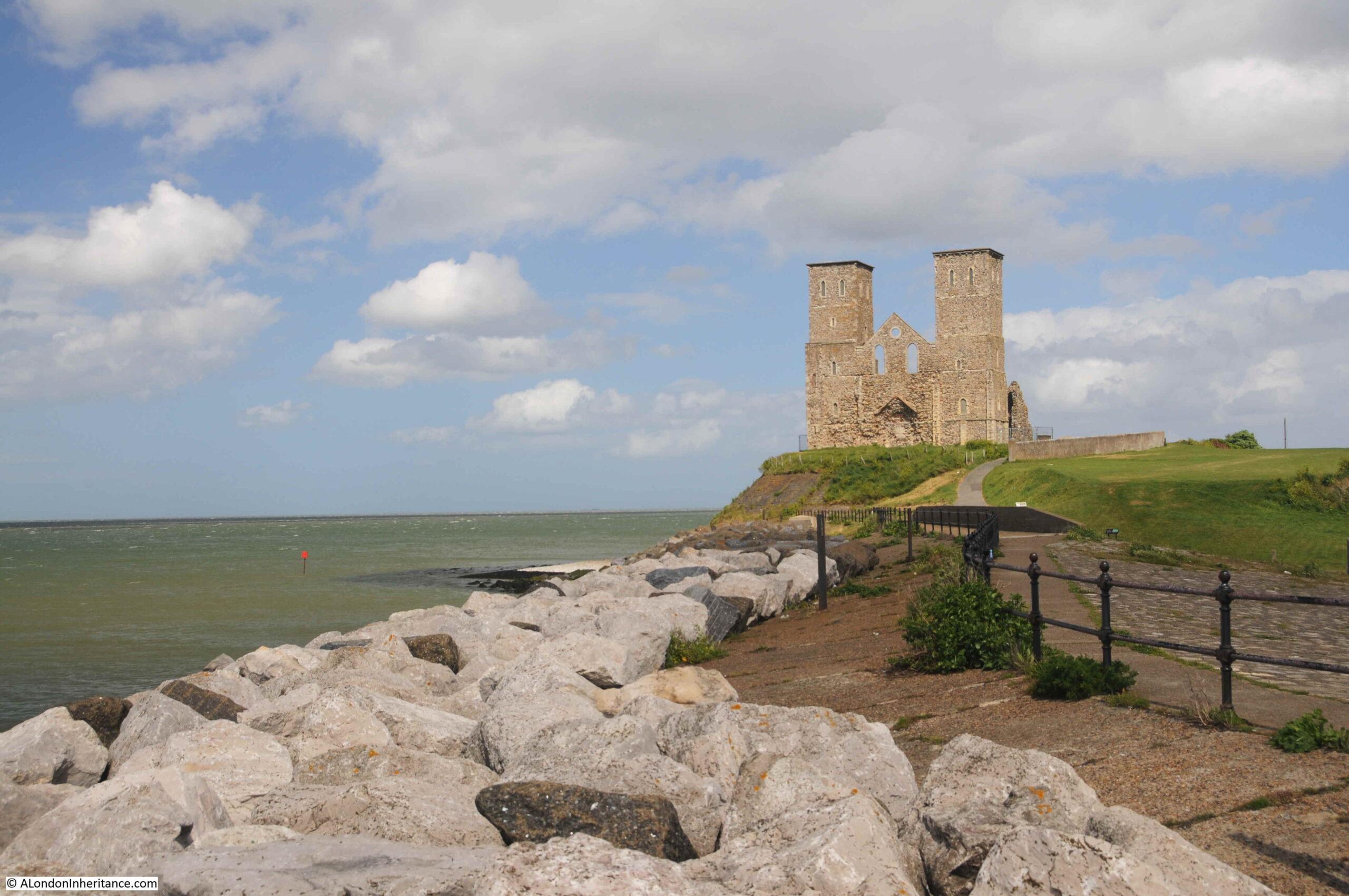
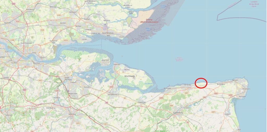
Reculver is a few miles to the east of Herne Bay, and as the above photo shows is on a prominent location on a cliff top next to the sea. The location is ringed in the following map ( © OpenStreetMap contributors):
This has long been an important location, with the first major construction on the site being an early Roman fort. A Saxon church was built at some point around the year 669, with the church forming the core of a small monastic settlement.
The towers were added when a series of alterations were made to the church at the end of the twelfth century. This work included a new, large west facing doorway.
The church was built in the centre of the original Roman fort, and the church was originally almost a mile from the sea, however erosion has taken the sea up to the edge of the church, and the land occupied by almost half of the Roman fort has been lost.
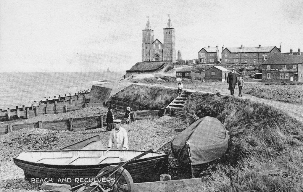
The beach (now occupied by large rocks to prevent further erosion) and the church has long been a tourist destination, and the following early postcard shows what would have greeted visitors in the early 20th century:
The Monastic establishment came to an end in the year 949 when the building took on the role of a parish church. The rebuild of the late twelfth century utilised the remains of the old monastery to construct the new church.
Over the centuries, land was gradually being eroded, and by 1780, the northern corner of the church was only 50 yards from the sea. In 1802 much of the core of the church collapsed and by 1805, the two towers were at risk.
The prominence of the two towers, on the cliff, overlooking the sea and the Thames estuary was critical to navigation. The minutes of Trinity House from 1662 record the need to make repairs to the steeples of a building that was long regarded as an “ancient sea mark”.
With the two towers at risk in 1805, Trinity House took action and purchased the remains of the old church in 1810 and built groins along the beach in front of the cliff, to break up the action of the waves. They also faced the cliff with stone to prevent further erosion, and following this work, the two towers have been able to continue to help those navigating at sea.
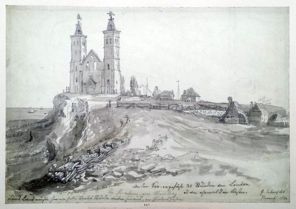
Trinity House also rebuilt the wooden steeples at the top of the towers, which had been blown down (it can get very windy along this exposed coast).
Navigation markers, such as the towers at Reculver, were becoming less relevant in the early 20th century for navigation on the Thames estuary, so Trinity House handed over the site to the Government’s Office of Works in 1925, and it is now the responsibility of English Heritage.
The following print from 1834 shows the new wooden steeples installed by Trinity House at the top of the towers. Note also to the right of the church two structures with flags which were probably used for signaling to ships at sea (© The Trustees of the British Museum).
Getting closer to the church and the original west facing entrance can be seen, now blocked up.
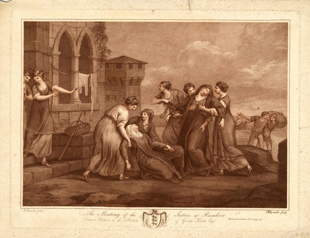
A legend associated with the twin towers of the church is that they were either caused to be built, or where repaired around the year 1500 by Frances St. Clair, Abbess of a Convent of Benedictine Nuns at Davington.
There are a number of variations to the legend, with the majority recording that Frances, along with her sister (also a nun) were travelling on a ship that was shipwrecked near Reculver. They were brought ashore at the church. Some variations record that her sister Isabelle died in the ship wreck, other that they were both saved.
Either way, due to the shipwreck, Francis had the towers built / repaired as a result of being saved, or in memory of her sister.
A drawing from 1784 shows Frances and Isabella being reunited in front of the church at Reculver, with some serious artistic license and creativity being used to show the buildings of the church in the background (© The Trustees of the British Museum).
The site of the church has probably been in use for well over 2,000 years. Archaeological excavations have shown that the Roman fort probably started as a small initial camp for the invading Roman forces in the year 43. Excavations have also revealed that Reculver was the site of an earlier Iron Age farmstead.
The site was occupied throughout the Roman period, and the main walled fort was built early in the third century. It became one of the line of forts known as the Saxon Shore Forts which were established along the eastern and southern coast of England, and the northern coast of France, in the late third century, to protect against raiding parties as the Roman empire started to face many of the threats that would result in Rome abandoning England in the early 5th century.
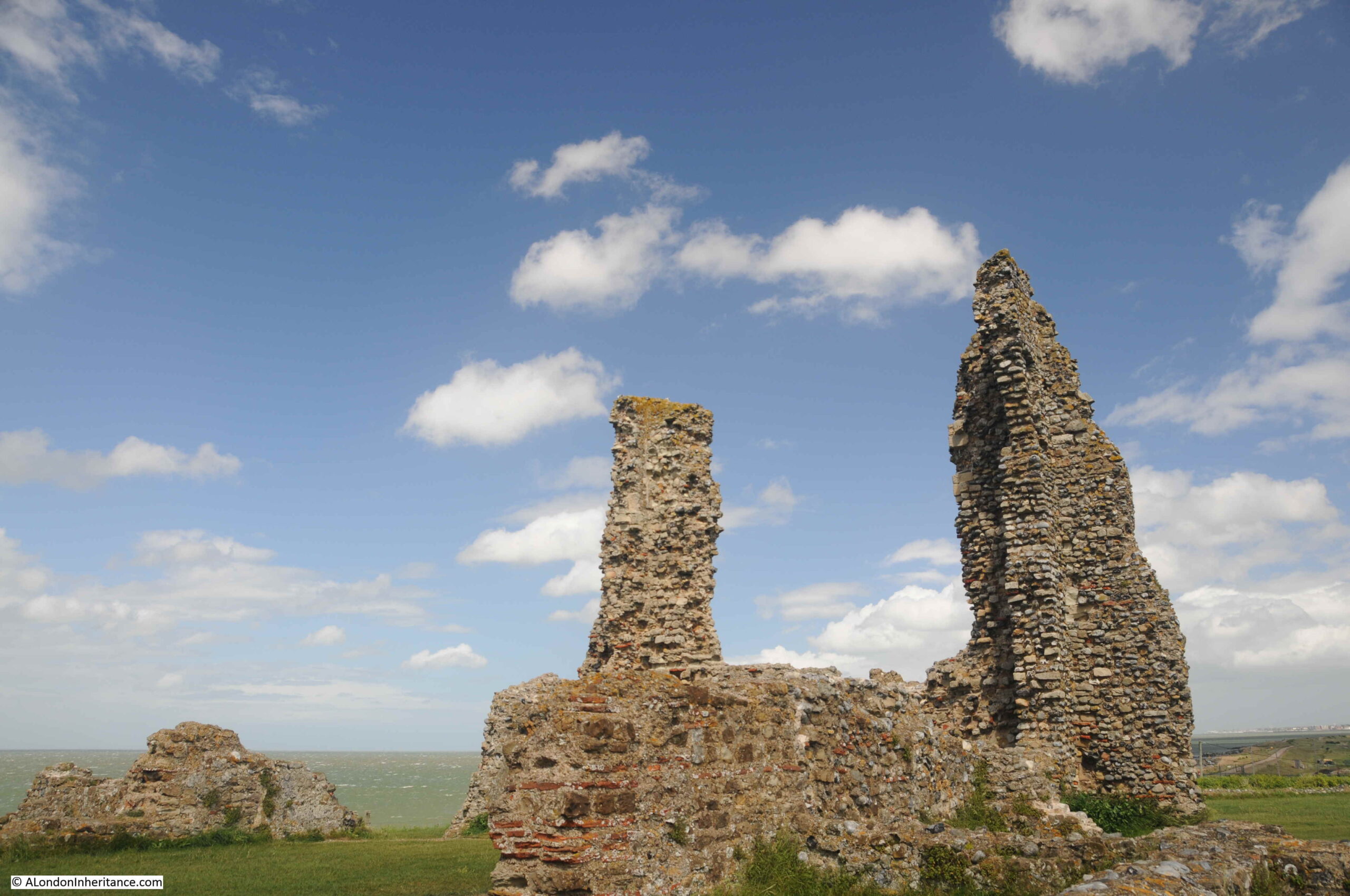
The remains of a number of the walls of the fort can still be seen around the site, and Roman tiles and stone were used in the construction of the church. The distinctive red / orange Roman tiles can be seen embedded in many of the remaining walls of the church:
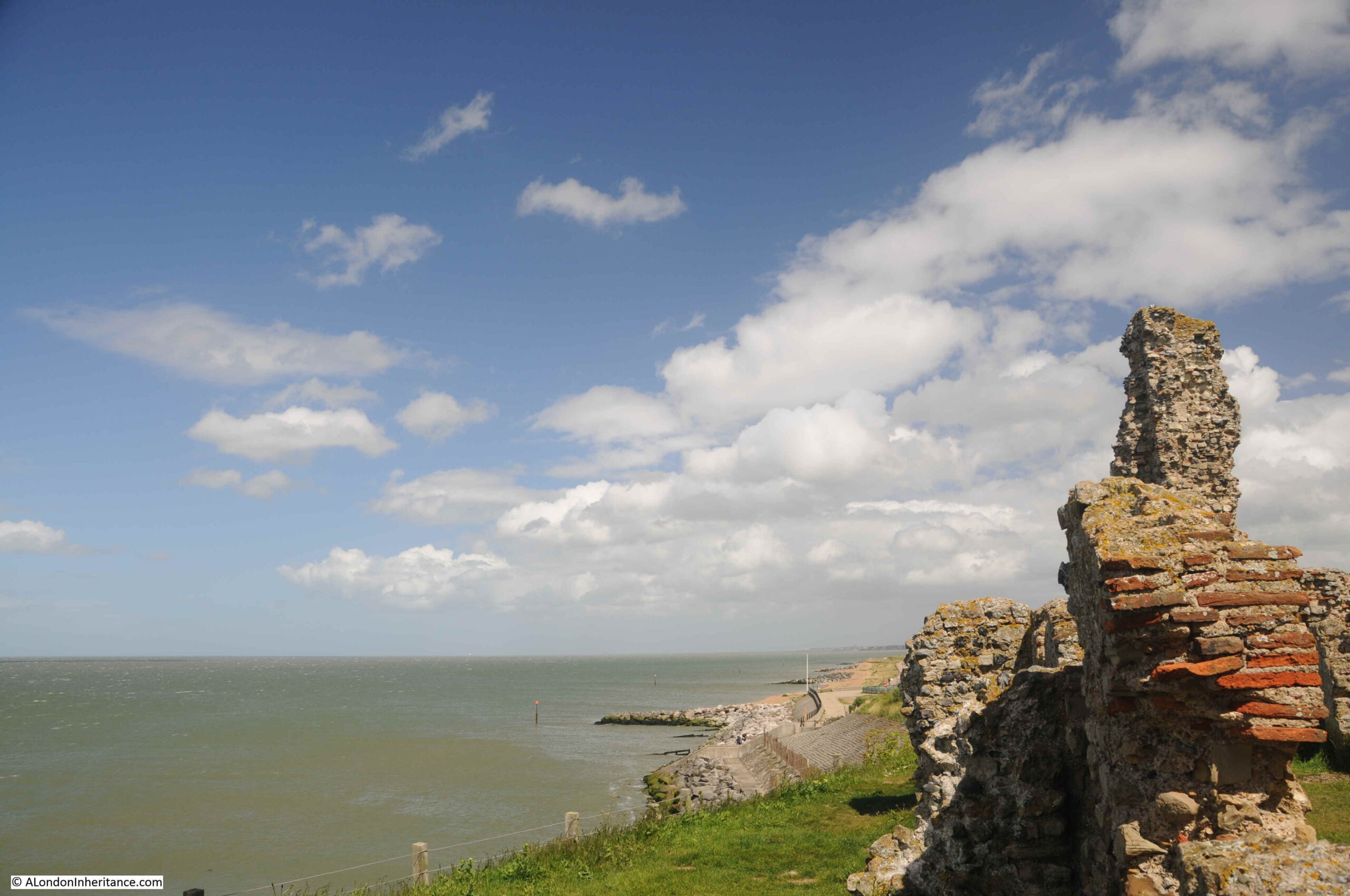
My last visit to Reculver was on a brilliant sunny day, and the ruins of the church stood out against a blue sky.
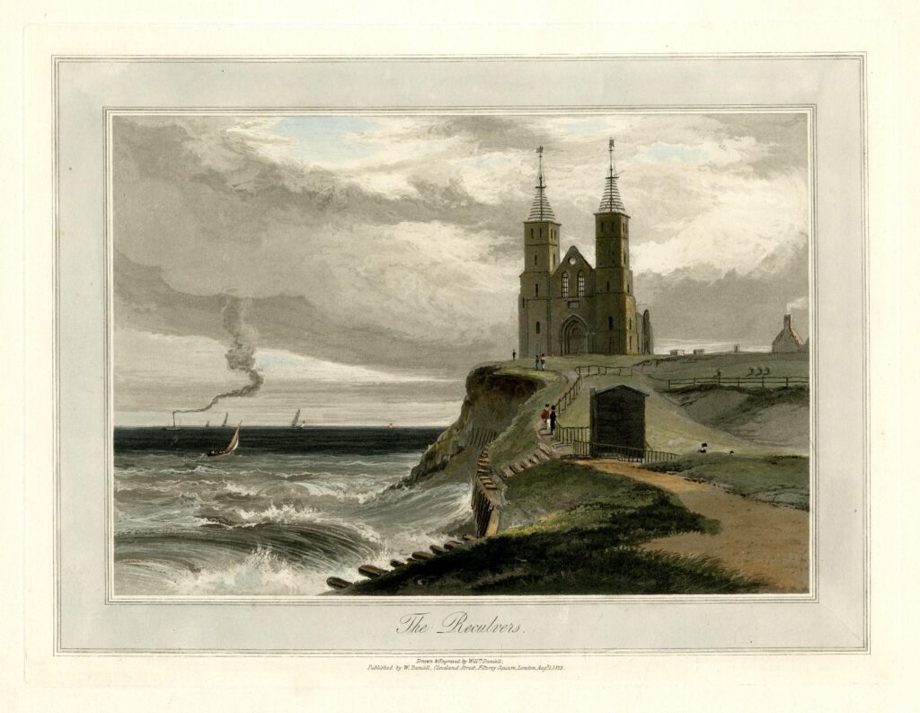
However it is a wonderful place to walk at any time of year, and has frequently been illustrated as part of a windy / stormy scene with the waves crashing up to the cliff showing how easily this part of the north Kent coast is eroded, and that the church would have been victim to the waves if not for the work of Trinity House. The following print is from 1829 (© The Trustees of the British Museum):
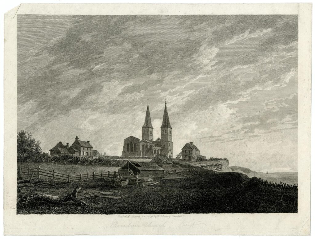
Another scene from 1796 showing the nave of the church before this collapsed in 1802. The scene also shows a house between church and cliff, however as well as the collapse of the church, a few years later this house would also be lost and the cliff would be up against the church (© The Trustees of the British Museum).
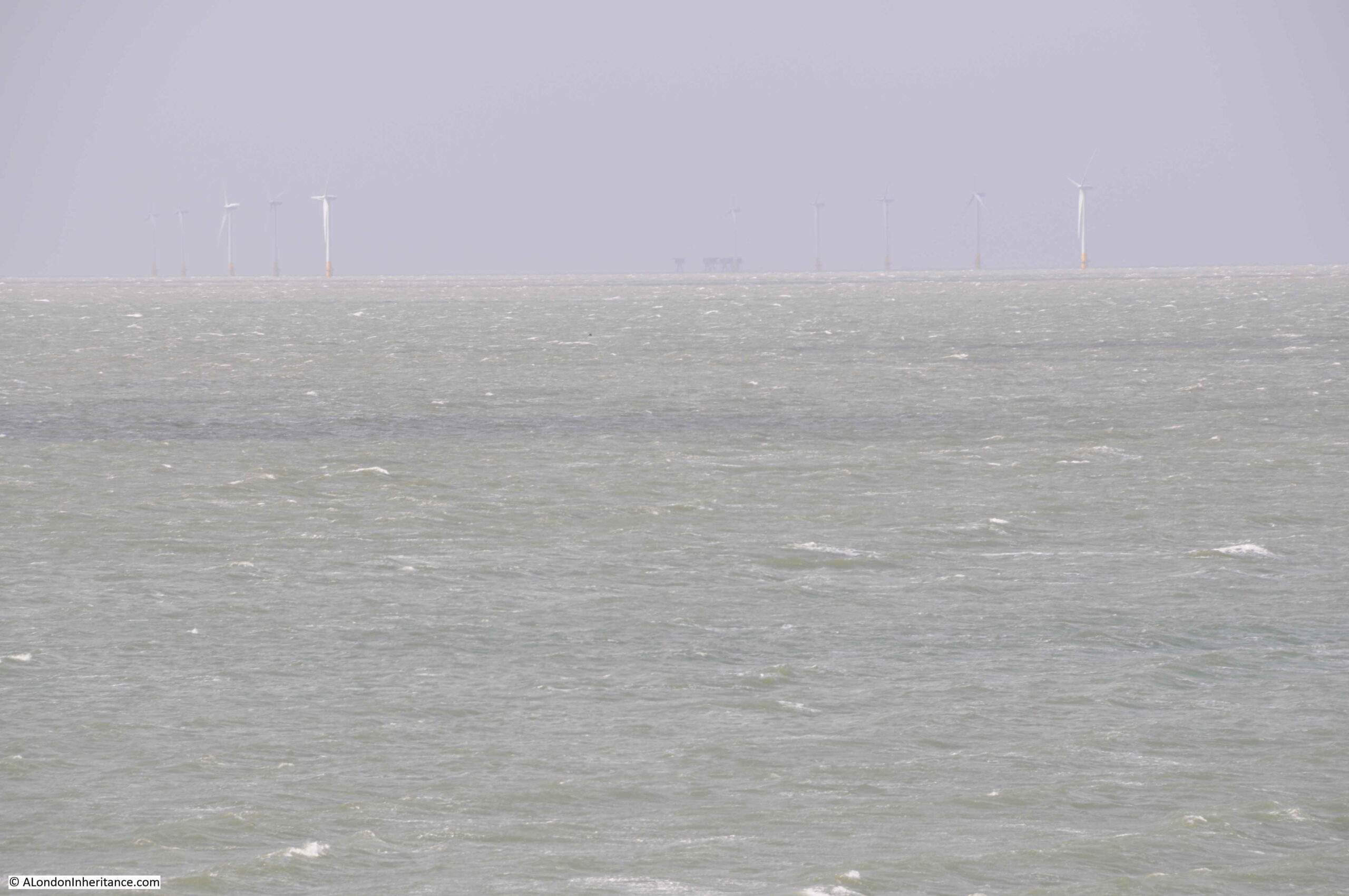
Whilst today there are very few sailing ships off Reculver using the towers as navigation markers, the view from Reculver includes the Kentish Flats wind farm, roughly six miles offshore, and in the middle of the following photo, just visible on the horizon, is the Red Sands fort:
Reculver is a fascinating place to visit at anytime of year. It is also a good place to see the impact of coastal erosion, with getting on for a mile of land having been lost in recorded history. Without the work of Trinity House, it is doubtful whether the two towers, the remains of the body of the church, and some of the walls of the Roman fort would remain for us to see today.
That’s my last post for 2021. Thanks for reading over the last year, and can I wish you all a very happy and healthy 2022.
