Tag Archives: Lambeth

Roupell Street and Aquinas Street – Two Streets on Lambeth Marsh

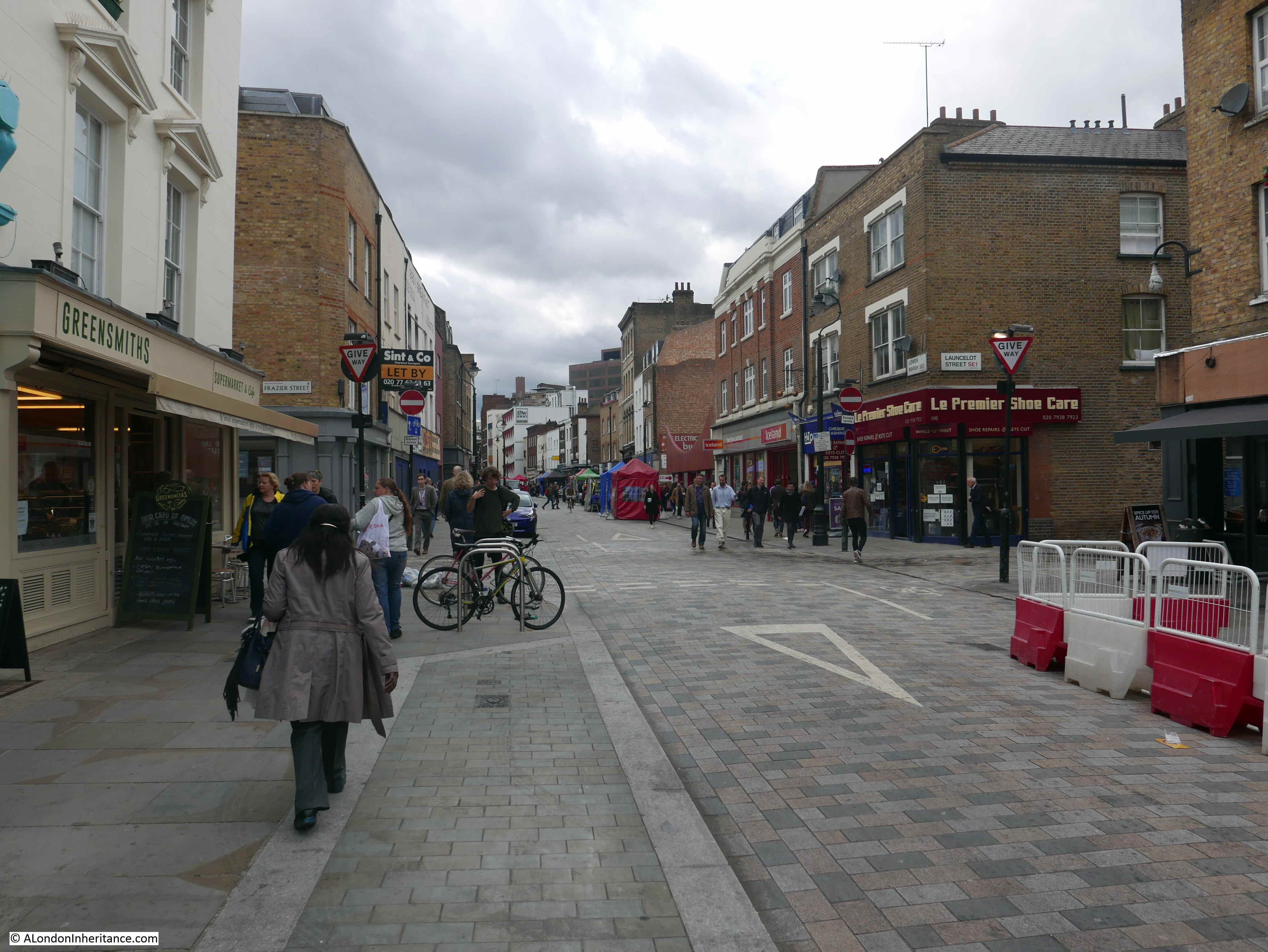
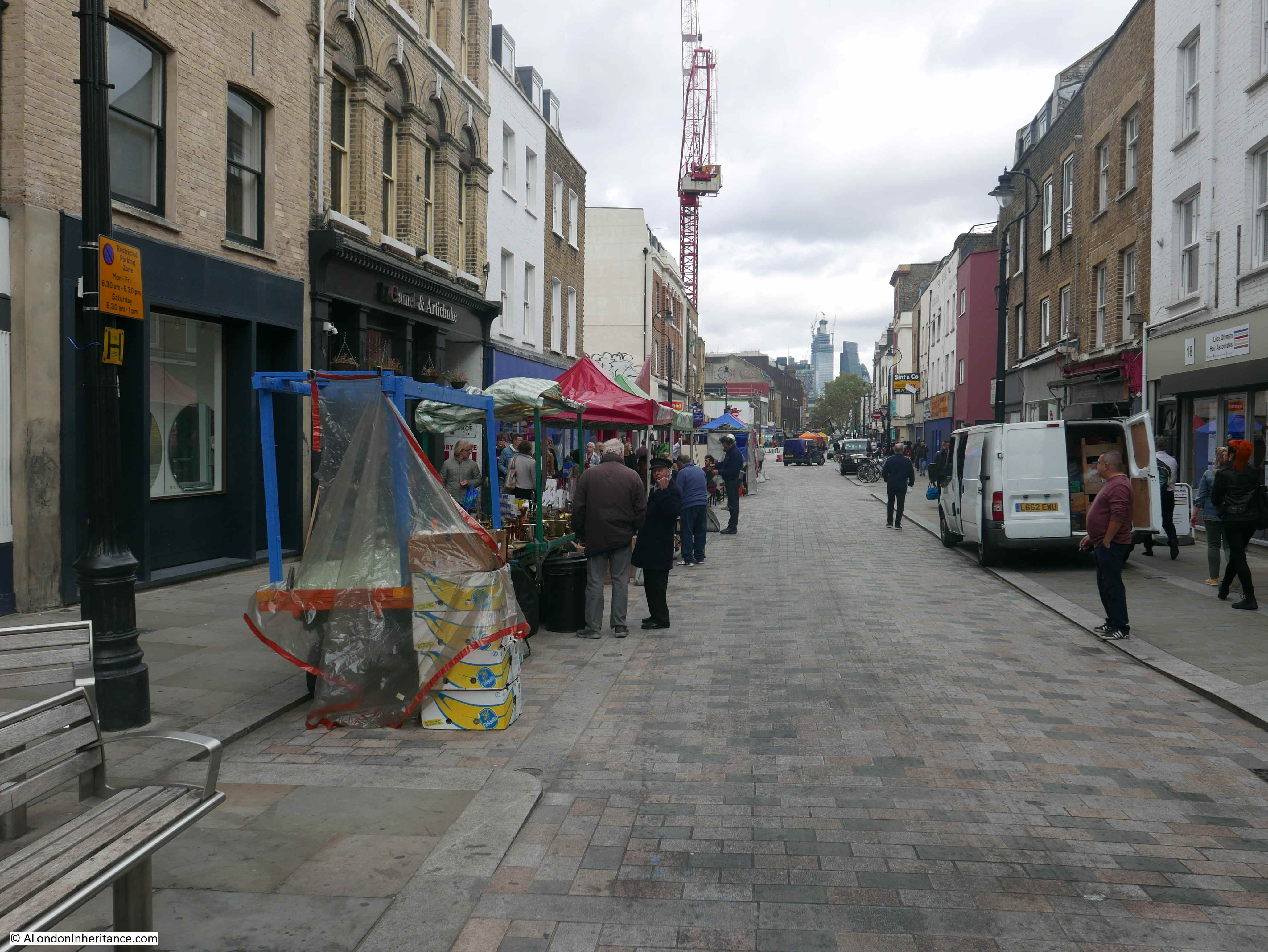
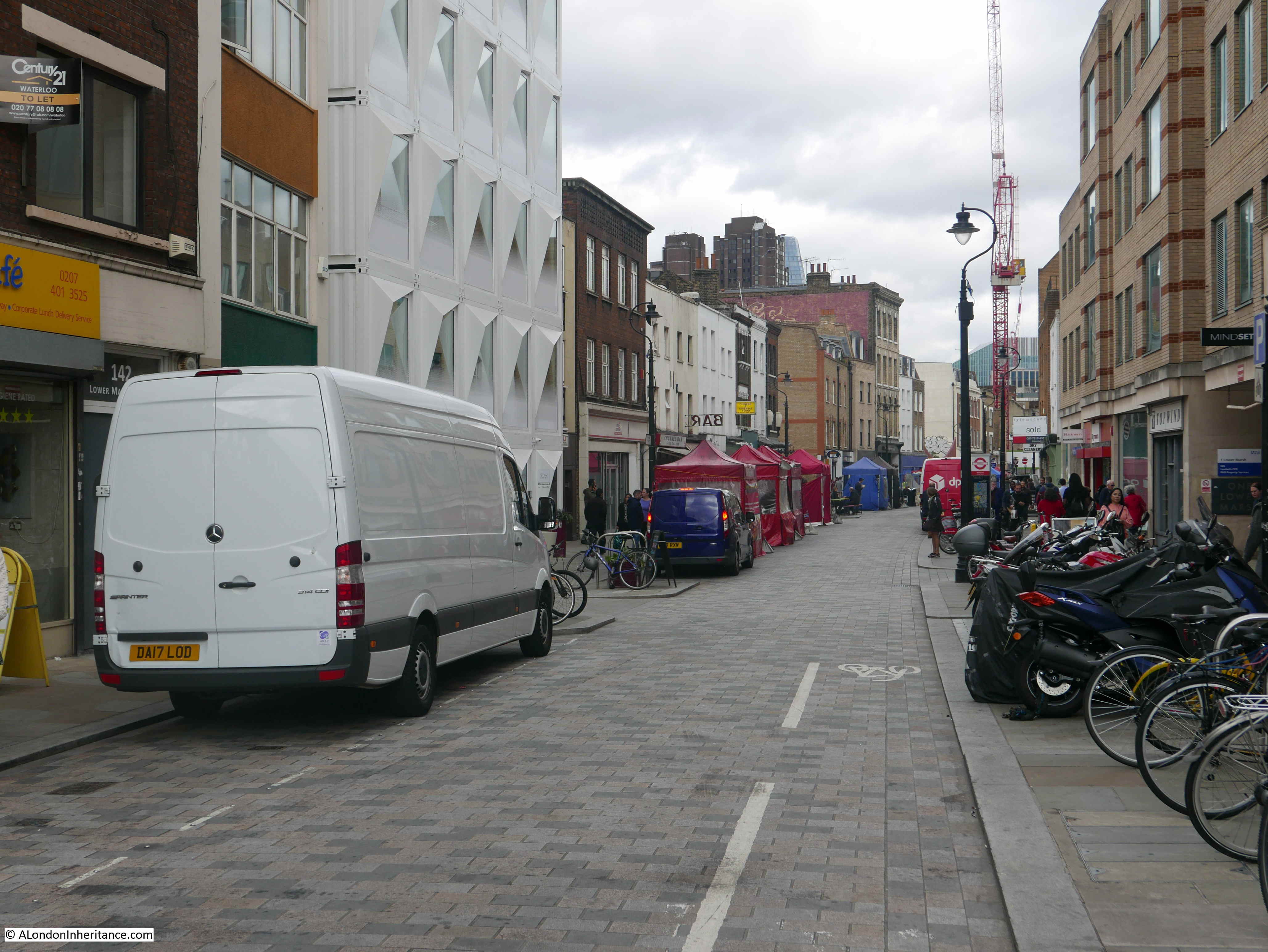
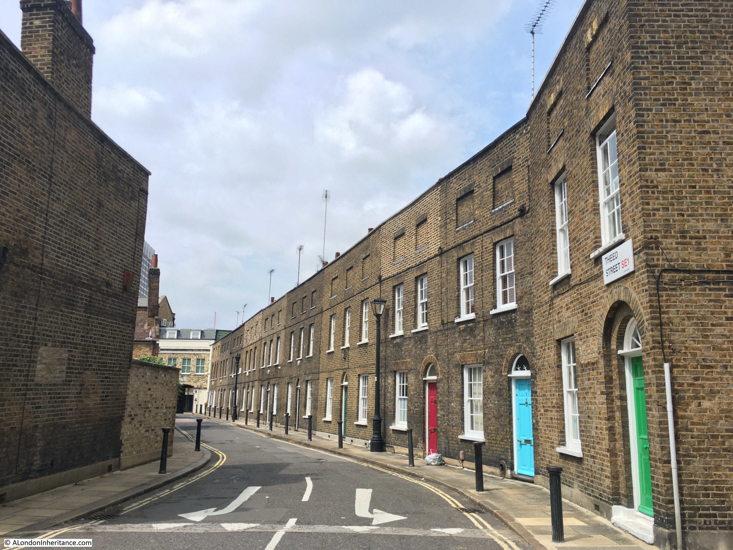
A short distance from Waterloo Station, there are some wonderful streets. Lined with terrace housing that date back to the 19th and early 20th centuries. A couple of weeks ago, I went for a walk along these streets, starting at Roupell Street and ending at Aquinas Street.

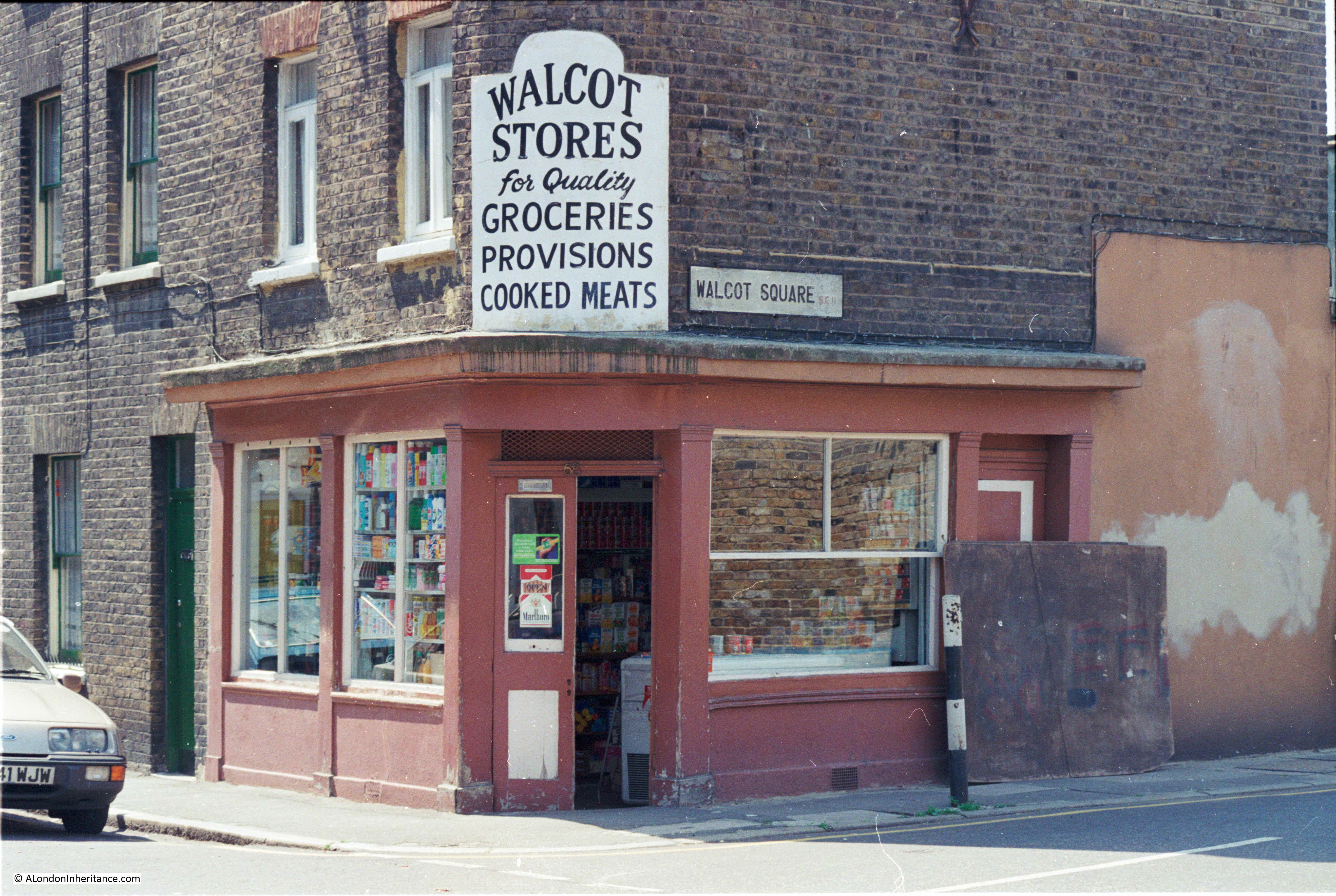
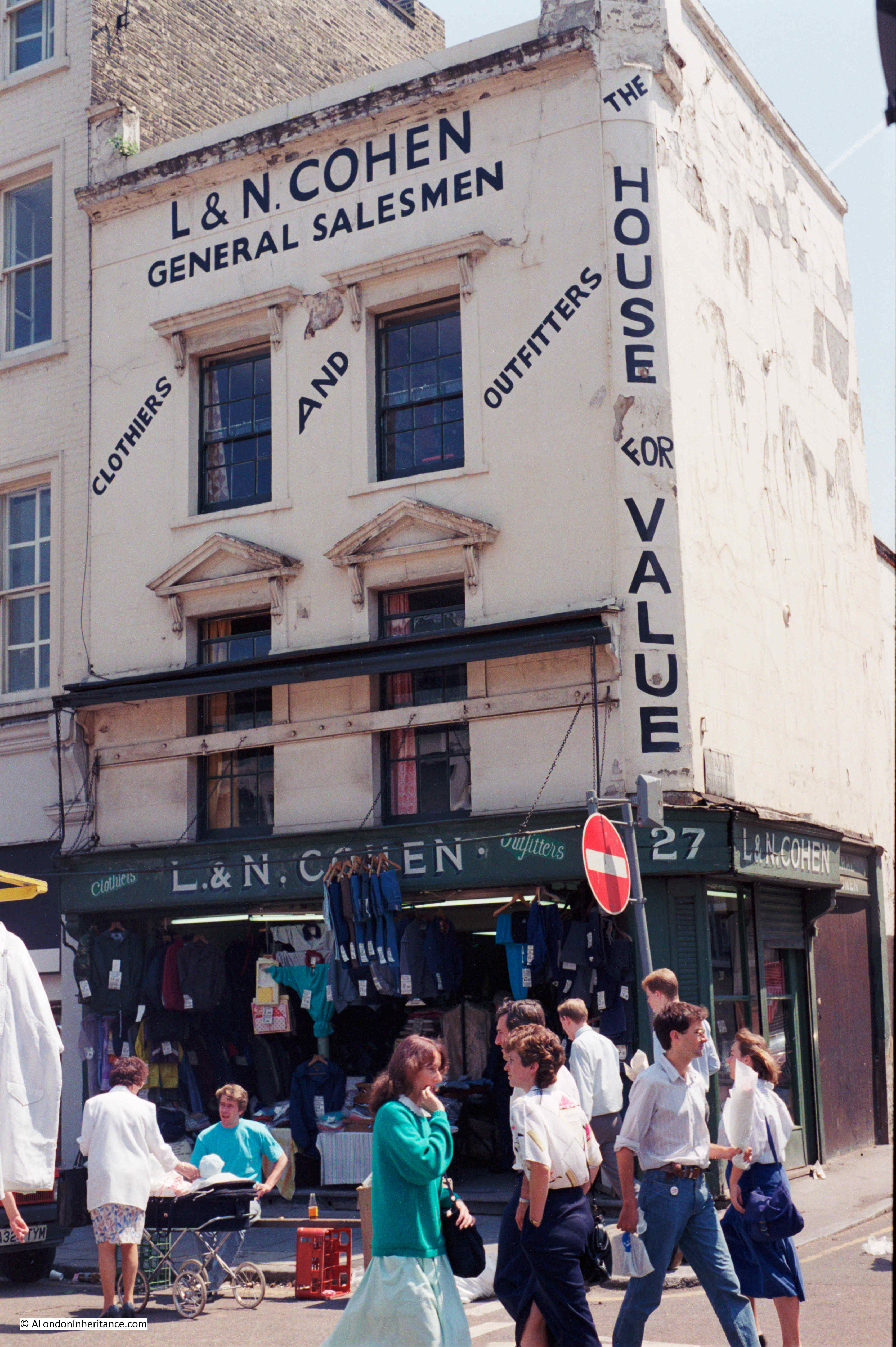
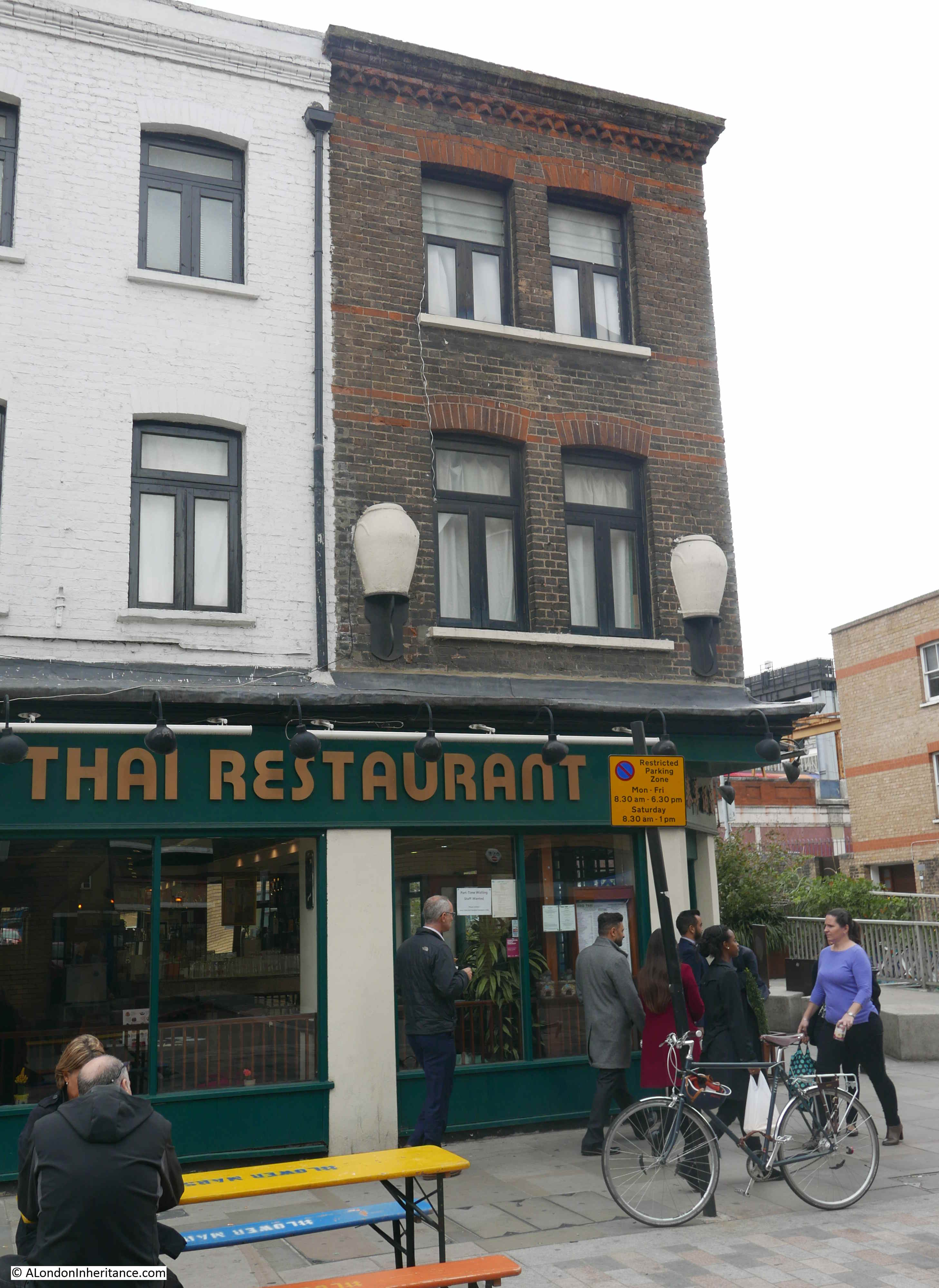
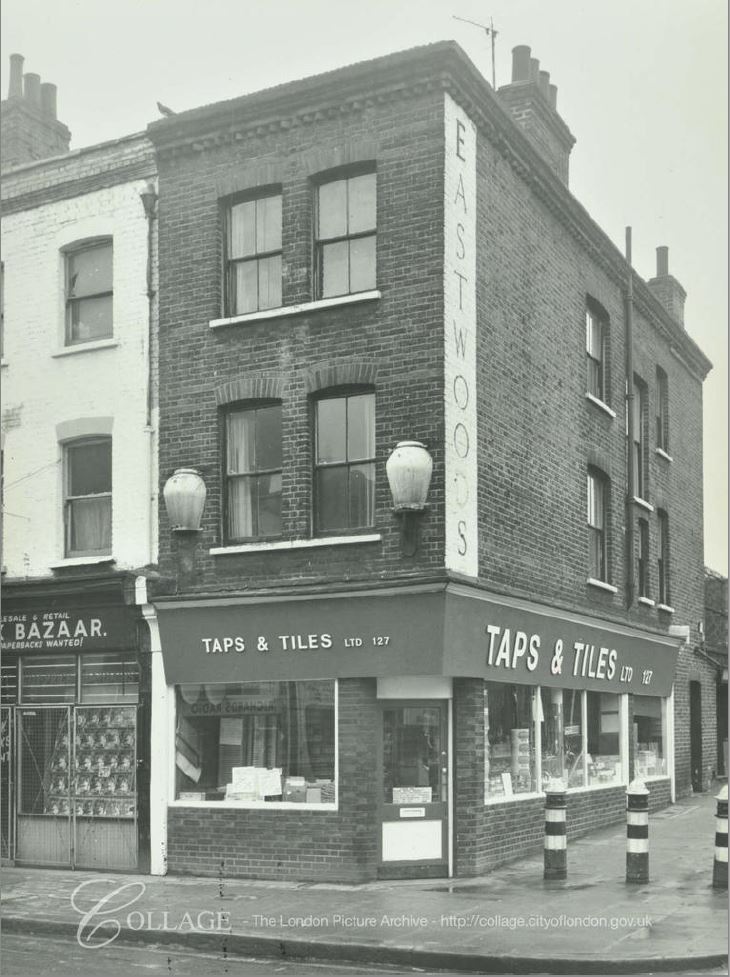
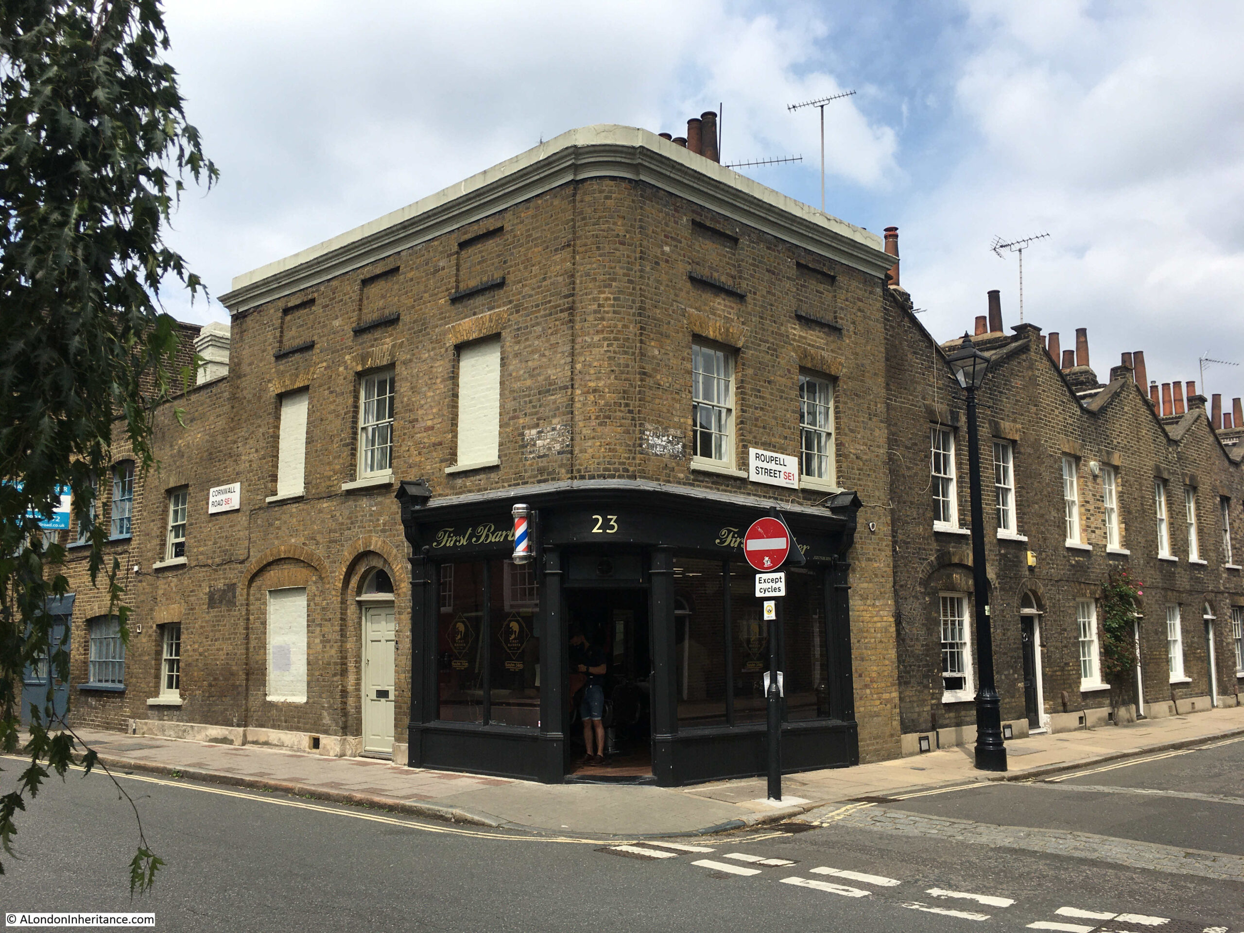
The reason for the visit was to revisit the site of a 1986 photo of a men’s hairdresser on the corner of Roupell Street and Cornwall Road:

Roupell Street

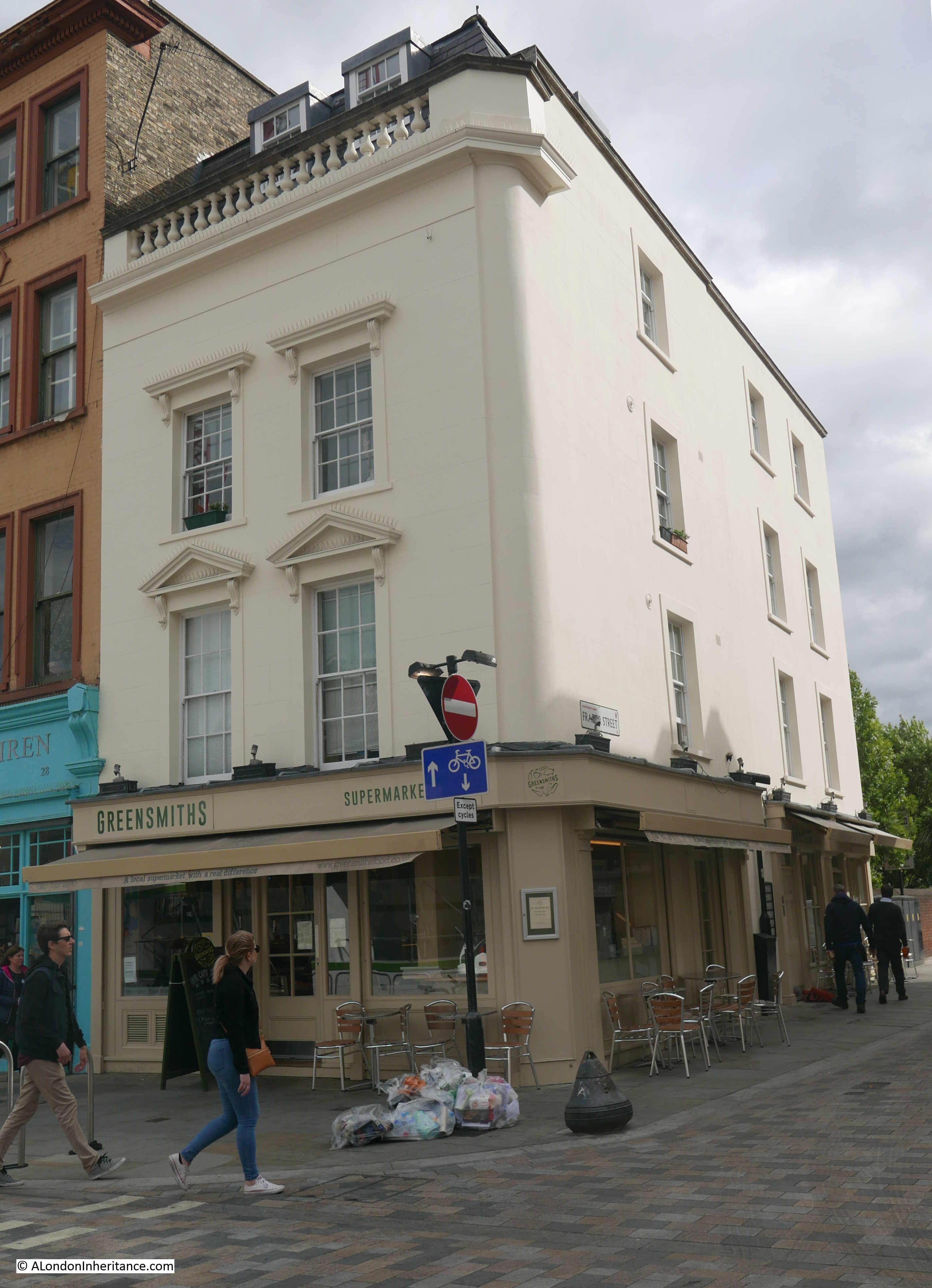
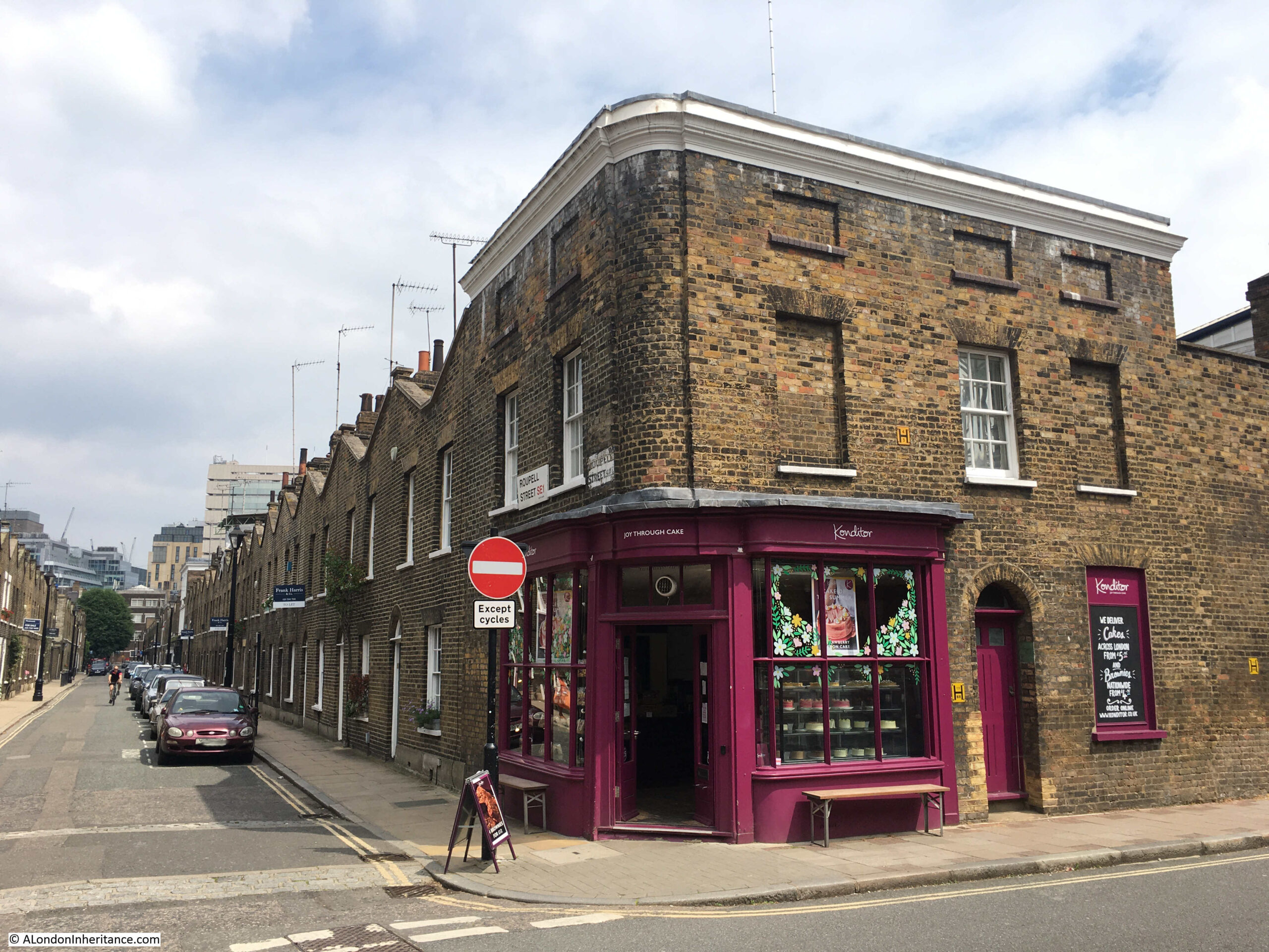
The same view 35 years later in June 2021:

Roupell Street

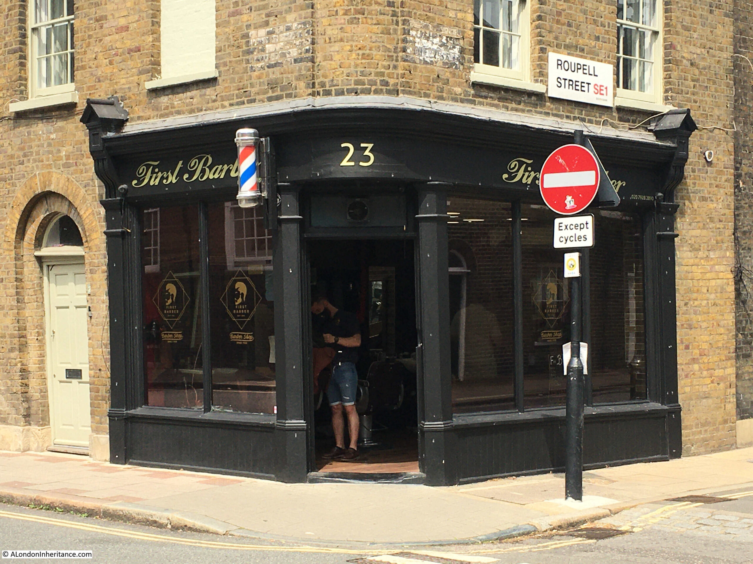
What was then, simply a “mens hairdresser” is now “First Barber”. Really good to see that the same type of business is in operation thirty five years later.

Getting your hair cut is a service which cannot be provided over the Internet, so hairdressers / barbers are the type of shops that will hopefully be on the streets for many years to come.

It did though get me thinking about name changes. In the 1980s I went to a hairdressers, or a hair stylist (see my post on the Hairdressers of 1980s London for lots more examples). When did the shop for a men’s hair cut change from a hairdresser to a barber? One of those gradual changes that you do not really notice until you compare street scenes.

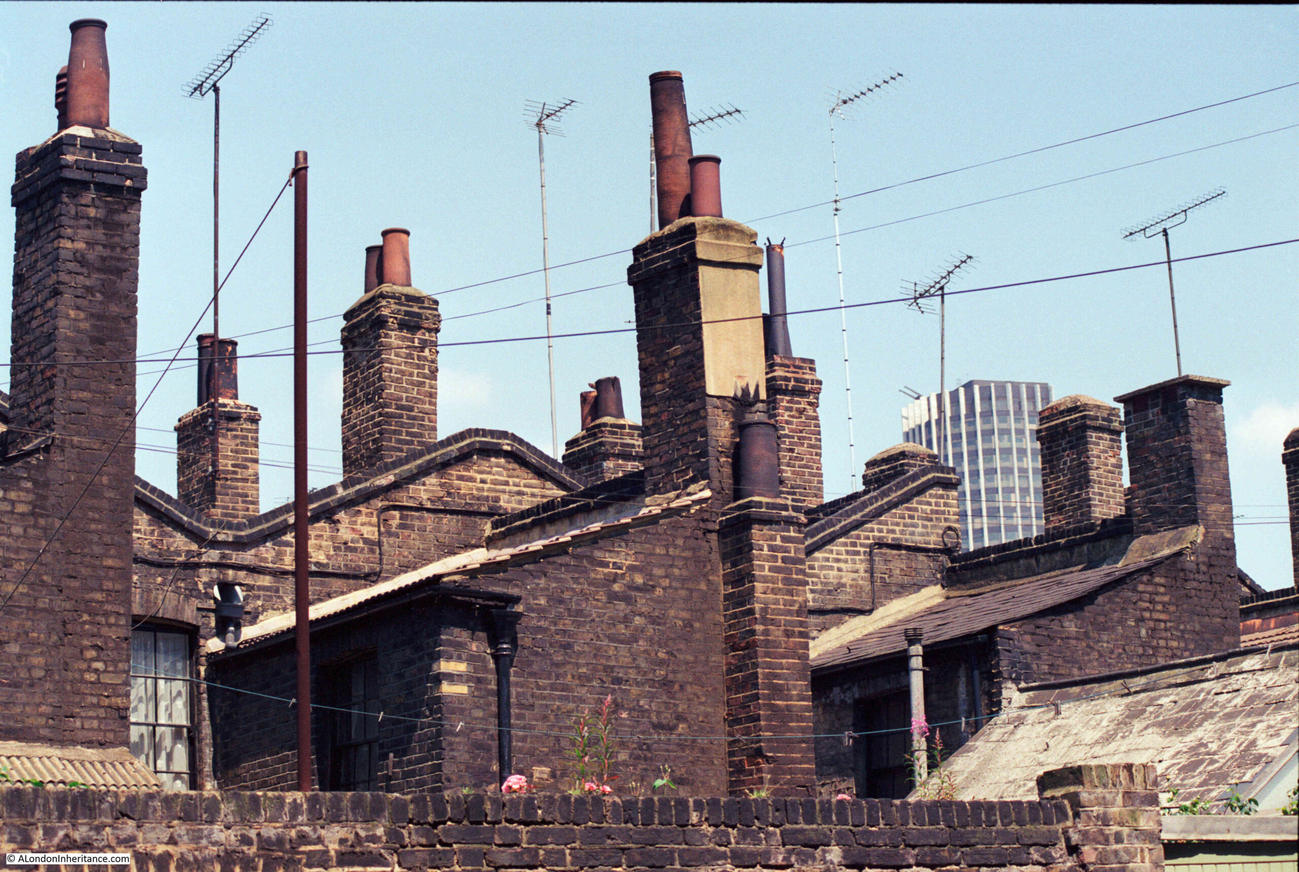
Another 1986 photo shows the rear of the houses in Roupell Street. A jumble of chimneys and TV aerials:

Brad Street

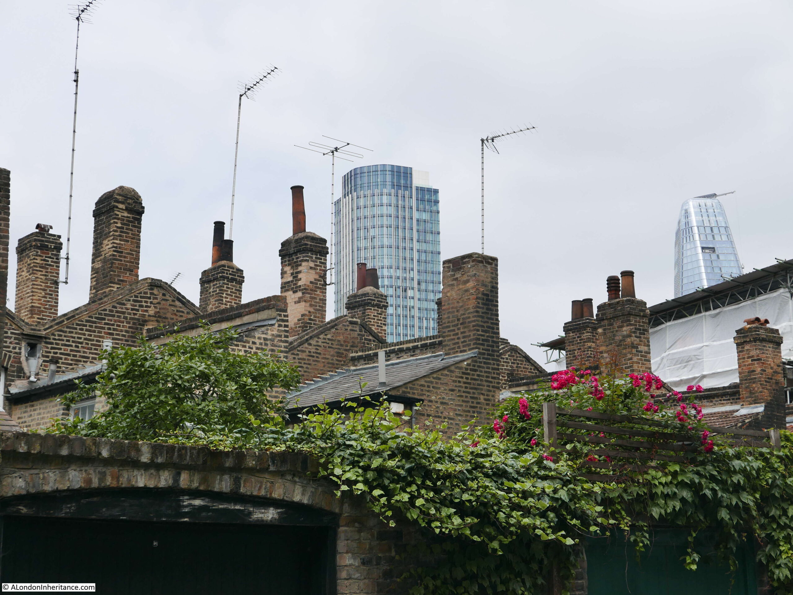
I walked down Brad Street, which runs behind the southern side of Roupell Street, trying to find the same chimney combination as in the 1986 photo, but there seem to have been many subtle changes. The following photo is the nearest I could get:

Brad Street

The centre tower in the 1986 photo was Kings Reach Tower, the home of IPC Media, publisher of a vast range of titles from Country Life to NME. It was sold some years ago, had additional floors added to the top (hence the difference in height between the two photos) and is now apartments.

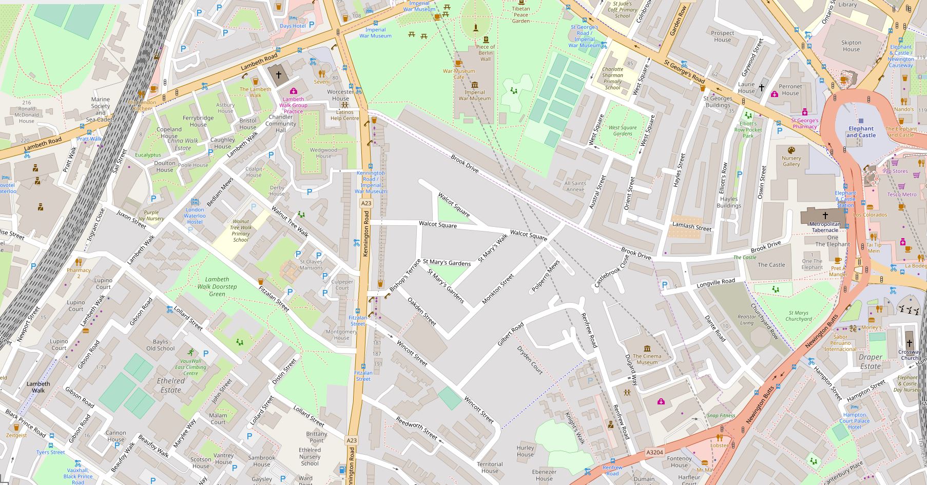
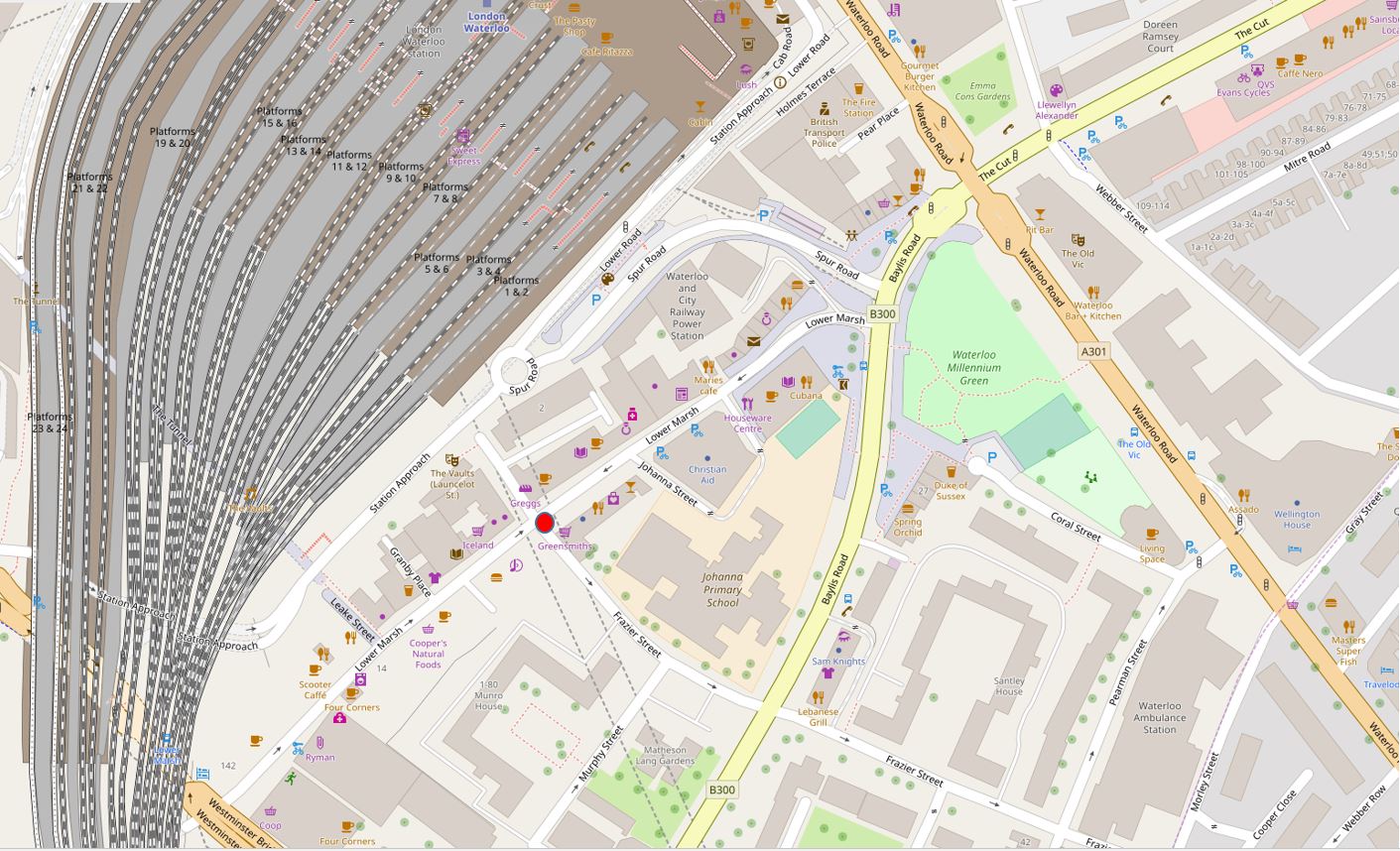
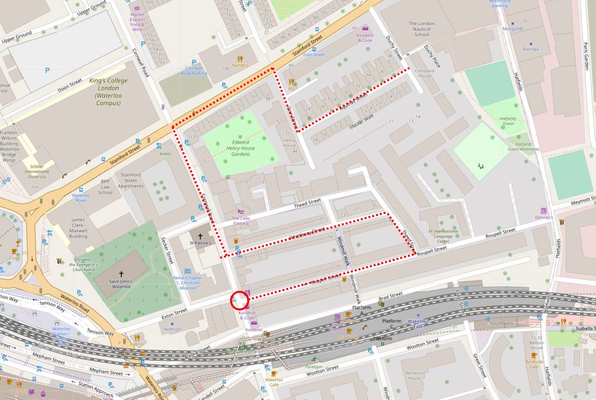
The location of the hairdressers / barbers is shown in the following map (red circle) (Map © OpenStreetMap contributors):

Roupell Street

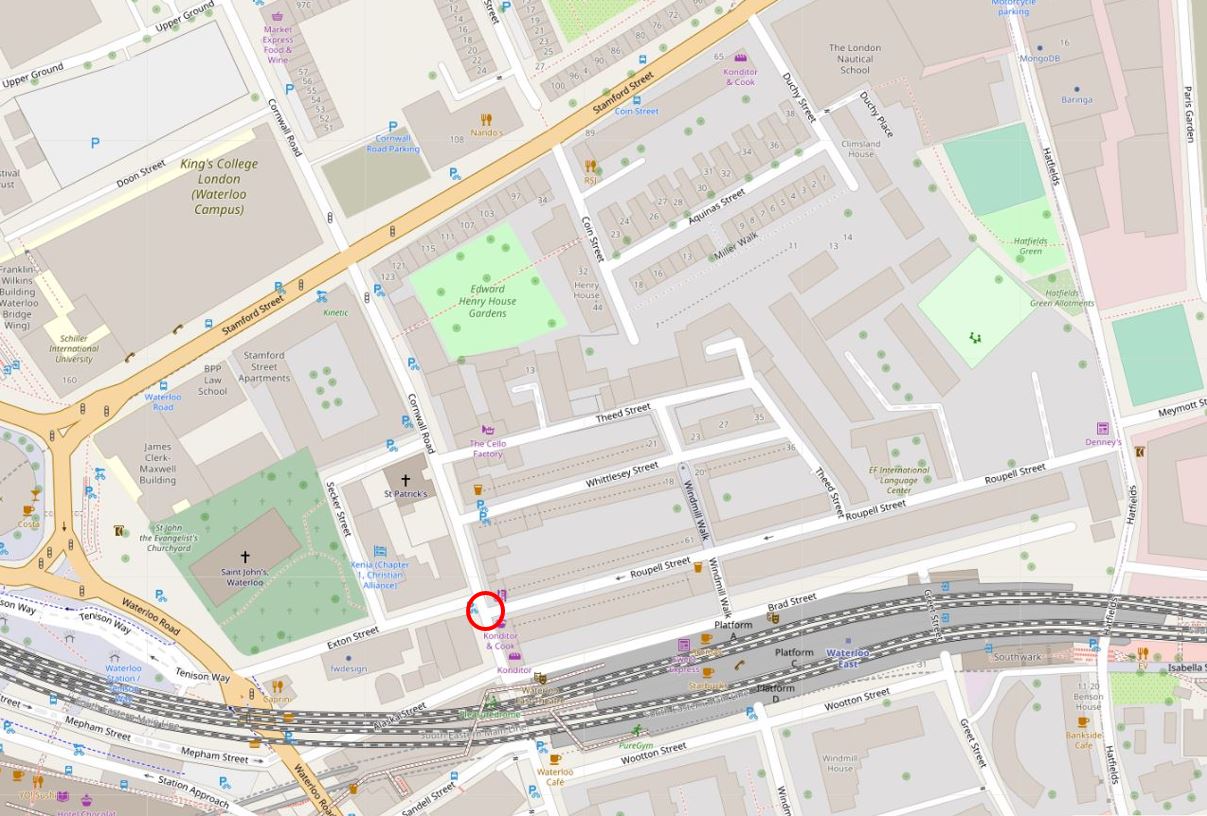
Roupell Street runs to the right of the red circle, and Waterloo East station is below.

Part of a roundabout can be seen on the left edge of the map. This is the large roundabout at the southern end of Waterloo Bridge, and Waterloo Station is just off the map to the left.

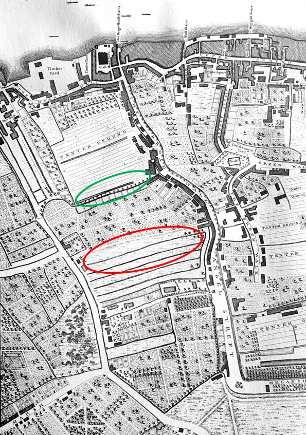
Development of the area is relatively recent. It was long part of the area known as Lambeth Marsh. An area of low lying land, with many streams and ditches, and marshy ground. During the 17th century, much of the area was being converted to different forms of agricultural use, and in 1746, Roqcues map shows some streets, limited building, and a network of fields (red oval is future location of Roupell Street and green oval future location of Aquinas Street, which I will be coming to later in the post).

By 1816, Smith’s New Map of London was showing increased building in the area, however the area around what will become Roupell Street (red oval) was still open land, with what may have been large plots extending back from the houses on Broad Wall.

Roupell Street

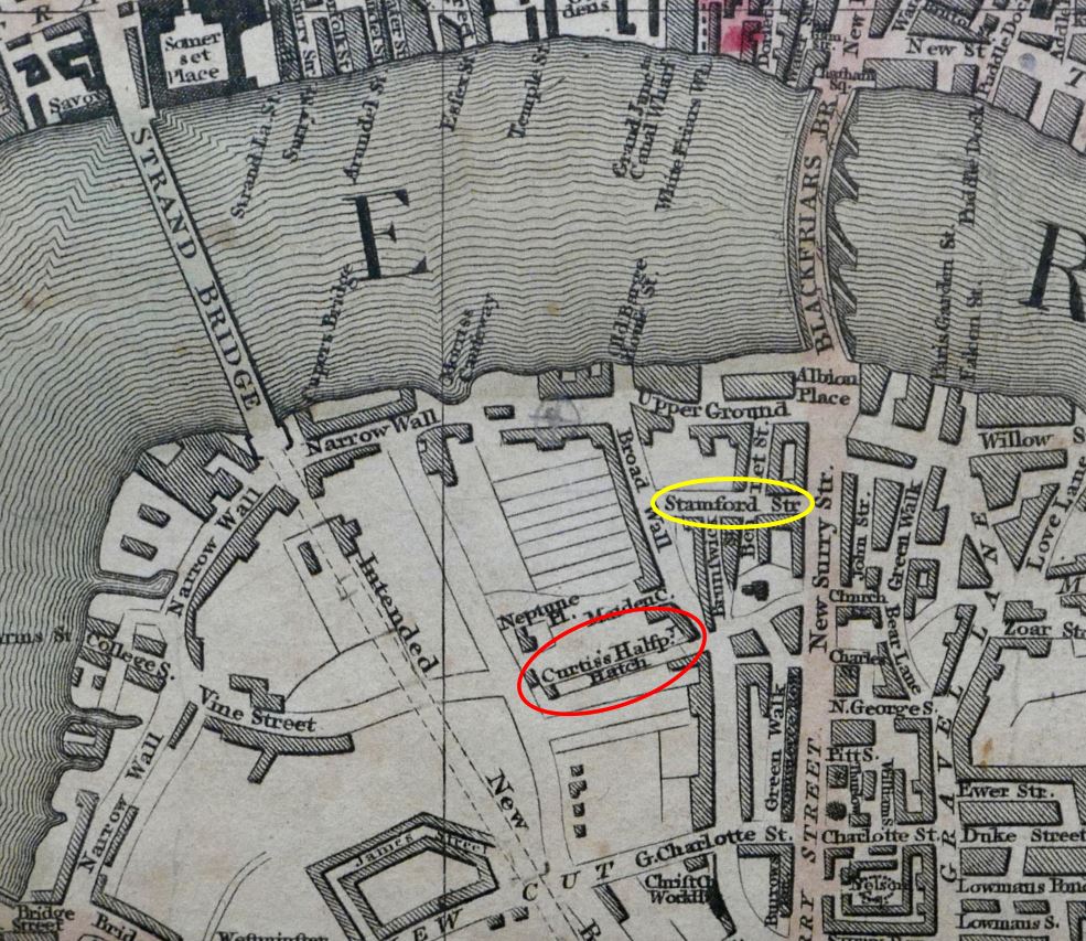
The yellow oval is around the first stretch of Stamford Street. This is the road that runs to the north of the area I am walking, and is a busy road connecting Blackfriars Road and Waterloo Road.

Note the Strand Bridge. This was the recently built first bridge on the site of what is now Waterloo Bridge. Also, running south from Strand Bridge is the outline of a street labelled “Intended New Road”. This is the future Waterloo Road.

In the above map, there is a track called Curtis’s Halfpenny Hatch where the future Roupell Street would be located.

This was named after a William Curtis who was the founder of a Botanic Gardens in the area. It was a suitable location for aquatic and bog plants as the area was low lying. The Halfpenny element of the name was the cost to use the route when it was previously a short cut through the agricultural land on either side.

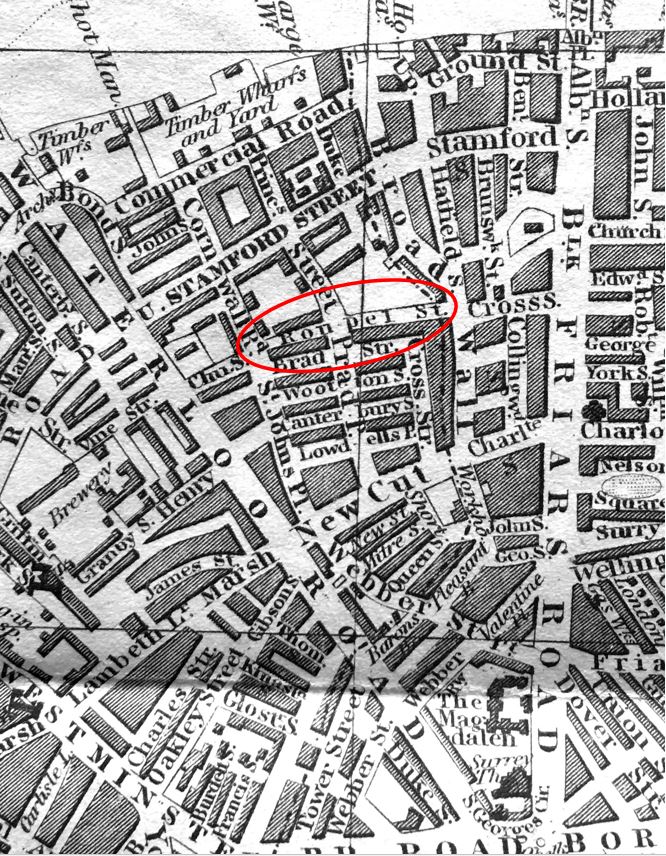
The 19th century would bring considerable change and development to the area with the arrival of Waterloo Station, however this had not yet been built by the time of the 1847 edition of Reynolds’s Splendid New Map Of London. Roupel Street had arrived, but apparently not yet fully built, along with the streets that would fill in the area to the north (more on this later in the post).

Roupell Street

Between the 1816 and 1847 maps, Stamford Street was completed linking Blackfriars and the now completed Waterloo Road.

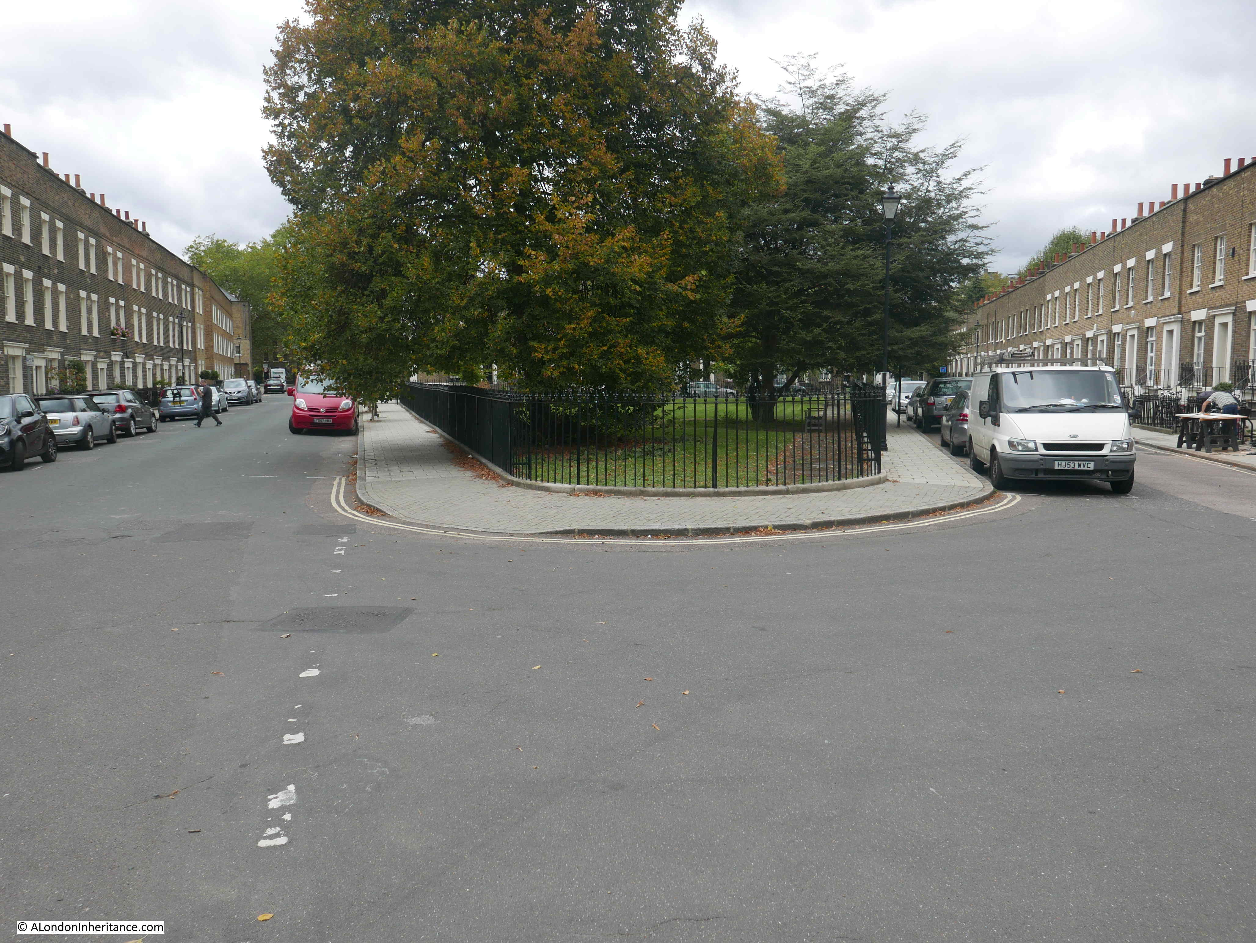
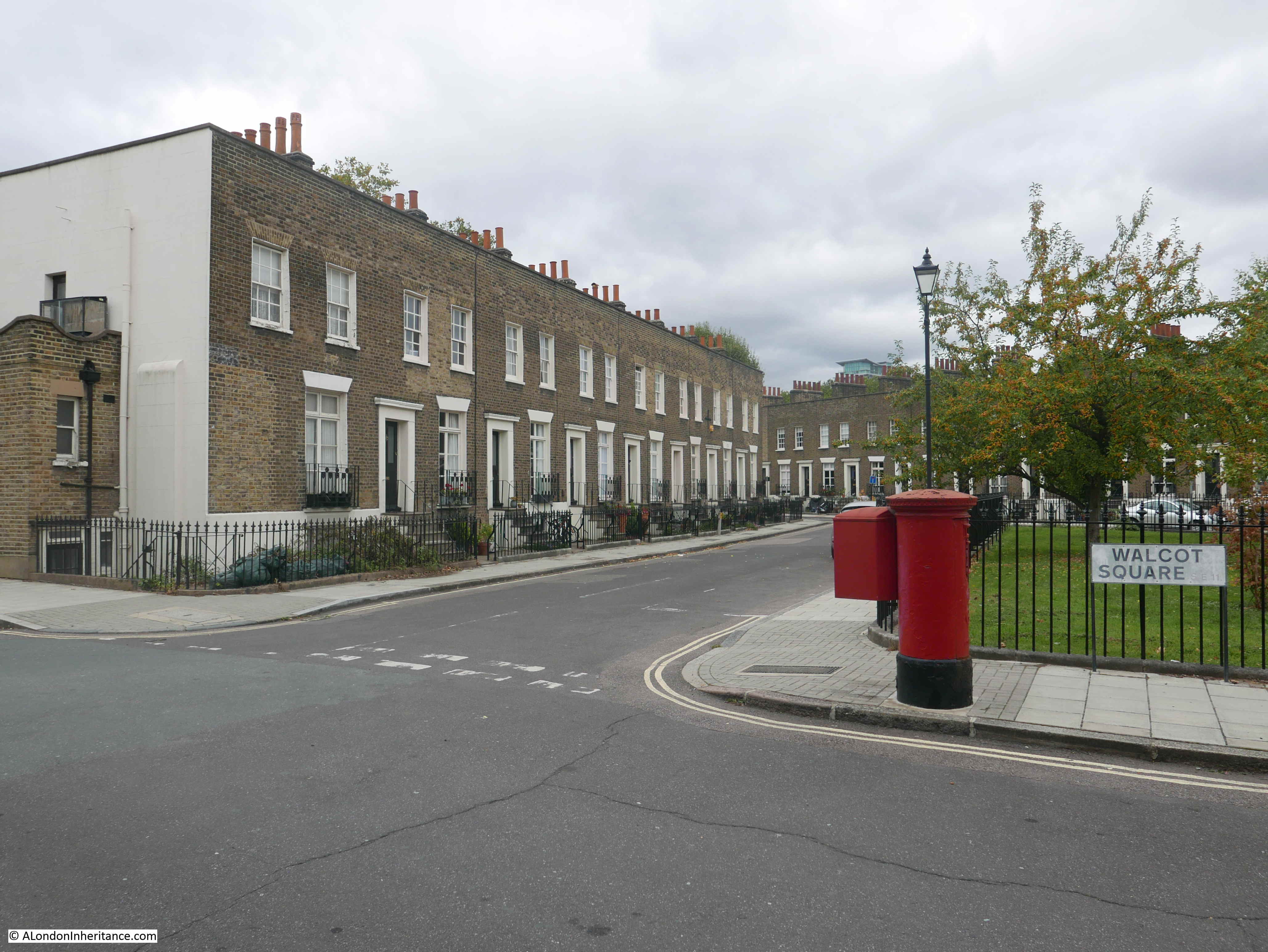
To explore the area, I went for a walk from Roupell Street to Aquinas Street, shown by the dotted red line in the following map, starting at the red circled location of the hairdressers (Map © OpenStreetMap contributors).

Roupell Street

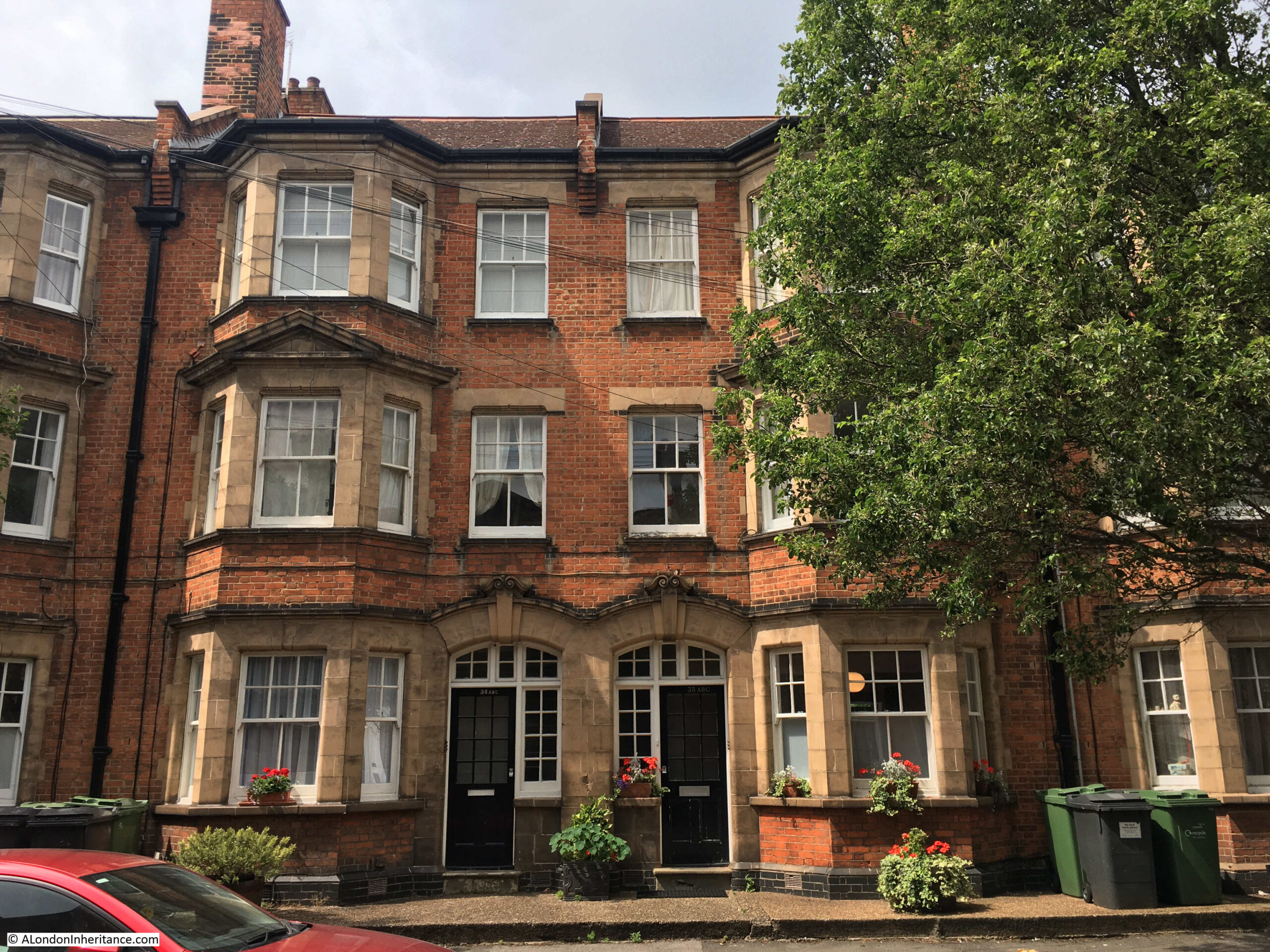
This is the full view of the corner building with the barbers at street level:

Roupell Street

On the opposite corner is an identical building, even with the same bricked windows:

Roupell Street

With a bakers shop now occupying the corner position.

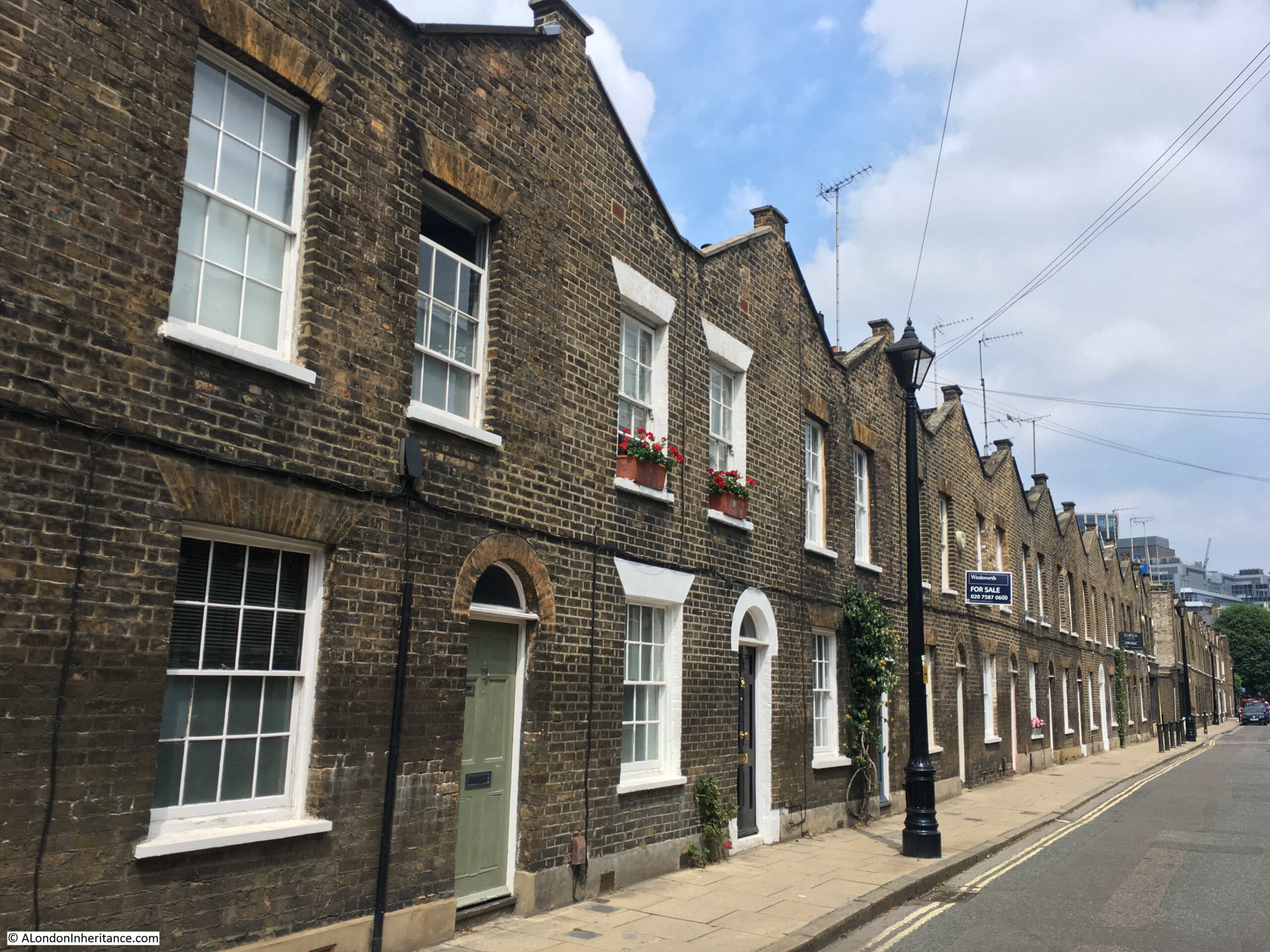
Looking down the full length of Roupell Street:

Roupell Street

The name of the street comes from John Roupell, who purchased the land and built the estate in the early 19th century.

John Roupell had a Bankside metal works, and seems to have inherited the wealth needed to pay £8,000 for the land through his wife’s family.

The street was laid out and construction started around 1824. when John Roupell was 64. The houses in the street seem to have been occupied from the early 1830s as from 1835 onwards, references to those living in the street, or local events, start appearing in the press. One strange mention concerns a murder in a pub garden in Broad Wall, at the eastern end of Roupell Street, when during the inquest, one witness stated:

“John Bingley deposed he is a private watchman. On Sunday morning, about twenty minutes after two, witness was in Roupell-street; he heard a voice – apparently that of a women – exclaim ‘Here’s a villain! – he has got me down and is trying to kill me’.

By the Coroner – Did you hear any other words?

Witness – Yes, i heard the same voice say ‘Come to me’ and then in a fainter tone, ‘Have mercy on me’.

Apparently John Bingley thought it was a drunken row, and took no notice of the matter, he did not see any person answering the description of the deceased either alone, or accompanied by any other person – he does not sound perhaps the most pro-active watchman that you would want to employ on London’s streets.

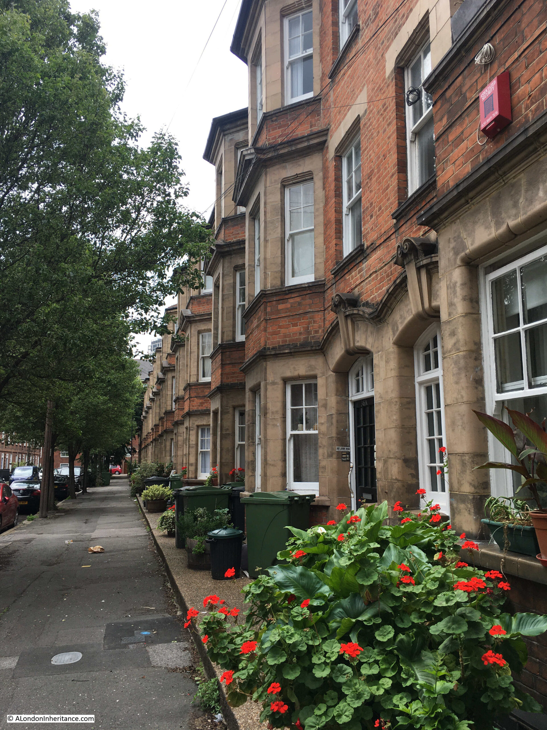
Roupell built two storey terrace housing. Brick built, directly onto the street with no front garden or a small area protected by railings. Open the front door and you are directly on the street.

Roupell Street

The first time that Roupell Street features in London’s newspapers is when the London Evening Standard reported, on the 1st June 1829, the impact of Roupell’s builders working extra hours:

“On Saturday evening a fire broke out in Roupell-street in one of the new houses belonging to Mr Roupell. On the first alarm, the engines of the Palladium and West of England fire-offices promptly attended, and by the aid of a plentiful supply of water the flames were prevented from spreading, and eventually subdued in about an hour, but not before one of the houses, nearly in a finished state, was totally destroyed and the adjoining one considerably damaged.

The fire originated under these circumstances:- Mr Roupell had bound himself by contract to have both houses finished by a given time, and the period fast approaching, men were employed to work beyond the usual hours.

Some of them were in the act of pitching some gutters, when the pot boiled over and set fire to the shavings and wood with such rapidity that it was with some difficulty all the workmen succeeded in effecting their escape.

Of course none of the houses were insured, as they were in an unfinished state.”

The street was quickly finished after the fire. By the time of the 1841 census, Roupell Street seems to have had a good population, with 250 people recorded in the census as living in the street.

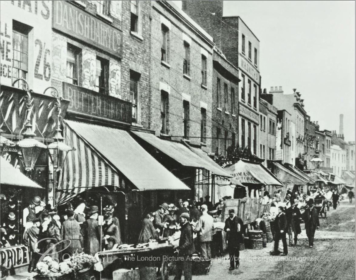
Roupell had built the street for what were described as “artisan workers” and the 1841 census provides a view of the professions of what must have been some of the first people living in the street. This included; painters, labourers, clerks, printers, bakers, carpenters, bricklayers, compositors, paper hanger, hatter, an excise officer, lighterman, warehouseman – all the typical jobs that you expect to find in such a street in 1840s London.

Roupell Street

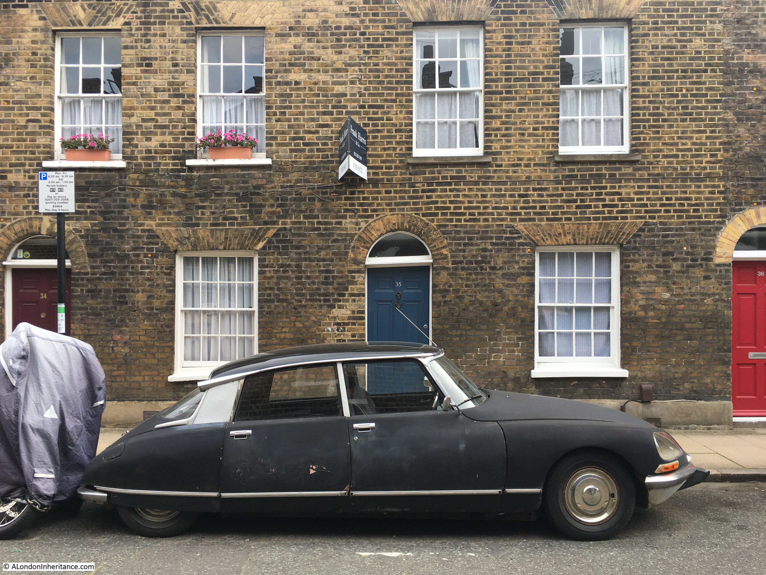
This Citroen has been parked on the street for many years, and provides one of the most photographed views of the street.

Roupell Street

Walking further down Roupell Street, and a pedestrian walkway that was once a street cuts across. This is Windmill Walk.

On either side of the northern entrance to Windmill Walk are two buildings that have what appears to be shop fronts, along with what could be a very faded painted advertising sign on the wall.

Roupell Street

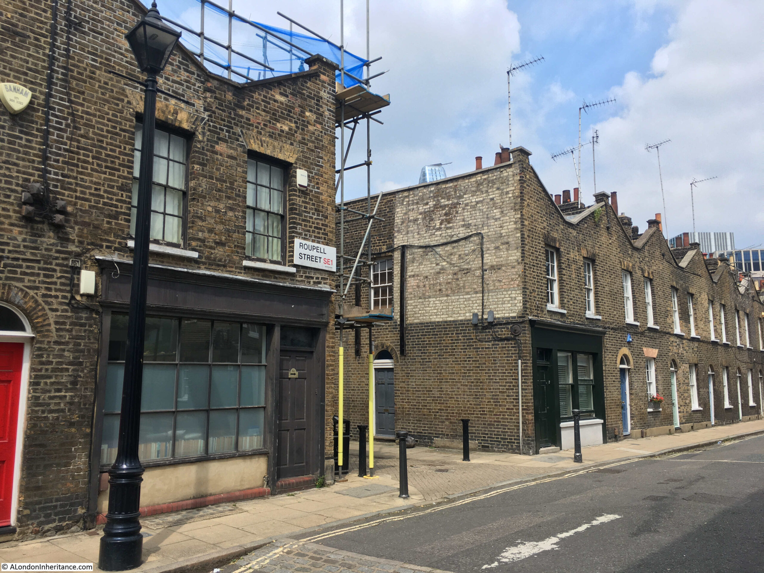
The 1910 Post Office Directory confirms that these were shops, and the businesses that operated in them at the start of the 20th century.

At number 61 (nearest the camera) was john Bowen Walters – Dairyman and at number 62 was Arthur Edward Cowdery – Baker.

The 2007 Conservation Area Statement records that the shop fronts are replacement / reproductions of the originals.

Directly across the street from the above old shops, is the Kings Arms, a brilliant local pub:

Kings Arms

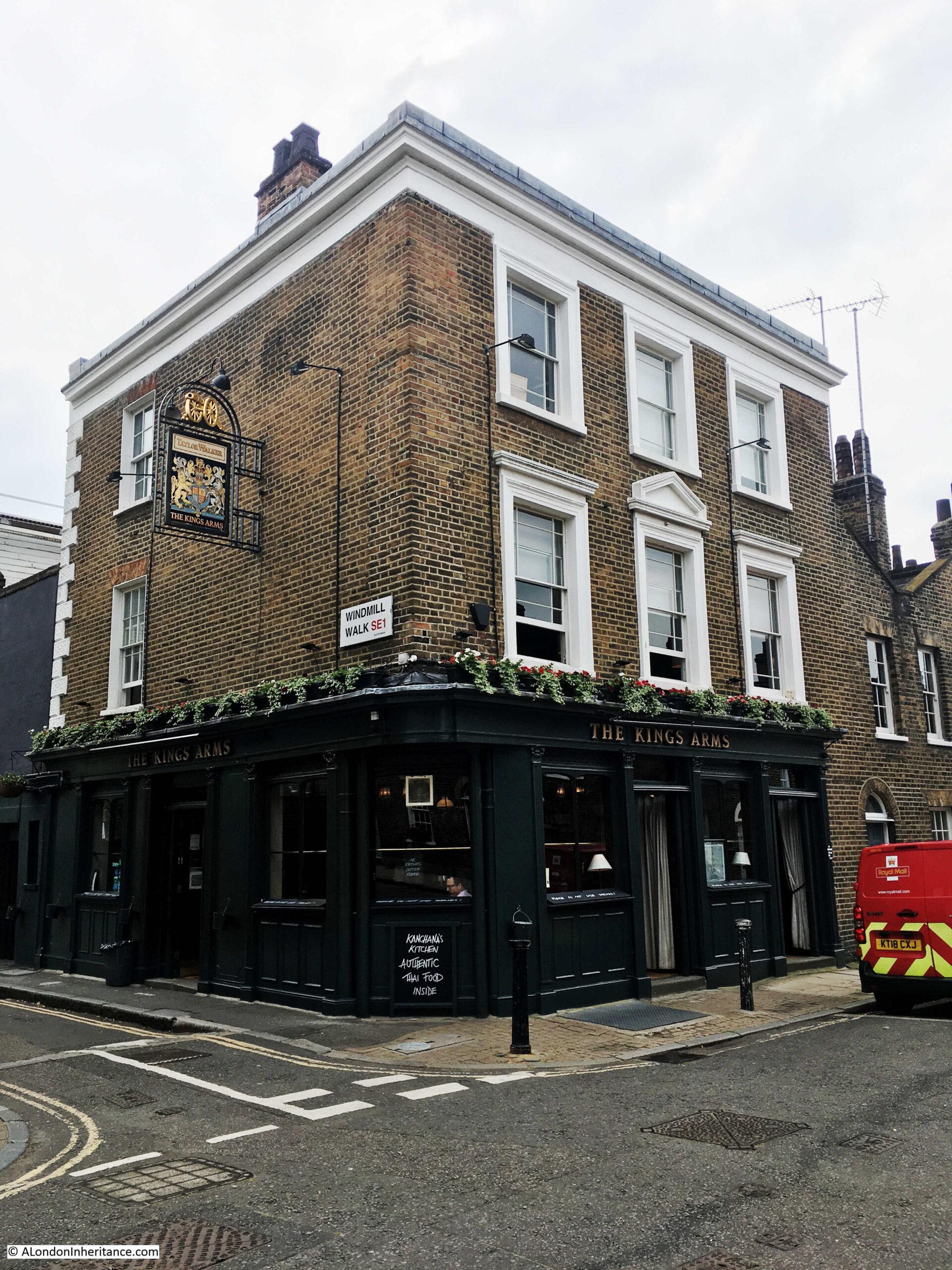
The Kings Arms was part of the original build of the street and has retained the same name since opening in the 1830s.

The first reference to the pub in the press provides a fascinating view of the agricultural nature of the area. An advert from the Morning Advertiser on the 22nd March 1836:

“Broadwall, Blackfriars-road – to Timber-merchants, Hard Wood-turners, Veneer-sawyers and Others, By Mr. C. COULTON on the Premises, a field opposite the King’s Arms, Roupell-street, Broadwall, on THURSDAY, March 24, at Twelve.

COMPRISING two hundred Yew Trees – to be paid for on the fall of the hammer. may be viewed till the sale, and Catalogues had of the Auctioneer, No 32, Union-street, Borough”.

The advert shows that in the 1830s, reminders of the old agricultural nature of this part of Lambeth could still be found. Two hundred yew trees sounds like a reasonable number so this was not a small field. I do not believe they like water logged conditions, so the typical wet conditions of the Lambeth Marsh were also disappearing.

The trees were almost certainly being sold to release the field for building, as in the late 1830s and 1840s, the remaining open space was being built on.

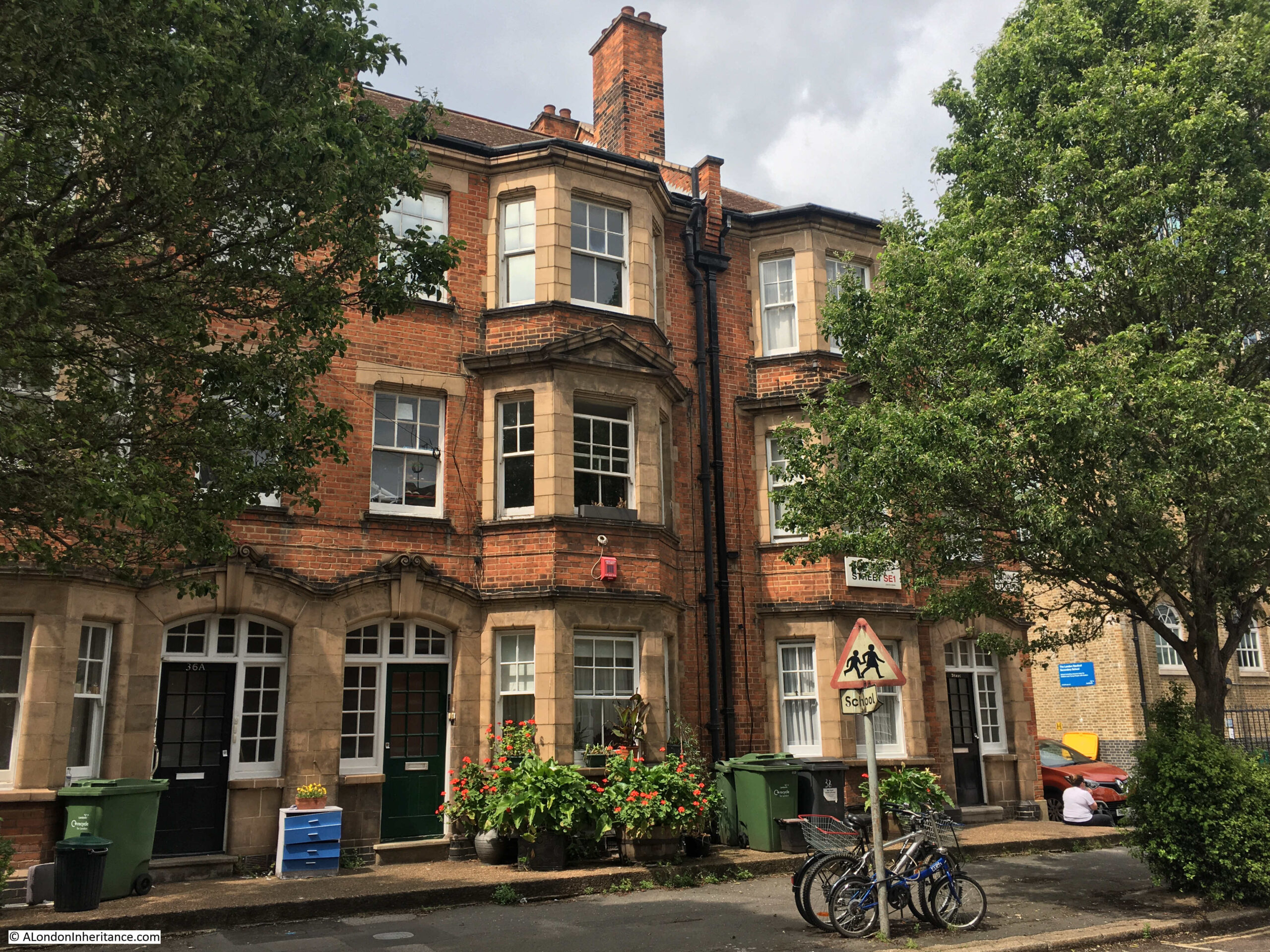
The majority of Roupell Street has a uniform appearance, however walking further east along the street and there is a three storey pair of houses.

Roupell Street

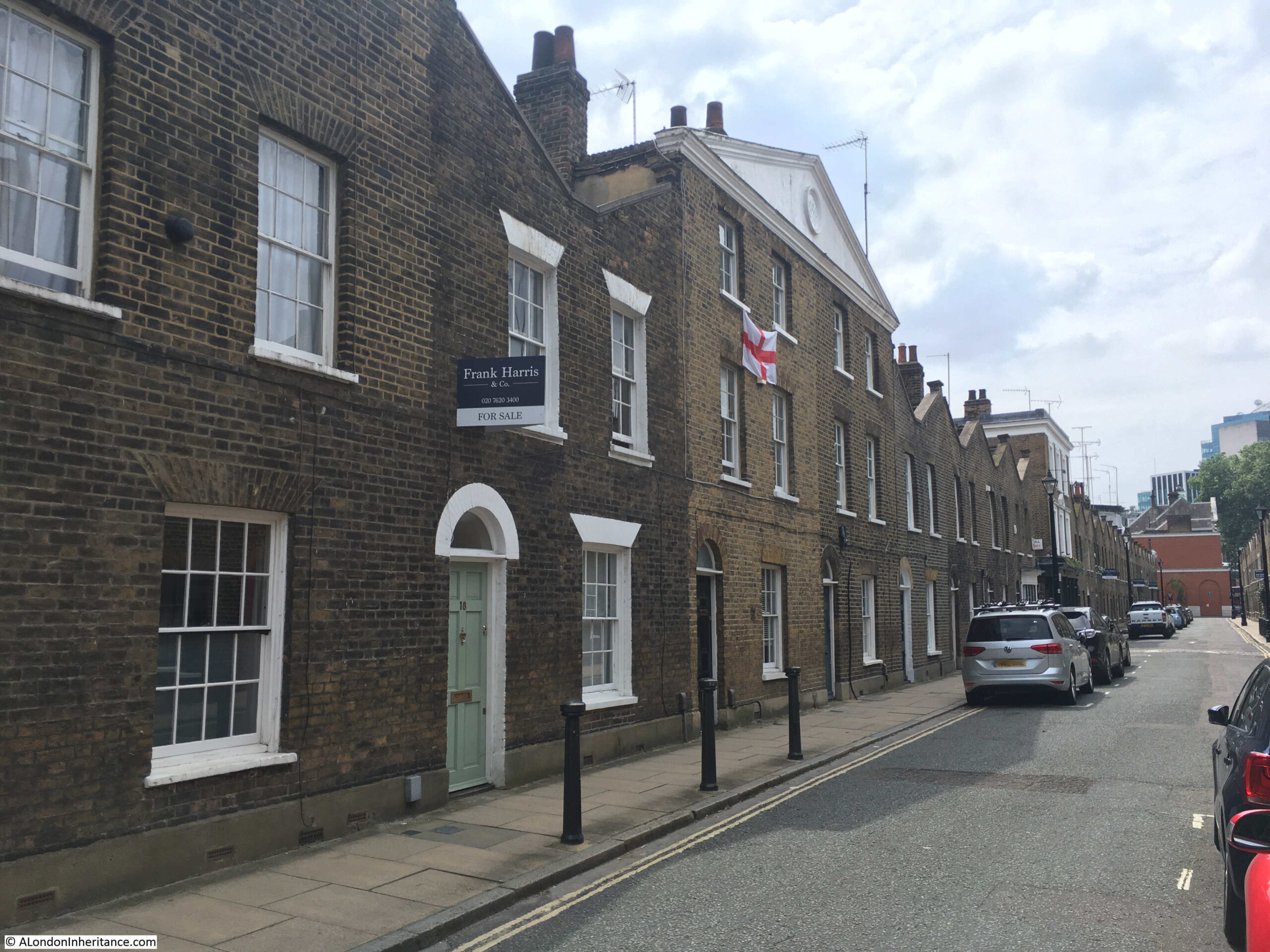
These houses were not part of the original construction of the street as within the triangular pediment at the top of the building there is the date 1891 which is presumably the date of construction.

The two houses retain the same width as those along the rest of the street and the doors and windows are also much the same, so it may be that in 1891 only the top floor and pediment was added to two existing terrace houses. Perhaps some late 19th century home improvements.

John Roupell died on the 23rd December 1835, when the St James’s Chronicle reported that he had died in his 75th year at his own residence in Roupell Street. Along with Roupell Street, he had a substantial portfolio of land and property in south London, part of which gets mentioned in a news report when his son Richard Palmer Roupell was a witness to a possible murder in his grounds at Norwood. At the inquest, Richard Palmer Roupell was described as a lead merchant of Cross-street, Blackfriars who has a country residence at Brixton Hill.

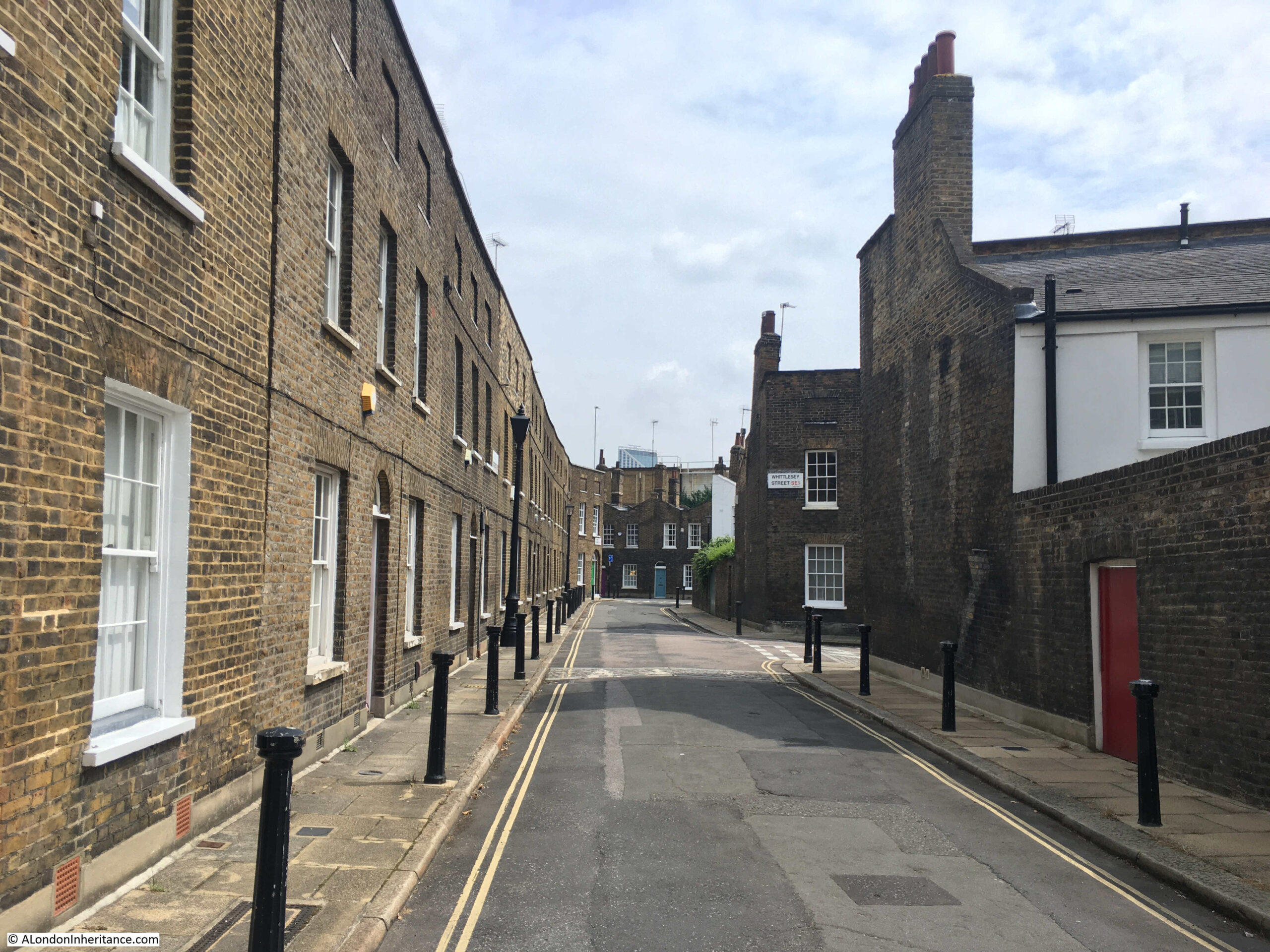
It may have been Richard Palmer Roupell who developed Theed Street which runs north from Roupell Street:

Theed Street

Theed Street still consists of a terrace of two storey houses, however there is a very different treatment at the top of the buildings where instead of the rise and fall of the triangular wall in Roupell Street, Theed Street has a top wall blanking off the roof at the rear, giving the impression of a more substantial row of houses.

According to Reynolds’s Splendid New Map Of London published in 1847, Theed Street had not yet been built. See the annotated map below:

Theed Street

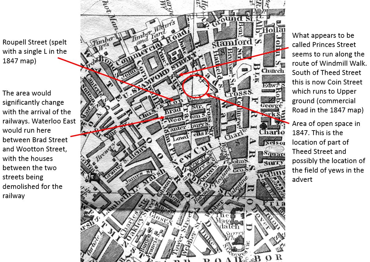
I am not sure whether the 1847 map is correct. Greenwood’s map from 1828 shows what would become Theed Street as an unnamed street running between two fields. It could be that in 1847 it was still unnamed and running between fields and therefore not considered worth recording – one of the challenges of trying to interpret maps of different scales and over the years as London changes.

Greenwood’s map does show that Roupell Street was originally called Navarino Street (after a naval sea battle fought by the British and allies against the Ottoman and Egyptian forces in the Greek War of Independence in 1827). This was in 1828, and Roupell seems to have quickly changed the name of the street.

Branching off Theed Street is Whittlesey Street which continues the same architectural style of Theed Street:

Whittlesey Streeet

Looking back up Theed Street towards Roupell Street – not a parked car in sight which adds considerably to the view:

Theed Street

In the above photo, the house on the right is to the same design as those in Theed Street, and the way that the top line of brick hides the rear slopping roof can be seen.

Not what you expect to see running across the street of such a densely built area:

Whittlesey Street

Where Windmill Walk crosses Whittlesey Street:

Windmill Walk

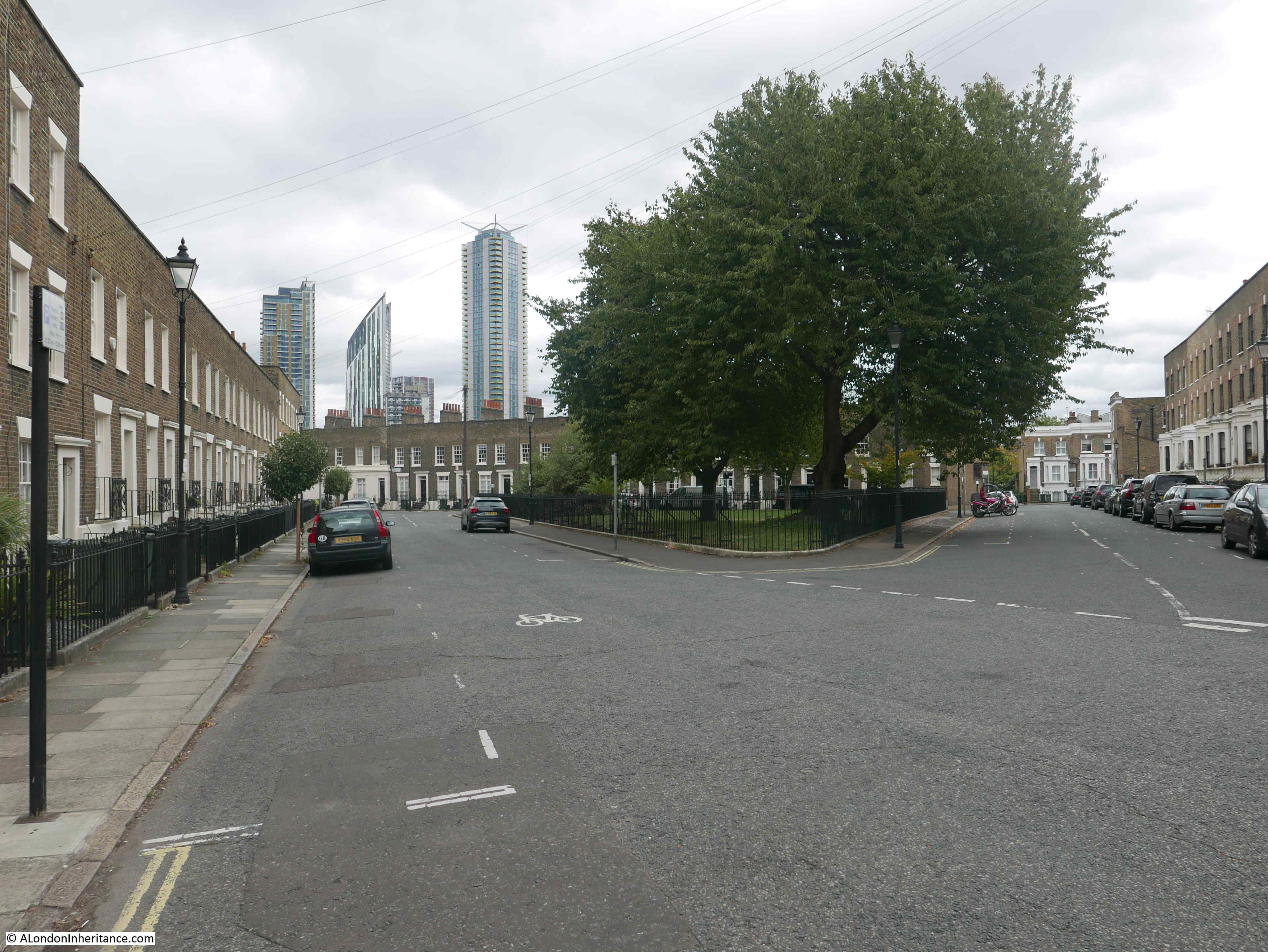
The towers in the distance of the above photo are the new blocks recently built around the Shell Centre site on the Southbank.

Reaching the end of Whittlesey Street, where the street meets Cornwall Road, the following photo is looking south with the railway bridge over the street and above that, the pedestrian walkways that take travelers down to the platforms of Waterloo East.

Cornwall Road

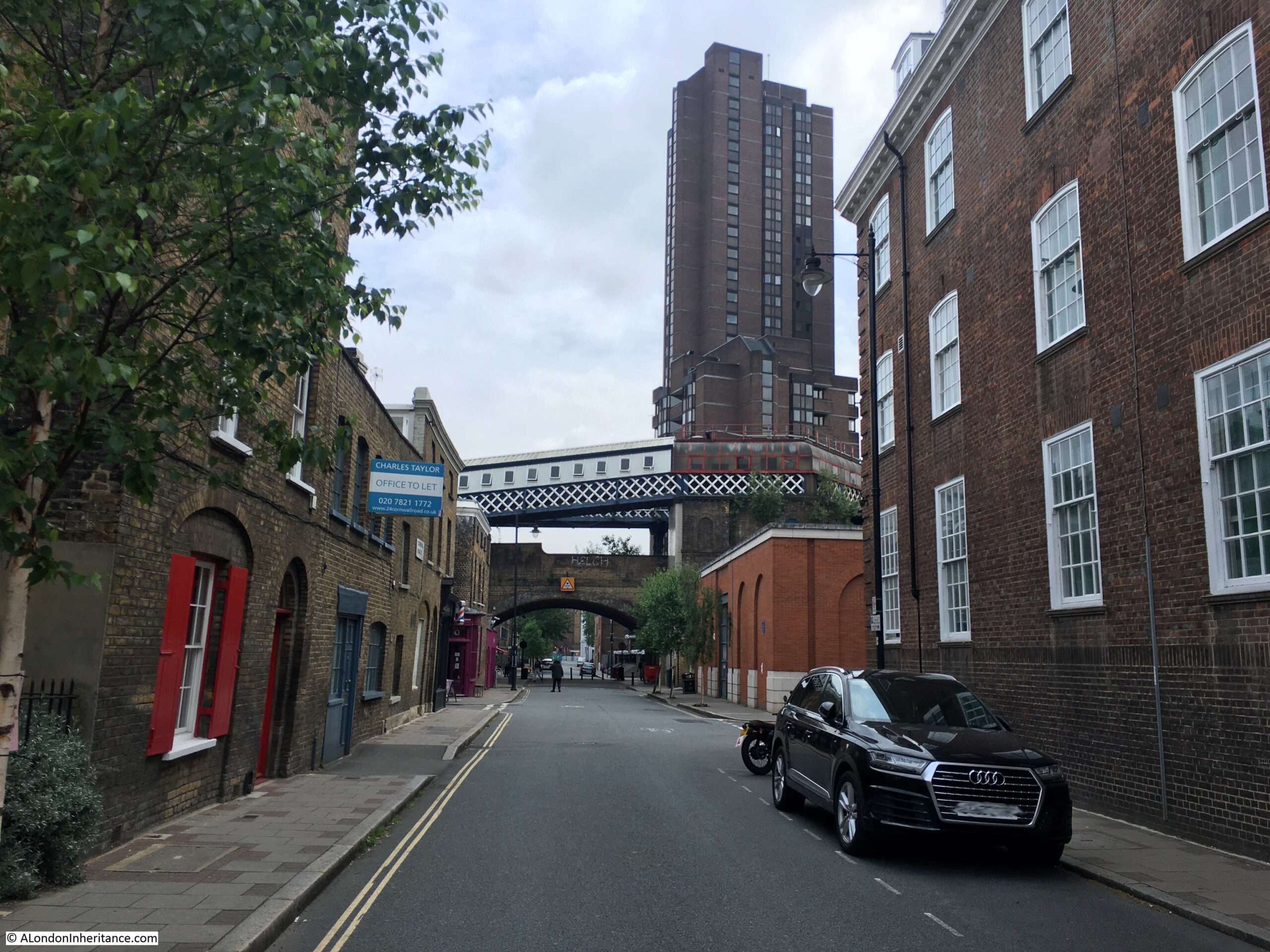
On the corner of Whittlesey Street and Cornwall Road is another pub – the White Hart:

Roupell Street

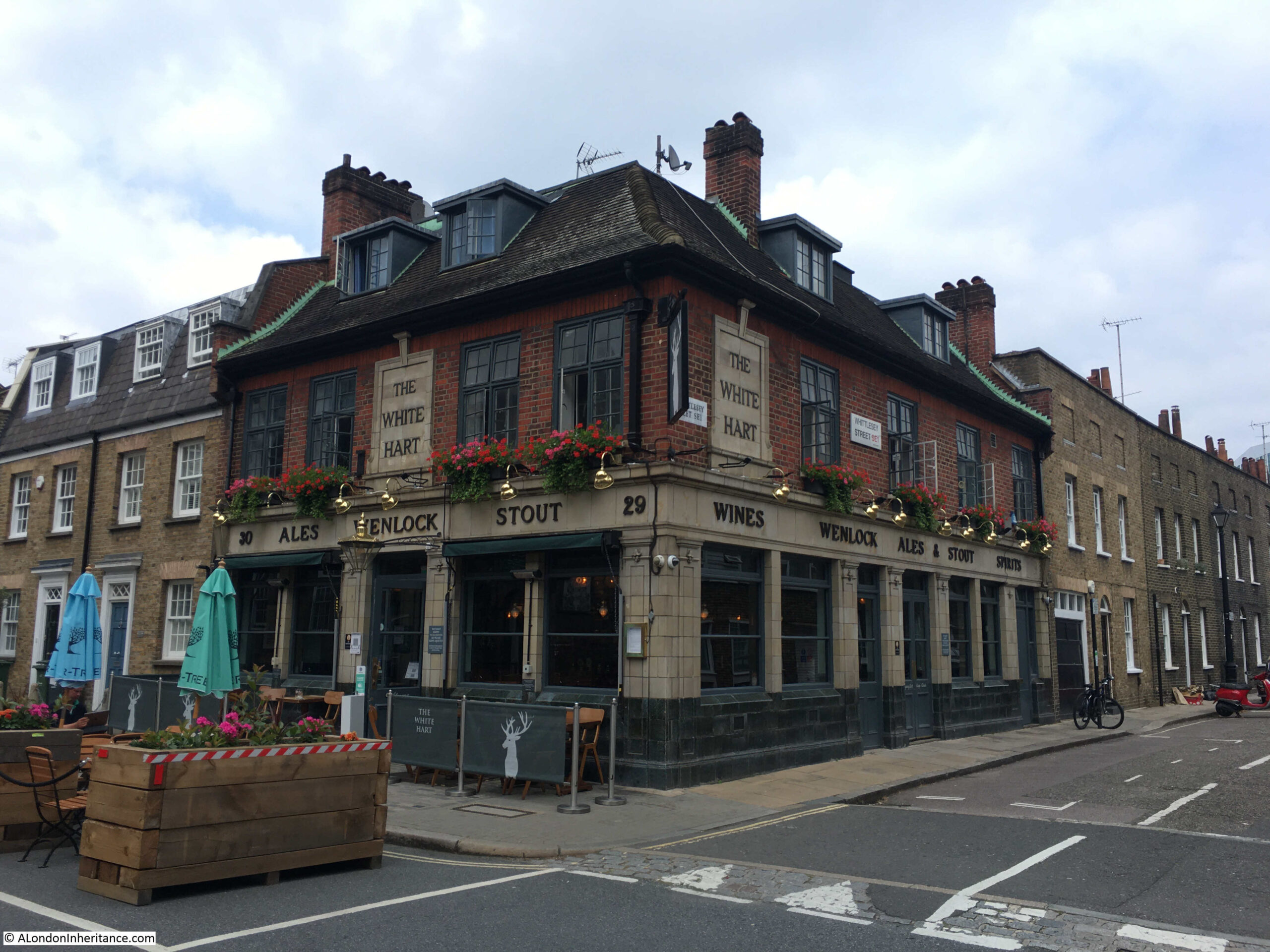
Another pub that has been here since the development of the area and that has retained the same name. The first record I can find of the pub dates from the 25th January 1849 when they placed an advert in the Morning Advertiser for a Barman or Under-Barman. In the advert the pub was described as “a respectable Tavern”.

From here, I am going to take a short walk from the area of Roupell’s developments as there is another street with some fantastic architecture.

Following the route in the map shown earlier in the post, I walked north along Cornwall Road to turn right onto Stamford Street, then south down Coin Street to find Aquinas Street:

Aquinas Street

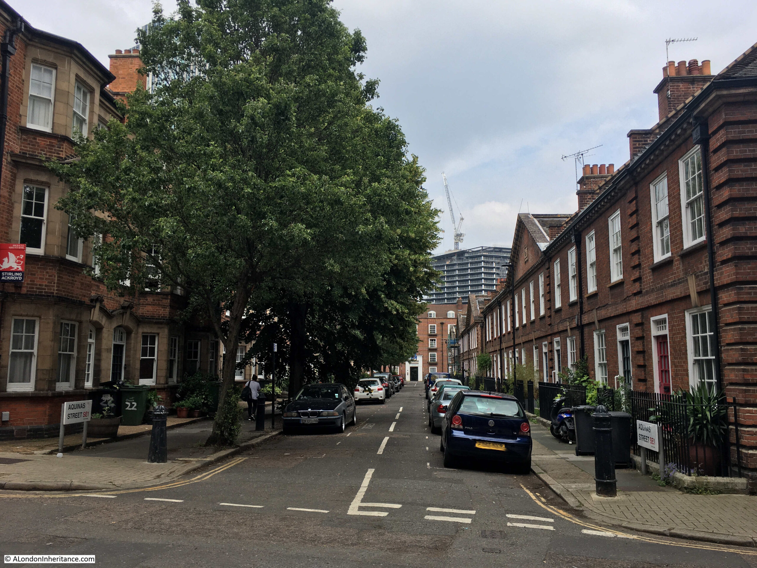
Aquinas Street is early 20th century, so later than Roupell, Theed and Whittlesey Streets, but like these early 19th century streets, Aquinas Street is lined by rows of terrace houses of a continuous and unique design.

This is the south side of the street:

Aquinas Street

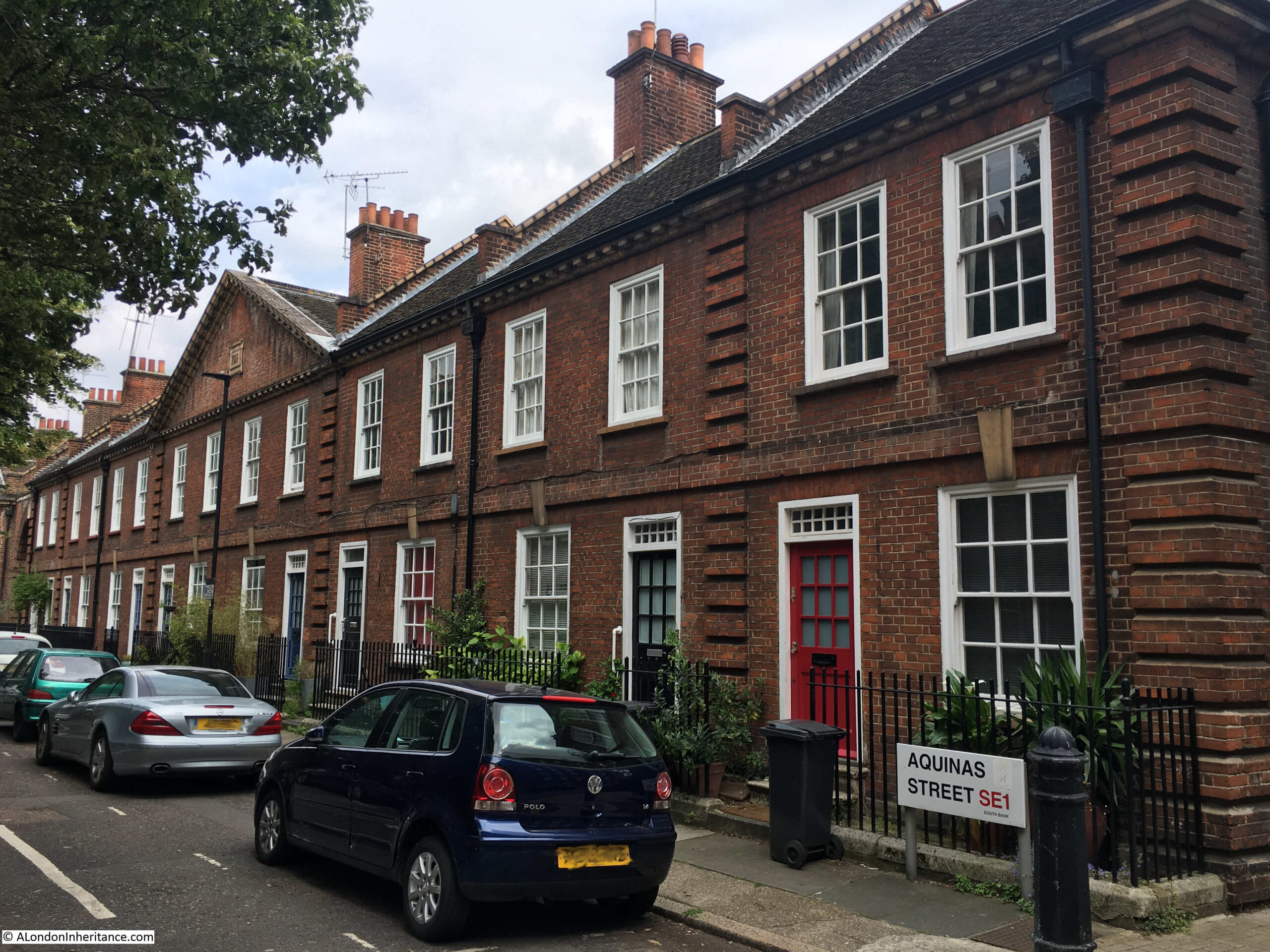
The south side of the street dates from 1911, and in the conservation area statement are described as Neo-Georgian, with their original doors, sash windows and railings. The terrace is Grade II listed.

The northern side of the street has a continuous terrace of houses, but of a very different style:

Aquinas Street

Substantial three storeys, each with a full height bay. They are not what you expect to find in this part of Lambeth and represent a rare example of a surviving, continuous terrace of houses dating from the early decades of the 20th century.

Aquinas Street

Aquinas Street is a perfect example of some of the wonderful streets that can be found by turning off the main streets of the city.

Aquinas Street

I started the post with the hairdressers / barbers on the corner of Roupell Street, so I will conclude the post by returning to the Roupell family.

John Roupell, the original developer of the estate, died in 1835. He died a wealthy man.

His son Richard Palmer Roupell had four children, however it appears that John Roupell was unaware of his grandchildren as Richard had the children with Sarah Crane who was recorded as the daughter of a carpenter. John Roupell would apparently have disapproved of this match, so Richard hid the relationship from him.

One of the four sons of Richard Roupell was William Roupell. He discovered that his father left his estate to his brother Richard, who was the only son born after Richard and Sarah had married (after John Roupell had died).

Richard forged his father’s will to leave his estate to his mother with Richard as executor. He was able to borrow against the estate. He also became an MP for Lambeth.

He had substantial debts and when those who had lent him money called for the debts to be repaid, he fled to Spain. He was persuaded to return, and then tried at the Old Bailey in 1862.

The trial gained considerable publicity, because of the level of forgeries, and because Roupell had been an MP.

An account of the trial was published, published in 1862 and described as “From the shorthand notes of Mr. G. Blagrave Snell – Shorthand writer to the Court of Bankruptcy”. The introduction to the account provides an indication of the sensational nature of the trial:

“The following pages contain the whole of the startling details of one of the most extraordinary series of forgeries that was ever disclosed in a court of justice in this country. No work of fiction, it may safely be said, ever was conceived, in which all the incidents that go to make up a tale of thrilling interest, can be more striking than is this bare, unvarnished tale of truth.

The principal party concerned in it was but the other day a member of Parliament, and a man of whom many prophesised that it would be no long time ere he would rise to distinction in the senate; but who by embarking on a career of reckless profligacy, has brought down absolute ruin upon himself, and upon his family an amount of calamity wholly undeserved, which would have been far greater had he not surrendered to justice by placing himself in the felon’s dock.

It was but recently that the pubic were surprised at the resignation of the Member for Lambeth. They little knew the tale that lay behind that resignation. They little knew that forgery and fraud had been the common paths and beaten ways of William Roupell for seven long years; that he had wasted the patrimony of his family, and had reduced them to comparative poverty even before his father’s death.

At length the fatal truth came out, and he was obliged either to face his father’s executors or fly the country. The family property had been fraudulently sold, and it was only when overwhelmed with difficulties, pecuniary and otherwise, that he resolved to confess the whole truth, even at the bar of the court of justice”.

A dramatic end to a once wealthy family, however we still have John Roupell’s original development as a memorial to his achievements, rather than his fraudulent grandson.

alondoninheritance.com

Walcot Square And Lost Prefabs

The challenges facing the High Street have been much in the news over the last few years, with the failure of many shops and restaurant chains. This is the latest manifestation of a process that has been changing the way we shop for many years. It was not so long ago that the corner shop was the main source for day to day provisions. A corner shop could be found on the majority of London streets and the outline of many of these remain to this day, and for this blog post I went in search of one we photographed in 1986 to see what remained. This is the Walcot Stores in Walcot Square, Lambeth:

Walcot Square

The same view today:

Walcot Square

The Walcot Stores has long closed, but parts of the painted sign and the shop front remain. The conservation appraisal for the area records about the shop front that “Despite some surviving elements, unfortunately the door and much of the timber has been replaced and inappropriately stained.”

Looking into the original shop reveals a mix of goods. Tins of soup, boxes of fruit juice, packets of biscuits and in the left hand window, household cleaning products, toothpaste and soap.

Walcot Square is in Lambeth. Follow the Kennington Road, and just after the grounds of the Imperial War Museum are a couple of streets that lead into an early 19th century development centered on Walcot Square.

in the following map, Kennington Road is the vertical orange road in the centre. The Imperial War Museum is at the centre top, and just below this is the Walcot Estate centred around two triangular greens, just to the right of Kennington Road.

Walcot Square

Map  © OpenStreetMap contributors. 

The Walcot Estate is one of those places that can be found across London which have a very distinctive character and are different to their surroundings. I have written about similar estates before, such as the Lloyd Baker estate.

The land in this part of Lambeth was once owned by the Earls of Arundel, then the Dukes of Norfolk. In 1559, Thomas, Duke of Norfolk sold a parcel of land, and in 1657 this land was sold to Edmund Walcot.

There must have been a family connection to the area as Edmund’s uncle, Richard Walcot also owned some local land which Edmund inherited.

Edmund left the land in trust to St. Mary Lambeth and St. Olave, Southwark, for the benefit of the poor. At this time the majority of the land was undeveloped, apart from some limited building, it was mainly used for agricultural purposes.

The land left to St. Mary and St. Olave went through a number of partitions, enabling the two parishes to own their specific block of land, with the line of the present day Kennington Road roughly forming the border between the partitioned land.

Building commenced in the early years of the 19th century. Walcot Square was constructed between 1837 and 1839.

The name Walcot Square does not fit the area. Walcot recalls Edmund Walcot who left the land in trust to the parishes, however the area is not really a square.

The grassed section in the middle is more a triangle than a square, whilst the name also extends along the road that leads down to Kennington Road and up towards Brook Drive.

The Walcot Stores were at the eastern end of Walcot Square, towards Brook Drive. After photographing the old store front, I walked along Walcot Square towards the central grassed area.

In the following photo, the old shop is in the building on the left. In the front of the single storey building is a very old looking stone.

Walcot Square

A closer examination reveals a stone with a number of inscriptions. The date appears to be 1779.

Walcot Square

The stone pre-dates the construction of Walcot Square so was probably a boundary stone, possibly to show the land had been partitioned between the parishes of St. Mary and St. Olave.

I checked John Rocque’s 1746 map to see if I could find any obvious boundary (assuming that the boundary was in place 33 years before the date on the stone).

The following map extract shows the area in 1746.

Walcot Square

Some of the main roads that exist today could also be found in 1746. Part of Kennington Road along with Hercules Road, Lambeth Road and Lambeth Walk.

I have marked roughly where Kennington Road extends today and also the area occupied by the Walcot Estate, which in 1746 mainly consisted of fields.

There is a very hard boundary running diagonally down from Lambeth Road with cultivated agricultural land on the left and open fields on the right. This may have been the partition between St. Mary and St. Olave’s land, however the boundary does not look to be where the stone is to be found today – this is assuming that the stone is in the original location, Rocque’s map is correctly drawn and scaled, and that my interpretation of where the future extension to Kennington Road would run, and the future location of the Walcot Estate is correct.

Again, one of the problems with my blog where I worry I do not have enough time to research the detail – however I found it fascinating to find that a boundary stone that pre-dates the building of the entire estate can still be found.

Walking from the location of the shop, a short distance along Walcot Square brings us to the main area that could be considered a square. Here, the view is looking in the direction of Kennington Road with one of the corners of the triangle of grass, and the houses of Walcot Square on either side.

Walcot Square

The square and housing was built between 1837 and 1839. The Kenning Road extension had already been built, along with the large houses that faced onto Kennington Road, so Walcot Square was the typical expansion of building back from the main roads into the fields.

The square consists of two and three storey houses, along with a small basement. the ground floor is raised so a small set of steps leads up from the street to the front door.

Walcot Square

The north western corner of the square ends in a short stub of a street. The large gardens of the houses facing onto Kennington Road block the street. On the left is a rather attractive single storey building with a part basement below. The unusual design is probably because of the limited space behind, as this building could not intrude into the gardens of the house on the left.

Walcot Square

I wonder if it was the original intention to purchase the houses and land that block the extension on to Kennington Road and extend the above street and Walcot Square housing directly onto Kennington Road?

Leaving Walcot Square, walk along Bishop’s Terrace and you will find St. Mary’s Gardens (which must have been named after St. Mary, Lambeth, one of the parishes that had received the land in trust from Edmund Walcot). The layout is almost a mirror image of Walcot Square, with a triangular central garden.

Walcot Square

St. Mary’s Gardens was built at around the same time as Walcot Square so is of 1830s design and construction.

Compared to the continuous stream of traffic along Kennington Road, the streets of the Walcot Estate are quiet, and apart from the street parking, the general appearance of Walcot Square and St. Mary’s Gardens are much the same as when the estate was completed in the 1830s.

Walking back to Kennington Road, there is another of the typical 19th century standards for estate building. As with shops, pubs were also a common feature at the end of a terrace, or corner of a street, here at the junction of Bishop’s Terrace and Kennington Road:

Walcot Square

The pub was until very recently the Ship, but appears to have had a name change to The Walcot 1830 – a clear reference to the construction decade of the adjacent estate.

Lost Prefabs

Nothing to do with the Walcot Estate, but these must be in the local area.

The photo adjacent to the photo of the Walcot Stores on the strip of negatives from 1986 shows some prefab houses:

Walcot Square

Whilst the prefabs have almost certainly long gone, I was hoping that the distinctive building in the background could still be found, however after a lengthy walk through the streets of this part of Lambeth, I could not find the building in the background, so the street in which these prefabs were to be found in the 1980s remains a mystery.

It would be great to know if any reader recognises the location.

alondoninheritance.com

Lower Marsh Market And L & N Cohen

For this week’s post, I am in Lower Marsh, just to the south of Waterloo Station, however before getting into the post, can I say a big thanks for all the comments to last week’s post. Within a few hours on Sunday morning, your comments provided:

  • The source of the name Flockton – Webster Flockton, who had a tar works in Spa Road, Bermondsey
  • It appears there was nothing sinister with Violet Rose Dicker’s disappearance, she probably ran away with her future husband
  • The correct location of the photograph – Bevington Street

It is really good to have another of my father’s photos correctly identified, I will never know why he labelled it as Flockton Street, I will check the photos again to see if there is one of Flockton Street as perhaps the wrong photo was labelled. I will also take a walk to Bevington Street to take a photo in the right location.

There is no such mystery with today’s location. I worked around Waterloo for 10 years between 1979 and 1989, and one of the lunchtime walking routes was along Lower Marsh, a street lined with shops and a busy market occupying the length of the street.

This is the shop of L&N Cohen at 27 Lower Marsh on the corner of Frazier Street photographed in 1986:

Lower Marsh

This is the same building today:

Lower Marsh

The two photos provide a summary of the changes in the area, as can also be seen across so much of London. The building is no longer the “House for Value” and is now an independent local supermarket selling artisan bread.

I assume the same Cohen family had been running a clothes shop in Lower Marsh for many years. I found the following photo of the same shop in the LMA Collage archive. The photo is dated 1950.

Lower Marsh

Image credit: London Metropolitan Archives, City of London: catalogue ref: SC_PHL_02_0942_80_3901

The initials changed between the 1950 and 1986 photos, so I assume ownership of the shop moved to later generations of the Cohen family. It is interesting that the same structures can be seen across the front of the first floor of the building, running across the windows. I could not work out what these were for, whether a very large awning, fixing for signage that was once in place, or strengthening of the building wall. What ever it was, it has long gone and the building today has been considerably renovated and extended along Frazier Street.

Lower Marsh runs in the shadow of Waterloo Station. The name hints at what the land in the area was like before the developments between the street and the river. When I worked in the area the street was always known as the Cut rather than Lower Marsh. However the street today named The Cut runs to the east of Waterloo Road.

The following map extract shows the location of the building (the red dot, just to the lower left of centre), Lower Marsh runs from lower left to upper right. Waterloo Station dominates the area to the north. Waterloo Road is the orange road on the right, with The Cut leading off Waterloo Road to the top right corner.

Lower Marsh

Map  © OpenStreetMap contributors. 

When I work in the area, the Lower Marsh market was always busy with the street lined with stalls selling all manner of typical market goods, however today, the street appears much quieter with nearly all the stalls selling food. I have not walked along here for a few years, so not sure if this was a typical day, however it is a very different market to that of the 1980s.

Lower Marsh

The Lower Marsh market has a long history, but trading was not always peaceful. An article in the Illustrated London News on the 27th January 1872 shows some of the problems with attempts at Sunday trading:

“SUNDAY TRADING IN THE NEW-CUT: The Lower Marsh, Lambeth, which is popularly called ‘the New-cut’, has long been the regular weekly haunt of a numerous assembly of costermongers, dealers in fish, rabbits, and pork, sellers of cheap hosiery, pottery, hardware, trinkets and toys, who have been permitted to set up their little stalls, or to place their barrows and baskets at the sides of the wide street. This trade has gone on every Sunday at eight o’clock in the morning to one in the afternoon, while most of the neighbouring shopkeepers were obliged in self-defence, to have their business open at the same time.

Two or three weeks ago, the vestry board of St. Mary’s, Lambeth, passed a resolution to the effect that printed notices should be posted through the parish, cautioning all persons in the habit of exposing goods for sale that such a practice would not in future be allowed on Sunday mornings, and that any person so found offending would be summoned before the magistrate on the charge of creating an obstruction, the penalty on conviction being 40s. It was also resolved that the inspectors of nuisances for the parish should be employed to see that the terms of the notice were strictly enforced. The police authorities had declined to interfere, unless the order were to be applied to shopkeepers as well as to costermongers; but a double force of constables was placed on duty to prevent any breach of the peace.

On Sunday week, the trade began at the usual hour, but at nine o’clock, six of the Lambeth nuisance inspectors, in uniform, appeared upon the scene, and, accompanied by police-constables and followed by a large body of roughs, yelling and hooting, visited the stall-keepers in succession, ordering each to remove the stall, barrow or basket at once. If they merely removed to other places, they were followed by an inspector, who took down the name and address of the offending dealer, informing him he would be summoned.

As a rule, the officers, while performing their disagreeable duty, were treated with civility; but were very generally told that, if prevented selling their goods as usual, the costermongers would be compelled to throw themselves upon the parish, as they mainly depended for their scanty living upon the profits of the Sunday morning sales, when they did more business than on all the other days of the week.”

The articles goes on to state that the issue was discussed further in a number of vestry meetings, with a considerable number of shop-keepers, rate payers, shop assistants and costermongers urging the vestry that regulation rather than prohibition was required.

The vestry agreed on a compromise that allowed the market to go ahead on a Sunday morning, providing the stalls were removed by half-past ten o’clock, before church time.

The article finishes with a sentence that illustrates the working conditions that constrained the lives of so many of the working class:

“It is said that many of the working-class families in Lambeth cannot get their needful purchases for Sunday on Saturday night, because they work late on Saturday and do not receive their wages till the evening.”

Lower Marsh today, looking west with the old Cohen shop immediately on the left:Lower Marsh

Another view along Lower Marsh:

Lower Marsh

There are still many interesting 19th century buildings along Lower Marsh. On the front of one building at 127 Lower Marsh, there are two large urns on the either side of the first floor windows.

Lower Marsh

Apparently these are Tuscan oil jars and were often found on the facades of former oil shops. The ground floor of the building today is occupied by a Thai Restaurant, however in 1972 it was occupied by “Taps & Tiles”:

Lower Marsh

Image credit: London Metropolitan Archives, City of London: catalogue ref: SC_PHL_01_251_72_1090A

The Eastwood’s sign on the side of the building in 1972 has disappeared. I have not been able to find out if this was the name of a possible oil shop, or some other business on the premises.

Lower Marsh from Westminster Bridge Road end:

Lower Marsh

The London metropolitan Archives, Collage collection has a number of photos of the Lower Marsh market over the years, the following are a sample.

The first is one of the earliest I could find and is dated 1896, only 24 years after the Sunday trading issues detailed earlier in the post.

Lower Marsh

Image credit: London Metropolitan Archives, City of London: catalogue ref: SC_PHL_01_251_77_1062

This is from a time when the majority of shops had awnings and frequently large advertising boards across the facade, as can be seen with the Danish Dairy Company in the above photo. I wonder if the remains of these fixtures could still be seen across the front of Cohen’s shop in 1986.

The following photo is from 1950. The text that goes with this photo states that “the market stretched from Blackfriars to Vauxhall”.

Lower Marsh

Image credit: London Metropolitan Archives, City of London: catalogue ref: SC_PHL_02_0942_90_3903

I have not been able to find any evidence that the market stretched all the way from Blackfriars to Vauxhall – this would have been a considerable distance. It may have been that, as described in the 1872 Illustrated London News article, costermongers and traders could have sold from baskets and stalls anywhere along the roads south of the river from Blackfriars to Vauxhall, rather than a single, organised market. Street trading was much more haphazard before the 20th century.

This photo is again from 1950, and is at the eastern end of Lambeth Marsh, close to the junction with Waterloo Bridge Road.

Lower Marsh

Image credit: London Metropolitan Archives, City of London: catalogue ref: SC_PHL_02_0942_90_3903

This final photo from the Collage archive is also towards the Waterloo Bridge Road end of Lambeth Marsh. The photo is from 1950 and shows Waterloo Station in the background.

Lower Marsh

Image credit: London Metropolitan Archives, City of London: catalogue ref: SC_PHL_01_251_80_3912

I hope the early Friday afternoon that I walked down Lambeth Marsh was not a normal market day, it was very quiet and with considerably less variety than the market of the 1980s, however demographics change and I suspect the market today reflects local demand as it is, rather than as it was.

These changes between 1986 and 2018 can be clearly seen in the changes to 27 Lower Marsh.

alondoninheritance.com