Tag Archives: Waterloo

The IMAX Roundabout at the end of Waterloo Bridge

Roundabouts in cities are a problem. Whilst they are built to simplify traffic flow, they take up a large amount of space, and leave a central area for which it is difficult to find a purpose due to its isolated location.

One such roundabout is at the southern end of Waterloo Bridge, where York Road, Waterloo Road, Stamford Street and the approach to Waterloo Bridge all meet. I photographed the roundabout from the Shell Centre viewing gallery in 1980:
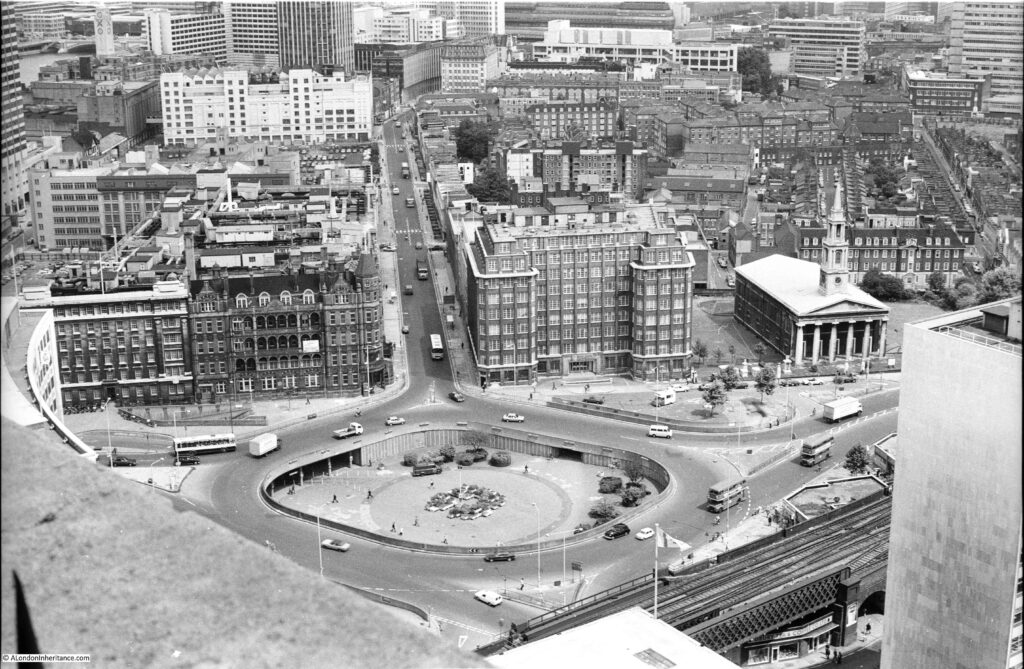
Roundabout at the end of Waterloo Bridge

Beneath the roundabout were a large number of pedestrianised access routes to the surrounding streets and the central space provided access between these, so you could walk between any of the surrounding streets without having to cross a road.

It was always a rather bleak space. Concrete planters were scattered around the central space, and for a time in the 1980s the GLC organised what we would now call a pop-up market at lunchtimes, hoping to attract workers from the surrounding offices, although with traffic on the surrounding roundabout, it was not that pleasant and most people headed to the Jubilee Gardens or the walkway alongside the Thames.

A rather innovative use for the central space was found in the late 1990s when the British Film Institute opened an IMAX Theatre in the centre of the roundabout:
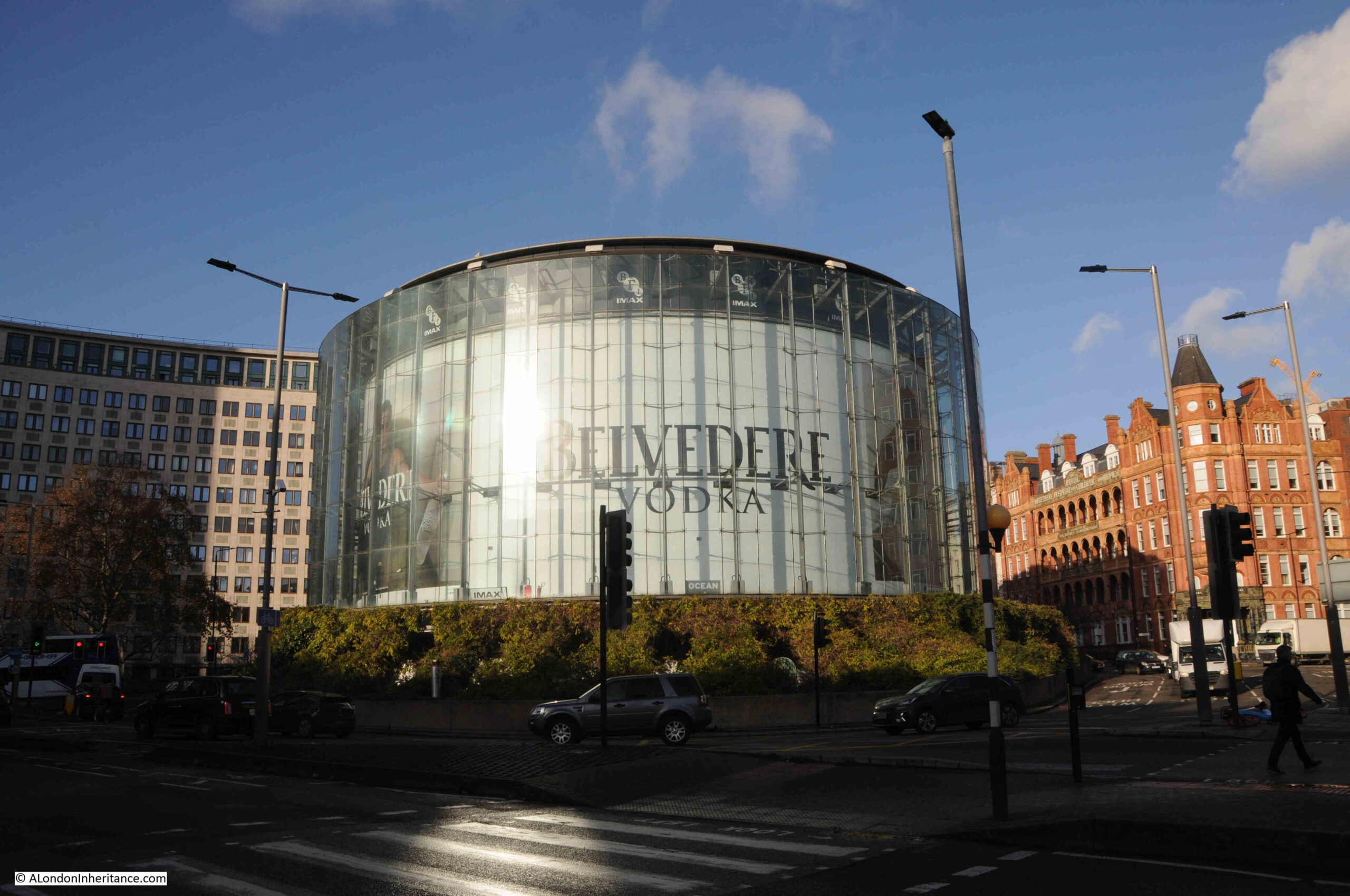
IMAX Theatre at end of Waterloo Bridge

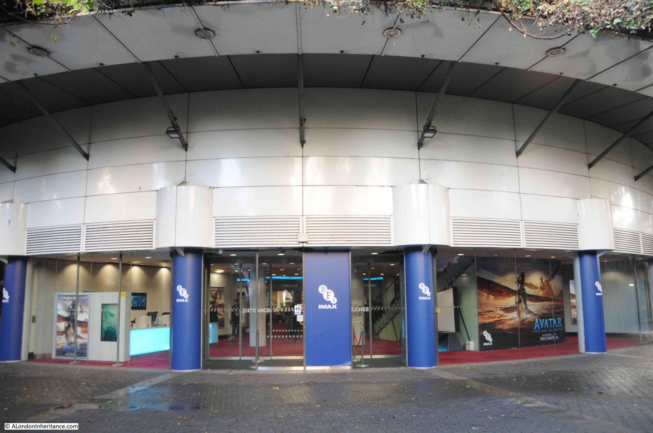
The IMAX is of circular design to fit the central space, and is surrounded by a glass wall which makes the building ideal for advertising and for displaying films that are being shown in the theatre. It is a very obvous landmark when approaching from any of the surrounding streets, and with the low sun of a December day, produces strange light reflections on the streets of the roundabout.

So, a very clever use of a difficult city space. One that has to overcome a number of obstacles, for example vibration and soundproofing from both the traffic on the roundabout, and the Waterloo and City line which runs just 4 metres below the theatre, which gives me an excuse to show a map of the route of the Waterloo and City line, with the location of the roundabout and IMAX marked by a red circle (Credit: The Engineer, July 26, 1895, Public domain, via Wikimedia Commons):
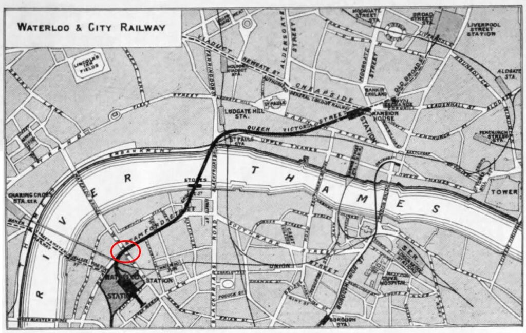
Old map of the Waterloo and City line

The IMAX Theatre was opened in 1999 and designed by Bryan Avery Architects. I have walked past the IMAX countless times, but what got me thinking about the use of space and the problems of inner city planning and maintenance was when I was walking alongside the roundabout in late December.

Access to the IMAX is via the steps down from the surrounding streets that also provide access between the streets without having to cross at surface level.

The steps down in the following photo are on the side of the roundabout between York Road and Waterloo Road. It was the start of the Christmas school holidays and I noticed a mother and child going down the stairs, then coming up, looking around, walking to another set of stairs, then back to the one in the photo. They were going to the IMAX, but there is no obvious signage and the stairs down do not look the most inviting.
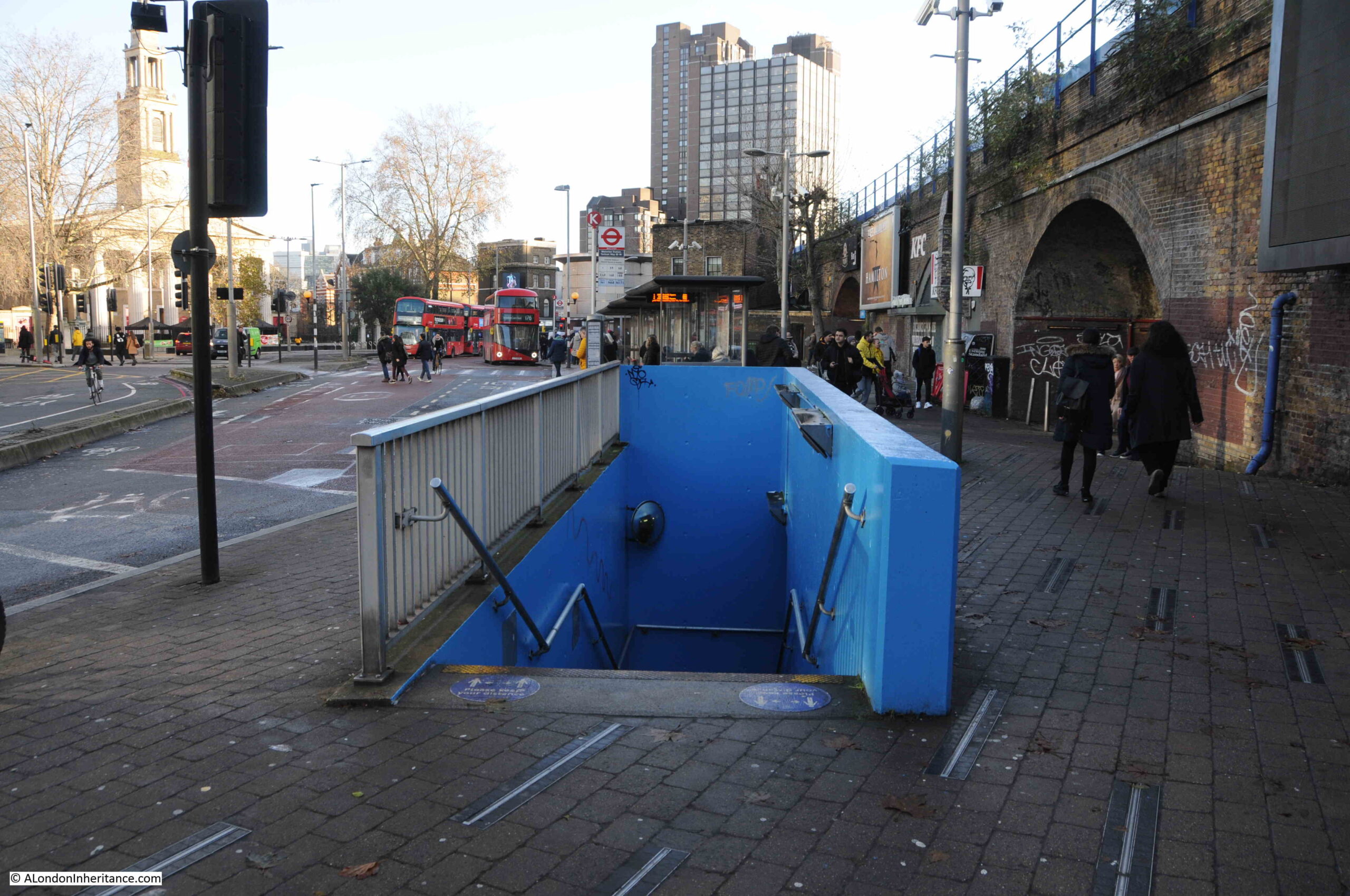
Tunnel to IMAX Theatre from Waterloo

I walked down the stairs, and met the smell that is familiar to such spaces:
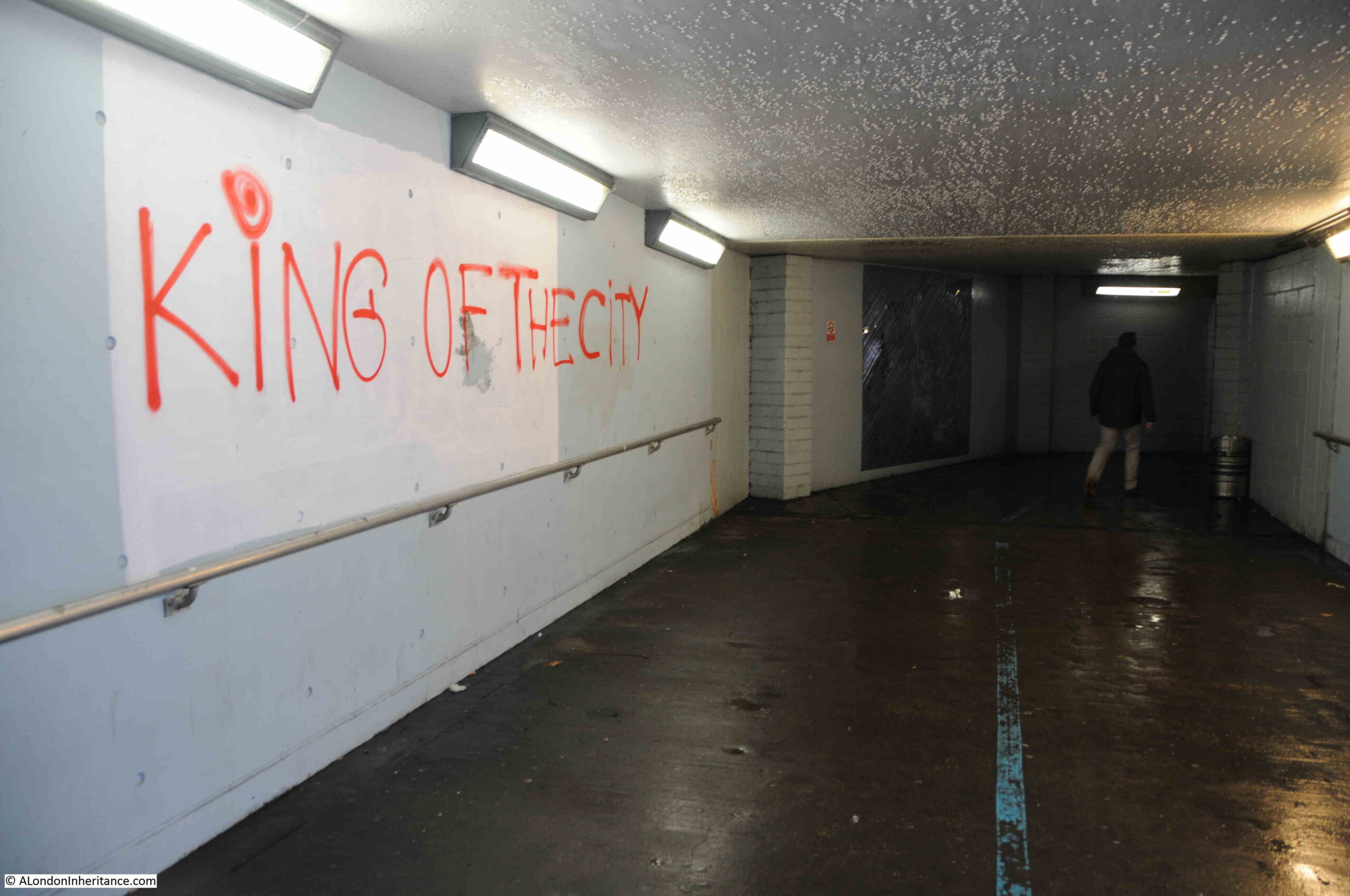
Tunnel under roundabout

Tunnel under the roundabout leading to the central space and the IMAX:
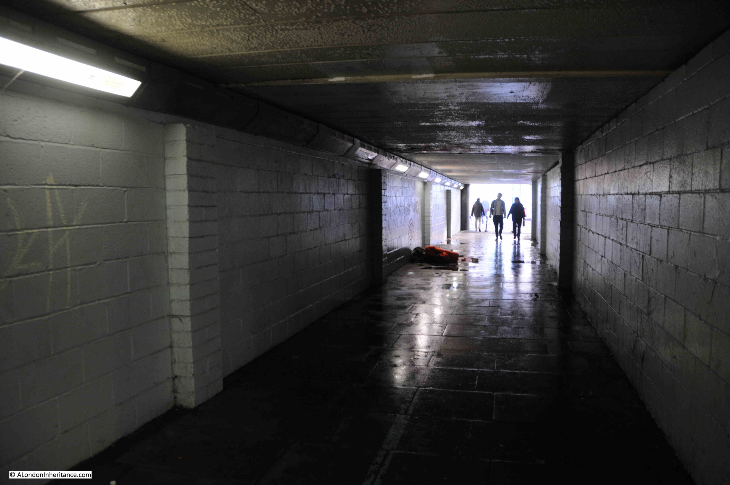
Tunnel under roundabout

Once in the central space of the roundabout, we can see the curving wall of the IMAX and the extensive planting that creates a rather unique space:

Area around the IMAX Theatre

More than 2000 plants were originally planted, comprising of honeysuckle, jasmine, wisteria, clematis, ivy, Boston ivy and Japanese vine. An automated watering system was installed, which looks to have worked well as the plants now look very established and have grown up from the side walls, across supporting cables and up to the sides of the IMAX:
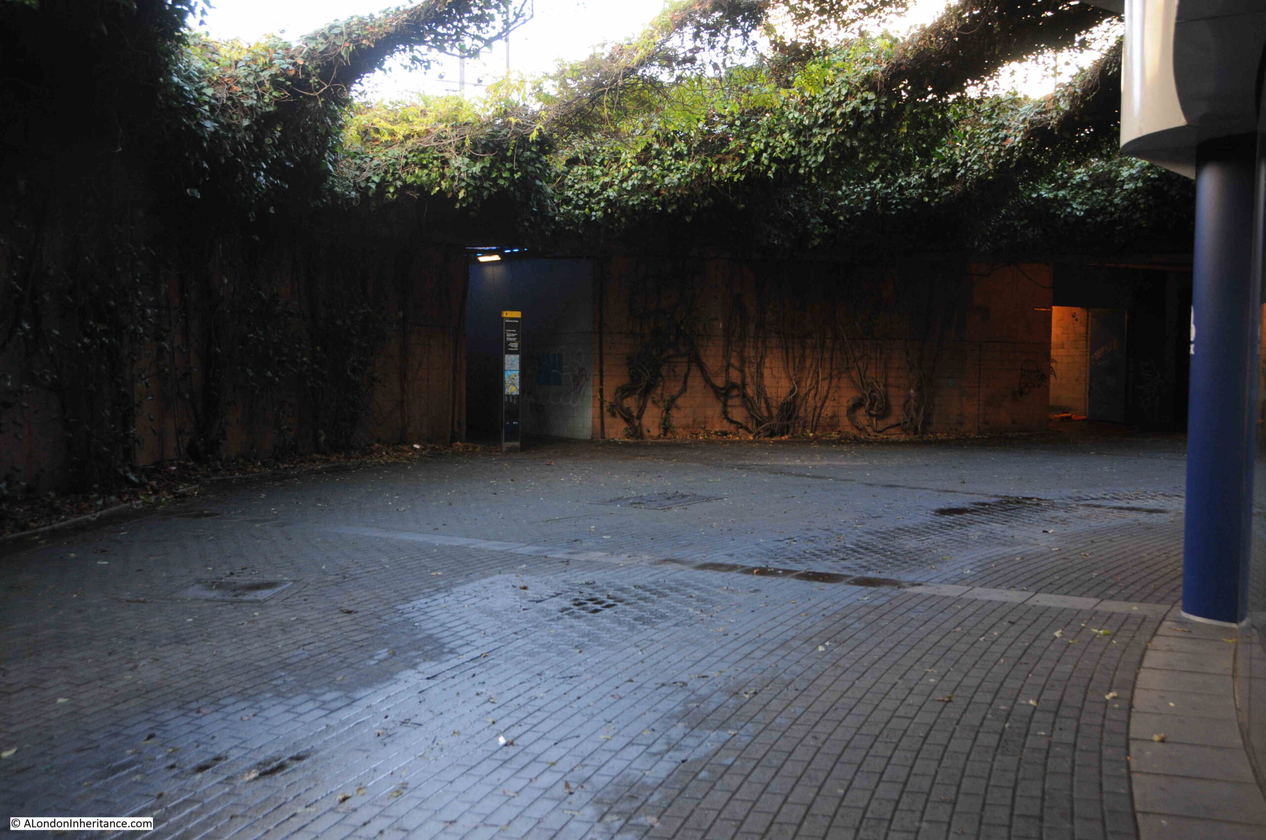
Area around the IMAX Theatre

There is a very tenuous link between the current centre of the roundabout, and an earlier use of the space, when it was occupied by Cuper’s Gardens, one of the many gardens and places of entertainment that were found on the south bank of the river in the 17th, 18th and early 19th centuries.

The following map is interesting as it shows the area in 1825, eight years after Waterloo Bridge was opened. It is titled “A Plan of Cuper’s Gardens with part of the Parish of Lambeth in the year 1746 showing also the site of the Waterloo Bridge Road and the new roads adjacent”.

The map helps define the exact location of Cuper’s Gardens as the church of St. John is also shown. The large roundabout (circled) now covers part of Cuper’s Gardens at the junction with Stamford Street:
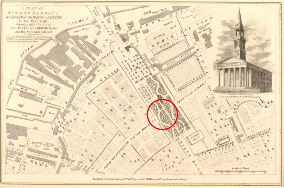
Old map of Cuper's Gardens and Waterloo Bridge

The “gardens” around the IMAX are very different today, and the whole area is rather a surreal space. The outer wall has been painted light brown, possibly to resemble the earth through which the space descends. Large, twisted trunks (which look like roots) of the presumably now over 20 years growth extend up along the walls, and the outer wall is occasionally cut through with the access tunnels to the streets above:
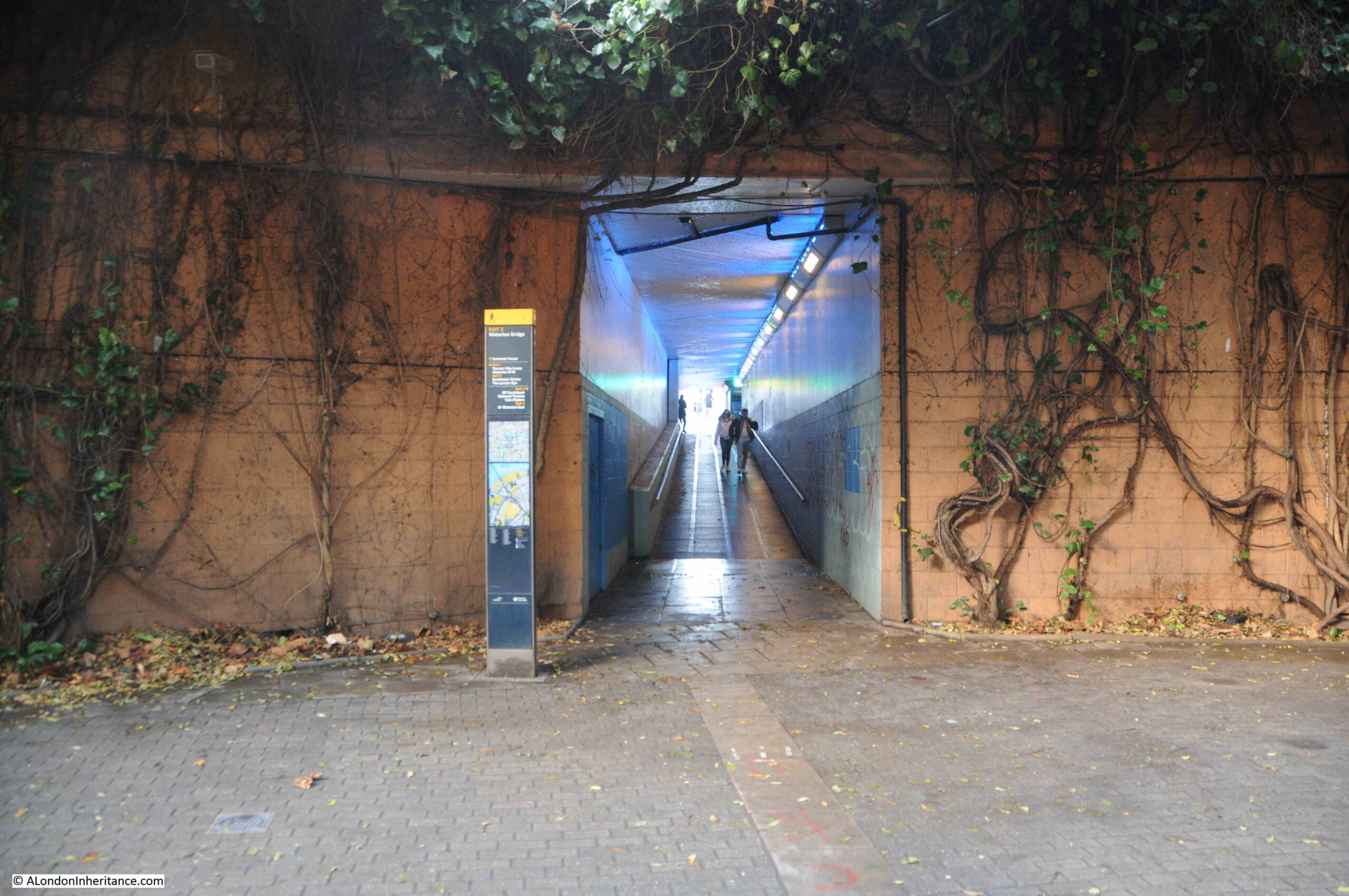
Tunnel leading up to Waterloo Bridge

The entrance to the IMAX Theatre:

IMAX Theatre

Looking up between the planting and the curved glass wall of the IMAX dominates the view:
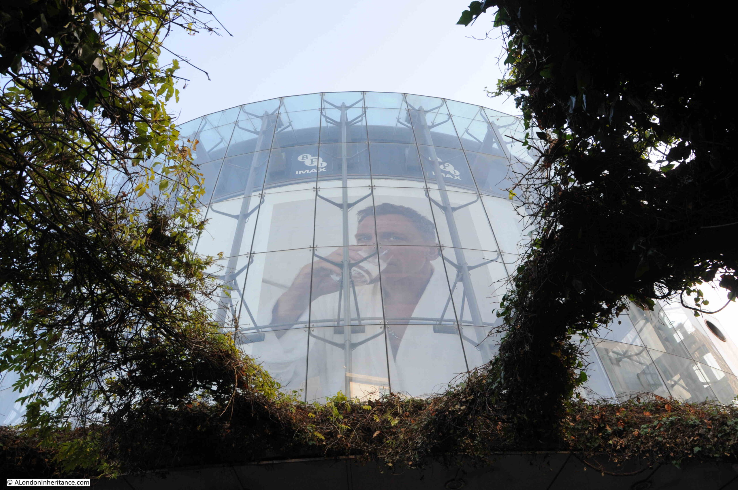
IMAX Theatre

When the IMAX was opened, as well as the central space surrounding the theatre, the walkways and tunnels leading up to the streets were cleaned, restored and painted, with many of the walls being painted blue, and some lighting being set into the walls.
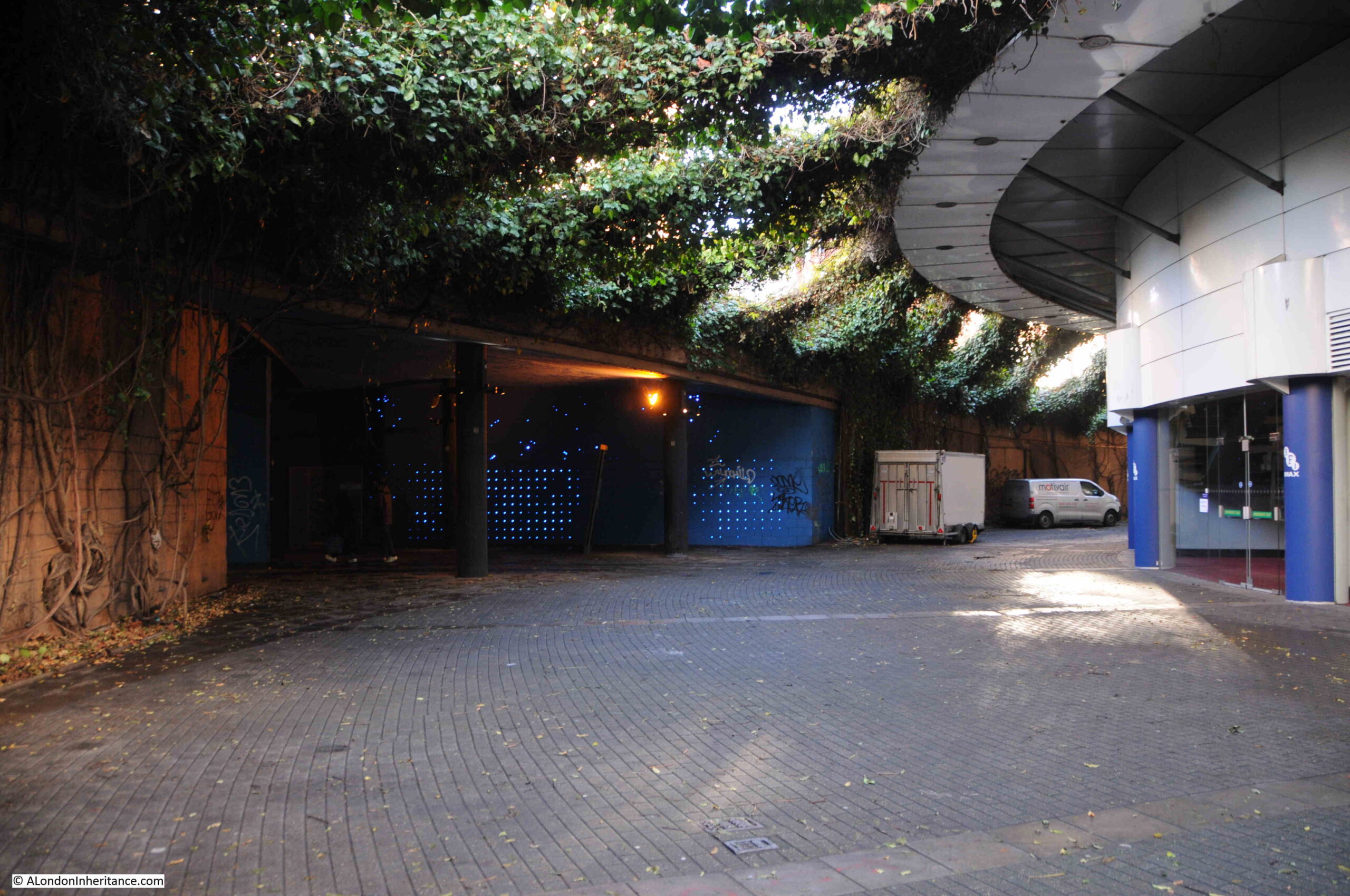
IMAX Theatre

You can see the effect that this was intended to create. The central space with substantial overhead plant growth, the surrounding earth coloured walls, covered in the trunks of the plants, with the walls being cut through by the blue painted walkways to the surrounding streets.

It all creates an intriguing and surreal space, appropriate for walks to the IMAX.

Service access tunnel and pedestrian walkway leading to Belvedere Road:
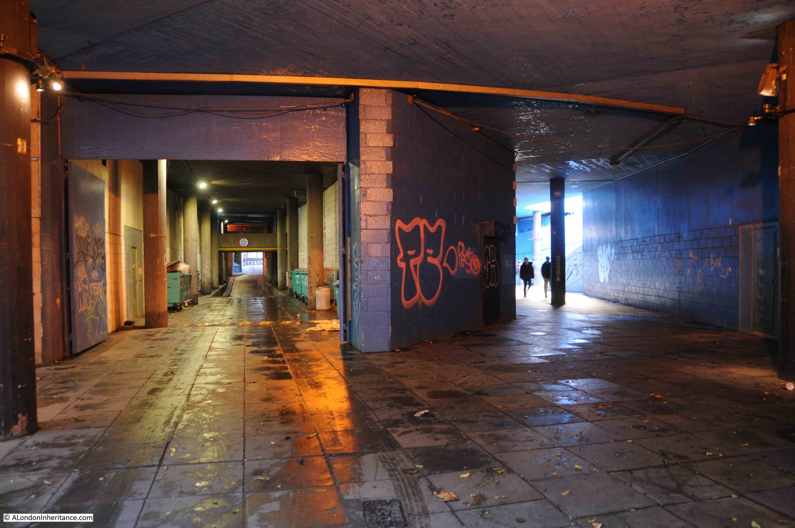
Tunnels under Waterloo Bridge

View up through the plants with the new tower blocks that have taken much of the old Shell Centre site:
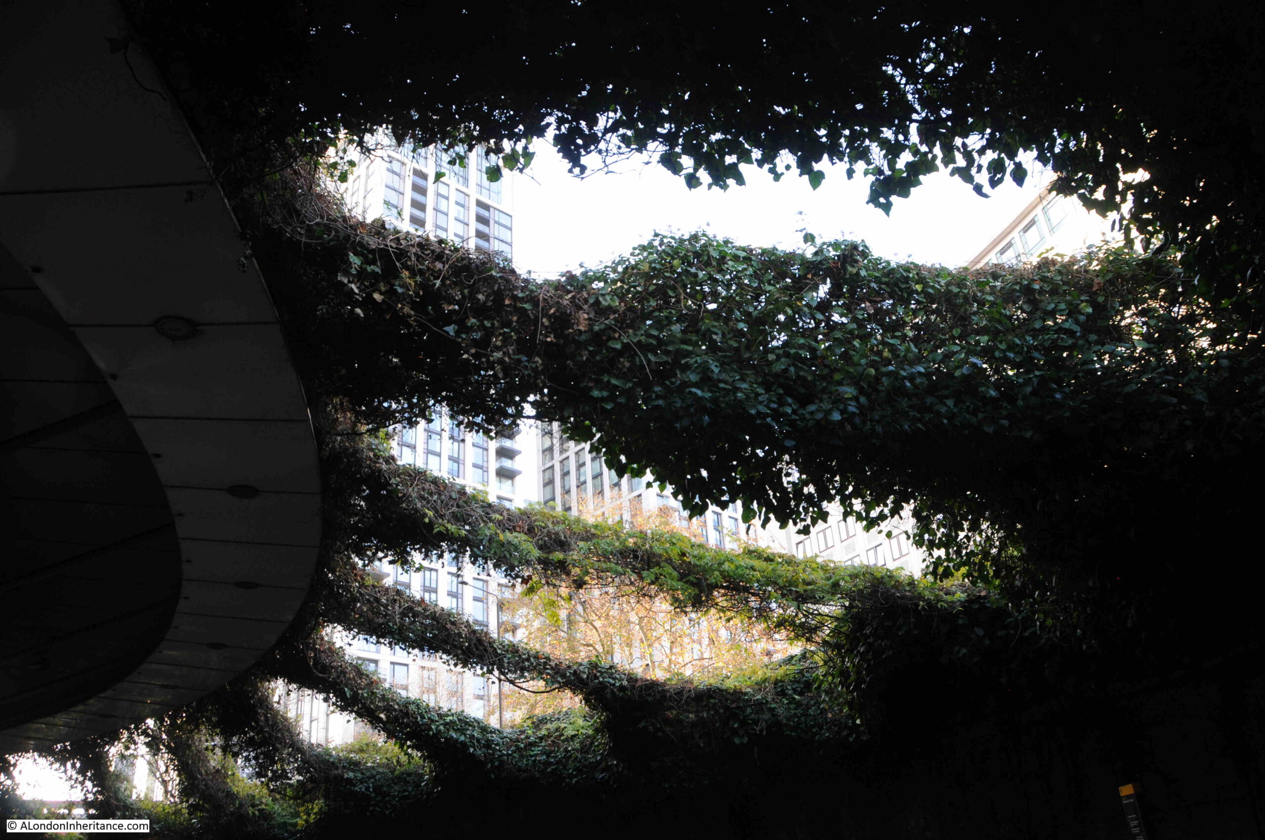
View from IMAX Theatre

Walking up to the surrounding streets, and it is clear what was intended, and the problems that result in the walkways not being that much of an inviting route to the IMAX. The following photo shows the walkway up to the western side of Waterloo Bridge:
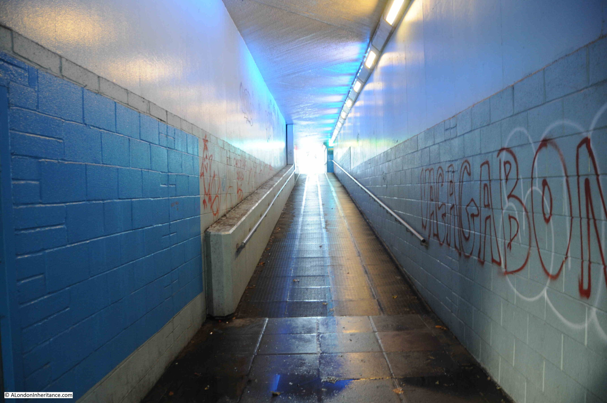
Access tunnel from IMAX to Waterloo Bridge

Many of the walls are covered in graffiti, including the main walkway, and the tunnels that connect the east and west walkways:
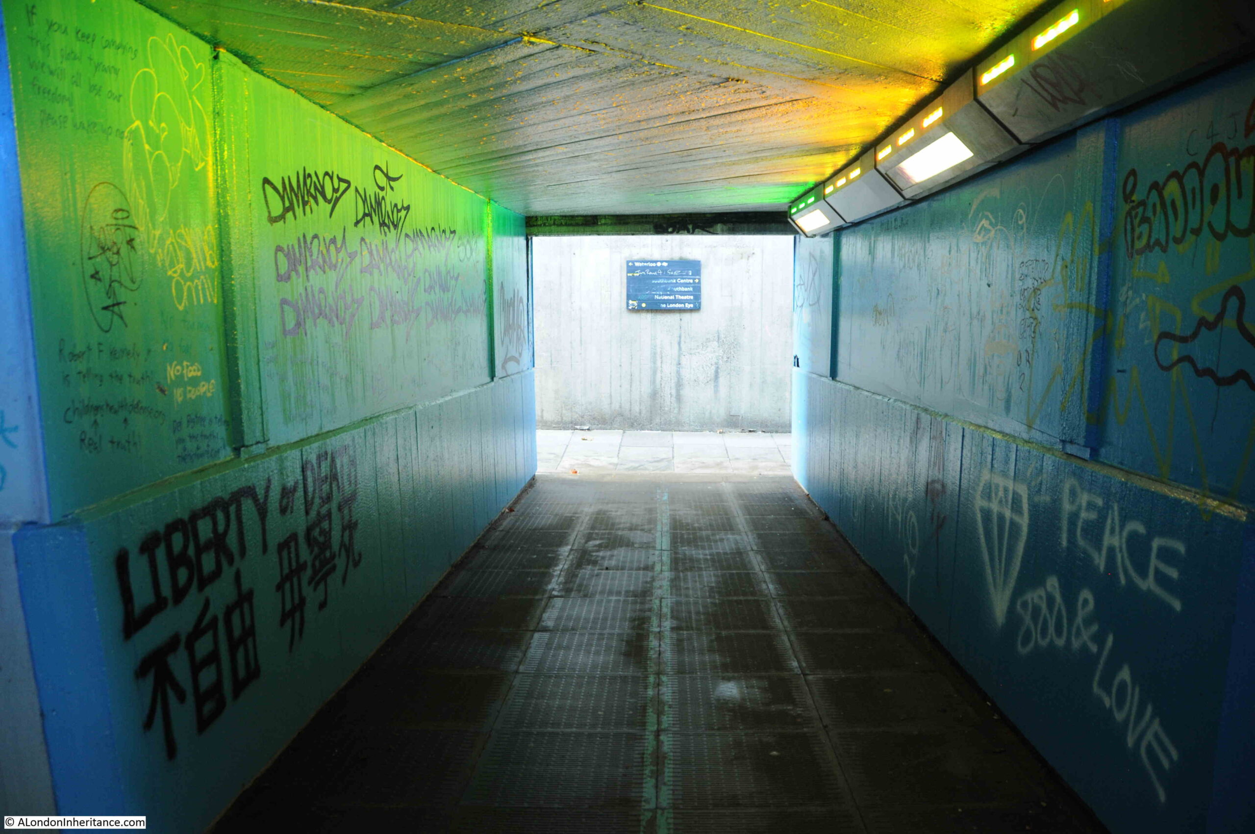
Under Waterloo Bridge

Many of these walkways and tunnels make really good subjects for photography. The blue walls, the grafitte, and the hidden destination of these tunnels adds to their mystery, however if you did not know the area, were taking children to the IMAX, and it was at night, they are not inviting, and there were very few people using them as I wandered around taking photos.
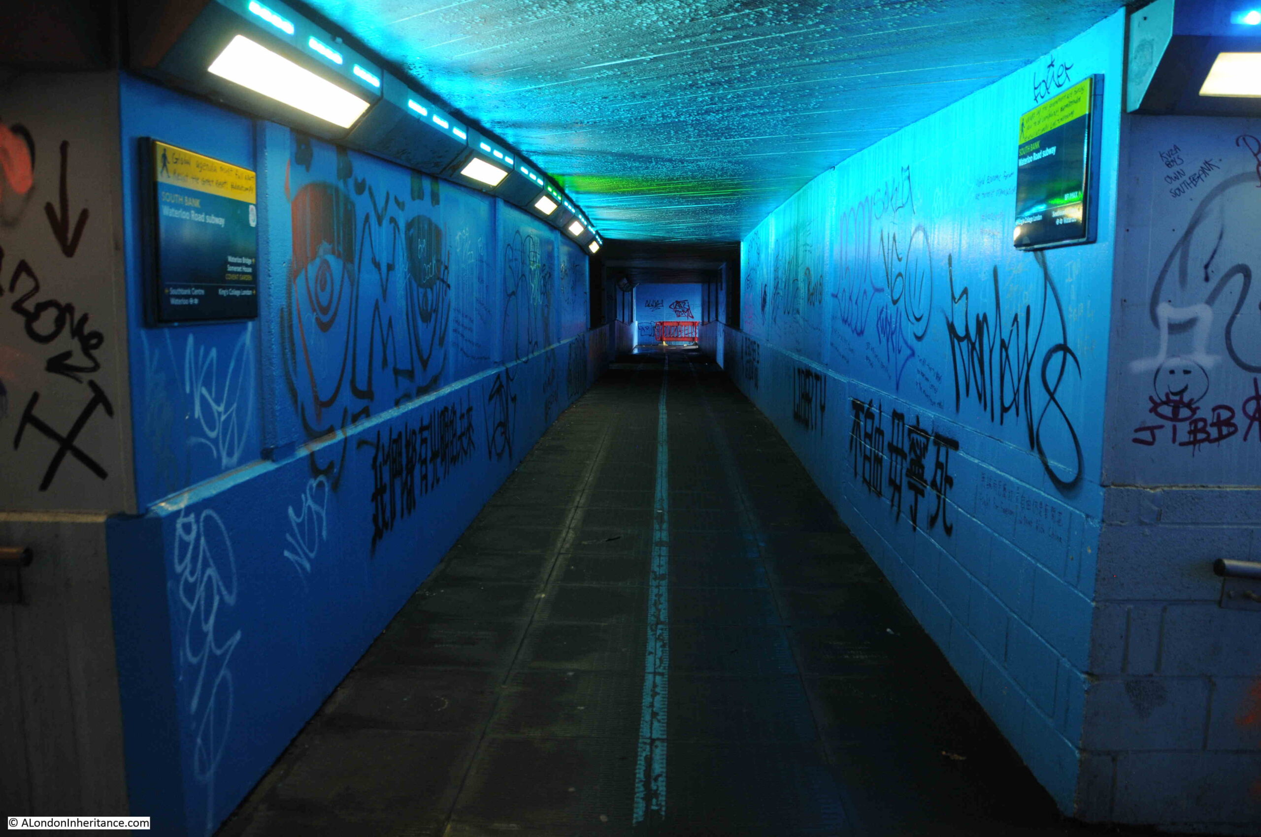
Under Waterloo bridge

Global conspiracy theories meet South Bank direction signs:
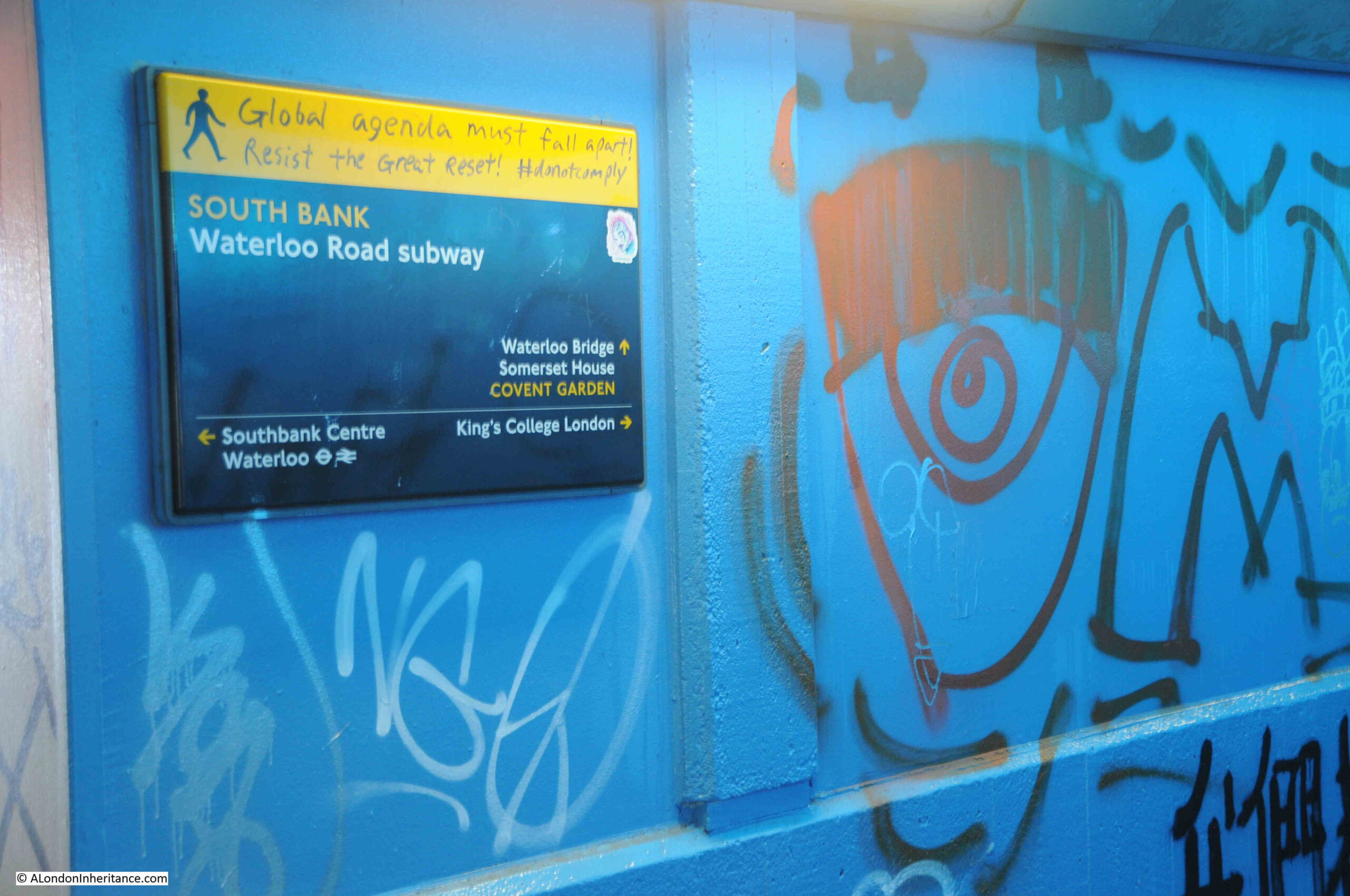
Under Waterloo Bridge

Looking back down the walkway from the western side of Waterloo Bridge:
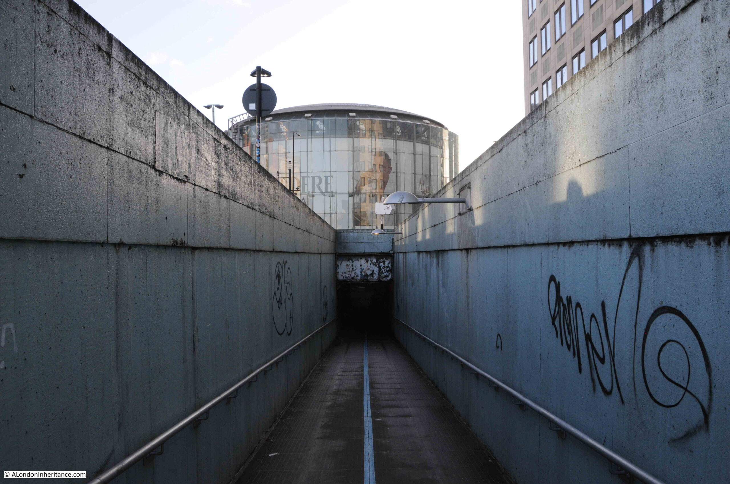
Underground tunnel leading up to Waterloo bridge with IMAX in background

Whilst the view of the IMAX in the above photo provides an indication of the destination of the walkway and the tunnel, it does not encourage you to walk down, there should be signs above the tunnel and better lighting in the entrance to the tunnel.

One of the walkways that crosses between the west and east sides of Waterloo Bridges crosses the service tunnel:
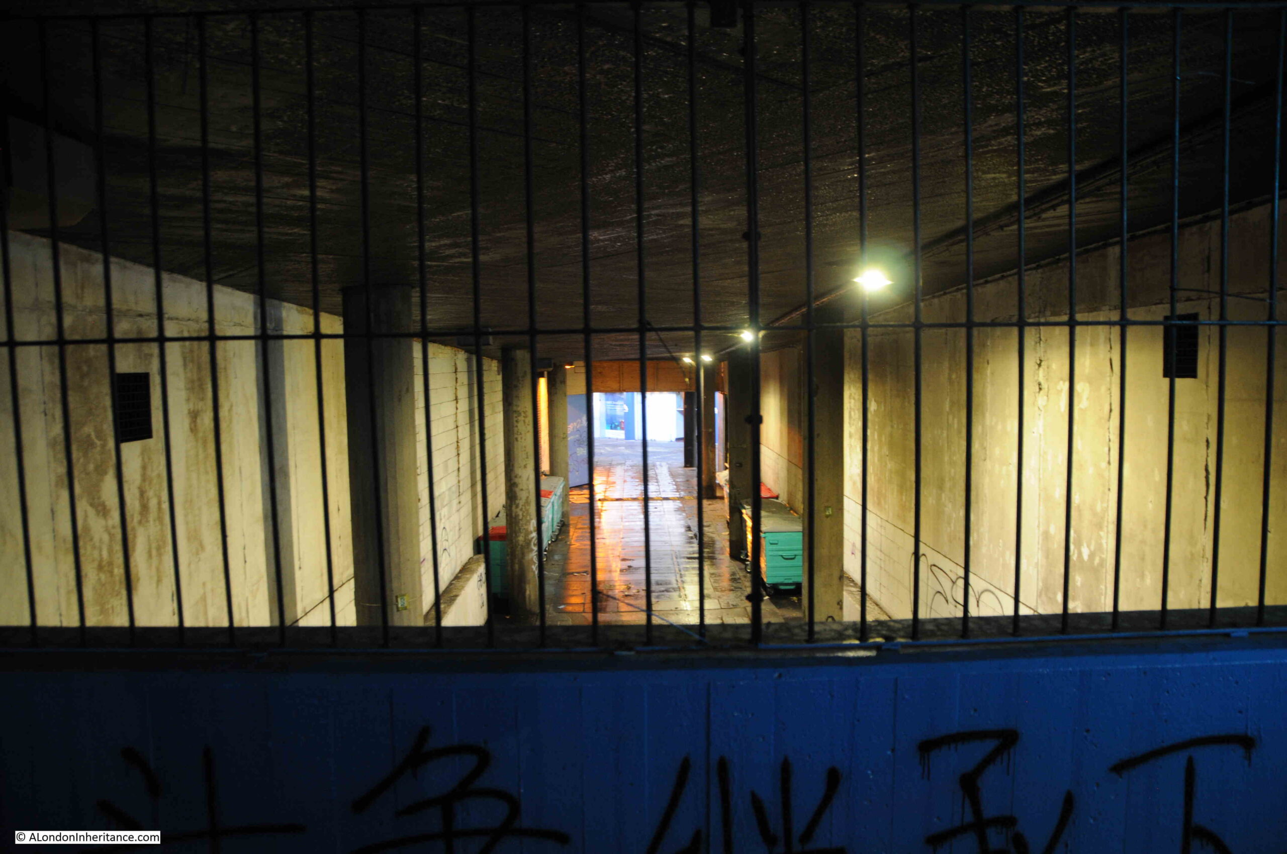
Under Waterloo Bridge

Walkway up to the eastern side of Waterloo Bridge:
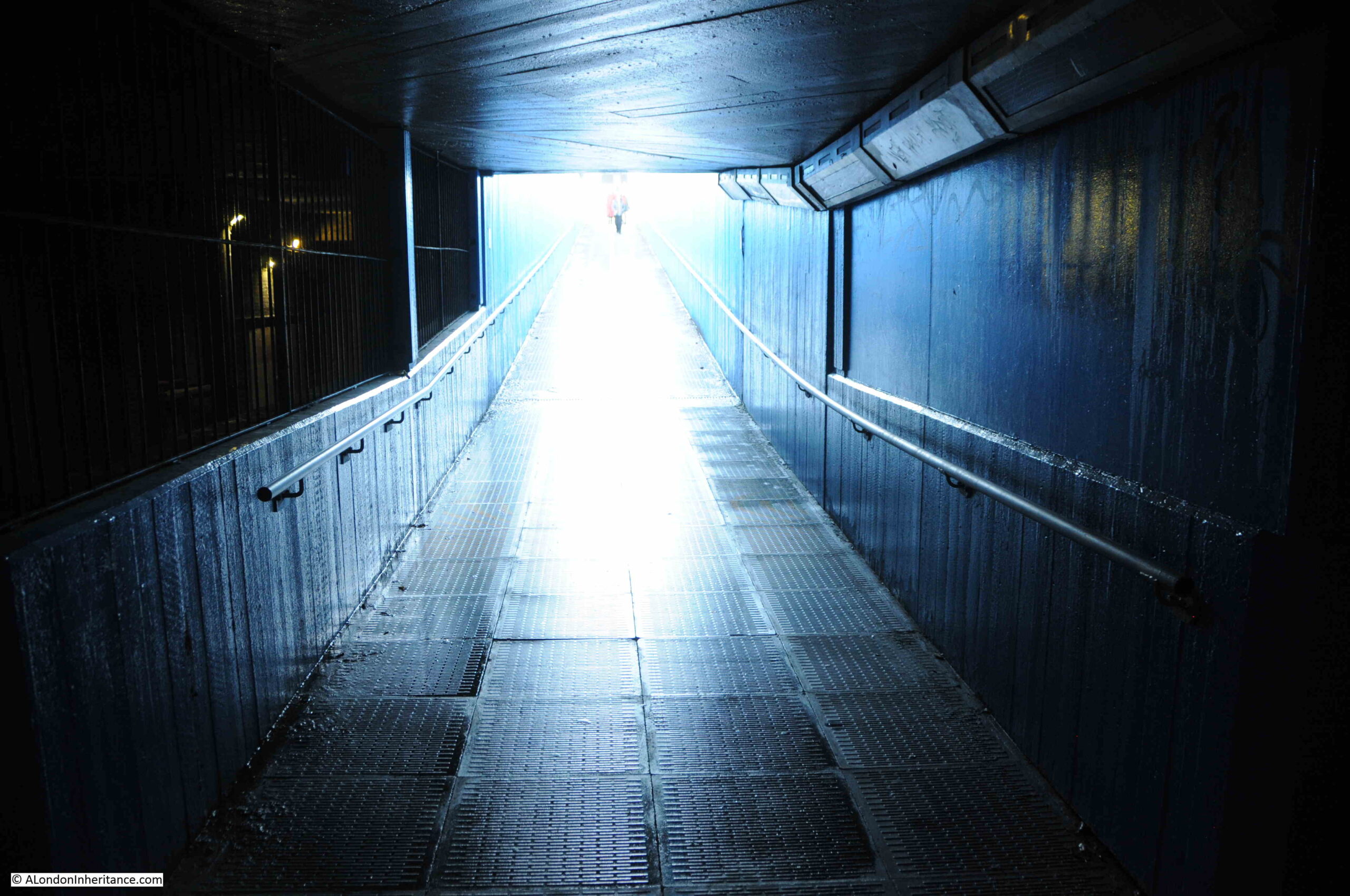
Underground tunnel leading up to Waterloo Bridge

This is the view from the eastern side of Waterloo Bridge, with the IMAX in the centre of the roundabout, and the blue painted entrance to the walkway and tunnels that lead to the IMAX:
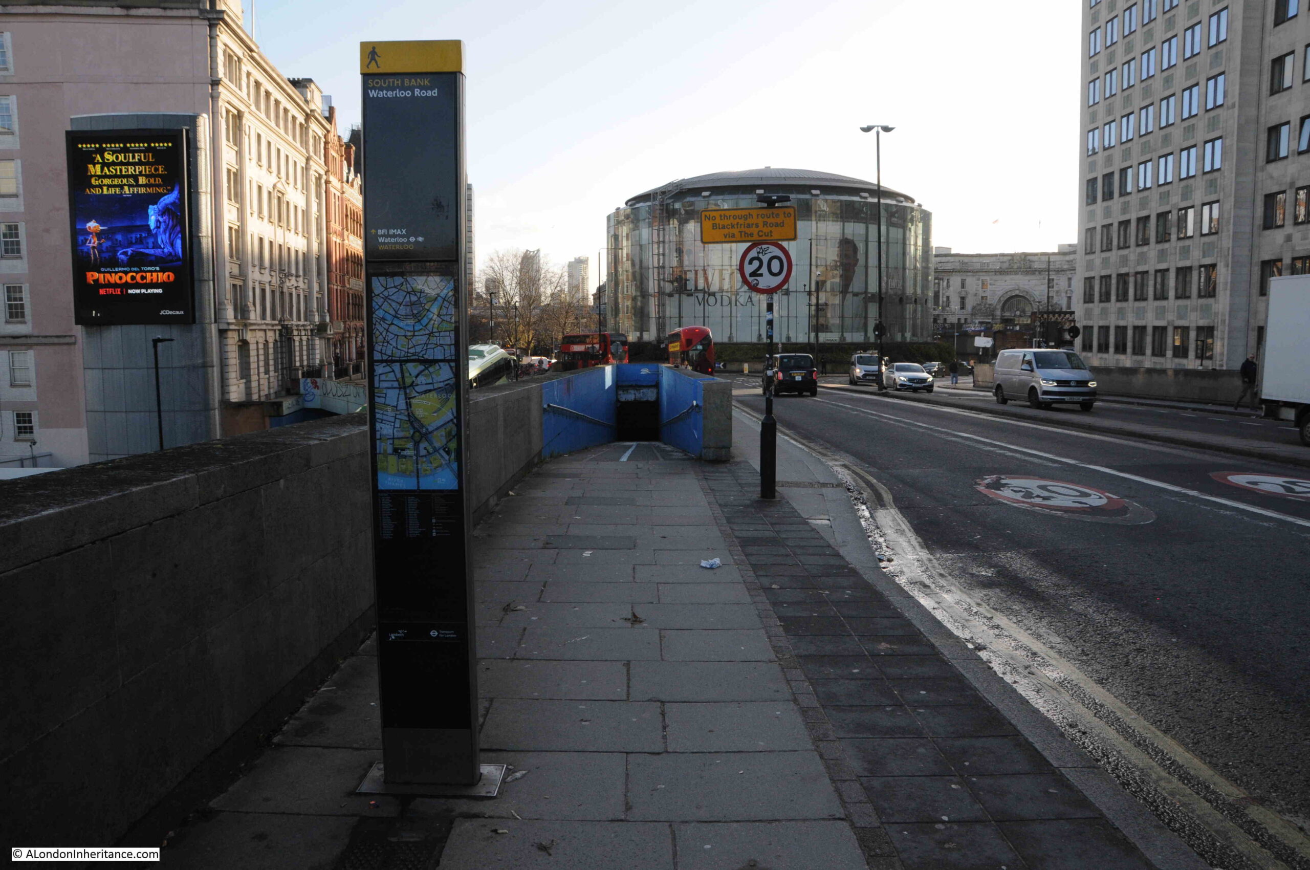
IMAX Theatre from Waterloo Bridge

The direction post to the left of the pavement does have a direction to the IMAX with an arrow pointing straight up, the implication being to head down the tunnel rather than walk on the pavement to the right. As with the other entrances, the tunnel does not offer an inviting prospect. No signage above the point where the walkway enters the tunnel and poor lighting at the entrance to the tunnel so it looks very dark and forbidding.

The Waterloo IMAX Theatre is a brilliant use of a difficult space, as well as being a building that has some technically clever ways of avoiding sound and vibrations. For example, the first floor is mounted on oil-damped spring bearings, and the walls inside the glass outer wall are 750mm thick. During construction, pile foundations were installed around the tunnels of the Waterloo and City line. A thick concrete slab was then built on top of the pilings to support the weight of the building above.

The IMAX apparently has the largest screen of any cinema in the UK and has the equipment to support normal film format as well as IMAX Digital and 3D.

A shame that whilst the intention with the tunnels and walkways is clear, and they could have provided a creative and innovative space, what appears to have been limited maintenance and care over the years has resulted in a rather poor experience when walking to the theatre at the centre.

TfL did have plans back in 2017 to transform the area and remove the roundabout, creating a surface level pedestrianised space up to the IMAX, however these plans appear to have been paused due to “the pandemic and current funding restraints”.

Given TfL’s current funding constraints, I suspect the roundabout will be there for some years to come.

More 1980 photos from the viewing gallery of Shell Centre are in this post.

alondoninheritance.com

Lower Marsh Market And L & N Cohen

For this week’s post, I am in Lower Marsh, just to the south of Waterloo Station, however before getting into the post, can I say a big thanks for all the comments to last week’s post. Within a few hours on Sunday morning, your comments provided:

  • The source of the name Flockton – Webster Flockton, who had a tar works in Spa Road, Bermondsey
  • It appears there was nothing sinister with Violet Rose Dicker’s disappearance, she probably ran away with her future husband
  • The correct location of the photograph – Bevington Street

It is really good to have another of my father’s photos correctly identified, I will never know why he labelled it as Flockton Street, I will check the photos again to see if there is one of Flockton Street as perhaps the wrong photo was labelled. I will also take a walk to Bevington Street to take a photo in the right location.

There is no such mystery with today’s location. I worked around Waterloo for 10 years between 1979 and 1989, and one of the lunchtime walking routes was along Lower Marsh, a street lined with shops and a busy market occupying the length of the street.

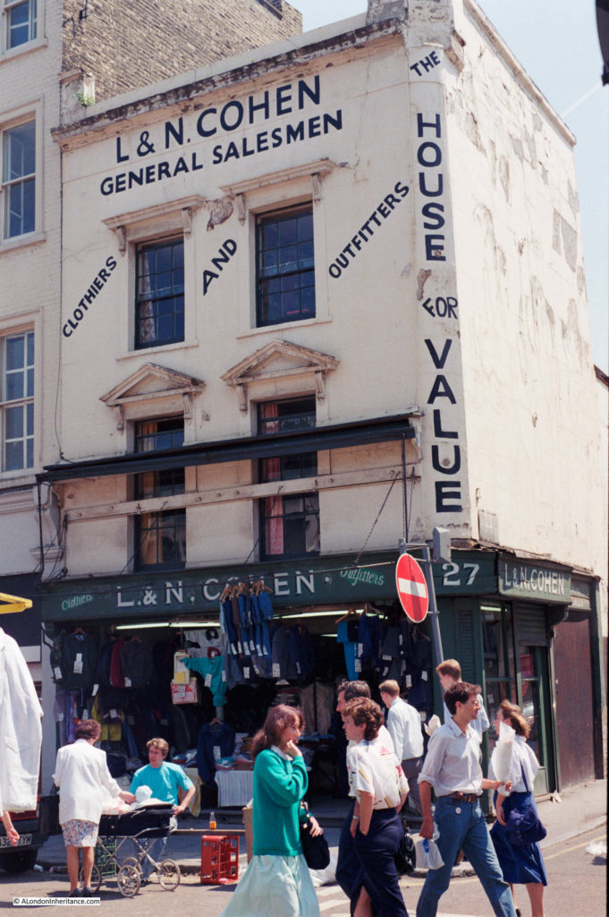
This is the shop of L&N Cohen at 27 Lower Marsh on the corner of Frazier Street photographed in 1986:

Lower Marsh

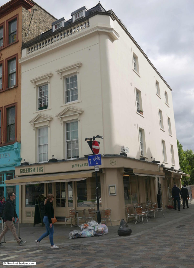
This is the same building today:

Lower Marsh

The two photos provide a summary of the changes in the area, as can also be seen across so much of London. The building is no longer the “House for Value” and is now an independent local supermarket selling artisan bread.

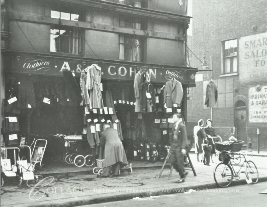
I assume the same Cohen family had been running a clothes shop in Lower Marsh for many years. I found the following photo of the same shop in the LMA Collage archive. The photo is dated 1950.

Lower Marsh

Image credit: London Metropolitan Archives, City of London: catalogue ref: SC_PHL_02_0942_80_3901

The initials changed between the 1950 and 1986 photos, so I assume ownership of the shop moved to later generations of the Cohen family. It is interesting that the same structures can be seen across the front of the first floor of the building, running across the windows. I could not work out what these were for, whether a very large awning, fixing for signage that was once in place, or strengthening of the building wall. What ever it was, it has long gone and the building today has been considerably renovated and extended along Frazier Street.

Lower Marsh runs in the shadow of Waterloo Station. The name hints at what the land in the area was like before the developments between the street and the river. When I worked in the area the street was always known as the Cut rather than Lower Marsh. However the street today named The Cut runs to the east of Waterloo Road.

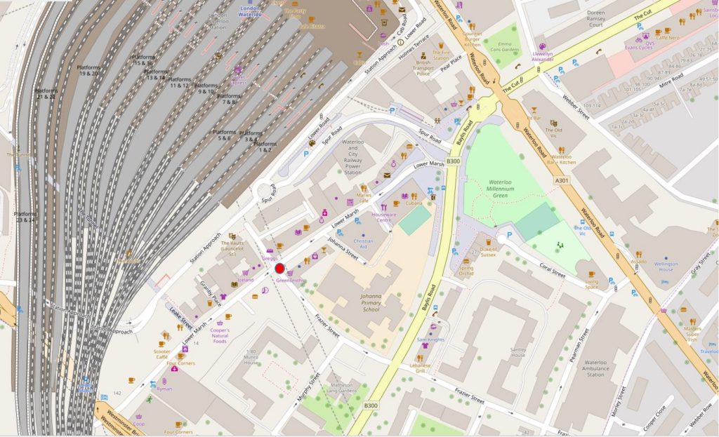
The following map extract shows the location of the building (the red dot, just to the lower left of centre), Lower Marsh runs from lower left to upper right. Waterloo Station dominates the area to the north. Waterloo Road is the orange road on the right, with The Cut leading off Waterloo Road to the top right corner.

Lower Marsh

Map  © OpenStreetMap contributors. 

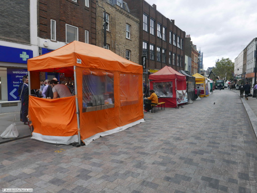
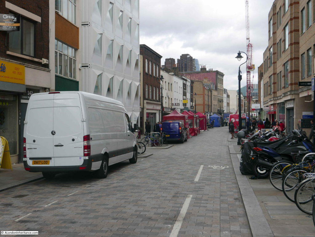
When I work in the area, the Lower Marsh market was always busy with the street lined with stalls selling all manner of typical market goods, however today, the street appears much quieter with nearly all the stalls selling food. I have not walked along here for a few years, so not sure if this was a typical day, however it is a very different market to that of the 1980s.

Lower Marsh

The Lower Marsh market has a long history, but trading was not always peaceful. An article in the Illustrated London News on the 27th January 1872 shows some of the problems with attempts at Sunday trading:

“SUNDAY TRADING IN THE NEW-CUT: The Lower Marsh, Lambeth, which is popularly called ‘the New-cut’, has long been the regular weekly haunt of a numerous assembly of costermongers, dealers in fish, rabbits, and pork, sellers of cheap hosiery, pottery, hardware, trinkets and toys, who have been permitted to set up their little stalls, or to place their barrows and baskets at the sides of the wide street. This trade has gone on every Sunday at eight o’clock in the morning to one in the afternoon, while most of the neighbouring shopkeepers were obliged in self-defence, to have their business open at the same time.

Two or three weeks ago, the vestry board of St. Mary’s, Lambeth, passed a resolution to the effect that printed notices should be posted through the parish, cautioning all persons in the habit of exposing goods for sale that such a practice would not in future be allowed on Sunday mornings, and that any person so found offending would be summoned before the magistrate on the charge of creating an obstruction, the penalty on conviction being 40s. It was also resolved that the inspectors of nuisances for the parish should be employed to see that the terms of the notice were strictly enforced. The police authorities had declined to interfere, unless the order were to be applied to shopkeepers as well as to costermongers; but a double force of constables was placed on duty to prevent any breach of the peace.

On Sunday week, the trade began at the usual hour, but at nine o’clock, six of the Lambeth nuisance inspectors, in uniform, appeared upon the scene, and, accompanied by police-constables and followed by a large body of roughs, yelling and hooting, visited the stall-keepers in succession, ordering each to remove the stall, barrow or basket at once. If they merely removed to other places, they were followed by an inspector, who took down the name and address of the offending dealer, informing him he would be summoned.

As a rule, the officers, while performing their disagreeable duty, were treated with civility; but were very generally told that, if prevented selling their goods as usual, the costermongers would be compelled to throw themselves upon the parish, as they mainly depended for their scanty living upon the profits of the Sunday morning sales, when they did more business than on all the other days of the week.”

The articles goes on to state that the issue was discussed further in a number of vestry meetings, with a considerable number of shop-keepers, rate payers, shop assistants and costermongers urging the vestry that regulation rather than prohibition was required.

The vestry agreed on a compromise that allowed the market to go ahead on a Sunday morning, providing the stalls were removed by half-past ten o’clock, before church time.

The article finishes with a sentence that illustrates the working conditions that constrained the lives of so many of the working class:

“It is said that many of the working-class families in Lambeth cannot get their needful purchases for Sunday on Saturday night, because they work late on Saturday and do not receive their wages till the evening.”

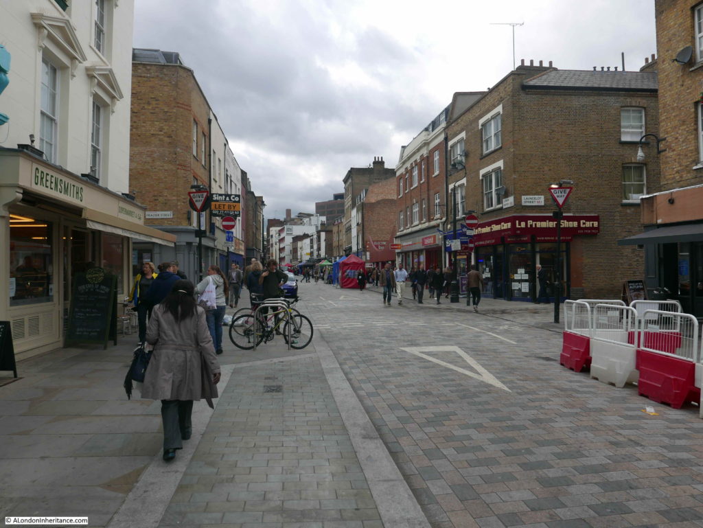
Lower Marsh today, looking west with the old Cohen shop immediately on the left:Lower Marsh

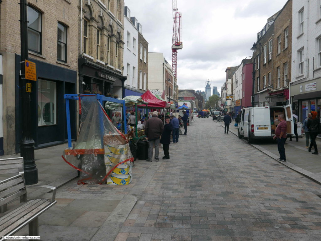
Another view along Lower Marsh:

Lower Marsh

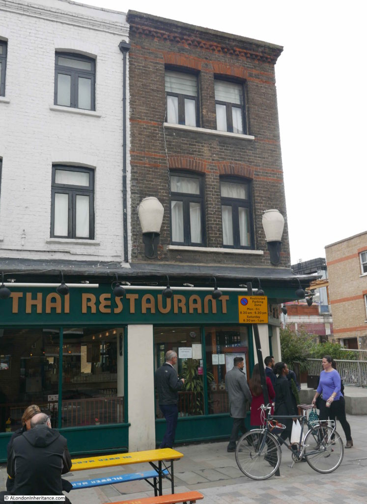
There are still many interesting 19th century buildings along Lower Marsh. On the front of one building at 127 Lower Marsh, there are two large urns on the either side of the first floor windows.

Lower Marsh

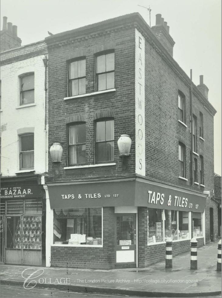
Apparently these are Tuscan oil jars and were often found on the facades of former oil shops. The ground floor of the building today is occupied by a Thai Restaurant, however in 1972 it was occupied by “Taps & Tiles”:

Lower Marsh

Image credit: London Metropolitan Archives, City of London: catalogue ref: SC_PHL_01_251_72_1090A

The Eastwood’s sign on the side of the building in 1972 has disappeared. I have not been able to find out if this was the name of a possible oil shop, or some other business on the premises.

Lower Marsh from Westminster Bridge Road end:

Lower Marsh

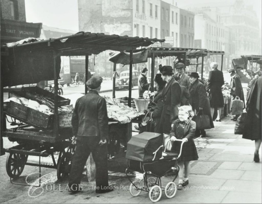
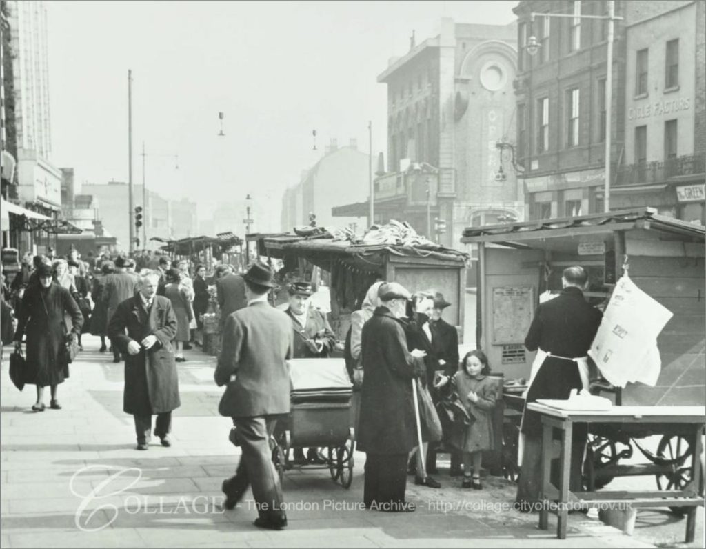
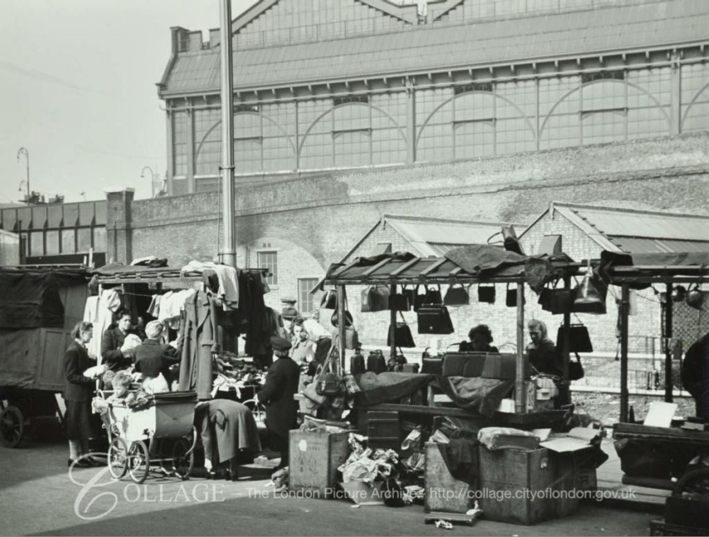
The London metropolitan Archives, Collage collection has a number of photos of the Lower Marsh market over the years, the following are a sample.

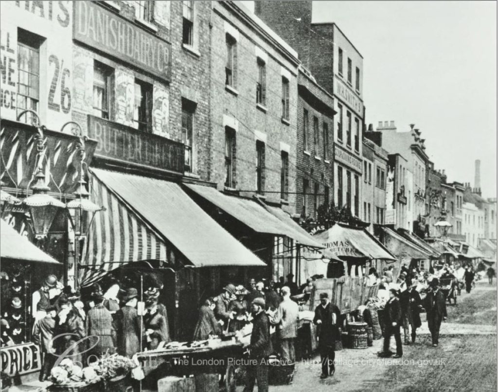
The first is one of the earliest I could find and is dated 1896, only 24 years after the Sunday trading issues detailed earlier in the post.

Lower Marsh

Image credit: London Metropolitan Archives, City of London: catalogue ref: SC_PHL_01_251_77_1062

This is from a time when the majority of shops had awnings and frequently large advertising boards across the facade, as can be seen with the Danish Dairy Company in the above photo. I wonder if the remains of these fixtures could still be seen across the front of Cohen’s shop in 1986.

The following photo is from 1950. The text that goes with this photo states that “the market stretched from Blackfriars to Vauxhall”.

Lower Marsh

Image credit: London Metropolitan Archives, City of London: catalogue ref: SC_PHL_02_0942_90_3903

I have not been able to find any evidence that the market stretched all the way from Blackfriars to Vauxhall – this would have been a considerable distance. It may have been that, as described in the 1872 Illustrated London News article, costermongers and traders could have sold from baskets and stalls anywhere along the roads south of the river from Blackfriars to Vauxhall, rather than a single, organised market. Street trading was much more haphazard before the 20th century.

This photo is again from 1950, and is at the eastern end of Lambeth Marsh, close to the junction with Waterloo Bridge Road.

Lower Marsh

Image credit: London Metropolitan Archives, City of London: catalogue ref: SC_PHL_02_0942_90_3903

This final photo from the Collage archive is also towards the Waterloo Bridge Road end of Lambeth Marsh. The photo is from 1950 and shows Waterloo Station in the background.

Lower Marsh

Image credit: London Metropolitan Archives, City of London: catalogue ref: SC_PHL_01_251_80_3912

I hope the early Friday afternoon that I walked down Lambeth Marsh was not a normal market day, it was very quiet and with considerably less variety than the market of the 1980s, however demographics change and I suspect the market today reflects local demand as it is, rather than as it was.

These changes between 1986 and 2018 can be clearly seen in the changes to 27 Lower Marsh.

alondoninheritance.com

The Waterloo Air Terminal

Following the closure of the Festival of Britain, the Southbank site was swiftly cleared apart from the Royal Festival Hall which was always planned as a permanent facility unlike the rest of the Festival buildings.

One part of the Festival site did remain for a few more years and provided support to the rapidly growing Heathrow Airport to the west. In the early days of Heathrow, transport options to the airport were very limited. The Bath Road ran alongside which provided a route for cars / taxis and there were some limited bus services to the airport, however the extension of Underground and Rail services were still many years in the future. The airlines operating out of Heathrow needed to provide passengers for this new and rapidly growing form of transport with easy access to the airport from the centre of London.

One of the main entrances to the Festival of Britain was on York Road facing the main entrance of Waterloo Station. This entrance also had a dedicated entry / exit to the Underground system at Waterloo with the escalators diving underneath York Road to reach the tunnels to the Northern and Bakerloo lines.

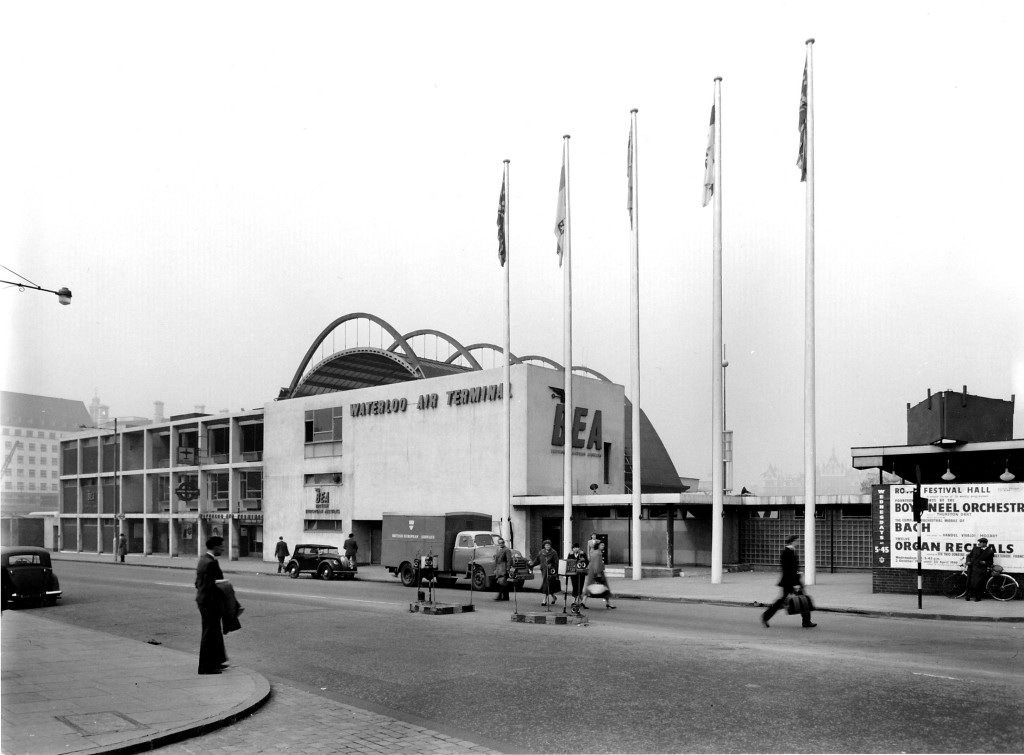
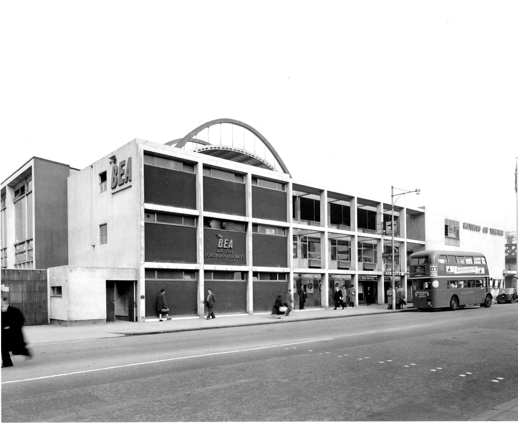
The Festival of Britain was held during the summer of 1951, and two years after closure, on the 27th March 1953 the York Road entrance to the site re-opened as the BEA Waterloo Air Terminal serving passengers on BEA flights and other airlines operating out of Heathrow for which BEA acted as a handler. (BEA or British European Airways was formed in 1946 and merged with BOAC, the British Overseas Airways Corporation in 1974 to become British Airways)

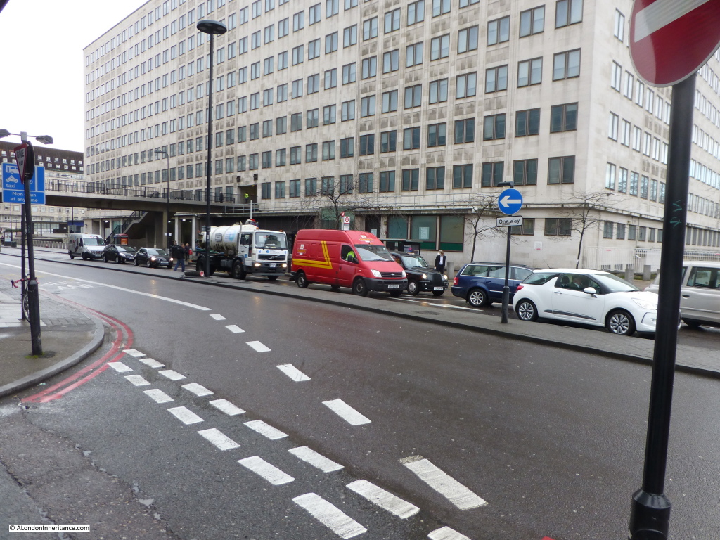
The following photo of the Waterloo Air Terminal was taken in York Road from the end of the access road to the main entrance of Waterloo Station.

Waterloo terminal 1

A British European Airways truck is parked outside the building, a poster advertising events at the Royal festival Hall is on the right. County Hall, the home of what was the London County Council can be seen to the left.

My 2015 photo taken on a damp January morning from roughly the same position is shown in the photo below:

Waterloo terminal 4

In the original photo, the London Underground sign can be seen on one of the columns of the building to the left. In the 2015 photo the underground station is just under the footbridge as it enters the office block. The station entrance and the escalator tunnels down to the main underground stations have not changed in the intervening years which provides a perfect reference point in the old and new photos.

Walk further along York Road towards County Hall and we can look back and get another view of the Air Terminal and the Underground Station entrance can be seen just behind the bus.

Waterloo terminal 3

The Waterloo Air Terminal was in use between 1953 and 1957 and provided check-in facilities, luggage drop-off (which would be collected and taken separately to Heathrow) and a regular coach / bus service provided passenger transport to the airport.

For a short period starting on the 25th July 1955 and ending on the 31st May 1956, a trial helicopter service was run between the Waterloo Air Terminal and Heathrow using the space remaining from the Festival of Britain and a Westland-Sikorsky S55 helicopter, however the high cost of the tickets and the limited capacity of the helicopter did not justify running the service and the coach / bus services remained as the primary means of transport. The helicopter service carried 3,822 revenue paying customers during operation.

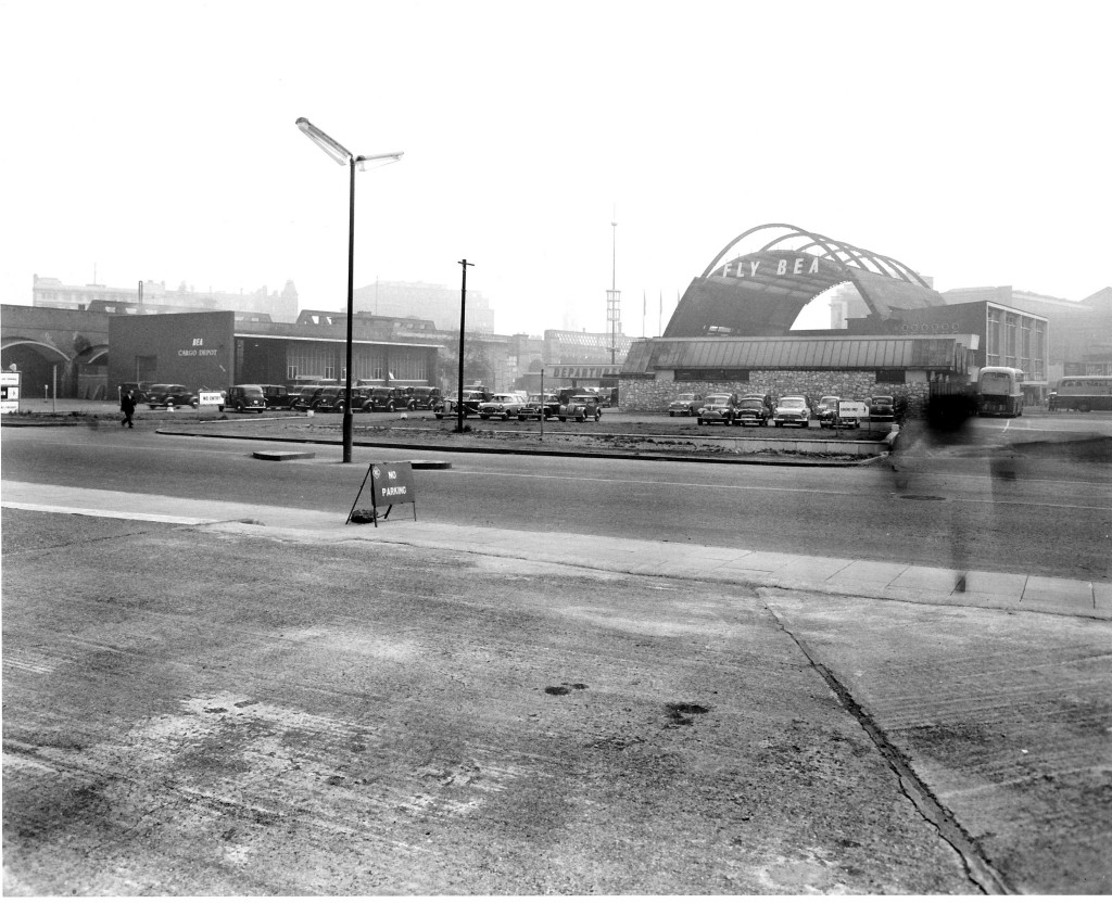
Walk to the traffic lights where Chicheley Street meets York Road, walk down Chicheley Street and cross over to the Jubilee Gardens where we can look back towards York Road. This was the rear of the Waterloo Air Terminal:

Waterloo terminal 2

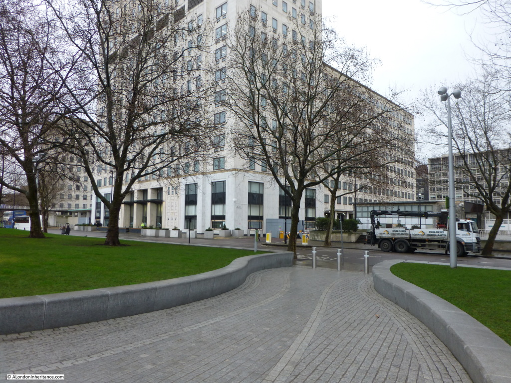
The main terminal is underneath the arches. The building on the left is the BEA Cargo Depot. The coach park is on the right. To the left can be seen the railway viaduct which runs from Hungerford Bridge into Waterloo East. Roughly the same scene in 2015:

Waterloo terminal 5A much larger Air Terminal was constructed by BEA in Cromwell Road in 1957 and the services provided by the Waterloo Air terminal were relocated to Cromwell Road allowing the closure of the site and the redevelopment of the area.

The building that is now located on the site of the Waterloo Air Terminal is Shell Centre, built as the UK Head Offices of the Royal Dutch / Shell group of companies and was constructed on the site shortly after the closure of the air terminal from 1957 to 1962.

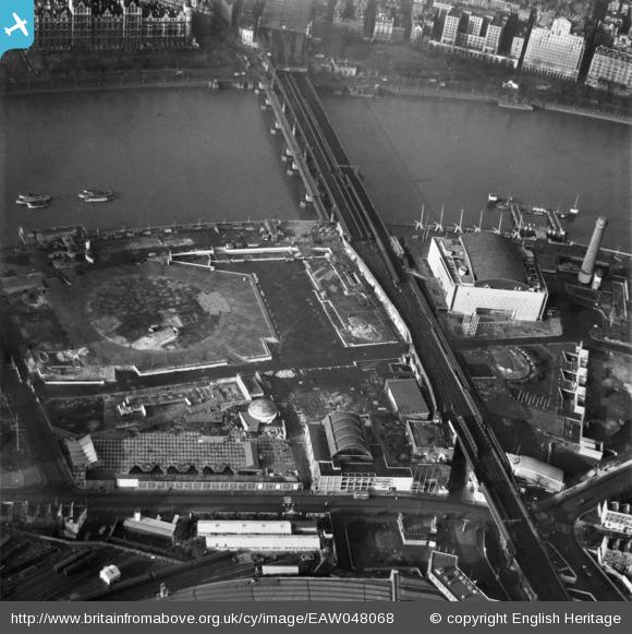
Aerofilms took a superb photo of the site after closure of the Festival of Britain and removal of many of the buildings including the central Dome of Discovery, the outline of which can be seen in the centre left of the photo below. It was the large area occupied by the Dome of Discovery that was used for the helicopter service.
EAW048068

The Waterloo Air Terminal can be seen in the lower centre of the photo with York Road running left to right. The curved roof of Waterloo Station can just be seen at the bottom of the photo. The Royal Festival Hall is clearly seen and to the right is the Shot Tower which would soon be demolished.

The Waterloo Air Terminal was only open for 4 years, but during those years it played a small, but significant role in supporting the development of Heathrow. A clear sign in the immediate post-war years of how Heathrow would become such a key part of London’s transport infrastructure.

alondoninheritance.com