Tag Archives: Operation Market Garden

Arnhem Oosterbeek War Cemetery

Today, Remembrance Sunday, the focus will quite rightly be on the 100 year anniversary of the end of the First World War. 1918 was the end of what was hoped to be the “war to end all wars”, however in just over 20 years time, the world would descend into yet another global conflict.

The Second World War would add to the cemeteries created for the victims of the first war and during my visit to the Netherlands this year I went to the Arnhem Oosterbeek War Cemetery, a place that my father had already photographed during his visit to the Netherlands in 1952, not long after the cemetery had been created for the dead of Operation Market Garden and other  conflict in this part of the Netherlands.

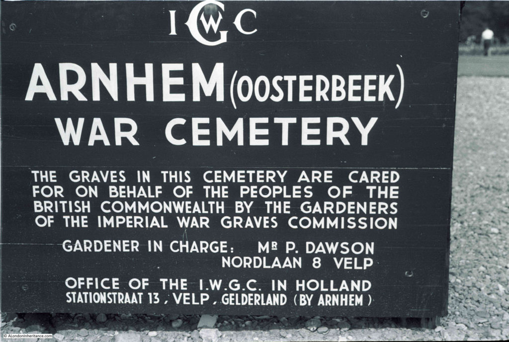
In 1952, this was the sign at the entrance to the cemetery:

Arnhem Oosterbeek War Cemetery

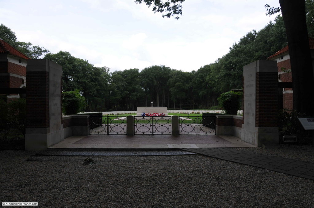
The entrance to the cemetery today:

Arnhem Oosterbeek War Cemetery

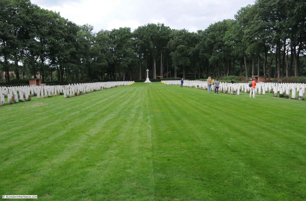
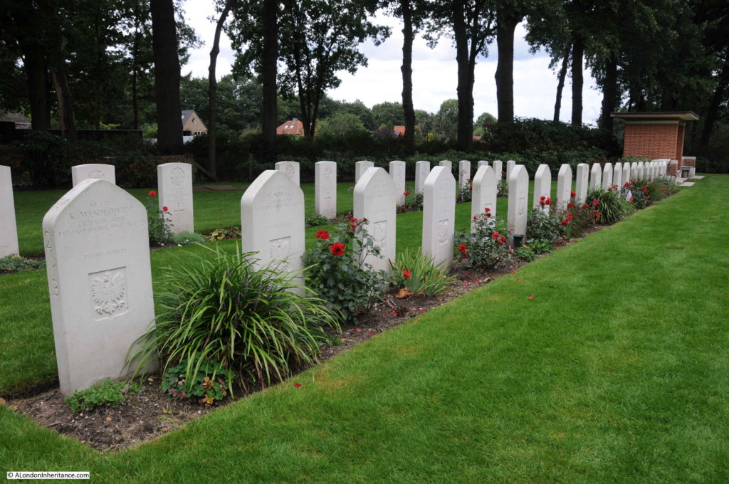
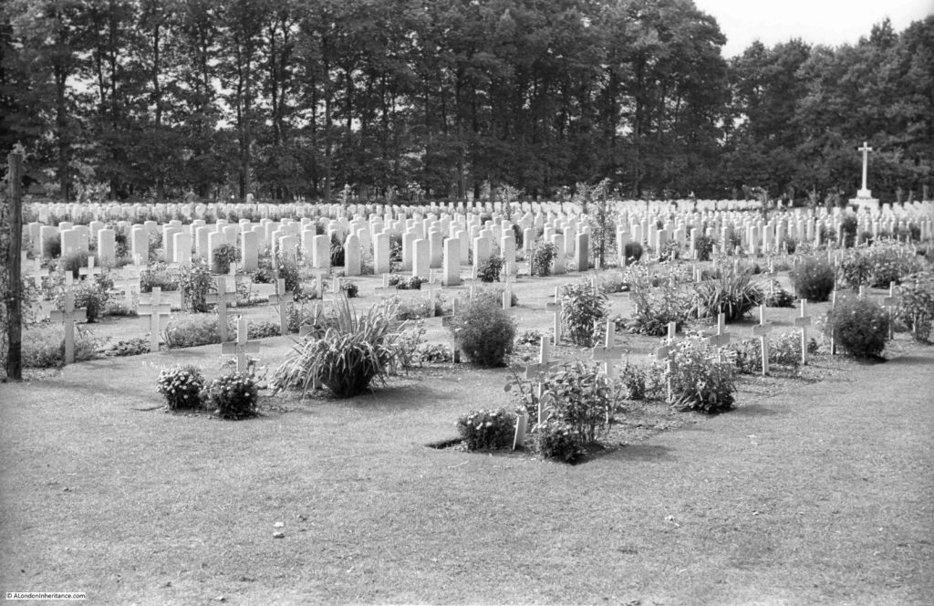
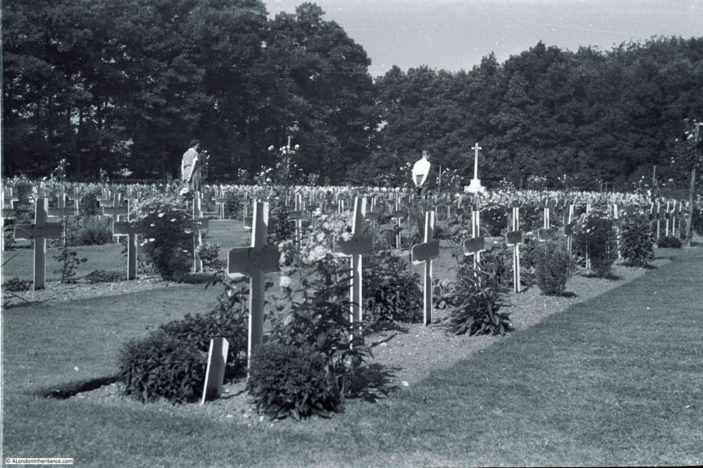
The following photo provides some indication of the size of the Arnhem Oosterbeek War Cemetery. A central grassed space runs down to a cross at the far end. On either side there are row upon row of gravestones, each representing a person, someone who died in the fighting around this part of the Netherlands.

Arnhem Oosterbeek War Cemetery

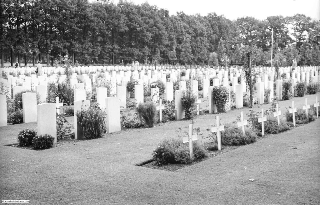
When my father was at the cemetery in 1952, it was still being completed. At the end of the war, the task began of recovering the bodies and burying them in the cemetery. During Operation Market Garden, the dead would usually be buried where they fell, and the grave marked with a temporary wooden cross made from whatever materials were to hand.

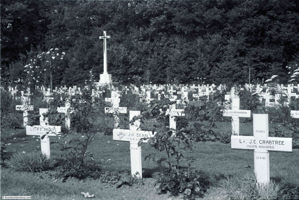
Identities had to be confirmed and stone gravestones were made for each grave. In 1952, a number of graves still had the temporary crosses used for the initial burial at Oosterbeek.

Arnhem Oosterbeek War Cemetery

There were a number of graves that I wanted to find as the names were clear in my father’s photos. The first was Lieutenant J. C. Crabtree, named on a cross at the end of a line of graves towards the far end of the cemetery. In 1952, this section of the cemetery still had the temporary crosses.

Arnhem Oosterbeek War Cemetery

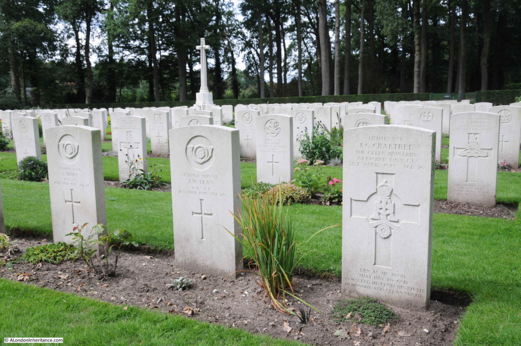
The same graves today:

Arnhem Oosterbeek War Cemetery

J.C. Crabtree was Jack Colin Crabtree who died on the 21st April 1945 at the young age of 20.

The son of Herbert Beaumont Crabtree and Dorothy Crabtree, in the 1939 census they were recorded as living at 13 St. Margaret’s Avenue in Luton, the house is still there. Jack’s father was listed as a Suprt Body Builder Motor and was obviously employed in Luton’s car manufacturing industries. Dorothy was described as Unpaid Domestic.

Jack Colin Crabtree was a Lieutenant in the Green Howards (Yorkshire Regiment). His death was in the closing months of the war, the Netherlands were fully liberated in May 1945 when the surrender of the German forces in the country was negotiated on the 5th May 1945.

Another grave I wanted to find was of a soldier in the Polish Parachute Brigade. The Polish parachute forces landed south of the river, opposite Oosterbeek in the closing days of  Operation Market Garden when the British forces were being pushed into a tight perimeter in Oosterbeek. The Polish landing date had been delayed by fog on the English airfields and when they landed the Germans were prepared for their arrival and the Poles suffered terrible casualties.

They managed to establish and hold a perimeter south of the river until the arrival of the main land forces which enabled the withdrawal across the river of the surviving British troops from Oosterbeek. A number of the Polish soldiers made it across the river to help man the ever shrinking Oosterbeek perimeter,

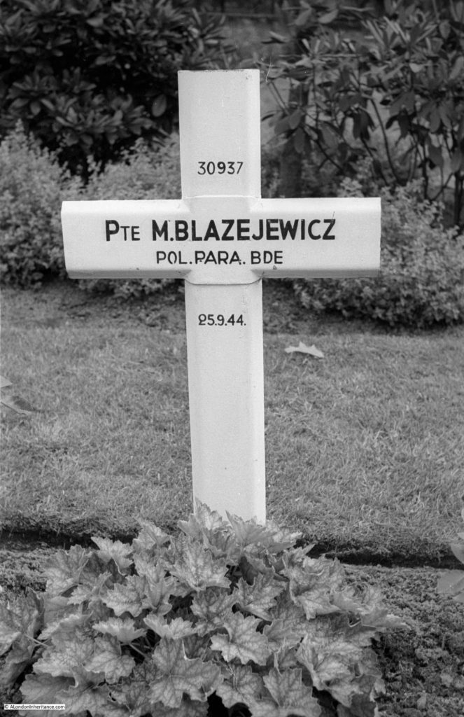
This is the original, temporary cross at the grave of Private M. Blazejewicz:

Arnhem Oosterbeek War Cemetery

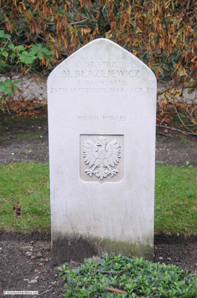
This year, I photographed the permanent gravestone:

Arnhem Oosterbeek War Cemetery

Some of the details on the original cross appear to have been corrected on the later headstone. The date of death has changed as well as his rank.

The grave is of Mieczyslaw Blazejewicz, with a rank of Starszy Strzelec (this seems to translate to a Senior Private or Lance Corporal) in the 3rd Parachute Battalion of the 1st Polish Independent Parachute Brigade. He was born on the 24th November 1920 at Lancut, a town in south eastern Poland.

He was killed whilst trying to cross the River Rhine to get to Oosterbeek on the 26th September 1944. As with many of those killed whilst trying the cross the river, his body would drift downstream and his body was recovered from the river at Rhenen on the 9th October. He was 23, just two months short of his 24th birthday.

There are a number of Polish soldiers buried in the Arnhem Oosterbeek War Cemetery. Their gravestones are distinctive by having a more dome shaped top, unlike the other gravestones.

Arnhem Oosterbeek War Cemetery

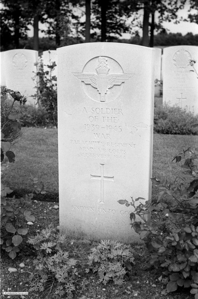
As you walk along the rows of graves, reading the inscriptions, one thing that always stands out is the very young age of those who fought and died. The majority are in their twenties, however there are many who were 18 or 19.

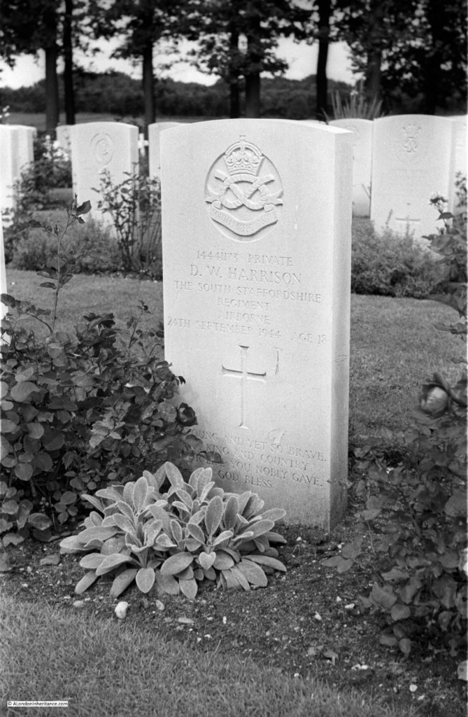
This is the grave of Private Dennis William Harrison of the 2nd Airborne Battalion of the South Staffordshire Regiment. Dennis was 18 years of age when he died on the 24th September 1944, the day before the survivors who still held a shrinking perimeter in Oosterbeek were given the order to withdraw across the Rhine.

Arnhem Oosterbeek War Cemetery

The South Staffordshire Regiment arrived over two days. The majority arrived in the first day of the campaign, Sunday 17th September, with the remainder of the regiment arriving on the following day. It is probable therefore that 18 year old Dennis William Harrison was fighting from the 17th September until his death on the 24th September.  In the 1939 census, Dennis father was recorded as a Coal Mine Charge Hand and his mother Annie was recorded with Unpaid Domestic Duties. They lived at Ballinson Road, Blurton Stoke-on-Trent, in a house that is still there.

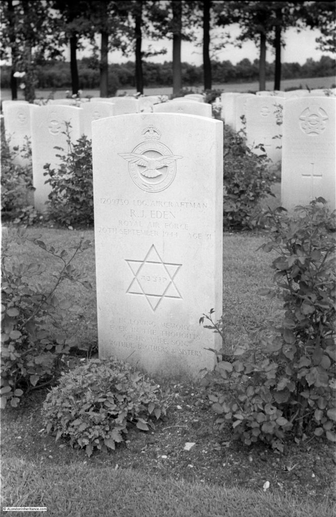
This is the grave of Leading Aircraftman R. J. Eden in 1952:

Arnhem Oosterbeek War Cemetery

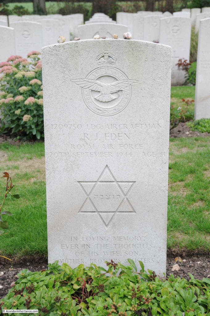
The same gravestone in 2018:

Arnhem Oosterbeek War Cemetery

It is lovely to see that the Jewish tradition of leaving stones on the gravestone to show that you have visited the grave is in evidence on R.J. Eden’s grave, as well as a number of other graves of Jewish soldiers in the cemetery.

According to the Arnhem Oosterbeek War Cemetery records, R.J. Eden was Roffer James Eden, serving with 6080 Light Warning Unit as part of the Royal Air Force Volunteer Reserve.

The Light Warning Units were one of the many specialised roles in an airborne force.  They were equipped with Light Warning equipment which was used to signal and coordinate with fighter aircraft providing cover for the ground forces. The Light Warning equipment was just about small enough to fit into a pair of Horsa Gliders. Four gliders were used to transport the Light Warning equipment on the second day of the campaign. Each pair of gliders held a complete set of equipment so in theory loss of one, or a maximum of two gliders would allow one set to arrive safely, however the transport plane for one glider was hit by flak and crashed, and the second glider was also hit by flak and crashed. By chance, both the crashed gliders were the same one from each pair, so the two gliders that arrived safely were each carrying the same half of the equipment needed to build an operational Light Warning Unit.

Once on the ground, and if they could not perform their primary role, Roffer James Eden, along with other roles such as glider pilots would fight alongside the other forces.

The Commonwealth War Graves Commission records that Roffer was the husband of Annie Eden of Victoria, London. Despite the unusual name, I have not been able to track down any details of Roffer James Eden. The transcript of RAF deaths records his first names as “Roffer J or Eckstein Jacob”, however I have also not been able to find an Eckstein Jacob Eden.

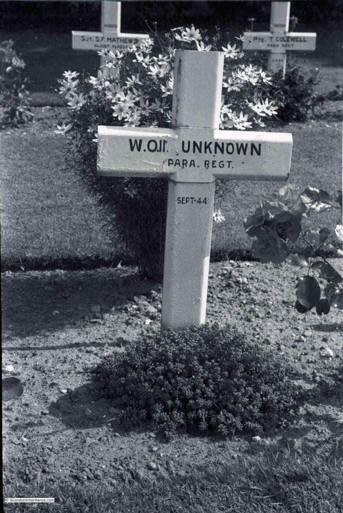
There are many graves across Oosterbeek cemetery where the identity of the person is unknown.

Arnhem Oosterbeek War Cemetery

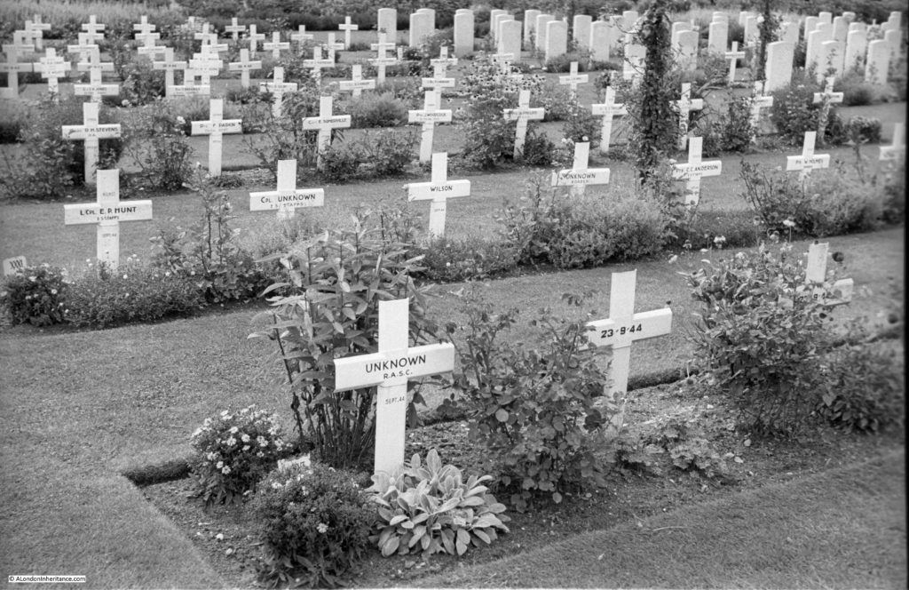
In the following photo from 1952, a block of graves have the temporary crosses. The grave nearest the camera is marked as ‘unknown’ that on the right only has a date. Behind there is the grave to a Corporal, but with no name, and a bit further to the right another unknown soldier.

Arnhem Oosterbeek War Cemetery

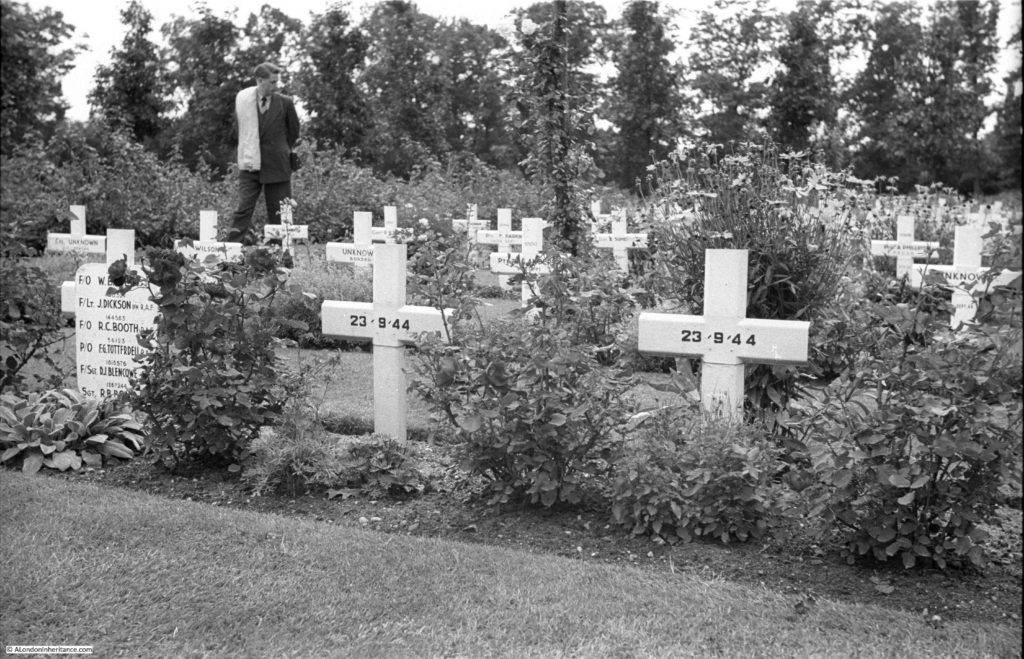
In the following photo from 1952 there is a cross on the left with 6 names.

Arnhem Oosterbeek War Cemetery

I checked the names which are fully visible and they are all from 570 Squadron of the Royal Air Force. and they appear to be a full crew from a single plane.

Robert Carter Booth, aged 22 was a Flying Officer, Navigator. Francis George Totterdell, aged 24 was a Pilot Officer, Wireless Op./Air Gunner. Dennis James Blencowe (no age recorded) was a Flight Sergeant, Air Gunner. John Dickson, aged 24 was a Flight Lieutenant, Navigator.

To add to the evidence that they were all on the same plane, their date of death was the same, the 23rd September 1944.

570 Squadron was based at RAF Harwell in Berkshire. They flew Short Stirling aircraft and during Operation Market Garden they operated as tugs for the Horsa Gliders for the initial drops, then until the force at Oosterbeek was withdrawn they ran supply drops. Most of these were unsuccessful as the Germans had overrun the drop zones and the soldiers on the ground had no working radios to communicate with the aircraft.

Written accounts from those on the ground at the time tell of the bravery of the RAF crews making the supply drops. They would fly in relatively low and slow and many aircraft were lost after being hit by high levels of German fire from the ground and attacks by German fighter aircraft.

In his book Arnhem by Major-General Urquhart, the commanding office in Oosterbeek, he writes of the supply drops:

“Twice in the afternoon the RAF tried to get supplies to us. Their first mission at 12:45 pm was disastrous. The aircraft were shot up by ME109s before our eyes and there was some evidence that the Germans were using our signals to attract some of the supplies. The second mission at 4 pm was much more successful and we acquired a small proportion of the sorely needed ammunition and rations as they fell. It was a costly day for the RAF, whose losses were twenty per cent of the aircraft taking part”.

Also on another drop “Again, the ground signals were laid and lit, and the troops held out parachute silks. But the aircraft kept to the planned dropping points and the Germans again found themselves receiving gifts from their enemies. only the overs reached us. Some crews, overshooting, came round in the face of most appalling flak. Some aircraft were on fire. Hundreds of us saw one man in the doorway of a blazing Dakota refusing to release a pannier until he had found the exact spot, though the machine was a flaming torch and he had no hope of escape.”

As their date of death was the 23rd September, this was towards the end of the campaign and would have been during one of the attempted supply drops.

Another of my father’s photos of the cemetery in 1952.

Arnhem Oosterbeek War Cemetery

And another of the many graves to unknown soldiers.

Arnhem Oosterbeek War Cemetery

Temporary crosses:

Arnhem Oosterbeek War Cemetery

Some of the graves have photos of those buried.

Arnhem Oosterbeek War Cemetery

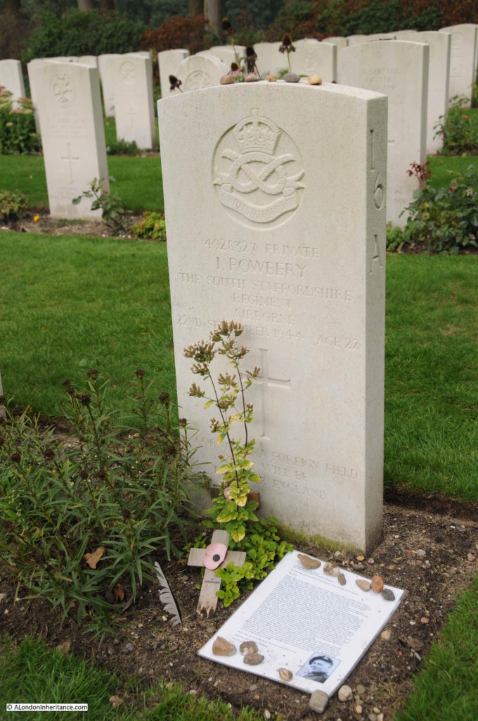
This is the grave of Private Ivor Rowbery of the South Staffordshire Regiment. He was 22 years old when he died on the 22th September 1944 when a mortar hit his gun pit near the Oosterbeek Old Church.

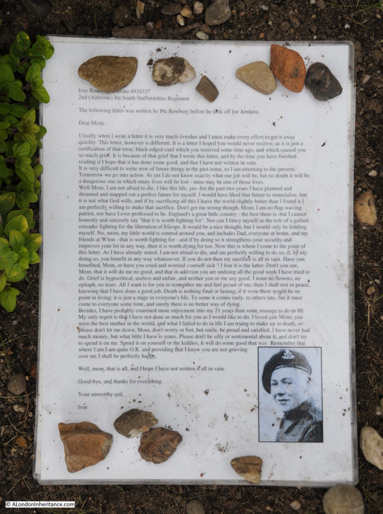
By the gravestone is a copy of a letter he wrote just before leaving the UK for Oosterbeek and Arnhem. It was the letter that would be sent to parents, wife, next of kin in the event of the soldier’s death in battle. Ivor Rowbery addressed the letter to his “mom”. (Click on the photo for a larger photo – it is a letter that should be read)

Arnhem Oosterbeek War Cemetery

It is a wonderful letter, no nationalistic flag waving, just a quiet pride in his home and family, and concern for his mother should he be killed in the conflict.

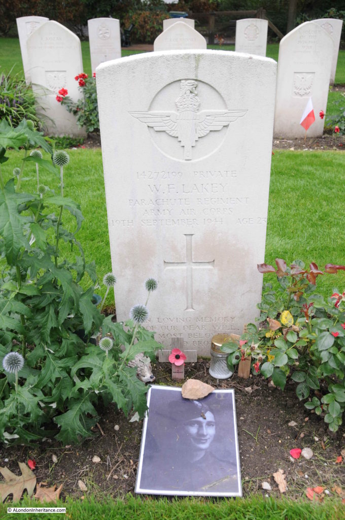
Next is the grave of William Frank Lakey, aged 23 and a private in the Parachute Regiment. He came from Upper Holloway, London. A photo provides a reminder that all these gravestones are for individuals who died at far too young an age.

Arnhem Oosterbeek War Cemetery

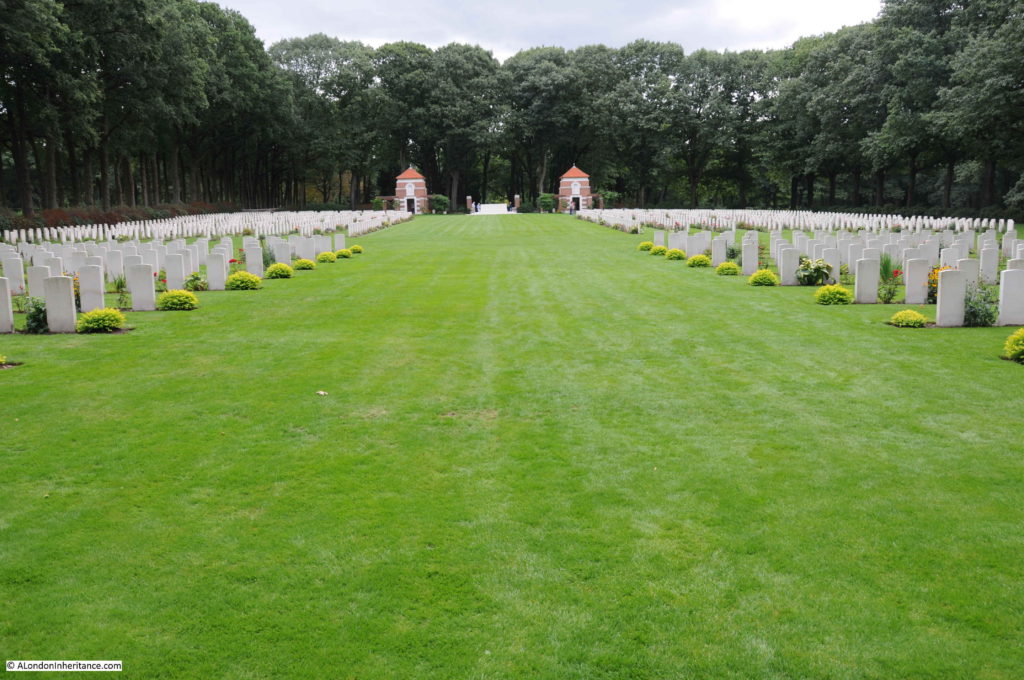
Looking down from the entrance to the rear of the cemetery:

Arnhem Oosterbeek War Cemetery

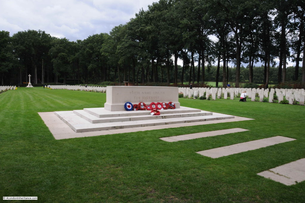
The view from the cross at the far end of the cemetery towards the entrance. Row upon row of gravestones for those killed in action during Operation Market Garden or from other fighting as this part of the Netherlands was liberated.

Arnhem Oosterbeek War Cemetery

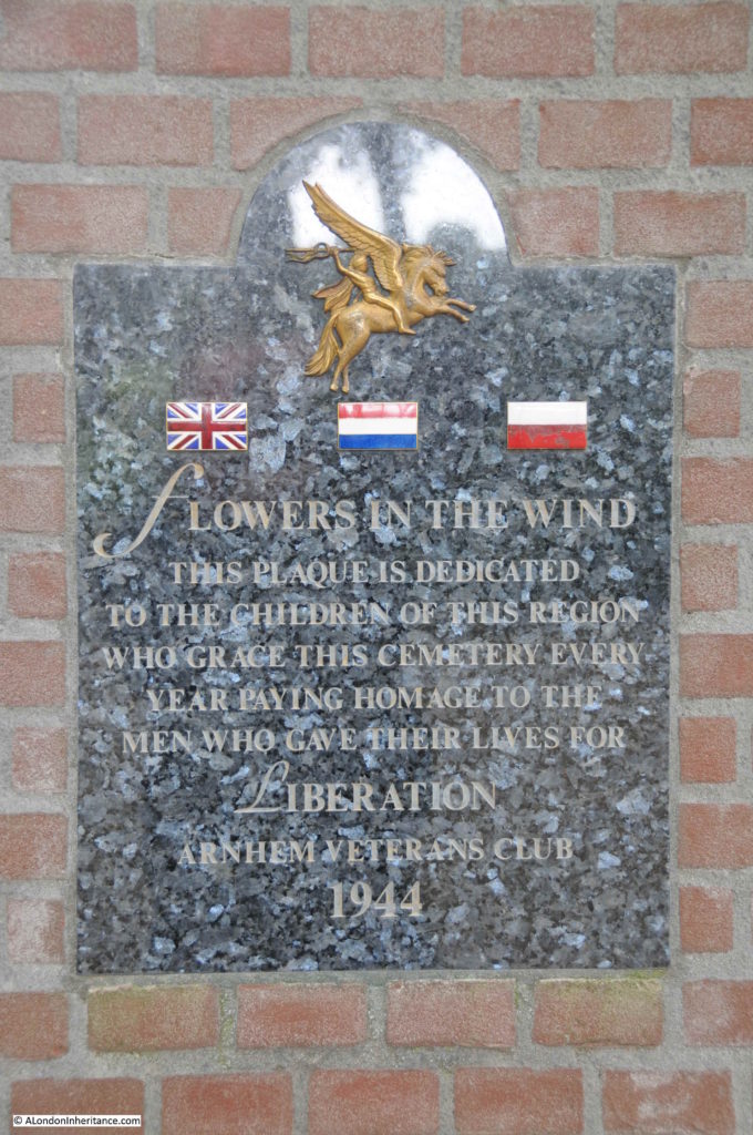
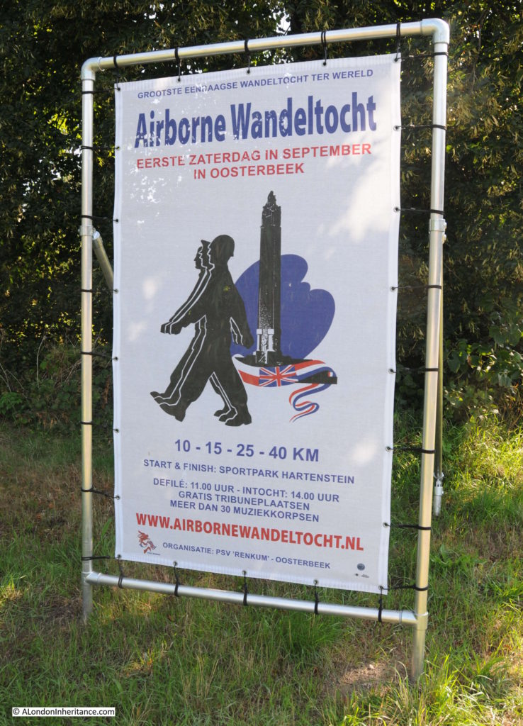
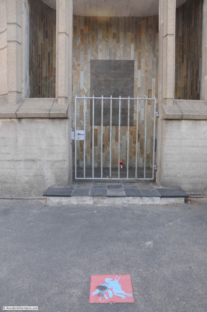
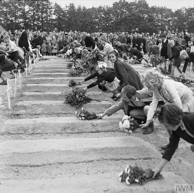
The events in and around Arnhem and Oosterbeek in September 1944 are still commemorated every year with events such as the Airborne Wandeltocht and other commemorative ceremonies. One of which is when children of the area place flowers on all the graves in the Arnhem Oosterbeek War Cemetery. A plaque in the entrance commemorates this annual event.

Arnhem Oosterbeek War Cemetery

A photo from the Imperial War Museum archive shows the first time this ceremony took place.
Arnhem Oosterbeek War Cemetery

THE BRITISH AIRBORNE DIVISION AT ARNHEM AND OOSTERBEEK IN HOLLAND (BU 10741) Dutch children pay their respects to the fallen and lay flowers on the graves. Copyright: © IWM. Original Source: http://www.iwm.org.uk/collections/item/object/205192049

The ceremony still takes place, and this year on the 23rd September the children whispered the name of the person buried as they place flowers on the grave.

It is too easy to be overwhelmed by the number of graves in war cemeteries, however it is so important to remember that each one was an individual with hopes and ambitions for the future, with a family, with a life back in their home country.

Today, as well as my Great Uncle Arthur who died in the First World War, on the 30th October 1918, I shall be remembering William Frank Lakey, Ivor Rowbery, the crew from 570 Squadron on a resupply mission in their Short Stirling aircraft, Roffer James Eden, Mieczyslaw Blazejewicz, Jack Colin Crabtree and all those buried in the Arnhem Oosterbeek War Cemetery.

alondoninheritance.com

The Airborne Wandeltocht

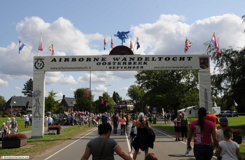
My final post from the Netherlands before returning to London for next Sunday’s post. The Airborne Wandeltocht (or Airborne Walking Tour) is an annual event on the first Saturday in September where a series of different length walks takes participants around the sites in Oosterbeek that featured in the events of September 1944.

The first walk took place in 1947 and walks have been held annually since, to commemorate and remember those who fought and died around Oosterbeek and Arnhem, and to raise money for charities associated with military veterans and youth projects.

Airborne Wandeltocht

This year, on the 1st September, the 72nd walk took place and 32,809 walkers took one of four route options around Oosterbeek. The routes start at 10km with longer options up to 40km. All routes take in the Hartenstein Hotel (now the Airborne Museum), the Oosterbeek War Cemetery (which I will write about in November) and the Oosterbeek Old Church on the edge of the town and river which featured in the defence of the critical length of river needed to escape to the south.

The 40km walk extends to include the landing grounds to the north west of Oosterbeek.

The walk formally starts at 11 o’clock with a parade along the main road in front of the Airborne Museum, although many of the longer distance walkers will have started earlier in order to complete the walk during the mid-afternoon.

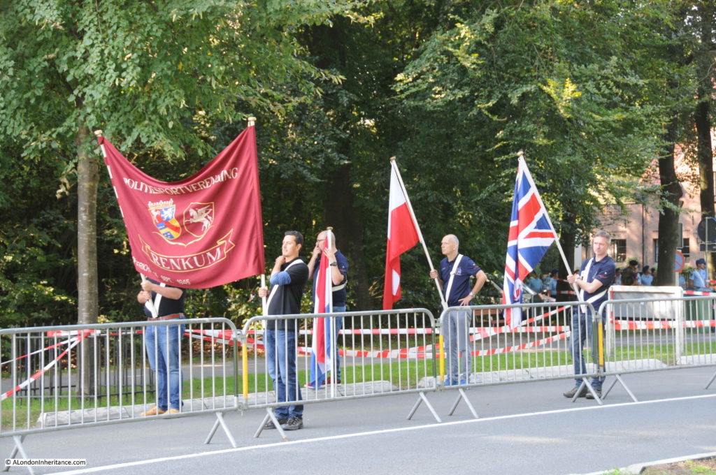
Across the whole event the flags of Poland, the United Kingdom and the Netherlands are very much in evidence to commemorate the airborne forces, the resistance and the civilians who fought and died in and around Oosterbeek.

The opening ceremony makes very clear that this is not a glorification of war, it is to remember those who fought, were wounded and died in the liberation of the Netherlands and the restoration of freedom and democracy.

Airborne Wandeltocht

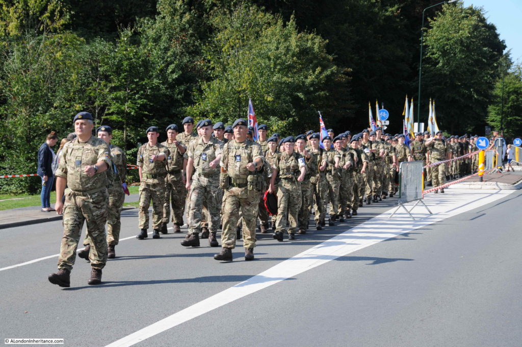
The parade to formally start the walks includes a wide range of groups – those from the emergency services, scouts, charities along with current armed services and cadets, including representatives from the UK,

Airborne Wandeltocht

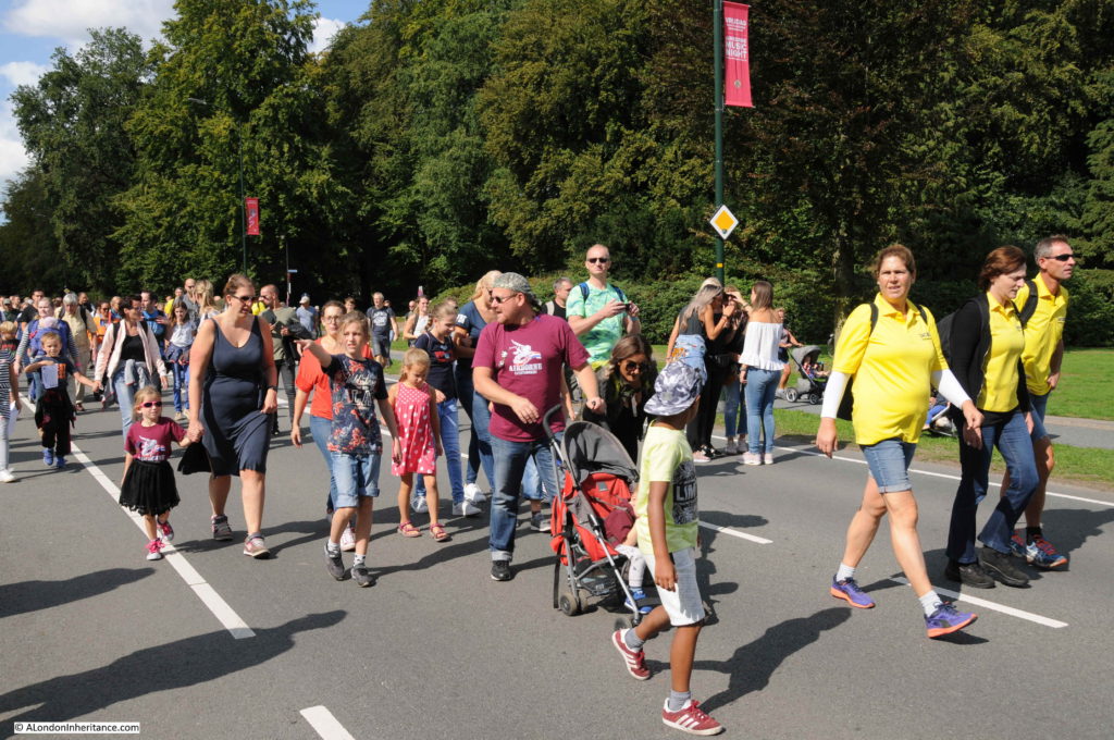
In between there are groups of walkers. The walk is very much a family day out.

Airborne Wandeltocht

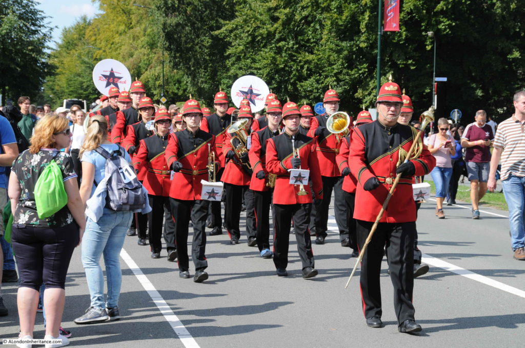
Along with marching bands – a Dutch specialty.

Airborne Wandeltocht

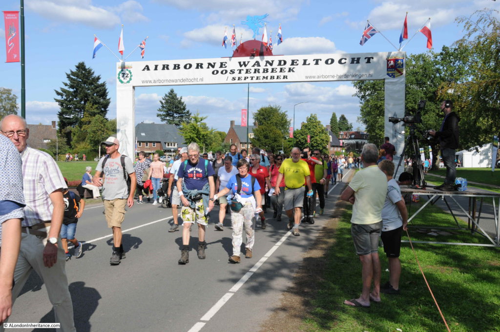
The formal start / end point on the Utrechtseweg, the main road running through Oosterbeek and one of the roads taken by the airborne forces as they moved from the landing grounds towards Arnhem.

Airborne Wandeltocht

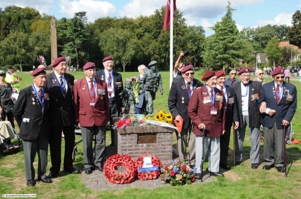
A number of British veterans attend the event each year, they have pride of place in the marquee next to the start / end point. Here, they are standing by the memorial to commemorate the 65th Airborne Wandeltocht – 74 years after they fought in the surrounding area.

Airborne Wandeltocht

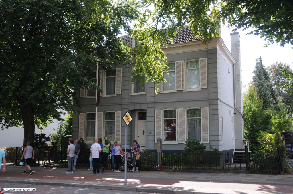
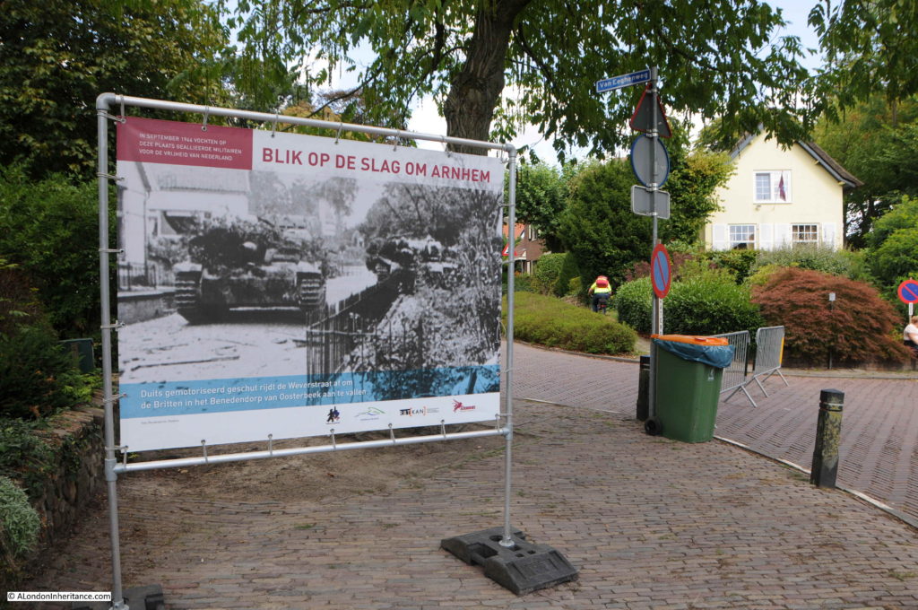
All around Oosterbeek there are permanent signs telling the story of September 1944. In the following photo of a house on Utrechtseweg, a pillar can be seen on the pavement to the right of the front door.

Airborne Wandeltocht

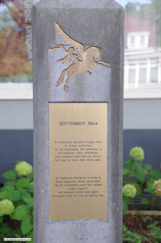
The pillar records that the 10th Parachute Battalion fought here to virtual extinction, and that on the 23rd September the remnants of the battalion were withdrawn.

Airborne Wandeltocht

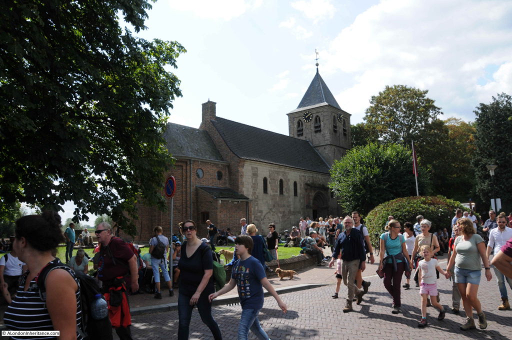
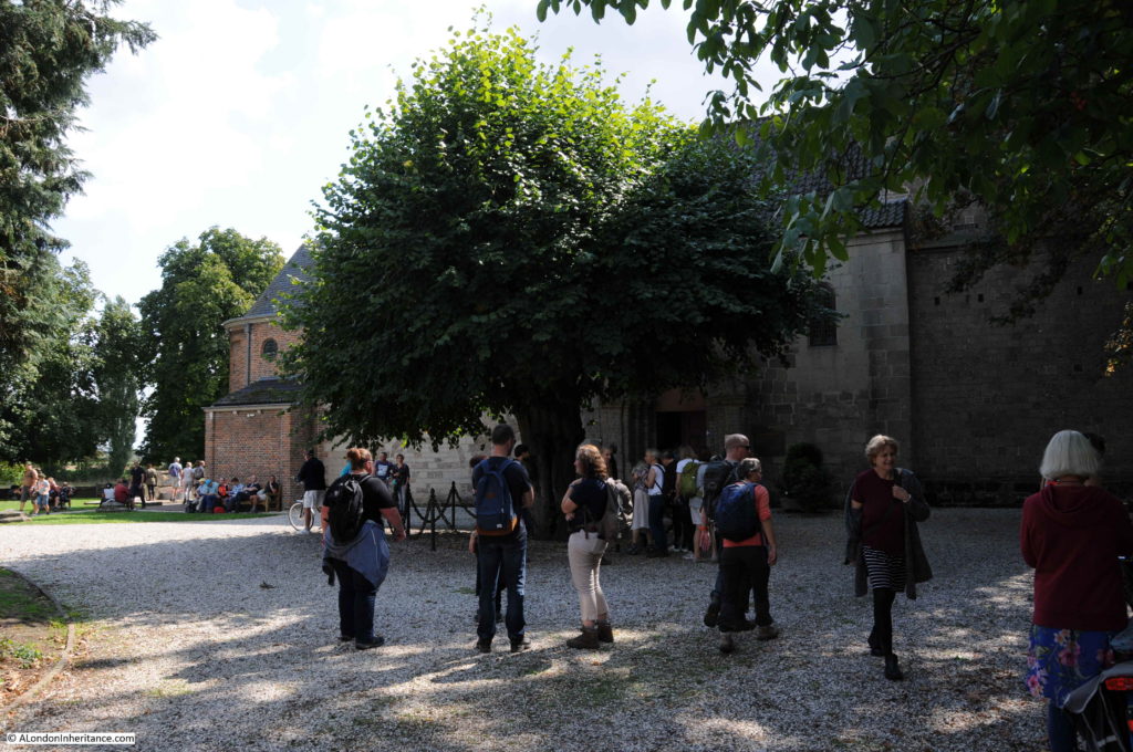
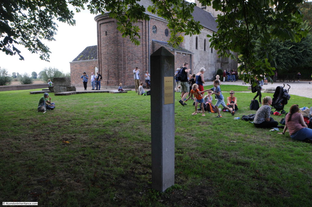
A key point on the route is the Oosterbeek Old Church. The church is on the outskirts of the modern day town, close to the flat stretch of open land that runs between town and river. The church is one of the oldest in the Netherlands, dating at least back to the year 900. In restoration work after the war, pre-christian features were found under the church so the site has been of importance for many centuries.

The church is open on the day of the Airborne Wandeltocht and all four routes pass by the church. It makes a good resting point and a fascinating location to explore.

Airborne Wandeltocht

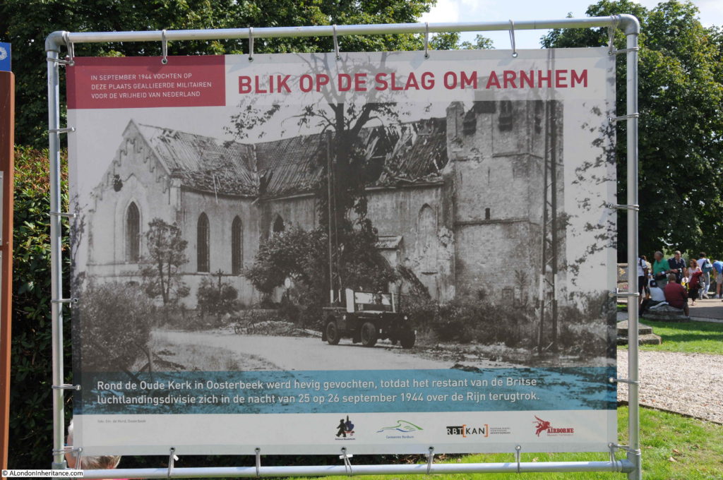
As well as the permanent pillars, there are also photo signs at various points along the walk showing what the site looked like following the events of September 1944. The church was badly damaged in the fighting.

Airborne Wandeltocht

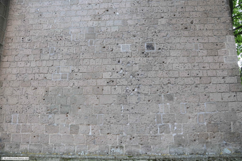
There are still plenty of bullet holes to be found in the walls.

Airborne Wandeltocht

The church was a central point in the fighting to defend the gradually shrinking pocket of land held by the airborne forces. Keeping a length of the river and the route open to withdraw to the river was critical in making sure that the airborne forces were not cut off in Oosterbeek. Towards the end of the battle, the width of land occupied by the British, and the Polish forces that had made it across the river was down to 700 yards.

Airborne Wandeltocht

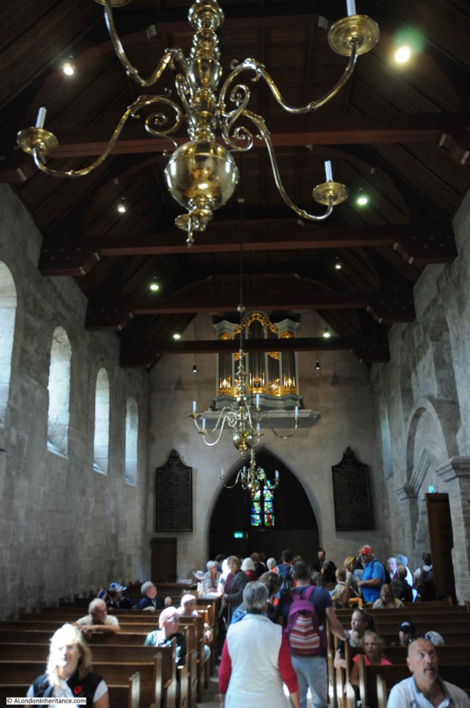
The restored interior of the church – very busy on the day of the Airborne Wandeltocht.

Airborne Wandeltocht

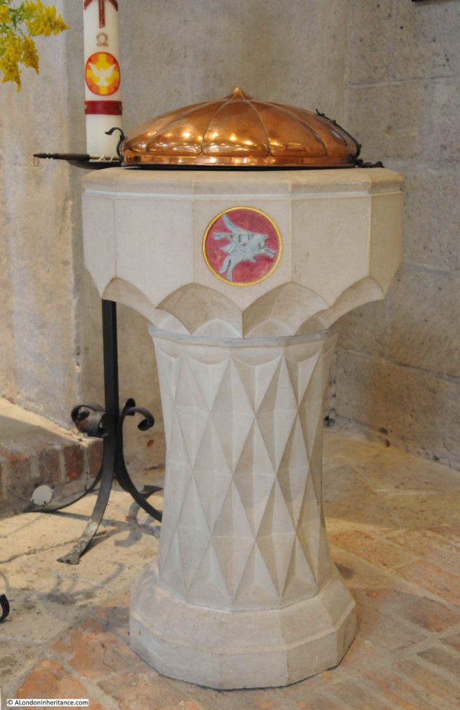
The Pegasus emblem of the Parachute Regiment can be found across Oosterbeek and Arnhem. In the Oosterbeek Old Church it is on the kneeling cushions, wall memorials and on the font.

Airborne Wandeltocht

Another view of the church.

Airborne Wandeltocht

A small plaque underneath the tree reads:

“In the thick of the fighting when a patrol of five Airborne warriors was standing by this lime tree, a mortar shell hit the place and killed four of them.

Only Mark Leaver survived. Staff sgt. G Squadron, Glider Pilot Regiment, born 20th January 1920, died 31st October 2000″

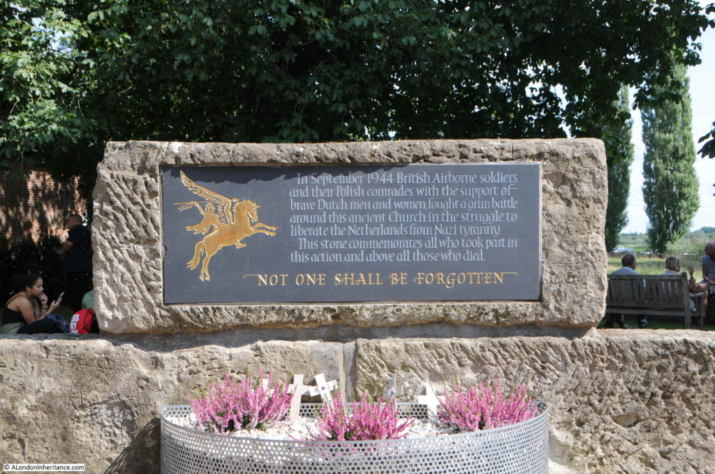
Another memorial in the churchyard to the British, Polish and Dutch men and women “who fought a grim battle around this ancient church to liberate the Netherlands from Nazi tyranny.”

Airborne Wandeltocht

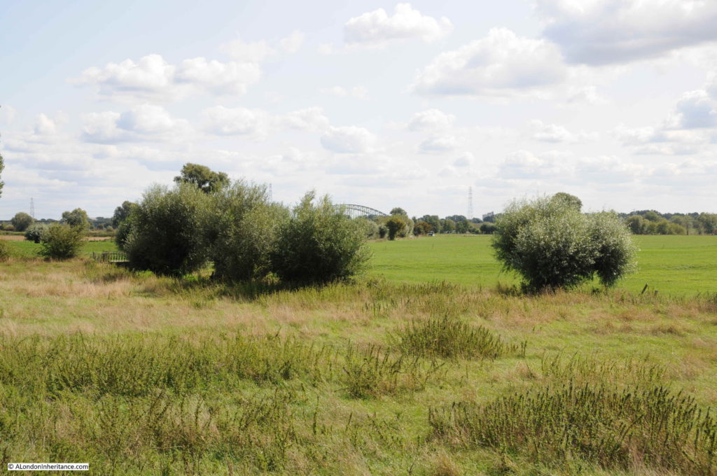
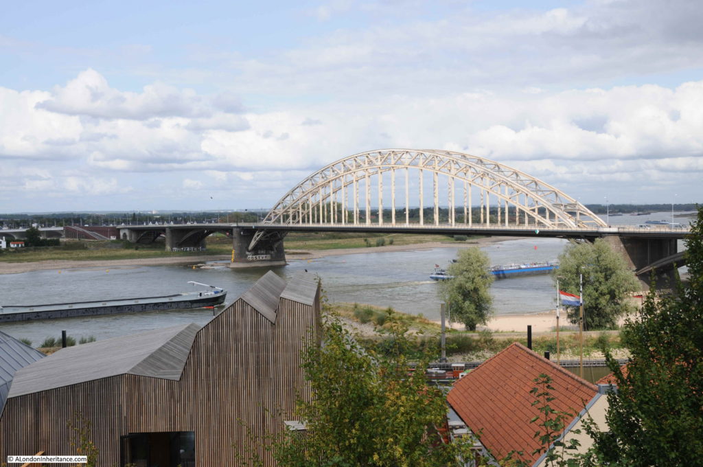
The flat lands between the church, the southern edge of Oosterbeek and the river in the distance. A bridge over the river can be seen in the distance. It was over this land that the final overnight withdrawal took place, across the river to the southern shore where advance parties of the British 2nd Army and the Polish forces who had landed a few days earlier, had taken the river bank.

Airborne Wandeltocht

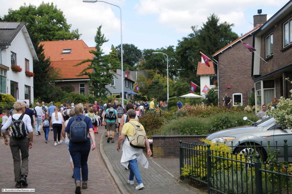
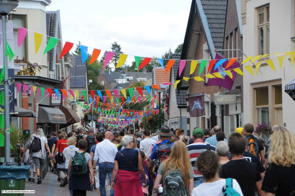
The Airborne Wandeltocht threads its way through the streets of Oosterbeek, walking through streets that were once the scene of deadly fighting. Pegasus flags of the Parachute Regiment fly from the majority of houses.

Airborne Wandeltocht

Another example of the information posters along the route showing the same scene in 1944.

Airborne Wandeltocht

Crowds of walkers returning through the central streets of Oosterbeek:

Airborne Wandeltocht

Returning through the formal end point of the Airborne Wandeltocht. The walkers return to the main assembly field to collect their medals.

Airborne Wandeltocht

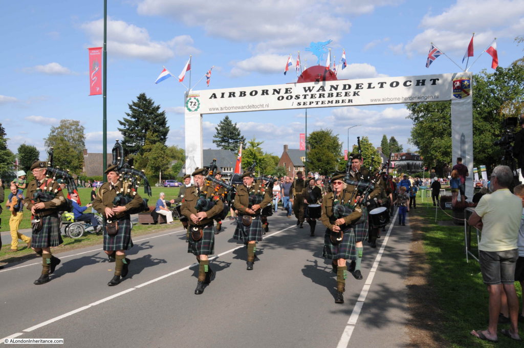
Not something you expect to see, a bagpipe band in the Netherlands. These are the Seaforth Highlanders of Holland. They were formed to commemorate the Seaforth Highlanders of Canada, who were part of the Canadian armed forces who liberated parts of the Netherlands during 1945. They were formed in Vancouver in 1910 following the large number of Scottish immigrants to Canada.

Although the Airborne Wandeltocht is just one of many events held during September to commemorate the impact of Operation Market Garden in Arnhem and Oosterbeek, it is by far the biggest event with this year well over 32,000 people of all ages taking part.

The walk does an excellent job of weaving together the history of September 1944, events at key locations and remembering the sacrifices of the British and Polish airborne forces and the Dutch civilians.

Next year’s event will take place on the first Saturday in September and details can be found on the web site of the Airborne Wandeltocht. (There is an English version, but Google translate does a good job with the full site).

alondoninheritance.com

Operation Market Garden – Arnhem And Oosterbeek

For my last Sunday post from the Netherlands, I have reached Arnhem, the final bridge in the chain of bridges that were to be taken during Operation Market Garden, and by doing so, clearing a path across the rivers to a point where the Allied forces could turn east with an unobstructed path into the heart of industrial Germany.

As well as Arnhem, I will also visit Oosterbeek, a suburb to the west of Arnhem that became the centre for British forces during the operation when German attacks prevented the majority of the airborne forces from fighting their way through to the bridge.

Operation Market Garden involved the landing of airborne forces that would capture key towns and bridges from Enindhoven in the south through to Arnhem. Capture of these towns and bridges would allow the British 2nd Army to break out from the Belgium border and drive north along the corridor of captured land through to the final bridge at Arnhem.

The 101 US Airborne Division would capture the city of Eindhoven and key points north where they would meet up with the 82 US Airborne Division which would capture the route from Grave through to the bridge at Nijmegen. This would allow the British 2nd Army to move on to Arnhem and the bridge that was to have been taken by the 1st British Airborne Division and the 1st Polish Independent Parachute Brigade.

The plan was that the bridge at Arnhem would only need to be held for two to three days before the ground forces reached the airborne forces, however delays along the route, as well as the failure to immediately capture the bridge at Nijmegen and the fighting in the town before the bridge could finally be taken resulted in significant delays.

The expectation was that only light German forces would be found in Arnhem, however the quick reactions of the occupying forces along with SS Panzer Divisions being in the area meant that the British airborne troops faced much stronger defending forces than expected.

The British Airborne forces also had to land several miles to the west of Arnhem. The area chosen was the only flat land suitable for both parachute and glider landings, as well as being away from a German airfield to the north west of Arnhem, with significant anti-aircraft fire.

The operation started on the 17th September 1944 with parachute drops and glider landings to the west of Arnhem. Troops were organised to hold the landing grounds for future drops and to move forward to capture both the bridge and other strategic locations around Arnhem.

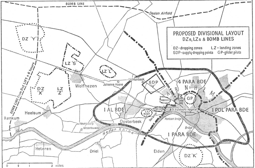
The following map from the book Arnhem by Major General Roy Urquhart shows the Drop Zones and Landing Zones to the west of Arnhem along with Drop Zone K to the south for the later drop of the Polish airborne. The map shows the intended plan to capture the bridge and the defensive positions to be taken whilst waiting for the 2nd Army to reach them from the south. The suburb of Oosterbeek can also be seen just to the west, alongside the river.

Arnhem

The German forces were much stronger than expected, with more, experienced and better equipped opposition both already in the area, and hastily assembled.

The 2nd Battalion led by Lt. Col. John Frost reached the bridge on the first day and took the buildings either side of the northern end of the bridge, however stiff resistance prevented the rest of the 1st Parachute Brigade from reaching the bridge, and fighting would take place from the landing zones through to Arnhem as the Germans pressed in on the attacking force.

The small force from the Parachute Brigade would hold the northern end of the bridge from Sunday 17th to Wednesday 20th September. Intensive attacks on the occupiers over the four days with a gradually shrinking perimeter and occupied buildings being demolished by German tank and gun fire, as well as very high numbers of dead and wounded and running out of ammunition resulted in the remnants of the parachute battalion being taken into captivity in the early hours of Thursday 21st September.

My father only took a few photos of Arnhem, not as many as Nijmegen, so I am not sure if Arnhem was to the end of the route he was taking through the Netherlands and he was running low on film.

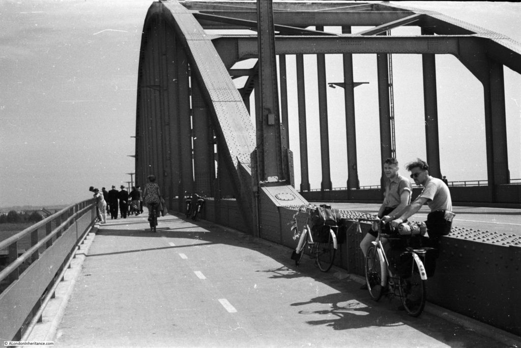
The first is of the bridge, and includes his two friends and their bikes:

Arnhem

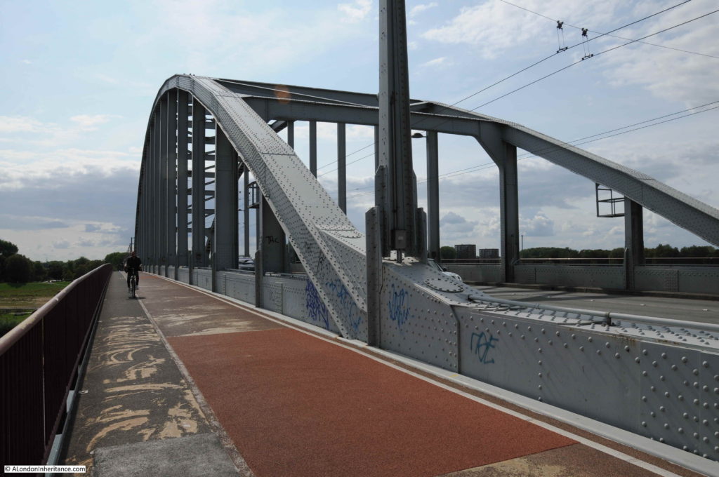
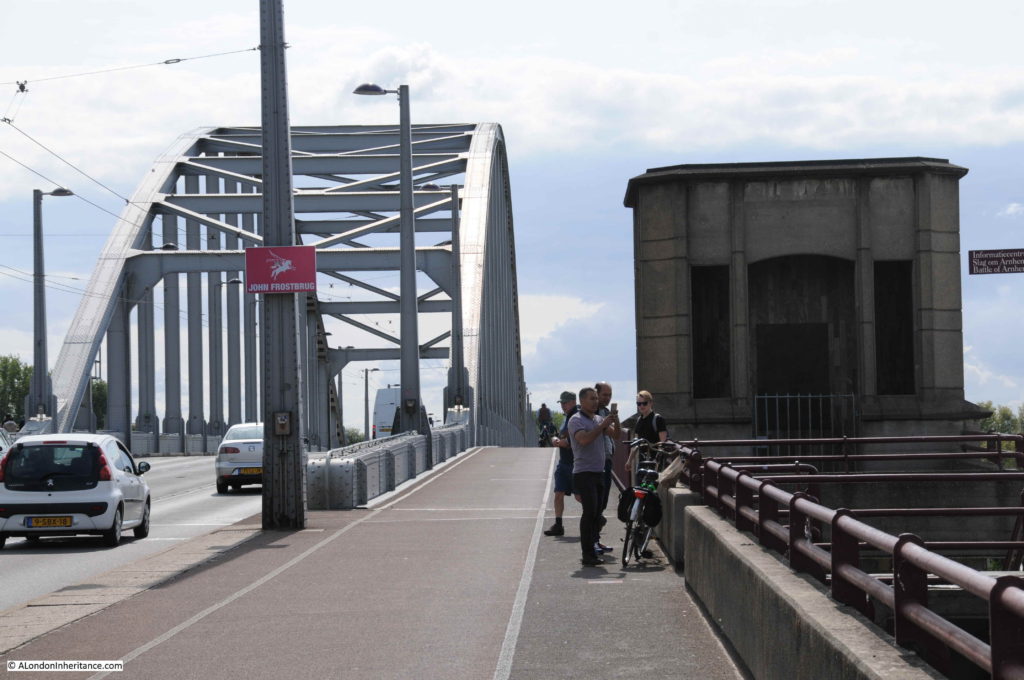
During my visit I walked over the bridge to the same position:

Arnhem

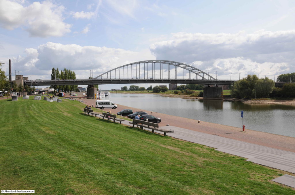
The bridge as seen from the east, just in front of a new, and very busy “Airborne at the Bridge” visitor centre:

Arnhem

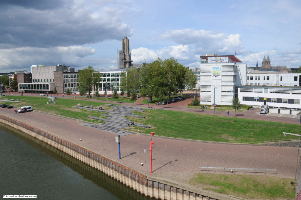
The view from the bridge looking north east into the city. The buildings that originally stood here were occupied by the parachute brigade:

Arnhem

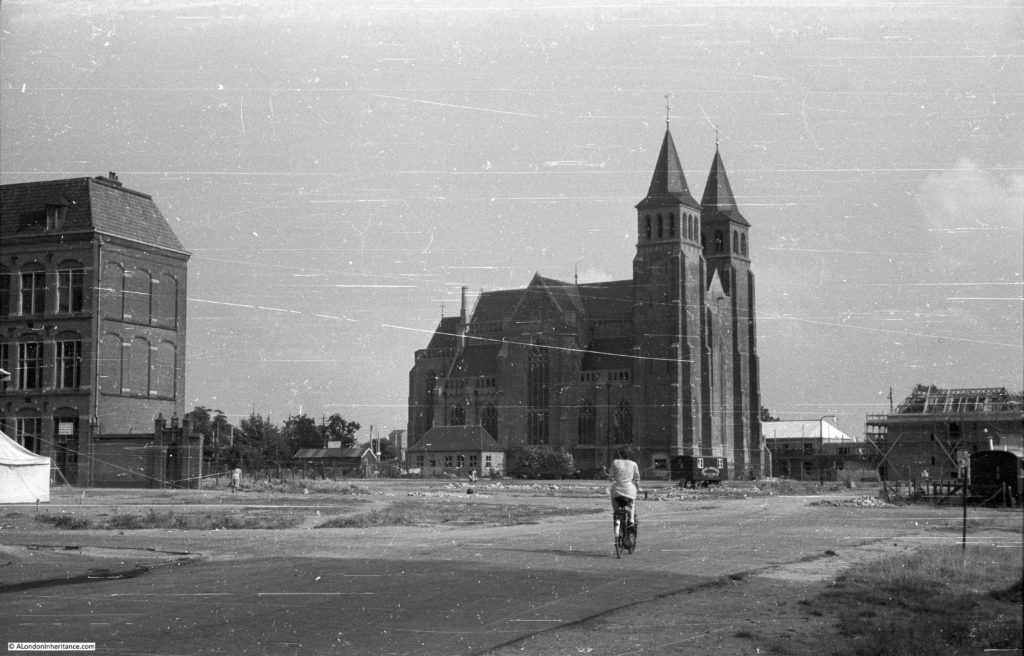
Fighting took place at several sites across Arnhem as British forces attempted to get to the bridge. On the right in the above photo can be seen the tops of two church towers. My father took the following photo of the church in 1952. Whilst the church had been repaired, the surrounding land has been cleared of buildings damaged during the fighting.

Arnhem

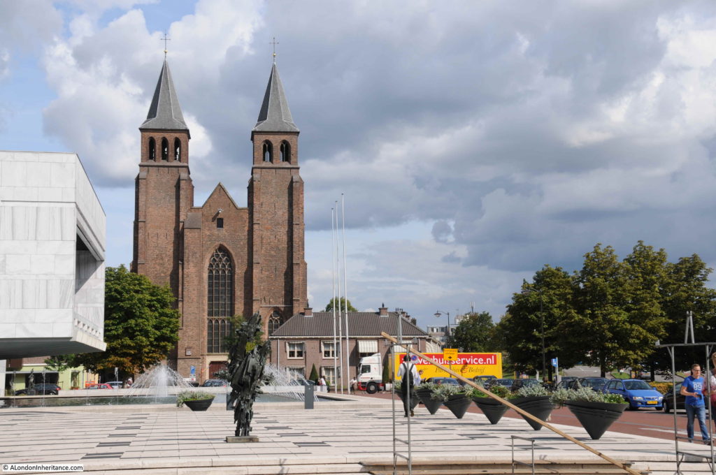
I could not get the same view of the church today, as buildings obscure the view, so the following shows the front of the church as it is today:

Arnhem

Back to the bridge – on the lamp post on the left can be seen a sign with the Pegasus symbol of the Parachute Regiment and that the name of the bridge is John Frostbrug.

Arnhem

After the war, the bridge was named after John Frost, the commanding officer of the Parachute forces who lasted so long on the northern end of the bridge.

On the right, there is a small building, again with the Pegasus symbol and a plaque:

Arnhem

The plaque reads:

“On the 17th of September 1944, the 1st British Airborne Division began to land some eight miles to the west of Arnhem with the object of forming a bridgehead north of the lower Rhine.

The 2nd Battalion the Parachute Regiment fought its way into Arnhem and occupied the buildings which commanded the site of the bridge. Here it was joined by elements of other units of the division.

For three days and four nights the bridge was held against far greater numbers of the German 2nd Panzer Corps, until with ammunition expended, with few survivors unwounded and all the buildings destroyed around them they were finally overwhelmed.

The gallant defence of this detachment, cut off by enemy action from the remainder of the division had a marked influence on the conduct of the campaign in Holland, and the delay imposed on German reinforcements moving south to stem the allied advance enabled crossings over the Rhine at Grave and Nijmegen to be firmly secured.”

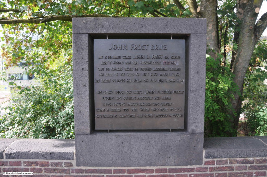
Another plaque alongside the bridge gives some background as to the naming of the John Frost Bridge, finishing that “the bridge with his name in now proudly wrought.

Arnhem

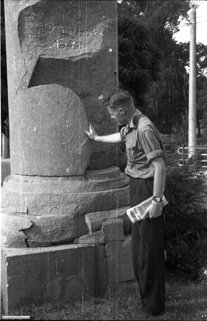
One of my father’s photos shows one of his friends looking at what appears to be a monument in Arnhem with the 17th September 1944 date engraved on what looks like a damaged pillar from a building. There were no identifying features so I was dubious that I would find the location of this photo:

Arnhem

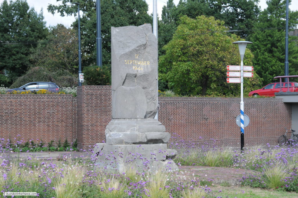
However walking north off the bridge and through some pedestrian tunnels under the roundabout at the end of the bridge revealed the same monument:

Arnhem

I have no idea if the monument is in the same position today as in 1952. The area around the bridge has been significantly altered and rebuilt with a number of large roads converging on the spot.

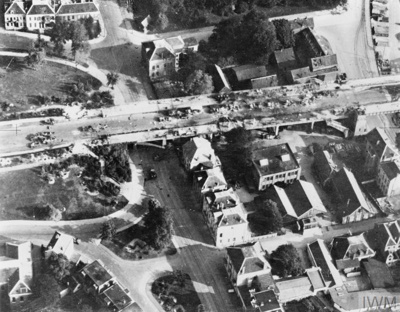
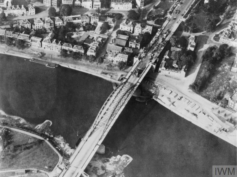
The Imperial War Museum have a number of photos showing the bridge during the battle. The following two photos show the northern end of the bridge in the early days of the battle. The debris of the initial German attack over the bridge can be seen.

Arnhem

THE BRITISH AIRBORNE DIVISION AT ARNHEM AND OOSTERBEEK IN HOLLAND (MH 2062) An aerial view of the vital bridge at Arnhem, taken immediately after the operation. This shows more clearly the wrecked German vehicles at the north end of the bridge. Copyright: © IWM. Original Source: http://www.iwm.org.uk/collections/item/object/205084668

The buildings either side of the bridge are occupied by the Parachute Brigade. In the coming days, German tanks and guns would systematically destroy these buildings.

Arnhem

THE SECOND WORLD WAR 1939 – 1945: THE ALLIED CAMPAIGN IN NORTH-WEST EUROPE JUNE 1944 – MAY 1945: THE BRITISH AIRBORNE DIVISION AT ARNHEM AND OOSTERBEEK IN HOLLAND (MH 2061) Aerial view of the bridge over the Neder Rijn, Arnhem; British troops and armoured vehicles are visible at the north end of the bridge. Copyright: © IWM. Original Source: http://www.iwm.org.uk/collections/item/object/205193321

After leaving the centre of Arnhem, we then traveled out to Oosterbeek.

After the initial success with the 2nd Battalion the Parachute Regiment reaching the bridge, German defences responded quickly and built a blocking defensive line between Arnhem and Oosterbeek to prevent further British forces from reaching Arnhem and the bridge.

The main body of the 1st British Airborne Division therefore started to collect around Oosterbeek, building a defensive perimeter leading up from the river to north of the main road from Utrecht into Arnhem.

Adjacent to what was the main Utrecht to Arnhem road through Oosterbeek was the Hartenstein Hotel. When the airborne forces were landing, the hotel was being used by the German General, Field Marshall Walter Model. Thinking he was the target of the airborne attack he quickly left the hotel.

The hotel was taken over by Major-General Roy Urquhart as his headquarters for the 1st British Airborne Division operations in Oosterbeek and Arnhem.

The hotel continued to be used until the point where the airborne forces were running out of ammunition and the number of dead and wounded were severely reducing the numbers available to fight and hold and gradually reducing perimeter. On the evening of Monday 25th September, 9 days after the initial landings, those who could were finally withdrawn from Oosterbeek across the Nederrijn as by then allied forces had reached the river bank south of Oosterbeek.

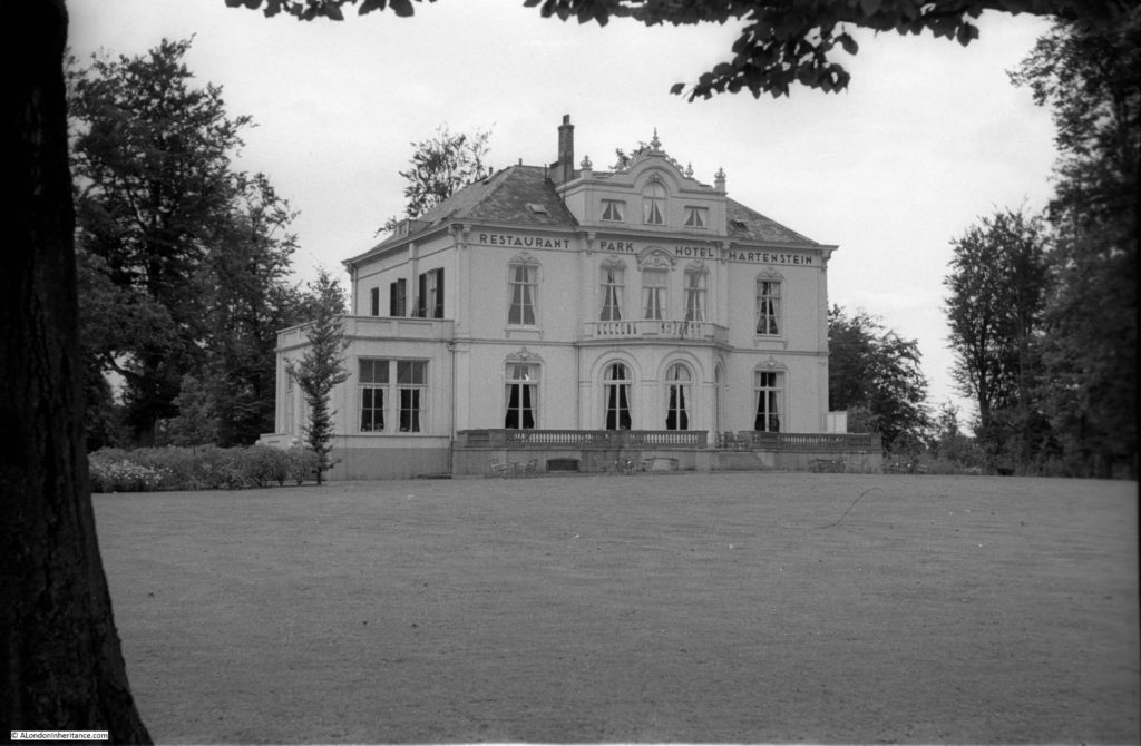
My father’s 1952 photo of the Hartenstein Hotel:

Arnhem

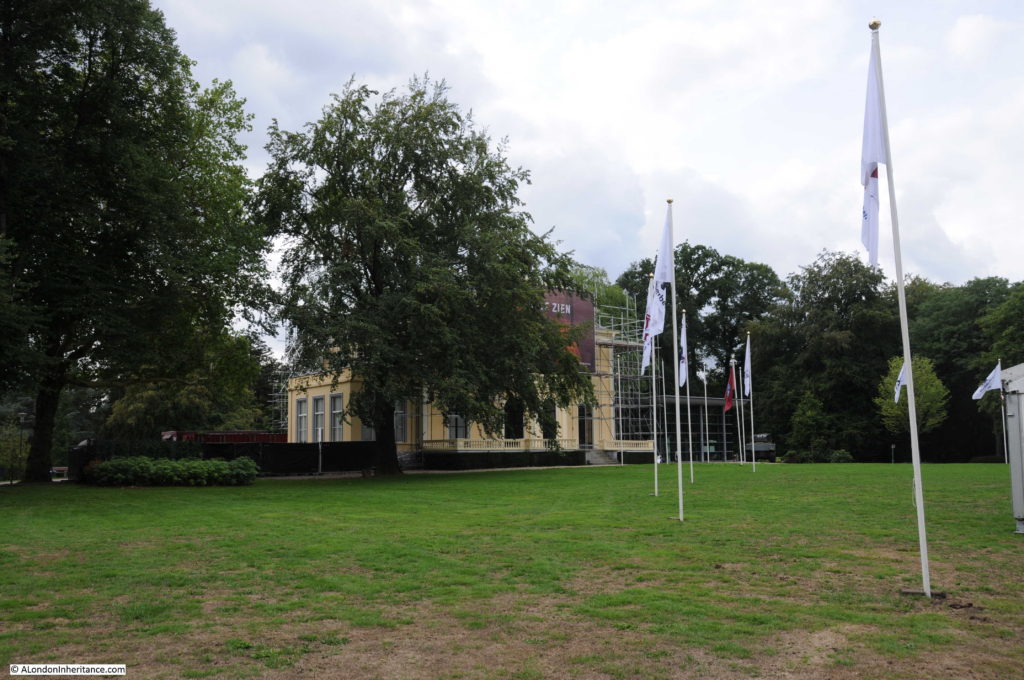
The building today:

Arnhem

In 1978 the building opened as the Airborne Museum, a role it continues to this day, indeed in a much expanded format.

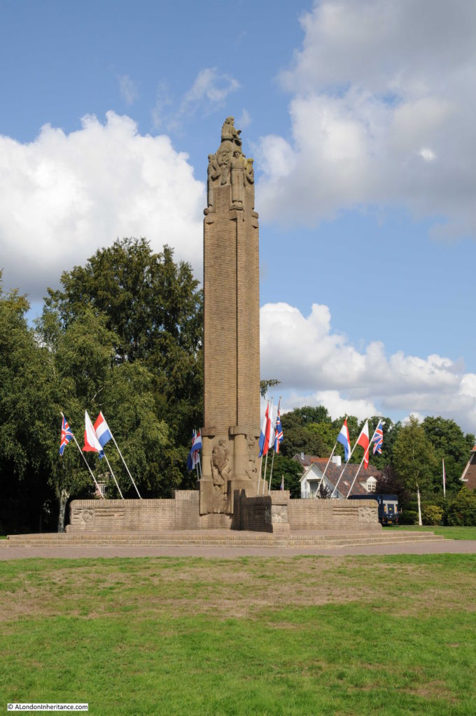
Directly opposite the hotel, across the original Utrecht to Arnhem road is a memorial to the events of September 1944:

Arnhem

During my 2018 visit, the memorial was decorated ready for a major annual commemoration which I will cover in a mid-week post. The flag of the Netherlands, along with the flags of the United Kingdom and that of Poland fly together at the base of the memorial.

Arnhem

The Polish flag is in recognition of the 1st Polish Independent Parachute Brigade. The Polish brigade’s flight from England was delayed due to weather and when they did land they were met with heavy fire from German forces and suffered significant casualties.

A number of Polish forces did make it across the river to support the 1st British Airborne Division  and they also helped with the link up to the advancing British army from the south.

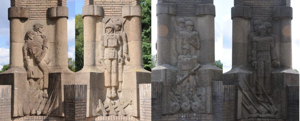
Around the base of the memorial are representations of the participants in the events around Oosterbeek (the bright background sunlight resulted in the two photos on the right being in shadow).

Arnhem

From left to right:

  • the attention given to the wounded by the women of Oosterbeek
  • the landing
  • the support of the Dutch underground resistance
  • the last stand in Oosterbeek

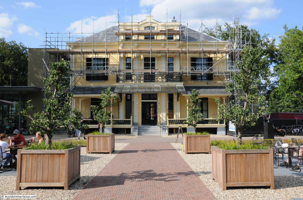
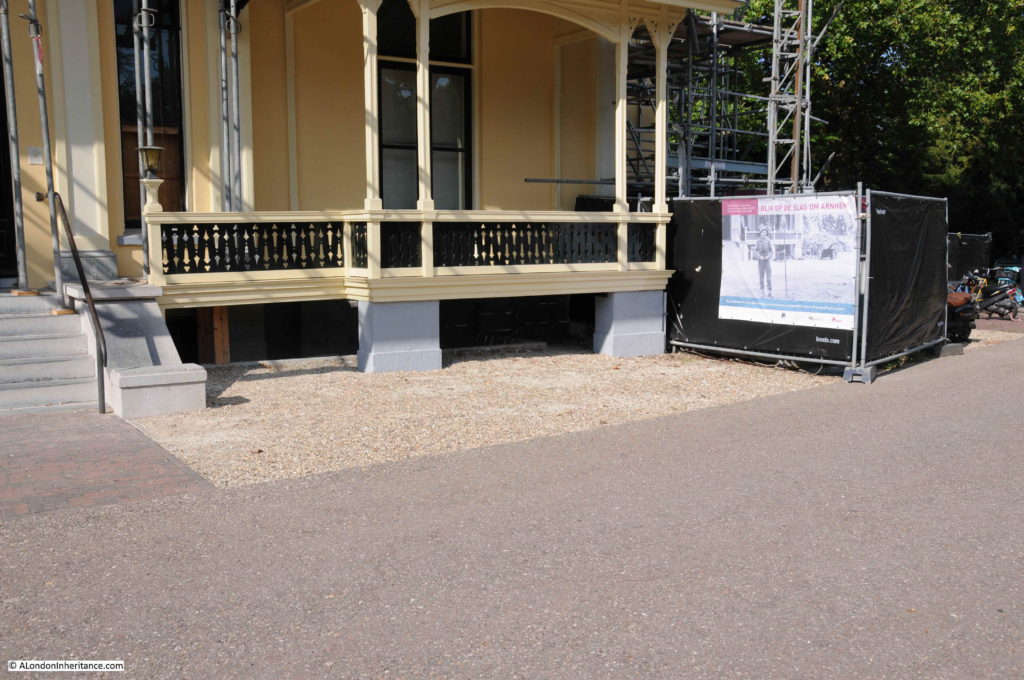
The original Hartenstein Hotel building has been magnificently restored and recently considerably extended to add additional displays to tell the story of the events around Arnhem and Oosterbeek. The view of the rear of the building:

Arnhem

During Operation Market Garden, the building was used as headquarters for British operations. It was constantly under attack with shelling, mortar fire and snipers who had infiltrated into the surrounding woodland.

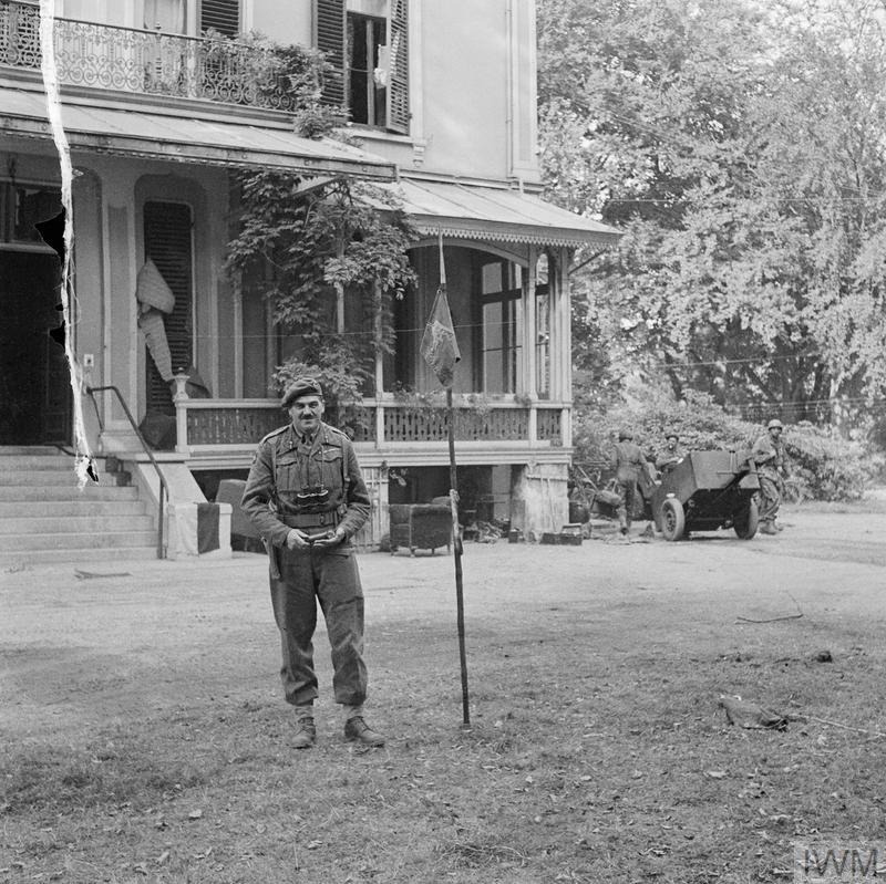
In the first days of occupation of the building Major-General Roy Urquhart was photographed standing at the rear of the building. The photo is from the Imperial War Museum archives:

Arnhem

OPERATION ‘MARKET GARDEN’ – THE BATTLE FOR ARNHEM, SEPTEMBER 1944 (BU 1136) Major-General Robert E Urquhart, commanding 1st British Airborne Division, with the Pegasus airborne pennant in the grounds outside his headquarters at the Hartenstein Hotel in Oosterbeek, 22 September 1944. Copyright: © IWM. Original Source: http://www.iwm.org.uk/collections/item/object/205192016

The same view today:

Arnhem

The Airborne Museum provides a very comprehensive overview of Operation Market Garden and the events around Arnhem and Oosterbeek, using a mix of display items from the time of the battle, as well as multi-media recreations of the events. The museum was very busy during our visit and is a perfect example of what a small museum can achieve.

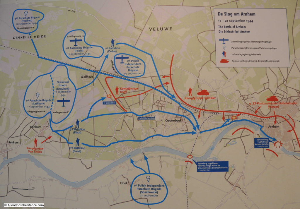
The following map from the museum provides an overview of the battle and the location of British, Polish and German forces.

Arnhem

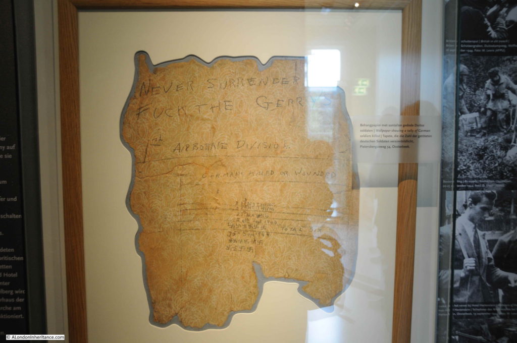
There are several rooms full of weapons used during the battle, uniforms, documentation as well as items recovered from the battlefield, including this piece of wallpaper from a house at Pietersbergweg 34 in Oosterbeek showing the dark humour of the battlefield:

Arnhem

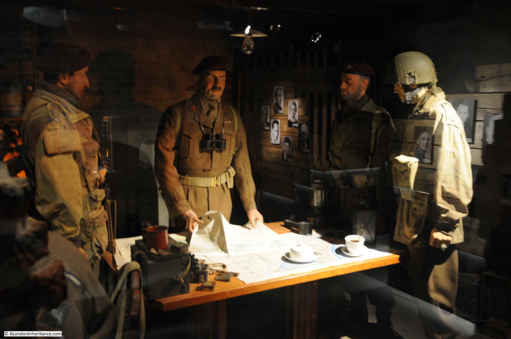
There are recreations of the rooms within the hotel during the battle, including this view of how the cellars were used as the headquarters offices during the battle:

Arnhem

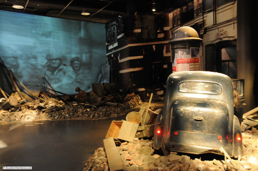
And there is a large multi-media recreation of street fighting during the battle. A single photo does not recreate the intensity of walking through with the sounds of battle all around.

Arnhem

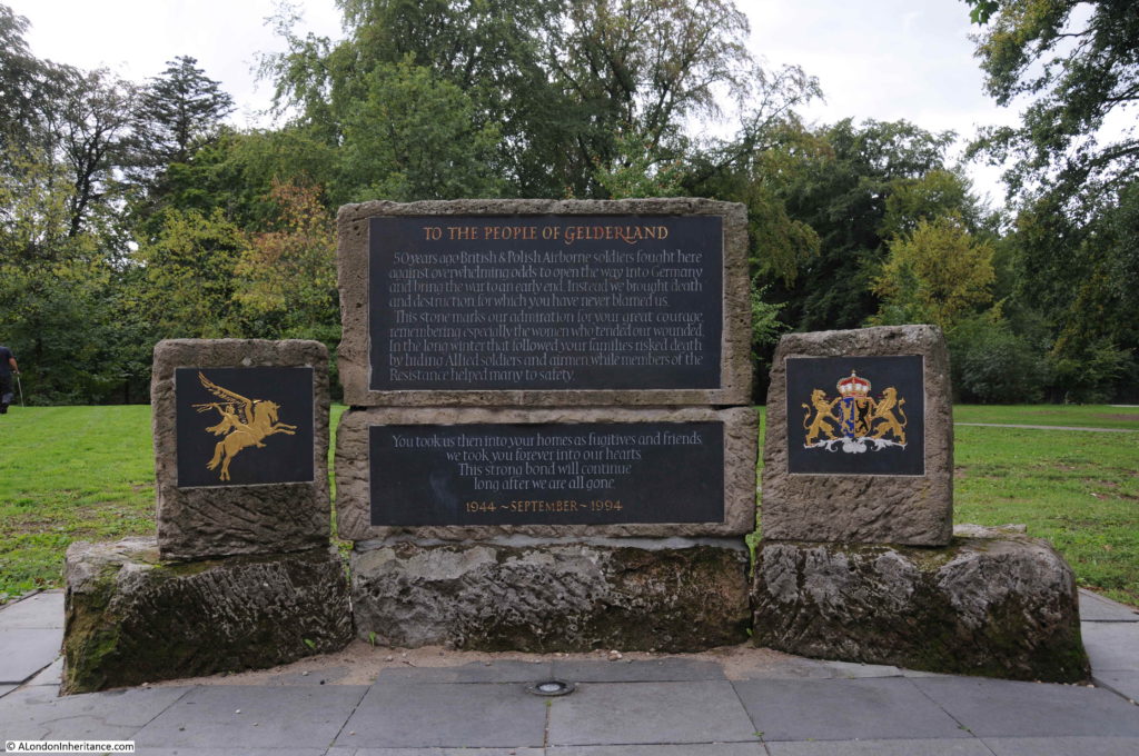
A large memorial outside the museum, erected in 1994 on the 50th anniversary of the battle. The memorial is from the British and Polish forces in recognition of the impact that Operation Market Garden had on the people of the area, the support of the women of the Oosterbeek and Arnhem in helping the wounded and the Dutch resistance who supported the British and Polish forces during the battle.

Arnhem

After the battle had ended, the Dutch people continued to help by hiding members of the Parachute Brigade who had escaped capture and there was a slow trickle of soldiers returning back to allied lines as soon as it was safe to do so.

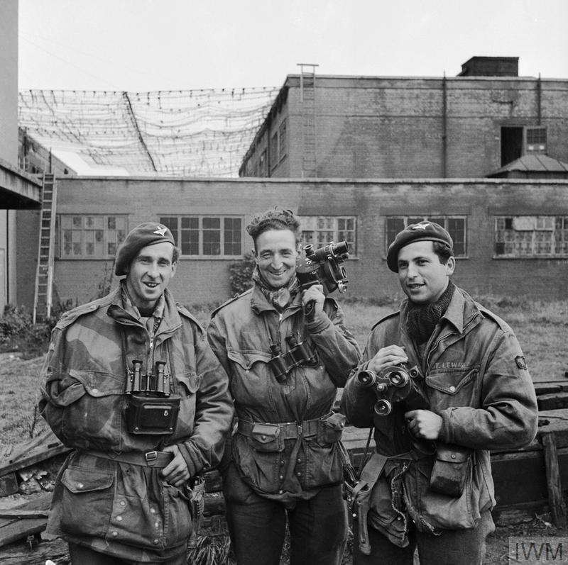
The Imperial War Museum has a number of photos from the battle in Oosterbeek. Along with the fighting troops, three Army Film and Photographic Unit photographers landed with the 1st Parachute Brigade and documented the fighting as it took place in the days leading up to the withdrawal across the river. Despite taking photos in the front line, all three survived.

The following photo shows Sgt D M Smith, Sgt G Walker and Sgt C M Lewis the day that they arrived back at the Army Photographic Unit at Pinewood. Sgt. Smith had been wounded in the shoulder.

Arnhem

OPERATION ‘MARKET GARDEN’ – THE BATTLE FOR ARNHEM, SEPTEMBER 1944 (BU 1169) The three Army Film and Photographic Unit Photographers who took the graphic still and cine pictures of the 1st Airborne Division epic fight at Arnhem. Copyright: © IWM. Original Source: http://www.iwm.org.uk/collections/item/object/205192044

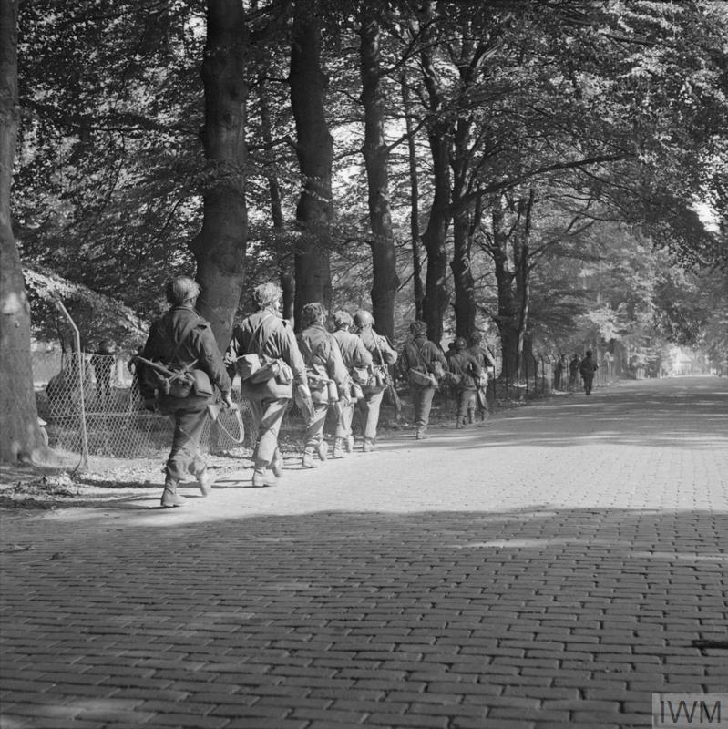
A small sample of photos, the initial advance along the road entering into Oosterbeek from the west:

Arnhem

OPERATION ‘MARKET GARDEN’ – THE BATTLE FOR ARNHEM, SEPTEMBER 1944 (BU 1089) Men of the 2nd Battalion South Staffordshire Regiment entering Oosterbeek along the Utrechtsweg on their way towards Arnhem, 18 September 1944. Copyright: © IWM. Original Source: http://www.iwm.org.uk/collections/item/object/205216205

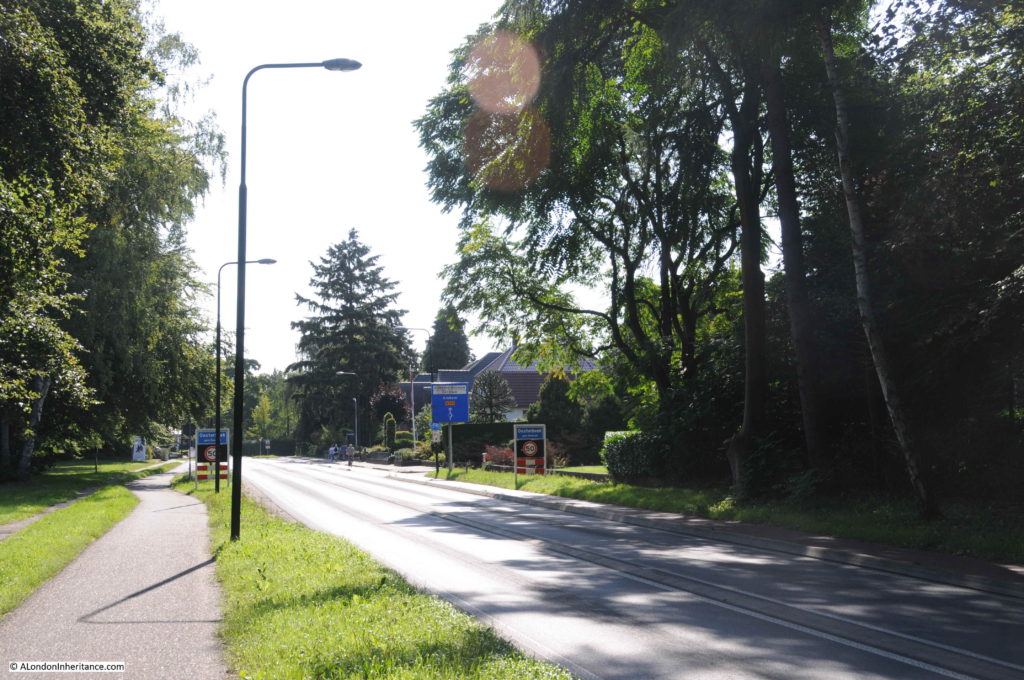
The same street today, the area is wooded, there are trees lining the streets and houses set back from the road. Very different to when the perimeter was roughly across this photo in September 1944:

Arnhem

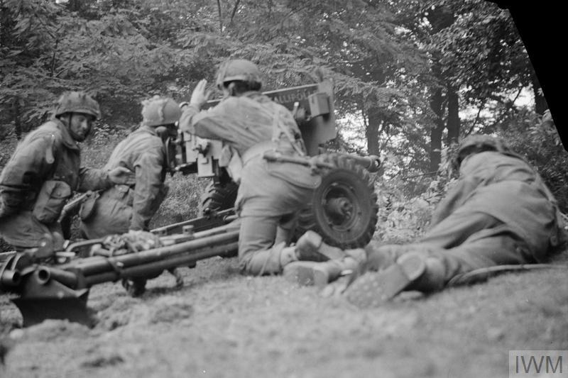
A 6-pounder anti-tank gun of No. 26 Anti-Tank Platoon, 1st Border Regiment, 1st Airborne Division, in action in Oosterbeek, 20 September 1944. The gun was at this moment engaging a German PzKpfw B2 (f) Flammpanzer tank of Panzer-Kompanie 224 and successfully knocked it out:

Arnhem

OPERATION ‘MARKET GARDEN’ – THE BATTLE FOR ARNHEM, SEPTEMBER 1944 (BU 1109)  Copyright: © IWM. Original Source: http://www.iwm.org.uk/collections/item/object/205203182

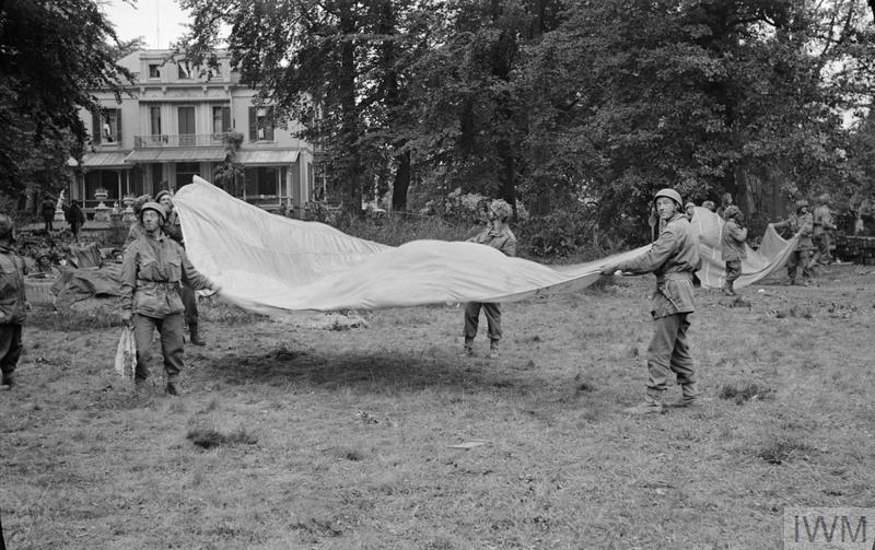
The German forces had over run the planned drop zones for resupply of the airborne forces. The aircraft were under instruction to ignore signals from the ground as they could have been enemy diversions so the majority of dropped supplies landed in German held territory. There was also significant loss of the aircraft dropping supplies.
1st Airborne Division soldiers use parachutes to signal to Allied supply aircraft from the grounds of 1st Airborne Division’s HQ at the Hartenstein Hotel in Oosterbeek, 23 September 1944.

Arnhem

OPERATION ‘MARKET GARDEN’ – THE BATTLE FOR ARNHEM, SEPTEMBER 1944 (BU 1119) Copyright: © IWM. Original Source: http://www.iwm.org.uk/collections/item/object/205203183

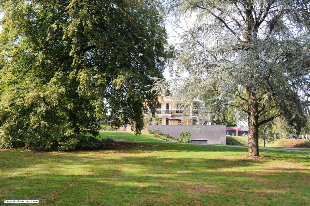
The same view today is shown in the photo below. The grounds have been beautifully landscaped. The large construction extended from the ground is the recent extension to the basement which holds the multi-media exhibitions.

Arnhem

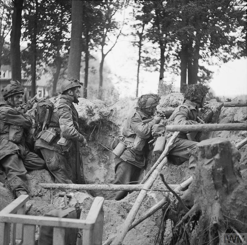
Another example of front line Photography by the Army photographic unit during the battle. Troops of the 1st Paratroop Battalion take cover in a shell hole in Arnhem, 17 September 1944.

Arnhem

OPERATION ‘MARKET GARDEN’ – THE BATTLE FOR ARNHEM, SEPTEMBER 1944 (BU 1167) Copyright: © IWM. Original Source: http://www.iwm.org.uk/collections/item/object/205192043

There are reminders of the battle to be found all around Arnhem and Oosterbeek, from superb museums, to memorials large and small and bullet market buildings.

Of the 8,905 officers and men and the 1,100 glider pilots who had originally landed west of Oosterbeek, only 2,163 would escape. Over 1,200 officers and men died in the battle and the rest would be taken into captivity.
There is a major Commonwealth War Graves Commission cemetery at Oosterbeek – I will report about my visit to the cemetery in a post later in November.
I will also have a mid-week post on the major commemoration held in Oosterbeek in September.

Next Sunday I will be returning to London, and hopefully for my long suffering e-mail subscribers, shorter posts (thanks for bearing with me during my visit to the Netherlands.)

alondoninheritance.com

Operation Market Garden, Nijmegen And The Valkhof

The next stop for my posts on the Netherlands is the city of Nijmegen. My father took a series of photos of the town centre and also the bridge over the River Waal, one of the bridges that was part of the 1944 Operation Market Garden – the plan for allied forces to breakout from Belgium, capture key bridges over the major rivers that ran from Germany and across the Netherlands to where an unobstructed route opened up to central Germany.

A brief bit of background to Operation Market Garden – By September 1944, the British 2nd Army and Canadian forces had made considerable progress. The breakout from Normandy was followed by a dash across northern France and Belgium to the point where the 2nd Army stood on the Belgium / Netherlands border. The speed of their success meant huge problems with supplies catching up with the leading columns, despite the apparent crumbling of the German forces.

With the American army making progress to the south, there was competition as to who would make the most progress into Germany and an ambition to try and bring the war in the west to a swift end.

Airborne forces had been waiting in England since D-Day. A number of proposed parachute drops had been cancelled at the last minute, often because the land forces had moved so quickly and had already taken the objectives.

Field Marshal Montgomery put together a plan which would make use of the airborne forces to secure bridges across the Netherlands and open up a path for the 2nd Army to sweep across the rivers to the point where a turn to the east would bring them directly into the industrial heart of Germany.

The plan was given the code name Operation Market Garden, with the ground forces being the “Garden” part of the operation and the airborne forces, the “Market” element.

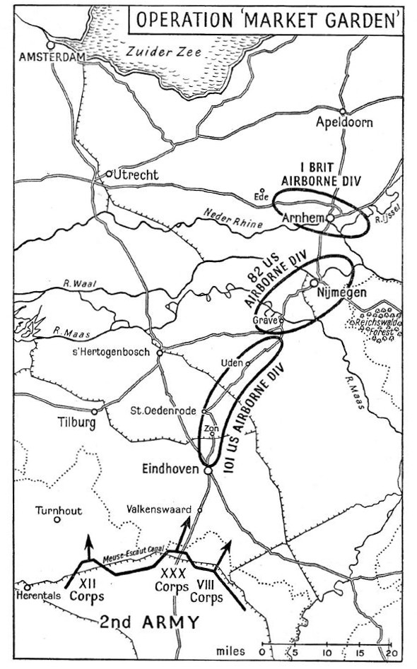
The following map from the 1958 book “Arnhem” by Major-General R.E. Urquhart illustrates the plan behind Operation Market Garden:

Operation Market Garden

US airborne forces with drop and hold the route from Eindhoven to Nijmegen, with British airborne forces landing at Arnhem to hold the final bridge.

Operation Market Garden has been covered in a range of excellent books from the original “A Bridge Too Far” by Cornelius Ryan from 1974 through to the most recent book published this year, “Arnhem” by Anthony Beevor. There are also earlier books, some by those who were involved in the operation, such as the book from which the above map came from.

Operational Market Garden was the subject of the 1977 film “A Bridge Too Far”, directed by Richard Attenborough. There was also an earlier film from 1946, “Theirs Is The Glory”, which included many of the actual participants recreating their role in the operation at Arnhem. It is still available on DVD and a remarkable film to watch, given that the majority of those in the film were participants, not actors.

I can probably guess why may father wanted to see Nijmegen. Having followed the war as a child, using the Daily Express map of the War in Europe pinned to his bedroom wall – seeing the places that would have been featured in news reports, newsreels and post war films would be a thing to do, once travel was easier and he had completed National Service.

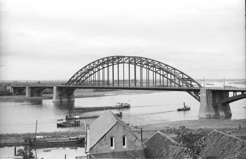
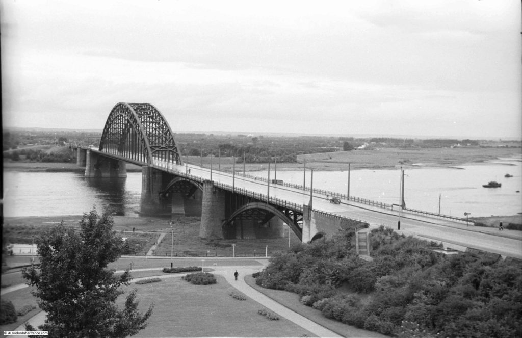
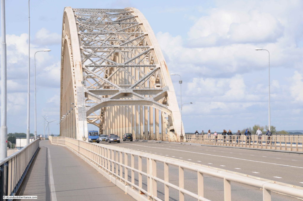
The bridges would have been the first things to see – this is the bridge at Nijmegen over the River Waal, a key part of Operation Market Garden. Photographed by my father in 1952:

Operation Market Garden

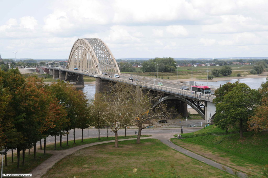
Sixty six years later in 2018, I stood in roughly the same spot:

Operation Market Garden

The 82nd US Airborne had been tasked with taking Nijmegen and securing the bridge as part of Operation Market Garden. They were to hold until the XXX Corp of the 2nd Army had fought up from the Belgium border, past Eindhoven to Nigmegen.

The bridge was important as by holding the bridge, and with XXX Corp reaching Nijmegen in time, they would have been able to move up to Arnhem to relieve the 1st British Airborne Division who were dropped near Arnhem to take and hold the bridge over the Nederrijn.

There was a significant delay in taking the Nijmegen bridge, which not was secured until day 4 of Operation Market Garden. An initial lack of priority to focus on the bridge, the need to defend the landing grounds, and from assumed German forces in the Reichswald Forest (see map above) meant that German reinforcements were able to build in the town and around the bridge. The Germans also started to demolish and burn large parts of the city of Nijmegen to make it harder for an attacking force.

Another 1952 view of the bridge:

Operation Market Garden

The same view in 2018:

Operation Market Garden

The attempt to take the bridge was made difficult as airborne forces had only been landed on the southern side of the river, rather than on both sides, so the north was well defended and attempts to take the bridge were met with heavy fire from the north.

Fighting in the city of Nijmegen was intense and took some days to clear. Rather than rush the bridge, US forces crossed the river to the west under heavy, sustained fire and taking significant casualties, and after more intense fighting were able to take the northern side of the bridge.

A small number of British tanks made it across the bridge, but then halted due to supply difficulties, no supporting infantry and unknown German forces on the road between Nijmegen and Arnhem. It was a surprise that the German forces had not demolished the bridge.

The final part of Operation Market Garden, the 1st British Airborne Division and the Polish 1st Independent Parachute Brigade at Arnhem were left isolated.

I had the opportunity to explore the Arnhem area, and witness the events that are held every year by the Dutch to commemorate the sacrifice of the British and Polish soldiers a few days after visiting Nijmegen.

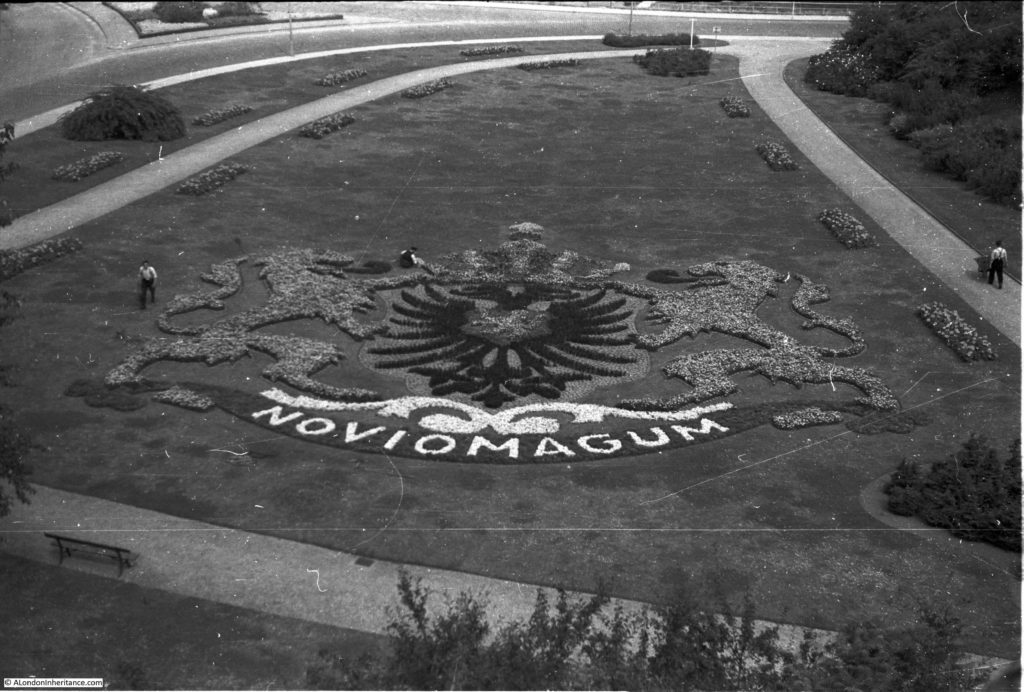
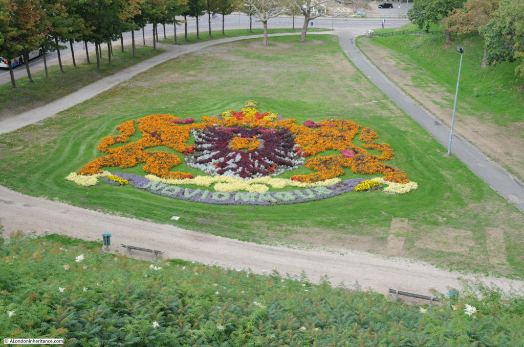
In the above two photos, there is a grassed area at the bottom of each photo. Moving the camera down in 1952 and 2018 provides a view of a rather elaborate floral display

Operation Market Garden

1952 above and 2018 below:

Operation Market Garden

Nijmegen is probably the oldest city in the Netherlands, with a history of occupation going back to the 1st century BC. The city was established in the Roman period and given the name Noviomagus which means “new market” – as highlighted within the floral display.

On the northeastern corner of the city is a high plateau of land. This was occupied as a fortified area, with the town being established towards the south (where the town of today is located) and along the river. It is from the high point that the above photos were taken.

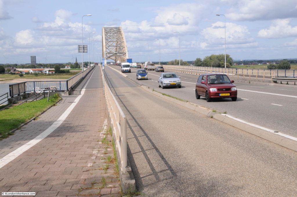
I then headed down to the bridge to take a walk to the centre of the bridge. The central carriageway is for motorised traffic, with walkways along each side of the bridge for pedestrians and bikes.

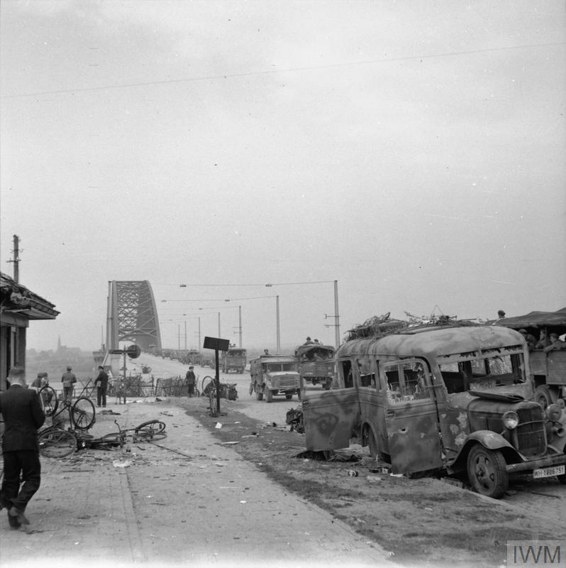
The Imperial War Museum archives have some photos which show the bridge immediately after the battle. The following photo is from the Nijmegen end of the bridge:

Operation Market Garden

THE BRITISH ARMY IN NORTH-WEST EUROPE 1944-45 (B 10173) A column of lorries passes wrecked German vehicles on the bridge at Nijmegen, 21 September 1944. Copyright: © IWM. Original Source: http://www.iwm.org.uk/collections/item/object/205202526

The same view today:

Operation Market Garden

Operation Market Garden depended on a long, relatively narrow thrust of allied forces up through the Netherlands. Whilst this allowed considerable progress to be made in penetrating deep into what had been occupied territory, it did leave long exposed flanks which the Germany army continually attacked, occasionally breaking the chain from the Belgium border to Nijmegen.

The allied forces therefore had to be continually ready for an attack from the east or west of their positions, as demonstrated by the following photo with guns facing the land to the side of the bridge.

Operation Market Garden

THE BRITISH ARMY IN NORTH-WEST EUROPE 1944-45 (B 10171) 17-pdr anti-tank gun of the 21st Anti-Tank Regiment, Guards Armoured Division, guards the approaches to Nijmegen Bridge, 21 September 1944. Copyright: © IWM. Original Source: http://www.iwm.org.uk/collections/item/object/205202528

The Germans had rigged the bridge with explosives, but had held back from blowing the bridge in the expectation that they would need the bridge for a counter attack. There have been various theories for why the bridge was not blown when the capture of Nijmegen seemed certain – the wires were cut in the fighting, sabotage by the Dutch resistance, or just failed orders.

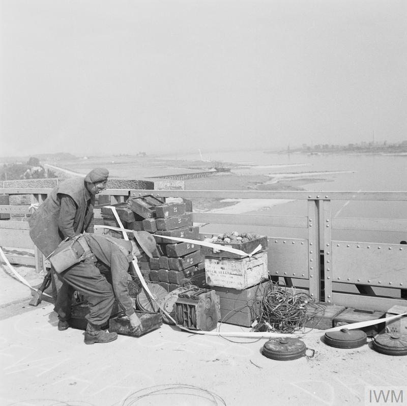
After the capture of the bridge, a considerable amount of explosive was removed:

Operation Market Garden

OPERATION ‘MARKET GARDEN’ (THE BATTLE FOR ARNHEM): 17 – 25 SEPTEMBER 1944: NIJMEGEN AND GRAVE 17 – 20 SEPTEMBER 1944 (B 10174) Nijmegen and Grave 17 – 20 September 1944: British engineers removing the charge which the Germans had set in readiness to blow the Nijmegen bridge. Copyright: © IWM. Original Source: http://www.iwm.org.uk/collections/item/object/205193889

Walking further along the bridge and it was from roughly the following point that my father took some photos along the river and back into the city:

Operation Market Garden

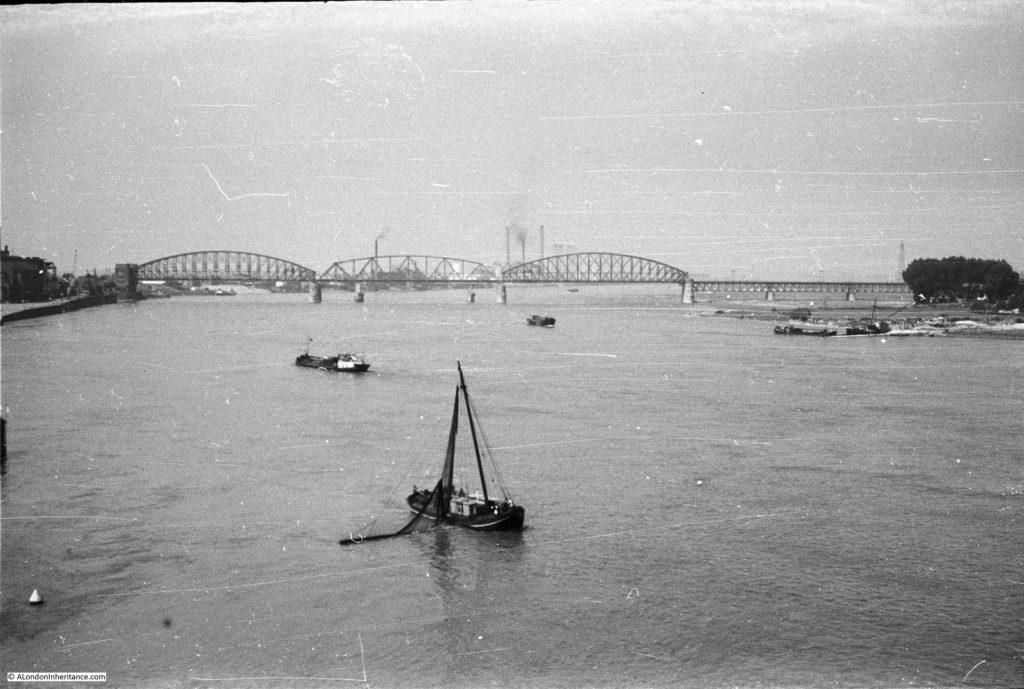
This 1952 photo is from the main road bridge, looking west along the River Waal towards the railway bridge:

Operation Market Garden

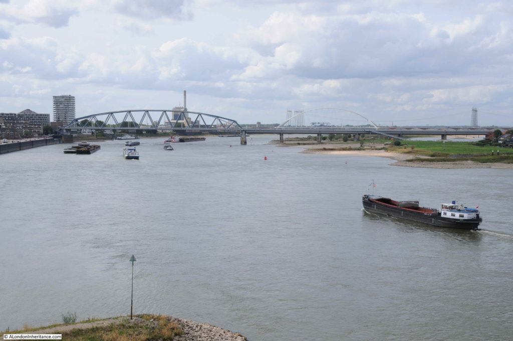
The same 2018 view with a new railway bridge:

Operation Market Garden

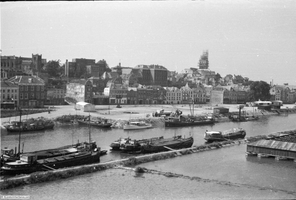
In 1952 this was the view looking back into the city of Nijmegen:

Operation Market Garden

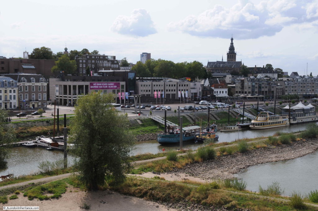
The same view in 2018, although with a lower water level on the river:

Operation Market Garden

The water front has seen some development between the two photos, however the church, undergoing repair in 1952, can be seen in both photos, and along the front there are at least two buildings remaining. The second building from the left, along with the white building in the 2018 photo just below the church.

I mentioned earlier the Valkhof – the high plateau of land to the north east of the city, overlooking the River Waal. The area today is a park, with superb views of the river, but it has a long and fascinating history.
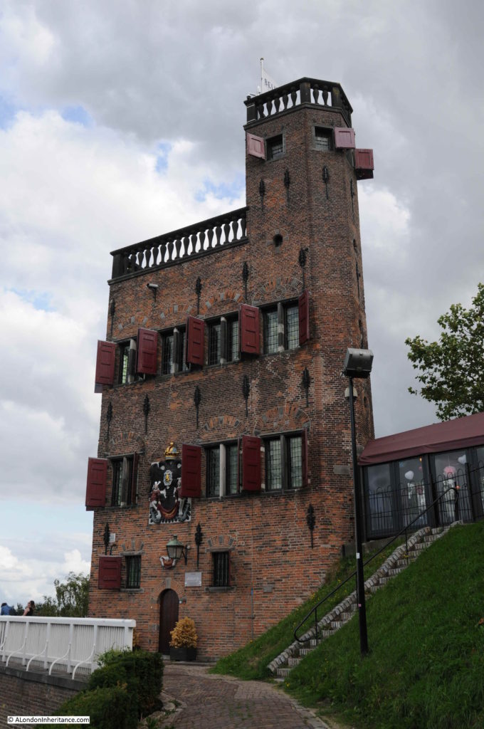
There is a deep cutting between the main part of the Valkhof and a steep hill overlooking the bridge.  At the top of this hill is a building, with a plaque providing the following description: “Originally a defense tower from the 15th century. Substantially changed in 1646. Restored in 1888″
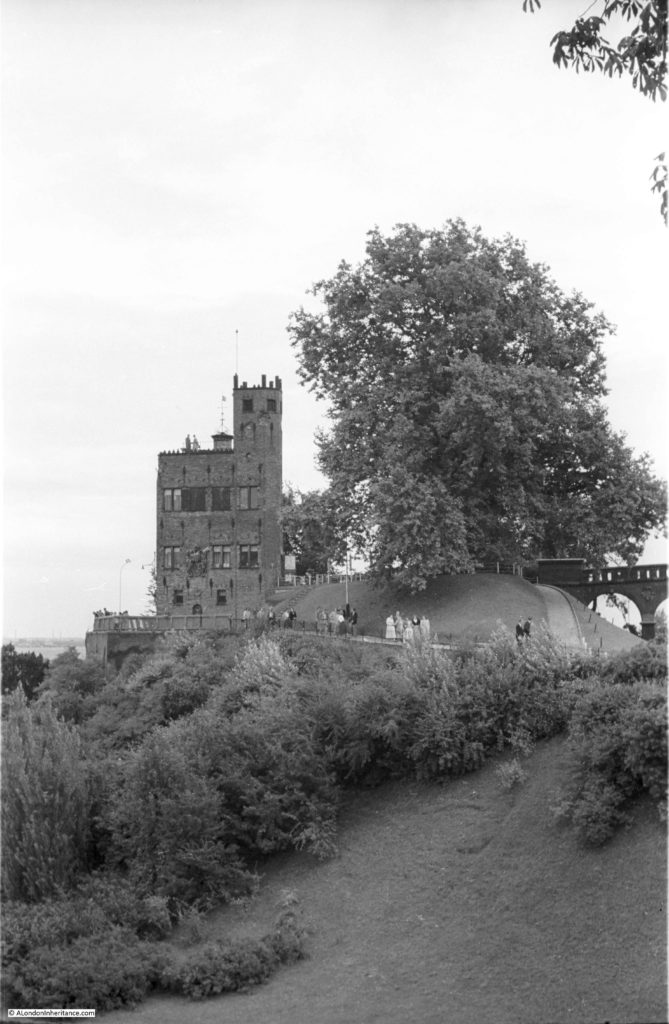
Operation Market Garden

Large trees now obscure the view from where my father took the above photo, so I walked over to the tower and took a closer view. Today the main purpose of the tower appears to be as a wedding venue.

Operation Market Garden

The Valkhof, the high plateau of land in the north east of Nijmegen, overlooking the bridge, has a fascinating history. Valkhof can be translated as “Falcon’s Court”.

Initially some Roman fortifications were followed at the end of the 8th century by a castle / palace for the Emperor Charlemagne who made Nijmegen one of his residences.

After Charlemagne’s death and towards the end of the 9th century Nijmegen is attacked by the Vikings and much of the palace destroyed. Over the following centuries, the castle went through periods of rebuild and decay until the 12th century when the Emperor Frederic Barbarossa ordered a much larger castle to be built on the Valkhof.

It is from the 12th century onwards that Nijmegen grows rapidly in prosperity and size. The castle and proximity to the River Waal provides the city with an importance in European affairs, along with access to a major trading route. Nijmegen is granted the privileges of a City which allows walls to be built around the city.

The castle was badly damaged in the 18th century when the French occupied the city, and at the end of the 18th century, permission was given for the castle to be demolished, with the exception of two chapels.

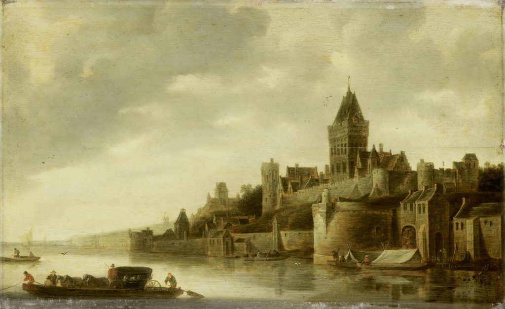
The castle and the city walls,  overlooking the River Waal were an impressive sight. The following painting by the Dutch artist Frans de Hulst shows the castle on the Valkhof in the mid 17th century.

Operation Market Garden

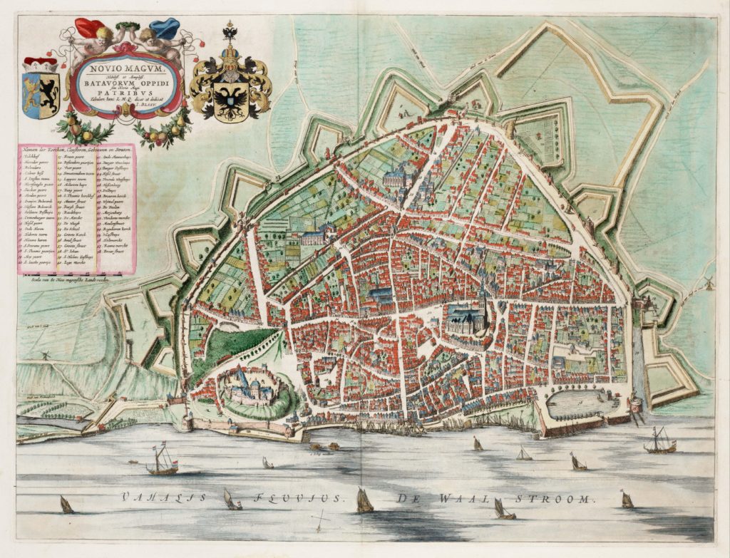
The following map from the same period shows the castle at bottom left with the city of Nijmegen enclosed by city walls and fortifications.

Operation Market Garden

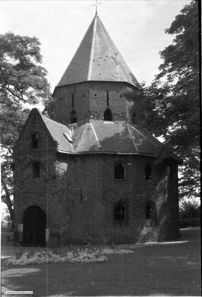
There are two structures remaining from the original castle on the Valkhof. The first is the chapel that my father photographed in 1952:

Operation Market Garden

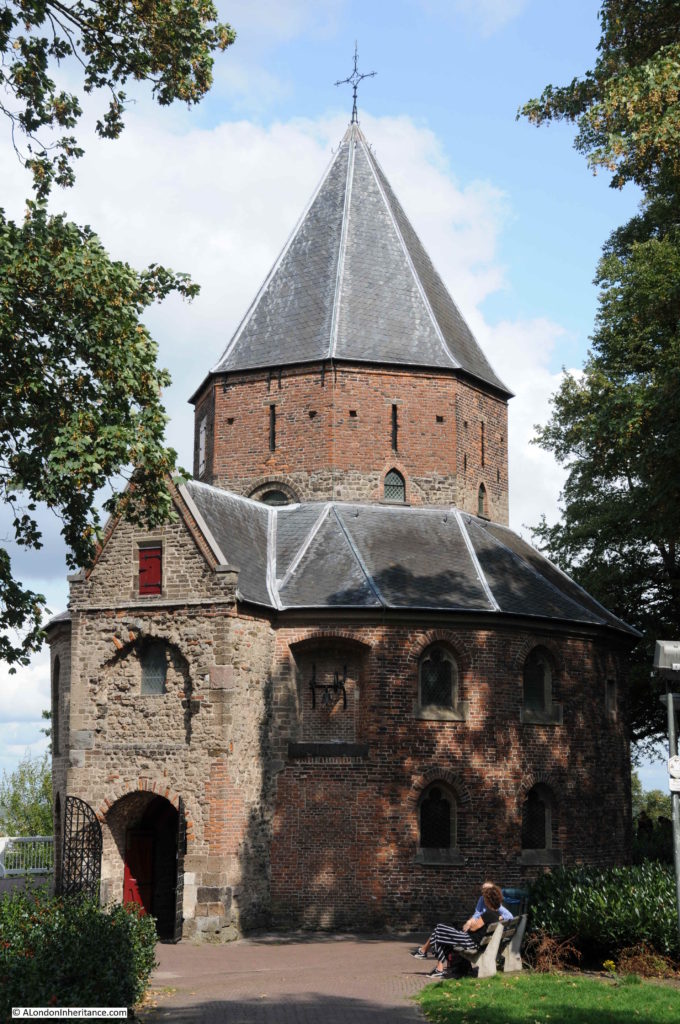
For a building that is hundreds of years old, the change in 66 years should be minimal, which indeed is the case, apart from some changes on the wall to the right of the main entrance, which may have been uncovering features which were bricked over.

Operation Market Garden

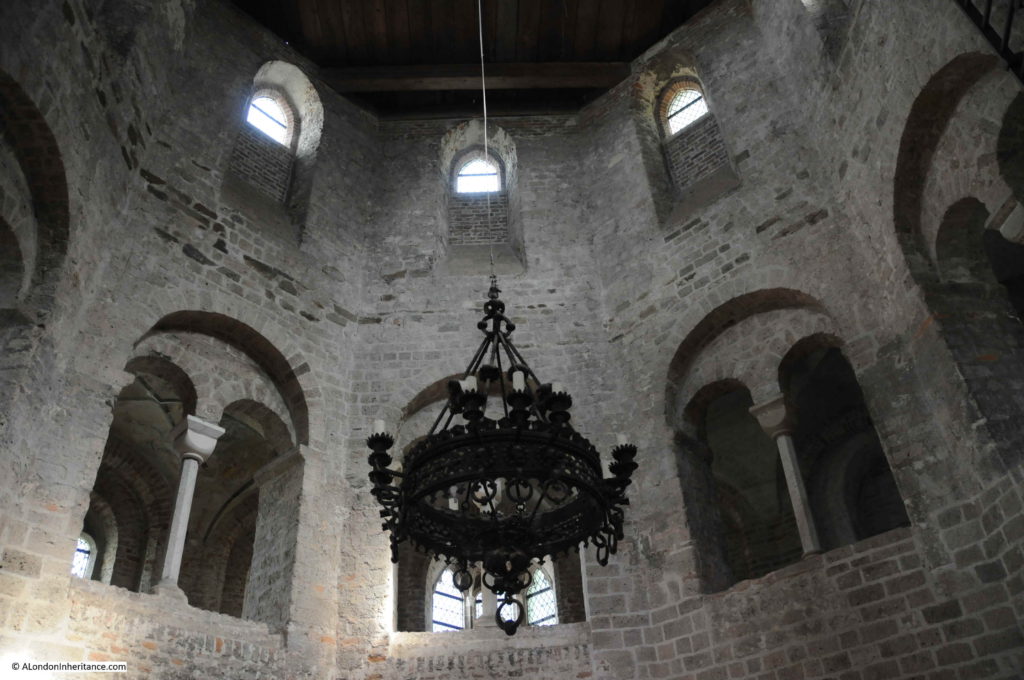
Although the chapel dates from the very first castle on the Valkhof, the building today mainly dates from the end of the 14th century following a fire. This rebuild used brick, and the interior of the chapel was increased in height with an additional gallery running around the chapel.

To step inside the chapel is to walk from a 21st century city back into the medieval castle.

Operation Market Garden

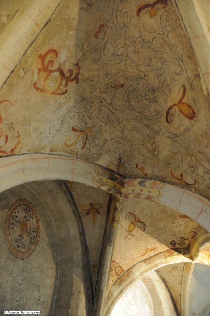
Some remarkable decoration still survives:

Operation Market Garden

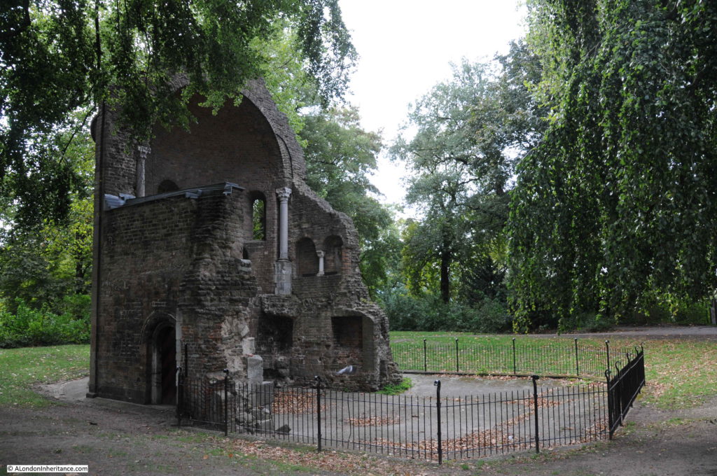
The other chapel on the Valkhof has only part of the walls remaining. This chapel dates from 1155.

Operation Market Garden

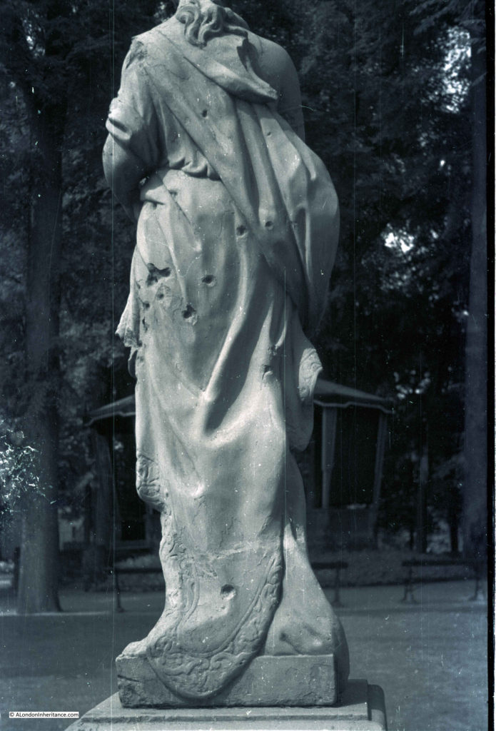
There was only one 1952 photo that I could not find today. I assume it was in Nijmegen as the following photo was in the same strips of negatives. The photo shows a statue in a park with damage caused by multiple bullets.

I had a good walk around the park, but could not find the statue, or the scene behind which looks to be a bandstand.

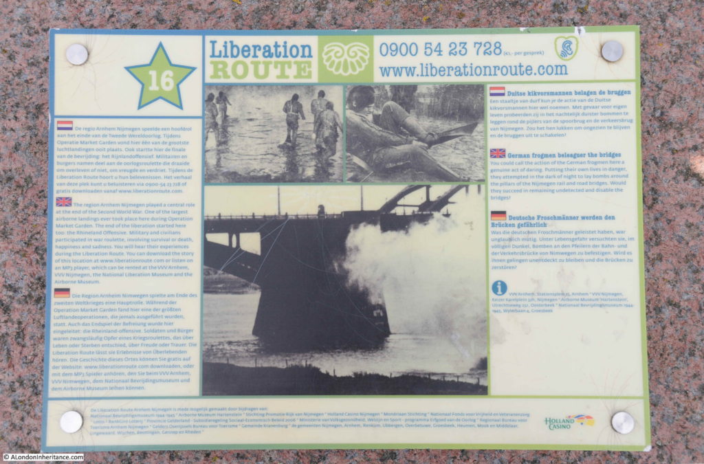
After exploring the Valkhof and the bridge, I took a walk along the edge of the River Waal, a circular route to head into the centre of Nijmegen to find the locations of the rest of my father’s photos. On the river edge is one of the Liberation Route information panels.

Operation Market Garden

The Liberation Route Europe is a fascinating initiative. Funded by the European Union and the Dutch Foundation for Peace, Freedom and Veteran Support, the Liberation route aims to mark out key milestones in recent European history with the liberation of Europe at the end of the 2nd World War. The route starts in southern England, follows through the D-Day beaches of Normandy, the Belgian Ardennes and the southern region of the Netherlands. The route then moves through Germany to Berlin and ends in the Polish city of Gdansk,

Information on the Liberation route can be found at their website here. The site includes a large number of personal stories.

The website also has a copy of the Liberation Route’s “Magna Carta”, a document written by several European historians to establish the historical and scientific basis for the project.

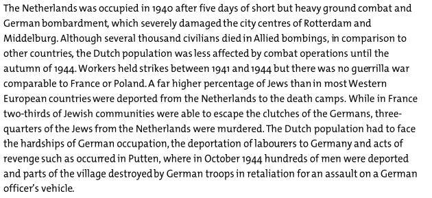
The Magna Carta includes a summary of the impact of war on each of the European countries included in the route. This summary makes very clear that the impact, both during and in the decades that would follow the war, were and are very different.

For example, the following extract is from the summary for Great Britain:

Operation Market Garden

And the following is part of the summary for the Netherlands:

Operation Market Garden

For the people of the Netherlands, it is the liberation from the appalling hardships outlined in the above text that are celebrated today, with the return of freedom and democracy that the liberation enabled. I would see how these celebrations continue to this day when I made the journey to the Arnhem suburb of Oosterbeek a few days later, where the final actions of Operation Market Garden played out.

Before that, I had some more locations of my father’s 1952 photos to find in Nijmegen – a subject for a post in a couple of day.

alondoninheritance.com