Tag Archives: River Wye

The Eagle’s Nest and Monmouth

Long term readers will be aware, that as well as taking photos of London, my father also took photos around the country in the late 1940s / early 1950s during National Service and then cycling with friends and staying in Youth Hostels.

For this week’s post I am visiting two of these locations, the wonderfully named Eagle’s Nest followed by the town of Monmouth.

I have been saving this post until the gloomy days of December, as we approach the shortest day of sunlight of the year, as a reminder of the weather and long days of summer.

The Eagle’s Nest

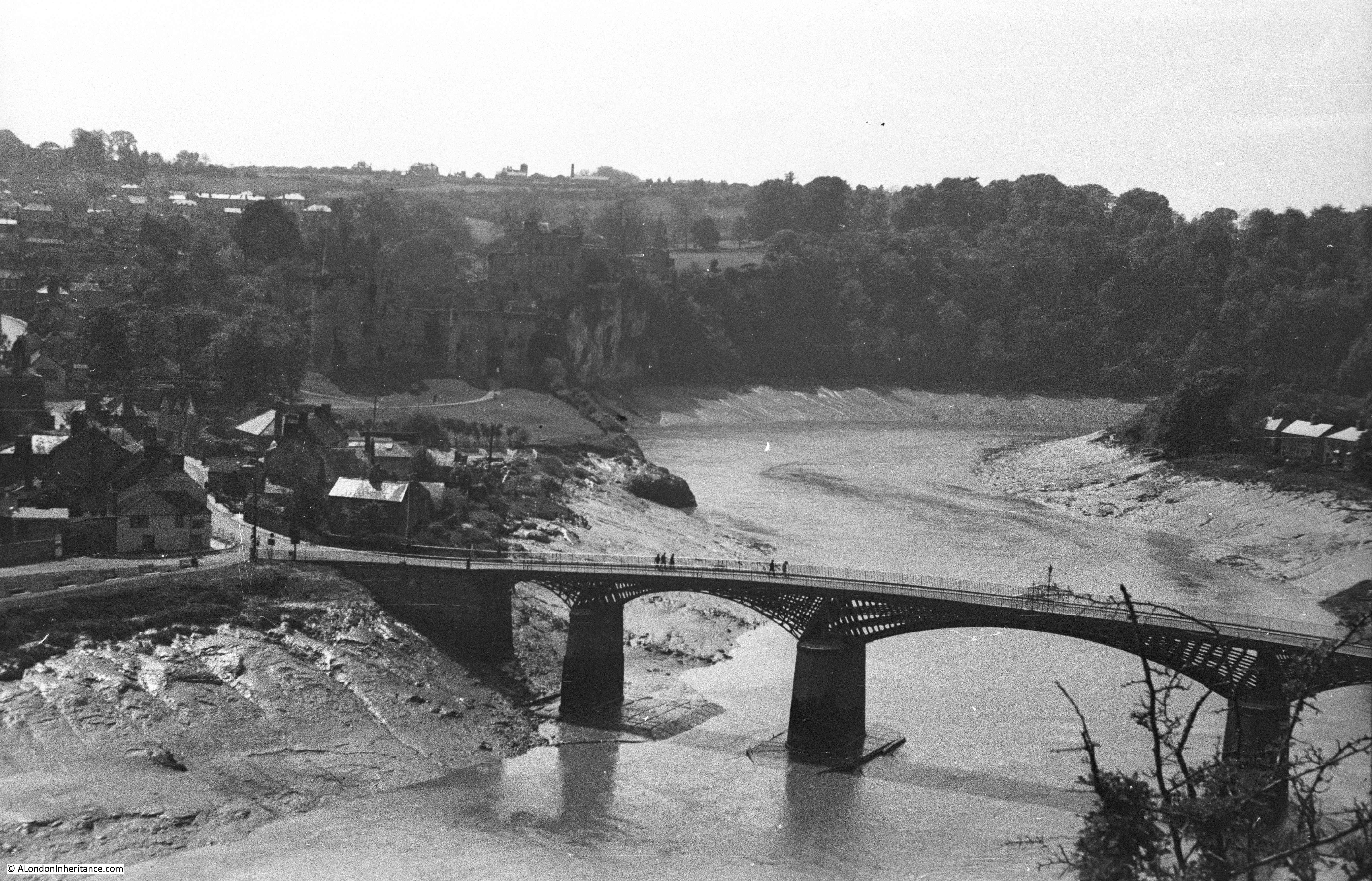
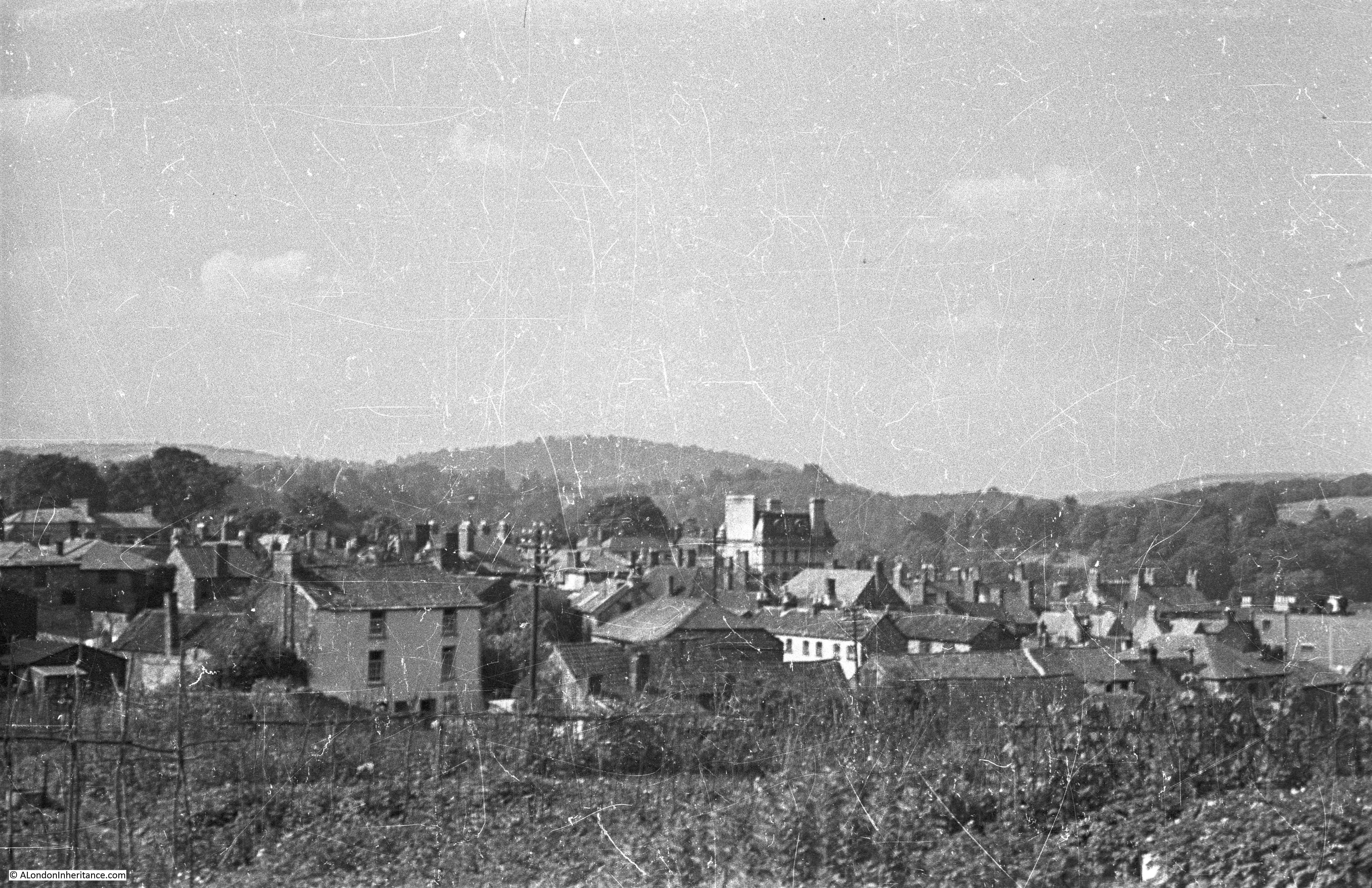
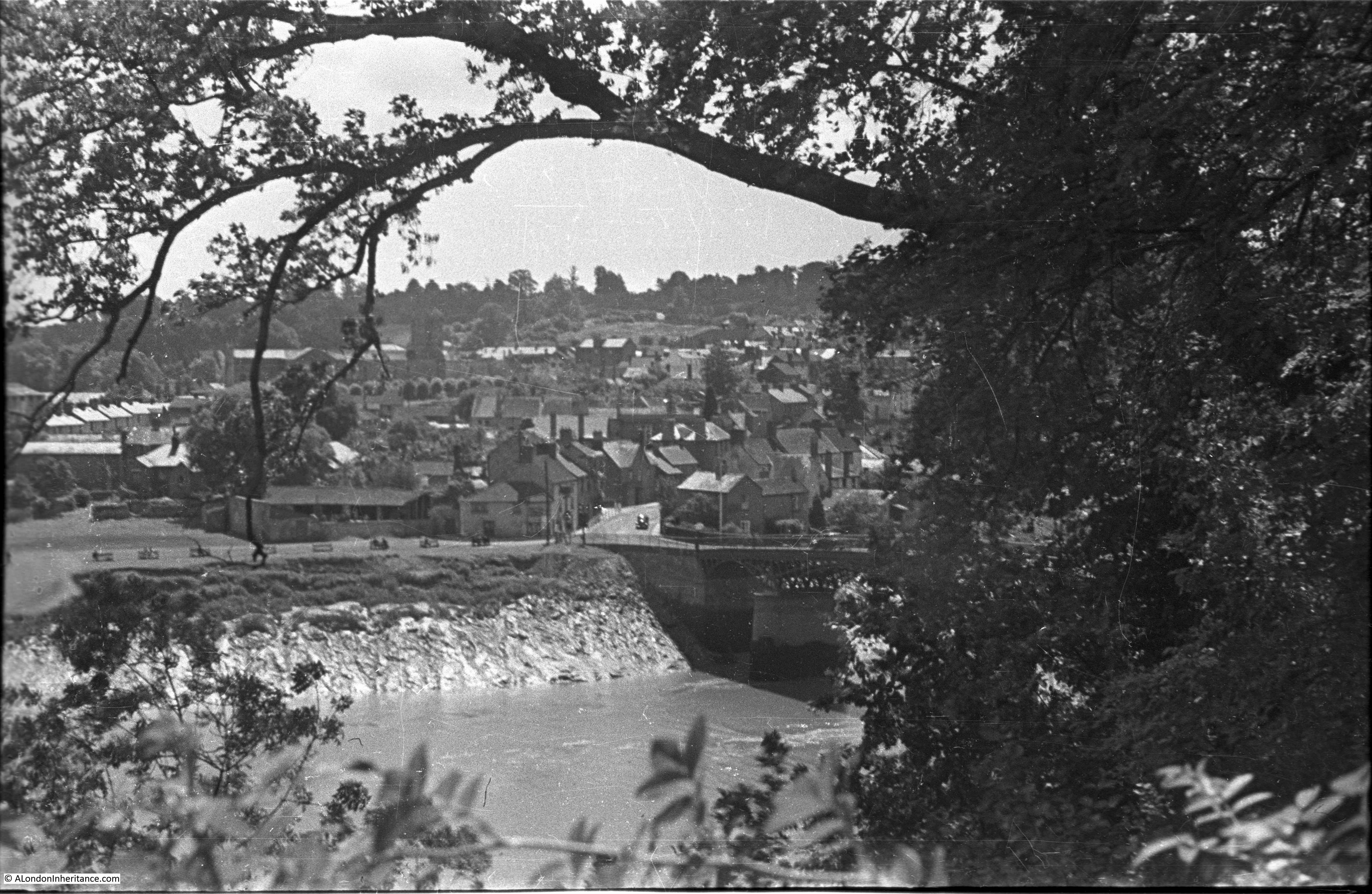
The following is the first of my father’s photos taken from the Eagle’s Nest, a view point looking over the lower Wye Valley with the River Wye in the foreground and the River Severn in the background:

I visited the Eagle’s Nest a few months ago, on a warm September day, and the following photo is looking at the same view as my father’s photo, 76 years later:

The location of the Eagle’s Nest is in south east Wales, very close to the border with England, so close that the border runs along the middle of the River Wye, so in the above photo, the fields in the centre left are in England, the wooded banks on the right are in Wales.

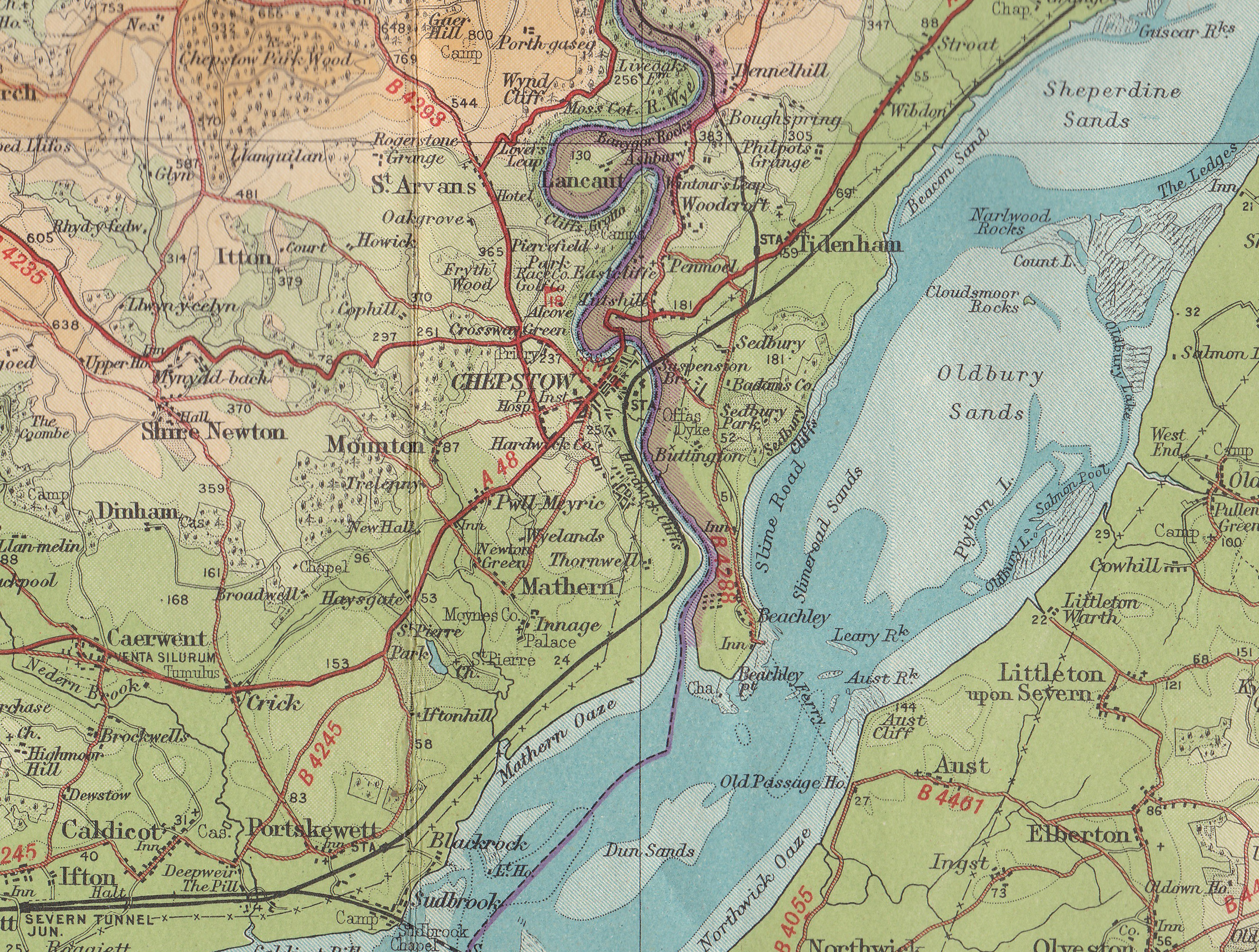
In the following map I have marked the location of the Eagle’s Nest with a red circle, and ringed the town of Monmouth, which I will come to later in the post, with the dark blue circle:

The River Severn is the large body of water from bottom centre up to top right. The Eagle’s Next overlooks the River Wye, which can just be seen in the above map, threading up from where it meets the Severn, just past Chepstow in the south of the map.

The following extract shows the Eagle’s Nest circled, with the loop of the River Wye:

The Eagle’s Nest is reached by one of two paths through the surrounding woodland. One is a steep ascent via 365 steps, the other is a more gentle route, and together they form a loop via a car park next to the road at the bottom of the wooded sides to the river.

The path up through the woods:

Which is well signposted:

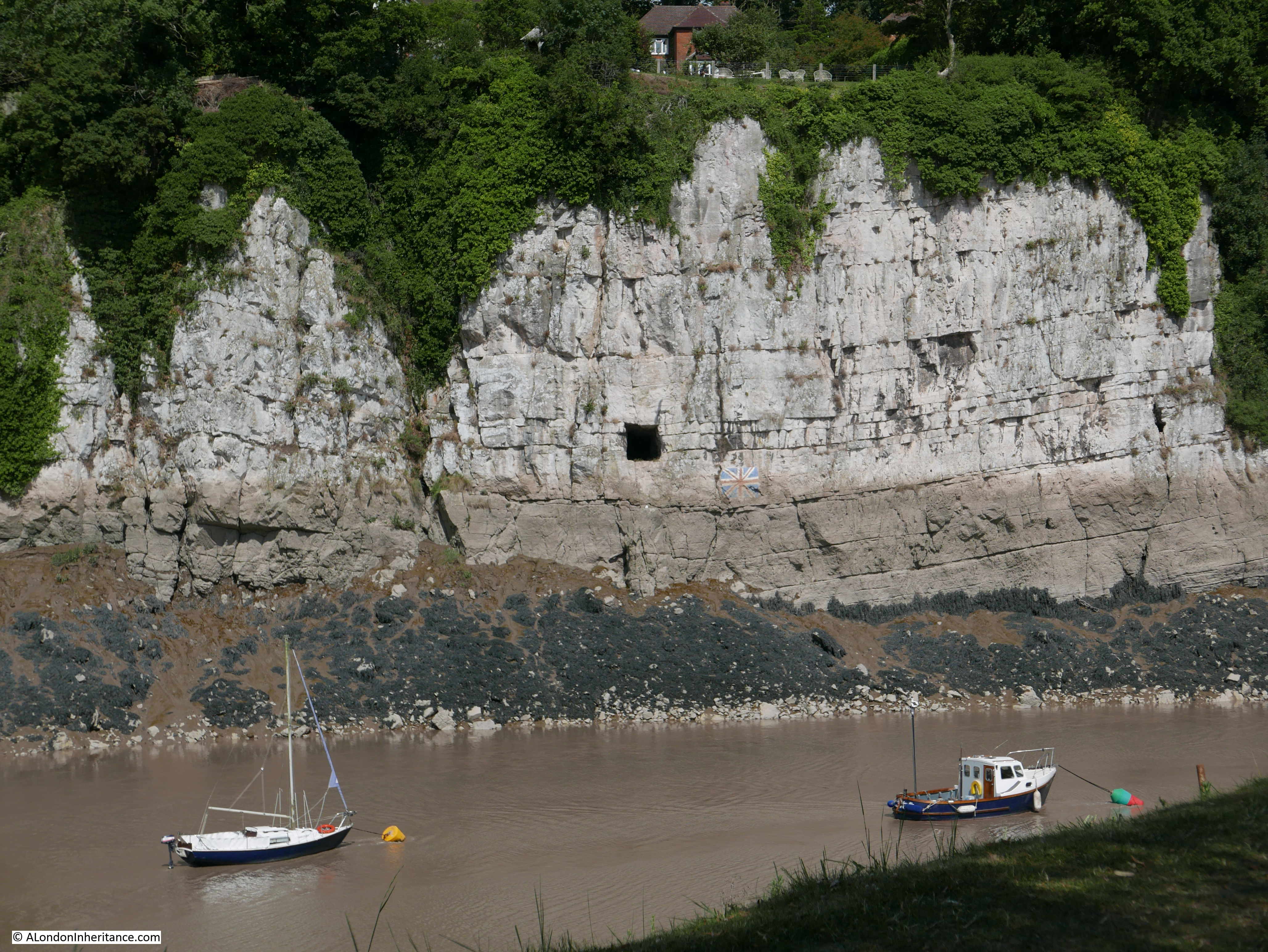
The view is the result of the River Wye cutting through limestone over very many thousands of years, leaving limestone cliffs on either side with the river in a valley or gouge.

The Eagle’s Nest is the name given to the viewpoint which was built in 1828 as part of the walks around the Duke of Beaufort’s nearby Piercefield estate. The name is appropriate as it is easy to imagine eagles nesting in the limestone cliffs and flying out over the Wye, hunting for food. 

It was built on the Monmouthshire bank of the Wye, and at a height of 771 feet, it offers a wonderful view of the bend in the river, to the south and east, and across to the River Severn.

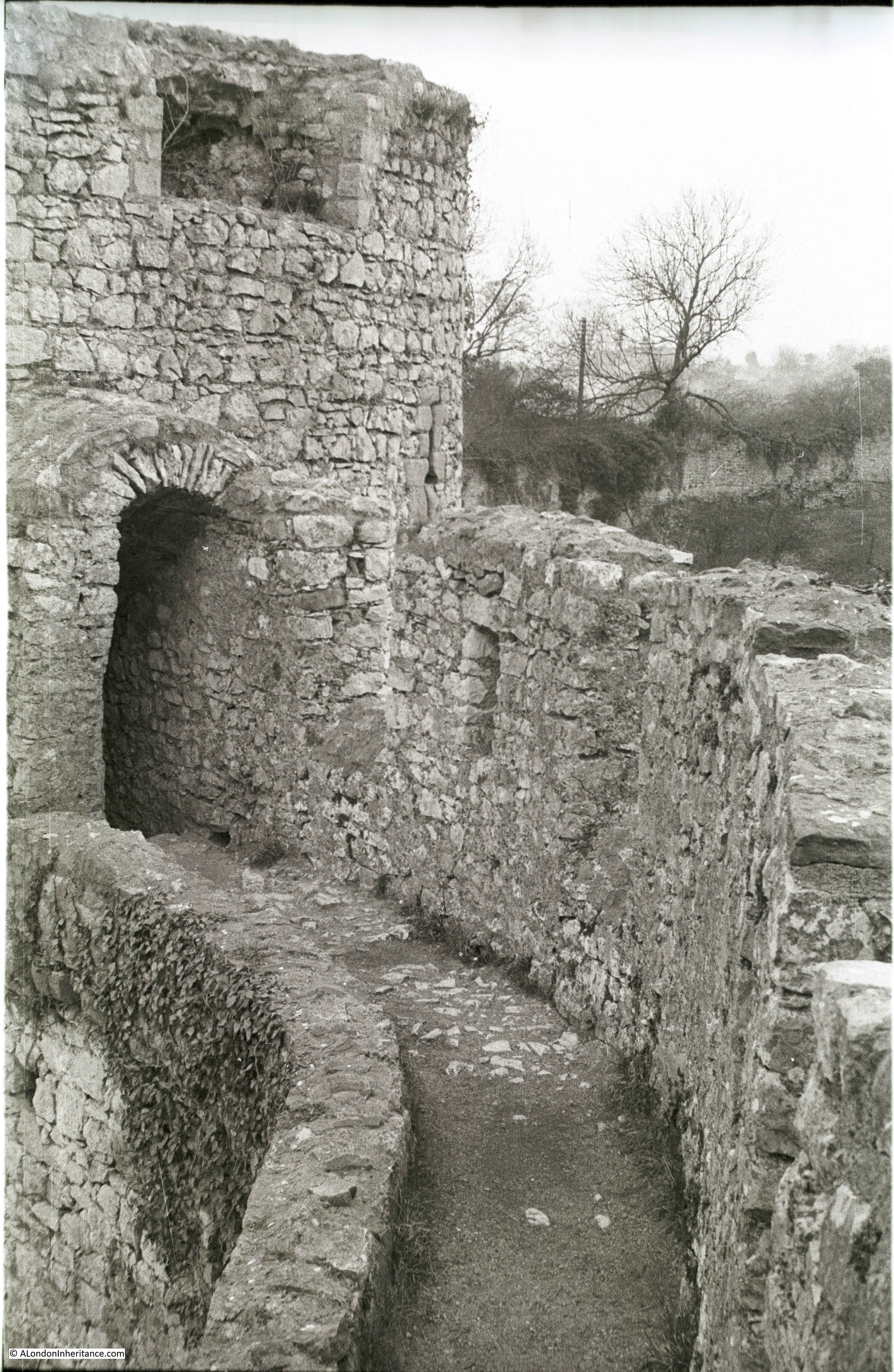
The Eagle’s Nest viewing point, built on the side of the cliff, with railings and a run of seats, as shown in the following photo:

The way a tree at the end of the row of seats has weaved its way around the wall gives some indication of the age of the view point:

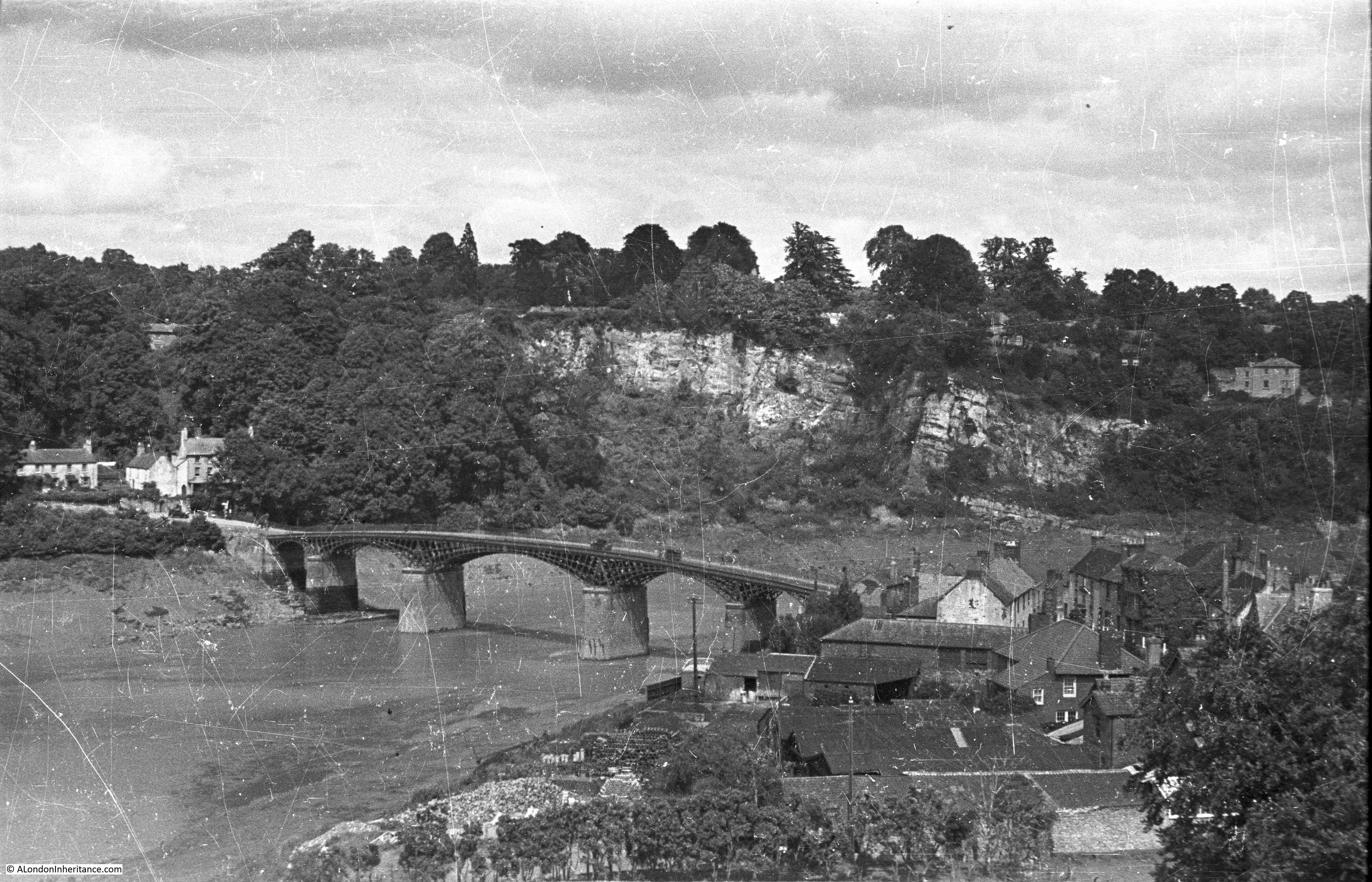
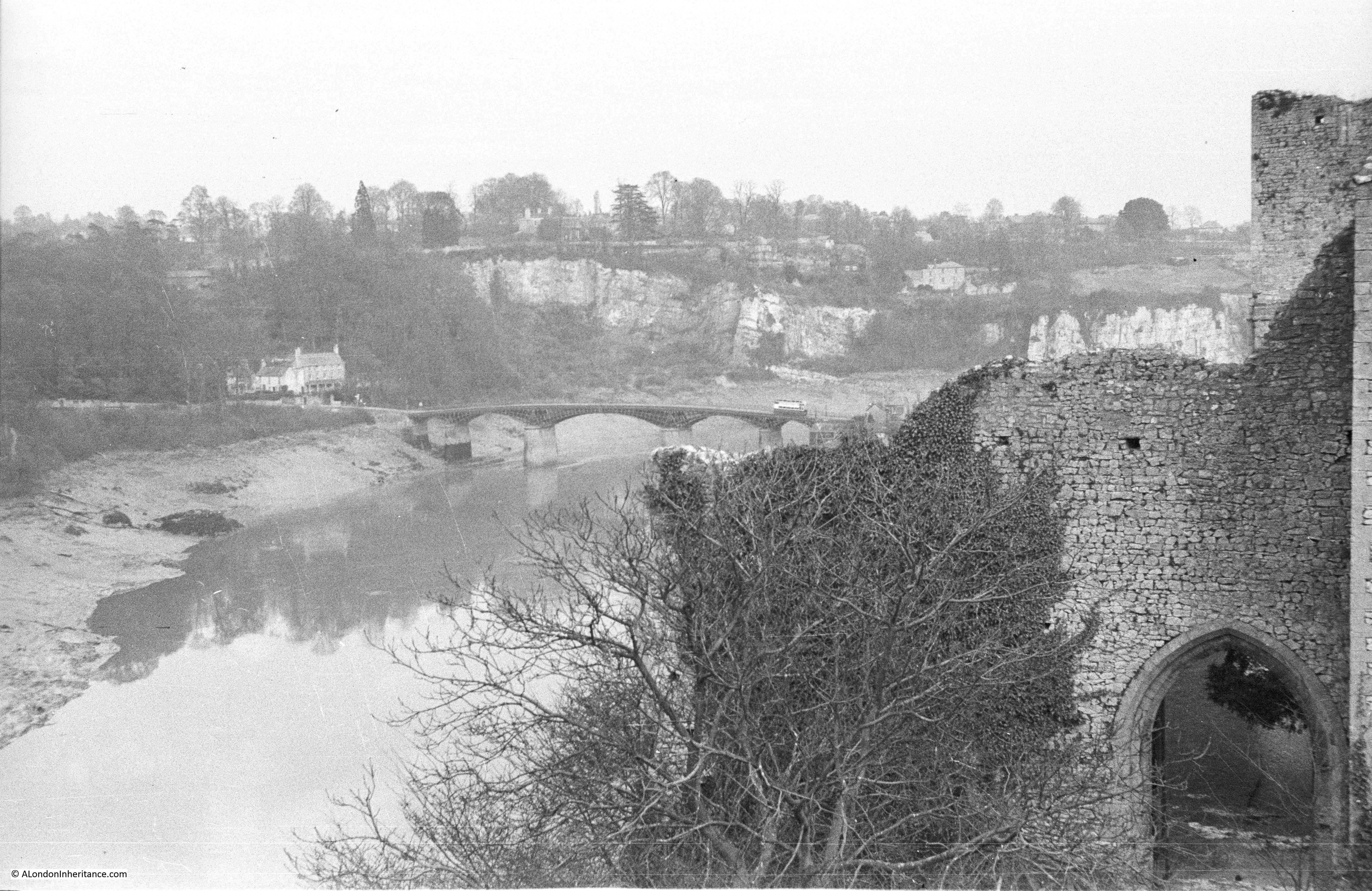
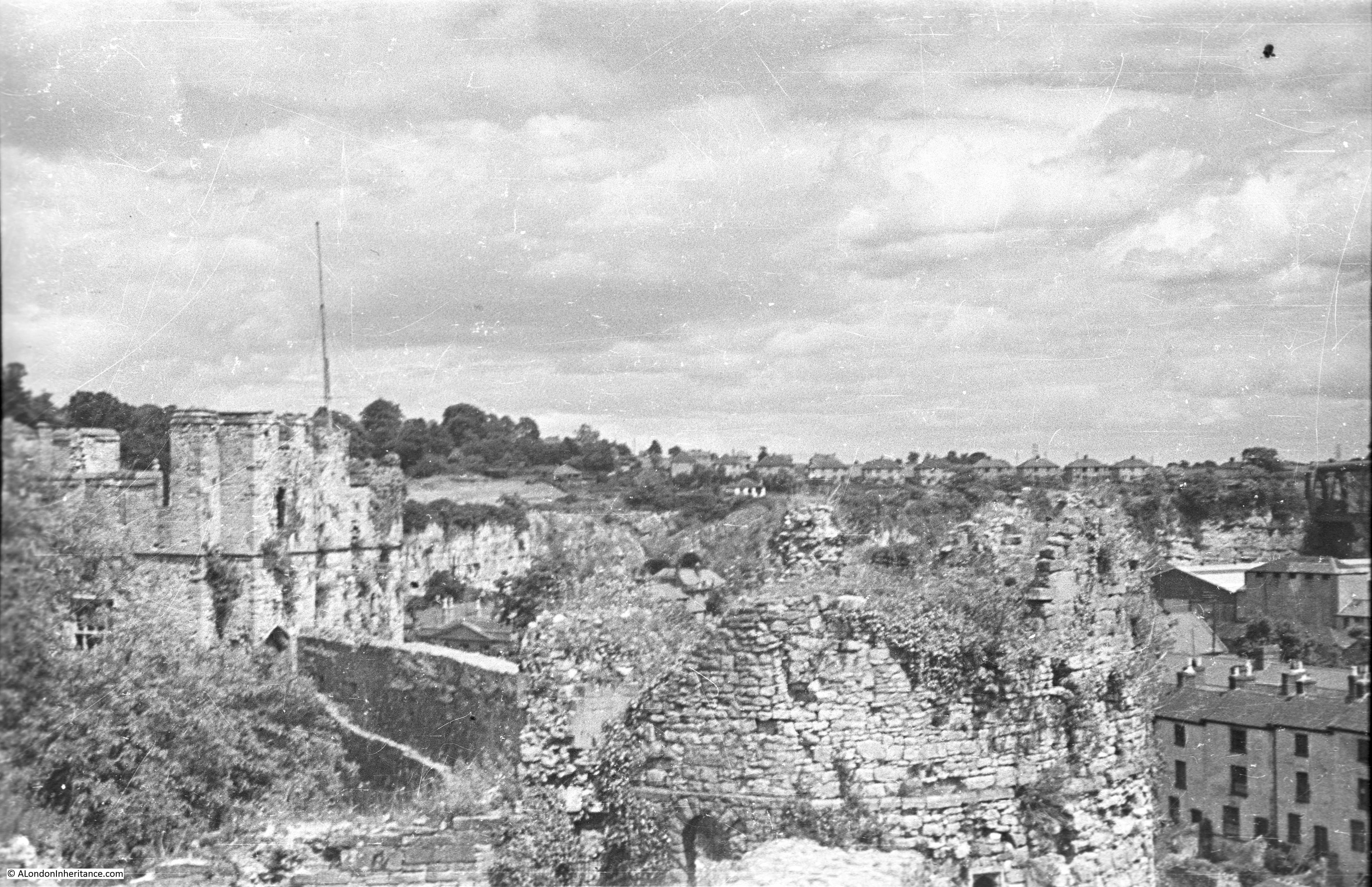
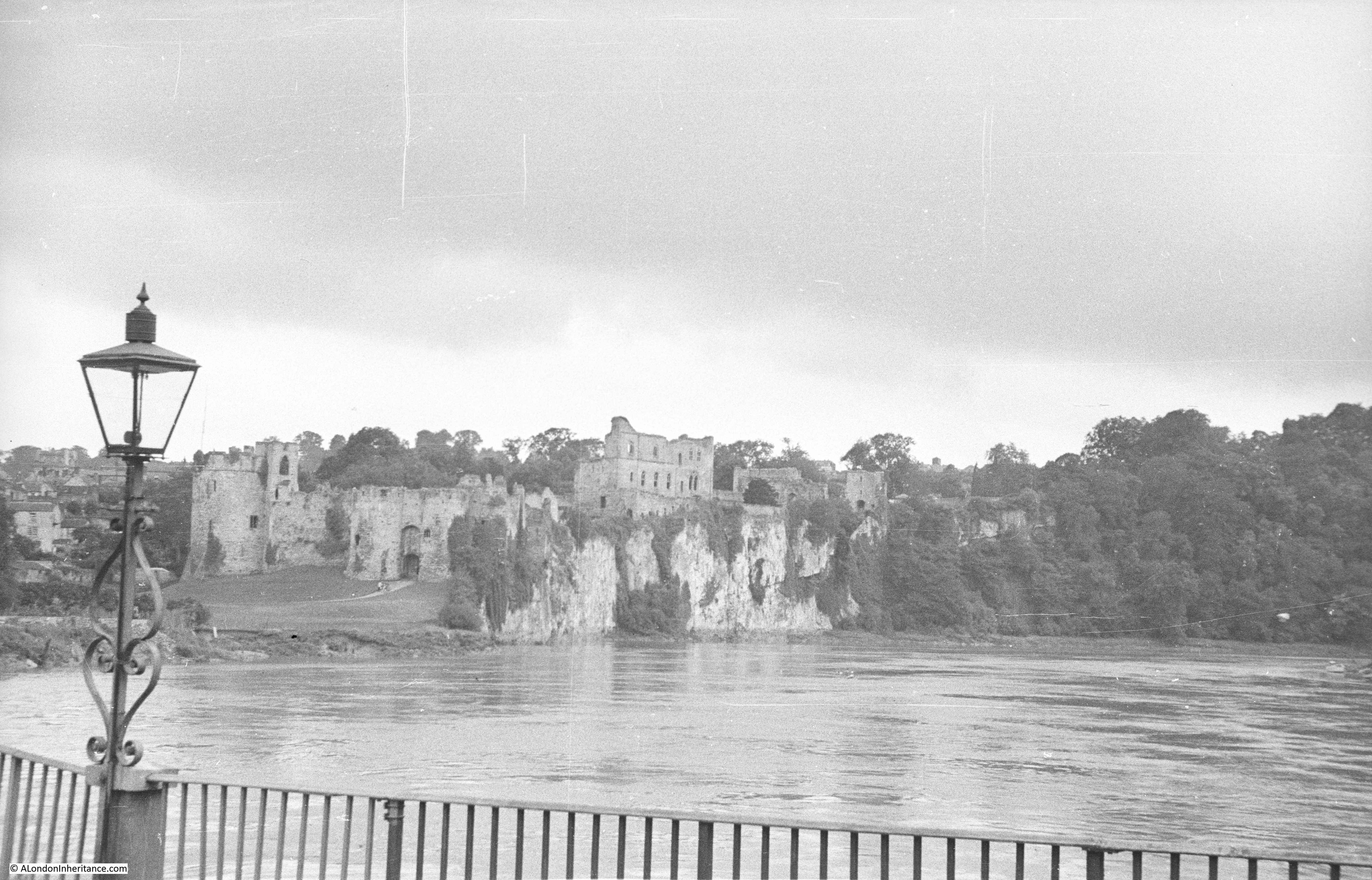
This is the second of the two photos taken by my father in 1948, and is looking slightly to the left / east of the first photo, and shows the flat area of land circled by the River Wye. In the background is the River Severn, and to the upper left, the limestone cliffs of the gouge created by the river, can be seen:

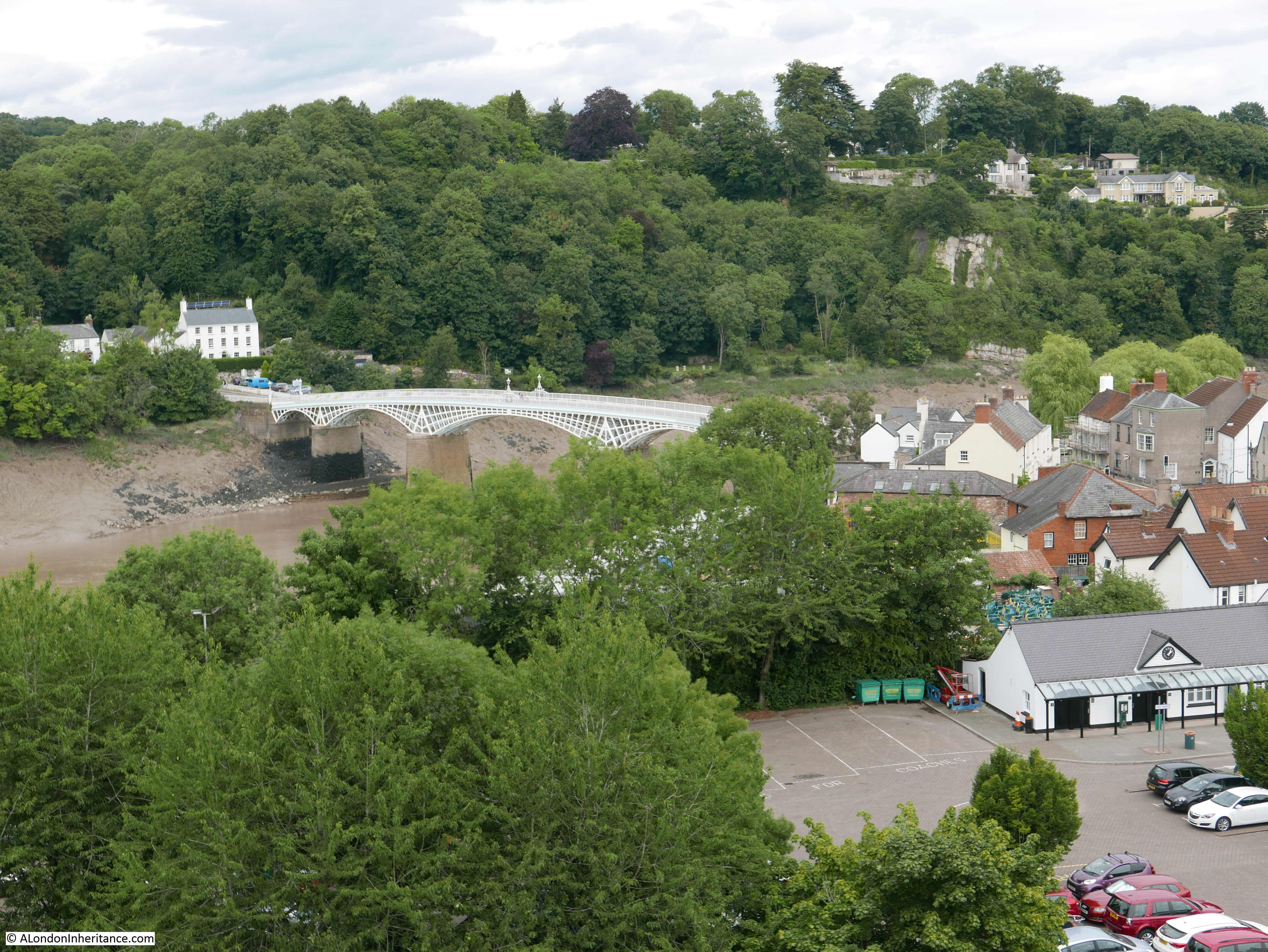
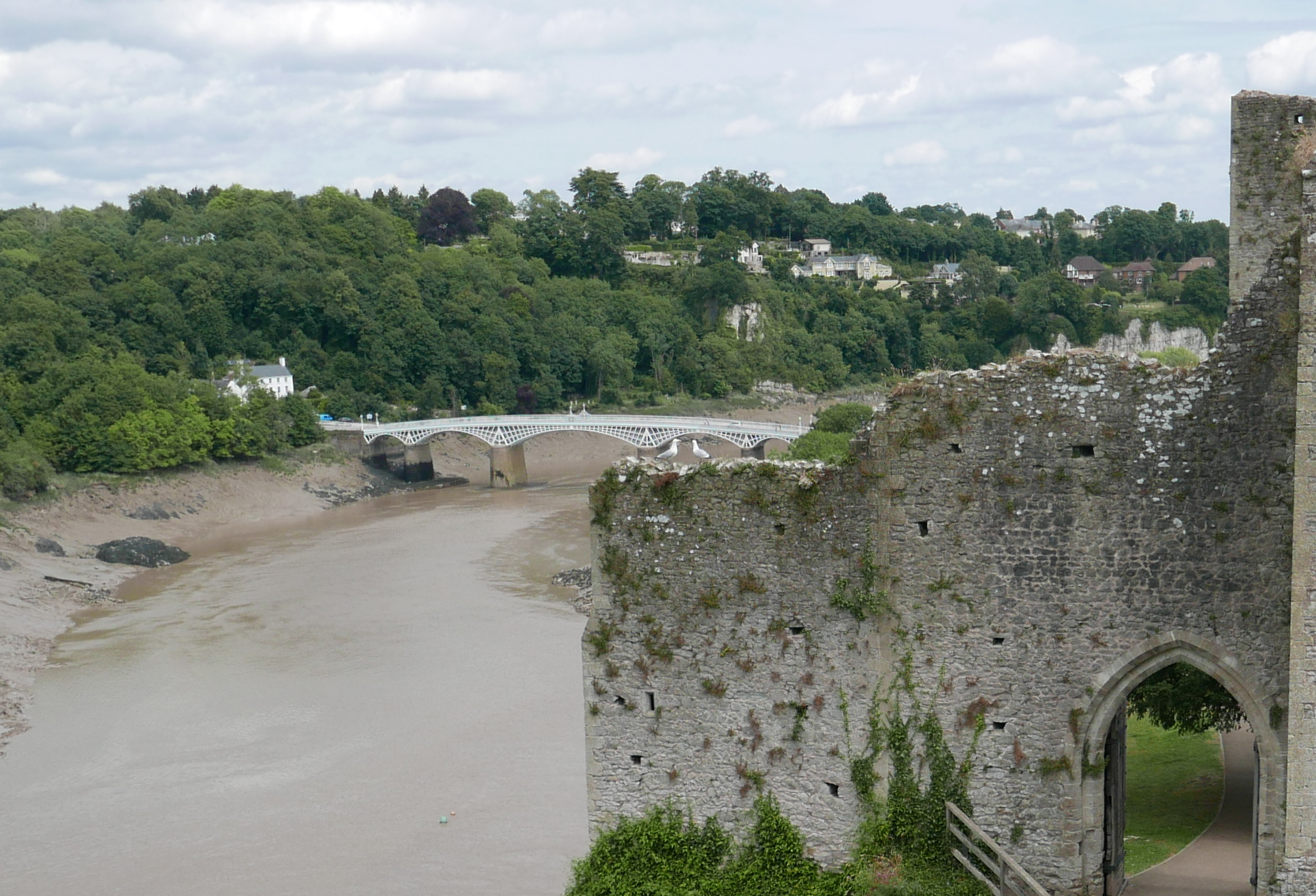
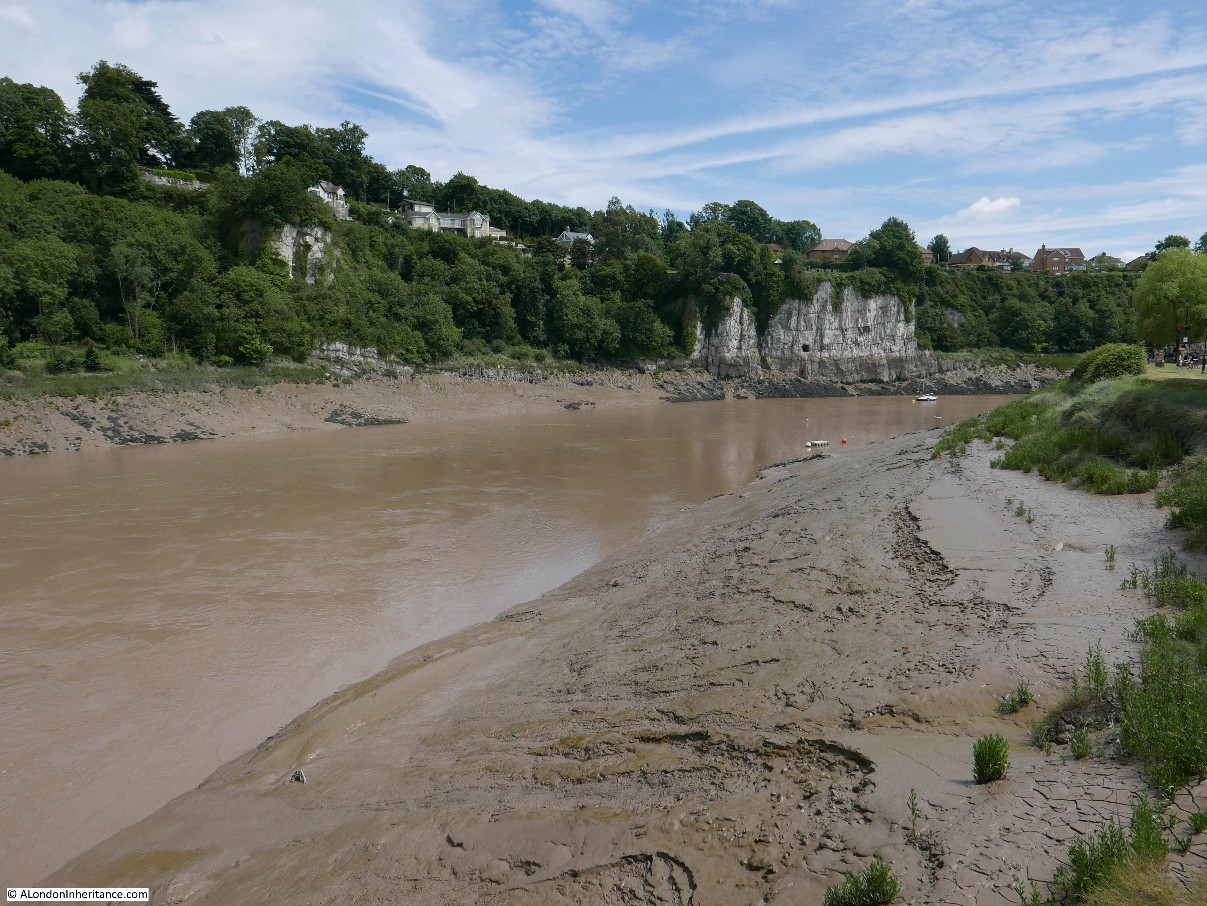
The same view in 2024:

In the upper left of the above photo, the limestone cliffs that form the sides to the route of the River Wye can be seen. The following photo shows a closer view of these cliffs:

There seem to be a number of theories as to how the gouge through which the River Wye flows, was formed, but their common factor is the Wye gradually eroding through upper layers (possibily sedimentary layers that covered the area), then down through the limestone below.

It could also have been due to erosion by glacial melt water flowing along the route of the future River Wye.

Whatever the exact geological process that formed the area, it has left behind a very impressive landscape.

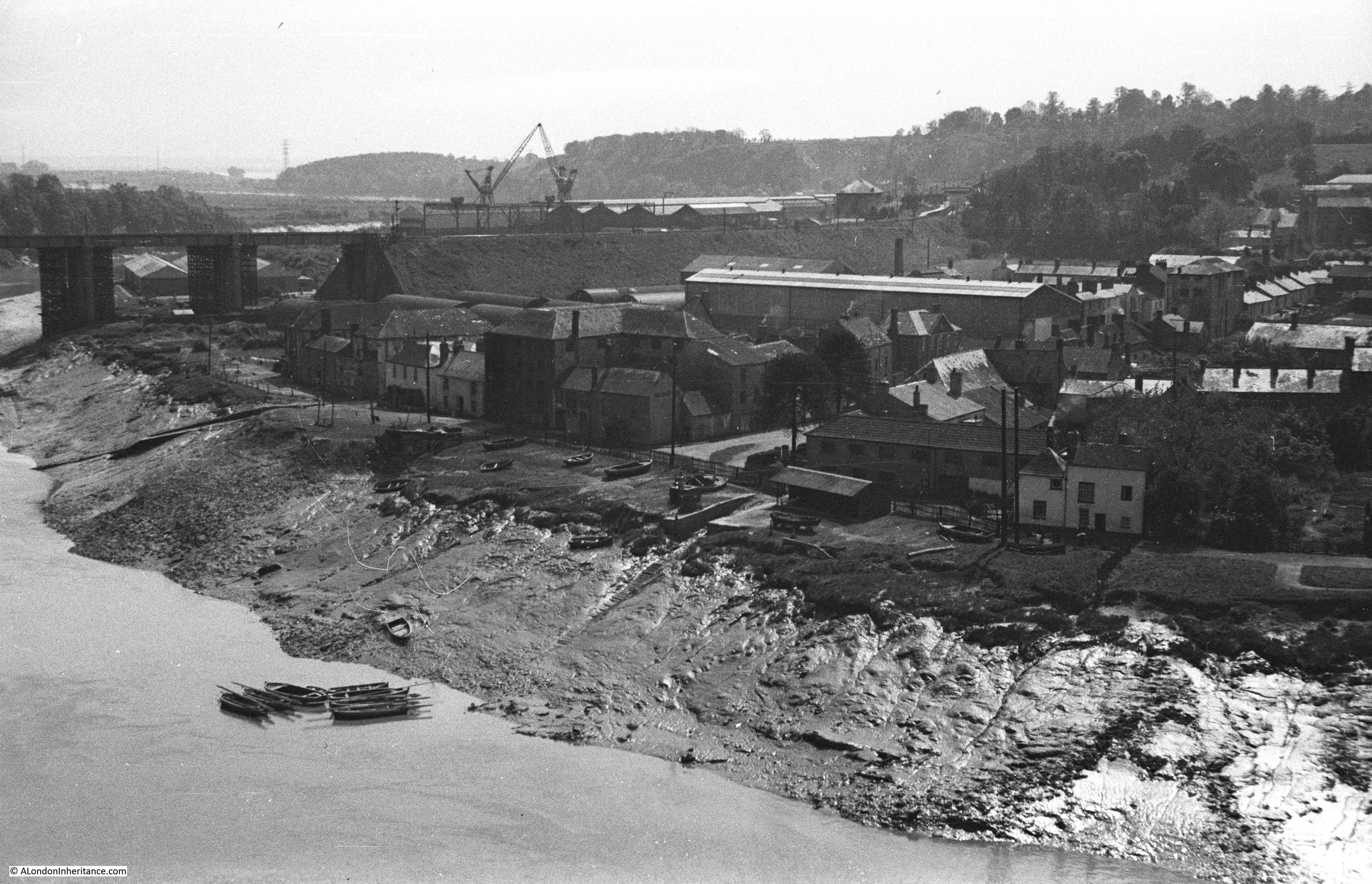
The River Severn flows in the background of the 1948 and 2024 photos, and there are a couple of key features today, which were not there in 1948.

At that time, a ferry provided a crossing of the River Severn, however with post-war rising traffic volumes, a ferry would not last for long as a feasible option.

The need for a bridge was being argued from the 1920s, and finally was justified and funded, with construction started in 1961, with the second Bridge opening in 1963.

From the Eagle’s Nest, we can see the original Severn Bridge in the distance:

The Severn Bridge was a considerable success, and traffic using the bridge increased rapidly in the decades after opening, so much so, that it was expected that the bridge would be running at full capacity by the mid 1990s.

The answer was a second bridge, and in 1992 construction started, with the bridge opening in 1996, and named the Prince of Wales Bridge with the Prince also performing the opening ceremony.

The Prince of Wales Bridge can be seen in the following photo:

Both bridges were originally toll bridges, however at the end of 2018, tolls for both bridges were removed, and they are now free to cross.

The Eagle’s Nest has been a viewing point for almost 200 years, and changes to the route of the Wye will take centuries as the river naturally changes over time.

I assume that the land in the middle as the river curves around the inside of the cliffs, is mainly soil / mud and possibly sediment deposited over the centuries as the river occasionally floods.

There is one feature in my father;s photos that I assumed would not have survived in the following 76 years. The following photo is an extract from the photo at the top of the post, and shows a small area of land that has fallen into, or been eroded by the river:

The feature is still there, in what appears to be exactly the same shape:

The level of the mud in 2024 seems higher than in 1948, so perhaps mud is gradually being deposited in the breach, and over the following decades it will disappear and the original line of the river bank restored.

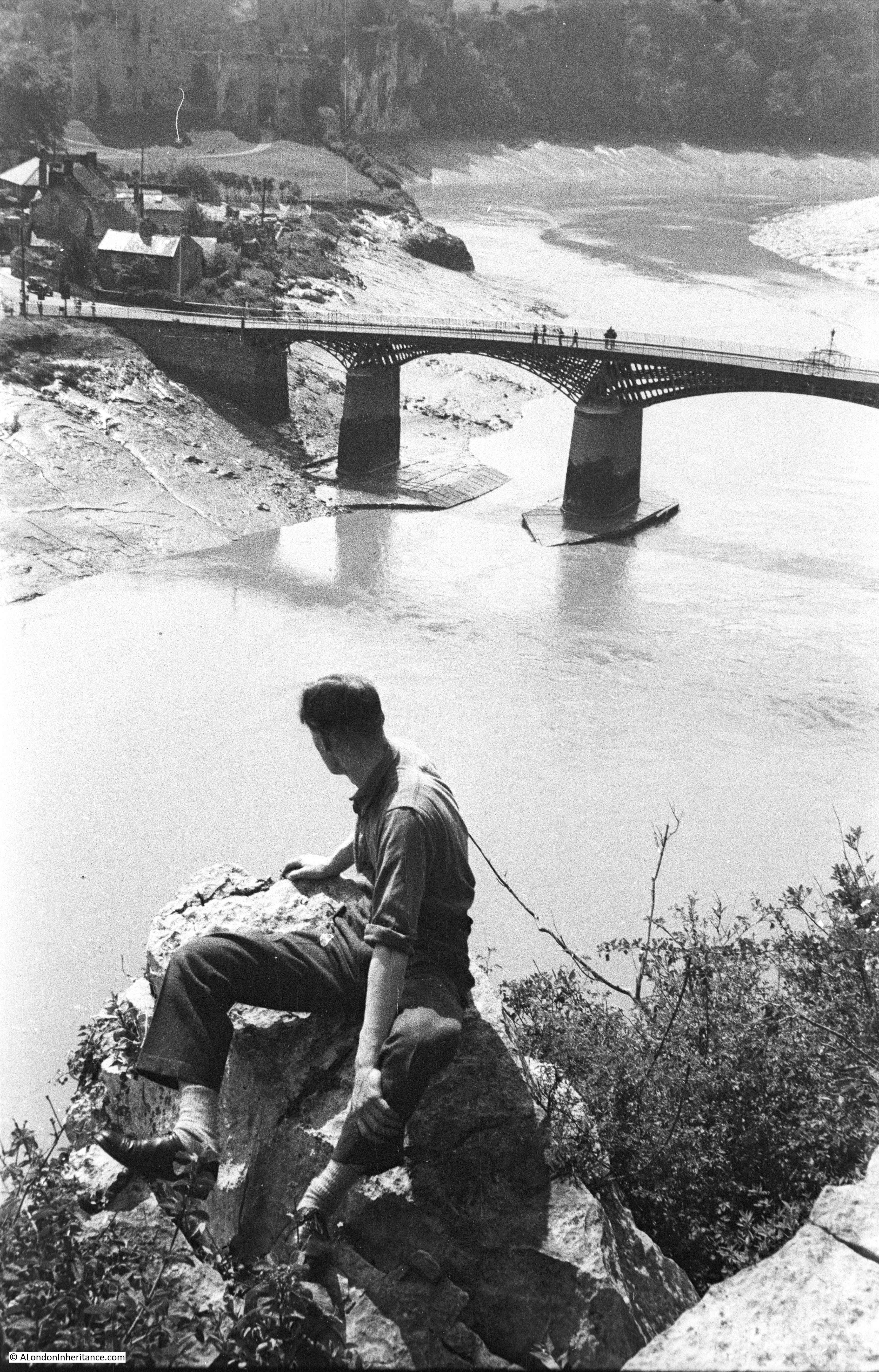
The view from the Eagle’s Nest is stunning, even more so after a walk up through the woods where there is no indication of the view, until you get to a few stairs down through the trees to the viewing platform – it is well worth a visit.

After an uninterrupted 20 minutes looking over the River Wye, we then left for the next destination of:

Monmouth

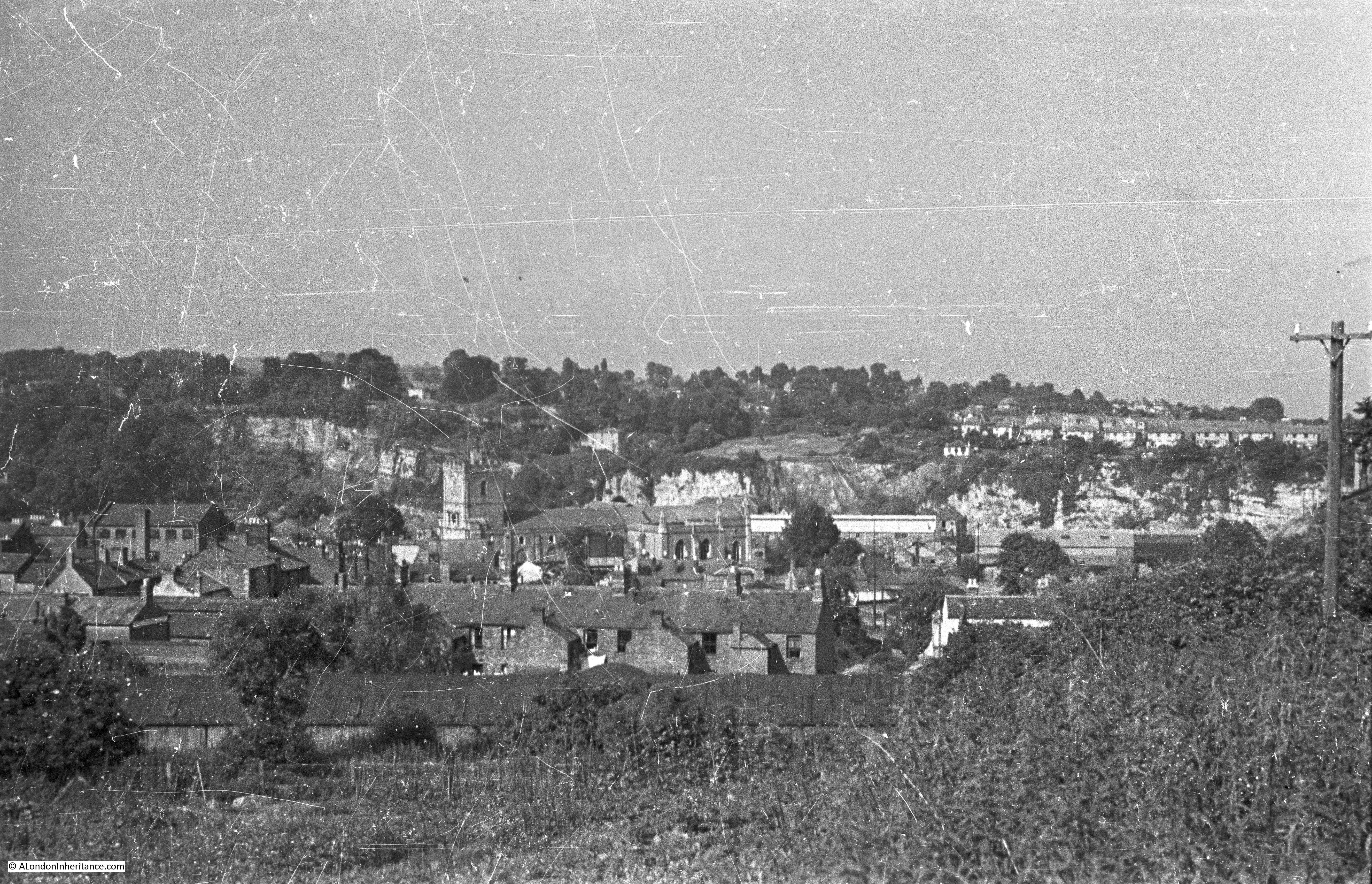
Monmouth is a wonderful Welsh town, just a couple of miles inside the border and surrounded by a stunning landscape.

The book “Where Wye and Severn Flow” by W.J. Smart (1949) provides the following description of the town and the surrounding countryside:

“It is literally true that five minutes walk from the centre of this ancient town of Monmouth and you are in the corn fields. The same number of minutes will take you over the Wye Bridge to the foot of the Kymin – a wooded hill which rises to seven hundred feet above sea level – or over the Trothy Bridge where you may begin the thousand-feet ascent up the winding road to the Trellech Plateau. If you are here in the springtime, you will find the winding, woodland paths on the Buckholt, fifteen minutes walk from the town, lined with bluebells and foxgloves; in the summertime, you will find boating on the river from Wye Bridge to Symonds Yat; in the autumn you will see the hills on every side aflame with colour.

Monmouth is thus at the bottom of a basin with highlands rising all around it. It is surrounded by three rivers – the Wye, the Trothy and the Monnow. Its natural scenery is unspoilt and probably unchanged since the days when Caractacus repulsed the Romans on the Little Doward, or when William Fitz Osbern, the chief military advisor to William the Conqueror, stablished Monmouth Castle to keep back the Welsh.”

The walks may be slightly longer these days to get to the surrounding countryside as there has been some development since the above was written, however the description of Monmouth at the bottom of a basin, the three rivers and the surrounding countryside is still just as valid.

The major change is probably the dual carriageway of the A40 which today runs between the town and the River Wye.

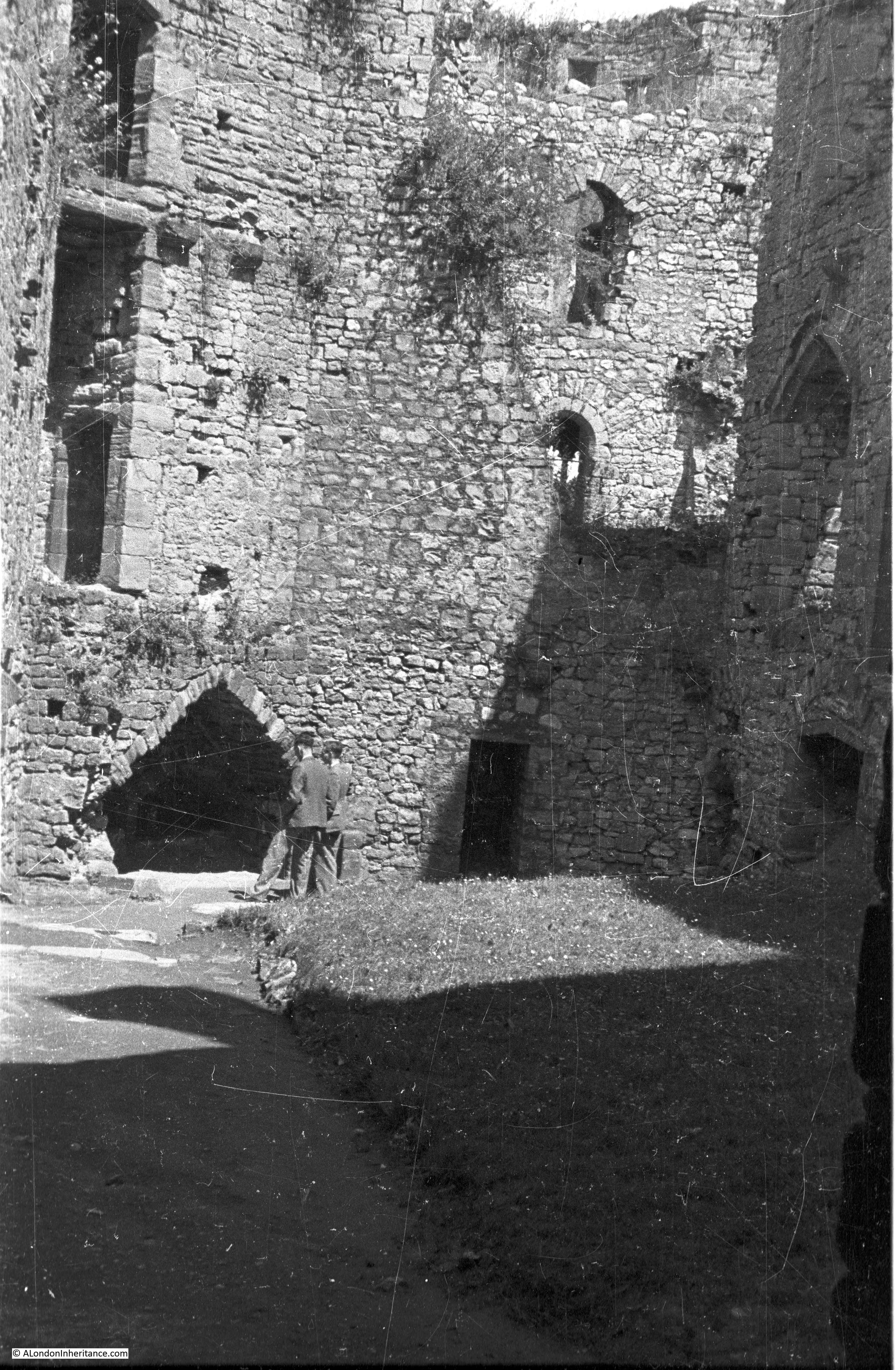
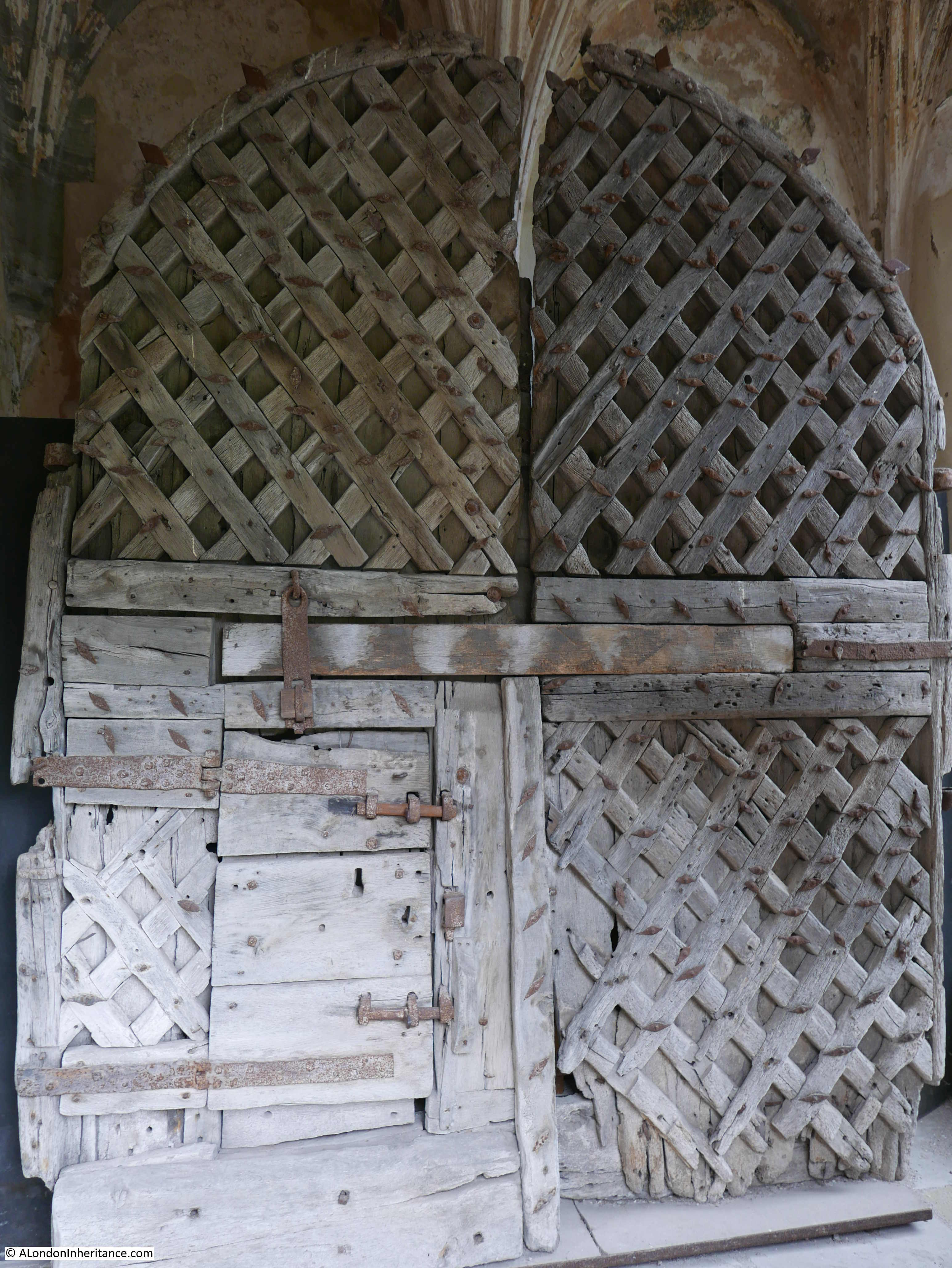
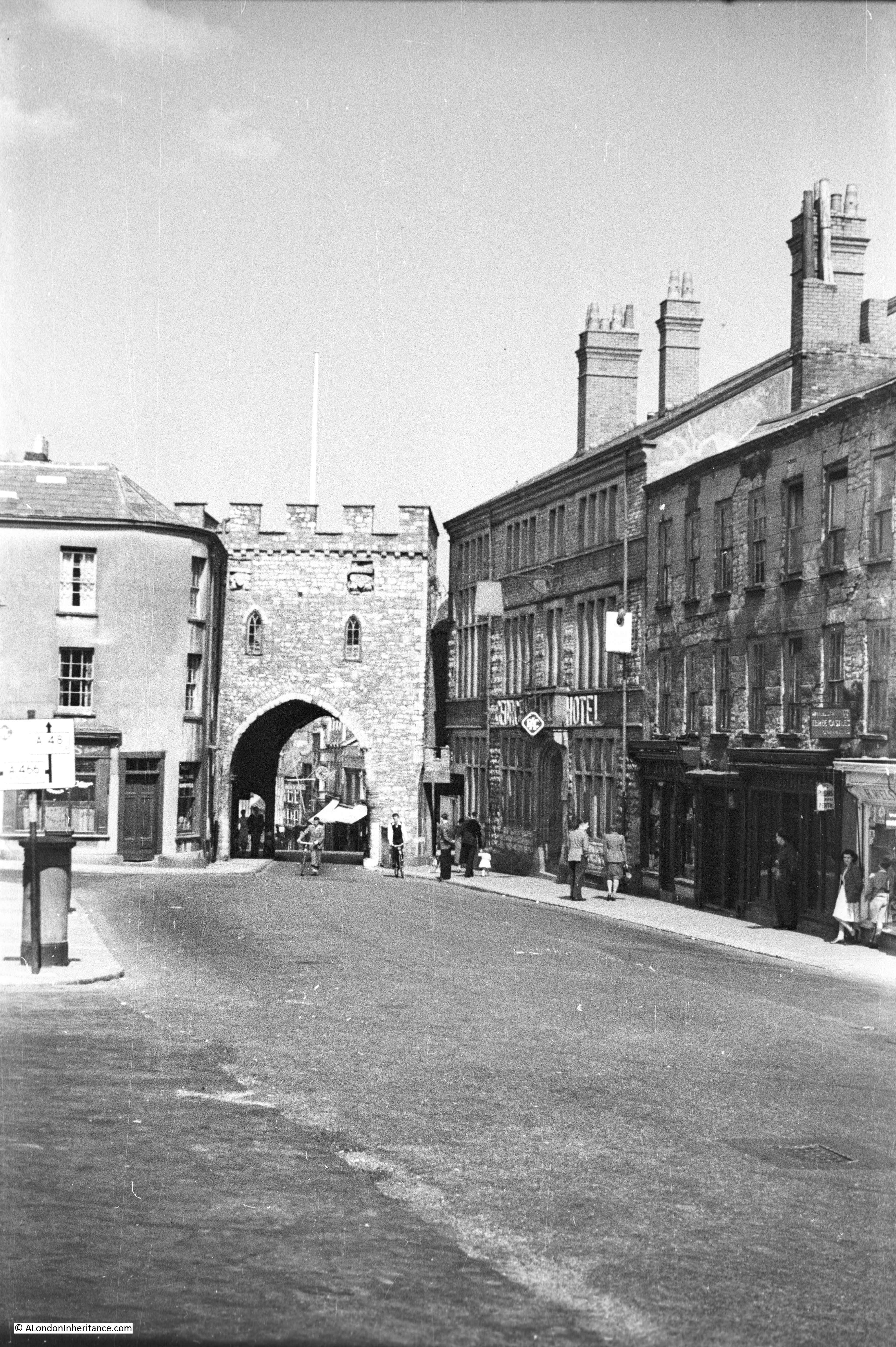
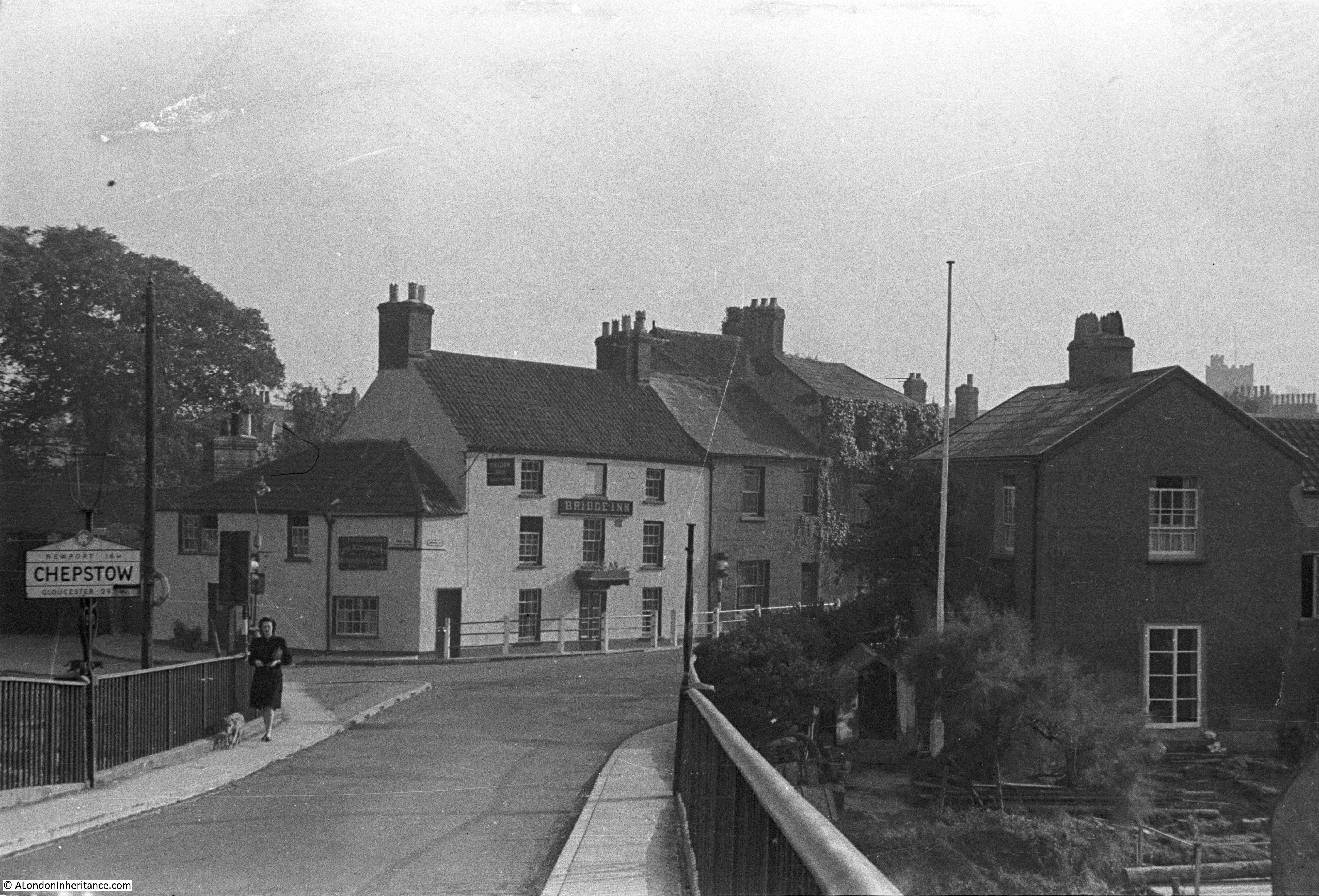
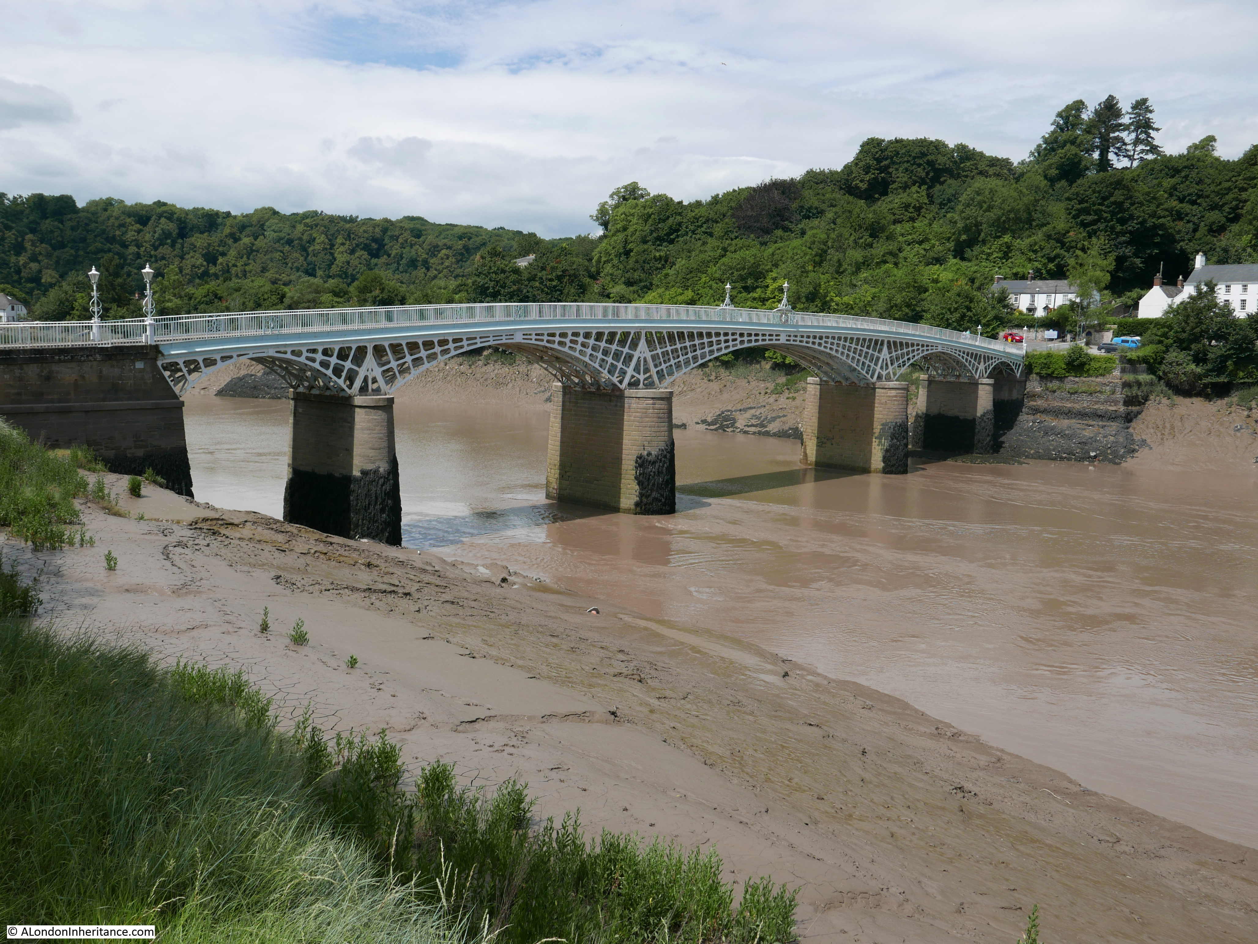
My father was cycling through Monmouth in the year before the book with the above description was published, and he took a couple of photos of one of the unique structures in Monmouth, the medieval bridge and gate tower at the entrance to the town over the River Monnow:

The following photo if from a slightly different angle, and through the main arch of the gate tower we can see Monnow Street – the main street through the town:

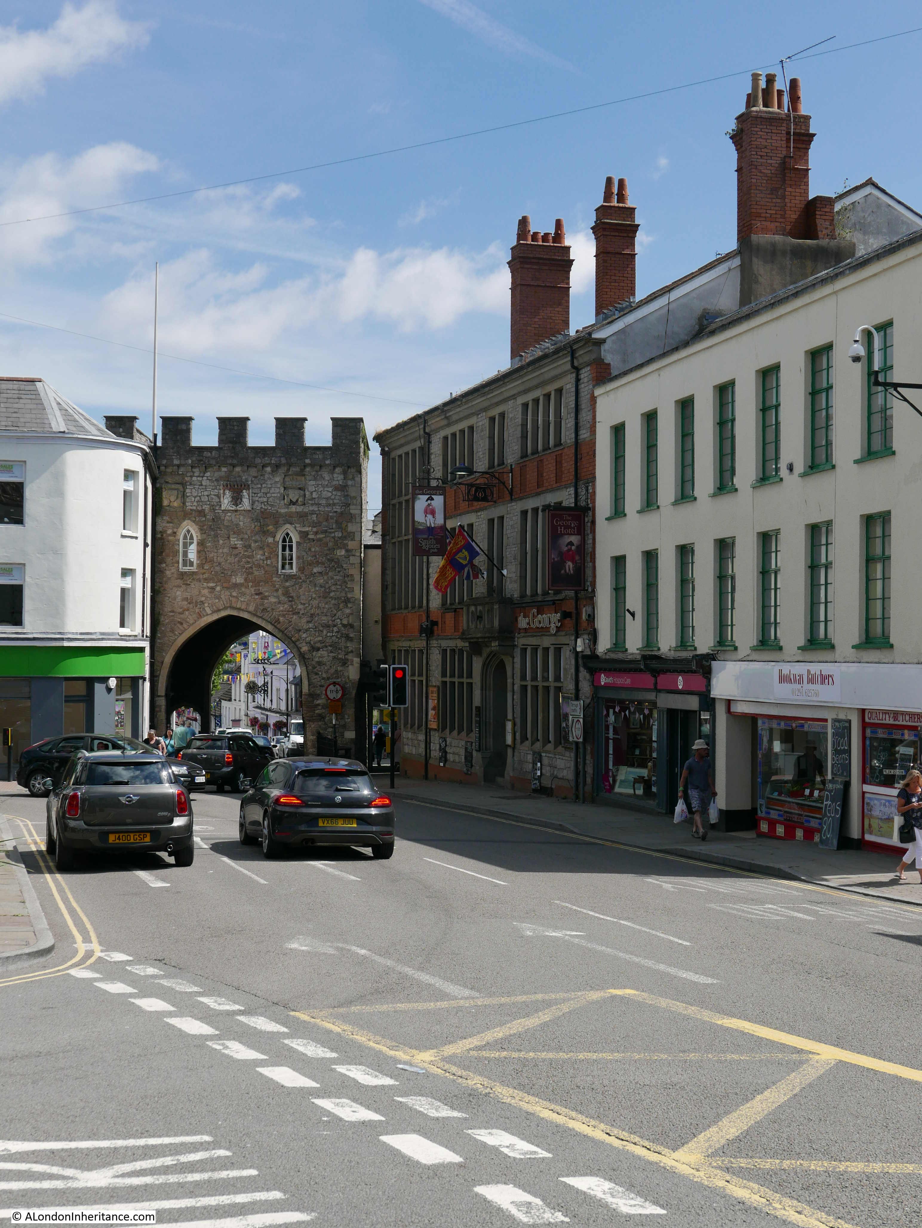
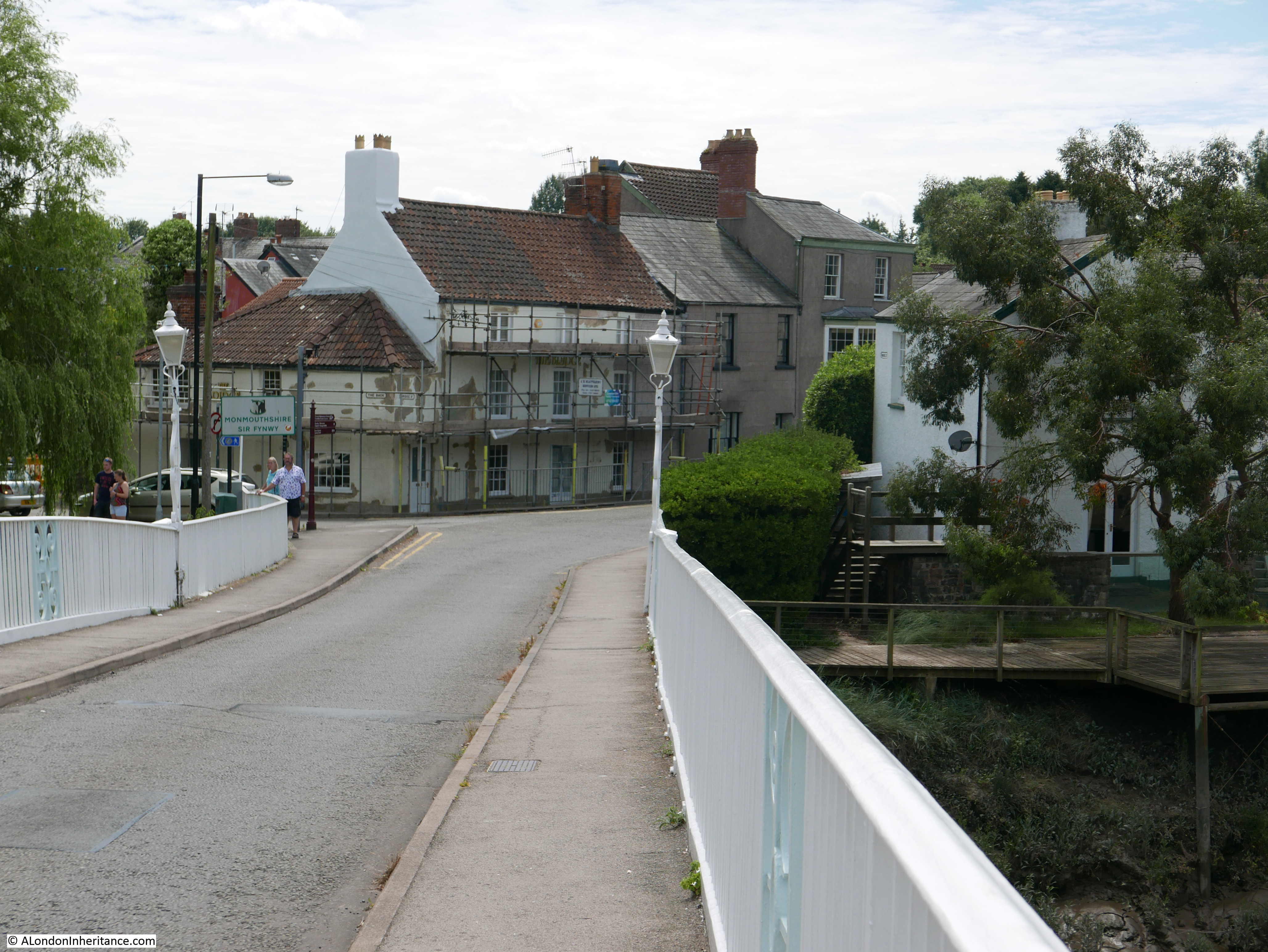
The same view in 2024 – seventy six years later:

In 1948, the bridge was the main route to the south and west of Monmouth, so as shown in my father’s photos, the route through the bridge was open, and there was a sign on the right indicating a 9ft 6 inches headroom, the height at the top of the straight side walls, below the arch at the top of the route through the gate.

A new bridge opened in 2004, a short distance to the east, and from then onwards, the Monnow Bridge has been closed closed to traffic.

The bridge and gate tower are Grade I listed. The bridge is believed to have been built in 1272, to replace a wooden bridge from the 1170s.

The bridge and gate house are not exactly as they were first built. The gate tower was modified in both the 18th and 19th centuries, starting in 1705 when it was converted to a two storey home, with included the removal of a battlemented parapet.

Monmouth did originally have stone defensive walls surrounding the town. The gatehouse was not part of this walls, but provided a stand alone structure to defend against anyone trying to cross the bridge into the town, and also as a toll house, generating revenue from those crossing the River Monnow to the town.

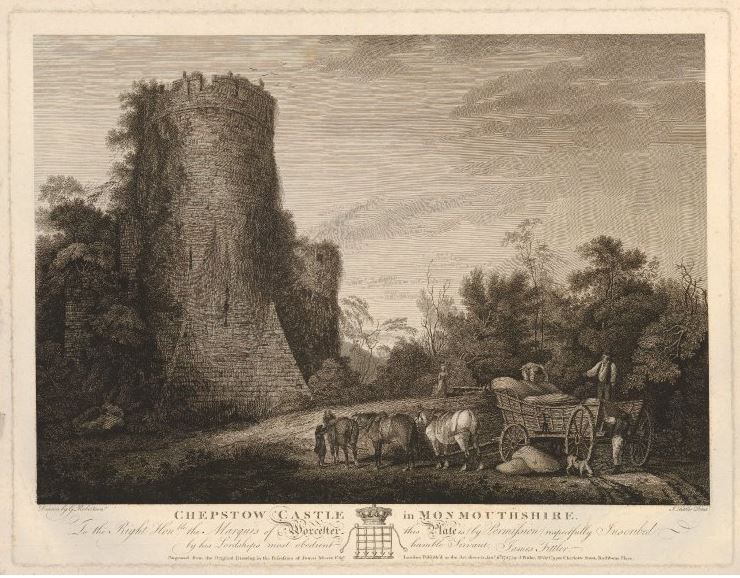
The width of the bridge was originally limited to just the road surface that we see today, but was widened in the early 19th century, to the width we see today. The passageway on the north side of the bridge was cut through the gate tower in 1819, with the southern passageway added in 1845.

The following print shows the road and bridge before these changes, with the central arch being the only access through the gate tower:

Image: © The Trustees of the British Museum. Shared under a Creative Commons Attribution-NonCommercial-ShareAlike 4.0 International (CC BY-NC-SA 4.0) licence.

The gate tower has been used for a range of purposes over the centuries, a gaol, toll house, guard room and for a short time as a residence.

The gate tower was often used for defensive purposes as Monmouth occupies a key geographical location, on the Welsh / English borders, as well as at crossing points over the Rivers Wye and Monnow.

The town saw frequent skirmishes during the various campaigns between the Barons and King Edward II in the 14th century. The town changed hands a couple of times during the English Civil War, and the last time that the gate tower was occupied by troops ready for the defence of Monmouth was during the Chartist risings in 1839.

Side view of the bridge and gate tower with the River Monnow flowing underneath:

A blue plaque for the Monnow Bridge which confirms that it is the only surviving medieval bridge and gate tower in Britain:

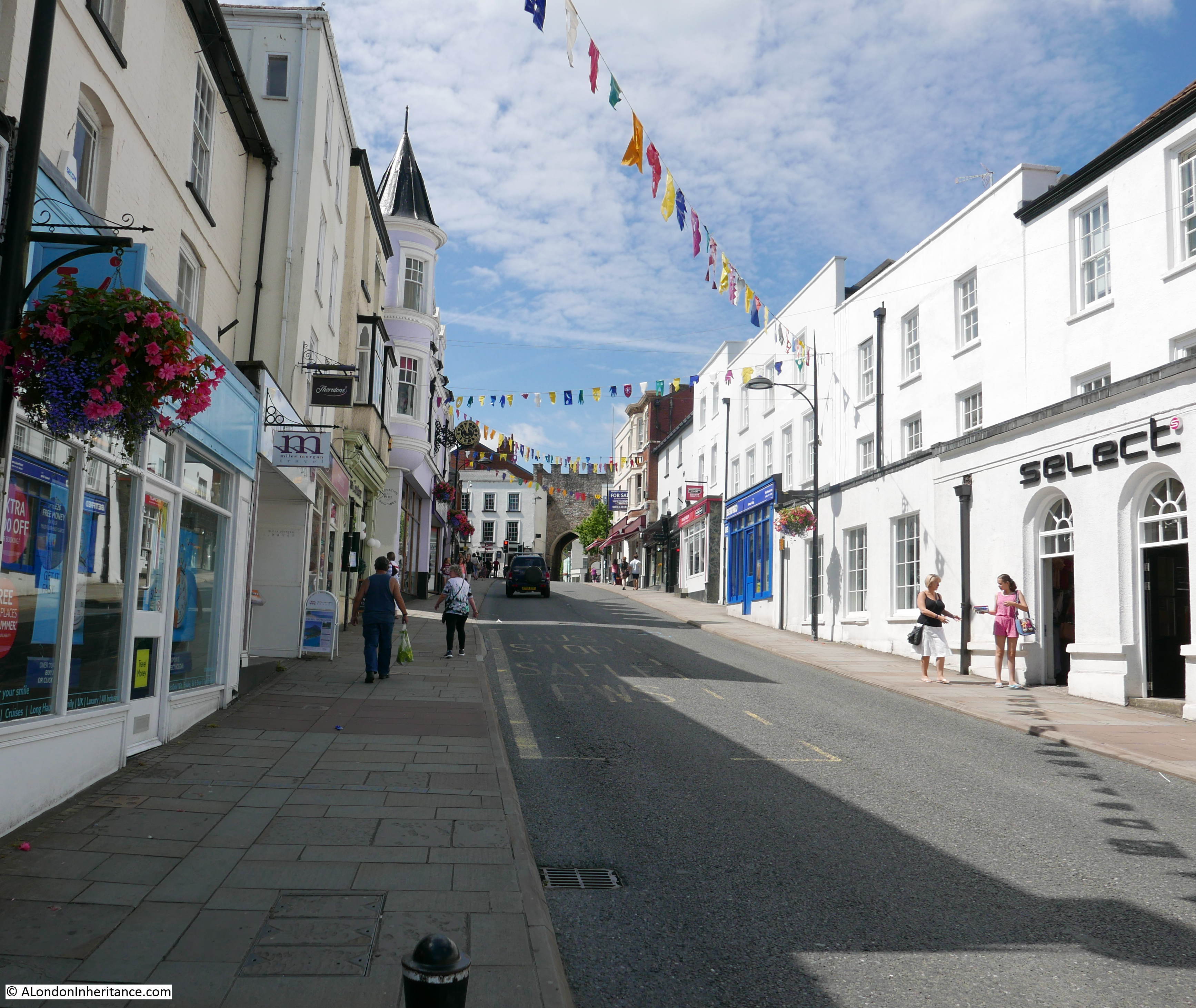
Monnow Bridge was the only means of access from the roads to the south of Monmouth, into the town, and from the bridge Monnow Street, which is effectively the high street, leads up through the town:

Looking at the map of listed buildings on the Cadw website shows that the majority of the buildings along Monnow Street are listed.

In the above photo, the Robin Hood Inn is on the corner, and is Grade II* listed. It is believed to be 16th century is origin, with the main internal features being 17th century.

The upstairs rooms of the building were used as a meeting place for Catholics before the Roman Catholic Relief Act of 1829 removed the majority of the restrictions on the Roman Catholic faith.

The building in the photo below is the distinctive Cornwall House, one of the few buildings in Monnow Street that is set back from the street. The house is a 1752 rebuild of a 17th century house on the site, which had earlier been an inn:

Monmouth is the type of town where shops such as White Stuff and Café Nero occupy Grade II listed, 18th century buildings. The plaque on the upper floor at the centre of the building has the initials THE and the date of 1724:

The Shire Hall:

Monmouth was the county town for Monmouthshire until boundary and county changes in 1974. The Shire Hall was important in Monmouth’s role as a county town, with the County Court occupying the building from 1821.

The original Shire Hall was built in 1724, but has been much remodelled to accommodate the various functions which have occupied the building.

On the front of the Shire Hall is a statue of Henry V, who was born in Monmouth, according to the statue in 1387, however a different date in 1386 is frequently given for the date of his birth in Monmouth Castle. The statue is part of the overall Grade I listing of the Shire Hall and was added in 1792, being the work of Charles Peart:

Directly in front of the Shire Hall is a Grade II* listed statue of Charles Rolls (part founder of Rolls-Royce) who, although born in London, had strong connections to Monmouth, as he was the son of Lord Llangattock of “The Hendre”, a large Victorian county house close to Monmouth.

The statue was unveiled in 1911 following Rolls death in a flying accident at Bournemouth in 1910. The statue has Rolls looking at a model of the bi-plane he was flying at the time of his death:

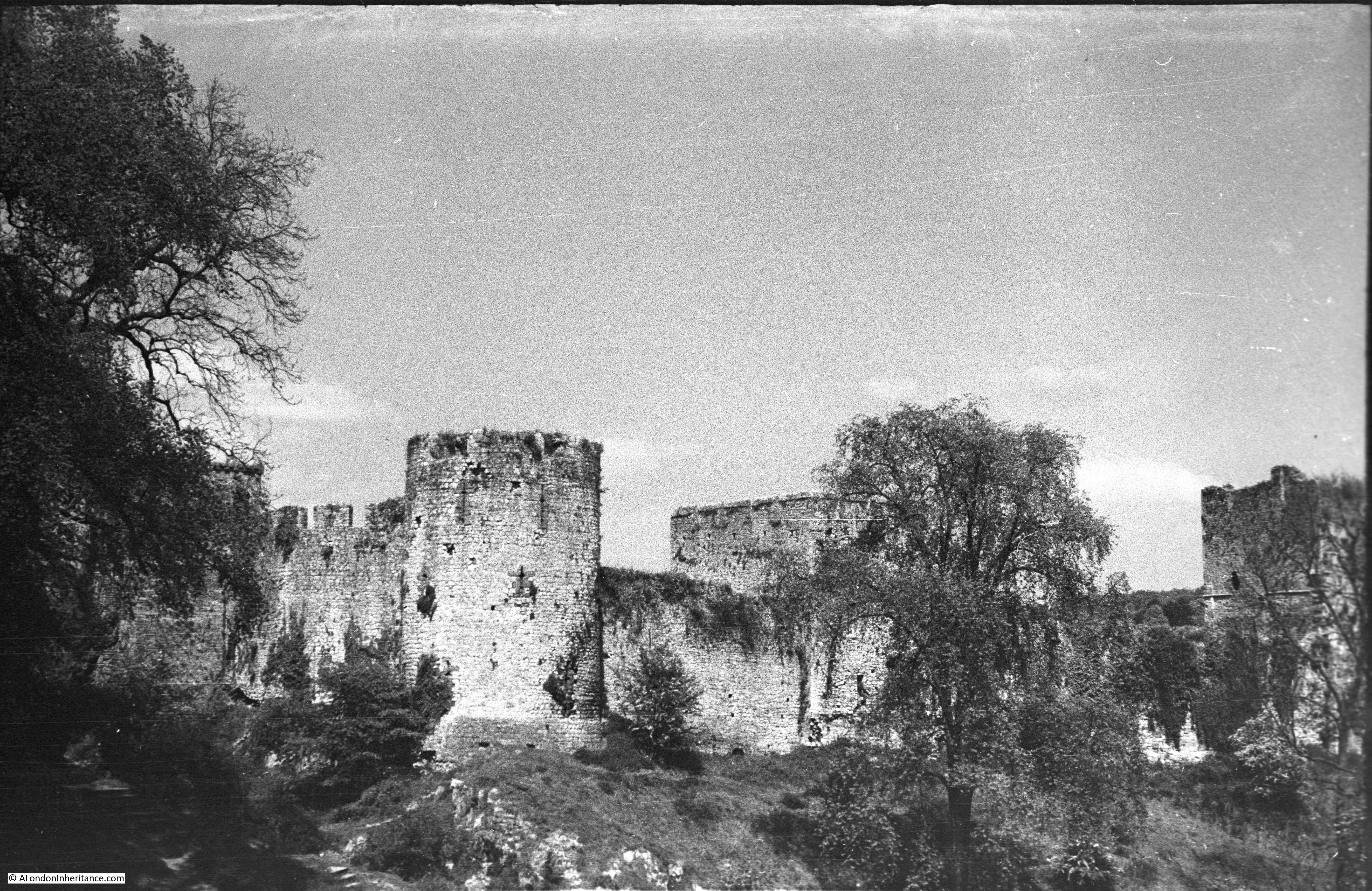
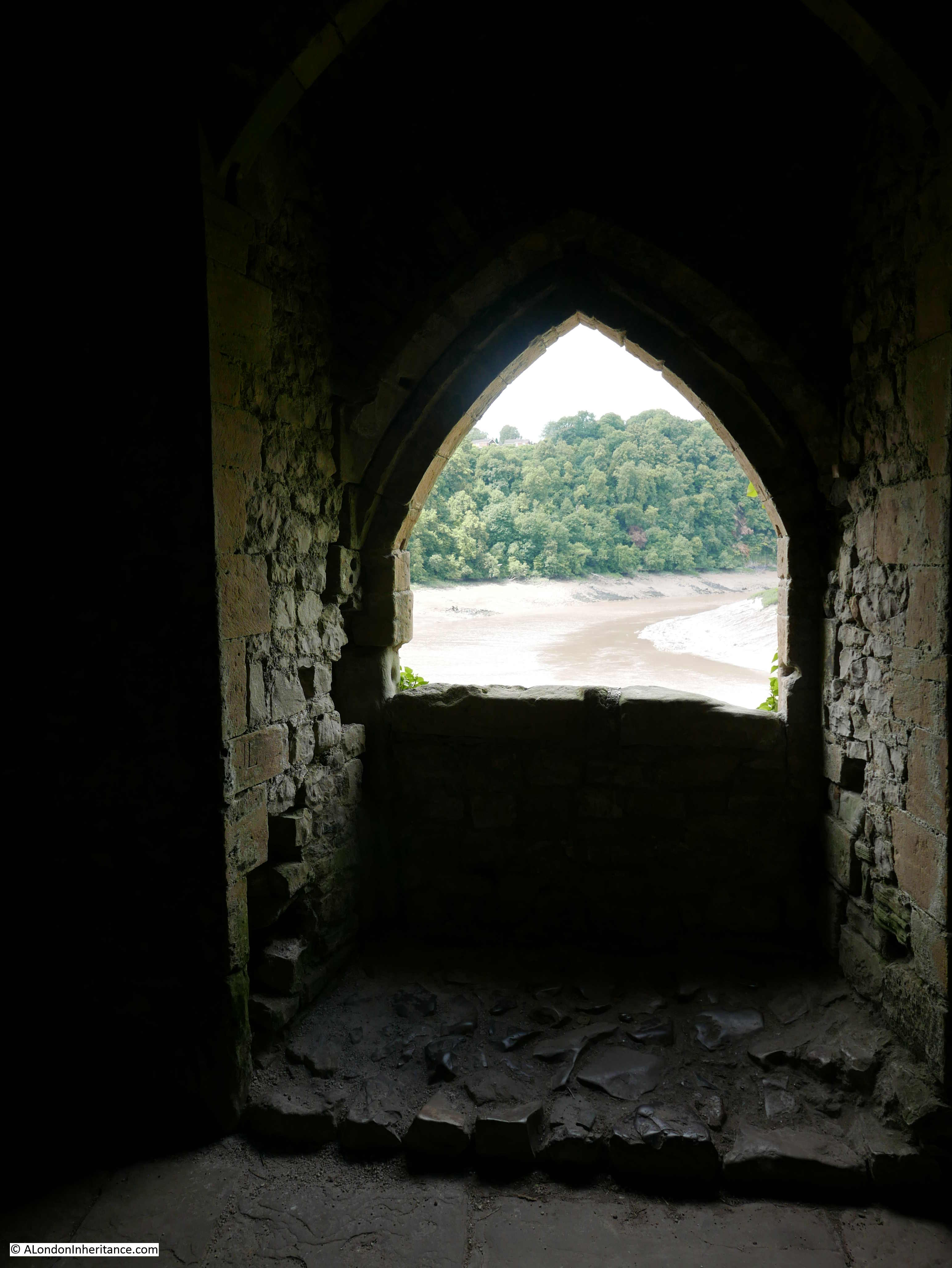
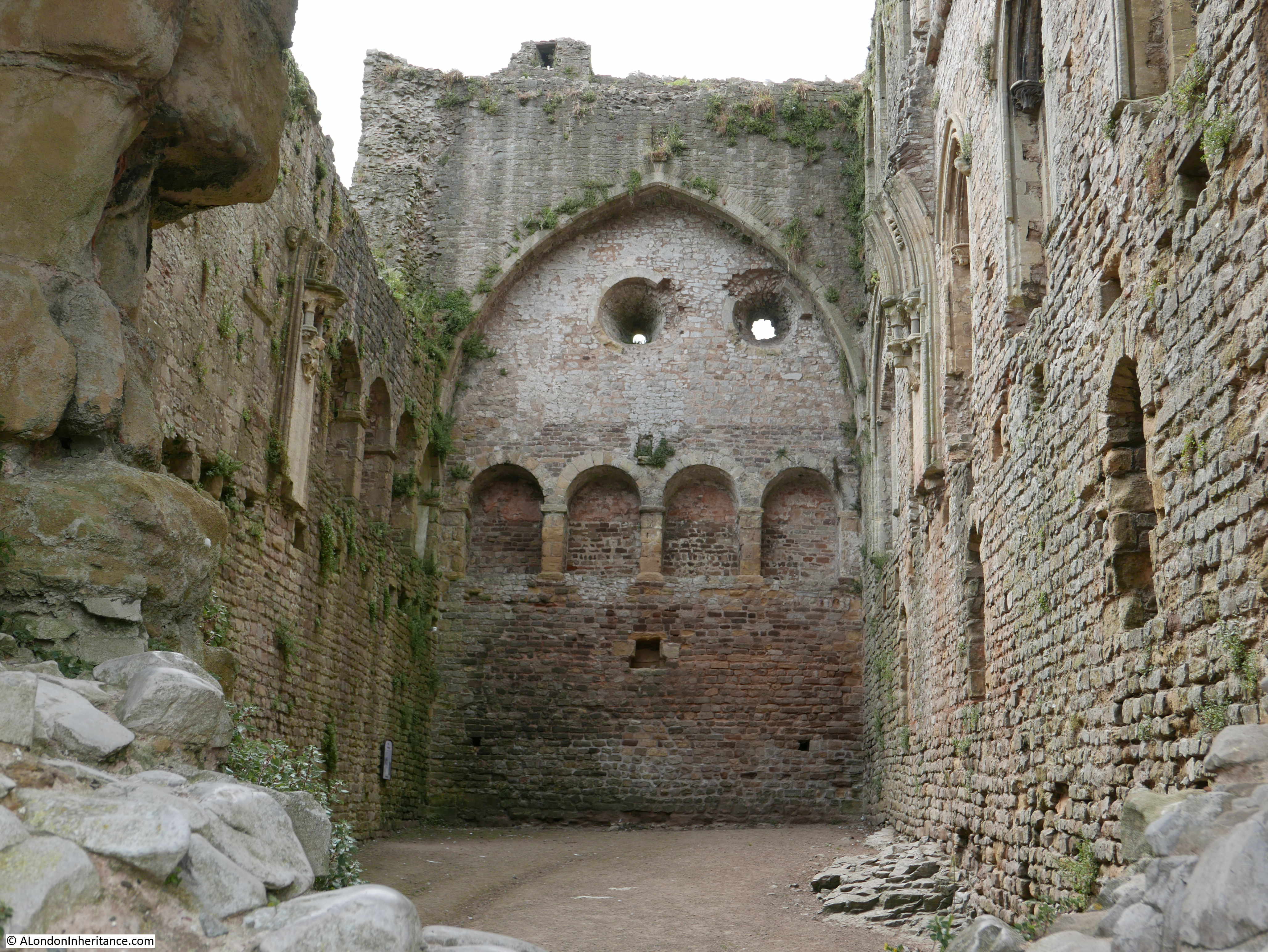
Henry V was born in Monmouth Castle, however today there is not that much left of the structure. The following photo is looking at what remains of the Great Tower of the castle:

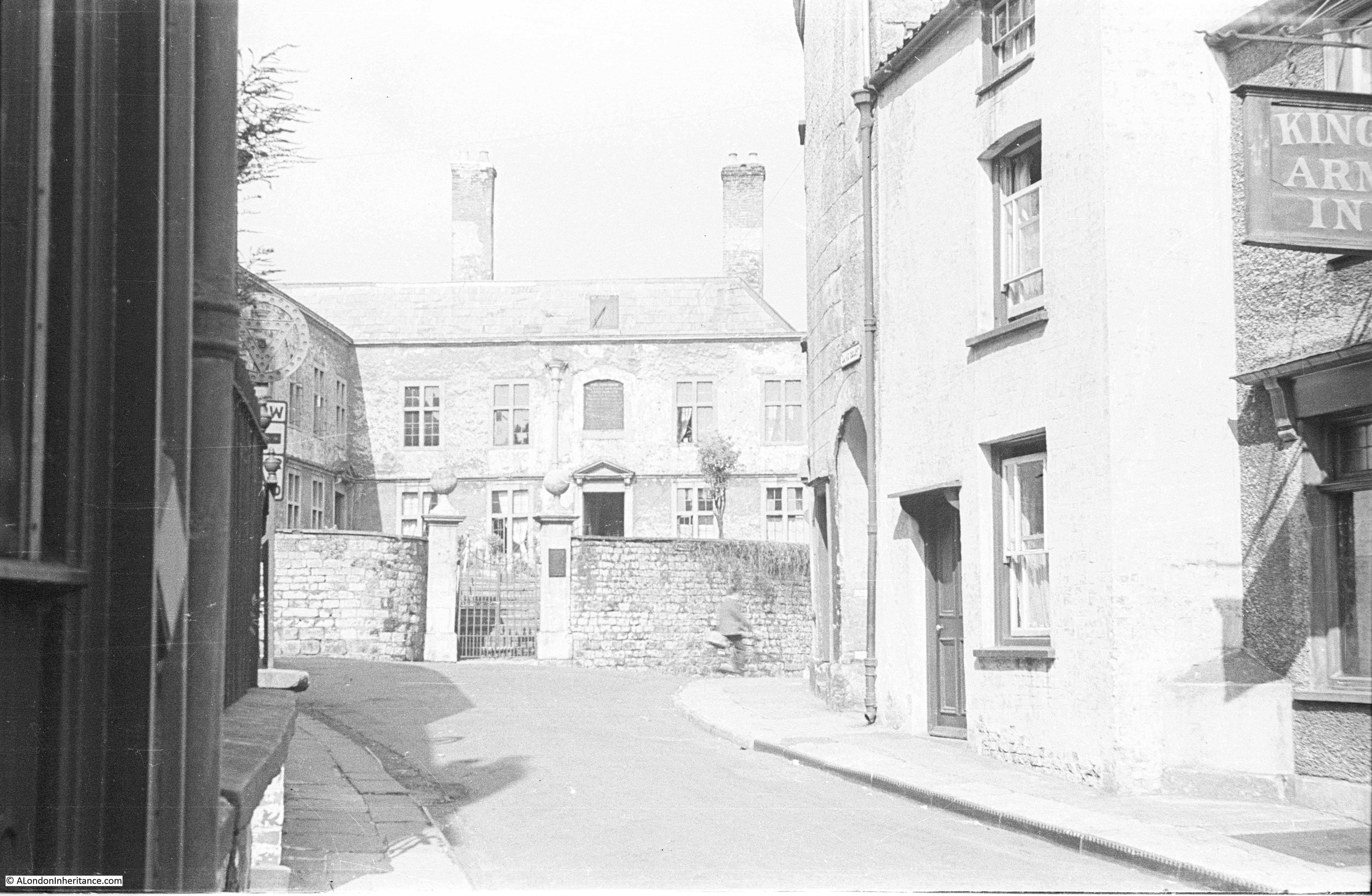
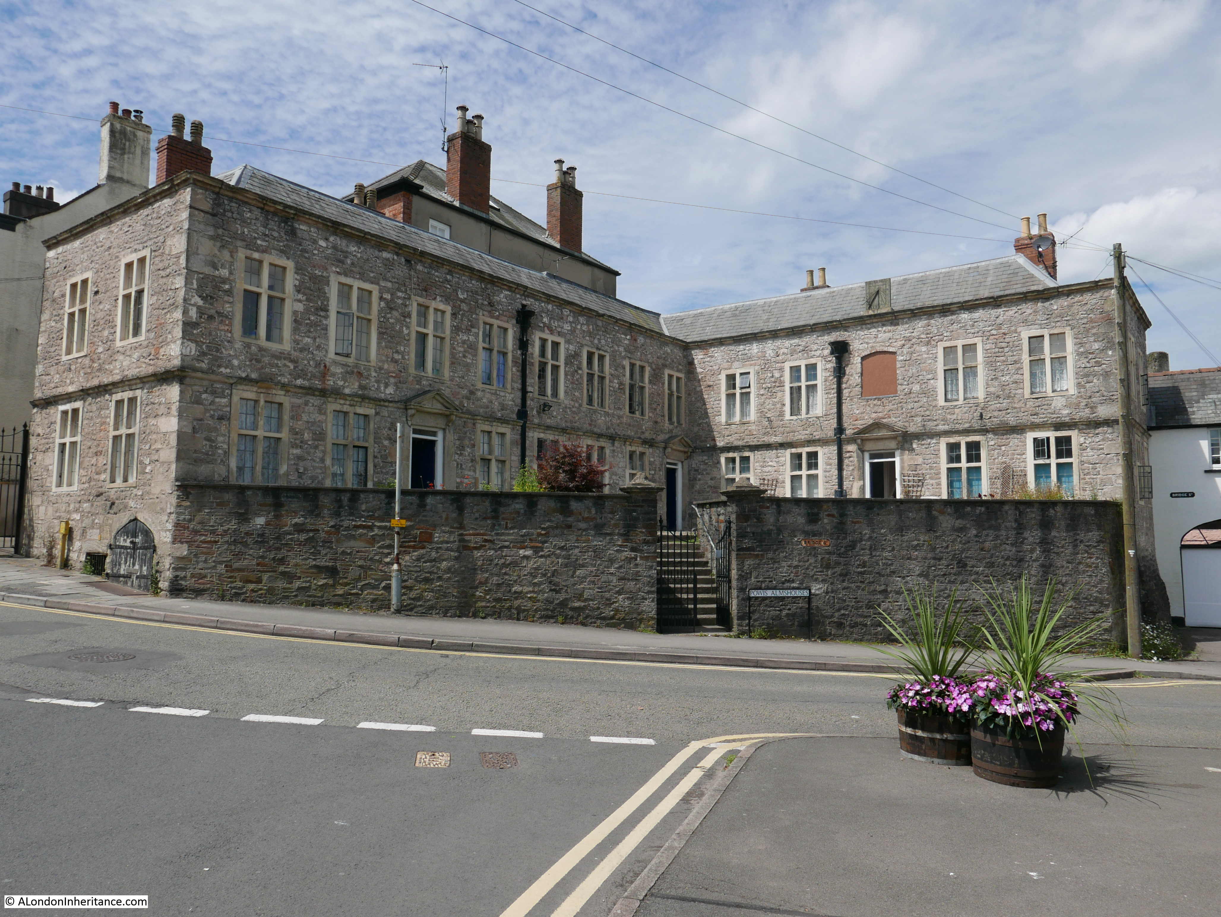
On the approach to the castle is the Grade I listed Great Castle House:

The original house, dating from 1673 is at the centre. The side wings were added in 1863.

The house was built by the Duke of Beaufort , and has been used as a residence by the Beaufort’s, an Assize Court prior to the construction of the Shire Hall, and as a girls school.

In 1852 Great Castle House became the headquarters of the Monmouthshire Militia, and has continued in having a military role as the building is now home to the Royal Monmouthshire Royal Engineers, and their Regimental Museum occupies the block to the left, which is why there is an assembly of military equipment in front of the building, with the cannon seen to the right being captured at Sevastopol in 1855.

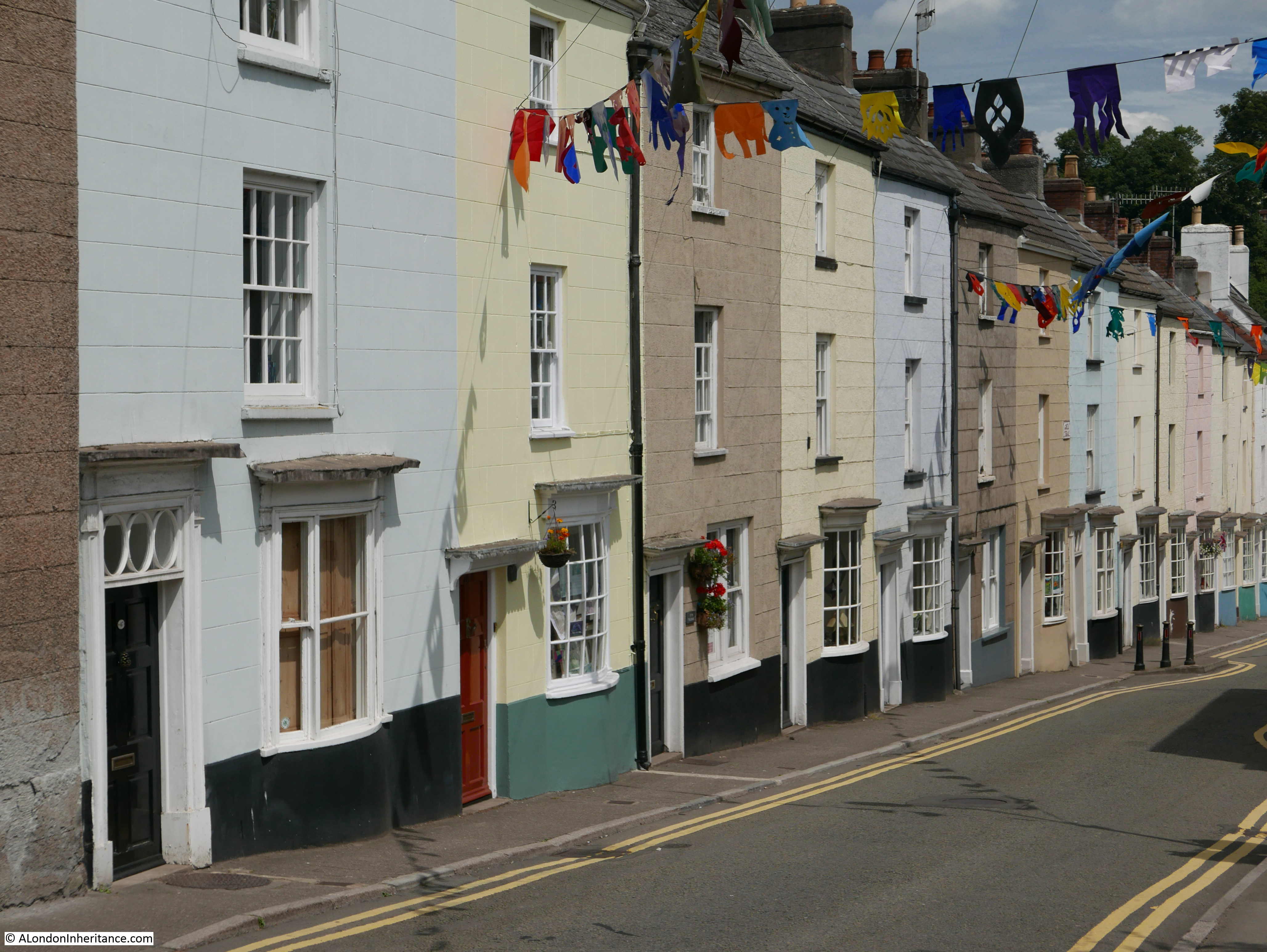
At the top of Monnow Street, Church Street runs off to the side. A narrow pedestrian, shop lined street, which leads as the name suggests, to the church. Every single building in the street is listed:

Not what you would perhaps expect to see in such a street, but along the street we find the Savoy Theatre, described in the Grade II* listing as a “rare and little altered example of a small cinema (600 seats) from the inter-War period in Wales, and as part of the continuous run of historic buildings in Church Street”. The cinema occupies a 19th century rebuild of a house dating from around 1700:

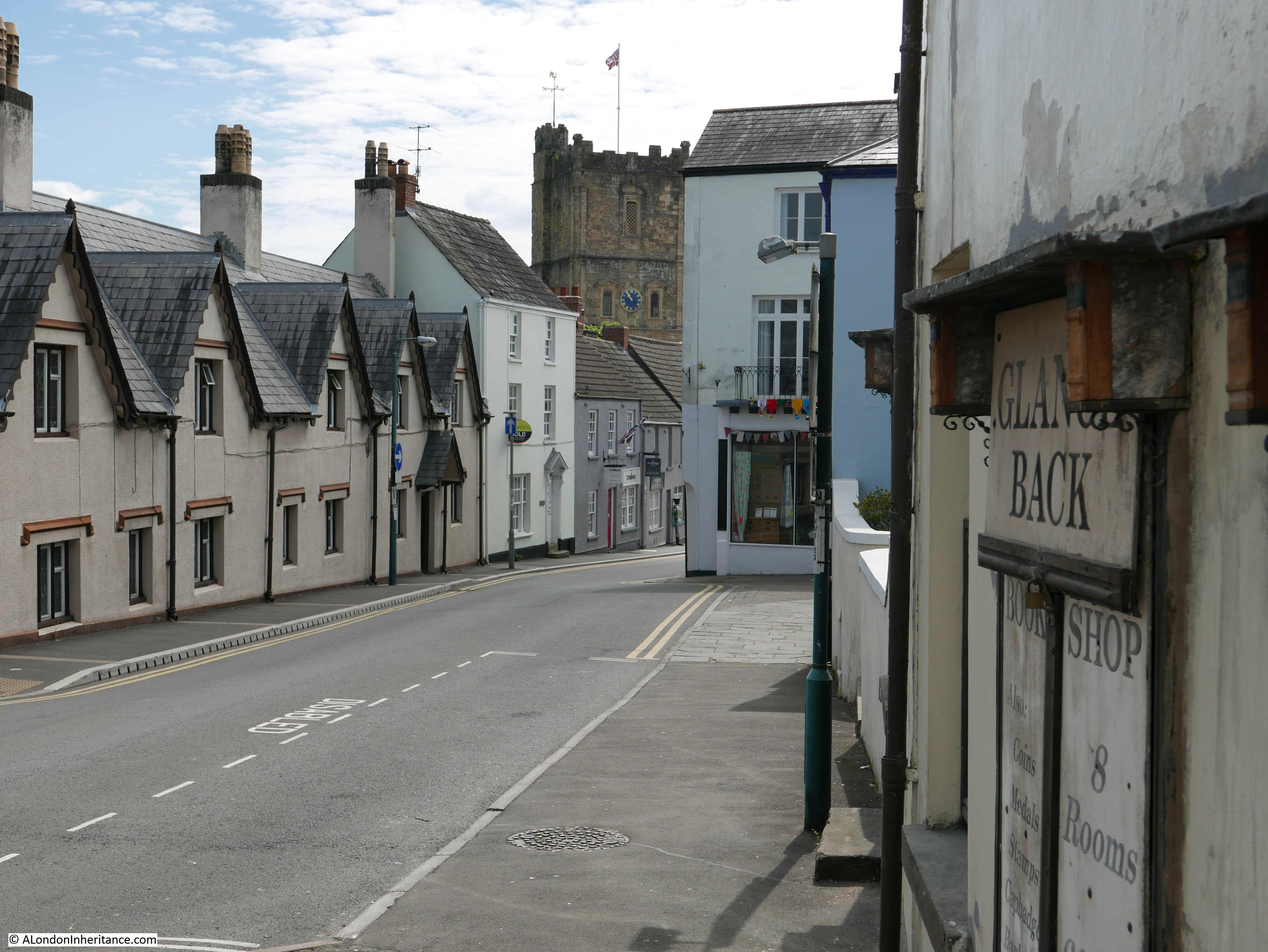
A final look down along Monnow Street, with the wooded hills in the distance, across the bridge and the River Monnow:

The viewing point at the Eagle’s Nest and the town of Monmouth are both wonderful places to explore, and both look glorious on a summer’s day, the type of day which seems a long way off whilst I am writing this post during days of cold, grey December weather.

You may also be interested in the following posts covering the area around the Wye Valley and Chepstow:

Chepstow And The River Wye

Tintern Abbey – Summer 1947 and 2019

National Service, Chepstow, 1947

alondoninheritance.com

Chepstow Castle

After visiting the town of Chepstow and the River Wye in last Sunday’s post, in this post I explore Chepstow Castle – one of the earliest Norman castles in the country.

Chepstow Castle is on a large limestone cliff overlooking the river and town. Construction started in 1067, the year after the Battle of Hastings and the coronation of William the Conqueror as King William I.

William had given Chepstow to William Fitz Osbern, the Earl of Hereford and it was William Fitz Osbern who started construction of the castle. The castle passed to William Marshall in 1189 and stayed in the Marshall family until 1245 when the Marshall estates were divided between five daughters with Chepstow going to Maud Marshall and through Maud’s marriage to Hugh Bigod, the 3rd Earl of Norfolk, it passed to the Bigod family.

As the castle passed through various families, it was extended considerably, existing buildings were remodeled and the castle lived a relatively peaceful life until the Civil War.

This is the 1947  view of the castle from across the River Wye. The castle is rather hard to see, but is behind the bridge, on the left bank of the river. The castle from a distance can appear to blend in with the cliffs on which it is built.

Chepstow Castle

And this is the view in 1947 taken from one of the castle towers looking back towards where the above photo was taken.

Chepstow Castle

The same view today. The buildings at both ends of the bridge are the same, however the buildings at the bottom of the 1947 photo have been cleared to make way for a large car park and the visitor centre which are located directly in front of the entrance to the castle.

Chepstow Castle

A 1947 view of the external walls and towers of the castle:

Chepstow Castle

Another view from inside the castle looking over the river and bridge.

Chepstow Castle

The same view today:

Chepstow Castle

My father took these photos during his National Service when he was at an Army base just outside Chepstow, and he was at the castle with a number of his colleagues from the army – there are photos of them in and around Chepstow and the castle, including this one rather precariously sitting on the edge of the cliff lookiing back towards the castle.

Chepstow Castle

The lighting was not ideal in the above photo to show the height of the cliffs on which the castle was built, however this photo shows the height of the cliffs and the sheer vertical ascent above the river.

Chepstow Castle

The setting of Chepstow Castle high on the cliffs over the river has attracted many artists over the centuries to paint and draw different views of the castle. The following painting by the Flemish artist Hendrik-Frans De Cort shows a rather overgrown and ruined castle. The bridge in the background is the version of the bridge prior to the existing bridge.

Chepstow Castle

Cellars underneath the castle provided storage and also access to the river. The following 1947 view is of the large opening from the cellar overlooking the river. From this opening, goods could be winched up from boats on the river below.

Chepstow Castle

The view from the cellar in 2017:

Chepstow Castle

Chepstow Castle was further fortified in the early 15th century to prevent any attacks by Owain Glyndwr, the last Prince of Wales to be a native Welshman, and who led a number of revolts against the rule of Wales by the English.

In the 16th century the castle become more of a home than a castle and was modified for a more comfortable form of living, however it was during the English Civil War in the 17th century that the castle was to see considerable action.

During the Civil War, much of Monmouthshire and South Wales supported Charles I, and Chepstow was the main Royalist base in the area.

Parliament briefly gained control of the castle in 1643, but for the majority of the Civil War the castle remained loyal to the Royalist cause. In 1645 the castle was besieged and surrendered without waiting for a full attack.

In November 1647 whilst being held at Hampton Court Palace, Charles I briefly escaped. News of his escape triggered a number of Royalist rebellions across the country, including at Chepstow where Sir Nicholas Kemeys captured the castle in a surprise attack with 160 soldiers.

On May 11th 1648 Cromwell arrived in Chepstow and captured the town but not the castle. He left part of his army at the castle to commence a siege.

The siege lasted for two weeks, when Kemeys was offered terms for surrender which he refused until only unconditional surrender was offered.

Kemeys realised he could not continue to hold the castle and he arranged to escape by boat, however the boat was seen by Royalist soldiers who captured the boat before Kemeys could escape.

The Parliamentary forces then breached the walls of the castle, and in a last desperate fight, Kemeys was killed. Of his original force, only 40 survived and surrendered.

A plaque on the interior wall of Chepstow Castle records where Sir Nicholas Kemeys met his death.

Chepstow Castle

After the Civil War, Chepstow Castle entered a long period of peace and gradual decay as illustrated by this print from 1787 (©Trustees of the British Museum):

Chepstow Castle

View inside the castle in 1947:Chepstow Castle

Along the top of the ramparts:

Chepstow Castle

View across the castle to the cliffs on the opposite bank of the River Wye. In the bottom right hand corner is the Georgian Castle Terrace (see the photo in last week’s post of the street facing facades of these lovely buildings)

Chepstow Castle

I could not find the exact location that the above photo and the following two photos were taken from, a task that should have been easy given the number of obvious landmarks, however I suspect the point where the above photo was taken is now closed off, and the following two photos may have been taken just outside of the castle on land that rises behind and now looks to be mainly wooded.

Chepstow Castle

Chepstow Castle

Back in Chepstow Castle, the following photo shows the remains of the Great Tower. It originally consisted of a two storey tower built between 1067 and 1115 making this the earliest stone structure in the castle.

Chepstow Castle

It was extended over the years and as the rest of the castle developed, the Great Tower moved from being a purely defensive structure to being ornate private apartments and ceremonial space. The photo below shows some of the decoration that remains within the Great Tower. In the centre there is the remains of a decorated arch. Part of a pair that crossed the width of the hall.

Chepstow Castle

The ornate east doorway to the Great Tower is shown in the photo below. Note the layer of Roman tiles running along the wall and over the arch of the door. There is no evidence of a Roman building on the site of the castle, however there were Roman buildings nearby and the tiles probably came from one of these buildings.

Chepstow Castle

The interior of Marten’s Tower which was built between 1288 and 1293 by Roger Bigod. Possibly intended as a guest suite for a king, it contained grand private rooms on three floors along with a private chapel.

Chepstow Castle

Recent tree ring dating tests have identified a gate that until 1962 still hung at the main castle gateway, as being the oldest castle doors in Europe. Tree ring dating identified the doors as having been made no later than the 1190s. Just image the people that have passed these doors and the events they have witnessed over the almost 800 years that they were in place.

Chepstow Castle

That concludes my all too brief visit to Chepstow Castle, one of the oldest Norman castles in England and Wales, and indeed my visit to Chepstow.

There are more photos from 1947 and 1948 taken in the areas around Chepstow so I hope to return one day and track these down, but I was really pleased that tracking down the locations of the photos in these two posts gave me a reason to visit Chepstow and discover a wonderful town that is really worth a visit.

alondoninheritance.com

Chepstow And The River Wye

In addition to photos of London, my father took lots of photos of the rest of the country whilst cycling and staying at Youth Hostels (a very popular post war pursuit) and during National Service. As well as tracking down all the locations of the London photos, I have a side project to track down this geographically wider set of photos. I have already featured a number of these locations in previous posts and this week I am visiting Chepstow and the River Wye.

These photos were taken in 1947 whilst my father was based with the army near Chepstow as part of his National Service. The post will be in two parts, today covering the town of Chepstow and the River Wye. A mid-week post will visit Chepstow Castle. Construction of the castle started in 1067 which makes Chepstow one of the earliest Norman castles in the country. I will be back in London next Sunday.

The River Wye runs up from the River Severn and here forms the boundary between England and Wales. Chepstow is located in one of the many loops of the River Wye, just on the Welsh side of the river, not far from the River Severn.

The following extract from a 1930s edition of Bartholomew’s Revised Half Inch Contour Maps shows the location of Chepstow. These are wonderful maps, their use of colour to show the height of the land, the typeface used for the lettering and the symbols used for landscape features produced maps that are lovely to look at as well as highly functional.

Chepstow And The River Wye

The River Wye between Goodrich, Monmouth and Chepstow runs through several sections of limestone, with deep valleys, large meanders and densely forested cliffs. Meanders are usually associated with a sluggish river, but this is not so with the Wye. It is a fast running river and also has one of the highest tidal ranges in the world with a range of up to 44 feet (13.4m) at the bridge in Chepstow. Large volumes of water are therefore moved up and down the river each day.

Despite the large tidal range, Chepstow was once a thriving port. The town’s location within the Welsh Marches meant that imports and exports were free from duties to the Crown, providing that the ships did not call at Bristol.

Such was the success of the port of Chepstow that in 1791 there were 31 ships belonging to the town of 2,495 tonnage which grew to 75 ships with a tonnage of 5,782 in 1824.

Trade from Cheptow was with the rest of the UK as well as the Continent and ships from Chepstow carried spirits, wines, wheat, barley, flour, cider, iron, millstones and timber for the navy from the forests that lined the Wye Valley. The level of trade justified a Customs House at Chepstow which was in operation until the mid 1850s. Goods were also transferred from sea going ships at Chepstow onto lighters which would transfer goods further up the River Wye, to towns such as Monmouth, Hereford and Hay on Wye.

The port went into decline after the 1850s, probably due to the arrival of the railway at Chepstow in the same decade. Isambard Kingdom Brunel’s railway bridge across the Wye at Chepstow was a remarkable engineering achievement and whilst a new support structure was put in place in 1962, Brunel’s original cast iron pillars still support the bridge.

Time to take a walk to explore Chepstow and the River Wye. According to my father’s notes all the Chepstow photos were taken over two weekends, the 5th and 6th and the 12th and 13th of July 1947, so I assume these were periods of leave. In the collection there are also many photos of army life at Chepstow, including one of a troop of 18 and 19 year National Service recruits leaving “for a p*** up”, so I am not sure if the inhabitants of a quiet Welsh market town appreciated having the army so close. My visit to Chepstow was on Saturday the 8th July so as close as I could get to being exactly 70 years between the two sets of photos.

I will start just outside the original town, at the entrance to the Town Gate, originally the only landward entry to Chepstow in the walls that surrounded the town and port.

The original town gate was built in the 13th century at the same time as the walls. The gate in place today dates from the 16th century with the usual repairs, part rebuilds and modifications that would be expected for a building in such a prominent position in over 400 years.

On the right of the town gate is the George Hotel. An Inn has been here since the early 17th century however the current building dares from 1899.

Chepstow And The River Wye

The same view today, 70 years later. Mainly cosmetic changes to the buildings. The increase in road traffic is such that traffic lights now control traffic through the town gate.

Chepstow And The River Wye

Walking through the Town Gate takes us into the High Street. This is the view looking up the High Street back towards the gate.

Chepstow And The River Wye

And looking down the High Street from the same position. These two photos show the slope of the land as it descends down towards the River Wye.

Chepstow And The River Wye

Thankfully Chepstow retains the feel of a local town with individual businesses rather than being overrun with national chains, although one national coffee chain has established a prominent position at the bottom of the High Street.

Along the High Street, I found a connection with London, although a rather derogatory reference:

Chepstow And The River Wye

The text is from a poem by the Rev. E. Davies:

Unlike the flabby fish in London sold,
A Chepstow Salmon’s worth his weight in gold,
Crimps up delightful to the taste and sight,
In flakes alternate of fine red and white,
Few other rivers such fine Salmon feed,
Nor Taff, nor Tay, nor Tyne, nor Trent, nor Tweed.

The earliest references to this poem I have found are from the early 19th Century so this was written at a time when salmon were relatively abundant in the River Wye at Chepstow. Salmon numbers have fluctuated considerably over the centuries, periods of over fishing and poaching as well as environmental factors have contributed to reductions in numbers however salmon seem to recover well and the 1960s and 70s were record decades with salmon weighing in excess of 30lbs and measuring over 4ft long being caught and over 6,000 being caught each year in the late 1980s.

Salmon numbers plummeted dramatically soon after so by 2002 only 357 salmon were caught. Numbers are gradually recovering and in 2016 there was a spring catch of over 500 as salmon returned to the river in numbers not seen for 20 years.

I did not get a chance to try a Chepstow salmon so cannot compare with the flabby fish in London.

From the High Street, I walked into Middle Street and immediately along the pedestrianised St. Mary Street.

This is the view looking up St. Mary Street. The Chepstow Bookshop is on the left of this street – a brilliant independent bookshop where I bought a couple of books on the history of the area.

Chepstow And The River Wye

At the end of St. Mary Street is Upper Church Street and this was the view in 1947:

Chepstow And The River Wye

And the same view in 2017 which stupidly I took in landscape rather than the portrait format of the original.

Chepstow And The River Wye

Again the scene is much the same with only cosmetic differences. There is however one remarkable difference between the two. All my photography of street scenes and buildings today are generally plagued by cars. Roadside parking and street traffic generally obstructing the view of a building or scene, however in the above pair of photos there are three cars in 1947 and nothing in 2017. Traffic in Chepstow is much lighter than London and I was lucky that there was no parking in the marked bay in front of me, but it did seem strange not to be trying to take a photo in between parked and passing traffic.

Staying in the same position as the above two photos, but turning to look in the opposite direction is this large old building in Bridge Street at the end of Upper Church Street.

Chepstow And The River Wye

These are the Powis Alsmhouses. The plaque above the door states that the almshouses were built following an endowment in 1716 from Thomas Powis, a Vintner from Enfield in Middlesex for six poor men and six poor women of the town and parish. His connection with Chepstow is that he was born in the town. The cellars underneath the almshouses were used by wine merchants during the 18th century.

The almshouses are now Grade II listed and the following photo shows the full building, which again is little changed from 1947.

Chepstow And The River Wye

Above the plague there is a sundial projecting from the edge of the roof. This was also in the 1947 photo.

Chepstow And The River Wye

Bridge Street, as the name suggests is the road that leads down to the original bridge over the River Wye, linking Chepstow to England. One side of the street is lined by 3 storey houses. This is Castle Terrace and consists of an unbroken row of 14 Georgian houses built between 1805 and 1822. The rear of the houses look out onto the castle. They are also Grade II listed.

Chepstow And The River Wye

At the end of Bridge Street is the bridge over the River Wye. This was the view in 1947 a short distance on the bridge looking back towards Chepstow.

Chepstow And The River Wye

70 years later the view is much the same.

Chepstow And The River Wye

The building at the end of the bridge surrounded by scaffolding was the Bridge Inn, a Grade II listed pub, however the pub has now closed and the building is being converted into a cafe, shop and apartments. Just one of the twenty one pubs that are closing each week according to a Campaign for Real Ale report.

The bridge provides a very dramatic view of the River Wye and Chepstow Castle. This is the 1947 view with a high tide showing the full width of the river.

Chepstow And The River Wye

Similar view in 2017 – rather more ornate lights have replaced the 1947 versions.

Chepstow And The River Wye

The tidal range of the River Wye at Chepstow is one of the largest in the world. The lowest astronomical tide is 1.2m and the highest is 14.6m giving a maximum tidal range of 13.4m (44 ft). The highest tidal range of 16.2m is at the Bay of Fundy in eastern Canada, 15m at Ungava Bay in north eastern Canada, followed by 14.7m across the Severn Estuary, then Chepstow at 14.6m.

The following photo was taken as the tide was receding – low tide had not yet been reached. Tide height can be seen by the height of the mud banks and also by the tide line on the cliffs in the distance.

Chepstow And The River Wye

There is a much later road bridge carrying the A48 into Chepstow, however this is the original road bridge.

Chepstow And The River Wye

There has been a bridge on the site since the 13th century, the first built of wood and with a central stone arch it was subject to frequent damage requiring a ferry to provide transport across the river until it was repaired. There was also an earlier Roman bridge further upstream.

The current bridge was built between 1815 and 1816 and is the largest remaining iron arch bridge built prior to 1830. The original Ironbridge in Shropshire is about 35 years older but is a shorter bridge than the one at Chepstow.

The bridge was designed and built by John Urpeth Rastrick – an engineer who has been rather overshadowed by the likes of Brunel and Thomas Telford.

Born in 1780 in Morpeth, Northumberland, Rastrick built steam engines, including the first engine to be run in the USA. He was the chairman of the judging panel for the Rainhill Trials in 1829 where 5 engines competed along a mile of track at Rainhill. Stephenson’s Rocket was the only engine to complete the trials. He was also the engineer for the extension of the London to Brighton railway from Croydon to Brighton.

If you look back at the map at the top of the post, the bridge carried the A48 across the River Wye and was the only road bridge to cross this section of the river. Also, if you follow the River Wye down to where it meets the River Severn you can see there is a ferry at Beachley. This was long before the Severn road crossings were built and the only route across was via the ferry or a long detour via Gloucester.

The bridge has a very elegant design and looks remarkable during a very high tide when the water fully covers the concrete piers and the white arches appear to be floating on the water.

As well as the high tide, the Wye has been known to flood. In the photo below there is a plaque at the bottom of the white pillar at the end of the railings. The plaque marks the high tide level on the 17th October 1883.

Chepstow And The River Wye

The River Wye is home to a growing population of salmon, and there have been very occasional sightings of seals who have come up from the River Severn to hunt fish. Remarkably on the day of my visit there was a seal hunting for fish in the muddy water slightly downstream of the bridge.

Chepstow And The River Wye

A short distance from the bridge, there is a small wine bar / restaurant along the banks of the Wye. A July day with a beer and some food sitting outside along the banks of the River Wye was hard to beat.

Directly opposite are these limestone cliffs. There is a large, square hole in the cliffs. This opens out onto a much larger chamber. There are a number of possible origins and use of the chamber, one of the most credible uses was to unload and provide a temporary storage place for goods that could not be unloaded from ships at the shallower wharves across the river.

If you look just below and to the right of the hole is a Union Jack. This was originally painted in 1935 for the Silver Jubilee of King George V. The flag has been repainted a number of times since.

Chepstow And The River Wye

The tide mark for a high tide is very visible in the above photo and in January 2014 heavy rains and flooding caused the River Wye to reach above the flag.

My father took the following photo from the top of the cliffs shown in the above photo, looking back onto Chepstow and the River Wye. I tried to get up to the same spot, however housing seems to have been built along the cliff and I could not find the same view point, although I was by then short of time, so an excuse for another visit.

Chepstow And The River Wye

There are rows of benches along the river’s edge in the above photo. Then as today, this is a lovely place to sit on a summer’s day and watch the rise and fall of the tides.

I assume the following photo was from around the same spot as the above. This is looking downstream and the railway bridge across the river can be seen on the left. The white painted building towards the right of the photo facing the river is now the Riverside Wine Bar. The photo again gives a good view of the tidal range at Chepstow.

Chepstow And The River Wye

Chepstow and the River Wye is a wonderful place to visit and I was really pleased that tracking down the locations of the old photos provided the motivation to make the journey. There was much more to see – I will cover the castle in my next post, however the town also has a museum (which I did not get time to visit), there are long walks along the River Wye and Chepstow has some excellent pubs and restaurants (one of which I did get the time to visit).

From London, Chepstow is roughly a three hour train journey, or by car, straight down the M4 then turn right after crossing the River Severn – it is well worth the journey.

alondoninheritance.com