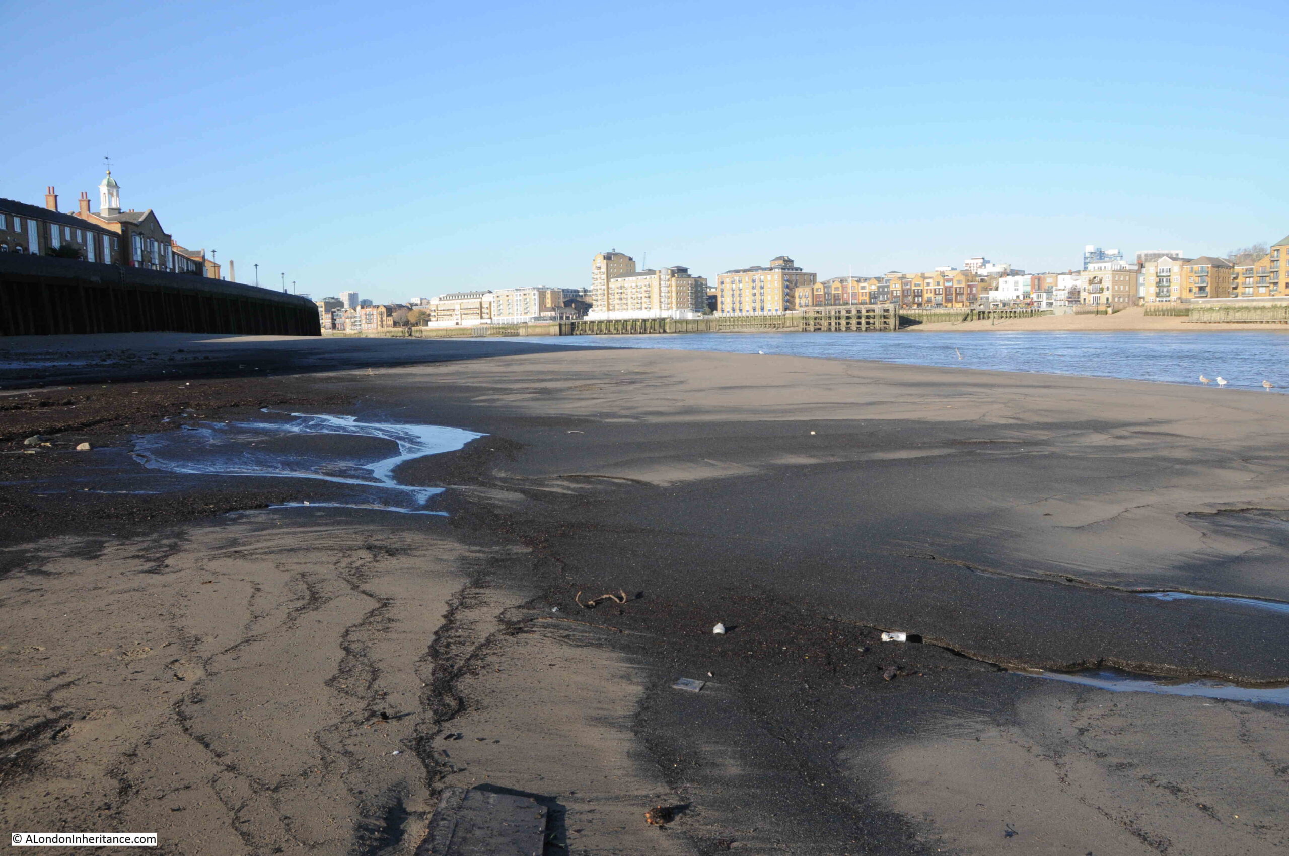
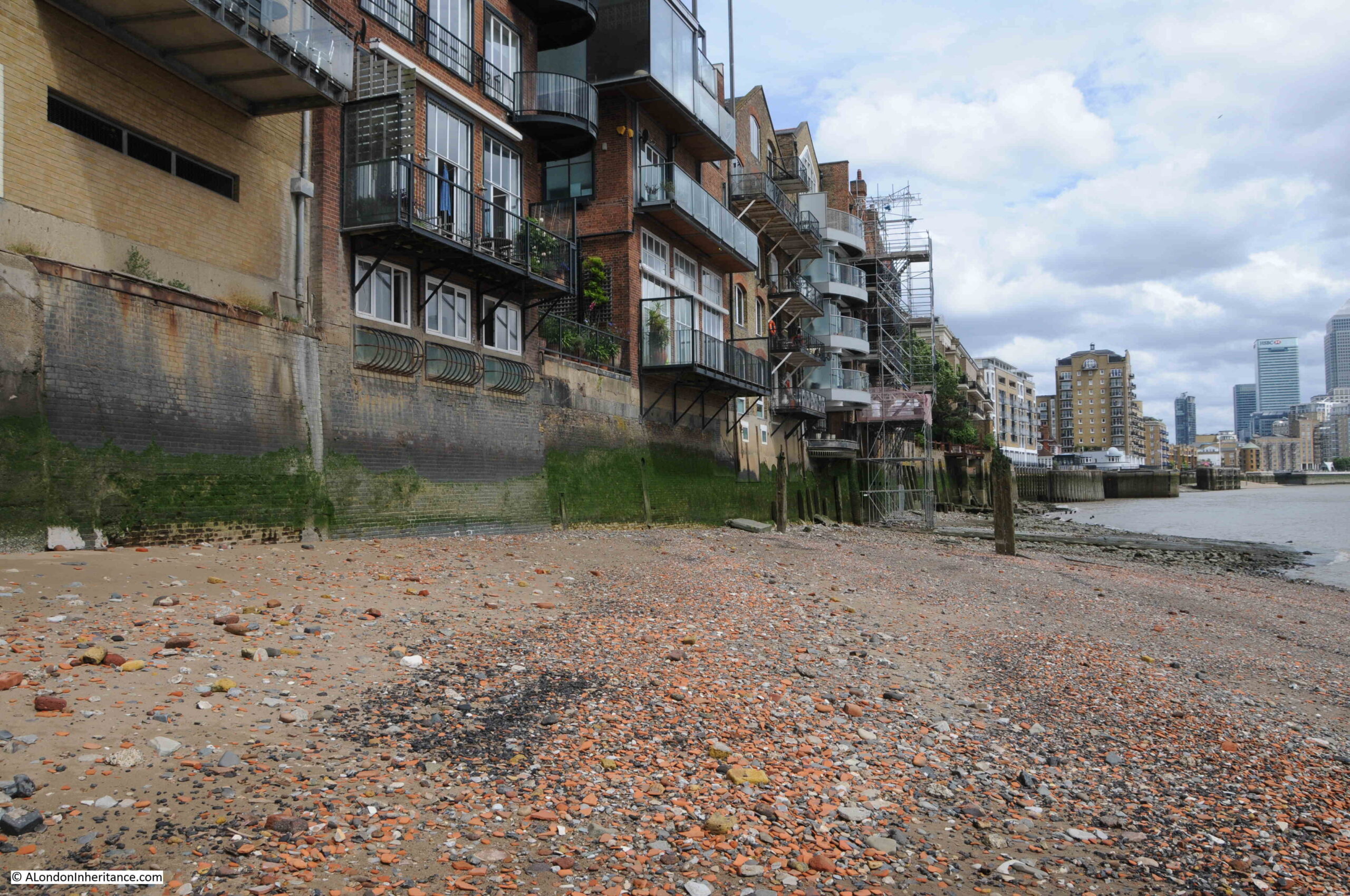
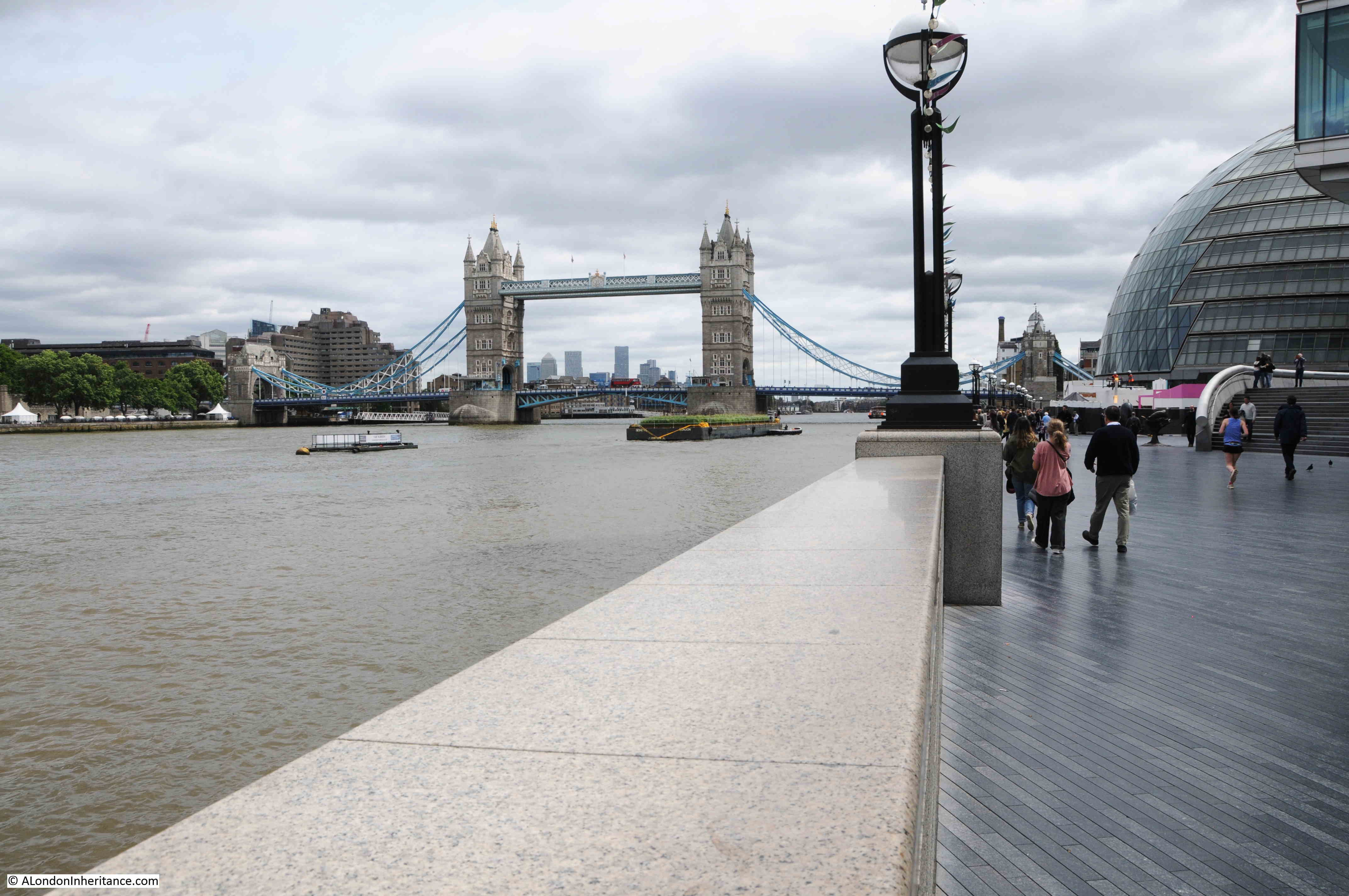
Underneath the northern tower of Tower Bridge, there is a late 19th century version of one of the old Thames Stairs, which has a name that refers to one of the gates that controlled access into the Tower of London. This is Iron Gate Stairs.
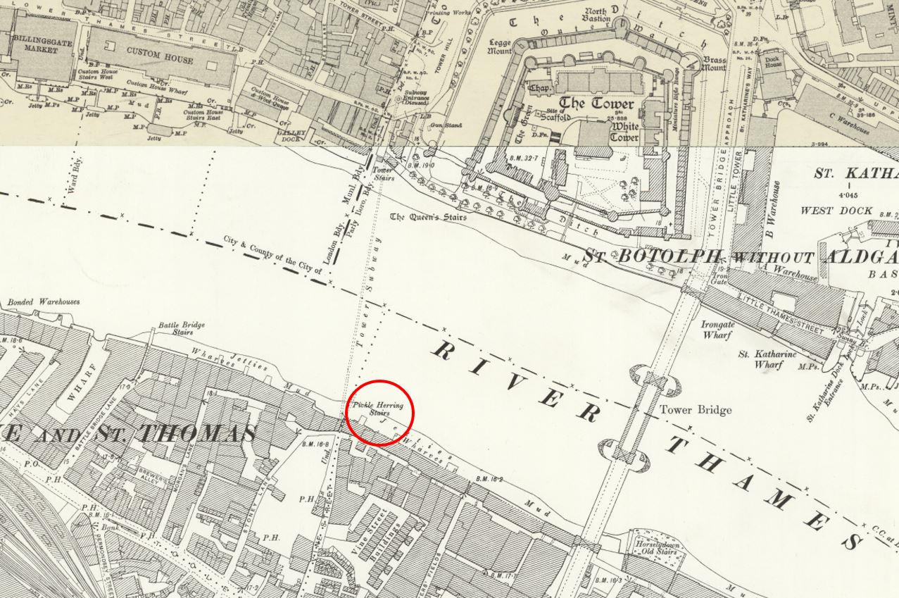
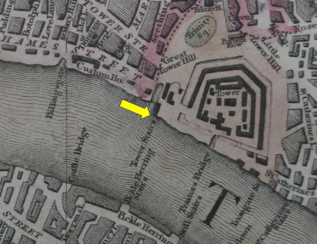
The stairs are shown before Tower Bridge was built in this extract from Langley and Belch’s, 1812 New Map of London (underlined in red):
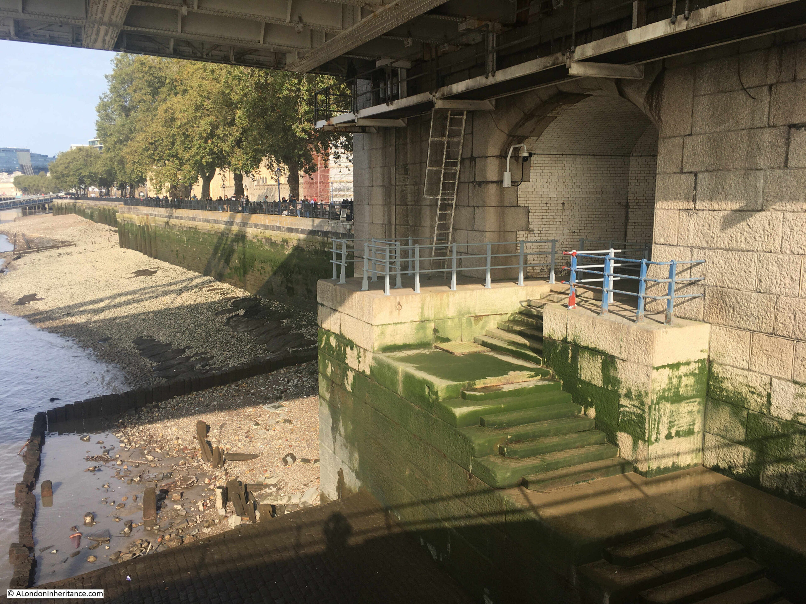
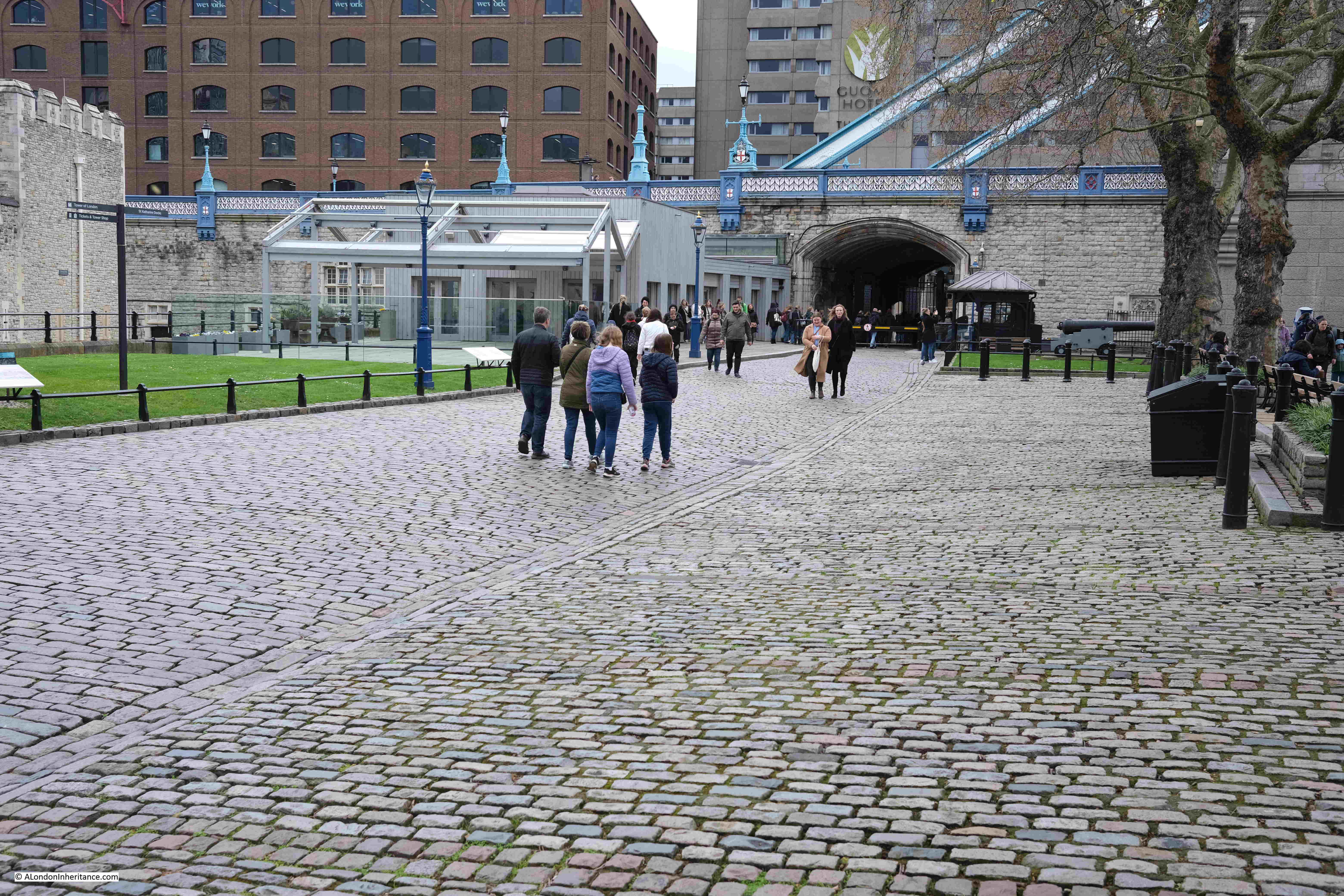
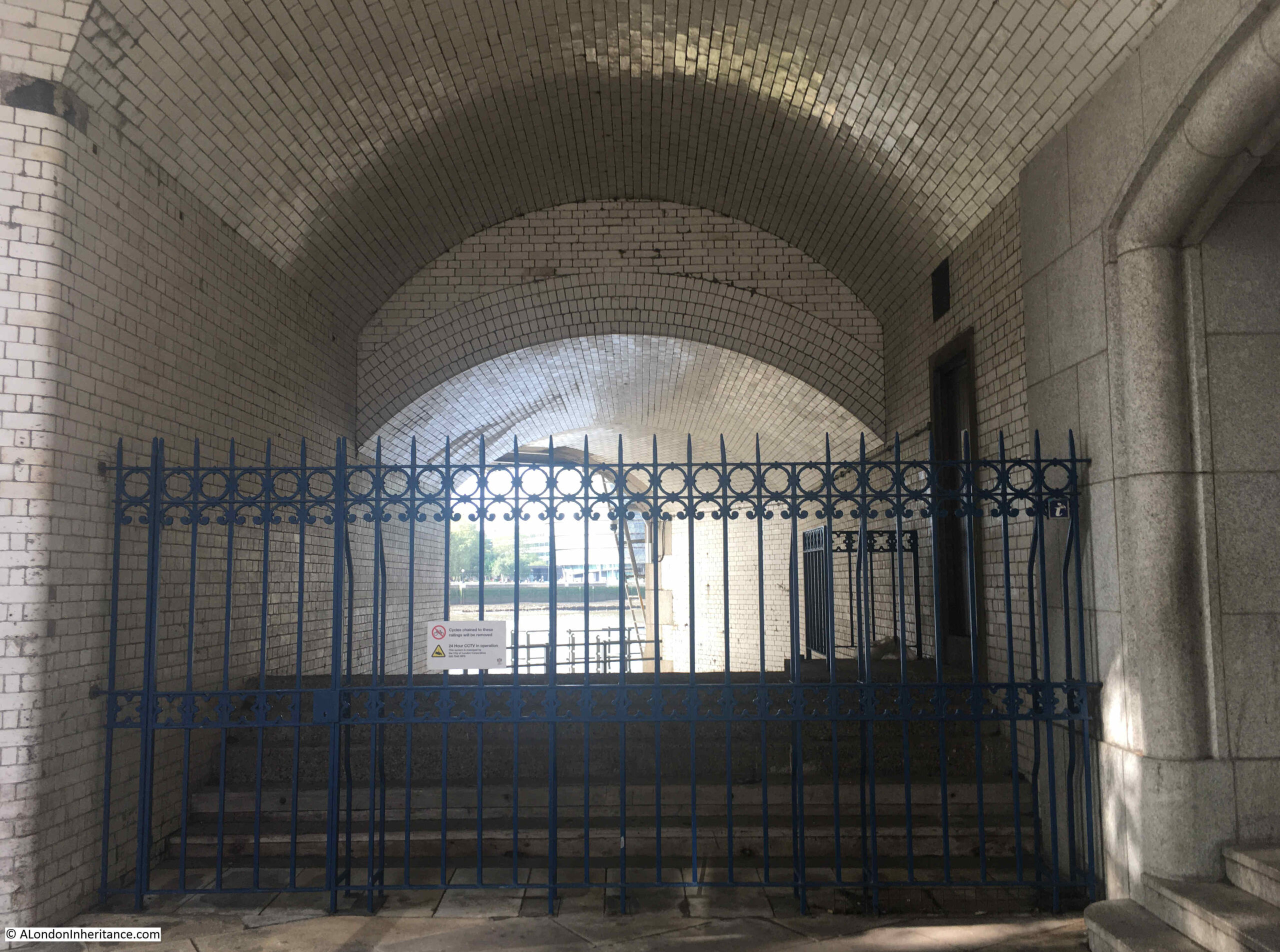
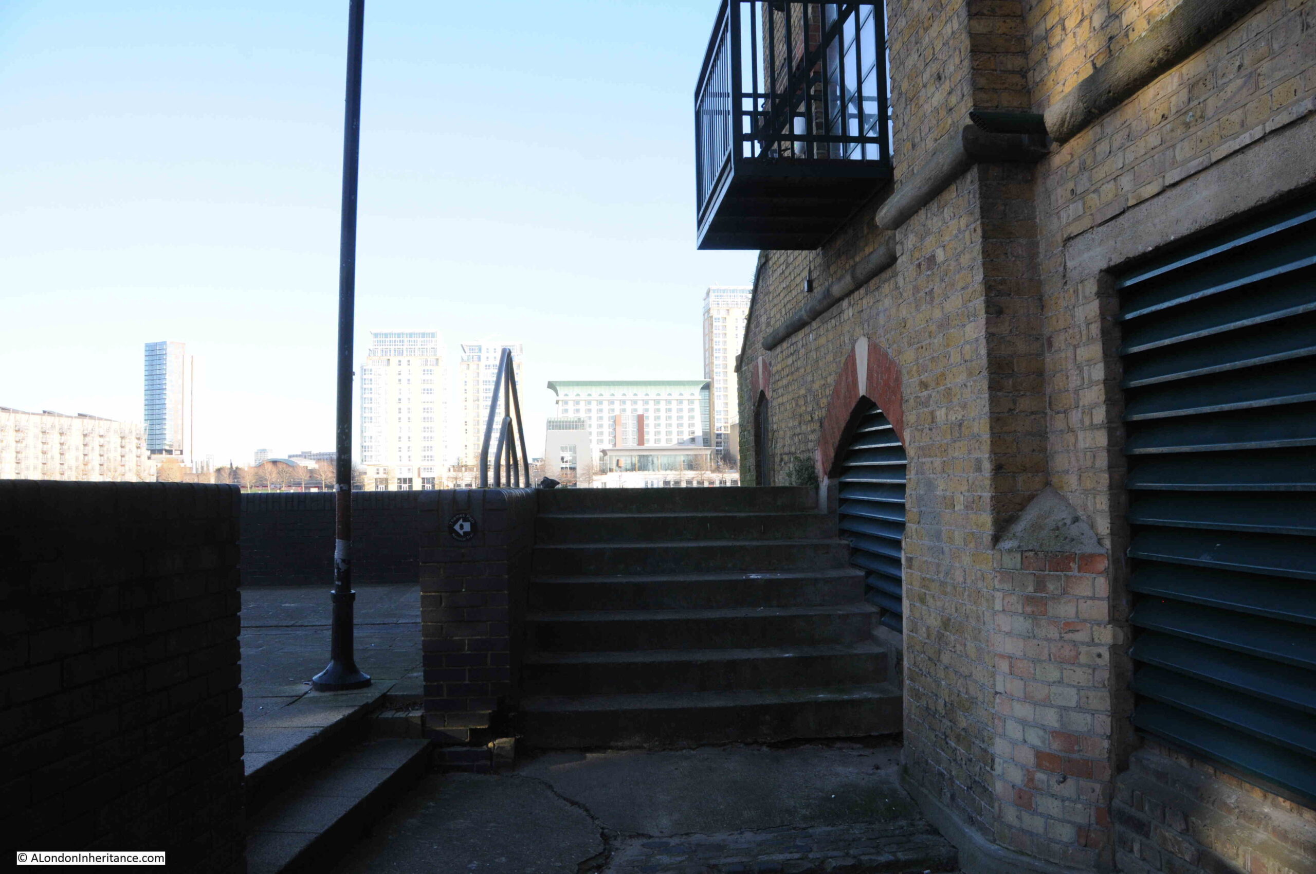
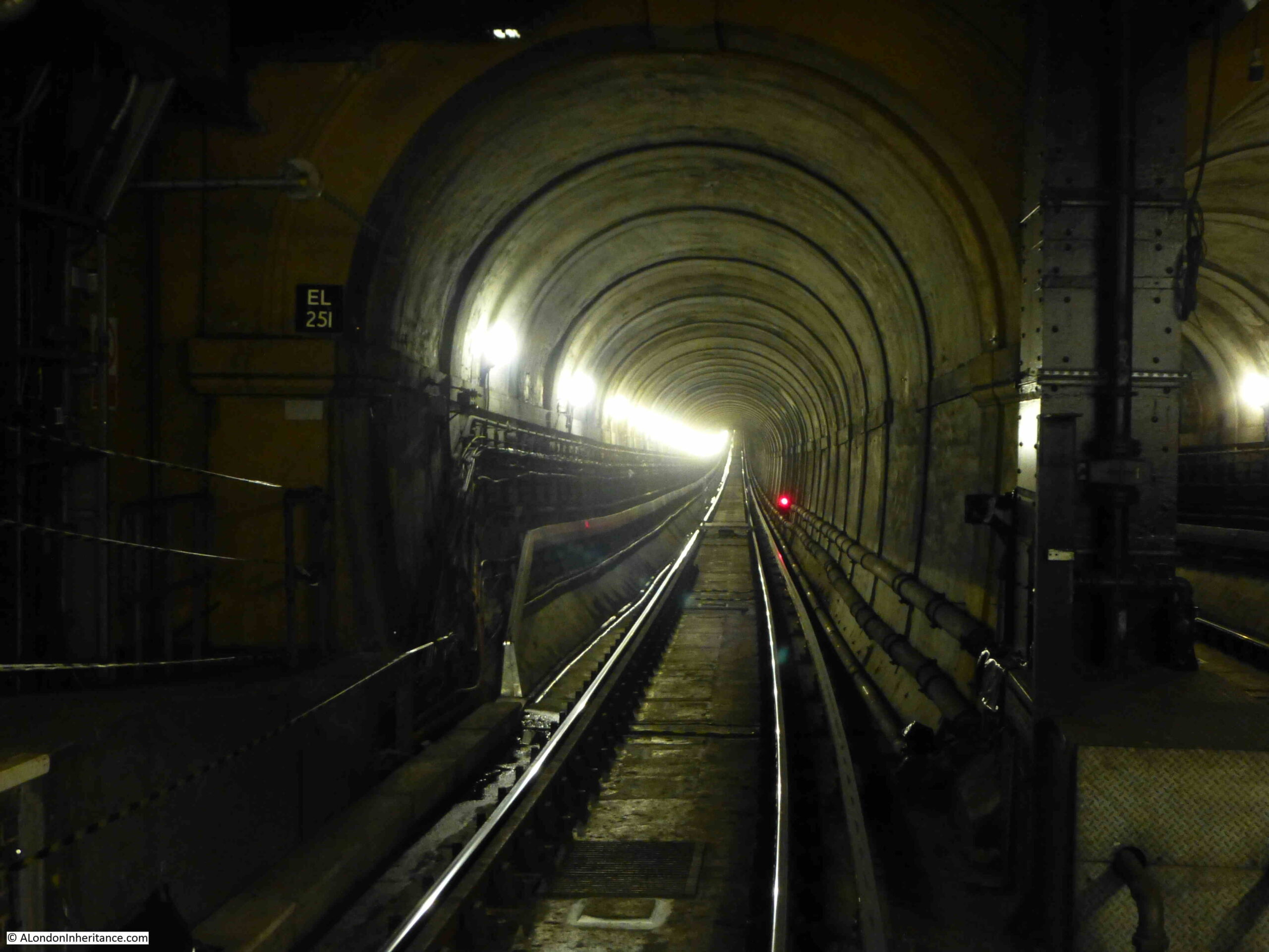
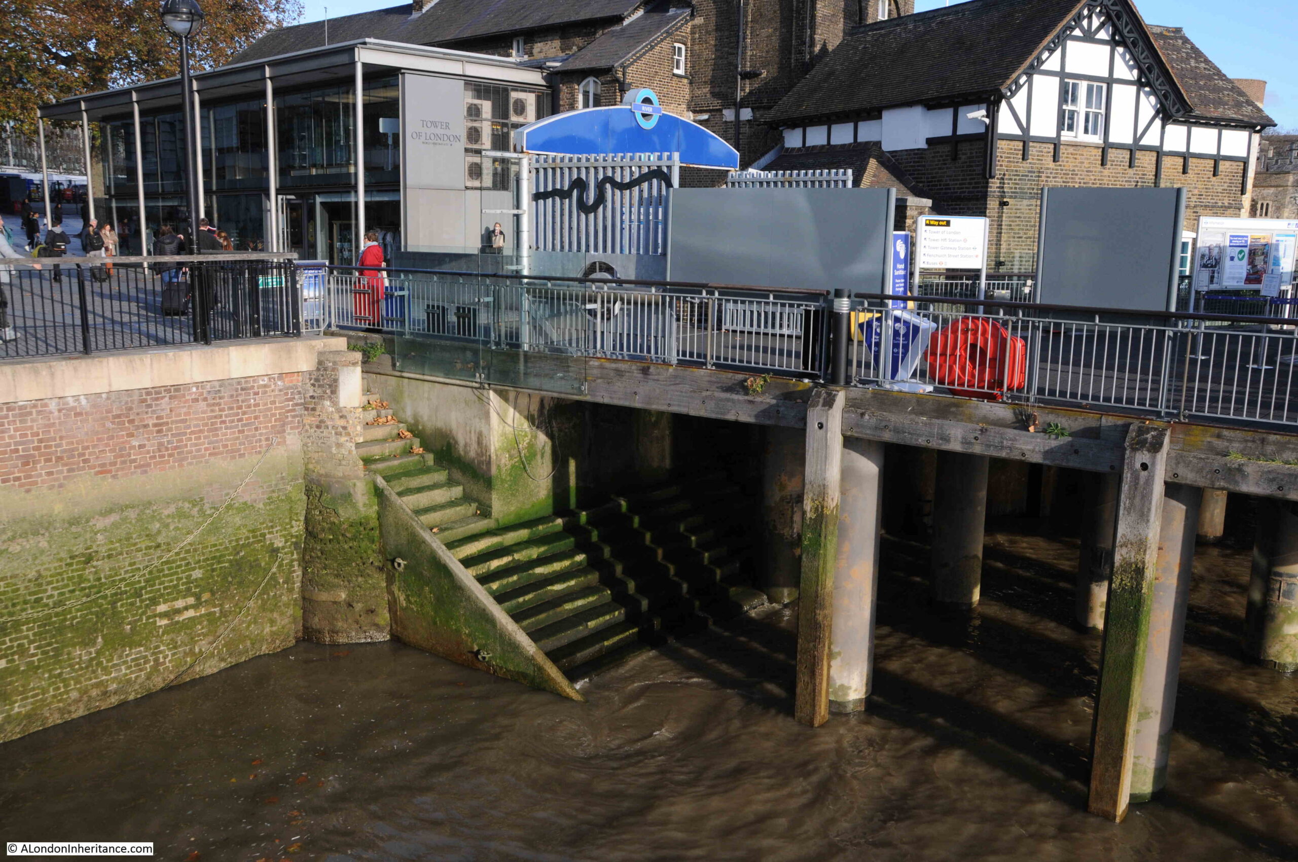
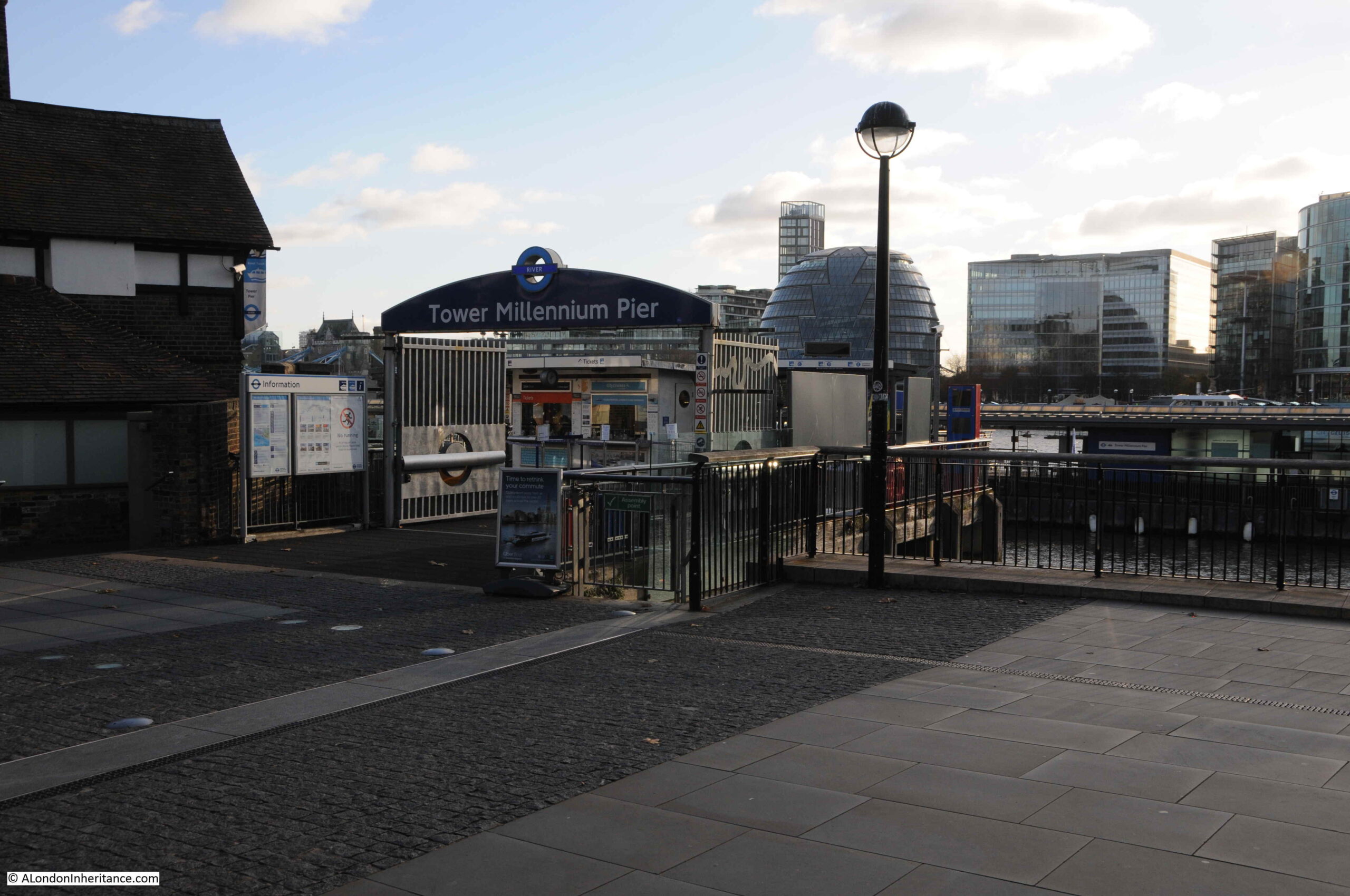
Today, Iron Gate Stairs are reached via a tunnel which runs through the northern tower of the bridge, and comes out to a well maintained set of stone stairs:
As far as I can confirm, by checking and aligning a number of maps, the stairs today appear to be in the same location as the stairs shown in the 1812 map.
It shows the importance of these access points to the river, that they were included in the design of Tower Bridge, and it must have cost more, and been more complex, to route the access to the stairs through the tower, rather than relocate them to one of the sides of the northern tower of the bridge.
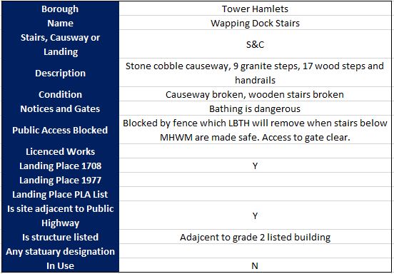
The Port of London book “Access to the River Thames, a Port of London Guide”. includes these stairs in the listing of all points of access to the river along the tidal Thames, and the PLA record for Iron Gate Stairs reads:
Stairs and Causeway
Constructed of Stone
A landing place in 1708 and 1977 and in use at the time of the book (around 1995)
Structure is listed
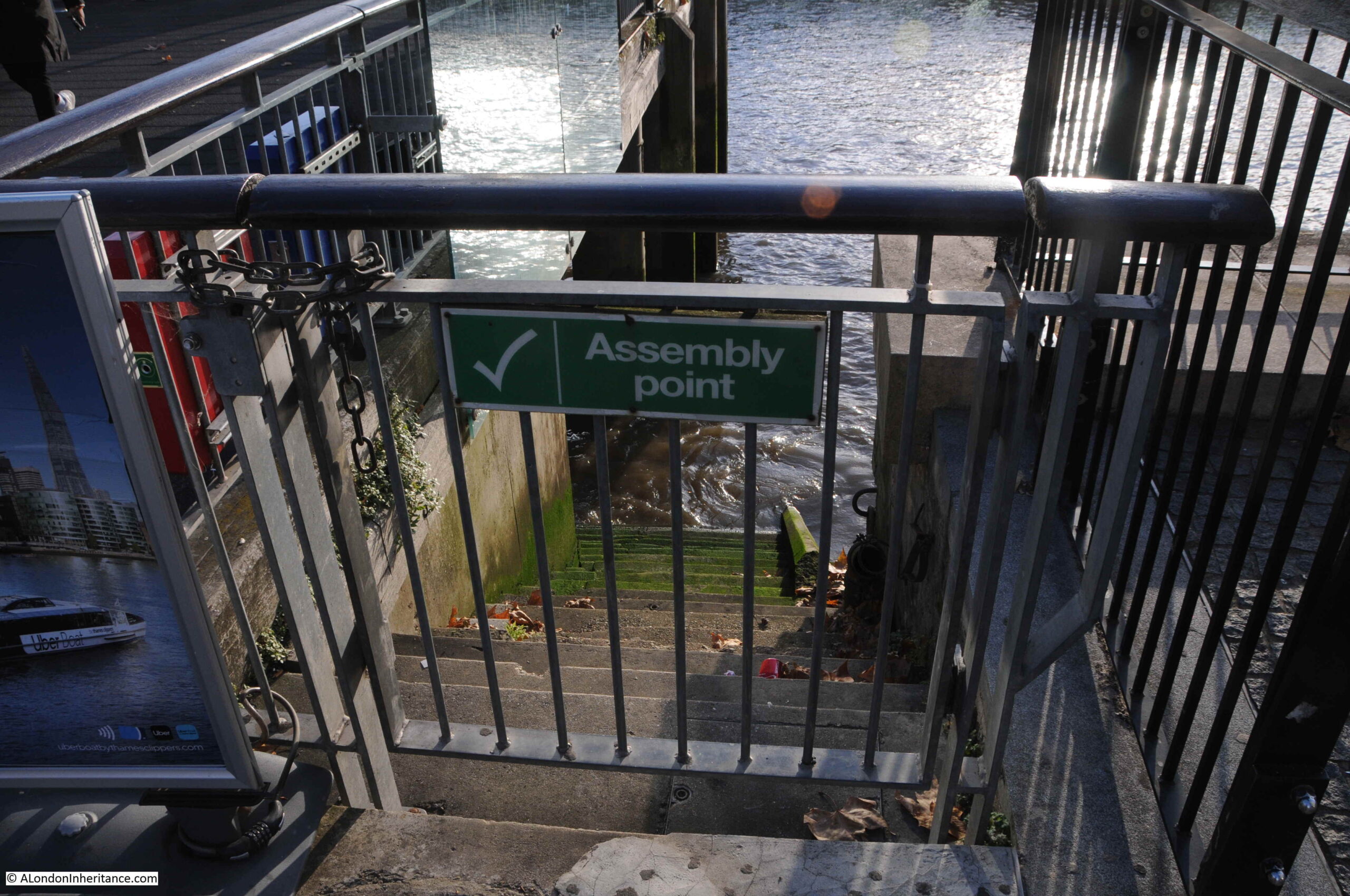
The stairs are gated
Bathing from these stairs is extremely dangerous
I cannot find a separate listing for the stairs on the Historic England website, so I assume that the stairs are included within the overall Grade I listing of Tower Bridge, as the access to the stairs is part of the structure of the bridge.
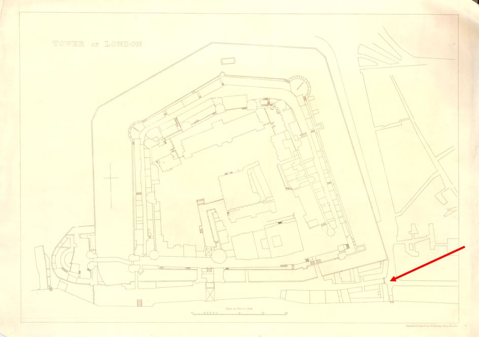
The name of the stairs is interesting, and it appears to refer to a gate that once controlled access to the south east corner of the area between the walls of the tower and the river.
In this 1852 plan of the Tower of London, there are a cluster of buildings in the lower south east corner, with a black line, indicating some form of gate, controlling access (red arrow):
Although not named, the stairs can be seen running down to the river, next to the gate.
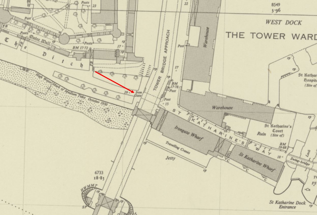
After the construction of Tower Bridge, the name Iron Gate is retained, and although the stairs do not appear to be named (perhaps because they are under the bridge), iron Gate is used next to the tunnel underneath the approach to Tower Bridge, where today you can walk from the St Katherine Dock area, to the area between the Tower of London and the river.
So Iron Gate in the OS maps seems to continue to refer to a gate across this access through the wall created by the approach road to Tower Bridge.
As with all Thames stairs, there are references to the stairs in multiple newspaper reports over the centuries. For example, the following is from the Public Ledger and Daily Advert on the 9th of October, 1826, and unfortunately it does not record what Samuel Pearce did, which required such a public apology:
“CAUTION TO WATERMEN – I Samuel Pearce, Waterman, plying at Iron Gate Stairs, near the Tower, beg publicly to acknowledge and express my grateful feeling to John Morrison, Esq. for foregoing a prosecution against me, which I well merited, in consequence of an unprovoked and unwarrantable outrage committed on him on Friday evening; for which I cheerfully make this public apology, which he accepts, in consequence of the distressed state of my wife and infant family.”
Iron Gate Stairs were also the boarding point if you wanted to travel to “Harwich, Yarmouth and Places Adjacent”, as the 80 horse-power Steam Packet Swift sailed from the stairs on Sundays and Thursdays in the 1820s.
Indeed, Iron Gate Stairs feature in papers across the 18th and 19th centuries with all the usual stories of activities that happened at these places which formed a key access point between the land and the river.
As with other stairs, Iron Gate Stairs was a place where bodies recovered from the river were brought up to land.
The Historic England Monument Record for the Iron Gate refers to it being a gate tower constructed during the reign of Edward III (who reigned between 1327 and 1377), and that it was built to strengthen the defences of the Tower on the southern side of the complex, and that it commanded a “walled causeway through to the Develin Tower at the south east corner of the outer wall.“
Stow in the early 17th century refers to the Iron Gate as being “great and strong but not often opened”.
The Iron Gate was demolished in 1680 following a review of the Tower’s defences, and whilst looking for space to expand accommodation.
So whilst the gate tower was demolished, as shown in the 1852 map, a gate seems to have remained in place, although rather than the gate tower, just a standard gate.
After demolition, there also appears to have been a cluster of buildings around the location of the gate which seem to have been used for accommodation, storage and small industrial activity.
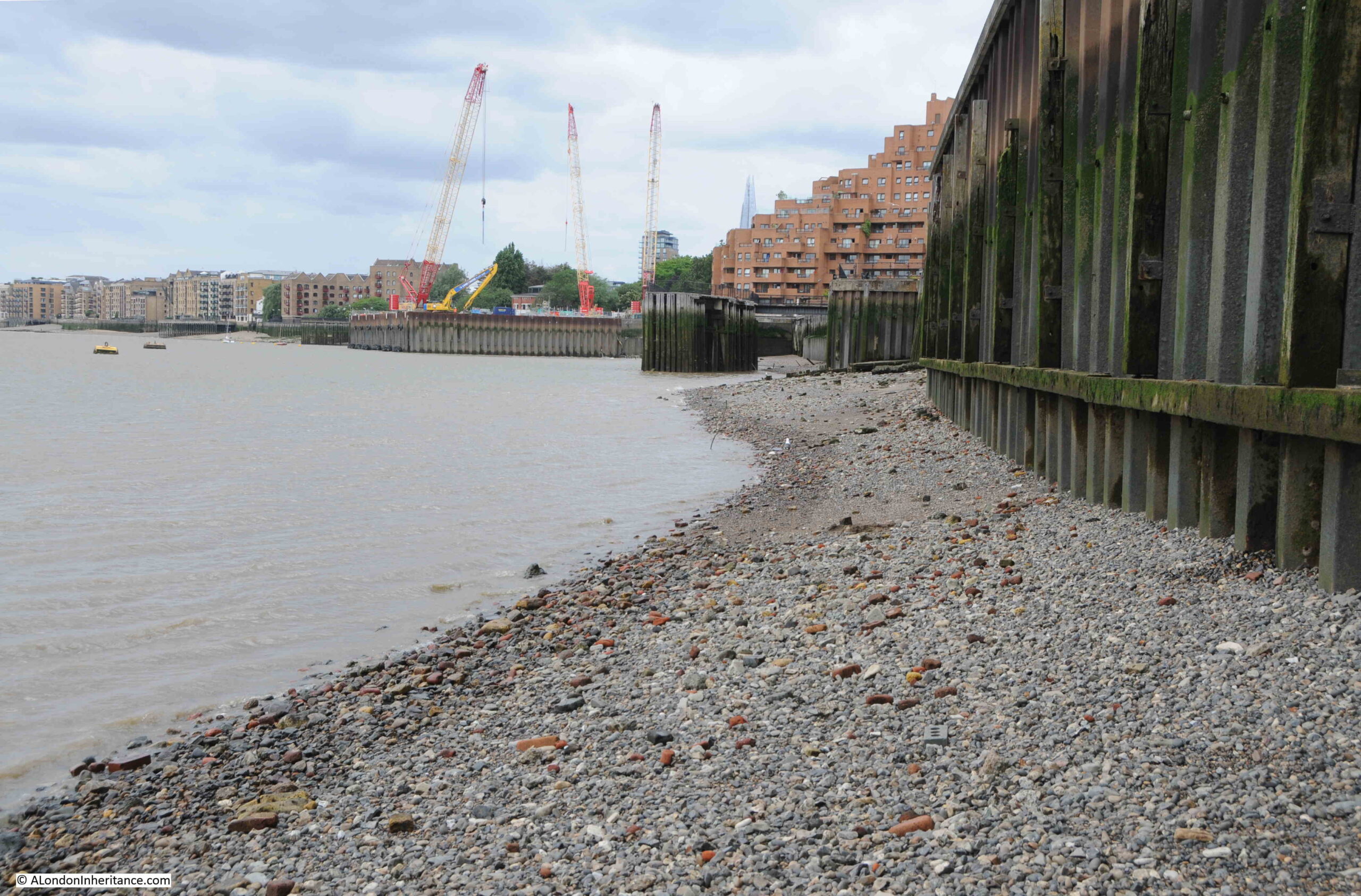
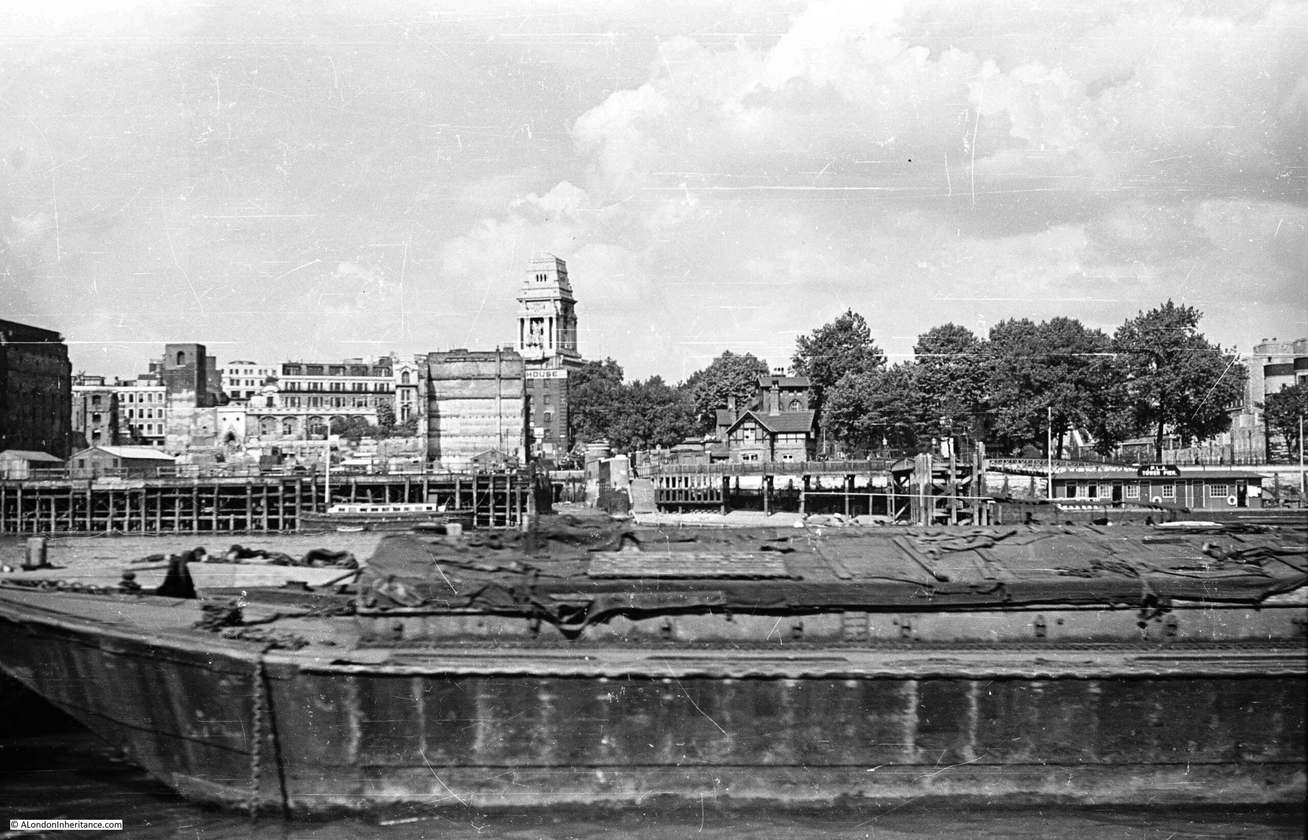
Construction of Tower Bridge cleared these buildings, and today we can see the area where the Iron Gate was located when looking towards the bridge, from the west:
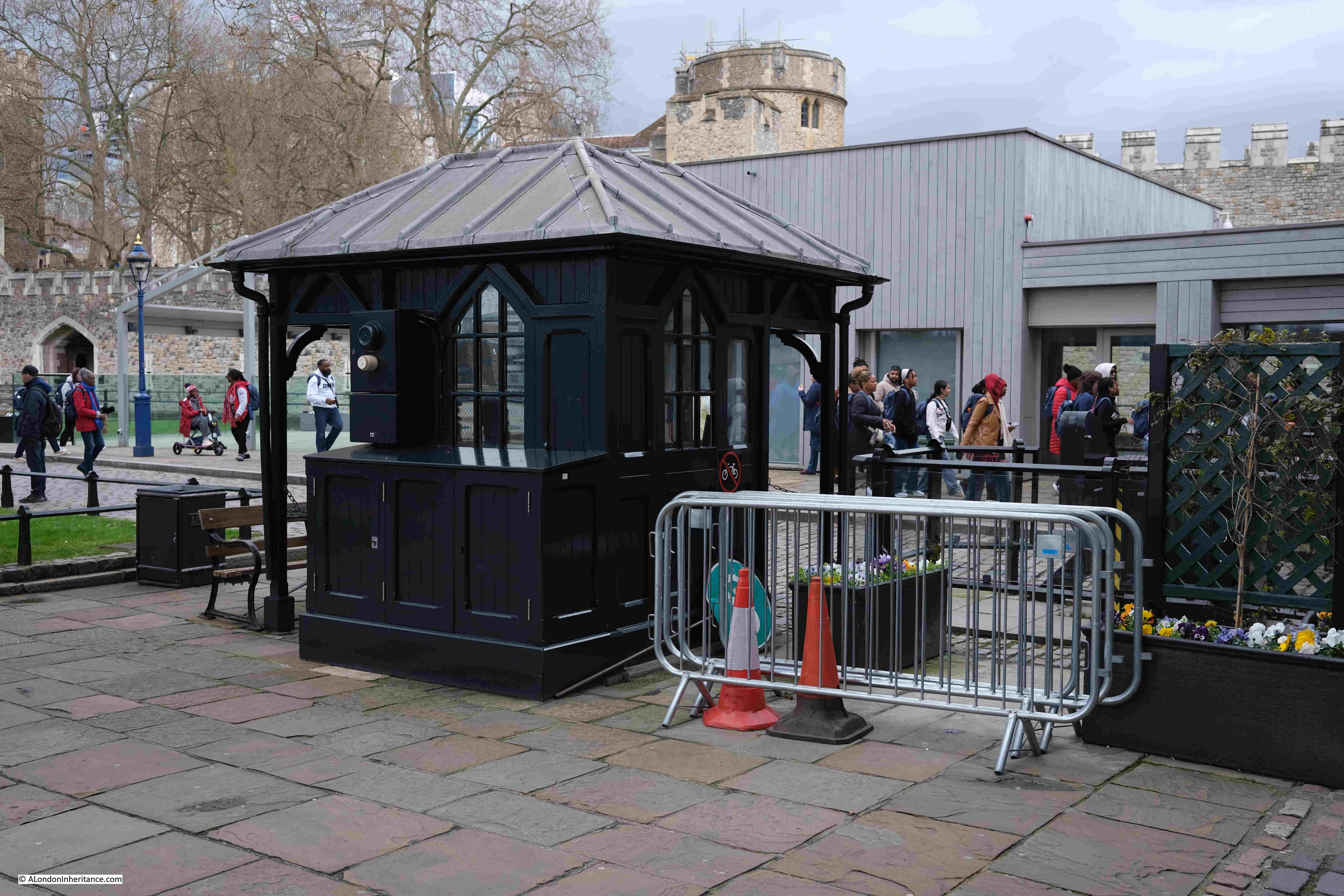
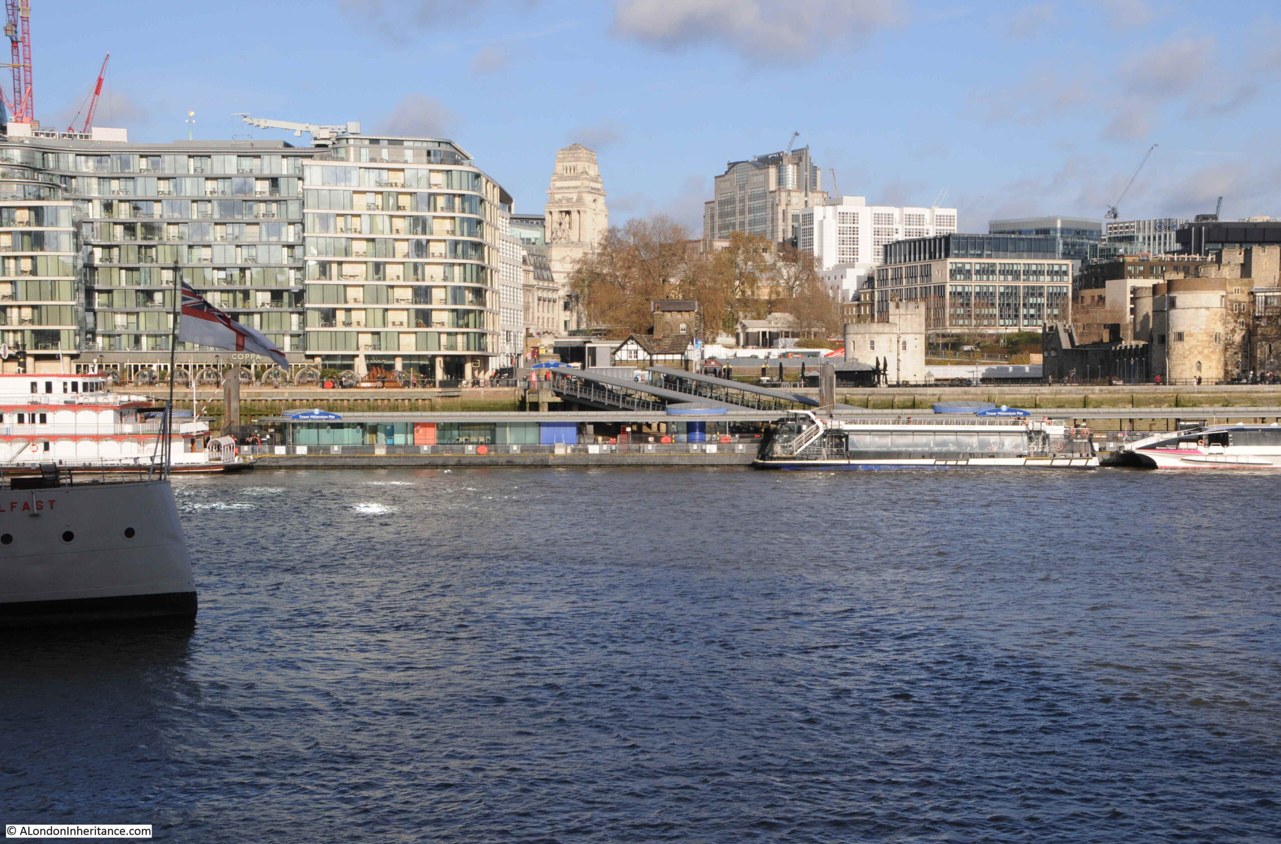
And with some lovely historical continuity, the area of the Iron Gate is still gated, with a gatehouse and barrier across the road:
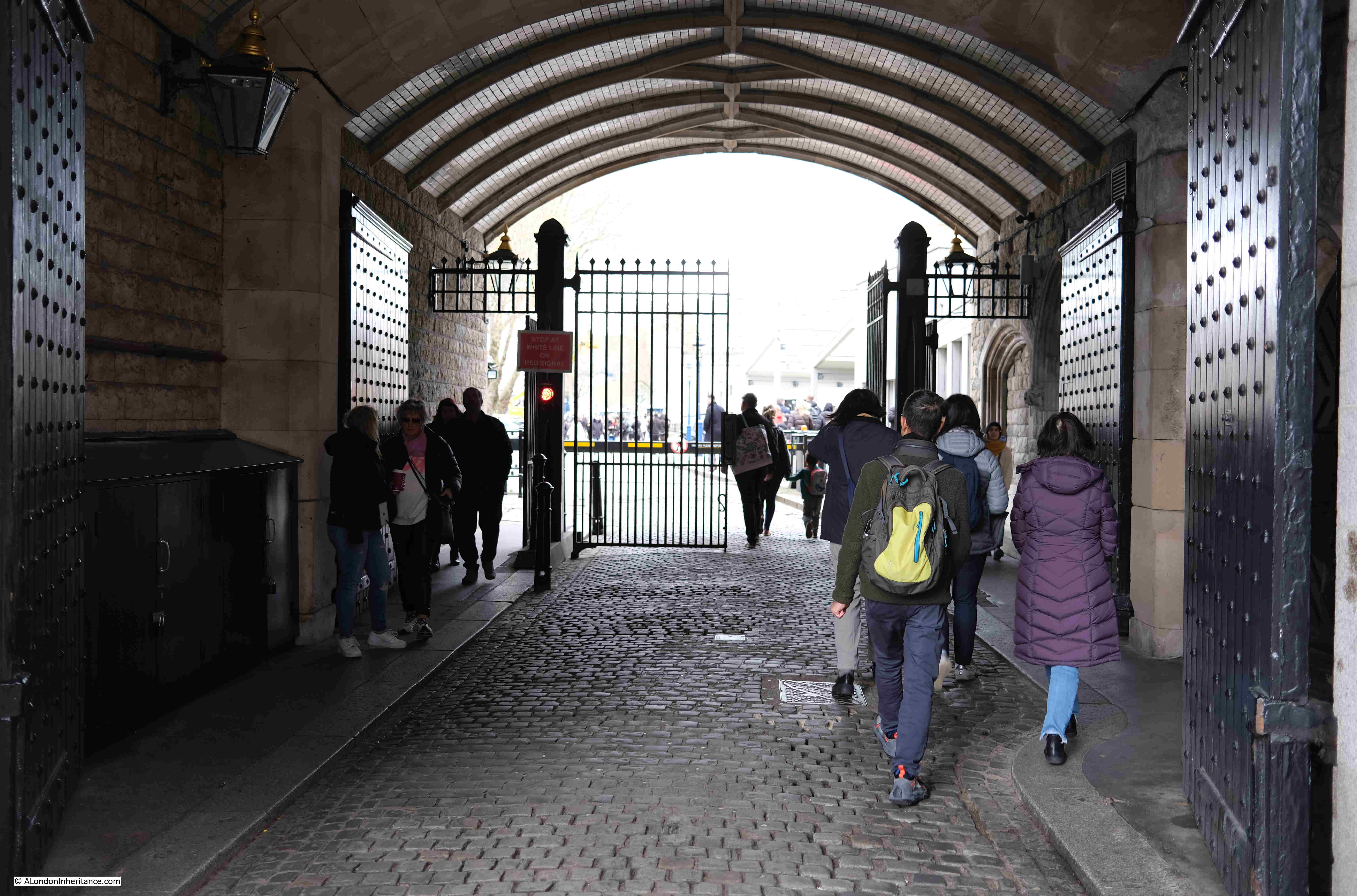
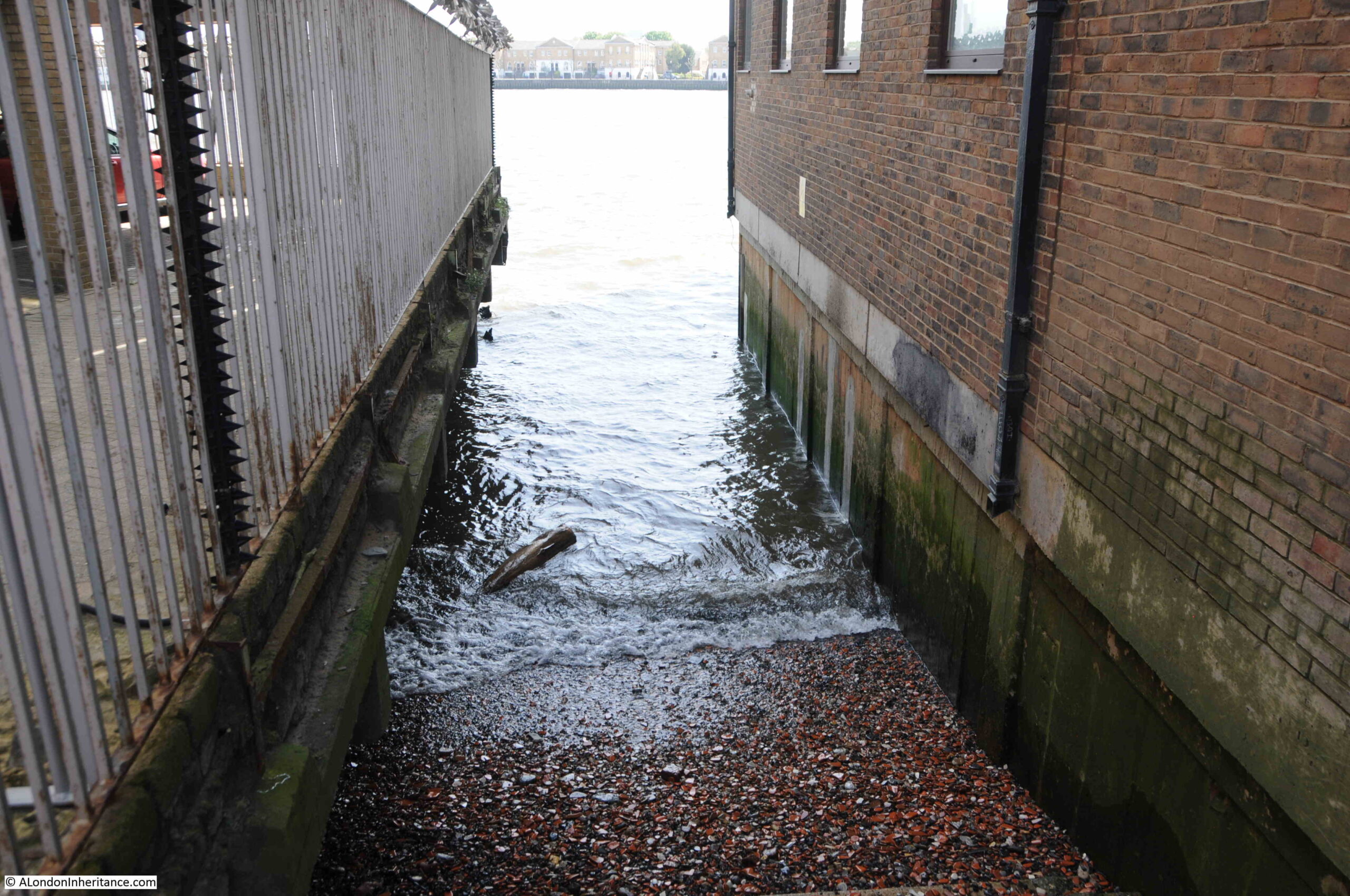
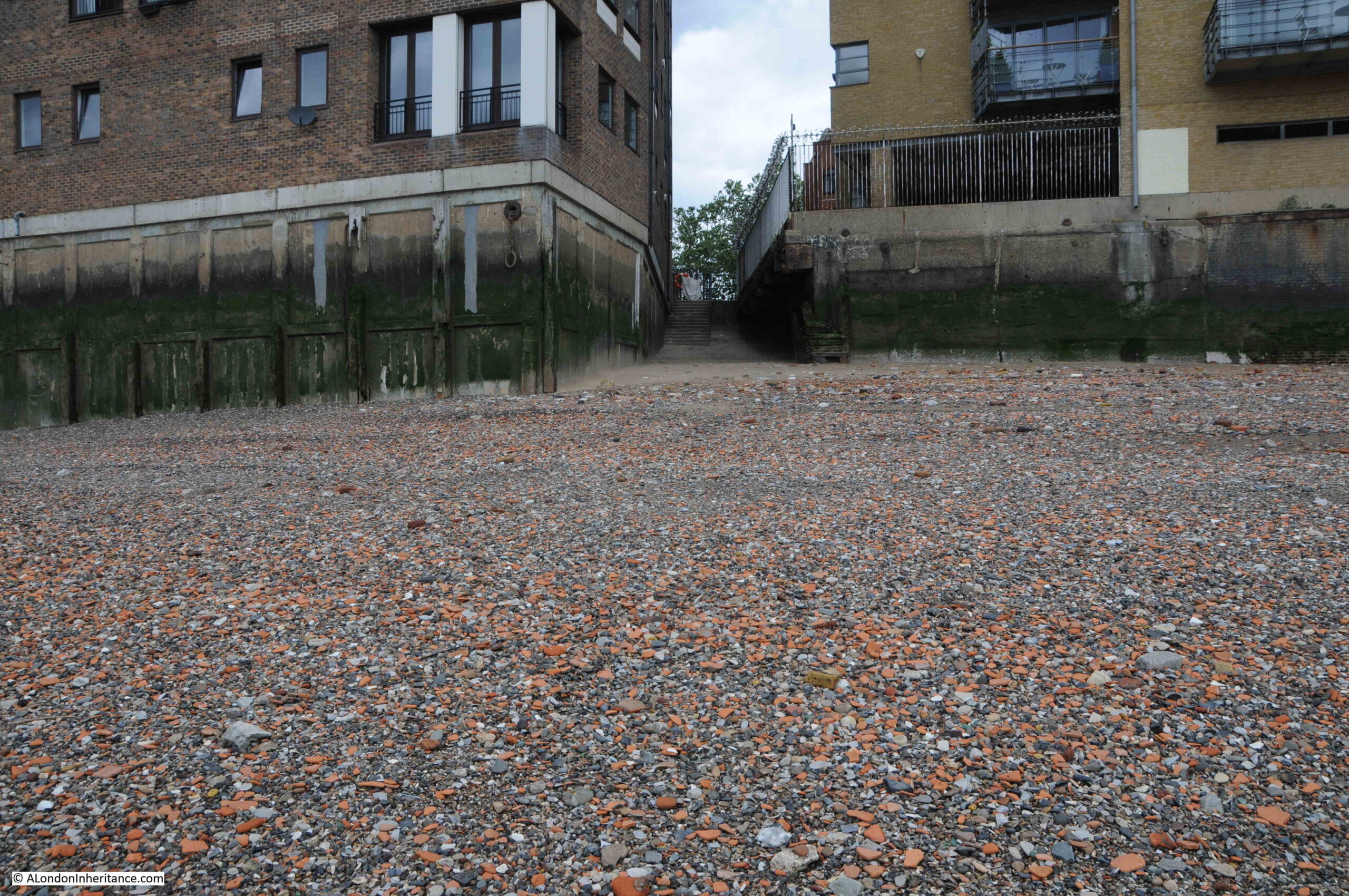
And looking through the walkway under the approach road to Tower Bridge, we can see gates part open across the walkway, as well as much larger and stronger gates set against the sides of the walkway:
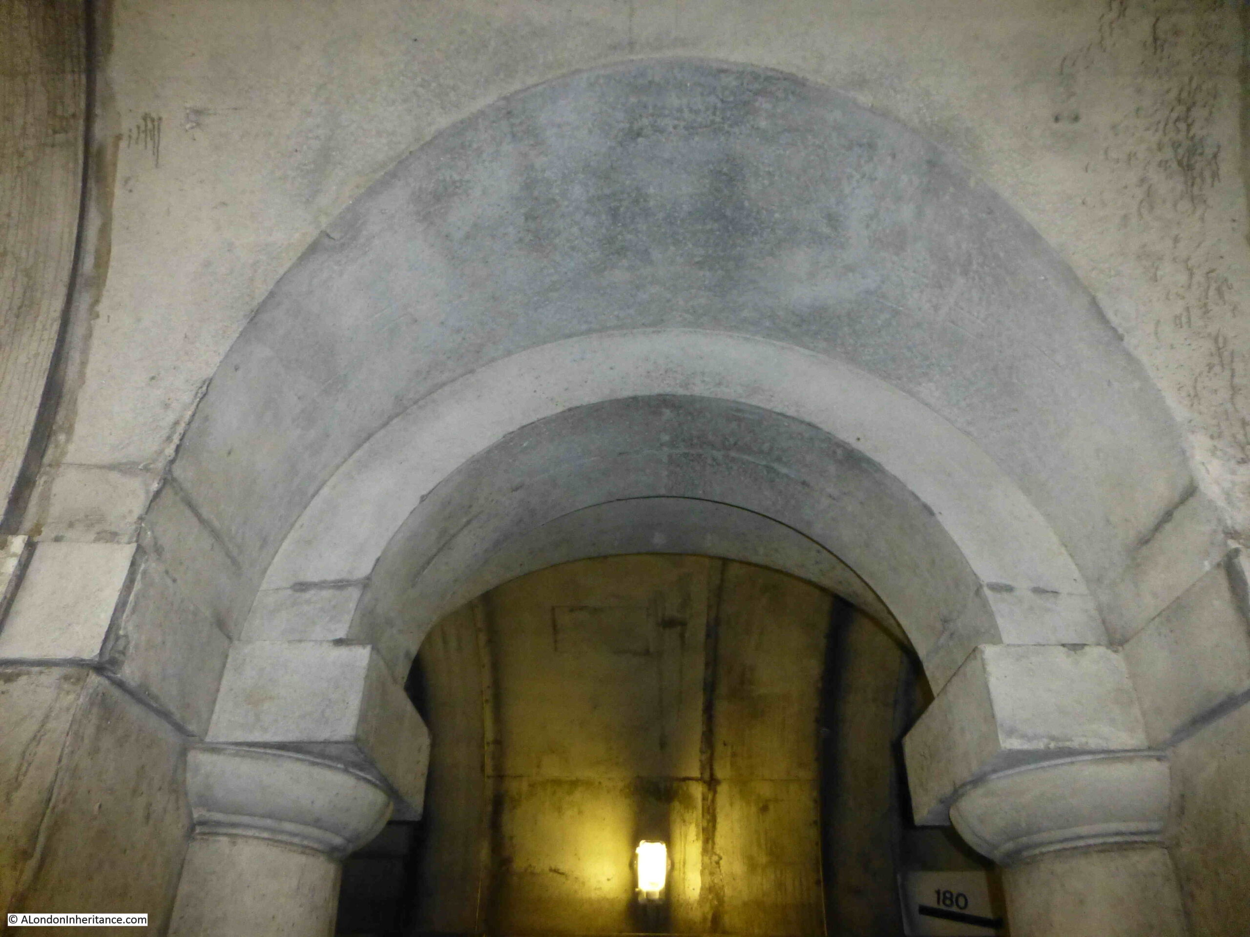
In the following photo, the entrance to the walkway tunnel under the approach road is on the right, and the arch on the left provides access to the entrance to Iron Gate Stairs:
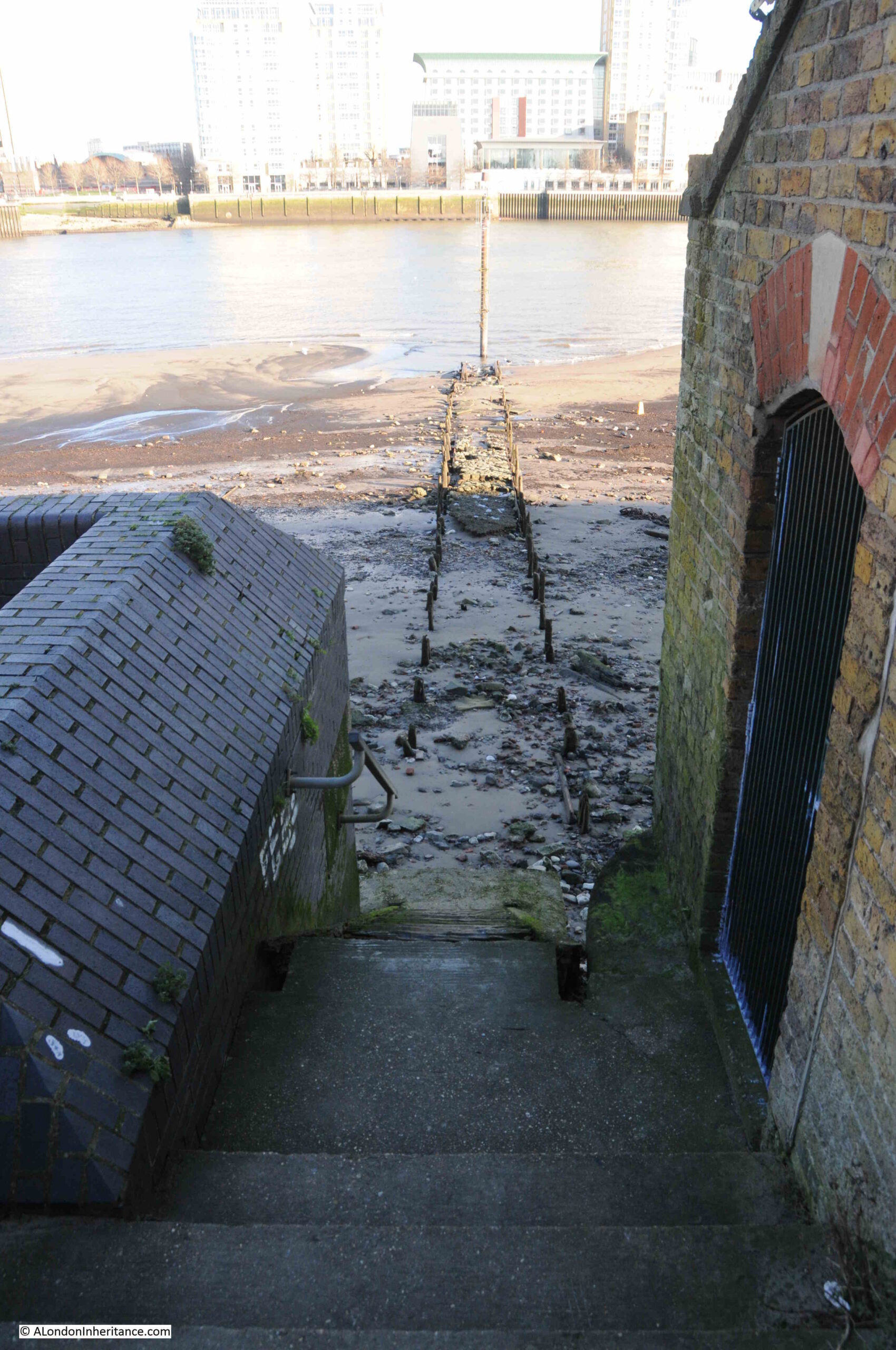
Which, as the PLA description of the stairs records, is gated:
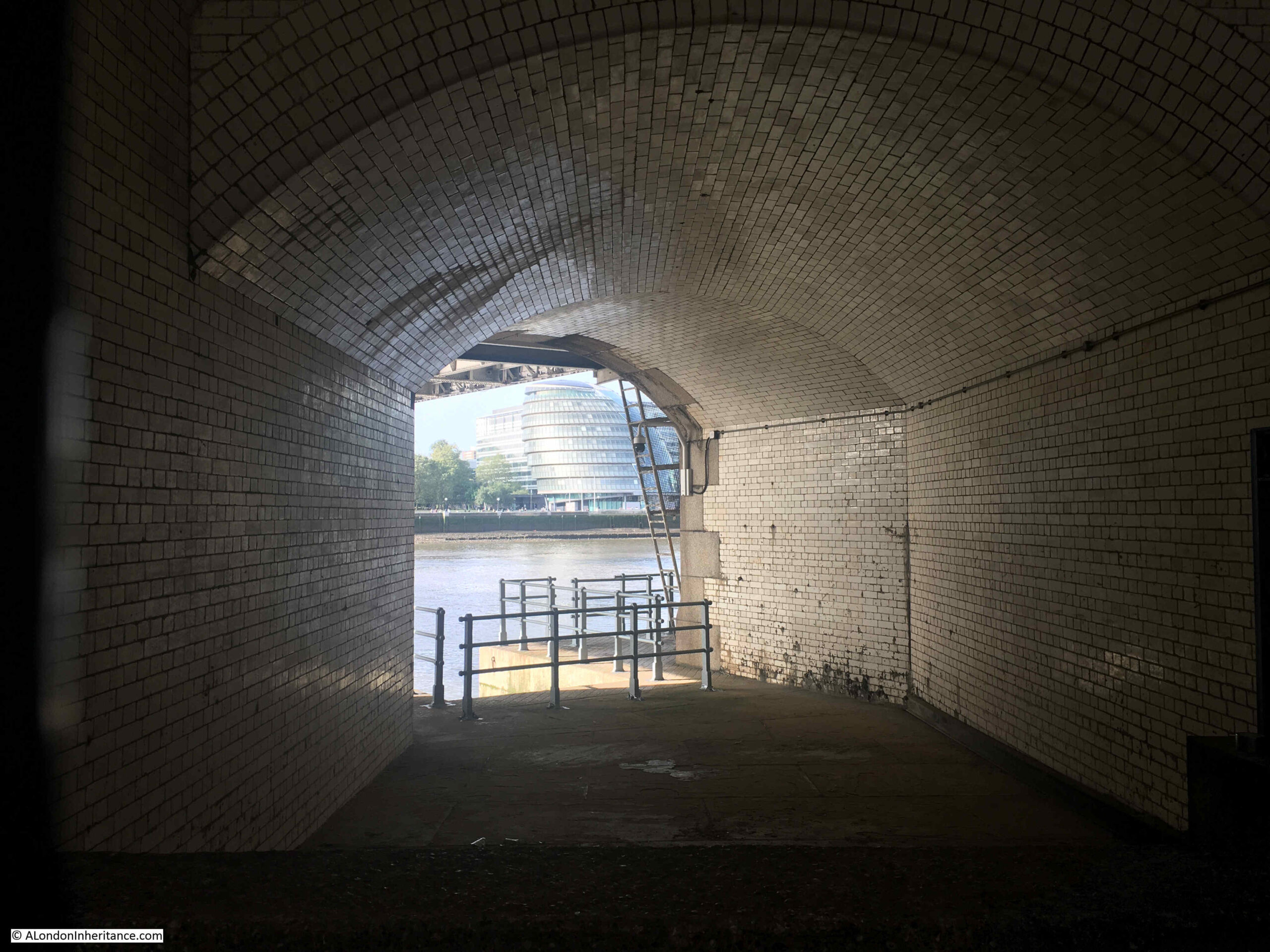
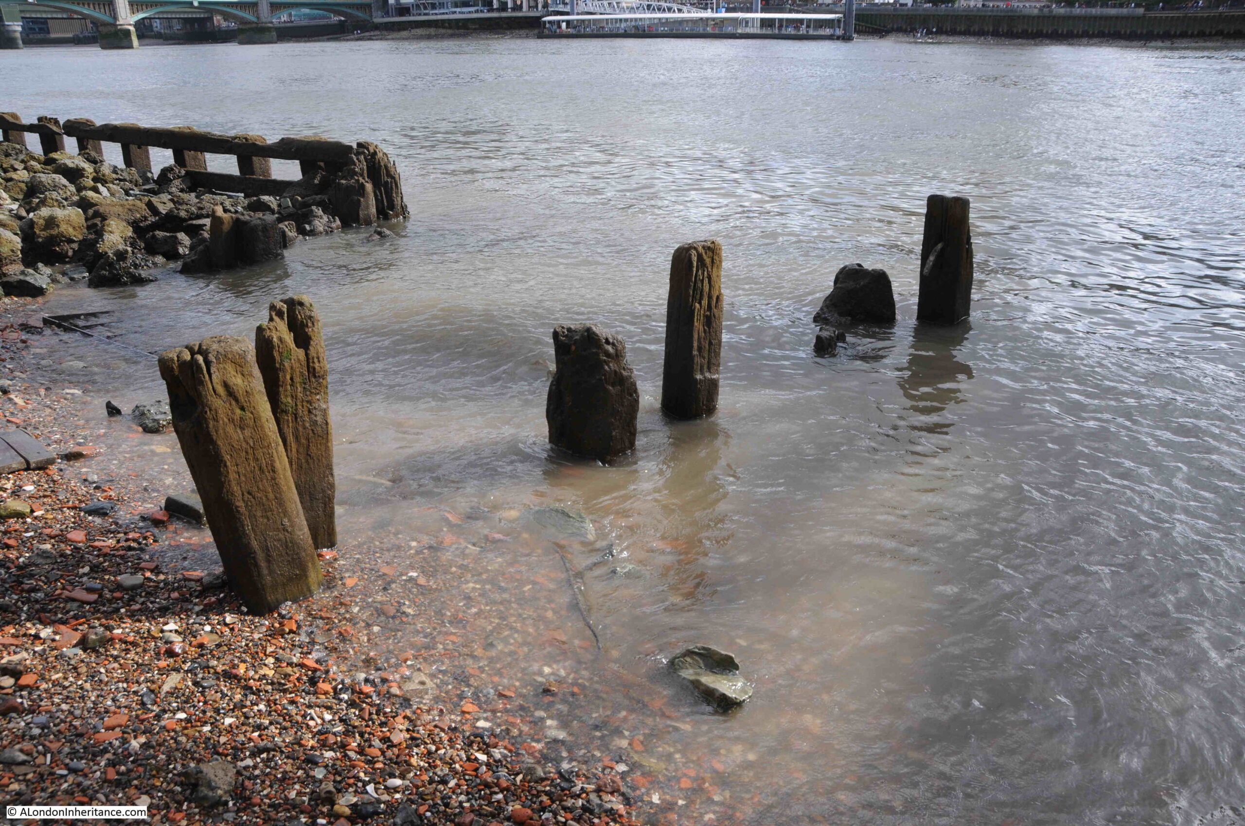
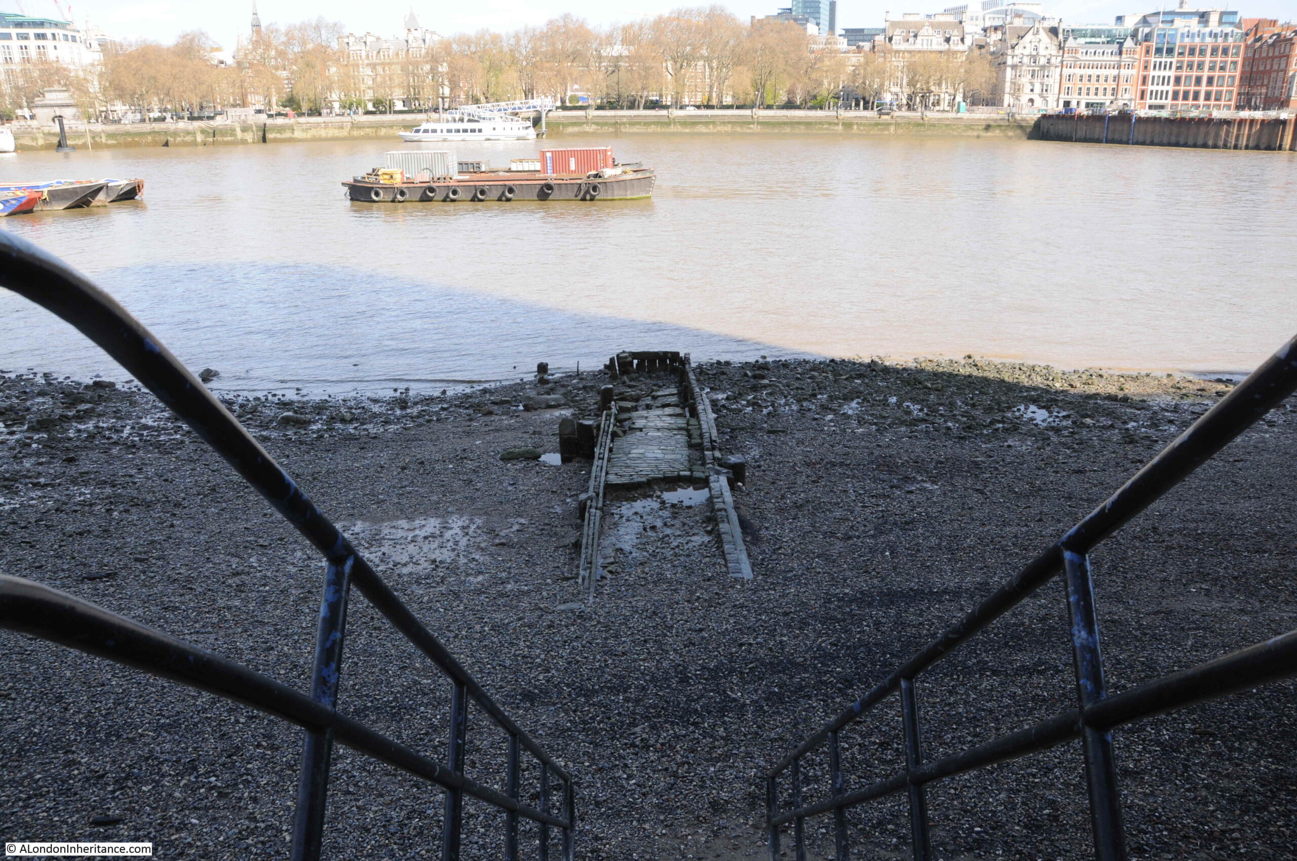
View of how the tunnel exits the base of the northern tower of Tower Bridge, and the steps leading down:
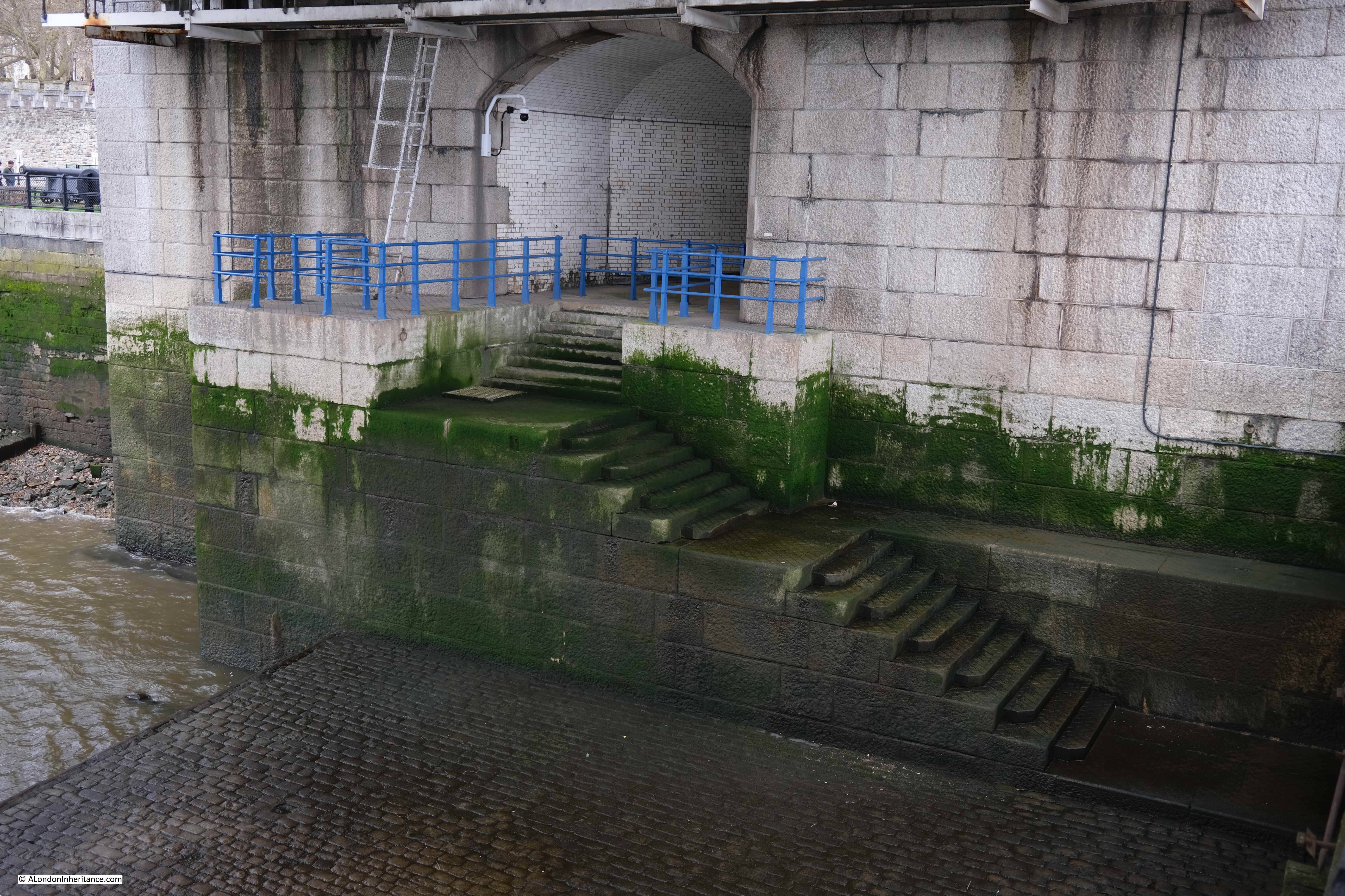
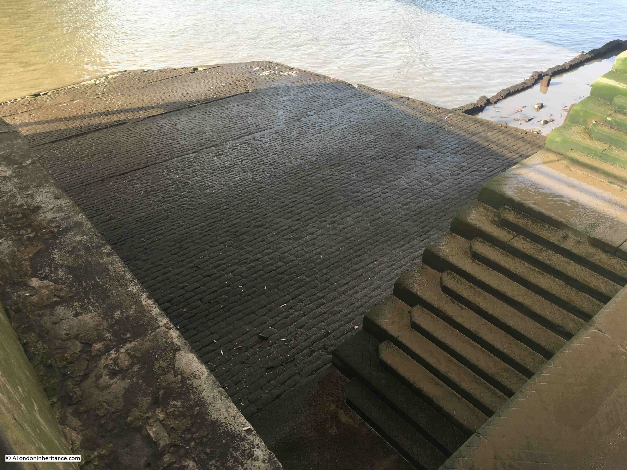
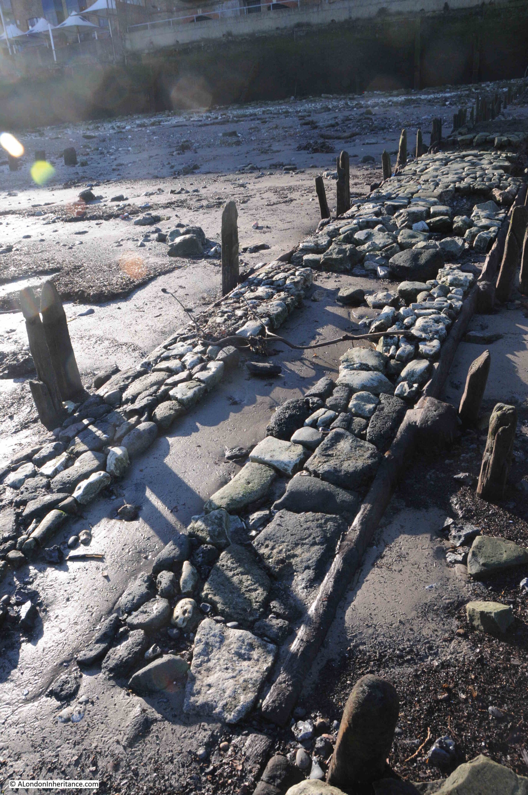
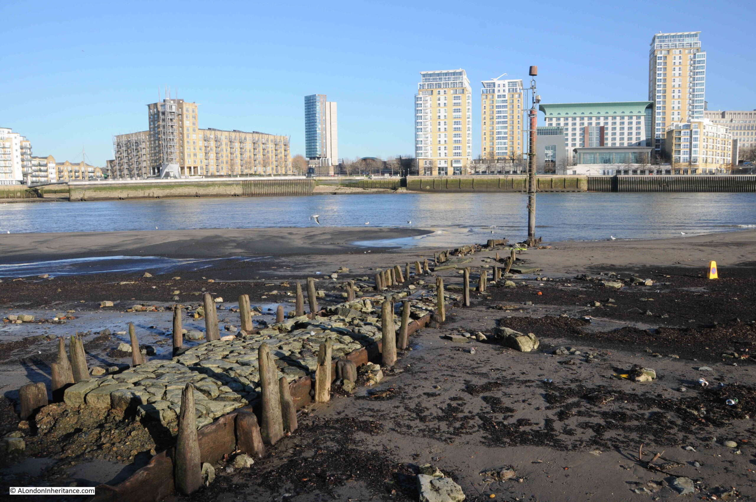
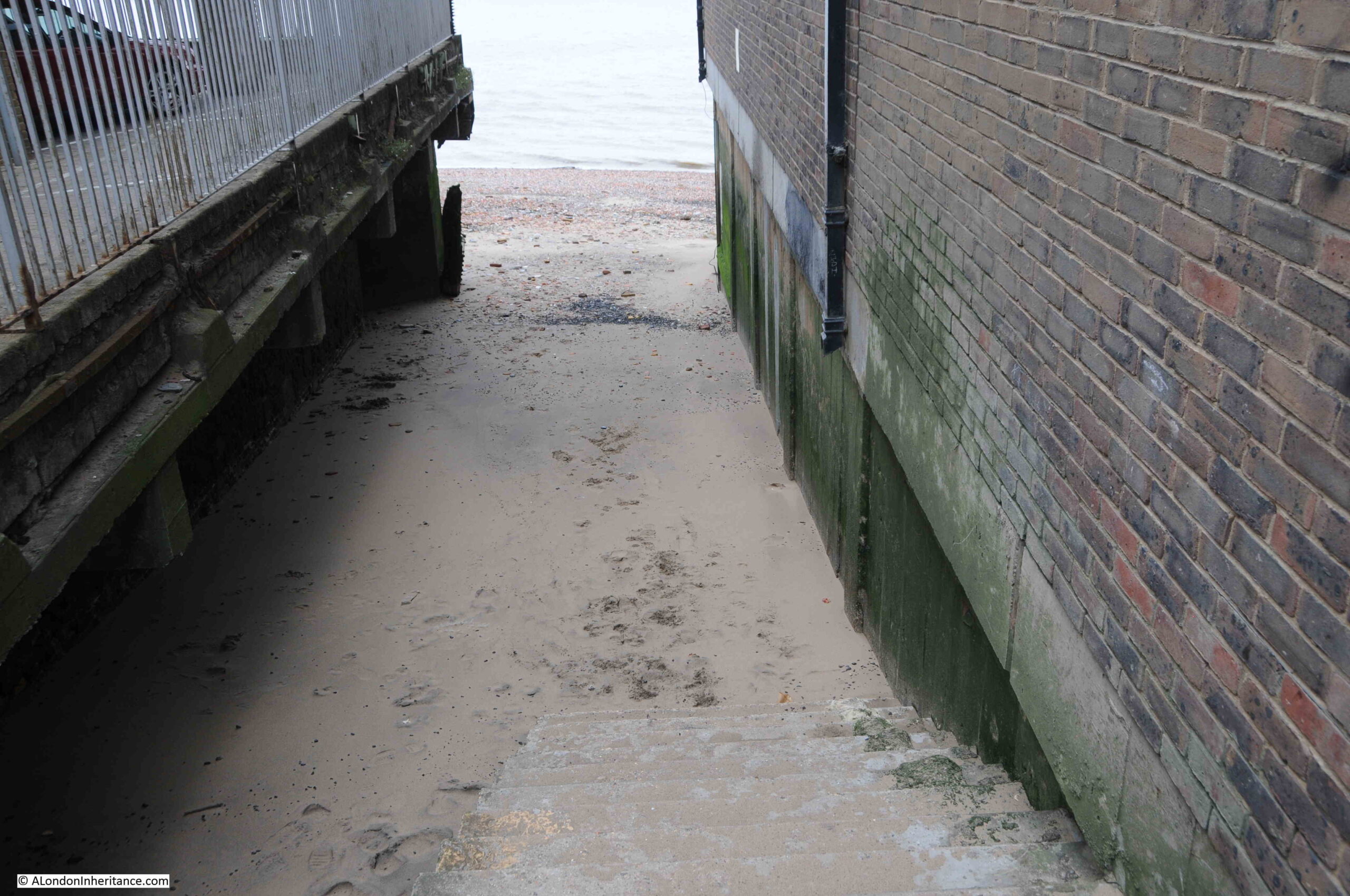
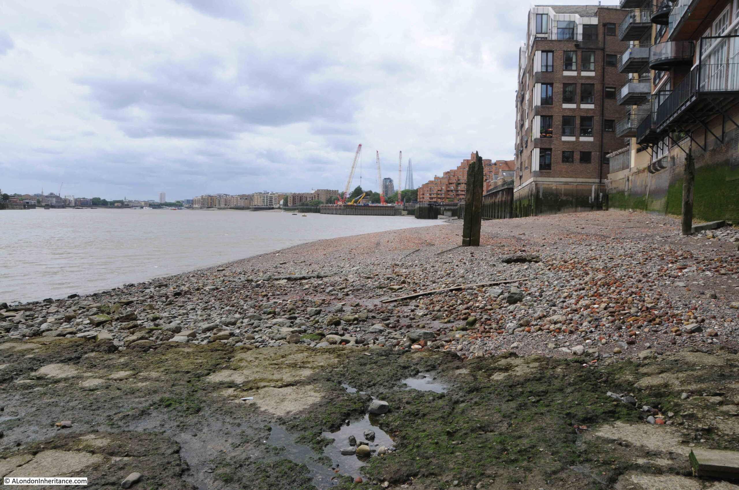
As the PLA document records, a causeway is part of Iron Gate Stairs, and for the stairs this is one of the largest causeways to be seen. It covers a large space at the base of the stairs, both in terms of width and length into the river:
The stairs are part of the construction of Tower Bridge, and I assume that the causeway may well date from the same time (assuming it has been continuously repaired). I doubt whether the stairs would have had a causeway of such size prior to the bridge being built.
The need for a bridge at or around the location of Tower Bridge had been a pressing issue for many years prior to the construction of the bridge. In the later half of the 19th century, there was so much cross river traffic that an urgent solution was needed.
In 1884, the Southwark recorder and Bermondsey and Rotherhithe Advertiser was reporting that “The Corporation also propose to establish a steam ferry across the river, from Iron Gate Stairs, Little Tower Hill, to Horselydown Old Stairs, near Horselydown Lane. Another scheme for crossing the Thames is proposed by the Tower (Duplex) Bridge Bill. The structure would cross the river from Hartley’s Wharf, Horselydown, to Little Tower Hill, having in the centre of the river two loop bridges.”
The following year, the Eastern Argus and Borough of Hackney Times, was reporting about the construction of the new bridge, and that “the work will be done by the City Corporation which has set down five years as the period for completing it. It is to be formed from a point westwards of and near the Iron Gate Stairs to Hartley’s Wharf. The cost will be £750,000, and the structure will be of such a character as to admit of the passage at all times of the tide of vessels navigating the river. The bridge will be a great convenience to East London”.
The above report does call into question whether the current stairs were built on the site of the original Iron Gate Stairs, as the article states that the new bridge is to be built “westwards of and near the Iron Gate Stairs”.
A later article in June 1886 does though seem to confirm that the northern tower, and the stairs we see today are on the site of the original stairs, as when describing the works for the new bridge, the article states “On the north side, as already stated, it touches the shore at Irongate Stairs, from which a road will lead directly up to the Minories”.
In 1889, Watermen were complaining about the disruption to their trade “THE TOWER BRIDGE AND THE LONDON WATERMEN – The Select Committee of the House of Lords appointed to considered the Tower Bridge Bill proceeded to-day to hear the evidence of numerous watermen who claim compensation for disturbance of their occupation between Irongate and Horselydown Stairs in consequence of the construction of the works,. George William Shand was the first claimant”.
I would have thought that the watermen would have been far more concerned about the forthcoming loss of their trade between the two stairs once the new bridge had been opened.
Based on the majority of newspaper reports, aligning maps, and the Port of London Authority listing of Thames Stairs, I am as certain as I can be that the stairs we see today are in the same place as the original Iron Gate Stairs.
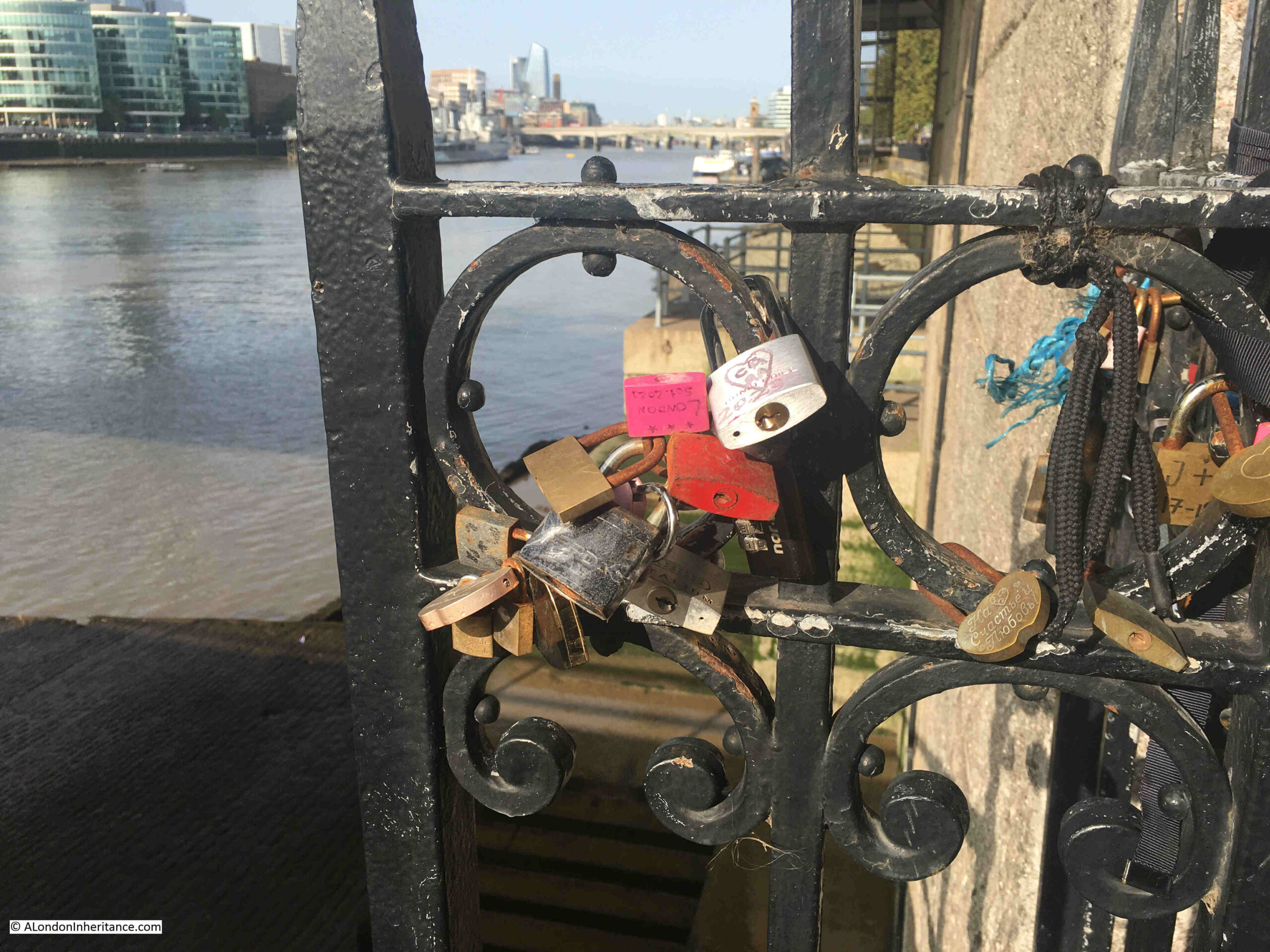
The railing by the side of the view over the stairs seem to have acquired evidence of many of the tourist visits to the site:
I had a good look around, however I could not find any signs that name iron Gate Stairs.
They are though yet another example of historical continuity, with the stairs being in roughly the same place after the construction of Tower Bridge, and being named after a gate dating back to the 14th century, located where there are still a barrier and gates in position, to close of the south eastern entry to the space between the Tower of London and the River Thames.
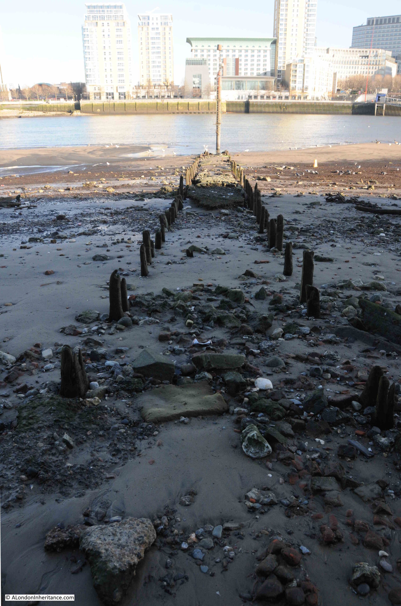
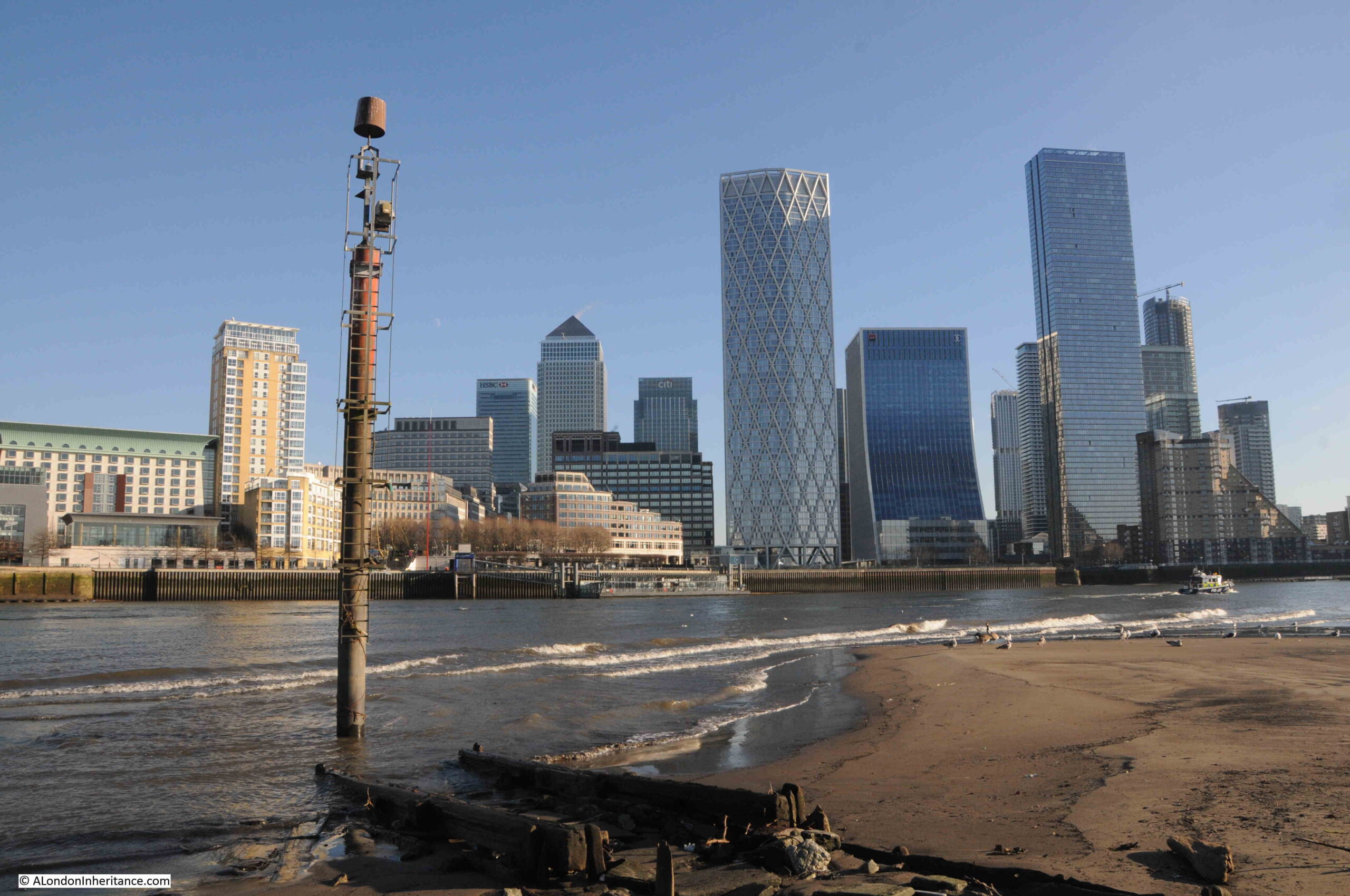
If you wanted to visit somewhere in London on a very cold January morning, a bright day, but with ice having formed overnight on standing water, the last place you may think of is the Thames foreshore, however, on such a day, I went to one of my favourite places on the river – Horn Stairs and Cuckold’s Point:
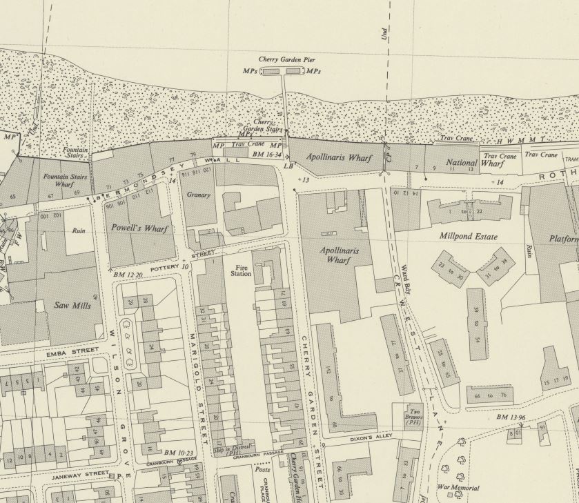
Horn Stairs and Cuckold’s Point are in Rotherhithe, opposite Limehouse and the north-eastern part of the Isle of Dogs, on the inside of a bend in the river where it curves past Rotherhithe.
Cuckold’s Point is the area of the river / foreshore slightly to left and right of the arrow head in the above map, and where, when the tide is low, there is a broad beach of sand and mud running down to the water.
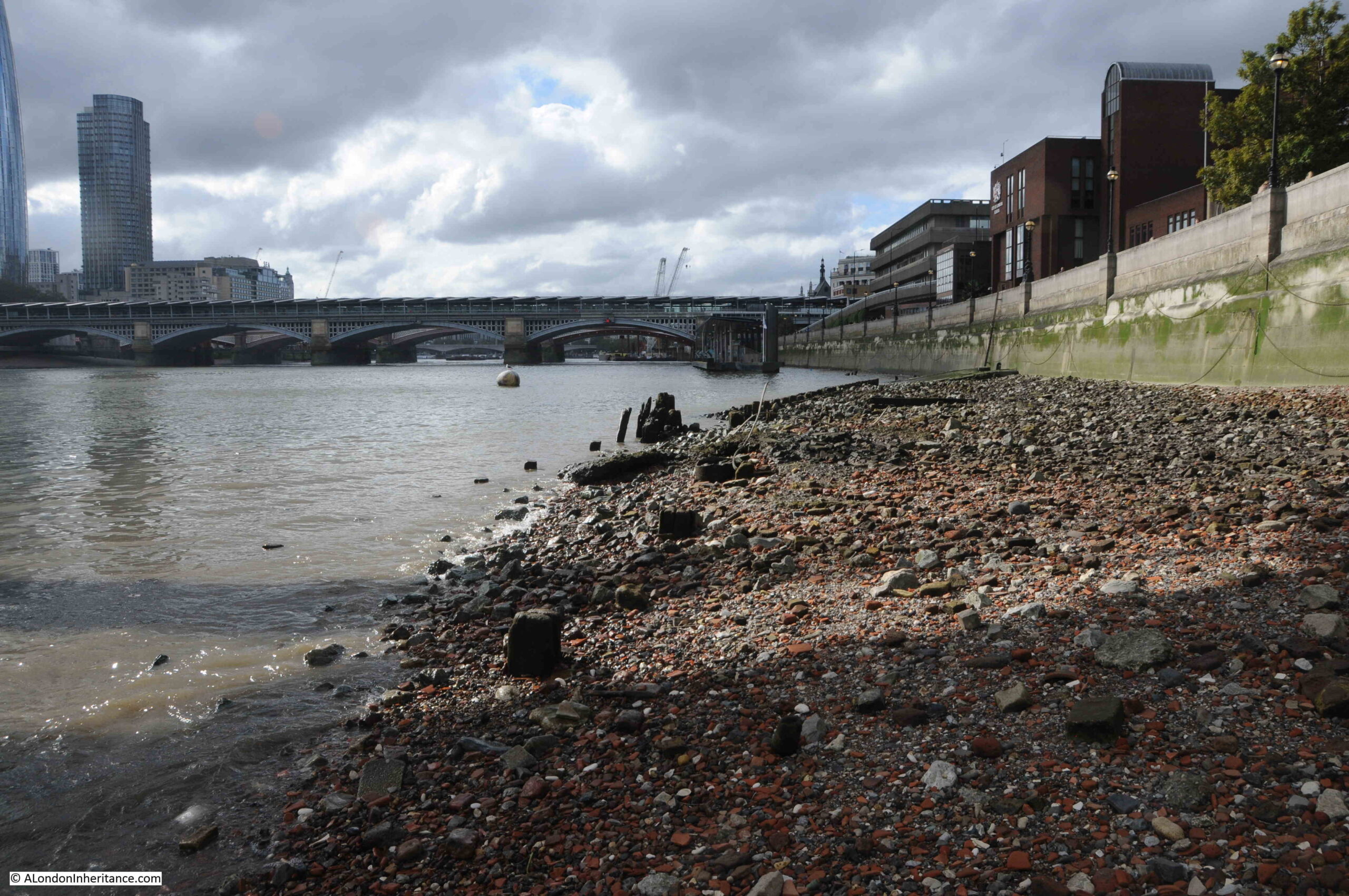
I was walking from the west, and there were some stunning views across the river, and as I reached the stairs, the outline of the causeway running from Horn Stairs could be seen, with a pole towards the end of the causeway:
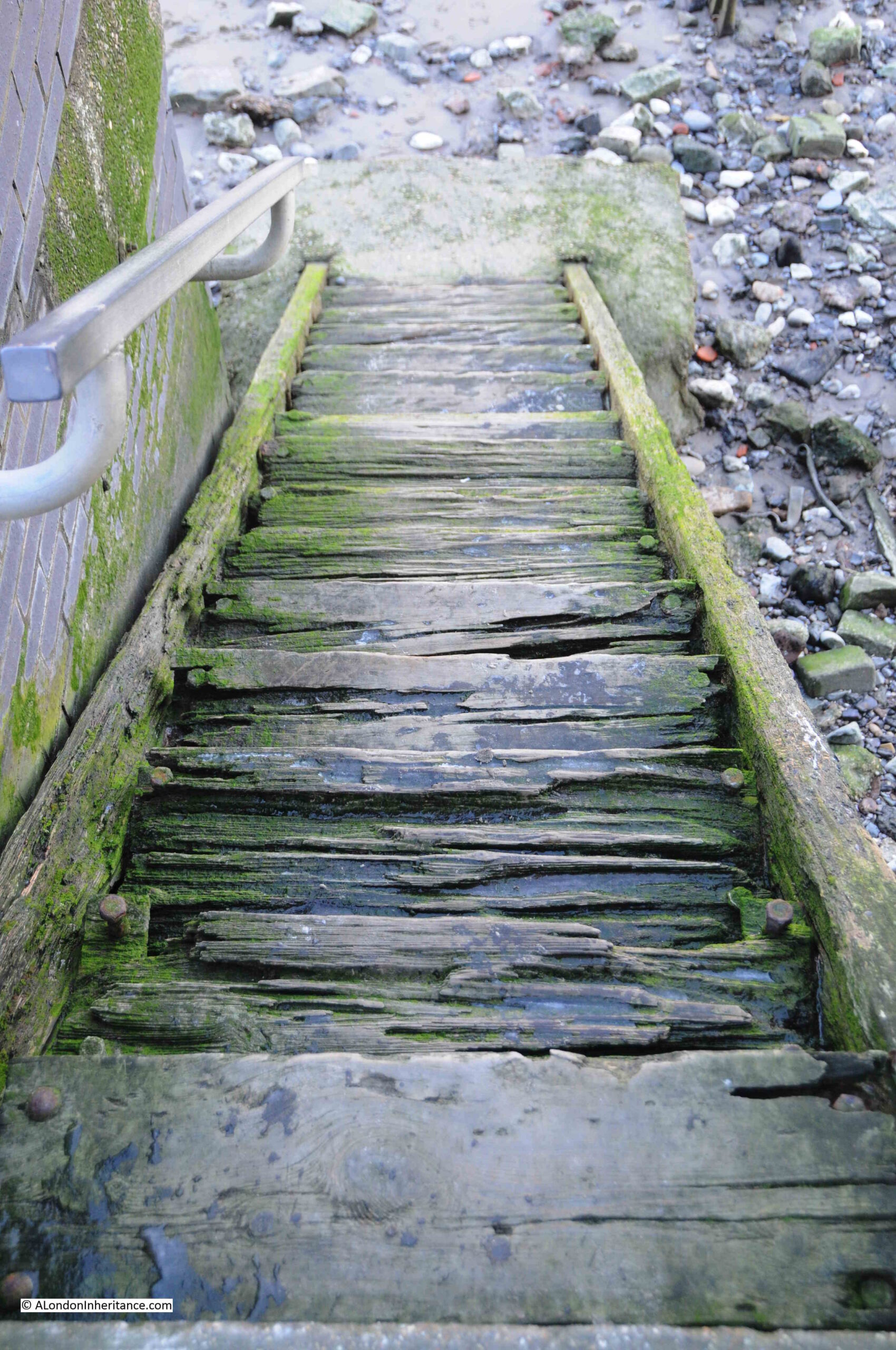
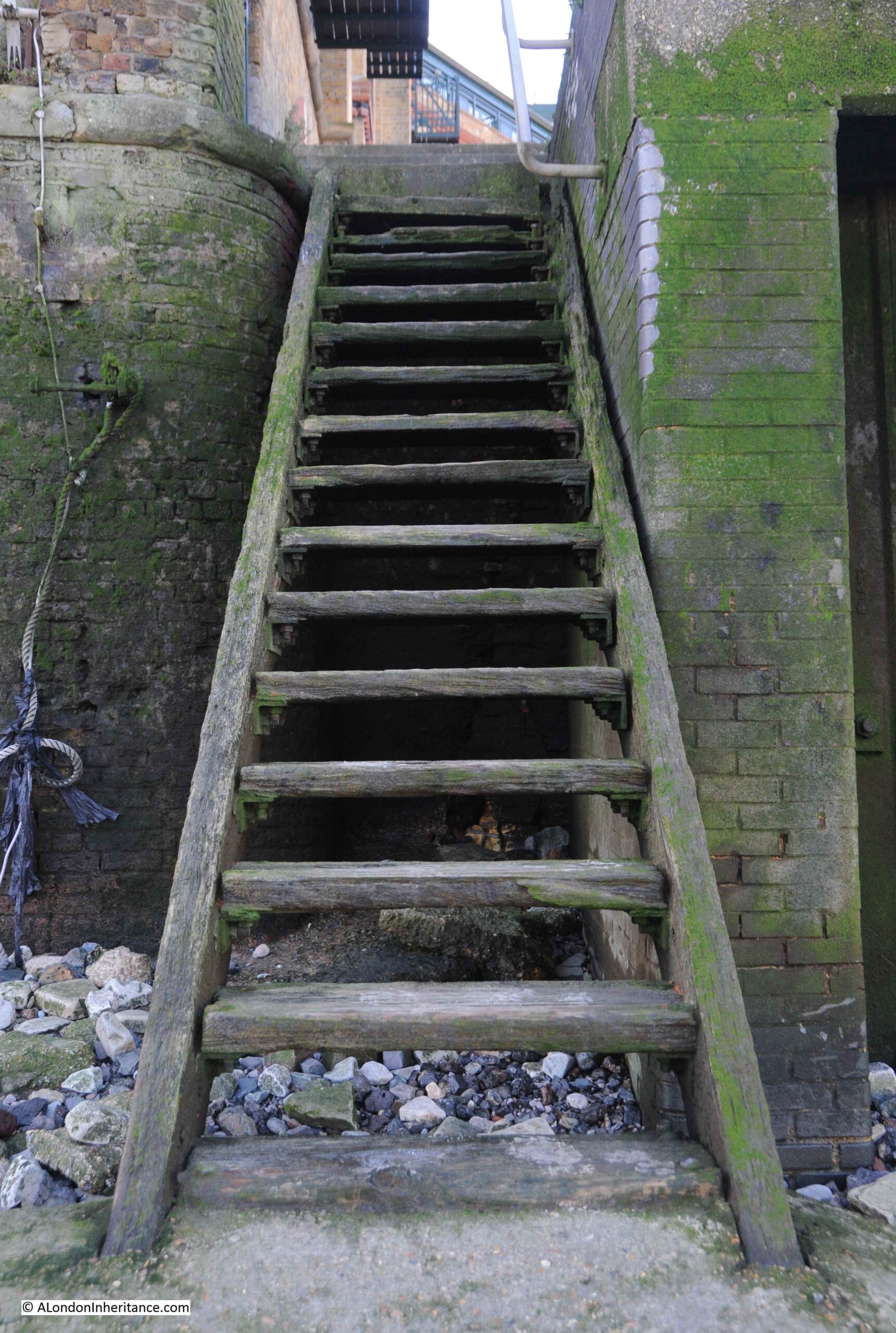
The steps over the river wall that lead to Horn Stairs:
From the top of these steps, we get a view of the remains of the causeway leading off across the foreshore from the foot of the stairs:
The upper part of the stairs, where they run over the river wall, are off concrete, with the main part leading down to the foreshore being a set of wooden stairs:
The upper part of the stairs look rather dodgy. From the top of the stairs it is difficult to tell how thick each of the steps is, and whether it will hold your weight if you walk down the stairs.
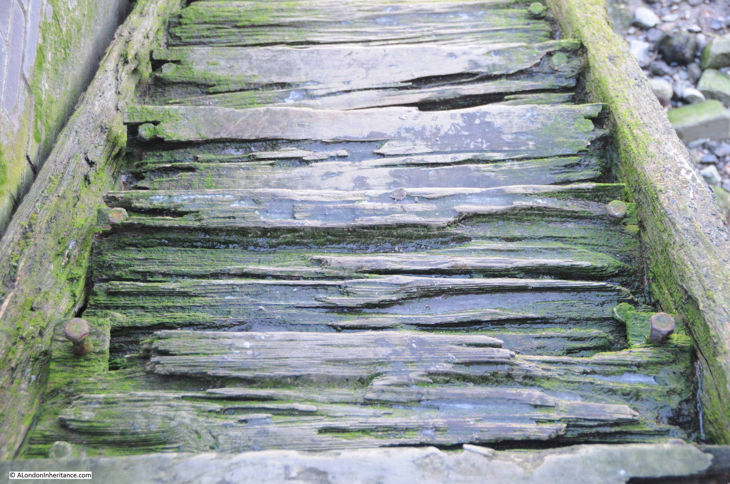
In the following photo of the top steps, you can see from the bolts on either side of each step, just how much appears to have eroded, or perhaps the wood has shrunk, also on the day I was at the stairs, there was ice in the hollows in each of the steps:
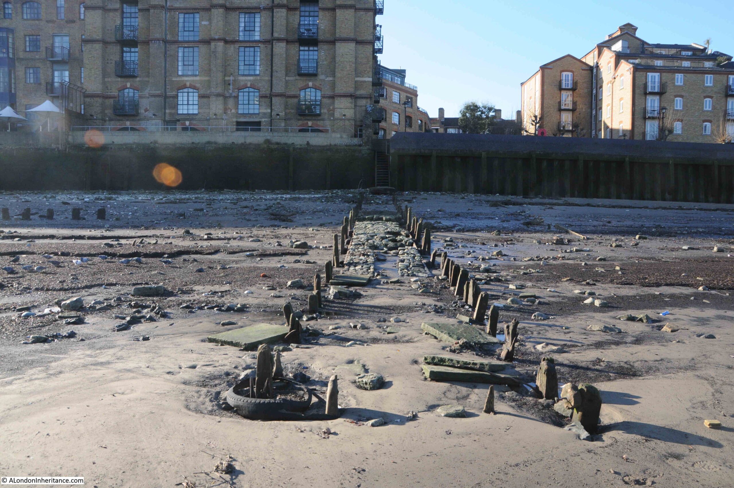
At the bottom of the stairs, we can see the remains of the causeway leading out towards the water:
The Port of London Authority (PLA) has very little information on the stairs in their listing of all the Steps, Stairs and Landing Places on the Tidal Thames (published around 1995), there is just a remark that the stairs are in “Reasonable” condition and that they were still in use.
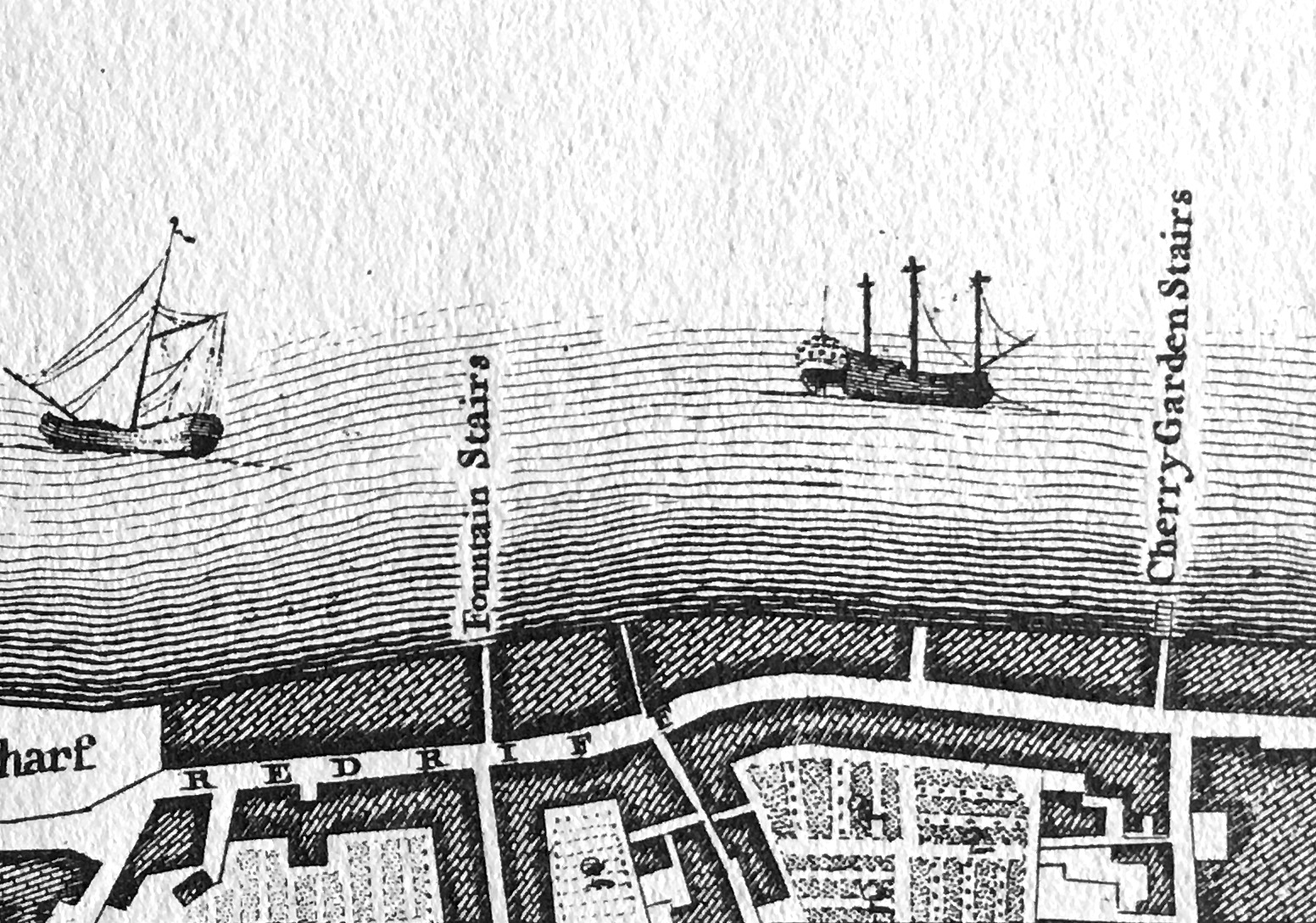
The PLA does not record any early dates for when Horn Stairs were in use, and there are not that many references to the stairs, with Cuckold’s Point being the name used for any reference to the location.
In Rocque’s map of 1746, the stairs are not shown, but Cuckold’s Point is marked:
The earliest written reference I have found was in a newspaper article on the 25th of October, 1832 when the name Horn’s Stairs were used in a legal action against the owners of the Eclipse, a steam packet which ran between London and Margate, and was accused of running down a barge off Horn’s Stairs.
The name of the stairs did often appear as Horn’s or Horns rather than the singular Horn, and one of the possible sources of the name could be a Horns Tavern which was to be found near the stairs – although an unresolved question is what came first, the tavern or the stairs.
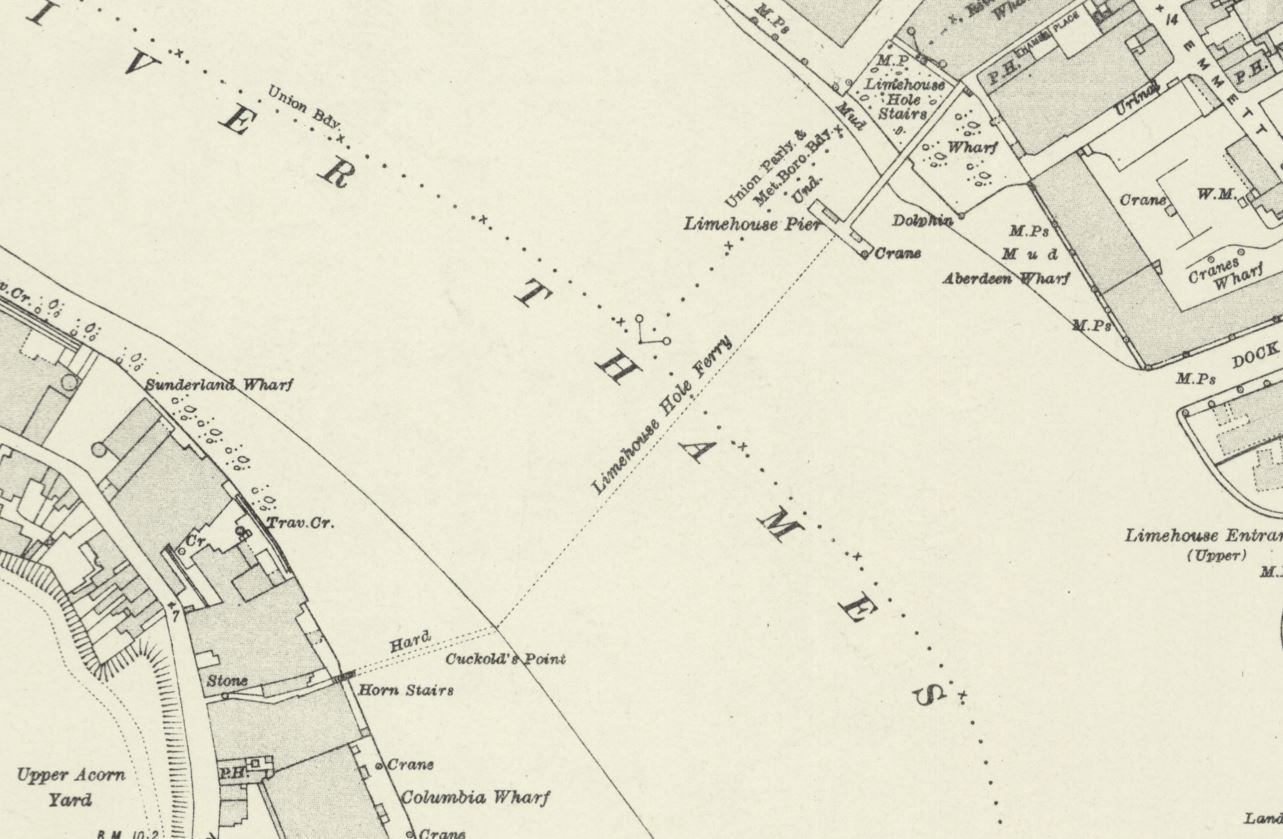
The name Horn is used in the majority of references from the late 19th century onwards, as shown in the following extract from the 1896 revision of the OS map, where Horn Stairs can be seen bottom left (‘Reproduced with the permission of the National Library of Scotland“):
In the above map, the causeway leading out from the stairs is labelled “Hard”, and would have provided a hard surface above the sand and mud of the foreshore, to walk to and from a boat at nearly all states of the tide.
Also in the above map a dotted line leading across the river to Limehouse Pier can be seen, and labelled as Limehouse Hole Ferry. This was a regular ferry that had run for a good few centuries between the two sides of the river. I wrote about the ferry in my post on Limehouse Hole Stairs and the Breach.
The fact that Horn Stairs does not appear in the 1746 map, and I can find no written references to the stairs earlier than 1832 does not mean that the stairs and a causeway have not been here for much longer.
The City of London Archaeological Society has a fascinating post on surveying stairs, which included a section on Horn Stairs, and in the post, 16th or 17th century hand made bricks were identified which may have formed an early hard standing on the foreshore.
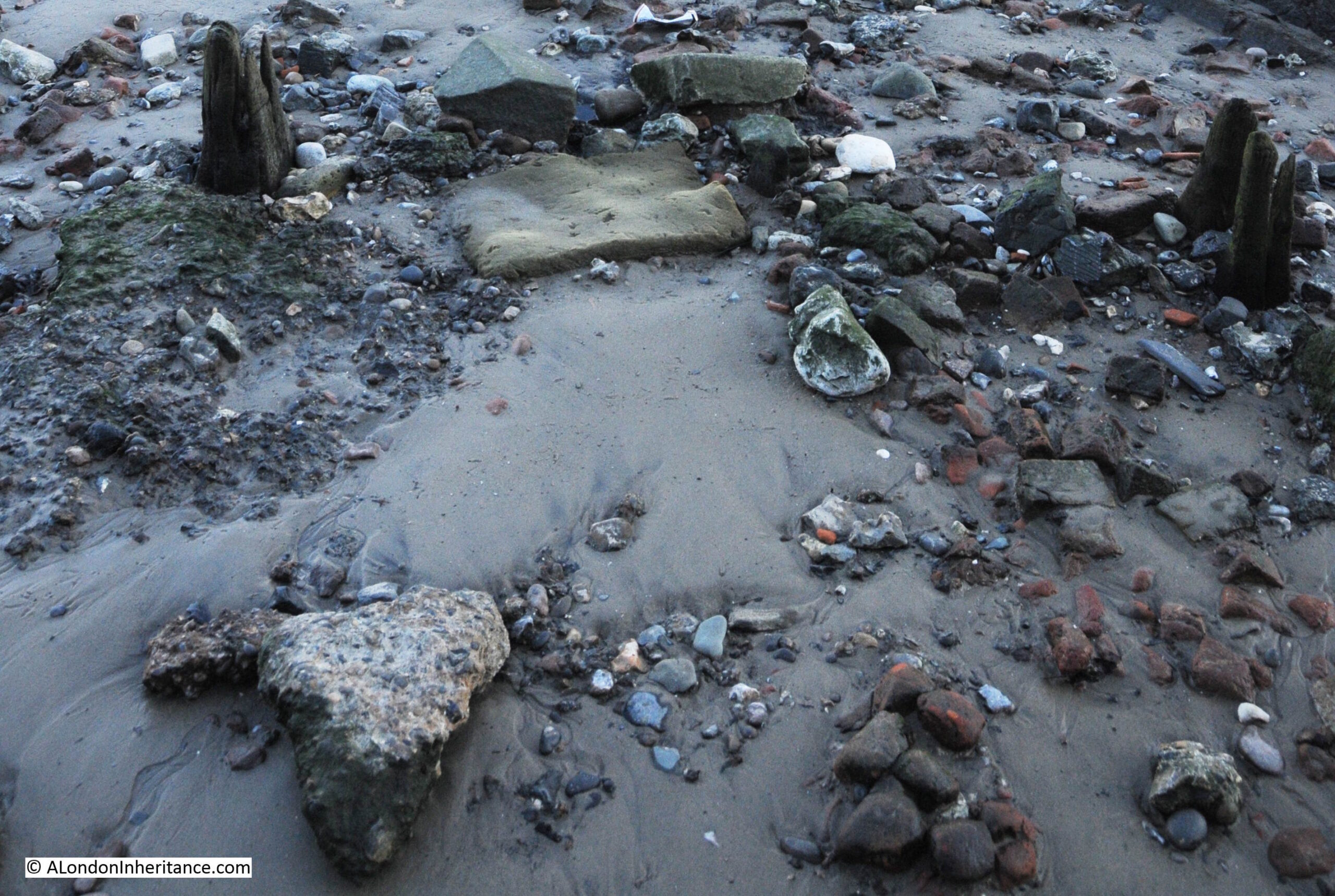
Although I could not find the bricks exactly as shown in the photo in the City of London Archaeological Society’s post, (the foreshore is a constantly changing environment), I did find a number of this type of red brick, which can be seen in the photo below, to the right side of the causeway:
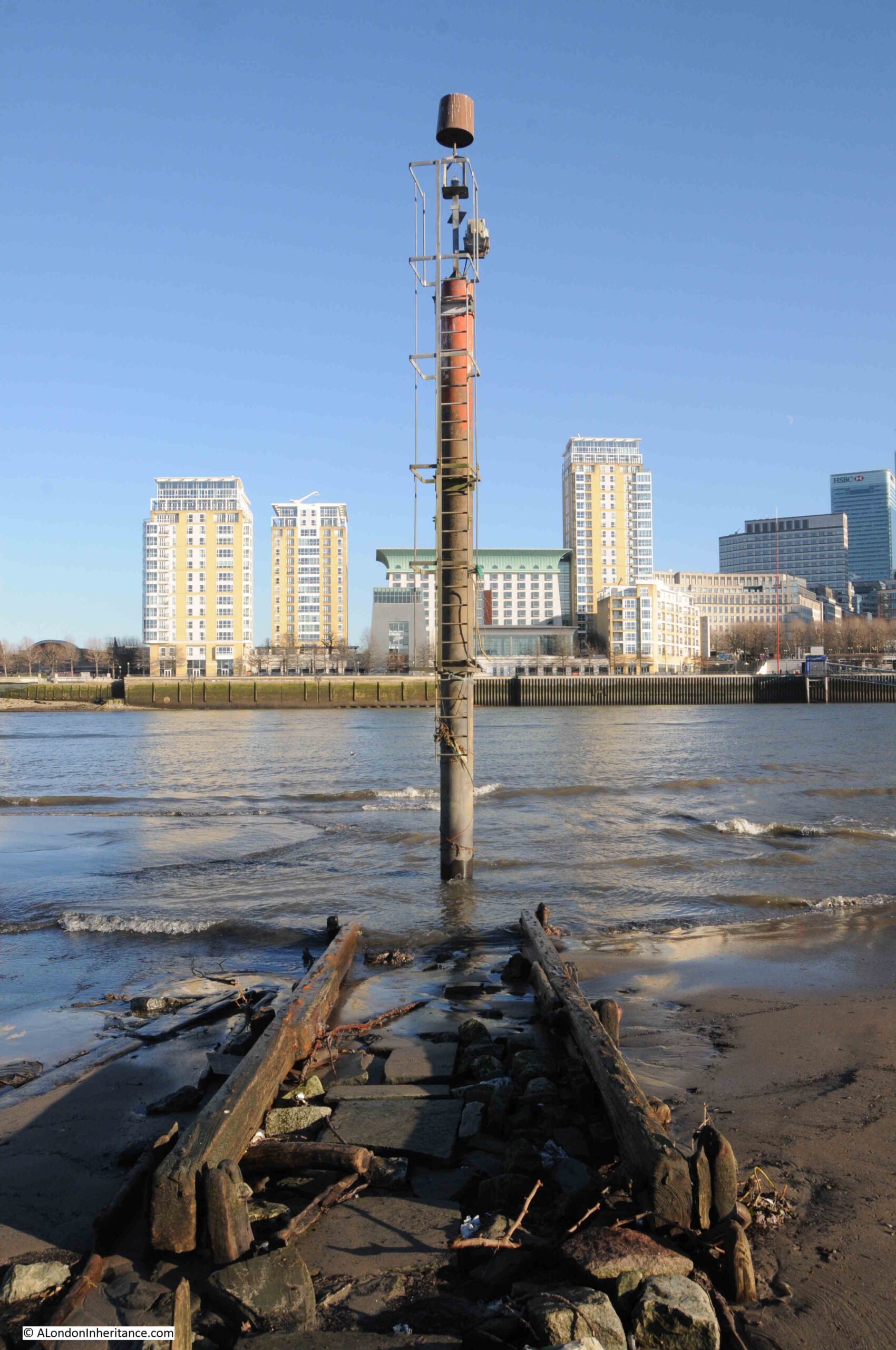
At the end of the causeway, and at the point just before where the Thames will recede to at low tide, is a pole labelled as a navigation marker on the PLA chart for this section of the river. The marker has a light at the top of the pole to ensure the marker can be seen in the dark:
At the end of the causeway:
Looking back to the river wall and the stairs down to the foreshore, which is a distance of some 50 metres, and the dark colouring along the river wall shows how high the water is when the tide comes in along Cuckold’s Point:
The naming of Cuckold’s Point is interesting, and the true source of the name cannot really be confirmed given the centuries that the name has been in use.
The word Cuckold means, according to the online Cambridge Dictionary “If a man is cuckolded, his wife has a sexual relationship with another man”, and the most repeated story about the use of the word Cuckold for the foreshore in Rotherhithe goes back to King John, who was on the throne between 1199 and 1216.
There are a number of variations to the story, but it generally goes that King John was hunting around Shooters Hill, Blackheath and Greenwich. He seems to have found himself in Charlton, and entered the house of a Miller, where he found the Miller’s wife alone.
The Miller soon returned home, but found his wife “in flagrante” with the King.
The Miller attacked the King intending to kill him, and to defend himself the King revealed who he was, and came to an agreement with the Miller that he could have all the land to the west that he could see from his house, which extended all the way to what is now Cuckold’s Point, where, at the time, there was a pole with a pair of horns mounted on the top.
The Miller, in some stories, also had to walk to Cuckold’s Point once a year, with horns on his head.
So the name Cuckold’s Point came from the position that the Miller had been put in by King John.
The King also gave the Miller the right to have a fair on the 18th of October, and this fair became known as the Horn Fair and was held in Charlton.
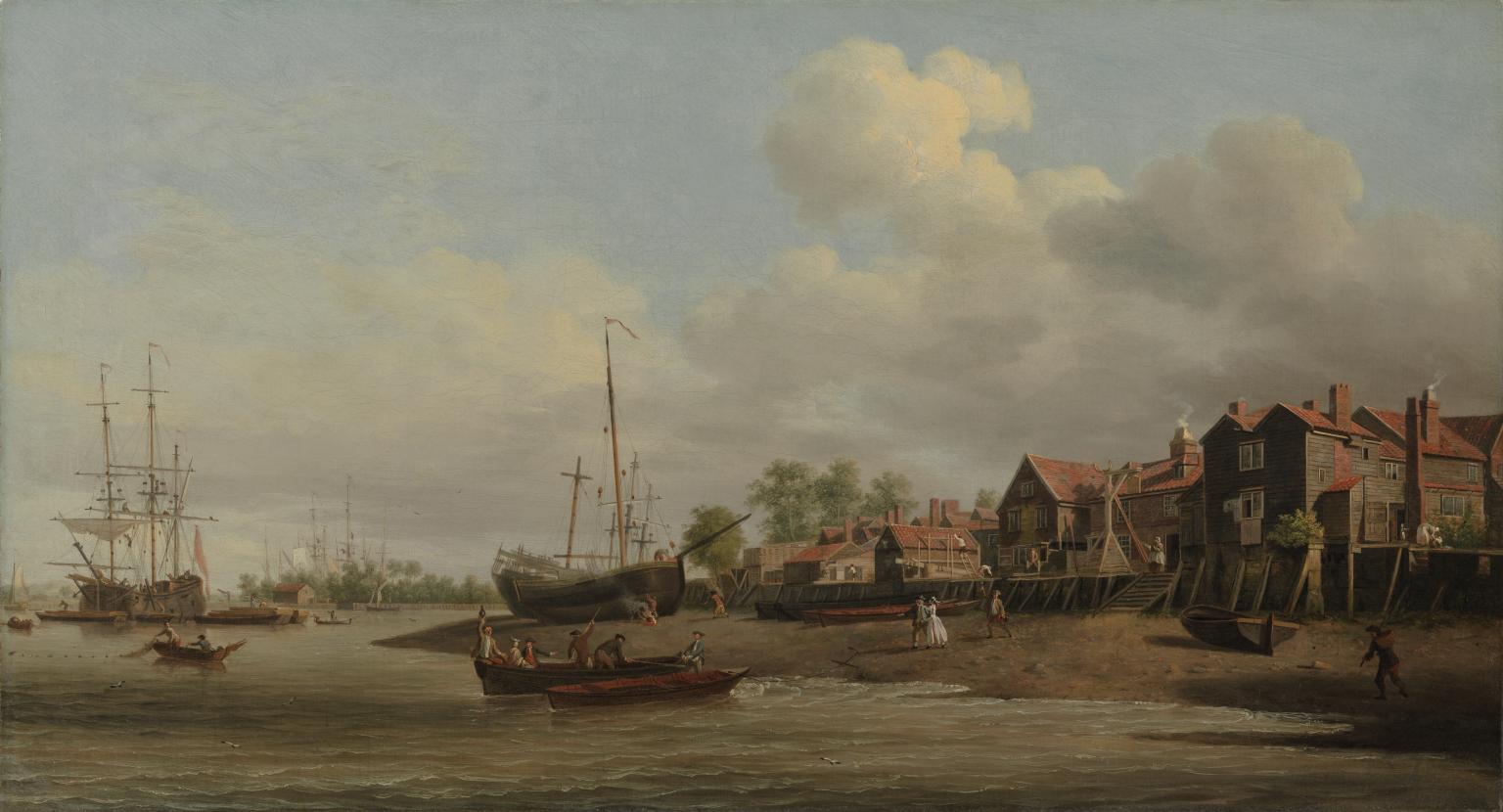
An early view of Cuckold’s Point can be seen in a painting by Samuel Scott in his work “A Morning View of Cuckold’s Point“, painted between 1750 and 1760:
A Morning, with a View of Cuckold’s Point c.1750-60 Samuel Scott c.1702-1772 Presented by H.F. Tomalin 1944 http://www.tate.org.uk/art/work/N05450
The challenge with confirming that this is Cuckold’s Point is that there are no features which can be found today, however there is a set of wooden stairs leading down to the foreshore, and the slope and shape of the foreshore is very similar to that of today.
The painting does though give a very good impression of what Cuckold’s Point probably did look like. There are two Waterman’s boats where the water meets the foreshore, and there is a third approaching the same point.
There are people on the foreshore walking down to the boats from the stairs, presumably either to meet the people arriving on the boats, or to take one of the boats along the river.
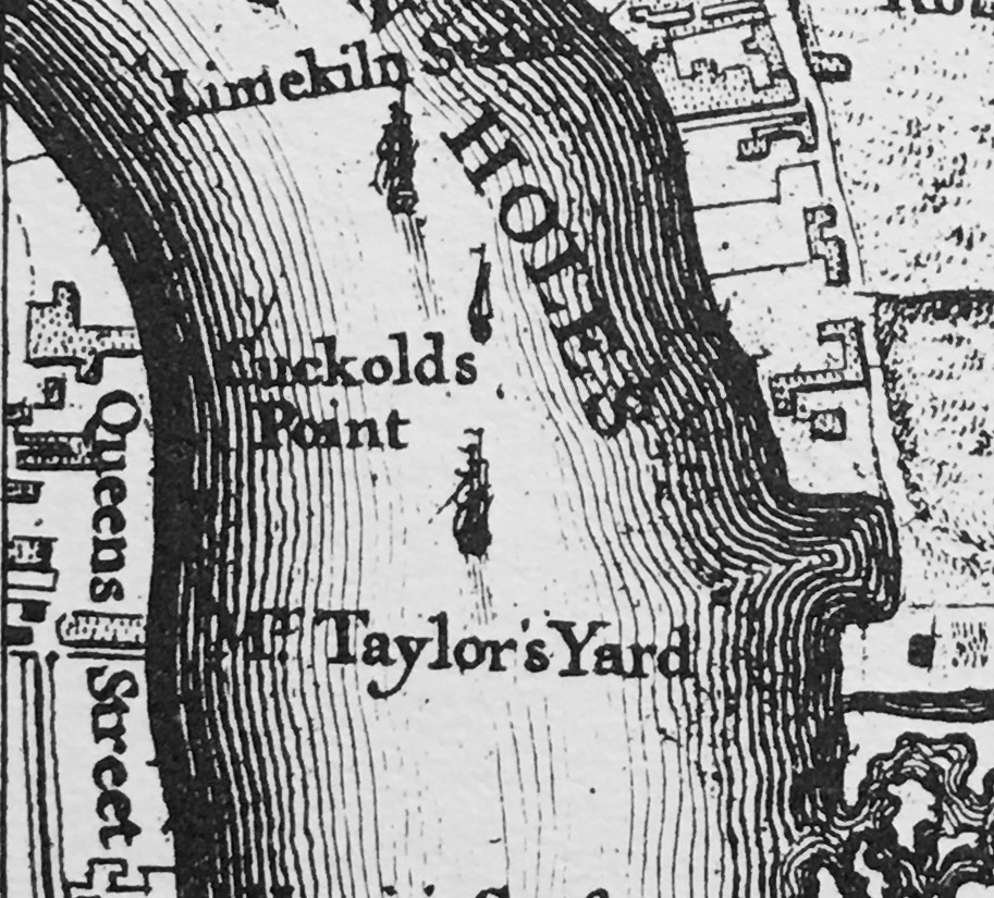
The ships on the foreshore are in the location of Mr. Taylor’s Yard, as shown in Rocque’s 1746 map.
The river appears to bend to the right, which indeed it does, as it heads along the eastern side of Rotherhithe towards Deptford.
The painting does provide some support to an alternative theory as to the name Cuckold’s Point. Just to the left of the stairs can be seen a wooden frame, and this is believed to show a ducking, or cucking stool, which was use to punish and humiliate women, who were labelled as a scold, or had committed some form of sexual offence, such as cheating on a husband.
As was usual, there was no similar punishment or humiliation for the man involved.
As the site of a cucking stool, where the wife of a cuckold would have been punished, this may also be the source of the name, however this story does not seem to have gained much support over the years.
The broad sweep of the foreshore at Cuckold’s Point, looking west along the river in the direction of the City of London:
Standing at Cuckold’s Point on a cold January morning is a lonely experience. There is no one else around, and the river is also very quiet, with just the regular Thames Clippers causing a run of waves up to the foreshore.
These places were once busy, both along the rivers edge, the foreshore, and along the river, and it is fascinating to stand at these places, thinking of all the people that have stood in the same place, and the events that have taken place here.
I searched newspaper records for reports mentioning Cuckold’s Point for three decades in the first half of the 18th century, the 1720s, 30s and 40s and there are many references. The following is a sample of what went on around Cuckold’s Point in these years:
17th June 1721 – On Thursday last in the Afternoon Mr. Bailey, a Coasting officer, and Mr. Purser, a Custom-House waterman, made a seizure in the River near Cuckold’s Point of 1900 Weight of Tea, artfully wrought up in the sides of a Mackerel Boat filled with Fish, and supposed to come of Ostend.
11th of May 1726 – The Execution of Capt. Jeane, condemned at the late Sessions of Admiralty for the Murder of his Cabin Boy, is appointed for next Friday, he will be hanged in Chains over against Cuckold’s Point.
6th of October 1736 – On Monday last a Fisherman caught in his Common Net, near Cuckold’s Point, a Salmon 38 inches long and about 17 inches round, and sold the same to Capt. Bond, who was in sight when the fish was caught, and was going on board the East-India Man at Gravesend. The Fisherman being unable to hold his net, begged assistance of a man in the Captain’s Boat, who accordingly went; but as he was helping he fell accidentally into the Thames, from whence it being low water, he took the Fish in his Arms and threw it into the boat. The Fish was sold for 36 shillings out of which the Fisherman gave the Waterman 6 shillings for his Trouble.
23rd April 1737 – On Tuesday last, the Wind being very high, and the Tide rough, two boats, overladen with Passengers, were cast away between Cuckold’s Point and Deptford, and 17 persons drowned. Two other boats, near the same place, with 16 persons in them, and another at the Isle of Dogs, with six and a Waterman, overset, and seven of the former and all the layer were drowned,
23rd October 1742 – Yesterday a new ship, of 220 Tons and 20 Guns, intended for the West India Trade, was launched at Mr. Taylor’s Dock at Cuckold’s Point, and named the Anna Maria (see earlier extract from Rocque’s map of 1746 for location of Taylor’s Dock)
10th December 1743 – Last Tuesday upwards of 1000 Pairs of French Gloves with some Skins, were brought to the custom House. They were seized by Mess. Smith and Harris, Customhouse officers, as they were attempting to land them at Cuckold’s Point.
4th February 1744 – On Tuesday 200lb of Cocoa Nuts, 200 Weight of Tea and 20 Pieces of Cambrick, with some Lace, were seized at Cuckold’s Point, and brought to the Custom House; This seizure is valued at £300. (Cambric is a finely woven, plain cloth that came from France)
7th of March 1747 – Tuesday in the Afternoon as a Boat was going to Greenwich with six Passengers, it was overset near Cuckold’s Point by running foul of a Ships Anchor, by which accident Mrs. Sims and her Daughter, of St. Catherine’s Lane, were unfortunately drowned.
27th of March 1749 – On Monday last thirteen prisoners were tried at Kingston in Surrey, three of whom were capitally convicted, viz. John Rayner, for Robbery on the Highway, Thomas Pattin and William Walker, two Watermen, for knocking down Mr. Alison, in a Boat on the River Thames, near Cuckold’s Point, and robbing him of a Silver Coffee Pot, a Watch, and a Guinea and Half in Money.
These quiet places along the Thames were once full of life, and also unfortunately, death.
Looking along Cuckold’s Point to the east and there is a pier that reaches out over the foreshore. This is where you can catch the Thames Clipper RB4 service that runs between this pier at the Doubletree Docklands Hotel, across the river to the pier at Canary Wharf – a brilliant way of crossing the river.
A rather good example of historical continuity in London, the Thames Clipper RB4 service has almost exactly the same route as the old Limehouse Hole ferry that ran from Horn Stairs.
Some of the long length of the causeway still has a layer of stones that would have provided the hard surface to walk down to catch your boat:
I visited Horn Stairs and Cuckold’s Point in January, and this was probably the left over of some New Year’s Eve celebrations:
Returning to the story of the Miller and King John, one of the rights allegedly granted to the Miller was the right to hold a fair in Charlton.
Whatever the truth in the story of the Miller and King, a fair was held each year, on St. Luke’s Day, the 18th of October, and the following article from The Sun on the 20th of October, 1846 hints at the antiquity of the fair, and also provides a good overview of the event.
There is also a reference to Cuckold’s Point towards the end of the article, which I have highlighted in bold:
“HORN FAIR – This scene of popular amusement was held yesterday, according to ancient custom, in the healthful and pleasant village of Charlton.
In former times it was generally distinguished by riot and obscenity. Some of the worst class in London made parties to carry out the vulgar joke of cornuted husbands and wives (cornuted means to bear or have horns).
Horn Fair (the common name) is now changed to Charlton Fair, and the visitors, more enlightened that their ancestors, seldom indulge in those disorderly transactions which bore the stigma of indecency. It was formerly a mart for various forms of utensils made of horn, and tradition ascribes the origin to King John. An armour carried out by that licentious and infamous Prince with the wife of an honest miller was the foundation for the fair. John, surprised by the enraged husband, would have perished under the uplifted dirk of the miller, had he not saved his life by promising to redress the injury. The compensation was a grant of land the miller could see westward from the top of his mill. Agreeable to the royal donation, a fair was to be held annually, on St.-Luke’s-day, for ever.
Such is the oral account of the fair from year to year, and there is, we believe, at the present day, an aquatic custom at Cuckold’s-point, where it is said the mill stood, which bears out the story. The waterman, as he passes the stairs, or landing place, frequently tells his fare that a spider is crawling on his hat. The person naturally takes it off his head, and then Old Charon, with a laugh, requests he will put it on again, having properly paid his respects to the Horns at Cuckold’s Point.”
Note in the above article that the mill is described as being at Cuckold’s Point, however the majority of references refer to the location being in Charlton, and that Cuckold’s Point, where horns were mounted on a pole, was the place furthest west that the Miller could see from his place in Charlton.
The article also mentions that Horn Fair was held on St. Luke’s Day. The connection with St. Luke comes from ecclesiastical art, where St. Luke is often painted with an Ox, an example being this early 18th century print which shows St. Luke seated at a desk, with a winged ox with horns, behind him.
There are very many references to Horn Fare, including some which describe events such as the following from 1742:
“Monday being St. Luke’s Day, a large Body of Cuckolds, both real and reputed, attended the King, the Miller, and his Wife, from the Sun Yard in Bishopsgate-street, to Horn Fair, held at Charlton in Kent, according to annual Custom.”.
In the 18th century, the Press Gang took advantage of Horn Fair, as this report from the 27th of October, 1746 explains:
“Last Saturday Night a large Press Gang, with Horns on, and Music playing before them, came through Greenwich, Deptford and Rotherhithe, &c. from Horn Fair, which drew a great many Sailors out of their Retreats to see the Procession, several of whom were pressed for his Majesty’s Service, and sent directly on board the Tenders in the River.”
The stairs today look almost like archaeological remains, washed from under layers of mud and sand by a strong tide, a bit like Seahenge, discovered in Norfolk in 1998. I checked on the Historic England directory, and the stairs are not listed, and it is unclear who, if anyone, is responsible for these features. Sadly, they will probably continue to erode away. A great loss for future generations.
Temporary structures were erected for Horn Fair, and we can get a glimpse of these from reports about the fair, including one from 1819 where there was an unexpected heavy snow fall, which caused much damage to the fair, including temporary structures for “The Freemasons Tavern” and “The Crown and Anchor”, which had apparently been “fitted up with great splendor , and the proprietor had omitted to take down his lamps and lustres” – which along with bottles, crockery, furniture etc. were all badly damaged by the snow.
The Horn Fair was abolished in 1872. By then Charlton had ceased to be the “healthful and pleasant village of Charlton“, and was being rapidly developed.
Horn Fair did not fit in with the Victorian narrative of improvement, and riotous assemblies such as fairs, were seen as a threat to those living nearby, to law and order, and to the social structures of the time.
In the Morning Advertiser on the 27th of February, 1872, in between lists of the prices of coal, hops, potatoes, the cattle market, and an article listing the days of the arrivals of the mail from Australia, New Zealand, the Falkland Islands, Mexico, Egypt (all symbols of a new Victorian London), there was a brief article reporting on the official abolition of the Horn Fair at Charlton and the Blackheath Fair, both of which had “survived all other suburban pleasure fairs”.
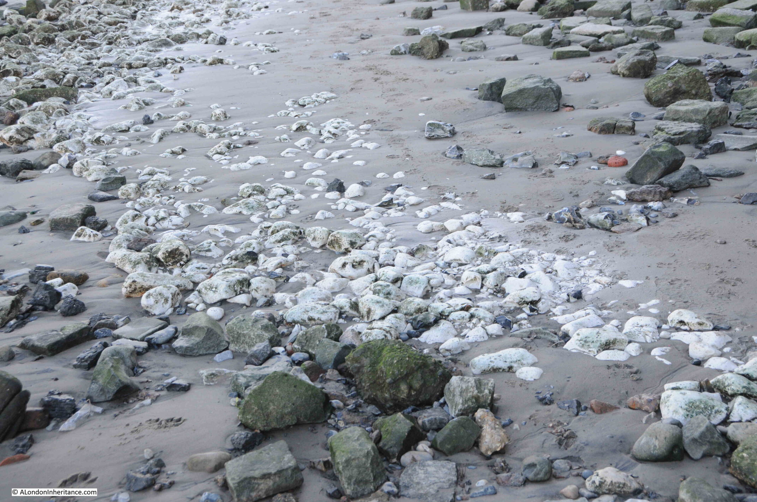
Chalk on the foreshore at Cuckold’s Point, left over from a time when chalk was used to build a flat platform on which barges could be grounded:
The wooden steps of Horn Stairs. The condition of the individual steps seems to get worse with height, with those at the very top appearing to be in very poor condition. I assume this is because those at the top are much more open to the atmosphere, are washed by the river rather than being covered, and suffer more wave action.
Horn Stairs and Cuckold’s Point are wonderful places to take in the river, views across to Limehouse and the Isle of Dogs (but walk down the stairs at your own risk !!).
It is a place with a long history, shared with the history of the river, and a connection with a Miller and King in Charlton, and a historic fair held in the “pleasant village of Charlton“, which does still have a Hornfair Road near the original location of the fair
What ever the truth of the story of the Miller, his Wife and King John, it is a fascinating part of London’s long history, and tells much about life in London over the centuries.
Trig Lane Stairs lead down to the Thames foreshore, just to the east of the Millennium Bridge. Today, the stairs connect the foreshore with the walkway that now runs along the edge of the river, with apartments and offices between the river and Upper Thames Street.
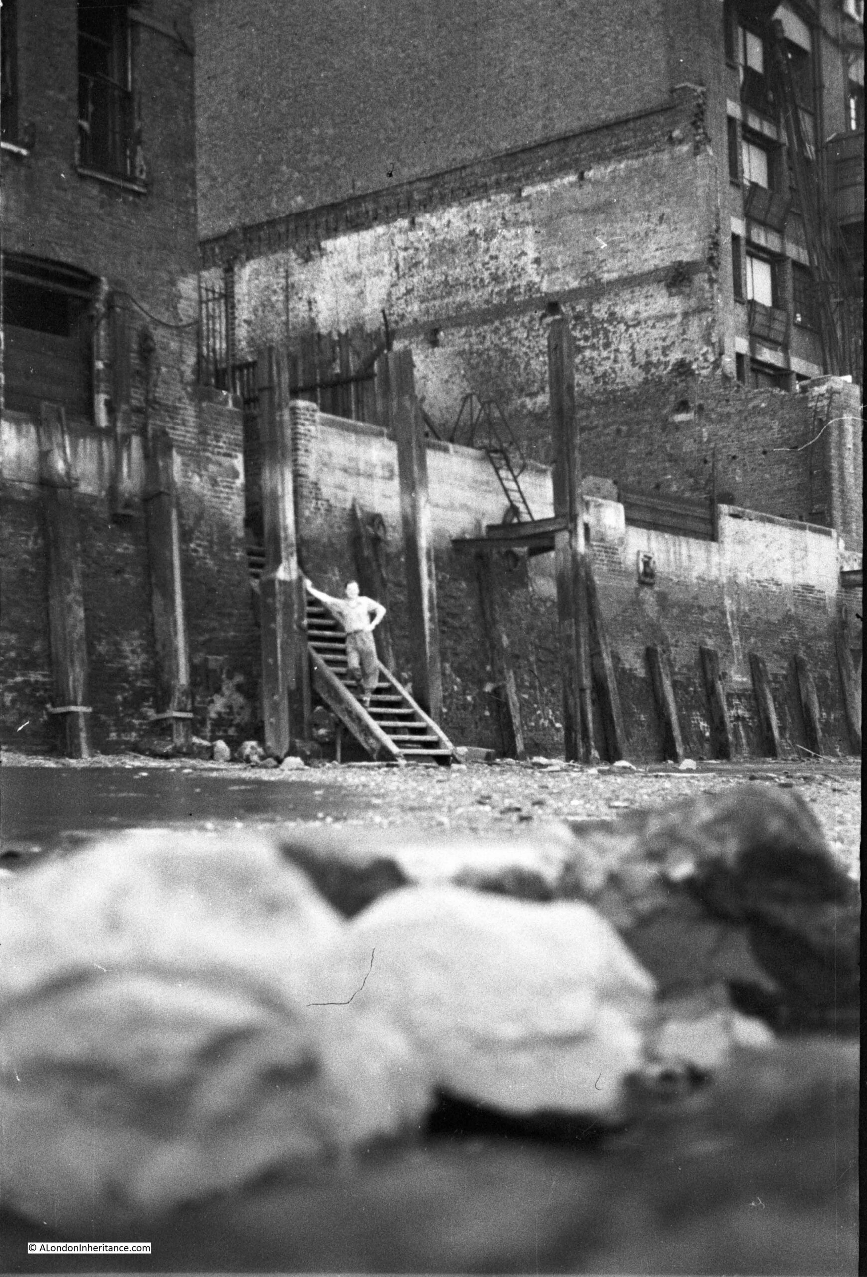
Back in 1949 it was a very different place, a mix of wartime bomb damage and with many of the warehouses remaining from the time when this section of the river was busy with the movement of goods between barges and warehouses.
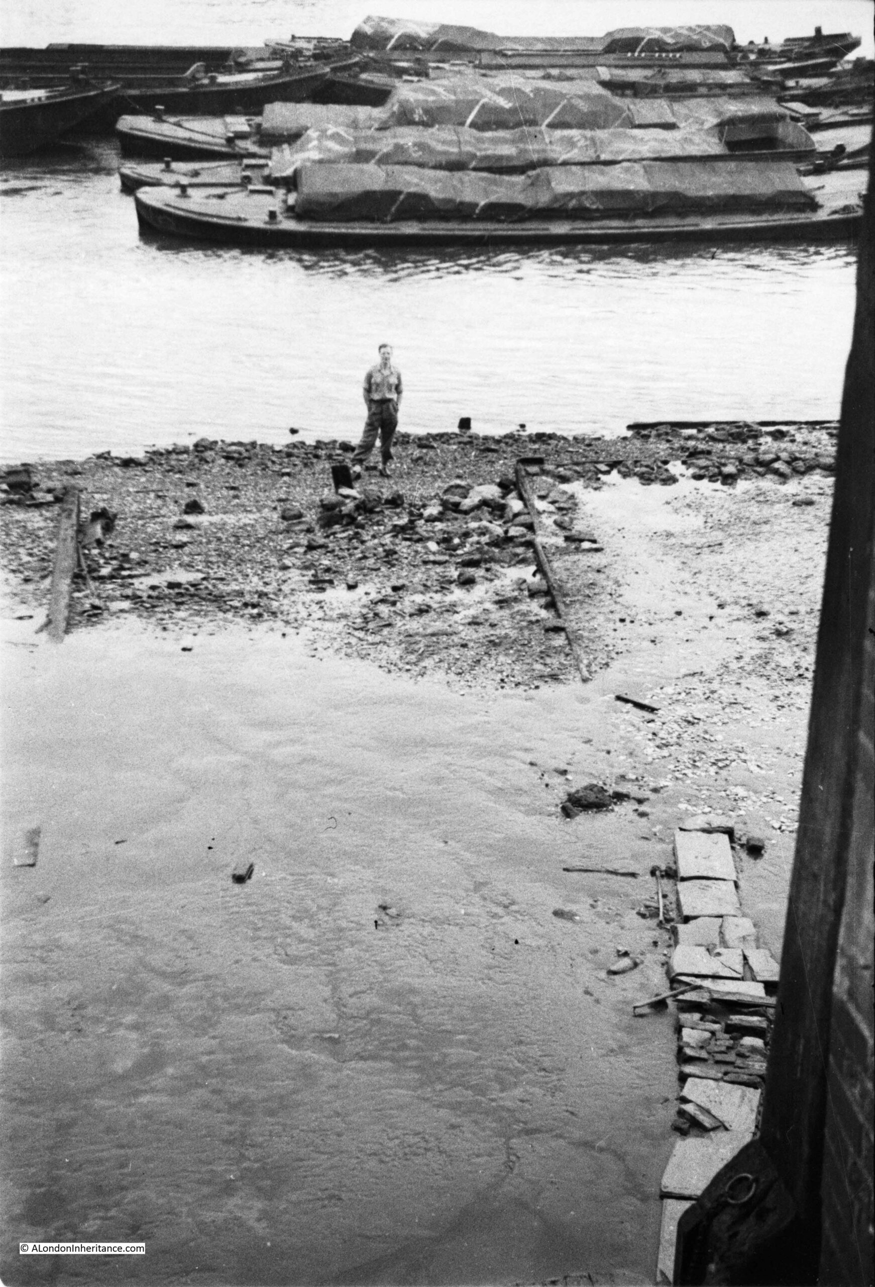
This is one of my father’s photos from 1949. The wooden stairs of Trig Lane Stairs lead down to the foreshore, warehouses either side with an open space between (not bomb damage, but an open space for movement of goods), and one of my father’s friends standing on the stairs:
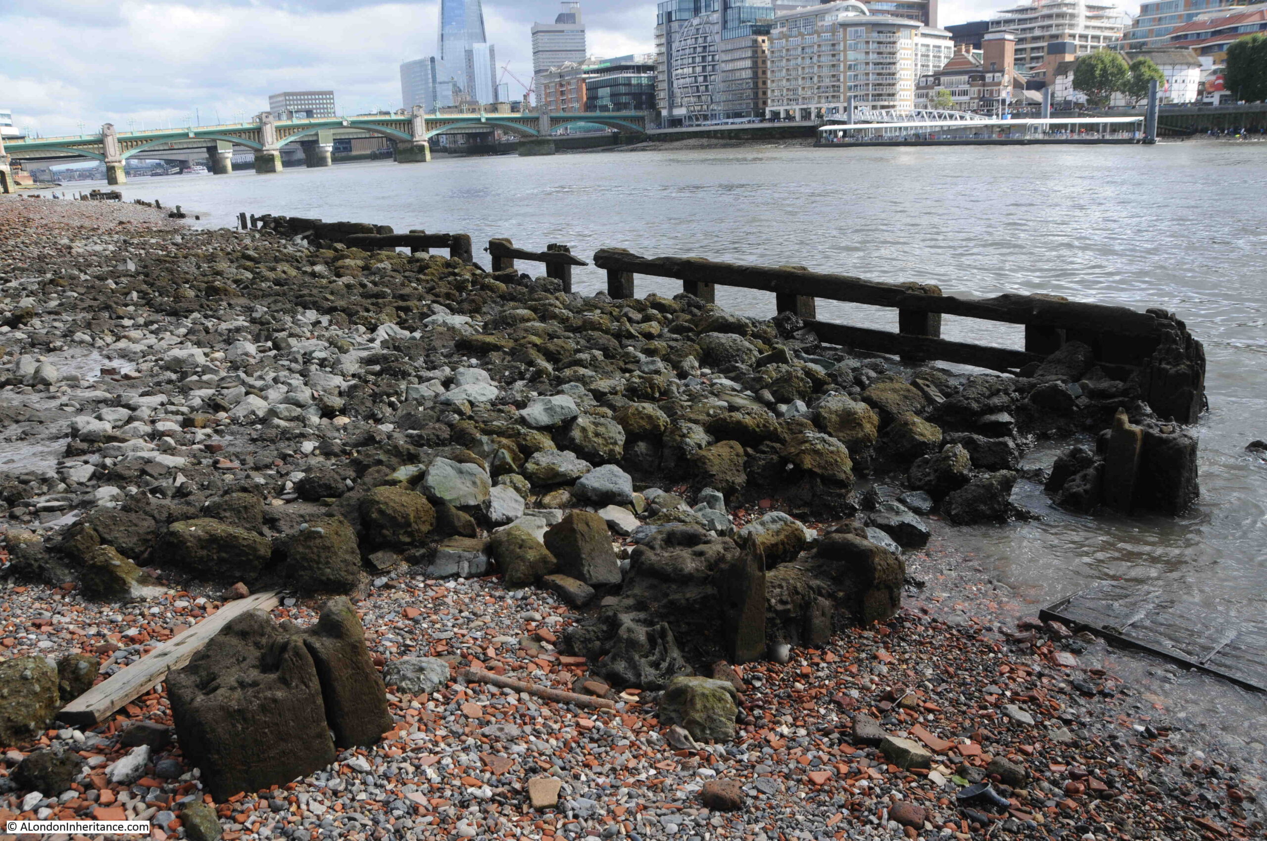
I took the following photo from the south bank of the river. To the right of the Millennium Bridge, along the wall that runs alongside the river, you can see a dark rectangle, which is the entrance to Trig Stairs through the river wall, and the wooden stairs to the foreshore can just be seen below the gap:
As with the edge of the Thames through most of London, this area has changed dramatically in the 74 years between the two photos.
The warehouses have been replaced with new buildings, with a single block covering the space behind the stairs and along where several warehouses once stood.
Walking along the edge of the river from the east, and the Trig Lane Stairs can be seen in the following photo, just behind the group of people on the foreshore:
The entrance to Trig Lane Stairs in 2023:
The stairs go up, before going down to the foreshore are an indication of the height of the river wall now needed to prevent any flooding at times of exceptionally high tide.
Once over the stairs, we can get a view of the wooden stairs going down to the foreshore:
And this was the same view in 1949:
In 1949 the warehouses were still in use, and the loaded barges which can be seen in the background are probably holding goods that are waiting to be moved to the warehouses as these were mostly used for import.
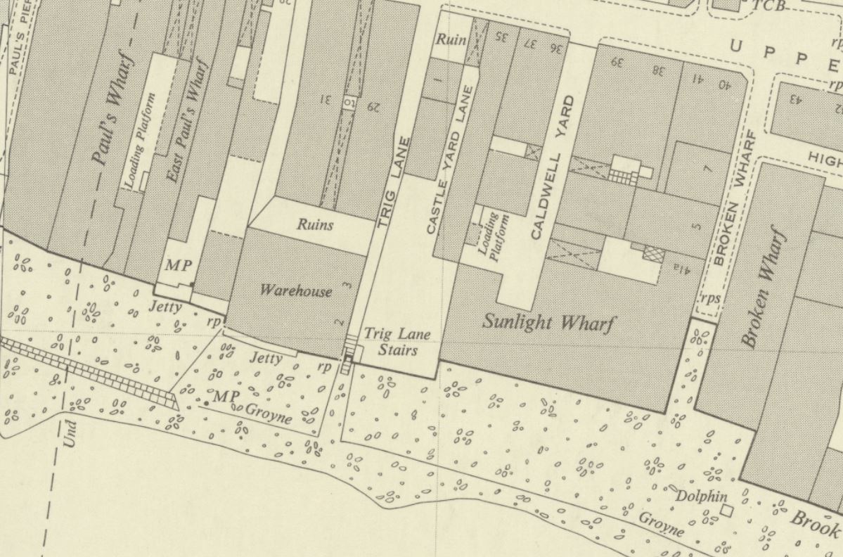
According to the 1953 edition of “London Wharves and Docks”, published by Commercial Motor, the warehouse to the left of the stairs in my father’s photo was the warehouse of Crown and Horseshoe Wharf, which traded in general goods, and specialised in canned goods and chemicals. The warehouse had storage space for 100,000 cubic feet of goods.
The warehouse on the right of the stairs was Sunlight Wharf, owned by LEP Transport, and in 1953 was described as “premises particularly suited for storage of canned goods, having large basement accommodation at average low temperature”.
According to “A Dictionary of London” by Henry Harben, the first mention of the name was as Trigge Lane in the 1603 edition of Stow’s Survey of London, and by 1677 it was Trigg Lane.
The first mention of the stairs was by John Strype, who published a new, expanded version of Stow’s Survey of London in 1720. Strype’s description of the stairs and lane was “Trig Stairs, so called from the Stairs on the Water side, which is indifferently well supplied by Watermen. The Lane is pretty open, reasonably well built and inhabited”.
Henry Harben states that the name came from John Trigge, the owner of property around the lane and stairs, and in the following centuries, the name has changed from Trigge to Trig. The “London Encyclopedia” (Ben Weinreb and Christopher Hibbert) also repeats the source of the name, and that “the Trigge family were local residents in the 14th and 15th centuries”.
The street Trig Lane has all but disappeared. It no longer runs from Upper Thames Street down to the stairs. Development over the last few decades has obliterated the original route of the street, but the name remains in an east – west street, which is mainly an access route to the rear of one of the buildings that now faces onto the river.
Having photos from 1949 and 2023, looking down from the stairs to the foreshore allows comparison of the foreshore, 74 years apart.
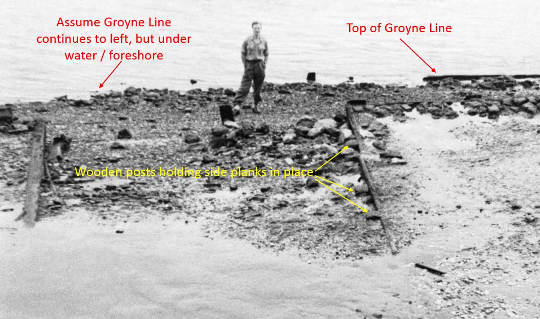
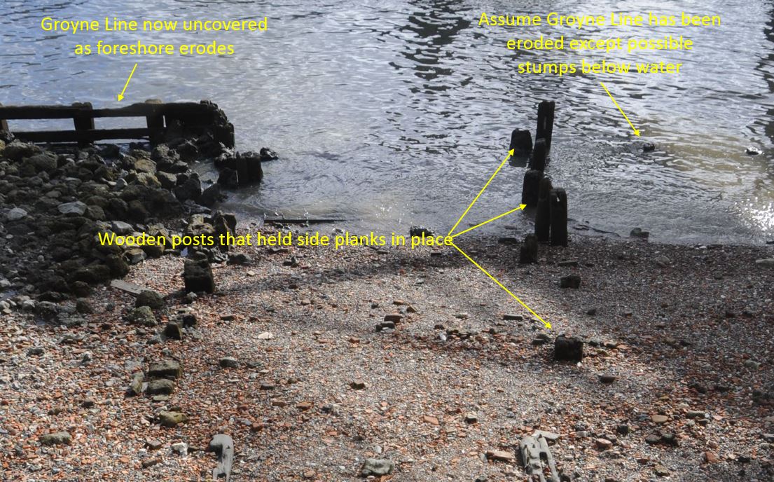
The following photo is an extract from the 1949 photo, looking at the area where a number of wooden structures can be seen:
I have labeled what I assume is the top of the groyne line on the right. The groyne line is shown in the 1951 OS map, and apart from a gap opposite the stairs, it runs along the foreshore, a little distance out from the embankment.
The groyne line was probably a wooden wall used to retain the foreshore and create a reasonably flat surface on wich barges could be positioned and their cargo unloaded into the warehouses.
I have also labeled wooden posts that appear to be retaining a plank. There is a similar plank to the left and these two may have been where the groyne line returned to the river wall, or could have formed the edge to a causeway that ran out from the bottom of the stairs.
Looking at the same view today, and we can see just how much of the foreshore has eroded in the last seven decades:
The groyne on the right, the top of which was visible in 1949 has now disappeared. The groyne on the left which was just below the foreshore is now fully exposed.
We can also see the wooden posts which were once retaining the planks along the edge of the causeway.
Comparing these two photos shows that at the location of the groynes, the foreshore has eroded a good two to three feet.
The Thames foreshore is a very fluid space, in all senses of the word.
Trig Lane and the stairs date from the 17th century, and are probably much older and even if the name Trig dated from around that time, there were probably stairs here much earlier as stairs were such an important part of access between the land and the river, and along this part of the river, there has been port infrastructure for so many centuries.
The London Encyclopedia has the same view as it states that the stairs were earlier known as Fish Wharf.
Excavation at Trig Lane between 1974 and 1976, prior to major development of the area revealed remarkable remains of the medieval waterfront with significant wooden revetments and other infrastructure of the port between the late 13th and mid-15th centuries.
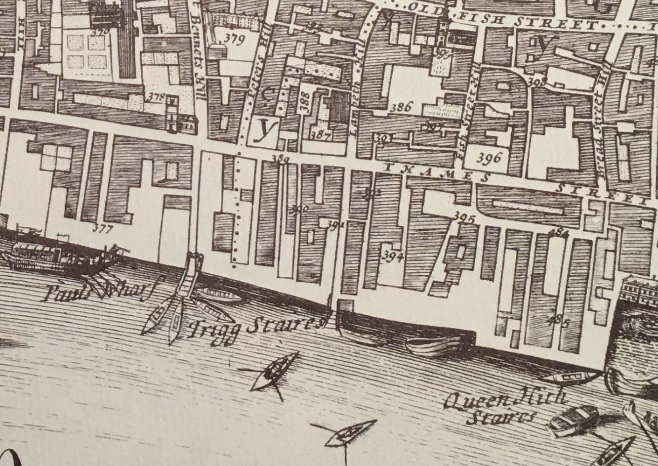
The following is an extract from William Morgan’s map of London from 1682, and shows Trigg Stairs. To the left of Trigg Stairs is Paul’s Wharf which also had a set of stairs. I do not know whether it was an artistic interpretation of the scene, or whether it was fact, but the stairs by Paul’s Wharf had a large cluster of watermen’s boats, but none at Trigg Stairs:
What I love above Thames stairs is not just the physical structure, but the stories you can find about what happened at the stairs. Just small glimpses, but they help with an understanding of what life was like at the boundary between river and City.
For example, from the Newcastle Courant on the 15th of July, 1721:
“Last Monday, Mr. Hargrave, who sometime ago killed one Capt. Wilkes, a half Pay Officer in Racket Court, Fleet Street, and fled, and coming off the water at Trig Stairs, drew his sword upon the Waterman, without any provocation, and stabbed him very dangerously in the Breast, for which he and his Companion were forthwith seized, and carried before the Lord Mayor, who committed them to Wood Street Compter”.
And from the Caledonian Mercury on the 1st of July, 1728:
“On Tuesday in the afternoon, a Barge Man was struck down by lightening as he was going up a ladder at Trig Stairs; and falling into the River, was drowned before any help could be got”.
From the Kentish Weekly Post on the 24th of January, 1759:
“A Journeyman Carpenter crossing the water from Trig Stairs, being a little in liquor, and imagining he was near the shore, jumped out of the boat and was drowned”.
The Reading Mercury reported on the 28th of July, 1783, that:
“The lighters of Mr. Rodbard, at Trig Stairs, Thames Street, having been lately frequently robbed, a guard was appointed to overlook them; and early yesterday morning three persons were discovered filling the corn into sacks, who being fired at by the guard, one of them was killed; the others immediately rowed off in a boat which they had stolen for the occasion, to Pepper Alley Stairs, where they escaped, leaving the body in the boat.”
The London Morning Herald reported on the 13th of October, 1837, that:
“Yesterday evening an inquest was held in the King’s Arms, Queenhithe, before W. Payne (City Coroner), on view of the body of Joseph Colcourt, a lighterman. It appeared from evidence that the deceased was in company with a boy bringing a barge down the river, on Wednesday morning last, about three o’clock, and had arrived alongside Trig Stairs, Queenhithe, when the barge struck against another which was moored off the stairs, and deceased, who was at the time standing on the gunwale, was, in consequence of the concussion, precipitated overboard, and sunk immediately. The boy made what efforts he could at the time to save him, but they were ineffectual. The tide was running down very strong, and it was impossible to render assistance. The body of the deceased was found next morning near to the spot where he fell in. Verdict – Accidental Death.”
Whilst all these stories are of assault, theft and accidental death (as today, the press only report the bad news), they are a common theme to all Thames stairs, and show the dangers of working on the river, of crossing the river, crime on the river, children also working in such dangerous conditions etc.
Standing at the stairs today, it is hard to imagine a guard firing and killing one of those trying to steal corn from barges moored by the stairs.
In Morgan’s map of London from 1682, the stairs were spelt Trigg, but by the time of Rocque’s map of London in 1746, the last “g” had been dropped, and they were just Trig Stairs, as they remain today.
It is interesting how place names change, and I suspect that it was usually a gradual simplification of the name, so the stairs started with the name of a local land owner as Trigge, then Trigg and finally Trig, so the name ends with a spelling that more accurately mirrors how the name is pronounced.
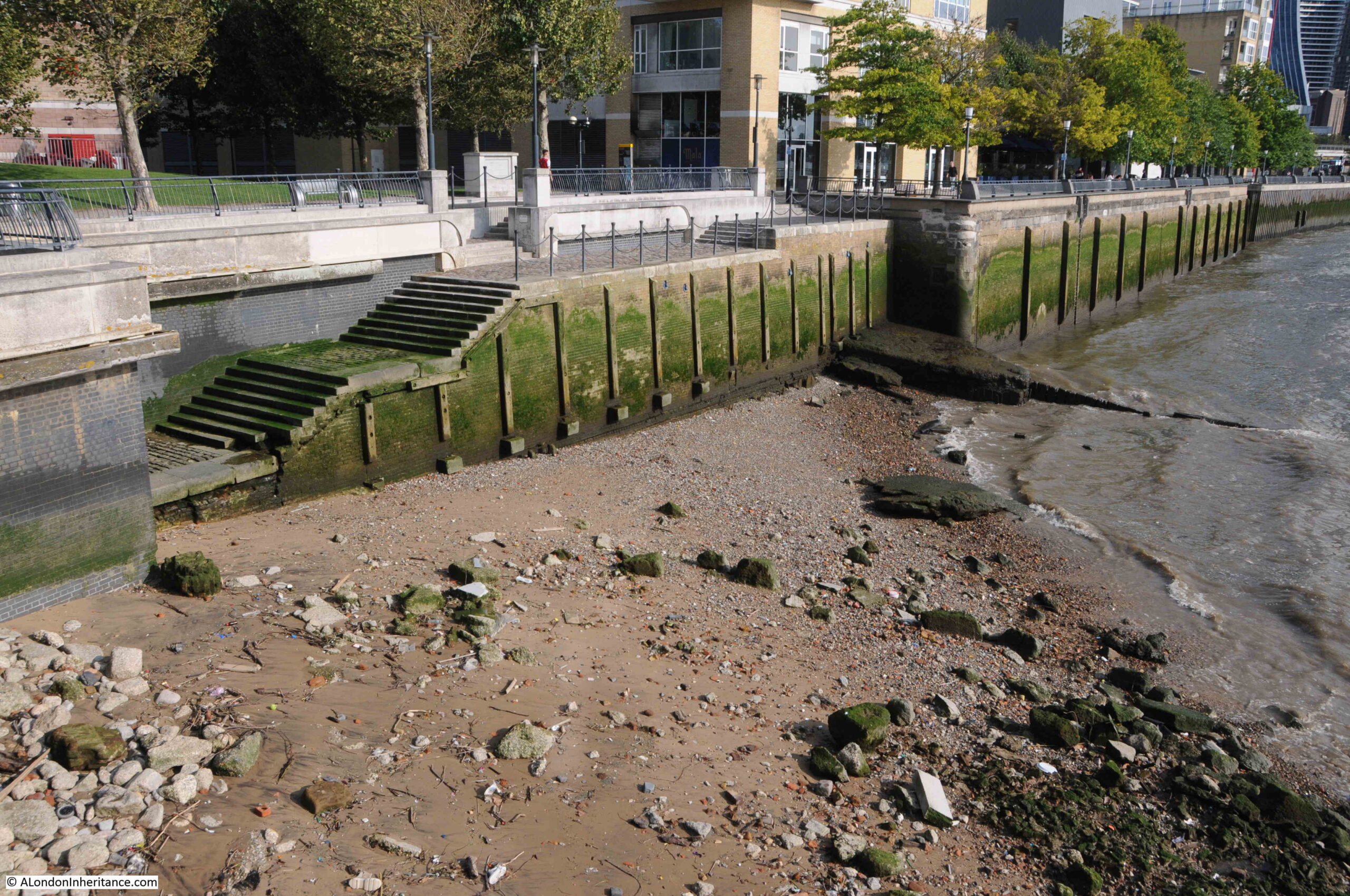
The groynes today still seem to form a boundary between the water and the foreshore at a typical low tide:
I assume that the rubble behind the groyne may have been used as infill to build up the foreshore on the land side of the groyne to create a platform where barges could be moored on some reasonably level ground.
And today we can also see where the eastern groyne ends, there is a gap where the causeway would have extended, and the wooden posts along the side of the causeway now project above the surface. It could also have been where the groynes returned to the river wall. This shows just how much erosion the foreshore has suffered in the last 70 years:
View along the foreshore to the west:
And to the east – the large brick building at the end of the run of modern buildings is the only warehouse that remains from the pre-war period:
In the Port of London Authority book: “Access to the River Thames. A Port of London Authority Guide, Steps, Stairs and Landing Places on the Tidal Thames” (published around 1995), Trig Lane Stairs is listed as having 9 stone steps and 18 wood steps, and that the condition was bad.
The stairs today have 16 steps. The stairs in the 1949 photo are longer as they went into the recess in the wall, so I do wonder if the stairs at the time of the PLA survey were the same as in my father’s photo, as they would probably have been in bad condition having been exposed to decades of Thames tides washing over them.
The PLA listing confirms that the stairs were in use in 1708, and at the time of the survey they were not in use.
The stairs today are in good condition, and whilst probably not in use as a landing place, they provide access to the foreshore:
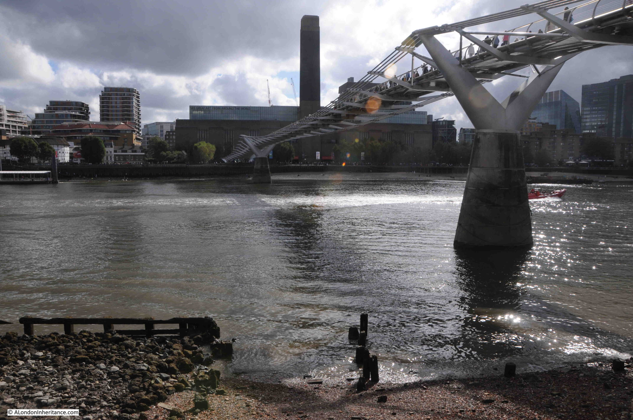
The following photo shows the view across the river to Tate Modern, the old Bankside Power Station:
My father did take photos across the river from the top of the stairs at different times to the photos of Trig Lane Stairs.
The first shows dates from 1953 and shows the new Bankside Power Station when the first half had been completed and was in operation. The original power station is on the left, where the parallel rows of chimneys can be seen. I wrote about the view, along with other photos in the post Building Bankside Power Station.
And this view from 1949 shows the original power station on the left, and the Phoenix Gas Works on the right. I wrote about this view, along with a wider view of Bankside in the post A Bankside Panorama In 1949 And 2017:
Trig Stairs are in good condition, but the same cannot be said for the remains of the wooden structures on the foreshore, the groynes and the possible edges to a causeway leading out from the base of the stairs.
I suspect that erosion of the foreshore may have been speeding up over the last few decades, as the groynes and platform they protected are now not needed and are therefore not maintained, and that there are no obstructions along the foreshore or the river that would have slowed down water passing over the foreshore (for example, barges on the river and moored on the foreshore).
I doubt whether the remaining wooden structures below the Trig Lane Stairs will be there in another 74 years time.
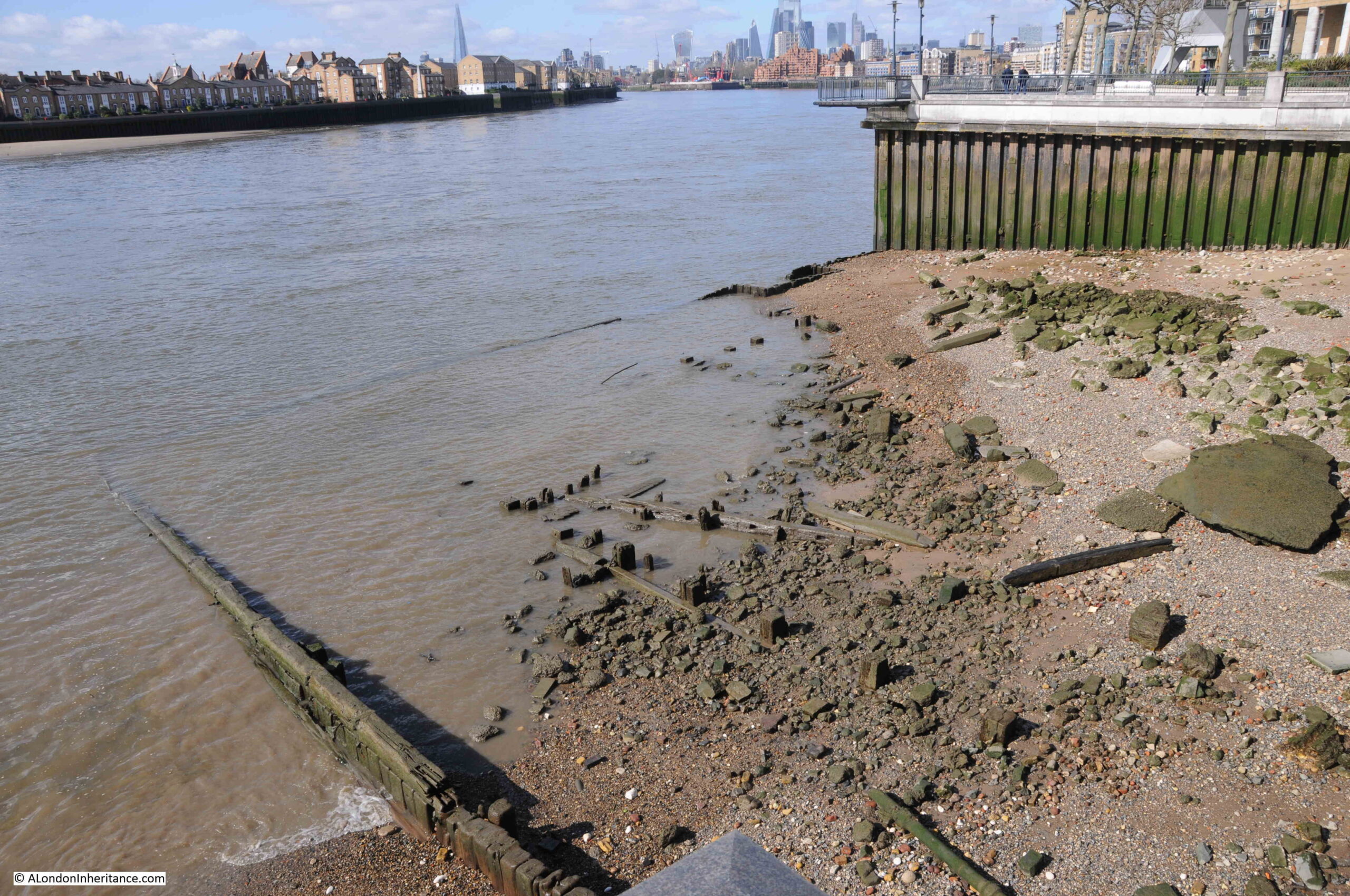
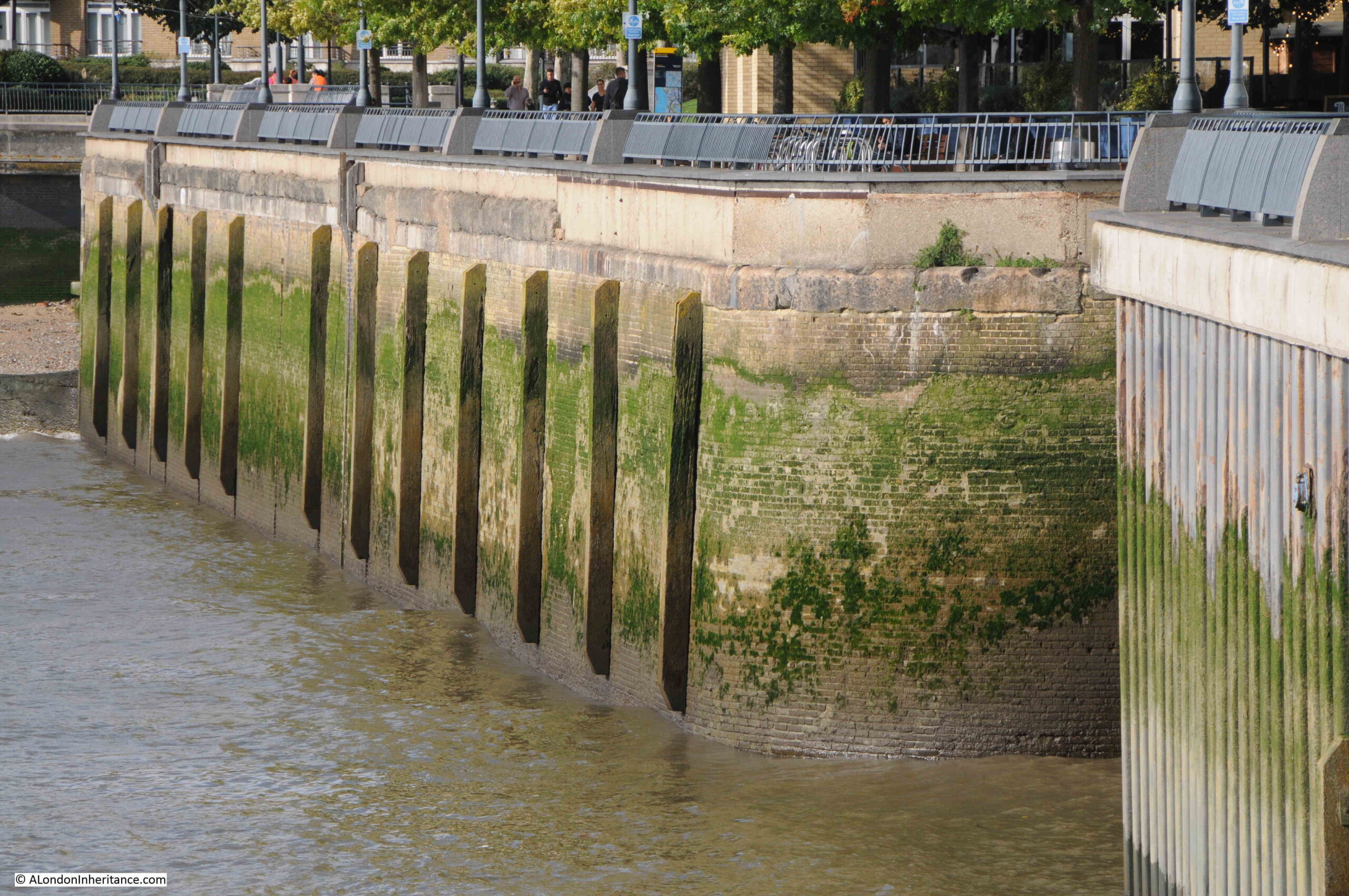
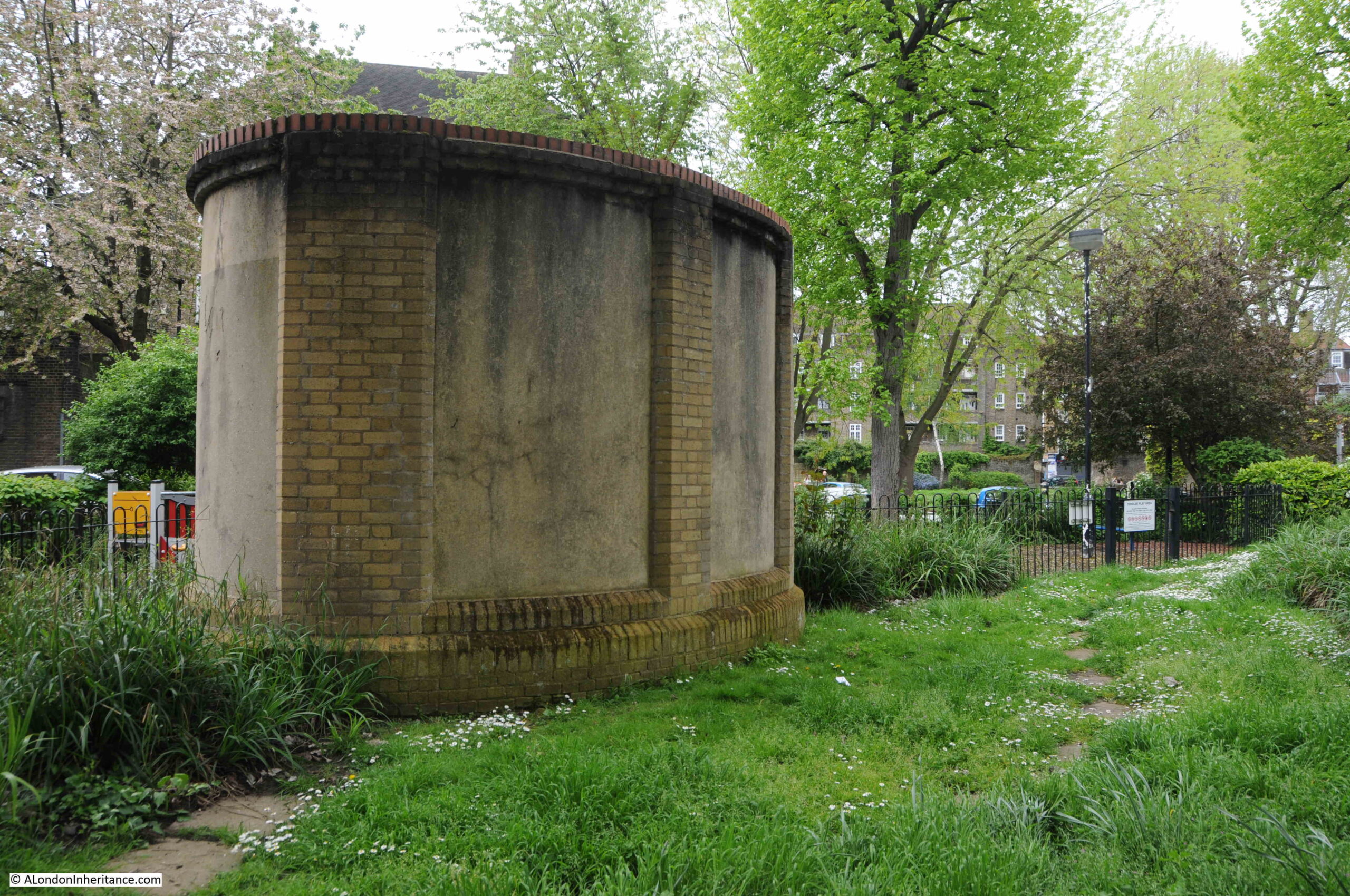
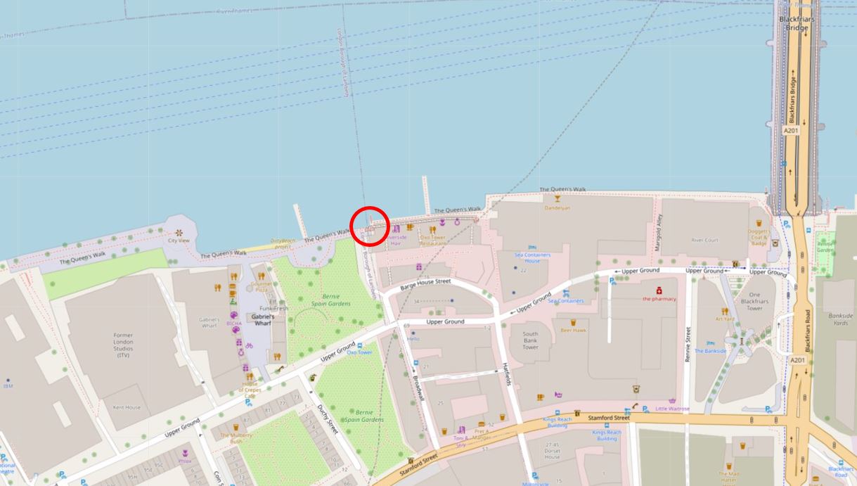
Limehouse Hole Stairs are one of the very old stairs between the land and the river. They are towards the eastern edge of Limehouse, in an area once known as Limehouse Hole, where the river turns south on its journey around the Isle of Dogs.
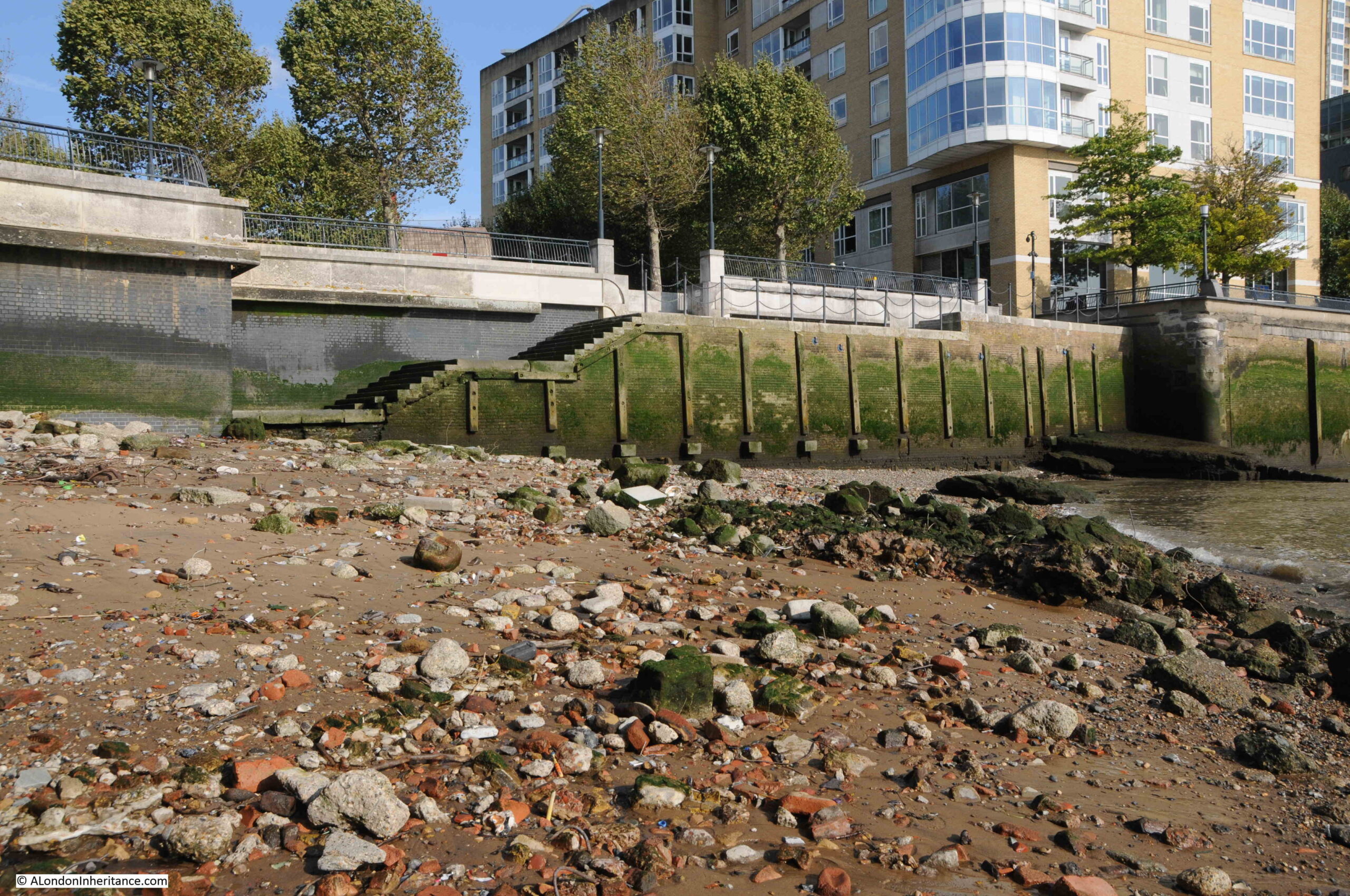
Today, the stairs are a wide and well maintained set of steps leading down from the walkway alongside the river, towards a very roughly rectangular area which is accessible when the tide is low:
The foreshore at Limehouse Hole Stairs has large sandy patches along with plenty of stone and brick that has found its way into the river from the buildings and infrastructure that once lined the Thames.
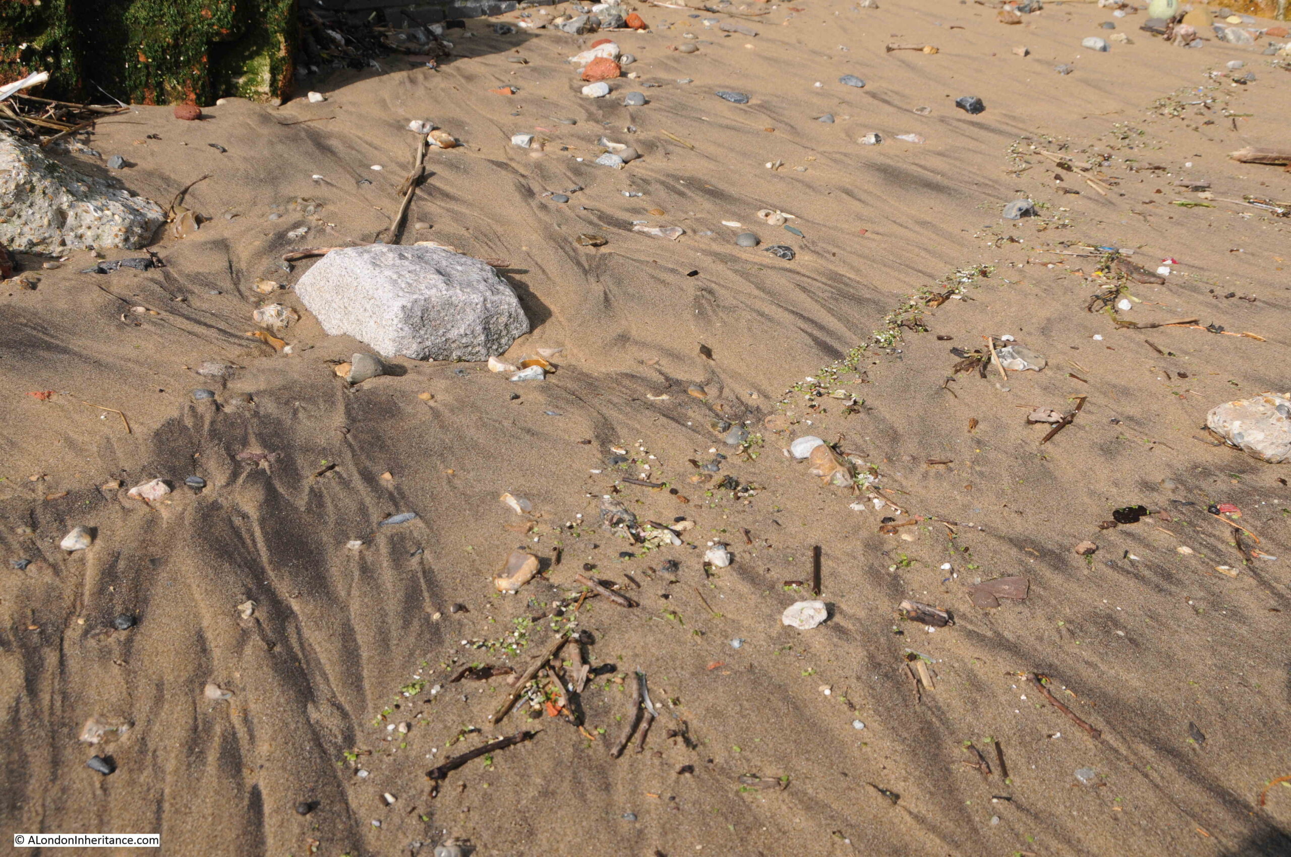
If you look closely, it is interesting how similar items can be found in lines along the foreshore. They were left when the tide went out, and form a line across the sand. I have no idea of the mechanism that leaves them in a line rather than randomly scattered, and on the foreshore at Limehouse Hole Stairs, a line of green glass / plastic / minerals (not sure what they were), was stretched across the sand:
The Port of London Authority list of the steps, stairs and landing places on the tidal Thames has very little information on Limehouse Hole Stairs, just recording that they were in good condition, with stone and concrete steps and in use. The PLA had not recorded whether the stairs were in use in their two key recording years of 1708 and 1977.
The stairs are old, but the stairs we see today are very different to what was there prior to the redevelopment of the area in recent decades, which I will show later in the post.
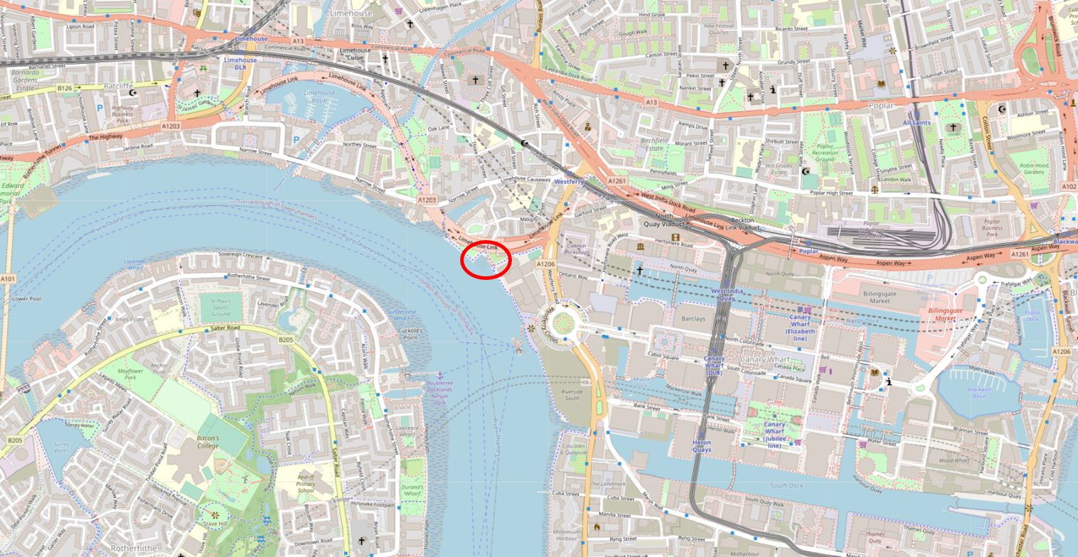
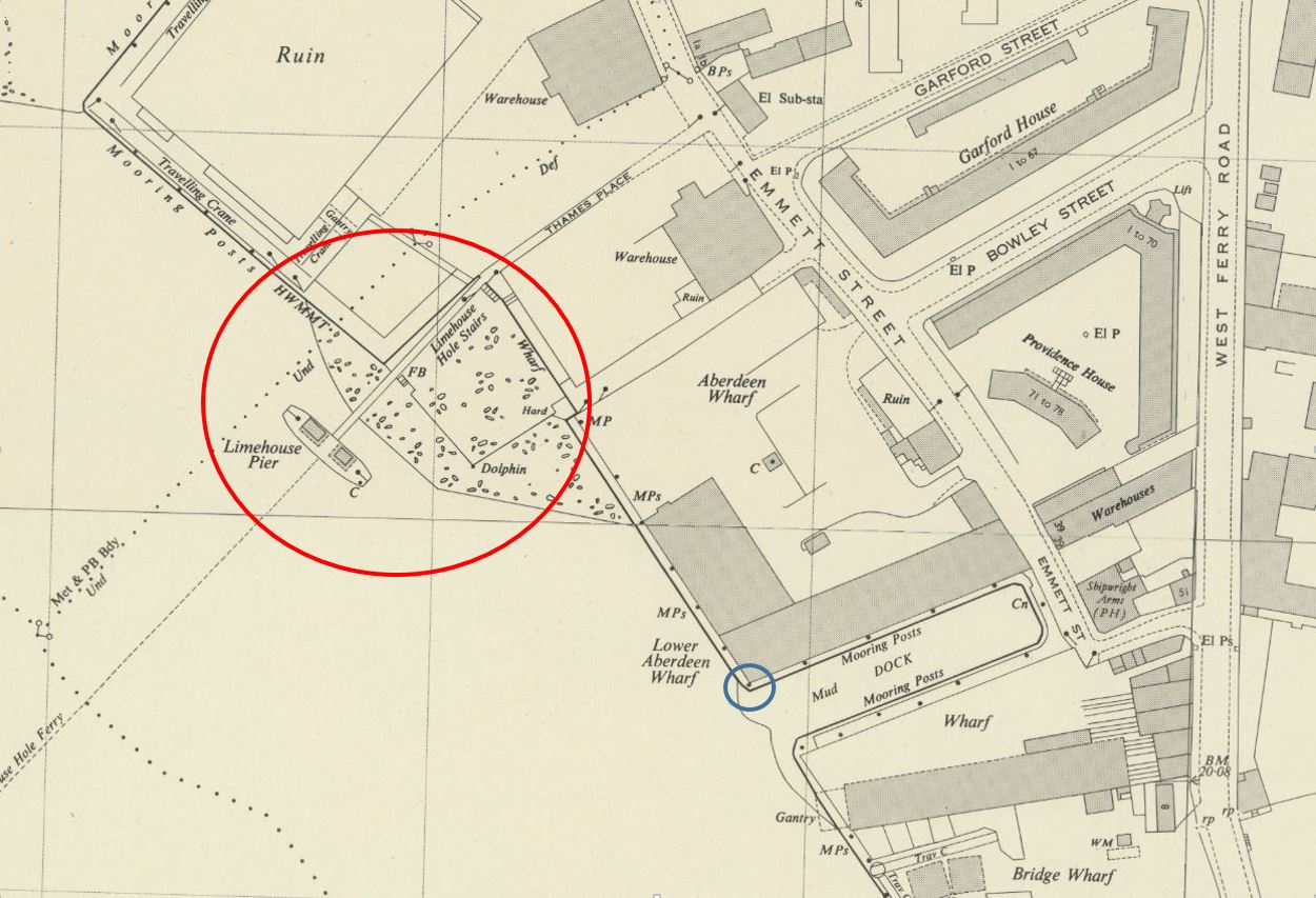
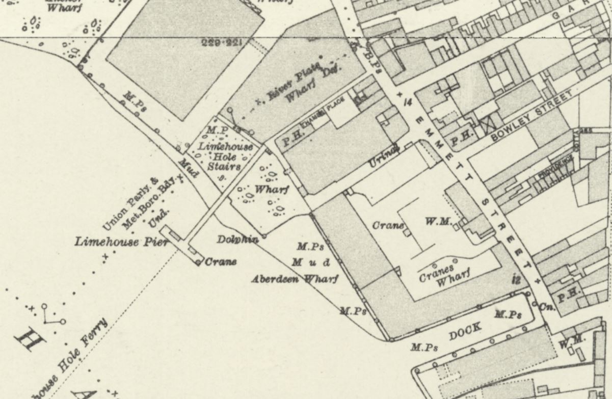
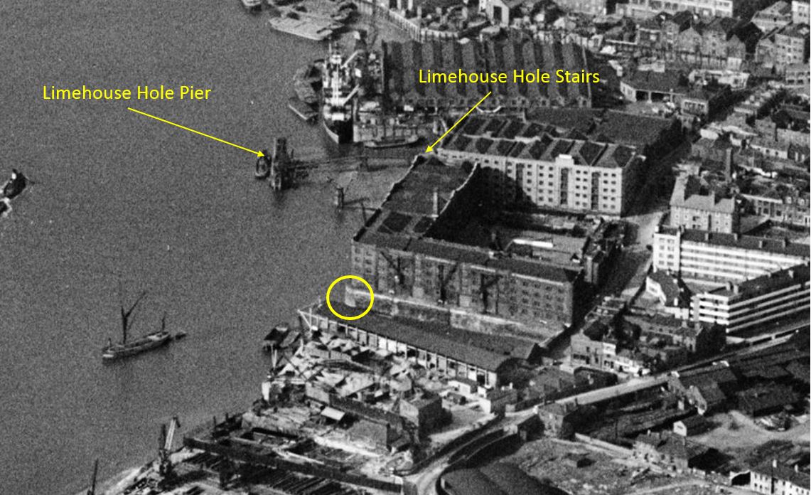
There is an area of foreshore that dries when the tide is low shown mainly within the red circle. Limehouse Pier extends into the river. Follow the pier back to land, and in the corner is Limehouse Hole Stairs.
You can also see in the above map, a line forming two sides of a square, with the river walls forming the other two sides. The two lines running across the dried foreshore in the map were a wooden surround, parts of which can still be seen today, as I will show later.
I will come to the relevance of the blue circle later in the post.
This area has a complicated naming history.
Written references to the stairs date back to the early 19th century, although these do not explicitly name Limehouse Hole Stairs. A typical advert in February 1807 was for the Schooner Anne which was for sale and could be seen “lying at Limehouse Hole, opposite the stairs”.
The name Limehouse Hole is also a bit of a mystery. It may refer to a form of small harbour or dock, although I find this unlikely as the larger Limekiln Dock is within the area traditionally known as Limehouse Hole.
I did wonder if the name referred to a hole in the river, perhaps a particularly deep part of the Thames, however in the area known as Limehouse Hole, the bed of the river is of a depth that is normal for much of this stretch of the river, typically around 6 metres deep at the lowest astronomical tide.
There is though a strange depression in the bed of the river not far to the west, in the middle of the river opposite the entrance to Limehouse Dock, where the river descends from a depth of 5.5 metres to a depth of 11.4 metres, all within a small area of the Thames.
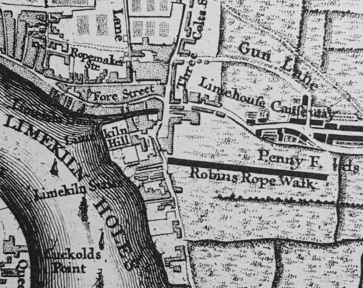
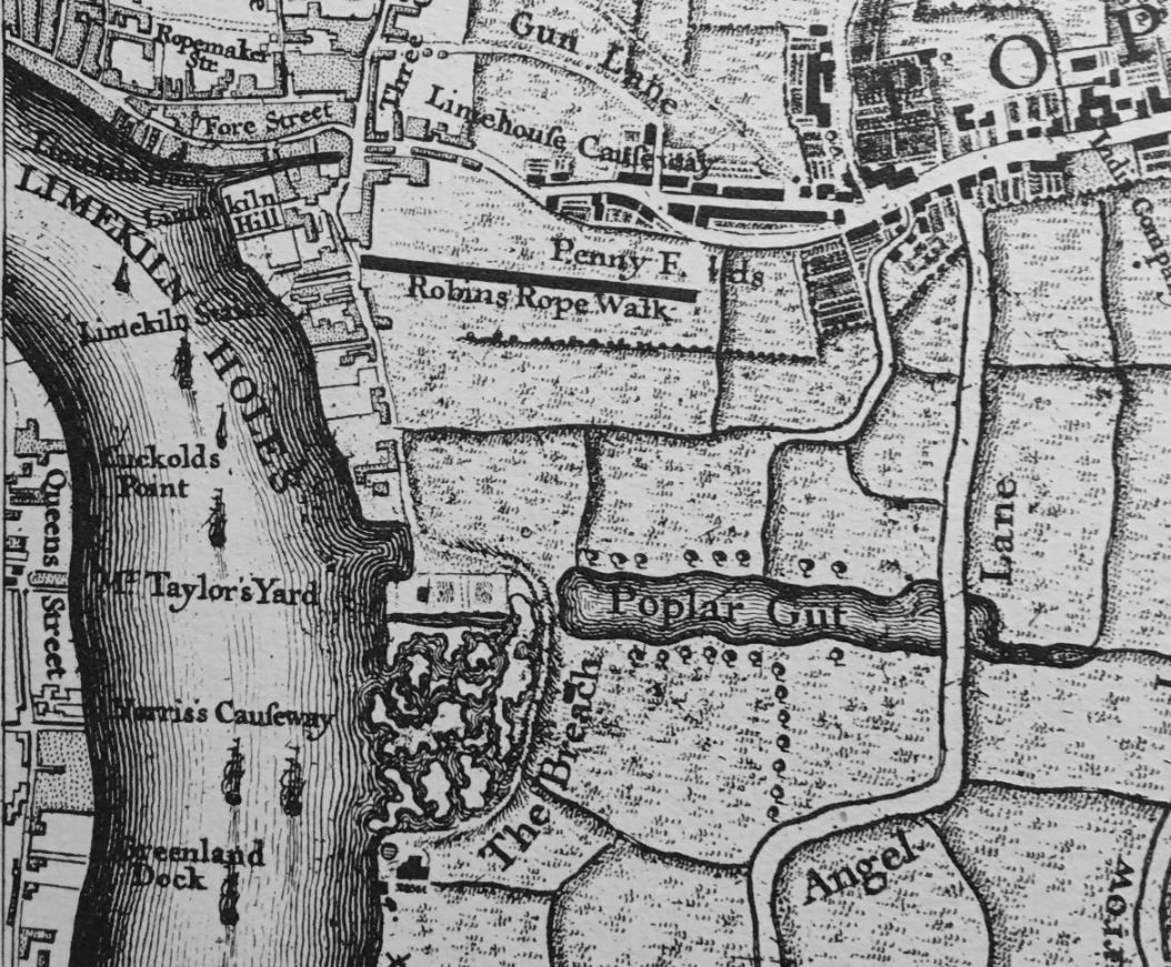
To add to naming confusion, if we look at Rocque’s map from 1746, there are stairs in the rough location of Limehouse Hole Stairs, however Rocque calls then Limekiln Stairs, and he also names this stretch of the river Limekiln Holes rather than Limehouse Hole, so perhaps the name refers to some aspect of the Limekiln industry, and as this industry declined, the name changed from Limekiln to Limehouse Hole.
The Survey of London does though state that the name Limehouse Hole was in use for this section of the river by the seventeenth century, so perhaps Rocque was confused with the Limekilns and Limekiln Dock, or in the 18th century there were different names in use.
The extract from Rocque’s map is shown below:
The first references to the full name of Limehouse Hole Stairs start to appear around 1817, and there are multiple references in the 1820s onwards. All the usual events that make their way into the papers – accidents on the river, ships for sale, fires in the buildings by the stairs, rowing competitions, and tables of rates for Watermen to charge to row passengers along the river.
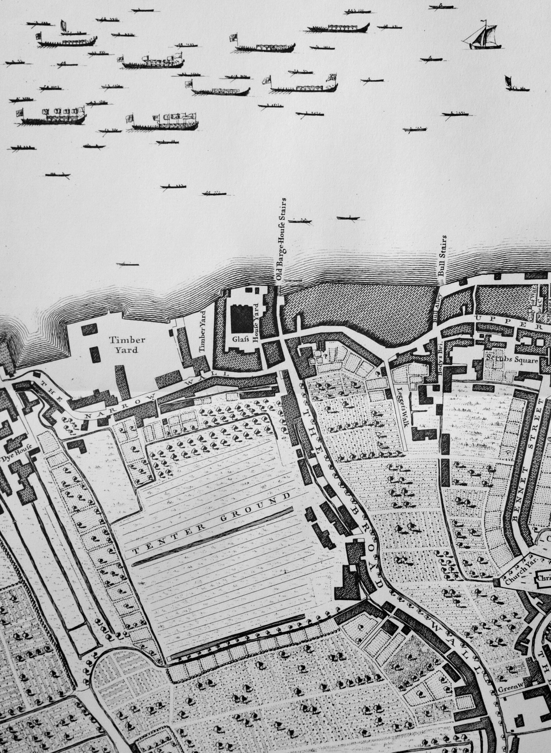
In the OS map shown above, there is a pier coming out from Limehouse Hole stairs. The earliest reference I can find to the pier dates from 1843, when there was an article in the November 5th edition of The Planet recording a court case, where “On Tuesday, Jonathan Bourne, a waterman, and one of the proprietors of the floating-pier at Limehouse Hole stairs, appeared to answer a charge of carrying passengers in his boat on Sunday, in violation of the rights and privileges of William Banks, the Sunday ferryman. The real question in dispute between the parties was as to the right of the watermen owning the floating pier to convey passengers to and from the Watermen’s Company steamers which stop there. When the tide is low there is not sufficient water for the steamers to come alongside the outer barge of the pier, and the watermen row the passengers to the steamers, and vice versa, but no money is taken.”
From the article, it appears that the pier was owned by a group of watermen. The article also shows how watermen were regulated, and had specific rights covering what they could do, and when. I did not know that the Watermen’s Company ran steamers on the river. This must have been a far more efficient way of conveying passengers along the river, rather than rowing as watermen in previous years would have done. Also, an early version of the Thames Clippers that provide the same service today.
The pier seems to have disappeared by the 1860s, as in the East London Observer on the 1st of May, 1869, there was a report on a public meeting of the parishioners of Limehouse “to consider what action should be taken in obtaining the construction of a pier on the Thames, for the convenience of the inhabitants of Limehouse”, and that “there were many persons who would far rather go to the city by boat than either rail or bus”.
A new pier was needed because “the old pier was never under the management of the Thames Conservators, but under that of the watermen, who let it go to ruin”.
A new pier was built in 1870 and this second pier lasted until 1901, when it was removed for the construction of Dundee Wharf, and a couple of years later, the London County Council built the third pier on the site.
Getty Images have some photos of this third iteration of the pier, with the following photos showing the pier stretching out across the foreshore, with Dundee Wharf in the background, on the left. Click on the arrows to the sides of each photo to see all images of the pier in the gallery. (If you have received this post via email, the photo may not be visible due to the way code embedding works. Go to the post here https://alondoninheritance.com/ to see the photo).
The photos show the wooden surround which was shown in the earlier OS map. The photo helps with the purpose of this surround, as it presumably held back a raised area of the foreshore to create a reasonably level space for barges and lighters to be moored.
The Survey of London states that this third pier “was removed by the PLA in 1948, but the stairs and Thames Place, though closed off in 1967, survived until 1990”. The survival of the stairs until 1990 presumably refers to the version of the stairs prior to that which we see today.
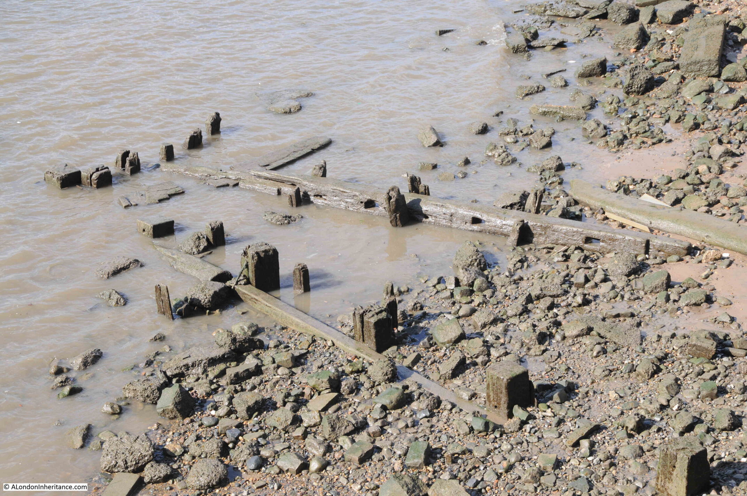
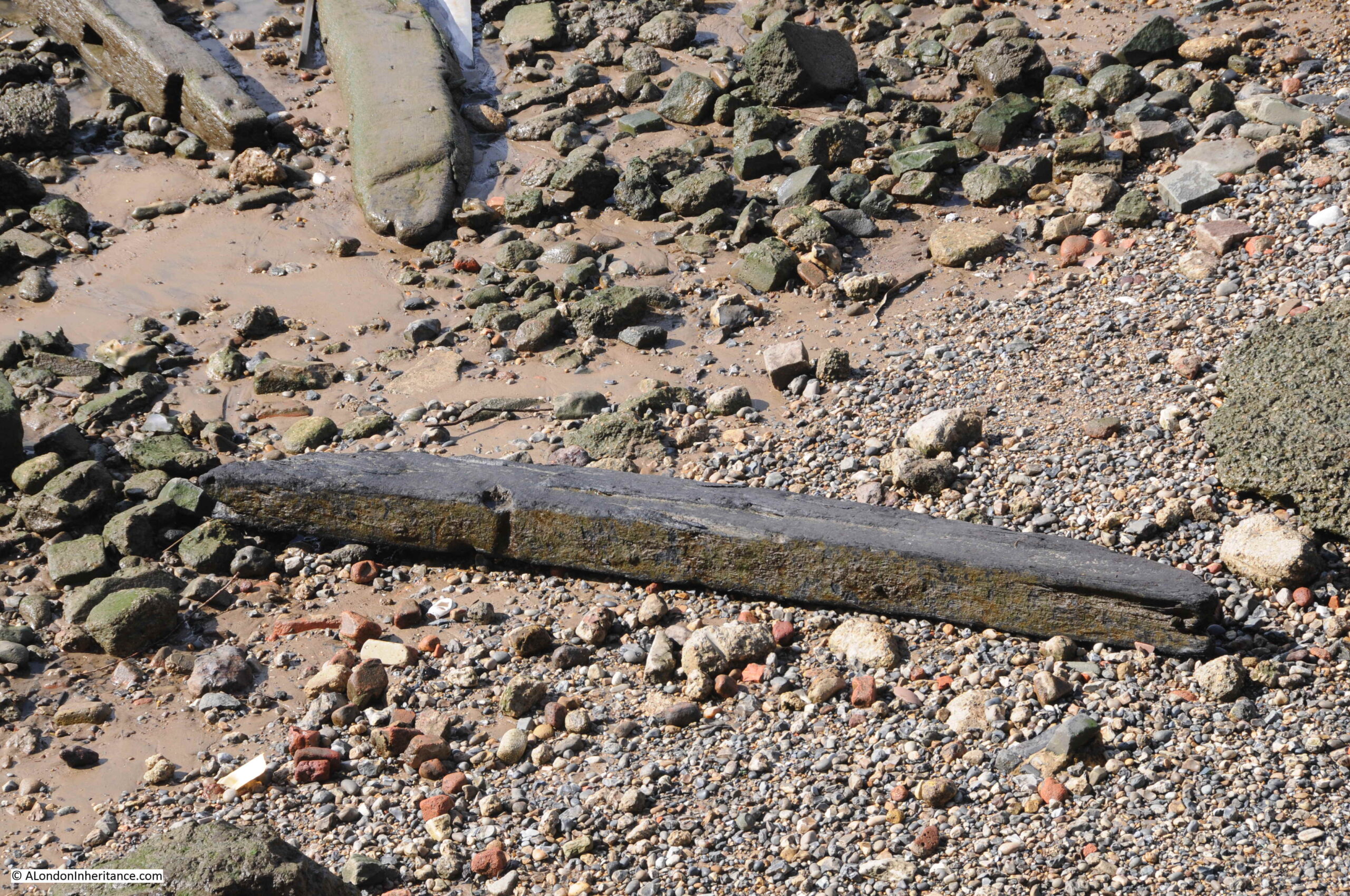
The result of multiple piers, along with the wooden surround to the area, means that there are still remains on the foreshore which we can see today:
Including plenty of loose timbers which may have been washed here from other locations along the river:
And when the tide is low, we can still see the wooden surround which once enclosed a flat area of the foreshore as can be seen in the Getty photo above:
The following 1914 revision of the OS map shows Limehouse Hole Stairs and the pier, and also shows Limehouse Hole Ferry running across the river from the pier. This was a ferry to the opposite site of the river which landed at Horn Stairs, and which provided a fast way of crossing the river, rather than having to travel to either the Rothehithe or Blackwall Tunnels (‘Reproduced with the permission of the National Library of Scotland“):
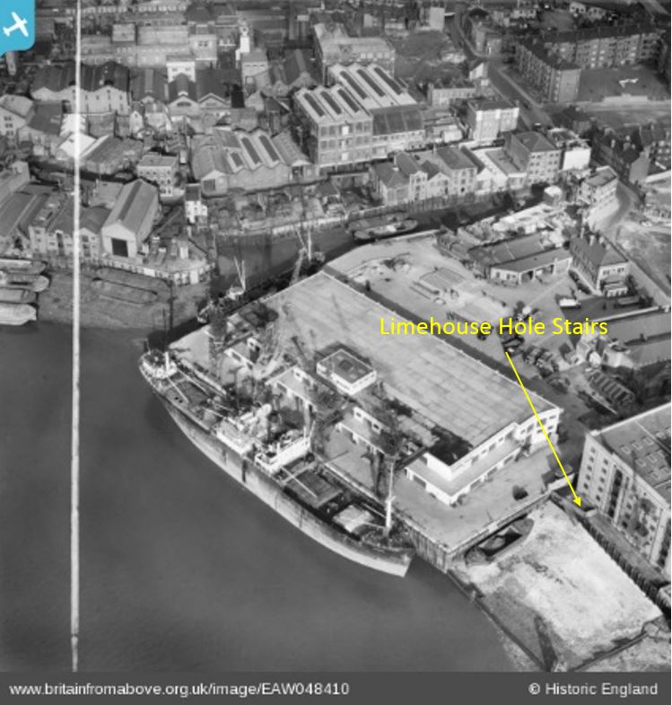
The following photo from Britain from Above shows the site in 1953 when the pier had been removed. I have marked Limehouse Hole Stairs, which at the time was simply wooden steps leading down to the foreshore. To get a closer view, the photo can be found here.
The pier had been removed just a few years before the above photo. Limekiln Dock runs inland towards the top of the photo, and, along with the shape of the river wall where Limehouse Hole Stairs is located, is the only feature that survives today. Almost every single building has disappeared.
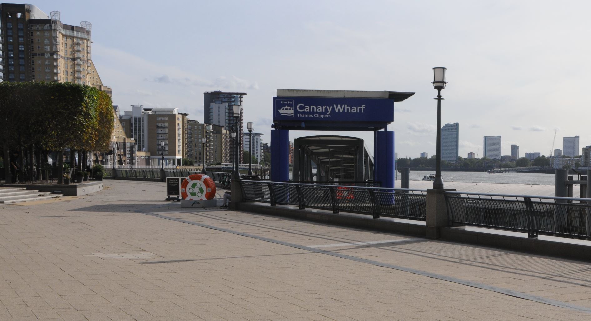
Although Limehouse Hole Pier has gone, there is another pier, a short distance to the south, where the Canary Wharf pier can be found today, which provides access to the Thames Clippers, providing a similar function to the old steamers that once docked at Limehouse Hole pier:
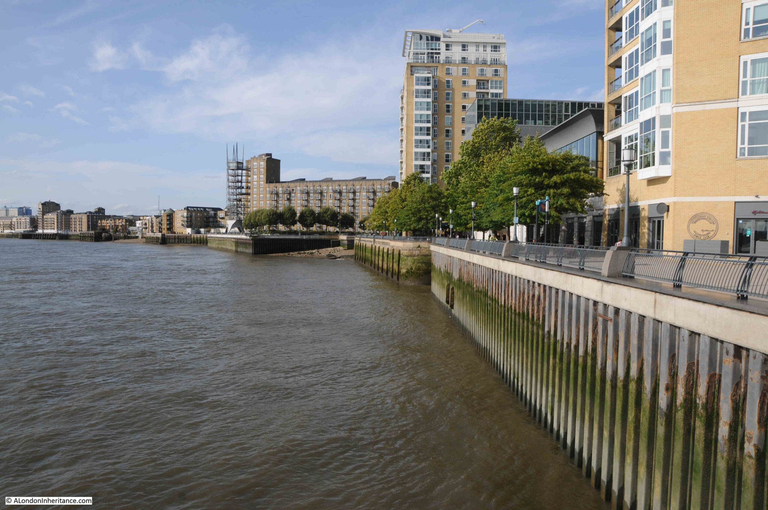
Looking north from Canary Wharf pier, and there is another feature that survives. In the following photo, looking towards the location of Limehouse Hole Stairs, there is a straight row of metal piling, followed by a brick wall:
With a closer look, we can see that the brick wall turns inwards:
Returning to the 1949 revision of the OS map, I have marked the curved brick wall in the above photo, by a blue circle in the following map:
The curved brick wall was at the northern side of the entrance to a dock that ran alongside Lower Aberdeen Wharf.
The wall today looks as if it continues in land and I would love to know how much of the old dock, and the walls that once surrounded the dock, survive under the modern walkway that has been built as part of the redevelopment of the area.
We can also see the dock in an aerial photo, again from the Britain from Above web site, and dating from 1938:
I have highlighted the corner wall we can see today in an extract from the above photo, and have also marked the stairs and pier:
As well as Limehouse Hole Stairs, the other part of the title of the post is “the Breach”.
Much of the Isle of Dogs, and indeed much of the land alongside the Thames, is low lying, and over the centuries, it has been very common for there to be floods during high tides.
As London grew, and trade along the river developed, land was reclaimed, and river walls were built, but until the 20th century, these walls were often not of the height and strength we see today.
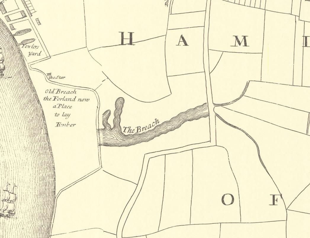
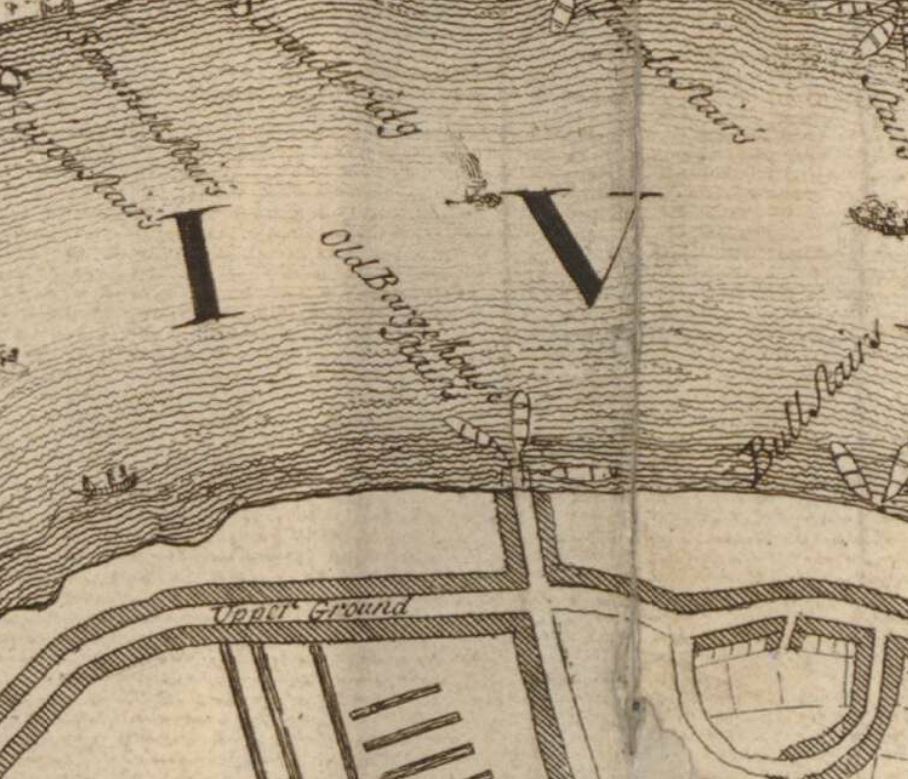
Nor far south of Limehouse Hole Stairs is an area of land where the river wall was breached, and was flooded, or in a state of marsh, for very many years. This was known as “The Breach”, and was shown on maps, including Rocque’s 1746 map, where it can be seen with a road running around what appears to be an area of marsh:
There is also a water feature in the above map called the “Poplar Gut”, and both this and the Breach were mentioned in an article in the East London Observer in 1903, when “Pepys in his diary under date of 23rd March, 1660, mentions that he saw the great breach which the late high water had made, to the loss of many thousands of pounds to the people about Limehouse. In Gascoyne’s map, the spot is marked by the explanation ‘Old Breach, the Foreland, now a place to lay timber’ and ‘The Breach’ is applied to what was more recently known as the Poplar Gut”.
The reason why the Breach happened where it did was down to the natural erosion of the land by the river at this particular point in its meander around the Isle of Dogs.
In time, and without any human intervention, the Thames would have cut through the northern section of the Isle of Dogs, leaving the part of the river around the south of the Isle of Dogs as an Oxbow Lake. The Thames has made subtle changes to its course over the centuries, and it is only in recent years that we have effectively put the river into a concrete and banked channel, and limited the natural forces of erosion.
There are also stories of people digging out ballast from the foreshore around where the Breach occurred, which would have contributed to the flood.
The view from Greenwich would have looked very different if the river had continued with the Breach.
in the quote from Pepys, he mentions that the Breach is now a place to lay timber, and this would have been a good place, as timber was often kept in a wet environment to stop the wood drying out and to allow gradual conditioning before sale.
In a parish map from 1703, the area is marked as a place to lay timber:
In Rocque’s map, there is an inland area of water called the Poplar Gut and in the above map it is labelled as the Breach. This was part of the area that flooded when the river breached the bank along the river.
This must have been a significant area of reasonably deep water, as on the 10th of June, 1748, it was reported that “On Saturday last, in the evening as Mr. George Newman, son of Mr. Newman, an eminent Linen Draper in Whitechapel, was washing himself in Poplar Gut, he was unfortunately drowned, although all possible means were used by a companion he was along with, to save him, to the inexpressible grief of his parents, and all who knew him”.
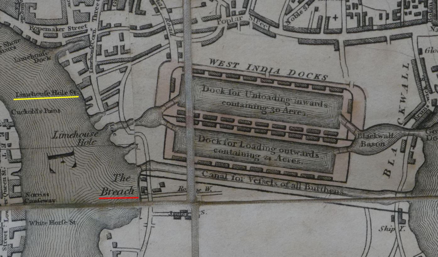
The Breach lasted for some years, and was still shown in the 1816 edition of Smith’s New Plan of London, which also included the recently completed West India Docks, which had been built over the Poplar Gut:
The Breach would soon be reclaimed after the publication of the above map, as the size and number of docks grew on the Isle of Dogs, and industry expanded along the edge of the river (the West India Docks and the channel across the Isle of Dogs will be the subject of future posts).
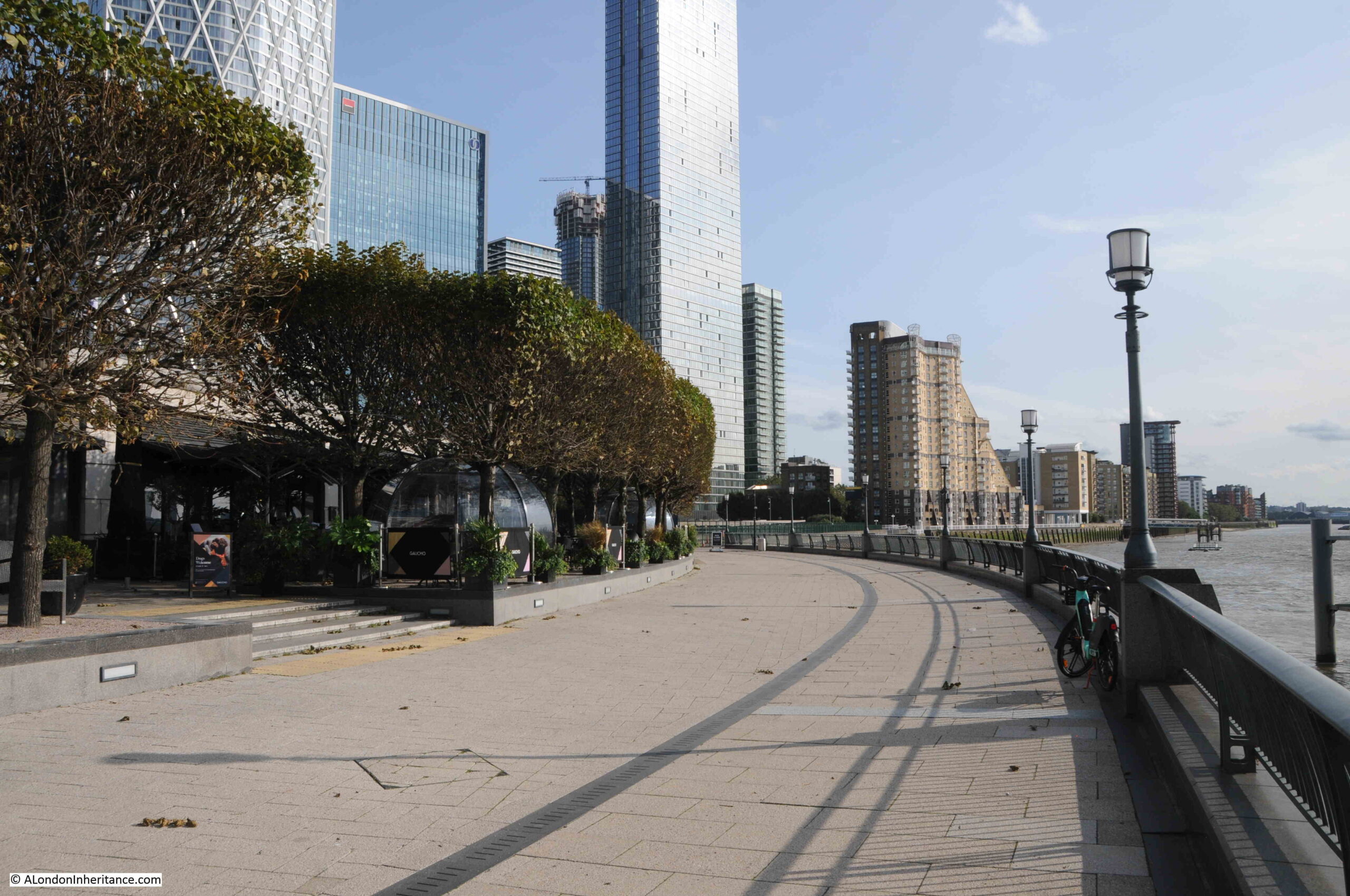
Nothing remains to be seen of the Breach today, although it was to the south of where the Canary Wharf pier is today, in the following view:
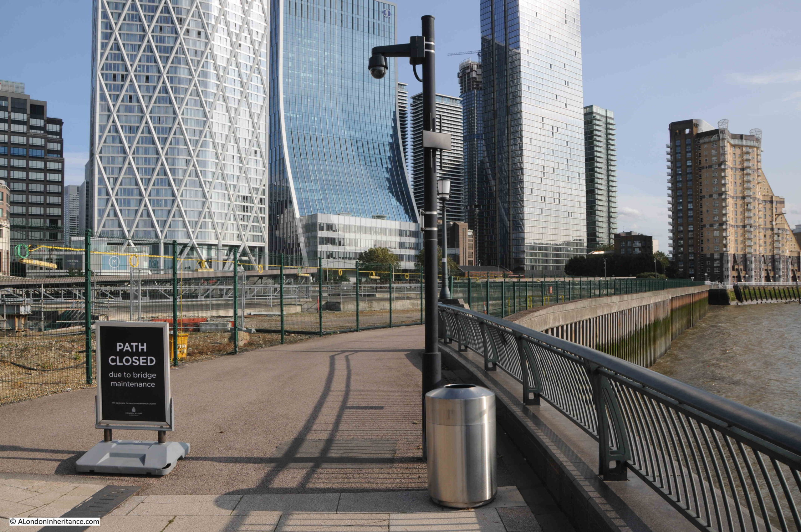
And almost as a reminder of when it was impossible to cross where the water of the Thames had breached the bank, during my visit, the path was closed, but this time for maintenance, rather than a flood:
This small area of Limehouse has changed dramatically over the last few decades, however there are still places where we can see traces of the previous industrial. docks and riverside infrastructure.
Wooden planks still poking through the foreshore, although being gradually eroded, a brick wall running along the river’s edge, and location and names of the stairs that bridge the boundary between land and the river.
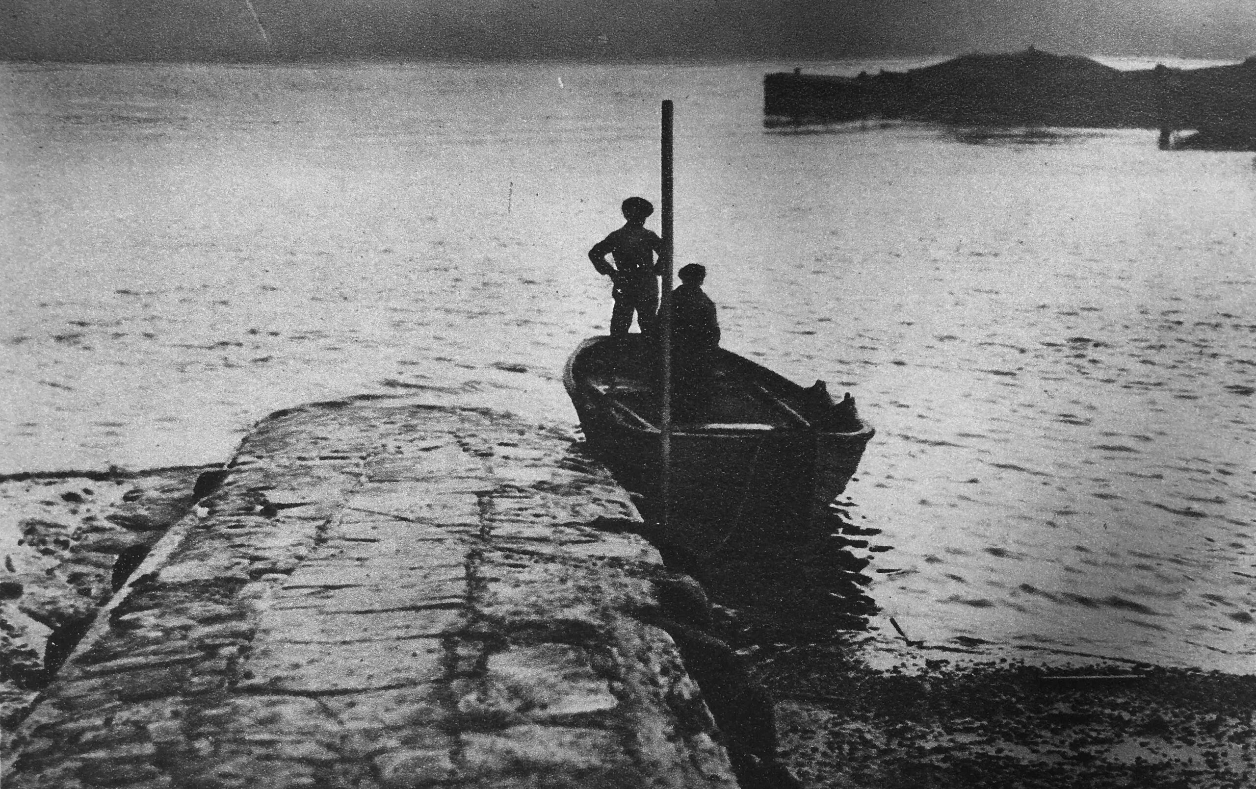
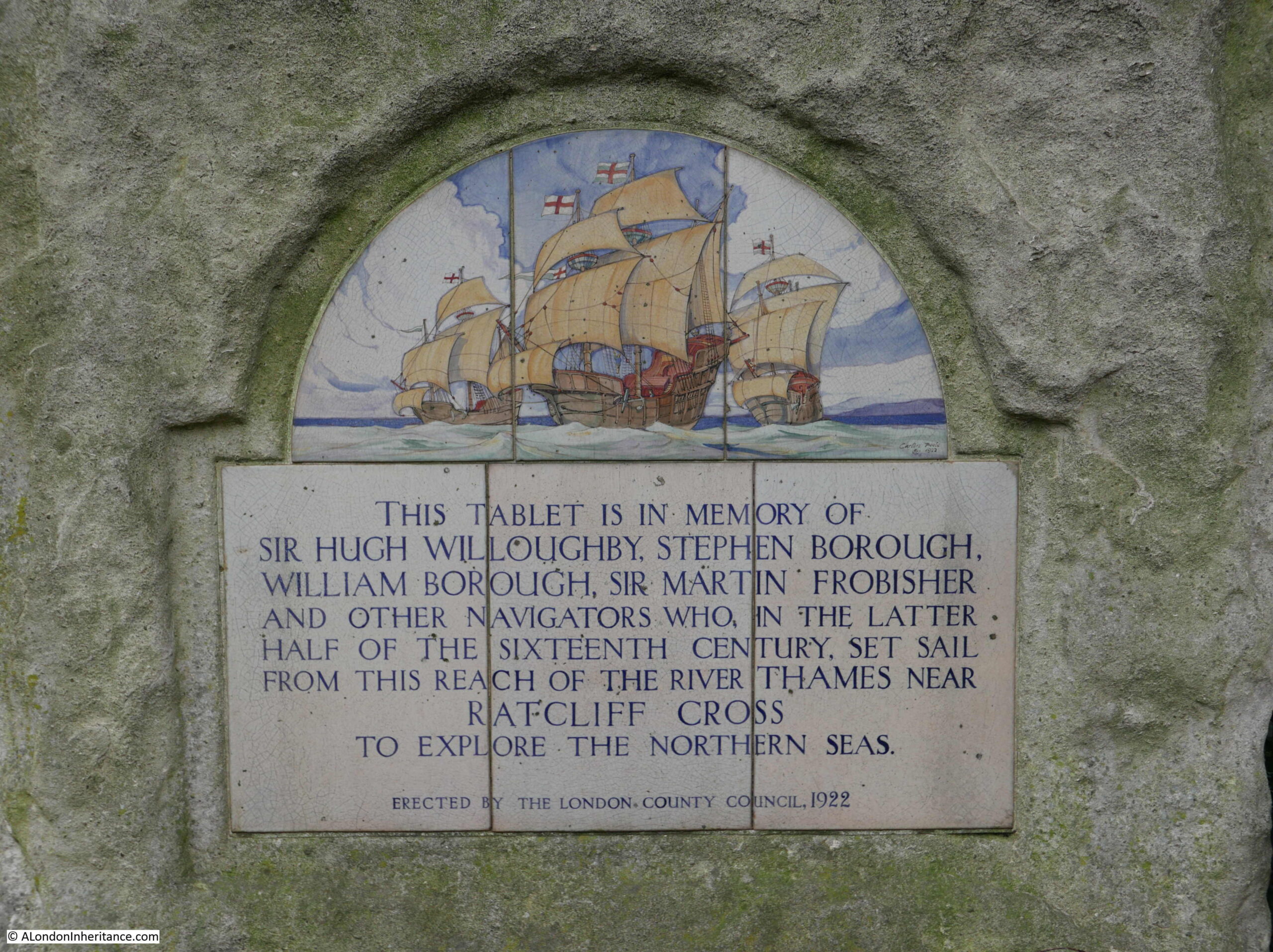
For this week’s post, I am returning to my exploration of the ancient stairs that line the River Thames. In the 1920s books Wonderful London there is the following photo of Ratcliffe Cross Stairs, described as “an ancient and much used landing place and point of departure of a ferry. There is a tradition that Sir Martin Frobisher took boat here for his ship when starting on his voyage to find the North-West Passage. Ratcliffe Cross is the old name for the thoroughfare leading to this landing stage, whence Butchers’ Row meets Broad Street, Shadwell, and Narrow Street, Limehouse”:
I do not know if that is the ferry mentioned in the Wonderful London text, but it does illustrate perfectly how these stairs, and the causeway that ran from the bottom of the stairs, was used to take a boat either along the river to another set of stairs, or to a ship on the river.
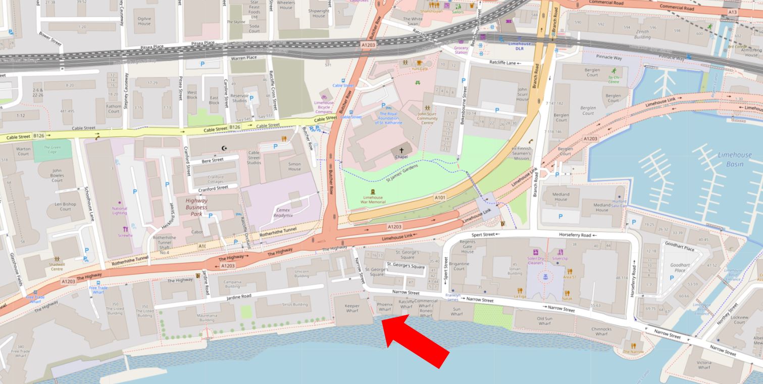
Limehouse Basin is the area of water to the right of the map, and the dark pink road above is the Highway leading into the Limehouse Link Tunnel, with the dark pink line of Butcher Row running north.
Ratcliffe Cross Stairs leads from Narrow Street at the point where it does a sharp bend to head north to a dead end at the Highway.
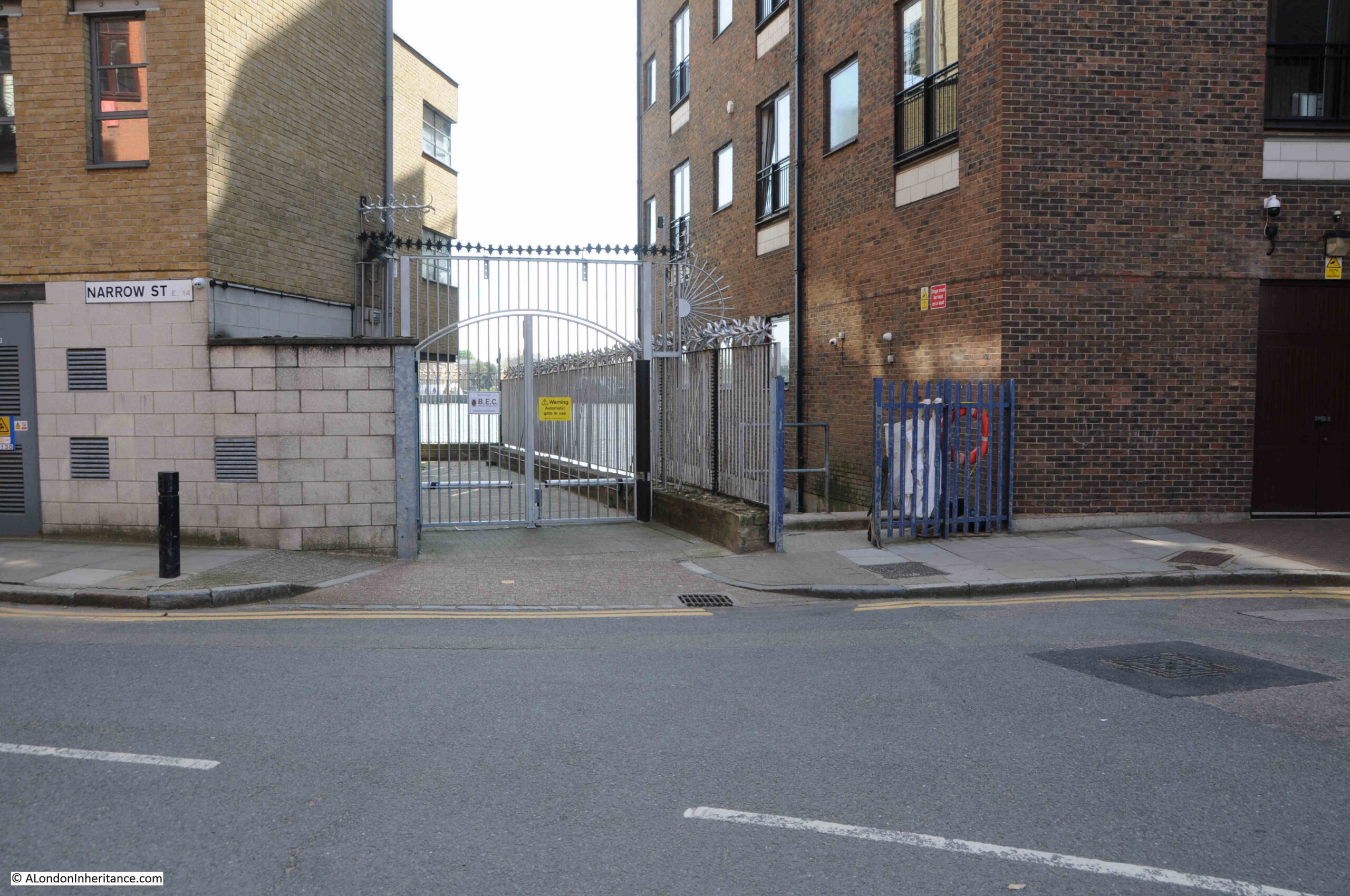
In the following photo, the dark blue gates are the entrance to Ratcliffe Cross Stairs:
Ratcliffe Cross Stairs are in what was the old hamlet of Ratcliffe. The name came from Redcliff as the high ground along the route of the main street that ran from the City to the east of London, parallel to the river had red sandstone exposed in the slight cliff that descended down to the marshy land along the river.
The road that ran along this higher land became known at the Ratcliffe Highway (now just the Highway), as it followed the river from the City to the hamlet.
Although now not as well known as the stairs in Wapping, Ratcliffe Cross Stairs were important and well used river stairs, and to understand why, we need to look at maps that show the area at a time when development was limited, and much of east London was still fields.
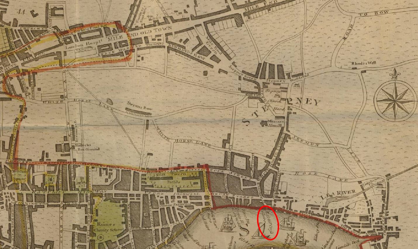
Now using the same map, we can zoom out, and we can see the wider context of the location of the stairs (red oval):
If we follow the route of the road that runs down to the stairs, then after running through some fields, and limited development along the road, we reach Stepney. Follow the main road through Stepney as it turns to the left, and we reach Mile End Old Town, so the road that runs directly to the stairs is the direct route from Stepney and Mile End.
Also, if we look to the left, we can see two main roads that run from the east of the City of London, which also run to Butcher Street, then down to Ratcliffe Cross Stairs.
So whilst today, the stairs are at a quiet location, where Narrow Street turns to a dead end, it was once at a key location, at the end of the main road that would have made the stairs the most direct route to the river from a wide area of east London.
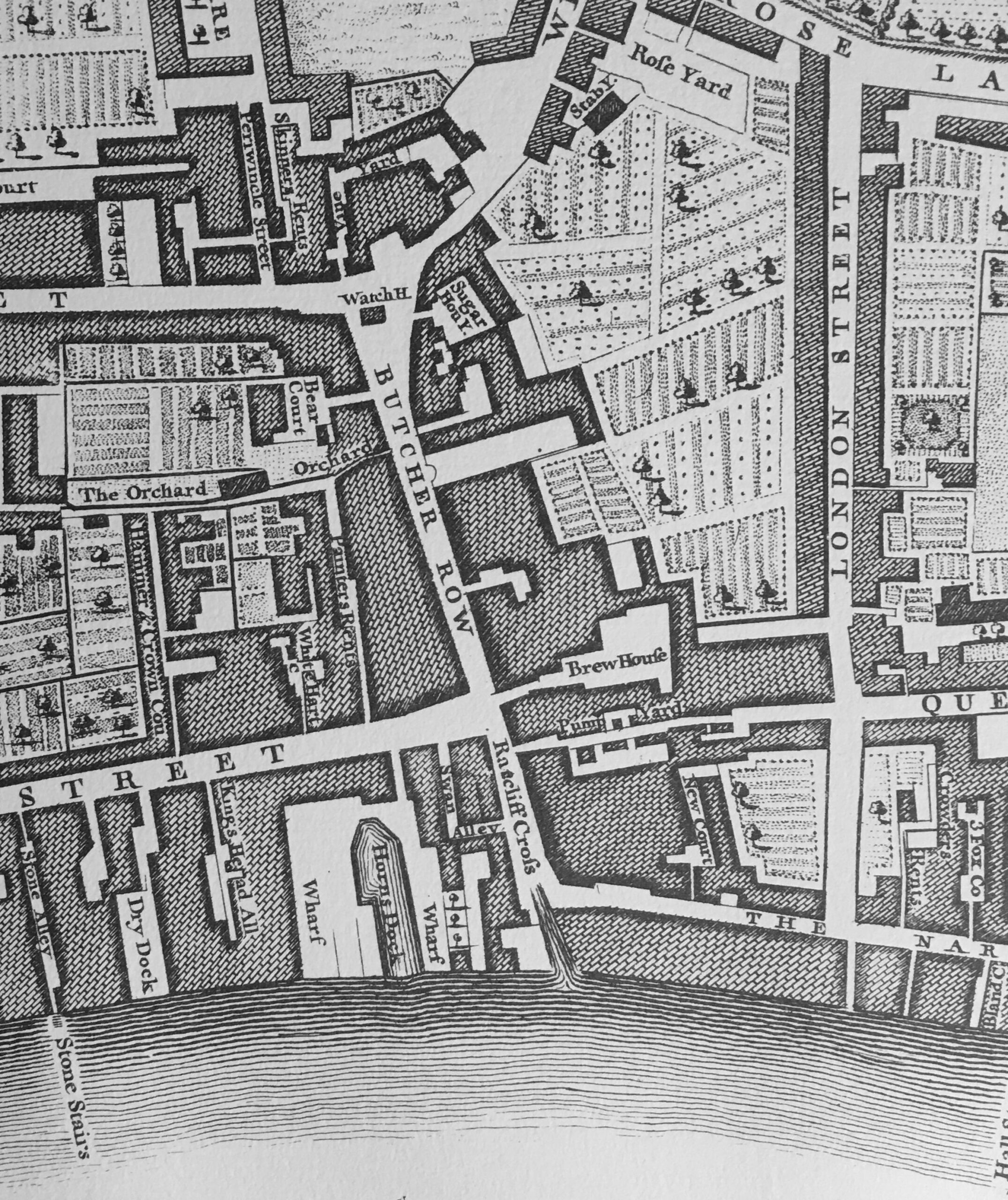
Rocque’s 1746 map of London does not name the stairs, but the street leading back from the stairs is called Ratcliff Cross (centre of the map, along the Thames):
The above map also shows Butcher Row leading down into Ratcliff Cross, and there is a Watch House shown at the junction between Butcher Row and where the road to Stepney is off to the right, and the road to the City on the left.
A Watch House also confirms that this was an important route between Mile End, the City and the river.
The stairs appear to have been in use in the 16th century, and were probably much older. Although I cannot find an early, verified reference to this, Ratcliffe Cross Stairs were alleged to have been used by explorers and adventurers of the later half of the 16th century, such as Sir Hugh Willoughby and Sir Martin Frobisher.
Sir Hugh Willoughby was a soldier, who took command of an expedition funded by the Muscovy Company, to find a north east passage along the northern coast of Russia, to the Far East. Willoughby, along with his crew would die in the attempt.
Sir Martin Frobisher was a sailor who made three attempts to find the north west passage to China. He survived all three expeditions, but failed to find a way through from the Atlantic to the Pacific.
I have found references to Ratcliffe Cross being used by 16th century adventurers such as Willoughby and Frobisher in a number of books on London and in a series of newspaper articles on the history of east London in the East London Observer in 1912.
There is also a plaque in the King Edward VII Memorial Park in Shadwell, next to the air vent / old pedestrian access to the Rotherhithe Tunnel:
Just a note on spelling – the hamlet and the stairs seem to be referred to by both Ratcliff and Ratcliffe. I am using the version with an “e” at the end as this was the spelling used for the Wonderful London photo.
There are a couple of points here regarding the reference to famous adventurers leaving the stairs. They were just the boarding point where they would have got onto a smaller boat to be rowed to their ship which was either moored on the Thames, or at Deptford.
Locations along the Thames were also not the last place in the country that they would have set foot, as these expeditions frequently stopped at places such as Plymouth to take on any final provisions and to pick up and leave final messages.
There is also a question as to whether any reference to Ratcliffe Cross refers to the stairs, or to a cross.
There are multiple references to there being some form of cross near the stairs which was used as a place to receive a blessing before departing, to make proclamations, and as a place from where news could be spread.
The cross appears to have been just north of the stairs, and at some point along Butcher Row.
Again, referring back to the maps above, this would have been a good location for a cross given the convergence of roads, and the road running from Mile End, through Stepney and straight down to the stairs.
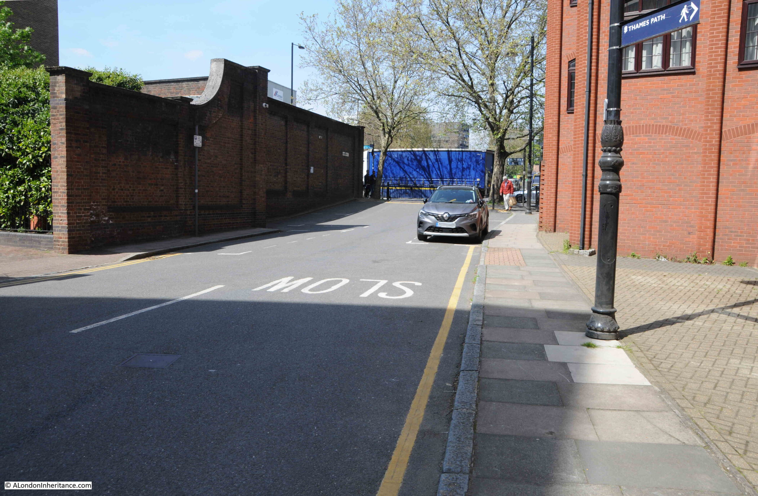
The following photo is looking north along the short stub of Narrow Street (that was Butcher Row) up to where the Highway joins the Limehouse Link Tunnel. Butcher Row continues north across the Highway.:
The cross was in place in the 18th century as the poet and playwright John Dryden has one of his characters mention having heard a ballad about the Protector Somerset being sung at Ratcliffe Cross.
There are also references to the cross being lost or demolished in the 18th century, and in the early 20th century there were attempts at setting up some form of commemoration of the cross, for example from the Shoreditch Observer on the 26th of July, 1913:
“The Borough Council in January last resolved to request the London County Council to consider the question of the commemoration of the site of ‘Ratcliffe Cross’ on the ground that the spot witnessed the departure of mariners in the time of Elizabeth.”
And from the East London Observer:
“The Council are aware that the question of a suitable perpetuation of the historic ‘Ratcliffe Cross’ has been recently referred to, and in this connection we beg to report that we have under consideration a communication from Mr. C. McNaught, dated 7th, December 1912, urging that some sign, signification, or memorial thereof should be placed on the pillars of the Ratcliffe entrance to the Ratcliffe and Rotherhithe Tunnel. We think that the suggestion embodied in the forgoing communication is one which should be supported, and therefore, we recommend that the London County Council be requested to give effect to what Mr. McNaught suggests in this matter, and that Mr. McNaught be informed of the actions taken.
Councilor Maynard could not see why a memorial of Ratcliffe Cross should be put on the most modern structure of Rotherhithe Tunnel. He did not think the London County Council would agree to it.
Councilor Brennan was in favour of the memorial, pointing out that the tunnel was the nearest spot to the site of the Cross.”
The above text is interesting, as it shows the conflict between commemorating old London on the latest infrastructure, and it also implies that the cross was not right by the stairs, rather towards where the Highway junction with Butcher Row is now located, as this is close to the entrance to the Rotherhithe Tunnel.
The Mr. McNaught mentioned in the above article was Charles McNaught. He appears to have been a local historian, and wrote a series of articles in the East London Observer titled “Roundabout Old East London”.
He seems to have been rather cynical about some of the well known historians who had published books about London. In one article, he writes that “When Sir Walter Besant and his lieutenants came down to Ratcliffe a little more than a dozen years ago, they found at first that the hamlet offered little to interest or instruct.”
He also wrote that “When Sir Walter Besant ‘discovered’ this part of London”
He implies that authors such as Besant (who wrote a number of books about the history of London) came to places such as Ratcliffe, with his “lieutenants”, they did not put the effort in to discover the real history of the place, and eventually found out what the locals already knew, whilst claiming to “discover” the place.
So we have stairs that were at an important location, at the end of a direct route from Mile End, that had an important cross close by which had some symbolic meaning for departing sailors, and was used to make announcements (the East London Observer reported that the cross was used to make a proclamation about Queen Victoria becoming queen), dates from at least the 16th century, and was known as a departing point for 16th century adventurers.
Time to take a look at the stairs:
The above photo is an earlier photo to my latest visit, just to show how far the water of the Thames comes in at high water. The above photo was taken when the tide had already been receding.
The photo below is when the tide was out, and shows a set of steps down to the foreshore:
The foreshore nearest to the steps seems to be comprised of a very fine sand. There was a strong breeze during my visit, and walking through this section risked fine sand being blown in the eyes.
Just to the left of where the stairs meet Narrow Street, where the street heads north, there is the PH symbol for a Public House.
In researching Thames stairs, the majority appear to have had a pub located next to the stairs. This would have been a place to wait for your boat to arrive, a place for a first drink after you have arrive back, or just simply had some business next to the stairs.
The pub was the Ship Tavern, and in 1939 “East London’s oldest woman licensee, Mrs. Rose Hannah M. Jenkins (aged 69), who for 40 years was in charge of the Ship Tavern, Narrow Street, Stepney, has died. The Ship was formerly the resort of men from the sailing ships who used to land at Ratcliffe Cross Stairs.”
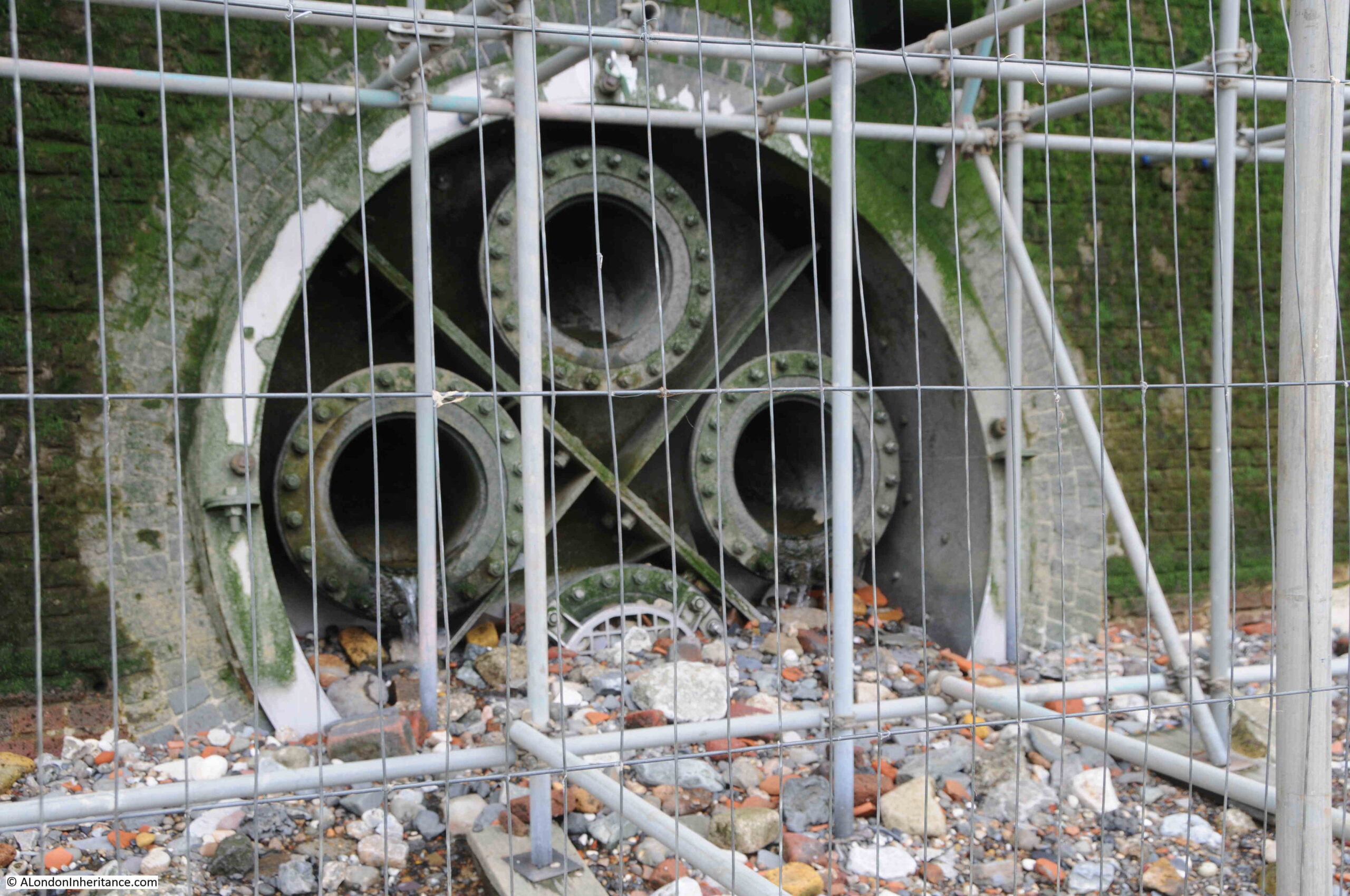
In the above map extract, the stairs do seem to have a causeway extending across the foreshore, and the 1920s photo shows this causeway. Ratcliffe Cross Stairs does have a Historic England listing, with the “Old stone slipway to River Thames” being Grade II listed.
The causeway has today completely disappeared. Whether it was demolished, gradually eroded, or perhaps is covered by the debris deposited on the foreshore by the river, I do not know. It would be good if it was the later.
The view from the foreshore looking towards the Isle of Dogs:
View of the river frontage of the buildings that face onto Narrow Street:
Foreshore looking towards the east:
A short distance along the foreshore showing the construction site for the Thames Tideway Tunnel:
Looking back from the foreshore towards the stairs. The causeway would have run down from the stairs to where I am standing.
The above photo shows a couple of things. Firstly the size of the tidal range on the Thames. I was standing close to the water to take the above photo and at high tide I would be completely underwater by several feet. The green algae on the walls shows the height of the tide.
Also, a bit hard to see, but the height of the foreshore drops off on either side of the stairs. The foreshore is covered in stones, the remains of bricks, bits of wood and concrete, and I do wonder if parts of the causeway remain below the surface.
I checked in my copy of the Port of London Authority book: “Access to the River Thames. A Port of London Authority Guide, Steps, Stairs and Landing Places on the Tidal Thames” (published around 1995), and the following table shows the entry for Ratcliffe Cross Stairs:
Interesting that it referred to the stairs as a landing place in 1977 (so still in use), and that the paving had been renewed. The implication was that in 1995 the stairs and causeway were in good condition.
After the post on Wapping Dock Stairs a few weeks ago, I did email the Port of London Authority with a question as to who is responsible for the Thames stairs, however so far I have not received a reply.
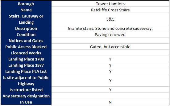
There is also the remains of the industrial use of the Thames. In the photo below there is a large layer of concrete, which may have been a slipway of some sort. The scaffolding is there to support maintenance work on the building above.
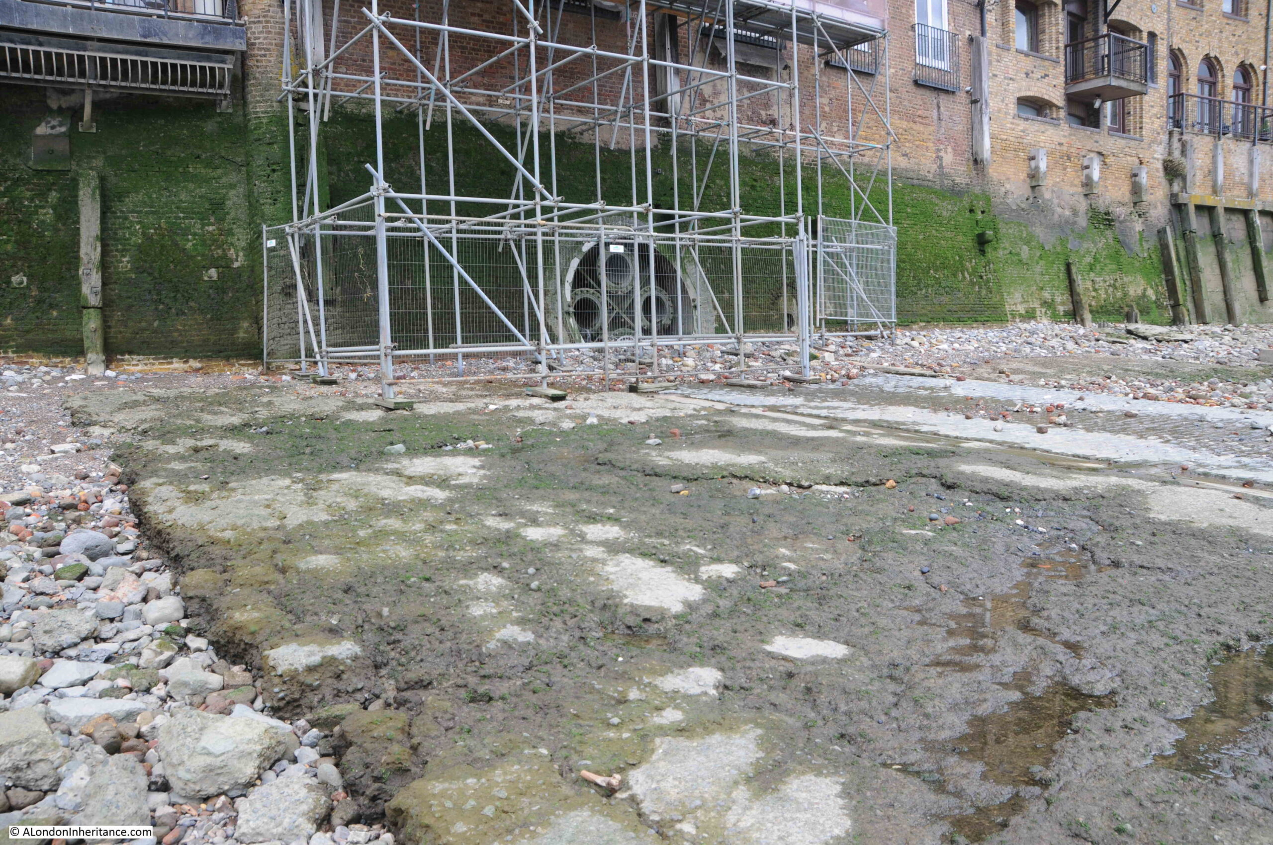
However behind the scaffolding is this large pipe which contains four smaller pipes. There were water draining from the two middle pipes, but I have no idea what they were used for, are they still used, and how far back they go.
There is a cobbled slipway on the foreshore, close by the stairs, and I did wonder if this was the site of the Wonderful London photo, however the slipway uses different stones, and is wider than the one in the photo:
The following extract is from the 1949 revision of the OS map. Ratcliffe Cross Stairs are in the centre of the map, and to the right I have highlighted a feature identified as a “jetty”:
Parts of this jetty are still visible:
Wood and concrete on the foreshore:
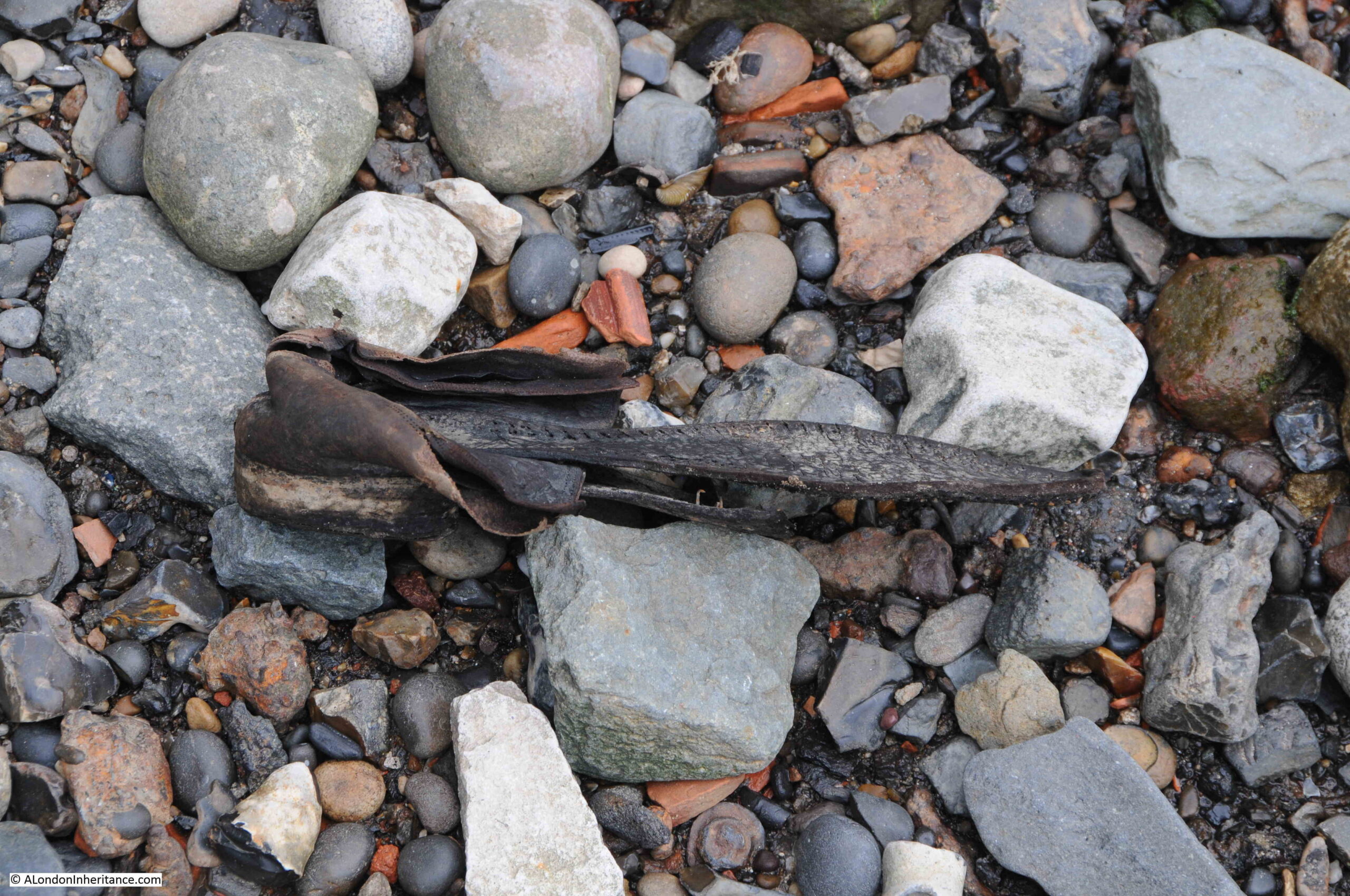
And the remains of an old shoe:
I do have a PLA Thames Foreshore Permit, but very rarely get the time for any serious searching. I have always wanted to find a complete clay pipe, but no luck. This would be a wonderful connection with those who once lived and worked on the river.
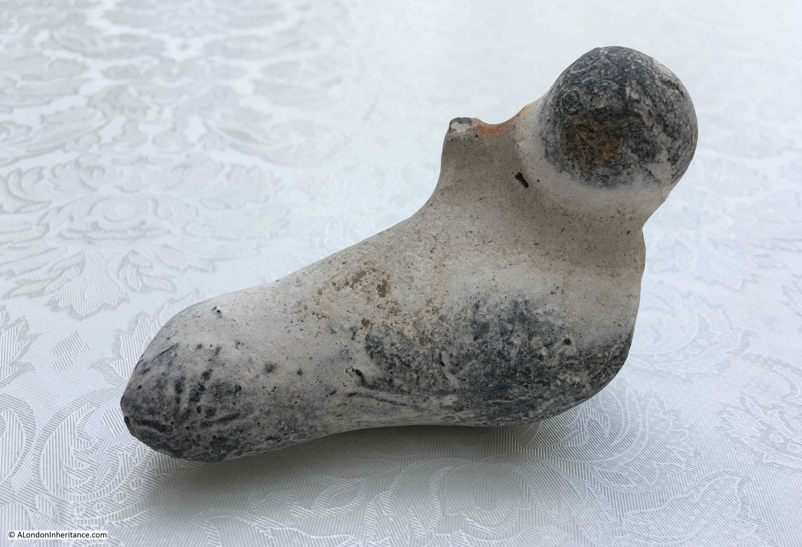
What I did find at Ratcliffe Cross Stairs was this stone bird:
It seems to have been made out of a lump of flint as the stone is exposed where part has broken off, however the overall shape of a bird and some of the decoration and colour can be clearly seen.
I have reported and sent photos to the Portable Antiquities Scheme Finds Liaison Officer at the Museum of London, so await an update as to whether it has any age.
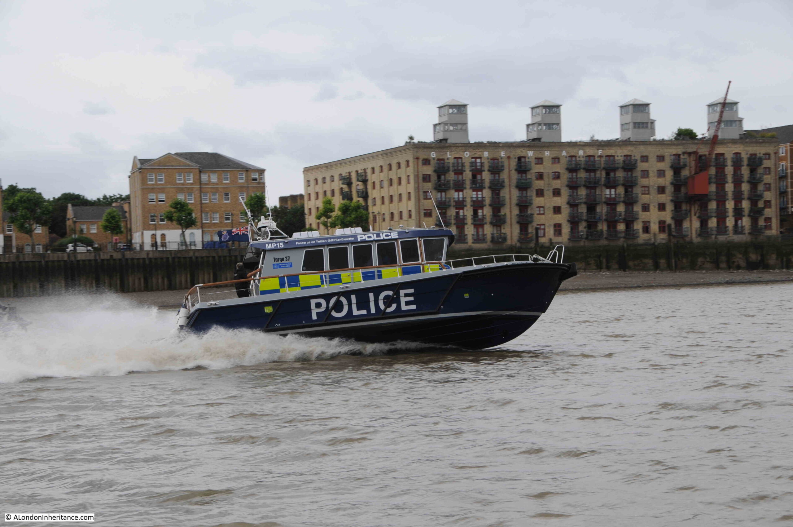
The River Police are still a very visible presence on the Thames, and in 1937, Police Constable Earnest Butters of the Thames Police received £5 “in recognition of his courage in rescuing a five year old boy who had fallen into the river at Ratcliffe Cross Stairs on July 2nd”.
Ratcliffe Cross Stairs deserve more recognition, and more research. There are no plaques or information boards at the stairs to provide any information as to the historic importance of the location (as with all the Thames stairs).
The Ratcliffe Cross, after which the stairs are named is a fascinating bit of lost east London history, and has been added to my very long list of things to try and find out more about.
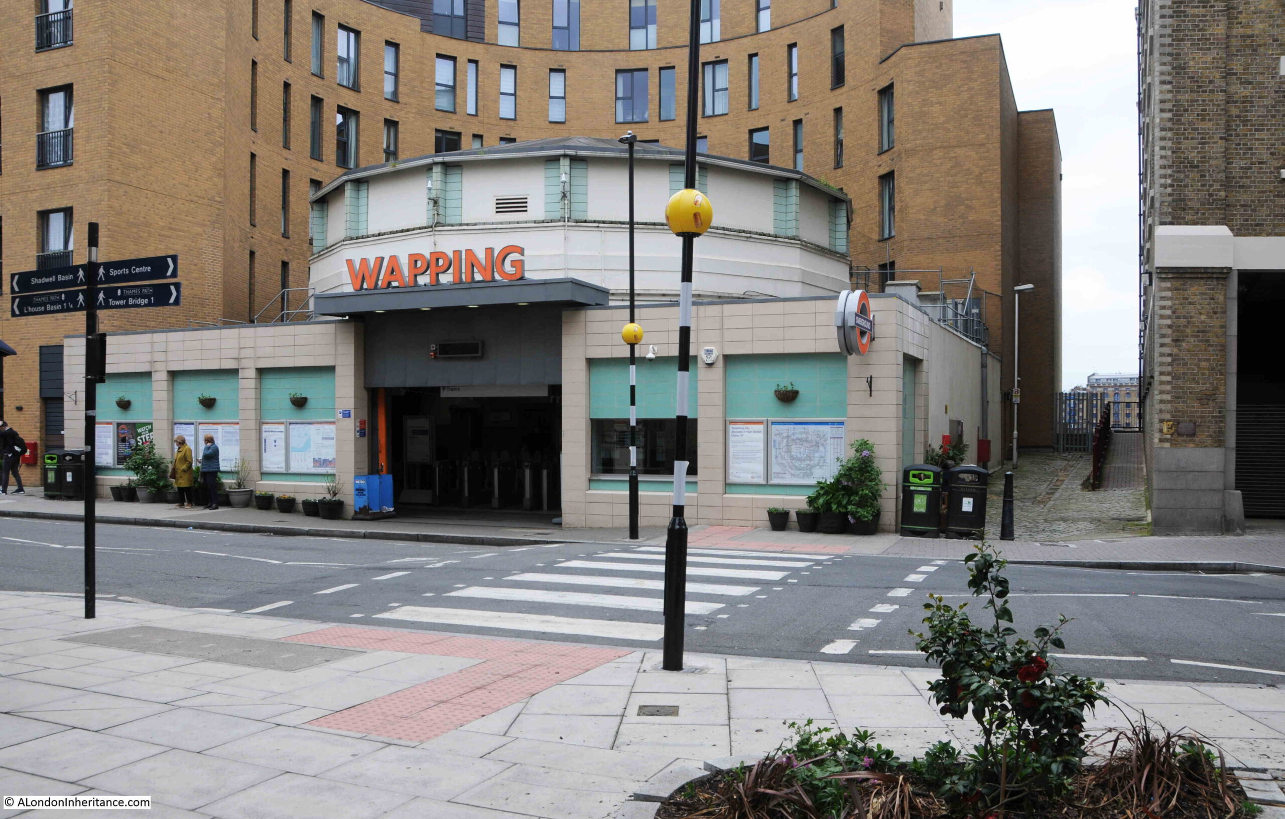
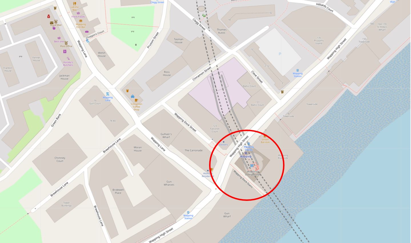
If you have been on my Wapping walk, you will hopefully recognise the following view, and it is a view that I find fascinating as it represents the history of crossing the Thames between Wapping and Rotherhithe..
The main feature in the photo is Wapping Station, a station on the London Overground that from Wapping crosses under the river to the next stop on the route south at Rotherhithe.
I will touch on the station later in the post, but the main focus of today’s post is at the end of the walkway to the right of the station, a walkway that leads up to Wapping Dock Stairs.
If you have been reading the blog for a few years, you will realise I have a strange fascination with Thames Stairs.
Not so much the physical stair, although these are really interesting, historical structures, rather what the stairs represent.
For centuries, these were the main interface between the land and the river. If you were travelling up, down, or across the river you would use one of the Watermen who would cluster at the base of the stairs, to row you to your destination.
If you were leaving London, you would reach the boat taking you to your destination via a river stair, or if you were arriving back in London, you would return to the land via the stairs.
Countless thousands of people have used these stairs. For some, arriving at the stairs would be their first view of London, for those leaving, it could be their last view of London.
Many of those who have had to flee the country, for political or religious reasons, would have left the country via Thames stairs. Perhaps leaving in disguise, or in the dead of night to avoid recognition, to catch a boat to take them away from the country.
I have covered many such stories in previous blog posts, and will provide links at the end of today’s post, but for now back to Wapping Dock Stairs.
As with nearly all the stairs in Wapping, Wapping Dock Stairs are old, and date back to at least the end of the 17th century, and are probably much older.
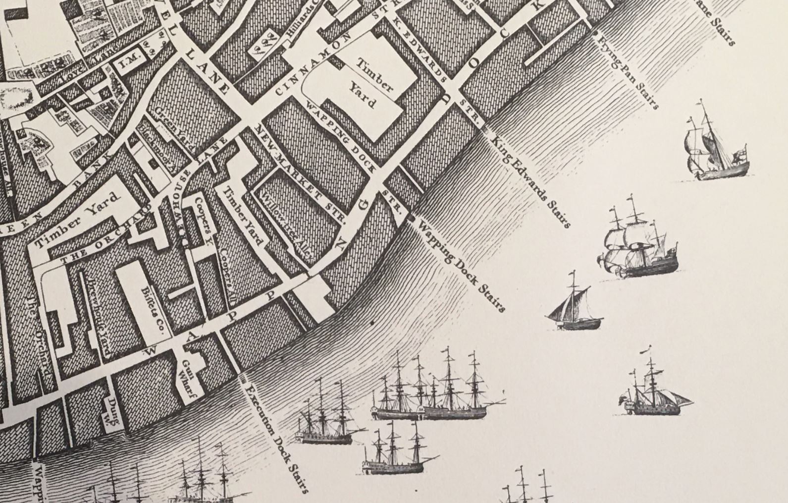
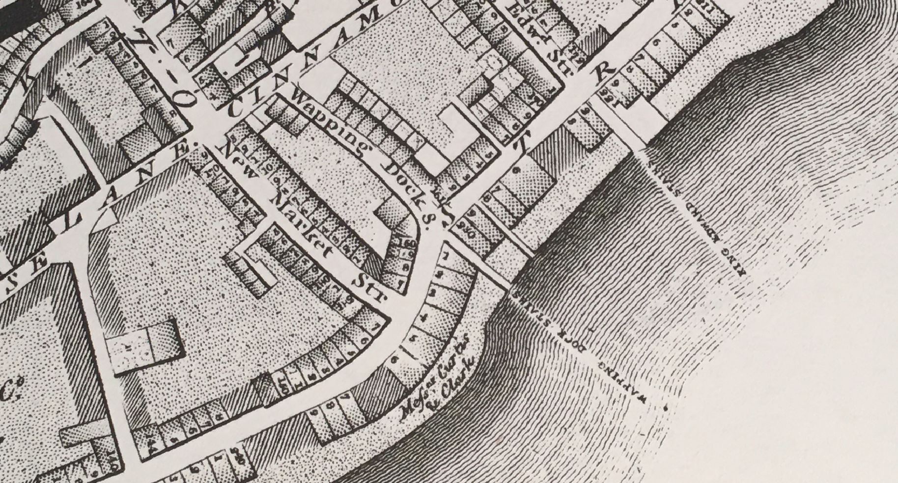
In Rocque’s map of 1746, the stairs are shown in the centre of the following extract, with Wapping Dock Street being the street that leads up to the stairs:
Richard Horwood’s map of London from 1799 also shows Wapping Dock Stairs, and when compared to Rocque’s map, Horwood adds a level of detail with individual buildings lining the streets:
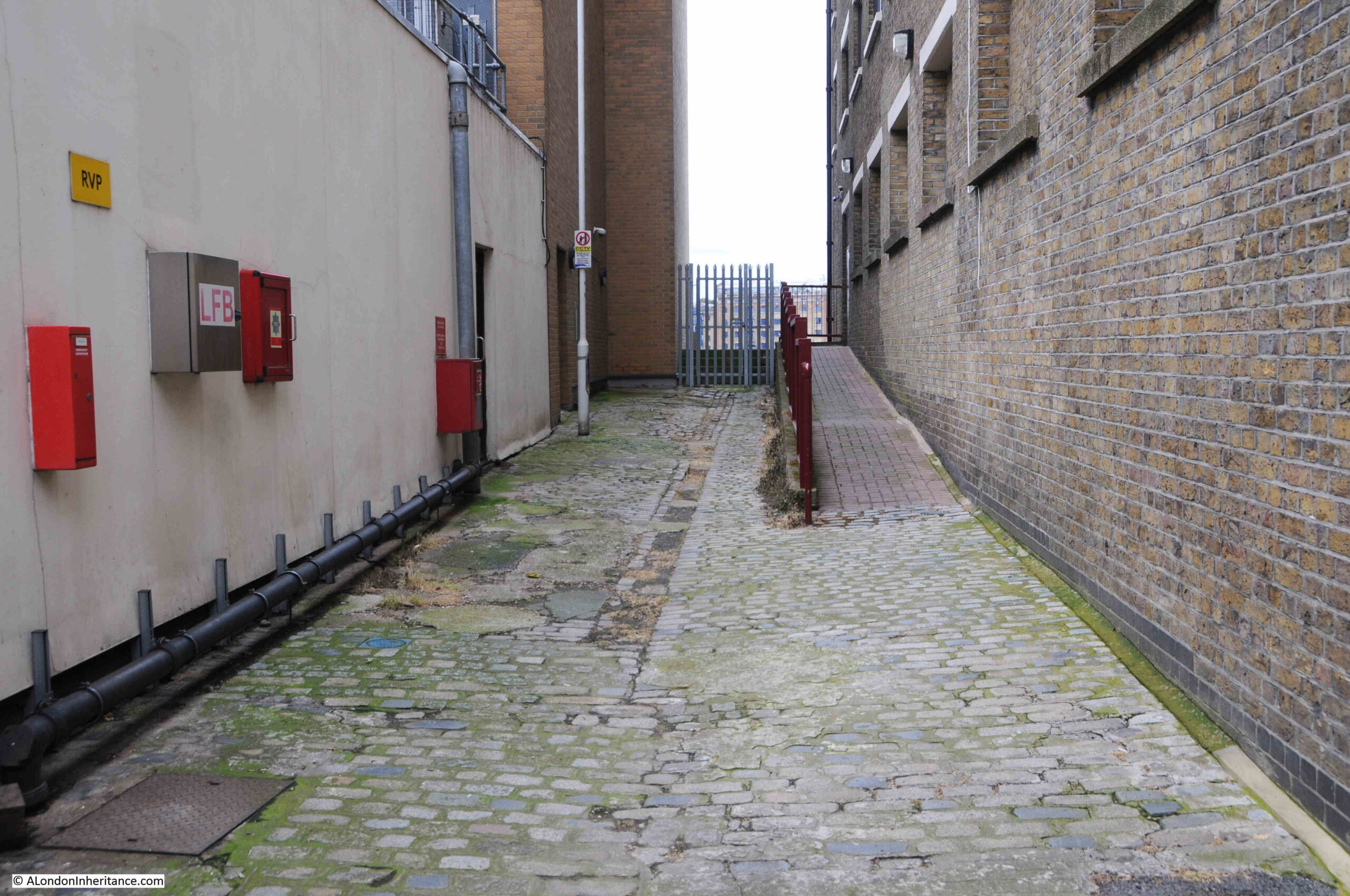
Turning off Wapping High Street, this is the approach to the stairs. The walkway on the right leads to an entrance to the building on the right. The walkway on the left leads to the stairs.
Nearly every set of stairs in Wapping had a pub by the side of the approach to the stairs. Only two can be seen today, the Town of Ramsgate by Wapping Old Stairs, and the Prospect of Whitby by Pelican Stairs.
Wapping Dock Stairs also had a pub, the Swan, and we can get a view of the pub from an advert in the Morning Advertiser on the 2nd of December,1806 when the lease came up for sale:
“A lease for 21 years, and immediate possession, of the SWAN PUBLIC HOUSE, situate at the corner of Wapping Dock Stairs, as eligible a spot for business as any along the coast; it contains in the basement, an extensive dry cellar; on the ground floor, a convenient bar, large tap-room, and good parlour, and three stories above, with a space of about 30 feet square on each floor, divided into numerous well-proportioned rooms; here is an abundance of accommodation for lodgers, as well as ample conveniences for an extensive business; common industry and attention would assuredly beget here a very lucrative trade. May be viewed at any time for a week prior to the sale. Particulars to be had of Mr. Harris, No. 12, Gracechurch Street.”
There are many newspaper references to these pubs by stairs, and so often they offer a glimpse into a story which you really want to know more about, for example, from the Morning Advertiser on the 26th of August, 1808:
“If the next of Kin of Hendrick Steerwell, late belonging to the West India Merchant ship Ranger, dec. will apply at the Swan, Wapping Dock Stairs, they will hear of something to their advantage.”
This brief advert leaves so many questions unanswered. Who was Hendrick Steerwell, where and how did he die (presumably whilst serving on the West India Merchant ship Ranger). What did he leave that would be of advantage to his next of kin, did they benefit, and also what happened if there were several next of kin.
A whole story could be written based on that single advert from 1808.
The advert also highlights that the stairs were a key part of the pub’s location. Rather than giving an address on Wapping High Street, the pub is specifically mentioned as being at the stairs.
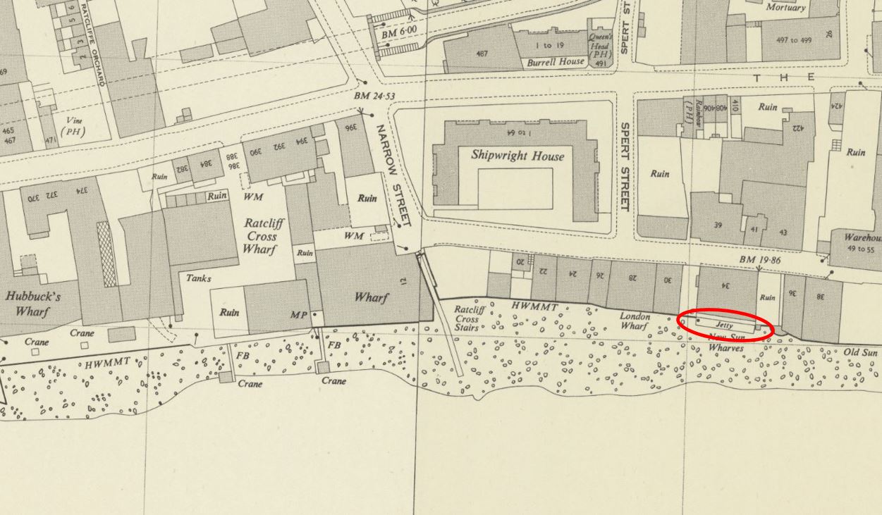
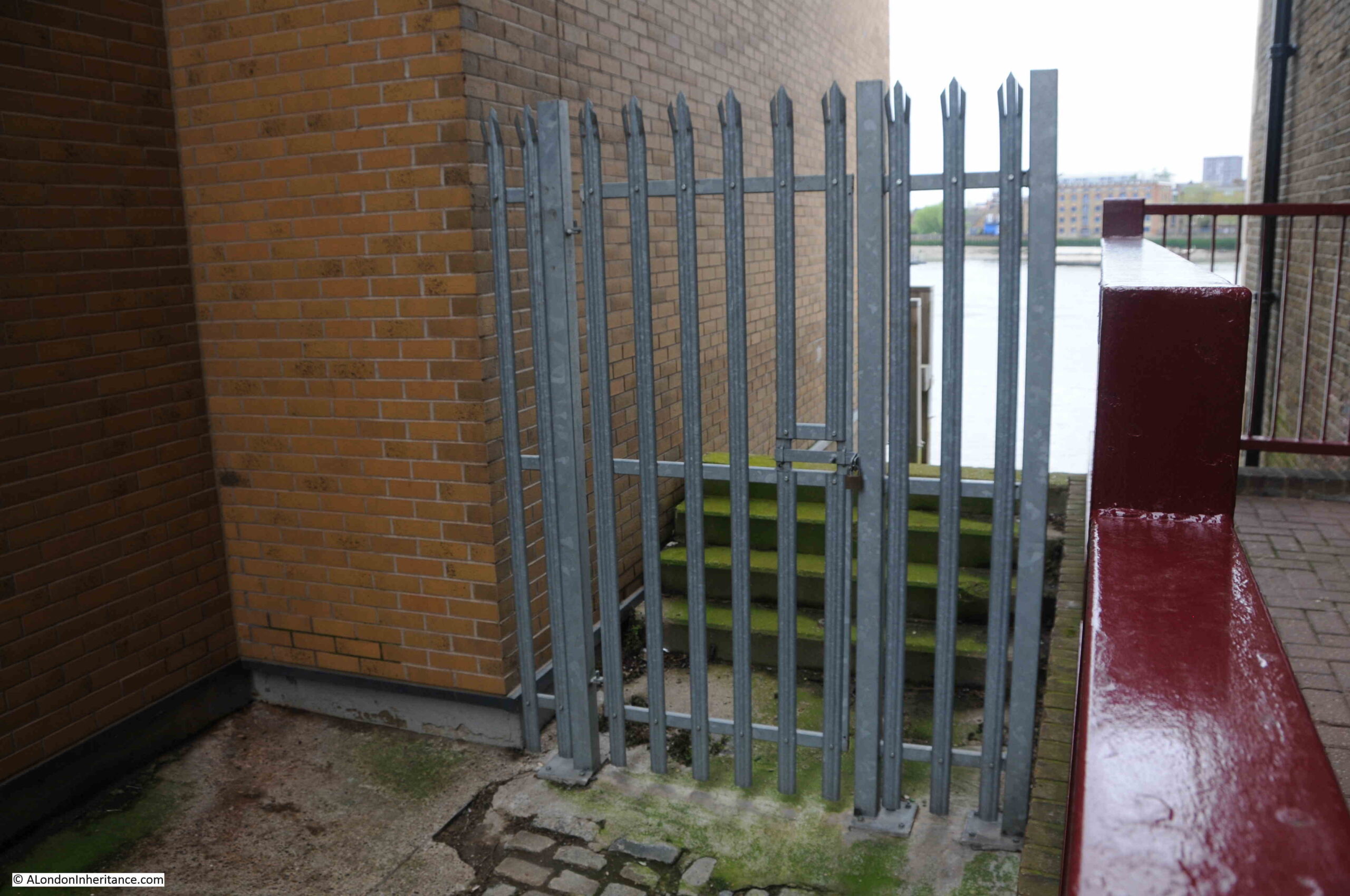
Back to Wapping Dock Stairs, and approaching the stairs there is a strong metal gate preventing any access to the stairs. Behind the gate are the stone steps often found at these stairs which added a bit height and therefore flood prevention from high tides:
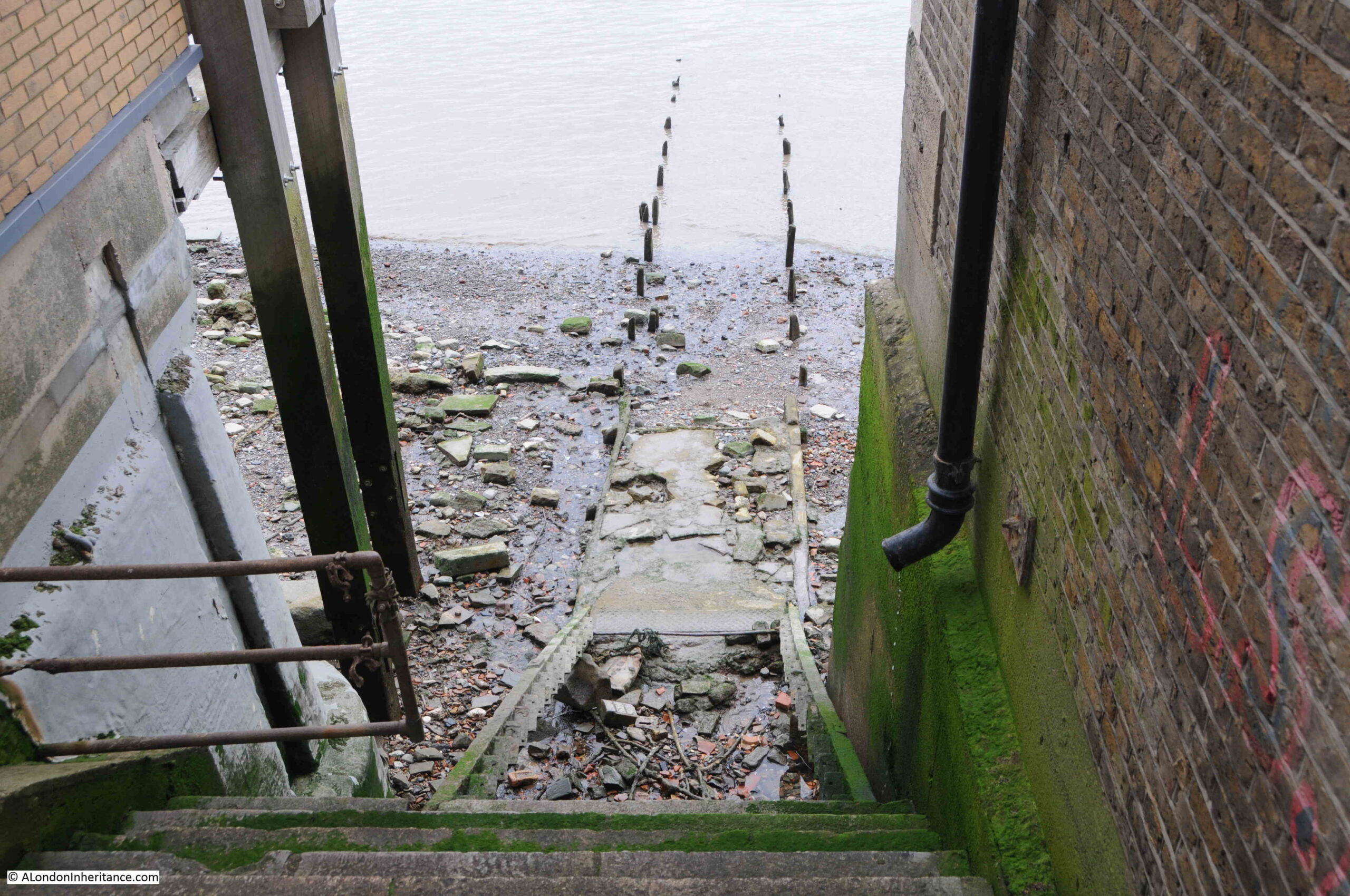
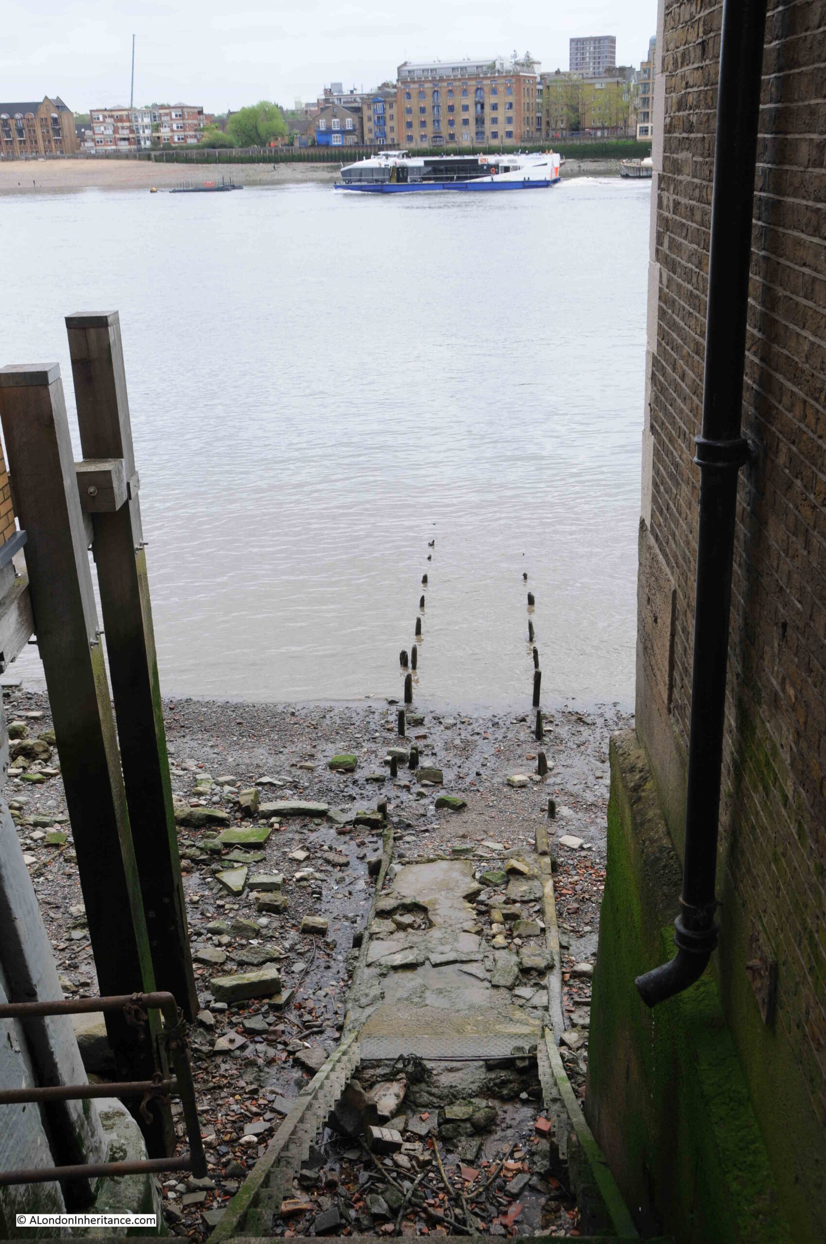
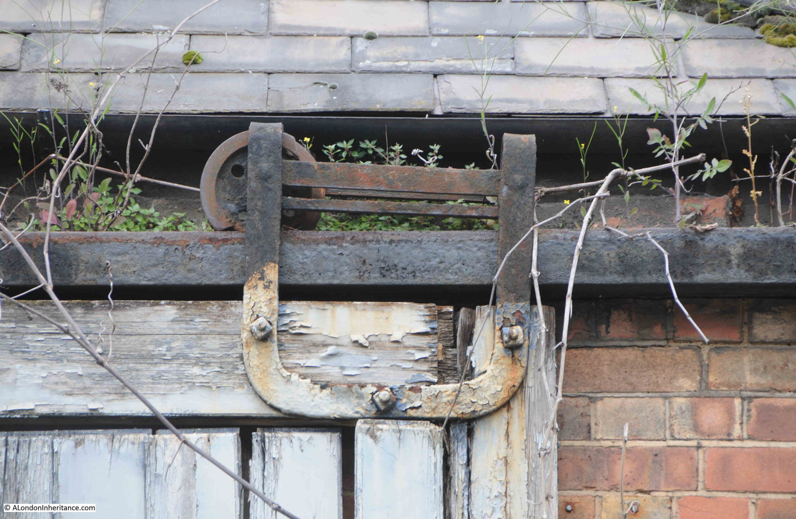
Looking over the gate, and we can see why they were fenced off so securely:
There are stone steps that run down to where a series of wooden steps once led down to the foreshore. These wooden steps have completely eroded away.
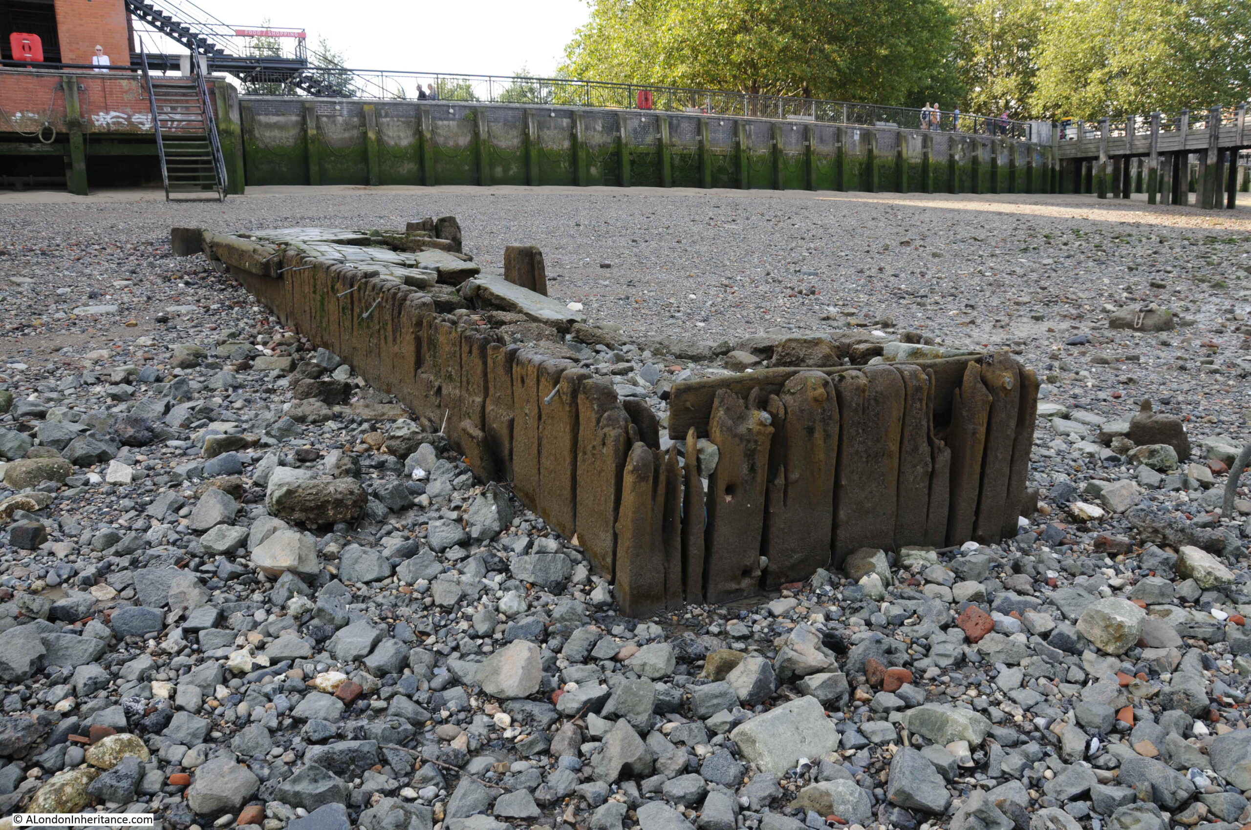
From the bottom of where the wooden steps should have been, the remains of a causeway leads out across the foreshore, into the river.
Much of the causeway has also eroded, leaving only the wooden stakes on either side that would have held the causeway in position.
From the top of Wapping Dock Stairs, we can look across the river to Rotherhithe. This view would once have been full of ships, with ships being moored around the stairs, some of which were often for sale, such as on the 20th of November, 1805 when the following auction was advertised:
“This day, the 20th Instant, at Three precisely, The good Smack Ocean, built at Burnham in Essex, in 1798, is a strong, clinch-built vessel, and is well adapted for the Oyster Trade, a Pilot Boat, &c, well founded in stores. Lying at Wapping Dock Stairs.”
To pursue my rather nerdy interest in Thames Stairs, I have finally got hold of a copy of a book published by the Port of London Authority, titled “Access to the River Thames. A Port of London Authority Guide”, with the sub-title of “Steps, Stairs and Landing Places on the Tidal Thames”:
Although the book is not dated, I believe it was published around 1995.
It covers all the steps, stairs and landing places on the part of the Thames managed by the PLA, the tidal Thames, and covers from Richmond down to Southend.
There is an outline map, based on the area covered by a PLA chart for sections of the river, with the stairs along that stretch of the river marked and named.
There is a table for each set of steps, stairs and landing places describing key features of each. I copied the details for Wapping Dock Stairs into the following table:
The categories for each set of stairs, landing places etc. in the book are the same, allowing them to be compared.
For Wapping Dock Stairs the stairs are described as having a broken causeway and wooden stairs. This probably means that the wooden stairs were part there, but in the following 30 years they have disappeared completely.
Bathing is dangerous, and public access to the stairs is blocked by a fence which the London Borough of Tower Hamlets will remove when the stairs below Mean High Water Mark are made safe.
I have always wondered about responsibility for these stairs. The London Borough of Tower Hamlets were responsible for putting in the metal gate, but are they responsible for the stairs down to the foreshore, or is it the Port of London Authority who, along with the Crown Estate are the primary owners of the foreshore.
I have emailed the PLA asking who is responsible for the stairs, it will be interesting to see the reply.
The tables for all stairs, from Richmond to Southend list whether the stairs were a landing place in 1708 and 1977. Wapping Dock Stairs is listed as a landing place in 1708, which sets a minimum age for the stairs as over 300 years.
I do not know why 1708 has been used for all stairs, steps and landing places along the tidal Thames. A few quick searches have not revealed any surveys or maps that were made of the whole tidal river in 1708 – probably another question for the PLA.
The Grade 2 listed building that the table states that the stairs are adjacent to is the 1920s Gun Wharves that runs along 124 to 130 Wapping High Street.
I wrote at the start of the post that the photo of Wapping Station and Wapping Dock Stairs show the methods of crossing the river that have been in use for hundreds of years.
In the early 19th century, the increase in the numbers of people crossing the river by boat resulted in a proposal for a foot tunnel under the river.
The result was a foot tunnel where the rail route under the river is today. I walked through the tunnel in 2014, and the following is a brief extract from my post on the tunnel, which you can find here.
A Thames Tunnel was badly needed. It was a four mile circuit between Rotherhithe and Wapping via London Bridge and ferries carried 4,000 people across the Thames every day at Rotherhithe.
Marc Brunel was convinced that a tunnel could be built and had the concept of a shield to protect workers at the face of the tunneling work. A meeting with investors was held on the 18th February 1824 and a company formed with Brunel appointed as engineer.
The shaft was started in March 1825 and all appeared to be going well, however in January 1826 the river burst through, but work pressed on and by the beginning of 1827 the tunnel had reached 300 feet.
As work progressed, in addition to the risk of the river breaking through, there were all manner of problems including strikes, mysterious diseases (the River Thames was London’s main drain, polluted with a considerable amount of sewage) and explosions from “fire-damp”.
The river continued to burst through. On Saturday 12th January 1828 six workman were trapped and drowned and despite the hole being filled with 4,000 bags of clay the project was temporarily abandoned due to lack of funds. The tunnel was bricked up and no further work carried out for seven years.
Work started again on the 27th March 1835 and carried on for a further eight more years.
In March 1843 staircases were built around the shafts and Marc Brunel led a triumphant procession through the tunnel. Marc Brunel’s son Isambard worked with his father during the construction of the tunnel and was appointed chief engineer in 1827, however his work with the Great Western railway took him away from the tunnel during the later years of construction. Marc Brunel worked on the tunnel from start to finish.
As one of the sights of London, the Thames Tunnel was a huge success. Within 24 hours of the tunnel’s opening fifty thousand people had passed through and one million within the first fifteen weeks.
It did not remain a foot tunnel for long. The Thames Tunnel was purchased by the East London railway in 1866 and three years later was part of London’s underground railway system.
View along one of the tracks in the tunnel:
The wall between the two tracks in the tunnel had arches spaced at roughly regular intervals along the length of the tunnel.
When the tunnel first opened for foot passengers, a number of enterprising Londoners set out stalls in these arches selling to those who had come to walk through the tunnel. There were reports at the time of how all these stalls selling food, souvenirs etc. degraded the walk through the tunnel. Low level crime was also attracted to the tunnel.
Looking at the arches in what is now a railway tunnel shows a quality of design and finish that was meant to be seen by people walking through, rather than speeding past in a train.
So in summary, the view across to Wapping Station and the adjacent Wapping Dock Stairs shows:
The means of crossing the river between Wapping and Rotherhithe for hundreds of years by taking a boat from a Thames Stair
The introduction in 1843 of a foot tunnel which offered a new and unique way of crossing the river, and;
The purchase of the tunnel by the East London railway in 1866 and integration into London’s rail network, part of which it has remained to this day
There was another feature that I wanted to find related to the station. Walking slightly in land, along Clave Street, then Clegg Street, where on the corner is this building, part of the landscape of Wapping prior to the development of recent decades:
With some lovely metal fittings that allow the wooden door to be rolled along the front of the building:
Which I suspect have not worked for many years:
At the back of the building, there is a small green space, with a children’s playground in Hilliards Court. At the side of the playground is this structure:
Stand here for a few minutes and you will soon hear the very clear sound of a train, either pulling away from, or slowing down into, Wapping Station. An unexpected sound in this very quiet Wapping green space, coming from an air vent to the tracks below.
The PLA book on Steps, Stairs and Landing Places on the Tidal Thames lists a total of 241 from Richmond to Southend, along both banks of the river – so I have only scratched the surface.
If you are interested in reading about the other Thames stairs I have covered, then:
Today’s photo from my father’s collection is one I scanned a while ago, but had not investigated until planning my guided walked between Bankside and Tower Bridge. It was taken from the foot of Pickle Herring Stairs. a name that will be familiar to readers as I have written a couple of posts about Pickle Herring Street.
The photo was taken at the bottom of Pickle Herring Stairs, looking towards Tower Bridge, with the travelling cranes that lined the foreshore on the right.
The stairs have disappeared in the considerable redevelopment of the area, and the walkway along the river and embankment have been extended into the river, so it is impossible today to be exactly sure where the stairs were located, however by lining up with features on the opposite side of the Thames, I suspect they were roughly where I took the following photo. The perspective is different as I used a wider lens compared to my father’s photo to show some of the nearby features to help with locating the stairs.
To the right is the old City Hall for the Mayor of London, now closed following the move of the Mayor’s office further east towards the Royal Docks.
The above map shows that by the end of the 19th century, the side of the river was lined by warehouses, however the cranes seen in my father’s photo had not yet arrived.
These would be installed during the early decades of the 20th century when the warehouses were expanded, and large cranes were installed to handle the quantity and range of goods that needed to be moved from river to warehouse.
They were called “travelling cranes” as they moved on rails along the platform on which they were built, so they could easily get to the cargo that needed to be moved.
By the 1952 Ordnance Survey map (just a few years after my father’s photo), the jetties had been built on the foreshore, and the travelling cranes had been installed. The following extract from the map shows the length of the jetty which supported the cranes. Pickle Herring Stairs are circled to the left, and the map confirms that my father’s photo is looking at both Tower Bridge, and the end of the jetty (‘Reproduced with the permission of the National Library of Scotland“).
Looking from across the river, the following photo shows where the stairs were located:
What is not clear is what came first, the name of the stairs or the name of the street, or whether they were named at the same time.
I suspect the name of the stairs came first, and this could support one of the possible sources of the name down to the landing of Pickle Herring at this point on the river. however I have no evidence to support this.
What is certain is that both stairs and street are old names.
Regular readers will know that I find these stairs fascinating. Not only the physical stairs (where they remain), but that they can tell us so much about life in the area.
I looked back at some early newspaper articles that mentioned the stairs, and found the following sample from the 18th century.
The first is a report about a fire, a very common event in the warehouses full of inflammable goods along the river:
“15th January 1740: On Thursday night about 11 o’Clock, a fire broke out at Mr. Brooks’s a Hoop bender near Pickle Herring Stairs, opposite the Tower, that raged with such violence that in three hours time above 20 dwelling houses, besides warehouses were consumed.
A young fellow, a Waterman, who had rescued his wife and child,returning to preserve some of his goods, is missing, and supposed to have perished in the flames.
Last night, Joseph Chitty, one of the Candidates for the Borough of Southwark, sent over a present of 20 Guineas to be distributed among the most necessitous of the sufferers by the said fire.”
There were so many suicides along the Thames, and one of the methods used would be to get a Waterman to row you out into the centre of the river, as this very tragic report of a woman abandoned after becoming pregnant tells:
“26th January 1748: Yesterday a young woman took a boat at Pickle Herring Stairs and desired to be ferried over; when the boat came to the middle of the river, she threw down six pence, and jumped over. The Waterman with great difficulty drew her again into the boat; on which she confessed that being far gone with Child by a Noble Lord, and being refused any assistance, had determined her to put a period to her existence.”
Papers were full of so many strange events across the City. One, where someone was tarred and feathered, also ended with what was probably some of the day to day racism which foreign seamen had to endure:
“18th October 1784: Friday the following singular occurrence took place. A seaman arriving after being discharged from a vessel lying off Pickle Herring Stairs, on account of his having rendered himself extremely obnoxious to the rest of the crew, was imprudent enough to return on board the ship, upon which he was seized by some of the men, stripped, and tarred and feathered, with as much dexterity as ever that discipline was inflicted in the Country where it was invented, and still practiced.
In this situation he walked to the Public-Office in Shadwell, followed by an immense concourse of people, and exhibited his complaint before Peter Green, the presiding magistrate, by whole order of several pounds of butter and some quarts of oil, were administered, to clear the man from the disagreeable covering.
During the above operation, proper persons were dispatched by the Magistrate in search of the delinquents and in something more than an hour they brought to the Office the Mate and five of the seamen belonging to the ship on board of which the act had been committed, against whom a charge for an assault was substantiated. The Captain bailed the Mate and four of the men, but the other, a youth about twenty, a native of Nevis, was committed to New-Prison, Clerkenwell.”
The earliest newspaper report I could find was the one from 1740, however the stairs are certainly much older. They appeared on the 1746 John Rocque map, as can be seen in the following extract:
I suspect these stairs went back to the medieval period, or even earlier. Stairs were such an important way of accessing the river, and naming stairs would have been incredibly important, as:
If you were arriving or departing on a ship, you needed to know where on the river the ship would be moored, and the nearest set of stairs to use for arrival or departure. There are plenty of newspaper references where a name of stairs are quoted for the location of a ship;
If you asked a Waterman to row you across or along the river, you would have needed to tell the Waterman the destination;
For sales of cargo or goods, a location was needed to advertise the sale. There are very many adverts over the centuries using the names of stairs to locate a sale;
For events on the river, the stairs provided a reference point, and newspapers used the stairs to refer to the many accidents, deaths, ships departing and leaving, thefts of goods, crimes against people, where press gangs were operating etc.
The unique naming of each individual stair was also important to avoid confusion, so even when stairs almost had the same name, and were in a very similar location, the name always had something to make them unique, for example Wapping Old Stairs and Wapping New Stairs on Wapping High Street.
The name on the token is that of James Acrigg. The only record I could find of him was his marriage in London in February 1675.
The very last newspaper report I found about an event at Pickle Herring Stairs was dated the 16th of August 1928, when “The body of an unknown man aged about 40 was found today floating in the Thames near Pickle Herring Stairs. It is believed the man has been in the water for several hours.”
Following the above report, the story of Pickle Herring Stairs goes silent. They would still have been in use, however this would be much reduced. Better street and underground transport removed the need for a Waterman to row you along or across the river.
Access to ships on the river was now mainly from piers or when ships were docked alongside the infrastructure on the waters edge (such as the jetty seen in my father’s photo).
They were finally lost under the redevelopment of the area between London and Tower Bridges, when the open space and riverside walkway was built and extended out into the river.
I will leave the final words in today’s post to the London Rivers Association, who were quoted in the Illustrated London News on the 1st of May 1996, which reported on their campaign that “The London Rivers Association believes that the Thames should be made better use of for both public and freight transport. ‘Getting in touch with the Thames’ is endeavouring to open up all access points to the river – steps and stairs which once had such distinctive names as Elephant Stairs, Hoy Steps or Pickle Herring Stairs. Some of the Millennium projects are very glamorous, said a spokeswoman for the association. this scheme is more modest and will benefit everyone.”
Too late for Pickle Herring Stairs – but a scheme that I would fully support.
The following photo was taken by my father in 1947, from the south bank of the River Thames, looking over to the north bank, just to the west of the Tower of London (part of which can be seen on the right hand edge of the photo).
The tall building in the centre of the photo is the former headquarters of the Port of London Authority on Trinity Square. Lower, and to the left can be seen a blackened tower. This is the remains of the church of All Hallows by the Tower after the area was very badly damaged by wartime bombing.
Hard to see, but in the very centre of the photo, along the river edge is a set of stairs. I have enlarged the section of the above photo to shows the stairs below:
This was Tower Stairs – one of the many old stairs leading from the land down to the river, described in an 18th century newspaper as “the greatest plying place in all London”.
I have written about a number of these stairs in previous posts, and I must admit to be fascinated by them. They connect two very different worlds, the land and the water, although they are an integral part of both, and for so many people they have been a point of arrival or departure.
Along with City churches, they have been in the same location for centuries. They are a fixed point where we can trace events in the history and life of everyday Londoners.
The majority of Thames Stairs are not that obvious, and people probably walk by without noticing them.
A wonderful project would be plaques alongside to restore the original name of each of these stairs, and perhaps some of the key events that happened at each stair. An initiative to try and reconnect people with the river.
Tower Stairs were an important set of stairs to the river. They were adjacent to the Tower of London and they were to the east of London Bridge, therefore if you were travelling to places along the east of the river, such as Greenwich, by using Tower Stairs you would avoid having to pass through the narrow arches of London Bridge, where the fast flow of water through a narrow gap was always a risk.
The following photo is my 2021 view of the same photo taken by my father in 1947:
Tower Pier now hides the location of the stairs in the above photo, so to find them, we need to cross the river and look for them under the entrance walkway to Tower Pier:
A wide set of stairs remain, although a considerable width of the stairs has been built on to provide support for the entrance to Tower Pier. Only a narrow section on the left of the stairs runs up to street level.
The following photo is looking at the entrance to Tower Pier. The entrance to the stairs is to the lower right of the pier entrance, at the end of the central light section of paving which runs between the two dark sections.
The entrance to Tower Stairs (unfortunately locked), showing the narrow section which leads down to the wider stairs and to the river.
There are numerous newspaper reports about events happening at these stairs.
In March 1793, it was reported that “one hundred and fifty Frenchmen, chiefly officers, who had fled from Dumourier’s army, landed at Tower Stairs from Holland. They gave the most deplorable accounts of the wants and distresses of Dumourier’s soldiery”.
In May 1750, after reviewing the First Regiment of Foot Guards in Hyde Park, the Duke of Cumberland arrived at Tower Stairs , where he took to the water “to go Pleasuring for a few days in the Caroline Yacht”.
In January 1768, the stairs were described in the words I used in the title to this post as “the greatest plying place in all London” which gives some indication of their importance. The same report stated that old houses adjoining Tower Stairs would be pulled down in the spring to make the “landing more commodious”.
Tower Stairs was also the site of the numerous small tragedies that were almost a daily occurrence on the river. In May 1739 “a young lad, about 18 years of age, servant to a Druggist in Wood Street, washing himself in the river off Tower-stairs, was taken suddenly with the Cramp, and drowned, in sight of numbers of spectators, none of whom could be quick enough to save him”.
And in October 1738, “Captain Collier, Commander of a Norwayman, landing at Tower Stairs, upon stepping on shore, his foot slipped, and he fell into the river and drowned”.
Tower Stairs are very old. Although not named, they are shown on the 19th century reprint of the mid 16th century map known as the Agas map (although the original has not survived, only later, modified copies).
The stairs are not named, but in the following extract, look to the left of the Tower of London, and a wide street runs down to the river, where there is a break in the river wall. A man appears to be driving a couple of animals into the river at the point where the stairs are located.
The stairs are shown and named Tower Stairs on Rocque’s 1746 map of London. They appear right on the edge of the page on my reprint of the map so I have not included an extract.
They are also shown on Smith’s New Plan of London, dating from 1816. I have arrowed the stairs in the following extract:
The importance of the stairs can be judged by their location, adjacent to the Tower of London, and where Great Tower Hill meets the Thames. As can be seen in the above map, there was also a small inlet to the left of the stairs, which probably provided additional mooring space for Watermen, and boats loading and unloading at the stairs.
As you have probably seen from previous posts, I use newspaper archives as one of the historical sources when researching posts.
Being newspapers, they have to be read with some care, to try and see through the way the story has been edited and added to by the journalist, however they do provide an account that was written at the time.
There are numerous references to Tower Stairs, so I decided to take a few from the 18th century to see what was happening at the stairs. I have already recorded some local events, but there were four accounts mentioning Tower Stairs that tell of a wider story of life in London in the eighteenth century, based on people who walked along Tower Stairs, so for the rest of the post, four stories about Press Gangs, the Frozen Thames, the Blackheath Chocolate House and when Cherokee Indians visited London.
The Press Gangs
The danger of being taken by a Press Gang and tricked into service in the Navy was more often a risk for those living and working in the streets to the east of the City, however those sleeping in their beds in the City were at risk, but the City of London would always protect their citizens, as this report from the12th of September 1755 records:
“Monday at the Sessions at Guildhall, Robert Alsop, a Midshipman of one of her Majesty’s men of War, was convicted, upon his own confession, of riotously entering the Dwelling-House of Mr. William Godfrey at Billingsgate, a reputable Citizen, and Livery Man of London, at the Head of a Press-Gang, on the 25th of June last, in the Night-time; and for seizing him by the collar, knocking him down, forcibly dragging him through the Streets of London to the Tower-Stairs (with only one Slipper on), carrying him on board a Tender on the River Thames, and confining him in the Hold for twelve hours, without any Warrant of lawful Authority, to the great peril of his Life; when the Court were pleased to fine him £5, and to order him to be imprisoned one Year in Newgate. This Prosecution was carried on by the Directions of the Court of Alderman, at the Expense of the City, in order to vindicate the Rights and privileges of its Citizens, and to prevent such Insolences for the future.”
The City of London was always ready to defend the “Rights and Privileges” of their citizens. I suspect a fine of £5 and one year of imprisonment was a reasonably hard sentence, which also acted as a deterrent to others.
During the 18th century, the Navy was in almost constant need of men to man the ships. The Derby Mercury on the 17th March 1743 described another event at Tower Stairs, when “They press so strong upon the River Thames for Seamen, that not a Day passes but they get a great many Hands, and last Saturday, a Waterman, belonging to Tower Stairs, who had a Protection, was pressed five different times”.
Protection was mainly issued by the Admiralty or Trinity House for specific types of employment, and the bearer had to prove their protection if they were caught by a press gang. This would normally stop a person being taken, however in times of war, even protections were abandoned and almost anyone could be taken.
The 1828 edition of City Scenes by William Darton shows a press gang in operation at Tower Hill. I assume the man at the front is pointing towards Tower Stairs where the unfortunate man is being dragged. A Royal Nay ship can be seen in the background.
Having avoided the Press Gangs, there is another danger in the Thames off Tower Stairs:
The Frozen Thames
Up until the mid 19th century, a period known as the Little Ice Age had been causing very cold winters and periods when warm summers were not always dependable. This period of colder weather began around the 14th century, but the impact on London is well documented in the 17th, 18th and 19th centuries.
Whilst the popular image is of ice fairs held on the Thames, for those who had to work or travel on the river, ice would also present a danger. For those without the sanctuary of shelter and warmth, very low temperatures would also be a risk to life.
News reports referencing Tower Stairs show the dangers of the frozen River Thames. On the 12th January 1740, the Ipswich Journal reported: “On Tuesday Night an adventurous Waterman undertook to carry his Fare, a Woman and a Child, from Tower-stairs to Battle-Bridge, as the tide was coming in; but the Islands of Ice floating down upon them they were drove to the Bridge, where they lay in sight, perishing with the Cold, but out of reach of Relief from any of the Inhabitants of the Bridge, but at last were fortunately carried through to St Mary Overy’s Stairs, and taken up almost to Death. Tis thought neither the Woman nor Child can recover.”
The Bridge was London Bridge when it still had houses and businesses running along the bridge over the river. The relatively narrow arches for water to flow under the bridge caused a fast flow and it was a very dangerous place to get trapped.
In the same report was an indication of the amount of ice on the river “Yesterday morning at Low Water, the Thames was so covered with Ice above Bridge, that several Men walked over from Old Swan to Pepper-Alley Stairs”.
Although prints such as the one above show a scene of celebration on the frozen river, there was a very dark side as the Kentish Weekly Post reported on the 9th January 1740 where “Several dead Bodies float up and down with the Tide and Ice, but none of them can be taken up”.
The winter of early 1740 seems to have been a particularly bad winter for those on and off the river. On the 5th of January “Above 30 boats, twas judged lost between Tower-stairs and Woolwich, most of which were stav’d, but some sunk under the Ice and were not seen afterwards”.
The above paragraph referencing Tower Stairs was at the end of a longer description of the January weather in London: “On Saturday Night, by the Violence of the Wind, several boats were drove from their Fastenings above Bridge near Shore and stav’d to Pieces by the large Flakes of Ice that were brought down by the Tide. The same day in the morning, a Hoy laden with Malt was sunk in Chelsea Reach by the Violence of the Wind.
Two Coasters were drove from their Anchors at Horselydown upon the Sterlings at London bridge, where they lay for some time being beaten against the Houses, to the great Terror of the Inhabitants; but by the turn of the Tide they were luckily carried off, tho’ not without having sustained very great Damage.
Besides the two Vessels above-mentioned, there have been five more since cut from their Anchors by the Ice and drove down against the Bridge, where their Bowsprits have broke into several of the houses of the Eastern side and done great Damages to the Inhabitants.
On Sunday three Boys in a Boat off Rotherhithe were drove away by the great Flakes of Ice and perished thro’ the Severity of the Frost.“
As ever, what is a danger to some is an opportunity for others, although in this instance, without the hoped for outcome:
“Yesterday great Numbers of London Gunners assembled at the several Stairs leading to the Thames, to shoot Ducks, Gulls and Road Geese, which appeared in great Plenty; and many of them were killed, tho’ none could be brought off, the Frost not yet having prevented the Currency of the Tide. Dogs were of no use to bringing them off, the Edges of the Ice on which the birds settled being too weak for the Dogs to get up by.“
As well as freezing much of the Thames, the cold winter of 1740 was a danger to those without the benefit of shelter and warmth:
“A poor man without either Money or Friends, on Friday night last was obliged to take up his Lodging on a Laystall in Tyburn Road, and was on Saturday Morning found dead thereon; although he had covered himself over with Dung and loose Litter.
On Sunday Night last, about nine o’clock, a Man about 60 years was found dead in Pensioners Alley in King-street, Westminster, supposed to have perished for Want; as were also two aged Men by the Waterside at White-friars, and two Women in Old Street, all through excessive Cold and for Want of Nourishment.”
A laystall, referred to in the article was a place where “waste and dung” was deposited.
Now off to a warmer place, as my next stop from Tower Stairs is:
Blackheath Chocolate House
Tower Stairs appear to have been one of the main routes for Royalty when they headed to Greenwich. From the Newcastle Courant on the 8th September 1722:
“This day the young princesses, with a Guard, came through the City, took water at Tower Stairs for Greenwich; dined at Sir John Jennings, and after seeing the Hospital of Greenwich and other Rarities of the place, returned in the evening to Kensington”.
On the 30th June 1736, the Kentish Weekly Post was reporting another Royal visit to Greenwich, which included a visit to a place of entertainment at Blackheath:
“On Saturday evening their Royal Highnesses the Prince and Princess of Wales came through the City from Kensington, and taking Water at the Tower Stairs, went down the River in a Barge, attended by two others, in one of which was a fine Band of Music. Their Royal Highnesses landed at Greenwich, and went to the Chocolate House on Blackheath, where they had an elegant Collation, and about twelve returned back to Kensington.”
The Prince and Princess of Wales were the future King George II and his wife Caroline of Ansbach.
The Chocolate House was a popular place for people to meet, drink chocolate, scheme and plot in the 17th and 18th centuries. The chocolate drink was very different to the type we would drink today. It was heavily sweetened, and would be flavoured with spices and fruits.
There were several Chocolate Houses in London, but I was not aware of one at Blackheath, which if not already a popular place, would be the place to be seen after the Prince and Princess of Wales visit.
The article referenced Blackheath rather than Greenwich, so it was not close to the river or in the park, and luckily a series of articles in the Kentish Mercury in 1902 located the site of the Chocolate House, starting with the following article on the 22nd August 1902:
“THE CHOCOLATE HOUSE ON BLACKHEATH: A glimpse of the ‘manners and customs’ of some 130 years ago is obtained in the following paragraphs taken from the Kentish Express of July 4th, 1774 – ‘Friday, the Kentish Society held their annual feast at the Chocolate House in Blackheath, where there was a most elegant entertainment, and it was unanimously agreed to support the Hon. Mr Marsham and Mr Sawbridge to be the Members of the County of Kent at the General Election, being gentlemen of very considerable property in the said county, and independently to support the interest of the same. Lord North’s name was mentioned, that he is tended to offer, but they all declared to oppose him’.
Perhaps some of our readers can identify the site of the Chocolate house on Blackheath.”
The challenge of finding the location of the Blackheath Chocolate House was one that the readers of the Kentish Mercury rose to, and a series of articles followed based on reader feedback. On the 29th August 1902:
“A correspondent says that while he is unable to identify the site of the Chocolate House on Blackheath, he remembers that twenty years ago there was a pond at the top of Hyde-vale known as Chocolate Pond. He suggests that this may offer some clues.”
On September 5th, 1902: “Mr Alderman Dyer appears to put the matter to rest with the interesting statement that it was in The Grove between Nos. 4 and 5, and was a fashionable resort of the period. The beaux and belles of Blackheath much resorted thereto in the days when George the Third was King, for the purpose of drinking chocolate and discussing the scandal of the neighbourhood. The house was subsequently used as a ladies’ school, but was pulled down some years ago.”
The Kentish Mercury declared success in finding the location of the Chocolate House on the 26th September 1902, when “The question of the site of the Chocolate House on Blackheath, with a view to the definite fixing of which we some time solicited information, can now, we opine, assumed to be settled. documentary evidence in our possession goes to show that the site is now occupied by the houses 4 and 5, The Grove, Blackheath.
By the kindness of a gentleman living on Blackheath-hill we have been afforded the opportunity of inspecting a lease dated from 1776, from Mr. John Wilkinson to Mr. Charles Walker, of the property which stood upon the site in question., described in the document, which is mutilated, as in ‘Chocolate-row’.
Mr Charles Walker, aforementioned, is described as of ‘Chocolate House’. That this Chocolate House was a place of fashionable resort and entertainment we have previously mentioned. Proof is afforded by the fact that on the lease there are clauses relating to the use of the assembly rooms for ‘dancing, music and other diversions’. Our informant himself remembers the premises referred to, before the building was pulled down for the erection of those at present standing.”
The article also mentions an “Olde House” in Hyde Vale where the footmen and attendants would wait whilst their “masters and mistress were disporting themselves in the Chocolate House” – which gives a good impression of the atmosphere in the Chocolate House.
There were a number of Chocolate Houses in eighteenth century London, with Blackheath being described as one of the five most important. They were:
Blackheath Chocolate House – was much favoured by officers from Woolwich
The Cocoa Tree in Pall Mall, on what is now 87, St James’s, Pall Mall, gave its name to the Cocoa Tree Club, the oldest of existing London clubs. It was famous as a resort for Tory politicians.
Lindhart’s was in King Street, Bloomsbury
The Spread Eagle in Bridge Street, Covent Garden
White’s the most famous of any, was started in 1698, and was at the southern end of St James’s Street.
Having found the location of the Blackheath Chocolate House, there is one more story of those who had at one time passed along Tower Stairs, a delegation from the US, when:
Cherokee Indians Visit London
Reading through newspaper reports mentioning Tower Stairs, I found the following from the Oxford Journal on the 24th July 1762 – a report I was not expecting to find of some rather unusual visitors to Tower Stairs:
“This day the Cherokee King, and his two Chiefs, went in their Coach to the Tower-stairs, and about half an hour after Ten o’Clock, went on board the Admiralty Barge, in which they proceeded down the River to Deptford, Greenwich &c.”
The British had established an alliance with the Cherokee nation early in the 18th century, with both a trading and military alliance. This was important as the Cherokee were one of the major native American tribes and controlled land across what is now the states of Virginia, North and South Carolina, and Georgia.
An earlier Cherokee delegation had visited London in 1730 when a group of seven Cherokee, led by chief Oukanaekah spent time in London and had several meetings with King George II at Windsor Castle. This led to a treaty where the British supplied military equipment and the Cherokee agreed to trade only with, and fight alongside, the British.
The relationship between the Cherokee and British was tense at times, and the British did occasionally attack and burn Cherokee villages.
The Cherokee fought with the British against France and during the American War of Independence.
A member of the British Virginia Militia was instrumental in arranging the visit to London. Henry Timberlake had lived with the Cherokee for a number of months and was asked by Chief Osteneco for an opportunity to visit England and to meet with the King.
After sailing across the Atlantic (during their voyage their interpreter died which caused problems until a new interpreter could be found), they arrived in Plymouth and then traveled across country to reach London, where newspapers described their appearance:
“The Cherokee Indians lately arrived in Town, are tall men, six feet high, dressed in a shirt, trousers and mantel round them and their heads adorned with Shells’ Feather and Ear-Rings, unfortunately their interpreter died in his passage and they can now only express their wants by signs. They are shy of company, especially a crowd. This King’s business here is to pay his respects to our Monarch, with whom he has lately entered into alliance. In his own country, he can raise 10,000 fighting men.”
The following print shows the Cherokee leader, Osteneco (centre) with his two chiefs:
So what would a Cherokee delegation to London do in 1762. It appears they did much the same as a delegation from a country would do in London today. They were wined and dined, taken to shows, met key people such as the Lord Mayor and visited displays of military power.
I have been able to trace some of their itinerary as follows:
11th June 1762 – An Indian King and two Chiefs belonging to the Cherokee Indians arrived in London after landing in Plymouth from America
12th June 1762 – Cherokee Indians met the Earl of Egremont at his House in Piccadilly
28th June 1762 – King of the Cherokees, with his attendants, dressed in the English fashion, walked for some time in Kensington Gardens, and seemed highly delighted with the place. They dined with Governor Ellis.
3rd July 1762 – The Cherokee Chiefs were at Sadler’s Wells, and expressed great satisfaction at the entertainments of the place
7th July 1762 – At Vauxhall where they had a very sumptuous entertainment. The wines first set before them were Burgundy and Claret, which however they did not greatly relish. Others were then placed on the table, when they fixed upon Frontenac, the sweetness of which highly hit their palate and they drank of it very freely
11th July 1762 – Dined with the Lord Mayor at the Mansion House. They seemed greatly pleased with the numerous concourse of ladies and gentlemen who crowded the windows &c. to see them pass
23rd July 1762 – Mr. Montague conducted the Cherokee Chiefs to the Parade in St James’s-Park; they happened to enter the Guard Room just as the Grenadiers were fixing their bayonets in order to Troop the Colour. The formidable appearance of the men and the business that accidently were engaged in threw them into such agitation that it was with the utmost difficulty they were persuaded to advance a step on the parade. They had a suspicion of treachery, were extremely impatient to be gone, and when they got home defined to see no more of those warriors with caps.
24th July 1762 – This day, the Cherokee King and his two chiefs, went in their coach to the Tower Stairs, and about half an hour after ten o’clock, went on board the Admiralty Barge, in which they proceeded down the river to Deptford, Greenwich, Woolwich &c. They were much delighted with the hospital. An entertainment was laid on for them at the Greyhound, and after dinner they saw the park and the Observatory
28th August 1762 – The Cherokee Indians, in a Landau with six horses, visited Winchester Camp; at its appearance they seemed greatly surprised
30th August 1762 – Arrive in Portsmouth and visit the Theatre.
31st August 1762 – They went on board the Epreuve Frigate, and the wind being fair, sailed directly back to America
Whilst in London, Joshua Reynolds painted Chief Osteneco:
Soon after the Cherokee visitors had returned to America, the War of Independence started. The Cherokee nation allied with the British, but in reality this was more against the settlers who were continually moving closer to, and taking parts of Cherokee land.
As part of the War of Independence, in 1776 Osteneco led his forces against the Province of Georgia, however this resulted in the destruction of the towns occupied by Osteneco’s Cherokee tribes. He would then lead his people to the west and he eventually settled in the town that is today Chattanooga in Tennessee.
He died in 1780 at the house of his grandson Richard Timberlake. Henry Timberlake, who had lived with the Cherokee and was instrumental in bringing the delegation to London in 1762 was the father of Richard with one of Osteneco’s daughters being the mother.
After American independence, the British had no interest in the Cherokee nation. The following decades saw frequent skirmishes and battles with the forces of the independent state of America, and they would gradually loose their land and freedoms.
Today, Tower Stairs are hidden beneath the walkway to Tower Pier, however they were one of the key river stairs. Many thousands of people would have walked along these stairs, either passing to or from the river.
Of those thousands, four tell us a wider story of Press Gangs, the Frozen Thames, London’s Chocolate Houses, and when a delegation of Cherokee Indians visited London.
I just wish there was a conspicuous plaque naming these river stairs and providing some information on their history.
For today’s post, I am returning to one of my favourite subjects, the old stairs that lined the river and provided such an important connection between the Thames and the streets of London on both the north and south banks of the river. The stairs for today’s post are Old Barge House Stairs:
In the above photo, there are some modern steps descending from the river wall, just to the left of the large OXO sign. The remains of a wood and stone causeway can be seen to the left of the base of the steps towards the river.
The causeway is all that is left of Old Barge House Stairs. The following view shows the stairs from the opposite direction to the above photo:
The name Old Barge House Stairs comes from their proximity to the King’s Barge House, along with accommodation for the Royal Barge Master. It was here in the time of Henry VIII that the King’s Barge was stored.
The stairs appeared on maps as early as 1720, as shown in this extract from “A Plan of the City’s of London, Westminster and Borough of Southwark”, where Old Barge House Stairs are shown in the centre of the map:
I do like the way that the map shows the boats that were probably used by the watermen associated with the stairs, clustered around the stairs.
If you visit Old Barge House Stairs when the tide is high, you will find just the top of a modern set of metal stairs that run down from the walkway in front of the north western corner of the Oxo building. Visit at low tide, and the causeway that would have once led from the original stairs is visible:
I doubt that the causeway we see today dates back to the time of the above 1720 map. These stairs and their causeways were remade several times over the centuries due to continual erosion by the river, as well their changing importance relative to other river stairs.
What I find so fascinating about these river stairs is that they provide a fixed point between two very different worlds – the land and the river. They are where people moved between the two, and they provided a fixed point of reference to understand what was happening in these two very different worlds.
On the land around the stairs, they would be used as a reference to events happening near-by. This would help people find a location, or the best way to travel. For example, the following advert from the Morning Chronicle on the 5th September 1806 is the equivalent of today using an underground station as a point of reference:
“Oak Scantlings, Mahogany Plank and Boards, and Two Thousand Deals &c. By Mr Farebrother at Mr Gresham’s Wharf (late Gales) near the Old Barge-house-stairs, Narrow Wall, Lambeth, on Monday next at 12.”
Newspapers mainly report bad news, and the River Thames has been the scene of so many tragic events over the centuries. A quick scan of old newspapers reveals an almost daily report of accidents and deaths on the river. It was a very dangerous place, as well as the scene of tragedies such as that reported in the Morning Chronicle on the 8th April 1831:
“On Tuesday evening, about five o’clock, a middle aged French lady, elegantly attired, hired a waterman, named Oxley, belonging to Waterloo-bridge stairs, to row her to the Old Barge House stairs. On the man being about to land her, she desired to return back and proceed to Westminster-bridge. He instantly pulled round, but previous to his arriving near the bridge, he asked the lady which stairs she would like to be landed at? To which she replied the lower one. When nearing them the lady placed her muff and purse in the boat and taking a portrait out of her bosom, and her bonnet off, she precipitated herself into the river before the waterman could prevent her. By great exertion, however, he succeeded in catching hold of her after she floated through the second arch, and by prompt assistance, she was rescued from the death she meditated. She was conveyed into the Swan tap, where every attention was paid her, but she would neither give any explanation of her rash conduct, nor her name or place of residence. her friends, however, by some means, became acquainted with the circumstance and they sent a coach for her, the coachman being desired to drive to Thornhaugh-street.”
And this very sad report from the Kentish Mercury on the 16th February 1847:
“On Wednesday an inquest was held by Mr. W. Carter at the Mitre, Broadwall, Blackfriars-road, relative to the death of a newly-born male child, found under very remarkable circumstances. Mark Marten, a lighterman, deposed that he was proceeding down the river on Friday morning last, and whilst passing Raymond’s-roads on the upper side of Blackfriars-bridge, he saw a market basket floating down with the tide.
He pulled it into his boat, and rowed ashore at Old Barge House Stairs, where he opened it, and found the body of a child wrapt in a piece of flannel, and covered with meadow hay. On the top of the basket was a label, to the following effect ‘to be opened with care, from an old friend’. Witness gave the body to the police, and inadvertently destroyed the label, which in a moment of excitement, threw into a fire. Mr. E. Doubleday, surgeon, said that he had examined the body, which was that of a male child, fully developed. There was sufficient evidence of the child having breathed, but he was unable to say to what extent. The deceased from the appearance of the body, had clearly received the necessary attention at his birth.
The coroner remarked that the fact of the paper being destroyed by the first witness was an unfortunate occurrence as all chance of tracing the guilty party was lost. He left the case in the hands of the jury, who returned an open verdict of Found Dead in the River Thames.”
The above two reports cover some of the more unusual events where the stairs were involved. There were also very many more tragedies at the river in the vicinity of each of the stairs, for example in August 1880 at old Barge House Stairs, 16 year old John Thomas Glue, who drowned after simply going for a swim during his dinner hour. Ten or eleven yards from the bank, he suddenly had cramp, was swept by the tide under a barge near the steps where he drowned.
What would not have been reported in the newspapers are the thousands of people who have used these stairs, using the services of the watermen who gathered around the stairs like taxis in a taxi rank, waiting to take their fare to their destination of choice.
Today, Old Barge House Stairs are found between the Oxo building and Bernie Spain Gardens. The gardens are one of the few places of grassed, open space in the immediate area as this is a very built up area.
The old ITV Studios buildings, IBM Offices and the National Theatre are found to the west. Housing, offices and streets inland. In terms of London’s development, building around Old Barge House Stairs has been relatively recent, with the majority taking place during the 19th century.
For centuries the land around Old Barge House Stairs was part of Lambeth Marsh, an area of land roughly between Lambeth and Blackfriars Bridges and inland to St George’s Circus.
In the following extract from Rocque’s 1746 map of London, Old Barge House Stairs is marked in the centre of the map:
The map shows that by 1746, the land along the river had been built on, however inland it was mainly fields and agriculture. The Tenter Ground was an area used for the drying of newly manufactured cloth. Frames were set up across the field and the cloth was stretched across the frame to dry. If you look on the left side of the map, there is a building marked Dye House, so it is possible that cloth dyed in this building would be dried on the Tenter Ground.
The street running from the left is called Narrow Wall. This street ran from the current location of Westminster Bridge, running along the length of the south bank. The first written mentions of Narrow Wall date back to 1443, and it seems to have been a raised causeway or walkway with the sandy foreshore to the north. The name describes its original appearance as a Narrow Wall which would have helped prevent high tides coming too far inland.
Today, Narrow Wall is better known as Belevdere Road and Upper Ground. This later street name can be seen continuing to the right of the map, with the name again describing the physical characteristics of the street, when so much of the surrounding land was low lying, marshy, and would have been regularly threatened with flooding.
A long street called Broad Wall runs south from Old Barge House Stairs for the length of the map.
The name Broad Wall again defines how this street originally formed. It was also along the line of the western boundary of an area of land known as Paris Garden. The boundary was formed by one of the branches of the River Neckinger, which also seems to have gone by the name of Widefleet.
There was a syndicated article about Paris Garden in a number of newspapers in March 1890, which mention the boundary, and how the stream eventually became a sewer which entered the Thames at Old Barge House Stairs:
“Paris Garden, known as the King’s manor as appertaining to its lord and copyholders, formerly lay in St. Saviour’s Parish, and was famed for its mill, water-courses, pastures and wild plants. In 1670 nearly all of it was taken for the new parish of Christchurch, as constituted under the will of John Marshall, who had died 40 years before. Comprising the ancient hide of Wideflete, and covering nearly 100 acres, it had been given in 1113 by one Robert Marmion to the Cluniac Monastery of Bermondsey, whence, almost fifty years later, it passed to the Knights Templar, who set up a chapelry there, and from them to the Knights Hospitaler of St. John.
In the early years of the fifteenth century it became a sanctuary for offenders. Ultimately passing to Henry VIII, it was granted as dowry for Jane Seymour. Lord Hundens and others, who got the manor from Queen Elizabeth, conveyed the land and manor house to Thomas Cure, a benefactor to the parish. The manor house has been identified with the Holland’s Leaguer, or Nob’s Island, one of the many houses of ill-fame that formerly flourished on Bankside. The moated and castellated ‘Leaguer’ which was kept by one Susan Holland, in 1630, stood south-westwards of the present Falcon drawing dock. Latterly known as Beggars Hall, it was pulled down in making the southern approach to Blackfriars Bridge; yet some authorities question the survival of the original building to that time. The Widefleet was converted into a sewer, having its outlet by Barge House-stairs.”
The outline of streams can be seen in the 1746 map, however these can be more clearly seen in the Agas map which shows London in the mid 16th century. The map does not show Old Barge House Stairs, however the land of Paris Garden is shown as the built and cultivated area in the centre of the map, with Paris Garden stairs to the right of the line of buildings along the river. In the following extract of the Agas map, I have marked the location of Old Barge House Stairs (red circle):
The map does illustrate the number of streams in this part of the south bank, and running south from the future location of the stairs is a street (Broad Wall), with a stream running along the west side of the street, one of the branches of the Neckinger, or the Widefleet, which drained into the Thames at the location of the stairs.
The Neckinger / Widefleet is not visible today and does not drain into the river next to the stairs. Presumably any running water from the stream is now part of the sewer system.
The river walls here are high, protecting the low lying land from the waters of the Thames:
The causeway will gradually erode over the years as the daily tides cover and roll back from the structure. It would be interesting to know if the causeway extends further towards the river wall, under the sand of the foreshore.
Thames stairs are so much more than the physical remains we see today. They are a reference point between the land and river, which help tell a story of the area, and the many thousands of people who have in some way come into contact with them.
The problem with researching these posts, is finding a reference to the subject of a post which raises a whole set of new questions, which I frequently do not have time to follow up. One example concerns a potential bridge across the River Thames which would have landed at Old Barge House Stairs.
In 1862 the London Gazette reported on the incorporation of a new compnay, for the making of new bridges over the River Thames. Application was being made by the new company for a new Act that the company was intending to bring before Parliament. The Act proposed a range of new bridges, including:
A bridge, to be called the Tower Bridge, for horses, animals, trucks and passengers across the River Thames. Works to commence at Irongate Stairs near the Tower of London, and to terminate at Horseleydown Old Stairs.
A bridge, to be called St Paul’s Bridge, for horses, animals, trucks and passengers across the River Thames, commencing from the foot of St Paul’s Steam-boat Pier and terminating at Mason’s Stairs, Bankside.
A bridge, to be called the Temple Bridge, for horses, animals, trucks and passengers across the River Thames, commencing on the north side at a point distant 100 yards or thereabouts in a south-easterly direction from the commencement of the Temple Steam-boat Pier near Essex Street, and terminating at certain Stairs called Old Barge-house Stairs at the end of Old Barge-house Alley
As well as the above, the Act also proposed the New Chelsea and Battersea Bridge and the Wandsworth Bridge.
Tower Bridge would be built, however construction was not started for a further 24 years after the above Act.
St Paul’s Bridge continued to be a proposed solution in the early decades of the 20th century, but was never built.
As well as the 1862 Act, a Temple Bridge was proposed in the 1943, Abercrombie County of London Plan, published by the London County Council, but would also not be built.
Today, there is a short stretch of Barge House Street from Upper Ground to behind the Oxo building, and there is a stretch of Broadwall from Upper Ground to Stamford Street, so some of these old street names, and reminders of the history of the area can still be found when walking today.
The subject of this week’s post is one of the earliest of my father’s photos as it dates from 1946. The negative is 75 years old and is not in that good a condition. The scanned image needed some processing to get it to the state you see below, and it is still rather grey with poor contrast.
The photo is from Cherry Garden Stairs, Bermondsey, looking along the river towards the City, with the dome of St Paul’s Cathedral visible through Tower Bridge.
The same view today, with the dome of St Paul’s Cathedral in exactly the same place, however a very different river scene (the perspective looks different due to the very different camera and lens combinations used).
In 1946, the river bank was lined by warehouses, wharves and docks, with cranes along the river. A large number of lighters and barges are moored in the river, and directly in front of the camera, which would have been on the foreshore of the river.
In the 2021 photo the towers of the City are visible to the right, along with the Shard on the left. There are no more working warehouses, wharves or docks, and traffic on the river is today very different.
The river is though still used to transport construction equipment to a major construction site. In the 2021 there is a large shed on the left bank of the river, with the metal work of a travelling crane extending from the shed to over the river.
This is Chambers Wharf, one of the main construction sites for the Thames Tideway Tunnel. Chambers Wharf is one of the project’s main drive sites, with boring machines transported to the site via the river, and lowered by crane down to the point where the machines drive out, creating the tunnel.
Chambers Wharf was one of the many wharves between Tower Bridge and Cherry Garden Stairs. The following map is from the 1953 edition of London Wharves and Docks, and the left of the river covers the area from Tower Bridge to Cherry Garden Stairs seen in my father’s photo.
The type of goods that these wharves dealt with are (from the top of the left bank of the river):
Coles Upper Wharf: Bulk grain, flour, cereals
Butler’s Wharf: Tea, rubber, colonial produce, bulk grain, fresh fruit
Sterling Wharf: General, strawboards and wood pulp boards
Chambers Wharf and Cold Storage: All types of food including highly perishable refrigerated dairy produce and quick frozen goods
Fountain Dock: Grabable rough goods, coal, granite, ballast and sand
Fountain Stairs Wharf: General, flour, cased goods
Powells Wharf: Foodstuffs
Farrands and Cherry Garden Wharf: General goods in bags, cases and casks, flour and corn starch
Also in the above map is St Saviour’s Dock, which I will save for a future post.
The list of wharfs does show the considerable range of goods that were being handled in the stretch of the south bank of the river shown in the 1946 photo.
The following extract from the 1949 edition of the Ordnance Survey map shows Cherry Garden Street in the centre of the map, running up to Cherry Garden Stairs, which are at the lower left of Cherry Garden Pier (‘Reproduced with the permission of the National Library of Scotland’).
A pier at the site seems to date from the later half of the 19th century, and Cherry Garden Pier is still there today, although used by a private company with no public access.
One interesting point in the above map, is to the right of the map is the Millpond Estate, a 1930s housing development which can still be seen today. The location of the estate had been the site of a flour mill, mill pond and terrace housing. The mill pond was once part of an extensive irrigation system that ran inland to much larger ponds – lots more to discover around this part of Bermondsey.
Cherry Garden Stairs are one of the many old stairs that provided access to the river. The earliest newspaper reference I can find to the stairs dates from the 25th May 1738 when “Yesterday morning an eminent Shoemaker at Cherry Garden Stairs, Rotherhith, was found drowned in the River Thames”.
The stairs are probably much older than the 1738 reference. Leading back from the location of the stairs (see above map) is a street called Cherry Garden Street. The street is named after a pleasure garden that was here called Cherry Garden.
In volume four of the 1912 edition of the History of the County of Surrey in the Victoria County History series, there is reference to a Jacobean style house called Jamaica House which could still be found in Cherry Garden Street until 1860.
This house appears to have been part of the gardens as in the same volume, there is a quote from Pepys which reads “To Jamaica House, where I never was before, together with my wife, and the Mercers and our two maids, and there the girls did run wagers upon the bowling green: a pleasant day and spent but little”.
Pepys visit is referenced in an article in the Westminster Gazette on the 7th October 1910, which also recalls an inn that was located by the stairs: “Cherry Garden-street, the scene of yesterday’s big riverside fire, occupies the site and preserves the name of the old Bermondsey ‘Cherry Garden’, once a well-known place of public resort. The Cherry Garden was favourably known to Pepys, who recorded his visit there in his famous diary. At Cherry Garden Stairs there was formerly a celebrated inn known as the Lion and Castle, a name supposed to have been derived from the marriage which took place between the Royal House of Stuart and that of Spain. Close by was the even more famous Jamaica, traditionally supposed to have been the residence of Cromwell”.
Edward Walford in Old and New London (1878) doubts the Lion and Castle name originating from a Stuart / Spanish name and prefers the source to be “the brand of Spanish arms on the sherry casks, and have been put up by the landlord to indicate the sale of genuine Spanish wines, such as sack, canary and mountain”.
The Lion and Castle pub seems to have been at Cherry Garden Stairs from the late 18th century to some point around the 1860s. It was not shown on the 1895 OS map.
It may have been that the stairs were used for river access to the pleasure gardens and that was why they took the name of the gardens. Rocque’s map of London in 1746 shows Cherry Garden Stairs (right on the corner edge of my copy of the map):
Thames stairs were so very important for centuries in the life of the river, and for all those who had some connection with the activities carried out on, or alongside the Thames.
As well as providing access to and from the river, Thames stairs were a key landmark. There are hundreds of newspaper references to Cherry Garden Stairs during the 18th and 19th centuries. The majority of these are adverts of ships for sale, for lease, or that were about to set out and were advertising for cargo or passengers.
For example, the Public Ledger and Daily Advertiser on the 8th May 1818 has the following advert: “Has only room for a few Tons of Goods, and will be dispatched immediately. For Gibraltar direct. The fine, fast-sailing Brig PRINCE REGENT, Henry Stammers, Commander. lying at Cherry Garden Stairs. burthen 118 tons. For Freight or Passage”.
Other reports concern accidents, collisions, drowning and bodies pulled from the river near the stairs. Such an incident is recorded in the last newspaper reference to the stairs that I can find, when on the 29th November 1936, Reynold’s Newspaper recorded that a ten year old Bermondsey boy had fallen into the Thames from Cherry Garden Stairs and had drowned.
Thames stairs and pubs also seem to be a magnet for crime. For example, there are reports of passengers being rowed across the Thames and then robbed in, or close by the pubs that were often located near the landside of the stairs.
The tide was in when I arrived at Cherry Garden Stairs to taken the comparison photo. Access to the foreshore is now via a modern set of metal stairs that run over the embankment wall that was built as part of the walkway / tree lined open space that runs along the river. Difficult to photograph without being on the foreshore, but the stairs can be seen at the end of the wall in the following photo:
The walkway to the pier can be seen in the background.
I am sure that my father took the original photo from the 1946 version of the stairs, as it was by standing on the stairs that I could get the dome of St Paul’s Cathedral in exactly the same position. At this distance from Tower Bridge and the cathedral, even a small change in position changed the orientation of bridge and dome.
There is much more to discover in this part of Bermondsey, so it is an area I will be returning to again.