The bridges over the River Thames are key transport links between the north and south sides of the river and closure of any of the bridges can quickly lead to congestion during a busy London day. Today, any closures are normally for short periods of time, however during the last war there was a real risk that one or more of London’s bridges would be put out of action by bombing. Destruction of any of the bridges would quickly impact the day-to-day business of Londoners and would also cause problems for the emergency services and troop movements.
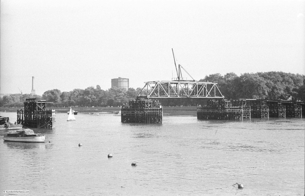
To help mitigate the impact of any damage to London’s bridges, a number of temporary bridges were constructed to provide alternative routes across the river. I featured the temporary bridge between Westminster and the Southbank in an earlier post, and whilst searching through my father’s photos I found a photo of one of the other bridges, the temporary Chelsea Bridge, this one providing a route across the Thames from Chelsea to Battersea Park and built across the river between the Albert and Chelsea Bridges.
The photo was taken in 1947 and shows the bridge in the final stages of demolition with only the centre box girder section in place, along with the full set of piers sunk into the river. One of the chimneys of Battersea Power Station can be seen to the left of the photo, and just to the left of the box girder section of the bridge is the blue gas holder at Battersea, a local landmark built in 1932 and finally removed in 2015.
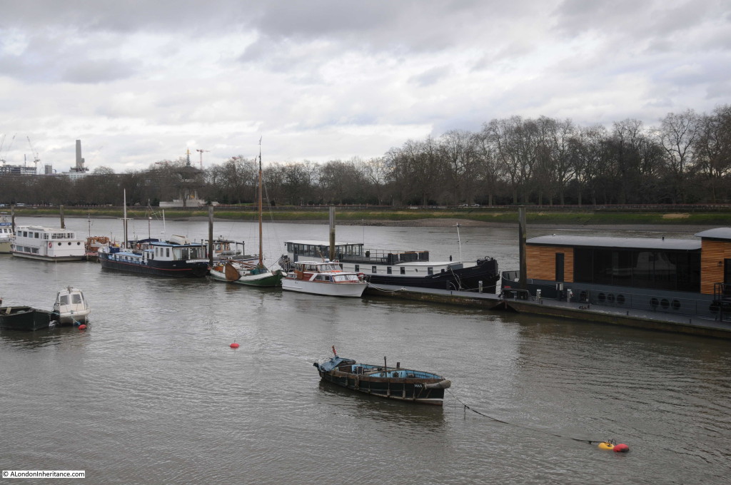
The view from the same position in 2016.
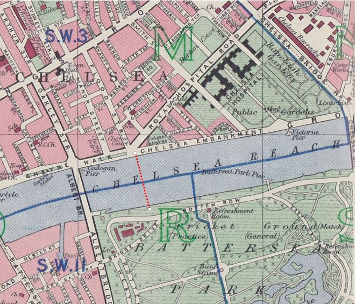
Today, there are no remains of the bridge to be seen, which makes trying to locate the landing point of the bridge rather difficult and I have been unable to find the bridge marked on any maps from the period. Estimating the position from my father’s photo and looking at the roads in the area, I suspect that the bridge landed on the north bank on the Chelsea Embankment at the junction with Royal Hospital Road. The following map is from the 1940 Bartholomew’s Reference Atlas of Greater London. The streets in this area of Chelsea are almost unchanged. I have marked where I believe the bridge crossed the river with a red dotted line.
One of the reasons why a temporary bridge was built in this location was a concern that German bombing would be aimed at the Chelsea Barracks (see top right of the 1940 map) and that the local bridges would also be targeted.
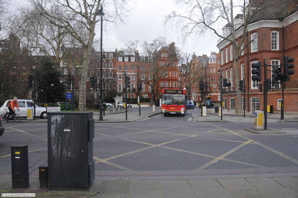
I took the photo below from the Chelsea Embankment looking north into the junction with Royal Hospital Road. It is here that I believe the bridge landed.
Both the Albert and Chelsea Bridges continued in full service during the war, so the temporary bridge was not needed, but it demonstrates the planning that was put in place to ensure that key transport routes would continue to be available, even if the main London bridges were put out of action.


interesting, informative and carefully-researched as always.
Very interesting – yet another piece of history I wasn’t aware of. Have a look at this aerial photo
http://www.britainfromabove.org.uk/image/eaw004907?search=chelsea&start=21&end=32&ref=9
I think you’ve got the location of the bridge spot on.
Barbara
Barbara – that is fantastic, thank you for finding this photo. I use the Britain from Above site in researching locations and had looked for a photo of the bridge but did not come across the photo you have found. I will update the post – thanks again.
Good stuff. A wider view here. http://www.britainfromabove.org.uk/image/eaw009111
My mistake, that second one is the same view, but a few months later!
A lovely and informative post. Thankyou. xx
You can see the bridge on Google Earth — move the timeline back to 1945 and it’s exactly where you estimated it was.
Thanks Kris – I keep forgetting that Google has this feature – very useful.
One of the bases of Sir Thomas Peirson Frank’s Thames flood prevention emergency repairs unit was in Battersea Park (The buildings marked in NW corner of the map) This could be the reason it was located there.
Richard, I knew about the flood prevention plans but did not know that a unit was based in Battersea Park. A logical location, close to the river and lots of open space. Thanks
Hello, I believe that I have a pencil drawing of the temporary WW2 Chelsea Bridge. My late mother lived on Cheney Walk 1940-42 and I believe aquired it then. She may have known the artist personally, she was very fond of it and it hung on her bedroom wall at home all her later life. I have no idea who the artist was, but I understood that he/she drew a little symbol in the corner of the drawing as a signature. I have taken a jpeg of it and would be happy to send it to you. best regards Richard
The excellent book “The Thames at War” by Gustav Milne describes the Thames Flood Unit depot in Battersea Park and this “Emergency Bridge no 3” between the park & Chelsea Embankment. All 3 of London’s emergency bridges were dismantled between 1947-1948, However, I’ve also found a reference to an emergency bridge for the troops based at Chelsea Barracks that was dismantled in 1945. I’m trying to find out if the year 1945 is a mistake or if there was another temporary bridge in the region of Chelsea Bridge???
Thank you for your explanation of this bridge, which I discovered in the “Ordnance Survey Air Photo Mosaics, 1944-1950” (vertical). These are on line in the National Library of Scotland’s amazing map collection; there is a picture with a wide view (which is the one in Google Earth), and also a detailed large-scale picture of most of the bridge: https://maps.nls.uk/view/238418026
They make the position of its connections to the roads at each end clear, but it looks as if there were still (1948) trees blocking the road access. Was the bridge built to be there if needed, but never made usable?
There used to be a K6 phone box in that location. The bridge foot was a fairly standard location for the placement of a phone box in Chelsea. For example Albert Bridge boasted a K2 box on the bridge itself – just in front of the bridge support on the north side. From 1982 to 1986 I visited all the phone boxes in Chelsea every day.
After the war one of the temporary bridges (I do not know which one) was taken to Zambia (then Northern Rhodesia) to provide a bridge across the Kafue River on the road between Livingstone (then the capital) and Lusaka. The bridge replaced a pontoon.
There is a tantalising glimpse of this temporary bridge in the 1946 film “Wanted for Murder” where it is seen through the ground floor window of a house on Chelsea Embankment.
The website “Reel Streets” displays stills of old films in the search for contemporary views of the same scene. They show the view and the 2014 equivalence in their capture 11 of Wanted for Murder. If our host will permit the link, it is here:
https://www.reelstreets.com/films/wanted-for-murder/
Warning: that website is as addictive as A London Inheritance.