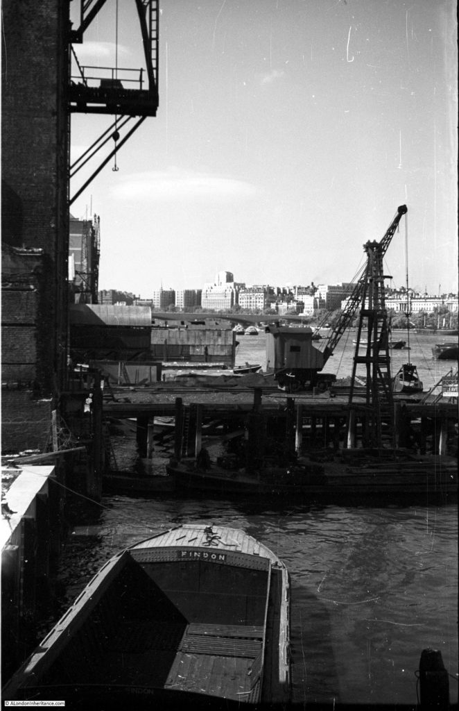
This week I am on the southern end of Blackfriars Bridge, looking along the river towards the west. This was the view that my father photographed in 1952:
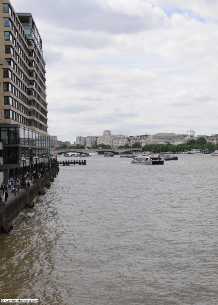
And the view from the same location, 65 years later in 2017:
The buildings on the north bank of the river stand out well in my father’s photo, he had timed the sun perfectly. Shell Mex House, the Savoy, Waterloo Bridge and Somerset House provide a contrast with the south bank of the river.
In 1952, the south bank of the river was still an industrial landscape with warehouses lining the river’s edge and jetties sticking out into the river. All this has long since disappeared and the occasional remains of some of the jetties can be seen above the water, or on the muddy edge of the river at low tide.
Whilst the south bank of the river has changed dramatically, the north bank along this stretch of the river has hardly changed. A closer examination would show there have been cosmetic changes to the buildings, but at this distance the view looks much the same.
Blackfriars Bridge is the second bridge across the river at this location. It was designed by Joseph Cubitt, who was also responsible for the original Blackfriars Rail Bridge, the columns of which can still be seen in the river between the road bridge and the later rail bridge.
It was opened by Queen Victoria in 1869, on the same day as she opened Holborn Viaduct – a perfect illustration of how much development of the city’s infrastructure was taking place in the later half of the 19th century.
The top of the bridge is rather plain. The view to the east is obscured by the Blackfriars Rail Bridge and the new building work along the top of the bridge. To the west is the open view towards Waterloo Bridge along the stretch of the river known as King’s Reach.
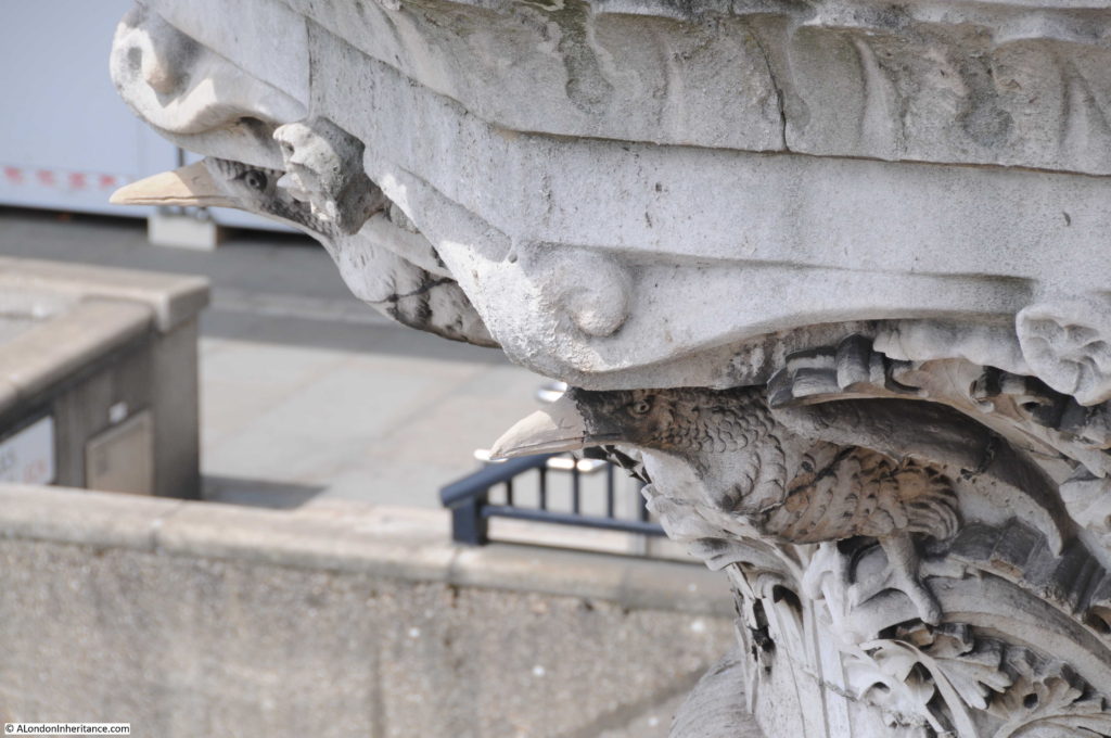
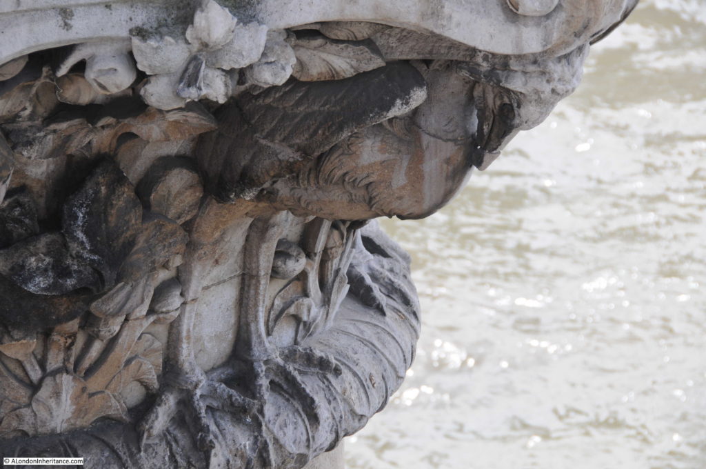
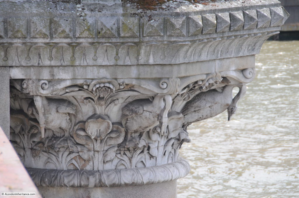
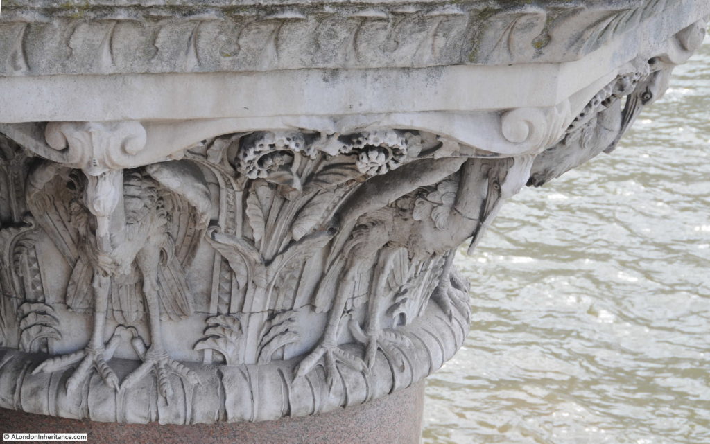
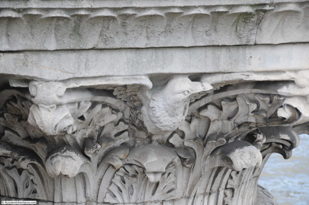
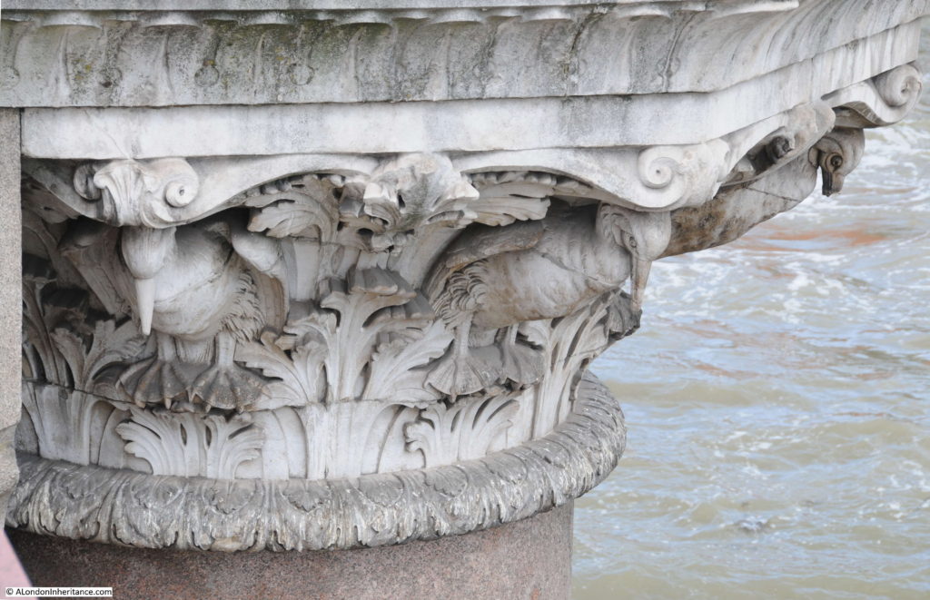
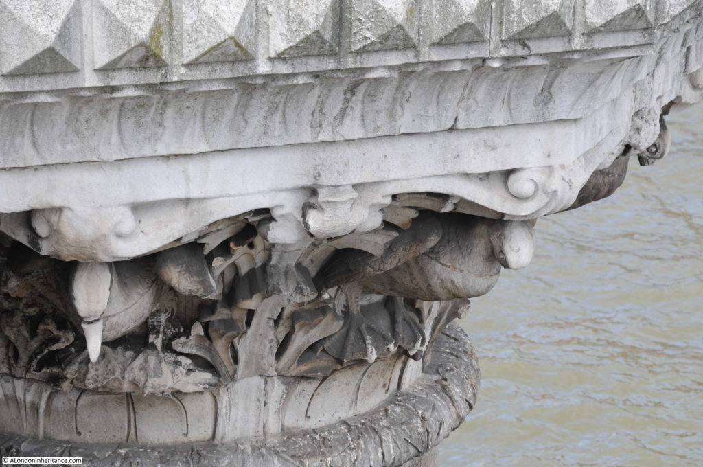
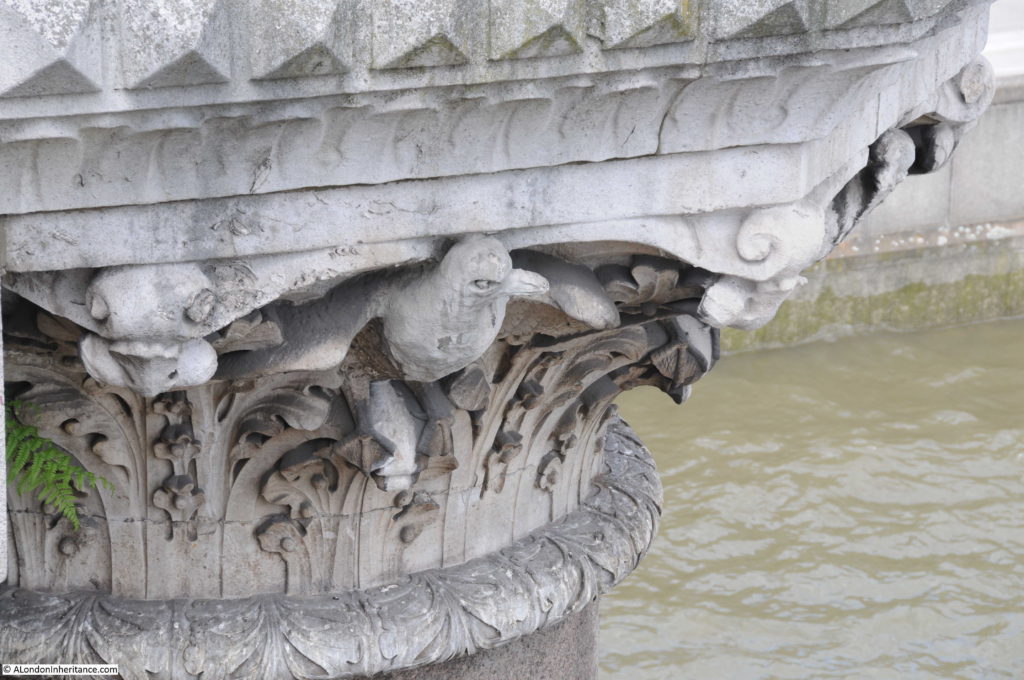
It is always interesting to look over the side of a bridge, and if you peer over the edge and look at the tops of the columns supporting Blackfriars Bridge you will find a series of beautifully carved birds. These were by the sculptor J.B. Philip and are carved in Portland Stone.
The birds along the west-facing side of the bridge are apparently fresh water birds and those on the eastern side of the bridge are salt water birds. I have read that the bridge marks the boundary of salt water penetration up the Thames, however I doubt this is correct, or that there is a clear boundary. The Port of London Authority puts the boundary of river water and salt water at Barking, however this will move up or down river dependent on tides and the volumes of fresh water coming from the upper Thames. Theoretically, the river could have a gradually reducing salt content all the way to the tidal limit at Teddington Lock.
Starting from the northern end of the bridge, these are the four sets of birds that look out over the river, upstream towards the west:
And walking back along the eastern side of the bridge, these are the birds looking along the river towards the estuary and the sea (although their view is blocked by the railway bridge):
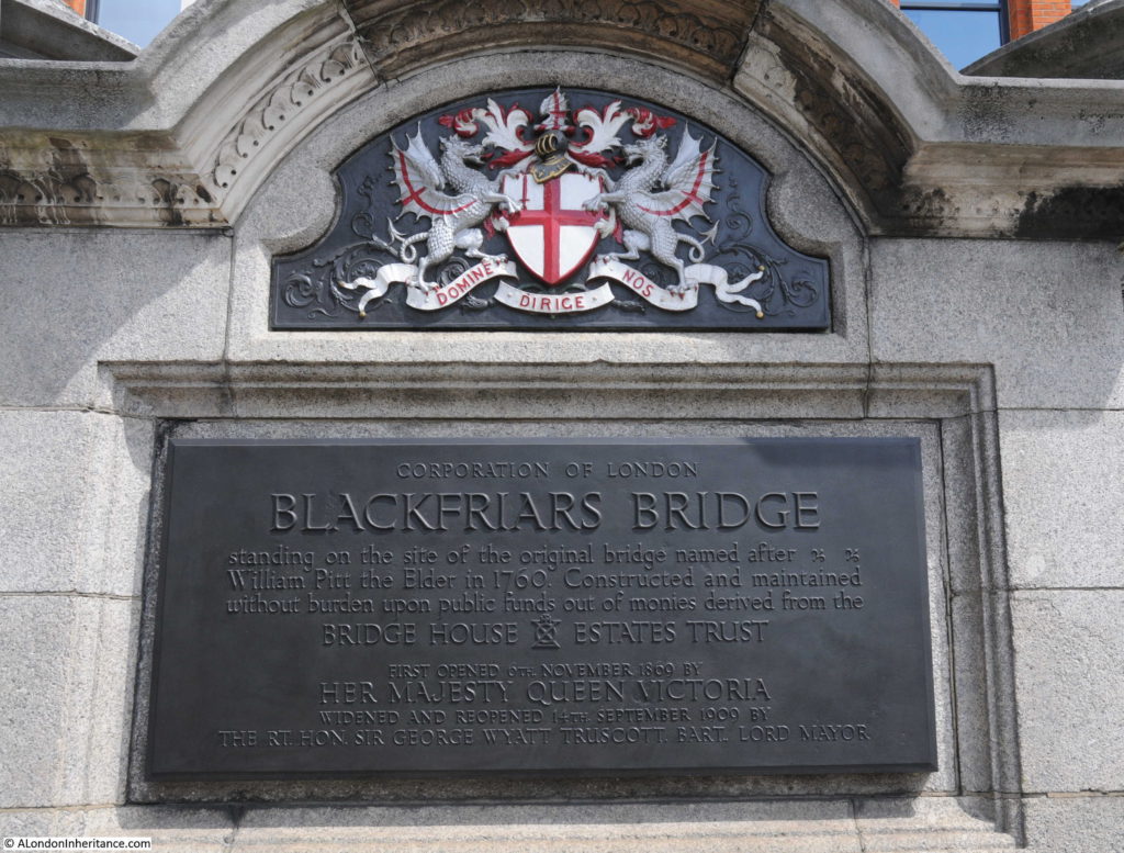
A plaque at the north-eastern corner of the bridge records that the current Blackfriars Bridge is on the site of the original 1760 bridge which was named after William Pitt the Elder who was Prime Minister during the construction of the bridge from 1760 to 1769. The name did not catch on and the location of the bridge gradually gave the name to Blackfriars Bridge.
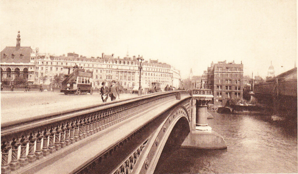
The plaque also records that the bridge was widened in 1909. This was done by adding 9 meters on the western edge of the bridge to allow tram lines to be run across the bridge. The following postcard shows a bus running along the western side of the bridge.
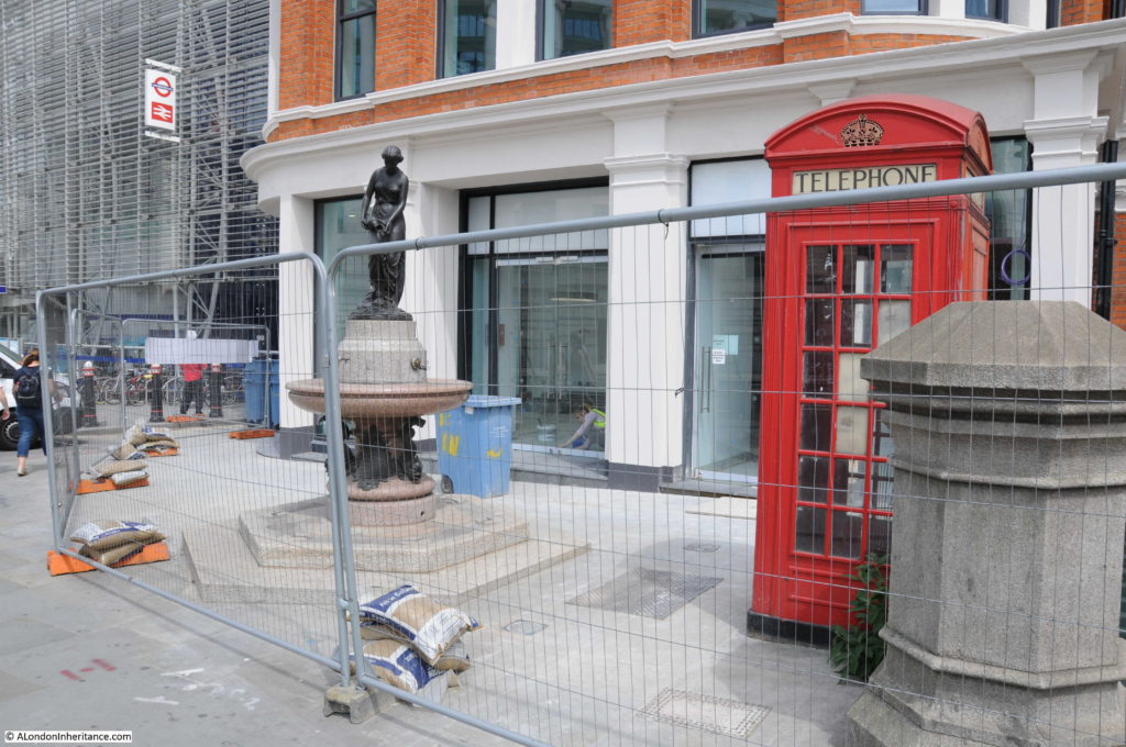
The last time I took photos along the bridge was in 2014 and the building at the north-east corner of the bridge was empty and boarded up. I was rather worried about the wonderful fountain in front of this building after seeing building work and construction hoarding hiding the fountain from the pavement. The fountain was provided by the Metropolitan Free Drinking Fountain Association and erected by the Association in July 1861 by the Chairman Samuel Gurney MP.
The hoarding is now coming down with wire fencing remaining and it is good to see the fountain still looking good after 156 years.
I have always been fascinated by the River Thames. Despite being the reason for London being where it is, and for the success of the City, today the river is often seen either as a flood risk or as a valuable scenic addition to the luxury apartments that continue to line the river.
Blackfriars Bridge is a means to cross the river, however the birds along the edges of the bridge acknowledge the river and the differences between the upstream and downstream sections of the river, pointing inland or down to the sea. The birds show that the river is not just a barrier to be crossed, but a living part of the city’s landscape.

“The birds show that the river is not just a barrier to be crossed, but a living part of the city’s landscape.”
Just perfectly said, David. Thank you.
Thankyou for this post,Admin. Those years travelling to work on the 63 bus over Blackfriars bridge and I never saw those beautifully carved birds! Well next time I’m there I’ll certainly be looking for them. I expect I was always admiring the ornate railway company’s coat of arms on the old railway bridge.
By the way,that looks more like an old ‘general’ omnibus on the postcard, are you sure it’s a tram?
Yes never seen the birds either – amazing what can be missed!
I think you are right about the tram/bus – looks like an old ‘B-type’.
Thanks Jo, you are of course right about the omnibus – I will update the post.
Another great post! I’m amazed that the Portland Stone hasn’t eroded much. The bird carvings still look quite sharp, despite having lived through a time of terrible air pollution.
I used to walk to and from work across the bridge every day in the early ’70s and never noticed the birds or even the plaque! As well as the drinking fountain at the NE corner it is good to see the old red telephone box preserved.
In 1970 I worked on the building of the flats that are immediately next to the SW corner of the bridge next to the 1952 view in your post. I recall that the most prestigous flats (they would be called apartments these days) were initially on sale for the then astronomical sum of £30,000. If only I knew then……..!
Thanks for another thoroughly interesting post.
What a fabulous post! I must look over bridges more often, eyes down. You have mansged to get beauiful delicate colours in the Thames.
I too always hurry over this bridge but next time I will linger and look for the birds. And I don’t recall ever noticing the fountain either. Thanks for opening my eyes to something that has been hiding in plain sight.
Looking that the old and new views, can anyone help me with a question?
In the recent image, the New Adelphi building is two storeys higher, so when was it extended? I’ve never seen it without the arched windows at the rear in any images.
Also, in the new image you can see the rear of the Charing Cross hotel next to the new Price Cooper Waterhouse building. In the old one, there appears to be a near identical building to the hotel on the PCW building site. Does anyone know what this was?
I hope someone can help.
Thanks
W
Thank you for writing these articles – I always look forward to reading them and am never disappointed.
Carolyn
Not a very original comment, I am afraid, but I too have missed the birds completely when going across. Thanks for alerting me and I will make sure to have a look at them next time I’m in the area.
Baldwin
It’s a minor point but to me the most significant change on the north bank is the increased size of the trees which are slowly obscuring the buildings. It’s great that there is more greenery but this is a dilemma that faces many places and I guess eventually they will be felled and replanted. Interesting as ever.
Hi, Thanks for another very interesting article. Just one small correction: what you say about trams being allowed over the bridge from 1909 is correct, but the vehicle shown on the postcard is a bus, probably a London General Omnibus Company K-type.