After the devastation of the last war, there was an urgent need to rebuild and housing was a key priority in post war redevelopment. The construction techniques and architectural style were often very different from pre-war housing and new estates sprung up to replace the old street plan. One such location is the Tybalds Close Estate, just north of Theobalds Road.
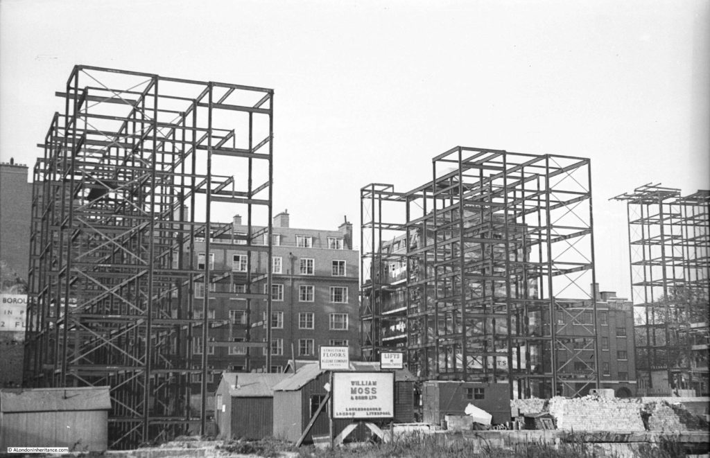
My father took a couple of photos of the first blocks of the estate being built in 1949:
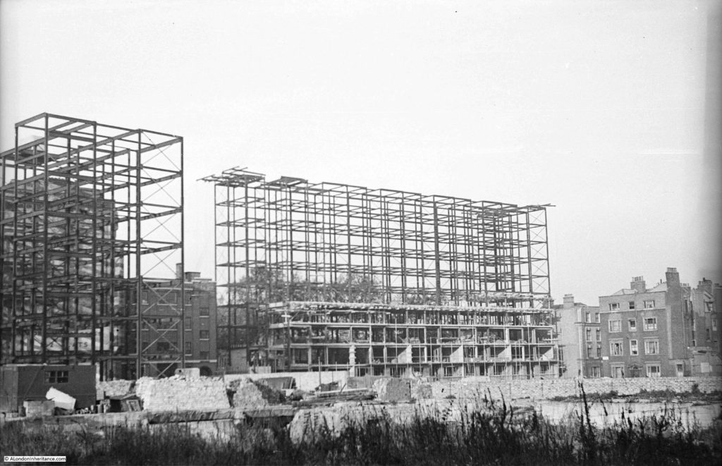
The following photo was taken looking to the right of the above photo and shows the tallest of the first blocks to be built, along with a house in the lower right corner which enabled the location to be identified and also surprised me by showing that you cannot believe that buildings are the age they appear – more on that later in the post.
Approval to develop the Tybalds Close Estate was given in 1946 and the estate gradually grew from the late 1940s (when my father’s photos were taken) through to the 1960s when the final tower block was complete.
The first blocks were of a steel frame construction and consisted of one block of 10 storeys (the one on the right in the above photo) and four 7 storey blocks (two of which can be seen on the left of the above photos with the remaining two being built later).
The architects were Robert Hening and Anthony Chitty. They had started their architectural work in the years before the war when their work included a number of regional airports. One of these airports was at Ipswich where despite being Grade II listed, Hening and Chitty’s airport terminal buildings were demolished in 2005.
After war service, Hening and Chitty reformed their partnership and worked on a number of housing developments, commercial, industrial and schools. As well as the Tybalds Close Estate, Hening and Chitty were also responsible for the housing blocks alongside Cromer Street in St. Pancras. The style of both sets of housing blocks is very similar, although the Cromer Street blocks have been through a complete re-cladding.
The buildings were constructed by William Moss and Sons, a company original founded in 1820 and with a long history as an independent construction company until being taken over by the Kier Group in 1984.
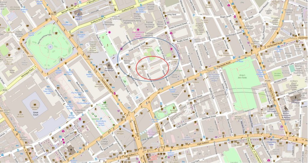
The following map shows the location of the Tybalds Close Estate. The overall estate being roughly within the blue oval, with the original parts of the estate as shewn in my father’s photo being within the red oval. (Map “© OpenStreetMap contributors”).
As can be seen, the area between the housing blocks and where my father was standing was open ground. Originally dense housing, but badly bombed with the area cleared ready for reconstruction.
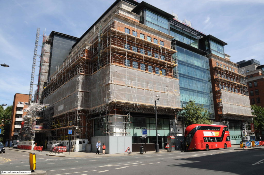
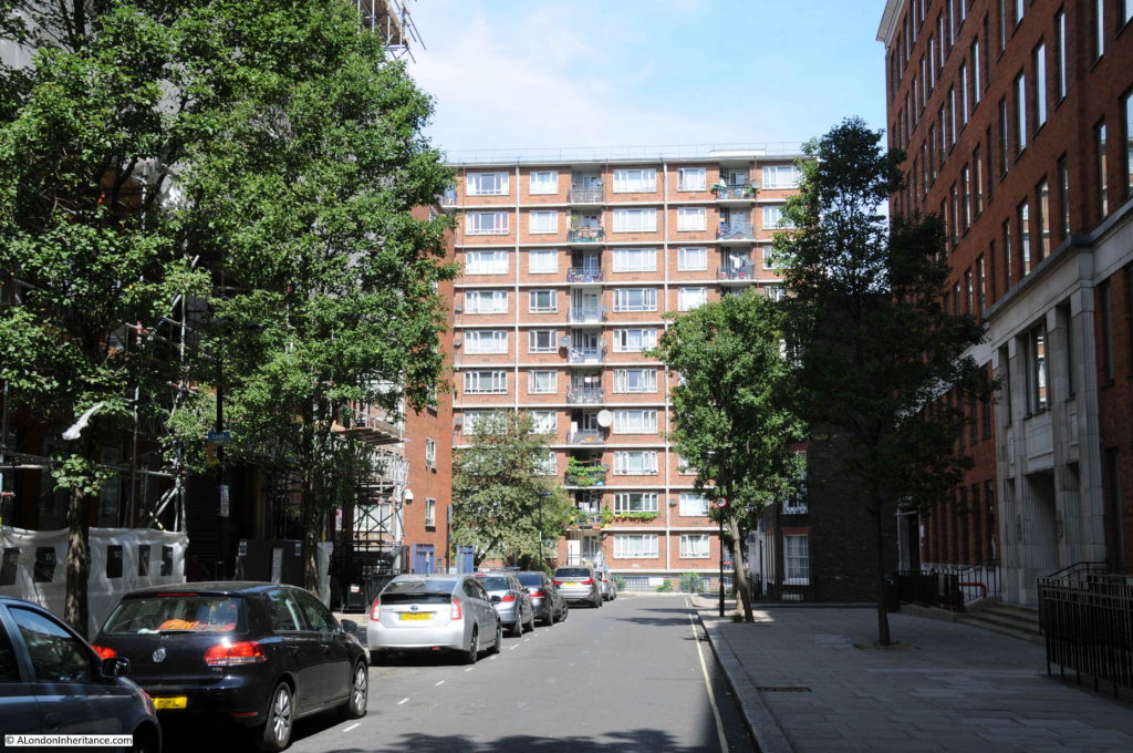
It is impossible to get a similar view today as the area has been completely built over with large office blocks. The following photo is looking across in the general direction of the original photos. My father was standing somewhere under this large office block to take the originals.
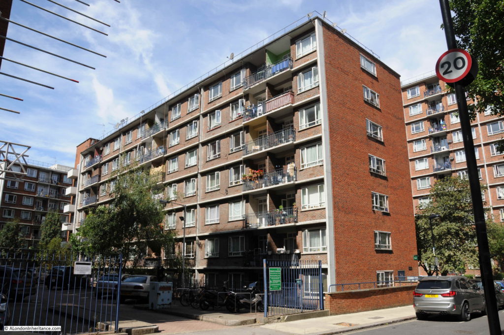
The taller of the blocks on the right of the second photo is Blemundsbury House. This is the view of Blemundsbury House today, looking down Harpur Street.
This is Windmill House. Not yet started when my father took the original photos, but of the same style and one of Hening and Chitty’s designs. To the left of Windmill House can be seen one of the buildings that was also a steel frame in my father’s photos, at right angles to Blemundsbury House.
I mentioned earlier in the post that the location of the photo could be identified by the old house in the lower right corner and that I also found something that demonstrates you cannot always believe what you see.
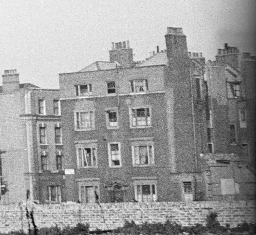
The following is an extract from the second of my father’s photos. It is an enlargement of the house at the lower right corner of the photo.
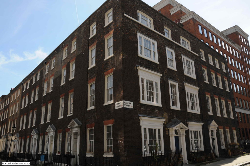
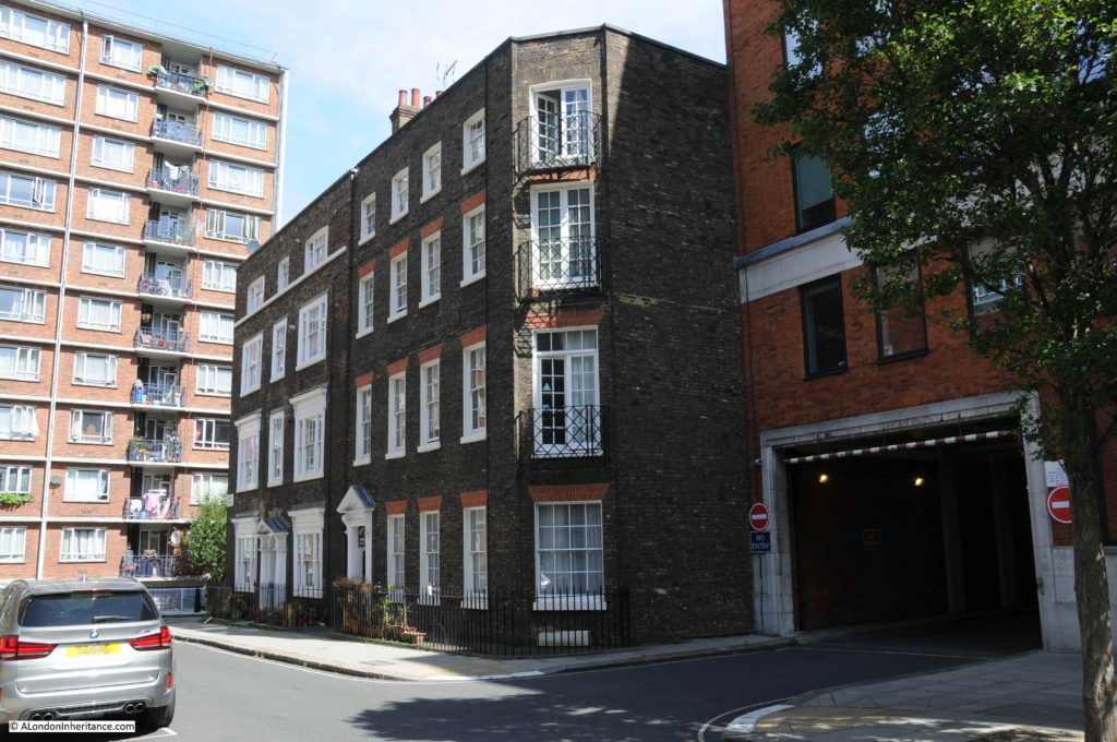
The house is on the corner of Harpur and Dombey Streets. The following is a photo of the same house today.
The house in the original photo looks the worst for wartime damage, however the layour of the windows is the same, the same entrance door, the same seperator at the top of the 3rd floor and the street name sign is in the same place on the corner of the house.
What is really stange is that in the original photo there is no building to the right of the corner house, although today there is a substantial house which looks original in all aspects.
This is another view of the two houses. The further being the one in the original photo and the house closest to the camera must be a post war reconstruction of the original house on the site.
The attention to detail is remarkable. The brickwork is the same, the style of the house is the same as the houses in Dombey Street. If I did not have my father’s photo for evidence I would have thought that this was an original Georgian house.
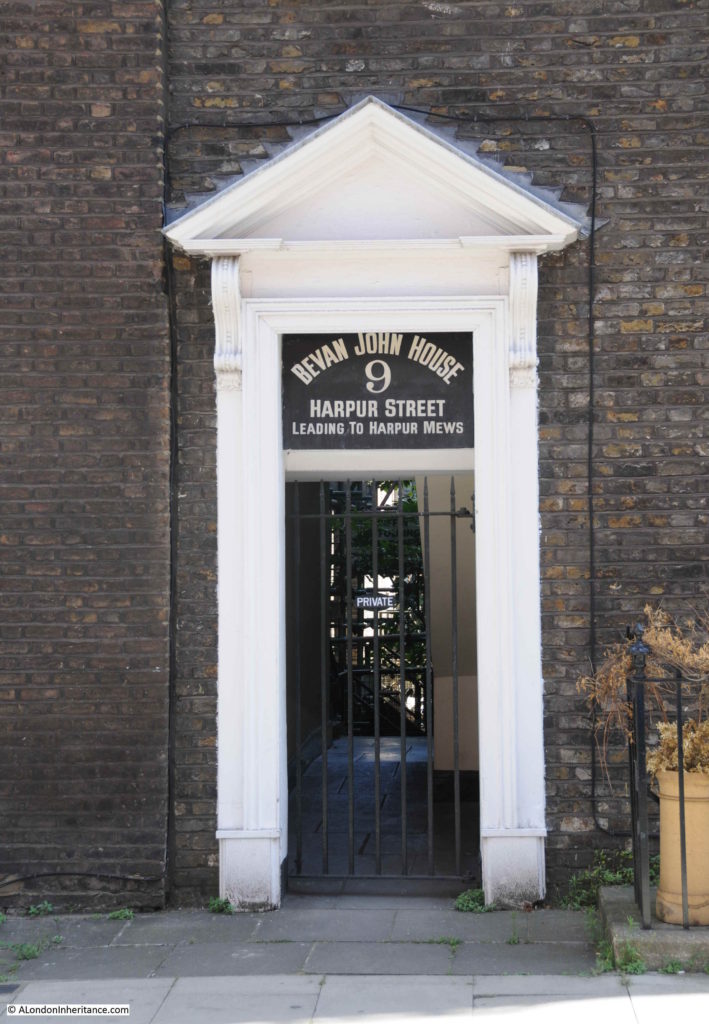
The entrance door to the reconstructed house is shown in the photo below. Note how identical the brick work and the size of the coarse between the bricks is to the wall on the left. There must have been piles of bricks in the area from the bomb damage and I can only assume that bricks and probably door and windows were reused from demolished houses to construct this new house.
In the enlargement of the original photo there is a doorway visible to the right of the main house and this was probably the entrance to the original house, but not to Harpur Mews as the sign above the entrance advertises today.
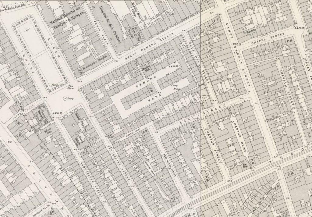
The following map is an extract from the 1895 Ordnance Survey map.
Harpur Street can be seen to the lower right. Harpur Mews is in the middle of the block and there is no entrance to the mews from Harpur Street. the entrance was from East Street (now Dombey Street) as shown by the building with the X which denotes a building above a through entrance.
The map also shows the dense housing across the area, much of which is now covered by the Tybalds Close Estate. Blemundsbury House occupies the space occupied by the houses to the north of East Street, starting from just to the right of the junction with Harpur Street and running to the left.
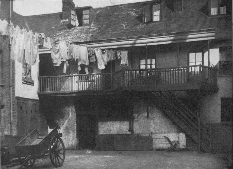
I could not find too much information on the area, however I did find a photo of Ormond Yard, the largest space in the centre of the map and now occupied by the Tybalds Close Estate. The following photo was published in The Sphere on the 2nd December 1933 and is one of a series of photos taken by a Mr. William Clark in 1918. Mr. Clark was apparently a Birmingham businessman who was fascinated by London in the time of Dickens and set out to photograph what he could find that was typical of Dickens time and also mentioned in Dickens novels.
The following photo is titled “Ormond Yard, Bloomsbury – Galleried cottages of Dickensian days whose quiet charm is in strange contrast to 20th century London”.
The first mentions that I could find of Ormond Yard date back to 1770, and through one hundred plus years there are the usual reports of the casual crime, accidents and violence that could be found across the dense housing of London.
The pub in the centre of the yard was The Crown. A report in the Sporting Life on the 2nd of June 1885 offers a glimpse of life in the yard:
“The Crown, Ormond Yard, Bloomsbury – A high class show took place at this establishment on the 31st, the exhibits consisting of bulldogs, bull terriers, mastiffs, pugs, dachshunds, and almost every variety of choice toy pets. The house, as usual, was well attended by fanciers and dealers. the chair was occupied by Mr. Alfred George faced by Mr Currie, supported by the following;- Messrs Strugnell (champion pugs), Clarke (bull dogs), Anderson (white half-bred dogs), Painter (champion spaniels), Matthews and Taylor (toy black and tan terriers) and Nicholls (mastiffs); also a gentlemen with some remarkably fine dachshunds, and many others together with many strangers. The handsome silver collar for the best bull terrier was taken by Mr. A. George’s Prince, a very handsome dog.”
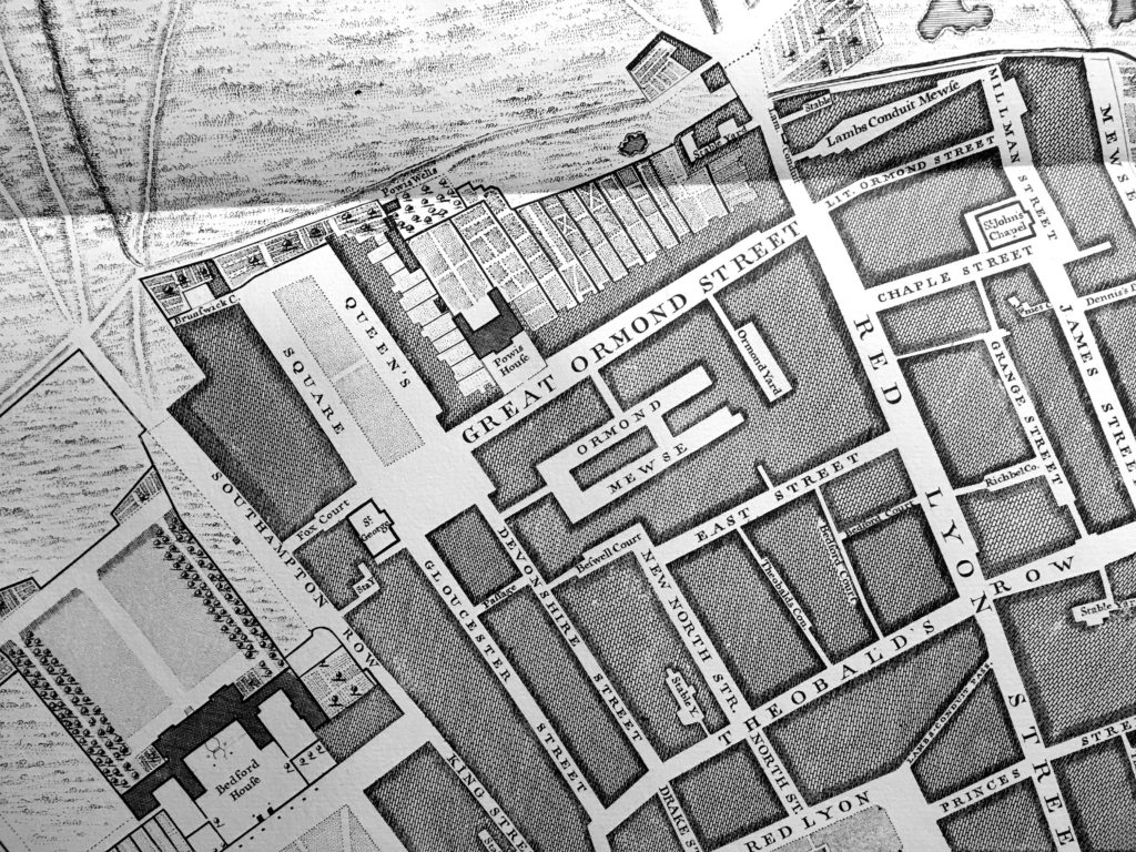
The land on which the Tybalds Close Estate is built was part of the early 18th century expansion of London. Rocque’s map from 1746 shows the area below:
The fields to the north and west show that the area at the time was on the edge of built London. At the time, and as probably built, Ormond Yard was a separate smaller yard and the main area was Ormond Mewse – the two areas would later combine as shown in the 1895 map.
The area in which the Tybalds Close Estate is built was originally part of the land donated by Sir William Harpur in 1566 by Sir William Harpur. See my post on Tracing Harpur’s Bedford Charity Estate.
One final point, the larger of the two blocks being built in my father’s photo is Blemundsbury House. The name provides an old connection to the area of Bloomsbury.
Blemundsbury was the original name of Bloomsbury. In turn, Blemundsbury took its name from a 13th century drainage ditch in the area known as Blemund’s Dyke.
The Tybalds Close Estate is at the heart of a fascinating area.

Thank you. Fascinating, particularly the observation about the reconstructed house in the shadow of the estate tower. You’re fortunate to have such a treasure trove of old photos via your father, and we’re fortunate that you take such care in bridging the past with the present.
Fascinating as ever. The obscuring office blocks you mention are much older than they appear. 1950s, I think, and formerly owned by the MOD. They’ve been refitted twice this century. I first met my wife in one of them, and what would become Londonist was first hosted on a server there 15 years ago.
I think that office building is Warner House, now home of Warner Brothers, but previously Adastral House, occupied by the RAF from around 1950, taking the name of the bomb damaged Adastral House on Aldwych/Kingsway near Bush House (later used by Rediffusion and ITN). The name had been used previously for De Keyser’s Royal Hotel when it was requisitioned for the newly formed RAF.
So it must have gone up and been completed in the few years immediately after the war, just after your father’s photo. Steel frame construction can be very quick.
The similar one next door, Lacon House, was also a government building. In the 70s I think they were both occupied by the Department for the Environment, and then Lacon House was (until recently) the home of the law firm Nabarro.
PS – Pevsner roundly condemns those new office buildings as “deplorable, crushingly utilitarian government offices”, and names the architect, Arthur S Ash. I doubt they will win any prizes, but are they really that bad?
And Lacon was a character in Tinker, Tailor, Soldier Spy…
Lacon House was MOD, my late father worked there until 1981 when he retired
Very interesting. Fascinating that the Harpur St house was built/rebuilt to match the corner house so closely. A look on the aerial photos on Google Maps shows that, while it looks the same from street level, the roof is constructed differently to its older neighbours: https://www.google.co.uk/maps/place/Lamb's+Conduit+St,+London/@51.5209619,-0.1200892,56a,49.1y,91.72h,70.91t/data=!3m1!1e3!4m5!3m4!1s0x48761b363cf9e58d:0x420a88ab376898fa!8m2!3d51.5216251!4d-0.1183173
The early photo of Ormond’s Yard with its gallery is a fascinating reminder of how old this part of London is.
The C18th Harpur Street house that was rebuilt so carefully was one of many in this area: further up the road behind Sadler’s Wells there are a number of houses in Myddleton Square that were bombed out and rebuilt and it’s hard to distinguish these at first.
I found your father’s photos fascinating: I had no idea that those blocks of flats dated from 1940’s designs, thinking them built in the ’60’s.
As always thank you for posting your Father’s photographs full size, this is most welcome as it makes it simple to examine detail. Few people who write blogs take the trouble to do this.
Your article was absolutely fabulous. I moved into Windmill (didn’t know it was called house) a two bedroom flat, with my mum, dad and baby brother in about 1947-8. I was born in 1945. When my sister was born in 1952 we moved into Blemundsbury a three bedroom flat where my youngest sister was born. After a number of years when we started leaving home my mum and dad moved to Falcon back to a two bedroom flat. My mum lived there until the mid 2000’s. Quite a few of my mum’s family lived in these flats. I remember most of the buildings on Theobalds Road we’re bombed sites and lots of us used them as our playground.
I have been reminiscing recently about my early life and came across your article. I could probably tell you a lot about the area and my experiences there.
Thank you for your article.
Hello, I work for the Holborn Community Association (based just next to the Tybalds Close Estate) and we’re currently doing a project with local residents to gather stories, memories and photos of the estate to make a small booklet to share with local people and the Camden Archives to preserve the history of the estate before a major regeneration takes place over the next few years.
I’ve loved reading your blog, and wondered if you might give permission for us to reproduce your father’s photos of the estate being built in the booklet? I know local residents would love to see them! Absolutely understand if you’d rather not, but had to ask!
Lovely, detailed article, thank you!
Regarding the reconstructed house, its fidelity didn’t entirely surprise me, especially regarding the timber elements. A skilled carpenter working in the 1950s might well have trained before WWI, when it was normal to make everything on site – panelled doors, sash windows and door surrounds would all be made up from stock timber, and an experienced chippy could have a range of moulding planes with which he could make exactly the same shapes that Georgian carpenters had. Indeed, as old tools would be carefully maintained and sold on or inherited, he might actually be using the same tools that made the original fittings (a bit of a stretch but not impossible). In the late 1970s or early 1980s I knew an elderly chap whose speciality had been hand carving banister returns (corners) from block timber.