Caledonian Park in north London in the Borough of Islington is today a green space in a busy part of London, with few reminders of the areas rich history.
I have much to write about Caledonian Park so I will cover in two posts this weekend. Today some historical background to the area, some lost murals and finding the location of one of my father’s photos. Tomorrow, climbing the Victorian Clock Tower at the heart of the park to see some of the most stunning views of London.
Caledonian Park is a relatively recent name. Taking its name from the nearby Caledonian Road which in turn was named after the Caledonian Asylum which was established nearby in 1815 for the “children of Scottish parents”.
Prior to the considerable expansion of London in the 19th century, the whole area consisted of open fields and went by the name of Copenhagen Fields. There was also a Copenhagen House located within the area of the current park.
The origin of the Copenhagen name is probably down to the use of the house (or possibly the construction of the house) by the Danish Ambassador for use as a rural retreat from the City of London during the Great Plague of 1665.
Copenhagen House became an Inn during the early part of the 18th century and the fields were used for sport, recreation and occasionally as an assembly point for demonstrations, or as Edward Walford described in Old and New London, the fields were “the resort of Cockney lovers, Cockney sportsmen and Cockney agitators”
The following print shows Copenhagen House from the south east in 1783, still a very rural location.
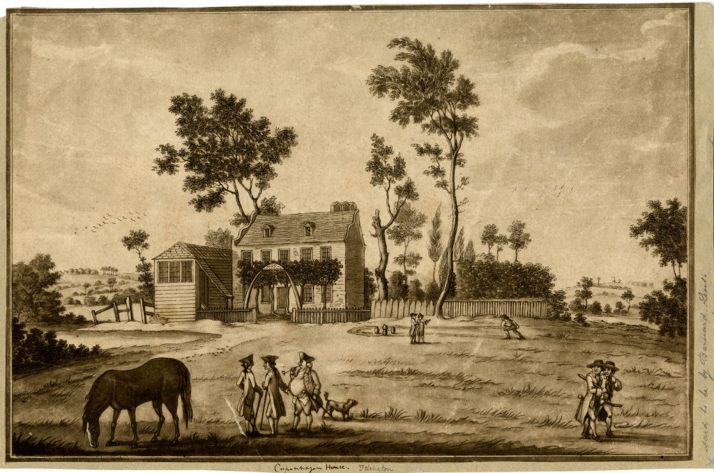 ©Trustees of the British Museum
During the last part of the 18th century, Copenhagen Fields was often used as a meeting point for many of the anti-government demonstrations of the time. Old and New London by Walter Thornbury has a description of these meetings:
“In the early days of the French Revolution, when the Tories trembled with fear and rage, the fields near Copenhagen House were the scene of those meetings of the London Corresponding Society, which so alarmed the Government. The most threatening of these was held on October 26, 1795, when Thelwall, and other sympathisers with France and liberty, addressed 40,000, and threw out hints that the mob should surround Westminster on the 29th, when the King would go to the House. The hint was attended to, and on that day the King was shot at, but escaped unhurt.”
The meetings and threats from groups such as the Corresponding Societies led to the Combination Acts of 1799 which legislated against the gathering of men for a common purpose. It was this repression that also contributed to the Cato Street Conspiracy covered in my post which can be found here.
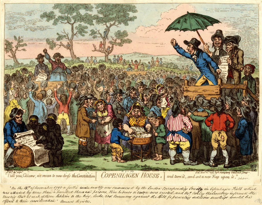
The following is a satirical print from 1795 by James Gillray of a meeting on Copenhagen Fields “summoned by the London Corresponding Society” which was “attended by more than a hundred thousand persons”.
©Trustees of the British Museum
Copenhagen Fields continued to be used for gatherings. In April 1834 there was a meeting in support of the Tolpuddle Martyrs, who had been sentenced to transportation to Australia for forming a trade union. Walter Thornbury provides the following description: “an immense number of persons of the trades’ unions assembled in the Fields, to form part of a procession of 40,000 men to Whitehall to present an address to his Majesty, signed by 260,000 unionists on behalf of their colleagues who had been convicted at Dorchester for administering illegal oaths”.
The final large meeting to be held in Copenhagen Fields was in 1851 in support of an exiled Hungarian revolutionary leader. The role of this rural location was about to change very dramatically.
Smithfield in the city was originally London’s main cattle market however during the first half of the 19th century the volume of animals passing through the market and the associated activities such as the slaughter houses were getting unmanageable in such a densely populated part of central London.
The City of London Corporation settled on Copenhagen Fields as the appropriate location for London’s main cattle market and purchased Copenhagen House and the surrounding fields in 1852. The site was ideal as it was still mainly open space, close enough to London, and near to a number of the new railway routes into north London.
Copenhagen House was demolished and the construction of the new market, designed by the Corporation of London Architect, James Bunstone Bunning was swiftly underway, opening on the 13th June 1855.
A ground penetrating radar survey of the area commissioned by Islington Council in 2014 identified the location of Copenhagen House as (when viewed from the park to the south of the Clock Tower) just in front and to the left of the Clock Tower.
The sheer scale of the new market was impressive. In total covering seventy five acres and built at a cost of £500,000. There were 13,000 feet of railings to which the larger animals could be tied and 1,800 pens for up to 35,000 sheep.
Market days were Mondays and Thursdays for cattle, sheep and pigs, and Fridays for horses, donkeys and goats. The largest market of the year was held just before Christmas. In the last Christmas market at Smithfield in 1854, the number of animals at the market was 6,100. At the first Christmas market at the new location, numbers had grown to 7,000 and by 1863 had reached 10,300.
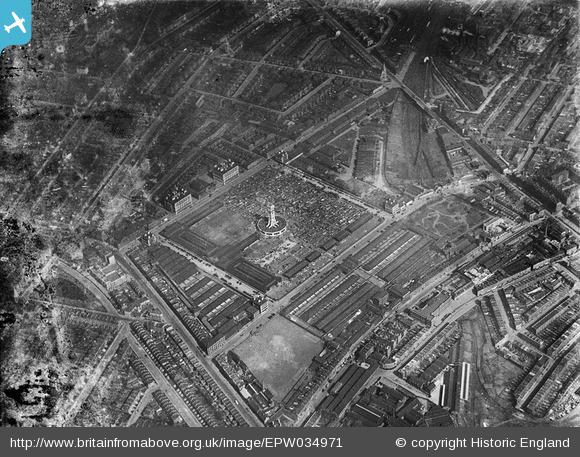
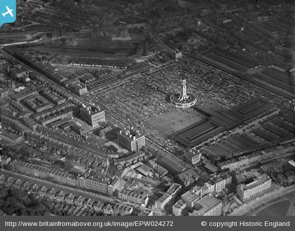
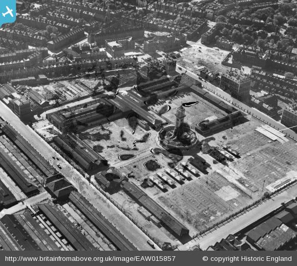
The following Aerofilms photo from 1931 shows the scale of the market. The clock tower at the centre of the market is also at the centre of the photo with the central market square along with peripheral buildings in the surrounding streets.
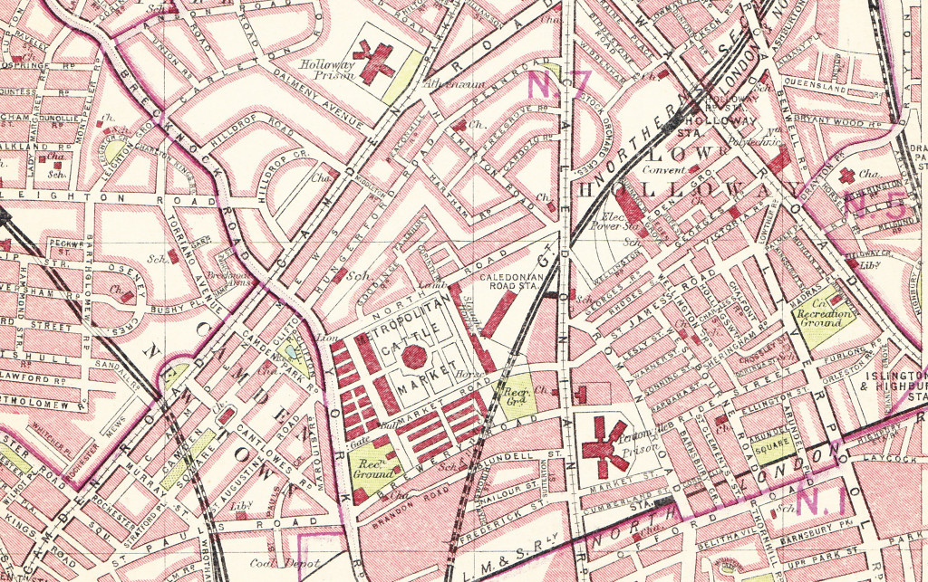
The 1930 edition of Bartholomew’s Handy Reference Atlas of London shows the location and size of the market:
As well as the cattle market, the construction included essential infrastructure to support those working and visiting the market. Four large public houses were built, one on each of the corners of the central square. The following Aerofilms photo from 1928, shows three of the pubs at corners of the main square. The two large buildings to the left of the photo are hotels, also constructed as part of the market facilities
The clock tower is located in the middle, at the base of the clock tower are the branch offices of several banks, railway companies, telegraph companies along with a number of shops.
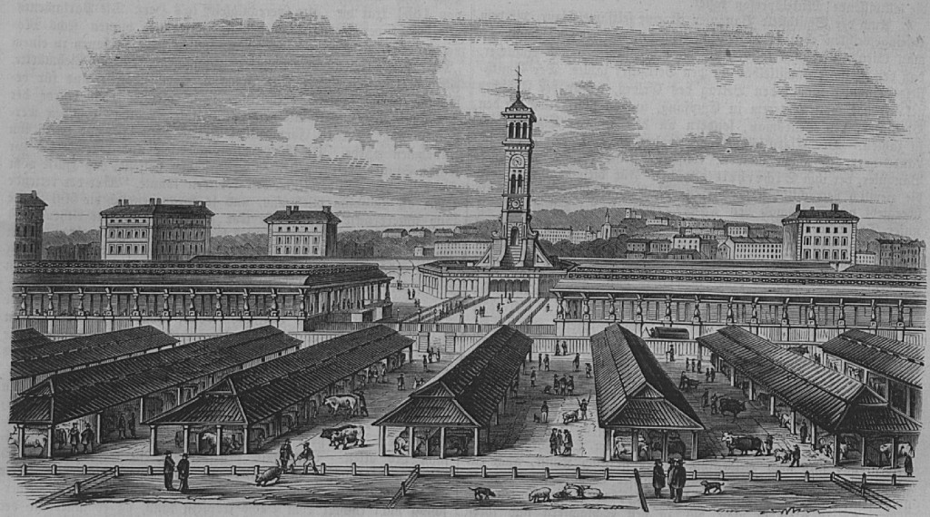
A 19th century drawing shows the clock tower and the long sheds that covered much of the market:
By the time of the First World War, the cattle market had started to decline and was finally closed in 1939 at the start of the Second World War, with the site then being used by the army.
After the war, the slaughter houses around the market continued to be used up until 1964, when the London County Council and the Borough of Islington purchased the site ready for redevelopment. The Market Housing Estate was built on much of the site, although by the 1980s the physical condition of the estate had started to decline significantly, and the estate had a growing problem with drugs and prostitution. Housing blocks were built up close to the clock tower and there was limited green space with many concrete paved areas surrounding the housing blocks and the clock tower.
A second redevelopment of the area was planned and planning permission granted in 2005. The last of the Market Estate housing blocks was demolished in 2010 and it this latest development which occupies much of the area today.
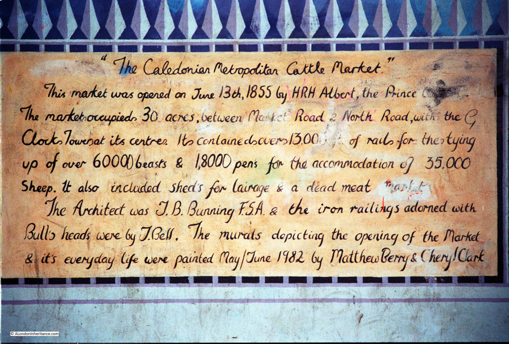
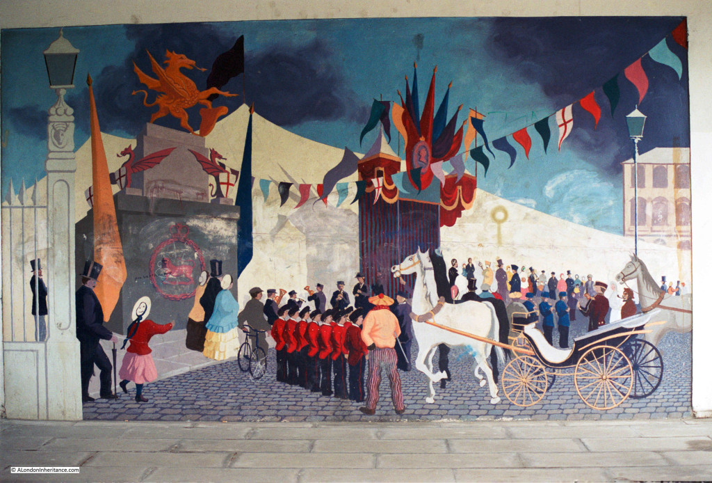
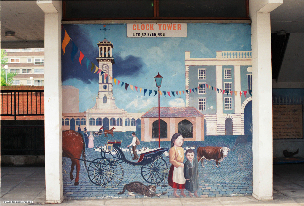
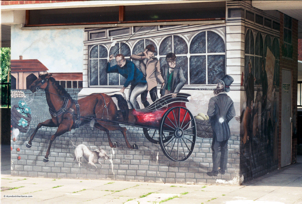
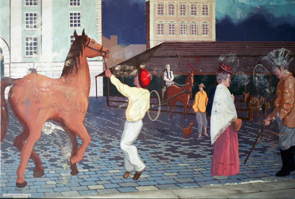
In 1982 a number of murals illustrating the history of the market were painted on the ground floor exterior of the main Clock Tower building of the original Market Estate. In 1986 my father took some photos of the murals during a walk round Islington. As far as I know, these murals were lost during the later redevelopment of the area.
The introductory mural providing some history of the market:
A scene showing the opening of the market by Prince Albert in 1855. A lavishly decorated marquee hosted a thousand invited guests to mark the opening of the market.
The central clock tower painted on the Clock Tower building of the housing estate:
Other scenes from around the market:
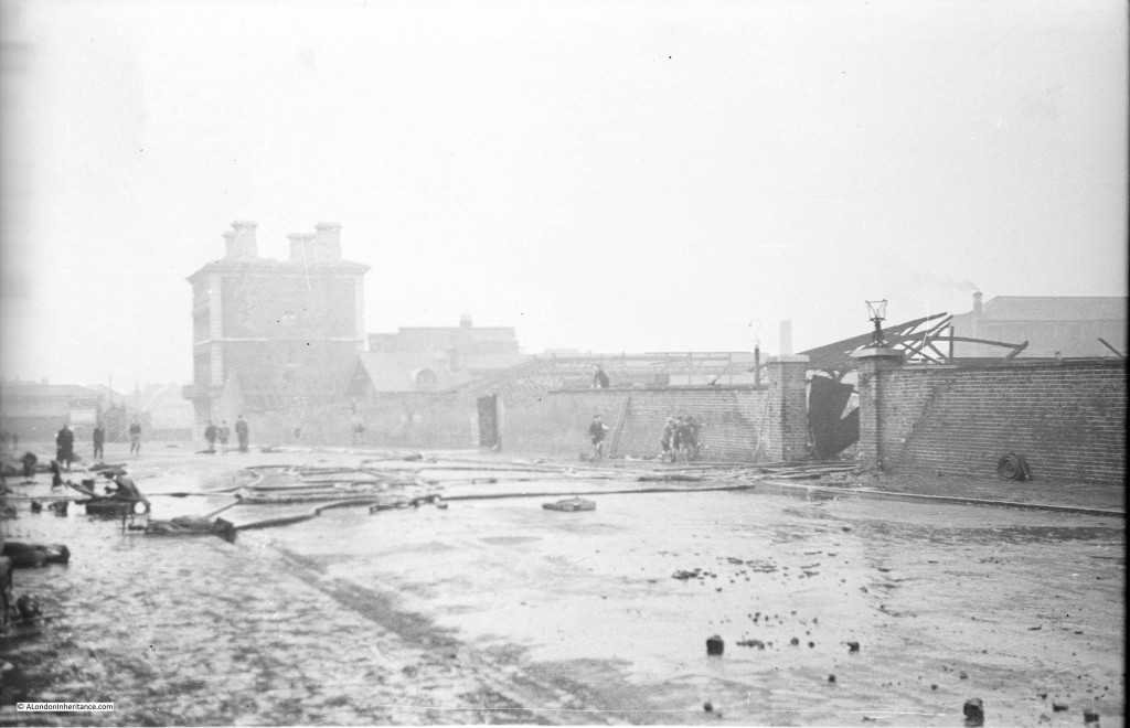
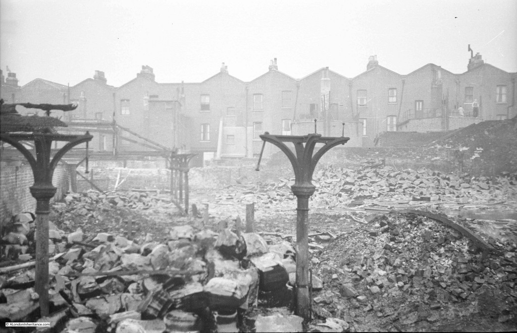
As well as the photos of the murals, almost 40 years earlier in 1948 my father had taken a photo of the aftermath of a fire. I was unsure where this was and I published the photo below a few weeks ago in my post on mystery locations.
One of the messages I had in response to this post (my thanks to Tom Miler), was that the building at the back of the photo looked like one of the pubs at the Caledonian Market.
I took a walk around the periphery of the site trying to work out which of the streets and pubs could be the location of my father’s photo and found the following:
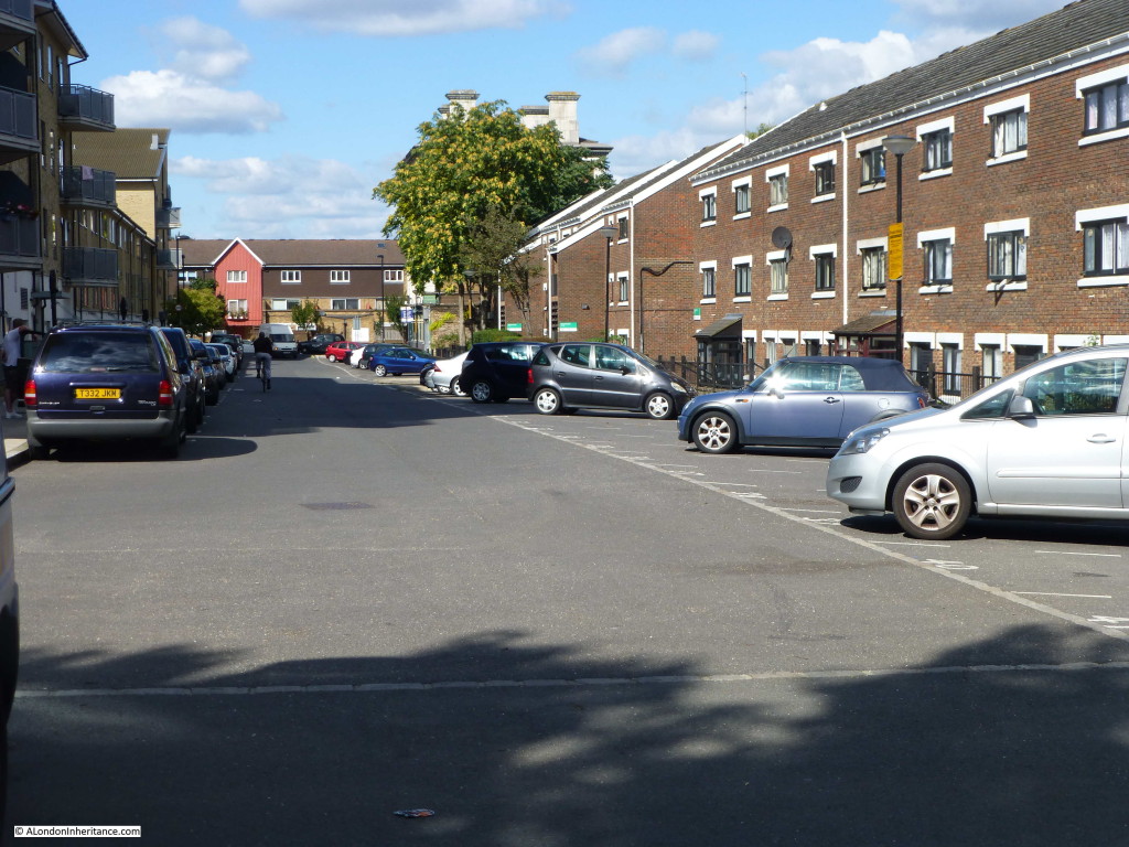
This, I am sure, is the location of my father’s photo. The street is Shearling Way running along the eastern edge of Caledonian Park. I probably should have been a bit further back to take the photo, however the rest of the road was closed and full of cars unloading students into the student accommodation that now occupies the southern end of Shearling Way – an indication of how much the area has changed.
The pub is hidden behind the tree, although it is in the same position and the chimneys are clearly the same and in the right position. The old yards and sheds that had burnt down on the right of the original photo have been replaced by housing.
I was really pleased to find the location of this photo, it is one I thought I would not be able to place in modern day London.
This Aerofilms photo from 1948 shows the pub from the above photo at the top left of the main market square with the road running up to the right. Above the road is the area that was the scene of the fire.
This is another photo of the scene of the fire and the housing in the background can also be seen in the above Aerofilms photo, further confirming the location.
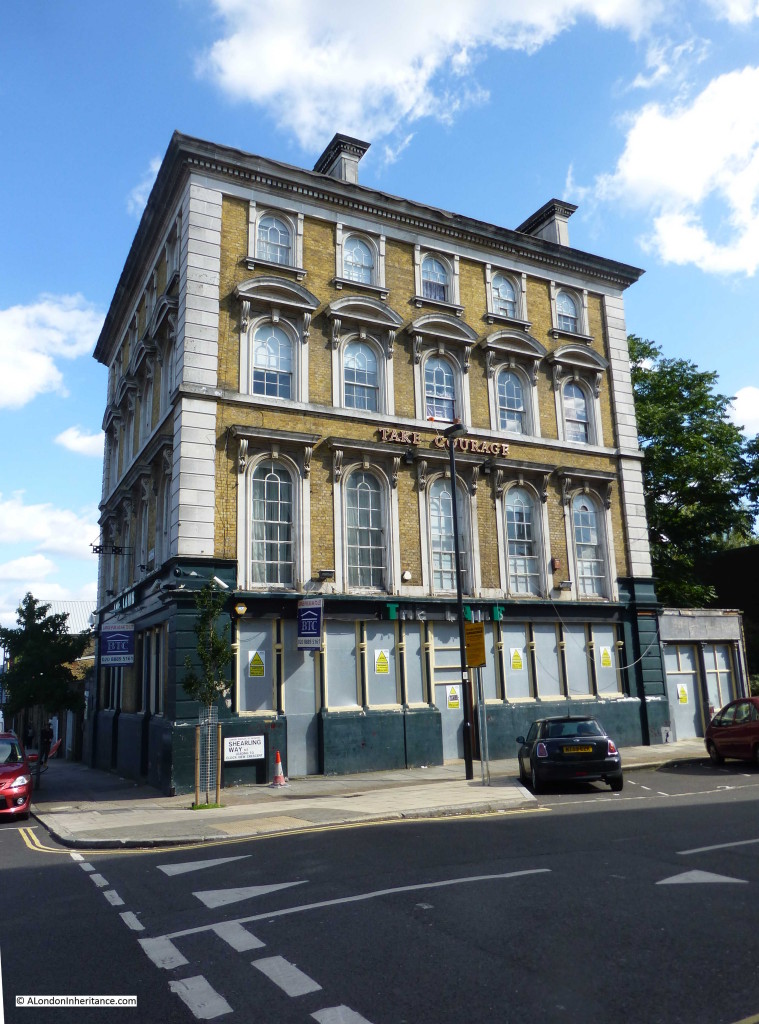
Walking down the street I took the following photo of the pub, the front of the pub has the same features as on the 1948 photo.
The pub was The Lamb, unfortunately, as with the other pubs on the corners of the old cattle market, it is now closed.
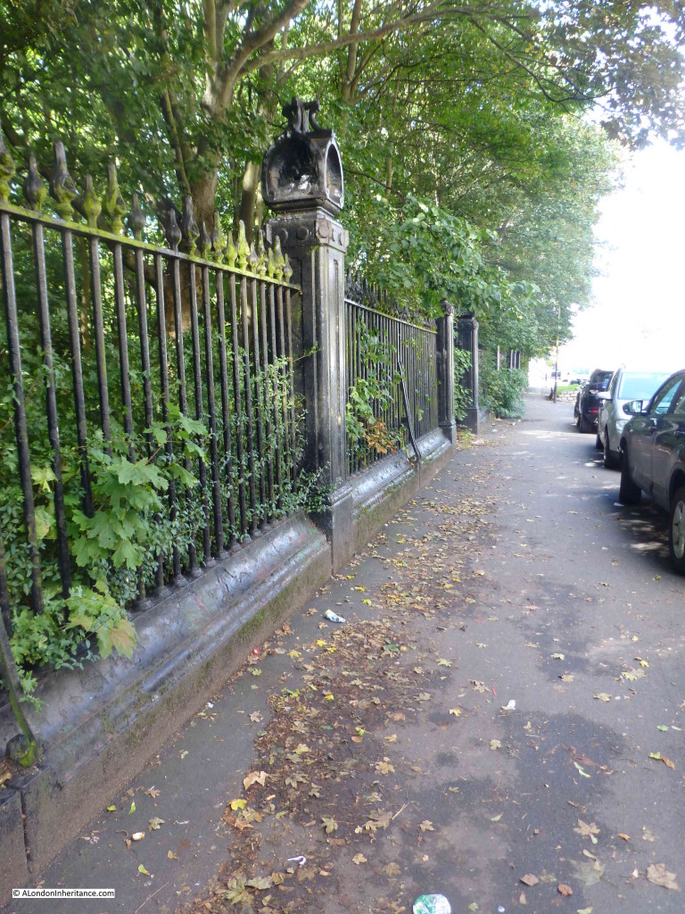
To the left of the first half of the street, adjacent to the park, the original market railings are still in place:
A short time after the opening of the Cattle Market, a general or flea market had become established alongside. This market grew considerably and was generally known as the Cally Market, a place where almost anything could be found for sale. By the start of the 20th century, the size of the Cally Market had outgrown the original Cattle Market.
The journalist and author H.V. Morton visited the market for his newspaper articles on London and later consolidated in his book “London” (published in 1925) and wrote the following:
“When I walked into this remarkable once a week junk fair I was deeply touched to think that any living person could need many of the things displayed for sale. For all round me, lying on sacking, were the driftwood and wreckage of a thousand lives: door knobs, perambulators in extremis, bicycle wheels, bell wire, bed knobs, old clothes, awful pictures, broken mirrors, unromantic china goods, gaping false teeth, screws, nuts, bolts and vague pieces of rusty iron, whose mission in life, or whose part and portion of a whole, Time had obliterated.”
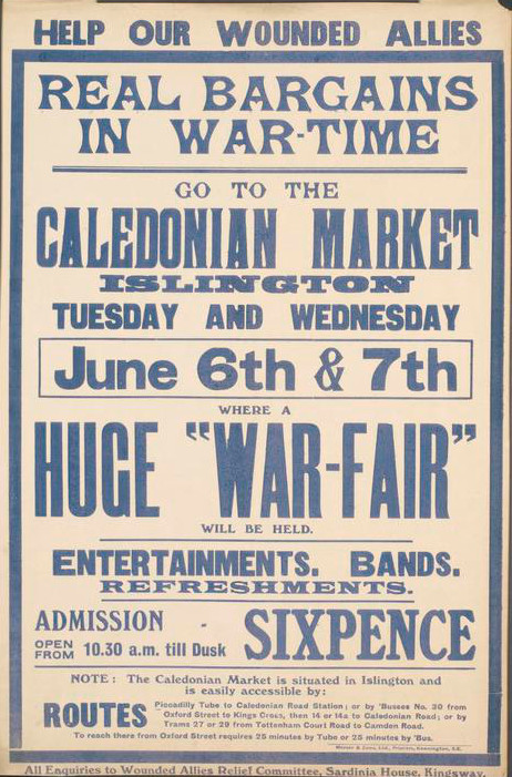
The Cally Market was also used during both the first and second world wars for major fund raising events. This poster from the first world war:
© IWM (Art.IWM PST 10955)
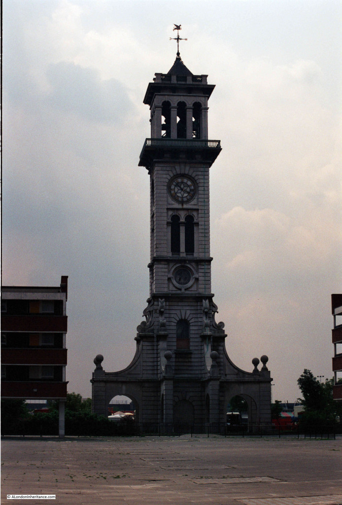
Along with the murals, my father took a photo of the Clock Tower in 1986. The original housing blocks that reached up to the clock tower can be seen on either side. The clock tower is surrounded by concrete paving.
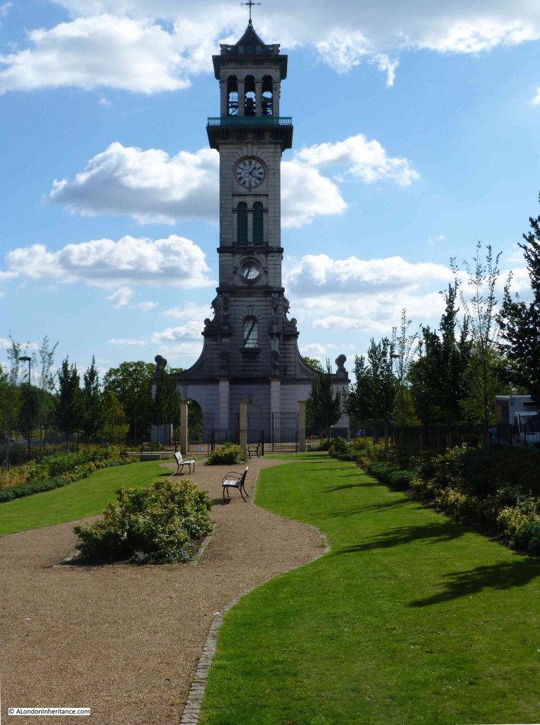
This is the same scene in 2015 from roughly the same point (although I should have been more to the left). The old housing blocks have been demolished and the clock tower is now surrounded by green space.
Looking at the above photo, the wooden steps that provide the route up inside the Clock Tower can be seen through the two windows.
Join me for tomorrow’s post as I climb the tower to the viewing gallery at the top for some of the best views across London.

Your photograph of 1948, in my opinion, shows ‘The Lamb” public house at the junction with North Road. The wall on the right with an entrance gate was, in the 1950’s, the main entrance to the abbattoirs which was always guarded by a policeman, possibly from Caledonian Road Police Station. Cows would be driven from the lairages on Market Road into the abbattoirs. The sight used to frighten me as a child in the 1950’s. Some of my uncles used to work in the slaughterhouses, and one who was chief gutter, died as a result of being trampled on by a bull which had got loose. Unpleasant facts, but a reminder of what life was like. if you need more information, please contact me by e-mail. Looking again at your article. I see your photograph of the area as it is today.
Jenny, thanks, that is really interesting. It must have been a very difficult and dangerous place to work by today’s standards. Yes, you are right the pub is The Lamb, a real shame it is now closed but I believe they are protected buildings so at least the building will remain.
The fire started by a firework I November it caught the Rubber alight and the sticky rubber run down York way and people going to work got stuck in it and all the traffic had extra rubber on the weeks the pub was called the Bull hope this helps
In the late 50s the PC was probably PC Gregory presumably his surname. He was on the tubby side and could never catch us as we young scamps scampered over and around the inside of the gates. I lived at City Mansions facing the clock tower and I can still remember the smell of blood from the abattoir area. I attended Hungerford Primary and 40 years later and 40 odd miles away my wife met and became good friends with a woman who had been there at Hungerford at the same time as me.
Dear Jenny
I had just finished telling my wife of the escapades of our little gang of ruffians back in the 50’s
I was about 9 or 10 and lived in Wheelright Street next to the Prison, we used to go up to the local recreation ground to lark around.
That day the drovers were bringing some cattle to the abattoir, we closed the gate and opened the gate into the play ground and shooed them in, what a laugh seeing girls with prams running for there lives.
I am now 78 and can still remember it like yesterday.
Louise my wife and I are have just emigrated from Australia where we have lived for some time and are going for a nostalgic trip next Wednesday morning to the our old stamping ground, might see you there.
Sam Coster
Dear Jenny
I had just finished telling my wife of the escapades of our little gang of ruffians back in the 50’s
I was about 9 or 10 and lived in Wheelright Street next to the Prison, we used to go up to the local recreation ground to lark around.
That day the drovers were bringing some cattle to the abattoir, we closed the gate and opened the gate into the play ground and shooed them in, what a laugh seeing girls with prams running for there lives.
Another profound memory was going down the prison when there was a hanging and laughing at the people with boards saying “repent the end is nigh”
I am now 78 and can still remember it like yesterday.
Louise my wife and I are have just emigrated from Australia where we have lived for some time and are going for a nostalgic trip next Wednesday morning to the our old stamping ground, might see you there.
Sam Coster
Fascinating history of this area. I first started work more than 60 years ago in the Kings Cross area and travelled down the Caledonian Road every day not knowing what was going on only a stones throw away!
I am wondering just how all the livestock was transported in and out of the site in its later years? I never saw any sign of that at all.
Thanks for this brilliant article and all the research that has gone into it. Looking forward to part two.
Thanks Malcolm. I believe that much of the transport was via rail, one of the reasons for the location of the Cattle Market and the proximity of rail routes into north London, however I have been unable to find any photos or information about the actual transport methods used.
This is indeed a very interesting article on the history of Caledonian Park, I lived on the City of London York Way Estate that abounds Market Road, York Way and North Road that was built in 1968 for many years before moving out to Kent. The fourth pub that was on the site of this estate was I beleive burned down around 1966, I cannot think of its name. The pub that was on the other end of the old market The White Horse has been converted into luxury flats with the large bar area becoming a five bedroom apartment that six years ago was on the market (no pun intended) for over one million pounds. Times really have changed.
Thanks for the feedback John. You are right how much the area has changed. During the brief time I stood at the top of the tower it was interesting to consider how different the view would have been when the market was in operation. I have tried to find photos taken from the tower when the market was open but with no luck. Would be fascinating to see.
The name of the fourth pub (the only one not still standing) was the Black Bull, on the South-West Corner of the market.
The White Horse on the SE Corner, the Lamb on the NE, and the Lion on the NW Corner.
The White Horse and The Lion are both now apartments. The Black Bull was demolished in the 60s when the Corporation of London housing estate was built, and the Lamb was still a pub up to the mid-nineties, and the landlady made a nice additional income by renting rooms to circus performers training at The Circus Space just next door.
The Lamb has been shuttered for a while, but when I passed a few weeks ago there were signs of work going on…
But all three remaining building are listed.
I knew a lady who lived in the area and spoke about the animals being taken off the trains at Caledonian Road and walked along said road to the market area via Market Road. There was a cobbled ramp behind two large green gates on the southeastern side of the bridge across the road from the underground station.
I can remember a circus being held in Finsbury Park their animals were taken off a train at Caledonian Road which were then walked towards Holloway and on to Finsbury Park via Isledon Road.
A wonderful history of Cally Park with so many great photos. Well done.
A great history. Thank You. My father worked in the market until it closed. As a small boy I seem to recall cattle driven up York Way from Kings Cross to the market but perhaps Im wrong. I have a photograph in a book of Islington Photographs of the disused market taken in 1961 by Angus McBean if its of interest.
My Grandfather William Lambert Moore had a stall in the market in the 1930s. My mum used to miss school to help him push his barrow to the market and then crawl under the gate to reserve his pitch. She was born in 1921 and lived until 2016. I was a London Cabbie until I retired . One day ( Circa 2003) returning from taking mum out for a ride I stopped the cab by the main gate of the market and in the mirror I watched the light dawn on her face.. ‘Oh my gawd’ she said pointing at the gate, ‘I used to go under there to save my dads pitch. The Smith side of my family lived at first in Queens Arms Buildings and then in City Arms Buildings (1871 & 1881) If any one knows of a decent picture of them I’d love to have a copy.
I know this thread is old and you probably won’t see it but, can I ask if your mother’s name was Florence? I don’t know much about my grandfather’s family, but his father was William Lambert Moore which is an unusual middle name.
Fascinating reading this as both my Dad and Grandad worked at the market. They were both called Billy Hoy, and worked as butchers.
I can remember my Dad taking me to ‘the Cally’ and clearly recall the railings, and the clock tower in the middle of the site.
Incidentally, I have an old enamel arm badge on which is written ‘ Metropolitan cattle market’ and has the words ‘Drover 86’ as well as a shield. This came from my Dad’s belongings when he died in in 1997 aged 71.
Peter Hoy
Wonderful article, thank you. I live locally and with the Coronavirus lockdown have been walking in the park very day. My husband’s father used to come to the market in the 1930’s, it seems nice we have come full circle and live close to it.
I can’t wait for the Clocktower to reopen so we can visit. Your article really inspired me to know more about the area I have lived in for 20 years, thanks again.
I remember as a small child my grandma standing me on a table at the window to watch the cattle being driven down York Way to the market. She lived in Camden Buildings, which were pulled down years ago. One time, a cow made its way up the open stairway to the roof and had to be killed and butchered up there because they couldn’t get it down. The meat was thrown from the rooftop and crack the pavement below.
I came to this article from your Essex Road piece, and have two observations.
Firstly, I used to play football at the Market Road astroturf in the late 1970’s, and drink in a pub at the Eastern end of Market Road (can’t remember it’s name sadly !).
Seondly, I have a 1954 AtoZ which tells me the the four pubs you mentioned were, the Lion, Bull, Lamb and Horse !
Love your items, and always finding myself “emerging” from them, much (much !) later, having spent some very enjoyable time thinking about this amazing city we live in.
I have to say that this article was fascinating. I am doing some research to write a book for my children, grandchildren and who knows. I wanted to do this so they could have some idea of how things were with their pop. As I was reading this article and noticed that a couple of things that didn’t make sense to me. This is mainly to do with the fire at Caledonian Cattle market in 1948. I remember this incident very well. I was attending Hungerford Road School and it was the first time I was caned. The Headmaster at the time was Mr. Cole and got very angry at the students who went to look at the aftermath of the fire. There of couse things were in terrible state, mess everywhere including rubber from some of the melted hoses. One of the kid after being there had gone back and wiped his shoes on the roller towels at the school. Hence his anger! He took aside about 13 boys who lined up and all got six strokes of the cane on their hands. In those days being caned was accepted as common practice. I was eight at the time and this event stamped in my memory. I mentioned this as on reading the article the reporter suggested that the photograph that his father took was in Shearling Road? This point I think is wrong! There have been many changes made around The Caledonian Market, including street names. This was at the time was Corinth Road, it ran from the end of Goodinge Road along the other side of Hungerford Road School Over North Road then through to Market Road. with the Abattoir and Slaughter House on the Left and the Market itself on the right. So even though it may be called Shearling Road now it was Corinth Road. It seems like they have blocked off the Market Road end to traffic making it Fred White Walk. There are also other streets there now that weren’t there back then.
By the way I think the pub in the picture would have been The White Horse! Looking down the then Corinth Road to Market Road with The White Horse pub on the right hand corner. The Lamb would have been behind the photographer on the corner of North Road and Corinth Road.
Ah I don’t think it was the White Horse, but The Black Bull, which is no longer standing, but which was on the SW Corner of the market, not far from the junction of Market Rd and York Way.
I think the fire was next to that.
In the aerial photo where the author refers to the pub in the top left as being the one seen in her father’s photo, the pub they’re referring to is The Black Bull and not The Lamb. Being at opposite corners of the market they would have been mirror images of each other, so an easy mistake to make.
But in the aerial photo
http://alondoninheritance.com/wp-content/uploads/2015/09/EAW015857.jpg
It’s the Black Bull which is top left. How to tell? Those two big buildings at the top of the picture were hotels – The Queens Arms and the City Arms – located on what is now North Road, and situated between the Lion to the west and the Lamb to the East.
Here’s a good diagram:
https://upload.wikimedia.org/wikipedia/en/5/5e/Metropolitan_Cattle_Market_Islington.png
Shearling Way Not Road! Sorry!!
Fascinating article, thank you! I did a Working from Home (yes, still doing that in Feb 2022!) and was fascinated by the history of the park, the clock tower and the three remaining pubs. The area has seen a lot of gentrification since I moved to Holloway in 2004. It’s lovely to see a historic location being valued again.
Lucien
I remember this area when it was full of prfabricated houses back in 1966-7.