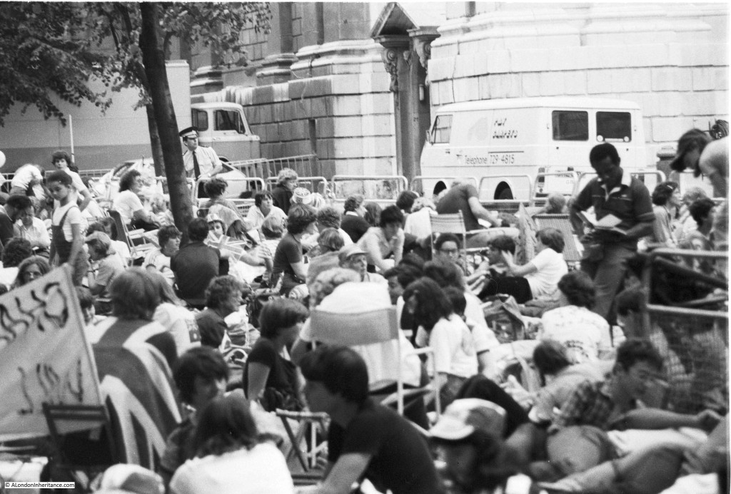
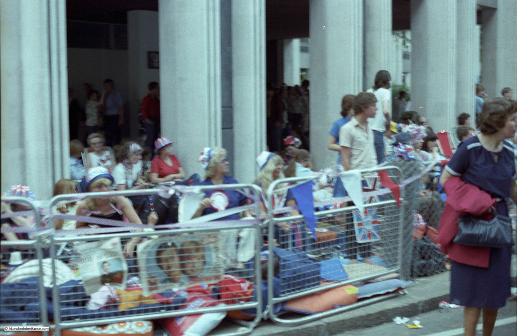
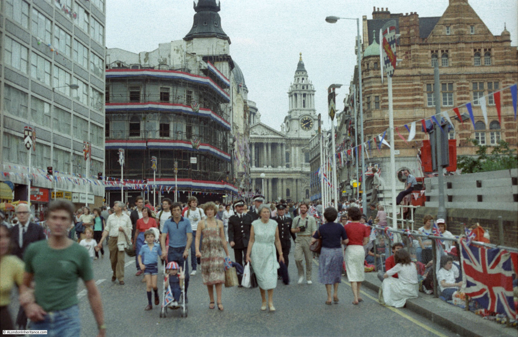
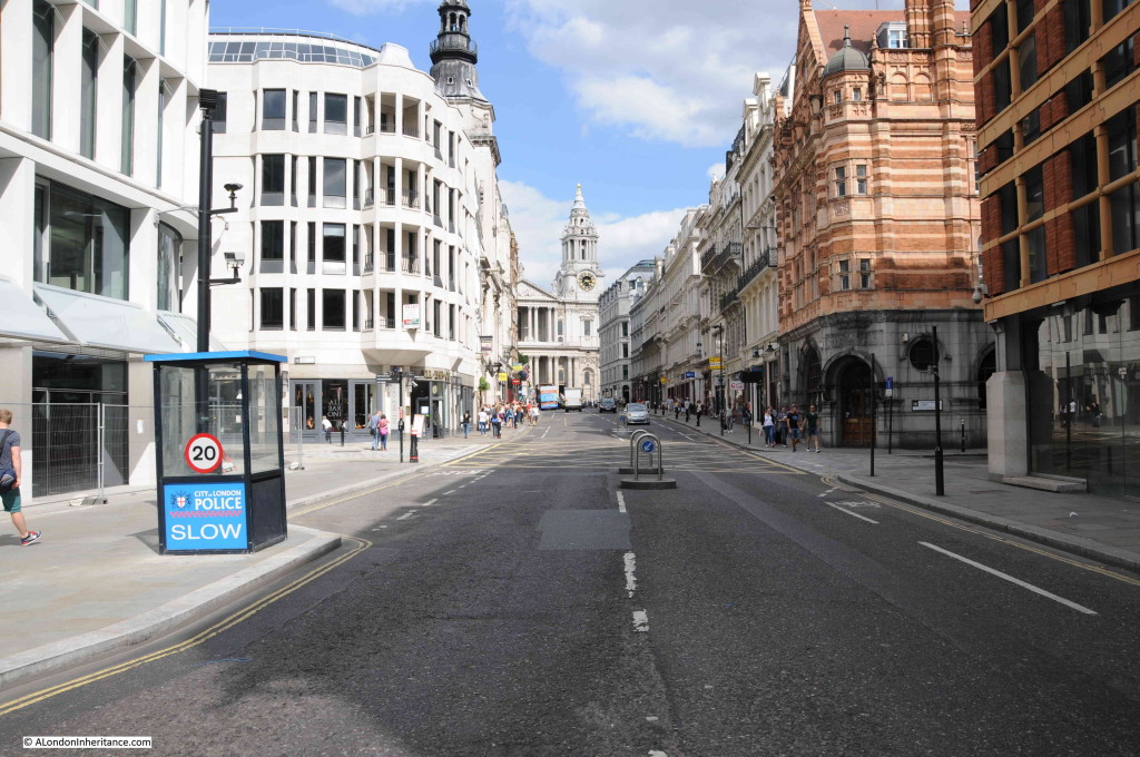
Tag Archives: Fleet Street

Temple Bar – A Historic Boundary to the City

The City of London has always regarded the boundaries of the City as important in defining where the jurisdiction of the City extended. This included having very visible symbols of where you were crossing from the wider city into the City of London. One such symbol was Temple Bar in the Strand:
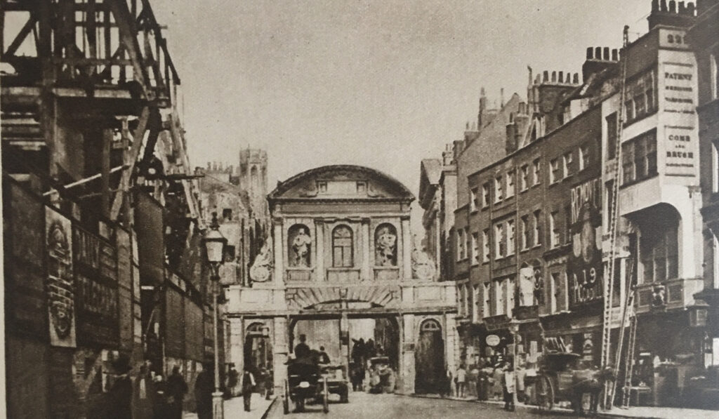
Temple Bar

The above photo dates from 1878, and comes from the book Wonderful London, which describes the scene as “Scaffolding and buildings show signs of the housebreaker on the left, where the Law Courts are in the process of erection. Their site alone cost £1,450,000, and in the years that have gone since the camera made this precious record, most of the scene has changed out of all recognition. Four buildings remain, St. Dunstan’s Church, the top of whose spire can just be seen, the façade of the entrance to the Middle Temple beyond the southern footway of Temple Bar and the two white houses on the right where the ladders are leaning.”

Not long after the above photo, Temple Bar was demolished, the Law Courts were completed, and a new monument was built on the site of Temple Bar, and Wonderful London recorded the changed street scene:
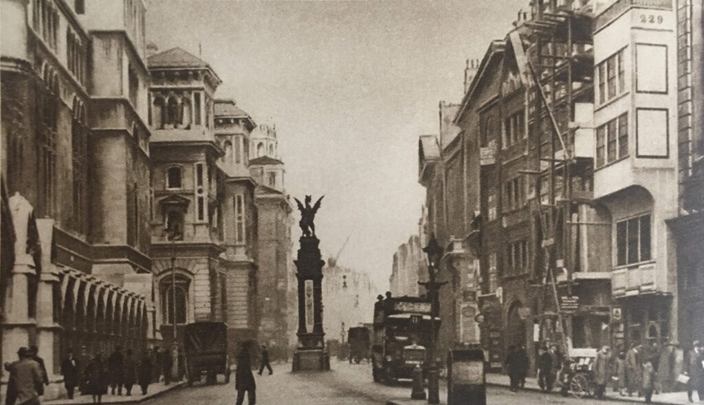
Temple Bar

There was a forty year gap between the above two photos, and the caption in Wonderful London to the above photo reads “On the right the white building of No. 229 still stands, but it is its neighbour that is under repair this time. These two houses are said to have escaped the Great Fire, which destroyed much of the street. St. Dunstan’s is just visible above the winged griffin that ramps on the monument marking the site of the old Temple Bar. The width of the street is almost double what it was, and it would obviously be impossible to get the modern column of traffic through the old narrow arch. The pediment over the gateway of Middle Temple Lane can be seen on the right.”

Although Temple Bar had disappeared from the Strand, the City of London saved the stones that made up the structure. Numbering each individual stone and keeping a plan of their location, the stones of Temple Bar were stored in a yard in Farringdon Road.

The stones of the old gate were purchased by Lady Meux, wife of Sir Henry Bruce Meux (of the Meux’s Brewery Company), who owned a house in Theobalds Park, near Cheshunt, and Temple Bar was rebuilt there in 1888.

The London Evening Standard reported on the laying of the foundation stone at Temple Bar’s new location on the 9th of January 1888: “The foundation stone of Temple Bar was laid on Saturday afternoon by Lady Meux at the entrance to Theobald’s Park, Cheshunt. Her Ladyship was accompanied by Sir Morell Mackenzie and several other ladies and gentlemen. There was a large gathering. At the platform which was erected, her ladyship was received by Mr. Elliot of Newbury, the contractor for the re-erection of the bar, and Mr. Poulting, the architect. Before the ceremony of laying the foundation stone commenced Mr. Elliot presented Lady Meux with a model of Temple Bar worked in oak, a silver trowel, and a mahogany mallet. After depositing a bottle, some of the current coins, several newspapers, and other articles, the stone was lowered, and was declared well and truly laid. About 400 tons of the stones have already been carted to Cheshunt at a cost of £200.”

The book “The Queen’s London” published in 1896 included a photo of Temple Bar in its new location at Theobald’s Park:
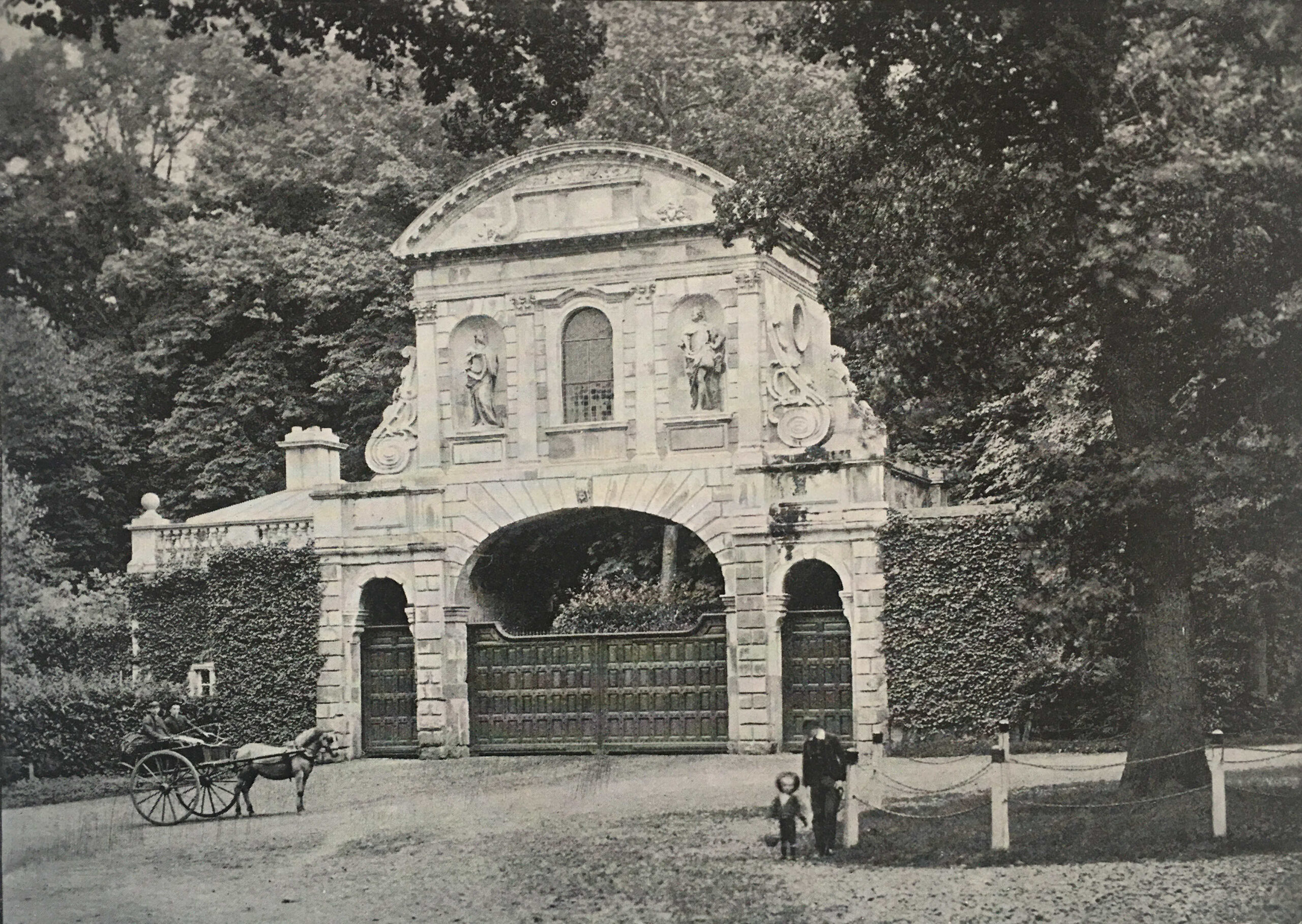
Temple Bar

Apparently Lady Meux used the room over the central arch for entertaining. The gate frequently appeared in sporting newspapers which included photos of the local fox hunt and hounds meeting in front of the gate.

By the 1920s, Wonderful London’s photo of the gate showed the accumulated dirt of the years since it was rebuilt in 1888. Note the smoke rising from the chimney of the gatehouse to the left.
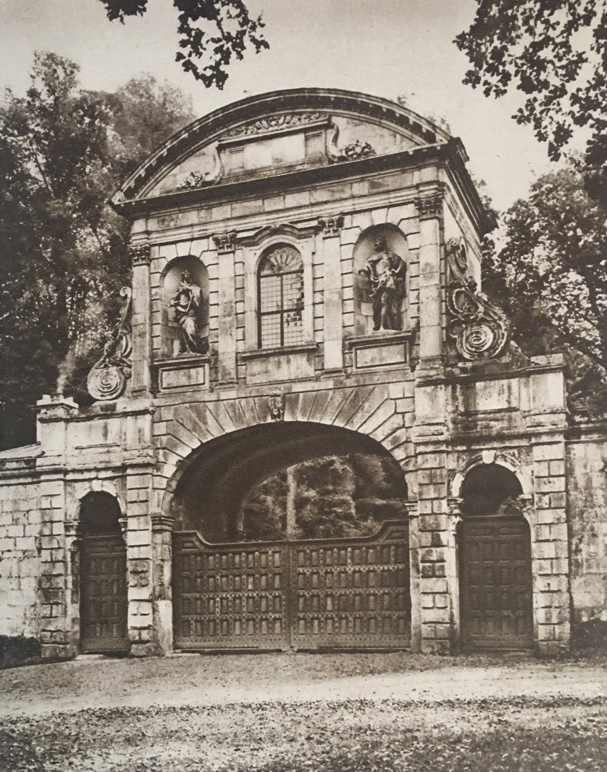
Temple Bar

Almost as soon as Temple Bar had been demolished, and rebuilt in Cheshunt, there were murmurings that it had not been the best decision by the Corporation of London, and that a location for the historic structure should have been found in London. For example, on the 8th of October, 1906, a Mr. H. Oscar Mark wrote to the Westminster Gazette lamenting the removal of the old Temple Bar to Theobald’s Park:

“Surely a site could have been and could now be found in the widened Strand, or in Aldwych, or, if necessary, in the open space west of the Law Courts buildings where old Temple Bar could be seen and admired, as everyone with any sense for the antique or artistic could not help doing. I would suggest that strenuous efforts should be made by Londoners who love their London and its old landmarks – of which we have too few left – to reacquire this fine old relic, and to re-erect it on one of the sites named or in the heart of London.

We can ill afford to lose ancient monuments, the more so when they are of so highly interesting a character as this one must be to thousands of London’s inhabitants.”

Despite languishing in Theobald’s Park, Temple Bar refused to be forgotten in the minds of Londoners. In 1921, the Illustrated London News published a photo of Temple Bar at Theobald’s Park with the caption “To be restored to London?”.

In November 1945, a syndicated newspaper column stated that “I see that the suggestion of bringing Temple Bar back from Theobald’s Park to the City of London has once more been made, this time as part of the scheme for rebuilding the destroyed portions of the Inner and Middle Temples. The suggestion may stand a better chance of being carried out now; but whenever it was made in the lifetime of Admiral Sir Hedworth Meux, owner of Theobald’s Park, he greeted it with caustic comments on the vandalism of Londoners and their unworthiness to possess so fine a piece of architecture as Temple Bar.

Nor were these strictures unjustified. When Temple Bar was pulled down from its old position across Fleet Street at the City boundary, Londoners openly rejoiced at this removal of a traffic obstruction that had long been a nuisance; and the numbered stones lay about in unsightly heaps, derided by all, until they were sold.”

Post war rebuilding would perhaps have been the ideal time to restore Temple Bar to London, however money for such a project was short, and the approach to rebuilding tended to take two divergent views, either to restore to what had been, or to build buildings that fitted the view of a more modern City.

Meanwhile Temple Bar continued to slowly deteriorate in Theobald’s Park:
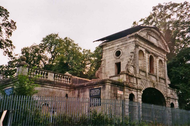
Theobald's Park

(Image credit: Temple Bar, Theobalds Park cc-by-sa/2.0 – © Christine Matthews – geograph.org.uk/p/185643)

Plans to return Temple Bar to London began to take on a more positive aspect in 1976 when the Temple Bar Trust was formed, specifically with the aim of returning the structure to the City.

Rebuilding of the area to the north of St. Paul’s Cathedral offered an opportunity for Temple Bar, where it could form part of the Paternoster Square development. A landmark location, where there were no concerns about traffic restrictions that such as structure would impose.

Temple Bar was again dismantled, transported back to London and rebuilt over one of the entrances to Paternoster Square. Temple Bar was officially reopened at its new, third, location on the 10th of November 2004 by the Lord Mayor of London:
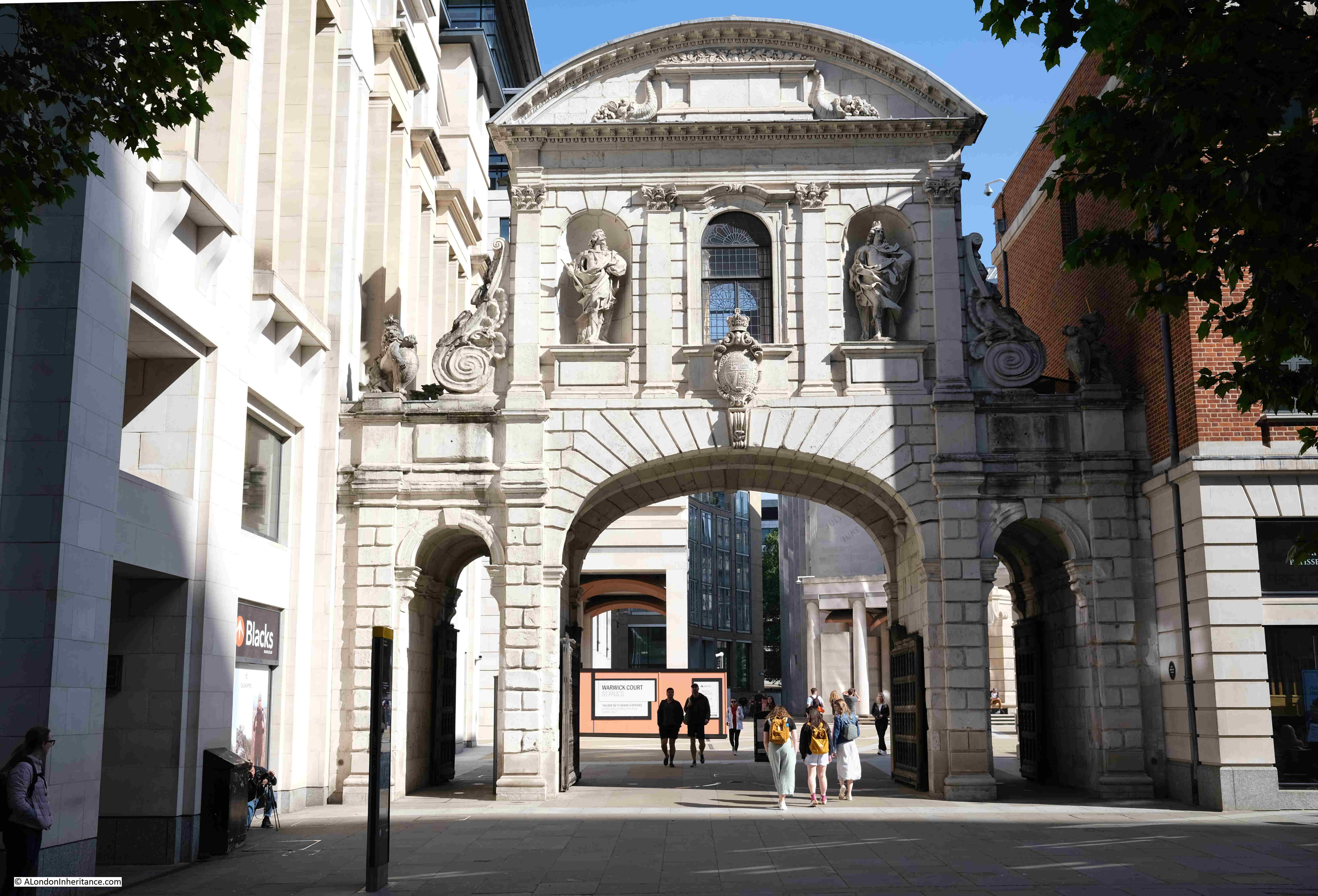
Paternoster Square

But the version of Temple Bar we see at the entrance to Paternoster Square was only the last of a series of barriers across Fleet Street / the Strand, to mark the boundary of the City of London.

The first references to a barrier across the street date back to the 13th century when a bar was recorded as being across the street. This was not a stone structure, and would probably have been some form of wooden or chain barrier that could be moved across the street. The bar, and location close to the Temple appears to have been the source of the name Temple Bar.

The historian John Strype, writing in the early 18th century stated that at Temple Bar “there were only posts, rails, and a chain, such as are now in Holborn, Smithfield, and Whitechapel bars. Afterwards there was a house of timber erected across the street, with a narrow gateway and an entry on the south side of it under the house.

It is difficult to be sure of the appearance of earlier versions of Temple Bar. One print dating from 1853 which claimed to be copied from an old drawing of 1620 shows what Temple Bar may have looked like in the 17th century (© The Trustees of the British Museum):
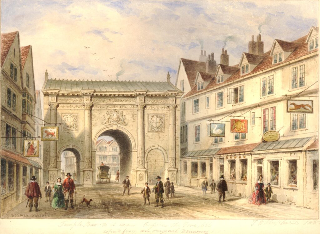
Old Temple Bar

Temple Bar was rebuilt between 1670 and 1672 by Sir Christopher Wren, and it is Wren’s version that we can see in Paternoster Square today. Built of Portland Stone, the structure continued to provide an impressive gateway to the City of London.

The location of Temple Bar is perhaps further west of what could be considered the traditional boundaries of the City, the original City Wall and the Fleet River.

Temple Bar is where the Freedom of the City of London met the Liberty of the City of Westminster, and originally whilst not part of the original City of London, it is where the freedoms granted to and by the City of London extended beyond the original City walls, up to the point where Westminster took over jurisdiction.

The location is also where Fleet Street and the Strand met. We can still see this today if you stand by the monument on the site of the gate and look across to the Law Courts where there is a street sign for the Strand, and opposite on the old building of the Child & Co. bank is the sign for Fleet Street.

The following print shows Temple Bar in 1761 (© The Trustees of the British Museum):
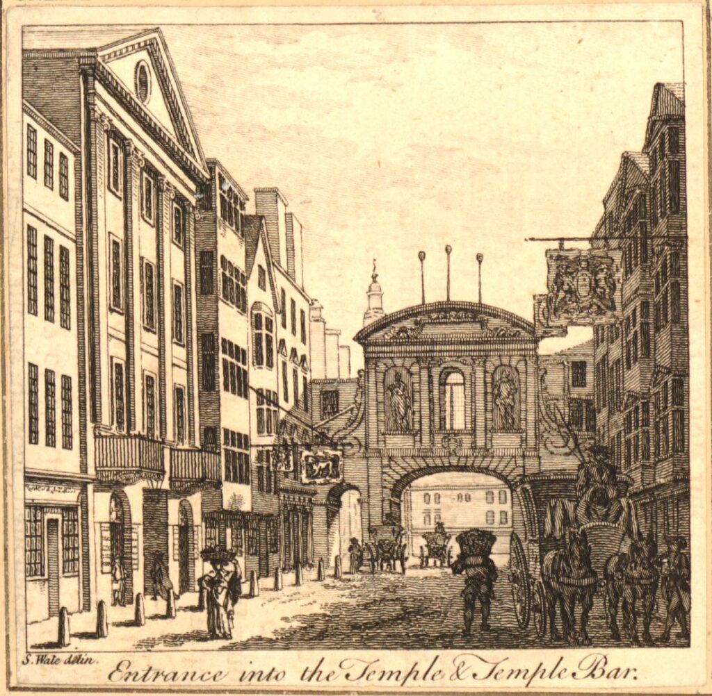
Heads on spikes

Perhaps the most disturbing part of the above print is that even at this point in the 18th century, heads of the executed where still being displayed on poles high above the gate.

The display of heads seems to have been just part of everyday life for 18th century Londoners. Newspaper reports on the 7th of February 1732 simply reported that: “On Sunday the Head of Colonel Oxburgh, who was executed for being in the Preston Rebellion, and had his Head stuck on a Pole, fell off from the Top of Temple Bar.”

The last heads to be displayed above Temple Bar were those executed following the 1745 Jacobite rebellion, including Colonel Francis Townley and George Fletcher.

They were hung on Kennington Common, cut down, then disemboweled, beheaded, and quartered, after which their hearts were thrown into a fire, and at the end of August 1746, newspapers report that “On Saturday last the Heads of Townley and Fletcher were brought from the New Goal, and fixed on two Poles on Temple Bar. The Heads of Chadwick, Barwick, Deacon and Syddall, are preserved in Spirits, and are to be carried down to Manchester and Carlisle, to be affixed on Places most proper for that Purpose.”

A few days later, on the 13th of August, 1746, the Kentish Weekly Post carried a report that showed how feelings were still running high after the 1745 rebellion: “On Friday a Highlander, as he was passing by Temple Bar, and observing the Heads there, uttered several treasonable expressions, upon which he was severely handled by the Populace.”

The heads stayed on their poles for a considerable number of years, until March 1773, when a strong March wind brought down one head, with the second following soon after.

Temple Bar was also the scene of less grisly punishments, with a pillory being set up at the gate. In 1729 it was reported that a Mr. William Hales “Received sentence to pay a Fine of ten Marks upon each Indictment, to stand in the Pillory twice, viz. once at the Royal Exchange, and once at Temple Bar, to suffer five years imprisonment, and to give Security for his good Behaviour for seven years.”

Temple Bar was though the scene of far more enjoyable activities with numerous processions passing through the gate and ceremonies being held at the gate. When the Monarch entered the City, they would be greeted by City dignitaries at the gate.

On the 9th of November 1837, Queen Victoria was greeted at Temple Bar where she was presented with the ceremonial sword of the City of London.

During the funeral of Lord Nelson, his funeral procession was met at Temple Bar by the Lord Mayor and representatives of the Corporation of London.

The following print shows another of Queen Victoria’s visits to the City where the Queen and Prince Albert in the royal carriage, are being presented again with the ceremonial sword of the City of London as they arrive at Temple Bar(© The Trustees of the British Museum):
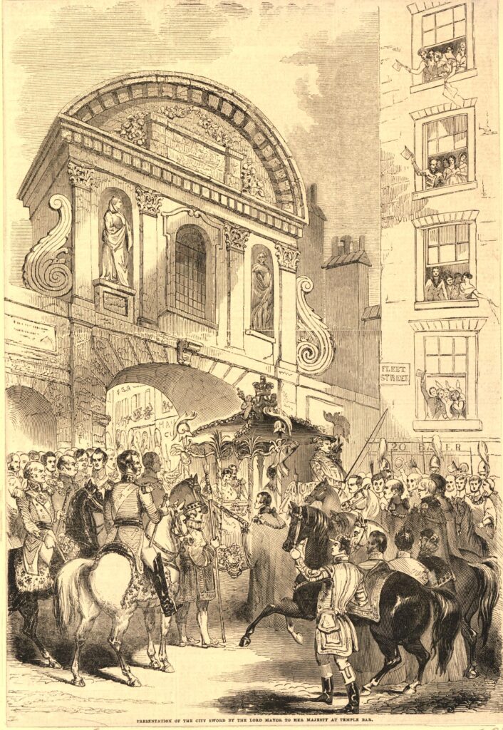
Queen Victoria visit to the City of London

In the second half of the 19th century, much of the area around Temple Bar was being redeveloped, with the Law Courts being the major development to the north of the gate. The following print, dated 1868, shows buildings being demolished ready for construction of the Law Courts and is titled, and shows the “Forlorn Condition of Temple Bar” (© The Trustees of the British Museum):
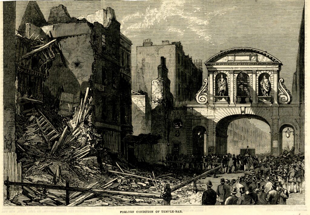
Temple Bar

And almost ten years later, a print showed the structure ready for demolition, with the title of “Temple Bar’s Last Christmas Day” (© The Trustees of the British Museum):
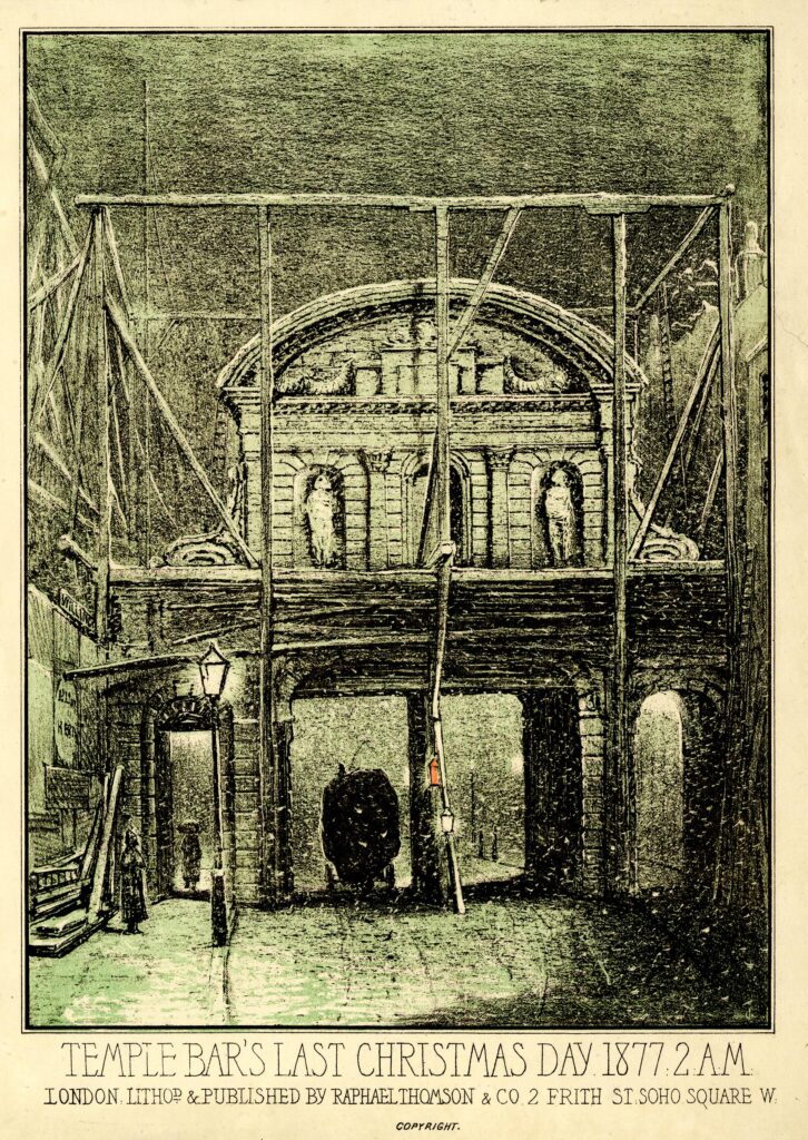
Temple Bar

And today we see the gate between Paternoster Square and St. Paul’s Cathedral:
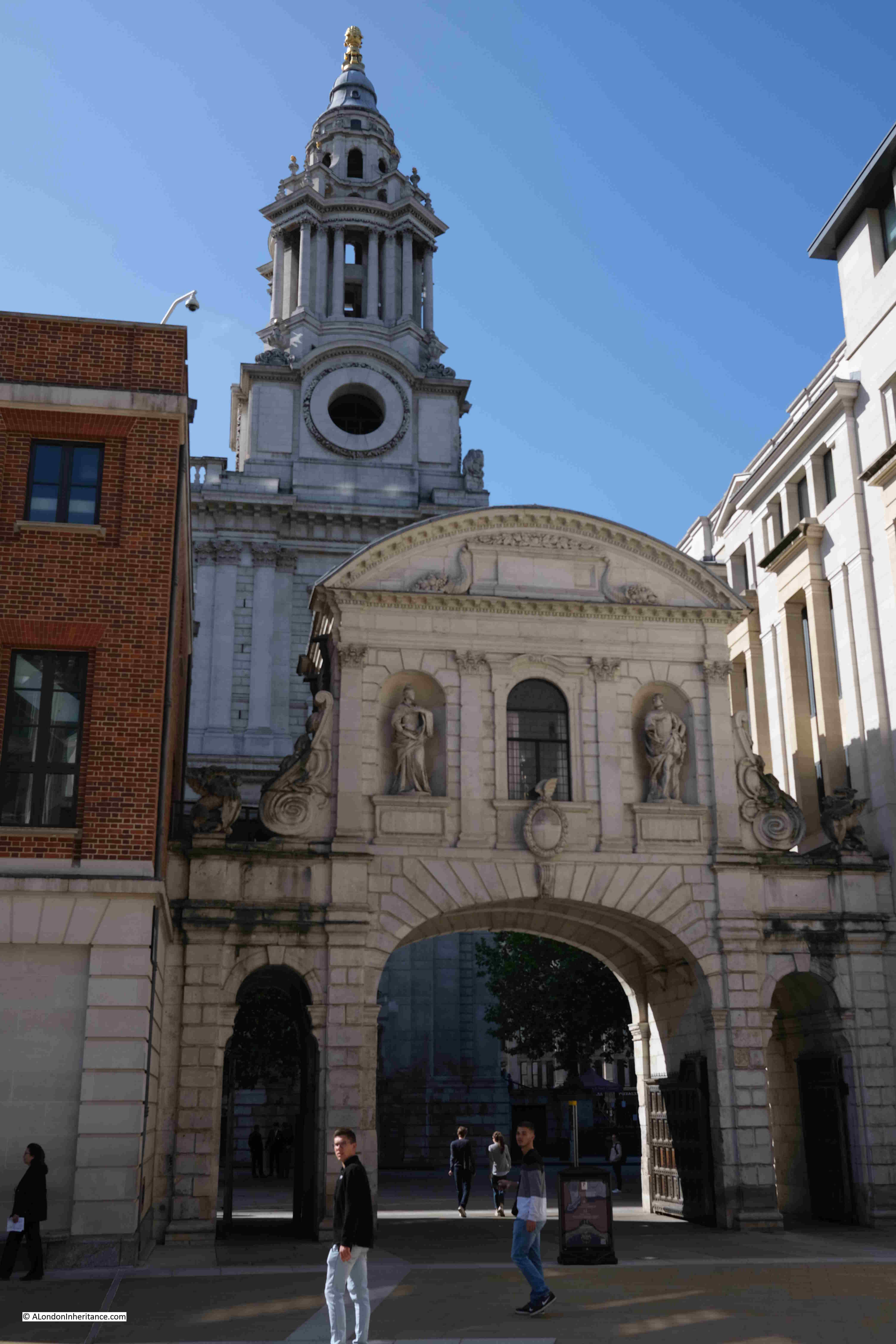
Temple Bar

There are a number of statues on the gate. The following photo shows the statues that originally faced to the east and Fleet Street. On the right is James I. The figure on the left is often referred to as Anne of Denmark, the wife of James I, although there are other references, including in Old and New London by Walter Thornbury who claims the statue is of Queen Elizabeth. Anne of Denmark seems to be the most probable.
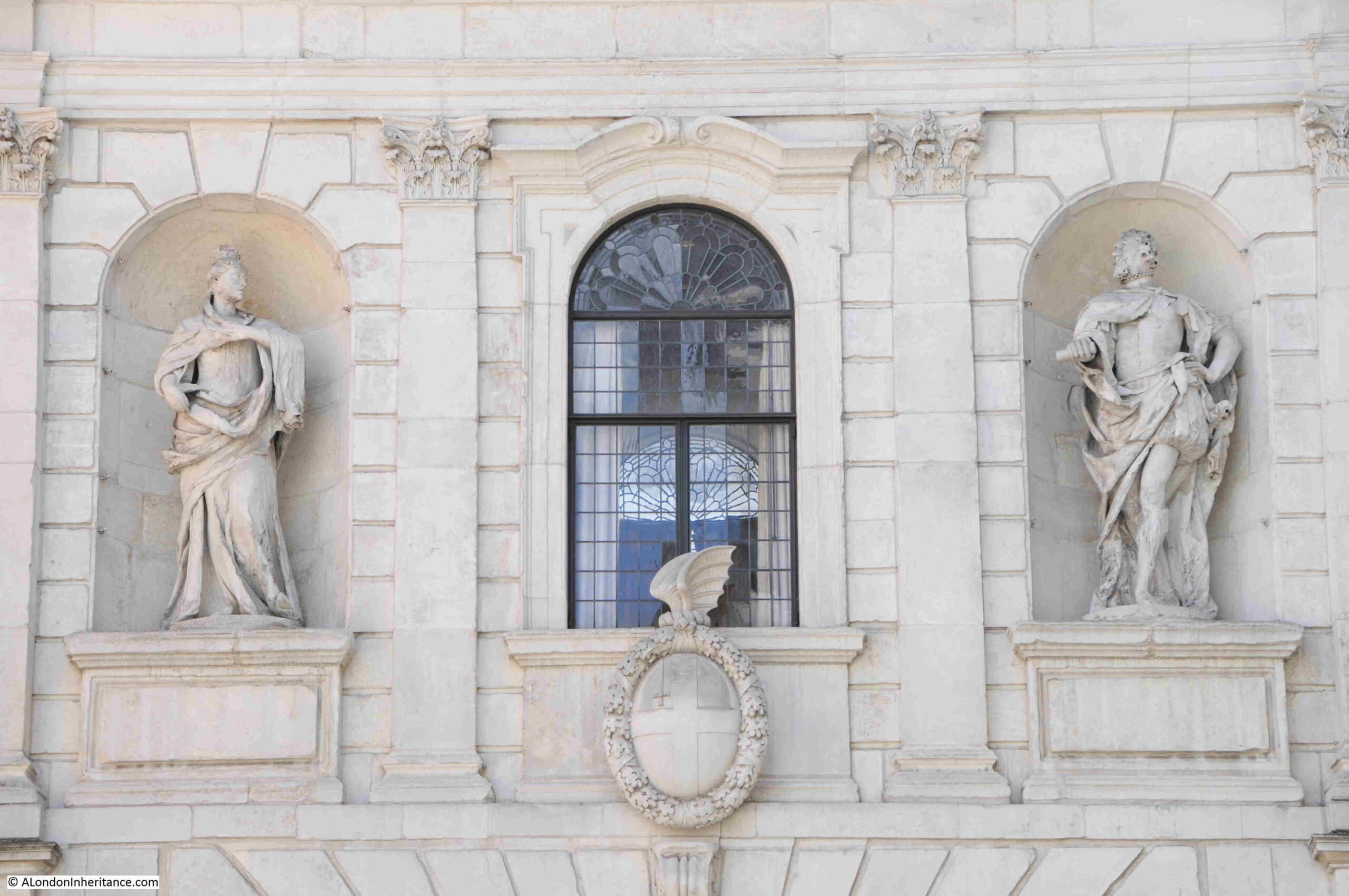
Temple Bar

On the old western, Strand side of the gate are statues of Charles I and Charles II:
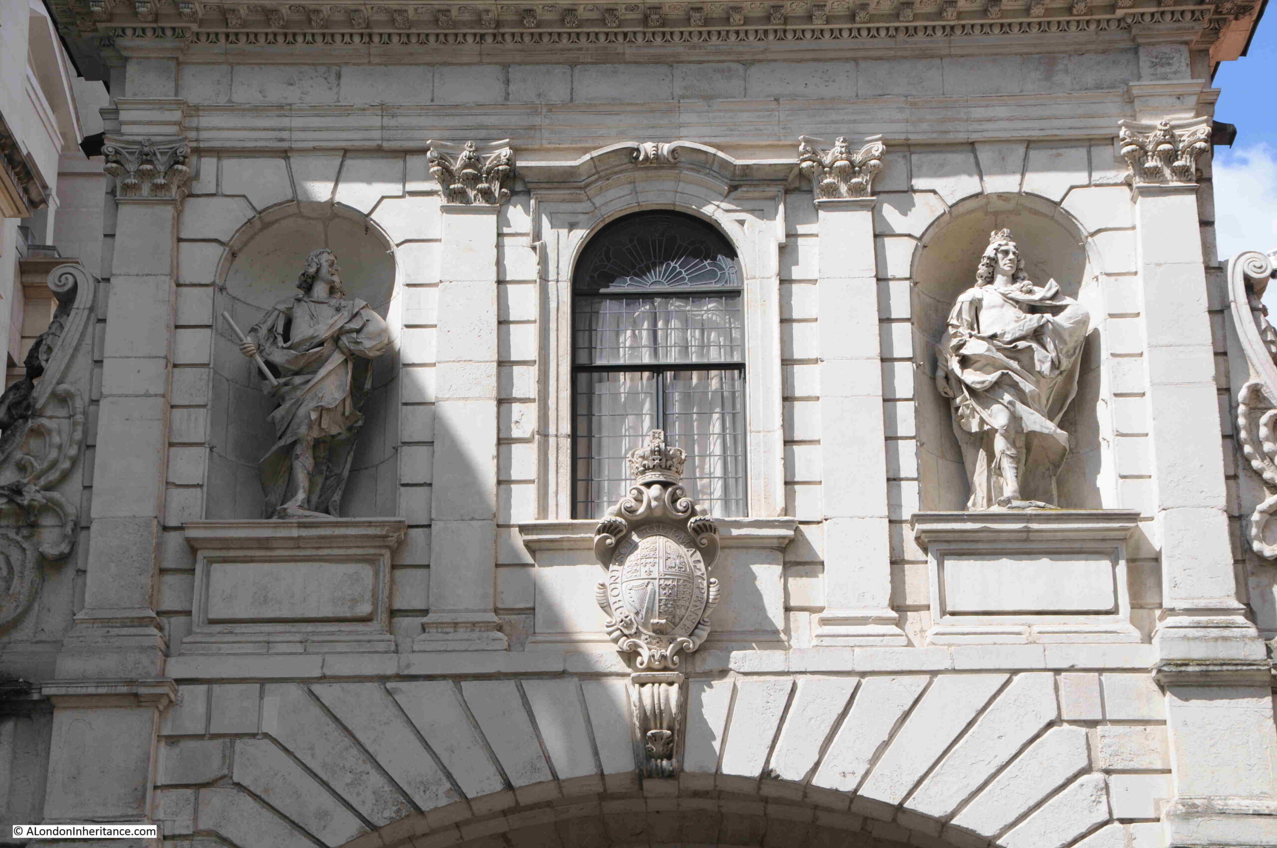
Temple Bar

A plaque in the ground by the gate records the names of Edward and Joshua Marshall, Master Stone Masons, Temple Bar, 1673.

Edward was the father and Joshua the son.
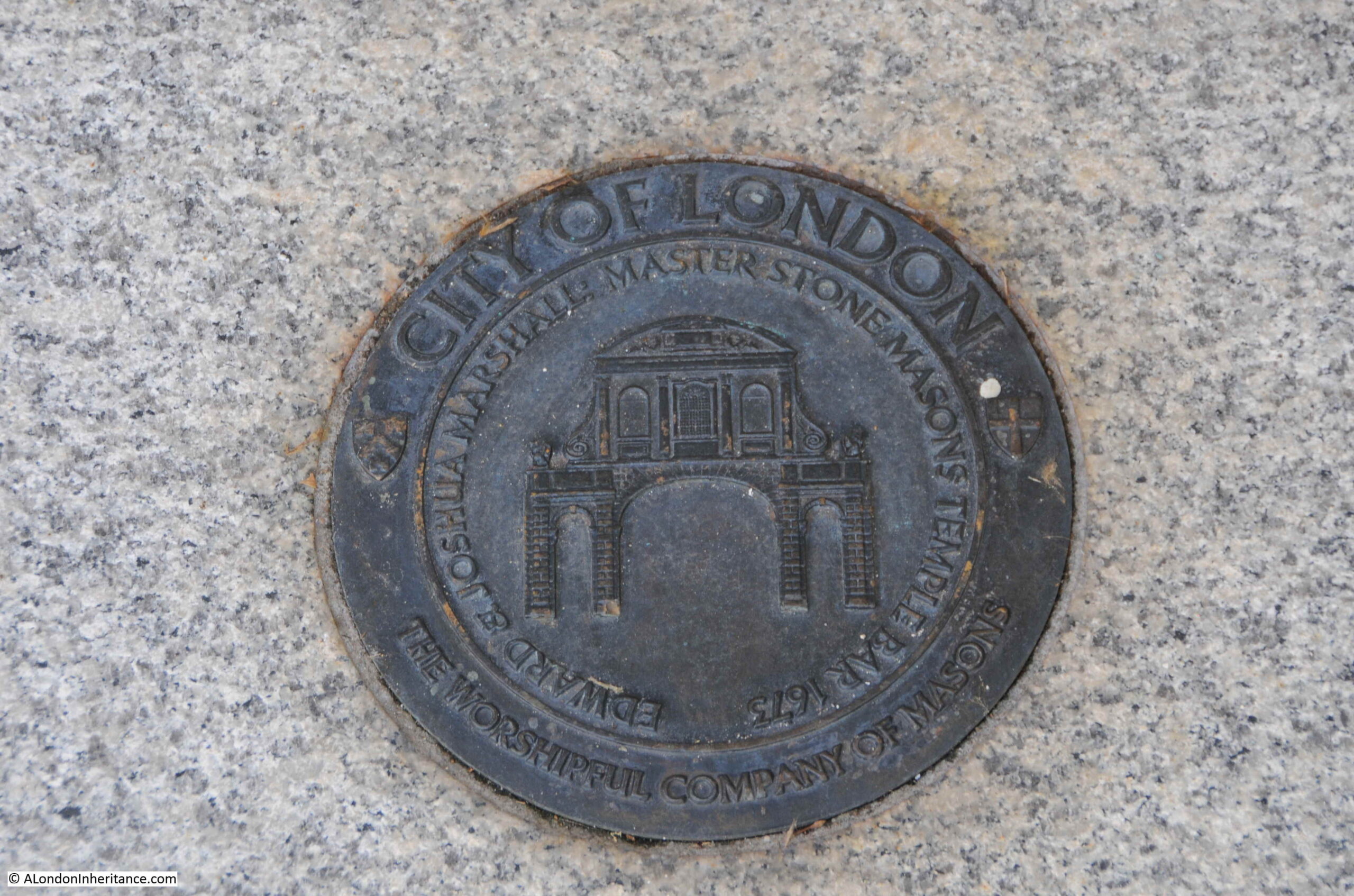
Master Masons

They were stones masons who worked on a considerable number of 17th century buildings and monuments in the city. It is believed that the majority of the work on Temple Bar was completed by Joshua, as his father was in his sixties by the time of the gate’s construction.

So what of the monument that can be seen today at the old location of Temple Bar?

It was still important to mark the boundary to the City of London, and soon after Temple Bar was demolished, a new monument was built in the centre of the widened street:

Temple Bar memorial

In 1880, the Illustrated London News described the new monument: “The new structure will be of an elaborate and handsome character, from designs by Mr. Horace Jones, the City Architect. It will be 37ft high, 5ft wide and 8ft long. The base will be of polished Guernsey granite, the next tier of Balmoral granite, and above that will be red granite from the same quarry as that used in the Albert Memorial in Hyde Park.

In niches in the north and south sides will be life size figures in marble of the Queen and the Prince of Wales, by Mr. Boehm, and in panels in the sides will be reliefs in bronze by Mr. Mabey and Mr. Kelsey, of the Queen’s first entrance into the City through Temple Bar in 1837, and of the procession to St. Paul’s on the day of the thanksgiving for the Prince of Wale’s recovery. The superstructure will be of hard white stone, and will be surmounted by a griffin, the heraldic emblem of the City, which is being executed by Mr. Birch.”
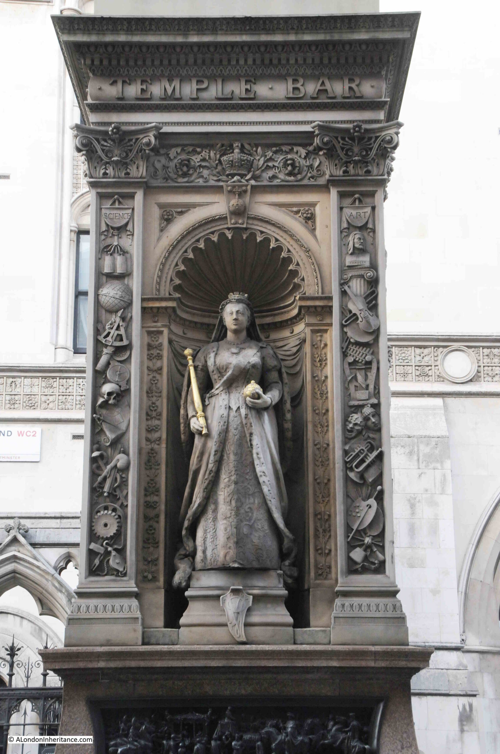
Queen Victoria

As well as marking the location of Temple Bar, the monument was claimed to offer a refuge for those crossing the street, however the Illustrated London News did not understand this justification, or the need for marking the boundary: “We know of no sufficient reason for marking this particular boundary. Other similar landmarks – such as Ludgate, Aldgate, Cripplegate, and Bishopsgate – have been removed without loss of municipal prestige, rights, or privileges worth preserving. The need of a refuge is much more obvious where the thoroughfare is wide, like Regent Street, or still more where roads intersect.”
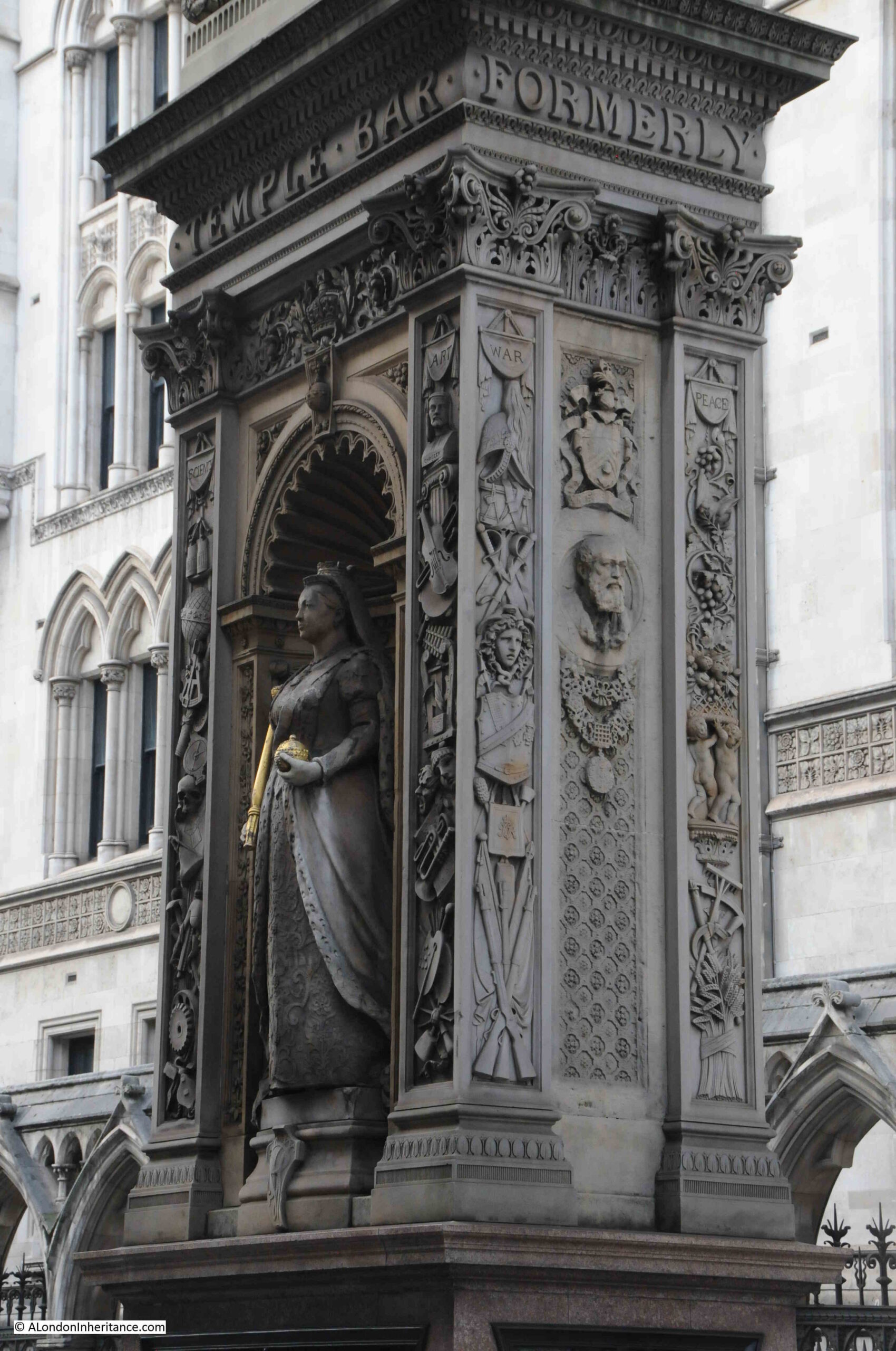
Queen Victoria

Victoria’s son, Prince Edward, Prince of Wales on the side of the monument facing the Law Courts:
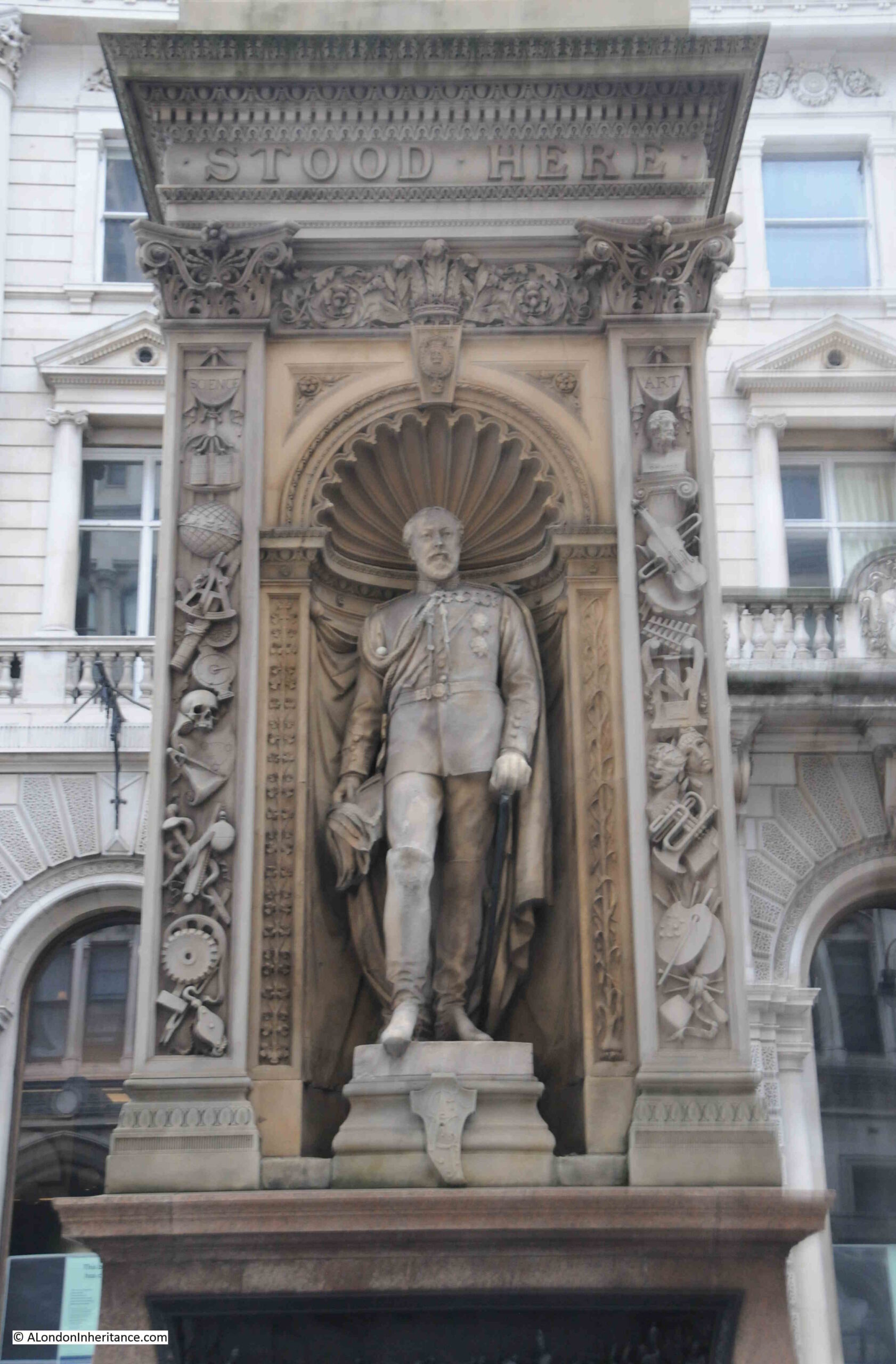
Prince Edward

On either side of the statues there are columns of carvings, with the left column representing Science and the Arts on the right column. On the narrow ends of the monument there are columns of carvings representing War and Peace.
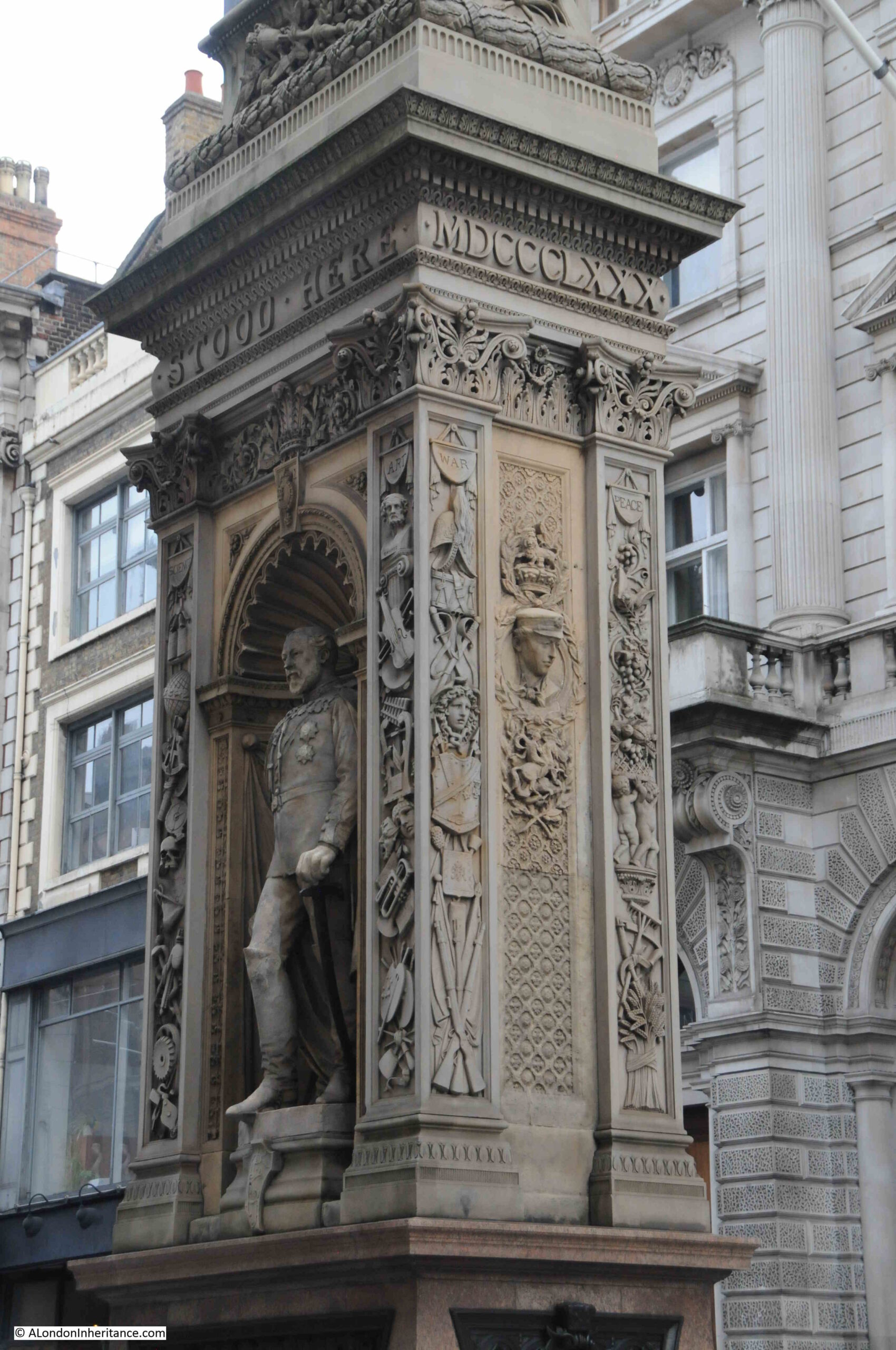
Prince Edward

The new monument was far from universally popular and there was much criticism about the design and location.

in 1881, the Corporation of London had appointed a committee to look at the memorial and decide whether it should be removed and placed in some more convenient spot.

The Times included an article which referred to the monument that the “erection is an eyesore in point of taste, a mischievous obstruction instead of a public convenience and reckless expenditure. As to its future, the best that we could hear would be that it was likely to disappear and be no more seen. The 10,000 guineas or more that it cost would be wasted, no doubt, but they could not be more thrown away than they are at present on a monument which no one likes, and everyone laughs at.”

The monument was even vandelised, despite being guarded. The Weekly Dispatch reported on the 7th of August 1881 that “Notwithstanding the vigilance of the City and Metropolitan Police who are appointed to guard the memorial, it was on Friday morning discovered that there had been further mutilation of the bas-relief representing various events in civic history.”

And on the 29th of August 1881 “On Saturday evening a young man who was lodged in the Bridewell police station on a charge of wilfully damaging the Temple Bar Memorial. A gentleman who was passing by saw the prisoner deliberately disfiguring the heads and legs of the figures with his fists. The attention of a police-constable was called to the matter, and he immediately took the offender into custody. When asked by the Inspector why he had done it, the prisoner replied, ‘I did it for fun. It is only an obstruction, and I didn’t see why I should not have a go at it as well as other people.”

The monument seems to have gradually been accepted, receiving less attention as time went by, although being in the middle of the busy Fleet Street / Strand, with growing levels of traffic in the 20th century, the monument was occasionally still referred to as an obstruction.

Below the statues, there are four reliefs on the four sides of the pedestal.

The first is a rather accurate reminder of the location of Temple Bar:
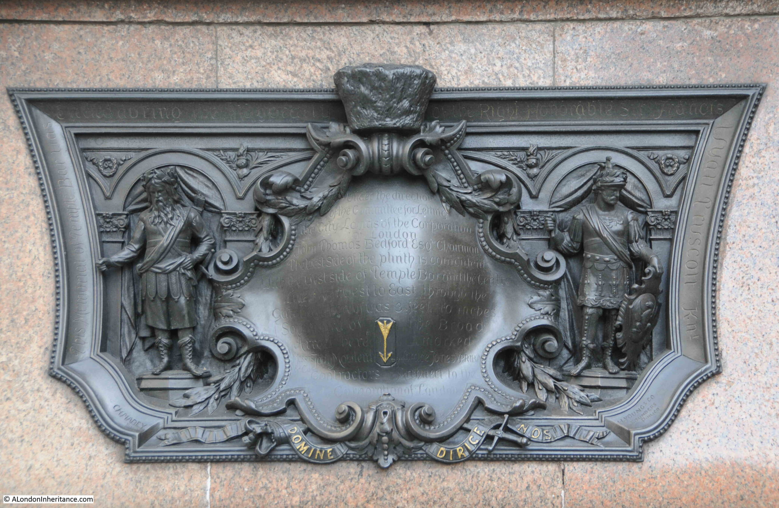
Temple Bar

The text reads: “Under the direction of the committee for letting the City lands of the Corporation of London. John Thomas Bedford Esq. Chairman. The west side of the plinth is coincident with the west side of Temple Bar and the centre line from west to east through the gateway thereof was 3 feet 10 inches southward of the broad arrow here marked.”

On the end of the monument facing Fleet Street is a relief of Temple Bar:
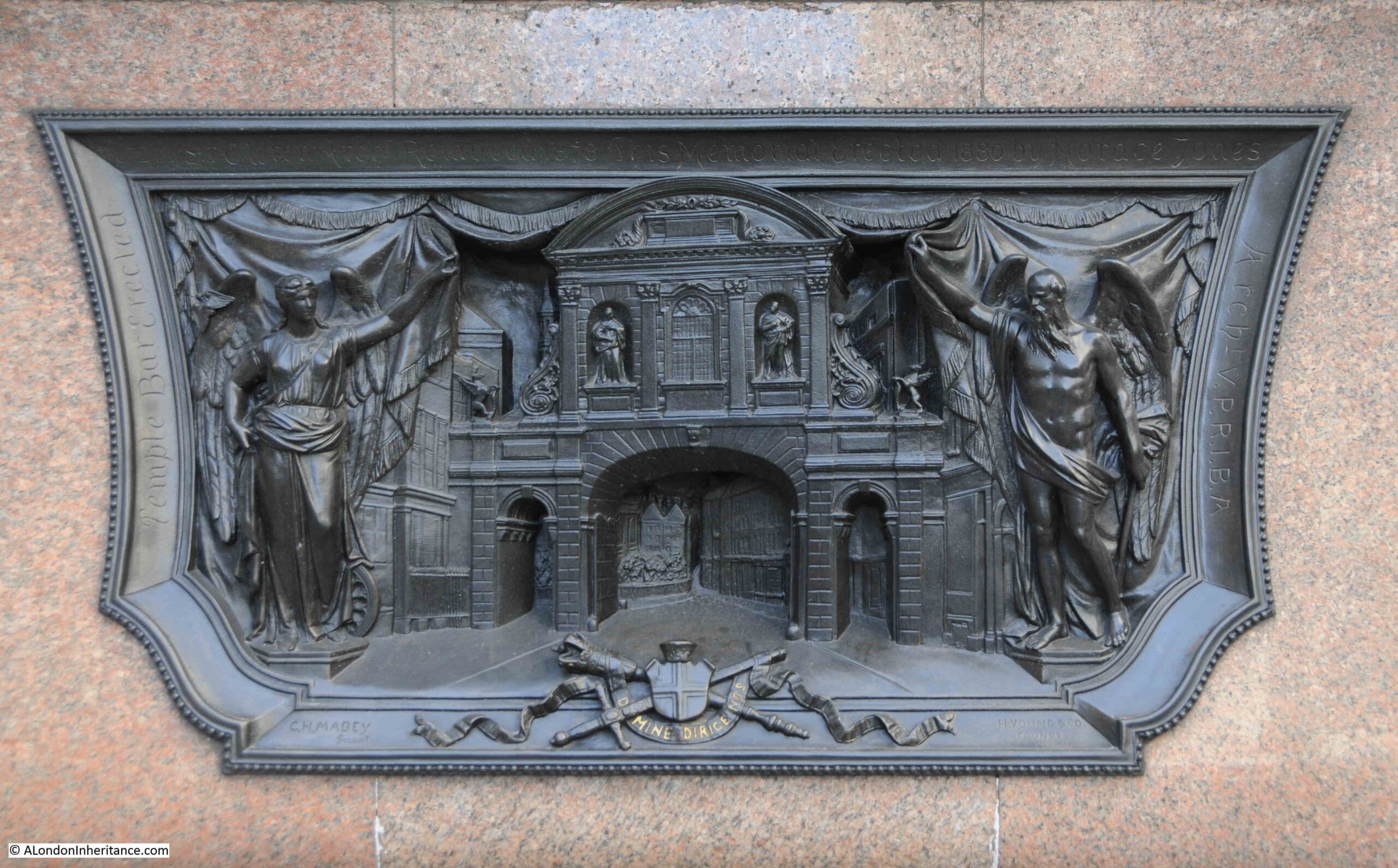
Temple Bar

On the side is a relief titled “Her most gracious Majesty Queen Victoria and his Royal Highness Prince Albert Edward Prince of Wales going to St. Paul’s February 27 1872”:
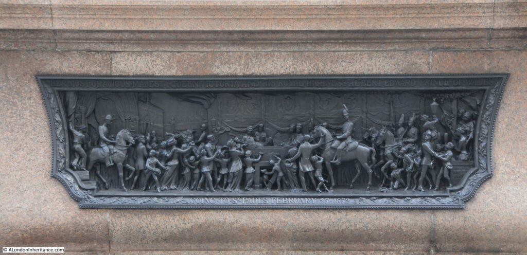
Temple Bar

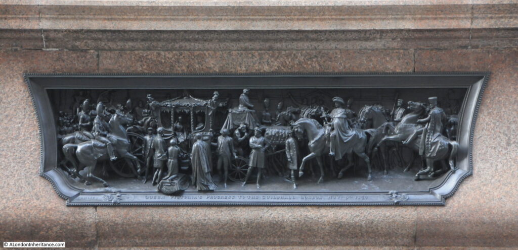
And on the other side of the plinth is a relief titled “Queen Victoria’s progress to the Guildhall, London Nov. 9th 1837.

Temple Bar

The importance of this location as a boundary, not just as the boundary to the City of London, can be seen by a boundary marker set in the pavement on the south side of the street, directly opposite the monument:
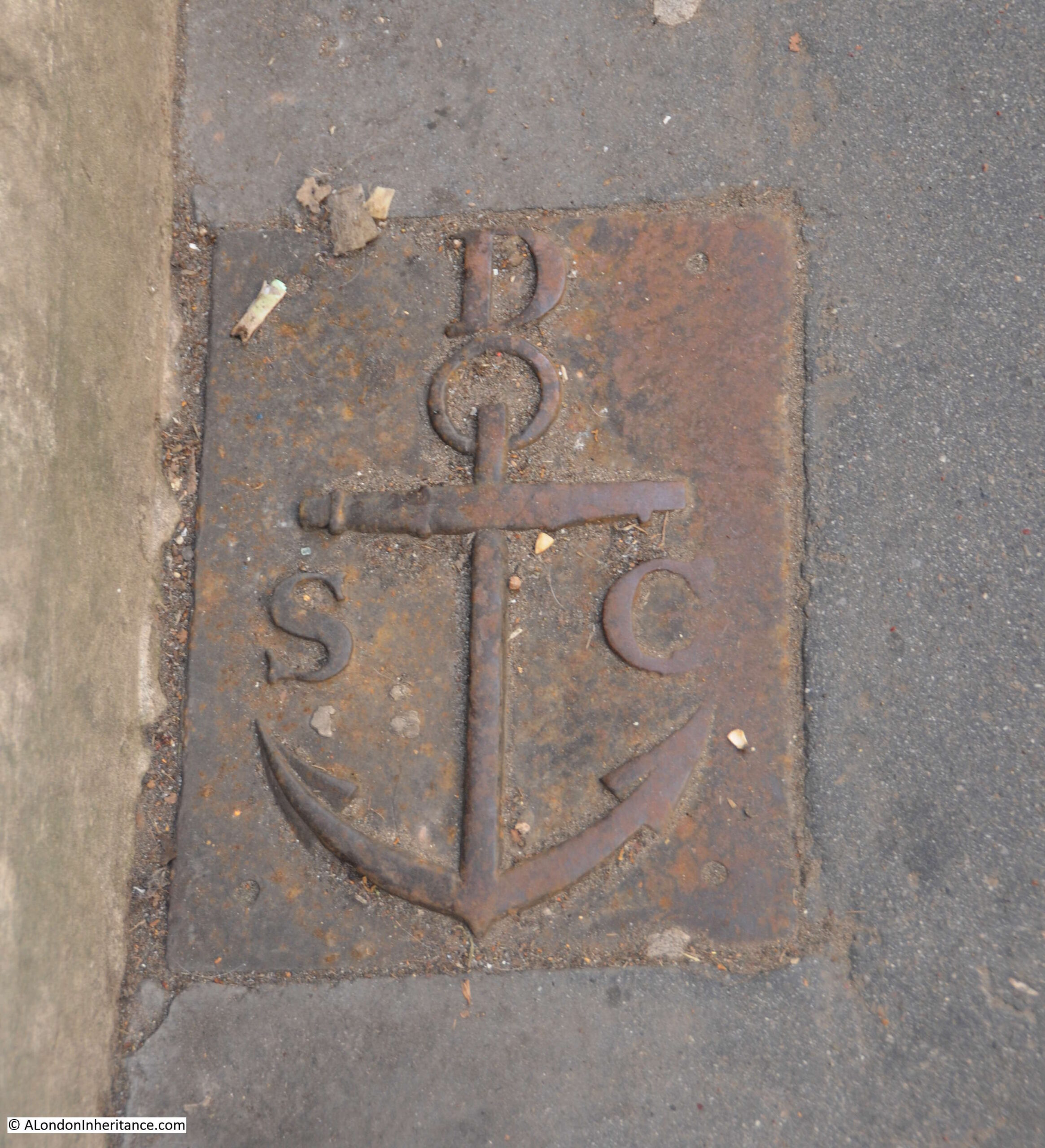
St Clement Danes parish boundary marker

This is a boundary marker of the parish of St. Clement Danes. The relevance of the anchor is that it became the symbol of St. Clement as he was apparently tied to an anchor, then thrown into the sea to drown.

I assume that the parish of St. Clement Danes would have ended at the boundary with the City.

What is fascinating about the story of Temple Bar is the recurring theme of how buildings and architecture are treated in London. For example, from Mr. H. Oscar Mark’s letter earlier in the post where he suggested that “strenuous efforts should be made by Londoners who love their London and its old landmarks – of which we have too few left – to reacquire this fine old relic, and to re-erect it on one of the sites named or in the heart of London“.

This was followed by a chorus of criticism about the new monument that replaced Temple Bar at the meeting of Fleet Street and the Strand.

However I suspect there would be concern and criticism if there were proposals today to remove the monument. How we view buildings and architecture in general is very much related to time and their age.

alondoninheritance.com

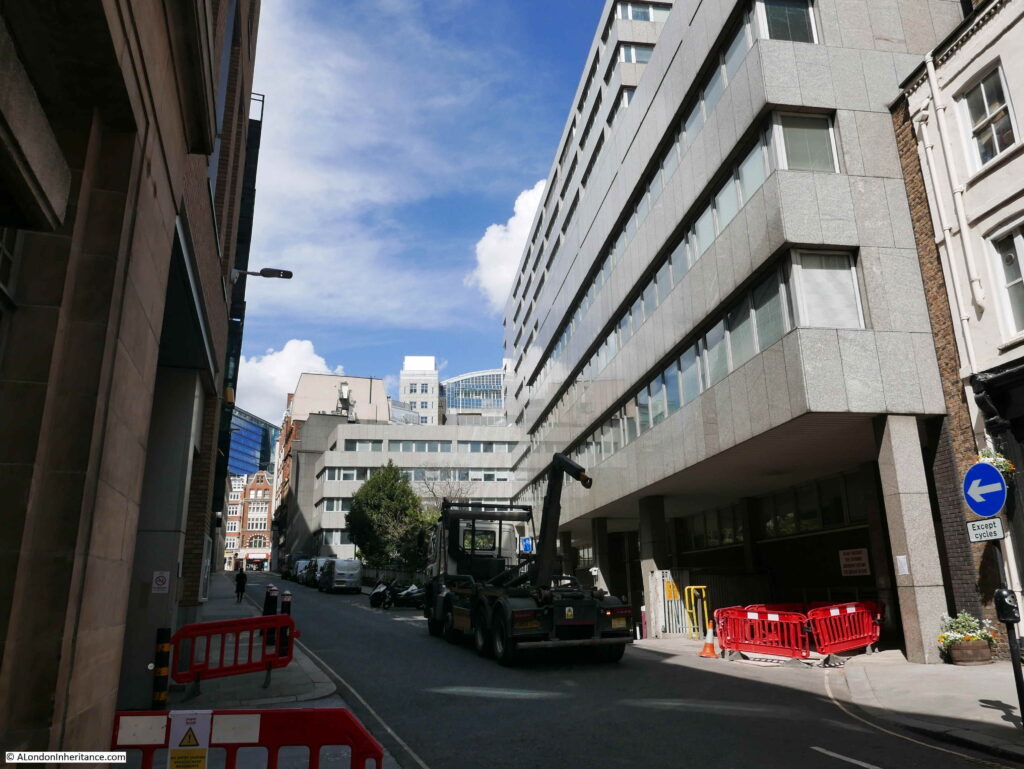
Three Future Demolitions and Re-developments

The streets of London always have, and always will change. Buildings can disappear almost overnight and be replaced by a very different structure.

I try and photograph buildings and places before any demolition. This can be a challenge given the rate of change, however for today’s post, there are three places I want to focus on which will probably be very different in the years to come.

The three locations are shown in the following map  (Map © OpenStreetMap contributors):

Three Future Demolitions

The London Studios / London Weekend Television

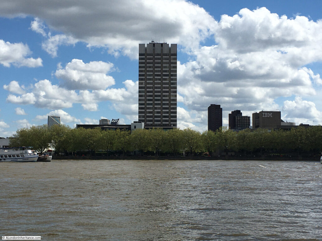
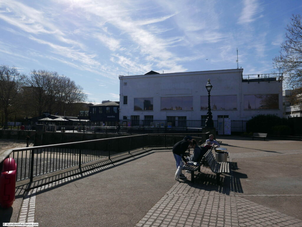
Look across the river from the Embankment by Temple Underground Station, and this is the view:

London Studios

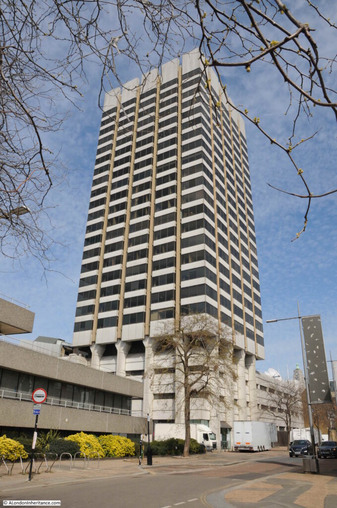
The tall tower was originally known as Kent House, a 24 story tower block, and the most visible part of the old studio complex which also includes a significant area of land around the base of the tower, including the low rise buildings which can just be seen to the left of the tower, above the tree line.

Kent House, and the low rise buildings were until 2018, ITV’s London Studios, also known as the Southbank Television Studios. It was here that ITV made Good Morning Britain, Loose Women, Ant and Dec’s Saturday Night Takeaway, the Jonathan Ross Show, along with a considerable number of shows for other channels, such as the Graham Norton Show and Have I Got News For You for the BBC. If you have watched ITV prior to 2018, chances are that you would have seen a programme filmed here on the south bank of the river.

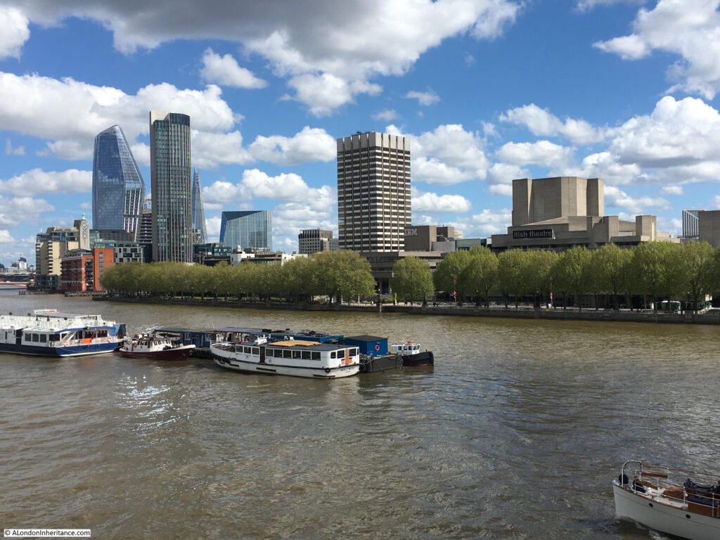
The following photo shows the view of Kent House from Waterloo Bridge. The National Theatre is the building to the right.

London Studios

ITV were intending to return to the south bank studios after refurbishment and development, however they made the decision to leave and sell the site, with their programmes such as Good Morning Britain now filmed at the old BBC Television Centre in White City.

The story of Kent House and the associated studio buildings dates back to the early 1970s when there were two independent television stations serving London. Thames Television operated from Monday to Friday, and from Friday evening to six on Monday mornings, London Weekend Television (LWT) would broadcast.

When LWT started broadcasting in 1968, they only had temporary studios in Wembley, and were in urgent need for custom built studios, which was even more important with the transition from black and white to colour TV.

LWT identified a block of land near the National Theatre on the south bank and proceeded to build the new studio complex, including Kent House. These opened in 1972 and became the hub for all LWT production. The benefit of a new build was that they became the most technically advanced colour TV studios in Europe at the time of opening.

The studio complex faces onto the walkway along the south bank of the river. The tower is at the rear of the complex, facing onto the street Upper Ground, with low rise buildings facing onto the river.

ITV Studios

Studio buildings extend to the left of the above photo, with the block in the following photo up against the cafes, restaurants and shops at Gabriel’s Wharf which is further to the left.

ITV Studios

The whole site will soon look very different.

ITV sold the studio complex in 2019, including Kent House, to the Japanese real estate company, Mitsubishi Estate, and plans have now been submitted for redevelopment.

Kent House and the entire studio complex will be demolished, and replaced by a 26 storey office building to the rear (Kent House has 24 floors), two lower rise blocks of 13 and 6 storeys facing on to the river.

What is a surprise is that the majority of the complex will be office space, with a capacity for up to 4,000 workers. Based on what normally happens to sites in such a prime location is conversion to apartment blocks, as is happening around the Shell Centre tower further west along the south bank. Whether the plan continues to be for offices after the work at home impact of the pandemic will be interesting to see.

The proposal also includes plans for some form of open space, the obligatory restaurants and some form of cultural space.

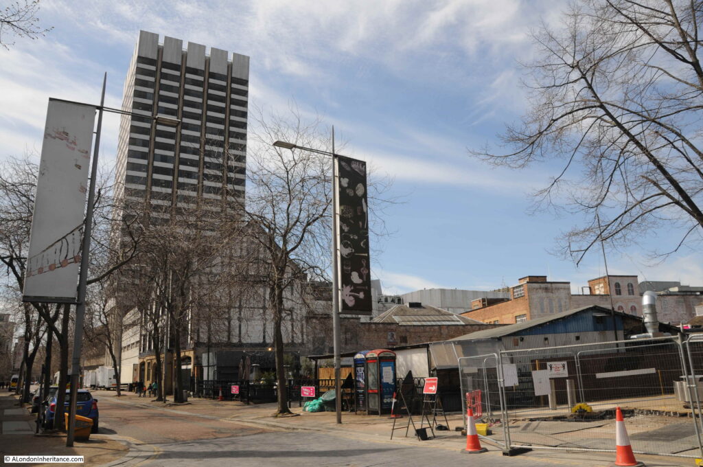
The view from Upper Ground:

Gabriel's Wharf

The cafes, restaurants and shops at Gabriel’s Wharf are to the right of the two telephone boxes. Behind them are the low rise studio buildings.

Plans for the redevelopment of the area are still at an early stage, however Mitsubishi’s partner CO-RE are currently listing a 2026 date for completion of the project.

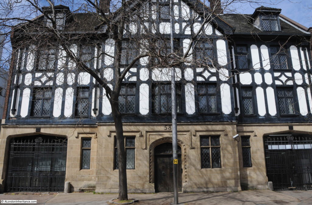
The following photo shows part of one of the old warehouses / offices at 58 Upper Ground, now part of the studio scenery stores.

Gabriel's Wharf

To the left of 58 Upper Ground is the early 1970s studio complex at the base of Kent House:

Southbank Studios

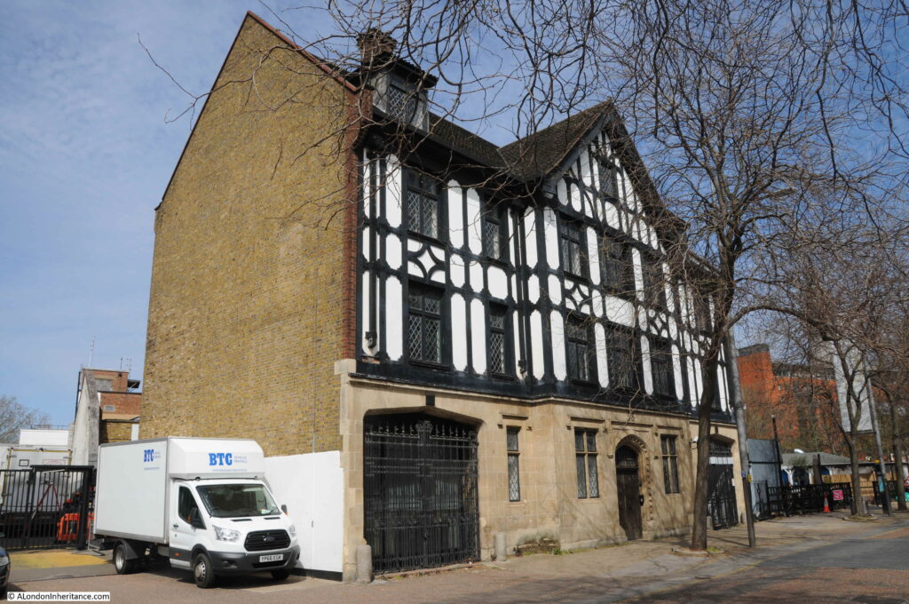
The mock Tudor building is one of the few survivors from before post war redevelopment of the area.

Gabriel's Wharf

ITV left the site in 2018, however the site still offers temporary office and studio space:

Kent House

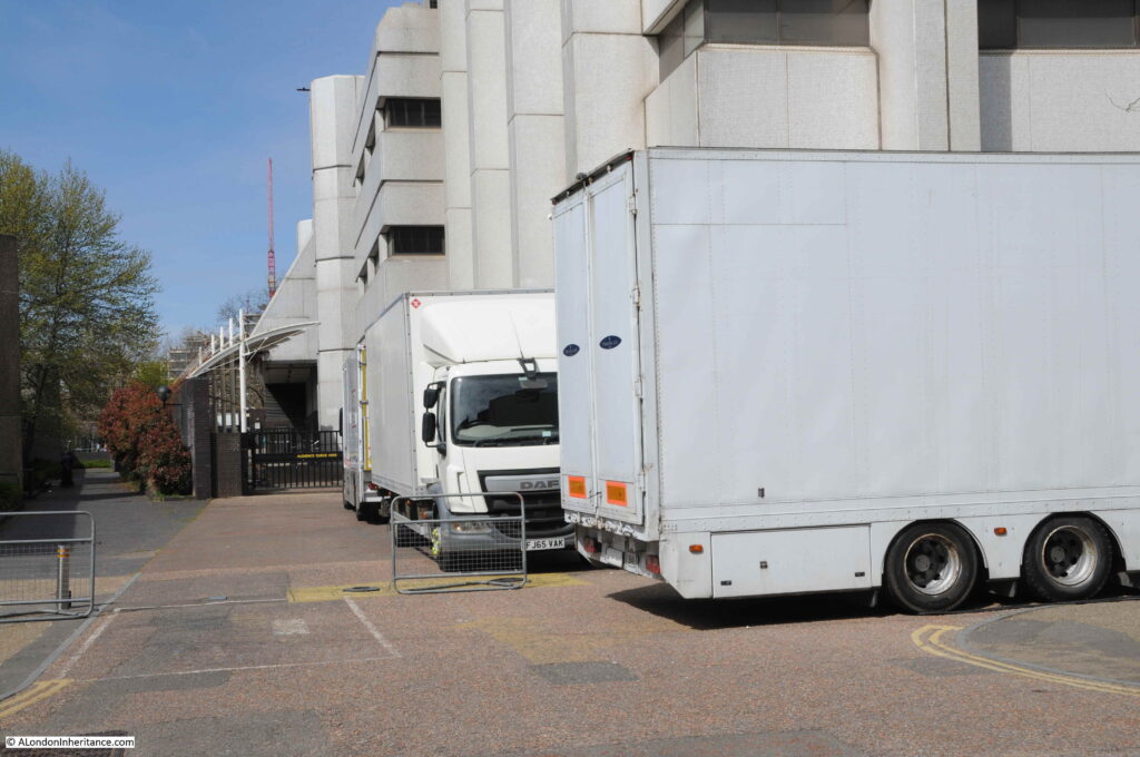
To the lower left of the Kent House tower, the studio complex can be seen at the rear. This is the western boundary of the studio complex. In the distance can just be seen the half roof of a covered walkway. This was where the audience attending a show would queue for entry. When I worked on the Southbank, it was common to see a long queue of people here in the late afternoon.

Kent House

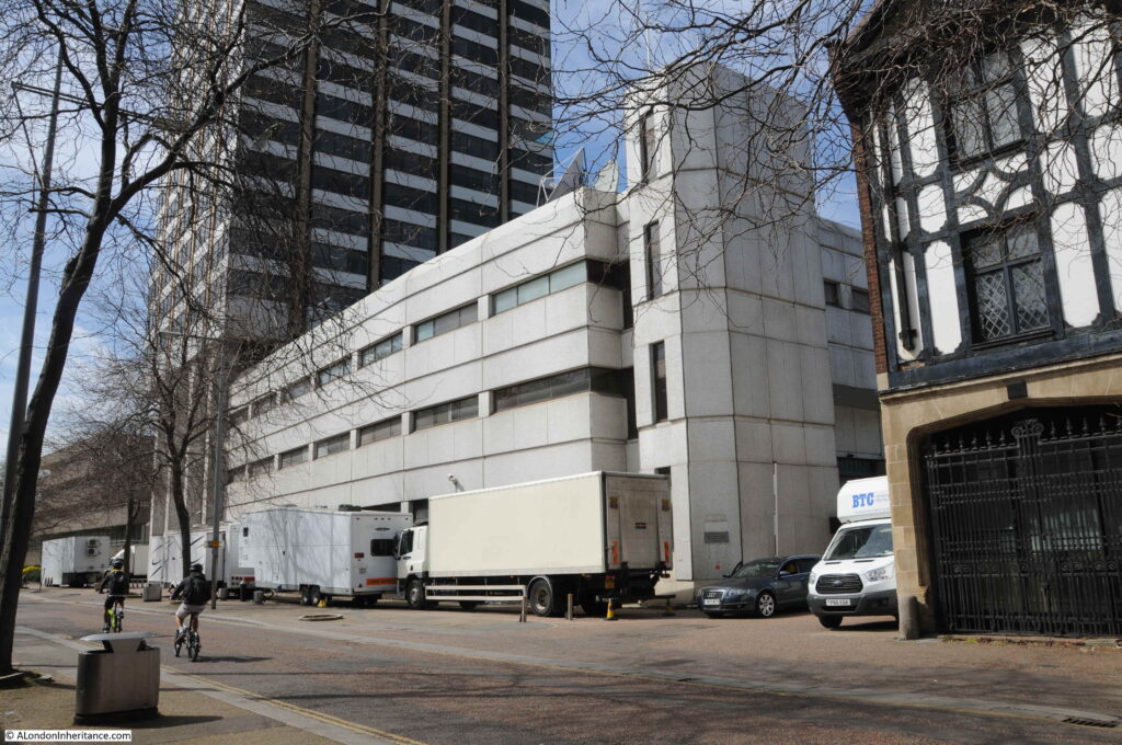
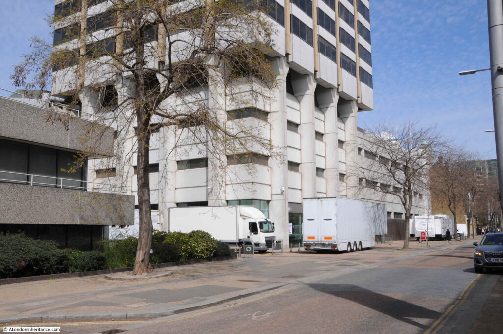
As shown in the above photo, there are frequently lorries parked around the base of the tower and studio area when the studios are in use.

The Southbank Conservation Area Statement prepared for Lambeth Council Planning states “The ITV tower is reasonably attractive but the lower buildings are of little architectural interest and the entrance forecourt is almost cluttered with waiting vehicles and delivery lorries”.

Personally, I think that this is a danger when looking at something only from a conservation perspective. The lorries at the base do add clutter to the scene, however they are there only because this is a working studio complex, which has added a diversity of activity and a busyness to Upper Ground.

The loss of a diverse range of activities when areas are transformed to a mix of expensive apartments, offices, hotels and chain restaurants, cafes and take-ways can really destroy an area.

Diversity of activity is essential in keeping a city alive.

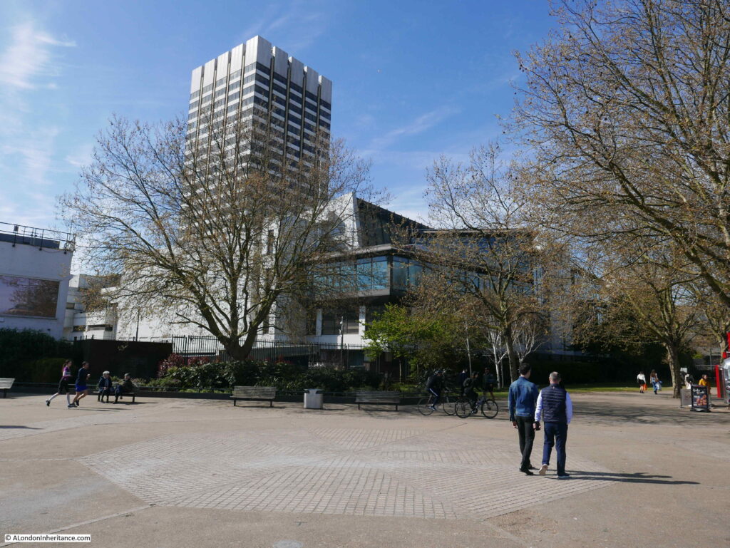
The following photo shows the base of the tower and the lower levels of the studio complex. I love the way the tower looks as if it has been slotted over the lower levels, with the legs of the tower reaching down along the sides to the ground.

Kent House

A full view of the Kent House tower from Upper Ground:

Kent House

The next site is still on the south of the river, close to London Bridge Station and Tooley Street is:

Colechurch House

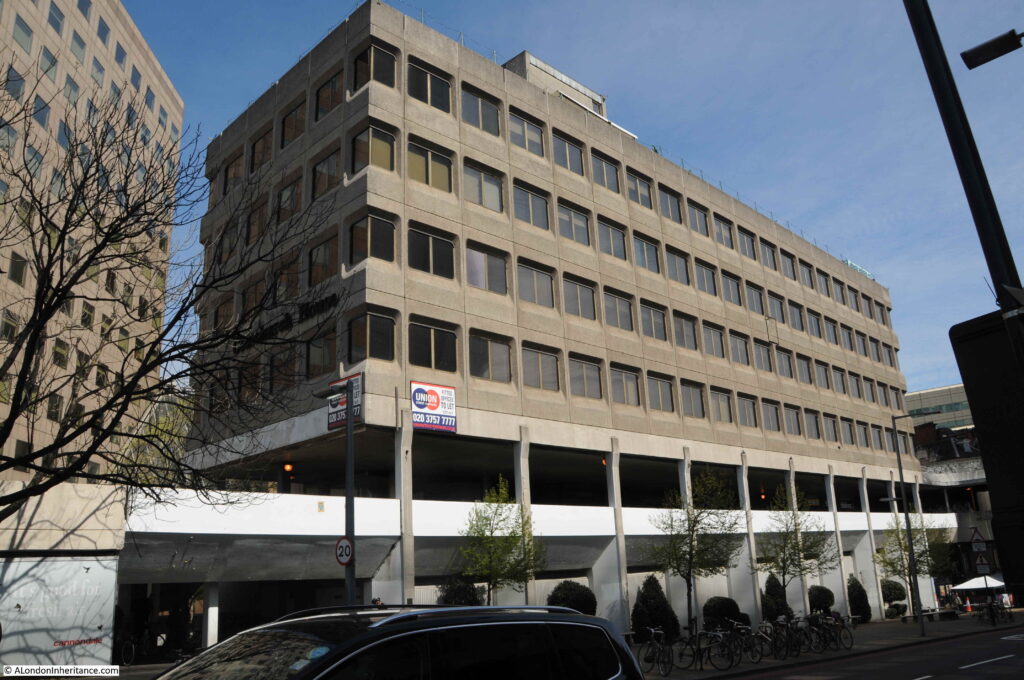
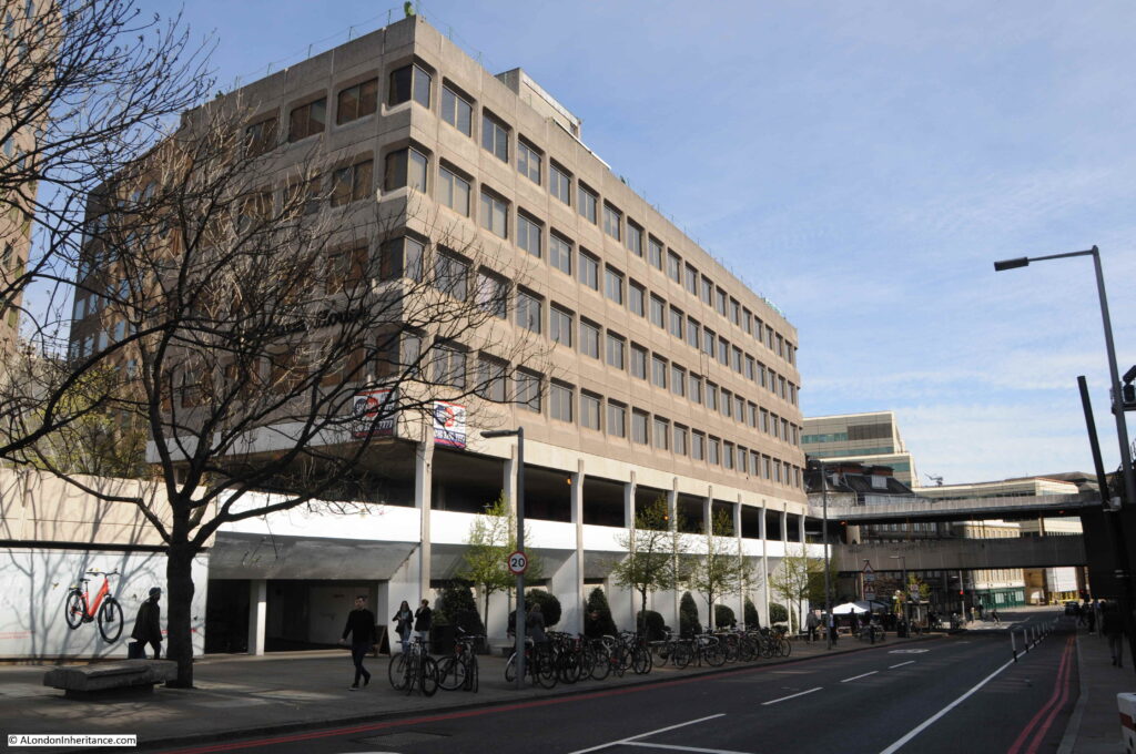
Colechurch House is a late 1960s office block on a relatively narrow strip of land between Tooley Street and Duke Street Hill. The main office building is lifted above ground level, and includes a walkway which provides access to the taxi waiting area for the station and London Bridge Street.

Colechurch House

Colechurch House was designed by architect E G Chandler for the City of London. It was named after Peter de Colechurch who was responsible for the first stone London Bridge, the building of which was started in 1176 and completed in 1209.

The building and the freehold of the land is owned by Bridge House Estates, and on the 14th October, the City of London Corporation as Trustee of Bridge House Estates released a press statement that property owner CIT had purchased a lease of the building, and would be bringing forward proposals for redevelopment.

Colechurch House

CIT’s proposals for the complete redevelopment of the site include replacing Colechurch House with a new office building ranging in height from 12 to 22 storeys, with the lowest height part of the building being at the London Bridge / Borough High Street end of the street. The highest part of the building was originally planned to be 32 storeys, however following a consultation process this has now been reduced to 22.

The new office block will be lifted off the street, with the area at ground level being public open space called the Park, which will be divided into a number of areas – Bridge Gate Square, Old London Bridge Park and St Olaf Square.

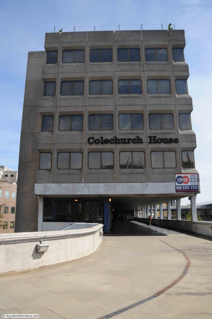
View of Colechurch House from the elevated walkway. The entrance to the office block is where the two lights can be seen.

Colechurch House

The planning application was submitted at the end of 2020, a number of issues with the application were raised in a letter dated the 1st March 2021. Consideration of these and a final decision is still to be confirmed, however I expect the demolition and rebuild will go ahead within the next couple of years.

Across the river to Fleet Street now, to find the site of a much larger redevelopment:

Fleet Street and Salisbury Court

This is probably the larger of the three developments covered in this post, and it covers a significant frontage onto Fleet Street and to the rear within a block bounded by Salisbury Court and Whitefriars Street.

The redevelopment is for a new area which has been dubbed the “Justice Quarter” as it will include a number of new buildings that will house functions related to the law.

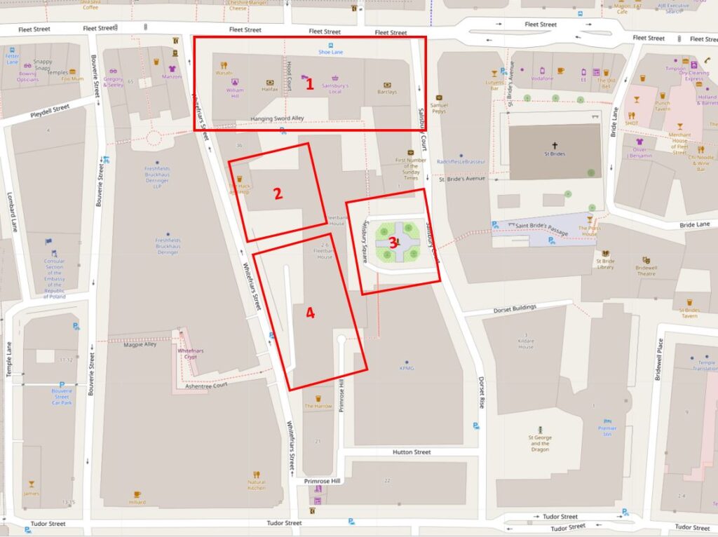
The following map shows the area to be redeveloped, and the new functions that will be located in the development  (Map © OpenStreetMap contributors).

Justice Quarter

1 – New City of London Law Courts

2 – New headquarter building for the City of London Police

3 – Public space covering an area slightly larger than the current Salisbury Square

4 – New commercial / office space with, you may have guessed, space for restaurants, bars or cafes on the ground floor

The following photos walk through the area, starting from Salisbury Square, which is the green space within rectangle 3 in the above map.

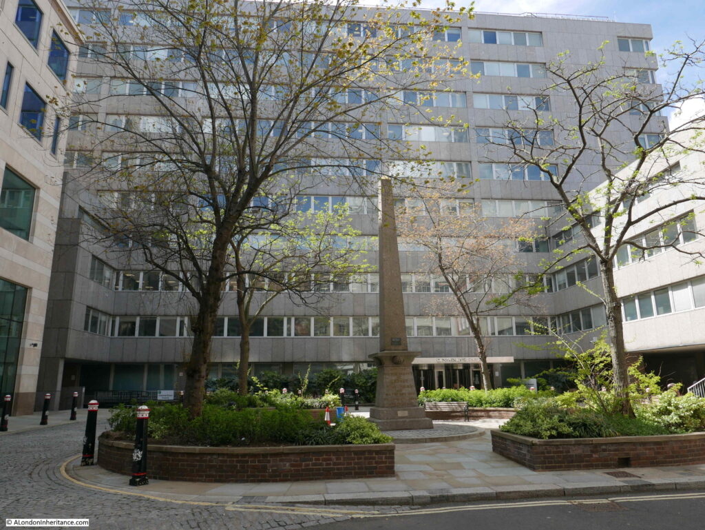
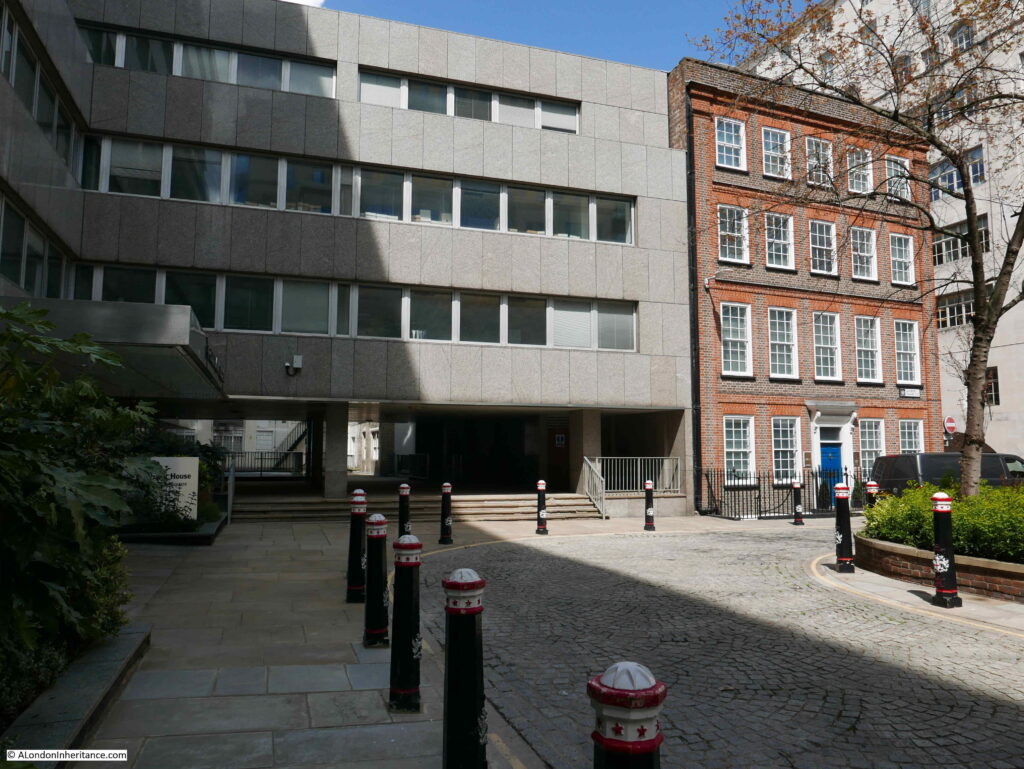
This is the view across the square.

Salisbury Square

The building in the background is Fleetbank House, built between 1970 and 1975, a large building that has a lower section to the right, and also runs down Whitefriars Street, which is behind the building.

The obelisk in the centre of the square is a memorial to Robert Waithman, Lord Mayor of the City between 1823 and 1824. The memorial states that it was erected by his friends and fellow citizens.

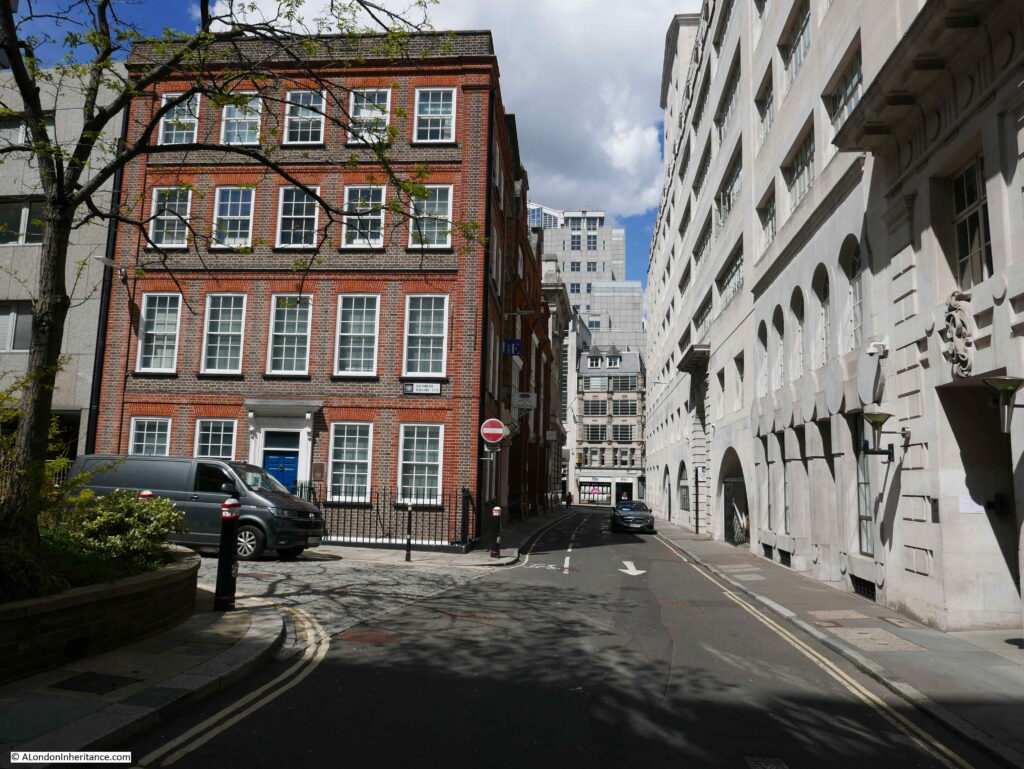
To the right of the above photo, is the following brick building, 1 Salisbury Square:

Salisbury Square

The road to the right is Salisbury Court, running up to Fleet Street at the top.

Both Fleetbank House and 1 Salisbury Court have been granted a certificate of immunity by Historic England. This certificate states that the Secretary of State does not intend to list the buildings for a specific period of time – in the case of these buildings, up to July 2025.

If I have understood the proposals correctly, 1 Salisbury Square will be demolished and the area occupied will become part of the larger public space of Salisbury Square.

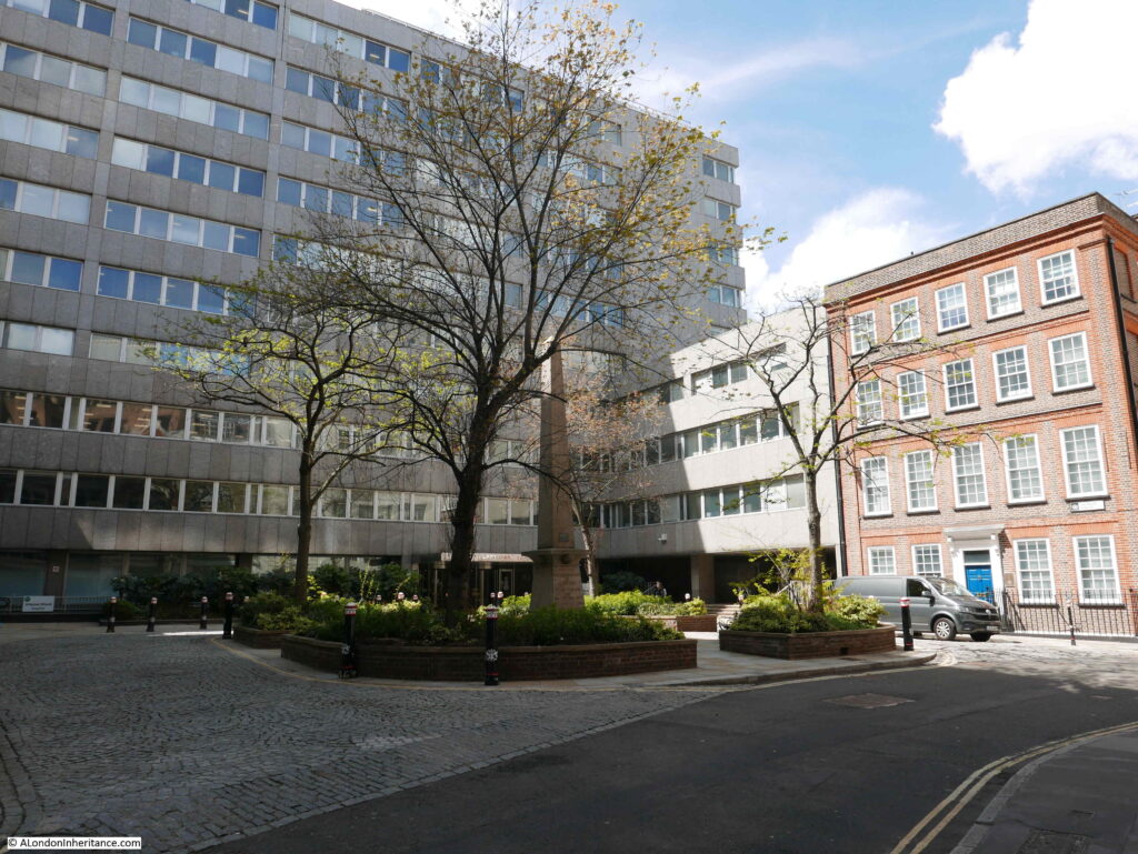
The following photo is a wider view across the square:

Salisbury Square

I am always amused by developers now and future impressions of proposed developments. If you look halfway down this page on the Salisbury Square Development website, there is a now and future picture where you can scroll between the two.

The now part of the photo was taken on a relatively grey day, with people milling about, or hurrying across the square. The proposed computer generated picture, shows the square at dusk, subtle lighting lights up the trees and the ground floor area of the new public space and there is not a cloud to be seen in the sky. Buildings frequently look their best with this form of lighting.

This type of comparison is all too common with the proposals for any new development.

A row of bollards line Salisbury Square:

Salisbury Square

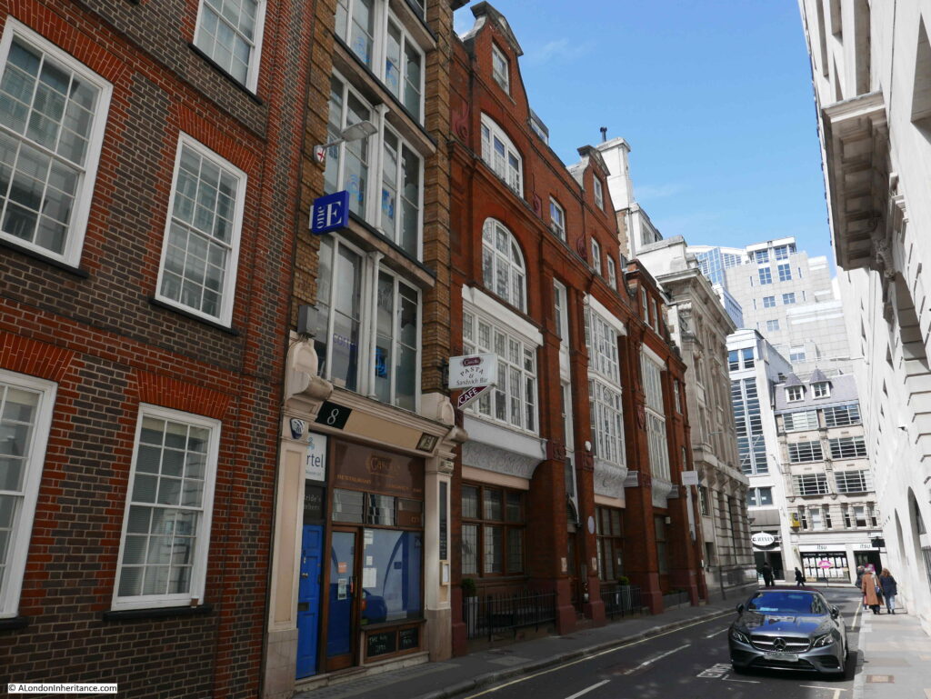
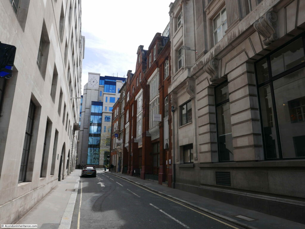
Walking along Salisbury Court, up to Fleet Street. A relatively narrow street, the edge of 1 Salisbury Court is to the left of the photo:

Salisbury Court

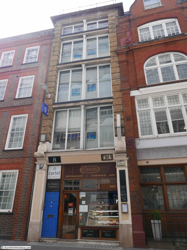
8 Salisbury Court – again if I have understood the proposals correctly, this building will also be demolished, and the land become part of the new public space.

Salisbury Court

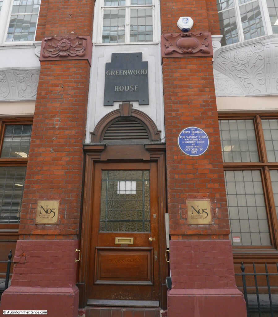
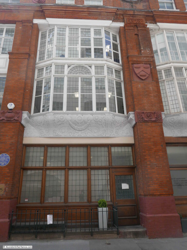
To the right of number 8, is a large brick building that covers number 2 to 7 Salisbury Court. This is Greenwood House.

Salisbury Court

The blue plaque states that the first number of the Sunday Times was edited at 4 Salisbury Court by Henry White on October 20th 1822.

The building dates from 1878, and was designed by the architect Alexander Peebles.

Between the ground and first floors, the building has some rather ornate terracotta carvings, and the land or building may have once belonged to the Vintners Company, as their arms with the three tuns can be seen on the wall between first floor windows.

Salisbury Court

2 to 7 Salisbury Court are Grade II listed, however a City of London notice cable tied to the iron railings outside the building state that a number of changes will be made:

i) Part demolition of 2-7 Salisbury Court Grade II listed;

ii) remodelling at roof level;

iii) formation of new facade to south elevation, and part new facade to west elevation;

iv) replacement fenestration;

v) new plant; and

v) associated internal alterations.

The two “v” bullets are directly from the notice, the final should I suspect be a vi.

Always hard to decode exactly what these planning notices mean, but I suspect it will be a new façade to replace the joining wall where number 8 has been demolished. Possible demolition of the internal structure of the building, with the wall facing Salisbury Court retained as a façade. A new roof and changes to the windows.

So some dramatic changes.

The view looking down Salisbury Court from the junction with Fleet Street:

Salisbury Court

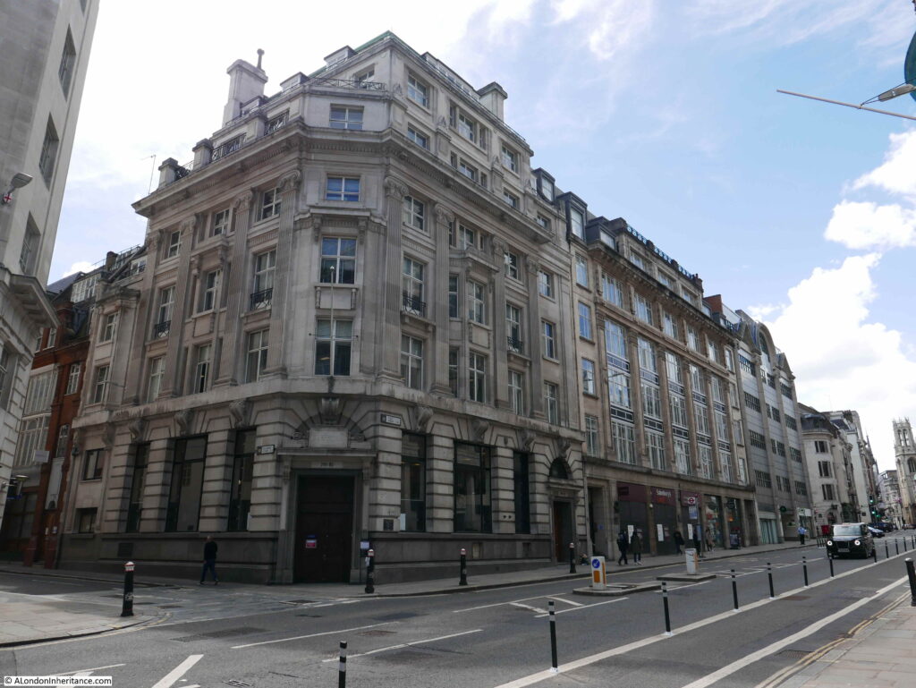
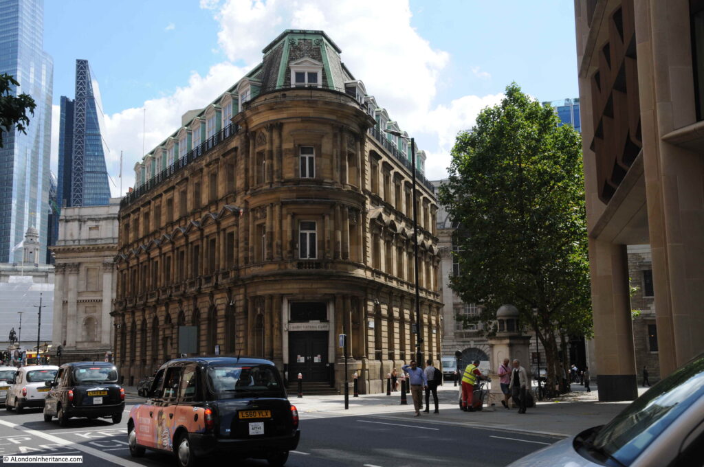
On the corner of Salisbury Court and Fleet Street is 80 to 81 Fleet Street. A large corner building that was until recently a Barclays Bank. The building was originally, up to 1930, the home of the Daily Chronicle.

Fleet Street

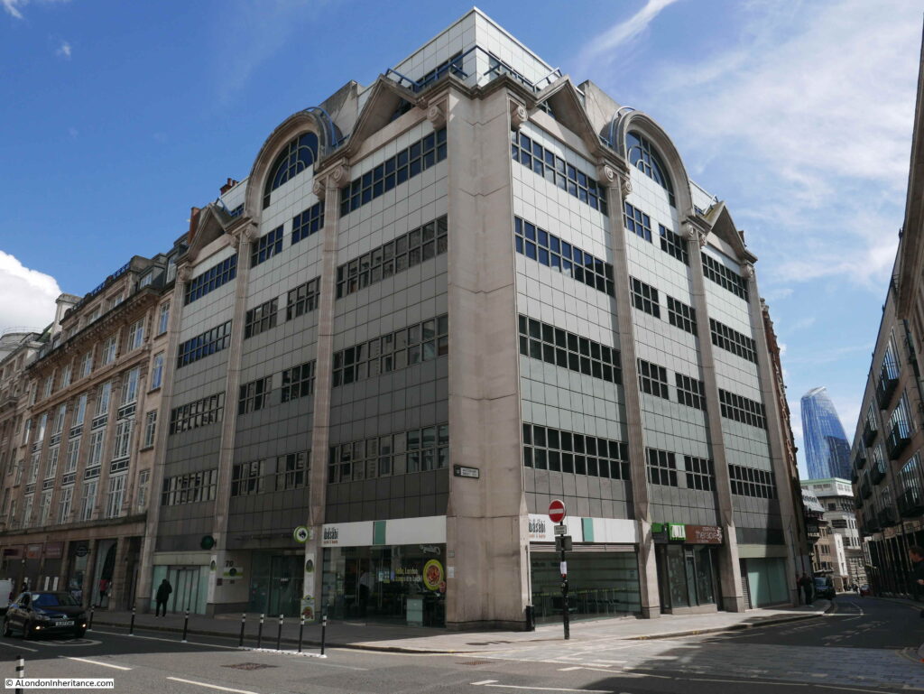
This corner building will also be demolished, and will form, along with the entire block along Fleet Street as shown in the above photo, the new City of London Law Courts.

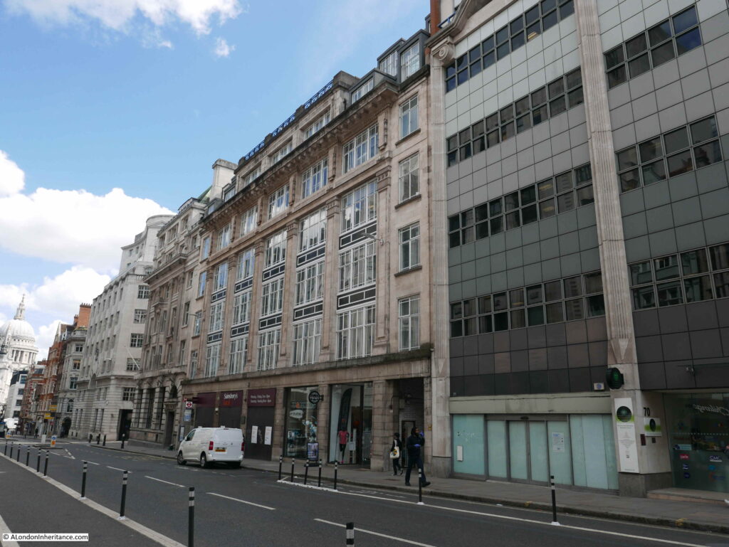
The centre block in the following photo is Chronicle House, covering 72-78 Fleet Street. The building dates from 1924 and was designed and built by Hebert, Ellis & Clarke.

Fleet Street

The building takes its name from being home to the newspaper, the News Chronicle. The building has also been granted immunity from listing by Historic England and the Secretary of State.

The following block is on the corner of Fleet Street and Whitefriars Street, and will also be demolished to become part of the Law Courts complex.

Fleet Street

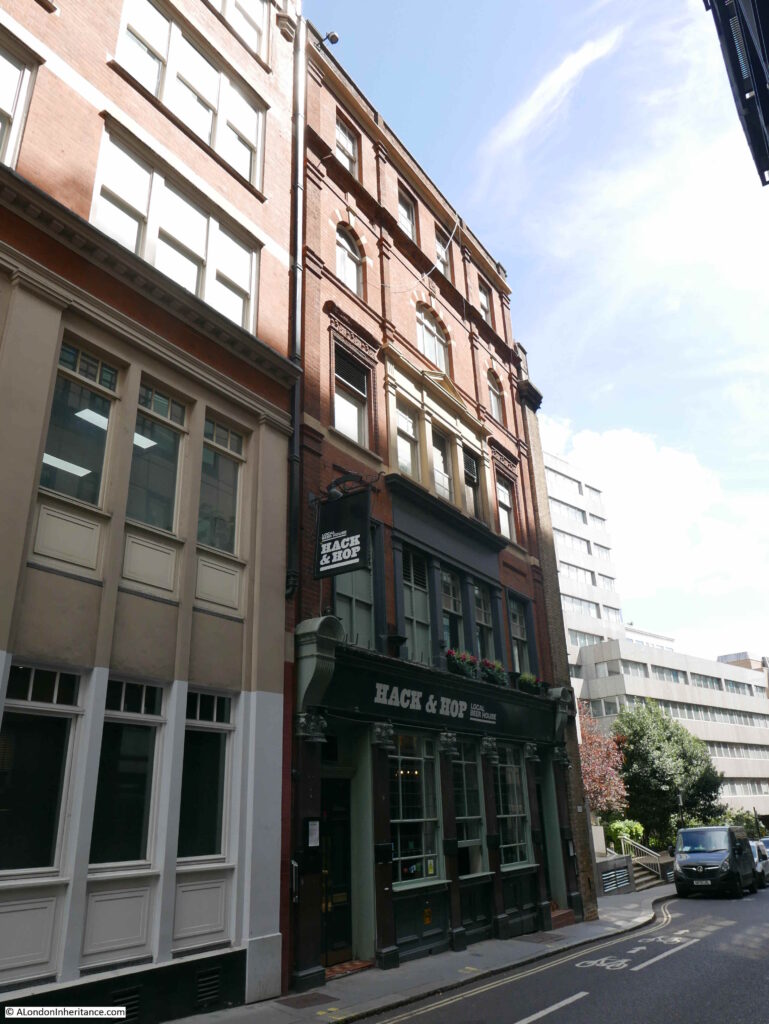
Walking down Whitefriars Street, and the following building is the Hack and Hop pub:

Hack and Hop

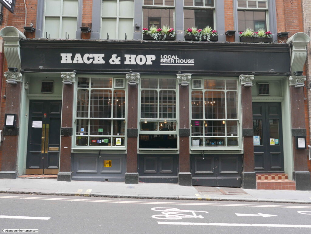
The Hack and Hop was originally the Coach and Horses, a pub that dates back to the mid 19th century. The earliest record I can find of the pub is a newspaper mention in the Morning Advertiser on the 25th November 1850, where there was an advert for a regular Monday evening meeting where a penny subscription would be collected for the London Copper-Plate Printers Benevolent Fund – a reminder of the long history of the area with the printing trade.

Hack and Hop

The buildings along this part of Whitefriars Street, including the Hack and Hop pub will be demolished and replaced by the new headquarters building for the City of London Police.

The new building will bring together police functions from a couple of existing buildings which have already been sold – Wood Street and Snow Hill police stations. The new building will have ten floors above ground with space for 1,000 police officers and civilian staff, with three levels below ground for specialist functions and parking.

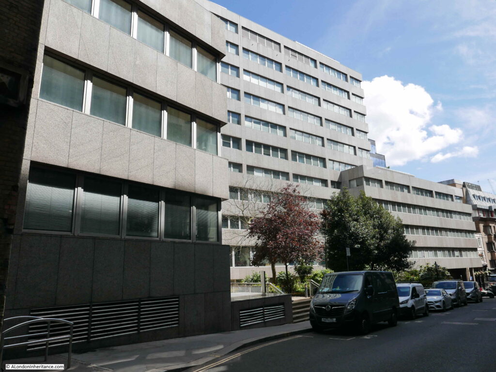
Continuing on down Whitefriars Street, and we see the other side of Fleetbank House:

Whitefriars Street

Fleetbank House will be demolished and replaced with a new office / commercial building, which is described as having a “lively frontage”. I suspect this means cafes, bars and restaurants.

The view looking up Whitefriars Street, with the grey walls of Fleetbank House.

Whitefriars Street

The end of Fleetbank House in the above photo marks the southern limit of the new re-development of Whietfriars Street. The work to create the so called Justice Quarter will be one of the most significant developments along Fleet Street for a very long time.

The area off Fleet Street has a considerable amount of history which will require a dedicated post. Hanging Sword Alley passes through the space from Whitefriars Street to Salisbury Court. There is a memorial to journalist T.P. O’Connor along Fleet Street. Bradbury and Evans, one of Dickens publishers were located here. The Fleet water conduit was here until the Great Fire in 1666.

The whole block has a long association with the journalism and the publishing industry, which ended in 2009 when the French Press Agency left 72-78 Fleet Street (Chronicle House).

It is hard to avoid getting into a discussion about the good or bad points of any new development, and I have tried to avoid this in the above post, focusing instead on recording what may well disappear in the coming years.

There is much to consider regarding any change. The buildings lost, the new buildings, what the change brings to the overall area, architecture, impact on wider views, jobs, diversity of activity etc. etc.

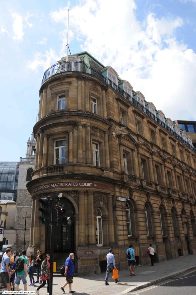
There is also the issue of what then happens to the buildings where functions will move from. For example, one of the City of London courts that will move into the new Fleet Street building is the City of London Magistrates Court on the corner of Queen Victoria Street and Walbrook, shown in the following two photos:

London Magistrates Court

A building in a very prime location.

Development often leads to further development as functions, businesses etc. shuffle their way around the City.

Three possible future demolitions and re-developments that will have a significant impact on their local area of London.

Further reading on these can be found at:

City of London Salisbury Square Development web site

City of London Consultation briefing for the Salisbury Square development

Save Britain’s Heritage petition to stop the demolition of 72 – 81 Fleet Street

Colechurch House development web site

Article with artist’s impression of new Colechurch House development

Article with artist’s impression of development on south bank replacing Kent House and Studios

alondoninheritance.com

Fleet Street in 32 Exposures

Before taking a walk along Fleet Street, a quick update on last week’s post.

Thanks for all the feedback via comments, e-mail and Twitter, which demonstrated that you cannot believe everything that you read in the papers, even back in 1915. Readers identified the following statues as earlier than that of Florence Nightingale, so my list of the first statues of women (not royalty) in London is now as follows:

  1. Sarah Siddons, unveiled at Paddington Green in 1897. Sarah was an actor, also known as the most “famous tragedienne of the 18th century”
  2. Boudicca, unveiled at the western end of Westminster Bridge in 1902. Some discussion about Boudicca as she could be classed as “royal” which the 1915 papers excluded, however I will keep her on the list
  3. Margaret MacDonald,  unveiled at Lincoln’s Inn Fields in 1914. Margaret was a social reformer, feminist and member of organisations such as the National Union of Women’s Suffrage Societies
  4. Florence Nightingale, unveiled at Waterloo Place in 1915

So that would put Florence Nightingale’s statue as the 4th public statue of a women unveiled in London (excluding royalty, or perhaps 3rd if Boudicca is classed as royalty).

Leave a comment if you know of any others.

The other point of discussion was the initials on the 1861 lamp post next to the Guards’ memorial. The combination of letters appeared to be SGFCG. Possibilities included the names of Guards Regiments, or a royal link with Saxe-Coburg Gotha (the Prince Consort as Colonel of the Guards was at the unveiling).

I e-mailed the Guards’ Museum and their feedback was that they had not seen the initials of the three Foot Guards Regiments combined in such a way elsewhere, however the initials do appear to fit the Regiments as they were known in 1861 – Grenadier, Coldstream and Scots Fusilier Guards.

Thanks again for all the feedback – there is always so much to learn about the city’s history.

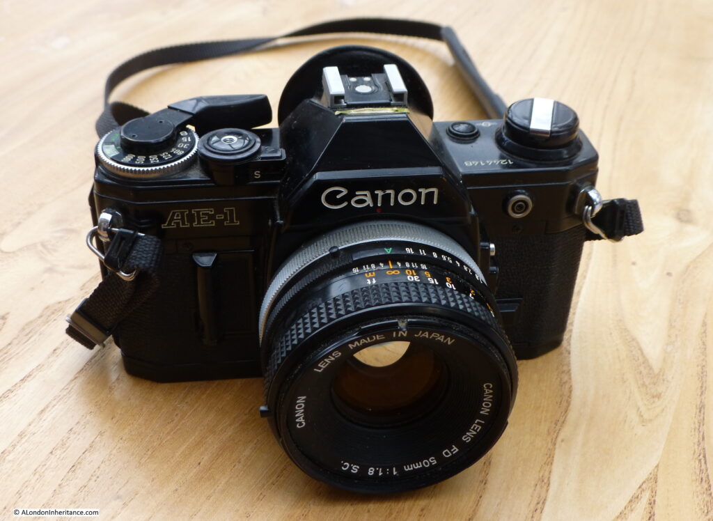
On to todays post. Last summer I took my father’s old Leica camera out for walk. The first time this 70 year old camera had been used in 40 years. To test the camera I had purchased a pack of Ilford black and white film, and as there were some spare, I decided to take my old film camera out, a Canon AE-1 which was my main camera for around 25 years, but last used in 2003.

The Canon AE-1 was a significant camera when it came out in 1976. I purchased mine in 1977 from a discount shop in Houndsditch in the City on Hire Purchase, spreading the cost over a year. It replaced a cheap Russian made Zenit camera which had a randomly sticking shutter as a feature.

The Canon AE-1 was a revolution at the time. The first camera to include a microprocessor, it included a light meter and once the desired speed had been set on the ring on the top of the camera, the aperture (how much light is let in through the lens) would be set automatically. It was also possible to set both speed and aperture manually.

Focus was still manual, via a focusing ring on the front of the included 50mm lens.

My Canon AE-1:

Fleet Street

The camera was powered by a battery in the compartment to the left of the lens in the above photo. Having not used the camera for almost twenty years, my main concern was that on opening the compartment, I would be met by a corroded mess, however the battery, although flat, was in good condition, and after replacing with a new battery, the camera came back to life.

Inserting a new film was much easier than the Leica as the film did not need to be trimmed, simply pushing the end of the film into the take up spool and winding on until the rewind knob moved.

I took the camera for a walk along Fleet Street, hence the title of the post – Fleet Street in 32 Exposures. I was using a 36 exposure film, so lost some in initial testing to make sure the film was winding on correctly.

Fleet Street seemed a good choice, as the street is lined with fascinating buildings. Substantial buildings from when newspapers occupied much of the street, to tall, thin buildings which are evidence of the narrow plots of land that were once typical along this important street. Many of the buildings are also ornately decorated.

This will be a photographic look at the buildings rather than a historical walk. Fleet Street has so much history that it would take a few posts to cover.

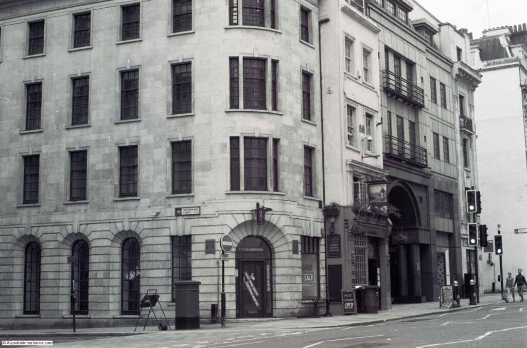
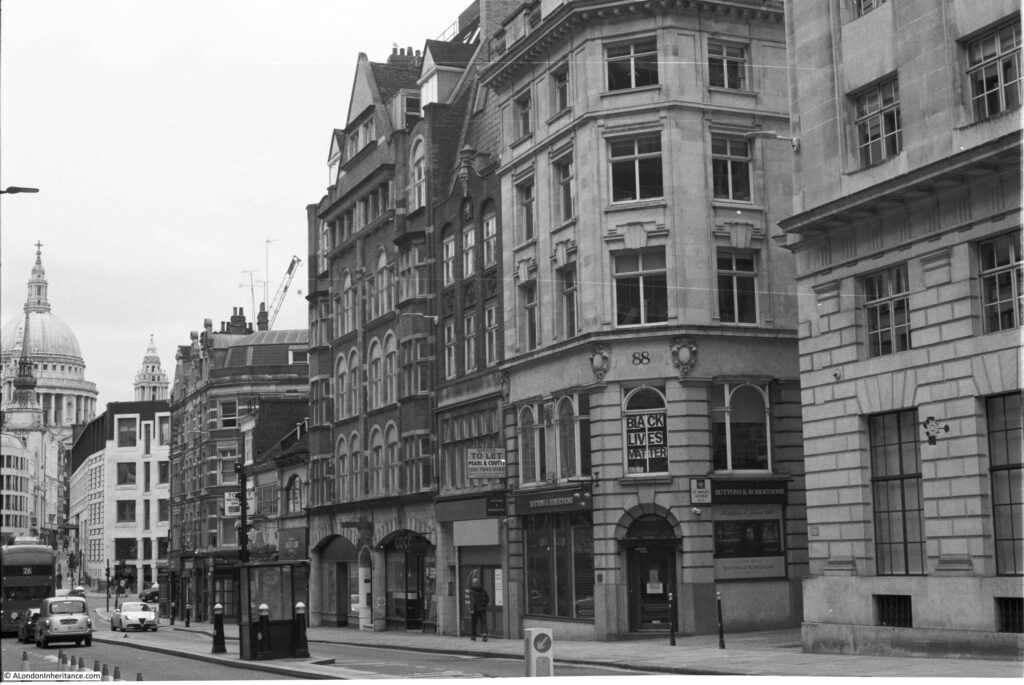
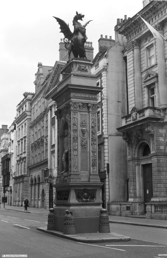
So to start a black and white walk along Fleet Street. I started at the point where the Strand becomes Fleet Street and the Temple Bar memorial:

Fleet Street

The Temple Bar memorial dates from 1880 and was designed by Sir Horace Jones. It marks the location of Wren’s Temple Bar which marked the ceremonial entrance to the City of London. The original Temple Bar now stands at the entrance to Paternoster Square from St Paul’s Churchyard.

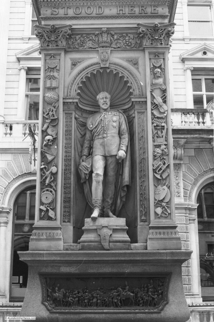
Statues of Queen Victoria and the Prince of Wales are on either side of the monument, which is also heavily decorated and shows the Victorian fascination with the arts and sciences, with representations of these lining either side of the alcoves with the statues.

Fleet Street

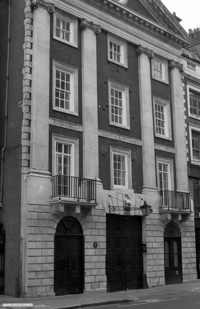
The Grade I listed Middle Temple Gatehouse which leads from Fleet Street into Middle Temple Lane. The building originally dates from 1684:

Fleet Street

The Grade II* listed Inner Temple Gatehouse between Fleet Street and the Inner Temple location of Temple Church:

Fleet Street

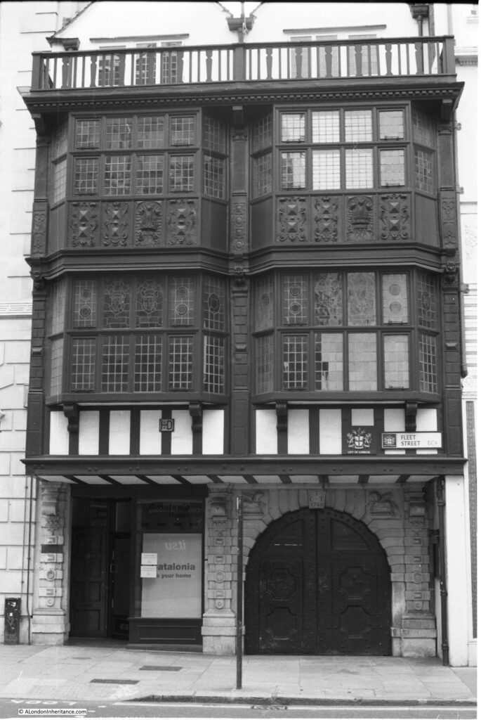
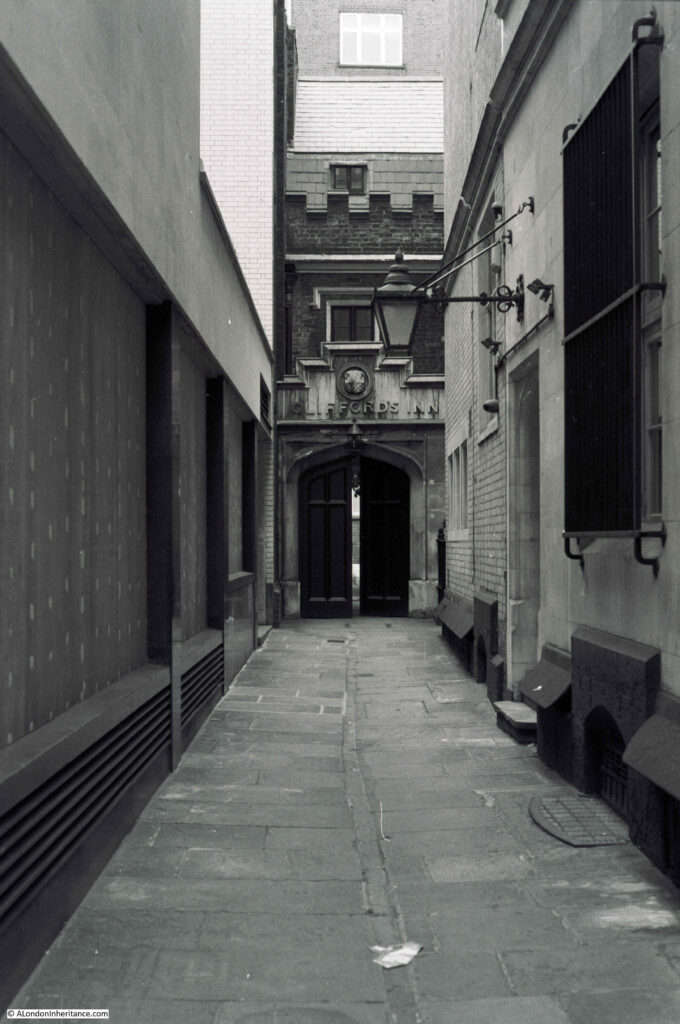
Cliffords Inn Passage and the entrance gate to Cliffords Inn:

Fleet Street

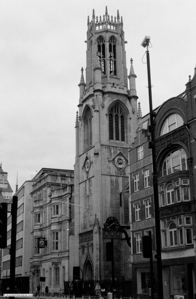
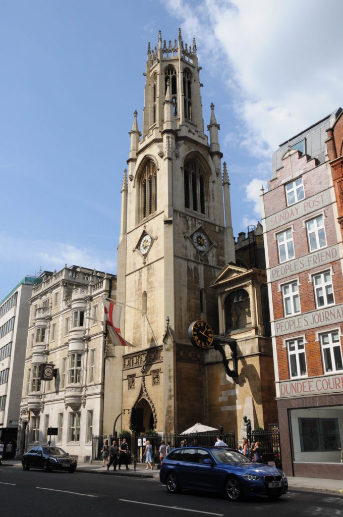
The church of St Dunstan in the West:

Fleet Street

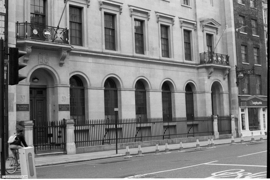
The head office building of the private bank of C. Hoare & Co. Founded by Richard Hoare in 1672, the bank has been based here in Fleet Street since 1690:

Fleet Street

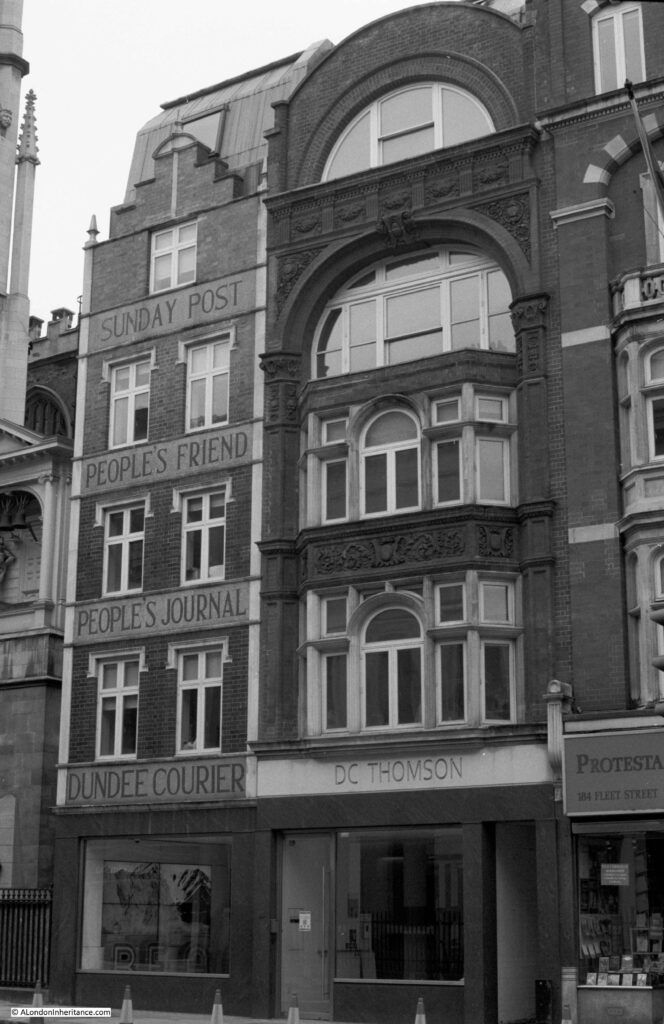
Offices of publishing company DC Thomson, who still publish the Sunday Post and People’s Friend as well as the Beano. This is their London office, with their head offices being in Dundee (hence the Dundee Courier):

Fleet Street

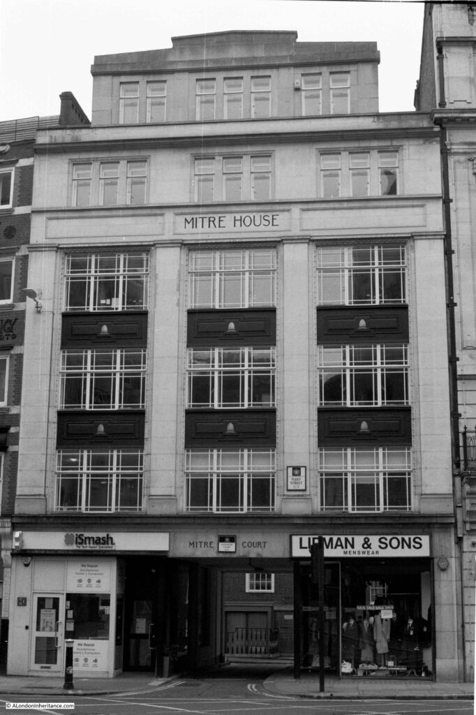
Mitre House, with the entrance to Mitre Court:

Fleet Street

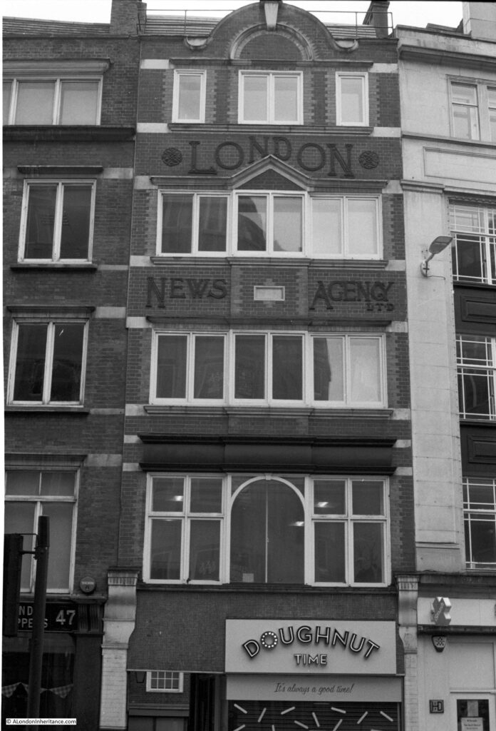
The original home of the London News Agency, also known as the Fleet Street News Agency. The business was here in Fleet Street from 1893 until 1972 when the business moved to Clerkenwell, where it was based until the agency closed in 1996.

Fleet Street

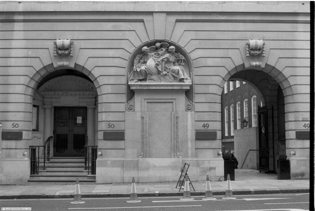
The entrance to 49 and 50 Fleet Street, a Grade II listed building that dates from 1911. Originally Barristers’ Chambers, in 2018 the building was converted into an extension to the Apex Temple Court Hotel.

Fleet Street

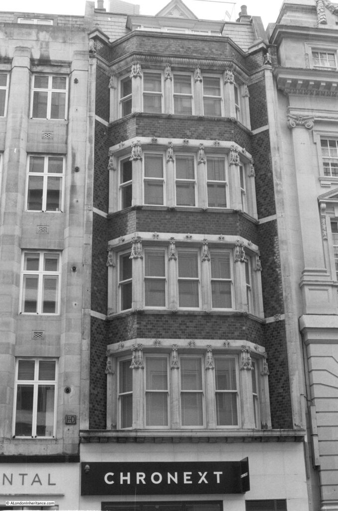
The following photo is of 53 Fleet Street and is a good example of where black and white is the wrong film to capture the features of a building. The upper floors are decorated with dark red bricks with green bricks forming diamond patterns, which can just be seen in the photo. It looks much better in colour.

Fleet Street

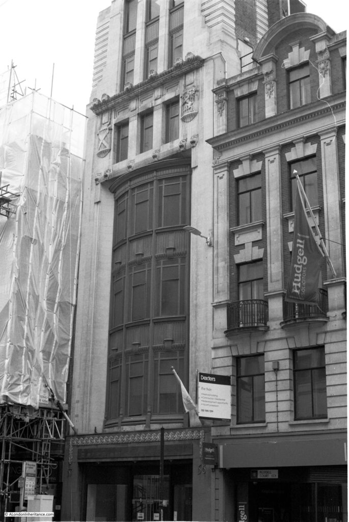
The following building is the Grade II listed former office of the Glasgow Herald built in 1927. The building is relatively thin and tall and the challenges with photographing the building using a fixed 50mm lens are apparent as I could not get in the top of the building without the front being at too oblique an angle.

Fleet Street

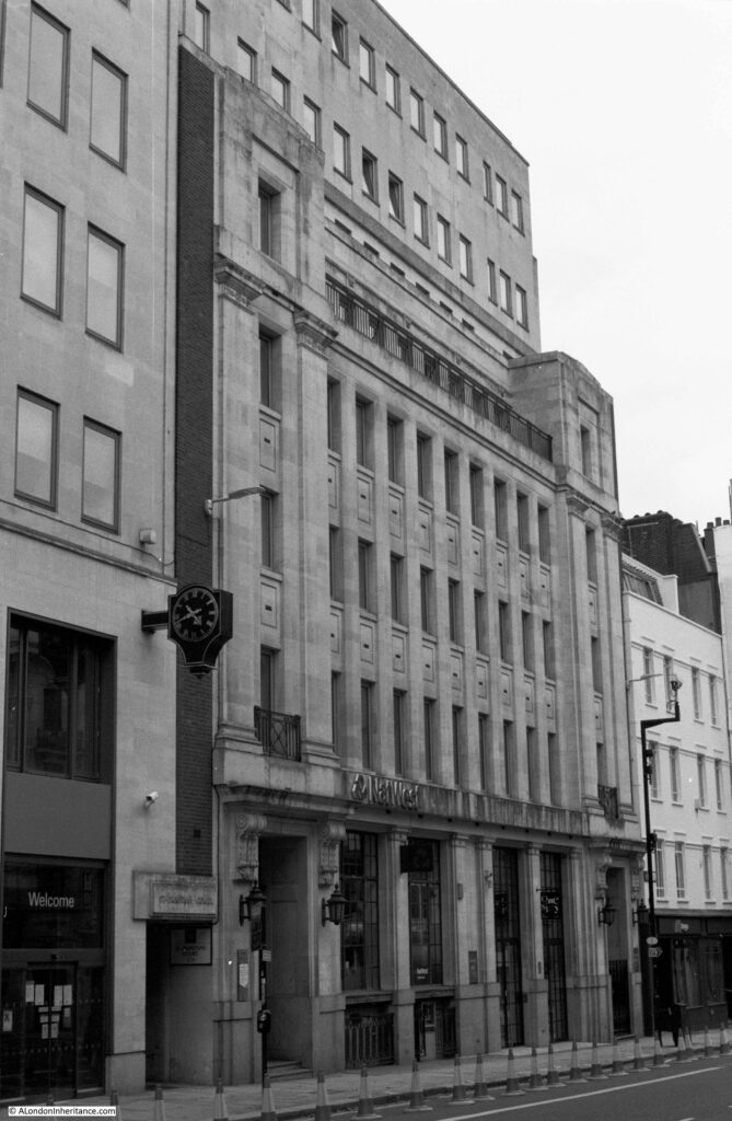
The 1920’s Bouverie House, with entrance to St Dunstans Court at lower left:

Fleet Street

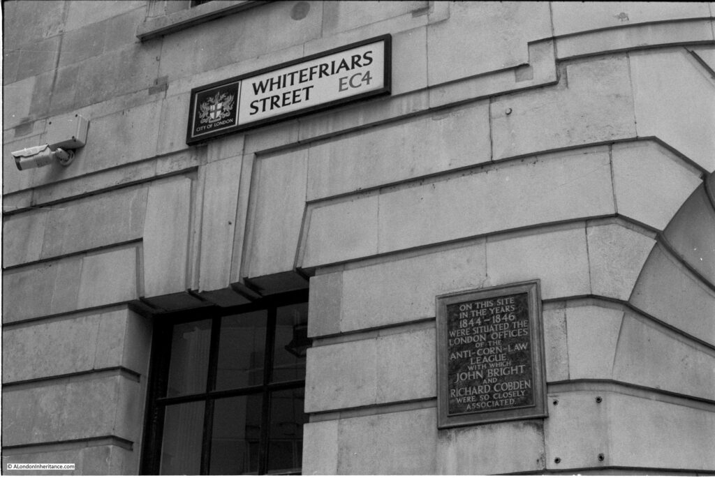
Almost opposite Bouverie House, Whitefriars Street leads off from Fleet Street. A plaque on the wall records that this was the location of the office of the Anti-Corn-Law League between 1844 and 1846.

Fleet Street

A wider view of the building on the corner of Whitefriars Street and Fleet Street. The above plaque can be seen on the wall to the left of the corner entrance. The pub just to the right of the corner building is the Tipperary at 66 Fleet Street.

Fleet Street

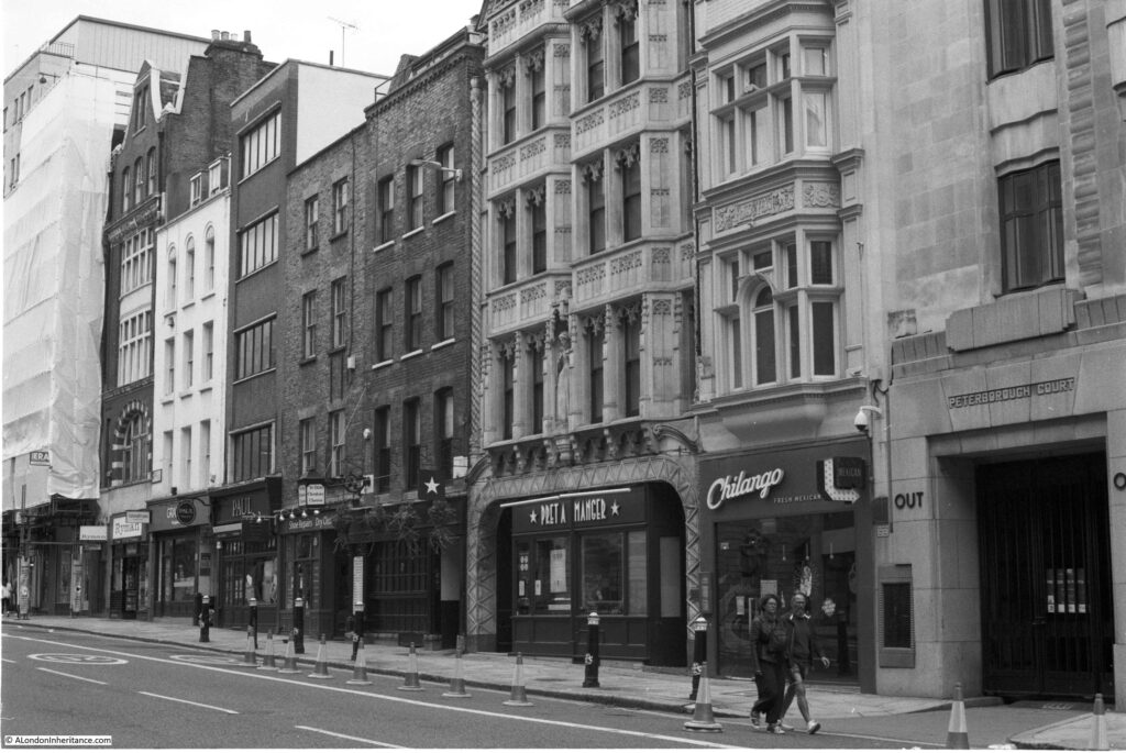
The following photo shows a view along the northern side of Fleet Street and highlights the mix of different building ages, materials and architectural styles that make this street so interesting. One of the oldest building on the street is in the centre of the view. The Cheshire Cheese pub dates from 1538 with the current building dating to 1667.

Fleet Street

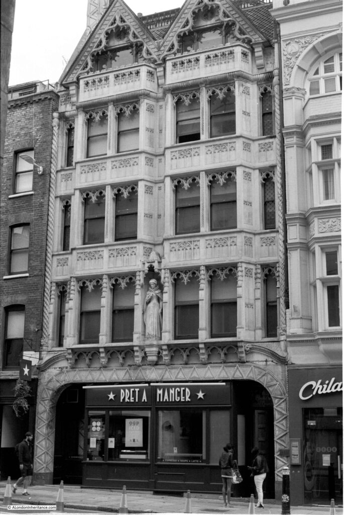
Next to the Cheshire Cheese is this rather ornate building which is currently home to a Pret on the ground floor. This is the Grade II listed, 143 and 144 Fleet Street. The statue in the centre of the first floor is of Mary, Queen of Scots.

Fleet Street

The building in the above photo was constructed in 1905 for Sir John Tollemache Sinclair, a Scottish MP, and designed by the architect  R.M. Roe.  Whilst researching for the reason why the statue is on the building (Sinclair was a fan of Mary Queen of Scots), I found the following newspaper report from The Sphere on the 17th August 1946 which provides a description of the use of the building:

“Although at first glance, this life-size statue of Mary, Queen of Scots appears to be in an ecclesiastical setting, it is, in fact, situated above a chemist’s shop and a restaurant in one of the older and grimier buildings of Fleet Street. No. 143-144 Fleet Street, known as Mary, Queen of Scots House, contains a typical selection of Fleet Street tenants – newspaper offices, advertising agents and artists agents”

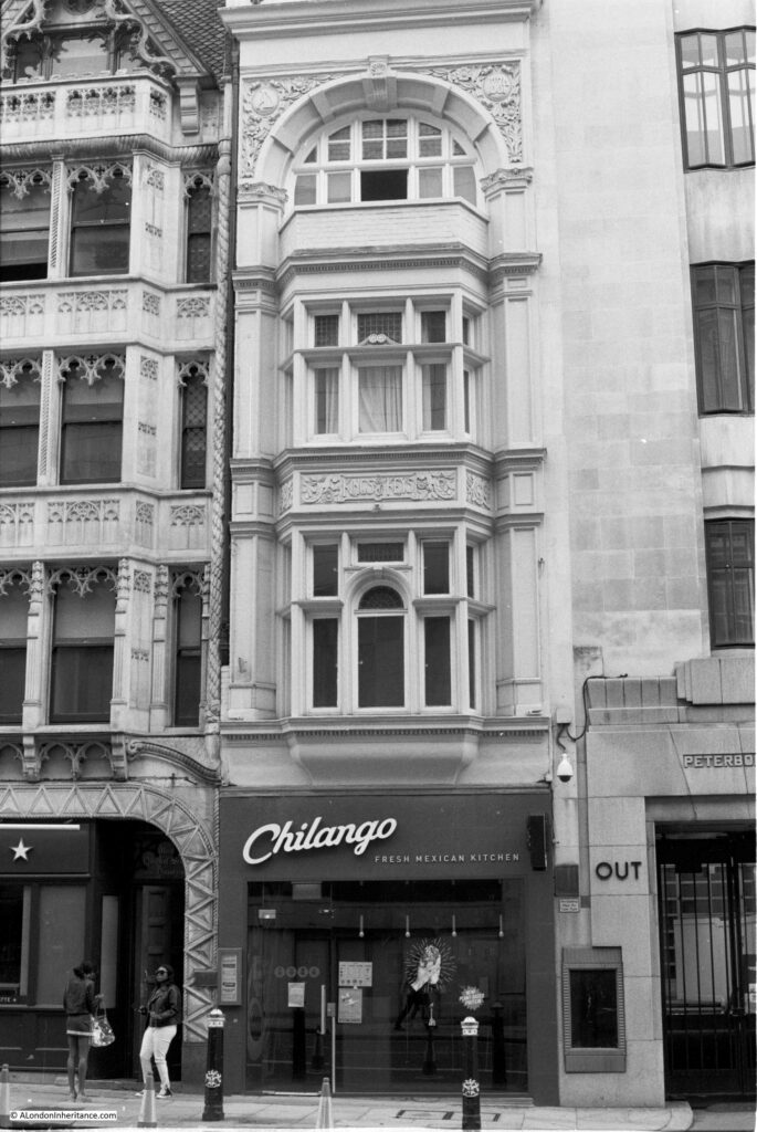
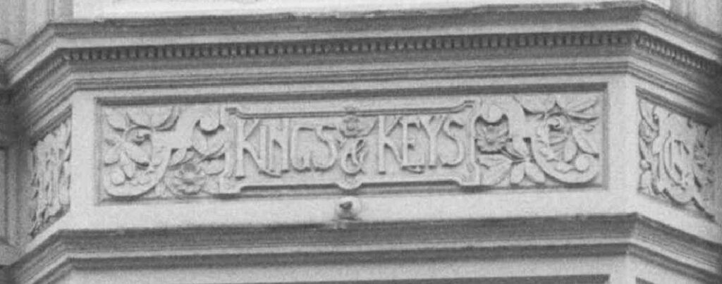
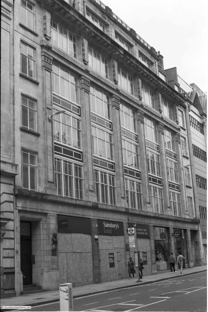
Next to the above building is a lost pub, the building in the following photo was once the Kings and Keys pub.

Fleet Street

The name of the pub can still be seen carved in the decoration between the first and second floors.

Fleet Street

The Kings and Keys closed in 2007, and in the days when Fleet Street newspapers had their local pub, this was the pub for the Daily Telegraph. Although the building dates from the late 19th century, a pub with the name Kings and Keys had long been on the site. A newspaper report from 1804 highlights the dangers for those travelling through London and stopping at a pub:

“Last week a young midshipman, from Dover, going to Oxford on a visit to his relations, stopped at the King and Keys, in Fleet-street, for refreshment, when a fellow-traveler, whom he had supported on the road, attempted to rob him of his box, containing his money and clothes, which was prevented by the waiter; the ungrateful villain unfortunately made his escape”.

Across the road is a closed and boarded Sainsbury’s Local. One of the casualties of the lack of people travelling to work in Fleet Street during the lock-downs.

Fleet Street

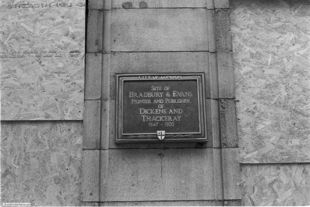
On the front of the above building is a plaque recording that it was the site of Bradbury and Evans, Printer and Publisher of Dickens and Thackeray between 1847 and 1900.

Fleet Street

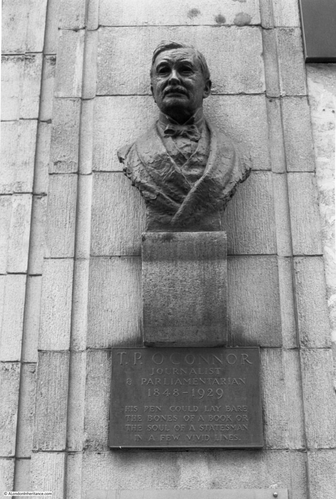
And to the left of the building is a memorial to T.P. O’Connor, Journalist and Parliamentarian 1848 to 1929 – “His pen could lay bare the bones of a book or the soul of a statesman in a few vivid lines”.

Fleet Street

Next to the old Kings and Keys building is the old offices of the Daily Telegraph newspaper. Built for the newspaper in 1928 and now Grade II listed.

Fleet Street

The building is a good example of the power and authority that the newspapers wanted to project when they were still the main source of news, before radio and television had become a mass market source of news.

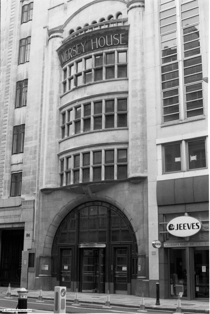
Next to the Telegraph building is Mersey House, built between 1904 and 1906:

Fleet Street

Mersey House is yet another Grade II listed building, and was the London home of the Liverpool Daily Post (which is probably the source of the Mersey name after the River Mersey). The newspaper cannot have been using all the space in the building as in 1941 they were advertising:

“Do you want a London Office with a Central and Appropriate Address? Accommodation can be had in Mersey House, Fleet Street, E.C. 4 – Apply the Daily Post and Echo, Victoria Street, Liverpool”.

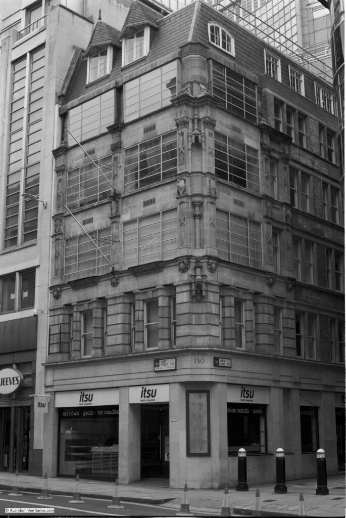
There are substantial stone clad buildings on many of the corners of Fleet Street. This is 130 Fleet Street on the corner with Shoe Lane:

Fleet Street

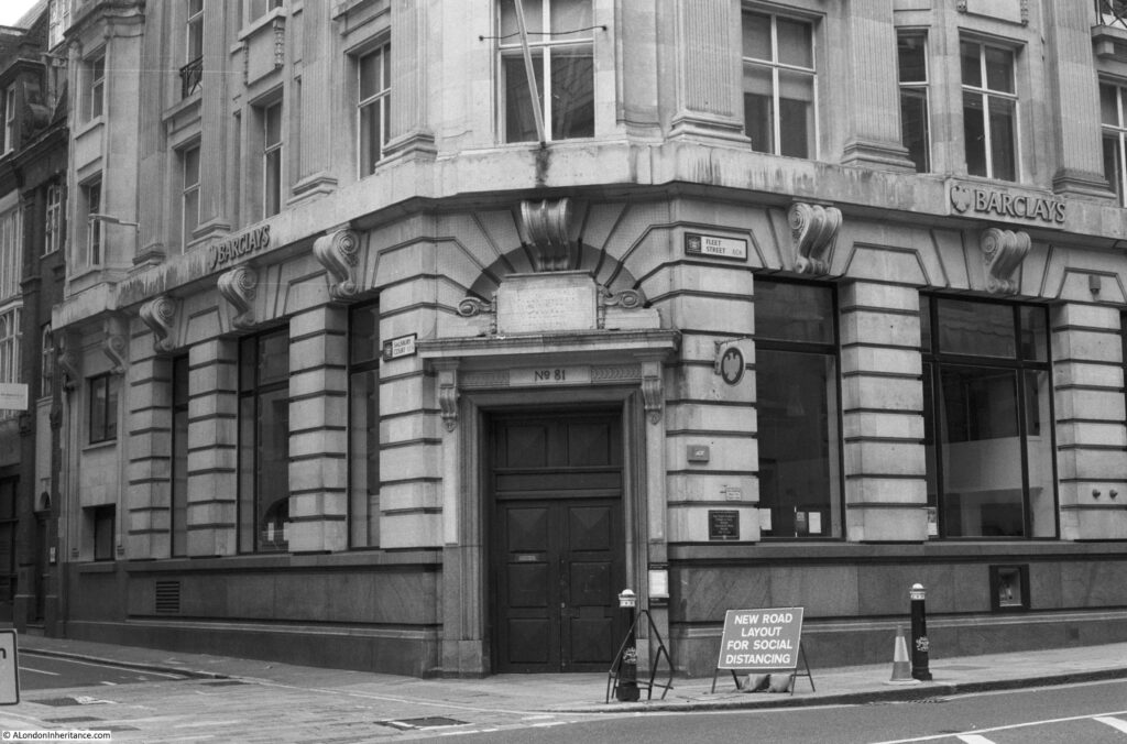
And a typical bank building on the corner with Salisbury Court. The plaque to the right of the door records that “The Fleet Conduit Stood In This Street Providing Free Water 1388 to 1666”.

Fleet Street

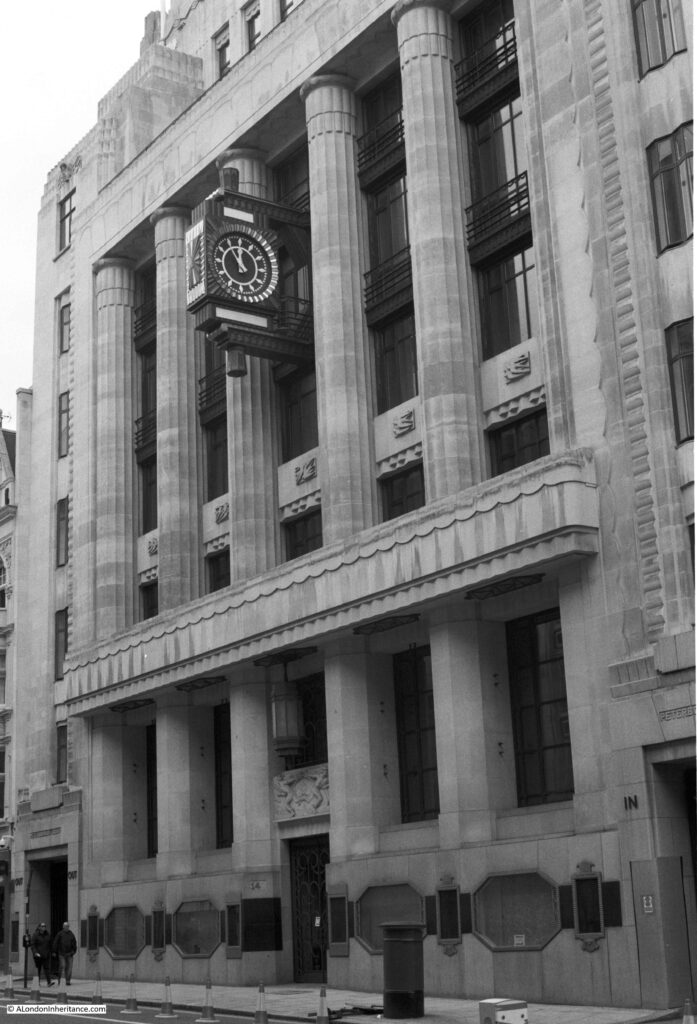
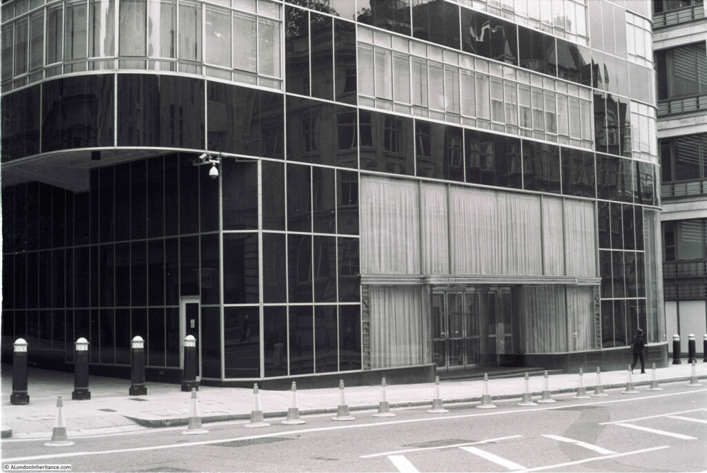
The majority of buildings that line Fleet Street are of stone, however there is one spectacular building of a very different design and using very different materials. The following photo shows the lower floors of the Grade II* listed Daily Express building dating from 1932.

Fleet Street

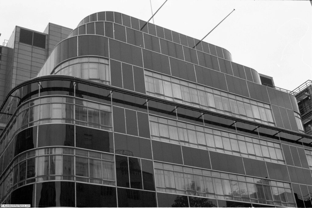
The above photo shows the limitations of using a fixed lens. impossible to get the whole building in a single photo. These are the upper floors:

Fleet Street

The art deco building was designed by architects H. O. Ellis & Clarke with engineer Sir Owen Williams. The materials used for the building could not be more different than the rest of Fleet Street.

Vitrolite (pigmented, structural glass) along with glass and chromium strips formed the façade of the building, to give the building a very modern, clean and functional appearance at the start of the 1930s.

Four years after completion, the building was used as an example in an article on “Architecture – the way we are going” in Reynolds’s Newspaper to demonstrate the battle of architectural ideas, and the type of design and materials that will be the future of office and industrial buildings

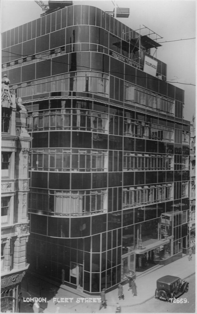
The building can really be appreciated when seen as a complete building, and the following postcard issued as construction was finishing, shows the building in all its glory:

Fleet Street

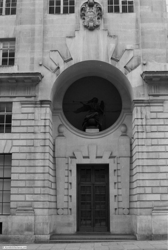
On the opposite side of the street is the old building of the Reuters news agency, one of the last of the news agencies to leave Fleet Street in 2005. The following photo shows the main entrance to the building and according to Pevsner is recognisable as the work of the architect Sir Edward Lutyens by “the wide, deep entrance niche on the narrower Fleet Street front”. Above the door, in the round window is the bronze figure of Fame.

Fleet Street

View looking down Fleet Street, with the dome of St Paul’s Cathedral in the distance:

Fleet Street

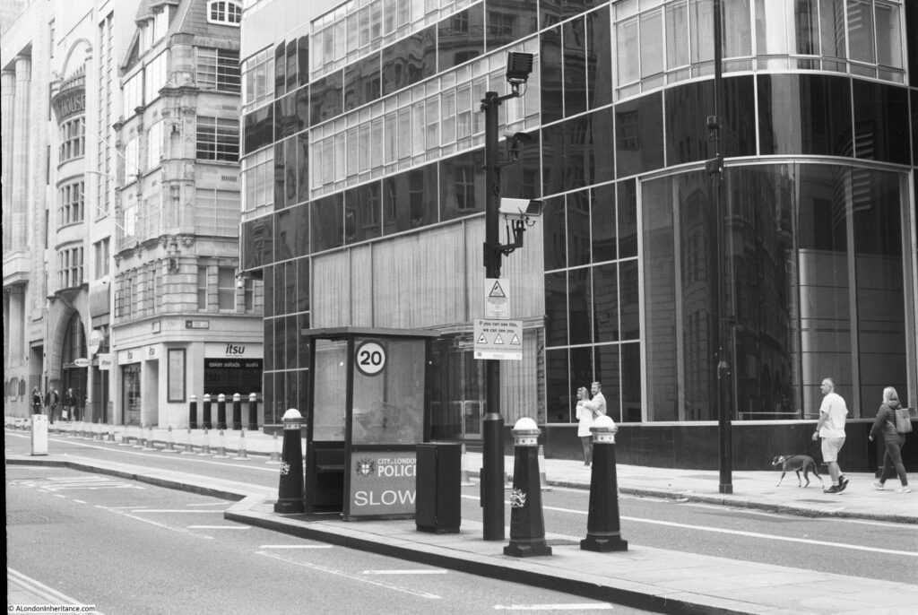
The following photo is looking back up Fleet Street. in the centre of the road is one of the old police sentry boxes introduced during the early 1990s in response to the IRA bombing campaign in the City of London.

Fleet Street

I have now come to Ludgate Circus, where Fleet Street meets Farringdon Street, and where the old river that gave the street its name once ran.

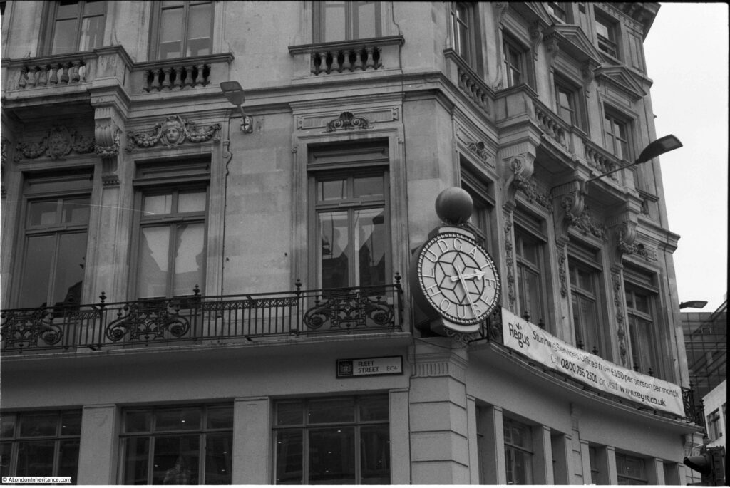
The clock on Ludgate House:

Fleet Street

That is Fleet Street in 32 exposures, and it proved that my 44 year old camera is still working.

The Canon AE-1 was a joy to use. Taking photographs with a film camera does feel very satisfying. After each photo, the act of pulling the lever to wind the film feels like you have done something a bit more substantial than just the shutter click of a digital camera.

There is a story that Apple used the sound of the shutter on the Canon AE-1 as the sound when taking a photo on an iPhone – it does sound very similar, but I am not convinced.

Black and White photography is good for certain types of photo. It does bring out the texture in building materials, but I still have much to learn to use this type of film for the right type of photo (when using the Canon I mainly used colour film).

The fixed 50mm lens was also a problem with trying to photograph larger buildings in a confined space. In my early years of using the camera I could not afford any additional Canon lens, but did buy compatible Vivitar 28mm and 135mm lens which I need to find.

Fleet Street has such a rich collection of architectural styles, and the legacy that the newspapers have left on the street is still very clear. It is a fascinating street to walk.

alondoninheritance.com

St Dunstan In The West And An Honest Solicitor

The church of St Dunstan in the West can be found in Fleet Street on the edge of the City. The current church is not that old having been built between 1830 and 1833, however a church has been here for many centuries.

The original church was dismantled as part of the widening of Fleet Street and the land available for the replacement church was slightly further back and with limited space available, the design and layout of the church is somewhat unusual.

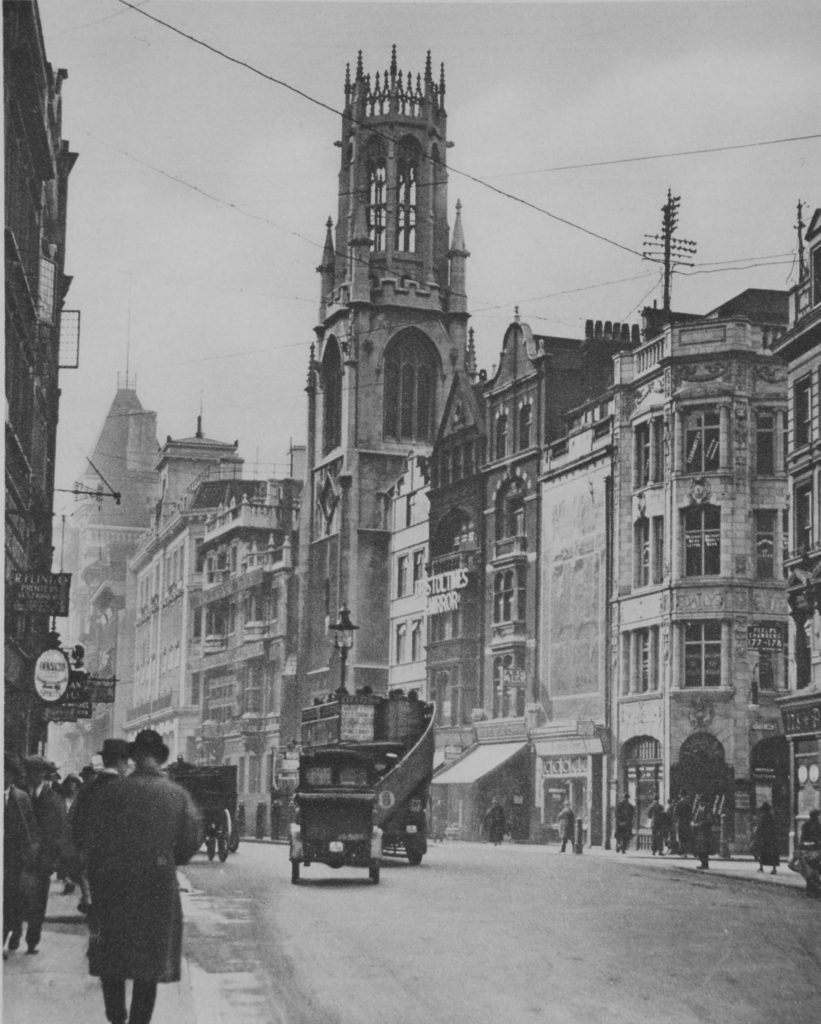
Walking up Fleet Street and heading towards the Strand, the tower of St Dunstan in the West still stands clear of the surrounding buildings.

st-dunstan-1

Indeed not that much has changed in the past 100 years:

st-dunstan-11

The first mention of a church on the site was around the year 1170 and the core of the medieval church survived the Great Fire and was demolished as part of the widening of Fleet Street when the new church was built further back as a replacement.

The church was built by John Shaw between the years 1830 and 1832. John Shaw senior died in 1832 and his son, also a John, completed the church. Various books claim that the tower and octagonal lantern were modelled on either St Botolph’s in Boston or All Souls Pavement in York – both are similar and we will probably never know which was the real inspiration.

The church was damaged during the last war, but was fully restored in 1950.

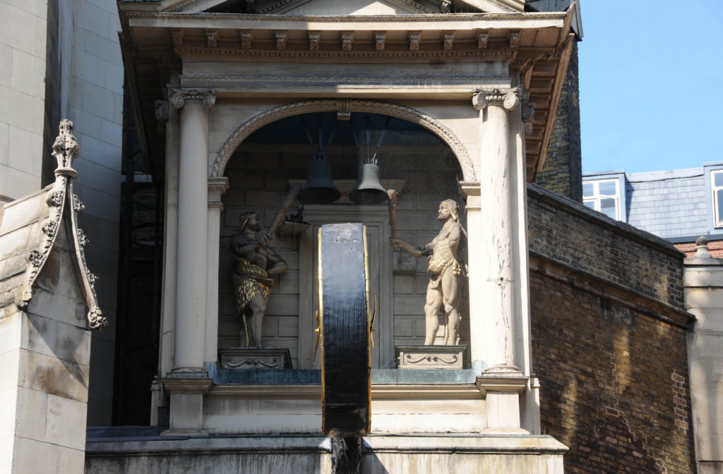
Just to the right of the tower is the clock which was made by Thomas Harris in 1671 for the original church. It was saved by Lord Hertford in 1828 just before the original church was demolished, who then installed it on his villa in Regent’s Park. It was returned to the church in 1935. In a recess behind the clock are two figures either side of a pair of bells.

st-dunstan-9

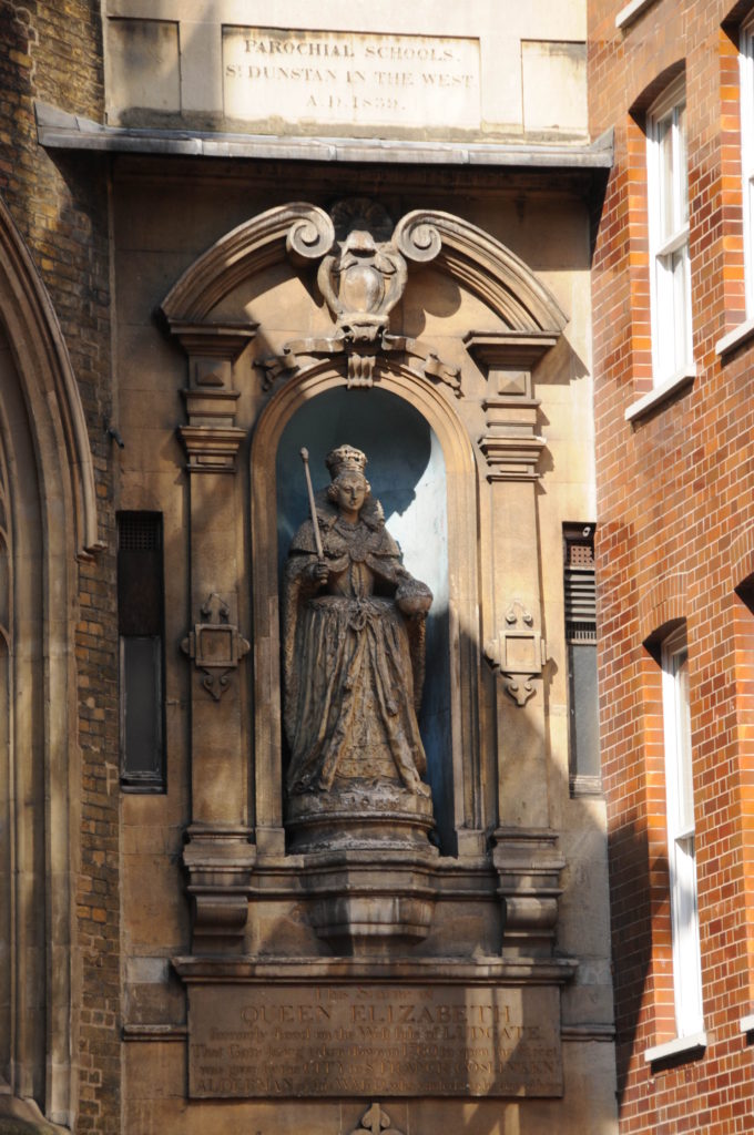
To the right of the clock, further back from the road is the oldest statue of Queen Elizabeth I. Made probably around 1586 and therefore during the reign of Elizabeth I, the statue was originally on the Ludgate, one of the gated entrances to the City. The plaque below the statue reads:

“This statue of Queen Elizabeth formerly stood on the West side of LUDGATE. That gate being taken down in 1760 to open the Street, was given by the City to Sir Francis Gosling, Alderman of this Ward who caused it to be placed here”.

st-dunstan-8

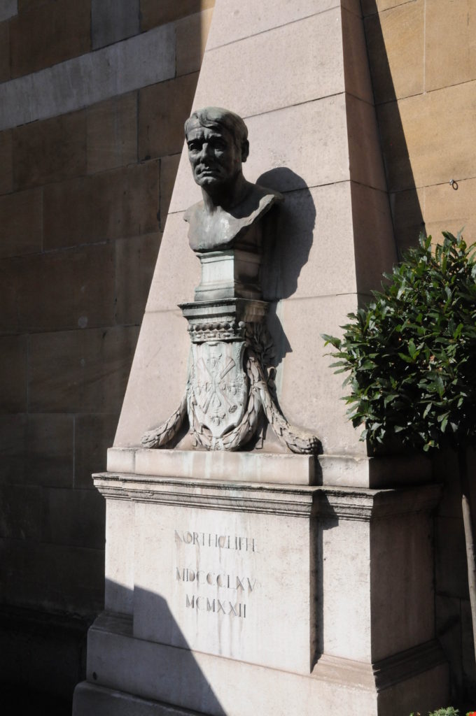
Outside the front of the church is also the Northcliffe Memorial from 1930, who arranged the return of the clock.

st-dunstan-10

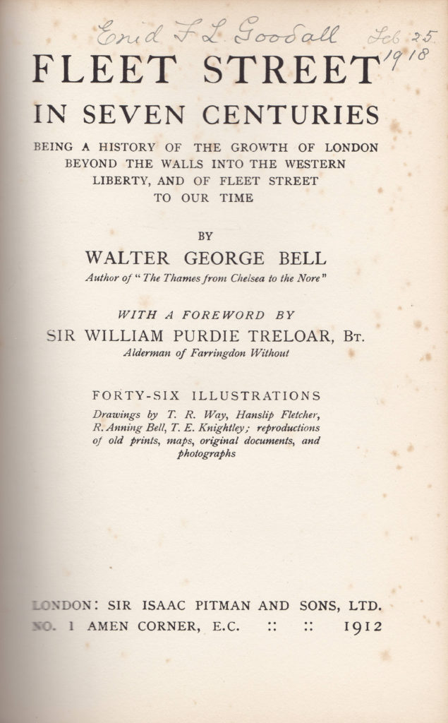
The Book “Fleet Street in Seven Centuries”, by Walter G. Bell. published in 1912 provides an insight into how St. Dunstan’s in the West featured in the life of the city, along with the types of incidents that troubled the lives of those who lived in the area.

The earliest example is from the early years of the reign of Richard II (1377 – 1399) and tells the story of one William Hughlot who, within Temple Bar, in the parish of St Dunstan’s West, Fletestrete entered a shop owned by John Elyngham, a barber and by force of arms, William Hughlot drew his dagger and wounded, beat and maltreated the luckless barber.

Whilst this attack was taking place, the barber’s wife made a great outcry which attracted the attention of John Rote, Alderman who tried to stop the attack, however Hughlot then started to attack the Alderman who would have been killed had not the Alderman “manfully defended himself”.

John Wilman, a constable of Fletestrete seeing Hughnot trying to kill the Alderman arrested Hughnot but was also wounded in the process.

The attack on a city Alderman was classed as “a greater offence against the City’s dignity than would have been a massacre of princes”.

At trial, the judgement was that Hughlot should have his right hand, with which he first drew the dagger and afterwards drew his sword upon the Alderman cut off. This was described as the least punishment befitting such an offence. The sentence was about to be carried out, however the Alderman John Rote “in reverence for our lord the King and at the request of divers lords who entreated for the said William, begged of the Mayor and Alderman that execution of the judgement aforesaid might be remitted unto him”

After nine days of imprisonment Hughlot was released, but had to “carry from the Guildhall, through Chepe and Fletestrete, a lighted wax candle of three pounds weight to the Church of St. Dunstan, and there make offering of the same. And he was to find sureties for good behavior.”

In the 17th century, the church is described as having “gathered a little outlying colony of booksellers, who had their shops in the churchyard”,

During much of the 16th and 17th centuries the wardmote for the southside of the ward of Farringdon Without would meet at St Dunstan’s on St. Thomas’s Day when a grand jury and petty jury would consider local affairs. Example of the affairs brought to the wardmote were:

  • Thomas Smythe, a waterman dwelling in Chancery Lane, resorted to the Temple Stairs and the Whitefriars Bridge to wash his clothes. For that he was presented to the Court of Alderman in 1559 as a common annoyer of all citizens.
  • James Dalton suffered apprentices to play at dice and lose their master’s money and was also judged a common annoyer.
  • In 1560, Hugh Barett, apprentice to Miles Fawcett, cloth worker was whipped, for that he had in a vile manner did hang a cord full of horns at the door of Henry Ewart, an officer of this City and the same on the Church door, the day the said officer was married.
  • A Masterman kept a cellar under the house of Richard Blackman in Fleet Street, “wherein is much figytings, quarrelinge, and other great disorders to the great disquiet of his neighbours”.
  • In 1603 there was presented Joan Spronoy, a woman given to slanderings, scoldings, and babbling, to the great disturbance of her neighbours and others
  • In 1642, Widd Moody from Fleet Street was presented  as she was found to keep a disorderly house, and for that in her widdhood she hath had as is credibly reported two children, and still doth do incontinently

Such was daily life in the area around St. Dunstan in the West.

The church of St Dunstan in the West escaped destruction during the Great Fire of London but was quickly put into good use when it was found to have escaped unharmed as it was soon stacked high with household contents from the houses that had been destroyed by the fire. The year preceding the Great Fire was not a good one in St. Dunstan as in 1665, out of 856 burials, 568 in only three months are marked “P” for Plague.

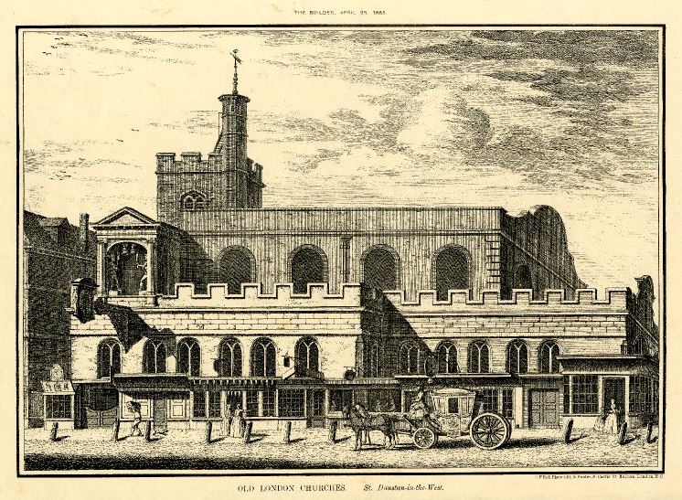
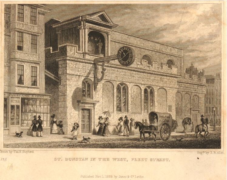
The following two prints show the original church. The only feature that was carried to the new design that we see now is the clock and the alcove above the clock with the two figures striking bells.

st-dunstan-12

st-dunstan-13

During the 16th and 17th centuries, the area around St Dunstan was known for publishers and booksellers. Among these was John Smethwicke who had premises “under the diall” of St. Dunstan’s Church and who published “Hamlet” and “Romeo and Juliet”. Richard Marriot, a St. Dunstan’s bookseller published Isaak Walton’s “Complete Angler” and Matthias Walker was one of the publishers of John Milton’s “The Paradise Lost”.

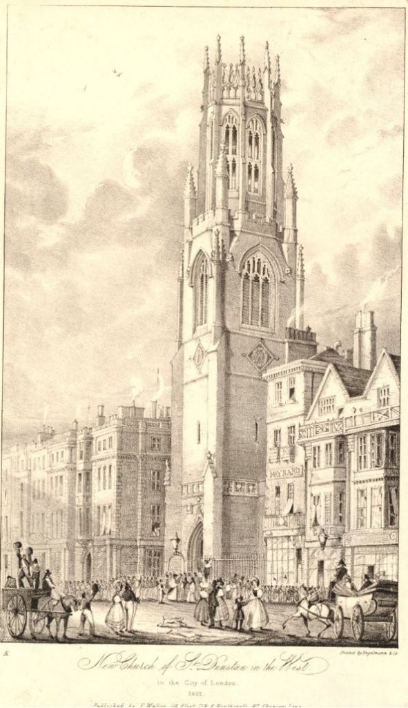
The following print from 1832 titled “New church of St Dunstan in the West” shows the new church when almost complete. There is a queue of people running to the left from the entrance to the church, possibly for the first opening of the new building.

st-dunstan-14

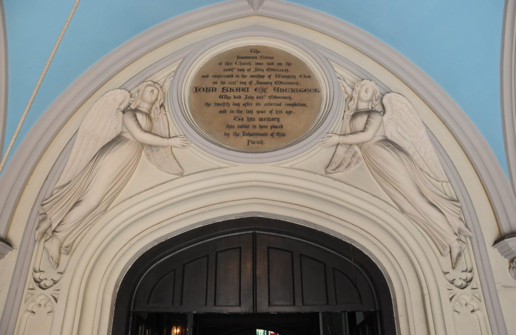
Time to leave Fleet Street and walk into the church. Immediately on entering the church is a plaque to the memory of the architect of the church, John Shaw. The plaque reads:

“The foundation stone of this Church was laid on the 27th day of July 1831 and consecrated to the worship of Almighty God on the 31st day of January 1833: John Shaw, Architect who died July 30th 1832, the 12th day after its external completion, and in the 57th year of his age. To his memory this tablet is here placed by the Inhabitants of this Parish.”
st-dunstan-6

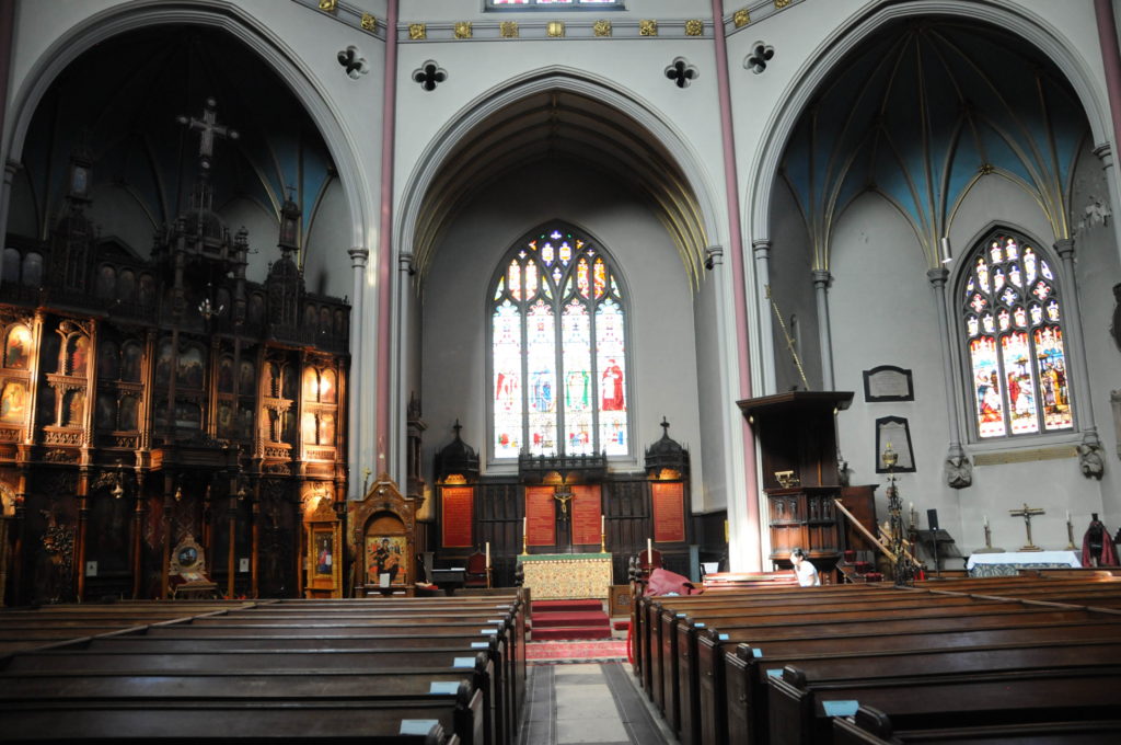
Once inside the church, the unusual layout can be seen. With the widening of Fleet Street, there was limited space to build a traditional style of church with a long nave, so an octagonal shape was used to maximise use of the space available and to provide alcoves around the edge of the church for uses such as individual chapels.

st-dunstan-4

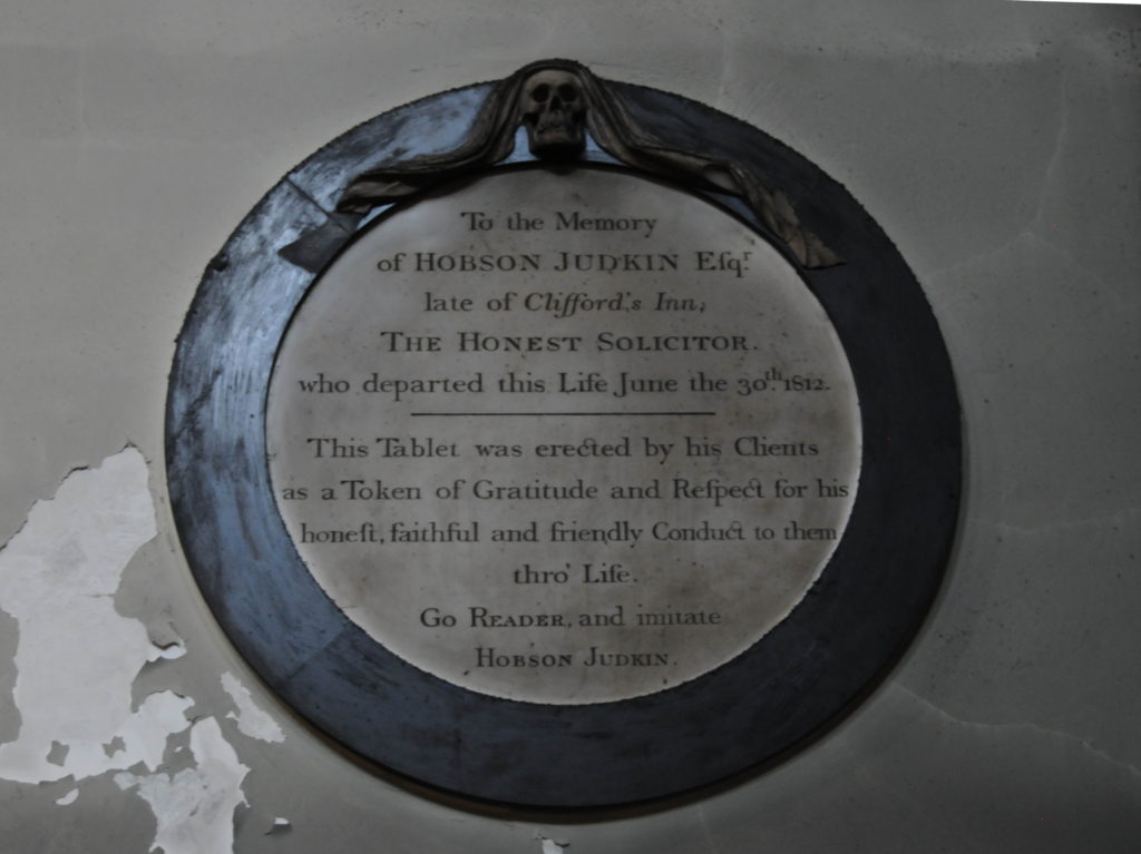
Along the walls of the church are a number of memorials and tablets including the following to Hobson Judkin – The Honest Solicitor.

st-dunstan-3

Hobson Judkin was a solicitor at the nearby Clifford’s Inn and as well as recording his honesty, the tablet also probably tells us more about how other solicitors of the time were seen if it was significant to record the honesty of one individual. I found the last will and testament of Hobson Judkin in the National Archives, however it was written over two pages of very condensed script and to my untrained eye only the occasional words were legible. I will have to work on this more.
The closing sentence “Go reader and imitate Hobson Judkin” has to be one of the best epitaphs – who would not want to be remembered in this way?

Walter Thornbury writing in Old and New London mentions that in the record of the parish written by a Mr Noble, there is a remark on the extraordinary longevity attained by the incumbents of St. Dunstan. Dr. White held the living for 49 years, Dr. Grant for 59, the Rev. Joseph Williamson for 41 and the Rev. William Romaine for 46. Thornbury makes the telling remark that “the solution of the problem probably is that a good and secure income is the best promoter of longevity”. Then as ever, poverty does not result in a long life.
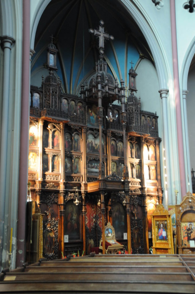
St Dunstan in the West is an Anglican Guild Church, and is also home to the Romanian Orthodox Church in London and has a superb altar screen that was brought to the church from a monastery in Bucharest in 1966.
st-dunstan-5

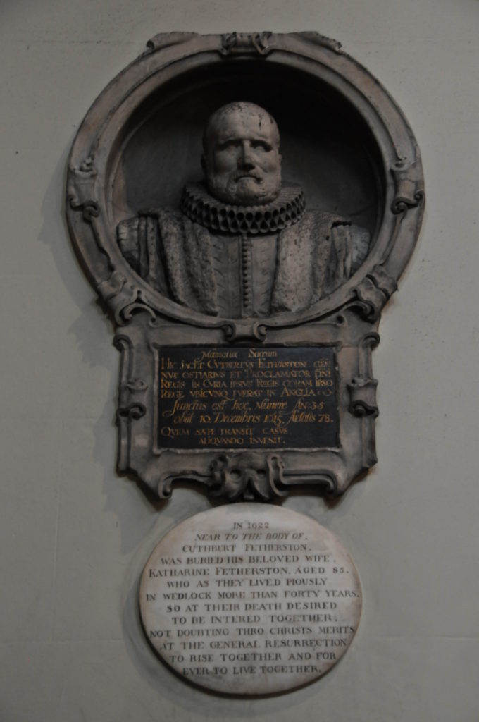
The monument to Cuthbert Fetherston who died on the 10th December 1615, aged 78. Underneath is a plaque recording that his wife Katharine Fetherston was buried nearby in 1622 – “Who as they lived piously in wedlock more than forty years. So at their death desired to be intered together”.

st-dunstan-2

The magnificent roof of the church, above eight identical windows.

st-dunstan-7

The premises of the bank of C. Hoare and Co have been opposite the church since 1690 and the bank has had a long association with the church. Several members of the Hoare family are buried in the church, and the bank donated the stained glass windows behind the high altar.

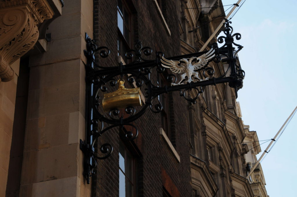
The bank opposite still has the sign of “the golden bottle” hanging outside the entrance – a reminder of when buildings did not use numbers and some visible symbol was used to mark the location of specific people and businesses.

st-dunstan-15

My visit to the church was on the day when the Friends of City Churches host visitors and I am grateful to the very knowledgeable team who provided considerable information on the history of the church.

I also used a number of books to research the history of St. Dunstan in the West, including the excellent Fleet Street in Seven Centuries by Walter G. Bell. Churches provide a tangible link with Londoners, but so can books.

My copy of Fleet Street in Seven Centuries was originally owned by Enid F. L. Goodall who received the book as a present from her mother in February 1918. Inscribed on the inside cover of the book is “In memory of February 1918 E.F.S.G, C.E.G.G, F. Ln. G in Fleet Street” (the last set of initials were those of Enid’s mother).

On the top of the cover page of the book, Enid has written her name and the date Feb 25th 1918.

Finding the names of previous owners written in books is very common, however what was unusual about Enid is that she used her two middle initials so I wondered if I could track her down.

Enid was born on the 11th January 1890 in Dulwich. In the 1891 census her father Arthur was listed as a Photographer. In the 1939 census she had moved to Lowestoft in Suffolk where she is living with Hilda Allerton (a widow) and Georgina Unwin. Both Enid and Hilda are listed as being of Private Means whilst Georgina is listed as being in Domestic Service. Enid apparently stayed in Suffolk for the rest of her life as her death is recorded in Waveney in 1990, shortly after her 100th birthday. An article and photograph of her 100th birthday is in the Lowestoft Journal, I found the record but not the actual page which is held in the Suffolk Record Office.

So many millions of people have passed through the streets of London over the centuries and every so often it is possible to get a glimpse of an individual. It would be fascinating to know why Fleet Street on the 25th February 1918 was so memorable to Enid Goodall.

st-dunstan-16

alondoninheritance.com

Walking The Streets On The Evening Before The 1981 Royal Wedding

A couple of weeks ago I published the photos my father took of people waiting for the Coronation in 1953. That post can be found here.

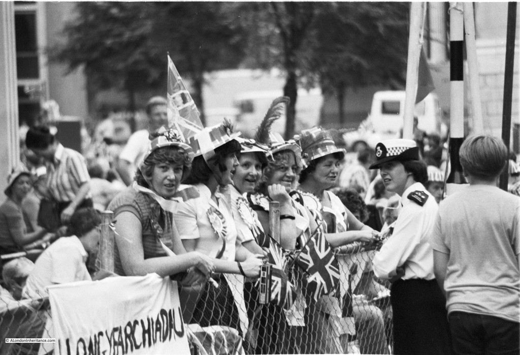
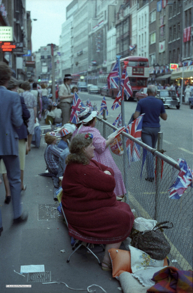
Just under 30 years later there was another royal event in central London, and on the evening before people were finding the best position along the route to watch the events of the following day.

This was the wedding of Charles and Diana that took place on the 29th July 1981 and on the evening of the 28th July I took a walk from St. Paul’s Cathedral and along Fleet Street and the Strand to take some photos.

Starting at St. Paul’s Cathedral, this is where the best positions were and large crowds had already found their place ready for an overnight stay.

I must have had a couple of photos left on some Black and White film before moving to colour.

Outside St. Paul’s Cathedral:

Royal Wedding St. Paul's

Crowds at this perfect position looking across at the steps leading into the Cathedral: Royal Wedding St. Paul'sI must have then switched to a colour film:Royal Wedding St. Paul's

Looking back up Ludgate Hill. Although this was the evening before, the road had been closed and a large number of people were just walking the route, taking in the atmosphere and watching the people who were settling in for the night along the edge of the route. It was a warm evening and I remember there being a real sense of a big event taking place the following day.

Royal Wedding Ludgate Hill

The same view today looking back up Ludgate Hill towards the cathedral. St. Martin Ludgate on the left is still there, along with many of the buildings on the right.

Ludgate Hill

Just to the right in the above photo in 1981:

Royal Wedding Ludgate Hill

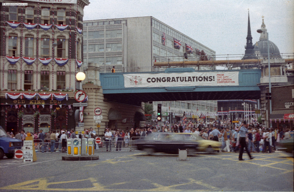
Now in Ludgate Circus. This was when the railway bridge still ran across the start of Ludgate Hill.

Royal Wedding Ludgate Circus

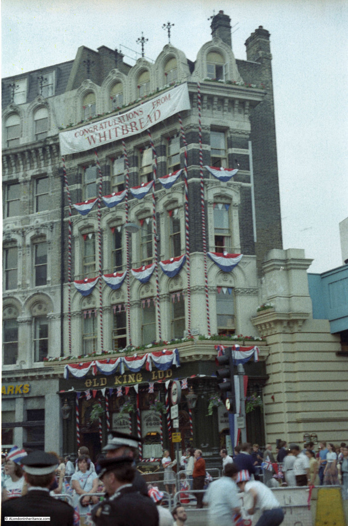
Just to the left of the railway bridge is the Old King Lud pub, decorated for the event. This was a lovely Victorian pub, built-in 1870,

Royal Wedding Ludgate Circus

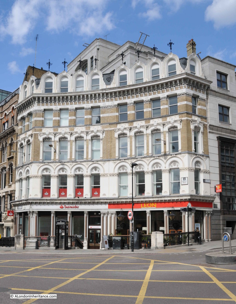
After going through some changes in the 1990s, the pub finally closed in 2005 and became yet another of London’s lost Victorian pubs. The site is now occupied by a fast food store with offices above:

Ludgate Circus

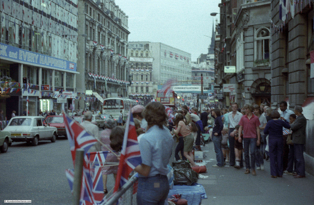
Moving up into Fleet Street. This road was still open and the pavements were busy with those walking and those waiting:

Royal Wedding Fleet Street

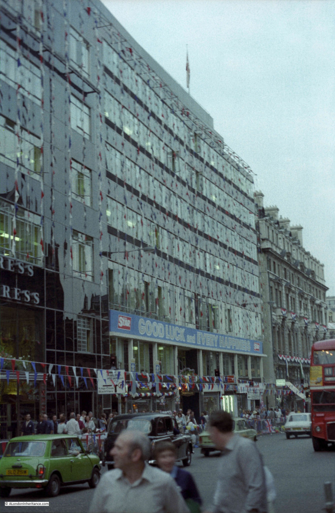
This was when Fleet Street was still occupied by newspaper publishers. The Express offices on the left and those of the Star on the right. I remember walking along Fleet Street and the side roads leading down to the Thames on a late Saturday afternoon / early evening and listening to the sound of the newspapers being printed and the amount of activity to get the next day’s edition distributed. All very exciting when you are young and exploring London.

Royal Wedding Fleet Street

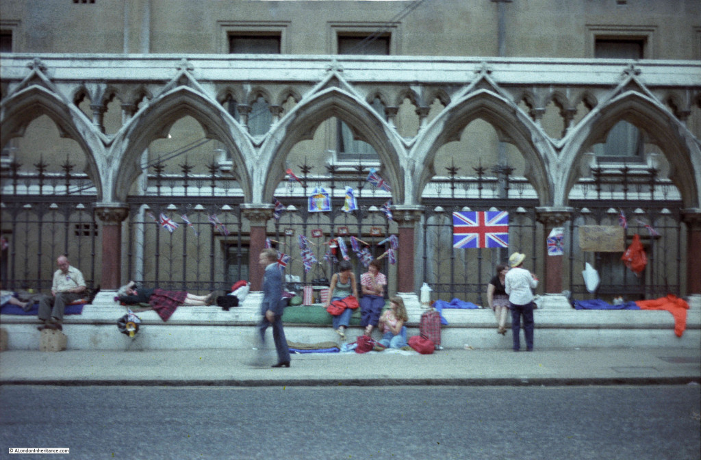
Prepared for a night’s wait:

Royal Wedding Fleet Street

Along the side of the Royal Court’s of Justice:

Royal Wedding Law Courts

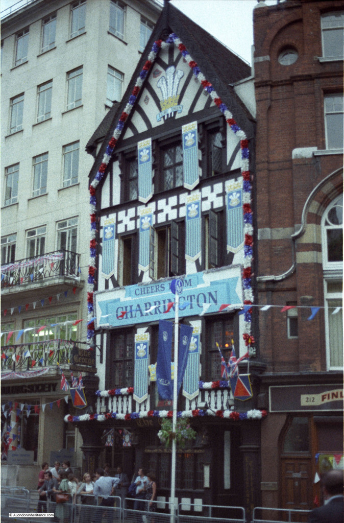
The George pub in the Strand which fortunately is still there:

Royal Wedding Strand

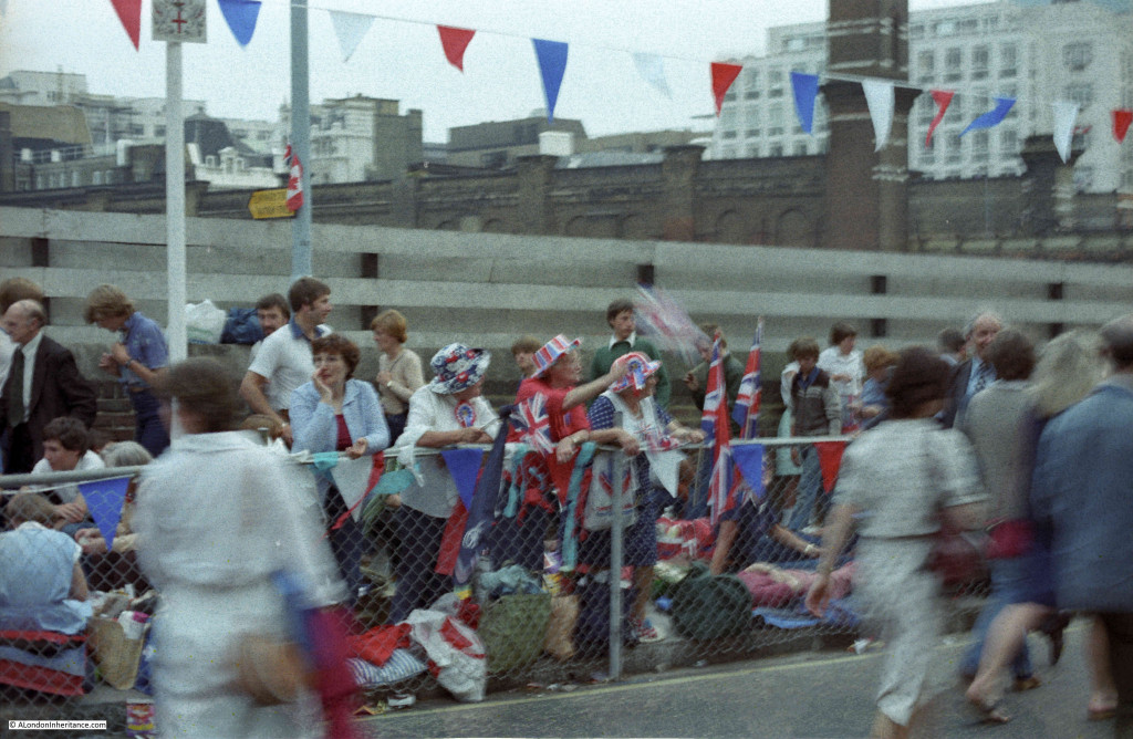
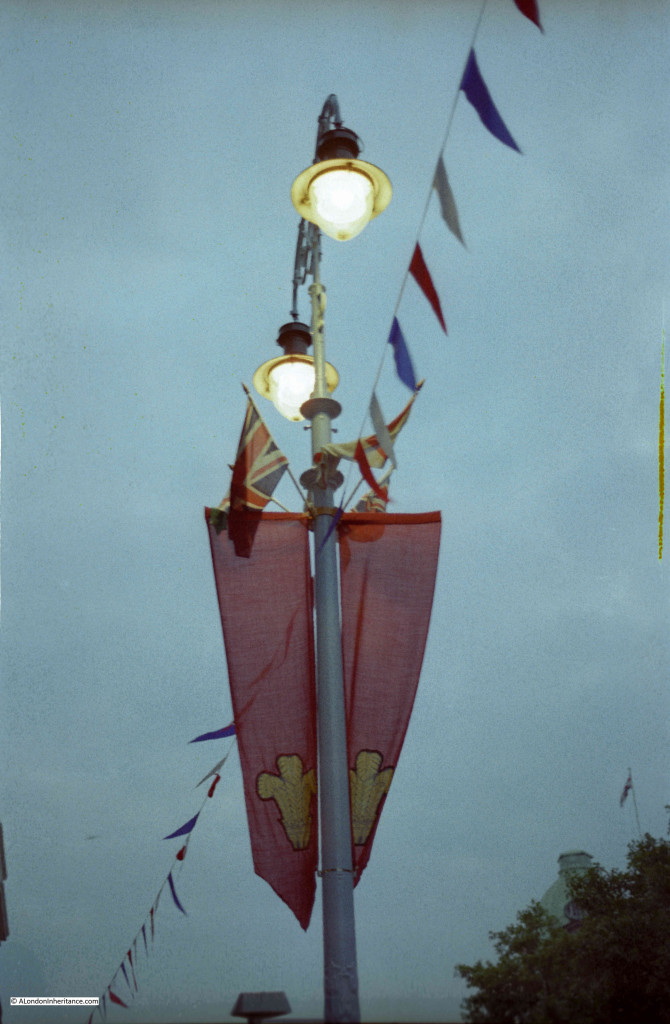
Most of the decorations were put up by the owners of the buildings along the route. “Official” street decoration was very limited, mainly these pennants hanging from lamp posts. Union Jacks along with red, white and blue bunting was out in abundance.

Royal Wedding Strand

One of many events that have taken this route to St. Paul’s Cathedral, but a special event for me as this was my first opportunity to get out and photograph the streets and people preparing for the following day.

alondoninheritance.com