Monthly Archives: November 2025

The King’s Chapel of the Savoy

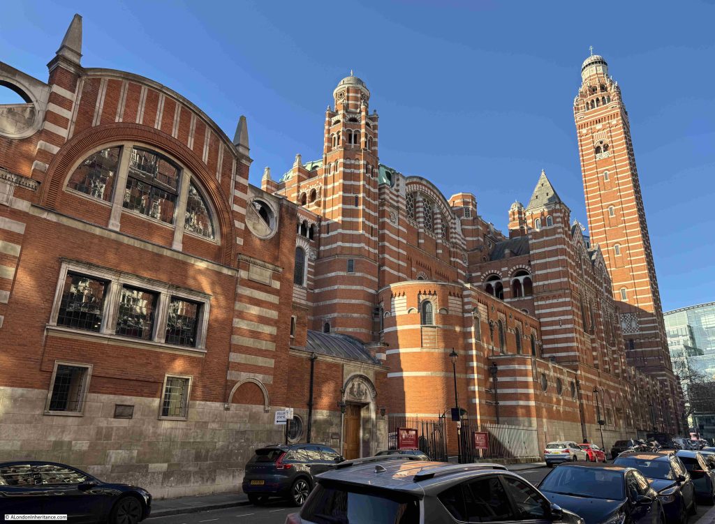
From the Strand, head down Savoy Street, then into Savoy Hill and you will find a remarkable little chapel, which today looks out on much taller buildings, but once was surrounded by a very different estate. This is the King’s Chapel of the Savoy. The chapel tells a story of the complexity of medieval land ownership, and the challenges of being sure of facts when using historical records, maps, books etc.

This is the view from Savoy Hill. The main entrance is through the modern brick building to the right:

If you approach the chapel from the Strand, along Savoy Street, you will find the entrance to the small churchyard located to the east of the building:

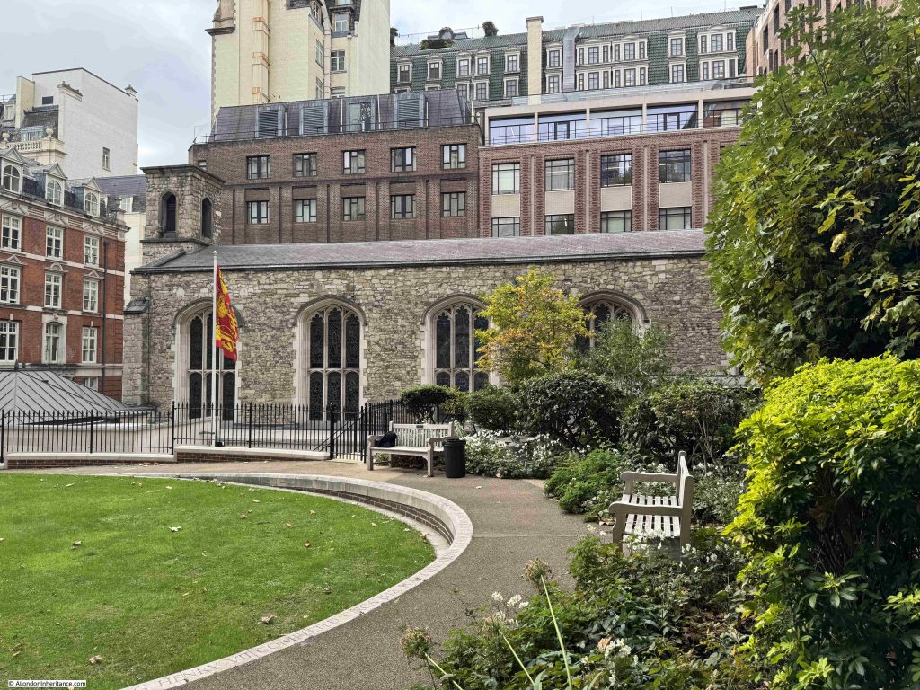
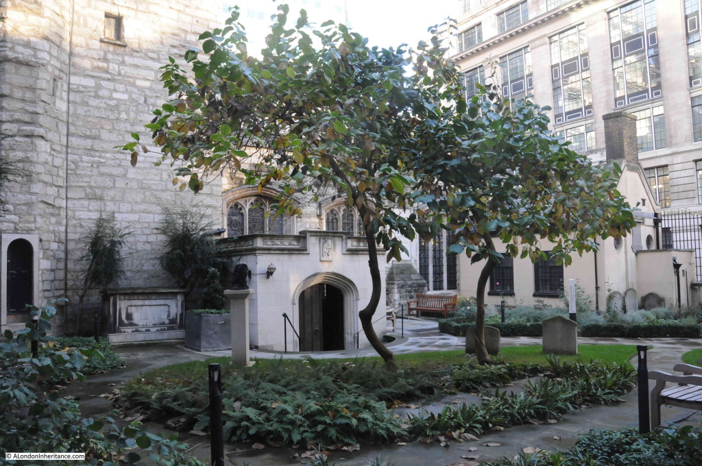
And in the churchyard, we can see the eastern side of the chapel:

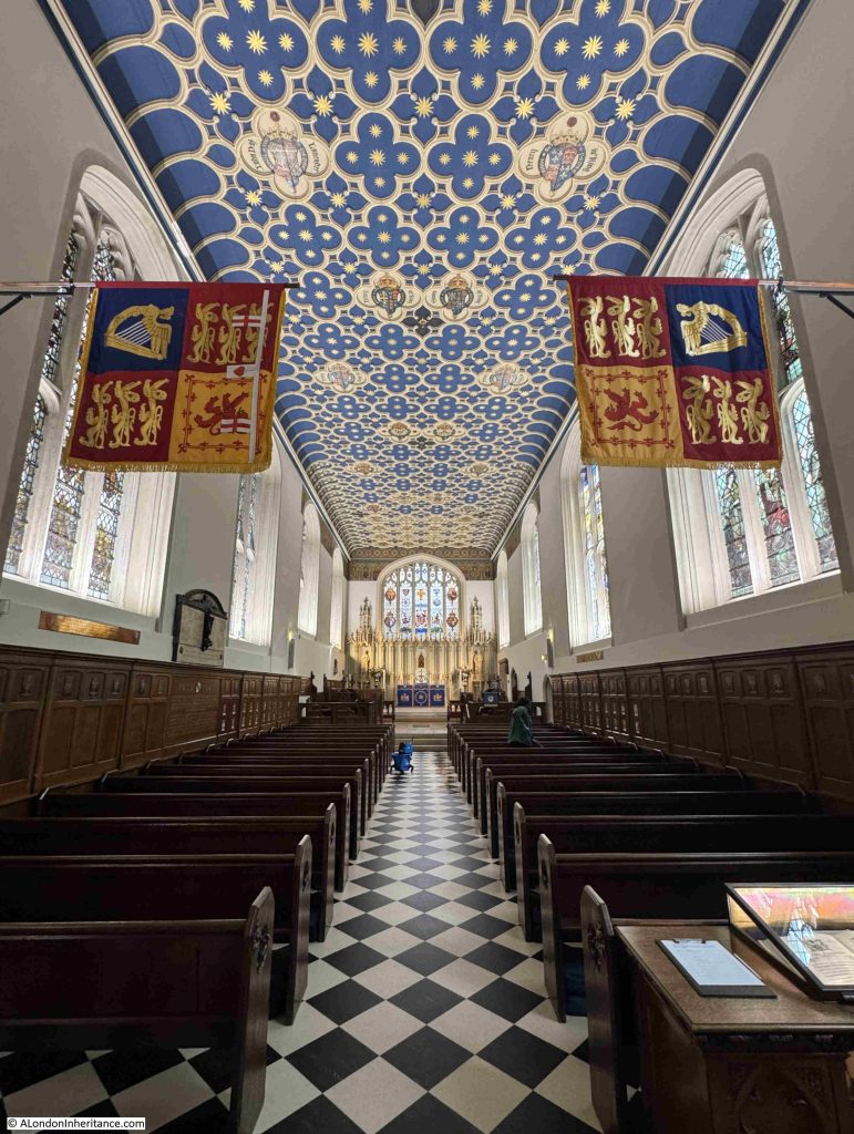
There are many remarkable things about this chapel, one is how much larger the interior is when compared to the view from outside, along with the colour and decoration to be found within:

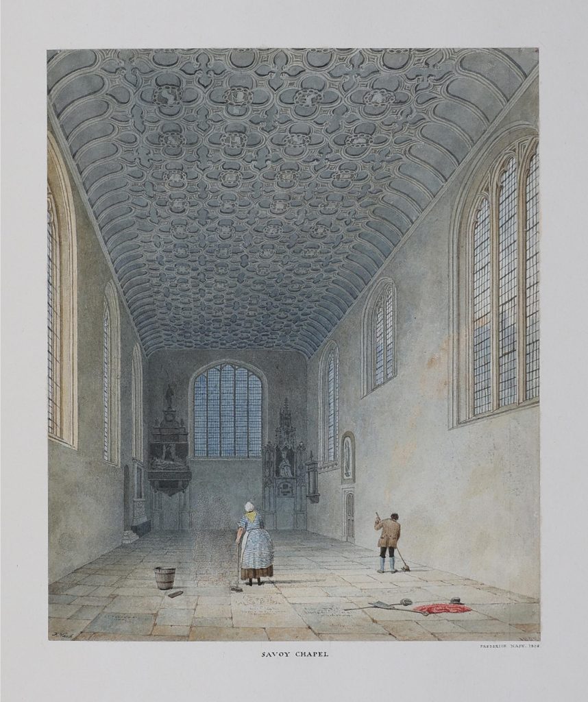
There is a cleaner working on the pews in the above photo, with their bucket in the aisle. In a bit of historical symmetry, the following print from 1808 shows a much plainer interior, but with two cleaners working on the flag stones which then paved the floor:

The King’s Chapel of the Savoy is today the only survivor of a much larger institution, and includes the name of a medieval owner of the land. The chapel has also long held a unique position with respect to the Church and Crown.

The easily traceable history of the estate, a small part of which is occupied by the chapel, goes back to the 13th century, when the land was owned by Simon de Montfort, the 6th Earl of Leicester, who formed an estate to the west of Somerset House, and built a palace on the land.

de Montfort has a fascinating history and both supported, and fought against the king, and for a time he ran an early form of Parliament. de Montfort died during the Battle of Evesham on the 4th of August, 1265, when he led a small army of rebellious barons against Edward, the son of King Henry III.

de Montfort’s land then went through many different owners, eventually becoming part of the Duchy of Lancaster, which is still in existence today, and continues to be a landowner, with assets held in trust for the King or Queen of the day, in their role as the Duke of Lancaster.

One of the owners of the land was Peter of Savoy hence the use of the name Savoy in the full title of the chapel. Some accounts state that Peter of Savoy built a large house on the land in 1245, later known as Savoy Palace, however Simon de Montford did not die until 1265, so the house was either built later during Peter of Savoy’s ownership, or it was built in 1245 by Simon de Montford.

The Duchy of Lancaster continues to own the land occupied by the chapel, along with a number of surrounding parcels of land and buildings. I wrote a post about the Duchy of Lancaster here, and included the following diagram as an attempt to trace the ownership of the estate through to the Duchy taking full control:

The above was an attempt to explain how this area of land between the Strand and the Embankment was formed, came into Royal ownership, and how the name of Savoy became part of the chapel’s name.

Interesting that although Peter of Savoy owned the estate for a relatively short period of time in the 13th century, the use of Savoy continued for many centuries, and today can be found not just in the name of the chapel, but in many of the surrounding streets, the hotel and theatre.

But in all the above changes in ownership, and by 1399 when Henry IV combined the Savoy estate with the Duchy of Lancaster, the chapel had not yet been built. That would have to wait until the early 16th century when Henry VII founded the “Hospital of Henry late King of England of the Savoy”.

The Savoy Palace had been attacked during the Peasants Revolt in 1381, when the rebellion, angered by the actions of then owner, John of Gaunt, destroyed all the contents of the palace, and set fire to the building.

It remained semi-derelict until the founding of the hospital by Henry VII, although he died in 1509, six years before the completion of the hospital in 1515, when Henry VIII was on the throne, hence the use of “Henry late King of England” in the original name of the hospital.

According to Henry Chamberlain in “A New and Complete History and Survey of London and Westminster” (1770), the hospital was “controlled by a Master amd four brethren, who were to be in priests orders, and officiate in their turns, and they were to stand alternatively at the gate of the Savoy, and if they saw any person who was an object of charity, they were obliged to take him in and feed him. If he proved to be a traveller he was entertained for one night, and a letter of recommendation, with so much money given to him as would defray his expenses to the next hospital”.

Henry Chamberlain goes on to state that the hospital was supressed in the 7th year of the reign of Edward VI (who reigned from 1547 to 1553, so presumably the final year of his reign), with the furniture being given to the Hospitals of Bridewell and St. Thomas.

Once Mary I came to he throne (1553 to 1558), she refounded the hospital, there was also recorded a porter, who was responsible for locking the gates of the hospital every night, and for receiving rents, so presumably some of the land had been rented out or leased to other occupiers, and a considerable sum was received, amounting to around £20,000 per annum.

The chapel was one of a number of chapels built as part of the hospital complex, which appears to have been of some size, with the main dormitory being described as larger than Westminster Hall.

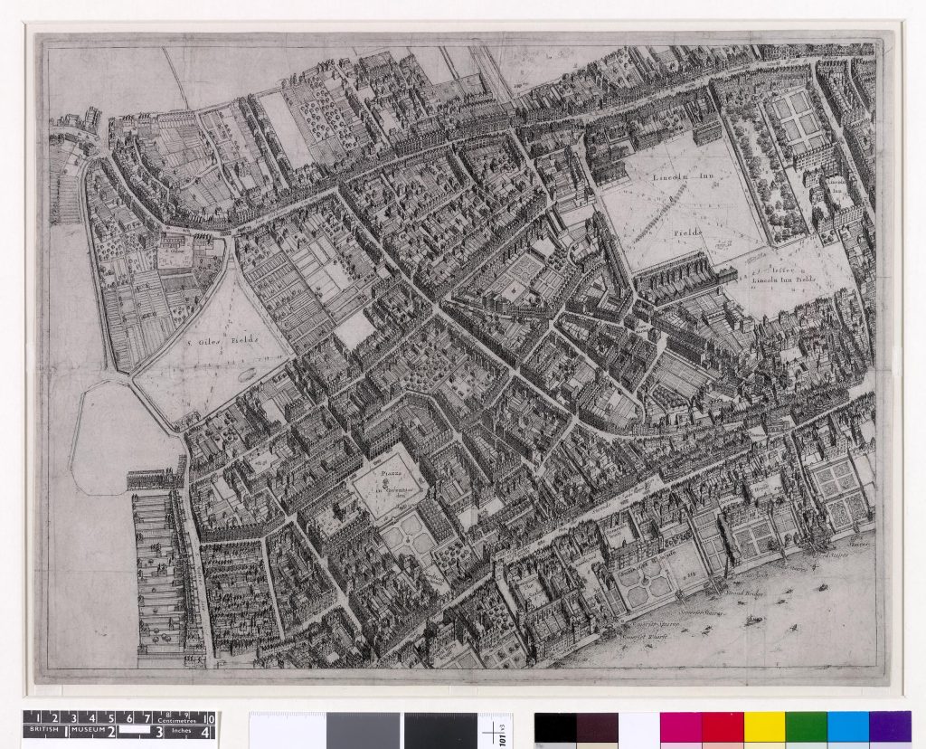
The following map, part of an 1660s “bird’s-eye plan of London” by Wenceslaus Hollar shows the area from the Thames in the south, up to High Holborn  (© The Trustees of the British Museum. Shared under a Creative Commons Attribution-NonCommercial-ShareAlike 4.0 International (CC BY-NC-SA 4.0) licence.):

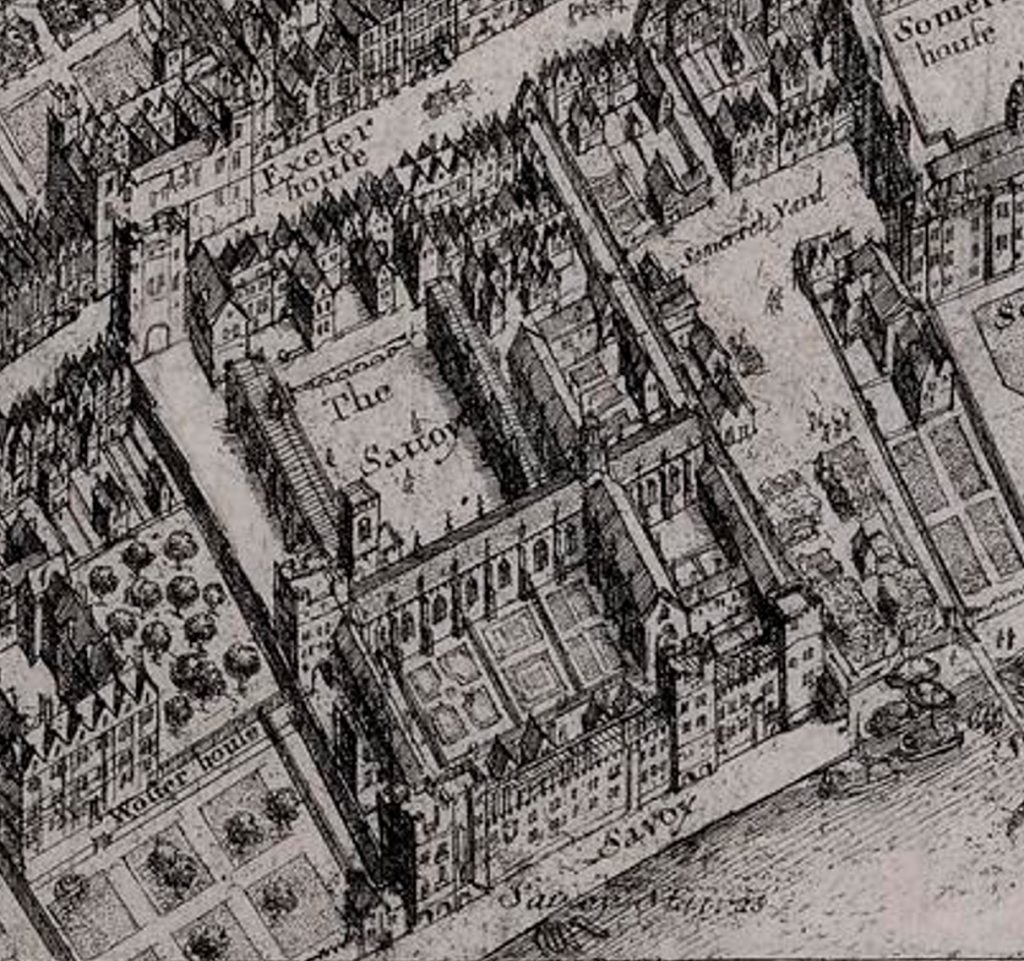
The following is an extract from the map showing the Savoy estate. Just to the lower left of centre, there is a tower which may be the tower of the chapel:

The above extract shows a substantial complex. Presumably much of the estate had been leased or rented out, hence the high level of income, and the main dormitory could have been the long building just to the south of the tower, running east – west, with a couple of transverse wings running north – south.

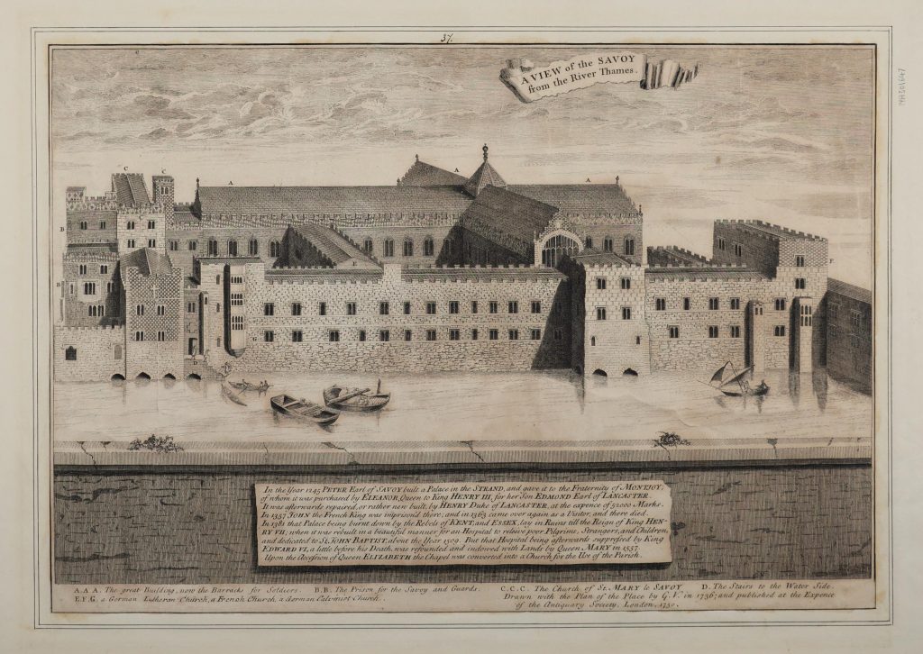
The following print from 1736 shows a view of the Savoy from the river, and the building in the print can be aligned with the above map from about 75 years earlier  (© The Trustees of the British Museum. Shared under a Creative Commons Attribution-NonCommercial-ShareAlike 4.0 International (CC BY-NC-SA 4.0) licence.):

By the time of the above print, the hospital had been dissolved, and act carried out in 1702.

The print also creates a bit of a mystery regarding the King’s Chapel of the Savoy.

Nearly all sources state that the chapel has always been dedicated to St John the Baptist, however in the above print, the tower, seen in the print and earlier map is part of a church that is dedicated to “St. Mary-le-Savoy”. Henry Chamberlain states the following “The chapel of the Savoy (which is called St. Mary le Savoy) is probably the chapel of St. John the Baptist”, the St. Mary may have been a later dedication which came into more common use in the 18th century, before the later restoration of St. John the Baptist, which is the current dedication.

In my ongoing interest in Thames Stairs, it is good to see that Savoy Stairs are also shown in the print, towards the left, with some waterman’s boats at the base of the stairs, along with two larger boats, which presumably were used for carrying goods to and from the Savoy.

These stairs can also be seen in the following extract from another 18th century map, where the church tower can again be seen, although a tower that looks more like a traditional church tower than the tower we see today:

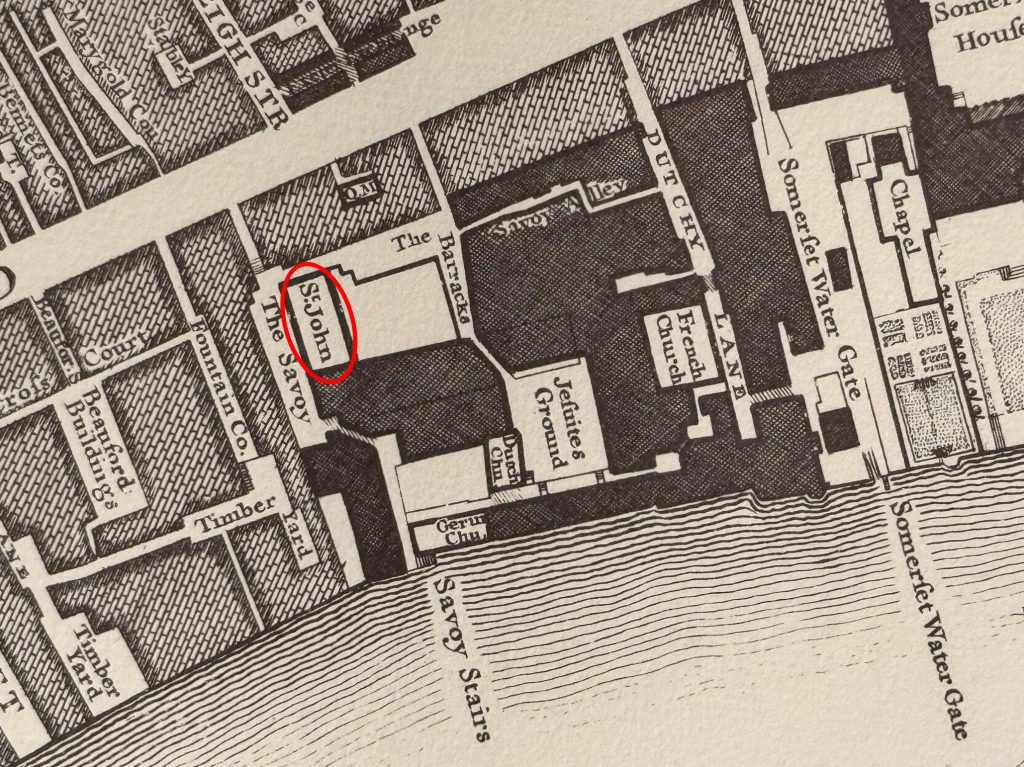
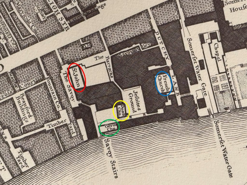
Confirmation of the dedication of the chapel, and identification of a number of other chapels on the site of the Savoy and hospital can be seen in Rocque’s map of 1746, where the chapel has a St. John dedication – circled in red in the following extract:

In the mid-18th century, as well as the chapel of St. John, there were three other chapels marked on Rocque’s map – a German (green circle), Dutch (yellow) and French (blue):

To add confusion to the chapels, Henry Chamberlain states that there were two German churches, one a Calvinist and the other Lutheran, a French church and a Quaker meeting house.

Henry Chamberlain also records that after the hospital had been dissolved, the site was occupied by “barracks for 500 soldiers, the Savoy prison for deserters and other delinquents of the army, and for securing the recruits. There is also a handsome infirmary for such of the guards as fall sick, and for three or four officers”.

Soldiers seem to have been sent to the prison for relatively trivial offences, for example in January 1729: “On Sunday 62 Soldiers of the second Regiment of Foot Guards were sent to the Savoy, for having spots on their Cloths”.

The prison and barracks for 500 are confirmed in the earlier print of the complex, with the large central building running east – west being the barracks. The print does not mention a Quaker meeting house, however there is a mention in a March 1776 article about a fire at the Savoy estate, when:

“The flames then communicated to the Soldiers Barracks, which are totally destroyed down to some stone work, Several men escaped from the Savoy Prison; but the building itself is not burnt. The Lutheran Chapel is not damaged, and the Quaker’s Meeting House nearly destroyed. Happily through the vigilance of Captains Greenfield and Stephens, and the activity of the Savoy Guard, the Gunpowder was moved in time, to prevent the consequences of the fire catching it.”

Many of the buildings survived until to the early 19th century, but by this time there was pressure to redevelop the area, and major construction projects such as Waterloo Bridge required land as the approach road to the bridge was built over the eastern edge of the Savoy estate.

The chapel was repaired in 1721 at the expense of George I, who was also responsible for enclosing the churchyard, as well as adding a side door between the chapel and churchyard.

Throughout all this time, the King’s Chapel of the Savoy survived. Firstly a part of Henry VII’s hospital, then after the hospital was dissolved, part of the different uses of the buildings on the Savoy estate, including military barracks and prison, then seeing all these buildings demolished as the area became occupied by more commercially focused buildings.

The Savoy Stairs were lost when the Embankment was built, distancing the chapel from the Thames, and further reconstruction in the later part of the 19th century and the 20th century resulted in the area as we see it today, where the 16th century chapel still survives.

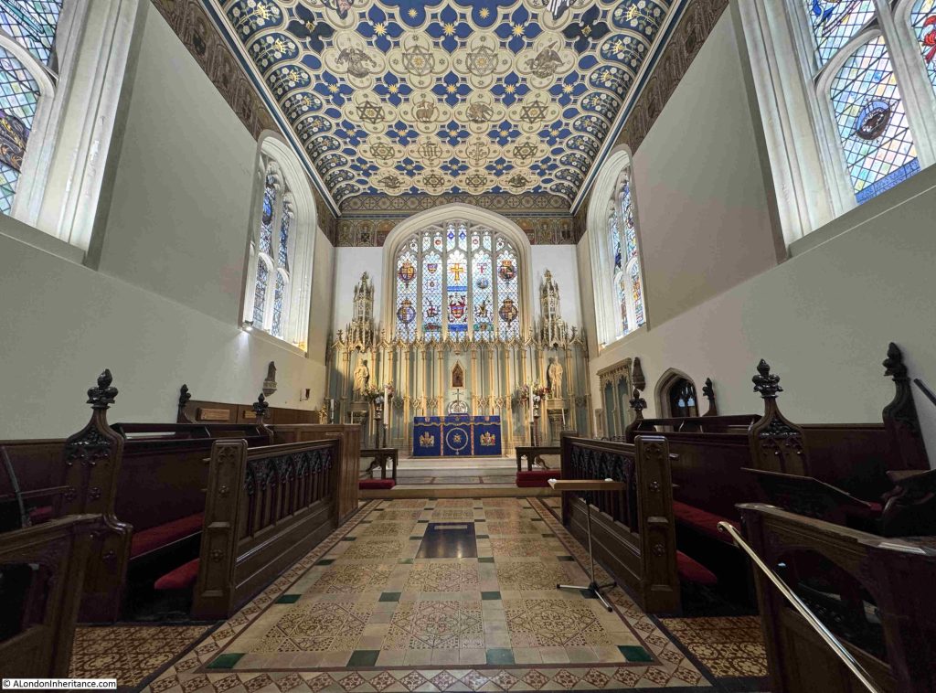
Inside the chapel. the core of the walls are Tudor, from the time of the chapel’s original construction. The ceiling is part of a later restoration:

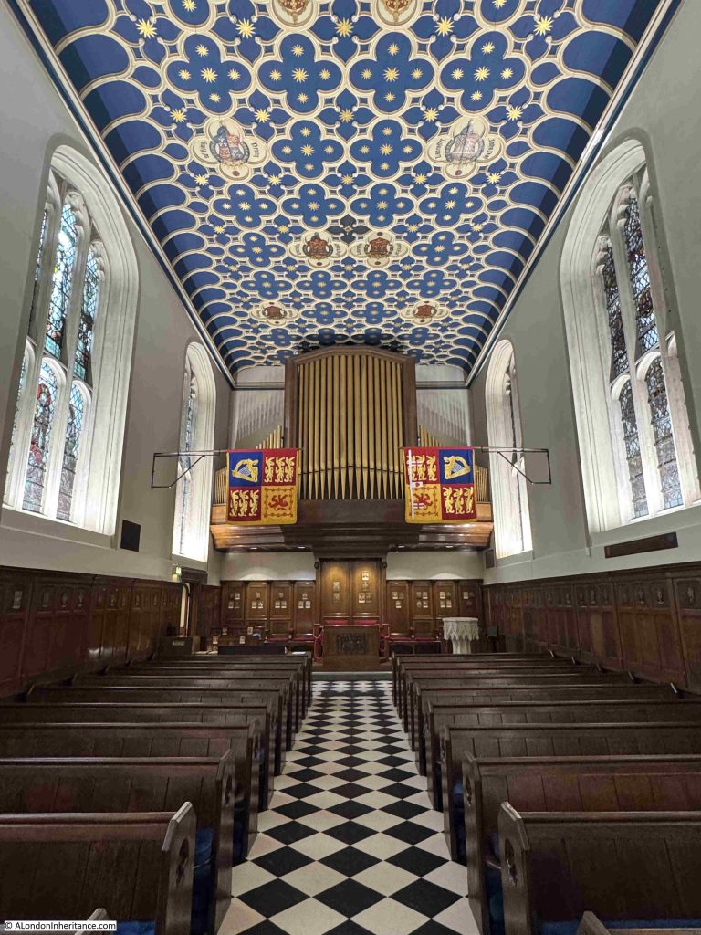
The organ, which was built by J W Walker & Sons Ltd, and dedicated by Queen Elizabeth II during a service on the 27th of October 1965:

The magnificent ceiling, recently restored and decorated to mirror what is believed to be the original appearance of the ceiling:

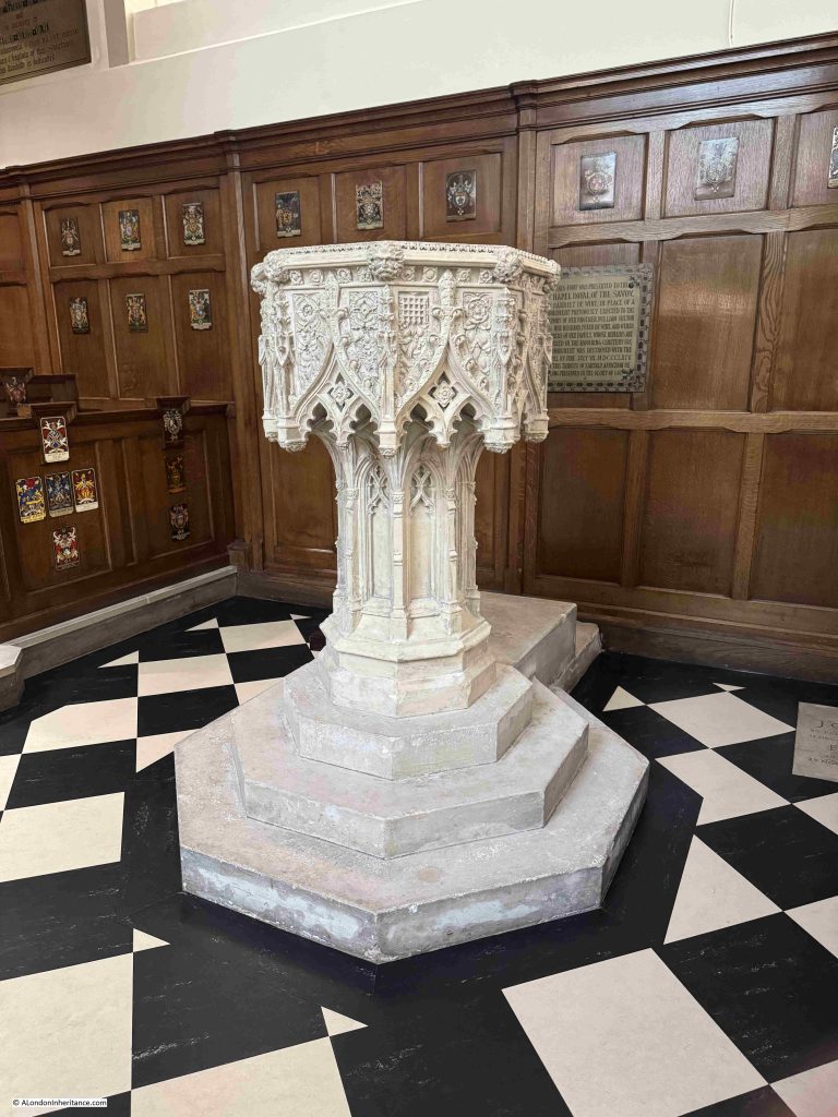
The font:

The font was a gift to the chapel in 1864 to replace an earlier font which had been “destroyed with the chapel by fire”.

The fire was significant, and helps explain why only the core of the walls are original, and the roof, decorated ceiling and much of the rest of the chapel is later. The following is typical of newspaper reports from the 15th of July 1864, describing the fire:

“On Thursday afternoon, one of the most ancient structures in London, the Savoy Chapel, was destroyed by fire. When first it was seen it would appear that only the organ was burning; but in a few minutes the whole interior woodwork, open seats, pulpit, &c were in flames. The fire presently burst out of the stained glass window at the northern end, and caught the veranda of the house in front of it, 109 Strand, a tailor’s shop. The upper part of the house, occupied by the Press newspaper, was also on fire for a short time, but the flames were got under control by the timely arrival of the steam engine.

The fire in the church however was not subdued till the roof had fallen in. The cause of the unfortunate occurrence is in this instance more easy to trace than usual.

It appears that there was an escape of gas near the organ, and the gasmen were engaged at one o’clock to find the precise spot. They left for their dinner without turning off the gas at the meter, and it is supposed that they either left a light behind them, of that they had unwittingly lighted an escape and left it burning. The keys of the church were not forthcoming for some time after the engines had arrived.”

The report states that the ceiling was entirely destroyed, and that it was the most striking feature of the interior of the chapel (as it is today). It was wholly of oak and pear tree, divided into 138 quatrefoil panels, and enriched with a carved ornament either of sacred or historical significance. The report also covers some of the many monuments in the chapel, only a few of which survived the fire.

The 1864 fire appears to have been the last of three fires that overall caused severe damage to the chapel. A report in 1911 states that “Owing to three fires between 1842 and 1864, very little of the old interior is left”.

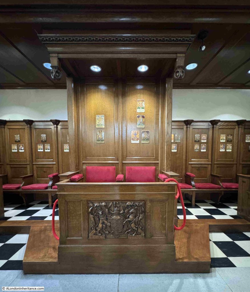
At the rear of the chapel, underneath the organ, are two separate seats:

The name King’s Chapel of the Savoy explains why these seats are here, and the unique status of the chapel.

The King’s Chapel of the Savoy is a private royal chapel for the monarch, and is not subject to the jurisdiction of the established church. It is also therefore not a parish church.

Until recently it was the Queen’s Chapel of the Savoy, but with the death of Elizabeth II and the coronation of Charles III, the chapel changed to the King’s Chapel.

The addition of “King’s” to the name Chapel of the Savoy is relatively recent, as in April 1939 “The Duchy of Lancaster Office last night issued the following announcement – His Majesty, in right of his Duchy of Lancaster, has been pleased to command that his Chapel of the Savoy shall be styled henceforth ‘the King’s Chapel of the Savoy'”.

Two years earlier, in 1937, George VI has also commanded that the Savoy Chapel should be the chapel of the Royal Victorian Order, an order that was founded by Queen Victoria in 1896 for services to the King or Queen, and other members of the Royal Family.

The special seats at the rear of the church, which face straight down the walkway between the pews are for the monarch, and on the wooden panels behind the seats are copper panels which display the Coat of Arms of previous monarchs and other members of the royal family who have or had a role in the life of the chapel, for example Princess Ann who as Princess Royal is the Grand Master of the Royal Victorian Order, part of the honours system that is closely associated with the chapel:

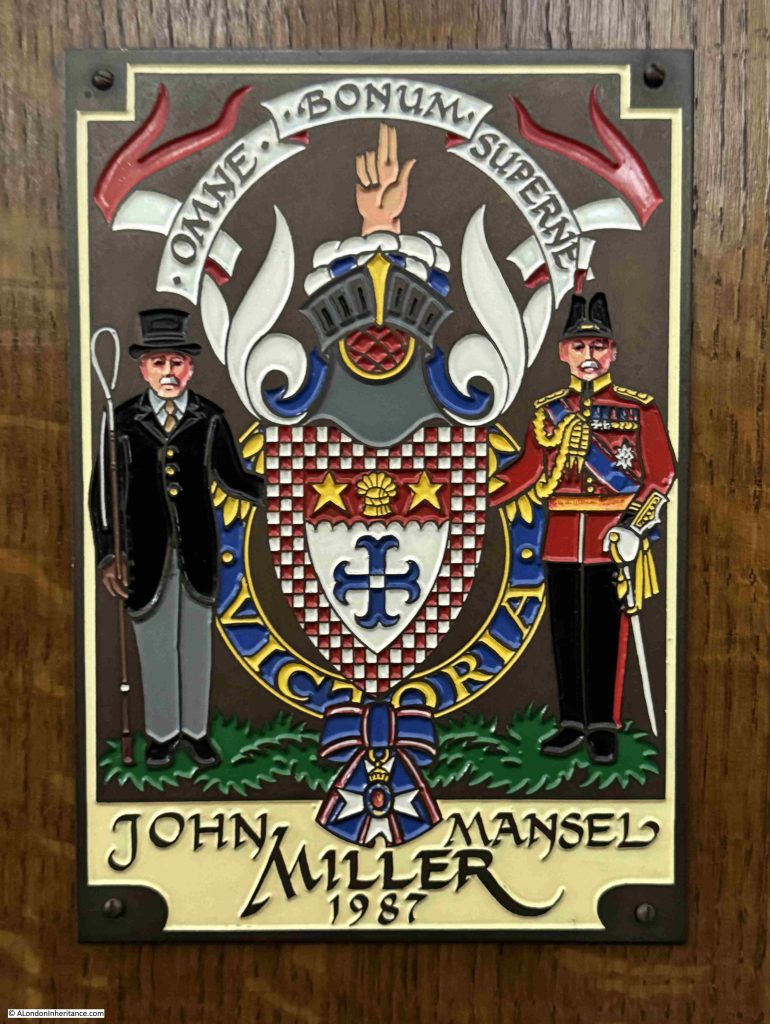
There are similar copper plates on the wooden panels that line the rear and side of the chapel. These are for members of the Royal Victorian Order, and include John Mansel Miller who as Lieutenant Colonel Sir John Miller was made a GCVO (Knight or Dame Grand Cross) in 1987 having been a Crown Equerry between 1961 and 1987:

Colonel Sir Henry MacGeagh who was the Deputy Treasurer of the Middle Temple and also became a GCVO, in 1950:

As well as the devastating fire in the chapel in 1864, much of the stained glass at the northern end of the church was destroyed by a bomb which hit a neighbouring building during the last war. Stained glass to the southern end survived, but is later than the chapel fire of 1864.

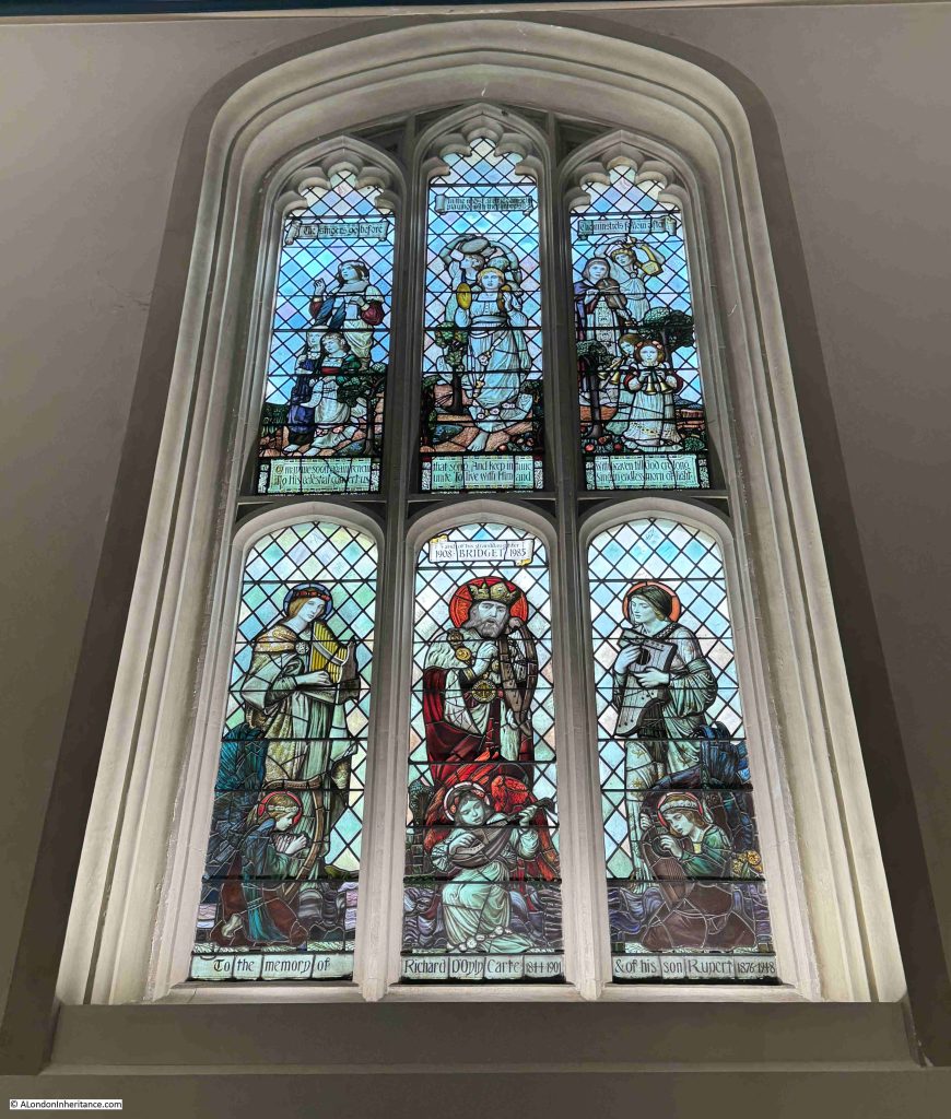
Stained glass window dedicated to the memory of Richard D’Oyly Carte and his son Rupert:

Richard D’Oyly Carte was behind the construction of the Savoy Theatre which he built using the profits from Gilbert & Sullivan productions and he also built and owned the Savoy hotel, this time using profits from the Mikado:

He married his second wife, Helen Lenoir, in the Savoy Chapel.

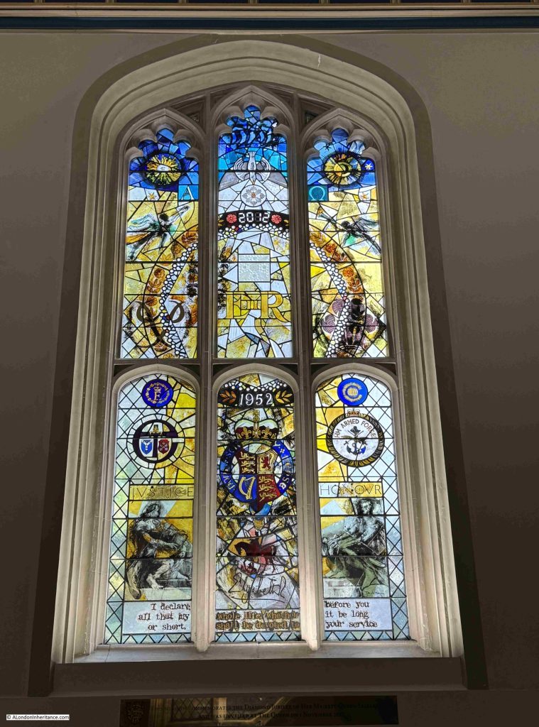
The latest stained glass window in the chapel is a window dedicated to Elizabeth II and installed in 2012 for the Queen’s diamond jubilee:

The King’s Chapel of the Savoy has been the location for many baptisms, marriages and funerals over the years, normally for someone who has some association with the chapel, or with the Royal Victorian Order.

An interesting court case in July 1756 shows that unofficial marriages were also celebrated, but these would lead to a substantial sentence.

“Yesterday, the Rev. Mr Wilkinson was tried at the Old Bailey, for celebrating clandestine Marriages at the Savoy Chapel. He was found guilty after a trial of upwards seven hours, and ordered for transportation for fourteen years.”

I very much doubt that a clandestine marriage could take place in the chapel today.

The King’s Chapel of the Savoy is a fascinating place to visit, just a short detour from the Strand. As well as the original church, there is a side room which contains some historical maps, prints and photos which help to tell the history of the chapel, and the staff at the chapel are very happy to tell visitors the story of the place, and point out key features of the building.

On the chapel’s website, the opening times for visitors is stated as from 9am to 4pm, Monday to Thursday, however I have found that it can also be closed during these times, but a bit of perseverance is worthwhile to see a unique chapel that retains the name of the owner of a long lost estate back in the 13th century, and was part of an early 16th century hospital founded by Henry VII.

It Happened Again and the City in Autumn

It happened again last week. A few months ago I apologised for the lack of a Sunday post due to problems with the website. It was very slow and was going up and down, and the hosting provider was telling me the problem was something that I knew it was not.

I had some help from a brilliant web design and support company (Toast, who can be found at this link if you ever need any help with website support and design – they are really good). Sorting out the database, caching improvements and a number of other changes had the website working well again.

With almost 12 years of posts, 14,500 photos and images and over 2 million words, I am surprised it lasted as lonmg as it did without some in depth maintenance.

But then it happened again.

Last week, the website went down, and was down for two days. It was different this time – it was completely down. Not slow, not intermittent, just down.

I contacted the hosting provider. Their first response was that it was loading just fine for them, and it was a problem with the SSL certificate (the bit that puts the padlock symbol in your browser, encrypts the link between you and the website, is preferred by Google etc.)

This sounded ridiculous, as if the certificate was the problem, I would have still been able to access the website.

Once this theory was knocked down, they were still telling me it was a problem at my end, as they could access the site without any problems.

After much effort trying to prove to them it was a routing problem (sending copies of traces showing the connection was failing in Germany (where the site is hosted), just before getting to the site), and asking several times for the problem to get escalated, then after about 9 hours I got an update from someone who actually knew what was going on.

A really weird issue, and nothing to do with my website.

My website is on a shared server (I cannot afford a dedicated server), and another website on the shared server was getting lots of strange traffic, so to prevent any problems this might cause to the server, the hosting provider cut the routing to the server from the rest of the Internet, which explained why their support team could still access as they were on their internal network).

This went on for just under two days, and then the website came back online after they have made routing changes, and presumably sorted out the strange traffic to the other website.

So all good.

A day later it went down again.

I bypassed their first line support and went back to the team who knew what was happening with the original fault, and a quick response was provided, that the server needed emergency maintenance. No idea why, whether it was connected with the original problem or just an unlucky coincidence.

Later that day, the website came back online.

The whole experience reminds me of a quote from a customer in a former employment “Sh*t happens, it is how you deal with it that counts”, which is very true, and first line support should not see it as their role to deflect all problems back to the customer, but once you get to someone who knows what is going on, you have some confidence that it is being managed.

Anyway, this has been a very longwinded way to explain why there is no new post this week – I simply ran out of time.

I am though going to do something I promised myself I would never do – repeat a post.

So for this week’s post, I am going back 10 years to November 2015, and look at:

Autumn In The City

Whilst the majority of my father’s photos came to me as negatives, a number were printed, and of these some had the location written on the back. As well as the location, a few are also specific about the time of year as the photo reflects how London appears as the seasons change.

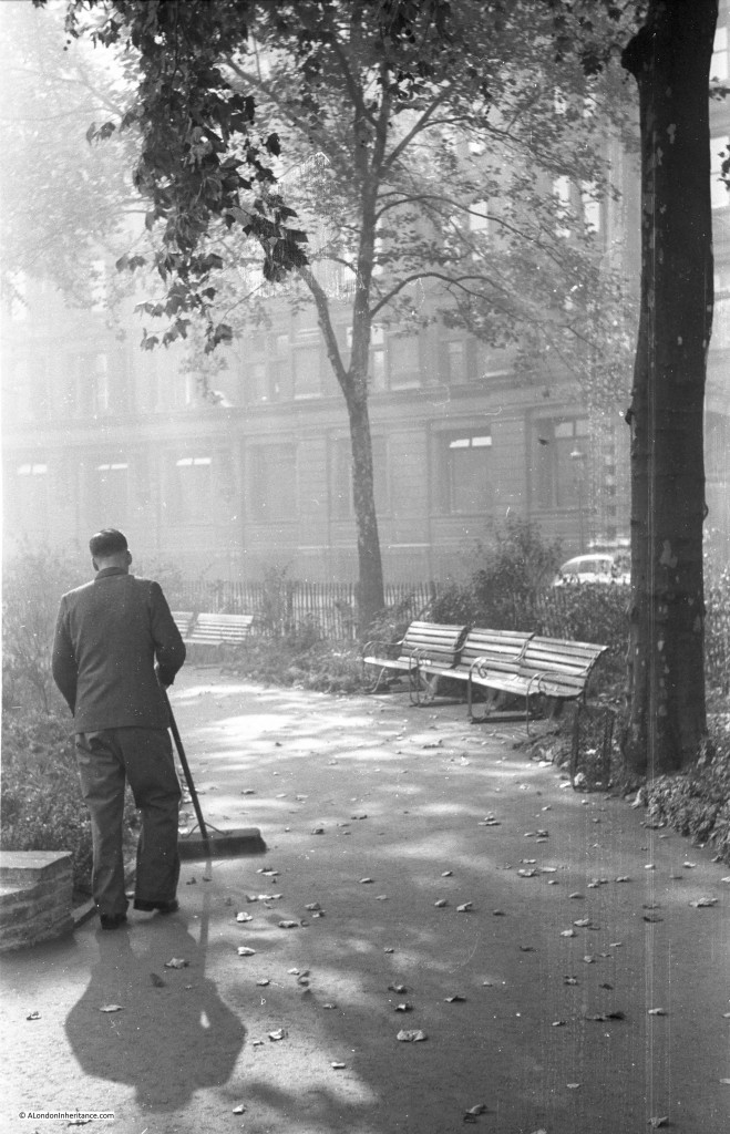
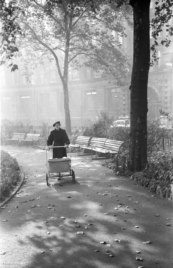
For this week’s post, I bring you two photos on which my father had written the simple title “Autumn in Finsbury Circus”.

Both were taken early in the morning and show autumnal light shining through the trees, with the first autumn leaves on the path. There are two photos, one showing a woman pushing what looks like a pram, whilst the second shows a man starting to sweep the fallen leaves:

I suspect that he had taken these photos either for exhibition or competition at the St. Brides Institute Photographic Society as they have a more composed quality rather than the straight forward recording of London’s buildings and streets:

To try and find the location of these photos, a day off from work last Friday provided the opportunity for an autumn walk around London.

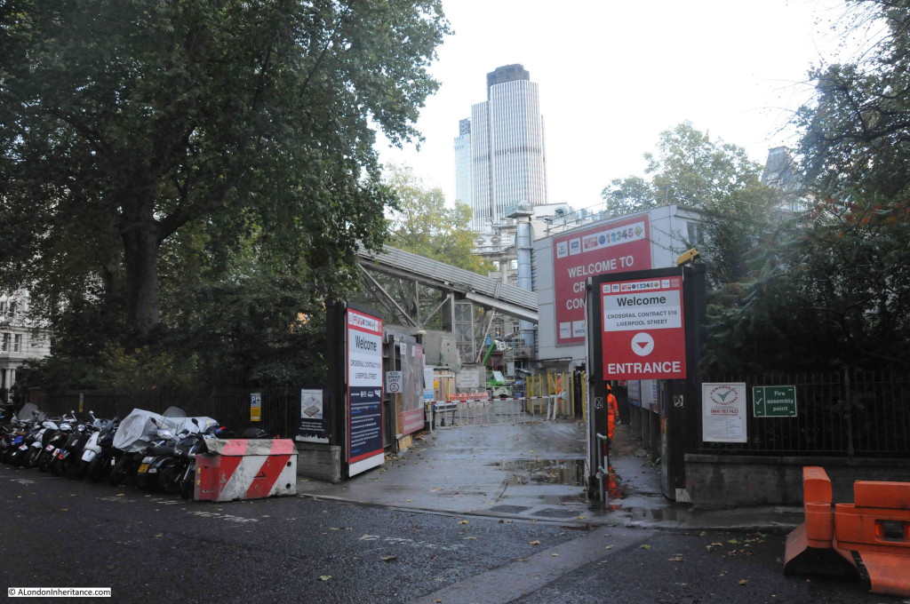
Finsbury Circus is much the same today, with one significant exception being that it is a major construction site for Crossrail with the centre of the gardens in the middle of the square being used for access to Crossrail and sections of the path that runs round the perimeter of the gardens also being closed.

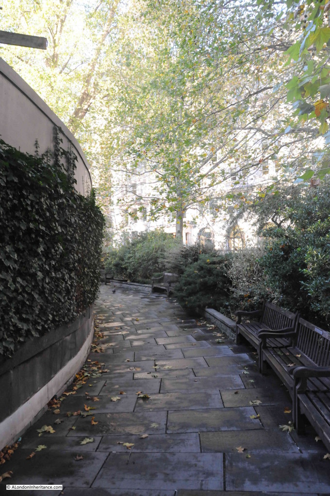
If I correctly located the buildings in the background, they were behind part of the closed off path, however parts that remain open provided the opportunity to show that not too much has changed (if you ignore the major construction site to your left):

The layout of Finsbury Circus was established in the early 19th Century, with the office buildings we see today being built over the following century, with some redevelopment continuing today.

As one of the few areas of green space, the gardens were very popular with city workers, with a bandstand and bowling green occupying part of the centre of the gardens. A small, temporary bandstand remains today. The gardens at the centre of Finsbury Circus will be restored after the Crossrail works are complete.

The main entrance to the Crossrail construction site which currently occupies much of the gardens in the centre of Finsbury Circus:

Walking in central London, there are very few indicators of the season of the year. Apart from temperature and the times of the rising and setting of the sun, it could be any time of year. The natural indicators of whether it is spring, summer, autumn or winter are few and far between.

Taking inspiration from the title of my father’s photos, I thought it would be interesting to take a walk through the City and look for any other examples of where autumn can be found in amongst such a built environment.

The weather last Friday at least was very autumnal with strong winds and alternating between heavy showers of rain and clear blue sky (although in fairness that could be English weather at any time of year).

There are very few green spaces left in the City, the majority that remain are usually associated with a church, either still remaining or one that was lost in the last war, and it was to one of these that I headed to after Finsbury Circus.

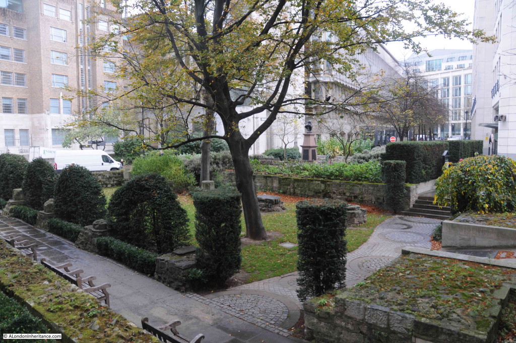
This is the garden that occupies the site of St. Mary Aldermanbury. a church that was heavily damaged in the last war, not rebuilt and the remains shipped to America (see my first post here). Just south of London Wall at the corner of Aldermanbury and Love Lane.

A heavy rain shower as I stood in the garden, and a strong wind blowing the fallen leaves up against the far wall:

The next stop was the garden that occupies the graveyard of the church of St. Anne and St. Agnes at the corner of Noble Street and Gresham Street.

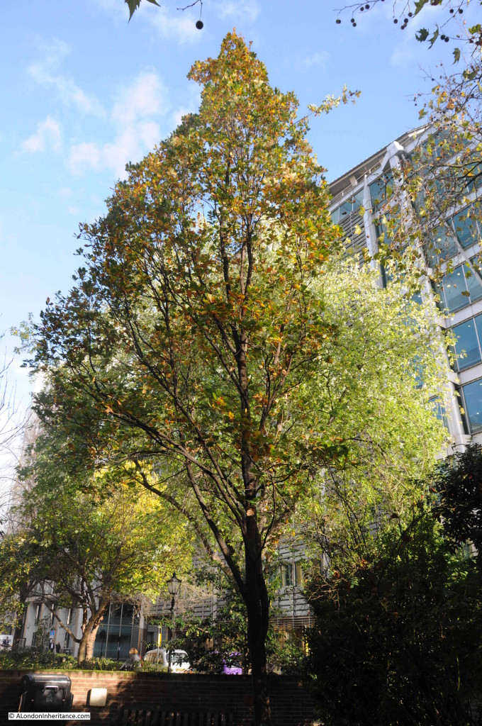
This garden occupies a relatively small space, however some mature trees reach up to the sky in amongst the surrounding buildings, with the leaves starting to turn to their autumn colours:

Walking to the end of Gresham Street, then turning up St. Martin’s Le Grand I came to Postman’s Park. At this time of year, the sun does not reach above the buildings to the south in order to shine on Postman’s Park, so the park spends much of this time of year in shade that appears to be made darker by the sunlight on the surrounding buildings. Many of the trees here had already lost the majority of their leaves:

Walking out from Postman’s Park into King Edward Street and I was back in the sunshine of an autumn day:

Heading south from Postman’s Park to one of the larger areas of green open space remaining in the City, the churchyard of St. Paul’s Cathedral:

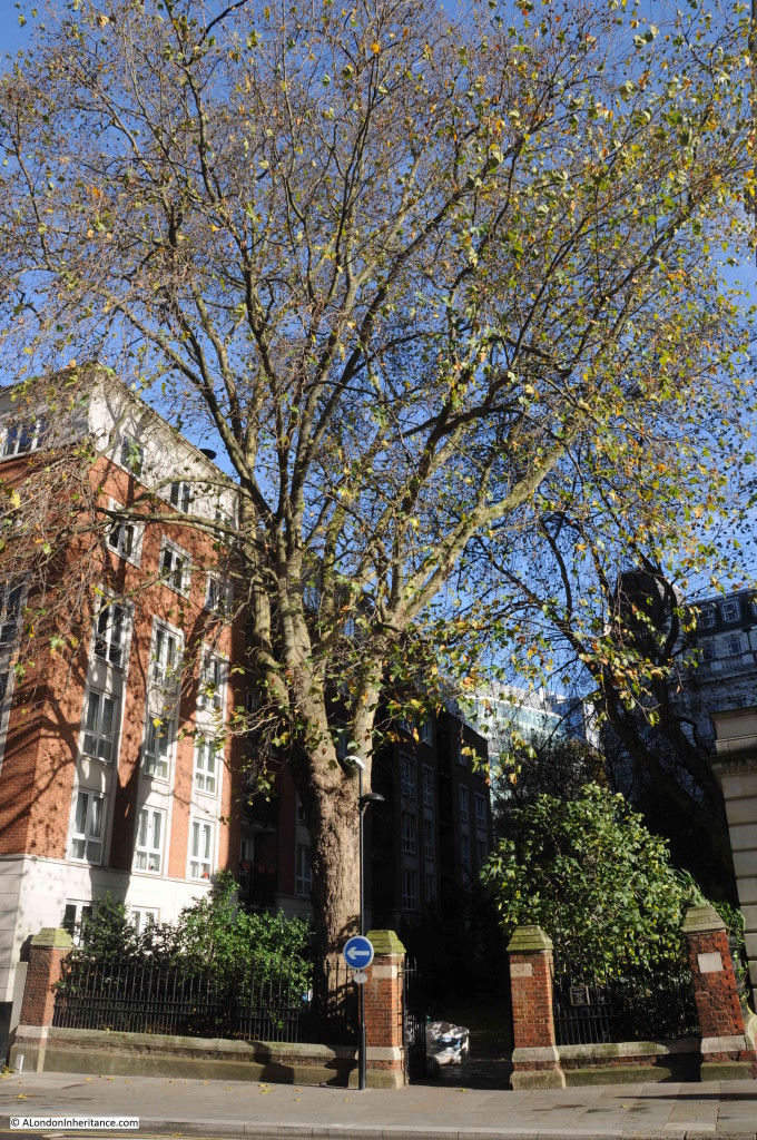
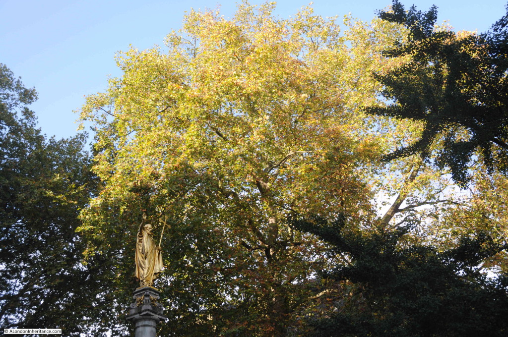
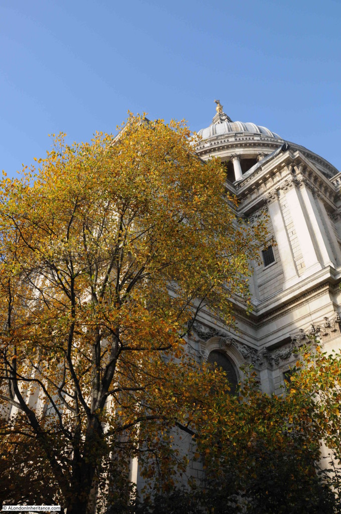
Here plenty of mature trees can be found around the eastern half of the cathedral and their autumn colours looking spectacular against both the stone of St. Paul’s and the sky:

From St. Paul’s, it was then a walk down Cannon Street, Eastcheap and Great Tower Street to Trinity Square Gardens. (I did miss out the garden at St. Dunstan in the East as the sky to the east was getting very dark and I wanted to get to Trinity Square before another heavy shower of rain).

This large (for the City) open space also benefits from a lack of tall buildings to the south so the rare combination of a City garden that also gets the sun at this time of year.

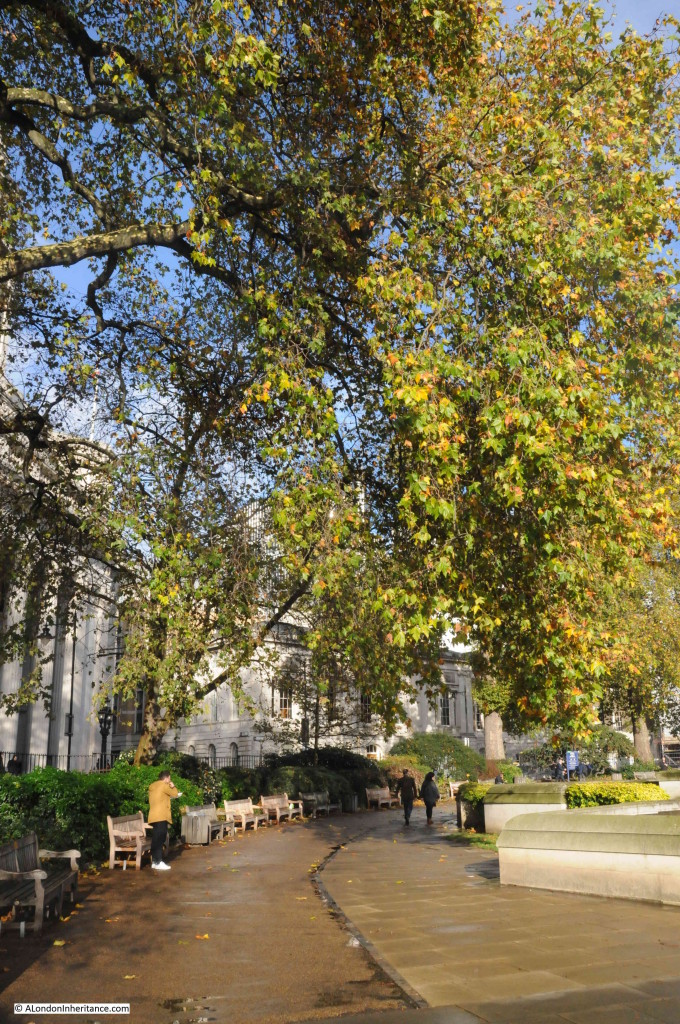
The pavements showing the signs of recent rain. Overhung by mature trees, the pavements will soon be covered by leaves:

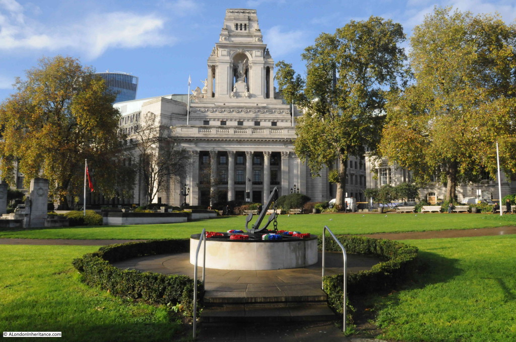
The old Port of London Authority building in the background with the new memorial to Royal Fleet Auxiliary and Merchant Seamen who lost their lives in the Falklands Campaign. The mature trees around the edge of the gardens just starting to change to their autumn colours:

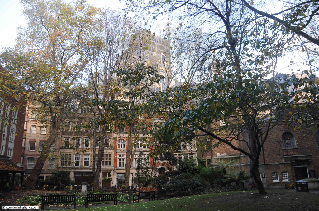
My final visit was to the churchyard of St. Olave in Seething Lane. A small churchyard just catching the last glimpse of an autumn sun, with leaves on the trees starting to fall:

It was a fascinating walk through the city on a typical autumn day with extremes of weather from heavy rain showers to clear blue sky. Even with the amount of building there are still places were it is possible to observe the changing of the seasons and retain contact with the natural cycle through the year.

I fear though that with the ever increasing height of buildings in the City, these valuable survivors of the natural world will be spending more and more of their days in the shadow of their surroundings.

Normal service should hopefully be resumed next Sunday.

Union Chapel, Islington – Live Music and a Nonconformist History

Live music venues have long been central to London’s creativity and the city’s entertainment industries. The number of smaller pub with live music venues have declined significantly over the last few decades, but there are still many places where live music is performed in a unique venue, and not part of an international corporate empire.

My first large concert in London was at QPR’s ground, Loftus Road in 1975, when with a schoolfriend, we went to see the band Yes. Before that it was smaller groups and venues. Since then, London has continued to be the place where we have seen so very many live performances across the musical spectrum. Dr Feelgood, Blockheads, Stranglers, Human League, Gary Numan, Public Service Broadcasting, Muse and so very many more.

A couple of week’s ago we went to see Toyah, in what must be one of London’s most unique venues – Union Chapel in Islington.

It is a place we have been to a number of times since the Union Chapel started hosting concerts, the last was to see a band called Caravan, who performed there in 2022. They were the first live band I ever saw, I think in 1973 or 1974.

Union Chapel is a really fascinating building, both from an architectural and historical aspect, and the purpose of today’s post is to explore the history of the building – not my musical taste you will be pleased to know.

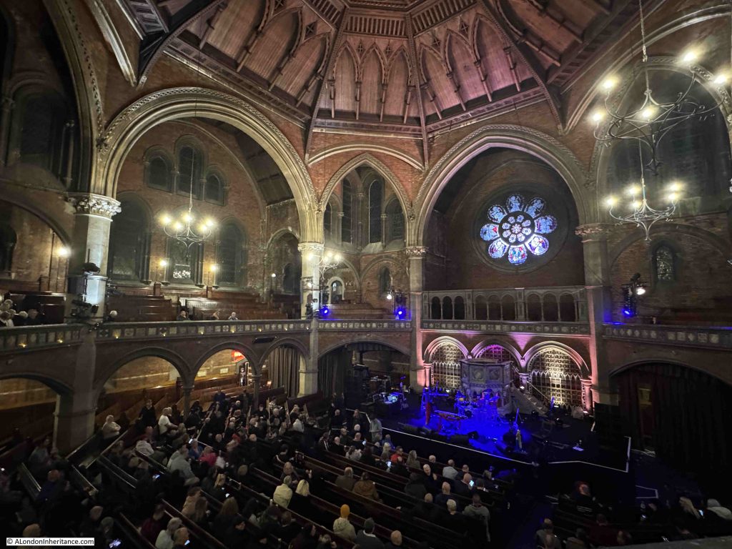
Looking down to the stage from the rear of the balcony:

The current Union Chapel was built between 1876 and 1877, replacing an earlier and smaller chapel on the same site.

Union Chapel is a Nonconformist, Congregational Church.

The name Union comes from the original founding of the congregation in 1799, when a group of Nonconformists joined with a group of Anglicans who had grown apart from the established church of St. Mary’s, Islington.

Over time, the Anglican element of the union gradually declined and the group became fully nonconformist, which basically means an approach to church hierarchy, worship and prayer that is different to the established church.

The first meeting place of the “Union” was in a large house in Highbury Grove, then in 1806 they moved into a chapel built on the site of the existing Union Chapel.

As the 19th century progressed, the Congregational approach grew in popularity, as did the size of the local population as the area around Islington and Highbury developed quickly.

This resulted in the need for a larger chapel, and the original chapel was demolished in 1875, to make way for the new chapel which opened in 1877.

The new chapel was designed by James Cubitt (no relation to the builders and civil engineers, brothers William, Thomas and Lewis Cubitt who jointly built much of 19th century London, including Cubitt Town on the Isle of Dogs).

James Cubitt specialised in Nonconformist chapels during the 19th century, and the Islington Union Chapel was one of his first, and probably one of his most important works. Many of his other chapels across the country have since been demolished, but Union Chapel remains.

The Congregational approach was that the whole congregation should be involved in the process of worship, and that the Minister, and those leading services should be visible to all, unlike a typical church service where a screen would often hide key parts of a religious ceremony from the majority of the congregation.

This approach can be seen in the interior design of the Union Chapel.

The interior has a cruciform design, although when inside the church this is not really visible, as the octagonal configuration of the walls is the dominant feature.

This allows an unobstructed view of the pulpit from the floor of the chapel, where there are pews on a floor that gradually increases in height towards the rear of the chapel, as well as on the surrounding balcony, where pews are also arranged so they increase in height as they run towards the external walls of the chapel.

This arrangement minimises the number of obstructions, either architectural, or from the people sitting in front, and is a design that makes the Union Chapel ideal not just for religious services, but also for concerts.

View looking across to the stage on the lower right, pews along the ground floor, balcony with pews underneath the gothic arches at the side of the chapel:

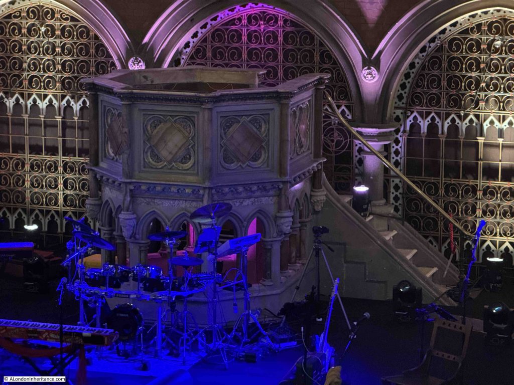
To further ensure the visibility of the minister, the large stone pulpit is raised so that the congregation had a good and unobstructed view of the minister, who could also look out across the congregation:

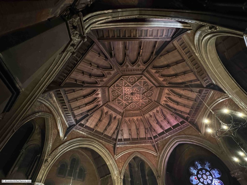
The ornate ceiling of the chapel, with the decorated central panel:

The interior of the chapel is a contrast to the exterior, which is architecturally still an impressive building, but to glance at the building from Upper Street or Compton Terrace, you would not have an idea of the magnificent interior.

The chapel was built half way along a terrace of houses in Compton Terrace, a street deliberately set back from the busy Upper Street, with a length of gardens separating the two.

In the following extract from the 1894 revision of the OS map, Union Chapel can be seen in the middle of the map as the large block in the middle of a long row of terrace houses, with a Lecture Hall and Sunday School towards the rear, which faces on to Compton Avenue (‘Reproduced with the permission of the National Library of Scotland“:
In the above map, the row of terrace houses on either side of Union Chapel is of equal length.

The northern length of houses today is much shorter than originally built. A V1 flying bomb hit in 1944, killing 26 people and resulting in the destruction and severe damage of 12 houses, along the northern end of the terrace, these were demolished after the war.

This demolition provided the space for the traffic roundabout and central space of Highbury Corner to be built. We can see this in the following map, where Union Chapel is again in the centre, the original length of terrace remains to the south, but a much shorter terrace is to the north of the chapel, and Highbury Corner and the central Highbury Island now cover where the rest of the northern stretch of terrace once ran (© OpenStreetMap contributors):

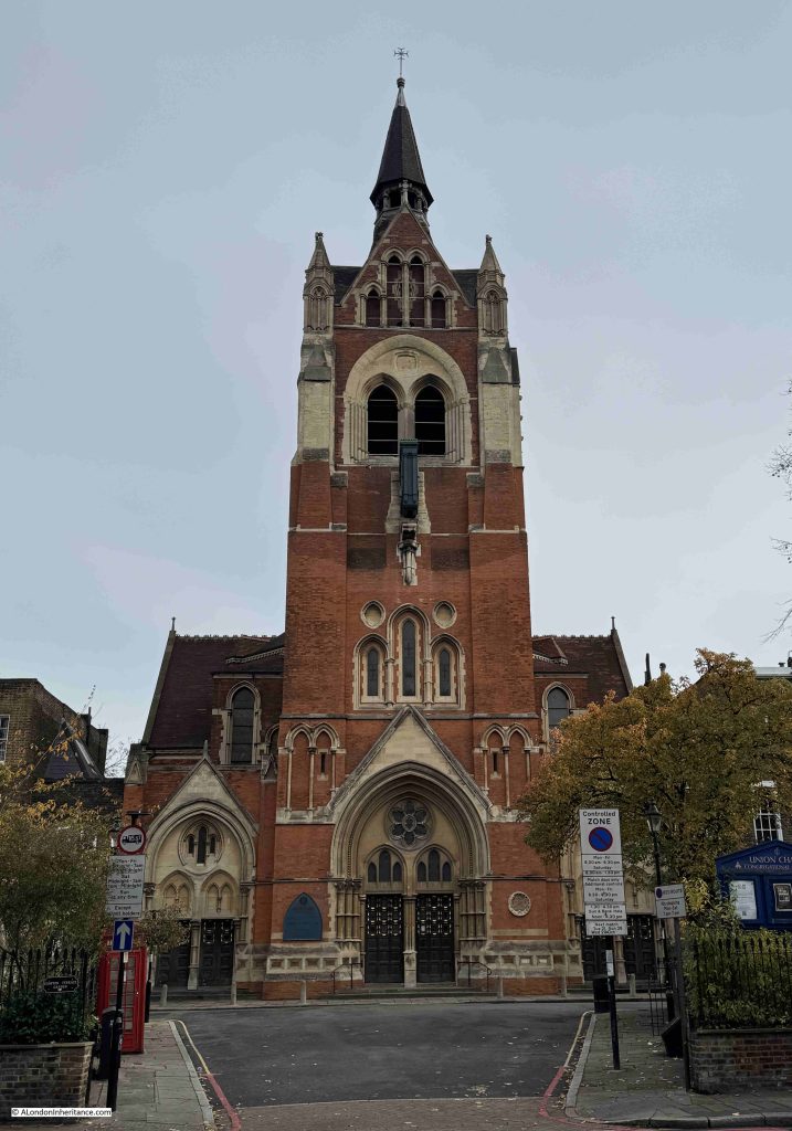
The main entrance to Union Chapel, as seen from Upper Street:

The tower was completed in 1889, just over 10 years after the chapel first opened. It is 170 feet in height, and according to the listing at Historic England (Union Chapel is Grade I listed), bells were never installed in the belfry, behind the open windows towards the top of the tower.
A large clock projects out from the tower, and at ground level there are three entrances, a large central Gothic portal at centre, and two smaller, but similar entrances to either side.

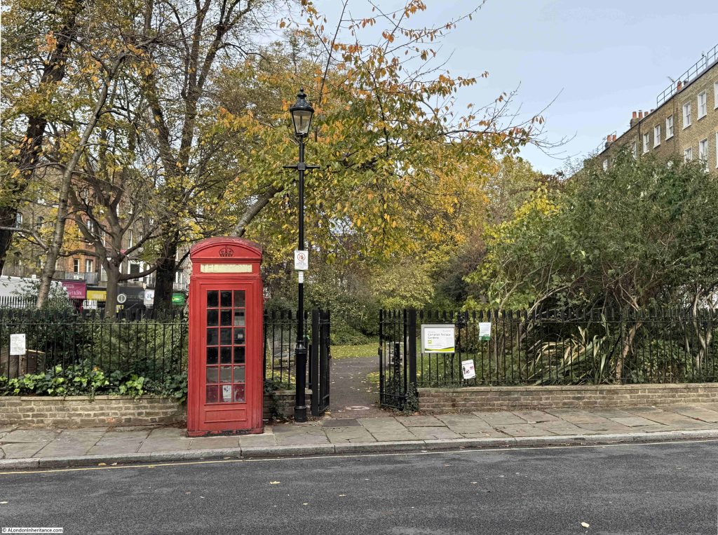
To the left of the short stretch of road that connects Upper Street with Compton Terrace, there is a Grade II listed K2 Telephone Kiosk, designed by Giles Gilbert Scott. Behind the kiosk are the gardens that separate the terrace from Upper Street:

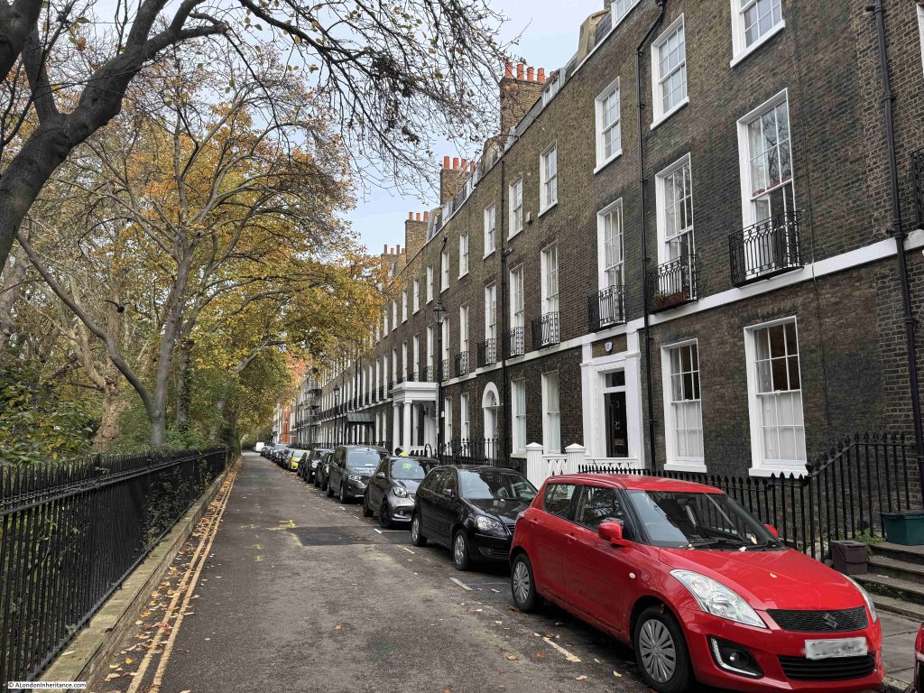
This is the view along Compton Terrace from the south, with a small part of the lighter brick of the chapel visible in the distance:

Much of the terrace and railings at the front, are Grade II listed, and were built between 1819 and 1821 by Henry Flower and Samuel Kell.

The name Compton Terrace comes from Lord Compton, Marquess of Northampton, the original owner of the land, and whose permission was needed to build the Union Chapel.

Closer up to the chapel, and we can (just) see the clock on the front of the tower:

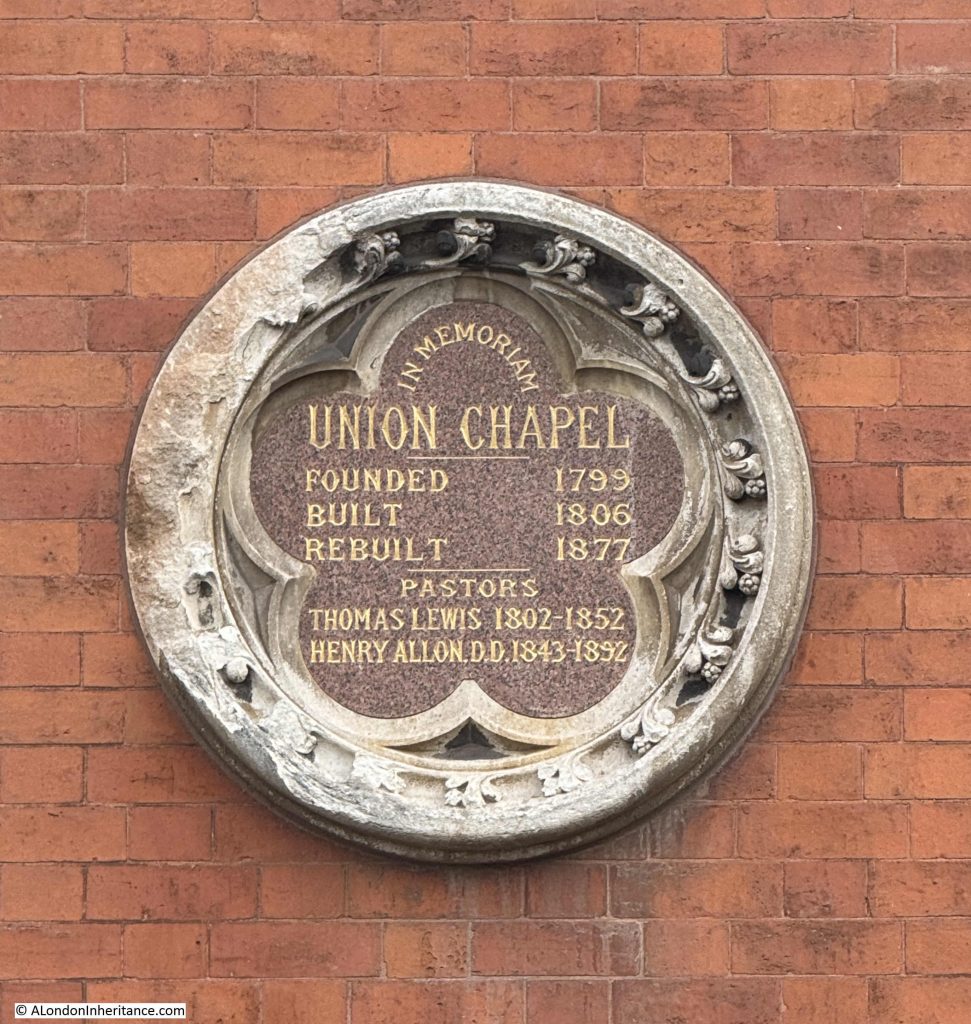
Plaque on the front of the chapel recording the founding of the original “Union” of the two congregations, who first met at Highbury Grove, then the 1806 chapel in Compton Terrace, then the 1877 rebuild of the chapel, which is the chapel we see today:

The names of the two pastors shown on the plaque show that for the majority of the 19th century, there were only two lead pastors of the Union Chapel.

It was Henry Allon who was the driving force behind the construction of the new, expanded Union Chapel. He was also a significant figure in the Nonconformist movement across London, the rest of the country as well as the United States..

He was paster at Union Chapel until his death in 1892, and the Nonconformist paper published a lengthy obituary on the 22nd of April; 1892, of which the following two paragraphs are just a small part:

“Dr. Allon was a man of immense industry and of very various activities, but his great work was the building up, maintenance and extension of the congregation of Union Chapel. he was a highly competent, but by no mean showy, preacher. He would have blushed at the thought of using the pulpit as a means of setting off his abilities. Teaching and edifying were the aims he kept constantly in view, and never were the labours of a Nonconformist pastor more handsomely requited by the confidence and affection of his people. It was so from the first, and so to the end.

Dr. Allon’s death will be felt as a loss wherever the English language is spoken. In the United States, which sent him the highest academic distinction it has to bestow, he was greatly honoured for his learning and refined taste. At home, where he never evaded difficulties, he was always a healing and unifying influence. Never eager, he was always ready, to speak, and his utterances were invariably well considered and kindly. We shall all greatly miss his intellectual countenance, with its habitually benevolent expression, but we have the consolidation of thinking that he has well and truly accomplished the great task committed to him, and left an example which it will be an honour to follow.”

Henry Allon had been awarded Honorary doctorates from Yale in the united States and from St. Andrew’s in Scotland.

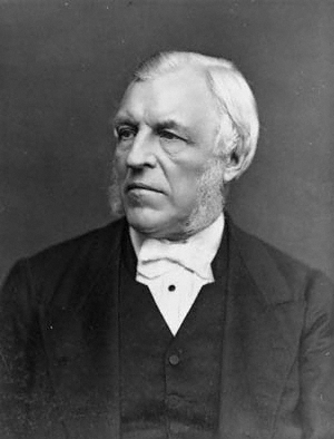
Henry Allon in 1879:

Attribution: Lock & Whitfield, Public domain, via Wikimedia Commons

The foundation stone of the new chapel was put in place in 1876, and the Islington Gazette on the 16th of May 1876 reported on the ceremony, and confirmed some of the history of the chapel:

“On Saturday afternoon the ceremony of laying the foundation-stone of the new Union Chapel, Compton-terrace, was performed under most cheering auspices. From a sketch of the history of the church, a copy of which was deposited under the stone, we gather that the chapel had its origins in 1802, in the spontaneous association of a few earnest and devout men, in part Episcopalians, and in part Nonconformists – the former a more evangelical ministry than at that time could be found in the parish church, and the latter some provision for evangelical worship in addition to the two Nonconformist chapels then existing in Islington. After worshipping together for about two years they formed themselves into an organised church consisting of twenty-six members, and secured as a chapel, a building in Highbury-grove, now the dwelling house No. 18.

In August 1806, the church and congregation moved to the chapel in Compton-terrace, which they had erected. On the 30th of that month it was opened for Divine worship. It was called Union Chapel to indicate the union of its worshippers of Episcopalians and Nonconformists. The liturgy of the Church of England was used in the morning, and the extempore prayer, after the manner of the Nonconformists, in the evening.

In 1861, in consequence of the growing requirements of the church, additional land was purchased, and the chapel was enlarged; 400 sittings were added, and new vestries, lecture and classrooms were built.

From the beginning the church was gradually increased in numbers and influence. In 1802 it consisted of 26 members; 1843, 319; 1875, 676 including the members of the mission stations, Nichol-street, Spitalfields and Morton-road of 791.”

The foundation stone ceremony was attended by around two thousand people, the majority coming from the congregation of the chapel. There were flags and banners, including those from the Union Chapel Sunday School, the Nichol Street Sunday School and the Morton Road Ragged School.

A platform had been set up next to the foundation stone, and on the platform were many of the representatives of the chapel and the congregation, including Dr. Allon, and from the congregation there was Henry Spicer, a senior deacon of the chapel, who would be recorded as the person who laid the stone.

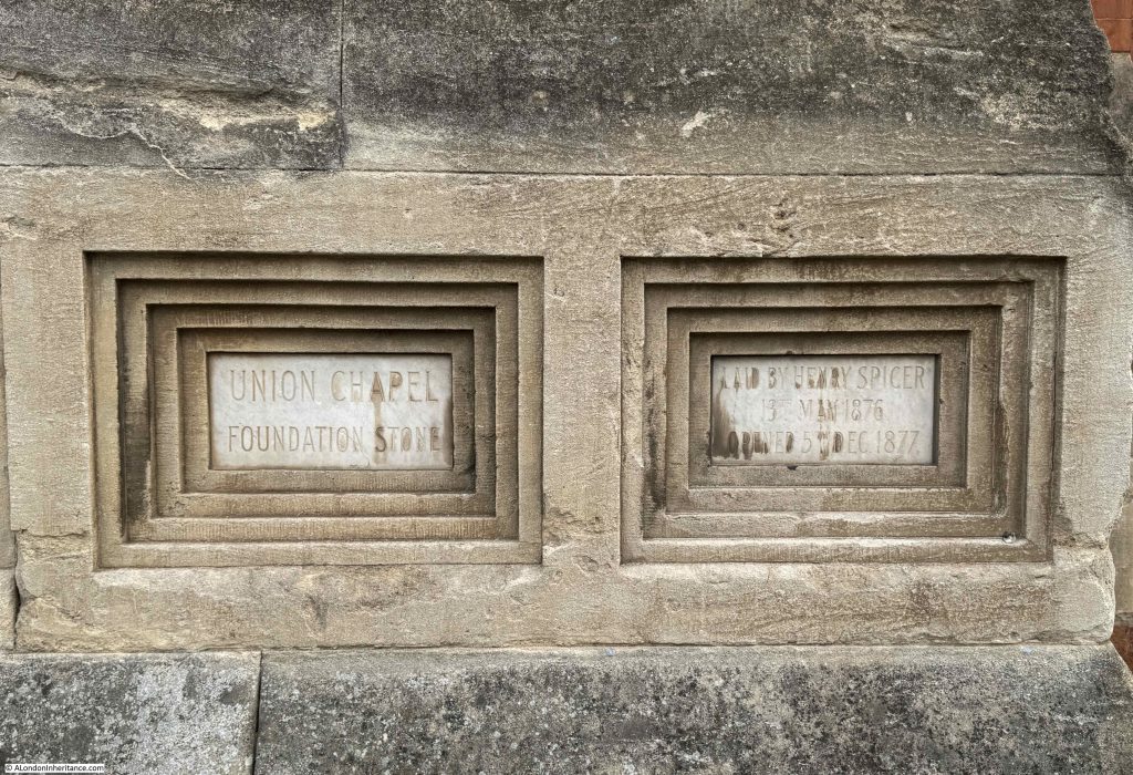
The foundation stone of the Union Chapel.

The formal opening of the Union Chapel was an equally well attended event, and the opening was also attended by the William Gladstone, who a couple of years earlier had ended his first term as Prime Minister.

Gladstone was given a tour of the chapel, and a service was held to commemorate the event.

It is interesting reading the accounts of the opening service, as Dr. Allon’s sermon included references to the dispute between science and religion regarding the position of “man” and the theory of evolution, which had gained considerable more public awareness after Darwin published “On the Origin of Species” in 1859.

During the service “he then proceeded to oppose the argument that man is the mere creature of natural laws, and therefore morally on a level with all other creatures. Having referred to what had been urged by opponents of Christian revelation about the antiquity of the earth and the successive developments of geological formations and of animal and vegetable life, he maintained that the very grounds on which it was thus sought to degrade man really elevated him, seeing that all these vast changes were effected in order to fit the earth to be man’s habitation.”

So Allon was arguing that the earth had evolved to fit man’s habitation, whilst Darwin was arguing that man had evolved because of the way the earth, and life on the planet had evolved.

A walk to the rear of the chapel in Compton Avenue brings us to the Sunday School and other offices of the Union Chapel. In the following photo, the Sunday School is the brick building facing the street, and we can get a glimpse of the tower of the chapel in the background:

A short distance along Compton Avenue is the Compton Arms, which dates from 1895. As with the terrace, the avenue and pub are both named after Lord Compton, Marquess of Northampton. A perfect place for a drink before heading to an event at the Union Chapel:

View looking north along Compton Avenue:

I am not sure of the history or function of the structures on the left. They are not listed so perhaps not old, and I think that Compton Mews were here (although this may be wrong), but whatever their history, they add some interest to the street.

During the later half of the 20th century, attendance at the Union Chapel dropped considerably, and there were proposals to demolish the church. Such a large and complex building needed a considerable amount of funding to maintain.

In 1992, Union Chapel opened as an events space, with the profits generated from hiring out the venue cycled back into the conservation, maintenance and development of the building.

It is still a place of worship, with services being held every Sunday morning, and whilst it is a really good concert venue, it is the people who have used the Union Chapel over the decades that come to mind as you sit in the wooden pews.

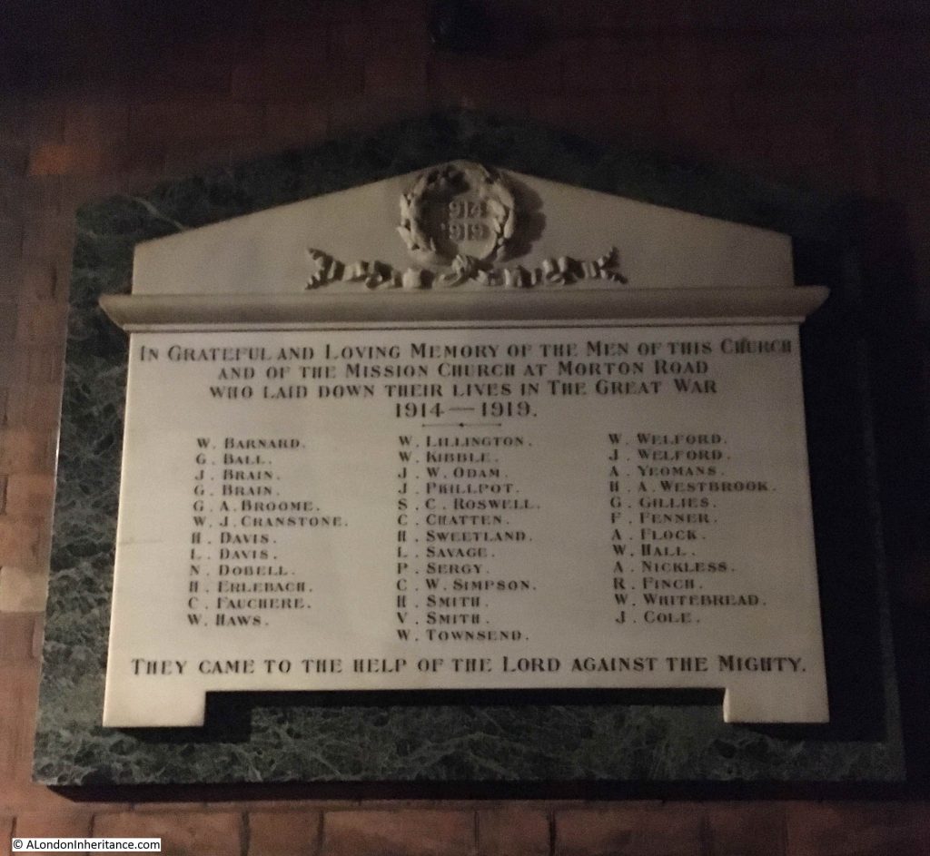
At the rear of the church, to the right of the pulpit area, there is a war memorial, recording the names of the members of the Union Chapel, and associated Mission Church, who lost their lives in the First World War (it is always sad to read the term “Great War” in these memorials, when we now call it the First World War, as unknown to those who put up these memorials, there would be yet another global war in a few short years time).

There is a name on the memorial which may be a distant family member – something I have long been trying to confirm:

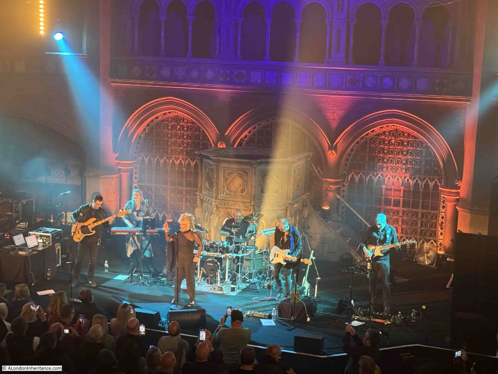
And to finish off, Toyah was brilliant as usual, and as well as more recent music, it was also a flashback to the 1980s:

It would though be interesting to know what Dr. Henry Allon would have thought of such events happening just in front of the pulpit at which he preached for many years

There are monthly tours of Union Chapel if you would like to visit this remarkable place. Click here to go to their list of tour dates and times.

St Martin in the Fields and Historical maps of Southwark and City Ward Maps

In this week’s post, I am exploring the church of St Martin in the Fields, and also at the end of the post I have my first Sunday of the month feature on Resources, where I look at some of the resources available to help explore the history of London. In this months Resources, I am looking at a source of Historical maps of Southwark (and the rest of London) and a series of maps showing the boundaries of Wards of the City of London..

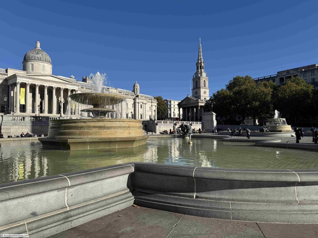
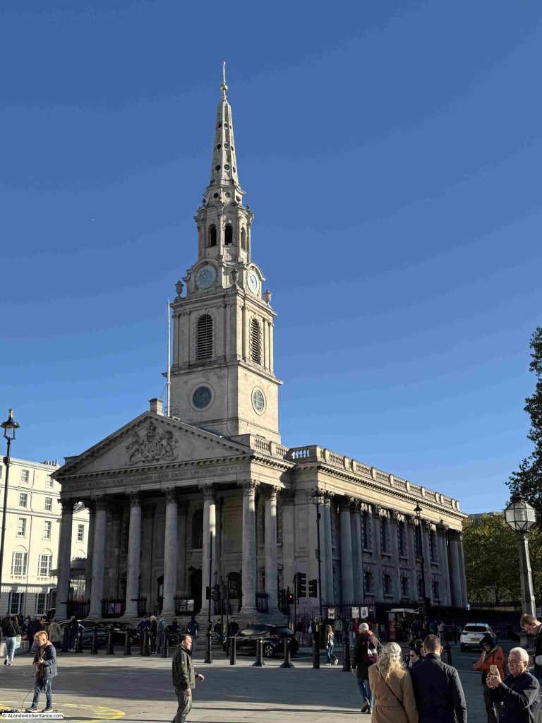
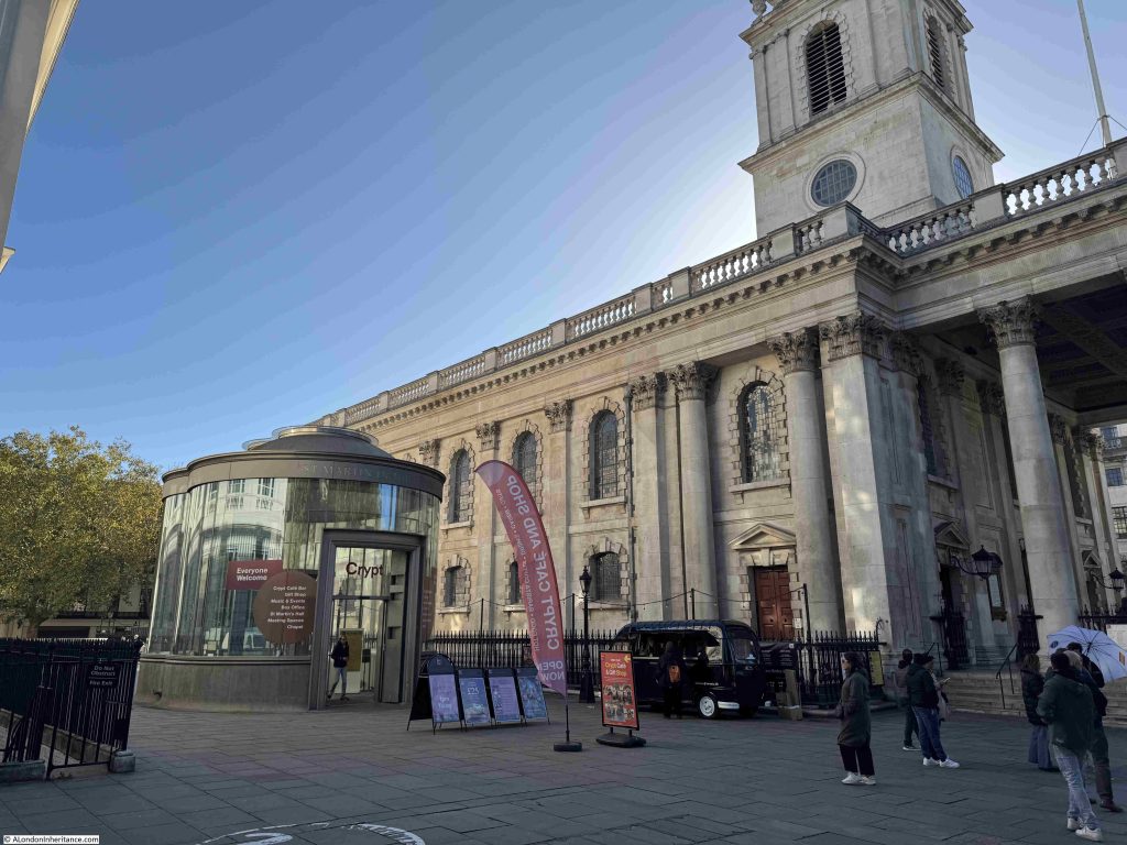
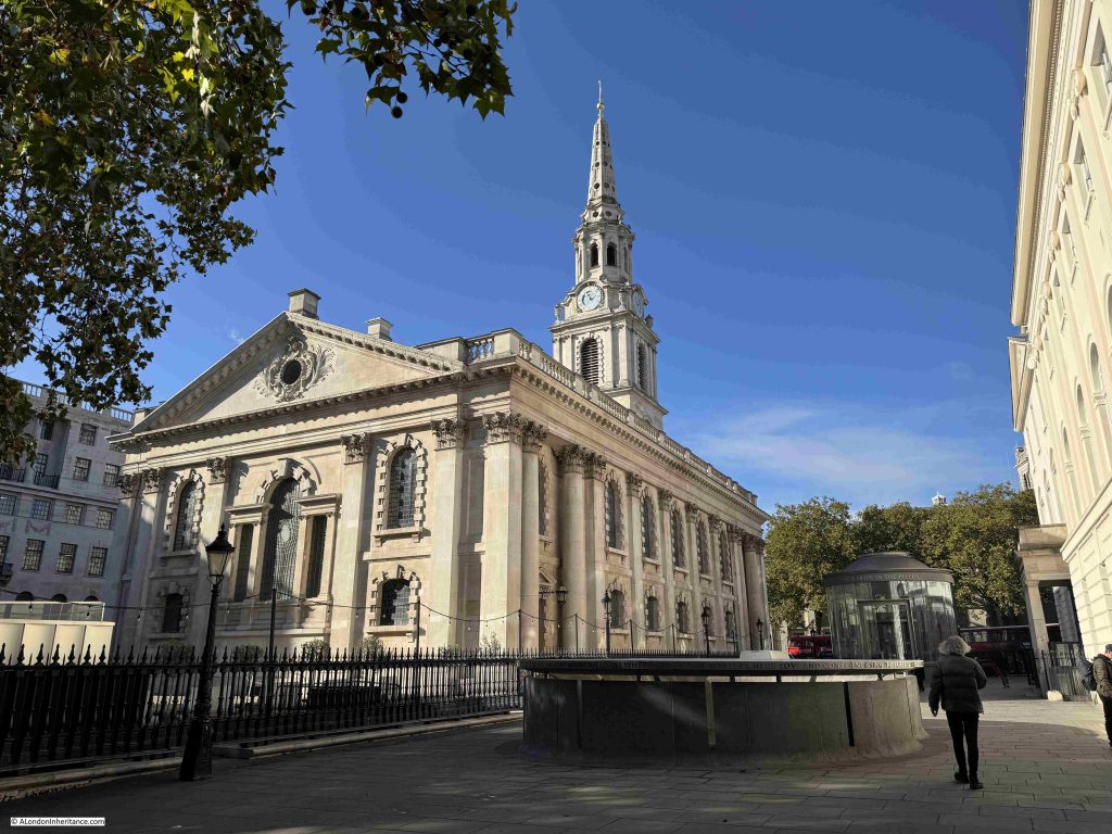
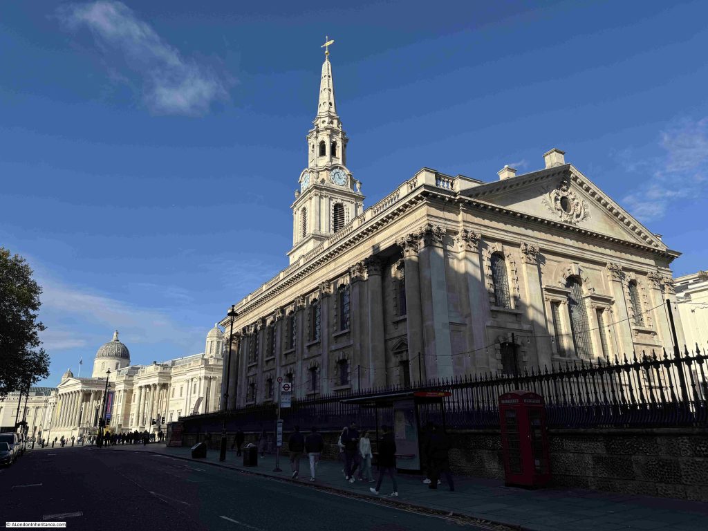
But first, St Martin in the Fields, a very prominent church on Charing Cross Road and at the north eastern edge of Trafalgar Square, with the prominent tower and steeple looking out over the square and the National Gallery:

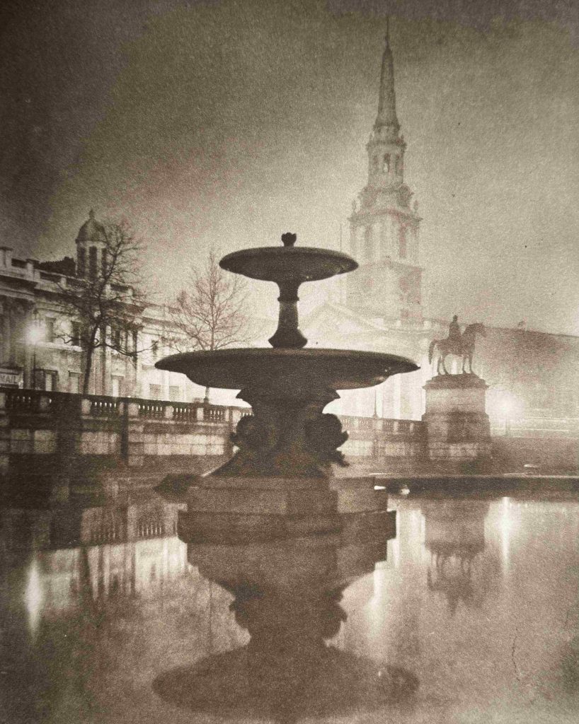
A similar, but very moody view of the church through a Trafalgar Square fountain in the 1920s:

The St Martin in the Fields that we see today was designed by James Gibbs and completed in 1726:

The current church was built on the site of a much earlier mediaeval church, with the first mention of the church dating back to 1222, when it would have been mainly surrounded by fields, although just to the south was the important road running from the City to Westminster and the small village of Charing.

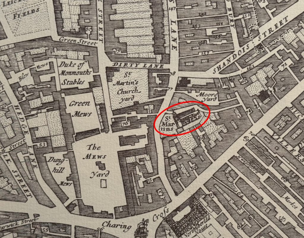
We can see the original church in Morgan’s 1682 map of London, by which time most of the surrounding area had been transformed from fields to streets:

The Mews Yard and St Martin’s Church Yard are where Trafalgar Square and the National Gallery are today.

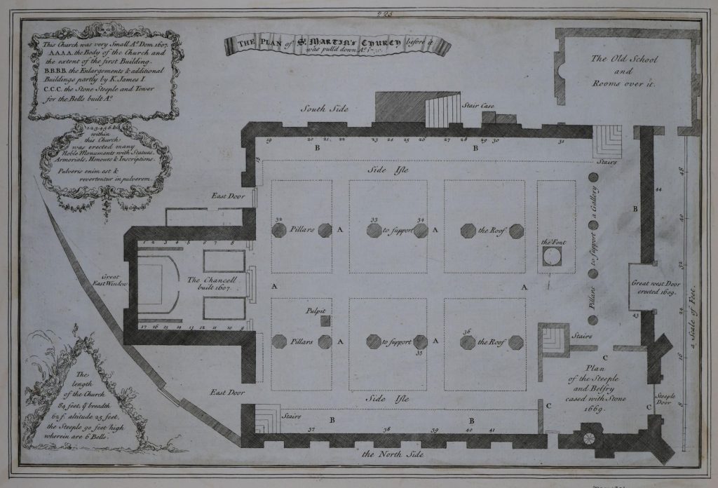
A plan of the mediaeval church was produced shortly before it was demolished. The plan shows a relatively small, simple church with a length of 84 feet, width of 62 feet, height of 25 feet and a 90 foot high steeple which contained 6 bells  (© The Trustees of the British Museum. Shared under a Creative Commons Attribution-NonCommercial-ShareAlike 4.0 International (CC BY-NC-SA 4.0) licence.):

The church had been extended in the 17th century with the Chancel to the left added in 1607, and the steeple and belfry being cased in stone in 1669, so it was a smaller building prior to the 17th century.

At upper right is marked a school room with rooms above.

Old and New London by Edward Walford includes a drawing of the west view of the church, as it appeared before demolition. The view matches the above plan, with the tower on the left corner, and the school room and rooms above on the right, extending from the side and front of the church:

As with so many medieval churches across London, by the early 18th century St Martin in the Fields was in a very poor condition. A survey of the church identified that the decayed walls made mainly of rubble, had been spread out by the weight of the roof, and the fabric of the church was unable to continue providing sufficient support.

A new church was needed, and as the church was now serving a large, built up area, rather than a small village with surrounding fields, an impressive and larger church was required.

A new church was included in the 1715 list of “Fifty New Churches”, however there was very little progress, and the majority of the fifty churches would not be built due to cost.

The Church Vestry petitioned Parliament and in 1717 an Act was passed to rebuild St Martin, with the costs being covered by the inhabitants of the parish.

Designs for a new church were requested from architects of the day, and George Sampson, Sir James Thornhill, John James, Nicholas Dubois and James Gibbs submitted plans in 1720.

James Gibbs design was chosen, the old church was demolished between April 1722 and January 1723, and construction of the new church commenced.

James Gibbs plans went through a number of iterations. His first plan for the new St Martin’s was for a round church with a large dome – almost a mini version of St Paul’s. There were issues with the overall size of the plot, the need to house memorials from the old church, provision of a temporary site of prayer during construction, the encroachment of nearby houses etc.

Gibbs came up with a final design which addressed these issues, as well as the costs of a large, domed church, and produced a more traditional rectangular design in early 1721.

Minor design changes continued during the construction process, although a major change was made in 1722 to “increase the breadth of the portico”, a change that would result in the impressive front and entrance to the church that we see today, and which brough the front and the steps up to the church, up to the edge of St Martin’s Lane.

In the spring of 1724, the core of the church, consisting of brick and Portland stone, had been completed and construction moved on to the fitting out of the new church with carpenters, plasters, plumbers etc. submitting proposals for how this would be completed. This work included cast iron railings to surround the churchyard.

The total cost for the new church was £22,497.

A rather strange event was held to celebrate the completion of the new St Martin in the Fields. Tomas Cadman, who was known as the Italian Flyer, descended head first along a rope stretched from the top of the steeple to the Royal Mews opposite.

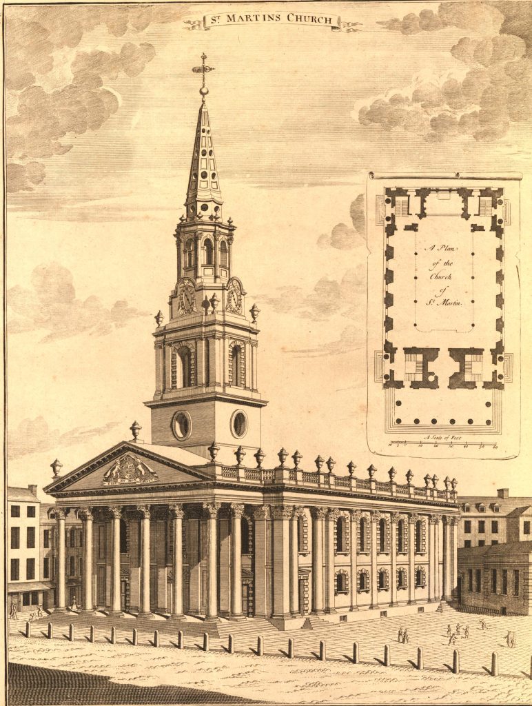
The new St Martin in the Fields not long after completion, as shown in a print dating from 1754  (© The Trustees of the British Museum. Shared under a Creative Commons Attribution-NonCommercial-ShareAlike 4.0 International (CC BY-NC-SA 4.0) licence.):

The new church when built looked across to the Royal Mews, however after the construction of Trafalgar Square, the church took on a whole new status as a key landmark at the north east corner of Trafalgar Square, as seen in this 1836 print  (© The Trustees of the British Museum. Shared under a Creative Commons Attribution-NonCommercial-ShareAlike 4.0 International (CC BY-NC-SA 4.0) licence.):

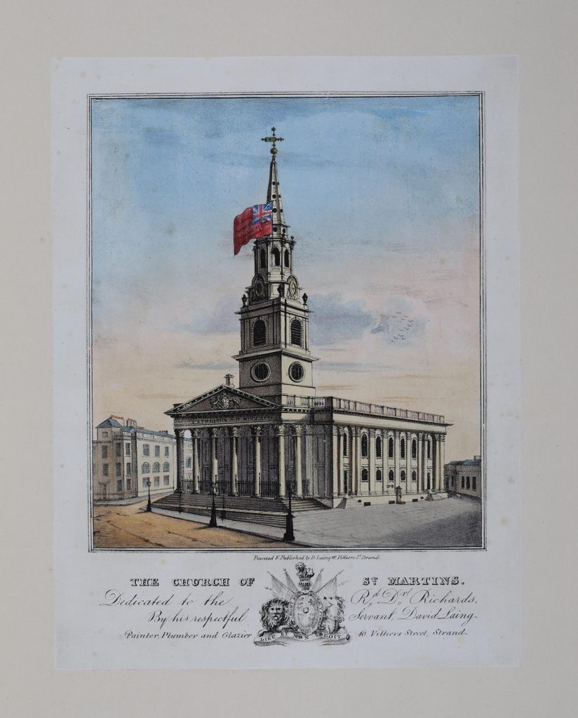
One print of the church shows a large flag being displayed alongside the steeple. Flag flying from churches seems to have been a common event in the 18th and 19th centuries, and a news paper report from the 4th of June 1726 reads that “The Right Hon. The Lords of the Admiralty have made a present to the Parish of St Martin in the Fields of the Royal Standard, who have a right, it being his Majesty’s Parish, to put out the Ensign (upon all days that flags are put out) upon their Church” – although the flag in the print is not the Royal Standard  (© The Trustees of the British Museum. Shared under a Creative Commons Attribution-NonCommercial-ShareAlike 4.0 International (CC BY-NC-SA 4.0) licence.):

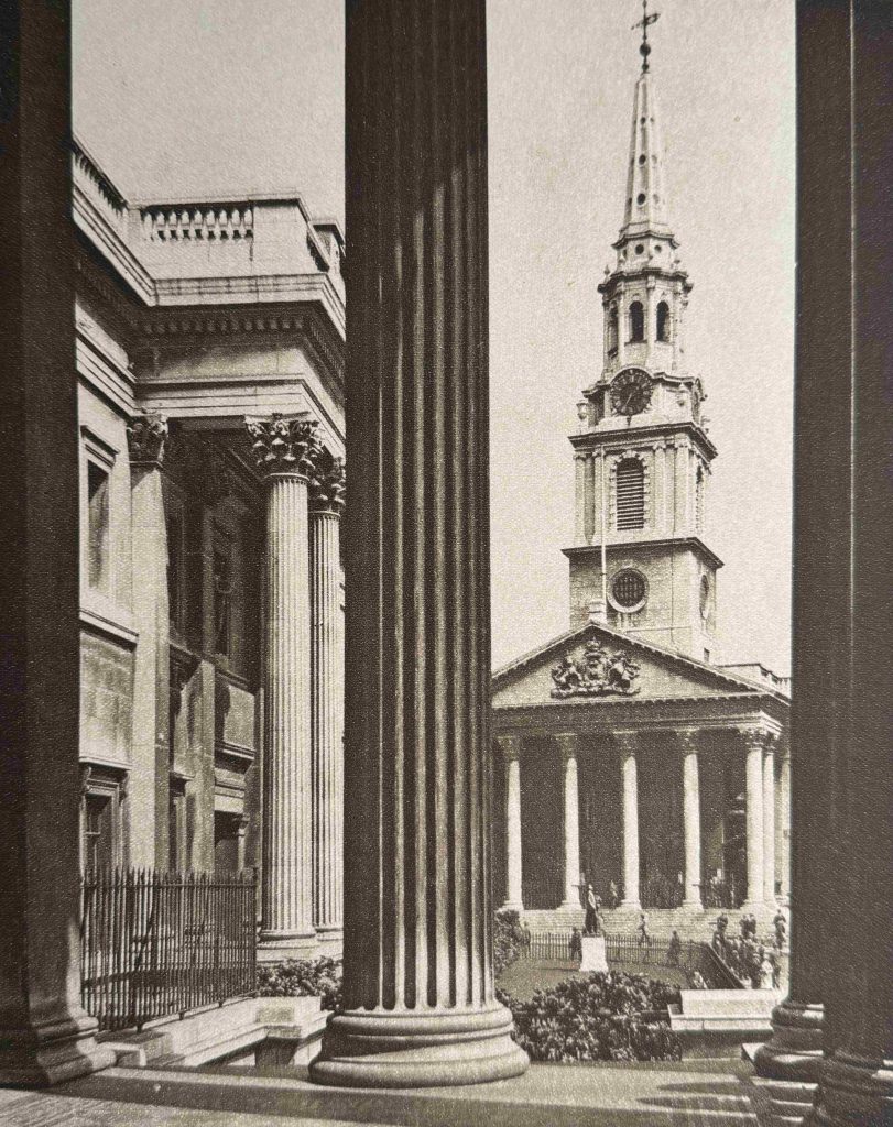
A 1920s view looking across to St Martin in the Fields from the National Gallery:

It is difficult to photograph the interior of the church as there are very many services, musical events and rehearsals, and when these take place there are signs up saying absolutely no photography.

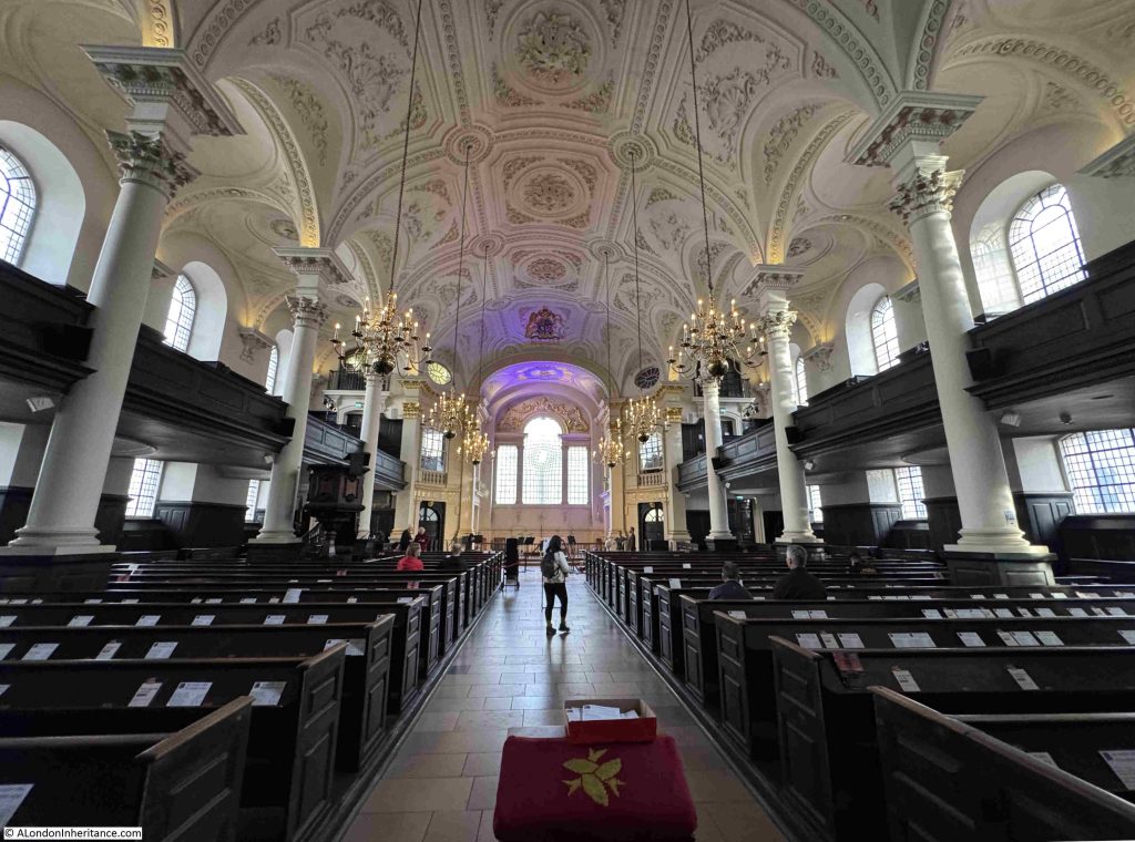
On my fifth recent visit, I did find a time when there were nothing was happening, so managed to get the following photo of the interior of the church:

The large number of side windows on two levels provide a significant amount of natural light into the church, and the white of the roof, walls and pillars contrasts nicely with the dark wood of the pews and the balcony seating along the side walls.

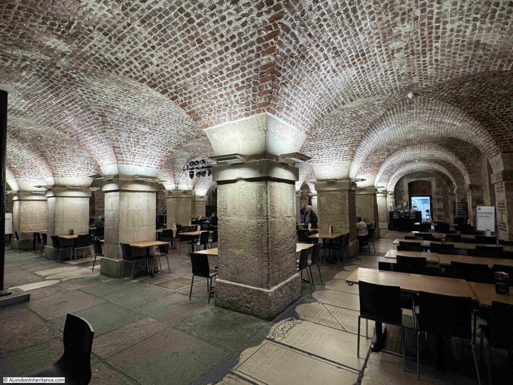
In the above photograph, there are none of the traditional monuments and plaques that we would normally expect to see on the side walls of the church. For these we have to go below ground to visit the magnificent crypt:

Originally the crypt was a place of burials, but was cleared to make a large space, which is now used for a café and event space. I will come onto the burials and crypts later in the post.

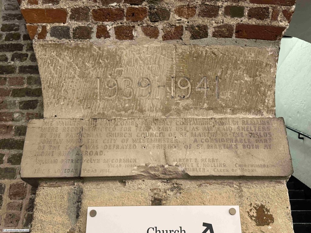
A carved sign on one of the pillars reads “The vaults and catacombs formerly containing human remains were reconstructed for temporary use as air raid shelters by the parochial church council of St Martin in the Fields jointly with the City of Westminster. A considerable part of the cost was defrayed by friends of St Martin’s both at home and abroad”:

The crypt was also used to provide refreshments to service personnel during the war. As the following from the 10th of May 1940 highlights “A team of Boys Brigade men are undertaking in turn night duty at the Services Canteen in the crypt of St Martin in the Fields Church in Trafalgar Square. Some of those who have been helping out in this way since the outbreak of war have now joined the forces themselves and there are vacancies for more Boys Brigade officers who could give an occasional night to attend to the needs of the soldiers, sailors and airmen who throng St Martins. The hours of duty are from 10 p.m. to 6 a.m. and one’s turn comes about once a month”.

The church did suffer some bomb damage in November 1940.

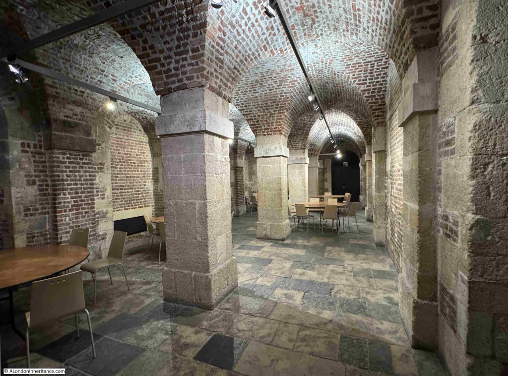
Towards the front of the church is a small space:

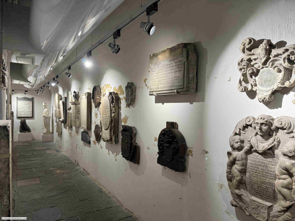
And to the side of this space, there is a corridor which contains many of the memorials and monuments that were once found across the church, many of which must come from the original church as they predate the current St Martin’s:

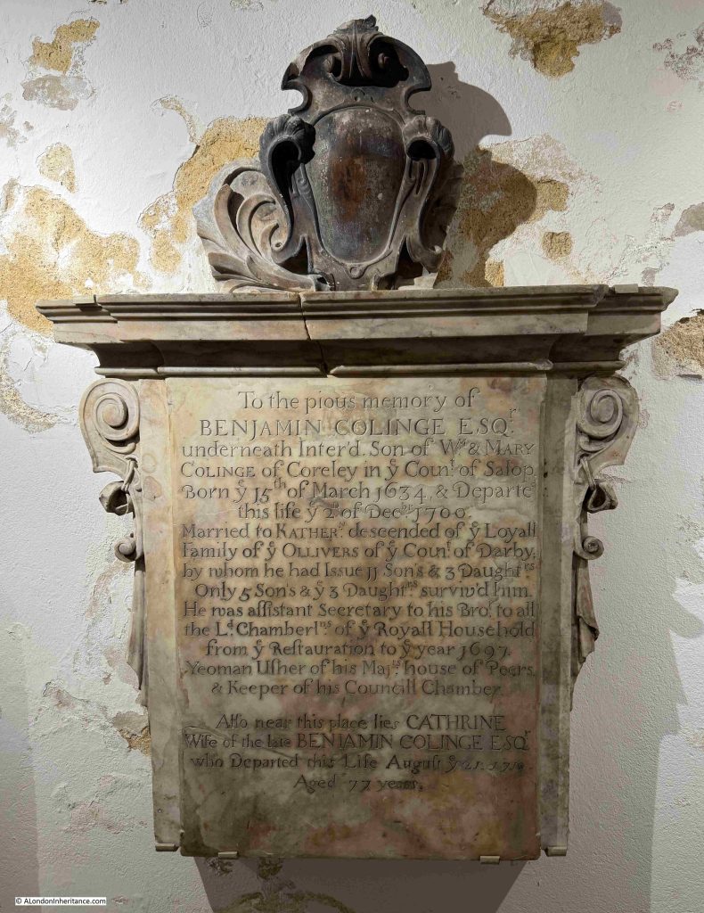
The memorial to Benjamin Colinge who died on the 2nd of December 1700, and who worked in the Royal Household from the Restoration until 1697:

With his wife Katherine (also spelt Catherine on the same memorial). They had 11 sons and 3 daughters, of which only 5 sons and 3 daughters survived their father. Katherine lived to the age of 77 – quite an achievement in the late 17th / early 18th century after having a total of 14 children.

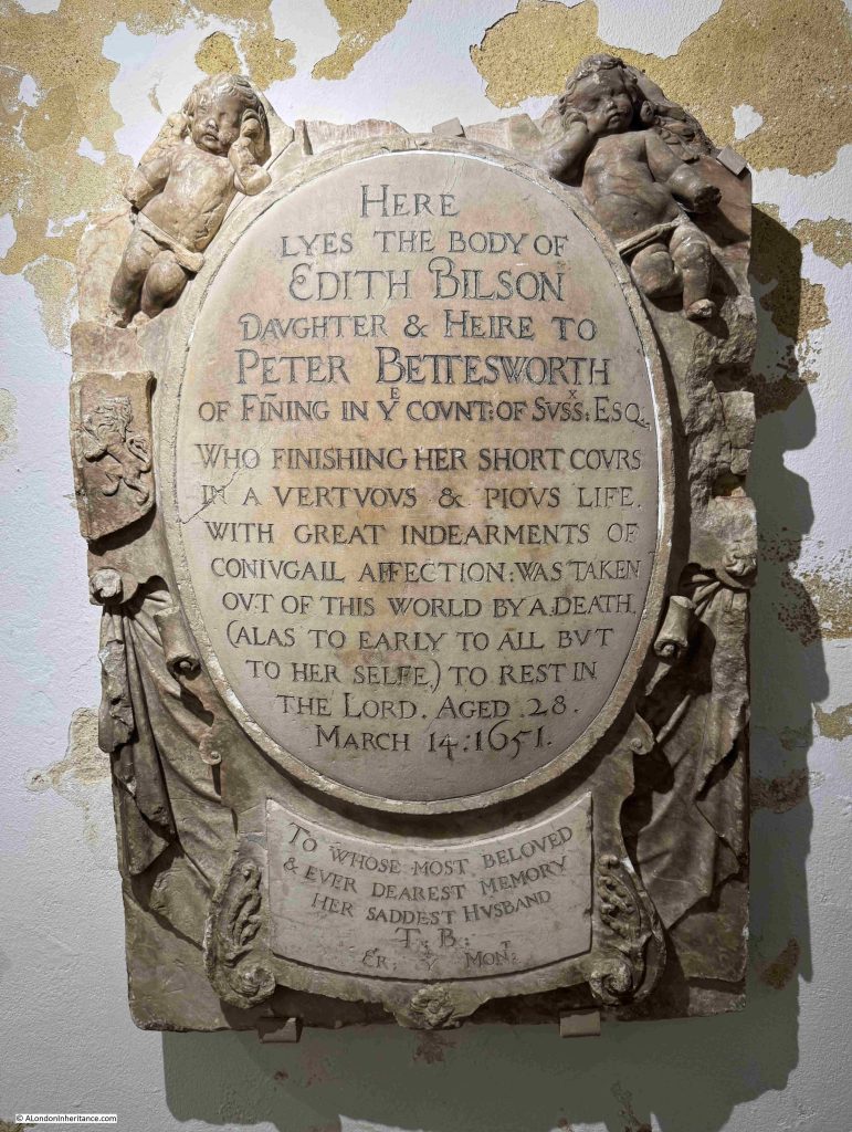
To the Pious Memory of Edith Bilson who died on the 14th of March 1651, aged 28:

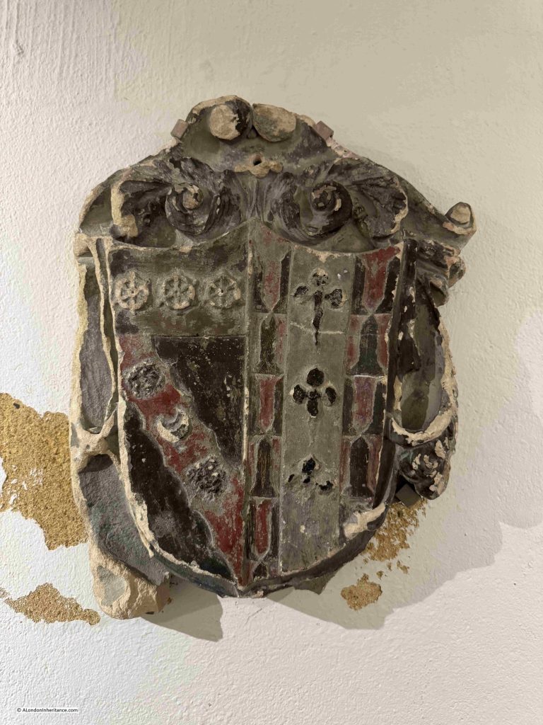
There are also a few Coats of Arms, presumably of those who had been buried in the church and possibly the only parts remaining of their monument / tomb:

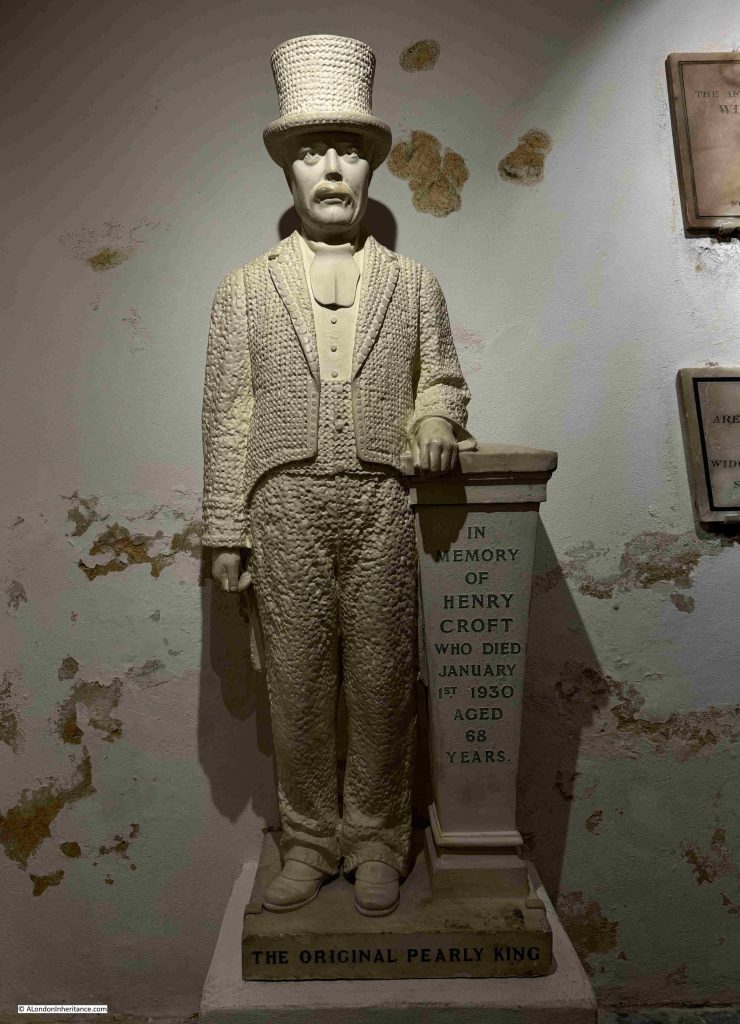
At the corner of the corridor of memorials is that of Henry Croft – “The Original Pearly King”:

Henry died on the 1st of January 1930 and there were numerous accounts of his life and funeral in the papers, with the following from the St Pancras Gazette on the 10th of January 1930:

“At the age of 67, the death took place, as the bells were ringing in the New Year, of Mr. Henry Croft, the original ‘Pearly King’. Mr Croft, who was well known in every quarter of London, had been an employee of the St. Pancras Vestry and Borough Council for over 40 years and only recently retired on pension.

Most remarkable scenes were witnessed on Tuesday, when the funeral took place to St. Pancras Cemetery. Hours before it was due to leave great crowds began to assemble round 16 Charles-street, Euston-road, and those crowds grew until all the adjoining neighbourhood was one solid mass of humanity.

There were over one hundred ‘Pearly Kings and Queens’ to say nothing of ‘Pearly Children’ who assembled in their full regalia to pay their respects to their old comrade, a man who had collected many thousands of pounds for the various hospitals of London.

Almost every Saturday and Sunday he devoted to his task, and hospitals have certainly lost a very great friend by his death. It took a number of mounted and foot police to control the crowds and it was a most impressive sight when the procession left Charles-street to wend its way to the cemetery, led by a band of pipers playing a haunting lament, and many banners were displayed by members of the various societies and organisations with which the deceased was connected. The coffin was borne by four comrades – all Pearly Kings – and on it rested the deceased tall hat of pearl buttons, and also all the medals with which he had been presented for his charitable work, displayed on a black velvet cushion.

The coffin was drawn in an open car with four horses, and the three coaches following contained his widow and family – he had two sons and three daughters. Behind the mourning coaches came a stream of vehicles of all kinds carrying other Pearly Kings and Queens and a whole retinue of the deceased friends. The procession was nearly half a mile in length and was one of the largest that London has seen for many years.”

The statue of Henry Croft was originally installed where he was buried in St Pancras Cemetery, however after several instances of vandalism, it was restored and moved to the crypt in 2002. The choice of St Martin in the Fields was because of the long association of Pearly Kings and Queens with the church, and it is where they continue to hold their Annual Harvest Festival.

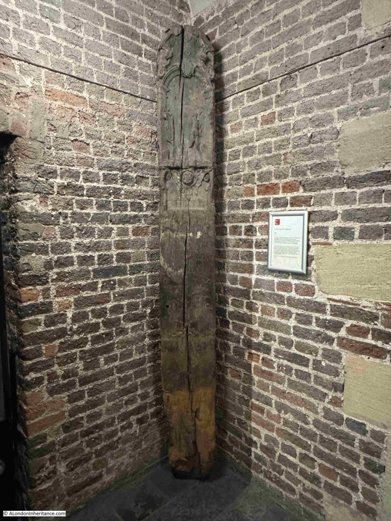
On display in the crypt is a reminder of the barbaric forms of punishment that offenders could suffer in London – the St Martin in the Fields Whipping Post:

There were a number of whipping posts across London, and these were often associated with a pillory. Whipping was also carried out with the offender tied to a cart, and whipped as they were being moved between two places, often relevant to their crimes.

Whipping was a public punishment, aimed not only at punishing and humiliating the offender, but also visibly showing the public the type of punishment they would suffer if they were to commit similar crimes.

The punishment was also a risky time for the authorities, if the general public was not happy that the offender was being given a fair punishment, or if there were other general issues with authority. For example, the whipping of James Dinord, a journeyman weaver in Bethnal Green in 1829 was attended by the officers of Worship Street, Lambeth Street, the Thames police and all the parochial and special constables of the district, including the parochial officers of the twenty one districts of Tower Hamlets, due to the risk of trouble.

The large crowd was described as being silent whilst the punishment was carried out, with not a single murmur being heard, nor the slightest symptom of riot or insubordination.

The impact of a whipping or being confined in the pillory could also effectively be a death sentence. On the 28th of September 1810, the London Statesman reported that “The sheriffs and Jack Ketch were actively employed yesterday between the pillory and the whipping post in the Old Bailey; their respective functions were not finished till it was nearly dark. Viguers, the miscreant placed in the pillory in Cornhill, is at present blind, in consequence of the pelting he received. He was so much bruised and lacerated, that he is not expected to survive”.

I cannot find where the St Martin in the Fields Whipping Post was originally located. I wonder if it was a short distance further south at Charing Cross which would have been a public place, at the junction of key roads, for such a public punishment to be carried out.

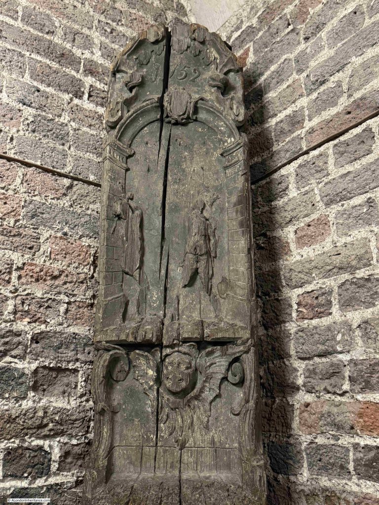
The Whipping Post dates from 1752, as indicated by the year carved at the top of the post, and at this time St Martin was relatively enclosed within streets and buildings, long before Trafalgar Square was built, and whilst St Martins Lane was a busy street, it would not have been such a public location as the main street just to he south:

It is interesting that it was thought necessary that the post used for such a punishment should also be ornately carved, it was probably to give some authority to the whipping post and the punishments carried out.

There was a pillory at Charing Cross, as illustrated in this print from 1809, by Rowlandson and Pugin from Ackermann’s Microcosm of London:

There is a large space space to the left side of the church and to the rear. This space was once part of the burying ground, which originally extended further than the space we see today:

There were up to 70,000 burials in the crypt and across the burying ground and between 1827 and 1830 the burying ground was emptied and the crypt space extended under a programme of work by John Nash to create buildings to the north of the church. This also allowed Duncannon Street which now runs along the southern edge of the church to be built.

Al the crypt space was finally emptied between 1915 and 1937.

The area to the north and south of the church has been significantly renewed, with a couple of floors of space developed below ground, consisting of the church hall, music rehearsal room, a chapel, open space, and a shop.

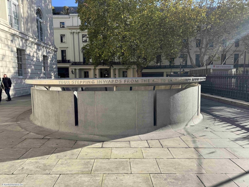
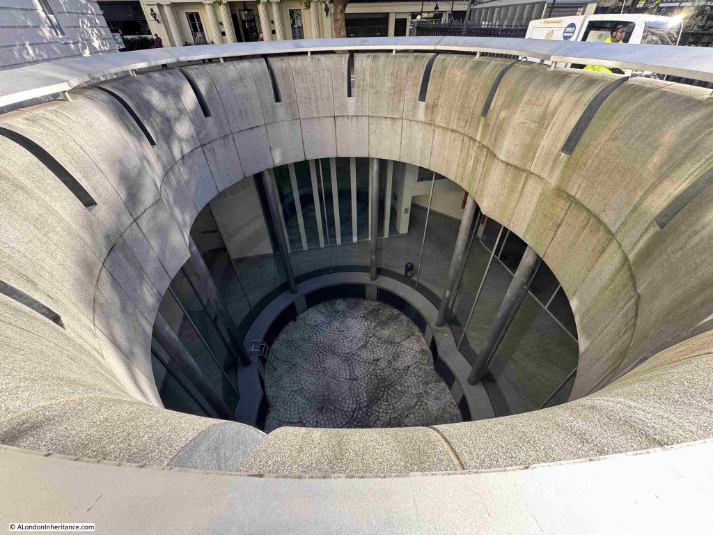
There is a new entrance to the crypt and below ground space, as shown in the photo above and just behind the entrance there is a light well that lets natural light into the two floors below:

Looking down through the light well:

The church seen from the north east showing space to the side and behind the church which was once part of the burying ground, and then the below ground extension to the crypt:

And from Duncannon Street, the street created when the burying ground to this side of the church was emptied of human remains:

Today, as well as church services, St Martin’s is a centre for music with regular concerts, and the original home of the Academy of St Martin in the Fields, formed in 1958 by Sir Neville Marriner, and who had their first performance in the church in November 1959.

There is an interesting video by Eric Parry Architects on the project to redevelop the below ground space:

St Martin in the Fields is a very impressive church. It is ideally placed at the north east corner of Trafalgar Square, a space that would not be developed for over 100 years after James Gibbs designed the church, and modified the front to enlarge the portico during the construction process, a change which just adds to the view of the church as you look across Trafalgar Square.

I suspect he would be rather pleased with the views now available of his church.

Resources – Historical maps of Southwark and City Ward Maps

In this months section on resources that may be of help with researching the history or London, I am looking at some more maps.

Maps are brilliant resources for understanding the history of an area, and by using maps of different dates, how an area has developed over the years.

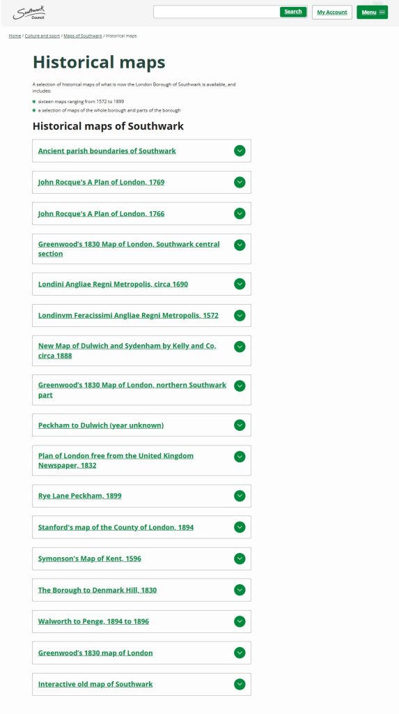
Southwark Council have put a range of historical maps online. The title of the respective webpage is Historical maps of Southwark, although the maps available cover much more than just the Borough of Southwark, with many of the maps showing the whole of London.

The Historical maps of Southwark webpage can be found by clicking here, where you will find the following listing:

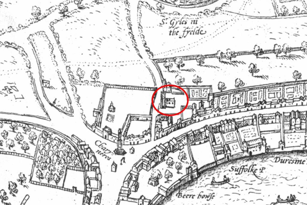
The list shows the range of maps available, and to give an example, the following is an extract from the 1572 map Londinvm Feracissimi Angliae Regni Metropolis, and in the extract I have put a circle around the main subject of the post – St Martin in the Fields:

The map shows how the church justified the use of “in the Fields” within the name, as at the time, it was on the edge of the built city. An early St Martin’s Lane can be seen running north in front of the church.

To the south is the Strand, which runs to Charing Cross, then continues to the south to Westminster. The importance of the Strand can be seen by the large houses running along the street, with rear gardens leading down to the Thames, where each house would typically have its own Watergate.

To the north of the church there are fields, up to another “in the Fields” church, St Giles in the Fields.

At the major road junction at Charing Cross, we can see the last of the Eleanor Crosses, which marked the route taken by the body of Eleanor of Castile, the wife of Edward I, from the location of her death in Lincolnshire, to her burial at Westminster Abbey.

It was taken down on the orders of Parliament in 1647, and the stones were allegedly used in various building works in Whitehall.

Another London local authority with some interesting maps is the City of London Corporation. If you have ever wondered about the current boundaries of all the City Wards, then the Corporation have a webpage to help.

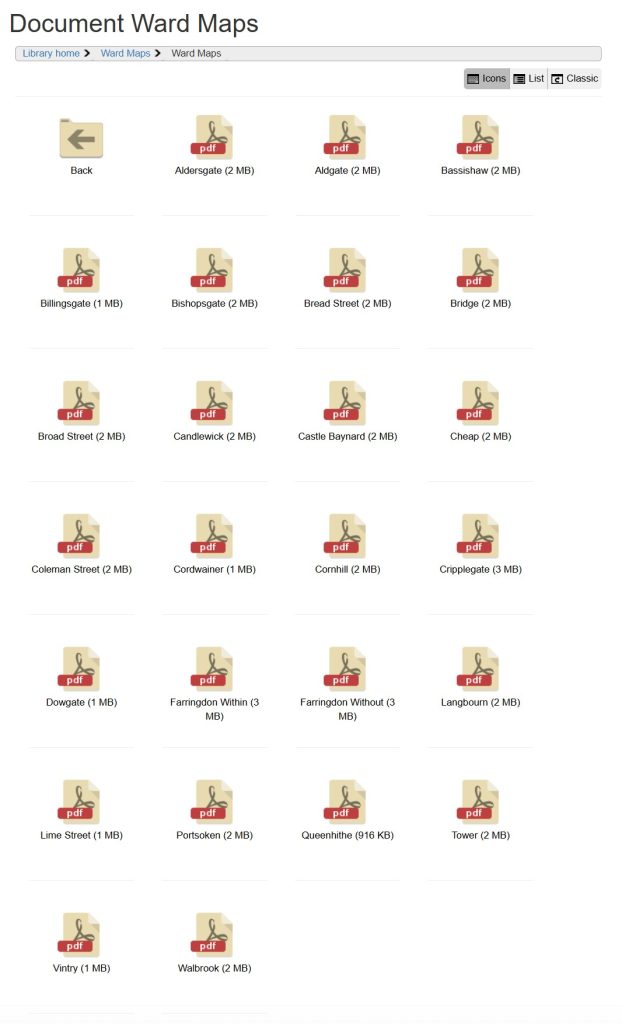
The Ward Maps webpage can be found by clicking here, where you will find subfolders for each of the City Wards, as shown in the following image:

Clicking on any of the Wards when you are on their webpage, will bring up a PDF map showing the boundaries of the relevant Ward superimposed on a modern day street map.

Each Ward Map also shows the boundaries of the City of London, along with the adjacent Wards.

Both the Southwark and the City of London Corporation webpages provide very different views of London, but both help provide an understanding of the historical development of the city, and how historical boundaries still apply in a very modern City.