
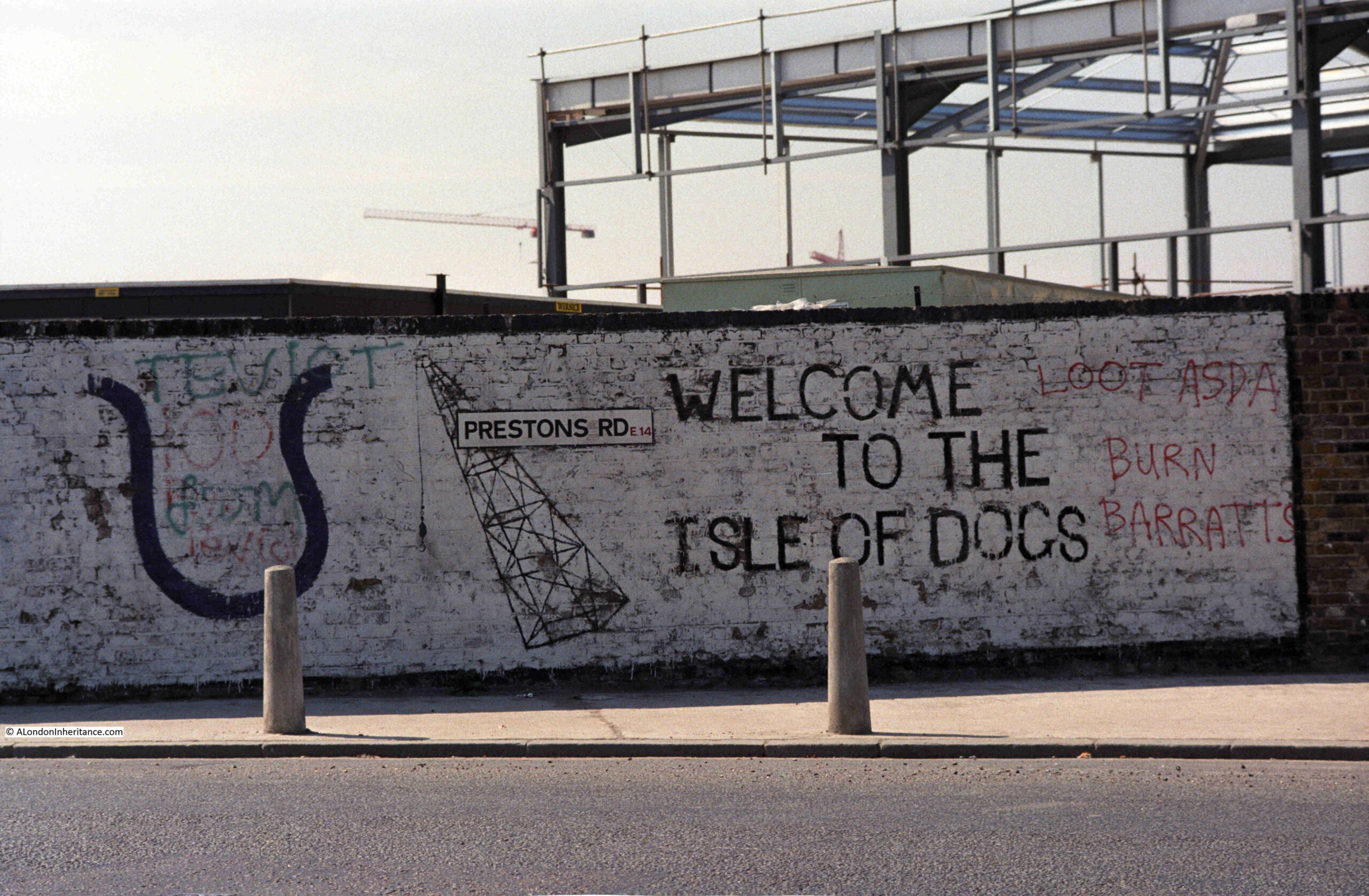
In 1986, my father photographed some graffiti on a wall in Prestons Road which runs from Poplar to the Isle of Dogs.
The 1980s were a traumatic time for the residents of the Isle of Dogs. The docks had closed and the developments that would lead to the office complex around Canary Wharf, as well as many new housing developments, were underway.
Much of this new development would not directly benefit local residents. Thousands of office jobs for those living outside of the Isle of Dogs, and new homes being built which were typically much more expensive than traditional homes in the area. Very little of the money being poured into new developments would find its way to the original residents.
The graffiti on the wall in Prestons Road reflects some of the anger and frustration felt as a result of the developments. Barratts the builders are mentioned on the right of the wall, along with Asda.
Whilst the build of a new Asda store could have been seen as a positive for residents, in reality it was one of the many cultural changes imposed, where centralised shopping would badly impact the trade of multiple small, often family owned shops.
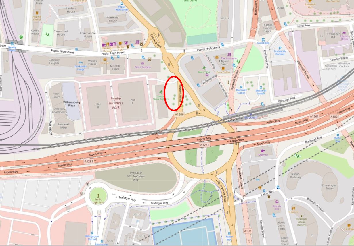
The graffiti was on a wall in Prestons Road. This road runs from a junction with Poplar High Street down to the so called Blue Bridge, which crosses the east entrance to West India South Dock from the Thames.
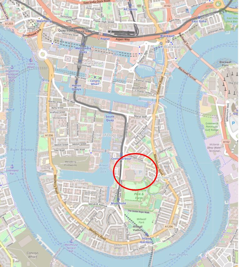
I have marked the two end points of Prestons Road in the following map. The road runs between these two points (© OpenStreetMap contributors):

My father took the photo at the top of the post, and did not leave a record of the location. I do vaguely remember walking past the wall in the mid-1980s and that it was somewhere near the Poplar High Street end of Prestons Road, somewhere around the location highlighted by the red oval on the following map (© OpenStreetMap contributors):
I think I found the location when I went for a walk along Prestons Road, and I will explain later in the post, however before walking the road, some background to a road that has changed significantly in the last decades.
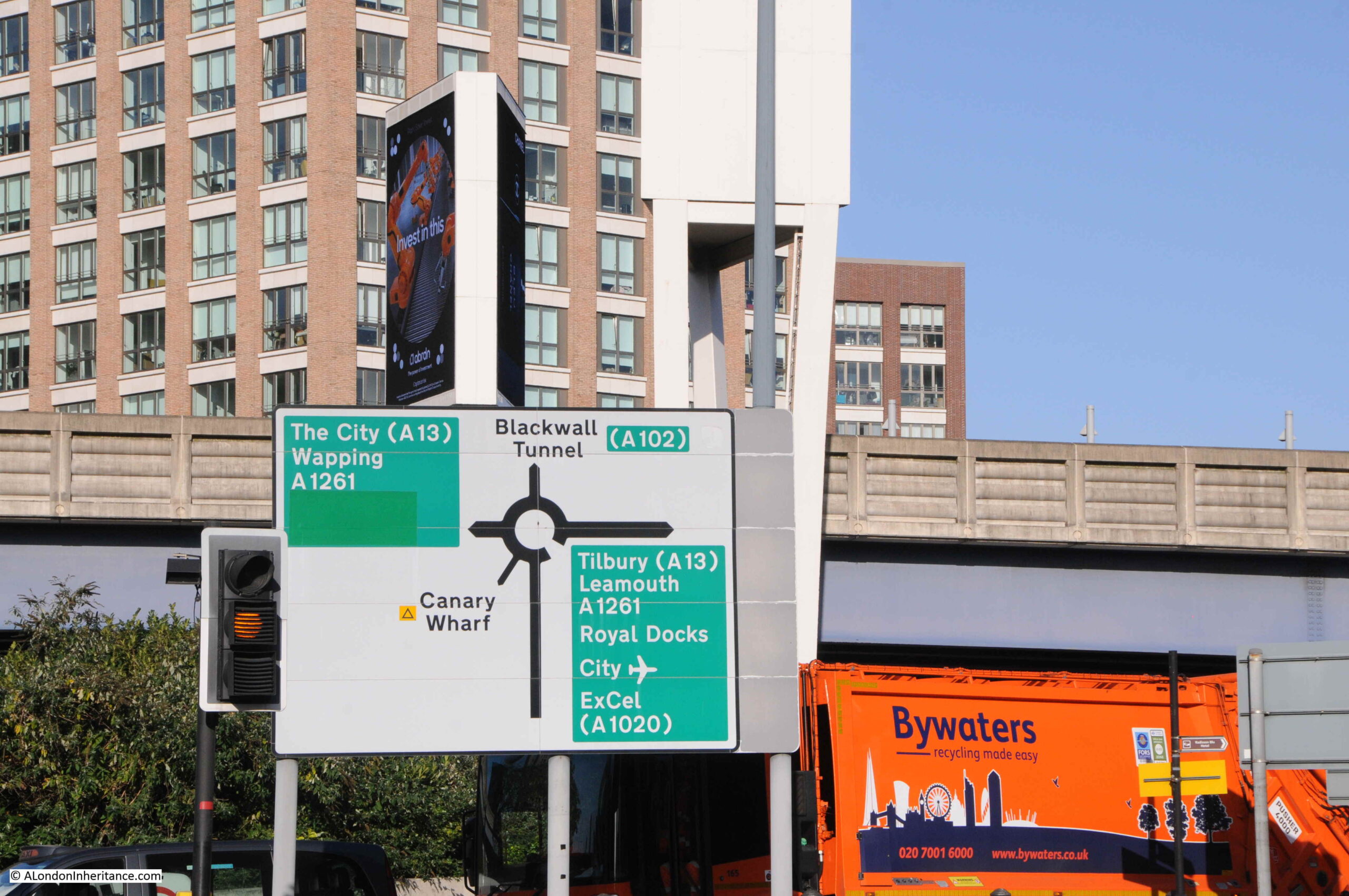
The most significant change to Prestons Road is in the northern part, up to the junction with Poplar High Street. Between the northern and southern sections of the road, it has been divided by a large roundabout and the dual carriageways of the A1261, or the Aspen Way, which is carried over the roundabout, as can be seen in the above map.
The A1261 provides a route between the A13 at the start of the East India Dock Road in the west, through to the Lower Lea Crossing in the east.
Construction of this road had significant impact on the area, and in some ways, reinforced the division between the Isle of Dogs and the rest of Poplar. The A1261 was built as part of the transformation of transport infrastructure surrounding development of the Docklands, which included other major projects such as the Limehouse Link Tunnel.
To illustrate the impact of this road, and the roundabout, the following map is from the 1950 edition of the Ordnance Survey, which covers roughly the same area as in the above map. The location of the roundabout is shown by the red circle (‘Reproduced with the permission of the National Library of Scotland“):
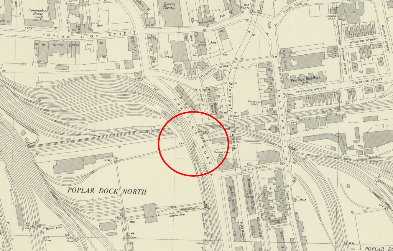
By comparing the two maps, it can be seen that the northern part of Prestons Road, up to Poplar High Street has changed to enable the entry and exit carriageways to the roundabout. Where Prestons Road once had a straight section down from Poplar High Street, it is now more angled to accommodate the roundabout. This will be relevant when searching for the location of the graffiti.
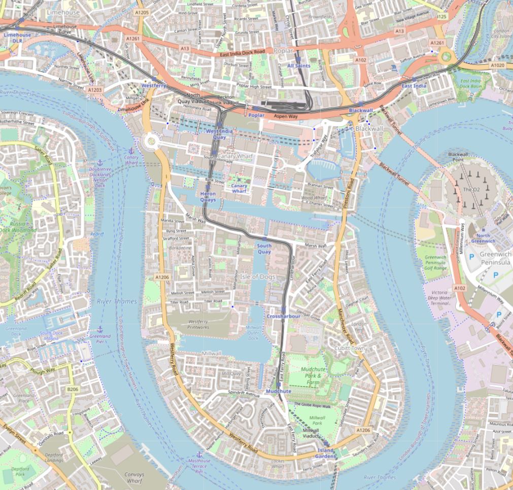
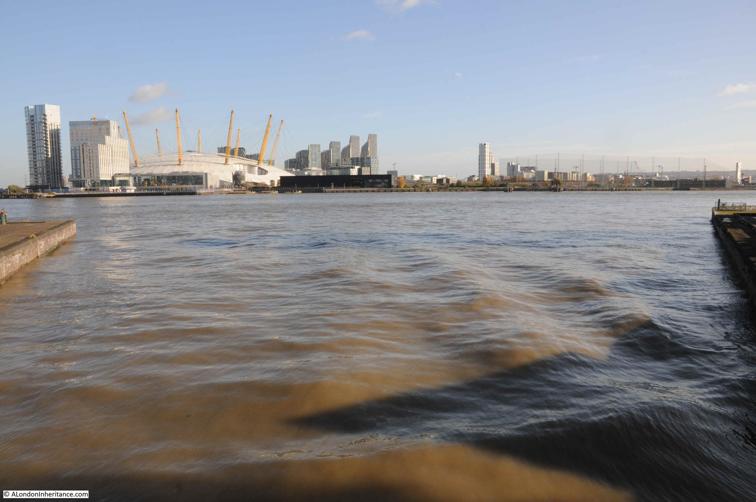
Taking a wider view of the area, we can see the Aspen Way running left to right at the very north of the Isle of Dogs. Just to the south, Billingsgate Market, and the office blocks around North Quay and the northern section of Canary Wharf reinforce the boundary created by the Aspen Way, leaving two main routes to the Isle of Dogs on the east and west of the peninsula – the eastern route being Prestons Road (© OpenStreetMap contributors).
This boundary between the Isle of Dogs and Poplar has been long in the making. The following extract from Smith’s New Plan of London, dated 1816, shows that the construction of the West India Docks had created a barrier across the centre, leaving only the two roads either side of the peninsula:
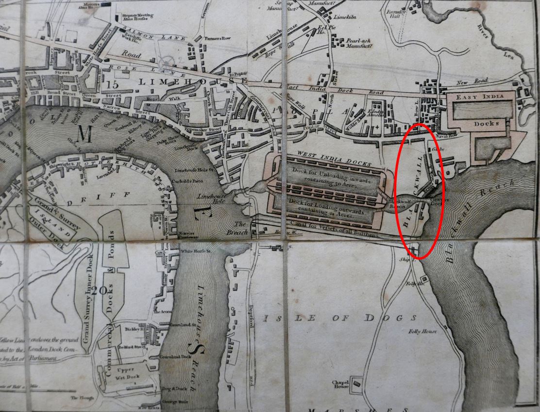
In the above map, I have circled the location of Prestons Road, and whilst the southern section across the dock entrances was in place, the northern section had not been built. Instead, a turn to the right entered Brunswick Street.
I believe that the northern section of Prestons Road was built at the same time as the Poplar Docks which were located on the left of the section of the street just to the south of the roundabout.
We must go back to the 18th century, to see the area before any of the docks were built to understand how the docks, and then Canary Wharf and the Aspen Way have created an apparent northern boundary to the Isle of Dogs.
In the following map from 1703, we can see that the whole area was part of Poplar, with Poplar High Street already lined with buildings. To follow on from last week’s post, I have also circled a reference to Penny Fields to the left.
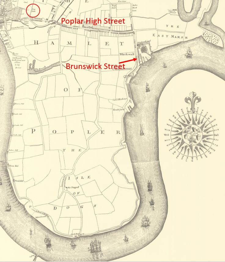
Brunswick Street is to the right, however rather than just east and west routes, up until the construction of the docks, there were to roads running down from Poplar High Street, including the central road which ran down to the ferry across the Thames to Greenwich, at the southern tip of the peninsula.
So today, when crossing under the Aspen Way, it feels like a boundary has been crossed, and we are entering the Isle of Dogs. Time to take a walk along Prestons Road:
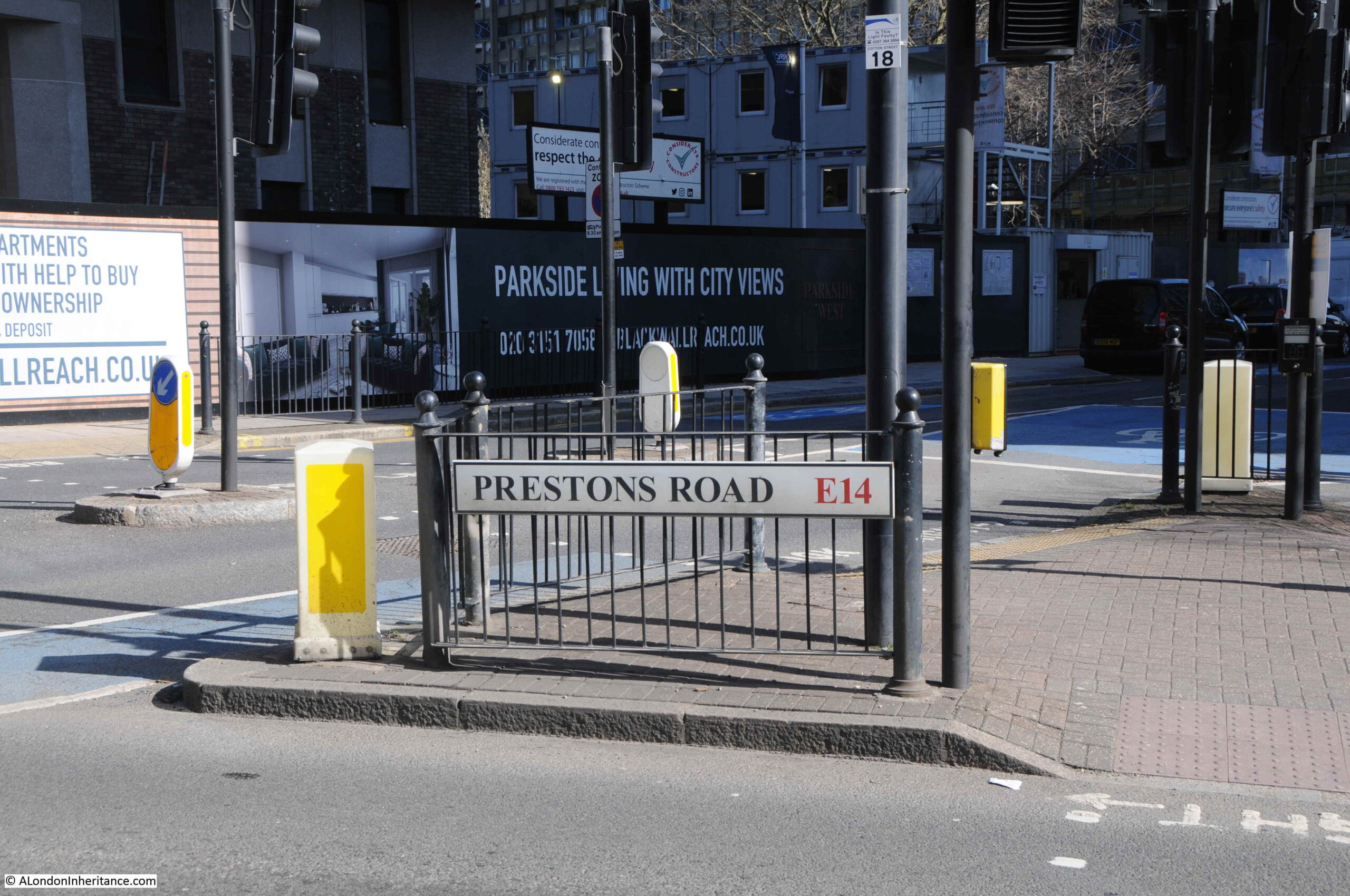
The above photo was taken at the junction of Prestons Road with Poplar High Street.
For this post, I am using the spelling of the street as seen on the street name signs in 1986 and today. Many references to the street also refer to Preston’s, however to stay with the name signs, I will leave out the apostrophe.
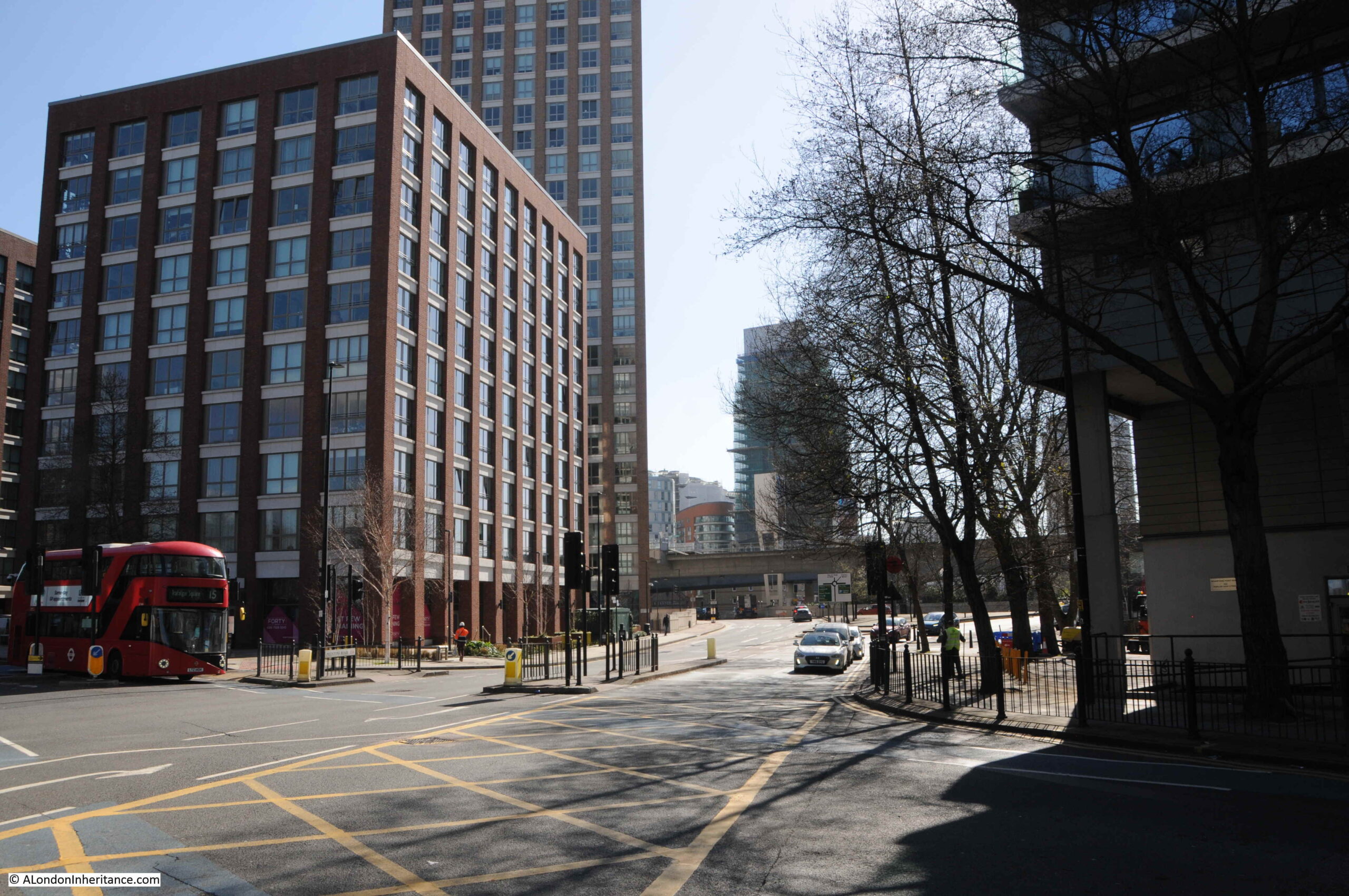
The following photo is looking south from the junction in the above photo. The upper part of Prestons Road was angled slightly to the left when the roundabout was built. If I remember rightly, the wall with the graffiti was somewhere along the right side of the street.
A short distance down the street is a turn off to the right with Poplar Business Park at the end:
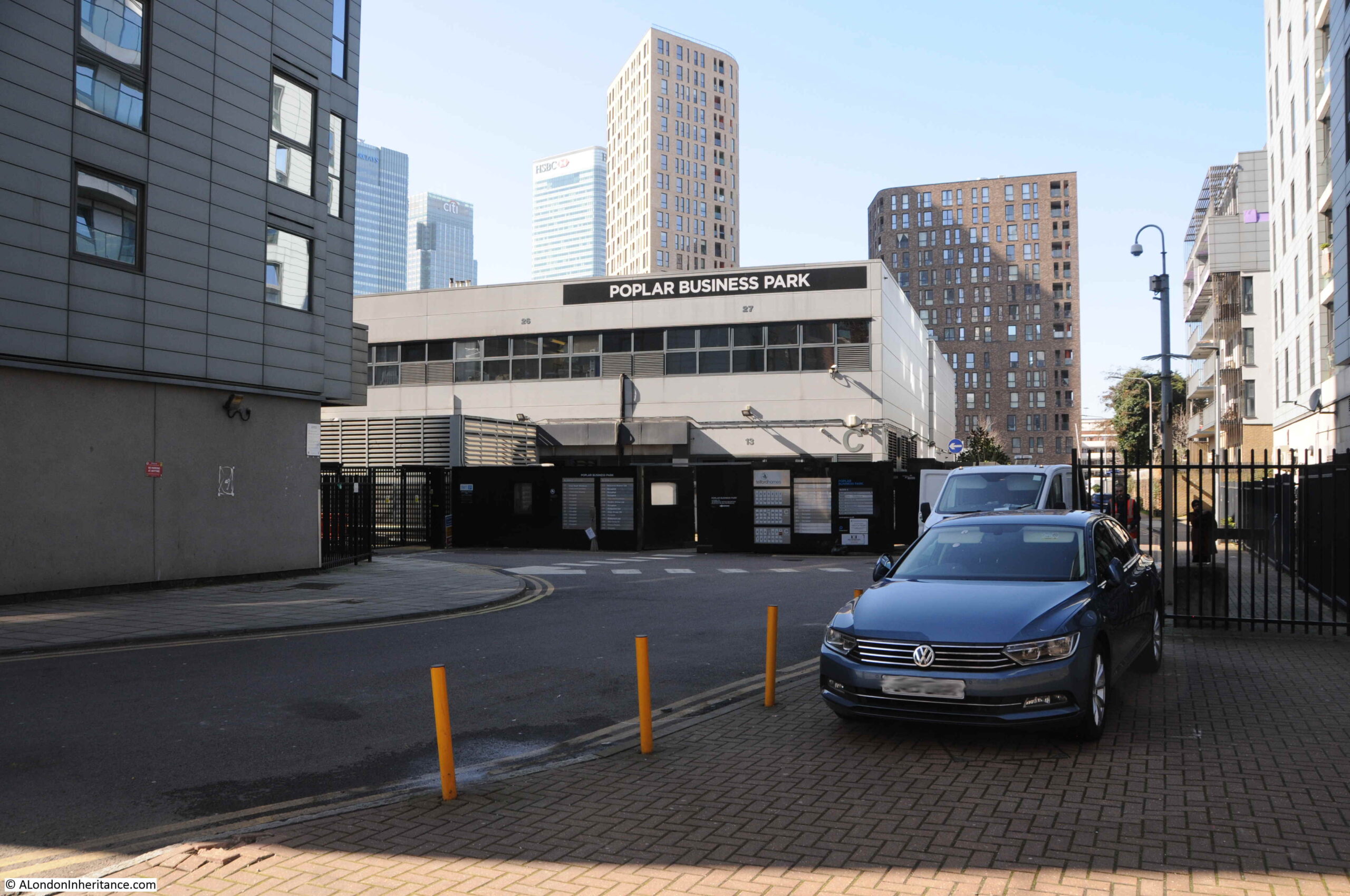
In the background of the 1986 photo, the frame of a building under construction can be seen. The majority of buildings to the south of Poplar High Street are relatively recent, and do not date back to the 1980s, however I wondered if the Poplar Business Park could be the building which was under construction when my father took the photo.
It is certainly in the right place, if my memory is correct that the wall was around here.
I looked for references to the Poplar Business Park to try and date the building, and found an advert from 1988 for “Moat Security Doors, Poplar Business Park, Prestons Road, Isle of Dogs, E14”, who sold iron gates to add security in front of a door, or as they advertised “Never be afraid to open your front door again”.
So the Poplar Business Park was in operation in 1988, so possibly safe to assume it was the building photographed under construction two years earlier. Interesting that whilst in the Poplar Business Park, they used Isle of Dogs in the address, despite being at the northern end of Prestons Road, very close to Poplar High Street.
If I am correct, the wall would have been to the left of the above photo, or perhaps to the left of the photo below which is looking up Prestons Road, with the side road to the Poplar Business Park being the street where the grey car is about to exit:
A very short distance to the south is where Prestons Road crosses under the A1261, the Aspen Way, a very significant set of new road infrastructure:
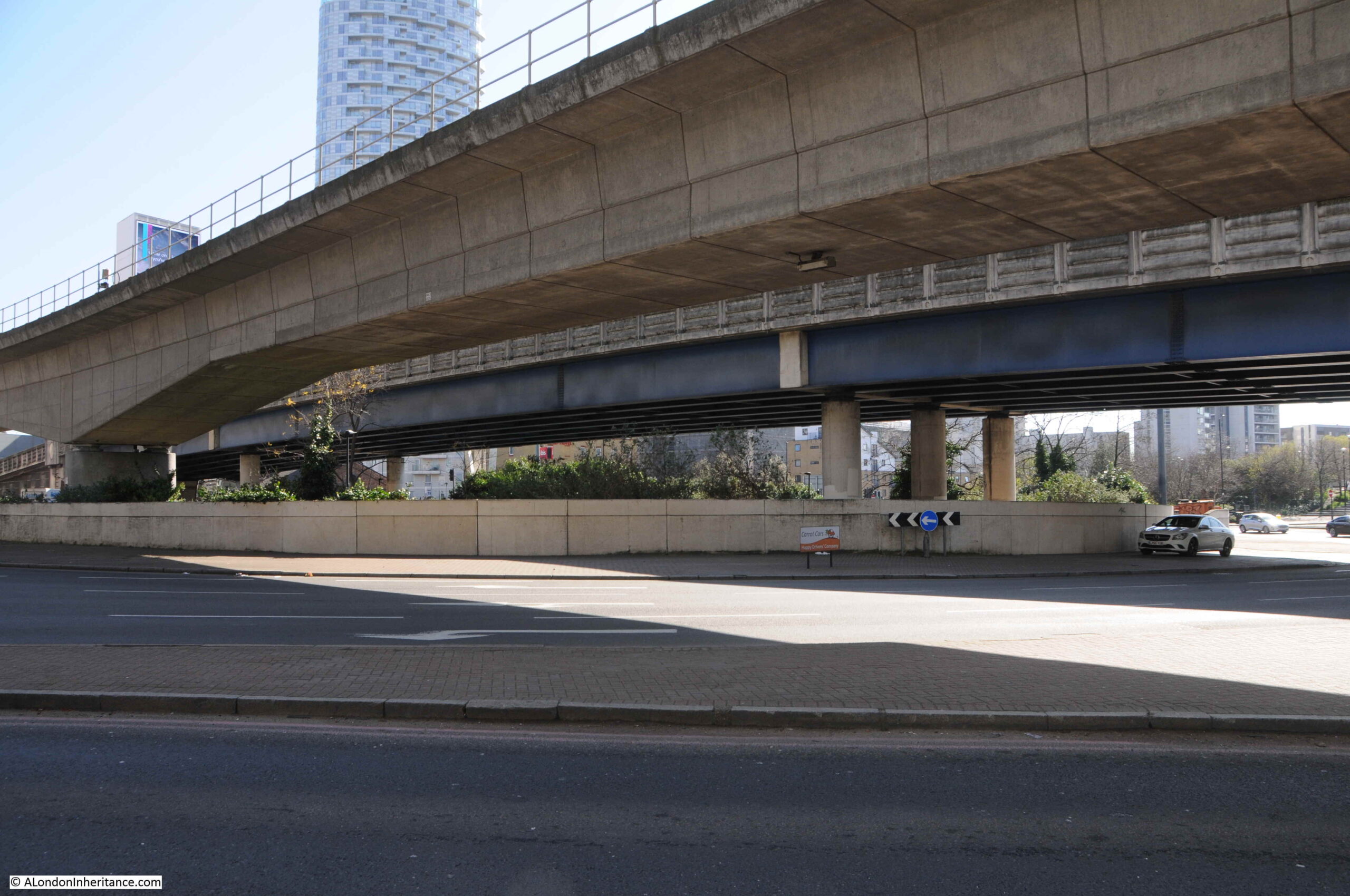
From the south, looking north, and the slip road to the east, up to the Aspen Way towards the City of London and one of the new road access points to Canary Wharf:
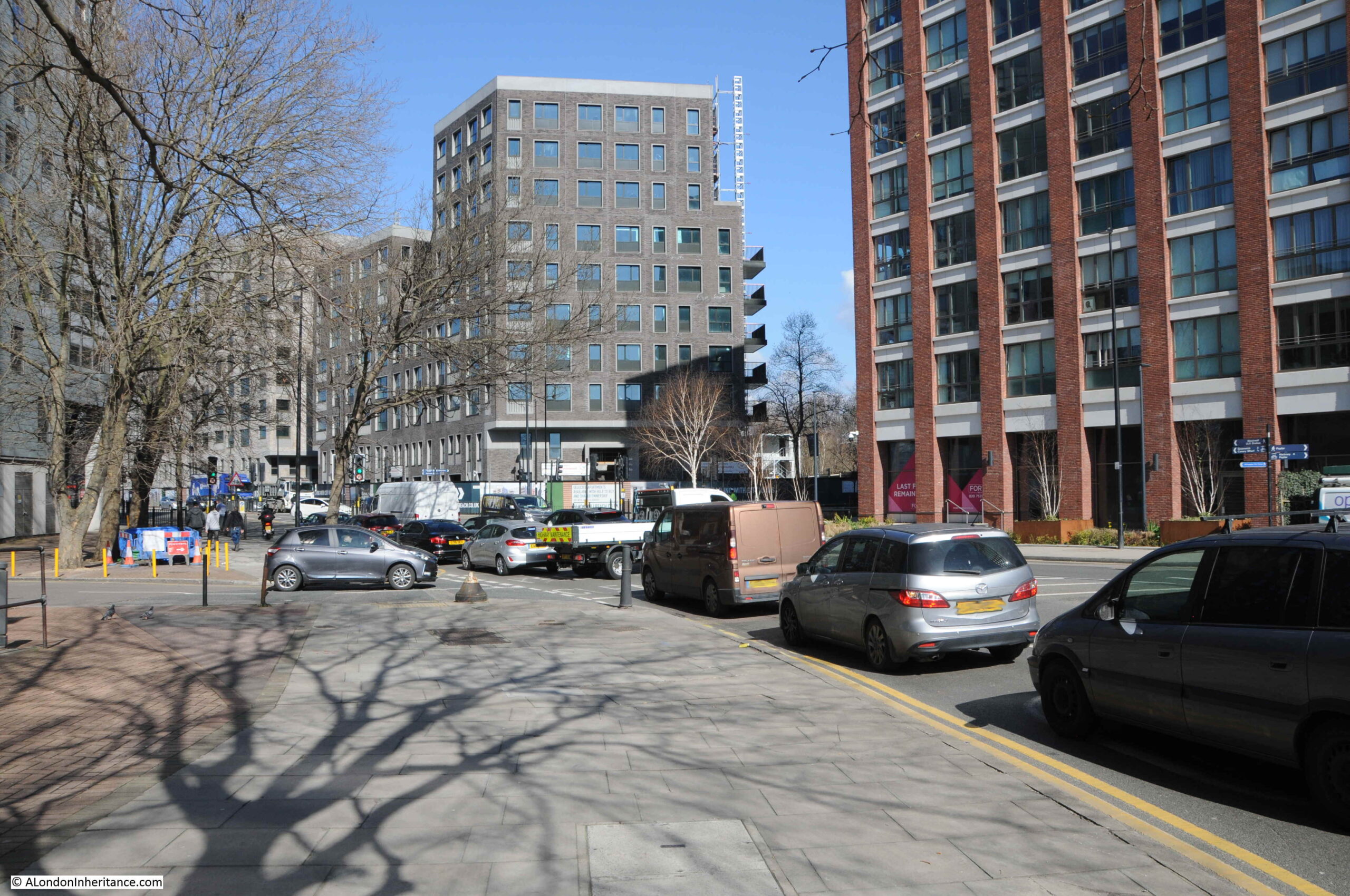
From the edge of the roundabout we can see some of the new residential towers that are becoming so common across this part of east London:
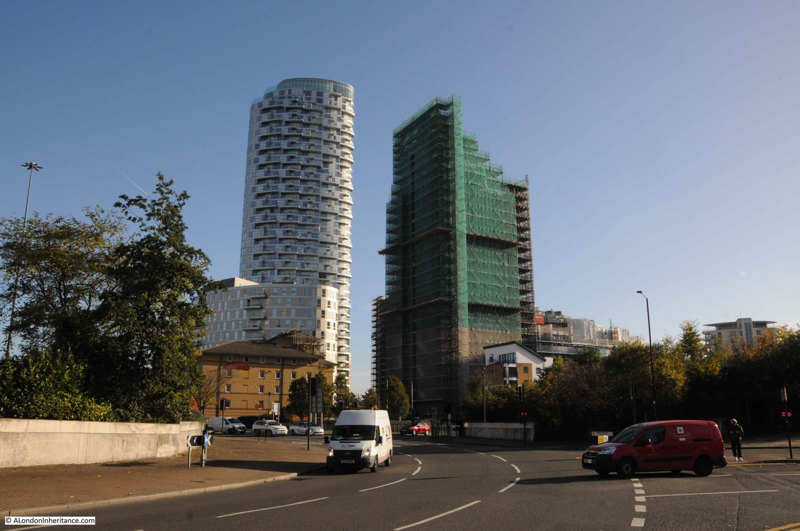
A full view of the routes that can be accessed via the roundabout that obliterated part of Prestons Road:
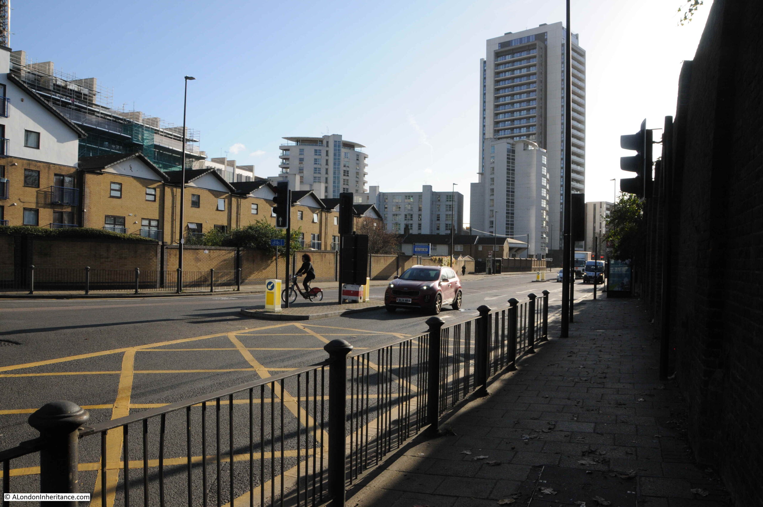
This is the view looking south along Prestons Road into the Isle of Dogs. I do not live there, so I am not really one to judge, but when walking the area, it is only along here that I feel I am entering the Isle of Dogs:
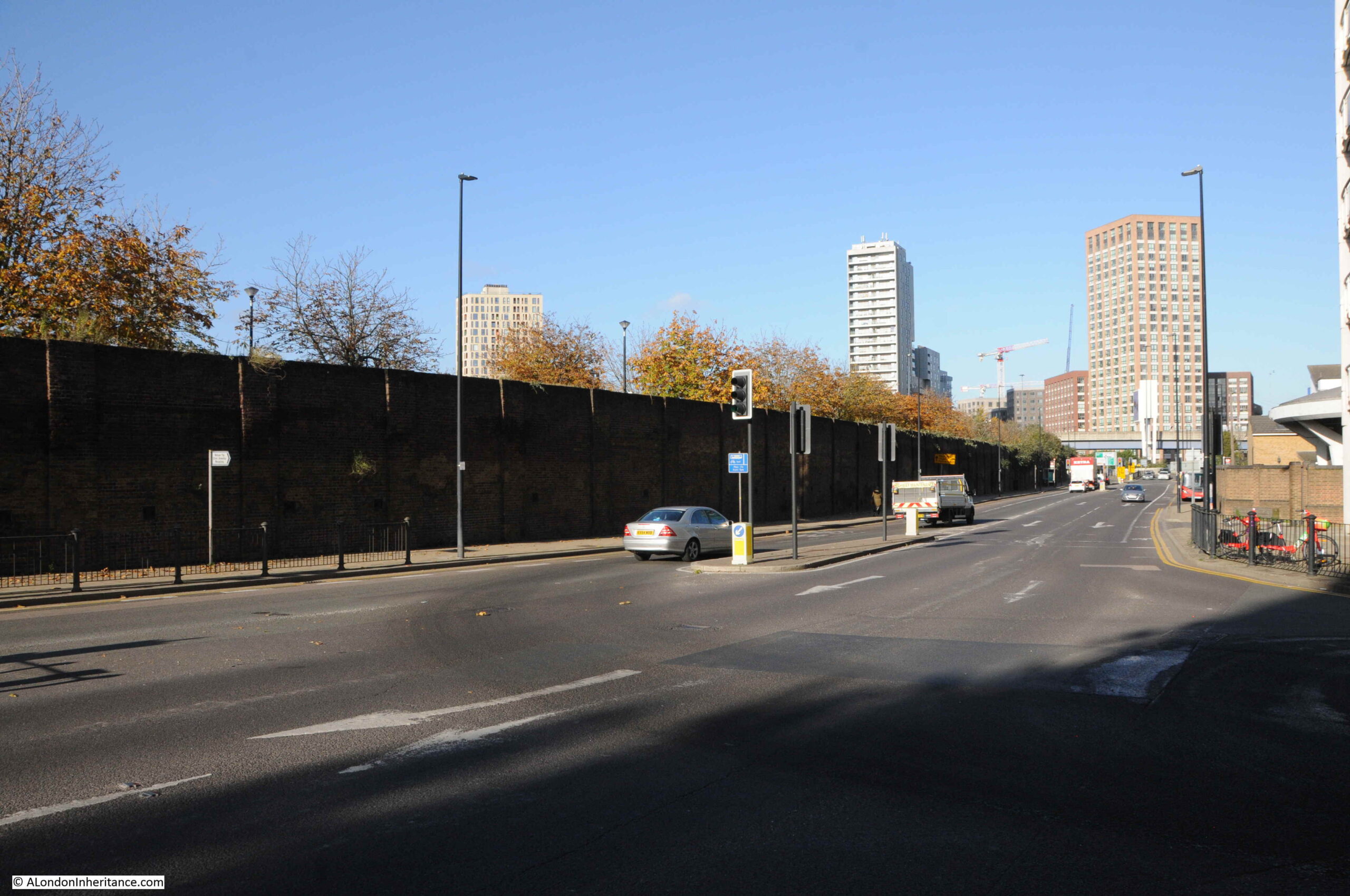
In the above photo, there is a tall brick wall, in shadow, on the right. This is the wall between the street and Poplar Docks, the construction of which I believe, resulted in the construction of this section of Prestons Road, as a road would have been needed along the boundary to serve entrances to the docks.
The following photo is of Poplar Dock today, looking west with two cranes remaining from when the dock was operational:
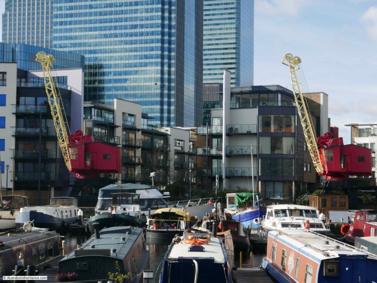
The site is now Poplar Dock Marina and is full with narrow boats and an assorted range of other smaller craft. Poplar Dock opened in 1851, however the site had originally been used from 1827 as a reservoir to balance water levels in the main West India Dock just to the west. In the 1840s the area was used as a timber pond before conversion to a dock.
Poplar Docks served a specific purpose, being known as a railway dock as the docks were almost fully ringed by railway tracks and depots of the railway companies.
Walking south along the street, and the area between the street and the river is full of new buildings, however there is a rather strange, flying saucer shaped building to be seen:
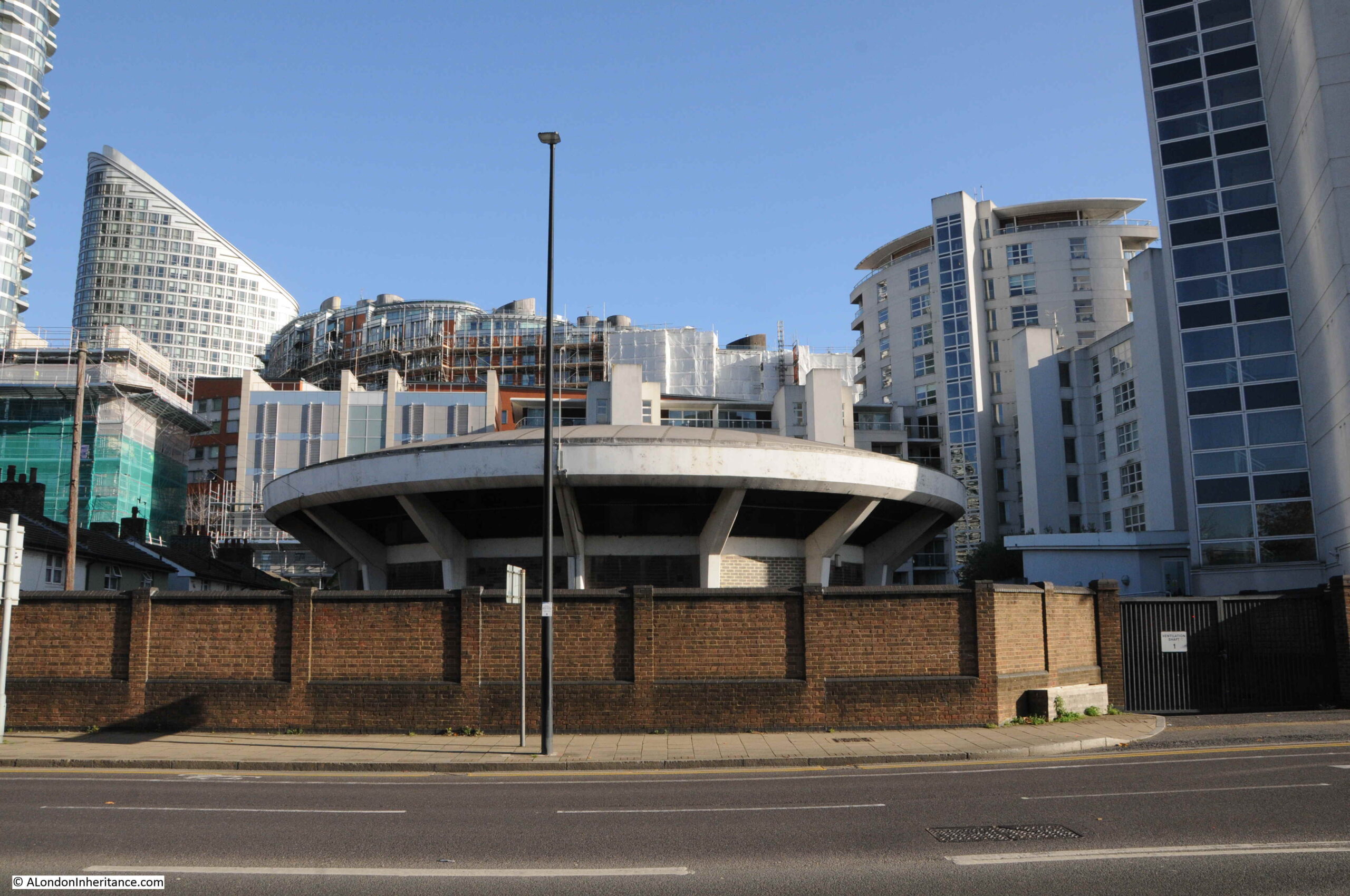
The building is one of the air vents and access points to the Blackwall Tunnel, which runs parallel (but deeper) to the northern section of Prestons Road.
Looking north towards the roundabout, and we can see the tall brick wall that once separated Poplar Dock from Prestons Road:
We now come to one of the crossings over the channels from the docks to the Thames:
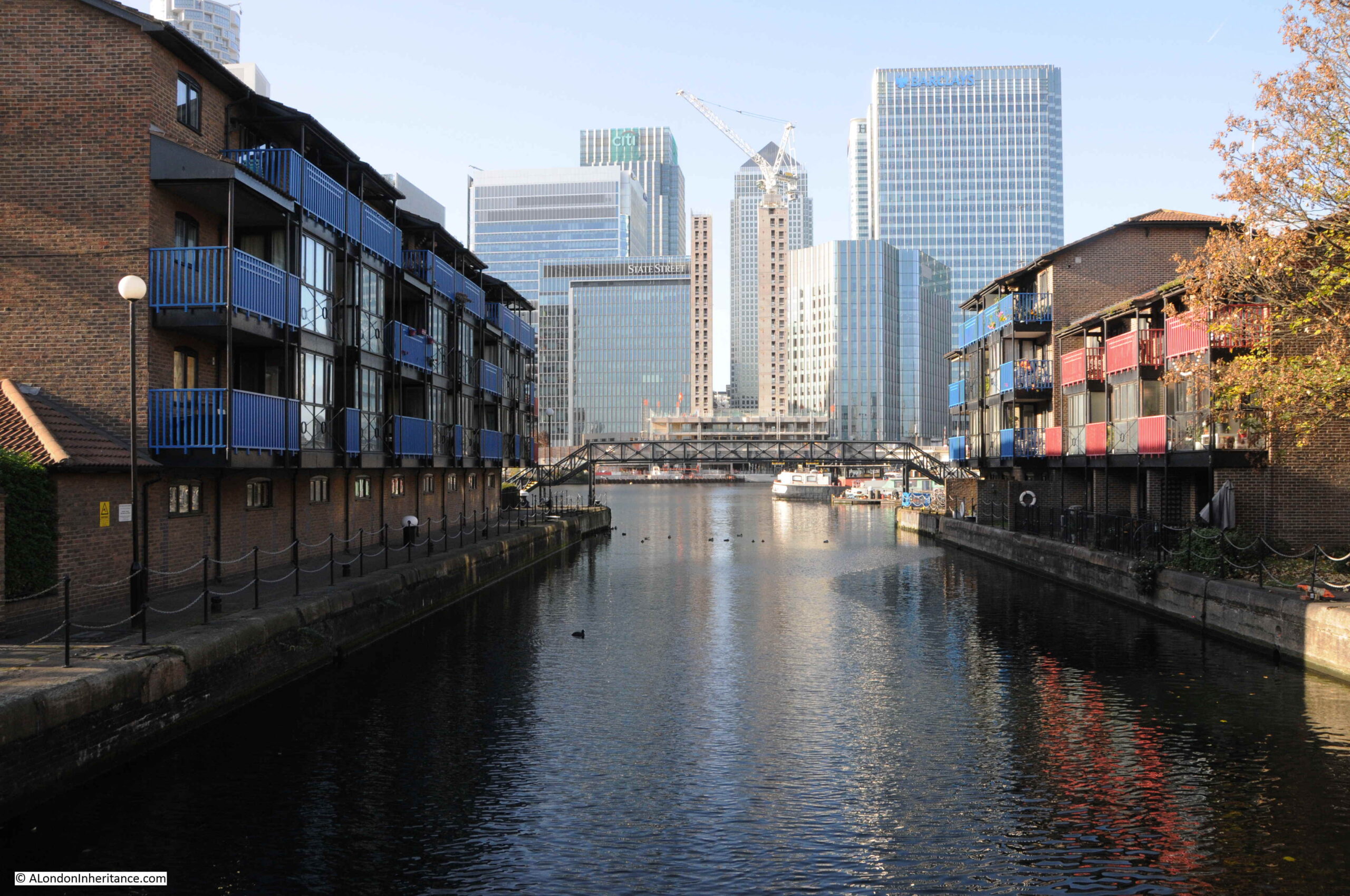
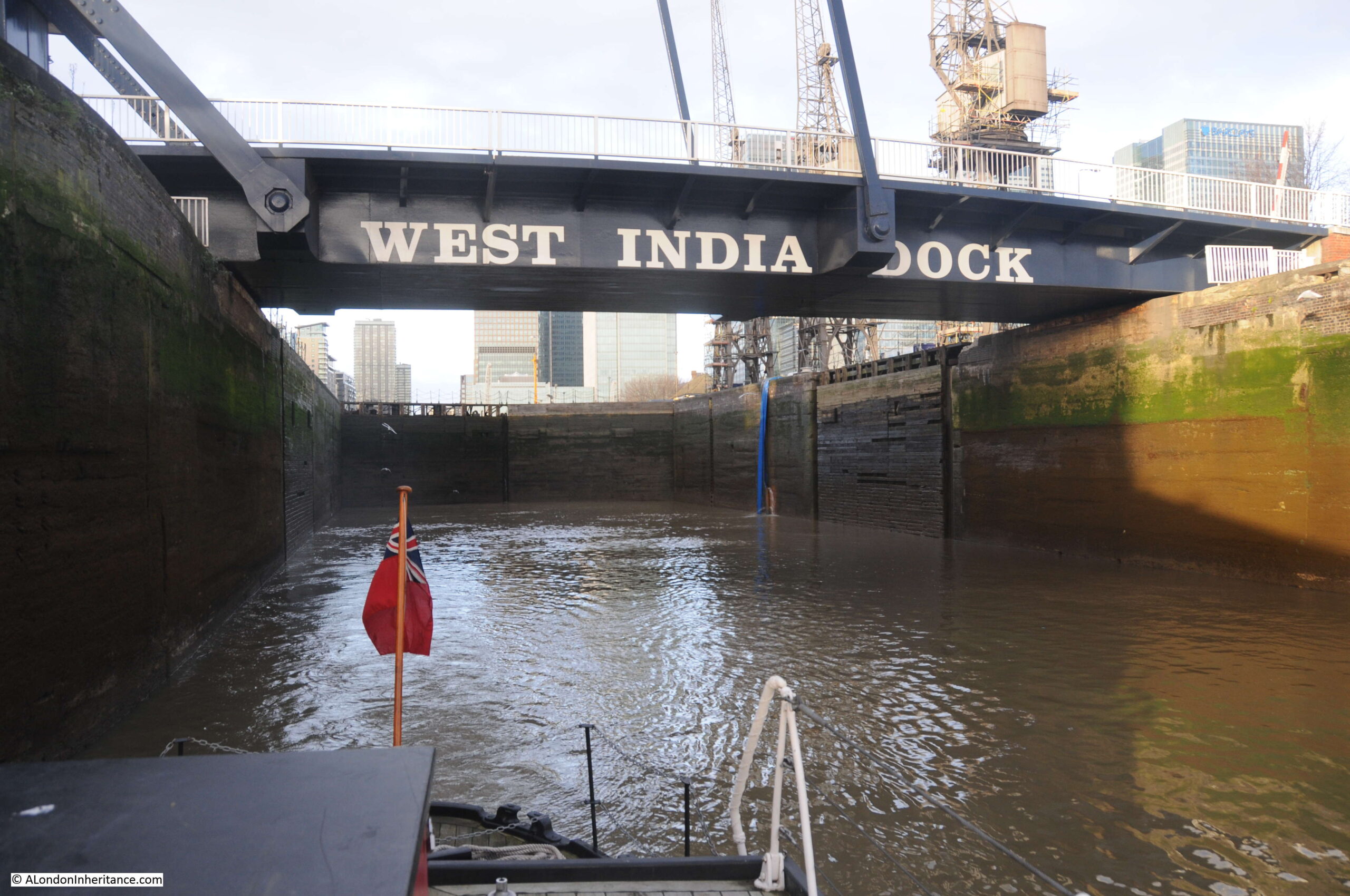
This is the channel that ran from the Thames to Blackwall Basin, and then led into the West India Docks (see the extract from Smith’s New Plan of London, dated 1816 earlier in the post).
This is the view looking east along the channel towards the Blackwall Basin. The Canary Wharf complex has been built over much of the old West India Docks.
To the right of the above photo, behind the trees is the old Dockmaster’s House:
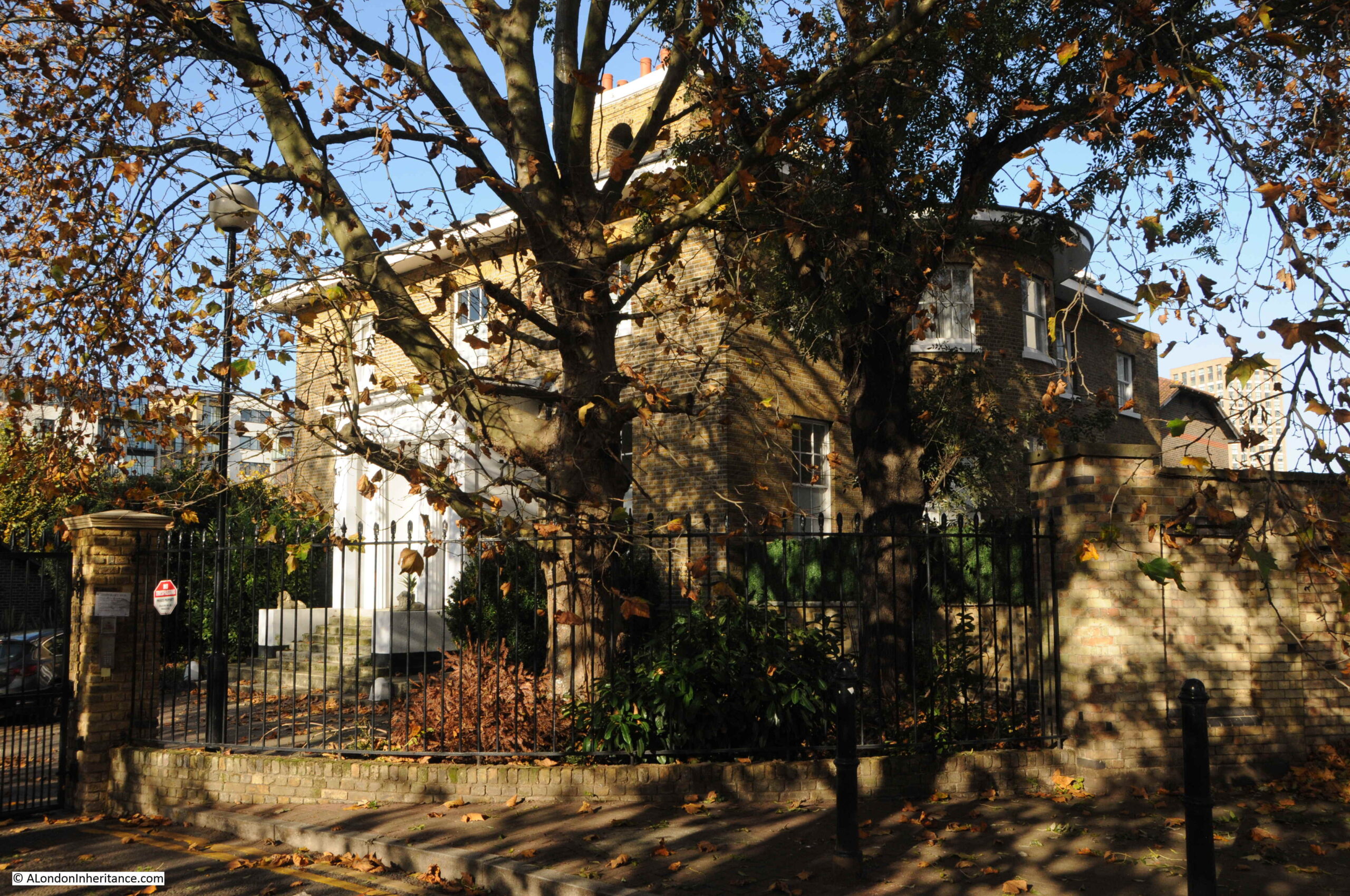
The Dockmaster’s House is named Bridge House and was built between 1819 and 1820 for the West India Dock Company’s Principal Dockmaster. The entrance to the house faces to the channel running between docks and river, however if you look on the right of the building, you will see large bay windows facing out towards the river. This was a deliberate part of the design by John Rennie as these windows, along with the house being on raised ground would provide a perfect view towards the river and the shipping about to enter or leave the docks.
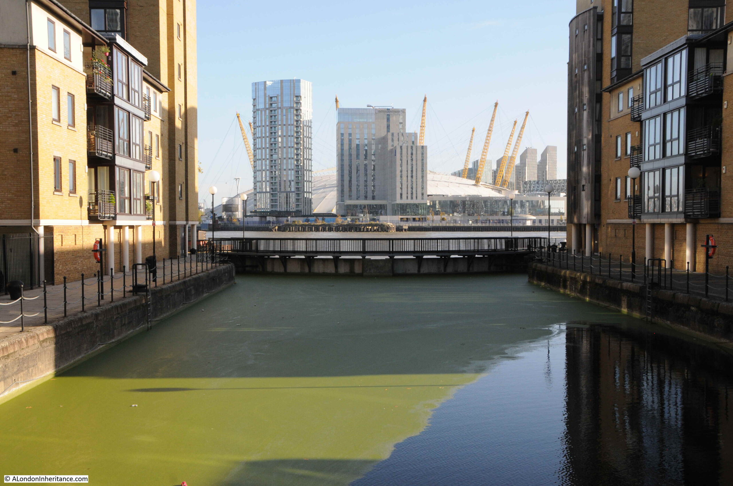
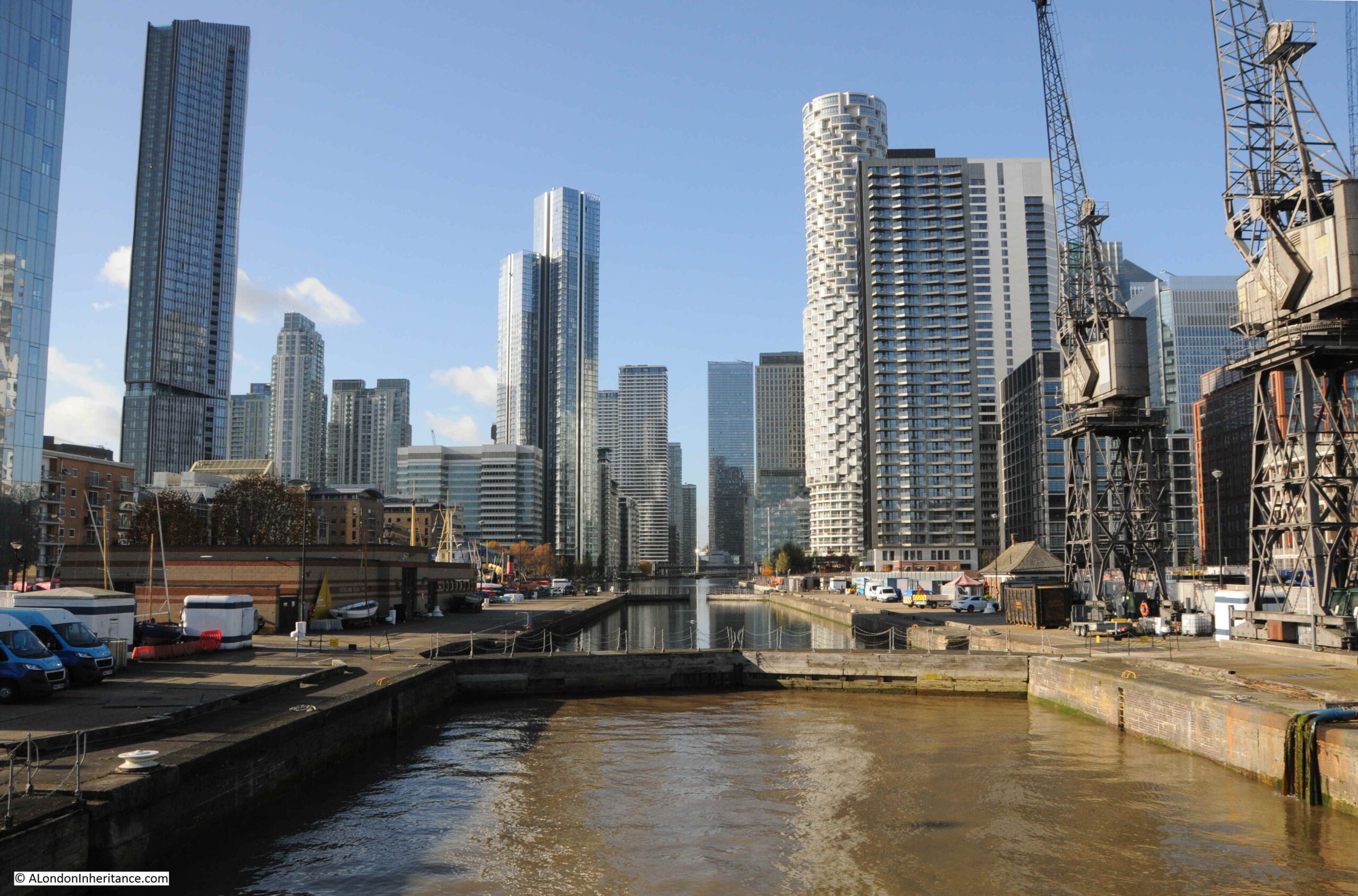
A short distance further on and Prestons Road crosses another channel between docks and river. This is the channel between the West India South Dock and the Thames, and the view west provides a stunning view of some of the recent developments:
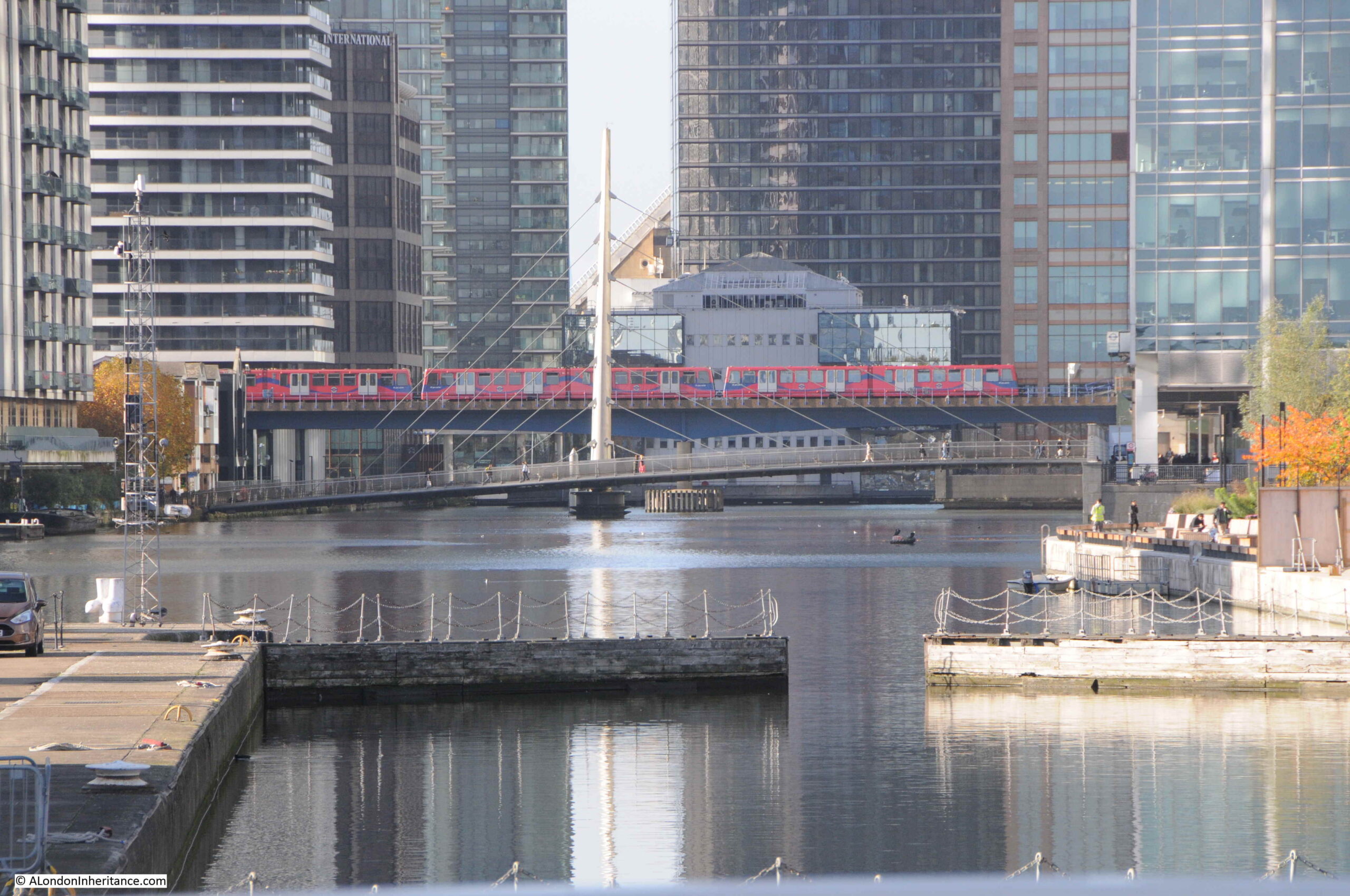
With the Docklands Light Railway crossing the old dock in the distance:
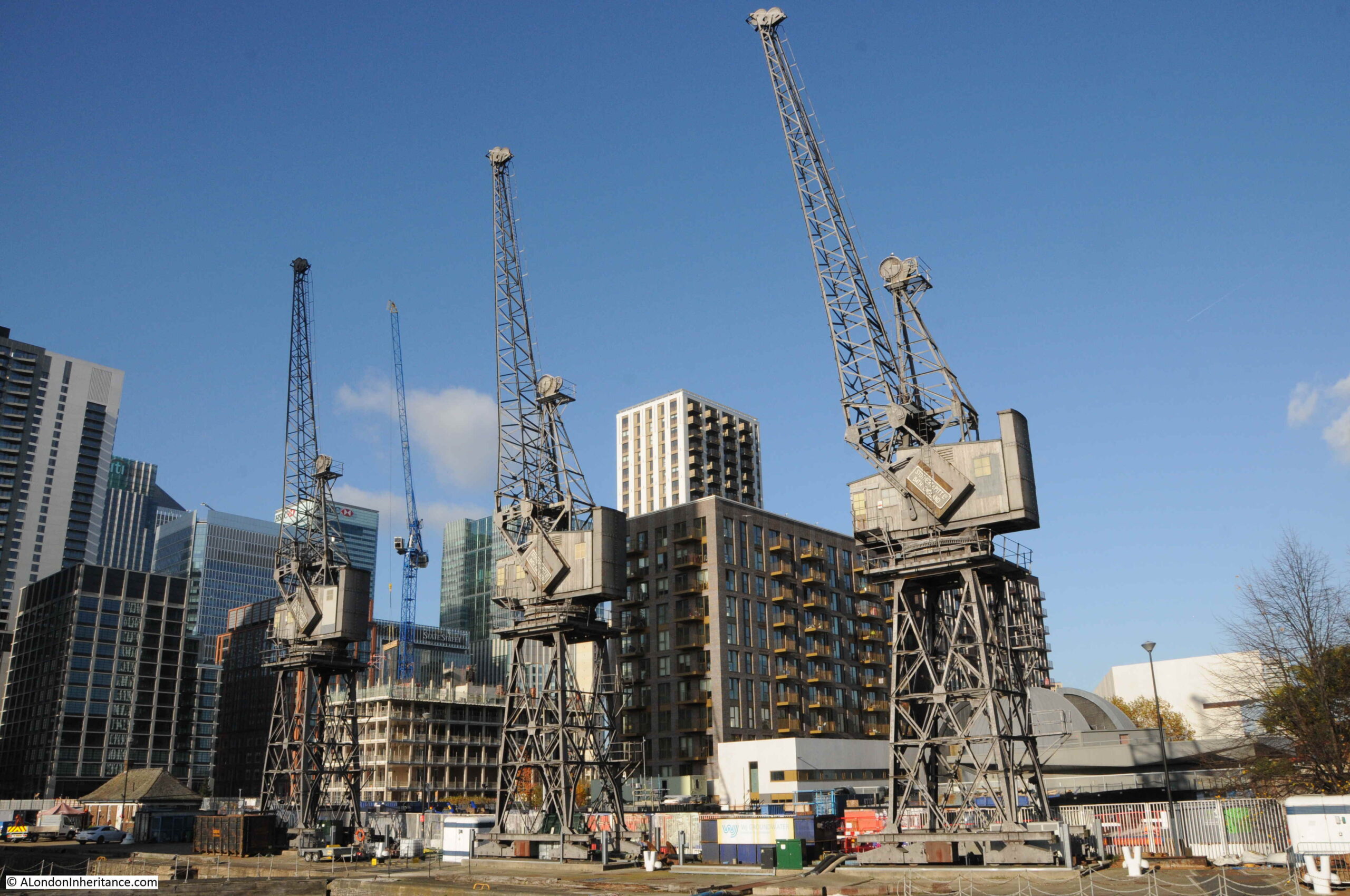
Original cranes remaining from when this was a working dock:
It is fascinating when standing here to imagine the many thousands of ships that have entered or exited through this channel, and where they had been coming from or going to.
Looking east where the channel meets the river.
The bridge that spans the channel in the above photos is the bridge that has taken on the name of the Blue Bridge.
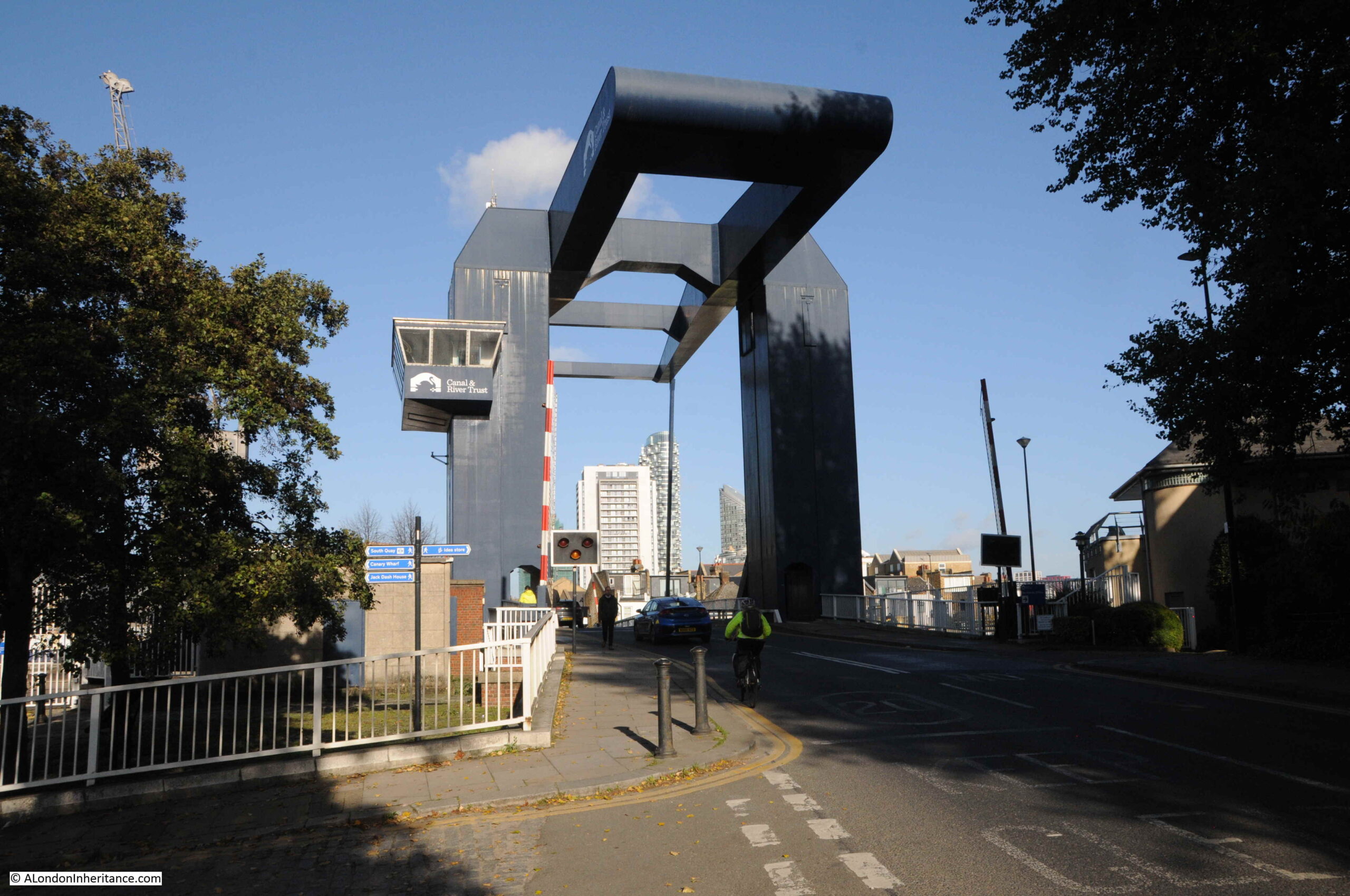
Built during the late 1960s, the bridge is just the latest of a number that have spanned the channel.
I have never seen the bridge lift, but I was lucky enough to go under the bridge during a trip along the Thames on the Massey Shaw fireboat back in 2015:
The bridge marks the end of Prestons Road, continuing south, the road changes name to Manchester Road, all the way to the southern tip of the Isle of Dogs, where the road again changes name to Westferry Road, which then continues along the western side of the Isle of Dogs, all the way up to the West India Dock Road, which it joins opposite Pennyfields, explored in last week’s post.
The view heading south from the bridge:
On the right of the above photo, there is a row of terrace houses that run along a street slightly offset from what is now Manchester Road. This terrace marks the original route of Manchester Road up to an earlier incarnation of the bridge.
Having come to the end of my walk along Prestons Road, there was one last place I wanted to find.
Asda was part of the graffiti on the 1980s wall, so I wanted to find the store that would change the approach to shopping on the Isle of Dogs.
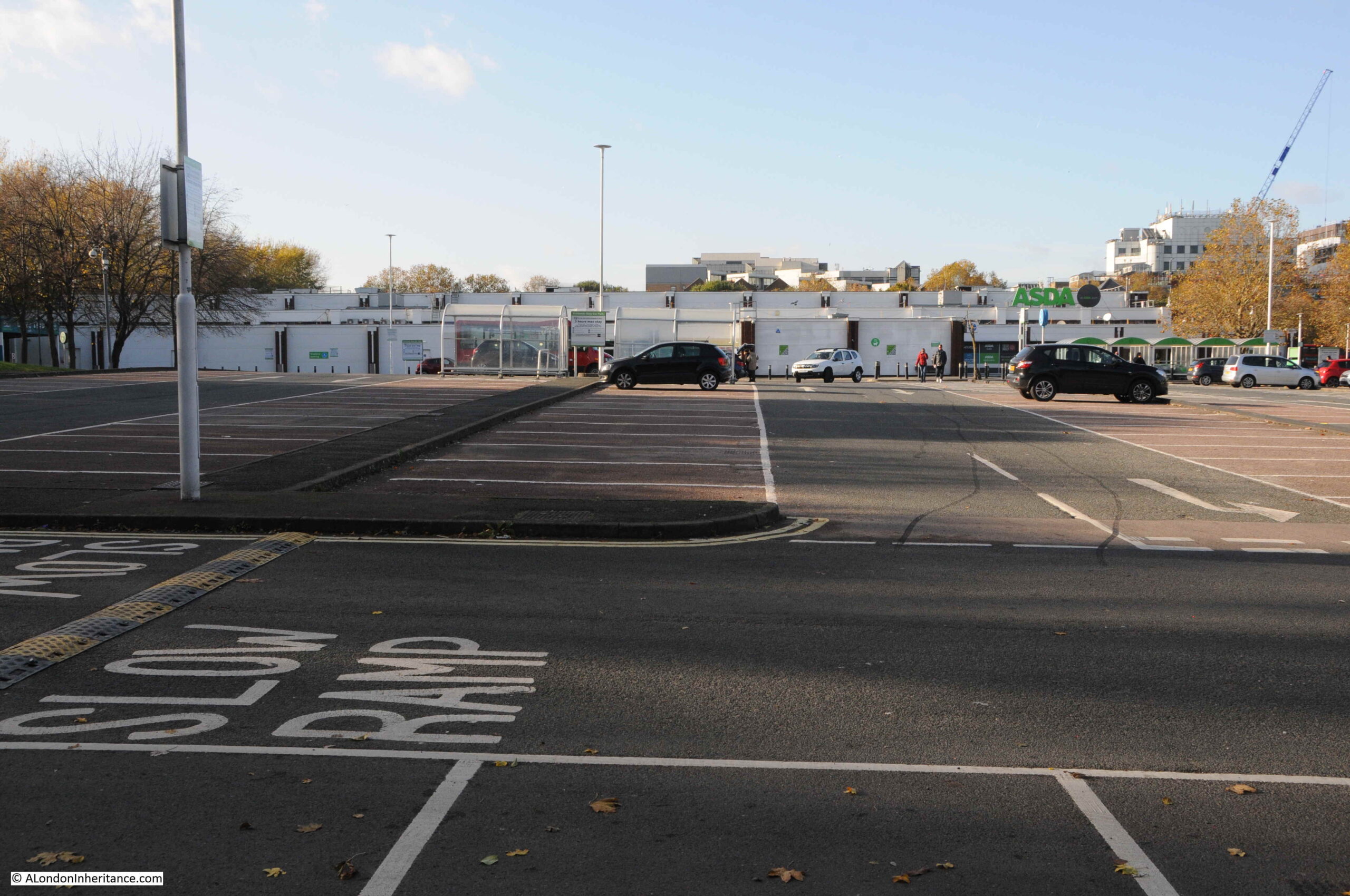
I have marked the location of the Asda store, with its surrounding car park on the following map (© OpenStreetMap contributors):
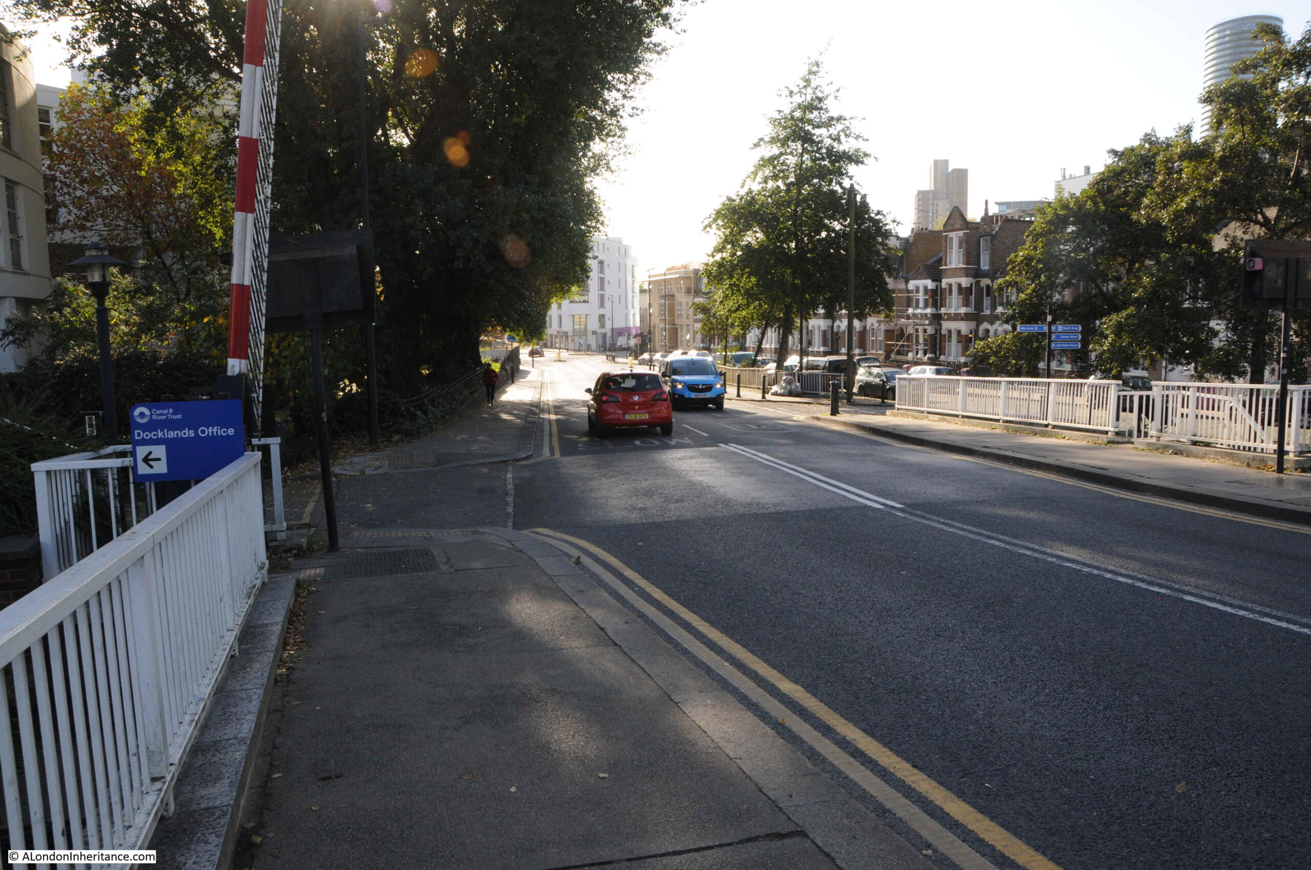
I walked along Manchester Road, then cut through Mudchute Park:
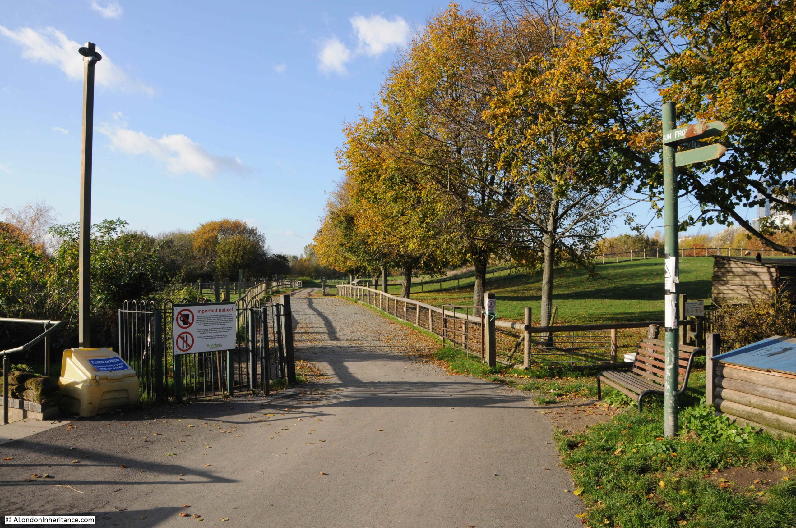
As usual, there is far too much for a weekly post, and I will return to the Isle of Dogs and places like Mudchute in future posts, however it was an area of land created by dumping the spoil when constructing and dredging Millwall Dock.
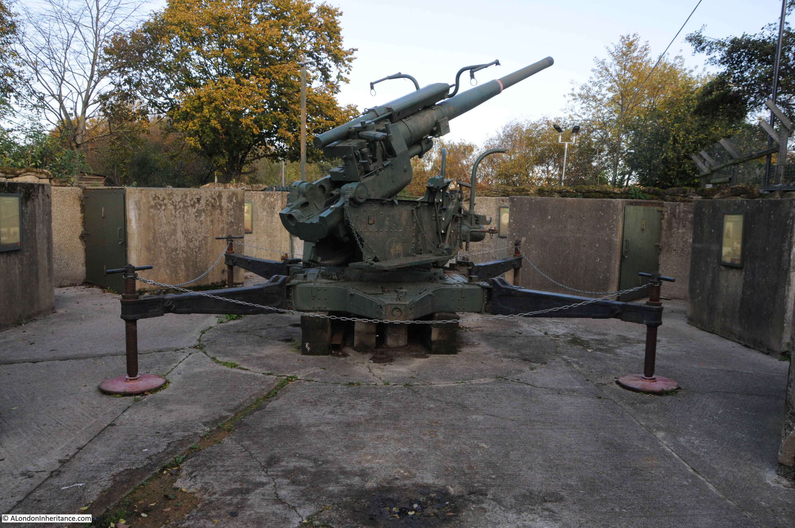
Now a large area of parkland, a city farm, and with a restored anti-aircraft gun, commemorating the Second World War when a number of these guns were based in the area, and the terrible suffering from bombing of those living on the Isle of Dogs:
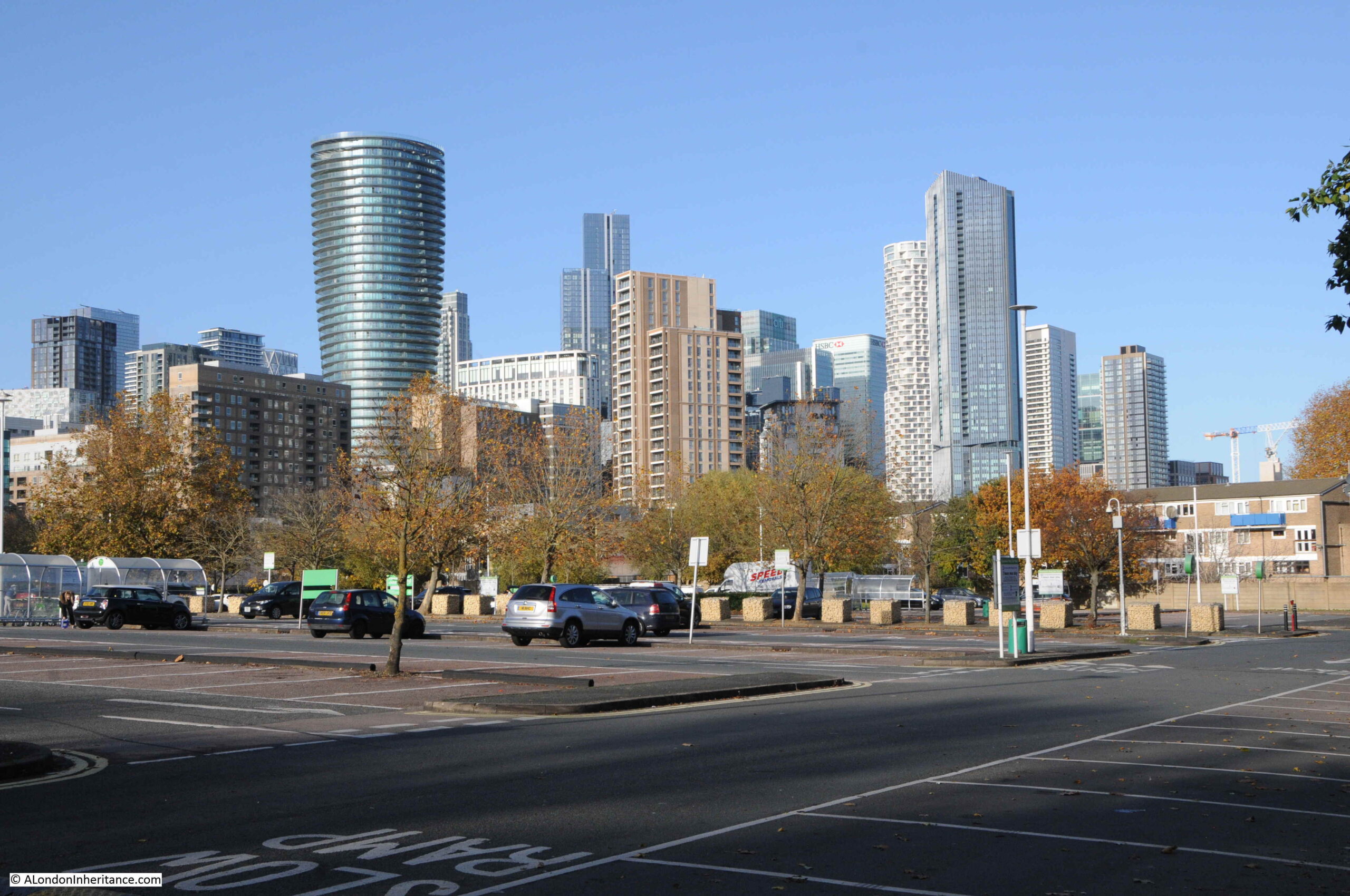
An exit from Mudchute runs directly into the Asda car park, with the many new developments gradually taking over the Isle of Dogs in the background:
This was the change in shopping in the 1980s when many of the major stores opened up large “superstores” with car parks where you could drive and do a complete weekly shop without having to go to a number of separate shops.
Perhaps more convenient, but an approach that would result in the closure of so many individual, often family run shops.
The view across the car park to the Asda store:
The store gives away its 1980s heritage by the lack of lots of glass, which is typical of the majority of recent stores of this type.
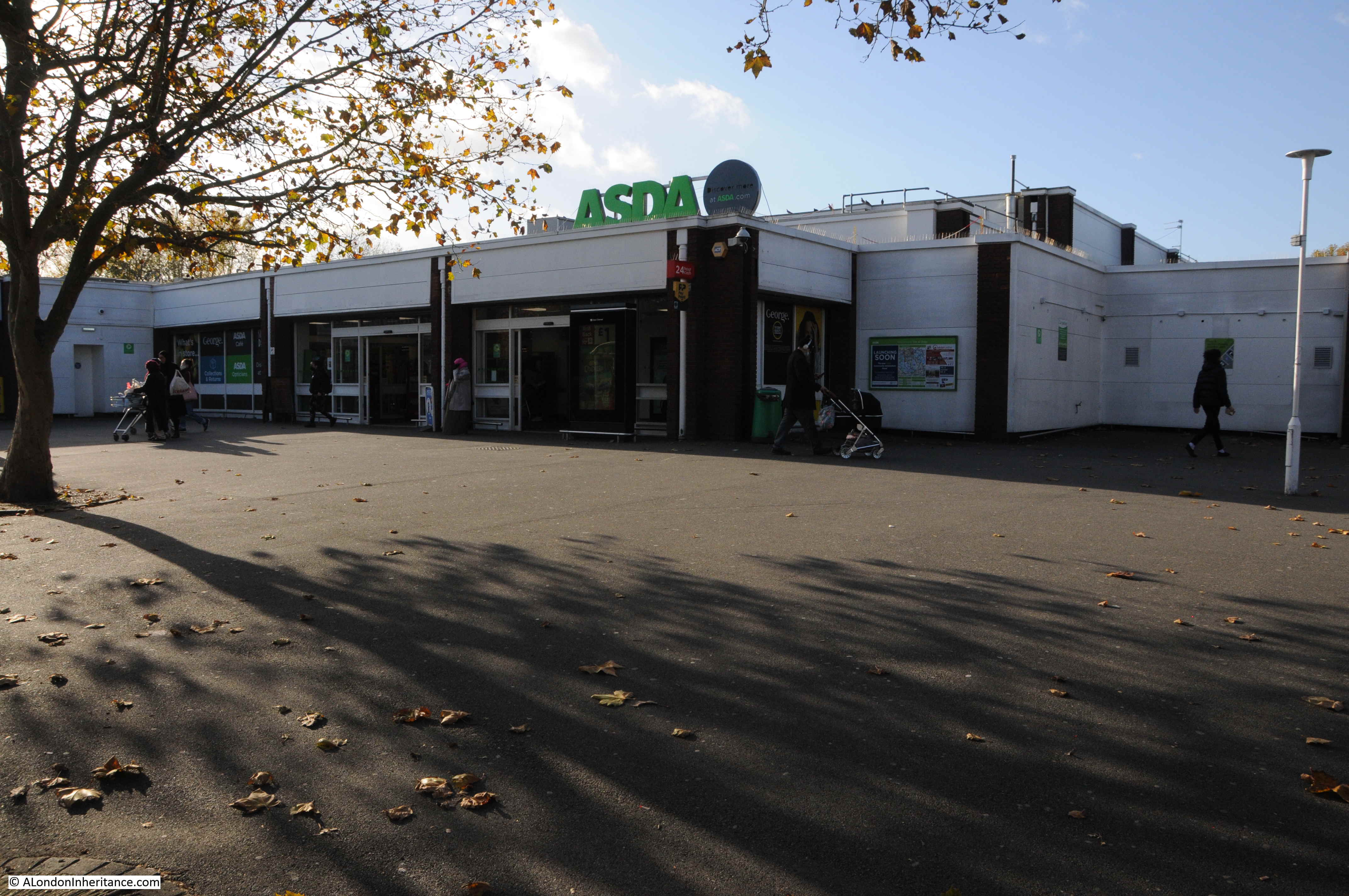
The coming of Asda marked the early years of the developments that would dramatically change the Isle of Dogs, change that is continuing as the glass and steel towers continue to grow.
It would be great to know if I have the correct location for the wall with the graffiti.
If any past or current resident of the Isle of Dogs can confirm, or advise the correct location, I would be very grateful.
I assume the wall was just demolished as part of the development of the area, and the changes as a result of the new roundabout and the Aspen Way. A real shame that the wall was not kept, as part of the historical records of the changes to this fascinating part of London.
Thanks for the photos and the history, I learn so much from your posts. Thank you.
Another very interesting post to confirm some of the details of this area. Prestons Road was part of my daily lockdown walk ’round the block’ from Wapping, along the river then round Poplar Dock, up to Poplar High Street and then various different routes back to Wapping. Such a fascinating area and I was always taken by the Dock Master’s house which I believe is now divided into flats. Thanks very much.
Mark
As ever, a great post, thank you.
ASDA sits on the site of the Athletic Grounds, where MillwallFootball Club played in the 1890’s, and the George Pub on East Ferry Road was their club headquarters.
I’ve heard anecdotally that during the Blitz, the Govt offered to re-house the residents of the Isle of Dogs but they refused to move. I would be interested to know if this is true.
I seem to recall this sign when I was looking to buy in the Docks in 1985: my memory may be wrong but I thought it was close to the actual entrance to the I of D rather than closer to Poplar High St as it was like a ‘greetings’ message.
I do recall there being a very significant level of bad feeling about the developments and the incomers and that graffiti put me off looking in any great depth at living there – that and the lack of public transport. I ended up buying in Wapping – better transport but very few food shops at the time.
I also recall this sign on the western entrance to the IOD but its 40 odd years ago and there could have been a similar sign on both entrances.
Another great article and this one I will retrace later in April.
You and others might be interested in my article examining the decade before dockland became ‘Docklands’, which wasn’t quite as moribund as is popularly believed.
https://www.chrismrogers.net/copy-of-blank-page
Hi Chris, this is a very useful addition to both this piece and to the general knowledge of the last years of the Port of London. As you suggest, the common view, mine included (born in Tooting in 1951 and lived through these times in London), was of a mismanaged and neglected time of decay and abandonment. This piece helps to redress the balance.
Mie
As a local police officer I was called one hot afternoon to the Blue Bridge (always known by us as the ‘Dutch Bridge’?) when it refused to close having expanded in the heat. Several attempts failed and it was decided that something heavy was required to drive onto the bridge to aid the mechanism. I called the local Fire Station in Manchester Road to ask if they would spray the bridge in the hope of reducing the swelling before any weight was applied. A shiny appliance attended together with the station boss. A quick splash of water followed and the engine complete with machine drove on to the bridge which dropped the last couple of feet and successfully closed the gap. ‘Round of applause for those daring young men in their fire machine’
The Museum of London Docklands is well worth a visit if you are around the West India Docks area. Lots of displays about the Blitz and the days of the docks. When I last visited, there was a party of older ladies who grew up around there and it was great to listen to them. Both my Grandfathers were crane drivers in the docks up to WW2. Both were re-housed to Becontree in the 1930s – priority was given to ex-soldiers of WW1.
Interesting that you mention Mudchute park- it was one of the original homes of Millwall FC before they moved south of the river in 1910
https://islandhistory.wordpress.com/2019/02/09/millwall-fc-in-millwall-park/
That’s an excellent article and it’s just what I try to inform participants of when I occasionally lead walks around the former docks.
I am a relative newcomer to your posts which I am finding very interesting as both my husband and I have traced our ancestors back to the East End.
I wonder if you have done any work on the Plaistow area as my husbands great grandfather Joseph Walker was landlord of The Castle, Barking Road, TheRoyal Standard at 77 St Leonard’s Road and then at The Lord Raglan, 9 High St., Plaistow until his death in 1904. Apparently he was a very well known character and we have a fascinating newspaper cutting of his funeral which was East End style with a four horse cortège and six mourners carriages and a number of private broughams. The interment took place at East London Cemetery, Plaistow but we have not been able to determine exactly where that is. If you have not yet covered Plaistow I would be delighted if you could consider it for a future project.
You mention twice about cranes that are still extant from the old docks.
Are these simply abandoned, or are they maintained and in-situ for historical reasons ?
The cranes are not abandoned, they are preserved as monuments to the past. I’m all but certain that the three near the Blue Bridge belong to the museum of London. The two in Poplar Dock were installed by British Railways in the earlier 1950s and are included in Historic England’s grade II ‘listing’ of the dock. They were originally painted dark grey, not today’s gaudy colours!
The remaining dockside cranes were all made by Stothert & Pitt of Bath in the early 1960s and are of the famed ‘DD2’ type, probably the best crane of their type ever built. Two next to the Northern part of Millwall Dock have recently been painted in a pleasing dark blue and the others are all in excellent condition.
Another fascinating read, thank you.
Unfortunately you’ve got your east and west the wrong way round.
It should read: “The A1261 provides a route between the A13 at the start of the East India Dock Road in the WEST, through to the Lower Lea Crossing in the EAST. ”
and
“leaving two main routes to the Isle of Dogs on the east and west of the peninsula – the EASTERN route being Prestons Road “
Thanks for picking that up. Corrected.
It is simply incredible to me the amount of change that has occurred in the Isle of Dogs in the last 35 years (and I am in construction!). While I was living in London (1987-1990), two of the projects we were building were in the Isle; a rather squat metal panel and glass building along Marsh Wall (next to South Quay), and a Richard Rogers building for Reuters along the river at Blackwall Yard. Both are incredibly minor edifices when compared to what has been built there since, but at the time were highly visible. I recall at Reuters, the only other structure that I recall nearby was an air intake funnel for the tunnels below. Now this building is surrounded and nearly hidden. On top of that, the whole of the area was predominately mud.
But I think what astounds me the most is that there is such a need for towering structures, here and practically all over London now. When I was there, London was basically a low-rise city, save a few towers in They City (all of which were disliked at the time for having changed the traditional skyline!). Now the skyline of 1988 is quaint. From my viewpoint, London has changed very significantly in these past 30 years. Amazing.
Really informative article. I lived on the Isle of Dogs from 1983- 1987, in Kelson House. A friend and I ,both training at The London Hospital, now prefixed by Royal, got a flat there under the GLC hard to let scheme. There were no buses running after a late shift, so we had to cycle to Whitechapel.
I am going back later in the year for a reunion and hope to revisit. I remember the wall, but can’t honestly remember where it was!
My thanks to our author for another superb insight into London. Confirmation of the wall’s location can be found here…
https://islandhistory.wordpress.com/2019/09/24/the-writing-on-the-wall/
I got to know the Isle of Dogs very well during the last years of the docks and have been visiting ever since yet, I have to confess that I had to look that up myself.
I remember in the early 1970s when the Isle of Dogs was in the headlines for declaring a UDI! It was a local community campaign to highlight the lack of interest taken by the local authority into the Island’s services. It was a kind of ‘Passport to Pimlico’ idea, and the campaign had a very able and vocal spokesman who got them onto front pages and TV news programmes. Wonder if the graffiti dates from that time (not the ASDA ref because they came along much later).
I lived on the Isle of Dogs in 2008-2009, and used to shop often at the Asda (24 hours open, what a treat). It’s amazing seeing the photos you took from the car park of the towers to the north now. Amazing to see the development that has happened since I left.
Thanks for another interesting blog.
A fine comprehensive account – fascinating. Many thanks!
You and your readers might be interested in my more impressionistic account which partially overlaps topographically :
https://internationaltimes.it/blow-up-a-london-walk-of-august-2020-and-its-consequences/
All very best wishes, Lawrence
Very informative as usual
Ana amazing trip through history. Many thanks for sharing this with us!
Great piece, as ever, enjoy your interesting walks around the city. I live in the development on Poplar Dock and Blackwall Basin, and we have two big ol’ cranes to look after. It’s in our leases that, as an estate, we have to look after / repair / refurbish / paint the cranes every so often. Ours are bright red, which apparently was an ‘accurate colour’ – it’s just the pollution, hard working / grimy environment and a latter day lack of maintenance as the dock work dried up meant they either didn’t stay very fresh very long or were neglected for aeons.
I’ve worked on the island since 1992, lived here since 2001 and seen masses of change over the years. I vividly remember the head of press for Canary Wharf, a Mr D’eath (you don’t forget his name) showing a bunch of us newly-arrived workers the view from the top of 1 Canada Square. A view of mainy fields, water and distant council blocks. “There are plans for another tower this high to the left and right”, he said, as we sniggered. The holding company was going bust at the time I seem to remember. And the infrastructure was a bit, er, all over the place. The DLR shut at 8pm, the two pubs at 9pm, and there was a Tesco Metro, a Pizza Express and little else. I worked over the road from the Asda and ate the 99p brekkie there many days, as a poor starving TV researcher trying to get away with parking my crappy old Fiat on the road and not getting ticketed every day.
Oh, and on Mr D’eath, on a London Architecture ‘mystery tour’ that ended up, hilariously, at the top of Canary Wharf three years’ back, he was still there, with all of the buildings now there around the tower everyone still, inaccurately, calls Canary Wharf. We’d been up the old Nat West tower, the Shard and ended up in my ol’ neck of the woods. I told him of my 1992 trip and he claimed to remember me hahah. One of the great things about living here is that the estate management and staff are long-standing, friendly and do seem to care about us residemts as well as the many workers.
Anyways, just sharing my bit of related knowledge. Thanks again sir, and look forward to reading you every weekend.
Peter
I lived on the Isle of Dogs for about a year in 1980 and this sign was certainly there at that time. It related to the Ted Johns-inspired declaration of independence for the Isle of Dogs, not the LDDC-led developments which began in the mid 80s. At some stage someone added ‘You’re’ before ‘welcome to the Isle of Dogs’. As some other correspondents have noted it was I am sure further south than the ptesebt Aspen Way roundabout. And as much as some local residents resented the developments others did not, and the poor standards of education, public transport and housing were the key limiting factors in local people’s opportunities rather than the nature of the Canary Wharf development per se. Finally I don’t think you should criticise the arrival of ASDA when the nearest other supermarkets were in Bow or Wapping. At some point the area had to join the second half of the 20th C.
Another excellent blog. Am from Pimlico, but moved east when I married, as my soon to be wife (who also trained at The Royal London hospital) lived in Campbell, Road Poplar. I recall watching the DLR being built right beneath us between Bow Road and Devon’s Road in 1987. In 1988 we moved to a converted church in St Leonard’s Road, not far from Chrisp St market. I moved with my job to the South Quay area on Isle of Dogs in 1993, which meant a short commute to work. However this only lasted about 5 months, due to the IRA bomb in Feb 94! Our office was badly damaged and it was three years before we could move back there. Got to know the Island very well and apart from ASDA there were hardly any other shops until the Shopping centre was built under Canada Tower. One place we did go to to eat was an American diner in an airstream on the road leading to Canada Tower on the west ferry side. It was always good to go down to Island Gardens for the view across to Greenwich.
This photo may be of interest…
https://www.flickr.com/photos/petermarshall/49445422557
All the best
Ian Bull