I have finally completed the post covering the last stage of the New River Walk, which covers from Alexandra Palace to New River Head in north Clerkenwell.
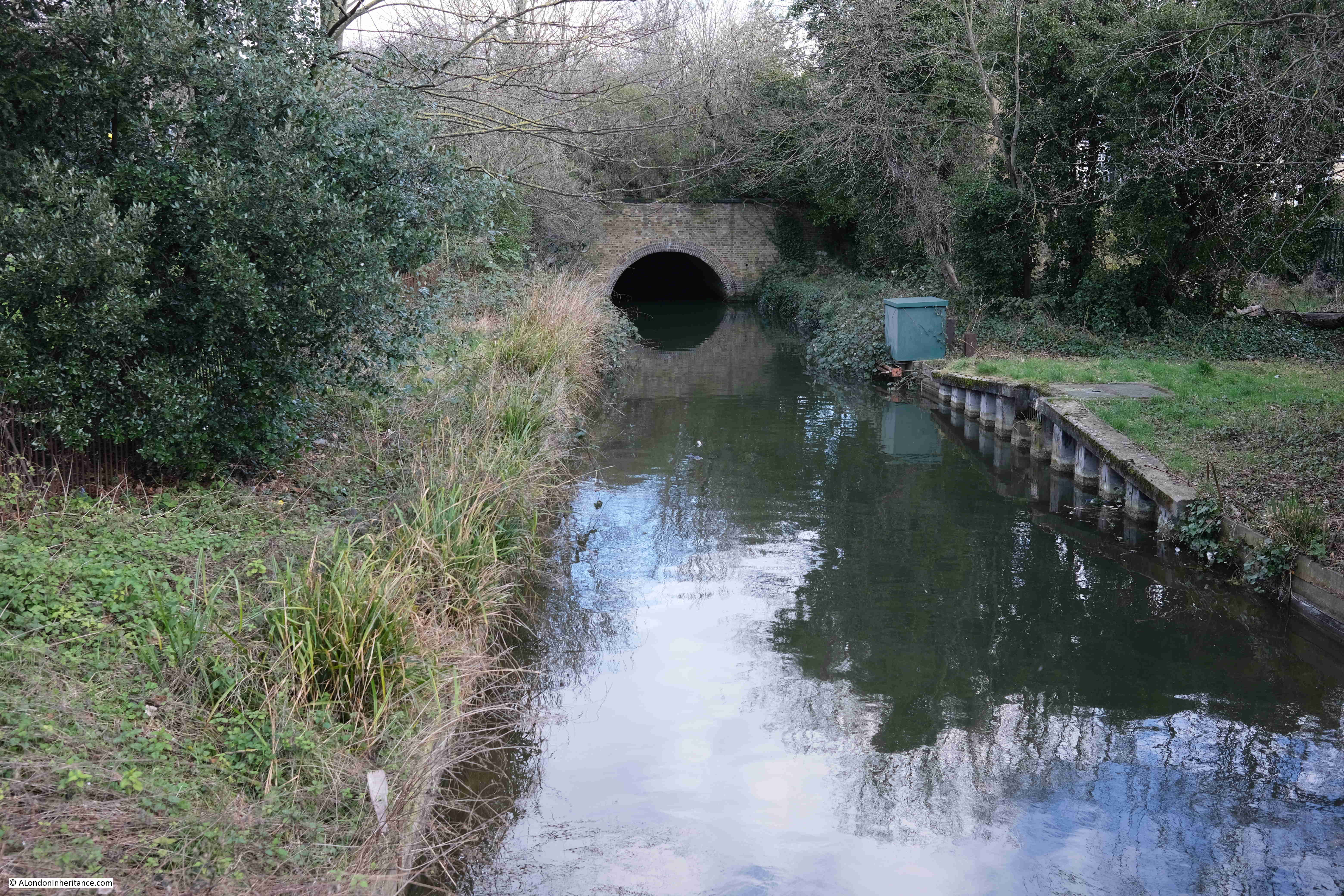
At the end of the previous stage, we had reached Bowes Park, where the New River disappeared in a tunnel, and for today’s post, we rejoin the New River where it exits the tunnel, opposite Alexandra Palace station.
This stage of the walk will follow the New River from Alexandra Palace to the east and west reservoirs, just south of the Seven Sisters Road, where it ends as a river. Then, the walk follows a Heritage Walk that follows the original route of the river to New River Head before the river was truncated at the reservoirs.
The map of the final stage, with key locations covered in the post is shown below (© OpenStreetMap contributors):
Point S on the map: Alexandra Palace station is at the north west tip of a patch of open, green space, and at the south east corner of this space, the New River exits the tunnel through which it has flowed from Bowes Park:
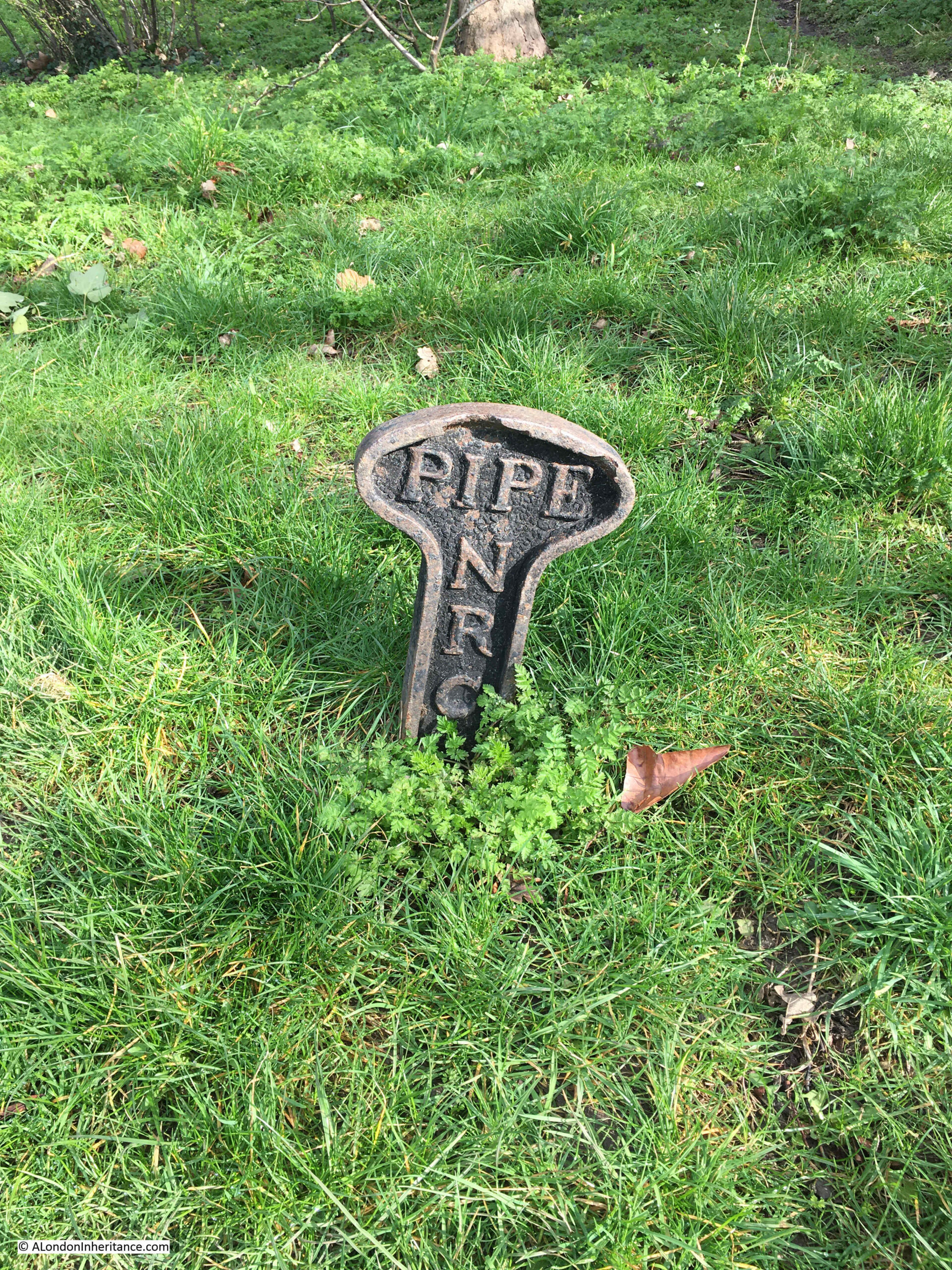
There is nothing to see of the actual river between Bowes Park and Alexandra Palace, however there are a number of these New River Company pipe markers:
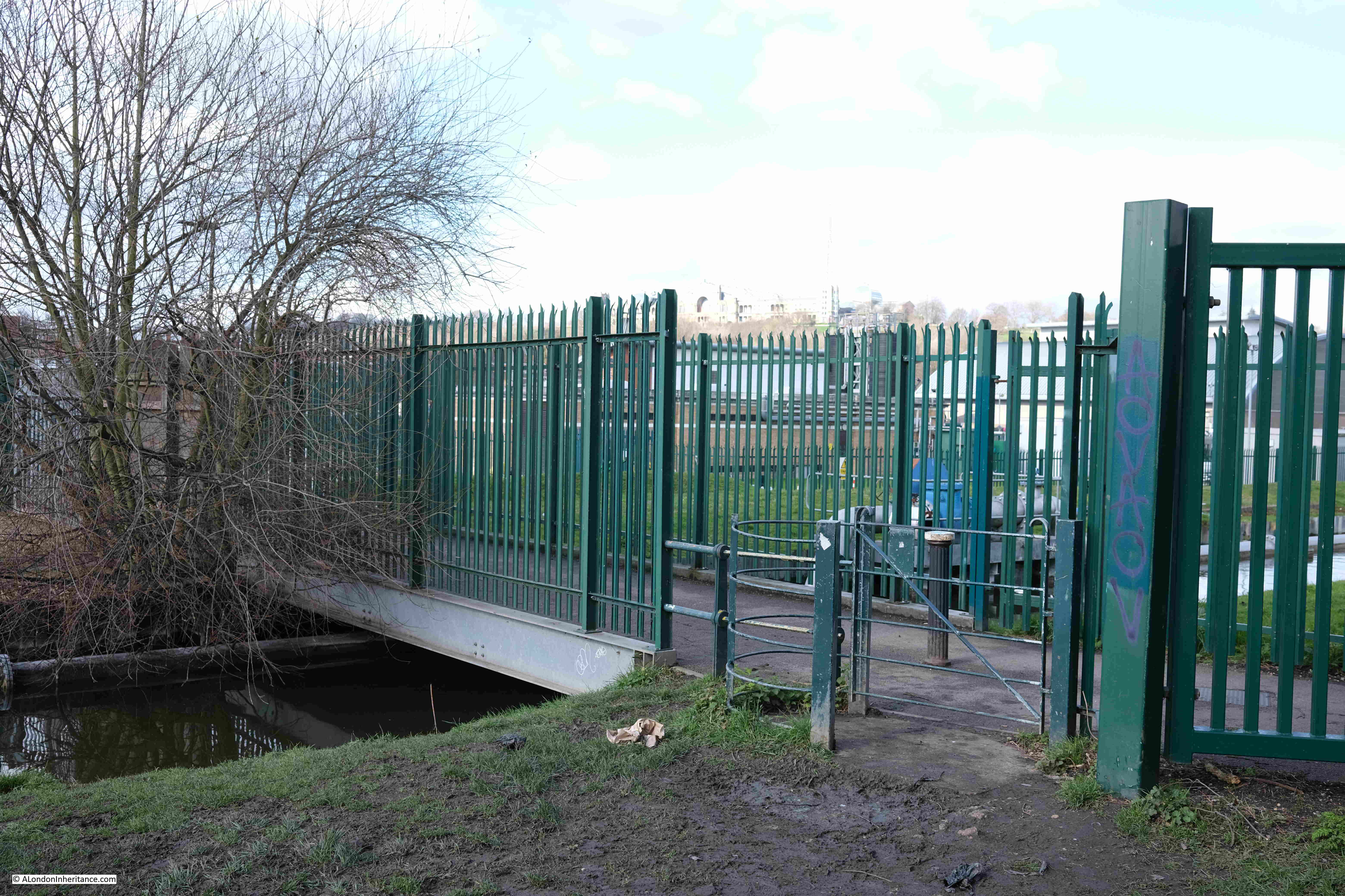
Point 1 on the map: Here, a rather over exposed Alexandra Palace can be seen on the high ground in the distance. Hornsey Water Treatment Works are behind the green metal fencing and the New River runs under the footbridge between the fencing:
The route through Hornsey is an example of where the New River has been straightened and does not follow the original early 17th century route.
The following map from 1861 shows the original early 17th century route (dark blue), along with the proposed new straightened route (light blue):
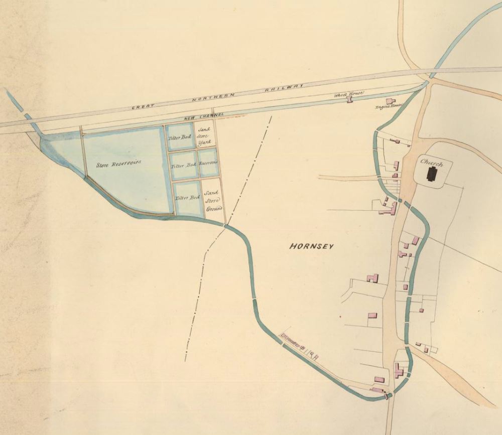
Hornsey Water Treatment Works are to the left, and the New River runs at the bottom of these works, and heads to Hornsey High Street which it crosses, before turning and crossing Middle Lane. It then heads towards the church and crosses the High Street again, heading up to the junction with Tottenham Lane.
Towards the top of the map, the Great Northern Railway runs from left to right, and below the railway can be seen the proposed new route of the New River, which is straight, and cuts of the large loop around Hornsey.
Roughly the same area as the above map, is shown in the following map of the area today, which includes the new route of the river just below the railway, and streets and buildings now covering the original route of the river around Hornsey (© OpenStreetMap contributors):
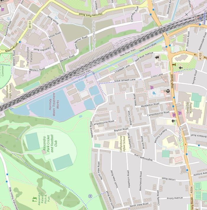
There are a number of similar examples on the New River Walk where the route follows where the river has been straightened rather than the original route. It would be an interesting exercise to follow the early 17th century route, however I think I will put that walk on the long list of London walks.
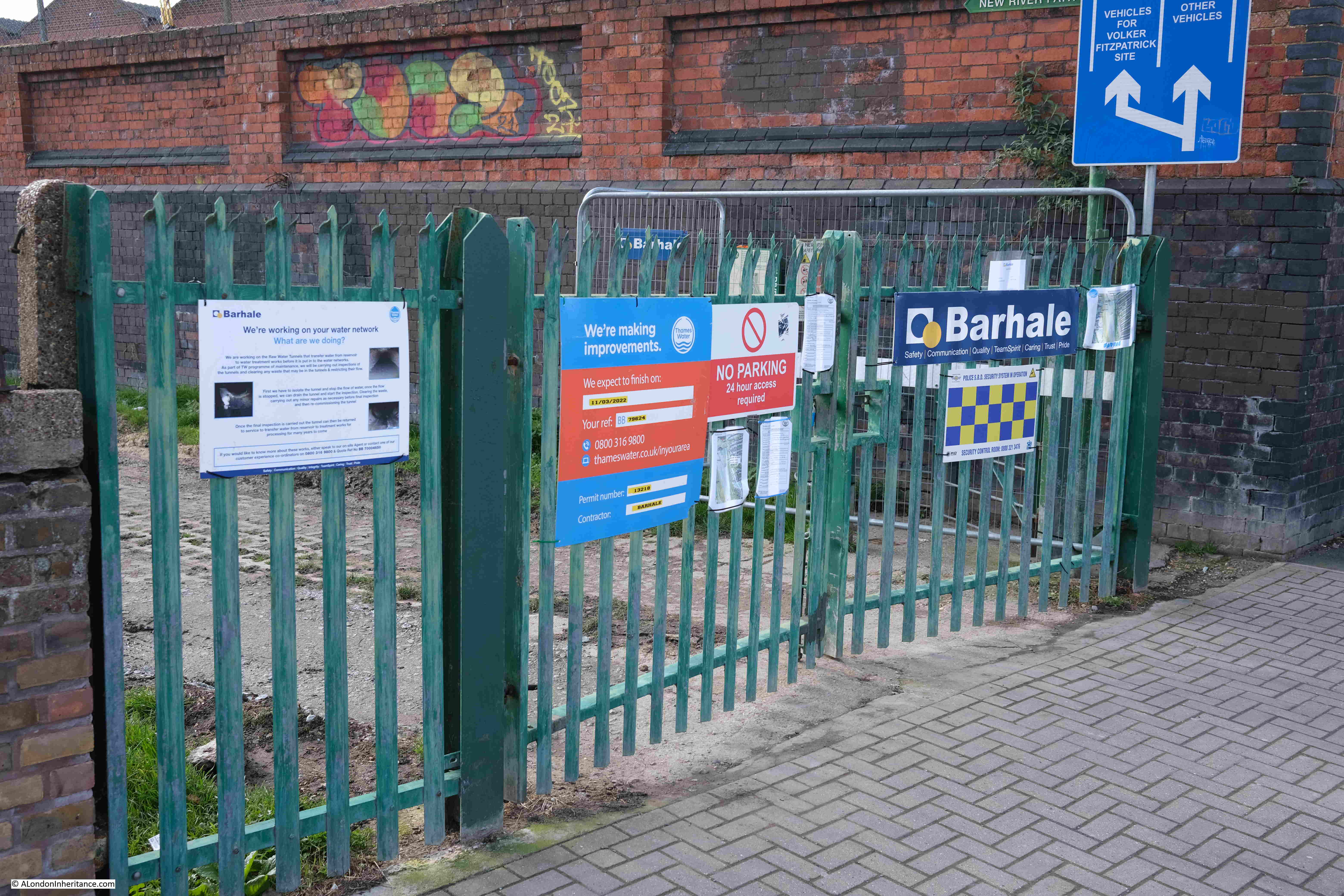
Point 2 on the map: There were very few places on the entire route where it was not possible to follow the New River walk, however one place on this final stretch was also in Hornsey where the path had been closed off as Thames Water are carrying out some repair works on the river:
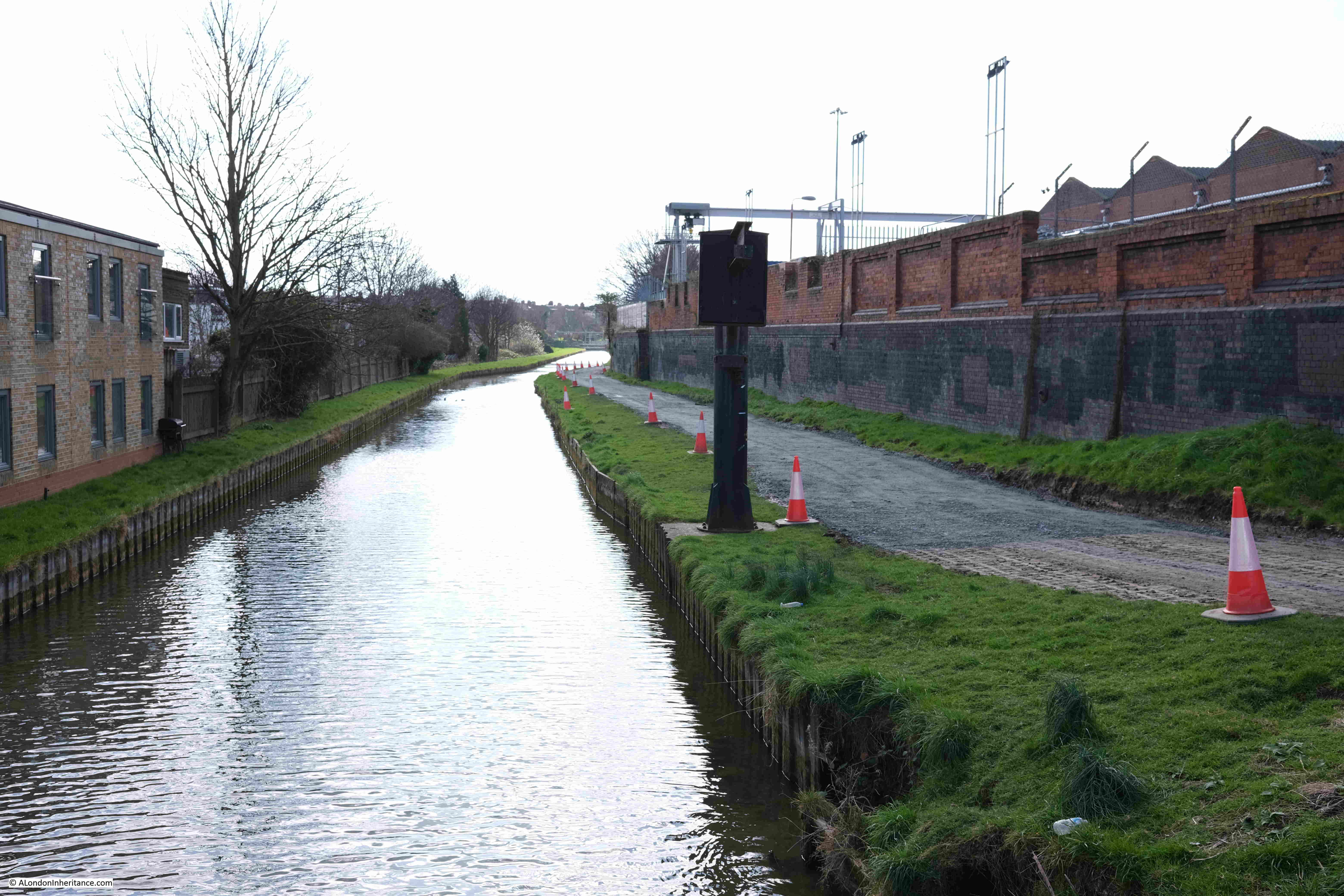
Following photo is looking along the closed section of the walk. This is another straightened section of the New River:
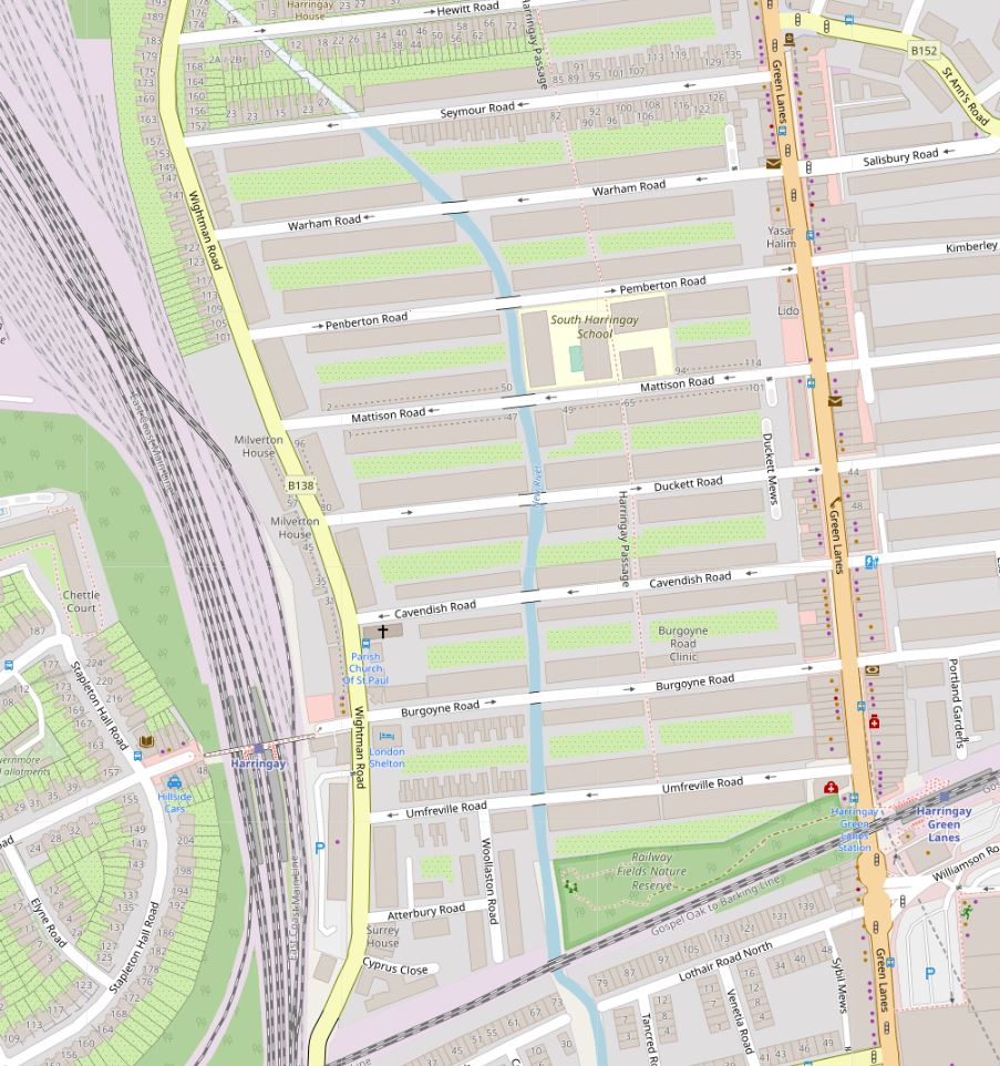
Point 3 on the map: The New River then runs through a housing estate which was built around the New River. The following map extract shows the river running between terrace housing and under streets. There is no path alongside this section of the river, and walking to where the river crosses each street, then back, would add a considerable distance to the walk, so the Thames Water New River path runs along Wightman Road to the left (© OpenStreetMap contributors):
The view looking down one of the streets from Wightman Road, the New River crosses the street half way down:
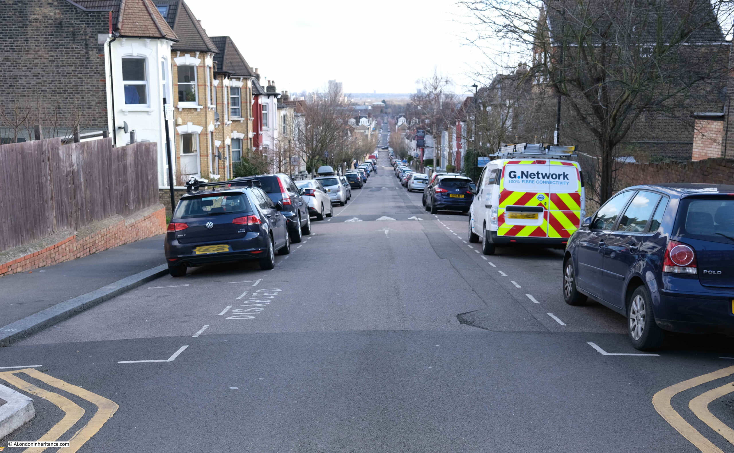
In the above photo, the streets is dropping in height towards the point where the river crosses about half way down. This stretch of the New River demonstrates how the river follows the contours of the land, from the source in Ware to New River Head. A considerable distance which needed some careful planning, and is remarkable given the survey technologies available in the early 17th century.
The following map shows land height by colour, with blue being lower land, then increasing in height through green, yellow and red (from the excellent topographic-map.com):
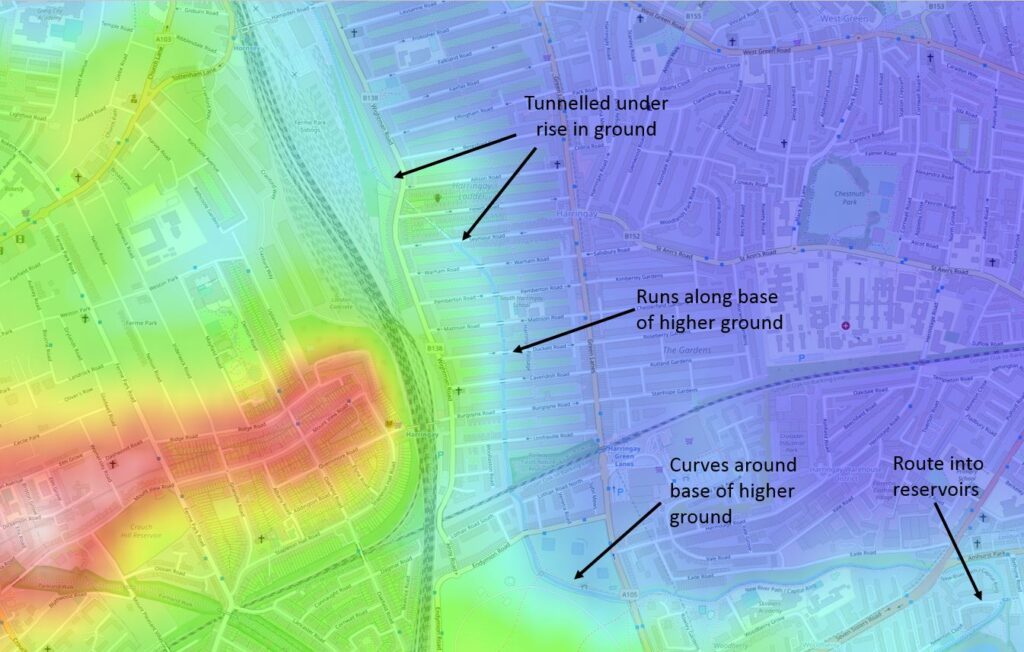
I have marked the route of the New River which is following the boundary between the higher land on the left (around Crouch Hill station), and the lower land on the right (south Tottenham and Seven Sisters station).
At one point in the map, an area of higher ground (yellow) juts out, and the New River has been tunneled under this, before emerging and running through the streets to the east of Wightman Road.
Point 4 on the map: After weaving through the streets of terrace housing, the New River emerges into the north east corner of Finsbury Park:
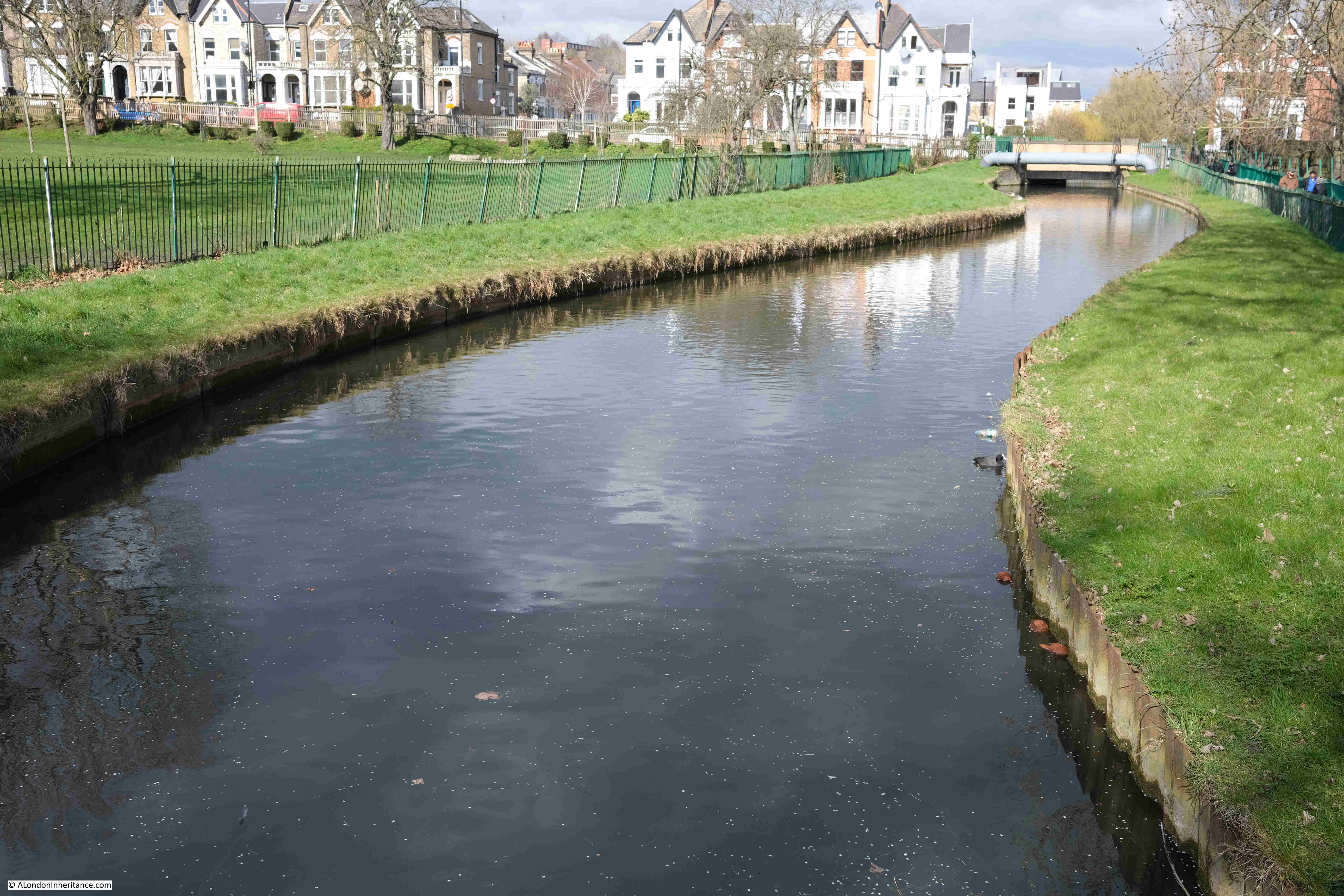
Where there is a plaque recording the origins and purpose of the river:
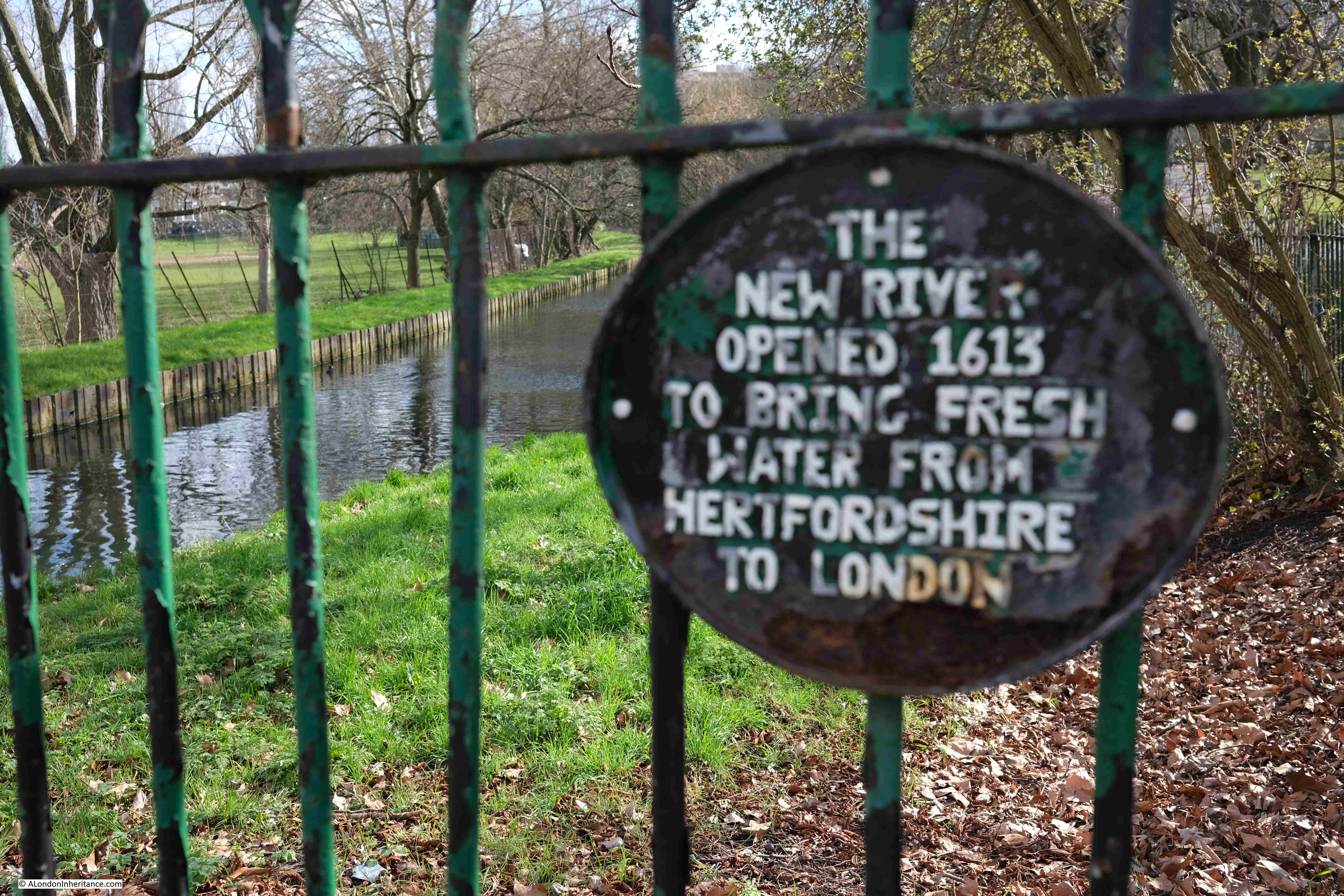
The New River stays in just the north east corner of Finsbury Park, before crossing under Green Lanes, and reaching:
Point 5 on the map: where the river runs along a narrow green space between an industrial area to the north, school and housing to the south:
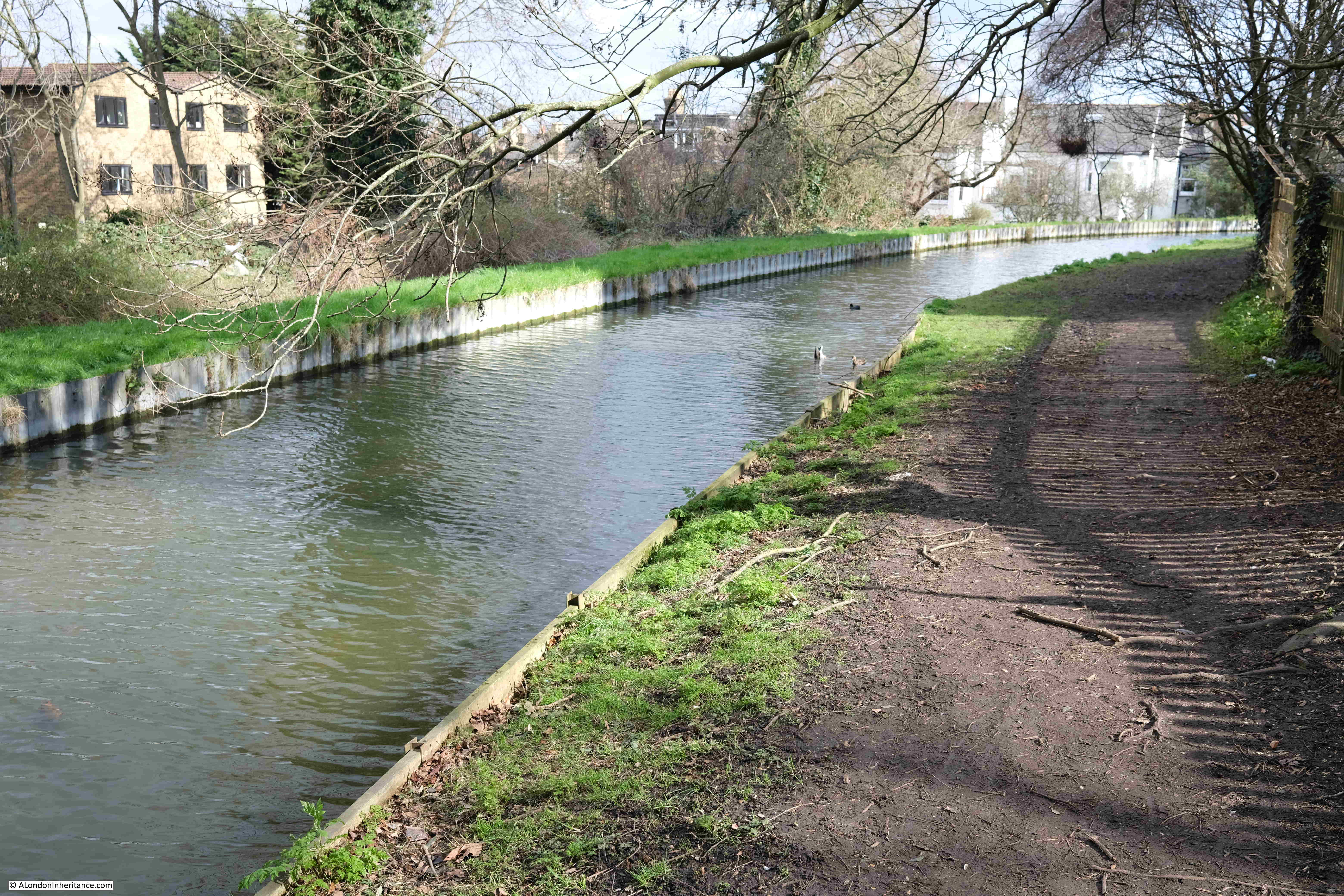
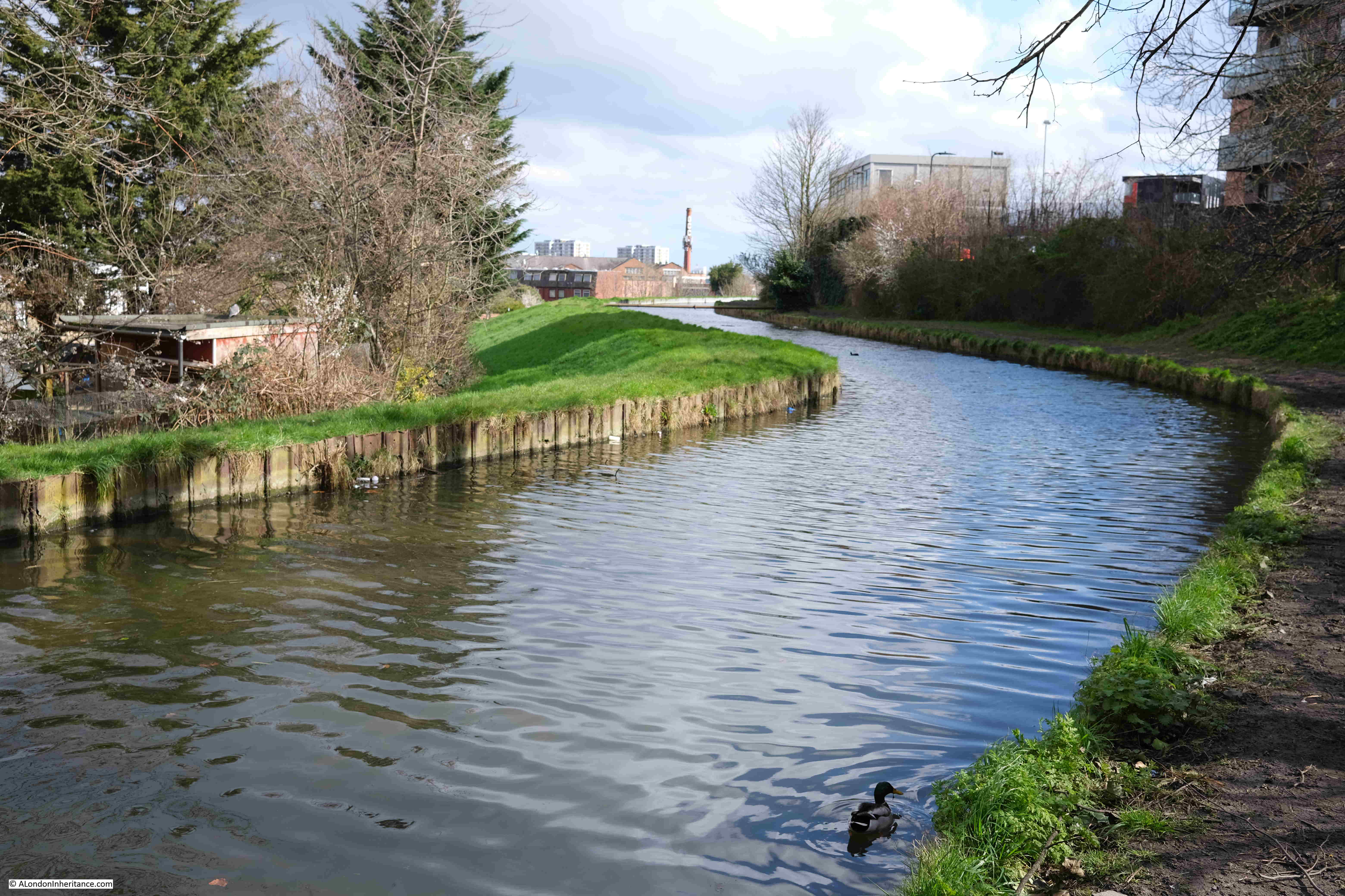
In the height map above, the New River is heading towards the reservoirs and is skirting around some higher land to the south, and this is visible as we walk alongside the river, with a downward slope from right to left requiring the river to be banked on the northern side:
North of the M25, between Cheshunt and Ware, there were a number of points where water was being extracted from boreholes and pumped into the New River. There were no examples of this south of the M25, except for one point along this stretch of the walk where four pipes were pumping water into the river, although it was not clear from where this was being extracted.
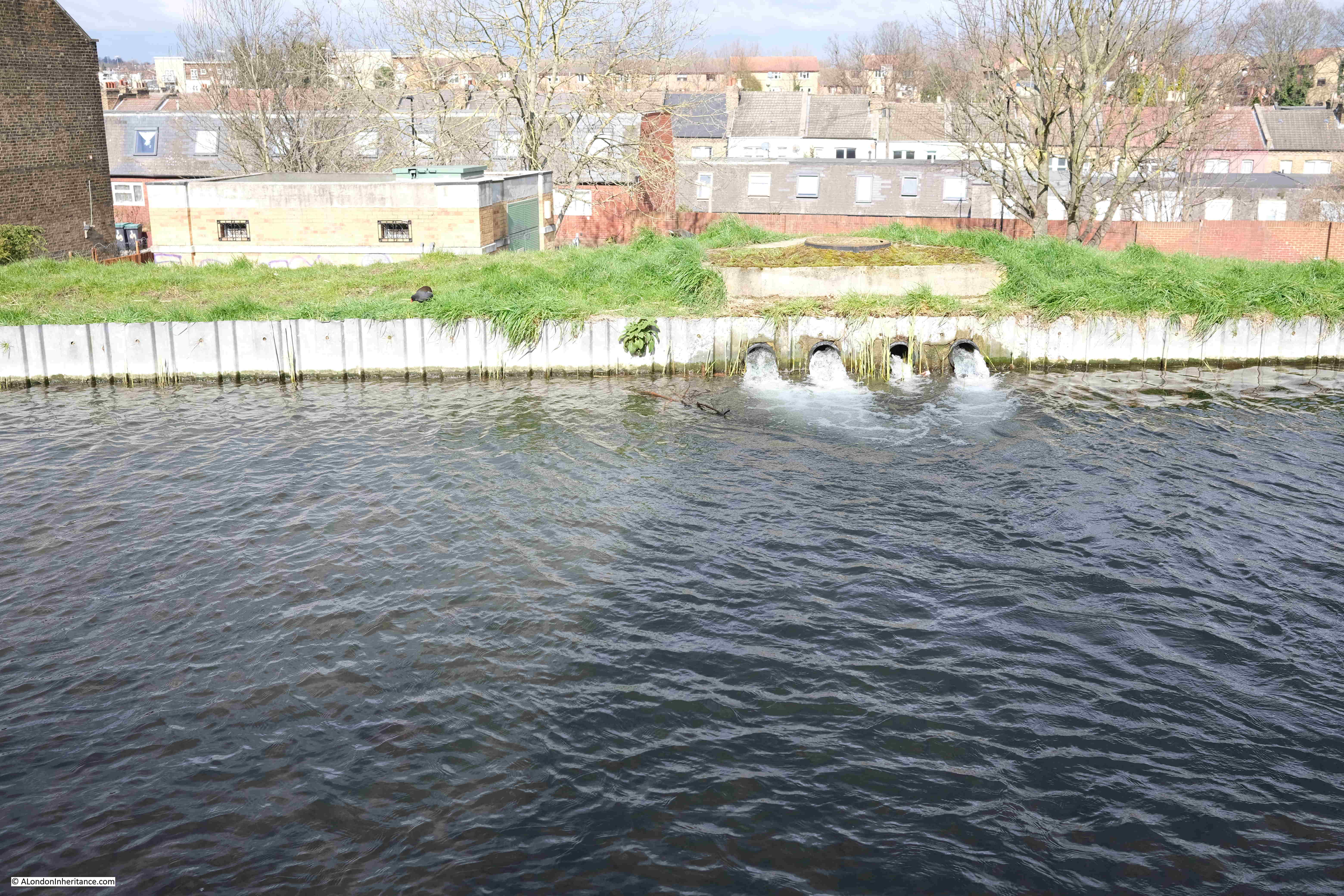
There is a brick building visible just to the left of where the water is pouring into the river. This is on Eade Road. It houses infrastructure of some sort, and has a 2003 plaque on the outside, but no indication of its function.
The British Geological Survey borehole map lists a borehole under this building, however it is marked as “Confidential” with no data available.
I assume the water running into the New River is from this borehole, however it is strange as to why the record is confidential.
This section of the walk was incredibly muddy, with some sections rather difficult to pass.
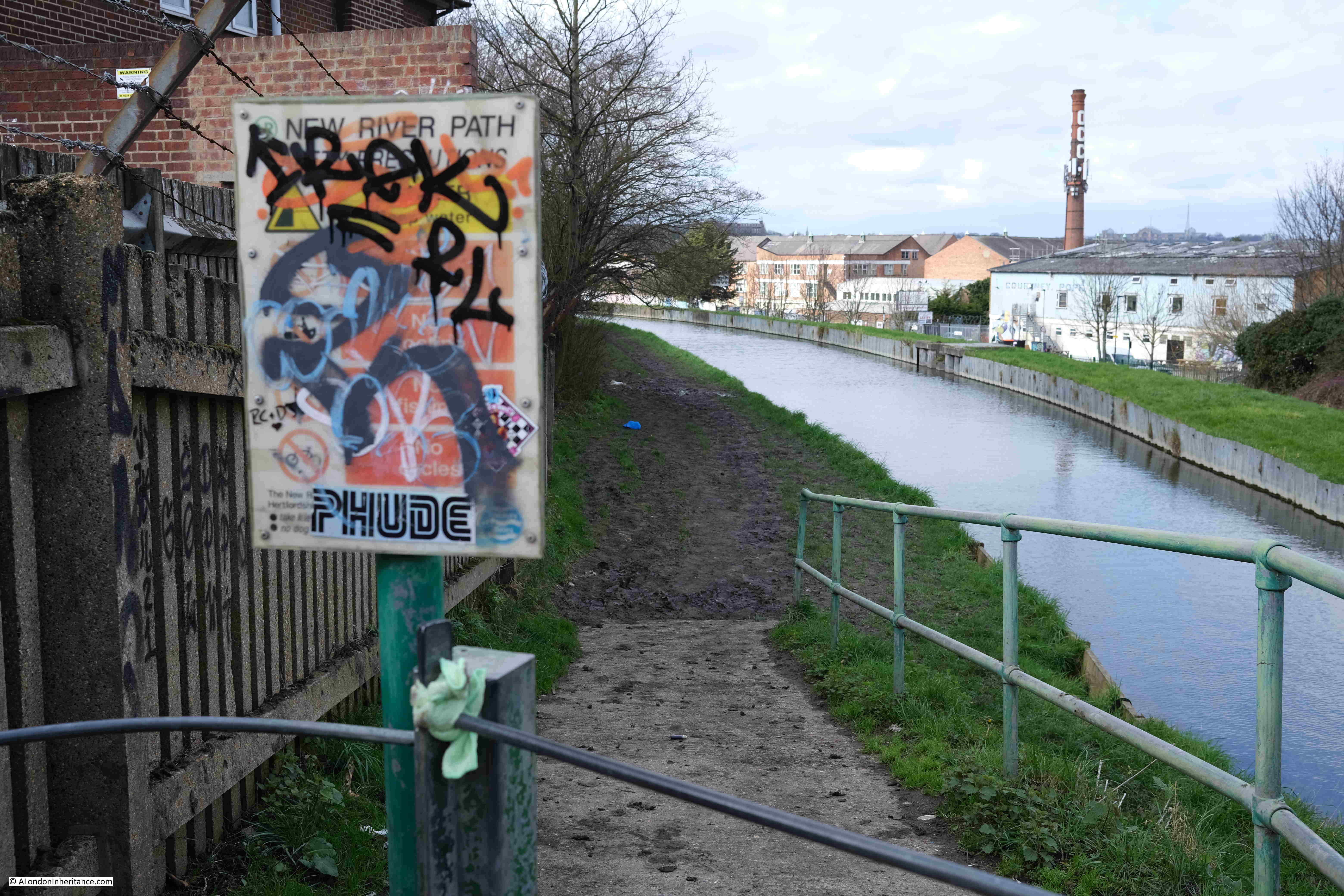
At the end, the path runs up to meet Seven Sisters Road, with an information panel covered in graffiti:
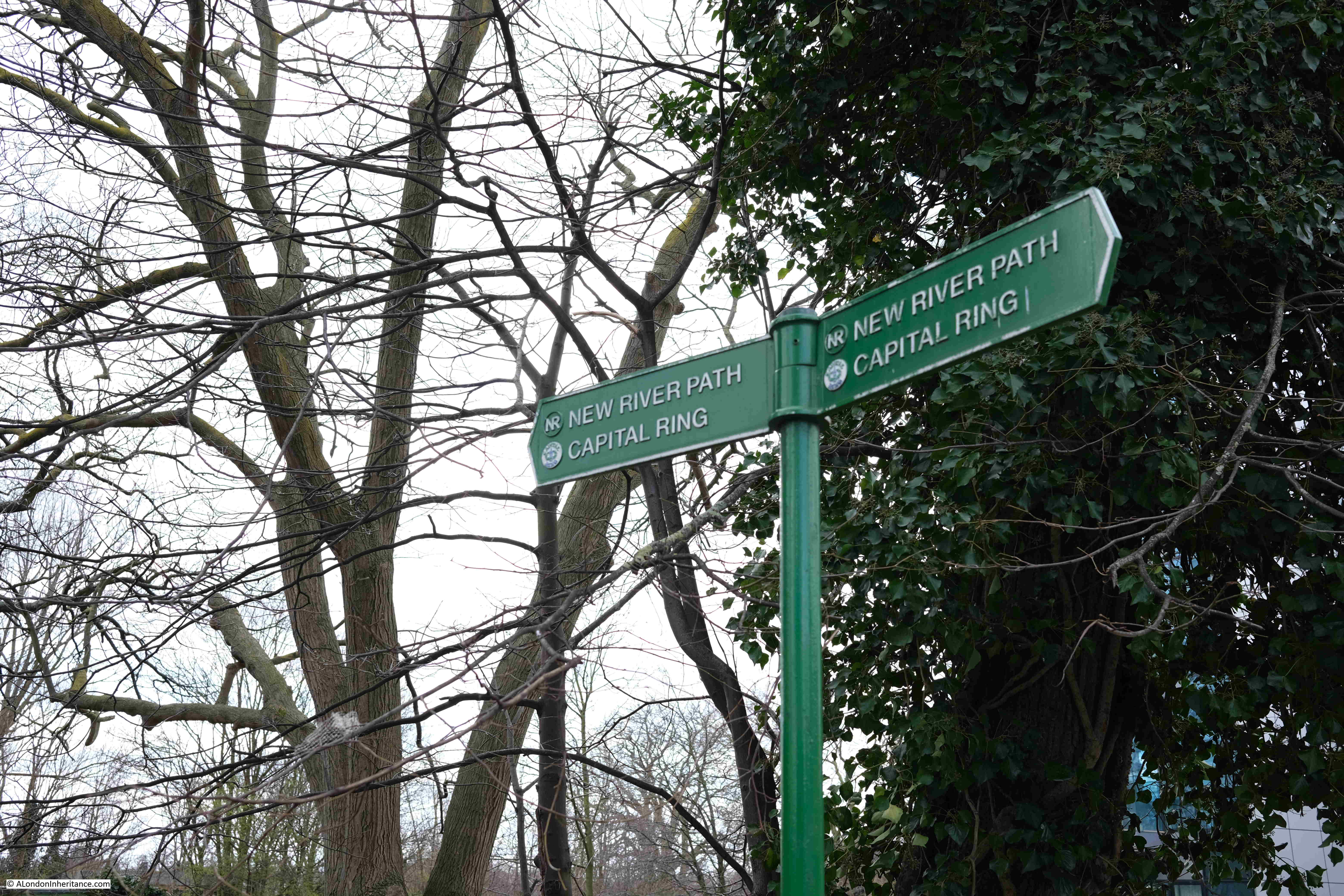
For a short distance, the New River Path has joined with another walking route, the Capital Ring:
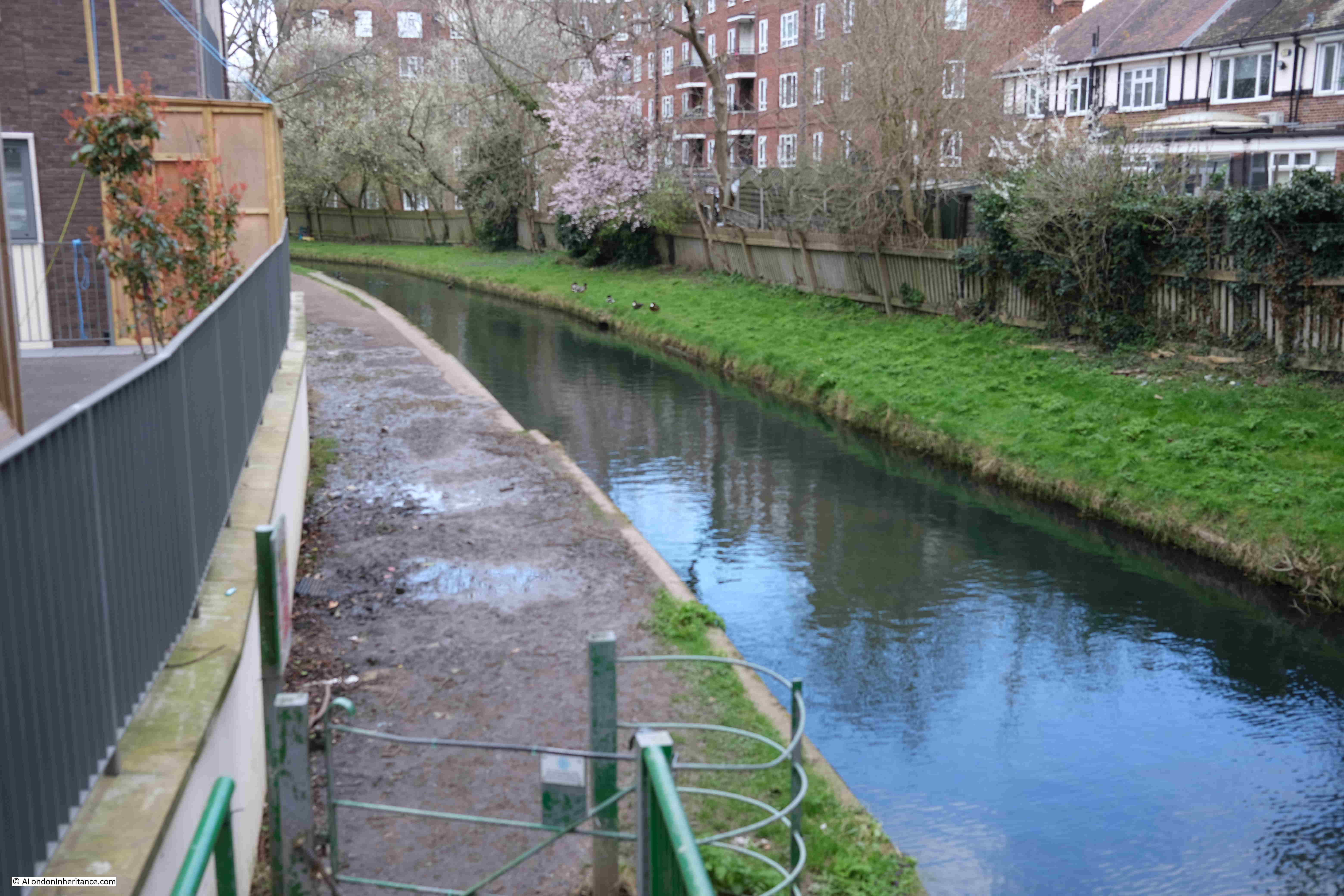
And one final loop through housing, with a rather muddy path:
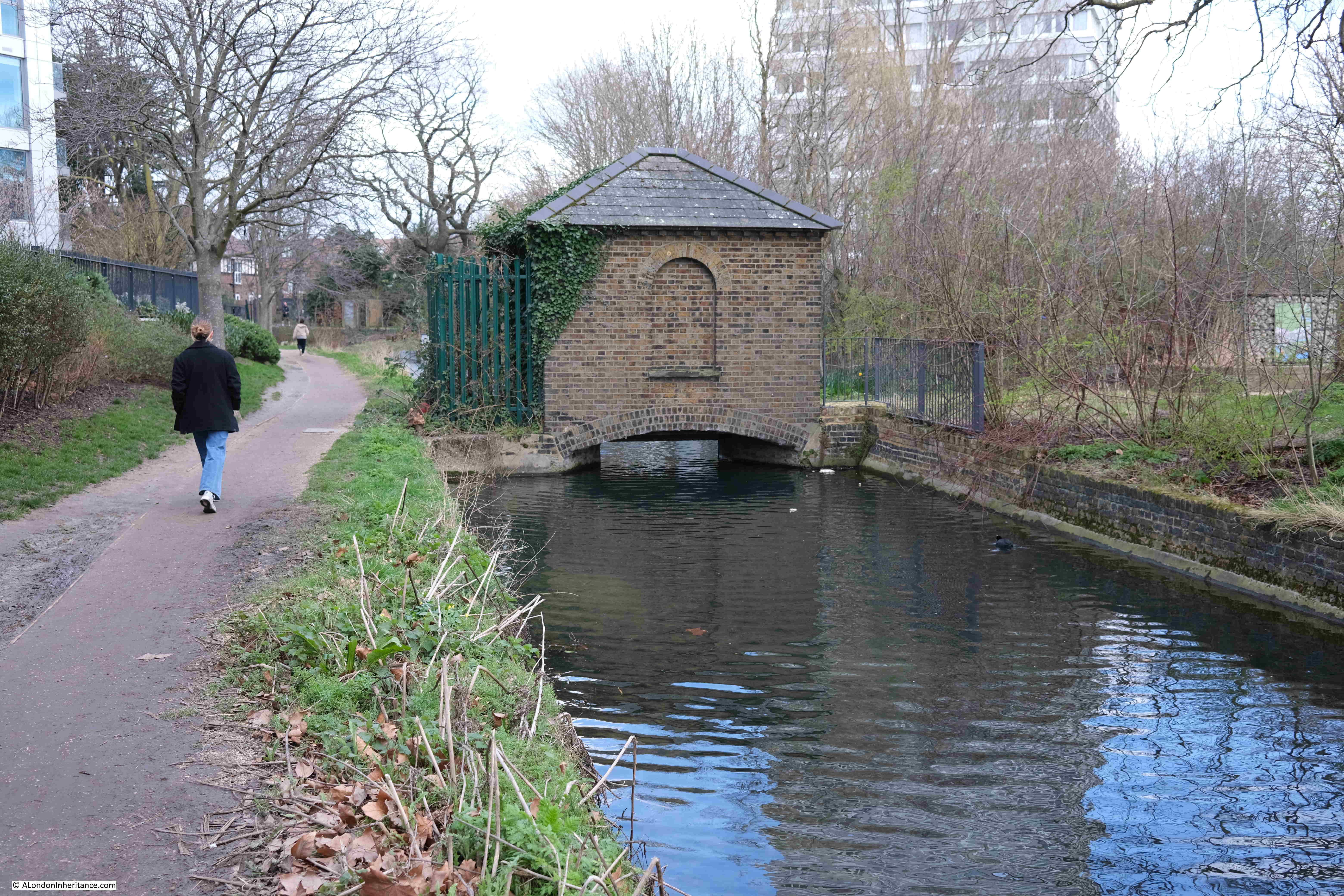
Point 6 on the map: The New River now reaches the reservoirs, with what must have been a gauge house, some means of regulating or measuring the flow of the river, straddling the New River just before the reservoirs:
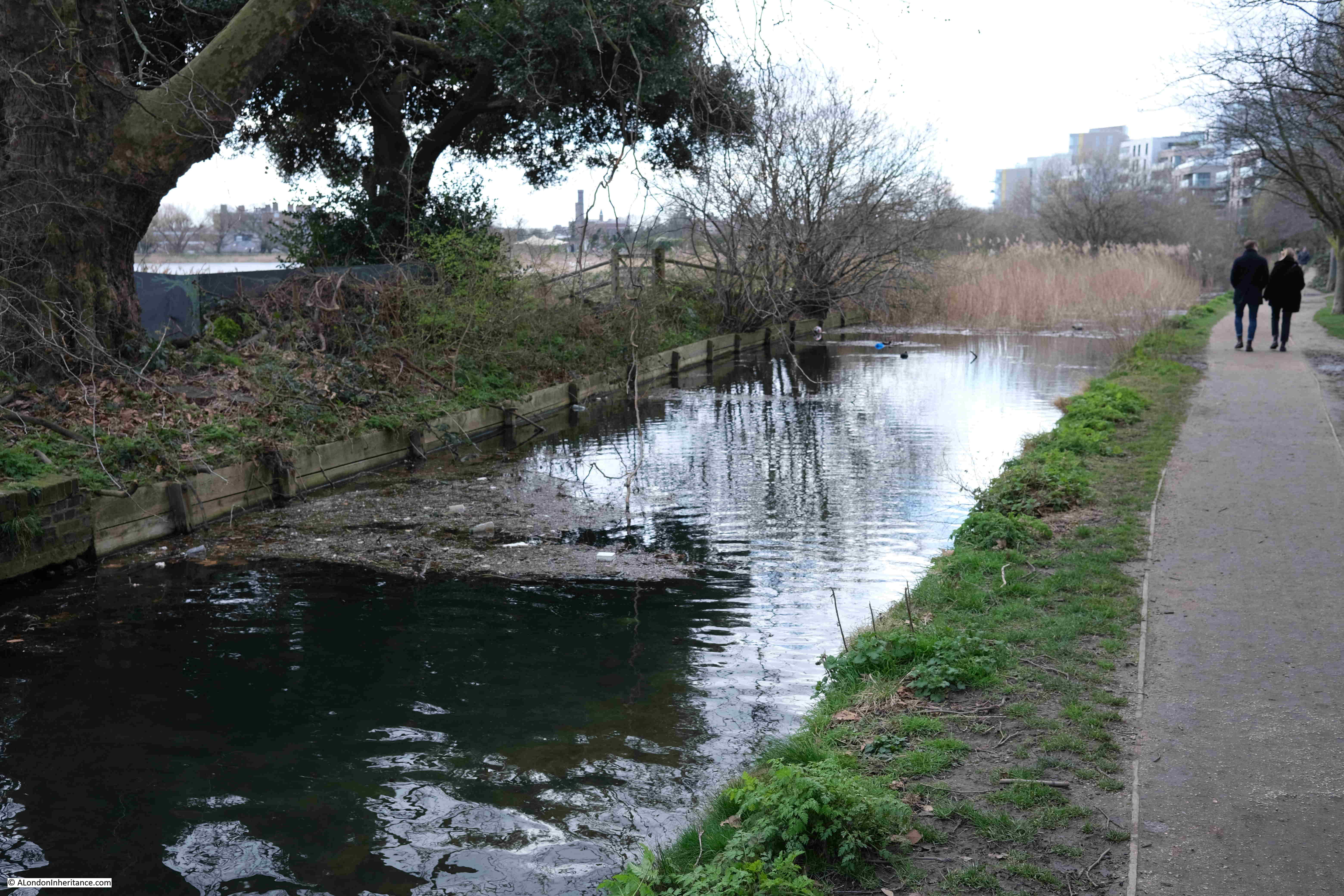
The New River was truncated at the reservoirs at Stoke Newington in 1946, and now feeds water into the reservoirs, as well as running to their north, through the Woodberry Wetlands, an area surrounding the reservoirs that is now managed as a wildlife haven:
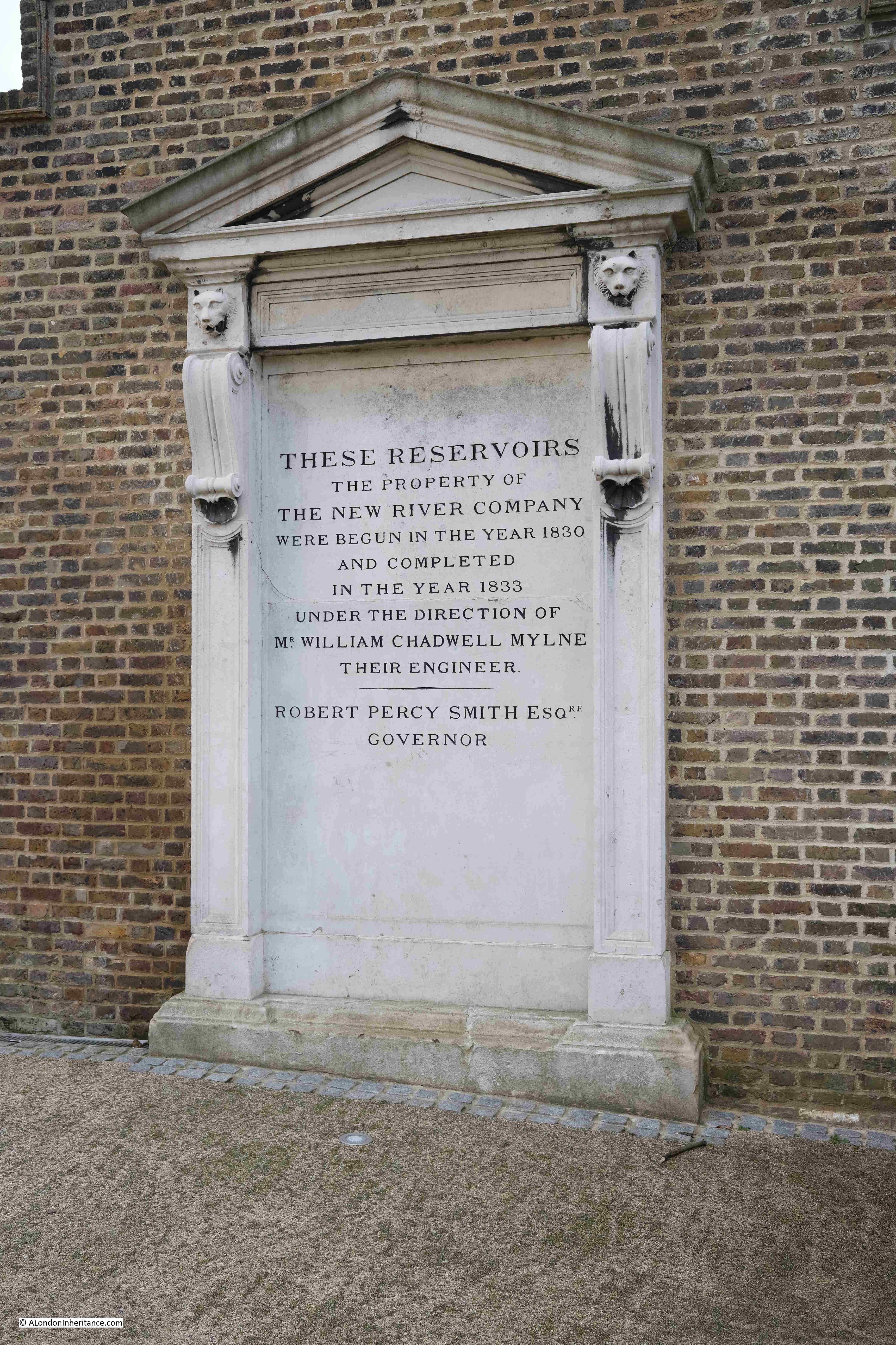
Between the east and the west reservoirs is a building that was once part of the New River infrastructure and has now been refurbished as the Coal House Café. The area outside the café was full of families, so I will not include a photo online, however at the side of the building is a record of the creation of the reservoirs by the New River Company:
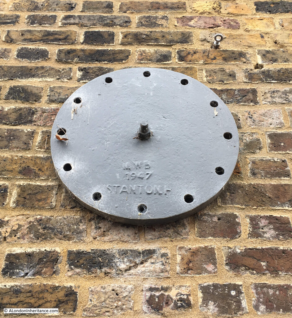
Also on the side of the building is a wall tie with the initials of the Metropolitan Water Board, the organisation that took over the running of the New River Company’s assets:
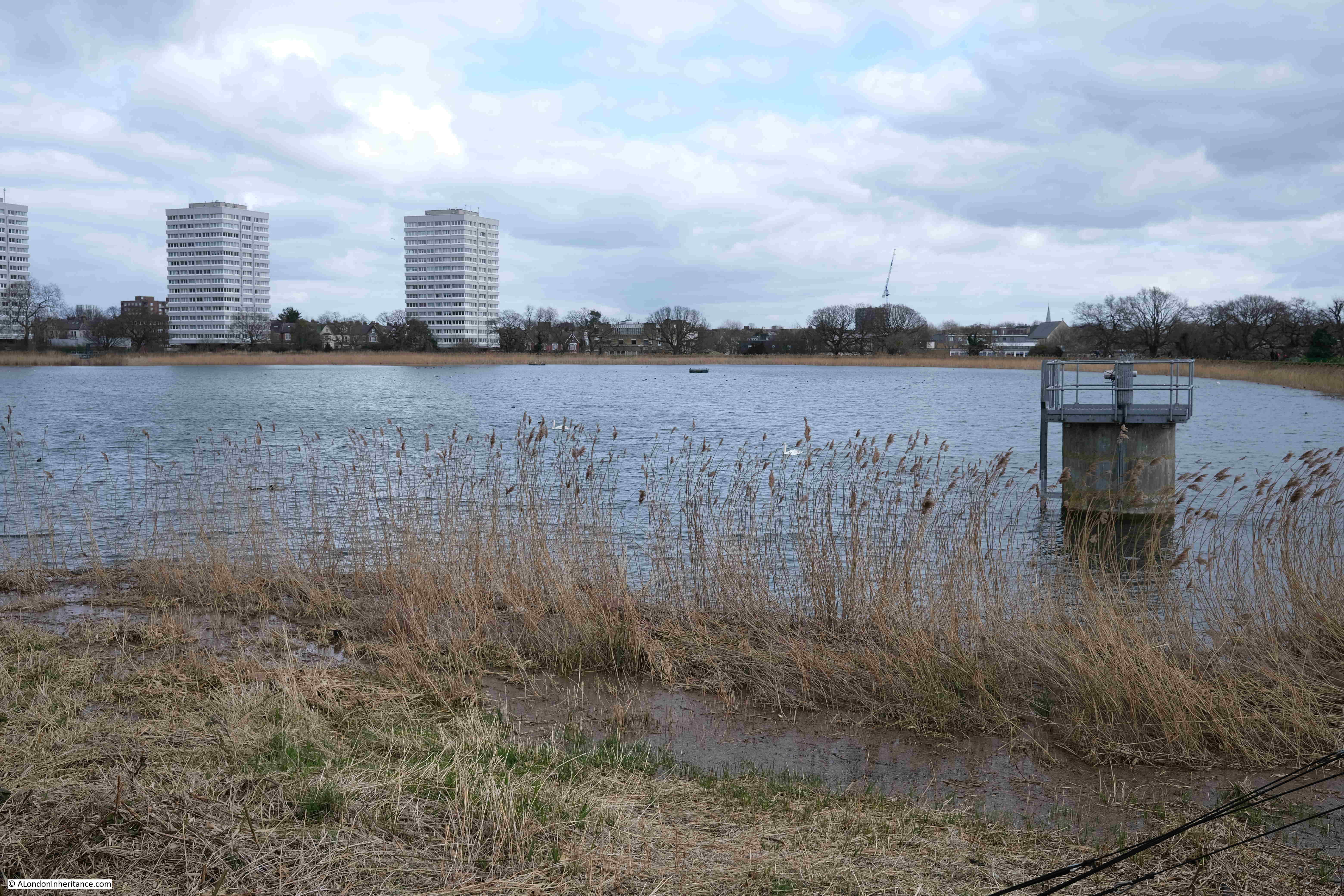
View across the east reservoir:
View across the west reservoir:
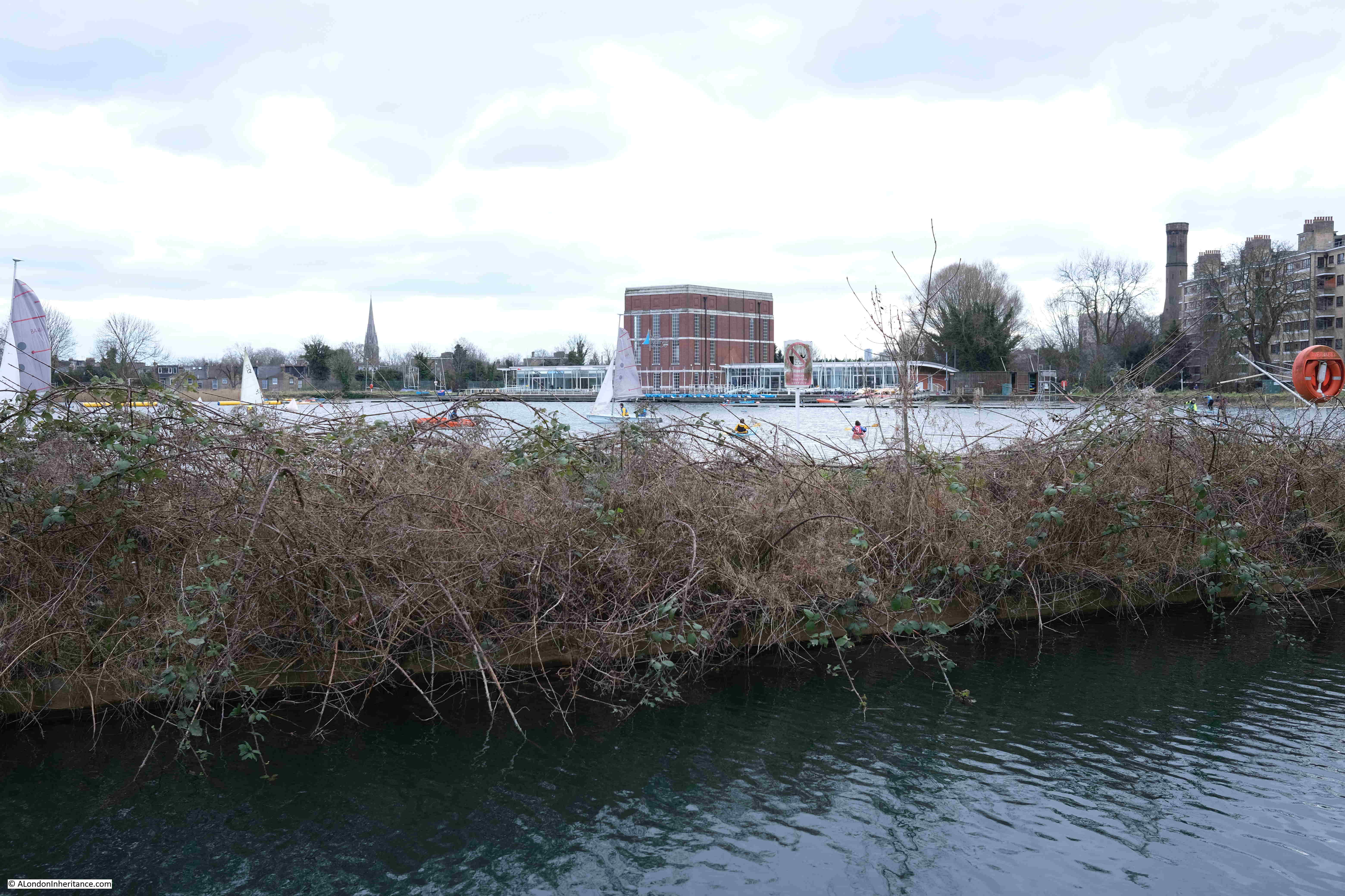
And a short walk from the west reservoir, we reach the very end of the remaining route of the New River. The last point in the walk from Ware in Hertfordshire, where the river can be seen above ground. It ends in a rather sad dead end:
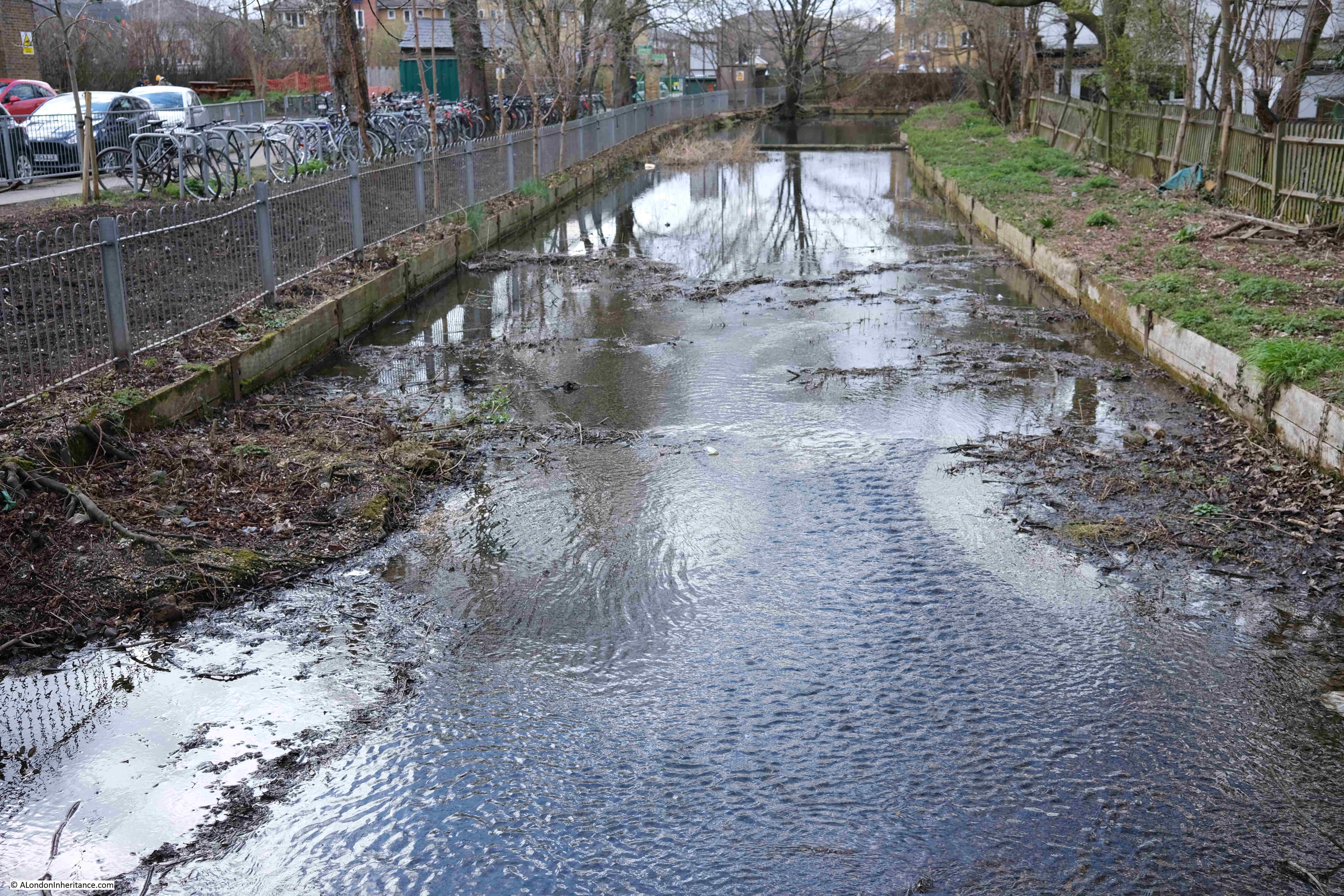
Just to the left of the above photo is the wonderful 19th century pumping station built by the New River Company:

The Metropolis Water Act of 1852 required that water companies supplying water to London, filter the water prior to distribution, and that any subsequent reservoirs after filtering be covered. The aim was to improve the quality of water and prevent much of the pollution from an industrial city from entering the water supply.
Prior to the act, the New River Company was supplying water directly from the reservoirs, however the act now required filter beds to be constructed, along with infrastructure such as a pumping station, and the building in the above photo was built between 1852 and 1856 by William Chadwell Mylne, the Surveyor for the New River Company.
The building housed steam engines and boilers until 1936 when these were replaced by diesel engines.
By 1971, the pumping station was rather dated and too small, and the design of the building did not support an upgrade, so the Metropolitan Water Board applied for permission to demolish the building.
There was considerable local support to retain the building as it was such a local landmark, resembling an industrial castle alongside Green Lanes.
This campaign resulted in the building being given a Grade II* listing in 1972, however it would continue to stay empty, and under threat.
The Historic England listing record provides a perfect description of the old pumping station, and why it is known as the Castle (Historic England source here):
“Large building designed to resemble a mediaeval fortress with keep and bailey. 1854-6 by Chadwell Mylne. Stock brick with stone dressings. Battlements and large stepped buttresses all around. The “keep” is of 2 storeys with a tall basement plinth. 6 windows on main south-west front. At north-east and south-west corners round towers with square bartizans the former with a tall conical roof and both having battlements crow-stepped up towards them. Continuous quasi-entablature, with cable moulding, running right around towers. Taller octagonal chimney tower to east. 8 steps (the top one with bootscraper!) to entrance in forebuilding running along north wall and into “bailey” building, which is lower with segmental arcading and 2 slit windows in each bay. Important picturesque landmark.”
The building was empty until 1994 when it was converted into a climbing centre. The large internal spaces perfectly suited for such a use. If you walk past, it is worthwhile having a quick look inside, as the building is still the Castle Climbing Centre.
Leaving the pumping station, we are now following the heritage section of the New River Walk. This section of the route has not seen the New River as a stream of water for many years, as the river was buried in pipes during the 19th century, and since 1946, New River water has ended at the reservoirs.
Point 7 on the map: Here we turn off from Green Lanes and into Clissold Park.
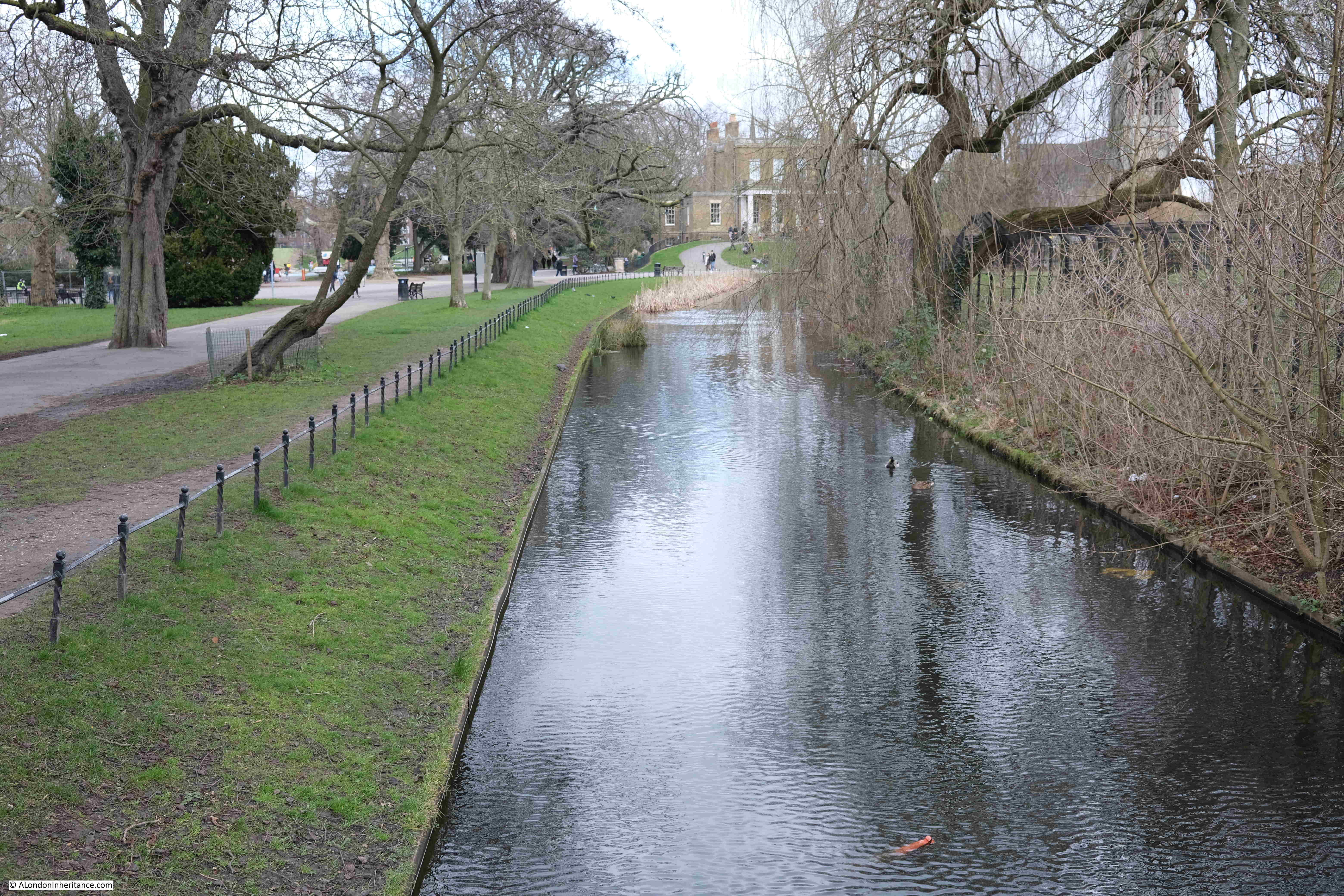
The park retains a couple of stretches of the New River, however these are for decorative purposes only, and start and end within the park.
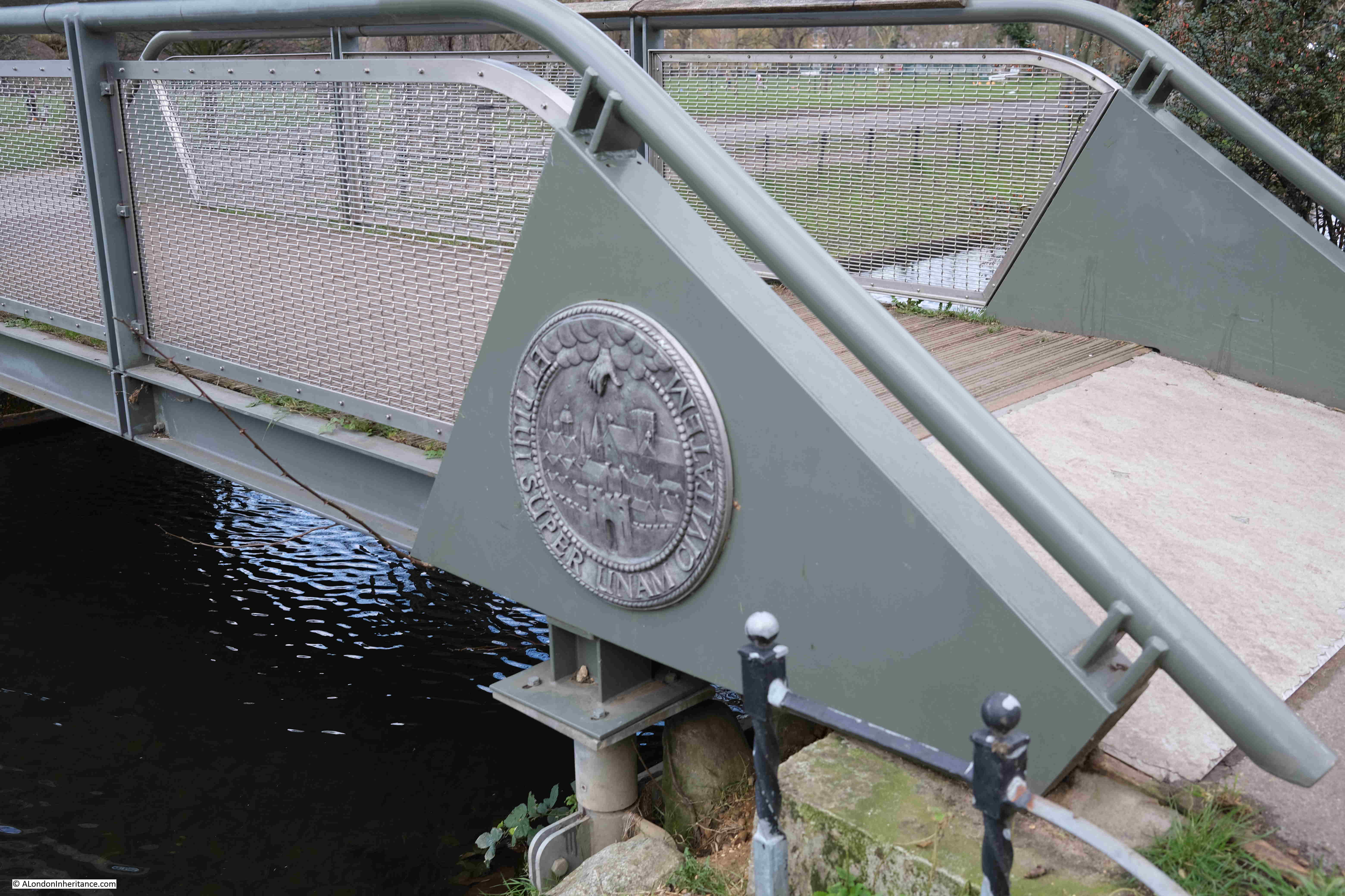
There is a bridge across one of these decorative runs of the river, which has the arms and motto of the New River Company on the side. “ET PLUI SUPER UNAM CIVITATEM” or “And I caused it to rain upon one city” indicated by the hand reaching down from a cloud, and showering rain drops on the city below.
Part of the decorative New River feature running up to Clissold House:
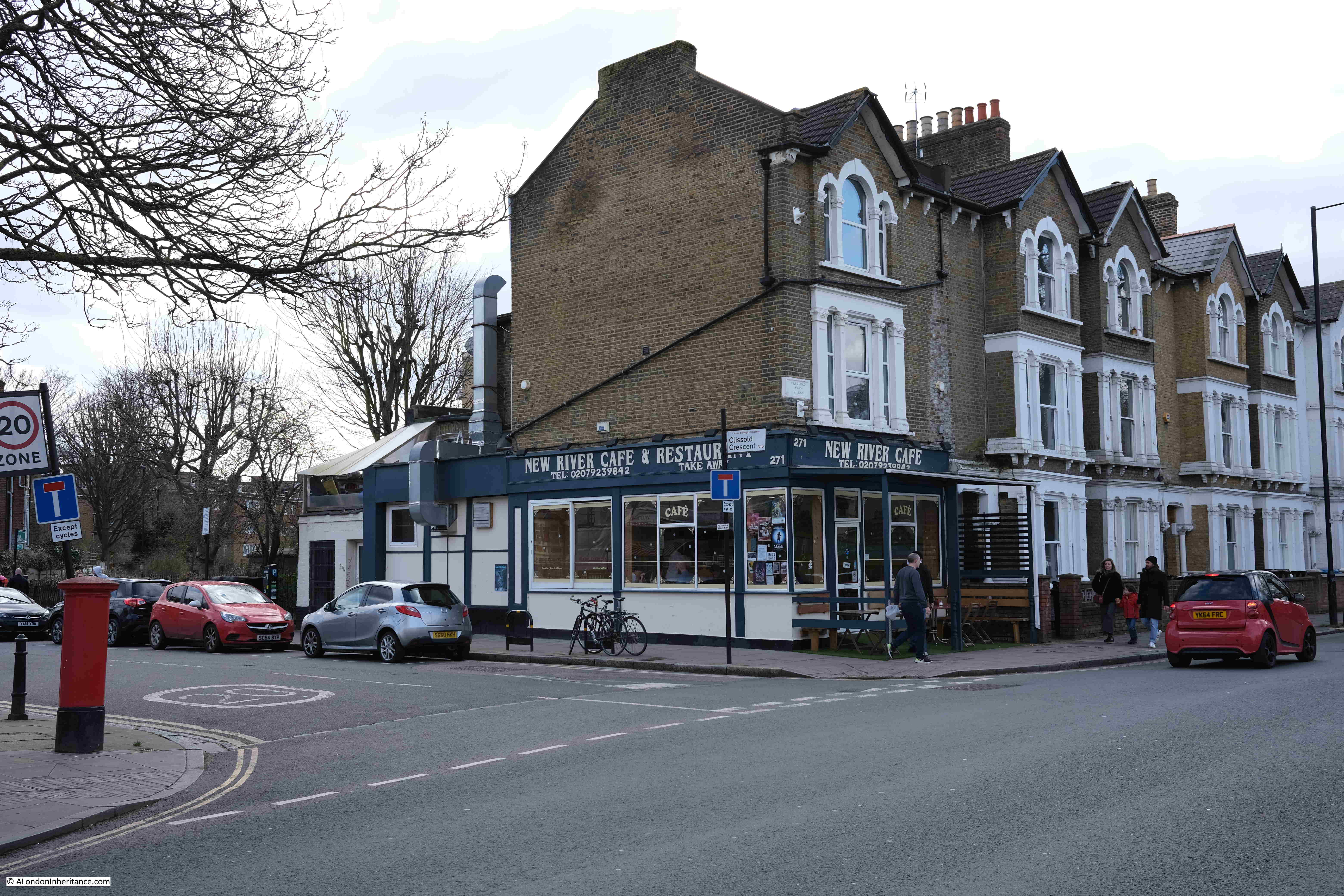
Leaving Clissold Park, and walking along Stoke Newington Church Street, there is another reminder of the New River with the New River Café on the corner with Clissold Crescent:
Walk a short distance along Clissold Crescent, and there is a reminder of the New River:
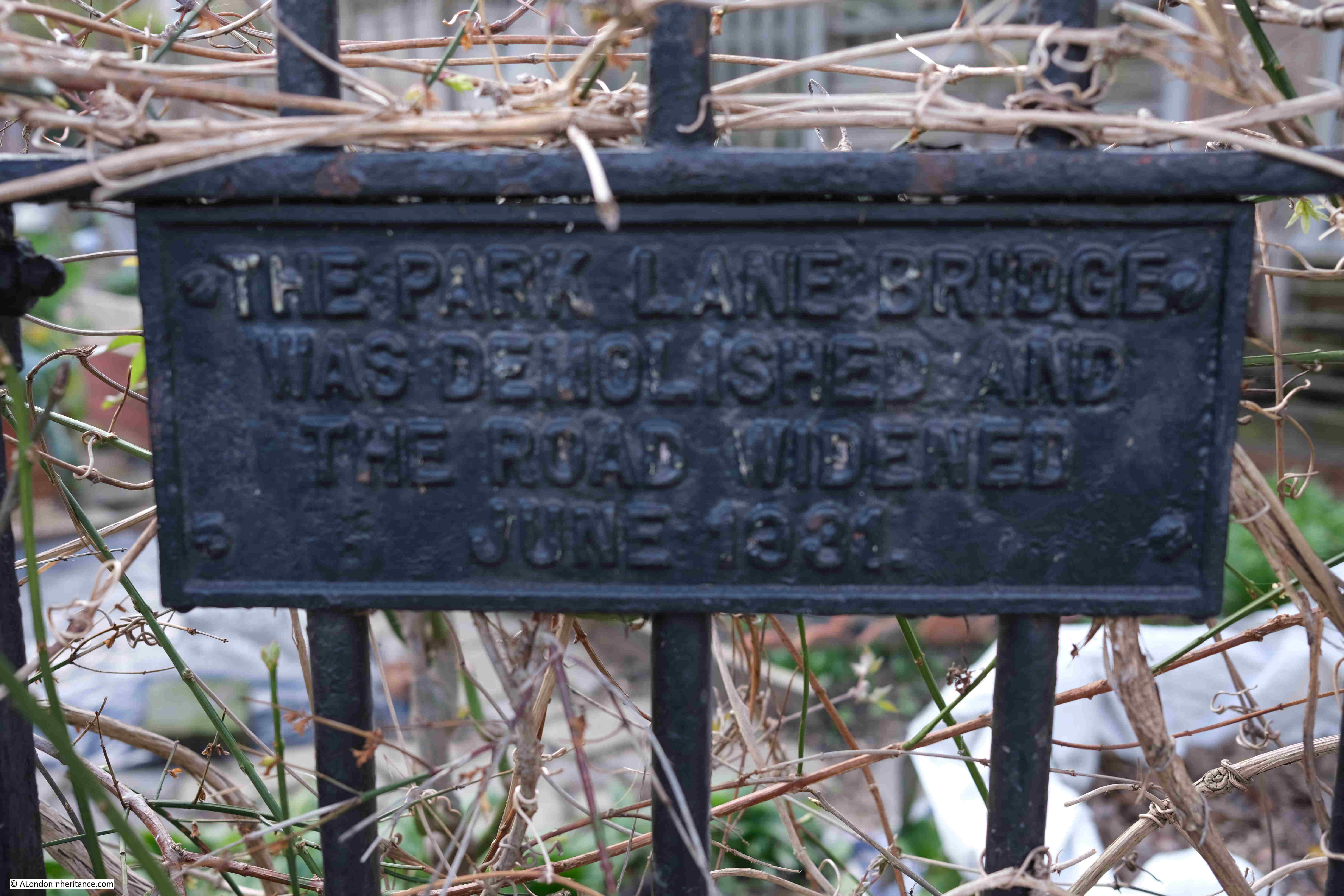
The plaque reads “The Park Lane bridge was demolished and the road widened June 1881”.
Park Lane was the original name of Clissold Crescent, and the bridge carried Park Lane over the New River.
A version of the Ordnance Survey map from the 1890s shows the Park Lane bridge and the New River, although by this time, the New River should have been carried underground in pipes, and as the plaque reads, the bridge was demolished in 1881 and the road widened, so I suspect the OS map was not updated at this point (‘Reproduced with the permission of the National Library of Scotland“).
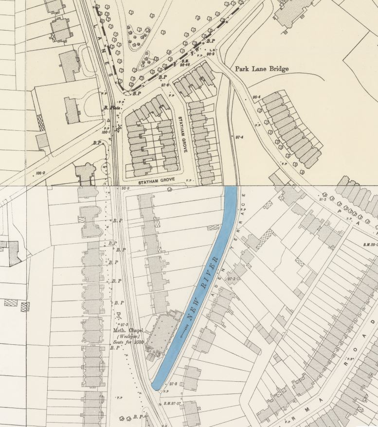
In the above map, the New River heads south between houses, and the route has been preserved and now forms a series of allotments running along the old course of the river:
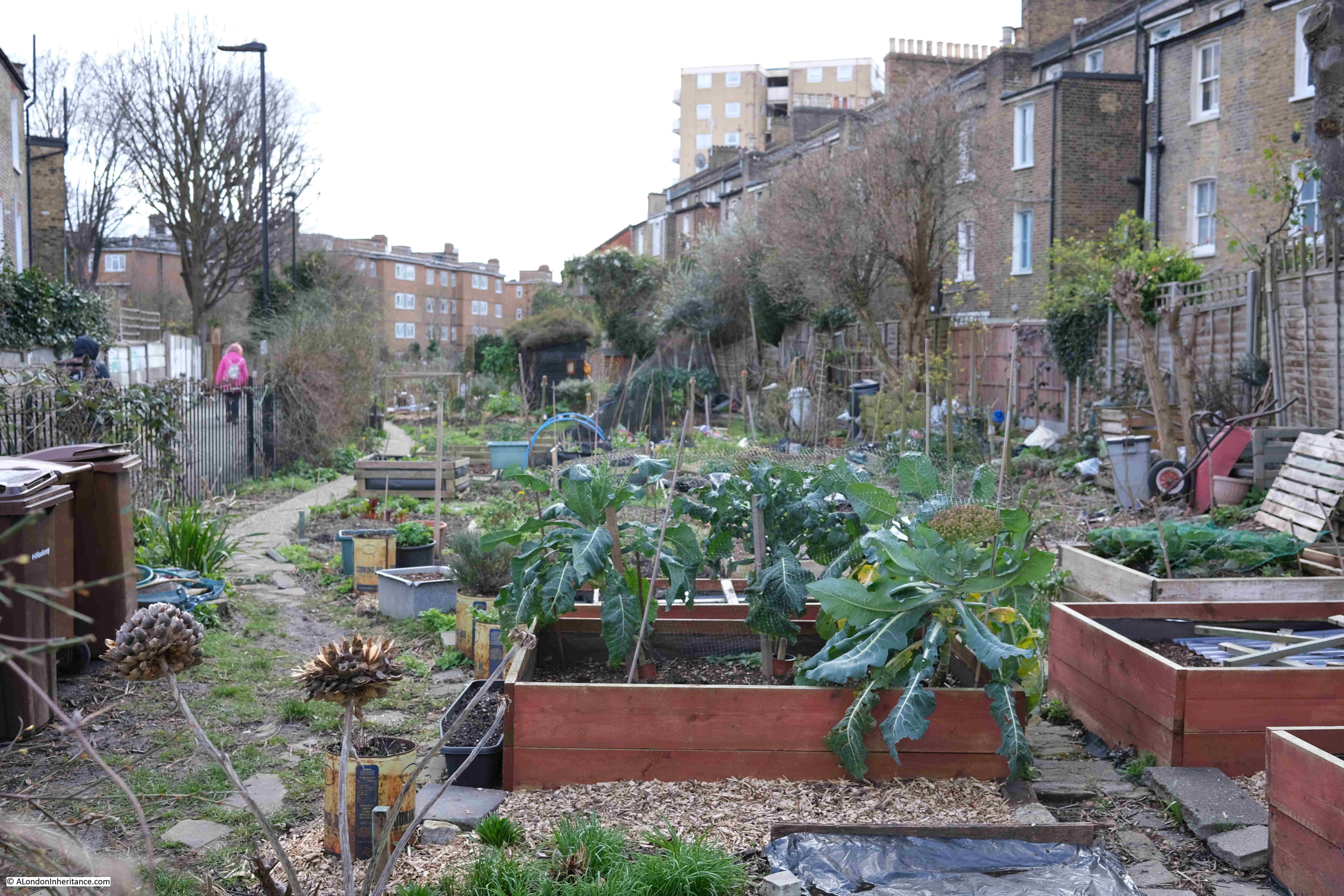
The path between the allotments ends at Green Lanes (again, almost a constant companion on the southern section of the walk). We cross over Green Lanes to reach;
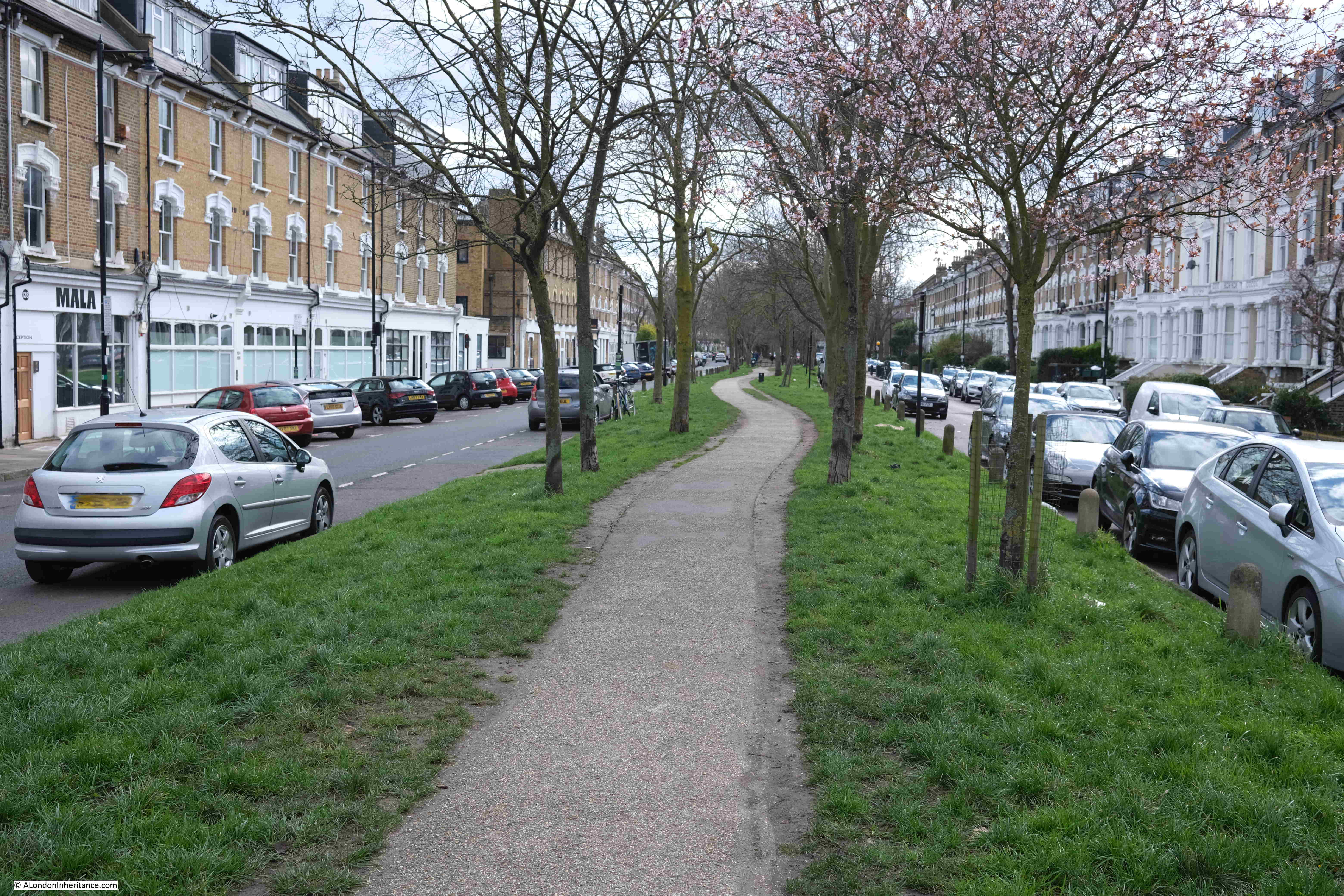
Point 8 on the map: this is Petherton Road where the New River once ran down the centre of the street, and is now a walkway with trees and grass on either side:
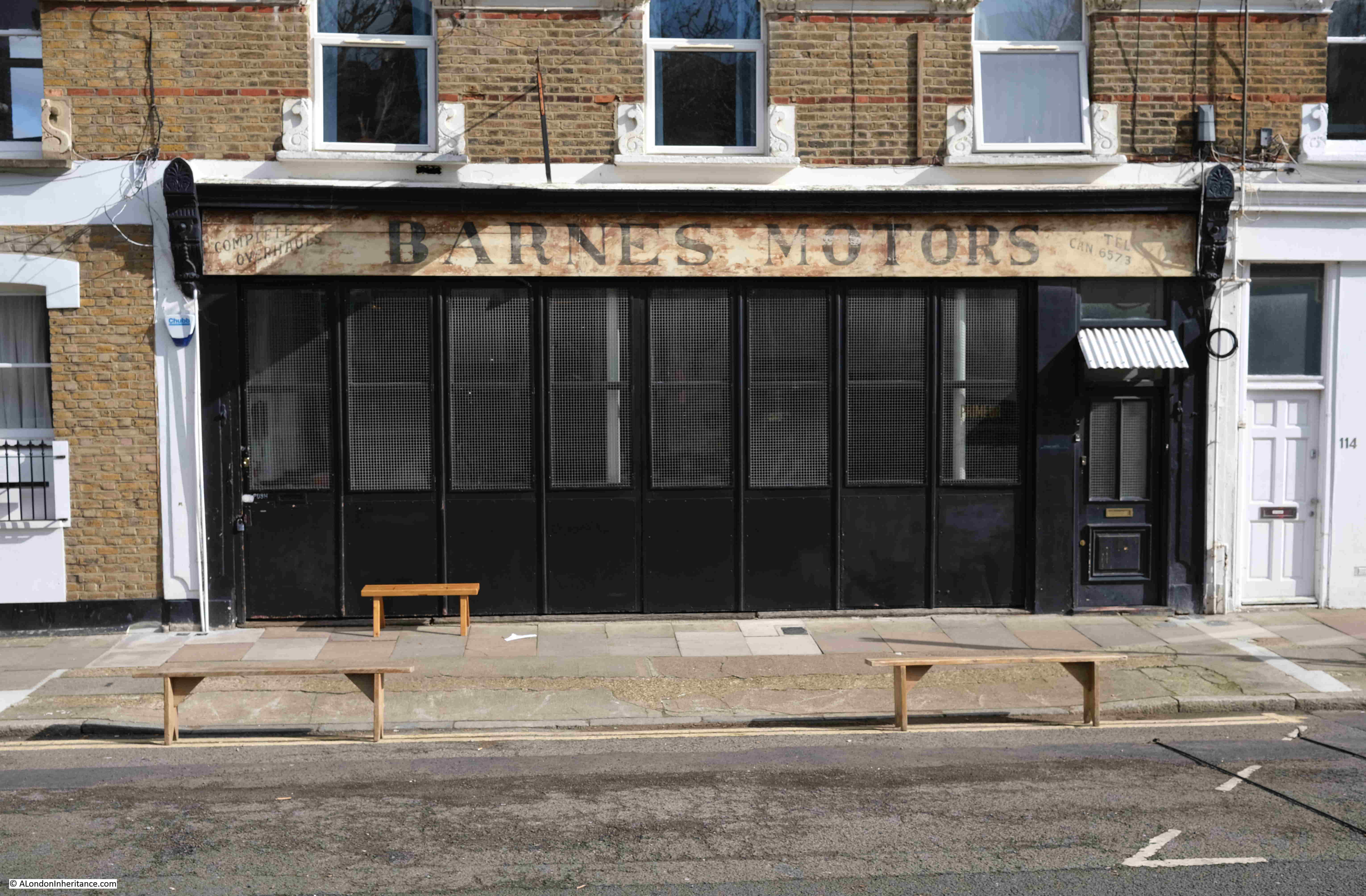
A rather nice ghost sign for Barnes Motors along Petherton Road:
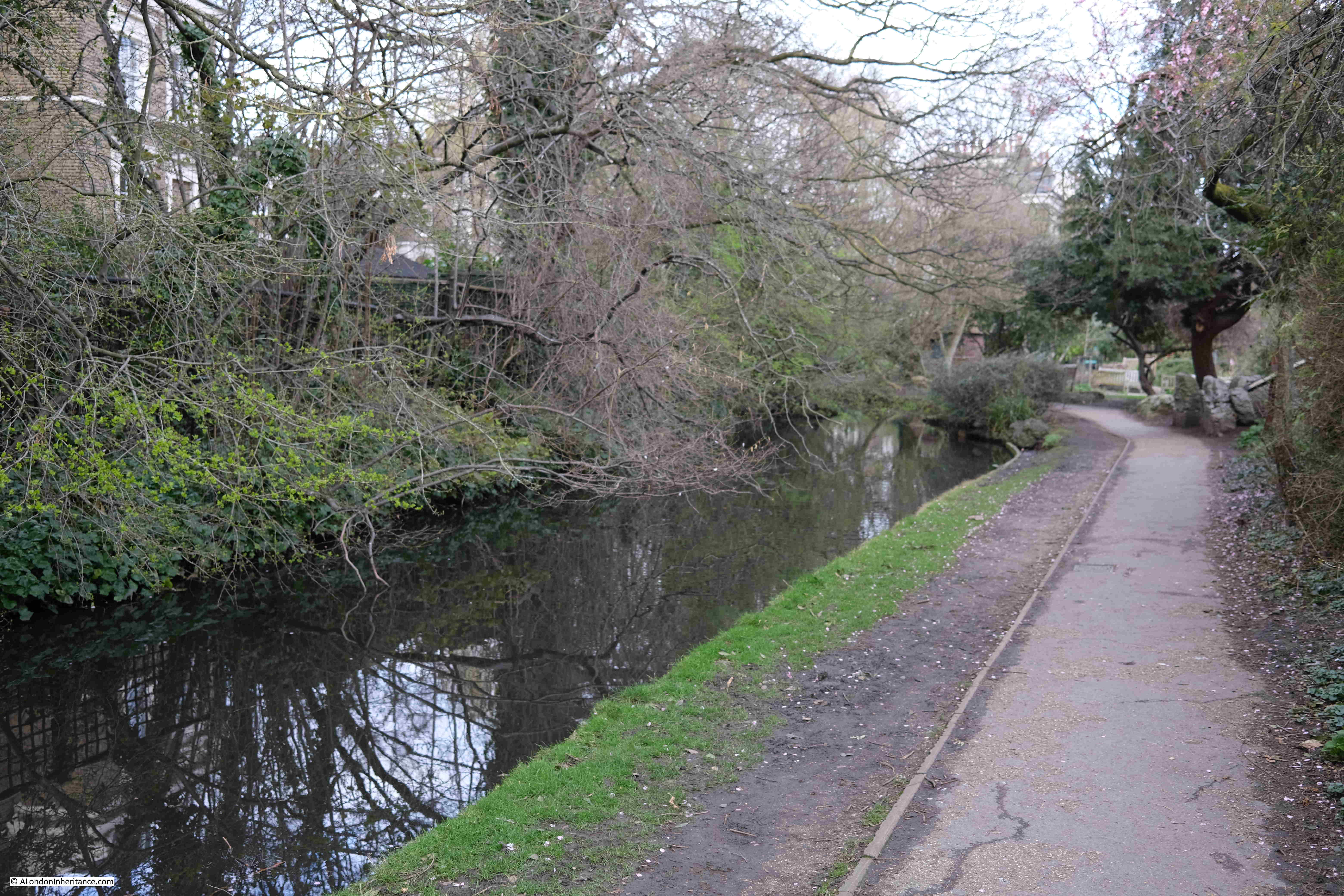
At the end of Petherton Road, the green space gives way to a street which still follows the route of the New River, past Canonbury Station and cross over St Paul’s Road into another section of the New River route that has been transformed into a long green space, with a decorative water feature running the length of the space:
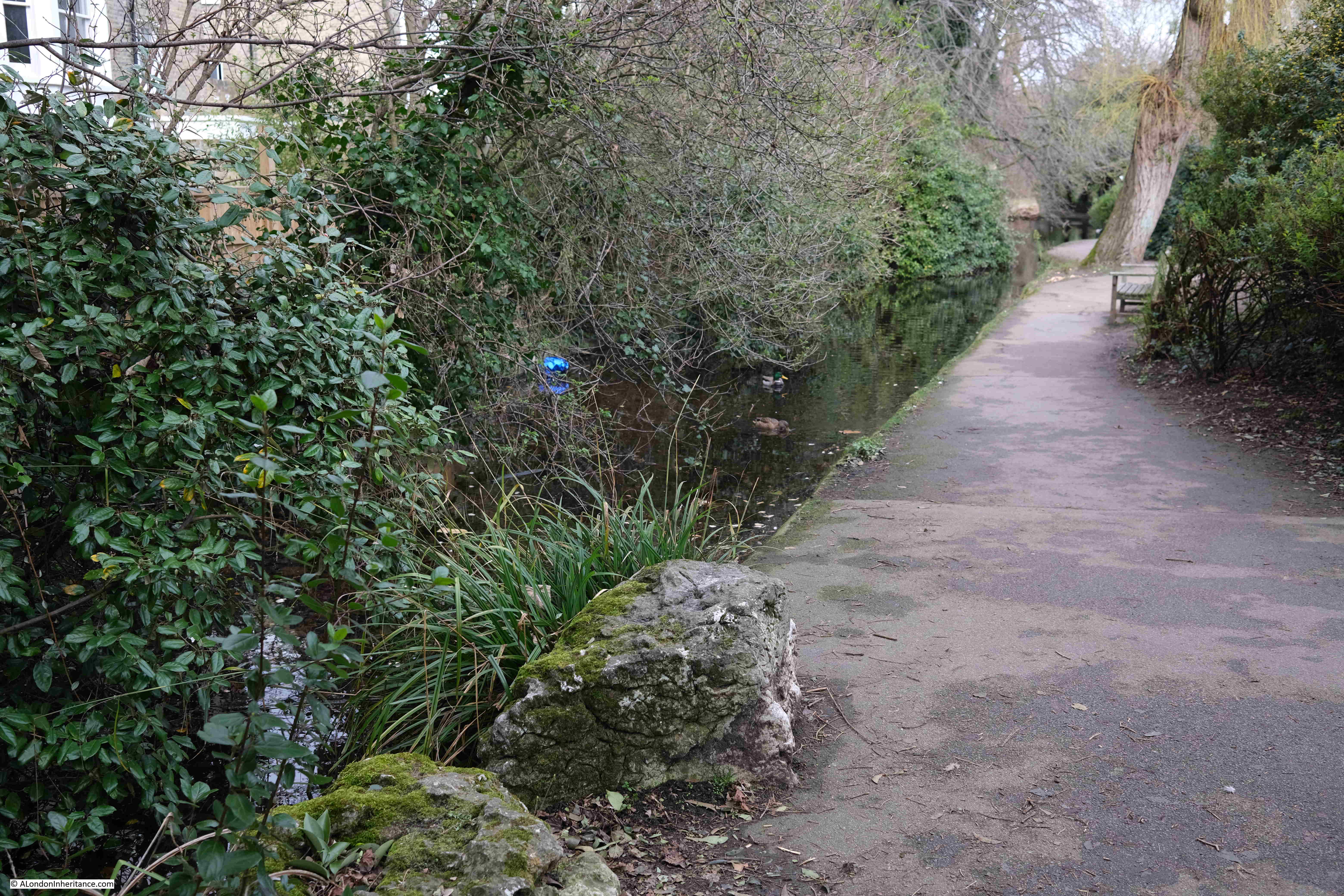
Towards the end of this green space is:
Point 9 on the map: where there is a round brick building alongside the original route of the New River:

The building appears to be a late 18th century watch hut. To protect the New River, the New River Company had a watchman or linesman stationed at points along the route of the river to keep the river clear of debris and also to prevent fishing and swimming in the water, or anything that could pollute the supply.
The brick hut is an example of where such a person would have been stationed to keep watch over the river.
The final stretch of the ornamental water that follows the original route of the New River:
Where the above green space ends, we then walk south along Essex Road, and turn off just before reaching Islington Green, to find Colebrooke Row.
This is another street where the houses were built facing on to the New River, and the space occupied by the river is now a green space running the length of the street.
In the following photo, the houses on the right once looked onto the New River where the grass and trees now run, with the street being on the left:
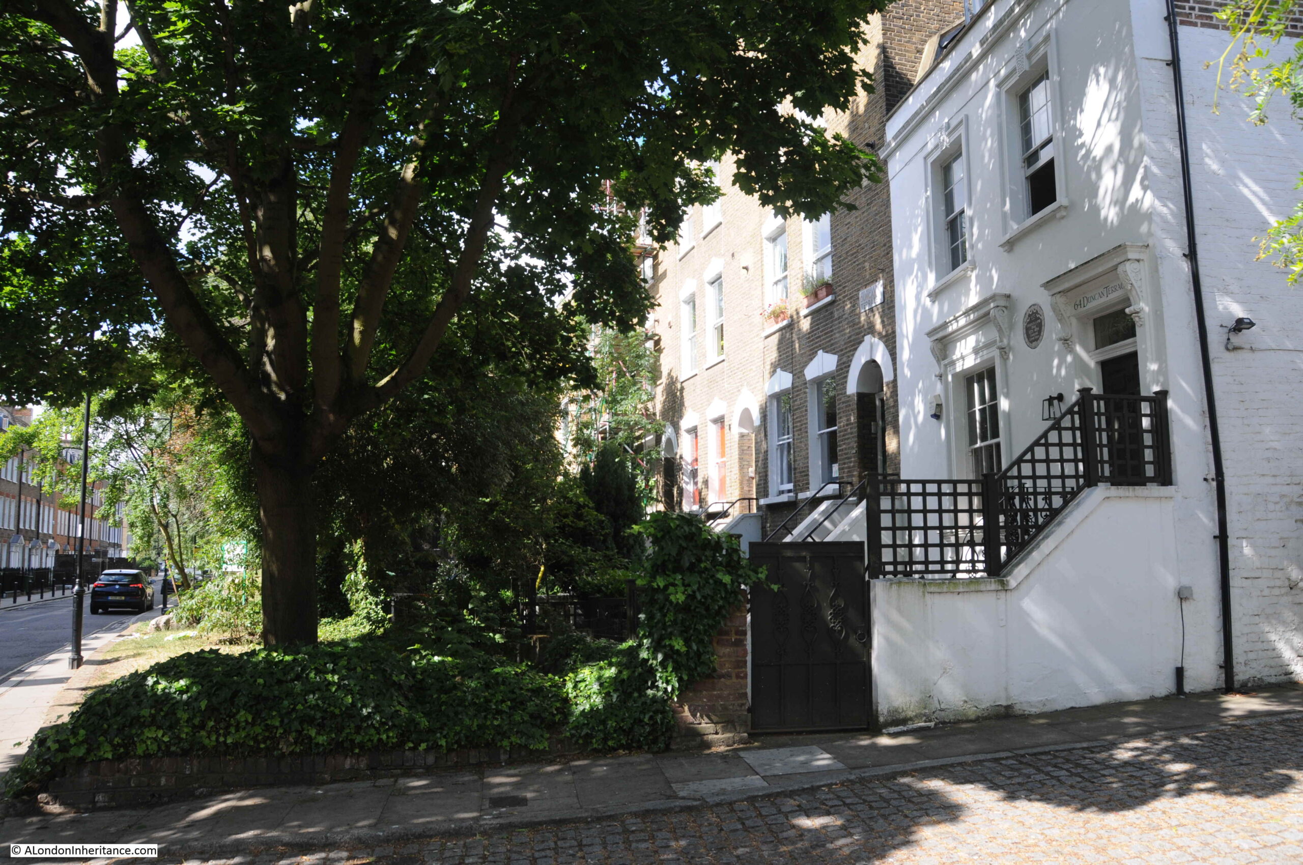
The white house on the right in the above photo was occupied by the poet and essayist Charles Lamb in the 1820s. The following print shows the house as it was, with the New River running directly in front of the house:
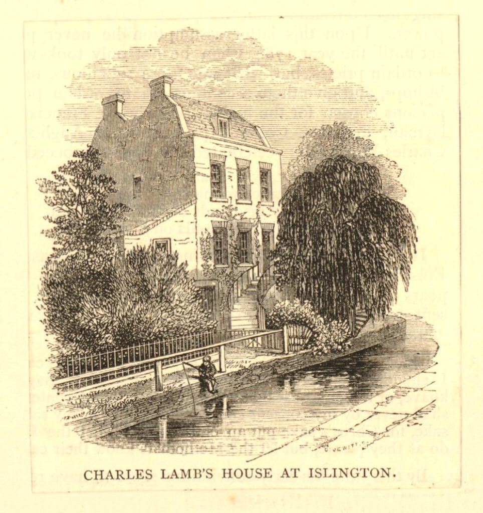
I have written a detailed post about Colebrooke Row and Charles Lambs which can be found here.
Leaving Colebrooke Row, we cross over City Road and Goswell Road, and cut through to St John Street. Then down to Owen’s Row (which is on the alignment of the New River, I wrote about Owen’s Row within this post).
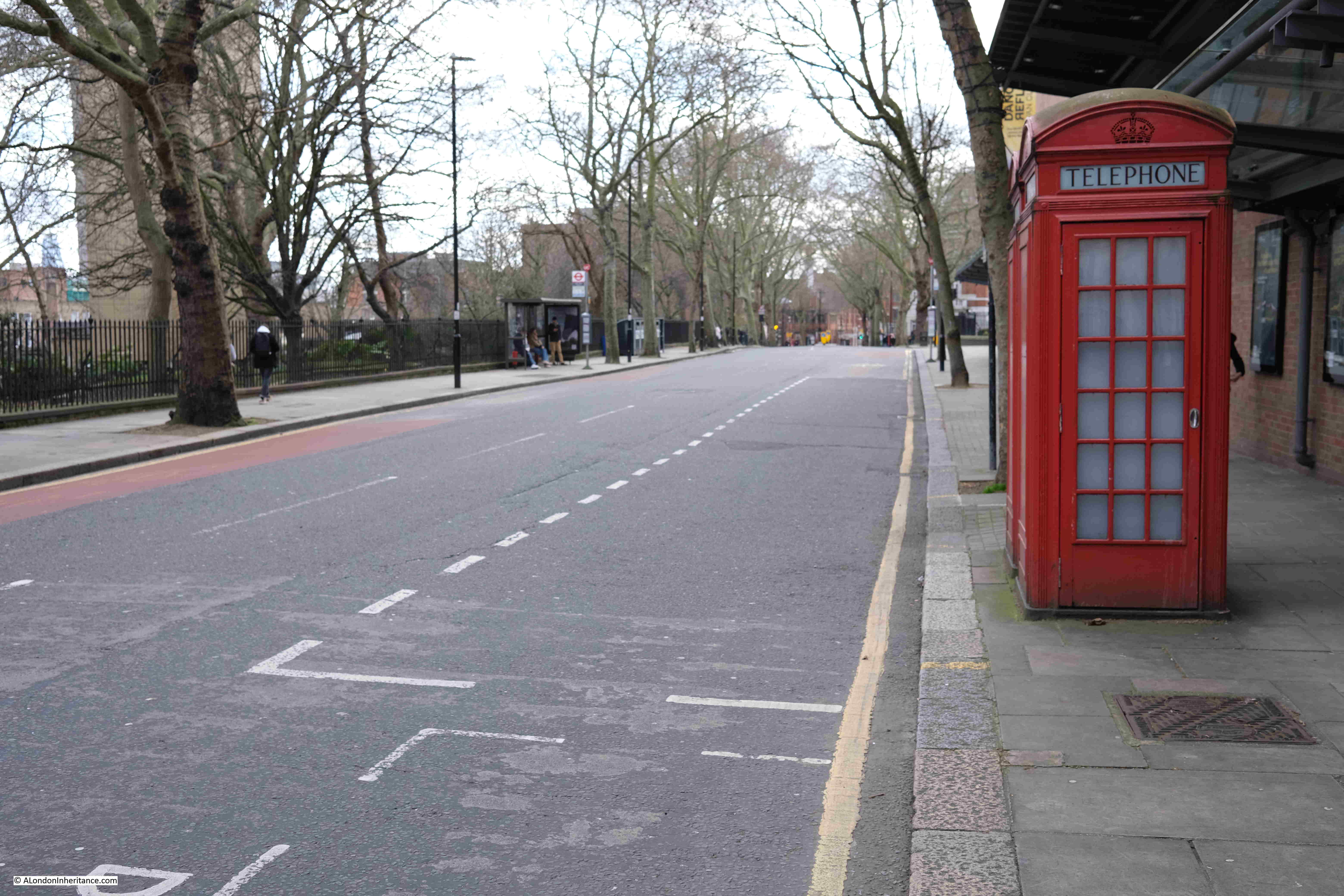
Crossing over St John Street into Rosebery Avenue, and this is the view along the old route of the New River, with Sadlers Wells on the right (a post on Sadlers Wells and the New River is here):
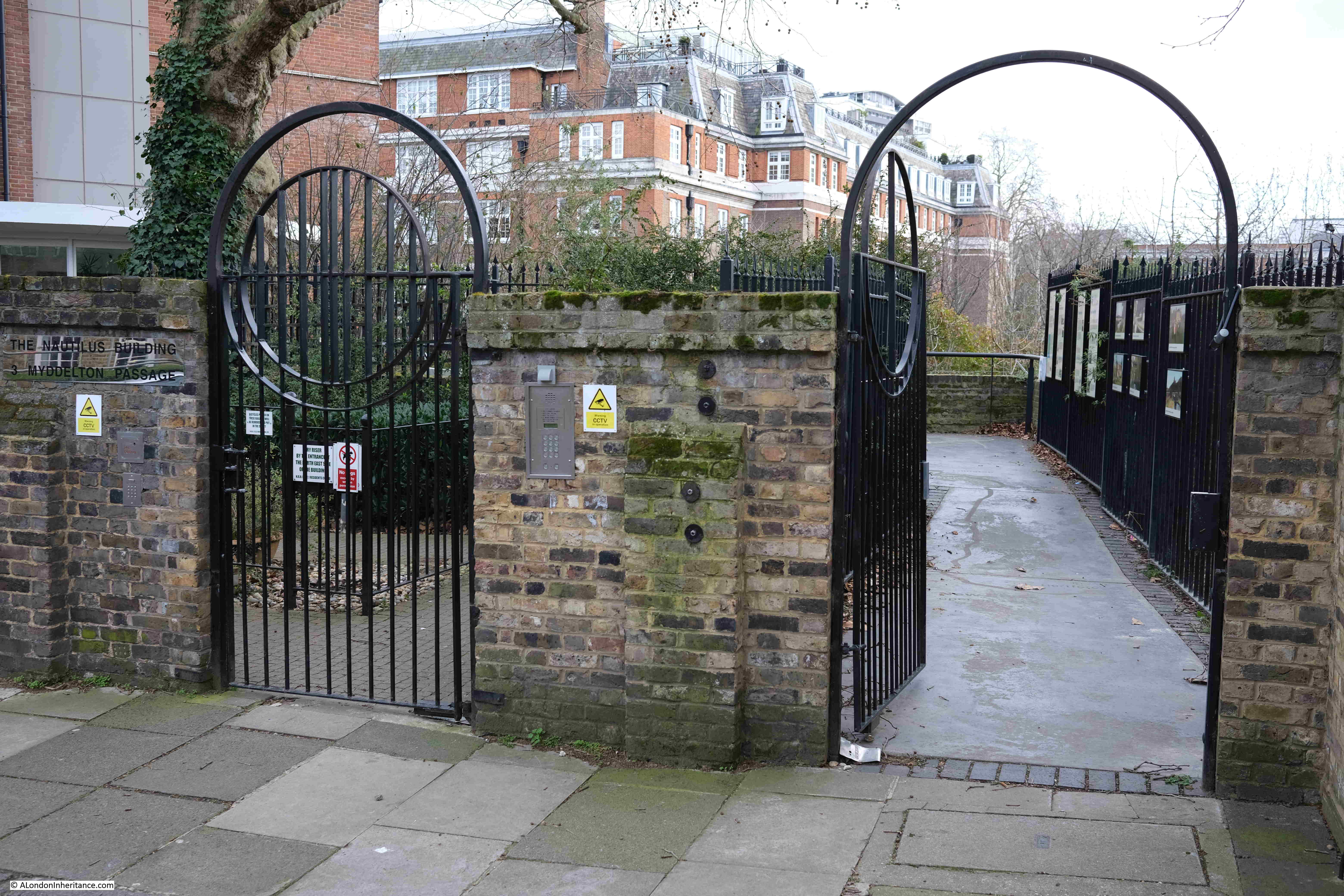
At the end of Sadlers Wells, turn right into Arlington Way, then left into Myddelton Passage, where we come to the official end of the New River Walk, at the viewing platform looking over what was New River Head:
The route is marked on the ground of the viewing platform:
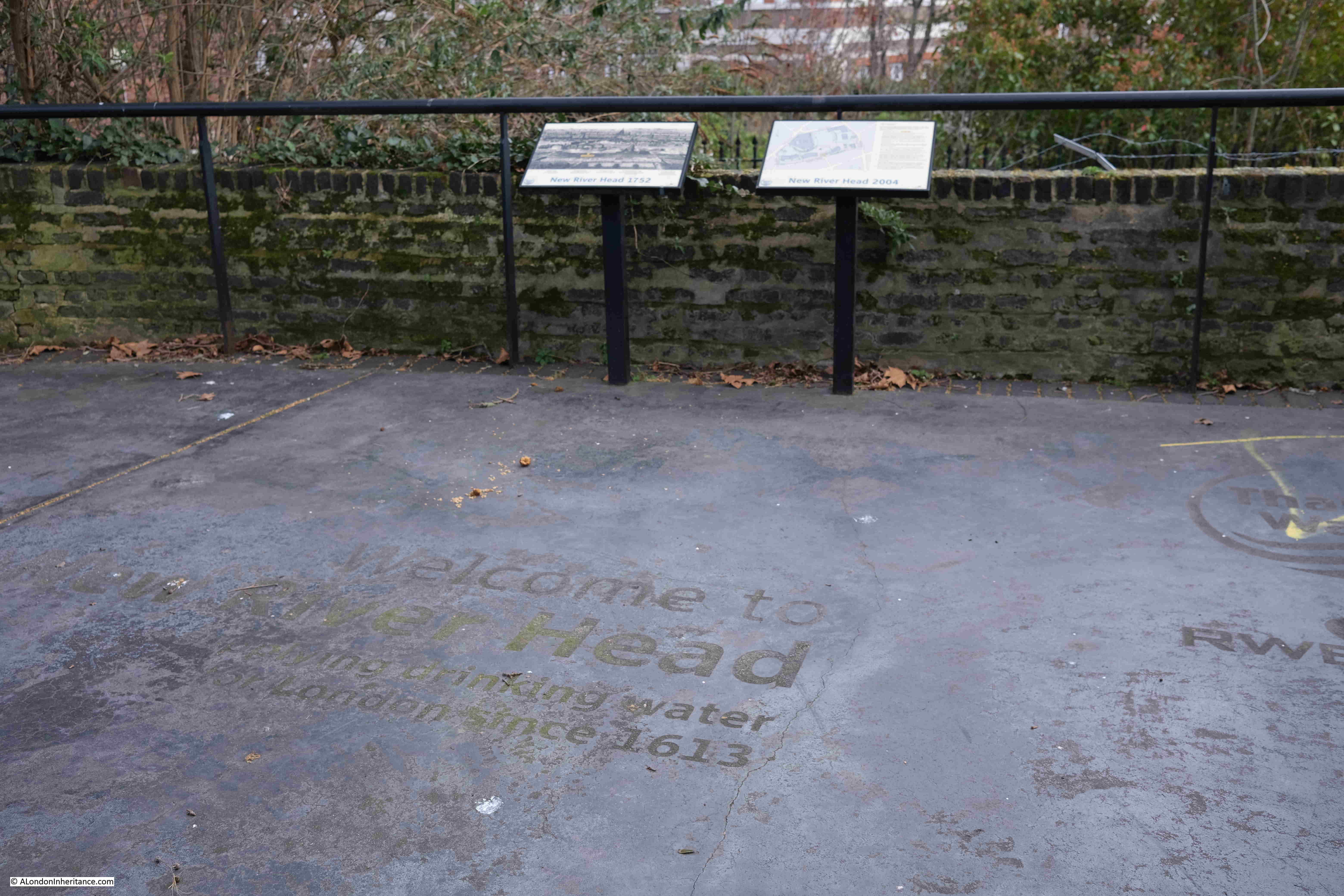
And that completed the New River Walk, over four days / two weekends, from Ware in Hertfordshire to New River Head, Clerkenwell.
It was a fascinating journey, and whilst the route has been straightened at a number of points and does not fully trace the original early 17th century route, it did leave me with considerable admiration for those in the early 17th century who surveyed and built the route, following the contours of the land so it would only fall by roughly 20 feet along the entire route ( 5.5m in total or 5 inches per mile). This enabled the water to flow naturally without the need for any pumping.
You can find my posts covering the first two stages of the walk at the following links:
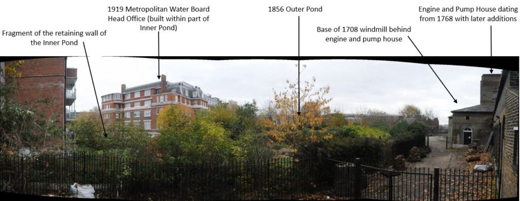
In the following panorama from the viewing platform at New River Head, I have labeled some of the key features. On the right are the engine and pump house which will soon become the new Quentin Blake Centre for Illustration, a wonderful new use for these historic buildings.
David Fletcher creates remarkable 3D photogrammetry captures of heritage sites and has one for the historic buildings at New River Head. Hopefully this will work as I have embedded the model in the post (if you do not see this in the e-mail, click here for the post on the website).
You can walk through the site, both inside and out to see this remarkable, historic site in detail:
And finally, if you have not had enough about the New River, I purchased the following book, the Mercenary River by Nick Higham a few weeks ago.
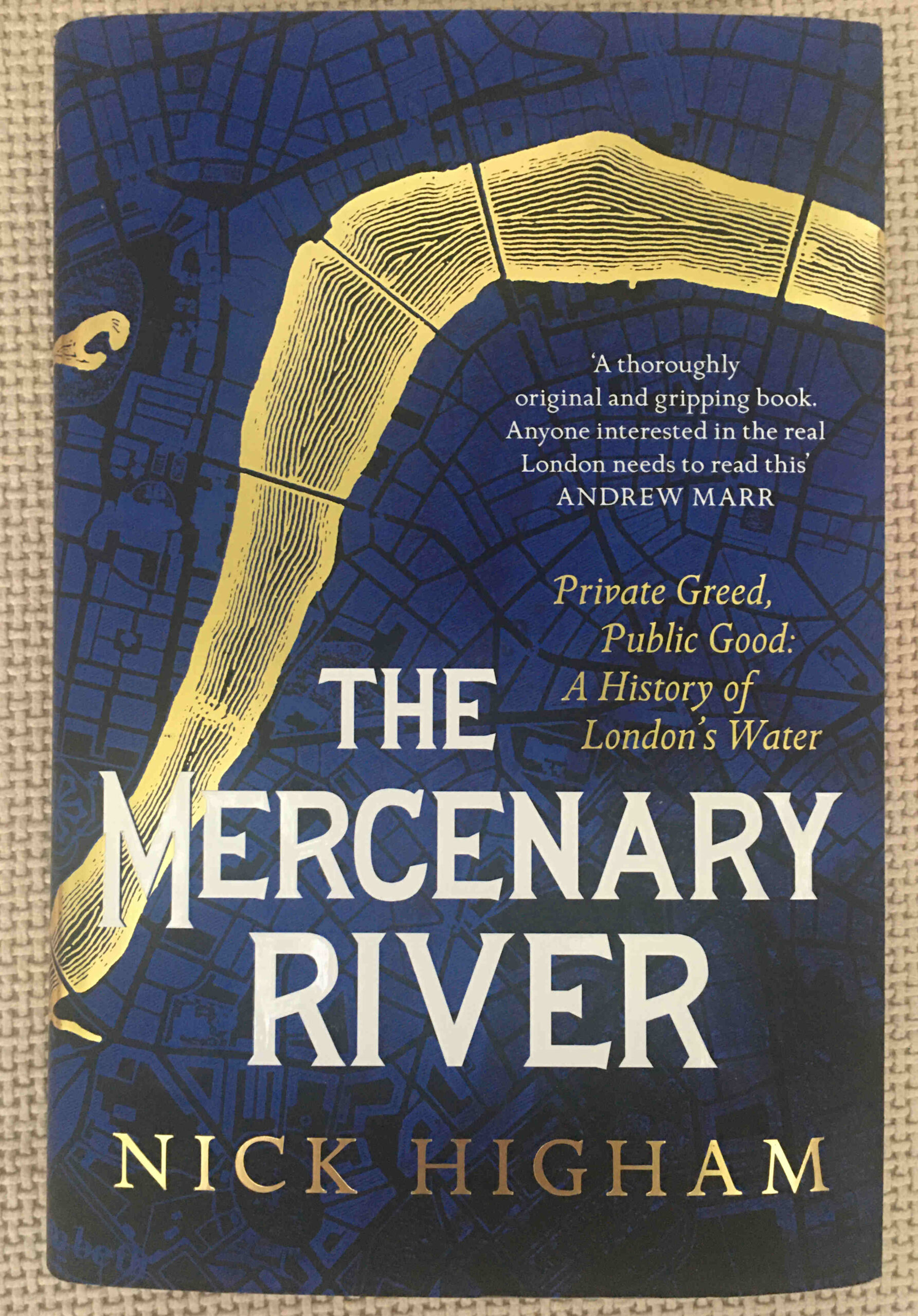
It really is a fascinating history of London’s water supply, including, off course, the New River, and is highly recommended.

Wonderful detail backed up with another set of excellent photos. As I’m not a London resident it fascinates me to ‘walk’ these areas and see how comparatively closely they’re linked. I have to resist diving off into your various links at the time of first read-through, otherwise I’ll be here all day!
Thank you, as ever, for another brilliant post.
Thank you. I used to live just off Hornsey High Street, in fact the house we lived in must have been on the old course of the New River before it was straightened.
I had always been puzzled that the Three Compasses pub on Hornsey High Street was described as being popular during the 19th century, with gardens running down to the New River. Now I understand why.
Thank-you for another most illuminating post, as always, a pleasure to read.
The notoriously muddy section between Finsbury Park and Seven Sisters Road is currently puddled-clay which doesn’t allow water to drain. It is to be surfaced by Thames Water with work due to begin later this year, 2022. No-doubt, the path will be closed during the improvements. An alternative route is shown on page five of this .pdf…
https://www.innerlondonramblers.org.uk/images/RingandLoop/guides/CR12-highgate-to-stoke-newington-Jan22.pdf
This is good news. That section off the path is sometimes virtually impassable…
That muddy part of the New River Path is also part of the 75 mile ‘Capital Ring’ long-distance footpath which was adopted by The Ramblers from TfL. It was the Ramblers who persuaded Thames Water to improve the surface.
Very nice post. I used to live in Islington, and had no idea that the New River had passed through it so close to where I lived. Looks an interesting walk I may have to replicate soon.
Many thanks for the plug! Those interested in following the route as closely as possible may like to know that you can also see a section of the New River, marked by a raised bank and a line of trees, at the south end of Petherton Rd running between blocks of flats on the Highbury Estate off Beresford Terrace and Grosvenor Ave.
Thames Water have announced that they will begin work to make the muddy section between Finsbury Park and Seven Sisters Road permanently walkable on 2nd May 2023 and that it will take seven to eight weeks. The path will be closed during that period.
It’s open now and looks great, we formed a group New River Renewal Campaign ( https://www.newriverrenewal.co.uk) and one our objectives was to get them to sort it this section which TW did after a couple of meetings. Had no idea that the ramblers have been on at TW for ages to do this. It now looks as though it will be closed again as they want to drain the section and reline it
Enjoyed reading your comprehensive guide, one correction what you call a borehole with four pipes entering the river nr Seven Sisters Rd is in fact a pressure release system connected directly to Walhamstow Reservoirs to cope with excess pressure and bring that water down to the East Reservoir
Hullo Mark
Thanks for your information. One question. Immediately east of Seven Sisters Road and between the New River and the parallel Amhurst Park is a circular concrete ‘base’ with an inlet/outlet to the river. Sounds of pumping (?) occasionally emanate from it. Do you happen to know what this is?
Thanks – Ian
Hi Ian,
Yup that what was what I meant by ‘the thing with four pipes’ going into the NR, it houses the valve to release the water into the NR so releasing excess water to be recirculated via the East Res and back up to Walthamstow for treatment
BW
M
Hullo Mark
The four pipes are much closer to Finsbury Park! If this long link works you’ll see what I mean.
https://www.google.co.uk/maps/@51.5742667,-0.0859972,3a,90y,342.53h,90.8t/data=!3m8!1e1!3m6!1sAF1QipOx5328-JtthsuNWVtcR52P8Dortx9lzQPp72NQ!2e10!3e11!6shttps:%2F%2Flh5.googleusercontent.com%2Fp%2FAF1QipOx5328-JtthsuNWVtcR52P8Dortx9lzQPp72NQ%3Dw203-h100-k-no-pi0-ya343.32297-ro-0-fo100!7i5376!8i2688?entry=ttu
All the best
Ian