Tag Archives: New River Head

New River Walk – Alexandra Palace to New River Head

I have finally completed the post covering the last stage of the New River Walk, which covers from Alexandra Palace to New River Head in north Clerkenwell.

At the end of the previous stage, we had reached Bowes Park, where the New River disappeared in a tunnel, and for today’s post, we rejoin the New River where it exits the tunnel, opposite Alexandra Palace station.

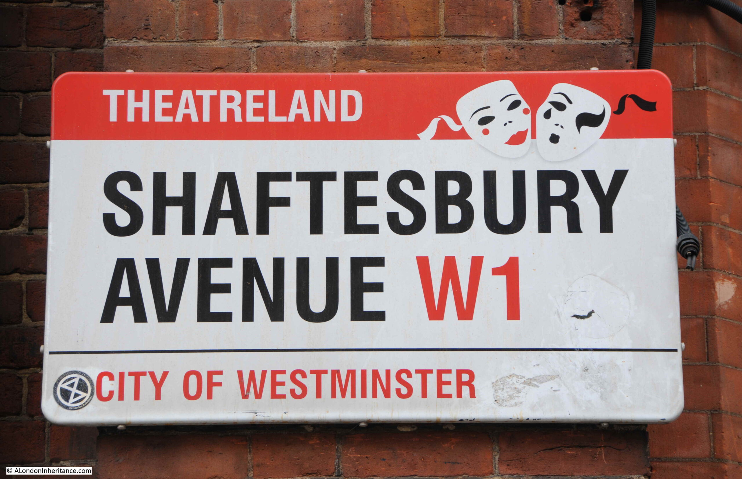
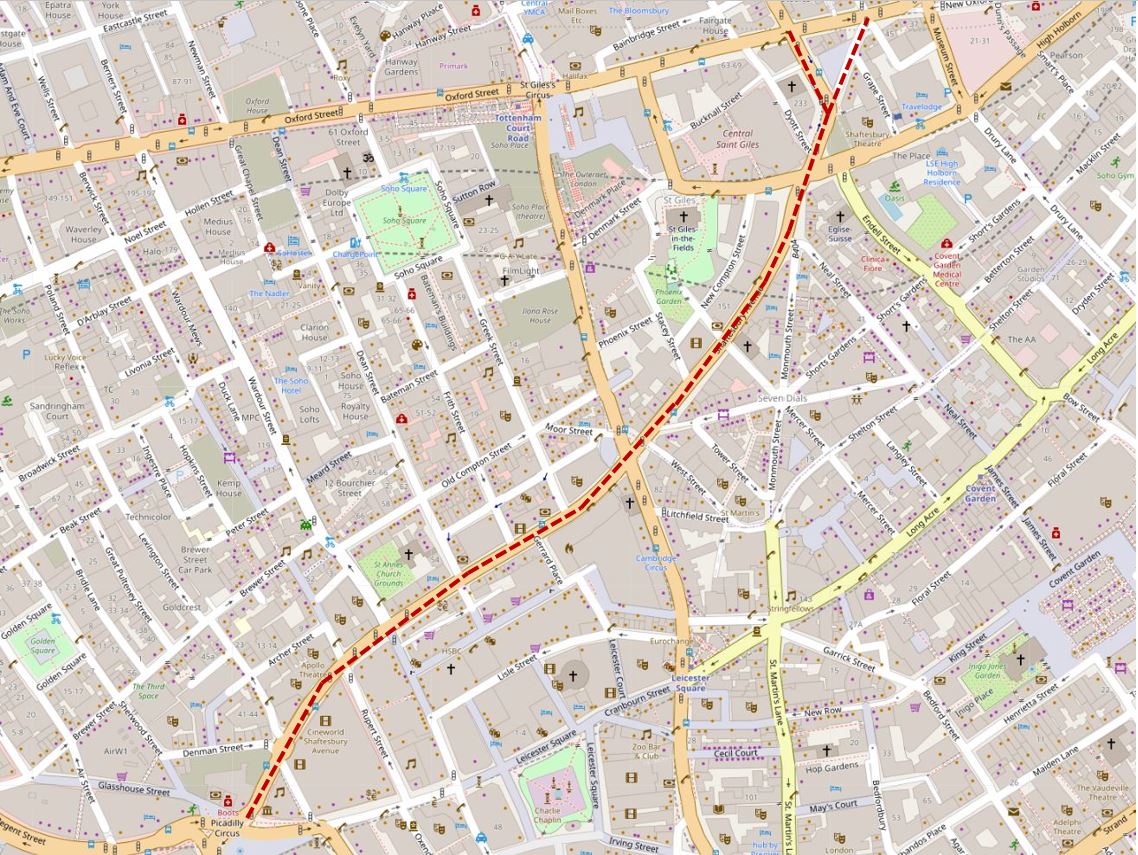
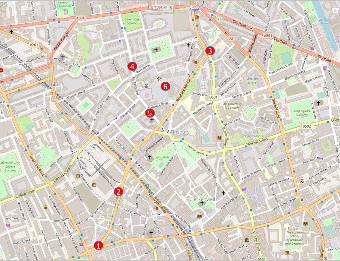
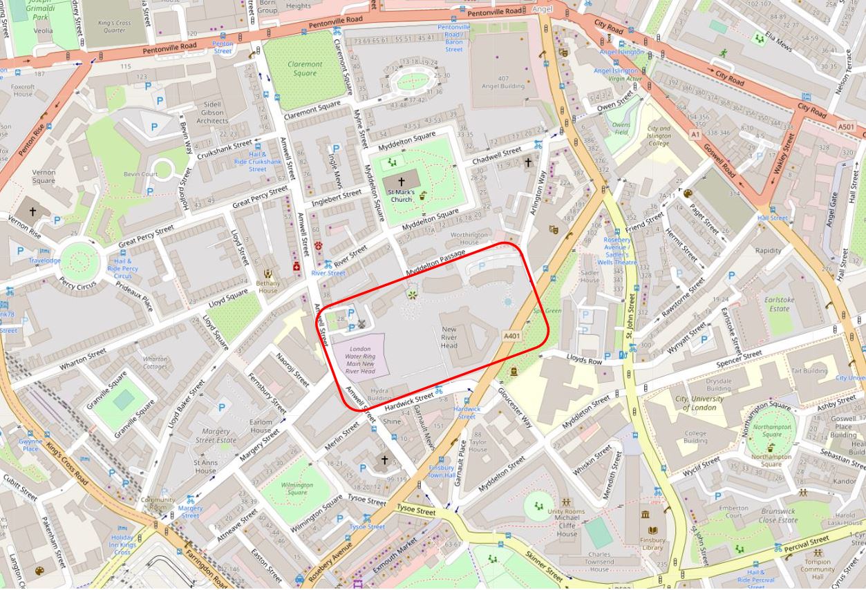
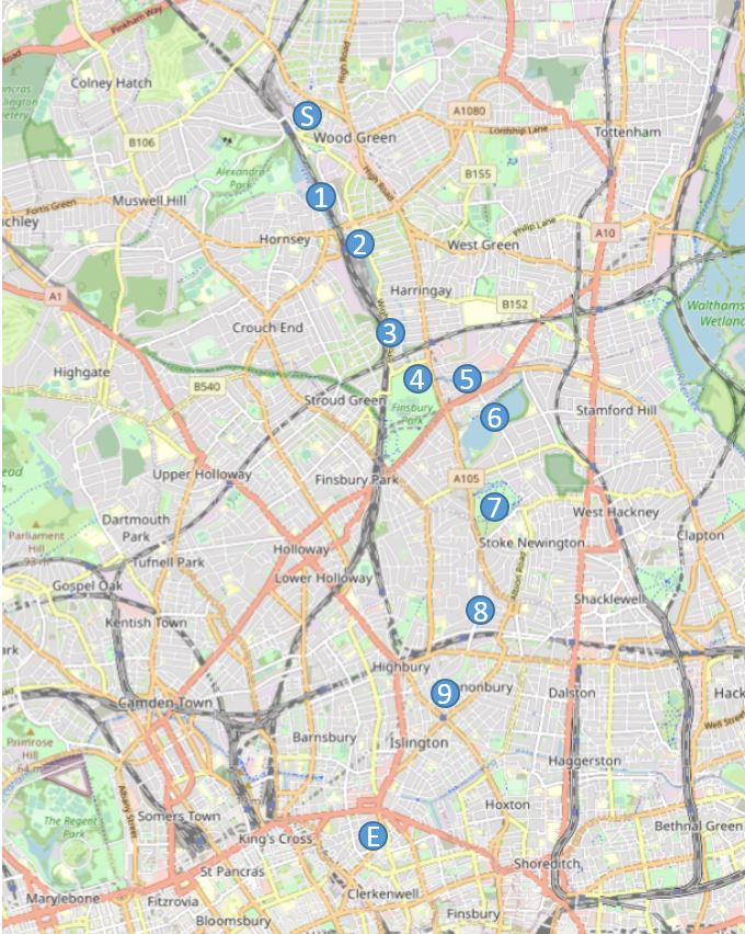
This stage of the walk will follow the New River from Alexandra Palace to the east and west reservoirs, just south of the Seven Sisters Road, where it ends as a river. Then, the walk follows a Heritage Walk that follows the original route of the river to New River Head before the river was truncated at the reservoirs.

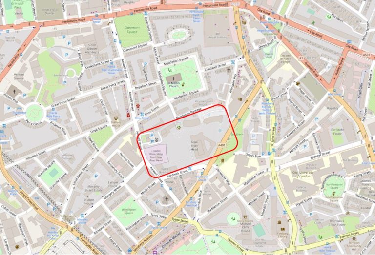
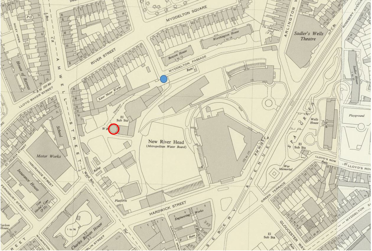
The map of the final stage, with key locations covered in the post is shown below  (© OpenStreetMap contributors):

New River Walk Alexandra Palace to New River Head

Point S on the map: Alexandra Palace station is at the north west tip of a patch of open, green space, and at the south east corner of this space, the New River exits the tunnel through which it has flowed from Bowes Park:

Alexandra Palace

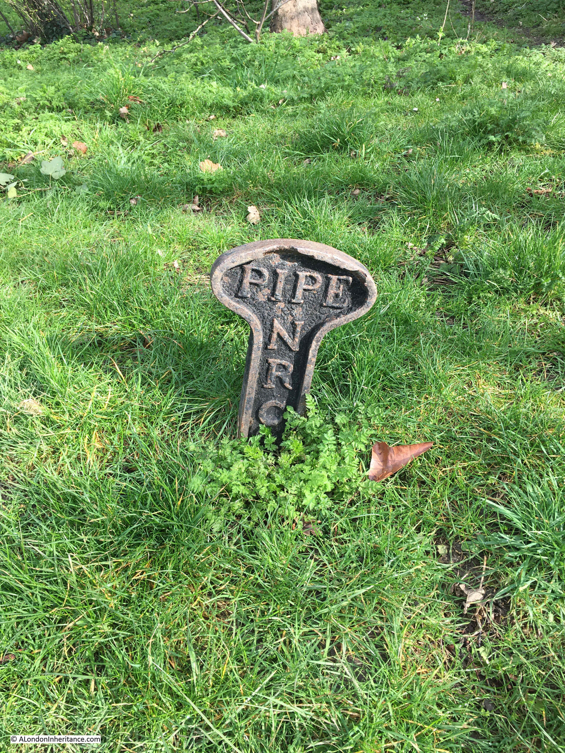
There is nothing to see of the actual river between Bowes Park and Alexandra Palace, however there are a number of these New River Company pipe markers:

NRC Pipe

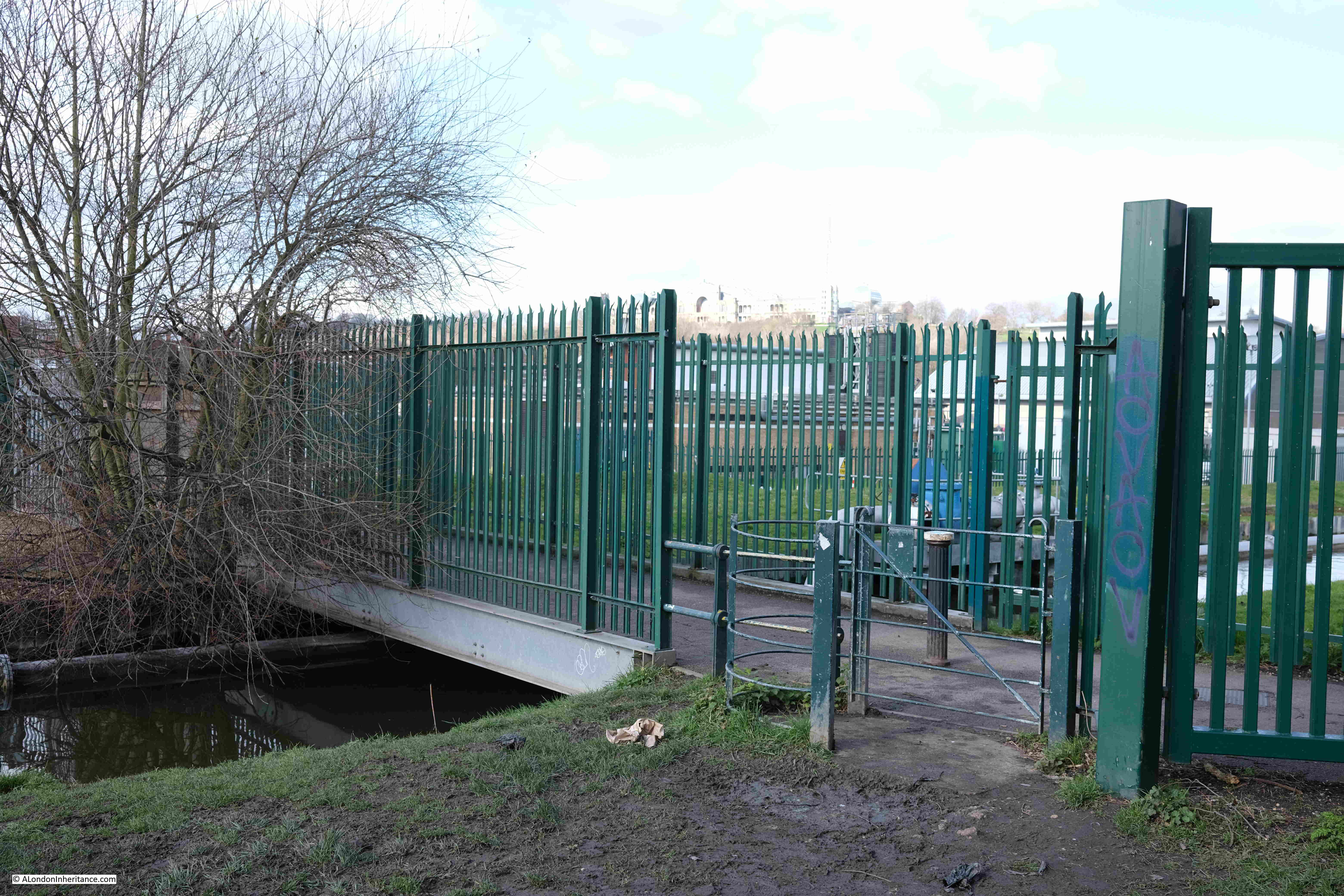
Point 1 on the map: Here, a rather over exposed Alexandra Palace can be seen on the high ground in the distance. Hornsey Water Treatment Works are behind the green metal fencing and the New River runs under the footbridge between the fencing:

Hornsey

The route through Hornsey is an example of where the New River has been straightened and does not follow the original early 17th century route.

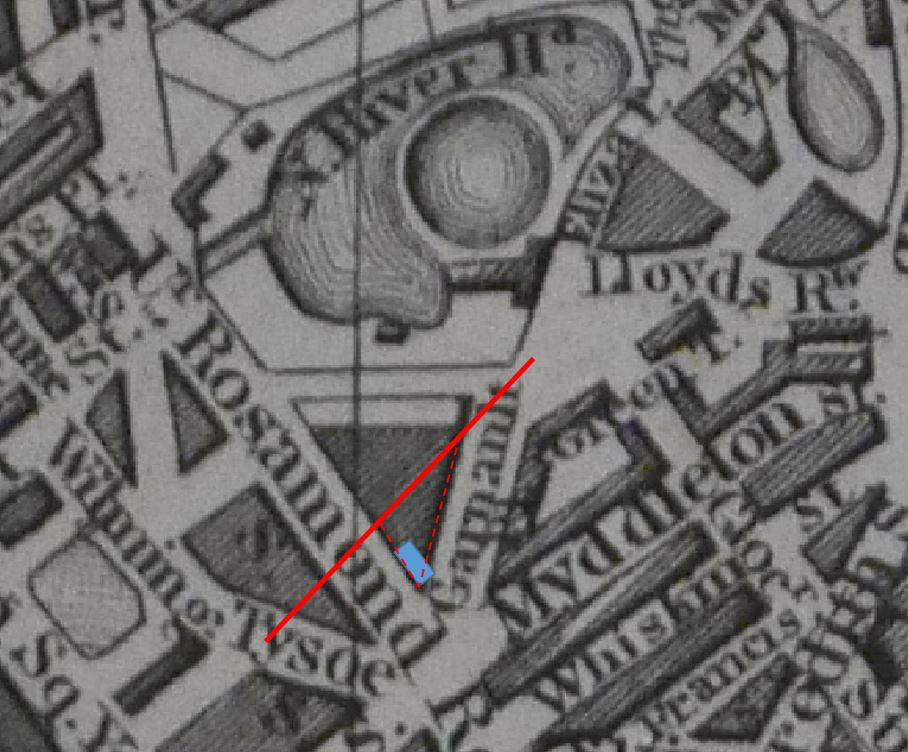
The following map from 1861 shows the original early 17th century route (dark blue), along with the proposed new straightened route (light blue):

Hornsey

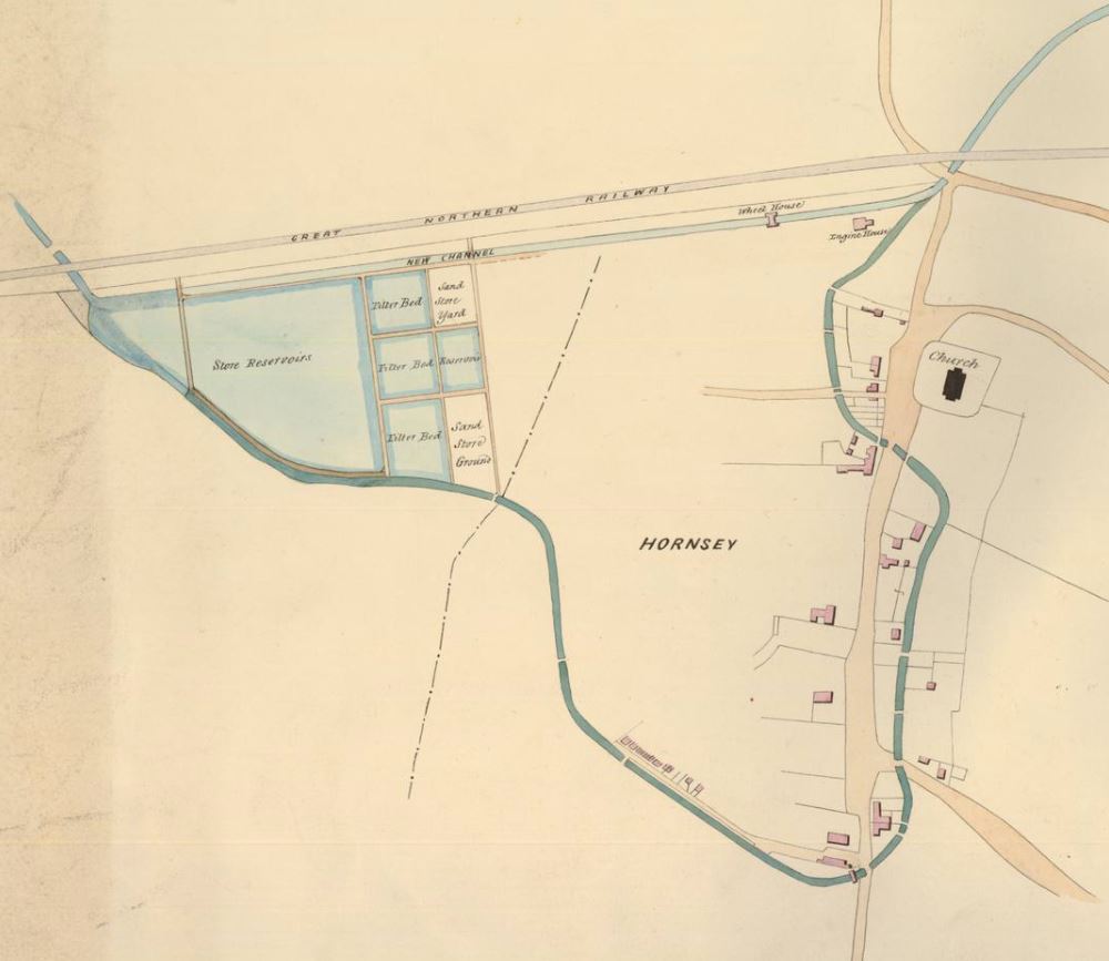
Hornsey Water Treatment Works are to the left, and the New River runs at the bottom of these works, and heads to Hornsey High Street which it crosses, before turning and crossing Middle Lane. It then heads towards the church and crosses the High Street again, heading up to the junction with Tottenham Lane.

Towards the top of the map, the Great Northern Railway runs from left to right, and below the railway can be seen the proposed new route of the New River, which is straight, and cuts of the large loop around Hornsey.

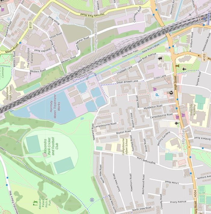
Roughly the same area as the above map, is shown in the following map of the area today, which includes the new route of the river just below the railway, and streets and buildings now covering the original route of the river around Hornsey  (© OpenStreetMap contributors):

Hornsey

There are a number of similar examples on the New River Walk where the route follows where the river has been straightened rather than the original route. It would be an interesting exercise to follow the early 17th century route, however I think I will put that walk on the long list of London walks.

Point 2 on the map: There were very few places on the entire route where it was not possible to follow the New River walk, however one place on this final stretch was also in Hornsey where the path had been closed off as Thames Water are carrying out some repair works on the river:

New River Walk

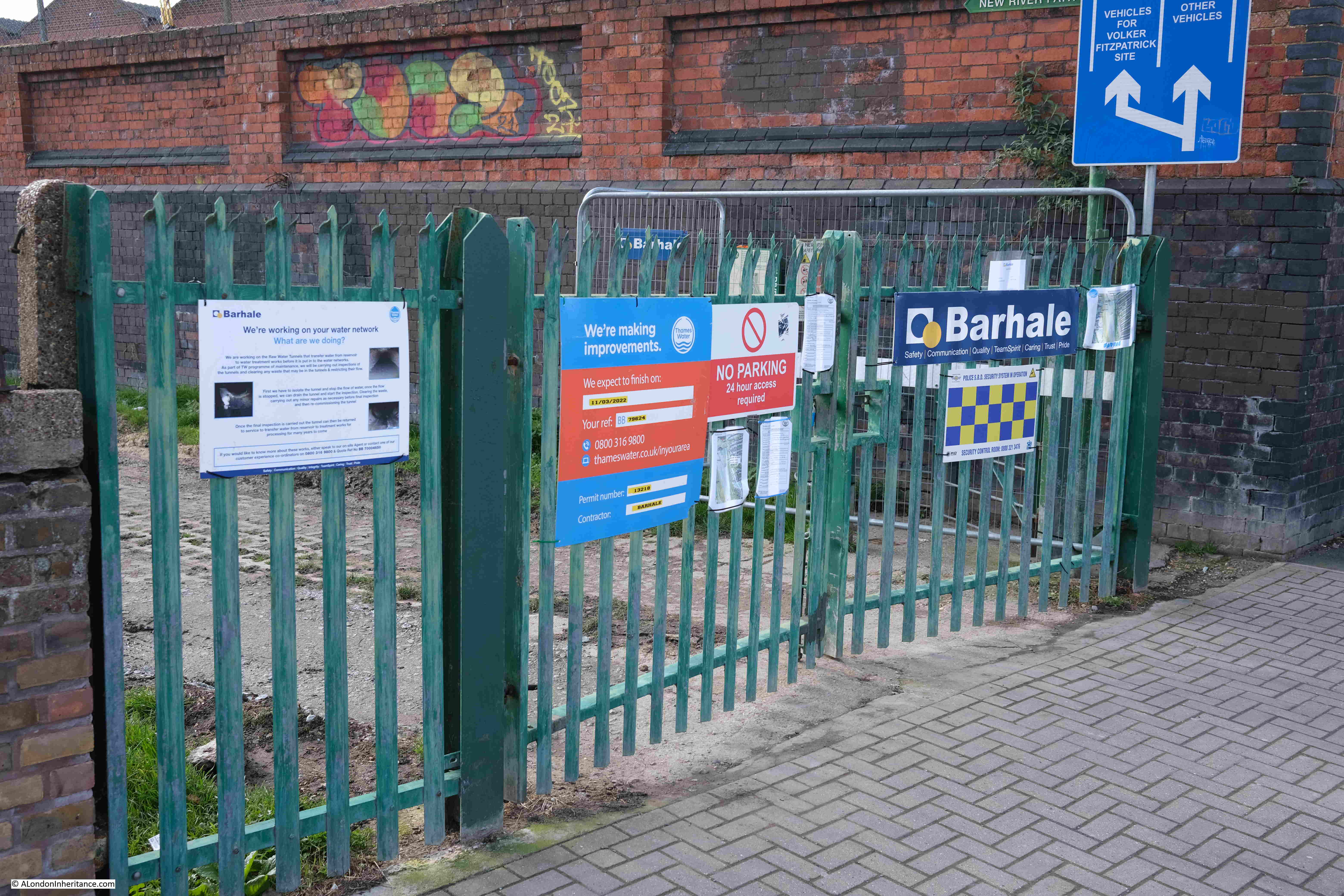
Following photo is looking along the closed section of the walk. This is another straightened section of the New River:

New River Walk

Point 3 on the map: The New River then runs through a housing estate which was built around the New River. The following map extract shows the river running between terrace housing and under streets. There is no path alongside this section of the river, and walking to where the river crosses each street, then back, would add a considerable distance to the walk, so the Thames Water New River path runs along Wightman Road to the left  (© OpenStreetMap contributors):

Wightman Road

The view looking down one of the streets from Wightman Road, the New River crosses the street half way down:

Wightman Road

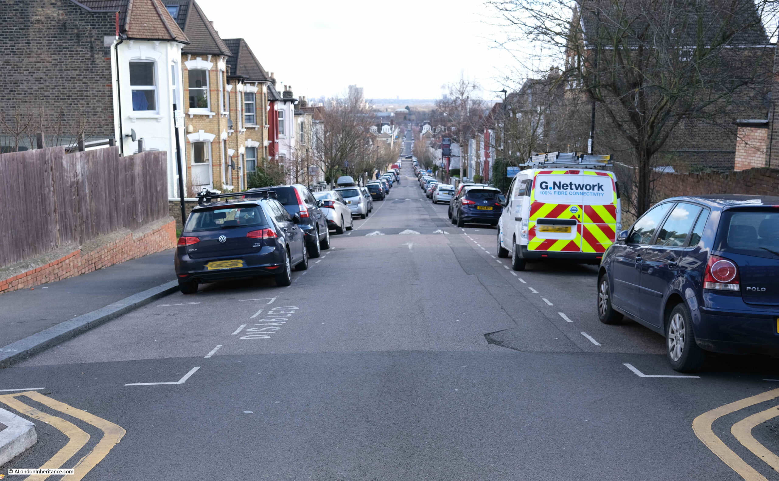
In the above photo, the streets is dropping in height towards the point where the river crosses about half way down. This stretch of the New River demonstrates how the river follows the contours of the land, from the source in Ware to New River Head. A considerable distance which needed some careful planning, and is remarkable given the survey technologies available in the early 17th century.

The following map shows land height by colour, with blue being lower land, then increasing in height through green, yellow and red (from the excellent topographic-map.com):

New River height map

I have marked the route of the New River which is following the boundary between the higher land on the left (around Crouch Hill station), and the lower land on the right (south Tottenham and Seven Sisters station).

At one point in the map, an area of higher ground (yellow) juts out, and the New River has been tunneled under this, before emerging and running through the streets to the east of Wightman Road.

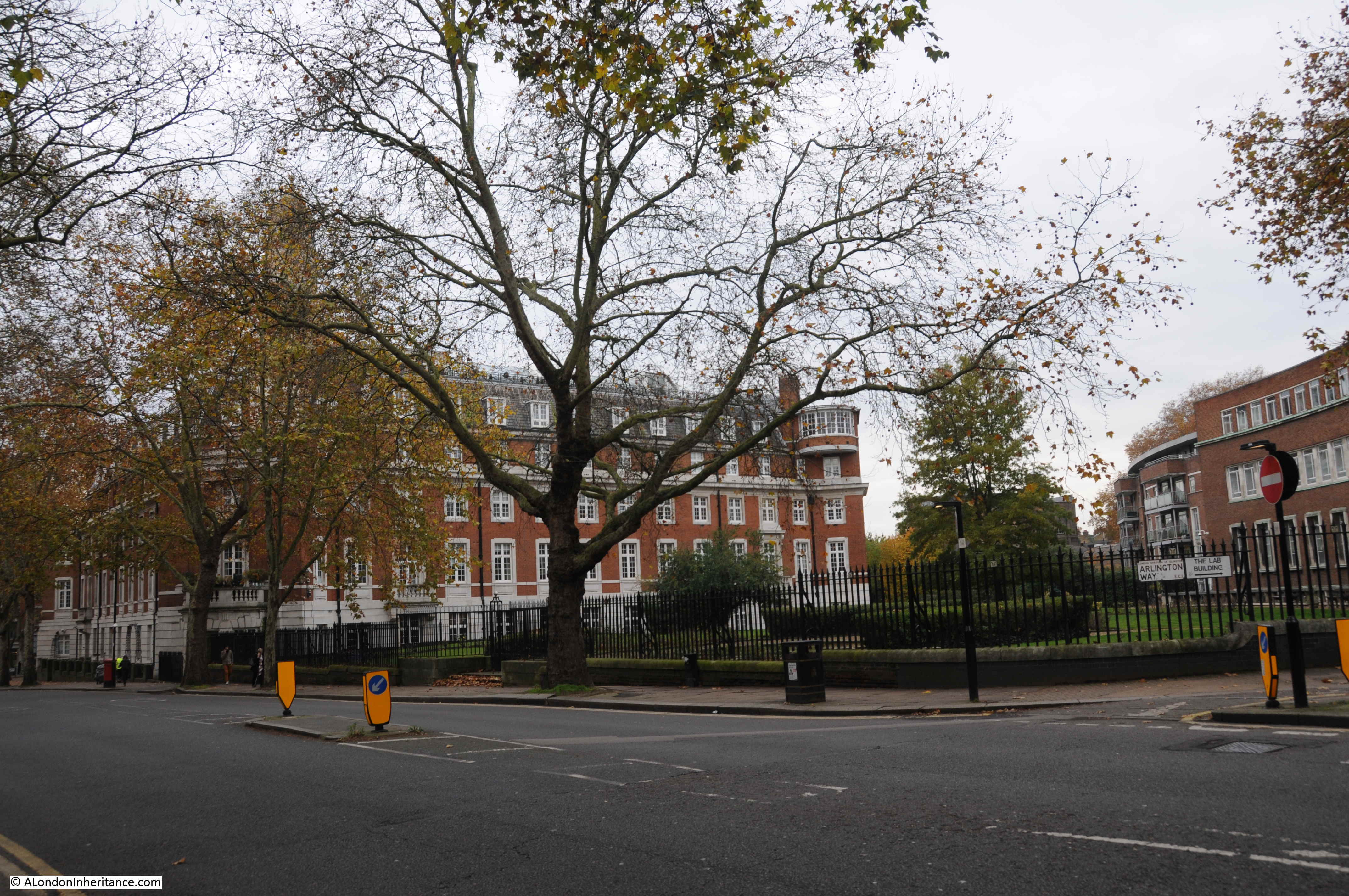
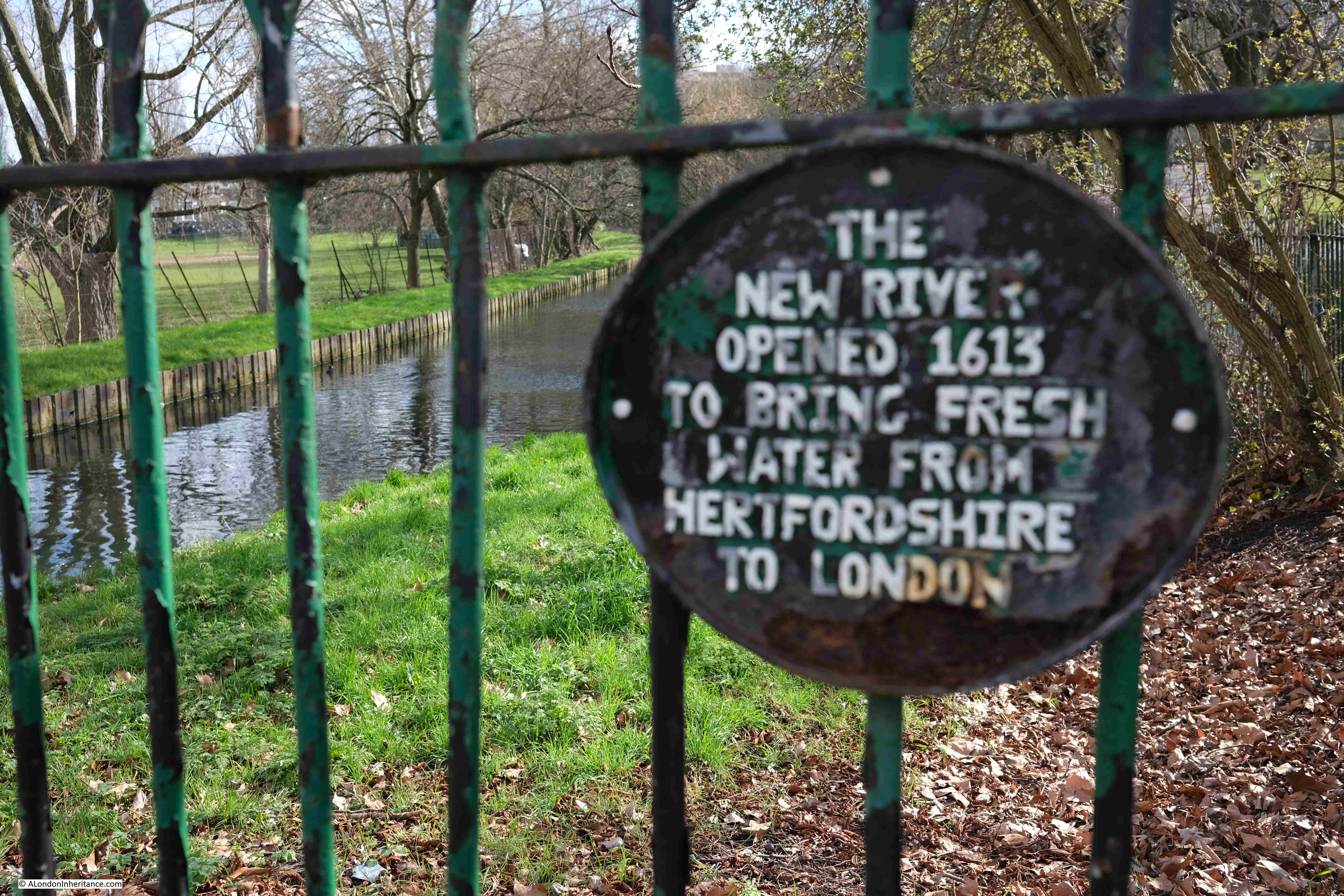
Point 4 on the map: After weaving through the streets of terrace housing, the New River emerges into the north east corner of Finsbury Park:

Finsbury Park

Where there is a plaque recording the origins and purpose of the river:

Finsbury Park

The New River stays in just the north east corner of Finsbury Park, before crossing under Green Lanes, and reaching:

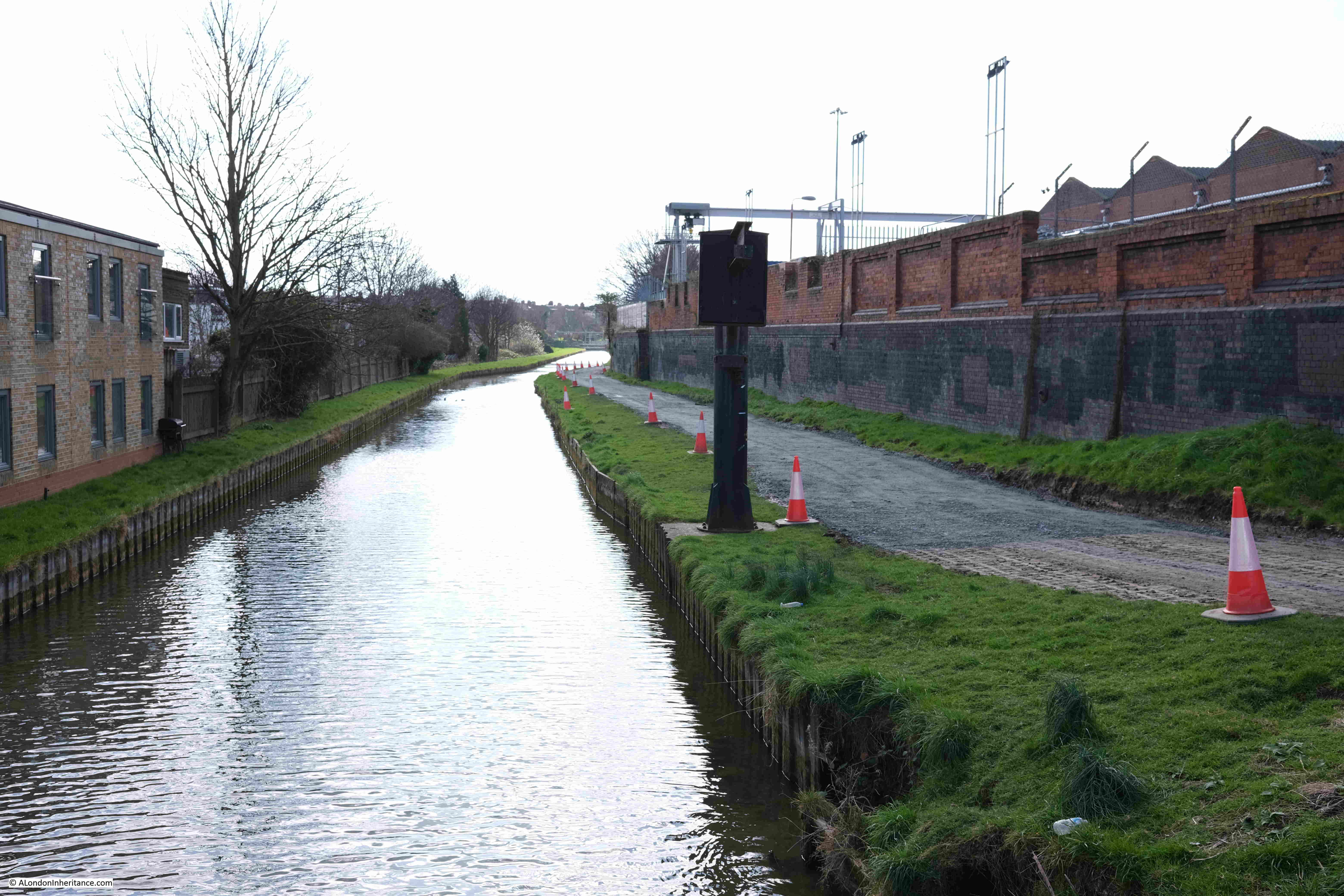
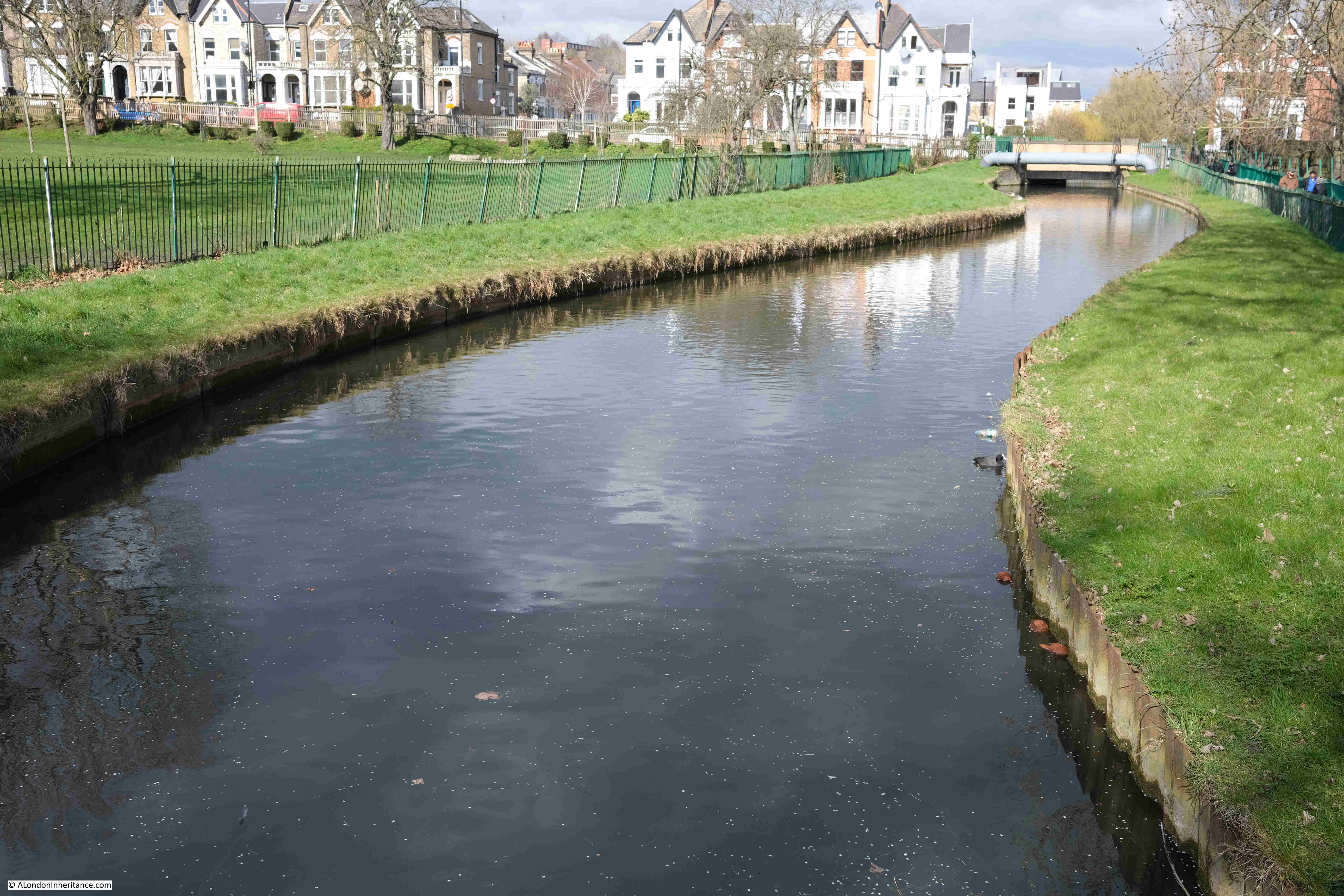
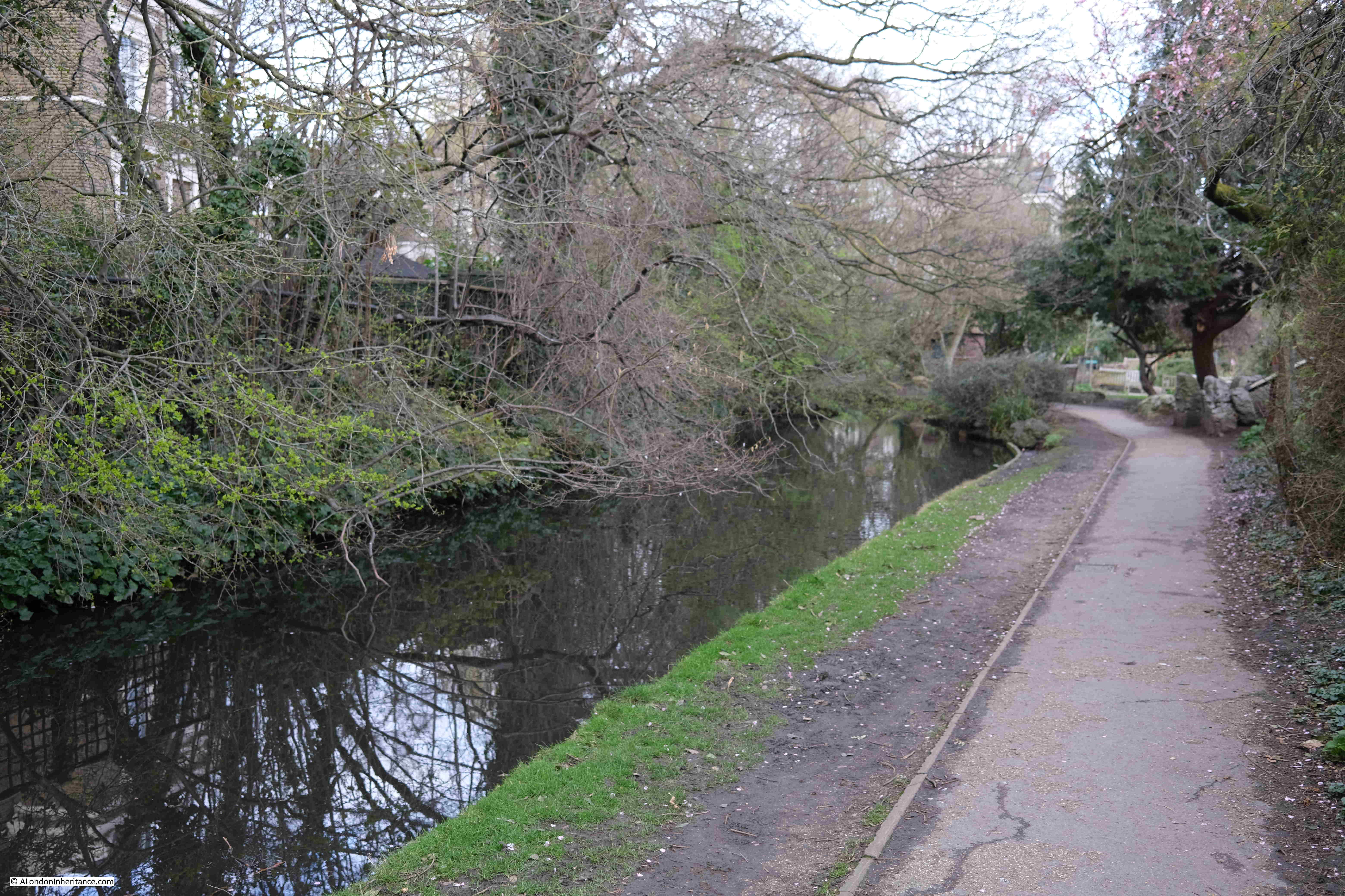
Point 5 on the map: where the river runs along a narrow green space between an industrial area to the north, school and housing to the south:

New River

In the height map above, the New River is heading towards the reservoirs and is skirting around some higher land to the south, and this is visible as we walk alongside the river, with a downward slope from right to left requiring the river to be banked on the northern side:

New River

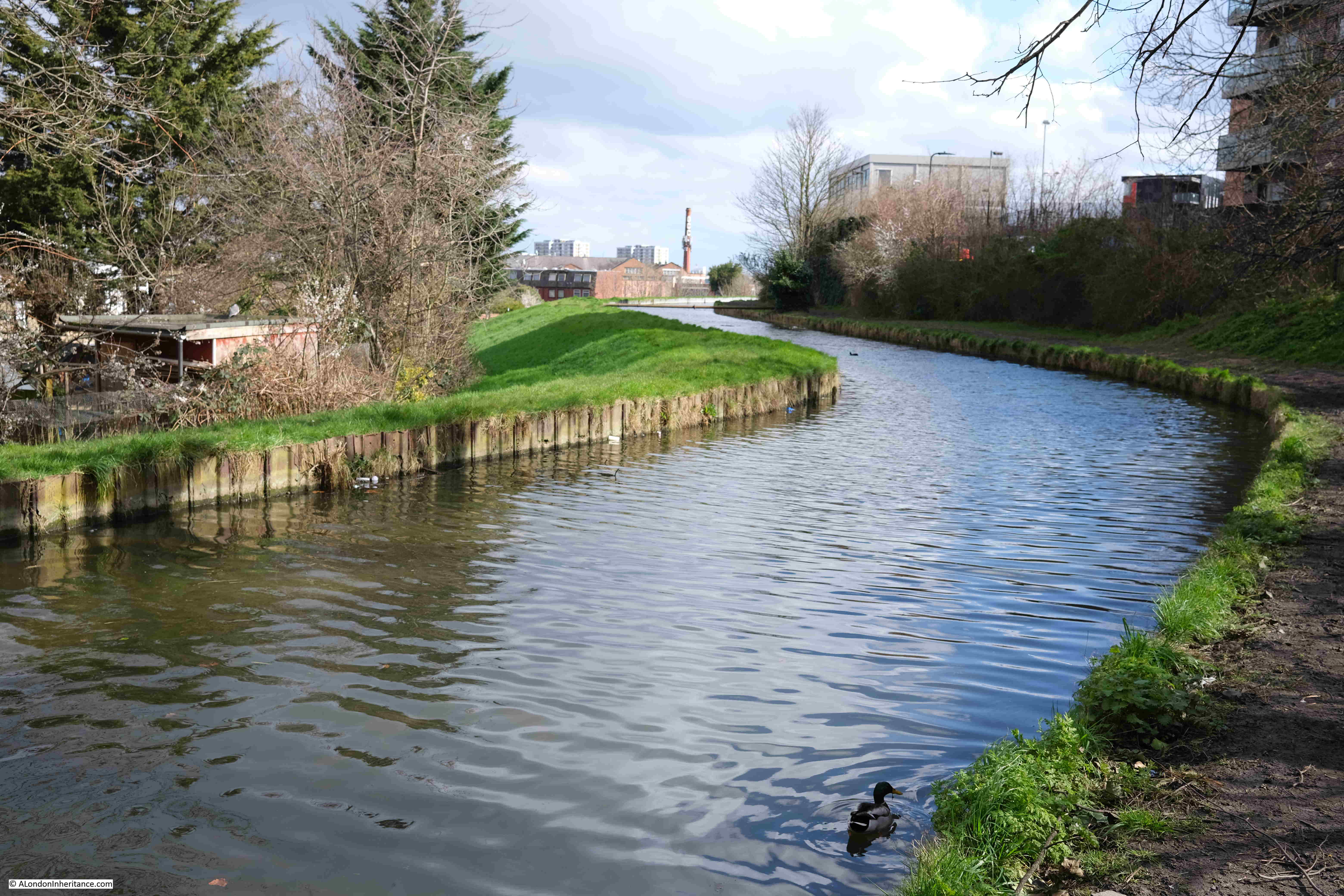
North of the M25, between Cheshunt and Ware, there were a number of points where water was being extracted from boreholes and pumped into the New River. There were no examples of this south of the M25, except for one point along this stretch of the walk where four pipes were pumping water into the river, although it was not clear from where this was being extracted.

New River

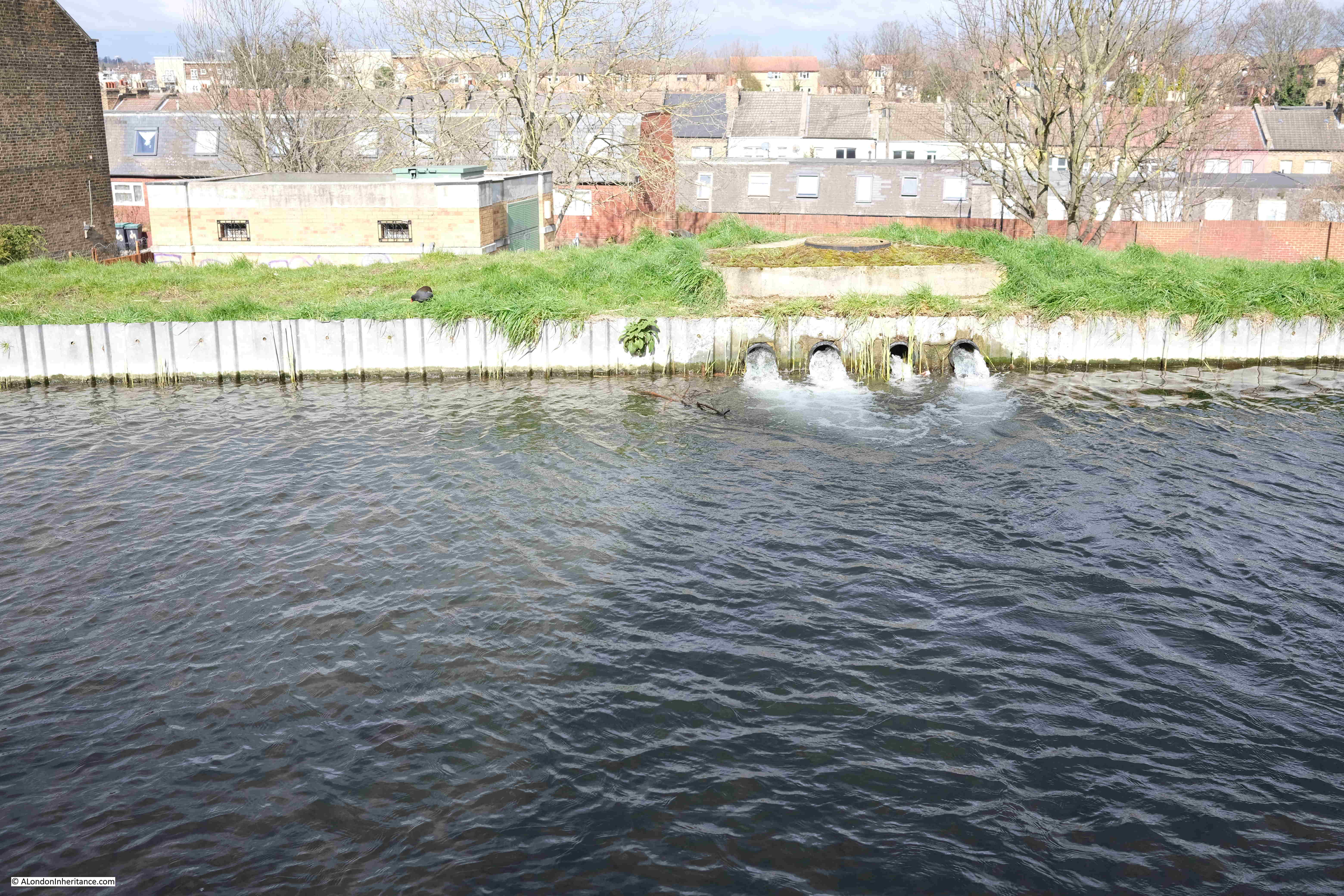
There is a brick building visible just to the left of where the water is pouring into the river. This is on Eade Road. It houses infrastructure of some sort, and has a 2003 plaque on the outside, but no indication of its function.

The British Geological Survey borehole map lists a borehole under this building, however it is marked as “Confidential” with no data available.

I assume the water running into the New River is from this borehole, however it is strange as to why the record is confidential.

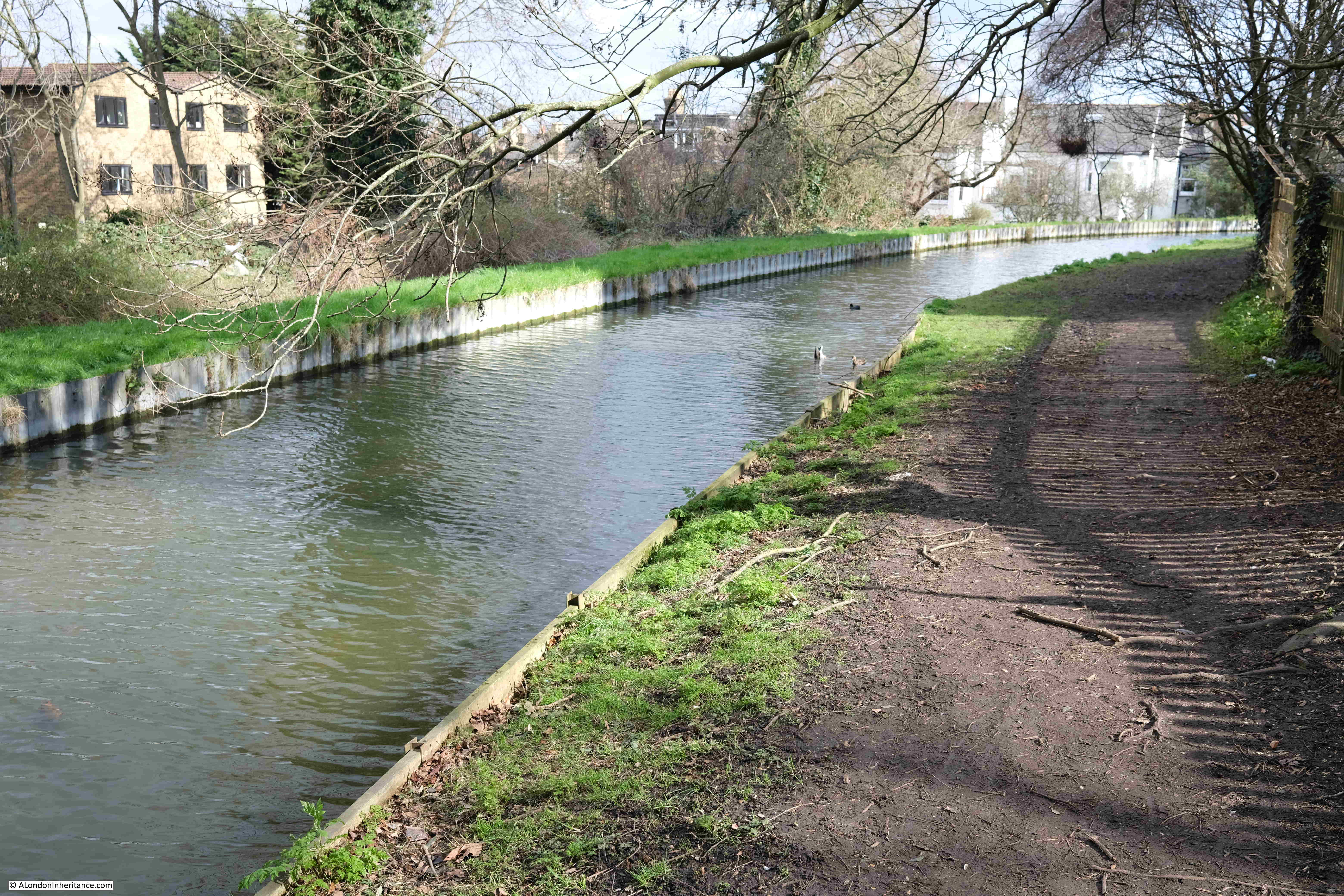
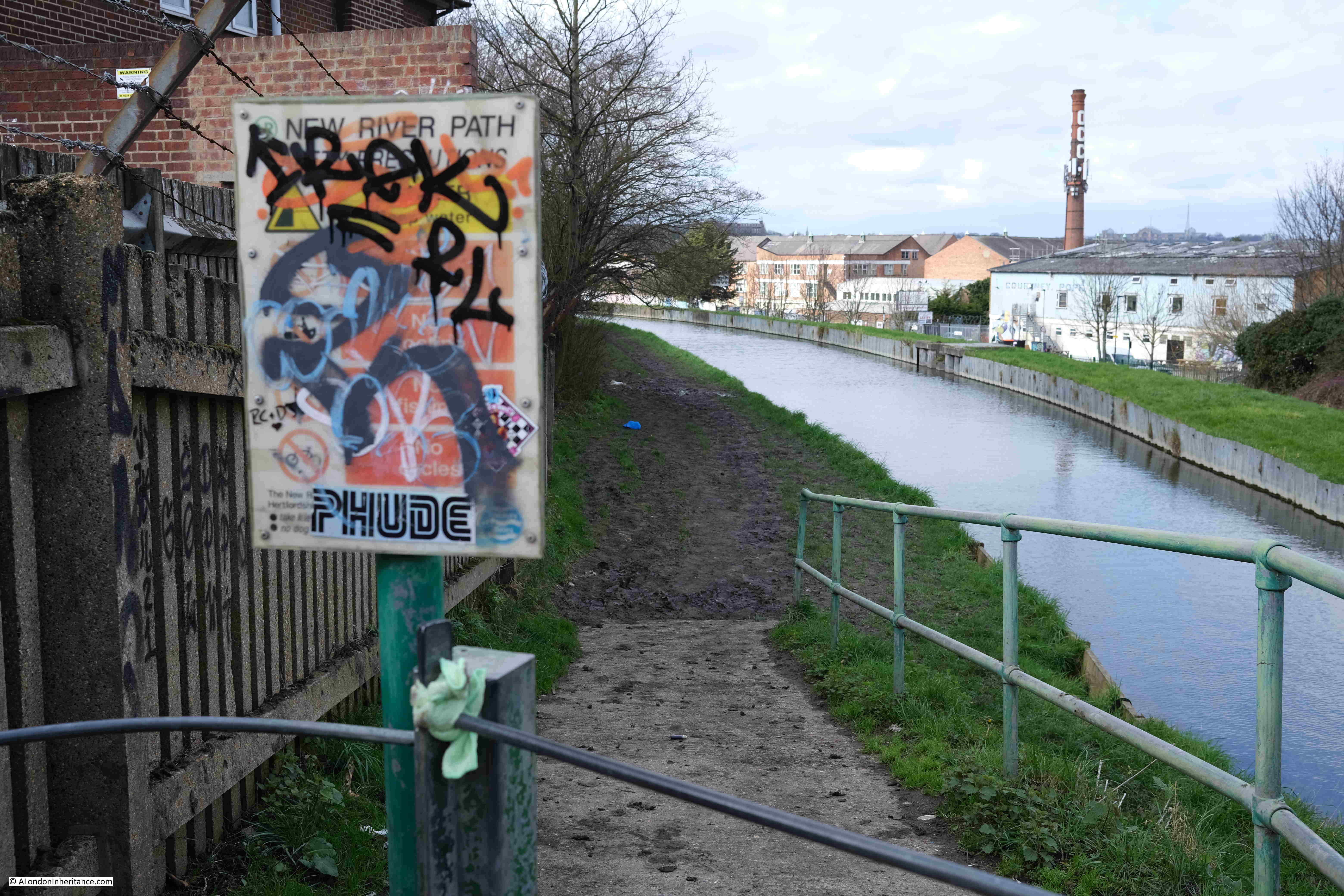
This section of the walk was incredibly muddy, with some sections rather difficult to pass.

At the end, the path runs up to meet Seven Sisters Road, with an information panel covered in graffiti:

New River Walk

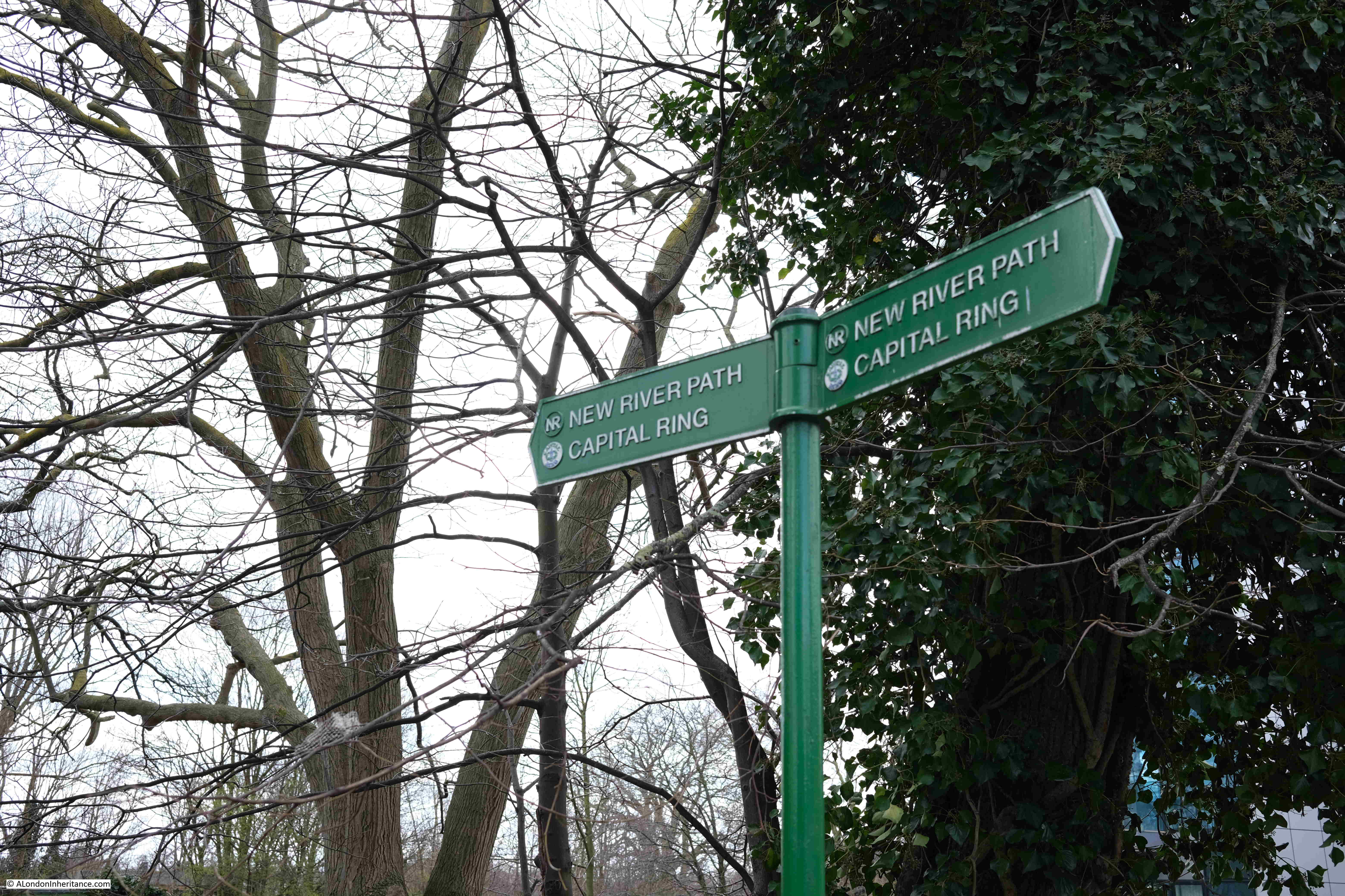
For a short distance, the New River Path has joined with another walking route, the Capital Ring:

Capital Ring

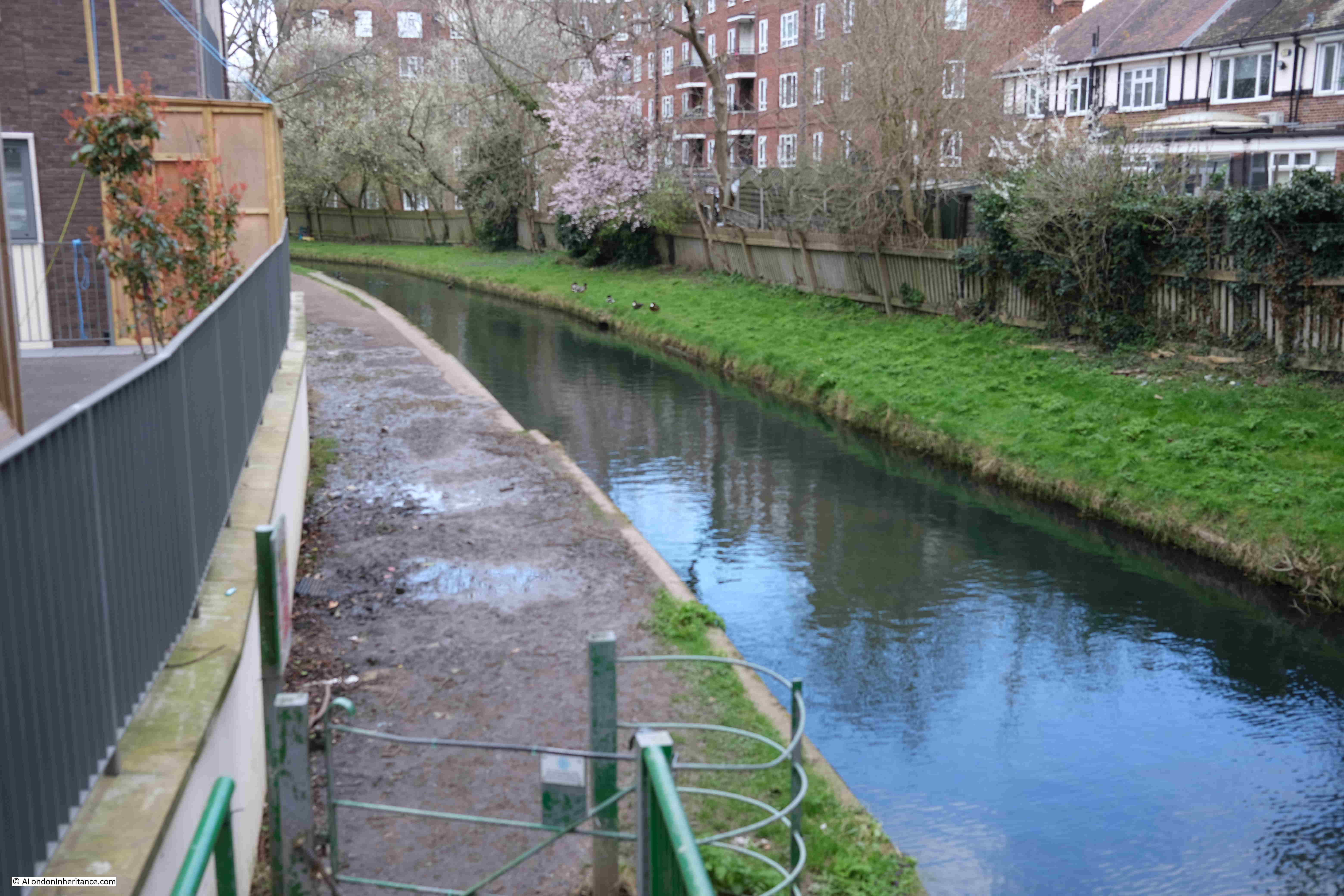
And one final loop through housing, with a rather muddy path:

New River Walk

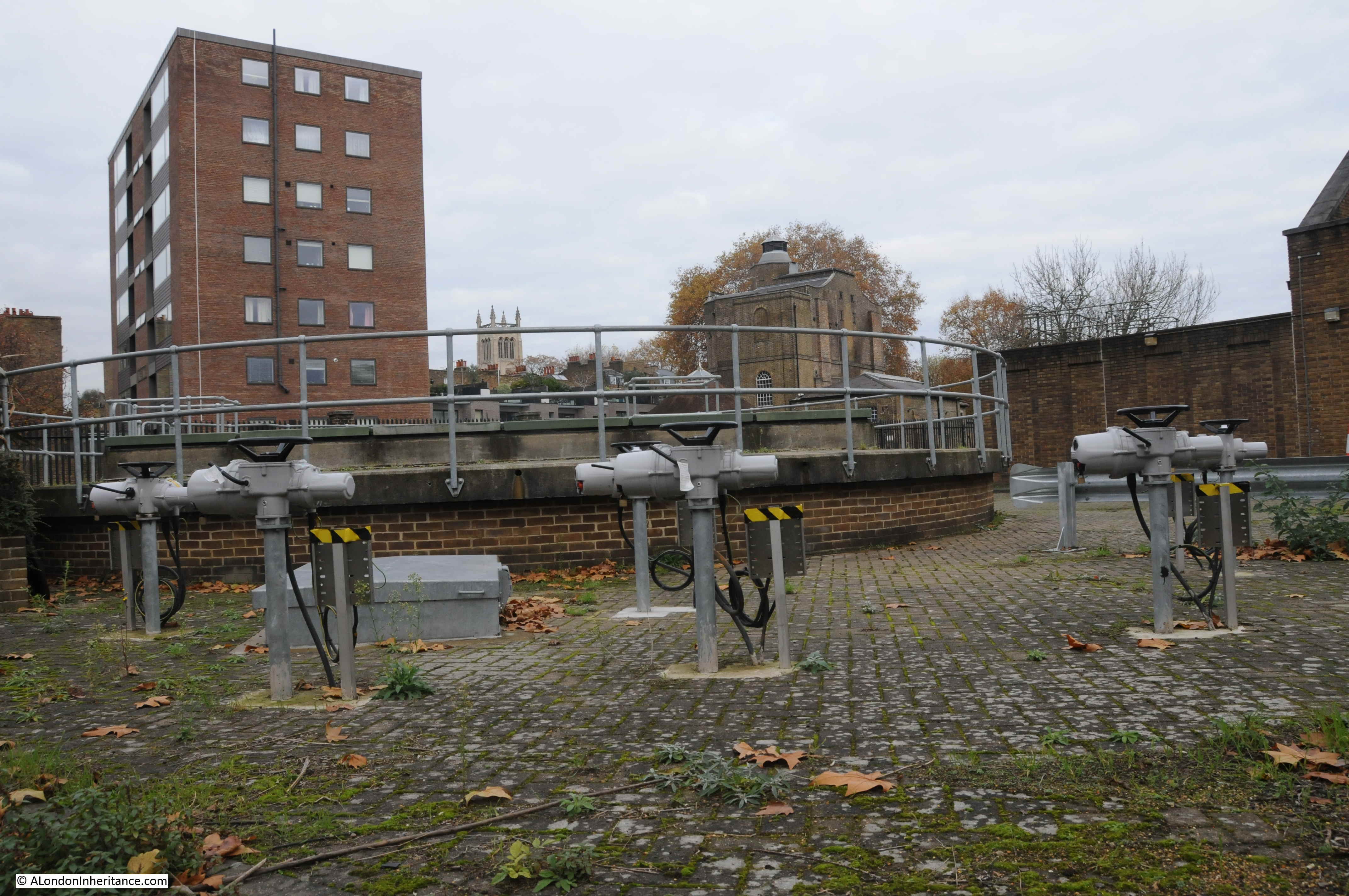
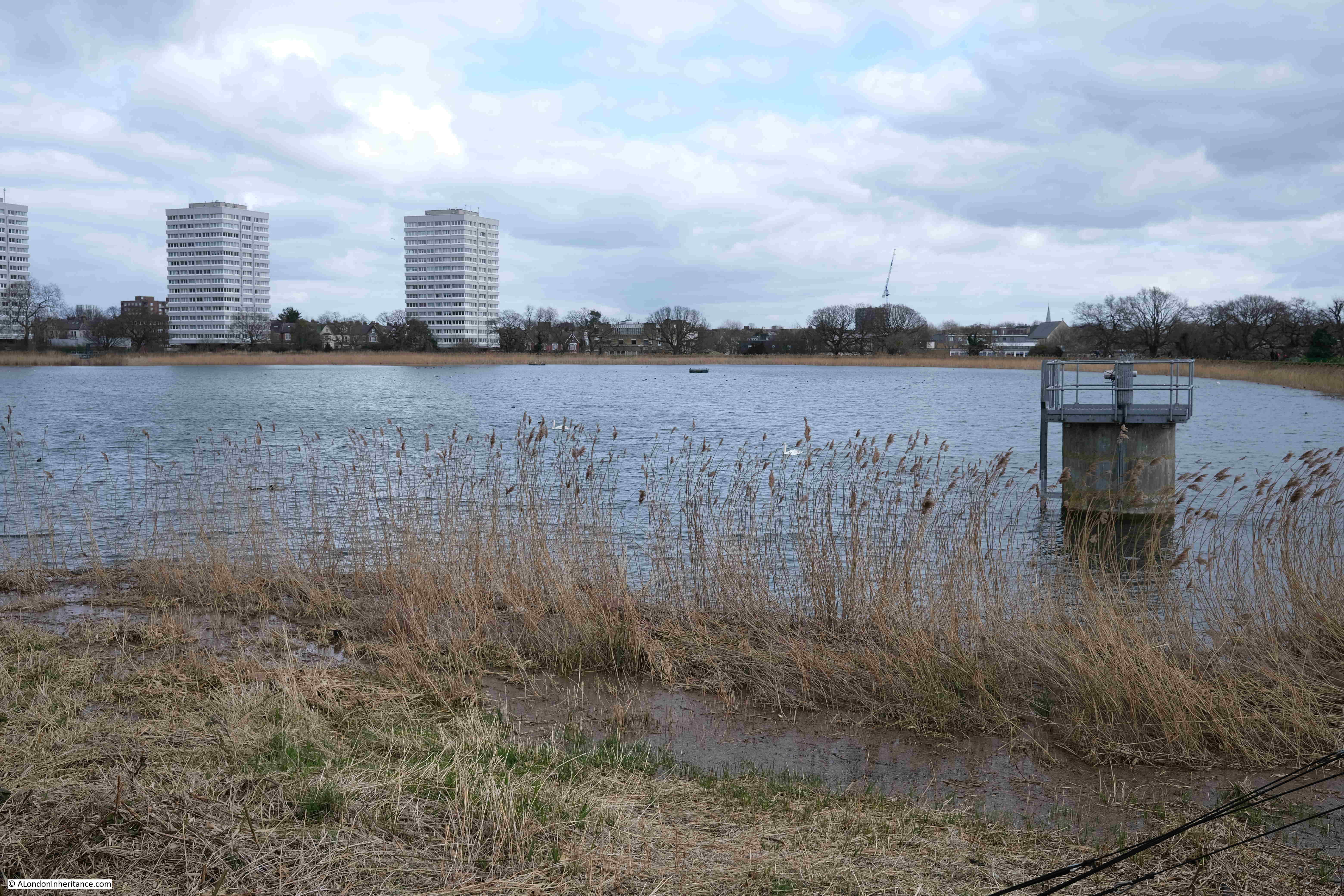
Point 6 on the map: The New River now reaches the reservoirs, with what must have been a gauge house, some means of regulating or measuring the flow of the river, straddling the New River just before the reservoirs:

New River Walk

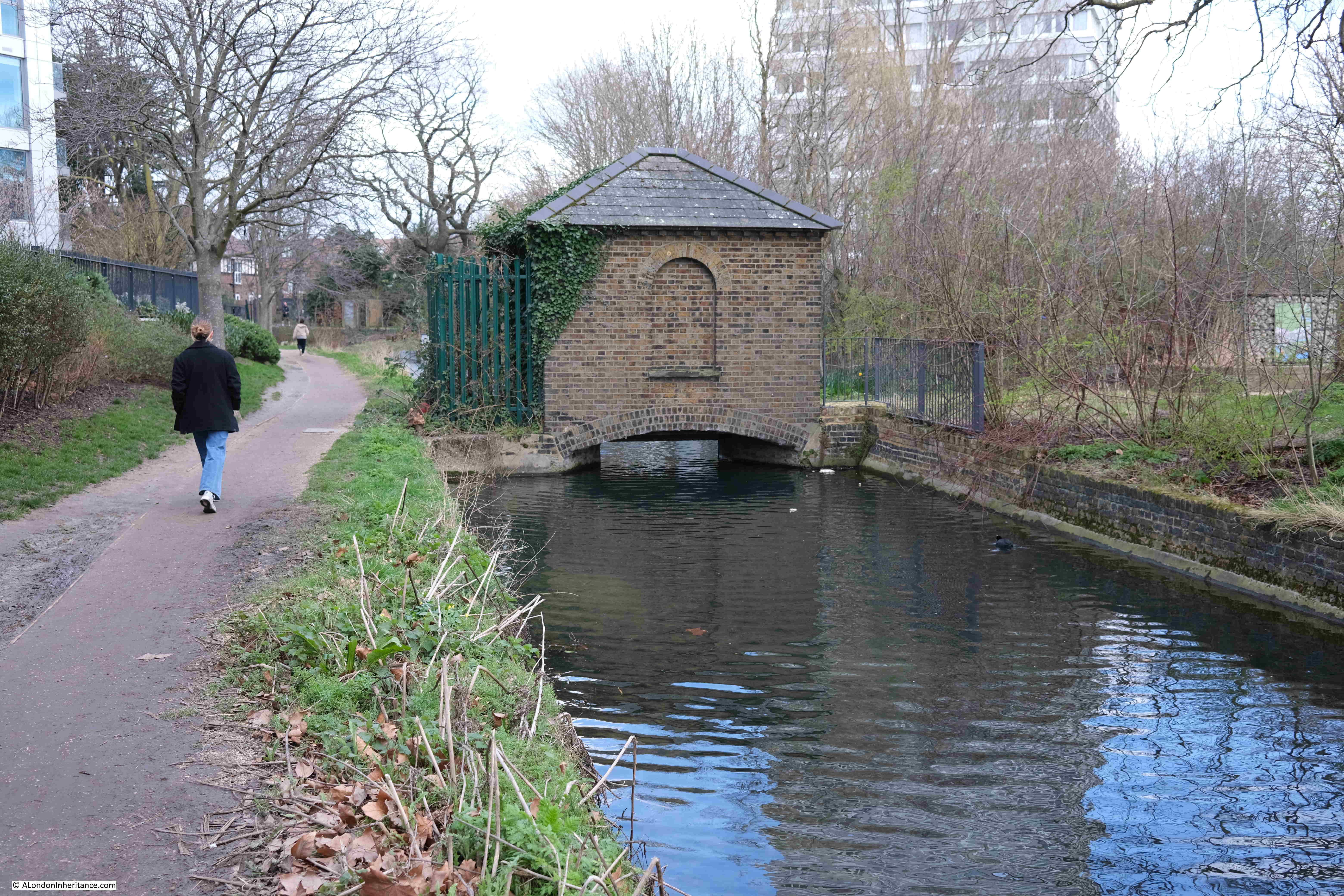
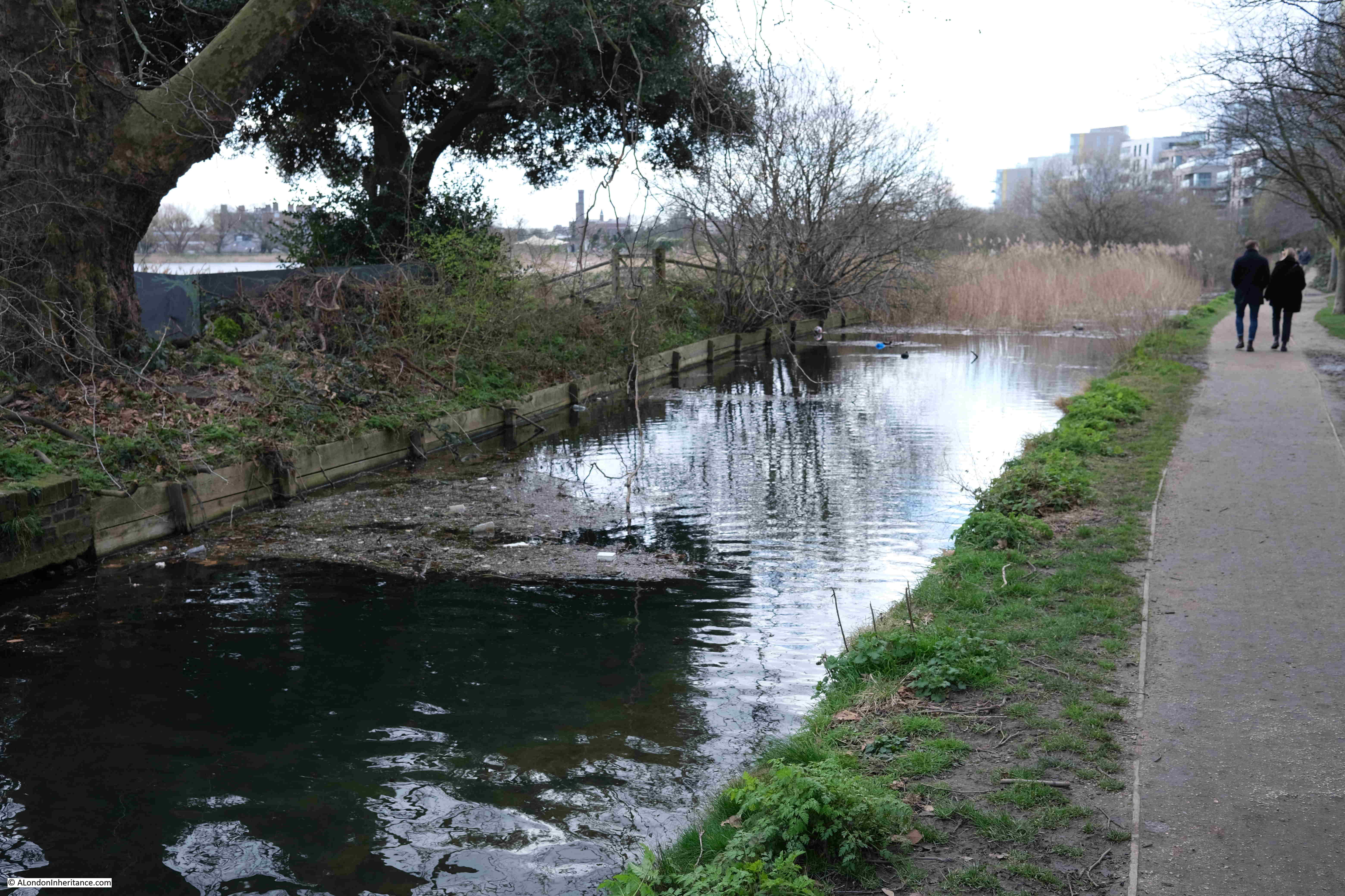
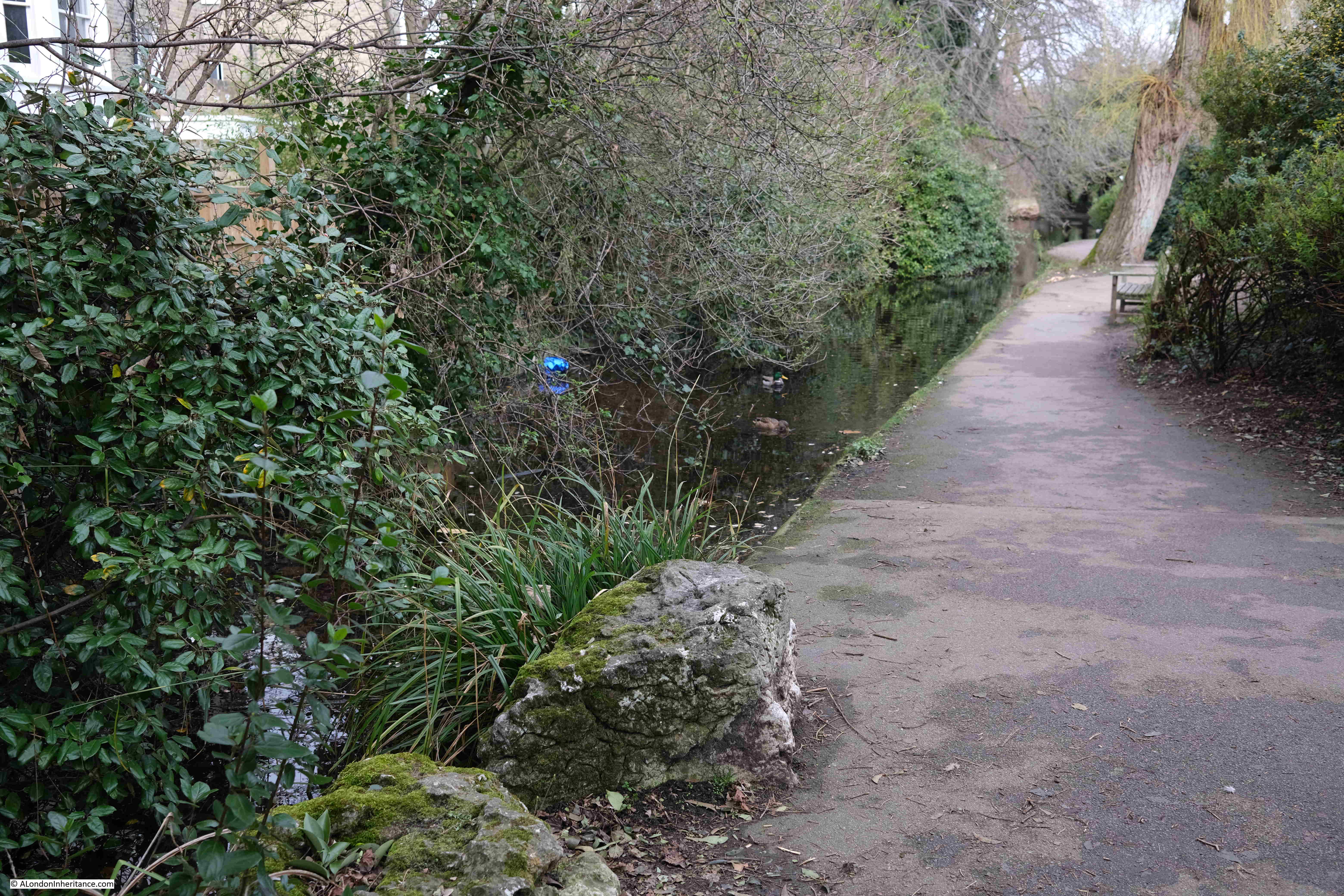
The New River was truncated at the reservoirs at Stoke Newington in 1946, and now feeds water into the reservoirs, as well as running to their north, through the Woodberry Wetlands, an area surrounding the reservoirs that is now managed as a wildlife haven:

New River Walk

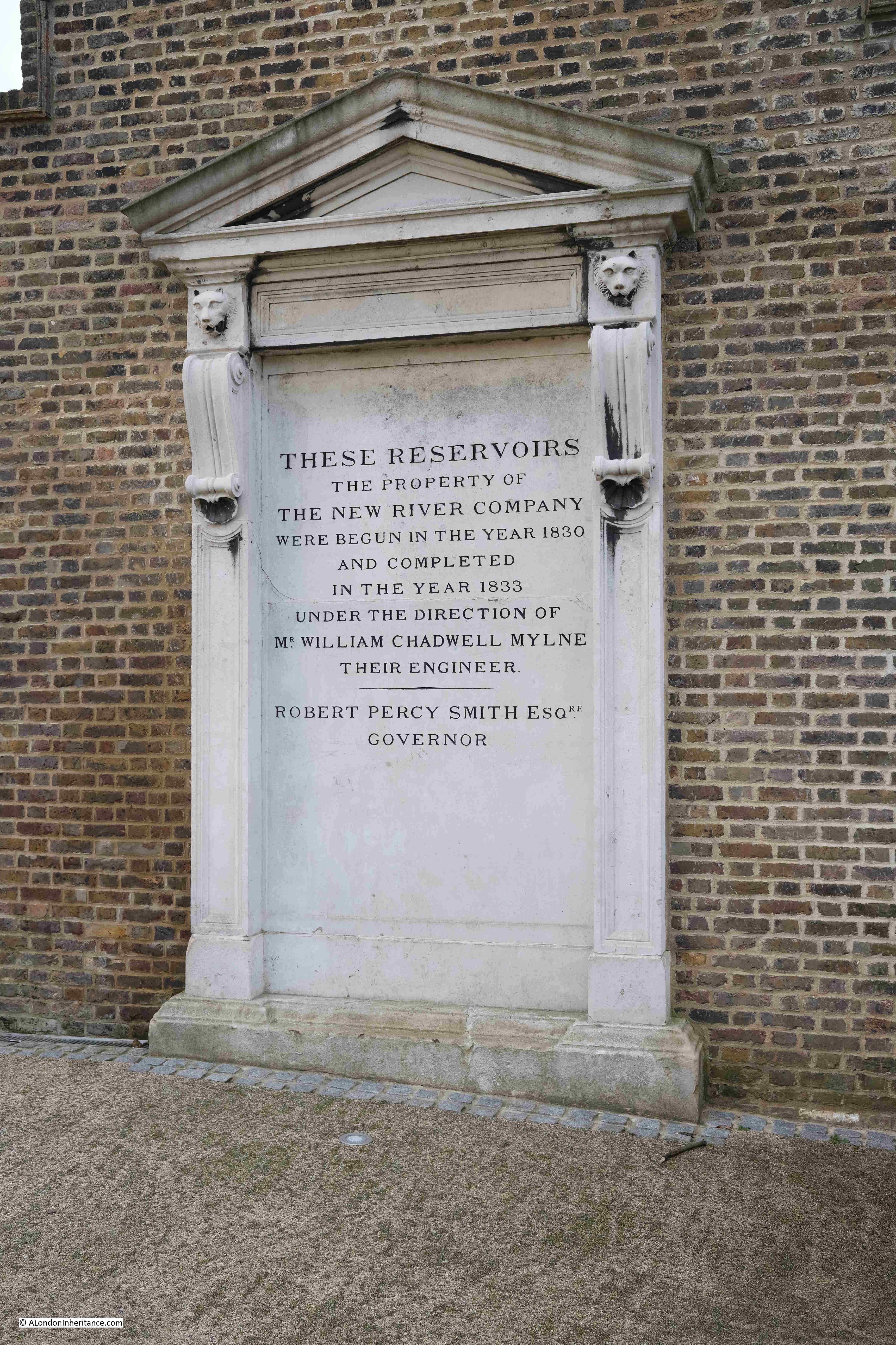
Between the east and the west reservoirs is a building that was once part of the New River infrastructure and has now been refurbished as the Coal House Café. The area outside the café was full of families, so I will not include a photo online, however at the side of the building is a record of the creation of the reservoirs by the New River Company:

New River Company

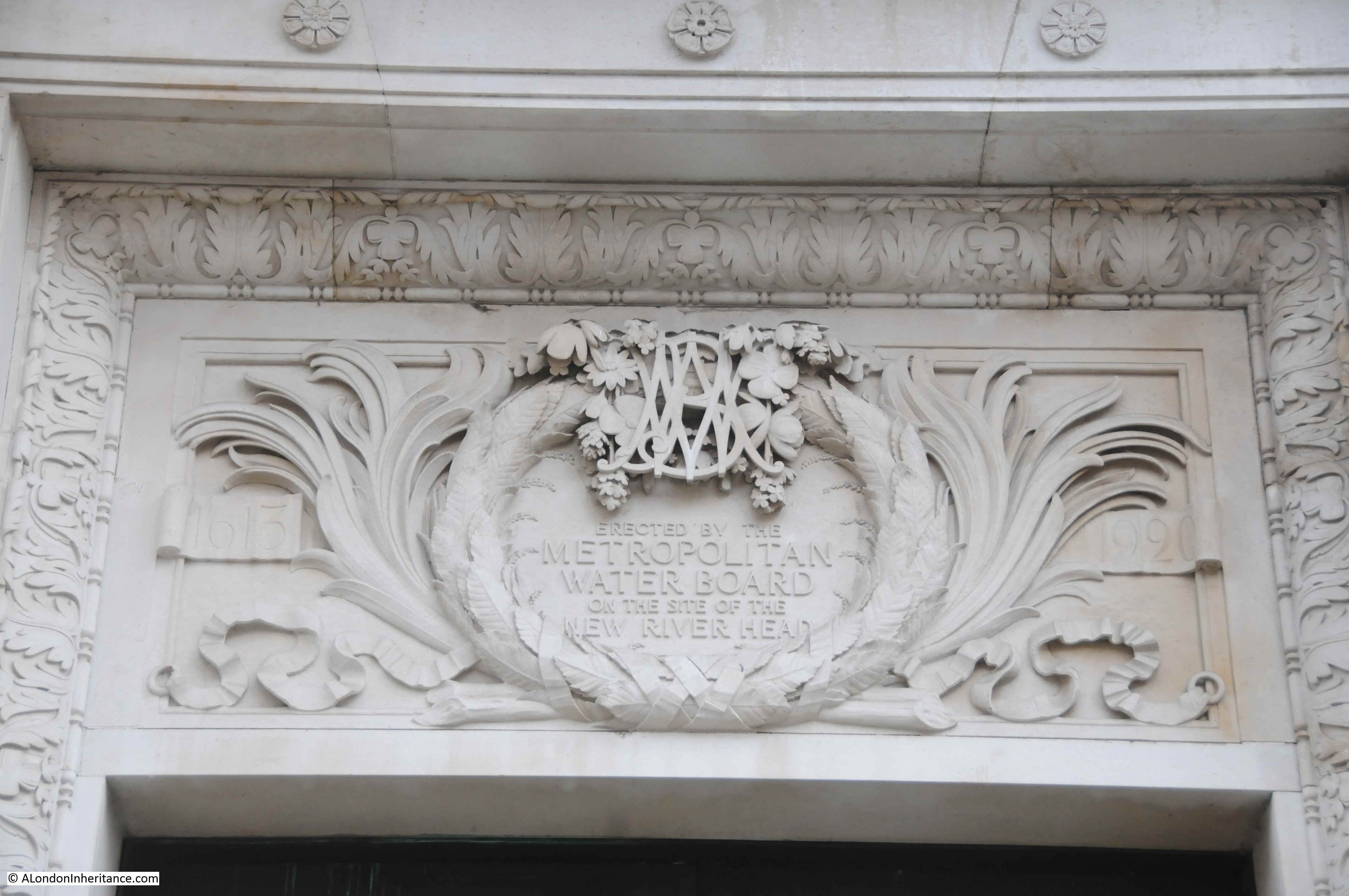
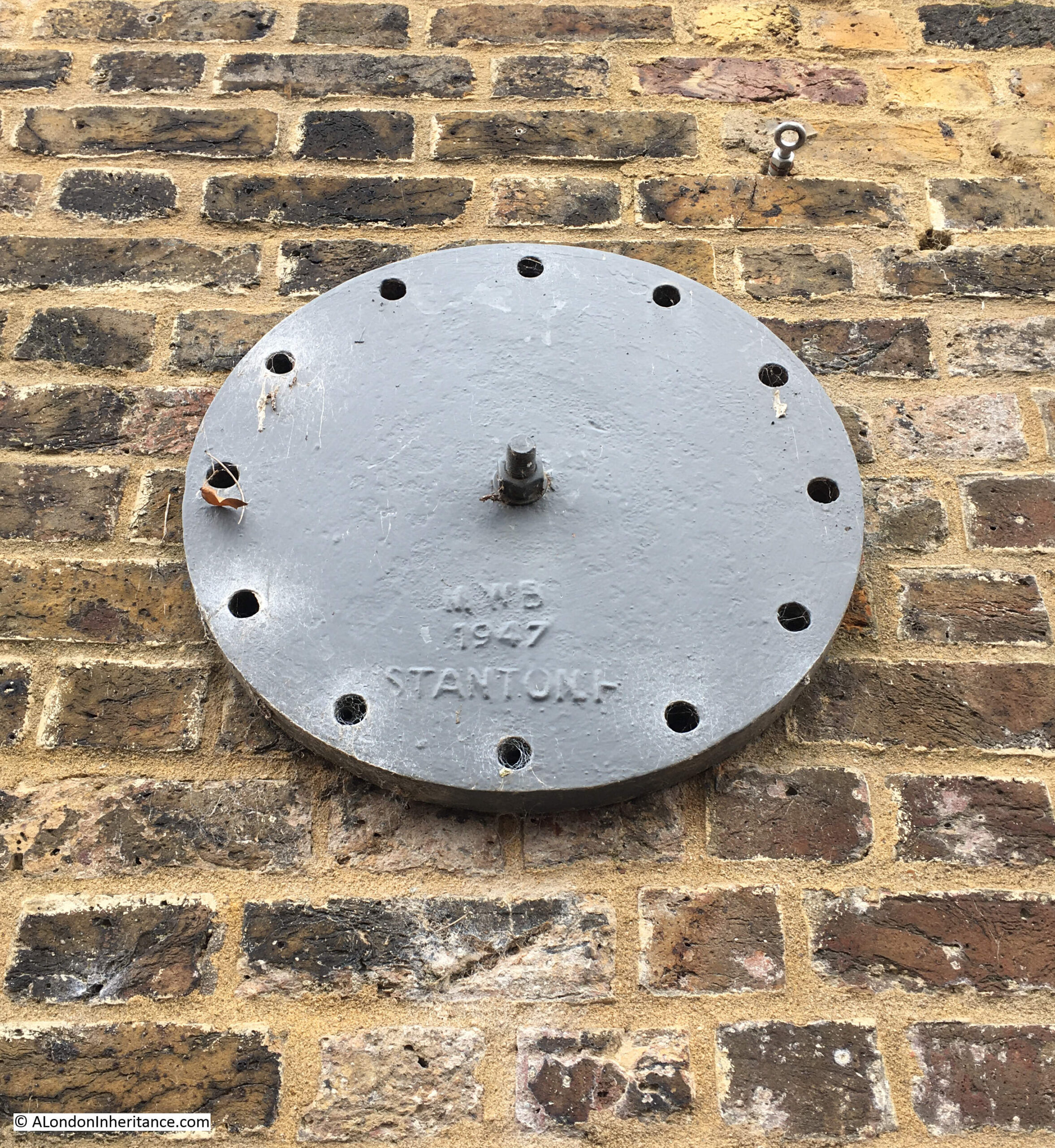
Also on the side of the building is a wall tie with the initials of the Metropolitan Water Board, the organisation that took over the running of the New River Company’s assets:

New River Walk

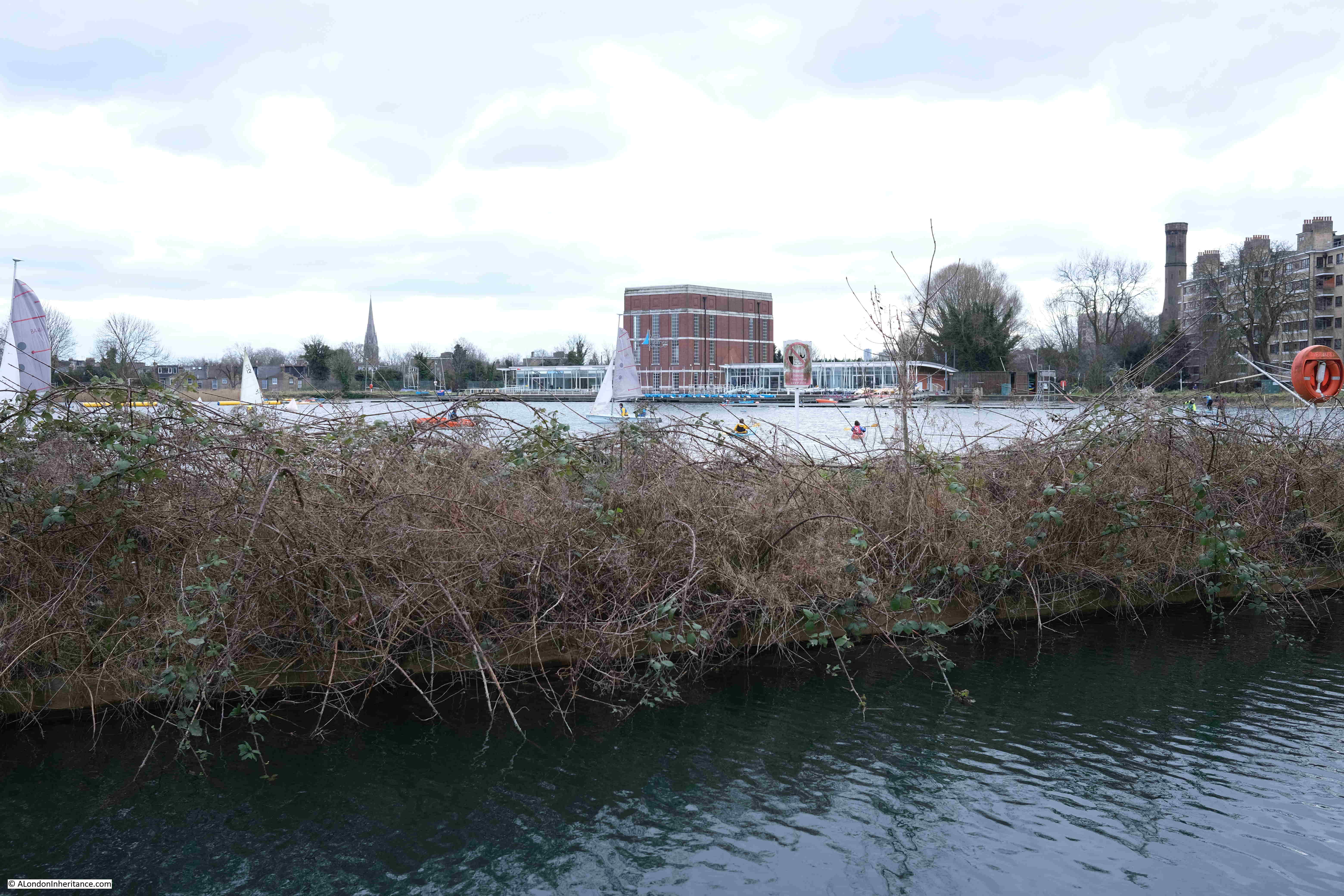
View across the east reservoir:

New River Walk

View across the west reservoir:

New River Walk

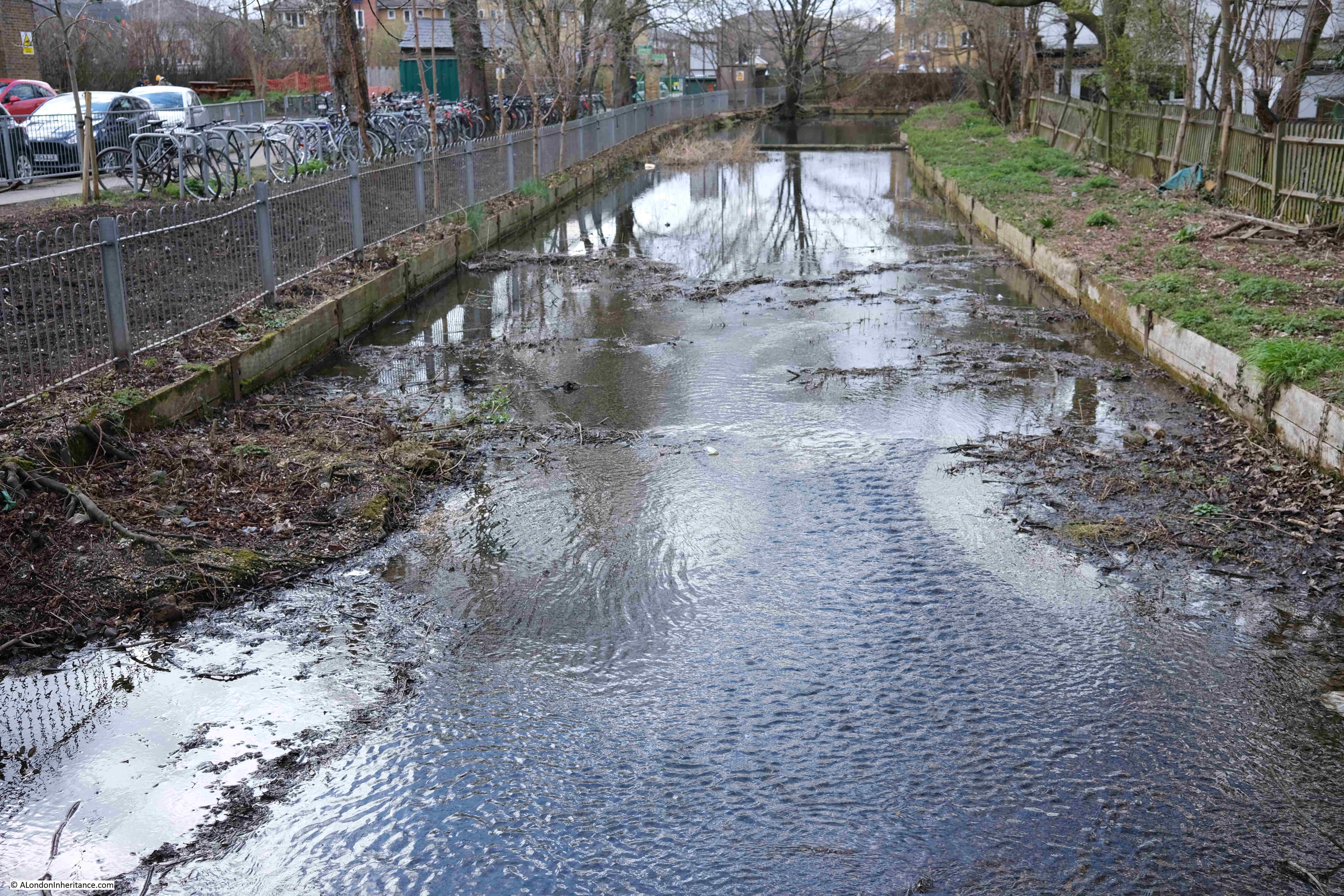
And a short walk from the west reservoir, we reach the very end of the remaining route of the New River. The last point in the walk from Ware in Hertfordshire, where the river can be seen above ground. It ends in a rather sad dead end:

End of the New River

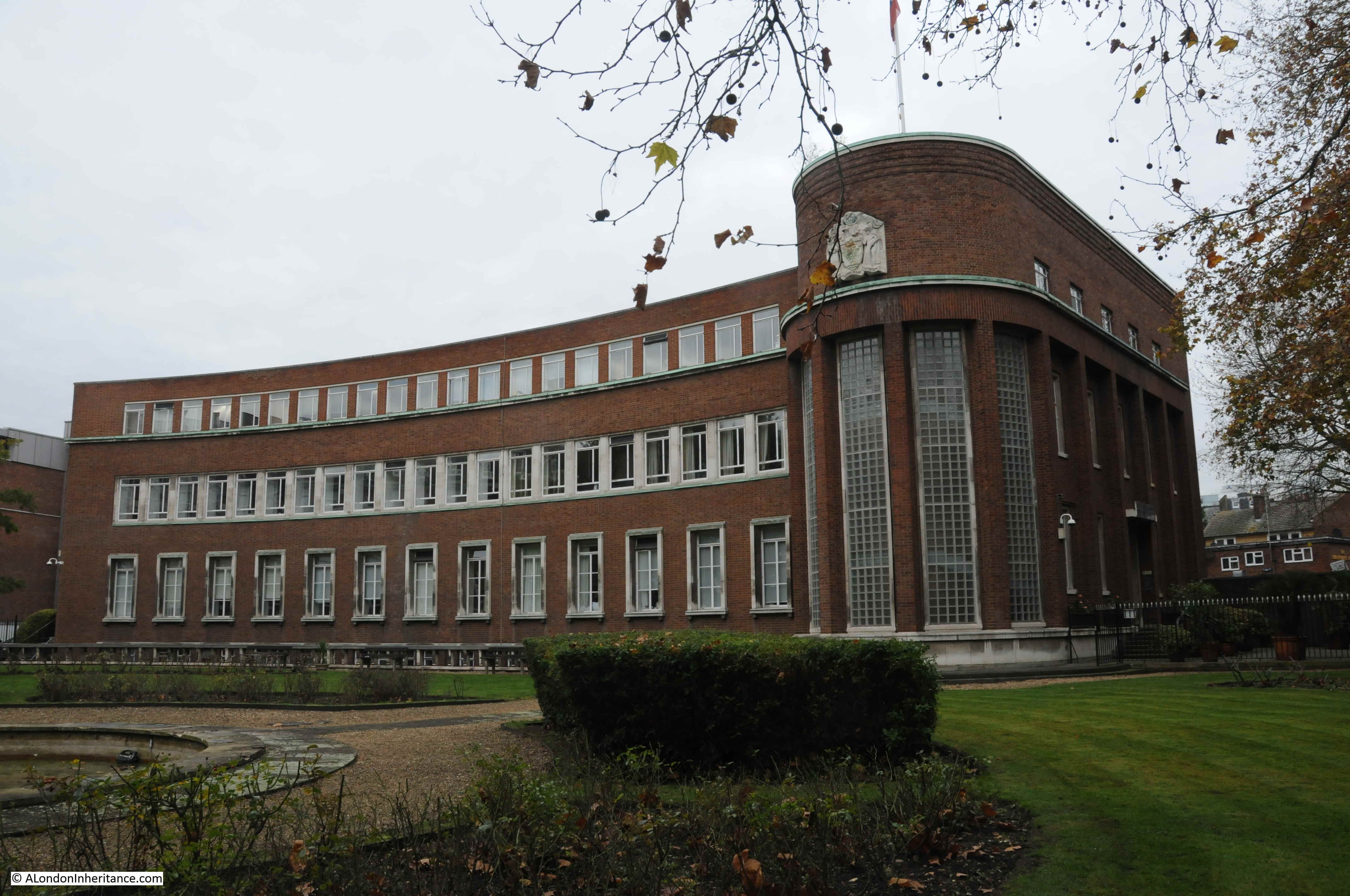
Just to the left of the above photo is the wonderful 19th century pumping station built by the New River Company:

Castle pumping station

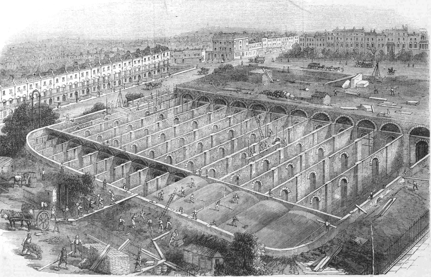
The Metropolis Water Act of 1852 required that water companies supplying water to London, filter the water prior to distribution, and that any subsequent reservoirs after filtering be covered. The aim was to improve the quality of water and prevent much of the pollution from an industrial city from entering the water supply.

Prior to the act, the New River Company was supplying water directly from the reservoirs, however the act now required filter beds to be constructed, along with infrastructure such as a pumping station, and the building in the above photo was built between 1852 and 1856 by William Chadwell Mylne, the Surveyor for the New River Company.

The building housed steam engines and boilers until 1936 when these were replaced by diesel engines.

By 1971, the pumping station was rather dated and too small, and the design of the building did not support an upgrade, so the Metropolitan Water Board applied for permission to demolish the building.

There was considerable local support to retain the building as it was such a local landmark, resembling an industrial castle alongside Green Lanes.

This campaign resulted in the building being given a Grade II* listing in 1972, however it would continue to stay empty, and under threat.

The Historic England listing record provides a perfect description of the old pumping station, and why it is known as the Castle (Historic England source here):

Large building designed to resemble a mediaeval fortress with keep and bailey. 1854-6 by Chadwell Mylne. Stock brick with stone dressings. Battlements and large stepped buttresses all around. The “keep” is of 2 storeys with a tall basement plinth. 6 windows on main south-west front. At north-east and south-west corners round towers with square bartizans the former with a tall conical roof and both having battlements crow-stepped up towards them. Continuous quasi-entablature, with cable moulding, running right around towers. Taller octagonal chimney tower to east. 8 steps (the top one with bootscraper!) to entrance in forebuilding running along north wall and into “bailey” building, which is lower with segmental arcading and 2 slit windows in each bay. Important picturesque landmark.”

The building was empty until 1994 when it was converted into a climbing centre. The large internal spaces perfectly suited for such a use. If you walk past, it is worthwhile having a quick look inside, as the building is still the Castle Climbing Centre.

Leaving the pumping station, we are now following the heritage section of the New River Walk. This section of the route has not seen the New River as a stream of water for many years, as the river was buried in pipes during the 19th century, and since 1946, New River water has ended at the reservoirs.

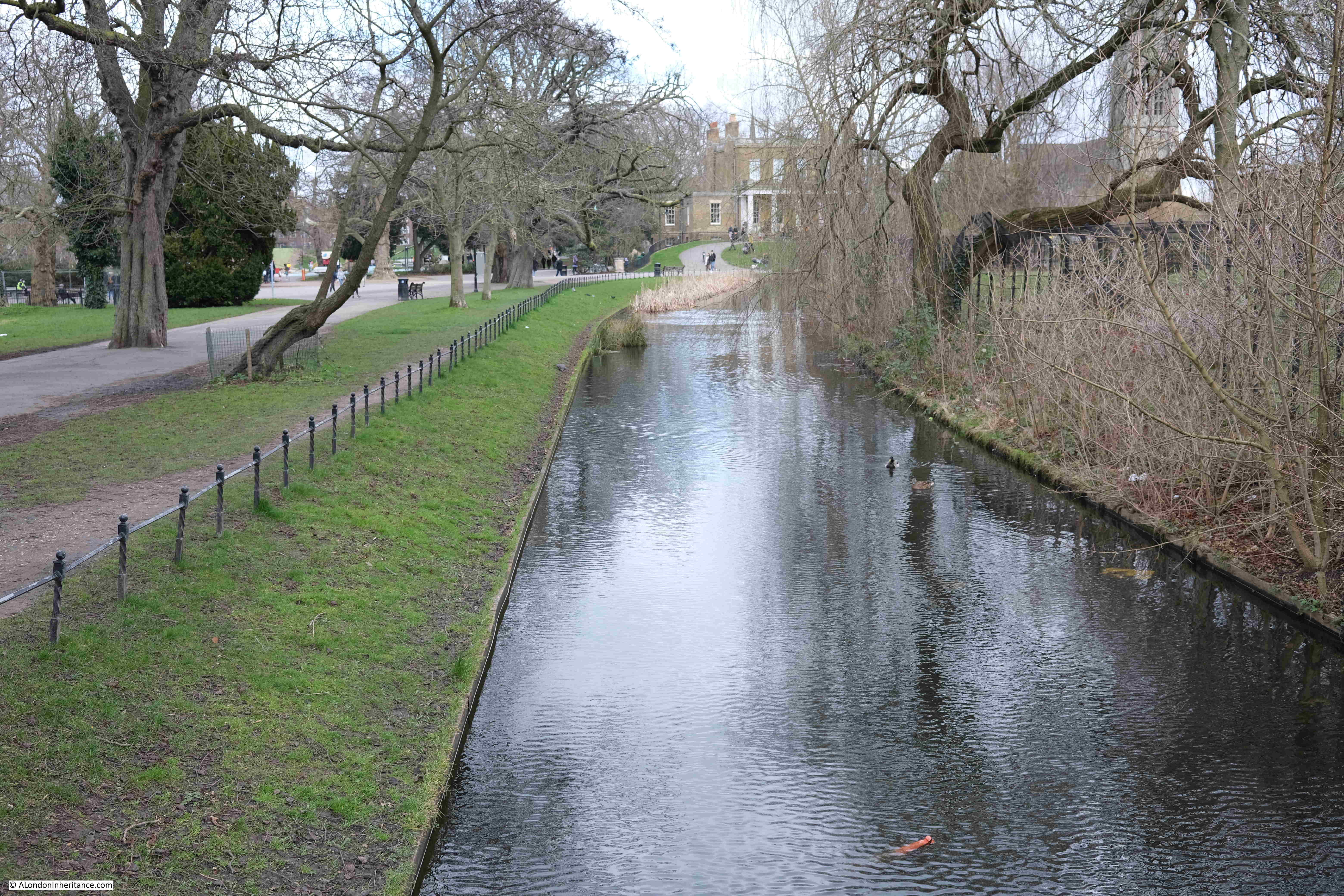
Point 7 on the map: Here we turn off from Green Lanes and into Clissold Park.

The park retains a couple of stretches of the New River, however these are for decorative purposes only, and start and end within the park.

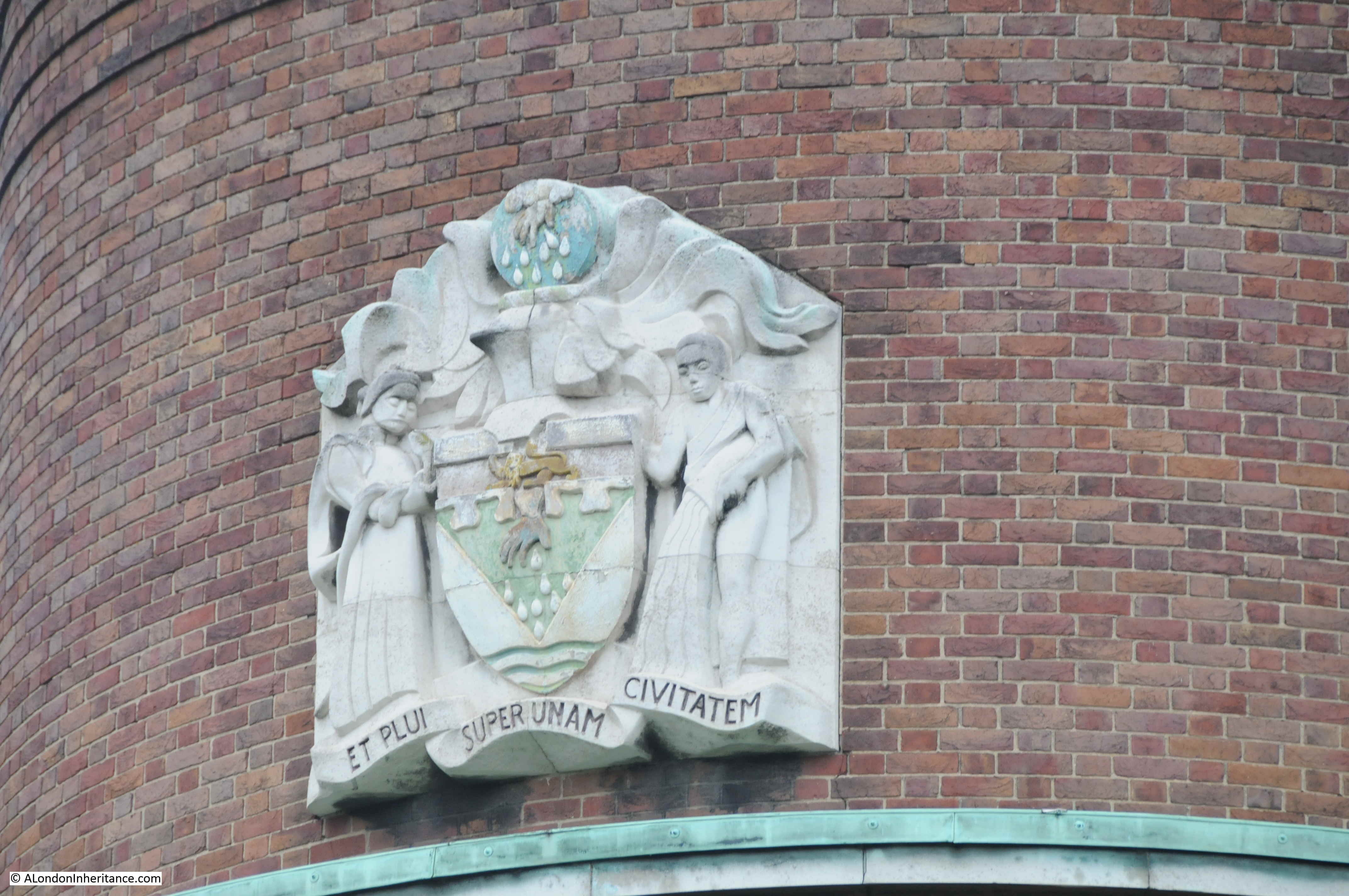
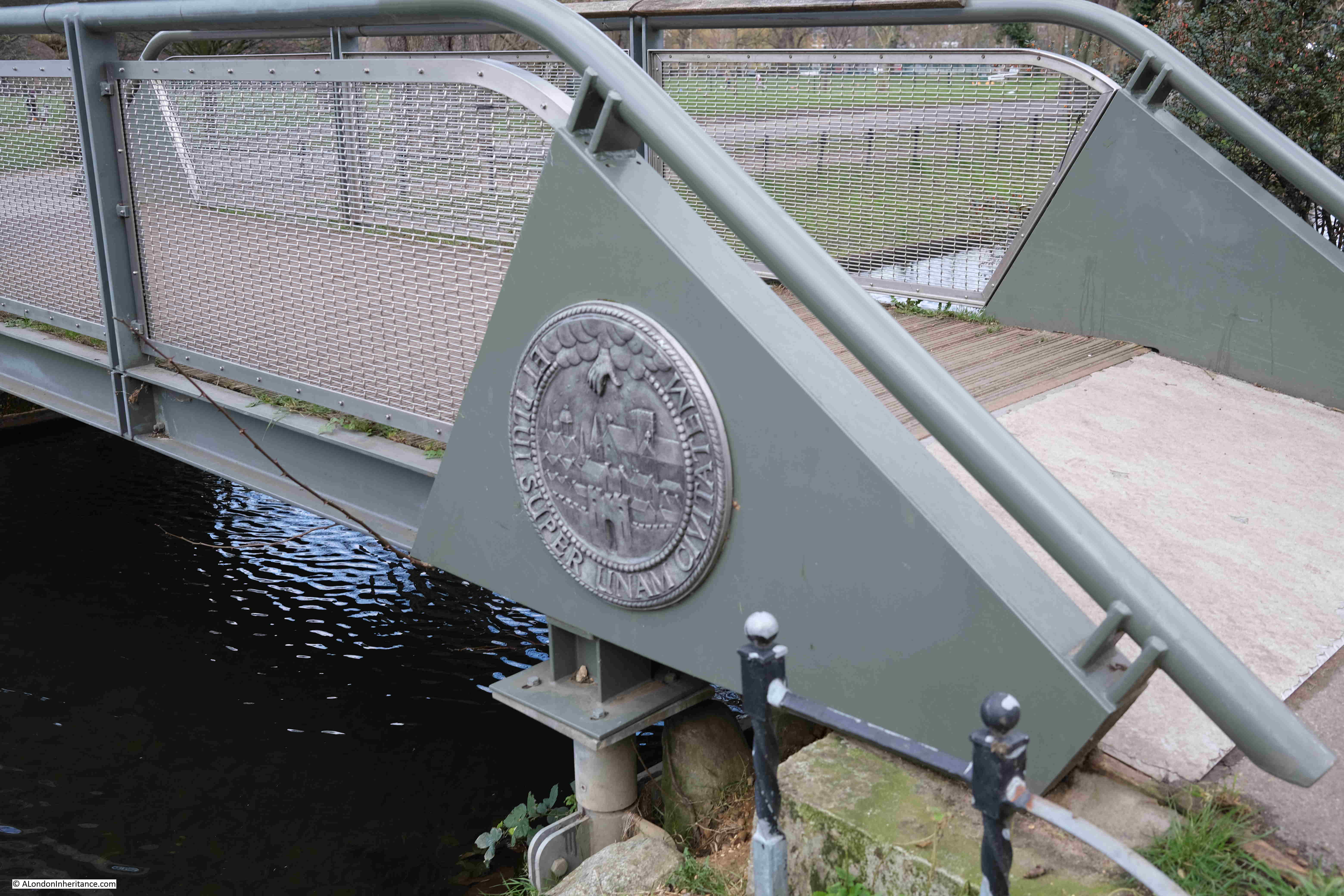
There is a bridge across one of these decorative runs of the river, which has the arms and motto of the New River Company on the side. “ET PLUI SUPER UNAM CIVITATEM” or “And I caused it to rain upon one city” indicated by the hand reaching down from a cloud, and showering rain drops on the city below.

Clissold Park

Part of the decorative New River feature running up to Clissold House:

Clissold House

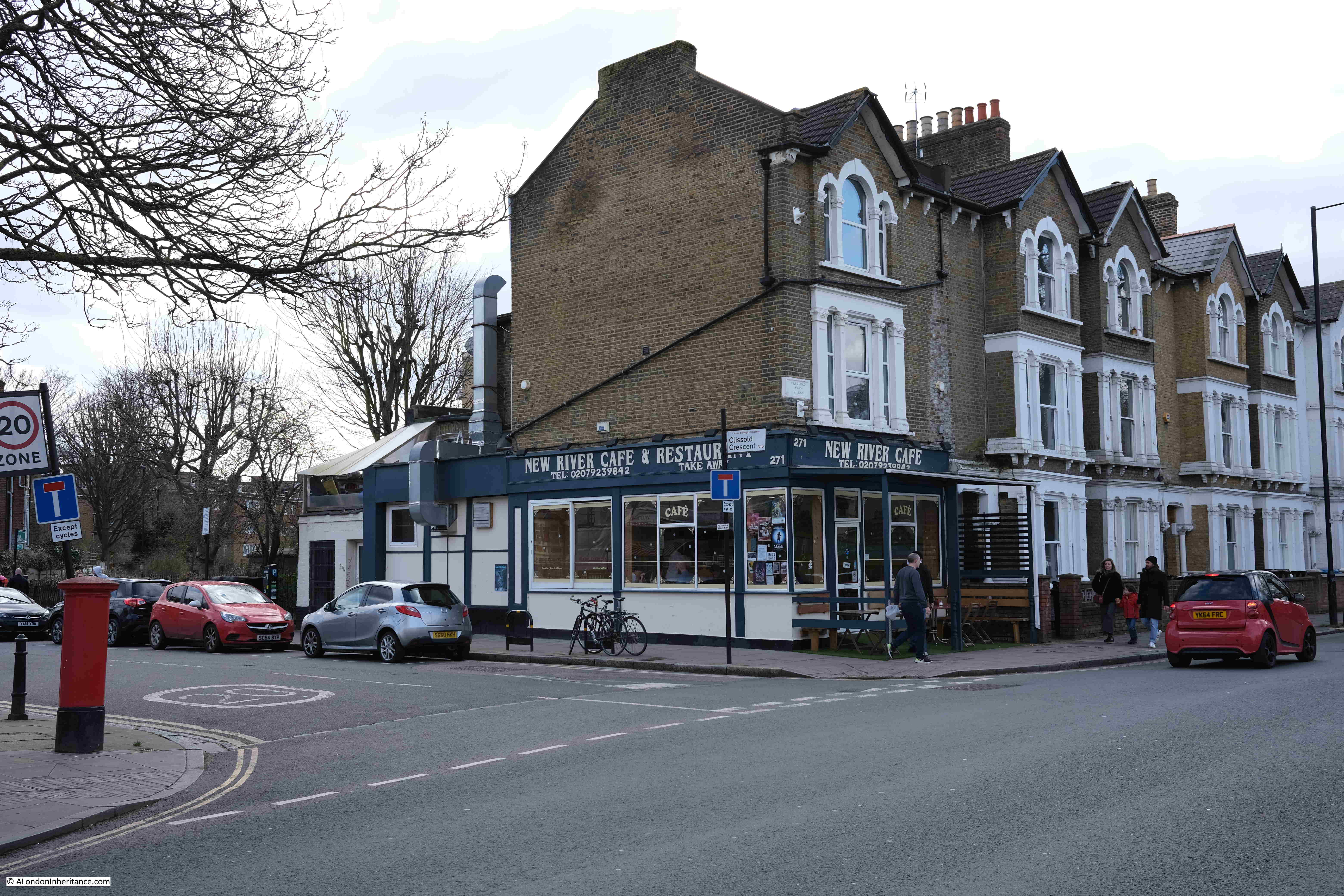
Leaving Clissold Park, and walking along Stoke Newington Church Street, there is another reminder of the New River with the New River Café on the corner with Clissold Crescent:

New River cafe

Walk a short distance along Clissold Crescent, and there is a reminder of the New River:

Clissold Crescent

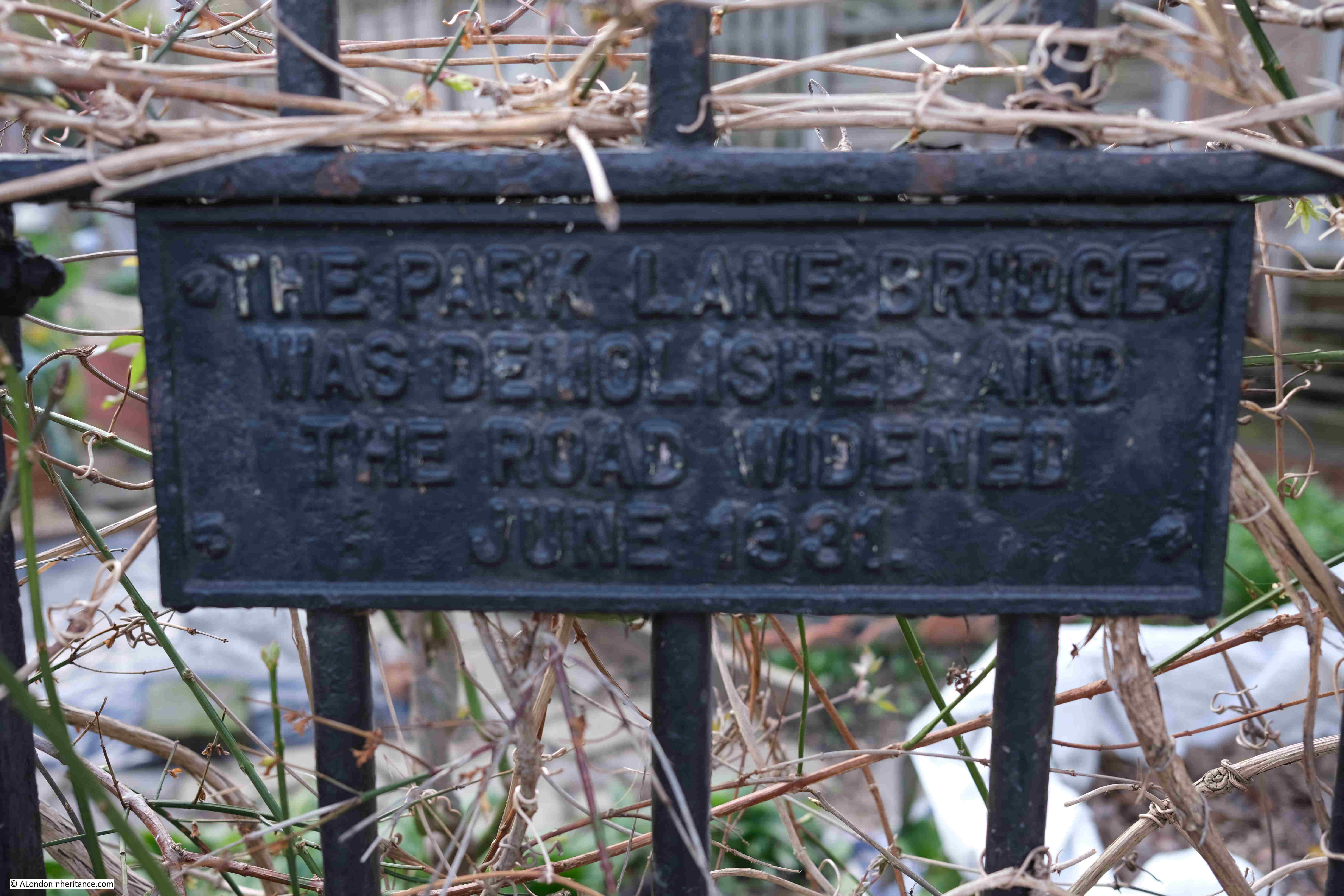
The plaque reads “The Park Lane bridge was demolished and the road widened June 1881”.

Park Lane was the original name of Clissold Crescent, and the bridge carried Park Lane over the New River.

A version of the Ordnance Survey map from the 1890s shows the Park Lane bridge and the New River, although by this time, the New River should have been carried underground in pipes, and as the plaque reads, the bridge was demolished in 1881 and the road widened, so I suspect the OS map was not updated at this point  (‘Reproduced with the permission of the National Library of Scotland“).

Clissold Crescent

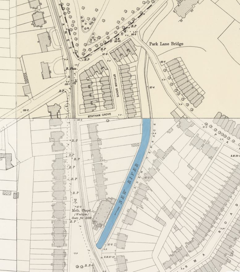
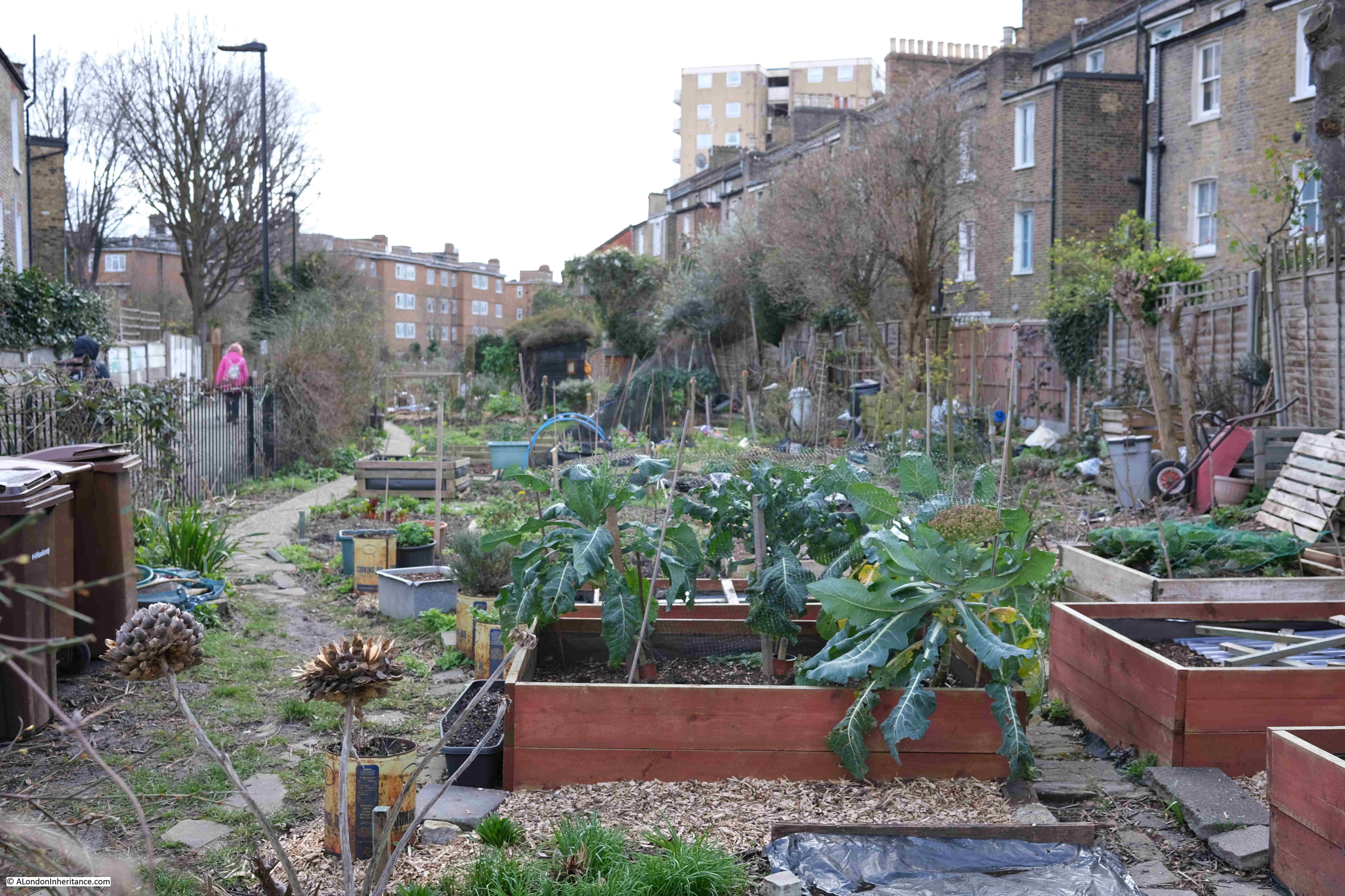
In the above map, the New River heads south between houses, and the route has been preserved and now forms a series of allotments running along the old course of the river:

New River Walk

The path between the allotments ends at Green Lanes (again, almost a constant companion on the southern section of the walk). We cross over Green Lanes to reach;

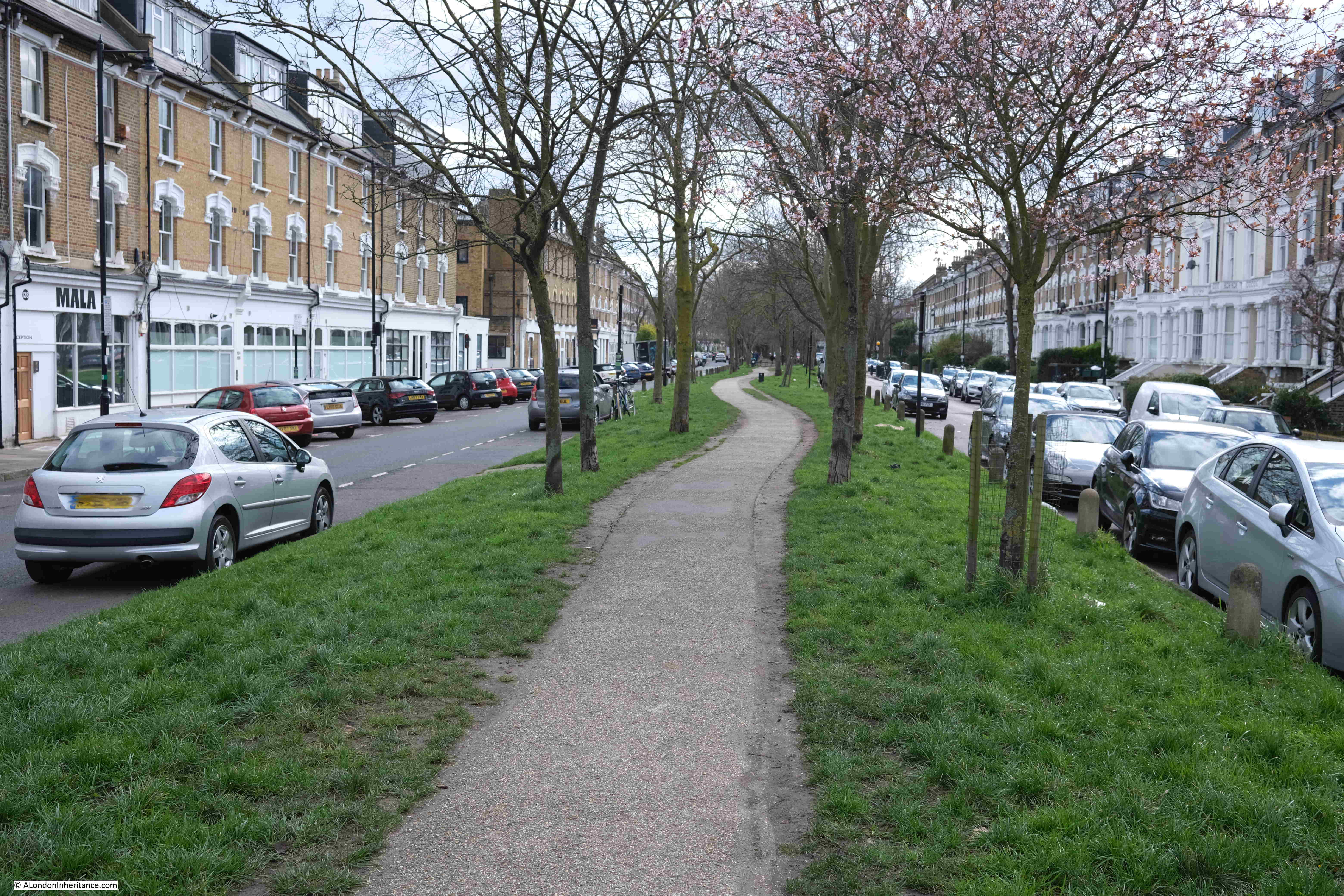
Point 8 on the map: this is Petherton Road where the New River once ran down the centre of the street, and is now a walkway with trees and grass on either side:

Petherton Road

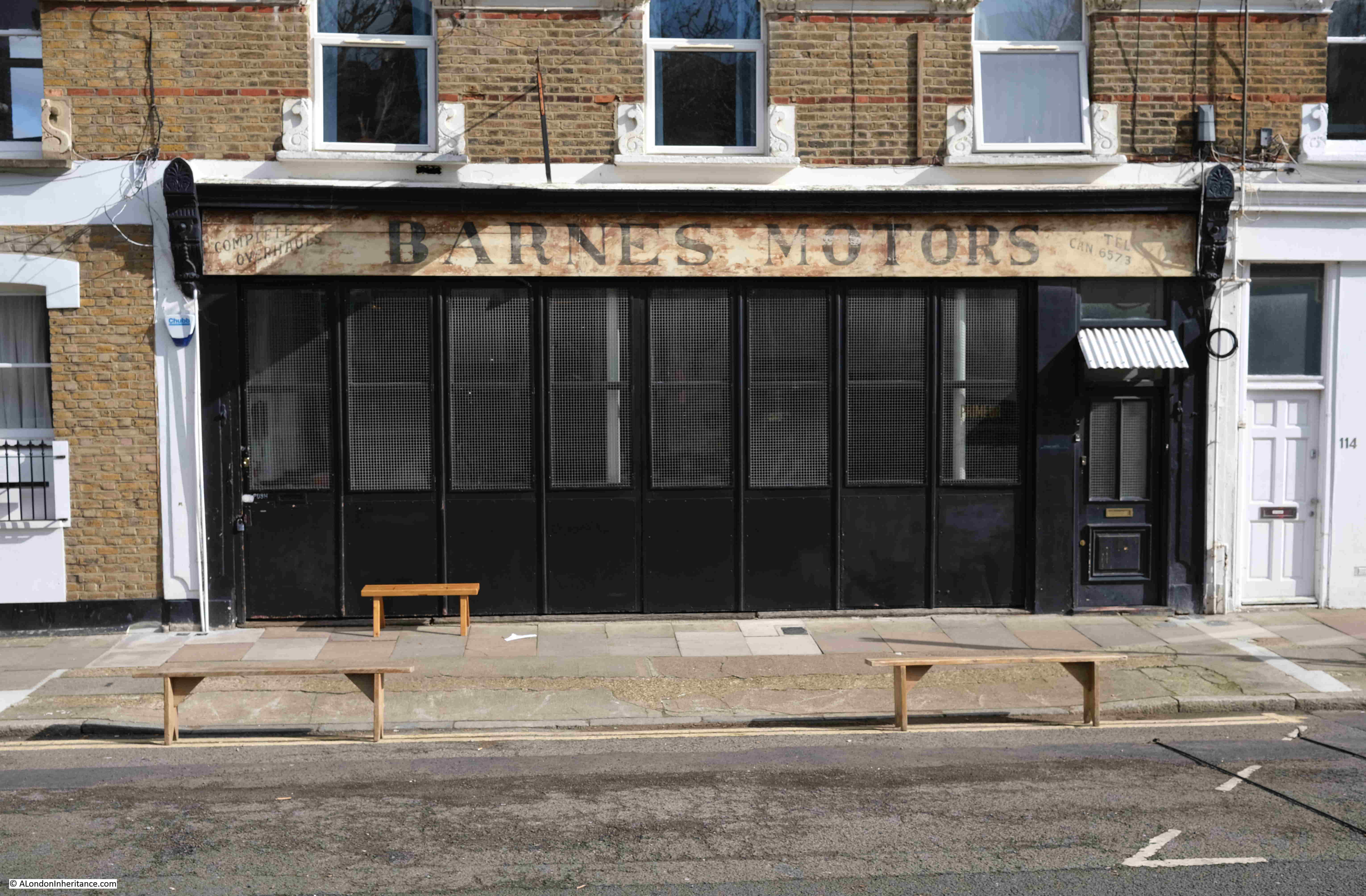
A rather nice ghost sign for Barnes Motors along Petherton Road:

Barnes Motors

At the end of Petherton Road, the green space gives way to a street which still follows the route of the New River, past Canonbury Station and cross over St Paul’s Road into another section of the New River route that has been transformed into a long green space, with a decorative water feature running the length of the space:

New River Walk

Towards the end of this green space is:

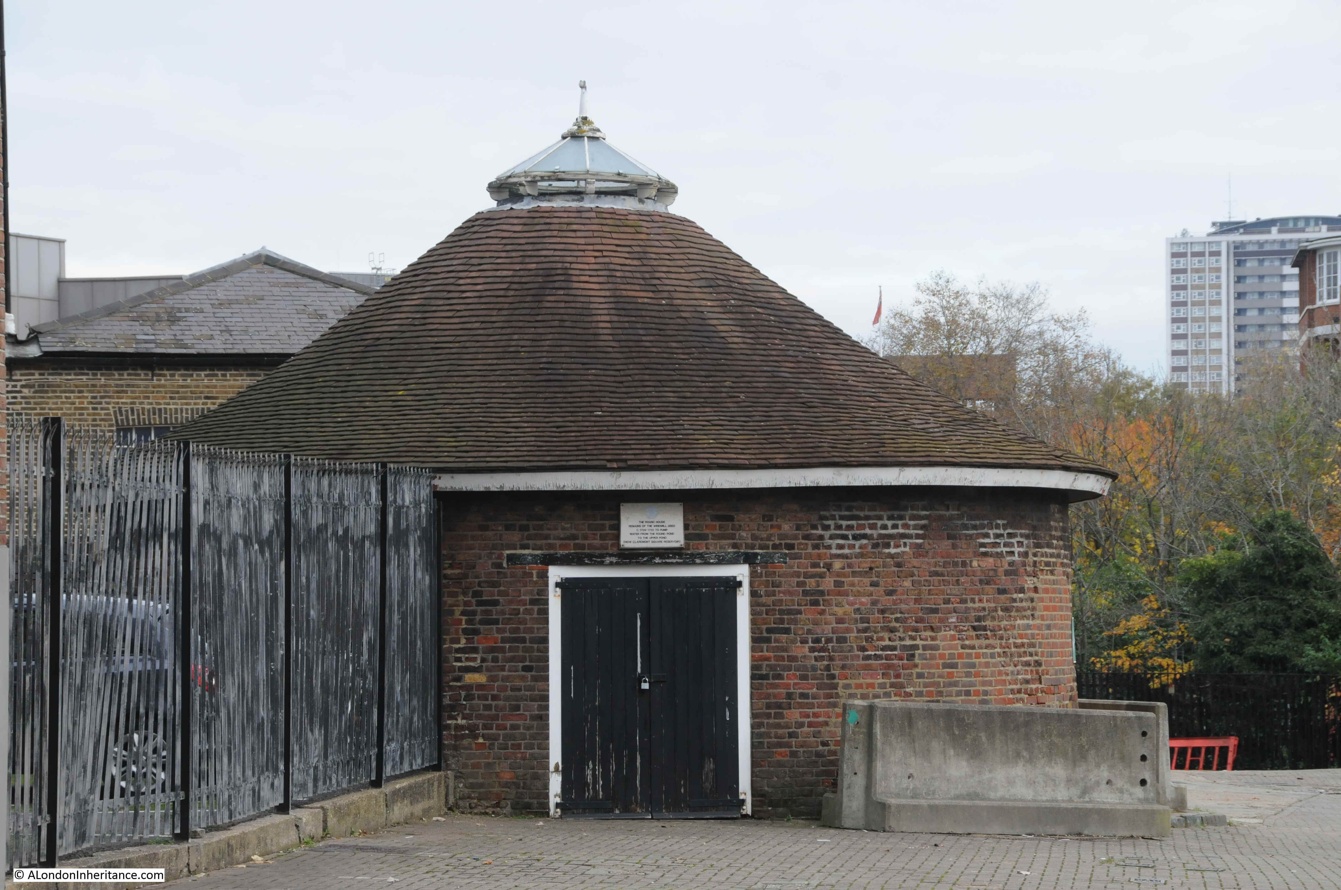
Point 9 on the map: where there is a round brick building alongside the original route of the New River:

New River Watch House

The building appears to be a late 18th century watch hut. To protect the New River, the New River Company had a watchman or linesman stationed at points along the route of the river to keep the river clear of debris and also to prevent fishing and swimming in the water, or anything that could pollute the supply.

The brick hut is an example of where such a person would have been stationed to keep watch over the river.

The final stretch of the ornamental water that follows the original route of the New River:

New River Walk

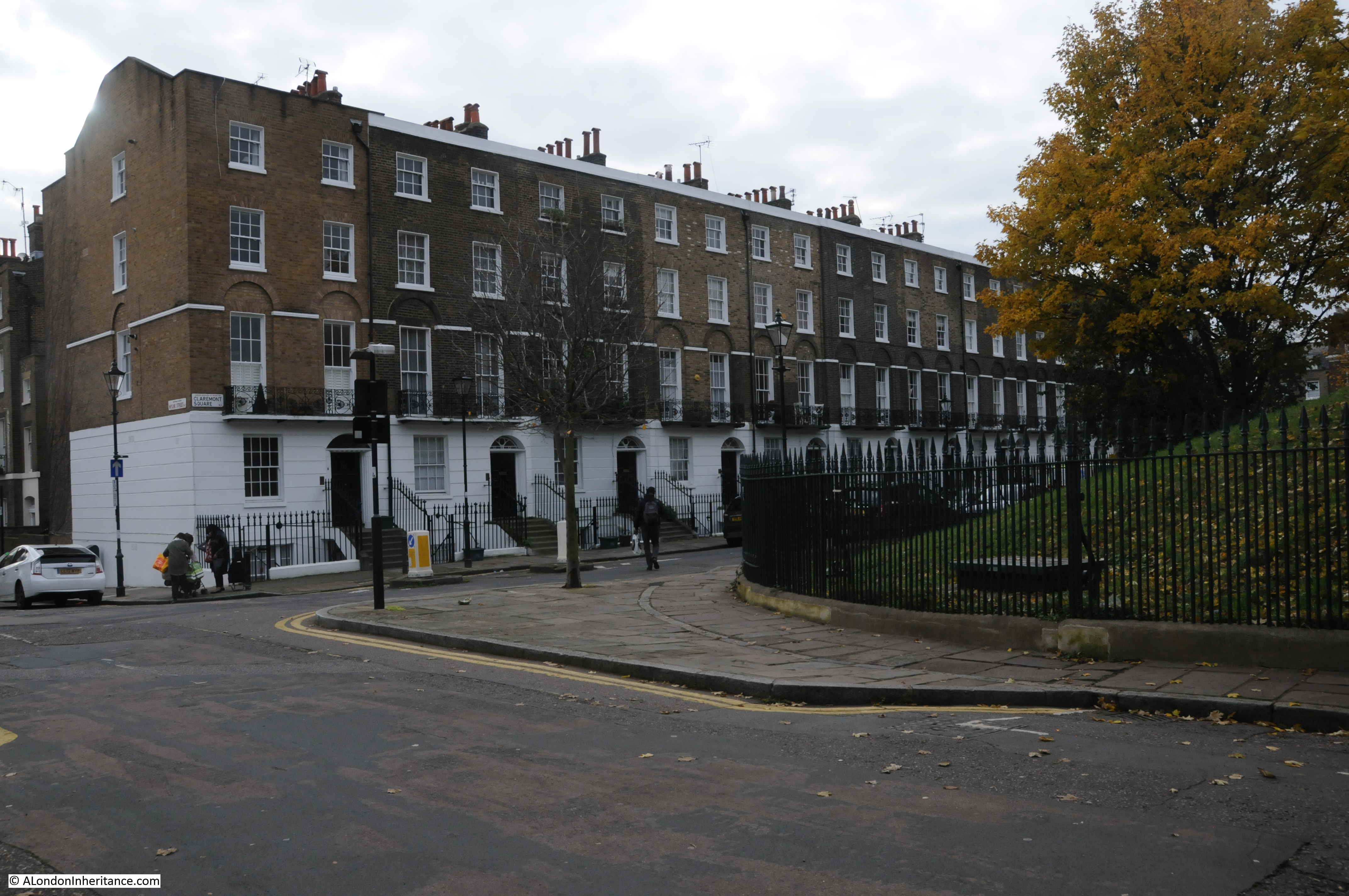
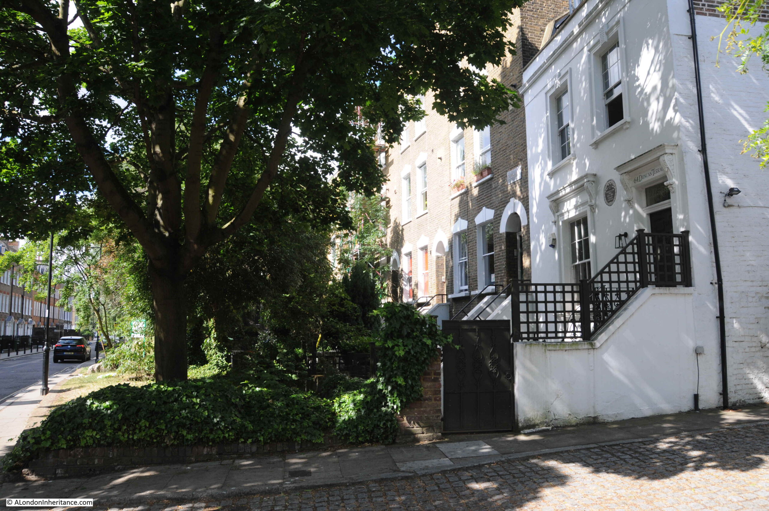
Where the above green space ends, we then walk south along Essex Road, and turn off just before reaching Islington Green, to find Colebrooke Row.

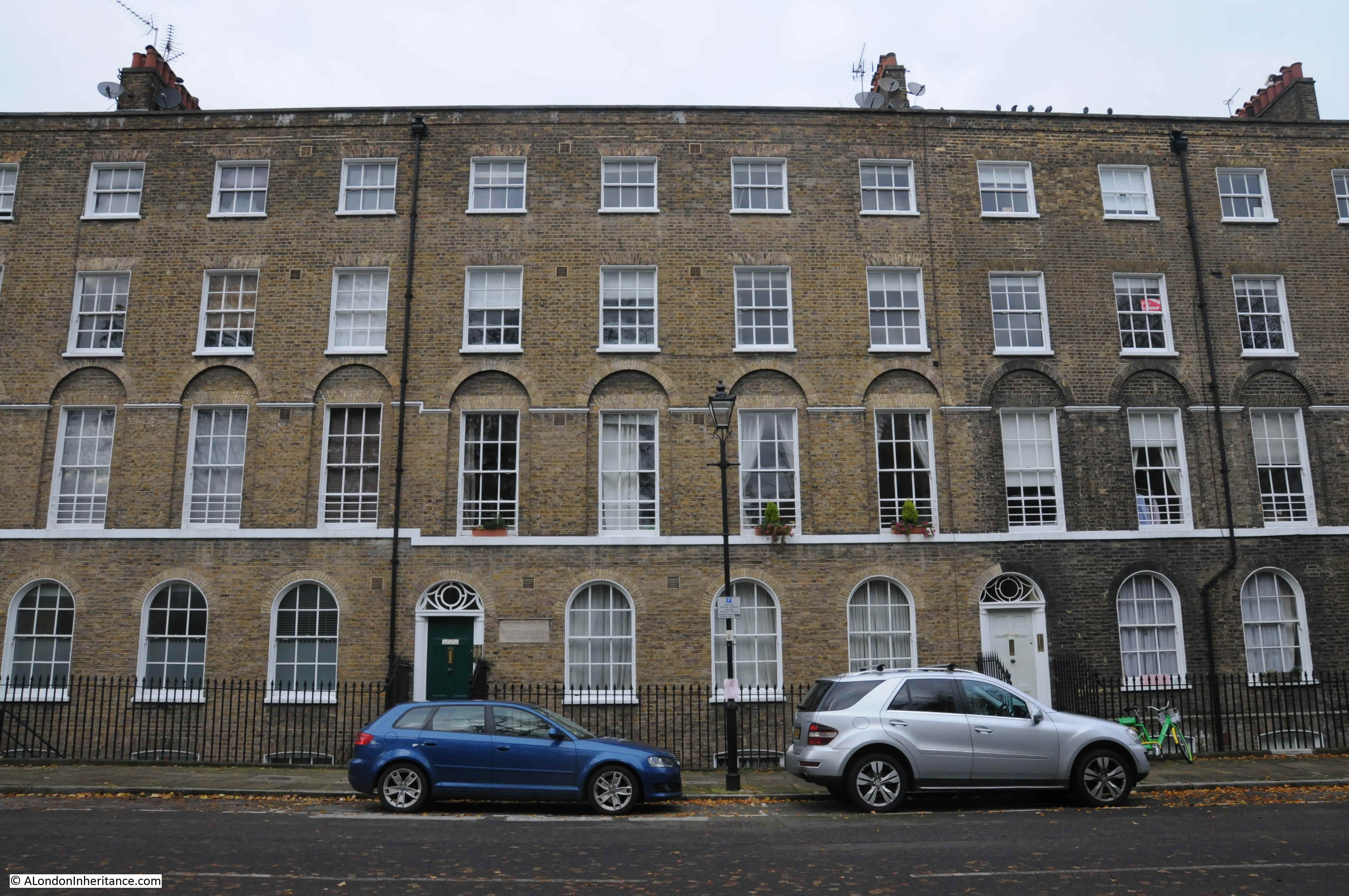
This is another street where the houses were built facing on to the New River, and the space occupied by the river is now a green space running the length of the street.

In the following photo, the houses on the right once looked onto the New River where the grass and trees now run, with the street being on the left:

Charles Lamb's House

The white house on the right in the above photo was occupied by the poet and essayist Charles Lamb in the 1820s. The following print shows the house as it was, with the New River running directly in front of the house:

Charles Lamb's House

I have written a detailed post about Colebrooke Row and Charles Lambs which can be found here.

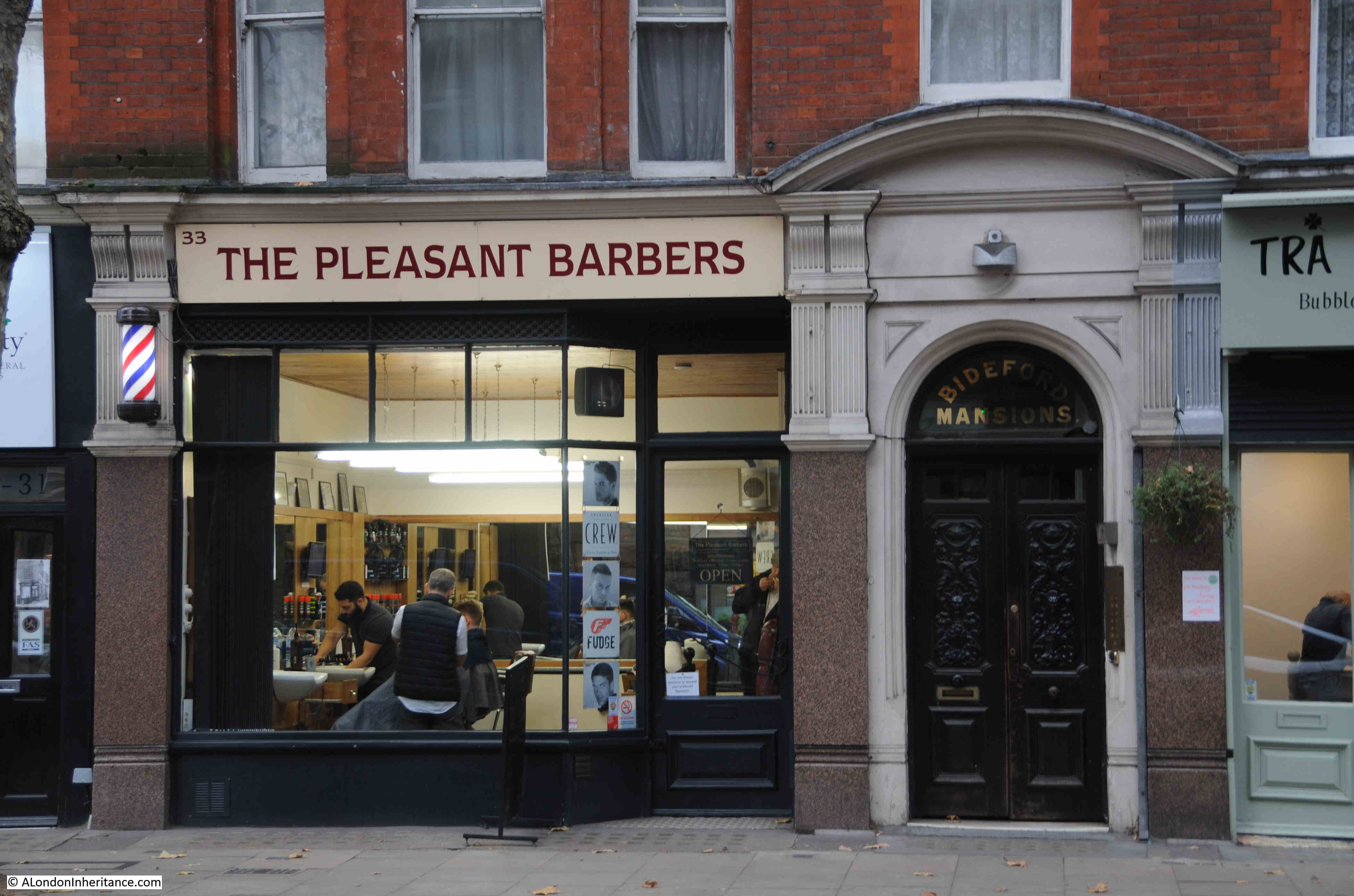
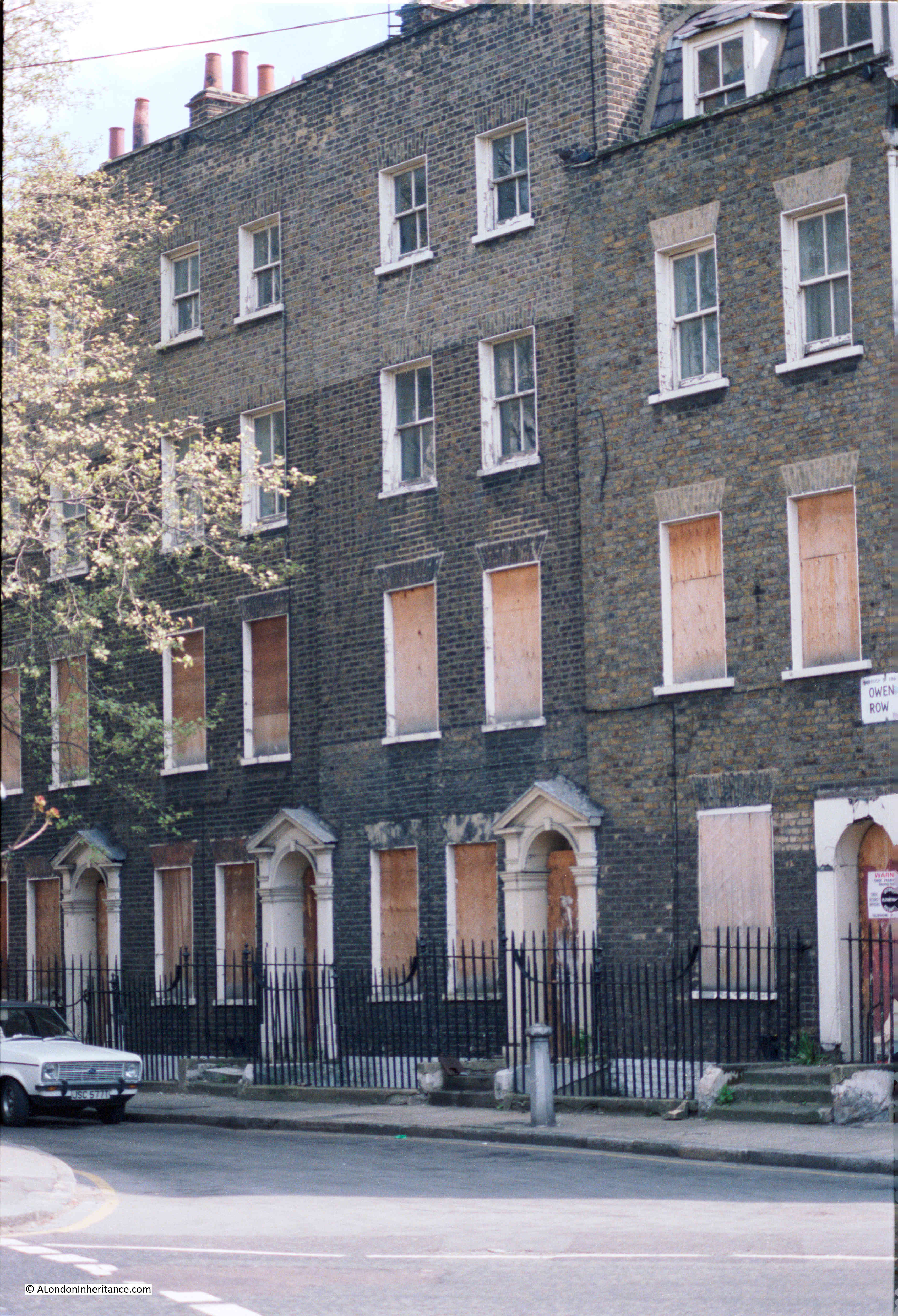
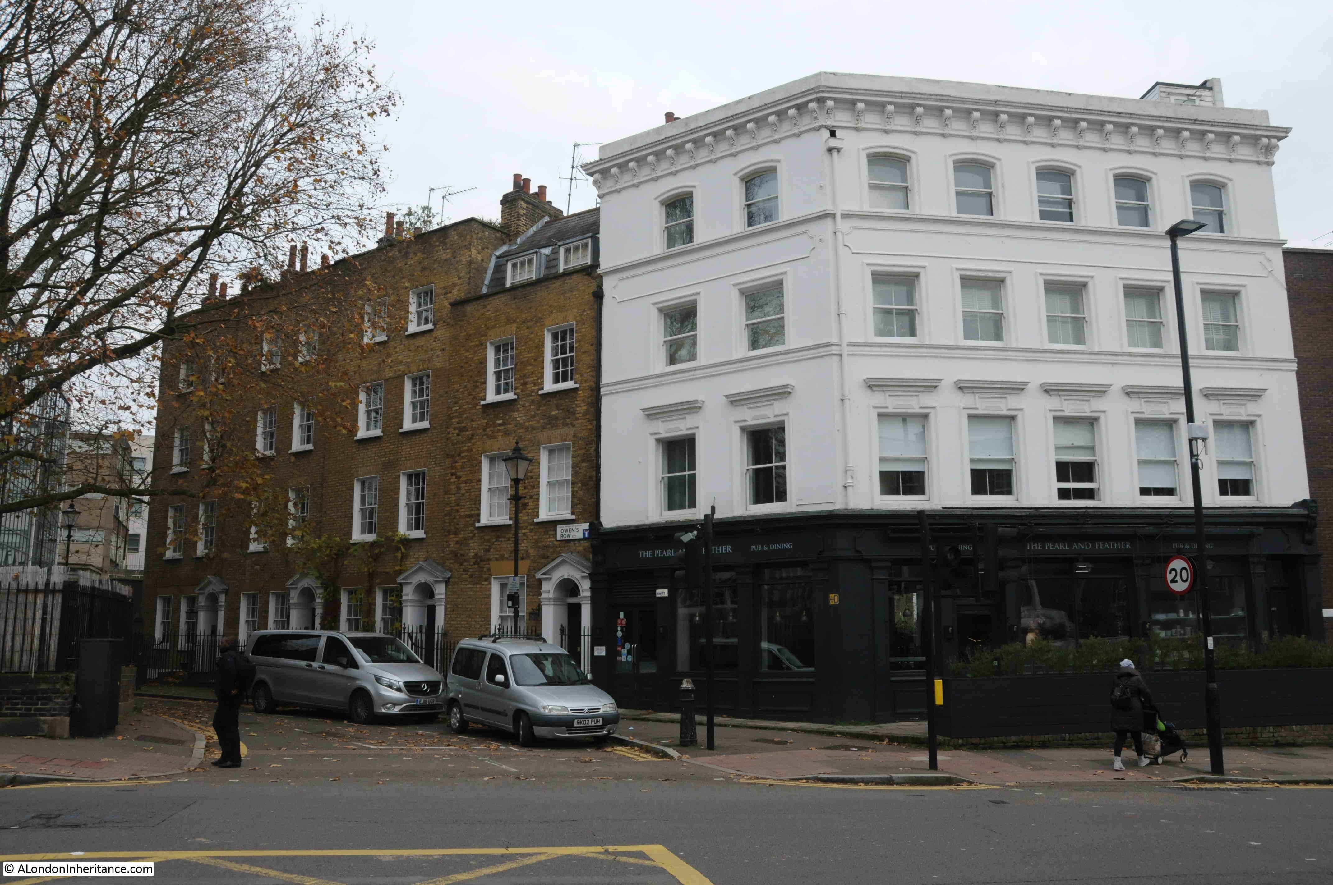
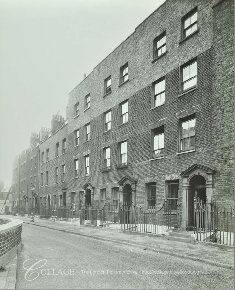
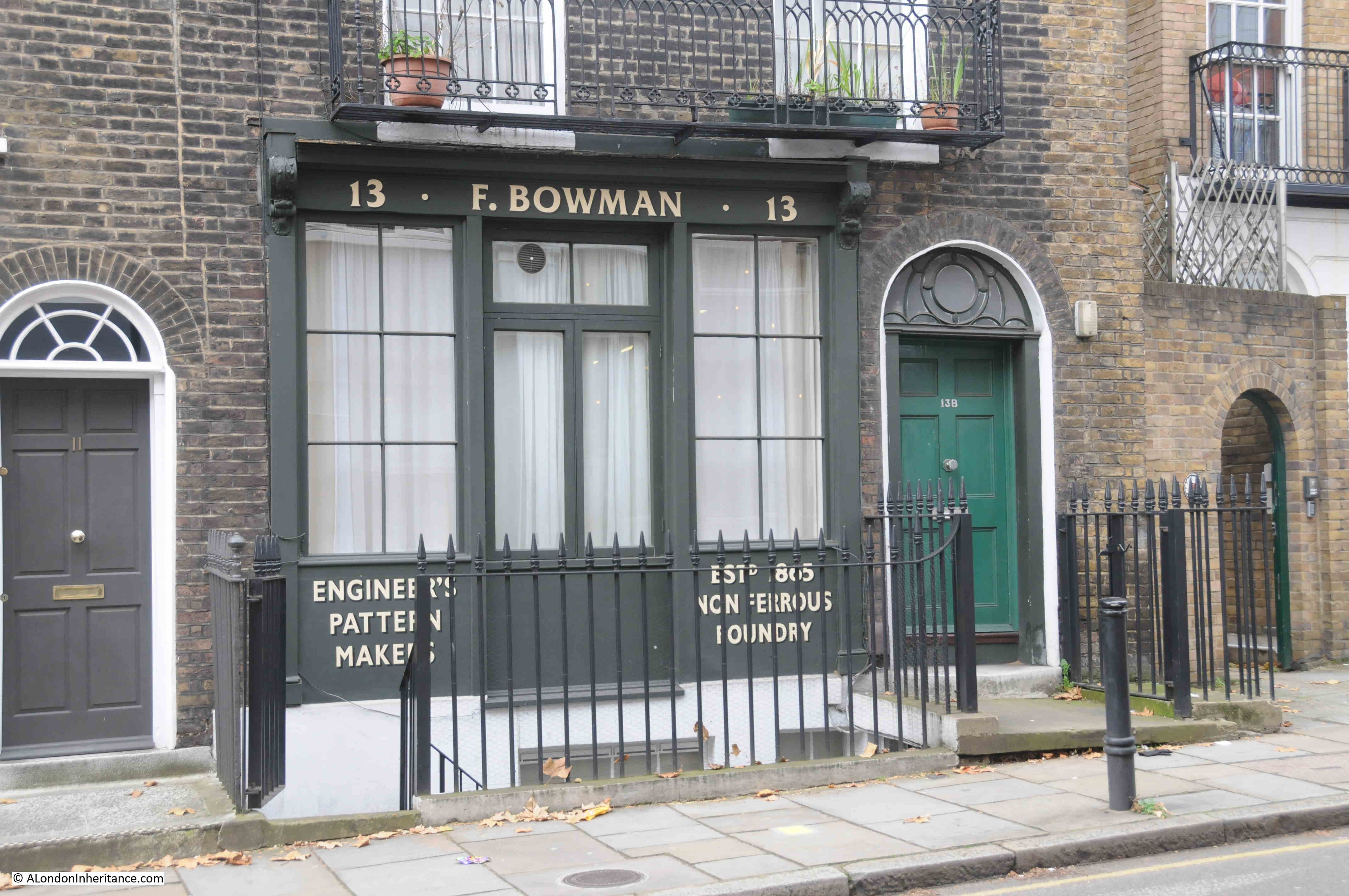
Leaving Colebrooke Row, we cross over City Road and Goswell Road, and cut through to St John Street. Then down to Owen’s Row (which is on the alignment of the New River, I wrote about Owen’s Row within this post).

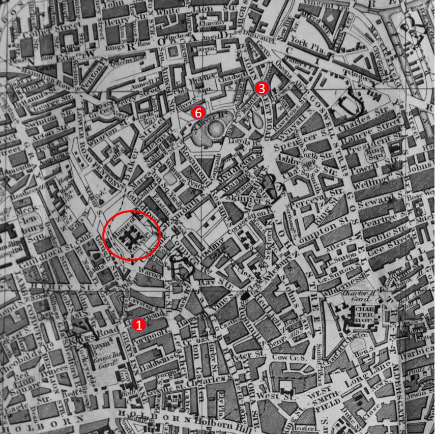
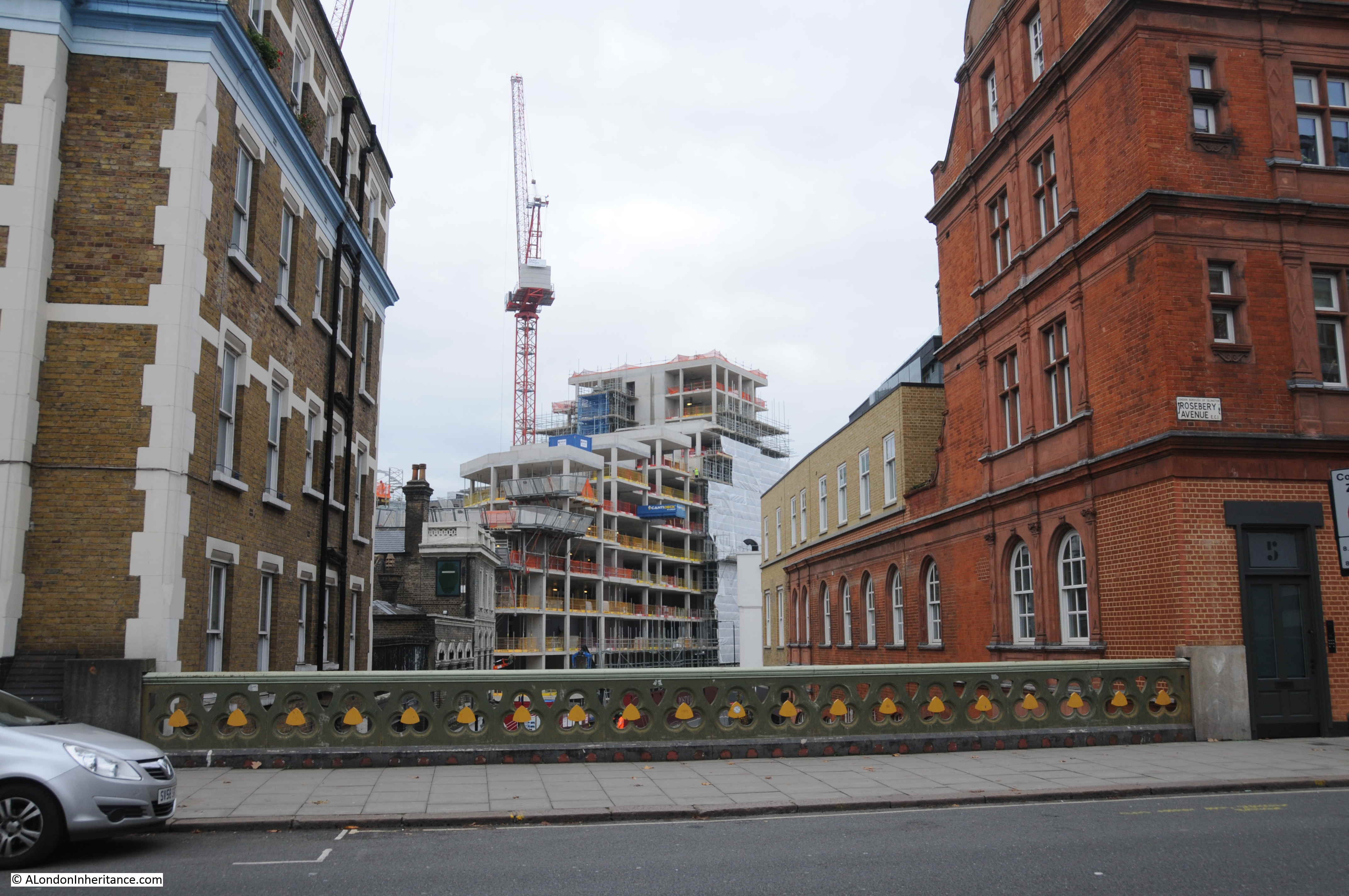
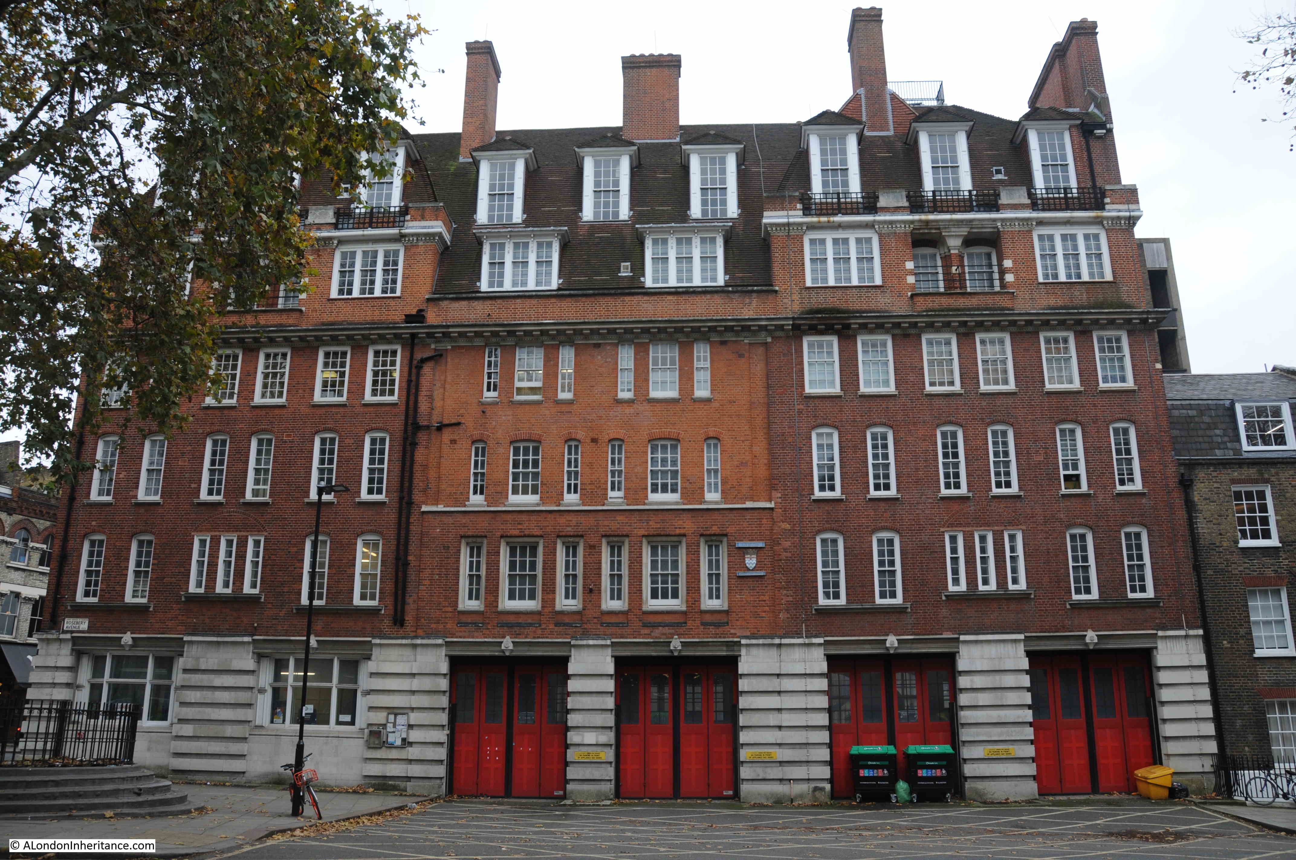
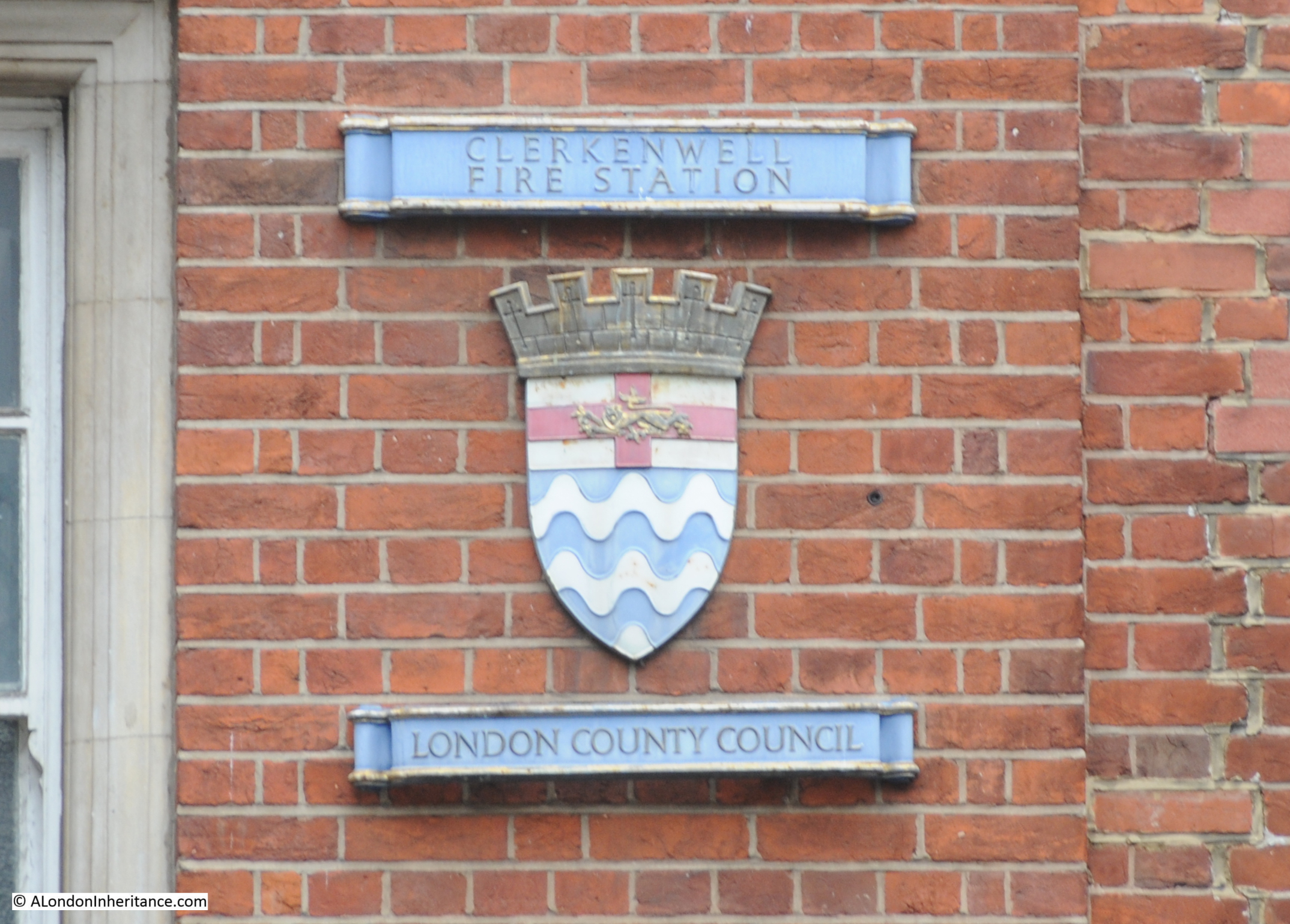
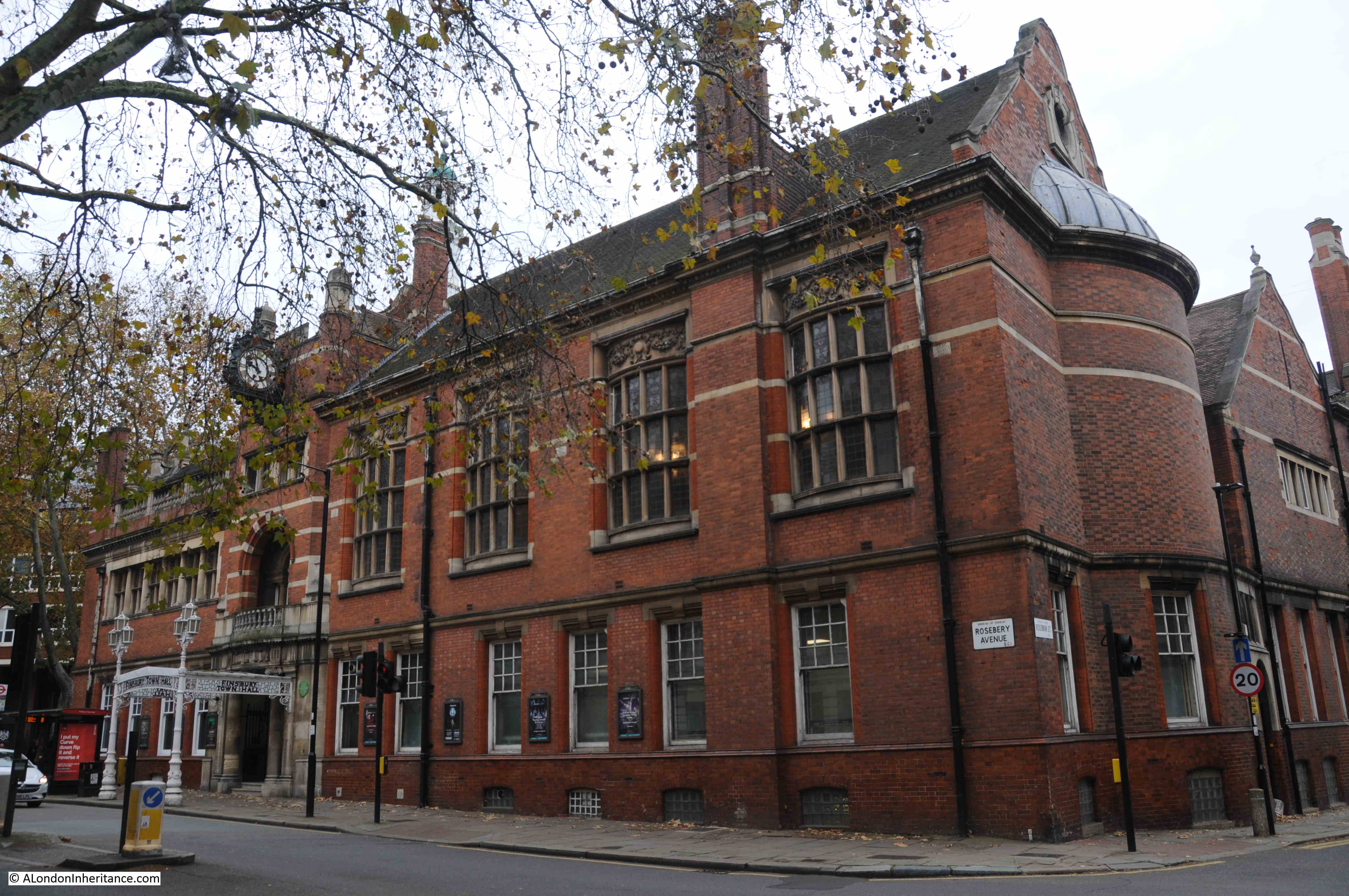
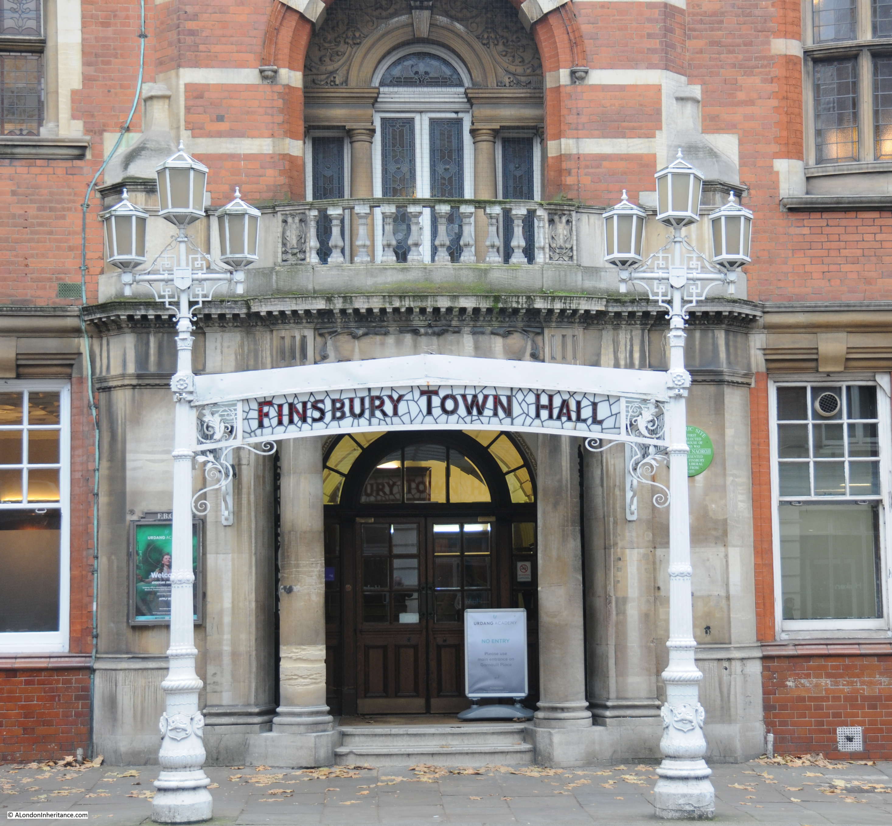
Crossing over St John Street into Rosebery Avenue, and this is the view along the old route of the New River, with Sadlers Wells on the right (a post on Sadlers Wells and the New River is here):

Sadlers Wells

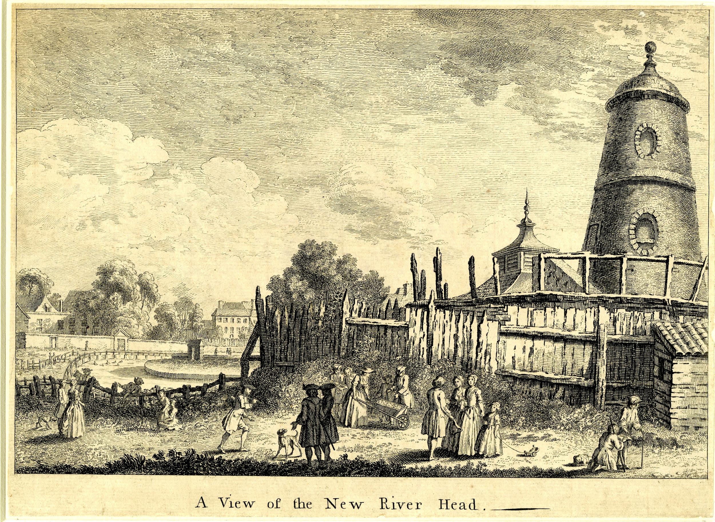
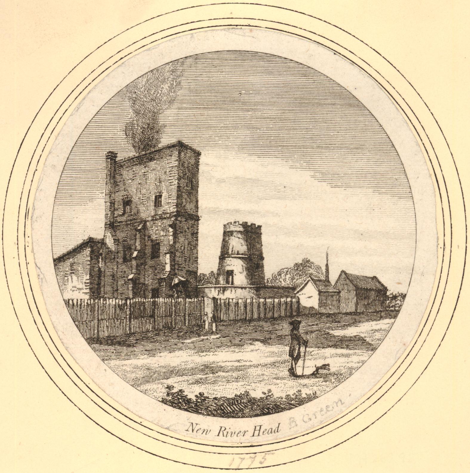
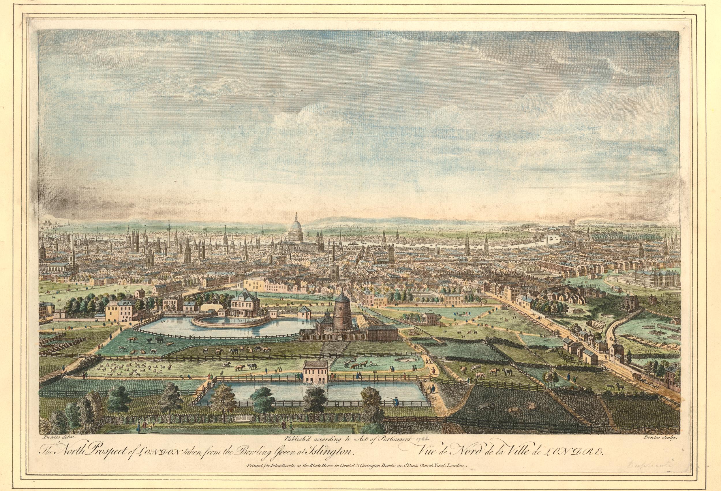
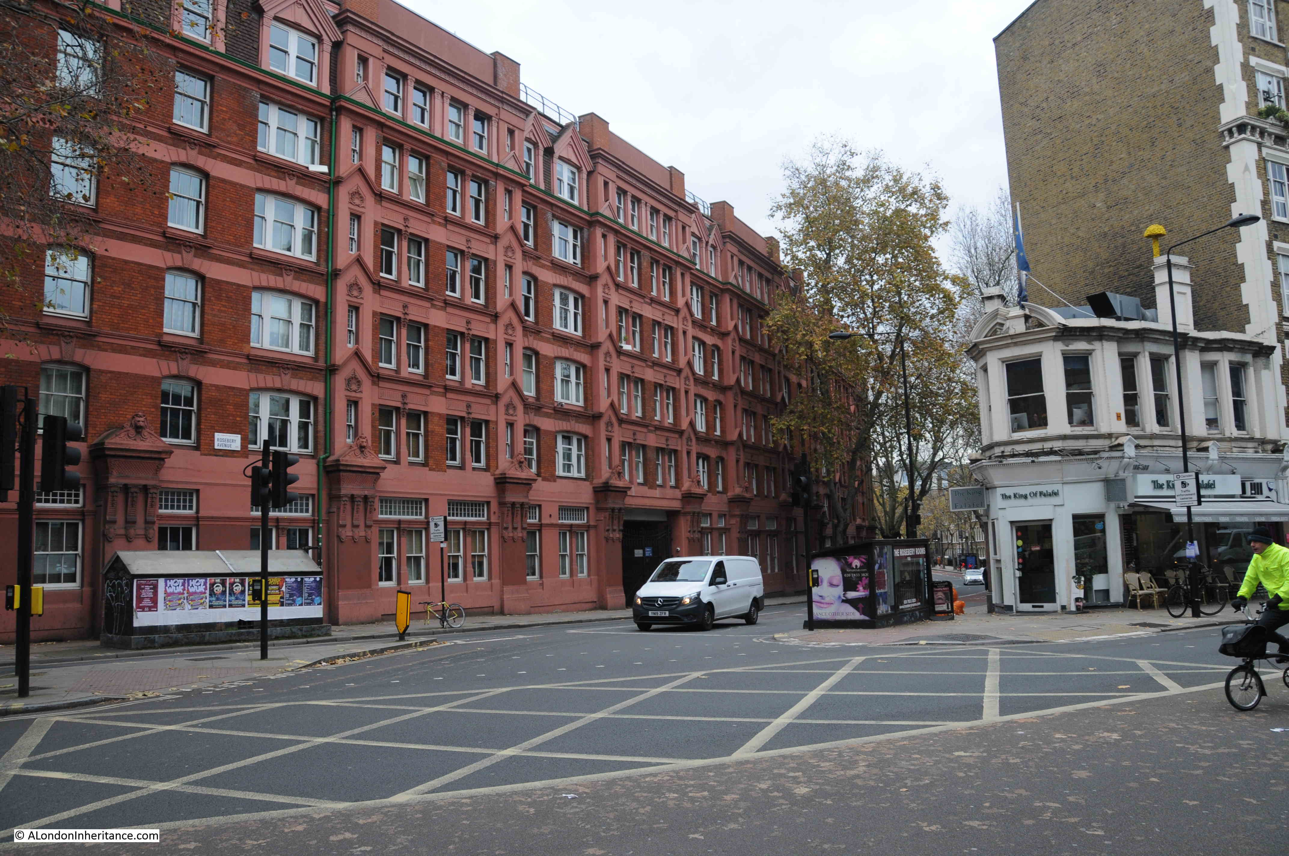
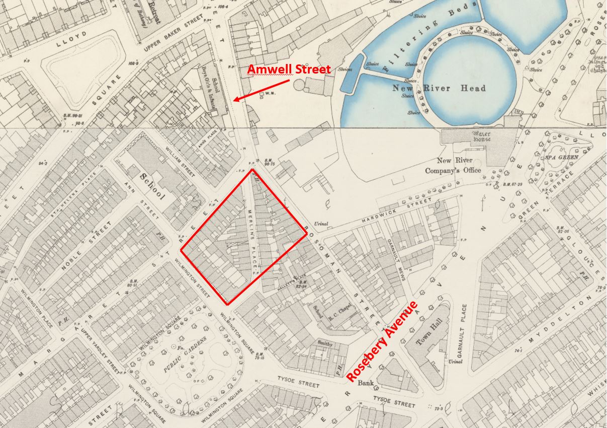
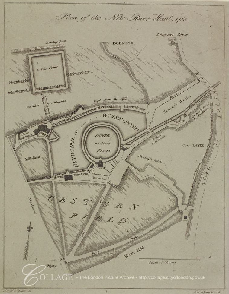
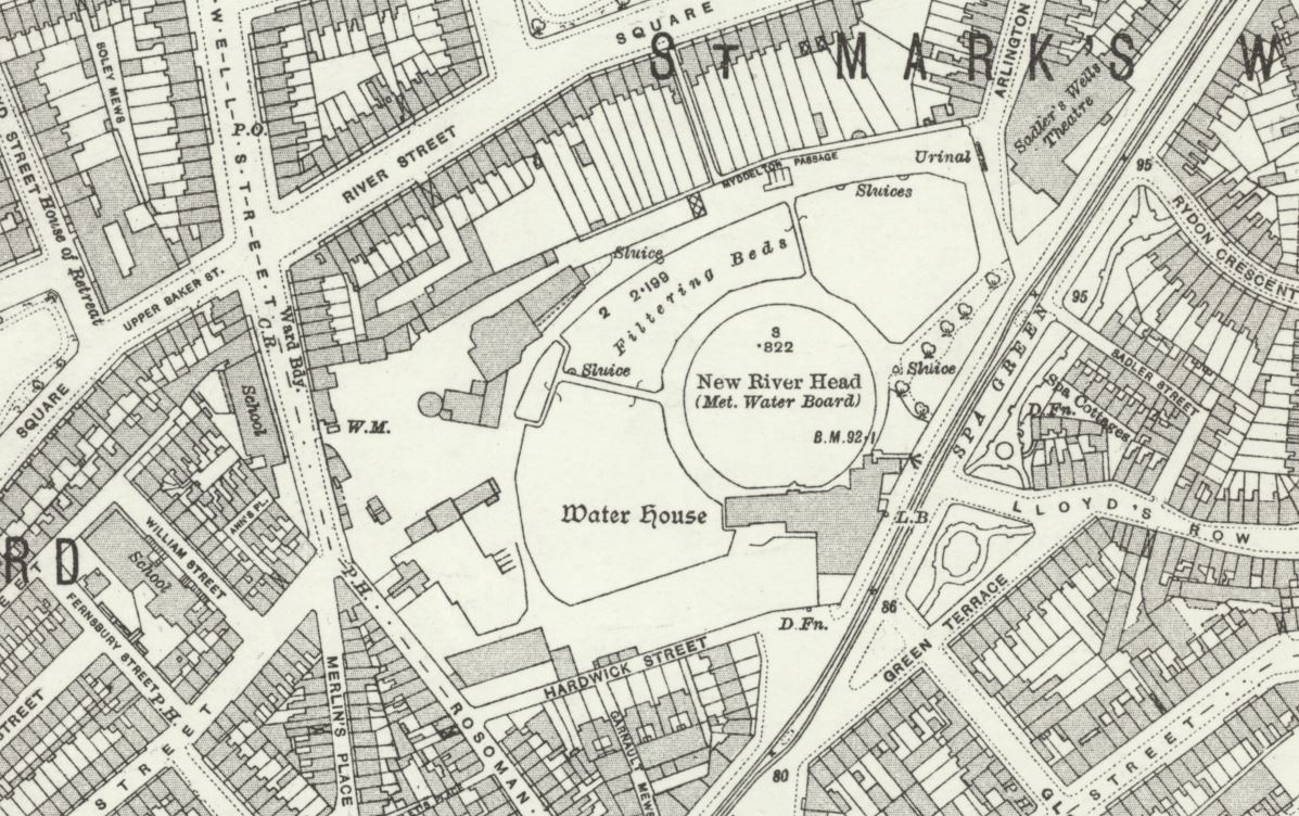
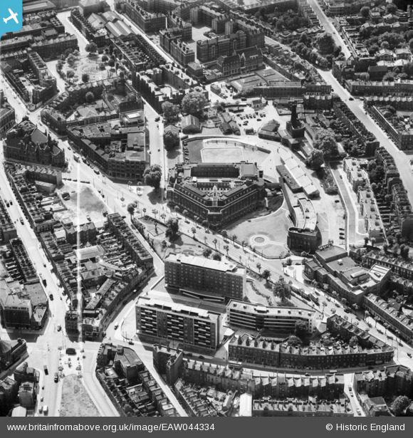
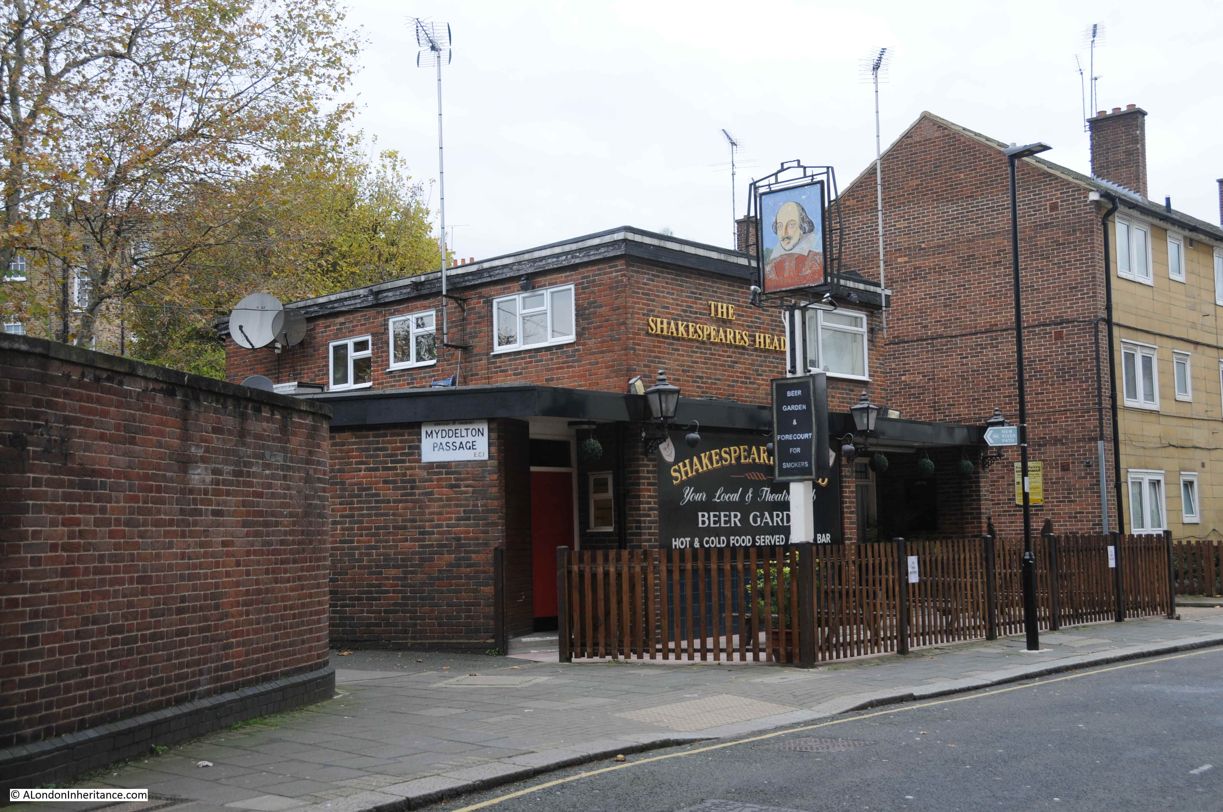
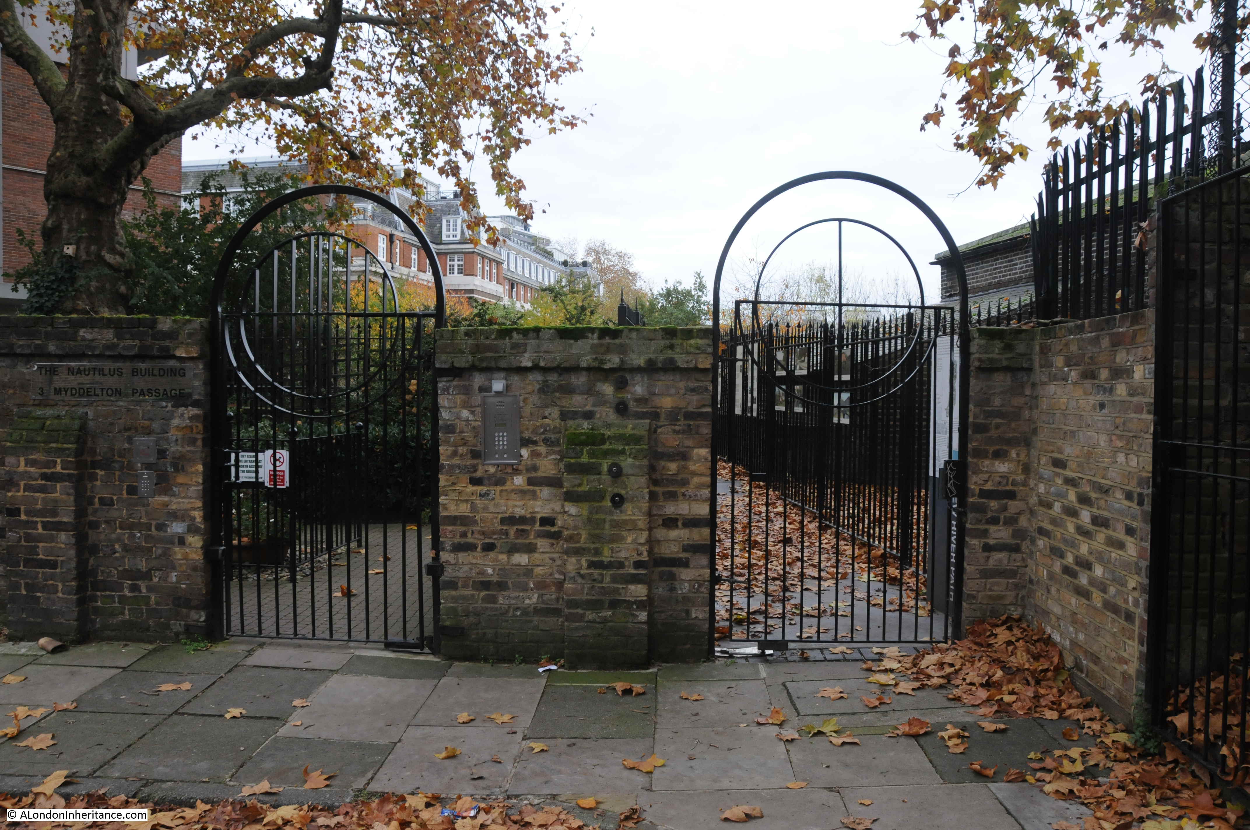
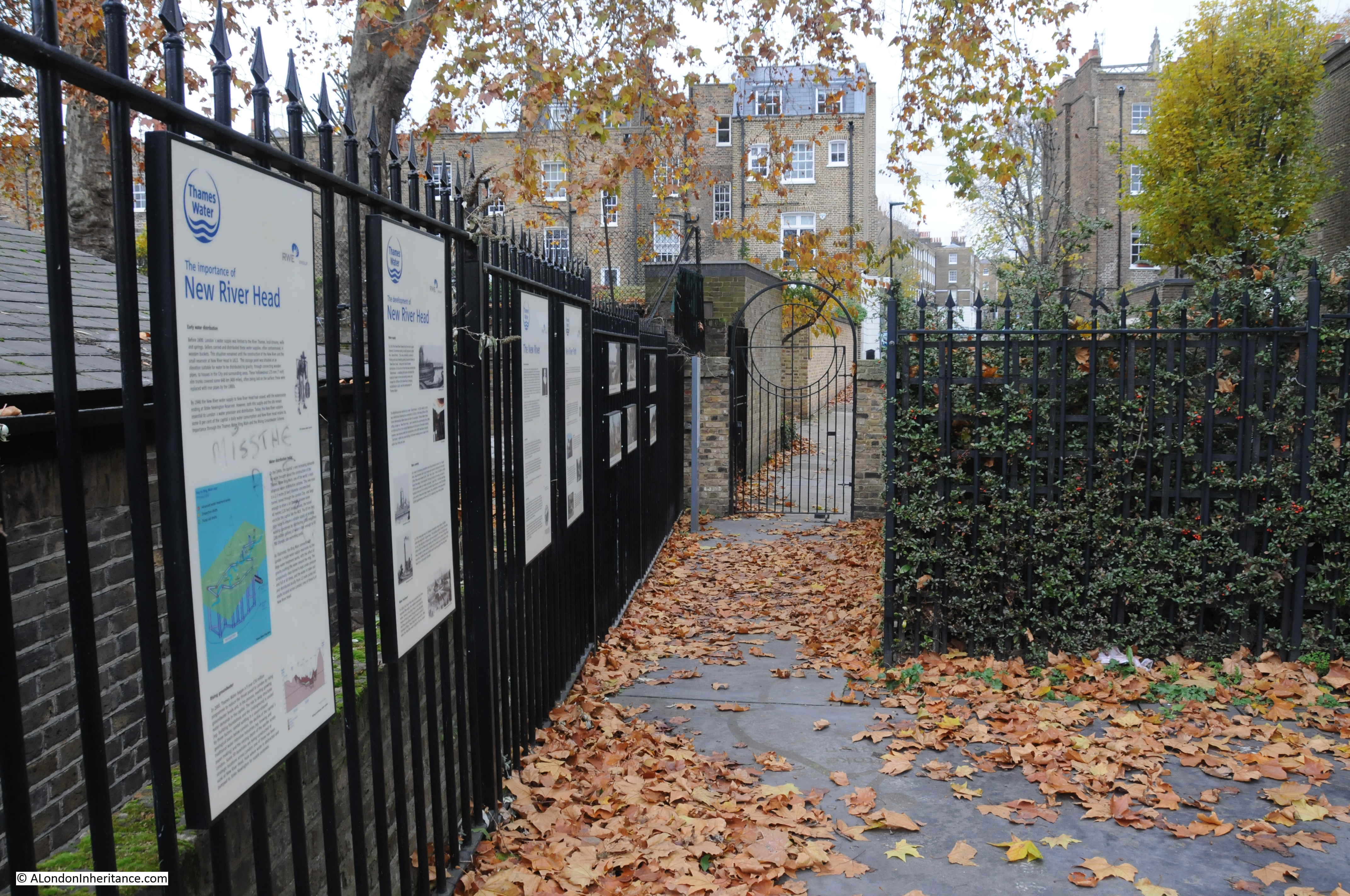
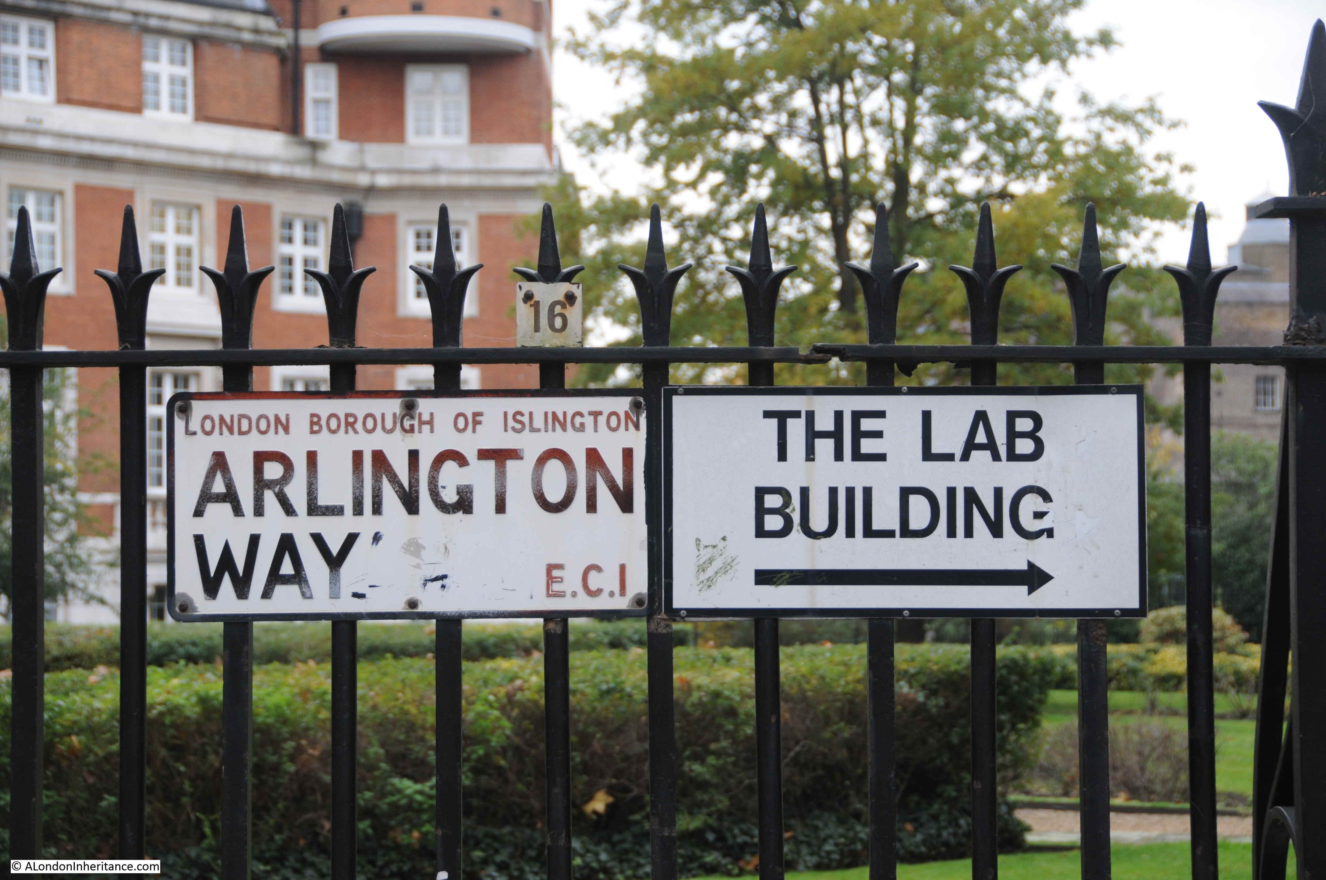
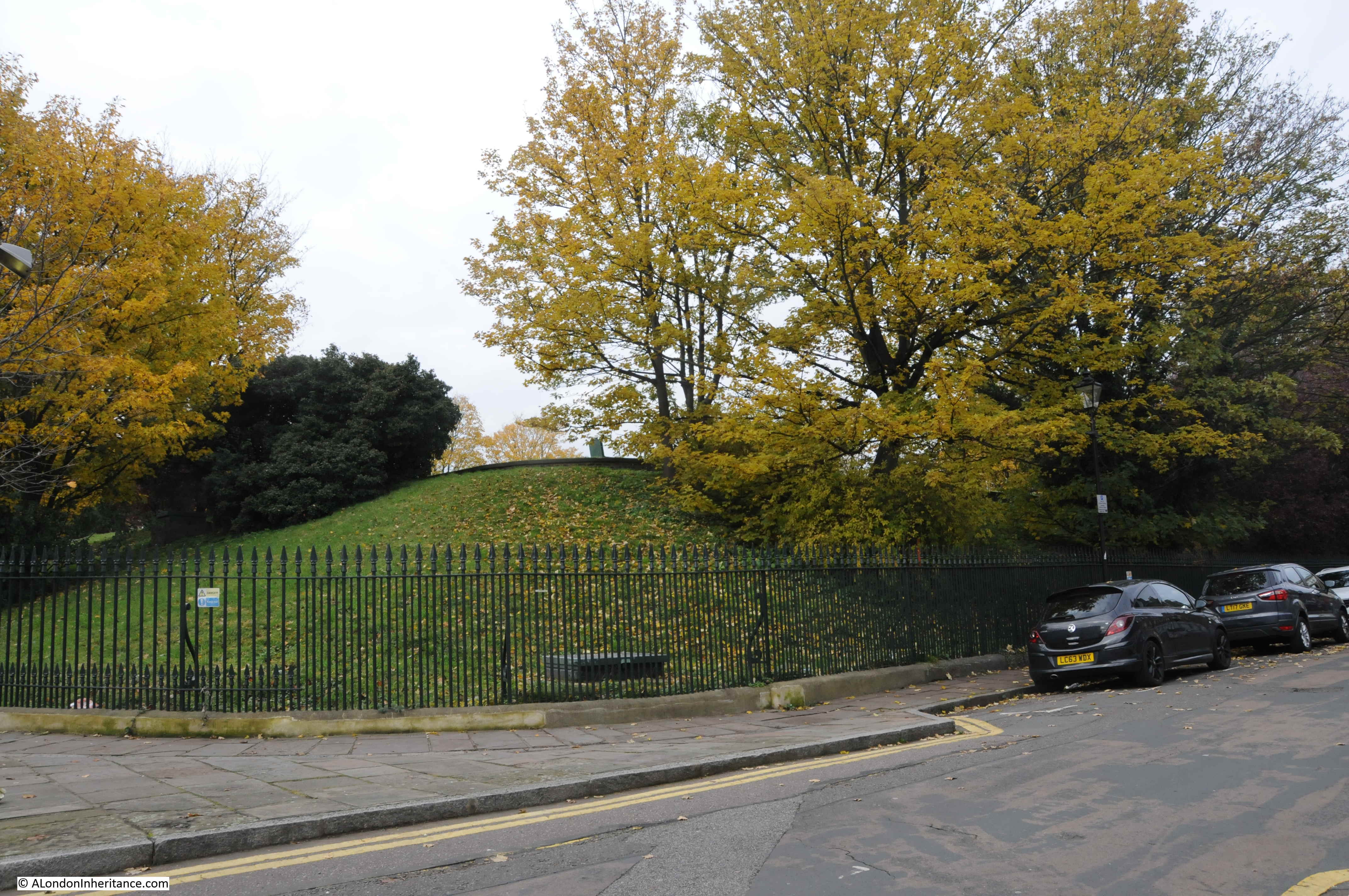
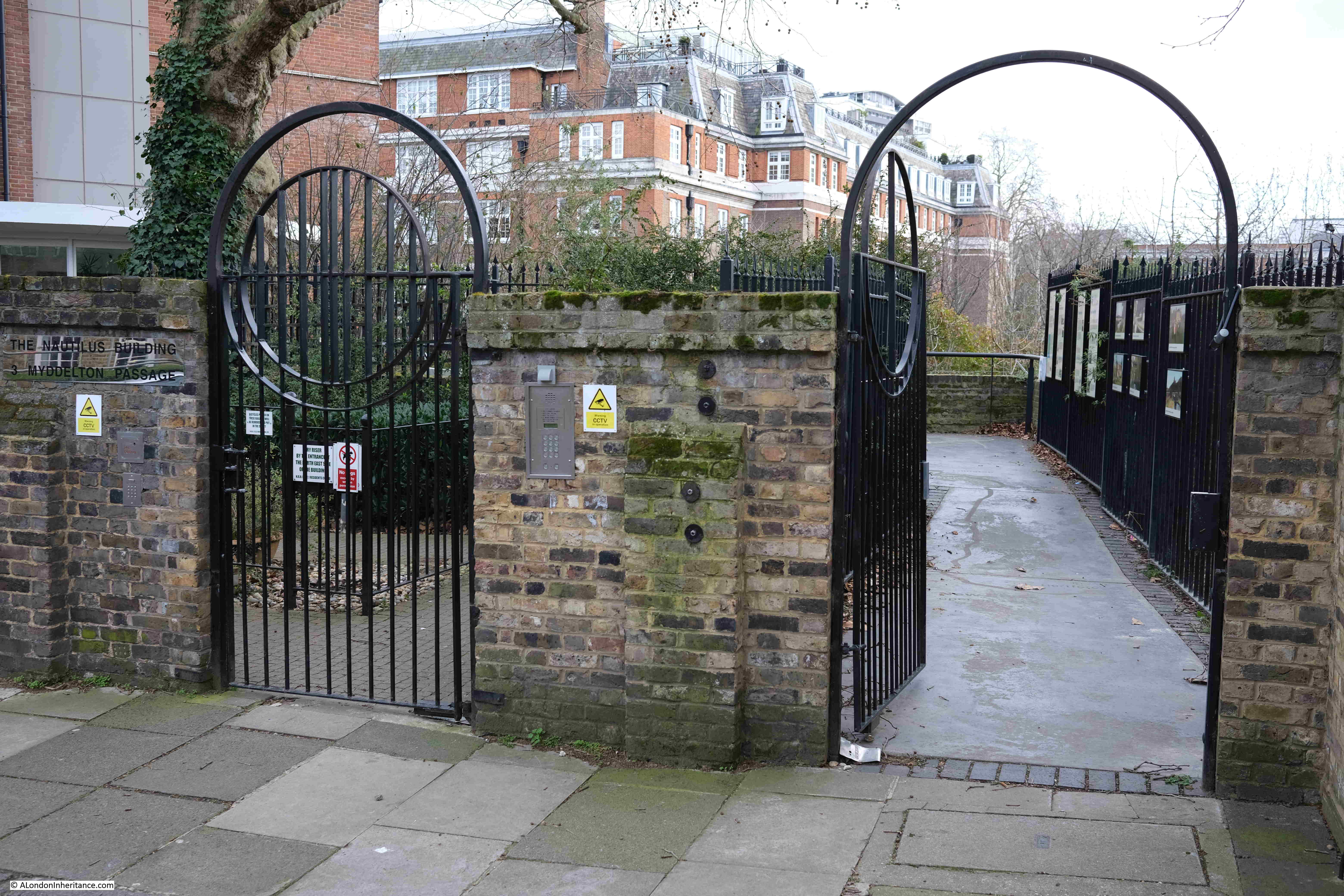
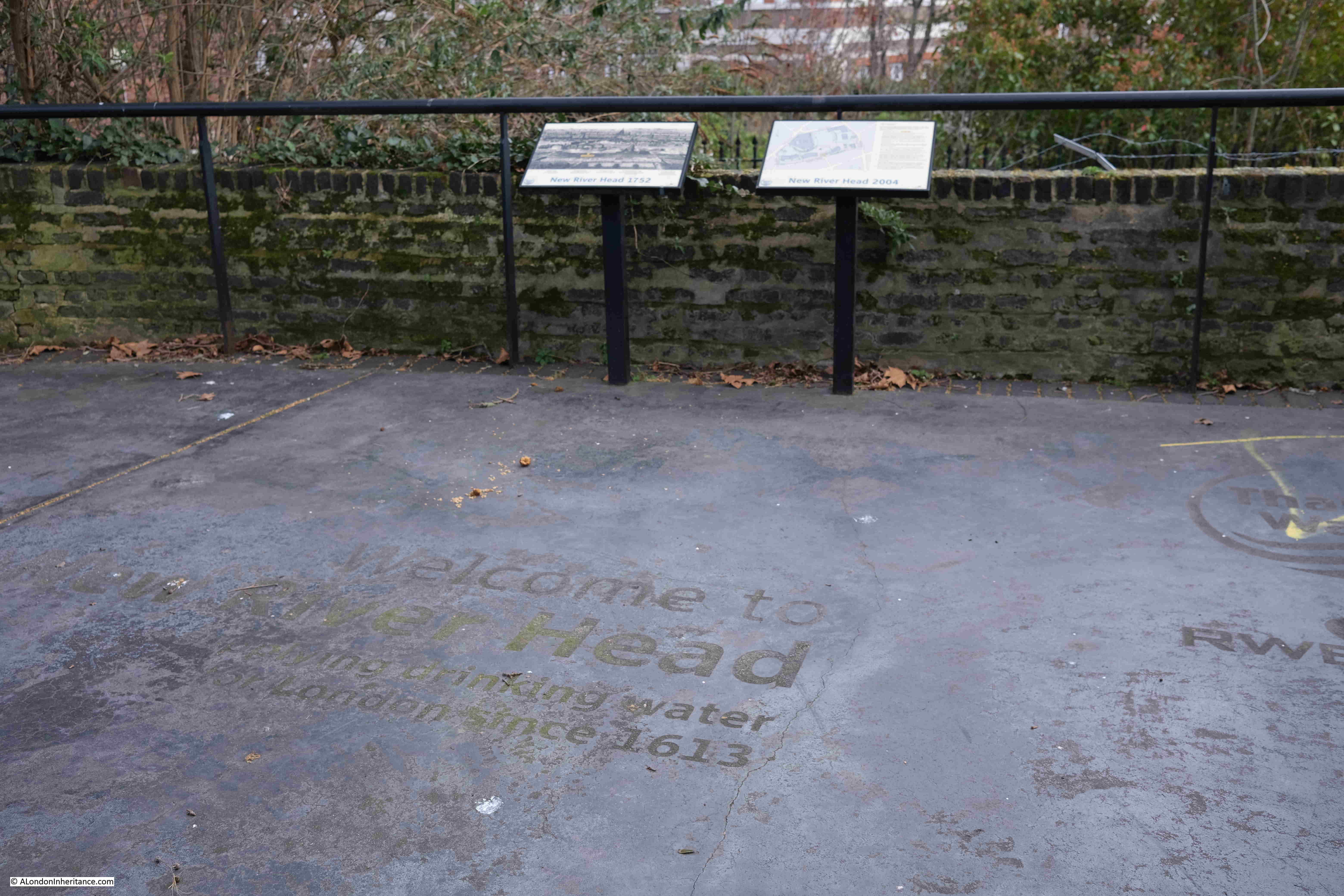
At the end of Sadlers Wells, turn right into Arlington Way, then left into Myddelton Passage, where we come to the official end of the New River Walk, at the viewing platform looking over what was New River Head:

New River Head

The route is marked on the ground of the viewing platform:

New River Head

And that completed the New River Walk, over four days / two weekends, from Ware in Hertfordshire to New River Head, Clerkenwell.

It was a fascinating journey, and whilst the route has been straightened at a number of points and does not fully trace the original early 17th century route, it did leave me with considerable admiration for those in the early 17th century who surveyed and built the route, following the contours of the land so it would only fall by roughly 20 feet along the entire route ( 5.5m in total or 5 inches per mile). This enabled the water to flow naturally without the need for any pumping.

You can find my posts covering the first two stages of the walk at the following links:

I have also written about the history of New River Head and London’s Water Industry, which you can find at this link.

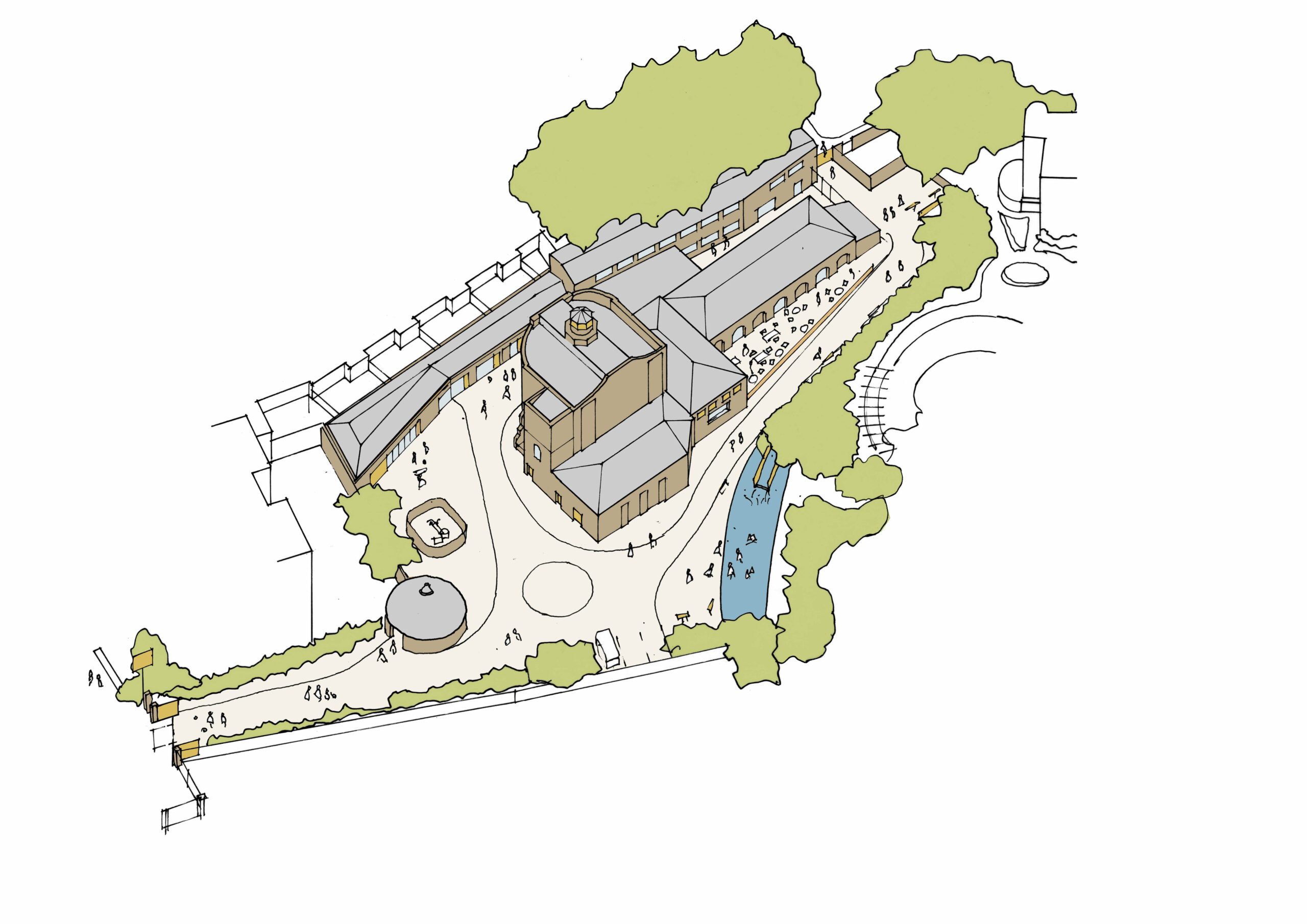
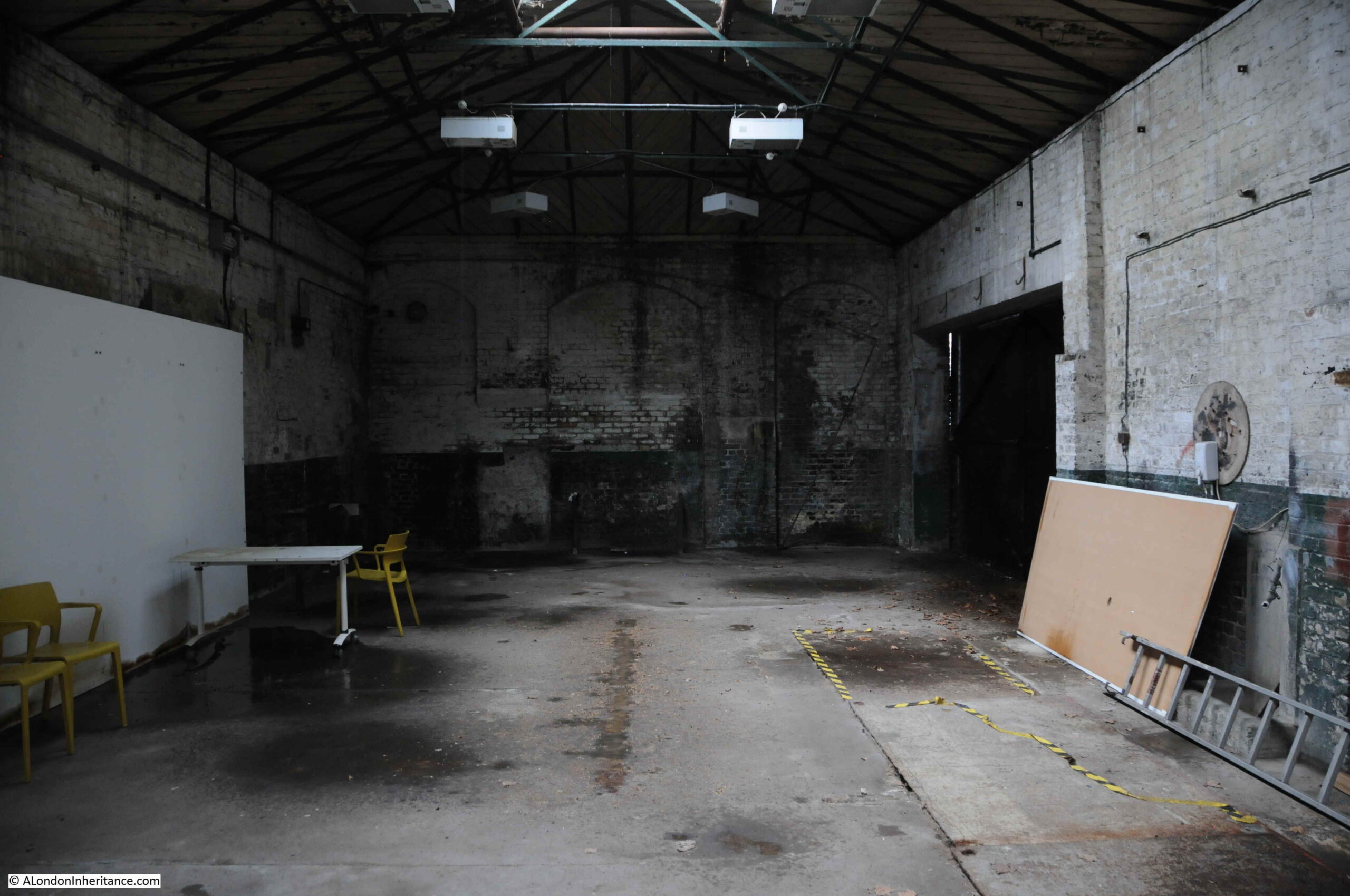
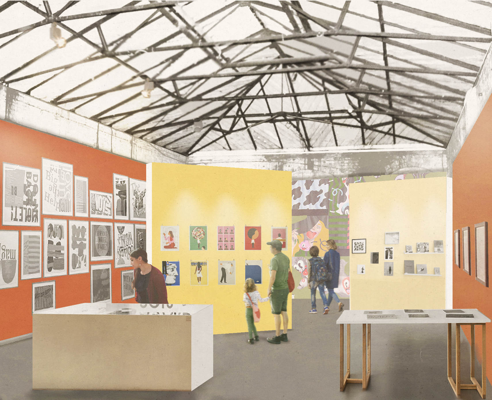
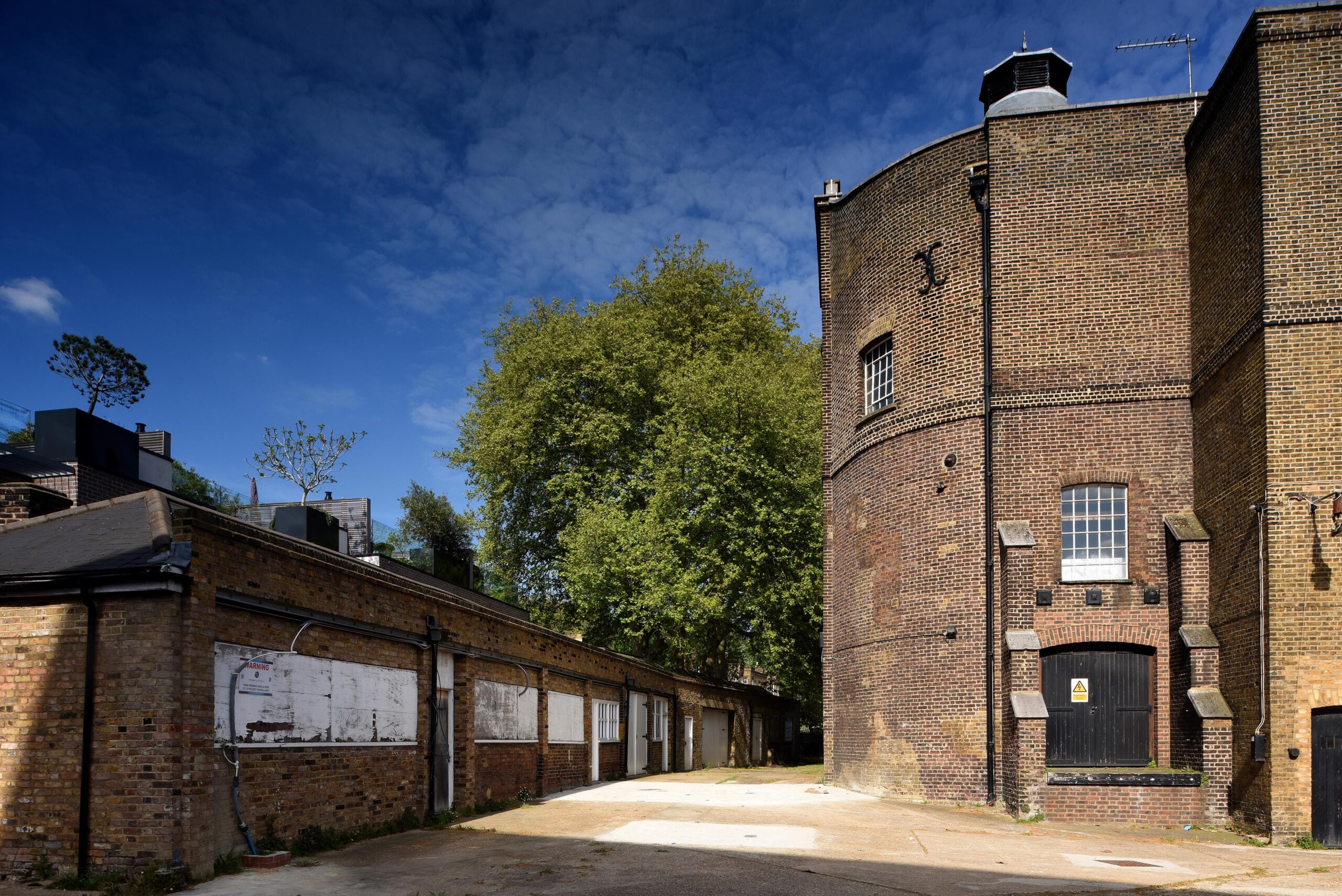
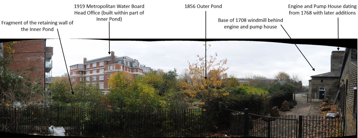
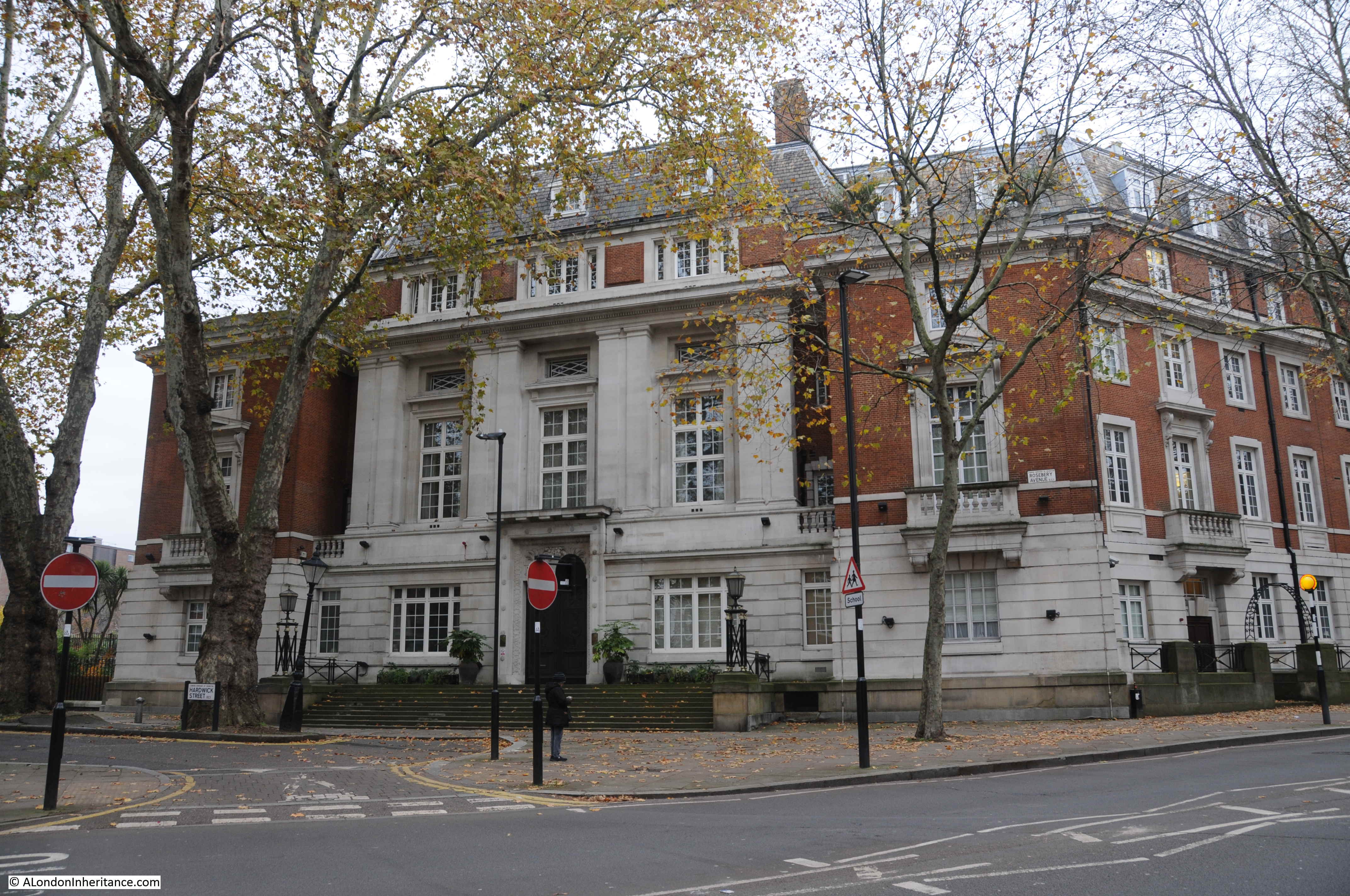
In the following panorama from the viewing platform at New River Head, I have labeled some of the key features. On the right are the engine and pump house which will soon become the new Quentin Blake Centre for Illustration, a wonderful new use for these historic buildings.

Panorama of New River Head

David Fletcher creates remarkable 3D photogrammetry captures of heritage sites and has one for the historic buildings at New River Head. Hopefully this will work as I have embedded the model in the post (if you do not see this in the e-mail, click here for the post on the website).

You can walk through the site, both inside and out to see this remarkable, historic site in detail:

And finally, if you have not had enough about the New River, I purchased the following book, the Mercenary River by Nick Higham a few weeks ago.

The Mercenary River

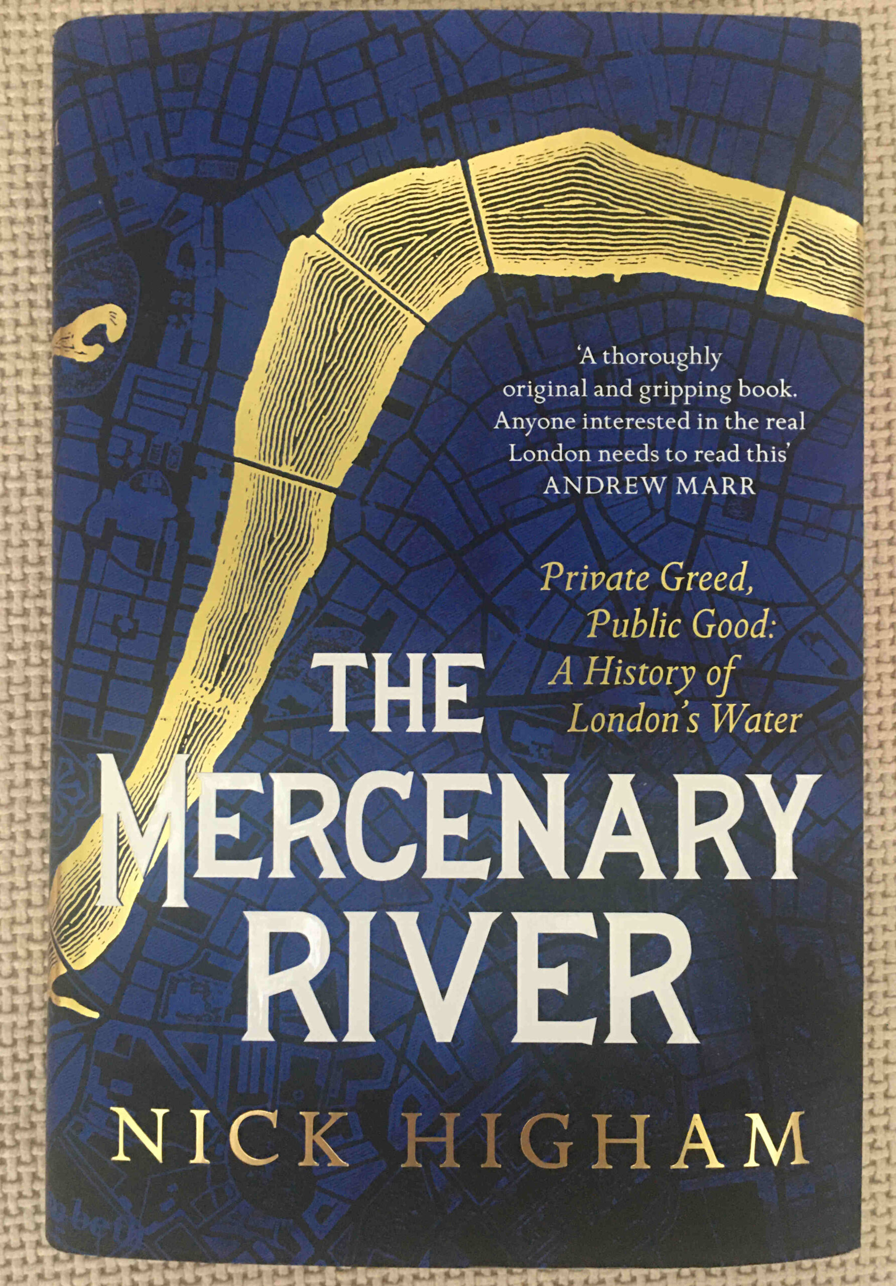
It really is a fascinating history of London’s water supply, including, off course, the New River, and is highly recommended.

alondoninheritance.com

St Anne’s Soho, New River Company and Shaftesbury Avenue

St Anne’s Soho, New River Company and Shaftesbury Avenue is a bit of a mix of very different subjects, however the following photo from one of the Wonderful London books provides the connection.

New River Company Elm Pipes

The caption to the photo reads: “Elm Trunks for Conduit Pipes dug up near St Anne’s, Soho. Wooden pipes like these were used to carry water from New River Head over the Holebourne for the citizens. Trunks used for conveying the fresh water supply were of elm which of all the timbers best withstands the exigencies of heat and cold. The New River Co. had a wharf at the bottom of Dorset Street where the elm trunks were landed and bored. Shaftesbury Avenue was opened February 26, 1887, and the excavations laid these old pipes bare.”

There is much to unpack in that single caption, far more than within the scope of a single post, but I will give it a go, starting with the elm trunk in the photo.

When the New River Company started to distribute water across the city from their pond at New River Head, the only method to carry water within pipes was to use bored tree trunks. Iron pipes would not become available for the New River Company to use for well over a hundred years from when the company started operations in 1613.

The photo shows how a tree trunk was converted into use as a pipe. A hole was bored through the centre of the pipe to carry water, and one end of the trunk was shaved down to a point around the hole so that it could be pushed into the next trunk in the series, trying to form as close a seal as possible to prevent the leakage of water.

The New River Company had their main pond or reservoir at New River Head in north Clerkenwell, and their offices eventually moved to the same location, however as the caption states, they had a wharf at the bottom of Dorset Street, and their original offices were at the same location. It was here that elm trunks were delivered via the River Thames, bored and shaped ready to be used within their network of pipes.

The caption states that the wharf was at the bottom of Dorset Street. The offices, yard and wharf are marked on Horwood’s 1799 map of London, just to the west of Blackfriars Bridge, circled in the following extract:

New River Company

The location of the New River offices, yard and wharf are now separated from the river by the construction of the Victoria Embankment, however I have marked their location with the red arrow in the following photo, now covered by the brick building to the left of the old City of London School.

New River Company

The area served by the New River Company was extensive, for example one of their large industrial customers was the Truman’s Brewery in Brick Lane to the east of the city, and as London expanded to the west, they buried their pipes along the streets to serve the new buildings.

Serving the new west London streets did however bring problems. New River Head was located at a height of 30 metres above sea level. The original customers in the City of London were at a height ranging from 15 metres in the north of the City down to 1 or 2 metres along the river. This worked well when gravity was being used to get the water from New River Head to the City.

The west of the city was a different matter, with the area around Shaftesbury Avenue and Soho being around 22 metres in height, only an 8 metre difference to New River Head and much higher than the City.

This led to supply problems along the new streets of Soho, with a good supply in the City, and poor supply due to low pressure in west London.

The New River Company was also facing competitive pressure from other water companies, and at the end of the 17th century, they brought in Christopher Wren to evaluate their water supply system, and make recommendations for improvements.

Wren’s view was that the system was an unplanned mess, that had grown without any planning or understanding of the areas being served and how water was affected by the length and size of pipes, and the difference in height across London.

Wren could not make any individual recommendations, he compared the system to a diseased body, with the New River Company looking only at one small part of the body to try and work out a cure. Wren recommended a system wide replanning that would take much of the following century to implement.

Wren’s recommendations were also supported by the ex-clergyman John Lowthorpe, also commissioned by the New River Company to examine the system. Lowthorpe also identified that the company had no audit or understanding of their pipe network, and that a single person should be responsible for the system’s design, the role of a Chief Surveyor.

The New River Company did build an upper pond at Claremont Square, and the additional height of this new pond did overcome some of the pressure problems, but it would not be until wooden pipes were replaced with iron pipes, and steam engines were used to pump pressurised water rather than use gravity, that the supply across London would become reliable.

I have written more about New River Head and the New River Company here.

The photo of the elm pipe was taken outside the Wardour Street entrance to the church of St Anne’s, Soho. This is the same view today:

St Anne's Soho

St Anne’s, Soho was built to serve the spiritual needs of those living in the expanding Soho streets. Plans for a new church were first being discussed in the 1670s, along with the search for a suitable location. The land on which the church would be built was owned by two speculators, brewer Joseph Girle and tiler and bricklayer Richard Frith (who would give his name to Frith Street).

There is no firm evidence of the architect of the church, there are references to both Christopher Wren, and one William Talman, but it is impossible at this distance in time, and loss of documentation over the years, to be clear of their individual role.

The new church was ready for use in 1685 and was consecrated by Bishop Henry Compton in either 1685 or 1686.

The church was very badly damaged during the blitz raids of September 1940. The body of the church was completely burnt out, the tower survived, but with considerable damage.

The church was partly restored in the decades after the war, before undergoing a full restoration between 1990 and 1991. The tower survives from the pre-war church, however the rest of the building is a modern rebuild.

The tower and church of St Anne’s, Soho:

St Anne's Soho

The church in 1810 (with the inclusion of Westminster in the name as it was within the parish):

St Anne's Soho

It is always easy to get distracted by the gravestones in the churchyard of an old London church, and St Anne’s is no exception. Although these are now separated from their original graves, they tell the story of some of the characters who were buried here:

St Anne's Soho

In the above photo, the stone on the upper right is to Theodore, King of Corsica:

Theodore king of Corsica

Theodore was born in Cologne, Germany in 1694, with the full name Theodor Stephan Freiherr von Neuhoff. He had a varied career, service with both the French and Swedish armies, negotiating on behalf of the Swedish king with England and Spain, and travelling widely.

It was whilst traveling in Italy that he became involved with rebels trying to free the island of Corsica from the rule of Genoa, one of the republics that made up Italy in the 18th century.

Theodore landed in Corsica in March 1736, and was made king of the island by the inhabitants. His rule did not last long. Disagreements within the rebels, and the Republic of Genoa putting a price on his head resulted in Theodore leaving the island in November of the same year.

He lived in the Netherlands for a while before moving to London, where he tried to get support for Corsica, and his role as king. He was not successful, had many money problems and ended up in the King’s Bench debtors prison.

Released in 1755 after declaring bankrupt, and registering his Kingdom of Corsica for the use of his creditors. He died the following year in 1756, and the gravestone includes the following text:

Another gravestone on the base of the tower is that of William Hazlitt, whose grave in the churchyard is marked by a recent memorial.

William Hazlitt

Hazlitt was one of the greatest English essayist’s of the late 18th and early 19th centuries, however he lived his last years in relative obscurity, partly in a flat in Frith Street which explains why he was buried in St Anne’s.

A report in The Atlas (A General Newspaper and Journal of Literature) on the 26th September 1830 finishes with a sentence that will probably ring true with the majority of authors:

“On Thursday last the body of William Hazlitt was borne beneath our windows; till that moment we were not aware that a man of genius, a popular writer – the author of no less that able a work than the life of Napoleon, which alas closed his literary labours – and an amiable man, had been our next door neighbour for months, enduring sickness and at length dying in indigence. We boast of our national generosity, glory on the flourishing state of our literature, and thunder forth the power of the press, the palladium of our liberties; in the meanwhile ‘the spirit of life’ is allowed to burn itself out in penury and privation. Publishers sport their carriages, or fail for a hundred thousand pounds; and those by whom they become publishers die for want of a dinner.”

So that covers a brief looks at the New River Company and their elm pipes, as well as St Anne’s, Soho. The caption to the photo has the following final sentence:

Shaftesbury Avenue was opened February 26, 1887, and the excavations laid these old pipes bare.”

Which implies that the elm pipes were uncovered during the work to create Shaftesbury Avenue, so the creation of this famous West End street is what I wanted to explore next.

Shaftesbury Avenue

Shaftesbury Avenue is a long street that runs from New Oxford Street in the north down to Piccadilly Circus in the south. The street crosses Charing Cross Road, and it is the lower half that is probably best known as this is where the majority of the street’s theatres are located. As the street sign above confirms, Shaftesbury Avenue is in the heart of London’s theatre land.

In the following map, I have marked the route of Shaftesbury Avenue with a a red dashed line (Map © OpenStreetMap contributors).

Shaftesbury Avenue

Shaftesbury Avenue cut through a series of streets and buildings that had existed from the time of London’s expansion westwards. The following map is from William Morgan’s 1682 map of London, again the red dashed line marks the future route of Shaftesbury Avenue.

Shaftesbury Avenue

During the second half of the 19th century there were a number of building schemes that carved new roads through what been been dense networks of streets and buildings. I have already written about Roseberry Avenue which was built between 1887 and 1892, and Charing Cross Road which was officially opened on the Saturday 26th February 1887.

Shaftesbury Avenue was part of the same scheme that included Charing Cross Road.

Proposals for roads improvements along the lines of Charing Cross Road and Shaftesbury Avenue dated back to the 1830s, when a Select Committee of the House of Commons stated that “several plans for affording greater convenience of intercourse between the southern and northern divisions of the metropolis” were considered due to increasing traffic flow and the need to provide much more direct and convenient links between locations such as the eastern end of Oxford Street, Charing Cross and Piccadilly Circus.

Nothing would come of these early proposals, and by the 1870s the situation was becoming more critical, with traffic added to by the arrival of railway stations to the north of the city and those along the river such as Charing Cross.

The Metropolitan Board of Works applied to parliament for permission to improve the streets between Oxford Street, Charing Cross and Piccadilly, and they were granted the powers to construct these streets through the Metropolitan Street Improvements Act of 1877.

Details of these improvements, along with so many others throughout London were published by the London County Council in a wonderful book published in 1898 called “History of London Street Improvements, 1855 – 1897”.

The book includes some detail on the Shaftesbury Avenue development, including the following two maps which detail the route. I have added a yellow line to highlight the route. The first map covers from Piccadilly Circus at lower left to just to the north west of Seven Dials at top right.

Shaftesbury Avenue

The following map includes a short overlap and covers the north eastern section of the street from Greek Street (top left) to New Oxford Street at lower right.

Shaftesbury Avenue

The route of Shaftesbury Avenue would take over and widen a number of existing streets and would run through a number of housing blocks.

At the southern end of the route, Shaftesbury Avenue opens out onto Piccadilly Circus which is a major junction with Regent Street, Piccadilly, Regent Street St James, and Coventry Street.

Piccadilly Circus

The view along Shaftesbury Avenue from the junction with Piccadilly Circus:

Shaftesbury Avenue

The 1877 Act imposed some difficult conditions on the Metropolitan Board of Works. Previous acts had allowed development to take place with conditions for the rehousing of the “labouring classes” who would be displaced, however the new Act stated that the Metropolitan Board of Works was “forbidden to take, without the consent of the Secretary of State, 15 or more houses occupied wholly or partially by persons of the labouring classes, until the Board had proved to the satisfaction of the Secretary of State that other accommodation in suitable dwellings had been provided”.

The new street would pass through some of the most densely populated parts of London, requiring the rehousing of hundreds of people, so this was a difficult condition for the Board.

The Metropolitan Board of Works tried through the following years to get the condition regarding 15 or more houses either removed or modified, however Parliament refused to change the original Act.

Whilst the Board had been trying to get the Act changed, it had also acquired the land of the old Newport Market and had been building large blocks of working class dwellings ready for those who would be displaced by the development of Charing Cross Road and Shaftesbury Avenue.

Newport Market was an area just to the south of the route of Shaftesbury Avenue. I have ringed the location in the following extract from Reynolds’s 1847 “Splendid New Map of London”:

Newport Market

The projects to build Charing Cross Road and Shaftesbury Avenue would eventually displace a total of 3,044 people, described of being of the “labouring classes”.

Starting to walk north along Shaftesbury Avenue. This stretch of the new road ran through areas of dense housing:

Shaftesbury Avenue

The Metropolitan Board of Works purchased the land for the new street. They tried to keep their purchases to a minimum as the costs were taken from the Rates.

In an example of how the ownership of land always was, and in many ways, continues to be a source of profit, without many of the associated costs, it was complained at the time that whilst the cost of improvements were recovered through the Rates, these were generally paid by the tenants of properties, not by the owner, although in developments such as Shaftesbury Avenue, the owner of land close to the new street would benefit by the increase in the value of his land due to the improvements to the area such a development would bring.

Very similar in the way that Crossrail increases the value of land around new stations.

Land purchased for the new road, often included land running along side. The Board was expected to sell excess land alongside the road to recover part of the construction costs.

Completion of Shaftesbury Avenue would result in an explosion of building along the new route, which included many of the theatres that today line the street.

Shaftesbury Avenue

In the above photo, further from the camera on the right is the Lyric Theatre (1888) and with the “Jamie” advertising is the Apollo Theatre (1901).

At the junction with Wardour Street. The church of St Anne’s, Soho is just up the street to the right.

Shaftesbury Avenue

Remarkable that as the original buildings and streets were being cleared ready for the construction of Shaftesbury Avenue that the 17th century elm pipes were being removed from the ground, and that in the 1880s these were fortunately considered important enough to photograph.

The following photo is looking north from the junction with Wardour Street, and is the stretch of Shaftesbury Avenue which was a much widened earlier King Street:

Shaftesbury Avenue

At the junction of Shaftesbury Avenue and Gerrard Place, there is a modern fire station:

Shaftesbury Avenue

The site has been a fire station from the construction of the street. In 1886, the Metropolitan Board of Works leased the land to a private fire fighting organisation, the London Salvage Corps, with the first fire station being built the following year in 1887. In 1920 the site was acquired by the London County Council as a site for the London Fire Brigade.

Looking south from outside the fire station:

Shaftesbury Avenue

Turning north, and it is here that Shaftesbury Avenue crosses Charing Cross Road, which was also being developed at the same time:

Cambridge Circus

At the junction of Shaftesbury Avenue and Charing Cross Road is the Palace Theatre:

Palace Theatre

The Palace Theatre is a large, red brick building with a capacity for 1,400 theatre goers.

The theatre was opened in 1891 (soon after the completion of the two new streets) for Richard D’Oyly Carte who intended the theatre to be the home of English opera and on opening the theatre was known as the Royal English Opera House. The first production was Arthur Sullivan’s Ivanhoe, however when this closed there was no follow up production and the Royal English Opera House closed.

D’Oyly sold the building and in 1911 it opened as the Palace Theatre of Varieties, commencing a theme of musical productions which have run for most of the theatre’s time. With the emphasis on musicals rather than variety productions, the theatre dropped the last part of the name to become the Palace Theatre.

Today, the Palace Theatre is hosting probably one of the biggest productions in the West End for some years, J.K. Rowling’s “Harry Potter and the Cursed Child”.

Continuing north along Shaftesbury Avenue and on the corner with Mercer Street is the Soho Baptist Chapel:

Soho Baptist Chapel

Built between 1887 and 1888 (the building work along the street in the few years after completion must have been considerable). The building is now the Chinese Church in London.

Further along is the Shaftesbury Avenue Odeon:

Odeon Shaftesbury Avenue

The facade is not what you would typically associate with a cinema and gives away the building’s original function. This building was originally the Saville Theatre.

The Saville Theatre opened in 1931 and according to an introduction to the theatre in one of the early theatre programmes was “built by Messrs Gee, Walker and Slater of 32, St. James’s Street, SW1 from plans of the Architects, Messrs T.P. Bennett and Son, of 41 Bedford Row, WC1 who were also responsible for the whole colour scheme, lighting, furnishing etc.”

The exterior of the building looks much the same today as when it first opened as the Saville Theatre, apart from the canopy over the entrance and the glass blocks that now replace the wrought iron windows in the enclosed area above the canopy.

I have written a post on the Saville Theatre and the freeze that runs along the side of the building here.

Further along Shaftesbury Avenue is what was the “Hospital et Dispensaire Francais”, or the French Hospital:

French Hospital

The French Hospital was originally at 10 Leicester Place where it had been opened in 1867 by Eugene Rimmel, for “the benefit of distressed foreigners of all nations requiring medical relief”.

The hospital quickly outgrew the original site, and the land adjacent to Shaftesbury Avenue was acquired from the Metropolitan Board of Works, with the new hospital building opening in 1890. A hospital would continue on the site until 1992.

Towards the junction with St Giles High Street and High Holborn, Shaftesbury Avenue has left behind the theatres of the southern part of the street, and we find different types of shops, including a decorating / hardware store:

Leyland

Forbidden Planet:

Forbidden Planet

And Ben’s Traditional Fish and Chips:

Fish and Chips

This was also the site of the now closed Arthur Beale, ships chandler.

Looking north across the junction with St Giles High Street on the left and High Holborn on the right with Shaftesbury Avenue continuing north:

St Giles High Street

Although the majority of the street’s theatres are in the section of street between Charing Cross Road and Piccadilly Circus, there is another theatre on the corner of Shaftesbury Avenue and High Holborn – the Shaftesbury Theatre:

Shaftesbury Avenue

The Shaftesbury Theatre occupies a prominent corner location. Opened in 1911 it was originally called The Princes Theatre. For over a century the Shaftesbury Theatre has hosted musicals, plays and comedies and in 1968 the run of the musical Hair commenced in September, made possible by the ending of theatre censorship laws on the 26th September 1968 when after 231 years of theatre censorship, the Lord Chamberlain had his powers to censor plays removed.

Hair ran for almost 2,000 performances before it was forced to close owing to structural problems in the building that required urgent restoration work. During closure, there were attempts to redevelop the building, however it was saved as a theatre and reopened in 1974.

We are now coming into the final part of the street, where it joins New Oxford Street, however, there is a change to the original route.

in the following map, the yellow line indicates the route of Shaftesbury Avenue to New Oxford Street on the right, with the text “Termination of Street” showing where the new street would end.

Shaftesbury Avenue

The above map shows the street cutting across a stretch of street labeled Bloomsbury Street, however today, both this small section of Bloomsbury Street and the new street are called Shaftesbury Avenue as shown on the building in the corner where the two sections of the street run to left and right:

Shaftesbury Avenue

Today, the original section of Shaftesbury Avenue is mainly paved, but with a short stretch of street running along one side:

Shaftesbury Avenue

This view is from New Oxford Street looking down where Shaftesbury Avenue originally joined New Oxford Street:

Shaftesbury Avenue

And this is the view down what was the short section of Bloomsbury Street that now forms the junction of Shaftesbury Avenue with New Oxford Street.

Shaftesbury Avenue

Shaftesbury Avenue was completed in January 1886, and provided a new direct route from New Oxford Street to Piccadilly Circus, as well as driving a considerable explosion of building that has resulted in the street we see today, a street that is at the heart of the West End theatre industry.

The street was 3,350 feet long and 60 feet wide. A subway was constructed along the length of the street for gas, water and other assorted pipes.

The gross cost of constructing Shaftesbury Avenue was £1,136,456. The net cost was £758,887 after the sale of surplus land at £377,569.

The street was named after Anthony Ashley-Cooper, 7th Earl of Shaftesbury, who had died in 1885, the year before the new street was completed. The Shaftesbury name was also given to the Shaftesbury Memorial Fountain (probably better known as Eros), in Piccadilly Circus.

Newspapers at the time of his death were full of the philanthropic work of the Earl of Shaftesbury, and his work in Parliament to try and improve working and living conditions. One of these was the so called “Ten Hours Bill”, which although not strictly living up to its name, did look to reduce the hours of work for children.

Considering that this was considered a great improvement, the changes that the bill looked to implement were still horrendous by today’s standards.

With the exception of silk and lace mills, children under the age of nine were not to be employed in factories, while the labour of those under thirteen was to be limited to 48 hours a week, and the employers of all children were required to provide them with not less than two hours schooling a week.

So, going back to the caption at the top of the post, unpacking everything in the photo from the New River Company’s elm pipe excavated when Shaftesbury Avenue was built, and the church of St Anne’s Soho reveals a fascinating history of a small part of the West End.

It would be brilliant to think that there are still some elm pipes buried below the city’s streets just waiting to be discovered.

If you have managed to get to the end of the post, you may be interested in one of my walks. All the Barbican walks have sold out, and there are just a few tickets remaining for the Southbank walk, which can be booked here.

Quentin Blake Centre for Illustration and New River Head

House of Illustration is a small arts and education charity dedicated to the art of illustration – an art form that can be found on almost every aspect of modern life. Originally based in King’s Cross, the charity is moving to a very historic location and transforming into the Quentin Blake Centre for Illustration.

Quentin Blake has been one of the most prolific and high profile illustrators of the 20th and early 21st centuries, with his work across many forms of illustration, including illustrating the works of the author Roald Dahl.

The new location for the Quentin Blake Centre for Illustration will be at New River Head in north Clerkenwell / Islington, the site of the reservoir that terminated the first man made river bringing supplies of water to the city of London in the early 17th century.

Having been empty for many years, the base of the early 18th century windmill, the engine house and coal store at New River Head will be sensitively transformed over the coming year into the new centre. This transformation will ensure that these buildings are preserved and after being hidden away for so many years, will be given a new life hosting one of London’s small, but so important charities and exhibition spaces. The centre will also eventually be the home for Quentin Blake’s archive.

So why is this the subject of this week’s blog post? A while ago, a colleague from the Clerkenwell and Islington Guide (CIGA) Course was offered the opportunity to visit the site and create a walk that would illustrate how water has been key to the area’s development, and to visit the interior of the windmill and coal stores and the exterior of the engine house before work begins to create the new centre. 

Offered the opportunity to be involved, it took about a second to say yes, and for one week only there is a series of walks exploring the Fluid History of Islington, which, with the support of the Quentin Blake Centre for Illustration, includes access to the base of the early 18th century windmill, the coal stores and around the outside of the engine house at New River Head. I will be guiding on some of these walks, and colleagues from CIGA will be guiding the rest.

This is a unique opportunity to explore how water has influenced the development of the area, see these historic buildings up close, and learn about their future use.

The full set of walks are available to book here

As an introduction to the walk, the following illustration is the proposed plan of the new Quentin Blake Centre for Illustration.

Quentin Blake Centre for Illustration

Credit: Quentin Blake Centre for Illustration, Tim Ronalds Architects

In the above plan, the round building to the lower left is the base of the early windmill. I took the following photo of the building on a recent visit:

Quentin Blake Centre for Illustration

The large building to the right is the old engine house. The interior will not be open for the visit as it is currently difficult to navigate, however we will walk around the outside of the building and talk about the part the engine house played in the development of New River Head and London’s water supply, along with the future of the site.

Quentin Blake Centre for Illustration

Credit: New River Head © Justin Piperger

The old coal store forms the longer building to the right, and will be open during the visit:

Quentin Blake Centre for Illustration

As can be seen from the following illustration, when transformed to a new exhibition area, the fabric of the building will retain its industrial heritage:

Quentin Blake Centre for Illustration

Credit: Quentin Blake Centre for Illustration, Tim Ronalds Architects, Prospective Gallery

The location for the new Quentin Blake Centre for Illustration is at a place that played a key part in the supply of clean water for London’s growing population for a considerable period of time.

The New River and reservoirs at New River Head were the first serious attempt at bringing significant volumes of water into London from a distance, and avoiding the need to draw water from the Thames, which by the end of the 16th century was not exactly a healthy source of drinking water.

The New River dates to the start of the 17th century, a time when there was a desperate need for supplies of clean water to a rapidly expanding city. Numerous schemes were being proposed, and the build of the New River tells the story of how the City of London, Parliament, the Crown and private enterprise all tried to gain an advantage and ownership of significant new infrastructural services, the power they would have over the city, and the expected profits.

The New River proposal was for a man-made channel, bringing water in from springs around Ware in Hertfordshire (Amwell and Chadwell springs) to the city. A location was needed outside the city where water from the New River could be stored, treated and then distributed to consumers across the city.

The site chosen, called New River Head, was located between what is now Rosebery Avenue and Amwell Street. The red rectangle on the following map shows the area occupied by New River Head (Map © OpenStreetMap contributors).

Quentin Blake Centre for Illustration

The story of the New River dates back to 1602 when a former army officer from Bath, Edmund Colthurst who had served in Ireland, proposed a scheme to bring in water from Hertfordshire springs to a site to the north of the city.

As a reward for his military service, he was granted letters patent from King James I, to construct a channel, six feet wide, to bring water from Hertfordshire to the city.

Colthurst’s was not the only scheme for supplying water to the city. There were a number of other private companies, and the City of London Corporation was looking at similar schemes to bring in water from the River Lea and Hertfordshire springs.

Whilst Colthurst’s project was underway, the City of London petitioned parliament, requesting that the City be granted the rights to the water sources and for the construction of a channel to bring the water to the city.

In 1606 the City of London was successful when parliament granted the City access rights to the Hertfordshire water, a decision which effectively destroyed Colthurst’s scheme, which collapsed after the construction of 3 miles of the river channel.

It was an interesting situation, as Colthurst had the support of the King, through the letters patent he had been granted, whilst the City of London had the support of parliament.

The City of London took a few years deciding what to do with the water rights granted by parliament, and in 1609 granted these rights to a wealthy City Goldsmith, Hugh Myddelton. He was a member of the Goldsmiths Company, an MP (for Denbigh in Wales), and one of his brothers, Thomas Myddelton was a City alderman and would later become Lord Mayor of the City of London, so Myddelton probably had all the right connections, which Colthurst lacked.

Colthurst obviously could see how he had been outflanked by the City, so agreed to join the new scheme, and was granted shares in the project. Colthurst joining the City of London’s scheme thereby uniting the rights granted by James I and parliament.

Work commenced on the New River in 1609, but swiftly ran into problems with owners of land through which the New River would pass, objecting to the work, and the loss of land. A number of land owners petitioned Parliament to repeal the original acts which had granted the rights to the City, however when James I dissolved Parliament in 1611, the scheme was given three years to complete construction and find a way to overcome land owners objections, as Parliament would not be recalled until 1614.

There were originally 36 shares in the New River Company. Myddleton had decided to enlist the support of James I to address the land owners objections, and created an additional 36 new shares and granted these to James I who would effectively own half the company.

in return, James I granted the New River Company the right to build on his land, he covered half the costs, and Royal support influenced the other land owners along the route, removing their objections, as any further attempts to hinder the work would result in the king’s “high displeasure”.

The New River was completed in 1613. It was a significant engineering achievement. Although the straight line distance between the springs around Ware and New River Head was around 20 miles, the actual route was just over 40 miles, as the route followed the 100 foot height contour to provide a smooth flow of water, resulting in only an 18 foot drop from source to end.

The New River Head location was chosen for a number of reasons. A location north of the city was needed to act as a holding location, from where multiple streams of water could then be distributed through pipes across the wider city.

The location sat on London Clay, rather than the free draining gravel found further south in Clerkenwell, and it was also a high point, with roughly a 31 meter drop down to the River Thames, thereby allowing gravity to transport water down towards consumers in the city.

The site already had a number of ponds, confirming the suitability of the land to hold water.

By the end of the 17th century, London had been expanding to the west and developement was taking place around the area now called Soho, including Soho Square.

The challenge the New Rver Company had with supplying water to London’s expanding population was down to having sufficient volumes of water available, and with maintaining water pressure.

The City of London was much lower than New River Head, and water pressure was generally good, however further to the west of the city, the land was higher, and the difference in height between places such as Soho and New River Head was insufficient to provide a good supply to new developments.

This is when the windmill appeared. The New River Company built a new reservoir at Claremont Square, towards Pentonville Road. This new reservoir provided extra storage capacity, and was also higher than New River Head, thereby able to deliver water at greater pressure.

A method was needed to pump water to the new reservoir and the method chosen was a windmill. This was in operation by 1709, but was never very efficient and the top of the windmill was severely damaged by a storm in 1720. Newspaper reports of the storm refer to “the upper part, quite to the brickwork, was blown of the Windmill at New River Head”

The storm also damaged large numbers of ships anchored in the Thames, and: “The Horse-Ferry boat, that passed to and fro from Greenwich to the Isle of Dogs was lost and is not yet found, and the Storm was so violent as to lay the Isle of Dogs under Water by the beating of Water over the Banks”

The following print shows the windmill in the 1740s with the sails and top section missing after the storm  (© The Trustees of the British Museum):

Quentin Blake Centre for Illustration

By 1775, the top of the windmill appears to have been castellated. The first engine house is in operation to the left. The engine house replaced the windmill and later horse power by providing the power for the pumps.  (© The Trustees of the British Museum):

Quentin Blake Centre for Illustration

The following print from 1752 shows the New River Head complex with the remains of the windmill after the 1720 storms  (© The Trustees of the British Museum).

New River Head

To the lower left of the windmill is a small building that would have housed the horse-gin, used between the storm and the installation of the steam engine to power the pumps, pumping water to the reservoir which can be seen in the lower part of the view.

If you look closely between the reservoir and the windmill, you can see what appears to be a couple of pipes running between the windmill and a building on the edge of the reservoir from where water is pouring into the reservoir.

Although now reduced to just the base, it is remarkable that part of the windmill has survived over 300 years, and it is the base of the windmill that we will see inside during the walk.

After the storm, a “horse gin” was employed which consisted of a small building adjacent to the windmill that provided room for a horse to walk in a circle whilst harnessed to a wheel. The rotation of the wheel was transferred to the pumps to provide the power to move water from New River Head to the higher reservoir.

Later in the 18th century, this was replaced by a steam engine. Whilst we will not be able to go into the engine house, we will walk alongside to explore the history of the building:

Quentin Blake Centre for Illustration

Credit: New River Head © Justin Piperger

Behind the engine house is a coal store used to store the fuel for the steam engines in the engine house. The following photo shows the coal store buildings on the left, with a storage area marked with dimensions on the right:

New River Head

Some photos of the interior of the engine house:

New River Head
New River Head
New River Head
New River Head
New River Head

New River Head would continue to play a part in the supply of water into the 20th century.

Reservoirs eventually built at Stoke Newington were of the size needed for London’s ever growing population, and the New River would come to terminate at these reservoirs rather than continuing on to New River Head.

The central Round Pond was drained in 1913. The remaining filter beds had disappeared by 1946, and New River Head became the head offices of the Metropolitan Water Board, along with supporting functions including a large laboratory building.

New River Head continues to be a key part of London’s water supply with one of the shafts to the London Ring Main on the site. The shaft is one of the 12 main pump out shafts across the ring main where water is taken out and distributed locally.

New River Head appeared in a 1748 print with astronomical drawings describing an eclipse of the sun. New River Head is at the bottom of the print, then fields and with the City in the distance  (© The Trustees of the British Museum).

New River Head

One of the two characters at bottom right is using a telescope, presumably to observe the eclipse which took place on the 14th July 1748.

The above print is the type of find that sends me searching for something that is not really related to the subject of the post, however as New River Head is in the view, there is a tenuous link.

The 1748 eclipse was an event well publicised in advance, and numerous papers published recommendations on how to view the eclipse, which sound very similar to what we would do today (apart from the candle).

1. Make a pin-hole in a piece of paper, and look through it at the eclipse. Or,

2. Hold a piece of glass so long over the flame of a candle, till it is equally blackened; and then the eclipse may be viewed through it, either with the naked eye, or through a telescope. Or,

3. Let the sun’s rays through a small hole into a darkened room, and so view the picture of the eclipse, upon a wall, or upon paper. Or,

4. Transmit the image of the sun through a telescope, either inverted, as usual on a circle of paper or pasteboard.

In London the eclipse would start at four minutes past nine in the morning and end at ten minutes past twelve. The eclipse was partly visible, however for much of the time it was obscured due to what were described as “flying clouds”.

I can guarantee that there will not be an eclipse at New River Head during the week of the walks, however the walks will provide a unique opportunity to view some of the buildings that contributed to the development of London’s water supply, learn about their future use, and to hear how water has influenced the development of Islington.

The walks can be booked here.

alondoninheritance.com

Rosebery Avenue, St John Street and Amwell Street

A couple of week’s ago I wrote about the New River Head. Whilst in the area, I took advantage of a walk along Rosebery Avenue, St John Street and Amwell Street to visit the location of some of our 1985 photos, and also to explore the area in a bit more detail. What follows is therefore a rather random walk, but as with any London street, there is so much interesting architecture, history and people to discover.

The following map shows some of the key locations in this week’s post (Map © OpenStreetMap contributors):

Rosebery Avenue

  • Location 1 is the starting point, at the junction of Rosebery Avenue and Clerkenwell Road
  • Location 2 is the site of a hairdressers photographed in 1985
  • Location 3 is a row of 18th century houses which in 1985 looked doomed to demolition, and also where Rosebery Avenue meets St John Street
  • Location 4 is a long open chemist in Amwell Street
  • Location 5 is an old engineering business also in Amwell Street
  • Location 6, for reference, is New River Head, the location of the post a couple of weeks ago.

Rosebery Avenue runs from points 1 to 3 on the map, and is one of those late Victorian streets, built to support the increasing volume of traffic across London, and to provide a wide through route where before only a maze of narrow streets existed.

Clearance of the route commenced in 1887, and the new street was opened in July 1892. The new street was named after Lord Rosebery, the first chairman of the London County Council. Lord Rosebery had resigned from the LCC a few days before the opening of Rosebery Avenue, so John Hutton, the vice chairman took on the task of formally opening the street.

Compared to many other 19th century London street openings, that of Rosebery Avenue seems to have been rather subdued. The Illustrated London News reported simply that:

“The new street from the Angel at Islington to the Holborn Townhall, Gray’s Inn Road, called Rosebery Avenue, was opened on Saturday, July 9, by the Deputy Chairman of the London County Council. It is 1173 yards long, straight and broad, with a subway under it for laying gas and water mains and electric wires. It has cost £353,000, but part of this expenditure will be recovered by the sale of land”.

As well as being the first chairman of the LCC, Lord Rosebery was a prominent politician of the late 19th century and was a Liberal Party Prime Minister between March 1894 and June 1895 after William Gladstone had retired. In 1895 Rosebery’s government lost a vote of confidence and the resulting general election returned a Unionist Government. He continued to lead the Liberal Party for a year, then permanently retired from politics.

Lord Rosebery after whom Rosebery Avenue is named:

Rosebery Avenue

The following map extract is from “Reynolds’s Splendid New Map of London; Showing The Grand Improvements for 1847”, and shows the area before the construction of Rosebery Avenue.

Location 1 is the same as in the above map, where the future Rosebery Avenue would meet Clerkenwell Road. Point 3 is where the new street will meet St John Street and point 6 is New River Head, with the ponds as they were in 1847.

The red oval is around a House of Correction. This was Coldbath Fields Prison, where the Mount Pleasant Post Office buildings would later be constructed. The south-east corner of these buildings are close to Rosebery Avenue.

Rosebery Avenue cut across the Fleet valley, cut through numerous streets, and cut short many streets including Exmouth Street which originally ran up to the site of the prison.

The following photo is at location 1, looking from Clerkenwell Road, across to the start of Rosebery Avenue:

Rosebery Avenue

Construction of Rosebery Avenue would displace a large number of people, as housing would be demolished to make way for the new street. The LCC mandated the construction of new housing to the south of the street before work commenced on the northern sections.

A short distance along Rosebery Avenue we can see the evidence of the LCC’s requirement with two identical blocks of flats lining the street – Rosebery Square, east and west. The following photo shows Rosebery Square east.

Rosebery Avenue

The new buildings were completed and ready to house those displaced by the new street in July 1891. A plaque on the wall records the names of the parish church wardens at the time of construction:

Rosebery Avenue

Parts of the southern section of Rosebery Avenue, between Laystall Street and Coldbath Square, are higher than the surrounding land. (See this post on Laystall Street) This allows extra lower floors to be part of buildings such as Rosebery Square, and also requires a viaduct as shown in the photo below where the street crosses Warner Street.

Rosebery Avenue

The photo above also shows how the buildings facing onto Rosebery Avenue drop down below the level of the street, and are therefore much larger than they appear.

A short distance further along, just before the junction with Mount Pleasant and Coldbath Square is the first of the locations photographed in 1985. In 2019, this is the Pleasant Barbers:

Rosebery Avenue

Who twenty-four years ago, were The Pleasant Gent’s Hairdresser, but at the same location:

Rosebery Avenue

It is interesting how the name of a trade changes over time. In the 1980s, to get your hair cut (for a man) you went to a Hairdresser. Today, you go to a Barber.

Hairdressers / Barbers are a type of shop we have been photographing for the past 40 years. They are usually local businesses, not part of a chain and have individual character. One of the few types of business that is not under threat from the Internet.

A few years ago I wrote a post about Hairdressers of 1980s London, featuring a selection from 1985 and 1986. Many have since disappeared, but there are still plenty to be found across London.

After the building with Pleasant Barbers, we find the south-east corner of the Royal Mail sorting office at Mount Pleasant.

Rosebery Avenue

The area occupied by the Mount Pleasant sorting office was the site of the House of Correction shown in the 1847 map – a location that deserves a dedicated article.

On the opposite side of Rosebery Avenue is the Grade II listed, former Clerkenwell Fire Station.

Rosebery Avenue

A fire station had existed on the site before the construction of the building we see from Rosebery Avenue. The site increased in importance over the years, becoming the Superintendent’s Station for the Central District by 1890.

The original fire station was extended over the years, and the section facing onto Rosebery Avenue was constructed between 1912 and 1917, and included parts of the original fire station buildings and the 1896 extensions to the building.

The architectural quality of the building draws from the London County Council’s development of London housing, as architects from the LCC housing department also had responsibility for fire station design from the start of the 20th century.

Clerkenwell Fire Station closed in 2014 – one of the ten London Fire Stations closed in the same year due to budget cuts when Boris Johnson was Mayor.

A reminder of the London County Council origins of Clerkenwell Fire Station:

Rosebery Avenue

The fire station stands at the south-eastern corner of the junction of Rosebery Avenue and Farringdon Road. This is where Exmouth Street was shortened slightly. In the photo below, I am looking across the junction to Exmouth Street.

Rosebery Avenue

If you look at the 1847 map, Exmouth Street was originally on a main route between Goswell Road and Gray’s Inn Road, along with Myddelton Street (a New River reference).

The construction of Rosebery Avenue faced a number of legal challenges and one of these was from the Marquis of Northampton who was after £22,000 of compensation due to the impact on his properties around Exmouth Street and that “the remainder of the estate would be seriously depreciated by the diversion of traffic from Exmouth Street to the new thoroughfare, thus converting that street into a back street”.

Exmouth Street today is a back street as far as traffic is concerned, but now is the location of the Exmouth Street market.

The Marquis of Northampton, or Lord Northampton and his landholdings in Clerkenwell featured in a map created in 1909 by William Bellinger Northrop and titled “Landlordism Causes Unemployment”.

Rosebery Avenue

Map from Cornell University – PJ Mode Collection of Persuasive Cartography and reproduced under Creative Commons Attribution-NonCommercial-ShareAlike 3.0 (CC BY-NC-SA 3.0) Unported License

The aim of Northrop’s map was to show how “Landlordism” was strangling London, with large areas of the city being owned by the rich and powerful. Northrop claimed that Lord Northampton owned 260 acres in Clerkenwell and that this estate produced an annual rent of £1,600,000.

Continuing along Rosebery Avenue and the gradual increase in height is more apparent now, showing again why New River Head was located at close to the end of Rosebery Avenue as the drop to the city aided the flow of water from reservoir to consumer.

There are plenty of interesting buildings along the street, and a mix of architectural styles, one rather ornate building is the old Finsbury Town Hall:

Rosebery Avenue

Finsbury Town Hall was built between 1894 and 1895 on land cleared following the construction of Rosebery Avenue. The original vestry building was in a southern corner of the same plot, however a much larger triangular plot of land had been reduced to a much smaller triangular plot as Rosebery Avenue cut through Rosamond Street (now Rosoman Street).

In the following extract from the 1847 map, the red line is the rough alignment of how Rosebery Avenue would cut through the area. The blue rectangle is the original vestry building, and the red dashed lines show the location of the Finsbury Town Hall which now faces onto Rosebery Avenue.

Rosebery Avenue

Soon after completion, in 1900, the building became the town hall of the new Metropolitan Borough of Finsbury.

As well as conducting council business for the borough, the town hall also had two large rooms available for council functions and public hire.

Typical of the events held in the town hall was a Carnival Ball of Costermongers belonging to the National Association of Street Traders held at Finsbury Town Hall on the 30th January 1928:

Rosebery Avenue

Local government changes meant that in 1965 the Metropolitan Borough of Finsbury was integrated with the London Borough of Islington, and the majority of council functions moved to Islington Town Hall, with only a small number of council operations remaining in the old Finsbury building.

The building entered a gradual state of decay, and by the end of the 1980s, council functions had to be moved out of the building.

Finsbury Town Hall almost fell to the “luxury flat” fate of so many other buildings across the city, however in 2005 the dance school, the Urdang Academy commenced the redevelopment of the building, moving in, in 2006.

The building continues to be the home of the Urdang Academy, with some of the large halls still available for hire.

The ornate entrance to the old Finsbury Town Hall from Rosebery Avenue:

Rosebery Avenue

Leaving Finsbury Town Hall, we reach New River Head, which I explored a couple of weeks ago, and then Sadler’s Wells, which demands a dedicated post, so I will continue to the end of Rosebery Avenue, and to the junction with St John Street, where the next location of my 1985 photos is to be found.

Across St John Street, and just to the south of the junction with Rosebery Avenue is a short stub of street by the name of Owen’s Row, with a terrace of late 18th century houses. In 1985 these were boarded up, and appeared to be at risk:

Rosebery Avenue

Thankfully in 2019, they are still here and looking in good condition. A wider view in the photo below to the 1985 photo, showing Owen’s Row with the terrace, and the former Empress of Russia pub on the corner with St John Street.

Rosebery Avenue

The Empress of Russia pub dates to the early 19th century. The pub closed in 2000, went through a series of food related businesses, before returning to a pub in the form of the Pearl and Feather.

From 1985 the Empress of Russia was the regular London performance venue of the Ukelele Orchestra of Great Britain, where it was usual to hear the music of the Rolling Stones and the Velvet Underground played on the Ukelele.

The alignment of Owen’s Row is down to the New River.

Building of a row of houses along the eastern bank of the New River commenced in 1773 by Thomas Rawstorne, who started building from the St John Street junction. When built, the houses faced onto the New River.

Look in the centre of the following extract from the 1847 map. Just above the S in the word Street of St John Street, is the word Owens, and to the left of this is the channel of the New River, flowing to the bottom of the map towards New River Head. In 1847 this section of the New River was still uncovered.

Rosebery Avenue

Owen’s Row would not become a street until 1862 when this section of the New River was enclosed and covered.

Today, the terrace consists of just four houses, but following the start of the street in 1773, houses extended further along the eastern edge of the New River. The following photo from 1946 shows the extended terrace, with a row of three floor buildings after those with four floors. These were later demolished, and the end of the original Owen’s Row is now occupied by the Sixth Form College of the City and Islington College.

Rosebery Avenue

Image credit: London Metropolitan Archives, City of London: catalogue ref: SC_PHL_01_087_F3305

What is interesting in the above photos, is that in all photos of the remaining terrace, the bricks of the fourth floor are a very different shade to those on the lower three floors. It is more clearly visible in the 1946 photo, and would indicate that the terrace was originally built with three floors, with a later addition of a fourth floor.

Really good to see that part of the terrace remains, and that although boarded up in 1985, they were not demolished. Owen’s Row is also a physical reminder of the route of the new river, and when this terrace of houses looked out onto water flowing through the channel to New River Head.

Although I still had two 1985 photos to track down, I find wandering the streets fascinating, and in the streets around St John Street there are so many interesting places.

On the corner of St John Street and Chadwell Street are Turner & George, butchers.

Rosebery Avenue

The Turner & George business is new, only opening in the last few years, however the shop has long been a butchers.

In the tiling below the windows is the word BLAND. This refers to the Bland family who ran a butchers in St John Street from 19th century.

In 1882, there was a Mrs Sarah Bland recorded as Butcher of 563 St John Street-road, Clerkenwell, The present building is at number 399 St John Street, so Sarah Bland’s butchers may have been at a different location, or more likely, at the current corner location, which has changed number, as streets were frequently renumbered as streets changed over the years.

On the corner of Arlington Way and Chadwell Street is the business of Thomas B. Treacy – Funeral Directors.

Rosebery Avenue

I have not been able to find any evidence, however I suspect the building may have originally been a pub. The corner location, and the round corner for the building are typical of 19th century pubs.

One pub that does survive is The Harlequin in Arlington Way.

Rosebery Avenue

The Harlequin was first recorded as a beer house around 1848, with the current name being in use by 1894.

Although there is plenty of interest in the streets around Rosebery Avenue and St John Street, I had two more 1985 photo locations to find, so I walked across to Amwell Street to find the location of W.C. & K. King, Chemists, who had this wonderful lantern hanging outside the shop in 1985.

Rosebery Avenue

In 2019, the shop is still a chemists, and the same shop front survives, however the lantern has disappeared.

Rosebery Avenue

The lantern claims 1839 as the year the business was established, however I can find no evidence of when the business opened, or when W.C. & K, King where proprietors.

I continued walking down along Amwell Street, past the point where I photographed the base of the New River Head windmill, and then found this rather magnificent building – giving the appearance of a large brick built castle guarding Amwell Street:

Rosebery Avenue

This is the Grade II listed Charles Rowan House.

Built between 1928-1930 to provide accommodation for married police officers, the building was design by Gilbert Mackenzie Trench who was the architect for the Metropolitan Police.

Built of red brick, the large rectangular building provided 96 two and three-bedroom flats, arranged around a central courtyard. The longer sides of the building are along the roads leading off from Amwell Street, and it is in these two side streets that the arched entrances to the central courtyard and the flats can be found.

The building transferred to local council ownership in 1974. I am not sure how much of the building remains as council provided housing. I suspect many of the flats have transferred to private ownership through right to buy, and today, a 2 bedroom flat in Charles Rowan House can be had for £650,000.

The building is named after Sir Charles Rowan, the first Chief Commissioner of the Metropolitan Police, and his obituary published on the 11th May 1852 in the London Daily News, reveals a link between the Metropolitan Police and the Battle of Waterloo:

“Death of Sir Charles Rowan K.C.B. – Sir Charles Rowan, later Chief Commissioner of the Metropolitan Police, died at his residence in Norfolk-street, Park-lane on Saturday the 8th inst. he entered the army as an ensign in the 52nd Light Infantry, in 1797, and served with that distinguished regiment in the expedition to Ferrol in 1800; in Sicily, in 1806-7; and with Sir John Moore’s expedition to Sweden in 1808. He joined the army in Portugal after the Battle of Vimiera, and served from that time with the reserve forces of Sir John Moore, and in the Battle of Corunna. he also served with great distinction both in Spain and Portugal, and commanded a wing of the 52nd at the Battle of Waterloo, when he was wounded; he was also wounded at Badajoz, on which occasion he received the brevet rank of lieutenant-colonel. In 1815 he was appointed companion of the Bath. From 1829, the year the Metropolitan Police Force was instituted, until 1859, he was chief commissioner, and for his services in that capacity was, in 1848, nominated a knight commander of the Bath”.

Fascinating that the building is named after someone who fought at the Battle of Waterloo, and that same person became the first chief commissioner of the Metropolitan Police.

The construction of Charles Rowan House obliterated a street and a large number of houses, and it was here that Amwell Street ended.

In the following extract from the 1896 edition of the Ordnance Survey map, I have marked the location of Charles Rowan House with the large red rectangle.

Rosebery Avenue

Credit: ‘Reproduced with the permission of the National Library of Scotland’ 

Amwell Street ran to the northern tip of what would later become Charles Rowan House, and from then down to Rosebery Avenue, the street was named Rosoman Street.  Today, Amwell Street extends onto Rosebery Avenue, replacing the Rosoman Street name.

This is relevant as it helped me find more details of the following location, photographed in 1985:

Rosebery Avenue

In the 1901 census, the address was 95 Rosoman Street rather than 13 Amwell Street.

The building was occupied by:

  • Frederick Bowman, aged 52 and occupation Brass Founder
  • Ellen Bowman, aged 39, his wife
  • Irene Bowman, aged 14, daughter
  • Ruby Bowman, aged 13, daughter
  • Theophilus Bowman, aged 11, son
  • Christie Bowman, aged 7, daughter
  • Helen Munto, aged 32, servant

If the business was founded in 1865 as recorded on the front of the building, then I am not sure it was the Frederick Bowman of the 1901 census, as he would have been too young, and all his children were recorded as being born in Chingford, Essex.

I cannot find any reference to an earlier F. Bowman. In the 1911 census, Frederick Bowman was still living at 95 Rosoman Street, aged 64 and still working as a Brass and Aluminium Founder. All his children still lived at home, however Helen Munto had left (perhaps returning to her native Scotland), and the new servant was Edward Redgrave, aged 30.

Frederick seems to have been a name used by the family over the generations, as Theophilus middle name was Frederick. Chingford also seems to have been a family connection as Theophilus would marry Florence May Jerome at Chingford in 1922.

Theophilus would go on to live in Chingford, but he would also carry on the family trade, as in the 1939 census, his occupation is given as Brass Moulder – what is not clear is whether he worked in Chingford, or commuted to the Rosoman / Amwell Street business.

The same location in 2019:

Rosebery Avenue

The 1985 photo implies that the entrance to the business was in the centre, with the entrance to the family home to the right.

In 2019 it looks as if the building has been converted to a home, with a single entrance door to the right, and the paving leading to the business door removed to open up the cellar.

Frederick Bowman’s name still looks onto Amwell Street.

A short distance on, and I was back on Rosebery Avenue. Although the walk did not have a theme, to me it is the fascination of what can be found on random walking across London, on this walk using some 1985 photos as a guide.

Businesses that continue to (hopefully) thrive on London’s streets such as the Pleasant Barbers, Lord Northampton’s hold over the land of Clerkenwell, a row of houses that owe their alignment to the New River, a block of flats named after a Waterloo survivor, and a street named after the first chairman of the London County Council, and future Prime Minister are typical of the fascinating stories to be found all over London.

alondoninheritance.com

New River Head and London’s Water Industry

Last week I had the opportunity to research the New River, and to walk around the site of New River Head, where the New River terminated, just south of the Pentonville Road.

The New River dates to the start of the 17th century, a time when there was a desperate need for supplies of clean water to a rapidly expanding city. Numerous schemes were being proposed, and the build of the New River tells the story of how the City of London, Parliament, the Crown and private enterprise all tried to gain an advantage and ownership of significant new infrastructural services, the power they would have over the city, and the expected profits.

The New River proposal was for a man-made channel, bringing water in from springs around Ware in Hertfordshire (Amwell and Chadwell springs) to the city. A location was needed outside the city where water from the New River could be stored, treated and then distributed to consumers across the city.

The site chosen, called New River Head, was located between what is now Rosebery Avenue and Amwell Street. The red rectangle on the following map shows the area occupied by New River Head (Map © OpenStreetMap contributors).

New River Head

The story of the New River dates back to 1602 when a former army officer from Bath, Edmund Colthurst who had served in Ireland, proposed a scheme to bring in water from Hertfordshire springs to a site to the north of the city.

As a reward for his military service, he was granted letters patent from King James I, to construct a channel, six feet wide, to bring water from Hertfordshire to the city.

Colthurst’s was not the only scheme for supplying water to the city. There were a number of other private companies, and the City of London Corporation was looking at similar schemes to bring in water from the River Lea and Hertfordshire springs.

Whilst Colthurst’s project was underway, the City of London petitioned parliament, requesting that the City be granted the rights to the water sources and for the construction of a channel to bring the water to the city.

In 1606 the City of London was successful when parliament granted the City access rights to the Hertfordshire water, a decision which effectively destroyed Colthurst’s scheme, which collapsed after the construction of 3 miles of the river channel.

It was an interesting situation, as Colthurst had the support of the King, through the letters patent he had been granted, whilst the City of London had the support of parliament.

The City of London took a few years deciding what to do with the water rights granted by parliament, and in 1609 granted these rights to a wealthy City Goldsmith, Hugh Myddelton. He was a member of the Goldsmiths Company, an MP (for Denbigh in Wales), and one of his brothers, Thomas Myddelton was a City alderman and would later become Lord Mayor of the City of London, so Myddelton probably had all the right connections, which Colthurst lacked.

Colthurst obviously could see how he had been outflanked by the City, so agreed to join the new scheme, and was granted shares in the project. Colthurst joining the City of London’s scheme thereby uniting the rights granted by James I and parliament.

Work commenced on the New River in 1609, but swiftly ran into problems with owners of land through which the New River would pass, objecting to the work, and the loss of land. A number of land owners petitioned Parliament to repeal the original acts which had granted the rights to the City, however when James I dissolved Parliament in 1611, the scheme was given three years to complete construction and find a way to overcome land owners objections, as parliament would not be recalled until 1614.

There were originally 36 shares in the New River Company. Myddleton had decided to enlist the support of James I to address the land owners objections, and created an additional 36 new shares and granted these to James I who would effectively own half the company.

in return, James I granted the New River Company the right to build on his land, he covered half the costs, and Royal support influenced the other land owners along the route, removing their objections, as any further attempts to hinder the work would result in the king’s “high displeasure”.

The New River was completed in 1613. It was a significant engineering achievement. Although the straight line distance between the springs around Ware and New River Head was around 20 miles, the actual route was just over 40 miles, as the route followed the 100 foot height contour to provide a smooth flow of water, resulting in only an 18 foot drop from source to end.

The New River Head location was chosen for a number of reasons. A location north of the city was needed to act as a holding location, from where multiple streams of water could then be distributed through pipes across the wider city.

The location sat on London Clay, rather than the free draining gravel found further south in Clerkenwell, and it was also a high point, with roughly a 31 meter drop down to the River Thames, thereby allowing gravity to transport water down towards consumers in the city.

The site already had a number of ponds, confirming the suitability of the land to hold water.

The following map from Stow’s Survey of London, dated around 1720, shows the location of New River Head, still in fields to the north of the city, with the New River feeding in from the right.

New River Head

The New River project was a success, however by the end of the 17th century, the New River Company was supplying water to a considerable part of London, and had reached the organisational and technological limits of the time.

Whilst there were no significant problems with transporting water from Hertfordshire to New River Head, the real problems were distributing water onward across the city, where a system of pipes had grown over the years without any integrated planning, and no real understanding of the implications of water pressure, pipe size, height profiles etc.

Users were starting to complain, water could be cut off for days, pressure was frequently low, and the number of consumers continued to grow rapidly, for example in the ten years between 1695 and 1705 an additional 600 new consumers had been added in the West End, an area of considerable growth for the New River Company.

The West End also had unique problems as it was higher than the City and the difference in height required different distribution methods, rather than just adding more pipes to an already overstretched network.

Sir Christopher Wren was asked to help with understanding the problems of distributing water to Soho Square in the West End, however Wren looked at the whole system and recommended that the problems could only be addressed by effectively replacing the entire system with a new, integrated design.

The New River Company also commissioned John Lowthorp (a clergyman, who was also a member of the Royal Society) to look at the distribution problems,

Lowthorpe established that it was not water supply problems to New River Head (indeed the New River supplied enough water for the whole of London), as with Wren, Lowthorpe identified the distribution network and the organisation of the company.

The New River Company undertook a significant reform of their operations over the course of the 18th century. An integrated approach to distributing water, placement of valves and cisterns, use of different pipe bores and careful surveys of the height profile of the distribution network, and the locations of consumers.

The New River Head location also expanded with additional holding ponds, and in 1709 a new reservoir called the New or Upper Pond was constructed, a short distance north from New River Head, where Claremont Square stands today towards Pentonville Road.

The following plan shows the New River Head in 1753. The original Inner pond, built for the 1613 opening of the New River, surrounded by later ponds, and to the upper left, the New Pond dating from 1709.

New River Head

Image credit: London Metropolitan Archives, City of London: catalogue ref: p5440560

The New Pond was higher than the main New River Head site, so a means of pumping water was required and initially a windmill was constructed at the New River Head site to pump water up to the New Pond, however this was an inefficient method. Water could not be pumped at times of insufficient wind and the windmill was also damaged during times of high wind. The windmill was soon replaced by horsepower, and then by steam pumps in a new pump and engine house.

The following print shows New River Head in 1752.

New River Head

The New Pond is at the bottom of the picture, the ponds at New River Head are just above and the windmill can be seen to the right of the New River Head ponds. This print also shows how the buildings of the city are gradually creeping towards New River Head, when compared to the map from 1720 – all new consumers for the New River Company.

This print from the 1740s shows New River Head and the windmill.

New River Head

The growing demand for water also meant that the capacity of the original Hertfordshire springs was insufficient. The New River Company had started to use the River Lea as an additional source of water and in the 17th century had constructed pipes to take water from the River Lea to the New River.

Bargeman and Mill owners along the River Lea were not happy with the impact of the New River on the volume of water and rate of flow along the River Lea, resulting in a number of disputes.

Parliament provided their approval to an agreement drawn up between the trustees of the River Lea Navigation and the New River Company in 1739, which allowed the New River Company to continue drawing water on payment of £350 per annum to the River Lea Navigation.

There is so much history to New River Head, however this post is already far too long, so a brief look at a couple of maps to show how the site then developed to the site we see today.

This 1913 revision of the Ordnance Survey map, shows New River Head, with the central round pond, and surrounding filter beds. The map also shows the level of development during the 19th century with the fields that surrounded the site in the 17th century, now covered with housing and streets.

New River Head

Credit: ‘Reproduced with the permission of the National Library of Scotland’ 

Fast forward to the 1952 revision, and we can see the large head office of the Metropolitan Water Board (discussed further down the post) dominates the site, and covers much of the original location of the round pond, with only parts of the northern edge remaining (which we can still see today).

New River Head

Credit: ‘Reproduced with the permission of the National Library of Scotland’ 

In the map, I have marked the location of the New River Head viewing point (see further down the post) by a blue circle, and the red circle outlines the base of the original windmill used to pump water to the Claremont Street reservoir.

The following photo from Britain from Above, dated 1952, shows the New River Head location. It is really only with an aerial view that you can appreciate the head office of the Metropolitan Water Board in the centre of the photo.

New River Head

Time for a walk around the site today, to see what is left of New River Head.

As part of the New River Path, developed to follow the route of the New River between Hertford and Islington, Thames Water created a viewing platform to look over the site of New River Head. To get to there, i walked up Rosebery Avenue, and just before the Sadler’s Wells Theatre, turned left into Arlington Way, then just before the Shakespeare’s Head pub, turned left into  Myddleton Passage.

New River Head

At the point where Myddleton Passage does a 90 degree bend up to Myddleton Square (both named after Hugh Myddleton), there are two metal gates, the one on the right provides access to the viewing platform.

New River Head

There are a number of information panels lining the fence providing some background to the New River and New River Head.

New River Head

The concept of having a viewing platform at the end of the New River Path, overlooking the place where water emptied out into the ponds and the infrastructure to distribute the water onward across London is brilliant, however I must admit I was somewhat disappointed by the limited view. Much of the original history of the site is either obscured by plant growth, or buildings, or is just too low to be visible.

The following panorama shows the view from the viewing platform, and I have marked some of the key features which are either visible, or hidden.

New River Head

Fortunately, taking a walk around the wider area reveals much more of New River Head and the New River Company, so here is a tour round the site starting with the magnificent Head Office of the Metropolitan Water Board constructed in 1919 / 1920. This is the view of the building as you walk up Rosebery Avenue from the south.

New River Head

It is hard to appreciate the full size, or shape of the building from ground level. The Britain from Above photo shown earlier in the post shows what a magnificent building this is when the full building can be appreciated.

There are multiple reminders of the original function of the building and New River Head, to be found all over the building:

New River Head

Walking further north along Rosebery Avenue, and this is the view looking back towards the Metropolitan Water Board head office. The full area on the right is part of the original New River Head.

New River Head

In the above photo, where the head office building ends along Rosebery Avenue, there are gates which provide a glimpse of the original round pond. The photo below shows part of the retaining wall of the round pond behind the far fence – later upgrades and restorations so not exactly the 1613 walls, but retaining the position of the original round pond.

New River Head

To the north of the site is the magnificent Grade II listed, 1938 Laboratory Building, designed by John Murray Easton and formerly the water testing centre for Thames Water.

New River Head

The Laboratory Building is now home to 35 apartments. On the rounded corner of the Laboratory Building is the seal of the New River Company:

New River Head

The seal depicts the hand of Providence bestowing rain upon the city. The motto “et plui super unam civitatem” translates as “and I rained upon one city”.

This is the turn off from Rosebery Avenue to get to Myddleton Passage:

New River Head

The view along Myddleton Passage. The passage can be seen along the northern boundary of New River Head in the maps above. The wall on the left is the boundary wall from 1806-7.

New River Head

In the 19th and early 20th centuries this passage, alongside the water works was a dark and isolated place at night, and a number of crimes were reported in the press of the day. For example from the London Daily News on the 26th March 1846 “Robbery from the person of Mr Thomas Woods, of Number 9 Wardrobe-place, Doctors Commons whilst passing through Myddleton-passage, Clerkenwell, a striped silk purse, containing twenty sovereigns and twenty shillings in silver”.

The presence of police officers in Myddleton Passage can be seen through “collar numbers” carved into a section of the boundary wall along Myddleton Passage.

New River Head

The Survey of London identifies a number of the officers who recorded their numbers along the wall. One being Frederick Albert Victor Moore, from Cornwall, who joined G Division of the Metropolitan Police in 1886. Prior to his transfer to London he had served at the Devonport Naval Dockyard, and in Myddleton Passage recorded not only his London number, but also his original 365 PLYMOUTH number, seen in the middle of the second from bottom course of bricks in the following photo:

New River Head

Fascinating to imagine Metropolitan Police Officers of the 19th century patrolling this lonely alley on a dark night, with the waters of New River Head just behind the wall.

Walk to the end of Myddleton Passage, stop off at the viewing platform then head north.

At the end of Myddleton Passage, we reach Myddleton Square, a large square with the church of St Marks, Clerkenwell in the centre. Both passage and square named after Hugh Myddleton.

New River Head

Along the northern terrace of Myddleton Square, there is a distinctive change in brick colouring:

New River Head

Not due to cleaning, rather bombing of the site and a rebuild of the terrace as recorded on a plaque adjacent to the black door in the centre of the above photo:

New River Head

The plaque records the New River Company rebuilt this section of Myddleton Square between 1947 and 1948, and it also gives a clue as to how the New River Company evolved.

The Metropolis Water Act of 1902 transferred the responsibility of the many local water companies serving London to the newly created Metropolitan Water Board. The New River Company ceased the role that it had been created for almost 300 year before.

As well as supplying water, the New River Company had long been a significant owner of land and properties, both along the route of the New River and the surroundings of New River Head. In 1904, the New River Company re-incorporated as a property company.

In 1974 the New River Company was taken over by London Merchant Securities, but still operated as a separate division.

Today, the New River Company is a subsidiary of the property company Derwent London plc (I am constantly fascinated by how you can still find evidence of centuries old institutions across London).

A turning off Myddleton Square is Chadwell Street – after one of the original Hertfordshire springs.

New River Head

Leading north from Myddleton Square is Mylne Street.

Mylne Street is named after Robert Mylne (1733 to 1811), who became the New River Company’s second chief surveyor in 1771. Mylne had already worked on Blackfriars Bridge (completed in 1760), he was surveyor of St Paul’s Cathedral and worked on numerous canal and architectural construction and engineering projects.

I have a load of 1980s photos that we took around Clerkenwell and Islington, and one of the reasons for my visit to the area was to photograph the same locations today. The following is a photo from 1984 showing one of the first buildings in Mylne Street from Myddleton Square.

New River Head

It is a lovely building, with ornate ironwork fronting the street, but what was of interest is the street name carved between the ground and first floors. Also, from the perspective of 2019, the parking meter that was once so common across London streets.

The same building in November 2019:

New River Head

At the northern end of Mylne Street we reach Claremont Square. This was the location of the New, or Upper Pond. In a wonderful example of continuity of use, over 300 years later, the centre of the square is still occupied by a large, covered reservoir, with grassed, earth banks surrounding the centre of the square.

New River Head

Lining three sides of the square are early 19th century terrace houses. Pentonville Road lines the northern edge of the square.

New River Head

Steps leading up from Claremont Square to the top of the reservoir:

New River Head

The original reservoir was uncovered, however as the reservoir contained filtered water ready for distribution to consumers, the Metropolis Water Act of 1852 required such reservoirs to be covered to prevent any form of contamination entering the water from the wider environment.

In the 1850s, the reservoir was drained, brick piers built, covered and turfed over. The reservoir was also raised in height to give a total depth of water of 21 feet, and the capability to hold 3.5 million gallons.

Four million bricks were used in the reconstruction and covering the reservoir, and the following print showing work taking place, and the internal construction provides a good view of how the reservoir was built and covered.

New River Head

Whilst New River Head could provide water for large parts of London in the 17th and 18th centuries, new sources and reservoirs were being developed, including reservoirs in Stoke Newington, where the New River now terminates and feeds the east and west reservoirs just south of Seven Sisters Road.

The Claremont Square reservoir was already integrated into a wider water distribution network in the 19th century, as in the 19th century, large pipes had been installed between the reservoirs in Stoke Newington and Claremont Square, so the reservoir could be stocked with water from both New River Head and Stoke Newington.

Today, the reservoir is fed with water from the London Ring Main, and the reservoir was Grade II listed in the year 2000..

The western edge of Claremont Square is at the top of Amwell Street (named after one of the original Hertfordshire springs), so I turned into Amwell Street and headed south.

Passing the junction with River Street (after the New River) and Lloyd Baker Street (see my earlier post on the Lloyd Baker Estate), I reached the point where you can peer through railings surrounding the New River Head site, and see the base of the windmill that was built to pump water from New River Head to the Claremont Square Reservoir in 1709:

New River Head

The plaque above the door reads:

“The round house, remains of the windmill used C. 1709 -1720 to pump water from the round pond to the upper pond (now Claremont Square reservoir)”.

Locks on the entrance gate between Amwell Street and the New River Head site – they really do not want you to get in:

New River Head

Which is understandable, as New River Head is still a key location in the distribution of water across London.

In another fascinating example of how locations across London maintain a continuity of use across centuries, the information panel at the viewing point shows where a deep shaft at the New River Head site connects to the London Ring Main, a core part of the infrastructure that now distributes water across London.

Pumps raise water from the ring main for distribution via the Claremont Square reservoir.

New River Head

As well as the London Ring Main interconnect, the New River Head site also hosts a bore hole used to extract ground water.

For centuries, water intensive industries such as breweries, tanneries etc. drained London’s ground water, resulting in an ever dropping level of ground water.

With the decline of these industries, ground water has been gradually rising. Whilst a good thing to return to natural levels, rising groundwater does create problems for the infrastructure now buried deep under London. For example, TFL has to pump 47 million litres of water a day from across the network, with 35 litres per second needing to be pumped from just Victoria Station.

The bore hole at New River Head is to the left of the old windmill base, but appears to be out of operation at the moment as stabilisation works are required, however when back in operation, the New River Head bore hole can extract between 3 and 3.46 million litres per day from London’s rising ground water.

Again, I have only scratched the surface of the history of the area and New River Head. Within the Round Pond, there is the Devil’s Conduit, a chimney conduit originally from Queen’s Square, Bloomsbury and moved to New River Head in 1927. The original 17th century oak room from the Water House building, built next to the Round Pond, and dating from around 1693, is now in the Metropolitan Water Board head office building (open during Open House, London).

Thames Water (the successor to the Metropolitan Water Board) have long left the New River Head offices, and are now based in Reading. The old head office building has been converted into flats.

To research this post, as well as walking the area I have used a number of excellent books, including:

  • The New River by Mary Cosh
  • The Survey of London, Volume 47 on Northern Clerkenwell and Pentonville
  • The History of the London Water Industry 1580 to 1820 by Leslie Tomory
  • Online reports from Thames Water and TFL
  • Online reports by the General Aquifer Research Development and Investigation Team

The book by Leslie Tomory is a fascinating read if you want to understand how the water industry developed across London from very simple beginnings, to an industry that could serve an industrialising and rapidly expanding city.

alondoninheritance.com