
Before heading to St Saviour’s Dock, a quick thank you for ordering tickets for this year’s walks. At the time of writing, the Barbican walks and Wapping walks are sold out. Many of the Bankside dates have sold out, but there are some tickets remaining on later dates, and there are a few on the Southbank walks.
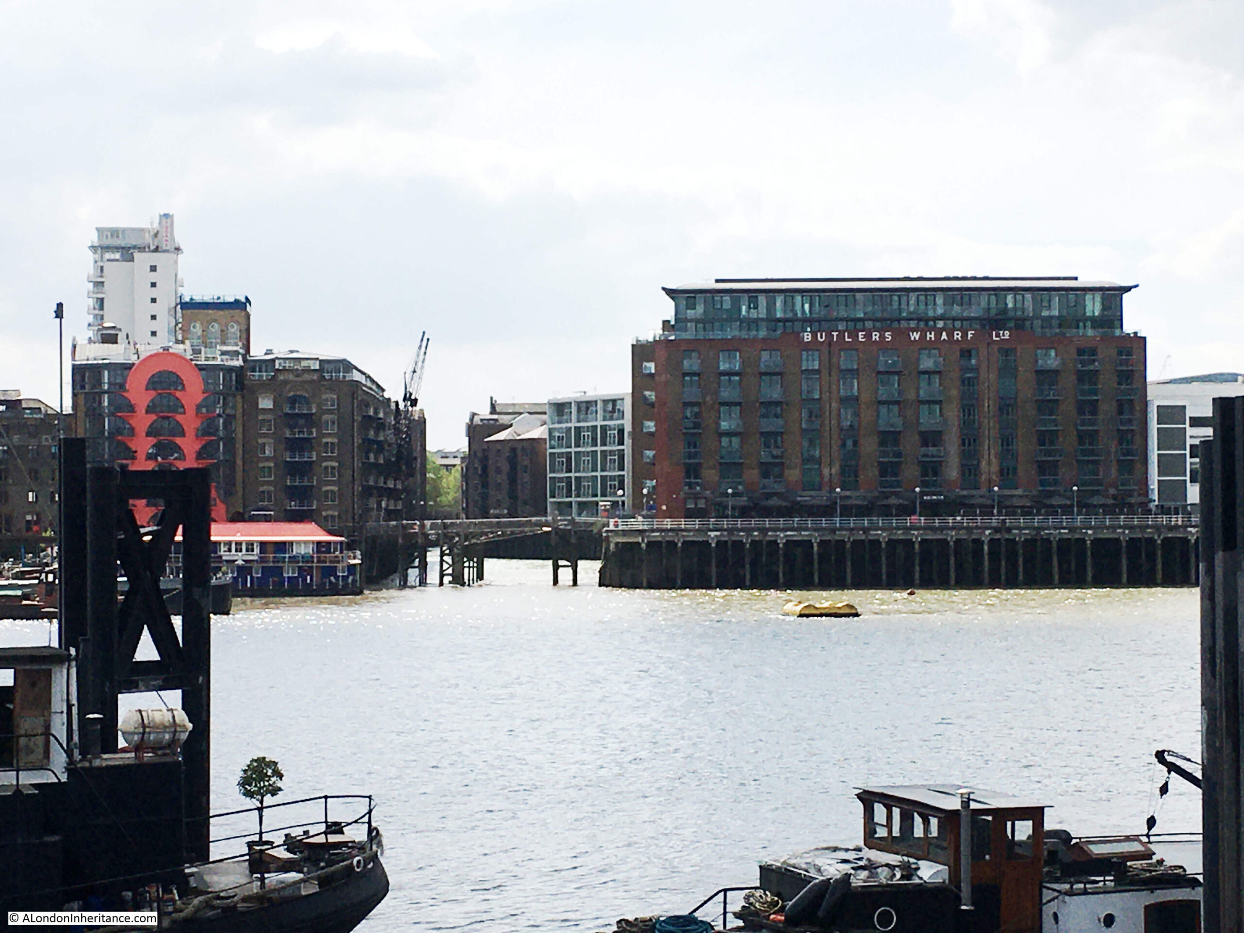
St Saviour’s Dock is an inlet from the Thames in Bermondsey, just to the east of Tower Bridge on the south bank of the river. We can look across the river near Hermitage Moorings on the north bank, and see St Saviour’s Dock just to the left of Butlers Wharf.
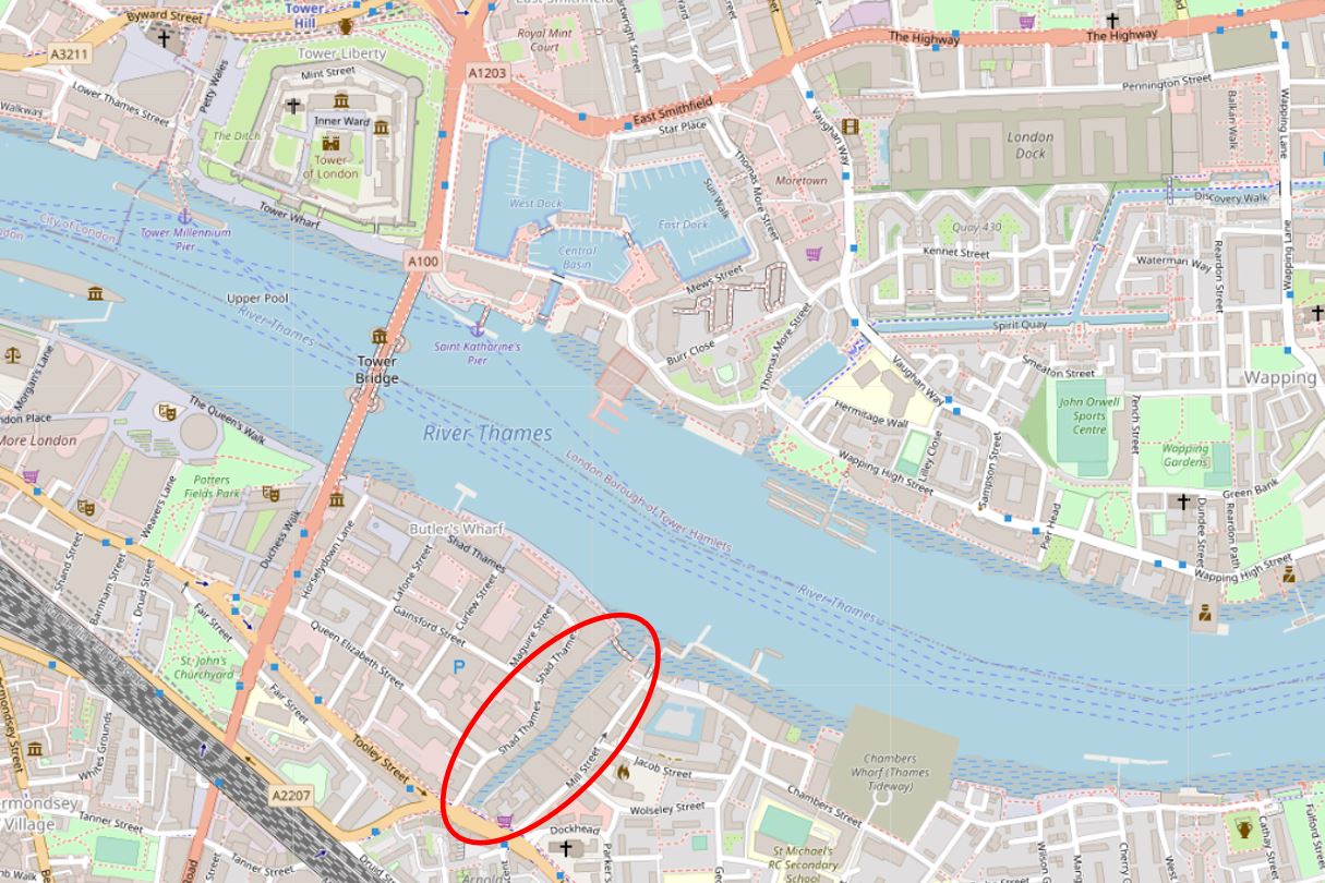
I have circled the location of St Saviour’s Dock in the following map (© OpenStreetMap contributors):
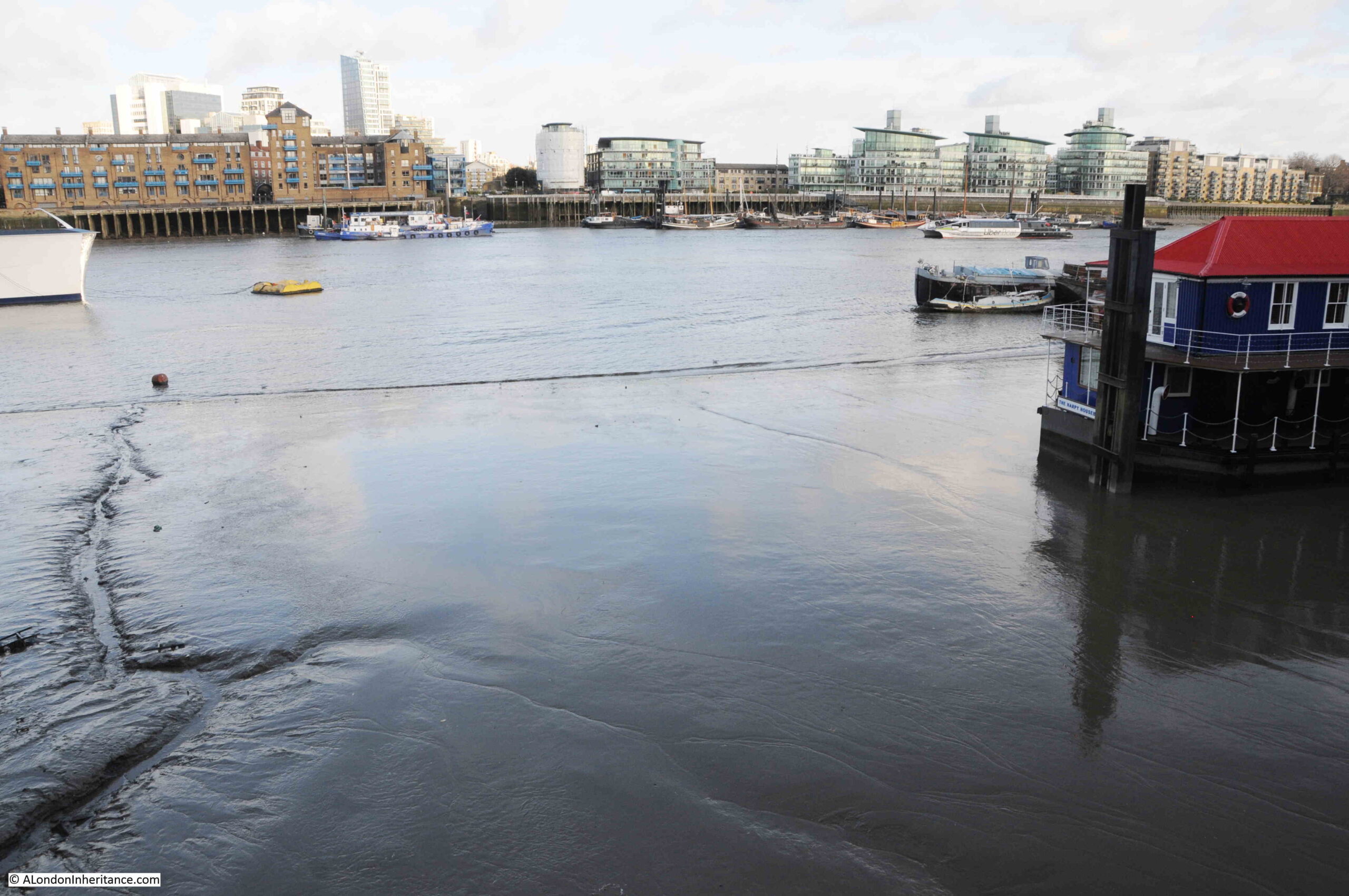
Cross over to the south bank of the river, and on approaching the dock, there is a walkway spanning the entrance:

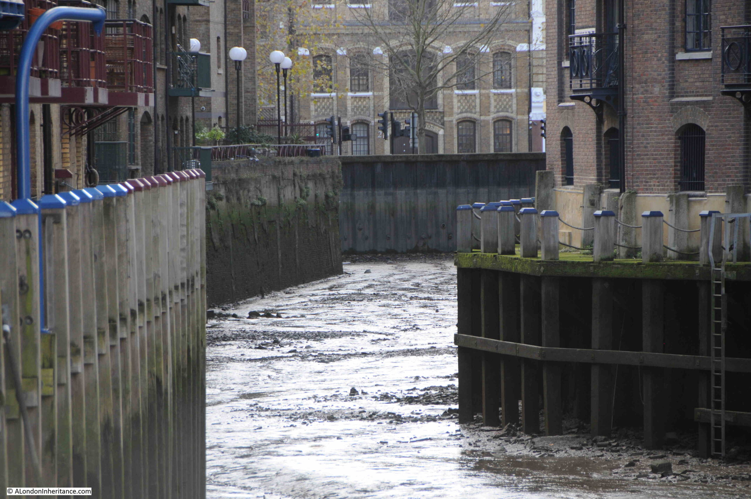
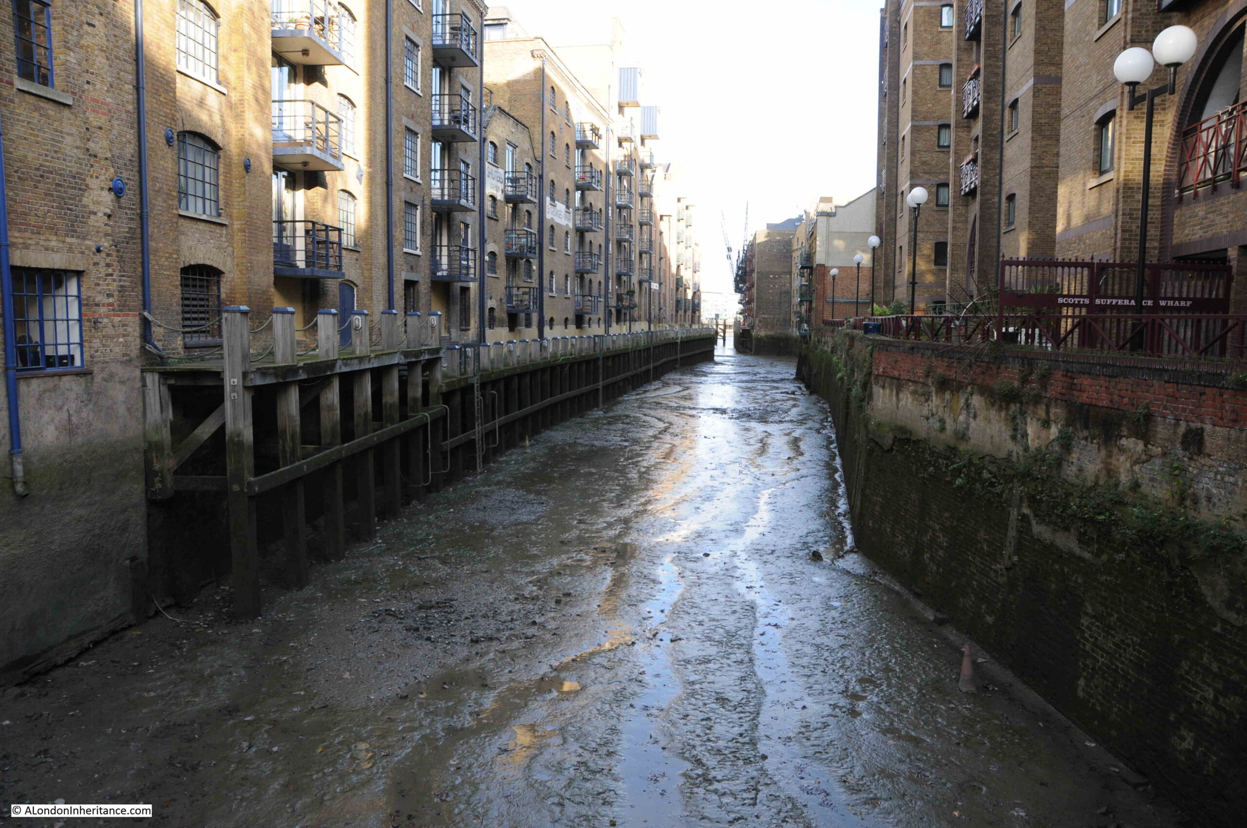
View from the footbridge across to the north bank of the river, at low tide, with thick mud across the foreshore:
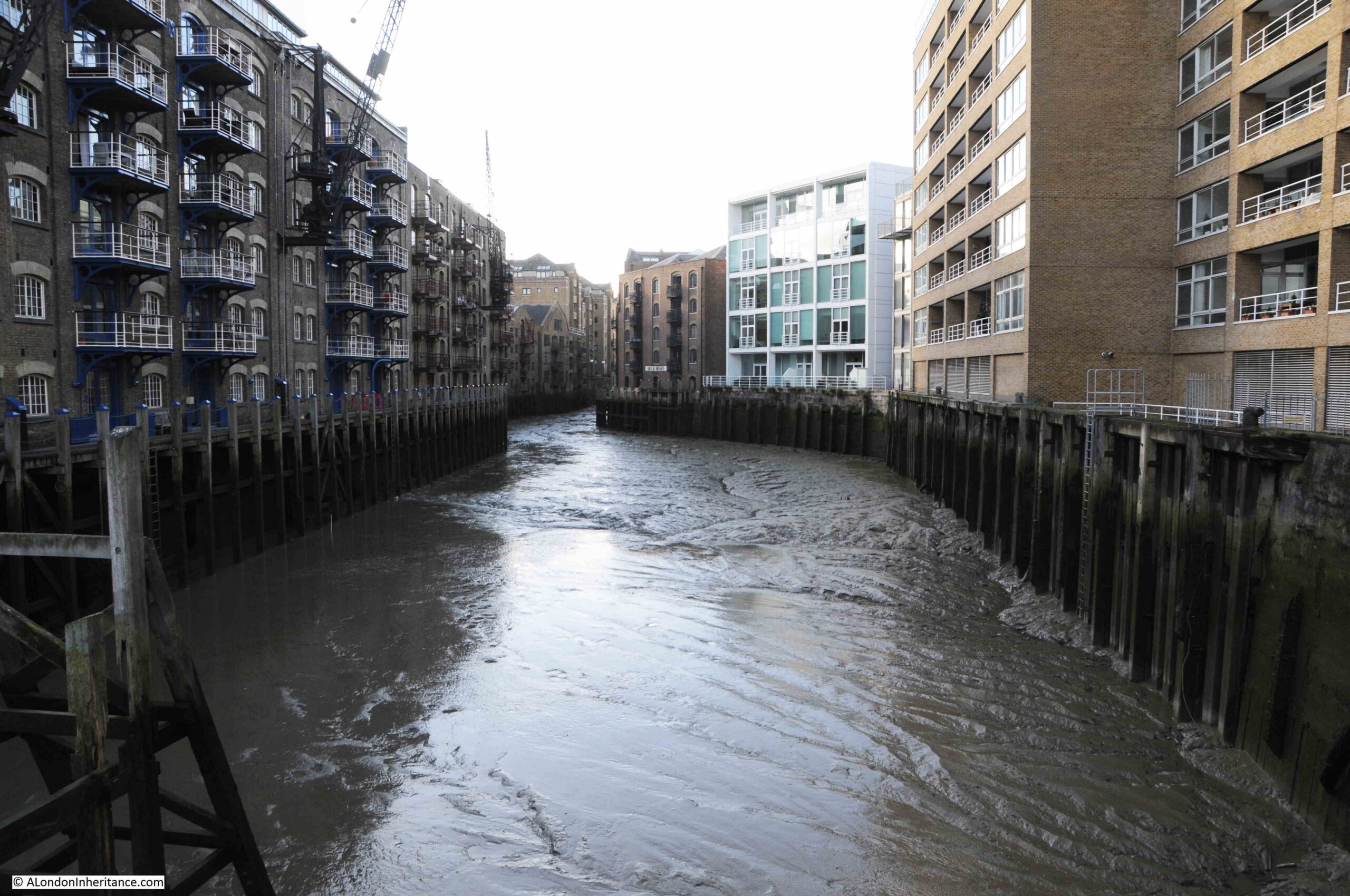
Looking along St Saviour’s Dock – a carpet of mud:
St Saviour’s Dock is a very old feature of this section of the river. Originally the mouth of the River Neckinger, although it is very hard to pin down exactly where the Neckinger ran with any certainty, and how much of the water course was a natural river.
There were many streams and ditches in this area of Bermondsey and much of the land was low lying marsh. Some of the ditches which may have once been part of the Neckinger can be seen on 18th century maps, which I will come to later in the post.
Looking south along St Saviour’s Dock, the bends in the dock give the impression of a natural feature. Early maps show the sides of the dock as relatively straight, so the curves we see today may have been the result of extending some of the warehouses that line the dock as an attempt to maximise warehouse space.
At the far end of the dock, it comes to an abrupt halt at “Dock Head” at the junction of Jamaica Road and Tooley Street.
It is impossible to know for sure as to the origins of St Saviour’s Dock. It appears to have been part of the lands of Bermondsey Abbey, and what was then a natural watercourse, had banks created on either side, and a mill built on one side of the dock by the abbey at some point around the 13th century.
Just to the east of St Saviour’s Dock is Mill Street, apparently named after a mill stream which ran along the route of the street and which powered the mill, which was used to grind corn for the abbey. Mill Street is on the other side of the warehouses that line the eastern side of the dock, so is very close and complicates the mapping of waterways in the area.
The land around St Savoiur’s Dock was fully developed between the 16th and start of the 19th centuries, as maps from the 17th and 18th centuries confirm.
The following is an extract from William Morgan’s map of London from 1682. St Saviour’s Dock is located just to the lower right of centre of the map:
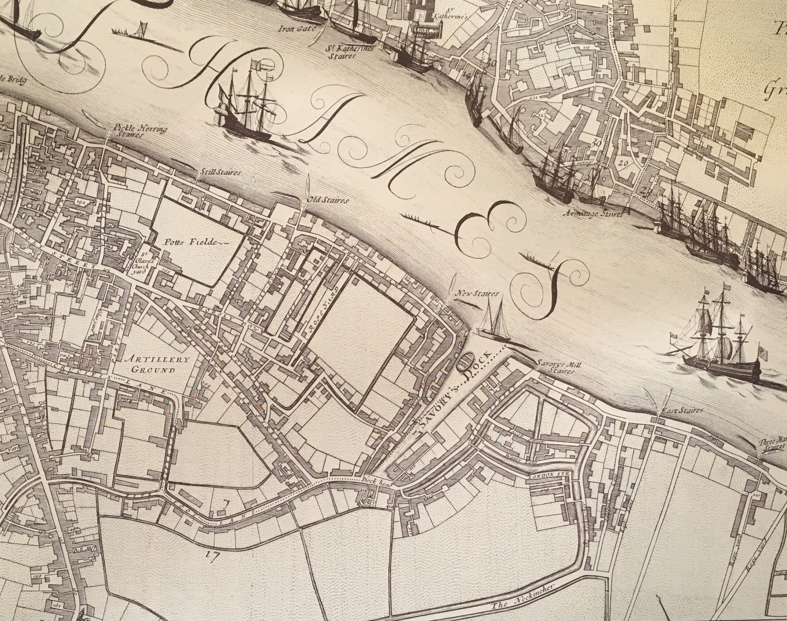
Note that the name of the dock in the map is Savory’s Dock. This may be a simple corruption of the name, or it could have been a rather sarcastic description of the dock given that there was much pollution from the surrounding buildings, and Bermondsey’s growing industry, that ended up in the dock.
I like the depiction of a small boat in the dock. It looks too wide to be a waterman’s boat, and could have been a lighter that transported goods between boats moored in the river and the warehouses lining the dock.
By the time of Morgan’s map in the late 17th century, it appears that buildings were lining the majority of the dock, and streets had been built to the east.
If you click on the above map to enlarge, you can see that to the right of St Saviour’s Dock were a number of water channels, and that to the lower centre edge of the map, there are what appear to be two water channels either side of a road, with a name of “The Neckincher” along the street. presumably this name applies to the water channels, and is a version of the name Neckinger.
This is the problem with being sure as to the route of the Neckinger, and how much of the route was a natural feature, and how much were artificial channels and ditches used to perhaps provide water to the industries in the area, or to drain what was low lying, marshy land.
Seventy three years after Morgan’s map, a 1755 map has St Saviour’s Dock on the edge of the map, with the surrounding area looking much the same as in 1682:
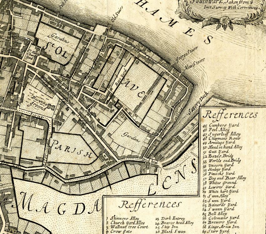
It is interesting that the name Savory Dock was again used on this later map. This name does not appear to be used when reporting anything about the dock in newspapers. For example on the 10th of January 1730, the Kentish Weekly Post used the name Saviour in a report that “Last Sunday, a Man, well dressed, was found drowned in St Saviour’s Dock”.
I can find no newspaper reference to the Savory spelling of the dock’s name.
Newspaper’s do give us an idea of the type of businesses and properties that surrounded the dock in the years around the publication of the above map. For example, on the 11th of January 1762 there was a report of a fire in one of the buildings along the dock:
“Thursday morning a fire broke out in a granary belonging to Mess. Hemmock and Co. Corn Lightermen, at St. Saviour’s Dock, near Dock Head, which was consumed, together with 8 dwelling houses, and a great many warehouses, and other out-buildings; three other dwelling houses were greatly damaged. Mr Allport, a biscuit maker, and his family, ran into the street almost naked, not having time to save anything. It being low-water, it was with difficulty a whole tier of ships was preserved, as they lay upon the mud close to the Dock, and nothing parted them from the flames but a crane house, which took fire several times, but by the activity of the firemen was prevented from getting to a head. We hear no lives were lost.”
So in 1762, St Saviour’s Dock was surrounded by a granary, dwelling houses, and a great many warehouses, which does align with the view presented in the above maps. As well as the granary, there are also mentions of a “Mr John Robinson’s Rope Warehouse” in the dock in the mid 18th century.
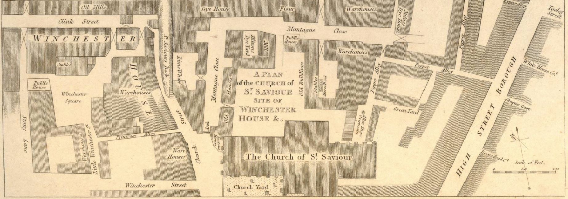
The following map is dated 1813 and includes the names of the wharfs along the dock. Only two also have the names of products stored, with a granary at lower left of the dock and a lime yard at upper right.
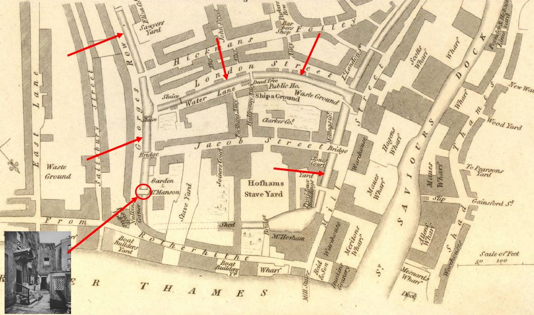
What is interesting about the above map is the area to the left (east) of St Saviour’s Dock.
On this map there are a number of streams / ditches shown, along with bridges over these. I have highlighted the waterways with arrows.
The area between the waterway on the left and St Saviour’s Dock is the area that would become known as Jacob’s Island (after Jacob Street running through the centre). It was Charles Dickens who would bring some notoriety to this small patch of Bermondsey when he apparently located Fagins den and Bill Sykes death in Jacob’s Island in his novel, Oliver Twist.
In the lower left of the map, I have included the photo of Bridge House, a house that was built over one of the bridges (arrowed). I have researched and written about the location of Bridge House in my post “A Return To Bermondsey Wall – Bevington Street, George Row And Bridge House”.
The above map does confirm that the area was still a place of ditches and streams in the early 19th century, all possibly once part of the Neckinger, but would disappear during the rest of the 19th century as new warehouses and roads were built. The ditches do not appear to have any connection to St Saviour’s Dock or the River Thames, so must have just held stagnant water.
The following print shows a view of St Saviour’s Dock around 1840 – but the print is not quite what it seems (© The Trustees of the British Museum):
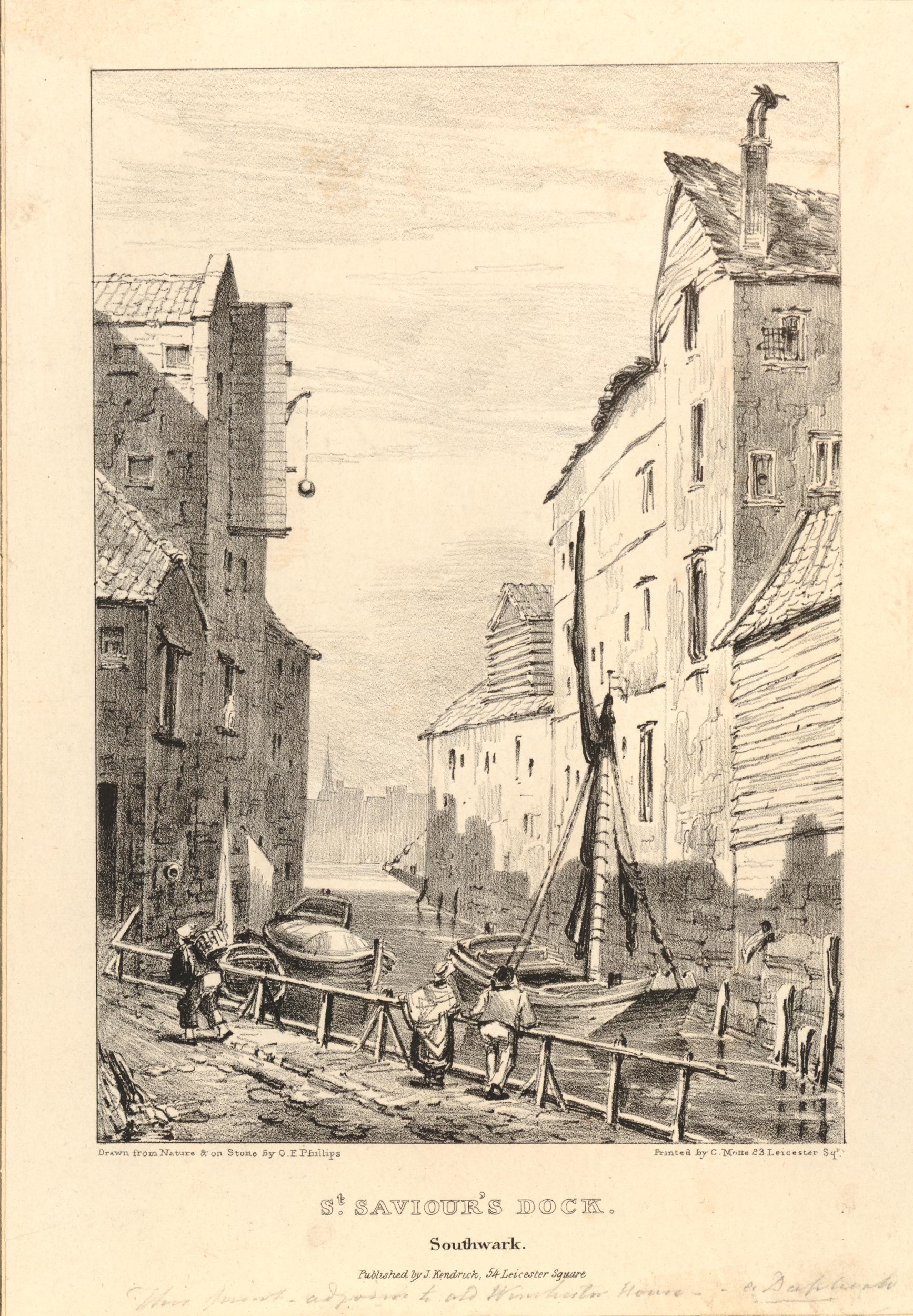
Underneath the name St Saviour’s Dock is the name “Southwark” rather than Bermondsey. The above print is really of the dock just to the north west of Southwark Cathedral, where the replica of the Golden Hind is now located.
Southwark Cathedral was originally the church of St Mary Overie. The church was renamed St Saviour’s at some point around the Dissolution of the Monasteries in 1539, and this name would remain in place until 1905 when it became Southwark Cathedral.
The small dock just to the north west of Southwark Cathedral was originaly Mary Overie Dock, but with the renaming of the cathedral, the dock took on the name of St Saviour’s Dock and is shown with this name in Rocque’s map of London from 1746, and in this 1811 print which shows the church of St Saviour (Southwark Cathedral) at lower centre, and St Saviour’s Dock to upper left.
The 1895 OS map continues to show the Southwark dock as St Saviour’s Dock.
So there were two St Saviour’s Docks, and we need to be careful with references to the name. Today the Southwark dock is the location of the Golden Hind replica, and the address on the Golden Hinde’s website is back to the original name of St Mary Overie Dock.
The 1895 Ordnance Survey map of the Bermondsey St Saviour’s Dock shows that the dock was lined with warehouses, wharfs and factories, including a flour mill, coal wharf, packing case factory and lime wharf – the typical mix of industries that you would find along any stretch of the industrial Thames in the 19th century.
As with so much of the London docks, St Saviour’s Dock went into decline after the war. Warehouses located down a narrow inlet just were not suitable for the size and type of ships, and containerisation would kill off any hope of using warehouses such as those found in the dock.
St Saviour’s Dock remained as an open inlet to the Thames, but the buildings along the edge of the dock started a path to dereliction.
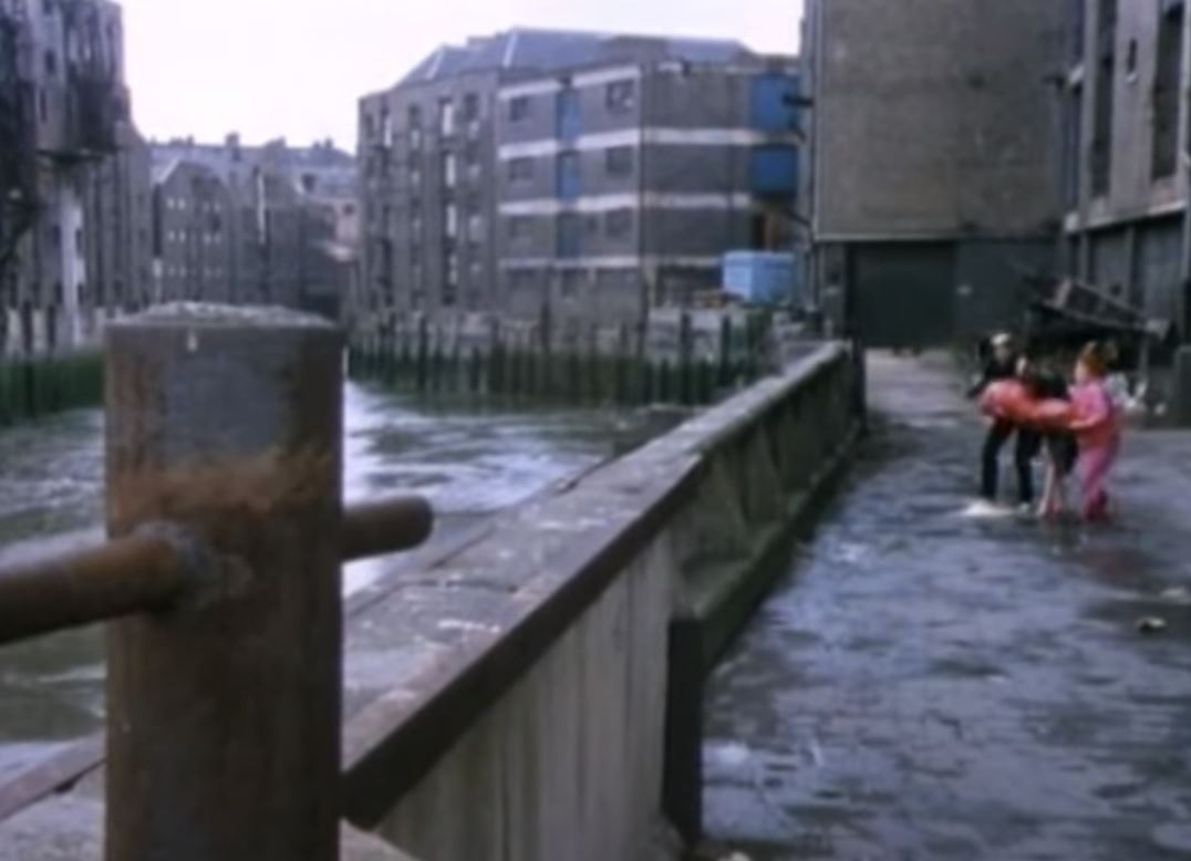
St Saviour’s Dock has been used in a number of films. One of these in the years before the buildings were transformed is Derek Jarman’s 1978 film Jubilee.
Jarman lived for a time in Butler’s Wharf, between the dock and Tower Bridge, and the film, which is still available as a DVD, whilst a typical Jarman film and very much of its time, is good to watch for one interpretation of punk and the late 1970s, but also for some London location spotting.
In the following clip, the characters Bod, Mad and Chaos are about to throw a body over the side of St Saviour’s Wharf, to the mud below, with the empty warehouses in the background:
From the 1980s onwards, the majority of the wharfs lining St Saviour’s Dock would be converted to apartments and offices. A walk along the side streets that follow the dock to the east and west reveals how many have survived.
Starting in Mill Street which runs along the eastern side of the dock, and to the north east corner is New Concordia Wharf:
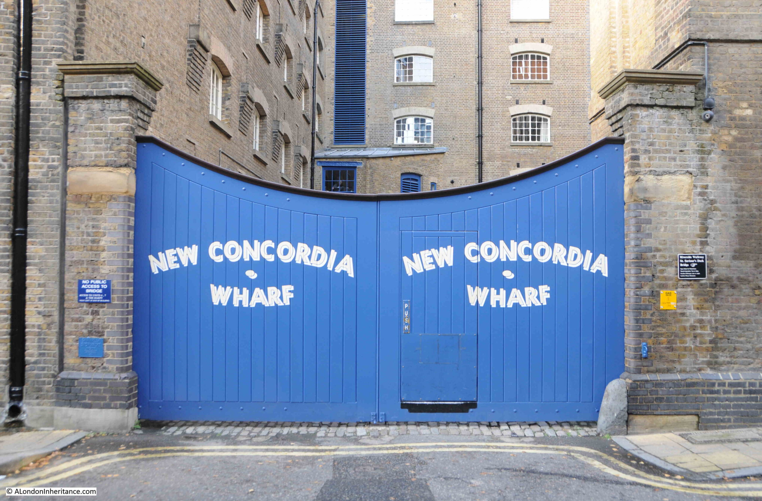
New Concordia Wharf was originally built in 1882 as St. Saviour’s Flour Mill, however after one of the fires that seemed to be a frequent risk to the wharfs along the river, it was rebuilt between 1894 and 1898.
St. Saviour’s Flour Mill / New Concordia Wharf included a flour / corn mill, continuing a tradition of milling flour that goes back to the original mill built on the banks of the dock by Bermondsey Abbey in the 13th century.
Rather than being powered by water, the mill was steam powered, and the water tank and chimney remain, although the water tank has been somewhat hidden by changes to the roof of the building.
The chimney was truncated in 1979, and now looks rather ungainly with what appears to be a concrete slab on the top of the chimney, but is still an unusual sight on the end of a warehouse.
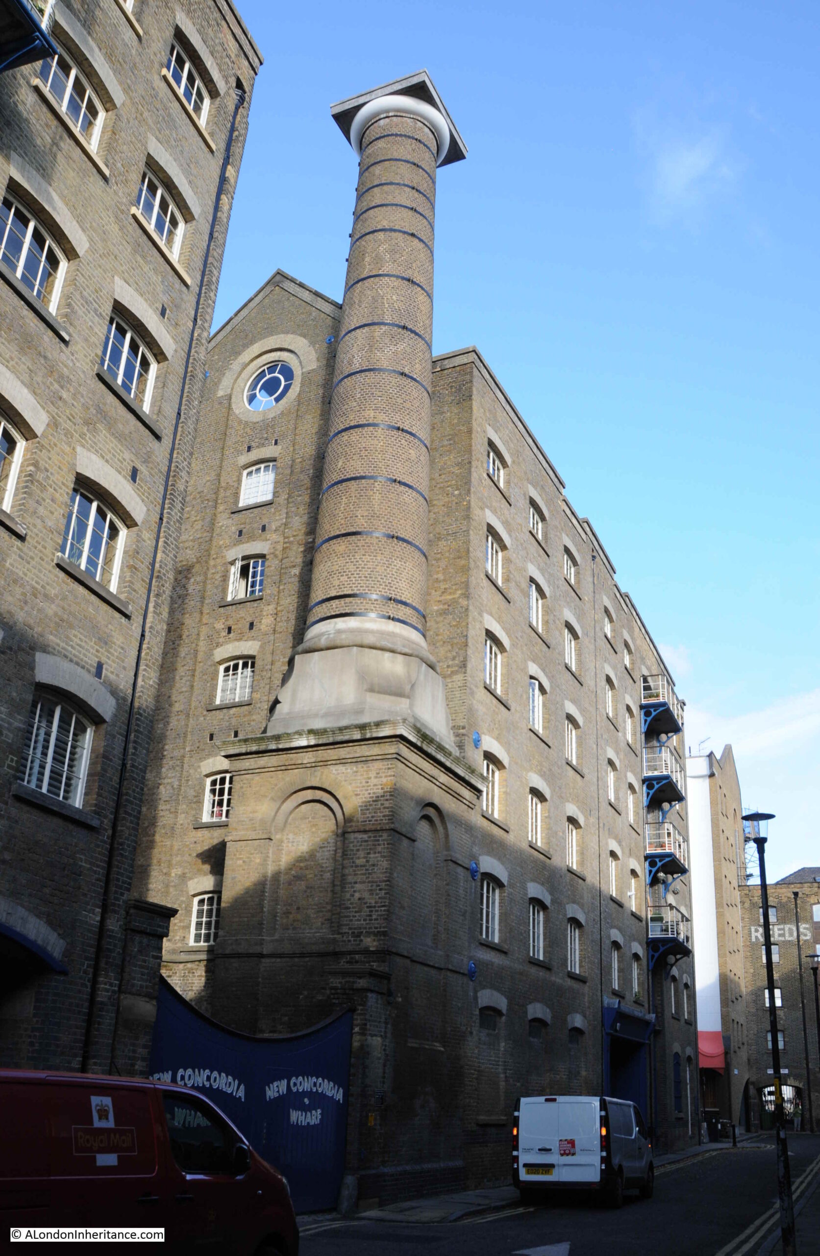
Conversion of New Concordia Wharf to apartments was carried out between 1982 and 1983 and was one of the first examples of the warehouse conversions that would become the standard for the type of building along the Thames.
We then come to Grade II listed St. Saviour’s Wharf:
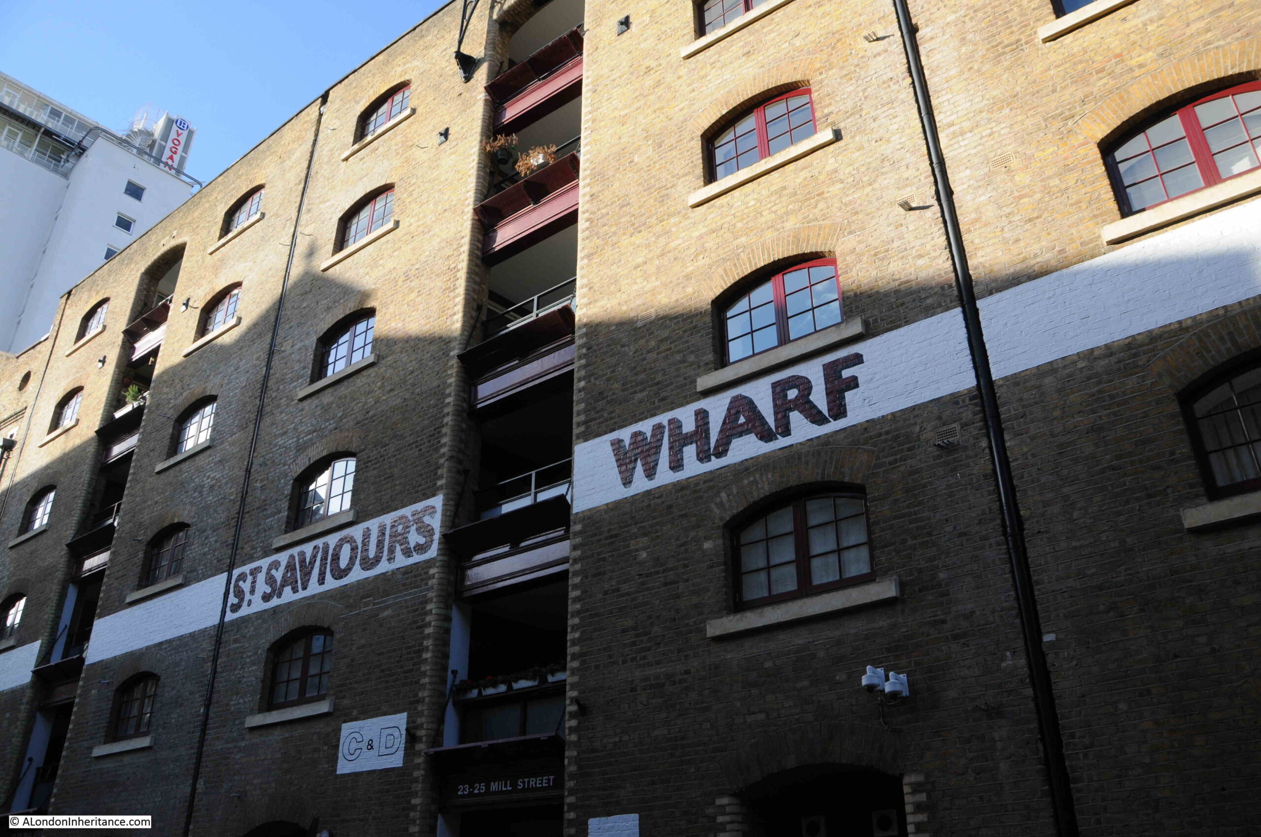
St. Saviour’s Wharf was built in 1868, and was for sale by auction in 1870. The advert for the auction provides some details of this 1868 building:
“Saint Saviour’s Sufferance Wharf, together with the modern pile of warehouses in Mill Street erected in 1868 in the most substantial manner under the superintendence of an eminent architect and so arranged as to fulfil all the requirements of the Metropolitan Buildings Act and of the Fire Insurance Companies. The premises comprise three double warehouses each with five floors and basement, having a frontage of 117 feet next Mill-street.
The various floors are carried on columns from basement to roof, and are strongly timbered. The ground floor is asphalted. The party walls are 2 feet 3 thick, and there is no communication between the three warehouses, except on the basement.
There are two staircases to each warehouse, and loophole doors and windows on each floor fronting the land and waterside.
The floors of two of the warehouses are divided by brick walls 2 feet 3 thick, communicating by chambers, enclosed by wrought iron folding double doors.”
The details of the construction of the buildings were important for potential buyers. Not just to show the strength of the building, but also that the building was designed to limit the spread of fire.
Fires in warehouses were a continual risk. Buildings on top of each other, all crammed with highly combustible goods resulted in frequent fires, and the newspapers almost always had reports of fires in warehouses along the Thames (for example, see my post on the “The Great Fire at London Bridge”).
No idea what the purchaser of St Saviour’s Wharf paid for the buildings, however today, a 2 bedroom apartment is for sale at £1.2 million.
The view along the southern end of Mill Street, with more wharfs and warehouses. Unity Wharf nearest.
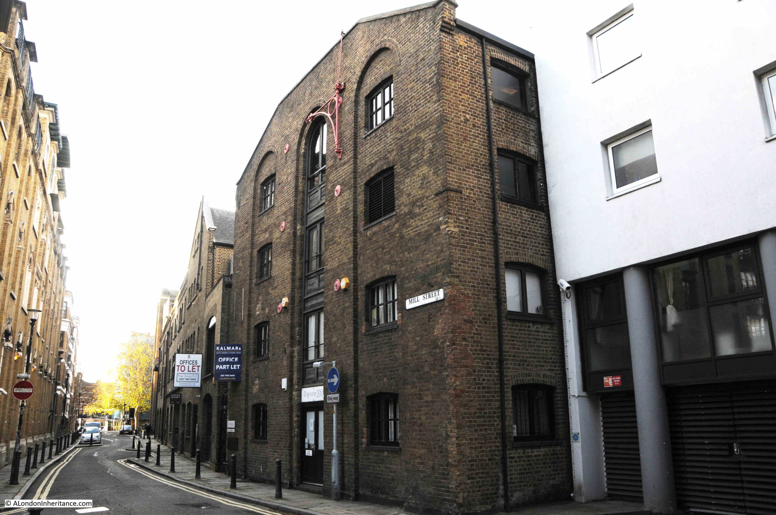
Unity Wharf is Grade II listed and is now mainly office / commercial space. In the 1953 publications “London Wharves and Docks”, Unity Wharf is listed holding Canned and Cased Goods, Bagged produce and General.
To the side of Unity Wharf is the entrance shown in the following photo:
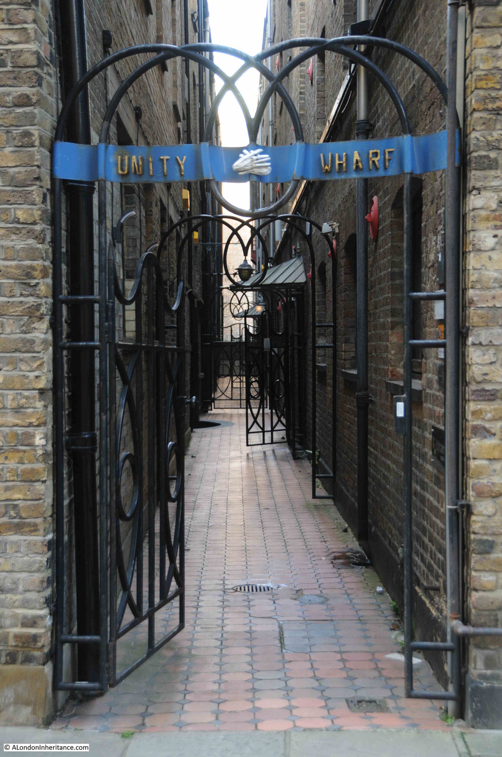
It was gated half way along on my visit, but appears to be one off, if not the only passage through the wharfs to the side of St Saviour’s Dock.
In the 1895 Ordnance Survey Map, the passage is shown, and marked as “Free Landing Way”, which I assume meant that it could be used by anyone to land something by boat in St Saviour’s Dock, and the passage provided a route between water and Mill Street. I would have loved to have got to the end of the passage and looked over the edge into the dock.
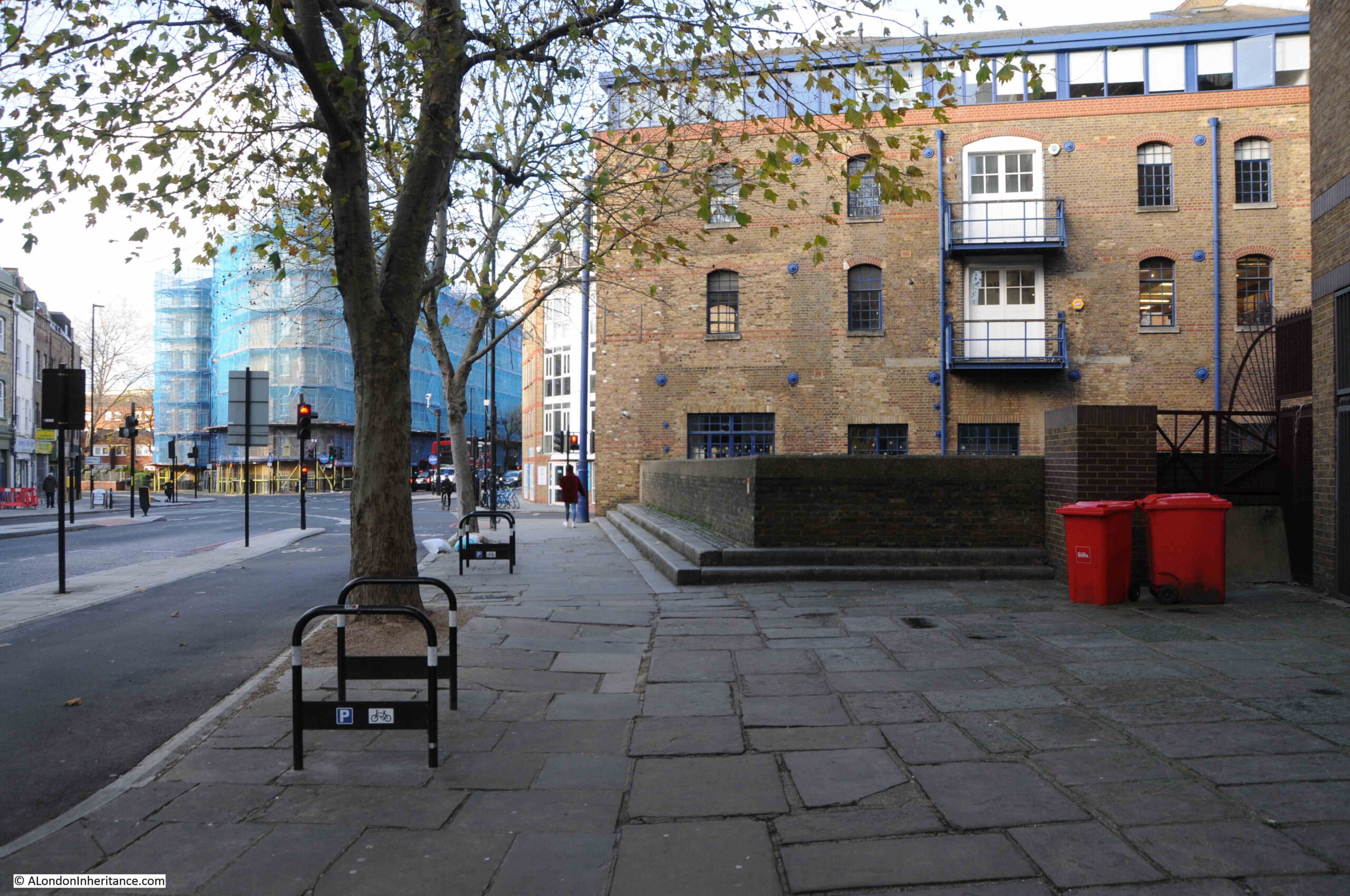
At the end of Mill Street, we reach the junction of Jamaica Road and Tooley Street. In the following photo, the steps to the left of the red bins lead up to the wall at the very end of St Saviour’s Dock – the point labeled Dock Head in the 17th and 18th century maps earlier in the post.
Climb the steps, look over the wall, and we can look down on St Saviour’s Wharf:
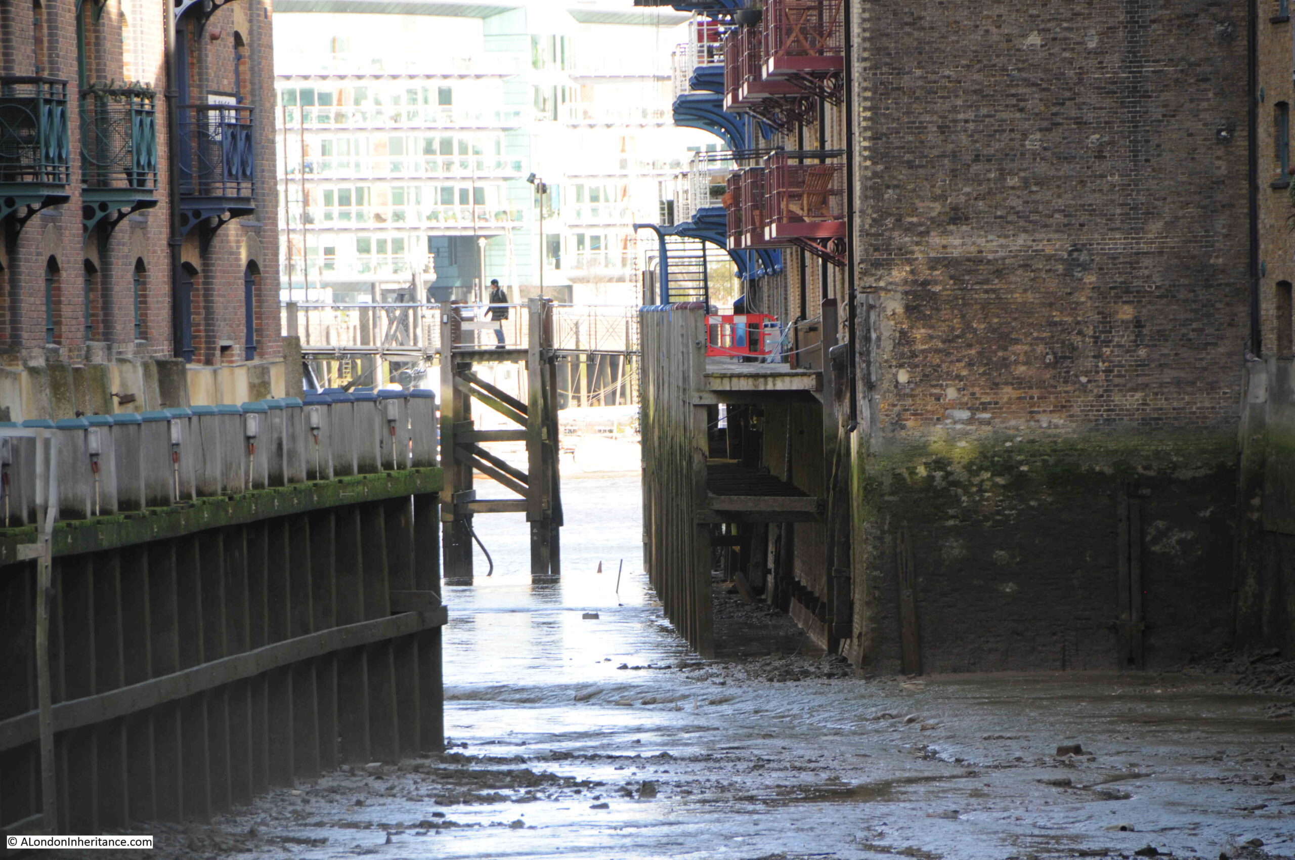
Towards the northern end of the dock where it meets the River Thames and is spanned by the footbridge:
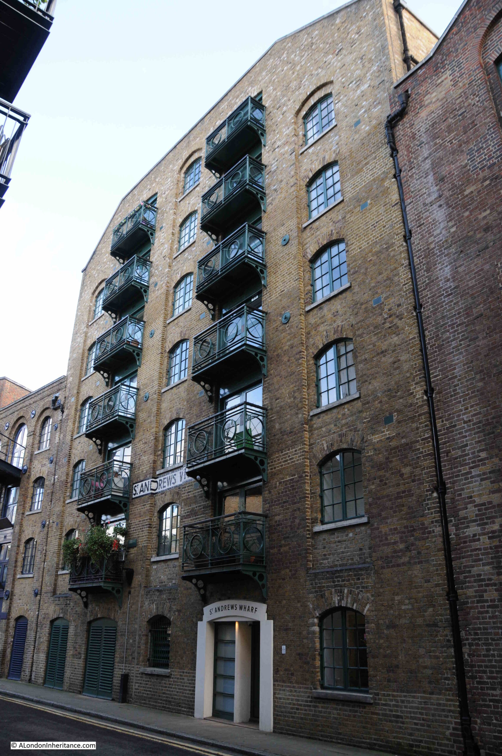
We can now walk along Shad Thames, the street that runs along the wharfs on the western edge of the dock.
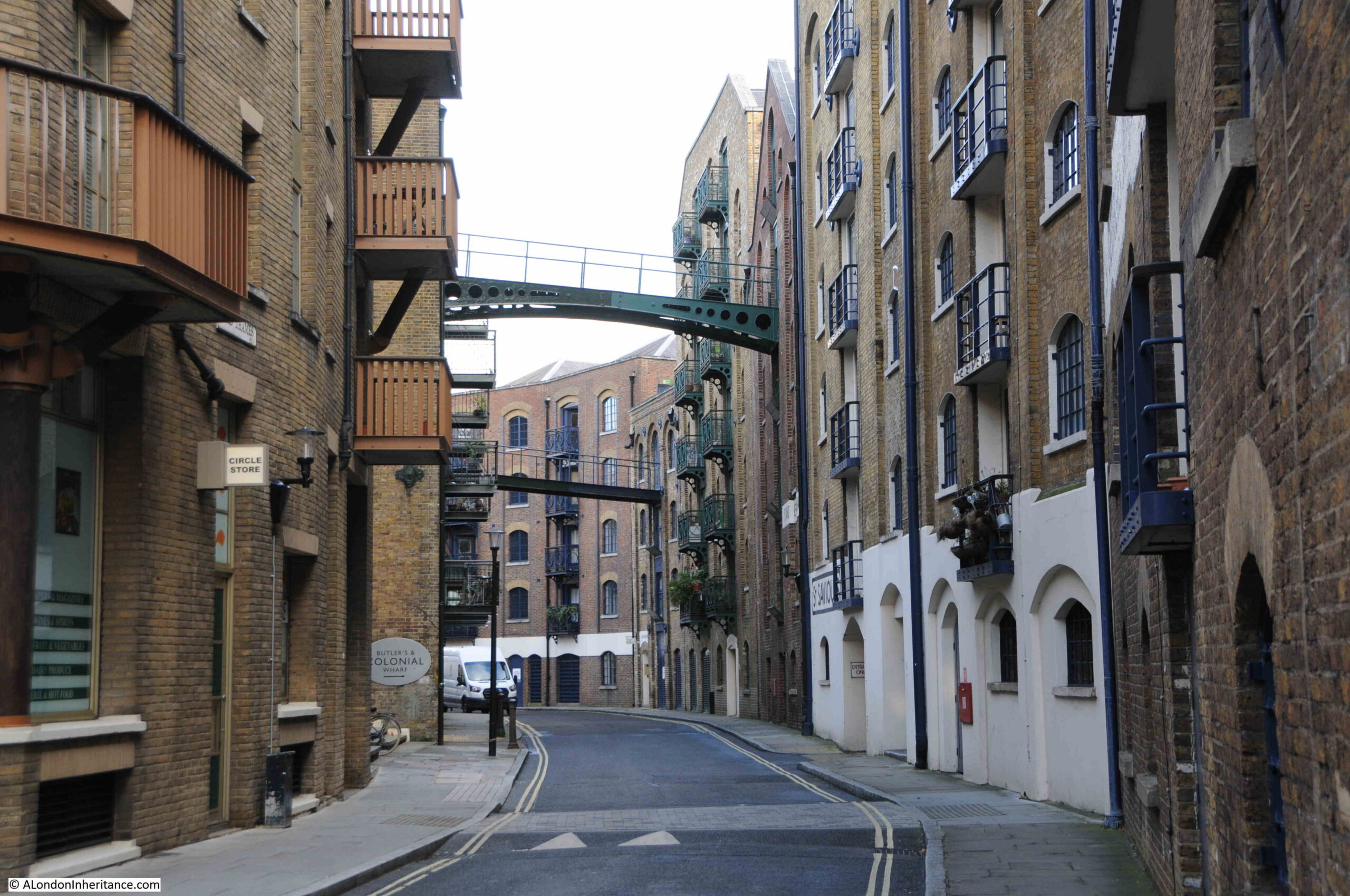
The buildings have a couple of footbridges between the wharfs on the right and additional warehouse space on the left. These were used to transport goods between buildings without having to travel up and down floors and across the street, although looking closely at one of the bridges, I doubt these are original, they look either very good restorations or new copies of what would have spanned the street.
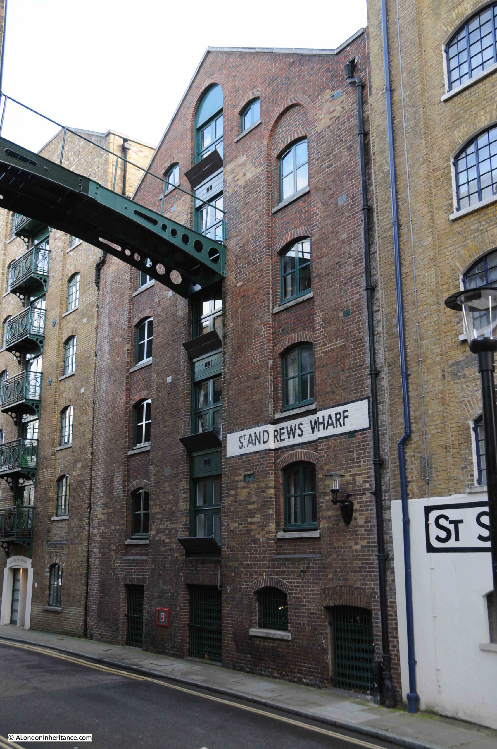
The following photo shows the “B” warehouse of St Andrew’s Wharf:
This building dates from 1850 and is Grade II listed, but as can be seen by the changes in brickwork, it has been partially rebuilt a number of times, most recently when it was converted for residential use.
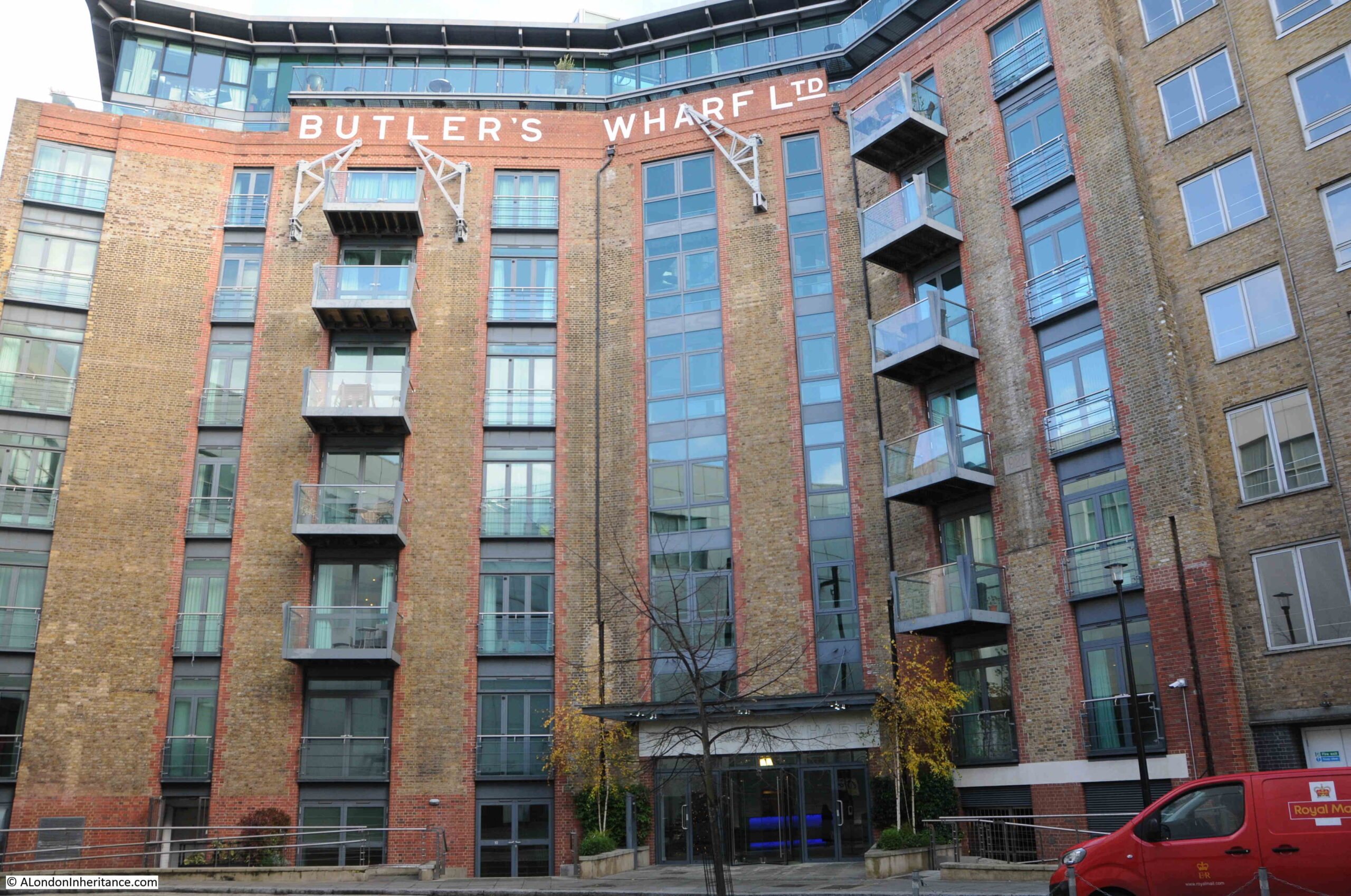
We then come to the point in Shad Thames where it leaves the wharfs that line St Saviour’s Dock, and turns west to head towards Tower Bridge.
At this corner point is the much rebuilt and restored Butler’s Wharf:
And that brings me to the end of a look at St Saviour’s Dock, and the wharfs and warehouses that line this ancient inlet from the River Thames.
Although the buildings have been converted to residential and commercial, they do still provide a really good impression of what the dock would have looked like from the late 19th century onwards.
The thing that is missing is noise and activity. Walking the area today and it is quiet. No lighters in the dock, no goods being loaded and unloaded and very few people walking the streets.
The dock itself is always thick with mud, and I have never seen anyone searching the dock or foreshore. A good thing as it looks highly dangerous, but intriguing to imagine what is buried beneath the mud given the centuries of use of St Saviour’s Dock.
Thank you as ever. I see one warehouse was a sufferance wharf which still seems to be a legal term in customs administration. What an elegant phrase….
Such an excellent piece. Where do you source your maps & the historical snippets about your subjects? I’ve read a bit about Butler’s Wharf in Derek Jarman’s diaries & recently visited St Saviour’s Dock (pre pandemic) as a friend lives nearby. You’ve captured the history & atmosphere perfectly/ especially the relative silence.
Back when the docklands boom started in the mid-80s I was very much ‘into’ it and toured the area extensively. New Concordia Wharf and Jacob’s Island etc was a key site done by Andrew Wadsworth, one of the main developers that came in. Eccentric British architects CZWG (think Piers Gough’s house for Janet Steet Porter) were the go-to firm for him and what emerged there – C/Reeds Wharefr, The Circle, the pentouse there etc. Also worth noting that St Saviours is what Hays Wharf (the shopping centre) used to look like before it was infilled and converted
Brilliant reading about the place where I was born and my family go back 7 generations in the Dockhead area ( Dickens Estate) through to Bermondsey Wall East and beyond to Rotherhithe & Surrey Docks. I’m still here after 70 years and wouldn’t change a thing. I started work in St Saviours Wharf in 1968 ( Christian’s) £10 Per 6 day week. Then went on to do a 5 year engineering apprenticeship- Never looked back. Have far to many stories to tell about this wonderful area Thankyou.
My Dad’s family home from 1915 to 1976 was at 56 Gainsford Street, west of the Dock. Grandad worked at Courage’s for over 50 years and Nan was the nurse at Booth’s Gin on Curlew Street until the firm moved out. The terraced houses still standing there are unique from that era. The whole area was buzzing during the working day with commercial activity. After the wharves etc closed we played in the local streets, cricket the length of Maguire Street (pumping station at mid-wicket!). At the head of the Dock where the steps are now was a famous public urinal, now demolished. Whatever one’s view of gentrification of our old manor it has secured the preservation of the character of these buildings; and opened up the riverside previously accessible only to those who worked by it or trespassed clandestinely (which, of course, is not admitted).
The renaming of the road running from the head of the Dock down to Holy Trinity Church from Dockhead to Jamaica Road when the new main road was constructed remains a right liberty.
In relation to the renaming and indeed the re routing of the road from Dockhead past Holy Trinity church to Jamaica Road, I recall that there was an engineer’s / architect’s framed drawing of the proposed route in the basement / crypt of the church there. I was a scout in the now defunct 2nd Bermondsey Scout Troop from ‘62-64. Our scout master was a priest associated with the church and we used to store our camping gear in the basement. The road hadn’t been rerouted the time I was there and I recall running for the number 70 bus bombing around the sharp bend on Parker’s Row at the church.
Brilliant – loved reading this. One of the most evocative locations in London on a murky Winter’s day at low tide. Bill Sykes, we know you are out there!
A fascinating article as ever. Looking carefully at the footbridge over the end of St Saviour’s Dock, it appears to be designed to swing around the large stainless steel cylinder that pokes up from the mud near the eastern end – obviously to allow larger vessels to enter the dock. Does anyone know if it works (it looks fairly modern) and are there any photographs of it open?
Wonderful account, brings back lots of memories of childhood in the ‘60s. Travelled to St Joseph’s primary school Dockhead on the no. 70 bus from Southwark Bridge stop. Used to do some study in St Olave’s library on Tooley Street, near to St saviour’s dock.
Very enjoyable read as usual some great comments as well
Hi Gary, I was at St Joseph’s primary school Dockhead with a Gary Browning. We were both Boy Scouts in the 2nd Bermondsey troop which met in the Fisher Club just up the road from St Saviour’s Dock.
I remember my dad telling me about his days as a fireman and nights during the blitz fighting fires in and around the docks.im in my 70s now and I do miss that brave generation.sadly all gone.tragic.never be the same.
Hello Tel,
It’s good to see you mention your dad’s wartime work in the Fire Service.
I wonder if you have seen the film “Fires Were Started” which depicts in fiction a day and night in the work of these brave men and women. The film was shot in 1943 but is set two years earlier at the height of the Blitz in several areas of Dockland including St Saviour’s Dock where the function of a sunken barge is explained.
Despite the film’s depiction of the awfulness of war, the camaraderie and dedication of the Fire Service are clear to see. Many (all?) of the actors were working in the service at the time.
It can be purchased on DVD (dir: Humphrey Jennings). A large number of stills from the film are shown on the ReelStreets website. Locations are given where these have been found. I think just a few are now remaining as unidentified.
Here’s the ReelStreets link:
https://www.reelstreets.com/films/fires-were-started/
All the best to you
Pimlico Pete
I lived on George Row in the 1950s and am fascinated by old maps of the area to see how it has changed over the years. Of interest in this post the 4th map down from top in 1813 .
It shows “The ship aground” pub on halfpenny alley. That alley and that pub were still there in the fifties and were off George Row which on that map is either Water Lane or London Street . My Dad frequented that pub and the alley was still there though nothing else from that 1813 period.
Another really interesting piece with supporting photos and maps.
I take partly back my recent comment. Although my Dad frequented The Ship Aground (and every other pub at one time or another) I was mistaken as to its location. The one I was thinking of was on Geroge Row and Flockton Street and no longer exists. I forget the name.
Yes the bridge at the head of the dock was built as openable, although in all the time I lived nearby I never saw it open. John Rogers has done a fairly recent video on the Neckinger, attempting to follow its course from by the Imperial War Museum to the Thames.
The Philadelphia Library holds a copy of Maitland’s History of London annotated by the botanist Peter Collinson (1693-1768). He wrote: “My grandmother Martha Lemon…lived in Lemons Yard in the Great White House built by her Father on the extreme east corner or point of Docks Head near Mill Stairs”. Locating this house has defeated me. Do you have any insights?
Wonderful, evocative writing – I have ancestors who ran “The Feathers” pub in Dockhead in the 1860s and 1870s.
Great account of the area, very informative. As my commercial estate agents office has been next to the dock since 1986, and overlooks the sluice gate that when the tide is out lets out the trickle that supposedly was the Neckinger, not surprisingly I have a few things to add/amend.
When they dredged a metre of mud from the dock in 1986 mud larkers with mine detectors turned up soon by the dozen. They found coins that had fallen over the side of ships over the millennium some dating from the Roman period, and some being experts said it proved that is had been used as a dock ever since.
I could be wrong but I am pretty sure Fagin’s lair was in Field Lane Clerkenwell and it was just Fagin’s den that was set here.
I don’t know how much St Saviours Wharf originally sold for but I know in 1984 I sold it for a client, comprising a very delipidated 100,000 sq ft for £700,000. Incidentally Steve Cornish mentions Christian’s Warehouses, one of them was confusingly also renamed as a marketing strategy St Saviours Wharf when it was developed in the early 90’s. I understand that my farther sold the warehouses to Christians comprising about 70,000 sq ft in 1957, I think for £80,000. Having moved Christians to Peckham, I then sold them to Bovis in c. 1988 for £1,400,000.
To say it declined from the war is perhaps a bit previous as it was used as a working dock until the mid 80;s when I sold the last one, Vogans Mill, for development. As with all change there were outcries of ‘Yuppies go home’ at the time but the buildings had reached the end of their riparian life and few would say that their being repurposed for the office shop and residential use that exists today is a disaster, even if it could have been done in a more egalitarian way.
Finally as for ‘The dock itself is always thick with mud’ twice a day if fills up with water, sometimes it is even clean!, and as I write there are 6 swans, opportunistically hoping for a tender morsel, swanning around in the 2 meters of water out there. Pity this link does not let me post the photo I had just taken.
Thank you for undertaking this research into St Saviour’s Wharf, Mill Street and Dockhead. These places are known to me only through my family’s records (which are now housed in three libraries). My ‘ancestral family,’ the Hagens, lived there for generations from 1688 for over a century and owned Hagen’s Wharf. They were deeply committed and pious Quakers and traded in wooden staves, which would have been in one or more of the warehouses. Originally from Hamburg and also Friedrichstadt (though Dutch origin), but they are distinguished by being leaders of the London anti-slavery campaign, in which family members were active for 50 years before seeing results. I believe that Jacob Street is named after the 18th Century head of the family Jacob Hagen. There should be a Blue Plaque to commemorate their ultimately successful anti-slavery activity. I also understand the Hagen family had moved out of the area around 1800.