Tag Archives: Chiswick

Launch And Landing Sites Of The First V-2 On London

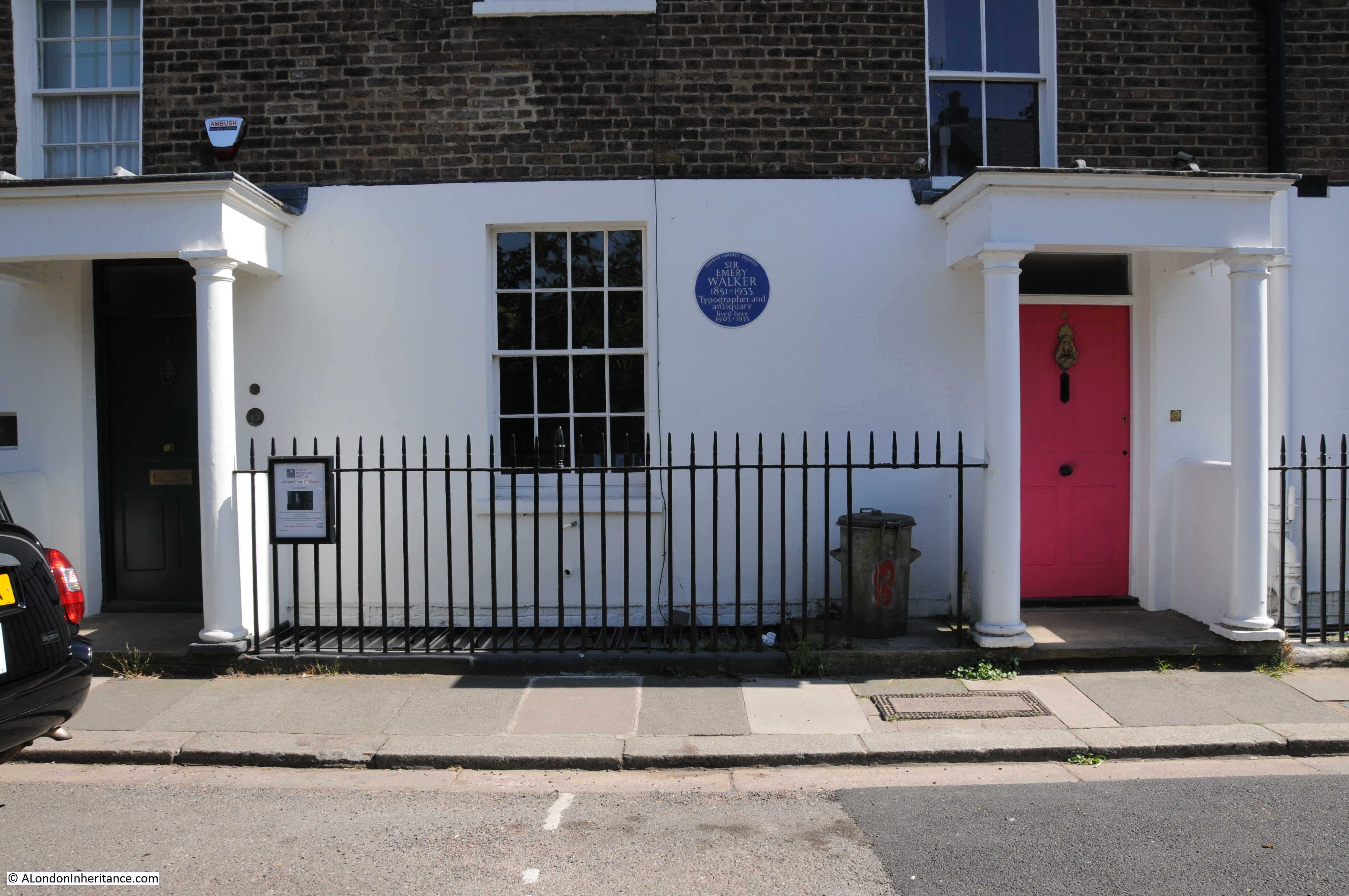
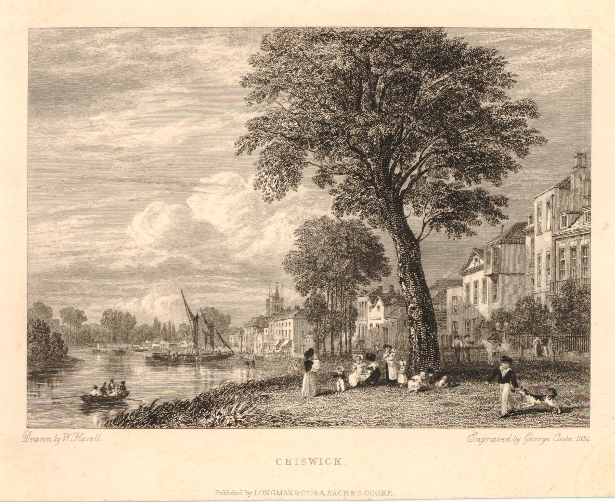
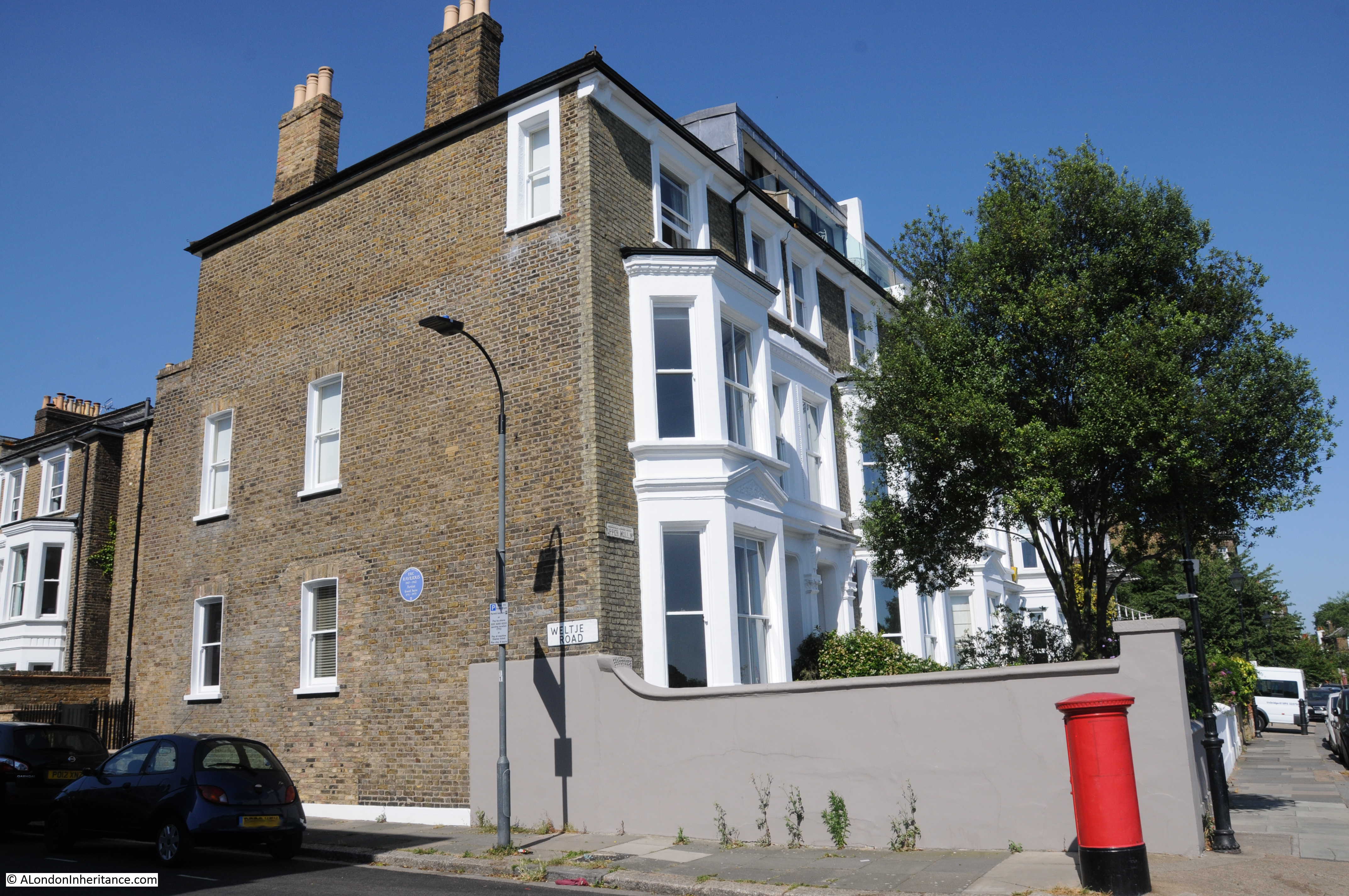
I was in the Hague for my last post, and before leaving I wanted to visit a site in a suburb of the Hague that has a very direct and tragic connection with London.

London had been under fire from V-1 flying bombs starting in June 1944 until October 1944 when the launch sites were captured as the allied forces progressed through France and Belgium.

In September 1944 a new weapon was first used against London. This was the V-2 rocket which had a much more flexible launch method than the V-1 and also longer range so launching against London was possible from the areas still held by German forces.

Although Allied forces were pressing up from the Belgium border, through Eindhoven and Nijmegen, the coastal west of the Netherlands was still under German control and the area around the Hague offered the ideal location to launch against London. The Hague had the rail connections to bring in the rockets and their fuel, and the suburbs of the Hague offered a large wooded area, crisscrossed by small roads which provided the perfect cover for mobile launches.

The V-2 was a highly sophisticated weapon. The supporting infrastructure allowed the rocket to be launched from a mobile launcher with fueling carried out on site along with final setting of the gyros that would guide the rocket to its destination. The speed of the rocket meant that it was almost impossible to destroy whilst in flight. The trajectory for the rocket was a parabola from the launch site up to the edge of space before descending at up to three times the speed of sound to the weapon’s target.

The following photo shows a V-2 rocket on a launch platform. Most photos of the V-2 show the black and white painted rocket, these were the test versions and the painted colour scheme ensured that any rotation of the rocket could be identified during flight. In use, the rockets did not have a colour scheme.

V-2

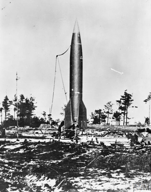
Black and white (CL 3405) V2 on launching platform Copyright: © IWM. Original Source: http://www.iwm.org.uk/collections/item/object/205087580

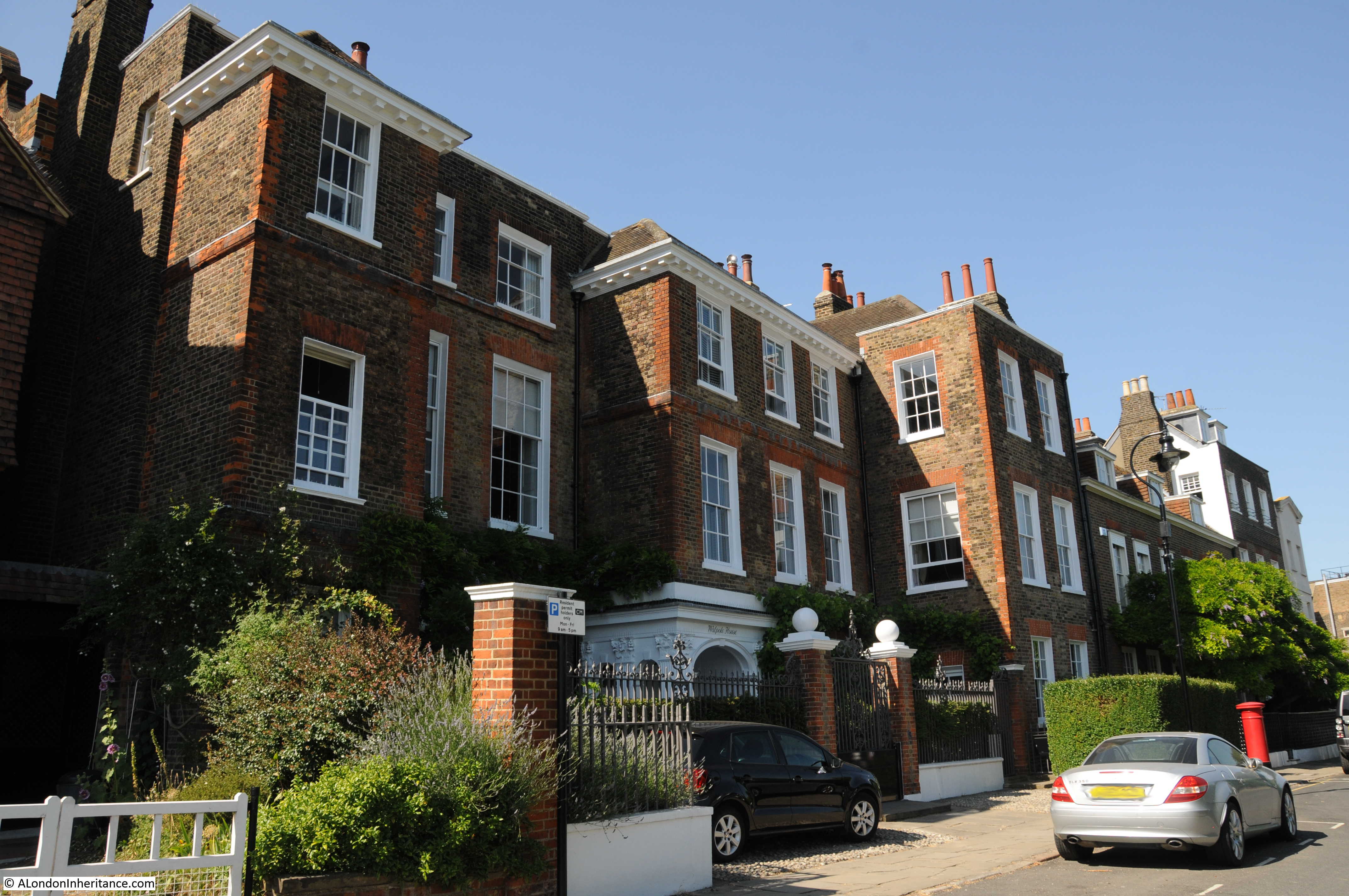
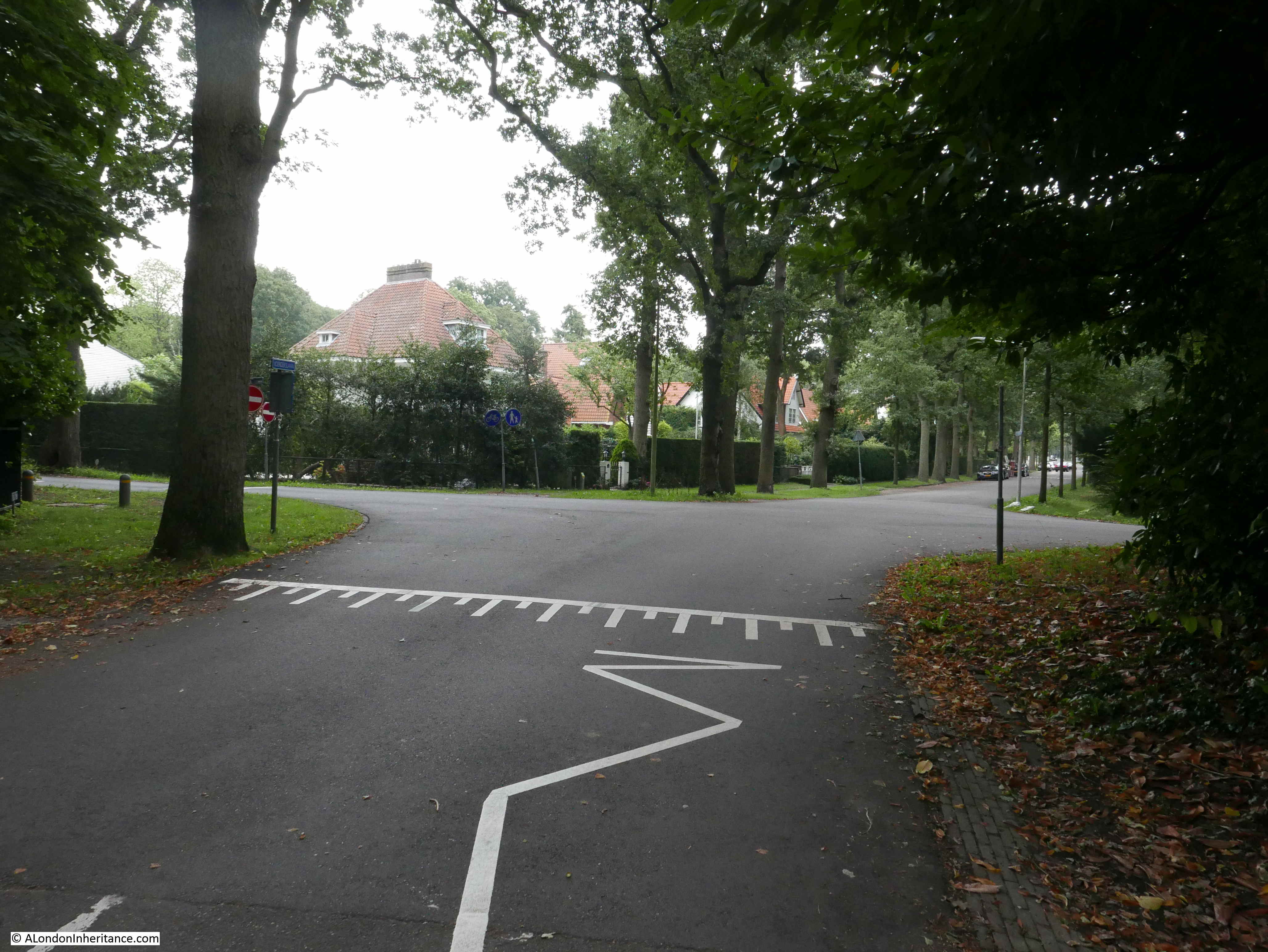
Wassenaar is a suburb of the Hague, located to the north east of the city. It is a wooded area with small roads crossing the area, concealed under trees which also line the roads. Wassenaar was one of the main launch sites for V-2s and the first rockets against London were launched from Wassenaar’s roads.

Before leaving the Hague, I wanted to find the location of the first V-2 launch against London, so headed out on the short drive to Wassenaar.

The following map shows the city of the Hague. Follow the orange road (the N44) that runs from the Hague to the north east and you will find Wassenaar.

V-2

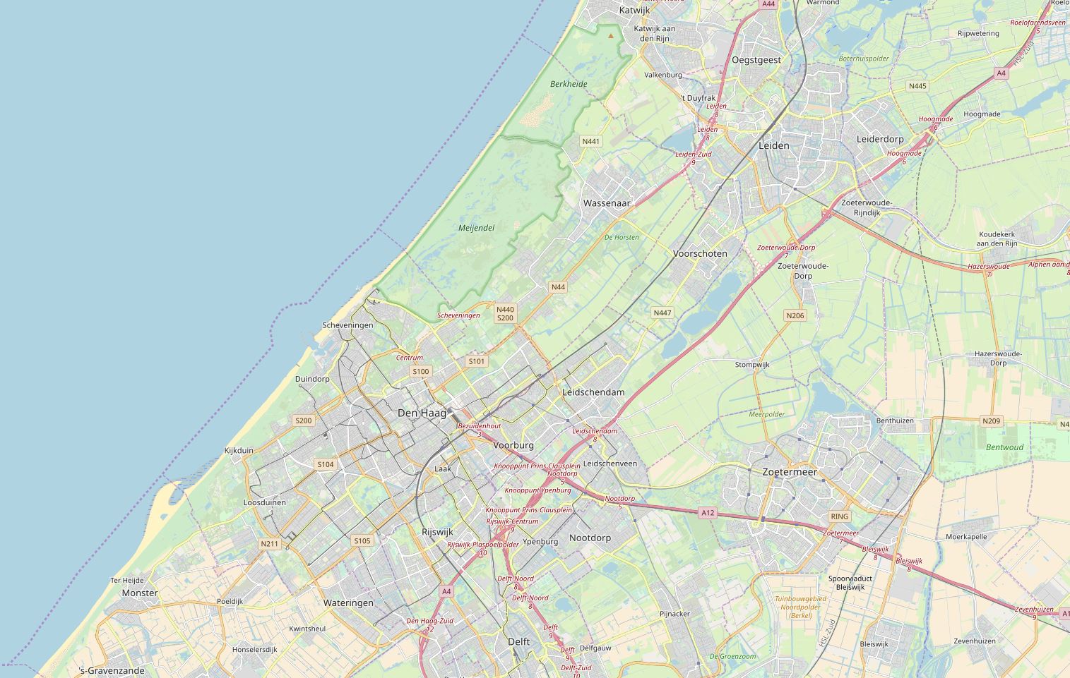
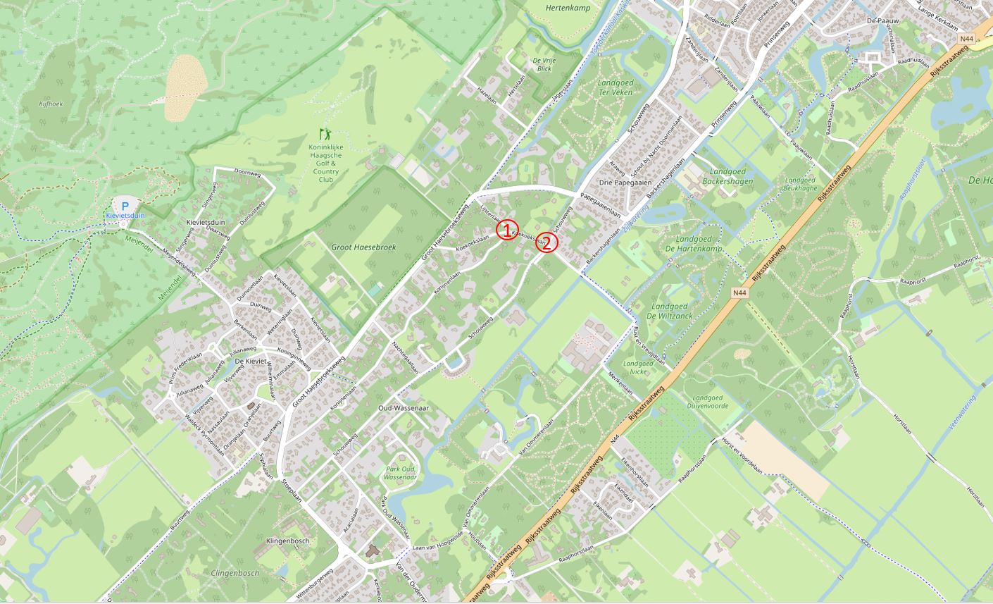
The following map extract shows Wassenaar in detail. The first launches against London took place on the evening of the 8th September 1944. There were two simultaneous launches at two different road junctions. These were ideal locations as road junctions offered a larger space for the rocket launcher and supporting vehicles as the rocket was fueled onsite. The map also shows the wooded nature of the site and that these were side roads – good concealment for the time needed to prepare and launch.

V-2

(The above two maps are  “© OpenStreetMap contributors”).

At around 6:35 pm on the evening of the 8th September 1944, the residents of Wassenaar heard a loud roaring noise and saw two objects rising above the trees, slowly at first before quickly gathering speed, then rushing skyward.

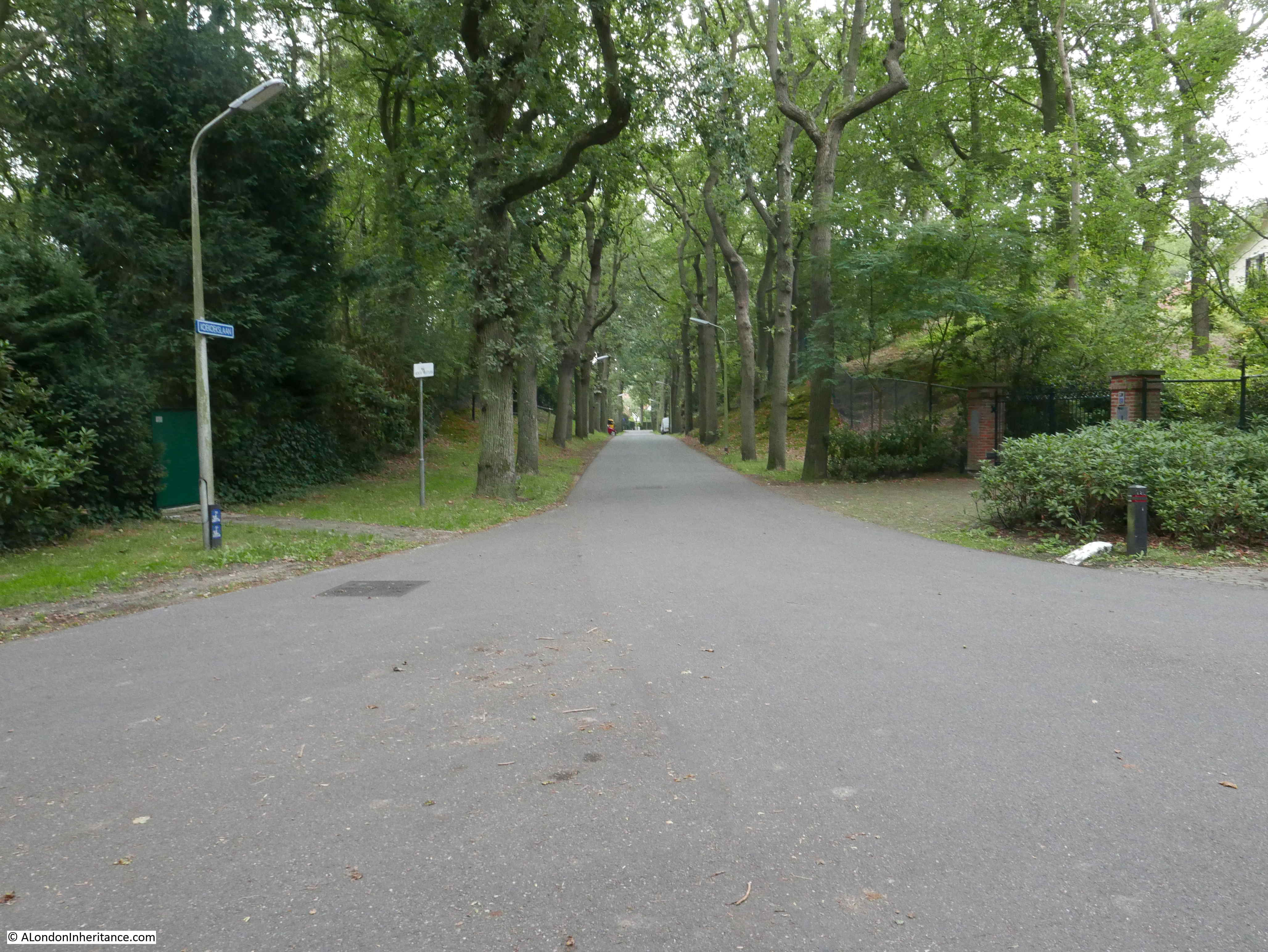
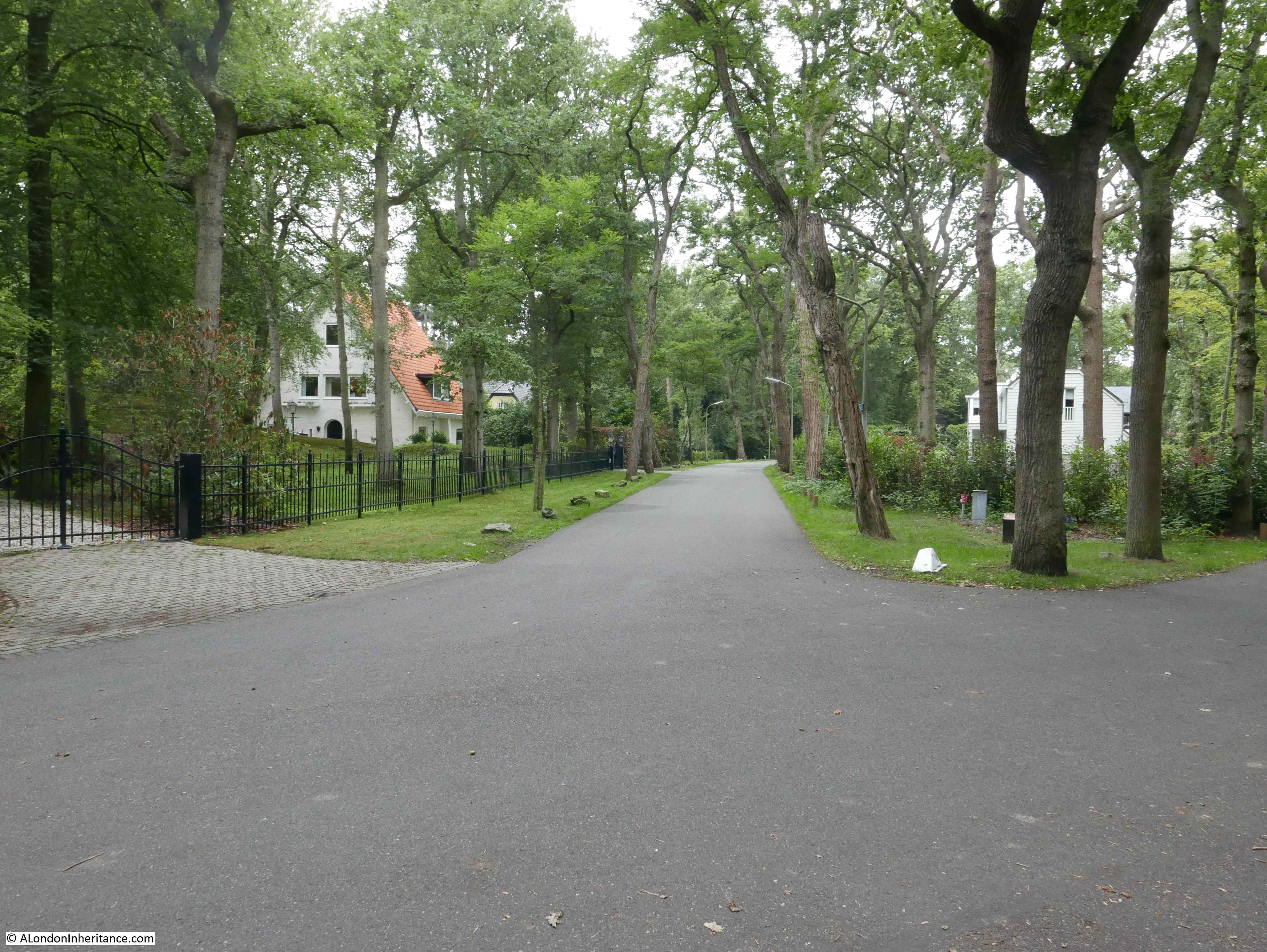
One was from the junction of three roads shown as point 1 in the above map. This is the junction of Lijsterlaan, Konijnenlaan and Koekoekslaan. This is the view of the junction as I walked up to the site:

V-2

Looking down one of the roads leading of from the junction shows the narrowness of the roads and the tree cover. It has not changed that much since the rockets were being launched here and shows how good the area was for concealment.

V-2

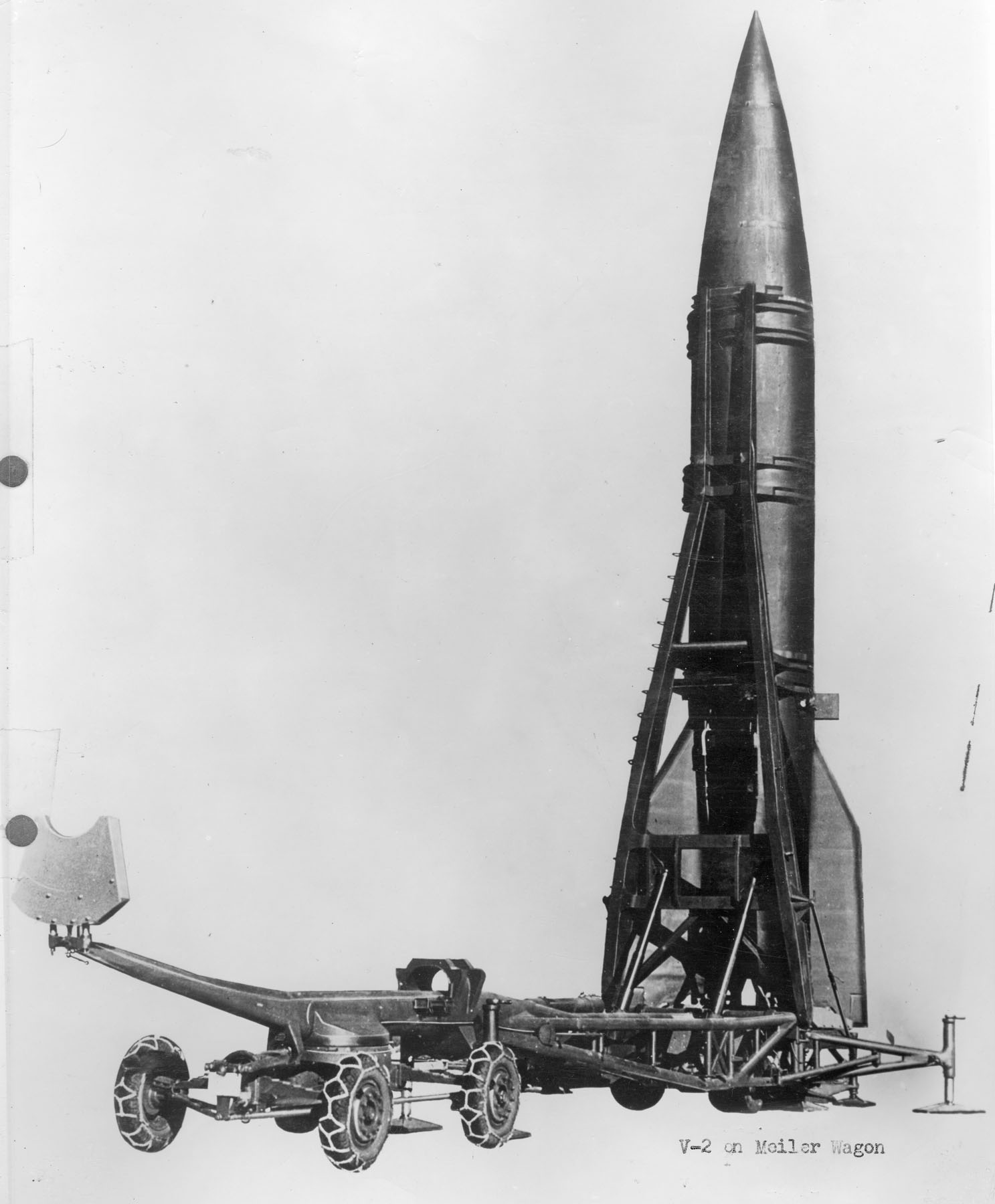
The original V-1 had to be launched from a fixed launching ramp. As well as the technological development of the rocket, other innovations with the V-2 were mobility where the complete system comprising a mobile launcher, fuel tankers (including liquid oxygen), launch and control system could drive up to a new location and launch within about two hours.

The following illustration shows a V-2 rocket in launch position on its mobile transport and launch platform:

V-2

The following photo shows a V-2 just after the initial launch. Two of these being launched almost simultaneously from the wooded side roads of Wassenaar must have been a frightening sight for the local residents.

V-2

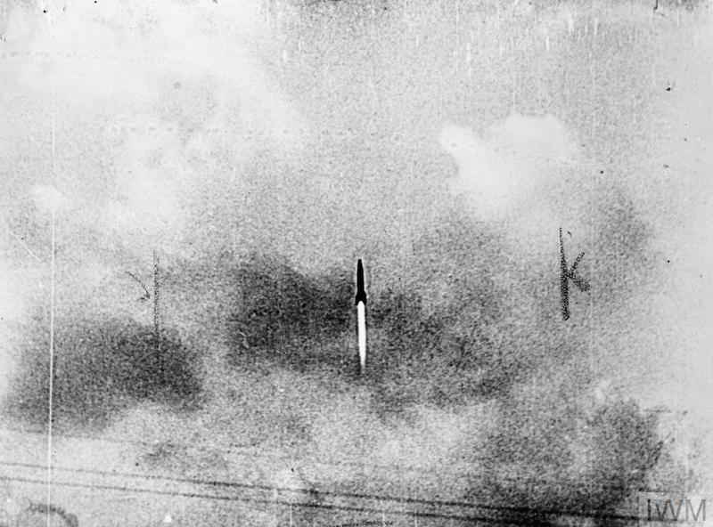
Black and white (CL 3429) German photograph of a V2 rocket in the initial stage of its flight Copyright: © IWM. Original Source: http://www.iwm.org.uk/collections/item/object/205087577

This part of Wassenaar is occupied by large houses and grounds. Reports from immediately after the launch tell of the road surface been scorched and melted, with trees being burnt for a few feet above ground level where flame from the rockets engines must have bounced of the road and been deflected onto the adjacent trees.

On the next day, the 9th September, the RAF started bombing Wassenaar. A cat and mouse game ensued with rockets, fuel and launch equipment being stored across the area and mobile launches taking place on a regular basis, and the RAF trying to locate and bomb any V-2 related infrastructure that could be found.

Another view of the road junction.

V-2

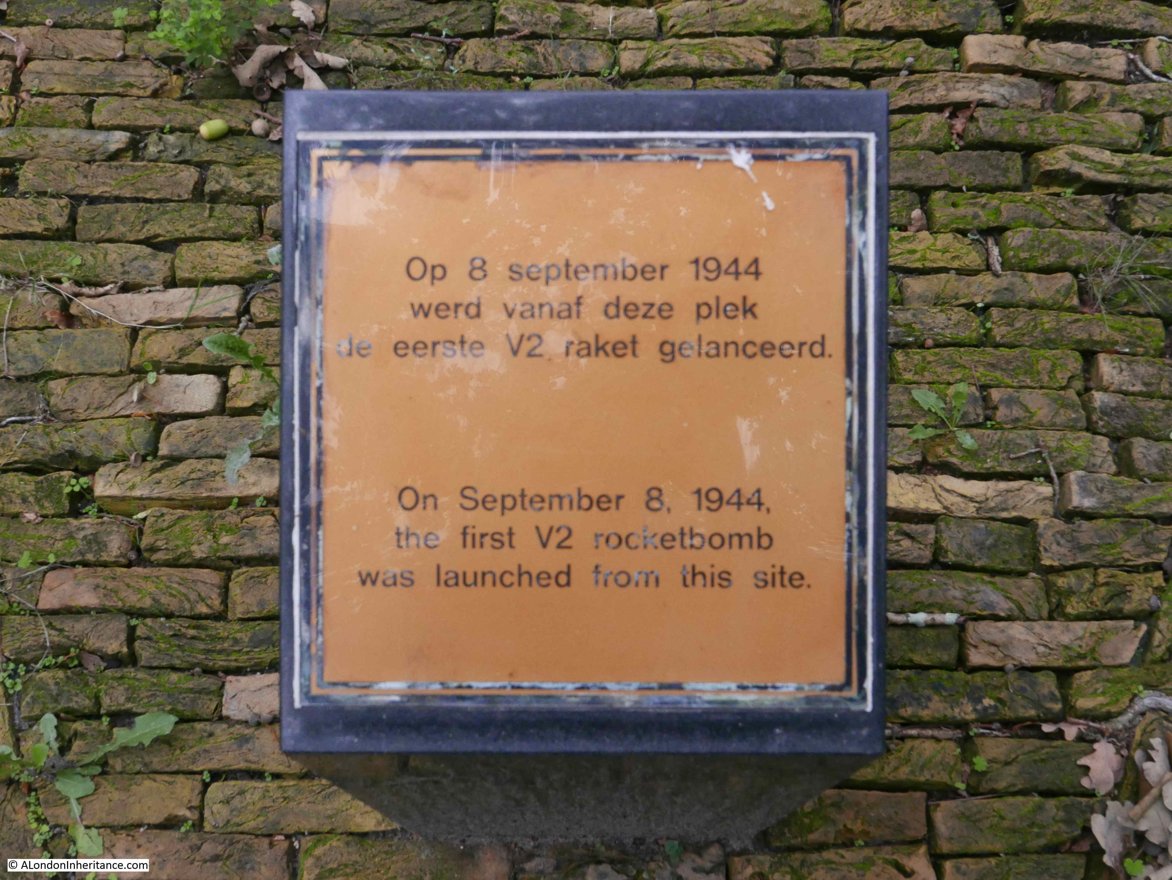
If you look at the patch of grass on the right, there is a white painted stone. Look to the upper right of the white stone, and just to the left of the tree is a small, wooden pillar.

The pillar records the junction as being the site of the first launch of a V-2 rocket on the 8th September 1944:

V-2

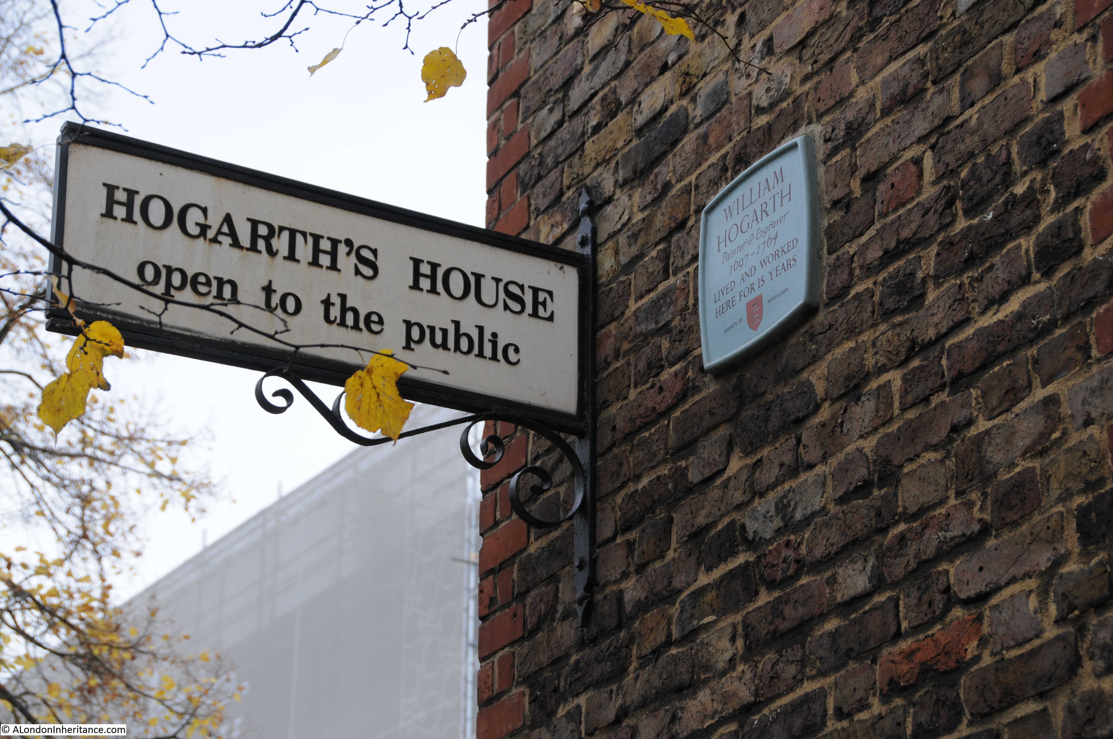
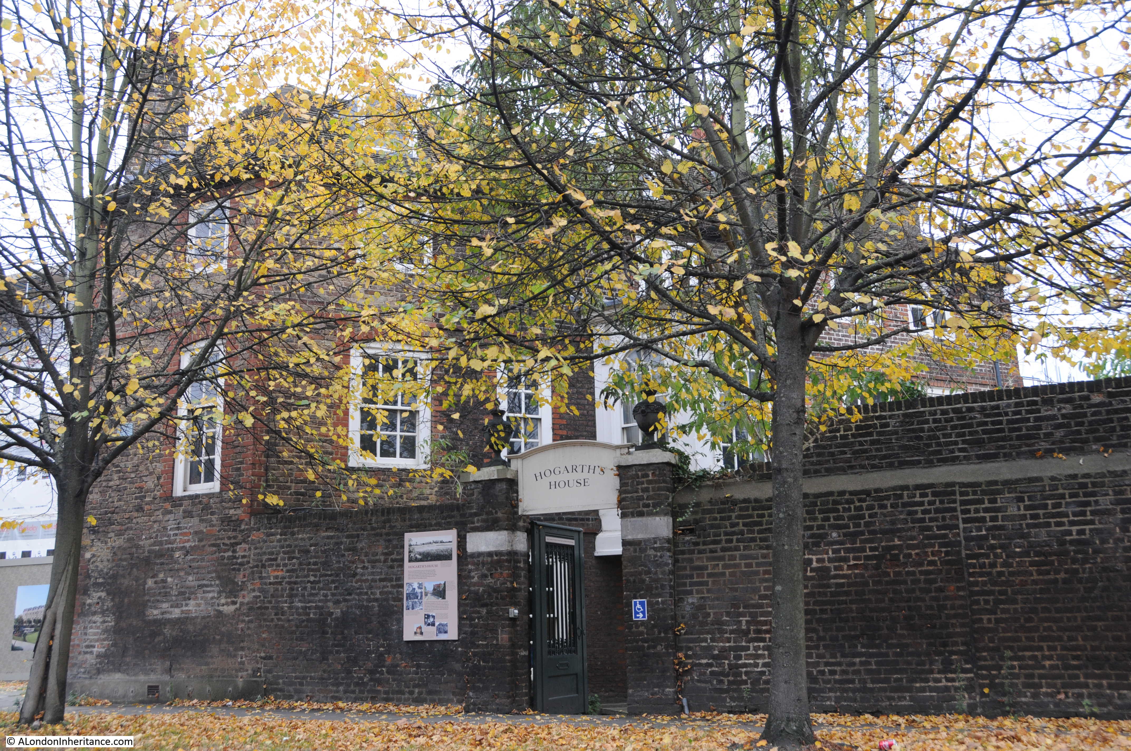
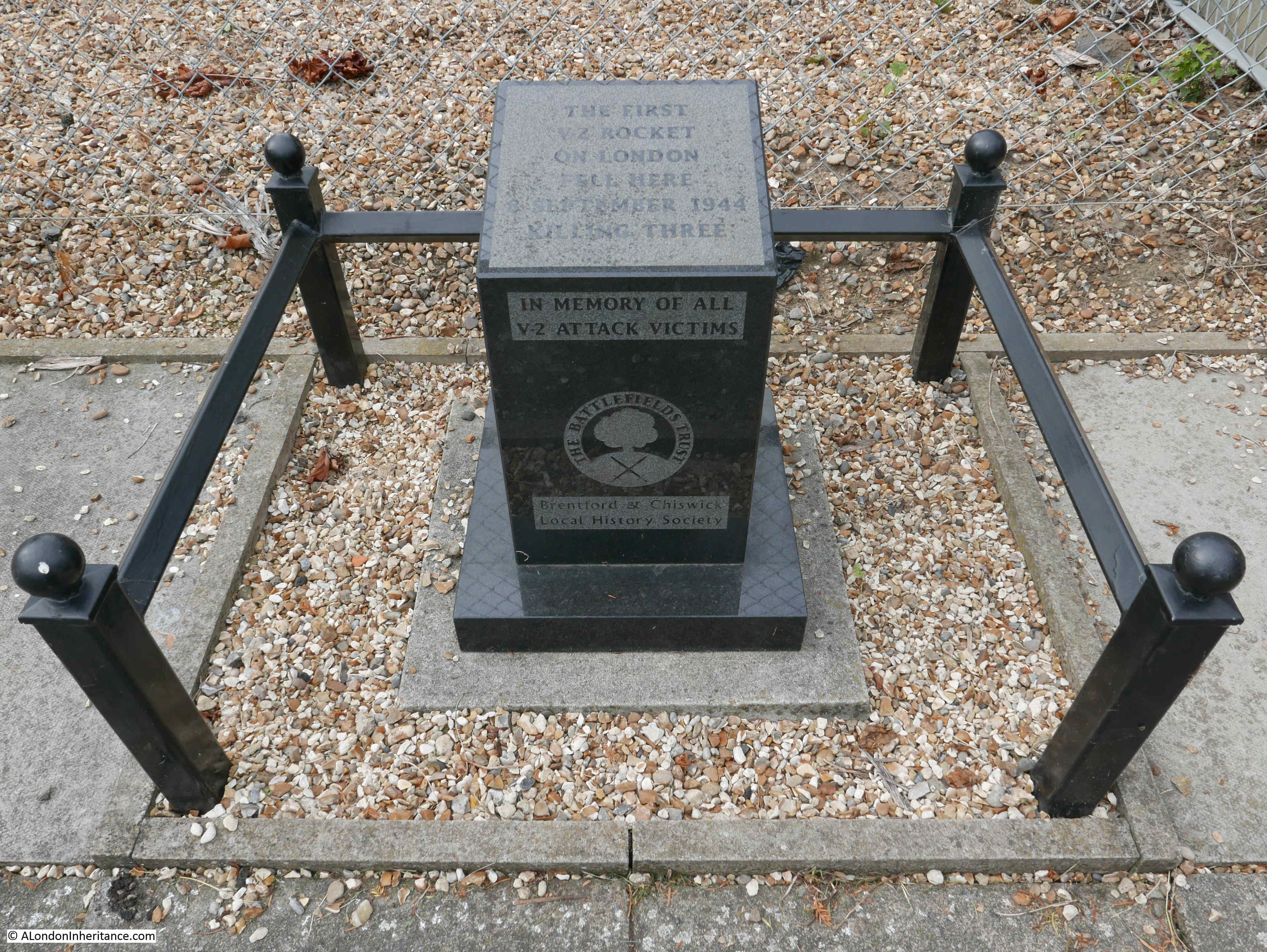
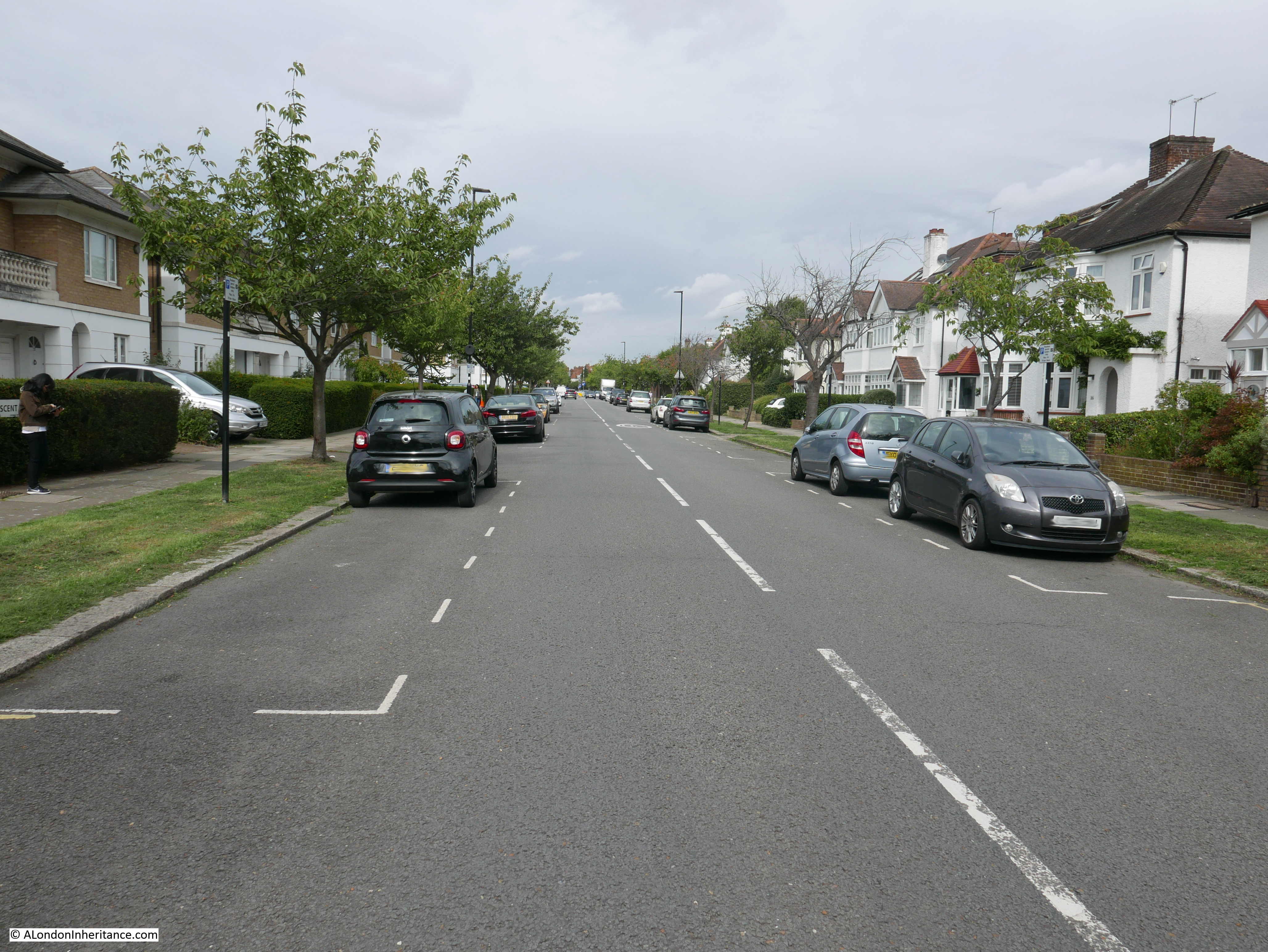
Soon after returning from the Netherlands, and on the 8th September 2018, I visited the site where the V-2 launched from Wassenaar landed – in Staveley Road, Chiswick where another pillar can be found recording that the first V-2 fell here. It had taken the rocket around 5 minutes to get from Wassenaar to Chiswick.

V-2

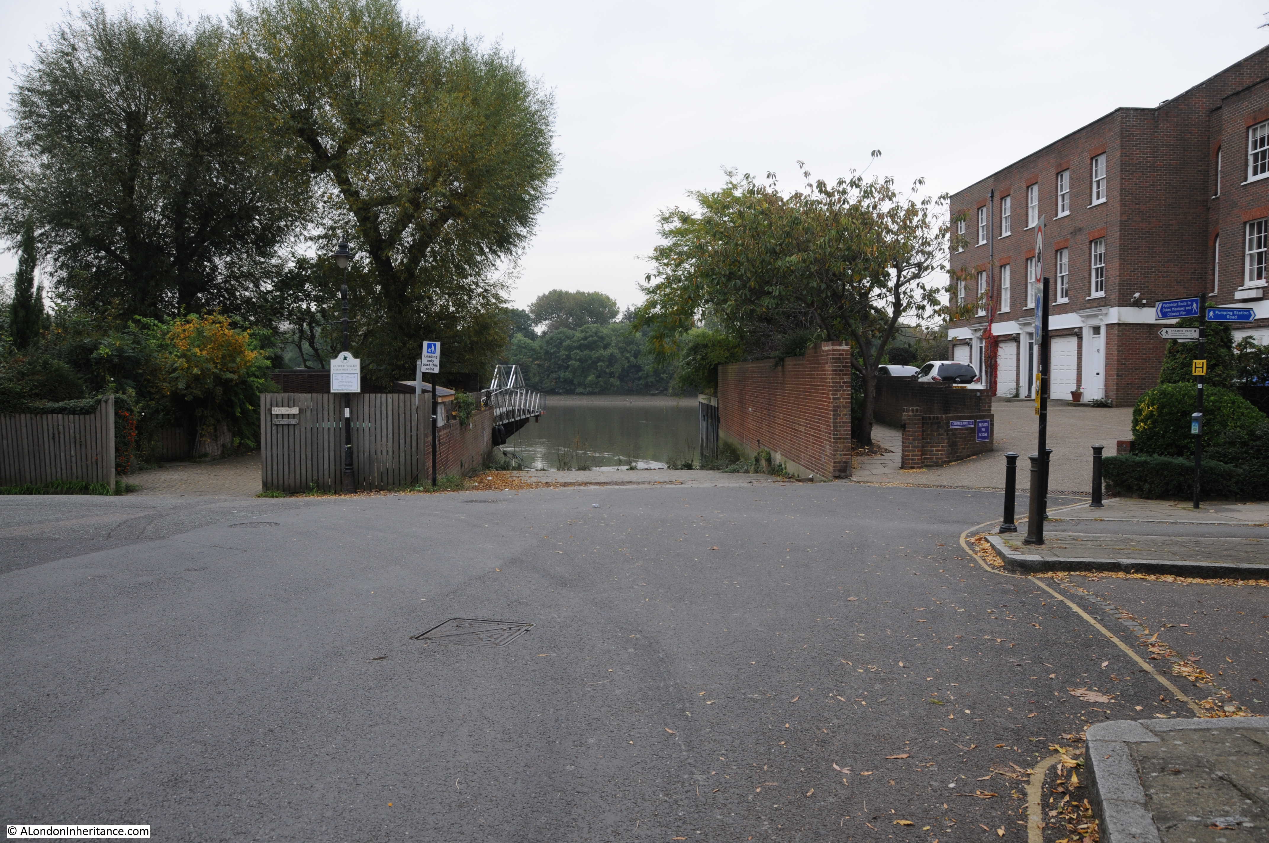
The view looking along the street from in front of the memorial pillar:

V-2

The memorial pillar is in front of a small electrical substation:

V-2

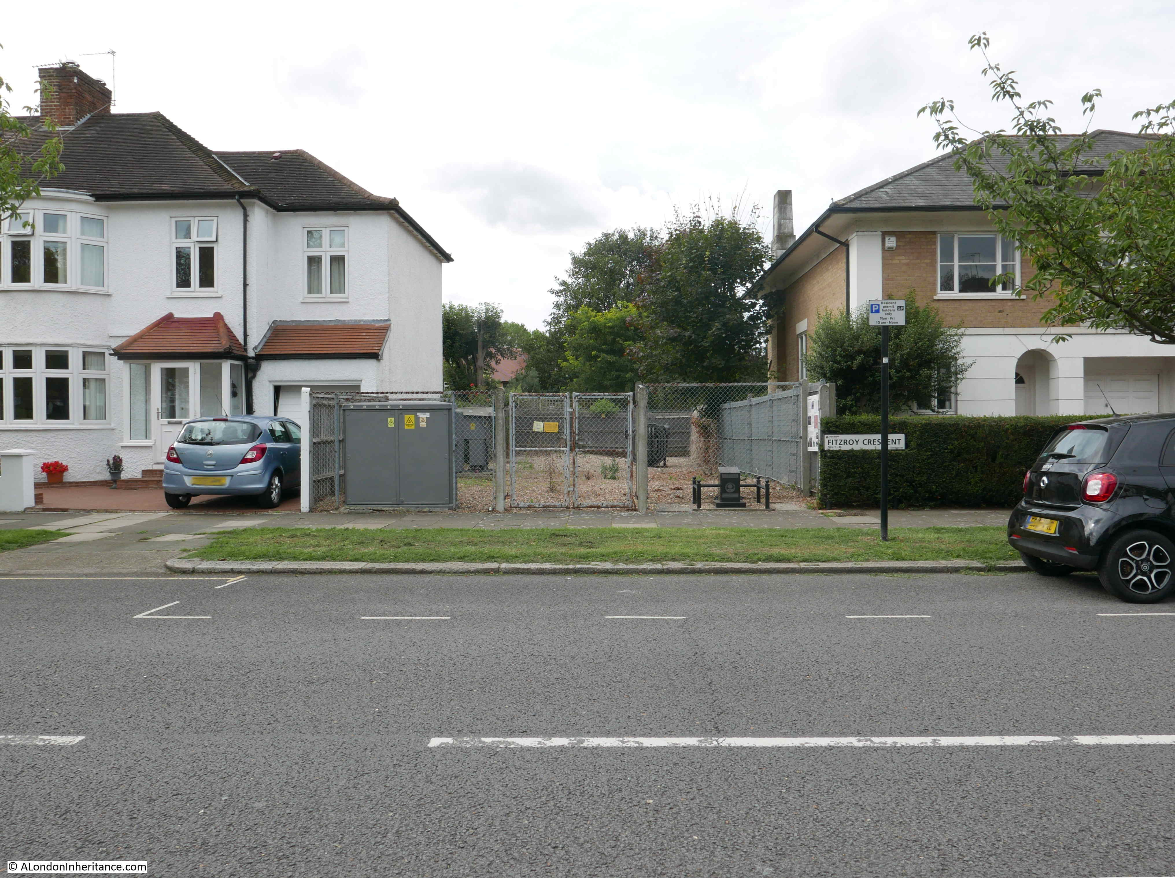
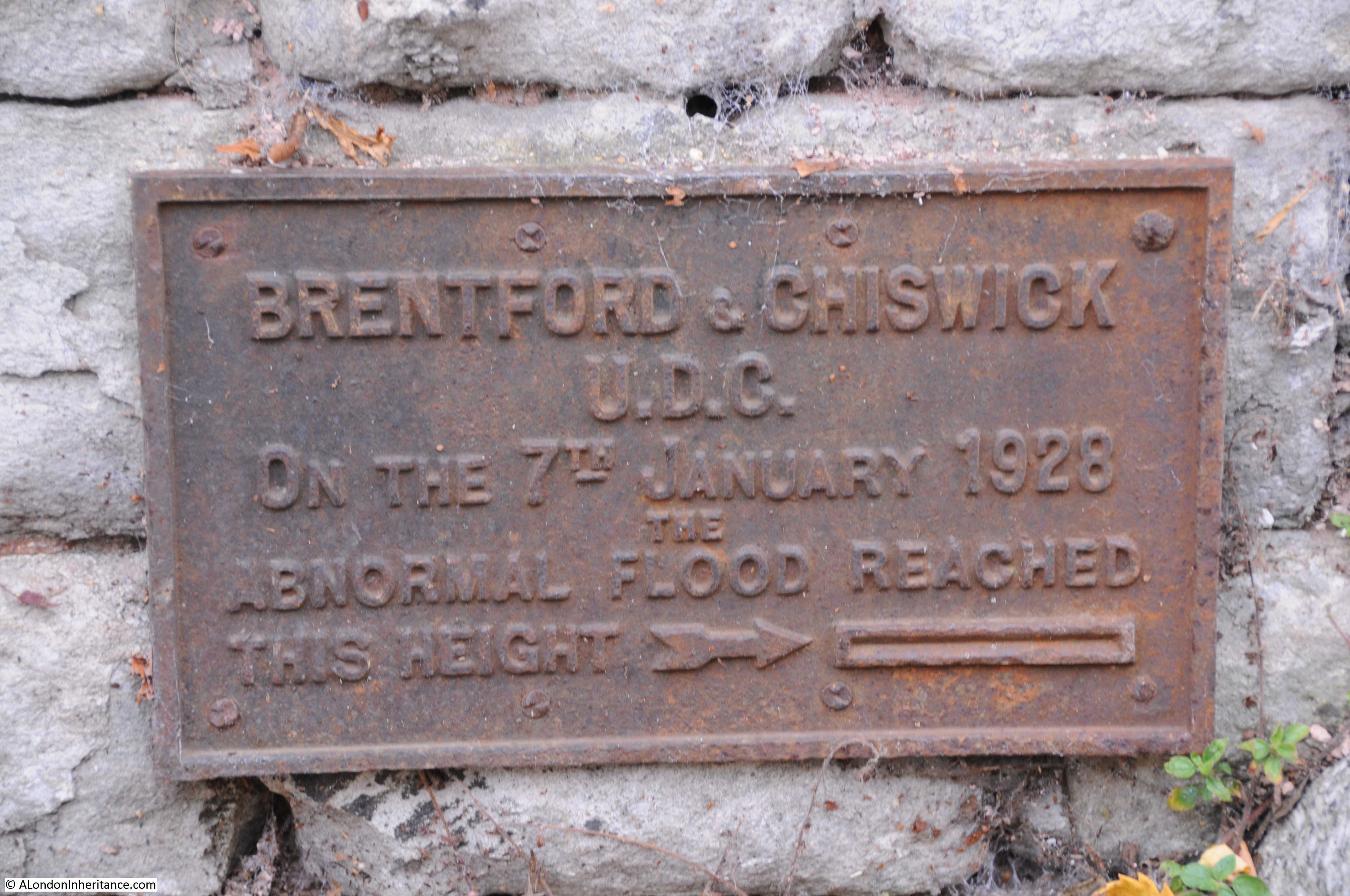
To the right of the pillar, mounted on the fence is an information panel which was unveiled by the Battlefields Trust and the Brentford and Chiswick Local History Society, on the same day that the pillar in Wassenaar was also unveiled.

V-2

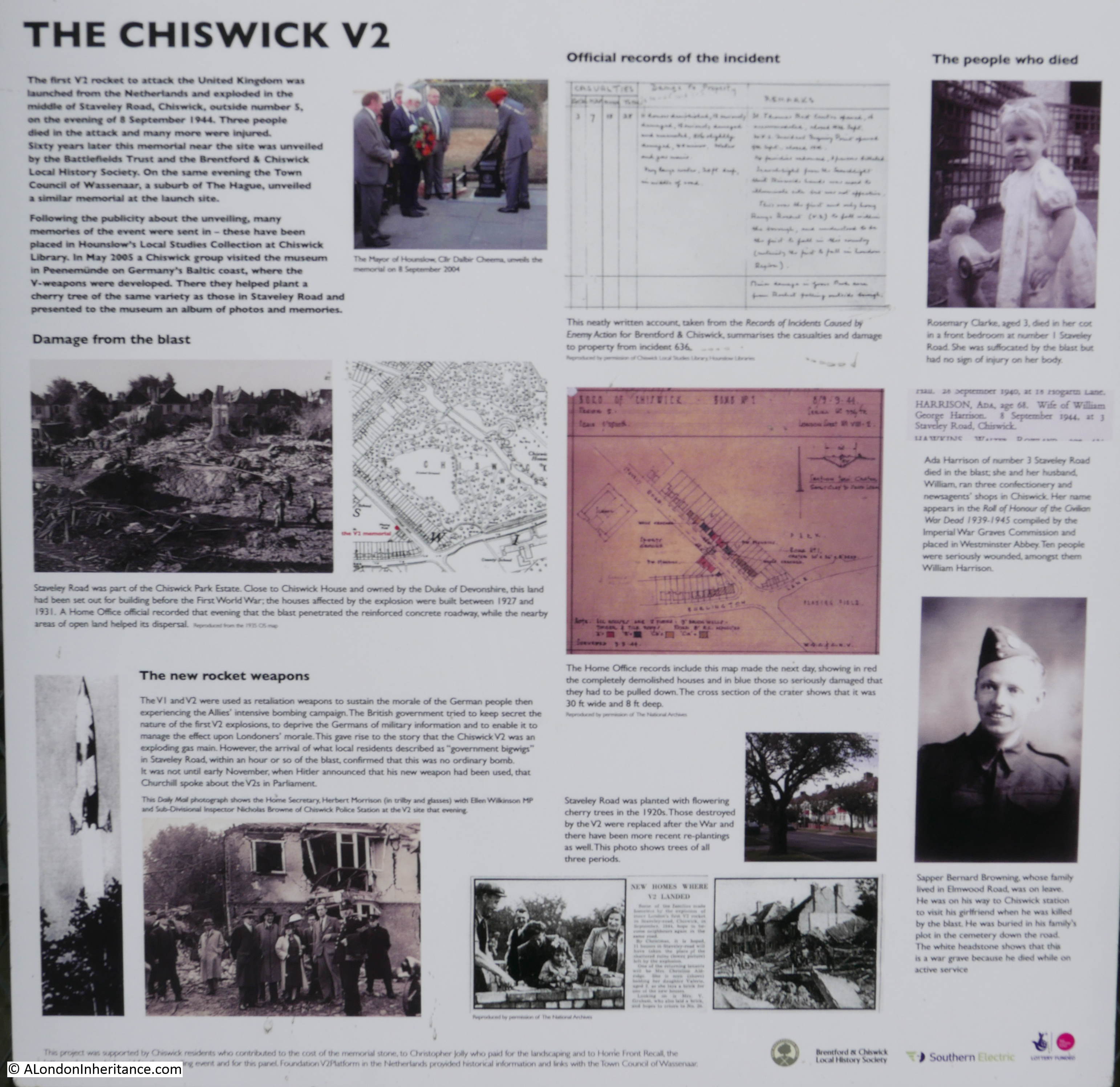
The V-2 on Chiswick resulted in three deaths. Three year old Rosemary Clarke who lived at number 1 Staveley Road, Ada Harrison aged 68 of 3 Staveley Road and Sapper Bernard Browning, who was on leave, and on his way to Chiswick Station.

Destruction was considerable. The V-2 blew a crater 30 ft wide and 8 ft deep at the point of impact. The following panoramic photo from the Imperial War Museum archive shows the damage that a V-2 could inflict.

V-2

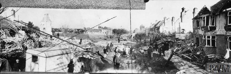
V1 AND V2 DAMAGE, 1944-45 (HU 66194) ‘Extensive damage caused by mystery explosion in Southern England.’ The photograph actually shows the site of the first V2 rocket impact on Britain, Staveley Road, Chiswick. Photograph taken 9 September 1944. Copyright: © IWM. Original Source: http://www.iwm.org.uk/collections/item/object/205070209

There was a second V-2 rocket launched at the same time, a very short distance from the location described above. This V-2 was launched from the point marked 2 in the map, at the junction of Lijsterlaan and Schouwweg. This V-2 would land minutes later at Parndon Wood, near Epping. Due to the rural nature of this location there were no casualties.

The following photo shows the junction from where this second V-2 was launched:

V-2

From the 8th September onward, there was a continuous series of V-2 launches from Wassenaar and the Hague. The area was also used for storage of rockets and fuel, launching equipment and the German forces and command structure that would launch the rockets were also housed in the surroundings of Wassenaar and the Hague.

Allied planes flew many missions over the area trying to locate and destroy V-2 infrastructure. On the 3rd March 1945 a large force of bombers mounted an attack on the forested regions of the Hague, but due to navigation errors many of the bombs fell on the Bezuidenhout suburb resulting in a large loss of life in the Dutch population.

The Dutch population also suffered when rockets misfired, and also the disruption and treatment they suffered from living in and around a place that was used to store, transport, prepare and launch such an intensive rocket programme.

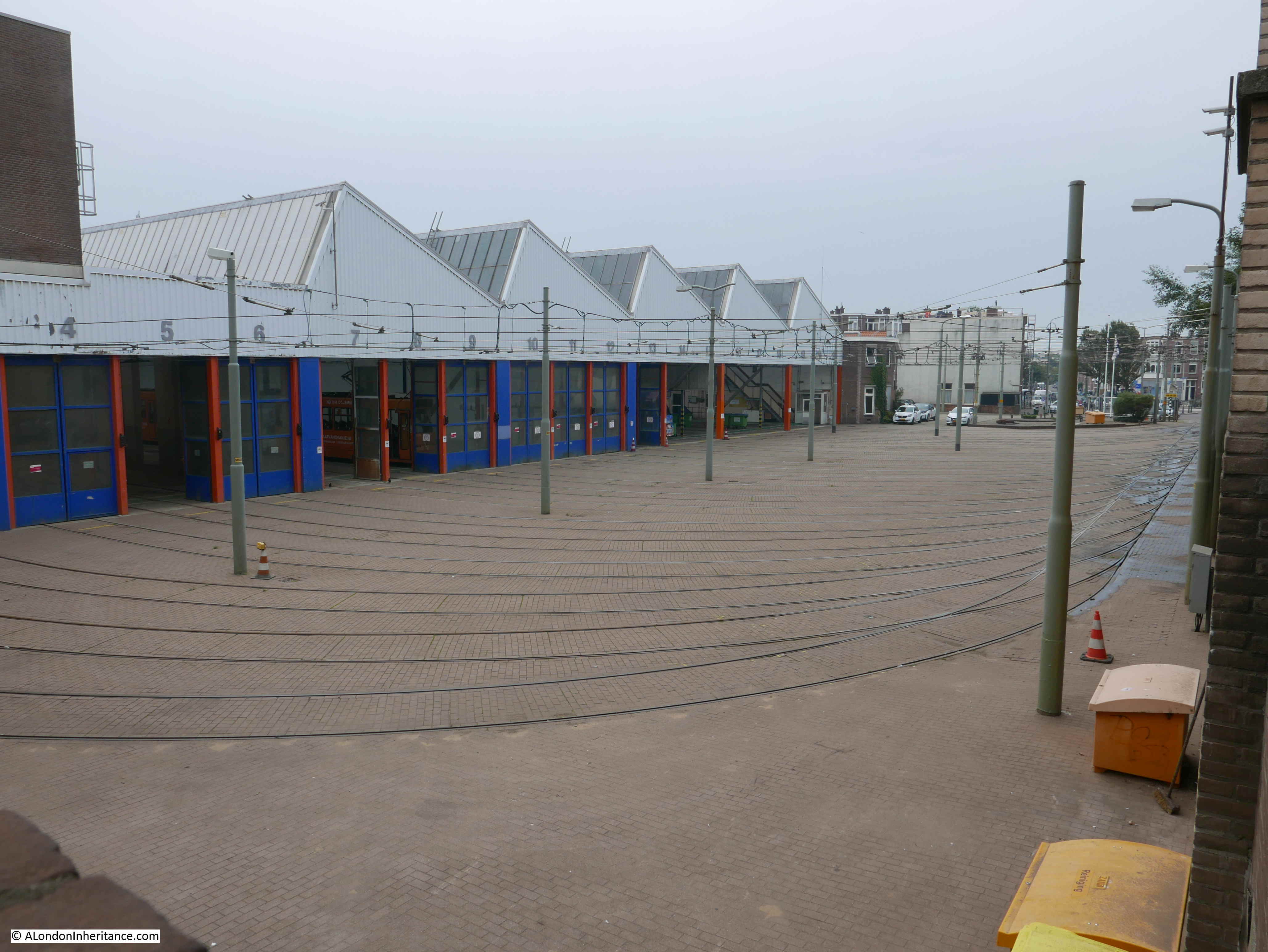
One of the locations where V-2 rockets were checked and prepared was the tram depot in Scheveningen, the coastal suburb of the Hague.

This is the view of the tram depot today:

V-2

There are historical posters around the streets commemorating the 200th anniversary of Scheveingen as a seaside resort. One of these posters shows the state of the tram depot in 1945:

V-2

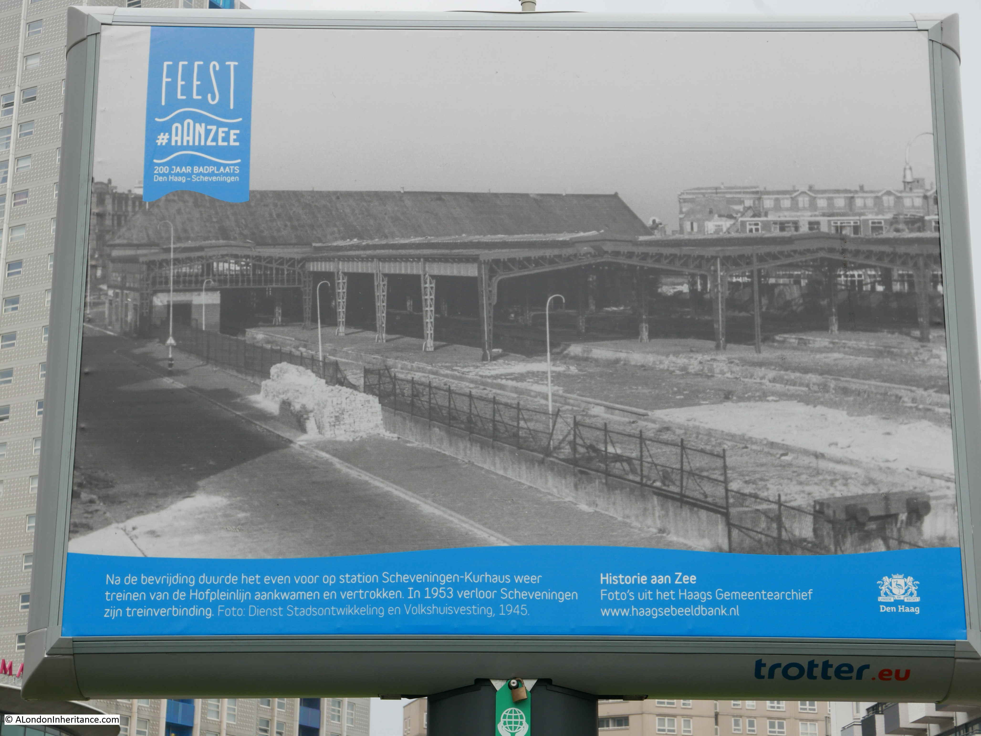
The text states that after the liberation, it took some time for trams from the Hofplein line to return to Scheveningen-Kurhaus station and that the tram connection was finally reestablished in 1953.

On the 27th March 1945 the last V-2 was launched against London. It fell on Orpington in Kent resulting in the deaths of 23 people. Whilst the west of the Netherlands was still occupied, rail connection with the rest of Germany had been cut and the German rocket forces had already been withdrawn from the Hague in order to avoid capture of the personnel and their equipment.

From the first V-2 on the 8th of September to the last on the 27th March, a total of 3172 V-2 rockets were launched. Of these around 1358 fell on the greater London area.

London did not suffer as badly as Antwerp, An important port for the Allied forces allowing supplies to be delivered into Belgium rather than the French ports further south, around 1610 V-2 rockets were launched against Antwerp.

Other rockets landed in France, Maastricht in Holland and even in Remagen, Germany where the use of rockets were an attempt to try and disrupt US forces by targeting the Ludendorff Bridge across the Rhine. This was the first time that rockets had been used to attack a very specific target. Eleven rockets were fired at the bridge, however none hit their target, but American soldiers and German civilians were killed.

The V-2 campaign against London killed more than 6,000 people.

The rockets were constructed by slave labour and many tens of thousands died due to the appalling conditions in which they were held and laboured.

The impact of the V-1 and V-2 weapons was considerable on those forced to build them, the areas where they were launched and their targets.

Two pillars in two countries, roughly 205 miles apart provide a reminder of the devastation that these weapons would cause.

alondoninheritance.com 

Along The Thames From Chiswick To Hammersmith

If you drive west out of London, along the A4, Great West Road from the Hammersmith Flyover to Chiswick and the Hogarth Roundabout, you pass along a very busy highway with three lanes of traffic either side.

This probably is the last place you would expect to find one of the more historic walks along a very scenic part of the River Thames, with some of the views looking more like the depths of the countryside rather than a built up area of west London.

There are some superb walks along the River Thames, and for today’s post, here is a walk from Chiswick to Hammersmith on a very hot Saturday afternoon in June (it is also a lovely walk on a cold, dark winter’s evening). The walk is perfect for a hot day as there are plenty of suitable stopping places along the route for some quick refreshment.

In the following map extract, the A4 is the large road running from the Hammersmith Flyover at top right, down to the Hogarth Roundabout at bottom left.

Chiswick

(Map  “© OpenStreetMap contributors”).

A short distance below the A4 is the river and along the river is a series of streets starting with, on the left, Chiswick Mall.

I started by walking to the river down Church Street, between St. Nicholas’ Church and Fuller’s Griffin Brewery to reach Chiswick Mall.

Chiswick Mall runs along the river, with gardens separating the street from the river, and large houses lining the street opposite the river.

The views here to the river look as if they should be from the upper reaches of the river, rather than a short distance from the six lanes of the A4.

Chiswick

The river here does frequently flood across the road. This was not a particularly high tide, however the damp road shows how far the river had come across the road.

Chiswick

The majority of the houses on the opposite side of the street have flood defences in the form of walls and metal gates that can be closed across the entrances from the street to prevent water from flooding towards the house.

There are also signs warning of the potential impact if you leave your car along the Chiswick Mall.

Chiswick

This is Walpole House, a Grade II listed building dating from the 18th century, possibly with elements from the 17th century.

Chiswick

Barbara Villiers, Duchess of Cleveland, a former mistress of King Charles II was one of the earliest recorded residents, with Thomas Walpole a later owner, who gave his name to the house.

Another view from Chiswick Mall towards the River Thames:

Chiswick

Italy or Chiswick?

Chiswick

At a number of places, the route between Chiswick and Hammersmith turns slightly in land and there are houses between the street and the river. This is where Chiswick Mall ends and becomes Hammersmith Terrace.

Chiswick

There are a number of references to the age of the terrace, dating them from 1755 to 1770. The houses along the terrace are nearly identical, however there are some minor differences, and some which stand out such as very different entrance doorways.

As could be expected there are blue plaques to be found. This one to the typographer and antiquary Emery Walker Chiswick

Emery Walker was a friend of William Morris and it was Walker’s interest in early typefaces that inspired Morris to set up the Kelmscott Press.

A short distance along the terrace is another blue plaque, this time for Edward Johnston, a Master Calligrapher.

Chiswick

Edward Johnston has had a significant impact on 20th century London. It was Johnston who created the sans-serif alphabet (now called Johnston) in 1916 for use across London Underground.

At the end of Hammersmith Terrace, the route returns to run alongside the River Thames, and at this turning is a good stopping point – The Black Lion:

Chiswick

The view at the end of Hammersmith Terrace. Hammersmith Bridge is just starting to appear in the distance:

Chiswick

The view looking back upstream towards Chiswick with Chiswick Eyot in the middle of the river:

Chiswick

The River Thames between Hammersmith and Chiswick is a wide river. In many places the river is bounded by large concrete walls that keep the river within the channel, however in some places, such as where the river floods in Chiswick Mall, the river comes up to the road, with a poorly defined boundary between river and land.

This was the state for the river until recent times, and early prints show a wide, meandering river with marshy edges. The following print from 1750 shows the River Thames from Chiswick:

Chiswick

In 1834, the banks of the river are starting to be developed, but the edge of the river is still a natural boundary between buildings and river:

Chiswick

However much of the river now has a very clear boundary, and time for another stop at the Old Ship:

Chiswick

A short distance along from the Old Ship is the London Corinthian Sailing Club, with a lookout and small pier for launching boats onto the Thames:

Chiswick

Chiswick

The forerunner of the club was the London Sailing Club, who later moved further downstream towards Essex, and those who remained in Hammersmith started the Corinthian’s. They were original housed in a building where Furnivall Gardens are now located, however the area suffered badly in the war, and the council cleared the land to create the gardens.

The council provided Linden House for the club where it remains to this day. The building is a magnificent, 18th century, former Merchants house.

Chiswick

On the corner of Upper Mall and Weltje Road is this house with a blue plaque on the side:

Chiswick

The plaque records that the artist Eric Ravilious lived in the house between 1931 and 1935.

Chiswick

He lived in a flat in the house with his wife Tirzah Garwood. His work had a very distinctive style and his later work covered many wartime scenes. He took the opportunity for a posting to Iceland with the RAF in August 1942 to paint both the Icelandic scenery and the work of the RAF.

On the 2nd September 1942 he was on an air-sea rescue mission flying from Iceland, in search of a plane that had been lost the previous day. The plane with Ravilious on board also disappeared, and he was lost at the young age of 39.

The following is an example of his wartime work. Bombing the Channel Ports. with the description from the IWM image: “a deserted coastal road that leads past an ‘acoustic mirror’ early warning device. In the top right of the composition there are searchlights beaming up into the sky, and a large circular glow of light to one side.”

Chiswick

Bombing the Channel Ports (Art.IWM ART LD 1588) Copyright: © IWM. Original Source: http://www.iwm.org.uk/collections/item/object/22468

On the river wall opposite is this survivor from 1960 warning that you could be fined forty shillings for driving or parking along Upper Mall:

Chiswick

On the wall of Eric Ravilious house, there is another survivor from the time when Hammersmith Borough Council was the authority for the area up to 1965.

Chiswick

A Jasmine covered lamp post:

Chiswick

Carved decoration on houses:

Chiswick

On Upper Mall is the small museum of the William Morris Society:

Chiswick

The displays are worth a visit, and above the entrance is an interesting plaque recording a unique event that took place here in Hammersmith.

Chiswick

The plaque is to record the construction and testing of the first electric telegraph here in Hammersmith in 1816.

This was the work of Sir Francis Ronalds who lived here and used his garden for experimentation. He was awarded a knighthood in 1870 and the following Illustrated London News report provides a good insight into an interesting character:

“The Queen has lately conferred the honour of knighthood upon a gentleman in the eighty-second year of his age, who showed the use of the electric telegraph so long ago as 1816. Sir Francis Ronalds, F.R.S. formerly director of the Kew Observatory, has devoted his life to the advancement of electrical science and its practical applications. in 1814, having made the acquaintance of M. de Lue, then engaged in a series of interesting experiments, Mr. Ronalds was induced to turn his attention to this subject.

The researches he then began, with a view to ascertain the degrees of quantity and intensity in the electric pile, and his invention of a clock to be kept in motion by electro-galvanic power, were described in the Philosophical Magazine.

In the summer of 1816 he undertook to prove the practicability of telegraphic communication at great distances, by transmitting a certain number of electric shocks, for an arranged signal, through insulated wires of a considerable length. He laid his wire in glass tubes surrounded by wooden troughs lined with pitch, which were placed in a covered ditch, 525 feet long and 4 feet deep in his garden at Hammersmith. He also suspended eight miles of wire, by silk cords, from two wooden frames erected on the lawn, so that the wire passed to and from many hundred times, well insulated at each point of attachment, and forming one continuous line, kept separate from contact with other parts.

Both these kinds of apparatus served equally to show the instantaneous transmission of the electric shock. in order to provide the means of conveying intelligence along the underground line, he placed at each end of it a clock, with a dial bearing twenty letters inscribed. It is only needful to explain that the two clocks were made to go isochronously, the one always presenting the same letter as the other at any particular second of time; and the moment chosen was indicated at the other end by the sudden collapse of a pair of pith ball electrometers, suspended at each station close to the clock dial and connected with the telegraph wire.”

The following illustration shows the apparatus used by Francis Ronalds in his Hammersmith garden:

Chiswick

I wonder what he would have thought of the people walking by his house using mobile phones with instant communication anywhere in the world?

The route now turns slightly in land as there are a row of houses between the Mall and the river, and here we find the next stop:

Chiswick

The Dove is an old pub, originally an early 18th century coffee house, not that big, but with some brilliant views over the river and the perfect place for a stop on a hot summer’s afternoon.

A short distance further along, the route returns to the river’s edge, alongside Furnivall Gardens, named after Dr. Frederick Furnivall who was one of the original creators of the Oxford English Dictionary. The relevance to the location alongside the river is his enthusiasm for rowing and his own Furnivall Sculling Club.

Alongside Furnivall Gardens we can get a view of the full length of Hammersmith Bridge:

Chiswick

Unfortunately, as the tide comes in, the river washes up the rubbish that has probably been up and down the Thames many times with the tides.

Chiswick

My next stop was at the Rutland Arms, probably the busiest pub along the river between Chiswick and Hammersmith.

Chiswick

Almost next door to the Rutland Arms is an older pub (the white building with the awning projecting from the front), the Blue Anchor which was first licensed in 1722. Another good stop on a hot summer afternoon:

Chiswick

A final blue plaque for George Devine, the Artistic Director of the Royal Court Theatre, who lived in this house overlooking the river and Hammersmith Bridge.

Chiswick

I then reached the end of the walk from Chiswick to Hammersmith, at Hammersmith Bridge, which deserves a dedicated post, however I took a quick walk across as this is always a fascinating bridge to pick out design and construction details.

Chiswick

The year of construction, 1887, replacing a previous bridge across the river:

Chiswick

Detail of the decoration on the rods leading up from the deck of the bridge to the main suspension cable:

Chiswick

Lights, which all appeared to be on during a bright summer afternoon:

Chiswick

The view from the bridge to the north bank at Hammersmith:

Chiswick

Wooden seating between the walkway across the bridge and the road.

Chiswick

As traffic passes over the bridge it makes a very distinctive rumbling noise. The cause of which is easily seen, as it the reason why Hammersmith Bridge is London’s weakest bridge.

The deck of the bridge appears to consist of wooden decking, overlaid with metal plates, then a layer of tarmac, which in many places has disintegrated. The rumbling noise as traffic passes over the bridge is caused by tyres passing over the many exposed bolt heads, which presumably are holding the metal plates and wooden decking together.

Chiswick

Chiswick to Hammersmith along the river is a fascinating walk, not just for the architecture and scenery, but also to discover early experiments with the electric telegraphic and the creator of the typeface that is still used across the London Underground.

There are also plenty of refreshing stops along the way, which on a very hot June day were very welcome.

alondoninheritance.com

Chiswick House And Gardens

I had not been intending to write about Chiswick House and Gardens for today’s post. I had been planning to write about one my father’s photos, one showing a street with the open space remaining from the clearance of bombed buildings. I tracked down the street and found gardens occupying the space where I thought the bombed buildings had been, however when I started writing the post, I checked the photos in more detail, aligned with some old maps, including the LCC Bomb Damage Maps, and found I had taken photos of the wrong end of the street.

I usually get the location right before I visit, however this time I missed some obvious architectural features which I should have seen whilst walking the street.

I will need to go back and photo the correct part of the street, so for today I have fallen back on a recent trip out to Chiswick, to visit Chiswick House and Gardens.

Chiswick House and Gardens are found just to the west of the Hogarth roundabout, between two busy roads, the A4 which runs out to the M4 motorway and the A316 which runs to the south west and crosses the River Thames over Chiswick Bridge. It is a busy and densely built area of west London.

The original Chiswick House was constructed in the 1620s, at a time when country houses were being built in the area, to take advantage of the benefits of being relatively close to London with the river providing access to the City.

The house was inherited by Richard Boyle, the 3rd Earl of Burlington in 1715. At the same time he also inherited Burlington House in Piccadilly, which became his London house.

Rather than use the house in Chiswick as a family residence, he planned to build a new house where he could use the architectural inspiration from his Grand Tours of Europe, and would also house the collections he had gathered touring Europe and where he could entertain.

The new house was built between 1726 and 1729, just to the north west of the original house.

Work on the gardens continued until the 1740s and the inspiration for many of the buildings that were distributed around the gardens would also come from his experiences during the Grand Tours. The Grand Tour was part of the education of an 18th century aristocrat, with months travelling through France, Germany and Italy to provide experience of the major European cultures. The majority of these tours would have Italy as their main destination. The tours were also used to build collections and many aristocratic residences of the time would be full of purchases made during the Grand Tour.

Chiswick House and Gardens passed through generations of the Dukes of Devonshire after Richard Boyle’s death in 1753. The 5th Duke demolished the original 17th century Chiswick House. The 6th Duke of Devonshire made significant changes to the gardens in 1811 with the purchase of additional land and the construction of formal gardens and the large conservatory.

Use of the house changed during the later years of the 19th century. The house was let to a number of different tenants and for a period was used as a lunatic asylum.

In 1929, Chiswick House and Gardens were sold by the 9th Duke of Devonshire to Middlesex County Council who opened the gardens as a public park.

After the war, the house was in need of serious restoration and whilst the gardens remained with the council, the house passed to the Ministry of Works in 1948.

Today, the house and gardens are managed by the Chiswick House and Gardens Trust, set-up by the London Borough of Hounslow and English Heritage.

The gardens are free to enter, and despite some of the land being sold over the years as Chiswick land was needed for building, there are still 65 acres of gardens to explore with many of the original features from the time of Richard Boyle, the 3rd Earl of Burlington.

English Heritage manage the house and charge a fee for entry. Unfortunately there are also signs banning photography inside the house. Walking the house, it is clear it was not designed as a home, but does provide a series of rooms designed for the display or art and sculpture, and there are still a significant number of works on display today.

If you enter from the entrance along the A316, Burlington Lane, this is the view of the house:

Chiswick House

The same view of the house in 1796.

Chiswick House

The following photo shows the rear of the house:

Chiswick House

Slightly to the side of the above photo is a long walkway leading up to the rear of the house:

Chiswick House

The following view from around 1770 shows the rear of the house with the lawns lined with large urns atop pedestals – much as can be seen in the gardens today.

Chiswick House

In the photo of the rear of the house shown above, steps can be seen leading up to a gallery from which the following view was drawn in around 1770.

Chiswick House

In the above view, a set of statues can be seen set in the hedge that forms the end of the large open area at the rear of the house.

I do not know if they are the same statues, however in the same place today, statues can be found in alcoves cut into the hedge at the far end of the lawns at the rear of the house.

Chiswick House

The Ionic Temple seen from across the lake. The design of the gardens incorporates long walks with a building, obelisk, or some other feature which can be seen the full length of the walk.

Chiswick House

Artists easels with 18th century views from the same spot can be found across the gardens. A very imaginative feature, and it is easy to picture an 18th century artist sitting at the same place, drawing the same view.

Chiswick House

The view looking down one of the walks with an obelisk in frount of the gate at the Burlington Lane entrance.

Chiswick House

A large artificial river runs across the full length of the gardens from the north west to the south east. Towards the north western end of the lake is this classically designed bridge.

Chiswick House

The view looking along the length of the river towards the south eastern end of the gardens from the bridge.

Chiswick House

And the view from the opposite side of the bridge.

Chiswick House

Standing on the bridge and looking at the views along the lake it is hard to believe that this is west London, however there is a constant reminder of where we are in the sky overhead. Chiswick House is a short distance from Heathrow Airport and under one of the flight paths and on the day I was there, a continuous procession of aircraft flew overhead coming into land.

Chiswick House

But the wildlife on the lake seems blissfully unaware of the planes flying overhead.

Chiswick House

The amphitheater, another obelisk and the Ionic temple.

Chiswick House

A statue of Venus rising above the trees atop a doric column.

Chiswick House

The gardens are also home to a rather large conservatory. Built by the 6th Duke of Devonshire in 1813, the building is 302 feet in length.

Chiswick House

During the later years of the 20th century, the conservatory was almost derelict and the collection of rare camellia trees housed in the conservatory was in serious danger. Considerable restoration work was carried out, completed in 2010 and the conservatory today looks magnificent.

The view from the conservatory to the formal gardens.

Chiswick House

The camellia collection that runs the length of the conservatory is considered of international importance. The collection includes some trees surviving from the Duke of Devonshire’s original collection. The camellia trees were all dense green leaves during my visit, but must look magnificent when in flower.

Chiswick House

Inside the conservatory are two Coade stone vases. These were originally outside the conservatory, alongside steps leading down to the gardens. They were manufactured at the Coade stone factory in Lambeth, on the southbank of the river by Westminster Bridge.

Chiswick House

The Inigo Jones Gateway, on the pathway between the conservatory and the house.

Chiswick House

A walk around Chickwick House and Gardens provides a wonderful break from the busy city streets and if it were not for the planes flying into Heathrow, you could be walking through a country park set in the countryside rather than west London.

Chiswick House and Gardens are a short distance from Hogarth’s House, and a visit to both provides a snapshot of 18th century Chiswick.

Now to find the time to go back and photograph the correct end of a London street.

alondoninheritance.com

A Visit To Hogarth’s House In Chiswick

Hogarth’s House in Chiswick has long been on my list of places to visit and a couple of weeks ago I had the opportunity. The drawings of William Hogarth have featured in a number of my posts. His observations provide a remarkable insight into 18th Century London society so I was very pleased to have the time for a trip out to Chiswick.

Hogarth’s House is next to the busy six lane road that leads from the Hogarth Roundabout to the M4, one of the main entry and exit routes into London from the west. On the day of my visit it was strangely quiet. An overnight accident next to the roundabout had resulted in a fuel spill on the road which was consequently closed for resurfacing. Very long queues of traffic led from the roundabout back into London, but adjacent to Hogarth’s House all was quiet.

hogarths-house-10

The house can easily be missed, but once seen it is clear that here is a building worth visiting. Viewed from the road in the photo below, the house is on the left, with a high garden wall running to the right. As with so much of London, the house is surrounded by construction activities with new apartment buildings rising in the background.

hogarths-house-9

The area of ground on which the house is built was originally part of a larger orchard. James Downes, a baker, inherited the land in 1713 and built the house in one corner of the orchard.

The house was purchased by Hogarth in 1749 from the widow of Georg Andreas Ruperti who had purchased the house new in 1717. Ruperti was the Pastor at the German Lutheran Church at the Savoy and was obviously a wealthy man as on his death in 1732 there was a sale of many of his possessions including 1,090 lots of books.

The following extract is from John Rocque’s map of 1746, three years before Hogarth purchased the house. The map shows the house to the northwest of the village of Chiswick, the last in the lane approaching Chiswick Common Field. I have circled the house in red. As can be seen, apart from building along the river, much of this area was still very rural.

hogarths-house-26

The following print (©Trustees of the British Museum) titled “Published as the Act directs by Jane Hogarth at the Golden-head Leicester Fields 1st May 1781” shows the view across the Chiswick Common Fields to Hogarth’s House which can be seen to the left of centre with the garden wall running to the right. This is the rural scene that Hogarth would have known. Today, the Hogarth Roundabout is on the far left and the six lane A4 runs from left to right across the scene, immediately in front of Hogarth’s House and the garden wall.

hogarths-house-27

Hogarth had been living in central London and his choice of a house in Chiswick may have been due to the heat wave in the summer of 1749 prompting a move to an area that was at the time mainly countryside, as well as Chiswick being the home to several of Hogarth’s friends.

The house, when purchased by Hogarth was a three storey brick-built building with wood paneled walls. Hogarth extended the house in 1750 by adding an additional room to each floor and a building in the garden included a first floor room which Hogarth used for painting.

The extension to the house can clearly be seen by the difference in mortar and brickwork. Hogarth also added the large oriel window in the centre of the house.

hogarths-house-25

Hogarth lived in the house for 15 years until his death in 1764. His wife Jane continued to live in the house until her death in 1789 when the house was inherited by Jane’s cousin Mary Lewis who had supported Jane by running the business to continue the sale of Hogarth’s prints. As well as the house, Mary also inherited the printing plates.

After Mary’s death in 1808, the house passed to Richard Lovejoy who may well have been Hogarth’s doctor. Lovejoy only had the house for 4 years until his death in 1812.

The house then went through a succession of owners during the 19th Century. The area around the house and the rest of Chiswick was changing fast. The construction of houses and the growth of industry including the nearby Griffen Brewery of Fuller, Smith and Turners (1828) was sweeping away the fields that Hogarth would have known.

The house was at risk of destruction in 1901 when plans were proposed for the building of new homes on the land occupied by Hogarth’s House. A committee was formed to try to raise funds to buy the house, however not enough was raised and after an appeal by The Chiswick Times, a Lieutenant Colonel William Shipway who also lived in Chiswick, purchased the house for £1,500. Shipway also paid for the restoration of the house, which was then opened to visitors in 1904.

William Shipway had to take legal action to preserve the house. From the London Daily News of the 26th March 1902:

“Colonel Shipway applied to Mr. Justice Buckley in the Chancery Division yesterday for an injunction to restrain Mr. Percy from excavating some land at Chiswick in such a way as to endanger the stability of Hogarth House. The defendant is a builder, and he had acquired some land at the rear of Hogarth House, and Colonel Shipway contended that he was working the valuable building sand which was beneath the surface in a manner which was likely to let Hogarth House down, and cause great damage. This the defendant denied. Mr. Justice Buckley, after hearing evidence said that there had been movement observed in the house by reason of the removal of saturated sand, and though the damage was slight it was sufficient to entitle the plaintiff to an injunction, which he accordingly granted, with costs.”

In 1909 Shipway made a gift of the house to Middlesex County Council with custodians living in the house rent free in return for showing visitors around the house.

The house suffered considerable damage in 1940 when a landmine fell nearby. It was repaired in 1951 and reopened the same year. In September 2008 the house closed for further restoration work, interrupted by a fire in 2009, with the fully restored house finally opening in 2011.

As well as being saved from demolition and damage by 2nd World War bombing, during the 20th Century the house also survived the building of the Hogarth Roundabout and the transformation of the road running alongside the house from the original Hogarth Lane into the A4 which was subsequently widened into the six lane road we see today. The house has also been surrounded by new building, and the Hogarth Business Park between the house and the roundabout. Building directly adjacent to Hogarth’s House continues to this day.

The view of Hogarth’s House from the end of the garden.

hogarths-house-1

The ground floor dining room:

hogarths-house-2

Hogarth’s bedroom:

hogarths-house-3

There are numerous copies of Hogarth’s drawings around the house. Here the six prints from the series “The Harlot’s Progress”, the first of his sets of prints where each individual print told part over an overall story. The Harlot’s Progress sold 1,240 sets of prints at a price of one guinea per set.

hogarths-house-4

Looking out from the large oriel window:

hogarths-house-5

Portraits of Hogarth’s sisters painted by Hogarth in 1740. Anne on the right who died in 1771 and Mary on the left who died in 1741. The sisters ran a dress shop in Smithfield and then in Cranbourn Street in Leicester Fields (now between Long Acre and Leicester Square.

hogarths-house-6

The house has been superbly restored. The wood paneling, layout of the floors and shape of the rooms does provide a good impression of what the house would have looked like when Hogarth was in residence.

Toy theatre and more prints:

hogarths-house-7

View from the 1st floor looking across the entrance to the house to the very quiet A4. Normally there are six lanes of traffic running along this road into and out of London. Very different from the narrow lane and fields that Hogarth would have seen through this window.

hogarths-house-8

An impression of what the lane that originally ran alongside the house was like in the 19th Century can be gathered from a newspaper article in the Daily Gazette, dated the 20th September 1878, where Hogarth’s House is described as “At a short distance north-west of the church, in a narrow and dirty lane leading towards one entrance to the grounds of Chiswick House still stands the red-bricked house which was once occupied by Hogarth, and still bears his name”.

A view from the rear of the house shows the unusual shape of the building. Hoarding reaching up to the house shows what is being built immediately to the rear.hogarths-house-11

Hogarth is buried in the nearby church of St. Nicholas. To reach the church, it was a short walk back to the Hogarth Roundabout, cross the roads by way of the underpass and walk down Church Street with the Fuller, Smith and Turner brewery on the left. The church is towards the end of this road on the right before reaching the River Thames.

hogarths-house-17

The tomb and monument to Hogarth is just to the side of the church.

hogarths-house-12

Inscriptions on the side of the monument read:

“Here lies the body of William Hogarth Esq. who died October the 26th 1764 aged 67 years” and “Mrs Jane Hogarth, Wife of William Hogarth Esq, died the 13th of November 1789 aged 80 years”.

The main inscription is an epitaph to Hogarth written by his friend, the actor David Garrick:

“Farewell great Painter of Mankind, Who reach’d the noblest point of Art, Whose pictur’d Morals charm the Mind, And through the Eye correct the Heart.

If genius fire thee, Reader, stay, If nature touch thee, drop a tear; If neither move thee, turn away, For HOGARTH’S honour’d dust lies here”.

In looking for Hogarth’s tomb I made the mistake of walking down the northern side of the church to the large entrance shown in the photo below. The churchyard is split into two sections, the original churchyard around the church and a much large extension to the churchyard that is accessed through this entrance.

hogarths-house-16

Plaques on the pillars of the entrance record that an additional acre of ground was given to the Parish of Chiswick by His Grace the Duke of Devonshire in 1871 and that the churchyard was then enlarged by the “addition of twenty five perches of ground given to the Parish by His Grace William Spencer in 1888”.

This extended churchyard is now a busy mix of very different styles of gravestone and monument.

hogarths-house-15

Part of the inscription on Hogarth’s tomb reads “If genius fire thee, Reader, stay, If nature touch thee, drop a tear”. After looking at the tomb I turned to look at the church and found that nature was indeed watching over Hogarth’s tomb:

hogarths-house-18

The River Thames is very close to the church and on the side of the churchyard wall is a plaque recording one of the floods when the Thames overflowed the very shallow banks along this part of the river.

hogarths-house-13

View from the side of the churchyard wall looking down towards the Thames. Hogarth would have known this part of the river very well.

hogarths-house-14

Some examples of Hogarth’s work (all ©Trustees of the British Museum). Here is Beer Street, a companion print to the famous Gin Lane. Beer Street is probably not so well-known as the scene is a more positive image than Gin Lane. Beer Street shows a happy, healthy and industrious population, all as a result of drinking beer.

hogarths-house-24

Whilst Gin Lane shows the dreadful effects on society of drinking Gin. Mother’s dropping their babies, a suicide hanging in the upper floor of the building on the right, the decay of buildings and general chaos on the streets. It was estimated that by 1743 the average consumption of gin was 2.2 gallons per person each year. The Gin Act came into force in 1751 to try to control the epidemic of gin drinking and Hogarth’s prints added to the impact of the campaign.

hogarths-house-23

The following print is titled “A representation of the March of the Guards towards Scotland in the Year 1745”, also known as the March of the Guards to Finchley. The print is a fictional representation of the assembly of Guards at Tottenham Court Road on their way to Finchley to defend London from the Jacobite Rebellion of 1745.

hogarths-house-22

The following print is the first from a set of eight titled “The Progress of a Rake”. These prints tell the story of Tom Rakewell from the first print where he comes into the possession of his father’s inheritance, through to the final print where we find Tom having descended into Madness and in the Bethlam Hospital.

hogarths-house-21

Tom’s journey from his inheritance is then covered by a series of prints titled The Levee (his rise in society), The Orgy (the descent begins), The Arrest (the party ends), The Marriage (Tom’s desperate sham), The Gaming House (Tom loses everything), The Prison (the beginning of Tom’s end) and finally The Madhouse (the end of the line).

Hogarth hated the abuse of animals that was so common in the 18th century. A series of four prints told a story of the Four Stages of Cruelty. As with the Progress of a Rake, these four prints also documented a journey and argued that if children were cruel to animals, and this was not prevented by society, they would grow into cruel adults.

The first stage of cruelty introduces Tom Nero as the central character who, along with other youths on the streets, is being cruel to a wide variety of animals. In the second stage (shown below) Tom Nero is now savagely beating his horse after the animal has collapsed under the weight of the cart.

hogarths-house-19

In the third stage of cruelty, Tom Nero has progressed from cruelty to animals to highway robbery and is shown after committing a murder. In the final print from the series titled “The Reward of Cruelty”, Tom has been executed at Tyburn and his body is shown being dissected for the purpose of the study of anatomy.

The four stages of cruelty are a shocking series of prints, and probably do show the horrific level of cruelty that would have been seen on the streets of London during the 18th Century.

I find Hogarth’s work fascinating. Whilst his work was certainly exaggerated somewhat for effect, it does provide an insight into 18th Century society without the romantic haze of looking back over a couple of hundred years. Life then could be hard and cruel.

A visit to Hogarth’s House is well worth a journey to Chiswick.

alondoninheritance.com