
A couple of week’s ago, my post was on No.49 Bankside, one of the few remaining historic buildings in Bankside, and for this week, I have moved across to the other side of Tate Modern, and found how echoes of London’s long history are still visible today, despite what at first sight, appears to be a very recent landscape.
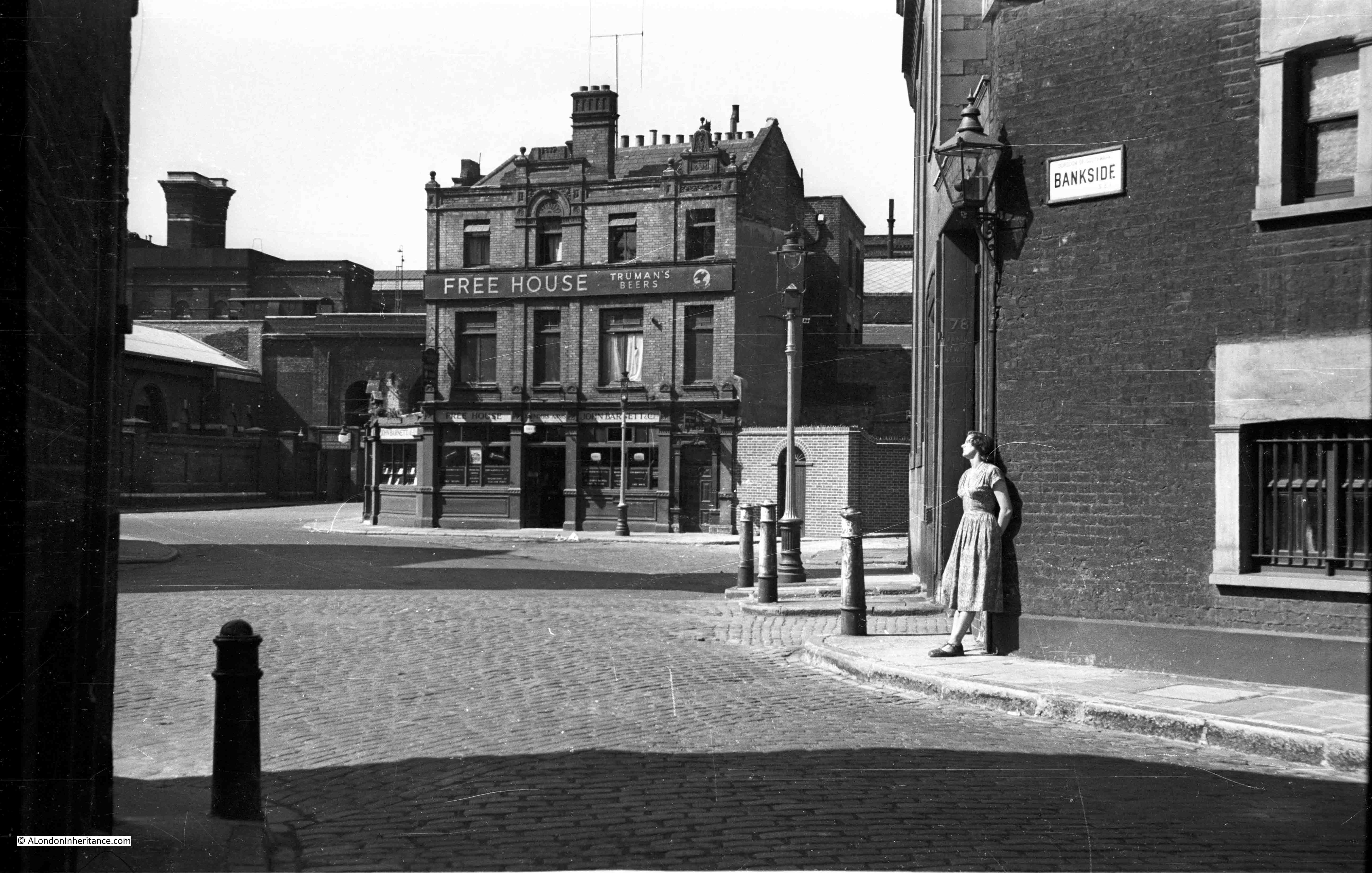
My photo for this week from my father’s collection was taken in 1950. As the street sign confirms, it is on Bankside and looking across to a fine Victorian pub. This is the Founder’s Arms.
Behind the pub is the viaduct, approaching Blackfriars railway bridge, carrying the rail lines across the Thames into Blackfriars Station. A couple of the arches underneath the railway can just be seen to the left of the pub.
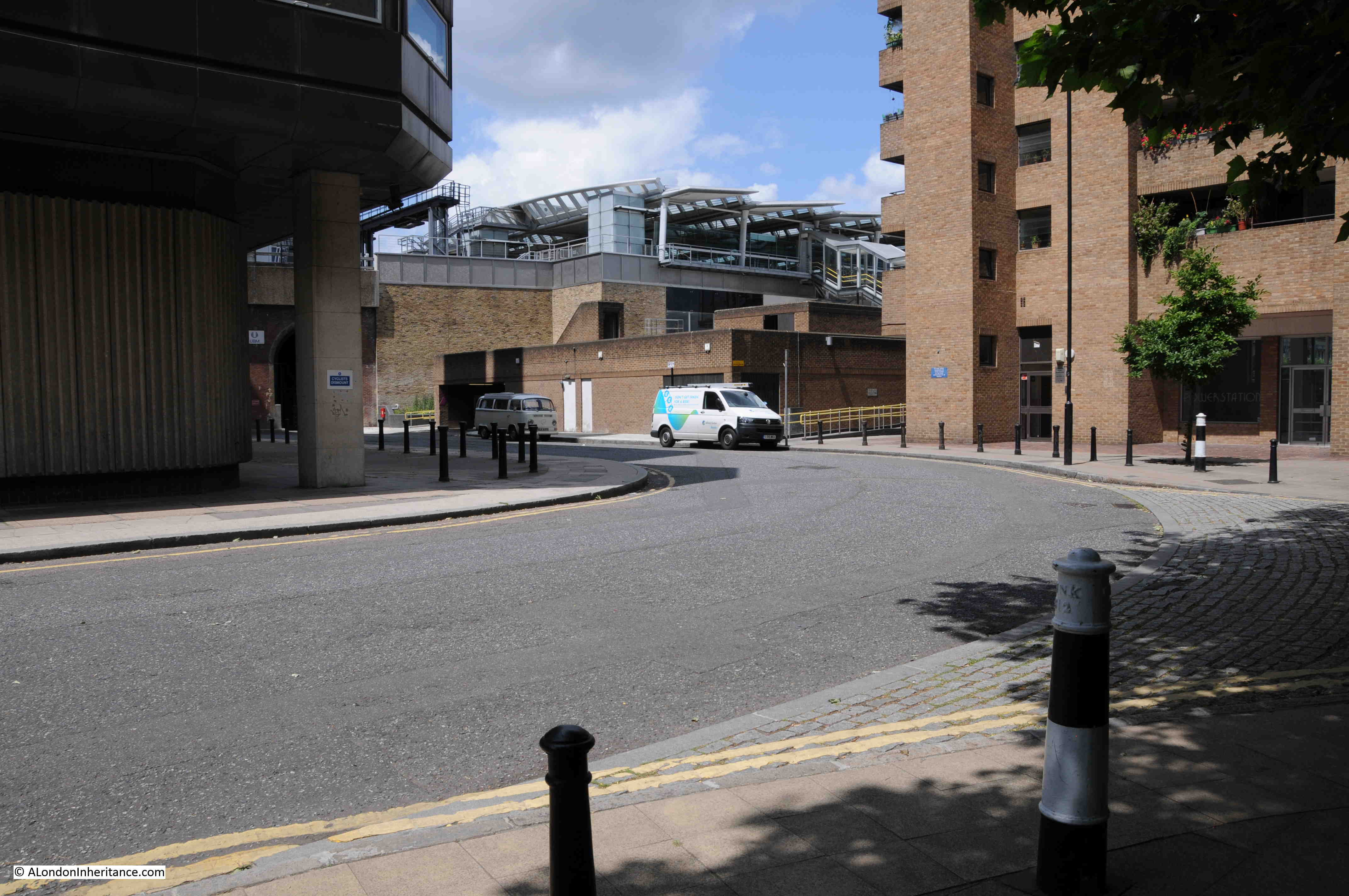
Although this part of Bankside has changed dramatically, it is relatively easy to place the location of the Founder’s Arms. The following is my 2015 photo, taken not quite from the same location as the new buildings on the right hide the view of the location of the pub, but using the arches in the railway viaduct and the road layout as reference points, where the pub once stood is now occupied by the single storey building behind the white van. The arches in the viaduct can just be seen on the left.
To the right of the pub in the 1950 photo, the roadway continues down to the wharfs and stairs on the river. Although not a road, this is still a footpath shown in the 2015 photo by the yellow railings. Bankside still curves to the right (although moved slightly away from the river, the original route now occupied by the buildings on the right), and in the 1950 photo, just visible to the left, two cobbled streets appear to be separated by a small part of pavement that extends into the centre left of the photo.
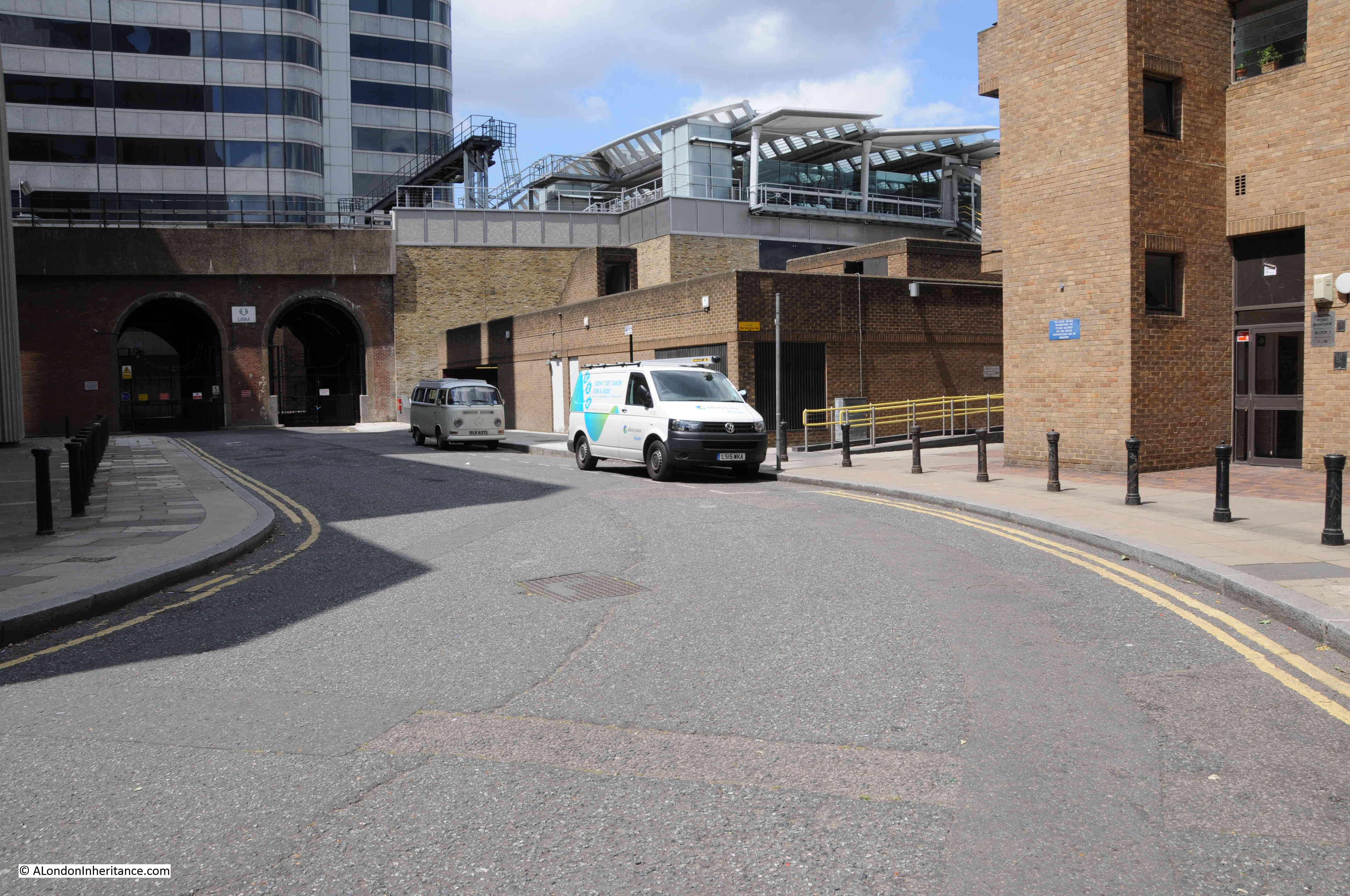
An alternative viewpoint with a better view of the arches under the viaduct with the position of the Founder’s Arms on the right:
To help understand the area in more detail, maps covering the last few centuries tell so much of how the area has changed, and what has remained.
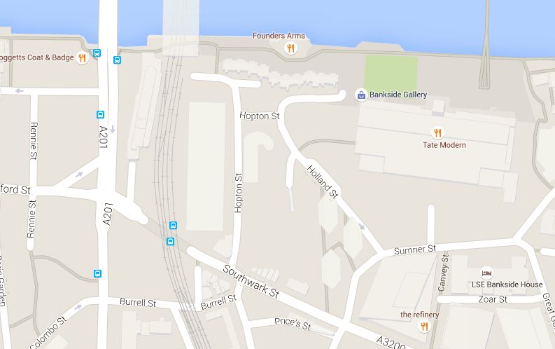
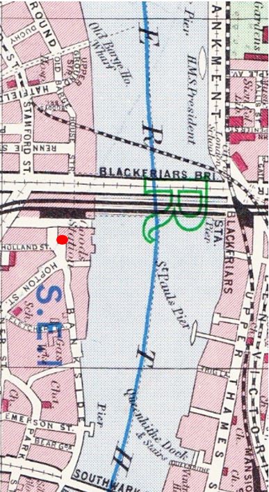
Below is the latest Google map of the location. Hopton Street is seen in the middle of the map, coming up to a T junction at the top, with just before this, a small side extension to join with Holland Street.
Turn left at the T junction and the walkway to the river past the original location of the pub is shown in grey. The map still shows a Founder’s Arms, now directly on the river, I will come back to this later.
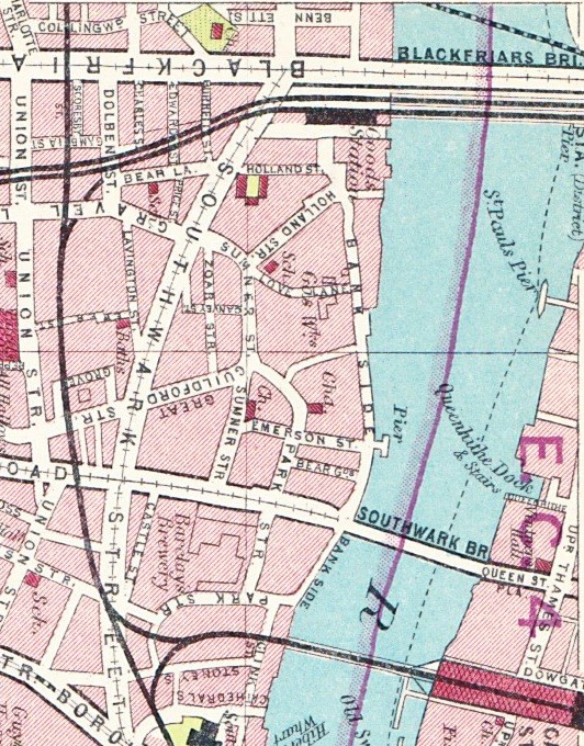
Working back in time, the following map is from the 1940 Bartholomew’s Reference Atlas of Greater London and shows the road layout as it was at the time of the 1950 photo. I have marked the position of the pub with a red dot.
Compare the roads Holland Street and Hopton Street. The 1940 map has these reversed compared to the Google map, and checking on site, Google is accurate, so was this just a map makers error?
Going back 10 years to the 1930 version of Bartholomew’s Atlas and it is even more confusing. Look at the same location near the top of the following map and now both are called Holland Street with no mention of Hopton Street.
I checked the 1913 version of the same Atlas (yes, sadly I do have multiple editions of the same London Maps !!) and the streets are both called Holland Street in this version as well, so I doubt this was an error.
So now, let’s jump back much further to John Rocque’s survey of London from 1746. I have again marked the approximate position of the pub by a red dot. In the John Rocque map, the reference point we can use that is still there today are the Hopton Almshouses which can be seen along The Green Walk. These can also be seen on the Bartholomew maps as the U-shaped building where Holland Street meets Southwark Street.
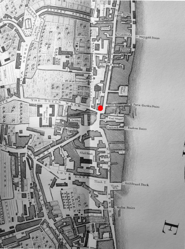 So, in 1746, neither Hopton or Holland street names existed. Today’s Hopton Street was The Green Walk and today’s Holland Street was part of Gravel Lane.
To start with trying to explain the street name changes, George Cunningham in his survey of London’s streets, buildings and monuments gives an explanation for the name Holland Street:
“Location of the old moated Manor House of Paris Garden, subsequently notorious under the name of Holland’s Leaguer, from Holland, a procuress (an early name for a “woman who procures prostitutes”), who occupied it in Charles I’s time. The old Manor House was a favourite resort of James I and his Court, George Villiers, Duke of Buckingham and the nobility generally.”
Holland was Sarah Holland who in 1631 had been charged as an “incontinent women” and imprisoned in Newgate. The Manor House was very suitable for her needs as she said it was “near the theatres and baiting rings, with their wild beasts and gladiators”.
George Cunningham’s book was published in 1927 and there is no mention of Hopton Street.
So that explains the source of the name Holland Street, but does not explain why or when The Green Walk and Gravel Lane changed their name. The 1913 Bartholomew Atlas is therefore correct by labelling the two streets (which were in effect one, looping back after reaching Bankside) as Holland Street.
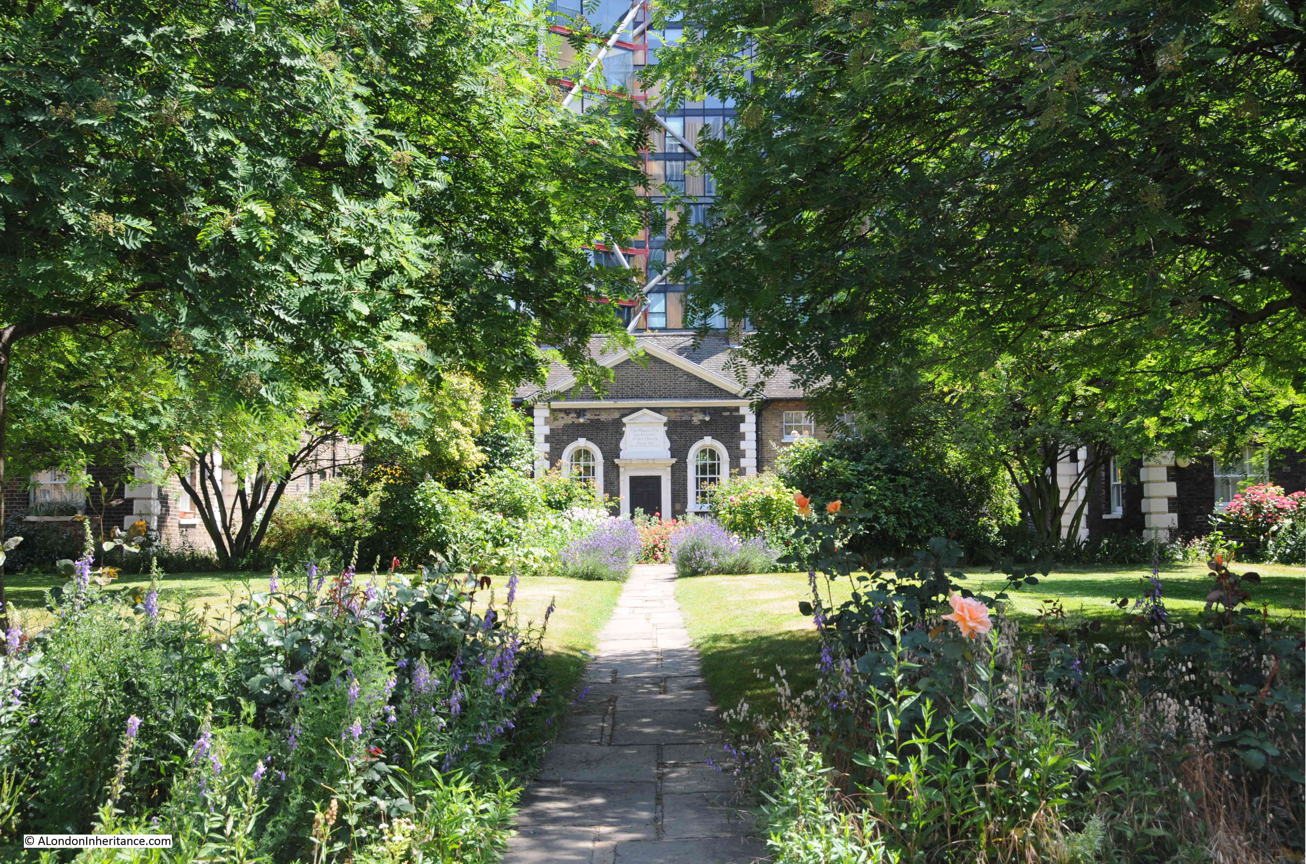
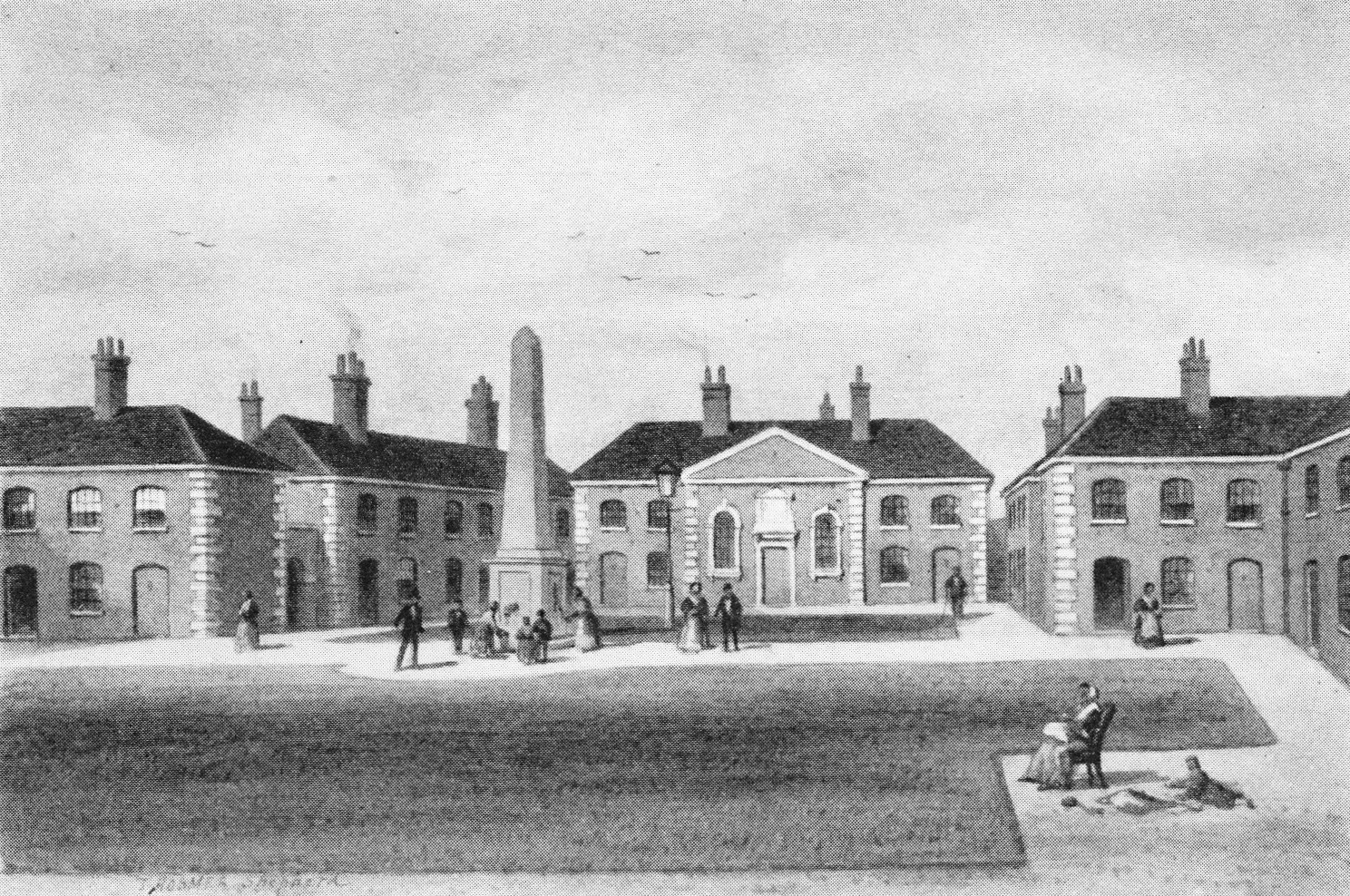
In the original The Green Walk are Hopton’s Almshouses. These were built around 1749 for “twenty-six decayed house-keepers, each to have an upper and lower room with £10 per annum and a chaldron of coals.” They have been occupied continuously since July 1752.
The money (and name) for these came from one Charles Hopton who on his death left a large sum of money to his sister, and on her death the money was used to build the Almshouses. Hopton was born around 1654 into a wealthy merchant family and was a member of the Guild of Fishmongers.
The Almshouses are still there today. A surprise to walk down Hopton Street in the summer and suddenly find these 18th century buildings with at their centre a wonderful colourful garden:
The Almshouses as they appeared around 1850. A far more austere appearance with no gardens:
In 1831 there is a description of these as being “those of Mr Hopton in Green Walk” – so it appears the name had not changed to Holland Street by 1831. By the time of Edward Walfords Old and New London (1890) the name had changed to Holland Street.
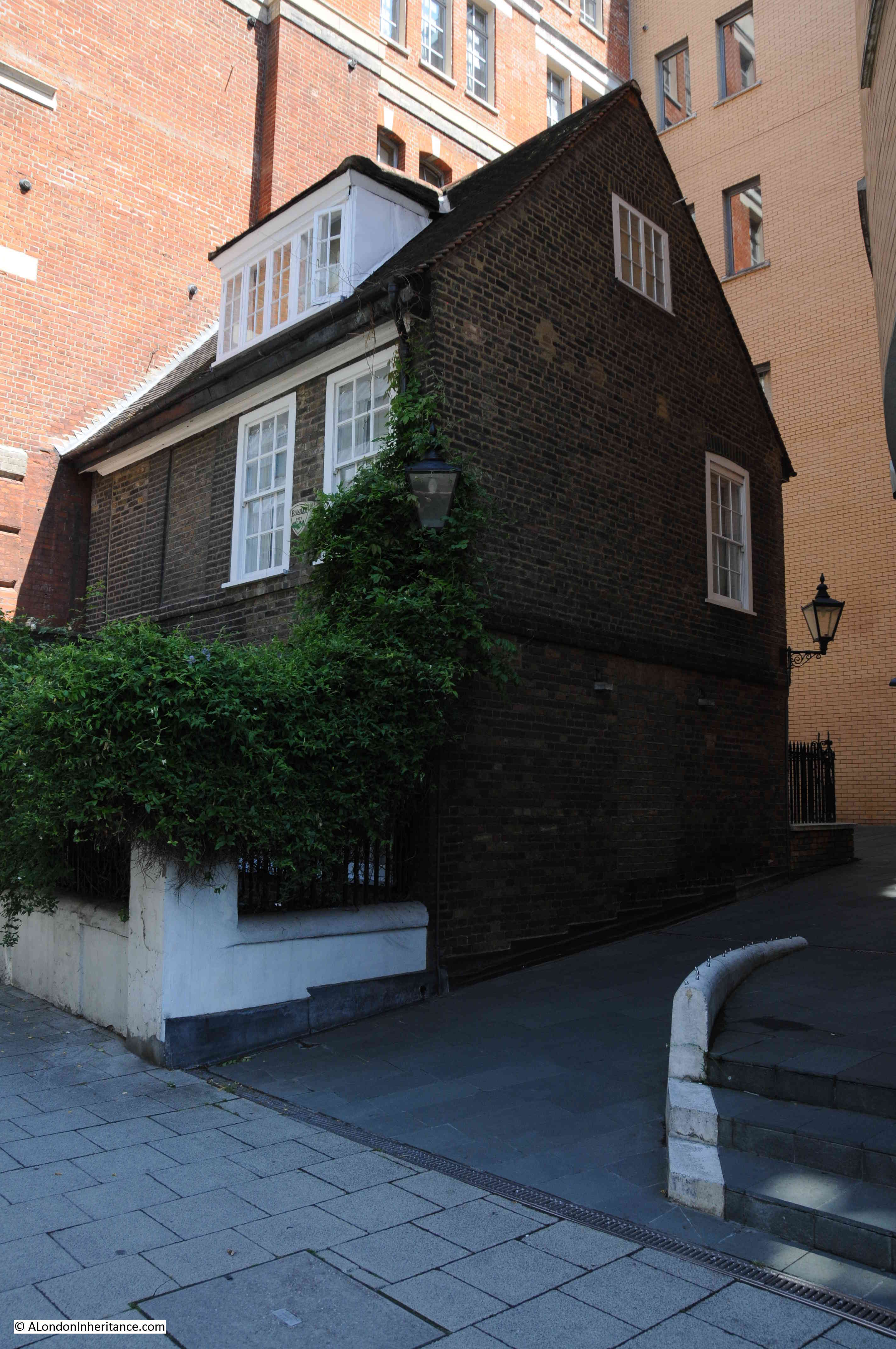
Hopton Street has one further surprise. This is No. 61 Hopton Street, or when it was first built, No. 9 Green Walk and is the oldest building in the area.
One of a number of houses built by James Price around 1703. This is the sole survivor and is surrounded on all sides by much later (and much larger) additions to Hopton Street. The changes that this house has seen over the centuries must be quite remarkable.
The change of part of Holland Street to Hopton Street probably occurred around the mid 1930s.
In Grace Golden’s history of Old Bankside, published in 1951, she refers to: “An apparently puritanical drive has recently changed Holland into Hopton Street, named after Charles Hopton”.
Also, the licensing records for the Founder’s Arms state that the original address was 8 Holland Street and the address was changed to 56 Hopton Street between 1934 and 1938.
From this, I assume that in the 1930s, there was an initiative to change from Holland to Hopton Street to erase the reference to what must have effectively been a brothel kept by Sarah Holland at the old Paris Garden’s Manor House.
The reversal of Holland and Hopton Streets between the 1940 and today’s maps was probably down to it being a very recent change in 1940 and an error in recording which leg of Holland Street had changed (although I cannot find out why only part of the street changed – it may have been down to the Almshouses wanting to have an address of their founder rather than the founder of a brothel !)
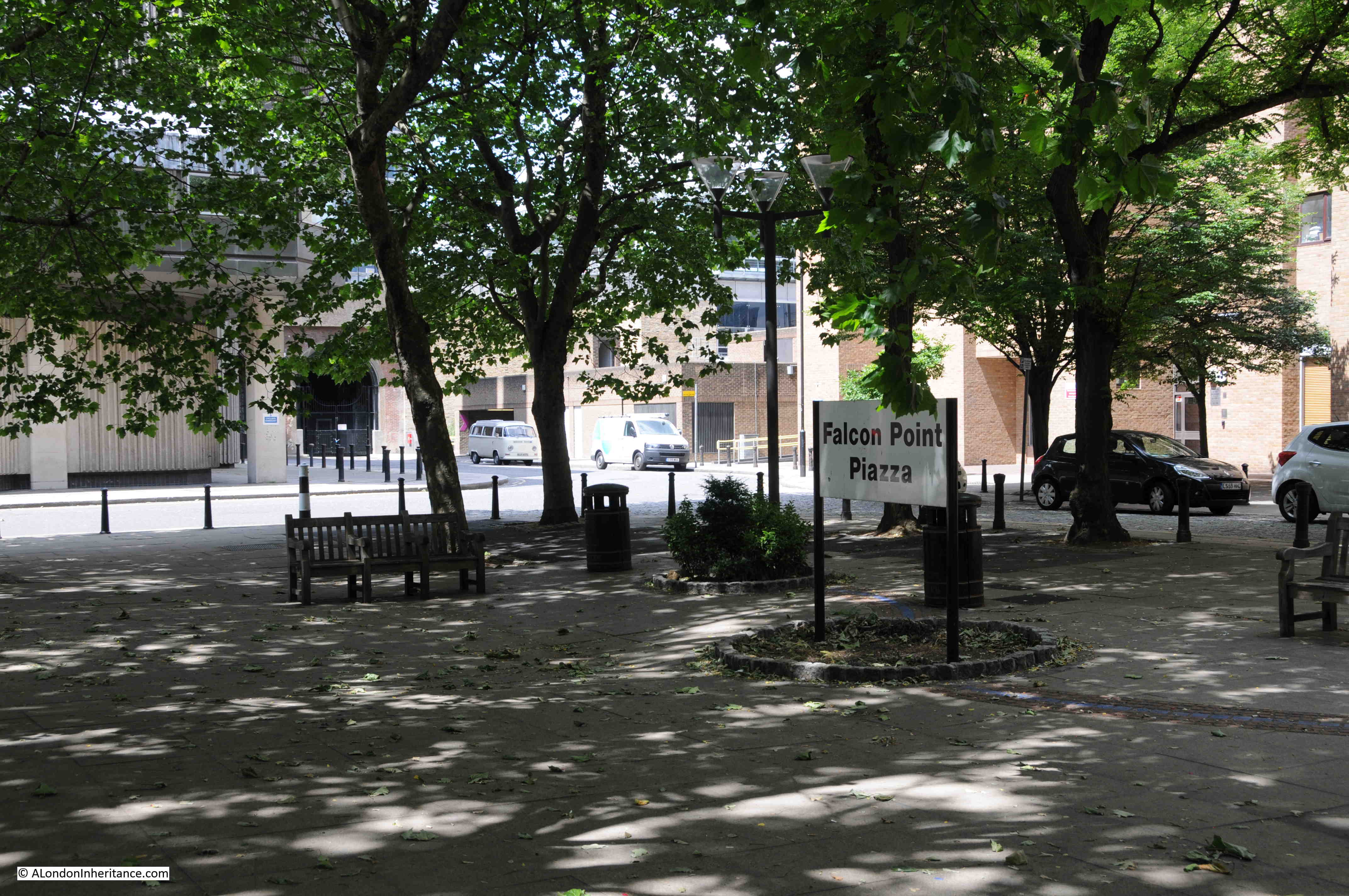
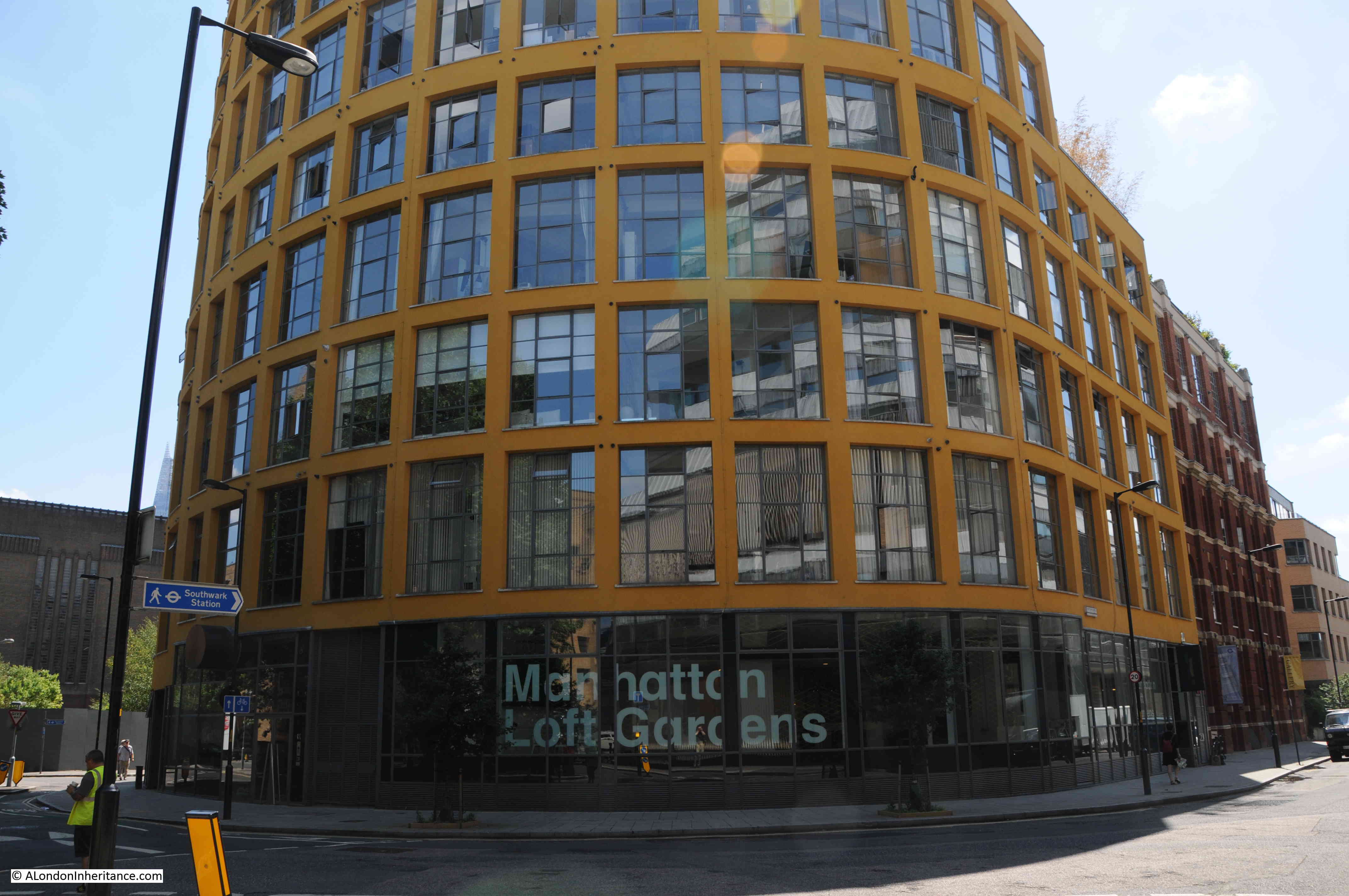
Before I return to the Founder’s Arms, there is one further name that persists in this small area. At the end of Hopton and Holland Streets is a paved area, planted with trees. This is Falcon Point Piazza:
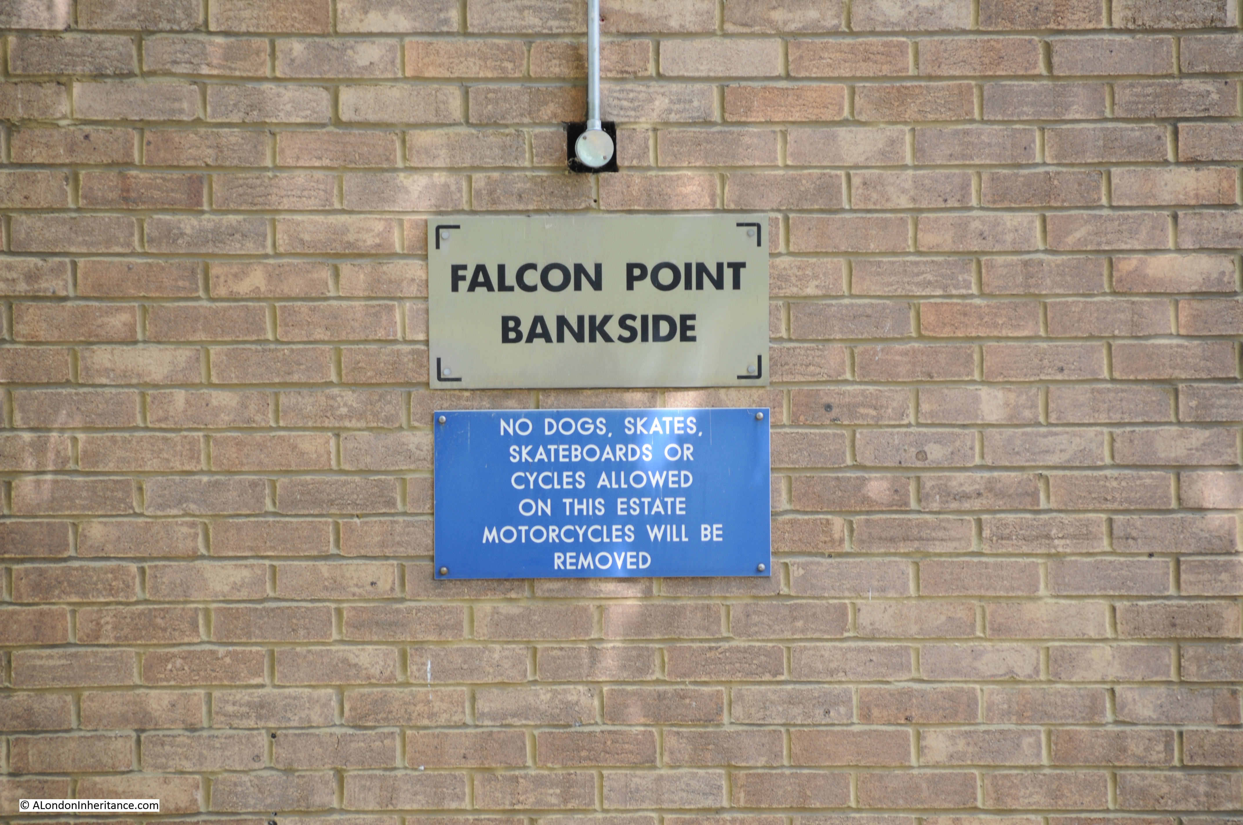
Also, the new buildings to the right of the above photo are named Falcon Point:
If you return to the John Rocque map from 1746 and look on the river’s edge to the lower right of the red circle you will see Faulcon Stairs, one of the many old stairs that led down to the river.
The earliest explanation I can find for the name is from the sport of Falconry that took place in the Paris Gardens that occupied much of this area, so the buildings and the Piazza both retain the name of a sport that took place here hundreds of years ago.
The Falcon name has other associations with the area.
Between the end of Holland / Hopton Streets and the Hopton Almshouses was the Falcon Glass Works. Built in the late 18th century by the firm of Pellatt & Green, partly on the site of a Millpond (the millpond can be seen on John Rocque’s map above. Look slightly below the red dot and to the left and a small shaded area adjacent to the road is the original millpond. The curve of the current road still maintains the outline of the millpond)
Writing of the Glass Works in 1843 in his History of Surrey, Brayley states that “Their present importance and excellence are mainly due to the taste and exertions of the present proprietor and the employment of skilful hands on materials that science and experience approve. By these means the most elegant productions of the Continent are advantageously rivalled, and in some respects surpassed”.
Falcon Glass Works as they appeared in 1827:
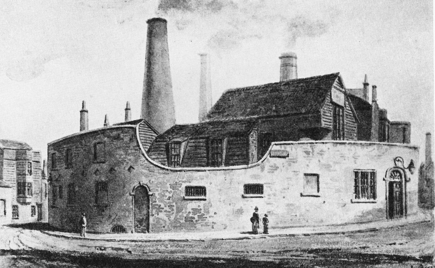
As can be seen, they were located at the point where Hopton / Holland Streets loop round, back to Southwark Street and Sumner Street. The same location now with the curve of the road (due to the original millpond) still very obvious:
I have read, but have been unable to corroborate, that the source of the name Founder’s Arms was due to the Glass Works or Foundry as a “Founder” is also an operator of a Foundry.
In addition to the Founder’s Arms, there was a much earlier pub on the site of the Falcon Drawing Dock, (closer to the river, near the stairs). This was the Falcon Tavern which was allegedly used by Shakespeare, but was definitely a major coaching inn, acting as the terminus for coaches to Kent, Surrey and Sussex. The Falcon Tavern was demolished in 1808.
Now if we walk past where the Founder’s Arms use to be back up to the walkway along the river we find both the latest the latest incarnation of the Founder’s Arms and steps leading down to the river, roughly in the location of the Falcon Stairs (I say roughly as with the building of the walkway and other changes it is impossible to be precise).
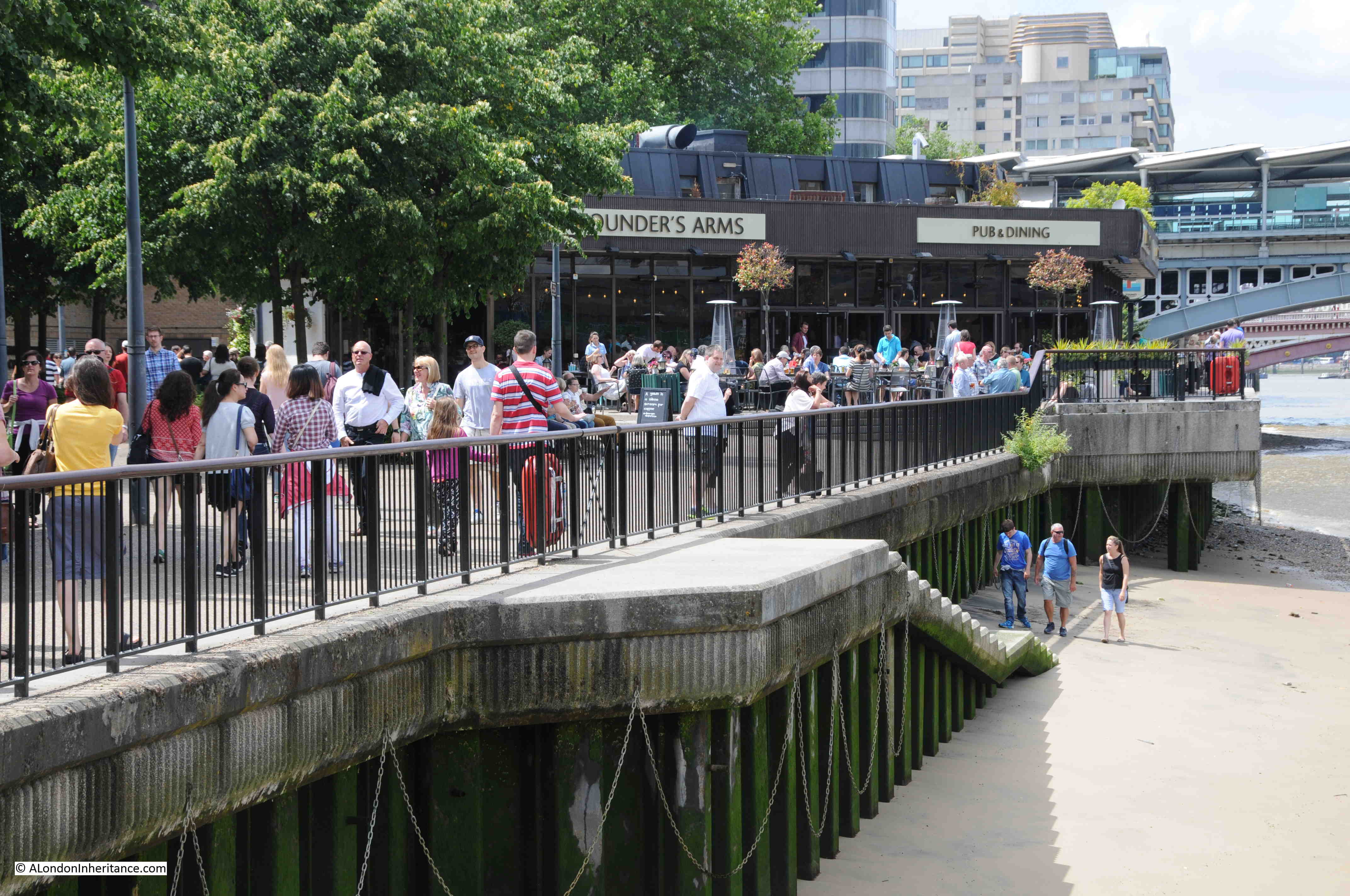
A very different pub to the Victorian original but good that for at least 176 years (the earliest record I can find for the Founder’s Arms is from 1839) a pub with the same name has been found in this small area of Bankside.
A rather convoluted story, but one that demonstrates how much is to be found in one very small area of London, and that despite so much reconstruction and change, links with the history of the site are still there to be discovered.
The sources I used to research this post are:
- Old and New London by Walter Thornbury published in 1881
- London, South of the Thames by Sir Walter Besant published in 1912
- Survey of London, Volume XXII published by the London County Council in 1950
- Old Bankside by Grace Golden published in 1951
- London by George H. Cunningham published in 1927
- Bartholomew’s Reference Atlas of Greater London, editions published in 1913, 1930 and 1940
- A Plan of the Cities of London and Westminster and the Borough of Southwark by John Rocque published in 1746