Tag Archives: London Streets

The Death of the London Telephone Box

Before exploring the London Telephone Box, an update on the walk exploring Islington’s place in the history of London’s water supply and some of the original buildings at New River Head, that I wrote about in a post a couple of week’s ago. I will be guiding on some of these walks and whilst most of walks have now sold out, the only walk that has tickets remaining is on Friday 10th September (PM). They can be booked here.

I cannot remember the last time I used a telephone box, or when I last saw anyone else using one. The mobile phone has effectively killed off the need to find a telephone box, yet they are still to be found across the city.

I have a number of photographic themes when walking London’s streets and for the last couple of years, London’s telephone boxes has been added to my theme list. So long a key part of the city’s street infrastructure, I wonder for how long they will survive.

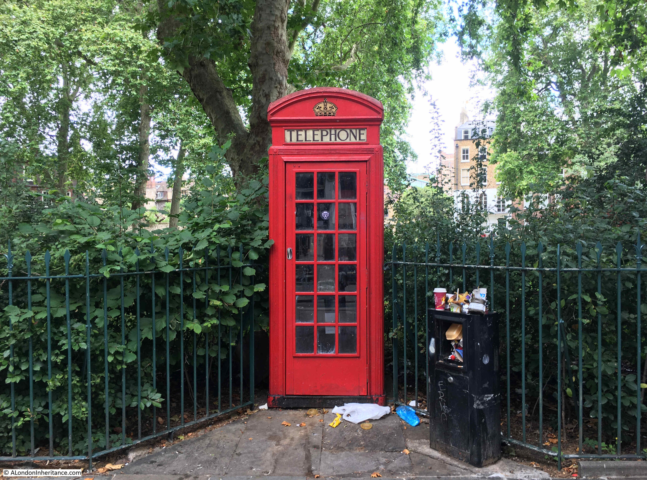
The majority do not work, many have had their phone equipment removed, and many are not in a state that you would wish to stand in and make a call, even if they did work.

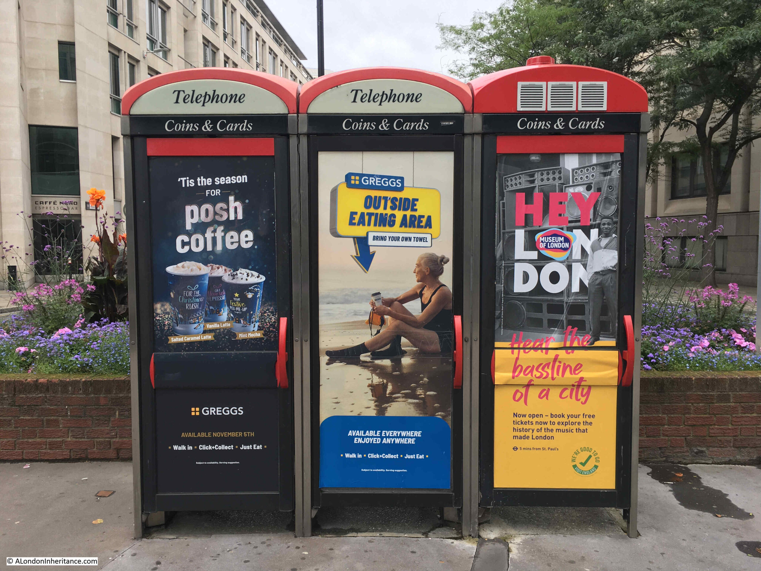
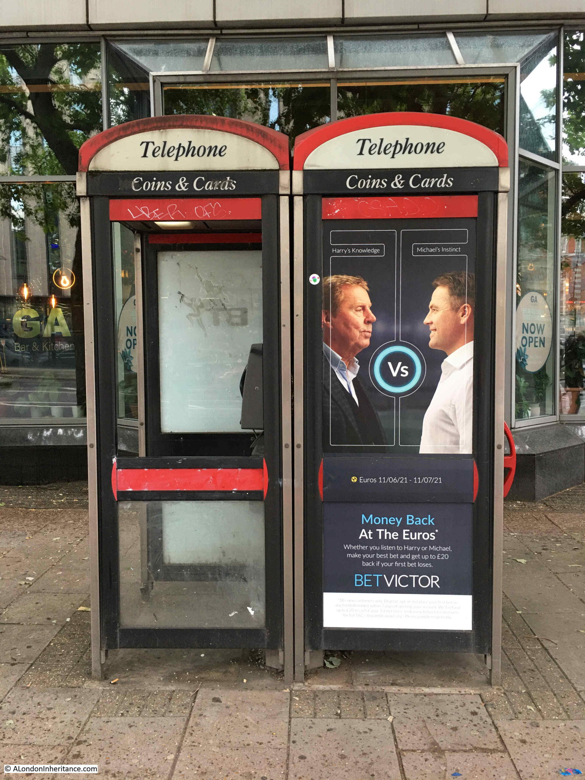
Some have found new uses. The most common being advertising as they are often in prime street locations, with full length advertising covering their windows.

The original red telephone box was designed by Sir Giles Gilbert Scott, a design he entered into a Post Office competition in 1924. The model K2 telephone box was the result, which first appeared on the streets of London in 1926. He would then update the design to the K6 which first appeared in 1934 and is the traditional red telephone box we see across the streets of the city.

There have been many modifications, and significant redesigns, the majority of these coming after the Post Office / British Telecom was privatised in the 1980s.

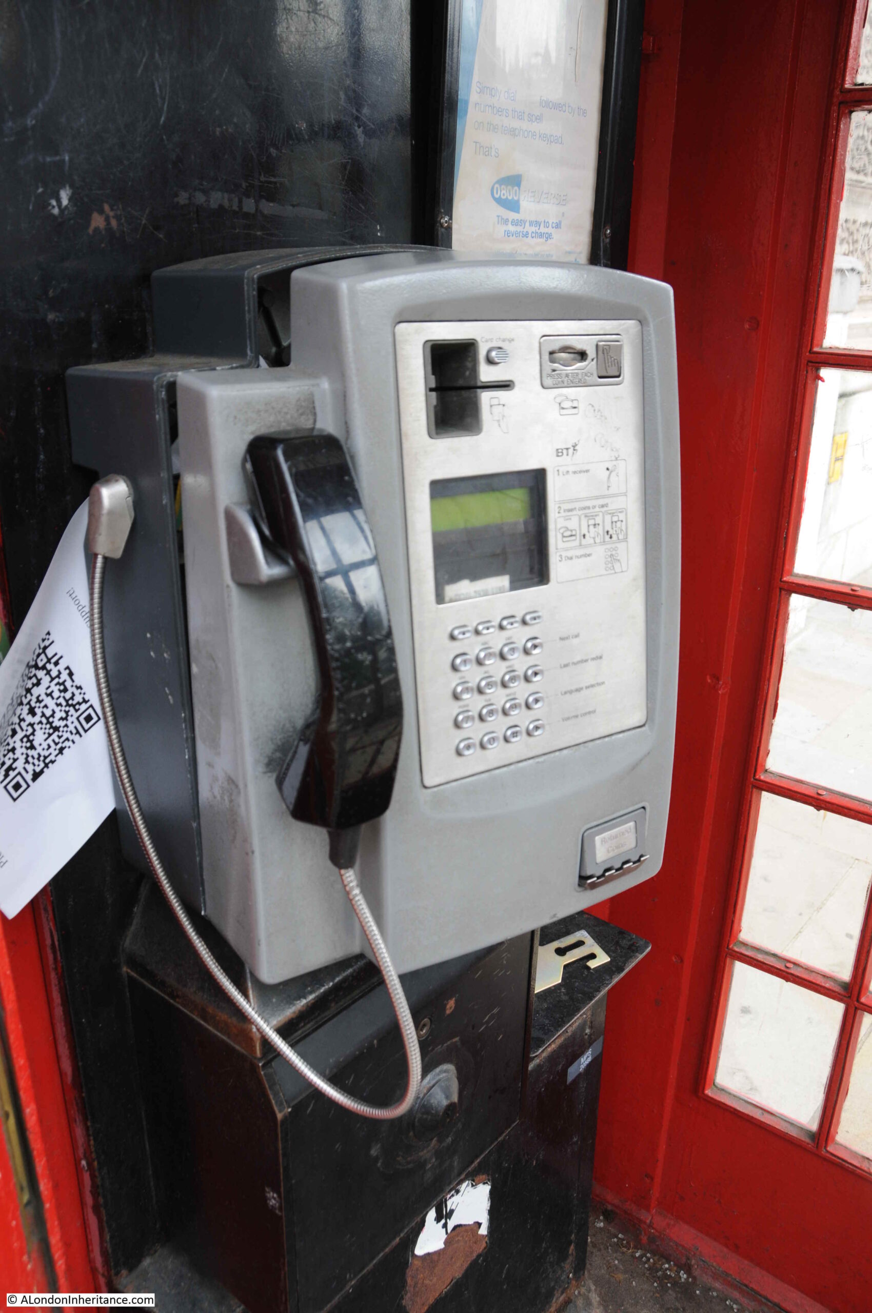
The technology in the phone box has changed over the years. I can just remember the manual method of paying for a call when you had to Press Button A to put coins into the phone to make a call, then if the call was not answered, Press Button B to return the coins.

Having the right change for a phone call was always a problem, and hearing the dreaded pips when the money was running out and you had no more change was a challenge for calls of more than a few minutes.

There are some 2,390 telephone boxes which have been listed by Historic England. The majority are Grade II, but some Grade II*. Historic England have a spreadsheet available for download here, which details the location of all listed telephone boxes.

I have to admit to finding telephone boxes rather scary. I know exactly why. As a young teenager I watched the short 1972 Spanish horror film La Cabina, or the telephone box on TV. It is why whenever I used a telephone box I would always keep my foot in the door, to keep it slightly open. The film is on Reddit, here.

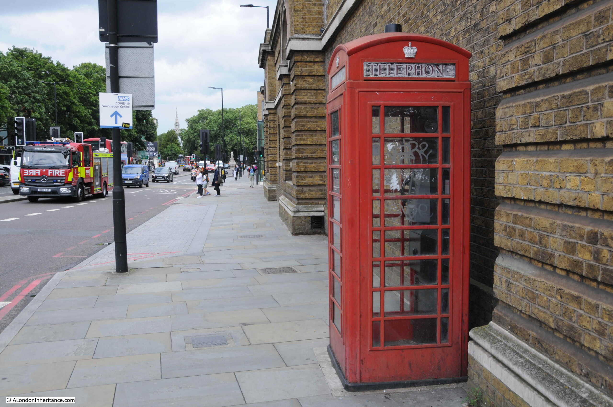
So, still never letting a door shut me in a phone box, here are a selection of photos of London telephone boxes, starting with Charterhouse Square:

Telephone Box

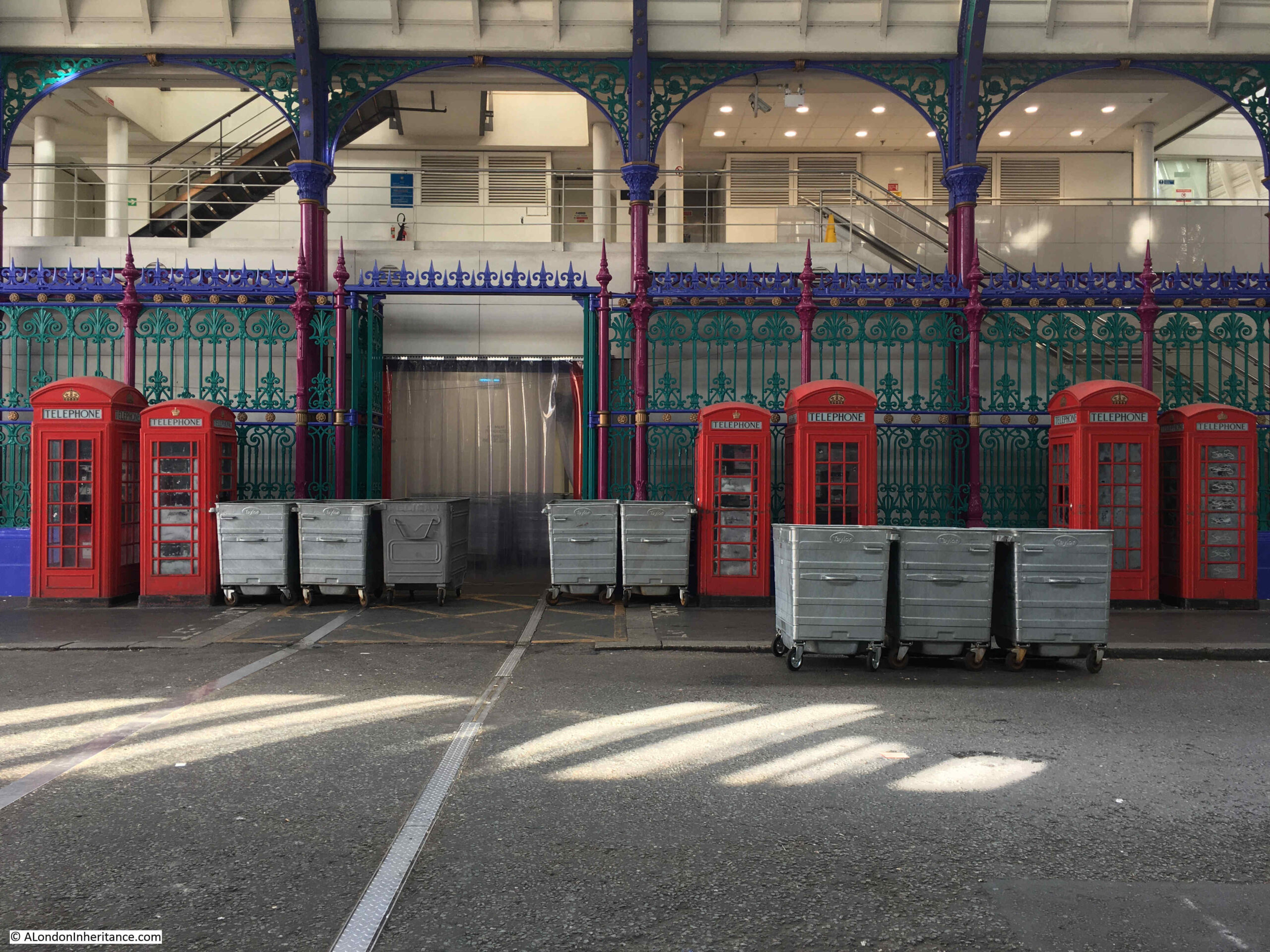
Grade II listed (the larger K6 models) telephone boxes at Smithfield Market:

Smithfield Market

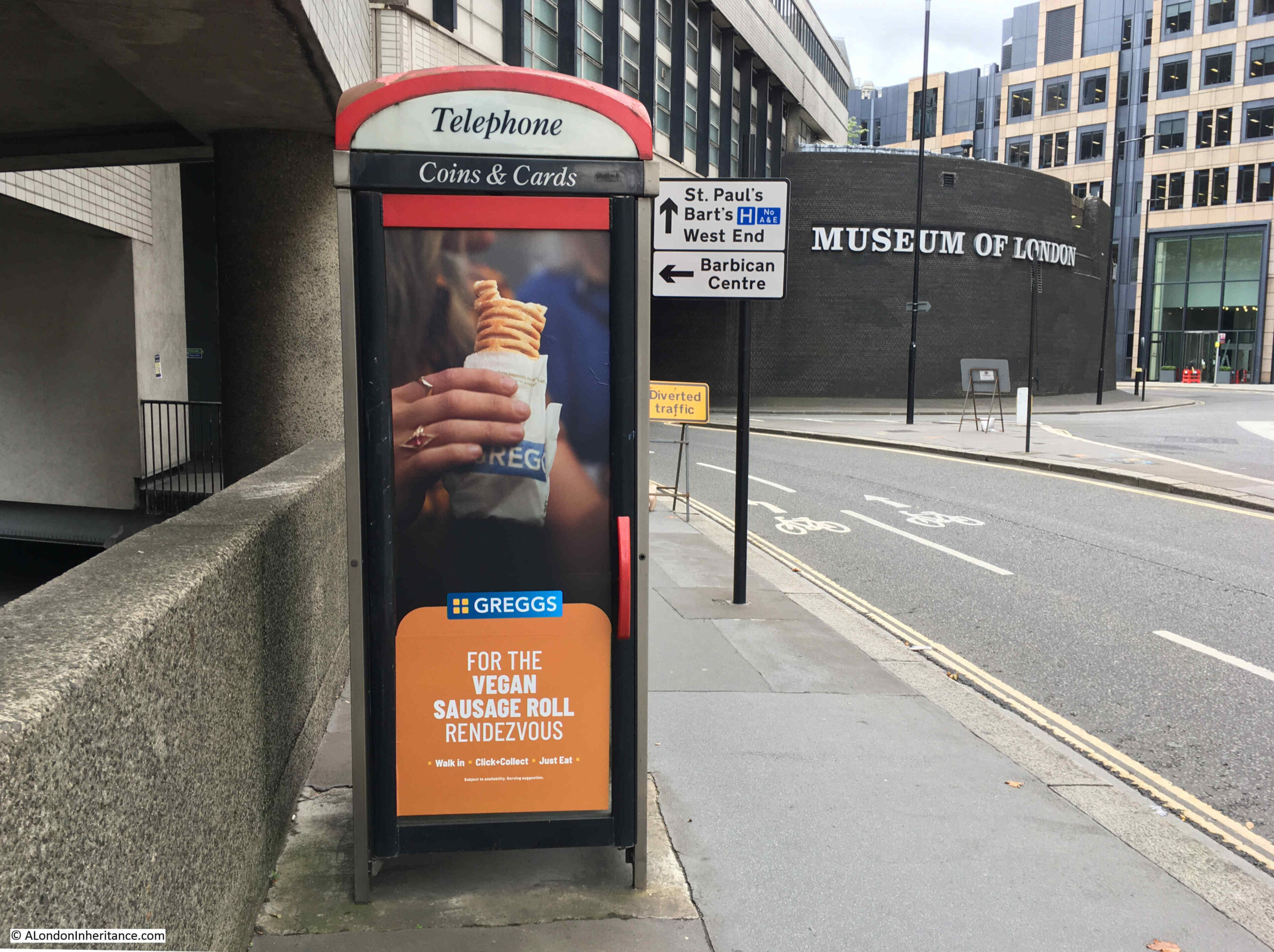
One of the modern versions of the telephone box, also showing how so many of these are now used for advertising. This one is in Aldersgate Street:

Aldersgate Street

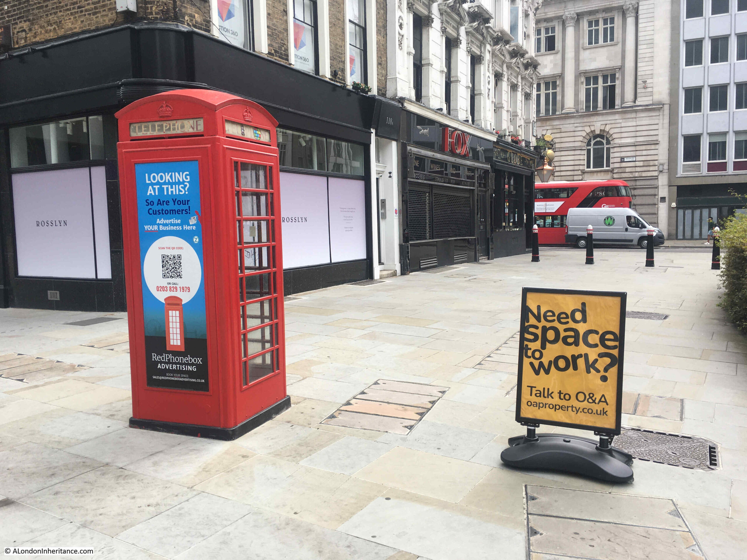
Advertising is a potentially profitable business for the reuse of telephone boxes. They are in locations where they are easy to be seen, and where there is a high footfall, so they originally could be found when you wanted to make a call. These original reasons for locating a phone box also apply to sites where advertising works best, and as advertised on the phone box in the photo below, at the junction of London Wall and Moorgate, there is a company (Redphonebox Advertising) that specialises in this new use.

Telephone Box

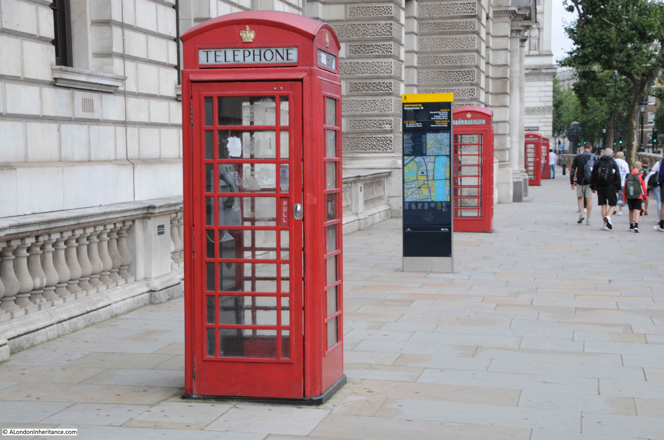
Perhaps the most photographed telephone box in London is this one in Great George Street / Parliament Square:

Parliament Square

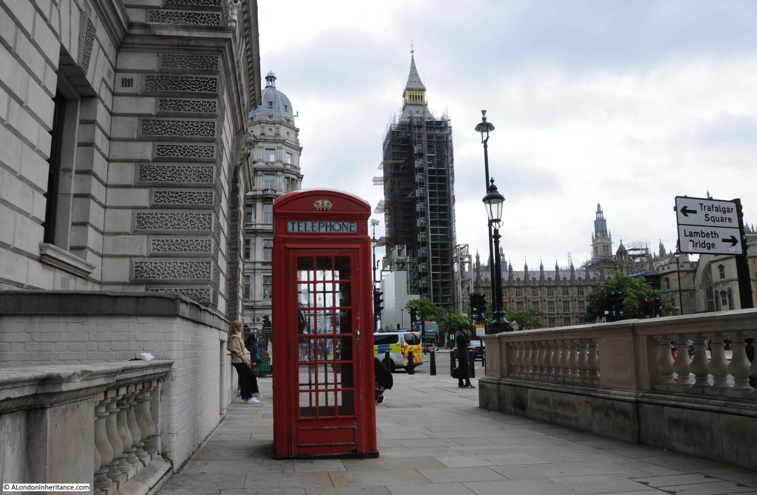
Before Covid, there would frequently be queues of tourists waiting to get their photo taken in a London red phone box with the Elizabeth Tower, or more probably Big Ben to those taking photos, in the background.

With the lack of tourists this phone box is now much quieter, and looking inside, even in such a prominent position, the telephone does not work, with the front panel being pulled away from the rear.

Telephone Box

The following telephone boxes in Parliament Street are also a frequent destination for those wanting a photo with a phone box.

Parliament Street

The following phone box is by the side of Grosvenor Road:

Telephone Box

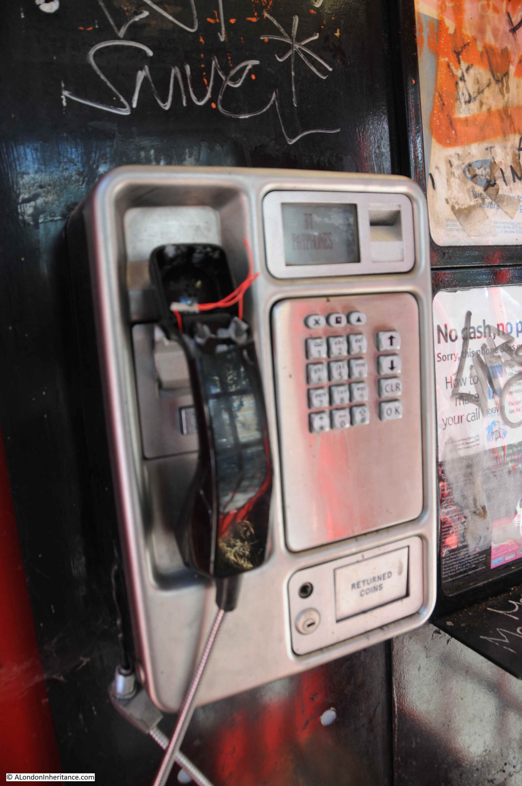
Internally, whilst the phone still has power, and the display reads BT Payphones, there is no chance of talking to anyone with the vandalised handset:

Telephone Box

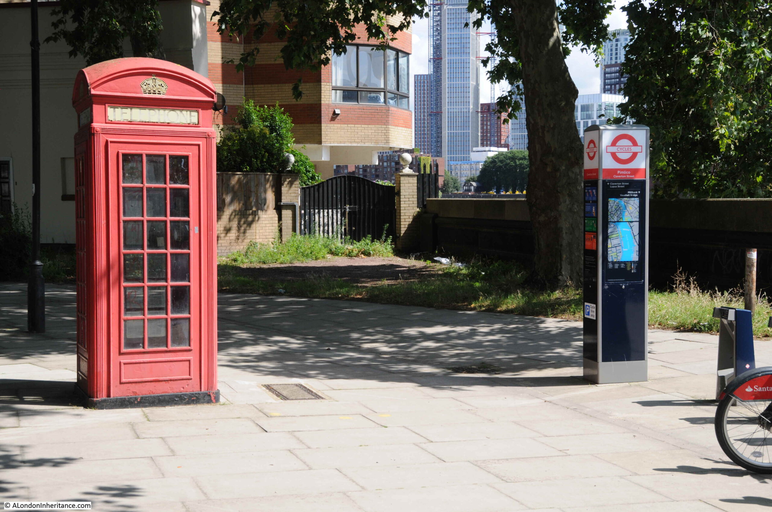
This view of the telephone box shows changing street furniture. The old, unused telephone box alongside a TfL cycle dock:

Telephone Box

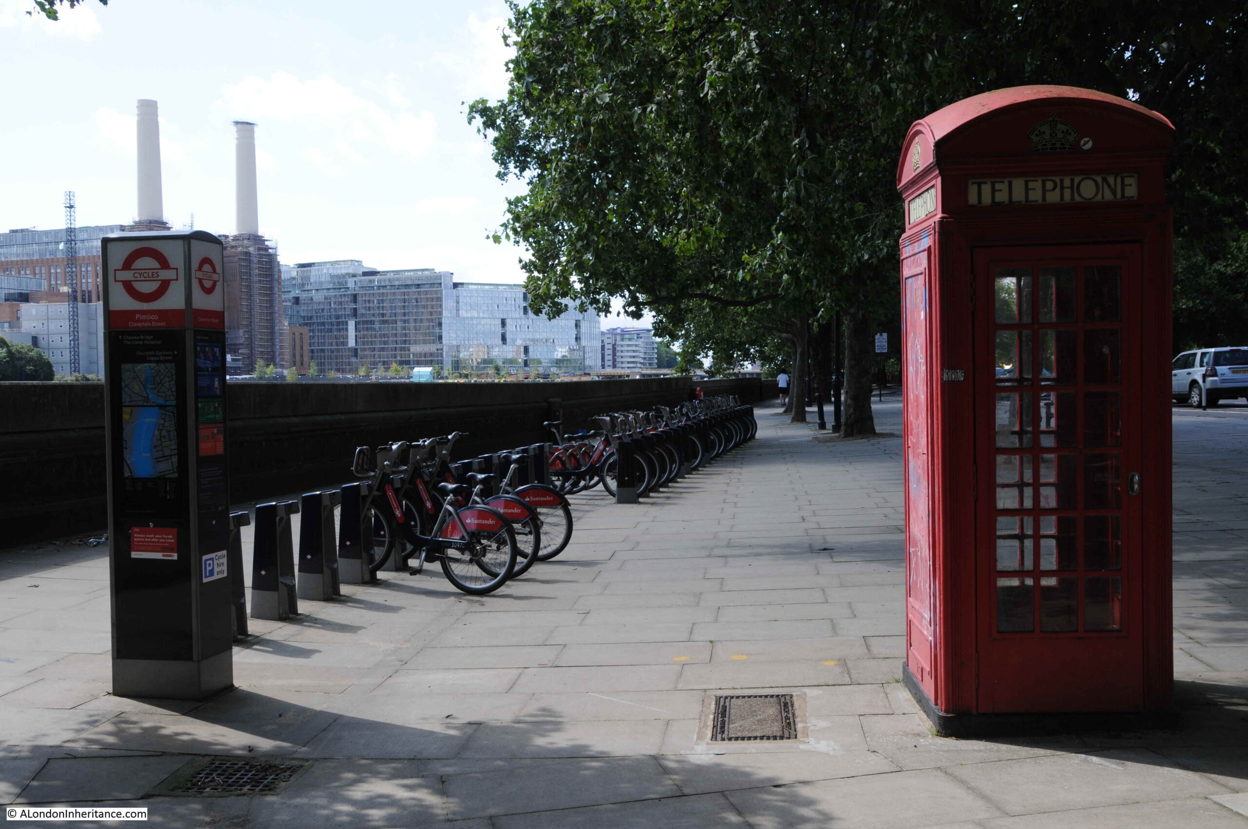
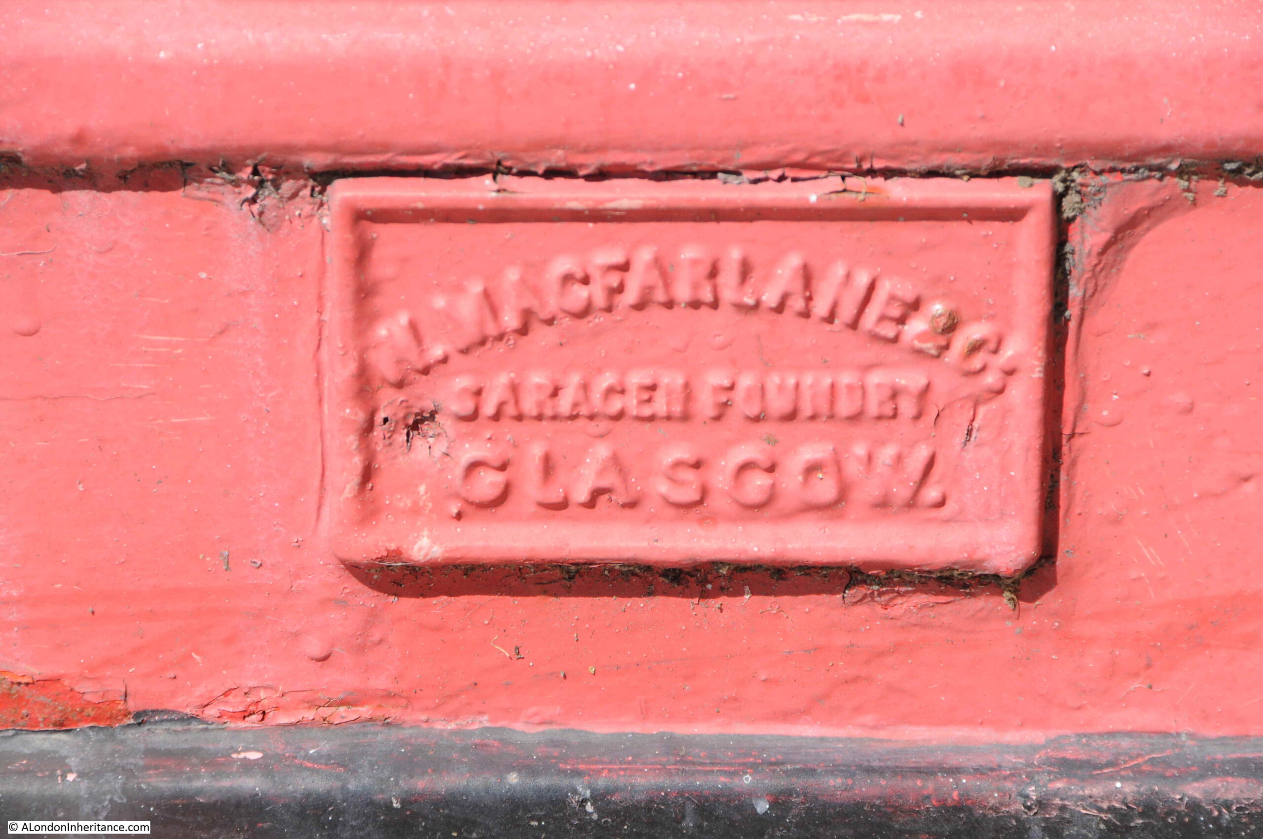
The above telephone box was made by Walter Macfarlane & Co, at their Saracen Foundry in Glasgow. It seems the company took on the manufacture of phone boxes in the late 1940s after their traditional markets started to disappear. The foundry closed, and the site demolished in 1967, however the company has left their mark on multiple telephone boxes across London:

Telephone Box

Outside Pimlico Station:

Pimlico Station

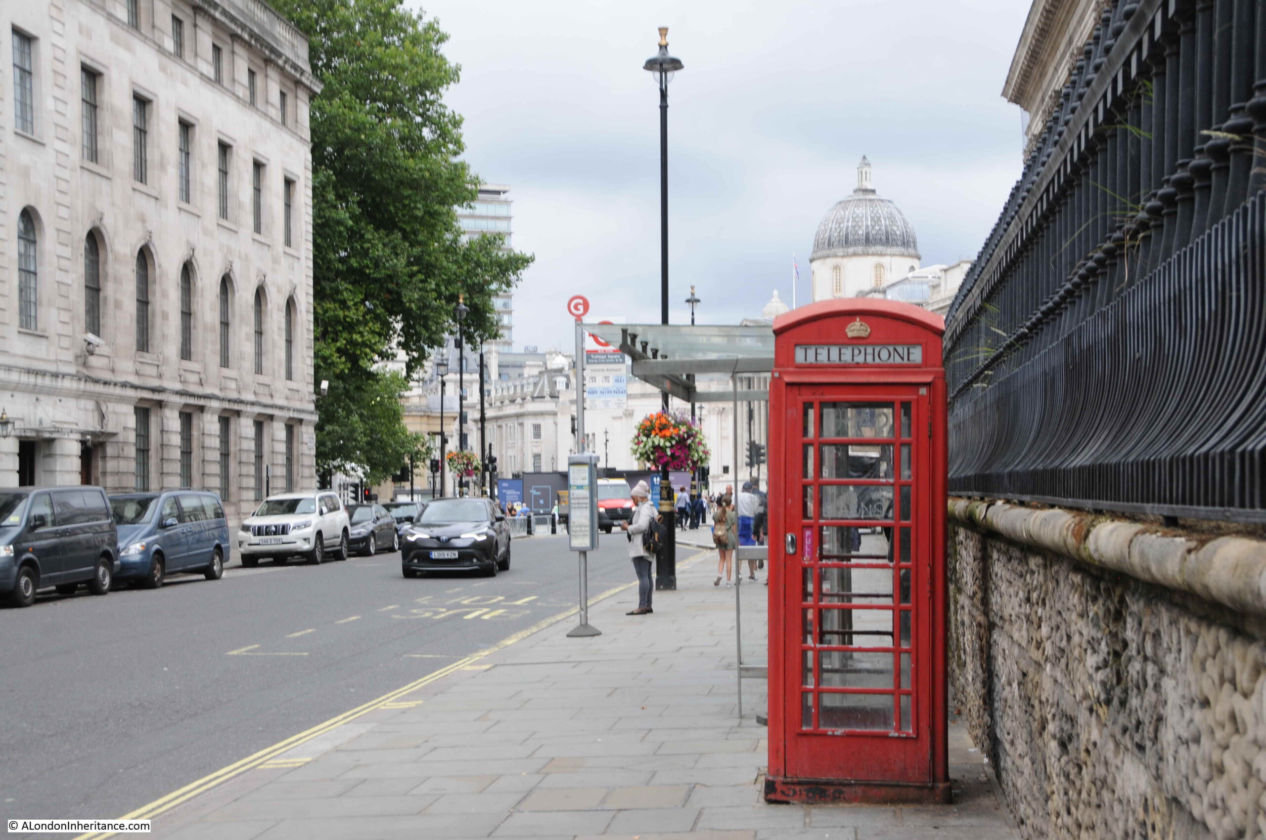
Duncannon Street, looking towards Trafalgar Square and the National Gallery:

Telephone Box

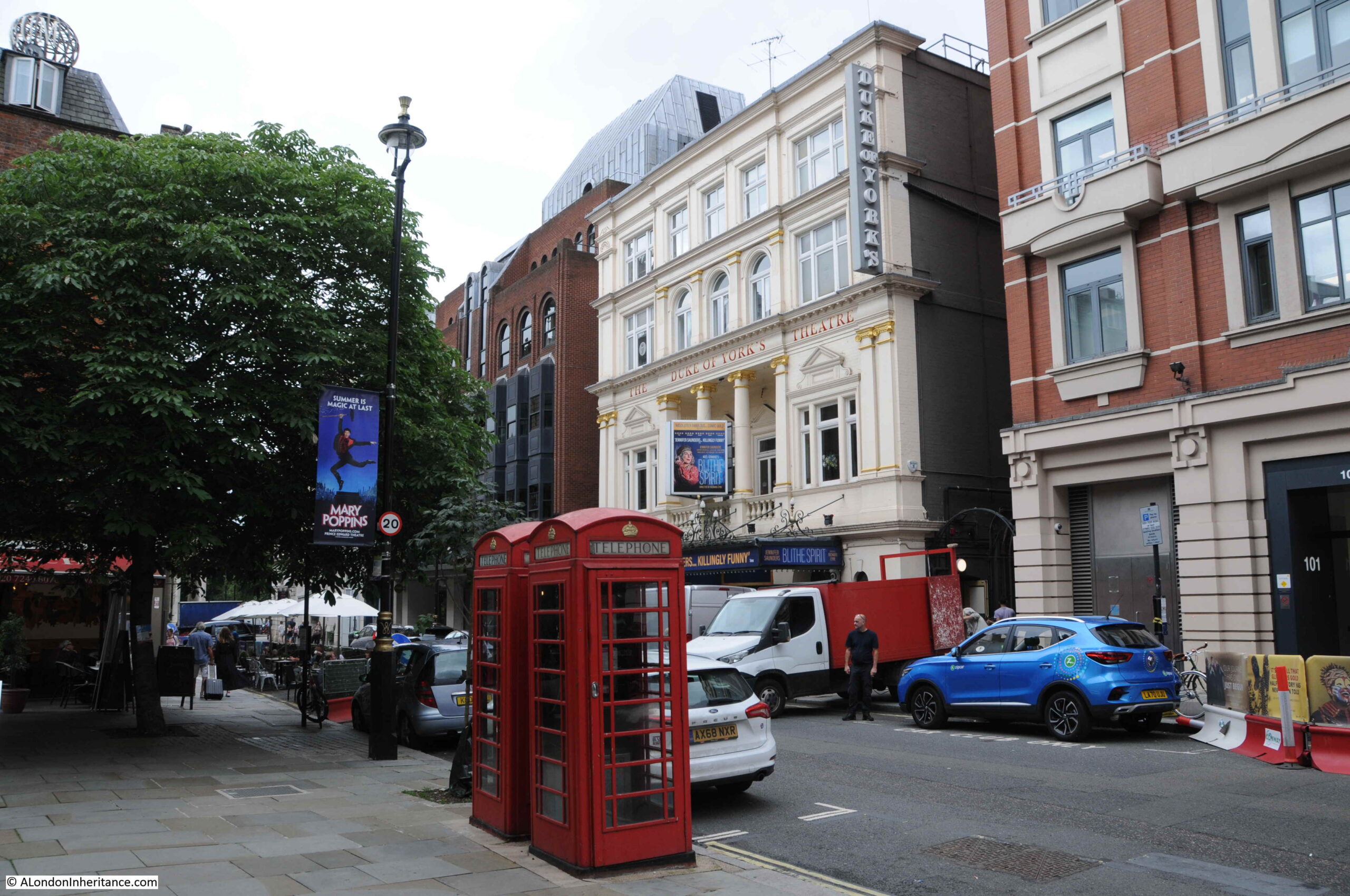
St Martins Lane, opposite the Duke of York’s theatre:

Telephone Box

Great Newport Street:

Telephone Box

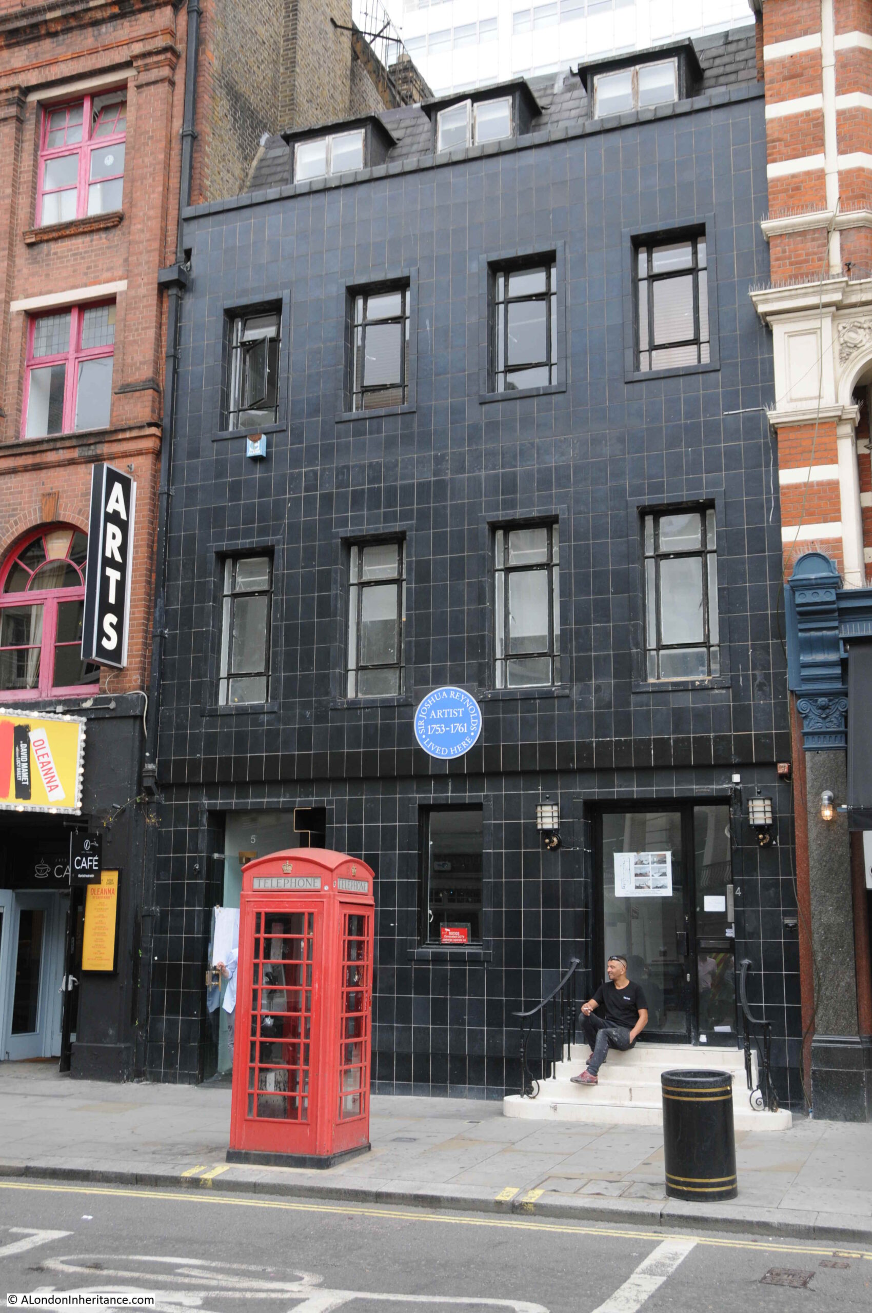
The large blue plaque in the above photo records that the artist Joshua Reynolds lived there between 1753 and 1761.

Charing Cross Road, looking up towards the junction with Shaftsbury Avenue:

Charing Cross Road

The telephone box in the following photo is in St Giles High Street with the church of St Giles in the Fields in the background. The door was left open, and at the time, it was not a phone box you would want to make a call from, even if it was working.

St Giles high Street

Shaftesbury Avenue:

Telephone Box

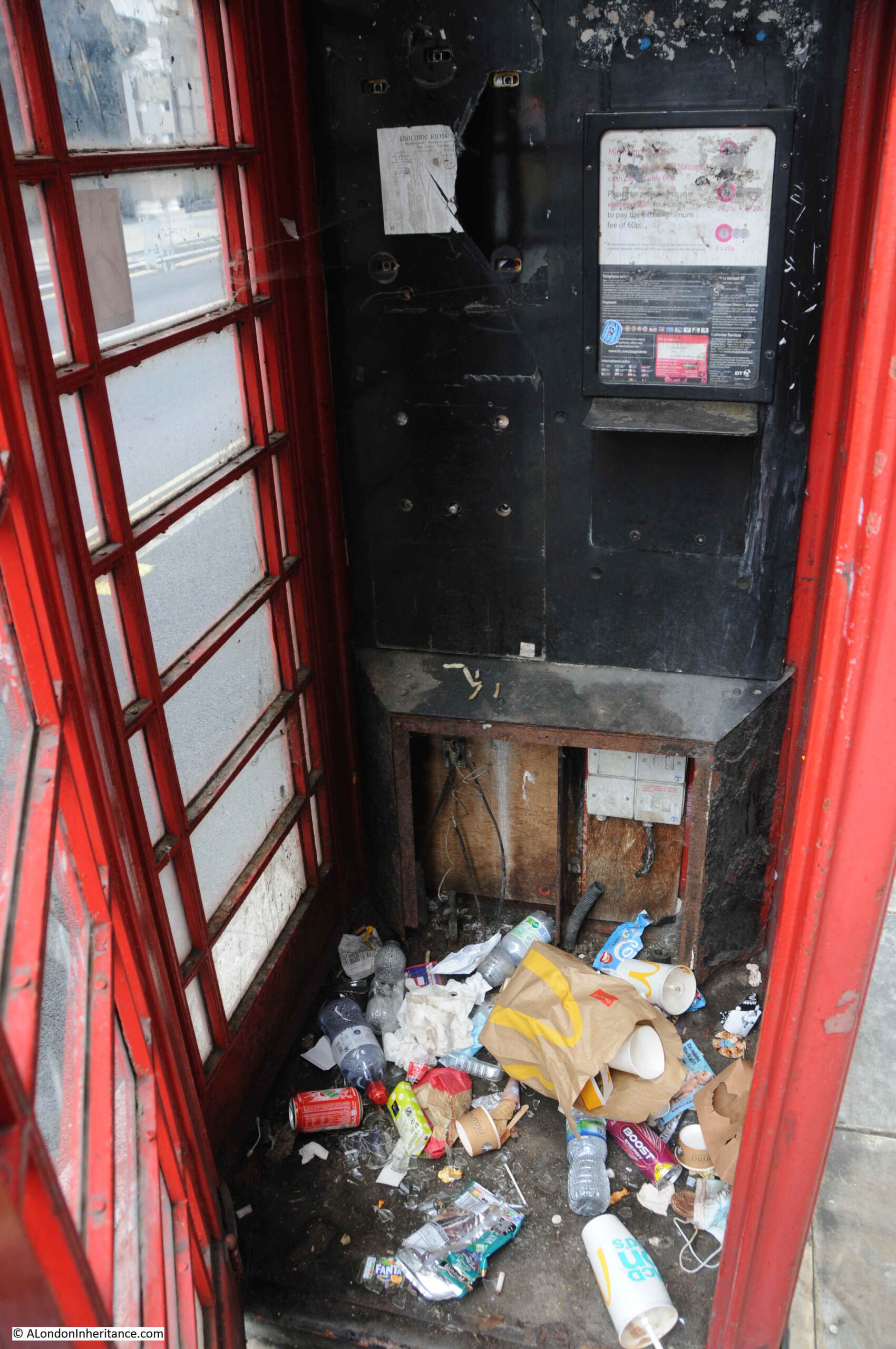
Bloomsbury Street, opposite the Bloomsbury Street Hotel:

Telephone Box

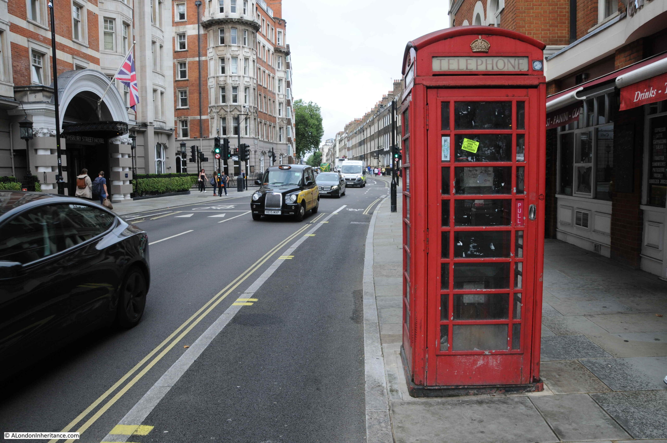
As with many telephone boxes across London, despite being in Bloomsbury Street, the phone box is used as a litter bin. The telephone equipment has been removed.

Telephone Box

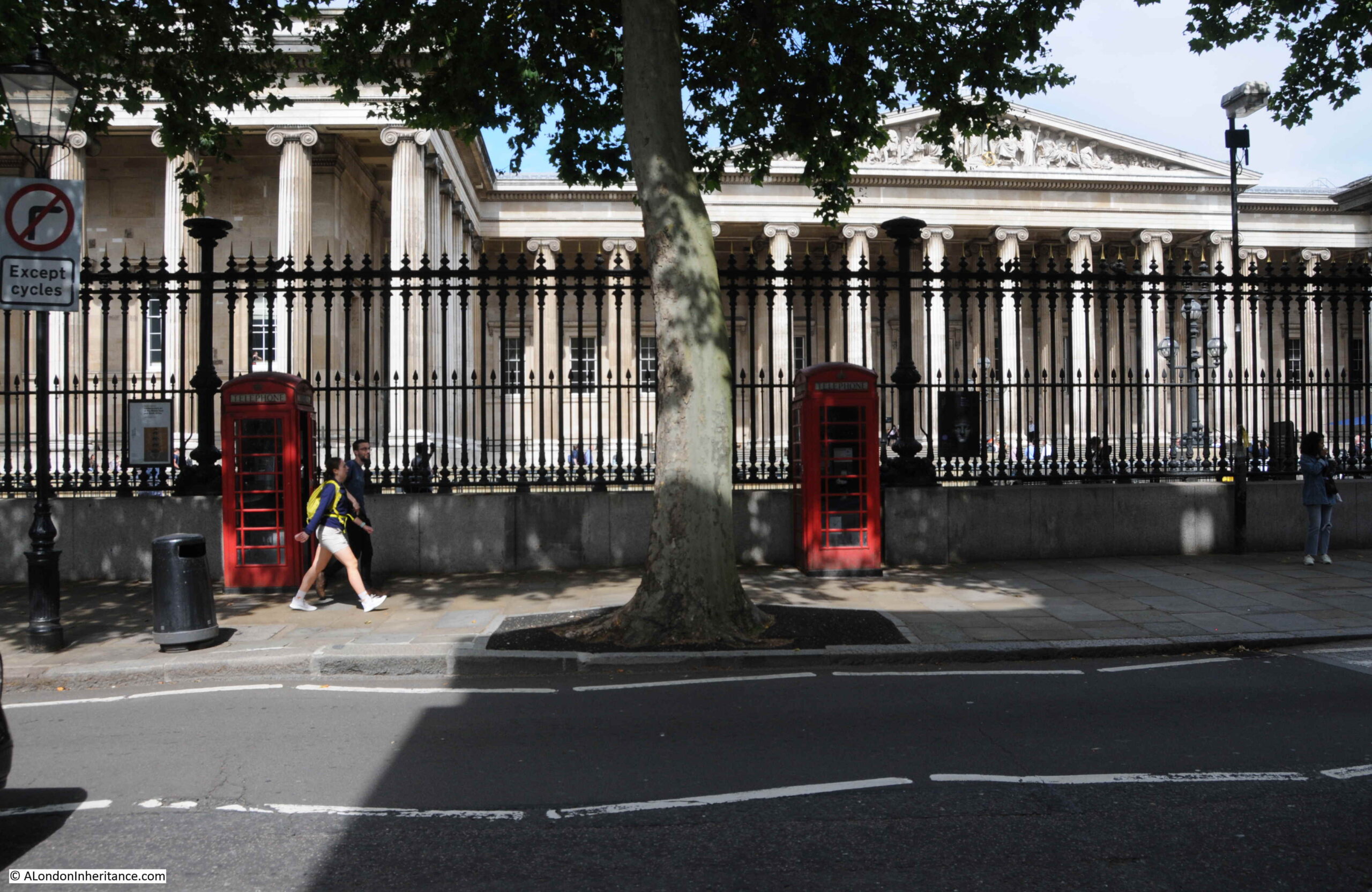
Outside the British Museum:

British Museum

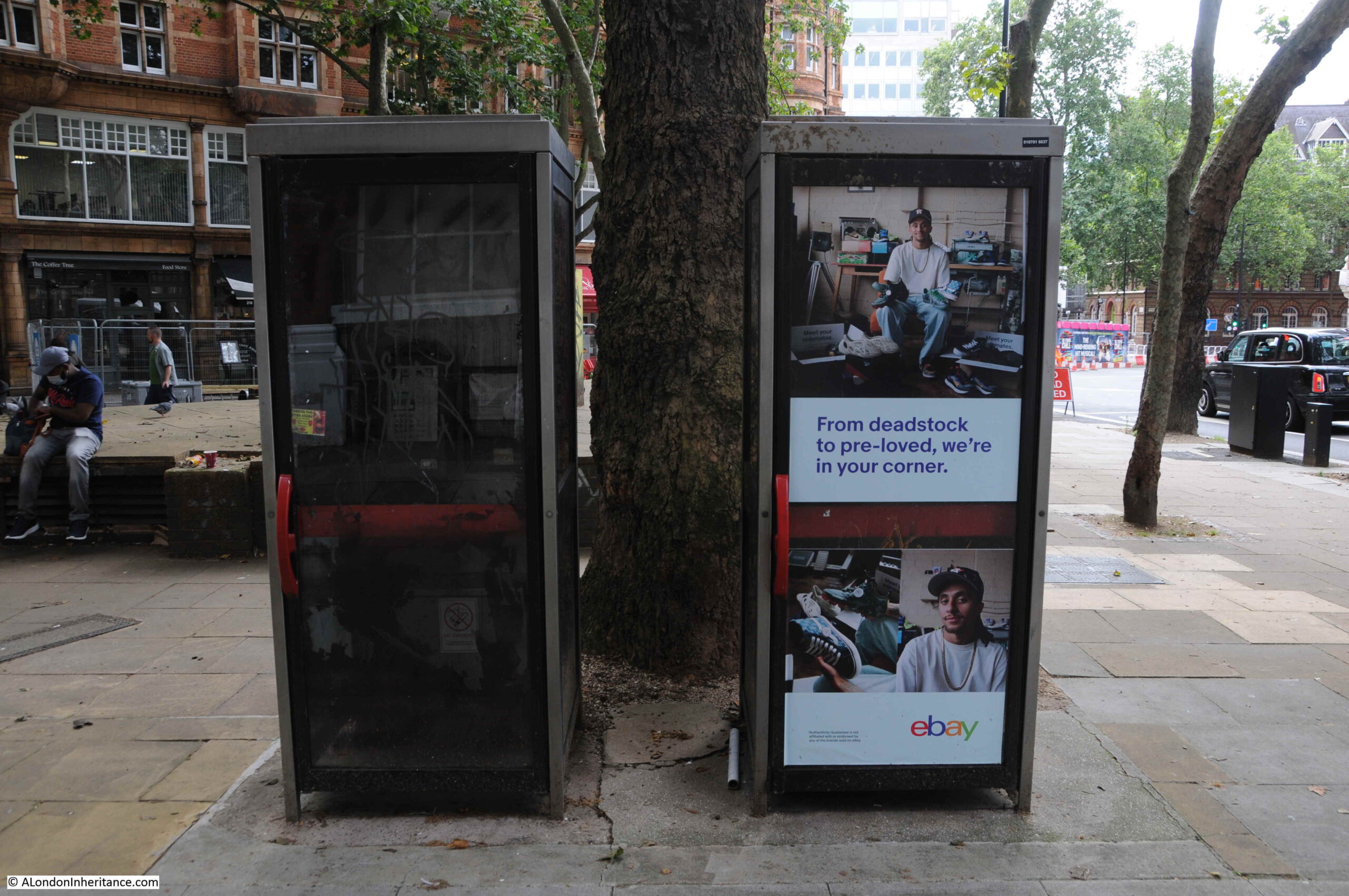
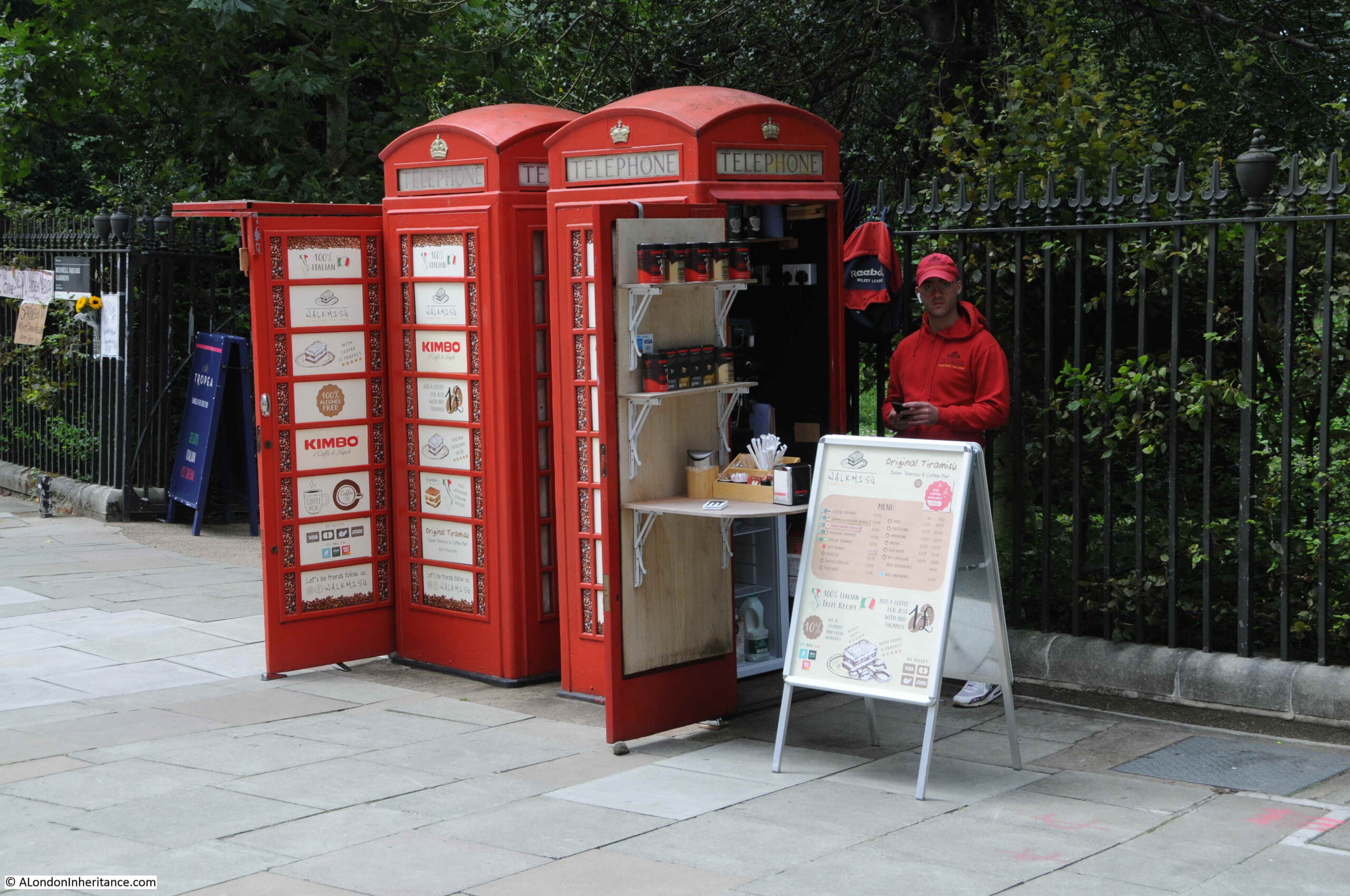
Telephone boxes have been converted to other uses. In Russell Square, two have been converted to a take away coffee shop:

Italian Tiranisu and Coffee Shop

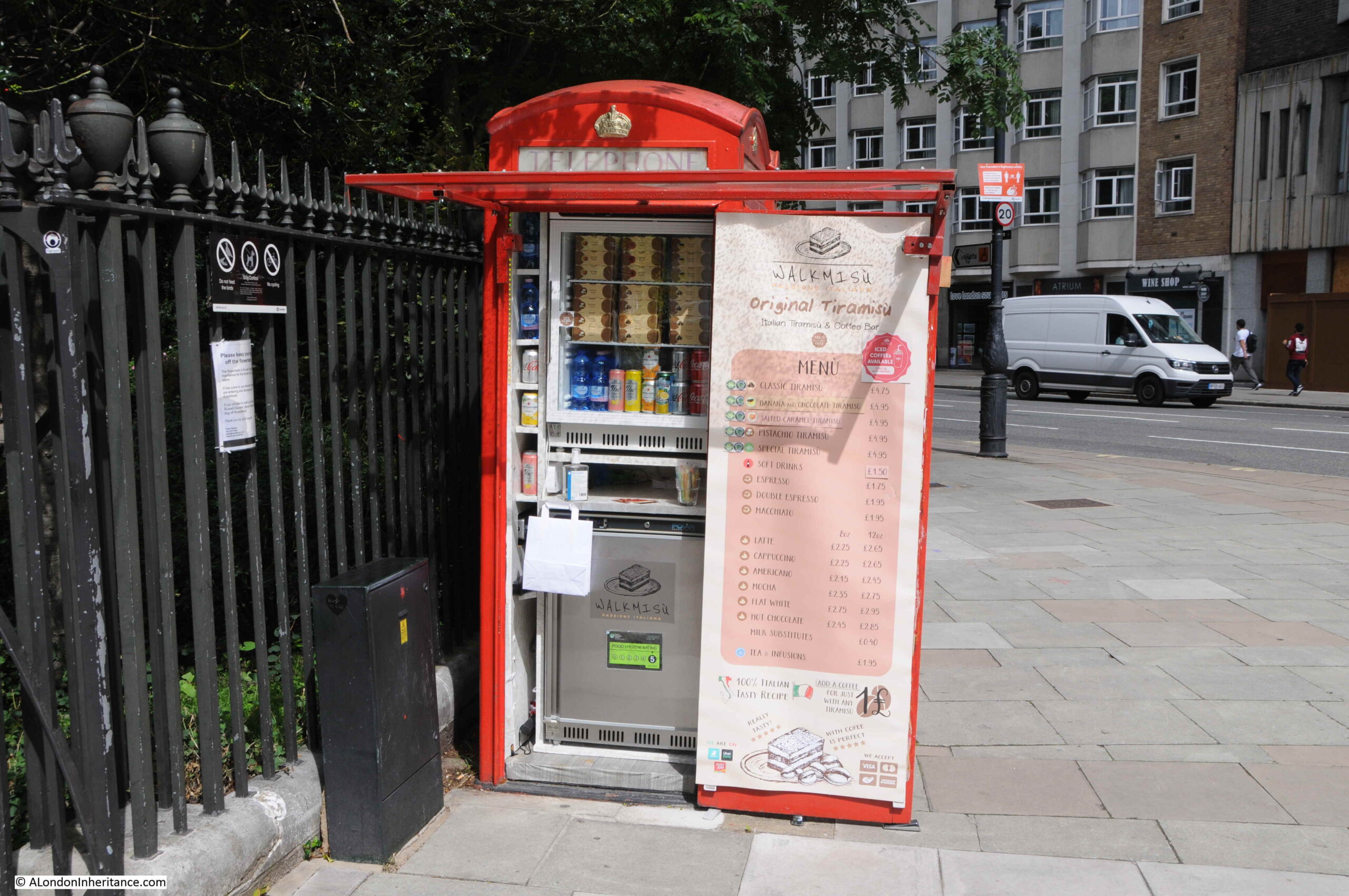
Known as the Italian Tiramisu and Coffee Shop:

Russell Square Gardens

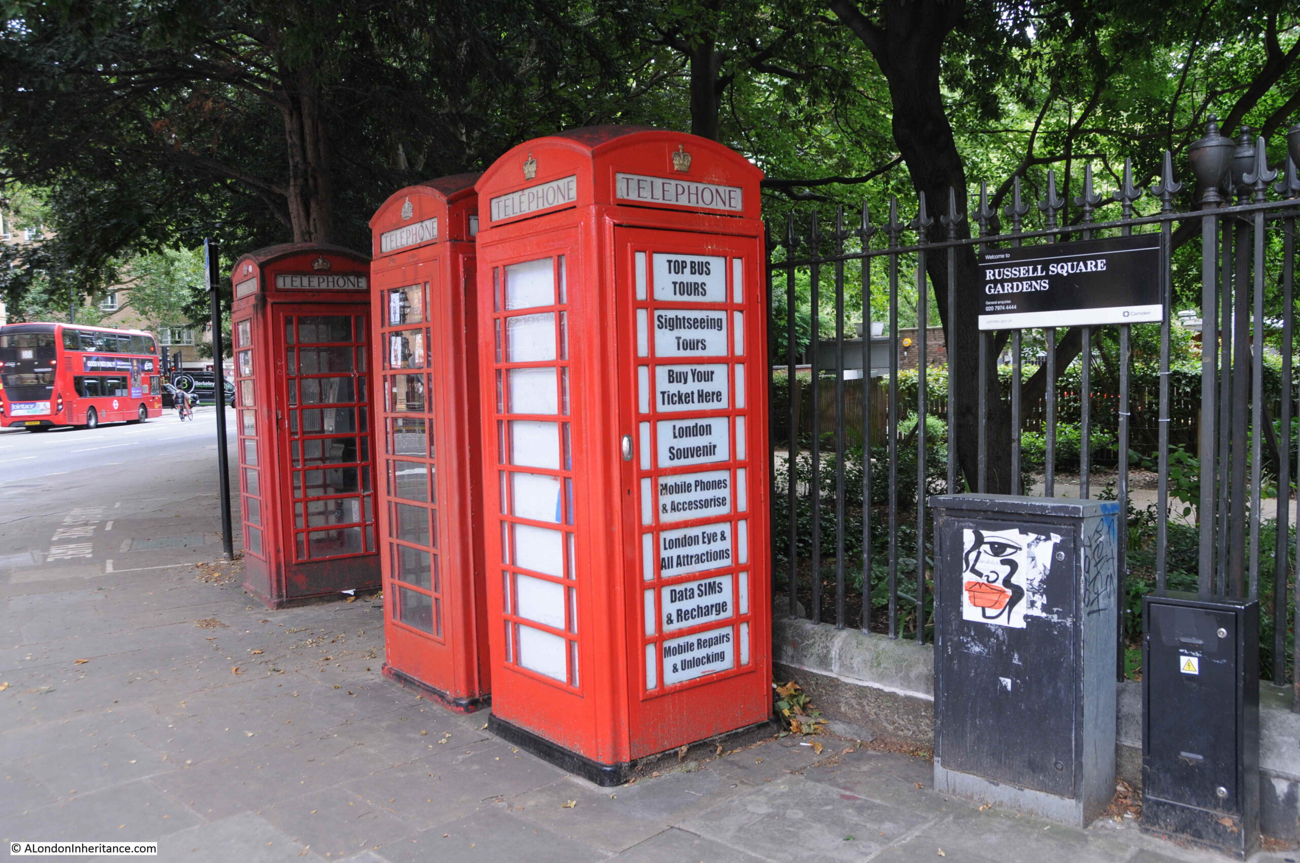
Walking further around Russell Square Gardens and there are another three, which according to the Historic England spreadsheet are Grade II listed:

Russell Square Gardens

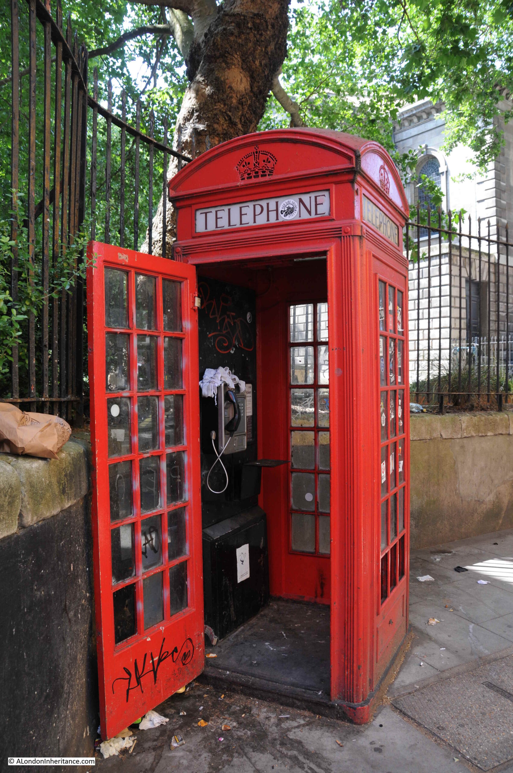
At the entrance to Regent Square Gardens on Regent Square:

Regent Square

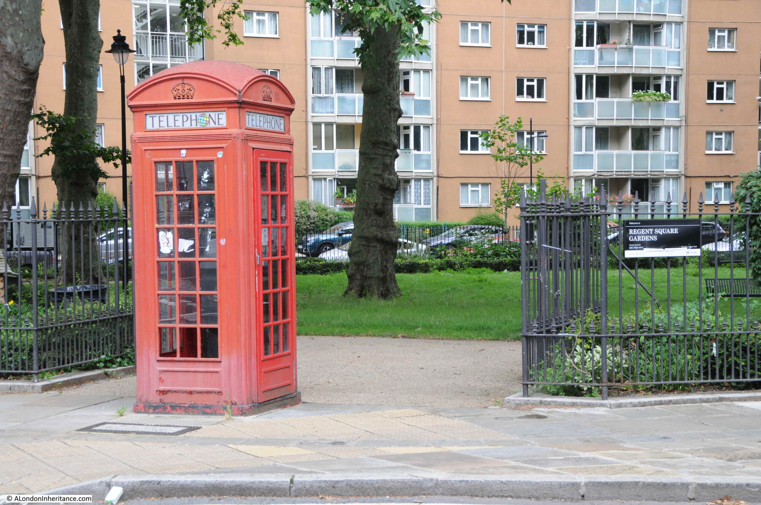
Looking inside the Regent Square Garden’s telephone box:

Regent Square

At the junction of Euston Road and North Gower Street:

Euston Road

Upper Street, Islington:

Upper Street

Across the road from the above phone box is the following:

Islington

Waterloo Place, looking up towards Piccadilly Circus:

Waterloo Place

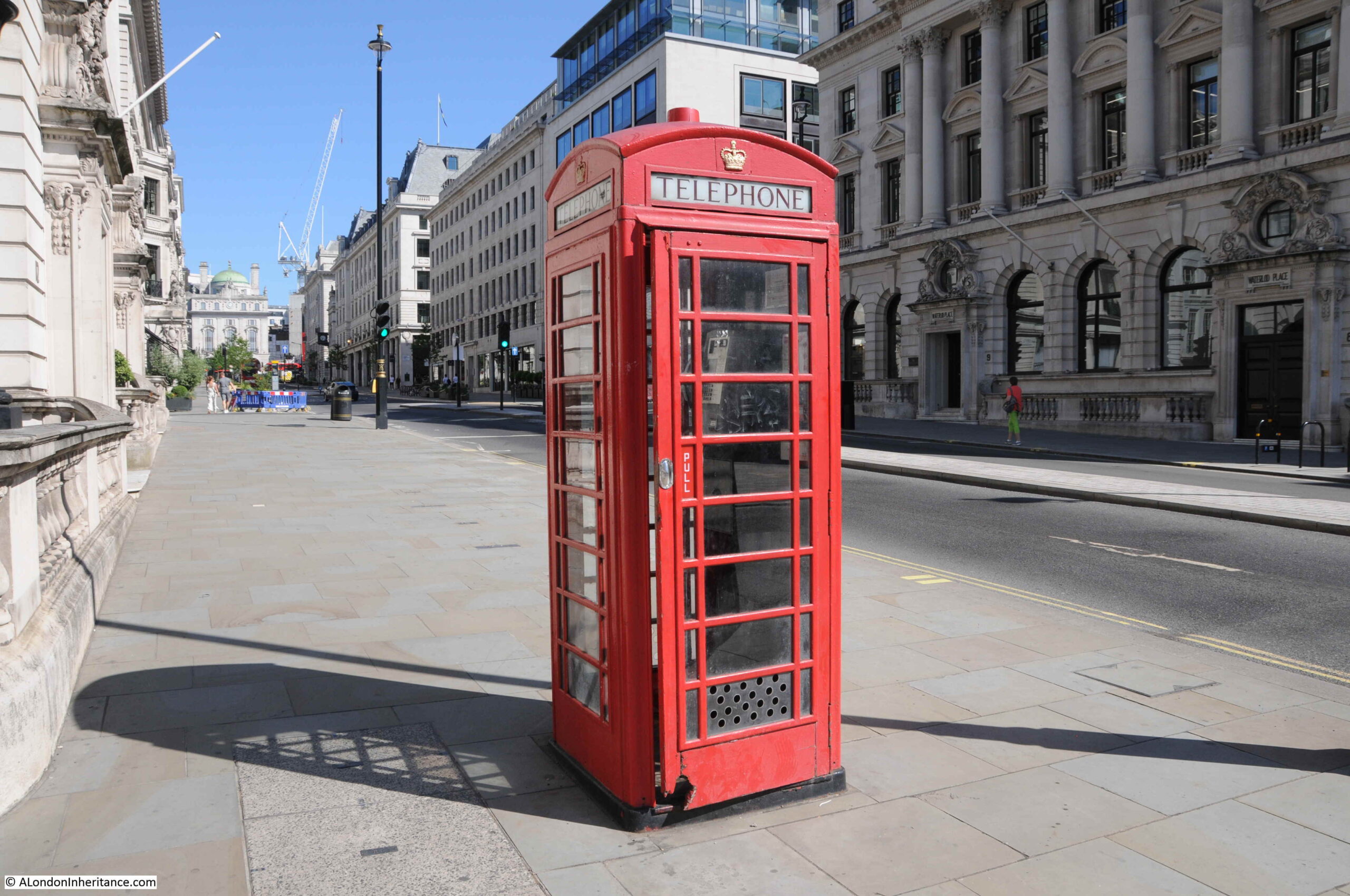
The Strand, close to Charing Cross Station:

Charing Cross Station

Opposite Charing Cross Station are these four telephone boxes:

Charing Cross station

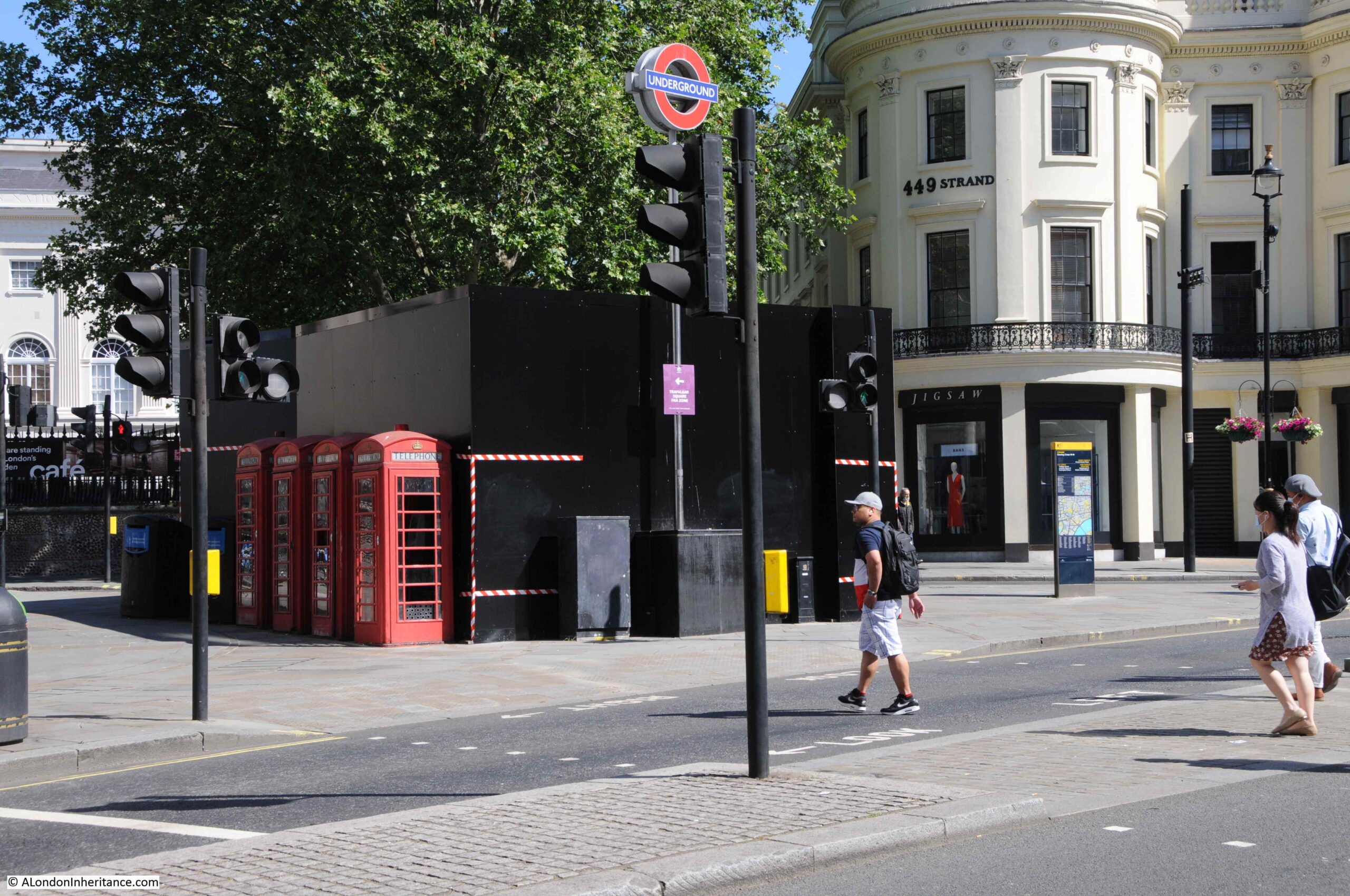
They are usually more obvious, however the black hoardings to their right are slightly obscuring them.

Hard to imagine seeing a row of four, empty telephone boxes, however they were sited together in an area of frequent use. In a high footfall area, between the Strand, Charing Cross Station, Trafalgar Square and the theatres of the West End, they would have attracted a considerable number of users.

When I commuted into and out of London during the 1980s, train distruption would always lead to long queues at the phone boxes as the only means of communicating with those at home, or who you were to meet, that you would be late.

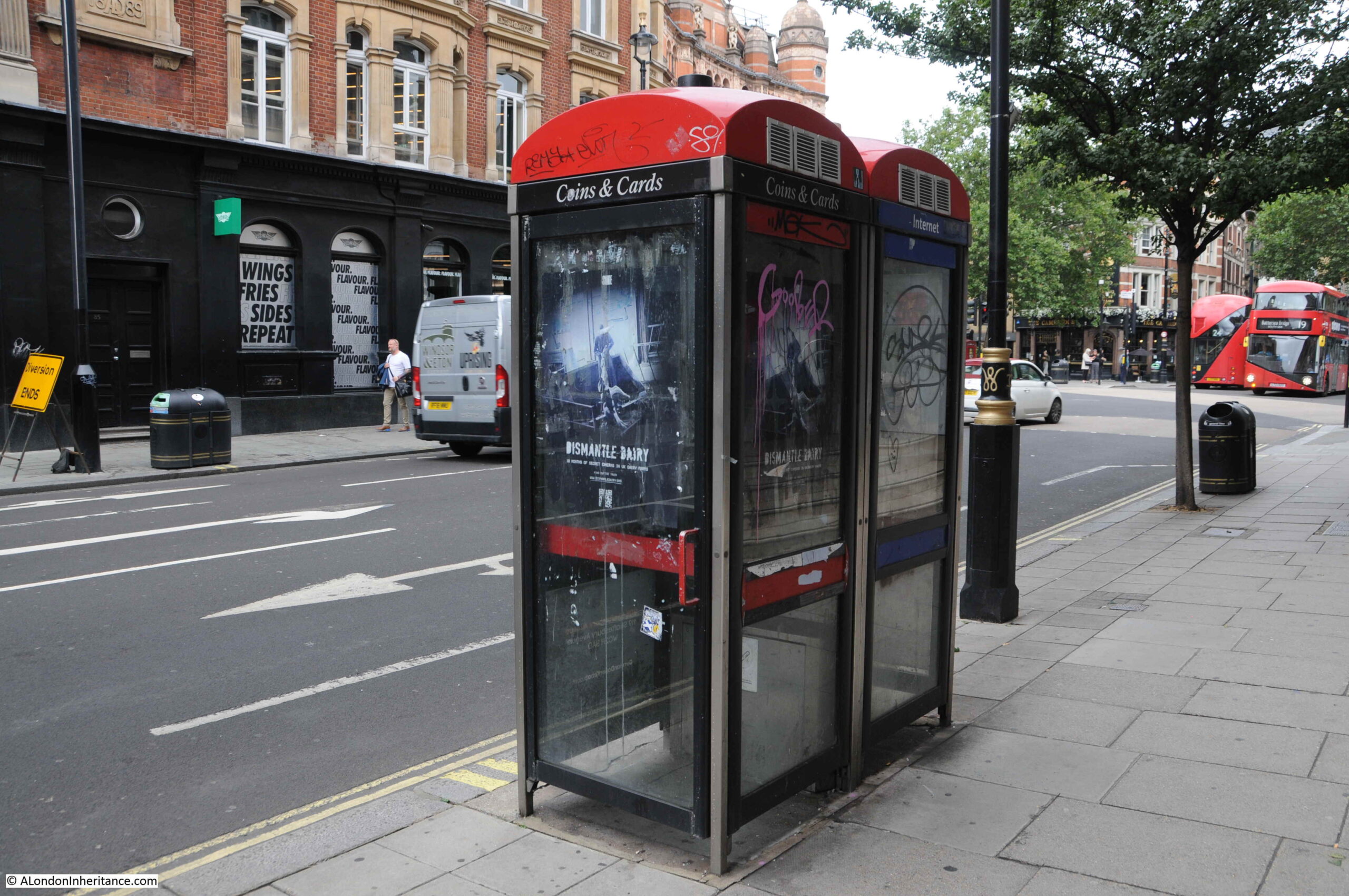
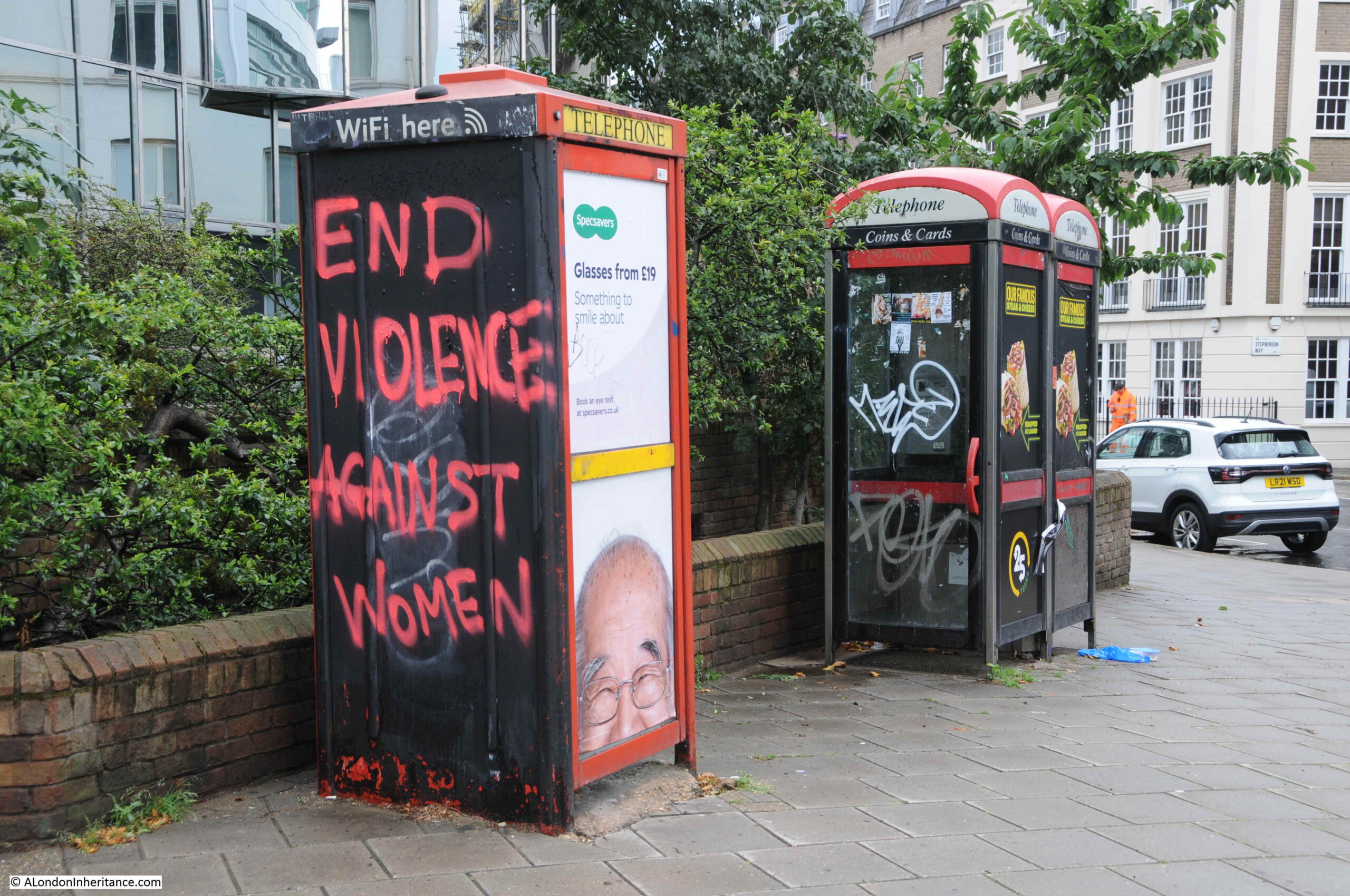
Later conversions of telephone boxes have tried to keep them relevant, however Internet access on a mobile phone renders WiFi from a phone box a failed model for their continued use.

Telephone Box

These two telephone boxes are Grade II listed, so even if there are no customers who have an urgent need to make a telephone call from in front of St Paul’s Cathedral, they will probably be here long into the future:

St Paul's cathedral

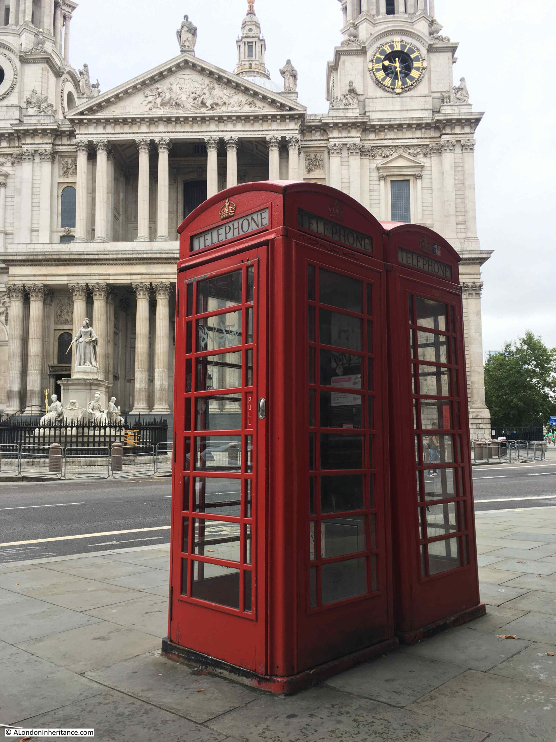
In the triangle of land where St Martin’s le Grand meets Cheapside:

Telephone Box

Telephone boxes advertising the time when cards as well as coins could be used to pay for a call:

Telephone Box

Euston Road:

Euston Road

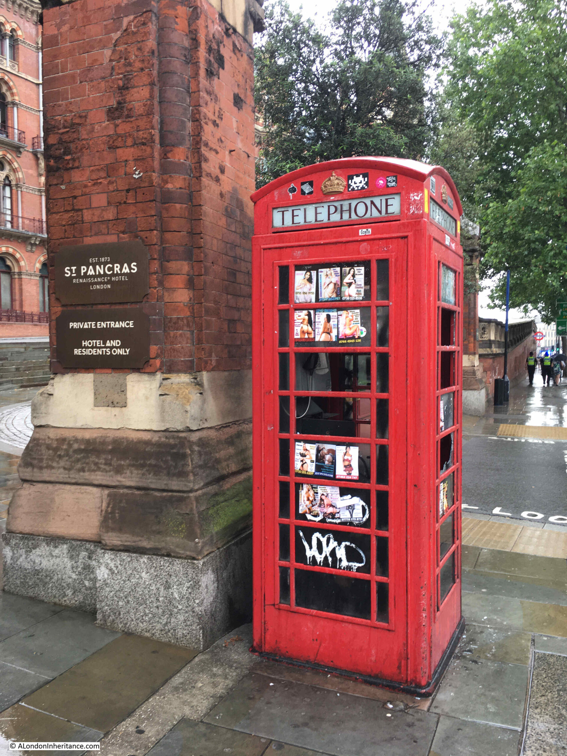
Outside St Pancras Station, with the sex work adverts that were once common across central London telephone boxes:

St Pancras

I titled this post the Death of the London Telephone Box, however that is not quite true. Many of them are listed so presumably will be around for years to come, and they are valuable assets as an advertising platform, however what they will not be used for is their original purpose of making telephone calls.

What is clear is that many are not maintained or cleaned. I have found very few that actually work. Many have had their equipment removed, others have been vandalised and many of the remainder are just dead.

I suspect the majority of people under the age of thirty have never used a telephone box, and find the concept of a fixed, wired phone rather antiquated.

They are a left over from a time when the only way to make a call when out on the streets was from a telephone box. When you needed to call for a lift home late at night, meet with friends, change an appointment, check on a place to meet, or just simply calling someone for a chat, the red telephone box was an essential part of street infrastructure.

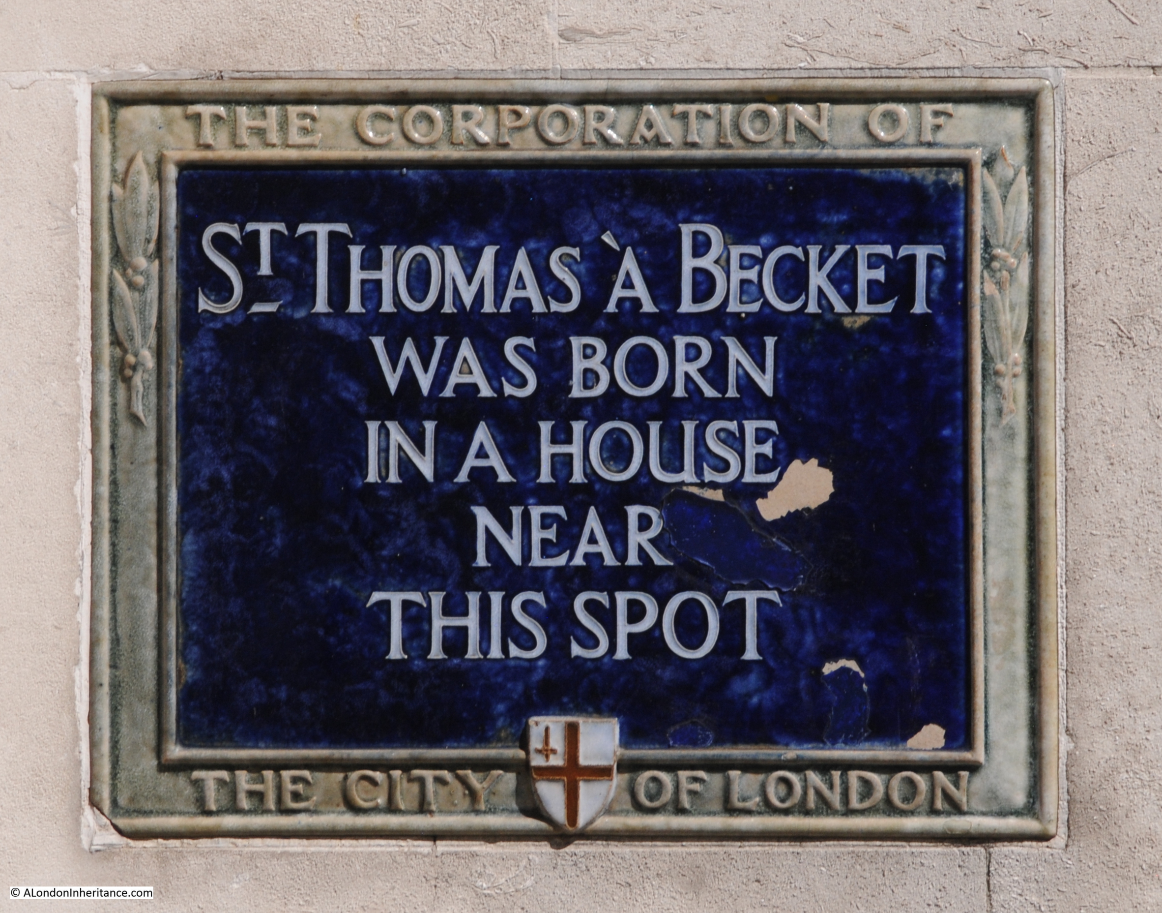
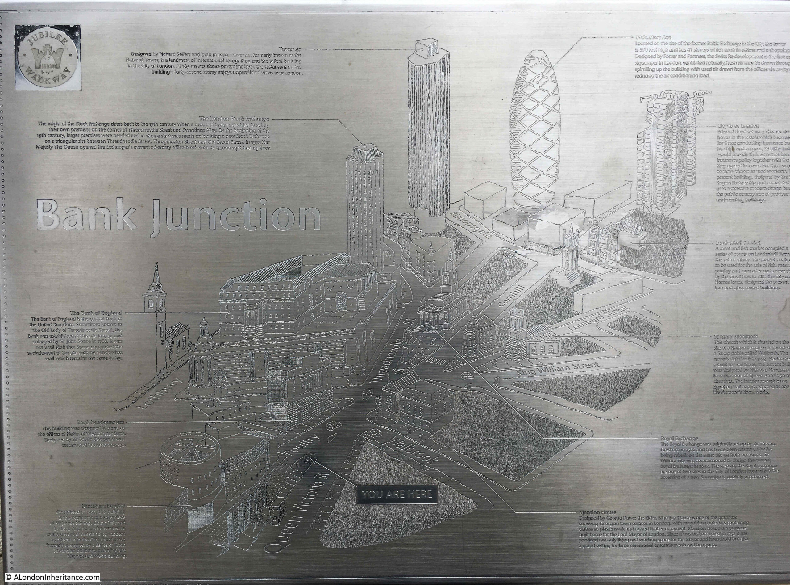
One of my other photographic themes is information panels, intended to show the passerby what can be seen in the area. I walked by this one a couple of weeks ago, close to the Bank junction:

Bank junction

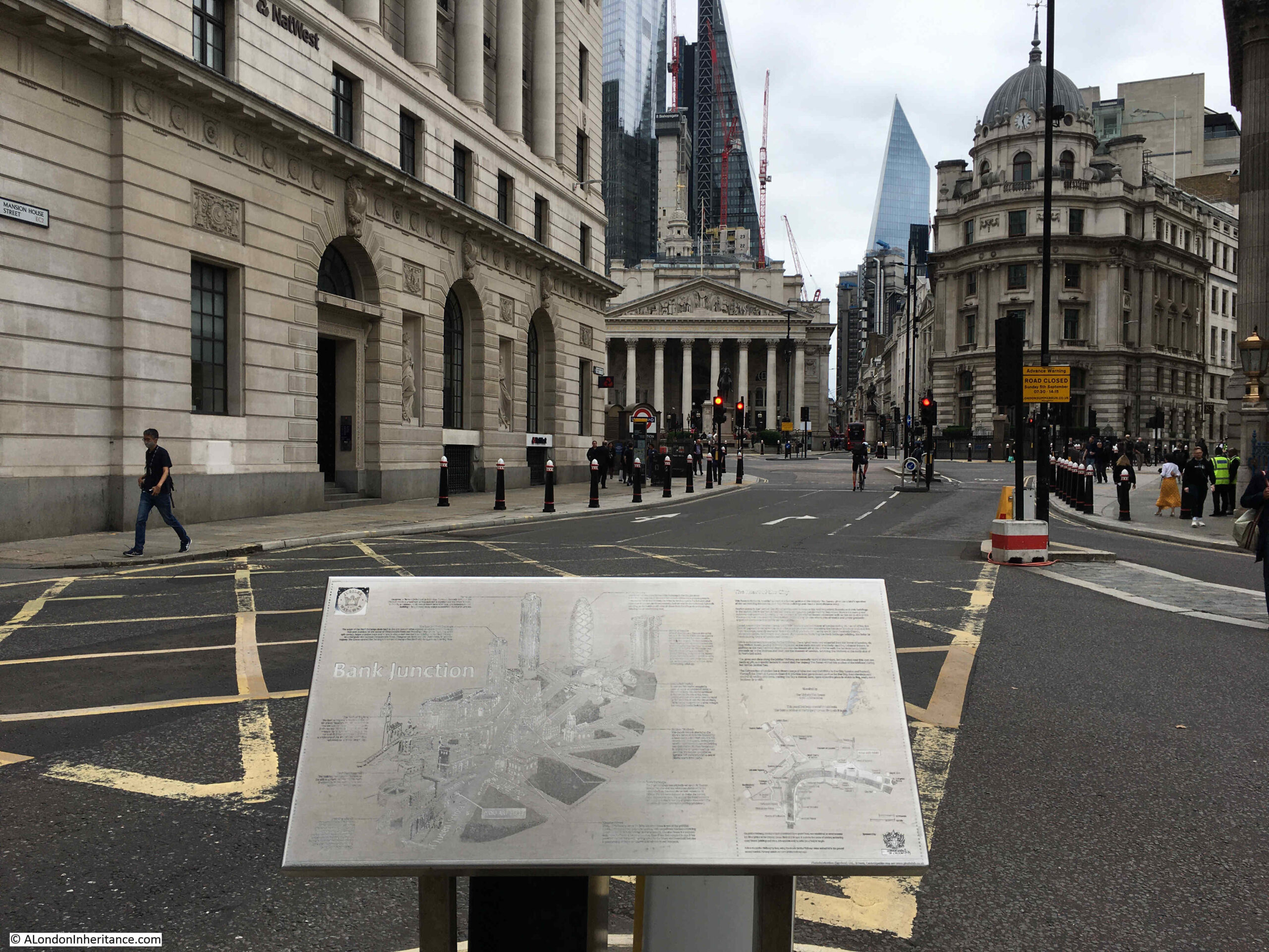
The plaque was unveiled by the Queen in October 2002, and shows the City’s skyline as it was, just 19 years ago,

Thr highlighted buildings include the London Stock Exchange, Tower 42 (the old NatWest Tower), 30 St Mary Axe (the Gherkin) and the Lloyds of London building.

it is a strange location as none of these buildings can be seen from the location of the plaque. I cannot remember if it has been moved from a different location. The “You Are Here” label on the map implies it is in its original location.

Bank junction

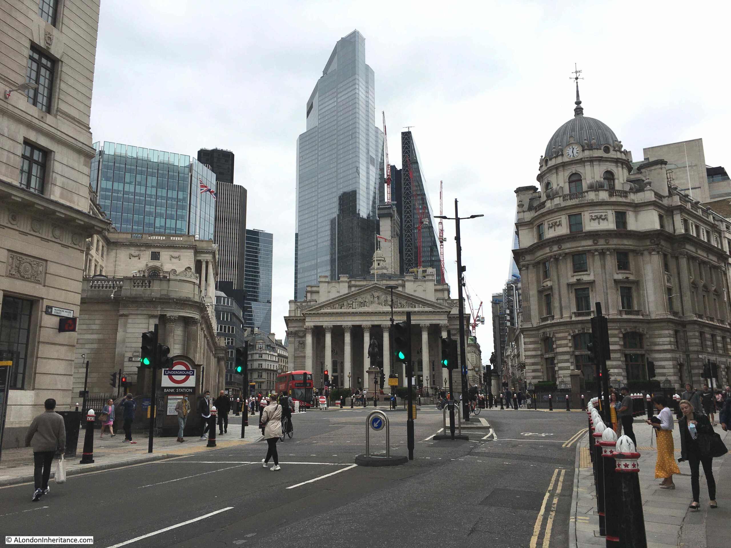
Walking further into the Bank junction and only Tower 42 remains visible, although now partly obscured.

Bank junction

London’s streets will continuously change, as technologies change as do the buildings lining the streets.

As with the transition from telephone boxes to mobile phones, there seems to be another transition gradually underway with the introduction of low traffic neighbourhoods, closure of many city streets to vehicles, cycle lanes etc.

It will be interesting to see how this impacts the city’s recovery from the pandemic, Does it enhance the city, or restrict its viability as a place to work.

In future, will the car in a city be seen the same as a telephone box today, an essential in the past, irrelevant in the future?

alondoninheritance.com

Ironmonger Lane – Two Thousand Years of History

A couple of week’s ago I was in ironmonger Lane in the City of London, a narrow lane running between Cheapside and Gresham Street.

The buildings in the lane are relatively recent, and difficult to photograph due to the width of the lane, however Ironmonger Lane has a fascinating history, so for this week’s post, let me take you on a journey through time starting with the earliest traces of habitation in ironmonger Lane.

As with many City streets, ironmonger Lane suffered bomb damage in the last war, hence the relatively young age of the buildings that line the lane today.

The bomb damaged remains of number 11 Ironmonger Lane were being demolished after the war and the Guildhall Museum led an excavation of the site.

Number 11 is in the centre of the photo below:

Ironmonger Lane

Adrian Oswald, working on behalf of the Guildhall Museum excavated the site, and 16 feet below street level the remains of a Roman house and Roman mosaic were found.

Ironmonger Lane

The excavation was notable at the time as this was the first Roman mosaic that had been found since excavations at the Bank of England.

The mosaic and house were dated to around the 2nd and 3rd centuries.

It is intriguing to imagine that Ironmonger Lane was a street in Roman times, and this was the earliest traces of the buildings and people living in this part of the City.

Ironmonger Lane

The next traces of occupation in Ironmonger Lane are possible 9th to 11th century foundations found in the churchyard of St. Olave during an excavation in 1985 / 86. The churchyard is in the centre of the lane, and Roman bricks were also found during the excavations, providing further evidence of Roman building.

Early in the 12th century, Thomas Becket, who would become Archbishop of Canterbury and murdered at Canterbury Cathedral at the apparent command of King Henry II, was born in a house on the corner of Ironmonger Lane and Cheapside, a plaque marks the site today:

Ironmonger Lane

The Becket family owned part of the land at the southern end of Ironmonger Lane and alongside Cheapside.

Also in the 12th century, we see the first references to the church of St Olave (roughly half way along the lane), although certainly much older, and also to the Hospital of St Thomas of Acon (dedicated to Thomas a Becket), when hospitals were mainly religious establishments.

The Hospital of St Thomas of Acon was founded in 1227 on land at the southern end of Ironmonger Lane, between ironmonger Lane and Old Jewry, facing onto Cheapside.

The hospital would be important for how we see the southern end of Ironmonger Lane today.

Now for my first map. This is John Rocque’s map of 1746, although I have not yet reached the 18th century, the map is helpful in showing the location of some of these 12th century establishments.

Ironmonger Lane

Ironmonger Lane is in the centre of the map. Cheapside at the southern end, and Cateaton Street (which would later become Gresham Street) at the northern end.

Look to the southern end, and to the right of Ironmonger Lane is a block of building and the abbreviation “Cha” for Chapel – this is the area where Thomas a Becket was born and also the site of the Hospital of St Thomas of Acon.

The hospital was built on land purchased from the Becket family. The name Acon is the anglicised version of Acre (now part of Israel), and dates from the Third Crusade between 1189 and 1191, and possibly originates from an order of monks / knights formed during the Crusade and the siege of Acre.

In Rocque’s map, you can see that the Mercers Hall is also shown where the hospital was located.

The Mercers Company represented the interest of merchants who traded in materials such as wool, linens and silks and it was the Mercers who became patrons of the Hospital of St Thomas of Acon, and used the hospital’s chapel as a ceremonial meeting site from when the chapel was built in the 13th century in 1248.

Also in the 13th century, the second church in Ironmonger Lane is first mentioned. This is the church of St Martin Pomary which was located between the church of St Olave and Ironmonger Lane – two churches adjacent to each other. To see how close these churches were, look at Roqcue’s map above, to the left of St Olave, you will see the text “St Martin’s Church Yard”.

I have not yet mentioned anything about the name – Ironmongers Lane.

The name relates to the trade of Iron Mongers as in the medieval City, trades generally clustered around specific streets. The first mention of the name is from the 13th century, and there were many variants of the name, starting with Ysmongeres Lane, with other variations between the 13th and 14th centuries. The Agas map of 1561 records the street as Iremongers Lane.

The ironmongers would not stay too long in the area as it appears they have moved to the Fenchurch Street area in the 15th century – so the name is a remarkable survival of a medieval trade with a specific area.

In the 15th century, the Mercers were continuing their long association with the Hospital of St Thomas of Acon as in 1407 the Mercers purchased their own chapel in the Hospital’s church.

Moving a century later, and the 16th century was a time of dramatic change in ironmonger Lane.

In 1524, the Mercers built their first Hall on land purchased from the Hospital.

In 1538, the Hospital of St Thomas of Acon was taken over by the Crown during the dissolution. The Mercers negotiated the purchase of the land, and subsequently purchased all the hospital’s properties, and the company built the Mercers School on part of the land. I suspect they were a company never to pass by a good commercial opportunity.

The Agas map of 1561 shows Ironmonger Lane densely built, with the church on the east side of the street and the Mercers Hall facing onto Cheapside.

Now travel forward to the 17th century and in 1665, as with the rest of London, the occupants of Ironmonger Lane lived in dread of the plague, and as a preventative measure, the Mercers closed their school.

The following year, 1666, the Great Fire took hold of the area and burnt down the churches of St Martin Pomary and St Olave, along with the Mercers Hall.

Wren rebuilt the church of St Olave in the 1670s, but St Martin Pomary was not rebuilt, the parish was amalgamated with that of St Olave.

The Mercers second Hall and Chapel on the site were also rebuilt, opening in 1676 to continue the Mercers long association with ironmonger Lane. The fire had also destroyed all remaining evidence of the Hospital of St Thomas of Acon.

In the 19th century, Ironmonger Lane was a busy commercial street in the heart of the City.

The 1895 Ordnance Survey map shows St Olave and Mercers Hall, along with a Police Station and a Public House at number 11 – this was Mullen’s Hotel.

Ironmonger Lane

Credit: ‘Reproduced with the permission of the National Library of Scotland’ 

Census reports provide an insight into Ironmonger Lane, and the City of London in general. In the 1861 census, it was recorded that there were 23 people living in the Mullens Hotel at number 11:

  • 5 family members and the owner of the hotel
  • 8 workers, all female and listed as servants
  • 10 visitors to the hotel including;
    • Drapers from Ireland
    • Drapers from Cornwall (one with two sons)
    • A Commercial Traveler from Norwich

As ever, London was a temporary home for travelers who had business in the City.

In 1892, the church of St Olave was demolished, apart from the tower of the church. The demolition was under legislation brought in to reduce the number of City churches. The tower was converted into a rectory for St Margaret Lothbury.

The tower is difficult to photograph from street level when the trees are in leaf, but it is there.

Ironmonger Lane

View of St Olave as it appeared in 1830, before demolition of the body of the church and with the tower visible from ironmonger Lane.

Ironmonger Lane

Image credit: London Metropolitan Archives, City of London: catalogue ref: q8051273

The gates that lead from the street into the old churchyard of St Martin Pomary with the tower of St Olave behind.

Ironmonger Lane

So into the 20th century, and Ironmonger Lane suffered badly from bombing during the Second World War.

The Mercers Hall, built after the Great Fire, was destroyed during the night of the 10th / 11th May 1941, and it was bomb damage that opened up number 11 to the excavation work that revealed the Roman house and mosaic.

Walking the street today, and we can still see the tower of St Olave, the old church of St Martin Pomary would have been just to the right and in front of the tower.

A number of parish boundary markers can be seen on the walls of buildings along the street, including that of St Martin Pomary:

Ironmonger Lane

The third Mercers Hall is at the southern end of the street, rebuilt after the Second World War. If you look on the corner of the hall, and along the hall and buildings along the south eastern side of Ironmonger Lane, you will see several carvings of the head and shoulders of a woman with a crown.

Ironmonger Lane

The figure is part of the armourial bearings of the Mercers Company, known as a Mercers Maiden, the figure is probably that of the Virgin Mary, although there is no written evidence to confirm this.

Ironmonger Lane

Ironmonger Lane

The Mercers have long been associated with the charitable building of houses across London, and there would have been a carving, or statue of a Mercers Maiden on the outside of the building. I have photographed a number of these including a very fine example alongside the church of St Dunstan and All Saints Stepney, and also along Hardinge Street.

The Ironmongers Lane entrance to Mercers Hall:

Ironmonger Lane

The following photo shows the view along Cheapside. The entrance to Ironmonger Lane is just to the left of the red circled street signs..

Ironmonger Lane

The large building running along Cheapside in the centre of the photo occupies the land between Ironmongers Lane and Old Jewry originally the location of the Hospital of St Thomas of Acon.

The following drawing shows the Mercers Hall occupying the same site in 1881. Ironmonger Lane is at the left.

Ironmonger Lane

Image credit: London Metropolitan Archives, City of London: catalogue ref: q7707062

The above view shows the post Great Fire version of the hall after considerable refurbishment. It was this version of the hall that was destroyed in May 1941.

The photo of the building from Cheapside shows more memorials to Thomas a Becket on the building corner at the junction of Ironmonger Lane and Cheapside..

Ironmonger Lane

It was the original association of the Mercers Company with the Becket family dating back to the 12th century, and their patronage of the Hospital of St Thomas of Acon, that almost 900 years later has the Mercers Hall still on the same site.

Looking up Ironmongers Lane from Cheapside, the open space on the right is at the entrance to the Mercers Hall, the narrow width of the lane can be seen continuing north.

Ironmonger Lane

There are a couple of passages leading off from ironmongers Lane.

The wonderfully named Prudent Passage leads to King Street. originally this was Sun Alley, and this original name was in use in the 18th century, with the first mention of Prudent Passage being in 1875.

Ironmonger Lane

St Olave’s Court runs to Old Jewry, alongside the location of the church of St Olave, and probably over the site of St Martin Pomary.

Ironmonger Lane

The view looking north towards the junction with Gresham Street:

Ironmonger Lane

The view south along Ironmonger Lane from Gresham Street showing the narrow width of the lane.

Ironmonger Lane

Number 11 Ironmonger Lane is just along the lane on the left. No longer a hotel, a new building was constructed on the site following the 1949 excavations, and refurbished a number of times since, and it is here that the Roman house and mosaics were found, which brings us full circle on almost 2,000 years of history of Ironmonger Lane.

alondoninheritance.com

London Streets In The 1980s

The 1980s in London was a decade of considerable change. Long established industries, street scenes, shops and ways of life were being swept away and the often divisive politics of the time were visible painted along the walls.

The mid 1980s are only 30 years ago but walking along London’s streets today I still find it surprising how considerable the change has been in many areas.

For this week’s post, I would like to take you back through a snapshot of London Streets in the 1980s, with some of the photos we took, mainly of south, east and north London.

Local, independent shops once served the majority of London’s residents, often run by the same family for many years. Many of these were in their final years, clinging on whilst much around them had closed:

Street Scenes 1


Street Scenes 4


Street Scenes 5

Many had already long closed, waiting for demolition and the rebuilding of whole streets:

Street Scenes 18

What Londoners would look for when eating out would also soon change. This was before the streets were populated with identical coffee shop brands:

Street Scenes 19

The corner shop was a standard feature of many residential streets. Many of these had closed or were put into some temporary use whilst awaiting either redevelopment or demolition:

Street Scenes 20


Street Scenes 21

A somewhat forlorn tribute to West Ham waits for what will become of these buildings:

Street Scenes 22

The Isle of Dogs is an area where much has changed beyond all recognition. Here a newsagent has found a novel way of continuing business using a shipping container:

Street Scenes 16

But there were large areas of the Isle of Dogs where businesses had closed down for good:

Street Scenes 15

Much of the old industrial and dock areas of the Isle of Dogs were a wasteland with the redevelopment of Canary Wharf, housing and riverside apartments yet to come. Closed gates, vacancy signs that would never again advertise another vacancy sat alongside graffiti that emphasised the perceived lack of concern from the government of the time to the plight of those affected:

Street Scenes 14

There had also been the rise of far right groups. Joe Pearce was imprisoned under the Race Relations Act for publishing the Bulldog magazine and became a cause celebre for these groups. Free Joe Pearce slogans could be found across the east of London, usually with a different slogan added underneath by groups opposing the far right:

Street Scenes 17

Whilst for some groups, anarchy was the only route:

Street Scenes 23

The start of redevelopment was also in evidence across the Isle of Dogs. This is Maconochies Wharf  where clearance and preparation was underway for the building of houses. A mural on the adjacent building emphasising the historical traditions of the Isle of Dogs:

Street Scenes 26

Street advertising for cafes and restaurants was much in evidence. This one in central London at Holborn – the “Perfect Businessman’s Venue” where you could get a 3 course set menu for £7.50

Street Scenes 13

Similar advertising signage could be seen across London’s streets:

Street Scenes 3

At least they were very colourful, even if the representation of what was on offer was probably not very accurate:

Street Scenes 11


Street Scenes 6


Street Scenes 12

This was a time when murals were very much in evidence. Ranging from those that would cover the whole side of a building:

Street Scenes 24

Street Scenes 25

More London Murals from the 1980s can be found in one of my earlier posts here.

Through to more individual efforts:

Street Scenes 8

Signs from a much earlier period were also much in evidence on buildings that would soon be lost:

Street Scenes 7

Only 30 years ago, but in many ways the London Streets in the 1980s were very different to those of today.

alondoninheritance.com