Tag Archives: London Transport

It Can Now Be Revealed

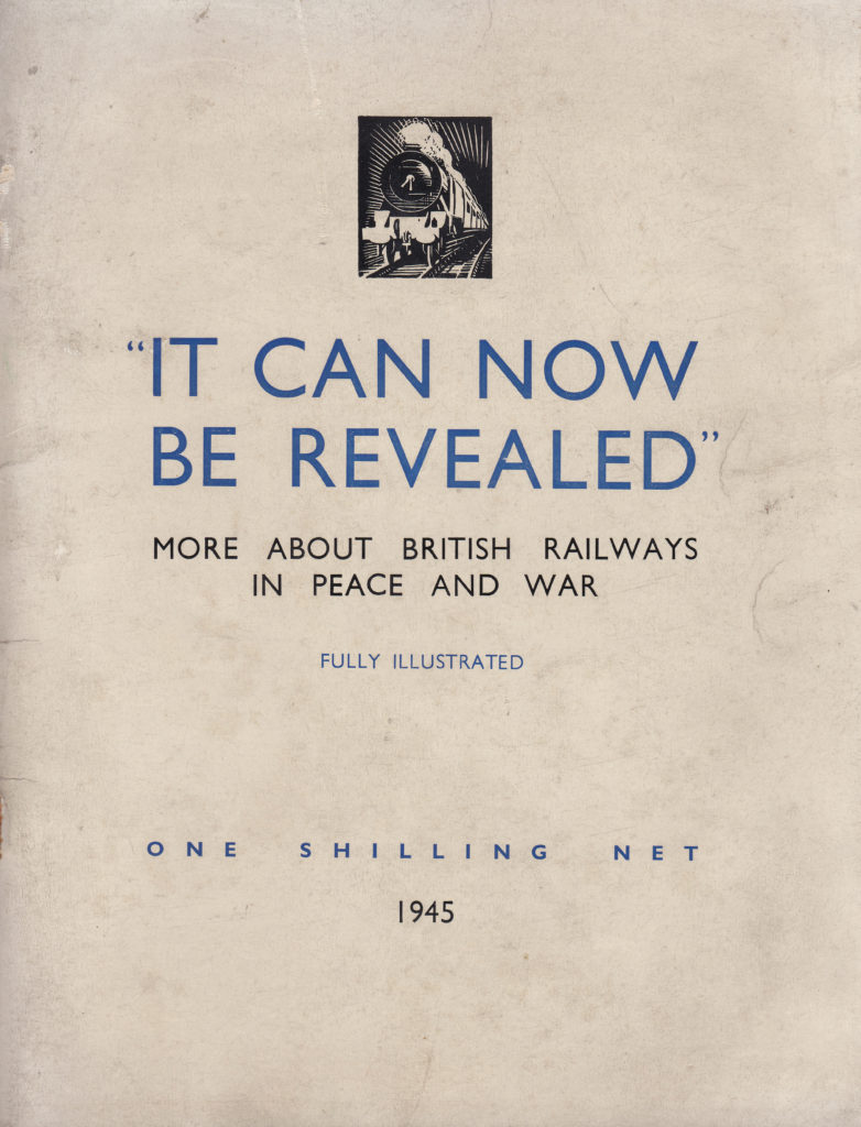
It Can Now Be Revealed – not a tabloid headline but the title of a booklet printed in 1945 by the British Railways Press Office telling the story of the railways during the war and ending with hopes for a brighter transport future. This booklet was one of many that were issued in the immediate years after the 2nd World War by organisations such as the Railways, the Post Office, the Police, all the various branches of the armed forces, individual London boroughs along with towns and cities across the country.

My father bought a number of these as they were published and they make fascinating reading and give the impression of an urgent need to record what happened between 1939 and 1945 before the country quickly moved on to reconstruction and the hoped for brighter future.

For this week’s post, I would like to introduce two of these booklets: The Post Office Went To War, and to start with, the title of the post – It Can Now Be Revealed, More About The British Railways In Peace And War:

It can now be revealed 9

It Can Now Be Revealed has three main themes: how the railways contributed to the war effort, how the railways responded to the damage inflicted by bombing and a look to the future. In covering the railways, the booklet fully covers the London Transport Passenger Board where workshops and staff quickly moved from supporting London’s transport network to the manufacture of components and equipment for the war effort.

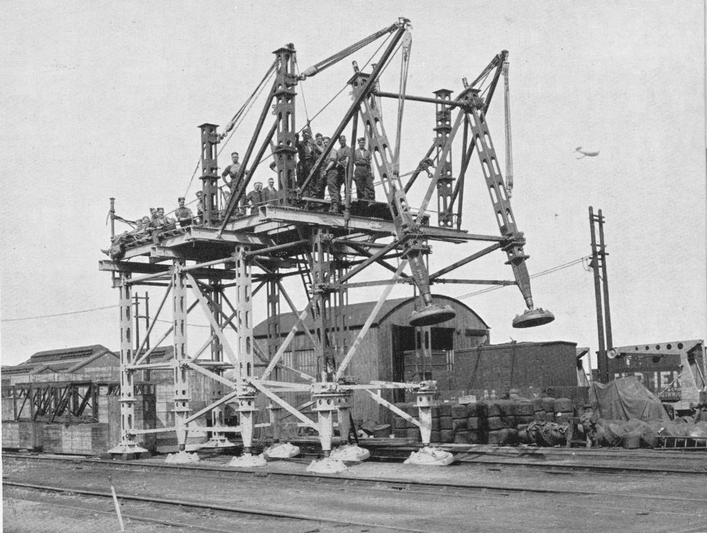
Pre-war, the rail network and the London Passenger Transport Board all had considerable engineering and manufacturing resources and these were immediately converted into wartime production. During the almost six years of war, these resources produced vast amounts of equipment of all types covering bombs, guns, boats, tanks, gliders and some very specialised equipment. The following photo shows one such item of specialised equipment produced by the Railway and London Transport workshops – a machine to help with the repair and installation of bridges.

It can now be revealed 2

London Transport, along with a number of road transport concerns, was part of the London Aircraft Production Group. The Group rapidly set up manufacturing resources and within fourteen months the first aircraft manufactured by the Group took flight and by the middle of 1944, the London Aircraft Production Group had built 503 Halifax bombers.

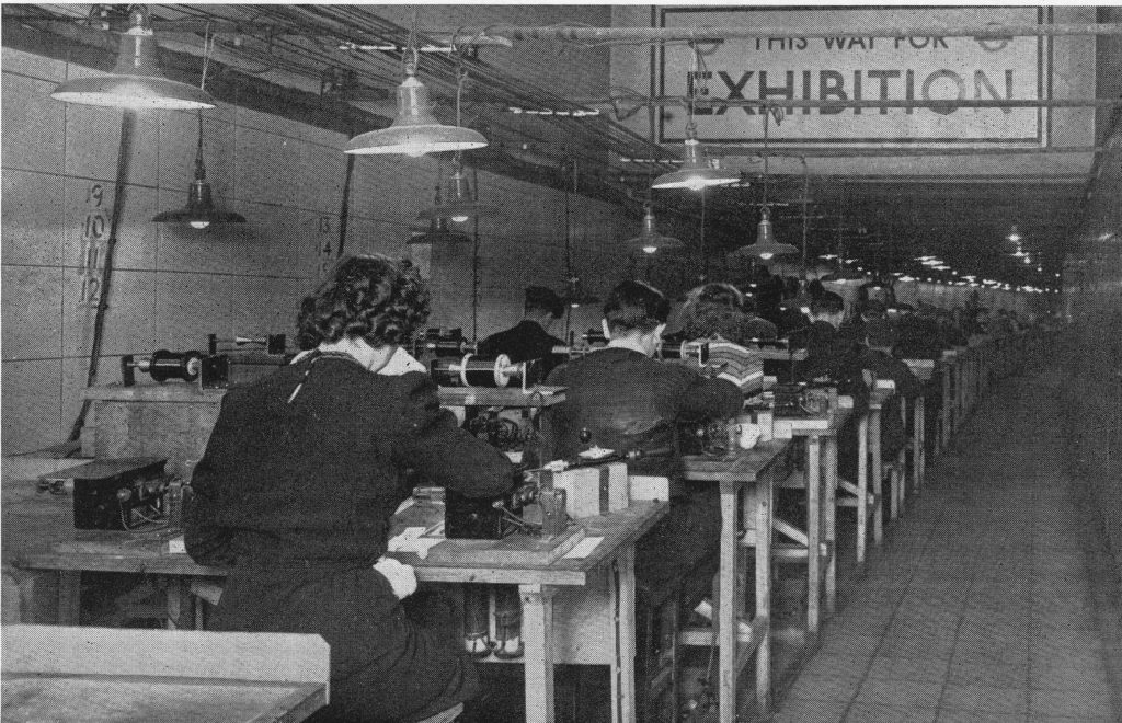
London Transport were able to make use of underground facilities for the secure manufacturing of aircraft components. The following photo shows once such production facility:

It can now be revealed 1

To give some idea of the breadth of equipment manufactured by London Transport, from the outbreak of war to 1944, London Transport had manufactured: 8,000 forgings for guns, 20,000 gun components, 80,000 sea mine components, 102,000 road vehicle parts and 158,000 2 inch shells as well as aircraft, bridges, tanks etc.

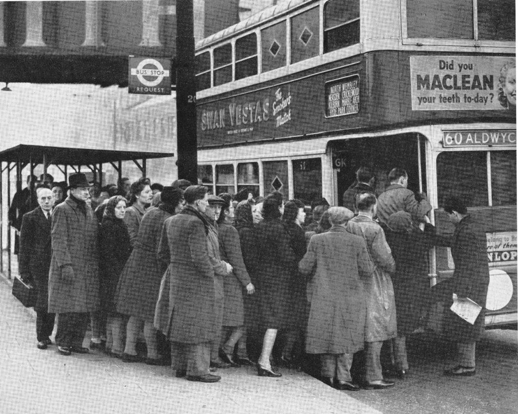
Transporting staff to the Railway and London Transport factories was a major effort as well as maintaining a degree of normal services. London’s buses were used for factory transport as well as continuing to provide services across the city and during the periods when bombing was at its peak there was considerable disruption with crowding on many of the routes across the city.

It can now be revealed 3

In the build up to war there was a considerable amount of planning and preparation to provide the staff of the rail networks with the equipment needed to protect the system and to install equipment to prevent damage. A serious concern with the London Underground system was the risk of flooding. This was a very real risk if the Thames embankment was breached or if bombing damaged water mains or sewers.

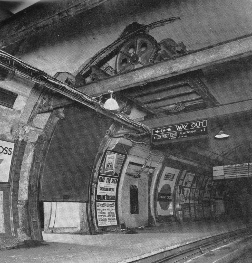
Floodgates were installed at a number of underground stations, including Waterloo, Charing Cross and the Strand stations. These were electrically operated floodgates installed across tunnels and connecting passages. The following photo shows one of the gates being tested at Charing Cross station.

It can now be revealed 4

The booklet recorded many of the incidents of damage across the rail network and the efforts that went in to restore the rail network as quickly as possible. Damage across the network was considerable, from the earliest days of the war through to the V1 and V2 weapons with both the above ground and underground networks suffering.

The booklet records an example of what happened when a V1 fell on the rail network:

“One of the worst incidents happened in the Southern. One night in August an express from Victoria bound for the Kent coast was travelling at 60 miles an hour when the girders of a bridge over a country lane less than 200 yards ahead of the train were damaged by a flying bomb falling nearby. The driver saw the explosion and at once threw on the brakes, but before he could bring the train to a stand it had reached the bridge, which collapsed when the engine, tender and leading coach had passed over. As a result the engine and tender were derailed about 100 feet from the bridge and the two first coaches were flung at right angles to the track. the third vehicle in the train got across, together with the leading end of the fourth, which came to a rest spanning the gap and supported on the damaged abutment. In the road beneath were poised four bogies torn from coaches. Eight persons, including a permanent way man who was on the bridge at the time, were killed and sixteen seriously injured, but strenuous efforts on the part of the railway engineers prevented serious dislocation to traffic. The damaged rolling stock was removed and a temporary bridge of two spans of 50 feet girders speedily erected, the outer ends of the girders being supported by bearing pads on the approach embankments and the centre by a steel trestle built in the middle of the roadway with the aid of a mobile crane. The relaying of the tracks was then quickly completed and within 66 hours of the incident both lines were again open for traffic.”

Which certainly brings the challenges of today’s commute into context.

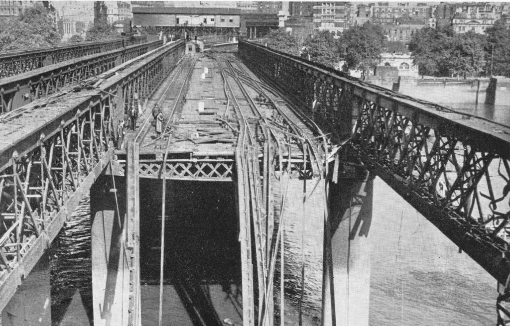
Photos within the booklet show the considerable damage across the rail network including the following photo showing damage to the Hungerford railway bridge, taken from the southern end of the bridge looking north towards Charing Cross station.

It can now be revealed 5

The booklet concludes with a positive view of the future with the final chapter opening with the sentence “The British Railways and London Transport are determined to regain and surpass their peacetime standards of public service”.

This included plans for new stations and rolling stock. This was urgently needed as there had been hardly any new building during the war years and the rail and underground networks were suffering from pre-war infrastructure, wartime damage and temporary repair and minimum maintenance.

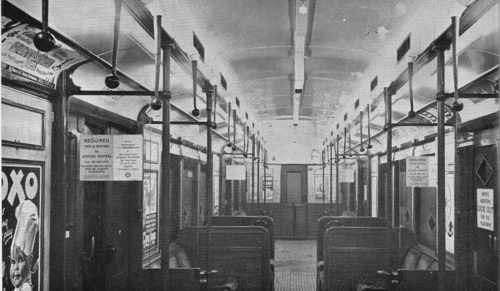
The following photo shows an example of new carriage construction and the title to the photo highlights one of the benefits being “improved lighting”.

It can now be revealed 6

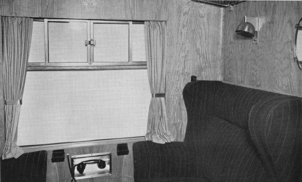
Along with a presumably a new design of first class compartment judging by the telephone handset below the window, presumably so that a first class passenger could call for service.

It can now be revealed 7

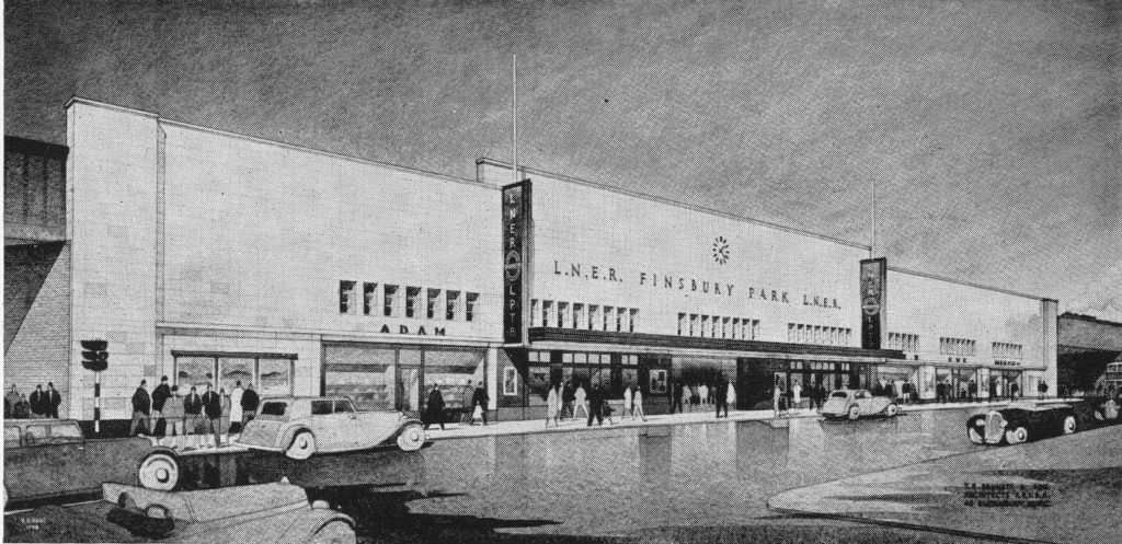
As well as new rolling stock, the booklet looked forward to new stations that would be built in the post war period. The station was described as the “shop” in which railway transport is sold. The booklet describes the facilities that will be provided at these new stations:

“The future British railway station will incorporate as spacious a concourse as possible, equipped with all the facilities that passengers need, conveniently situated and easily identifiable. Both concourse and public rooms will be light, cheerful and attractively decorated. News theatres (no idea what these were), newsagents, fruiterers, chemists, confectioners shops and Post Office facilities will be included whenever needed. Special attention will be given to the standard of food, drink and service provided in the refreshment rooms. Finally the platforms will be kept as free as possible of obstructions and passengers given the clearest indication and guidance about their trains, and how to get to them, by means of carefully designed train indicators and signs, supplemented by loudspeakers.”

The booklet includes a drawing of one of the future stations, Finsbury Park which will be rebuilt “on the most modern lines”.

It can now be revealed 8

It Can Now Be Revealed provides a fascinating insight into the impact of the last war on the rail networks of London and the wider country and how every aspect of the railway network and those who worked on the network were involved in one way or another in the war effort. As with many publications of the later years of the war, the booklet is also looking forward to a much brighter future with reconstruction offering the chance to significantly improve all aspects of the rail network.

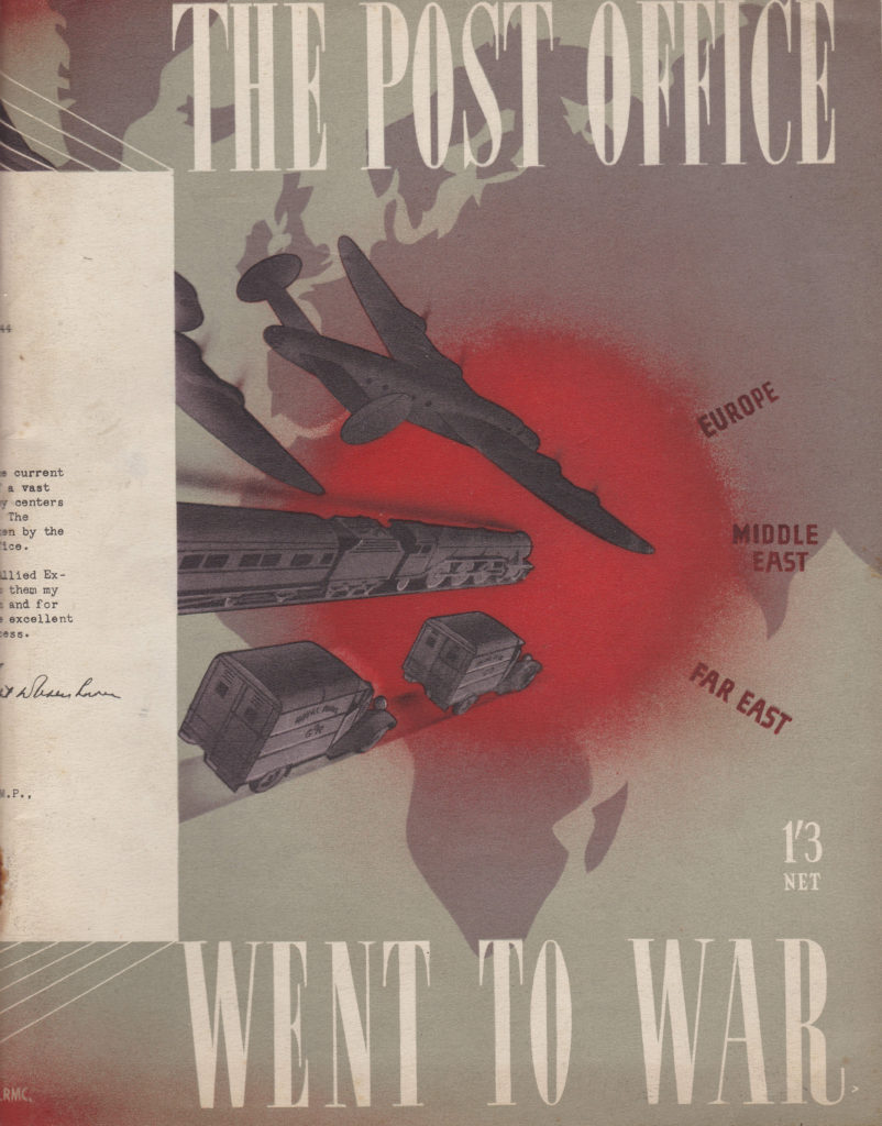
The second booklet was published a year later in 1946 and titled “The Post Office Went To War”. This was in the days when the Post Office ran a wide range of services, not just letter and parcel delivery, but also the telephone and telegraph networks, radio stations for long distance calls, sub-sea cables etc.

It can now be revealed 10

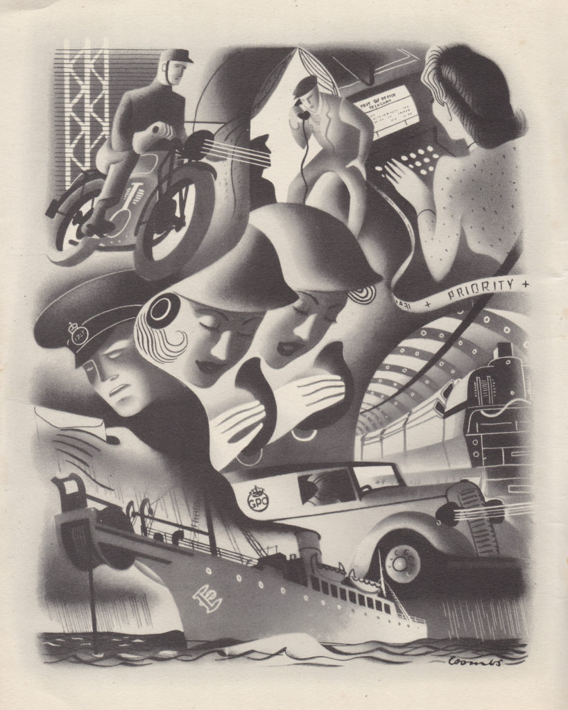
The extra year before publication may have allowed time for some additional graphic design as the Post Office booklet has a more interesting layout and artwork then the earlier Railways booklet published in 1945.

It can now be revealed 11

The opening paragraph to Chapter One states “Throughout our history as a nation it has been our cheerful habit to declare war first and then to prepare for it”, a statement that could also apply to events over the last few decades.

The challenges that faced the Post Office started long before there was any enemy action. Within the first week after war was declared, the Post Office lost fifteen percent of staff to the Forces, immediately having an impact on the ability to continue to provide services.

The first few months of war were spent putting in new telephone circuits to coordinate the services that would defend the country, and implementing alternative circuit routing so damage to one site would not cut out a large number of critical services.

When the bombing of London started, the impact was considerable. In one night alone in September 1940, twenty-three London Post Offices were hit and damage to the road and railway networks caused many problems with the transport of mail.

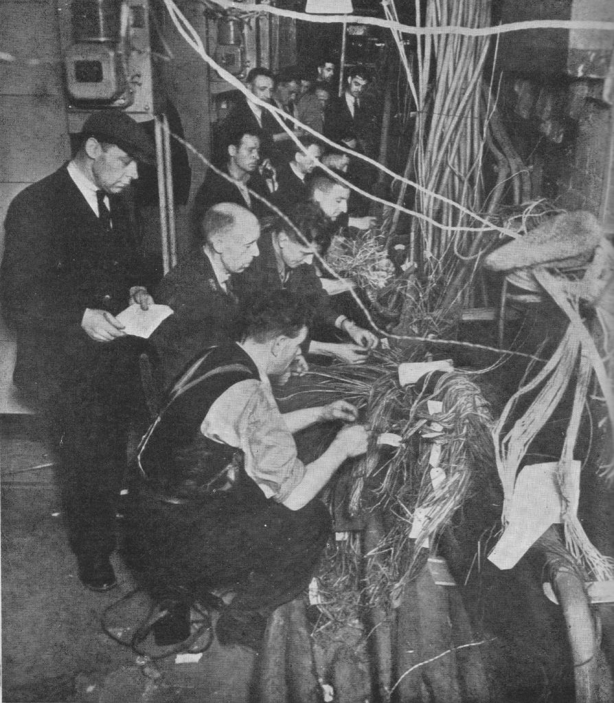
London was also a hub for much of the country’s telephone network with most of the international circuits terminating in a key number of London Telephone Exchanges. Bombing could damage cable at multiple points across the city, not just in the Exchanges, but also where they ran along the streets. After bombing it was an ongoing battle to quickly reconnect damaged cables to get telephone and telegraph services back up and running. Cables would be cut and fire would cause the lead cover and insulation to melt and burn away

The following photo from the booklet shows a team of engineers working on reconnecting damaged cables, and is titled “Joining up after a raid”.

It can now be revealed 12

The Post Office services hosted in London could not easily be moved out of the city. For telephone and telegraph services, the country network was design so that the majority of long distance and international calls were routed through a small set of London buildings. it was not just relocating staff from these buildings but also reconfiguring the whole network and implementing a new cabling system that would have been required to move out of London. The majority of these key services remained in central London buildings.

One of these was the Wood Street building, just north of Cheapside. This building housed three large automatic telephone exchanges, London Wall, Metropolitan and National along with Exchange services for City and Central areas. Wood Street also housed a large operator service.

On the night of the 29th December 1940, this area was very badly damaged by bombing. The building continued to operate throughout the night with operating staff working at an emergency manual switchboard in the basement of the building.

At 7pm a high explosive bomb fell close to the building blowing in all the doors and windows and the fires from the numerous incendiary bombs reached parts of the building overnight.

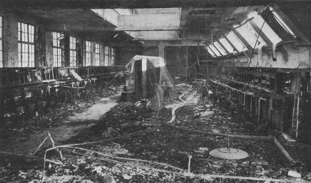
15,000 telephone lines terminated in Wood Street and the following morning 10,000 of these needed repair. The building itself was also badly damaged with the following photo showing one of the burnt out operator halls with the remains of operator positions lining the walls on either side.

It can now be revealed 13

In the days that followed, as well as work to repair the building, equipment and cabling, one hundred telephone boxes were installed along Cheapside and Moorgate to provide temporary services.

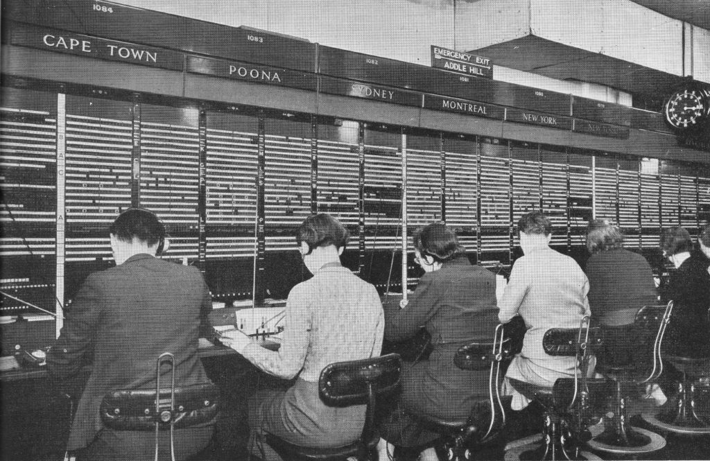
What the operator hall should have looked like is shown in the photo below taken in the Faraday Building in Queen Victoria Street which was a hub for Trunk and International telephone services and thankfully did not suffer the same level of damage as other telephone exchanges in the city.

It can now be revealed 18

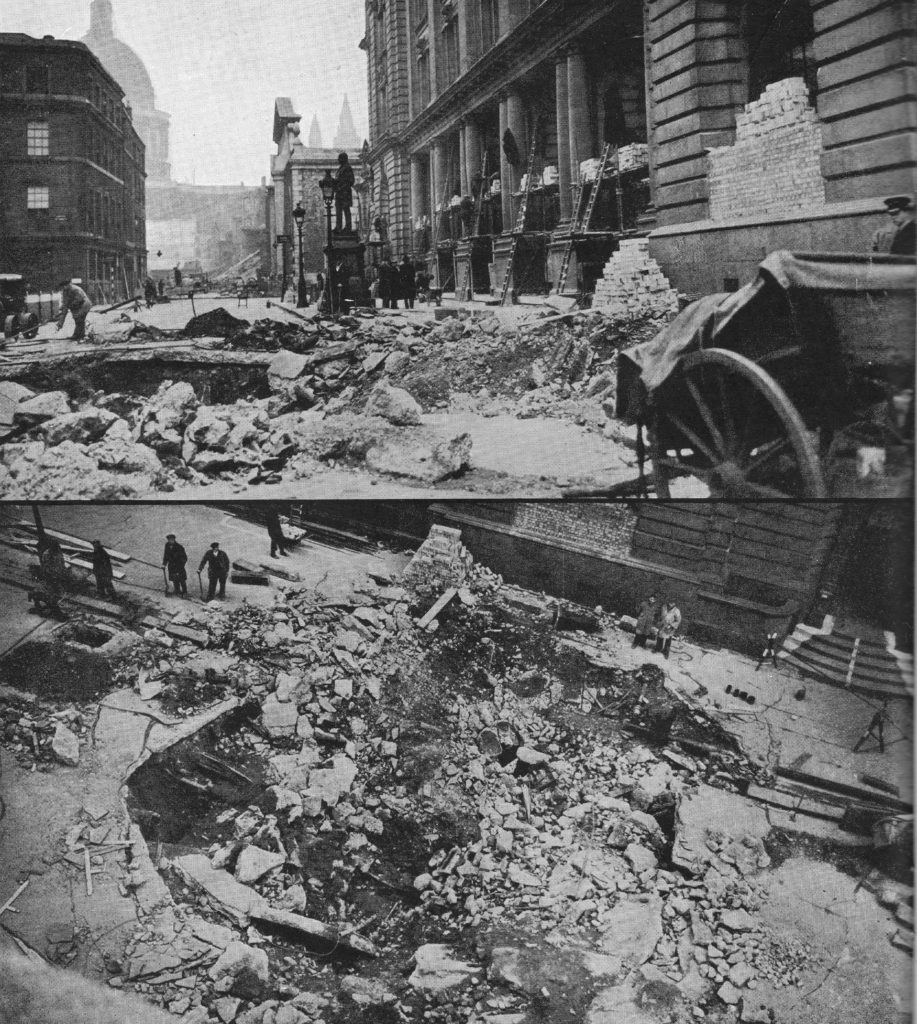
The following two photos show the impact of a high explosive bomb falling in the road outside the Central Telegraph Office in King Edward Street.

It can now be revealed 14

The Central Telegraph Office was the heart of the whole British telegraph system (used to transmit telegrams) and had a staff of 3,000. A telegram was how you would send a fast written short message to someone, the early 20th century version of text messaging or Whatsapp. Written messages would be delivered or phoned in to the Central Telegraph Office, typed onto a teleprinter that would send the message to a similar machine at a location closest to the recipient where it would be printed out and hand delivered.

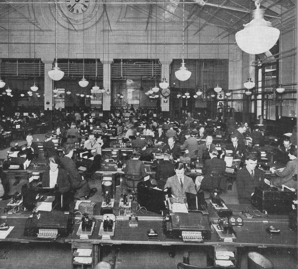
The Central Telegraph Office had galleries dedicated to Inland and Foreign telegrams. The Inland Gallery was equipped with 500 teleprinter machines dealing with 200,000 telegrams a day.

The Central Telegraph Office was completely gutted over the night of the 29th December 1940, but was rebuilt and continued to provide service during the later years of the war. The following photo shows one of the galleries in operation.

It can now be revealed 19

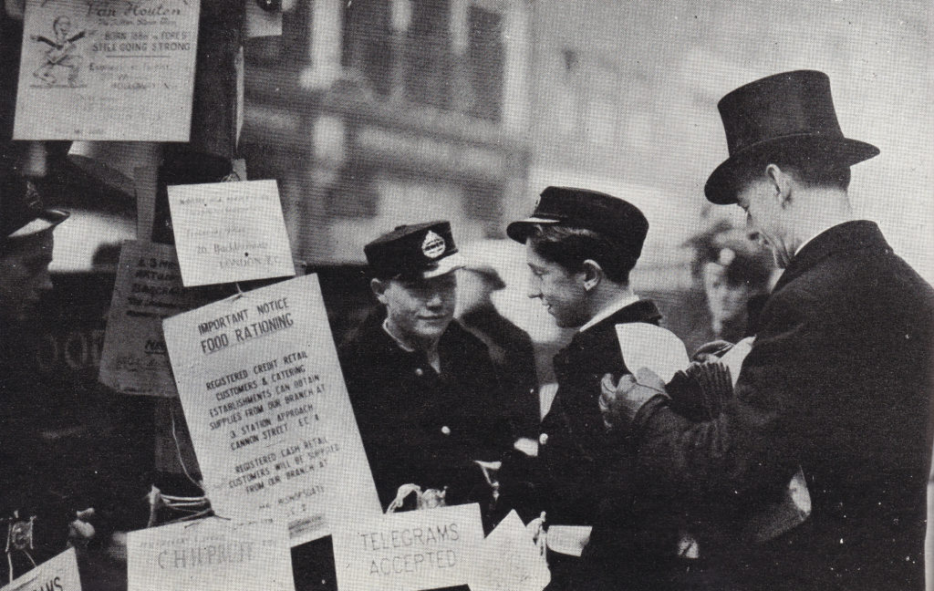
One of the methods to send a telegram for the businesses in the City was to phone the Central Telegraph Office and dictate the message, however with the damage to telephone cables, this was not always possible, so the Post Office stationed Telegraph Messengers at key points across the City to pick up messages and take them to the Central Telegraph Office.

It can now be revealed 15

As well as telephones and telegrams, the Post Office was also responsible for the collection and delivery of letters and parcels and in London this centered on Mount Pleasant which at the time was described as the largest Post Office in the World and just prior to the start of the war employed up to 7,000 Post Office workers.

The size of Mount Pleasant was such that it was bound to be hit by bombs but did get off relatively lightly being hit nine times throughout the war years, although some of these did cause considerable damage including a single bomb that on the 18th June 1943 completely gutted the three storey parcels building.

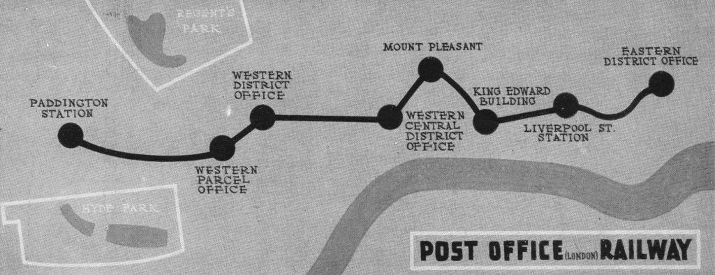
The Post Office Railway passes through Mount Pleasant and the booklet describes the railway during the war:

“During the war the Post Office Railway , in addition to its normal duties, made its own contribution to the Post Office war effort. It furnished an admirable air-raid shelter and dormitory; a series of cots, hinged to the wall by one end, being pulled down and set right across the track when the long day’s work was done and the conductor rail had gone dead for the night.

It was also a minor casualty when in December, 1944, a V2 rocket bomb fell in Bird Street, between Selfridges and the Western District Parcels Office. Besides putting this important parcels office out of action just before Christmas, it damaged a water-main which flooded the station of the Western District Parcels Office, nearly 80 feet below to a depth of 18 inches. But the Post Office Railway is prepared for such emergencies, and the station was soon pumped clear.”

Map from the Post Office booklet showing the stations of the Post Office railway:

It can now be revealed 16

An interesting couple of paragraphs in the booklet show that even in wartime, the collection of customs duties was fully in force:

“In war-time one class of parcel presents a particular problem – namely the packets of tobacco and cigarettes which may be dispatched duty-free to our Forces overseas. These are convenient to send, for all you have to do is hand an address and the requisite sum across a tobacconists counter, and a standard packet will be dispatched to your own particular sailor, solider or airman.

But if, as frequently happens, the packet cannot be delivered – possibly because the addressee has become a casualty or been transferred to another quarter of the globe – and the local authority sends it back, the nice question now arises ‘Who is to have the packet?’ Not the tobacconist for he has already been paid; nor the sender, for he has paid no duty. The Post Office solves the problem by handing over the packet to the customs authorities.”

The booklet also contains some fascinating detail of wartime mail distribution. It was possible to send letter to members of the British forces who were held as prisoners of war. An agreement was reached with Germany in 1941 allowing letters to be flown out to Lisbon where they would be handed over to the German airforce who would also hand over letters for German nationals held prisoner of war in the UK. Over 200,000 letters were sent each week from London to Lisbon for onward routing to British prisoners of war.

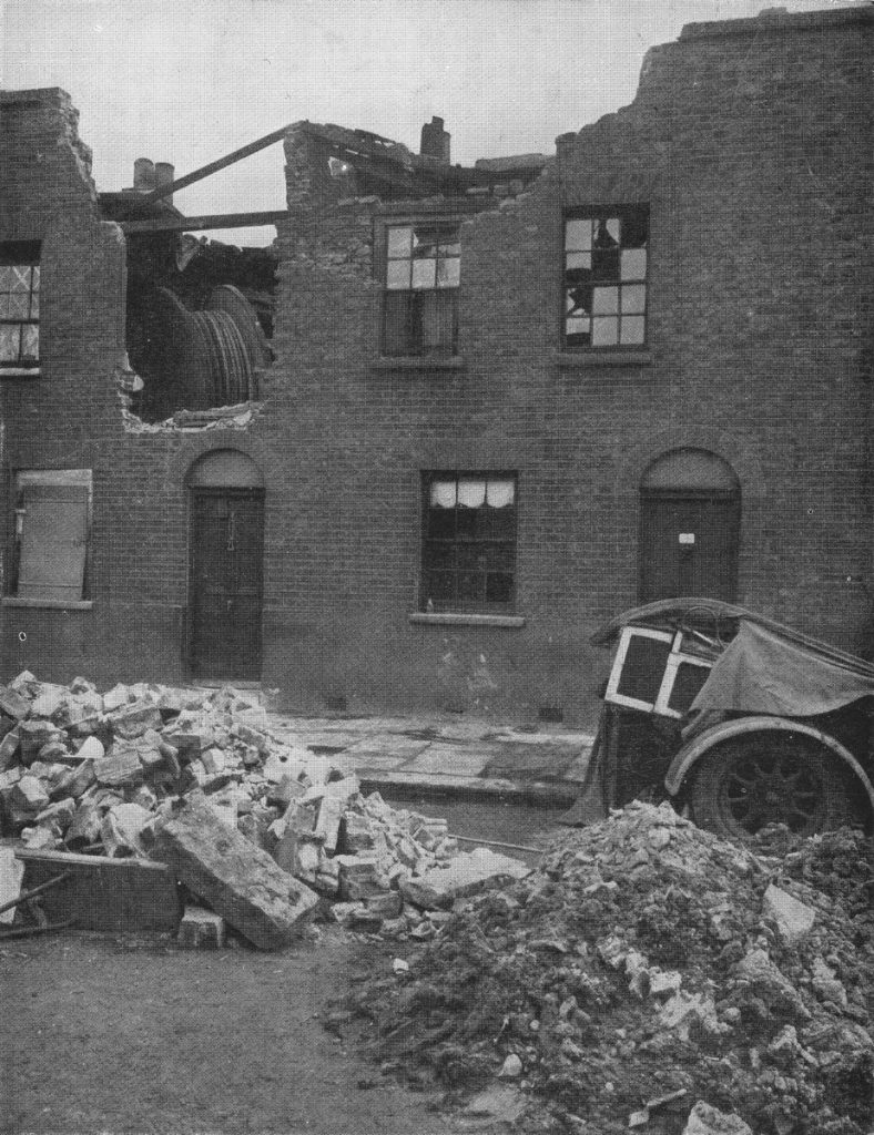
The booklet highlights the difficulties in maintaining the overall delivery of Post Office services, whether it was due to bombed Post Offices, damaged cabling or disruption to transport networks. Even when trying to repair the network, the impact of bombing can continue to cause problems. The following photo shows a cable drum blown from the street to the top floor of a house as a result of a bomb.

It can now be revealed 17

Unlike the Railway booklet, the Post Office Went To War does not have a chapter looking forward to post war reconstruction, however it does have a section on research and features the Post Office Research Station at Dollis Hill in north-west London.

Dollis Hill was the main Post Office Research Station and carried out research into all the technologies used by the Post Office including Telephone Systems, Radio, Cables, Sub-Sea systems etc. A significant number of engineers and scientists were employed at Dollis Hill with, for example, a staff of 300 in just the Radio Section.

It was still classified information at the time the booklet was written so it was not included, however the Collossus computers used at Bletchley Park during the war to decode German signals were built at Dollis Hill. Tommy Flowers (originally from Poplar in east London) who worked at Dollis Hill proposed using electronic valves rather than mechanical relays to build the computers needed by Alan Turing at Bletchley and despite considerable resistance that a machine with such a large number of valves (1,500 upwards) would be reliable, Tommy Flowers and his team constructed the Collossus computers which more than confirmed Flowers’ view that they would be much faster and more reliable than the existing mechanical relay based systems.

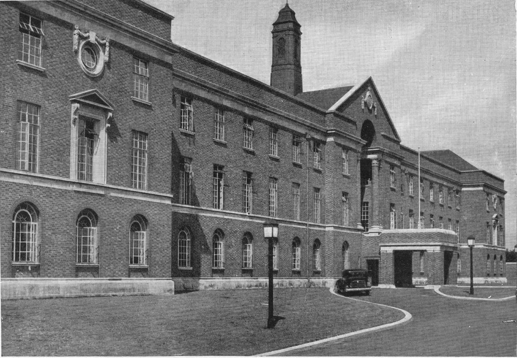
The Dollis Hill Research Station:

It can now be revealed 20

The Research Station moved out of London to Martlesham Heath in Suffolk during the 1970s after which Dollis Hill closed. The main building was preserved and converted into flats.The approach road to the flats has been named Flowers Close in honour of Tommy Flowers.

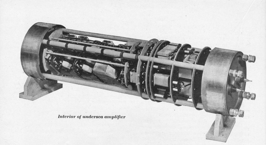
From the booklet, a photo of the interior of an undersea amplifier developed at Dollis Hill and used on sub-sea cable systems to amplify signals enabling telephone calls and telegrams to be sent over very long distances.

It can now be revealed 21

These two booklets, along with the many others published in the same period have a common theme. Recording with pride how their respective organisations, London boroughs or towns contributed to achieving victory at the end of the war, but also a recognition that times would very soon change and these events needed to be recorded quickly before the country focused on reconstruction and the possibilities that the future would bring.

alondoninheritance.com

Aldwych Underground Station

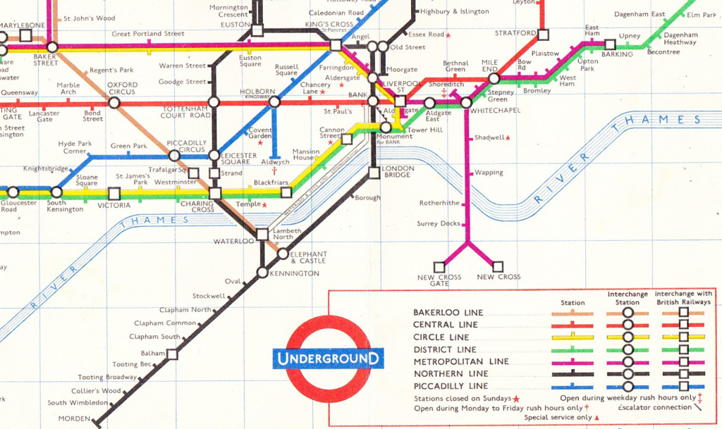
I have an underground map from 1963 and whilst there are some very significant differences when compared with an underground map of today, for example the yet to be constructed Jubilee Line, there is one station on the 1963 map that has disappeared.

Underground Map 1

Find Holborn Station in the above map. This has the Central and Piccadilly lines passing through, and there is a short stub section of the Piccadilly line going to an Aldwych station.

Aldwych station closed to passengers in 1994, however every so often the London Transport Museum organises tours of the station and yesterday I headed to Surrey Street, just of the Strand to take a look inside a station that I have walked past many times, but have never seen inside.

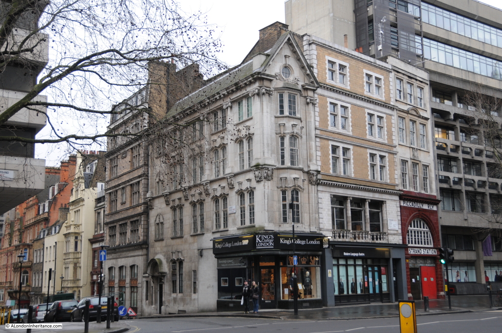
The external entrances of the station are still very visible. The station was built on a block of land between the Strand and Surrey Street with an entrance in each.

The following photo shows the block with the Strand entrance on the right and the Surrey Street entrance just visible on the left.

Aldwych 2

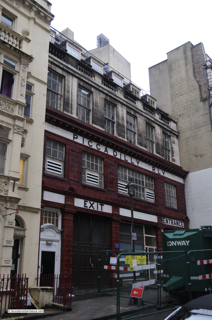
A close up of the Surrey Street entrance. The tiling is a very distinctive feature on both entrances:

Aldwych 1

The station was built on the site of Royal Strand Theatre which closed on the 13th May 1905. The site had been a theatre for much of the 19th century. The Royal Strand opened on the 5th April 1858 and was a reconstruction of the Strand Theatre which had previously stood on the site.

The underground station opened in 1907 as the Strand Station. It was renamed Aldwych in 1915.

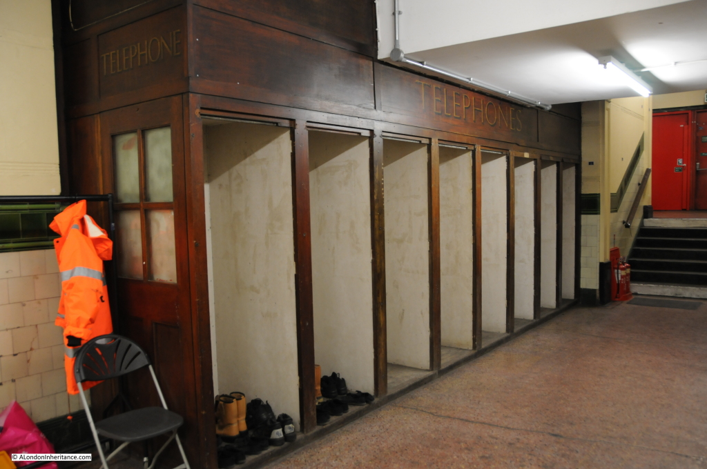
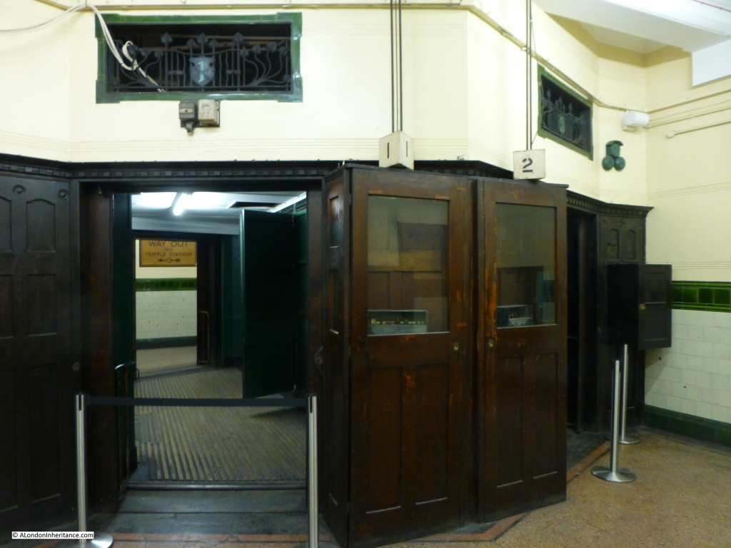
On entering the station, one is greeted with a now empty set of telephone booths. A reminder of the pre-mobile days when a fixed pay phone was needed to make a call when travelling in London.

Aldwych 18

The original lifts remain, although they do not work and were one of the reasons why the station closed. The lifts were still mainly the original 1907 equipment and replacement was urgently needed, however the very significant cost of replacing two lifts could not be justified for a station with only 450 passengers a day.

Aldwych 21

Passenger numbers through the station were very low from opening. This resulted in the ticket office being closed in 1922. Ticket booths were built into the lift cars so as well as operating the lift, the lift man could sell and collect tickets.
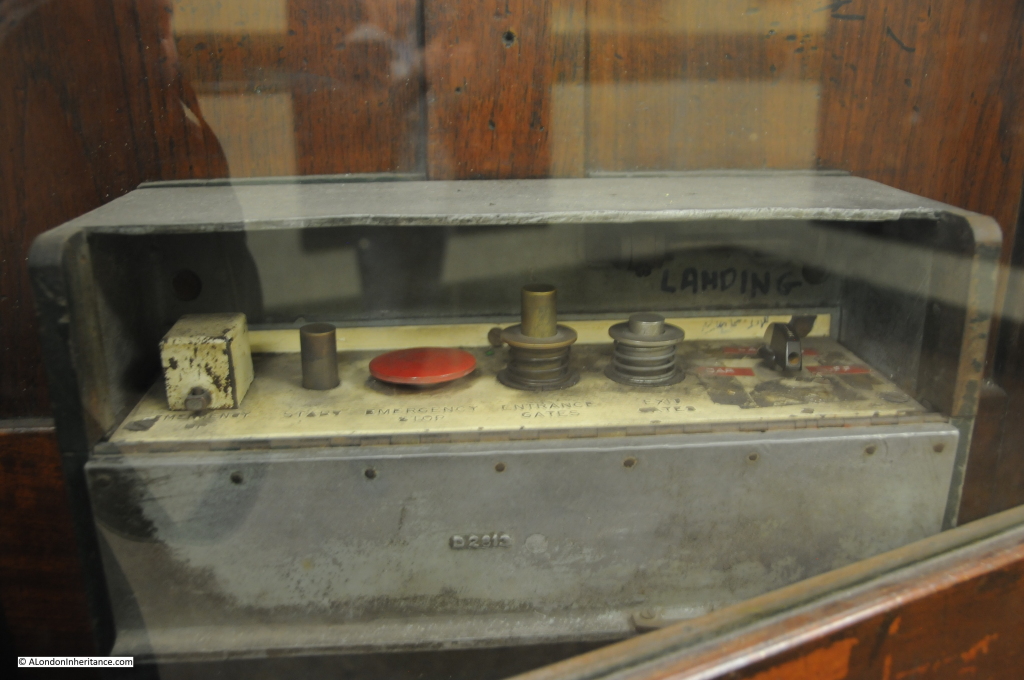
Lift control equipment:

Aldwych 19

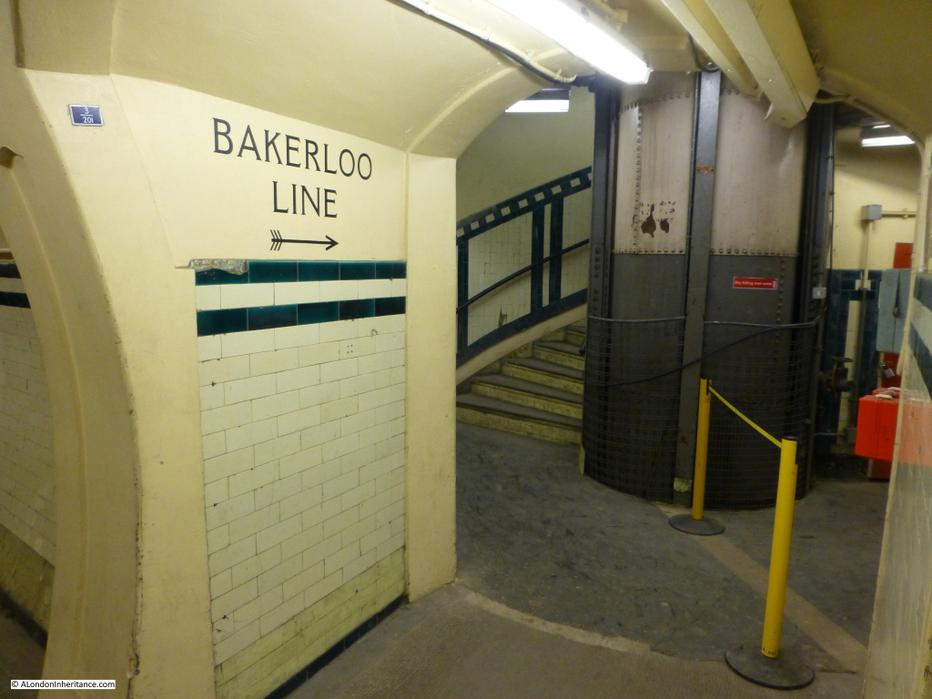
Without operational lifts, the platforms are now reached by a spiral staircase of some 160 steps. The base of the staircase:

Aldwych 22

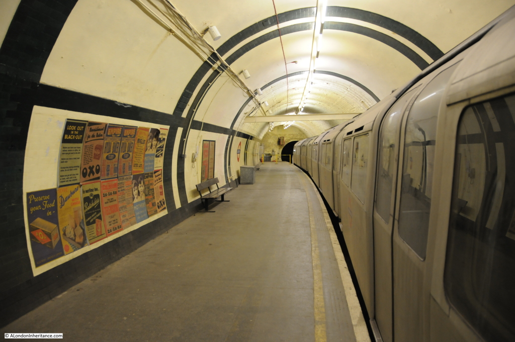
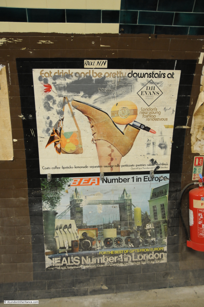
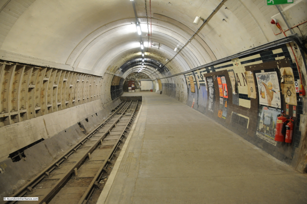
Platform 1 is the first platform to visit. This has an old Northern Line train in position along the platform. This platform and the train are used for training of the Underground’s Emergency Response Unit and has also been used as a film set for a considerable number of TV programmes and films. The old posters are more recent reproductions as part of creating an authentic platform for filming.
Aldwych 6

Aldwych was not part of the main Piccadilly Line and only had a shuttle service operating to Holborn.

More advertising posters:

Aldwych 13

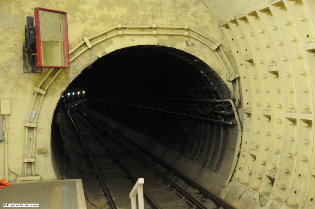
This platform still has an operational track towards Holborn station:

Aldwych 8

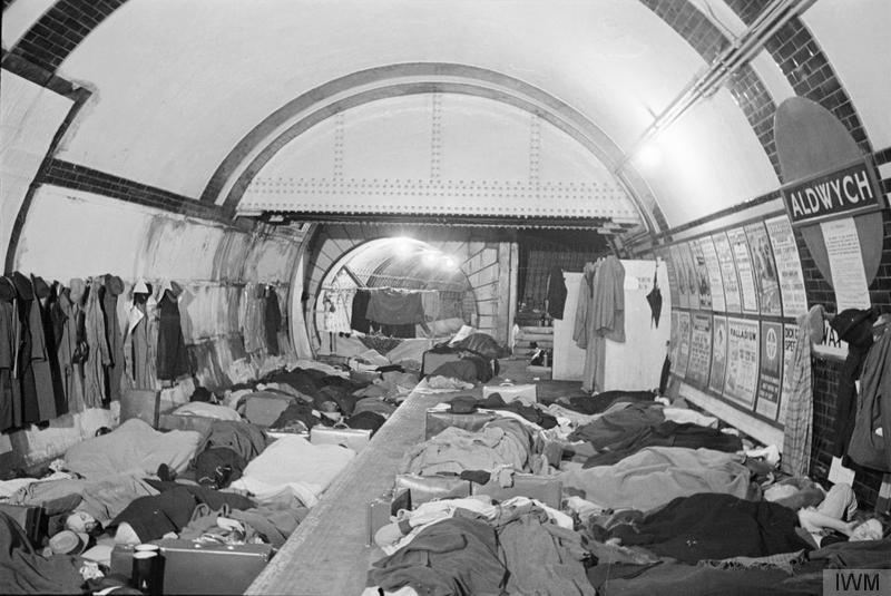
During the war, Aldwych station was a major air raid shelter which could accommodate up to 1500 people and was equipped with first aid facilities and a canteen. The train service to Holborn was suspended on the 22nd September 1940 from when the station was used as a shelter. The following photo is from the Imperial War Museum’s collection (© IWM (D 1675))

IWM (D 1675)

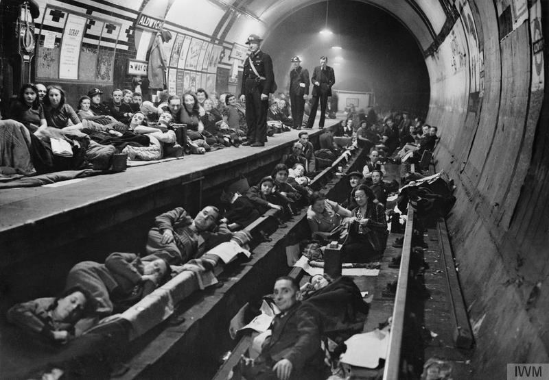
The following, also from the Imperial War Museum’s collection (© IWM (HU 44272)) illustrates just how basic and uncomfortable the facilities were, but considerably safer than being above ground during a major raid.

IWM (HU 44272)

The shelter formally closed as a shelter in May 1945 when war ended. peak usage had been during the early years of the war, with a second peak when the V1 and V2 weapons were targeted at London during the closing year of the war.

To get from platform 1 to platform 2 there is the walkway above the platforms as is typical in many other operational stations:

Aldwych 5

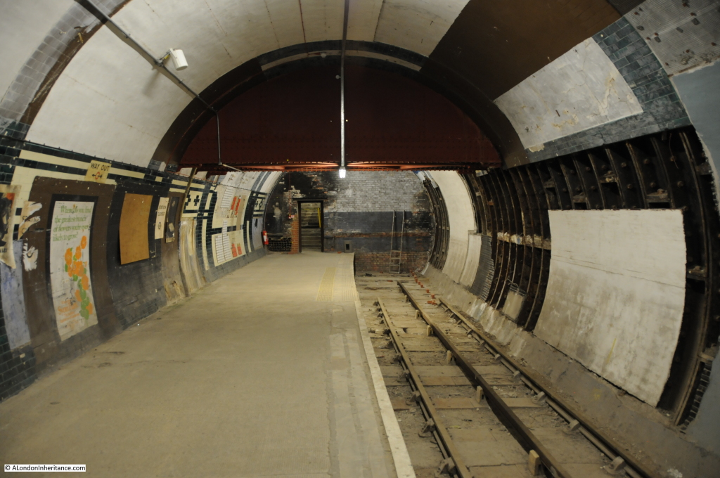
Platform 2 is very different to platform 1. This platform was closed for train services in 1914 with only platform 1 continuing to be used. Much of this area and the tunnel to Holborn was used as a store-room during the war. Many of the treasures from London museums were moved here for safety, including the Elgin Marbles from the British Museum. This is looking in the direction of Holborn.

Aldwych 24

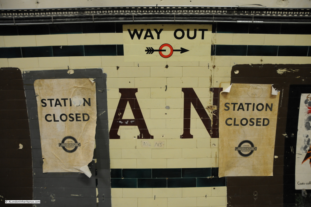
On the right can be seen part of the original Strand name of the station, shown below in more detail:

Aldwych 12

Only the “AN” still visible of Strand. The “Station Closed” posters are modern reproductions.

Platform 2 has also been used by London Underground to create mock-ups of station tiling and decoration in a realistic environment.

The opposite end of the platform, away from the Holborn direction is bricked off, with the exception of a door:

Aldwych 10

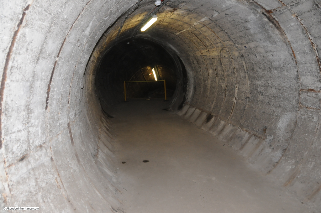
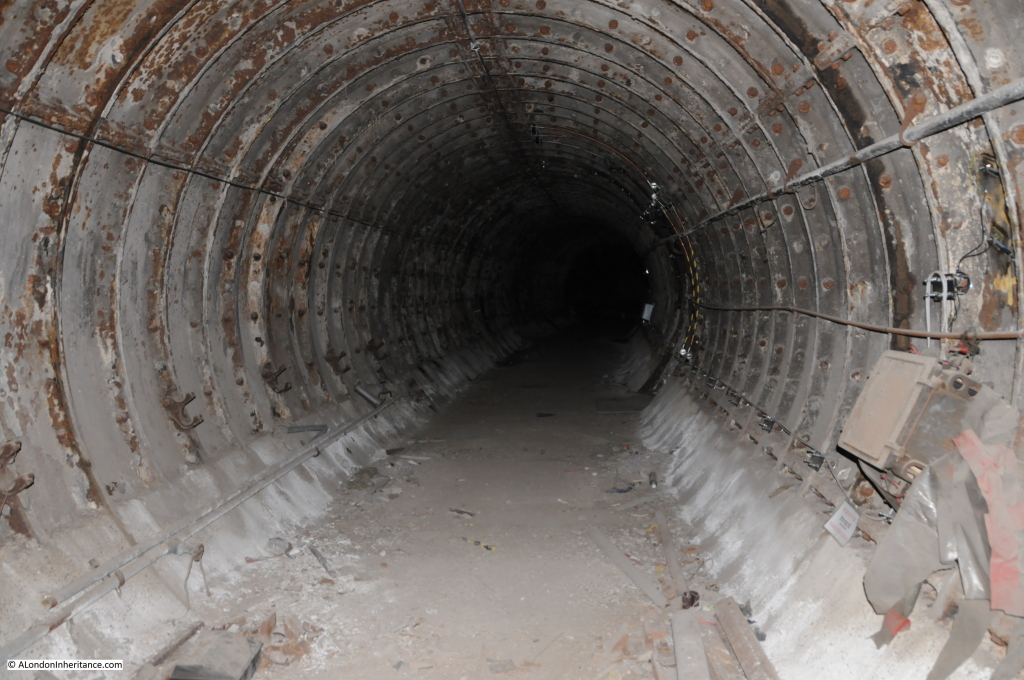
Behind the door is the original 1907 run off tunnel:

Aldwych 15

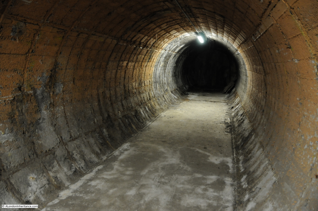
If a train did not stop, it would continue into the run off tunnel which had sand laid along the ground to try to slow the train. At the end of the tunnel are the original 1907 buffers and beyond these the tunnel terminates in a brick wall. Hopefully the dragging effect of the sand and the buffers would have done their job.

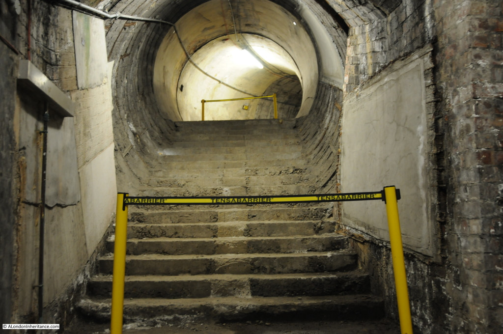
Adjacent to the run off tunnel are some of the original stairs. believed to have been intended as the original entrance to the platform:

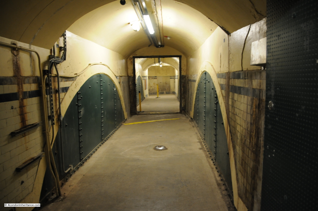
Aldwych 14There are also a number of tunnels which were never used by passengers and remain in their basic state. Even when the station was under construction there were concerns that passenger numbers would be low so only the main exit / entrance passages were fully finished.

Aldwych 16It was here that our guide told the story of why it is possible to feel a breeze, without the passing of any trains through the station.  The lead actress in the last play to run at the Royal Strand Theatre before it was demolished to make way for the station  was so unhappy that the play that was going so well was being cut short, swore to come back and haunt the station.

Sniffer dogs in training at the station have also been known to avoid this area of the station. A nice story, but looking into the dark of these tunnels does allow the imagination to run wild for a moment.

Aldwych 17

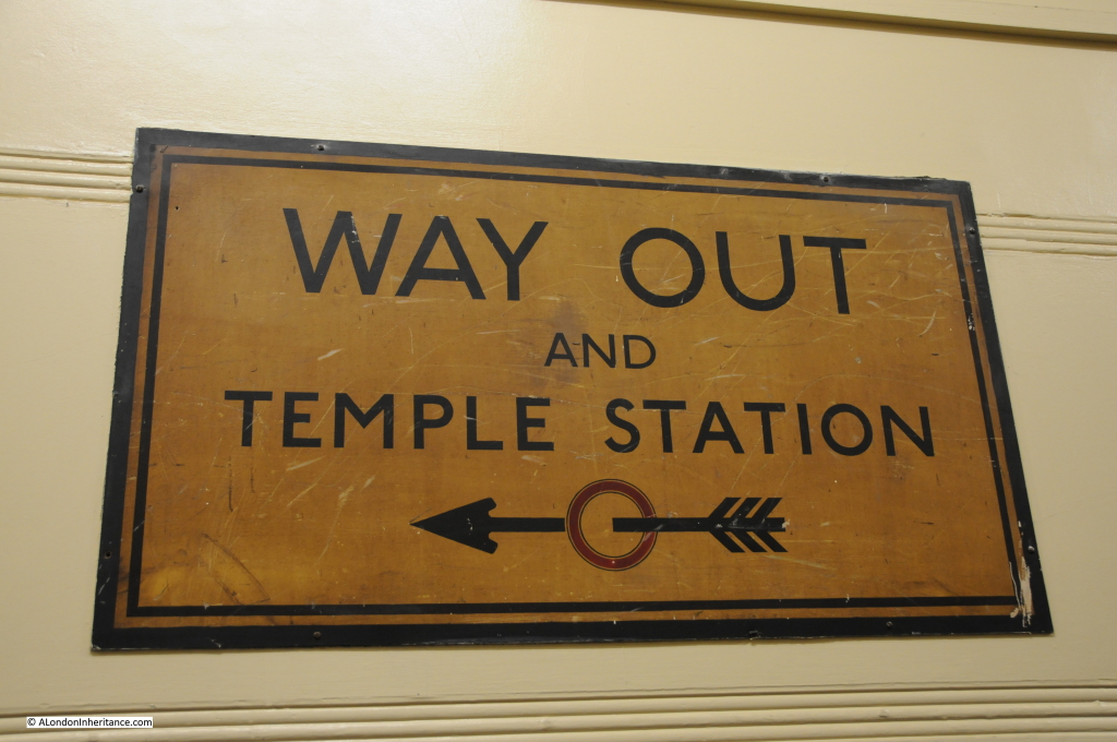
All too soon, it was time to climb back up the 160 steps to ground level and head out into Surrey Street, which as the sign below suggests, provides a short walk down to Temple Station.

Aldwych 20

A fascinating insight into one of the disused underground stations that are to found scattered across the underground system. As usual, the tour was superbly run by the London Transport Museum, with their highly knowledgeable staff and volunteers as guides.

alondoninheritance.com

London’s Railways – Planning For Peace

Around this time of year, a number of London stations are in the news for the considerable amount of work that is on-going for rebuilding, the creation of new lines and what always seems to be the inevitable overrunning engineering works. The work at London Bridge and for Crossrail being just two examples.

Major schemes have always been in various stages of planning to address London’s ever increasing transport requirements. Some schemes have reached completion, others never moved from the conceptual stage.

For this week’s post, I want to illustrate one set of schemes that were published in January 1946 and show how usage of the main London stations has changed over almost 80 years.

In the middle of the last war, there was a general feeling that the tide was starting to turn and planning could start for what London would look like in the decades after the war. How could the city be developed, what would be the transport needs of Londoners in the future, how could both the city’s infrastructure and landscape be improved and better use made of the limited space available?

In 1943 the London County Plan was published, then in February 1944 a committee was established :

“To investigate and report upon the technical and operational aspects of those suggestions made in the County of London Plan of 1943 which relate to the main line and suburban railway system of London, both surface and underground, bearing in mind that these suggestions are intended to contribute towards and form part of a comprehensive scheme for the re-development of the area in question.”

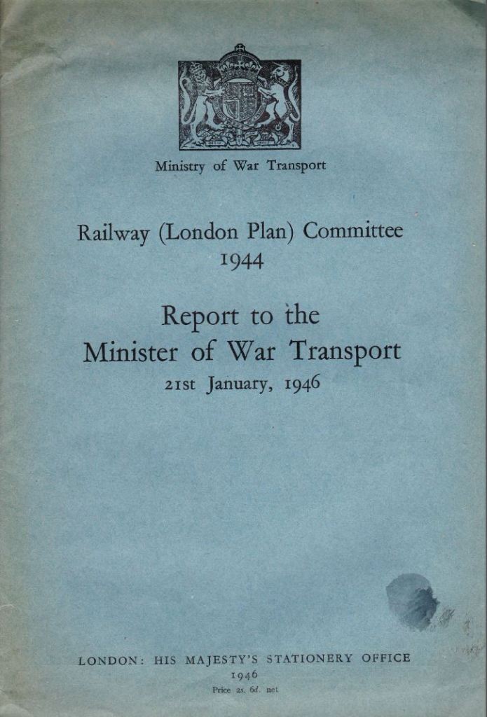
The report from the committee was published in 1946 and made some very far-reaching proposals, that had they been implemented would have had a dramatic impact on the transport system we see in London today.

Report Cover 1

Before getting into some of the details of the proposals, it is fascinating to compare the use of London stations between the 1930s and today. The 1946 report details passenger numbers of all mainline terminals up to the end of 1938 , the latter being the last year free from the influence of war.

The following table compares passenger arrival numbers during maximum morning peak hour  pre-war and in 2010 (the 2010 figures are taken from the “Central London Rail Termini: Analysing Passengers’ Travel Patterns Policy Analysis Research Project” published in September 2011 by Transport for London):

Station 1938 Peak Hour 2010 Peak Hour
Paddington 4,800 10,500
Euston 5,800 11,500
St. Pancras 2,100 9,000
Fenchurch Street 10,500 11,500
King’s Cross 9,000 7,500
Liverpool Street 34,700 32,500
Marylebone 3,900 5,500
Waterloo 24,300 45,500
Victoria 16,400 28,500
Charing Cross 17,000 15,500
Cannon Street 18,100 15,000
London Bridge 31,300 31,000
Totals 177,900 223,500

Whilst overall numbers have increased considerably there are some fascinating individual station comparisons. I bet if you use London Bridge on a daily basis the fact that in 2010 passenger numbers were still slightly below the 1938 level is of little comfort.

Perhaps reflecting the different options for transport and the changes in home locations for those working in central London, there are some significant swings. Paddington, Euston, St. Pancras, Waterloo and Victoria all showing significant increases in passenger traffic whilst King’s Cross, Liverpool Street, Charing Cross, Cannon Street and London Bridge are all showing reductions.

There were a couple of major themes within the 1946 report, perhaps reflecting the “anything can be done” attitude needed during the war, and a realisation that the changes caused to London by heavy bombing presented a major opportunity to improve London for everyone who lived and worked in the city. A similar approach to that taken by Wren after the Great Fire of 1666 when he proposed the creation of a city more along the lines of Paris than London had been with an ordered city with straight boulevards and a logical planning approach rather than the numerous small lanes and alleys of pre-fire London .

The major themes of the 1946 report were:

  • The removal of the head on terminals at Charing Cross and Cannon Street and the high level stations at London Bridge and Waterloo Junctions and the associated bridges across the River Thames
  • The construction of an extensive series of deep level tunnels and interchanges to replace the above ground infrastructure and to provide improved passenger and freight transport across London, capable of meeting the expected increase in both freight and passenger volumes.

As well as the removal of the bridges across the Thames, the viaducts across south London were also seen as a problem. Not just as a wasted space, but that they also split communities and their replacement by tunnels was seen as a way of integrating the many communities of south London. This was one of the areas where the rebuilding of the rail system would contribute into the overall London plan by making redevelopment of large areas such as the South Bank possible without the extensive railway infrastructure across the area.

In these proposals it is also possible to see the ideas behind Crossrail where trains from outside the immediate underground network are routed in tunnels across London with deep level interchanges with the tube and other rail networks and with the surface. Whilst the destinations are different, the concept is the same.

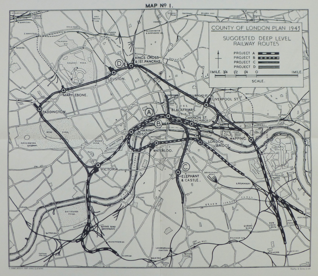
The following map from the report identifies the possible routes:

Map 1

The options shown in the map are:

Project A: A new deep-level North Bank link from Battersea to Deptford via Victoria, Charing Cross, Blackfriars, Cannon Street, Shadwell, Wapping and Surrey Docks

Project B: A new deep level-loop connecting Waterloo Junction, Charing Cross, Blackfriars, Cannon Street and London Bridge and then by tunnel via the Surrey Canal rising to join the existing surface systems in the south and south-east.

Project C: A north-south tunnel, an underground link to replace the existing viaduct from Snow Hill to Loughborough Junction

Project D: A northern arc suburban passenger route, passing below the main line stations at Paddington, Marylebone, Euston, King’s Cross and Liverpool Street with interchange facilities.

The projects also included the electrification of all remaining lines into London. I did not realise how much of the rail network leading into London had been electrified by the start of the last war. We tend to think that this was still the age of steam, but into London, the percentages that were already electrified after completion of the 1935 / 40 New Works Programme were:

Southern Railway: 86%

London and North Eastern Railway: 26%

London Midland and Scottish Railway: 32%

One of the other projects considered for the rail terminals was “The reconstruction of terminals at two levels, with flat roofs for future air landing”. Just shows the difficulties in trying to forecast how transport will be used in the future.

Removal of the bridges across the river was considered important as “the merit of a clean sweep of the three rail bridges over the Thames between Westminster and London Bridge cannot be denied”. How different the river would look today without the rail bridges.

Some of the themes driving the need for change are the same now as they were in 1946:

“Size and Distribution of Population. For many decades past, London has embraced a rising proportion of the total population of the whole country, which has itself been rising. During the inter-war years approximately half of the increase in London’s population could be attributed to immigration from the provinces
Decentralisation of employment, for it is one of the guiding principles that industry also should be de-centralised and there are proposals for satellite towns to be located, and existing towns expanded beyond the green belt.
Increasing traffic. Experience shows that, as income rises, the demand for transport rises more than proportionately, irrespective of transport to and from work.”

These words could equally have been written in 2014 as they were in 1946, and in 2014 to support the second point could also be added the ever-increasing price of property in central London driving people further out in search of affordable housing.

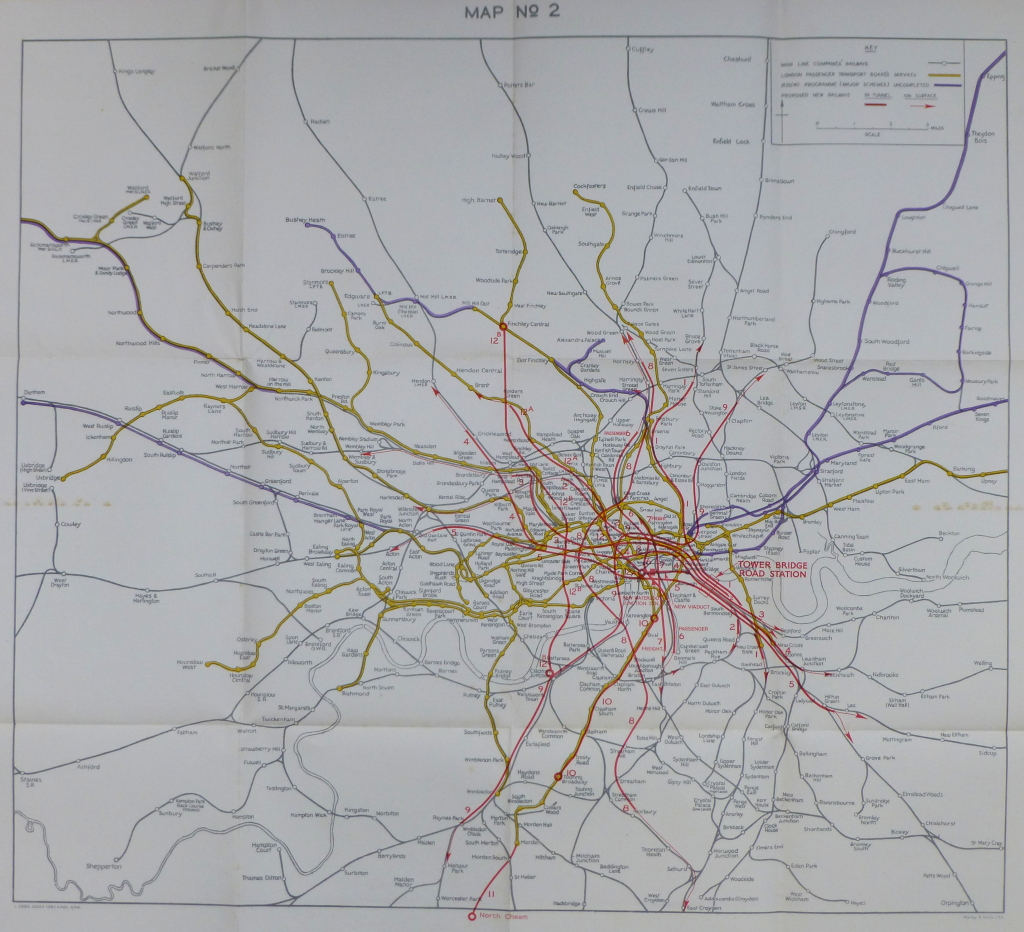
The following map from the 1946 report shows the proposed routes in their wider context and the considerable complexity of these proposals (click on the map to open a large copy):

Map 2
London Bridge Station was singled out for special interest. Total passenger numbers in the peak hour in 1925 was 38,000 and grew to 55,000 in 1938. In planning the proposed changes to the rail system, an expected 75,000 passengers was considered the level for which an upgrade should be planned.

As well as moving part of the station underground, an alternative site was considered and a major new underground / overground station was planned for a site adjoining Tower Bridge Road (as marked in Map No. 2 above)

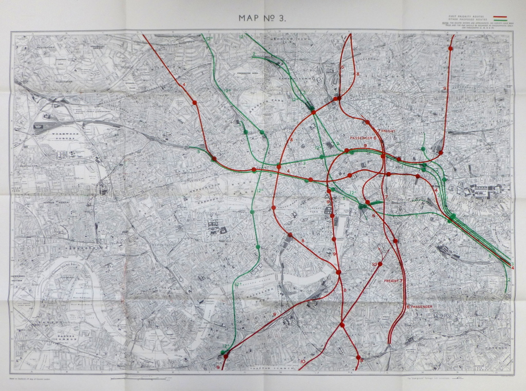
The following map shows the first and second priority routes and also tunnels for the use of passenger and freight traffic. This was still at a time when significant volumes of freight traffic were carried by rail. The explosion of road transport, the motorway network and the considerable use of lorries for freight was not forecast to have a major impact on the rail system in 1946 (again click on the map to open a larger copy).

Map 3

The cost for the priority works were estimated as:

North Bank Route Cost (£)
Main Route 20,920,000
Clapham Branch 2,640,000
Brixton Branch 1,940,000
Deptford Branch 530,000
New Cross Branch 1,380,000
New Cross Gate Branch 1,620,000
Lay-over at Charing Cross 1,840,000
South-east, City and West End Route  
Main Route 5,590,000
Lay-over at Charing Cross 460,000
North-South Route  
Main Route 4,800,000
Lay-over at Holborn 920,000
Northern Arc Route  
Main Route 6,450,000
Lay-over 460,000
Total Scheme 49,550,000

This was rounded up to £50 Million, which was then doubled to take into account the cost of land, property, traction equipment, rolling stock and signalling, plus a further £10M for other ancillary works, giving a total estimated cost of £110 Million. A considerable sum just after the war, also given the financial situation of the country at the time.

The cost of all proposals in the plan was estimated at between £228 Million and £236 Million and these costs did not include the cost of electrification or any other works outside of the proposed tunnels. Estimates of construction time were “under the most favourable conditions, would not be less than 30 years”.

New types of train were also recommended. The majority of overland trains on the Southern Railway comprised carriages with six-a-side compartments, however the safety needs of operating these trains underground required the provision of rolling stock with some form of through corridor to enable passengers to pass in emergency from one coach to another. The types of trains in use at the time were made up of six-a-side compartments and an overall train could carry 1,050 passengers. A 10-coach train of similar length with through corridors reduced passenger carrying capability down to 600 passengers. A challenge with the proposed approach as an increase in the number of trains would be required to carry the same number of passengers without any capacity for the expected increase in numbers.

So what happened to these proposals which would have had a very dramatic impact on the train services and stations in London as well as the view along the Thames if the removal of the rail bridges had gone ahead?

As well as the very significant costs of the proposals, shortly after they were published alternative committees were also set-up to look at options for upgrading London’s transport services.

London Transport planners also prepared their own report which was published the following year in March 1947. On the 1st January 1948, the British Transport Commission took over London Transport as well as the main line railways. The Commission also set-up a new working party to report on transport services within London and a report was completed in late 1948.

The multiple reports, high costs and the economic state of the country in the late 1940s and early 1950s put on hold this type of far-reaching proposal and development of transport within London followed a more individual project approach. Some of the 1946 proposals did get included in alternative projects. For example the Brixton branch proposed in 1946 was eventually covered by the routing of the Victoria Line to Brixton.

London Bridge Station in all it’s complexity is still there and perhaps after the ongoing considerable rebuilding work including the work over this year’s Christmas break, will see the station reach the potential envisaged by the 1946 planners, although with the significant difference of being above ground rather than below.

The sources I used to research this post are:

  • Railway (London Plan) Committee 1944 Report to the Minister of War Transport – 21st January 1946
  • Central London Rail Termini: Analysing Passengers Travel Patterns. Policy Analysis Research Report. published by Transport for London, September 2011

alondoninheritance.com