Tag Archives: Cannon Street

Myths and Legends of the London Stone

Before taking a look at the long history of the London Stone, a quick advert as I have arranged some dates for my very last tours of the year, and the last ones until probably May of next year. I have included all my different tours, and it would be great to show you many of the stories and photos from the blog over the last nine years, at the actual sites.

Dates and links for booking as follows:

It would be wonderful to see you on a walk – now to the London Stone.

In its ability to attract myths and legends, the London Stone is far more powerful than its physical size suggests. A long time resident of the area around what is now Cannon Street Station, but with the distance of time, it is impossible to know the truth about the block of stone, which can now be found in a new housing with a glass front:

London Stone

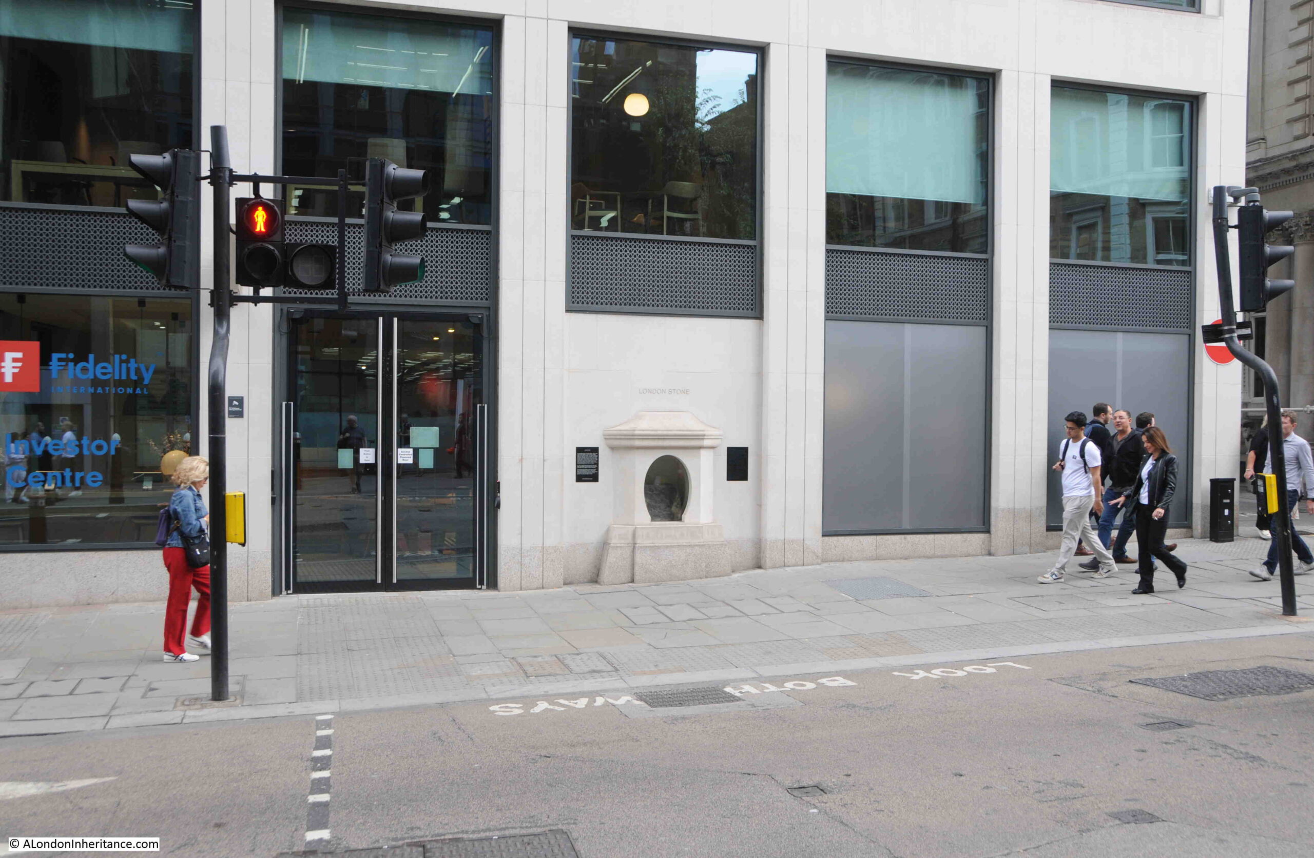
The new housing for the London Stone was completed in 2018, along with the building of which the stone is part of the ground floor frontage onto Cannon Street:

London Stone

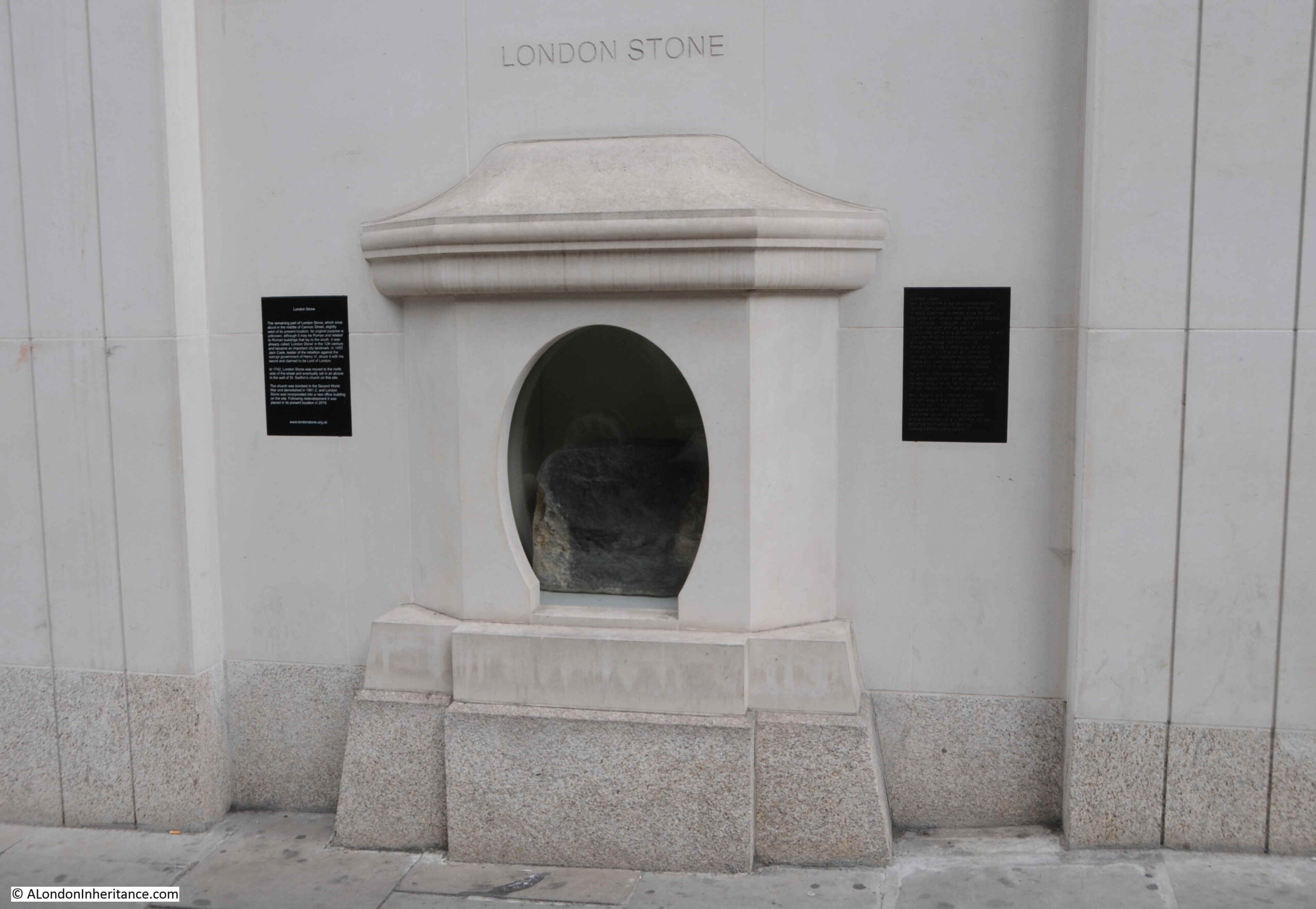
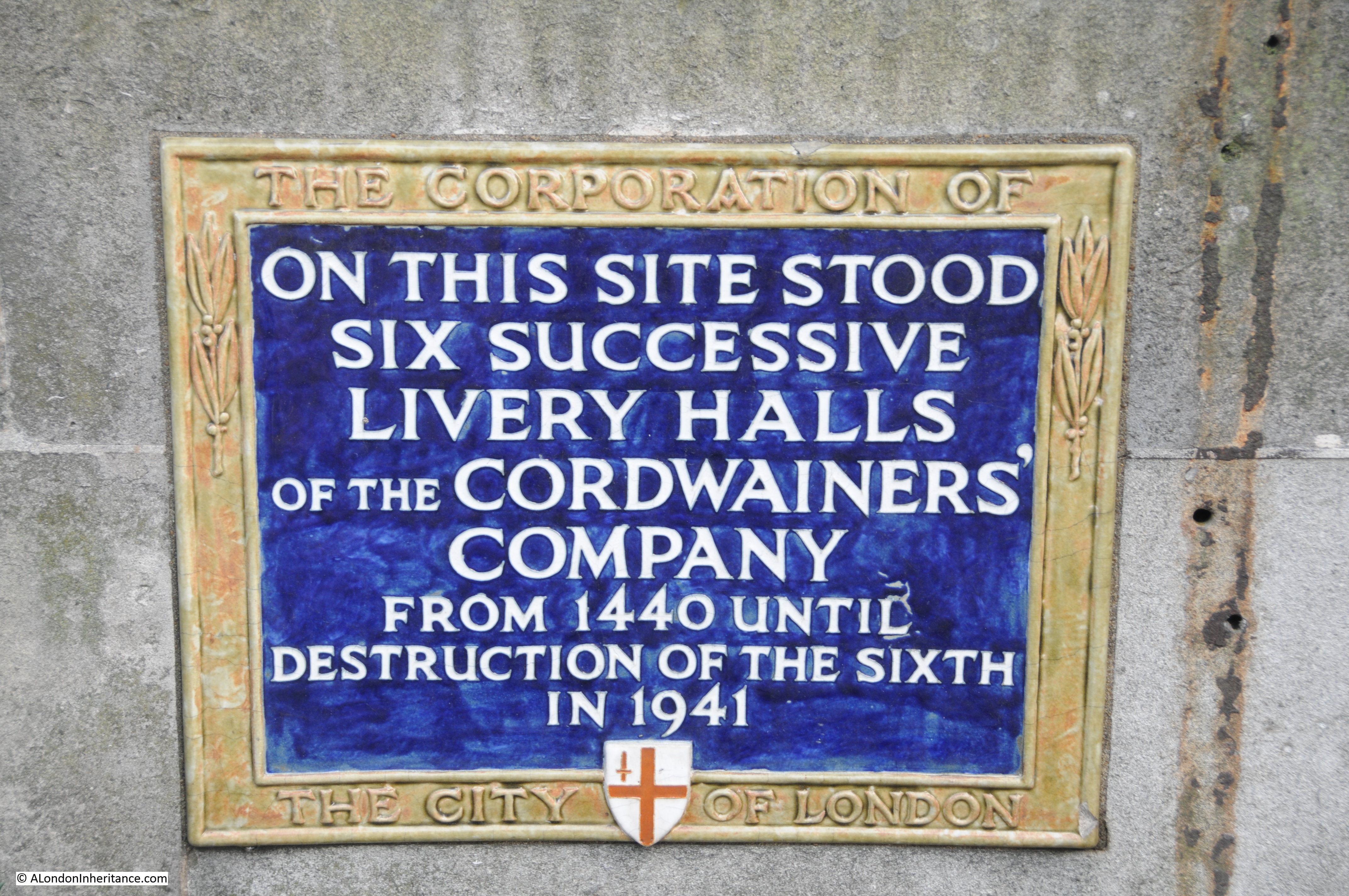
The plaque to the left records some of the key stories about the London Stone:

  • It may be Roman and related to Roman buildings to the south
  • It was already known as the London Stone by the 12th century
  • Jack Cade, the leader of a rebellion against the government of Henry VI in 1450 struck the stone with his sword and claimed to be Lord of London

The plaque on the right tells the story in braille which is rather good.

The previous building on the site was an early 1960s office building, which was demolished 2016, when the London Stone was moved to the Museum of London where is was put on temporary display, before being moved to its new home.

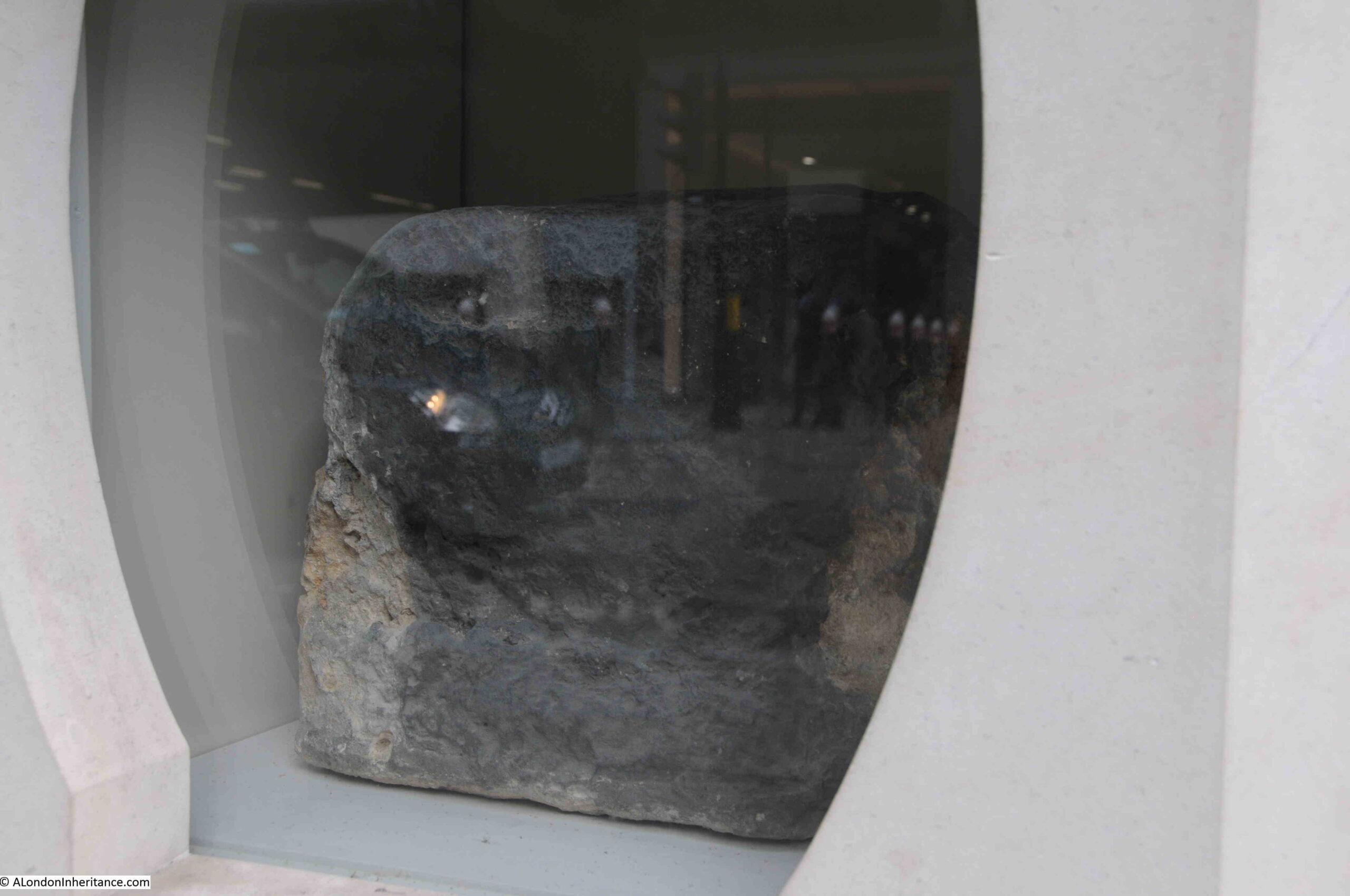
A view of the London Stone through the window at the front of the housing:

London Stone

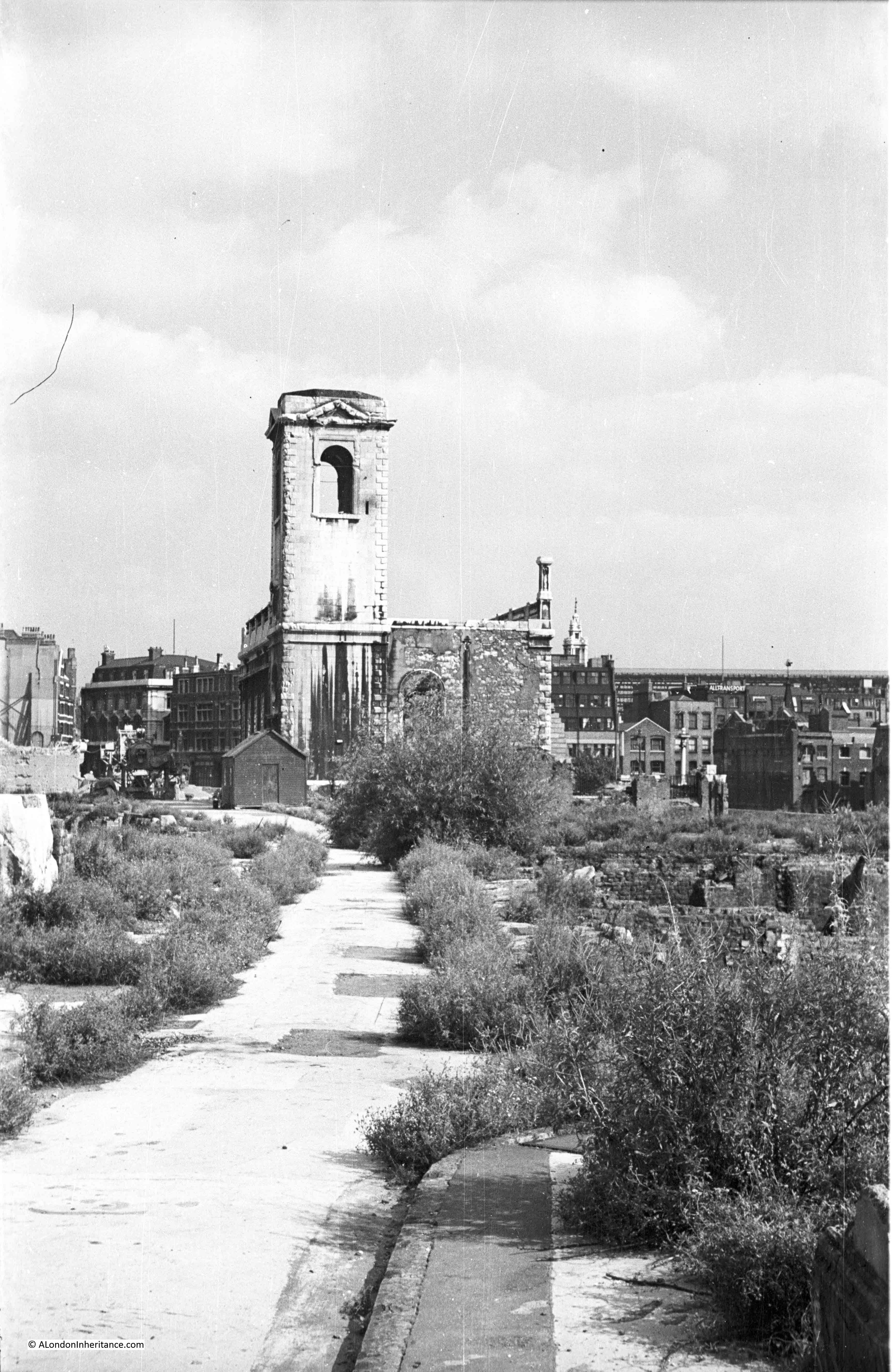
The site was originally occupied by St. Swithin’s Church, however the church was destroyed by bombing in 1940. The stone walls of the church, with the London Stone, survived, and continued to stand on the site until being demolished for the 1960s office building.

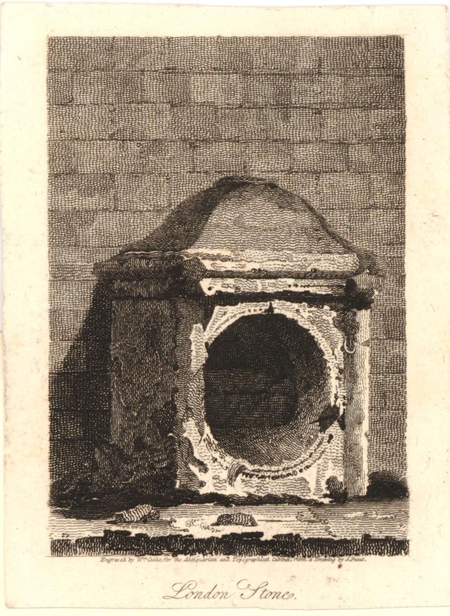
Wonderful London has a photo of the London Stone in its housing on the front of St. Swithin’s Church, I doubt that the stone usually had a police guard:

London Stone

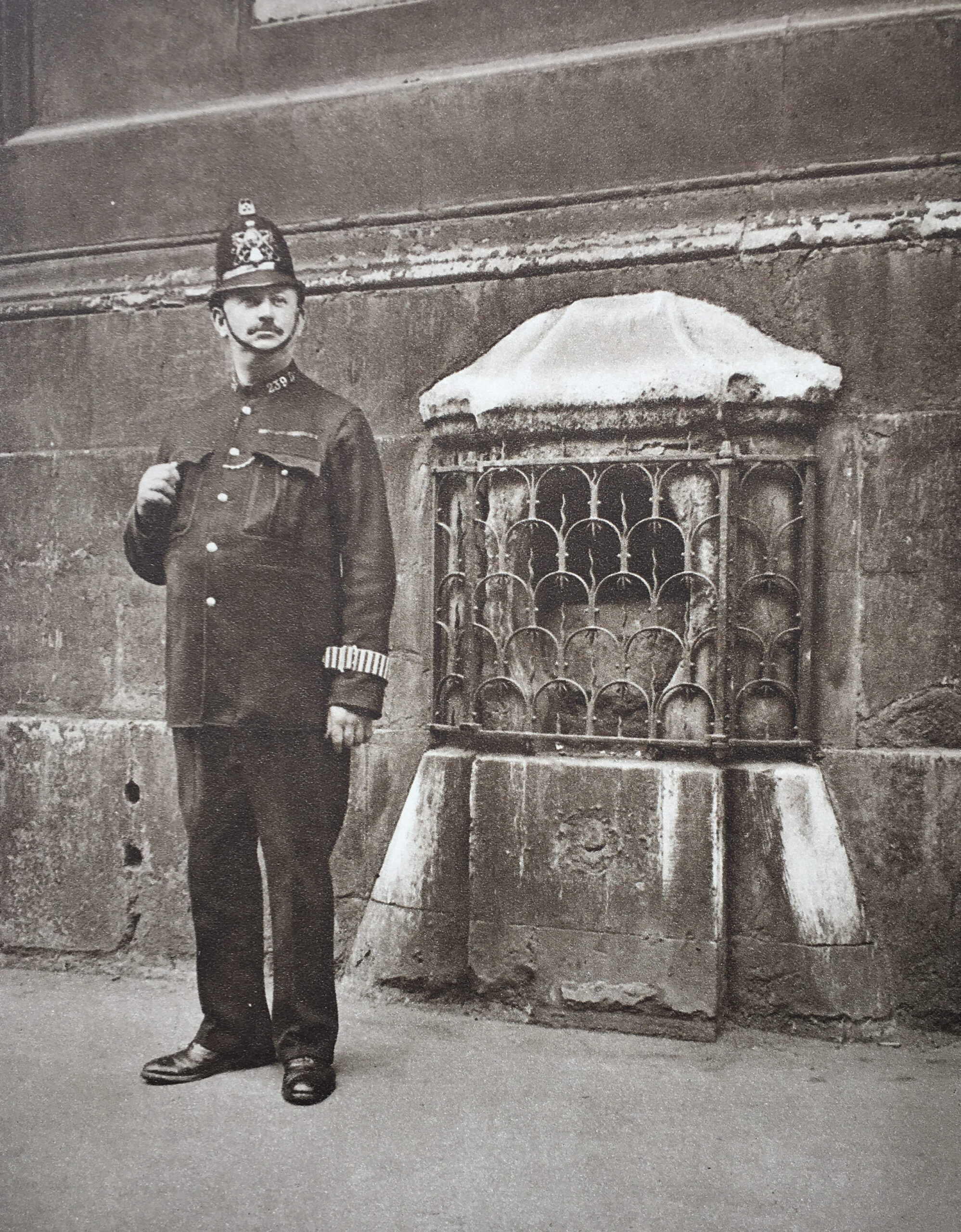
The Wonderful London description below the above photo reads: “Set in a stone casing in the wall of St. Swithin’s, Cannon Street, is this block of oolite, guarded by a grille. It was placed there in 1798, having been transferred from the other side of the road. Camden, the historian, 1551 – 1623, held that it was the milliarium, or milestone, from which distances were calculated on the main roads in days when London was Londinium Augusta. There was a similar stone in the Forum at Rome. If Camden is right, Roman lictors may have stood, like this policeman, in front of the stone 1,600 years ago”.

The text mentions that the stone is a block of oolite, which is a form of limestone, and was used in Roman London for building and sculpture, but may also have arrived in the City in the Saxon and early medieval period.

There was a large Roman building where Cannon Street Station now stands, so it may have formed some part of this building, or some of the decorative sculpture or statues that would have been part of the building.

There is no way to be sure.

The Roman milliarium or milestone story is repeated in multiple accounts of the stone. Sir Walter Besant in his 1910 book on the City of London includes the milestone story, but goes further by saying that some have supposed the stone to be the remains of a British druidical circle or religious monument. He quotes Strype as saying that Owen of Shrewsbury gave rise to the assertion that “the Druids had pillars of stone in veneration, which custom they borrowed from the Greeks”.

Besant also records that “Sir Christopher Wren was of opinion that ‘by reason of its large foundation, it was rather some more considerable monument in the Forum; for, in the adjoining ground to the south, upon digging for cellars after the Great Fire, were discovered some tessellated pavements, and other extensive, and other remains of Roman workmanship and buildings.”

The problem with all these stories about the original Roman use of the London Stone is that there is no firm evidence that it was a milliarium or milestone, when it arrived in the City, whether it was Roman, or the original use of the stone.

What seems to be certain is that the stone has long been in this part of Cannon Street. It was originally on the south side of the street and was also in the street, where it was an obstruction to the traffic flowing along the street.

The Wonderful London quote references that the stone was moved to St. Swithin’s Church, and guarded by a grill in 1798. This was urgently needed to protect the stone, as it appears to have been frequently under attack by those who used the street, as this report from several papers on the 2nd of July 1741 records:

“Thursday a Carman and a Drayman contending for the Way in Cannon-street, made a shift between them to throw down the little Building that covers London Stone (as ’tis call’d) and then pull the said Stone out of the Earth. this being presently known, great Numbers of People flocked to see it, and many curious Observations, Conjectures, and Prognosticks were believed by the Wiseacres present, on so extraordinary an Accident.”

The 16th century historian John Snow, who first published his Survey of London in 1598 included the following reference to the London Stone which explains how it was fixed in position, and why it was a significant obstruction for those who used Cannon Street:

“On the south side of this high street, near unto the channel is pitched upright a great stone called London stone, fixed in the ground very deep, fastened with bars of iron, and otherwise so strongly set, that if Carts do run against it through negligence, the wheels be broken, and the stone it self unshaken.”

The London Stone seems to have been a well known feature of Cannon Street, as it was often used as part of an address, such as in the following from an advert in the Kentish Gazette on Friday, November the 6th, 1795, where a contact was given as “Mr. Sergeant, Number 86, London Stone, Cannon Street”.

And on the 26th of February 1788 there was an announcement in the Kentish Gazette of the marriage at “St. Swithin’s, London Stone, of W.T. Reynolds’s Esq. of Great St. Helen’s to Miss Sands of St. Dunstan’s Hill”

The following print from 1791 shows the London Stone in a casing up against St. Swithin’s church, as although Wonderful London mentioned 1798 for the positioning of the stone against the church, it had been moved to this safe location some years earlier, and in 1798 the church went through a major set of repairs, which included proposals for the stone to be removed as a nuisance, however there were many objections and the stone was kept up against the front of the church © The Trustees of the British Museum):

London Stone

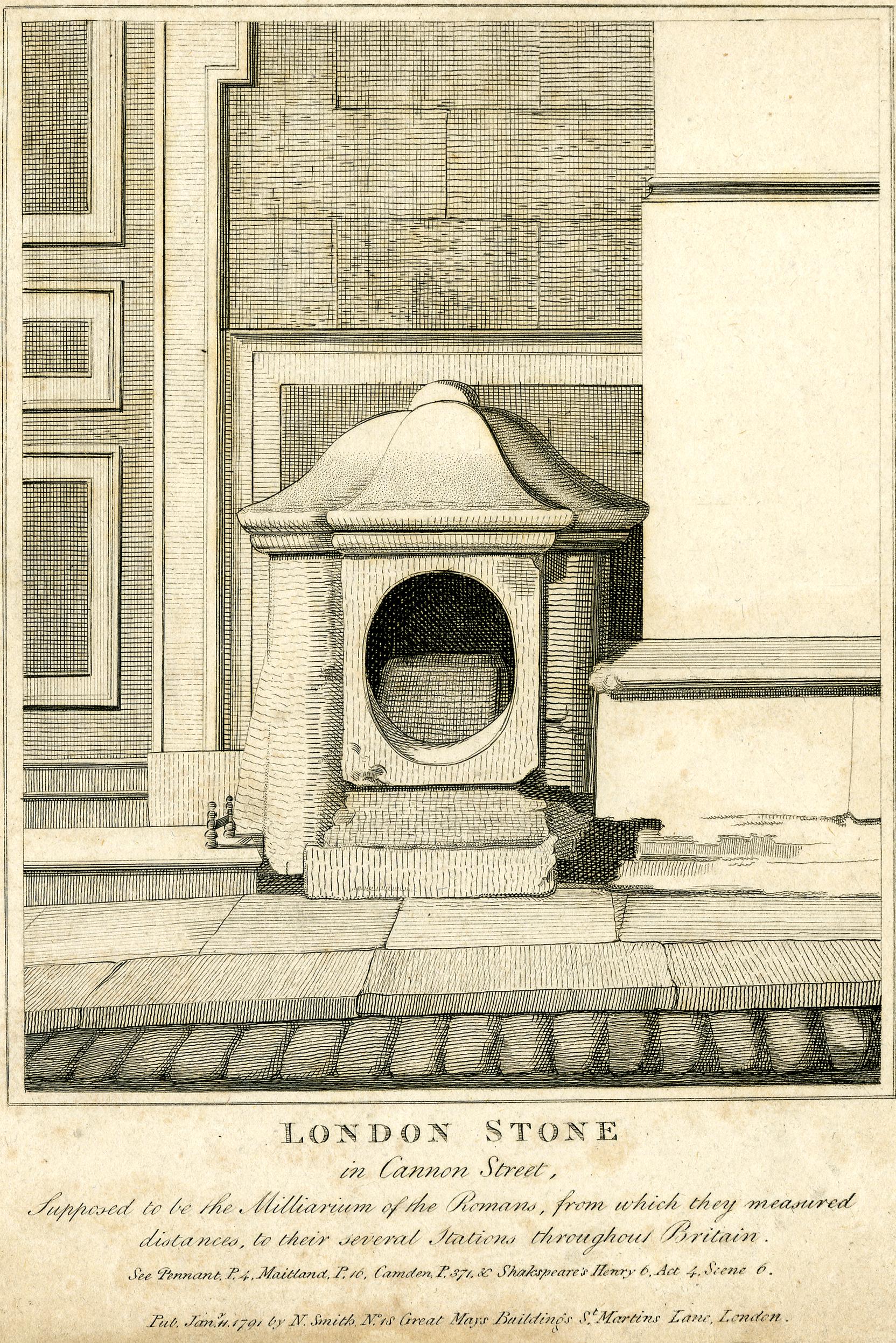
The above print repeats the milliarium story and provides sources from a number of historians, who, to an extent are repeating the same story, but not providing any firm evidence.

The print also includes a reference to Shakespeare’s Henry Vi, Act 4, Scene 6, and it is from this scene that Shakespeare amplified the story of Jack Cade’s association with the London Stone.

Jack Cade led a rebellion in 1450, from the south east of the country against the corruption, poor administration and the abuse of power by the King’s local representatives.

He led a large group of men from the south-east who headed into London in an attempt to raise their grievances, remove from power those they held responsible for corruption and abuse of power, and to reform governance.

Once within the City, the rebellion turned into looting, and the residents of the City turned on the rebels

The rebels were offered a pardon to return home peaceably. Cade as the leader was captured in a fight and died of his injuries as he was being returned to London for trial.

The connection between Jack Cade and the London Stone comes from the rebellion’s entry into the City of London. Cade pretended to use the name of Mortimer, (the family name of ancestors of one of Henry VI’s main rivals), and on reaching the London Stone, he struck his sword on the stone and according to Holinshed (a 16th century English chronicler), he exclaimed “Now is Mortimer Lord of this City”.

Describing the London Stone in Old and New London, Walter Thornbury embellished the story of Jack Cade by adding that “Jack Cade struck with his bloody sword when he had stormed London Bridge”.

This drawing from the late 18th century shows Cade in the act of striking the stone © The Trustees of the British Museum):

Jack Cade

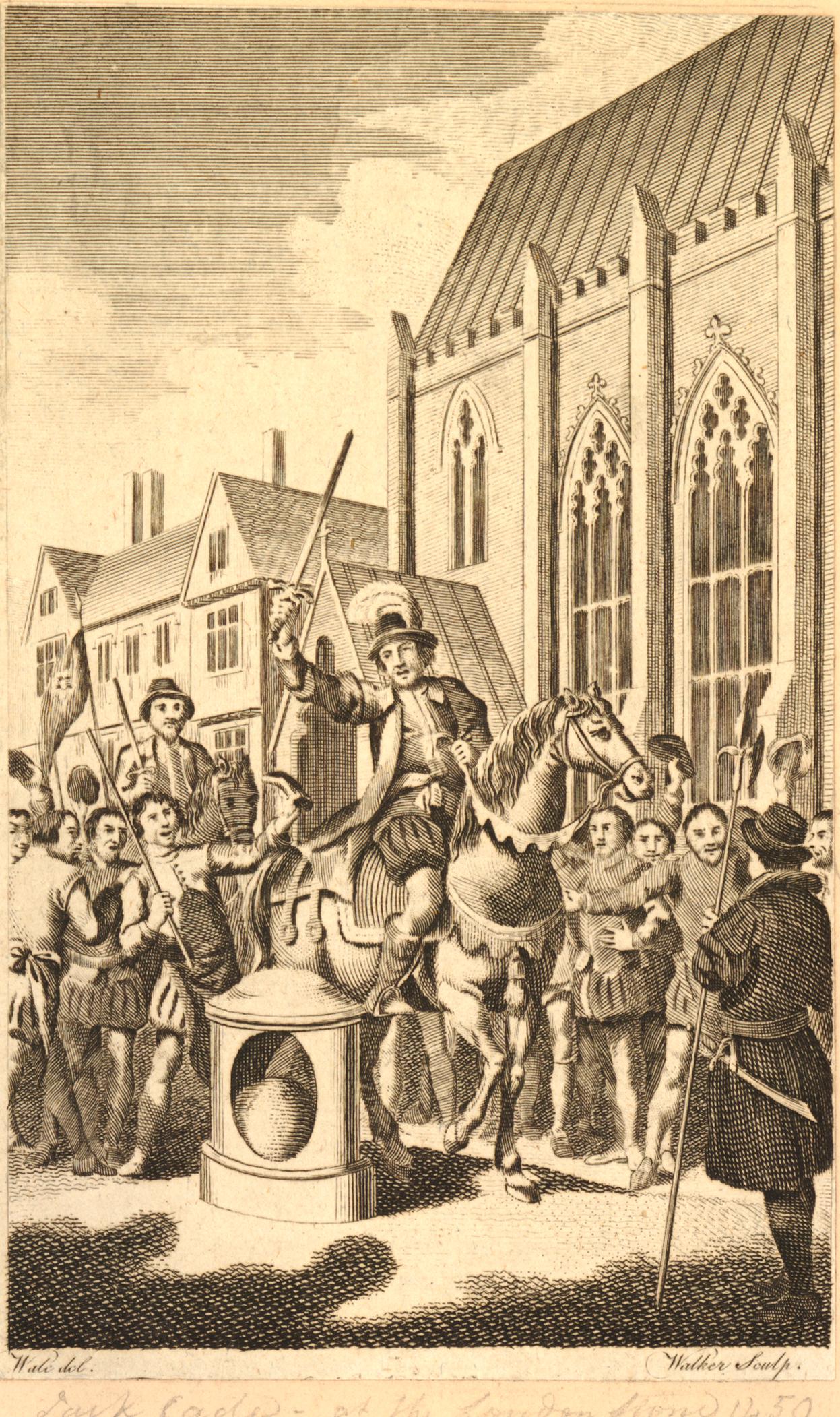
There is no reason why Cade would have used the London Stone in such a way. It was not a tradition for Kings or Lord Mayors of the City to strike the stone for any form of recognition.

Accounts imply that Cade did do this, but it was Shakespeare who really amplified and spread the story, including Cade using the stone as a sort of throne from where he issued proclamations and judgments. All part of the myths surrounding the London Stone.

The above print of Cade does show the stone in the street, not against the church, which appears to have been its location until the 18th century.

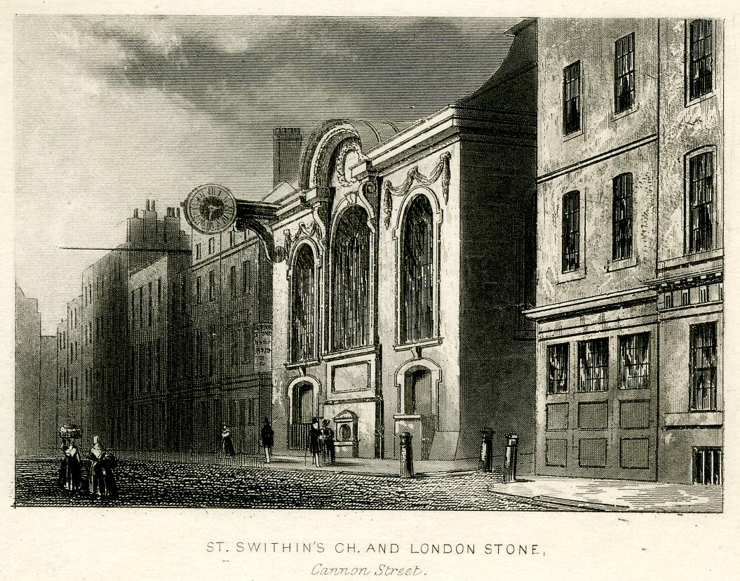
The following early 19th century print shows St. Swithin’s Church with the London Stone in the centre of the church, at ground level, facing onto Cannon Street © The Trustees of the British Museum):

London Stone

Another view from the early 19th century which appears to show the housing of the London Stone in a rather poor state © The Trustees of the British Museum):

London Stone

The Illustrated London News on the 13th of March 1937, reported that the London Stone was to be moved to a worthier setting, that it would be moved into an arched recess higher up the church, and flood lit at night.

Unfortunently, these plans were not carried out due to the start of war in 1939.

The Illustrated London News did repeat one of the apparent myths concerning the London Stone, that it “is believed to have originally been a tall prehistoric menhir, and later a Roman milliarium or milestone”, so not just tracing the stone back to Roman origins, but attributing a very much earlier origin as a prehistoric standing stone.

As well as prehistoric origins of the London Stone, there are also a number of myths about spiritual associations with the stone, the position of the stone at a centre of the City, and that if anything ever happens to the London Stone, the City will fall.

The following saying which is alleged to date from the medieval period has been repeated in a number of books about London:

So long as the Stone of Brutus is safe

So long will London flourish

John Clark in Folklore, Vol. 121, No. 1 found that this saying only existed from 1862.

A Brutus Stone seems to have been found in a number of places, for example in the Dartmouth and South Hams Chronicle on the 4th of March 1898: “Mr. Page rather made fun of the Brutus Stone set in the pavement of the High-street in Totnes, and of the claim that it was the stone on which Brutus of Troy landed when he came to Britain.”

Kipling used the name London Stone for a poem published in the Times on the 10th of November 1923. The poem was an elegy on grieving for the dead, however the poem referred to the Cenotaph, rather than the stone in Cannon Street (although the name of the poem was changed in different publications, as explored by the Kipling Society).

Many of the stories associated with the stone are just that, myths and stories, and there is very little to confirm the history of the stone prior to the medieval period.

Wherever stones are found, from the complexity of Stonehenge to a single prehistoric standing stone in a field, they always attract myths and legends.

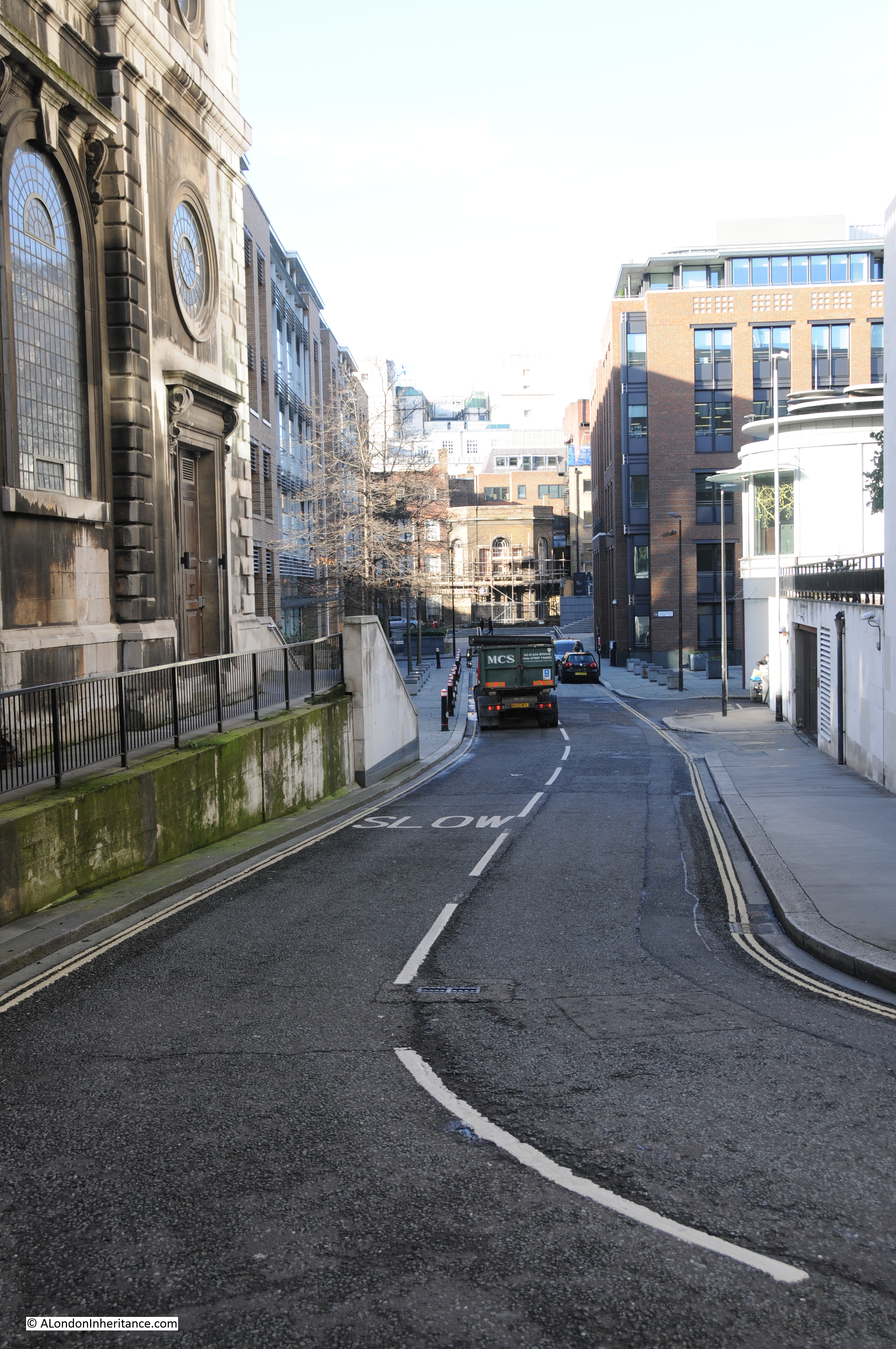
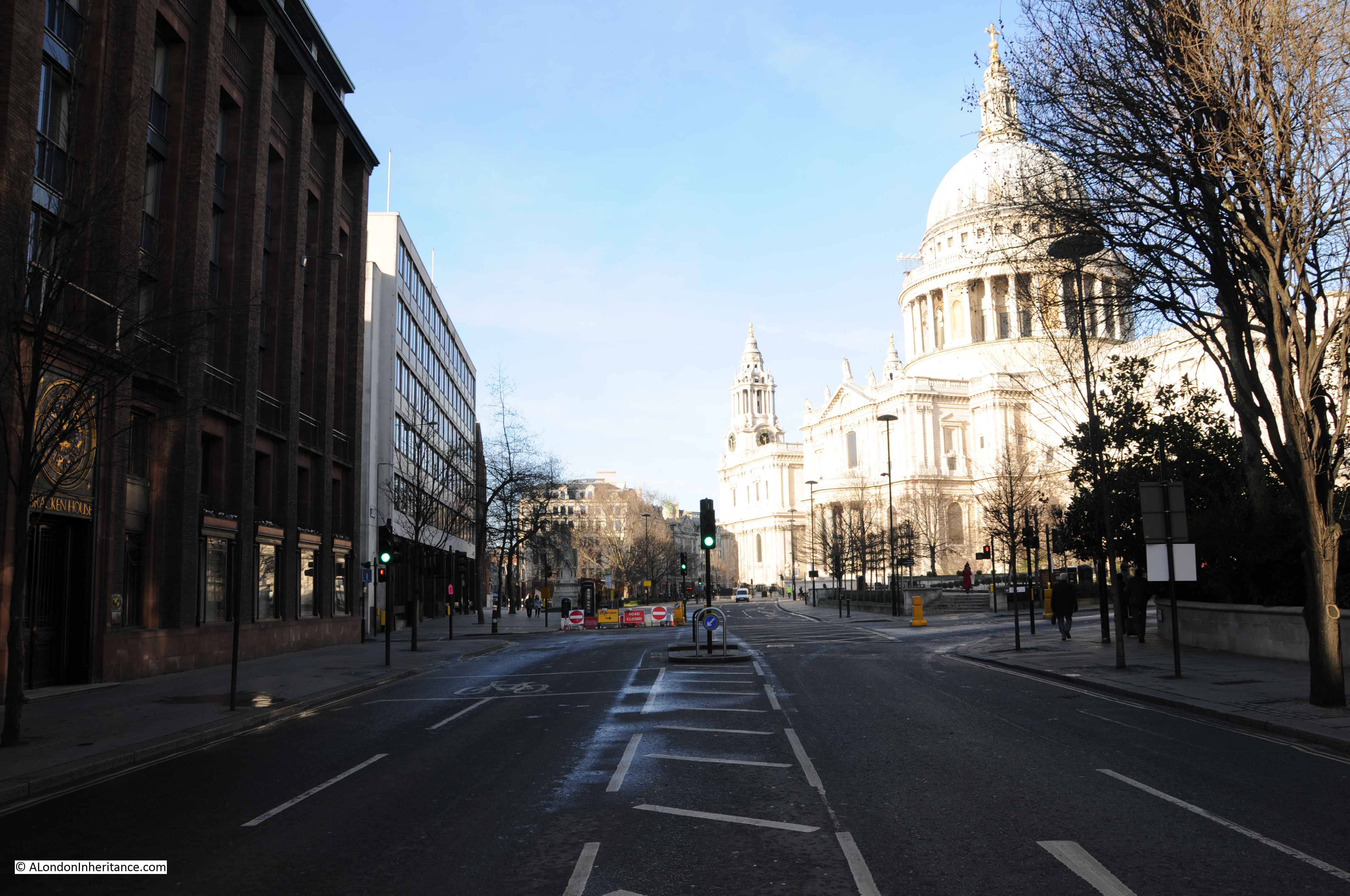
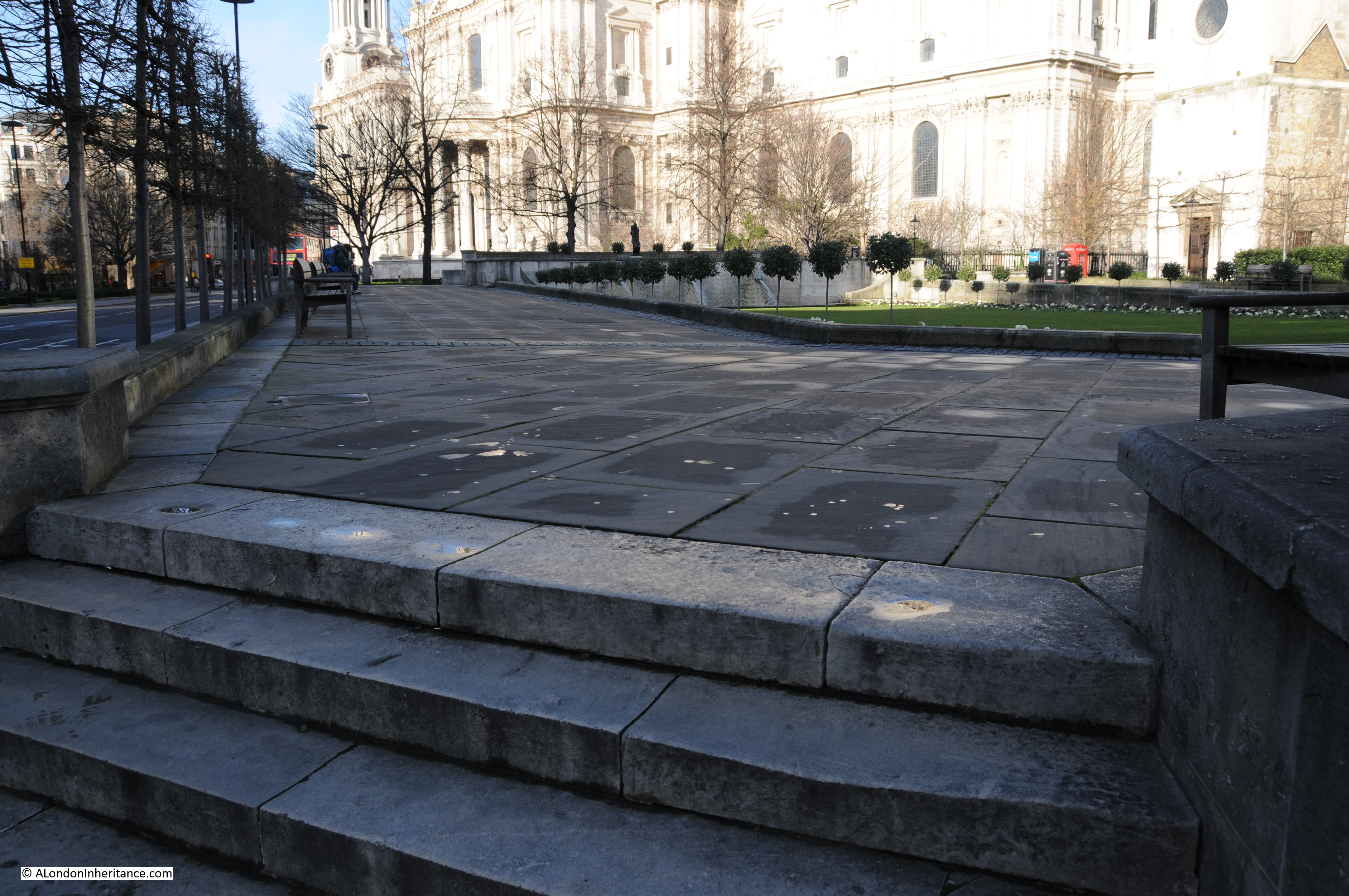
I used a reference from Sir Walter Besant’s 1910 book on the City of London earlier in the post, and opposite the page on the London Stone was this view looking west along Cannon Street towards St. Paul’s. Part of St. Swithin’s church is on the right, with the London Stone just out of shot:

Cannon Street

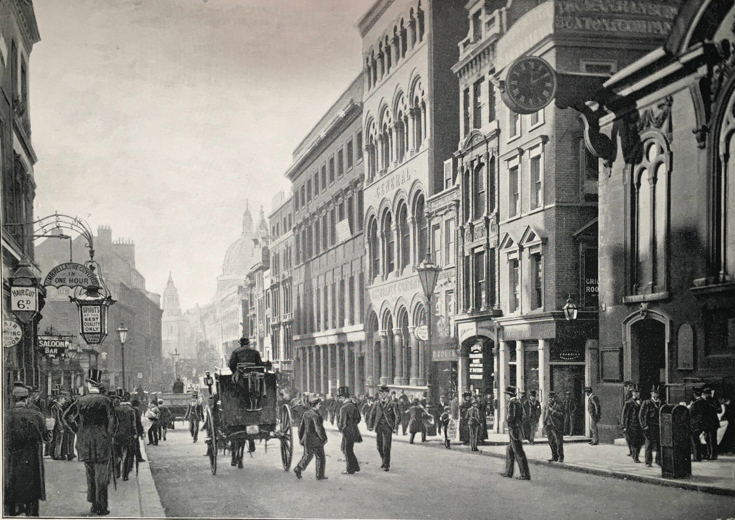
One hundred and thirteen years later the street is just as busy. Apart from St. Paul’s there is only one building that is in both views. In the photo below, on the immediate right is a building with distinctive arches over the windows. In the above photo, you can see the same building on the right, a little further down the street.

Cannon Street

The first written reference to the London Stone appears to be from the late 11th century, so the stone is old, but as to its origins and purpose, we can only make educated guesses, and whilst it has moved slightly around its current location in Cannon Street over the centuries, it has looked out on an ever changing street scene.

alondoninheritance.com

London Postcards

Back in August, I published a number of London Postcards showing the city during the first decades of the 20th Century. For this week’s post I have another series of postcards from the same time period.

I find these fascinating as they show many different aspects of London and provide a tangible link with those who lived in, or were visiting London.

The first postcard is of a very wintry Royal Observatory at Greenwich. Taken at a time when this was still a working observatory. Very rare to see such snowfall in London today.

The postcard was posted at a very different time of year to the pictured scene, on the 31st August 1905. With a Greenwich postmark, posted to a child in Lowestoft with a birthday wish from his aunt and uncle.

Postcards from London 2 7

As well as scenic views, early postcards are also populated by Londoners. This postcard shows Covent Garden with some fantastic detail of a very busy street scene. This was at a time when wearing a hat was almost mandatory, with the type of hat indicating your position in the social structure of the day. The scene is also piled high with baskets ready to transport goods to and from the market.

Postcards from London 2 8

The following postcard shows Regent Street at a time when almost all shops had awnings or shop blinds. The shop on the right is the London Stereoscopic Company. Formed during the 1850s, the company started selling stereoscopic photos and viewers and then went into the general photographic business selling cameras, photographic paper and other photography supplies. The company lasted until 1922.

The bus in the foreground is the number 13 covering Finchley Road, Baker Street, Oxford Street, Piccadilly Circus, Charing Cross and Fleet Street. The number 13 bus route today covers many of the same locations.

Postcards from London 2 2

Another street scene, this time Holborn (posted on the 18th September 1913).

Postcards from London 2 3

All these photos show the main street lamps on islands in the centre of the road. When electric lighting was introduced to the streets of London, the centre of the road was found to be the best location to spread light across both sides of the road. These lighting islands also had other benefits. A report presented to the Vestry of St. Pancras in 1891 covering the use of public lighting by electricity claimed that one advantage of central street lighting in busy thoroughfares is that they regulate the traffic. The report stated:

“Your committee are informed that the Commissioner of Metropolitan Police has suggested that there ought to be a rest at that point to prevent the numerous stoppages and accidents that occur there. The Police seem to be strongly of the opinion that the fixing of rests assists very materially in the regulation of the traffic, and your Committee feel therefore that although at first sight many people may think the lighting from the centre of the road would tend to obstruction, it really assists in facilitating the traffic and preventing obstruction in crowded thorough-fares.”

“Rests” refers to the islands built in the centre of the road where a street lamp could be installed and protected from traffic. They also provided a safe stopping point, or rest, for pedestrians trying to cross the road. The report was written as part of the planning for the installation of electric arc lamps in Tottenham Court Road. The following postcard shows Tottenham Court Road taken looking north from the junction with Charing Cross Road. The buildings on the left, along with the pub are still there.

Postcards from London 2 9

The above postcard was sent by a visitor to London from North Wales who “has been seeing the sights and are now going to the zoo.”

Perhaps one of those sights was Leicester Square, much quieter than it is today, possibly a weekend in winter when sitting in, or running through the square was the ideal way to pass the afternoon. The building in the background with the large flag is the original Empire Theatre. Opened in 1884 and demolished in 1927.

Postcards from London 2 5

It was not just central London locations that were popular subjects for postcards. The following card, postmarked 1912, shows Clapham Junction. Although the type of traffic has changed, the scene looks remarkably similar today, although the Arding and Hobbs department store on the corner is now a Debenhams.

The sender of the card wrote “On back is the new Arding & Hobbs. Old building burnt down a few years ago.” The new building shown in the postcard was completed in 1910.

Postcards from London 2 15

At first glance, the following photo looks to be of Charing Cross Station, although, as the name across the building confirms, it is the original Cannon Street Hotel, forming the entrance to Cannon Street Station.

Postcards from London 2 11

To show how similar they are, the following shows Charing Cross Station. This is no coincidence as they were both designed by Edward Middleton Barry who also designed the replica Queen Eleanor Cross which stands in the forecourt of the station. The hotel at Cannon Street has long gone, and the station entrance now looks very different. Charing Cross provides a physical reminder of what once stood in Cannon Street.

Postcards from London 2 10

The next postcard is of the Monument, however what I find more interesting about the scene are the people, and also the large amount of advertising on the building to the left. The postcard was posted at the station at Walton on Thames by someone who had just moved into a new house in Weybridge. Perhaps a City worker who had bought the postcard in London.

Postcards from London 2 6The posters include adverts for, Nestles Swiss Milk, Bass beer, the Royal Military Tournament, Regie Cigarettes, Allsopp’s Lager and Triscuit, which if it is the same thing is a cracker produced in America and is still in production today. The building on the corner on the right is the Monument Tavern.

London’s bridges have always been popular subjects for postcards, and the following view is of London Bridge. The bridge shown is that designed by John Rennie and opened in 1831. It was sold in 1968 to make way for the current London Bridge and rebuilt in Lake Havasu City, Arizona. Both the buildings on either side of the end of the bridge are still there, Adelaide House on the right and Fishmongers Hall on the left.

Postcards from London 2 12

And the following postcard shows Blackfriars Bridge. The large curved building at the left of the bridge is De Keyser’s Royal Hotel which was opened on the 5th September 1874 by Sir Polydore de Keyser who came to London as a waiter from Belgium and eventually became Lord Mayor of London. The Uniliver building is now on this site.

Postcards from London 2 14

The following postcard is titled “The Hanging Gardens of London, Selfridges Water Gardens Looking West”. The roof of the Oxford Street department store, Selfridges, had gardens and cafes during the 1920s and 30s and were a popular location after shopping. The roof gardens were damaged during the last war and never reopened.

Postcards from London 2 13

The following postcard shows the London County Council Millbank Estate, and judging by the condition of the streets, this must be soon after construction of the estate finished in 1902. The building halfway down the road on the left is a school. The estate and the school are still in existence and the buildings today look much the same although there is now parking lining most of these streets. The Milbank Estate is Grade II listed. The people in the photo are probably some of the first occupants of the estate.

Postcards from London 2 4

Although the Tower of London is the subject of the following postcard, I find the background of more interest as it shows London when the height of buildings was relatively low compared to the City we see today. This postcard has a 1931 postmark and was sent to Belgium by a visitor to London.

Postcards from London 2 16

The following photo taken from Bankside shows the north bank of the river with the original wharfs.

Paul’s Wharf in the centre with St. Paul’s Pier in front, the London & Lisbon Cork Wood Company (the smaller building towards the right with the white upper part), and Trig Wharf to the right. The Millennium Bridge now crosses the river here, roughly at the site of the London & Lisbon Cork Wood Company.  The Bankside location has always provided a superb view across the river and has a fascinating history which I wrote about here, mainly involving the transport of coal and other goods on the river hence the lighters on the river in the foreground.

Postcards from London 2 1

In the days before the personal ownership of portable cameras, postcards were about the only means of sending a message showing where the author lived or was visiting and as such they provide a fascinating insight into early 20th century London.

alondoninheritance.com

Distaff Lane – How London Streets Have Changed Over The Centuries

Distaff Lane is to be found on the western edge of the City. Just south of St. Paul’s Cathedral and running down from Cannon Street, past the church of St. Nicholas Cole Abbey to Queen Victoria Street.

It sounds like an old street name, which indeed it is, however Distaff Lane is a perfect example of how the City streets have changed over the centuries and what may appear today to be original City streets and lanes are a creation of the last 60 years.

I came upon Distaff Lane when I was looking for the location of one of the photos that my father took in the City just after the war.

The following photo shows the shell of a church in an area which has suffered considerable bombing damage. I was able to identify this as St. Nicolas Cole Abbey by the shape and features of the church, along with the position of Cannon Street Station, the original roof of which can be seen on the right of the photo in the distance.

Distaff lane 1

I could not get to the precise location of where my father took this photo due to subtle changes in street layout. The nearest I was able to get to show the same scene today is shown in the photo below:

Distaff lane 2

The church was fully restored after the war, including the replacement of the spire. The features on the church tower, along with the window to the right of the base of the tower identify this as the same church as the original photo.

Note how the orientation of the street has changed slightly and also the width. In the post war photo the kerb of the street can be seen by the plant growth along the edge. The original street was quite narrow compared to the current street.

The following Google Map shows the location of the church (the church is marked on the map as The Wren, this is the café in the church):

Distaff Lane can be seen curving up from Queen Victoria Street, running past the church then up to the cross roads with Cannon Street, New Change and St. Paul’s Churchyard. The name Distaff Lane is also given to the small pedestrian walkway segment that runs on to join Peter’s Hill and Sermon Lane, and it was from this location just along the pedestrian walkway, looking down Distaff Lane to the church that I took the modern day photo.

Distaff Lane is a perfect example of how London’s streets have changed over time. Not just appearance, but also location and name.

Distaff Lane is in Bread Street Ward, so a good place to start understanding how the area has changed over the centuries is the Bread Street Ward map from 1766, as shown below:

Distaff Map 2I have extracted the area of interest from the ward map to show the detail below:

Distaff Map 3The church at top left is St Augustine Watling Street. This church is adjacent to St. Paul’s Cathedral which is to the top left of the map extract. The block of land below Watling Street which includes Cordwainers Hall is now within the pedestrian area around St. Paul’s. The last Cordwainers Hall on the site was destroyed in the 2nd World War.

Below this is the original location of Distaff Lane, running to the right into Baising Lane. This is now Cannon Street. Cannon Street originally ran the length of Baising Lane and was extended across Distaff Lane in 1853-4 when Cannon Street was widened and extended up to St. Paul’s Church Yard. You will see opposite Cordwainers’ Hall another street call Little Distaff Lane. When the original Distaff Lane was replaced by Cannon Street, the “Little” was lost and this street then became Distaff Lane. This was the position up to the point where redevelopment started after the war.

Cordwainers’ Hall also gives us the origin of the name Distaff Lane. From Old and New London:

“Cordwainers’ Hall, No 7 Cannon Street, is the third of the same Company’s halls on this site, and was built in 1788 by Sylvanus Hall. The stone front, by Adam, has a sculptured medallion of a country girl spinning with a distaff, emblematic of the name of the lane, and of the thread used by cordwainers and shoemakers.”

A distaff is a stick or spindle used in spinning onto which wool or flax is wound. Some sources also state that this activity was carried out in the lane, which may well be true.

Harold Clunn in The Face of London provides us with a view of what the area in front of Cordwainers Hall was like:

“A widening of the roadway between this building and St. Paul’s Churchyard would afford a great relief to the very tiresome congestion of traffic caused by slow-moving vehicles, and that greatest of all abominations, the draught-horse, which seems to monopolize the vicinity of St. Paul’s Churchyard.”

The same book also provides a view of the type of trade that was carried out here;

“One of these great blocks situated between the Old Change and Distaff Lane was originally occupied by the large German firm of Berens, Bloomberg and Company, dealers in fancy foreign goods of all kinds who came to England shortly after the conclusion of the Napoleonic Wars”.

The following extract from the 1940 Bartholomew’s Reference Atlas of Great London shows the area as it was just before the destruction of the last war:

Distaff Map 4

Here we can clearly see Cannon Street running adjacent to Cordwainers Hall over what was the original Distaff Lane.

The original Little Distaff Lane is now Distaff Lane and runs from Cannon Street to the junction with Knightrider Street  adjacent to St. Nicholas Cole Abbey.

Knightrider Street runs over the route of the original Old Fish Street in the Bread Street ward map.

Distaff Lane was also probably called Mayden Lane at one point as Stow records in 1603:

“And on the south side from the Red Lion Gate to the old Exchange, and downe the same Exchange on the East side, by the west end of Mayden Lane, or Distar Lane to Knightriders Streete, or as they call that part thereof, Old Fishstreet”

Now returning to the same area today:

We can summarise the changes to the single street which currently bears the name Distaff Lane.

Distaff Lane is the short pedestrian stretch and then the whole of the road that routes past St. Nicholas Cole Abbey up to Cannon Street and also the short stretch that routes down to Queen Victoria Street (the street name may not be shown, Google map inserts do not always show the street names along their full length).

The short stretch down to Queen Victoria Street (which can be seen on the post war photo and the modern-day photo as a road turning off on the right side) was probably the original Old Change Hill.

This length of Knightrider Street (which was Old Fish Street in the original 1766 ward map) is now the enlarged Distaff Lane, which has also included Old Change Hill.

And finally the stretch from the church up to Cannon Street was originally Little Distaff Lane.

Distaff Lane is a perfect example of how London has evolved over time. Streets with names that have been in use for many centuries may not always be in their original location, and streets have often changed their names several times.

To finish, a quick walk along Distaff Lane.

This photo is looking down what was Old Change Hill. Now just a short length of road which stops before it can enter Queen Victoria Street.

Distaff Lane 3Walk past this turn off and look left and this is the scene now. This was once the Old Change. It went up from here, crossed Cannon Street and Watling Street. It is now Old Change Court.

Distaff Lane 4Walk up to the church of St. Nicholas Cole Abbey and we can look back down Distaff Lane (or what was Knightrider Street).

Distaff Lane 5From the same position, turn round and look up Distaff Lane towards Cannon Street. Although very uninspiring, this is the only part of the street that can justify the use of the name Distaff. This is the original Little Distaff Lane.

Distaff Lane 6At the top of Distaff Lane, turn right and walk a short distance, then look back to St. Paul’s. This stretch of road is the original Distaff Lane as shown in the Bread Street Ward map (although considerably widened). The original name was lost when Cannon Street was extended to St. Paul’s Churchyard.

Distaff Lane 7Walking up to St. Paul’s Churchyard we can see the sign recording the location of the Cordwainers’ Hall as shown in both the original Ward map and the 1940 map.

Distaff Lane 8And finally, this is the location of the Cordwainers’ Hall now. A whole block of buildings were destroyed in the last war and post war redevelopment changed this to a pedestrian / garden area, and opened up the view to St. Paul’s.

Distaff Lane 9

You may also be interested in my post on the church of St. Nicholas, Cole Abbey which can be found here

The sources I used to research this post are:

  • The Face of London by Harold Clunn published 1932
  • London by George H. Cunningham published 1927
  • Old & New London by Edward Walford published 1878
  • Bartholomew’s Reference Atlas of Great London published 1940
  • A Survey of London by John Stow, 1603. Oxford 1908 edition
  • London Lanes by Alan Stapleton published 1930
  • Bread Street Ward Map by Thomas Bowen 1766

alondoninheritance.com


London’s Railways – Planning For Peace

Around this time of year, a number of London stations are in the news for the considerable amount of work that is on-going for rebuilding, the creation of new lines and what always seems to be the inevitable overrunning engineering works. The work at London Bridge and for Crossrail being just two examples.

Major schemes have always been in various stages of planning to address London’s ever increasing transport requirements. Some schemes have reached completion, others never moved from the conceptual stage.

For this week’s post, I want to illustrate one set of schemes that were published in January 1946 and show how usage of the main London stations has changed over almost 80 years.

In the middle of the last war, there was a general feeling that the tide was starting to turn and planning could start for what London would look like in the decades after the war. How could the city be developed, what would be the transport needs of Londoners in the future, how could both the city’s infrastructure and landscape be improved and better use made of the limited space available?

In 1943 the London County Plan was published, then in February 1944 a committee was established :

“To investigate and report upon the technical and operational aspects of those suggestions made in the County of London Plan of 1943 which relate to the main line and suburban railway system of London, both surface and underground, bearing in mind that these suggestions are intended to contribute towards and form part of a comprehensive scheme for the re-development of the area in question.”

The report from the committee was published in 1946 and made some very far-reaching proposals, that had they been implemented would have had a dramatic impact on the transport system we see in London today.

Report Cover 1

Before getting into some of the details of the proposals, it is fascinating to compare the use of London stations between the 1930s and today. The 1946 report details passenger numbers of all mainline terminals up to the end of 1938 , the latter being the last year free from the influence of war.

The following table compares passenger arrival numbers during maximum morning peak hour  pre-war and in 2010 (the 2010 figures are taken from the “Central London Rail Termini: Analysing Passengers’ Travel Patterns Policy Analysis Research Project” published in September 2011 by Transport for London):

Station 1938 Peak Hour 2010 Peak Hour
Paddington 4,800 10,500
Euston 5,800 11,500
St. Pancras 2,100 9,000
Fenchurch Street 10,500 11,500
King’s Cross 9,000 7,500
Liverpool Street 34,700 32,500
Marylebone 3,900 5,500
Waterloo 24,300 45,500
Victoria 16,400 28,500
Charing Cross 17,000 15,500
Cannon Street 18,100 15,000
London Bridge 31,300 31,000
Totals 177,900 223,500

Whilst overall numbers have increased considerably there are some fascinating individual station comparisons. I bet if you use London Bridge on a daily basis the fact that in 2010 passenger numbers were still slightly below the 1938 level is of little comfort.

Perhaps reflecting the different options for transport and the changes in home locations for those working in central London, there are some significant swings. Paddington, Euston, St. Pancras, Waterloo and Victoria all showing significant increases in passenger traffic whilst King’s Cross, Liverpool Street, Charing Cross, Cannon Street and London Bridge are all showing reductions.

There were a couple of major themes within the 1946 report, perhaps reflecting the “anything can be done” attitude needed during the war, and a realisation that the changes caused to London by heavy bombing presented a major opportunity to improve London for everyone who lived and worked in the city. A similar approach to that taken by Wren after the Great Fire of 1666 when he proposed the creation of a city more along the lines of Paris than London had been with an ordered city with straight boulevards and a logical planning approach rather than the numerous small lanes and alleys of pre-fire London .

The major themes of the 1946 report were:

  • The removal of the head on terminals at Charing Cross and Cannon Street and the high level stations at London Bridge and Waterloo Junctions and the associated bridges across the River Thames
  • The construction of an extensive series of deep level tunnels and interchanges to replace the above ground infrastructure and to provide improved passenger and freight transport across London, capable of meeting the expected increase in both freight and passenger volumes.

As well as the removal of the bridges across the Thames, the viaducts across south London were also seen as a problem. Not just as a wasted space, but that they also split communities and their replacement by tunnels was seen as a way of integrating the many communities of south London. This was one of the areas where the rebuilding of the rail system would contribute into the overall London plan by making redevelopment of large areas such as the South Bank possible without the extensive railway infrastructure across the area.

In these proposals it is also possible to see the ideas behind Crossrail where trains from outside the immediate underground network are routed in tunnels across London with deep level interchanges with the tube and other rail networks and with the surface. Whilst the destinations are different, the concept is the same.

The following map from the report identifies the possible routes:

Map 1

The options shown in the map are:

Project A: A new deep-level North Bank link from Battersea to Deptford via Victoria, Charing Cross, Blackfriars, Cannon Street, Shadwell, Wapping and Surrey Docks

Project B: A new deep level-loop connecting Waterloo Junction, Charing Cross, Blackfriars, Cannon Street and London Bridge and then by tunnel via the Surrey Canal rising to join the existing surface systems in the south and south-east.

Project C: A north-south tunnel, an underground link to replace the existing viaduct from Snow Hill to Loughborough Junction

Project D: A northern arc suburban passenger route, passing below the main line stations at Paddington, Marylebone, Euston, King’s Cross and Liverpool Street with interchange facilities.

The projects also included the electrification of all remaining lines into London. I did not realise how much of the rail network leading into London had been electrified by the start of the last war. We tend to think that this was still the age of steam, but into London, the percentages that were already electrified after completion of the 1935 / 40 New Works Programme were:

Southern Railway: 86%

London and North Eastern Railway: 26%

London Midland and Scottish Railway: 32%

One of the other projects considered for the rail terminals was “The reconstruction of terminals at two levels, with flat roofs for future air landing”. Just shows the difficulties in trying to forecast how transport will be used in the future.

Removal of the bridges across the river was considered important as “the merit of a clean sweep of the three rail bridges over the Thames between Westminster and London Bridge cannot be denied”. How different the river would look today without the rail bridges.

Some of the themes driving the need for change are the same now as they were in 1946:

“Size and Distribution of Population. For many decades past, London has embraced a rising proportion of the total population of the whole country, which has itself been rising. During the inter-war years approximately half of the increase in London’s population could be attributed to immigration from the provinces

Decentralisation of employment, for it is one of the guiding principles that industry also should be de-centralised and there are proposals for satellite towns to be located, and existing towns expanded beyond the green belt.

Increasing traffic. Experience shows that, as income rises, the demand for transport rises more than proportionately, irrespective of transport to and from work.”

These words could equally have been written in 2014 as they were in 1946, and in 2014 to support the second point could also be added the ever-increasing price of property in central London driving people further out in search of affordable housing.

The following map from the 1946 report shows the proposed routes in their wider context and the considerable complexity of these proposals (click on the map to open a large copy):

Map 2
London Bridge Station was singled out for special interest. Total passenger numbers in the peak hour in 1925 was 38,000 and grew to 55,000 in 1938. In planning the proposed changes to the rail system, an expected 75,000 passengers was considered the level for which an upgrade should be planned.

As well as moving part of the station underground, an alternative site was considered and a major new underground / overground station was planned for a site adjoining Tower Bridge Road (as marked in Map No. 2 above)

The following map shows the first and second priority routes and also tunnels for the use of passenger and freight traffic. This was still at a time when significant volumes of freight traffic were carried by rail. The explosion of road transport, the motorway network and the considerable use of lorries for freight was not forecast to have a major impact on the rail system in 1946 (again click on the map to open a larger copy).

Map 3

The cost for the priority works were estimated as:

North Bank Route Cost (£)
Main Route 20,920,000
Clapham Branch 2,640,000
Brixton Branch 1,940,000
Deptford Branch 530,000
New Cross Branch 1,380,000
New Cross Gate Branch 1,620,000
Lay-over at Charing Cross 1,840,000
South-east, City and West End Route  
Main Route 5,590,000
Lay-over at Charing Cross 460,000
North-South Route  
Main Route 4,800,000
Lay-over at Holborn 920,000
Northern Arc Route  
Main Route 6,450,000
Lay-over 460,000
Total Scheme 49,550,000

This was rounded up to £50 Million, which was then doubled to take into account the cost of land, property, traction equipment, rolling stock and signalling, plus a further £10M for other ancillary works, giving a total estimated cost of £110 Million. A considerable sum just after the war, also given the financial situation of the country at the time.

The cost of all proposals in the plan was estimated at between £228 Million and £236 Million and these costs did not include the cost of electrification or any other works outside of the proposed tunnels. Estimates of construction time were “under the most favourable conditions, would not be less than 30 years”.

New types of train were also recommended. The majority of overland trains on the Southern Railway comprised carriages with six-a-side compartments, however the safety needs of operating these trains underground required the provision of rolling stock with some form of through corridor to enable passengers to pass in emergency from one coach to another. The types of trains in use at the time were made up of six-a-side compartments and an overall train could carry 1,050 passengers. A 10-coach train of similar length with through corridors reduced passenger carrying capability down to 600 passengers. A challenge with the proposed approach as an increase in the number of trains would be required to carry the same number of passengers without any capacity for the expected increase in numbers.

So what happened to these proposals which would have had a very dramatic impact on the train services and stations in London as well as the view along the Thames if the removal of the rail bridges had gone ahead?

As well as the very significant costs of the proposals, shortly after they were published alternative committees were also set-up to look at options for upgrading London’s transport services.

London Transport planners also prepared their own report which was published the following year in March 1947. On the 1st January 1948, the British Transport Commission took over London Transport as well as the main line railways. The Commission also set-up a new working party to report on transport services within London and a report was completed in late 1948.

The multiple reports, high costs and the economic state of the country in the late 1940s and early 1950s put on hold this type of far-reaching proposal and development of transport within London followed a more individual project approach. Some of the 1946 proposals did get included in alternative projects. For example the Brixton branch proposed in 1946 was eventually covered by the routing of the Victoria Line to Brixton.

London Bridge Station in all it’s complexity is still there and perhaps after the ongoing considerable rebuilding work including the work over this year’s Christmas break, will see the station reach the potential envisaged by the 1946 planners, although with the significant difference of being above ground rather than below.

The sources I used to research this post are:

  • Railway (London Plan) Committee 1944 Report to the Minister of War Transport – 21st January 1946
  • Central London Rail Termini: Analysing Passengers Travel Patterns. Policy Analysis Research Report. published by Transport for London, September 2011

alondoninheritance.com