Tag Archives: Southend

Southend on Sea – A London Bank Holiday

To really understand London and the lives of Londoners, we need to look outside the city to see how London has influenced the development of so many other places, one prime example being Southend on Sea.

Southend on Sea is on the Thames Estuary, not quite the open sea, and very different to the river that passes through London.

The first settlement around Southend was to the north of the town at Prittlewell, probably dating from the 6th or 7th centuries.

There was gradual development over the centuries, but from the late 18th century development dramatically increased and Southend on Sea became a major seaside resort of the 19th and earlier 20th centuries.

Passenger ships from the heart of the City would ferry day visitors to Southend, and with the opening of two rail lines (Fenchurch Street to Southend Central in 1856 and Liverpool Street to Southend Victoria in 1889), large numbers of Londoners would make their way to experience a day on the coast and to walk along the pier.

Southend is only Southend because of London.

As this is a Bank Holiday weekend, it seemed appropriate to join the thousands of Londoners who have made the same journey over the years and take a trip out to Southend on Sea.

Southend

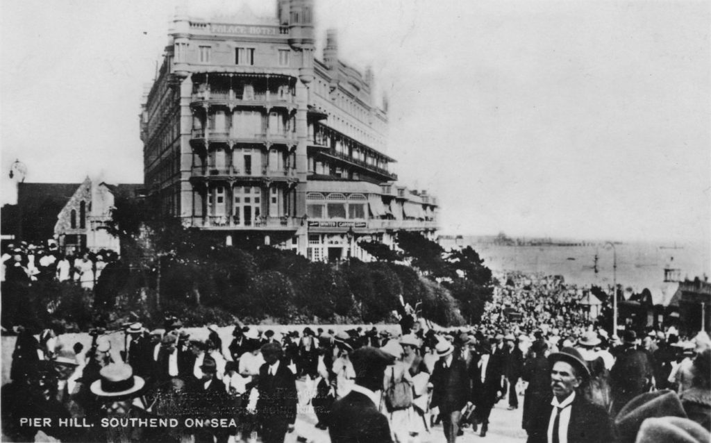
The above photo shows crowds streaming up Pier Hill. This leads from the pier and the parade along the sea front, up to the high street and the stations. It was probably taken towards the end of the day when day trippers were heading back to the stations for their journey back into London.

The Southend Standard from August 1910 provides a wonderful description of Southend on an August Bank Holiday:

“HOW SOUTHEND SPENT BANK HOLIDAY – Last year Bank Holiday was cold and wet, and holiday makers had a good deal of their enjoyment marred by cold winds and frequent showers. This year however, the Clerk of Weather changed his mind for once, and was in his most genial mood.

The sun shone from early morn to dewy eve; his somewhat warm attentions being tempered by a cool and steady breeze. Very early in the morning the incoming excursion trains began to unload their human cargoes; the railway stations, like gigantic hearts, beat at regular intervals and sent the human tides flowing outwards, to disperse themselves along the various arteries and veins of the town.

Such crowds there were too; everyone in their holiday rig; artisans and their wives, the poorer class of clerks, ‘Arry in fearsome ties, the latest cut of trousers, and bowler or straw hat stuck jauntily on one side; ‘Arriet in all the glory of purple velveteen, brown boots and large hat with sweeping ostrich feather; everybody and his uncle as the saying goes, was in the crowd that ceaselessly passed down the high street and spread itself along the front. By midday, the Parade was a sight worth seeing; right away from Westcliffe to Luna Park, the great mass of holiday making humanity moved to and fro and back again, like the tides of the estuary, merry laughter, jokes and greetings were everywhere. But it was down along the east front, in the afternoon that the holiday crowd was seen at its best, there the genus tripper was present in every variety.

The stalls which purveyed fearsome and wonderfully made American drinks did a roaring trade. Every fruit shop was the centre of a knot of customers and even the establishment whose claim to attention lay in the handing out of frizzling hot sausages and steaming mashed potatoes did a brisk trade.

From the shops at the commencement of the Parade to the gasworks every place did a roaring trade, they might have been huge magnets and the coins in the pockets of those outside made of steel, so quickly did the later pass over the counters, and from hand to hand.

The spaces of beach and sand which were left vacant were filled with hundreds of children and grown-ups, who sat about and enjoyed themselves to the full.  In the pools left by the residing tide the youngsters had great sport, and with pail and spade and tucked-up clothes, splashed and dug to their hearts contents.

‘Arries and ‘Arriets, regardless of the dust and the heat, danced round piano organs in the East End style, which is only born and cannot be taught.

By six o’clock in the evening the human tides begin to return to the railway stations and crowd the trains again. Much singing and dancing was there, not quite so clear and steady as in the morning, but nevertheless all good humoured.”

The train companies would arrange special excursion trains from London to Southend for Bank Holiday weekends, and newspapers in advance of the weekend would carry advertisements detailing the times and prices for those wanting to leave the city for a day by the sea. Very different to today, where the Bank Holiday is often a time for closures and engineering works, rather than special trains heading to the coast.

Southend Pier has long been a central feature of a day by the sea. The original pier opened in 1830, and the iron pier that we can walk along today followed in 1889. The end of the pier was extended several times with the Prince George Extension opened in 1929 bringing the length of the pier to 1.34 miles.

The pier railway was opened in 1890, reaching the end of the pier in 1891.

In the following years, Southend Pier has been hit by ships and suffered a number of fires. At times it seemed that the pier would not be restored and might even be closed, but somehow it has continued to stay open, a train still runs the length of the pier, and the buildings at the pier-head have been restored.

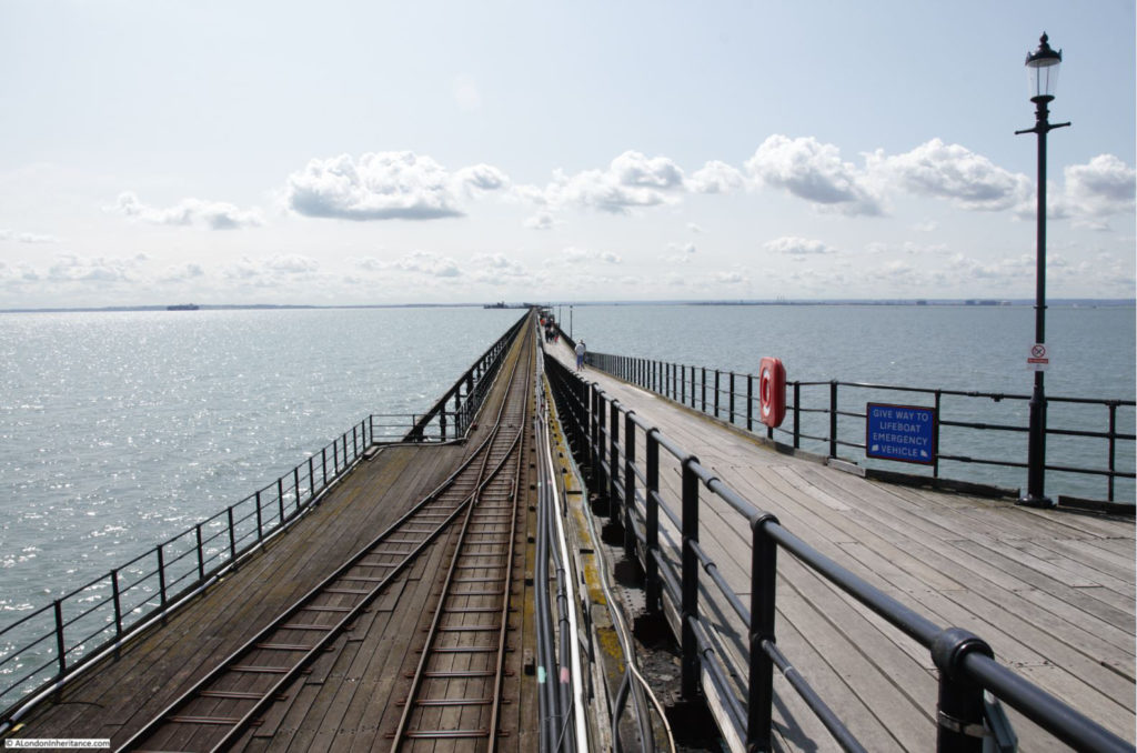
Time for a Bank Holiday walk along the pier:

Southend

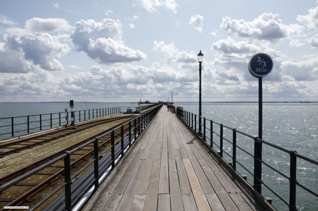
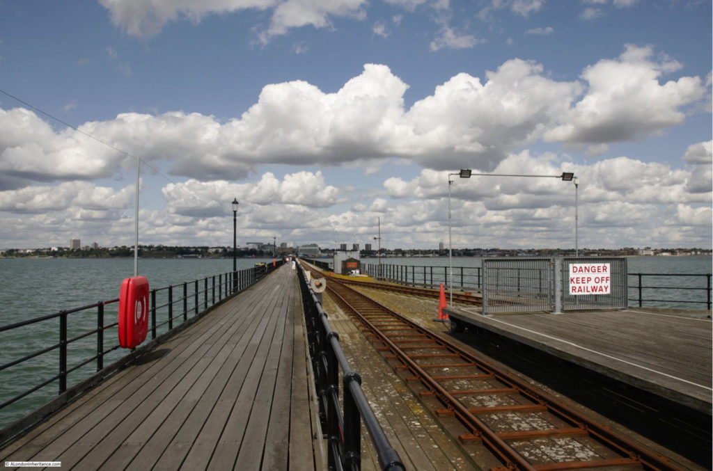
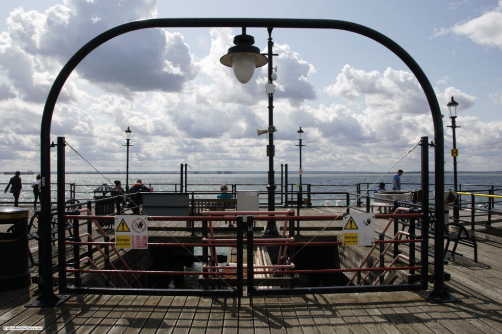
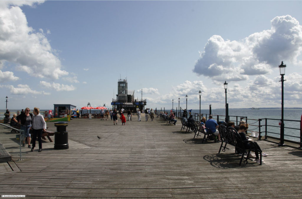
Once you start walking along the pier, the beauty of the estuary sky becomes apparent. The land on either side of the estuary almost blends with the water, and the wide open sky stretches from horizon to horizon.

Distance markers tell you how far along the pier you have walked – and how far you still have to go.

Southend

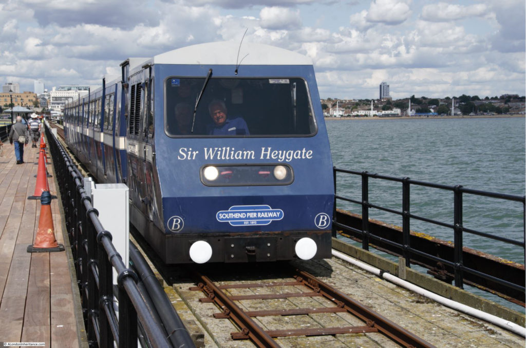
The Southend Pier Railway still runs the length of the pier.

Southend

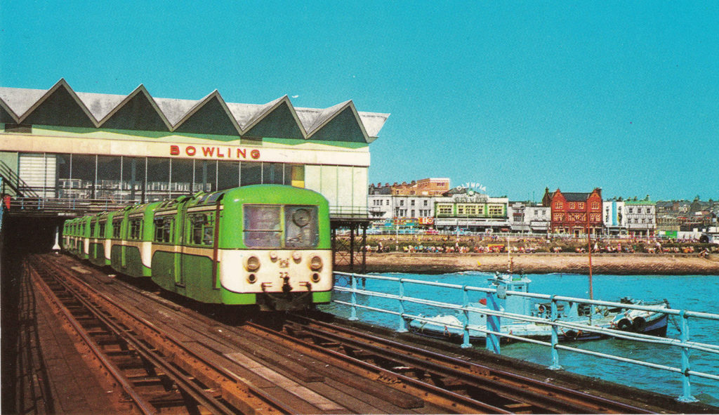
The first 1830 version of the pier included a horse-drawn tramway, however this was replaced by an electric tramway in 1890 soon after completion of the iron pier.

There have been a number of different versions of the pier train over the years – this is the first version I remember, with the bowling alley in the background which once was the main building over the start of the pier.

Southend

Conditions on a warm August day are very different to the wind and rain the pier has to endure, sticking over a mile out into a flat estuary  with no protection from everything that the weather can throw at the pier.

The pier therefore needs constant maintenance. Replacement of the wooden boards lining the walkway, painting of the railings, replacement and restoration of the iron supports of the pier.

Southend

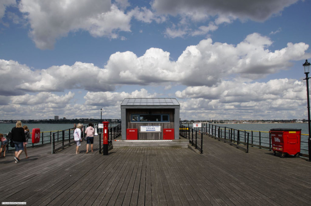
Looking back along the pier from alongside the station at the pier-head.

Southend

End of the pier station and estuary sky.

Southend

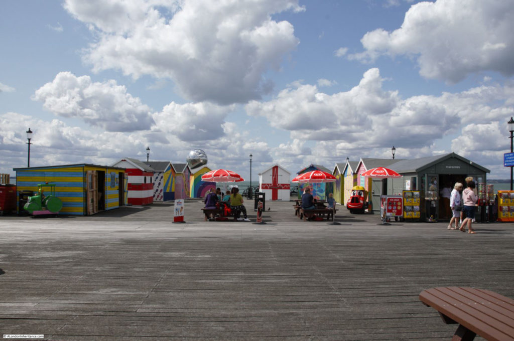
Colour at the end of the pier.

Southend

The pier did comprise upper and lower decks at the pier-head. The lower decks are now closed off.

Southend

Pier head:

Southend

Looking back at the pier head:

Southend

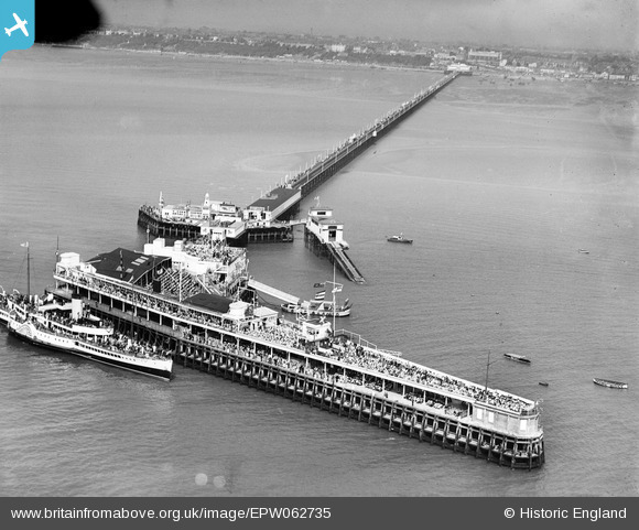
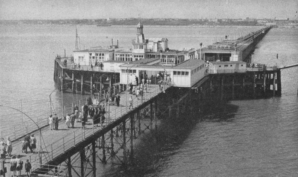
The following photo from the Britain from Above archive is titled “The Royal Eagle Paddle Steamer alongside Southend Pier, Southend-on-Sea, from the south-east, 1939”

Southend

Note the two decks along the pier head, and the crowds of people on the pier and the ship.

The Royal Eagle ran regular day trips from the centre of London out to Southend, Margate and Ramsgate.

A typical advert for the service from May 1933 read:

“London’s Luxury Liners – Commencing 3rd June Daily (Fridays excepted) Royal Eagle for Southend, Margate & Ramsgate from Tower Pier at 9.20 a.m. Greenwich 9.50, North Woolwich 10.20.”

Day return fares during the week to Southend were 4 shillings and 5 shillings on Saturdays, Sundays and Bank Holidays.

If you wanted a slightly longer day at Southend, the Crested Eagle left Tower Pier at 9 a.m.

The mid section of the pier head as it was pre-war. Note also the end of the pier station, with two covered platforms for trains.

Southend

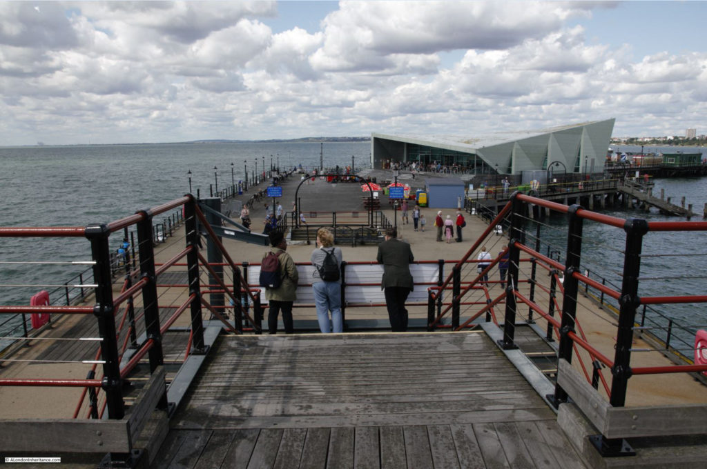
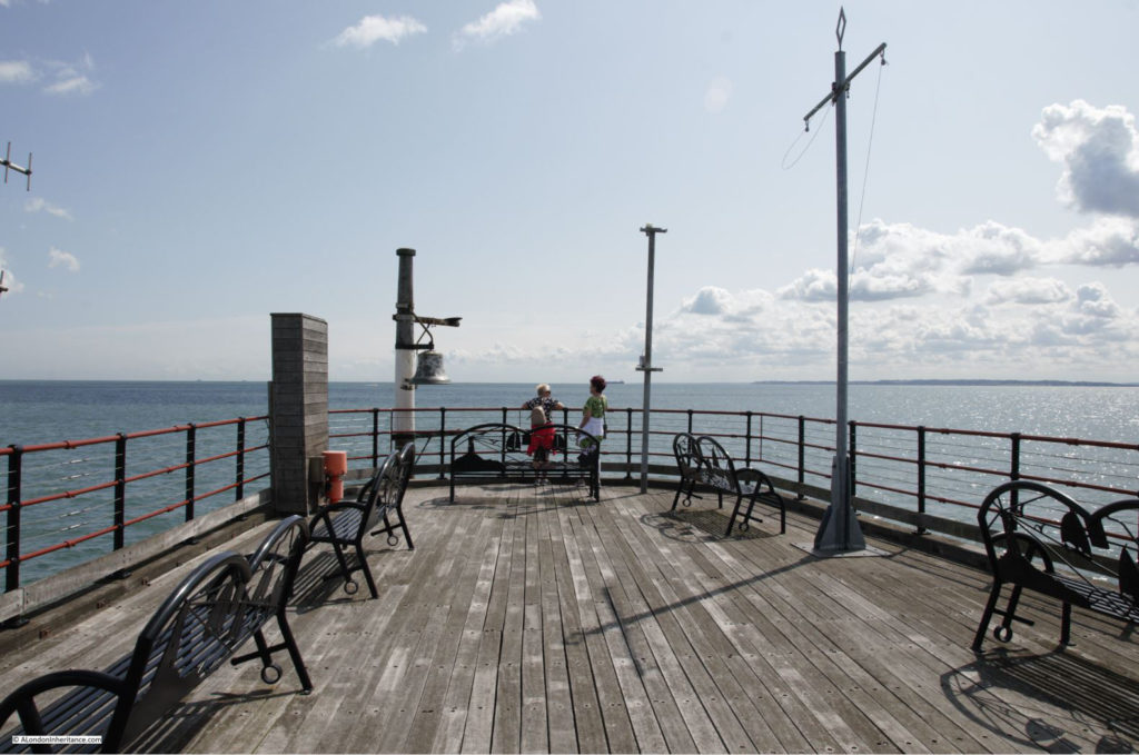
The very end of the pier:

Southend

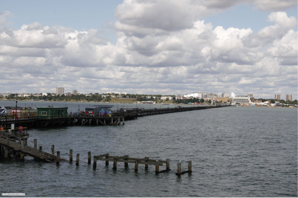
The view back along the pier towards Southend from the end of the pier:

Southend

From our 2019 viewpoint, it is probably hard to understand just how much a day out at Southend meant to someone living in East London. The ability to escape from the daily pressures of trying to earn enough to feed and house your family must have been essential to make life worth living. Whilst researching through newspapers, I came across the following tragic example from 1921. Hopefully a very rare case, but it does highlight what a day out at Southend meant to an east Londoner:

“TRAGEDY OF BOY’S SUIT IN PAWN – LOSS OF HOLIDAY CAUSES MOTHER’S SUICIDE.

Worried because she could not raise the money necessary to get her boy’s Sunday suit out of pawn so that he could go to Southend on Bank Holiday, Ellen Woolf (44) of Mile End, committed suicide by swallowing carbolic acid.

It was said at the inquest that the woman had had 14 children, of whom eight were living, and the clothes had been pawned during the week in order to get food.

She had also had additional worries over a sick child and debt. The husband served in France during the war, and was badly wounded. Before and since, for over 20 years, he had sold newspapers in Leadenhall-street for a living.

Suicide while of unsound mind was the verdict.”

The verdict should really have drawn attention to the pressures she must have been under, as these must have been the root cause of her state of mind – I will never take a trip to Southend for granted again.

Southend has had to change and adapt to continue to attract visitors who want more that just a walk along the pier or the Parade. As the 1910 report stated, in 2019 it is still about money, and attracting the coin out of the visitors pocket.

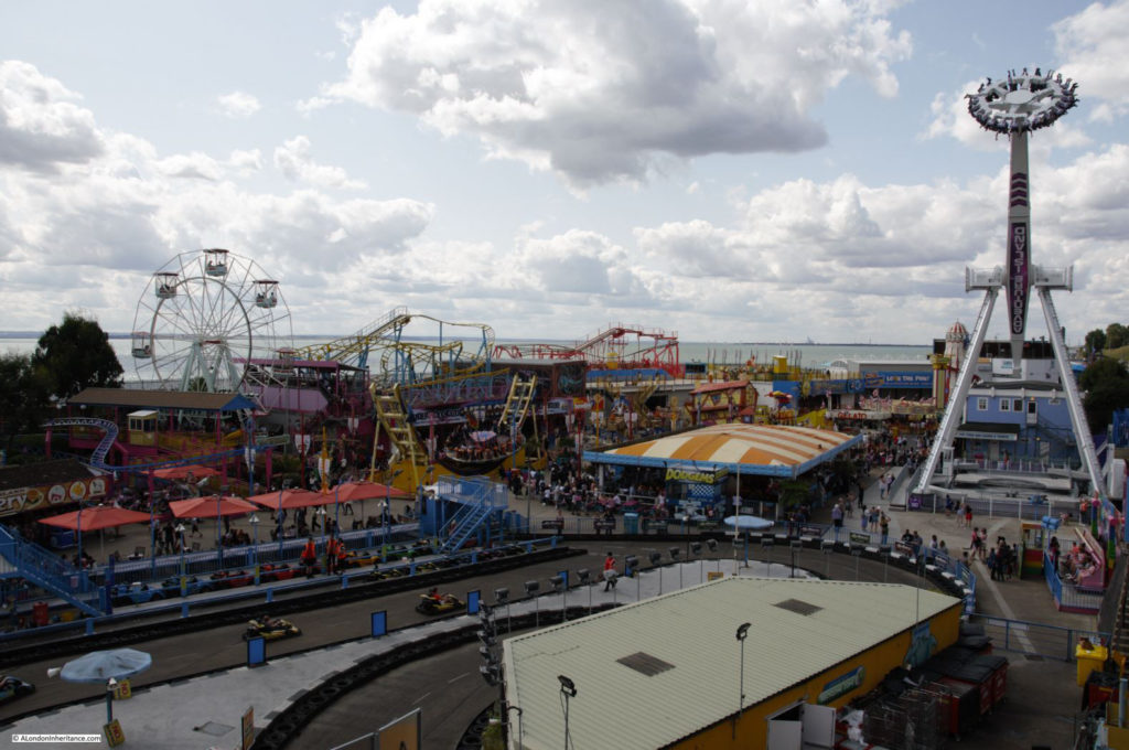
On either side of the pier, along the sea front is Adventure Island – a dense cluster of rides and amusements.

Southend

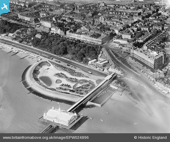
The following photo from the Britain from Above archive shows the sunken gardens in 1928, this is the same space as shown in the above photo.

Southend

The old Marine Parade, or Golden Mile runs along the sea front to the east of the pier.

Southend

This was one of the places to go in the late 1970s with my first car on a Saturday night. Clubs such as Talk of the South (ToTS) were in the buildings on the left and customised cars would spend their time driving up and down the Golden Mile. Southend on a Saturday night was exciting when you are 17.

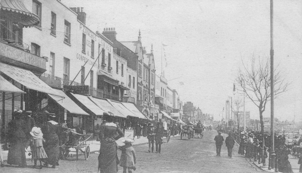
It was a very different scene in the early years of the 20th century:

Southend

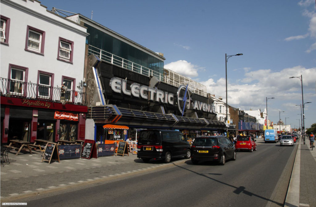
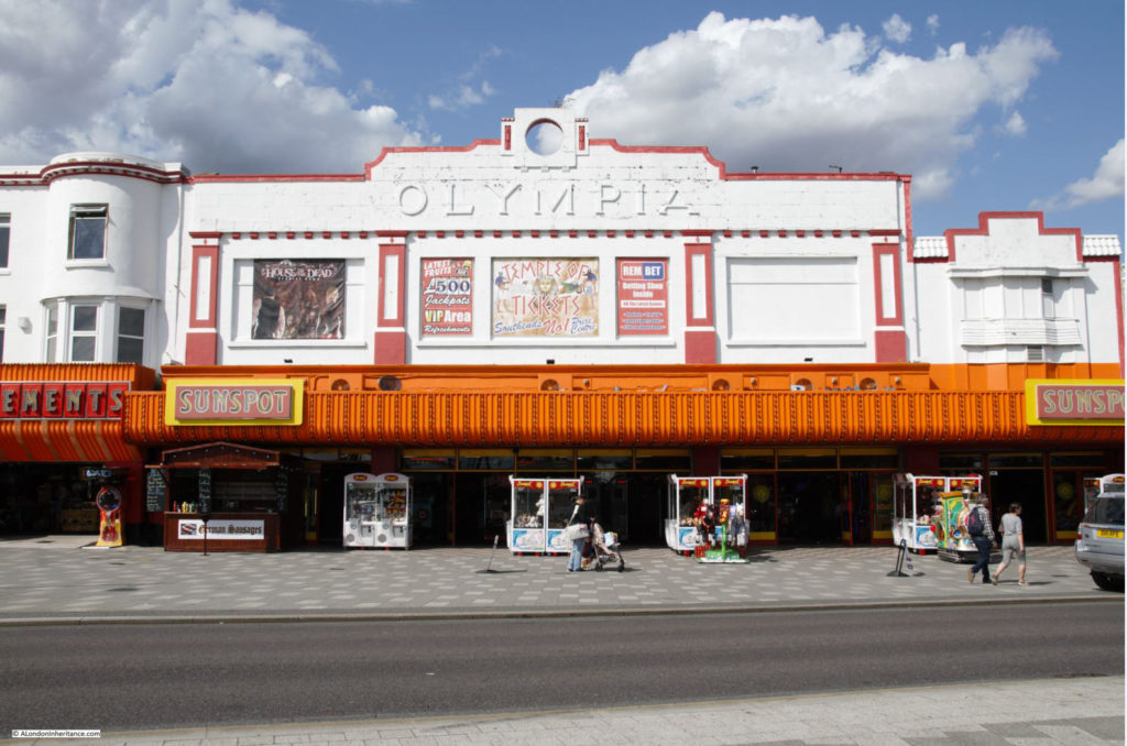
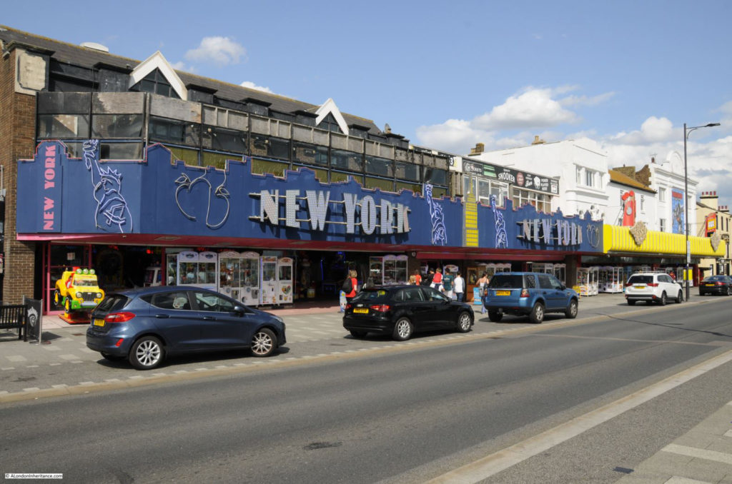
Large amusement arcades now line the street:

Southend

There have been proposals over the years to demolish and rebuild large parts of the Golden Mile, but they never seem to move beyond the conceptual stage, so Southend’s brightly coloured and gloriously tacky eastern seafront continues into the 21st century.

Southend

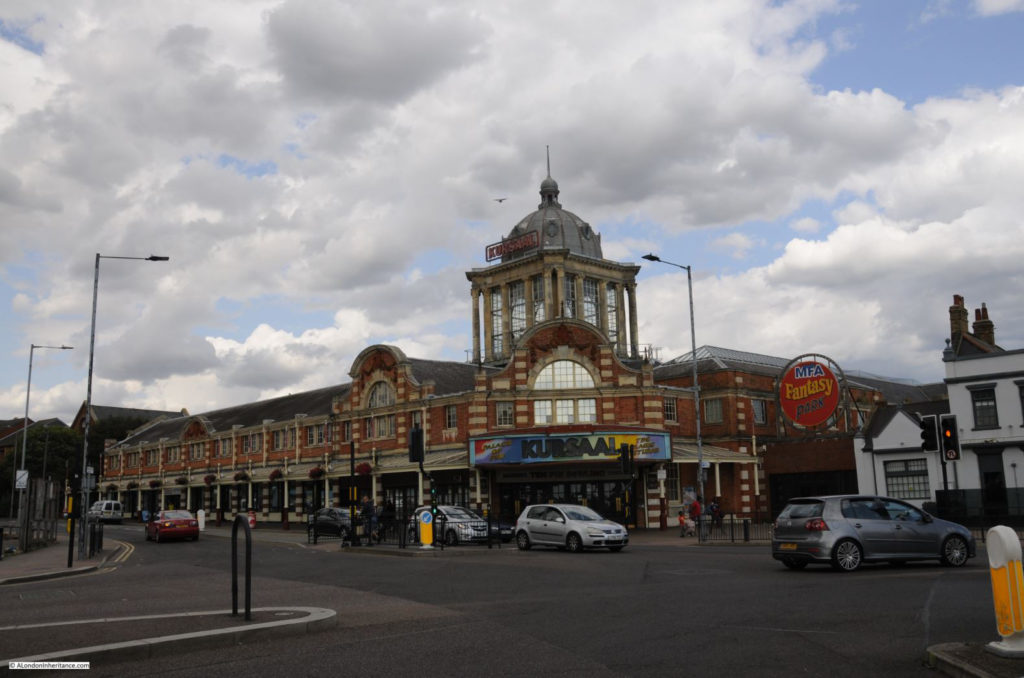
At the end of the street is the Kursal, now a shadow of its former self.

Southend

Opened in 1894 with the main entrance buildings opening in 1901, the Kursal consisted of dining halls, billiard rooms, bars etc. in the main building, with a large fairground covering the land behind.

The Kursal has been through many changes in use and ownership. In 1910 it was renamed the Luna Park, as referenced in the newspaper article at the start of the post. It has been used for greyhound racing and in the 1970s, the main ballroom was a rather good live music venue.

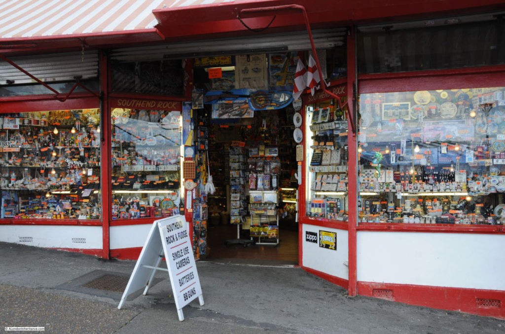
Leaving the seafront and walking up Pier Hill we find this strategically placed souvenir shop:

Southend

The shop has been here for as long as I can remember, and it is on the route back to the High Street and train stations from the pier and sea front. Just the place to stop off and buy your last minute souvenir before returning on the train to London.

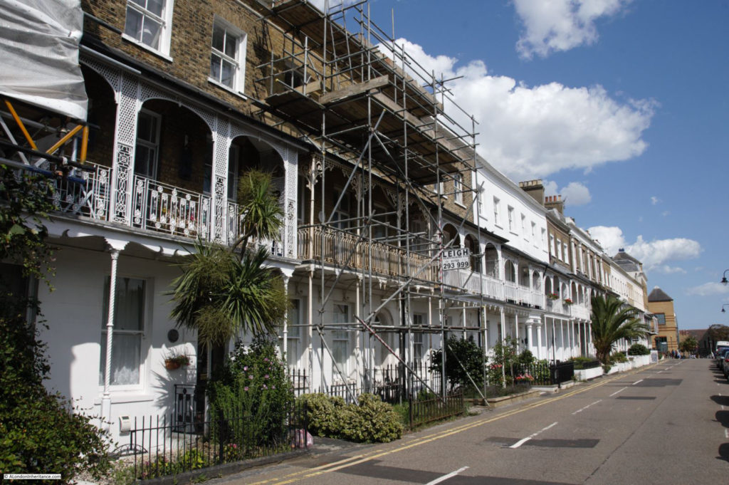
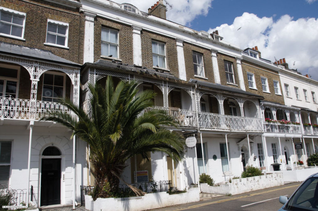
Southend is not all garish seaside buildings, there is some wonderful historic architecture. At the top of Pier Hill, turning to the west along the cliff top is the Royal Terrace.

At the far end, on the corner with the High Street, is the Royal Hotel and a line of late 18th century houses run along the street with superb views over the pier and estuary.

Southend

The terrace was built between 1791 and 1793. The “Royal” name of the terrace was given after the 1803 visit of Princess Caroline (the wife of the Prince Regent), who occupied numbers 7,8 and 9 – the houses in the centre of the photo below.

Southend

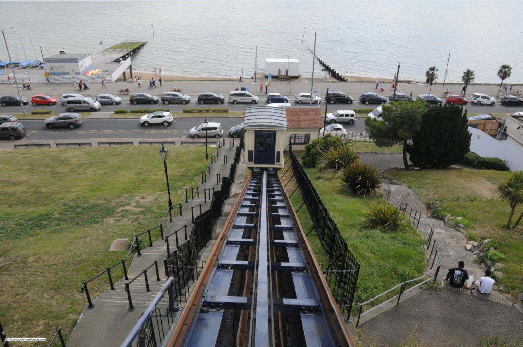
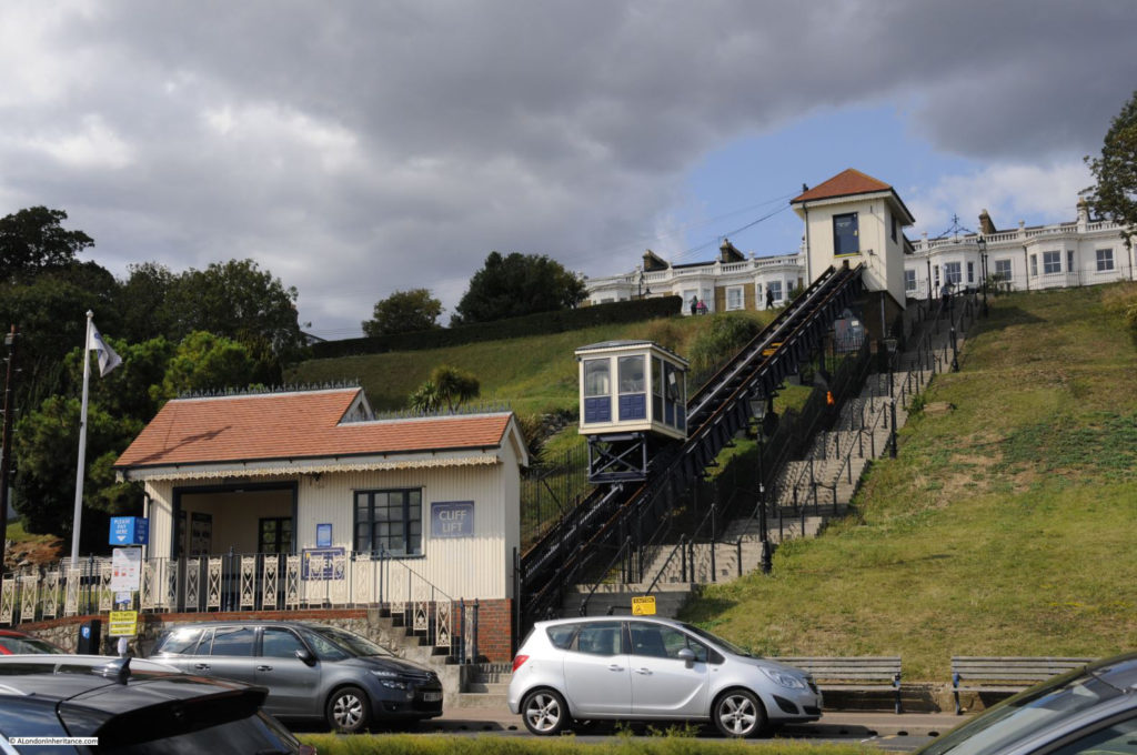
At the end of the Royal Terrace is the Cliff Lift, providing pedestrians with a route between the sea front and the top of the cliff if they want to avoid the walk.

Southend

In 1901, a moving walkway was installed on the site, replaced by the lift which was constructed in 1912.

The lift has undergone several refurbishments and updates since, the most recent being a £3 million upgrade in 2010.

For 50p you can be carried smoothly up to the Royal Terrace:

Southend

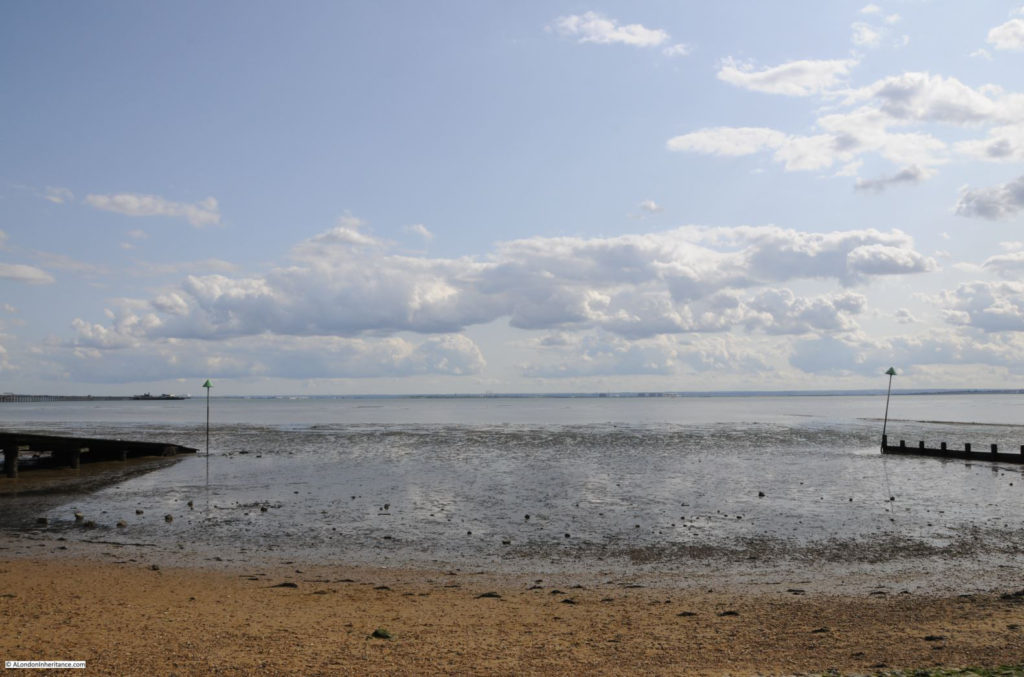
One final view across the estuary, where sand blends into mud, then water then sky, with a thin sliver of land across in Kent. Hard to believe that this is the the river that flows through central London, now over 4 miles wide between Southend and the Kent coasts.

Southend

Southend is only the Southend we see today because of London. A long heritage of being one of the main destinations for Summer weekends and Bank Holidays for those who lived in London.

Easy transport provided by passenger ships on the river and the opening of two railway lines to central London helped bring crowds out of London to spend their money in Southend. In the late 1920s and 1930 a new main road (now the A127) was opened between the Eastern Avenue at Romford and Southend, adding a dual carriageway from east London directly to Southend as visitors started the move from ship and train to car – a trend that would be accelerated in the post war years.

Tastes will continue to change and what people want from a day at the seaside will evolve, but I suspect that Southend will respond as it has done for two hundred years, and develop new ways to, as the 1910 article stated, remove the coin from the pocket of the visitor, but for me it will always be a place to get lost in the wonderful estuary sky.

alondoninheritance.com

From The City To The Sea – The Thames Estuary

Before returning to London, a quick chance to explore the Thames Estuary and discover some of the legacy from the last war that has survived the last 70 years.

As the Waverley left Southend, the sky and sea seemed to merge even more into a uniform grey with only the occasional boat adding any colour.

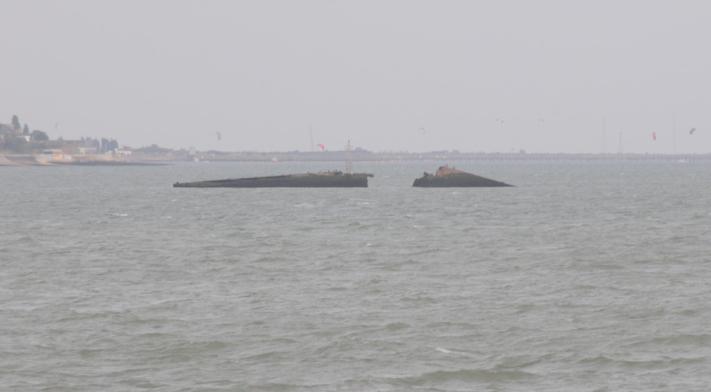
Soon after leaving Southend Pier there is the wreck of a part of the Mulberry Harbours that were used directly after the D-Day landings in France to provide temporary harbours until one of the French ports could be taken.

This particular part is a Phoenix Caisson. These were very large concrete hollow boxes that were used to provide the support to the harbour. They were manufactured at three locations in the UK including Tilbury on the Thames, however this Caisson was being brought from Immingham on the Humber to Southsea (Portsmouth on the south coast) ready for transport across the channel.

Whilst being transported from Immingham it sprang a leak and was towed into the Thames and beached in its current position.

Southend to Sea 1

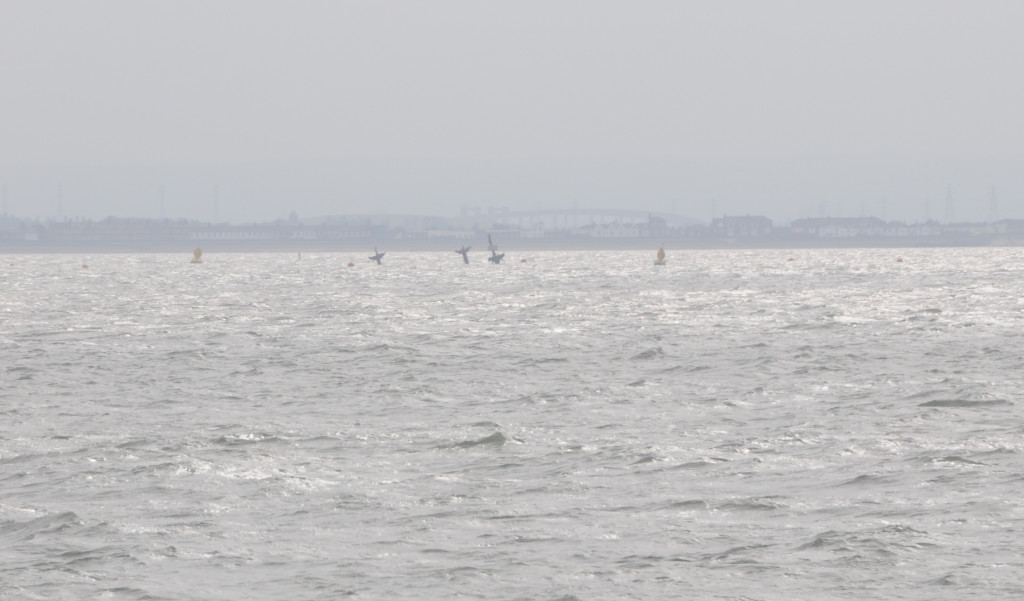
There is a much more potentially destructive relic of the last war about 5 miles from Southend. This is the wreck of the SS Richard Montgomery.

The SS Montgomery left the US in August 1944 loaded with over 6,000 tonnes of munitions and explosives. Arriving off Southend the ship was instructed to moor off Sheerness. On the 20th August, the Montgomery started to drag her anchor and drifted to a sand bank where she became stuck as the tide went down and the due to the uneven distribution of weight and insufficient water to provide support, she broke her back and was stranded on the sandbank with her full compliment of explosive cargo.

There was an attempt to remove some of the cargo, however before this was complete the ship finally broke in two and the salvage attempt was abandoned leaving a very considerable volume of munitions and explosives (high explosive bombs, fragmentation bombs, phosphorus bombs, pyrotechnic signals, flares and fuses) on the ship, which remain there to this day.

The ship has an exclusion zone marked by buoys and is regularly surveyed to check the stability of the structure.

I am not sure if anyone really knows what would happen if there was an explosion, many years ago I heard stories that it would break many of the windows in Southend.

It is an eerie sight passing the wreck and seeing the masts of the SS Richard Montgomery still standing above the water.

Southend to Sea 2

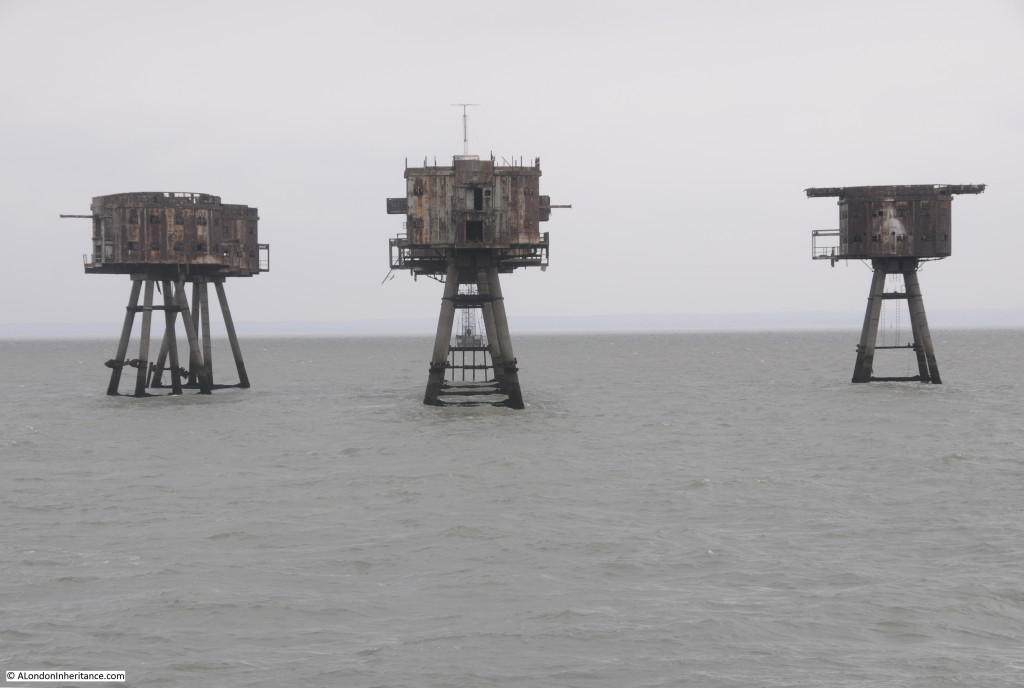
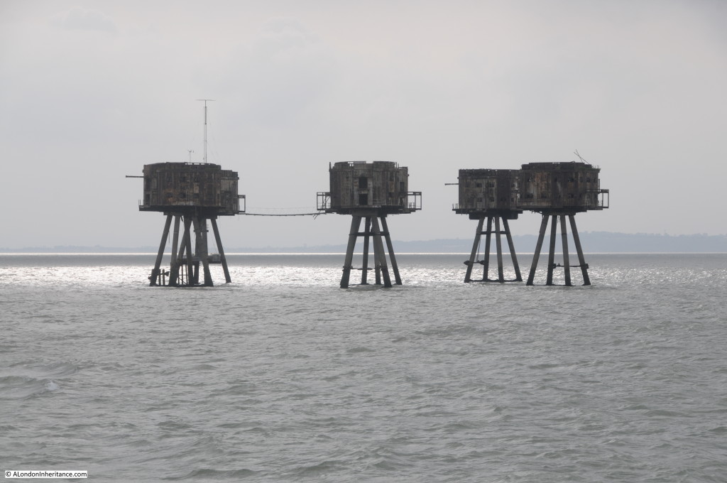
Further out from Southend are the Maunsell Forts.

These were operated by the Navy and Army during the last war to provide anti-aircraft gun emplacements in the estuary. The River Thames provided an ideal navigation route to central London for enemy bombers. Even at night and with a blackout, the glint of the moon on the water of the Thames would lead directly to London.

These forts were the idea of Guy Anson Maunsell, a highly innovative civil engineer who had worked on a range of civil engineering projects in the UK and abroad, including in 1931, the widening of Putney Bridge.

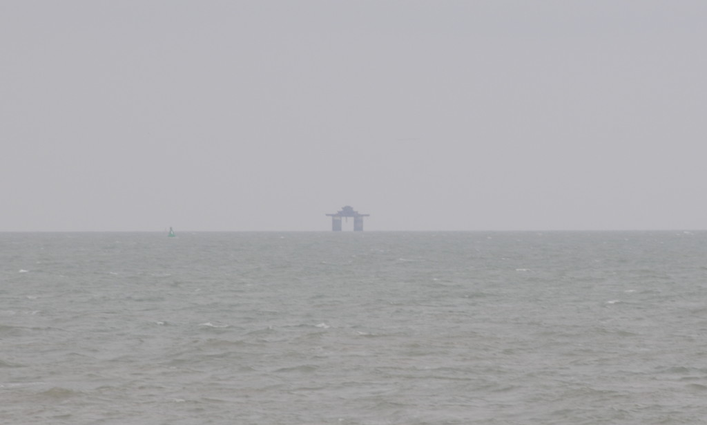
The initial requirement was for a set of Naval Forts further out to sea than the Army forts. They were operated by the Navy with the objective of preventing German mine laying in the approaches to the Thames. Four of these were constructed, of which two (Rough Sands and Knock John) survive. From the Thames Estuary the Knock John fort can be seen as a rather enigmatic shape in the distance.

Southend to Sea 11The Army forts followed the Naval forts. The aim of these forts was to attack approaching bomber forces with an anti-aircraft gun mounted on each of the individual forts.

The first set of forts were deployed in the Mersey to protect Liverpool, with the next set of forts deployed across the Thames Estuary to protect London.

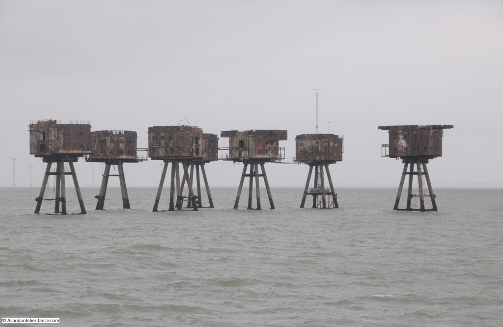
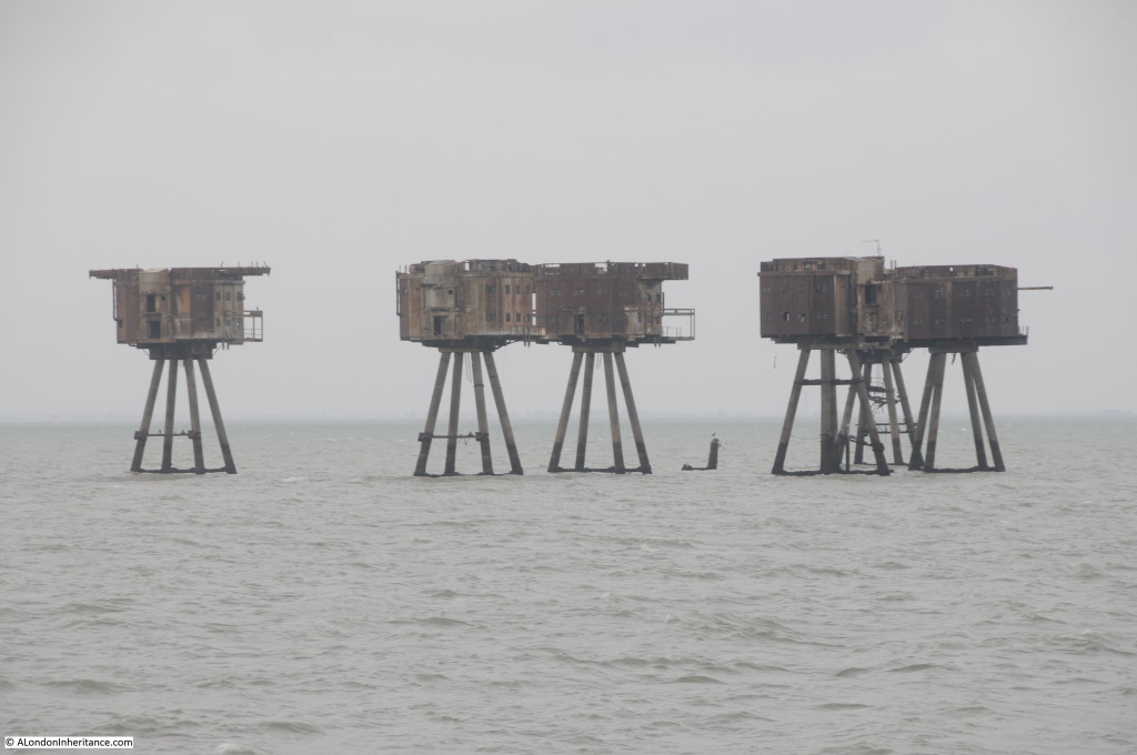
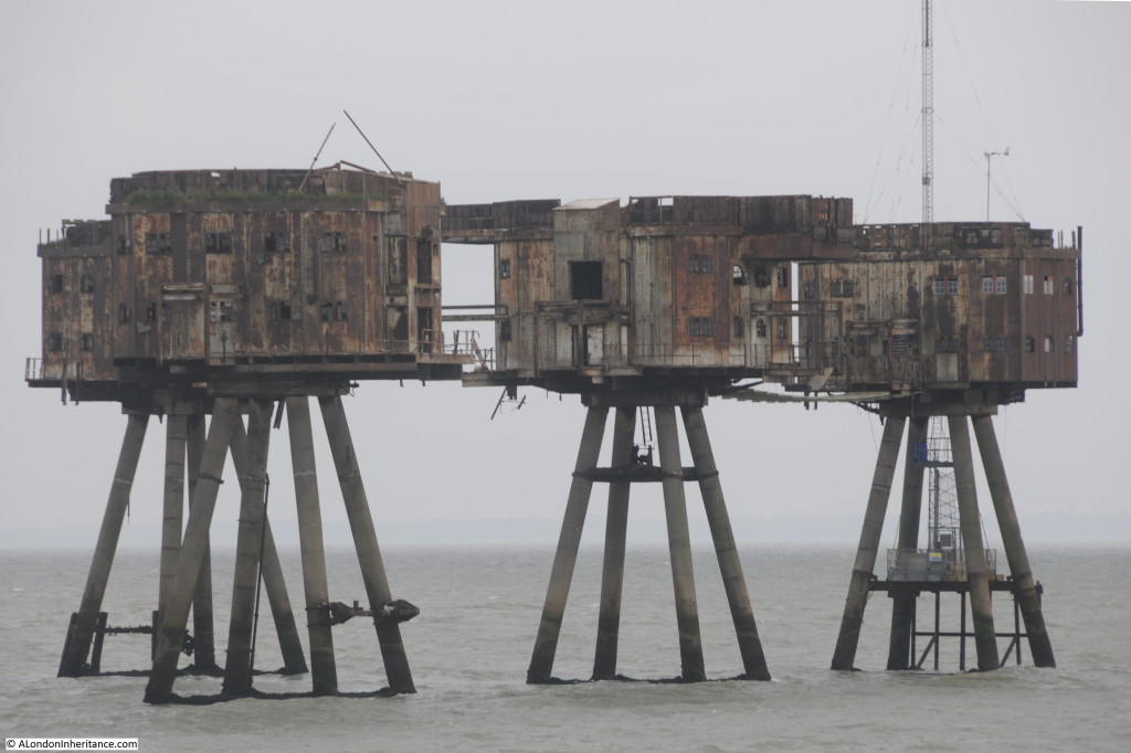
Three forts were installed, Shivering Sands, Red Sands and Nore, with Shivering Sands and Red Sands remaining to this day.

Setting out from Southend, the first fort is Red Sands.

Southend to Sea 3

The forts were built on the Thames in a disused and derelict cement factory that Maunsell had found at Red Lion Wharf at Northfleet, close to Gravesend. The forts were constructed, towed out and installed on site between May and December 1943.

Southend to Sea 4

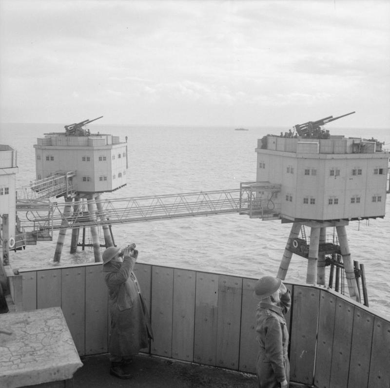
A central observation tower was surrounded by towers, each with an anti-aircraft gun installed. Walkways were run between the individual towers to provide access across the complex.

Southend to Sea 5

Although land was visible from the forts, this must have felt like an isolated and remote location for those based on the forts, coupled with long periods where there would not have been any enemy activity.  It cannot have been very comfortable on a cold and stormy winters night.

The crew of the forts would spend 4 weeks on-board, then a 10 day break ashore.

Although the forts were operational after the main period of the blitz on London they were successful during the later V1 campaign when at least 30 of the V1s were shot down on their way to London.

Southend to Sea 6

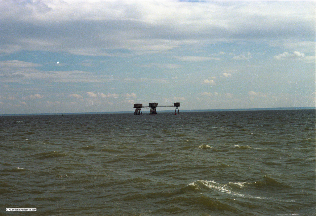
I passed the forts during my 1978 journey down the Thames, with the following photo from this time. Most of the walkways were then still in place. The weather was also better, just to show that there is some colour in the estuary.

Southend to Sea 13

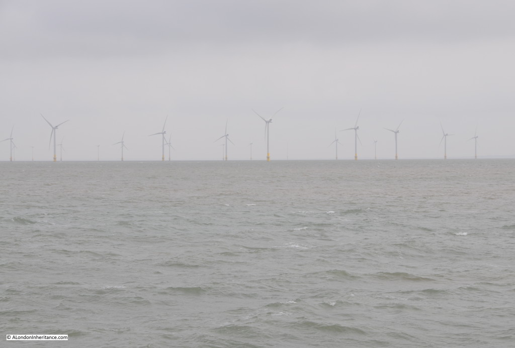
The Thames Estuary provides an example of how power generation has changed over the last century. Initially, power stations were local to population centres. London had a number of smaller power stations, (my grandfather worked in one in Camden). These were replaced by larger stations such as Battersea and Bankside. Power stations then started moving away from centres of population to places such as Littlebrook and Tilbury that we passed along the river. These have now closed and generation moved out to sea with a number of offshore wind farms located in the wider Thames Estuary.

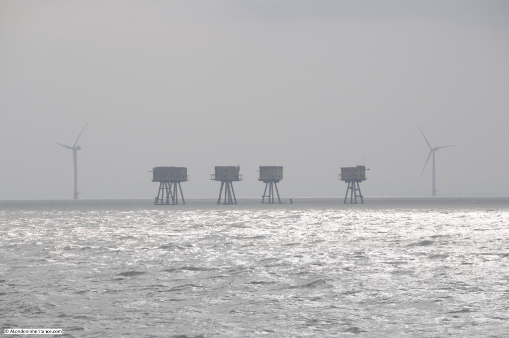
Emerging out of the gloom are the 30 wind turbines of the Kentish Flats Offshore Wind Farm.

Southend to Sea 7

Further out in the Estuary is the Shivering Sands fort. This was the last fort is be completed and as Maunsell wrote at the time:

“the final floating out operation sailed on the afternoon on December 13th, whereafter it transpired that the last of the Towers was grounded on the Shivering Sand in bright moonlight and bitter cold shortly after midnight on December 14th.”

Shivering Sands lost one of its towers in 1963 when it was hit by a ship. The stump of the tower still pokes from the water:

Southend to Sea 8

Passing Shivering Sands fort with Red Sands in the distance. Viewed from a distance they could almost be the Martians from H.G. Wells book War of the Worlds, striding across the Thames Estuary ready to wreak havoc on Southend.

Southend to Sea 9

Seventy years of construction in the Thames Estuary from wartime defences to peaceful electricity generation.

Southend to Sea 10

After the war, Guy Maunsell and a couple of partners set-up their own business and were much in demand to work on major construction projects across the world.

In London, G. Maunsell & Partners were responsible for the Hammersmith Flyover. When this was completed in 1961 it was the first such pre-cast segmented concrete structure in the UK. Further work followed on the Westway from Paddington to White City.

Guy Maunsell died in 1961. His company continued independently, working on projects such as the Docklands Light Railway and the Jubilee Line, until the year 2000 when the company was bought by the US firm AECOM.

The Imperial War Museum has a number of photos of the forts in use (reproduced under the IWM’s Share and Reuse, non commercial licence):

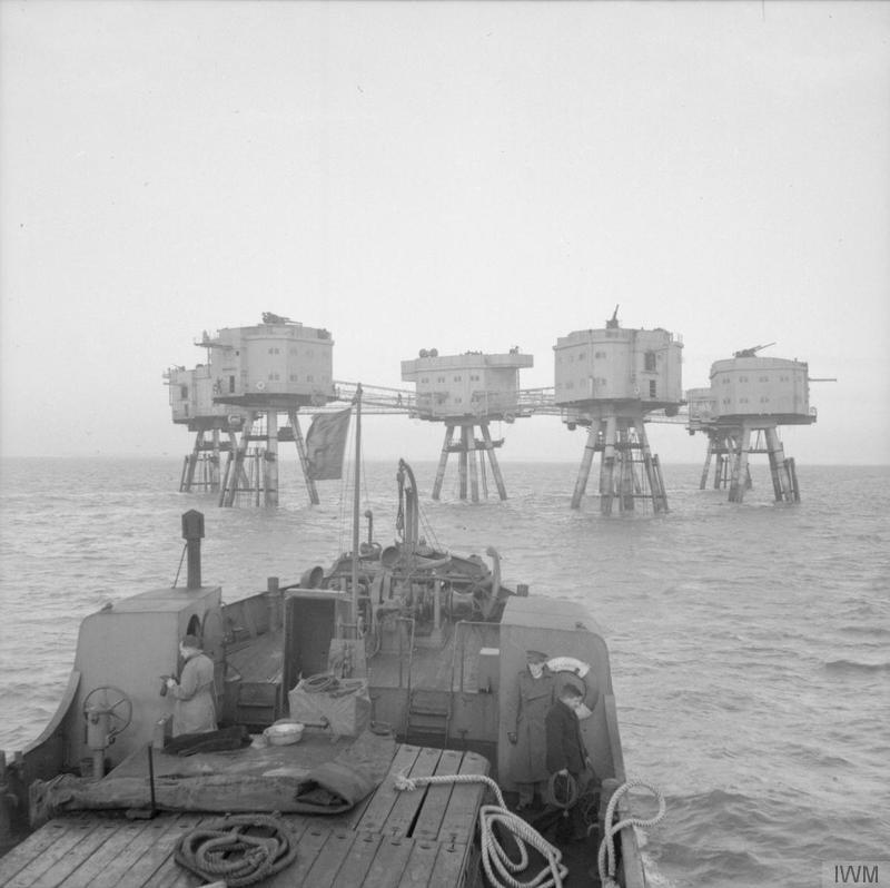
Supply vessel approaching one of the Thames forts © IWM (H 34537):

IWM - 1View from the top of one of the towers showing the anti-aircraft gun mounted on each tower © IWM (H 34542):

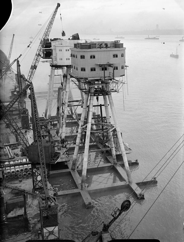
IWM - 2The only photo of the construction of the towers I could find was of the Mersey forts, however the Thames Estuary forts from Northfleet on the Thames would have been constructed in the same manner, ready to be floated out to sea © IWM (A 13259):

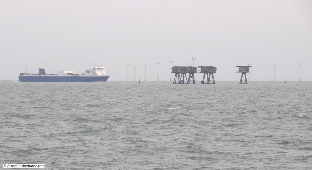
IWM - 3 A final view of the Red Sands fort, wind farm and a ship approaching the Thames heading for its berth further upstream.

Southend to Sea 14

The water that has flowed through London and down the Thames has now merged with the sea. Even at this distance, connections with London can still be found through the Maunsell Forts, built specifically to defend the city from attack during the last war.

The Thames is a fascinating river with a long history, intimately connected with London.

Now it is time to turn round and head back to London. For my final post on the Thames it will be a dramatic after dark return to the centre of the city.

alondoninheritance.com

From The City To The Sea – Barking Creek To Southend

Continuing on my journey along the River Thames from the City of London to the Sea, this post covers the section from Barking Creek to Southend. The river continues to change as we get closer to the estuary. The river is wider and the land on the river bank appears lower, almost merging with the water.

Where there is industry, transport and trade, it is now much larger, almost mirroring the increasing width of the river. Ocean going ships start to appear and the river has navigation markers for these, not the small passenger ferries that are the main river traffic closer to the city.

The weather also changed as we approached the estuary. The grey of the river seemed to evaporate and merge with the sky.
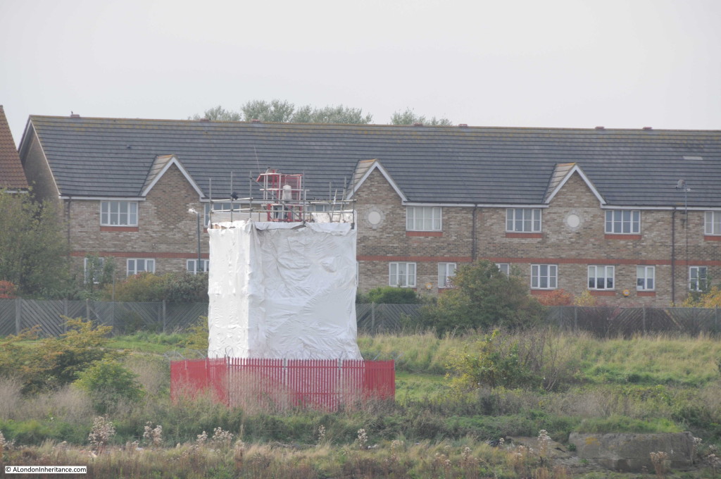
Leaving Barking Creek, we find one of the navigation lights that help ships navigate the Thames after dark. This one is at Crossness with the houses of Thamesmead behind. Undergoing some maintenance, but one of a number that line the river.

Barking to Southend 1

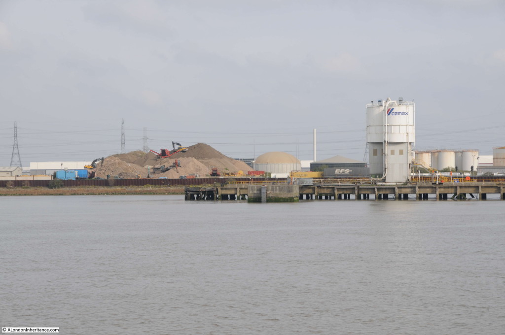
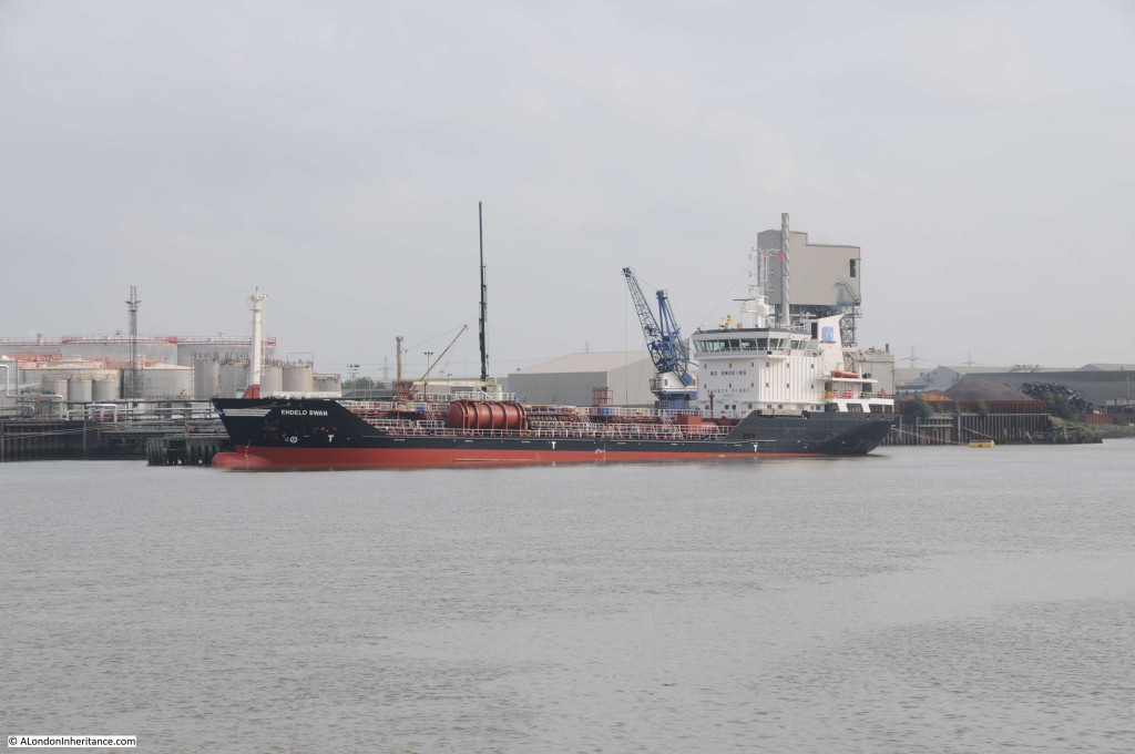
Much of the north bank of the Thames from Barking up to Tilbury is occupied by a range of industries specialising in bulk goods such as aggregates:

Barking to Southend 2

The common feature being that the Thames is the mode of transport for bulk delivery to the sites:

Barking to Southend 3

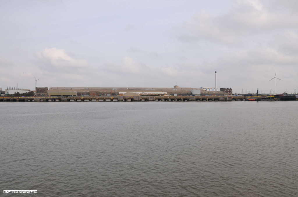
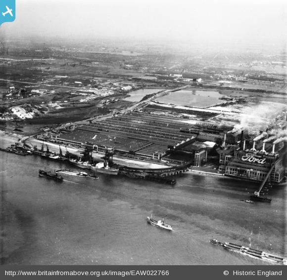
On the north bank of the river, we pass the Ford plant at Dagenham. The plant is a shadow of its former self. Car production has long ceased and the plant now manufactures diesel engines. Problems with the age of the plant, terrible industrial relations during the 1970s and the strength of the Pound resulted in Ford shifting car production to a number of other European locations. A site which once employed around 40,000 workers now employs close to 3,000. There is still a dock on the river for Ford, used for shipping to transport engines to other Ford plants.

Barking to Southend 4

How the site has changed can be seen by comparing the above with the Britain from Above photo below from 1949. In the above photo there is a very small blue Ford sign on the white band running across the centre of the building, in the past the site had the largest neon sign in Europe proudly proclaiming the Ford brand.

Ford 1949 - EAW022766

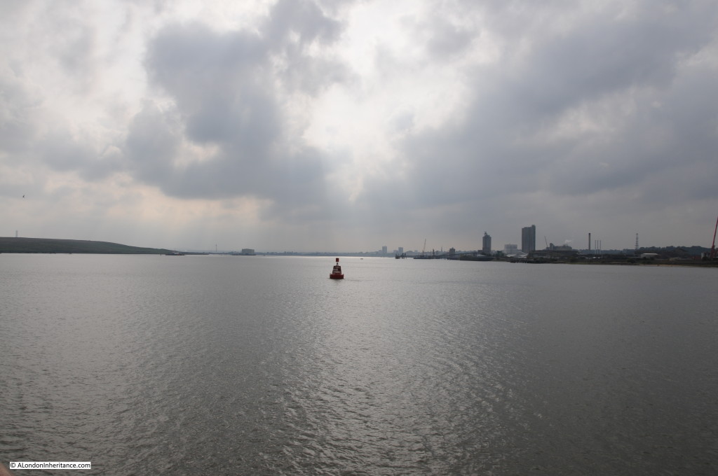
Past Dagenham, the Thames opens up. Calm and quiet.

Barking to Southend 5

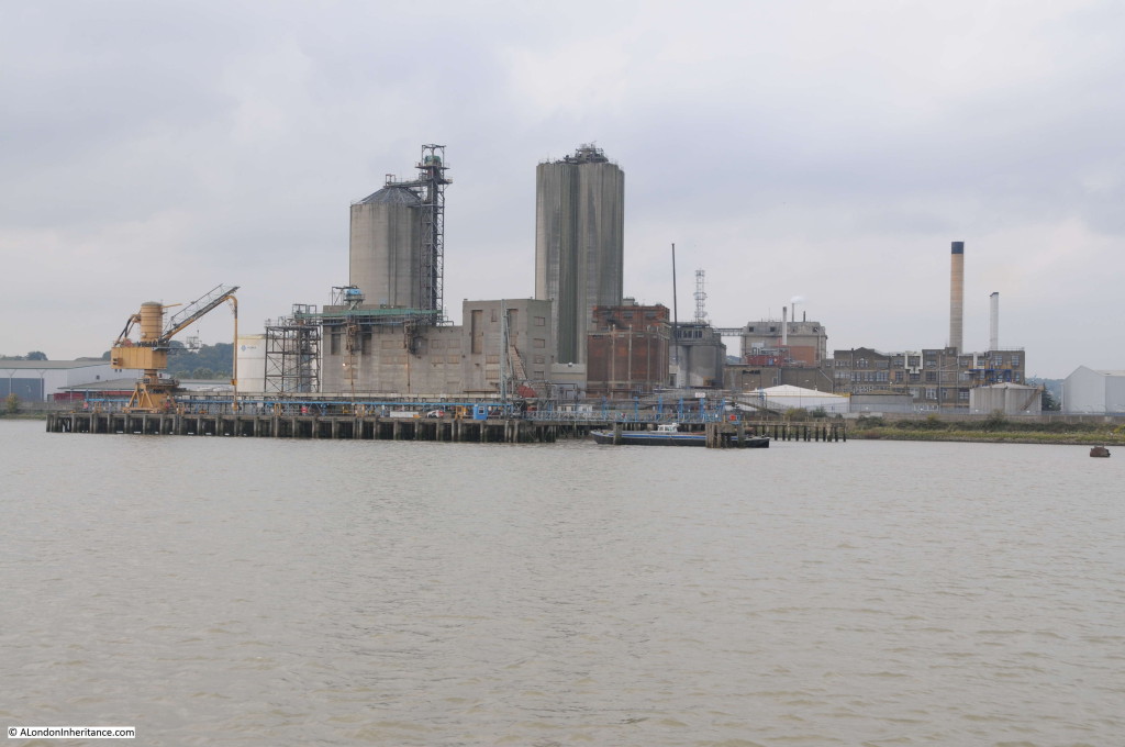
Approaching Erith, Kent on the southern bank of the river is the oil processing plant of Archer, Daniels, Midland Erith Ltd. This is oil from rapeseed, linseed and sunflowers rather than oil extracted from below ground. The plant processes 1 million tonnes of rapeseed a year to produce 385,000 tonnes of refined oil for use as food ingredients and biofuels.

Barking to Southend 6

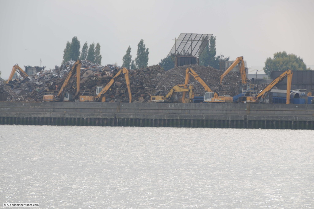
One common feature of the river bank are the scrapyards and excavators. I lost count of how many excavators there were along the length of the river.

Barking to Southend 7

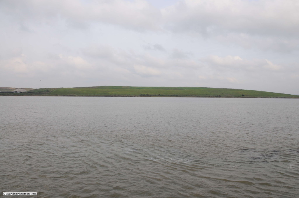
A break in the flat land bordering the Thames is not a natural feature, but a landfill site covering part of Rainham Marshes. Fortunately landfill does not occupy the majority of the old marshes and much has been preserved and now form an RSPB reserve on the Thames.

Barking to Southend 8

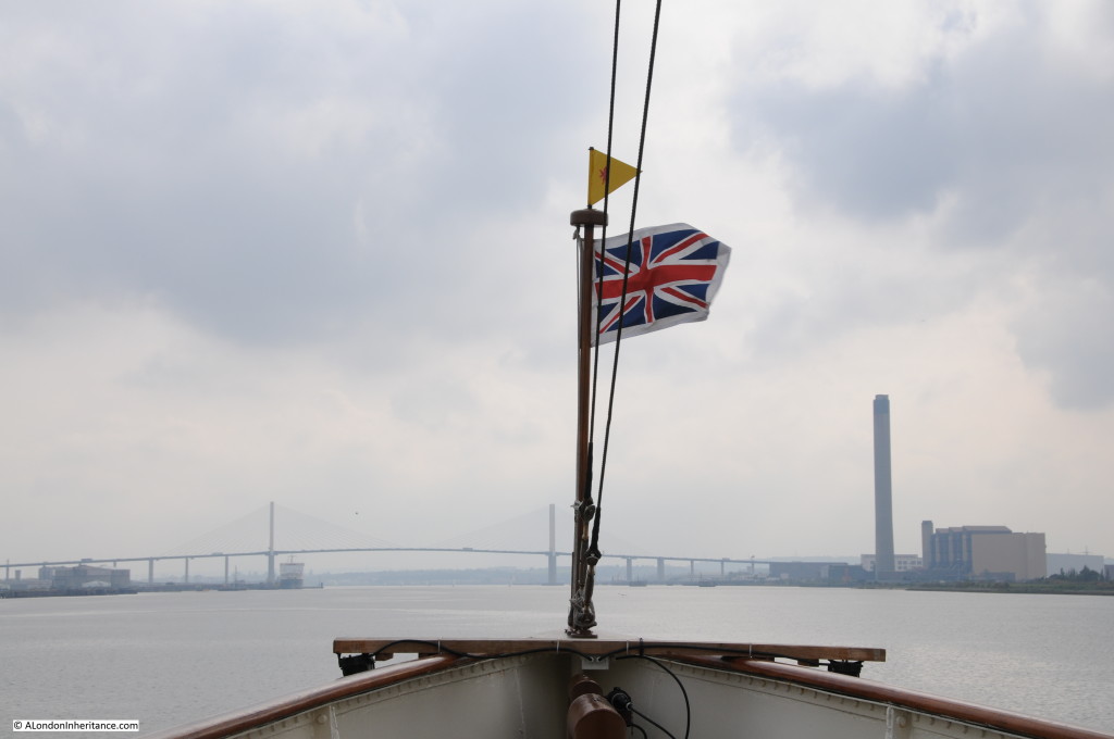
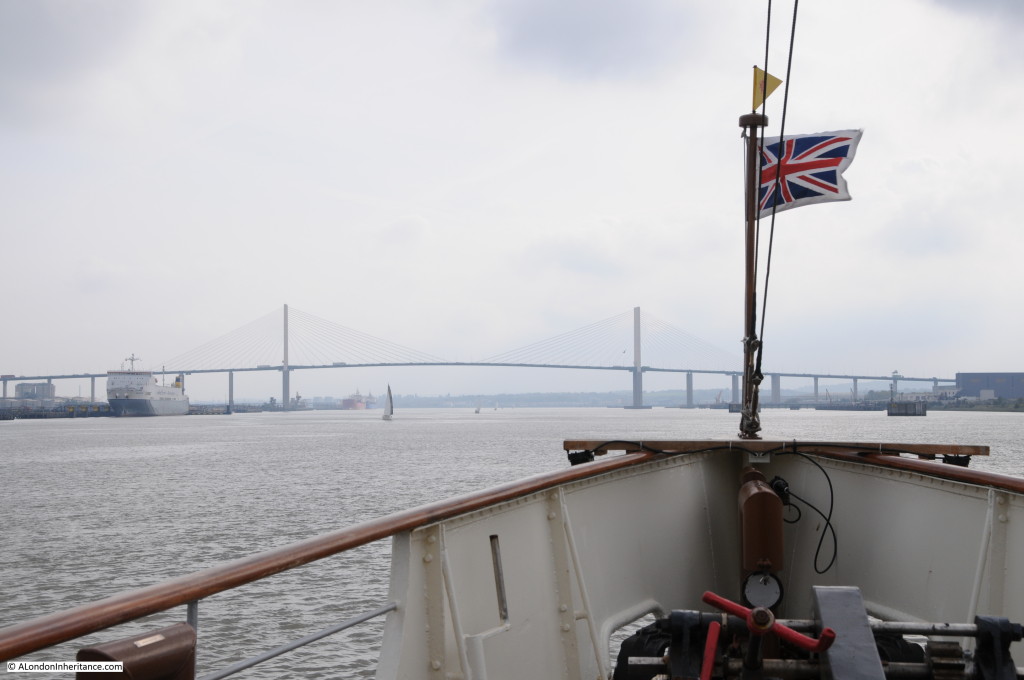
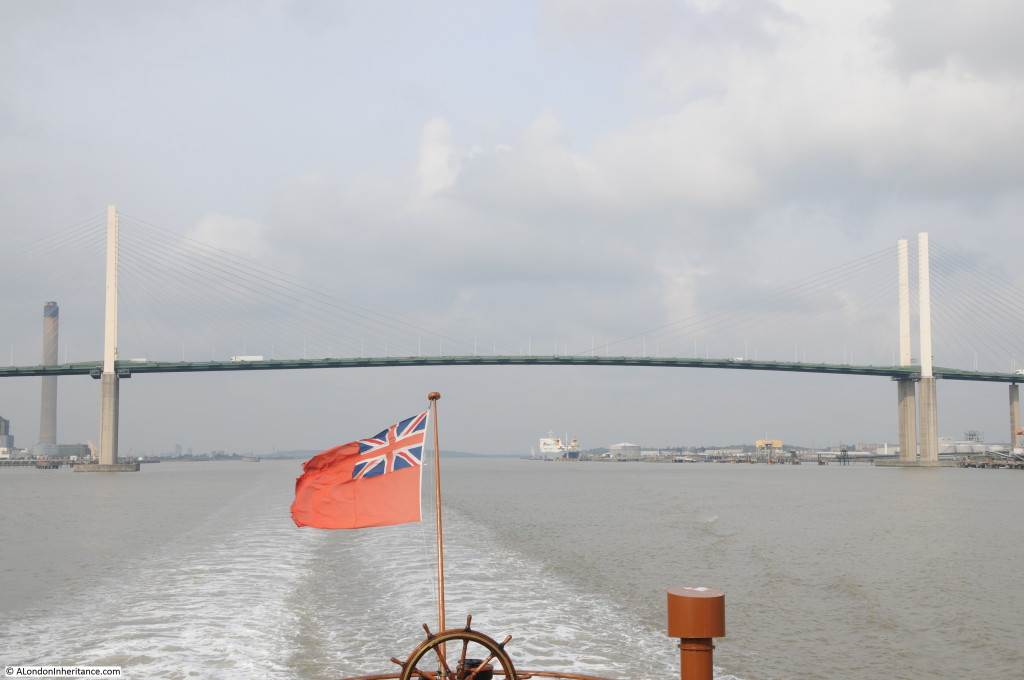
Passing Rainham and the Queen Elizabeth II bridge comes into view. Opened in 1991, the bridge provides additional capacity to the two tunnels under the Thames at the same location.  Traffic crossing the river at this point has grown considerably and is the only river crossing east of the Woolwich Ferry and the only bridge east of Tower Bridge.

The first tunnel was opened in 1963, long before the M25 and provided a crossing under the river between Purfleet on the north bank and Dartford on the south. The second tunnel was opened in 1980, however traffic continued to grow and rather than add a third tunnel, the most cost effective method for a large volume of traffic was the bridge. The tunnels and the bridge now make up the river crossing between the M25 on the north and south banks of the Thames.

Barking to Southend 9

In the above photo, there is a power station on the right. This is the Littlebrook Power Station, an oil fired station and the fourth to operate on the site since 1939. Proximity to the Thames allowed the fuel to be transported by river.

The station is owned by the German utility RWE and has now closed as having used up a limited number of generating hours under the EU’s Large Combustion Plant Directive that limits the life of the most polluting power plants.

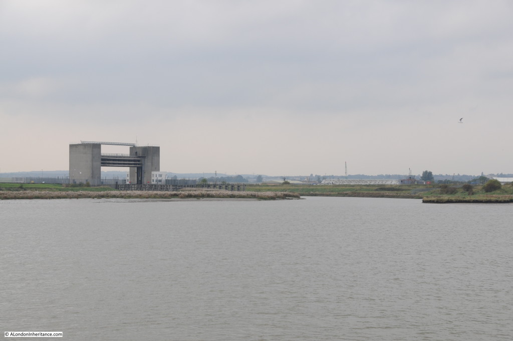
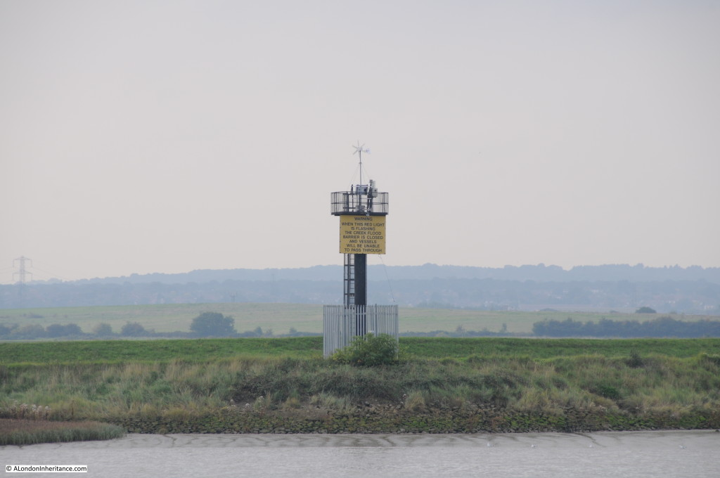
On the south side of the river is where the River Darent enters the Thames. As with Barking Creek, the river has its own barrier which is lowered during very high tides and storm surges to prevent flooding down river. The river rises near Westerham in Kent.

Barking to Southend 10

The land on the south side of the river has not been developed as much as the north and long stretches of the river bank and adjacent land have changed very little over the centuries.

Barking to Southend 11

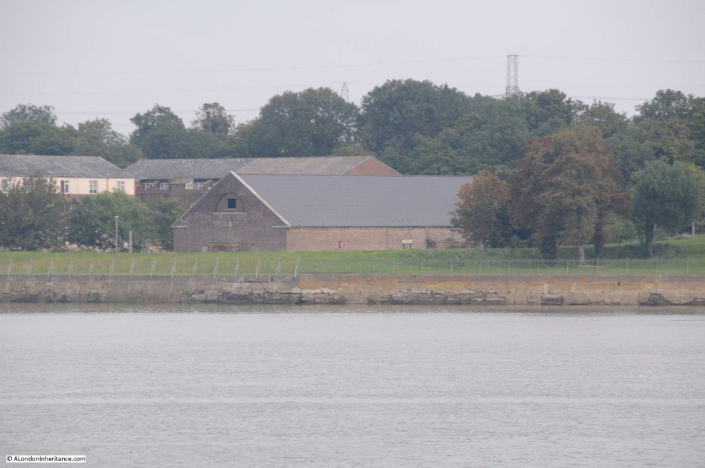
On the north bank of the river is the remaining powder magazine from the original set of five magazines that formed the Royal Magazine for Gunpowder at Purfleet. Each magazine provided storage for 10,000 barrels of gunpowder. Built between 1763 and 1765, the other four were only demolished in 1973. The site was one of the major stores of gunpowder for both the army and navy, storing powder produced at the Royal Gunpowder Factory at Waltham Abbey.
Waltham Abbey is adjacent to the River Lea so it is probable that the River Lea which enters the Thames by Trinity Buoy Wharf was used to bring the gunpowder to the Thames from where it was transported along the river to Purfleet.
Such was the importance of reducing the risks of sparks. wooden cranes were used inside to move the barrels. These still survive along with much of the original interior fittings. The remaining magazine is Grade 2 listed so will not suffer the fate as the other four.

Barking to Southend 12

Now getting closer to the bridge, but the sun shows no sign of returning.

Barking to Southend 13

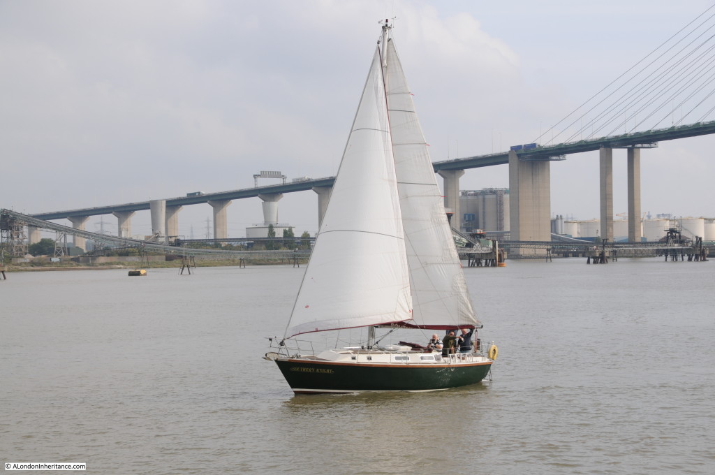
Weekend pleasure users of the river:

Barking to Southend 14

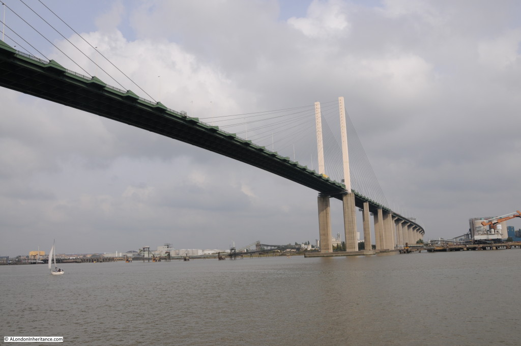
Passing under the bridge it is possible to appreciate the engineering which when driving over the top it is not always possible to do.

The deck of the bridge is 812m long with 450m of crossing over the river. The concrete masts rising above the bridge are 84m tall and they sit on 53m of concrete piers below the bridge. the clearance between the bridge and the river at high water is 57.5m

Each of the piers is designed to survive the impact of a 65,000 tonne ship travelling at 18.5km per hour. Reassuring when you next travel over the bridge!

Barking to Southend 15

And the sun briefly makes an appearance as the Waverley sails on downriver from the bridge.

Barking to Southend 16

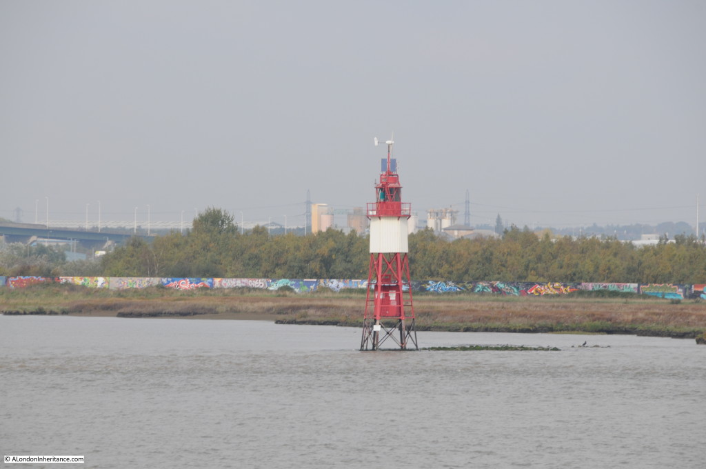
Just past the bridge, on the north bank is another of Thames lighthouses. This one the Stone Ness Lighthouse on a spit of land poking out into the Thames. Whilst the twists and turns of the Thames are very clear during the day, at night the river is dark and although today ships have GPS navigation systems to guide them down the river, these lights would have been essential to show where the river did not continue in a straight line. Today they remain essential markers and a backup for those without accurate GPS based river mapping.

Barking to Southend 17

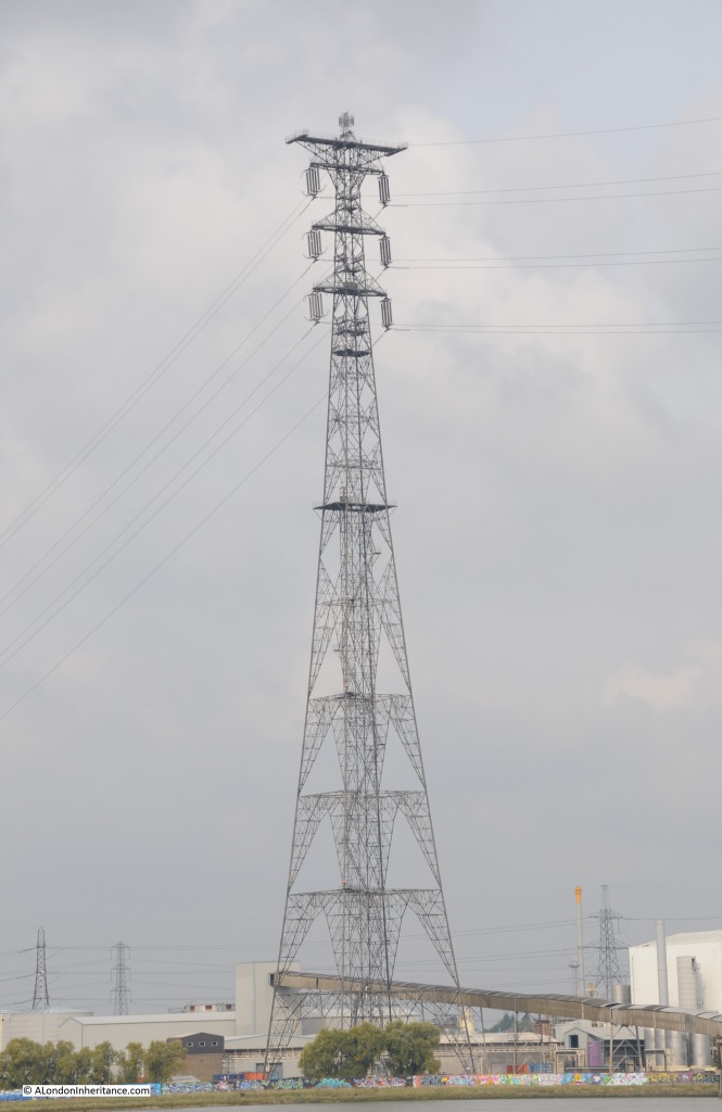
The Thames can boast that it has the tallest electrical transmission towers in the UK. These can be found supporting electrical power cables across the river between West Thurrock on the north bank and Swanscombe on the south. Built in 1965 these towers are 190m, 623ft tall.

Barking to Southend 18

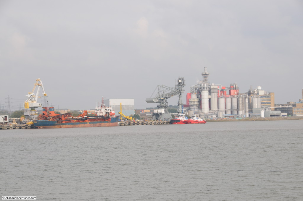
There are a number of interesting new industrial complexes along the Thames which appear to use the river for transport of raw or processed materials. This one between West Thurrock and Tilbury, showing that along this part of the river it is still providing an essential function in supporting trade and industry. It has just moved much further downstream from London.

Barking to Southend 19

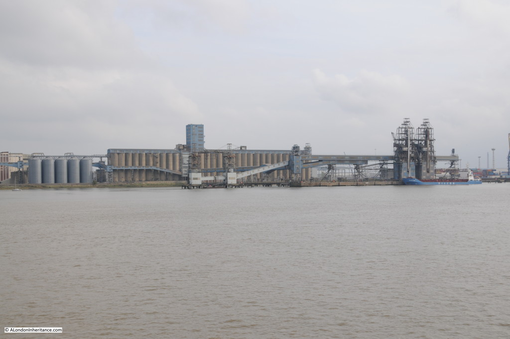
Approaching Tilbury, large grain silos:

Barking to Southend 20

Now at Tilbury Docks. The docks were opened in 1886 to help with the ever increasing volume of trade on London’s river and the lack of space at the central London docks.

Along with the availability of land, Tilbury was an ideal location due to a railway already being in existence leading to the ferry across to Gravesend. Unlike the central London docks, the availability of space, and the downstream location of Tilbury ensured that the docks could handle the conversion to containerisation and the ever increasing size of container ships.

Tilbury remains a busy port, however as we shall see, there is new competition downstream.

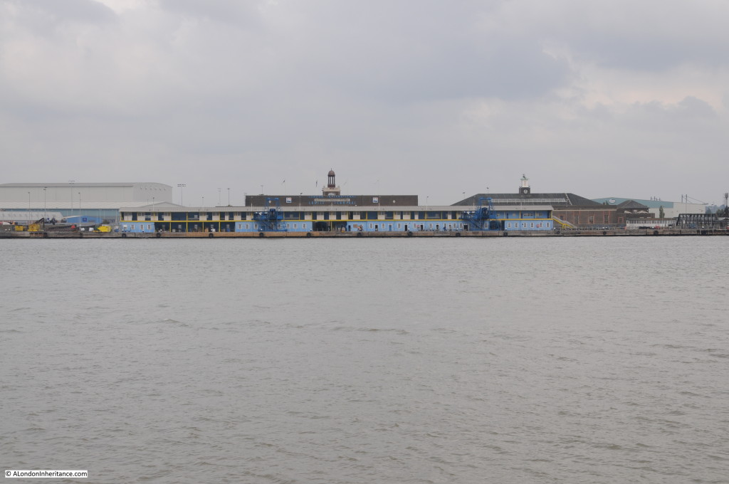
Barking to Southend 21

This is the London Cruise Terminal at Tilbury, the original Tilbury passenger ferry terminal. The terminal supports a number of the smaller cruise ships.

Barking to Southend 22

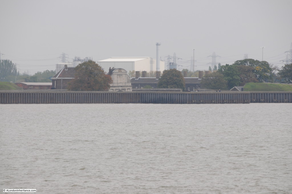
In my post that covered the Thames Barrier, I commented that without the barrier the river walls on the Embankment would need to be almost up to the height of the street lamps. The height of the river and the level of the land is very noticeable along stretches of the river. The following photo is showing Tilbury Fort with the majority of the fort gate hidden below the river wall.

Barking to Southend 23

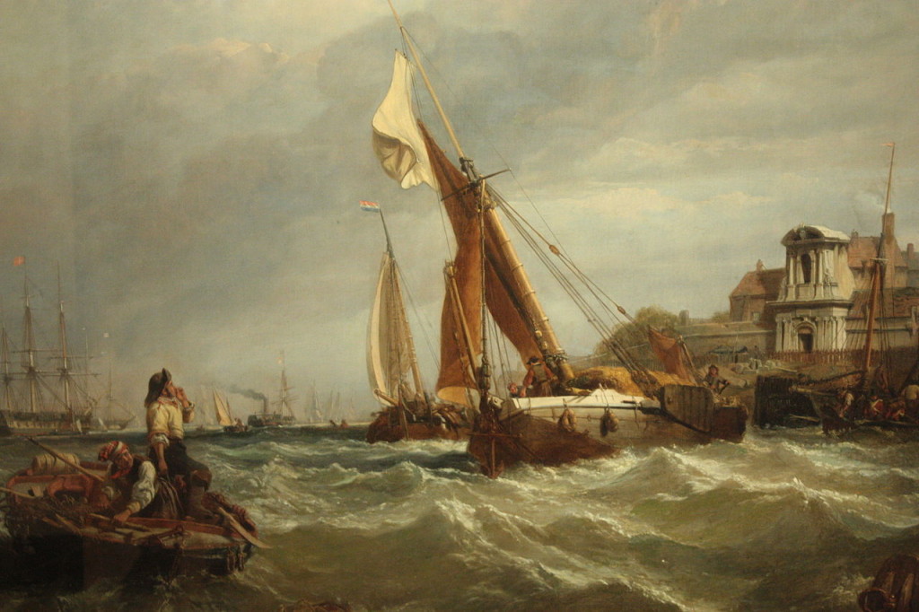
The appearance of the gate to the fort and the river in 1849 can be seen in this painting by Clarkson Frederick Stanfield titled Wind Against Tide. See also my post on the fort which can be found here. Channelling of the river, the loss of natural marsh land to absorb overflow and possible sea level rise over the centuries has resulted in the level of the Thames rising with respect to much of the surrounding land.

Tilbury_Fort_-_Wind_Against_Tide_by_Clarkson_Stansfield,_1849

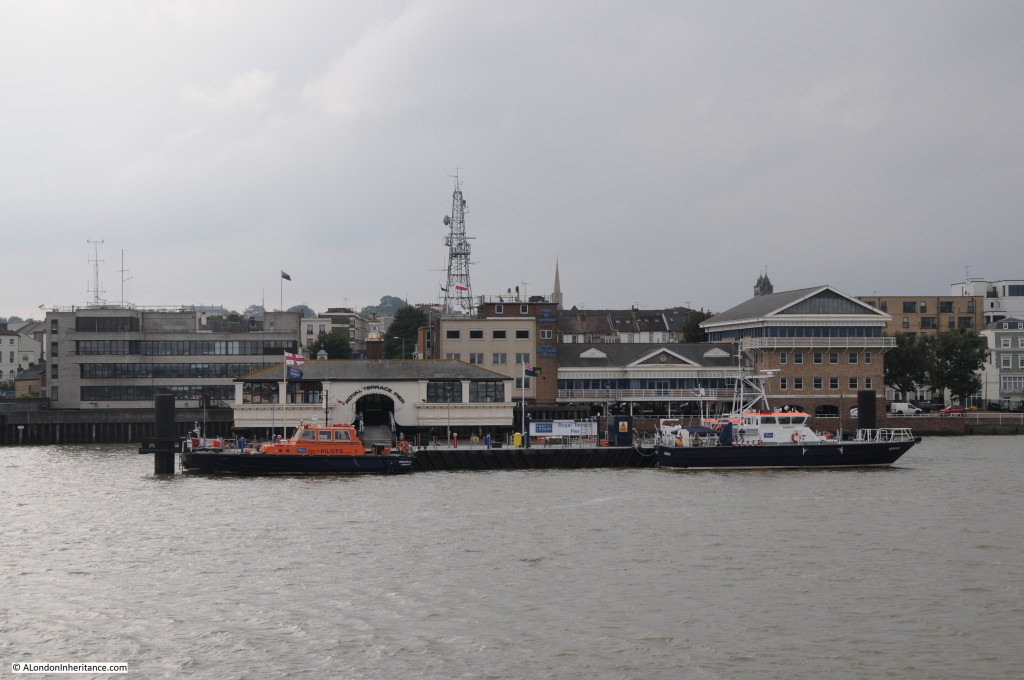
Across the river from Tilbury is Gravesend, an old town recorded in the Domesday Book of 1086. Here is the Royal Terrace Pier, built in 1844 and now an operations centre for the Port of London Authority.

Barking to Southend 24

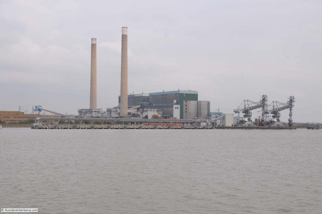
Opposite Gravesend is Tilbury Power Station, as with the Littlebrook Power Station next to the QE2 Bridge, it is also owned by RWE and closed in 2013 having used up the hours available for coal and biomass generation, raw materials which were transported along the river. I do not believe there is now an operational power station along the Thames.

Barking to Southend 25

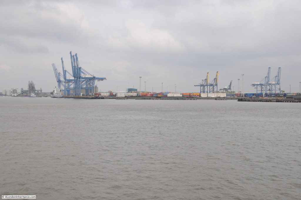
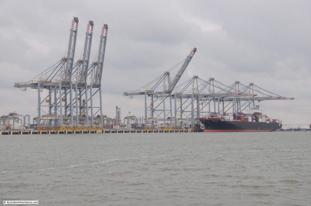
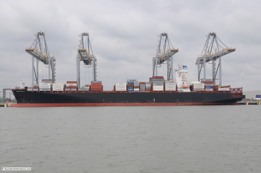
Another industry that has left the river is crude oil refining. Shell had long operated a large refinery at Shell Haven. Refinery operations started in 1916 and continued until 1999 when the site closed. The refinery has since been demolished and replaced with the London Gateway, a major new container port, part of which is shown in the photo below:

Barking to Southend 27

The river has been dredged to ensure that deep water moorings are available and the river bank built forward to provide 2.7km of quayside. The container cranes are 453ft high and can reach across a ship laden with 25 containers across.

Barking to Southend 28

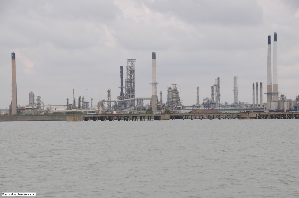
Just past the London Gateway is the Coryton Refinery, named after the village that was absorbed into the refinery complex during a period of expansion in the 1970s. The Coryton Refinery lasted longer than Shell Haven and finally closed in 2013, ending crude oil refining on the Thames. Two years later the refinery complex is still in place, awaiting whatever the future holds for the site.

Barking to Southend 29

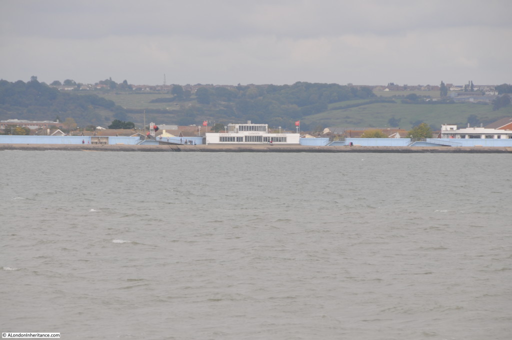
Next along is Canvey Island, The island was hit hard during the floods of 1953 which caused the deaths of 58 people. The sea wall has been significantly strengthened around the island and as can be seen in the photo below, the roof line of the houses just peer above the top of the blue sea wall.

The white building in the centre of the photo is the Labworth Café. A unique modernist building made of reinforced concrete and built between 1932 and 1933. The building was almost lost during one of the river wall building programmes and the overall impact of the building has been reduced with the lower part becoming embedded in the sea defences. It has now been restored and is a Grade 2 listed building.

Barking to Southend 30

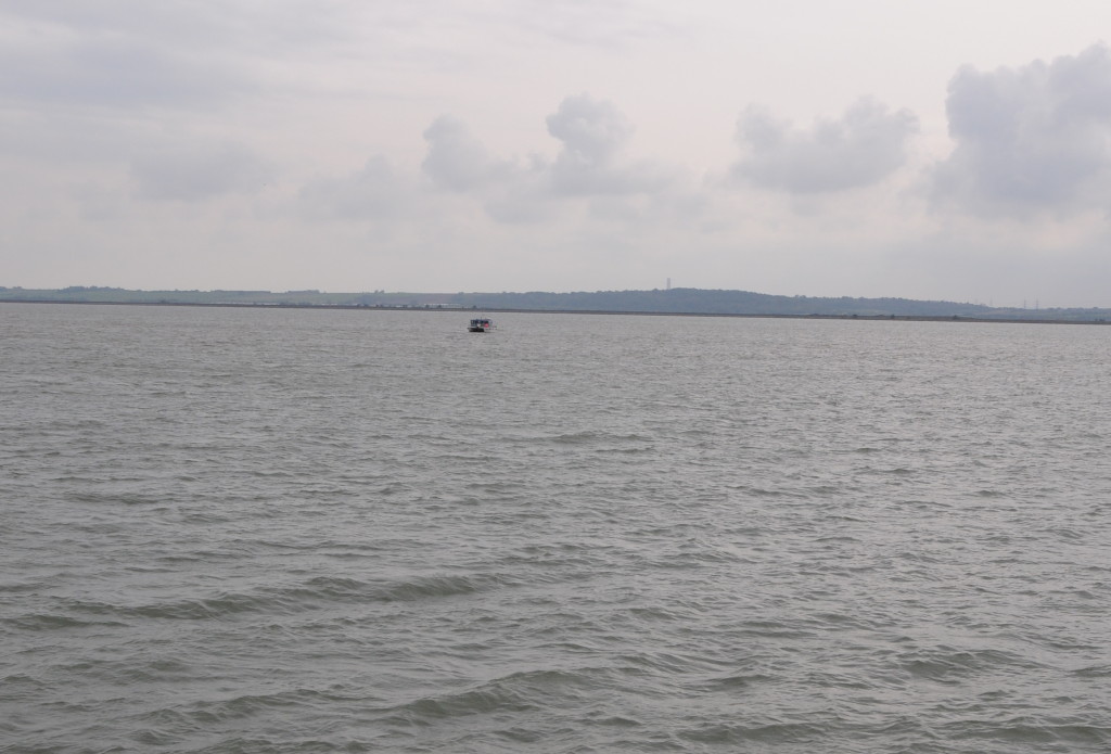
The photo below shows the north Kent coastline along the river. It has not changed for centuries and is still much the same as when Dickens would have walked here, and as described in the opening sections of Great Expectations:

“Ours was the marsh country, down by the river, within, as the river wound twenty miles from the sea. My first and most vivid and broad impression of the identity of things, seems to me to have been gained on a memorable raw afternoon towards evening. At such a time I found out for certain, that this bleak place overgrown with nettles was the churchyard….and that the dark flat wilderness beyond the churchyard, intersected  with dykes and mounds and gates, with scattered cattle feeding on it, was the marshes; and that the low leaden line beyond was the river; and that the distant savage lair from which the wind was rushing was the sea; and that the small bundle of shivers growing afraid of it all and beginning to cry, was Pip.”

The north Kent coastline along the Thames. The flat coast land merging with the river.

Barking to Southend 33

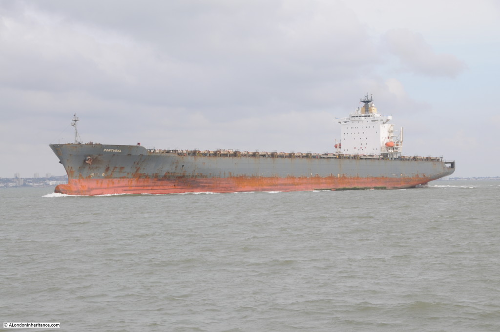
One indication of how far one has travelled down the Thames is the size of ship that can be seen. This ship passing Canvey Island is an empty container ship on its way to the London Gateway.

Barking to Southend 31

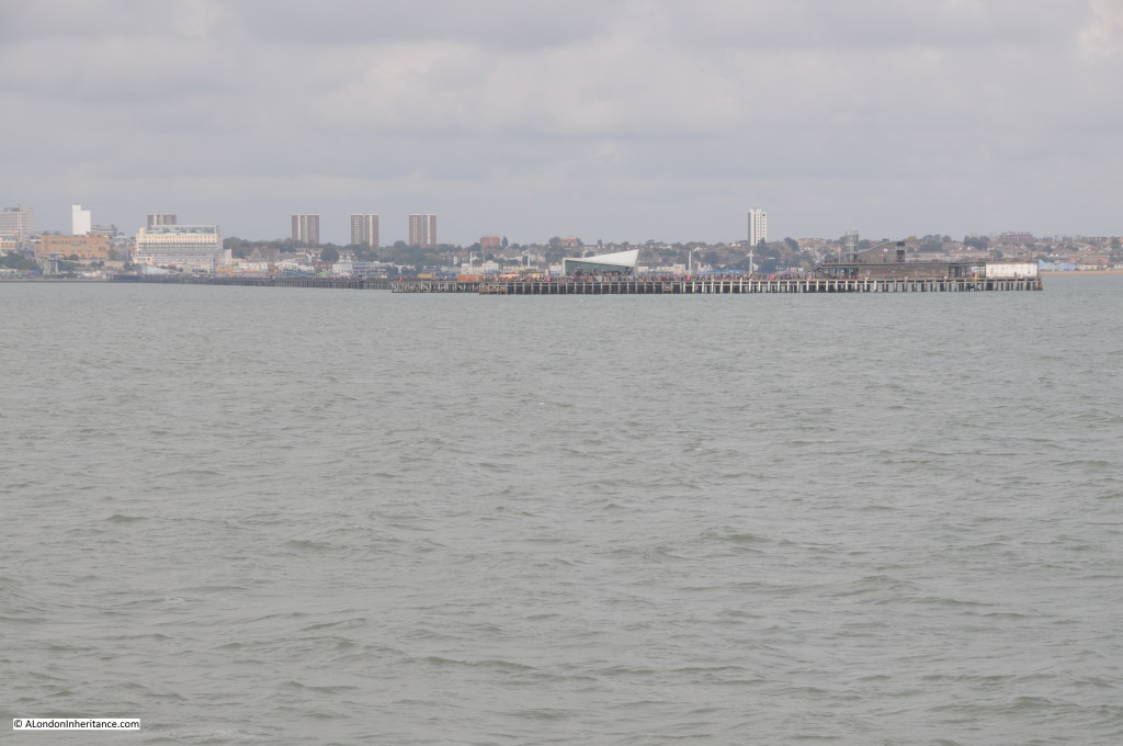
And finally, Southend Pier comes into view. The longest pier in the world at 1.34 miles. It is also Grade 2 listed.

The main reason for the length of the pier was to attract pleasure boats from London. The coastal part of the Thames Estuary leading up to Southend is relatively shallow and at low tide extensive mudflats reach out from the coast. A long pier was needed to reach a water depth that did not dry out at low tide, thereby allowing boats to moor at the end of the pier and unload visiting Londoners ready to spend their hard earned money during a rare pleasure trip to Southend.

Southend Pier has suffered numerous fires, has been struck by ships and has been threatened by closure, but after recent investment now seems to have a secure future. Even the trains, which were such a unique feature of the pier, continue to run.

Barking to Southend 32

It is hard to tell at Southend where the River Thames ends and the sea begins. The Crow Stone, an obelisk set in the river edge at Westcliffe-on-Sea, just a short distance west of the pier is the traditional boundary between the river and the sea. The Crow Stone was installed in 1836 to replace an earlier stone marker from 1755. These stones marking the limits of the authority of originally the City of London and then the Port of London Authority. Unfortunately, the Crow Stone was not visible this far out in the estuary.

Sailing down the Thames it is fascinating to imagine the vast number of ships and people that have travelled along the same route over the centuries. Prior to the development of flight (which given London’s long history is only relatively recently) the river was London’s gateway to the world for both people and trade.

Although much reduced, it still retains this role, whether taking cruise ships to Tilbury or cargo to the docks at Tilbury and the London Gateway along with the remaining industrial sites that line the river.

Although the boundary with the sea has been reached, there is more to visit, so in the next post a brief run out to the sea past Southend, before an after dark run back to Tower Pier.

alondoninheritance.com