
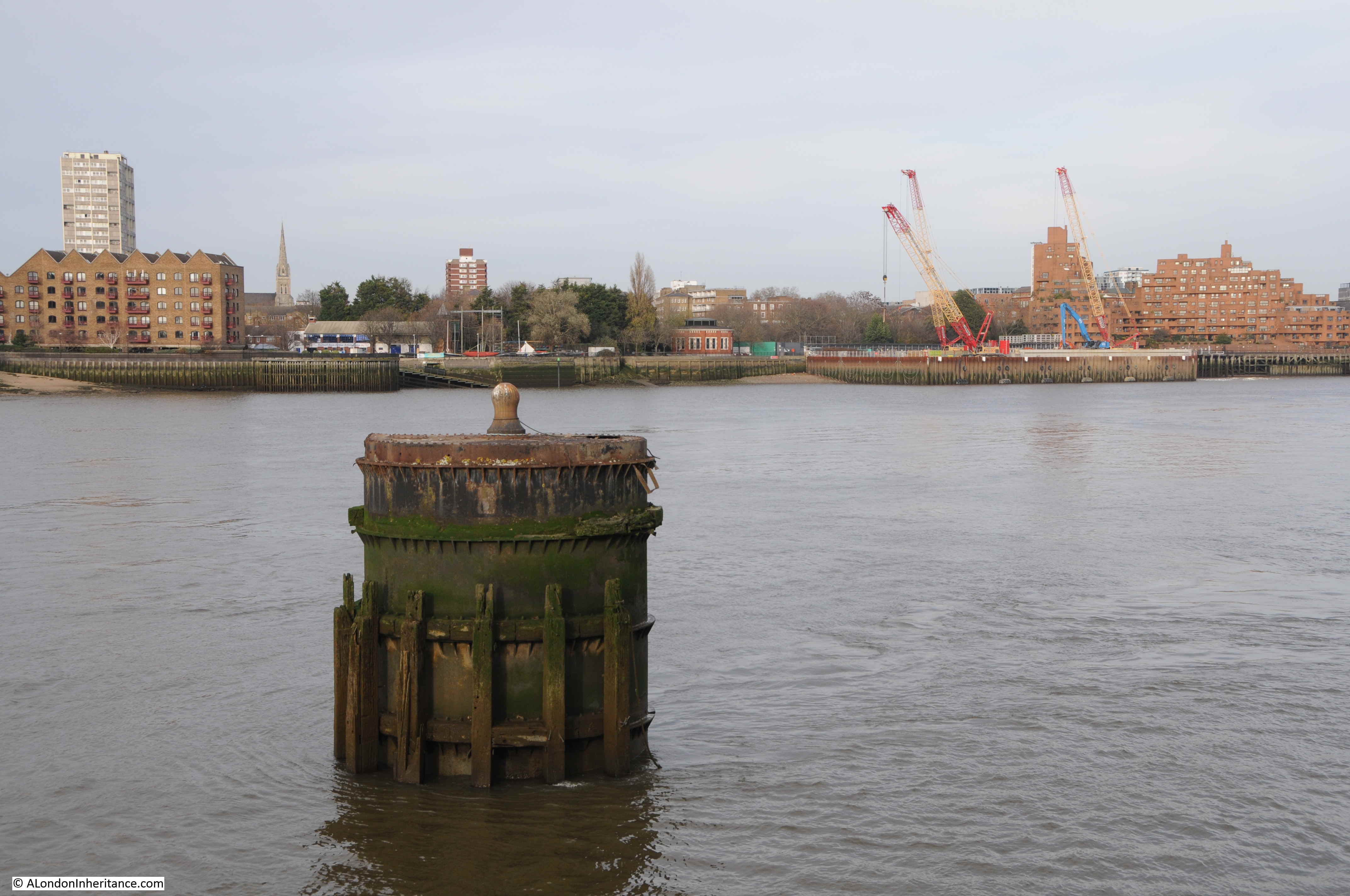
The title for this week’s post is a bit deceiving. The Thames dolphin in question is not one of the marine mammals, rather it is a structure in the river which is also called a dolphin.
The definitions for this type of dolphin include a pile, or a collection of piles in the river to which a boat can be moored, or a cluster of piles at the entrance to a dock, and it is this later definition which I suspect applies to the dolphin in my father’s photo at the entrance to the Surrey Lock and Basin in Rotherhithe – photographed in 1947:

The photo was taken from the Thames foreshore, adjacent to the air shaft of the Rotherhithe tunnel, looking across to the Shadwell / Wapping side of the river.
The negative with the photo was in poor condition and took some processing to get to the copy you see above, which unfortunately still has the opposite bank of the river with a rather poor contrast and lack of detail to the buildings.
I could not get down to the foreshore to take a similar photo as the tide was not sufficiently out, so the angle of the 2020 photo is slightly different. The following photo shows that the dolphin can still be seen today, along with some landmarks visible in 1947 on the opposite side of the river.
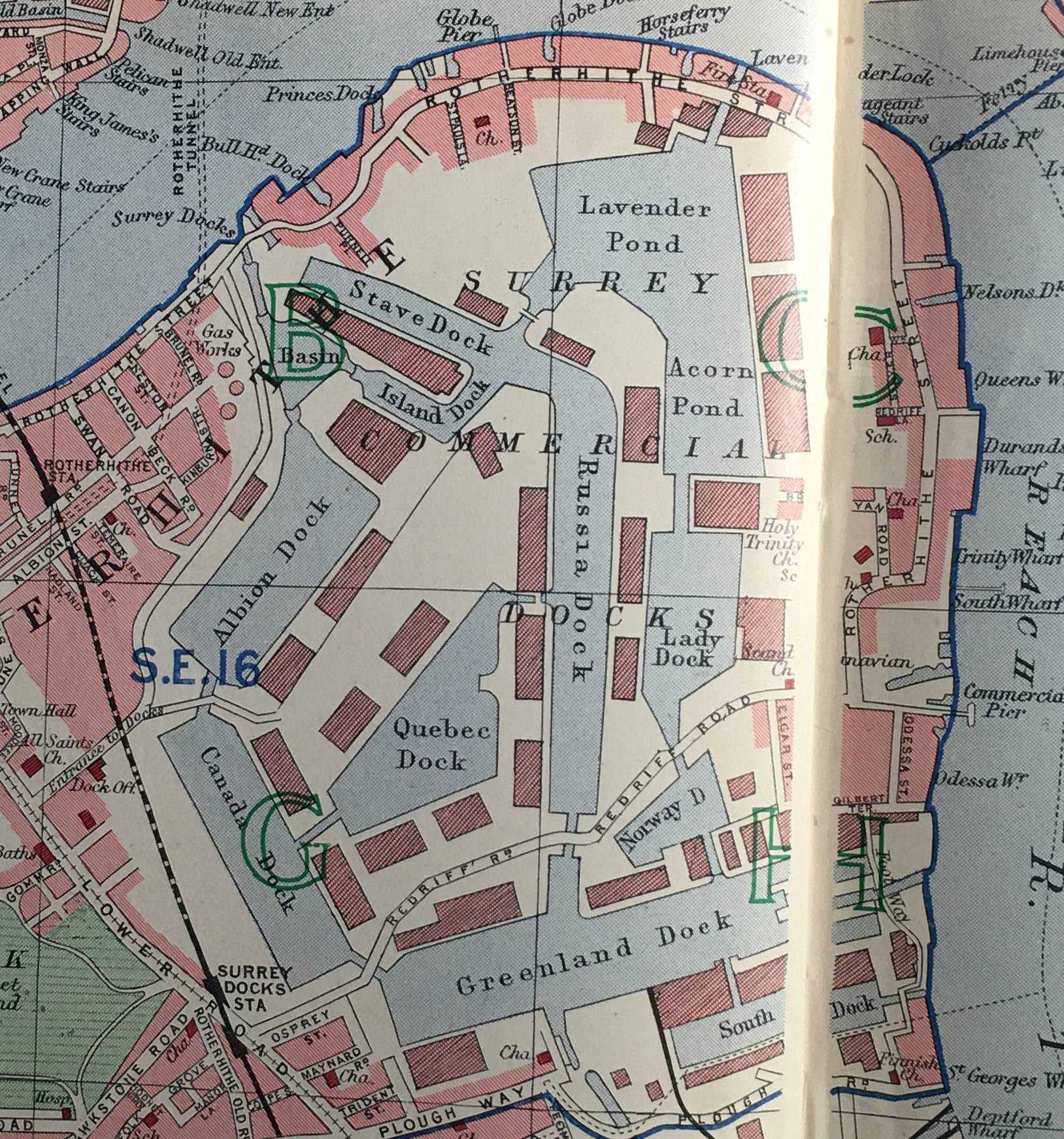
The following extract is from the 1948 revision of the Ordinance Survey map. The lines converge on the approximate point where my father was standing to take the photo. A blue circle marks the location of the dolphin (‘Reproduced with the permission of the National Library of Scotland’).
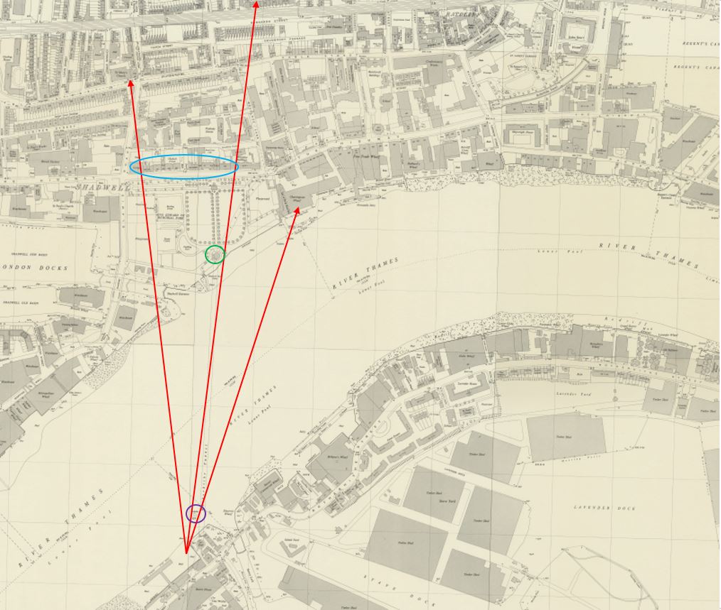
The green circle on the opposite side of the river is the position of the air shaft of the Rotherhithe tunnel which can be seen in the 1947 photo. The centre red arrow shows the alignment of the airshaft in relation to the dolphin.
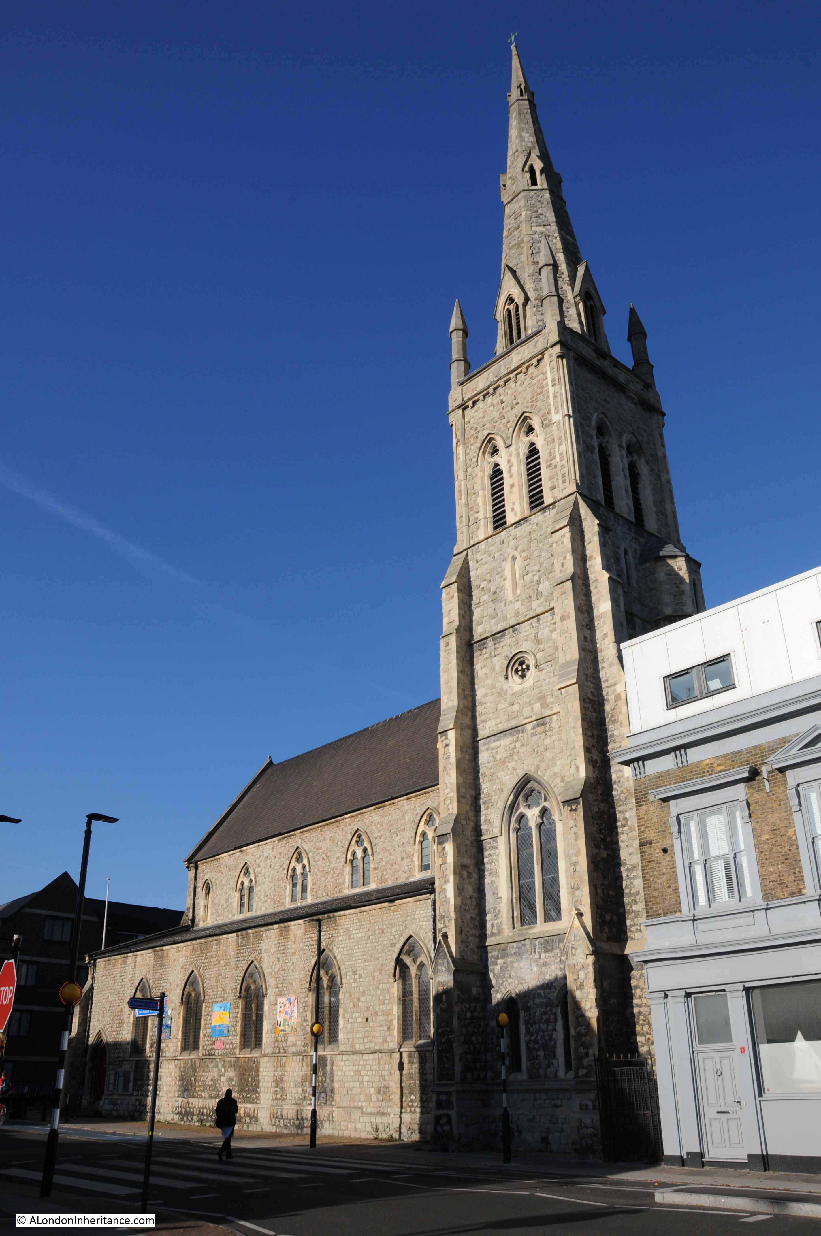
The arrow on the left points to the church spire that be seen in the 1947 photo. This is the spire of St Mary’s in Cable Street. The spire can also be seen in the 2020 photo, and I photographed the church when I was walking the area a few years ago.
The arrow on the right points to the buildings which can be seen to the right of the dolphin. These are the buildings and cranes of Charringtons Wharf, which were demolished some years ago to be replaced by the large block of flats on the site today. The cranes to the right of the tunnel air shaft in the 2020 photo mark one of the construction sites for the Thames Tideway Tunnel, or Super Sewer.
There is a prominent line of buildings running between the dolphin and the spire of the church. These were buildings along the northern edge of The Highway – buildings that have now been demolished.
The gap in the centre of the line of buildings is open space between The Highway and Glamis Place, with the ruins of a pub to the left.
The entrance to Shadwell Basin is also in the photo, but is hard to see due to the lack of contrast, and the lighting of the scene across the river. The entrance is also at an angle to the river so the northern side of the entrance looks like a continuation of the river wall.
I have marked these features on the original 1947 photo as shown below:

There is one feature in the 1947 photo that I could not locate, however the Britain from Above archive came to the rescue.
The following photo from 1946 shows the Wapping / Shadwell area. The tunnel air shaft is lower left and I have ringed the church. I have written the name of The Highway along the street and the row of buildings along the north side of the street can be seen.
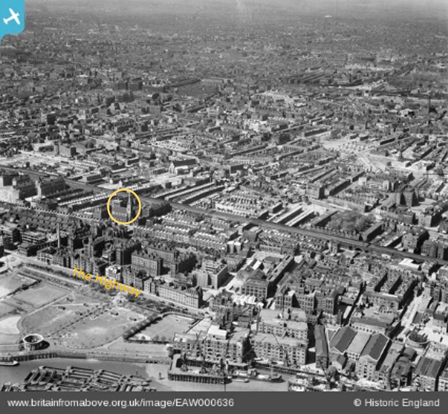
From the church spire, look diagonally to the lower left and you will see a chimney. This is the chimney seen in the 1947 photo and is the feature I could not locate.
Comparing the photo and the OS maps, the chimney looks as if it may have been part of the Queen Elizabeth Hospital for Children.
The following map shows the area today. The lower solid red circle is the point from where the photo was taken, and for reference, the upper red ring is the location of the church (Map © OpenStreetMap contributors).
The entrance to the Surrey Basin can be seen to the right of the lower red circle and the entrance to Shadwell New Basin is on the opposite bank.
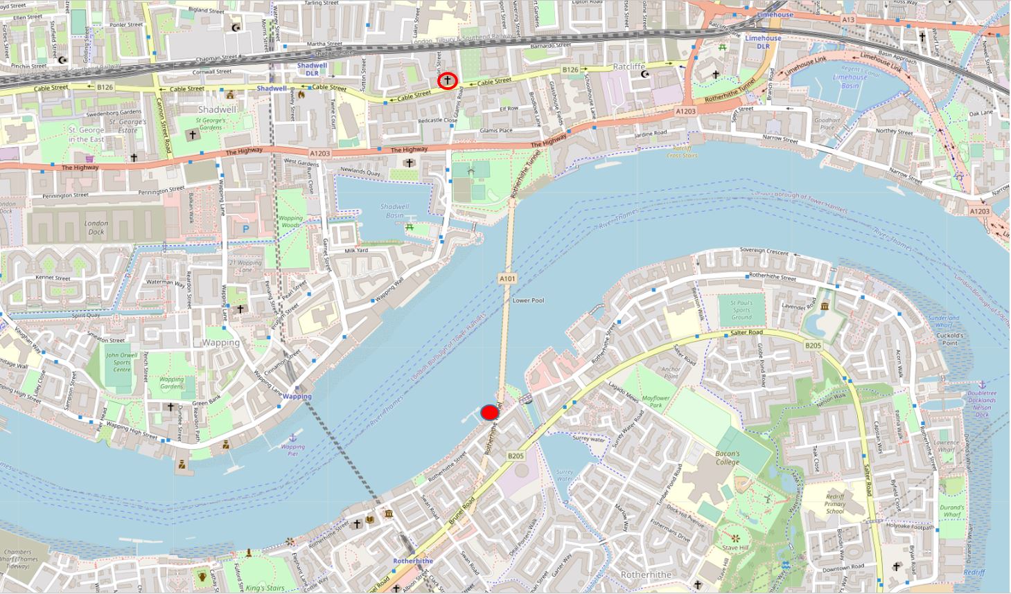
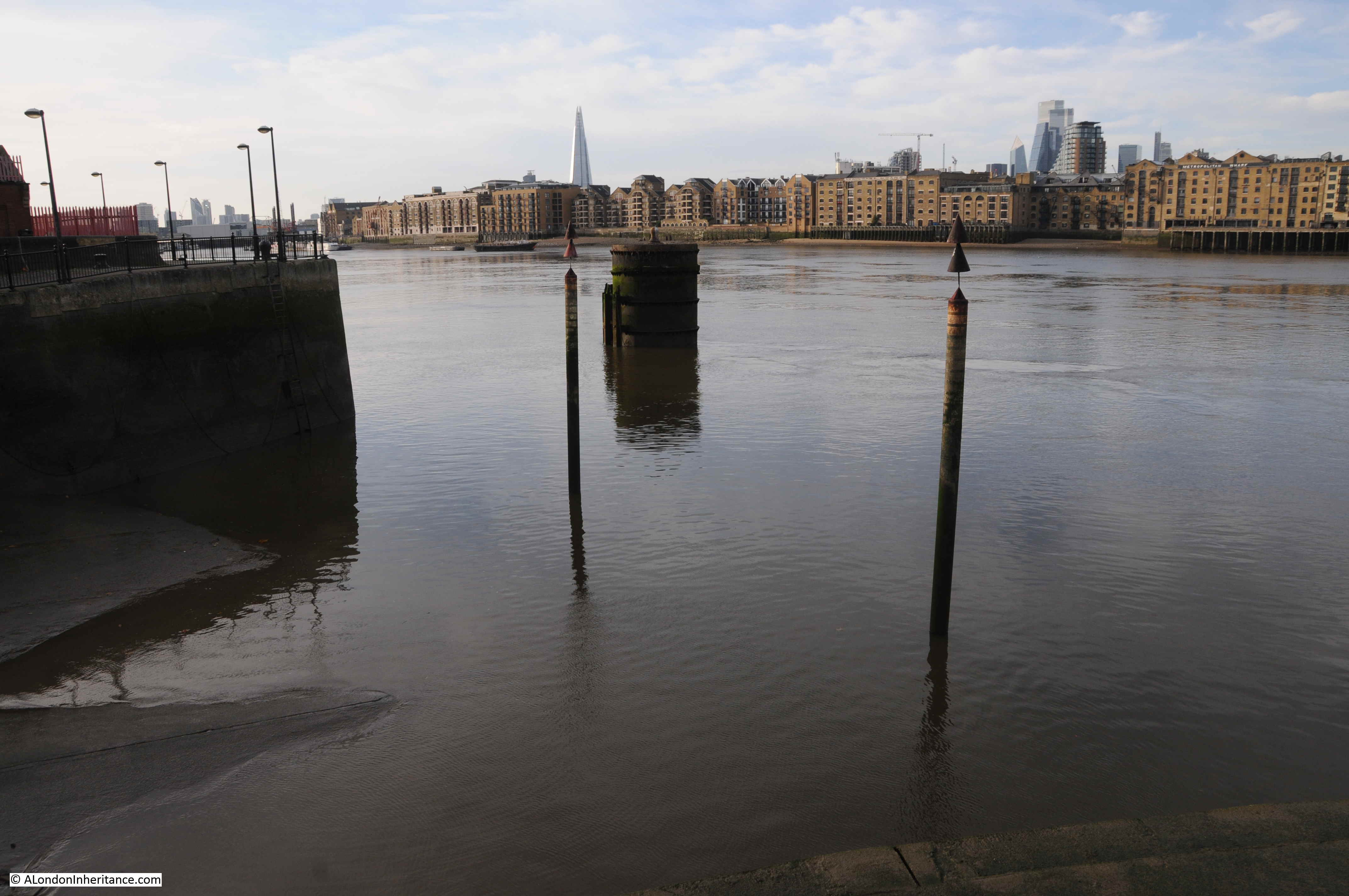
The following photo is looking slightly to the west. The air shaft of the tunnel is opposite, and it is strange to imagine the thousands of cars and lorries that are running daily, under the river between where I am standing and the air shaft opposite.
The dolphin has been repaired since the 1947 photo, but still retains the mooring bollard on top.
Across the river, there is a second church spire to the left, this is St Paul’s Shadwell. The white building on the extreme left is the Prospect of Whitby pub.
A close-up view of the air shaft on the north bank of the river. To the left of the air shaft are the Shadwell Dock Stairs, which I wrote about here.
The area behind the northern airshaft is the King Edward VII Memorial Park – a fascinating area which I wrote about here.
The following photo shows the Rotherhithe tunnel air shaft on the south bank of the river, mirroring the design of the structure on the opposite bank.

The location of these airshafts can be seen when travelling through the Rotherhithe tunnel. They are each located where the tunnel bends, and with the walls of the tunnel set back for the infrastructure leading up through the air shaft.
If you look along the river wall in the above photo, you will see steps descending down to the foreshore, which at the time I was there were still partly underwater.
I suspect this was the method my father used to get down to the foreshore to take the 1947 photo, as the steps are also shown on the 1948 Ordnance Survey map.
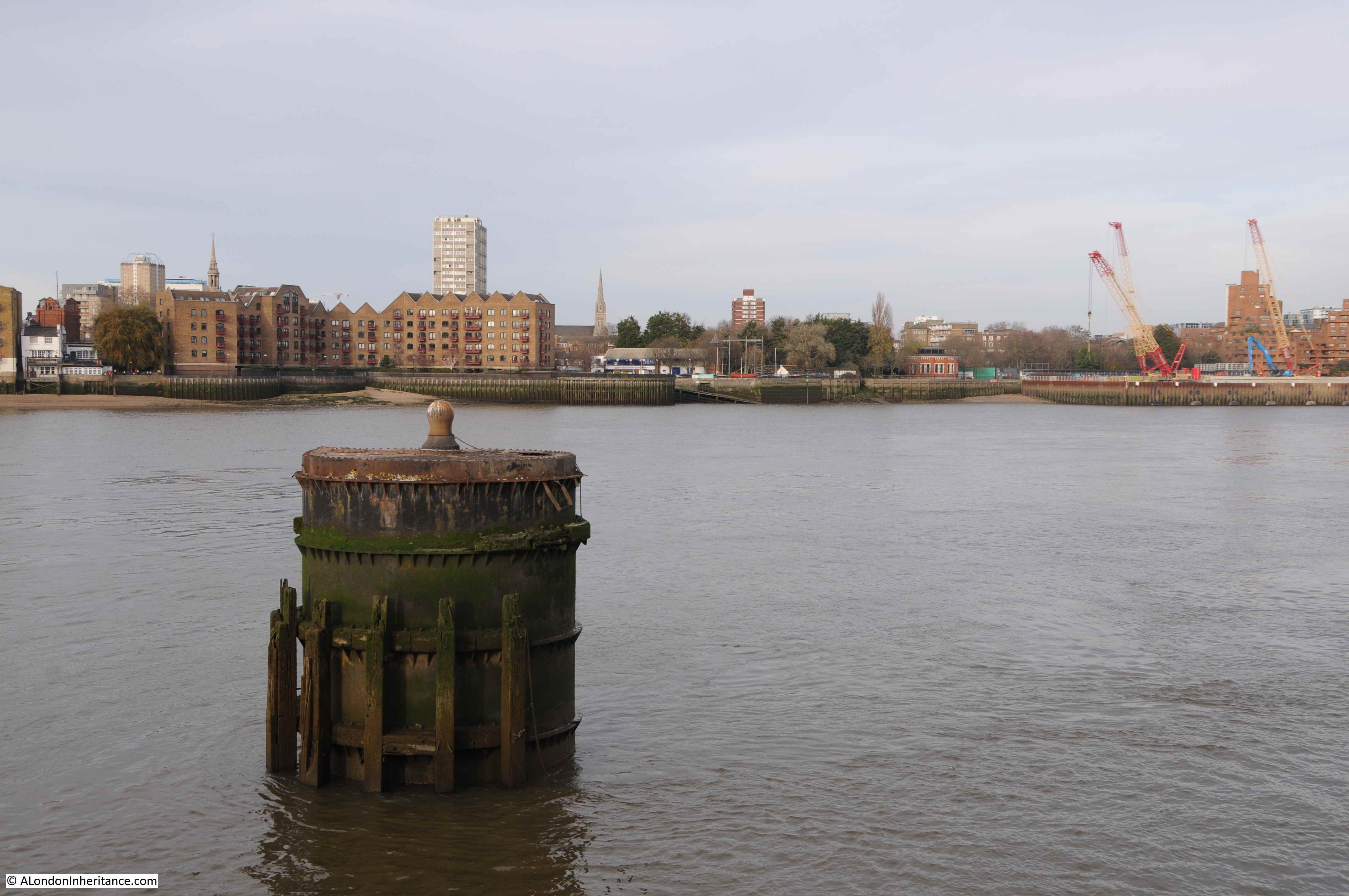
The entrance to the Shadwell New Basin on the opposite side of the river is almost impossible to see in the 1947 photo. The entrance is at an angle and is still not that obvious today. The following close-up photo shows the entrance to the basin.
The Prospect of Whitby on the northern bank of the river (I can only dream of having a beer there at the moment):

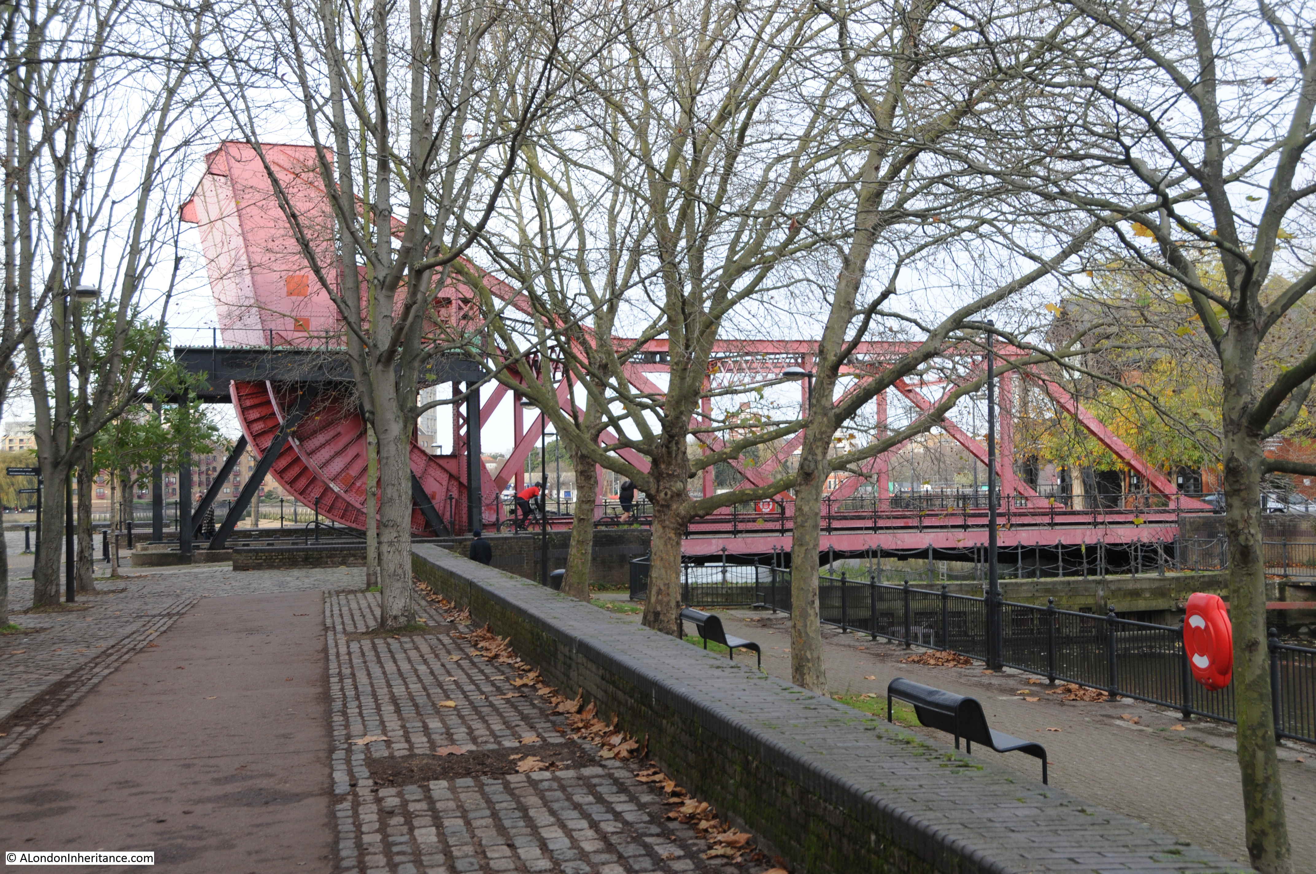
View looking west along the river with the dolphin:

The dolphin is just outside the entrance to the Surrey Lock, which was the western entrance to the Surrey Basin, and the large complex of docks that once occupied the peninsula. The following extract from the 1940 edition of Bartholomew’s Reference Atlas of Greater London shows the considerable size of the docks. The entrance by the dolphin is on the left and labelled Surrey Docks.
The following photo shows more clearly the position of the dolphin and the entrance to the docks, which today have two posts marking the entrance.
The mooring bollard on the top of the dolphin implies that ships could have been moored on the dolphin, however I would have thought a ship moored in that position could have been an obstruction for ships coming in and out of the dock.
Dolphins at the entrance to docks were also used as a type of fender where the dolphin provided something for a ship to gently hit up against, and as an aid to align and position the ship.
At the entrance to a dock this may have helped a ship enter or exit the dock rather than drift further up or down stream.
Whatever the use of the dolphin, I assume it is now redundant as the docks have long since closed, with the majority disappearing under new building, and the entrance from the lock into Surrey Water closed off by Salter Road which runs across the old entrance into the basin.
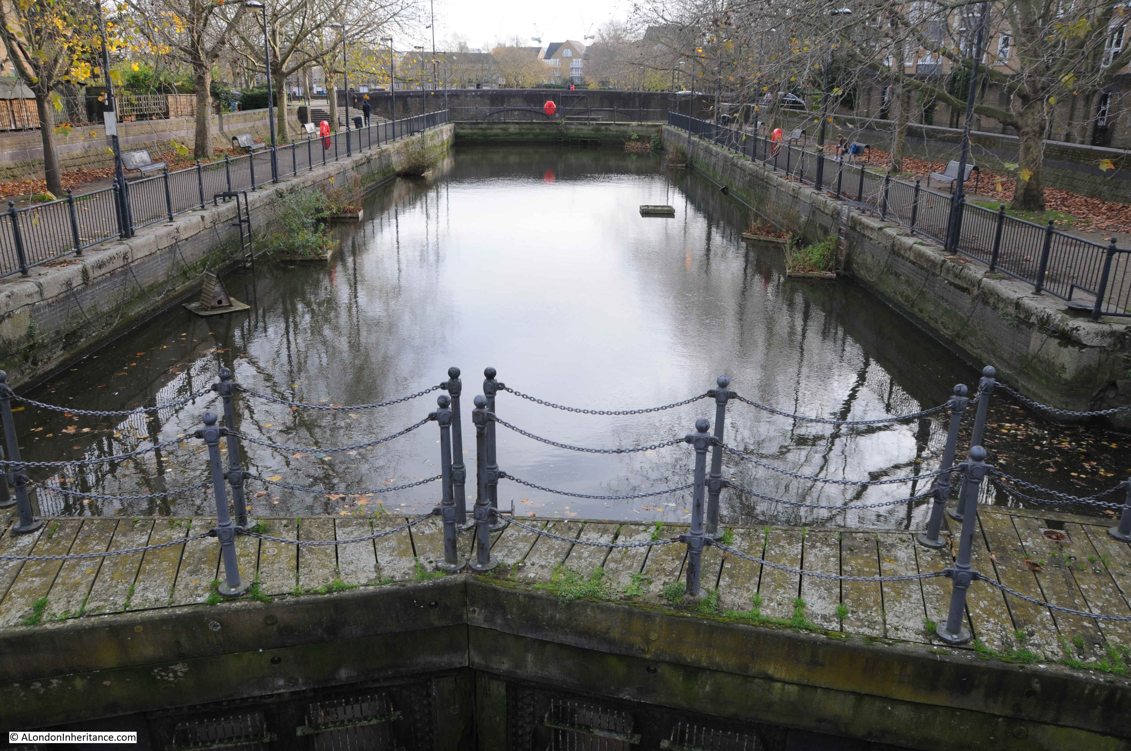
The entrance does have an interesting base, which appears to be composed of metal plates.

I suspect the design is to reduce the amount of sediment that settles on the base of the lock. The angled plates which run along the centre will result in water draining to left and right as the tide goes out, and the higher flow of water along the edges that this causes reduces the amount of sediment left in the dock.
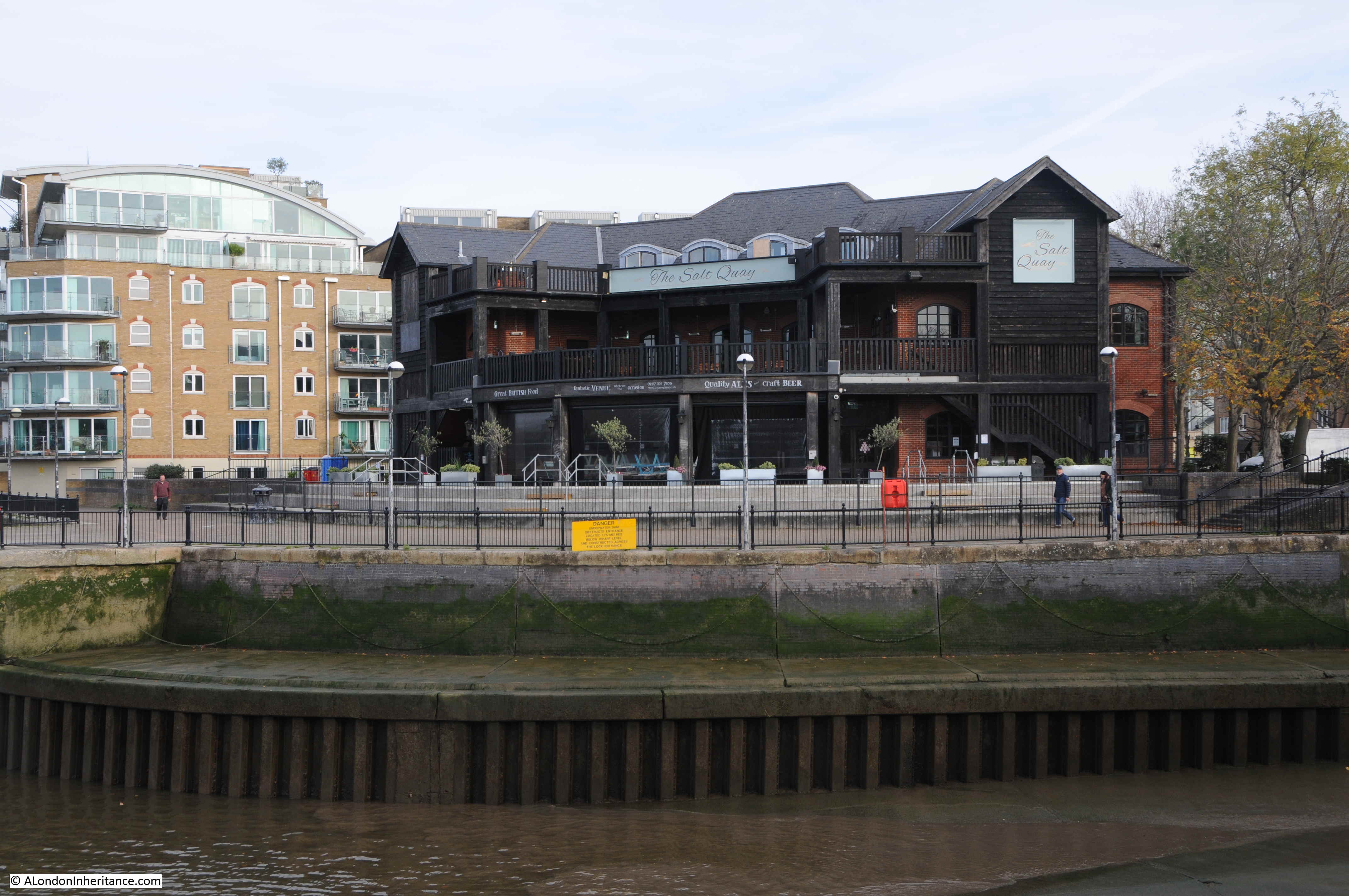
Facing out of the dock, towards the Thames, the tunnel air shaft is on the left, and a large pub, the Salt Quay, on the right:
Looking in from the river, along the Surrey Lock, and a rolling lift bridge can be seen, carrying Rotherhithe Street across the lock.
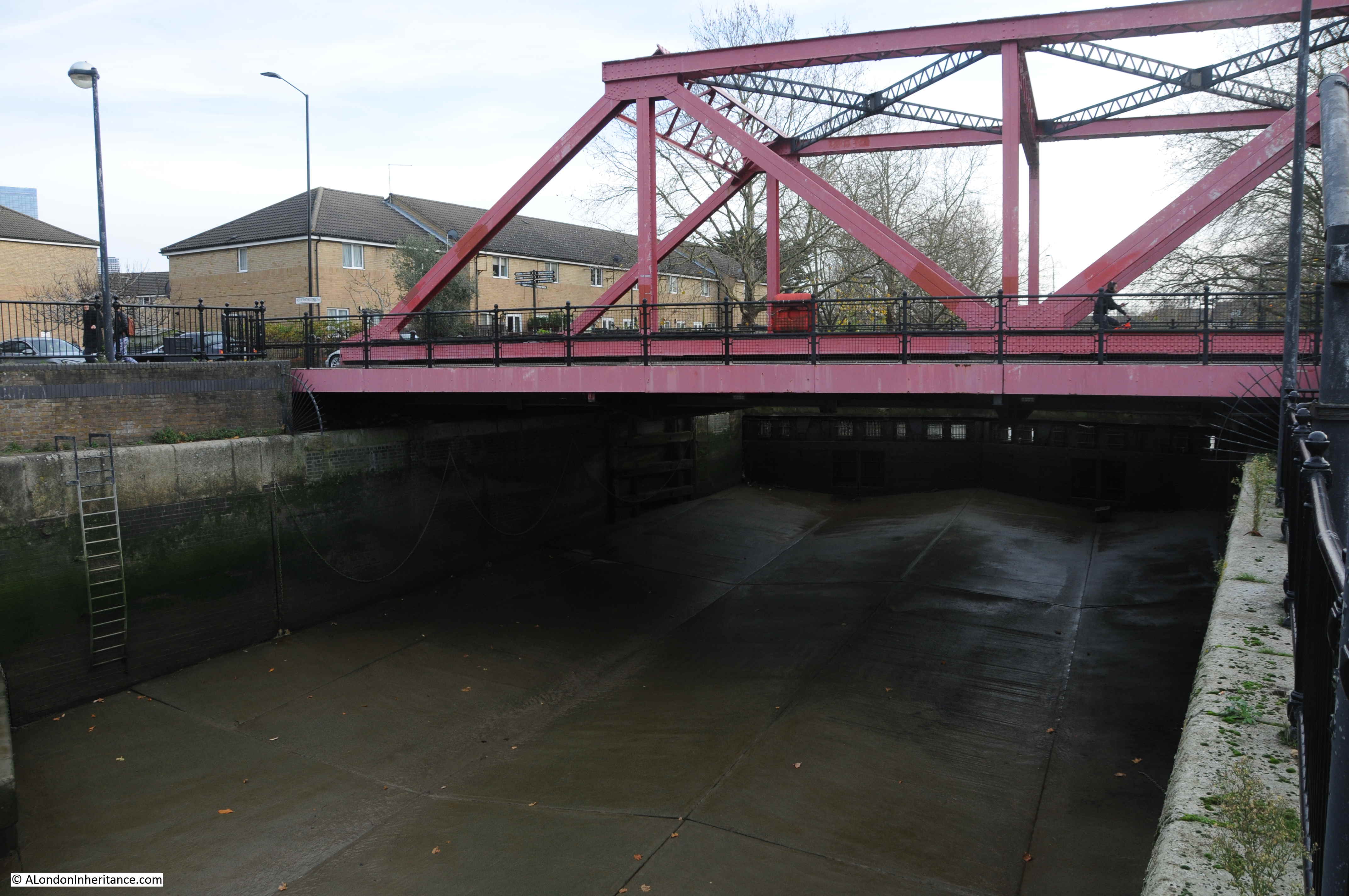
The bridge is a rolling lift bridge as it has a large counter weight at one end of the bridge, with a curved framework connecting the counter weight to the deck of the bridge.

When the bridge opens, the counter weight moves to the ground, rolling the deck of the bridge upwards. The following photo shows the bridge in action, with the deck fully raised to allow ships to move from the lock and into the docks.
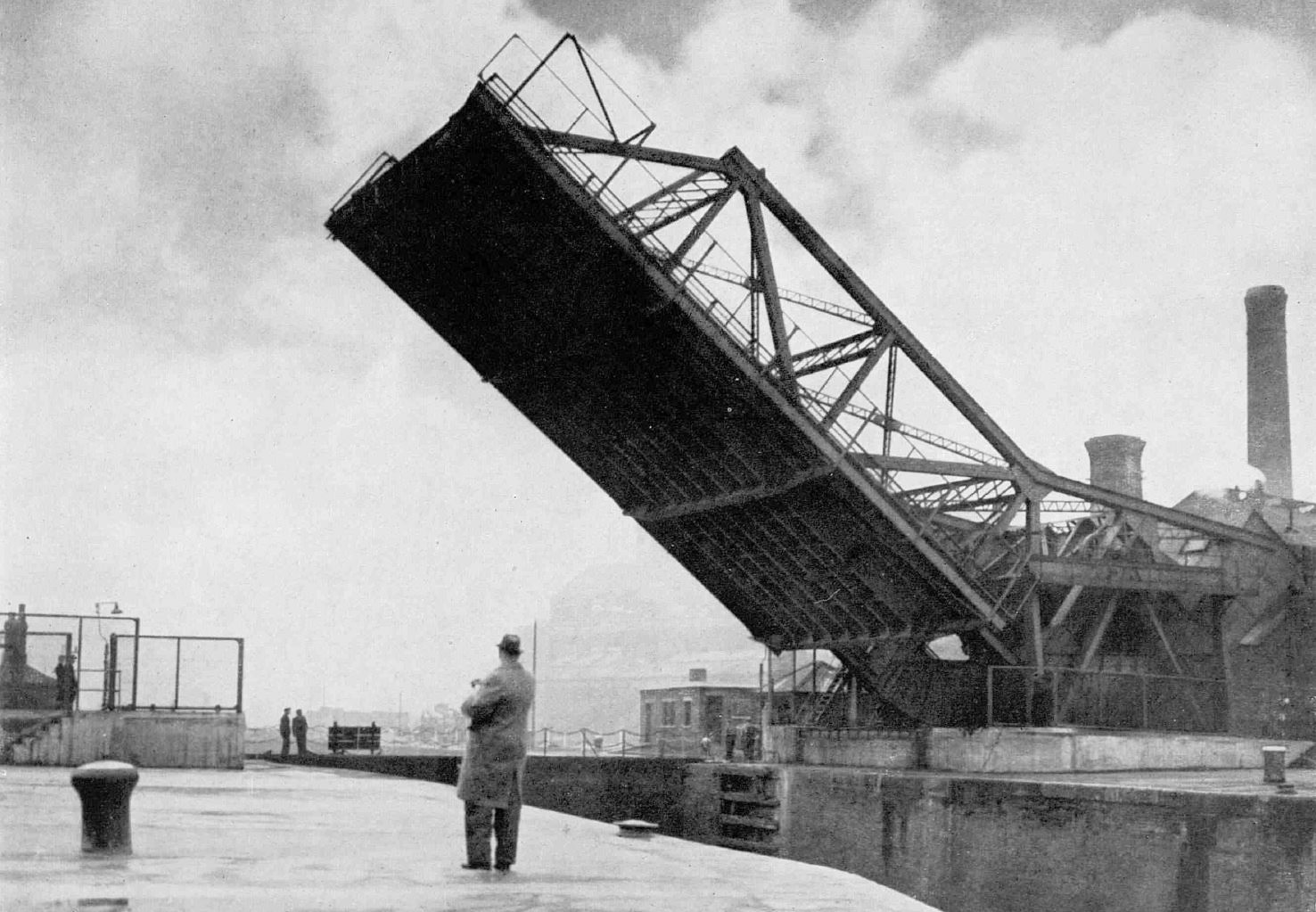
The above view is looking south-west from the Thames. The chimneys in the background are at the Rotherhithe Gas Works which I covered a couple of weeks ago.
The docks were a prime target for bombing during the last war, and the original bridge was badly damaged in September 1940. Whilst it could continue to provide a road across the dock, it could not lift, so only barges were able to enter, not the usual sea going ships that would have normally entered the docks via this route.
The original bridge was built in 1858 as part of the development of the dock complex, but was finally replaced in 1952 when the new bridge was completed and opened by Viscount Waverley, the chairman of the Port of London Authority.
When the bridge was opened, it was reported that “the people of Bermondsey will again be able to observe the daily spectacle of sea-going ships on their way in and out of this dock entrance”.
The bridge also had a wider roadway than the original bridge, along with improved approaches to the bridge which would help with the substantial volume of road traffic along Rotherhithe Street.
The bridge cost £110,000 to construct, and the fine balance of bridge and counter-weight enabled the 720 tons of the bridge to be raised or lowered in three minutes, by just a 50 horse power electric motor.
Newspaper reports of the time stated that “incorporated in the main structure are 100 tons of cast-iron blocks from an old bridge across the river at Limehouse”. An intriguing statement that I have not had the time to research.
The bridge today sits quietly in an area that those who attended the 1952 opening would be hard pressed to recognise, the area having been significantly redeveloped after the closure of the docks.
The following photo is looking from the bridge, along the Surrey Dock towards where Salter Road now closes off the entrance to the basin. Salter Road being part of the development of the area after the closure of the docks.
The dolphin at the entrance to the Surrey Lock is a reminder of the sea going shipping that once was so common on this part of the river, and that would have either moored on the dolphin, or used it as an aid to enter or leave the dock.
The Surrey Commercial Docks to give the dock complex their full name is an area I have yet to explore. My father took more photos of the area, so hopefully some return visits in 2021.
A really interesting read. Thanks for all your postings in 2020 – I hope you enjoy the best Christmas + New Year possible at present. I look forward to your high quality output in 2021
Have you published a book?
Thank you very much for this posting and all the pleasure you have given us during a difficult 2020.
A fascinating examination of the purpose of a ‘dolphin’ and its surrounding landscape. Thank you so much for taking the trouble to research this, so that we can all learn from your father’s and your shared experiences.
O to visit the prospect of Whitby in the new year .such an interesting area in bygone years.
Thank you for yet another fascinating post.
When I first moved to London in the early 1980’s I lived for a short while in the Sutton Estate facing South Dock on Plough Way. The LDDC hadn’t completely cleared the site so you could still walk around the old warehouse site and dock complex. Unfortunately, I hadn’t the money for a camera but I’m grateful to you for sharing as it brings back memories of staring across the river (to the then undiscovered world of this City) on my morning walks.
Many thanks for an interesting post as always, looking forward to more next year.
Merry Christmas to you.
John Campbell
Another use of the dolphin: At low tide the depth of water in the entrance channel may not have been deep enough to permit the passage of a fully loaded, ocean going ship. The ship could tie up at the dolphin and wait until the water level rose with the incoming tide until the water level was deep enough to allow it to pass into the docks. Was the water level in the docks controlled so that it was deep enough that the ships did not ground out at low tide?
St. Mary`s Cable street. My grandfather b.1891 brought up in Cable street.
great post as always
Always a pleasure to read your well-researched items on a Sunday.
Have a good Christmas and let’s hope the new year is better for all of us.
When I worked on Tower Hill in the 1960s we sometimes found time to go to the Prospect of Whitby. Marvellous pub and we would fashion wine glasses from the silver paper in fagpackets and stick them on the ceiling which was covered in them. Fun times !
With regard to the entrance to the lock, I am sure the ‘metal plates’ are concrete, and this would perhaps been installed in the 1980s, when the LDDC took over the redevelopment of the redundant docks. The concrete would probably have been installed to prevent potential scour and undermining of the dock walls, which could potentially have allowed the walls to move forwards. I would guess the dips in the concrete are to channel any overflow water from the barrel of the lock (although I do not know where the overflow points are located). I assume there may be some form of strengthening below water level to protect the lock gates, because they appear to be retaining water and also assume they are no longer being maintained.
On google earth a curved run of steel sheet piles can be seen and these will be acting to retain the end of the concrete apron and prevent undermining. The two steel posts will be marker posts that are positioned as a warming to small craft that there are buried obstructions.
On the right of one of the photographs of the barrel further sheet piling is visible, again with a concrete topping. I would guess that this was installed at the same time as the concrete apron and would have been installed to add to the stability of the existing original dock wall (by preventing undermining by scour or forward movement of the wall). It would have been installed after the docks closed because it narrows the width of the lock. In addition, if any vessel contacted the exposed edge the steel/concrete corner could have ripped the side of the vessel open.
With regard to Roger Thomas’s comments, the water level in the dock would have been maintained at approximately the same level and would ensure that vessels were always afloat. I do not think the dolphin would have been used as a mooring while vessels waited for the tide to rise because they would have only been held at one end and the action of the rising tide would have swept the unmoored end of the vessel in an upriver direction, thus potentially obstructing the adjacent gas works jetty.
The dolphin is unusual in that it is constructed of cast or wrought iron cylindrical segments with the segments bolted on top of each other to make a taller cylindrical structure. Looking at the photographs I would guess the cylinder is of the order of perhaps 20ft in diameter with each section being perhaps 3 or 4ft high – imperial measurements because that would have been the system of measurement when the structure was constructed. The whole structure was then fendered around the circumference with full height vertical timber fenders.
Cast or wrought iron structures in the Thames, apart from bridges, and with few exceptions, were generally associated with gas works or power stations and such jetties were used for the importation of coal. The decks of these jetties were frequently at a higher level than most other jetties and this allowed the crane drivers a better view into the holds of vessels.
The adjacent disused jetty utilised similar materials for the pile construction and was constructed to serve the gas works. Both the jetty and the dolphin first appear on the 1920 OS map. Earlier editions of the OS map show a jetty at the site but this jetty had a much noticeably smaller plan area.
I am therefore guessing the dolphin was associated with the gas works, although I do not know what purpose it could have served. One possibility could have been as a mooring point for the bow or stern of larger vessels, but I would have expected such a mooring to be on the shore rather than in the river. In addition, it would have tended to pull vessels off the berth rather than onto it – perhaps a shore mooring was not possible because the land was owned by the owners of the tunnel vent shaft. Another possible use could have been associated with an intake or outfall for water associated with the gas works.
Whilst the dolphin could have been provided to assist ships entering the lock it would have been unusual to just provide a single isolated structure (rather than a continuous structure, such as can be seen at other lock entrances). Also, such a structure would be expected to be in the line of the entrance to the bell mouth of the lock rather than, as in this case, forward of the line.
Great article, as always. For the purpose of the dolphin outside the dock – almost certainly it was used for warping ships in and out of the dock. Example below is from the OED, illustrating this use of the word from an 1840 source:
1840 Evid. Hull Docks Comm. 90 Q. What is a dolphin? A. There is a post in the middle, and it is inclosed round by other posts, and this post in the middle is the post to make the rope fast to, and the others support it; it is for the vessels to warp into the river Hull.