Tag Archives: East London

East London 1980s Shops – Fordham Street

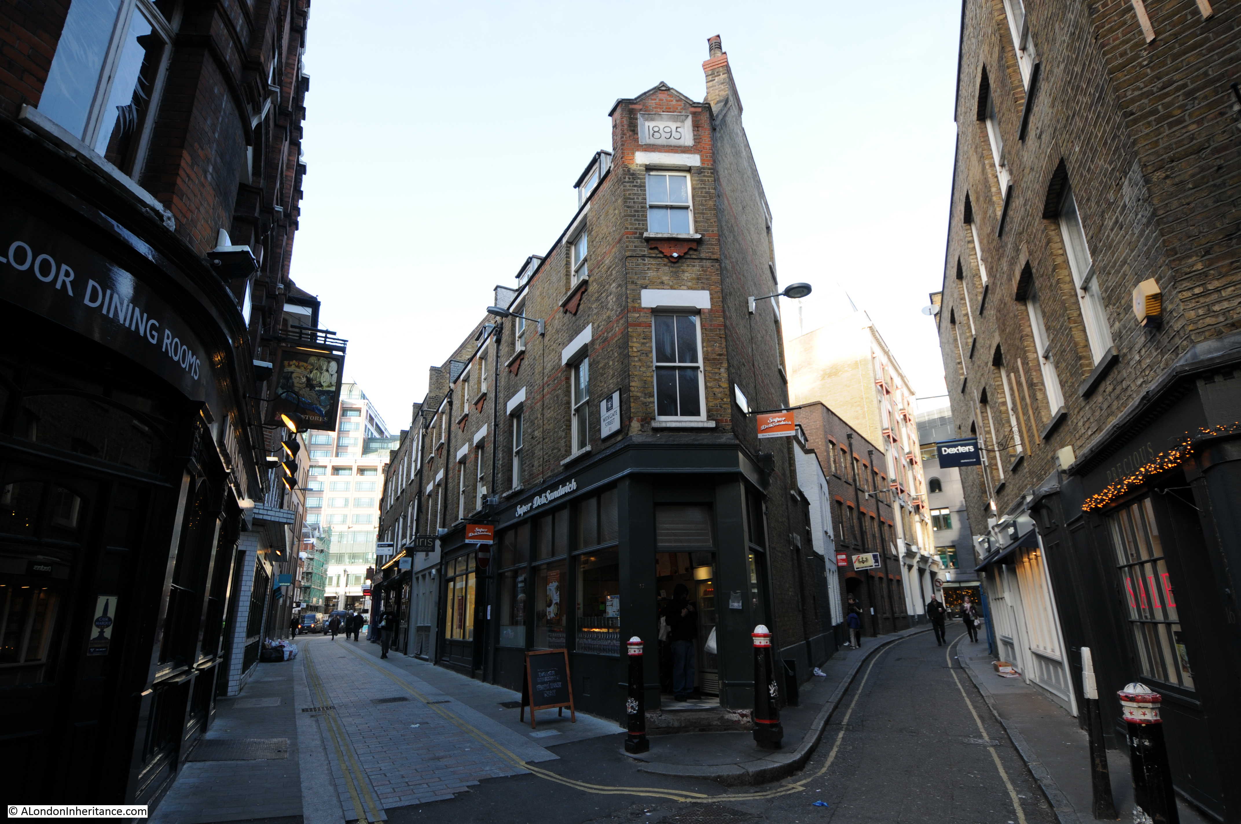
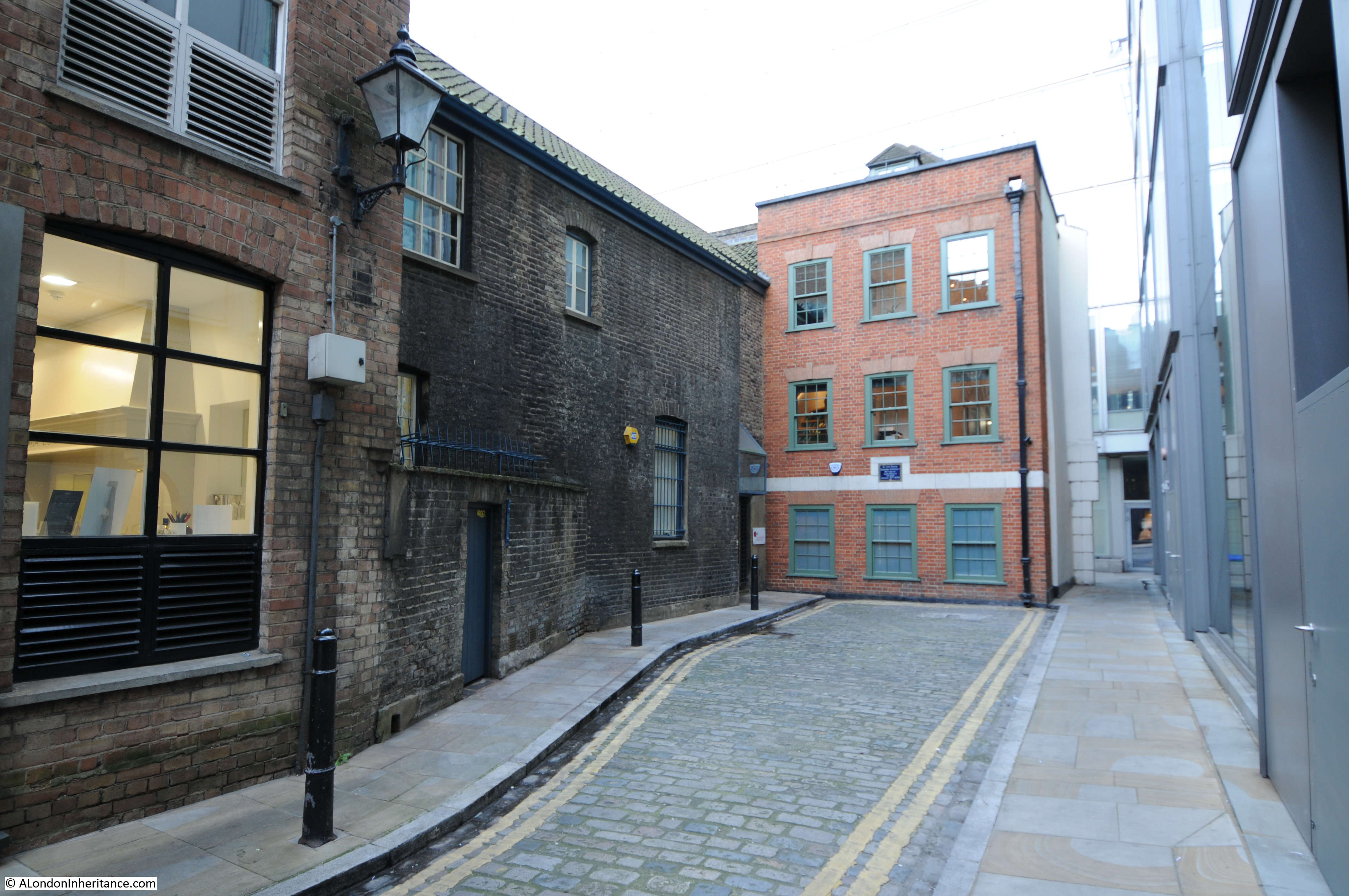
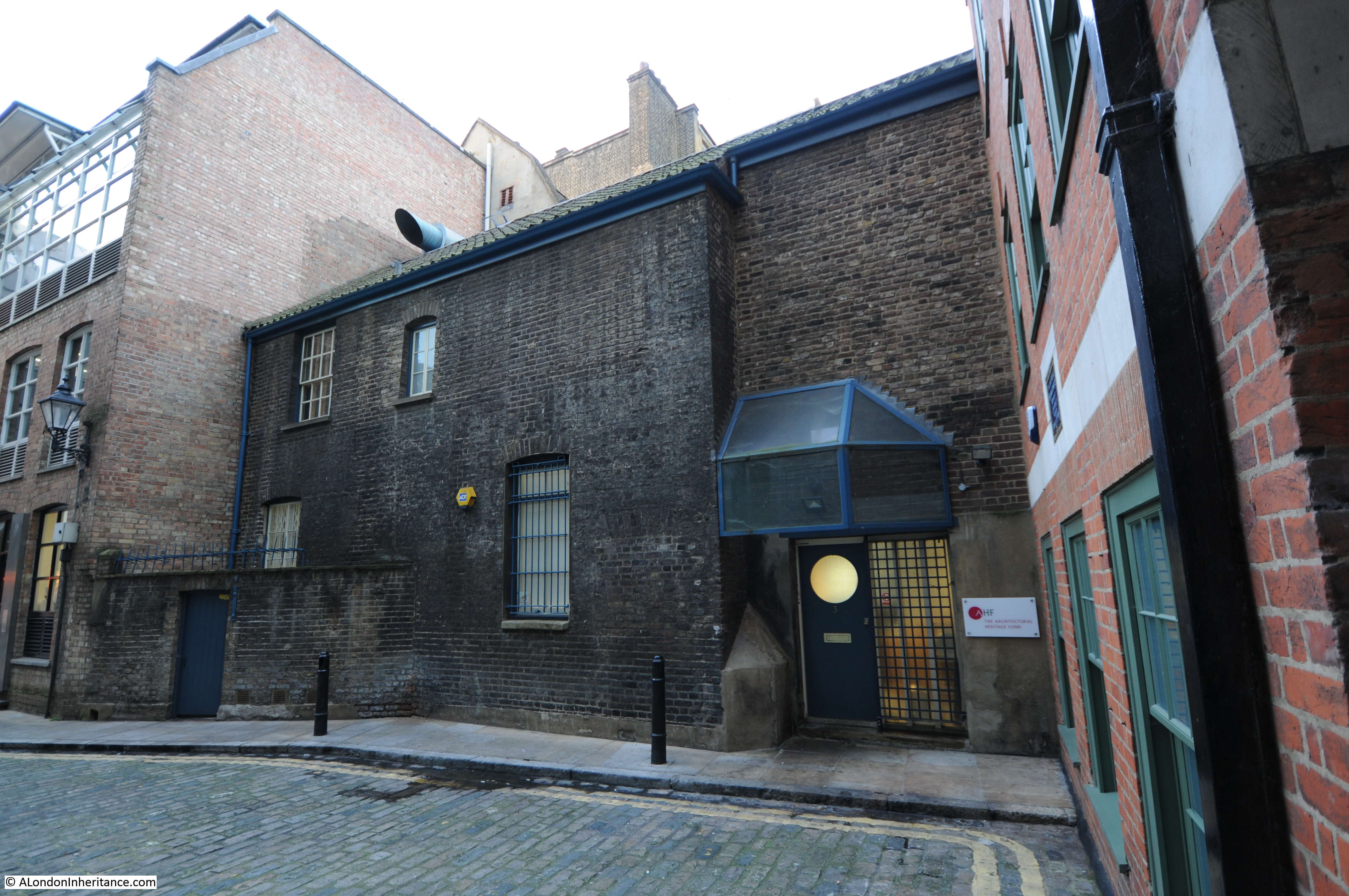
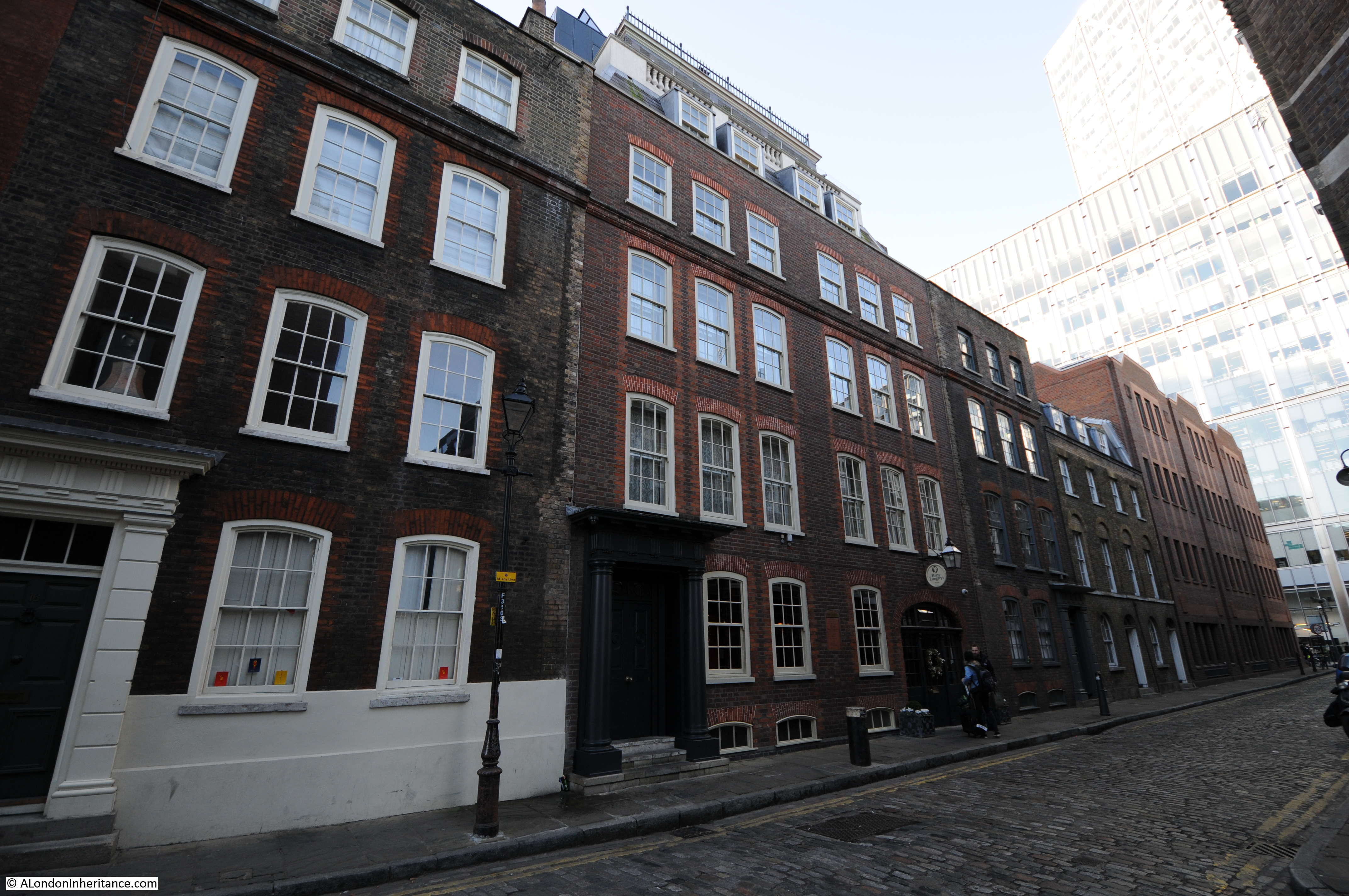
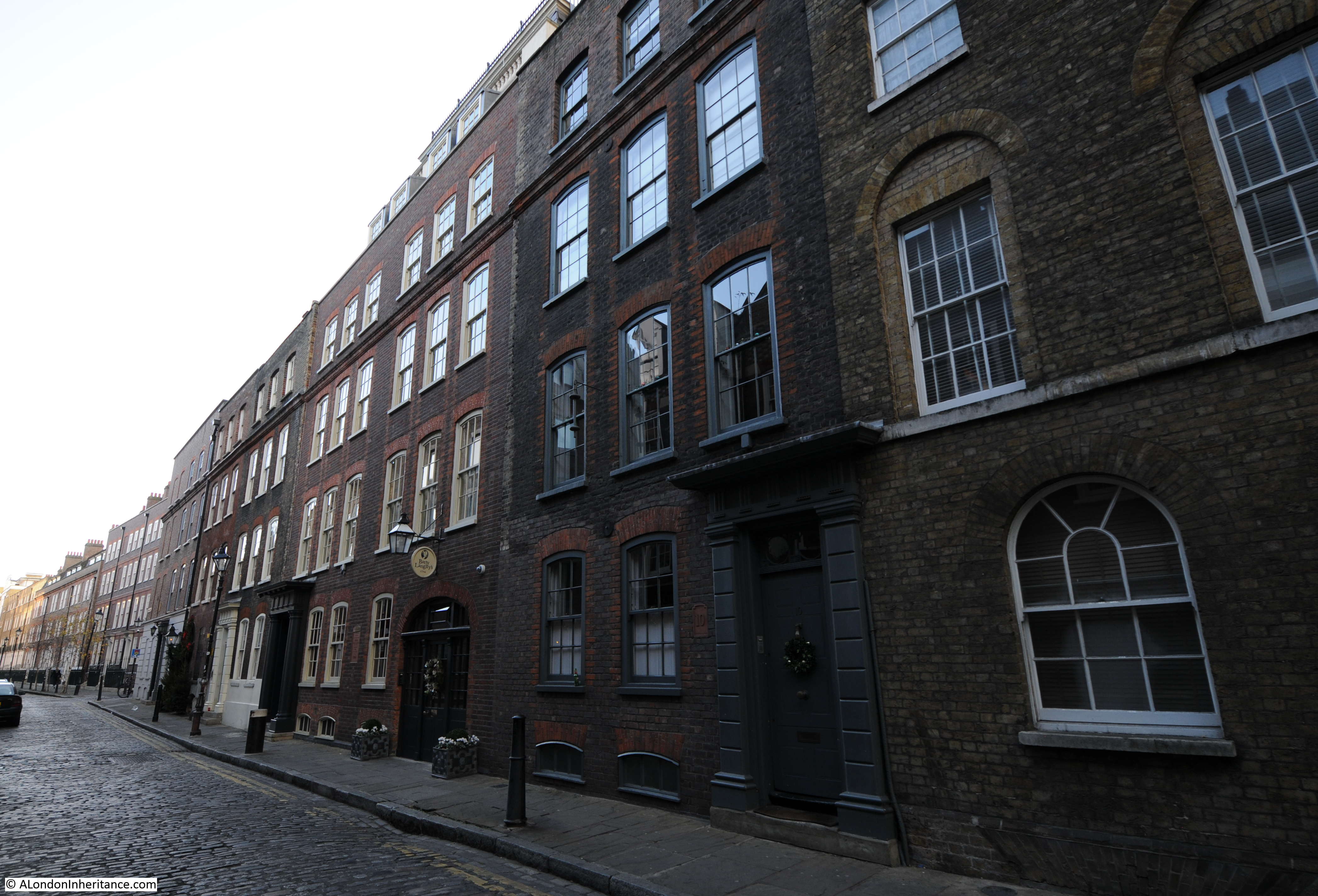
Thanks for the feedback to last week’s post. The pub at the top of the stairs leading down to the Thames, next to Westminster Bridge Road was identified as the Coronet, and there is a good drawing of the pub and the stairs on the Closed Pubs site. It was good that I did not get any comments or e-mails that the bronze box beneath the foundation stone of County Hall has been removed, so hopefully it is still there for archaeologists in the distant future to dig up.

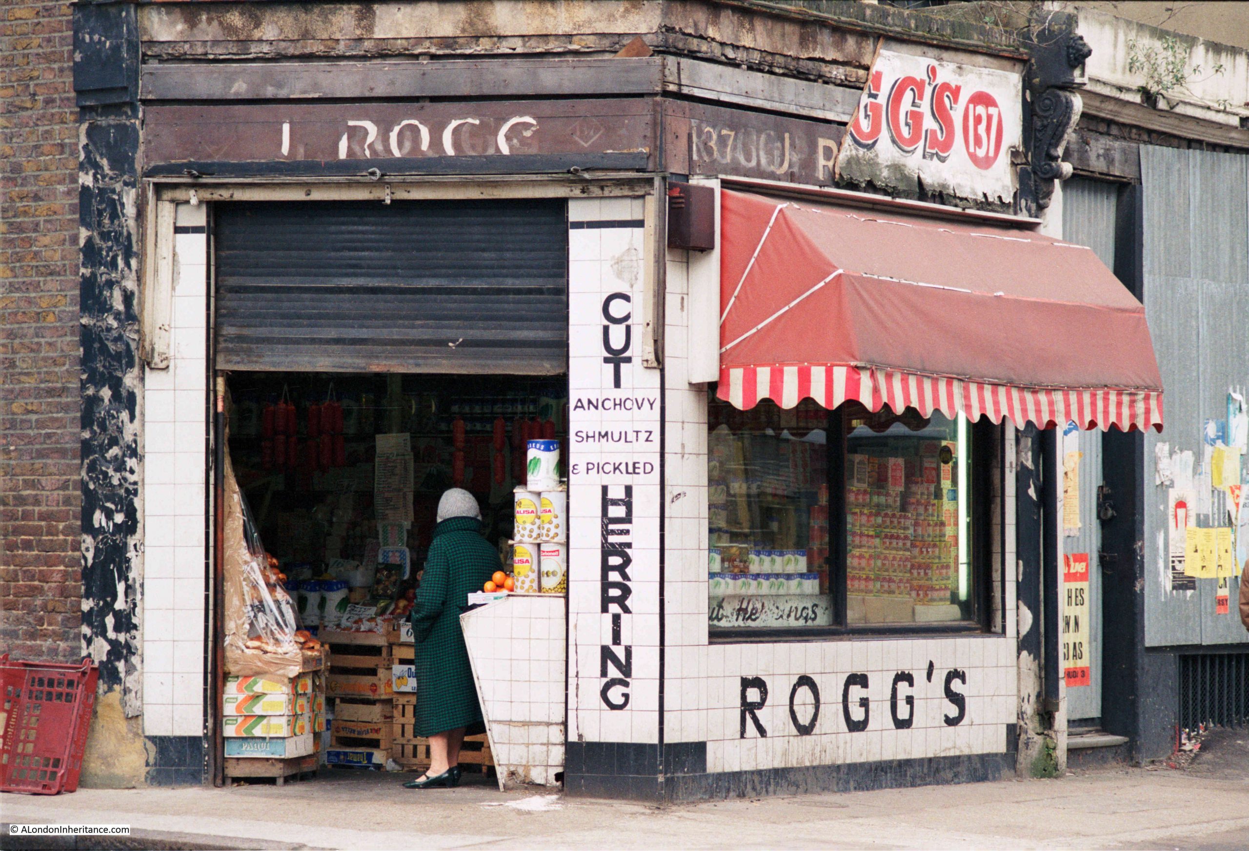
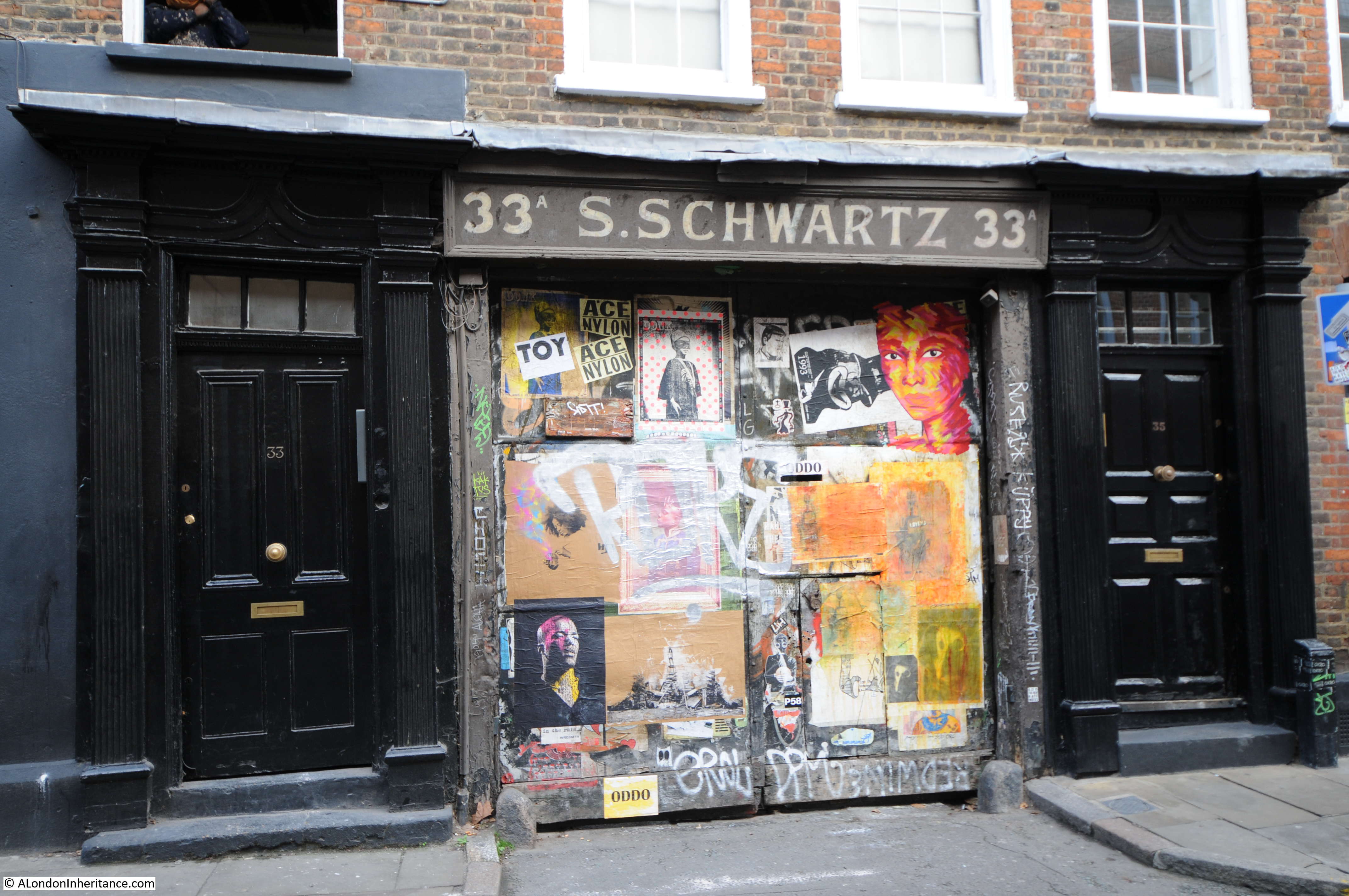
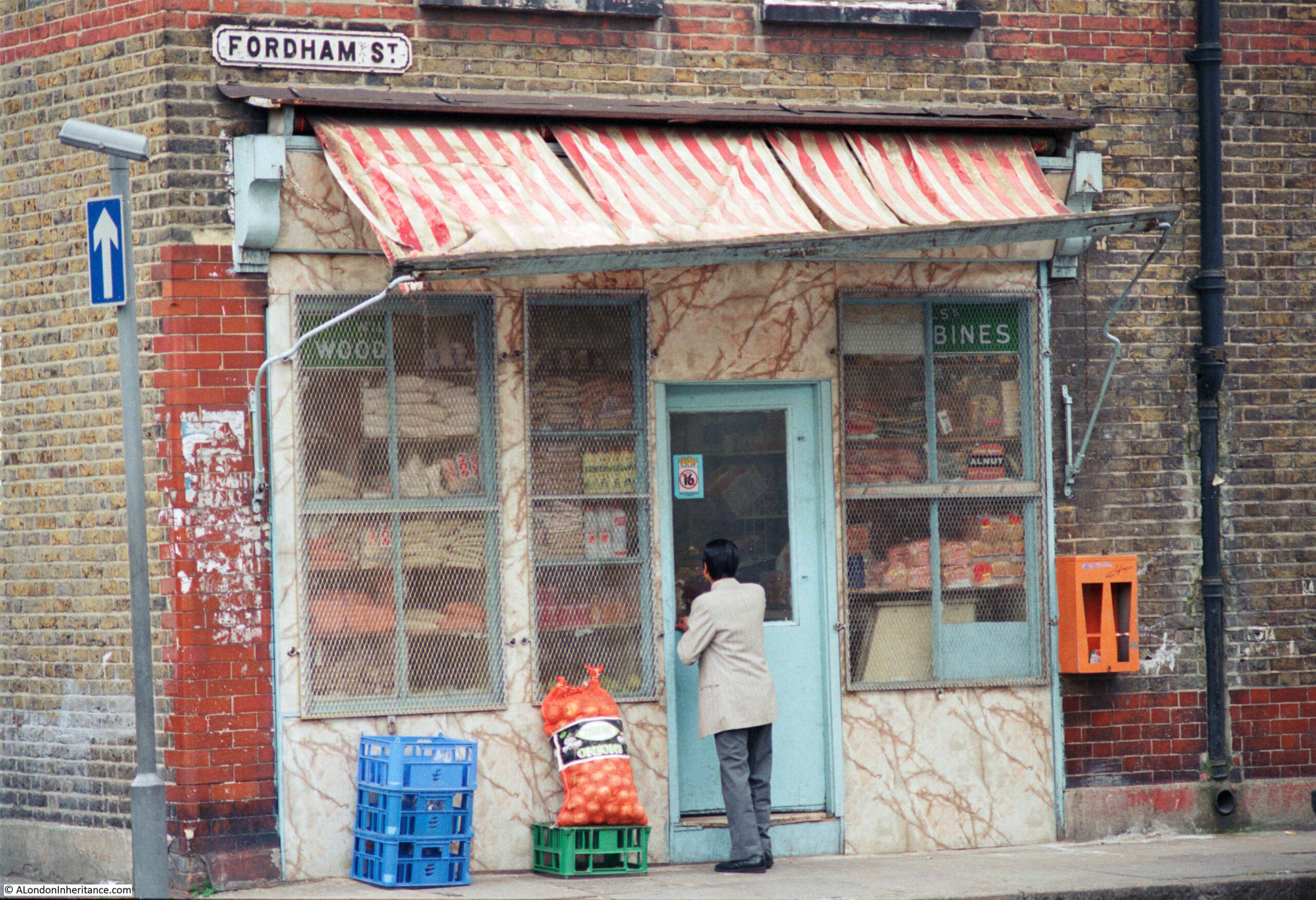
For this week’s post, I am in East London, looking for the location of a shop in Fordham Street, photographed here in 1986:

Fordham Street

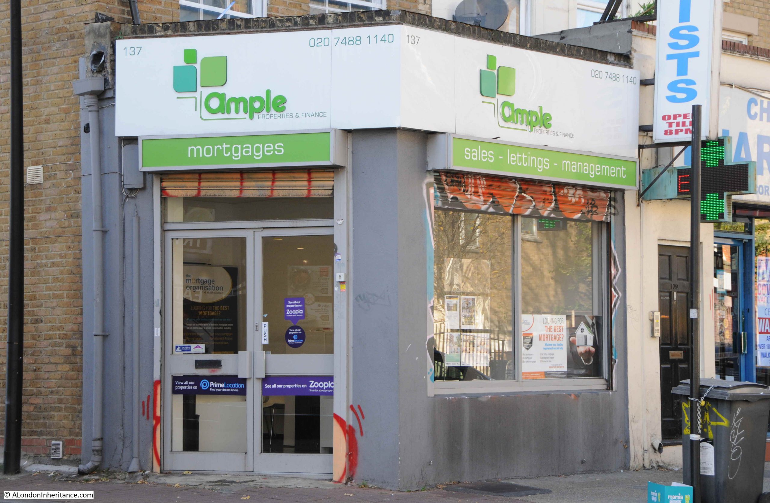
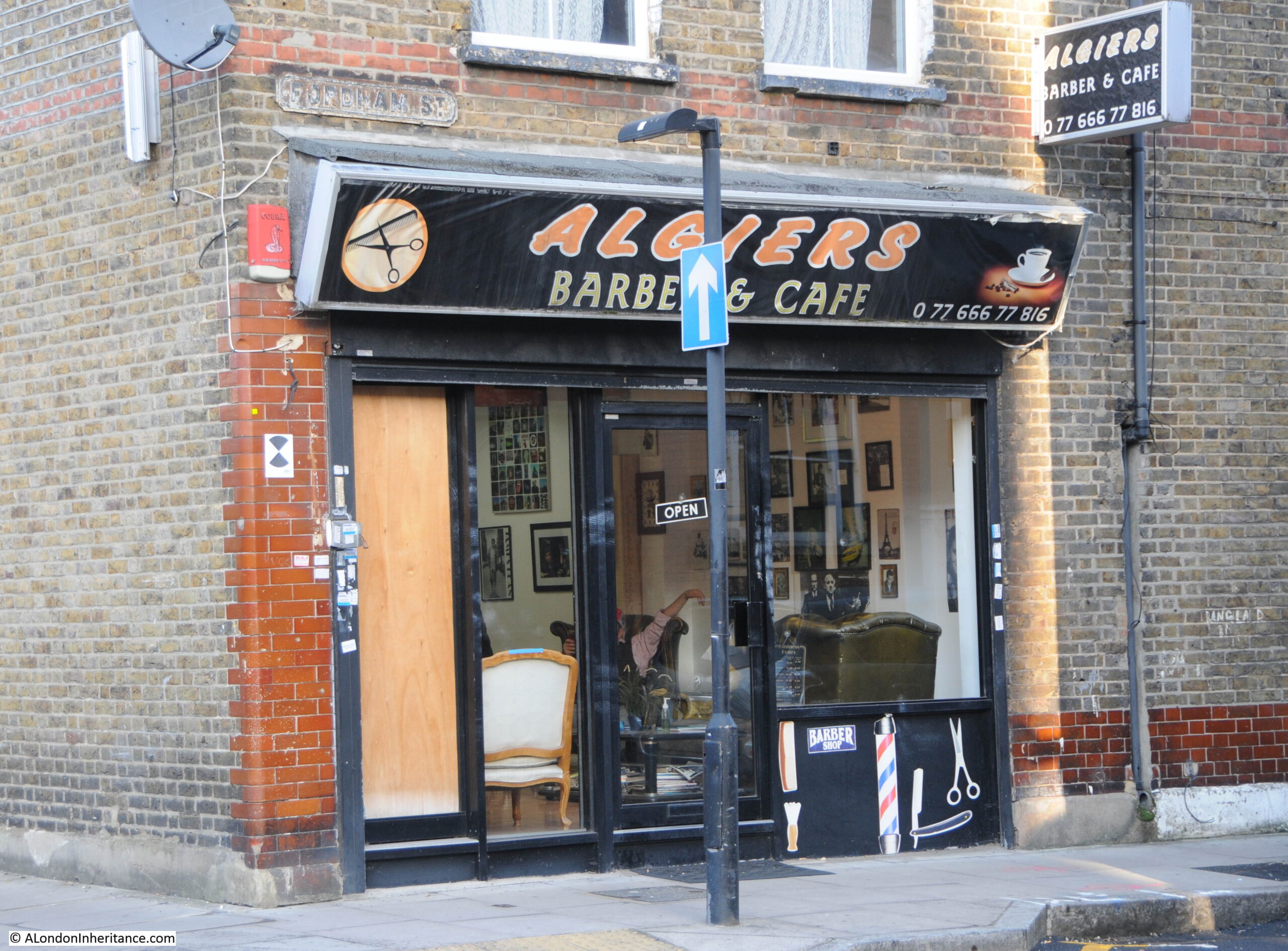
The same location today. The old general stores type of shop has been replaced by the Algiers Barber and Café:

Fordham Street

The 1986 photo is typical of the type of shop. Goods piled high in the window, bread, bottles of Fairy Liquid and Woodbines advertising running along the top of the window.

No idea whether that is a customer entering the shop, or the owner locking or unlocking.

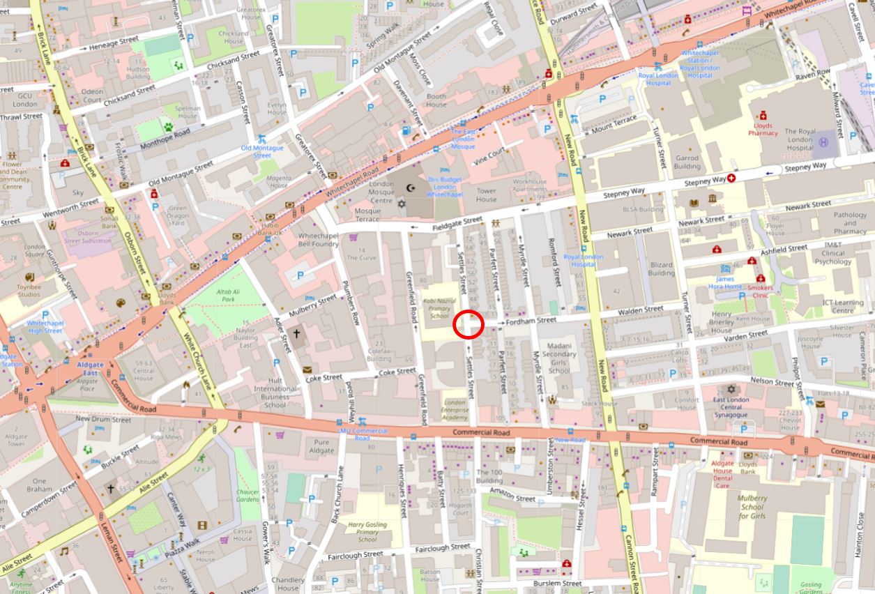
Fordham Street is in the heart of east London, roughly half way between Whitechapel and Commercial Roads. The street leads from New Road which is a main street leading between Whitechapel Road and Commercial Road, and is part of a residential area that has long housed the changing populations of east London.

In the following map I have circled the location of the shop photographed at the top of the post:

Fordham Street

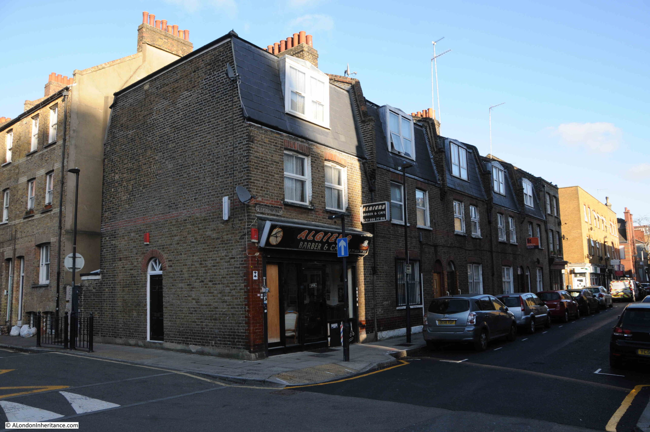
A view of the corner location of the shop, at the end of a short terrace of houses:

Fordham Street

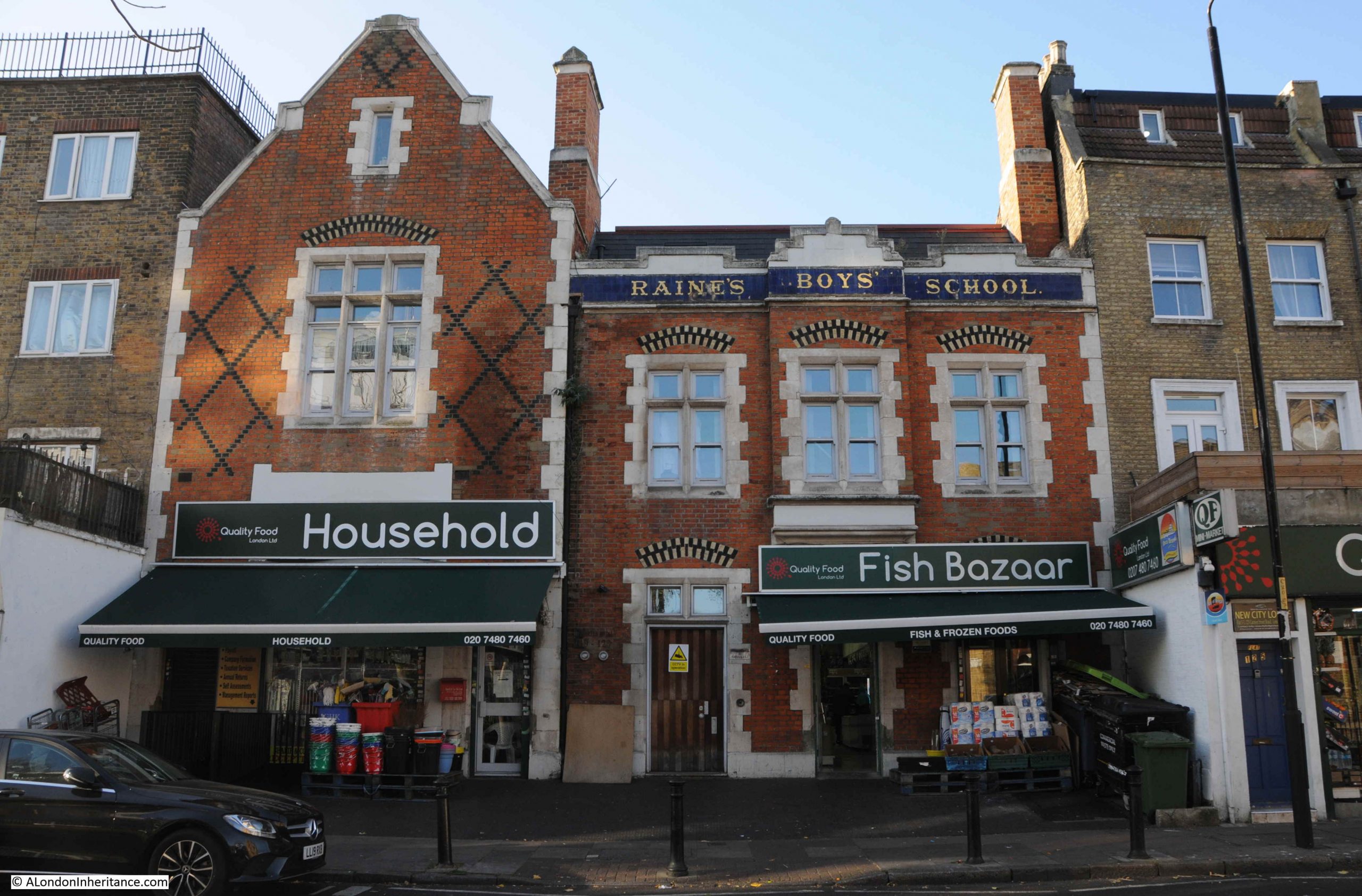
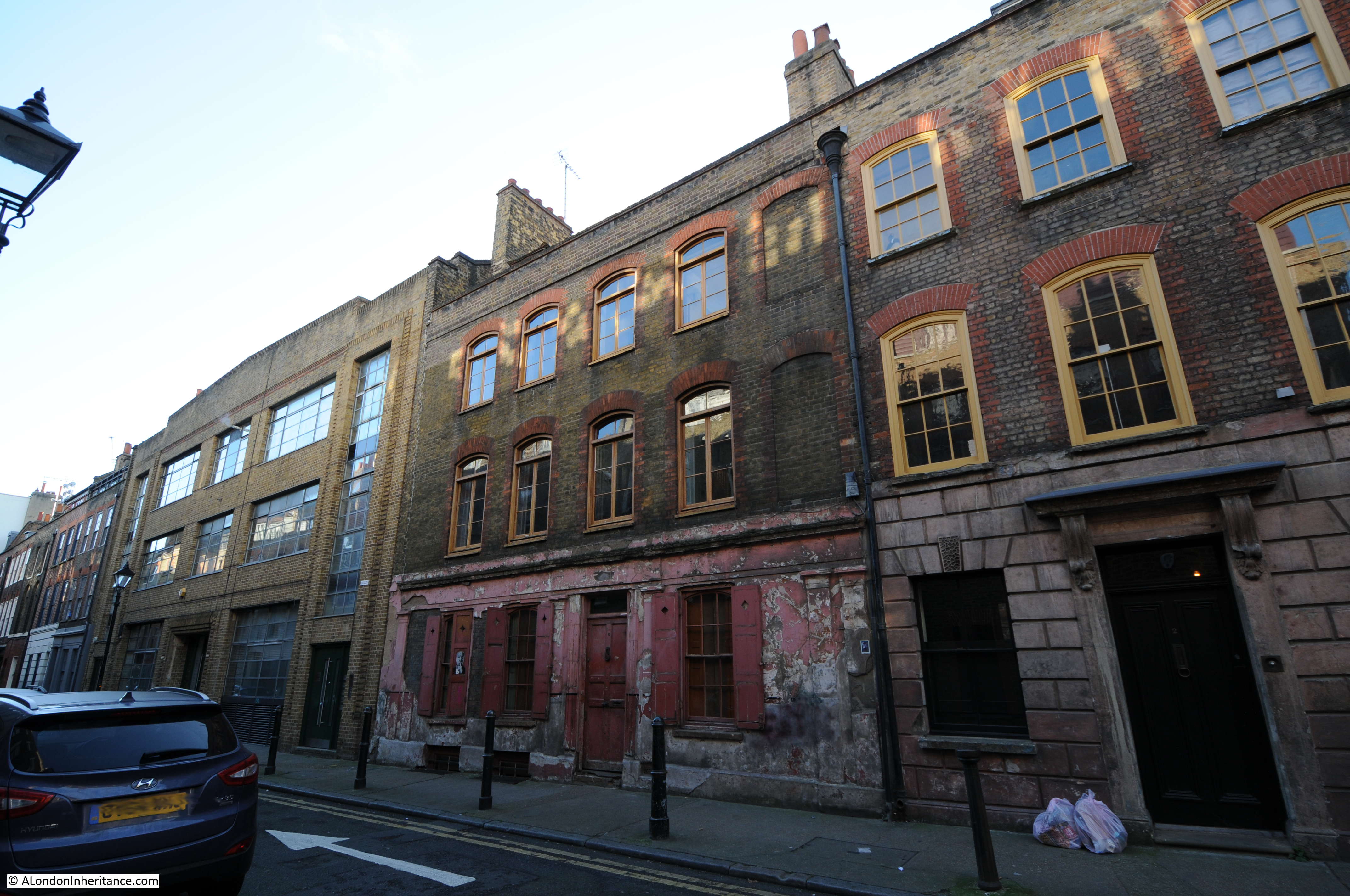
Although a relatively short street, as was typical in east London of old, the street had two pubs, both now long closed. On the corner opposite the shop is the building that housed one of the pubs:

Bricklayers Arms pub

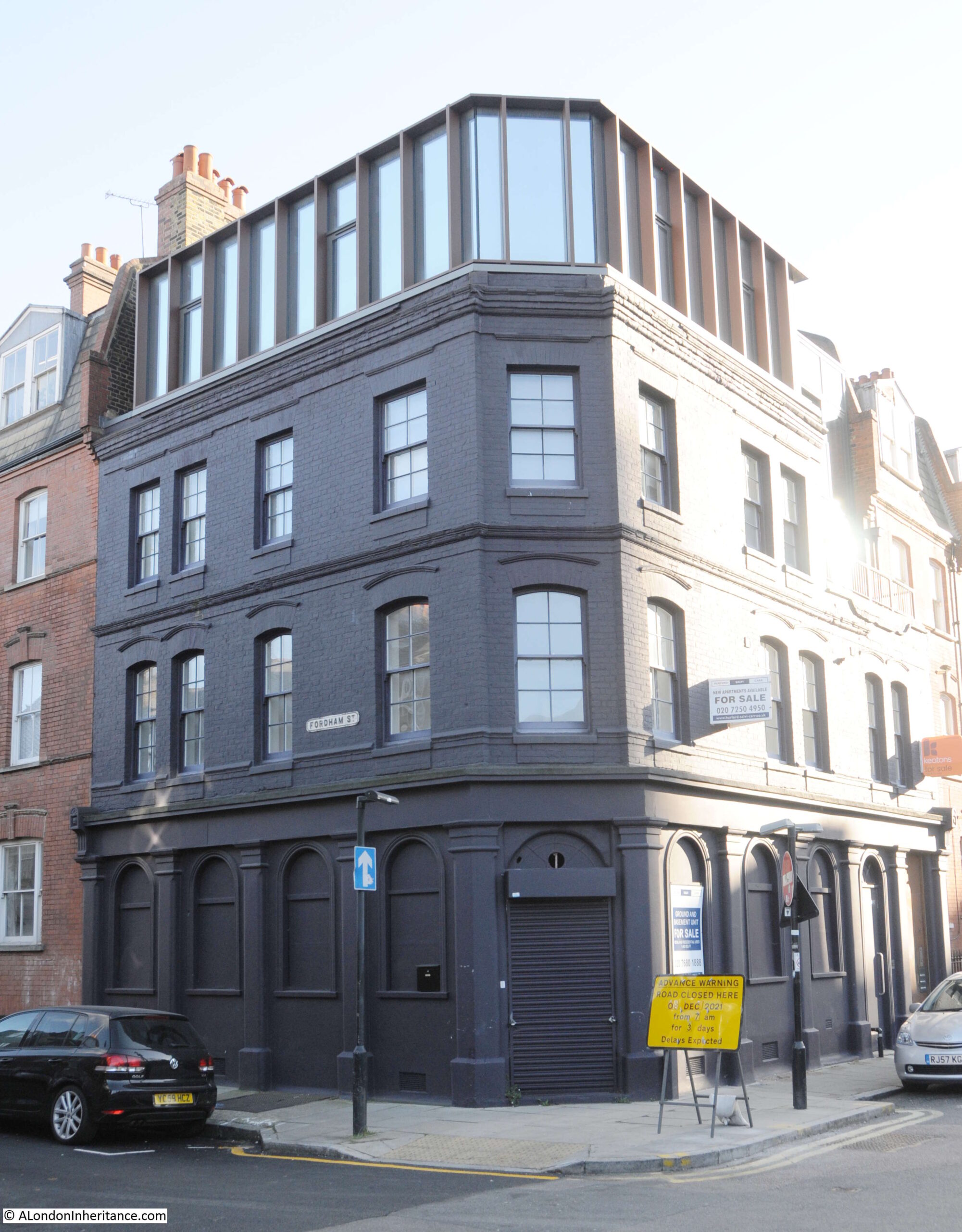
The pub was the Bricklayers Arms. I can find very little information about the pub, and there are only a couple of newspaper reports that mention the Bricklayers Arms. The first is when a 19 year old labourer, Frederick Perrie was sentenced to six months hard labour after trying to use a counterfeit florin in the pub in 1893.

Throughout the first decade of the 20th century, Friday evenings seem to have been the time when the East London (Jewish) branch of the London Central Council met in the pub. Regular adverts about the event featured in newspapers. The licensee at this time appears to have been Isaac Ernest Marks.

The last reference to the pub is in 1911 when Isaac Ernest Marks had his license renewed. It does not appear to have stayed open long after 1911 as Closed Pubs suspects the pub was closed by the 1920s, and there are no newspaper reports mentioning the pub after 1911.

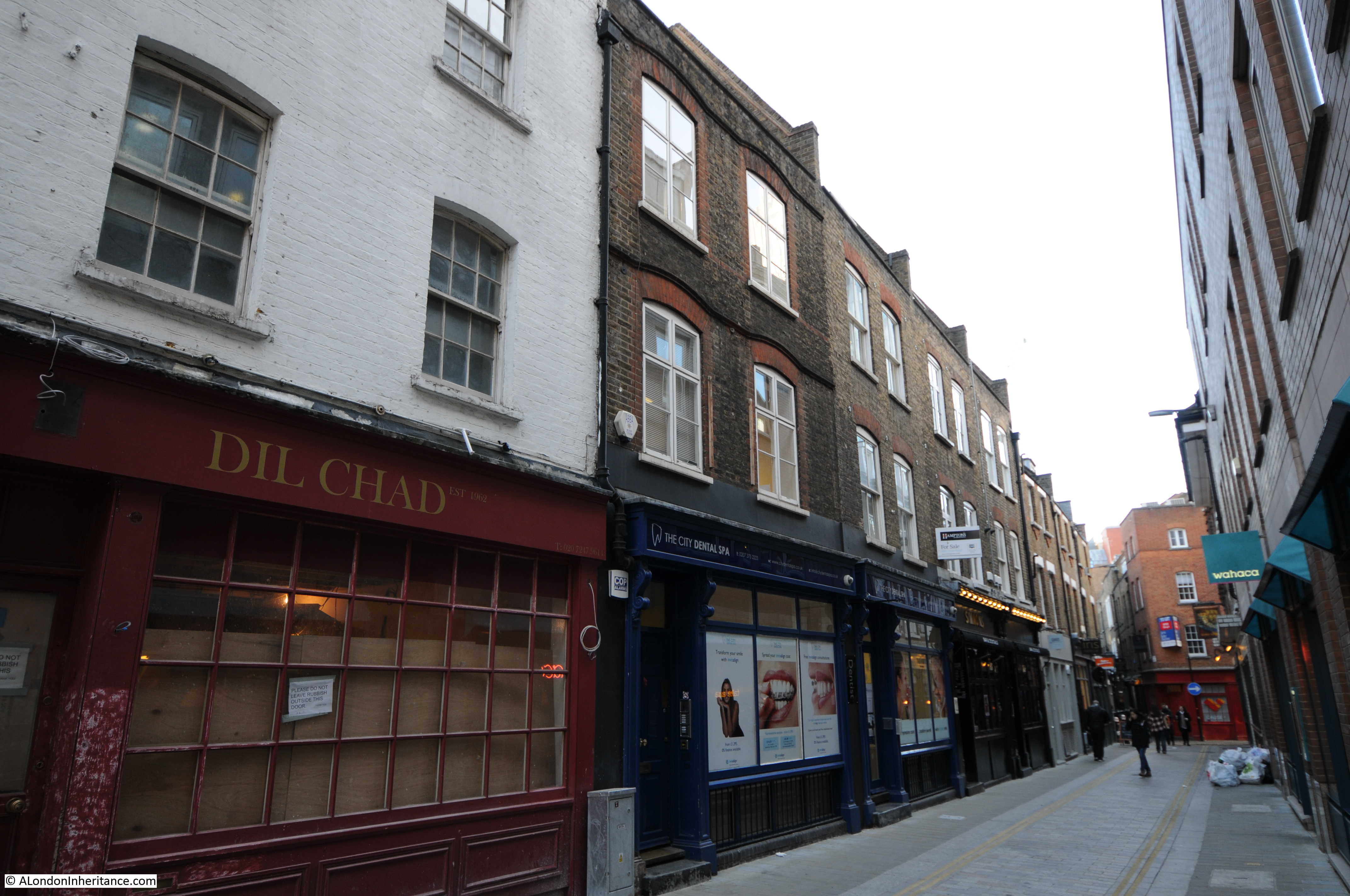
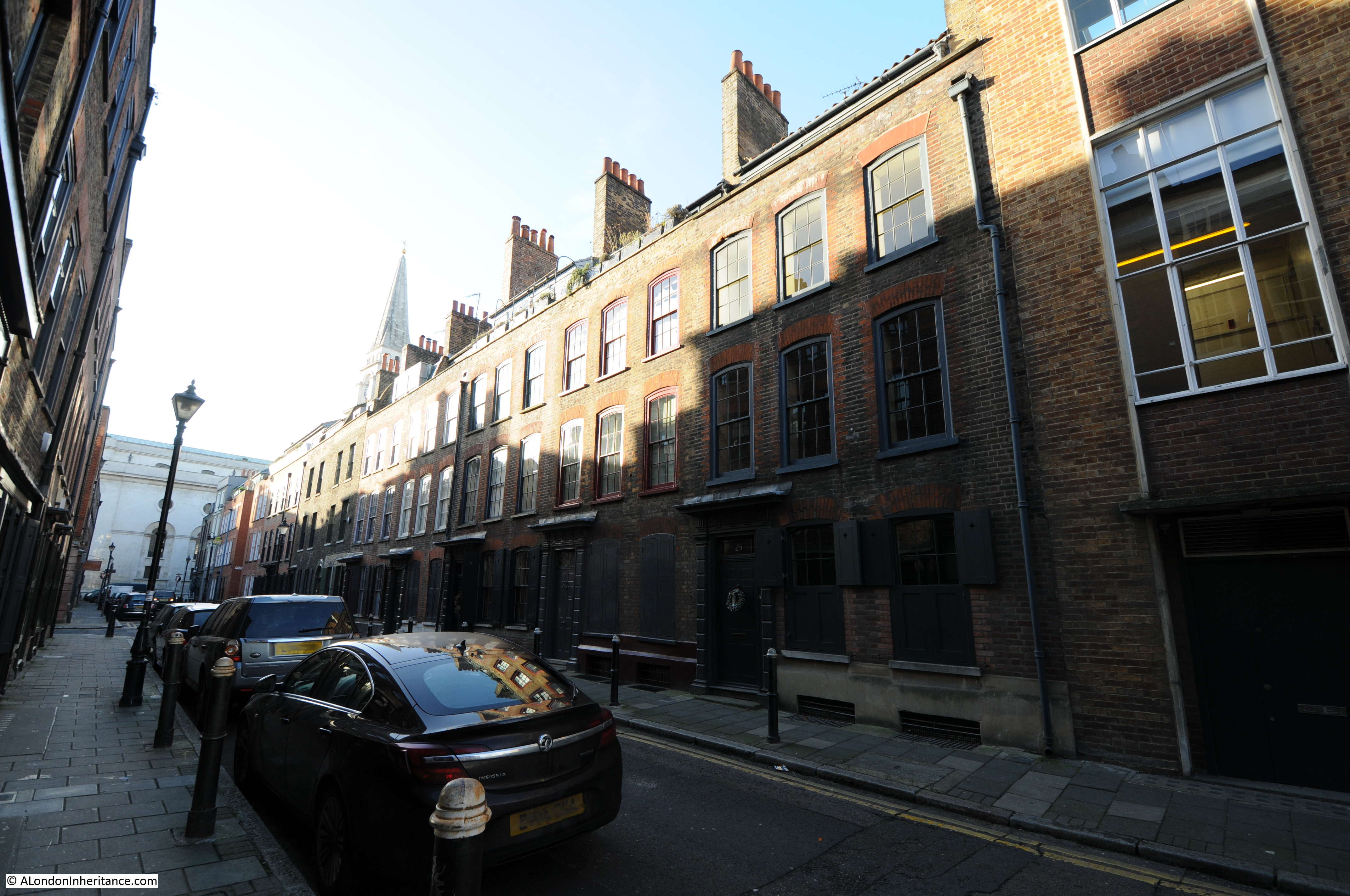
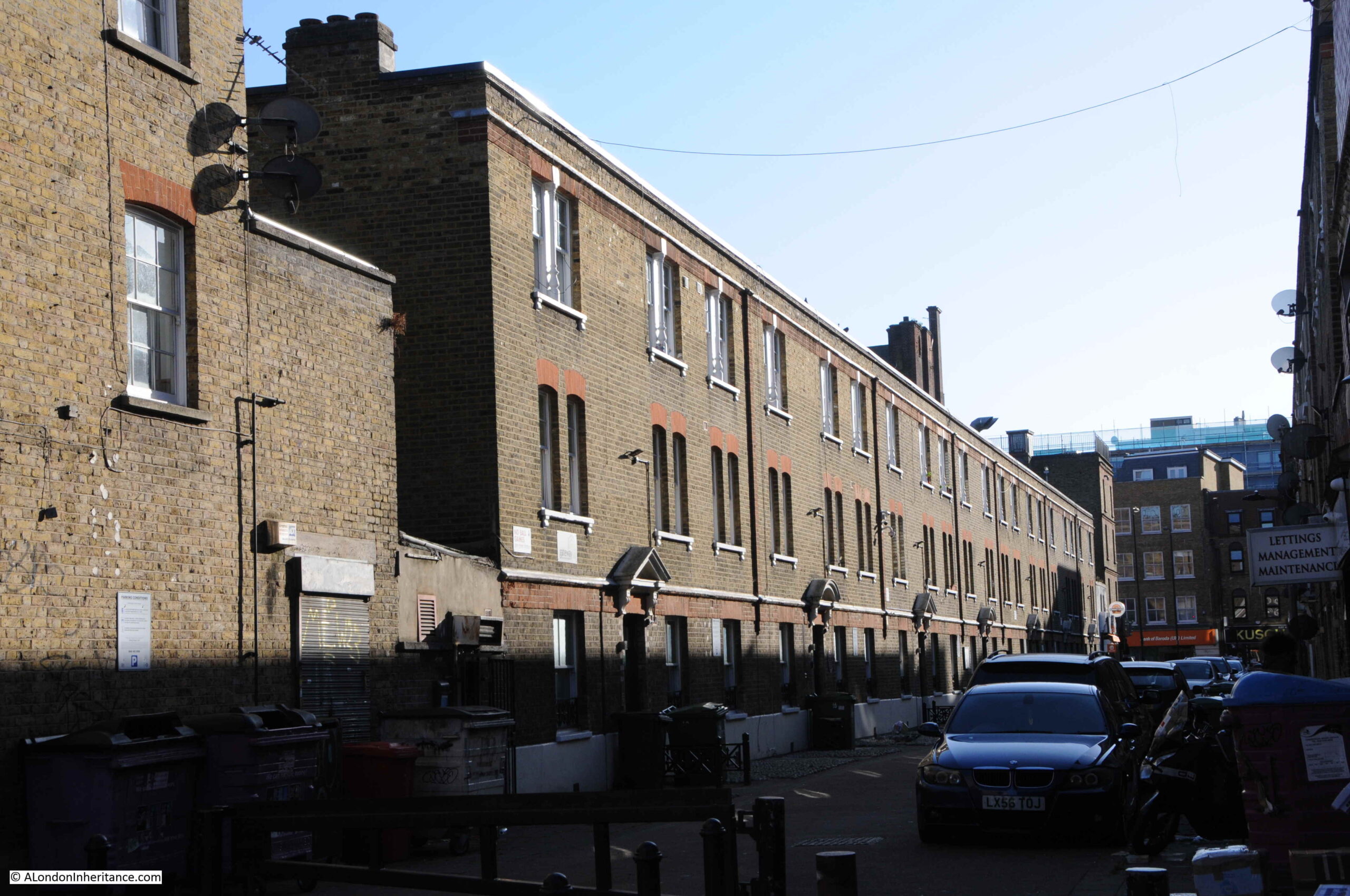
Pubs such as the Bricklayers Arms would have served those living in the densely populated terrace housing that lined the streets around Fordham Street. Whilst many of these have been demolished, some remain, although the following photo shows the challenges of taking photos with a low winter sun on a bright day:

Fordham Street

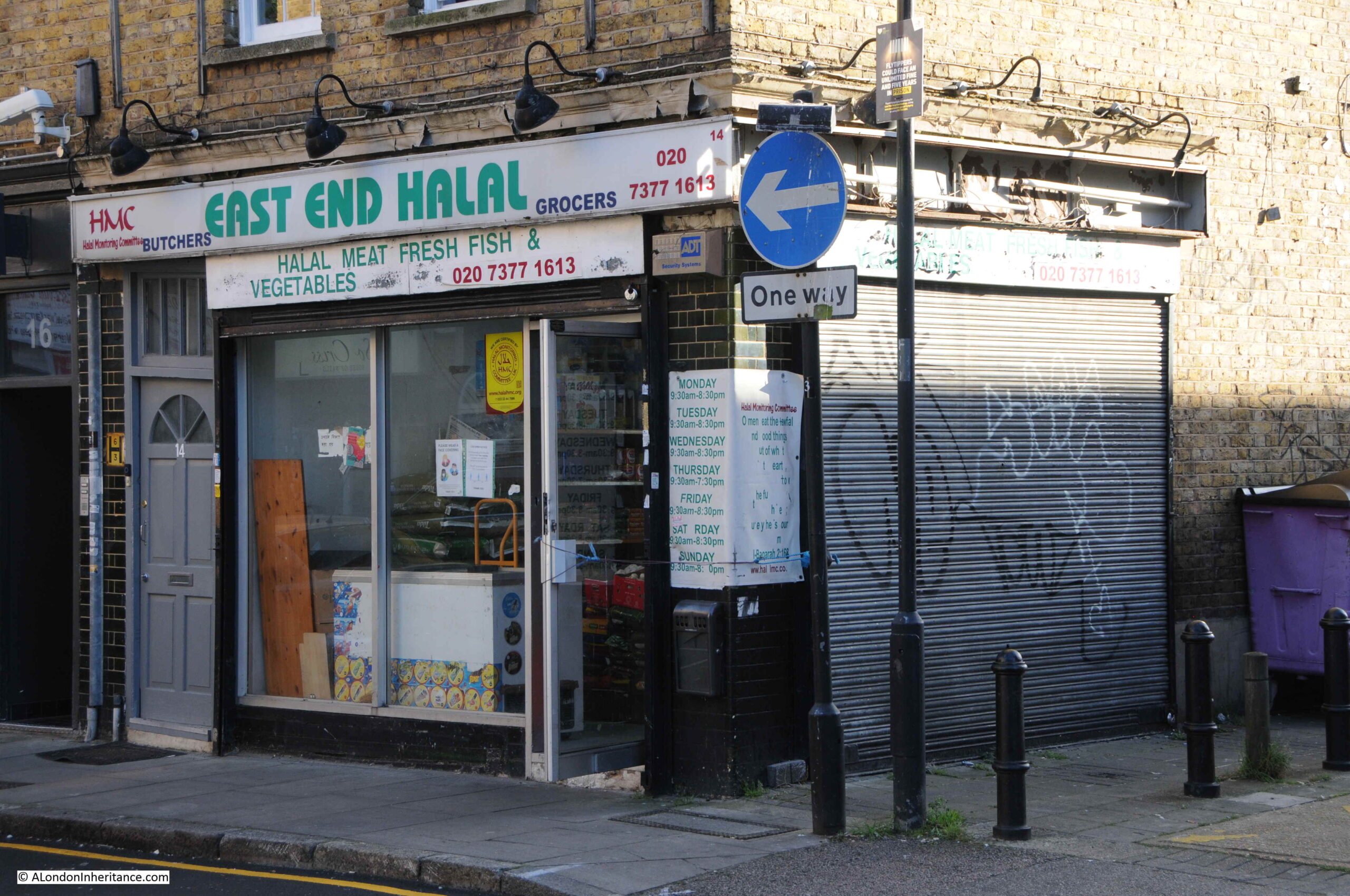
Many of the corner shops in Fordham Street have survived, and have changed over the 20th century to serve the changing population of east London:

Fordham Street

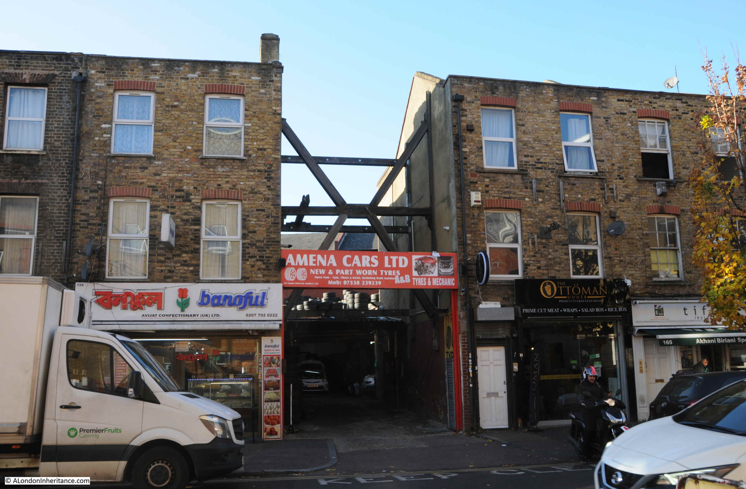
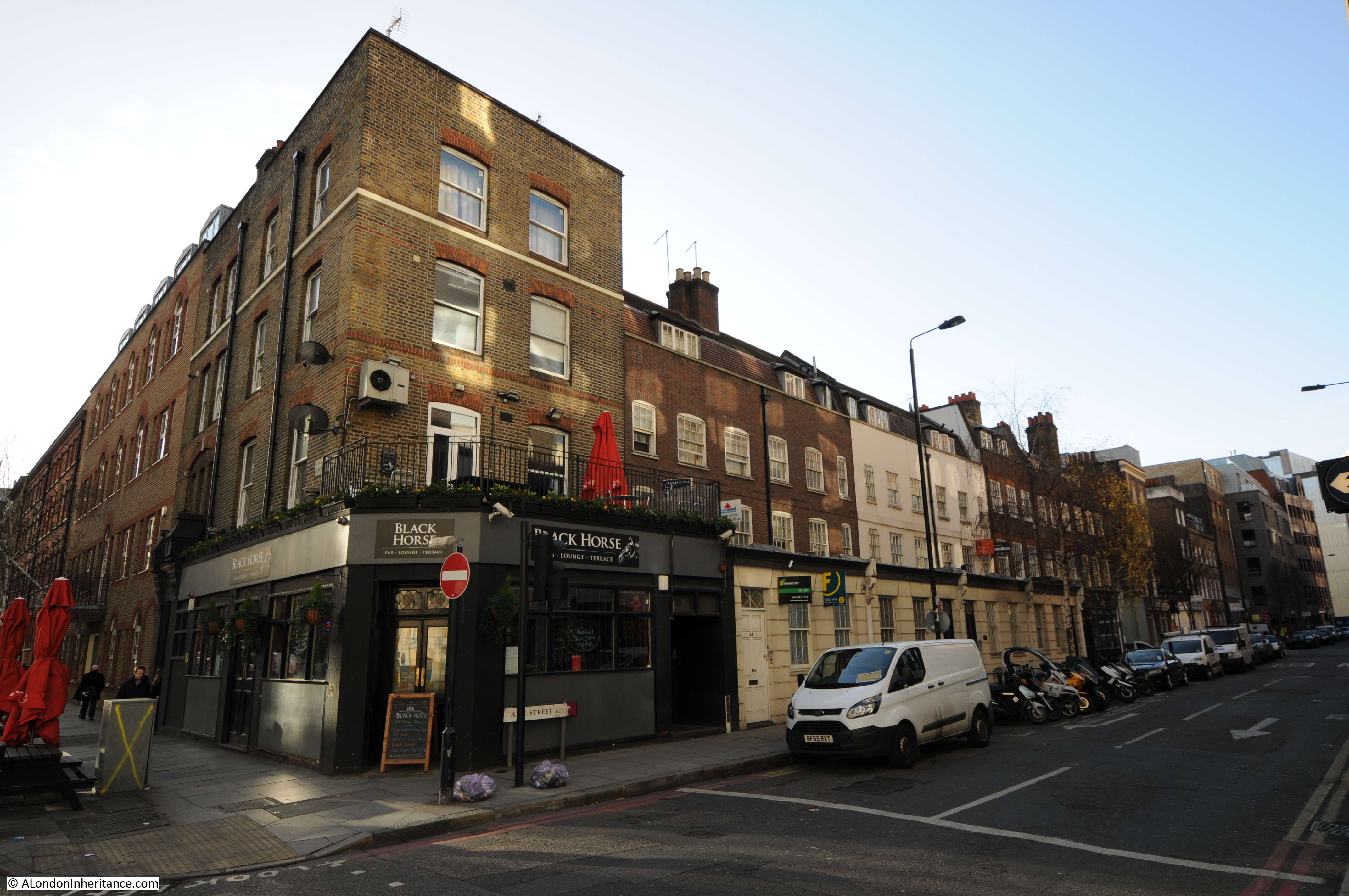
The second pub in the street was the Duke of York. The Bangla Super Store on the corner of Fordham Street and Myrdle Street now occupies the building that was once the pub:

Duke of York pub

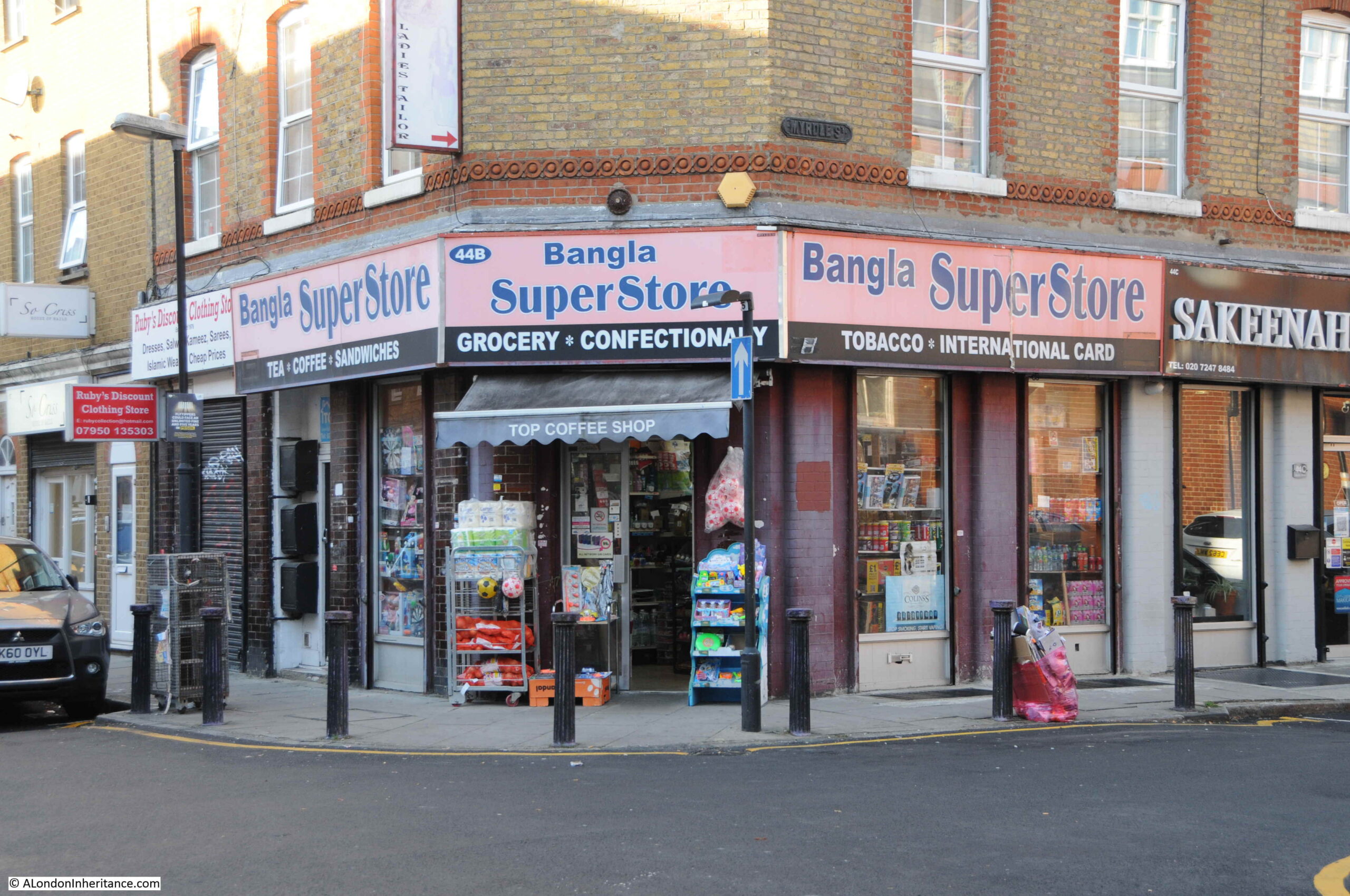
The Bangla Super Store maintains the tradition of a corner shop stacked high with a wide range of goods for the local community.

Rather strangely, I cannot find any newspaper report mentioning the Duke of York, and cannot find any record as to when the pub opened or closed. It is marked as a Public House on the 1894 Ordnance Survey map of the area, and the building has the large, flat corner on the upper floors, so typical of 19th century pubs where their large pub name / advertising signs were located.

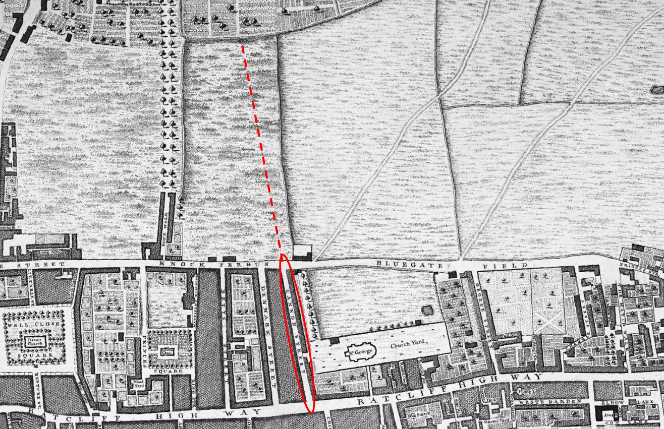
Myrdle Street runs across Fordham Street, and the straight lines of this network of streets indicate that they were laid out as part of a significant development of the area, however the street plan that we see today appears to be the second since the fields that once covered the area were built on.

In 1746, John Rocque’s map was showing the area now occupied by Fordham Street as a field, surrounded by other fields, ponds and cultivated land (the red line indicates the future location of Fordham Street):

Fordham Street

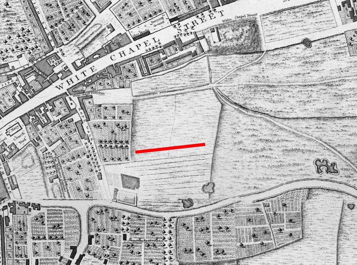
The following is an extract from the 1816 edition of Smith’s New Plan of London. I have ringed the area now occupied by Fordham Street and surrounding streets:

Fordham Street

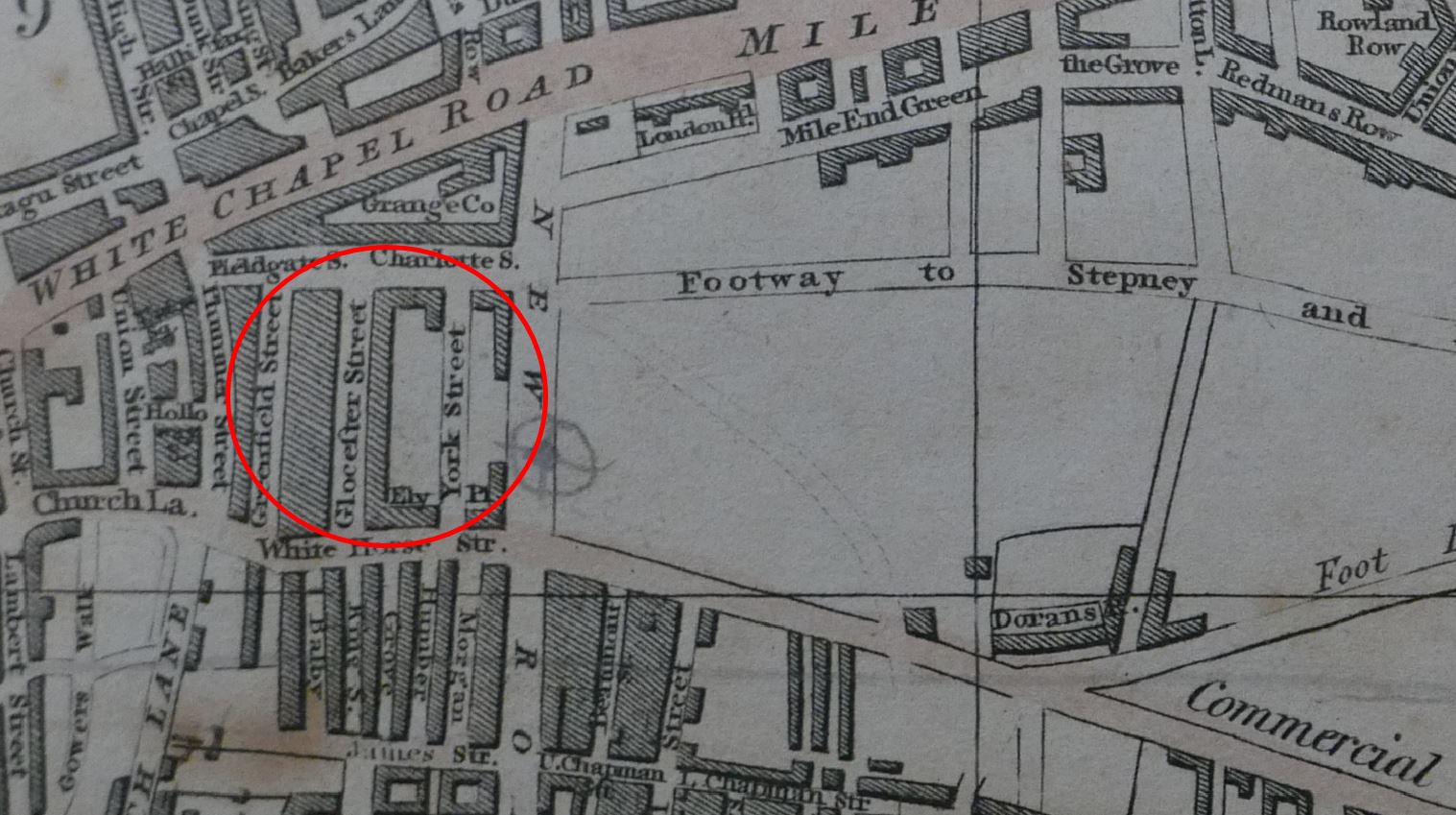
Comparing with the map of the area today (see below), and the streets, along with their street names are very different. To confirm the location, Whitechapel Road runs along the top of both maps, the start of the Commercial Road development runs along the lower part of the 1816 map, and one of the few consistent street names is Fieldgate Street which runs just south of Whitechapel Road in both maps.

New Road can be seen in both maps, new as this was a major new road built as part of the development of the area.

I cannot find exactly when Fordham Street was initially developed. It is shown in the 1894 OS map. The first newspaper reports which mention the street date to the 1880s, including one from 1886 which advertises a building plot available to be leased in Fordham Street.

Charles Booth’s poverty maps include Fordham Street, with the occupants of the street falling within the classification “Mixed. Some comfortable, some poor”. There was one area described as “Very poor, casual. Chronic want” on part of the land now occupied by Fieldgate Mansions (see further in the post). The street may then date to the early 1880s, however this does seem rather late.

I like that the Footpath to Stepney in the 1816 map is now the Stepney Way, to the upper right of the following map.

Fordham Street

So the streets we see today are not those from the original development of the area, and were built in the decades following the 1816 map. Interestingly, in 1816 there was a York Street roughly where Myrdle Street is today, where the Duke of York pub was located on the corner with Fordham Street, so this lost pub may have been named after the name of the original street.

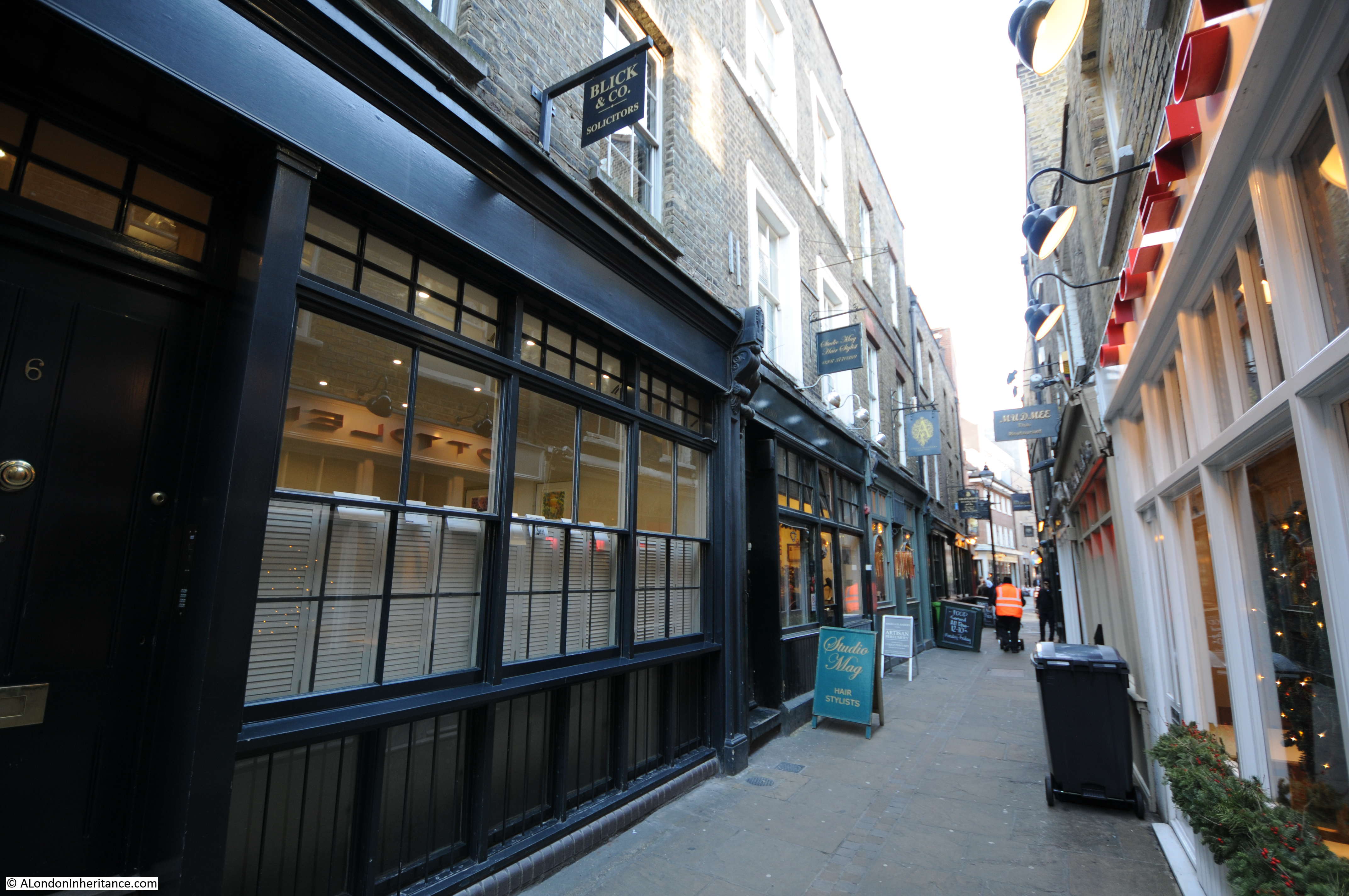
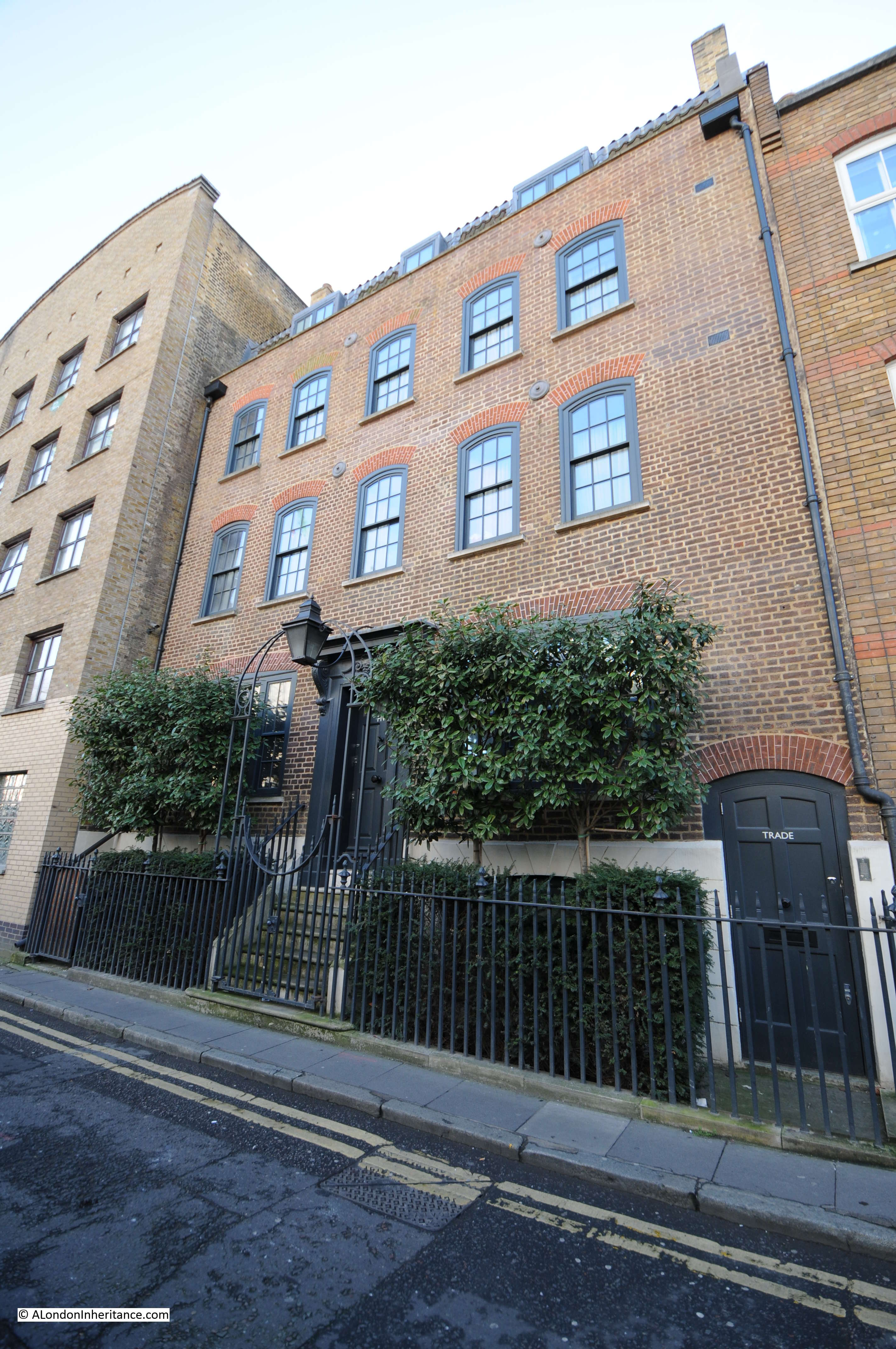
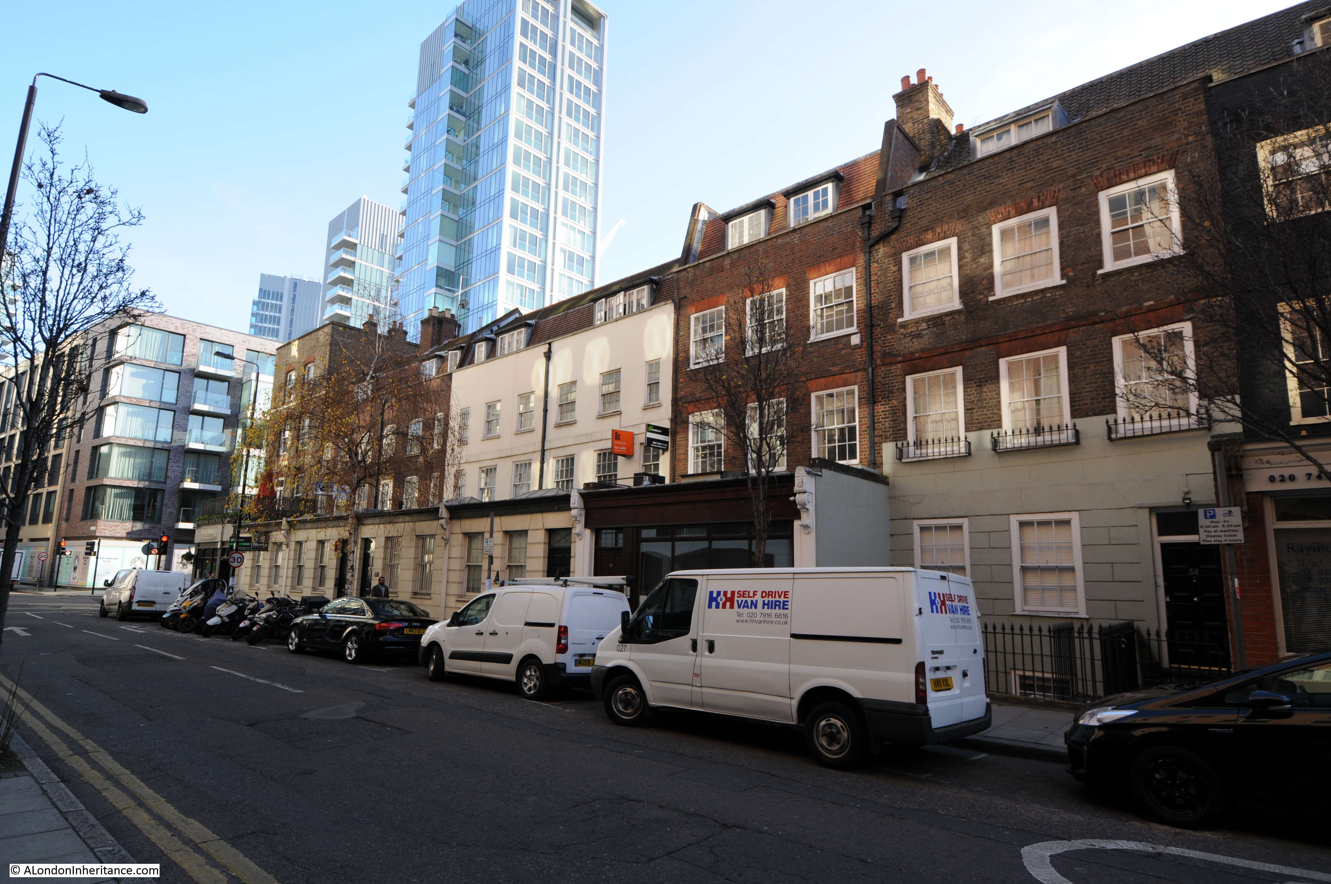
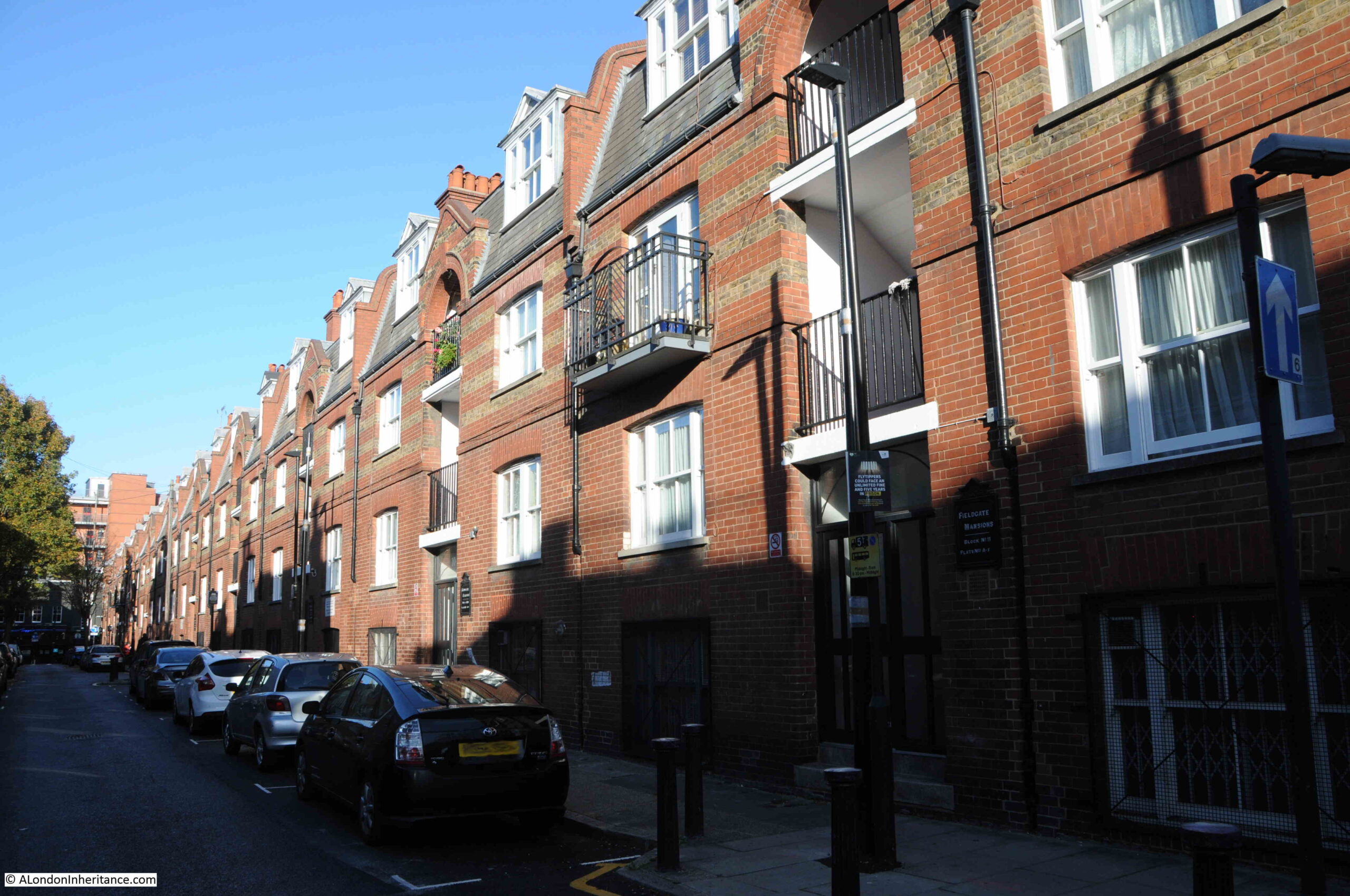
Myrdle Street was a long run of terrace houses, but one side of the street has been replaced by Fieldgate Mansions:

Fieldgate Mansions

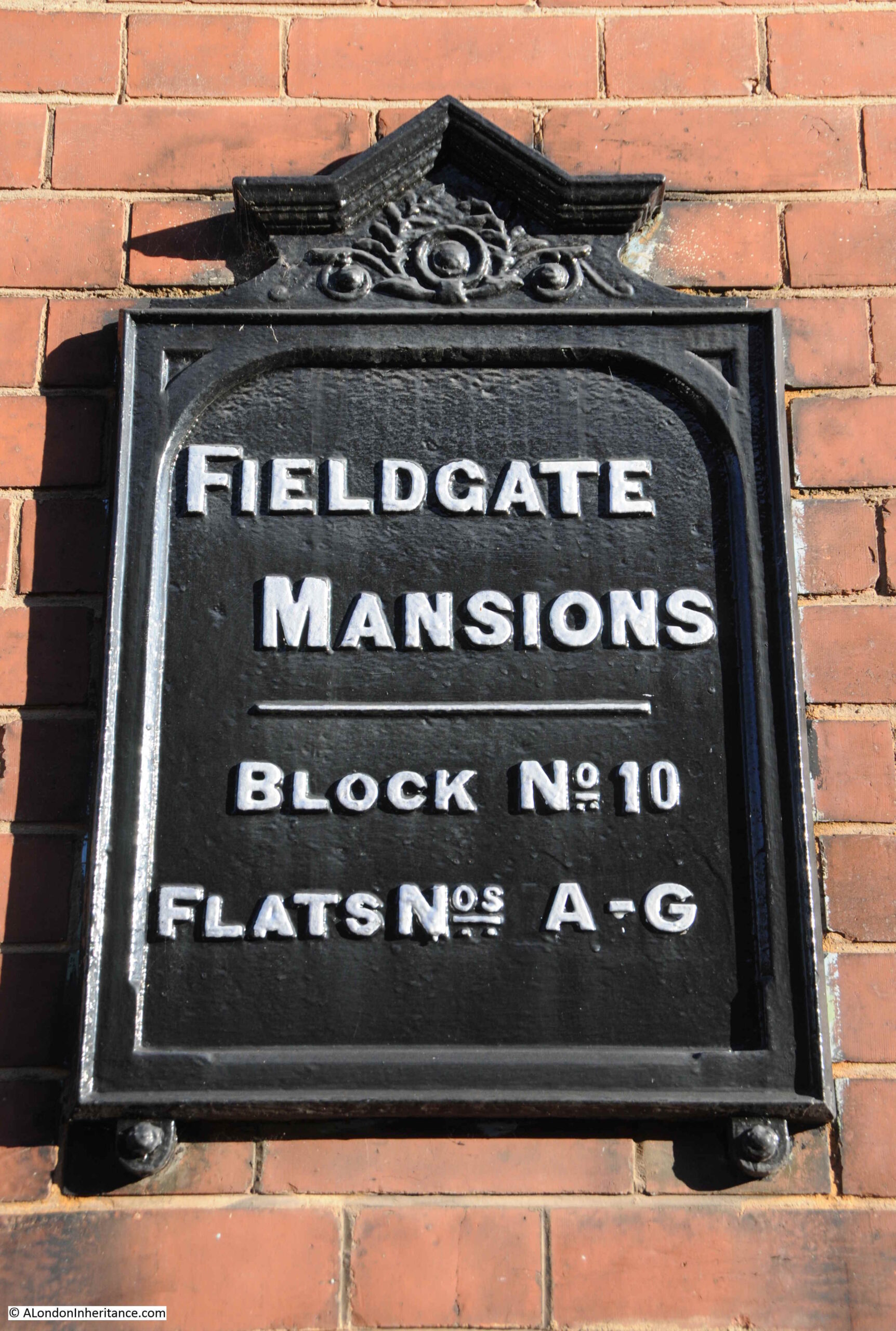
Fieldgate Mansions is a large complex of tenement dwellings that extend along Myrdle Street and further back towards New Road. They were built between 1903 and 1907 to replace the much smaller terrace houses that ran the length of the street. They take their name from Fieldgate Street which runs at the northern end of Myrdle Street.

The original tenants were mainly Jewish immigrants, which probably explains why meetings of the East London (Jewish) branch of the London Central Council were held in the pub at the end of Fordham Street.

Post war, the blocks were neglected by their landlords, some had suffered bomb damage, and by the early 1960s prostitution was a considerable problem in the area.

Many of the apartments in the blocks were empty by the late 1960s and 1970s, and were occupied by squatters campaigning for the restoration and use of derelict property.

They were redeveloped during the 1980s and it is the restored Fieldgate Mansions that we see today:

Fieldgate Mansions

Unlike the Duke of York pub, there are plenty of references to Fieldgate Mansions in the press, that tell of everyday life, and the challenges of those who lived here.

On the 4th of December 1942, the East London Observer has a Naturalization Notice, where “Notice is hereby given that H. LEVY of 48, Fieldgate Mansions, Myrdle Street, E.1. is applying to the Home Secretary for naturalization, and that any person who knows any reason why naturalization should not be granted should send a written and signed statement of the facts to the Under-Secretary of State, Home Office, S.W.1.”

On the 5th December 1941, Fieldgate Mansions were advertising for “two fire watchers, good references essential”. An important role where fire watchers would look out for fires started by incendiary bombs and then do their best to extinguish fires before they took hold. This was a role my grandfather had in his flats.

A strange case reported on the 31st March 1944 was when Morris Lakin, 32, a traveler of Fieldgate Mansions was in court accused of receiving stolen goods, described as property of the Canadian Army. A strange combination of “five revolvers, 83 rounds of ammunition and 63 pairs of woollen socks”. He was also charged, along with two others of receiving a “quantity of cosmetics, a wireless set and an Eastman cutting machine”.

The tenants of so many east London apartment blocks were subject to rent rises, and there were frequent strikes where tenants refused to pay their rent. On the 4th of July 1939, one rent strike ended and another began “Sixty-four tenants of Fieldgate Mansions, who have withheld their rents for 20 weeks, have reached agreement with their landlord. Rent reductions are to be made from May 1st, some amounting to 3s a week. At Linden Buildings, Brick-lane, Bethnal Green, 68 tenants started a rent strike yesterday”.

Just five years where within Fieldgate Mansions we have rent strikes, protecting the community by fire-watching, stolen goods, and H. Levy’s application for naturalization.

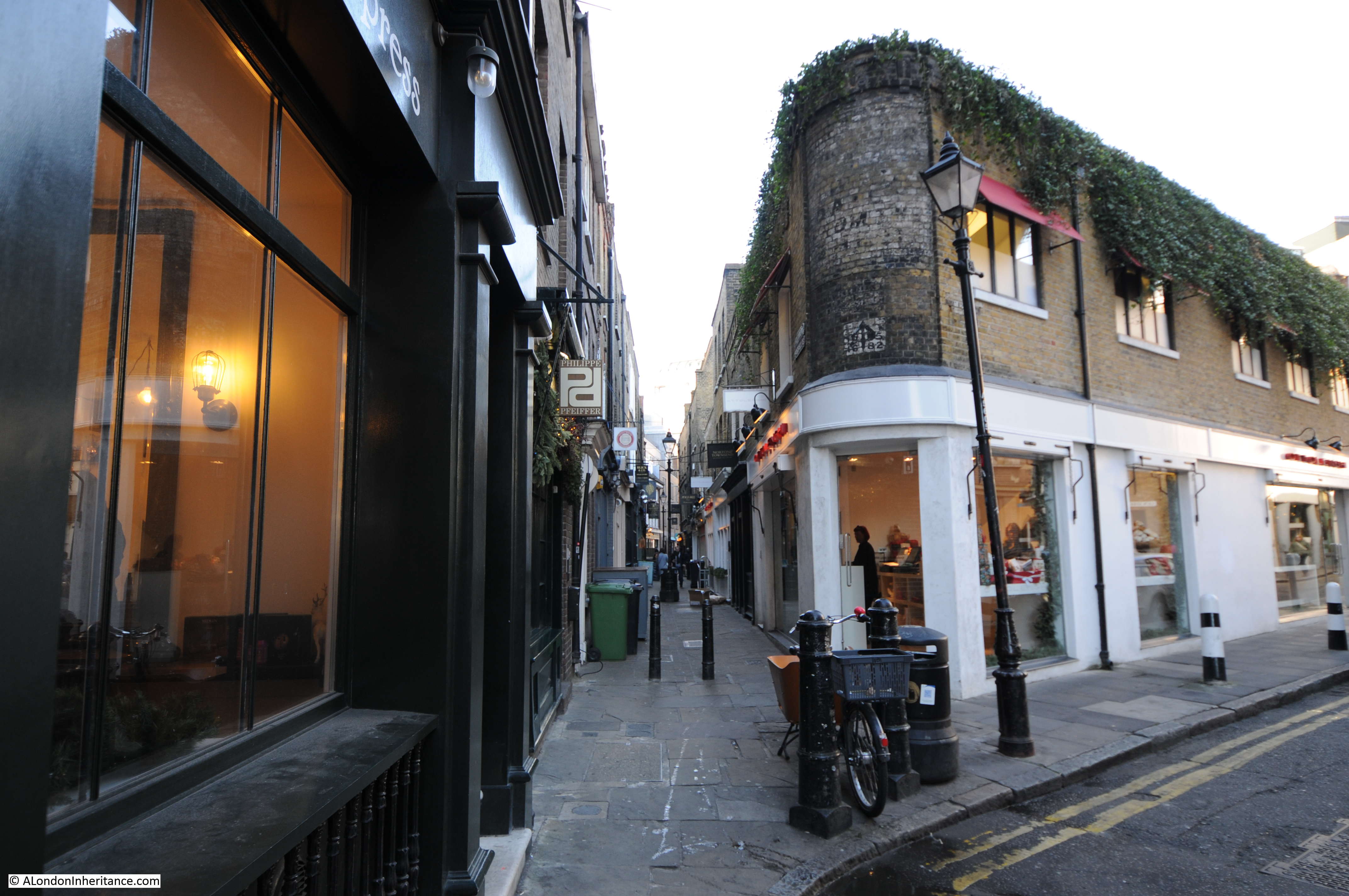
Myrdle Street crosses Fordham Street and on the south-western corner of the junction is another business housed in what was an original corner shop. The wooden decoration just visible around the top and to the right of the current shop signs demonstrates that this has long been a corner shop.

Fordham Street

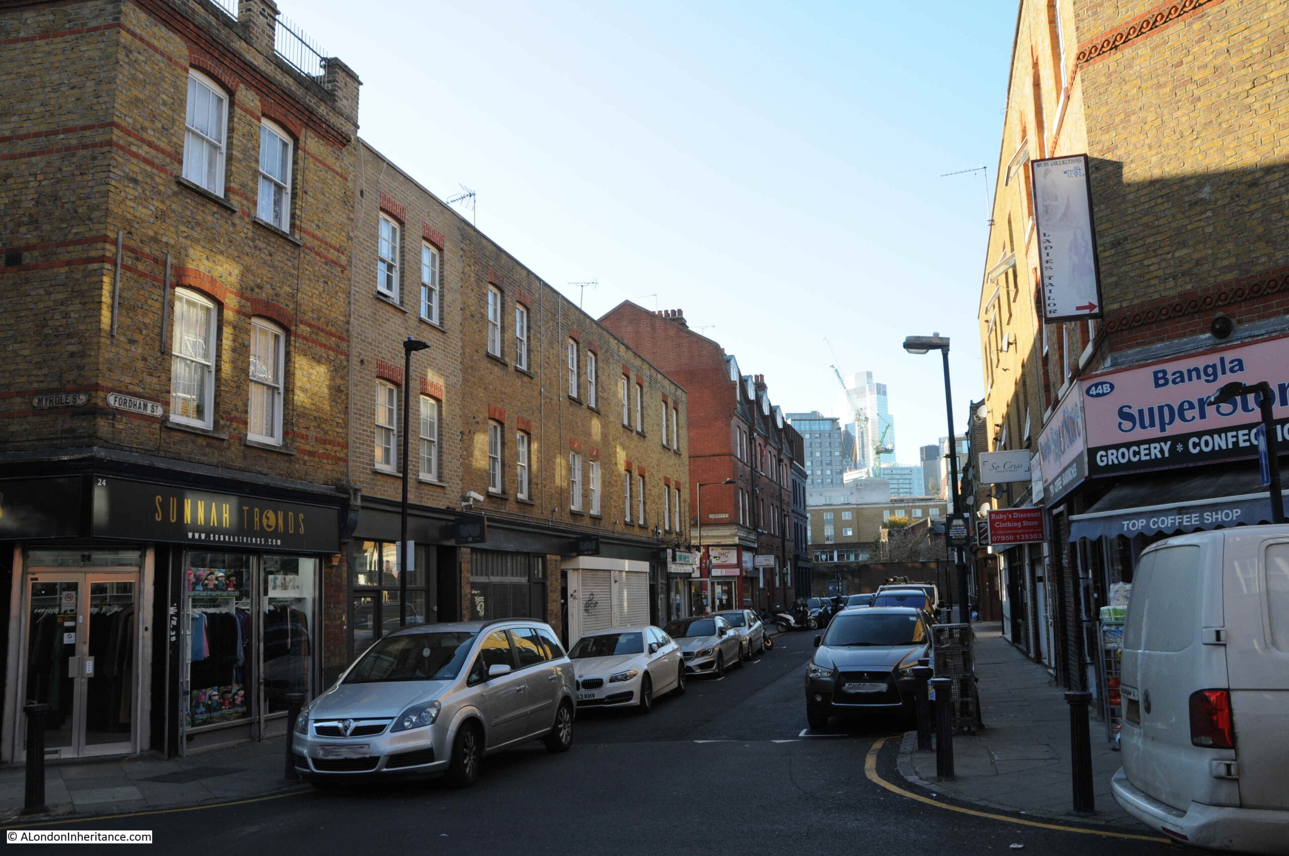
The following photo shows the view west, along Fordham Street at the junction with Myrdle Street. The towers of the City can be seen in the distance.

Fordham Street

Fordham Street is a very ordinary east London street, but it can tell so much about how the area has developed from the field of the 18th century to the network of streets we see today.

The demise of east London pubs, changing populations, and snapshots of the lives of people who have made this part of the city home for a brief few years.

alondoninheritance.com

East London 1980s Shops – Cannon Street Road

Thirty five years is a relatively short time, however during that time so much of London has changed considerably. Back in 1986, a large part of east London was run down. The area was still home to some wonderful communities, people who had lived and worked there for decades, but an area that would soon change. I recently went back to Cannon Street Road to photograph the site of two shops last photographed in 1986.

This is Rogg’s at 137 Cannon Street Road:

Cannon Street Road

Number 137 is today the home of Ample, a property and finance company:

Cannon Street Road

Rogg’s was on the corner of Cannon Street Road and Burslem Street and had been open since the early 1940s. A typical 1980s corner shop with products piled high in the windows. Inside, there was a wide range of traditional Jewish food.

The shop was at the end of a terrace of mixed date and designs. I am not sure if the building of which Rogg’s was the ground floor shop, has had a rebuild as the bricks look too clean and the corners / sides of the building are a little too sharp and clean for a building of some age:

Cannon Street Road

As well as Rogg selling Jewish food, another building that supported the local Jewish population was a synagogue that occupied the space in the above photo, to the right of the white building with part of a blue sign just above the ground floor.

The Cannon Street Road synagogue opened in 1895, but closed in the early 1970s due to the declining local Jewish population.

There was a rather infamous murder in the street in 1974, when Alfie Cohen, who ran a small all-night cigarette kiosk in Cannon Street Road was murdered during a robbery on his kiosk. The robbers got away with what was in the till and a quantity of ciggarettes, however they missed a considerable fortune.

Alfie had worked 7 nights a week for almost 50 years, and rarely took a night off. Rather than bank the money he made, he kept it under the counter in the kiosk, and when police came to investigate the murder, they found a total of around £100,000 in bags hidden in the kiosk.

A tragic story, but indicative of the characters that could be found in the street, and also of the relatively high level of crime in the 1970s.

Continuing south along Cannon Street Road, and at numbers 125 and 127 was Saad Cash and Carry:

Cannon Street Road

The same building today, now home to Quality Food London Ltd:

Cannon Street Road

A wider view of the terrace with 125 and 127 occupying the ground floor of the largest houses:

Cannon Street Road

Cannon Street Road is a typuical east London street. Shops and businesses catering to a diverse range of local residents, and with an equally diverse range of architecture. The condition of the buildings are much better than they were in the 1980s.

Cannon Street Road runs between Commercial Road to the north, and the Highway to the south, cutting across Cable Street rouighly two thirds along the street.

Cannon Street Road is the yellow road running north – south in the centre of the following map  (Map © OpenStreetMap contributors):

Cannon Street Road

The lower section of Cannon Street Road is old. The stretch between The Highway and Cable Street is shown in Rocque’s map of 1746. The upper section was then all fields with only the area between Cable Street and the Thames having much development as London’s expansion followed the line of the river.

Rocque’s map shows the street name as simply Cannon Street. I cannot find exactly when, or why, the name changed to Cannon Street Road, however the first mention of the longer name I can find is a newspaper advert from the 24th January 1803, which called for subscribers to the Commercial Road development who could collect their interest from an office in Cannon Street Road.

The following extract from Rocque’s map shows the 1746 length of Cannon Street (red oval), with the red dashed line showing the extension of the street that we see today.

John Rocque map of London

What I did not realise is that the development of Commercial Road appears to have been paid for by subscribers. As well as the advert, there is the following statement in the same 1803 newspaper:

“COMMERCIAL ROAD SUBSCRIPTION – at a MEETING of the TRUSTEES under the Act of Parliament, passed in the 42nd year of the Reign of King George the Third, for making a New Road from the West India Docks in the Isle of Dogs to the City of London, held at the Cannon-street-road office this day; it was ordered, that a further Call or Installment of £25 per cent, on the several Subscriptions, should be paid into the hands of Messrs. Harrison’s, Prickett and Newman, Bankers, Mansion-house-street, on or before the 1st day of February next. Limeshouse, Jan. 18th, 1803. THOMAS BAKER”

Thomas Baker was the Clerk to the Trustees, and the office was somewhere in Cannon Street Road.

I suspect that it was down to the development of Commercial Road, that Cannon Street changed to Cannon Street Road.

As the street provided a route between Commecial Road, Cable Street and The Highway, it would be a busy street (as it is today), and perhaps “Road” was added to avoid confusion with Cannon Street in the City of London.

Just to the left of the Saad Cash & Carry / Quality Food shop is an historic building, with the ground floor converted into shops. This was Raine’s Boys School:

Raine's School for Boys

The history of Raine’s schools goes back to around 1719, when brewer Henry Raine opened a school for 50 boys and 50 girls. The original school was in what is now Raine Street in Wapping. The building is still there, although was in a poor state in the 1970s and at risk of demolition. I wrote about the building in this post.

As the London Docks were built, the original school found itself rather isolated from the parish that the school was intended to serve, so in 1875 the Boys element of the school moved to the Cannon Street Road building, photographed above.

The building did not serve as a school for too long, as by the first decade of the 20th century, the buildings used by the school were too small, and the school consolidated into a large building in Arbour Square, just north of the Commercial Road. The building still exists as the Tower Hamlets New City College.

Cannon Street Road had already been home to a form of school / childrens home some forty year earlier when within the street could be found the Merchant Seamens’ Orphan Asylum.

This institute was founded in 1827 to care for the children of men lost at sea.

In 1833, an advert appeared in the Public Ledger and Daily Advertiser stating that the orphan asylum was ready to receive applications for the February election. This seemed to be standard practice for many institutions of the time, where applications were made and these were voted on by a Board of Management (see my post on the General Lying In Hospital, where this approach was taken with Subscribers being able to propose pregnant women for admission to the hospital).

In 1833, the orphan asylum had 41 boys and 23 girls. The advert stated that subscriptions and forms of petition for admittance could be had at the school in Cannon Street Road.

We do not often get a glimpse inside the houses of streets such as Cannon Street Road, however another advert from the Public Ledger and Daily Advertiser on the 12th of September, 1833 reports on the sale of the leasehold residence and contents of number 2 Cannon Street Road, at the direction of the Executors of the late Mr. Richard Neale:

“Leasehold Residence, Cannon Street Road, with Immediate Possession. Household Furniture, Plate, three Watches, Linen, China and Effects – By W.S. FRANCIS on the Premises, No. 2, Cannon Street Road, St George’s East, on Tuesday September 17, at 11, by direction of the Executors of the late Mr. Richard Neale.

The Leasehold Residence, with immediate possession, held for a term of 17 years, at the trifling ground rent of £2. The furniture consists of fourpost and other bedsteads and furnitures, goose feather beds and bedding, mahogany double and single chests of drawers, mahogany nail-over chairs, sofa, secretary and bookcase, looking glasses, Brussels carpet, and various other articles”.

If the contents of number 2 are typical of the street, then the residents of Cannon Street Road seem to have been reasonably comfortable. The house was at the southern end of Cannon Street Road, close to the church of St George in the East.

The southern end of Cannon Street Road mainly consists of post war rebuilding. It was the southern end that received the most damage during the Second World War, the northern section of the street appears to have escaped relatively undamaged.

Much of the north of the street still appears to be 19th century terrace housing, however it can be difficult to confirm what is original and what is a later rebuild.

The following photo shows part of the street where I assume a single house within the terrace has gone, to be replaced with an entrance to a car tyre dealers. The houses either side needing some serious support as the terrace has been broken.

Old terrace houses in east London

Cannon Street Road is part of east London’s expansion north from the original ribbon development along the Thames, and although east London streets have changed considerably over the last few decades, they are still fascinating places to walk as although wartime bombing has resulted in much new building, there is still many of the original terrace houses along the street, along with an ever changing range of shops.

alondoninheritance.com

St. Dunstan And All Saints, Stepney

For this week’s post, I am returning to my project to track down all the sites listed as at risk, in the 1973 Architects’ Journal issue on East London. You can find my first post explaining the thoughts behind the 1973 publication and the changes that were taking place across East London here.

I had a day off work on a freezing cold day in February, and tracked down the locations in Bethnal Green and Stepney. When I started working on a post, it was looking like a very long post, and the last week has been a very busy work week, so I will cover the full walk in a future post, and today explore the church of St. Dunstan and All Saints, Stepney.

The following is an extract from the 1973 Architects’ Journal map covering Bethnal Green and Stepney. The church is number 46, in the lower right corner of the map and is listed as “Medieval church of St. Dunstan’s – original parish church of Stepney”.

St. Dunstan and all Saints

To find the church, I had walked along Mile End Road, then walked through Stepney Green (number 47 in the above map) and along to Stepney High Street where St. Dunstan and All Saints can be found within a large graveyard, although today there are not that many graves to be seen.

Approaching the church from the north:

St. Dunstan and all Saints

The church of St. Dunstan And All Saints is a very old church. A church was rebuilt on the site (implying there was an earlier church here) in the 10th century and later dedicated to St. Dunstan, the 10th century Bishop of London. Until the chapel that gave Whitechapel its name was built in the 13th century, it was the only church that served the whole of the parish of Stepney.

I have read a number of different interpretations of how and when the church received its dedication, they are generally slightly different, however one common theme seems to be as follows. The dedication to St. Dunstan was possibly made by the end of the 13th century and the full dedication to St. Dunstan and All Saints was made in 1952, apparently in recognition that the original dedication may have been to All Saints prior to St. Dunstan.

The church was rebuilt in the 15th century, and as with many other churches, was subject to changes in the Victorian period which included re-facing the exterior walls of the church.

Above the main entrance door are two carvings which both represent connections with the church.

St. Dunstan and all Saints

On the right is a carving of the devil and some tongs. This refers to a story about St. Dunstan pulling the nose of the devil with some red hot tongs. This was one of the noses illustrated by George Cruikshank in 1834 in his Chapter on Noses. The illustration of St. Dunstan and the devil is at lower right:

St. Dunstan and all Saints

The carving on the left is of a ship and refers to the long association of the church with the sea and sailors. An information panel at the entrance to the church refers to the church being the mother church of the East End, and also being known as the Church of the High Seas. Many of the prints showing the church over the centuries show a very large flag, the red ensign, flying from the top of the tower (the flag flown by British passenger and merchant ships) and the church allowed the registration of those born at sea into the parish of Stepney.

The location of the church is interesting. In the following map from 1720, the church is shown in the middle of the map, surrounded by open fields.

St. Dunstan and all Saints

Mile End is to the north and to the south are the first streets that make up Limehouse and Shadwell. I have read some sources that claim the church initially start as a small chapel on a track between the Bishops Hall (just to the north of Mile End) and the river, however I can find no firm evidence to back this up. The origin of the large graveyard can be seen in the area surrounding the church and bounded by streets.

Early street and place names are always fascinating. Look to the right of the church and you will find “Rogues Well” and a Rogues Well Lane”. It would be interesting to know the origins of these names

In 1746 John Rocque was still showing the area as rural. The church is to the left, unfortunately on the edge of a page so I could not cover the same area as the 1720 map.

St. Dunstan and all Saints

In the 26 years between the two maps, Rogues Well has changed name to Rhodes Well, although I wonder if the name had really changed and in making one of the maps, the name was heard or recorded incorrectly – I have always wondered how mapmakers identified the names of places and streets outside of the central City. There would not have been any street signs and names must have been written down based on recording the names given by the local population.

In Rocque’s map there is also what looks like a small stream leading off from the field at the end of Rhodes Well and heading to the right. Possibly one of the many small springs, wells and streams that disappeared underneath the dense streets and buildings that would soon follow.

In the 100 years after Roque’s map, the fields surrounding the church of St, Dunstan would disappear, however the church has kept its large graveyard which we can see covering the same area as shown in the two 18th century maps.

Burials ended in the main graveyard in 1854 and a small extension was used for a further two years. The graveyard became a public garden in 1886 after the majority of the gravestones had been cleared.

An article in the Tower Hamlets Independent and East London Advertiser on the 19th October 1901 gives an indication of the number of burials there must have been in the graveyard as in 1625, 2,978 people died of plague, with a further 6,583 in 1665 within the parish of Stepney. A good many would presumably have been buried within the graveyard as well as the thousands of Stepney residents over the centuries.

The interior of the church is magnificent and surprisingly bright given that it was such a dull day outside.

St. Dunstan and all Saints

There was a major fire at the church in October 1901. The same newspaper article mentioned above started with the headlines “A Stepney Disaster – Parish Church Burnt Down – immense Damage”, however in a letter on the same page, the rector of St. Dunstan’s tried to correct some of the stories about the damage, whilst also appealing for funds:

“The Rector’s Appeal – So many are interested in this ancient church, that I am sure you will allow me to state exactly what happened. The church is not burnt down; the energy of commander Wells and the efforts of our excellent fire brigade have saved us from that, though the fire, the origin of which is unknown, had obtained a strong hold before it was discovered.

Our loss briefly is that the roof of the chancel and nave, the organ and vestries and Chapter House and their contents.

Of this our beautiful fifteenth century roof, and seventeenth century organ front and the old prints in the vestry are irreplaceable.

But the plates and requisites are intact, while the tower and the whole of the interior, i.e. walls with monuments, seats etc, are practically unhurt.

I see it said that we are insured for £11,000, and that this will cover all the damage. The first statement is true; I wish the second were, for while £11,000 would more than cover all damage, much of that sum is unavailable, e.g. insurance on the tower, seats, plate etc. , and I am already learning that there are many expenses which insurance cannot cover.

A considerable sum, possibly some £2,000 will be required over and above the insurance. Such a demand comes at a terribly awkward time.

Less than two years ago £5,000 was spent on the church and only a month ago we commenced the completion of our second church, St. Faith’s for which £1,800 is still required.

The ordinary expenses of such a parish as this, with its population of 24,000 in the heart of the East End, always taxes our resources to the very utmost.

I can, therefore, confidently appeal to the generosity of the public not to allow this fresh and unexpected burden to weigh down those who already have their hands full, and their pockets empty. I am, sir, yours faithfully, Arthur Dalton, Rector of Stepney.”

Luckily the funds were raised and the church restored:

St. Dunstan and all Saints

St. Dunstan’s survived the blitz, although there was serious damage to the surrounding area, given the proximity of the church to the river and docks.

Housing was urgently needed and towards the end of the war a number of prefab homes were built on some of the bombed land surrounding the church:

St. Dunstan and all Saints

Prints from the 18th century show the size of the church, that it appears to have had a lantern at the top of the tower, and a really large flag.

St. Dunstan and all Saints

Image credit: London Metropolitan Archives, City of London: catalogue ref: 23832

And in this invitation to a service in 1746, the flag looks to have grown:

St. Dunstan and all Saints

Image credit: London Metropolitan Archives, City of London: catalogue ref: 19444

The invitation is to a service at the church to meet the Stewards of the Stepney Feast, and after the service to accompany them to the Feast Room near the church.

The Stepney Feast appears to have been a society, comprised of members from the maritime trades who collected money to “apprentice out orphans, and the children of the poor, to marine trades”.

Note the limitation on servants at the very bottom of the invitation – charity would only extend so far.

The connection between the church and the sea can be seen in the following photo from 1924. Preparations are being made for Harvest Festival and this included the hanging of fishing nets in the church.

St. Dunstan and all Saints

Image credit: London Metropolitan Archives, City of London: catalogue ref: 302170

Inside the church today are a range of memorials, including these from the 17th century:

St. Dunstan and all Saints

St. Dunstan and all Saints

St. Dunstan and all Saints

The first memorial above is to a Mariner and the trade given in the following memorial is Rope Maker. If you return to the 1720 map, you will see to the left of the church “Rope Grounds”. These would have been lengths of land needed to stretch out ropes during their manufacturer.

St. Dunstan and all Saints

In the 1746 map, there is a track shown across the graveyard to the south east corner. This track is still in place today to provide the southern exit from the church. Trees form the boundary to the track, it must look magnificent when they are in full leave on a sunny day.

St. Dunstan and all Saints

There is so much to find when walking these streets and on exiting the graveyard to the south, I found these rather lovely houses immediately opposite.

St. Dunstan and all Saints

They are an example of the many houses built by the Worshipful Company of Mercers. The plaque at the top records the original build date of 1691 and the lower plaque records that they were rebuilt in 1856.

St. Dunstan and all Saints

As I was standing in front of the houses taking the above photos, one of the residents left his house to walk to the road. He turned to talk to me, I was worried he was about to complain about me standing in front of his house, taking photos. Instead he smiled and said “lovely houses aren’t they” before hurrying on.

I can only agree, but I wonder if he realised that these were some of the first houses to be built around the church and that this little row of houses (before the 1856 rebuild) would be shown on the 1720 map:

St. Dunstan and all Saints

I will complete my Stepney walk, tracking down the sites listed in the 1973 Architects’ Journal, in a later post – but for now I am pleased to have explored one of East London’s oldest churches.

alondoninheritance.com

New Deal For East London – Spitalfields

Before continuing on from last week’s post, it is interesting to understand why so much of East London had reached the state described by the Architects’ Journal in 1972. Such changes do not usually just happen, there is some underlying influence at work to cause so much gradual dereliction over such a large area.

The following extract titled “Planned Depression” from the 1972 article goes someway to describing how this had come about:

“Perhaps the most cheering factor in the situation is that it has now been recognised by Greater London’s planners that the economic depression existing throughout east London is the result not of thoughtless neglect, but of national planning policy. This was explained convincingly by Dr. David Eversley, now chief strategic planner to the GLC, when he spoke to the conference of municipal treasurers last year. As that important speech was not widely publicised (municipal treasurers not being regarded as newsworthy by the national press), this seems a good opportunity to present his argument in some detail.

First perhaps, one may recall that, whereas in the ‘hungry 30s’ when Ramsey MacDonald was prime minister of a national government, everybody burst into despairing laughter when he promised that progress was going ‘on and on and on, and up and up and up’, since 1945 this has in fact been the assumption of most of our economic advisers – at least until recently.

Founded on that assumption, it was a major goal of post-war planning policy to prevent London from going on and on and on (though it has certainly gone up and up and up) by inducing people to leave the capital and go to new towns. This was done by bribing industry, to establish itself in these towns by the system of industrial development certificates accompanied by various financial encouragements to leave overcrowded London, and other over-developed industrial centres and go to the new towns. As Dr. Eversley pointed out, the characteristic of the British approach has been for at least 30 years, ever since the intra-urban approach to the city’s problems concentrates largely on large-scale redevelopments; slum clearance followed normally by high-density, high-rise rebuilding; above all ambitious city centre schemes, designed to preserve the local and regional dominance of the older centres at a time of changing settlement habits….and into the age of private motor transport.

The distinguishing characteristic of British planning for urban problems in the last two decades, Dr. Eversley pointed out, has been that compared with most other countries, it has been extraordinarily successful… that the stated aims of national planning have by and large been implemented. Cities have held on to their Green Belts, the seven conurbations all had lower populations and London will by 1981 have fewer than 7,000,000 inhabitants – that is, about 2.5 million less than there would have been but for planned and voluntary out-migration.”

Although there was rebuilding across East London (but much of the high-density and high-rise housing as mentioned by Dr. Eversley), the inducements for both industry and people to move out to the new towns, (with the Essex new towns of Harlow and Basildon being the new homes for significant numbers of east Londoners), contributed to a lack of employment opportunities and a reducing population across east London.

Following last week’s walk around Whitechapel, my next stop following the Architects’ Journal 1972 map is Spitalfields. The last of the category A sites on the map which the Architects’ Journal classified as “Areas that were developed as overflow from the City of London”.

I must admit to feeling somewhat nervous in writing about this area of London which continues to be described in such detail by the excellent Spitalfields Life blog and in the books by Dan Cruickshank who was so instrumental in the years following the Architects’ Journal report in saving so much of this area. (Dan Cruikshank’s latest book “Spitalfields: Two Thousand Years of English History in One Neighbourhood” is sitting on my shelves waiting to be read)

The following map is an extract from the large map in the 1972 Architects’ Journal covering the eight locations around Spitalfields.

I have marked the locations on the following extract from OpenStreetMap to show the area as it is today. Comparison of the maps show the loss of Broadstreet Station, adjacent to Liverpool Street Station in the lower left corner. The Goods Yard at the top centre of the map, and the market in the middle of the map when it still the original fruit and vegetable market in 1972.

The first stop is site 9 on the above two maps. To follow the locations numerically, Widegate Street is reached by turning off Bishopsgate into Middlesex Street where a short distance along we reach the turn into:

Site 9 – Late 17th Century Widegate Street

On walking into Widegate Street we enter a series of narrow streets that retain their original layout and give a glimpse of what this part of London would have looked like from the time they were built until post war development.

As you walk down Widegate Street, the buildings on one side are recent all the way down to the building just before the Kings Stores pub with the buildings on the opposite side being a mix but appear to be mainly from the 19th century.

The following view is from the junction of Widegate Street (on the left) Sandy’s Row (on the right) and Artillery Passage. The corner building displays a construction date of 1895.

Looking down Widegate Street from the Middlesex Street end. Most of the buildings appear of 19th century vintage. The Architects’ Journal title for this location is “Late 17th century Widegate Street” and the black location mark on the map is on the left side of the street near the junction with Middlesex Street which may refer to the white-painted building on the left. This is a different style to the rest of the street and therefore may be a late 17th century building, but I would not apply this description to the whole of Widegate Street.

I assume that the buildings that once lined the opposite side of Widegate Street were of similar style to those that remain on the left.

The next stop is at the end of Widegate Street where we enter Artillery Passage.

Site 10 – Artillery Passage and Artillery Lane

Artillery Passage is a narrow foot passage that leads down from Widegate Street to a curve in Artillery Lane.

In the photo below I am standing in Artillery Lane looking down Artillery Passage. Just behind me are numbers 56 and 58 Artillery Lane which are from around 1720, with replacement Georgian facades from the 1750s. Number 56 retains its Georgian shop front.

When I was taking these photos there were two large white lorries parked in front of these buildings. I returned later and another set of large delivery vans were parked immediately in front. This corner of Artillery Lane seems to be the parking place of choice for lorries making their deliveries to the shops and restaurants here, and in Artillery Passage. I shall have to return on a Sunday when hopefully the area is free of deliveries.

Despite trying to read the faded sign on the first floor of the corner building from many different angles, I could not decode the faded lettering. I have found sites on the internet that state it reads “Fresh Milk Daily from The Shed”. Perhaps it would be clearer in better lighting than on a December day.

In the photo above, Artillery Lane is the road curving round to the right where it heads to Bishopsgate. Today, Artillery Lane continues behind where I was standing up to the junction with Crispin Street and Bell Lane. Up until 1895, this short stretch of road was known as Raven Row. Just to the northeast of this point was the five acres of land that until the end of the 17th century was used for longbow, crossbow and gun practice and was known as the Old Artillery Ground. Interesting to speculate whether Ravens also frequented this open area and gave this short street the name Raven Row.

Artillery Passage remains a narrow passage between what appear to be mainly 18th century buildings. It gives a good idea of what this small area of London would have looked like, despite the shops and restaurants now being rather upmarket.

Coming out of Artillery Lane turn right then immediately left into the next location.

Site 11 – Single 1720 house in White’s Row

White’s Row is a narrow lane running from Artillery Lane to Commercial Street. The Architects’ Journal map has location 11 roughly half way along White’s Row and described as a single 1720 house.

White’s Row is narrow, made worse at the moment as part of the pavement on one side is boarded off due to the large building site between White’s Row and Brushfield Street, meaning that as you walk towards Commercial Street there is nothing on the left. Most of White’s Row one remaining side appears to be either 19th or 20th century. There is one building in roughly the position shown on the Architects; Journal map that answers the description of a single house, however I have some problems with confirming this as a 1720 house.

My photo of the building is shown below. Whilst there are some elements of 18th century design, the building just looks too new. The window casements are also flush with the brickwork. Buildings of the period typically had recessed casements.

My assumption is that design elements of the original 1720 house have been retained, however the majority of this building must be of recent construction.

Leaving White’s Row, I walked up Commercial Street towards Christ Church and this is the view on the left of Commercial Street. The rear of the facade of the old Fruit and Wool Exchange building in Brushfield Street are all that remain, whilst a completely new building rises to the rear of the facade.

To the right of the above photo is the Fruit and Vegetable Market building, with the frontage onto Commercial Street shown in the photo below. The low winter light bringing out the colour of the brick walls – one of my favourite building materials.

Site 12 – Network of early 18th century streets around Hawksmoor’s Christ Church

Site 12 in the Architects’ Journal map covers the network of streets north of Hawksmoor’s magnificent Christ Church including Fournier Street, Princelet Street, Hanbury Street and Wilkes Street.

The first building on the right in Fournier Street is Hawksmoor’s 1726 Rectory. This is a very substantial building, emphasised by the windows being set back a full 9 inches from the facade of the building. The 1709 Building Act required windows to be set back by 4 inches, but Hawksmoor went back a further 5, perhaps to show the depth of the walls.

Opposite the Rectory, Fournier Street is lined with 18th century houses. Note also the deeply recessed sash windows. The 1709 Build Act justified this on the basis that is would be harder for fire to propagate along a street if wooden window frames were recessed and not flush with the facade. It also set the style for how sash windows would develop. A later 1774 Building Act took this further by requiring the sash box (the wooden part of the window surrounding the glass framed panels) also to be recessed into the fabric of the building to reduce further the exposure to fire.

Here is 33A Fournier Street. The boarded up entrance between the two doors is the entrance to a yard behind these houses.

I can find no record of S. Schwartz or the age of the sign, however there are photos from the 1950s showing this as the entrance to the Express Dairy including the following from the Collage collection:

The Architects’ Journal details some of the challenges facing the restoration of Fournier Street: “Built in the 1720s it was one of the most fashionable and solidly constructed streets in the area and shows the obvious mark of the Huguenots. They established Spitalfields’ silk weaving industry and in their houses, to brighten their workrooms, they built large attic windows. The GLC is adamant that this street should be preserved, yet so far has done little to maintain it. Tower Hamlets will pay no money for restoration as the houses, due to their wooden construction, could be inhabited only as single units (quarter-inch wainscot partitions do not correspond to fire precautions and noise insulation specified for flats). If they cannot be restored to council flats, they can be saved only by individuals restoring them to their original purpose as private houses. Any rehabilitation of these houses would demand much greater social change than was necessary in other areas.”

View looking down Fournier Street.

Corner of Fournier Street and Brick Lane.

Leaving Fournier Street, I walked a short distance along Brick Lane, and although Brick Lane is not included in the list of sites in the Architects’ Journal, there are many fascinating buildings, including the following building which was the Laurel Tree pub, built in 1901. The name of the pub is on the middle plaque, the year on the right, and on the left plaque are the initials THB for Truman Hanbury Buxton. A very similar set of decorations can be found on the old Three Suns pub on Wapping Wall (see my post here). Perhaps a project to track the remaining pub buildings that have this type of decoration could go on my list?

Along Brick Lane we now come to Wilkes Street, the next street marked within site 12 of the Architects’ Journal map. The junction of Wilkes Street and Hanbury Street.

Much of the area I am walking across for site 12 was land originally owned by two lawyers from Lincoln’s Inn, a Mr Charles Wood and a Mr Simon Michell. A large area of land between Commercial Street and Brick Lane was purchased by the pair around 1717 and the streets were laid out between 1718 and 1728.

Difficult to see in the following photo due to the deep shadow. The terrace of identical houses running to the left of the modern building on the right were built by the speculative builder Marmaduke Smith in 1723.

Half way along Wilkes Street is the junction with Princelet Street. The Blue Plaque on the left is to Anna Maria Garthwaite (born in 1688 and died in 1763). Anna Maria was a designer of Spitalfields silks and lived and worked in this building on the corner of Princelet Street.

Anna Maria was originally from Lincolnshire but moved to Spitalfields to be with her widowed sister. She became a celebrated designer of fashionable silk fabrics and specialised in botanical designs. Many of her original designs are now held in the Victoria and Albert Museum.

The following (© Victoria and Albert Museum, London) is an example of one of Anna Maria Garthwaite’s designs from when she was living and working in the house on the corner of Princelet Street.

Houses in Princelet Street.

With interesting window decoration.

As well as recessed windows, the photo above also shows one of the other identifying features for the age of Georgian building – the narrow mortar course between the bricks.

House in Princelet Street showing signage from the previous use of many of the buildings in this area.

The final street within site 12 is Hanbury Street with buildings marked on the southern edge of the street at the junction with Brick Lane:

Fortunately there are many buildings that have survived in the area covered by site 12 and the above photos are just a sample. Many houses were not so lucky to have survived and the Architects’ Journal records how developers worked around the risks of preservation orders in Folgate Street along which we will be walking to reach the next site:

“Around the corner, two houses in Folgate Street and most houses on the unrestored Elder Street are owned by a private developer. On the site in Folgate Street he wants to build offices, which the GLC oppose.

The day before a preservation order was to have been served on them, one was gutted by fire, and one Sunday soon after, they were demolished. There is a feeling that he will not restore his side of Elder Street to residential use, unless he is given permission to build offices on the now vacant site in Folgate Street.”

Site 13 – Much restored 17th century house in Spital Yard and the last 18th century house in Spital Square

To reach site 13, I left Hanbury Street, crossed over Commercial Street, walked down Folgate Street then turned into Spital Square.

The map locates the house almost adjacent to the entrance to Spital Yard and if I have located the correct building it is the one on the right in the photo below.

The above photo also demonstrates the impact that the ever growing glass and steel office blocks that are surrounding these 18th century streets in Spitalfields have on the views of the buildings.

Just along from the above buildings is the entrance to Spital Yard.

The house at the end of the yard fits the description of being “much restored” and the blue sign reads “In this house, Susanna Annesley mother of John Wesley was born January 20th 1669” which also fits with the 17th century description, although I am also fascinated by the adjacent building which is the head office of the Architectural Heritage Fund as this also looks to be of some age.

Site 14 – 1724 group in Folgate Street

Folgate Street between Bishopsgate and Commercial Street has a fine mix of buildings. The 1724 group are marked on the map as nearer the Bishopsgate end of the street and I believe are the houses shown in the photos below.

Including the wonderful Dennis Severs’ House, with the doorway dressed for Christmas as I walked passed in December.

Site 15 – Groups in Folgate Street and Elder Street

Elder Street can be found roughly half way down Folgate Street.

In the Architects’ Journal it is described in 1972 as “depopulated and isolated between the market area and a busy main road”. In the extract above about the fire at the house in Folgate Street there is the implied threat by the developer that he would not restore his side of Elder Street. Elder Street was in a bad way in 1972, however today the street is lined by restored buildings.

When restored the developer was selling the houses in Elder Street for £20,000 apparently with no lack of buyers. I could not find any houses for sale in Elder Street today, but estate agent estimates value houses at between £1.5 and £2.5 million – a considerable return on £20,000 in 45 years.

The mix of different styles and architectural features indicates the individual construction of each of these buildings rather than an identical terrace which can be found in a number of other streets such as Wilkes Street.

Note the building on the left with the bricked windows in the photo below. These are dummy window features added to break up what would have been a continuous slab of brick. The internal layout of the houses does not allow a window at these locations, as can be clearly seen on the first floor with the window across the two doors on both sides of the two houses.

Site 16 – Truman’s Brewery, 1740 – 1800

The final location in the group across Spitalfields is the Truman’s Brewery complex which can be found along Brick Lane.

Whilst the Architects’ Journal identified Truman’s buildings as worth preserving, they also identified the brewery company as a potential threat “It is not just small private developers exploiting this environment for personal gain – big businesses are expanding – Truman’s Brewery removed one side of early 18th century Hanbury Street and replaced it with a brick wall. The houses were in need of restoration, but no cosmetics could make a brick wall do anything but detract from a community.”

Reaching site 16 completes my walk around the category A sites in the Architects’ Journal map from 1972. It is good to see how many of the buildings of Spitalfields have survived since 1972, however as the article in 1972 predicted with comments about how Fournier Street could be restored, whilst the majority of the buildings have survived the area is socially completely different.

I have only just scratched the surface of these two areas, Whitechapel and Spitalfields, and I look forward to exploring them in more detail in the future.

In the coming months I will work on category B from the Architects’ Journal – Linear development along the Thames and Lea rivers due to riverside trades.

alondoninheritance.com

New Deal For East London – Whitechapel

I read in the week that the bookshop Waterstones reported an increase in sales of physical books after years of decline due to competition from electronic alternatives.

I have always preferred physical books as they can become so much more than the original contents. Second hand books that have the original owners name and date of purchase recorded, notes written in the margins and additional pages of information inserted in the book all help a book tell a much more comprehensive story than when it was originally published.

One of my father’s books, London’s Georgian Houses by Andrew Byrne, published in 1986 is stuffed full of pages and cuttings from professional journals such as the Architects’ Journal, newspapers and magazines such as Period Home from the 1970s, 80s, and 90s. These provide so much more additional information, updated over past and future time from the original contents of the book.

Included in these was a complete copy of an Architects’ Journal from forty five years ago, dated the 19th January 1972. This issue has a lengthy, special feature titled “New Deal For East London”.

The feature reported on the challenges facing the whole area to the east of London, which by the 1970s had been in continuous decline since the end of the last war, along with the future impact of some of the very early plans for major developments across the whole area to the east of London.

The article identifies a range of these challenges and developments, including:

  • The impact on the London Docks of the large cargo ships now coming into service
  • The lack of any strategic planning for the area and the speculative building work taking place, mainly along the edge of the Thames
  • The location of a possible Thames Barrage
  • The impact of the proposed new London airport off the coast of Essex at Foulness
  • The need to maintain a mixed community and not to destroy the established communities across the area

For this last point. the article provides an example of what happens when small pockets of more prosperous families move into an area: “some well-to-do families moved into a small terrace of new houses by the river, and were approached by the small boys of the neighbourhood with offers of ‘Guard your car, sir?’ for some trifling weekly sum. The car-owners brushed these knowing offers aside, but soon found their cars, if left in the street, being persistently vandalised, scratched and mucked about by those they had casually frozen out.”

The title page for the article shows the view from south of the river of the new tower blocks being built across east London.

East London Header 1

The text underneath the title highlights the challenges facing London in the early 1970s:

“London, for centuries the goal of the ambitious young from all parts of Britain, has been quietly losing her appeal, and is now losing more of the ambitious young than she gains from the rest of the country. This may well have advantages for the rest of the country, but what is wrong with London? And can it be put right? We dare not allow any large part of our capital to become in any sense a distressed area.”

Very different to today when London is often seen as sucking in jobs, resources and talent from the rest of the country.

The article paints a very depressing picture of East London at the start of the 1970s:

“This is the poorest part of the capital, with the greatest need for all the social services provided (or permitted to be provided) by the local authorities, and – not surprisingly  – with the highest rates. Today this is a going downhill area in which neither the growing tourist industry, nor the entertainment industry, nor the new light industries show any interest. Such industries prefer to expand near the prosperous West End or in some part of the country, such as the new towns, where they will be eligible for an industrial development certificate and all the financial assistance that implies.

The rag trade may still flourish in the east, but its best products will be sold in the boutiques and department stores of West London, none of which consider the East End area worth opening up in. Even the great chain stores seldom open up a new branch in this area, while there are obviously more profitable sites to be found to the west. The entertainment industry, too, takes little interest and one reason for this may well be the very poor public transport system in those parts, which must inevitably limit both the catchment area and the enjoyment of an evening out.

There is no comparison between the provision of public transport in the west and the east. The Underground provides a fast network of frequent trains, north, south, east and west – on the west of the City of London. No such network serves the East End, and even the newly proposed Fleet Line only touches north-east London at Fenchurch Street.”

A key focus of the article is a concern that should there be comprehensive development of the area in the coming years, then a range of pre-1800 buildings should be preserved. The article included a map that identified 85 locations where there are either individual or groups of buildings that should be preserved. The area includes parts of south London, although still to the east of the central city area, therefore considered as being east London.

The map was split across two pages and is shown below. The locations were divided into five categories, identified by their historical origins:

A – Areas that were developed as overflow from the City of London

B – Linear development along Thames and Lea due to riverside trades

C – Medieval village centres

D – Early 19th century ribbon developments

E – Medieval village centres along southern river bank and around London Bridge

East London Full Map 1

The second page of the map included a list of the buildings.

East London Full Map 2

When I see an old map with locations marked across the map I always wonder what is there now (although 45 years is not that old, but London was a very different place in the early 1970s).

There was only one thing to do, and start a project to visit all these locations and see if the buildings identified in 1972 as worthy of preservation have survived the considerable development of East London over the last 45 years.

I had some time off at the end of December and so started with category A – Areas that were developed as overflow from the City of London and in today’s post I will visit the sites clustered around Whitechapel and in next week’s post conclude category A with those clustered around Spitalfields. I intend to visit all the sites on the map across the coming months.

Sites 1 to 8 – Whitechapel

East London Map A

I have marked these on an up to date OpenStreetMap of the same area. Note that the Architects’ Journal appears to have the location of site 8 wrong on the above map, I will come to this later.

East London Map B1

Comparison of the two maps also shows how the road layout has changed. In the 1972 map, Commercial Road coming from the upper right side of the map ran straight to the large junction with Whitechapel High Street, Leman Street and Commercial Street. In the map of the area today, Commercial Road makes a sharp right turn and has its own junction with Whitechapel High Street.

Also see the rail tracks turn off the main line into Fenchurch Street and heading north a short distance into an area marked as Goods Shed. Both the Goods Shed and the length of rail track have been removed and the area labelled Goodmans Fields now covers part of this area. Although the name includes the word Fields, this area is mainly covered with new housing developments.

So, to start finding these sites, it is time to walk to:

Site 1 – Early 18th Century Pair

Turning off Aldgate High Street, I walked down Mansell Street to where site A should be according to the Architects’ Journal map, on Mansell Street at the junction with Little Somerset Street. There was nothing to be found that resembled an early 18th century pair of buildings on this side of the road, and if the location on the map is correct, the site of these buildings is now occupied by the office block shown in the photo below.

Not a very good start with the very first location lost at some point since 1972.

East London A1

Site 2 – 18th Century Pair

The next location was further down Mansell Street, on the opposite side of the road and at the location marked on the map I found the following pair of well preserved buildings.

East London A2

These are from the 1720s, with some possible Victorian updates to the facade. The entrance doorways would originally have been symmetrical. The doorway on the right has lost the pedimented Doric doorcase and the cornice above the door.

The photo below from the Architects’ Journal shows the state of the buildings in 1972 and they continued to crumble into the 1980s when the ground floor housed an Indian take-away.

East London A2B

I am not sure when they were restored, however after a worrying start, it was good to see the second location in fine condition.

Site 3 – 18th Century Group

To reach site three, I walked to the end of Mansell Street and turned left into Prescot Street. Here I was looking for a group of 18th century buildings on the south side of the western end of the street. Looking along the street I could only see one building of an appropriate architectural style and age, squashed between a Premier Inn and an office building.

East London A3

The Architects’ Journal described this location as a “group” so I assume that originally there were similar buildings on either side of this one survivor, possible of terrace of identical buildings.

Strange to see this building sandwiched between two very different and much more recent buildings.

East London A3B

Although not mentioned in the Architects’ Journal, there are a couple of interesting buildings further along Prescot Street. The building to the right is the old Whitechapel County and Police Courts, completed in 1859 and on the left is the Victorian pub the Princess of Prussia, built in the 1880s.

East London A3C

Site 4 – Single Large 1760 House

Now to site number four. At the end of Prescot Street I turned left into Leman Street and walked along the street to roughly where the map showed the location of a single large 1760 house.

In the expected location I found this cluster of three buildings. I assume that the single large 1760 house is the building on the right.

East London A4

I am now heading to Alie Street, but before I look for the next location, some information on the area I have been walking around.

If you look at the map at the top of this post, Mansell Street, Prescot Street, Leman Street and Alie Street form a square around another square of streets, North, East, South and West Tenter Street.

According to the Architects’ Journal article, Alie Street was laid out by Sir William Leman in 1710.

Checking in the book “The Streets of London” by Gertrude Burford Rawlings:

“Mansel Leman, towards the end of the 17th century, married Lucy Alie of St. Dunstan’s in the East. hence Leman Street, Great and Little Alie Street and Mansel Street”.

One refers to William Leman and the other to Mansel Leman. On checking the wonderfully named “Synopsis of the Extinct Baronetage of England” from 1885, Sir William Leman was the son of Mansel Leman.

In the middle aisle of St. Dunstan’s in the East, there was an inscription to Alice Alie and Lucy Alie dated 1678 which is presumably the date of death. Mansel Leman died in 1687 (the name Mansel is the maiden name of his mother, Mary Mansel).

So, given that the streets were laid out in 1710, Sir William Leman must have named the streets after the first and last names of his father and the maiden name of his mother.

An earlier member of the Leman family, Sir John Leman (1544 to 1632) was Lord Major of London in 1616 and was a member of the Fishmongers Company.

Within this square of streets is another square of Tenter Streets. The origin of this name is from the Tenter Ground that was enclosed by these streets. A Tenter Ground was an area of land where wooden frames called tenters were placed. These were used to stretch woven cloth so that it would dry.

Before the Tenter Ground, the area was part of Goodman’s Fields.

Site 5 – House Over Half Moon Passage

Continue along Leman Street and turn left into Alie Street. Walk along Alie Street to location number 5 where we find the house over Half Moon Passage.

East London A5

The building and passage are still here. I have found a couple of references to the origin of the name Half Moon Passage. One that refers to the graphic representation of an unpaid sixpence on a person’s tally used in pubs and ale houses in the 17th and 18th centuries, the other was that a tenement building that stood here in Tudor times was called the Half Moon.

The photo below from the Architects’ Journal shows Half Moon Passage and the building around the passage in 1972. The buildings on the left have been replaced by a later office block. The pub on the right, the White Swan is still there, although impossible to get a pint of Double Diamond there today.

East London A5D

View through Half Moon Passage:

East London A5B

The name of the passage gives you some hope that it would open out into a hidden square of 18th century buildings, however at the end is a small car park and office entrance all thrown into shadow by the tall surrounding buildings.East London A5C

Site 6 – 1710 Terrace In Alie Street

Opposite the White Swan is the start of the next set of buildings, a terrace that runs along Alie Street on either side of St. Mark Street.

East London A6A

A pair of symmetrical, four storey buildings stand on each side of the junction with Mark Street.

The terrace continues along Alie Street towards the junction with Leman Street. Changes to the ground floor, including extensions to the edge of the pavement obscure the lower floor, however the upper floors of this original terrace are still visible.

East London A6B

At the junction of Alie Street and Leman Street. The design along Alie Street appears to have been four storey buildings on the corners of road junctions with a terrace of three storey buildings between these four storey corner buildings.

East London A6C

Site 7 – 1760 Seamen’s Chapel

Just past the junction with Leman Street, still on Alie Street is the German Lutheran Church of St. George dating from 1762, or in the original German from the front of the church “Deutsche Lutherische St. Georgs Kirche”

East London A7

The church of St. George is the oldest German Church in the country and dates from a time when the area around Aldgate and Whitechapel was home to a large population of German immigrants, which grew to such numbers that during the 19th century the area was home to the largest number of German speaking people outside of Germany.

The church would have looked more impressive prior to 1934 when standing above the centre of the church was a large bell tower capped by a weather vane. These were taken down in 1934 owing to the poor and unsafe condition of the structure with the plain roof we see now put in place.

As with much of the surrounding area, the church was falling into a state of considerable disrepair during the 1970s, 80s and 90s. Such was the state that when the church was acquired by the Historic Chapels Trust, almost £1m was needed to repair the fabric and structure of the building.

The church was closed during my walk, however the interior contains many original features from the 18th and 19th centuries.

Site 8 – 17th Century Hoop And Grapes Pub

The final site in the Architects’ Journal cluster of buildings in Whitechapel is the Hoop and Grapes pub. This is the building that is incorrectly marked in the Architects’ Journal map which shows the building at the junction of Whitechapel High Street and Leman Street where it is actually at the junction of Aldgate High Street and Mansell Street.

East London A8

The Hoop and Grapes has foundations going back to the 13th century. There are various dates for the main building with both the 16th and 17th Centuries being claimed. The Architects’ Journal states that the building is from the mid 17th century and Pevsner moves this to the late 17th century.

I suspect that this was due to the the way buildings evolved rather than being built as a new single construction, parts of the building could well date to the 16th century with additions to the facade being added to meet the 17th century dates of both the Architects’ Journal and Pevsner. If you look at the construction sites across the City today, buildings are completely cleared away allowing a new building to be constructed without any of the earlier foundations, reuse of materials etc. The only exception being the hideous practice of removing all parts of a building with the exception of the facade (although whilst i deplore this practice it does at least retain the original street appearance despite a completely new building behind).

The photo below from the Architects’ Journal show the Hoop and Grapes in 1972 with a more industrial set of buildings in the background. The photo also had the statement that the pub is marooned by the road system around Aldgate and is grotesquely situated, but gives a glimpse of what the City was like before the great Victorian and later rebuildings.

East London A8C

This is still somewhat true with the pub being at the very busy junction of Whitechapel and Aldgate High Streets, Mansell Street and Middlesex Street, with the surrounding ever rising office blocks.

The rather crooked entrance to the Hoop and Grapes. An ideal place to stop after a walk around Whitechapel on a cold December day.

East London A8B

Forty five years after the original Architects’ Journal article, I was pleased to find that seven out of the original eight buildings, or clusters of buildings that the article proposed should be considered for preservation have been restored and survive into the 21st century.

In my next post I will be visiting the final set of buildings in category A – the cluster around Spitalfields.

alondoninheritance.com