Tag Archives: Battersea

A Sunday Morning Walk In Nine Elms

In photographing London, I try to get to places before they change, which is not an easy task given the rate of change in London. One area undergoing significant change is Nine Elms, and indeed the whole arc to the south of the river between Battersea Power Station and Vauxhall. This must be one of the largest construction sites in the country, with demolition of acres of industrial space, to make way for a forest of new apartment towers.

The most well known new occupant of this area is the United States Embassy, however the majority of the area is still a construction site and recent demolition has cleared a new area for development.

I am occasionally on the train between Clapham Junction and Waterloo and the train provides a perfect view of Nine Elms. I have been planning to take a walk around the area, but the view a couple of weeks ago prompted me to walk Nine Elms sooner rather than later.

The view from the train was the usual acres of cleared space ready for new construction, along with a range of new apartment towers in various stages of completion, however what caught my eye was at the edge of one of the recent blocks of demolition, a row of what looked to be early 19th century houses were visible. An unexpected sight given that this area was previously occupied by light industry, numerous courier companies, car repair businesses, markets etc.

Last Sunday I had a couple of hours spare in the morning. so I headed to Vauxhall to take a quick walk around Nine Elms, to find the houses I could see from the train. I also found hundreds of people making their way from Vauxhall to Nine Elms wrapped up against the cold of a January morning.

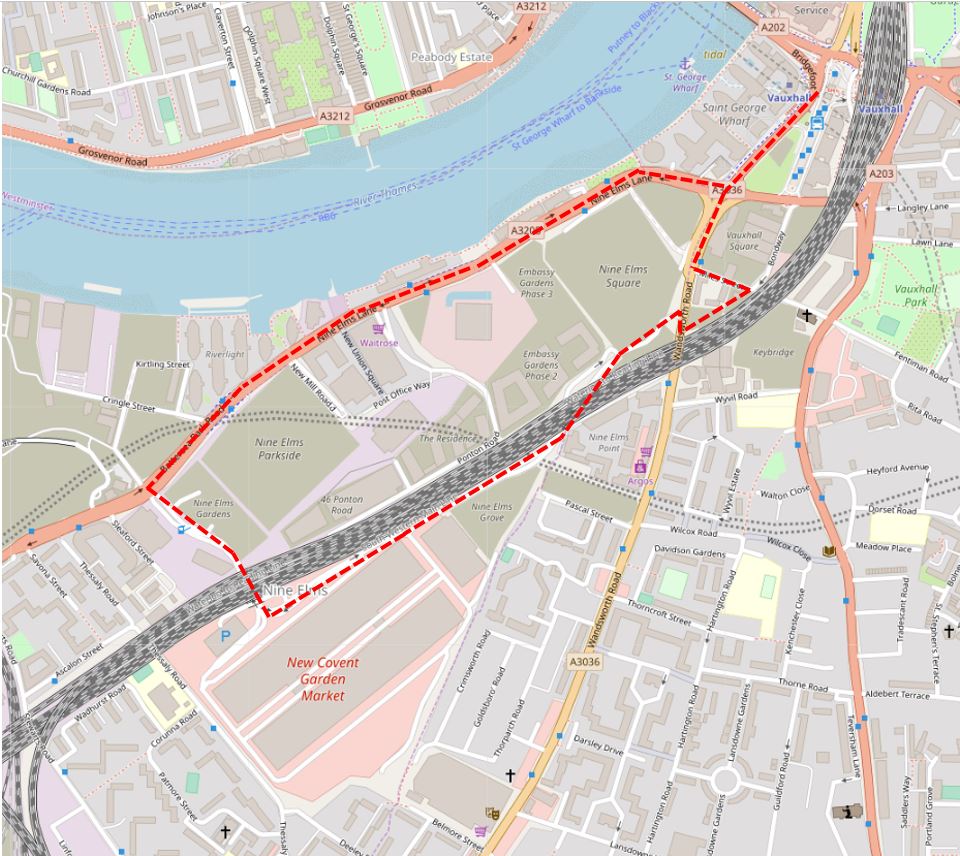
Walking across Vauxhall Bridge, I headed along Wandsworth Road to find the houses I had seen from the train. I have marked my full route around Nine Elms on the following map.

Nine Elms

Maps  © OpenStreetMap contributors. 

I have also added the times each photograph was taken to record a January Sunday morning in Nine Elms.

09:43

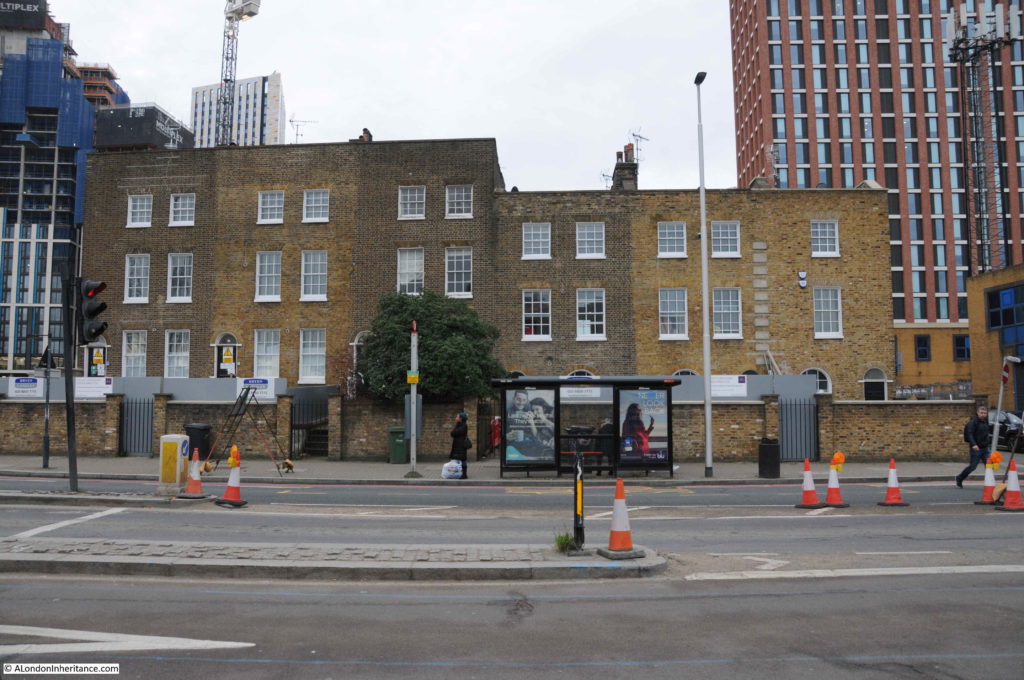
I found the houses I was looking for a short distance along the Wandswoth Road, just before the junction with Miles Street. A terrace of six houses with three taller on the left and three shorter on the right.

Nine Elms

Of the six houses, a couple look as if they have been cleaned whilst the house on the far right looks rather strange when compared with the other five, one window per storey rather than two. They currently appear to be providing office space for activities associated with the redevelopment of the area.

Although Nine Elms may be considered a rather unattractive area, it has a fascinating history and has been a key location in the development of the railway system to the south of London.

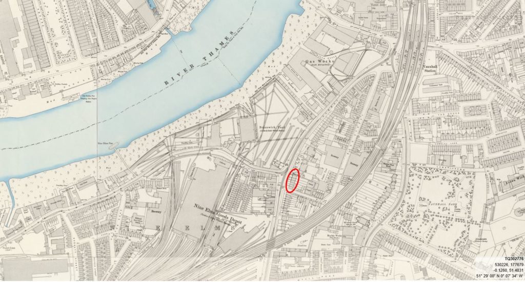
The 1895 Ordnance Survey map provides a good overview of the area following the first wave of development, and also locates the houses that still stand on the Wandsworth Road.

The following extract from the map shows the railway running into Waterloo Station towards the top right of the map. The area between the railway viaduct into Waterloo and the river has a considerable amount of railway infrastructure, including the Nine Elms Depot, however there are also pockets of housing with an oval shaped area between Wandsworth Road and the viaduct and it is here that we can find the six houses.

Nine Elms

Credit: ‘Reproduced with the permission of the National Library of Scotland’ 

I have circled the six houses on the map, at the junction of Miles Street and Wandsworth Road. They are almost the only survivors from the nineteenth century, and it is surprising that these houses have lasted through successive waves of redevelopment.

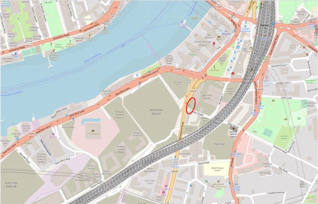
The following map shows roughly the same area today as the 1895 map, again I have marked the location of the six houses.

Nine Elms

There is so much history in this area. In the first decades of the 19th century, various schemes were looked at to try and speed up the transport of goods and people arriving by sea into London, as from the Atlantic, the route along the south coast then along the Thames added a number of days and were dependent on weather and tide. One scheme considered the construction of a canal from Portsmouth to London, but in 1831 initial plans were made for a railway from Southampton to London, with the London terminus at Nine Elms.

Construction of the railway from Nine Elms to Southampton started with the route to Woking Common in 1838. In 1846, a train pulled by an engine named “The Elk” ran from Southampton to Nine Elms in 93 minutes. By comparison, an on-time journey today takes around 80 minutes, so not a significant difference (although there is no mention of the number of intermediate stops for “The Elk”).

Nine Elms closed as a passenger station ten years later when the viaduct into Waterloo was built and the London terminus of the railway moved to the first Waterloo Station. Nine Elms then provided space for a Locomotive Works, which closed in 1909 when the works moved to Eastleigh in Hampshire. Nine Elms also provided space for a large Goods Yard and this continued in operation until 1968.

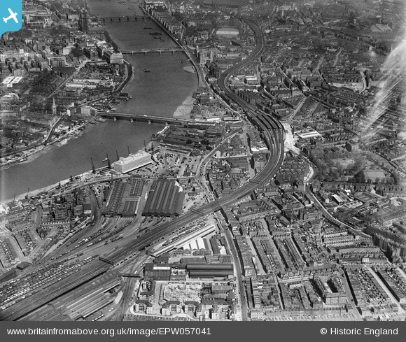
This photo from 1938 shows the scale of the railway sheds and goods yard at Nine Elms.

Nine Elms

This post is already too long, so I will leave the history of the railways in Nine Elms for another time, and continue walking.

09:44

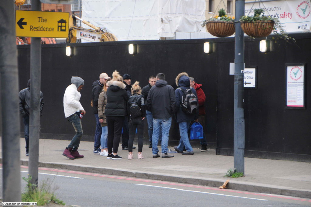
There was a continuous stream of people walking along Wandsworth Road, and just to the left of the six houses, one of the illegal betting scams normally seen on Westminster Bridge was in action, looking to take money from those streaming past – and probably those less able to manage the inevitable loss.

Nine Elms

This is obviously a problem in the area as there are signs up along the street advising people not to participate in these activities.

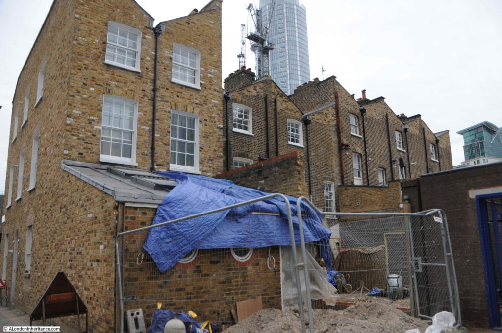
I walked past the houses and tuned into Miles Street and walked down to take a look at the rear of the buildings.

09:45

Nine Elms

This explained why one of the end houses looked so different. The view from the back shows that the end house appears to be a new build. The other houses in the terrace look original from the rear.

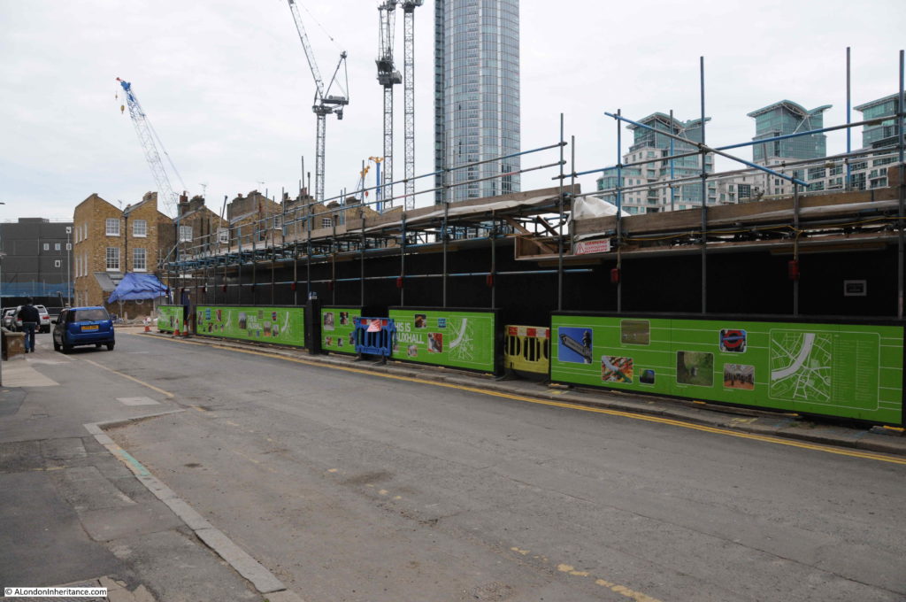
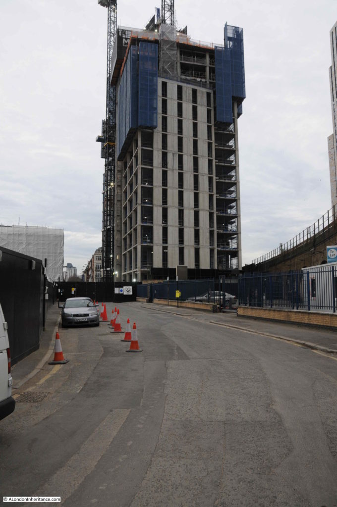
Hoardings lined the edge of Miles Street, hiding the areas of demolition that had opened up the view of these houses from the railway. There were a couple of gates where it was possible to peer through.

09:46

Nine Elms

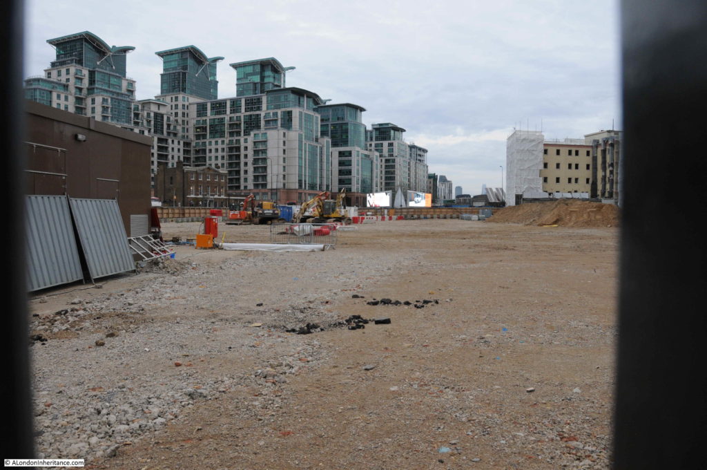
The above photo is looking through a gate onto the open space between the six houses (on the immediate left) and the railway viaduct (out of view on the right). Vauxhall is in the distance and only part of the space is visible, there is more to the right. The demolition of the buildings in this area opened up the view of the six houses from the railway.

09:47

Nine Elms

The above view is from the point where Miles Street meets the railway viaduct. The large open space is behind the hoardings on the right and the six houses can be seen in the distance.

09:47

Just before the point where Miles Street passes under the viaduct there is a street running towards Vauxhall. The following photo shows this street and also highlights one of the problems of walking around this area, so many streets have been closed off for construction. This is happening so rapidly that online maps such as Google and OpenStreetmap are not up to date with changes in the area.

Nine Elms

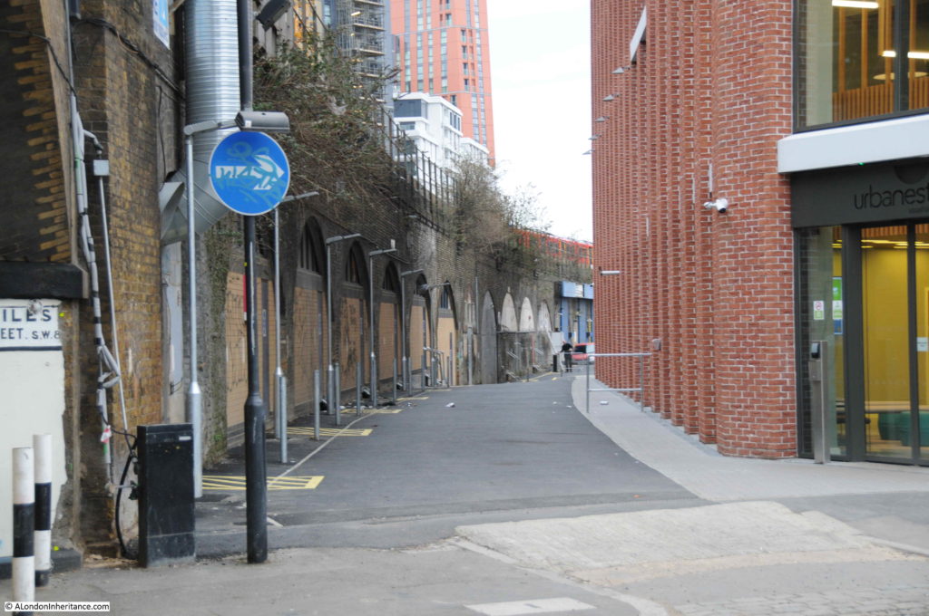
The above view is looking along the viaduct towards Vauxhall and Waterloo. Looking in the opposite direction and there are new buildings and a walkway alongside the viaduct – this was the direction that I decided to follow.

09:47

Nine Elms

A newly surfaced walkway runs alongside the viaduct and what appears to be a new student accommodation building on the right.  Further along this walkway is a rather strange survivor from the 19th century.

09:49

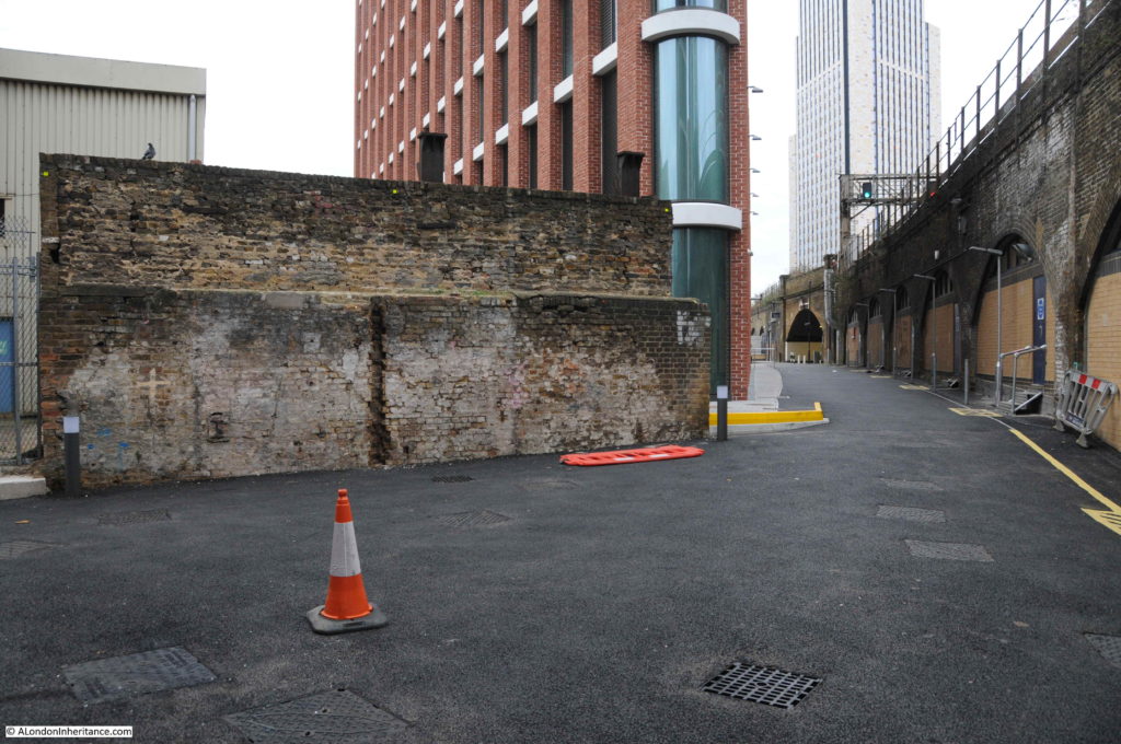
At the end of the student accommodation building is this strange wall.

Nine Elms

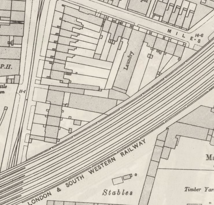
On the opposite side of the wall is a small electricity substation, so I am not sure if this is the reason why the wall has survived, I can see no other reason. The wall is not at right angles to the viaduct, it is slightly angled. The following is a detailed extract from the 1895 Ordnance Survey map. Miles Street is at the top and the route of the walkway is from Miles Street down, along the edge of the viaduct. Halfway along there is a large building, at an angle to the viaduct. I suspect that the wall is the remains of the uppermost wall of this building, the section where it is joined on to the smaller building at the end of the Laundry.

Nine Elms

No idea why the wall has been retained, however I really do hope that it remains exactly as it is, a shadow of the many buildings that once occupied this area over a century ago.

09:49

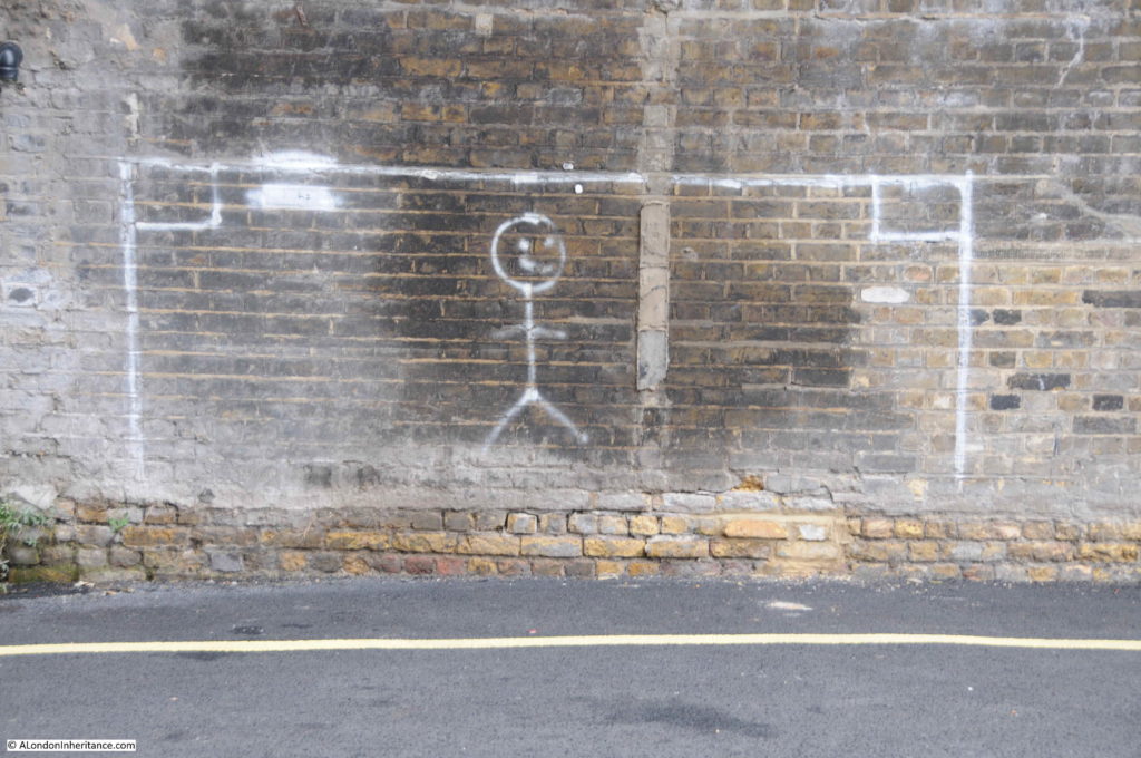
Goal on the viaduct:

Nine Elms

The end of the walkway joins Wandsworth Road, which I crossed over to walk along Parry Street. This is a narrow street that heads underneath the viaduct.

09:54

A look back down Parry Street at the continuous stream of people:

Nine Elms

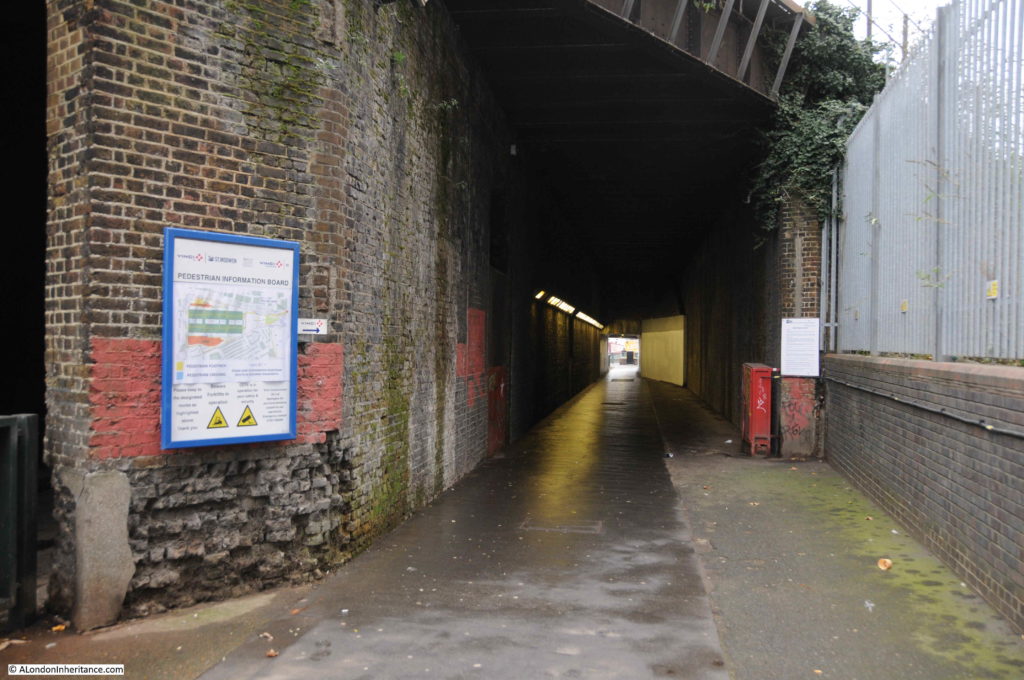
There are a couple of tunnels underneath the viaduct. The majority of people were taking the direct road route, I spotted a narrow entrance and went to take a look at what was intended to be the pedestrian route under the viaduct.

09:55

Nine Elms

I love railway viaducts. They are brilliant examples of Victorian construction, and whilst train passengers pass above, there is a different world of passages and arches underneath.

09:56

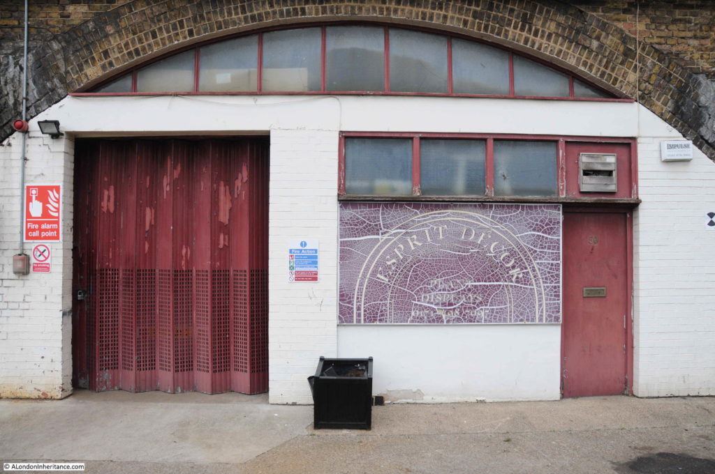
Reaching the other side of the viaduct and there are a number of businesses operating in the arches. Espirit Decor:

Nine Elms

09:56

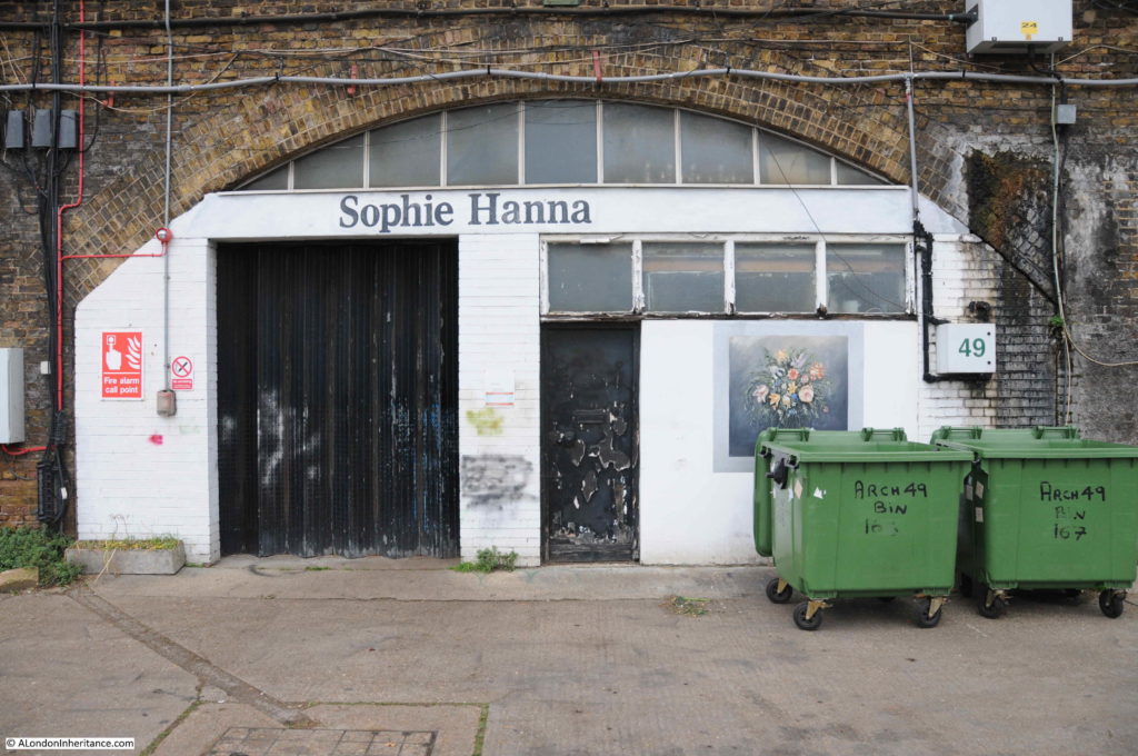
And Sophie Hanna Flowers (a logical location given the flower market which I will soon find).

Nine Elms

09:57

Directly opposite is the Nine Elms construction site for the Northern Line extension from Kennington to Battersea,Nine Elms
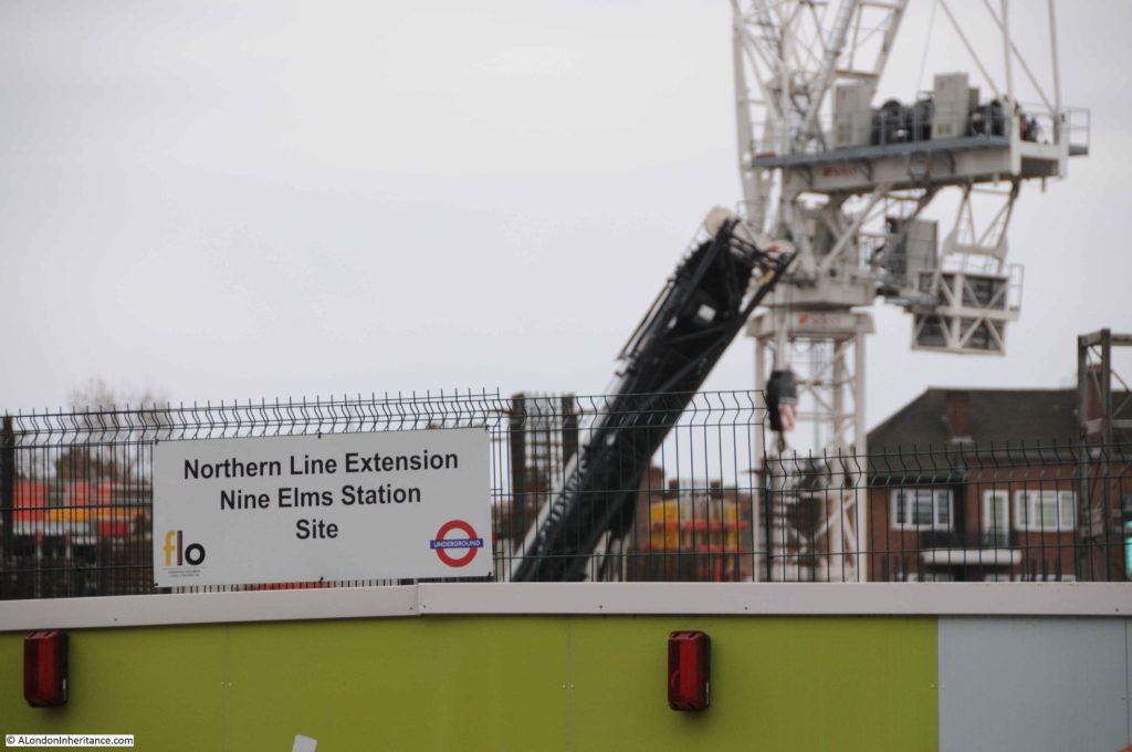
09:57

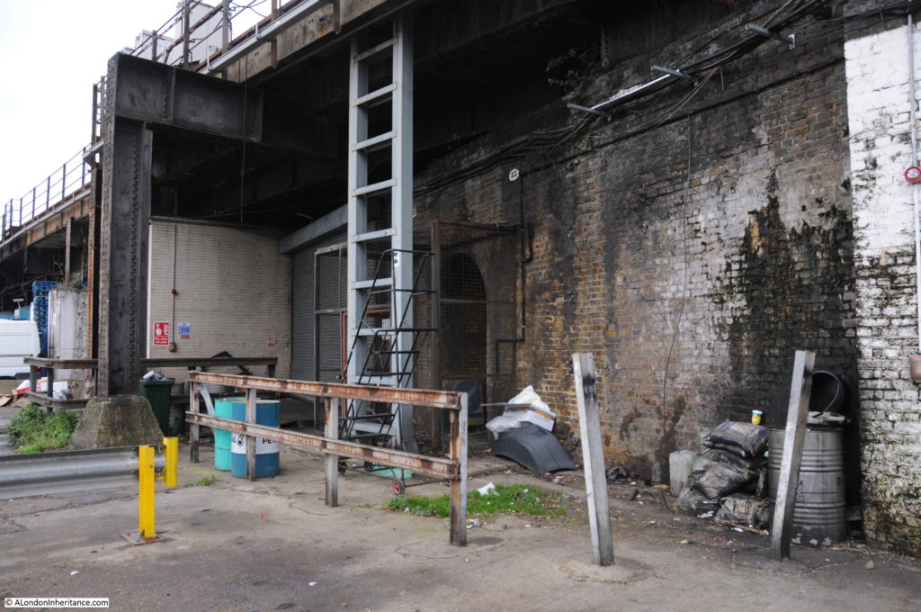
The viaduct now takes on a different appearance with infrastructure to service the tracks above and parking / workshop space for the considerable number of vans that wait here ready for their early weekday morning activity.

Nine Elms

10:00

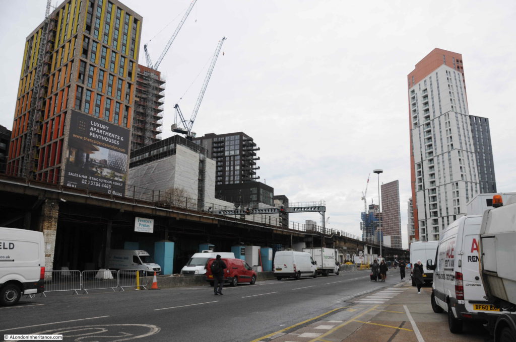
I had to wait for a gap in the stream of people walking along the road to take the following photo.

Nine Elms

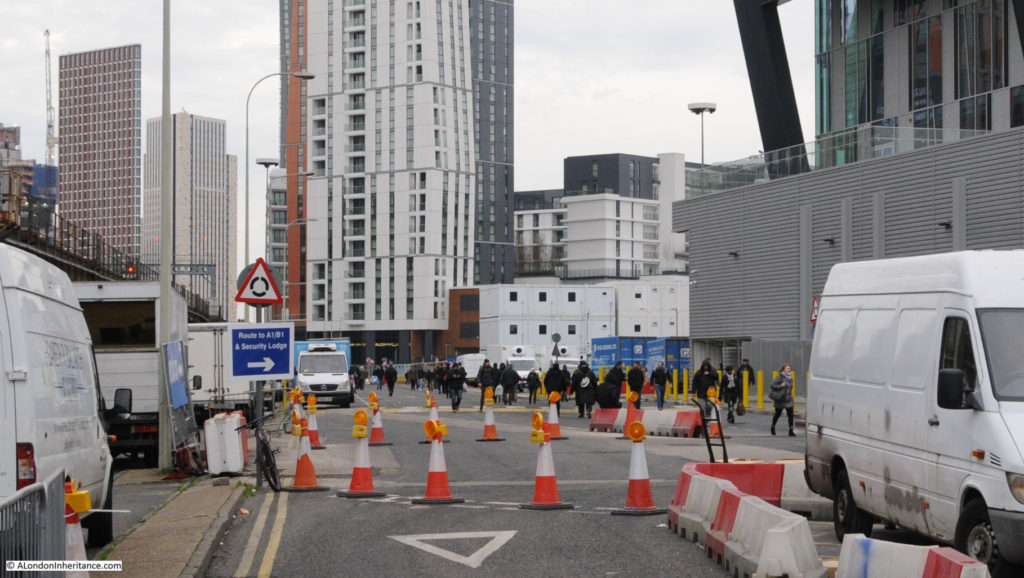
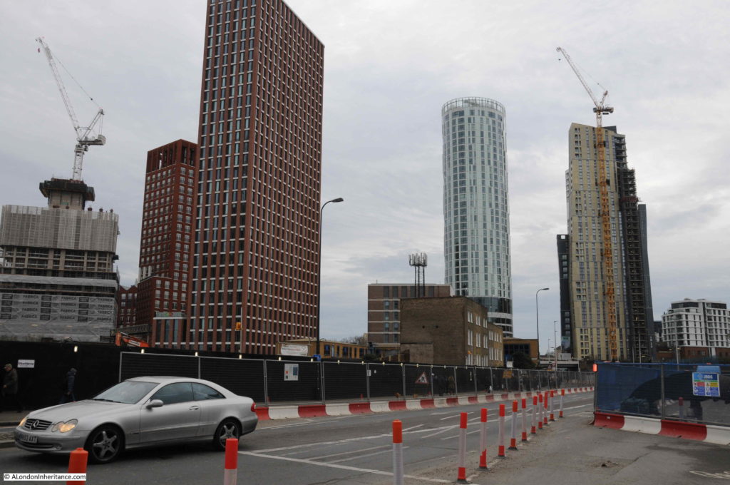
The photo does not really convey the view. I am standing surrounded by vans, a stream of people, wrapped up against the January cold and carrying bags, pulling shopping trolleys and wheeled suitcases walk below the railway tracks. Around them tall apartment blocks grow, each with a design that appears completely uncoordinated with any other, as if each had been designed in isolation and dropped from above onto Nine Elms.

This being a Sunday, the railway is relatively quiet. In the week a stream of trains would be taking commuters from the suburbs of London, the villages of Surrey, Hampshire and beyond into the city.

On the other site of the railway, huge signs advertise luxury apartments and penthouses.

10:01

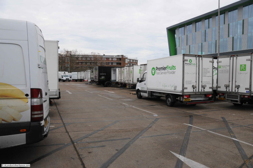
Turning round and there is a large car park full of vans – this is New Covent Garden Fruit and Veg Market.

Nine Elms

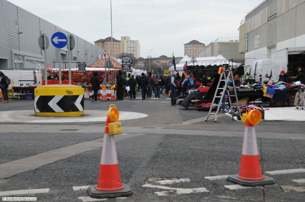
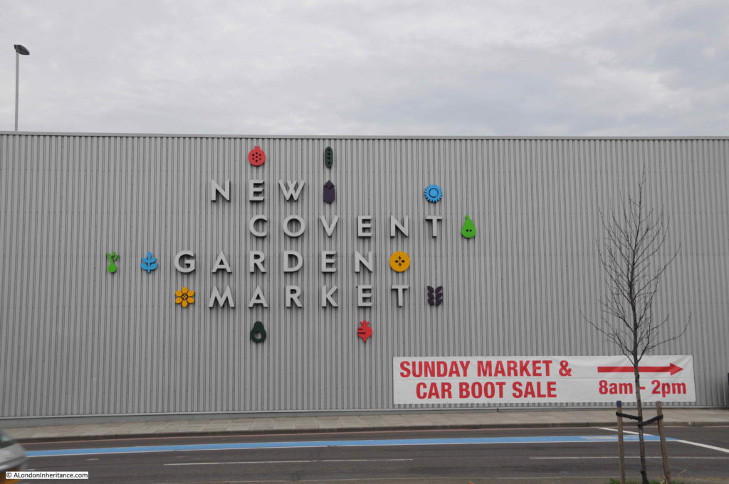
Just past the first market buildings was the reason for so many people walking along these streets on a Sunday morning as a large Sunday Market and Car Boot Sale operates here from eight in the morning to two in the afternoon.

10:03

Nine Elms

This is not a market for arts and crafts, this is market for the basics in life. I did not have time to explore the market apart from a quick walk along a couple of aisles where there are clothes, bags and cases of every description, tools, mobile phones and tablets.

It would have been good to take photos in the market, but the last thing the people who have come shopping here on a cold Sunday in January want is some bloke taking photos.

The market appears to be known as a source for second hand tools. On my walk back to Vauxhall, a man with an east European accent asked where the tool market was. He had just arrived in the country looking for work and needed to find some cheap tools to get started. How many times has that happened in London over the centuries.

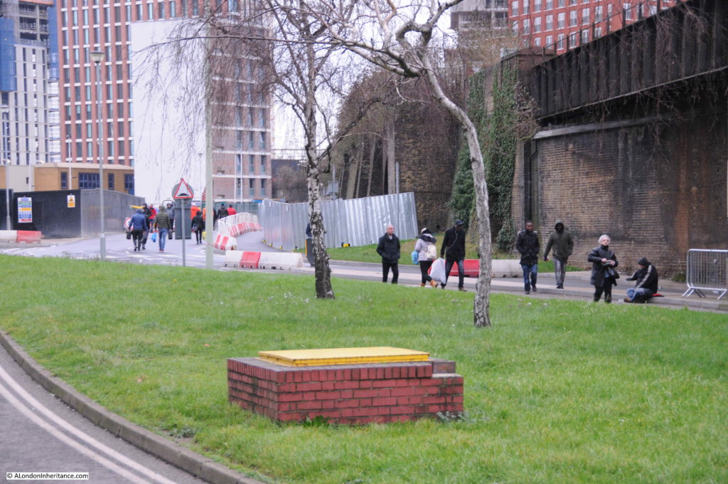
The market is very busy, the photo below shows the number of people walking to and from the market.

10:07

Nine Elms

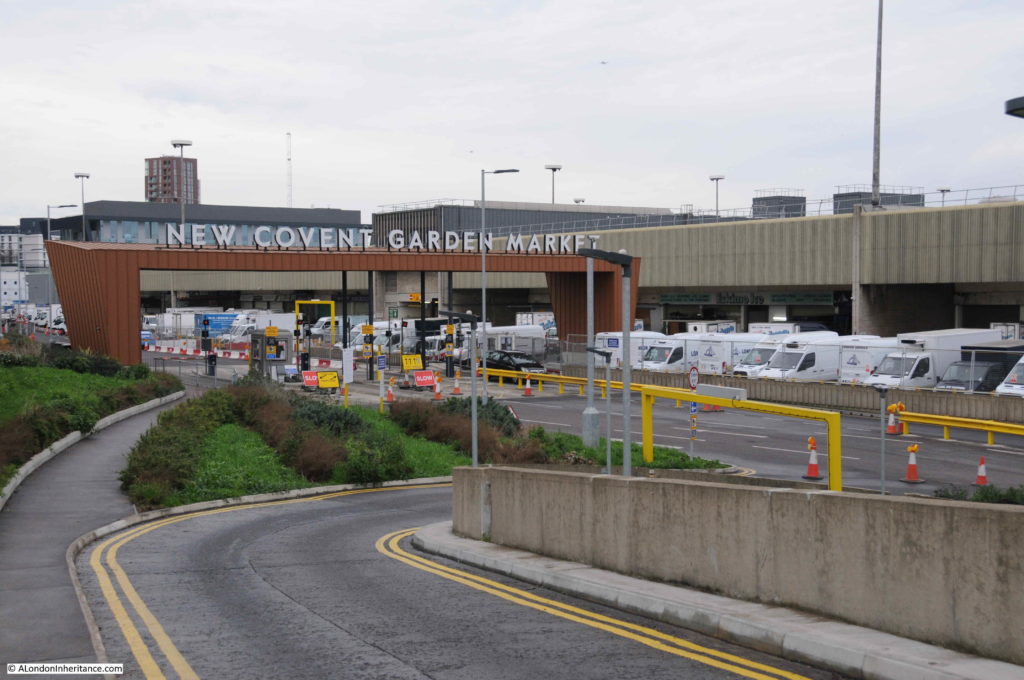
Continuing on, I walked through the man entrance to New Covent Garden Market.

10:10

Nine Elms

Covent Garden Market had outgrown its original location by the early 1960s. Lack of space for expansion and congestion on the surrounding roads required a new location to be found. The Nine Elms site was identified in 1961 and construction of New Covent Garden started in 1971. The Fruit & Veg and Flower Markets moved from Covent Garden to Nine Elms in November 1974 to sites to the south and north of the railway viaduct.

The southern market has been demolished and relocated (which I will find soon), but the main fruit and veg market continues in the original 1974 location and many of the buildings have recently been rebuilt and refurbished, with further construction ongoing.

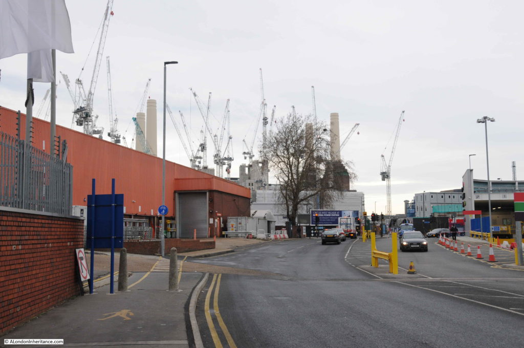
The market has a dedicated road tunnel under the railway viaduct allowing access to and from Battersea Park Road, so this is the route I took. Passing under the railway and the cranes surrounding Battersea Power Station come into view, further emphasising the sheer scale of the construction projects between Vauxhall, Nine Elms and Battersea.

10:15

Nine Elms

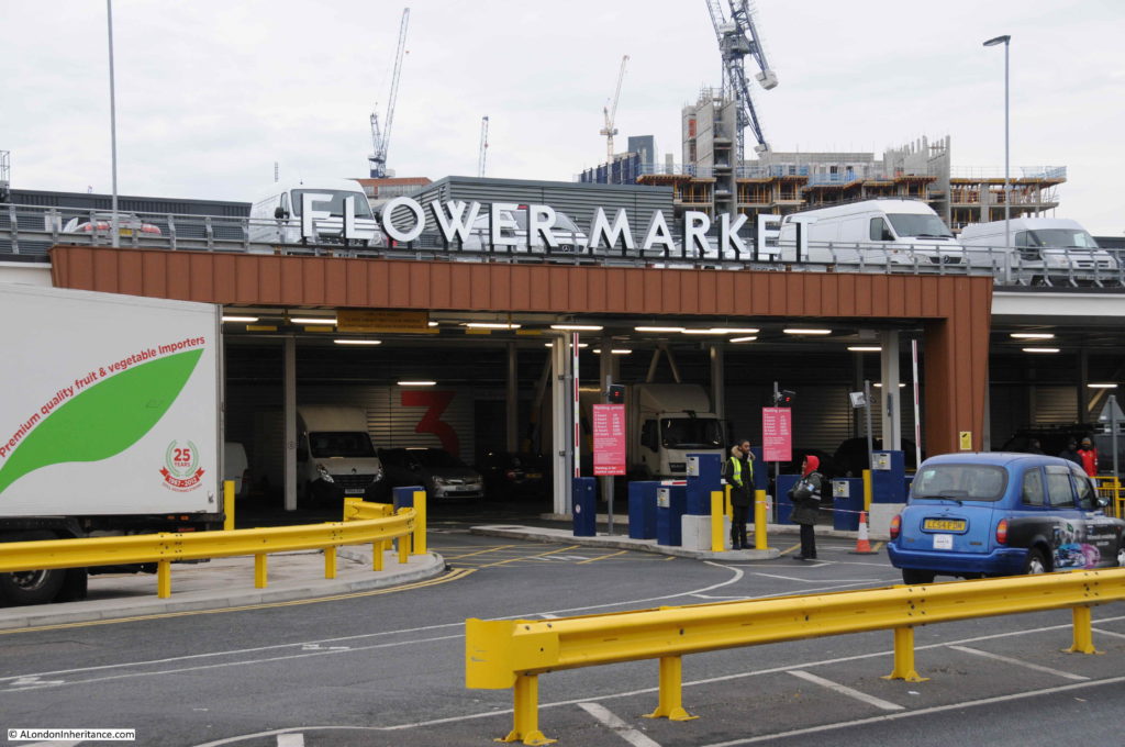
It is along this road, just under the railway viaduct, that the new Flower Market has been located.

10:17

The entrance to the Flower Market:

Nine Elms

The Flower Market was opened in April 2017 having moved from a location further down towards Vauxhall. That original site has now been demolished and cleared ready for new construction.

10:20

The new – New Covent Garden Flower Market in Battersea Park Road:

Nine Elms

Completing a circular route, my plan was now to walk back along Battersea Park Road and Nine Elms Lane to where I started in Vauxhall. It is along here that some of the original apartment blocks from this recent phase of development can be found.

10:32

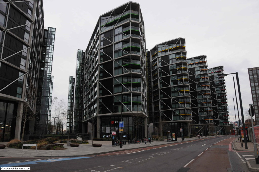
When redevelopment started, it was on the bank of the river, and over the last few years has continued back inland. Between Nine Elms Lane and the River Thames are five blocks of identical design/

Nine Elms

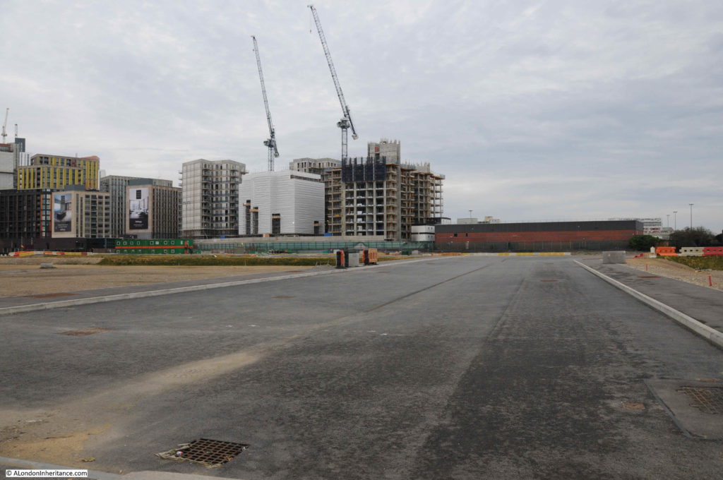
On the opposite side of Nine Elms Lane, large areas of land have been cleared. The roads are ready and utility services laid underneath the roads ready to service the buildings that will spring up on either side.

10:36

Nine Elms

10:38

Opposite is Cringle Street which leads to the large construction site surrounding Battersea Power Station:

Nine Elms

Further along Nine Elms Lane there are a number of completed buildings.

10:40

A very quiet January Sunday morning:

Nine Elms

Walking further along Nine Elms Lane and I found probably the most publicised building in the Nine Elms redevelopment.

10:48

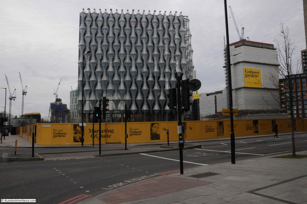
This is the new United States Embassy:

Nine Elms

It is January, it is a grey day, it is a Sunday morning so there are not many people around, the building is surrounded by construction sites, however comparing the new location to the original location in Grosvenor Square – it is very different.

I am sure it will be a much improved environment when the rest of the redevelopment of Nine Elms is complete. The hoardings around the site between road and Embassy are for the residential blocks that will be built here – the Embassy Gardens development. Based on the photos of potential residents on the hoardings around the building site, I doubt I fall within their age demographic.

10:50

Further down Nine Elms Lane:

Nine Elms

10:55

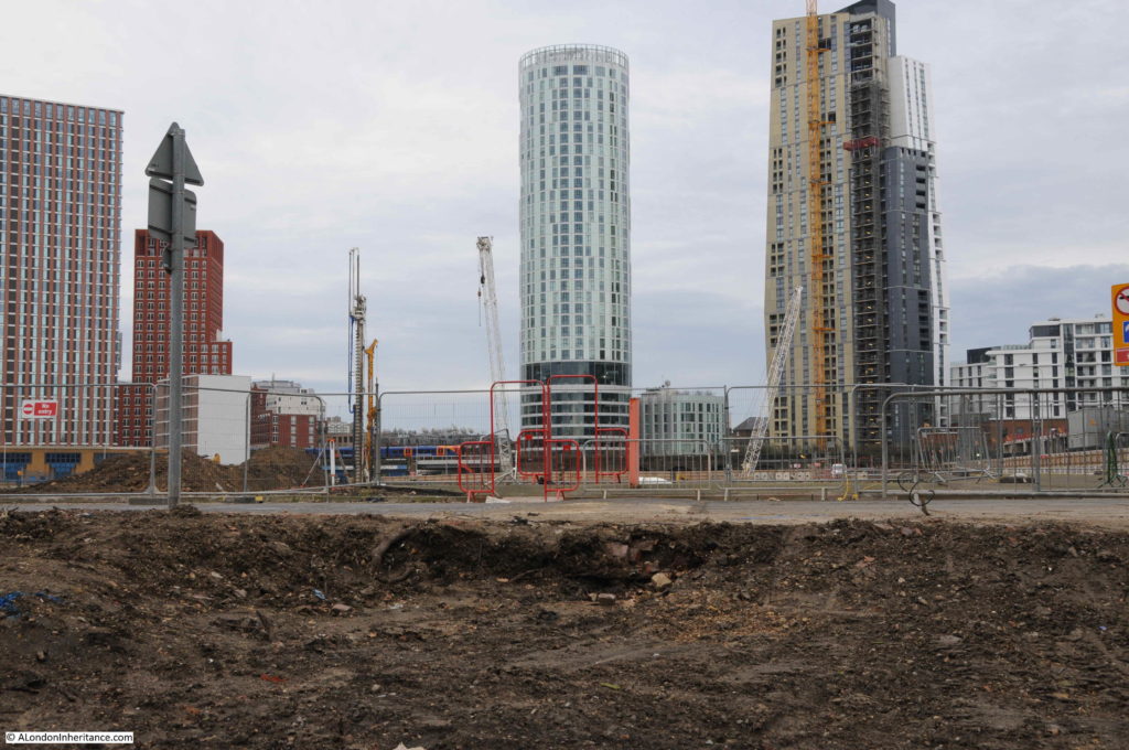
Continuing along Nine Elms Lane and there is another large space cleared and ready for new construction. This was where the original flower market was located.

Nine Elms

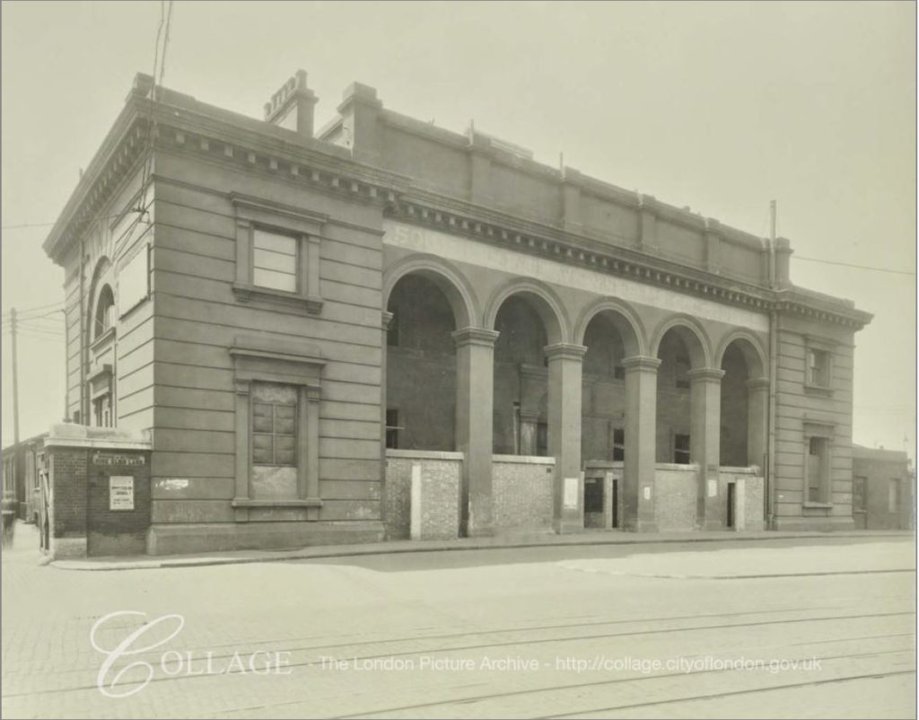
And if I have calculated the location correctly, it was also somewhere here that the original London terminus of the Southern Railway was located.

This was the street entrance of the terminal building in 1942. The building suffered bomb damage during the war and was demolished in the 1960s ready for the construction of the New Covent Garden Flower Market in 1974.

Nine Elms

Image credit: London Metropolitan Archives, City of London: catalogue ref: SC_PHL_02_0629_F898

10:56

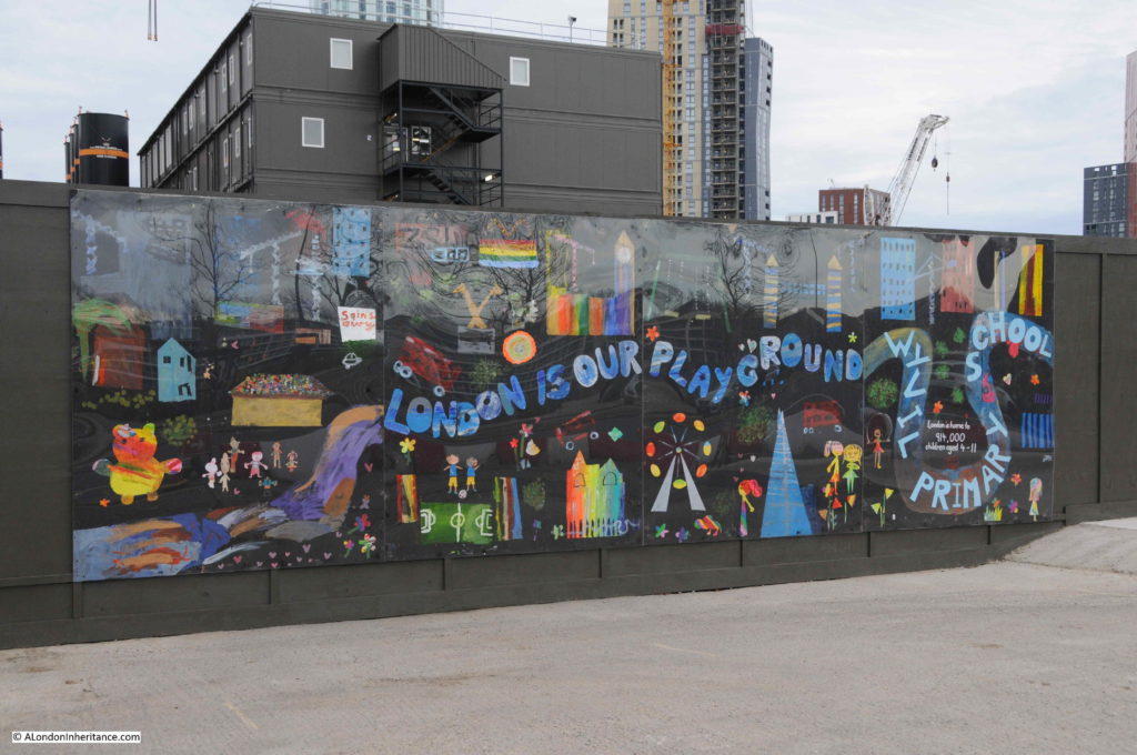
Mural by Wyvil Primary School – the mural informs that London is home to 914,000 children between the ages of four and eleven.

Nine Elms

I now reached the junction of Nine Elms Lane and Wandsworth Road.

10:57

From here I could look down Wandsworth Road again to see the houses that were the reason for spending Sunday morning in Nine Elms.

Nine Elms

It is a wonder that they have survived so long, given the closure of the railway station, workshops and good yards which were the catalyst for development of the area. The houses are probably of the same age as the original Nine Elms station.

The houses and the strange length of wall in the walkway alongside the viaduct are the only survivors from the 1895 map that I found, apart from the railway viaduct.

No idea what will happen to the houses. I hope they survive the latest phase of development and having seen the railway come and go, the Flower Market almost opposite built and demolished, they will now be surrounded by the towers that are springing up all around them.

11:10

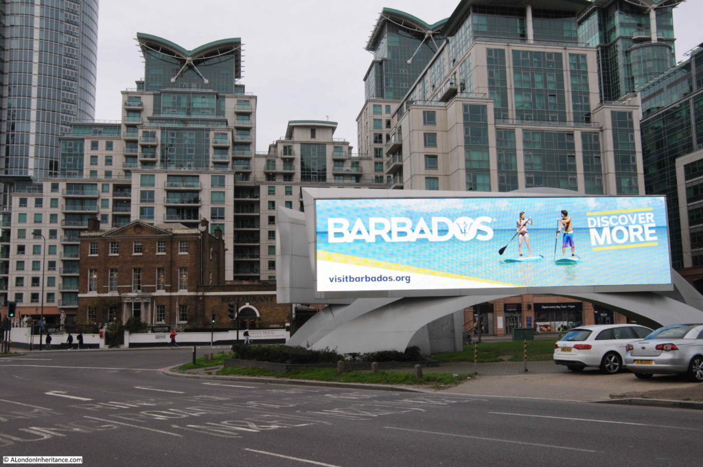
At the junction of Nine Elms Lane, Wandsworth Road and Parry Street, the bright lights of Barbados shine on those still streaming from Vauxhall Station to the Sunday Market.

Nine Elms

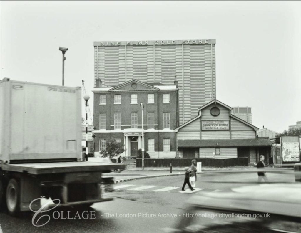
And as one final comparison photo, the old Brunswick Club building with the residential blocks behind in the above photo and the Nine Elms Cold Store in the photo below.

Nine Elms

Image credit: London Metropolitan Archives, City of London: catalogue ref: SC_PHL_01_258_71_7183

Nine Elms is probably not high up on the list of walks in London, however I found it fascinating. The sheer scale of the redevelopment work, with the extension down to Battersea Power Station, is remarkable. Not just above the surface, but also below ground with the Northern Line extension. The Sunday Market also serves those who need somewhere to buy cheap goods and for those seeking to start a life in London.

Nine Elms has been through two development phases. Originally as the first Southern Railway terminus in London, then with the associated locomotive works and goods yard, then as the site for Covent Garden’s relocated fruit, veg and flower markets with other light industrial business. Now a third phase as Nine Elms transitions to a mainly residential area, however it is good to see that the market will stay here.

There is still much to explore in Nine Elms, and when I return I will check to see if the six houses have survived along with the strange wall alongside the viaduct.

alondoninheritance.com

Curious Battersea

Curious London was the title of a small book published in 1951 by Hugh Pearman. The author was a London Taxi Driver and in the book there are two pages for each of the “twenty-nine boroughs and cities that make up the county of London”. I have already hunted down the Southwark sites from the book, and for this week’s post I went on a walk to find the six locations Pearman covered in the book for Curious Battersea.

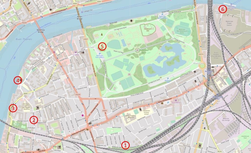
I have shown the locations on the map below. They are numbered differently to the order in which they appear in the book. I started at Clapham Junction and walked to Battersea Power Station and changed the site ordering to better fit my walk.

Curious Battersea

Map  © OpenStreetMap contributors. 

The first location was a problem before I set out on the walk. At the time little did I know it was not so far from Clapham Junction Station.

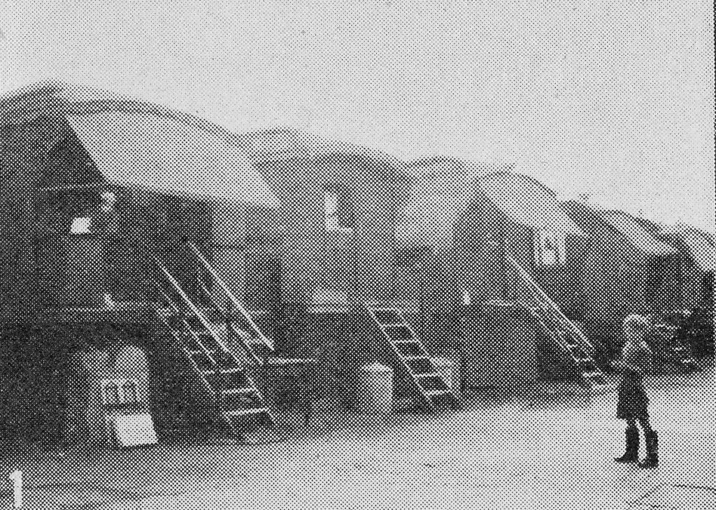
Site 1 – “Down by the railway tracks, hemmed in by streets of little houses, is this caravan encampment. Some of the dwellers in the old vans claim to be of pure Romany stock. Their ancestors came, so they say, year after year in the long ago when all around was Surrey countryside”.

This was Pearman’s caption to the photo below:

Curious Battersea

I failed to find the possible location of Pearman’s photo before walking the area. There are no clues in Pearman’s book. I have subsequently found a possible location as Sheepcote Lane which I have marked as point 1 on the map.

One side of Sheepcote Lane is of terrace housing and on the other side of the street is a grassed area between the road and the railway tracks, so as Pearman describes as being “down by the railway tracks” this could be the location.

I found the reference to Sheepcote Lane in a presentation by Dr. David M Smith of the University of Greenwich titled Gypsies and Travelers in Housing: adaptation, resistance and the reformulation of communities., which refers to Sheepcote Lane being occupied in the 50s, which is the same time period as Pearman’s book.

I will need to return to photograph the street and update this post.

The first location that I could identify in Curious Battersea was a walk from Clapham Junction station down to Battersea High Street to find:

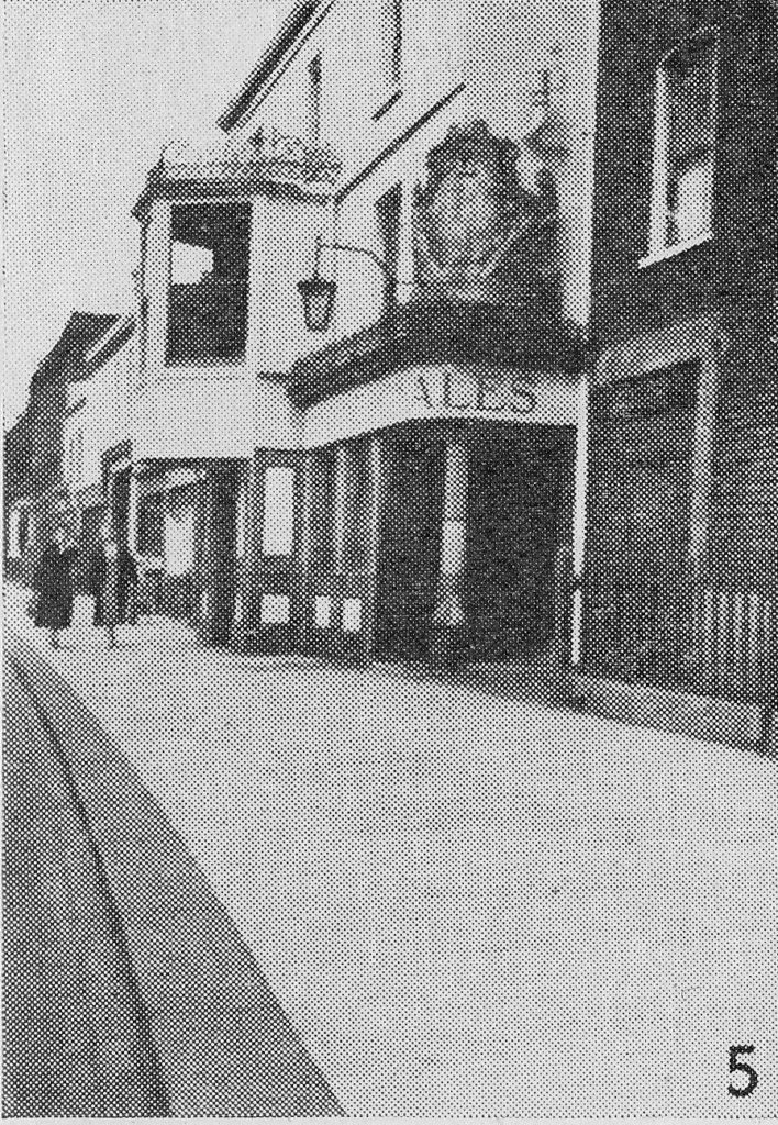
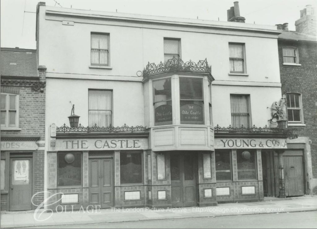
Site 2 – “In the High Street is this 17th century bow-windowed inn, the ‘castle’, a picturesque reminder of coaching days.”

Curious Battersea

A pub has been on the site since the very early 17th century. Pearman’s text claims that the building in his photo is the 17th century Inn, however I am not sure that all the features are from the original pub. Features such as the bow window may have been retained, but the facade does look of later construction.

There is what appears to be a large crest on the front of the pub, facing the camera. The small photo in the book does not provide any detail on the crest.

The pub did not last for too many years after Pearman’s book. It was demolished in the 1960s along with the buildings to the left and right of the pub. New flats were built to the left and a new pub (retaining the Castle name) was constructed on part of the site of the original Castle and slightly to the right.

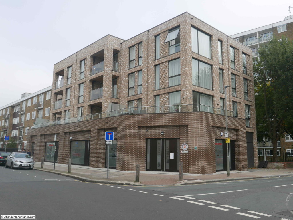
This 1960’s Castle pub was demolished in 2013 and the site is now occupied by flats:

Curious Battersea

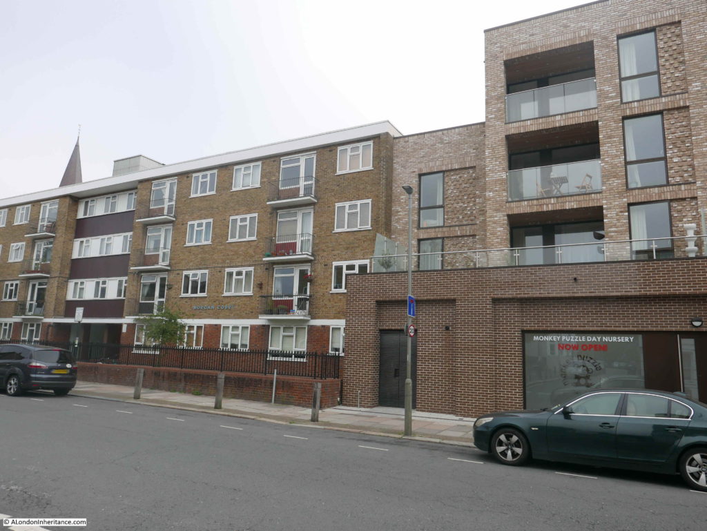
Checking the 1895 Ordnance Survey map, the Castle as photographed by Pearman was mainly on the site of the new flats, but also on part of the 1960s flats to the left in the photo below.

Curious Battersea

I was not aware that it was there, but found after walking the area, that the 1965 plaque from the 1960s pub is on the wall of the new flats – the wall that faces onto the open space on the ground floor on the 1960s flats to the left. The plaque records that the original Castle was built circa 1600 and rebuilt in 1965. The plaque also records that in 1600, mild ale was 4 shillings a barrel (equivalent to 1/4 d (old pence) a pint) and in 1965 was 1 shilling and 5 pence a pint.

Another reason to return to Battersea and photograph the plaque.

The London Metropolitan Archives, Collage site has a photo of the Castle in 1961, just a few years before demolition.

Curious Battersea

Image credit: London Metropolitan Archives, City of London: catalogue ref: SC_PHL_02_0965_62_255

Although I missed the 1965 Castle plaque, I did find some other interesting features in Battersea High Street.

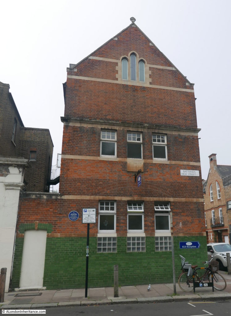
This three storey building is occupied by the Katherine Low Settlement.

Curious Battersea

The plaque on the first floor records the Cedars Club, founded in 1882 and rebuilt in 1905, whilst the blue plaque to lower left records Katherine Mackay Low, 1855 to 1923, a philanthropist in whose memory the settlement was founded on the 17th May 1924.

Katherine Mackay Low was born in Georgia in the USA to British parents. When her mother died in 1863 her father returned with his family back to UK, and when he died, Katherine settled in London. Her father was a merchant and banker so her inheritance was probably the source of her independence and philanthropy.

The land occupied by the Katherine Low Settlement was originally part of the grounds of the vicarage of the Vicar of Battersea (the large building, part of which can just be seen to the left of the above photo). The railway cut through the grounds of the vicarage in 1860 and due to this disruption the vicar moved out of the house.

In 1872 the old vicarage building was occupied by a settlement established by two Cambridge colleges. The purpose of the settlement was the support of the poor in the area, which was much needed in this area of Battersea in the latter decades of the 19th century.

The Cambridge colleges settlement established the Cedars as a boys club and mission and in 1905 the three storey building was constructed between the old vicarage and Orville Road.

Katherine Mackay Low died in 1923 and funds were raised to create a legacy in her name. The Cedars building was purchased and the Katherine Low Settlement was established.

The Settlement continues to this day, in the same building as a local community charity.

Whilst researching these posts, I stumble on events of which I was completely unaware. Searching newspapers for the Katherine Low Settlement, there was one date when many newspapers mentioned the settlement, but it was through a disaster rather then the works of the settlement. The first in-flight fire of a passenger flight. From multiple newspapers on the 4th October 1926:

“One of the worst disasters in the history of the Paris-London air lines occurred on Saturday afternoon near Tonbridge, Kent. A big French four-engine Bleriot plane from Le Bourget aerodrome was seen to be in difficulties, and flames were observed coming from the rear. Slowly the great machine turned turtle, and then fell like a stone into a field. Farm workers ran to render help, but so fierce was the heat that no one could approach it, and every soul on board perished.

Mr. J.H. Webb, a butler at an adjoining house, the first man on the scene, said ‘I was in the pantry when I heard the noise of an aeroplane passing overhead. As I looked through the window I saw the machine suddenly burst into flames and nose-dive to the ground. I shouted for assistance and, with some of my fellow-servants, rushed to the spot. Through the roaring flames I saw the terrified features of a woman passenger. We made an attempt to get to the woman’s assistance, but before we could approach her she was totally obscured by flames and smoke. The moment I saw my chance, however, i did succeed in dragging out a lady wearing a silk dress, but I was too late. She was very badly burned and quite dead.'”

The Settlement and Battersea connection comes when the article lists the casualties of the crash, one of whom was Miss Gertrude P. Hall, aged 43 of The Katherine Low Settlement, High-street, Battersea who was described as “a lady of independent means who devoted herself to philanthropic work.” 

Gertrude Hall must have been one of those who contributed to the founding of the Katherine Low Settlement just a few years earlier.

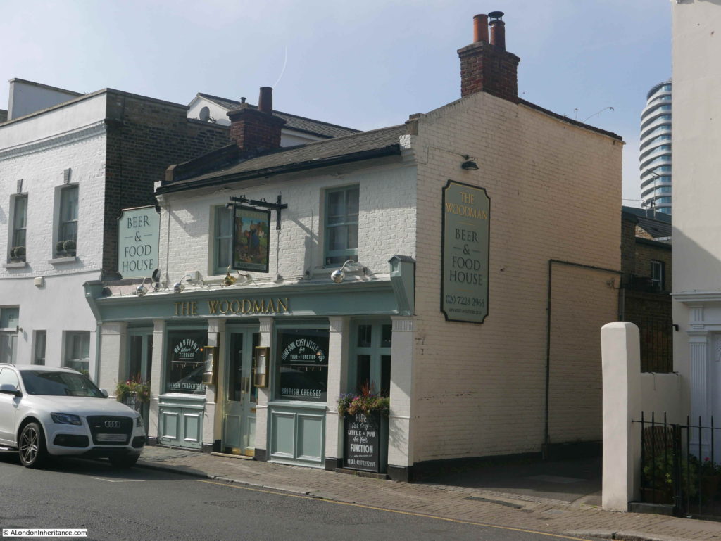
I walked further along Battersea High Street and although the Castle has been lost, there is still a pub in the street. This is the rather excellent, mid 19th century pub, The Woodman.

Curious Battersea

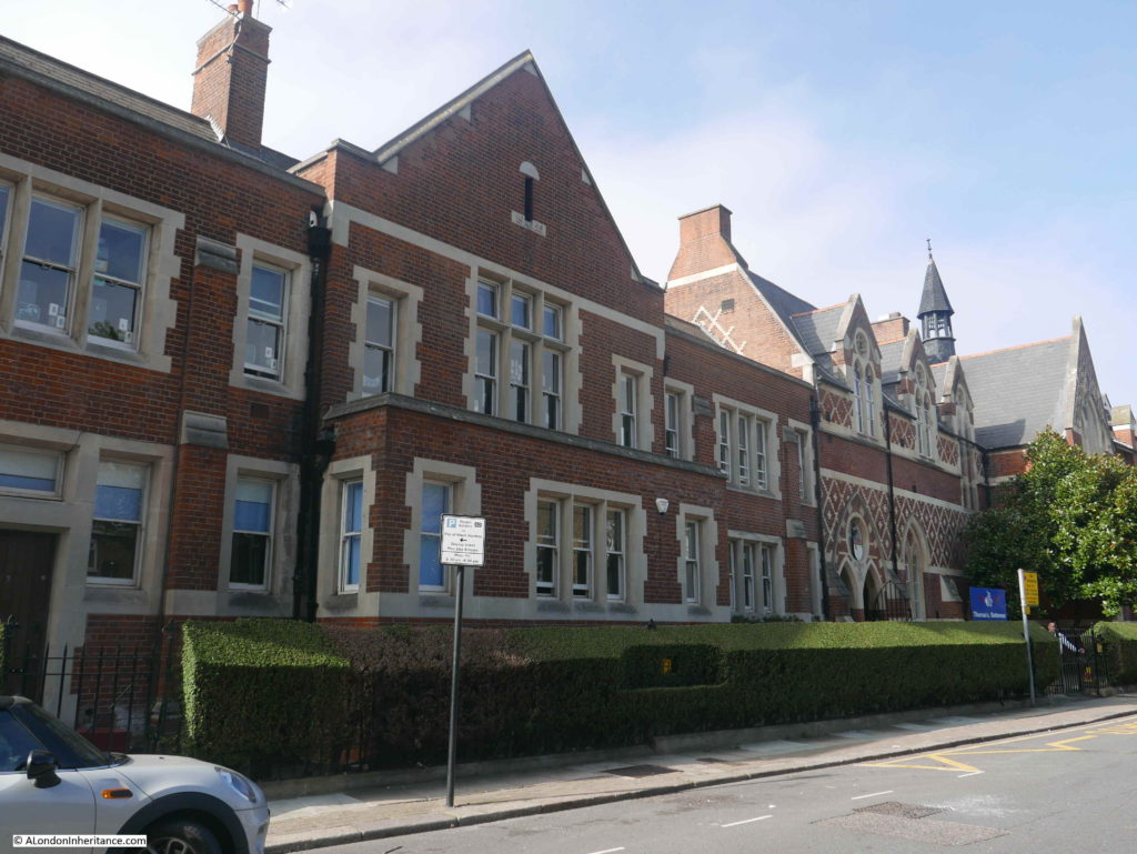
Further along Battersea High Street is the building constructed for the Sir Walter St. John’s School:

Curious Battersea

Sir Walter St. John of Battersea founded a charity in 1700 for the education of poor boys of the parish. The school expanded over the years with increasing number of boys and the inclusion of girls.

The enlarged school was constructed in 1859 and the school underwent various rebuilds, modifications and upgrades over the following years.

The school became a grammar school after the war, however in the following years the school went through various changes where pupils were integrated with other schools, classes moved and eventually, with a falling local birthrate, the school was closed in 1986.

The buildings were purchased in 1990 by Thomas’s London Day School, one of a group of Thomas’s independent schools within London.

I do not know whether it was due to the growth in numbers, or the desire to separate boys and girls, however in the 1850s the girls from the school were moved to Mrs Champion’s School, and the buildings of this school can still be found in nearby Vicarage Crescent:

Curious Battersea

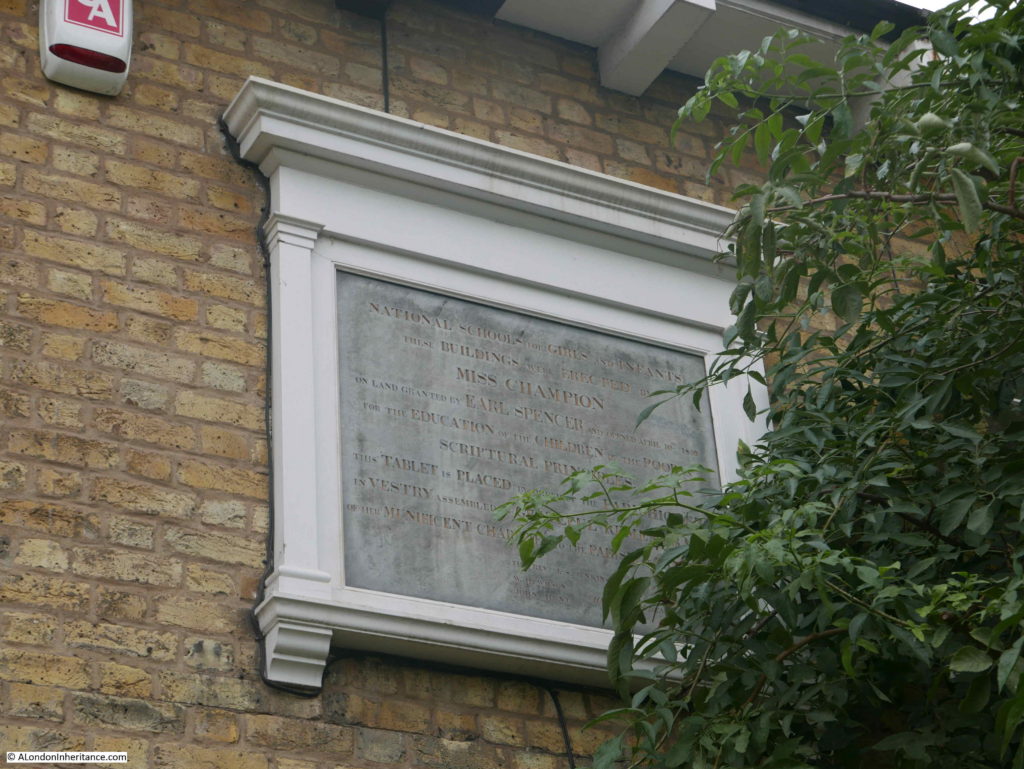
A plaque on the building:

Curious Battersea

The plaque reads (hopefully read correctly, rather difficult as part of the inscription was hidden by vegetation):

“National School for Girls and Infants. These buildings were erected by Miss Champion on land granted by Earl Spencer and opened April 10th 1855 for the education of the children of the poor on scriptural principles. This tablet is placed by order of the parishioners in the Vestry assembled in grateful remembrance of her munificent charities to the Parish of Battersea.”

To find this school building I had doubled back along Battersea High Street to Vicarage Crescent, but I was still on the correct route as my next location in Curious Battersea was a short distance further along the street.

Site 3 – A different sort of dwelling is this one in Vicarage Crescent that also seems strangely out of place in present-day Battersea. It was designed by Wren and has carvings by Grinling Gibbons. Although the home of a private family, this house, one of the finest in South London, is at certain times open to the public and is well worth a visit.

Curious Battersea

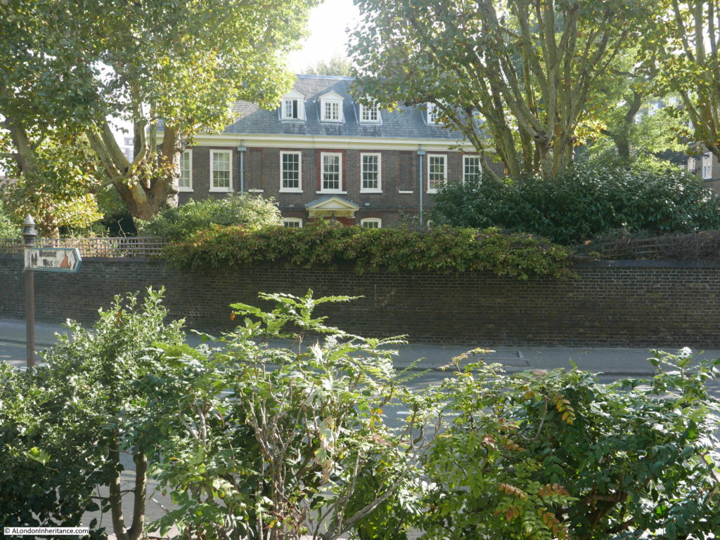
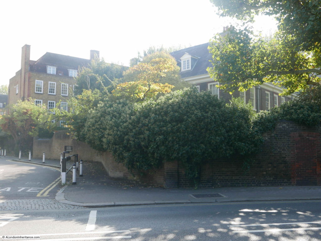
This is Grade II listed Old Battersea House. The house is set behind a high wall and faces the River Thames across Vicarage Crescent and the grassed area directly in front of the river.

I photographed the house from beside the river, looking across Vicarage Crescent.

Curious Battersea

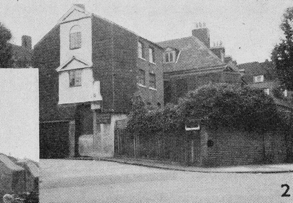
Pearman’s photo appears to be taken from the side, probably as with my photo it is not an easy house to photograph from the front. The original photo also appears to show a building on the side of Old Battersea House, between the house and the small side road that leads to the estate at the rear.

This extension is not there today, with just what I assume to be the original Old Battersea House as shown in the photo below (with a bright sun shining directly into the camera).

Curious Battersea

The house was originally called Terrace House. It became derelict in the late 1960s and restored in the 1970s – it was perhaps then when the extension photographed by Pearman was removed.

If you have a spare £10 million, the house is currently for sale.

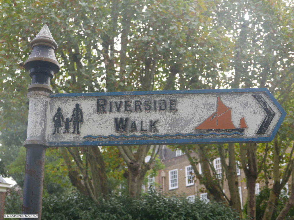
Between Vicarage Crescent and the River Thames opposite Old Battersea House, there is a small grassed area, where this lovely sign can be found.

Curious Battersea

I do not know when these signs date from, but there are still a few to be found. I like the depiction of the river at the bottom of the sign with the Thames sailing barge on the right – signs should be more like this, graphical and including a symbol of their subject.
To get to the next location in Curious Battersea, I continued east along Vicarage Crescent, along Battersea Church Road to:

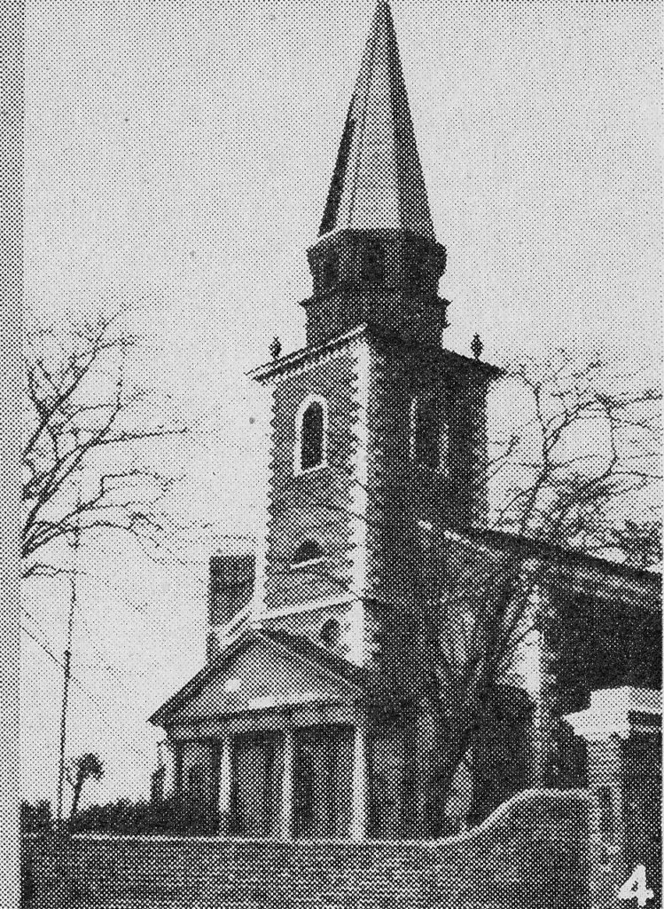
Site 4 – By the river is this parish church of St. Mary’s, a church full of memories. Here are a few of the famous names with which it is connected :- William Blake, poet, artist and mystic, here married his wife Katherine: from the upper vestry window Turner painted his glorious sunsets. The great Wilberforce, whose house was in the parish boundaries was a frequent visitor to the church. Buried in the crypt are the remains of that infamous “turncoat” General Benedict Arnold who tried to betray his comrade-in-arms, George Washington to the British.
Curious Battersea

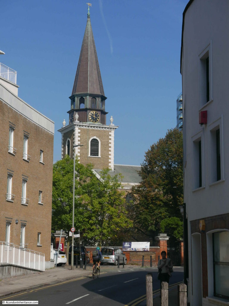
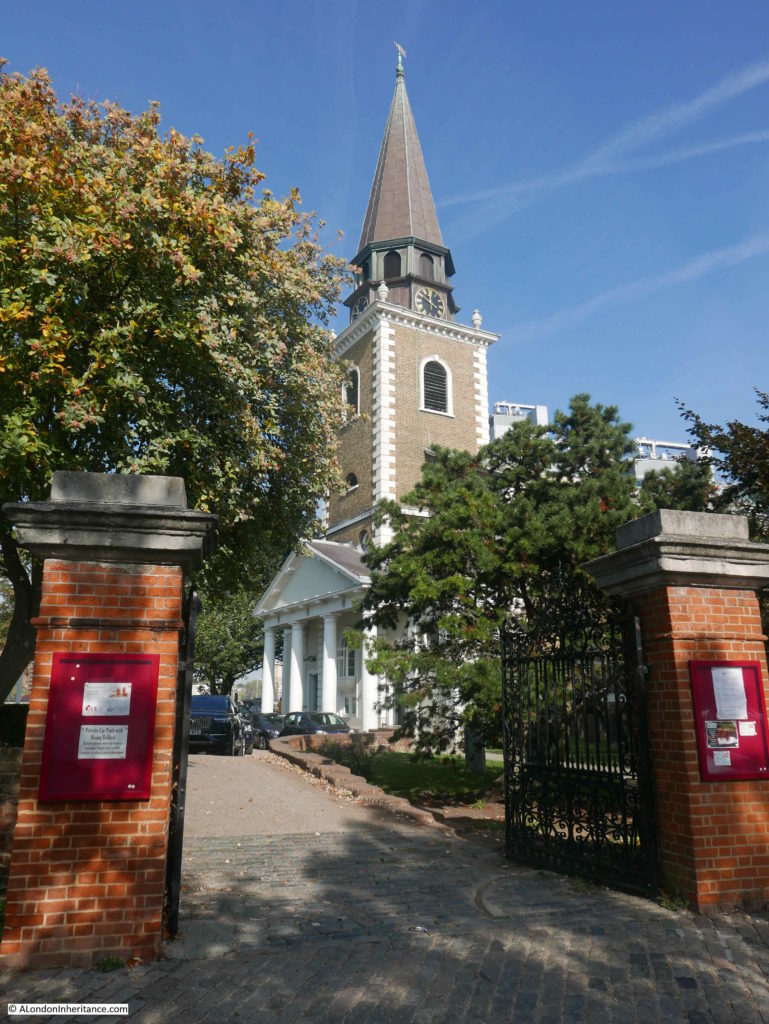
St. Mary’s is a lovely church, facing at a slight angle onto the river, the church has always struck me as being perfectly in proportion to its surroundings. The lighting was perfect as I walked towards the church along Battersea Church Road, where the church suddenly comes into view after a bend in the road.

Curious Battersea

At the church gates. The church sits on a slightly raise plateau of land as can be seen in the following view.

Curious Battersea

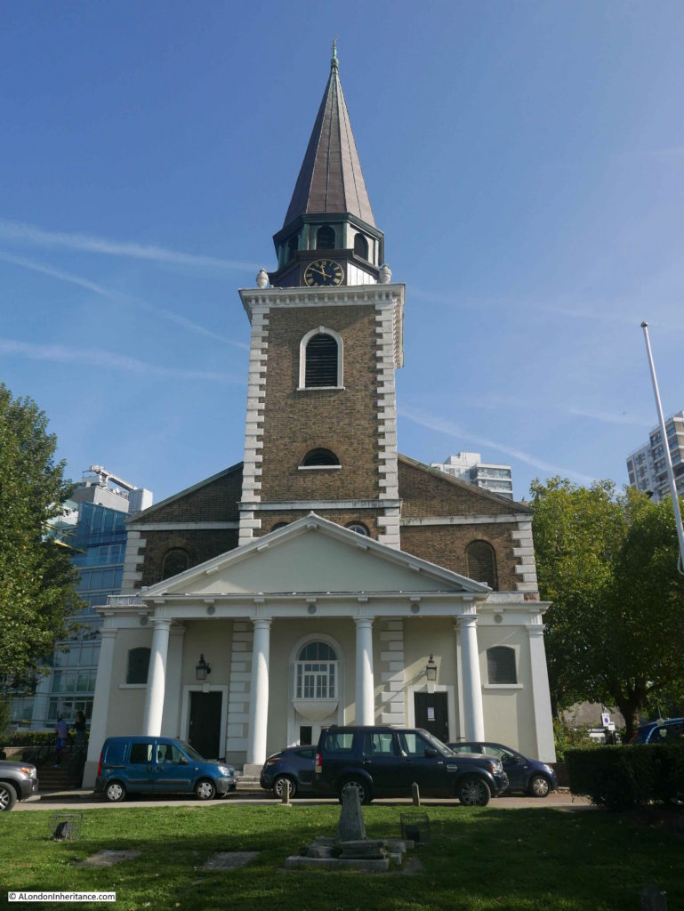
The current St. Mary’s Battersea was built between 1775 and 1777 to a design by the architect Joseph Dixon. As with so many other London churches, the location had already been the site for a church, possibly as far back as the 9th century.

Although the church today dates from the 18th century, it was repaired and reconstructed in 1878 and 1938 with later additional repairs.

The church is deservedly Grade I listed.

I had planned to look inside the church, however on the day of my visit there appeared to be a function in the church with a number of cars parked in front – another in the growing number of reasons to re-visit Battersea.

The front of the church with the encroaching towers of flats expanding along the Thames in the rear.

Curious Battersea

The next location was in Battersea Park which was the perfect excuse for a walk along the river.

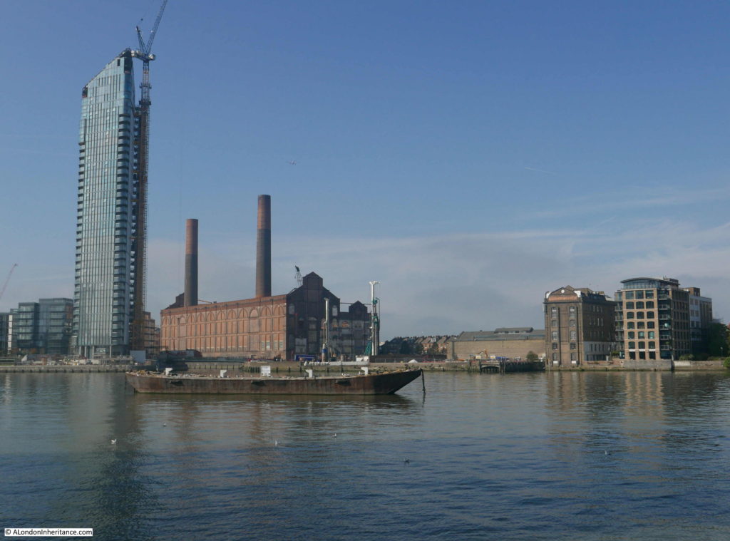
The view from the southern side of the river, the shell of the old Lotts Road Power Station stands out, one of the original Chelsea Wharf buildings on the right and yet another glass tower dwarfing its surroundings on the left.

Curious Battersea

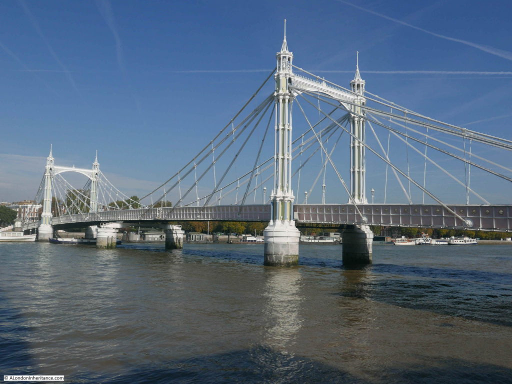
The light was perfect for the Albert Bridge:

Curious Battersea

On reaching Battersea Park, I walked to the next destination in Curious Battersea:

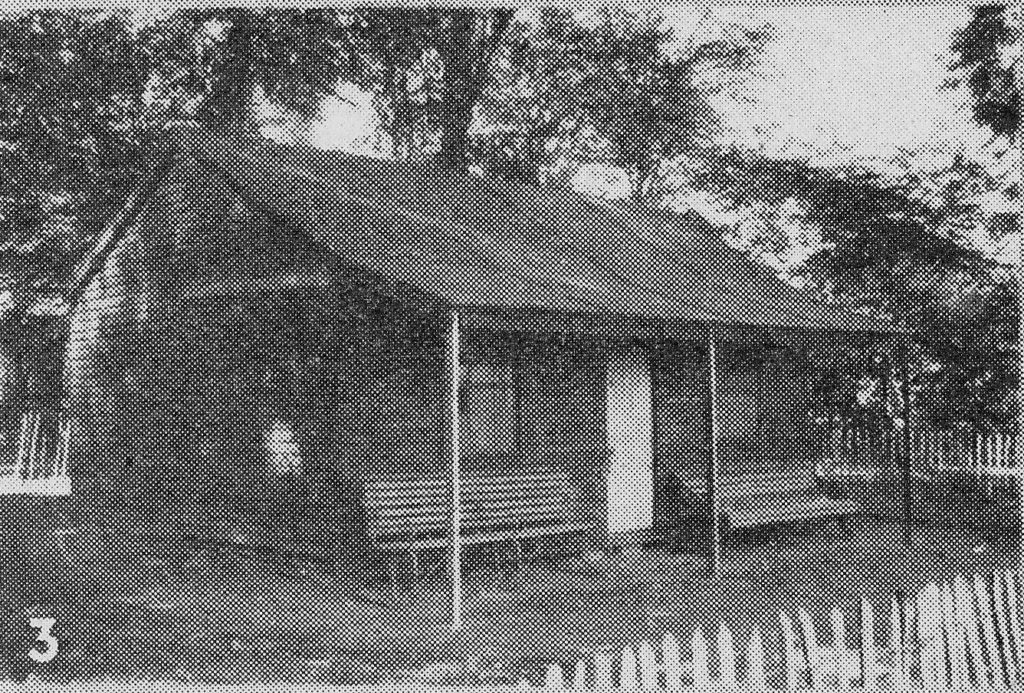
Site 5 – In the days when this borough still had a countrified air, this old wooden hut was the pavilion of the town cricket club. It is in Battersea Park near where it is said the “Iron Duke” fought a duel with Lord Winchelsea.

Curious Battersea

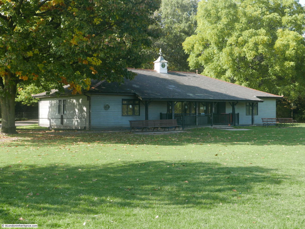
It is still possible to feel a “countrified air” in parts of Battersea Park today, as this carefully framed view of the pavilion today demonstrates.

Curious Battersea

I have no idea if the current cricket pavilion is in the same position as the one in Pearman’s photo, however the pavilion has been considerably upgraded since 1951.

Pearman mentions a duel between the Iron Duke and Lord Winchelsea. The Iron Duke was the Duke of Wellington who at the time of the duel (March 1829) was Prime Minister of Great Britain and Ireland.

The cause of the duel appears to have been the Catholic Relief Bill passed by Wellington’s government. The aim of the bill was to provide greater Catholic emancipation and the possibility of Catholics becoming members of Parliament.

Although Wellington was not a Catholic, fears of rebellion in the country appears to have influenced his decision to support the bill, however he was fiercely opposed by the staunch Protestant, the Earl of Winchelsea. In his opposition to the bill the Earl of Winchelsea appears to have accused the Duke of Wellington of allowing Popery to become part of the State.

Wellington challenged Winchelsea to a duel, which then took place at Battersea.

The duel appears to have been rather a strange affair, more about maintaining gentlemanly honour rather then attempting to kill or wound. Newspaper reports on the 27th March 1829 carried lengthy reports of the build up to, and the actual dual:

“Lord Winchilsea, it appeared, was aware that he had treated the Duke unfairly, and that an apology was due from him, but he considered that as a man of honour, it was ungentlemanly to do an act of injustice, until he had compelled his Grace to adopt a measure which might cause the death of Lord Winchilsea, to be produced by an act of the Duke’s. However monstrous the system may appear in theory, it is considered the very perfection of honour, and the Duke of Wellington was forced to discharge his pistol at Lord Winchilsea. The ball fortunately did no mischief, and then his Lordship tendered such an explanation as was deemed satisfactory, and which was prepared to be presented , in case the affair had terminated fatally to Lord Winchilsea. The latter nobleman was conscious that he had injured the Duke, and had determined therefore, not to return his fire.”

Both parties maintained their honour, and no one was wounded or injured. I suspect that both parties were also concerned that if the Duke had been killed, political chaos would have ensued and if Winchilsea had been killed he would have become a martyr to the Protestant cause.

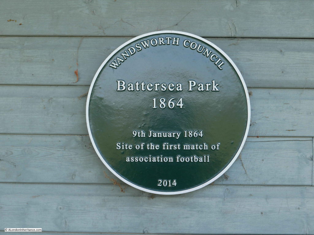
There does not appear to be any monument or plaque to the duel in Battersea Park, however on the Cricket Pavilion there is a plaque recording another 19th century event:

Curious Battersea

Prior to 1864 the game of football did not have a consistent set of rules to manage the game. There was pressure to develop rules that would apply to all games and in October 1863 the Football Association was formed, who then went on to draw up the 13 rules of Association Football.

To demonstrate the new rules a game was organised on the 9th January 1864 in Battersea Park between two teams led by the FA President and the FA Secretary. The President’s team won 2-0.

Leaving Battersea Park, I then headed to the final location of Curious Battersea:

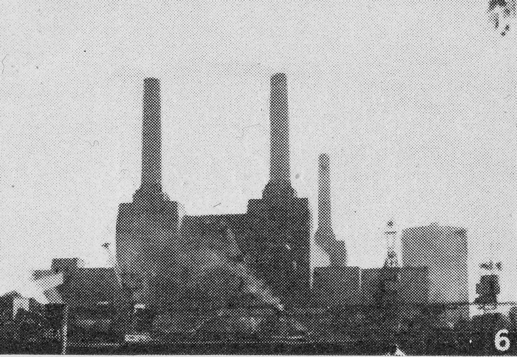
Site 6 – Not all of interest in Battersea is of the past, as witness this huge ‘Wellsian’ river-side power station. It is one of the largest in the world, and at night, when it is flood lit, has an unearthly sort of beauty.

Curious Battersea

When Hugh Pearman wrote Curious London in 1951, Battersea Power Station was becoming the largest provider of power to London. Half of the station (the A station) had been completed in the 1930s and construction of the B station started after the war, with the station coming on stream between 1953 and 1955.

In Pearman’s Curious Battersea, the power station was therefore the peak of modernity. Powering London into the future and “at night, when it is flood-lit, has an unearthly sort of beauty”.

Change is continuous and what had at the time been the most thermally efficient power station in the country eventually lost that efficiency. Generation was moving more towards gas and nuclear rather than coal and power stations were moving out of central London down towards the Thames estuary.

Battersea Power Station ceased operation in 1983, and since has been reduced to the outer walls, through many different schemes and ownership and is now finally being rebuilt.

The turbine halls will consist of shops, restaurants, cafes and cinemas and offices will occupy the boiler house.

Pearman’s photo was from across the river, however I wanted to take a look close up.

After walking under the rail tracks that run across the river into Victoria Station, the first of the new apartment blocks that will almost enclose the old power station is on the right. This follows the standard design seen all across London of apartments above and restaurants, bars and cafes on the ground floor.

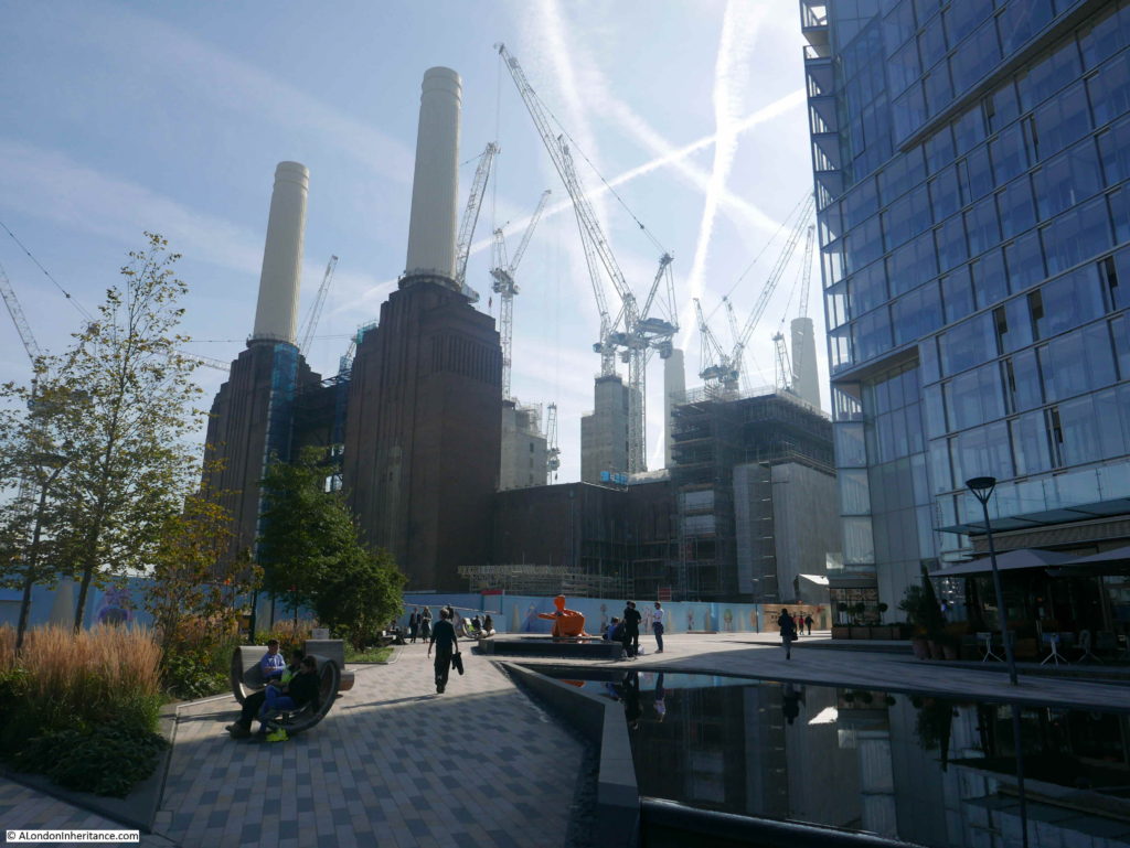
The old power station with its rebuilt chimneys is still a major construction site with cranes rising above the building.

Curious Battersea

I am not sure what Hugh Pearman would think of what is happening to Battersea Power Station today. In 1951 it was supporting the growth in post-war electricity consumption across the city. Today the site is mirroring so many other developments across London and whether the old power station retains any historical significance among the glass and steel apartment towers and the commercialisation of semi-public space remains to be seen.

As usual, I feel I am just scratching the surface of the history of the streets I have walked, but again I am grateful to Hugh Pearman for providing another fascinating route through London to discover more about Curious Battersea.

alondoninheritance.com

Albert Bridge And The Extra Piers

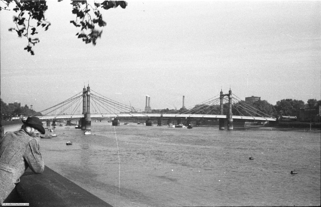
After exploring Cheyne Row for last week’s post, I walked along the Chelsea Embankment towards Battersea Bridge, to photographic the same view as my father’s photo looking along the River Thames towards Albert Bridge, with Battersea Park and Power Station in the background.

Albert Bridge

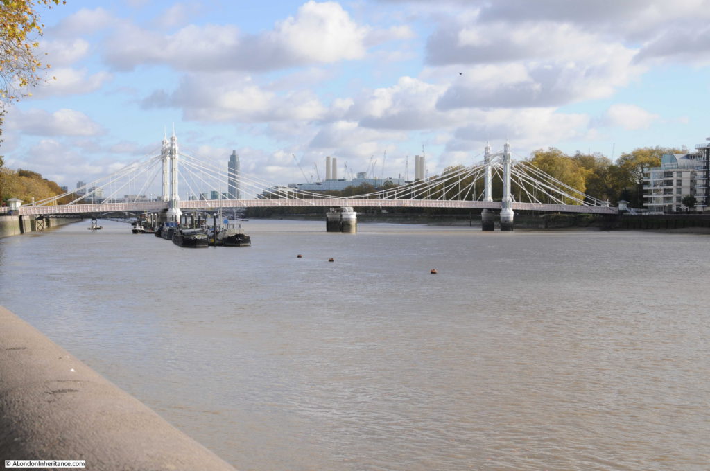
The same view today:

Albert Bridge

In the last half of the 19th century, Chelsea was growing rapidly. The Chelsea Embankment was under construction, the first Chelsea Bridge (originally called the Victoria Bridge) had been completed in 1858 and the nearby Battersea Bridge was of a rather old and fragile wooden construction.

Congestion and the rapid development of the area justified an additional river crossing and in 1860 Prince Albert proposed that an additional bridge between the two existing bridges would be justified by the volume of traffic and the revenue that would be generated by tolls for crossing the bridge. The Chelsea Bridge when opened was a toll bridge and proposals for the Albert Bridge included a toll for crossing the river.

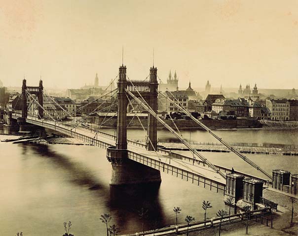
The Albert Bridge Company was formed to build and operate the bridge and construction started in 1870. The bridge was designed by Rowland Mason Ordish using his own patented design. Although construction of the Albert Bridge was approved in 1864, the six year delay to the start of construction (due to plans and work on the Chelsea Embankment), allowed Ordish to design and build another bridge using the same principles – the Franz Joseph Bridge which spanned the River Vltava in Prague.

The following photo of the Franz Joseph Bridge shows how similar the design was to the Albert Bridge, and also probably shows how the deck was suspended – a design that would lead to structural weaknesses in the Albert Bridge resulting in the need for additional strengthening over the years.

Albert Bridge

Source: By František Fridrich (21. 5. 1829 – 23. 3. 1892) [Public domain], via Wikimedia Commons)

The Albert Bridge was opened in 1873. The bridge was 710 feet long with a central span between the two towers of 384 feet. The design included toll booths at both ends of the bridge to collect the tolls for crossing the river. The cylindrical piers were the largest ever cast and were manufactured at a nearby metal works on the Battersea side of the river, then floated down to the location of the bridge, sunk in the river and filled with concrete.

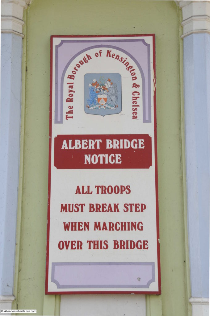
Soon after construction, there were concerns about the strength of the bridge as it would frequently vibrate, a problem which was amplified when large numbers of people walked across the bridge in step – an issue when troops from the nearby Chelsea Barracks crossed the bridge.

The vibration of the bridge was the result of the synchronisation of the steps of those crossing the bridge. The same problem was seen when the Millennium Footbridge opened across the river in June 2000. When upwards of 2,000 people were on the bridge it would start to vibrate. Research has shown that when a bridge starts to vibrate, people walking across the bridge start to synchronise their step with the movement of the bridge, which in turn amplifies the vibration and movement.

Interesting that even after 130 years, the same problems can apply to a structure.

In 1884 Sir Joseph Bazalgette inspected the bridge and found that the iron rods supporting the bridge were showing signs of corrosion and a program of work was implemented to strengthen the bridge which included the installation of steel chains to support the deck along with the replacement of the timber decking.

The steel chains changed the appearance of the bridge from the original design, which probably looked very similar to the Franz Joseph bridge, to the Albert Bridge that we see today.

When I took the comparison photo, I was trying to align features on the bridge with the chimneys of Battersea Power Station to make sure I was roughly in the same position. There were a number of distractions to this.

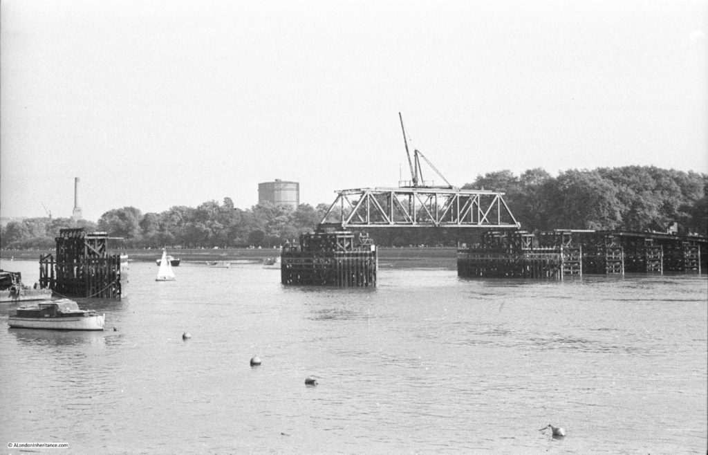
Firstly, if you look under the Albert Bridge there are a number of piers in the river further back. These are not the piers of Chelsea Bridge, rather they are the piers of one of the temporary bridges constructed over the river during the war to provide additional capacity should one of the main bridges be badly damaged by bombing. I wrote about this bridge in a previous post, and this is my father’s photo of the temporary bridge at Battersea:

Albert Bridge

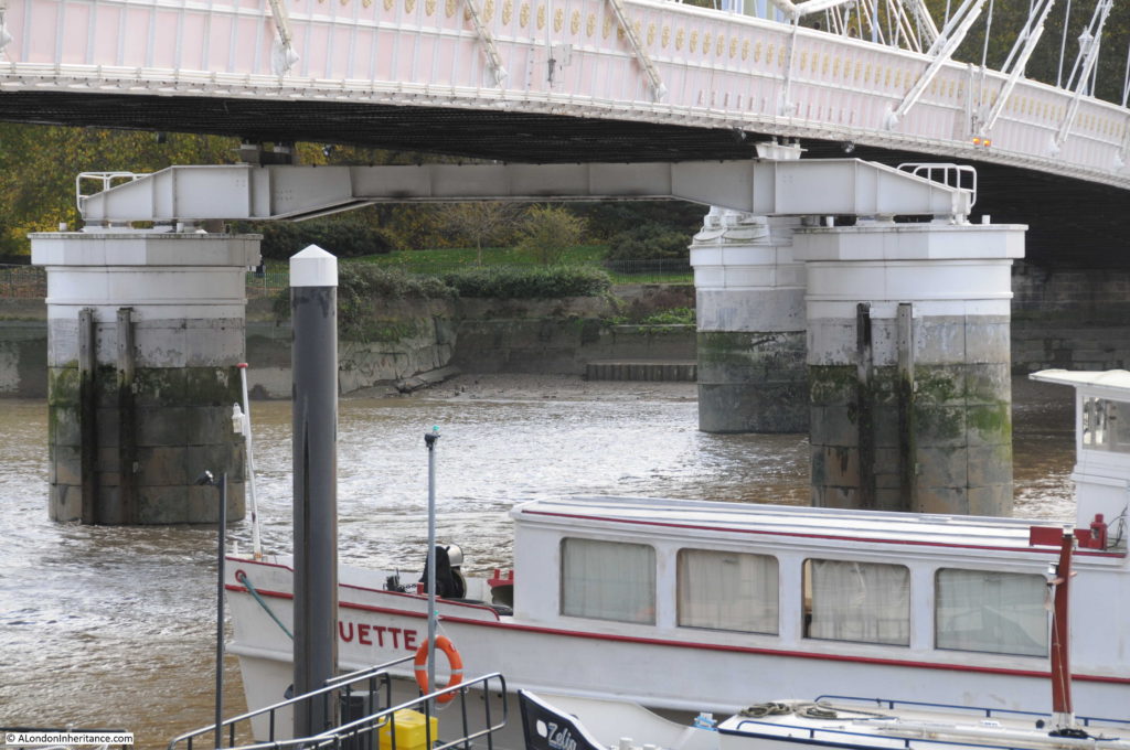
But there was another difference looking underneath the bridge – when my father took the original photo the bridge was a suspension bridge, with the central span supported across the river by the chains running from the top of each tower. In my 2017 photo there is a large pier supporting the centre of the bridge.

The central pier was the result of ongoing concerns about the strength of the Albert Bridge. After Bazalgette’s inspection in 1884, as well as the additional strengthening work, he imposed a weight limit of five tons for vehicles crossing the bridge.

There was a proposal to demolish the bridge in 1926 and replace with a new, stronger bridge, however lack of funding meant that this did not progress beyond the proposal stage. A second attempt to demolish the bridge was made by the London County Council in 1957, however a campaign led by John Betjeman saved the bridge again.

The weight limit for vehicles crossing the bridge had been further reduced to two tons in 1935, so clearly something had to be done to strengthen and preserve the bridge.

As well as replacing the decking and strengthening the bridge structure, the answer to significantly strengthen the bridge was to convert the bridge to a more traditional beam bridge by the addition of a central pier. The bridge closed in 1973 for this work to be carried out which resulted in the bridge we see today.

The two new central piers are of the same design as the original piers, however they support a metal girder that runs under, and supports the centre of the bridge:

Albert Bridge

In echoes of the Garden Bridge, there was also a proposal in 1973 to close the Albert Bridge to traffic and change the bridge into a public park and pedestrian walkway. John Betjeman also supported this proposal, along with many of the local inhabitants who probably saw the closure of the bridge to traffic as a way of reducing the ever increasing volumes of traffic along the Chelsea Embankment. Motoring groups opposed the idea and such was the need for river crossings capable of supporting vehicular traffic that the proposal was rejected and the bridge reopened to pedestrians and traffic after the strengthening work and the addition of the new central piers.

Despite this work, the weight limit has remained at two tons and to try and prevent vehicles over this weight from crossing the bridge a traffic island was introduced at the southern end of the bridge to narrow the entrance, thereby limiting the size of vehicles trying to cross.

The last strengthening work to be carried out was in 2010, and the Albert Bridge will continue to require periodic work to maintain the decking and the supporting ironwork well into the future.

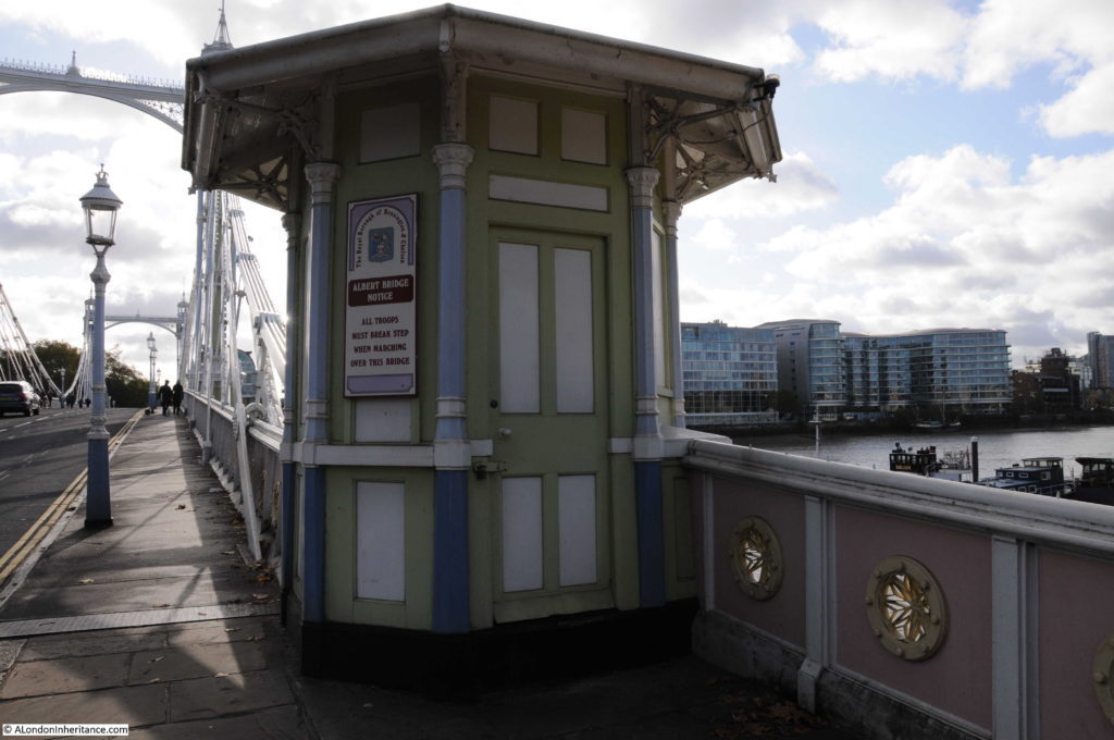
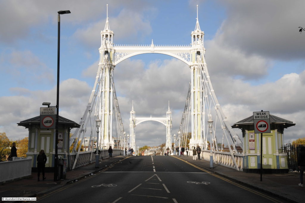
The toll booths at the entrance to the bridge:

Albert Bridge

The toll booths still retain the signs warning troops to break step when marching across the bridge:

Albert Bridge

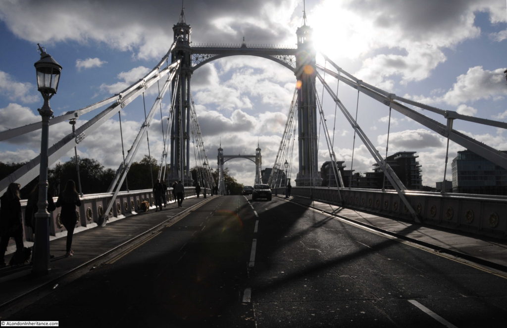
View across the bridge from the north side on a sunny autumn day:

Albert Bridge

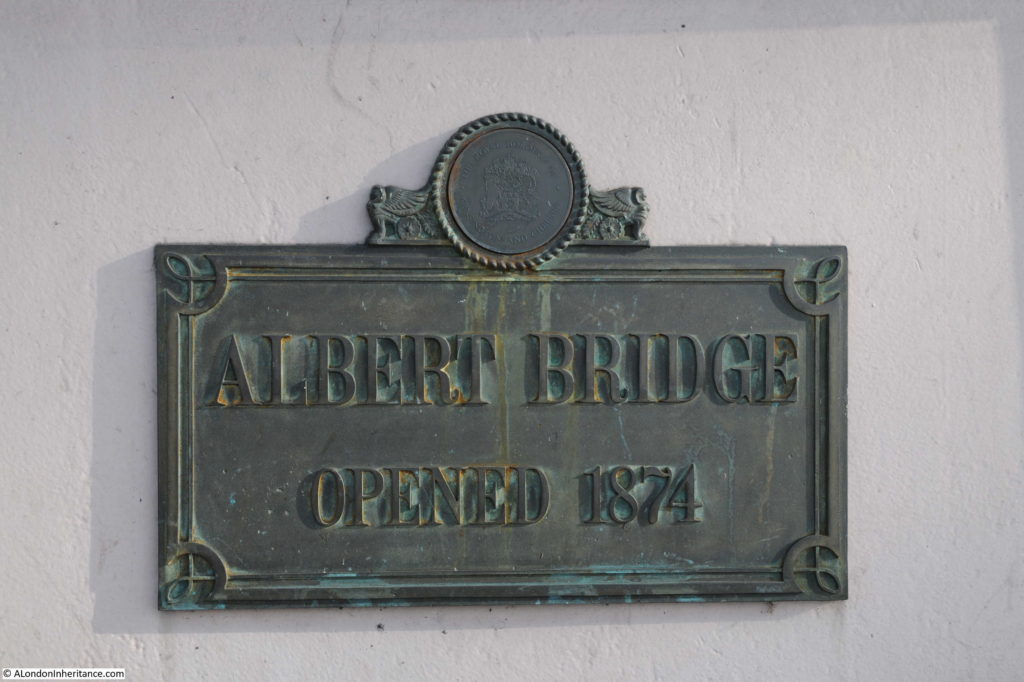
The plaque on the bridge states the bridge was opened in 1874, however the bridge had a phased opening.

Albert Bridge

The “Shipping and Mercantile Gazette” on the 1st January 1873 reported on the initial opening of the Albert Bridge:

“THE ALBERT BRIDGE AT CHELSEA – At 1 o’clock yesterday, amid the firing of cannon and waving of flags, the Albert Bridge at Chelsea was opened to the public. There was an absence of all ceremony, as the bridge is as yet in an unfinished condition. The opening simply consisted in the admission of the public over the bridge, the engineer, contractor and other gentlemen going over in a carriage. By this event, however, the conditions of the Act of Parliament have been complied with, which required that the bridge should be opened before the close of the year. The work of completion is being rapidly proceeded with, and in a short time the formal ceremony of opening the bridge may be expected to be performed.”

There does not appear to have been a formal opening ceremony, and there are reports in the newspapers of the time of the bridge opening to traffic in September 1873.

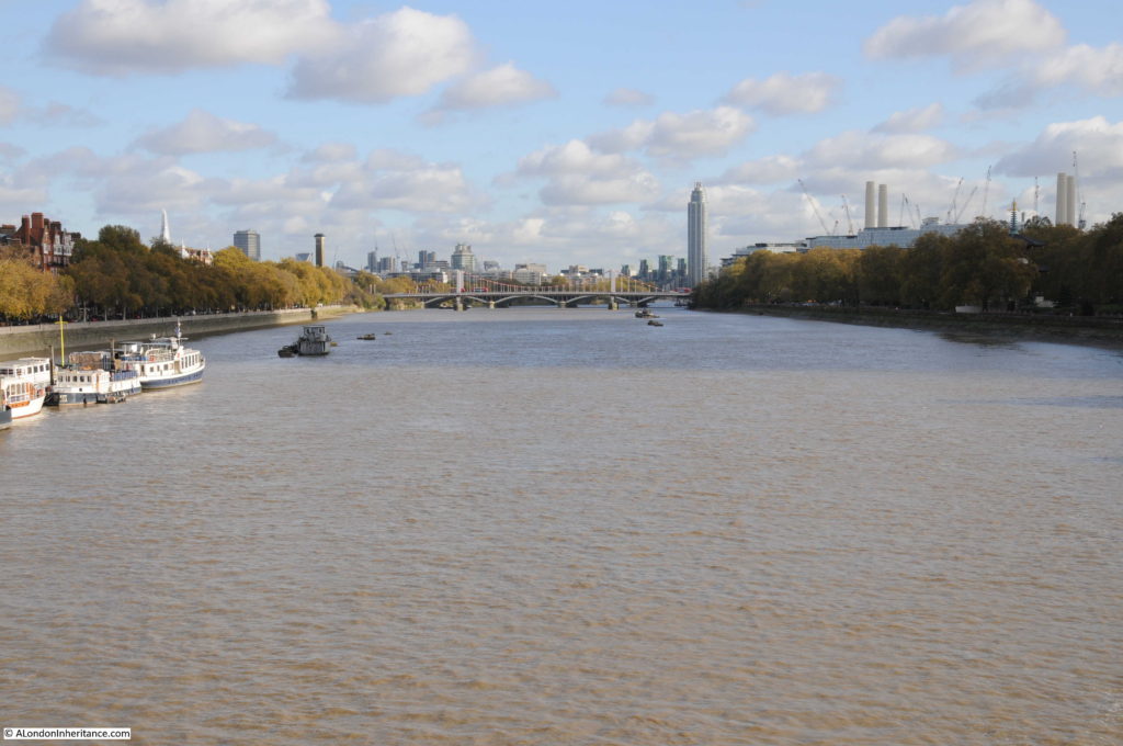
The view looking to the east from the centre of the bridge:

Albert Bridge

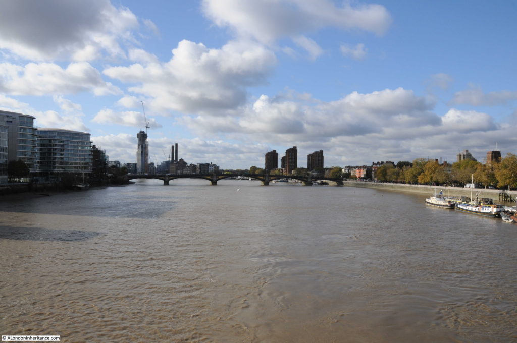
And the view looking to the west:

Albert Bridge

The bridges in the above photos, Chelsea and Battersea Bridges were, as with the Albert Bridge, all originally toll bridges, however soon after the Albert Bridge had opened, it was made toll free along with many other bridges across the river. The East London Observer reported in the 31st May 1879:

“FREEING THE BRIDGES OVER THE THAMES – a great work has just been accomplished in which the East End has co-operated with the West, although its first importance is for the latter. It was but the other day that Waterloo Bridge was thrown open free of toll, and the boon granted is conspicuous by the fact that in seven months the traffic has increased 90 per cent. But last Saturday five bridges were made free of toll for ever, these being the Lambeth, Vauxhall, Chelsea, the Albert and Battersea Bridges.

Within the Metropolis there are thirteen bridges spanning the River Thames and connecting the Middlesex and Surrey shores. With a view of obtaining for the public the full advantage of these bridges as a means of free communication between the various points of the Metropolis, the Board of Works in 1877, promoted a bill in Parliament, to enable them to purchase the interests of the several companies in all the toll bridges crossing the Thames within the metropolis, including the two foot-bridges at Charing Cross and Cannon Street railway stations, and also one bridge crossing the Ravensbourne at Deptford. the bill was successfully carried through both Houses of Parliament, and passed into law in July 1877.”

The Albert and Battersea Bridges were owned by the same company and the sum of £170,000 was paid by the Metropolitan Board of Works to the company for the purchase of the bridges.

From then on, crossing the river was toll free, which must have been one of the drivers to opening up business and trade on both sides of the River Thames, as the article also states that “A free communication across the Thames is an incalculable boon to all classes of inhabitants on both sides of the river”.

Following the opening of the bridges described above, the only bridges across the Thames that still had tolls were bridges at Wandsworth, Putney and Hammersmith.

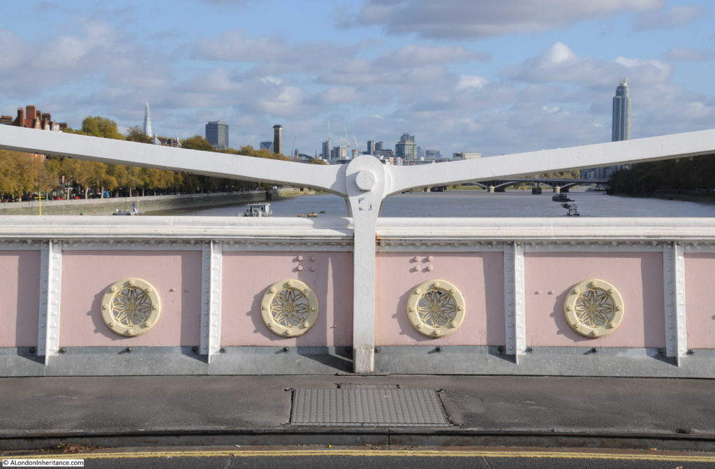
The view from the centre of the bridge – the style of decoration is the same throughout the bridge, with the round patterns repeated across both sides of the bridge span, and along the edge of the steps that lead up from the river walkway on the north bank of the river.

Albert Bridge

View from the traffic island on the southern end of the bridge looking back over towards the north:

Albert Bridge

It is perhaps a wonder that the Albert Bridge has survived so long. A bridge that once had a twin crossing a river in Prague.

A bridge that if the Chelsea Bridge had retained its original name would be one half of the Victoria and Albert Bridges.

And a bridge that may have been the original “garden bridge”.

The Albert Bridge is a unique bridge. The addition of the central pier has changed the design of the bridge to a more traditional beam bridge, however on a sunny autumn day it still appeared as London’s most beautiful bridge across the Thames.

alondoninheritance,com


London Ghosts

I read this week that sales of printed books are rising and that their demise at the hands of the eBook reader is hopefully not going to turn out to be true.

I love printed books. Not just to read, but also as a living record of information added by those who have owned the book. Many of the London books in my collection have annotations along with cuttings from newspapers and magazines over the last 70 years that add to the original text contained within the pages of the book.

The 1975 edition of Dan Cruickshank’s “London: The Art Of Georgian Building” has newspaper articles inserted detailing the destruction and development planned for London’s Georgian buildings during the 1970s, 80s and 90s. The 1923 edition of Historic Streets of London by Lilian and Ashmore Russan has the comment “Rot !!! confused with Battle Bridge N.W.1”  against the entry for Battle Bridge Lane in Bermondsey which states that it “Marks the place where the Romans defeated the Iceni, under Queen Boadicea, in the year AD61”

Rather than a one off read, books can therefore be a repository for new information as well as something to challenge and correct.

One such book is “Unbidden Guests – A Book of Real Ghosts” by William Oliver Stevens published in 1949. As well as the contents of the book, my copy is also stuffed full of newspaper and magazine articles recounting ghost stories from the last 60 years, and for this week’s post, as we approach the shortest day of the year when darkness falls over London from the late afternoon, here are a few of those articles, a sample from a series printed by the London Evening News in the run up to the Christmas of 1957.

These were written by Leslie Thomas who would later find fame following publication of his book The Virgin Soldiers in 1966. At the time of these articles, he was a feature writer for the London Evening News. He worked for the paper from 1955 to 1966 when the success of The Virgin Soldiers convinced him that he could make a career as an author.

These stories of London Ghosts are written in a suitably dramatic form and most have an illustration of the haunting to draw in the reader. I like to imagine Londoners reading these articles as they make their way home in the evening on a cold, dark and foggy December night when anything would seem possible.

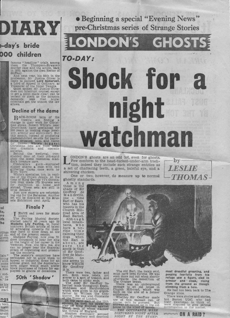
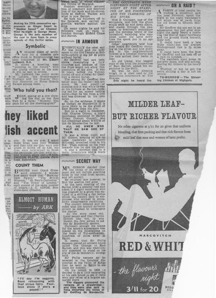
The first story is from 1926 when a Mr Gibson, a night watchman guarding roadwork’s in Church Hill Road, Barnet saw the ghost of Sir Geoffrey de Mandeville, Earl of Essex as a skeleton clad in a metal breast plate and black cape coming up the road towards him.

There were two Sir Geoffrey’s in the 12th century, the elder inheriting lands in Essex, Middlesex and Hertfordshire. His political scheming resulted in him being accused of being a traitor. Sir Geoffrey and his followers carried out guerrilla warfare, travelling on roads to London through Enfield Chase and Barnet. On his eventual death his body lay in Old Temple, Holborn for 20 years without burial. The second Sir Geoffrey had a fortress at Barnet and apparently fell from a tree and drowned in his own moat.

An old house in East Barnet called the Grange was allegedly built on the de Mandeville’s old fortress and when excavations disturbed the foundations of the old building the haunting started, including the stamping of footsteps and clanking of spurs, along with sightings as witnessed by the poor night-watchman.

The Evening News story concludes with a party of local people including a councillor spending the night at the night-watchman’s hut in Church Hill Road. Although nothing was seen, just after midnight the party heard a rumbling like that of many hoof beats and the ground shook.

A chilling tale from Barnet and I doubt the night watchman ever returned if the illustration is an accurate portrayal of his night on Church Hill Road.

London Ghosts 1a

London Ghosts 1b

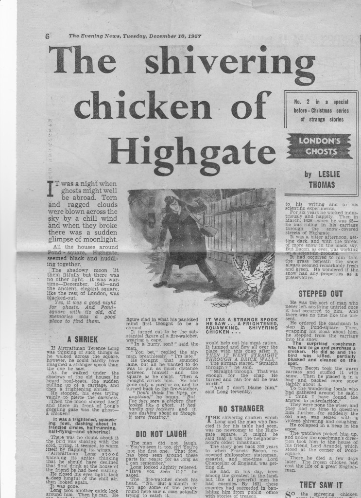
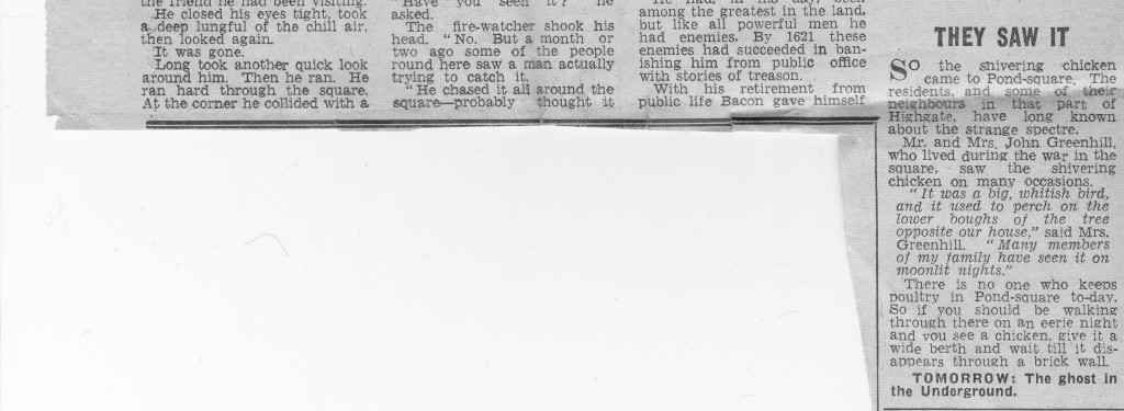
The next tale is from Pond Square, Highgate and starts with the experience of Aircraftman Terence Long in December 1943. Walking through Pond Square he heard the sudden pulling up of a carriage and then a frightening shriek.  Moonlight revealed the sight of a ghostly chicken – “It was a frightened, squawking fowl, dashing about in frenzied circles, half running, half flying, and shivering.”

The unlikely story of the chicken goes back to the 17th century when Francis Bacon was riding through the snow covered streets of Highgate. Pondering scientific questions, he suddenly asked his coachman to stop and fetch a chicken. The chicken was killed, and Bacon promptly stuffed it with snow and then put it in a bag filled with more snow. This experiment was following Bacon’s observation that the grass underneath snow always appeared fresh and he wondered whether snow and the cold could help with the preservation of food.

Whilst working on this experiment in the cold Highgate night, Bacon collapsed and was taken to the home of Lord Arundel in Pond Square where he died a few days later.

The chicken has since been seen many times in Pond Square, although why the chicken continues to haunt rather than Francis Bacon is a bit of a mystery.

London Ghosts 4

London Ghosts 4a

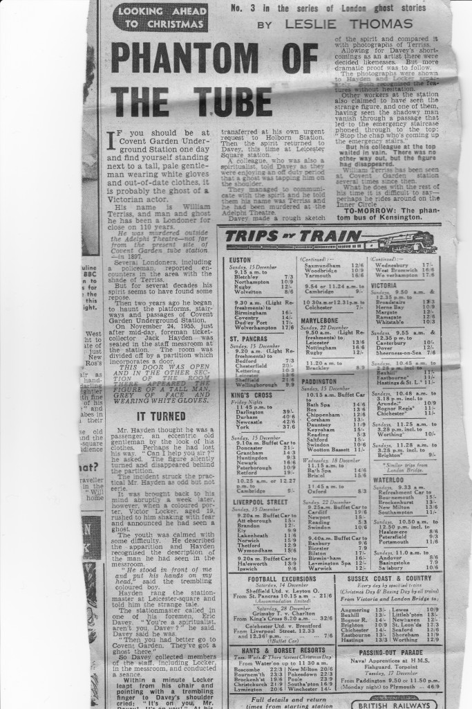
The next story moves into central London, to Covent Garden underground station and tells the story of the ghost of the Victorian actor, William Terriss.

On November 24th 1955, the foreman ticket collector Jack Hayden was in the staff mess room which was divided in two with a partition which included a door when, “This door was open and in the other section of the room there appeared the figure of a tall man, grey of face and wearing white gloves.” Jack Hayden and a colleague who had also seen the ghost were shown a photo of Terriss and immediately recognised him. William Terriss had been murdered at the nearby Adelphi Theatre.

Along with the ghost story, this cutting from the Evening News includes a fascinating advert for “Trips by Trains” and includes:

– Football excursions to see Sheffield United play Leyton Orient from St. Pancras. Grimsby Town play Charlton from King’s Cross and Colchester United play Brentford from Liverpool Street.

– There is a train leaving Paddington to see the Passing-Out Parade of Naval Apprentices at H.M.S Fishguard, Torpoint

– A Sunday timetable of trains, mainly with buffet cars from the main London stations

– weekday trains to the “Hants & Dorset Resorts”

This was when a train ticket from Waterloo to Bournemouth would have cost 15 shillings.

London Ghosts 3

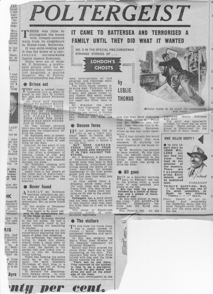
The next story is from south London and starts with the terrifying headline “It came to Battersea and terrorised a family until they did what it wanted.”

The haunting at the house in Eland Road, Battersea owned by the Robinson family, started on the 27th November, 1927 with breaking glass in the Conservatory, which was followed by flying coal, pennies and soda, loud noises and bangs, furniture falling in all directions, broken windows and door panels.

Mr Robinson called in the Police who were also subjected to flying coal, but could not do anything to help, so “the Robinsons spent the most miserable Christmas of their lives in a house that was full of flying coal, pennies and soda.”

Despite a steady stream of people trying to help, police, clergymen and spirit investigators, nothing could be done. There were also newspaper reporters and crowds of “open-mouthed sightseers.”

Members of the family tried to stay in the house, but were gradually driven out. The last to stay, a Mrs Perkins, was hit by a large lump of flying soda – “She ran from the kitchen followed by a tumult of banging’s and a shower of heavy pieces of coal. By this time, almost in tears she cried ‘Alright I’m going’ immediately the noise and the flying coal stopped.”

With the family who lived in the house now gone the spirit was satisfied and peace descended on the house in Eland Road.

London Ghosts 2

Leslie Thomas went on to publish 30 novels until his death in 2014. These articles highlight some of his earliest writings for the Evening News, nine years before publication of The Virgin Soldiers.

They also tell of some of the many possible ghostly encounters you may experience walking the streets of London after dark.

alondoninheritance.com