Tag Archives: Chelsea

Simmonds Stores, Godfrey Street, Chelsea

Before getting into this week’s post, can I thank everyone who commented and e-mailed following last Sunday’s post on the 5th anniversary of the blog. Your feedback is really appreciated.

There are a number of then and now photos that I find sum up the changes to an area. A few years ago I wrote a post about the location of the Gun Tavern in Wapping. My father photographed the post war ruins of the old pub. Today, the same location is occupied by a Foxton’s estate agent.

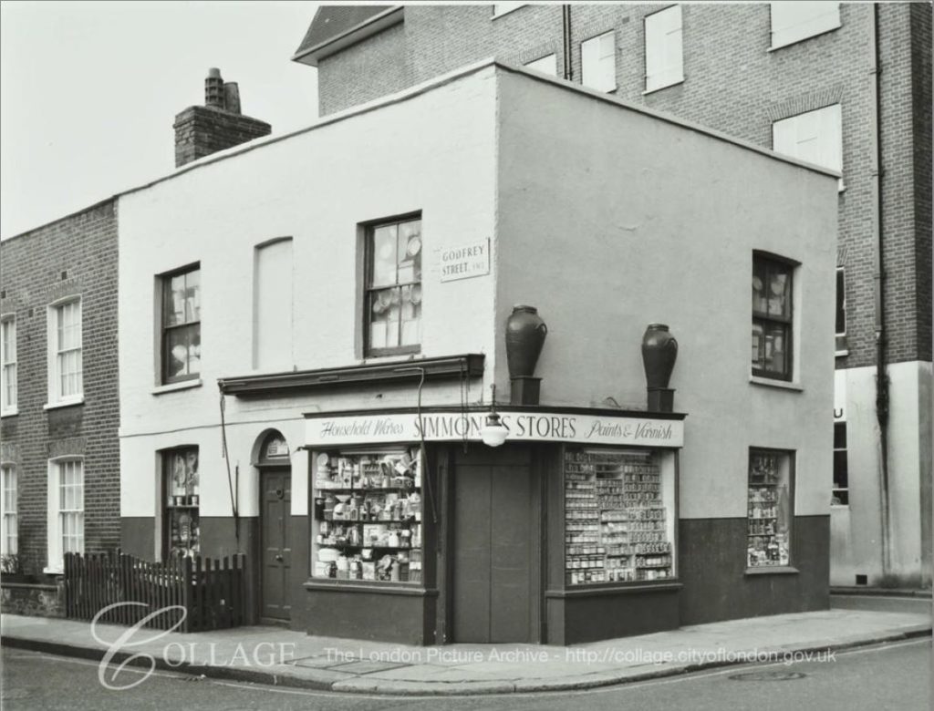
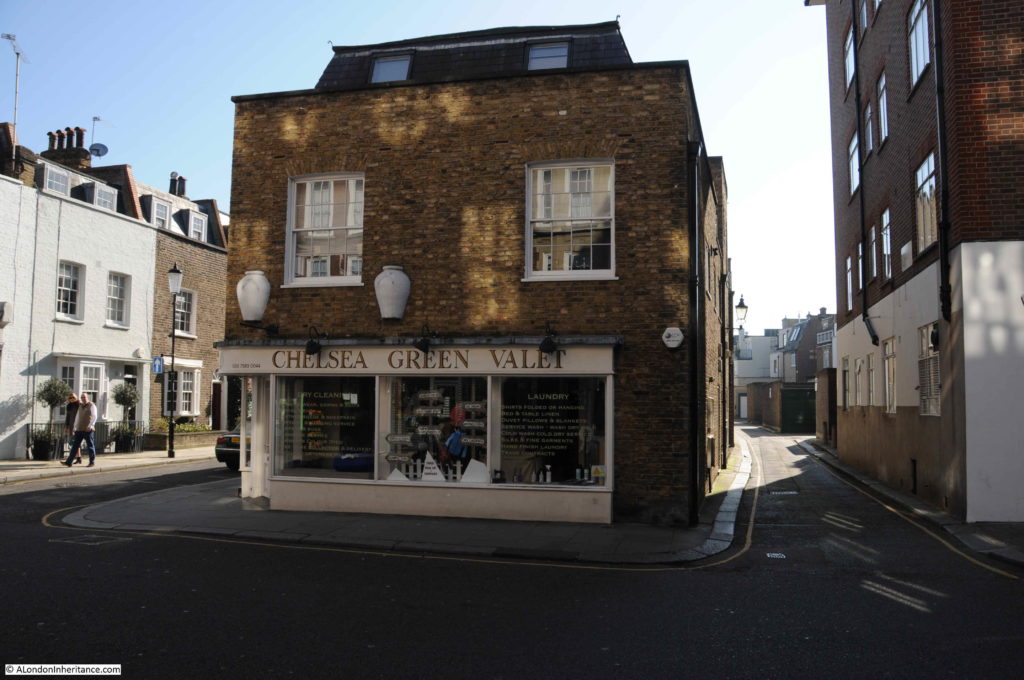
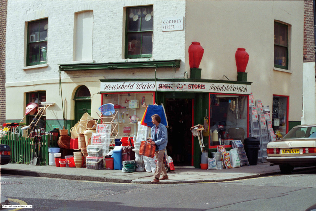
For today’s post I have another pair of photos that sum up how an area has changed. This time I am in Chelsea, and this is Simmonds Stores, on the corner of Godfrey Street and Cale Street. The photograph was taken in 1986.

Godfrey Street, Chelsea

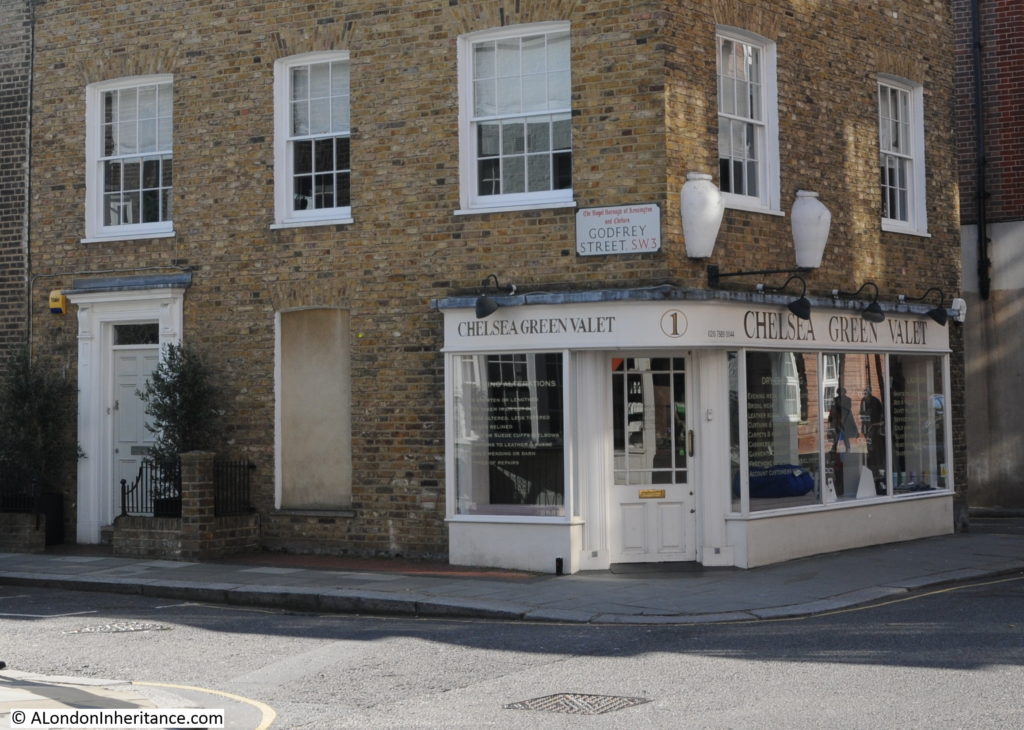
The same view in February 2019:

Godfrey Street, Chelsea

The two photos typify how the area has changed. A corner shop that once sold household wares, piled high outside the shop to tempt passers-by, is now the Chelsea Green Valet. It is not just the shop that has changed, the building has been “restored”, although some of the changes attempt to replicate original features which were not part of the building’s design. An example being the new door on the left of the building which replaces an original window. The use of a door surround that attempts to give the door an original appearance was part of the work to bring the building to its current appearance.

The building of Godfrey Street dates from the 19th century. The first newspaper reference I have found to the street was from 1830 which implies the street was developed in the first decades of the 19th century. The name probably comes from Walter Godfrey who was a landowner in Chelsea during the 18th century. The corner store probably dates to the original construction of the street.

The 1891 Kelly’s Directory records that Albert Simmonds, Oilman was in residence, and it is this reference that provides a clue to the early function of the store and the large jars that are still mounted on the side of the building.

These represented Tuscan oil jars and indicated that oil was sold in the store. There is another example to be found in my post on Lower Marsh in Lambeth.

The 1891 census provides some additional information on Albert Simmonds. He was aged 30 and was born in Shipton, Oxfordshire. He lived in the building with his wife Mary (31) and children Mary Ann (7), Albert (6) and Frederick (1). Also in the house there was a servant Florence Hele, aged 17 and listed as a General Servant.

I do not know when the stores closed, or whether it was still in the Simmonds family when my father photographed the building in 1986, however it retained the Simmonds name for around 100 years.

The London Metropolitan Collage archives has a photo of the stores dated from 1971.

Godfrey Street, Chelsea

Image credit: London Metropolitan Archives, City of London: catalogue ref: SC_PHL_01_067_71_2348.

In 1971 the shop had a rather nice lantern over the door which had disappeared by 1986, All the windows on both the ground and first floors looked stuffed with goods for sale.

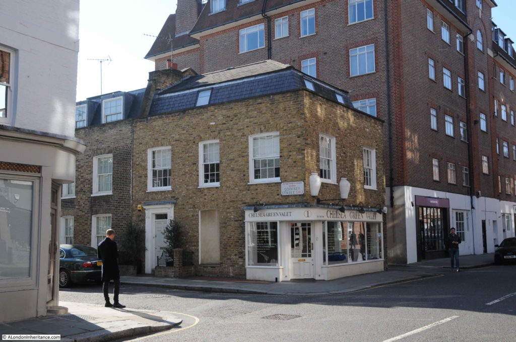
A wider view of the location of Simmonds Stores.

Godfrey Street, Chelsea

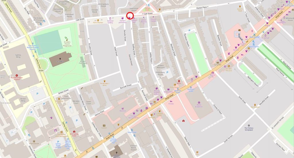
I have marked the location of the building in the following map extract to show Simmonds Stores on the north-west corner of Godfrey Street.

Godfrey Street, Chelsea

Map  © OpenStreetMap contributors. 

As usual, I always use the opportunity of finding these locations to take a walk around the immediate area. The shop sits between Godfrey Street on the left and Danube Street on the right. Danube Street’s main function is to provide access to the rear of the buildings on the adjacent streets.

Godfrey Street, Chelsea

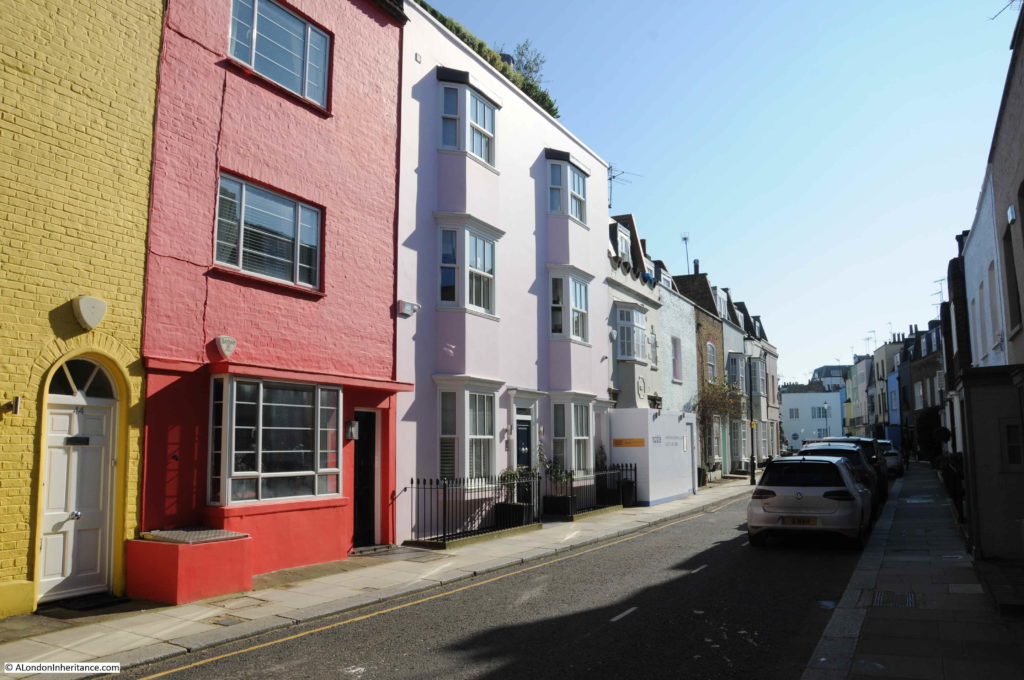
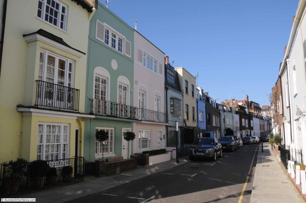
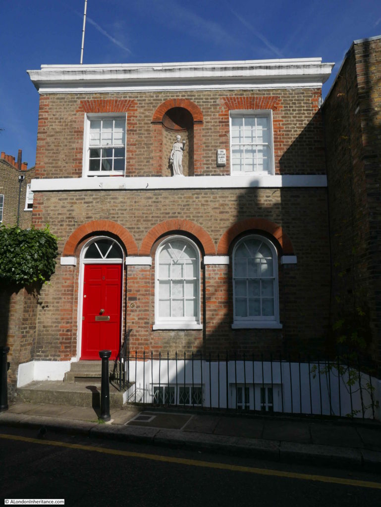
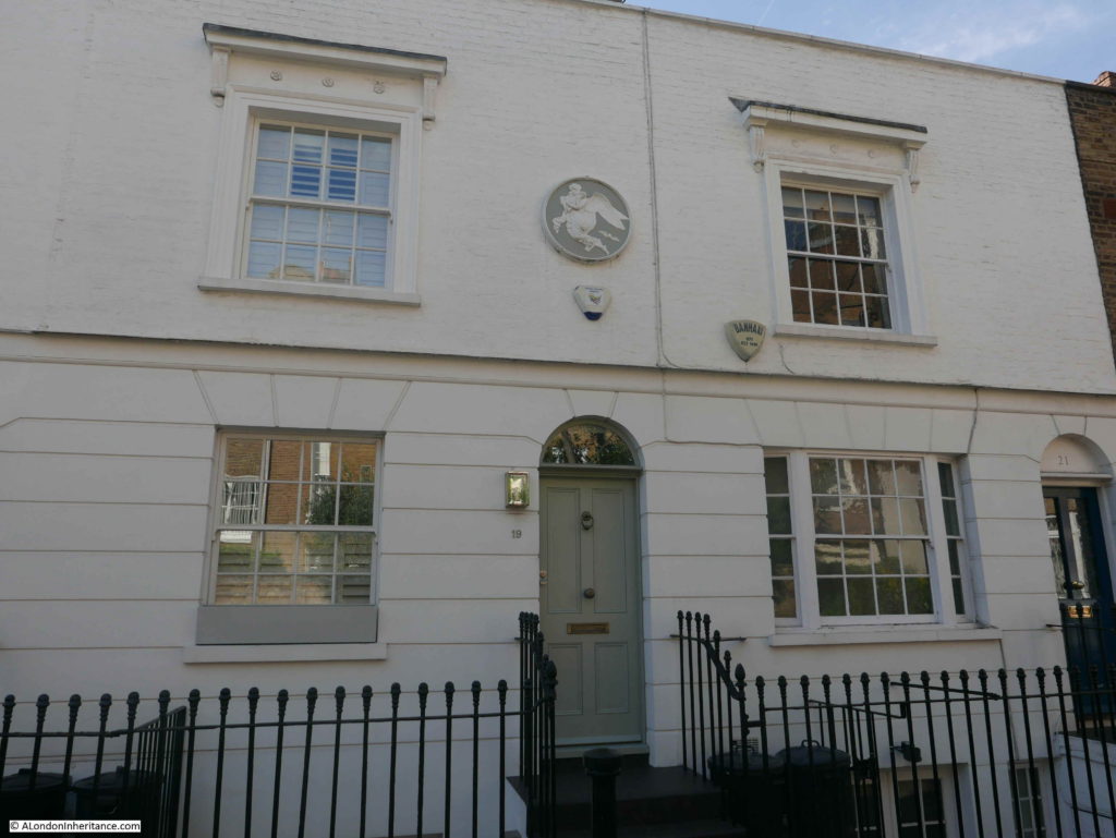
Godfrey Street is interesting. A considerable mix of architecture with houses much altered since their original build. Many of the buildings have been painted in bright colours.

Godfrey Street, Chelsea

The council’s conservation reports have concerns about this approach in a conservation area – “The buildings within the area were not intended to have painted masonry finishes. Today many houses have been painted. In some cases where the whole terrace was painted many years ago in a consistent scheme, this paint has become part of the street’s character. However, in other places, where individual houses have been painted in a brick terrace, they have harmed the uniformity of the terrace and the appearance of the conservation area”.

View from the southern end of Godfrey Street looking up towards Cale Street.

Godfrey Street, Chelsea

It is fascinating to look up newspaper references to the locations I visit. They frequently provide an insight into the lives of those who have lived in these streets. One tragic report from one of the earliest mentions of Godfrey Street, documenting an example of domestic abuse was reported in the London Courier and Evening Gazette on the 20th November 1832:

“LOVE AND SUICIDE – It may be recollected, that a few weeks ago Mr. Hilde, a Hanoverian by birth, was charged at Queen-square Police Office by a Mrs. Arthur, a young widow of 19 Godfrey Street, Chelsea-common, with frequently assaulting her, and treating her in such a manner that she considered her life in danger from his violence. He was then ordered to enter into sureties to keep the peace towards her, but he would still continue to come to the house and annoy her, although he had moved her lodgings  to No 22, Pulteney-street, Golden-square. Mr Hilde, had been a lodger of Mrs. Arthur’s and during the time he was there she was arrested and confined in Whitecross-street prison. he paid the debt for her, and she was released, and they then cohabited together as man and wife, until they had frequent quarrels, and he was in the habit of beating her continually. The last time he was brought to Queen-square was about a month ago for attempting to get into her house, and he had then great trouble to procure bail, as his friends found it difficult to keep him from going to the house where Mrs. Arthur resided, so devotedly did he appear to be attached to her, not withstanding his ill-usage of her.

On Sunday afternoon he called upon Police Sergeant King, of the V division, No. 10 at Battersea, who had him in custody at the Police-office, and he dined and drank tea with him. They afterwards went out and took a walk, and he returned and had supper with him. During the whole of the day he appeared very much depressed in spirits, and frequently exclaimed, with tears in his eyes, in broken English ‘My God ! how I love that woman ! – nobody knows how I love her !’

About a quarter to ten o’clock in the evening, he left King’s house to go home, and in less than half an hour afterwards King was informed that a man was in the Thames. An alarm was instantly given, boats put off, and in about twenty minutes the body of the unhappy man was picked up by Abraham Graves, a waterman, quite dead. The body was taken to the Adam and Eve public-house, in Duke-street, Chelsea, and Mr. Fletcher, the surgeon, promptly attended, but every effort to restore life was ineffectual. the body now awaits the Coroner’s inquest”.

The article highlights what Mrs. Arthur had to suffer, however the sympathy of the article appears to be with Mr. Hilde despite the fact that he was the one inflicting violence on the young widow. Sadly what happened in Godfrey Street was suffered by woman all across the City with minimal impact on the male perpetrators.

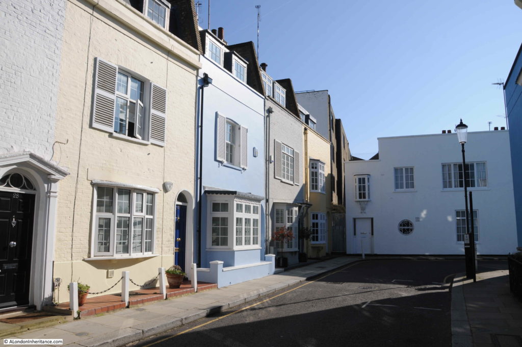
At first glance, Godfrey Street ends in a dead-end with a house appearing to close the street, however the street does a 90 degree bend to the right, where it meets the narrow Danube Street (the southern section of which is also called Godfrey Street).

Godfrey Street, Chelsea

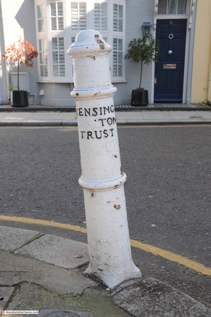
On the corner is a rather nice bollard.

Godfrey Street, Chelsea

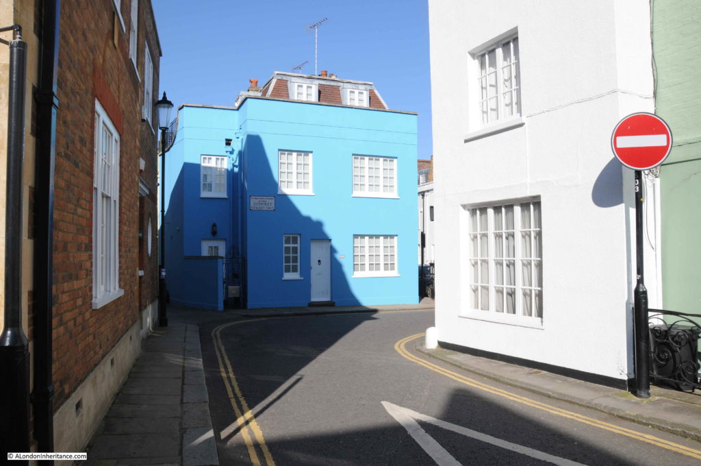
Turning the corner at the end of Godfrey Street and the house between the main street and the small side street is painted bright blue.

Godfrey Street, Chelsea

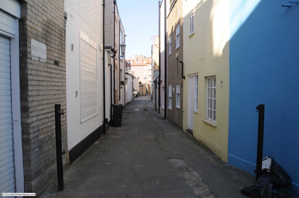
Looking down Godfrey / Danube Street that runs at the rear of the houses. A narrow service alley that provides access to the rear of the buildings.

Godfrey Street, Chelsea

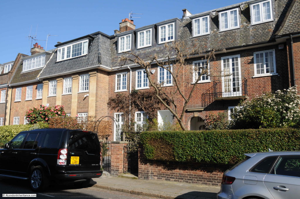
Godfrey Street ends at the junction with Burnsall Street. I turned right into Burnsall Street to look at the buildings that are on the opposite side of the alley that runs at the back of Godfrey Street. These houses are very different. This is Astell Street which runs parallel to Godfrey Street, up to Cale Street.

Godfrey Street, Chelsea

These buildings are very different to those in Godfrey Street. A look at the 1895 Ordnance Survey map shows that this street was named Blenheim Street and was comprised of workman’s houses, very similar to those in Godfrey Street, however early 20th century redevelopment demolished the original terraces of two storey houses and replaced them with much larger, and more expensive houses.

These changes were happening across Chelsea, causing the Chelsea Society in 1937 to express concern about the social mix of the area changing as working class homes were being demolished and replaced with the type of building we can see in Astell Street.

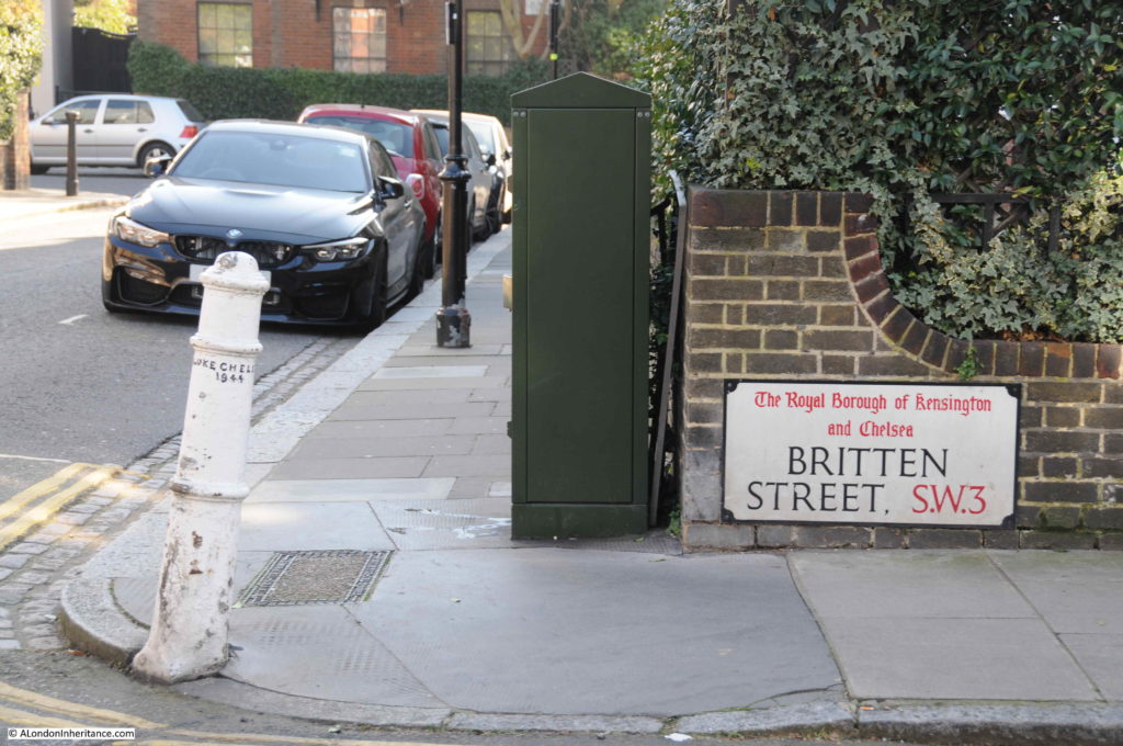
At the junction of Astell Street and Britten Street is another rather nice original bollard, dating from 1844.

Godfrey Street, Chelsea

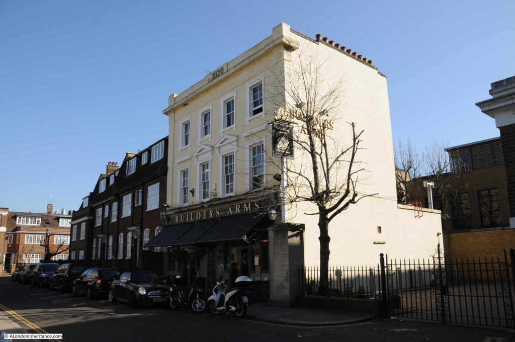
Walking down Britten Street and by a lucky coincidence there is the type of place where I like to end a walk. This is the Builders Arms.

Godfrey Street, Chelsea

The pub has the date c. 1820 at the very top of the building, however the written references I have found for the pub appear to date the building to around 1841. The reference to 1820 is a recent addition as this was not on the building in the 1970s.

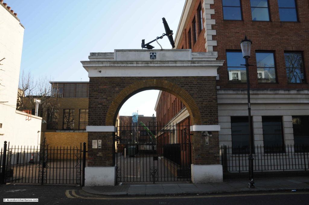
The Builders Arms was located adjacent to the Anchor Brewery. The site of the Brewery has been considerably redeveloped, however an entrance gate can still be seen.

Godfrey Street, Chelsea

I am not sure if I remember correctly, however I believe the arch is a rebuild of the original arch, although I may be wrong.

Simmonds Stores typifies how Chelsea has changed over the last few decades, however as with the references to Astell Street, the gradual change from original working class housing to the multi-million pound housing we find today has been going on for very many years.

I have covered a number of these 1980s corner shops, and have very many more to find, however for the next series of posts, I will be returning to 1940s and 1950s London, and also discovering some other aspects of London.

alondoninheritance.com

Tryon Street, Chelsea

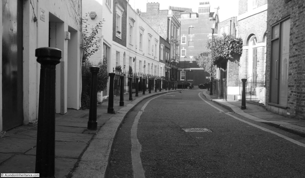
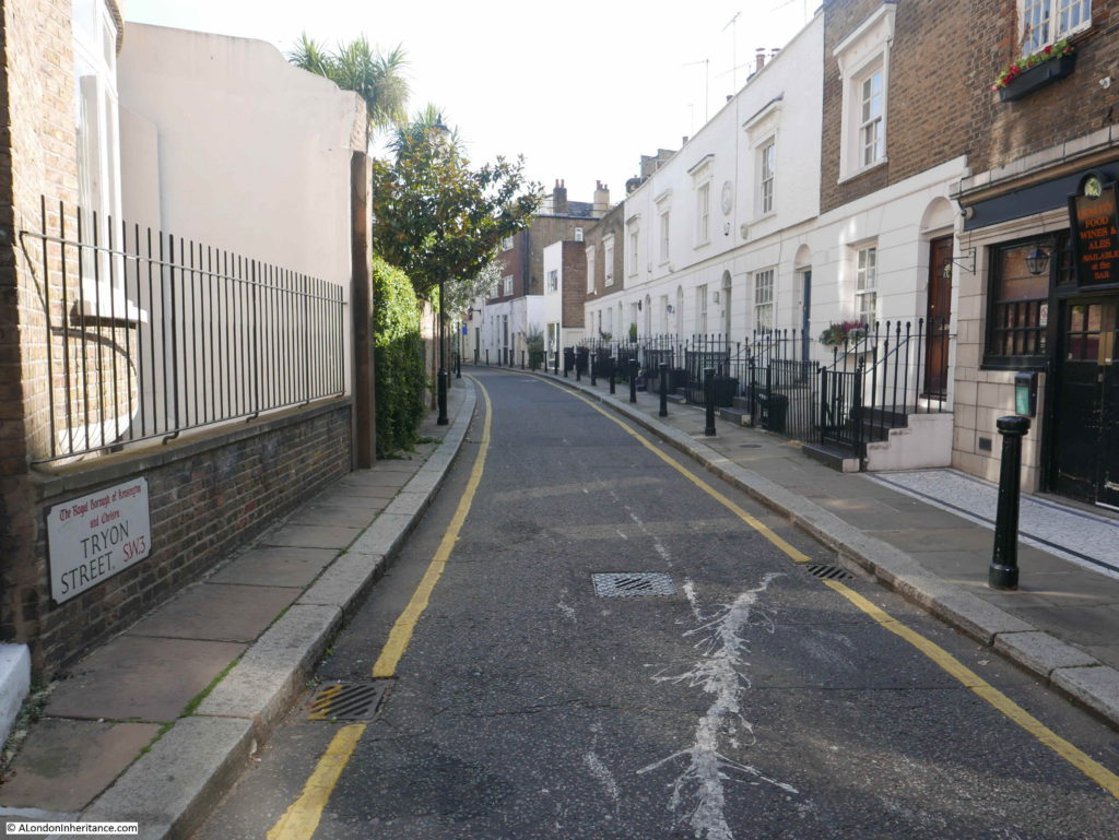
If you walk from Sloane Square, along the King’s Road, pass the Saatchi Gallery on the left and a short distance further on the right will be Tryon Street, a very narrow Chelsea street leading from the King’s Road. No entry signs indicate that you cannot drive directly into the street as it is a one way street with traffic entering from Elystan Place to the north.

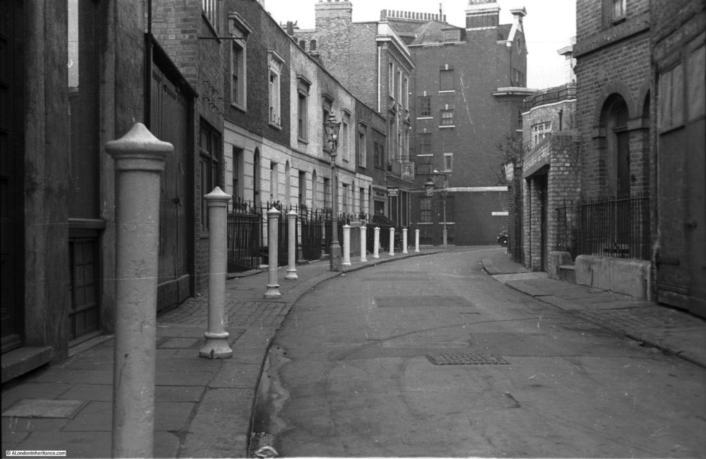
Walking from the King’s Road reveals a street that has hardly changed in 70 years. This is my father’s photo:

Tryon Street

And my 2018 photo taken on a very sunny September afternoon:

Tryon Street

I took the 2018 photo in Black & White as I suspect using colour artificially over emphasizes the changes in a scene, and in Tryon Street there has been very little change in 70 years.

The bollards have been changed, however a continuous line of bollards still runs the length of the street. There have been some cosmetic changes to the buildings, with a bit more structural change in the buildings nearest the camera. The road has been resurfaced, yellow lines have been added and the same metal chamber cover is in the same place in the middle of the road.

I am not sure why my father took the photo of Tryon Street. There is no obvious feature in the photo. i suspect the bollards had something to do with the decision to photograph the street as the line of bollards leading of to the end of the street enhances the composition of the photo.

I could not find that much information about Tryon Street. It is only a short street, the above photos show the full length of the street and it was only named Tryon Street in 1913, the street was originally part of the much longer Keppel Street, however the origin of the name is fascinating.

Tryon Street was named after Vice-Admiral Sir George Tryon who died when his ship sunk in the Mediterranean in 1893. The name of Tryon Street recalls a major naval tragedy.

Vice-Admiral Sir George Tryon was the Commander-in-Chief of the Mediterranean Fleet and leading the fleet in his ship Victoria. The fleet was to move from off the coast of Syria and make their way to new anchor positions off the Lebanon at Tripoli. The London Evening Standard on the 4th July 1893 details the circumstances of Tryon’s death and the sinking of the Victoria in a letter from “a Senior Office of the Fleet”:

“When ships are in columns of divisions, as we were, they ought to be twice the number of cables apart as there are ships in the longest line or column. We had six ships in the first division, and five in the second division- i.e. we ought to have really twelve cables apart (2400 yards); but we were only six cables (1200 yards). The diameter that the slowest ship is supposed to take in turning 16 points or right round is 800 yards. therefore two ships would occupy 1600 yards. We were coming up from Beyrout about six miles from the shore, and were in two divisions, but only six cables (1200 yards) apart.

The Admiral wanted to anchor the Fleet in line abreast, one division behind the other, to do which he had to re-form the fleet first, by turning the ships right round. He could have done two things, either turning each division outwards, or each inwards. He, for some reason, made the signal to turn inwards, namely, each ship in the division to turn in succession inwards on arriving where he turned. The two ships turned inwards, and the Camperdown closed watertight doors, seeing it impossible to avoid a collision. She struck the Victoria nearly at right angles, both ships going eight knots, just before the fore turret on the starboard side.

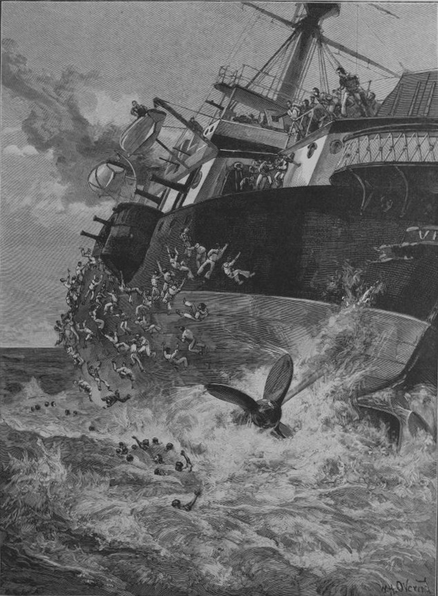
The Victoria had a fearful hole in her side, and as she heeled, her turrets and guns may have got loose and helped to turn her. She first seemed to have her bows under water, but made the signal ‘Negative sending boats’ and a semaphore, ‘Do not send boats but have them ready’. the next thing that I saw was that she began to heel over to starboard, and then more, until I could see her port screw going round out of water, it was a horrible sight. Next she seemed to make a plunge forward to starboard, and suddenly went right over, and we saw for a brief moment a most sickening sight, which I am sure, filled us all with awe – the enormous bottom upwards and both screws going round. I can see it now. In fact, one can never forget it. Then she sank and all was still. Of course, all boats in the Fleet were away as soon as we saw her with such a heel, and remained there until dark. However it was soon known that our Commander in Chief was gone. The poor engineers and the stokers in the engine-room and the stoke-hole ! Theirs must have been an awful death – too awful to think of. Thank God though that their end was not a slow one, for I think she blew up, as a few seconds after a huge volume of smoke arose to the surface.

One of the ship’s officers told me that there was hardly time to close the water-tight door, and when he tried to get below, he was stopped by the volume of water, so he began to get the boats out. But soon it was a case of ‘all hands for themselves’.  I believe the Admiral was last seen holding on to the rails of the chart-house forward, and would not leave the ship. poor fellow, I suppose at that last minute, he perhaps realised the mistake he had made and thought it best to show an example to duty by stopping at his post, although he told those around him to save themselves, for which I hope the country will forgive him. None of us can understand why the signal was made, although Markham hesitated in obeying it, and why the latter, fully knowing and realising the danger of the manoeuvre, ever carried it out.”

As well as Vice-Admiral Sir George Tryon, 22 officers and 336 men died in the sinking of the Victoria, although some reports put the number of casualties as high as 422. Of the casualties, 19 were were recorded as ‘boys’.

The wreck of the Victoria was considered to be in too deep water to attempt any recovery of bodies, and HMS Victoria still sits at the bottom of the Mediterranean near Tripoli, Lebanon.

The Illustrated London News carried a number of illustrations of the tragedy, including the following illustration showing the Victoria starting to turn over, with one of the screws already out of the water.Tryon Street

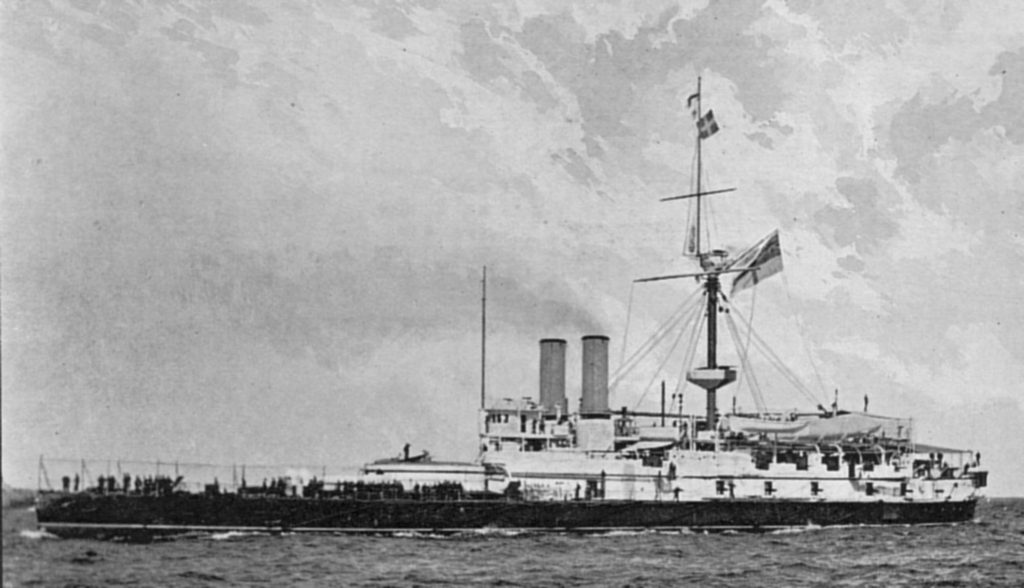
HMS Victoria before the tragedy:

Tryon Street

Image from: https://commons.wikimedia.org/wiki/File:HMS_Victoria_(1887).jpg

I cannot find any association between Sir George Tryon and the street that now has his name, however he did have a London house at Eaton Place, not that far away, on the other side of Sloane Square, where his wife was in residence at the time of the disaster.

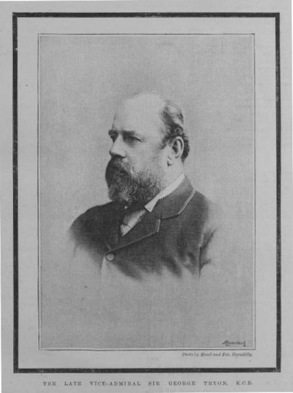
Portrait of Sir George Tryon from the many newspaper accounts of the disaster:

Tryon Street

Whilst Tryon Street may appear rather ordinary, the origin of the name is anything but.

Walking down Tryon Street, there are some interesting buildings. A short distance along on the right is this building. In the original photo, just the entrance on the left is visible.

Tryon Street

Further along, on one of the terrace houses on the left is a rather ornate plaque. Chelsea had a a long association with pottery so perhaps the plaque is from, or has some relevance to the Chelsea potteries.

Tryon Street

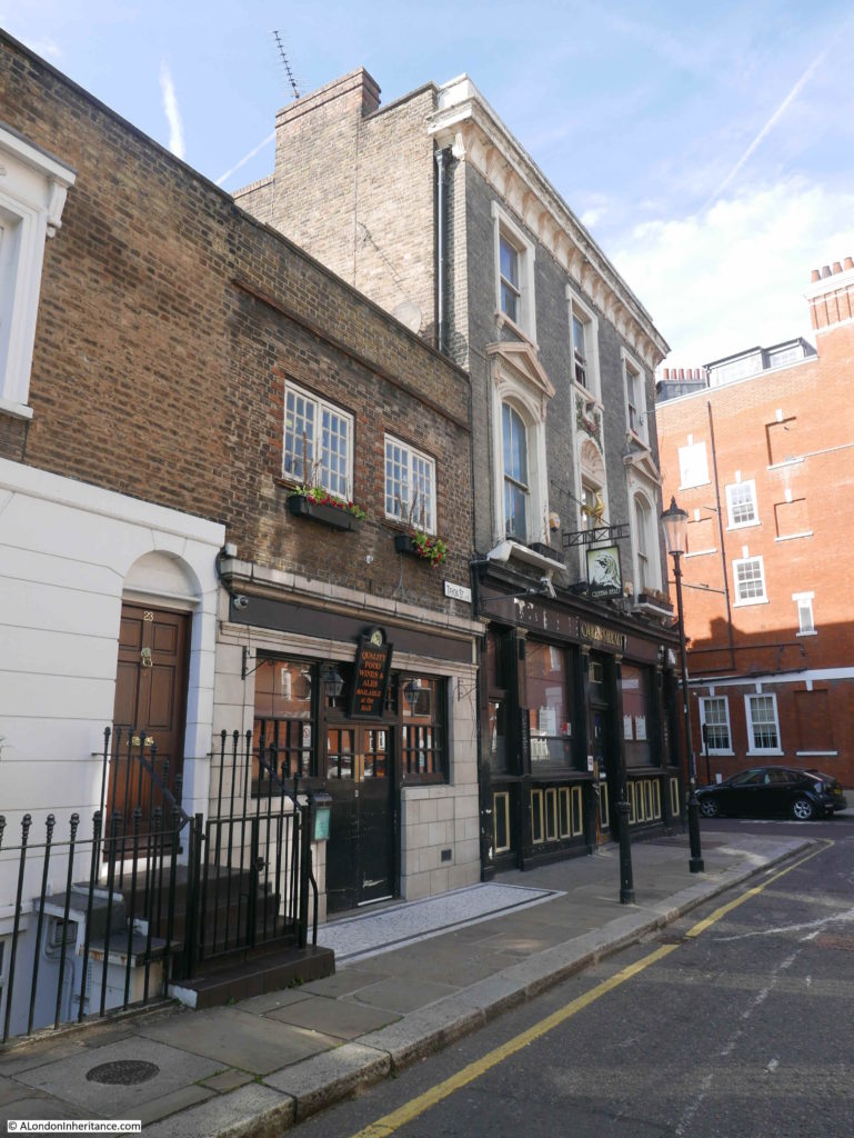
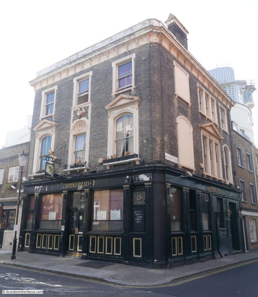
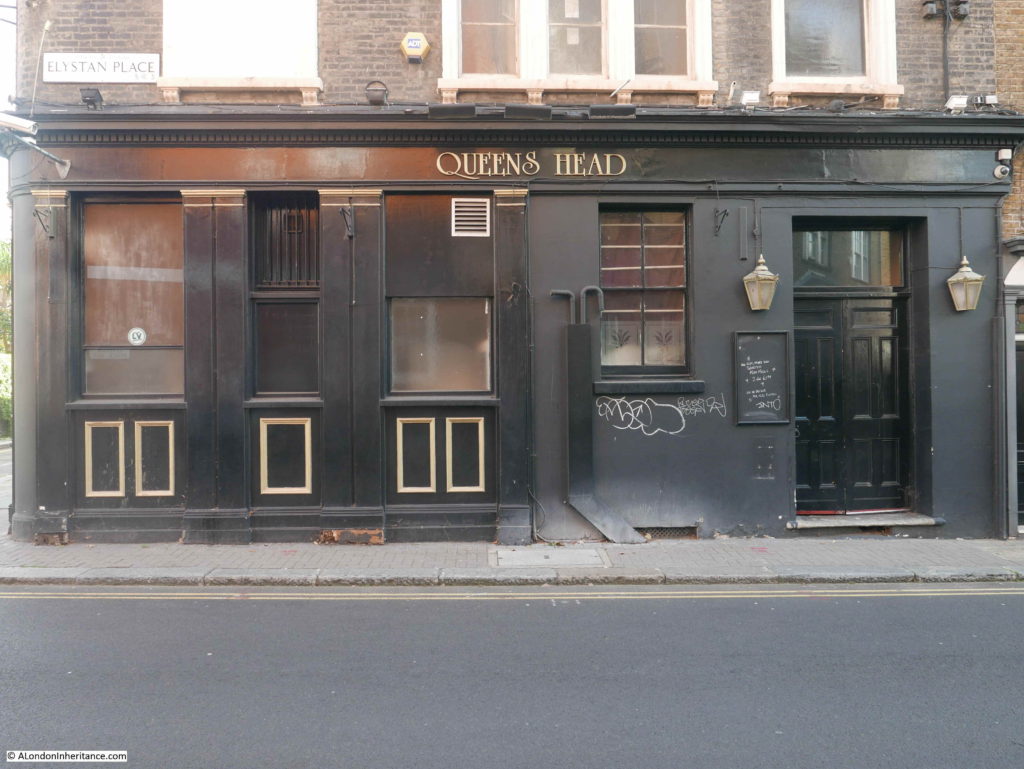
At the end of the street is a typical Victorian corner pub – the Queen’s Head.

Tryon Street

The pub closed on the 7th September 2016 and has been waiting for planning permission to be granted for changes. Originally a full conversion to residential was proposed, however the latest planning request is for residential on the first and second floors, and extension to the roof with conversion of the extension to the left of the pub also to residential.

The intention is that the pub will reopen on the ground floor and basement as a pub and restaurant.

The rather strange looking extension on the left of the pub is an early 20th century conversion, where the original house that was part of the 19th century terrace that runs along Tryon Street, was demolished and the pub extension built. It was used as a lounge bar to the pub.

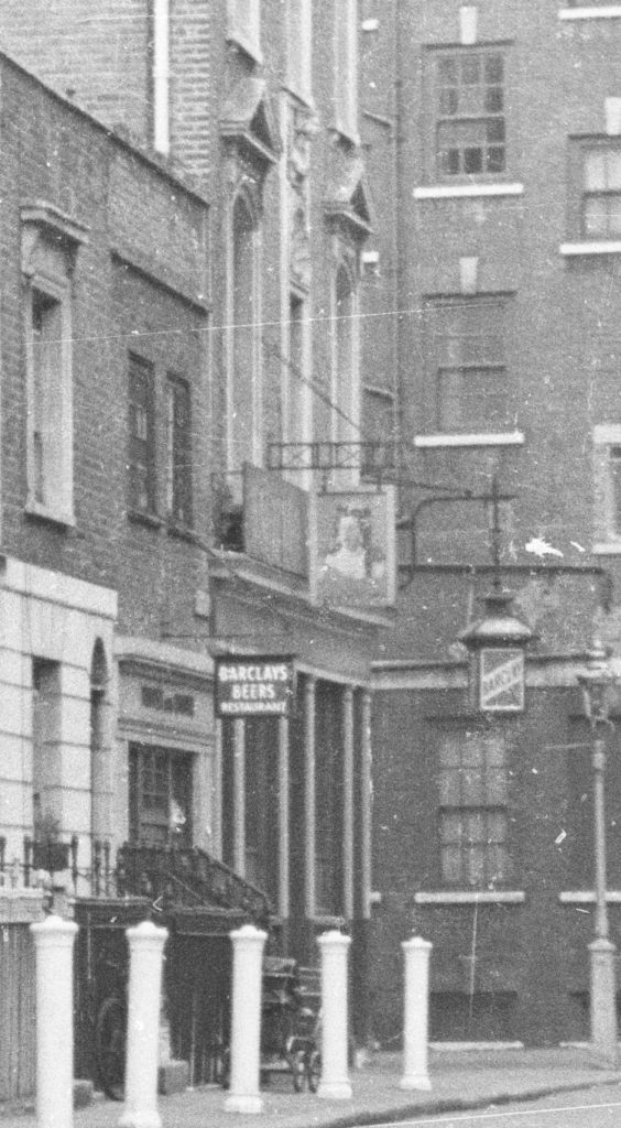
I cut an extract from my father’s original photo to show the detail of the pub as it was.

Tryon Street

The pub sold Barclays Beers. There is what appears to be a pram parked outside the pub.

The Queen’s Head is a very distinctive feature on the corner of Tryon Street and Elystan Place. The building is higher than the terraces on either side helping the pub to stand out.

Tryon Street

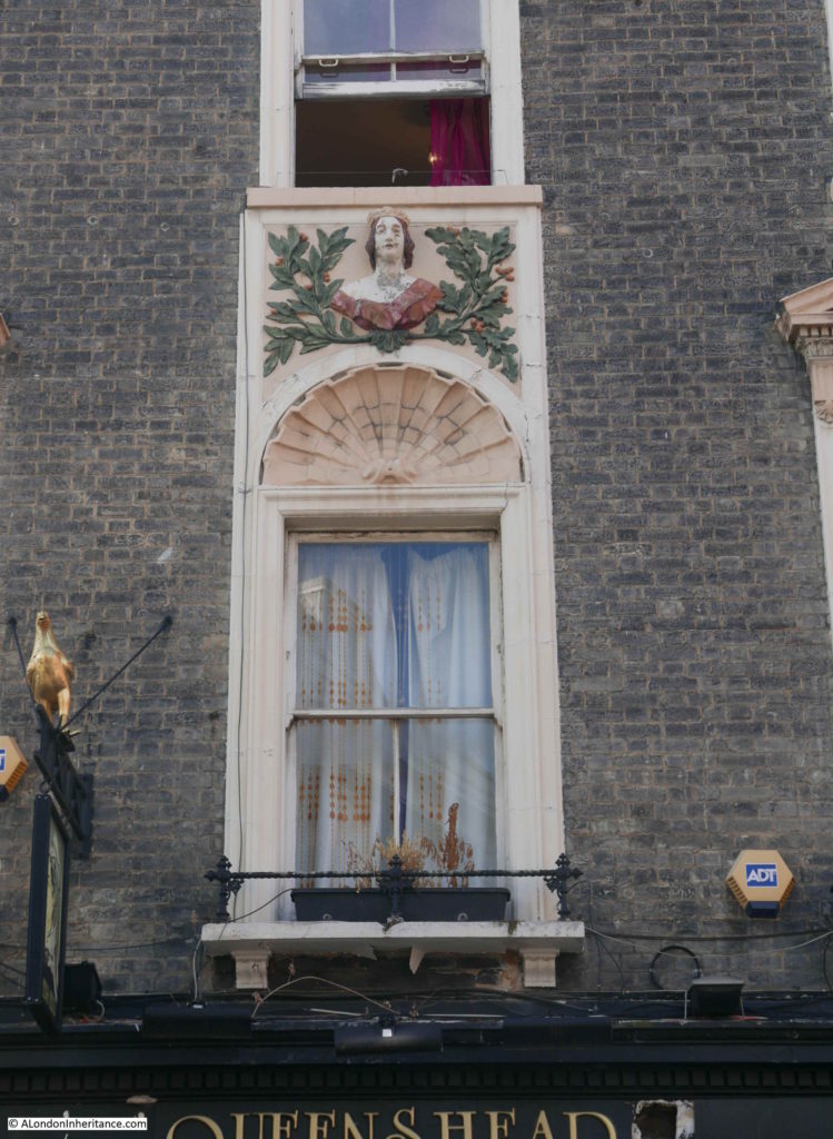
Decorative feature of the Queen’s Head on the first floor of the pub facing onto Tryon Street.

Tryon Street

The Queen’s Head facade facing Elystan Place.

Tryon Street

In the short time I was in Tryon Place, it seemed very quiet, very different to the King’s Road at the end of the street. There was no through traffic and just the occasional walker using the street as a cut through to somewhere else.

A search through newspapers revealed the normal adverts of goods for sale, situations vacant, tragedy and strangeness that can be found in any London street over the years.

On the 2nd of August 1940, Mr William Hendra aged 70 dropped dead in Tryon Street whilst on his way to work. He had been a foreman painter for 46 years and left a widow, fours sons and three daughters.

In October 1952, a man was arrested at 4:40 am “because he insisted on standing in the middle of Tryon Street, Chelsea and playing a trumpet. David Patrick (aged 22 and described as of no occupation), of Sheffield Terrace, Kensington, was at West London, fined £1 on a charge of insulting behavior. He was ordered to forfeit 10s of his bail because he arrived late.”

In February 1940, the secretary of the Ye Old Bell Loan Club and the Queen’s Head Loan Club, both of the Queen’s Head pub, Tryon Street was sent to prison for a month after the loss of £70. In what must have been a very common situation, the secretary was out of work and having to support five children on 39s a week unemployment benefit. The magistrate appears to have been sympathetic as he said “I am exceedingly sorry to see you in the position you are now. It is impossible to pass over an offence of this sort. I don’t say you started taking money intending not to repay, but it is gross carelessness on your part to take £70 without knowing what had become of it. Unless you had a good character I would certainly have given you a long sentence. As it is, go to prison for a month and think yourself exceedingly fortunate”.

Looking back down Tryon Street towards King’s Road:

Tryon Street

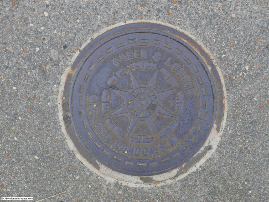
It is always interesting to look at the pavement when walking London’s streets, as well as the buildings. There are plenty of covers to coal holes along the pavement. This one is marked as Green & London – Chelsea, London, SW.

Tryon Street

The cover was purchased locally as Green and London were an ironmongers located at 121 King’s Road.

Tryon Street has changed very little over the last 70 years. A short street that most people appear to use as a cut through to and from the King’s Road, however it is a street with a name that recalls a naval tragedy of the late 19th century.

It will be good to see the Queen’s Head restored and reopened as a pub. There are too many lost pubs in London so retaining this fine Victorian example will be one small victory.

alondoninheritance.com

Albert Bridge And The Extra Piers

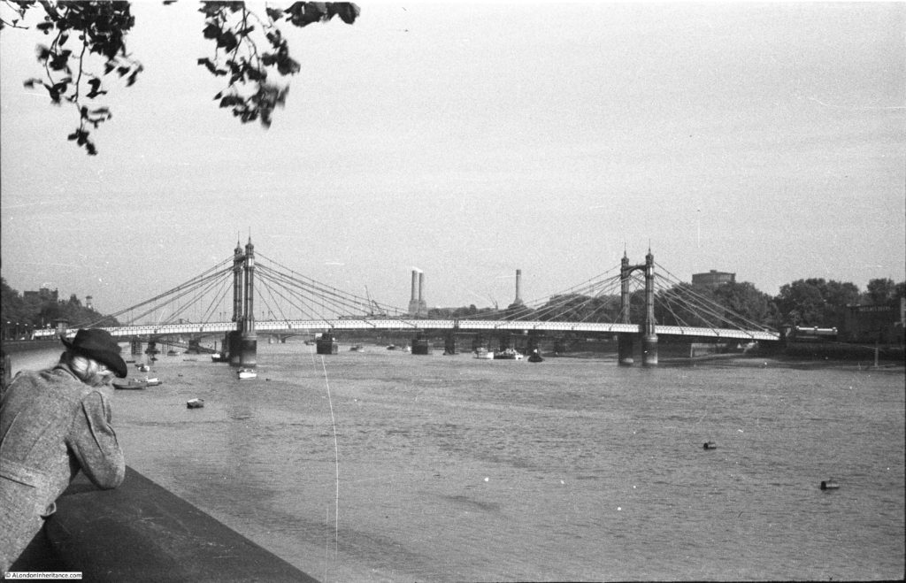
After exploring Cheyne Row for last week’s post, I walked along the Chelsea Embankment towards Battersea Bridge, to photographic the same view as my father’s photo looking along the River Thames towards Albert Bridge, with Battersea Park and Power Station in the background.

Albert Bridge

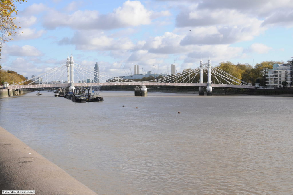
The same view today:

Albert Bridge

In the last half of the 19th century, Chelsea was growing rapidly. The Chelsea Embankment was under construction, the first Chelsea Bridge (originally called the Victoria Bridge) had been completed in 1858 and the nearby Battersea Bridge was of a rather old and fragile wooden construction.

Congestion and the rapid development of the area justified an additional river crossing and in 1860 Prince Albert proposed that an additional bridge between the two existing bridges would be justified by the volume of traffic and the revenue that would be generated by tolls for crossing the bridge. The Chelsea Bridge when opened was a toll bridge and proposals for the Albert Bridge included a toll for crossing the river.

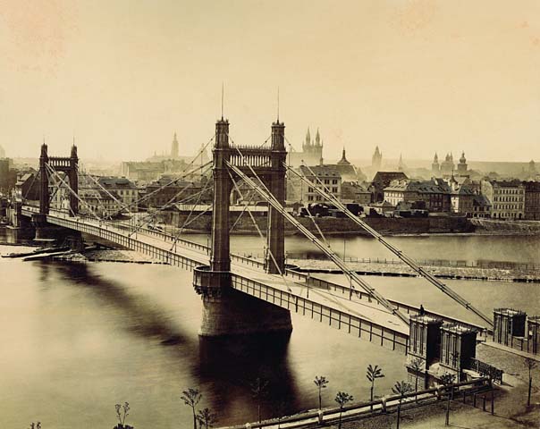
The Albert Bridge Company was formed to build and operate the bridge and construction started in 1870. The bridge was designed by Rowland Mason Ordish using his own patented design. Although construction of the Albert Bridge was approved in 1864, the six year delay to the start of construction (due to plans and work on the Chelsea Embankment), allowed Ordish to design and build another bridge using the same principles – the Franz Joseph Bridge which spanned the River Vltava in Prague.

The following photo of the Franz Joseph Bridge shows how similar the design was to the Albert Bridge, and also probably shows how the deck was suspended – a design that would lead to structural weaknesses in the Albert Bridge resulting in the need for additional strengthening over the years.

Albert Bridge

Source: By František Fridrich (21. 5. 1829 – 23. 3. 1892) [Public domain], via Wikimedia Commons)

The Albert Bridge was opened in 1873. The bridge was 710 feet long with a central span between the two towers of 384 feet. The design included toll booths at both ends of the bridge to collect the tolls for crossing the river. The cylindrical piers were the largest ever cast and were manufactured at a nearby metal works on the Battersea side of the river, then floated down to the location of the bridge, sunk in the river and filled with concrete.

Soon after construction, there were concerns about the strength of the bridge as it would frequently vibrate, a problem which was amplified when large numbers of people walked across the bridge in step – an issue when troops from the nearby Chelsea Barracks crossed the bridge.

The vibration of the bridge was the result of the synchronisation of the steps of those crossing the bridge. The same problem was seen when the Millennium Footbridge opened across the river in June 2000. When upwards of 2,000 people were on the bridge it would start to vibrate. Research has shown that when a bridge starts to vibrate, people walking across the bridge start to synchronise their step with the movement of the bridge, which in turn amplifies the vibration and movement.

Interesting that even after 130 years, the same problems can apply to a structure.

In 1884 Sir Joseph Bazalgette inspected the bridge and found that the iron rods supporting the bridge were showing signs of corrosion and a program of work was implemented to strengthen the bridge which included the installation of steel chains to support the deck along with the replacement of the timber decking.

The steel chains changed the appearance of the bridge from the original design, which probably looked very similar to the Franz Joseph bridge, to the Albert Bridge that we see today.

When I took the comparison photo, I was trying to align features on the bridge with the chimneys of Battersea Power Station to make sure I was roughly in the same position. There were a number of distractions to this.

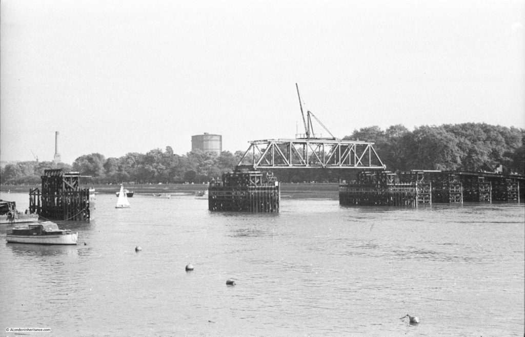
Firstly, if you look under the Albert Bridge there are a number of piers in the river further back. These are not the piers of Chelsea Bridge, rather they are the piers of one of the temporary bridges constructed over the river during the war to provide additional capacity should one of the main bridges be badly damaged by bombing. I wrote about this bridge in a previous post, and this is my father’s photo of the temporary bridge at Battersea:

Albert Bridge

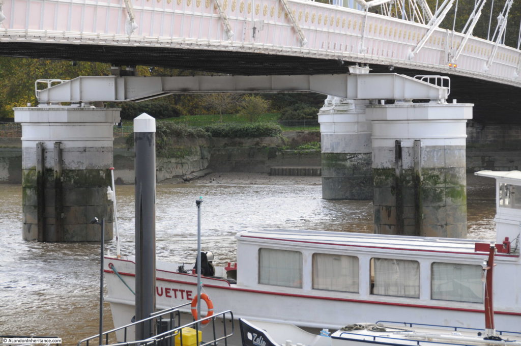
But there was another difference looking underneath the bridge – when my father took the original photo the bridge was a suspension bridge, with the central span supported across the river by the chains running from the top of each tower. In my 2017 photo there is a large pier supporting the centre of the bridge.

The central pier was the result of ongoing concerns about the strength of the Albert Bridge. After Bazalgette’s inspection in 1884, as well as the additional strengthening work, he imposed a weight limit of five tons for vehicles crossing the bridge.

There was a proposal to demolish the bridge in 1926 and replace with a new, stronger bridge, however lack of funding meant that this did not progress beyond the proposal stage. A second attempt to demolish the bridge was made by the London County Council in 1957, however a campaign led by John Betjeman saved the bridge again.

The weight limit for vehicles crossing the bridge had been further reduced to two tons in 1935, so clearly something had to be done to strengthen and preserve the bridge.

As well as replacing the decking and strengthening the bridge structure, the answer to significantly strengthen the bridge was to convert the bridge to a more traditional beam bridge by the addition of a central pier. The bridge closed in 1973 for this work to be carried out which resulted in the bridge we see today.

The two new central piers are of the same design as the original piers, however they support a metal girder that runs under, and supports the centre of the bridge:

Albert Bridge

In echoes of the Garden Bridge, there was also a proposal in 1973 to close the Albert Bridge to traffic and change the bridge into a public park and pedestrian walkway. John Betjeman also supported this proposal, along with many of the local inhabitants who probably saw the closure of the bridge to traffic as a way of reducing the ever increasing volumes of traffic along the Chelsea Embankment. Motoring groups opposed the idea and such was the need for river crossings capable of supporting vehicular traffic that the proposal was rejected and the bridge reopened to pedestrians and traffic after the strengthening work and the addition of the new central piers.

Despite this work, the weight limit has remained at two tons and to try and prevent vehicles over this weight from crossing the bridge a traffic island was introduced at the southern end of the bridge to narrow the entrance, thereby limiting the size of vehicles trying to cross.

The last strengthening work to be carried out was in 2010, and the Albert Bridge will continue to require periodic work to maintain the decking and the supporting ironwork well into the future.

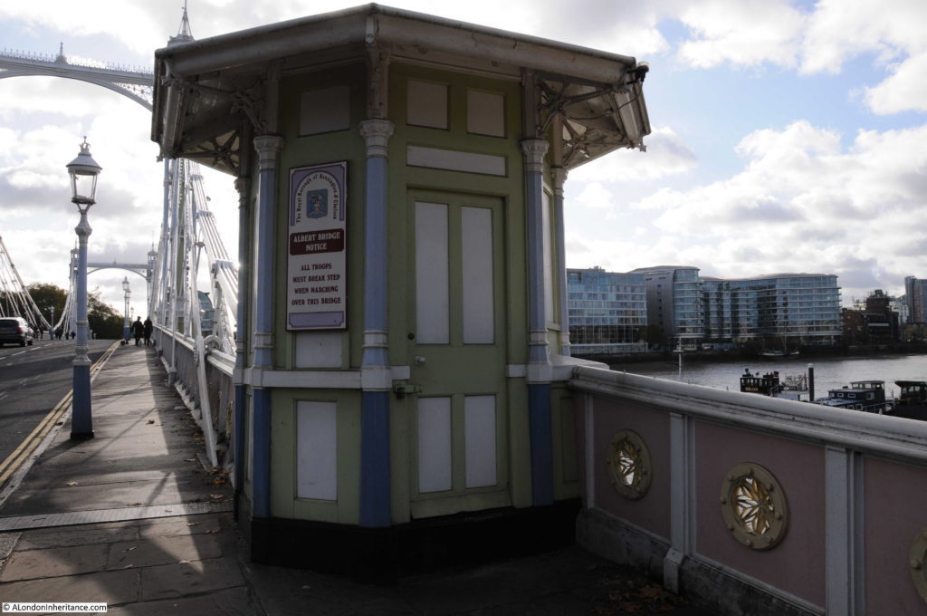
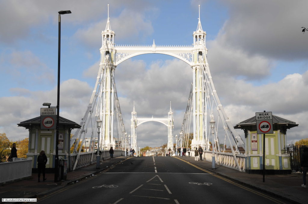
The toll booths at the entrance to the bridge:

Albert Bridge

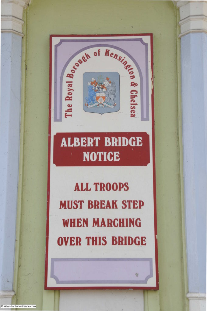
The toll booths still retain the signs warning troops to break step when marching across the bridge:

Albert Bridge

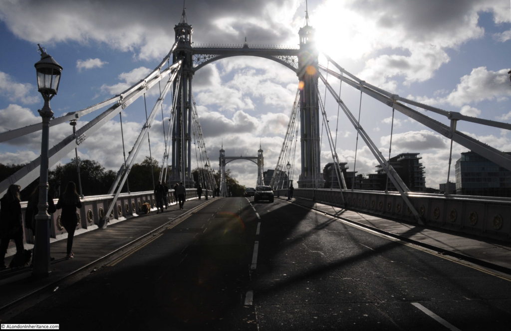
View across the bridge from the north side on a sunny autumn day:

Albert Bridge

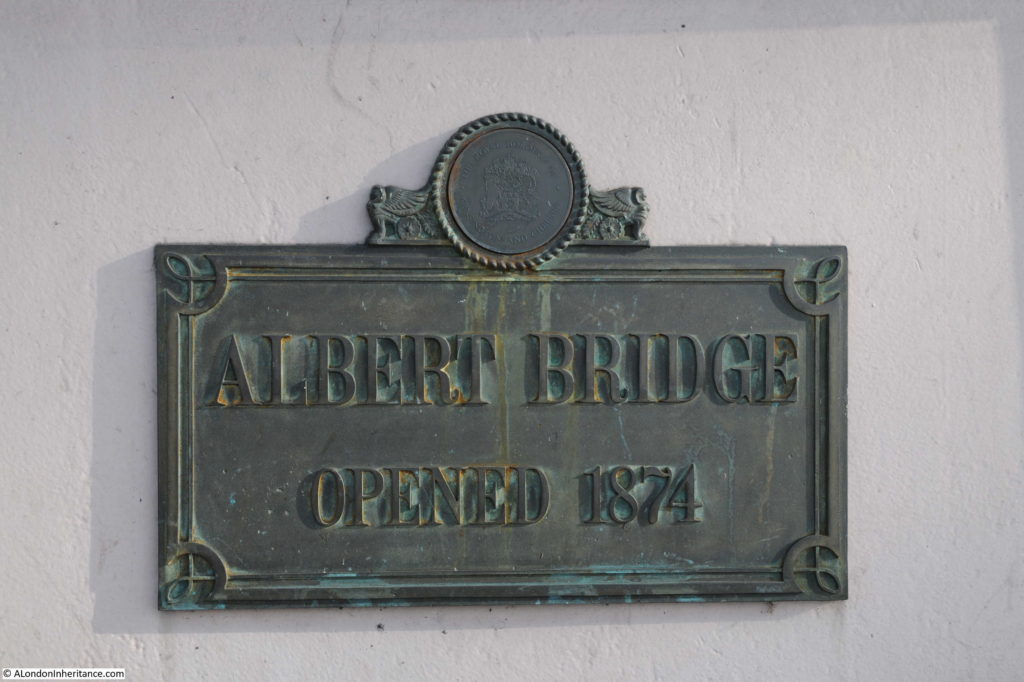
The plaque on the bridge states the bridge was opened in 1874, however the bridge had a phased opening.

Albert Bridge

The “Shipping and Mercantile Gazette” on the 1st January 1873 reported on the initial opening of the Albert Bridge:

“THE ALBERT BRIDGE AT CHELSEA – At 1 o’clock yesterday, amid the firing of cannon and waving of flags, the Albert Bridge at Chelsea was opened to the public. There was an absence of all ceremony, as the bridge is as yet in an unfinished condition. The opening simply consisted in the admission of the public over the bridge, the engineer, contractor and other gentlemen going over in a carriage. By this event, however, the conditions of the Act of Parliament have been complied with, which required that the bridge should be opened before the close of the year. The work of completion is being rapidly proceeded with, and in a short time the formal ceremony of opening the bridge may be expected to be performed.”

There does not appear to have been a formal opening ceremony, and there are reports in the newspapers of the time of the bridge opening to traffic in September 1873.

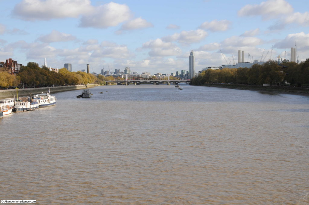
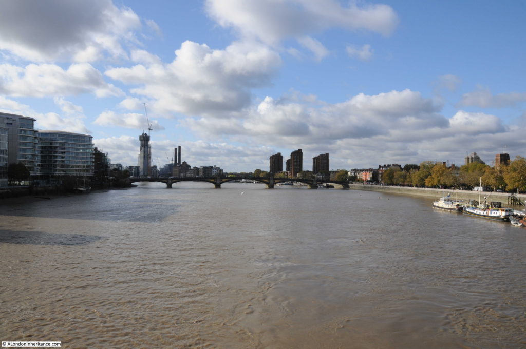
The view looking to the east from the centre of the bridge:

Albert Bridge

And the view looking to the west:

Albert Bridge

The bridges in the above photos, Chelsea and Battersea Bridges were, as with the Albert Bridge, all originally toll bridges, however soon after the Albert Bridge had opened, it was made toll free along with many other bridges across the river. The East London Observer reported in the 31st May 1879:

“FREEING THE BRIDGES OVER THE THAMES – a great work has just been accomplished in which the East End has co-operated with the West, although its first importance is for the latter. It was but the other day that Waterloo Bridge was thrown open free of toll, and the boon granted is conspicuous by the fact that in seven months the traffic has increased 90 per cent. But last Saturday five bridges were made free of toll for ever, these being the Lambeth, Vauxhall, Chelsea, the Albert and Battersea Bridges.

Within the Metropolis there are thirteen bridges spanning the River Thames and connecting the Middlesex and Surrey shores. With a view of obtaining for the public the full advantage of these bridges as a means of free communication between the various points of the Metropolis, the Board of Works in 1877, promoted a bill in Parliament, to enable them to purchase the interests of the several companies in all the toll bridges crossing the Thames within the metropolis, including the two foot-bridges at Charing Cross and Cannon Street railway stations, and also one bridge crossing the Ravensbourne at Deptford. the bill was successfully carried through both Houses of Parliament, and passed into law in July 1877.”

The Albert and Battersea Bridges were owned by the same company and the sum of £170,000 was paid by the Metropolitan Board of Works to the company for the purchase of the bridges.

From then on, crossing the river was toll free, which must have been one of the drivers to opening up business and trade on both sides of the River Thames, as the article also states that “A free communication across the Thames is an incalculable boon to all classes of inhabitants on both sides of the river”.

Following the opening of the bridges described above, the only bridges across the Thames that still had tolls were bridges at Wandsworth, Putney and Hammersmith.

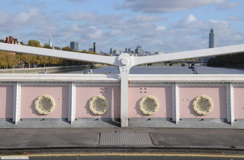
The view from the centre of the bridge – the style of decoration is the same throughout the bridge, with the round patterns repeated across both sides of the bridge span, and along the edge of the steps that lead up from the river walkway on the north bank of the river.

Albert Bridge

View from the traffic island on the southern end of the bridge looking back over towards the north:

Albert Bridge

It is perhaps a wonder that the Albert Bridge has survived so long. A bridge that once had a twin crossing a river in Prague.

A bridge that if the Chelsea Bridge had retained its original name would be one half of the Victoria and Albert Bridges.

And a bridge that may have been the original “garden bridge”.

The Albert Bridge is a unique bridge. The addition of the central pier has changed the design of the bridge to a more traditional beam bridge, however on a sunny autumn day it still appeared as London’s most beautiful bridge across the Thames.

alondoninheritance,com


Cheyne Row – Chelsea

Cheyne Row is an early 18th century street in Chelsea and is the location for this week’s post to track down the locations of two photos taken by my father in 1949.

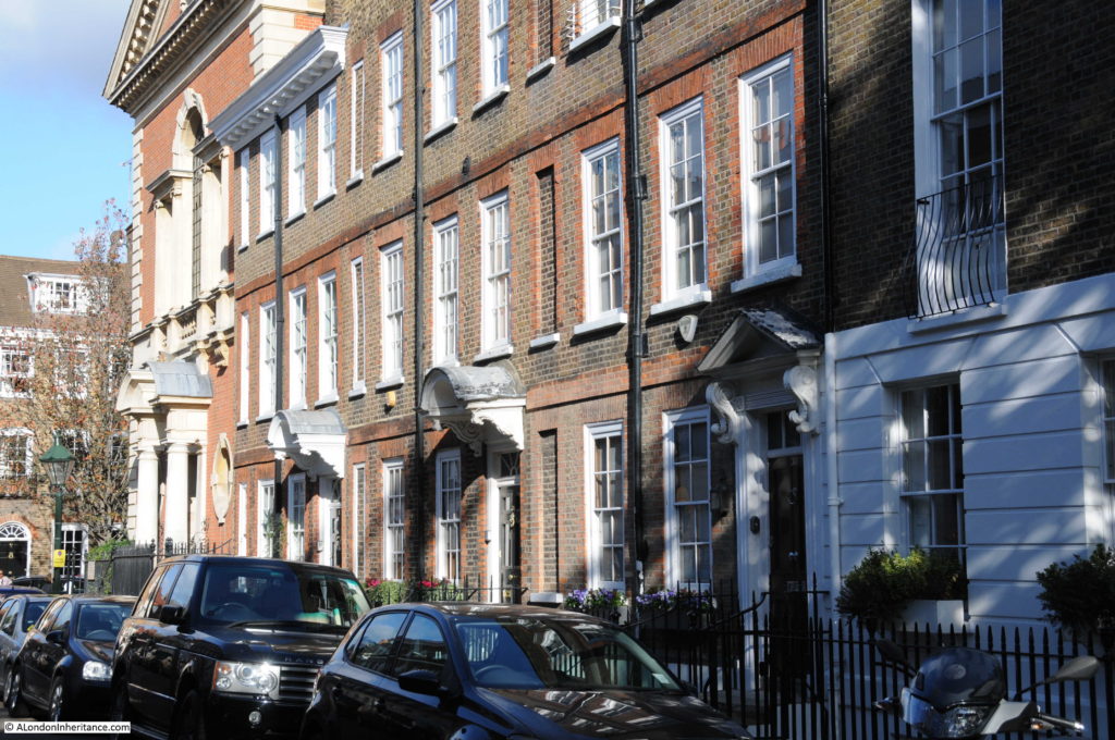
The first photo is of the terrace of houses with a church at the end of the terrace where Cheyne Row meets Upper Cheyne Row.

Cheyne Row

The same view today:

Cheyne Row

The view has hardly changed, just cosmetic details such as the removal of the balcony on the house on the right, and the addition of a canopy above the door on the third house along. A single car was parked in the photo in 1949, today there is continuous parking along both sides of the street.

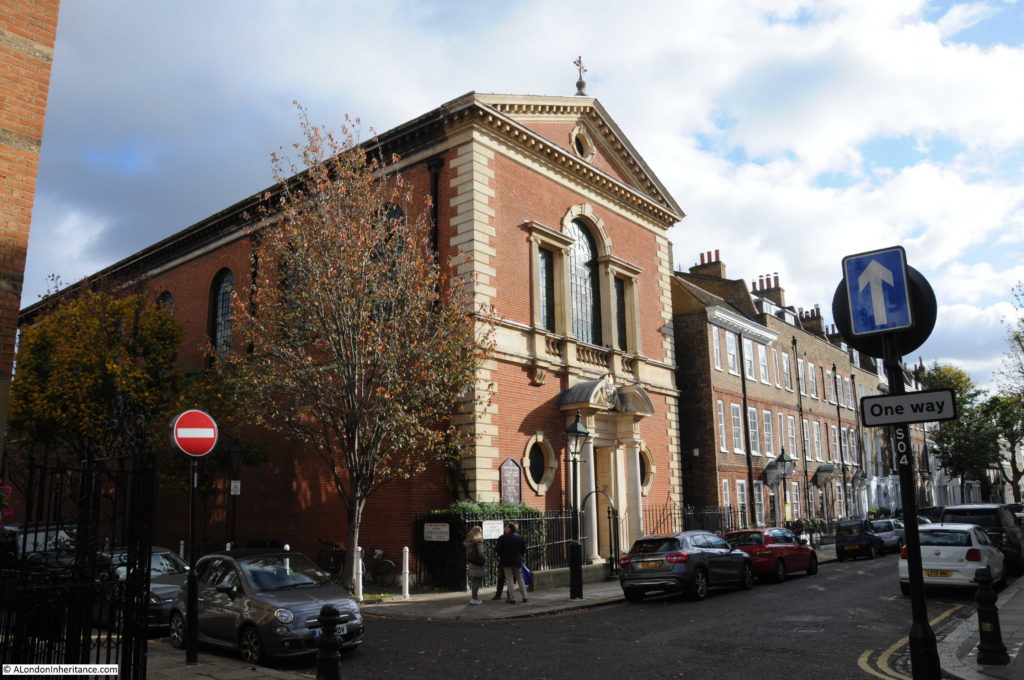
The church at the end of both photos has one of the longest dedications I have found – Our Most Holy Redeemer and St. Thomas More.

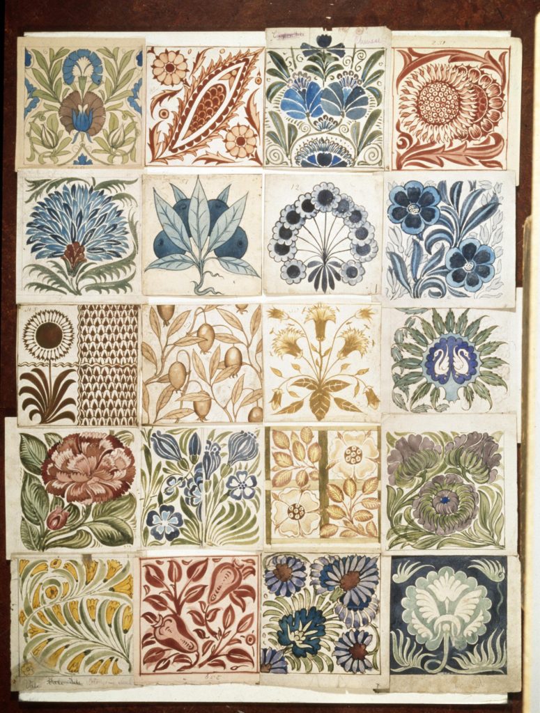
It was built between 1894 and 1895 on the site of the warehouse and showroom for the pottery run by William de Morgan who was in Cheyne Row between 1872 and 1881 before moving his pottery to Merton and then in 1888 to Sands End in Fulham. de Morgan was a friend of, and heavily influenced by William Morris. As well as pottery, he appears to have specialised in glazed tiles, very colourful and with intricate designs. The following picture shows a sample of his designs for decoration and ornament for pottery and tile work (© Victoria and Albert Museum, London):

Cheyne Row

In the 18th century, Chelsea was the location for a number of pottery businesses. Chelsea China was manufactured at a pottery in nearby Lawrence Street. Cheyne Row was also the location for Josiah Wedgewood’s London Decorating Studio. Pottery would be made at Wedgewood’s factory in Etruria near Stoke on Trent and brought down to London for final decoration before being sold to the affluent citizens of the city.

The main entrance to the church is on Cheyne Row and it extends back along Upper Cheyne Row. The crypt of the church was used as an air raid shelter during the 2nd World War. On the night of Saturday 14th September 1940, people were sheltering in the crypt when a high explosive bomb hit the church and exploded in the crypt. Of the 100 or so people in the crypt, 19 were killed by the explosion.

Cheyne Row

Despite the loss of life, the overall fabric of the church did not suffer major damage, unlike the nearby Chelsea Old Church which was completely destroyed in 1941 – see my post here.

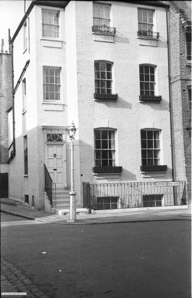
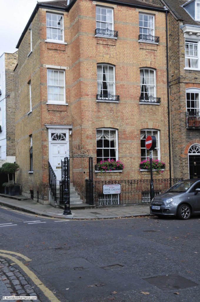
The second photo that my father took from Cheyne Row was from the end of the street, looking across to this building on the corner of Upper Cheyne Row and Glebe Place.

Cheyne Row

The same building today:

Cheyne Row

The key difference being that the white paint that covered the building in 1949 has been removed exposing the original brick work which, in my view, is a considerable improvement.

The only other change being the addition of the ornate ironwork at the sides and above the entrance from the street – the rest of the railings appear to be the same.

Cheyne Row was one of the first formal, residential streets in this part of Chelsea.

The street was built in 1708 on land that had been a bowling green belonging to the Three Tuns pub that was on the stretch of road facing the river.

Originally, the land had been part of the Manor of Chelsea, associated with the nearby Manor House which had been located to the west of Cheyne Row, just north of Upper Cheyne Row. The land and Manor House was purchased by Charles Cheyne in 1657. His son William inherited the estate, however he was also Lord Lieutenant of Buckinghamshire and preferred the country, so in 1712 William sold the Manor of Chelsea to Hans Sloane. The first part of Cheyne Row had already been built and named after the family that had owned the land for fifty-five years when the land was sold.

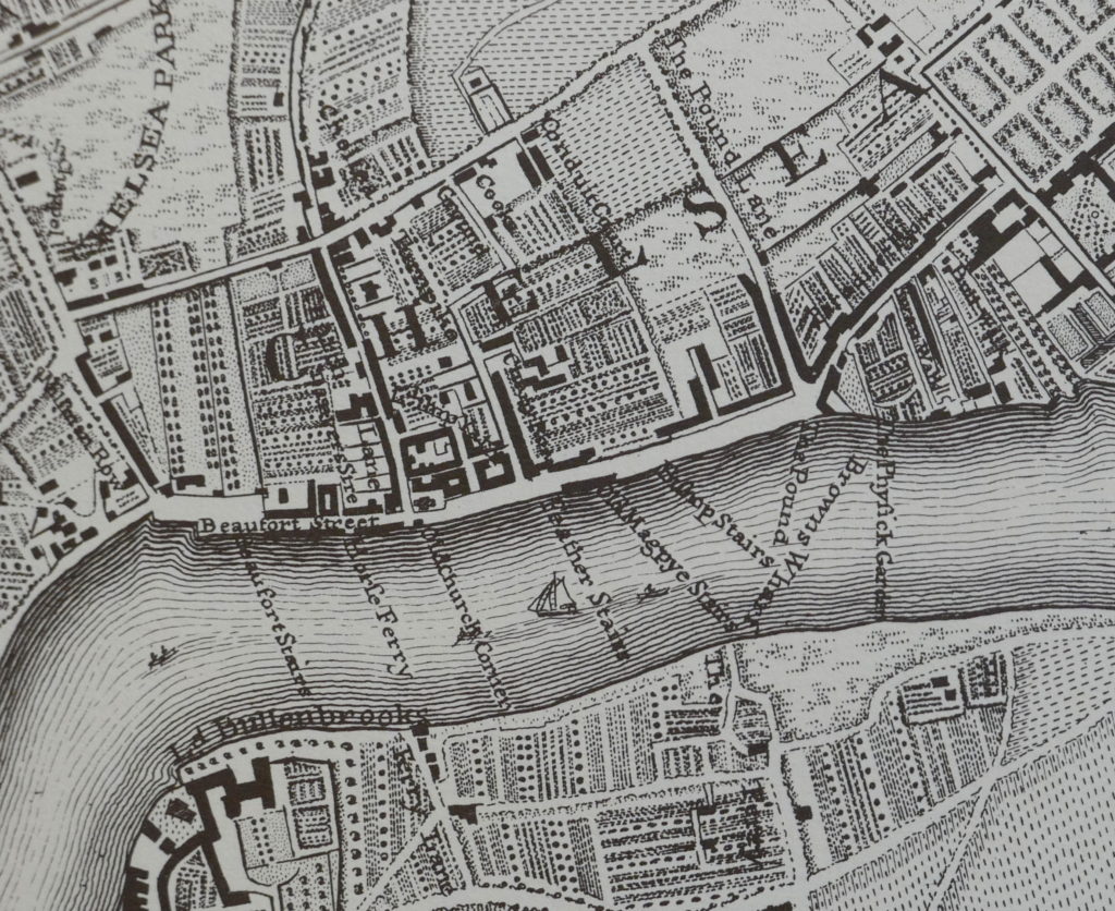
The following extract from John Rocque’s 1746 map shows Cheyne Row – the street in the centre of the map running up from the river with the solid black block of buildings on the right side of the street.

Cheyne Row

The map shows that the area was mainly gardens and orchards in the middle of the 18th century. The street running along the river ends at the junction with what is now Royal Hospital Road. The numerous stairs to the river, the boats on the river and the ferry landing points show that the river was probably the fastest and safest way to travel to central London from Chelsea.

To the right of Cheyne Row and towards Oakley Street (which now runs up from the Albert Bridge) was Shrewsbury House, another of the Tudor manor houses along this stretch of the river. Shrewsbury House was demolished in 1813, however the western boundary brick wall of the grounds associated with the house still forms the boundary wall at the end of some of the gardens of the houses on the eastern side of Cheyne Row. Tudor bricks from the house and boundary walls can also be found in the walls around this part of Chelsea.

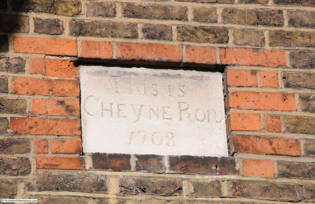
Stone plaque from 1708 recording that this is Cheyne Row (although the more I look at the plaque it looks like Cheyne Ron):Cheyne RowThe house with the 1708 plaque is on the end of the original terrace of Cheyne Row houses, the other end of the terrace are the houses shown in my father’s first photo.

Cheyne Row

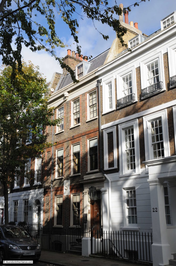
In the middle of this terrace is Thomas Carlyle’s house:

Cheyne Row

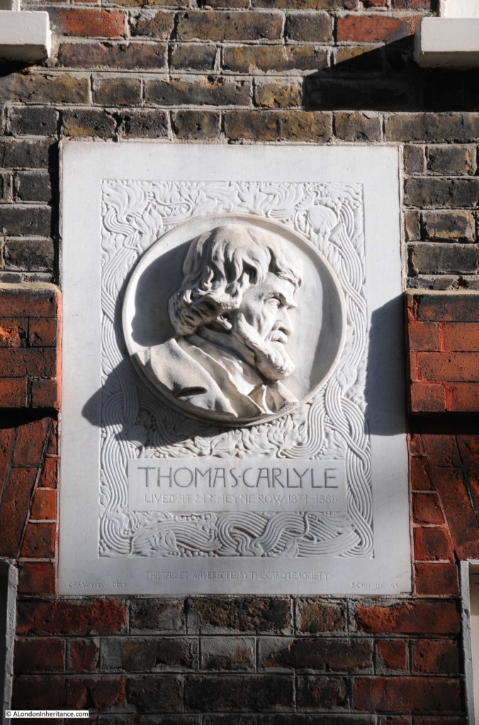
Thomas Carlyle was a Scottish philosopher, historian and writer, born in 1795 he moved to London with his family in 1831 before moving to Cheyne Row in 1834 where he would stay until his death in 1881. His wife, Jane, was initially concerned about the location, that being so close to the river the area would be foggy in winter, damp and unwholesome. The rent for such a large, solidly built house was low, only £35 for the first year as the area at the time had become rather unfashionable.

The house is owned by the National Trust. On the front of the house is a plaque erected by the Carlyle Society.

Cheyne Row

Thea Holme, the actress and also author of a couple of excellent books, one on the “The Carlyles At Home” and the second “Chelsea” which is a detailed history of Chelsea, lived in Thomas Carlyle’s house in the 1960s whilst her husband was working for the National Trust as the curator of the house.

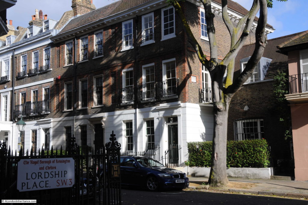
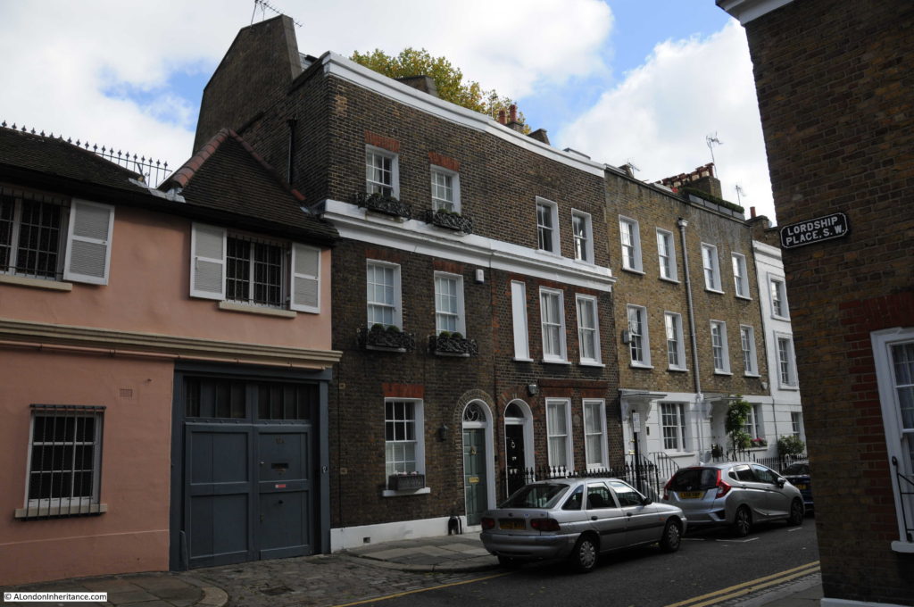
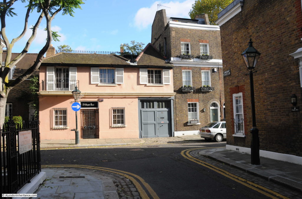
The junction with Lordship Place is roughly a third of the way up Cheyne Row from the river end of the street. The buildings to the left of this junction are the first to be built and were originally houses with single digit street numbers. For example Carlyle’s house was originally number 5 but is now number 24. This change in number was due to the additional building in the street and changing the numbers in what had originally been the section furthest from the Thames (also originally called Great Cheyne Row) to a single set of street numbers starting from the junction with Cheyne Walk.

The buildings to the right of the junction with Lordship Place leading down towards the river are of three storeys but are slightly smaller than the upper section of the street.

Cheyne Row

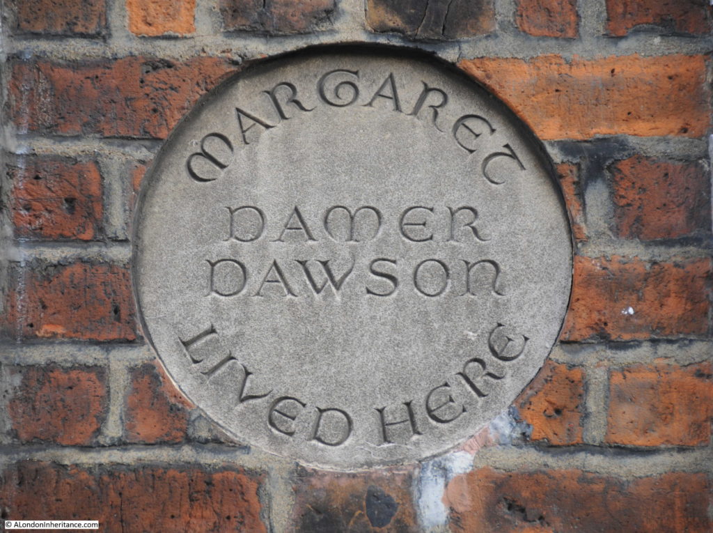
The second terrace house in the photo above, the one with the strange dummy window on the first floor has a round plaque between the windows on the ground floor:

Cheyne Row

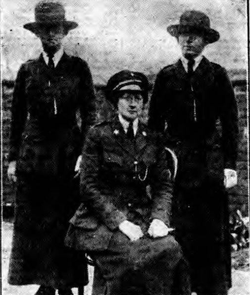
The plaque records that Margaret Damer Dawson lived in the house in Cheyne Row. Margaret Damer Dawson was a fascinating figure during the first couple of decades of the 20th century.

She was one of the founders in September 1914 of the Women Police Volunteers, which evolved into the Women Police Service, and which grew significantly during the First World War. As well as her interest in the police service, Margaret Damer Dawson was also a musician, a climber, motor-cyclist and a strong anti-vivisectionist.

The obituary published after her death in 1920 provides an interesting view of her achievements and of London during the First World War:

“The late Miss Margaret Mary Damer-Dawson OBE, whose death was announced last week, rendered valuable service to the young women of England by her work in connection with the Women Police Force of which she was Commandant.

The writer of a personal tribute in ‘The Times’ says her death came as a great shock to those who had known and worked with her. Woman of a naturally fastidious mind, she faced the realities of life with such courage that her work was of far more use than that of a woman of coarser fiber could have been. The most feminine of women, with a gentle voice and quiet manner, she yet went further than other uniformed women in adopting the outward symbols of male authority. She cut her hair close to her head, a fashion in which many of her inspectors followed her, and it was the rule of her force that superior officers were addressed as ‘sir’.

With the outward symbols, however the apparent masculinity disappeared. Everything that was young found in her a protector; she protected ‘khaki-mad’ young women from themselves, and she protected country-bred, ignorant young men, brought into big camps and great cities from harpies of all kinds. But especially was she the young woman’s friend. She was not of those who believed that it was only a young man who could sow his wild oats and then go straight; she believed that the young woman could pull herself together equally well, and she was entirely opposed to those who seem to think that sack-cloth and ashes and laundry work are the only possible means of redemption for a girl who has decided to give up a bad life.

Many girls who had strayed into the West End, had become known to the police, and had then tired of their life and wished to reform, found in her a useful and sincere friend. She had a gift for finding jobs for many protegees and girls who came to her, knowing her practical sympathy, rarely failed to make good. And even the failures she did not blame; for she knew that circumstances and the present state of the law were against them. One particular case moved her very strongly and she often told it as an example of how the fates played against her. A girl whom she had helped, and who had been accustomed to being in the West End at night, found ill-paid work in a factory near King’s Cross. A girl whom she knew on the streets sent her word that she was fallen ill and was penniless in lodgings near Leicester Square. the former was crossing the square to see her when a policeman who knew her, saw her and arrested her for accosting. On the policeman’s evidence the girl was imprisoned, and this nearly broke Miss Damer-Dawson’s heart. for the girl, when she came out, declined to work any more, as she refused to believe that once a women was known to the police she could never make good again.”

One of her motivations for founding the Women Police Service was her shock in discovering in 1914 that Belgian refugees from the Germans were being enticed into the sex trade by pimps and gangsters, often as they arrived as London’s train stations.

As well as support of the police service which was short of offices due to the war, the Ministry of Munitions employed members of the women’s police service to search women munition workers when they entered and left munition factories.

At the end of the First World War Damer-Dawson asked the Chief Commissioner of Police to make the Womens Service a permanent part of the police force, however he refused, apparently stating that the women were “too educated” and would “irritate” male members of the police force.

Magaret Damer-Dawson was awarded an OBE for her work with the Women Police Service during the First World War. She is pictured here, seated in uniform:

Cheyne Row

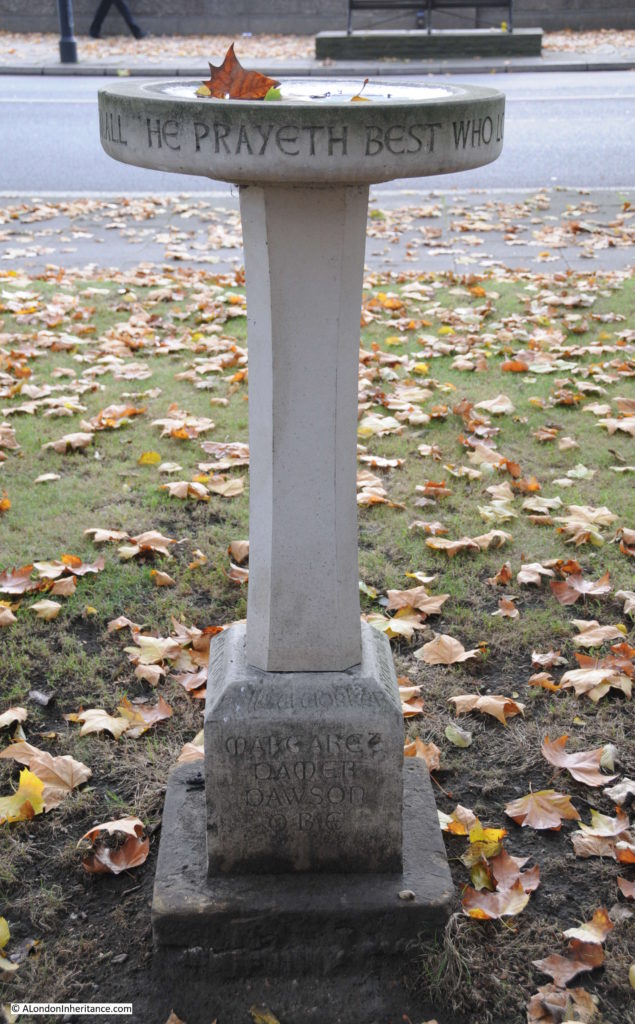
In the gardens that run alongside Cheyne Walk there is also a bird bath commemorating Damer-Dawson:

Cheyne Row

For a change, my walk around Cheyne Row was in lovely autumn weather, with sunshine highlighting to advantage the buildings that line the street. As well as the terraces of three floor houses, there are also buildings of very different styles showing that this is a street that has evolved since the first building in 1708, however despite these very different styles, they all seem work well together.

Cheyne Row

I mentioned Thea Holme earlier who lived in Carlyle’s house. In her book Chelsea, she talks about walking in Cheyne Walk and finding a foreign tourist looking lost and asking for “Chelsea”. She gradually comes to understand that by Chelsea he means the King’s Road, and then ends this story with the paragraph:

“But is there a Chelsea still which is not the King’s Road, which has not only a heart, but a spirit? Where is Chelsea, the Chelsea whose fame grew from century to century, spread abroad by the people who fell under the spell of this ‘Hyde Park on the Thames’? it is still on the Thames, though separated from it by an ever-increasing flow of traffic. It still has a beauty of water and sky, and the remains of nostalgic antiquity.”

Perhaps it was the lovely autumn weather, but I agree, it is easy to fall under the spell of this part of Chelsea.

alondoninheritance.com

Chelsea Old Church

So many historical buildings were destroyed across London in the last war, however few have been reconstructed with such care, and continue to fulfill their original function as the subject of this week’s post.

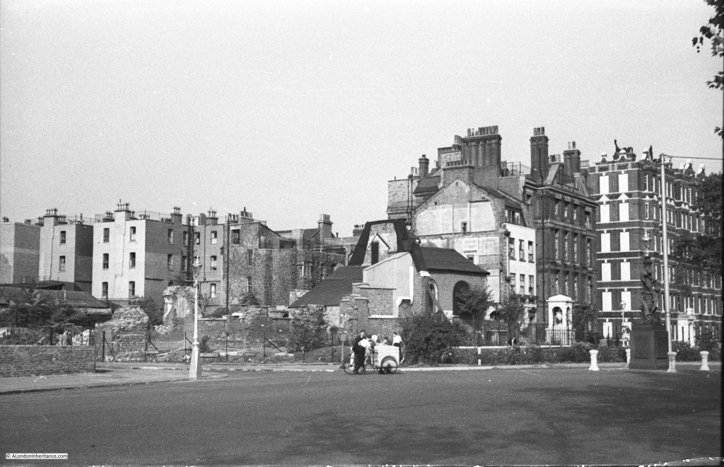
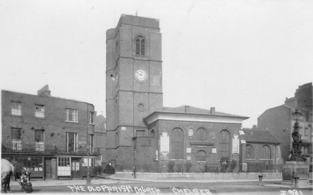
A quick look at the following photo and it is another bomb site, however the white monument on the right of the photo confirms exactly where this is, the site of Chelsea Old Church, at the junction of Old Church Street and Cheyne Walk. When my father took the photo, very little of the church remained apart from the chapel on the right. The main body of the church along with the tower had been completely destroyed.

Chelsea Old Church 1

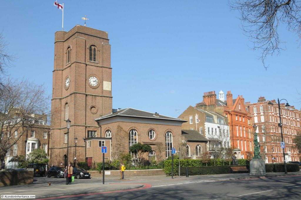
The same location today, with the reconstructed church. The monument and buildings to the right confirm the location.

Chelsea Old Church 2

And to confirm how accurately the church was reconstructed, the following photo shows the pre-war church.

Chelsea Old Church 15

In 1957 a booklet was published to raise money for the rebuilding fund. Titled “Chelsea Old Church, 1941 – 1950” it tells the story of the destruction of the church and the battle to rebuild.

The booklet starts with a paragraph summing up the night on which the church was destroyed:

“On the night of the 16th-17th April 1941, four hundred and fifty German bombers attacked south and central London for nearly eight hours. Civilian casualties were over one thousand killed and two thousand seriously injured, and among the buildings hit were eighteen hospitals and thirteen churches, one of which was Chelsea Old Church.”

Chelsea was heavily bombed that night with a total of five parachute mines, a range of high explosive bombs and hundreds of incendiary bombs. Parachute mines, or landmines were really the same mines as used at sea. They were dropped by parachute and detonated either by vibration or magnetism making them a problem on the ground until they could be safely dealt with.

April 16th had been a fine spring day, much like the day I visited the church, with the sun shining all day long.

The air raid sirens sounded at five past nine in the evening and the residents of Chelsea either headed towards air raid shelters or stayed in their homes and the fire watchers took up their positions ready to deal with any fires caused by incendiaries and to try and deal with any casualties of bombing.

Parachute flares were the first signs of the attack, dropping over the south east of Chelsea and over the Lots Road Power Station. The raid then intensified and the booklet takes up the story:

“By one in the morning about forty trapped casualties had been reported at the Royal Hospital Infirmary. A wardens’ post nearby had dealt with more than that number of walking cases and homeless persons. The Post Warden was conducting his senior officer, the District Warden, on a tour of the area, and they were returning from watching incendiary bombs rattling down on the warehouse roofs across the river when they saw six members of the Old Church Fire Party leave the shadow of the tower and walk away from it along Cheyne Walk towards Danvers Street.

The Post Warden had returned to Cook’s Ground School and was just lowering himself into a chair to make an entry in the Log Book when two heavy explosions occurred close at hand. The time was twenty past one. Everything in the room jumped, dust was shaken down, the noise of breaking glass and splintering woodwork came from elsewhere in the building. Leaving the telephonist in charge of the Post, the Post Warden dispatched all available wardens to investigate and went out himself. The District Warden joined him in the corridor. His windows had been blown in on top of him as he sat in his office, but he escaped injury. As they turned the corner from Gleve Place into Upper Cheyne Row light came from some of the houses; windows and window frames complete with blackout had been sucked out into the road or pushed into the room. Tiles, broken slates, lath and plaster, bits of wood and glass littered the roadway; but this was only the minor damage. Justice Walk was blocked halfway in from Lawrence Street and it was evident that the center of the damage was somewhere on the other side of it. As they ran round the corner into Cheyne Walk they were brought down by a length of garden railing. They saw flames leaping up in a thinning dust haze. Near Danvers Street in a shallow crater in the road a gas main was on fire. And then it came to them both: “The Old Church has gone!” There was a jagged stump of brickwork and projecting timbers silhouetted where the eye had expected the massive square tower.”

The account in the booklet then explains what had happened to cause such destruction:

“About the time the sirens sounded the “Alert”, Mallett and the others on duty had gone up to the top of the church tower, the first time they had been up there, he said. They stayed up there for a time watching the flares and then went down to the embankment. Later on they went back to the room on the first floor of Petyt House (just behind the church) for a cup of tea. After that they were in and out all the time. About one o’clock they went along Cheyne Walk towards Danvers Street and some of them were talking to one of the fire party on duty at the cafe on the corner there. The ack-ack fire had been very heavy and there was a lot of shell casing lying about. 

He had picked up a nose cap which had fallen outside the house with the copper panels on the gates (75 Cheyne Walk). He remembered saying to himself; ‘This is made of phosphorous bronze, expensive stuff to chuck about like this’, and then he heard something fall on the road beside him. It landed with a thump, not very loud, ‘like a fifty pound weight falling on soft ground’. It was not an alarming noise, and he looked round casually  to see what it was. Actually it must have been painted dark green, with the sea green parachute collapsing beside it. Mallett described it as a ‘big thing about seven feet long and as big as you could get your arms round.’

He shouted a warning to the others and started running. They probably saw it first for they were ahead of him and had turned into Old Church Street when a second mine struck and exploded between Petyt House and the Church. the explosion detonated the one which had landed unexploded beside Mallett. How he was not killed, blown to fragments like Michael Hodge and the others caught in the open, can only be guessed at. He said he was running too fast to turn the corner and follow the others up Church Street, and he was kneeling beside the fire alarm post on the corner of the street when the explosion took place. As he was on the far side of the tower and probably below the level of the church yard wall he was protected from the direct blast of the first explosion. There was in fact a fraction of a second’s interval between the two. It may be that the debris of the tower collapsed beside him into the roadway in time to divert the blast of the other mine lying not more than seventy-five yards away.”

The tower and the majority of the church had been complete destroyed. Only the More Chapel at the far end of the church from the tower remained (as can be seen in my father’s photo).

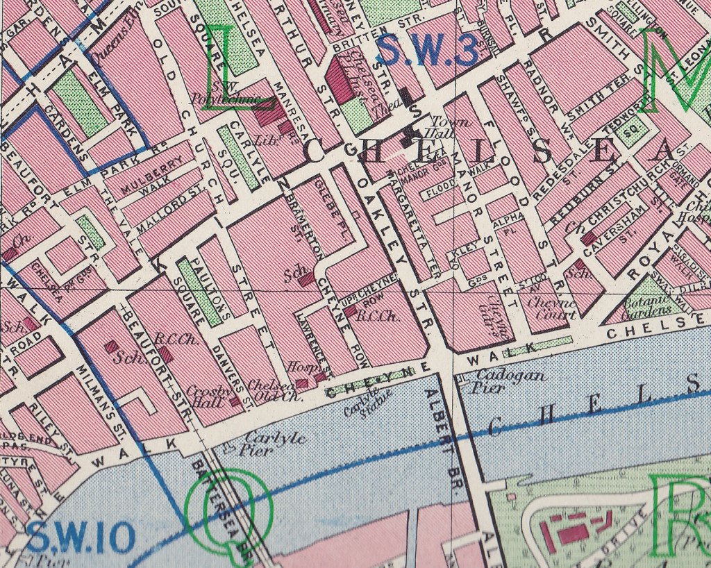
Map of the area in 1940 showing the church just above Carlyle Pier on the river with the street names, Old Church Street, Danvers Street, Lawrence Street, Cheyne Walk mentioned above.

Chelsea Old Church 17

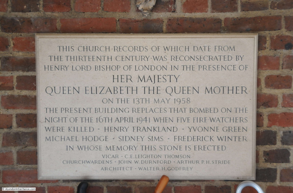
The following plaque in the entrance to the church records the names of the fire watchers who were killed when the church was bombed.

Chelsea Old Church 4

Whilst the plaque records their names, the booklet provides some background to help us understand more about the people who died protecting the church:

“There was a leader appointed for each night in the week. Normally Wednesday’s leader was Mr Bottley of Gregory Bottley & Co. Mineralogists, 30 Old Church Street and Mrs Bottley made one of the party, but they had gone away the week before on a three weeks trip to North Wales to obtain geological specimens and their places on the rota were taken by their manager, Mr Fred Winter and optical lens maker Mr. Sidney Sims. Both men had been with the firm since leaving school and were highly regarded. Sims was engaged to be married, Winter was married with two children. With Mallett, Winter and Sims on duty that Wednesday were Mrs. Greene, Michael Hodge and Mr. Franklin. The later was a carpenter employed by the Westminster Carriage Company, 48 Old Church Street, and was not strictly speaking a member of the Fire Party but had attached himself to them for the company and they included his premises in their patrols. Michael Hodge was aged seventeen and very tall for his age. He was waiting to go up to Cambridge but talking of enlisting in the Black Watch. He was staying at the Grosvenor Hotel with his parents and used to come down to Chelsea on Wednesday evening by taxi. Yvonne Greene of 34 Old Church Street, a Canadian and newly married to a Canadian army officer, was a part-time Auxiliary Fire Service driver.”

With the church destroyed, the challenge was now to protect the church site and plan for rebuilding. Anything that could be recovered from the site was quickly recovered and stored, however the site attracted problems during the years after the bombing:

“During the next two years there were no major engagements, though it was necessary to carry on a constant warfare against children who used the site as a playground, scribbling undesirable remarks on the stones and carrying off wood and bricks for their own purposes; and against adults, whom less excusably, stole lead to sell and wood to burn. It was Mr. Stewart Jones who took the initiative by getting the site fenced, and organised a concert to pay for it.”

The challenge for the church was getting approval and the funding needed to rebuild the church. The amount of damage across London meant that both funding and the labor and materials needed were in short supply during, and in the years after the war. There was no automatic assumption that Chelsea Old Church would be rebuilt.

Approval for reconstruction and funding was subject to Diocesan authority and expenditure required the consent of the Diocesan fund. A Diocesan Reconstruction Measure of 1941 placed the church on a list of bombed churches that would not be rebuilt within five years from the end of the war and there was doubt whether the church would ever be rebuilt.

In March 1945 proposals from the Diocesan Reorganization Committee recommended limited reconstruction of the church with just the More Chapel being retained to house the monuments recovered from the church.  The concern was that the remains of the church would be little more than a museum for the recovered monuments. A hard-fought campaign was needed over the following years to convince the Diocesan Reorganisation Committee that the full church should be rebuilt with permission and funding to build to the same design as the destroyed church. Fund raising took place and approval was finally given with the More Chapel reopened for services in 1950 and the whole church reconsecrated in May 1958.

The history of Chelsea Old Church requires a dedicated post to do justice to the church, however the following is a brief walk round the church.

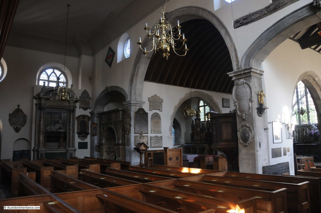
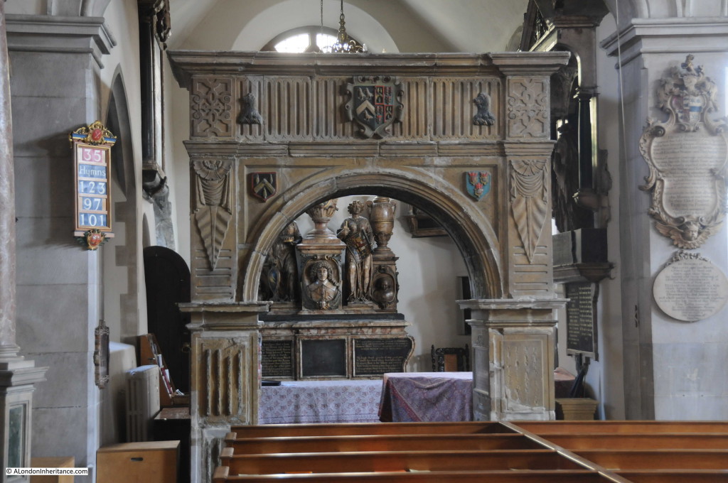
Looking across the church to the More Chapel, the Jervoise arch and the memorial to Lady Jane Cheyne:

Chelsea Old Church 3

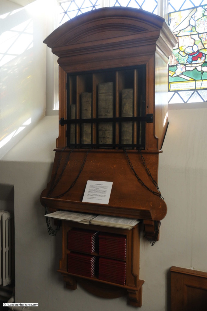
The church is the only one in London with any chained books. In a case within the church are five chained books, presented to the church by the Lord of the Manor, Sir Hans Sloane. The books consist of a Bible from 1717, first and third editions of Foxe’s Book of Martyrs from 1684, a 1723 book of Common Prayer and a 1683 volume of Homilies.

Chelsea Old Church 8

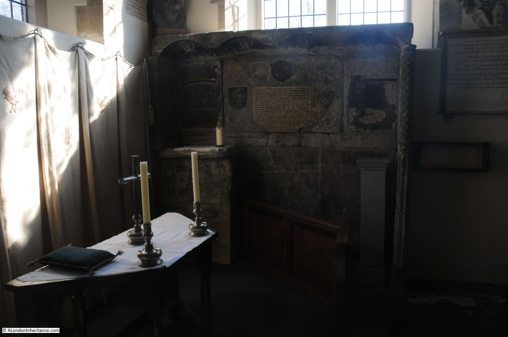
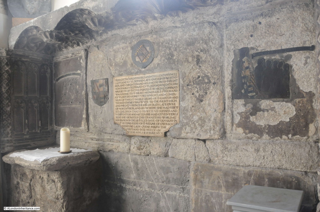
The remains of the tomb from 1555 of Lady Jane Guildford, Duchess of Northumberland.

Chelsea Old Church 6

The inscription reads:

HERE LYETH Y RIGHT NOBLE AND EXELLENT PRYNCES LADY JANE GVYLDEFORD LATE DVCHES OF NORTHVBERLAND DAUGHTER AND SOLE HEYRE VNTO Y RIGHT HONORABLE S EDWARD GVYLDEFORD KNIGHT LORD WARDEYN OF Y FYVE PORTES Y WHICH S EDWARD WAS SONNE TO Y RIGHT HONORABLE S RICHARD GVYLDEFORD SOMETYMES KNIGHT AND COMPANION OF Y MOST NOBLE ORDERE OF Y GARTOR AND THE SAID DVCHES WAS WYFE TO THE RIGHT HIGH AND MIGHTY PRINCE JOHN DVDLEY LATE DVKE OF NORTHVBERLAND BY WHOM SHE HAD YSSEW XIII CHILDREN THAT IS TO WETE VIII SONNES AND V DAWGHTERS AND AFTER SHE HAD LYVED YERES XLVI SHE DEPARTED THIS TRANSITORY WORLD AT HER MANER OF CHELSEY XXII DAY OF JANVARY IN Y SECOND YERE OF Y REIGNE OF OWR SOVEREYNE LADY QVEEN MARY THE FIRST AND IN A MDLV ON WHOSE SVLE IF SV HAVE M’CY

Standing in the church and thinking about even the recent history of the church, the words “this transitory world” are so very true for all those who have lived in, and traveled through London.

Chelsea Old Church 7

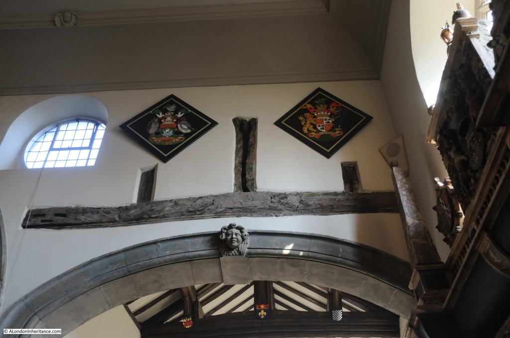
Although the bomb blast destroyed the majority of the church, the More Chapel was mainly intact and between the main body of the church and the More chapel, part of the original wooden construction of the church was exposed by the blast. The wooden “King Post” from the pre-Tudor construction of the building was not plastered over during rebuilding and has been left exposed.

Chelsea Old Church 16

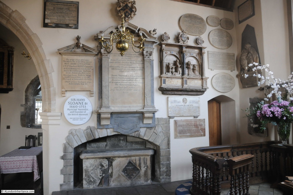
Monuments and plaques from the 16th century onwards:

Chelsea Old Church 9

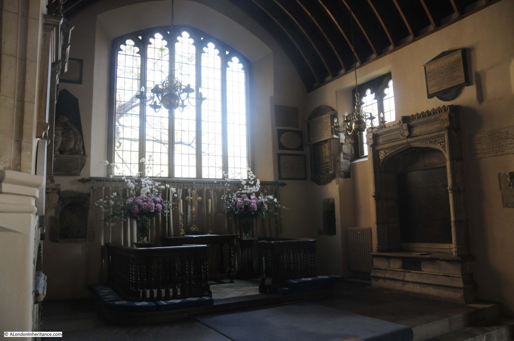
A view of the Sanctuary and on the right the memorial to Sir Thomas More.

Chelsea Old Church 5

Built by More for his first wife and intended by More also for him and his second wife after their deaths. The inscription, written by More describes his life and ends with a tribute to both his wives:

Sir Thomas More’s first loving wife lies here

For Alice and myself this tomb I rear

By Joan I had three daughters and one son

Before my prime and vig’rous strength was gone

To them such love was by Alice shown

In stepmothers, a virtue rarely known

The world believed the children were her own

Such is Alicia, such Joanna was

It’s hard to judge which was the happier choice

If piety or fate our prayers could grant

To join us three we should no blessings want

One grave shall hold us, yet in heaven we’ll live

And Death grants that which Life could never give

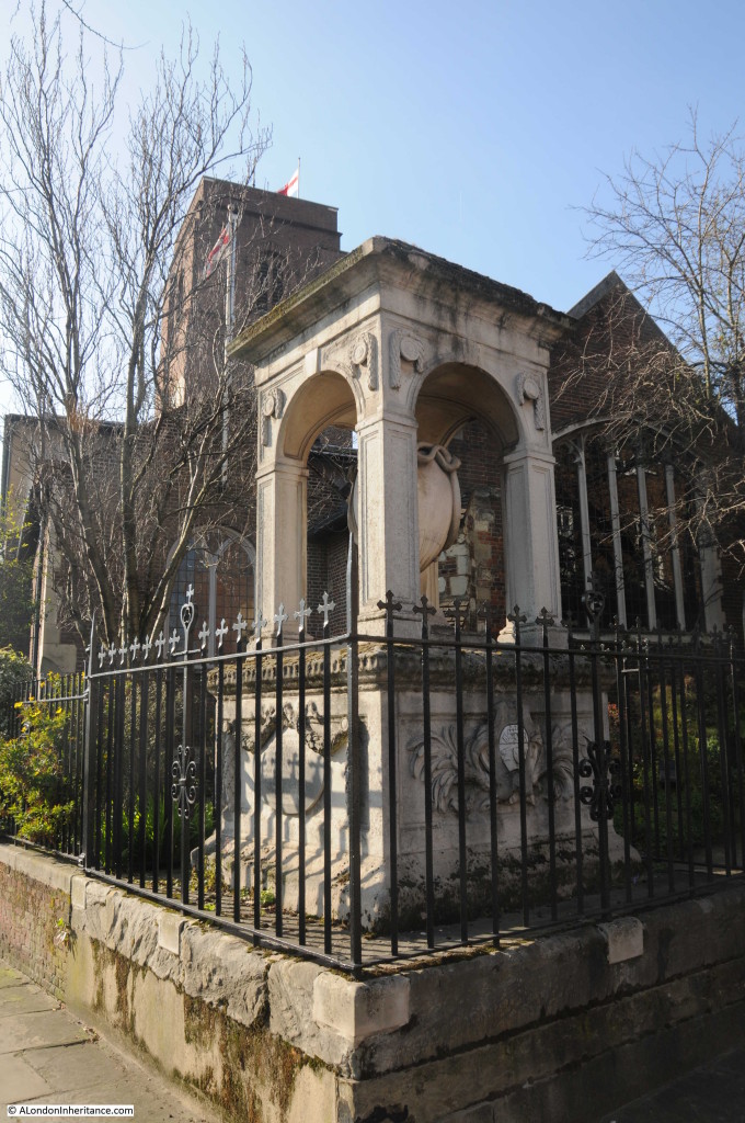
Another of the monuments from the original church, the triumphal arch commemorating Richard Jervoise:

Chelsea Old Church 10

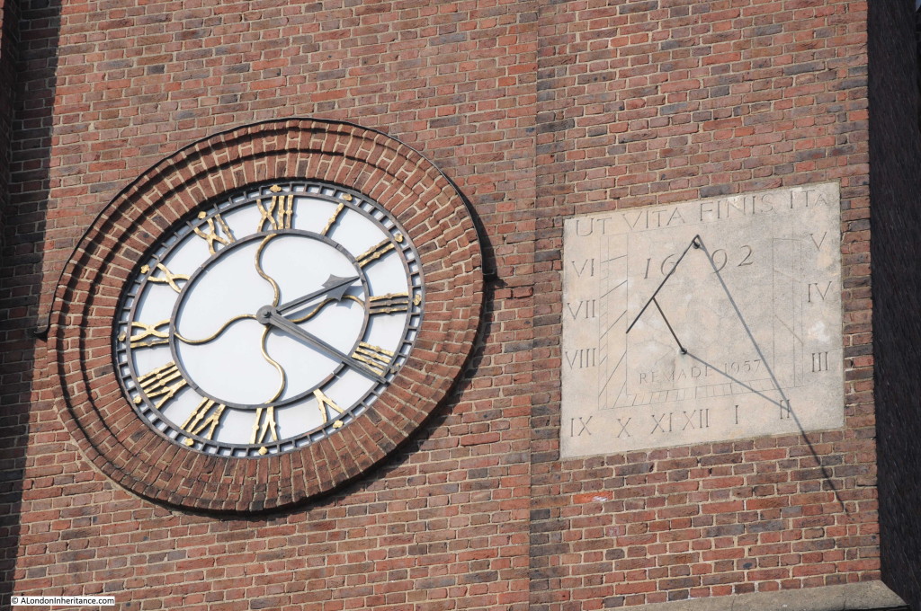
The sundial on the south-facing tower of the church, remade in 1957 and identical to the original (see the pre-war photo at the top of this post to see the original sundial in the same position).

Chelsea Old Church 13

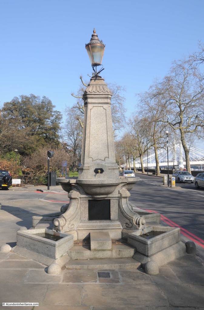
There are a number of monuments outside the church, including this water fountain built-in 1880 by the widow of George Sparkes of the East India Company:

Chelsea Old Church 11

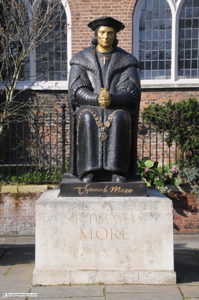
The 1969 statue of Sir Thomas Moor.

Chelsea Old Church 12

Sir Thomas More’s association with the church began when he settled in Chelsea, the owner of a large estate close to the church. When he moved to Chelsea in 1520 he rebuilt one of the chapels and with his family, worshiped at the church when at his Chelsea residence.

Another memorial to a person with a close connection to Chelsea is the memorial to Sir Hans Sloan, who was also involved with the founding of the nearby Chelsea Physic Garden:

Chelsea Old Church 14

The fact that Old Chelsea Church is still here is a tribute to those who fought hard for the church to be re-built and to the same design as the pre-war church. It also reminds us of those who died trying to protect the area in which they lived and worked during the last war.

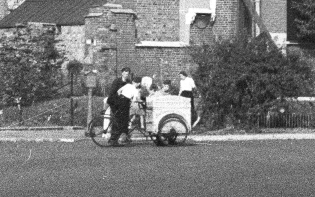
To finish, the following photo is an enlargement of a small section in front of the church from my father’s photo. I suspect this is an ice cream vendor cycling round the streets of Chelsea – very different to the busy road in front of the church today.

Chelsea Old Church 18

A church with a fascinating history and highly recommended for a visit, even if it is not a beautiful spring day in London.

alondoninheritance.com

The Chelsea Physic Garden

Last weekend I was walking in Chelsea, hunting down some of the locations of my father’s photos when I walked past one of the places I have always meant to visit.

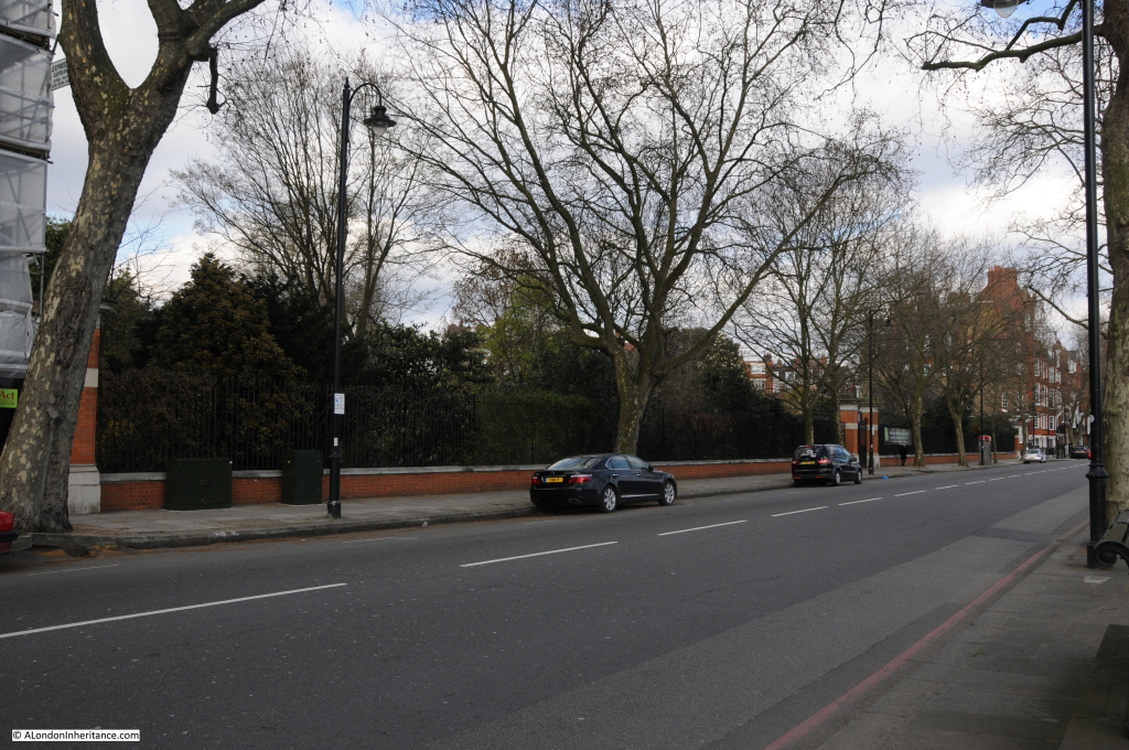
If you walk or drive along the Chelsea Embankment, in-between the rows of apartment buildings that face onto the embankment you will see a low brick wall with a slightly ornate entrance gate, with what appears to be gardens behind.

This is the Chelsea Physic Garden.

Chelsea Physic Garden

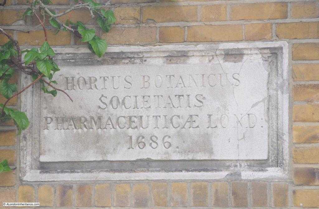
The main entrance to the Chelsea Physic Garden is on Swan Walk, which when facing the Gardens from the river forms the eastern boundary. A plaque in the brick wall adjacent to the entrance provides an indication of the function and the age of the Gardens:

Chelsea Physic Garden

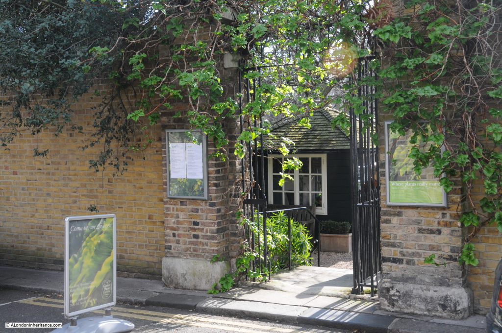
The main entrance is a relatively small gate in Swan Walk:

Chelsea Physic Garden

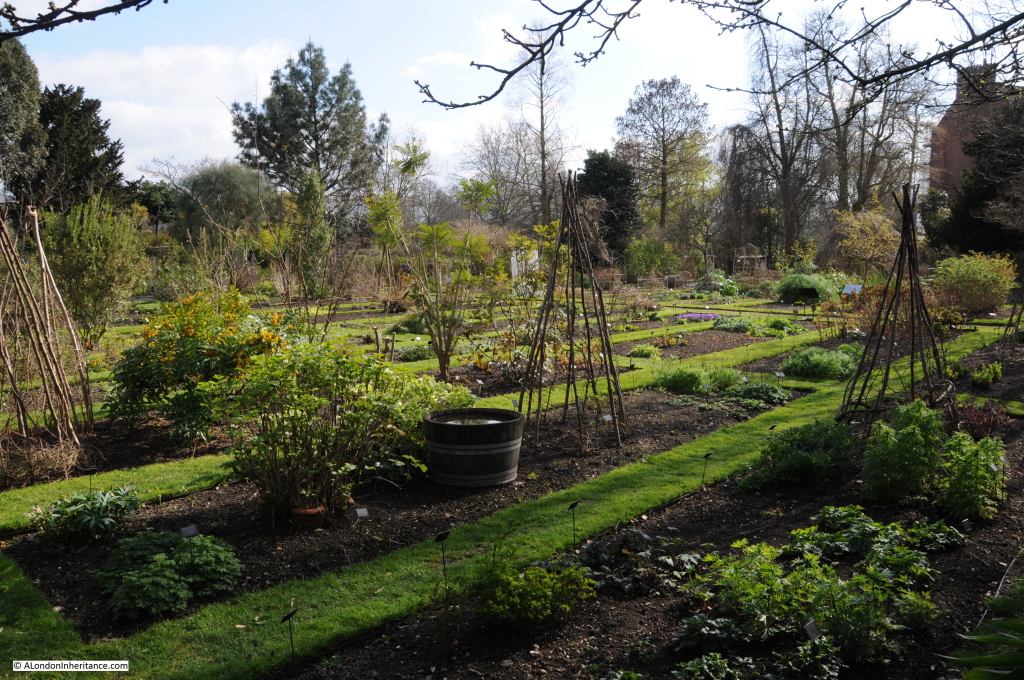
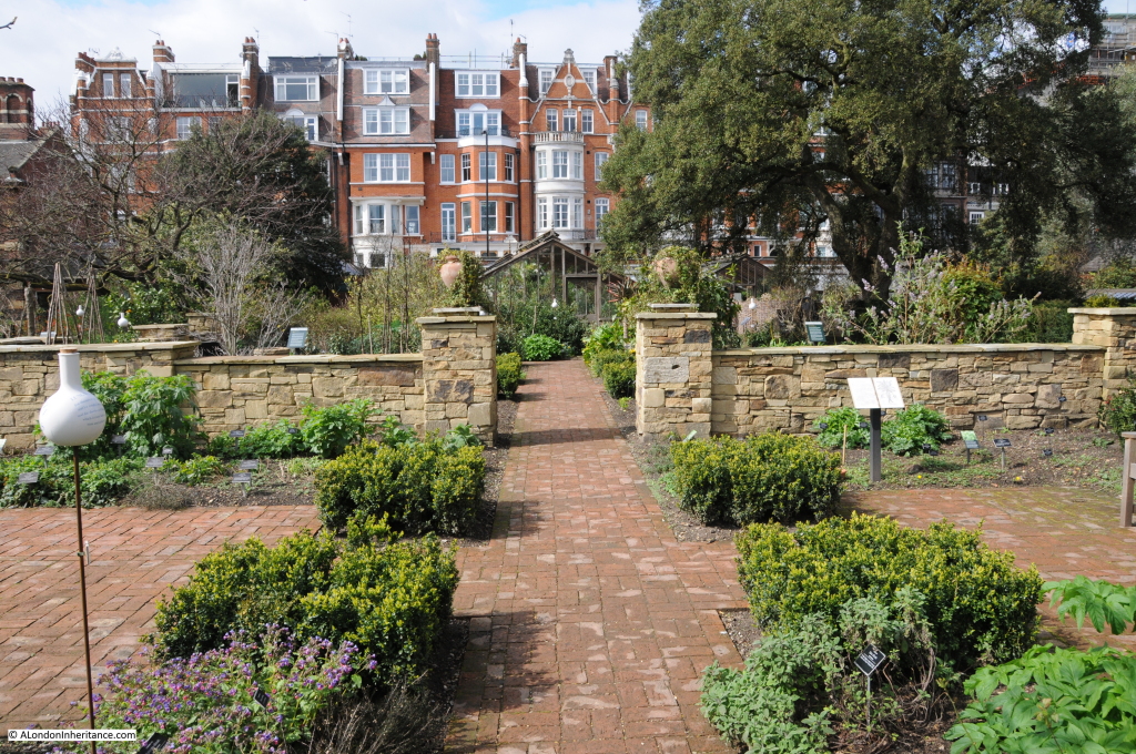
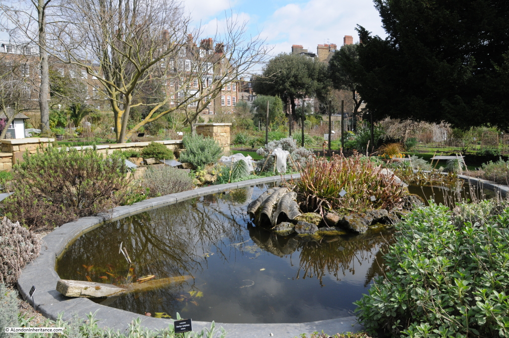
Once through the gate and having paid the entrance fee, the Gardens open up. Hard to believe that this is Chelsea and that the traffic on the Chelsea Embankment and the River Thames is just beyond the trees at the far end of the following photo:

Chelsea Physic Garden

The Chelsea Physic Garden was established in 1673 by the Worshipful Society of Apothecaries when the land was leased from Charles Cheyne, the Lord of the Manor of Chelsea. It has continued to occupy the same location adjacent to the River Thames, whilst the rest of Chelsea has been developed around the gardens.

The Apothecaries needed an area where medicinal herbs could be grown and apprentices to the Society could be trained in their use. The Society had acquired a Medical Garden at Westminster prior to Chelsea and it was the contents of this garden that were moved to Chelsea.

The location chosen in Chelsea was ideal. It was south-facing, fertile and directly adjacent to the river (the Chelsea Embankment had not yet been built) as the river provided easy and safe access to central London rather than cross the dangerous fields and marshes that extended east at this time.

In London Old and New, Edward Walford writes:

“The Physic Garden to which we now come, was originated by Sir Hans Sloane, the celebrated physician, and was handed over in 1721 by him, by deed of gift, to the Apothecaries Company, who still own and maintain it. The garden, which bears the name of the Royal Botanic, was presented to the above company on condition that it should at all times be continued as a physic-garden, for the manifestation of the power and wisdom, and goodness of God, in creation; and that the apprentices might learn to distinguish good and useful plants from hurtful ones. Various additions have been made to the Physic Garden at different periods in the way of greenhouses and hot-houses; and in the centre of the principal walk was erected a statue of Sir Hans Sloane, by Michael Rysbraeck.”

Walford gives the impression that Sir Hans Sloane created the Chelsea Physic Garden, however it was already in existence and Sloane had been an apprentice at the Garden. After Sloane had made his fortune (more on this in a later post on Chelsea), he purchased the Manor of Chelsea from Cheyne and granted a perpetual rent of the Garden to the Apothecaries for a peppercorn rent of £5 a year.

Chelsea Physic Garden

The Chelsea Physic Garden has not always looked as good as it does now. From “London Exhibited in 1851”:

“At the time the garden was formed, it must have stood entirely lying in the country, and had every chance of the plants in it maintaining a healthy state. Now, however, it is completely in the town, and but for its being on the side of the river and lying open on that quarter, it would be altogether surrounded with common streets and houses. As it is, the appearance of the walls, grass, plants and houses is very much that of most London gardens – dingy, smokey, and as regards the plants, impoverished and starved. It is however, interesting for its age, for the few old specimens it contains, for the medical plants, and especially because the houses are being gradually renovated and collections of ornamental plants, as well as those which are useful in medicine, formed and cultivated on the best principles, under the Curatorship of Mr Thomas Moore, one of the editors of the Gardeners Magazine of Botany. In spite of the disadvantages of its situation, here are still grown very many of the drugs which figure in the London Pharmacopoeia.”

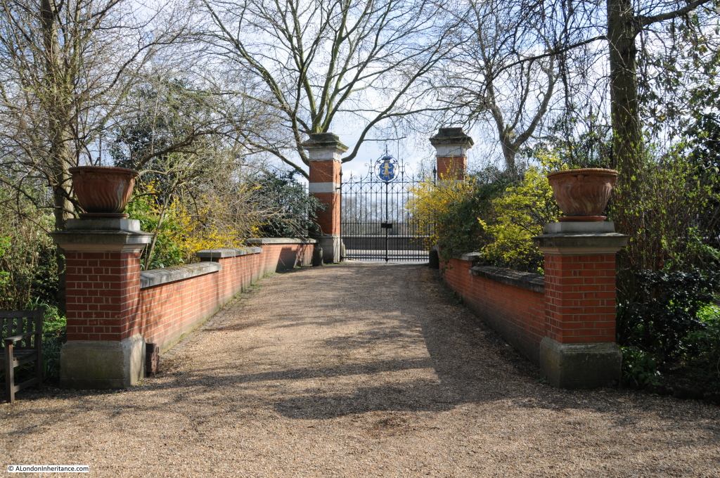
From inside the garden we can see the gates that face onto the Chelsea Embankment. These gates and the upgraded enclosure of the gardens was completed in 1877 when Mr Thomas Moore, mentioned in the above quote, was the Curator.  (As evidence of the scientific principles underlying the gardens, the Curator is effectively the Head Gardener, but with the responsibly to curate the collection of plants held by the garden.)

Chelsea Physic Garden

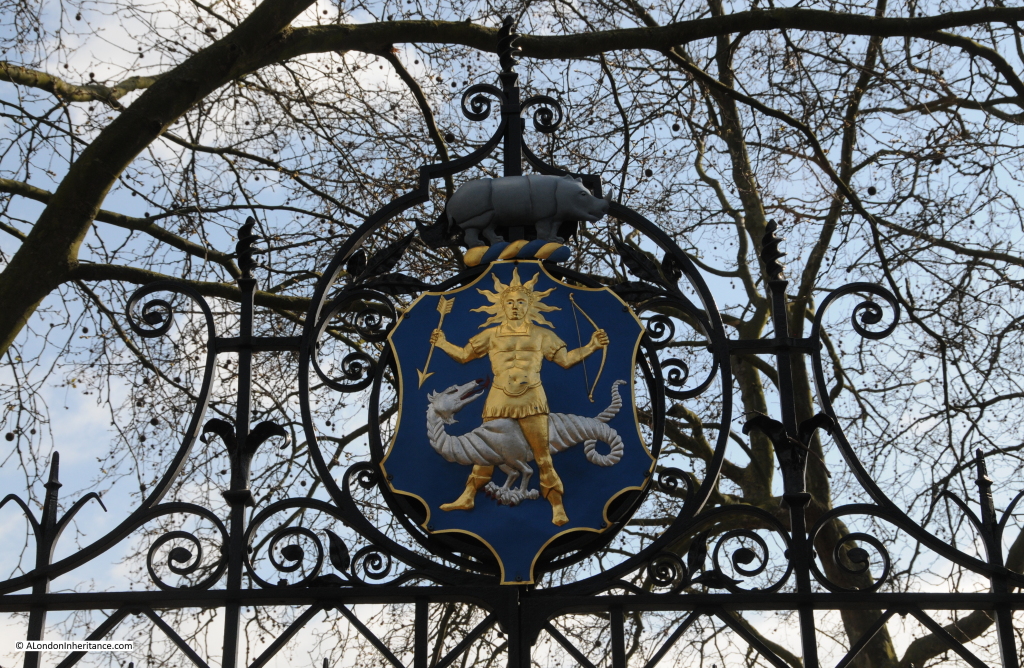
A the top of the gates is the badge of the Worshipful Society of Apothecaries in London:

Chelsea Physic Garden

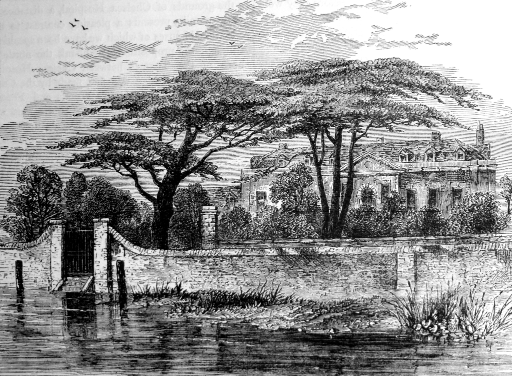
The following engraving from London Old And New shows the gardens in 1790 with the original wall and gates directly onto the River Thames before the construction of the Thames Embankment.

Chelsea Physic Garden

The following map extract from the early 1830s shows the Botanic Gardens between Coal Wharf and the Swan Brewery facing directly onto the river, as did Cheyne Walk prior to the construction of the Chelsea Embankment.

Chelsea Physic Garden

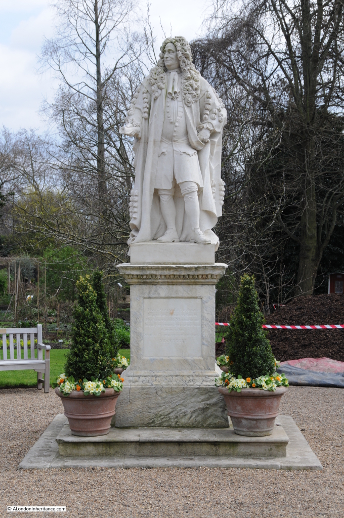
The statue to Sir Hans Sloane has pride of place in the centre of the gardens. This in not the original 1733 Michael Rysbrack statue, the original was damaged by pollution and is now in the British Museum. The current statue is a replica of the original.

Chelsea Physic Garden

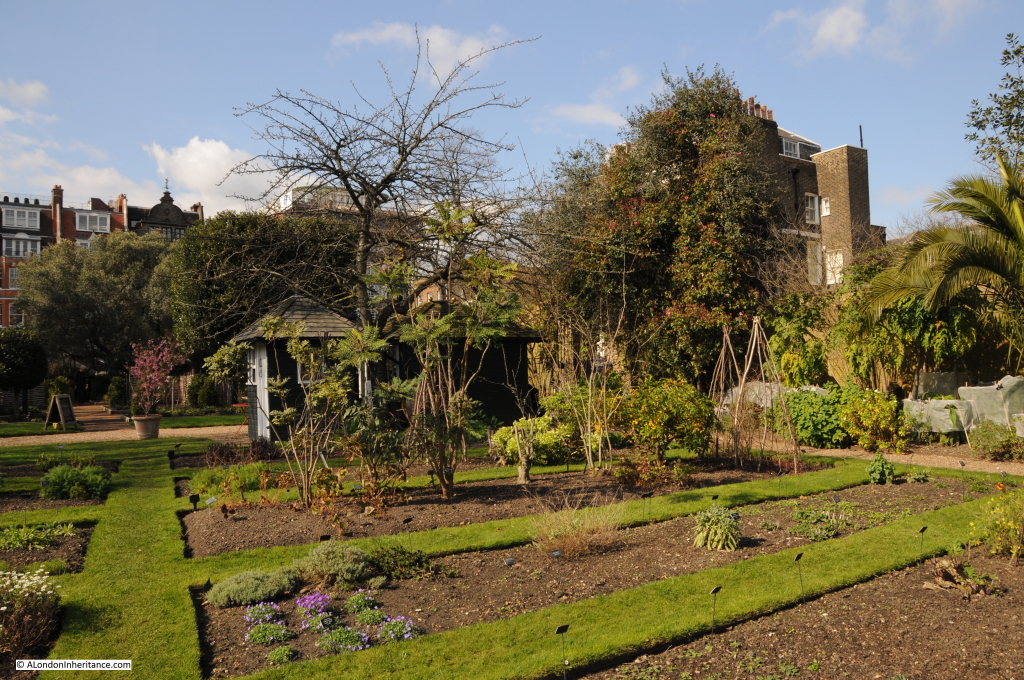
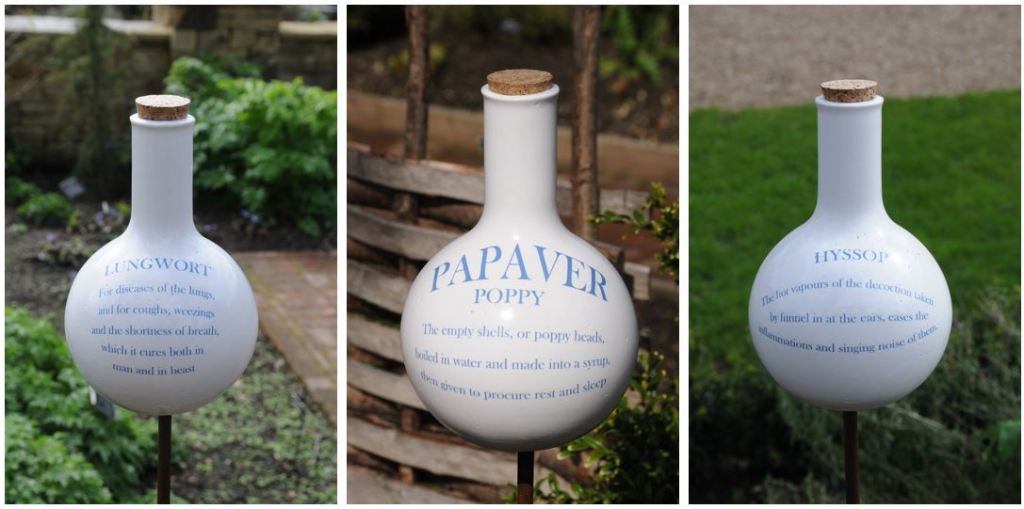
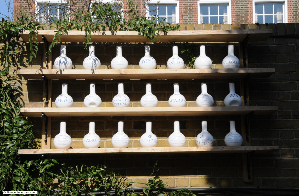
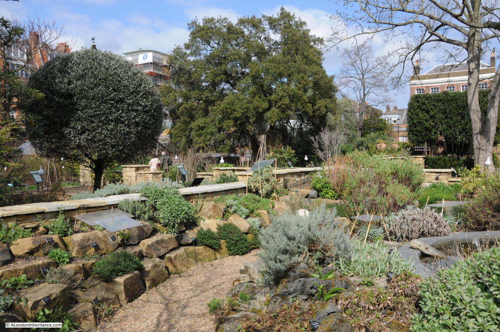
Visiting the garden now provides an excellent learning experience. The plants are very well labelled with several themed areas to focus on specific geographical sources of plants. There is also currently an art installation by Nici Ruggiero which uses jars in the style of those used by early Apothecaries to explain how different plants were and are used in medicine.

Jars are placed on stakes in the gardens:

Chelsea Physic Garden

As well as a rack of jars against one of the boundary walls:

Chelsea Physic Garden

If you did not know that Lungwort is for diseases of the lungs and for coughs, weezings and the shortness of breath, which it cures both in man and in beast, or that Golden Rod cures conditions of jaundice and provokes urine in abundance, then this is the place to learn.

The Chelsea Physic Garden was also one of the first in Europe to have a glass / hot house, and in 1685 the diarist John Evelyn described a visit to the garden where he met Mr Watts, keeper of the Garden and saw the heated glass house. He wrote in his diary: “what was very ingenious was the subterraneous heat, conveyed by a stove under the conservatory, all vaulted with brick, so as he has the doores and windowes open in the hardest frosts, secluding only the snow.”

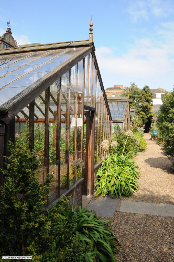
The gardens to this day have a number of heated glass houses that support plants from tropical locations that would not otherwise thrive in a London climate:

Chelsea Physic Garden

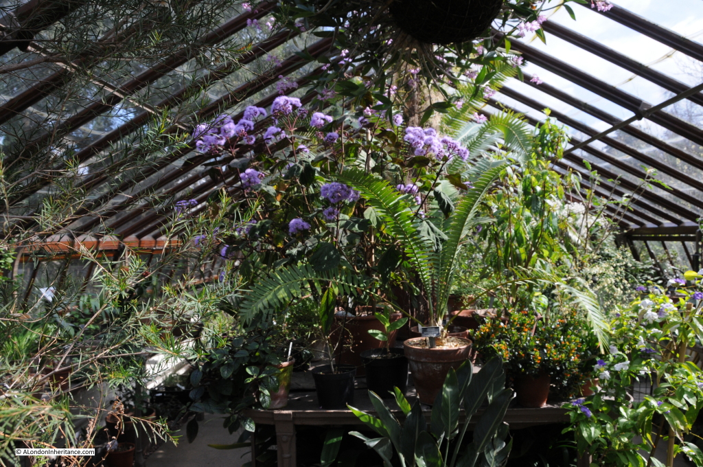
And they work well in promoting abundant growth:

Chelsea Physic Garden

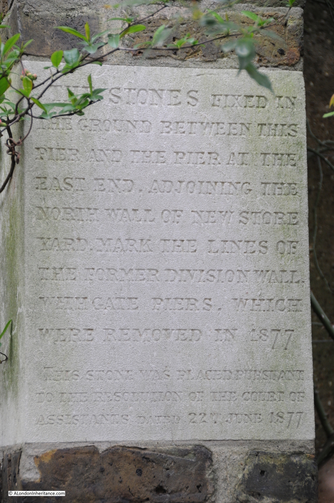
At the Chelsea Embankment edge of the gardens, it is still possible to find hidden on the side walls, stones fixed to mark the original division walls:

Chelsea Physic Garden

The gardens experienced mixed fortunes in the later half of the 19th century. The numbers of visiting medical students rose significantly in 1877 from a couple of hundred to 3,500 due mainly to the Society of Apothecaries finally allowing women to the study of medicine, but by the end of the 19th century the study of plants had been dropped from the medical syllabus and the Society of Apothecaries decided that there was no real need to continue with the garden.

The gardens also suffered from the construction of the Chelsea Embankment in 1876, cutting of what had been a riverside garden from the river.

The gardens were taken on by the City Parochial Foundation. From the history of the Foundation by Victor Belcher:

“The first additional long term obligation taken on by the Foundation was the maintenance of the Chelsea Physic Garden. By the 1890s the Company had decided that it could no longer afford the upkeep of the garden and recommended that the site should be sold and the proceeds used to endow scientific research and teaching. Widespread concern was voiced and a departmental committee was appointed by the Treasury to look into the situation. In 1898, W. H. Fisher (later Lord Downham), a trustee who also happened to be a Junior Lord of the Treasury in Lord Salisbury’s government, introduced a motion before the Central Governing Body urging the trustees to take over the garden from the Apothecaries Company. he stressed its importance as an open space and as a source of botanical study for students at the Battersea and South-Western polytechnics. The trustees were convinced and asked the Charity Commissioners to draw up a scheme. This was published in 1899 and required the Foundation to give an annual grant of £800 to the garden. the government provided a small supplementary grant, but from this time the Chelsea Physic Garden was essentially the Foundation’s responsibility, a state of affairs which was reflected in the composition of the garden’s managing committee, over half of whose members were to be appointed by the Foundation.”

(The City Parochial Foundation is one of the many bodies that have had an impact on the development of London. Formed in 1891 by bringing together a range of endowments so as to be under the control of a single corporate body, the Foundation was charged with helping the poor of London mainly through creating and supporting technical education in the form of the polytechnic movement)
It was good fortune that the Chelsea Physic Garden was saved otherwise it would now be just more Chelsea streets and buildings.

Chelsea Physic Garden

The City Parochial Foundation continued to support and provide grants to the gardens. By the early 1920s the original £800 per annum grant had grown to £2000.

The grant was reduced during the 2nd World War as the gardens were placed on a care and maintenance status, with several plants being moved to Kew due to damage by bombing. After the war the Foundation was responsible for repairs and redecoration to the gardens and buildings.

The end of the association between the City Parochial Foundation and the Chelsea Physic Garden started in the 1970s, again from the history of the Foundation:

“By the mid-1970s the trustees were becoming concerned about both the rising cost of repairs and the amount of grant now needed. There was also a nagging doubt, once the connections with the polytechnics had been severed, whether the Physic Garden could be said to serve the purposes of the Foundation any longer, if indeed it ever had done. The sub-committee which was appointed to prepare a policy for the quinquennium 1977-81 was asked to include the future of the Garden in its deliberations. It recommended that  funds should be made available for the modernisation of the Garden, but that the Charity Commissioners should be informed that the Foundation wished to withdraw further financial support. In the meantime the trustees would actively seek another sponsor.

Finally, in 1981 a new and independent body of trustees agreed to take over the Garden, and in return were promised grants totalling £200,000 to meet the estimated running costs over the next four years. A new scheme was published, and the formal transfer took place on 1 April 1983 when the Foundation’s scheme grant came to an end.” 

Along with the new status of the Chelsea Physic Garden, it was also formally opened to the public, and this continues to be the status of the gardens today with a small, independent charity responsible for the running of the gardens, and the associated educational work carried out to this day.

Chelsea Physic Garden

During their development, the gardens benefited from a constant stream of new discoveries from across the world. the 18th and 19th centuries were a time of botanical discoveries with expeditions being sent to all corners of the world to bring back specimens.

Among those who contributed to the garden was Joseph Banks, who had already made expeditions to Newfoundland and Labrador and was part of Captain Cook’s voyage to South America, the Pacific, Australia and New Zealand. It was through his role as President of the Royal Society that Banks supported expeditions around the world to bring back specimens for the Chelsea Physic Garden. Banks was elected as President in 1778 and held the post for 41 years
Curators were also major plant hunters. One such being Robert Fortune who was curator from 1846 to 1848. He was a prominent plant hunter who brought back many samples from Asia.
Chelsea Physic Garden

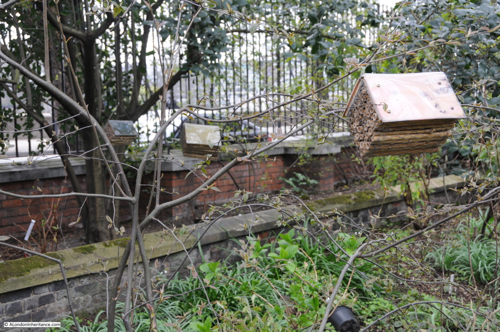
Insect houses up against the boundary wall with the Chelsea Embankment.

Chelsea Physic Garden

It has not really been possible to do justice to the history of the Chelsea Physic Garden in the space of a weekly blog post, however I hope this provides some background and an incentive to visit another example of the history of this fascinating city.

The sources I used to research this post are:

  • The Face of London by Harold P. Clunn published in 1951
  • Old And New London by Edward Walford published in 1878
  • The City Parochial Foundation 1891 – 1991 by Victor Belcher published in 1991
  • London: The Western Reaches by Godfrey James published in 1950
  • The history of the gardens on the Chelsea Physic Garden web site which can be found here

alondoninheritance.com