Tag Archives: Hampstead Heath

Parliament Hill (or Traitors Hill) – August 1947

4 tickets are available for my walk “From the Strand to the Old Thames Shoreline: Transformation of a River Bank” on the 18th of October. Click here for details and booking.

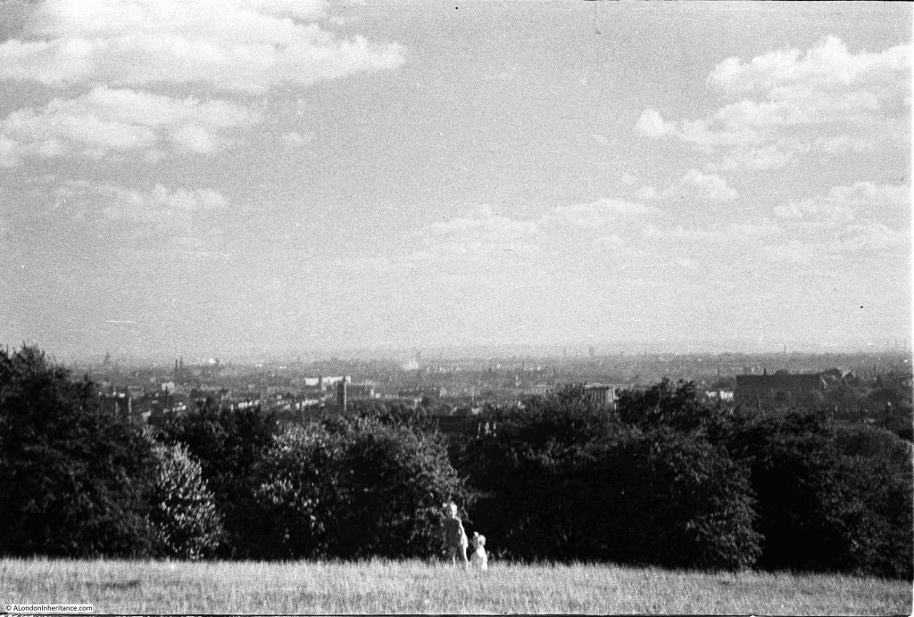
Parliament Hill is at the southern part of the high ground of Hampstead Heath. From the top of the hill there are wide ranging views across London, although these views are somewhat obscured by the trees that have grown on the slope leading down from the top of the hill to the fields below.

Parliament Hill has for long been a place to visit, to walk, to look at the view, to play games, and to enjoy the fresh air and open space, above the congested streets of the city.

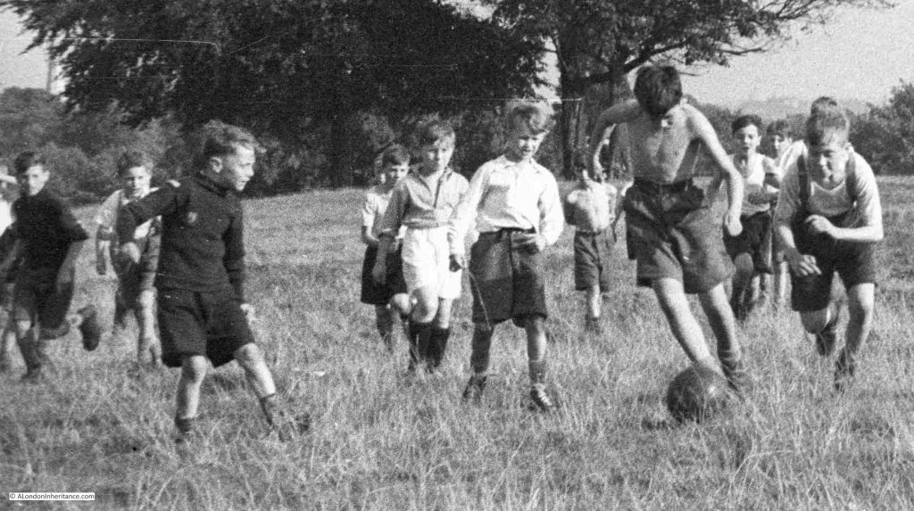
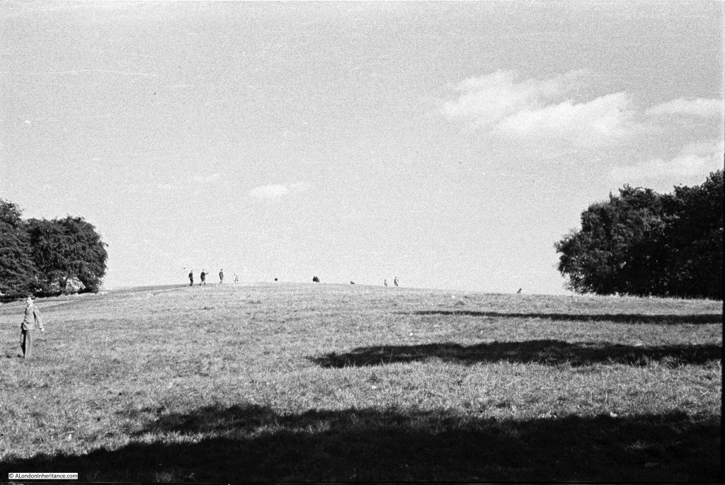
In August 1947, my father took a number of photos whilst on Parliament Hill, looking at the view, and the surrounding landscape. The first shows an intense, youthful game of football:
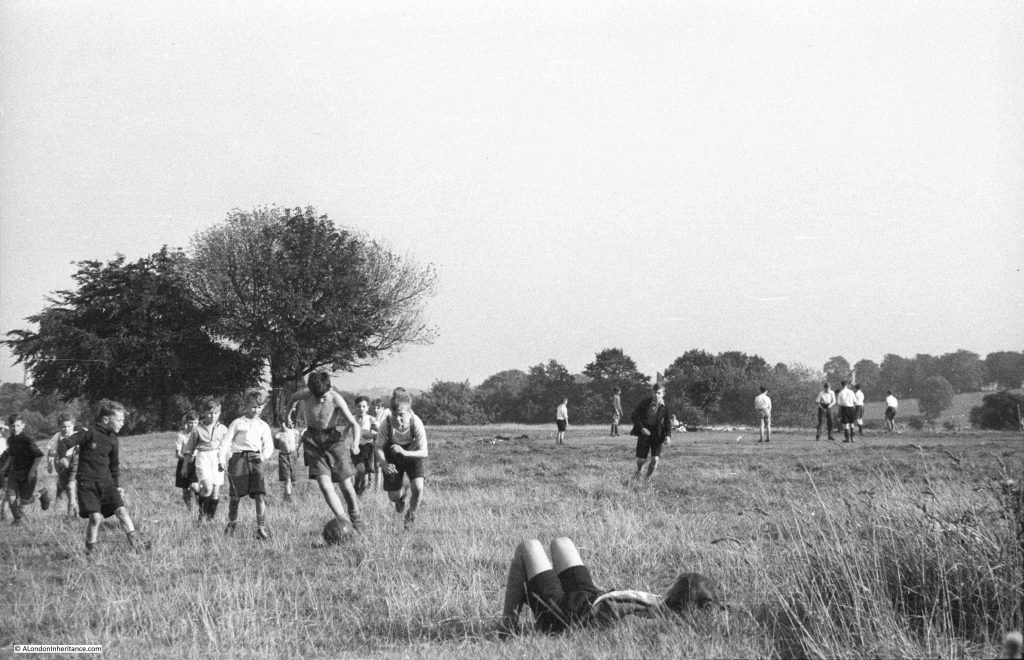
I love the concentration and their focus on the ball, a leather ball rather than the lighter balls in use today:
As usual for many places in London, there are different names for the hill, and different origins for these names.

Two names have been associated with the hill, and there is some common root to these names. The name in use today is Parliament Hill, however for most of the 19th century, Traitors Hill seems to have been the most common.

Examples of where references are made to these two names, and their origins include:

From the Holloway Press on the 8th of August 1952: “Of the many explanations of how Parliament Hill got its name, the most popular is that the instigators of the Gunpowder Plot met here to see the effects of their mischief. Some still call the place ‘Traitors Hill’. Another much favoured story dates back to the Civil War when the Parliamentarians had a camp on the site. The Royalists naturally called this ‘Parliament’ Hill ‘Traitors Hill'”.

On the 15th of July, 1897, there was a report of a garden party given by Baroness Burdett-Coutts at her home in Highgate, and after the garden party “A great many of the guests strolled through the numerous walks towards Traitors; Hill, whence, perhaps, the finest panoramic view of London is to be obtained. The extent of the view seemed to impress the Colonial visitors. Traitors’ Hill is so called from the fact that Catesby and his fellow conspirators awaited there the result of Guy Fawkes villainous attempt to blow up the Houses of Parliament”.

The hill seems to have been the destination for those holding parties in the surrounding houses, as another report from the Morning post on the 2nd of June 1834 explains that after a Fete held by the Duchess of St. Albans at her nearby villa “After the déjeuner there was a promenade to Traitors Hill, which is half a mile from the house, and through the most romantic labyrinth imaginable, whence there is a prospect of London and the counties of Essex, Kent, Surrey and Sussex.”

There are also claims that the Parliamentarians had cannon on the hill during the Civil War, and also used the high point as an observation post.

So whatever the true source of the name, it seems to date back to the 17th century, either from the 1605 Gunpower Plot or the English Civil War between 1642 and 1651.

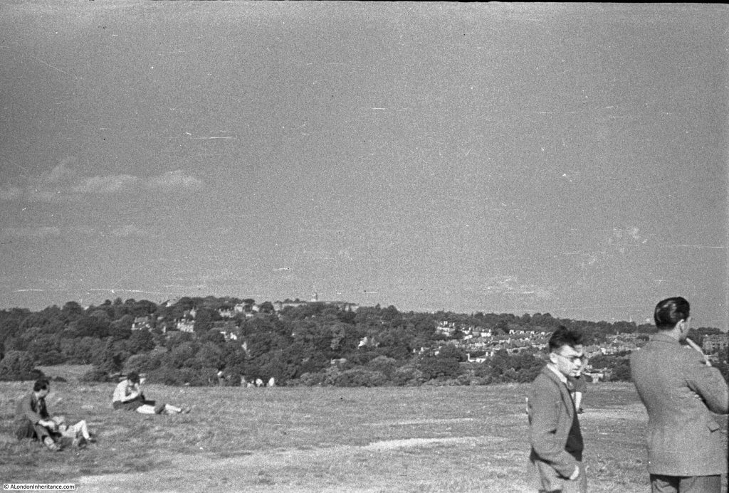
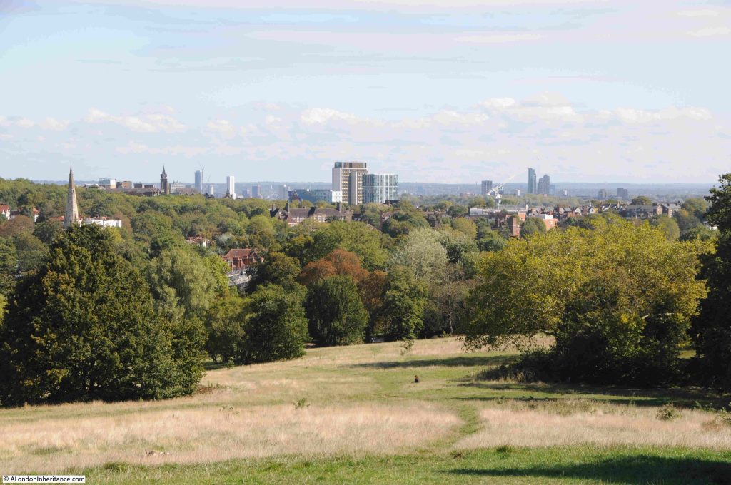
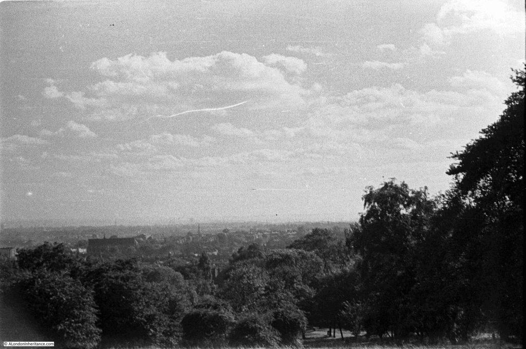
Looking east towards Highgate:
The same view in September 2025:
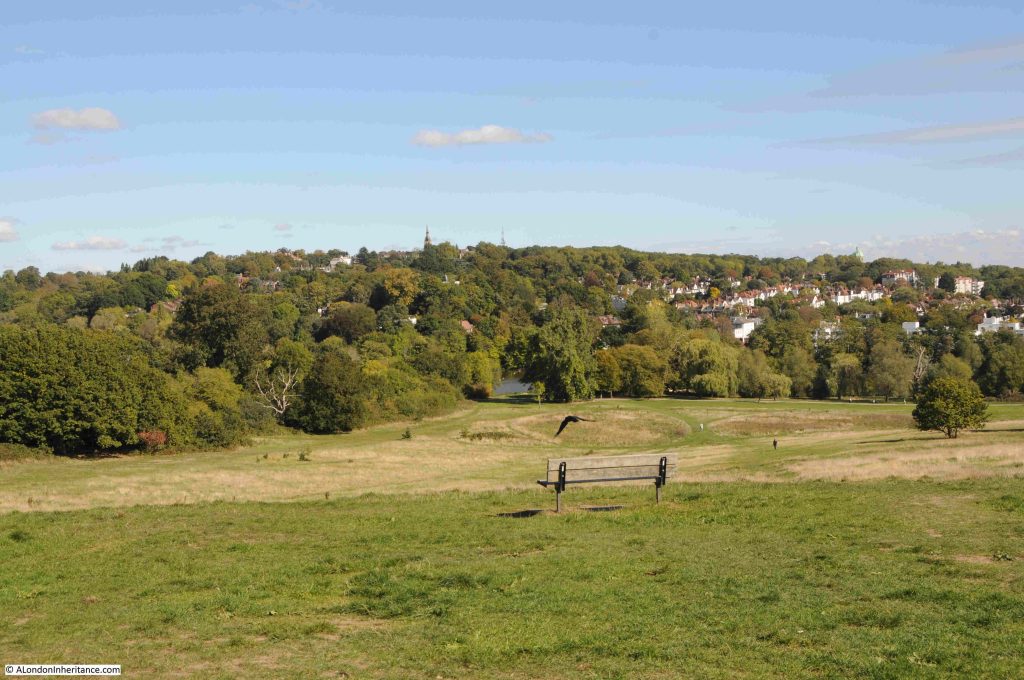
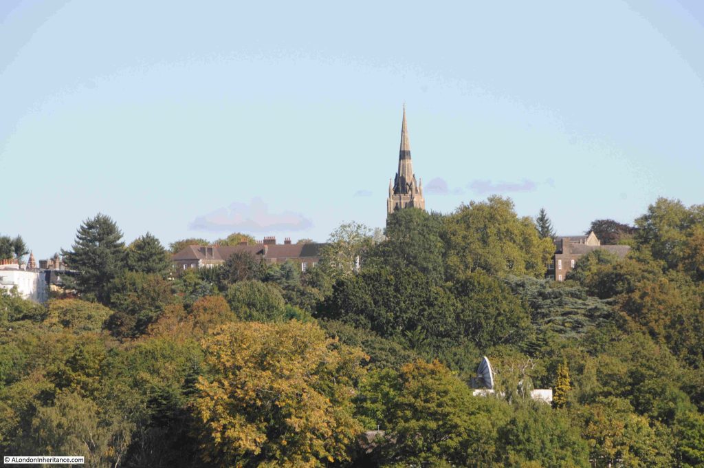
In both photos (a bit hard to see in my father’s photo due to the resolution of the film) you can see the spire of St. Michael’s, Highgate, the church that stands higher than any other church in London.

A close-up of the church from Parliament Hill, and hidden in the trees just below, someone seems to have a strangely large satellite dish:
Looking to the south-east:
Looking over the city in August 1947, hardly a tall building in sight:
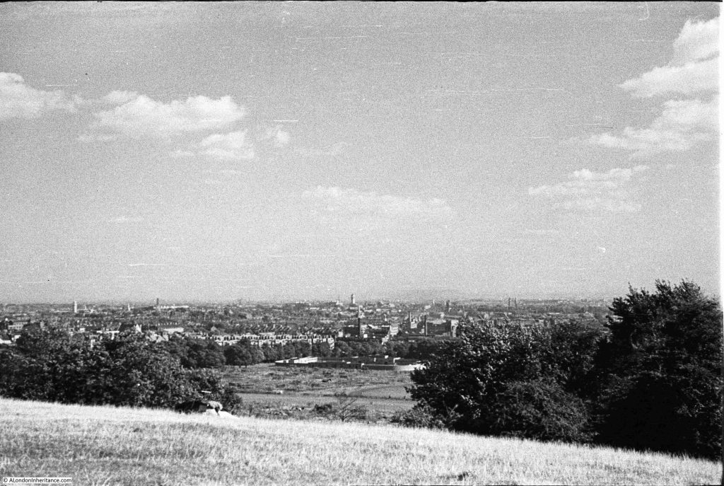
In the above photo, look between the trees and below the hill are open fields, Parliament Hill Fields. At the end of these fields are some low rise buildings. These are the Parliament Hill Fields Lido:
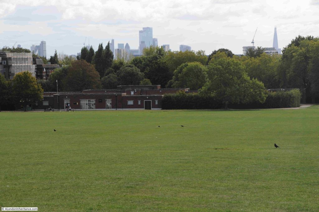
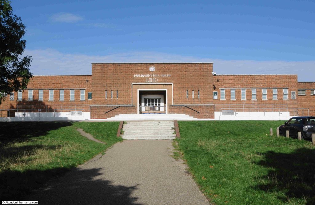
Parliament Hill Fields Lido was opened on 20 August 1938, and the following is a typical newspaper report on the opening of the Lido, part of a scheme by the London County Council for Lido’s across London:

“NEW £34,000 LIDO FOR LONDON – BATHING POOL TO HOLD 2000. With the opening of the new L.C.C. lido at Parliament Hill Fields on Saturday, another important link in the programme of providing London with a chain of modern swimming pools will be completed.

Since Mr George Lansbury, when first Commissioner of Works, gave London its first lido in Hyde Park in 1930, the popularity of these pools has increased enormously.

After Hyde Park came the first lido to be designated as such at Victoria Park built in 1934-35. Records show that in the height of the summer as many as 25,000 people bathe there on a Sunday morning.

The Parliament Hill Lido covers an area of approximately two and a half acres. It is 2ft 6inches deep at the shallow and 9ft 6 inches at the deep end, and holds 650,000 gallons of water, which will be completely filtered and purified every five hours. There are to be fixed and spring diving boards, foot and shower baths, and accommodation is planned for a maximum of 2024 bathers at any one time.

There are two terraces for spectators, and a café available for bathers and spectators alike. The lido had cost approximately £34,000.

The scheme originally approved by the L.C.C. also provided for lidos at Charlton Playing Fields at a cost of £25,000, Battersea Park, £40,000, Ladywell Recreation Ground, £27,000 and Clissold Park, £25,000.

The one at Charlton is nearing completion. The others will be undertaken by convenient stages with a view to the cost being distributed over a reasonable period.

Set among the trees, the lidos of London are vastly different from the cheerless, old-fashioned type of swimming bath. It would seem that they will ultimately render the old baths obsolete.

Including the two lidos already opened, the L.C.C. has eleven open-air swimming pools in London. These were patronised by over 1,000,000 swimmers in a year. Taking the lidos of Hyde Park and Victoria Park alone, the attendances in 1937 were: Children: 62,922, Adults: 175,379, Spectators: 93,731.”

The entrance to Parliament Hill Lido:
Returning to the top of the hill:
Parliament Hill and the fileds below, have long been a place to visit. The above photo shows a couple of children, and earlier photos in the post show people looking at the veiw, and more children playing football.

It was also a very popular place on public holidays, for example om the 11th of June 1892, the Hampstead and Highgate Express reported that: “PARLIAMENT HILL FIELDS – There were some thousands of holiday-makers in these picturesque fields on Whit-Monday. The International Band performed a selection of music in the afternoon, and in the evening Mr. Blake’s band similarly ministered to the enjoyment of the public. Cricket and lawn tennis were in full operation, and attracted large numbers of spectators.”

In 1947, the view from Parliament Hill was less obscured by trees than it is today, There were few stand out features as building height was much lower than it is today. The photos by my father were also made using the lower quality of film available post-war to the amateur photographer, and although taken using a Leica camera and Leica lens, enlarging the photos to look at distant features does not reveal much detail.

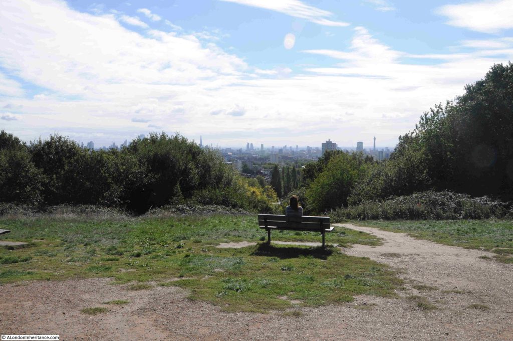
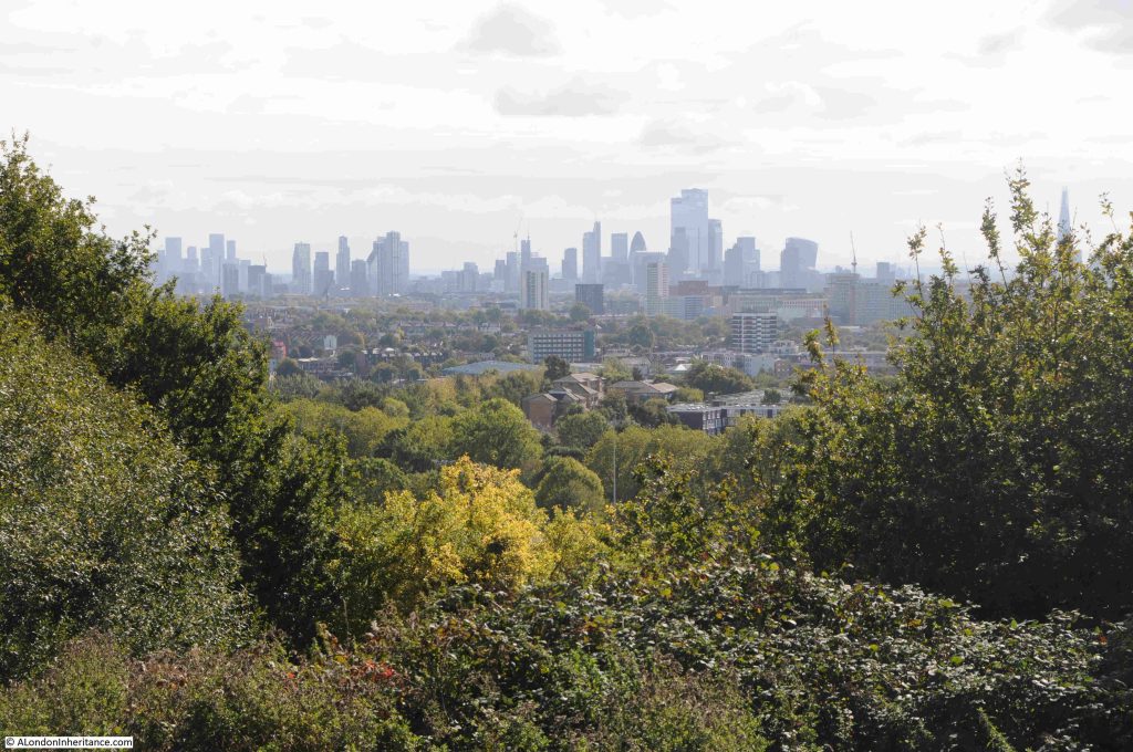
Comparing 1947 with today, shows just how the city has grown upwards:
The Parliament Hill viewing point today:
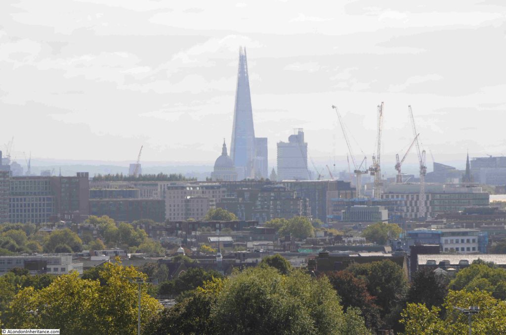
The view towards the towers of the City of London:
The Shard, with the dome of St. Paul’s Cathedral to the lower left of the Shard:
The BT / Post Office Tower, and to the lower left of the tower is the Victoria Tower of the Houses of Parliament. It must have been in this direction that the Gunpowder Plotters were looking, expecting to see an explosion – if the stories of one of the origins of the name Traitors Hill is true:
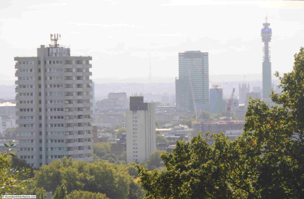
In the middle of the above photo, in the distant haze, is the radio and TV tower at Crystal Palace.

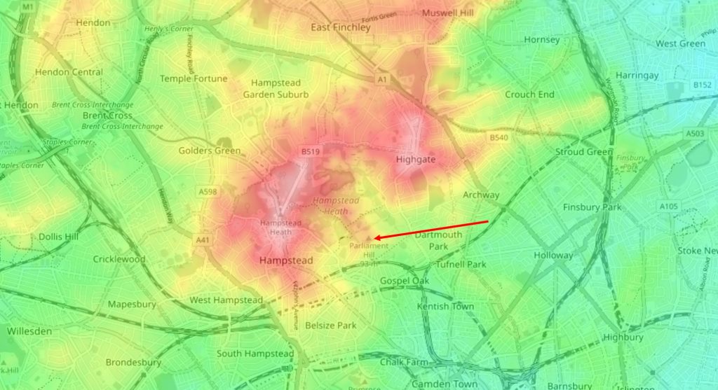
We can see why Parliament Hill is such a good place for a view by looking at a topographic map of the area.

In the following extract from the excellent topographic-map.com the high ground of Hampstead and Highgate is shown in reds and pinks, with the surrounding low ground in yellow and green.

I have marked the location of Parliament Hill with a red arrow, and as can be seen, it is on a small promontory, extending south from the higher ground of Hampstead Heath. To the right is the higher ground of Highgate, as illustrated by photos earlier in the post showing the spire of St. Michael’s, Highgate:
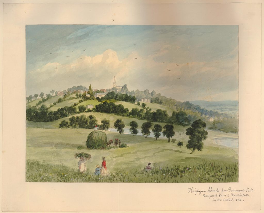
Parliament Hill as a viewing point and open space, has been photographed and painted for many years.

The following is dated 1841 and is by E.H. Dixon, and shows a “View of Highgate Church, from Parliament Hill in Hampstead Heath” (© The Trustees of the British Museum. Shared under a Creative Commons Attribution-NonCommercial-ShareAlike 4.0 International (CC BY-NC-SA 4.0) licence.)::
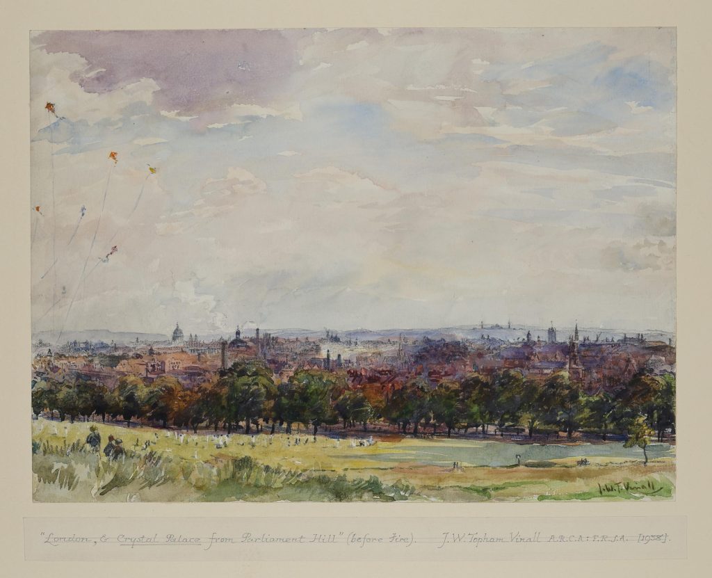
And a 1938 view by Joseph William Topham Vinall of “London, & Crystal Palace from Parliament Hill (before fire)” (© The Trustees of the British Museum. Shared under a Creative Commons Attribution-NonCommercial-ShareAlike 4.0 International (CC BY-NC-SA 4.0) licence.)::
Surrounding the viewing point:
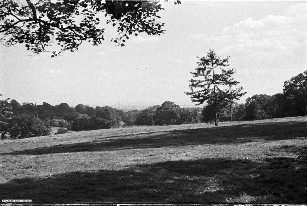
Looking up at the viewing point on Parliament Hill in 1947:
The tress just below the viewing point at the top of Parliament Hill obscure the full view, and you need to move left and right to view different parts of the city below.

Fromn the viewining point, there is a path that leads through the trees and bushes to a lower point, which does though provide a full panorama of the view to the south.

Descending through the trees:
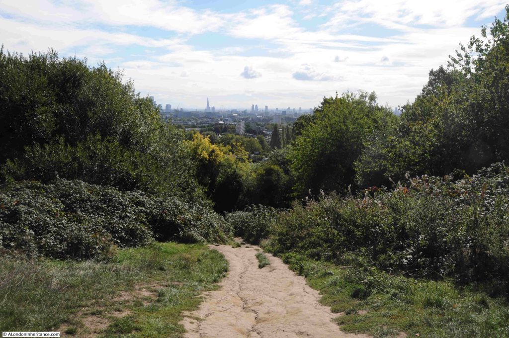
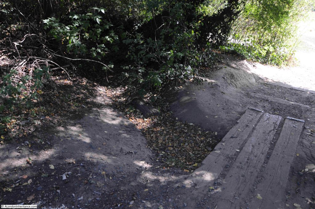
In the middle of the treeline, there is a dried up stream bed, and just to the side an area that is still damp and muddy – one of the many springs to be found in the area:
Once through the trees, the full panaorama opens up:
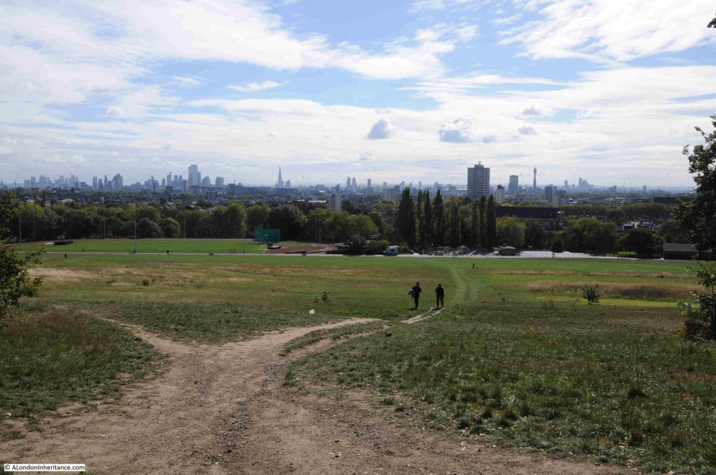
Click on the following panorama to enlarge:

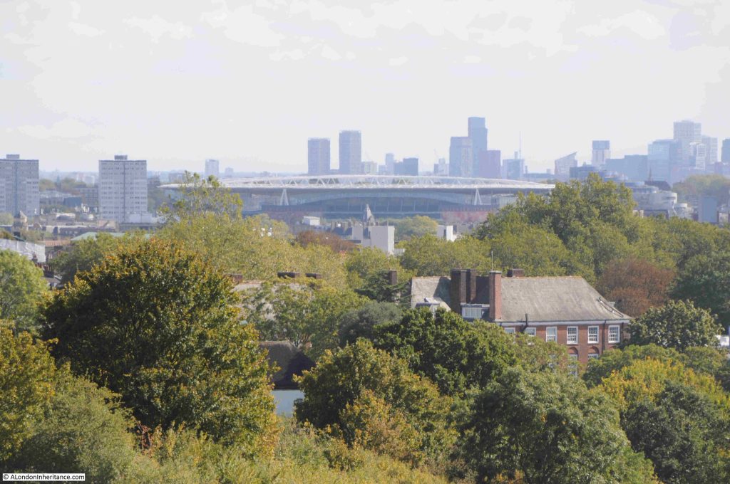
As well as the view to the south, looking to the east we can see the Emirates Stadium:
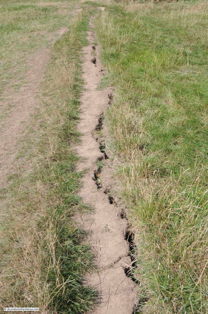
Walking down the hill into Parliament Hill Fields, there is evidence of a long hot, dry summer:
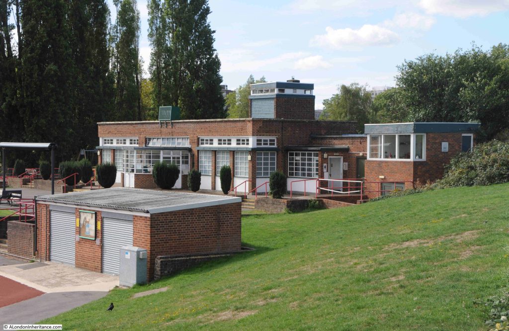
At the base of the hill, as well as the Lido, there is an athletics track. The track itself has recently been refurbished, and I believe that that the original facility dates from 1938, and this is when there were newspaper reports of the “opening of the new L.C.C. track at Parliament Field”, and the brick build and design of the buildings facing onto the track are of a similar design and material to those of the Lido:
That Parliament Hill survives today as a public open space is down to a campaign in the 1880s.

In the later part of the 19th century, the hill was at risk of development. Houses had been springing up in the desirable areas around Hampstead, Highgate and Parliament Hill, and what the press called “The Battle of Parliament Hill” was a campaign to keep the hill free of housing, and retained as a public space.

This came about as a result of the Hampstead Heath Enlargement Act of 1886. The aims of the act was described in the Pall Mall Budget of the 20th October 1887:

“In the first place, the object sought for is the enlargement of Hampstead Heath, but is in reality the preservation of it. The actual proposal was the acquisition of the open space known as Parliament Hill, which, of, course, would, to that extent, be an enlargement of Hampstead Heath. But the point to be most insisted upon is that if Parliament Hill be not acquired Hampstead Heath would be spoiled. For one thing, half its beauty will be destroyed; but it is not the aesthetic consideration that we wish now to place in the forefront, although the destruction of all Coleridge saw ‘looking down from Hampstead Heath’ would of itself be no mean loss. More important, however, than a supply of food for the aesthetic sense, is a supply of fresh air for the lungs, and if Parliament Hill were once to be covered in bricks and mortar the health giving quality of Hampstead Heath would be destroyed.”

Parliament Hill was purchased for the public in 1887 for £300,000.

There is an ancient tumulus on the northern side of the hill, which has been excavated, but nothing was found within.

A child did find what was classed as treasure trove on the hill in 1892, reported from the time as “A small boy called Haynes has been the lucky finder of treasure, including coin and antique silver vessels, while playing with a toy spade in Parliament Hill fields. Valued at £2,000, the treasure trove has formally been taken over by the Crown and the lad’s compensation will be the bullion value of the articles only.”

Parliament Hill has also attracted myths and theories about the use of the place in antiquity. In the book Prehistoric London – It’s Mounds and Circle by E.O. Gordon (1932), Gordon claims the hill as an ancient meeting place and also places the hill at the northern corner of a triangular alignment of key London mounds:
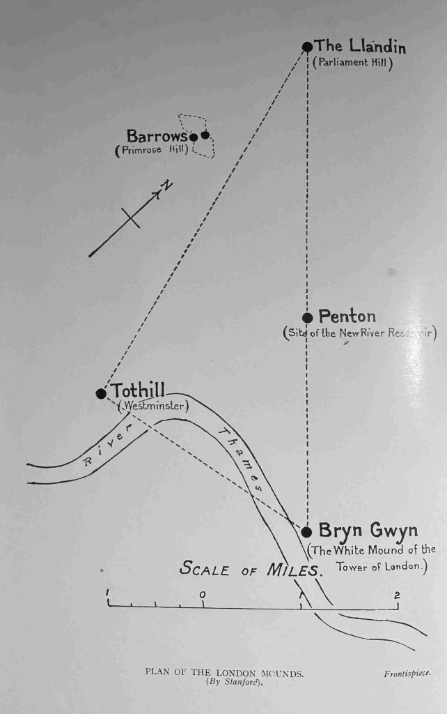
With the view across London, and across to the hills in the south, Parliament Hill has long been a place where people would stand and look, a place to look across to the hills that surround London to the south, and it is a special place, although probably not in the way E.O. Gordon thought about the place.

Parliament Hill or Traitors Hill – both names have their origins in events in the 17th century, and in the late 19th century the Parliament Hill was saved from the bricks and mortar spreading across London, so we can continue to stand and gaze across the city to this day.

alondoninheritance.com

The Spaniards Inn, Hampstead

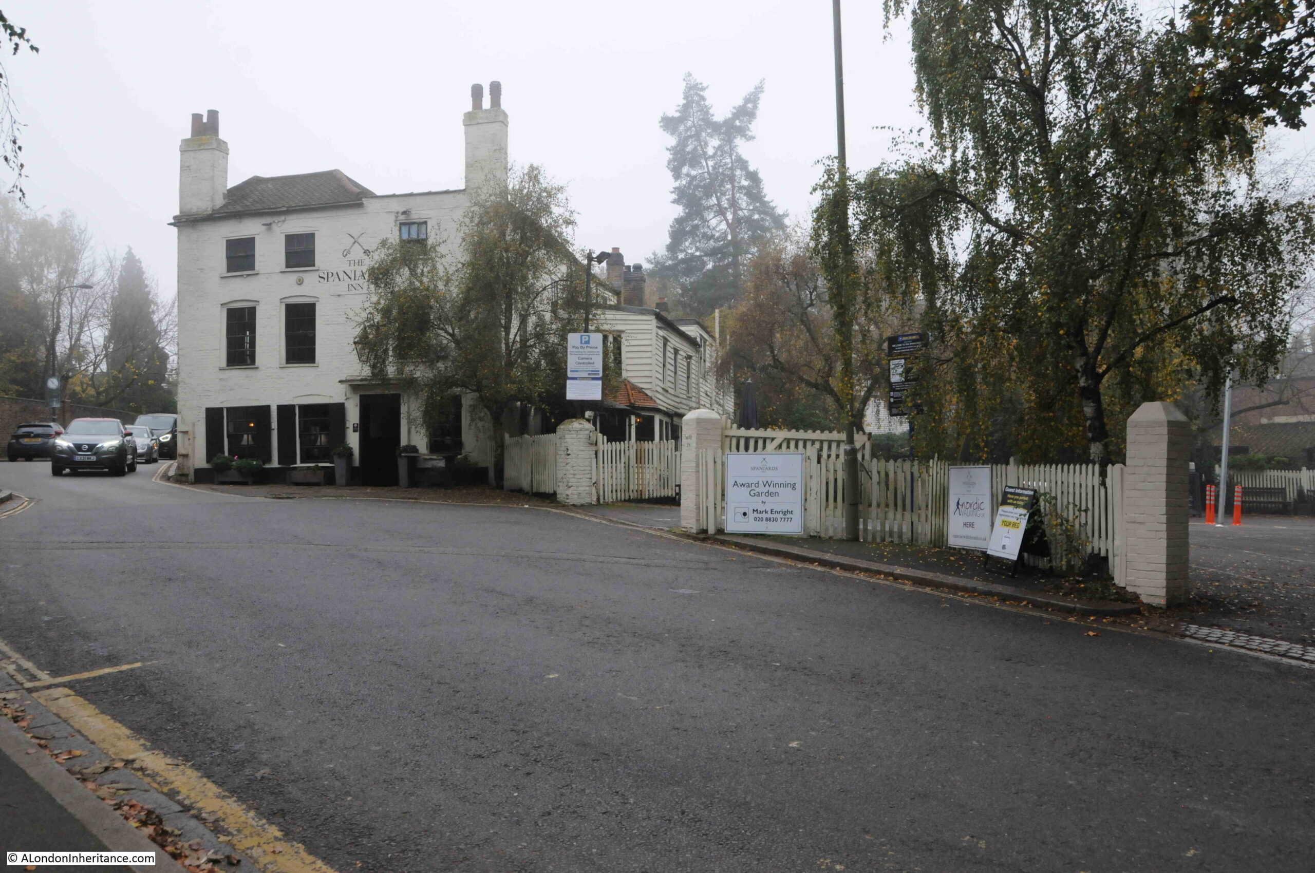
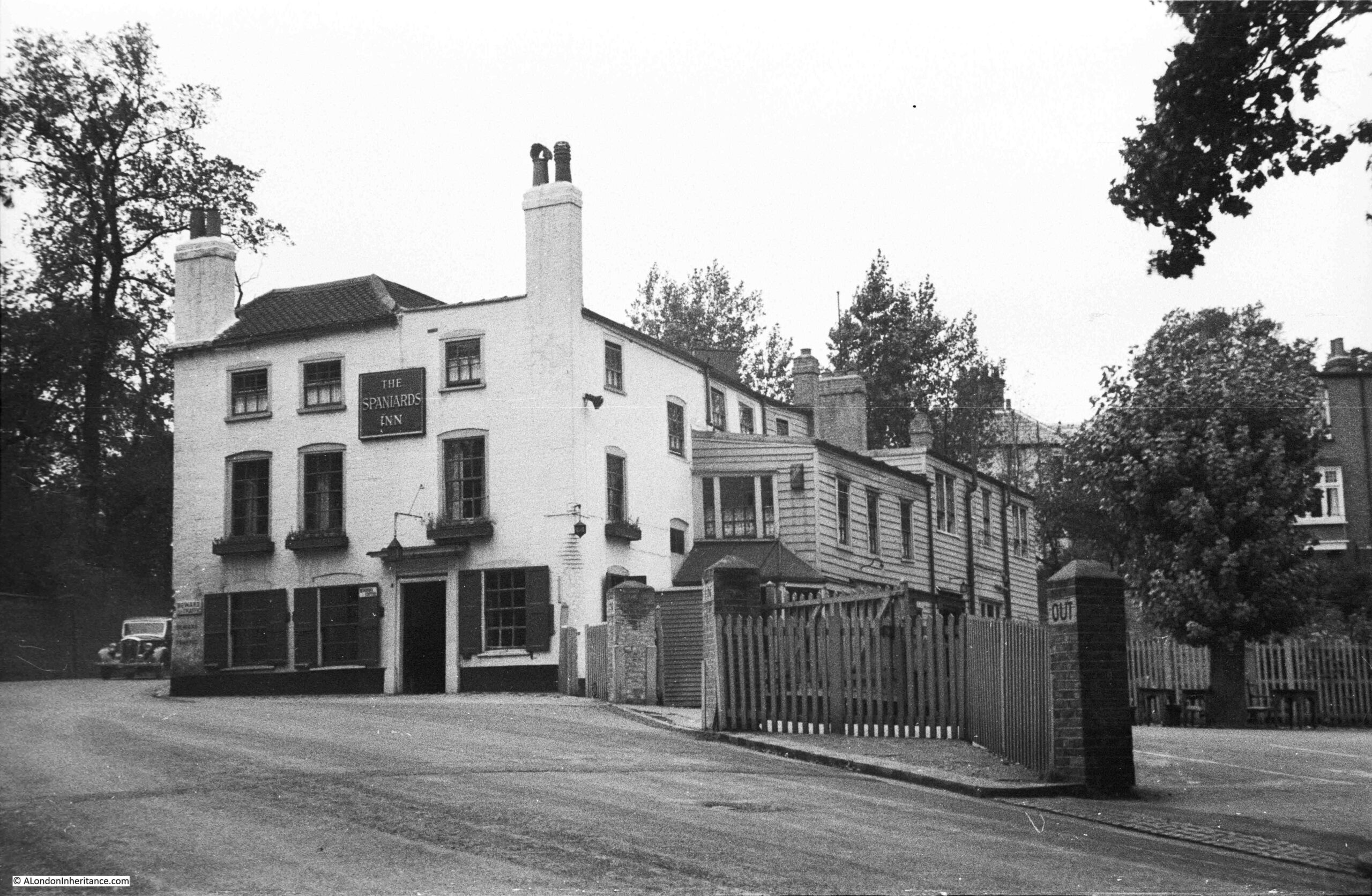
Thanks for all the feedback to last week’s series of posts on Eleanor of Castile – very much appreciated. A very different post today, as I am visiting the site of one of my father’s photos, and this is of the Spaniards Inn in Hampstead, photographed in 1948:

The Spaniards Inn

I had to be in Hampstead last week, so used the opportunity to cross this one off my list of my father’s photos to visit, however it was a misty, autumn day. I waited for much longer than the weather forecast predicted it would take for the mist to disappear, and finally had to take a misty comparison photo before I had to leave, so this is the same view today, a misty Spaniards Inn in 2022:
The Spaniards Inn

Different weather, different perspective due to very different cameras, and colour vs. black and white, however, look past that and the two views are almost identical across 74 years.

Even the small triangular pavement between the two car park entrances is still the same. The cars approaching along the road from behind the pub are though very different.

The Spaniards is a very old pub, believed to date back to the 16th century.

As with any pub of such age, there are plenty of stories about the pub, many of which have been repeated in newspapers and books for at least the last 150 years, so may well have a grain of truth.

Regarding the name, I have read two different accounts, firstly that there may have been two Spanish owners of the pub, who killed each other in a duel, secondly, that the pub was named after the Spanish Ambassador to James II.

There are stories that the highwayman Dick Turpin used the pub, and kept his horse in one of the buildings.

What does seem to be true is that the pub played a role in the Gordon Riots. This was in June 1780 when there were violent anti-Catholic riots in London. At the time, Kenwood House, not far from the Spaniards, was the home of the Earl of Mansfield, the Lord Chief Justice. He was rumoured to have pro-Catholic sympathies, so the rioters set out from central London with the intention of burning down Mansfield’s Kenwood House.

The rioters stopped in the large gardens of the Spaniards Inn, and the landlord, along with the Earl of Mansfield’s steward gave the rioters large amount of drink, which gave them time to summon soldiers, and by the time they arrived, the rioters were in no fit state to resist.

The Spaniards Inn also features in Dickens’ book, Pickwick papers where Mrs. Bardell and her friends take the Hampstead Stage to the Spaniards Tea Gardens. The Inn is also mentioned in Bram Stoker’s Dracula, where the vampire hunter Van Helsing, after having supper in Jack Straws Castle, then: “By good chance we got a cab near the “Spaniards,” and drove to town.”

Many of the literary and artistic inhabitants of, and visitors to Hampstead are believed to have visited the Spaniards Inn, including Keats, Shelley, Byron, Hogarth and Constable.

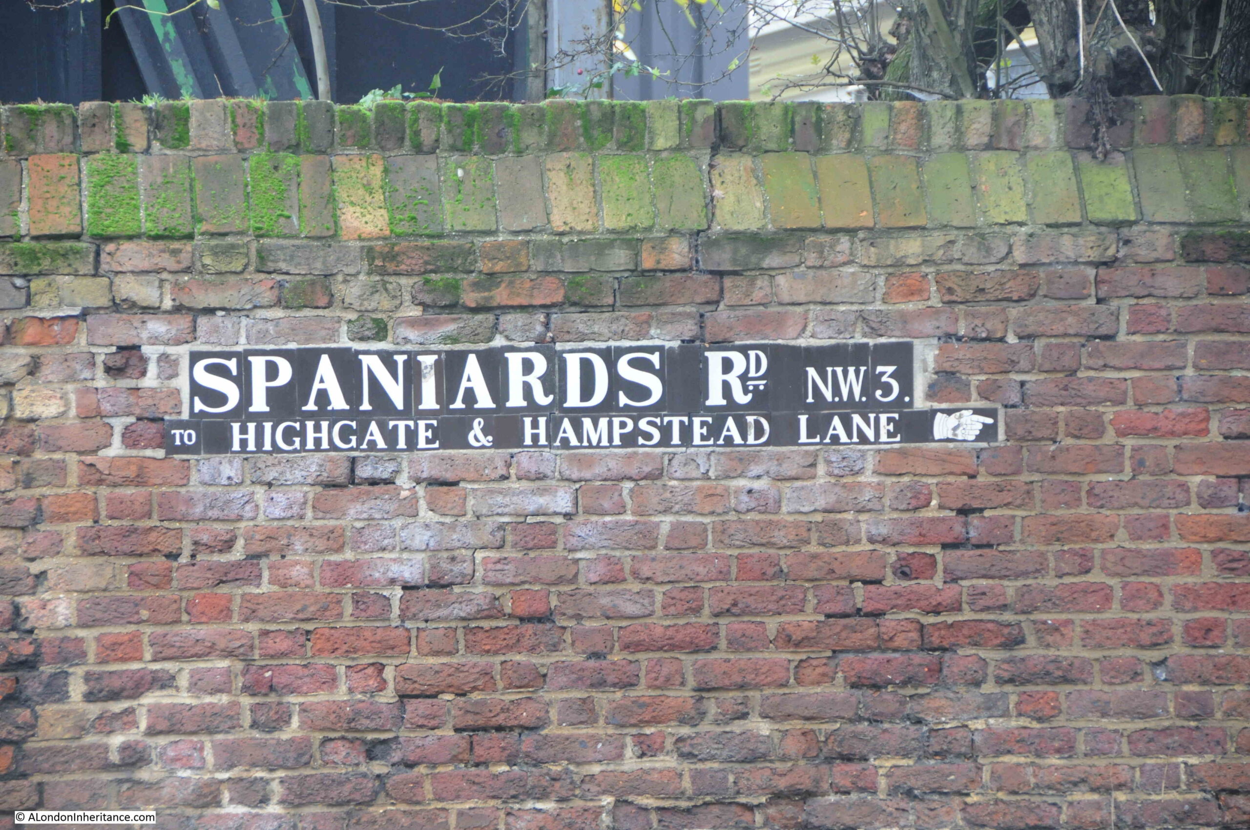
I walked to the Spaniards Inn from Hampstead, firstly walking up to Spaniards Road, where there is one of type of street signs that can be found across Hampstead, which also has a pointing hand symbol indicating the direction to Highgate.

Spaniards Road

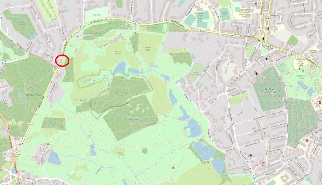
The road between Hampstead and Highgate runs along the north and north-western borders of the heath, and the Spaniards Inn can be found at roughly the half way point along the heath’s border. Spaniards Road runs up to the inn, and soon after the road changes name to Hampstead Lane – one of the indicators that the inn has long formed a boundary between Hampstead and Highgate.

The location of the Spaniards Inn is circled in the following map (© OpenStreetMap contributors):

The Spaniards Inn

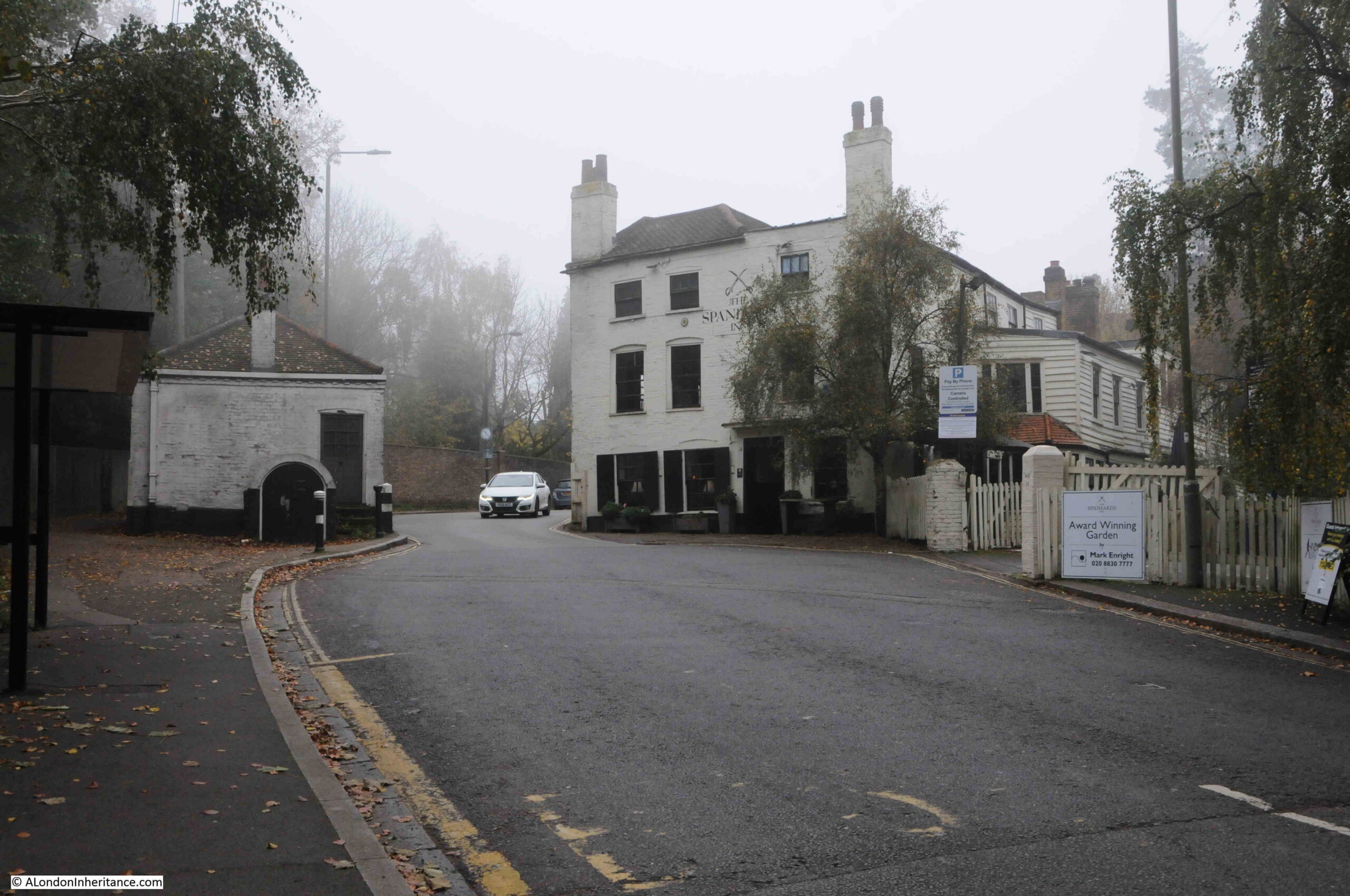
My father’s photo shows the corner of the Spaniards Inn directly on the road, with a car just coming from behind the pub. To discover why the inn is at such a historic location, we need to zoom out to a wider view of the road that runs to the side of the inn:

The Spaniards Inn

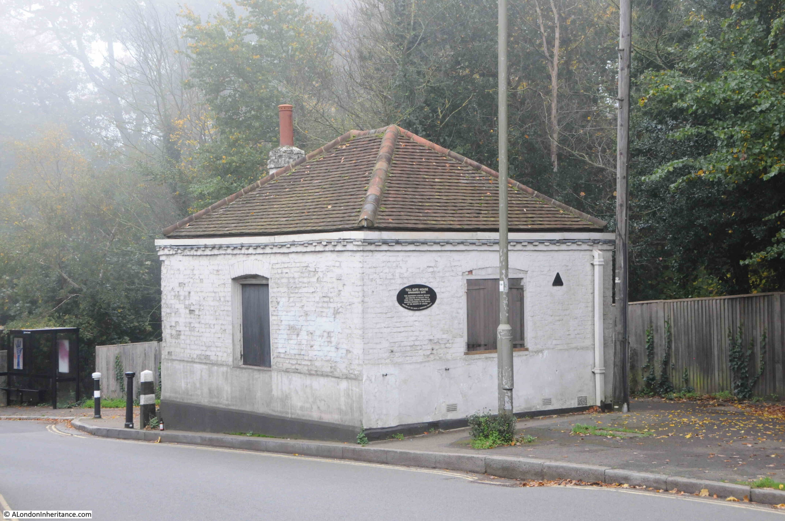
As the road passes the Spaniards Inn, it narrows and bends around the corner of the inn. On the opposite side of the road is a small square building.

This point in the road was the location of a toll gate, and travelers had to pay a toll when passing along the road in the direction of Highgate, as the land to the west of the tollgate was owned by the Bishops of London.

The square building on the opposite side of the road was the 18th century toll gate house.

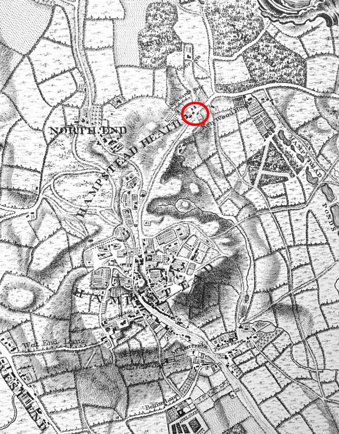
The Spaniards Inn and the toll gate feature in John Rocque’s 1746 map of London.

In the following extract, I have circled the location of the inn and the gate:

Location of the toll gate

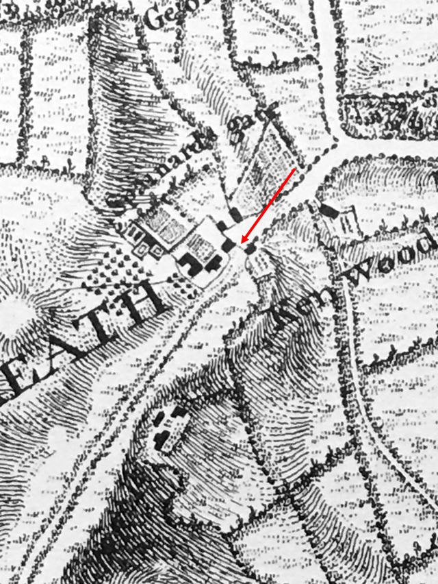
I love the detail that can be found in Rocque’s maps. In the map below, I have zoomed in on the location of the inn and the toll gate. Where the toll gate is located, there is a dotted line across the street (see red arrow), which I assume is a representation of the gate that would have barred the street to allow collection of tolls.

Location of the toll gate

The name Spaniards Gate can be seen above, implying that the gate took the name from the inn. one interesting feature is the way the road is represented on either side of the toll gate. To the right of the toll gate is the Bishop of London’s land. The road looks wider and more defined. To the left of the gate, the road is narrow and seems more like a track.

The toll was collected when you travelled into the Bishops of London land, moving left to right in the above map, and when you passed through the gate, you also started to travel on better roads. Even today, the road widens soon after passing the toll gate heading to the east.

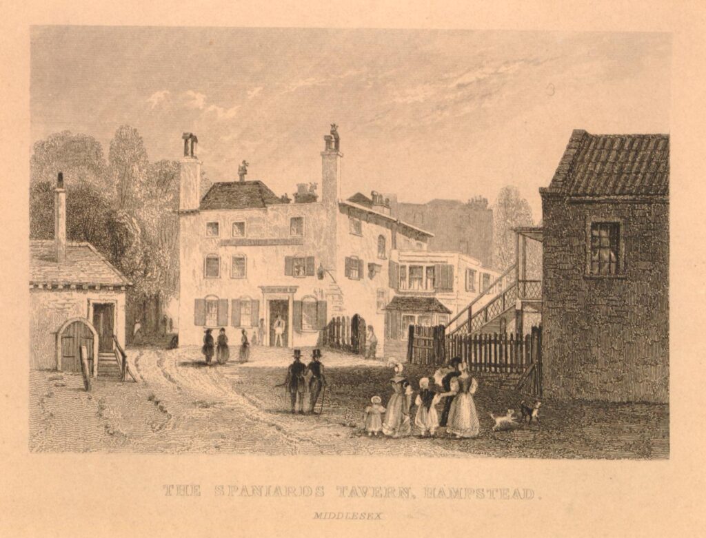
The following print from around 1840 shows a very similar scene to today, although the road and traffic along the road are very different  (© The Trustees of the British Museum).

The Spaniards Inn

As the road between Hampstead and Highgate passes the Spaniards Inn, traffic has to slow as there is not really enough space for two cars to pass through the gap.

The road is a busy road with an almost continuous stream of traffic. It took a while to get some reasonably traffic free photos.

it is remarkable that the toll gate house, and the narrow width of the road has remained as traffic has increased. There have been a number of attempts to remove the toll gate house, and widen the road, for example, one hundred years ago, the Hampstead and St John’s Wood Advertiser on the 14th of December 1922 reported that:

“The proposal to widen the road where it forms a sort of bottle-neck by the Spaniards Inn at the Highgate end of Hampstead Heath, if carried out, would probably mean a destruction of the famous old tavern, and the little brick building that stands opposite to it, on the Kenwood side of the road. In spite of the great volume of traffic on the Spaniards-road itself, on high days and holidays, it is not really a main thoroughfare to anywhere.”

The 1922 proposal to widen the road did not make any progress, and almost 40 years later, in 1961 there was another attempt, as reported in the Hampstead News, Golders Green Gazette and Journal on the 27th of January 1961:

“Tollhouse: Council Must Act – The L.C.C.’s proposed demolition of the Tollhouse at the Spaniards Inn, Hampstead Heath, for road improvements was brought to a head at a meeting of the Hampstead Borough Council at the town hall last night.

Cllr. Richard Butterfield asked the council to approve a motion opposing the demolition because of the historical association and usefulness in helping the traffic problem. He asked that copies of the resolution be sent to the L.C.C., other local authorities involved, local Members of Parliament, and to the Minister of Transport.”

The future of the toll gate even reached the House of Lords when a question was put to the Government on the 2nd of February 1966. Lord Colwyn obviously wanted the toll gate demolished and asked the following question:

“To ask Her Majesty’s Government whether they will arrange for the removal of the obstruction at the Spaniard’s Inn, Hampstead Lane.”

Lord Lindgren, the Parliamentary Secretary in the Ministry of Power replied – “My Lords, I presume that the noble Lord is referring to the old toll gate opposite the Spaniard’s Inn. Her Majesty’s Government have no powers to arrange for its removal. This is a problem essentially for the Greater London Council and the London Boroughs of Barnet and Camden, as the local authorities concerned, and I understand that they will be discussing it soon.”

Lord Colwyn wanted some action, as he replied – “My Lords, I thank the noble Lord very much for his Answer. May I ask whether he would get in touch with the Camden Council and the Barnet Council with a view to moving this obstruction backwards, putting it on Hampstead Heath, or putting up traffic lights? At the moment it causes a terrific traffic block.”

Lord Colwyn was Mr. Frederick Smith. He died not long after asking the above question, and the only reason I can find for appearing to want the demolition of the toll gate was that reports of his death included that he lived in St John’s Wood to the south of Hampstead, so perhaps he travelled along Spaniards Road and felt having the narrow bend in the road was an inconvenience.

The toll gate survived both the plans of the L.C.C. and the attentions of Lord Colwyn, however it would have to wait until 1974 when it would finally be listed as a Grade II building, under the ownership and care of Camden Council.

The following photo shows the toll gate house as seen from the Hampstead side. The oval plaque on the side of the building was put up by the Heath and Hampstead Society to record the function of the building.

Toll gate house

In the above photo, a black and white bollard can be seen at the corner of the building. This was installed in 2008 to provide some protection from the traffic that passes so close to the building.

It is Grade II listed, and the Historic England listing states that the building is inspected regularly and is in good condition.

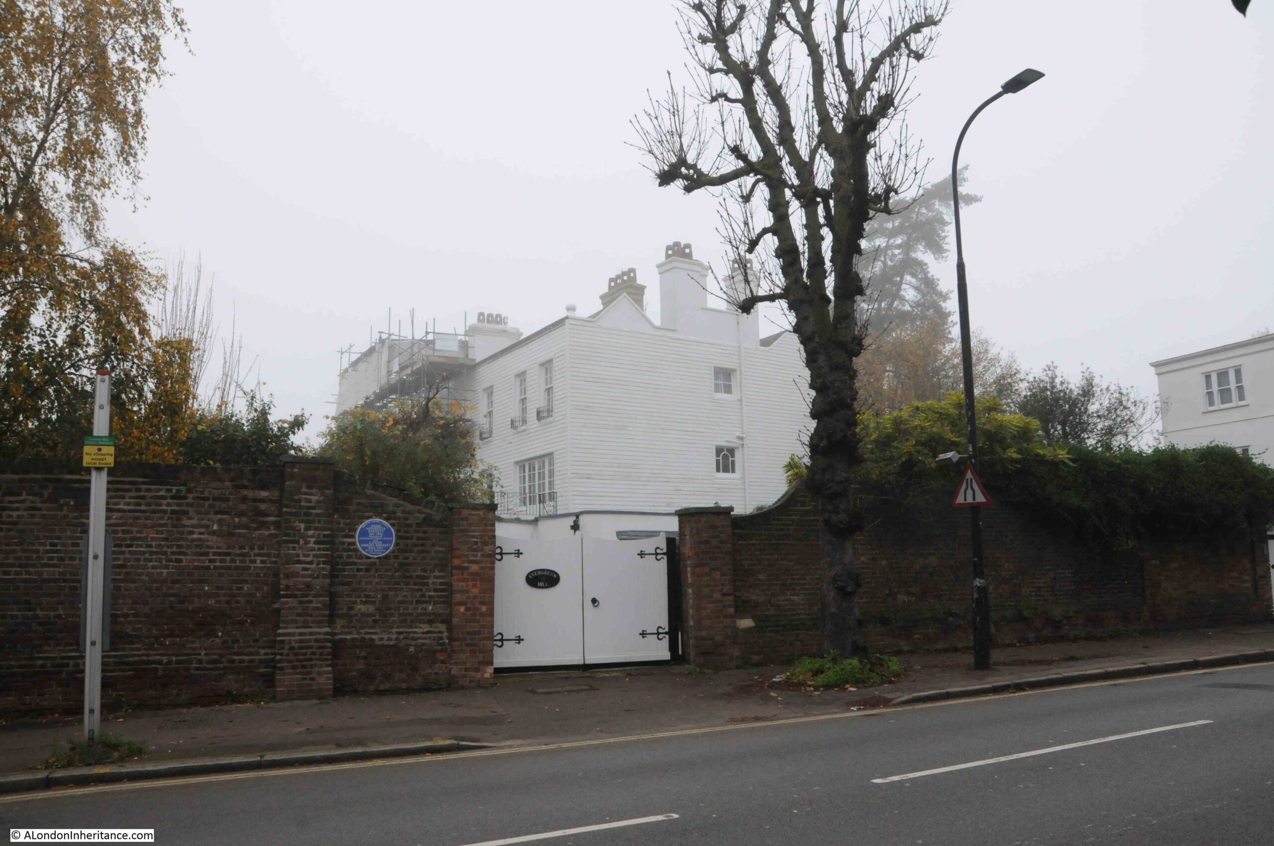
Just behind the Spaniards Inn is one of the many large buildings that can be found across Hampstead. It is a challenge to walk any distance in Hampstead and not find a blue plaque, and my walk to the Spaniards was no exception.

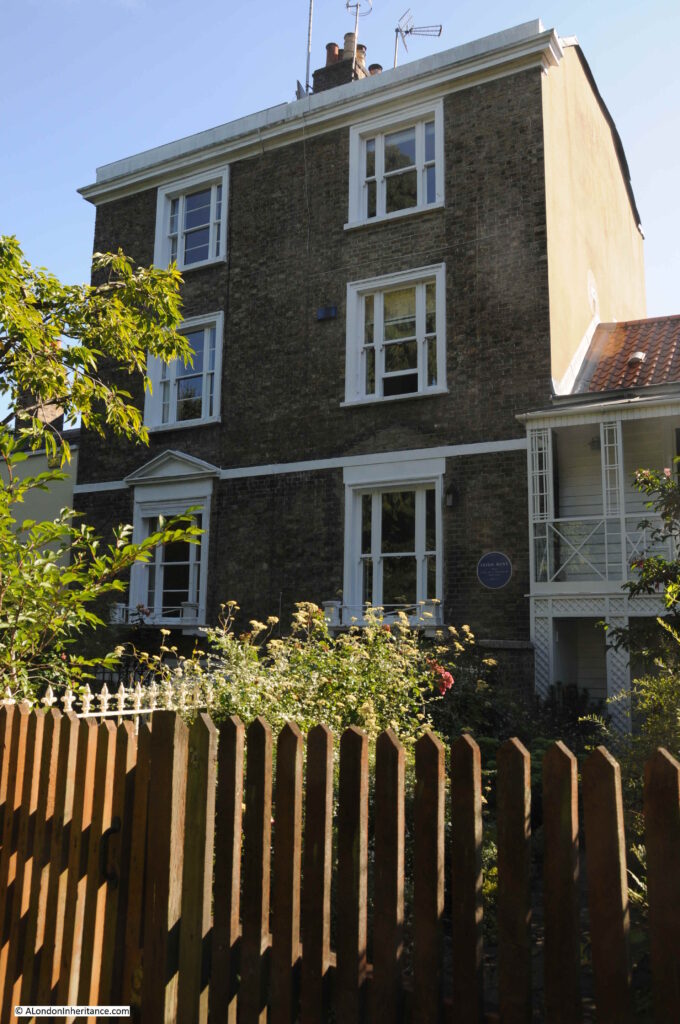
The building has a blue plaque at the entrance, recording that Dame Henrietta Barnett and Cannon Samuel Barnett lived in the house and that Henrietta was founder of the Hampstead Garden Suburb.

Dame Henrietta Barnett house

The Barnett’s were a married couple that had a significant impact on Hampstead, and on London. On her death in 1936, the Hampstead News dedicated a full page to her life, and the following is an introduction:

“Born 85 years ago, she dedicated herself at an early age to a life of social service. When she was 21 she married Canon S.A. Barnett, who had just been become Vicar of St. Jude’s Whitechapel. This was a very poor district affording ample scope for her unusual abilities and unbounded energy, and she at one threw herself into parish work. In 1875 she was appointed manager of the Forest Gate District School, holding this position until 1897, and from 1876 to 1898 she was honorary secretary of the Metropolitan Association for Befriending Young Students. During this period she found time to engage in promoting homes for workhouse and feeble-minded girls.

It was Mrs. Barnett who started the Children’s Country Holiday Fund, and in 1884 she founded the London Pupil Teachers Association, of which she was President from 1891 to 1907. She also put in much hard work as a member of the committee which formed the Whitechapel Art Gallery.

In 1883 a number of undergraduates from Oxford and Cambridge came, at the suggestion of Mrs. Barnett to live in Whitechapel during the vacations. From this Toynbee Hall developed, and Mrs. Barnett helped her husband enthusiastically in this new field. She later introduced the settlement system in America with great success.

It is, however, as the founder of the Hampstead Garden Suburb that she will be best remembered, at any rate in North West London. Her aim was to establish a healthy community in beautiful surroundings, coupled with architecture and town planning on artistic lines, in a way which did not limit these advantages to the wealthier classes. She formed the Hampstead Garden Suburb Trust, and building was commenced in 1907. All who live in north-west London know what the ‘suburb’ is today.”

The Hampstead Garden Suburb Trust is still in existence, and looks after the more than 5,000 properties and 880 acres of the estate.

Three buildings with some fascinating history. The Barnett’s house, the Spaniards Inn and the toll gate house, all at this historic crossing point between Hampstead and Highgate, and the original western boundary of the Bishops of London land. A boundary that can still be seen on the street today.
Hopefully, both the Spaniards Inn and the toll gate house will still mark the boundary for very many years to come.

alondoninheritance.com

Vale of Health

The Vale of Health is a rather unique place. To the north of Hampstead, the Vale of Health is a small enclave, surrounded on all sides by the heath and accessible only via a single road.

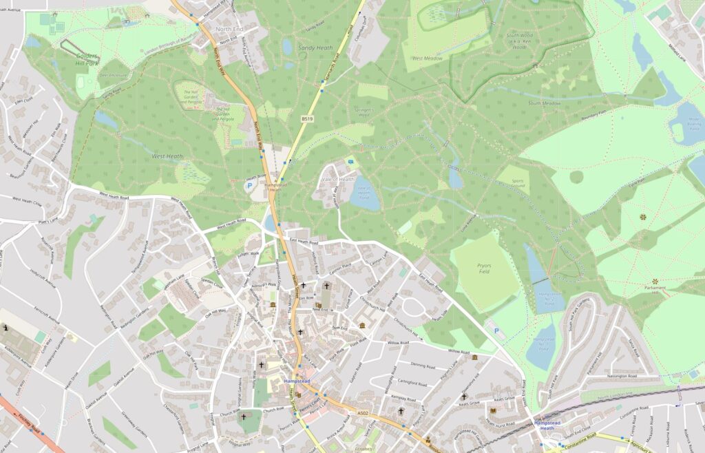
In the following map, the Vale of Health is in the centre of the map, with the blue for a pond on the eastern edge, surrounded by the green of Hampstead Heath, with a single road leading down from East Heath Road (Map © OpenStreetMap contributors).

Vale of Health

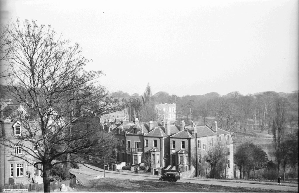
I had a recent visit to the Vale of Health, the reason being was to track down the location of some photos my father had taken of the general area, and a couple of photos showing the lost Vale of Health Hotel.

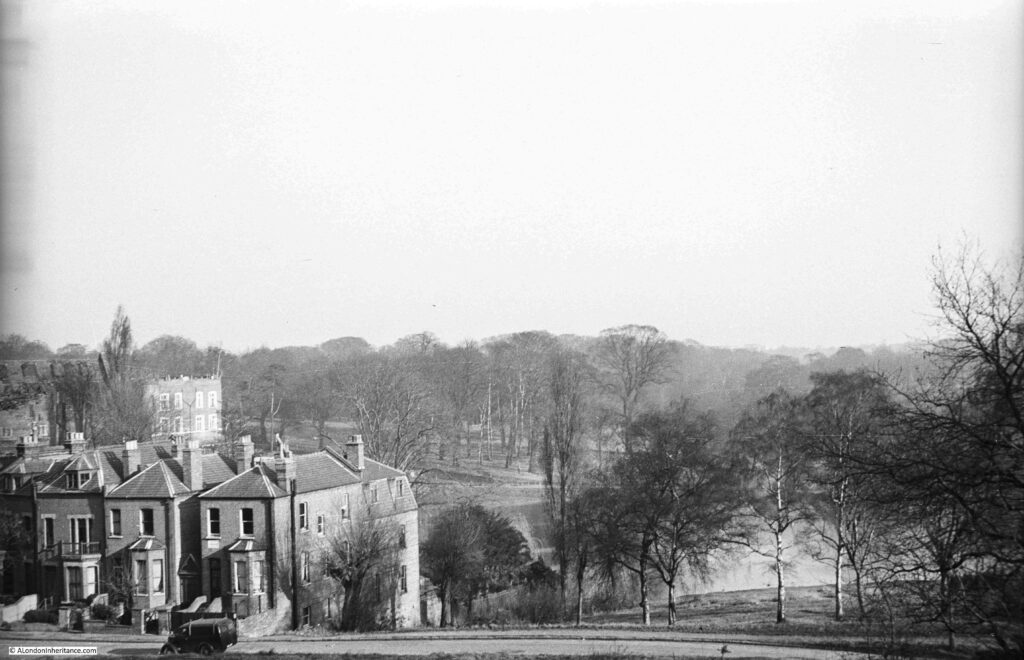
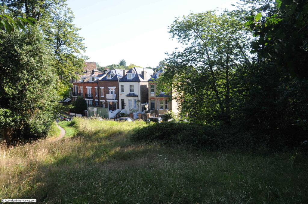
The first photo was a general view from the higher ground on the left, as you arrive on the single road that leads into the Vale of Health:

Vale of Health

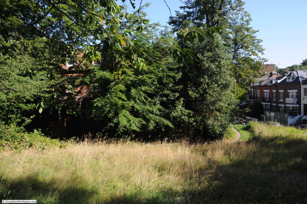
Although my father’s photos were taken in winter and mine in summer, so in my photos the trees are in leaf, the area is far more wooded today than it was, and the higher viewpoint for my father’s photo is today in among the trees and bushes with no clear view, so my comparison photo was slightly lower down, however the first houses along the road into the Vale of Health can still be seen:

Vale of Health

For his second photo from the same spot, may father turned a little to the left. Much the same view, however a large house on the left of the street comes into view.

Vale of Health

Again showing how much more overgrown this area is today, in the following photo the house is still there, but almost completely hidden by tree growth.

Vale of Health

The Vale of Health is a really unusual place. A single access road leads down into a cluster of houses, with a large pond to the east, and the whole place surrounded by the rest of Hampstead Heath.

The pond is a clue as to why the Vale of Health developed. Originally the area occupied by the Vale of Health was wet and marshy. The springs that pop up around the heath fed into this hollow of land. The area was originally called Hatches or Hatchett’s Bottom, and was also referred to as Gangmoor.

The history of the area really starts with the City of London’s insatiable thirst for clean water. In the 16th century, three reservoirs had been built on the heath to provide water for London, however demand kept growing as the population expanded.

in 1692 the Hampstead Water Company was formed and the Corporation of the City of London granted the company leases on the Hampstead Heath reservoirs.

Demand exceeded the capacity of these reservoirs, so in 1777 the Hampstead Water Company drained the marshy area that was Hatchett’s Bottom and formed a new pond to store and supply water for the City. During the 19th century the Hampstead ponds continued to supply water to the City, but by the mid 19th century, water was only used for non-domestic purposes as the quality was rather poor, described as “somewhat disagreeable to the taste and small and was rather turbid; the sediment deposited was considerable, and contained numerous living organic productions”.

The way that land was given over to ownership and house building on Hamsptead Heath was rather complicated. Long before the heath had the protection it does today, it was open for encroachment and squatting, and frequently those encroaching on the heath, could stay providing they paid a fee to the Lord of the Manor.

Applications for the use of “waste land” were made to the Manor and if approved these were allocated on the basis of a “copyholder” where if the person who was allocated the land died, or sold the land, the person inheriting or buying the land had to pay a “fine” to the Lord of the Manor.

One of the early allocations of land, around 1770, was to a Samuel Hatch, which could be why the area was originally named Hatches or Hatchett’s Bottom.

After the new reservoir or pond was constructed in 1777, more applications for grant of waste land were made. Three cottages for the parish poor of Hampstead were built – the choice of area aware from Hamsptead possibly because the land was cheap and Hatchett’s Bottom was not yet an area where the wealthy aspired to live.

Houses continued to be built, and the area started to change into a desirable residential location. Surrounded by the heath, away from the noise and traffic of Hamsptead, Hatchett’s Bottom was starting to be a desirable location, however the name was probably associated with the marshy ground before being drained for the pond, and the location for parish poor houses so perhaps a new name was required.

The name Vale of Health starts to appear at the start of the 19th century.

There are many theories as to the source of the name, however it is probably simply down to a new name to differentiate the place from earlier conditions and usage.

Although the Vale of Health started to be used from around 1801 onward, the name Hatchett’s Bottom would still be used for several decades after.

Houses continued to be built in the Vale of Health, and the Hampstead Heath location meant that the Vale of Health attracted those who left the city on weekends and Bank Holidays to find somewhere for fresh air and entertainment, and it was the location of one of these places that I went looking for next.

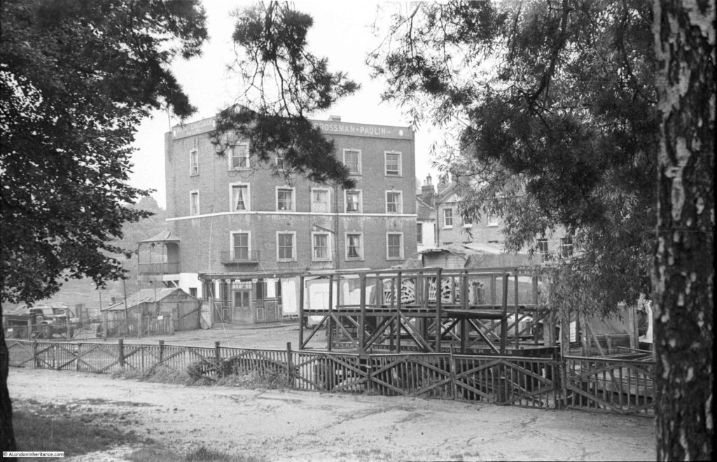
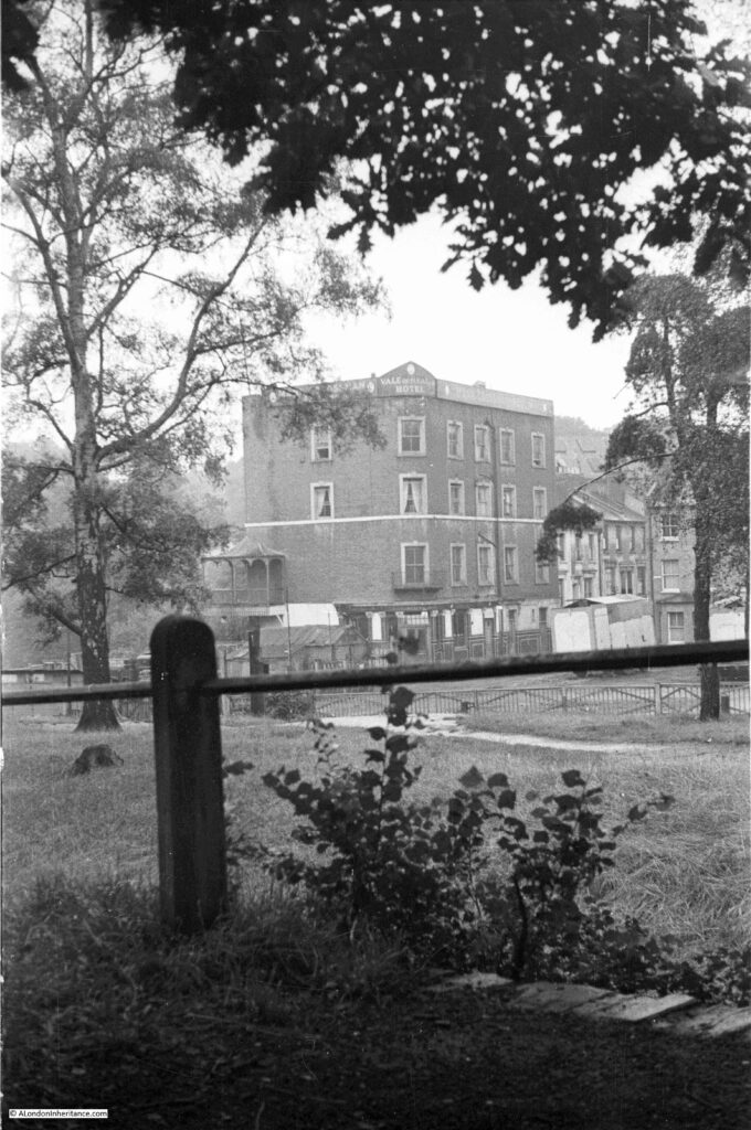
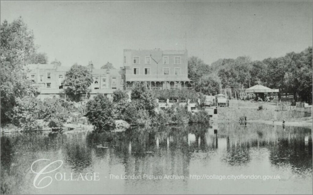
The following photo is my father’s photo of the Vale of Health Hotel. A large 4 storey building facing onto the pond. The view is across an area used as a fairground, and for the storage of fairground rides when not in use. The wooden frame nearest the camera has the words “dodgem cars” just above the top of the fence.

Vale of Health

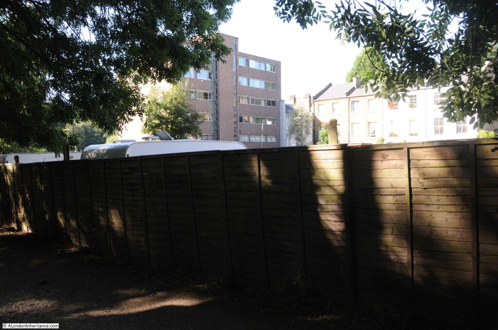
Roughly the same view today. I should have been a little further back, but this would have taken me into the trees and bushes.
Vale of Health

In the 2020 photo, there is a high wooden fence blocking off the area that was used for fairground storage. The Vale of Health Hotel has been replaced by a high block of flats. The terrace of houses on the right are the same in both photos.

The Vale of Health was a focal point for summer weekends and Bank Holidays when thousands of Londoners would stream up to the heath to escape the city. The hotel offered rooms, bars, food, and verandas overlooking the pond. The area behind the hotel was used as a fairground. The Era on the 17th April 1909 had a small article about the fair:
“In the Vale of Health: Harry Cox, the local showman, proudly boasts that he never exhibits his show concerns away from the Heath. By the side of the Vale Waters you will find him ready to entertain you. Here you will see steam roundabouts, boats, swings, shooters and variety stalls. Harry Cox, Vale of Health Perpetual Pleasure Fair is the great central constellation around which many lesser lights live and shine”.

The following article from the Hampstead and Highgate Express reviewing the April 1888 Bank Holiday Monday on the heath provides a good impression of what it must have been like, and what went on across Hampstead Heath and in the Vale of Health:

“BANK HOLIDAY ON HAMPSTEAD HEATH. On Easter Monday there were probably not far short of 80,000 visitors to Hampstead Heath. The weather was not all that could have been desired, but remembering what a comparatively few days ago it was since the Heath was covered white with snow, the holiday makers may be congratulated that at the beginning of April they were able to get as much outdoor fun as they did.

The fineness of the early morning led many to start from town soon after breakfast to spend a long day on the people’s favourite and beautiful Heath. Trains, tram-cars and omnibuses brought them up in goodly numbers from all parts and ‘all the fun of the fair’ had commenced when at about half past ten, down came a heavy shower of rain from a sullen-looking sky, threatening to spoil the whole day’s proceedings. Fortunately, however, this proved to be but a passing shower, and thenceforth for several hours fairly fine weather prevailed.

By midday the people were swarming onto the Heath, and for a long time it seemed as if the metropolis was sending all its juvenile population especially in this direction. There was plenty of amusement to be found of the kind in which the Cockney holiday-makers most delight on such occasions. Swings, skipping, pony and donkey riding, peep-shows, and exhibitions of curiosities with numberless coconut shies and try your strength apparatus, were in full operation, as to refreshments, tea and coffee stalls, fried fish establishments, and fruit and ice barrows offered their attractions, and by no means in vain, to the ruralisers around with sharpened appetites.

Conjurers, men on very high stilts, a fire-eater, and Punch and Judy also attracted very large crowds, and numerous pennies, and the swings and steam round-about in the Vale of Health did see a large amount of business.

In spite of some horse-play, especially in the Vale of Health, the holiday makers as a whole, behaved themselves well, and only one or two police charges arose out of the day’s holiday”.

The article mentions the “horse-play” around the Vale of Health and it does seem to have been the location of petty crime – perhaps the large numbers of people attracted to the steam fair was the ideal location for crimes such a pick-pocketing. A report in 1885 regarding the August Bank Holiday mentions the arrest of one William Mitcham, aged 16 from Gunn Street, Spitalfields, who was charged with being a suspected person loitering in the Vale of Health for the purpose of committing a felony by picking pockets.

Another of my father’s photos providing a clearer view of the Vale of Health Hotel:

Vale of Health

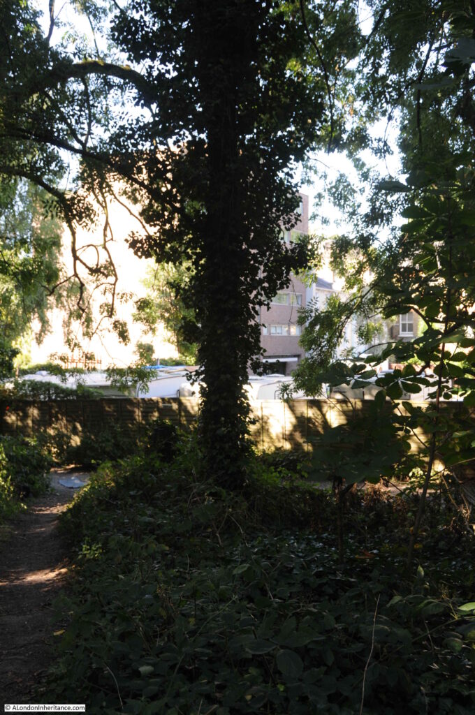
From roughly the same position today, but again showing how much the trees and undergrowth have claimed back the area which presumably was once relatively clear due to the crowds of people that once attended the fair here.

Vale of Health

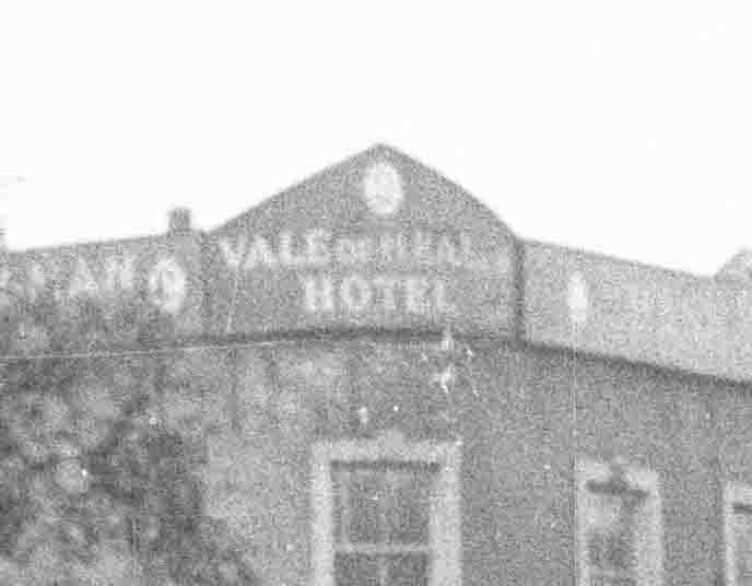
To confirm the name, the following is an extract from the above photo, showing the name on the corner of the signage along the roof line.

Vale of Health

The Vale of Health Hotel was demolished around 1962. The Vale of Health was also changing character. No longer the focal point for large numbers of potentially rowdy bank holiday visitors, the area was changing to a rather expensive enclave of housing. A 1962 newspaper article sums up these changes in an article titled “Vale of Wealth”:

“Van horses-what else? There is, of course. Battersea Park, and some people will never forgive Herbert Morrison – Lord Morrison of Lambeth – for setting that up in perennial competition with the old three-times-a-year tradition of the Hampstead Heath Fair.

That fair, in any case, is not what it used to be, what with the etiolated gaieties of the pin-tables. And even the Vale of Health hotel is under threat of being pulled down and made into something rather different.

So Battersea can go on with no serious challenge from the old traditional site. There is, indeed, some rebuilding there and some old Hampsteadians tend to call it now the Vale of Wealth”.

The brick building seen in my 2020 photos on the site of the old Vale of Health Hotel are the flats that were built on the site. They look rather bland from the landward site of the Vale of Health, but walk around the pond and they look very different.

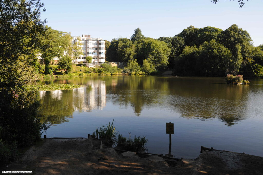
In the following photo, looking across the pond, which was once the Hampstead Water Company  reservoir, built after the 1777 draining of the marshy Hatchett’s Bottom, the new flats are within the mainly white coloured building.

Vale of Health

The Vale of Health Hotel once faced onto the pond, with verandas around the lower floors providing a lovely location for drinking and eating with a view across the pond.

The following photo from the LMA Collage archive shows the view across the pond to the Vale of Health Hotel, with the fair ground set up to the right of the hotel in the space shown in my photos being used for the storage of fair ground equipment. Comparison of the photos also shows how densely the trees have grown up around the pond.

Vale of Health

Image credit: London Metropolitan Archives, City of London: catalogue ref: SC_PHL_01_143_80_3444

A walk around the pond, and the Vale of Health is a lovely way to spend a Sunday morning. There is a walking route around the unbuilt parts of the pond, starting by the road leading into the Vale of Health.

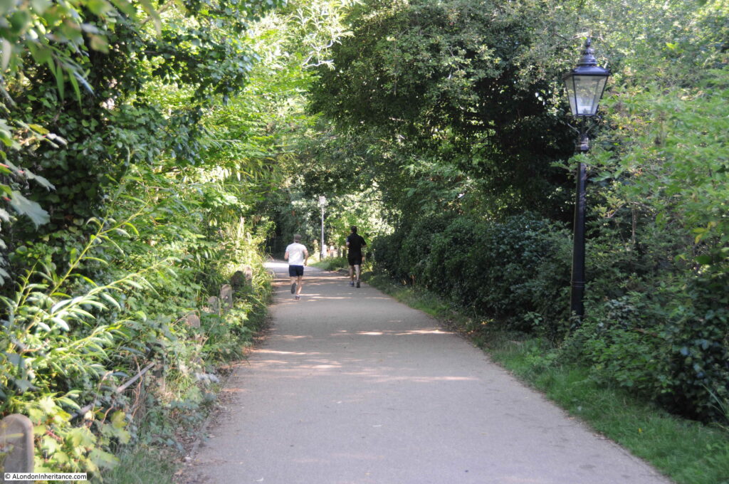
On the north east side of the pond, this is paved and is one of the many walking routes across the heath, which on a Sunday morning seems to be mainly used by joggers and the occasional dog walker.

Vale of Health

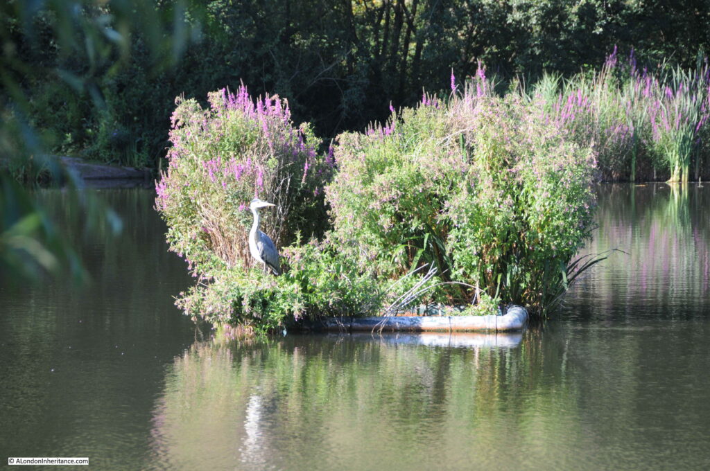
Island in the middle of the pond:

Vale of Health

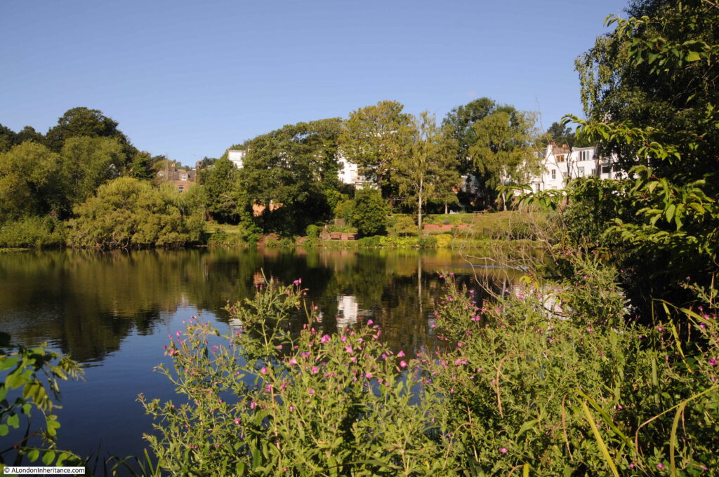
View across to the western edge of the pond:

Vale of Health

The rear of the flats occupying the site of the Vale of Health hotel. The corner of the block behind the tree is the same corner with the name of the hotel on the top corner of the hotel.

Vale of Health

There is a street leading to a dead end that runs in from where the rear of the hotel used to stand. The street also leads to the place where the fair ground equipment was stored in my father’s photo. Although the site of the hotel now has a different use, the area for the fairground is still used for the storage of fairground equipment.

Vale of Health

At the top of the street is a brick terrace called Byron Villas, built in 1903. This terrace of houses occupies the spot of another tavern / smaller hotel that once serviced the needs of visitors to the heath. The blue plaque records that the novelist and poet D.H. Lawrence lived in one of the houses in 1915.

Vale of Health

The oval plaque on the following building records that newspaper founder and editor Alfred Harmsworth, Lord Northcliffe lived in the house between 1870 and 1873.

Vale of Health

There is a single road in the Vale of Health, conveniently called Vale of Health. Even the spur down to where the old hotel was located has the same name.

Maps show what looks like a road called East View where the fair ground equipment store is located, however in reality, this is a small footpath between the front of the houses and the fairground land.

As well as the single road, there are a couple of alleys alongside the rear of the houses.

Vale of Health

House in which Leigh Hunt, the English critic, essayist and poet lived for a time in the Vale of Health.

Vale of Health

The Vale of Health is a rather unique area. A small collection of houses embedded in Hampstead Heath, accessed via a single road.

When the new flats were being built on the site of the Vale of Health hotel, there were considerable difficulties with the amount of water that was continuously seeping into the foundations, so perhaps the marshy hollow of Hatchett’s Bottom is still there below the surface,

alondoninheritance.com

Down at the Old Bull and Bush

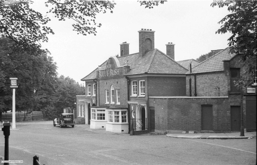
For last week’s post I was looking at the building that was once the pub Jack Straw’s Castle. This week, I have walked from Jack Straw’s Castle, along North End Way towards Golders Green to find another famous Hampstead pub. This is the Old Bull and Bush as photographed by my father in 1949:

Old Bull and Bush

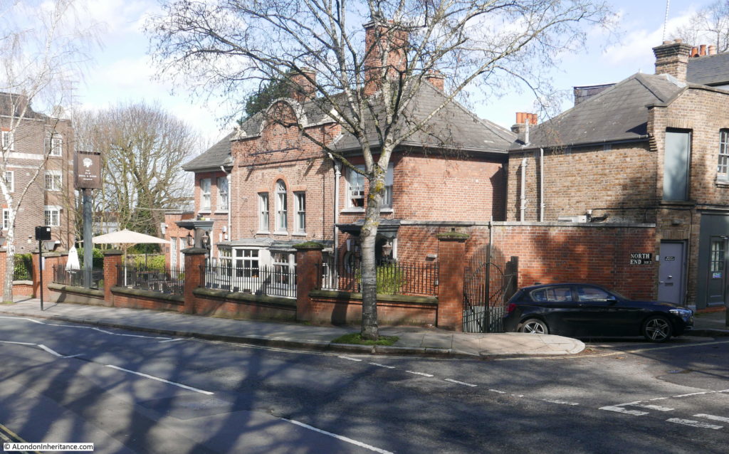
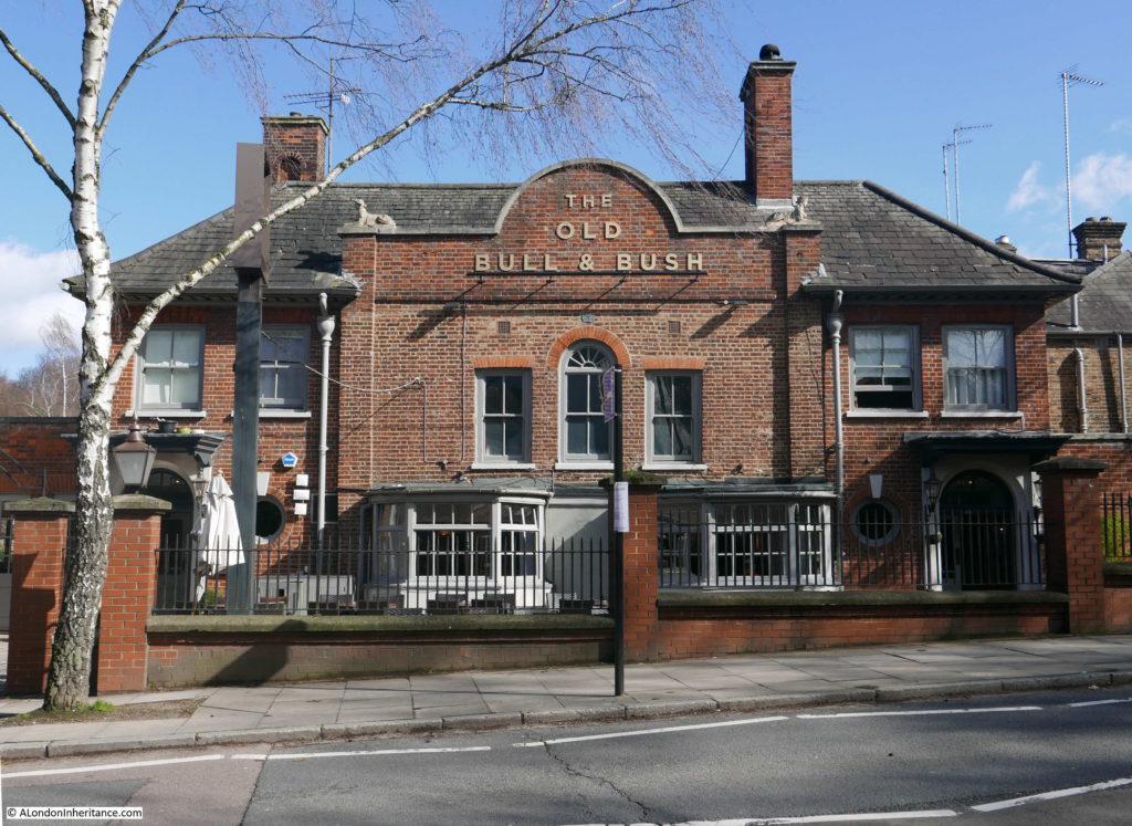
The same view 70 years later in 2019:

Old Bull and Bush

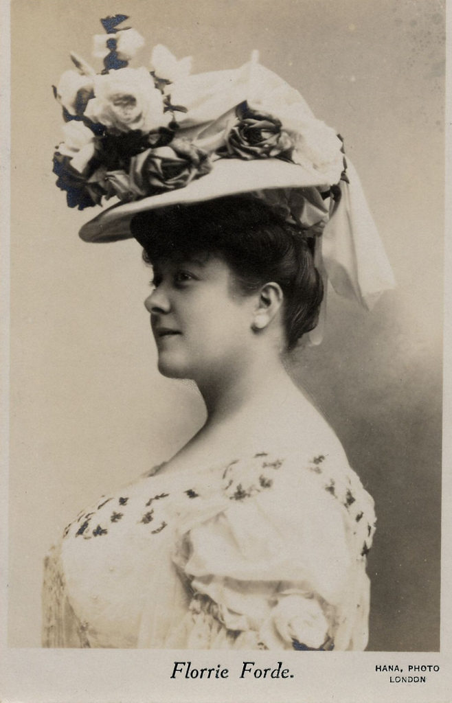
If you have not been to the Old Bull and Bush, you probably recognise the name from the music hall song “Down at the Old Bull and Bush” made famous by Florrie Forde in the early years of the 20th century. The song has the following chorus (there are some minor variations, dependent on the source):

Come, come, come and make eyes at me
Down at the Old Bull and Bush,
Come, come, drink some port wine with me,
Down at the Old Bull and Bush,
Hear the little German Band,
Just let me hold your hand dear,
Do, do come and have a drink or two
Down at the Old Bull and Bush, Bush, Bush
Come, come, come and make eyes at me

The song appears to date from 1903 / 1904. There is a recording apparently dated from 1903 by a Miss Edith Manley. The song may also been a re-work of a song with much the same words titled “Down at the Anheuser Bush” – a song commissioned by the Anheuser-Busch brewing company which also seems to have appeared in 1904.

The Anheuser Bush origin my be correct as the Old Bull and Bush version has a German band reference and the Anheuser Busch company grew out of the 1860 take over of the Bavarian Brewery in St. Louis by Eberhard Anheuser.

The song appeared in a number of pantomimes at Christmas 1904, but it was Florrie Forde’s recording of the song and live performances that appear to have given the song popular appeal at the time, and the longevity needed to keep the song in the cultural background 115 years later.

The song may well also be the reason why the Old Bull and Bush did not go the same way as Jack Straw’s Castle.

Florrie Forde  was born on the 16th of August 1875 in Melbourne, Australia, She was the sixth of eight children of Lott Flannagan, an Irish-born stonemason and Phoebe Simmons. Although her last name was Flannagan, she adopted the surname of a later step father to become Florrie Forde.

She had success in Australia, but moved to England in 1897 where she started to appear in London music halls. This was the start of a very successful career which would last until her death in 1940.

Old Bull and Bush

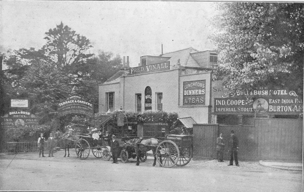
The Old Bull and Bush at it appeared in the first decade of the 20th century:

Old Bull and Bush

The style of the building is much the same as my father’s photo and the pub you will see today, however it has also clearly had some major redevelopment.

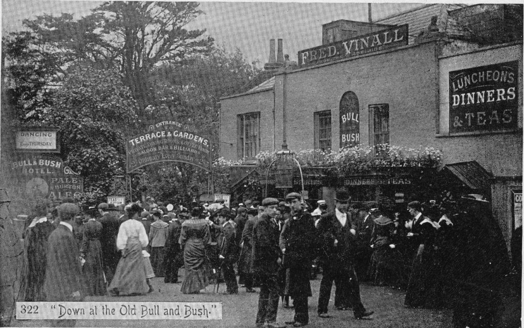
Hampstead pubs were major attractions during summer weekends and public holidays, when Londoners would have a rare opportunity to stop work and head to the open space and clean air of the heath. As well as the open space, fun fairs could be found on the heath as well as the Vale of Health and the pubs would always be a popular destination as shown in the following photo where crowds are heading into the Terrace and Gardens which could be found at the rear of the pub.

Old Bull and Bush

An example of the impact that the bank holiday trade could have for the country, and the pubs of Hampstead can be found in the following newspaper report from The Standard on Tuesday 17th April 1906 reporting on the previous day’s Bank Holiday:

“A RECORD BANK HOLIDAY – CROWDS EVERYWHERE – DAY OF SUNSHINE – SIGNS OF PROSPERITY. Absolutely empty was the Londoner’s verdict about London yesterday, as he strolled about the sunny streets of the metropolis. The fact remains that it was a wonderful Easter Monday, and that many holiday records were broken. The weather had a good deal to do with it. It was bright enough for June, and nearly warm enough for July. But the weather was not all. This is a time of good trade, and everybody is doing reasonably well. They are in the mood to enjoy a holiday, and they can afford to do it in ease and comfort.

The railway companies are unanimous in paying tribute to our satisfactory prosperity, as shown by the money we spend on pleasure. The passenger traffic on the Great Western was the highest ever recorded for Easter. Forty-four excursion trains left Paddington during the holidays. Liverpool Street station was a scene of unprecedented activity for the time of year, and 100,000 passengers left it during the week. More people went to Germany by way of the Hook of Holland, than ever before.

Fifty crowded excursion trains poured into Blackpool yesterday morning. 

Coming to smaller matters, the landlords of The Spaniards, Jack Straw’s Castle, and the Bull and Bush at Hampstead Heath, say it was the best Easter Monday they have known for years; and the refreshment and amusement caterers of Epping Forest admit that they have done better than ever before. At a rough estimate, some quarter of a million excursionists have thronged the glades of the forests during the four days of the holiday.”

I am always struck when reading these old newspapers, that whilst some things have changed, so much remains the same. This coming Easter weekend, crowds will not be taking excursion trains, indeed long public holidays are often when stations close for engineering work as Euston is during the coming Easter weekend. However if the weather is good, it is almost guaranteed that TV reporters will be at one of the seaside resorts with scenes of crowded beaches and interviews with ice cream sellers praising the increase in business.  Hampstead Heath will also be busy, as will the Old Bull and Bush and The Spaniards.

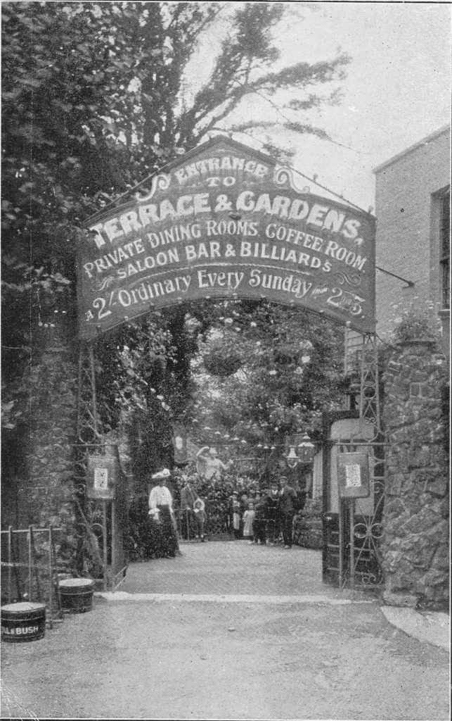
To the side of the Old Bull and Bush was the entrance to the Terrace and Gardens as shown in a postcard dated 1906:

Old Bull and Bush

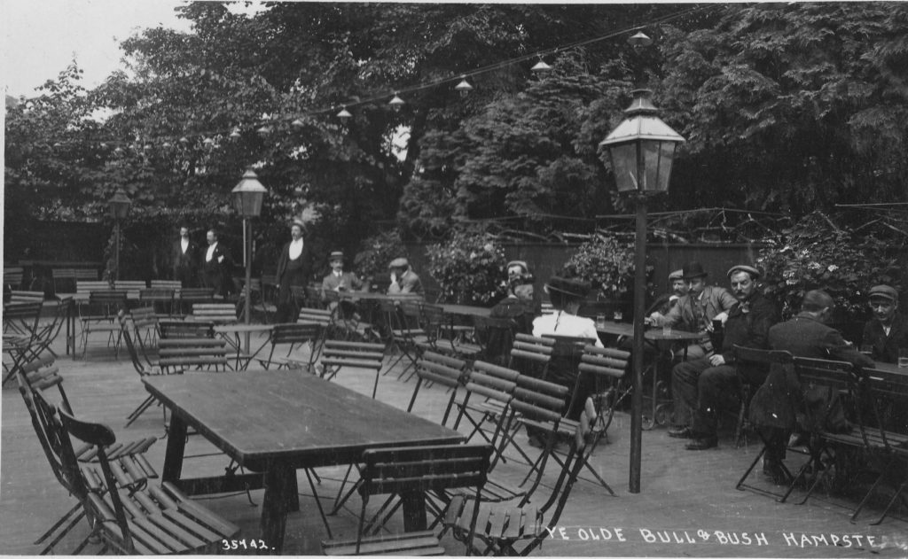
The Terrace and Gardens appear to have been a key part of the success of the Old Bull and Bush. The following view shows part of the gardens. Change the clothing of those sitting at the tables and this could be a pub garden today.

Old Bull and Bush

The above two photos shows lights strung along the gardens. This must have been a popular destination for a summer evening’s drink.

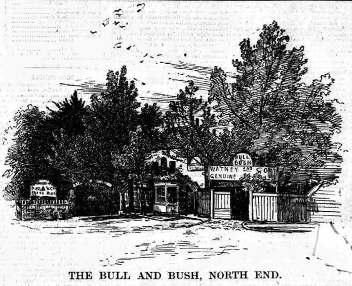
The Bull and Bush as it appeared in the 1880s:

Old Bull and Bush

Some history of the Old Bull and Bush can be found in the Hampstead and Highgate Express dated the 15th September 1888. Note that in the following article the pub is called the “Bull and Bush” so the Old was added at some point between 1888 and the end of the century – an early attempt at marketing the history of the pub to visitors to the heath.

“No tavern situated in the suburbs of London is better known than the Bull and Bush. Contiguous to some of the loveliest bits of Hampstead scenery, and possessing pleasant garden grounds, the Bull and Bush is all that can be desired of an old fashioned, comfortable, roadside hostelry. These characteristics, added to the attractions of its rural surroundings, have made the Bull and Bush a favourite resort for Londoners.

The Bull and Bush was originally a farm house and the country seat of Hogarth (by whom the yew bower in the garden was planted); and which, after its transformation into a roadside place of refreshment, attained some reputation as a resort of the London wits and quality. Tradition informs us that the place was visited by Addison and several of his friends. North-end must have charmed them by the picturesque beauty of its situation.

This feature of the spot still retains, notwithstanding the innovations of brick and mortar, and the construction of roads through regions once sacred to grass and wild flowers. The approach to the Bull and Bush from the town of Hampstead, with its glimpses of gorse and brushwood near Heathbrow, and the foliage in the gardens of Wildwood, remains one of the most beautiful places in suburban London.

The Bull and Bush, like other old Hampstead taverns, has many interesting bits of gossip connected with its history.

‘What a delightful little snuggery is this said Bull and Bush!’ So Gainsborough the painter is reported to have said on one occasion, while surrounded by a party of friends, who, like himself, were enjoying good cheer at the tavern.”

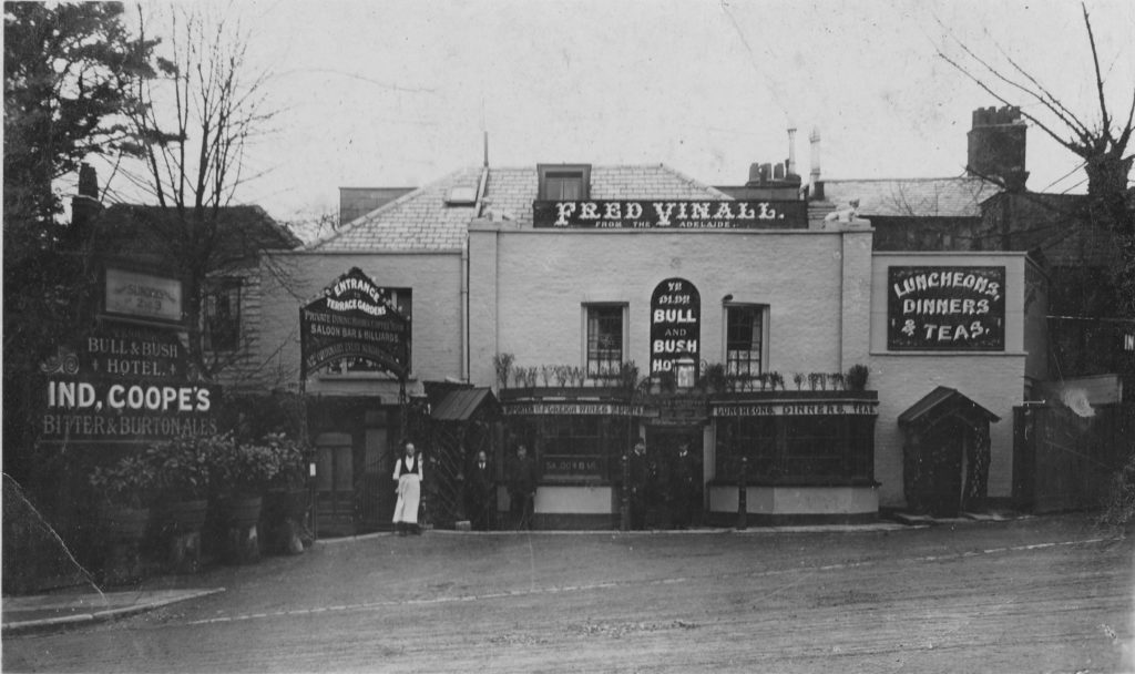
The peak in popularity of the Old Bull and Bush appears to have been around the time that Fred Vinall was licensee as the majority of photos of the pub have Fred’s name in large letters along the top of the building.

Old Bull and Bush

I wonder if that is Fred, standing outside the pub in the white apron in the above photo? He took over the pub in 1905.

Comparing the photo above, with the 2019 photo below shows that while the style of the pub has remained the same, the building has undergone some significant redevelopment, including the separation of the pub from the road by the wall and pavement.

Old Bull and Bush

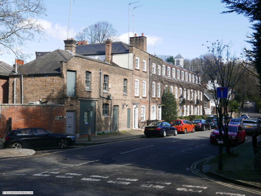
The road to the right of the pub has a lovely terrace of houses. I suspect the buildings on the left were originally stables.

Old Bull and Bush

The attraction of the Old Bull and Bush has always been its location, and the 1888 newspaper article mentioned that the area “remains one of the most beautiful places in suburban London”. Whilst the road heading down into Golders Green is now surrounded by housing, the road continuing up towards Jack Straw’s Castle and then into Hampstead retains the appearance it must have had in the heyday of the Old Bull and Bush.

This is the view looking up in the direction of Jack Straw’s Castle from where I was standing to take the photo of the Old Bull and Bush.

Old Bull and Bush

It is a lovely walk on a sunny day up from the pub to Jack Straw’s Castle and Whitestone Pond.

A short terrace of houses hidden in the woods.

Old Bull and Bush

Which contrasts with the very different view walking down the hill from the Old Bull and Bush towards Golders Green station:

Old Bull and Bush

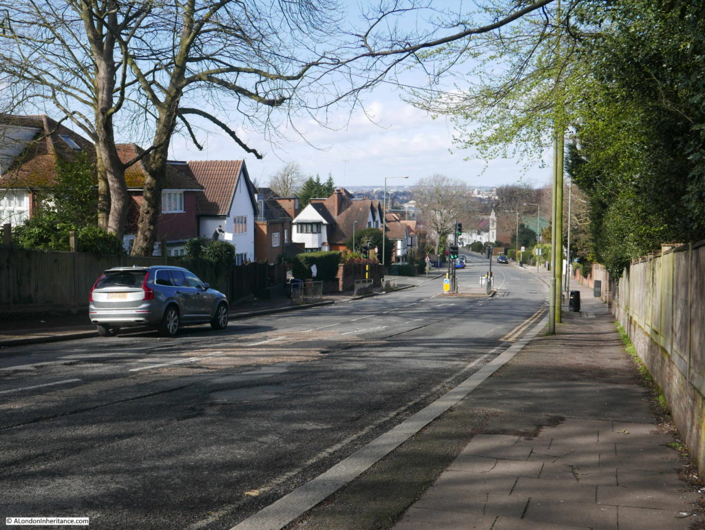
The street leading down to Golders Green station has a wide range of different architectural styles, probably a result of the speculative building on smaller plots of land that developed the area between Golders Green and Hampstead.

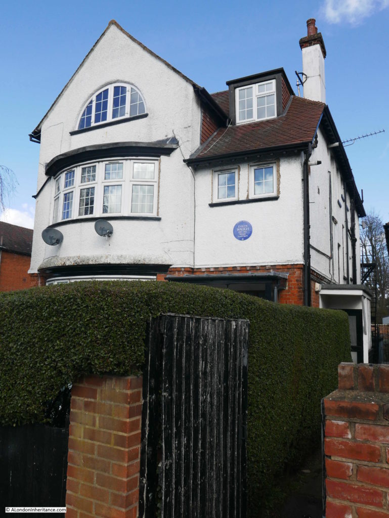
I spotted a couple of Blue Plaques in the street. One for Anna Pavlova, the Russian prima ballerina, who spent much of her life living in the Ivy House on North End Road. The following plaque is for the writer Evelyn Waugh who also lived along North End Road.

Old Bull and Bush

The short walk between Golders Green and Hampstead station is a lovely walk. If you start from Golders Green and walk up the hill, the Old Bull and Bush is a perfect stop before the final climb to the highest point in metropolitan London.

If you take the underground, do not follow the instructions in the “Getting Here” section on the pub’s website, which strangely states that the pub is “Located a quarter of a mile from Bull and Bush Underground station” – this was a planned station that was part built but never opened. Intended to serve building on the heath to the north of the Old Bull and Bush, which fortunately was never built. Next time I am in the pub I will have to ask them for directions to Bull and Bush Underground station (there is a surface building for the original entrance shaft, but it is clearly not a station – a subject for another post, even better if TfL could let me see the old station shafts and tunnels!).

It was relatively quiet during my visit, but if we have the same weather as reported in The Standard from 1906 for the Easter Bank Holiday weekend in a couple of weeks, the Old Bull and Bush, as well as the other pubs around Hampstead Heath will be looking forward to the additional trade that good weather has always generated.

alondoninheritance.com

Jack Straw’s Castle, Hampstead

For today’s post, I am at the highest point in the metropolitan London area, standing opposite Jack Straw’s Castle.

Jack Straw’s Castle was one of the most well known pubs around Hampstead Heath. A coaching inn as well as a place for those walking across the heath to visit, along with weekend and Bank Holiday crowds.

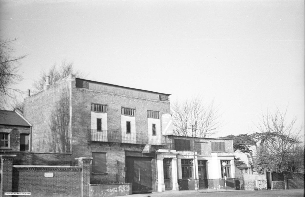
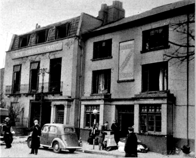
My father photographed the building just after the last war and the photo below is his view of Jack Straw’s Castle in 1949.

Jack Straw's Castle

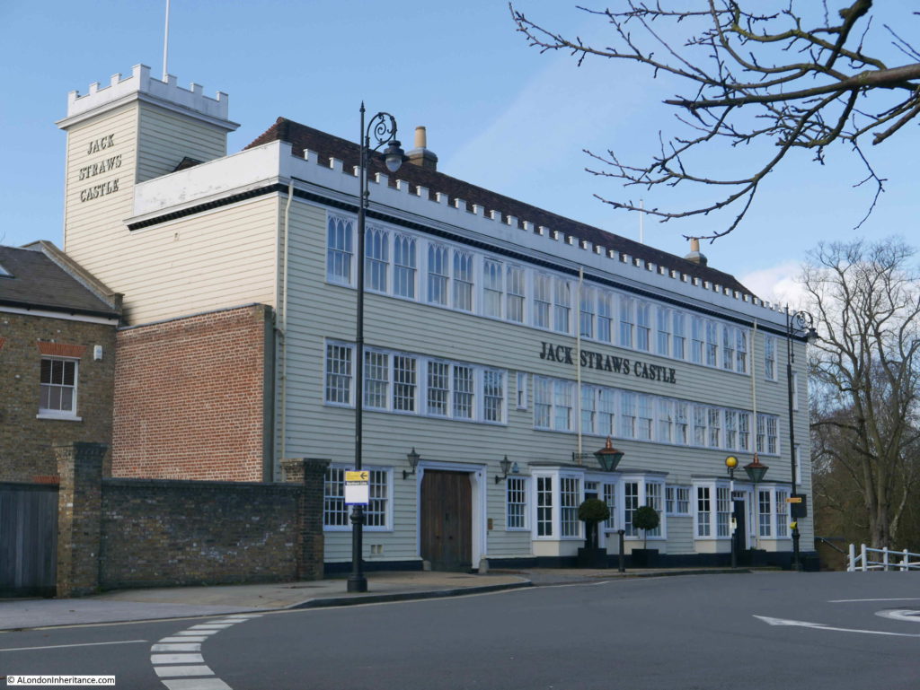
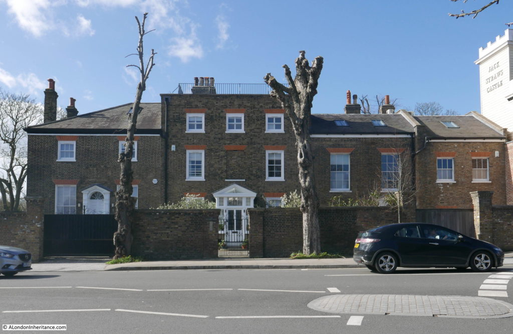
This was my view in March 2019:

Jack Straw's Castle

You may well be wondering how I know that my father’s photo is of Jack Straw’s Castle, given the changes between 1949 and 2019, however if you look at the very top of the tallest building, the faded words Jack Straw’s Castle can just be seen. Also, the building on the far left of both photos, along with the brick wall with two pillars, are the same in both photos.

My father’s photo shows the pub as it was following bomb damage in 1941 and subsequent demolition of some of the walls to make the building safe. The Daily Herald on the 29th March 1941 carried a report titled “Jack Straw’s Castle Bombed – the old Hampstead hostelry, was among places recently damaged during air-raids. Its neighbour, Heath House, the home of Lord Moyne, leader of the House of Lords, was also damaged.”

The building was demolished and rebuilt in 1964 to a rather striking design by Raymond Erith, however it is no longer a pub, having been converted into apartments and a gym. The building is Grade II listed which has helped to preserve key features of Erith’s design, despite developers trying to push the boundaries of how much they could change.

Jack Straw, after who the pub was named, is a rather enigmatic figure. General consensus appears to be that he was one of the leaders of the Peasants Revolt in 1381, however dependent on which book or Internet source is used, he could either have led the rebels from Essex, or been part of the Kent rebellion. Jack Straw may have been another name for Wat Tyler and some sources even question his existence. Any connection with Hampstead Heath and the site of Jack Straw’s Castle seem equally tenuous – he may have assembled his rebels here, made a speech to the rebels before they marched on London, or escaped here afterwards.

Jack Straw is mentioned by Geoffrey Chaucer in the The Nun’s Priest’s Tale of The Canterbury Tales:

Out of the hyve cam the swarm of bees.
So hydous was the noyse — a, benedicitee! 
Certes, he Jakke Straw and his meynee
Ne made nevere shoutes half so shrille
Whan that they wolden any Flemyng kille

Given The Canterbury Tales were written not long after the Peasants Revolt, this reference by Geoffrey Chaucer does probably confirm his existence. The reference to “Flemyng kille” is to the targeting of the houses of Flemish immigrants in London by the rebels.

I cannot though find any firm evidence of Jack Straw’s association with Hampstead or the site of the pub.

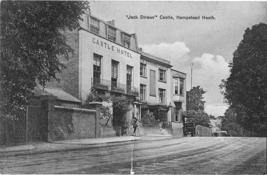
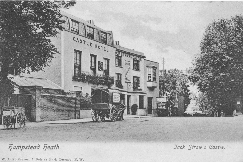
My father’s photo was of a rather sad looking building, however before the bombing of 1941, Jack Straw;s Castle was a rather lovely coaching inn. The following photo is from a postcard from around or just before the First World War showing Jack Straw’s Castle, and demonstrating that part of the series of buildings was the Castle Hotel.

Jack Straw's Castle

It all looks rather idyllic. A cart is parked outside, a well dressed couple are entering the Castle Hotel, and there are small trees and plants growing in frount of the buildings. The road to Golders Green disappears off past the buildings.

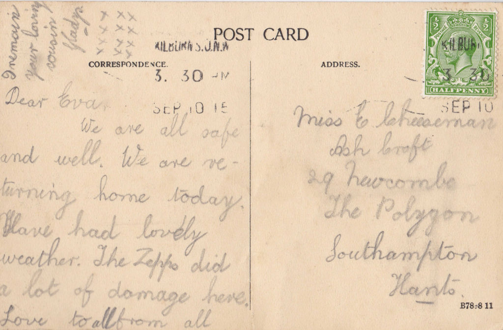
The rear of the postcard reveals that London was not so idyllic when it was posted. The card is dated 10th September 1915 and the author has written “The Zeppo did a lot of damage here”, probably referring to the raid on the 8th September 1915 when a Zeppelin attacked London, dropping the largest bomb to land on the city during the first war, with the raid killing 22 people in total.

Jack Straw's Castle

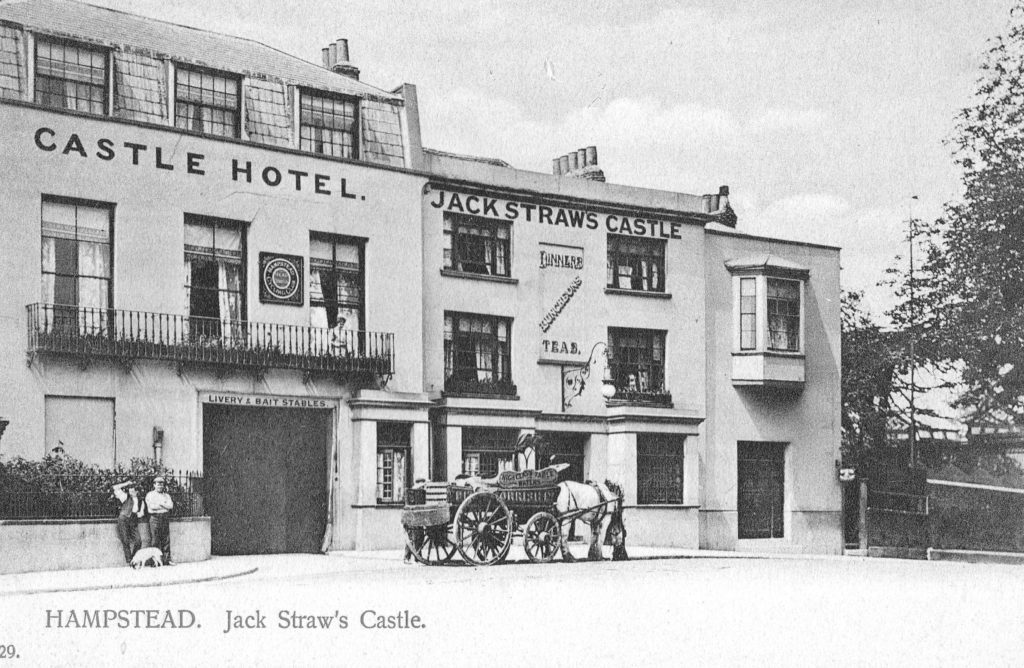
A later photo than the above postcard as the pub has now lost the bay windows on the ground floor and has the windows that would remain in my father’s photo.

Jack Straw's Castle

The two carts in the above photo possibly delivering Nevill’s Bread to Jack Straw’s Castle and Hotel, along with a delivery from the Civil Service Cooperative Society.

In the following photo, the cart is delivering High Class Table Waters.

Jack Straw's Castle

The above photo shows how there are frequently traces of previous buildings in the buildings we see today. Jack Straw’s Castle was a Coaching Inn, and the large doors on the left have “Livery & Bait Stables”, but compare the position of these large doors with my 2019 photo above and you will also see a large set of doors in roughly the same position, although the 1964 version of Jack Straw’s Castle had no need to provide a stables.

A view of Jack Straw’s Castle, the origin of the name and some of the visitors to the inn is provided by Edward Walford in Old and New London (published in 1878);

“To Hampstead Heath, as every reader of his ‘Life’ is aware, Charles Dickens was extremely partial, and he constantly turned his suburban walks in this direction. He writes to Mr. John Forster: ‘You don’t feel disposed, do you, to muffle yourself up and start off with me for a good brisk walk over Hampstead Heath? I know of a good house where we can have a red-hot chop for dinner and a glass of good wine.’ ‘This note’ adds Forster, ‘led to our first experience of Jack Straw’s Castle, memorable for many happy meetings in coming years.’

Passing into Jack Straw’s Castle, we find the usual number of visitors who have come up in Hansoms to enjoy the view, to dine off its modern fare, and to lounge about its gardens. The inn, or hotel, is not by any means an ancient one, and it would be difficult to find out any connection between the present hostelry and the rebellion which may, or may not, have given it a name. The following is all that we could glean from an old magazine which lay upon the table at which we sat and dined when we last visited it, and it is to be feared that the statement is not to be taken wholly ‘ for gospel’ – Jack Straw, who was second in command to Wat Tyler was probably entrusted with the insurgent division which immortalised itself by burning the Priory of St. John of Jerusalem, thence striking off to Highbury, where they destroyed the house of Sir Robert Hales, and afterwards encamping on Hampstead heights. Jack Straw, whose castle consisted of a mere hovel, or a hole in the hill-side, was to have been king of one of the English counties – probably of Middlesex; and his name alone of all the rioters associated itself with a local habitation, as his celebrated confession showed the rude but still not unorganised intentions of the insurgents to seize the king, and, having him amongst them, to raise the entire country.

This noted hostelry has long been a famous place for public and private dinner-parties and suppers, and its gardens and grounds for alfresco entertainments.”

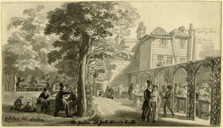
Gardens at the back of pubs and inns have probably been a popular attraction for as long as these establishments have existed, and today a pub with a garden is a perfect place to spend a summer’s evening or weekend afternoon. The garden at the back of Jack Straw’s Castle looks perfect in this drawing from 1830 by George Scharf (©Trustees of the British Museum).

Jack Straw's Castle

The drawing is interesting as it appears to contain notes for a later coloured version. Scribbled text alongside the building record that the chimney is light yellow, the boards are stone colour and the brick wall is yellow.

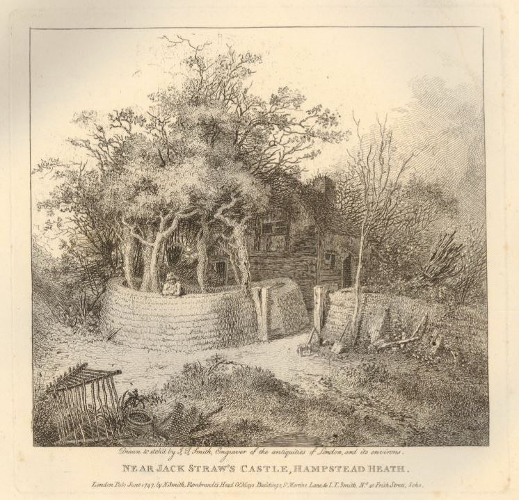
Jack Straw’s Castle was obviously a local landmark in what was a very rural area. The following print from 1797 showing an old cottage surrounded by trees and bracken and is labelled “Near Jack Straw’s Castle, Hampstead Heath” as the inn was probably the only local reference point (©Trustees of the British Museum).

Jack Straw's Castle

My father’s photo was of the building just after the war showing a shadow of the former inn. The following photo from 1941 shows Jack Straw’s Castle in 1941 in the days following the bombing.

Jack Straw's Castle

The windows have been blown out, but difficult to see what other damage has been caused to the structure of the building. From this photo I would have expected that Jack Straw’s Castle could have been repaired, however shortage of materials and people during the war probably prevented any repair work, and over the years any structural damage and the building being left in this state resulted in the building being unsafe, and walls demolished to result in the building that my father photographed.

Although Jack Straw’s Castle is very different, the buildings to the left look as if they are much the same as their original construction.

Jack Straw's Castle

There appear to be four individual houses in the above photo. The name adjacent to the entrance is “Old Court House”. The Victoria County History volume for Hampstead refers to these buildings as having been built by Thomas Pool who purchased Jack Straw’s Castle in 1744 and built two houses in 1788. The Victoria County History states that in 1820 they were converted into a single house, with name changes over the years of Heath View, Earlsmead, and finally Old Court House.

Underneath the name plate is an intercom system with four buttons so I assume they are four individual homes, but how and when they converted from the original two houses to the current buildings, I am unsure.

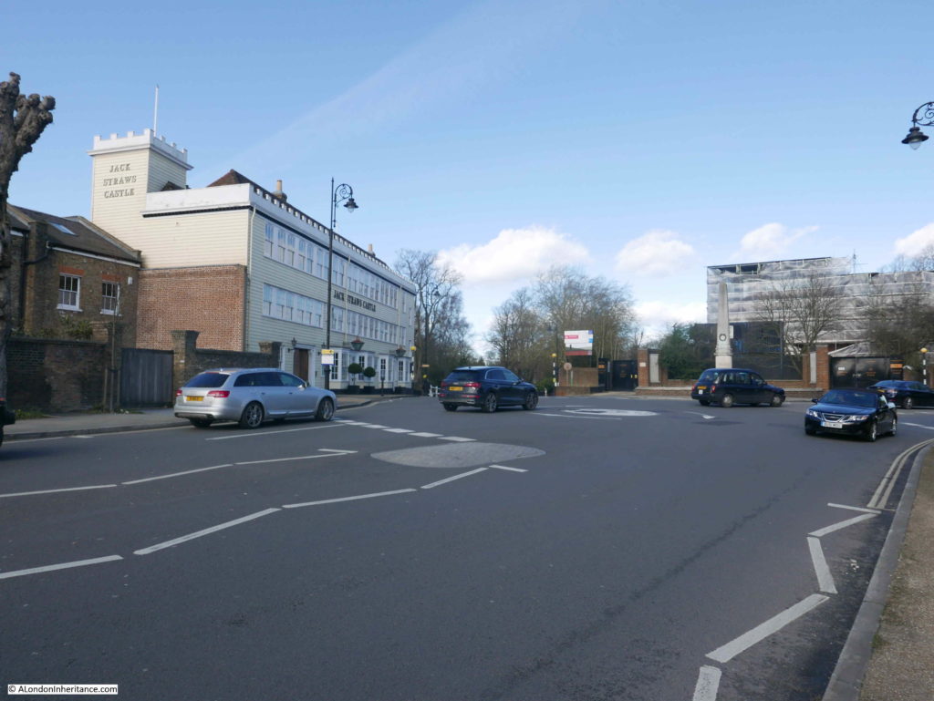
Jack Straw’s Castle sits on a very busy road junction, where roads from Hampstead, Highgate and Golders Green converge. Whilst I was trying to take photos there was a continuous stream of traffic.

In the following photo, the road on the left leads to Golders Green, the road on the right leads to Highgate (passing a building which is still a pub – the Spaniards), and I am standing by the road that leads up from Hampstead.

Jack Straw's Castle

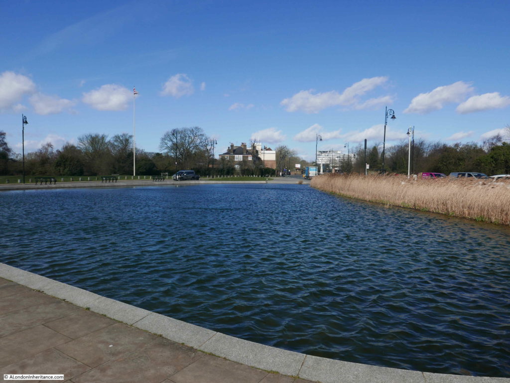
After visiting Jack Straw’s Castle, I walked down into Hampstead. This took me alongside Whitestone Pond.

Jack Straw's Castle

The pond was originally named Horse Pond as it was a drinking point for horses on the passing road, I will find the origin of the new name in a moment.

This area is the highest point in London, with according to the Ordnance Survey map, the pond being at 133m above sea level and Jack Straw’s Castle being at 135m.

It was originally fed by rain water and dew, however I believe it now also has an artificial supply as the height of the pond means there was no natural underground or stream sources of water.

This view dates from 1936 and shows Whitestone Pond, with the side of the Old Court House and Jack Straw’s Castle in the distance.

Jack Straw's Castle

I took the following photo of the same view, but I have no idea why I stupidly did not move to get the tree in a different position as it is obscuring the war memorial which can be seen in the distance in the 1936 view.

Jack Straw's Castle

Just to the left of where I was standing for the above photo, is the source of the name Whitestone Pond. Jack Straw's Castle

This is a milestone and states “IV miles from St Giles, 4 1/2 miles 29 yards from Holborn Bars”. There is a similar milestone near the Flask pub in Highgate (see my post here) which gives a distance of 5 miles from St Giles Pound. These two milestones show that there were two main routes, either side of Hampstead Heath, leading down to St. Giles and then via Holborn, into the City.

There is one final unexpected find before heading off down into the centre of Hampstead, close to the milestone is a covered reservoir with an unusual looking dome on top.

Jack Straw's Castle

This is the astronomical observatory of the Hampstead Scientific Society – a rather unique place to observe the night sky, high above the rest of London. One of the very few locations across London that provides public viewing. Unfortunately, the observatory is currently closed whilst restoration work is carried out.

It is a shame that Jack Straw’s Castle is no long a pub. It is an impressive building in an equally impressive location – although I must admit that i prefer the pre-war building. I have read so many different interpretations of the origin of the name Jack Straw and possible associations with Hampstead so i suspect we will never know the truth behind Jack Straw, but it is good that there is still a very visible reminder of the Peasants Revolt at the highest spot in Hampstead, 638 years after the event.

alondoninheritance.com

Kenwood House, Hampstead Heath

Last Monday, the early May public holiday, I headed to Hampstead Heath to visit Kenwood House.

I probably chose the wrong day to visit as it turned out to be the hottest early May holiday for decades, but the weather was fantastic, there was not a cloud in the sky, and along with what seemed like hundreds of other people, I headed along Hampstead Lane to enter the heath at  the rear of Kenwood House.

The reason for the visit was to take a couple of photos of Kenwood House as my father had done some years before.

Kenwood House sits on flat ground at the top of a long grass slope down to some rather large ‘ponds’. The land in front of the house has a short, steep fall, then a smoother fall down to the water, thereby reducing the height of the land in front of the house compared to the sides.

This has the effect of leaving arms of higher ground branching out from either side of the house and running either side of the central grassy slope. Standing on this higher ground provides a superb view of the house, which was obviously the intention of the landscape design.

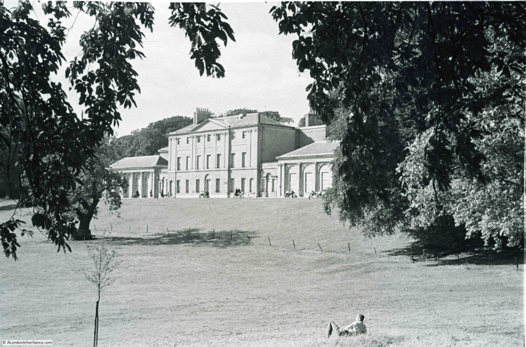
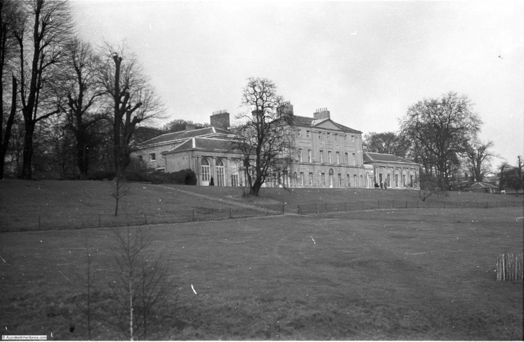
It is from the higher ground to the east of the house that my father took the following photo in 1953:

Kenwood House

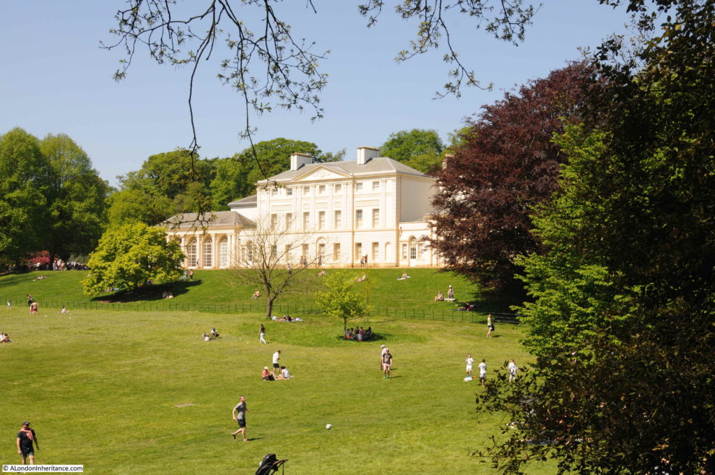
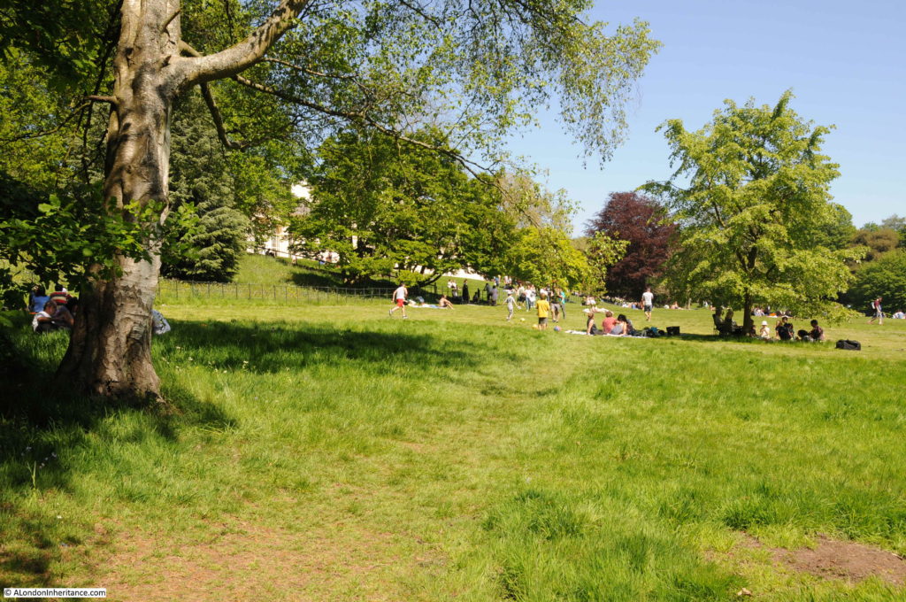
I could not take a photo from the same position as in the intervening 65 years there has been considerable tree growth, but I did find a gap a short distance further along to take the following photo:

Kenwood House

The first Kenwood House was built in the early 17th century by John Bill, a printer to King James 1st, who purchased the land in 1616. For the rest of the 17th century and early 18th century, the house would be brought and sold, modified and extended.

In tracing the name Kenwood, I have found several sources that give the original name as Caen Wood, including the use of this name during the 19th century. In Old and New London, Edward Walford writes:

“Pursuing our course along the Hampstead road, we reach the principal entrance to the estate of Caen (or Ken) Wood, the seat of the Earl of Mansfield. Though generally regarded as part and parcel of Hampstead, the estate lies just within the boundary of the parish of St. Pancras, and was part of the manor of Cantelows. It is said by antiquaries to form part of the remains of the ancient forest of Middlesex. Lysons is of the opion that the wood and the neighbouring hamlet of Kentish Town (anciently Kentestoune) were both named after some very remote possessor. There was, he says, a Dean of St. Paul’s named Reginald de Kentewode, and the alteration from Kentwode to Kenwood is by no means unlikely to happen. Mr Howitt looks for the origin of the syllable in the work ‘Ken’, a view. As, however, we have stated in previous chapters, the word Caen may, perhaps, be an equivalent to ‘Kaen’ or Ken, which lies at the root of Kentish Town, Kensington etc.”

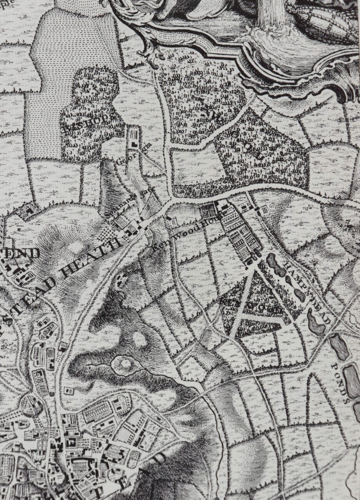
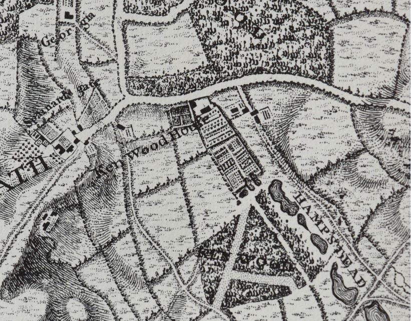
In 1746 the house appears on John Rocque’s map, with the name being two separate words as Ken Wood House, with the name Ken Wood also being found across the wooded area running parallel to the ponds. Whether Ken or Caen the house takes the name from the woods. The house can be seen just above the centre of the following map extract. In 1746 the area in front of the house down to Hampstead Ponds was covered by formal gardens.

Kenwood House

The transformation of the house and grounds to the view we see commenced in 1754 when William Murray, the 1st Earl of Mansfield purchased Kenwood House.

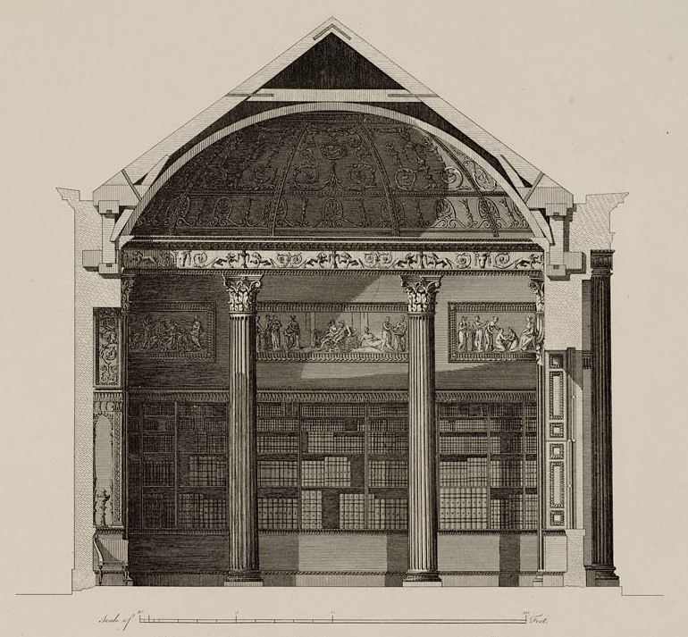
Robert Adam was commissioned to remodel the interior of the house. This included a new northern entrance to the house at the end of the drive from Hampstead Lane, along with interior works.

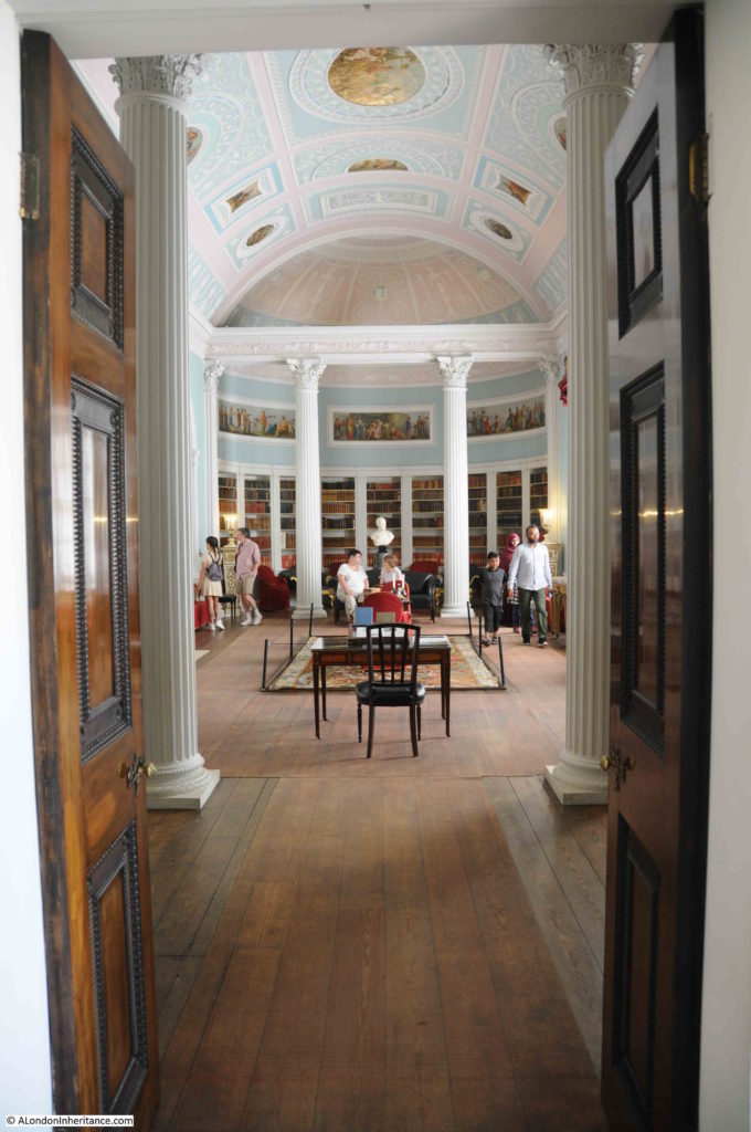
Adam’s original designs can still be found in the interior of Kenwood House. His work included the build of a ‘Great Room’ or Library. This is a section through the end of the library:

Kenwood House

Which can still be seen today at the end of the Great Room:

Kenwood House

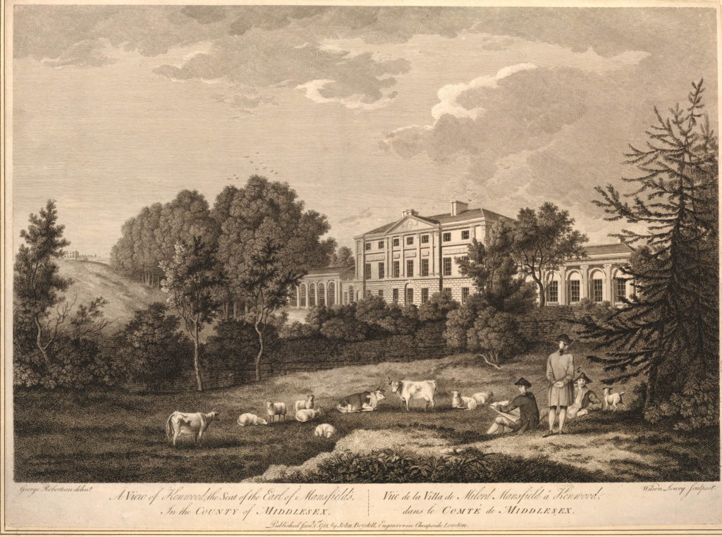
During the 1st Earl of Mansfield’s time, it seems that the formal gardens disappeared, and the land at the rear of the house was as rural as the rest of the heath. In the following view from 1781, drawn from a very similar viewpoint as my father’s photo, we can see animals being grazed on the land in front of Kenwood House. (Print ©Trustees of the British Museum)

Kenwood House

In 1793 Mansfield’s nephew, David Murray became the 2nd Earl and commissioned the Landscape Gardener Humphrey Repton to advise on changes to the land surrounding the house.  (Humphrey Repton was also responsible for the design of the gardens at the centre of Russell Square).

One of Repton’s recommendations was to move Hampstead Lane further away from the house to provide more privacy and to allow a longer, more impressive drive to be built between the house and road (you could do this sort of thing if you were an Earl).

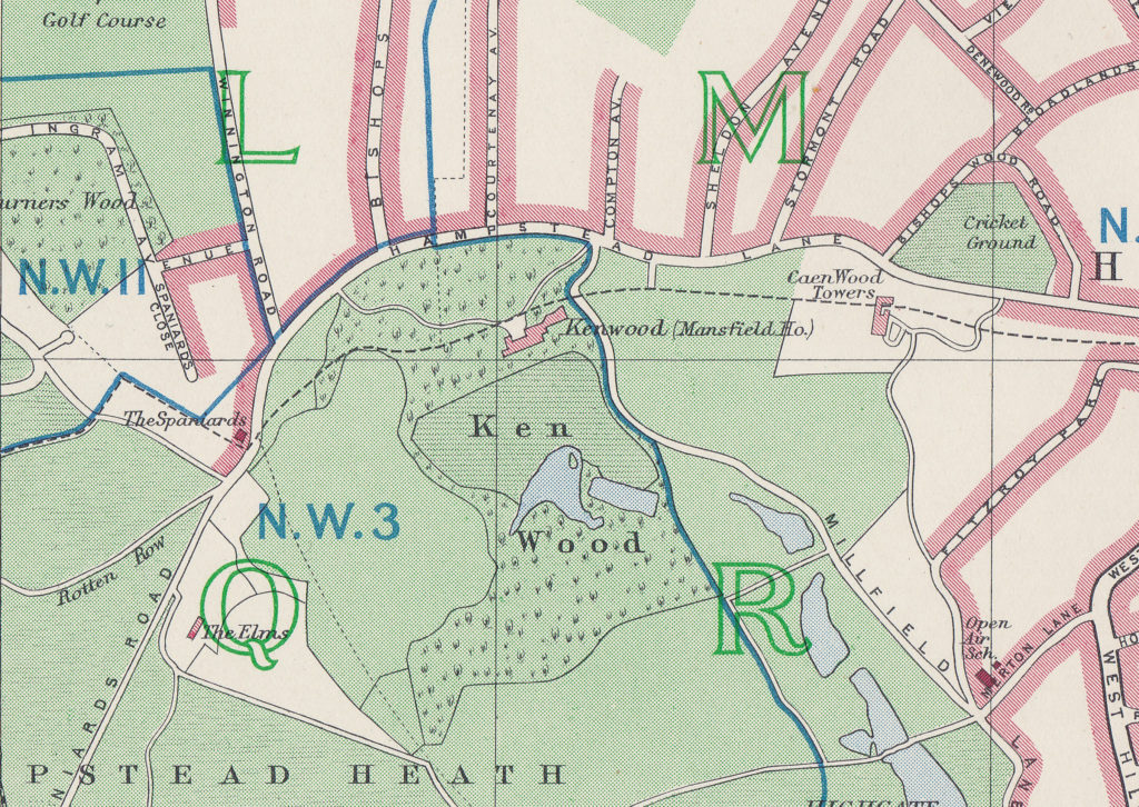
If you compare the following two maps, the first being detail from Rocque’s 1746 map and the second being the 1940 Bartholomew Atlas, you can see that Hampstead Lane now curves much further away from the house:

Kenwood House

Kenwood House

With reference to the earlier discussion of the source of the name as Caen Wood, in the above 1940 map there is a Caen Wood Towers to the right of the map. This is a large Victorian house, now known as Athlone House.

Repton’s proposals can also be seen in the open area at the rear of the house as the land drops down to the lake. Repton’s proposals included planting strategically placed trees to hide the buildings at Kentish Town and also to create the impression that the valley sweeping down from Kenwood House leads directly towards the City of London.

In 1804, the book “Selected Views in London and its Environs” described the house and gardens using the name Caen:

“Caen Wood, the beautiful seat of the Earl of Mansfield, is situated on a fine eminence between Hampstead and Highgate, and its extensive grounds contain no small degree to enrich the neighbouring scenery. These, with the wood which gives name to them, contain about forty acres, and are laid out with great taste. On the right of the garden front of the house (which is a very noble mansion) is a hanging wood of tall spreading trees, mostly beeches; and on the left the rising hills are planted with trees that produce a pleasing effect. These with a sweet shrubbery immediately before the front, and a serpentine piece of water, render the whole a very enlivening scene. The enclosed fields adjoining to the pleasure-grounds contain about thirty acres more. Hornsey great woods, held by the Earl of Mansfield under the Bishop of London, join the estate on the north, and have lately been added to the enclosure.”

The reference to the ‘pleasure-grounds’ refers to the large, grassed area at the rear of the house which slopes down to the ponds.

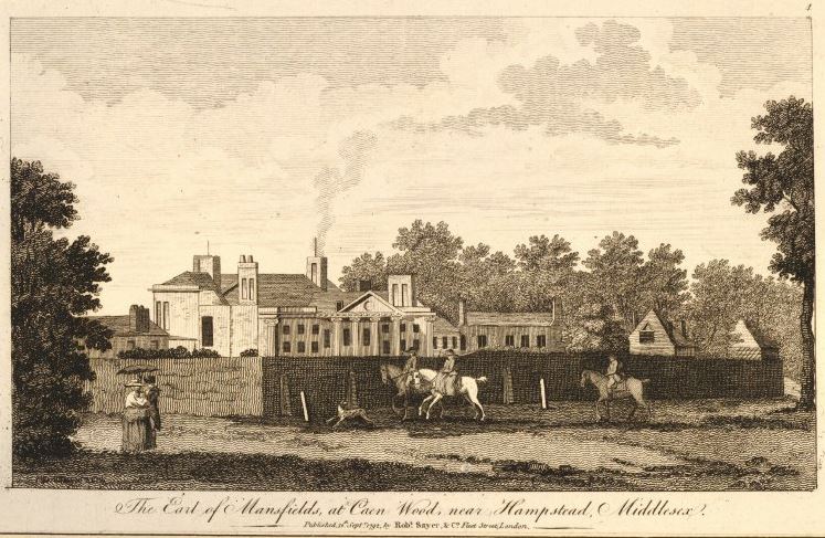
The following view from 1792 is titled “The Earl of Mansfield’s at Caen Wood near Hampstead” and is another reference to the name Caen Wood, and is also a view from Hampstead Lane and shows why Mansfield agreed with Repton’s advice to move the lane further north to hide the house from the road.  (Print ©Trustees of the British Museum)

Kenwood House

My father had photographed Kenwood House a few years earlier to the photo at the start of this post. The following photo was taken in 1947 from the western side of the “pleasure-grounds”, looking across to the house.

Kenwood House

I tried to find the same location, however the tree growth on the western side of the house has been considerable and the following photo is my best approximation of the same viewpoint. Although the majority of the house is hidden behind the trees, the fencing that runs along the middle of both photos provides a good reference point.

Kenwood House

My father’s photo taken in 1947 was just after the war, when the house was occupied by military servicemen. The connection with the Mansfield family had ended a couple of decades earlier when the 6th Earl of Mansfield had sold of the contents of the house in 1922 and in 1925 Kenwood House was purchased by Edward Cecil Guinness, the 1st Earl of Iveagh. Edward Guinness had a large art collection and in 1929 the Iveagh Bequest stipulated that access to the house for the public should be free of charge, and the art collection maintained in the house.

These conditions still hold today with the house having passed through the London County Council, then to English Heritage who run the house today, with access free of charge and Iveagh’s art collection (with a number of additions) still being on display.

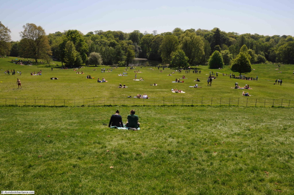
The view from the rear of Kenwood House looking down towards the ‘ponds’ and Ken Wood:

Kenwood House

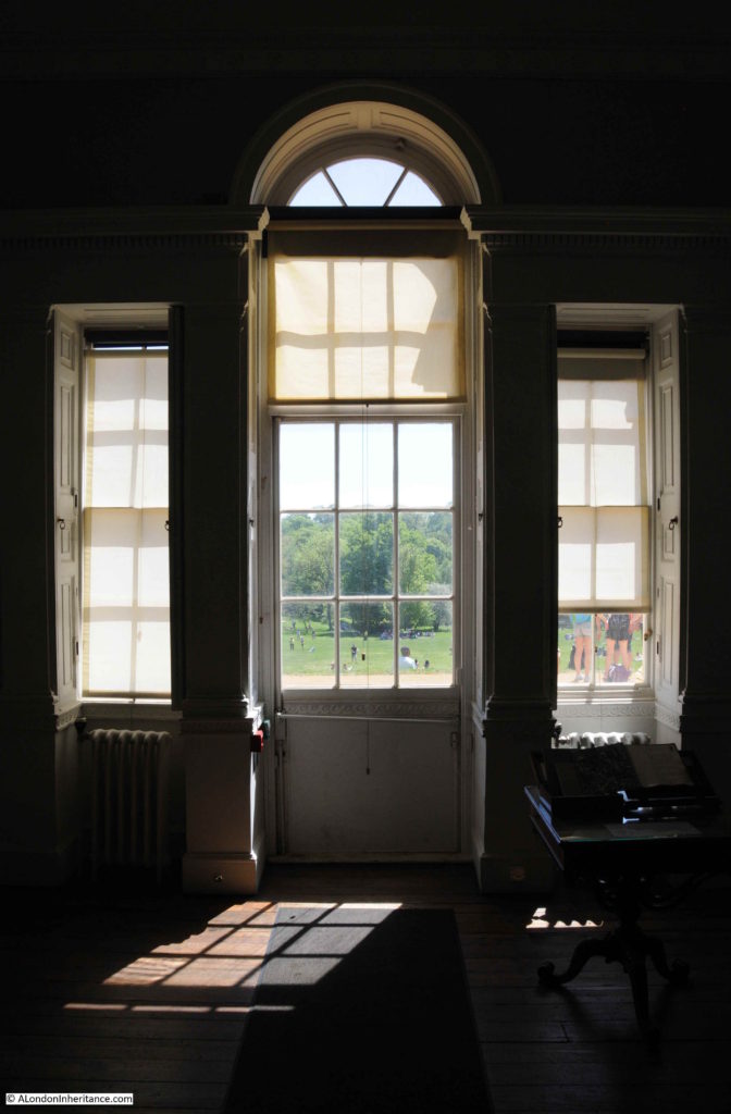
Whilst the view from the rear of the house is mainly obscured by trees, a short distance to the east of the house there is a viewpoint where a panorama of the City across to the BT Tower can be seen shimmering in the haze.

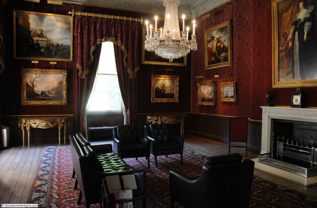
The interior o the house has been carefully restored and the Iveagh art collection is on display in many of the rooms.

Kenwood House

There is an English Heritage Volunteer in each of the rooms, who, without exception, had an in-depth knowledge the house.

It was also much cooler inside the house, compared to outside, although talking to the volunteers. the view was that it was a very cold building to work in during the winter.

Kenwood House

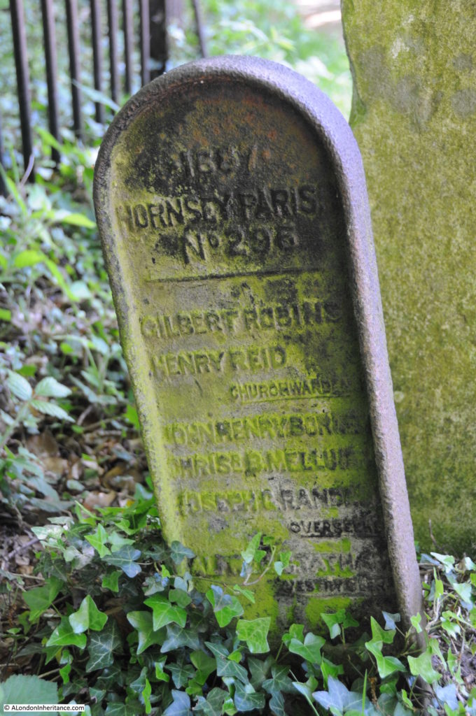
We walked back to Hampstead Lane by a different path, and spotted a couple of boundary markers by the side of the path. The stone marker was very faded but I think may have been a St. Pancras boundary marker. The metal marker is for Hornsey Parish, and is numbered and includes the names of a number of parish officials.

Kenwood House

I have seen a number of these Hornsey Parish boundary markers before, but not this one – I should really have been keeping a list of numbers.

Hampstead Lane was busy with parked cars occupying every available space either side of the road and still plenty of people walking to the heath to enjoy the rather unusual weather for a public holiday. We left Caen Wood, or Ken Wood via Mansfield’s rerouted Hampstead Lane to walk back to Highgate for some much-needed refreshment.

alondoninheritance.com