Tag Archives: Pickle Herring Street

Pickle Herring Stairs

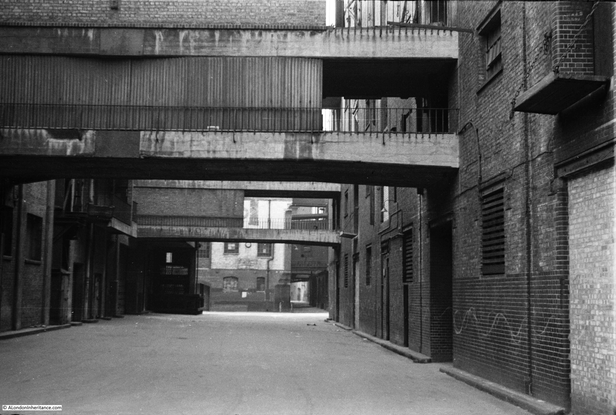
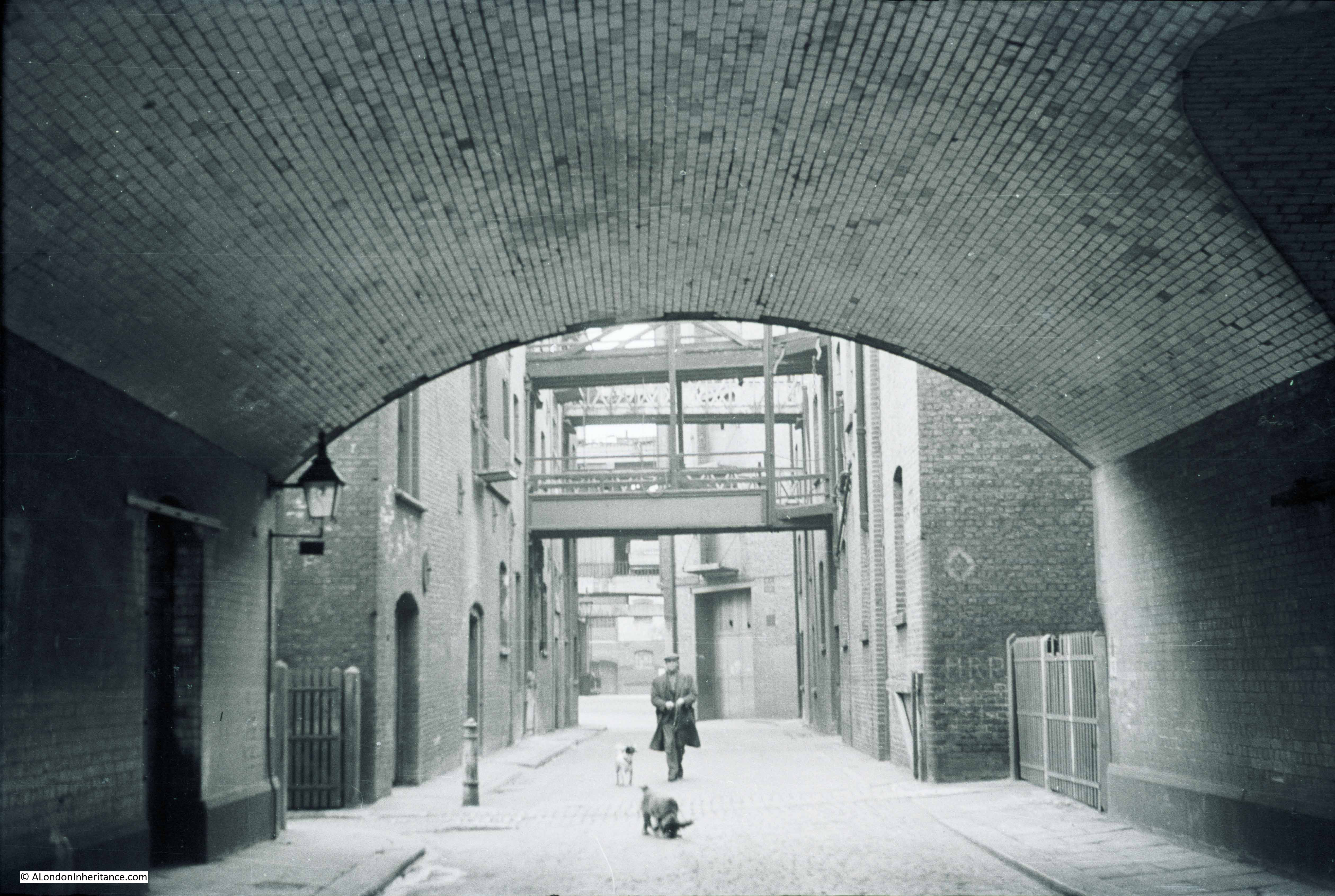
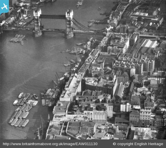
Today’s photo from my father’s collection is one I scanned a while ago, but had not investigated until planning my guided walked between Bankside and Tower Bridge. It was taken from the foot of Pickle Herring Stairs. a name that will be familiar to readers as I have written a couple of posts about Pickle Herring Street.

Pickle Herring Stairs

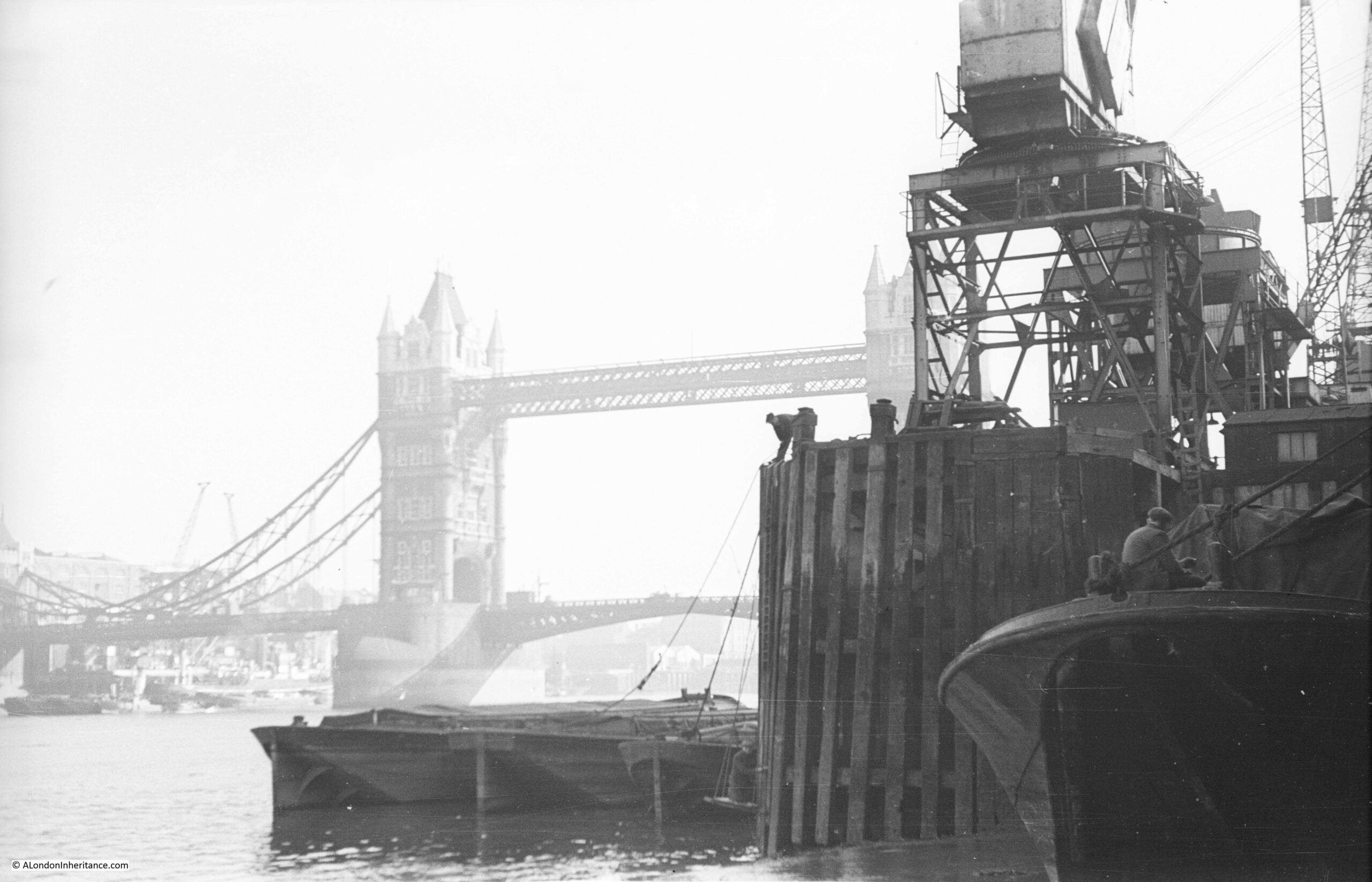
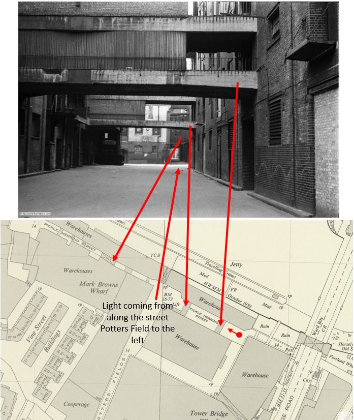
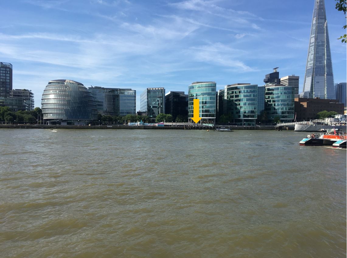
The photo was taken at the bottom of Pickle Herring Stairs, looking towards Tower Bridge, with the travelling cranes that lined the foreshore on the right.

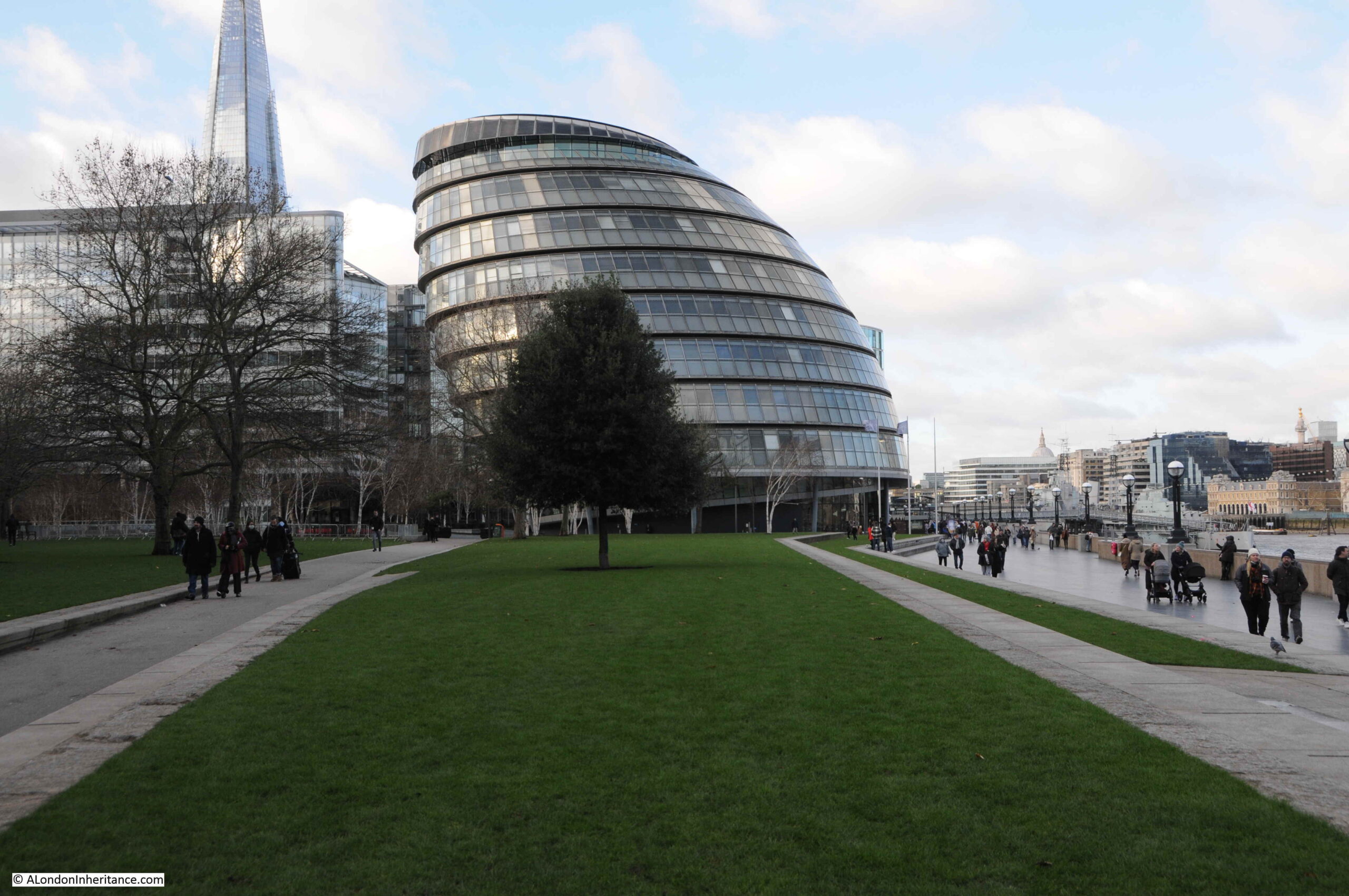
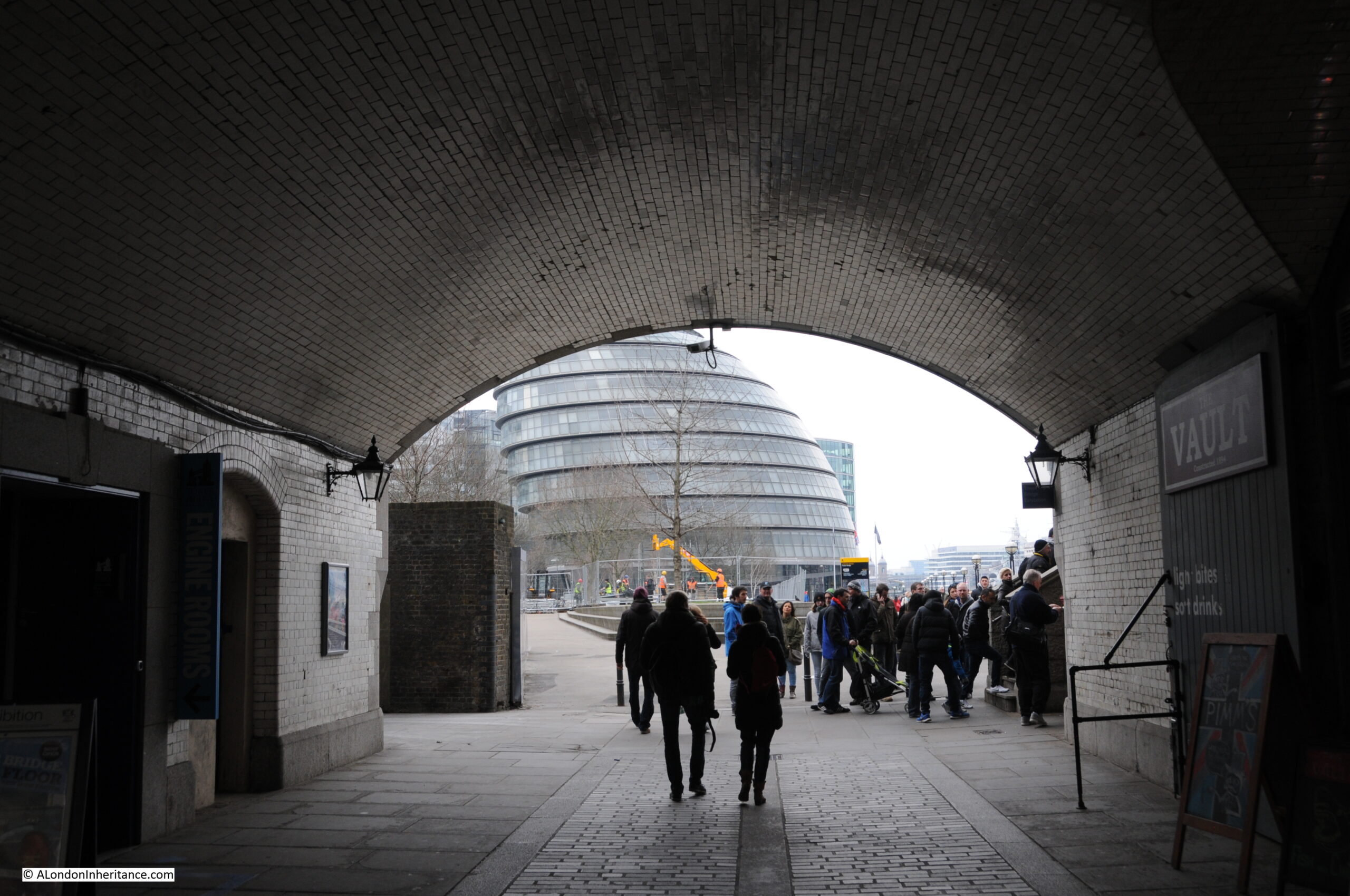
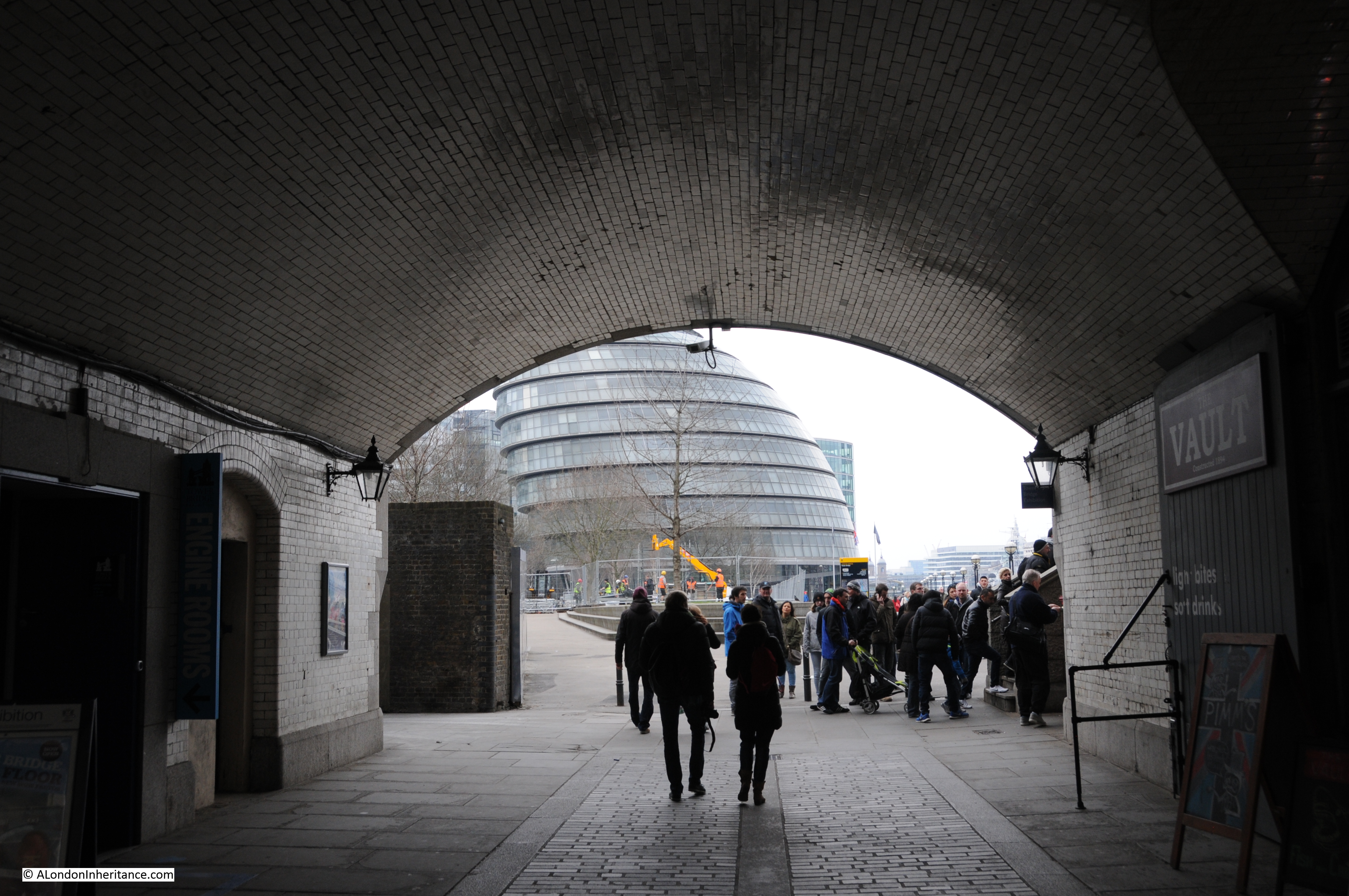
The stairs have disappeared in the considerable redevelopment of the area, and the walkway along the river and embankment have been extended into the river, so it is impossible today to be exactly sure where the stairs were located, however by lining up with features on the opposite side of the Thames, I suspect they were roughly where I took the following photo. The perspective is different as I used a wider lens compared to my father’s photo to show some of the nearby features to help with locating the stairs.

Pickle Herring Stairs

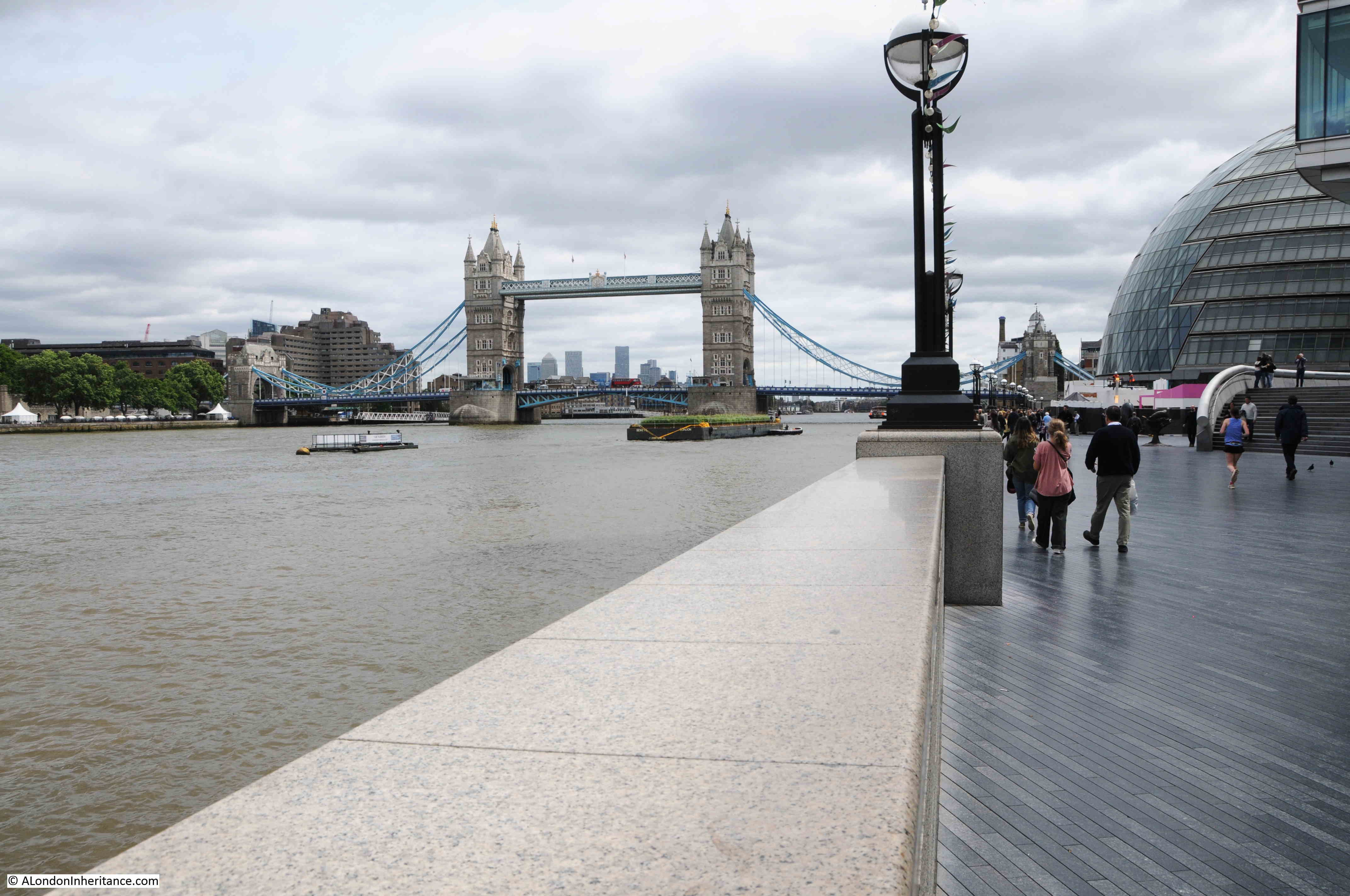
To the right is the old City Hall for the Mayor of London, now closed following the move of the Mayor’s office further east towards the Royal Docks.

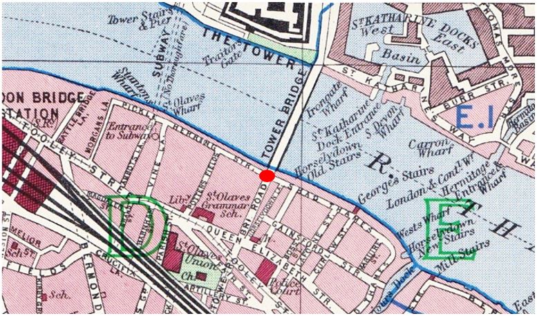
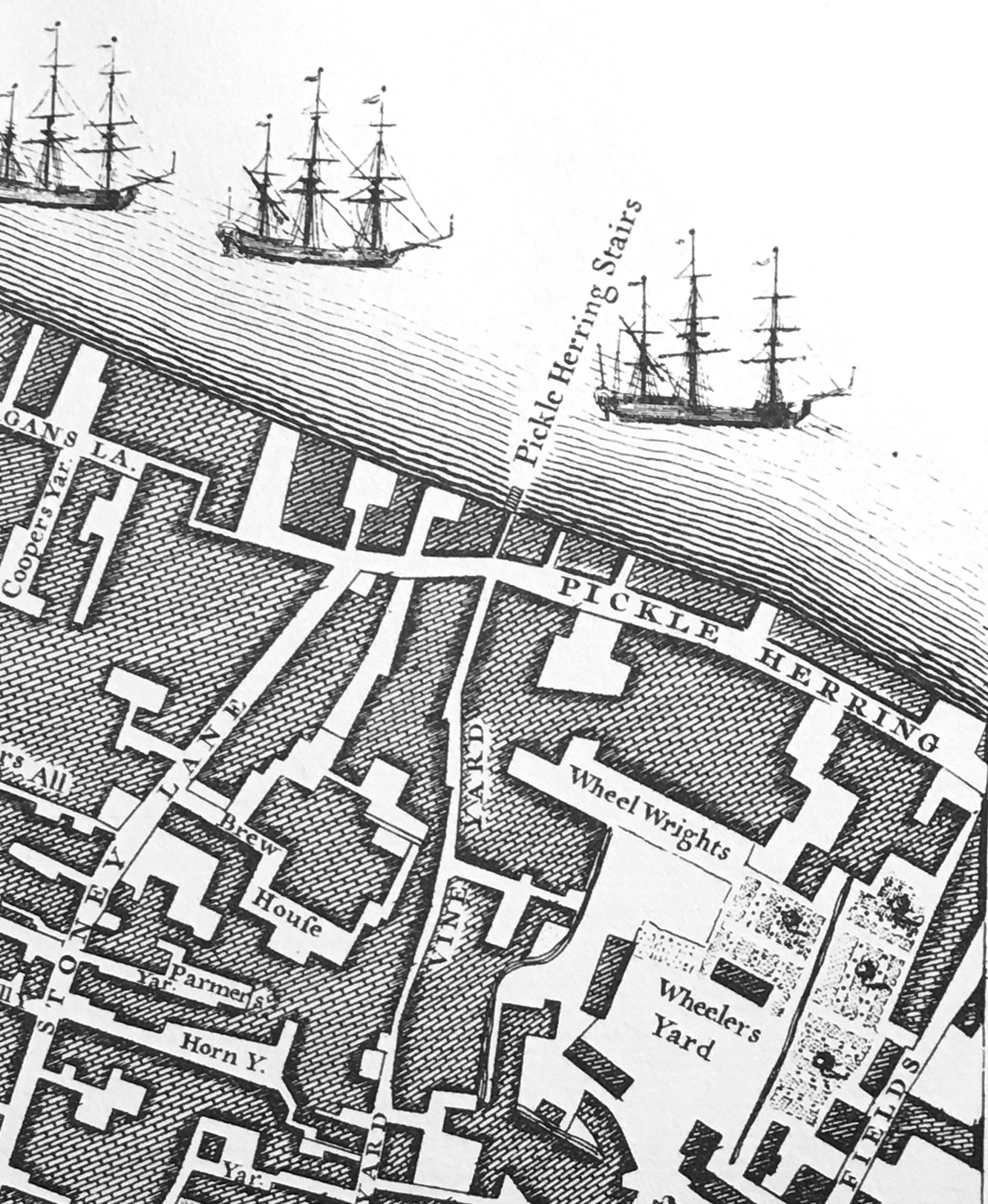
The following extract from the 1895 Ordnance Survey map shows the exact location of Pickle Herring Stairs (‘Reproduced with the permission of the National Library of Scotland“):

Pickle Herring Stairs

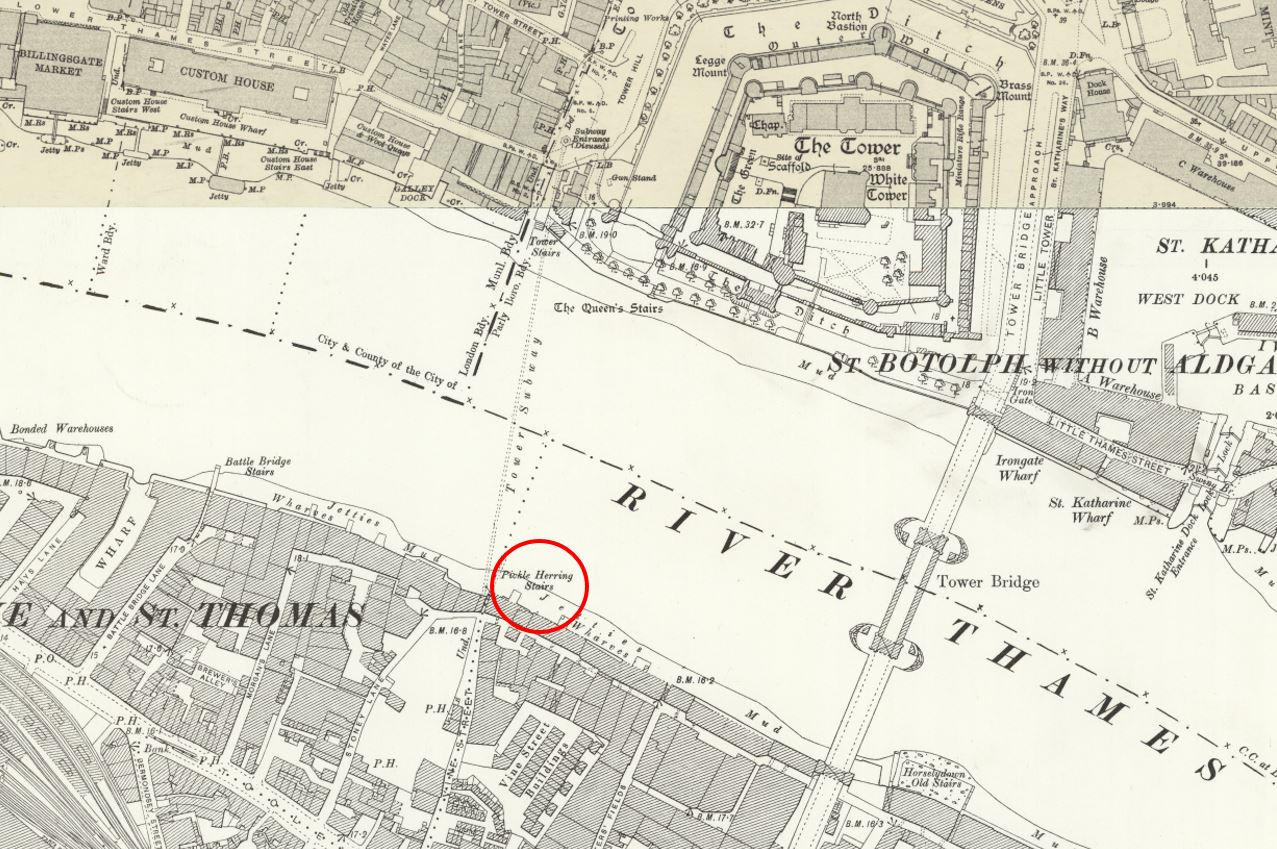
The above map shows that by the end of the 19th century, the side of the river was lined by warehouses, however the cranes seen in my father’s photo had not yet arrived.

These would be installed during the early decades of the 20th century when the warehouses were expanded, and large cranes were installed to handle the quantity and range of goods that needed to be moved from river to warehouse.

They were called “travelling cranes” as they moved on rails along the platform on which they were built, so they could easily get to the cargo that needed to be moved.

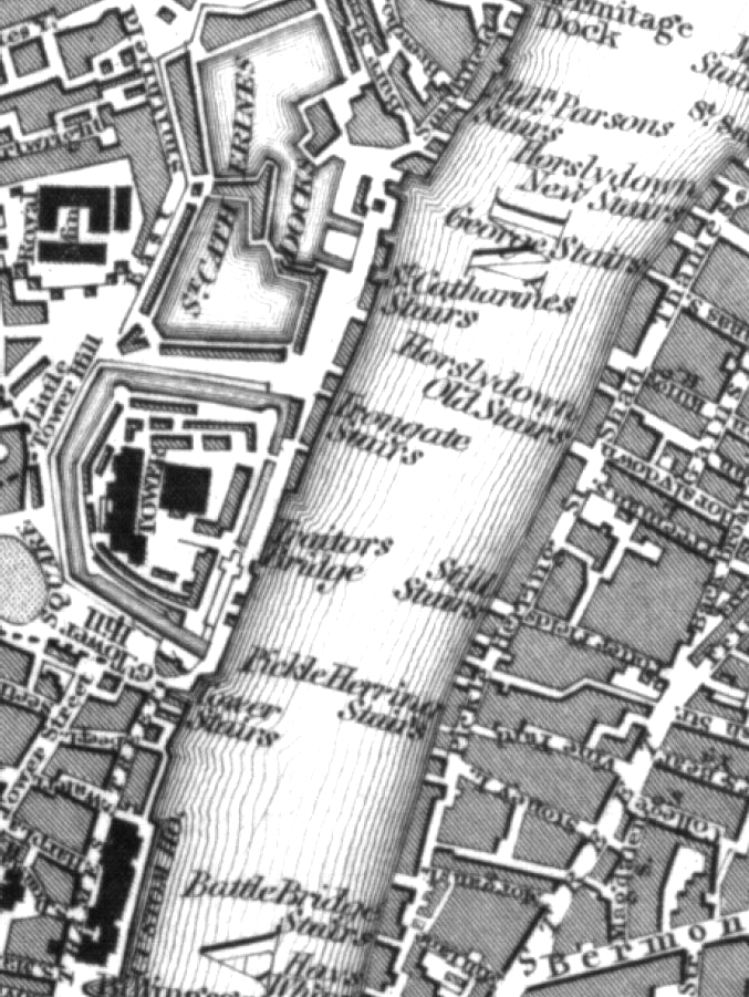
By the 1952 Ordnance Survey map (just a few years after my father’s photo), the jetties had been built on the foreshore, and the travelling cranes had been installed. The following extract from the map shows the length of the jetty which supported the cranes. Pickle Herring Stairs are circled to the left, and the map confirms that my father’s photo is looking at both Tower Bridge, and the end of the jetty (‘Reproduced with the permission of the National Library of Scotland“).

Pickle Herring Stairs

Looking from across the river, the following photo shows where the stairs were located:

View of the south bank of the River Thames

I have written about the area, and Pickle Herring Street, including theories as to the origins of the name in two posts – The Lost Warehouses of Pickle Herring Street, and Pickle Herring Street Revisited.

What is not clear is what came first, the name of the stairs or the name of the street, or whether they were named at the same time.

I suspect the name of the stairs came first, and this could support one of the possible sources of the name down to the landing of Pickle Herring at this point on the river. however I have no evidence to support this.

What is certain is that both stairs and street are old names.

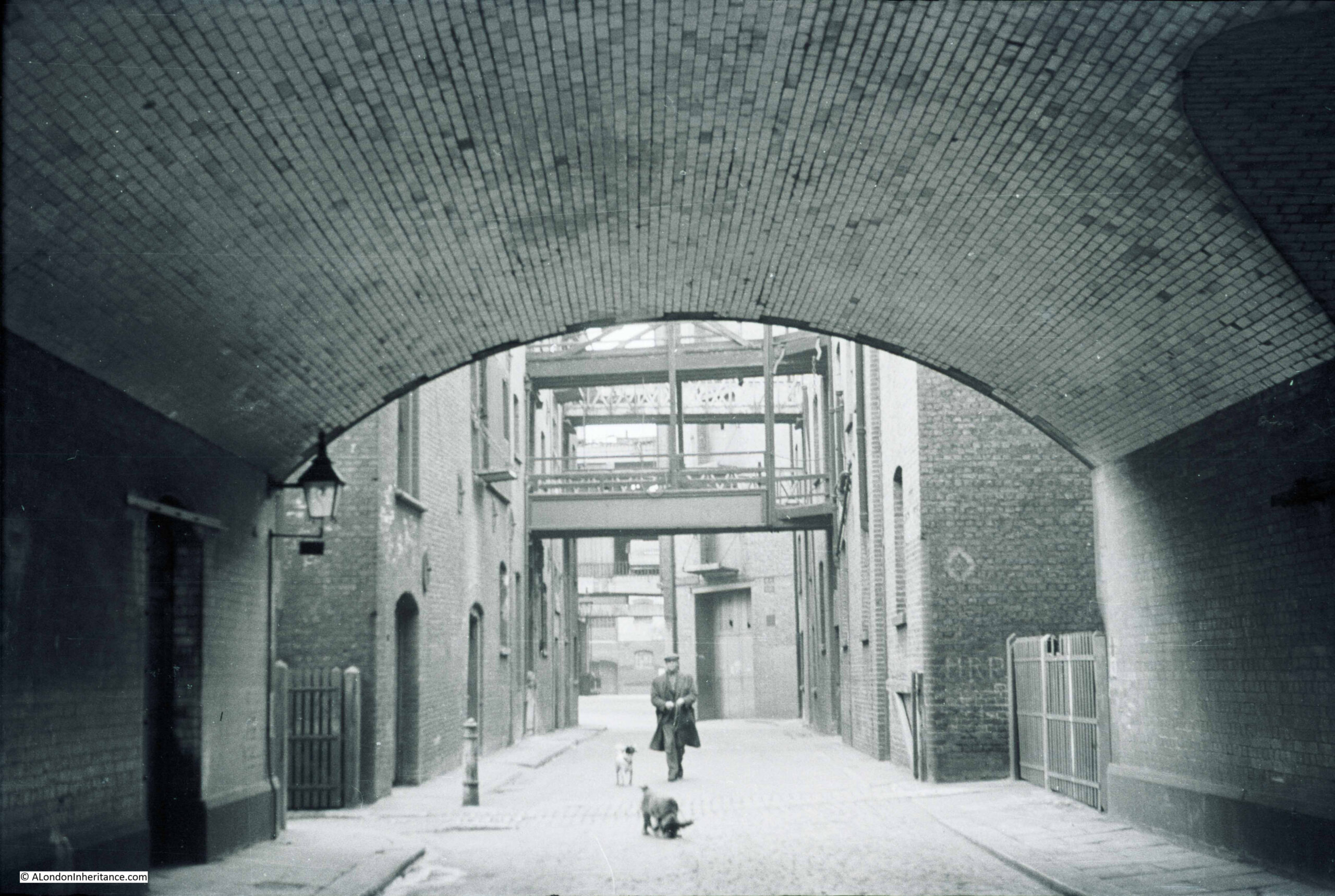
Regular readers will know that I find these stairs fascinating. Not only the physical stairs (where they remain), but that they can tell us so much about life in the area.

I looked back at some early newspaper articles that mentioned the stairs, and found the following sample from the 18th century.

The first is a report about a fire, a very common event in the warehouses full of inflammable goods along the river:

15th January 1740: On Thursday night about 11 o’Clock, a fire broke out at Mr. Brooks’s a Hoop bender near Pickle Herring Stairs, opposite the Tower, that raged with such violence that in three hours time above 20 dwelling houses, besides warehouses were consumed.

A young fellow, a Waterman, who had rescued his wife and child, returning to preserve some of his goods, is missing, and supposed to have perished in the flames.

Last night, Joseph Chitty, one of the Candidates for the Borough of Southwark, sent over a present of 20 Guineas to be distributed among the most necessitous of the sufferers by the said fire.”

There were so many suicides along the Thames, and one of the methods used would be to get a Waterman to row you out into the centre of the river, as this very tragic report of a woman abandoned after becoming pregnant tells:

26th January 1748: Yesterday a young woman took a boat at Pickle Herring Stairs and desired to be ferried over; when the boat came to the middle of the river, she threw down six pence, and jumped over. The Waterman with great difficulty drew her again into the boat; on which she confessed that being far gone with Child by a Noble Lord, and being refused any assistance, had determined her to put a period to her existence.”

Papers were full of so many strange events across the City. One, where someone was tarred and feathered, also ended with what was probably some of the day to day racism which foreign seamen had to endure:

18th October 1784: Friday the following singular occurrence took place. A seaman arriving after being discharged from a vessel lying off Pickle Herring Stairs, on account of his having rendered himself extremely obnoxious to the rest of the crew, was imprudent enough to return on board the ship, upon which he was seized by some of the men, stripped, and tarred and feathered, with as much dexterity as ever that discipline was inflicted in the Country where it was invented, and still practiced.

In this situation he walked to the Public-Office in Shadwell, followed by an immense concourse of people, and exhibited his complaint before Peter Green, the presiding magistrate, by whole order of several pounds of butter and some quarts of oil, were administered, to clear the man from the disagreeable covering.

During the above operation, proper persons were dispatched by the Magistrate in search of the delinquents and in something more than an hour they brought to the Office the Mate and five of the seamen belonging to the ship on board of which the act had been committed, against whom a charge for an assault was substantiated. The Captain bailed the Mate and four of the men, but the other, a youth about twenty, a native of Nevis, was committed to New-Prison, Clerkenwell.”

The earliest newspaper report I could find was the one from 1740, however the stairs are certainly much older. They appeared on the 1746 John Rocque map, as can be seen in the following extract:

John Rocque 1746 map

I suspect these stairs went back to the medieval period, or even earlier. Stairs were such an important way of accessing the river, and naming stairs would have been incredibly important, as:

  • If you were arriving or departing on a ship, you needed to know where on the river the ship would be moored, and the nearest set of stairs to use for arrival or departure. There are plenty of newspaper references where a name of stairs are quoted for the location of a ship;
  • If you asked a Waterman to row you across or along the river, you would have needed to tell the Waterman the destination;
  • For sales of cargo or goods, a location was needed to advertise the sale. There are very many adverts over the centuries using the names of stairs to locate a sale;
  • For events on the river, the stairs provided a reference point, and newspapers used the stairs to refer to the many accidents, deaths, ships departing and leaving, thefts of goods, crimes against people, where press gangs were operating etc.

The unique naming of each individual stair was also important to avoid confusion, so even when stairs almost had the same name, and were in a very similar location, the name always had something to make them unique, for example Wapping Old Stairs and Wapping New Stairs on Wapping High Street.

An example of how the names of stairs were used can be seen in the following 17th century token, of the type issued by merchants and traders to be used instead of cash. The token references the trader’s location as at Pickle Herring Stairs  (© The Trustees of the British Museum):

Pickle Herring Stairs

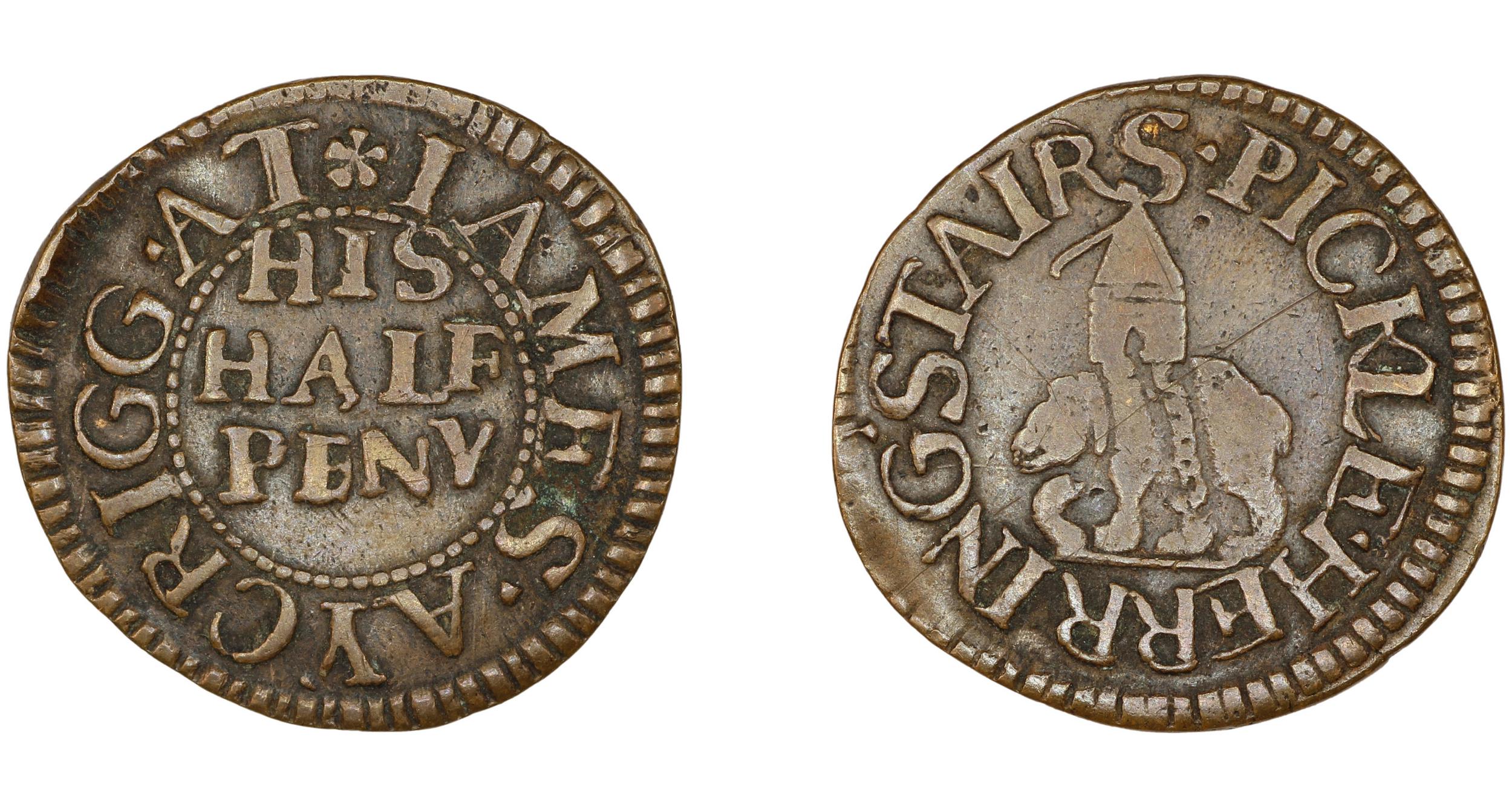
The name on the token is that of James Acrigg. The only record I could find of him was his marriage in London in February 1675.

The very last newspaper report I found about an event at Pickle Herring Stairs was dated the 16th of August 1928, when “The body of an unknown man aged about 40 was found today floating in the Thames near Pickle Herring Stairs. It is believed the man has been in the water for several hours.”

Following the above report, the story of Pickle Herring Stairs goes silent. They would still have been in use, however this would be much reduced. Better street and underground transport removed the need for a Waterman to row you along or across the river.

Access to ships on the river was now mainly from piers or when ships were docked alongside the infrastructure on the waters edge (such as the jetty seen in my father’s photo).

They were finally lost under the redevelopment of the area between London and Tower Bridges, when the open space and riverside walkway was built and extended out into the river.

I will leave the final words in today’s post to the London Rivers Association, who were quoted in the Illustrated London News on the 1st of May 1996, which reported on their campaign that “The London Rivers Association believes that the Thames should be made better use of for both public and freight transport. ‘Getting in touch with the Thames’ is endeavouring to open up all access points to the river – steps and stairs which once had such distinctive names as Elephant Stairs, Hoy Steps or Pickle Herring Stairs. Some of the Millennium projects are very glamorous, said a spokeswoman for the association. this scheme is more modest and will benefit everyone.”

Too late for Pickle Herring Stairs – but a scheme that I would fully support.

alondoninheritance.com

Pickle Herring Street Revisited

It is remarkable how some places in London have changed beyond all recognition within living memory, and this week’s photo is a prime example. It was taken by my father in 1947 in Pickle Herring Street, a lost street that ran behind the warehouses on the south bank of the Thames, west from Tower Bridge.

I last wrote about Pickle Herring Street six years ago, when I featured a photo taken from underneath the arch on the approach road to Tower Bridge. This photo was on the same strip of negatives, but I was not sure of the location, whether west of Tower Bridge, or east along Shad Thames, so I put the photo aside to look at later.

I recently spent some time checking maps, and aligning some of the features between map and photo and can now confirm that the following 1947 photo shows an additional section of Pickle Herring Street, not seen in my original 2015 post.

Pickle Herring Street

It is difficult to be precise with the exact location of the photo given the total redevelopment of the area, however as best as I can estimate, my father was standing somewhere on the grass between where I am standing to take the photo, and the tree, looking towards City Hall:

Pickle Herring Street

The building behind the tree is City Hall, the current home of the Mayor of London, which will soon be moving to an existing building called the “Crystal” at the Royal Docks in Newham. (Strangely on the Mayor of London website, the pages describing City Hall have text that refer to the existing building, but with a photo of the new building at the Royal Docks).

To find the location of the photo, I checked the features in the scene against the 1950 revision of the Ordnance Survey map, published three years after the photo had been taken.

In the following graphic, I have aligned features in the photo with those on the map  (‘Reproduced with the permission of the National Library of Scotland“):

Pickle Herring Street

The red dot and arrow show where my father was standing to take the photo and the arrow is the direction of view.

The first two arrows point to the overhead walkways connecting warehouses on either side of Pickle Herring Street.

A patch of light can then be seen on the street, this is coming from the street Potters Fields which runs to the left of the photo.

The street than narrows with a building seen blocking part of the street, and a narrow section to the right, where in the distance, a larger overhead structure can be seen spanning the street. This is the greyed in block in the map with an X which shows this is an upper floor which runs over a street.

The southern approach to Tower Bridge can be seen on the right of the map.

So having located this 1947 photo, I can add to the photo from my 2015 post to give a fuller view of Pickle Herring Street. This was the view from under the approach to Tower Bridge:

Pickle Herring Street

If you refer to the 1950 map, you can see the point in the street where the building on the right juts out into Pickle Herring Street, and it was there that my father was standing to take the photo at the top of today’s post.

The following photo is my 2015 version of the above, from underneath the approach to Tower Bridge:

Pickle Herring Street

Pickle Herring Street is an old street, and is shown in Rocque’s 1746 map of London. The following extract shows the western extent of the street, the part in my father’s photo was in the join on my printed copy of the map so did not photograph well.

John Rocque map of Southwark

The map does show that there was also a Pickle Herring Stairs to the western end of the street. I do not know what came first, the stairs or the street, but I suspect the stairs as the river stairs are some of the oldest features along the river’s edge.

There are also multiple theories as to the source of the name of the street and stairs. I cannot find any confirmed written reference to the source, but it is probably safe to assume it has some reference to the fish herring that may have been landed at the stairs, but it is impossible to be sure.

The first written references to activities within the street date to the start of the 19th century, and a newspaper advert from the Public Ledger and Daily Advertiser on the 14th of February, 1805 refers to the street, and also an interesting way of buying access to a property at the time:

“WHARF, DWELLING-HOUSE and WAREHOUSE, PICKLE HERRING STREET, Southwark, at Garraway’s Coffee-House, Cornhill. The Life Interest of Two Persons, aged 45 and 44, in the above estate, is now to be sold, and the purchaser will be entitled to the property for the life of the longest liver; both are insurable at a very trifling premium, but as there are now two lives, no insurance is necessary”.

Interesting way of buying access to a set of buildings, where the length of time you have access is entirely dependent on the remaining length of life of two people. Presumably they still held the freehold, which at the death of the last, would then pass to whoever was named in their will, and the person who had purchased the property would either have to leave, or negotiate with the new owner.

There is an earlier written reference to Pickle Herring Stairs, which dates from the 16th October 1727, when a newspaper reported that a Waterman’s Boy had fallen in the Thames at the stairs and drowned.

It is safe to assume that Pickle Herring Street has been in existence for centuries, and served the warehouses and wharves that lined the river.

That would all end not long after my father took the above photos. The 1953 edition of London Wharves and Docks, published by Commercial Motor lists the two wharves that were still in operation.

Mark Brown’s Wharf and Cold Stores are the buildings in the first photo at the top of the post. These were owned by the Hay’s Wharf Company and dealt with “provisions, dried fruit, spices, canned goods and refrigerated produce”.

As seen in the 1950 map, there was a long jetty in the river to serve the wharf, with travelling cranes. The jetty could accommodate and fully unload ships up to 420 feet in length.

The buildings seen from underneath the approach to Tower Bridge in the second photo were part of Tower Bridge Wharf, which dealt with “hides, skins, wool and leather”.

The buildings were empty and derelict for much of the 1960s and 70s, were demolished, and for some years the space became a temporary car and lorry park before the building of the area as we see it today.

The grass in the photo is part of Potters Fields green space, an area that runs from close to Tower Bridge, round the back of City Hall and up to Tooley Street.

The space where City Hall is located occupies the western end of Pickle Herring Street, at the far end of the photo at the start of the post.

It is interesting how streets dissapear, and the space occupied by these streets become part of private developments.

Large parts of London have long been owned by individuals. In the past these tended to be members of the aristocracy, who owned the land, then built and developed as the city expanded, and ended up owning large areas of streets and buildings. Many of these are still in existence, however they have reduced from their peak.

Property companies have built significant collections of buildings, and a change over the last few decades has been the rise of the foreigh property owner.

The area from City Hall, almost to Hays Galleria and up to Tooley Street now goes under the name of More London.

The area is owned by St Martins Property, which is the UK investment vehicle of the sovereign wealth fund of Kuwait.

So the space occupied by Pickle Herring Street is now under private ownership, and in common with many of these spaces, is patrolled by private security.

The name Potters Fields referred to the street that ran from Tooley Street to Pickle Herring Street and was the street that allowed light to fall on the street in the distance in my father’s photo. It can still be found as a small stub of the street remains off Tooley Street, and in the name of the green space.

Originally, Potters Fields was the name given to the space to the west of the approach to Tower Bridge, and today occupied by City hall. Part of this space was occupied by a pottery, set up by the Dutchman Christian Wilhelm in around 1618, and which went by the name of Pickle Herring Pottery.

I suspect the name of the pottery came from the street or stairs as it is a rather strange name to give to a pottery.

The pottery operated on the site for around 100 years, before moving to Horsley Down to the east of Tower Bridge, early in the 18th century.

The British Museum has a collection of what is attributed as Pickle Herring Pottery, including the following dish dating from 1668 and showing Charles II crowned and in armour (© The Trustees of the British Museum):

Potters Field pottery

Much of the early output of the Pickle Herring Pottery appears to have had a delftware influence, which was probably down to the Dutch founder of the pottery.

Sad that the centuries old name Pickle Herring which referred to both the street and river stairs can no longer be found in the area, however I am pleased to have confirmed the location of another of my father’s photos and at least these two photos help to remember this lost London street.

My original 2015 post on the street can be found here.

alondoninheritance.com

The Lost Warehouses of Pickle Herring Street

Many of the photos I have used to illustrate how London has changed are of the more well known views of London, from the Stone Gallery of St. Paul’s Cathedral, from Greenwich, from Waterloo Bridge, the Royal Festival Hall etc. however sometimes to get a real understanding of how London has changed since the last war in terms of the streets, buildings, employment and people, you need only look in some of the more ordinary, mundane places.

I was unsure of where my father took the subject of this week’s post. There are two photos, taken from within the same tunnel, looking out to streets with closely packed warehouses on either side.

The warehouses with their trademark walkways over the streets were clearly along the Thames. The tunnel in which the photo was taken would be adjacent to one of the stations or bridges across the Thames.

I vaguely recognised the tunnel from many walks along the south bank of the river, and a morning exploring all the tunnels finally found the location, however the changes were such that I was still slightly unsure (I will explain how I confirmed the location later).

The first photo, and it is a Sunday, early in 1947 and a solitary man walks with his two dogs towards my father taking the photo from the middle of the tunnel.

Welcome to Pickle Herring Street, taken from the tunnel under the southern approach to Tower Bridge in 1947 and then in 2015:

Pickle 1

Pickle 2

These two photos really show how London has changed in the intervening 68 years.

In 1947, shipping was still coming this far up river to be loaded and unloaded at the warehouses that ran the length of the river. The warehouses on the right were facing onto the river, walkways over the street lead to further warehouses.

Pickle Herring Street in the 1947 photo is the street winding through the warehouses, it had been here for many years but has now disappeared along with all the warehouses lining this stretch of the Thames in the redevelopment of this area of the south bank for City Hall (the building that appears to lean backwards in the 2015 photo), the home of the Mayor of London and the Greater London Authority, along with the public open space created up to Tower Bridge.

Instead of the solitary Londoner walking his dogs we now find the thousands of tourists who follow the walkway along the river and cross to and from the north bank and the Tower of London via Tower Bridge.

It took a while to take the 2015 photos, I was waiting until there were not too many people in the tunnel, such is the popularity of this area even on a chilly March morning. Not long after I took the photo, an ice cream van arrived and parked to the left of the tunnel entrance. I wonder what the man in the 1947 photo would have thought about how London would be changing over the coming decades.

The change was such that I was still slightly unsure that this is the correct location of the 1947 photo, so I checked the tiling on the roof of the tunnel. The following photos show that even across 68 years the same defects and damage to the tiling can be found.

roof compare 1

In the following map from the 1940 edition of Bartholomew’s Reference Atlas of Greater London I have marked the location from where the photograph was taken with a red dot.

The tunnel is directly underneath the approach road to Tower Bridge and Pickle Herring Street is seen running to the left:

Pickle map 2

The following early 19th century map extract shows the area prior to the construction of Tower Bridge. There was also a Pickle Herring Stairs roughly where St. Olaves Wharf is shown in the 1940 map. Note also Horslydown Old Stairs. This is where Tower Bridge would be built later in the 19th century.

Pickle map 6

Despite having such an interesting name, I have not found that many references to Pickle Herring Street. The name must refer to the landing and storage of pickle herrings here at some point in the past.

Old and New London, published in 1878 describes the area:

“Indeed from Morgan’s Lane – a turning about the middle of Tooley Street, on the north side, to St. Saviour’s Dock, the whole line of street – called in one part Pickle Herring Street, and in another Shad Thames – exhibits an uninterrupted series of wharves, warehouses, mills and factories, on both sides of the narrow and crowded roadway. The buildings on the northern side are contiguous to the river, and in the gateways and openings in these we witness the busy scenes and the mazes of the shipping which pertain to such a spot. “

The buildings would be exactly the same in 1947.

Gustave Doré visited the area in 1872. The following is his illustration of Pickle Herring Street for the publication, “London – A Pilgrimage”:

gustav dore

Doré probably used some artistic license in this drawing, the buildings look rather too finely built for riverside warehouses, however it probably does give a good impression of the atmosphere in Pickle Herring Street at the time.

Return to the dot in the above map, turn to the right and you will be looking down Shad Thames. This was the scene in 1947 looking down to the next stretch of warehousing running the length of the river. This was Butlers Wharf.

Pickle 3

In 2015 Shad Thames remains as does Butlers Wharf, although converted into luxury flats, restaurants and shops, again indicative of the changes across much of central London.

Pickle 4

The excellent Britain from Above website has the following photo of the area, also take in 1947.

The warehouses on either side of the approach road to Tower Bridge can clearly be seen along with the cluster of shipping and barges up against the warehouses along Pickle Herring Street.
EAW011130

I stood for a while in the tunnel waiting to take the photos, in exactly the same place as my 18 year old father back in 1947, under the same tiled roof, but looking out on a very different world.

alondoninheritance.com